










1,082 named trails · 1,757.4 miles in Los Angeles County · 829.5 miles open to Class 1 · 72 rules quoted in their own words · Rules verified October 25, 2026
Verified: every rule on this map is quoted from the agency that issues it, the Forest Service, the National Park Service, State Parks, the MRCA, LA County and 25 cities, and read on October 25, 2026 by Milad Ghobadibeygvand, BScN, or, for 16 city sections whose code host bars or challenges automated requests, from copies saved in August and September 2026; the method closes the page.
Quick Answer: In LA County the land manager decides. Most paved river paths and city bike paths take Class 1, 2 and 3, and the beach path changes rules at each city line. The National Park Service, the MRCA and five State Parks units allow Class 1 on dirt trails open to bikes; LA County Parks bars e-bikes from its dirt trails.
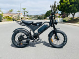
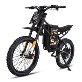
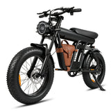
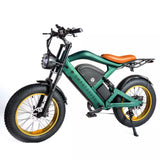
Every e-bike in our full range ships free to your Los Angeles door.

The Santa Monica Pier's Pacific Wheel and West Coaster at blue hour above the beach, where Santa Monica's stretch of the beach bike path is open to Class 1 and 2 e-bikes, in a scene generated with Playcut from a photograph of Pacific Park by Ian D. Keating.

Every line is a trail, fire road or off-street path from the Forest Service, LA County, LADOT, the National Park Service or OpenStreetMap, colored by the e-bike rule of the agency that manages the ground under it.
Where you may ride your e-bike off the street in Los Angeles changed this year. The City of Los Angeles adopted Motion 4A on May 1, 2026, directing Class 3 and Class 2 bans on its trails, and on October 20 the Council asked for an ordinance opening City park pathways to you.
The stakes are real: ride the wrong trail on the Angeles National Forest and the forest's own map prices it at "a fine of up to $5,000, imprisonment for up to 6 months, or both". This map tells you which trails your class may ride, and who says so.
California treats your e-bike as a bicycle first. Vehicle Code § 231 says "An electric bicycle is a bicycle", and § 312.5 caps your motor at a level that "does not exceed 750 watts of power", so your legal e-bike rides wherever a bicycle may unless the manager of that ground says otherwise.
The managers you will meet on LA's trails say a great deal otherwise. § 21207.5(b) lets the agency over "an equestrian trail, or hiking or recreational trail" prohibit "any class of electric bicycle on that trail", § 21207.5(c) gives State Parks the same power on its paths, and federal land follows federal rules. This map puts every one of those answers on the ground it governs.
It joins 2,391 pieces of trail and path, 1,757.4 miles counted once, to the agency whose land each crosses and to that agency's own words on e-bikes. You can download all of it in the trail register, one row per named trail, region and answer.
If you want the rest of California's e-bike law, read California e-bike laws. Riding beyond the county? Your next map is California e-bike trails, and e-bike trails by state compares the trail rules of several states side by side.
Takeaway
A Class 1 e-bike rides more of this map than a Class 2 or a Class 3: 829 miles for a Class 1, 658 for a Class 2 and 636 for a Class 3. The gap is the Santa Monica Mountains, where the National Park Service, State Parks and the MRCA open their dirt trails to Class 1 alone.
The 844.2 miles closed to you sit mostly on two kinds of ground: the Angeles National Forest's trails and fire roads that its Motor Vehicle Use Map does not designate (576.5 mi), and LA County Parks' dirt trails (168.8 mi).
In this guide
- How to read the map
- Who decides on each trail in Los Angeles
- The beach bike path, city by city
- The LA River bike path, end to end
- River and creek paths beyond the LA River
- Mountain bike trails in the Santa Monica Mountains
- The Angeles National Forest and the San Gabriel Mountains
- LA County Parks trails
- City of Los Angeles parks and trails
- Other cities' e-bike rules
- Catalina Island
- What could change before your next ride
- Named trails riders ask about
- Los Angeles County trails, region by region
- Where riders get caught out
- Streets, bike lanes and sidewalks
- Choosing an e-bike for LA's trails
- Frequently asked questions
How to read the map
Find your trail's color, then read whose ground it is. Green takes Class 1, 2 and 3, blue takes Class 1 and Class 2, orange Class 1 alone, and a dashed red line marks ground where a published rule keeps every e-bike off (on Hermosa Beach's Strand, every motor: you may pedal there with the power off). Gray marks an answer the managers' own texts leave open, so treat gray as closed until a sign says otherwise.
Blue and orange also carry the City of Los Angeles's pending bans. On City trails the Council has directed a Class 3 ban and a Class 2 ban with exceptions, which the City has not yet enacted, so those classes read pending there and the color shows you what you may ride today.
Gray never means open. Riders get caught treating gray as green. Gray holds 83.8 of the 1,757.4 miles for a Class 1, ground where the record leaves your answer open:
- the County's beach-path sentence, which reads two ways;
- records that disagree, such as West End Road on Catalina;
- trails that only partly follow an open forest road;
- city trails whose bicycle access is not on record, and city park paths where a posted sign decides;
- Hawaiian Gardens' new e-bike ordinance, whose text was not yet available online on October 25, 2026;
- managers whose e-bike rule was not located, and paths whose manager is not on record.
Your bike's label names its class, and your class decides your map. § 312.5 defines a Class 1 by a motor that assists only while you pedal and stops at 20 mph, a Class 2 by a motor that "may be used exclusively to propel the bicycle", also stopping at 20 mph, and a Class 3 by pedal assist to 28 mph.
A miles figure counts the ground once. Where the Forest Service, the County, LADOT and OpenStreetMap draw the same trail, the register keeps one line. Streets, proposed paths and lines drawn on a road's centerline are left out, because on a bike lane you follow the street's rules, which have their own section below.
Who decides on each trail in Los Angeles
The agency that manages the ground writes the rule, so the same e-bike can be legal on one side of a gate and banned on the other. The table gives each manager's answer for each class, the miles of this map it governs and the words it rests on, from the forest down to a city's parks.
| Who manages the ground | Classes that may ride (miles) | Mapped miles | Their rule |
|---|---|---|---|
| Angeles National Forest (USDA Forest Service) | Class 1, 2 and 3 84.4 mi; Unsettled 8.5 mi; Closed to e-bikes 576.5 mi | 669.4 | the forest's biking page and Motor Vehicle Use Map |
| National Park Service (Santa Monica Mountains) | Class 1 only 34.7 mi; Closed to e-bikes 28.2 mi | 62.9 | the park's compendium |
| California State Parks | Class 1 only 49.3 mi; Unsettled 0.4 mi; Closed to e-bikes 23.9 mi | 73.6 | State Parks' e-bike page |
| Mountains Recreation and Conservation Authority | Class 1, 2 and 3 2.4 mi; Class 1 only 35.7 mi; Closed to e-bikes 10.5 mi | 48.6 | the MRCA Park Ordinance |
| Santa Monica Mountains Conservancy land (MRCA-run) | Class 1, 2 and 3 0.4 mi; Class 1 only 6.5 mi | 6.9 | the MRCA Park Ordinance |
| LA County Parks | Class 1, 2 and 3 0.8 mi; Closed to e-bikes 168.8 mi | 169.6 | LA County Parks' trail Q&A |
| LA County (other ground) | Class 1, 2 and 3 39.8 mi; Unsettled 28.1 mi; Closed to e-bikes 9.4 mi | 77.2 | LA County Parks' trail Q&A |
| LA County Flood Control District | Class 1, 2 and 3 | 3.4 | LA County Parks' trail Q&A |
| Puente Hills Habitat Authority | Unsettled | 9.1 | the Habitat Authority's trail map |
| Catalina Island Conservancy | Class 1, 2 and 3 48.5 mi; Unsettled 5.6 mi; Closed to e-bikes 0.8 mi | 54.9 | the Conservancy's biking page |
| LA County Sanitation Districts | Unsettled | 4.5 | No e-bike rule located |
| Water districts | Unsettled 0.1 mi; Closed to e-bikes 1.1 mi | 1.2 | No e-bike rule located |
| Nonprofit land trusts | Unsettled | 0.9 | No e-bike rule located |
| U.S. Army Corps of Engineers | Class 1, 2 and 3 3.6 mi; Unsettled 1.3 mi | 4.9 | No e-bike rule located |
| State Lands Commission | Class 1 and 2 | 0.1 | No e-bike rule located |
| LA Department of Water and Power | Class 1, 2 and 3 2.6 mi; Unsettled 0.6 mi | 3.2 | No e-bike rule located |
| City of Los Angeles | Class 1, 2 and 3 112.2 mi; Class 1 and 2; Class 3 pending 5.5 mi; Class 1; Class 2 and 3 pending 40.2 mi; Unsettled 9.5 mi; Closed to e-bikes 0.7 mi | 168.1 | LAMC § 63.44 B.16 and Council File 26-0338 |
| 72 other cities (the city table below) | Class 1, 2 and 3 338.3 mi; Class 1 and 2 16.3 mi; Class 1 only 4.3 mi; Class 1; Class 2 and 3 pending 0.7 mi; Unsettled 14.3 mi; Unsettled; no Class 3 0.8 mi; Closed to e-bikes 24.3 mi | 399.0 | Each city's own code, in the city table |
Three state powers sit under every row you read. § 21207.5(b) lets "The local authority or governing body of a public agency" bar e-bikes from its trails "by ordinance", § 21207.5(c) lets State Parks bar them "on any bicycle path or trail within the department's jurisdiction", and § 21113(g) lets any public agency "restrict, or specify the conditions for" e-bikes on its property.
Federal ground answers to federal rules. The Angeles National Forest treats your e-bike as a motor vehicle: its biking page says "Class 1, 2 and 3 e-bikes are allowed on motorized trails and roads on national forests and grasslands", and nowhere else. The National Park Service's compendium lets you ride "Class 1 e-bikes" alone on its designated backcountry routes.
Takeaway
Paved paths are the safe bet for every class: LA County Parks says "E-bikes are permitted on the County's paved bike paths and bikeways", the City of Los Angeles kept its bikeways out of its trail bans, and 485.8 of the map's miles are paved. Dirt is where the classes split.
The beach bike path, city by city
The 22-mile beach path is one path through eight jurisdictions: Class 1 and 2 in Santa Monica, motor off in Hermosa Beach, 15 mph in Manhattan Beach, and two readings on the County's stretches. LA County's Beaches and Harbors describes "a 22-mile paved bicycle path that runs along the Los Angeles County coastline between Will Rogers State Beach and Torrance Beach".
| Stretch (city) | Mapped miles | What applies | Source |
|---|---|---|---|
| Los Angeles | 7.2 | Two readings: the County calls the path restricted; the City's park code lets motor-assisted cycles use paths built for them | LA County Parks' trail Q&A |
| Santa Monica | 3.4 | Class 1 and 2; no Class 3 | Santa Monica Municipal Code § 3.12.600(b) |
| Marina del Rey and other unincorporated stretches | 1.3 | Two readings: the County calls the path restricted, and no ordinance naming e-bikes was found | LA County Parks' trail Q&A |
| El Segundo | 0.9 | Two readings: the County calls the path restricted; no city e-bike rule reaches it | LA County Parks' trail Q&A |
| Manhattan Beach | 2.1 | Two readings: the city sets 15 mph for e-bikes on the trail; the County calls the path restricted | the city's e-bike rules |
| Hermosa Beach | 2.3 | Pedal with the motor off on the Strand walkway, Pier Plaza and the beach | Hermosa Beach Municipal Code § 12.20.220 |
| Redondo Beach | 2.4 | Two readings: the County calls the path restricted; no city e-bike rule reaches it | LA County Parks' trail Q&A |
| Torrance | 0.3 | Two readings: the County calls the path restricted; no city e-bike rule reaches it | LA County Parks' trail Q&A |
| The whole path | 19.9 | LA County Beaches and Harbors |
The register maps 19.9 miles of it off the street. The County's own note puts part of the 22 miles on a "Bicycle lane on Washington Boulevard, between north of Admiralty Way to Venice Beach", which follows the street's rules. The costly assumption is that one sign at the start covers the whole ride: the rule changes at each city line, with no gate between.
Santa Monica: Class 1 and 2, never Class 3
In Santa Monica you get the plainest rule on the coast. § 3.12.600(b) says "Class 1 and class 2 (as defined in the California Vehicle Code) electric bicycles are permitted on the Beach Bike-Path", while § 3.12.600(b) also makes it "unlawful to ride or operate a motorized bicycle or a class 3" e-bike there.
Step off the path and your rule tightens. § 4.55.065 bars any e-bike "over and upon the beach or in any City park", and § 3.12.600(c) bars bicycles and e-bikes "upon any public sidewalk".
Hermosa Beach: pedal with the motor off
Hermosa Beach lets you ride an e-bike on the Strand as a bicycle, with its power off. § 12.20.220 bars an "electric or motorized bicycle" from "any portion of the Strand walkway, Pier Plaza, or beach at any time when the motorized- or electric-propelled power is in use".
The Greenbelt is closed outright: § 10.12.175(A)(3) says "No electric bicycle, motor-driven cycle, pocket bike or any other electric or motorized conveyance shall be allowed on the Greenbelt."
Manhattan Beach: 15 mph, and a County sentence read two ways
In Manhattan Beach you stay off the Strand walkway and keep to 15 mph on the path. Its police department's summary of the city's ordinance "Prohibits riding at speeds over 15 miles per hour on the Marvin Braude Bike Trail (i.e. Beach Bike Path), and maintains the current “Walk Only Zone” on both sides of the pier."
County Public Works maintains this stretch, and LA County Parks calls "the beach bike path" an exception that "is restricted by ordinance". You will see it gray on the map: the city regulates you on the path as a rider, while the County's sentence can be read as a ban.
Venice, Will Rogers, Dockweiler and the County's other stretches
Outside Santa Monica State Beach and the stretch from Hermosa Beach's First Avenue to the Redondo Beach Pier, County Public Works maintains the path, so the County's sentence is the rule its operator states. No County ordinance naming e-bikes on the path was found in the County Code, current to September 2, 2026, so the sentence reads two ways.
Read as a ban, it closes the County's stretches to every e-bike. Read as a pointer to the cities' ordinances, it leaves each stretch to the city it crosses, and the City of Los Angeles's park code lets a cycle "powered by a motor" ride paths "designed and provided for such purposes". Until the County names its ordinance, ride these stretches slowly, and off the throttle near people.
Long Beach's beach path
Long Beach's own beach path is a separate path with a separate answer: its 6.3 mapped miles read green.
Two speed rules ride with you there. When the city opened the path to e-scooters on May 24, 2025, it announced that "A new and separate 20 mph speed limit will apply to bicycles, both electric and conventional", and § 16.08.502 holds bicycle riding on the Rainbow Harbor Esplanade to 3 mph from 10 a.m. to 10 p.m.
The city's e-bike ordinance is about sidewalks. Its § 10.48.070(B) says "No person shall ride a Class 3 electric bicycle upon any sidewalk", and § 10.48.070(A), in the same section headed "Riding on sidewalks", bars any bicycle "within the area south of Ocean Boulevard between the Long Beach Museum of Art on the west and Bluff Park on the east".
The map reads that clause as the walks on top of the bluff, so the beach path on the sand below stays green. If a sign below Bluff Park bars bicycles from the path, walk that stretch.
The LA River bike path, end to end
The paved LA River path is open to Class 1, 2 and 3 in every city it crosses, and the dirt riding trail beside parts of it is closed. It runs in pieces: the register maps 32.7 miles, from the San Fernando Valley through Glendale Narrows and Elysian Valley, then from Vernon south to Long Beach, with a gap through downtown.
| LA River path (city) | Mapped miles | Classes that may ride | Main rule |
|---|---|---|---|
| Los Angeles | 14.0 | Class 1, 2 and 3 12.1 mi; Unsettled 1.9 mi | LAMC § 63.44 B.16 |
| Long Beach | 10.2 | Class 1, 2 and 3 9.2 mi; Closed to e-bikes 1.0 mi | Long Beach Municipal Code § 10.48.070(B) |
| Paramount | 2.2 | Class 1, 2 and 3 | Vehicle Code § 231 |
| Bell | 1.9 | Class 1, 2 and 3 | Vehicle Code § 231 |
| South Gate | 1.6 | Class 1, 2 and 3 | Vehicle Code § 231 |
| Unincorporated LA County | 1.1 | Class 1, 2 and 3 | LA County Parks' trail Q&A |
| Cudahy | 0.8 | Class 1, 2 and 3 | Vehicle Code § 231 |
| Compton | 0.4 | Class 1, 2 and 3 | Vehicle Code § 231 |
| Vernon | 0.4 | Class 1, 2 and 3 | Vehicle Code § 231 |
| All of it | 32.7 | Class 1, 2 and 3 29.8 mi; Unsettled 1.9 mi; Closed to e-bikes 1.0 mi |
Your river path stays open because the City of Los Angeles kept it out of its trail bans. Motion 4A, which the Council adopted on May 1, 2026, says "The electric bicycle prohibition should not include designated Class I, II, III, or IV Bikeways", and the LA River path is a Class I bikeway in LADOT's records.
South of the City, the County's records carry the path, and LA County Parks says "E-bikes are permitted on the County's paved bike paths and bikeways". The 2.9 miles that read otherwise are side trails, not the paved path: the County's dirt riding trail, closed to e-bikes, and greenway trails on City and Army Corps ground that read gray. Riders who drift onto them where the pavement ends have left the open path.
River and creek paths beyond the LA River
Nearly every mile of paved river path in the county takes Class 1, 2 and 3; the dirt trail beside it usually does not. The County built its riverbank network in pairs, a paved bike path on one levee and, along several rivers, a dirt riding and horse trail on the other, and the two answer to different rules.
| Path | Paved path, mapped miles | Paved miles open to Class 1 | Dirt trail beside it, mapped miles | Dirt miles open to Class 1 |
|---|---|---|---|---|
| San Gabriel River | 37.3 | 35.5 | 15.5 | 1.4 |
| Rio Hondo | 18.8 | 18.8 | 13.8 | 0.0 |
| Coyote Creek | 9.5 | 9.2 | none | none |
| Ballona Creek | 6.8 | 6.8 | none | none |
| Santa Clara River (Santa Clarita) | 8.5 | 8.5 | none | none |
| G Line (Orange Line) path | 12.7 | 12.7 | 0.1 | 0.1 |
| Long Beach's beach path | 6.3 | 6.3 | none | none |
The dirt half you see across the river is LA County Parks' ground, and the department's trail Q&A says "E-bikes are not permitted on the County's multi-use trails based on the current County Code". On the San Gabriel River that is 15.5 miles of dirt beside 37.3 of pavement; on the Rio Hondo, 13.8 beside 18.8.
On Ballona Creek and the Santa Clara River path in Santa Clarita you have no dirt twin to stray onto, and every mapped mile reads green. The paved G Line path across the San Fernando Valley reads green end to end too, and Coyote Creek does except its short stretch in Hawaiian Gardens, where a new city ordinance on e-bikes leaves it gray for now.
Mountain bike trails in the Santa Monica Mountains
In the Santa Monica Mountains, a Class 1 e-bike rides most of the dirt trails bicycles ride; a Class 2 or 3 stays on paved roads. Three managers share the range, the National Park Service, State Parks and the MRCA, and all three draw the line at Class 1 on their dirt, with a 15 mph limit on Park Service and MRCA trails.
National Park Service routes: Class 1 only
On the National Park Service's 62.9 mapped miles here, your class decides everything. Its compendium says "Class 1 e-bikes are the only class to be allowed on NPS backcountry roads and trails within SMMNRA", and only on the routes the superintendent lists for bicycles: 34.7 mapped miles.
The other 28.2 miles of NPS trail are not on that list, and you may not ride them on any e-bike. On the park's roads "open to motor vehicle use by the public", the compendium admits bicycles and e-bikes of every class, and it caps bikes at "15 miles per hour or safest speed for trail conditions" on every road and trail.
State Parks: five units open to Class 1
California State Parks bars your e-bike from every unit "except on public roadways and in areas allowed through a Superintendent's Order", in the words of its e-bike page. Five LA-area units hold such an order: Topanga, Malibu Creek, Will Rogers State Historic Park, Leo Carrillo and Santa Susana Pass.
In those five, the order's table opens "All trail routes currently open to traditional bicycles" to Class 1 e-bikes: 49.3 mapped miles. Every other State Parks unit on this map, Hungry Valley and Los Angeles State Historic Park among them, has no such order, so the policy keeps e-bikes to its public roads.
MRCA parkland
The Mountains Recreation and Conservation Authority writes the same Class 1 line into its ordinance: "The use of Class 1 electric bicycles ... is allowed on multi-use trails and roads that are also open to traditional non-electric and non-motorized bicycles."
If you ride a Class 2 or Class 3, you stay on pavement. The ordinance bars a "Class 2 or 3 electric bicycle" from "anywhere other than on a paved roadway or parking lot unless specifically authorized by posted signage", and caps "all bicycles" at "15 miles per hour on any trail".
Calabasas, Agoura Hills, Westlake Village and Rancho Palos Verdes
Four cities close their trails to your e-bike whoever owns the dirt. Calabasas, Agoura Hills and Westlake Village bar electric mobility devices from equestrian, hiking and recreational trails, parks and ground off the roadway, and Rancho Palos Verdes bars motorized devices, e-bikes among them, from its parks, preserves and other recreational spaces.
Where an MRCA trail crosses one of those cities, both rules reach you, and the map shows the stricter one: 10.5 miles of MRCA trail read closed for that reason. A "bikes allowed" sign on Park Service, State Parks or MRCA land in these mountains means Class 1 at most, and inside those four cities it may mean no e-bike at all.
Takeaway
In the Santa Monica Mountains, pick a Class 1 if you want the dirt: the National Park Service's designated routes, five State Parks units and the MRCA's multi-use trails take it, and none of them takes a throttle on dirt.
The Angeles National Forest and the San Gabriel Mountains
On the Angeles National Forest your e-bike rides only the roads and trails the Motor Vehicle Use Map designates, and everything else is closed to you, fire roads included. That map is the law: "It Is prohibited to possess or operate a motor vehicle on National Forest System lands on the Angeles National Forest other than in accordance with these designations (36 CFR 261.13)", it says in its prohibitions.
Where the forest's map lets you ride
Of the 669.4 mapped miles on Forest Service ground, you may ride 84.4 on any class, the routes the forest's Motor Vehicle Use Map designates. 35.5 are the forest's motorized trails, every one an off-highway vehicle trail within about 7 miles of the Rowher 4X4 OHV Trail, in the area the map names the Rowher OHV Area, and 48.9 are forest roads its records list as open to all vehicles.
Those open roads include long stretches of the Rincon-Red Box and Santa Clara Truck Trails. Their designation can carry a season or a vehicle class, so before you ride, check the West sheet or the East sheet for the road you plan to ride.
The fire roads you may not ride
Everything else on the forest is closed to your e-bike, 576.5 mapped miles. That includes the Gabrielino and Silver Moccasin trails, the Mount Wilson Toll Road, Sunset Ridge, Mount Lowe and Josephine Peak fire roads, and the middle of the Old Ridge Route.
The MVUM prices a wrong turn: "Violators of 36 CFR 261.13 are subject to a fine of up to $5,000, imprisonment for up to 6 months, or both (18 U.S.C. 3571(e))." A gate without a no-bikes sign is no permission, because the map adds:
This prohibition applies regardless of the presence or absence of signs.
Wilderness and the Pacific Crest Trail
Two federal laws close ground to you on a bicycle of any kind. The Wilderness Act allows "no other form of mechanical transport", which closes 38.9 mapped miles in the Sheep Mountain, Pleasant View Ridge and San Gabriel wildernesses.
The Pacific Crest Trail "is open to foot and horse travel and closed to motorized and mechanized travel (i.e., bicycles)", says the Forest Service's PCT page, and 16 U.S.C. § 1246(c) bars "motorized vehicles by the general public along any national scenic trail".
LA County Parks trails
LA County Parks bars your e-bike from its dirt trails and welcomes it on its paved paths. Its trail Q&A says "E-bikes are not permitted on the County's multi-use trails based on the current County Code", which closes 168.8 mapped miles, the Schabarum-Skyline, Marshall Canyon and Bonelli trails among them, to every class.
That sentence, which you will meet on the County's own trail pages, rests on the department's reading of its Code. The County Code defines a motor vehicle as a "multi-wheeled" vehicle propelled by a "motor engine", which an e-bike only arguably is, and the map follows the department while printing the other reading.
Your paved County paths are open: "E-bikes are permitted on the County's paved bike paths and bikeways", the same Q&A says, with the beach path as its exception.
City of Los Angeles parks and trails
On City of Los Angeles trails a Class 1 e-bike may ride where a bicycle may; the Council has directed Class 2 and 3 bans that it has not yet enacted. The City's park code lets no one ride "any cycle or vehicle, whether powered by a motor or human power, except on paths, roads or drives designed and provided for such purposes".
A second section closes the trails you see posted. As the Council's own motion quotes it, LAMC § 86.04 says "no person shall ride a vehicle or bicycle on any path designated or posted as a trail by the Board of Recreation and Parks", so a sign at the trailhead decides.
What Motion 4A directs
On May 1, 2026 the Council adopted Motion 4A, instructing Recreation and Parks "to prohibit the use of Class 3 electric bicycles on all equestrian, hiking and recreational trails in the City of Los Angeles utilizing signage and all enforcement tools currently available", and to bar Class 2 except on four kinds of trail.
Those exceptions are trails "that are or were paved", trails "more than 10 feet wide", "Paved or unpaved fire roads in the Santa Monica Mountains", and trails a rider uses to reach a destination no bikeway serves.
The Council also asked the City Attorney for an ordinance with fines. When the Council file was read on October 25, 2026, its last activity was the Council's final action of May 5 and no ordinance had been presented; Recreation and Parks may post signs before one is.
What stays open
Your City bikeways stay open to every class, including the LA River path and the G Line path: 112.2 mapped miles read green. On City trails, 40.2 miles read orange and 5.5 miles of Santa Monica Mountains fire roads read blue, both colors meaning the bans are pending.
Other cities' e-bike rules
In most of the county's 88 cities, a search of the city's code found no e-bike rule that reaches a trail, so a bicycle's rules and state law decide there; a handful close their parks or trails outright. The table lists every city whose rule reaches a trail, a park or a path on this map.
| City | Where its rule reaches | E-bikes there | Code |
|---|---|---|---|
| Agoura Hills | Trails, parks and ground outside roadways and paved public areas | No e-bikes | § 31002 (Ord. No. 26-485) |
| Calabasas | Trails, parks and ground outside roadways and paved public areas | No e-bikes on trails unless a sign allows them | § 10.24.020 (Ord. No. 2026-423) |
| Westlake Village | Trails, parks and ground outside roadways and paved public areas | No e-bikes | § 3.10.020 (Ord. No. 308U-25, 309-25) |
| Rancho Palos Verdes | Parks, preserves and recreational areas | No e-bikes | § 12.16.020(C)(2) (Ord. No. 689) |
| Santa Monica | The beach bike path; the beach, every City park and every sidewalk | Class 1 and 2 on the path; none on the beach, in parks or on sidewalks | § 3.12.600(b); § 4.55.065(a); § 3.12.600(c) |
| Hermosa Beach | The Strand walkway, Pier Plaza, the beach; the Greenbelt | Motor off on the Strand; none on the Greenbelt | § 12.20.220 (Ord. 18-1387, 2018); § 10.12.175(A)(3) |
| Manhattan Beach | Sidewalks, the beach, walk streets, Veterans Parkway, the Strand walkway; 15 mph on the beach bike path | None in the listed places; 15 mph on the path | § 3.01.040 (Ord. 23-0008-U); e-bike rules (police department) |
| Lakewood | Sidewalks, parks and recreational areas | None | e-bike safety page |
| Bellflower | The Bellflower Trail; every city park | None | § 12.44.030; § 12.40.040(B) |
| Culver City | Every public park, off its roads and drives | None off park roads | § 9.10.055(F) |
| Azusa | Parks, sidewalks and city facilities | None | § 46-321(b) |
| Torrance | Parks, playgrounds and courts | No Class 3 | § 49.2.7(e) |
| Duarte | City recreation trails | Class 1 and 2 at 15 mph; no Class 3 | § 11.25.040(a) (Ord. No. 26-02) |
| Glendora | Natural surface trails, park pathways, and sidewalks in the Village, two shopping centers and school frontages | Class 1 only on natural trails and no Class 3 on park pathways, where signed; all classes on paved urban trails | Res. CC 2026-36 § 2(e); Res. CC 2026-36 § 2(d); Res. CC 2026-36 § 2(f); § 10.17.060(a) (Ord. 2098, 7/14/2026) |
| La Verne | Parks; sidewalks and public off-road trails | Parks only where signed; no Class 3 off-road | Chapter 10.80 |
| Claremont | Claremont Hills Wilderness Park | Class 1 and 2; no Class 3 | § 11.10.080 |
| Walnut | Designated multi-use trails and paved pathways | All classes, unless signed | § 3.32.145 |
| Burbank | Bicycle paths, trails and lanes | All classes where a bicycle may ride | §§ 6-1-2801, 6-1-2802 |
| Santa Clarita | The city's trails, roads and bike lanes | Class-compliant e-bikes ride them | e-bike guide (Dec. 18, 2025) |
| El Segundo | Sidewalks in business districts, parks and recreation areas | None | § 8-4-24 |
| Avalon | Crescent Avenue from Metropole to Clarissa, and short stretches of Sumner and Catalina Avenues | None | § 4-1.305 |
| Long Beach | Sidewalks, the Peninsula's Seaside and Bay Shore Walks among them; the area south of Ocean Boulevard from the Museum of Art to Bluff Park; the Rainbow Harbor Esplanade | No Class 3 on sidewalks, 15 mph there and 5 mph near pedestrians; no bicycle or e-bike in the Bluff Park area; 3 mph on the Esplanade from 10 a.m. to 10 p.m. | § 10.48.070(B) (ORD-26-0022); § 10.48.070(A) (ORD-26-0022); § 16.08.502 (ORD-08-0014, 2008) |
| Rolling Hills Estates | Trails and paths for equestrian use; city streets and paved paths | None on equestrian trails; all classes on paved paths, under the city's rules | § 10.46.010(A) (Ord. 764); § 10.44.040 (Ord. 764) |
| Hawaiian Gardens | Public property and the public right-of-way (Ordinance No. 2026-626) | Not settled: the ordinance's text was not available to read on October 25, 2026 | Ord. No. 2026-626 (Ch. 12.22) |
Searches of all 88 cities' codes, the latest on October 25, 2026, found 29 with rules for privately owned e-bikes, 12 with rules for rental fleets only, 2 with other e-bike provisions and 45 with none.
Where a city's rule reaches only its sidewalks or one named park, you follow the land manager and state law on the rest of its trails, and because an e-bike goes where a bicycle may, a trail closed to bicycles is closed to every class.
Catalina Island
On Catalina you may ride any class on the Conservancy's approved routes, with a reservation. The Catalina Island Conservancy's biking page says "Only traditional bicycles and Class 1, Class 2, and Class 3 electric bicycles are permitted on Conservancy property", and "Before each ride into the interior, you must book a reservation".
Check your route with the Conservancy when you book. The Conservancy counts "40 miles of trails and roads open to mountain biking", while LA County's trail records, which this map follows on the island, mark 48.5 mapped miles open. West End Road from Two Harbors to Parsons Landing reads gray: the Conservancy's bike map draws it as route 11, and the County's records list it as closed to bicycles.
Bring a hard-shell helmet: "Hard-shelled helmets are required for all bikers", the same page says, and "Biking is not permitted at night". In Avalon, § 4-1.305 bars bicycles and e-bikes from Crescent Avenue between Metropole and Clarissa, so you walk the waterfront.
What could change before your next ride
Three state changes take effect on January 1, 2027, and the City of Los Angeles has asked for two ordinances; none of the state changes closes a trail on its own. The table lists each change, where it stood when its record was read, and what it would change on this map.
| Change | Where it stands | What it would do |
|---|---|---|
| City of Los Angeles trail ordinance (Council File 26-0338) | Council adopted Motion 4A on May 1, 2026 and asked the City Attorney for an ordinance; none had been presented by October 25, 2026, when the file's last activity was the final action of May 5 | Class 3 barred from City equestrian, hiking and recreational trails; Class 2 barred except on paved trails, trails over 10 feet wide, Santa Monica Mountains fire roads and access trails; designated bikeways excluded |
| City of Los Angeles park pathways (Council File 26-1057) | Council adopted the committee report on October 20, 2026 and asked the City Attorney for an ordinance amending LAMC § 86.04 | Lets bicycles and e-bikes ride Class I bikeways and other pathways the Recreation and Parks Board allows inside City parks, with speed limits or dismount rules on pathways the Board designates |
| Glendora Resolution CC 2026-36 | Adopted June 23, 2026; each ban is enforced where the City has posted its signs | Bars Class 2 and Class 3 from Glendora's natural surface trails, lets bicycles and Class 1 and 2 ride designated park pathways, and bars every e-bike from sidewalks in the Village, two shopping centers and, in school hours, school frontages |
| Vehicle Code § 21214.8 (AB 2346) | Chaptered in 2026; in force January 1, 2027 | Lets a city or county set 15 or 20 mph on a bicycle path, or 10 mph in limited busy or blind areas |
| Vehicle Code § 21204 (AB 1614) | Chaptered in 2026; in force January 1, 2027 | Extends the seat-and-passenger rule to Class I bikeways |
| SB 1167 | Chaptered in 2026; in force January 1, 2027 | Renames 'motorized bicycle' as 'moped' across the Vehicle Code; the trail powers in § 21207.5 keep their reach |
The one you will notice first is speed. § 21214.8 lets a city or county post 15 or 20 mph on its bike paths, and 10 mph in "limited areas with high pedestrian volumes or sight distance challenges", from January 1, 2027.
What changed in 2026
These rule changes from 2026 are already in the map, oldest first.
- Duarte, Ord. No. 26-02, adopted March 10 and in force April 9: no Class 3 on the city's recreation trails, and 15 mph for the rest.
- Calabasas, Ord. No. 2026-423, March 11: no e-bike on equestrian, hiking or recreational trails unless a sign allows it.
- Agoura Hills, Ord. No. 26-485, April 22: no e-bike on equestrian, hiking or recreational trails.
- City of Los Angeles, Motion 4A, May 1: directs Class 3 and Class 2 bans on City trails, not yet enacted.
- Glendora, Resolution CC 2026-36, June 23: Class 2 and Class 3 off natural surface trails where the City has posted signs; Ord. 2098, dated July 14, rewrote the e-bike chapter with fines from $50.
- Long Beach, ORD-26-0022, in force September 25: no Class 3 on any sidewalk.
- Rolling Hills Estates, Ord. No. 764, September 22: no bicycle or e-bike on equestrian trails, and e-bikes on the city's paved paths under its rules.
- City of Los Angeles, Council File 26-1057, October 20: asks for an ordinance letting bicycles and e-bikes ride Class I bikeways and the pathways the Recreation and Parks Board allows.
- Hawaiian Gardens, Ord. No. 2026-626: a new chapter on e-bikes on public property, whose text was not yet available to read.
Named trails riders ask about
Each named trail takes its manager's rule, so the trail you ride can change color along its length, as the Old Ridge Route and Mount Lukens Road do. The table lists the longest named trails on the map, their region, their mapped miles and the classes that may ride them.
| Trail or path (region) | Mapped miles | Classes that may ride | Managed by |
|---|---|---|---|
| San Gabriel River Bike Trail (Gateway) | 36.6 | Class 1, 2 and 3 allowed | 12 cities and LA County |
| Schabarum-Skyline Trail (East San Gabriel Valley) | 29.2 | Closed to e-bikes | LA County Parks |
| Gabrielino NRT (Antelope Valley) | 26.1 | Closed to e-bikes | Angeles National Forest (USDA Forest Service) |
| Old Ridge Route (Santa Clarita Valley) | 17.7 | Varies by segment (the region table) | Angeles National Forest (USDA Forest Service) |
| Los Angeles River Bike Trail (Gateway) | 17.6 | Class 1, 2 and 3 allowed | 7 cities and LA County |
| Rincon Red Box Truck Trail (Antelope Valley) | 17.6 | Class 1, 2 and 3 allowed | Angeles National Forest (USDA Forest Service) |
| Santa Clara Truck Trail (Antelope Valley) | 15.5 | Class 1, 2 and 3 allowed | Angeles National Forest (USDA Forest Service) |
| Upper Pacoima Canyon Trail (Antelope Valley) | 13.7 | Closed to e-bikes | Angeles National Forest (USDA Forest Service) |
| Silver Moccasin NRT (Antelope Valley) | 13.5 | Closed to e-bikes | Angeles National Forest (USDA Forest Service) |
| Silver Fish Trail (Antelope Valley) | 13.4 | Closed to e-bikes | Angeles National Forest (USDA Forest Service) |
| Sunset Ridge Fire Road (Antelope Valley) | 12.7 | Closed to e-bikes | Angeles National Forest (USDA Forest Service) |
| Rio Hondo River Trail (West San Gabriel Valley) | 12.0 | Closed to e-bikes | LA County Parks |
| Little Rock Truck Trail (Antelope Valley) | 11.3 | Closed to e-bikes | Angeles National Forest (USDA Forest Service) |
| Fish Canyon Trail (Santa Clarita Valley) | 10.9 | Closed to e-bikes | Angeles National Forest (USDA Forest Service) |
| Gillette Mine (Antelope Valley) | 10.7 | Closed to e-bikes | Angeles National Forest (USDA Forest Service) |
| LA River Path (Metro) | 10.6 | Class 1, 2 and 3 allowed | City of Los Angeles |
| Mendenhall Ridge Road (Antelope Valley) | 10.2 | Closed to e-bikes | Angeles National Forest (USDA Forest Service) |
| Marvin Braude Bike Trail ("The Strand") (South Bay) | 10.2 | Varies by segment (the region table) | 6 cities |
| Trail Canyon Trail (Antelope Valley) | 9.8 | Closed to e-bikes | Angeles National Forest (USDA Forest Service) |
| Condor Peak Trail (Antelope Valley) | 9.8 | Closed to e-bikes | Angeles National Forest (USDA Forest Service) |
| Lower Rio Hondo Bike Path (Gateway) | 9.7 | Class 1, 2 and 3 allowed | 6 cities and LA County |
| East End Loop Trail (Coastal Islands) | 9.6 | Class 1, 2 and 3 allowed | Catalina Island Conservancy |
| Bonelli Trail (East San Gabriel Valley) | 9.3 | Closed to e-bikes | LA County Parks |
| Middle Ranch Rd (Coastal Islands) | 9.1 | Class 1, 2 and 3 allowed | Catalina Island Conservancy |
| Upper Rio Hondo Bike Path (West San Gabriel Valley) | 8.8 | Class 1, 2 and 3 allowed | 4 cities and LA County |
| North Fork Mill Creek Road (Antelope Valley) | 8.8 | Closed to e-bikes | Angeles National Forest (USDA Forest Service) |
| Shortcut Pass Road (Antelope Valley) | 8.7 | Class 1, 2 and 3 allowed | Angeles National Forest (USDA Forest Service) |
| High Desert NRT (Burkhart) (Antelope Valley) | 8.7 | Closed to e-bikes | Angeles National Forest (USDA Forest Service) |
| Mount Wilson Toll Road (Antelope Valley) | 8.7 | Closed to e-bikes | Angeles National Forest (USDA Forest Service) and LA County |
| Santa Clara River Bike Trail (Santa Clarita Valley) | 8.1 | Class 1, 2 and 3 allowed | City of Santa Clarita |
A trail marked "varies by segment" crosses managers, and the region tables below show you each piece.
Los Angeles County trails, region by region
LA County Regional Planning divides the county into eleven Planning Areas, and each has its own mix of rules, from the forest-heavy Antelope Valley to the paved paths of Metro LA. Each region below has its own map, a table of its trails of a mile or more, and every other trail in the register by its main color.
Antelope Valley
The Antelope Valley holds 584.1 mapped miles, most of them on the Angeles National Forest, so it reads mostly closed: you may ride 72.9 miles of it on a Class 1.

| Antelope Valley trail | Miles here | Classes that may ride | Manager |
|---|---|---|---|
| Gabrielino NRT | 26.1 | Closed to e-bikes | Angeles National Forest (USDA Forest Service) |
| Rincon Red Box Truck Trail | 17.6 | Class 1, 2 and 3 16.7 mi; Closed to e-bikes 0.8 mi | Angeles National Forest (USDA Forest Service) |
| Santa Clara Truck Trail | 15.5 | Class 1, 2 and 3 15.4 mi; Closed to e-bikes 0.1 mi | Angeles National Forest (USDA Forest Service) |
| Upper Pacoima Canyon Trail | 13.7 | Closed to e-bikes | Angeles National Forest (USDA Forest Service) |
| Silver Moccasin NRT | 13.5 | Closed to e-bikes | Angeles National Forest (USDA Forest Service) |
| Silver Fish Trail | 12.8 | Closed to e-bikes | Angeles National Forest (USDA Forest Service) |
| Sunset Ridge Fire Road | 12.7 | Closed to e-bikes | Angeles National Forest (USDA Forest Service) |
| Little Rock Truck Trail | 11.3 | Closed to e-bikes | Angeles National Forest (USDA Forest Service) |
| Gillette Mine | 10.7 | Closed to e-bikes | Angeles National Forest (USDA Forest Service) |
| Mendenhall Ridge Road | 10.2 | Unsettled 0.2 mi; Closed to e-bikes 10.1 mi | Angeles National Forest (USDA Forest Service) |
| Trail Canyon Trail | 9.8 | Closed to e-bikes | Angeles National Forest (USDA Forest Service) |
| Condor Peak Trail | 9.8 | Closed to e-bikes | Angeles National Forest (USDA Forest Service) |
| North Fork Mill Creek Road | 8.8 | Closed to e-bikes | Angeles National Forest (USDA Forest Service) |
| Shortcut Pass Road | 8.7 | Class 1, 2 and 3 | Angeles National Forest (USDA Forest Service) |
| High Desert NRT (Burkhart) | 8.7 | Closed to e-bikes | Angeles National Forest (USDA Forest Service) |
| Upper Monroe Truck Trail | 7.8 | Closed to e-bikes | Angeles National Forest (USDA Forest Service) |
| High Desert NRT (Devils Pbowl) | 7.7 | Closed to e-bikes | Angeles National Forest (USDA Forest Service) |
| West Fork National Recreation | 7.2 | Closed to e-bikes | Angeles National Forest (USDA Forest Service) |
| Gold Creek Road | 6.3 | Closed to e-bikes | Angeles National Forest (USDA Forest Service) |
| Strawberry Peak | 6.2 | Closed to e-bikes | Angeles National Forest (USDA Forest Service) |
| Mount Wilson Toll Road | 6.0 | Closed to e-bikes | Angeles National Forest (USDA Forest Service) |
| Forest Service Route 3N39 | 5.8 | Unsettled | Angeles National Forest (USDA Forest Service) |
| Mt. Baldy Trail | 5.6 | Closed to e-bikes | Angeles National Forest (USDA Forest Service) |
| Arrastre Canyon | 5.5 | Closed to e-bikes | Angeles National Forest (USDA Forest Service) |
| Bichota Canyon Trail | 5.5 | Closed to e-bikes | Angeles National Forest (USDA Forest Service) |
Every other Antelope Valley trail in the register (194 named trails, 330.7 mi), by its main color
Class 1, 2 and 3 (green) (7)
- Rowher 4X4 OHV Trail (5.0 mi)
- Old Ridge Route (4.4 mi)
- Sierra OHV Trail (2.2 mi)
- Portal OHV Trail (1.2 mi)
- 10th Street West (Inbound Bikeway) (0.5 mi)
- 10th Street West (Outbound Bikeway) (0.5 mi)
- Bypass OHV Trail (0.3 mi)
- Unnamed paths (19.5 mi)
Unsettled (gray) (4)
- Mount Wilson Trail (3.4 mi)
- Barrel Springs Trail (1.5 mi)
- Strawberry Peak Trail (1.1 mi)
- Oro Vista Avenue (0.3 mi)
Closed to e-bikes (dashed red) (183)
- Burnt Peak Trail (5.5 mi)
- High Desert NRT (Manzanita) (5.5 mi)
- Alimony 4X4 OHV Trail (5.4 mi)
- Mt. Waterman #1 (5.2 mi)
- Idlehour Trail (5.2 mi)
- Mount Lukens Road (5.1 mi)
- High Desert NRT (South Fork) (4.9 mi)
- Colby Canyon (4.8 mi)
- Fish Fork (4.8 mi)
- Islip Ridge Trail (4.7 mi)
- Yerba Buena Truck Trail (4.7 mi)
- 4N35 (4.7 mi)
- Pronghorn Trail (4.5 mi)
- Bear Canyon (4.5 mi)
- Alder Creek (4.4 mi)
- Dawson Peak (4.2 mi)
- South Hawkins Trail (4.1 mi)
- Mine Gulch (4.1 mi)
- Artesian Springs Trail (4.0 mi)
- Josephine Peak Road (3.9 mi)
- Heaton Flats Trail (3.8 mi)
- East Fork Trail (3.7 mi)
- Santiago 4X4 OHV Trail (3.6 mi)
- Shortcut OHV Trail (3.5 mi)
- Mendenhall Ridge Road (infrequently maintained) (3.4 mi)
- Rim Trail (3.4 mi)
- Bear Creek Trail (3.3 mi)
- Barley Flat Trail (3.3 mi)
- Fall Creek Road (UNMAINTAINED) (3.3 mi)
- Gold Canyon Trail (3.3 mi)
- Mt. Waterman #2 (3.1 mi)
- Fall Creek Trail (2.9 mi)
- Loomis Ranch Road (2.8 mi)
- Hoyt Mountain Trail (2.7 mi)
- Graveyard Canyon Trail (2.7 mi)
- Monte Cristo Trail (2.6 mi)
- Grizzly Flats Trail (2.6 mi)
- Sunset Ridge (2.6 mi)
- Valley Forge (2.6 mi)
- Kenyon Devore (2.6 mi)
- Brown Mountain Road (2.6 mi)
- Windy Gap Trail (2.5 mi)
- SAM Merrill (Middle) (2.4 mi)
- Prairie Fork (2.4 mi)
- Sturtevant (2.4 mi)
- Burma Road (2.4 mi)
- Zion Trail (2.4 mi)
- Lower Monroe Truck Trail (2.3 mi)
- Oak Springs Trail (2.3 mi)
- Manzanita Trail (Saugus) (2.3 mi)
- Raven Ridge Trail (2.3 mi)
- Spunky Trail (2.3 mi)
- Mount Lowe Motorway (2.2 mi)
- Yerba Buena Trail (2.2 mi)
- Winter Creek (Upper) (2.1 mi)
- Burton (2.1 mi)
- San Gabriel Peak (2.1 mi)
- Jackson Lake (2.1 mi)
- Blue Ridge (2.1 mi)
- Dagger Flats Trail (2.1 mi)
- Dawn Mine Trail (2.0 mi)
- Hawkins Ridge Trail (2.0 mi)
- Mendenhall Ridge Road (UNMAINTAINED) (1.9 mi)
- Upper Shake Trail (1.9 mi)
- Dawson Saddle (1.9 mi)
- Winter Creek (1.8 mi)
- Palmer Evey Trail (1.8 mi)
- TOM Sloane (1.8 mi)
- South Loop (1.8 mi)
- Stone Canyon Trail (1.8 mi)
- Castle Canyon (1.8 mi)
- Fern Truck Trail (1.7 mi)
- Mt. Hillyer (1.7 mi)
- Big Cienega Trail (1.7 mi)
- Merrill (Upper) (1.7 mi)
- Gorman Trail (1.7 mi)
- World Of Chaparral (1.6 mi)
- Winter Creek (Lower) (1.6 mi)
- Boulder Canyon Road (1.6 mi)
- Earl Canyon Road (1.6 mi)
- Doty Road (1.5 mi)
- Palmdale Hills Trail (1.4 mi)
- Johnstone Peak Truck Trail (1.3 mi)
- Atmore Meadows (1.3 mi)
- Fascination Springs Trail (1.3 mi)
- Mt Lowe (West) (1.2 mi)
- Vetter Mountain Trail (1.2 mi)
- Millard Canyon Road (1.2 mi)
- Pickens Trail (1.2 mi)
- SAM Merrill Trail (Lower) (1.1 mi)
- Pinyon Ridge Trail (1.0 mi)
- Mt. Islip Trail (1.0 mi)
- Twin Peaks (1.0 mi)
- Mt. Wilson (1.0 mi)
- Lost Ridge Trail (1.0 mi)
- El Prieto Trail (1.0 mi)
- Poppy Trail (0.9 mi)
- Lightning Point Interpretive (0.9 mi)
- Devils Punchbowl Interpretive (0.9 mi)
- First Water (0.9 mi)
- Upper Colby Trail (0.9 mi)
- Potato Mountain Trail (0.9 mi)
- DOC Larson (0.9 mi)
- Fall Creek Road (0.8 mi)
- Echo MTN (0.8 mi)
- Sturtevant Loop (0.8 mi)
- North Trail Canyon Road (0.8 mi)
- Littlerock OHV Trail (0.8 mi)
- Devil's Chair Trail (0.8 mi)
- Lake Trail (0.7 mi)
- Trees For Tomorrow (0.7 mi)
- Quail Pass Trail (0.7 mi)
- Freeman Wash (0.7 mi)
- Lower Shake Trail (0.7 mi)
- Tototngna Trail (0.6 mi)
- CCC Ridge Road (0.6 mi)
- Boulder (0.6 mi)
- Hoyt Mt. To Pines Picnic Trail (0.6 mi)
- Jackson Lake Interpretive (0.6 mi)
- Doane Cyn Road (0.6 mi)
- Soldier Creek Trail (0.6 mi)
- Larsen Flat Road (0.6 mi)
- Alder Creek Trail (0.5 mi)
- Jackson Flat Geological (0.5 mi)
- El Prieto (0.5 mi)
- Graveyard Truck Trail (Rim of the Valley Trail) (0.5 mi)
- Table MTN Nature (0.5 mi)
- Mount Hillyer Trail (0.5 mi)
- Strawberry Spur Trail (0.5 mi)
- Lower Monroe Trail (0.5 mi)
- Creekside (0.5 mi)
- Cedar Canyon Trail (0.5 mi)
- Half Knob Trail (0.5 mi)
- Natures Canteen (0.4 mi)
- Vasquez Loop Trail (0.4 mi)
- Rattlesnake Trail (0.4 mi)
- Oliver Trail (0.4 mi)
- Big Pines Nature Trail (0.4 mi)
- Jackson Flat Interpretive (0.4 mi)
- Lightning Ridge Nature Trail (0.4 mi)
- Barley Flats Truck Trail (0.4 mi)
- Wolf Tree Interpretive Trail (0.4 mi)
- Homestead Trail (0.3 mi)
- Limber Pines Vista (0.3 mi)
- Van Tassel Motorway (0.3 mi)
- Edison Road (0.3 mi)
- Golden CUP Trail (0.3 mi)
- Landslide (0.3 mi)
- Lower Freeman Trail (0.3 mi)
- West Fork Fascination Spring Trail (0.3 mi)
- Mt Lowe (East) (0.2 mi)
- Fallen Giant (0.2 mi)
- Buck Canyon Trail (0.2 mi)
- Mason's Trail (0.2 mi)
- Haines Canyon Trail (0.2 mi)
- Darrell Readmond Trail (0.2 mi)
- Sierra Alta (0.2 mi)
- Lower Shake Road (0.2 mi)
- Upper Sam Merrill Trail (0.2 mi)
- National Forest Hiking Trail (0.2 mi)
- Devil's Chair (0.2 mi)
- Pines Picnic (0.2 mi)
- Telephone Trail (0.2 mi)
- Pinon Pathway (0.2 mi)
- Bear Canyon Loop Trail (0.2 mi)
- Ebey Cyn Road (0.2 mi)
- Ebey Canyon Trail (0.1 mi)
- BEE Tree Interpretive (0.1 mi)
- West Fork Trail (0.1 mi)
- Acton Community Trail (0.1 mi)
- Lamel Springs (0.1 mi)
- Colby Canyon Trail (0.1 mi)
- Mount Lowe Trail (0.1 mi)
- Haines Canyon Road (0.1 mi)
- Acton Agua Dulce Library Trail (0.1 mi)
- Camp Glenwood Road (0.1 mi)
- Indian Trail (0.1 mi)
- Natures Canteen Trail (under 0.1 mi)
- Darrell Readmond Extension Trail (under 0.1 mi)
- Middle Sam Merrill Trail (under 0.1 mi)
- One-mile Loop Trail (under 0.1 mi)
- Gabrielino Trail / Silver Moccasin Trail (under 0.1 mi)
- Pines Parking Trail (under 0.1 mi)
Santa Clarita Valley
Santa Clarita's own trails and river paths are open to every class, while most of the national forest around the city is closed to e-bikes. Of 259.1 mapped miles, you may ride 140.7 on a Class 1.

| Santa Clarita Valley trail | Miles here | Classes that may ride | Manager |
|---|---|---|---|
| Old Ridge Route | 13.3 | Closed to e-bikes | Angeles National Forest (USDA Forest Service) |
| Fish Canyon Trail | 10.9 | Closed to e-bikes | Angeles National Forest (USDA Forest Service) |
| Santa Clara River Bike Trail | 8.1 | Class 1, 2 and 3 | City of Santa Clarita |
| San Francisquito Creek Bike Trail | 7.5 | Class 1, 2 and 3 | City of Santa Clarita; LA County (other ground) |
| Iron Canyon Trail | 6.0 | Closed to e-bikes | Angeles National Forest (USDA Forest Service) |
| Los Pinetos Trail | 5.9 | Closed to e-bikes | LA County Parks; Angeles National Forest (USDA Forest Service) |
| Deer 4X4 OHV Trail | 5.7 | Closed to e-bikes | Angeles National Forest (USDA Forest Service) |
| Chuck Pontius Commuter Rail Bike Trail | 5.4 | Class 1, 2 and 3 | City of Santa Clarita |
| Santa Clara Divide Road | 5.3 | Class 1, 2 and 3 3.5 mi; Closed to e-bikes 1.8 mi | Angeles National Forest (USDA Forest Service) |
| Bouquet Canyon Bike Trail | 4.7 | Class 1, 2 and 3 | City of Santa Clarita |
| May Canyon Road | 4.7 | Closed to e-bikes | Angeles National Forest (USDA Forest Service) |
| South Fork River Bike Trail | 4.2 | Class 1, 2 and 3 | City of Santa Clarita |
| Drinkwater 4X4 OHV Trail | 4.1 | Closed to e-bikes | Angeles National Forest (USDA Forest Service) |
| Cliffie Stone Trail | 3.9 | Closed to e-bikes | LA County Parks |
| Pico Canyon Trail (SCWP) | 3.5 | Class 1 only | Mountains Recreation and Conservation Authority |
| Warm Springs Trail | 3.0 | Closed to e-bikes | Angeles National Forest (USDA Forest Service) |
| Buffer OHV Trail | 3.0 | Class 1, 2 and 3 | Angeles National Forest (USDA Forest Service) |
| Mystery Mesa Trail | 2.9 | Class 1, 2 and 3 0.6 mi; Unsettled 0.5 mi; Closed to e-bikes 1.8 mi | LA County Parks; City of Santa Clarita |
| Viper | 2.8 | Closed to e-bikes | Angeles National Forest (USDA Forest Service) |
| Broken Spoke OHV Trail | 2.8 | Class 1, 2 and 3 | Angeles National Forest (USDA Forest Service) |
| Wayside Canyon Road | 2.7 | Unsettled | LA County (other ground) |
| Lookout 4X4 OHV Trail | 2.6 | Class 1, 2 and 3 | Angeles National Forest (USDA Forest Service) |
| Fair Oaks Trail | 2.4 | Closed to e-bikes | LA County Parks |
| Slide Mountain Road | 2.3 | Closed to e-bikes | Angeles National Forest (USDA Forest Service) |
| Perimeter Trail | 2.2 | Class 1, 2 and 3 | City of Santa Clarita; LA County (other ground) |
Every other Santa Clarita Valley trail in the register (172 named trails, 138.9 mi), by its main color
Class 1, 2 and 3 (green) (103)
- Break OHV Trail (2.0 mi)
- Heritage Trail (2.0 mi)
- Shadow Glen Trail (1.9 mi)
- Blue Cloud Loop (1.9 mi)
- Flat OHV Trail (1.8 mi)
- Texas OHV Trail (1.6 mi)
- Nadeau Trail (1.5 mi)
- Bouquet OHV Trail (1.5 mi)
- Pine Street Trail (1.4 mi)
- Spring OHV Trail (1.4 mi)
- Mine OHV Trail (1.4 mi)
- Prospector Loop (1.4 mi)
- Silverking OHV Trail (1.3 mi)
- Sidewinder OHV Trail (1.3 mi)
- Aliento Loop Trail (1.2 mi)
- Ridge OHV Trail (1.2 mi)
- Bothwell Trail (1.1 mi)
- Fox Loop (1.0 mi)
- Yucca OHV Trail (1.0 mi)
- Burn Victim (1.0 mi)
- Upper Fallout (1.0 mi)
- Coyote Loop (0.9 mi)
- Clean Energy Systems Trail (0.9 mi)
- Uncle Remi Trail (0.9 mi)
- Coyote Plunge (0.9 mi)
- City Loop (0.8 mi)
- Allen Trail (0.8 mi)
- Crosslink (0.8 mi)
- Stage OHV Trail (0.8 mi)
- Bison Road (0.8 mi)
- Bouquet Canyon Trail (0.7 mi)
- Campground Road (0.7 mi)
- ARC OHV Trail (0.7 mi)
- King Snake (0.7 mi)
- Twister (0.7 mi)
- Valencia Hills Paseo (0.7 mi)
- Brady (0.7 mi)
- Canyon Crawl (0.7 mi)
- Keely Downhill Trail (0.7 mi)
- Plum Canyon Fire Road (0.7 mi)
- Coyote Ridge (0.7 mi)
- Knob OHV Trail (0.7 mi)
- Taylor Loop (0.6 mi)
- Romo Trail (0.6 mi)
- Top Dog (0.6 mi)
- Rawlin's Loop (0.6 mi)
- Khybier Pass (0.6 mi)
- Knobby Ridge (0.6 mi)
- Coyote OHV Trail (0.5 mi)
- Tunnel Vision (0.5 mi)
- Homestead Trail (0.5 mi)
- Stevenson Family Trail (0.5 mi)
- Raynier Loop (0.5 mi)
- Paseo 7-1 (0.5 mi)
- Wildwood Canyon Trail (0.5 mi)
- Haskell Loop (0.5 mi)
- Tank to Train (0.4 mi)
- Fault Line (0.4 mi)
- Red Trail (0.4 mi)
- Conveyor (0.4 mi)
- Walker Loop (0.4 mi)
- Fritz Road (0.4 mi)
- Santa Clara River Trail (0.4 mi)
- Newhall Ranch Road Path (0.4 mi)
- Aftershock (0.4 mi)
- Needham Trail (0.4 mi)
- Tailings (0.4 mi)
- Cross Motorway (0.4 mi)
- Confluence (0.4 mi)
- The Paseos (0.4 mi)
- Heatwave (0.4 mi)
- Pay Dirt (0.3 mi)
- Canyon Pass (0.3 mi)
- Oro Fino Trail (0.3 mi)
- Path to Nowhere (0.3 mi)
- Needham to Romo Connector (0.3 mi)
- Cranx (0.3 mi)
- Renegade (0.3 mi)
- Farmer John Lateral (0.3 mi)
- Nutcase Ridge (0.3 mi)
- Black Trail (0.3 mi)
- Oro Fino Motorway (0.3 mi)
- TK OHV Trail (0.2 mi)
- Powerline (0.2 mi)
- Chainline (0.2 mi)
- Mikelyn Road (0.2 mi)
- Hammer Pass (0.2 mi)
- Chainwhip (0.2 mi)
- Coyote Climb (0.2 mi)
- Kona (0.2 mi)
- Kidds OHV Track (0.2 mi)
- Blue Trail (0.2 mi)
- Out! On Parole (0.2 mi)
- Falcon Crest Place (0.1 mi)
- Brake Fade (0.1 mi)
- Granny Gear (0.1 mi)
- Bypass (0.1 mi)
- Green Trail (0.1 mi)
- Flag Trail (0.1 mi)
- Chuck Pontius Commuter Rail Trail (0.1 mi)
- Raynier Trail (under 0.1 mi)
- Red Trail (Jump Line) (under 0.1 mi)
- San Francisquito Creek Trail (under 0.1 mi)
- Unnamed paths (20.5 mi)
Class 1 only (orange) (3)
- The Beast (2.0 mi)
- Whitney Canyon Road (0.9 mi)
- Edison Road (0.4 mi)
Unsettled (gray) (25)
- G-Out (1.1 mi)
- Oil Rig Run (1.1 mi)
- Huck-a-Buck Ridge (1.1 mi)
- Dog Tag (1.0 mi)
- Sidewinder (0.9 mi)
- The Grapevine (0.8 mi)
- Plea Bargain (0.8 mi)
- Karl's (0.8 mi)
- Sesame Street (0.7 mi)
- Foreplay (0.7 mi)
- Downtown (0.7 mi)
- Hogway to Heaven (0.6 mi)
- Uptown (0.6 mi)
- Logan's Run (0.5 mi)
- Creekbed (0.5 mi)
- Pigs in a Blanket (0.4 mi)
- North Hog Farm Rd. (0.4 mi)
- Backbone (0.4 mi)
- Skidmarks (0.4 mi)
- Secret Street (0.3 mi)
- Blue Cloud Road (0.3 mi)
- Criminal Ridge (0.3 mi)
- Nutcase Detour (0.3 mi)
- BBQ Lid (0.2 mi)
- Uptown Alt (0.2 mi)
- Unnamed paths (5.1 mi)
Closed to e-bikes (dashed red) (41)
- Frenchmen (2.1 mi)
- Alleheny Trail (1.9 mi)
- Canyon Trail (1.8 mi)
- Butterfield 4X4 OHV Trail (1.7 mi)
- Hasley Canyon Trail (1.7 mi)
- Pico Canyon Trail (1.5 mi)
- Bear Divide Chapparal (1.4 mi)
- Pine Ridge Trail (1.3 mi)
- Oak Flat Trail (1.2 mi)
- West Ridge Trail (1.2 mi)
- San Francisquito Trail (1.1 mi)
- The Grapevine Trail (1.0 mi)
- Pianobox (1.0 mi)
- House 4X4 OHV Trail (0.8 mi)
- Badger Pass/Fisherman's Trail (0.7 mi)
- Piru Creek (0.7 mi)
- Motorcross Trail (0.7 mi)
- Pros Uphill Trail (0.7 mi)
- Waterfall Trail (0.6 mi)
- Vista Ridge Trail (0.5 mi)
- Charlie Canyon Trail (0.5 mi)
- Cliffie Stone Extension (0.5 mi)
- Manzanita Mountain Trail (0.5 mi)
- Grasshopper Canyon Trail (0.5 mi)
- Tapia Canyon Trail (0.5 mi)
- Oak Flat Nature Trail (0.4 mi)
- Grasshopper Canyon South Valley Single Track (0.4 mi)
- North Park Trail (0.3 mi)
- Hillside Trail (0.3 mi)
- Pete's Pipeline/Deer Trail (0.3 mi)
- Pine Ridge Single Track (0.3 mi)
- Switchbacks Trail (0.2 mi)
- Water Tank Uphill Trail (0.2 mi)
- Cadillac Trail (0.2 mi)
- The Olympic Downhill (0.1 mi)
- Cross Towne Trail (0.1 mi)
- The Loop Trail (0.1 mi)
- Widow Maker Trail (0.1 mi)
- Overlook Trail (CLSRA) (0.1 mi)
- Overlook Trail (under 0.1 mi)
- 3 Acres Trail (under 0.1 mi)
San Fernando Valley
The San Fernando Valley mixes paved City bikeways, the G Line path and the LA River's upper reach among them, with park trails and fire roads: you may ride 144.5 of 163.7 mapped miles on a Class 1.

| San Fernando Valley trail | Miles here | Classes that may ride | Manager |
|---|---|---|---|
| Verdugo Motorway | 6.4 | Class 1, 2 and 3 5.7 mi; Class 1 only 0.7 mi | City of Glendale; City of Burbank |
| Orange Line (West) | 4.6 | Class 1, 2 and 3 | City of Los Angeles |
| Tujunga Wash Path | 4.3 | Class 1, 2 and 3 3.7 mi; Class 1; Class 2 and 3 pending 0.6 mi | City of Los Angeles; Mountains Recreation and Conservation Authority |
| Santa Susana Pass Trail | 4.3 | Class 1 only 0.3 mi; Closed to e-bikes 4.0 mi | LA County Parks; Mountains Recreation and Conservation Authority |
| Orange Line Ext Path | 4.2 | Class 1, 2 and 3 | City of Los Angeles |
| San Fernando Rd | 4.2 | Class 1, 2 and 3 | City of Los Angeles |
| Orange Line (East) | 3.9 | Class 1, 2 and 3 | City of Los Angeles |
| LA River Path | 3.6 | Class 1, 2 and 3 | City of Los Angeles |
| Chandler Motorway | 3.3 | Class 1, 2 and 3 0.7 mi; Class 1; Class 2 and 3 pending 2.6 mi | City of Los Angeles; City of Burbank |
| Graveyard Truck Trail (Rim of the Valley Trail) | 3.0 | Class 1; Class 2 and 3 pending 2.8 mi; Closed to e-bikes 0.2 mi | City of Los Angeles; Angeles National Forest (USDA Forest Service) |
| San Fernando Rd Bike Path Phase 2 | 2.8 | Class 1, 2 and 3 | City of Los Angeles |
| Rinaldi Street | 2.8 | Class 1, 2 and 3 1.5 mi; Class 1; Class 2 and 3 pending 1.3 mi | City of Los Angeles |
| Brand Motorway | 2.8 | Class 1, 2 and 3 | City of Glendale |
| Haines Canyon Road | 2.7 | Class 1, 2 and 3 1.0 mi; Class 1; Class 2 and 3 pending 1.5 mi; Closed to e-bikes 0.2 mi | City of Los Angeles; City of Glendale |
| Los Angeles River Greenway | 2.6 | Class 1, 2 and 3 0.8 mi; Unsettled 1.9 mi | City of Los Angeles; U.S. Army Corps of Engineers |
| Whiting Woods Motorway | 2.6 | Class 1, 2 and 3 | City of Glendale |
| Sepulveda Dam Bike Path | 2.6 | Class 1, 2 and 3 | City of Los Angeles |
| Victory BL | 2.5 | Class 1, 2 and 3 | City of Los Angeles |
| Hansen Dam | 2.4 | Class 1, 2 and 3 | City of Los Angeles |
| Ridge Motorway | 2.3 | Class 1, 2 and 3 | City of Glendale |
| Burbank Chandler Bike Path | 2.2 | Class 1, 2 and 3 | City of Burbank; City of Los Angeles |
| Las Flores Motorway | 2.2 | Class 1, 2 and 3 | City of Glendale |
| Beaudry North Motorway | 2.1 | Class 1, 2 and 3 | City of Glendale |
| La Tuna Canyon Trail | 2.1 | Class 1 only | Mountains Recreation and Conservation Authority |
| Haines Canyon Trail | 2.1 | Closed to e-bikes | Angeles National Forest (USDA Forest Service) |
Every other San Fernando Valley trail in the register (114 named trails, 85.4 mi), by its main color
Class 1, 2 and 3 (green) (55)
- Burbank BL (2.0 mi)
- San Fernando Rd Phase I Path (1.9 mi)
- Beaudry South Motorway (1.9 mi)
- Catalina Verdugo Trail (1.9 mi)
- Browns Canyon Wash (1.4 mi)
- Woodley AV (1.2 mi)
- Pacoima Wash Bikeway (1.1 mi)
- Oxnard St (1.0 mi)
- Limekiln Canyon Trail South (1.0 mi)
- Balboa BL W (1.0 mi)
- Stough Canyon Motorway (1.0 mi)
- Balboa BL E (1.0 mi)
- Chandler BL (0.8 mi)
- Scholl Canyon Road (0.7 mi)
- Scout Camp Trail (0.7 mi)
- Glendale Narrows Riverwalk (0.6 mi)
- LA River Bike Path West Valley Segment P2 (0.6 mi)
- Devonshire St (0.6 mi)
- Canterbury AV (0.5 mi)
- Browns Creek Bike Trail (0.5 mi)
- Former Stough Park Motorbike Trail (0.4 mi)
- Plummer St (0.4 mi)
- Matador Walk (0.4 mi)
- Oxnard (0.4 mi)
- Valle Vista Motorway (0.3 mi)
- Sierra Walk (0.3 mi)
- Matador Way (0.3 mi)
- East University Drive (0.2 mi)
- Mayan Drive (0.2 mi)
- Burbank Chandler Bikeway (0.2 mi)
- Mike Curb College Arts Walk (0.2 mi)
- Haskins West Flank (0.2 mi)
- Haskins East Flank (0.2 mi)
- Mesa Lila Road (0.2 mi)
- Cleary Walk (0.1 mi)
- Pierce College Transit Connector (0.1 mi)
- Sale AV (0.1 mi)
- May Canyon Road (0.1 mi)
- Haskell Walk (0.1 mi)
- Burbank Christmas Tree Lane (0.1 mi)
- Hayvenhurst Avenue connector (0.1 mi)
- Burbank Channel Bike Path (0.1 mi)
- Limekiln Canyon Trail (0.1 mi)
- Etiwanda Avenue Pedestrian Way (0.1 mi)
- Elmer Ave Green Street (0.1 mi)
- White Oak AV (0.1 mi)
- Evolution Walk (0.1 mi)
- Haddon Avenue Pedestrian Undercrossing (under 0.1 mi)
- Etiwanda Bridge (under 0.1 mi)
- Amigo Bridge (under 0.1 mi)
- Alley 80777 (under 0.1 mi)
- Oakdale Avenue Tunnel (Highway 101) (under 0.1 mi)
- Vanalden Bridge (under 0.1 mi)
- Variel Bridge (under 0.1 mi)
- Metro G Line Bikeway (under 0.1 mi)
- Unnamed paths (17.8 mi)
Class 1 only (orange) (10)
- Betty B. Dearing Trail (1.9 mi)
- Caballero Canyon Trail (1.5 mi)
- Browns Canyon Road (1.4 mi)
- El Camino Nuevo (1.1 mi)
- Conover Street (1.0 mi)
- Natoma Trail (0.7 mi)
- Old Santa Susanna Stagecoach Road (0.7 mi)
- Oro Vista Avenue (0.5 mi)
- Shady Oak Trail (0.4 mi)
- Cerrillos Trail (0.1 mi)
Class 1; Class 2 and 3 pending (orange) (35)
- Apeta Momonga Mission Trail (1.9 mi)
- Limekiln Canyon Trail North (1.9 mi)
- Village Avenue Trail (1.7 mi)
- Dr. Mario A. De Campos Trail (1.7 mi)
- Pressman Trail (1.7 mi)
- Cedar Bend Edison Road (1.4 mi)
- Green Verdugo Fire Road (1.3 mi)
- Headwaters Greenway northbank (1.2 mi)
- Verdugo Crestline Drive (0.8 mi)
- North Haul Road (0.7 mi)
- Sister Elsie Trail (0.6 mi)
- Doane Canyon Road (0.6 mi)
- Loop Trail (0.6 mi)
- El Escorpión Trail (0.6 mi)
- Valleyheart Greenway (0.5 mi)
- El Escorpión North Trail (0.5 mi)
- Village Gardeners Path (0.5 mi)
- LAPD Officer James C. Beyea Memorial Walk (0.5 mi)
- Yaroslavsky Greenway Trail (0.5 mi)
- Edison Road (0.4 mi)
- O'Melveny Nature Trail (0.4 mi)
- Ernie's Walk (0.3 mi)
- Horse Creek Edison Road (0.3 mi)
- Clybourn Avenue (0.2 mi)
- DeSoto (0.2 mi)
- Divina Street (0.2 mi)
- Corbin-Limekiln Trail (0.1 mi)
- El Escorpión Bypass Trail (0.1 mi)
- Long Tunnel (0.1 mi)
- Tyler Street (0.1 mi)
- Astoria Street (0.1 mi)
- Metro Orange Line Bikeway (0.1 mi)
- Snoopy Bridge (under 0.1 mi)
- tunnel (under 0.1 mi)
- Hayvenhurst Avenue (under 0.1 mi)
Unsettled (gray) (1)
- Rocky Peak Trail (0.4 mi)
- Unnamed paths (0.2 mi)
Closed to e-bikes (dashed red) (13)
- Marek Truck Trail (1.8 mi)
- Stone Canyon Trail (1.8 mi)
- Los Pinetos Trail (1.7 mi)
- Ebey Canyon Trail (0.7 mi)
- Ebey Cyn Road (0.6 mi)
- Doty Road (0.6 mi)
- Lopez Canyon Trail (0.5 mi)
- Rattlesnake Trail (0.5 mi)
- Highlands Trail (0.4 mi)
- Doane Cyn Road (0.2 mi)
- Fire Road Twenty-nine (0.2 mi)
- Citylights Trail (0.2 mi)
- Haines Canyon Road ANF 3N27 (0.2 mi)
Santa Monica Mountains
The Santa Monica Mountains read orange more than any other region, because the Park Service, State Parks and the MRCA open their dirt to Class 1 alone. Of 121.0 mapped miles, you may ride 77.3 on a Class 1 and 2.9 on a Class 3.

| Santa Monica Mountains trail | Miles here | Classes that may ride | Manager |
|---|---|---|---|
| Zuma Ridge Motorway | 5.8 | Class 1 only | National Park Service (Santa Monica Mountains) |
| Backbone Trail - Mesa Peak Motorway | 5.3 | Class 1 only | California State Parks |
| New Millennium Loop Trail | 5.2 | Closed to e-bikes | Mountains Recreation and Conservation Authority |
| Zuma Edison Road | 4.8 | Class 1 only | National Park Service (Santa Monica Mountains) |
| Crags Road | 3.4 | Class 1 only | California State Parks |
| Bulldog Motorway | 3.3 | Class 1 only | California State Parks |
| Las Virgenes Trail | 2.8 | Class 1 only 1.5 mi; Closed to e-bikes 1.3 mi | California State Parks; City of Calabasas |
| Backbone Trail - Mulholland to Etz Meloy | 2.6 | Class 1 only | National Park Service (Santa Monica Mountains) |
| Backbone Trail - Upper Solstice Canyon | 2.5 | Closed to e-bikes | National Park Service (Santa Monica Mountains); California State Parks |
| Backbone Trail - Zuma Canyon | 2.4 | Class 1 only | National Park Service (Santa Monica Mountains) |
| Las Virgenes View Trail | 2.3 | Closed to e-bikes | Mountains Recreation and Conservation Authority |
| Puerco Canyon Motorway | 2.3 | Class 1 only | Mountains Recreation and Conservation Authority; California State Parks |
| Kanan - Edison Road | 2.2 | Class 1 only | National Park Service (Santa Monica Mountains) |
| Calabasas Peak Motorway | 2.2 | Unsettled 1.0 mi; Closed to e-bikes 1.2 mi | LA County (other ground) |
| Backbone Trail - Newton Canyon | 2.1 | Class 1 only | National Park Service (Santa Monica Mountains) |
| Backbone Trail - Trancas Canyon | 2.1 | Class 1 only 1.8 mi; Closed to e-bikes 0.3 mi | National Park Service (Santa Monica Mountains) |
| Morrison Open Space SCE Road Trail | 2.1 | Closed to e-bikes | National Park Service (Santa Monica Mountains) |
| Pentachaeta Trail | 1.9 | Class 1 only 1.0 mi; Closed to e-bikes 1.0 mi | Mountains Recreation and Conservation Authority |
| Trancas Canyon SCE Road Trail | 1.8 | Closed to e-bikes | National Park Service (Santa Monica Mountains) |
| Liberty Canyon Fire Road | 1.7 | Class 1 only 1.5 mi; Closed to e-bikes 0.2 mi | California State Parks |
| Red Rock Road | 1.7 | Class 1 only | Mountains Recreation and Conservation Authority |
| Morrison Open Space Road | 1.6 | Closed to e-bikes | National Park Service (Santa Monica Mountains) |
| Yellow Hill Fire Road | 1.6 | Class 1 only | California State Parks |
| Solstice Canyon Trail | 1.5 | Closed to e-bikes | National Park Service (Santa Monica Mountains) |
| Summit To Summit Motorway | 1.5 | Class 1 only 0.7 mi; Closed to e-bikes 0.8 mi | City of Calabasas; Mountains Recreation and Conservation Authority |
Every other Santa Monica Mountains trail in the register (98 named trails, 54.3 mi), by its main color
Class 1, 2 and 3 (green) (1)
- Puerco Motorway (1.0 mi)
- Unnamed paths (2.1 mi)
Class 1 only (orange) (52)
- Backbone Trail - Latigo Canyon (1.4 mi)
- Ed Edelman North Loop Trail (1.4 mi)
- Dume Canyon Motorway (1.3 mi)
- Canyon View Trail (1.3 mi)
- Backbone Trail - Musch Trail (1.3 mi)
- Potrero Road (1.2 mi)
- Backbone Trail - Encinal to Mulholland (1.2 mi)
- Racetrack Road (1.2 mi)
- Rocky Oaks Loop Trail (1.1 mi)
- Backbone Trail - Etz Meloy Motorway (1.1 mi)
- Newton Motorway (Cessna Drive) (1.1 mi)
- Modelo Trail (1.1 mi)
- Tapia Spur Trail North (1.0 mi)
- Cheeseboro Canyon Trail (1.0 mi)
- East Topanga Fire Road (0.9 mi)
- Zev Yaroslovsky Trail (0.9 mi)
- Lookout Road (0.8 mi)
- Medicine Woman Trail (0.8 mi)
- Grassland Trail (0.7 mi)
- North Grasslands Trail (0.7 mi)
- Zuma Canyon Connector Trail (0.7 mi)
- Medea Creek Trail (0.6 mi)
- Mott Road (0.6 mi)
- High Road (0.6 mi)
- Trancas Edison Road (0.6 mi)
- Pavley Meadow Trail (0.6 mi)
- East Meadow Trail (0.5 mi)
- Santa Maria Canyon Trail (0.5 mi)
- Parker Mesa Overlook Trail (0.5 mi)
- Botany Trail (0.3 mi)
- Mesa Peak Motorway (0.3 mi)
- Viewridge Trail (0.3 mi)
- Newton Motorway (0.3 mi)
- Group Camp Road (0.3 mi)
- Malibou Lake Dam Spur (0.3 mi)
- Henry Ridge Motorway (0.2 mi)
- Rock Pool Trail (0.2 mi)
- Charmichael Road (0.2 mi)
- Campfire Pit Trail (0.2 mi)
- Ridge Trail (Unincorporated Los Angeles County) (0.2 mi)
- Park Entrance Road (0.1 mi)
- Crags Vista Point Road (0.1 mi)
- Century Lake Road (0.1 mi)
- Water Tank Road (0.1 mi)
- Backbone Trail - Etz Meloy Motorway Overlook (0.1 mi)
- Backbone Trail - Topanga Ridge Motorway (0.1 mi)
- Cheeseboro-Lower Cheeseboro Connector Trail (0.1 mi)
- Clarke Ranch Road Connector (0.1 mi)
- Three Park Trail (0.1 mi)
- Wayview Road (under 0.1 mi)
- Group Camp Service Road (under 0.1 mi)
- Inspiration Loop (under 0.1 mi)
Unsettled (gray) (2)
- Topanga Ridge Motorway (0.9 mi)
- Summit Road (0.1 mi)
Closed to e-bikes (dashed red) (43)
- Anza Loop Trail (1.4 mi)
- Las Virgenes View Connector Trail (1.4 mi)
- Castro Motorway (1.4 mi)
- Trancas-Edison Road (1.3 mi)
- Bark Park Trail (1.1 mi)
- Henry's Single Track (0.9 mi)
- Backdrop Trail (0.9 mi)
- Coyote Canyon Trail (0.8 mi)
- Summit-to-Summit - Santa Maria Canyon Connector East (0.7 mi)
- Yearling Trail (0.7 mi)
- Canyon View Trail (Cheeseboro) (0.6 mi)
- Morrison Ranch Trail - Loop Connector (0.6 mi)
- Dorothy Drive (0.6 mi)
- Bwana Trail (0.6 mi)
- Clark Ranch Road (0.6 mi)
- Cheeseboro Ridge Trail (0.6 mi)
- Racetrack Turn 7 (0.5 mi)
- Hacienda Trail (0.5 mi)
- Forest Trail (0.5 mi)
- Modelo Trail Connector (0.4 mi)
- Agoura High School Backtrail (0.4 mi)
- Edison Road to Las Virgenes Canyon (0.3 mi)
- Pond Trail (0.3 mi)
- Glade Trail (0.3 mi)
- Edison Road (CC) (0.3 mi)
- Don Wallace Trail (0.3 mi)
- Jungle Trail (0.3 mi)
- Rocky Oaks - Unnamed (0.2 mi)
- Coyote - Hacienda Connector (0.2 mi)
- Marco Polo Trail (0.2 mi)
- Rocky Oaks Loop - Pond Connector (0.2 mi)
- Morrison Ranch Loop Trail (0.2 mi)
- Western Town Road A (0.1 mi)
- Tapia Spur Trail South (0.1 mi)
- Lewis Pedestrian Over Crossing (0.1 mi)
- Bwana Connector (0.1 mi)
- Phantom Trail (0.1 mi)
- Medea Creek - Racetrack Connector (0.1 mi)
- Backbone Trail (0.1 mi)
- Western Town Road B (0.1 mi)
- Backbone Trail - Castro Motorway (0.1 mi)
- Medicine Woman Connector (under 0.1 mi)
- Ebb Tide Trail (under 0.1 mi)
Westside
The Westside holds the beach path north of El Segundo, Ballona Creek and the City's Santa Monica Mountains fire roads. Of 106.1 mapped miles, you may ride 64.6 on a Class 1, and 14.2 read gray, 8.5 of them on the beach path.

| Westside trail | Miles here | Classes that may ride | Manager |
|---|---|---|---|
| Mulholland Drive | 6.3 | Closed to e-bikes | National Park Service (Santa Monica Mountains) |
| Rogers Road Trail (Backbone Trail) | 5.4 | Closed to e-bikes | California State Parks |
| Park to Playa Trail | 5.3 | Closed to e-bikes | LA County Parks |
| Sullivan Canyon Trail | 4.2 | Class 1 and 2; Class 3 pending | City of Los Angeles |
| East Topanga Fire Road | 4.0 | Class 1 only | California State Parks |
| Ballona Creek Bike Path | 3.9 | Class 1, 2 and 3 | City of Culver City; LA County (other ground) |
| Dockweiler State Beach | 3.8 | Unsettled | City of Los Angeles |
| West Mandeville Fire Road | 3.7 | Class 1 only | Mountains Recreation and Conservation Authority |
| Sullivan Fire Road | 3.6 | Unsettled | LA County Sanitation Districts |
| Marvin Braude Bike Trail ("The Strand") | 3.0 | Class 1 and 2 | City of Santa Monica |
| Exposition Blvd | 2.8 | Class 1, 2 and 3 | City of Los Angeles |
| Eagle Springs Fire Road | 2.6 | Class 1 only | California State Parks |
| Ballona Creek (West) | 2.5 | Class 1, 2 and 3 | City of Los Angeles |
| Trailer Canyon Fire Road | 2.2 | Class 1 only | California State Parks |
| Fire Road Thirty | 2.1 | Class 1 only | California State Parks |
| Sullivan Ridge Fire Road | 2.0 | Class 1 only 1.8 mi; Closed to e-bikes 0.2 mi | California State Parks; City of Los Angeles |
| The Riordan Trail | 1.8 | Class 1; Class 2 and 3 pending | City of Los Angeles |
| Temescal Ridge Fire Road | 1.7 | Class 1 only | California State Parks |
| Venice Beach | 1.7 | Unsettled | City of Los Angeles |
| Canyonback Road | 1.5 | Class 1; Class 2 and 3 pending | City of Los Angeles |
| La Brea Greenbelt Loop | 1.5 | Closed to e-bikes | LA County Parks |
| Backbone Trail - Eagle Rock Fire Road | 1.4 | Class 1 only | California State Parks |
| Water and Power Pole Road | 1.4 | Class 1 only | Mountains Recreation and Conservation Authority |
| Exposition Line Bike Path | 1.4 | Class 1, 2 and 3 | City of Santa Monica |
| Culver BL | 1.4 | Class 1, 2 and 3 | City of Los Angeles |
Every other Westside trail in the register (91 named trails, 34.9 mi), by its main color
Class 1, 2 and 3 (green) (30)
- Westwood Park (0.4 mi)
- Amoroso Place (0.3 mi)
- Ballona Creek Path (0.2 mi)
- Paloma Avenue (0.2 mi)
- Ballona Creek (East) (0.2 mi)
- Dudley Avenue (0.1 mi)
- Wildcat Walkway (0.1 mi)
- Sunset Avenue (0.1 mi)
- Rieber Walk (0.1 mi)
- Thornton Avenue (0.1 mi)
- Park Avenue (0.1 mi)
- 19th Avenue (0.1 mi)
- 20th Avenue (0.1 mi)
- Breeze Avenue (0.1 mi)
- Wavecrest Avenue (0.1 mi)
- Clubhouse Avenue (0.1 mi)
- Coral Tree Walk (0.1 mi)
- 23rd Avenue (0.1 mi)
- 29th Avenue (0.1 mi)
- 30th Avenue (0.1 mi)
- 24th Avenue (0.1 mi)
- 25th Avenue (0.1 mi)
- 26th Avenue (0.1 mi)
- 27th Avenue (0.1 mi)
- 28th Avenue (0.1 mi)
- Montreal Street (0.1 mi)
- Culver Boulevard Bike Path (under 0.1 mi)
- Glendon / Tiverton (under 0.1 mi)
- Stein Plaza (under 0.1 mi)
- Ballona Creek Pedestrian Bridge (under 0.1 mi)
- Unnamed paths (5.6 mi)
Class 1 and 2; Class 3 pending (blue) (2)
- Franklin Canyon Drive Admin Access (0.9 mi)
- North Kenter fire road (0.6 mi)
Class 1 only (orange) (25)
- Inspiration Point Loop Trail (1.2 mi)
- Canyon Back Trail (1.0 mi)
- Backbone Trail - Musch Trail (0.8 mi)
- Farmer Ridge Fire Road (0.7 mi)
- Hollyhock Trail (0.7 mi)
- Norman O Houston Park Trails (0.7 mi)
- Backbone Trail - Temescal Ridge Fire Road (0.6 mi)
- Hillside Trail - Baldwin Hills (0.6 mi)
- Samurai Trail (0.5 mi)
- Baldwin Hills Unk1 (0.5 mi)
- Rueben Ingold Park (0.4 mi)
- Polo Field Road (0.4 mi)
- Bantam Trail (0.3 mi)
- Trebek Open Space Trail (Astral Road) (0.2 mi)
- Sullivan Goat Track (0.2 mi)
- Backbone Trail - Inspiration Point Loop (0.2 mi)
- Steps Trail (0.1 mi)
- Barn Service Road (0.1 mi)
- Stables Road (0.1 mi)
- Service Road (Los Angeles) (0.1 mi)
- Inspiration Point Road (0.1 mi)
- Wayview Road (0.1 mi)
- Sarah Point Road (0.1 mi)
- Visitor Center Road (under 0.1 mi)
- Eagle Rock Connector (under 0.1 mi)
Class 1; Class 2 and 3 pending (orange) (5)
- Casa Viejo Trail (0.6 mi)
- Waterview trail (0.2 mi)
- Cabora Drive (0.2 mi)
- Horse Trail (Los Angeles) (0.2 mi)
- Waterview Trail (0.2 mi)
Unsettled (gray) (7)
- Marvin Braude Bike Path (1.3 mi)
- Will Rogers State Beach (1.3 mi)
- Sullivan Ridge Trail (0.9 mi)
- Bundy Gateway Trail (0.7 mi)
- First Crack (0.4 mi)
- South Bay Bike Path (0.2 mi)
- Marvin Braude Bikeway (under 0.1 mi)
Closed to e-bikes (dashed red) (22)
- Park to Playa Trail Alternate (1.4 mi)
- Temescal Ridge Trail (1.2 mi)
- Ron's Trail (1.1 mi)
- Culver Boulevard Median Bike Path (0.6 mi)
- Murphy Ranch Road (0.5 mi)
- Bowl Loop (0.5 mi)
- Beehive Trail (0.5 mi)
- Backbone Trail (0.4 mi)
- Boy Scout Trail (0.3 mi)
- Inspiration Loop Trail (0.3 mi)
- 9/11 Memorial Path (0.3 mi)
- Cii Debora Spur Trail (0.2 mi)
- South Bay Bicycle Trail (0.2 mi)
- Forest Trail (KHRA) (0.2 mi)
- City View Trail (0.2 mi)
- Ridgeline Road (0.2 mi)
- Forest Trail Connector (0.1 mi)
- Diane's Trail (0.1 mi)
- Lower Olympic Trail (0.1 mi)
- Japanese Garden Loop (0.1 mi)
- Don Lorenzo Access Trail (0.1 mi)
- Ron's Trail Don Lorenzo Connector (under 0.1 mi)
Metro
Metro LA is mostly paved path, and most of it reads green, because cycles may ride the City's paths designed and provided for them: you may ride 43.3 of 44.7 mapped miles on a Class 1.

| Metro trail | Miles here | Classes that may ride | Manager |
|---|---|---|---|
| LA River Path | 7.0 | Class 1, 2 and 3 | City of Los Angeles |
| Slauson Rail | 5.0 | Class 1, 2 and 3 | City of Los Angeles; LA County (other ground) |
| Mount Hollywood Drive | 4.3 | Class 1, 2 and 3 | City of Los Angeles |
| Compton Creek Bike Path | 2.7 | Class 1, 2 and 3 | City of Compton |
| Arroyo Seco | 2.1 | Class 1, 2 and 3 | City of Los Angeles |
| Paseo del Rio | 1.7 | Class 1, 2 and 3 | City of Los Angeles |
| Portola Trail | 1.6 | Class 1; Class 2 and 3 pending | City of Los Angeles |
| Montlake Drive | 1.5 | Class 1, 2 and 3 | LA Department of Water and Power |
| Lake Hollywood Drive | 1.2 | Class 1, 2 and 3 | LA Department of Water and Power |
Every other Metro trail in the register (43 named trails, 17.7 mi), by its main color
Class 1, 2 and 3 (green) (28)
- Griffith Park Drive (0.7 mi)
- 98th St (0.5 mi)
- Hellman Way (0.4 mi)
- Los Angeles River Bike Trail (0.4 mi)
- Riverside Dr (0.4 mi)
- Childs Way (0.3 mi)
- Watt Way (0.3 mi)
- Lower Old Zoo Trail (0.3 mi)
- Park Front Walk (0.2 mi)
- Bloom Walk (0.2 mi)
- Old Zoo (0.2 mi)
- Glendale Narrows Riverwalk (0.2 mi)
- Downey Way (0.2 mi)
- Taylor Yard Bridge (0.1 mi)
- Mission Rd (0.1 mi)
- Arroyo Seco Bike Path (0.1 mi)
- Century BL (0.1 mi)
- Royal Street (0.1 mi)
- Alameda St (0.1 mi)
- Hoover Boulevard (0.1 mi)
- Red Car Bridge (0.1 mi)
- Los Angeles River Bike Path (0.1 mi)
- West 34th Street (0.1 mi)
- West 37th Street (0.1 mi)
- Pardee Way (0.1 mi)
- Sunnynook Pedestrian Bridge (0.1 mi)
- Rail to Rail (under 0.1 mi)
- Los Angeles River Greenway (under 0.1 mi)
- Unnamed paths (7.2 mi)
Class 1; Class 2 and 3 pending (orange) (15)
- Mulholland Highway (1.0 mi)
- Valle Vista Motorway (0.8 mi)
- Thomas Street (0.4 mi)
- Radio Street (0.4 mi)
- Fenn Street (0.4 mi)
- Barryknoll Drive (0.3 mi)
- Inglis Drive (0.3 mi)
- Sea View Drive (0.2 mi)
- Sea View Avenue (0.2 mi)
- Last House Trail (0.2 mi)
- Verdant Street (0.1 mi)
- Landa Street (0.1 mi)
- West Pheasant Drive (0.1 mi)
- Allesandro Walk (0.1 mi)
- La Kretz Crossing (0.1 mi)
West San Gabriel Valley
The West San Gabriel Valley runs from river paths on the valley floor, open to every class, to the forest's front range. Of 95.4 mapped miles, you may ride 50.1 on a Class 1.

| West San Gabriel Valley trail | Miles here | Classes that may ride | Manager |
|---|---|---|---|
| San Gabriel River Bike Trail | 10.2 | Class 1, 2 and 3 | City of Irwindale; LA County (other ground) |
| Upper Rio Hondo Bike Path | 8.8 | Class 1, 2 and 3 | City of El Monte; LA County (other ground) |
| Rio Hondo River Trail | 8.6 | Class 1, 2 and 3 0.3 mi; Closed to e-bikes 8.3 mi | LA County Parks; U.S. Army Corps of Engineers |
| San Gabriel River Trail | 5.2 | Class 1, 2 and 3 1.4 mi; Closed to e-bikes 3.8 mi | LA County Parks; City of Irwindale |
| Altadena Crest Trail | 4.5 | Closed to e-bikes | LA County (other ground); Angeles National Forest (USDA Forest Service) |
| Lower Clamshell Truck Trail | 3.9 | Class 1, 2 and 3 | City of Monrovia; City of Arcadia |
| Santa Anita Wash Trail | 3.7 | Closed to e-bikes | LA County Parks |
| Lower Rio Hondo Bike Path | 3.6 | Class 1, 2 and 3 | City of Montebello; LA County (other ground) |
| La Canada Open Space Trail | 3.5 | Class 1, 2 and 3 0.2 mi; Closed to e-bikes 3.3 mi | LA County Parks; City of La Cañada Flintridge |
| Van Tassel Motorway | 2.9 | Class 1, 2 and 3 1.3 mi; Closed to e-bikes 1.5 mi | Angeles National Forest (USDA Forest Service); City of Monrovia |
| Mount Wilson Toll Road | 2.6 | Closed to e-bikes | LA County (other ground) |
| Gould Canyon Trail | 2.6 | Closed to e-bikes | LA County Parks |
| San Gabriel River Trail - Eastern Bank | 2.2 | Closed to e-bikes | LA County Parks |
| Flint Canyon Trail | 2.1 | Closed to e-bikes | LA County Parks; City of Pasadena |
| Mount Lukens Road | 2.0 | Class 1, 2 and 3 | City of Pasadena |
| Earl Canyon Road | 1.9 | Class 1, 2 and 3 | City of La Cañada Flintridge |
| Duarte Bike Path | 1.6 | Class 1 and 2 | City of Duarte |
| Sawpit Wash Unimproved Recreation Trail | 1.5 | Class 1, 2 and 3 | City of Monrovia |
| Rio Hondo San Gabriel River Trail Connector | 1.5 | Unsettled 0.1 mi; Closed to e-bikes 1.4 mi | LA County Parks; U.S. Army Corps of Engineers |
| Millard Canyon Crest Trail | 1.1 | Class 1 only | Mountains Recreation and Conservation Authority |
| Van Tassel Trail | 1.0 | Closed to e-bikes | LA County Parks |
Every other West San Gabriel Valley trail in the register (28 named trails, 20.3 mi), by its main color
Class 1, 2 and 3 (green) (11)
- Gabrielino Trail (0.8 mi)
- Upper Cloverleaf Reservoir (0.5 mi)
- Vincent Community Bikeway (0.5 mi)
- El Prieto Trail (0.5 mi)
- Arroyo Seco Bicycle and Pedestrian Trail (0.4 mi)
- San Pasqual Walk (0.2 mi)
- Moore Walk (0.2 mi)
- Broad Walk (0.1 mi)
- Olive Walk (0.1 mi)
- Devil's Gate Dam (0.1 mi)
- Bechtel Mall (0.1 mi)
- Unnamed paths (8.6 mi)
Unsettled (gray) (2)
- Fern Truck Trail (0.9 mi)
- Mount Wilson Trail (0.8 mi)
Closed to e-bikes (dashed red) (15)
- SAM Merrill Trail (Lower) (0.9 mi)
- Sunset Ridge Lower (0.7 mi)
- San Gabriel River - Schabarum Connector (0.6 mi)
- Chaney Trail (0.6 mi)
- Horse Lane Trail (0.6 mi)
- Rio Hondo River Trail - Walnut Grove Ave Connector (0.6 mi)
- Silver Fish Trail (0.5 mi)
- El Prieto (0.4 mi)
- Altadena Crest Trail Connector (0.4 mi)
- Cobb Estate (0.3 mi)
- Lower Sam Merrill Trail (0.2 mi)
- Echo Glen Dr Connector (0.2 mi)
- Flint Canyon Connector Trail (0.2 mi)
- Rooks Rd Connector (0.1 mi)
- Fish CYN Trail (0.1 mi)
East San Gabriel Valley
The East San Gabriel Valley holds more LA County Parks dirt trail than any other region, Schabarum-Skyline and Marshall Canyon among them, so it reads mostly closed: LA County Parks keeps e-bikes off its multi-use trails. Of 143.4 mapped miles, you may ride 49.5 on a Class 1.

| East San Gabriel Valley trail | Miles here | Classes that may ride | Manager |
|---|---|---|---|
| Schabarum-Skyline Trail | 26.6 | Class 1, 2 and 3 0.2 mi; Unsettled 0.4 mi; Closed to e-bikes 26.0 mi | LA County Parks; LA County (other ground) |
| Bonelli Trail | 9.3 | Closed to e-bikes | LA County Parks |
| Marshall Canyon Trail | 7.7 | Closed to e-bikes | LA County Parks |
| San Gabriel River Bike Trail | 5.8 | Class 1, 2 and 3 | City of Azusa; City of El Monte |
| Sunset Ridge Truck Trail | 5.3 | Closed to e-bikes | Angeles National Forest (USDA Forest Service) |
| Antonovich Trail | 3.9 | Closed to e-bikes | LA County Parks; LA County (other ground) |
| Avocado Heights Trail | 3.6 | Class 1, 2 and 3 0.1 mi; Unsettled 2.3 mi; Closed to e-bikes 1.2 mi | LA County (other ground); LA County Parks |
| Cobal Canyon Trail | 3.2 | Class 1 and 2 2.4 mi; Unsettled 0.7 mi; Closed to e-bikes 0.2 mi | City of Claremont; LA County (other ground) |
| Schabarum Extension Trail | 2.8 | Closed to e-bikes | LA County Parks |
| San Jose Creek Trail | 2.6 | Closed to e-bikes | LA County Parks |
| Rowland Heights Loop Trail | 2.5 | Closed to e-bikes | LA County Parks |
| Lower Monroe Truck Trail | 2.4 | Closed to e-bikes | Angeles National Forest (USDA Forest Service) |
| Sycamore Flats Motorway | 2.3 | Class 1, 2 and 3 1.4 mi; Closed to e-bikes 0.9 mi | City of San Dimas; Angeles National Forest (USDA Forest Service) |
| Johnson Pasture Trail | 2.2 | Class 1 and 2 | City of Claremont |
| Native Oak Trail | 2.1 | Closed to e-bikes | LA County Parks |
| San Jose Creek Bike Path | 2.1 | Class 1, 2 and 3 | LA County (other ground); City of Industry |
| Lower Monroe Trail | 1.8 | Closed to e-bikes | Angeles National Forest (USDA Forest Service) |
| Park View Trail | 1.7 | Closed to e-bikes | LA County Parks |
| Thompson Creek Bike Trail | 1.7 | Class 1, 2 and 3 | City of Claremont; LA County (other ground) |
| Schabarum San Dimas Connector Trail | 1.7 | Class 1, 2 and 3 0.4 mi; Closed to e-bikes 1.3 mi | LA County Parks; LA County (other ground) |
| Van Tassel Trail | 1.7 | Closed to e-bikes | LA County Parks |
| Johnstone Peak Truck Trail | 1.6 | Closed to e-bikes | Angeles National Forest (USDA Forest Service) |
| Burbank Trail | 1.5 | Class 1 and 2 | City of Claremont |
| Schabarum Grand Spur Trail | 1.5 | Closed to e-bikes | LA County Parks |
| San Gabriel River Trail | 1.4 | Closed to e-bikes | LA County Parks |
Every other East San Gabriel Valley trail in the register (70 named trails, 44.2 mi), by its main color
Class 1, 2 and 3 (green) (22)
- Padua Avenue Bike Path (1.3 mi)
- Vincent Community Bikeway (1.3 mi)
- Palmer Evey Trail (0.9 mi)
- Baldwin Park Greenway (0.9 mi)
- West Fork Palmer Trail (0.7 mi)
- Colby-Dalton Trail (0.5 mi)
- Olive Lane (0.4 mi)
- Cramer Walkway (0.2 mi)
- Sophomore Walk (0.1 mi)
- College Way (0.1 mi)
- Stover Walk (0.1 mi)
- Mansion Lane (0.1 mi)
- 4th Street (0.1 mi)
- Eucalyptus Lane (0.1 mi)
- Oak Lane (0.1 mi)
- Oriole Lane (0.1 mi)
- Turnabout Lane (0.1 mi)
- Grier Street Pedestiran OC (0.1 mi)
- Rolling Green (0.1 mi)
- Gingerbread Lane (under 0.1 mi)
- Juniper Lane (under 0.1 mi)
- Camphor Lane (under 0.1 mi)
- Unnamed paths (15.6 mi)
Class 1 and 2 (blue) (6)
- Webb Canyon Trail (1.2 mi)
- East Pomello Trail (1.1 mi)
- Gale Trail (1.0 mi)
- Thompson Creek Trail (0.5 mi)
- Miller Lateral Trail (0.4 mi)
- Pomello Motorway (0.2 mi)
Class 1 only (orange) (10)
- South Hills Backbone Trail (0.8 mi)
- Colby Trail (0.7 mi)
- South Hills Motorway (0.6 mi)
- Alosta Canyon Trail (0.6 mi)
- Upper Colby Trail (0.4 mi)
- Bonnie Cove East Trail (0.3 mi)
- North Spur Trail (0.3 mi)
- East View South Fork Trail (0.2 mi)
- Palm Drive Trail (0.1 mi)
- South Hills Trail (0.1 mi)
Class 1; Class 2 and 3 pending (orange) (1)
- Mystic Canyon Trail (1.0 mi)
Unsettled (gray) (1)
- Schabarum Trail (0.2 mi)
Unsettled; no Class 3 (gray) (1)
- L.A. County Horse/Bike/Hike trail (0.5 mi)
Closed to e-bikes (dashed red) (29)
- San Gabriel River Trail - Eastern Bank (1.4 mi)
- Ahwingna Trail (1.3 mi)
- Stephens Ranch Spur Trail (0.9 mi)
- Schabarum-Skyline Trail - Azusa/Colima Connector (0.8 mi)
- Tree Line Trail (0.8 mi)
- San Gabriel River Bike Path (0.7 mi)
- Kikos Trail (0.6 mi)
- Punk Out Trail (0.5 mi)
- Schabarum-Skyline Trail - Extension Connector (0.5 mi)
- San Gabriel River - Schabarum Connector (0.5 mi)
- San Gabriel River Trail - Lario Connector (0.5 mi)
- Lower Bee Hive Trail (0.4 mi)
- Marshall-Miller Connector Trail (0.4 mi)
- Antonovich Oak Loop Trail (0.3 mi)
- Vargus Trail (0.3 mi)
- Antonovich South Spur Trail (0.3 mi)
- Rowland Heights Connector Trail (0.2 mi)
- Schabarum-Skyline Connector Trail (0.2 mi)
- Rowland Heights Loop Trail - Desire Ave Connector (0.1 mi)
- Marshall Staging Area Connector B (0.1 mi)
- Schabarum-Skyline Trail - Colima Parking Connector (0.1 mi)
- S Avenida Alipaz Connector (0.1 mi)
- Schabarum-Skyline Trail Nike Missile Site Connector (0.1 mi)
- Antonovich Connector Trail (0.1 mi)
- Schabarum-Skyline Trail - San Gabriel Valley Overlook (under 0.1 mi)
- Arbor Ridge Rd Connector (under 0.1 mi)
- S Azusa Ave Connector (under 0.1 mi)
- Famosa St Connector (under 0.1 mi)
- Schabarum-Skyline Nike Missile Site Connector (under 0.1 mi)
Gateway
The Gateway cities carry the lower LA, San Gabriel and Rio Hondo river paths and Coyote Creek. Of 140.7 mapped miles, you may ride 116.4 on a Class 1. Most of the rest is County dirt trail, much of it beside the rivers and closed to e-bikes, and the Puente Hills Habitat Authority's preserve, whose posted rule does not name e-bikes; the Bellflower Bike Trail is closed to them as well.

| Gateway trail | Miles here | Classes that may ride | Manager |
|---|---|---|---|
| San Gabriel River Bike Trail | 20.5 | Class 1, 2 and 3 19.4 mi; Unsettled 1.1 mi | City of Long Beach; City of Pico Rivera |
| Los Angeles River Bike Trail | 17.2 | Class 1, 2 and 3 | City of Long Beach; City of Paramount |
| Coyote Creek Bike Path | 6.9 | Class 1, 2 and 3 6.5 mi; Unsettled 0.4 mi | City of Cerritos; City of Santa Fe Springs |
| Lower Rio Hondo Bike Path | 6.0 | Class 1, 2 and 3 | City of South Gate; City of Pico Rivera |
| Whittier Greenway Bike Path | 4.6 | Class 1, 2 and 3 | City of Whittier |
| Heartwell Park Bike Trail | 4.0 | Class 1, 2 and 3 | City of Long Beach; City of Lakewood |
| Rio Hondo River Trail | 3.4 | Closed to e-bikes | LA County Parks |
| Schabarum-Skyline Trail | 2.6 | Closed to e-bikes | LA County Parks; LA County (other ground) |
| Whittier Greenway Trail | 2.6 | Class 1, 2 and 3 | City of Whittier |
| Rattlesnake Ridge Trail | 2.5 | Class 1, 2 and 3 1.1 mi; Unsettled 1.4 mi | LA County (other ground); City of Whittier |
| Bellflower Bike Trail | 2.4 | Class 1, 2 and 3 0.2 mi; Closed to e-bikes 2.2 mi | City of Bellflower; City of Paramount |
| Southern Avenue Greenway Bike Trail | 2.2 | Class 1, 2 and 3 | City of South Gate |
| Mark Bixby Memorial Bike Path | 1.9 | Class 1, 2 and 3 | City of Long Beach |
| Compton Creek Bike Path | 1.8 | Class 1, 2 and 3 | LA County (other ground) |
| Arroyo San Miguel Trail | 1.8 | Class 1, 2 and 3 1.5 mi; Unsettled 0.3 mi | City of Whittier; Puente Hills Habitat Authority |
| San Gabriel River - Schabarum Connector | 1.6 | Closed to e-bikes | LA County Parks |
| Workman Ridge Trail | 1.4 | Unsettled | Puente Hills Habitat Authority |
| Purple Sage Trail | 1.4 | Unsettled | Puente Hills Habitat Authority |
| Worsham Canyon Trail | 1.4 | Unsettled | Puente Hills Habitat Authority |
| Coyote Creek | 1.3 | Class 1, 2 and 3 | LA County (other ground) |
| Lynwood Urban Bike Trail | 1.3 | Class 1, 2 and 3 | City of Lynwood |
| Coyote Creek Bikeway | 1.3 | Class 1, 2 and 3 | LA County Flood Control District; LA County (other ground) |
| Turnbull Canyon Trail | 1.2 | Class 1, 2 and 3 0.1 mi; Unsettled 1.1 mi | Puente Hills Habitat Authority; City of Whittier |
| Black Walnut Trail | 1.2 | Unsettled | Puente Hills Habitat Authority |
| South Waterfront - Pier J Bike Path | 1.0 | Class 1, 2 and 3 | City of Long Beach |
Every other Gateway trail in the register (42 named trails, 46.9 mi), by its main color
Class 1, 2 and 3 (green) (25)
- El Dorado Park West (0.8 mi)
- Studebaker Road (0.7 mi)
- Shoreline Beach (0.5 mi)
- Historic District Recreational Trails (0.5 mi)
- Ocean Blvd/livingston Dr (Eastbound) (0.5 mi)
- Ocean Boulevard Connector (0.3 mi)
- Cover St (0.3 mi)
- Art and History Trail (0.3 mi)
- Gray Squirrel Trail (0.2 mi)
- Pico Ave Off-ramp (0.2 mi)
- West Gaylord Street (0.2 mi)
- Jenni Rivera Park (0.2 mi)
- John Zimmerman Park Path (0.2 mi)
- Mcgowen St (0.2 mi)
- Brizendine Ave (0.2 mi)
- Carson Street Bridge (0.1 mi)
- Los Angeles River Bikeway (0.1 mi)
- Channel Dr (0.1 mi)
- Pier J Bike Path (0.1 mi)
- Long Beach Bicycle Path (0.1 mi)
- East Osgood Street (0.1 mi)
- 39th Place (0.1 mi)
- Foster Rd Crossing (0.1 mi)
- Rio Hondo Bikeway (under 0.1 mi)
- Sigma-Blackstone Easement (under 0.1 mi)
- Unnamed paths (36.2 mi)
Unsettled (gray) (5)
- Powder Canyon Trail (0.9 mi)
- Sumac Trail (0.7 mi)
- Elderberry Trail (0.4 mi)
- Buena Vista Trail (0.2 mi)
- Nogales Trail (0.1 mi)
- Unnamed paths (0.5 mi)
Closed to e-bikes (dashed red) (12)
- Los Angeles River Trail (1.0 mi)
- San Gabriel River Trail - Eastern Bank (0.3 mi)
- San Gabriel River Trail - Siphon Road BP Connector (0.2 mi)
- Del Mar Ave Connector (0.1 mi)
- Suva St Connector S (under 0.1 mi)
- Excelsior Dr Connector (under 0.1 mi)
- Leeds St Connector (under 0.1 mi)
- Telegraph Rd Connector S (under 0.1 mi)
- Rio Hondo River Trail - Suva St Connector (under 0.1 mi)
- Artesia Blvd Connector N (under 0.1 mi)
- E Carson St Connector N (under 0.1 mi)
- Artesia Blvd Connector S (under 0.1 mi)
South Bay
The South Bay holds the beach path from El Segundo to Torrance, and Palos Verdes. Of 43.9 mapped miles, you may ride 21.7 on a Class 1, while Rancho Palos Verdes's preserve trails read closed.

| South Bay trail | Miles here | Classes that may ride | Manager |
|---|---|---|---|
| Marvin Braude Bike Trail ("The Strand") | 7.2 | Unsettled 5.3 mi; Closed to e-bikes 1.9 mi | City of Manhattan Beach; City of Redondo Beach |
| Bridle Bike Trail | 4.1 | Class 1, 2 and 3 | City of Rolling Hills Estates; City of Lomita |
| Laguna Dominguez Bike Path | 3.2 | Class 1, 2 and 3 | LA County (other ground); City of Gardena |
| Anza Avenue | 2.5 | Class 1, 2 and 3 | City of Torrance |
| Burma Road Trail | 2.2 | Closed to e-bikes | City of Rancho Palos Verdes |
Every other South Bay trail in the register (51 named trails, 24.8 mi), by its main color
Class 1, 2 and 3 (green) (14)
- Olmsted Trail (0.9 mi)
- Harbor Park (0.8 mi)
- Dominguez Channel (0.8 mi)
- Palos Verdes Dr (0.6 mi)
- Front St (0.5 mi)
- Dominguez Channel Bike Path (0.5 mi)
- Crescent AV (0.5 mi)
- Cabrillo Beach (0.4 mi)
- Imperial Highway (0.3 mi)
- North Redondo Bikeway (0.2 mi)
- 17th Street (0.1 mi)
- 32nd Street (under 0.1 mi)
- South Bay Bike Path (under 0.1 mi)
- 2nd Street (under 0.1 mi)
- Unnamed paths (6.2 mi)
Class 1 and 2 (blue) (0)
- Unnamed paths (0.6 mi)
Closed to e-bikes (dashed red) (37)
- Ishibashi Trail (0.8 mi)
- Peppertree Trail (0.8 mi)
- Alta Vicente Trail (0.8 mi)
- Three Sisters Trail (0.7 mi)
- Barkentine Trail (0.6 mi)
- Lunada Canyon Trail (0.6 mi)
- Eagle's Nest Trail (0.5 mi)
- Flying Mane Trail (0.5 mi)
- Barn Owl Trail (0.5 mi)
- Mariposa Trail (0.5 mi)
- Shoreline Park Trail (0.4 mi)
- East Boundary Trail (0.4 mi)
- Catalina Trail (0.4 mi)
- Ishibashi Farm Trail (0.3 mi)
- McCarrel Canyon Trail (0.3 mi)
- Sunshine Trail (0.3 mi)
- Panorama Trail (0.3 mi)
- Pirate Trail (0.3 mi)
- Portuguese Point loop Trail (0.3 mi)
- Gnatcatcher Trail (0.3 mi)
- Toyon Trail (0.2 mi)
- Vista Trail (0.2 mi)
- Toveemor Trail (0.2 mi)
- Conqueror Trail (0.2 mi)
- Donor Two Trail (0.2 mi)
- Sandbox Trail (0.2 mi)
- Dauntless Trail (0.1 mi)
- Canyon Trail (0.1 mi)
- North Spur Trail (0.1 mi)
- Purple Sage Trail (0.1 mi)
- Fossil Trail (0.1 mi)
- Cactus Trail (0.1 mi)
- Hermosa Beach Pier Plaza (0.1 mi)
- Basalt Trail (0.1 mi)
- Red Tail Trail (under 0.1 mi)
- South Spur Trail (under 0.1 mi)
- Cool Heights Trail (under 0.1 mi)
- Unnamed paths (0.6 mi)
Coastal Islands
On Catalina, every class may ride the Conservancy's bike routes with a reservation for each interior ride: 48.5 of the island's 55.1 mapped miles read green in LA County's trail records, and West End Road reads gray, for the reasons in the Catalina section.

| Coastal Islands trail | Miles here | Classes that may ride | Manager |
|---|---|---|---|
| East End Loop Trail | 9.6 | Class 1, 2 and 3 | Catalina Island Conservancy |
| Middle Ranch Rd | 9.1 | Class 1, 2 and 3 | Catalina Island Conservancy |
| Isthmus Rd | 7.6 | Class 1, 2 and 3 | Catalina Island Conservancy |
| Airport Rd | 6.7 | Class 1, 2 and 3 | Catalina Island Conservancy |
| West End Road | 5.6 | Unsettled | Catalina Island Conservancy |
| El Rancho Escondido Rd | 5.2 | Class 1, 2 and 3 | Catalina Island Conservancy |
| Cape Canyon Rd | 3.9 | Class 1, 2 and 3 | Catalina Island Conservancy |
| USC WIES Rd | 1.4 | Class 1, 2 and 3 | Catalina Island Conservancy |
| Black Jack Campground | 1.3 | Class 1, 2 and 3 | Catalina Island Conservancy |
Every other Coastal Islands trail in the register (18 named trails, 4.7 mi), by its main color
Class 1, 2 and 3 (green) (14)
- Ballast Point Rd (1.0 mi)
- Ben Weston Bunkers Rd (0.6 mi)
- Parsons Landing Rd (0.5 mi)
- Renton Mine Rd (0.4 mi)
- Middle Ranch Barn Loop (0.3 mi)
- TH Campground Rd (0.2 mi)
- Summit Vista Loop (0.1 mi)
- Cape Canyon Road (0.1 mi)
- Harbor to Harbor Trail (0.1 mi)
- Scenic Loop (0.1 mi)
- Wishbone Loop (0.1 mi)
- Haypress Rd (under 0.1 mi)
- Mailbox Spur (under 0.1 mi)
- Raggers Point (under 0.1 mi)
Unsettled (gray) (2)
- Ballast Point Road (0.2 mi)
- USC WIES Road (0.1 mi)
Closed to e-bikes (dashed red) (2)
- Trans-Catalina Trail (0.6 mi)
- Crescent Ave (0.2 mi)
Where riders get caught out
Five mix-ups sit where two neighboring trails, or two stretches of one trail, answer differently. Knowing these five keeps you off the ground that costs a ticket.
- A fire road is not a forest road. A gated fire road on the Angeles National Forest, the Mount Wilson Toll Road and Sunset Ridge among them, is closed to e-bikes unless the Motor Vehicle Use Map designates it, however wide it looks.
- The dirt trail beside a river path is a different trail. On the San Gabriel River and the Rio Hondo, the paved path is open and the County's dirt trail beside it is closed.
- The beach path changes at each city line. Santa Monica bars Class 3, Hermosa Beach wants the motor off, and Manhattan Beach caps you at 15 mph.
- A city can close a trail its owner opens. In Calabasas, Agoura Hills and Westlake Village the city's trail ban reaches MRCA ground.
- A Class 1 trail is not a Class 2 trail. National Park Service, State Parks and MRCA dirt takes Class 1 alone, so a throttle bike stays on the pavement there.
What a wrong turn can cost you
What a wrong turn costs you depends on the manager. On the Angeles National Forest a violation of 36 CFR 261.13 carries "a fine of up to $5,000, imprisonment for up to 6 months, or both", in the MVUM's words, and on MRCA parkland a violation is "a misdemeanor punishable by a maximum fine of one thousand dollars" under its § 5.0(a).
City rules run lighter but add up for you. Glendora's § 10.17.060 makes a violation of its e-bike chapter "an infraction" with "a fine of $50" the first time, $100 the second and $200 after that within 12 months.
Your LA trail checklist, in five steps
- Find the trail on the map and its color for your class.
- Read whose ground it is in its region's table, and open the rule.
- Check the trailhead sign: on City of LA trails a posted sign decides, and on the forest the Motor Vehicle Use Map does.
- Know your class from your label, and keep a Class 2 or 3 on pavement in the Santa Monica Mountains.
- Ride at 15 mph or slower on National Park Service and MRCA trails, Manhattan Beach's stretch of the beach path and Duarte's recreation trails, and at 3 mph on Long Beach's Rainbow Harbor Esplanade from 10 a.m. to 10 p.m.
Streets, bike lanes and sidewalks
On the street your e-bike follows the rules of a bicycle, each city writes its own sidewalk rule, and the helmet rule follows your age and your class. § 231 makes an e-bike a bicycle, and § 21206 leaves "the parking and operation of bicycles on pedestrian or bicycle facilities" to each city's ordinance.
Some cities close every sidewalk to you. Santa Monica bars bicycles and e-bikes "upon any public sidewalk" under § 3.12.600(c), and Lakewood's e-bike page says "riding on sidewalks, parks and recreational areas is prohibited". Long Beach bars Class 3 from every sidewalk, and any bicycle, e-bikes included, from business-district sidewalks and those beside schools, churches, playgrounds and senior housing.
Your helmet rule follows your age and your class. § 21212 requires one for anyone under 18 on a bicycle, which includes every e-bike, and § 21213 requires one for every Class 3 rider and passenger at any age. "A person under 16 years of age shall not operate a class 3 electric bicycle", § 21213(a) adds.
Choosing an e-bike for LA's trails
Choose your class by where you ride: a Class 1 rides every mile a Class 2 or 3 rides, plus 130.4 miles of dirt open to Class 1 alone, 57% of it in the Santa Monica Mountains. A Class 3 suits the river paths, Long Beach's beach path and the street; a Class 2's throttle stays on pavement wherever the mountains' managers draw their line.
| Your bike's class | Mapped miles it may ride | Share of the register |
|---|---|---|
| Class 1: assists only while you pedal, to 20 mph | 829.5 | 47% |
| Class 2: a throttle, to 20 mph | 658.2 | 37% |
| Class 3: assists while you pedal, to 28 mph; riders 16 and older, helmet at every age | 636.3 | 36% |
A Class 2 loses the dirt the National Park Service, State Parks and the MRCA open to Class 1 alone, and Glendora's natural trails. A Class 3 loses all of that plus 16.4 more miles, Claremont Hills Wilderness Park, Santa Monica's beach path and Duarte's recreation trails among them. A Class 1 loses nothing the others keep.
To find a shop near your trailhead, our directories list e-bike shops city by city: Los Angeles, Long Beach, Pasadena, Glendale, Burbank, Santa Clarita, Lancaster, Palmdale, Torrance, Inglewood, Downey, El Monte, West Covina and Pomona.
Why buy your LA e-bike from us
- Free shipping to your Los Angeles door. Every e-bike ships free within the lower 48 states. Your bike is dispatched within 1 to 3 business days of your order's confirmation, and most bikes arrive within 5 to 10 business days after dispatch (shipping policy).
- We handle a damaged delivery. Tell the carrier about the damage and send us photos within 48 hours of delivery, and we file the claim and arrange the replacement or repair (refund policy).
- A fault on arrival comes through us. A bike that will not power on or charge, shows an error code or arrives with a faulty part is covered by its maker's warranty, and we coordinate the repair or replacement for you (refund policy).
- A US support team. Write to support@redtailebikes.com, and expect a reply within one business day, or call (213) 444-4020; every voicemail is returned (contact page).
- Pay by card or wallet. Apple Pay, Google Pay and Shop Pay are accepted.
- A named company behind the sale. Our terms of service name the company you buy from, which stands behind your order after the bike reaches you.
Browse the store. Every e-bike we sell sits on one page, current markdowns are on sale, and add-ons are under accessories. If you already know the maker you want, go straight to Eunorau, SAMEBIKE, Eahora, Himiway, VTUVIA, FREESKY, Addmotor, Smartravel, Riding'times, Qiolor, Tesway or, for trikes, DWMEIGI.
The bottom line
On the paved paths along the LA River, the Rio Hondo, Ballona Creek and the Santa Clara River, on the G Line path and on the City of Los Angeles's bikeways, your Class 1, 2 or 3 e-bike is welcome. On the beach path, read the city: every class in Long Beach, Class 1 and 2 in Santa Monica, motor off in Hermosa Beach, 15 mph in Manhattan Beach, and the County's stretches in two readings.
In the Santa Monica Mountains, ride a Class 1 on the dirt the National Park Service, State Parks and the MRCA open to bicycles, keep a Class 2 or 3 on pavement, and stay off the trails of Calabasas, Agoura Hills, Westlake Village and Rancho Palos Verdes on any e-bike.
LA County Parks' dirt trails are closed to every class too, as are the Angeles National Forest's undesignated trails and fire roads; check the register before you ride somewhere new.
If you are choosing a bike for these trails and want to talk it through first, call (213) 444-4020 or write to support@redtailebikes.com, and expect a reply within one business day; every e-bike in our range ships free to your door when you are ready.
Frequently asked questions
Are e-bikes allowed on the Marvin Braude Bike Trail?
It depends on the city you are in. Santa Monica allows your Class 1 or 2 and bars Class 3; Hermosa Beach bars any e-bike with its power in use; Manhattan Beach sets 15 mph. On the stretches the County maintains, LA County Parks calls the path "restricted by ordinance", and no County ordinance naming e-bikes was found, so ride them slowly and keep off the throttle near people.
How long is the Marvin Braude Bike Trail?
LA County's Beaches and Harbors calls it "a 22-mile paved bicycle path". The register maps 19.9 miles of it off the street; the rest includes the Washington Boulevard bike lane near Venice.
Where does the Marvin Braude Bike Trail start?
It runs "between Will Rogers State Beach and Torrance Beach", in the County's words, through Los Angeles, Santa Monica, unincorporated Marina del Rey, El Segundo, Manhattan Beach, Hermosa Beach, Redondo Beach and Torrance.
Are e-bikes allowed on the LA River bike path?
Yes, you may ride any class on the paved path. The City of Los Angeles's Motion 4A keeps designated bikeways out of its trail bans, and LA County Parks permits e-bikes on the County's paved bike paths. The dirt riding trail beside parts of the river is a different trail, closed to you on County ground.
How long is the LA River bike path?
The register maps 32.7 miles of it, in pieces across 8 cities and unincorporated ground; 29.8 of those miles are paved path, all open to Class 1, 2 and 3.
Where does the LA River bike path start and end?
It runs in two main reaches: the City of Los Angeles's path through the San Fernando Valley, Glendale Narrows and Elysian Valley, and the County's path from Vernon south through Bell, Cudahy, South Gate, Paramount and Compton to Long Beach. A gap through downtown Los Angeles separates them.
How long is the Ballona Creek bike path?
The register maps 6.8 miles, through Los Angeles, Culver City and unincorporated ground near Marina del Rey, and you may ride every mile of it on any class.
How long is the San Gabriel River bike trail?
The register maps 37.3 miles of paved San Gabriel River path in LA County, almost all of it open to every class, and 15.5 miles of dirt trail beside it, most of it closed to e-bikes.
Can you ride an e-bike on mountain bike trails in Los Angeles?
On a Class 1 you can, on the National Park Service's designated routes, in five State Parks units and on MRCA trails open to bicycles. On a Class 2 or 3 you stay on paved roads there. LA County Parks' dirt trails and the Angeles National Forest's non-motorized trails are closed to every e-bike.
Are e-bikes allowed on Los Angeles County trails?
On the County's paved bike paths, yes, you may. On its dirt multi-use trails, no: LA County Parks says "E-bikes are not permitted on the County's multi-use trails based on the current County Code".
What are the electric bike laws in Los Angeles?
State law makes your e-bike a bicycle and caps its motor at 750 watts; if you are under 18 you wear a helmet, and on a Class 3 you must be 16 or older and helmeted at any age. Trail rules come from each land manager, and the City of Los Angeles has directed Class 3 and Class 2 bans on its trails that it has not yet enacted.
Can you ride a bike on the sidewalk in Los Angeles?
Your city decides. Santa Monica bars bicycles and e-bikes from every public sidewalk, Lakewood bars riding on sidewalks, and Long Beach bars Class 3 e-bikes from every sidewalk and any bicycle from business-district sidewalks; check the city you are riding in.
What are the best e-bike trails in Los Angeles?
Whatever your class, start with the paved river paths: the LA River, San Gabriel River, Rio Hondo, Coyote Creek and Ballona Creek paths and the G Line path. If you ride a Class 1 on dirt, add the Santa Monica Mountains' designated National Park Service routes and the Topanga and Malibu Creek State Park trails open to bicycles.
How long is the Chandler bike path?
The register maps the Burbank Chandler Bike Path at 2.2 miles and its Los Angeles continuation along Chandler Boulevard at 0.8 miles, and you may ride both on any class.
How long is the Expo bike path?
The register maps 2.8 miles of path along Exposition Boulevard in Los Angeles and 1.4 miles of the Exposition Line Bike Path in Santa Monica, and you may ride all of it on any class.
How we verified this map
Every line, rule and number on this map comes from a record you can open yourself, and the register names the source of each row.
- Trails. 2,391 pieces of trail and path over 1,757.4 miles from the Forest Service's trail records, LA County's multi-use trail inventory, the County's bikeway layer, LADOT's bikeways, the National Park Service's trails and OpenStreetMap in a Geofabrik extract of October 24, 2026. Ground two sources draw is counted once, and streets, proposed paths and lines on a road's centerline are left out.
- Managers. Each piece's manager comes from the source that is the manager's own record, then the County's parks and open space layer, then PAD-US; where none names one, the city or County the piece lies in, and the register says which record decided.
- Rules. 72 rules, each quoted from the manager's own text and checked word for word against the copy we saved; the state's Vehicle Code sections were read from the Legislature's bulk database, which carries the operative text on October 25, 2026. Each rule is published only by the body that makes it, so that body's own text is the one source cited for it.
- City codes. All 88 cities' published codes were searched for e-bike rules on September 25, 2026, with singular and plural terms and a control search in each. On October 25, 2026 the 46 cities whose code publishers allow automated search were searched again; of the other 42, the 2 that publish council records on Legistar were read for ordinances introduced since September 1; and every new hit was read in the ordinance itself.
- Sources. 81 sources are cited, each saved as it was read. Unreachable on October 25, 2026: the code hosts eCode360 and municipal.codes, whose robots files bar our requests, the City of Los Angeles's code host, which refused them, Glendale's trails page and the text of Hawaiian Gardens' new ordinance.
- The forest. The Angeles National Forest's Motor Vehicle Use Map was read three ways: its route labels, three trails checked by eye on the sheet with the Forest Service's own line drawn over it, and the Forest Service's open-road records matched to every fire road.
- Regions. LA County Regional Planning's eleven Planning Areas.
- The data. Every named trail is a row in the register (CSV) with its region, its manager, what its rule says for each class and the rule's source, and the same rows are published as JSON.
- Demand. The trails and questions on this page were chosen from 3,823 harvested search suggestions, ranking-page headings, forum posts and AI-panel answers from 4 kinds of source; 676 of them map to a section of this page.
- Cover. The cover scenes of the Santa Monica Pier were generated with Nano Banana Pro on Playcut (playcut.ai) from a photograph by Ian D. Keating (Wikimedia Commons, CC BY 2.0); their type was set in-house.
- Byline. Researched and written by Milad Ghobadibeygvand, BScN (Western University, 2014), for Redtail eBikes; corrections to support@redtailebikes.com.
Limitations
These are the places where the records themselves leave a question open, and how the map reads each one for you.
- The County's beach-path sentence reads two ways. LA County Parks says the beach bike path is "restricted by ordinance", and no County ordinance naming e-bikes on it was found in Titles 15, 17 and 19 of the County Code, current to September 2, 2026. The County-run stretches read gray on 14.2 miles until the County names the ordinance.
- LA County Parks' trail rule rests on its own statement. The department says e-bikes are not permitted on its multi-use trails "based on the current County Code"; the Code's definition of a motor vehicle (§ 17.04.110) reads "multi-wheeled" and "motor engine", which an e-bike only arguably is. The map follows the department on 169.6 miles and prints both readings.
- City of Los Angeles trails. Motion 4A directs bans the City has not yet enacted, so Class 2 and 3 read pending on City trails. Whether a given City trail is open to bicycles at all comes from OpenStreetMap's tags; posted signs decide on the ground.
- Two Forest Service records disagree with the forest's map. The trail records list motor use on the Alimony 4X4 and Shortcut OHV trails, and the Motor Vehicle Use Map shows no route symbol on either; the map follows the Motor Vehicle Use Map, which is what the federal rule follows.
- Some managers' rules do not settle e-bikes. The Habitat Authority's rules bar "unauthorized motorized vehicles" without naming e-bikes, and no e-bike rule was located for the Sanitation Districts, the Department of Water and Power and a few others; their ground reads gray, as do 26.7 miles of unpaved paths on unincorporated ground whose manager is not on record.
- Long Beach's Bluff Park clause is read one way. § 10.48.070(A) bars any bicycle "within the area south of Ocean Boulevard between the Long Beach Museum of Art on the west and Bluff Park on the east". The map reads it, under the section's heading "Riding on sidewalks", as the walks on top of the bluff and leaves the beach path below green; read word for word, it could reach the path below Bluff Park.
- Catalina's records disagree on West End Road. The Conservancy's bike map, a file dated 2013, draws route 11 on West End Road from Two Harbors to Parsons Landing, while LA County's trail records, last edited December 10, 2020, list West End Rd as closed to bicycles: 5.6 miles read gray. The Conservancy counts 40 miles open to bikes; the County's records open 48.5 mapped miles.
- The City of Los Angeles's sidewalk section was not read for this page. LAMC § 56.15's code host refused automated requests on October 25, 2026, and its newest archived copy, from December 31, 2025, holds the page without the section's text; the cities whose sidewalk rules are quoted are named where they are quoted.
- The register counts lines, not routes. A path with a second line beside it, an access ramp or a spur adds miles a route length does not, and a path that runs on streets for part of its length (the beach path's Washington Boulevard bike lane) loses those street miles, so register miles and a manager's published length can differ.
- City codes were searched on two dates. The 42 cities whose code publishers bar automated search keep their September 25, 2026 reading; 2 of them showed no e-bike ordinance on Legistar since September 1, and an ordinance adopted since September 25 in one of the others could be missing here.
- Hawaiian Gardens' new ordinance was not read. Ordinance No. 2026-626 adds a chapter on e-bikes on public property; its text was not available on October 25, 2026, so the city's 0.9 mapped miles read gray.
- A city trail follows the bicycle's access. Where a city has no e-bike rule for an unpaved trail, the map reads OpenStreetMap's bicycle tag; 6.7 miles carry none and read gray until a sign or the city settles them.
- Glendora's bans bind where they are signed. Resolution CC 2026-36 is enforced where the City has posted its signs; the map shows the classes the resolution sets.
- When to re-check this map. On January 1, 2027, when AB 2346 lets cities and the County set speed limits on bike paths and AB 1614 extends the seat rule to Class I bikeways; when the City of Los Angeles adopts the trail and pathway ordinances its Council requested; when the County names an ordinance for the beach path; when Hawaiian Gardens' ordinance can be read; and as Glendora posts its signs.
Source register
Every rule quoted on this page is linked where it is quoted. The primary sources, each retrieved and read October 25, 2026 unless the row says otherwise in the register:
- California law: Cal. Veh. Code § 21207.5(b), Cal. Veh. Code § 21113(g), Cal. Veh. Code § 21213(a), Cal. Veh. Code § 21212(a), Cal. Veh. Code § 21206, Cal. Veh. Code § 312.5(a), Cal. Veh. Code § 231, Cal. Veh. Code § 21214.8(a) (added by AB 2346, Stats. 2026, ch. 842; in force January 1, 2027), Cal. Veh. Code § 21204(a) (as amended by AB 1614, Stats. 2026, ch. 40; in force January 1, 2027).
- State agencies: California State Parks e-bike policy (effective 2021-08-27).
- Federal: Angeles National Forest, Biking (e-biking FAQ), Angeles National Forest Motor Vehicle Use Map, West sheet, Prohibitions, USDA Forest Service, Pacific Crest National Scenic Trail: About the Trail, 16 U.S.C. § 1246(c), SMMNRA Superintendent's Compendium (signed 2025-06-02), 36 CFR 4.30, 16 U.S.C. § 1133(c).
- Regional authorities: MRCA Park Ordinance (as amended 2022-09-07), Habitat Authority, Sycamore Canyon / Hellman Park trail map.
- LA County: LA County Parks, trails.lacounty.gov trail Q&A (Marshall Canyon Trail page), Los Angeles County Code § 17.04.110.
- Cities: LAMC § 63.44 B.16, LAMC § 86.04, as quoted in Council File 26-1057 (Motion, Raman-Blumenfield, 2026-08-04), Council File 26-1057, Arts, Parks, and City Facilities Committee report (2026-10-07), adopted 2026-10-20, Council File 26-0338, Motion 4A (Blumenfield-Hutt), adopted 2026-05-01, Santa Monica Municipal Code § 3.12.600(b), Duarte Municipal Code § 11.25.040(a) (Ord. No. 26-02), Long Beach Municipal Code § 10.48.070(B) (ORD-26-0022), Long Beach Municipal Code § 16.08.502 (ORD-08-0014, 2008), City of Long Beach, Press Release #052225 (May 22, 2025), Hermosa Beach Municipal Code § 12.20.220 (Ord. 18-1387, 2018), Hermosa Beach Municipal Code § 10.12.175(A)(3), City of Manhattan Beach Police Department, Safety Tips for Bicyclists and E-Bikes (the urgency ordinance's rules), City of Lakewood, E-Bike safety in Lakewood, Santa Monica Municipal Code § 4.55.065(a), Torrance Municipal Code § 49.2.7(e), Bellflower Municipal Code § 12.44.030, Burbank Municipal Code §§ 6-1-2801, 6-1-2802, La Verne Municipal Code Chapter 10.80, Glendora Municipal Code Chapter 10.17, Walnut Municipal Code § 3.32.145, Claremont Municipal Code § 11.10.080, El Segundo Municipal Code § 8-4-24, Bellflower Municipal Code § 12.40.040(B), Culver City Municipal Code § 9.10.055(F), Avalon Municipal Code § 4-1.305, Glendora Resolution CC 2026-36, § 2(e), Rolling Hills Estates Municipal Code § 10.46.010(A) (Ord. 764), Hawaiian Gardens Ordinance No. 2026-626 (adds Chapter 12.22), City of Santa Clarita, 'Giving an E-Bike? What to Know' (2025-12-18), Azusa Municipal Code § 46-321(b), Agoura Hills Municipal Code § 31002 (Ord. No. 26-485), Calabasas Municipal Code § 10.24.020 (Ord. No. 2026-423), Westlake Village Municipal Code § 3.10.020 (Ord. No. 308U-25, 309-25), Rancho Palos Verdes Municipal Code § 12.16.020(C)(2) (Ord. No. 689), Manhattan Beach Municipal Code § 3.01.040 (Ord. 23-0008-U).
- Land trust: Catalina Island Conservancy, Biking.
- Route maps: Catalina Island Conservancy, Catalina Island Bike Map (PDF).
- Map data: LA County multi-use trails, County bikeways, LADOT bikeways, Forest Service trails and roads, NPS trails, County parks and open space, Planning Areas, OpenStreetMap.
References
Each numbered source links to the text this map quotes or the data it reads, at the deepest page or section its publisher serves. All were read October 25, 2026 unless the register row gives an earlier date.
- California Department of Parks and Recreation: Cal. Veh. Code § 21207.5(c).
- California State Parks: California State Parks e-bike policy (effective 2021-08-27); California State Parks, 'Locations to ride e-bikes' table.
- State of California: Cal. Veh. Code § 21207.5(b); Cal. Veh. Code § 21113(g); Cal. Veh. Code § 21213(a); Cal. Veh. Code § 21213(b); Cal. Veh. Code § 21212(a); Cal. Veh. Code § 21206; Cal. Veh. Code § 312.5(a); Cal. Veh. Code § 231; Cal. Veh. Code § 21214.8(a) (added by AB 2346, Stats. 2026, ch. 842; in force January 1, 2027); Cal. Veh. Code § 21204(a) (as amended by AB 1614, Stats. 2026, ch. 40; in force January 1, 2027).
- Angeles National Forest (USDA Forest Service): Angeles National Forest, Biking (e-biking FAQ); Angeles National Forest Motor Vehicle Use Map, West sheet, Prohibitions.
- Santa Monica Mountains National Recreation Area (National Park Service): SMMNRA Superintendent's Compendium (signed 2025-06-02), 36 CFR 4.30; SMMNRA Superintendent's Compendium, 36 CFR 4.30(a).
- USDA Forest Service (Pacific Crest National Scenic Trail): USDA Forest Service, Pacific Crest National Scenic Trail: About the Trail.
- United States: 16 U.S.C. § 1246(c).
- United States (Wilderness Act): 16 U.S.C. § 1133(c).
- Catalina Island Conservancy: Catalina Island Conservancy, Biking; Catalina Island Conservancy, Catalina Island Bike Map (PDF).
- City of Agoura Hills: Agoura Hills Municipal Code § 31002 (Ord. No. 26-485).
- City of Avalon: Avalon Municipal Code § 4-1.305.
- City of Azusa: Azusa Municipal Code § 46-321(b).
- City of Bellflower: Bellflower Municipal Code § 12.44.030; Bellflower Municipal Code § 12.40.040(B).
- City of Burbank: Burbank Municipal Code §§ 6-1-2801, 6-1-2802.
- City of Calabasas: Calabasas Municipal Code § 10.24.020 (Ord. No. 2026-423).
- City of Claremont: Claremont Municipal Code § 11.10.080.
- City of Culver City: Culver City Municipal Code § 9.10.055(F).
- City of Duarte: Duarte Municipal Code § 11.25.040(a) (Ord. No. 26-02).
- City of El Segundo: El Segundo Municipal Code § 8-4-24.
- City of Glendora: Glendora Municipal Code Chapter 10.17; Glendora Municipal Code § 10.17.060(a) (Ord. 2098, 7/14/2026); Glendora Resolution CC 2026-36, § 2(e); Glendora Resolution CC 2026-36, § 2(d); Glendora Resolution CC 2026-36, § 2(f).
- City of Hawaiian Gardens: Hawaiian Gardens Ordinance No. 2026-626 (adds Chapter 12.22).
- City of Hermosa Beach: Hermosa Beach Municipal Code § 12.20.220 (Ord. 18-1387, 2018); Hermosa Beach Municipal Code § 10.12.175(A)(3).
- City of La Verne: La Verne Municipal Code Chapter 10.80.
- City of Lakewood: City of Lakewood, E-Bike safety in Lakewood.
- City of Long Beach: Long Beach Municipal Code § 10.48.070(B) (ORD-26-0022); Long Beach Municipal Code § 16.08.502 (ORD-08-0014, 2008); City of Long Beach, Press Release #052225 (May 22, 2025); Long Beach Municipal Code § 10.48.070(A) (ORD-26-0022).
- City of Los Angeles: LAMC § 63.44 B.16; LAMC § 86.04, as quoted in Council File 26-1057 (Motion, Raman-Blumenfield, 2026-08-04); Council File 26-1057, Arts, Parks, and City Facilities Committee report (2026-10-07), adopted 2026-10-20; Council File 26-0338, Motion 4A (Blumenfield-Hutt), adopted 2026-05-01.
- City of Manhattan Beach: City of Manhattan Beach Police Department, Safety Tips for Bicyclists and E-Bikes (the urgency ordinance's rules); Manhattan Beach Municipal Code § 3.01.040 (Ord. 23-0008-U).
- City of Rancho Palos Verdes: Rancho Palos Verdes Municipal Code § 12.16.020(C)(2) (Ord. No. 689).
- City of Rolling Hills Estates: Rolling Hills Estates Municipal Code § 10.46.010(A) (Ord. 764); Rolling Hills Estates Municipal Code § 10.44.040 (Ord. 764).
- City of Santa Clarita: City of Santa Clarita, 'Giving an E-Bike? What to Know' (2025-12-18).
- City of Santa Monica: Santa Monica Municipal Code § 3.12.600(b); Santa Monica Municipal Code § 3.12.600(c); Santa Monica Municipal Code § 4.55.065(a).
- City of Torrance: Torrance Municipal Code § 49.2.7(e).
- City of Walnut: Walnut Municipal Code § 3.32.145.
- City of Westlake Village: Westlake Village Municipal Code § 3.10.020 (Ord. No. 308U-25, 309-25).
- County of Los Angeles: Los Angeles County Code § 17.04.110.
- Los Angeles County Parks and Recreation: LA County Parks, trails.lacounty.gov trail Q&A (Marshall Canyon Trail page); LA County Parks, trails.lacounty.gov trail Q&A.
- Mountains Recreation and Conservation Authority: MRCA Park Ordinance (as amended 2022-09-07); MRCA Park Ordinance § 5.0(a).
- Puente Hills Habitat Preservation Authority: Habitat Authority, Sycamore Canyon / Hellman Park trail map.
- LA County Beaches and Harbors: Beach bike path. LA County Public Works: Bikeways.
- USDA Forest Service: Angeles National Forest Motor Vehicle Use Map, West sheet and East sheet; trail records; road records.
- Map data: OpenStreetMap contributors (ODbL), read in a Geofabrik extract; U.S. Census Bureau TIGERweb.



Share:
NYC Bike Paths Map 2026: Where eBikes Can Ride
Specialized eBikes 2026: Every US Model, Owner, Recalls