









479 named paths · 279.9 miles in all five boroughs · 201 miles open to Class 3 · 23 rules quoted in their own words · Rules verified October 25, 2026
Quick Answer: In New York City you may ride a Class 1, 2 or 3 e-bike at 15 mph on park drives and greenways, under the NYC Parks pilot through December 31, 2026, and in bike lanes and on City bridge paths. Of 279.9 mapped miles, 200.6 take every class; 20.0 are closed, including the Hudson River Greenway below West 59th Street.
Every e-bike in our full range ships free to your New York City door.

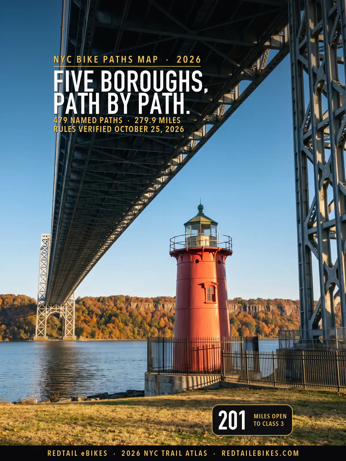
The Little Red Lighthouse under the George Washington Bridge in Fort Washington Park, where the park's greenway is open to Class 1, 2 and 3 e-bikes under the NYC Parks pilot, in a scene generated with Playcut from a photograph of the lighthouse by Tiraspolsky.

Every line is a greenway, park drive, bridge path or off-street bike path from NYC DOT's bike-route layer, the NYC Parks pilot map or OpenStreetMap, colored by the e-bike rule of the agency that manages the ground under it.
New York City is the one place in the state where you may ride a Class 3. Vehicle and Traffic Law § 1242(10) says "The operation of a class three bicycle with electric assist outside of a city having a population of one million or more is prohibited."
Inside the city, the ground under your tires decides the rest. NYC Parks runs the park drives and most greenways, NYC DOT the streets, bike lanes and its bridges, the State the Route 9A bikeway and its own parks, the National Park Service Gateway and Governors Island's fort, and a string of authorities run Battery Park City, Brooklyn Bridge Park, Roosevelt Island, Governors Island and the Port Authority and MTA bridges.
This map puts each of those managers' rules on the ground they govern: 5,061 pieces of path from NYC DOT's bike-route layer, NYC Parks' pilot map and OpenStreetMap, 279.9 miles counted once, each joined to the agency whose land it crosses and to that agency's own words on e-bikes. All of it sits in the path register, so you can check any ride path by path across all five boroughs.
For the rest of New York's e-bike law, from labels to Class 3 rules on the street, read New York e-bike laws, and for every state's, e-bike laws across the US. Riding beyond the city? New York bike trails maps the state's trails the same way, bike trails by state compares the states, and e-bike trails near you shows how to find one anywhere.
Takeaway
On a Class 1 you may ride more of this map than on a Class 2, and on a Class 2 more than on a Class 3: 222 miles, 215 and 201. Four managers set the gap: Governors Island's Trust lets you ride on pedal-assist alone, the State parks keep your Class 2 off dirt and bar Class 3, the Port Authority's bridge paths take Class 1 and 2, and Gateway's pages disagree on Class 3.
The 20.0 closed miles sit on six pieces of ground: the State's bikeway along the Hudson from Battery Place to West 59th Street (5.0 mi), Shirley Chisholm State Park (9.7 mi), Mount Loretto Unique Area (2.2 mi), Battery Park City (1.8 mi), Brooklyn Bridge Park (1.3 mi) and the fort on Governors Island (0.1 mi).
In this guide
- How to read the map
- Who decides on each path
- NYC Parks: the drives and greenways pilot
- The Hudson River Greenway and its West 59th Street line
- Bridges: who runs each path
- State and federal ground inside the city
- Authorities with their own rule
- What could change before your next ride
- Named paths riders ask about
- NYC bike paths, borough by borough
- Where riders get caught out
- Streets, bike lanes and sidewalks
- Choosing an e-bike for New York City
- Frequently asked questions
How to read the map
Find your path's color, then read whose ground it is. Green paths take Class 1, 2 and 3. Blue take Class 1 and Class 2, orange Class 1 alone, and a dashed red line marks ground where a published rule keeps every e-bike off.
Gray never means open. It holds three cases, each named in the register: two official texts that disagree, a State path no agency has designated for e-bikes, and ground whose manager's e-bike rule could not be found. Gray covers 38.0 of the 279.9 miles.
Your bike's label names its class. VTL § 102-c defines a Class 1 by a motor that assists "only when the person operating such bicycle is pedaling" and stops at 20 mph, and a Class 2 by a motor that "may be used exclusively to propel such bicycle", also stopping at 20 mph.
A Class 3 exists "Solely within a city having a population of one million or more": its motor may propel the bike on its own and stops assisting at 25 mph. Whatever the class, NYC DOT's traffic rule holds you to 15 mph unless a sign posts another e-bike limit.
A miles figure counts the path once. Where NYC DOT, NYC Parks and OpenStreetMap draw the same path, the register keeps one line and screens the others, so 215.6 miles of OpenStreetMap ways and 4.4 miles of parallel duplicates are counted nowhere. Streets are left out, 824.4 miles of them: a bike lane follows the street's rules, which Streets, bike lanes and sidewalks sets out.
Who decides on each path
The agency that manages the ground writes the rule. The table gives each manager's answer for each class, the miles of this map it governs and the words it rests on.
| Ground | Classes that may ride | Miles | Source |
|---|---|---|---|
| City of New York | |||
| NYC Parks drives and greenways (pilot) | Class 1, 2 and 3 | 166.4 | NYC Parks pilot page |
| NYC Parks mountain bike trails | Two readings | 15.1 | NYC Parks bicycling page |
| NYC Parks paths neither City map marks | Two readings | 2.3 | 2024 variance memo |
| Sidewalk links of the bike network | Two readings | 7.3 | VTL § 1242 |
| NYC DOT greenways and off-street paths (pilot) | Class 1, 2 and 3 | 22.3 | NYC DOT e-bike chart |
| NYC DOT bridge paths | Class 1, 2 and 3 | 11.8 | NYC DOT e-bike chart |
| New York State | |||
| Hudson River Greenway, Battery Place to West 59th Street | Closed | 5.0 | 2025 variance memo |
| Hudson River Greenway, West 135th to 145th Street (filed under the State) | Two readings | 0.5 | 2025 variance memo |
| Other State DOT path pieces | No designation | 1.7 | VTL § 1242 |
| State parks: paved paths | Class 1 and 2 | 0.9 | NYS Parks directive |
| State parks: natural-surface trails | Class 1 only | 0.4 | NYS Parks directive |
| Shirley Chisholm State Park | Closed | 9.7 | the park's page |
| Mount Loretto Unique Area (DEC) | Closed | 2.2 | DEC biking page |
| Federal | |||
| Gateway National Recreation Area | Class 1 and 2; Class 3 has two readings | 11.3 | Gateway bicycling page |
| Jacob Riis Park boardwalk (Gateway) | Two readings | 1.2 | Gateway 2026 compendium |
| Fort Jay and Castle Williams (NPS monument) | Closed | 0.1 | the monument's compendium |
| Authorities and other owners | |||
| Governors Island (the Trust) | Class 1 only | 6.4 | the Trust's rules |
| Port Authority bridge paths | Class 1 and 2 | 2.4 | Port Authority traffic rules |
| MTA bridge paths | Two readings | 4.8 | MTA PEV policy |
| Battery Park City | Closed | 1.8 | Battery Park City rules |
| Brooklyn Bridge Park | Closed | 1.3 | the park's biking page |
| Roosevelt Island | No rule found | 2.7 | No rule on any of the 116 pages of its site |
| Private and small agency pieces | No rule found | 2.4 | No rule located |
The City's own ground carries most of the map. NYC Parks' pilot governs 166.4 miles and NYC DOT's greenways and bridge paths 34.1 more, all open to Class 1, 2 and 3. DOT's chart says e-bikes ride "all park drives and greenways as part of NYC Parks-led pilot program", so its greenways share the pilot's end date.
The pilot rests on the Parks Commissioner's power to vary a Parks rule. Recalling June 16, 2023, the 2024 extension memo says "I granted a variance pursuant to Title 56 § 1-01(c) of the Rules of the City of New York, regarding Title 56 § 1-05(n)(1) of the Rules of the City of New York." DOT's 15 mph limit rests on Charter § 2903(a), the power its notice of adoption cites.
If you are ticketed in a park, it is a Parks summons. The penalty schedule in 56 RCNY § 1-07 prices a violation of § 1-05(n), the motor-vehicle rule the pilot varies, at $50, or $75 when the respondent defaults, before the Office of Administrative Trials and Hearings.
Takeaway
The map's gray is mostly disagreement in print: 31.3 of its 38.0 miles. NYC Parks' mountain bike trails (15.1 mi), sidewalk links (7.3 mi), park paths neither City map marks (2.3 mi), the MTA's bridge paths (4.8 mi), the Riis boardwalk (1.2 mi) and the greenway at West 135th to 145th Street (0.5 mi) each carry two official texts that disagree, and this page prints both.
NYC Parks: the drives and greenways pilot
On a park drive or a NYC Parks greenway, you may ride any of the three classes until December 31, 2026. The pilot page says "The pilot program is in effect from June 20, 2023 through December 31, 2026", and the 2024 memo defines its reach: e-bikes "may be operated on park drives and NYC greenways under the jurisdiction of NYC Parks (including those otherwise closed to motor vehicles), subject to the rules currently applicable to bicycles."
The rule it varies is 56 RCNY § 1-05(n)(1): "Motor vehicles may not be brought into or operated in any area of a park except on park roads or designated parking areas." The pilot lifts that rule for e-bikes on the drives and greenways and leaves it in place everywhere else in a park.
Where you must walk
On a park path or a sidewalk, you push the bike. The 2024 memo says "On park paths and sidewalks, bicycles, e-bikes, and e-scooters must be walked", and adds that the variance "does not allow use of such e-bikes and e-scooters on park paths or sidewalks."
The pilot page defines what you may ride: "A "greenway" is a designated path that is used for walking, jogging, rolling, stroller pushing, cycling, skating, etc." Most of NYC Parks' 184.7 mapped miles sit on its own pilot map or carry DOT's greenway mark. 2.3 miles of paths that DOT's map draws carry neither, and the register shows them gray with both texts.
Mountain bike trails: two readings
NYC Parks' dirt trails read two ways, so ride them on your pedal bike until NYC Parks says which applies. NYC Parks' bicycling page says "Mountain biking is permitted on shared-use trails in Highbridge Park in Manhattan, Wolfe's Pond Park on Staten Island, and Cunningham Park in Queens."
The pilot's 2024 memo opens with e-bikes that "may be operated within NYC Parks jurisdiction anywhere a human-powered bicycle may be operated", which would reach those trails. Its next sentence and the pilot page name only "park drives and greenways." The register marks the 15.1 miles of these trails gray.
When the pilot ends
The pilot page's date is December 31, 2026, and no 2026 instrument is posted beside it. NYC Parks' rules index still describes the pilot's last extension, "allowing electric bikes and electric scooters to use park drives and greenways until December 31, 2025", the reach of the May 29, 2025 memo. The page that sets the 2026 date is the pilot page itself.
On July 3, 2025, NYC Parks announced a plan to replace the pilot: "Parks intends to propose rule amendments to permanently allow the same e-bikes and stand-up e-scooters that are allowed in bike lanes to also be operated on park drives and greenways." As of October 25, 2026, the City's rules portal carries no proposed Parks rule on it.
The Hudson River Greenway and its West 59th Street line
North of West 59th Street the greenway is open to all three classes under the NYC Parks pilot through December 31, 2026, apart from 0.5 miles at West 135th to 145th Street that read two ways; south of it, to Battery Place, every e-bike is barred.
The state's Empire State Trail page gives the route from the Battery to Inwood Hill as 12.5 miles and says "The off-road Greenway Trail ends in NW Manhattan at Dyckman Street."
The 2025 extension memo draws the line: "This variance does not affect the Hudson River Greenway south of 59th Street (as depicted in Exhibit B), where e-bikes and e-scooters are prohibited by State law."
Battery Place to West 59th Street: closed
The path along this stretch belongs to the State. Hudson River Park's rules describe "The bikeway/walkway, which is owned by the New York State Department of Transportation, located east of the park and on the west side of Route 9A."
The park's advisories page is blunt: "No e-bikes, e-scooters or motorized vehicles of any kind are permitted on the Park's esplanades or piers, or on the bike path adjacent to the Park."
The statute behind it is VTL § 1242(4)(a): "No person shall operate a bicycle with electric assist on any public lands or property, other than a highway exclusive of any greenway running adjacent to or connected with a highway, except that a bicycle with electric assist may be operated on any such lands that have been designated and posted for travel by bicycles with electric assist".
No designation of this stretch was found. The register's State-owned stretch measures 5.0 miles, and Battery Park City's esplanade beside it adds 1.6 more.
North of 59th Street: open under the pilot
From West 59th Street to Dyckman Street the greenway runs through Riverside Park and Fort Washington Park, NYC Parks ground, past the Little Red Lighthouse on this page's cover. The pilot's words reach it, and NYC DOT's e-bike chart answers "Yes" for park drives and greenways for all three classes.
The register carries 17.7 miles of path on the west side's named lines, more than the state's 12.5-mile route, because it counts every mapped line: Battery Park City, Riverside Park and Fort Washington Park each carry a second path beside the main one. 10.5 of those miles take all three classes.
West 135th to 145th Street: two readings
On the 0.5 miles NYC DOT files under the State, ride as the signs there tell you. NYC DOT's bike map records the greenway between West 135th and West 145th Streets as NYSDOT's. NYC Parks' pilot map draws it open, and the 2025 memo names only the stretch south of 59th Street as closed by State law.
The statute closes State land to e-bikes unless it is designated and posted, and no designation was found, so the register shows the stretch gray with both texts.
Takeaway
On the west side of Manhattan, West 59th Street is the line. South of it the State's bikeway and Hudson River Park bar every e-bike, so ride a bike lane on the street; north of it, from Riverside Park to Dyckman Street, the greenway is open to all three classes at 15 mph, apart from the stretch at West 135th to 145th Street that reads two ways.
Bridges: who runs each path
Four owners run the bridge paths you will ride, and each says something different. NYC DOT's chart answers "Can I ride on bridges? Yes (only in bike lanes)" for all three classes on the City's bridges: the Brooklyn, Manhattan, Williamsburg and Queensboro, and the Harlem River bridges. The register carries 11.8 miles of them.
The Port Authority's George Washington, Bayonne and Goethals bridge paths take Class 1 and Class 2. Its traffic rules define a "LOW-SPEED ELECTRIC BICYCLE" as one whose motor "provides assistance at a rate of speed below 20 mph", and set "The speed limit for all permitted devices on the designated Pathways of Bridges is 15 mph."
The same rules require a bell on your bike, a helmet if you are under 18 and a label showing Class 1 or Class 2. Across the river, New Jersey's e-bike laws apply once you leave the bridge.
The MTA runs the RFK, Henry Hudson, Cross Bay and Marine Parkway bridges, and its own texts point two ways. Its personal electric vehicle policy, which its bike guide applies to "e-bikes or e-scooters", lists "On pedestrian walkways and shared use paths on bridges" among the places where operating one is prohibited, and says "If the MTA bridge has a pedestrian walkway, the Permissible PEV must be walked across."
Its May 12, 2025 release celebrates "the completion of paths for bicyclists, pedestrians and micromobility users on the Robert F. Kennedy, Henry Hudson and Cross Bay Bridges". Until the MTA squares the two, walk your e-bike across; these 4.8 miles read gray.
The Kosciuszko Bridge path is the State's, and like the State's other path pieces in the register (1.7 mi in all) it carries no e-bike designation.
State and federal ground inside the city
Gateway, Governors Island, New York's State parks and the State's environmental agency each keep their own e-bike rule. On this ground the City's pilot has no say.
Gateway National Recreation Area
You may ride Gateway's routes in the city on a Class 1 or Class 2; on a Class 3 your answer rests on which Gateway page you read. The bicycling page says "Class 1 and Class 2 E-bikes are also allowed on routes open to traditional bicycles throughout Gateway." The Laws & Policies page says "Class 1, 2 and 3 e-bikes are allowed on routes open to traditional bicycles."
The 2026 compendium adopts State law, under which a Class 3 is legal in the city, and limits the motor on paths: "the operator of an e-bike may only use the motor to assist pedal propulsion." So a throttle may not move you on Gateway's paths, whatever your class.
The register carries 11.3 miles of Gateway route, and Class 3 is gray on all of it. For national parks and forests beyond the city, see e-bikes on public land.
The Riis Park boardwalk (1.2 mi) is gray for every class. NYC DOT's map draws it in the Jamaica Bay greenway system, while the compendium designates "Greenway paths. Multi-use pathways." for bicycles and names the Riis boardwalk only among the places open to skates.
Governors Island
Ride Governors Island's roads on pedal-assist alone, and walk your bike in the fort. The Trust for Governors Island bars "Motorized vehicles, including motorized bicycles/scooters/skateboards, with the exception pedal-assist e-bicycles, mobility scooters or motorized wheelchairs." The register reads "pedal-assist" as Class 1 on 6.4 miles, since a throttle is not pedal assist.
Fort Jay and Castle Williams are the National Park Service's Governors Island National Monument, whose compendium closes "The use, storage and attachment to park property of bicycles and electric bicycles" there.
New York State parks and DEC land
In the city's State parks you may ride a Class 1 or Class 2 on paved paths and a Class 1 alone on dirt, at 15 mph, and two of them take no e-bike at all. NYS Parks' directive, effective June 4, 2026, says "Class 3 electric bicycles are strictly prohibited at all OPRHP facilities including parkways."
The directive opens "boardwalks and (ii) shared use or multi-use trails and paths that are paved or improved" to Class 1 and 2, and says "Class 2 electric bicycles are prohibited on all unimproved and/or natural surface trails."
NYS Parks' Shirley Chisholm State Park page reads "No E-bikes or scooters", which closes its 9.7 mapped miles. NYS Parks' Riverbank State Park page says "Bicycle riding is not permitted inside of the park."
The State's environmental agency closes Mount Loretto Unique Area on Staten Island. Its biking page says "Off-road use (including trails, roads, or terrain other than a public road or parking area) of E-bikes is prohibited", and the area's own page adds "Bicycles are allowed only on asphalt surfaces."
NYC DOT's records file the area's greenway under NYS Parks, while the State's protected-areas database names DEC as owner; the register follows the landowner and closes its 2.2 miles.
Authorities with their own rule
Battery Park City and Brooklyn Bridge Park bar e-bikes from their paths, and Roosevelt Island has posted no rule. Battery Park City's rules define a motor vehicle as "any automobile, motorcycle, moped, or other vehicle propelled by a motor" and say "Motor vehicles may not be brought into or operated in any area of a park except" where a permit or the rule allows.
Brooklyn Bridge Park's biking page says "Motorized bicycles, motorized scooters, and motorized skateboards are not allowed." NYC Parks' 2023 pilot map draws the waterfront greenway through the park, so both texts sit in the register; the park's own rule decides on its 1.3 miles, and the street bike lanes outside it carry you past.
Roosevelt Island's operator posts no riding rule for bicycles or e-bikes: all 116 pages of its website's sitemap were read on October 25, 2026, and the 2.7 miles of its greenway read gray. On Randall's Island, NYC Parks ground, the park's Alliance confirms the pilot: "Along with bicycles, e-bikes and e-scooters are allowed on the park's shared-use pathways."
What could change before your next ride
Three changes are in motion: the pilot's end date, NYC Parks' plan to make it permanent, and bills in the City Council. Read the pilot page before a ride after December 31, 2026, since it is the only text that carries the pilot to that date.
| Bill | What it would do | Status when read |
|---|---|---|
| Int 0377-2026 | Bar e-scooters and e-bikes from every park the Parks Department runs | Committee |
| Int 1110-2026 | Bar Class 3 e-bikes from city streets, parks and other public places, with warnings only before April 1, 2029 | Committee |
| Int 0244-2026 | Bar the sale and rental of Class 3 e-bikes, with civil penalties up to $2,000 | Laid Over in Committee |
| Int 0236-2026 | Require DOT and NYC Parks to post signs about the ban on riding on sidewalks, park walkways and boardwalks, and its fines | Committee |
| Int 0737-2026 | Raise the civil penalties for riding a bicycle, e-bike or e-scooter on the sidewalk | Committee |
| Int 0985-2026 | Create a DOT trade-in program for Class 3 e-bikes and look-alike vehicles | Laid Over in Committee |
| Int 0988-2026 | Bar advertising vehicles that must be registered with the DMV as powered bicycles or powered mobility devices | Laid Over in Committee |
| Int 0060-2024 | Bar e-scooters and e-bikes from parks (an earlier version of Int 0377-2026) | Filed (End of Session) |
| Int 0606-2024 | Require every e-bike, e-scooter and other legal motorized vehicle to be licensed and registered | Filed (End of Session) |
What changed in 2025 and 2026
- May 29, 2025: NYC Parks' extension memo carried the pilot to December 31, 2025.
- July 3, 2025: NYC Parks announced its plan to propose a permanent rule.
- October 24, 2025: NYC DOT's 15 mph rule for e-bikes took effect.
- January 5, 2026: the Port Authority revised its traffic rules.
- April 23, 2026: Gateway last updated its bicycling page, the one that names Class 1 and Class 2.
- June 4, 2026: NYS Parks updated its e-bike directive "to include violation information".
- October 8, 2026: Int 1110-2026, the Class 3 ban bill, was on the Council's agenda.
At the State level, S4471 "Relates to cargo bicycles with electric assist" and S3238 "Repeals certain provisions of the vehicle and traffic law relating to the operation of bicycles with electric assist"; both sat in the Senate Transportation Committee when read on October 25, 2026.
Named paths riders ask about
These are the paths riders ask about by name, with each manager's own length and the register's miles by class. A manager's length is the route as it publishes it; the register's miles are every mapped line on that route, side paths and approaches included.
| Path | Length its manager publishes | Register miles | Classes that may ride |
|---|---|---|---|
| Central Park drives | 6.1 mi (Conservancy running guide); 6.02 mi (bike map) | 8.8 | Class 1, 2 and 3 |
| Prospect Park drives | 3.36 mi (Prospect Park Alliance) | 5.9 | Class 1, 2 and 3 |
| Hudson River Greenway, the Battery to Dyckman Street | 12.5 mi (Empire State Trail) | 17.7 | Class 1, 2 and 3 north of West 59th Street; closed from Battery Place to West 59th Street |
| Manhattan Waterfront Greenway | 32.5 mi (NYC EDC) | 42.2 (NYC DOT's Manhattan Waterfront system) | Mostly Class 1, 2 and 3; closed on the west side from Battery Place to West 59th Street |
| Bronx River Greenway | 12 mi of on- and off-street trails in the city (Bronx River Alliance) | 8.3 (NYC DOT's Bronx River system) | Class 1, 2 and 3 on NYC Parks ground |
The Central Park loop: the Conservancy prints two lengths. Its running guide says "The longest loop in the Park totals 6.1 miles", and its bike map labels the loop "6.02 mi / 9.68 km". On the drives, the Conservancy's map asks you to "Travel counter-clockwise on the drives that circle the Park" and posts "the maximum speed limit of 20 mph"; City law holds your e-bike to 15.
At 15 mph the 6.1-mile loop takes you about 24 minutes of riding, and at 10 mph about 37; this is arithmetic from the Conservancy's length, before stops for lights and crowds.
The Prospect Park loop is 3.36 miles. The Prospect Park Alliance calls it "a 3.36-mile loop for runners, walkers, skaters and cyclists", and its Park Drive rules say, under the pilot, "Class 1, 2 and 3 e-bikes and e-scooters are permitted to use the cycling lane on the Park Drive."
The Alliance's bicycling page keeps you to the drives: "Cycling is permitted only on the main Park Drive, Center Drive and Wellhouse Drive, and prohibited on pedestrian paths."
If you ride around Manhattan on an e-bike, you take the street for part of the west side. NYC EDC's greenway book calls the Manhattan Waterfront Greenway "a 32.5-mile path for walking and cycling along the borough's waterfront", and the State's stretch from Battery Place to West 59th Street is closed to e-bikes, so your full loop needs a bike lane there.
The Bronx River Greenway is the Bronx River Alliance's. Its greenway page says "The Bronx River Greenway offers 12 miles of on and off street trails along the Bronx River in the New York City" and that the Alliance "coordinates completion of the eight miles of greenway in the Bronx"; the two figures are the Alliance's own.
NYC DOT's map files 8.3 miles of off-street path in its Bronx River system, 7.9 of them open to all three classes.
NYC DOT's greenway systems
NYC DOT's bike-route layer groups its greenways into 16 systems. The table gives the register's miles in each, as DOT files them.
| NYC DOT greenway system | Register miles | Open to Class 1, 2 and 3 | Other colors |
|---|---|---|---|
| Manhattan Waterfront | 42.2 | 28.6 | closed: 6.7; no rule found: 3.1; Class 1 only: 2.1; two readings: 1.4; not designated: 0.3 |
| Jamaica Bay | 27.8 | 14.6 | Class 1 and 2: 6.0; two readings: 3.9; closed: 3.3 |
| Brooklyn Waterfront | 16.9 | 14.4 | no rule found: 1.1; closed: 1.0; two readings: 0.4 |
| Central Queens | 15.9 | 14.6 | not designated: 0.8; two readings: 0.5 |
| Historic Brooklyn | 13.7 | 13.6 | two readings: 0.1 |
| Mosholu-Pelham | 12.1 | 12.0 | two readings: 0.1 |
| Staten Island Waterfront | 10.5 | 6.9 | Class 1 and 2: 1.8; closed: 1.3; two readings: 0.6 |
| Bronx River | 8.3 | 7.9 | two readings: 0.4 |
| Queens Waterfront | 8.2 | 7.7 | no rule found: 0.4; two readings: 0.1 |
| Bronx Waterfront | 7.9 | 6.8 | no rule found: 0.5; two readings: 0.3; not designated: 0.3 |
| Hutchinson River | 6.0 | 6.0 | none |
| New Springville | 3.8 | 3.8 | none |
| Harlem River-Putnam | 3.2 | 2.2 | Class 1 and 2: 0.8; two readings: 0.2 |
| Eastern Queens | 2.5 | 2.2 | two readings: 0.3 |
| Hudson River Valley | 0.5 | 0.0 | two readings: 0.5 |
| Harlem River | 0.4 | 0.0 | two readings: 0.4 |
NYC bike paths, borough by borough
Each borough's map and tables carry every named path in it. Each table lists the paths of a mile or more with their miles and class answers; the list after it names every other path in the borough with its color. On NYC Parks ground every answer is the pilot's, through December 31, 2026.

Each bar is one borough's register miles, split by the answer the managing agency's rule gives. In the Bronx 92% of the mapped miles take all three classes; Brooklyn carries the most closed miles (10.8), and Manhattan holds 6.4 of the city's 6.7 Class 1-only miles, on Governors Island.
Manhattan
Manhattan holds 75.1 mapped miles, 51.9 of them open to Class 3. The west side's greenway is closed from Battery Place to West 59th Street, Battery Park City is closed and Governors Island takes pedal-assist alone.

| Manhattan path | Miles here | Classes that may ride | Manager |
|---|---|---|---|
| Hudson River Greenway | 8.4 | Class 1, 2 and 3 2.9 mi; Two readings 0.5 mi; Closed 5.0 mi | NYS DOT; NYC Parks |
| Randall's Island Greenway | 4.5 | Class 1, 2 and 3 4.4 mi; Two readings 0.1 mi | NYC Parks |
| FDR Drive Greenway | 3.8 | Class 1, 2 and 3 | NYC Parks |
| Fort Washington Park Bicycle Trail | 3.5 | Class 1, 2 and 3 | NYC Parks |
| East River Esplanade | 3.4 | Class 1, 2 and 3 2.7 mi; Two readings 0.1 mi; No designation 0.3 mi; No rule found 0.4 mi | NYC Parks; NYC DOT |
| West Drive (Central Park) | 2.9 | Class 1, 2 and 3 | NYC Parks |
| Governors Island Greenway | 2.7 | Class 1 only | Trust for Governors Island |
| Roosevelt Island Greenway | 2.7 | No rule found | Roosevelt Island Operating Corporation |
| Harlem River Drive Greenway | 2.5 | Class 1, 2 and 3 | NYC Parks; NYC DOT |
| East Drive (Central Park) | 2.4 | Class 1, 2 and 3 | NYC Parks |
| Highbridge Park Trail | 2.1 | Two readings | NYC Parks; NYC DOT |
| Battery Park City Greenway | 1.6 | Closed | Battery Park City Authority |
| Cherry Walk Bicycle Trail | 1.5 | Class 1, 2 and 3 | NYC Parks |
| Fort Washington Park Greenway | 1.2 | Class 1, 2 and 3 | NYC Parks |
| Harlem River Pathway | 1.2 | Class 1, 2 and 3 | NYC Parks |
| Riverside Park Path | 1.1 | Class 1, 2 and 3 1.0 mi; Two readings 0.1 mi | NYC Parks |
Every other Manhattan path in the register (146 paths, 29.5 mi), by its main color
Class 1, 2 and 3 (green) (105)
- Unnamed path (Wards Island Park) (2.1 mi)
- Unnamed path (Randall's Island Park) (1.7 mi)
- Wards Island Greenway (0.8 mi)
- Williamsburg Bridge (0.7 mi)
- Inwood Hill Park Greenway (0.7 mi)
- Margaret Corbin Drive (0.7 mi)
- Queensboro Bridge (0.7 mi)
- Brooklyn Bridge (0.7 mi)
- Manhattan Bridge (0.6 mi)
- Macombs Dam Bridge (0.5 mi)
- Harlem River Driveway (0.5 mi)
- High Bridge Greenway (0.5 mi)
- East Midtown Greenway (0.5 mi)
- Center Drive (Central Park) (0.5 mi)
- Allen Street (0.4 mi)
- Bronx Shore Road (0.4 mi)
- Battery Park Greenway (0.4 mi)
- 3rd Avenue Bridge (0.4 mi)
- Wards Island Pedestrian Overpass (0.3 mi)
- Broadway Bridge (0.3 mi)
- Central Park Grand Army Plaza Approach (0.3 mi)
- Terrace Drive (Central Park) (0.3 mi)
- Central Park East Drive (0.3 mi)
- Madison Avenue Bridge (0.3 mi)
- Washington Bridge (0.3 mi)
- Central Park West 72nd Street Approach (0.3 mi)
- Unnamed path (Frederick Johnson Playground) (0.3 mi)
- Central Road (Randall's Island Park) (0.3 mi)
- Central Park 102 Center Drive (0.3 mi)
- Pike Street (0.2 mi)
- Hudson River Greenway 72nd Street Access (0.2 mi)
- Central Park Lenox Approach (0.2 mi)
- South Street (0.2 mi)
- New Wave Pier (0.2 mi)
- Central Park East 72nd Street Approach (0.2 mi)
- Wheeler Avenue (0.2 mi)
- Central Park West 85th Street Approach (0.2 mi)
- Peter Minuit Plaza Greenway (0.1 mi)
- West 151st Street Pedestrian Overpass (0.1 mi)
- University Heights Bridge (0.1 mi)
- City Hall Park Greenway (0.1 mi)
- Central Park East 102nd Street Approach (0.1 mi)
- Hudson River Greenway West 68th Street Access (0.1 mi)
- Evans Road (0.1 mi)
- Central Park West 100th Street Approach (0.1 mi)
- East 10th Street Pedestrian Overpass (0.1 mi)
- Central Park 6th Avenue Approach (0.1 mi)
- Roosevelt Island Bridge (0.1 mi)
- East 63rd Street Pedestrian Overpass (0.1 mi)
- East 71st Street Pedestrian Overpass (0.1 mi)
- East 111th Street Pedestrian Overpass (0.1 mi)
- East 120th Street Pedestrian Overpass (0.1 mi)
- Central Park West 106th Street Approach (0.1 mi)
- Willis Avenue Bridge Approach (0.1 mi)
- King Avenue (0.1 mi)
- Pike Slip (0.1 mi)
- Central Park West 67th Street Approach (0.1 mi)
- Central Park West 77th Street Approach (0.1 mi)
- Unnamed path (Riverside Park South) (0.1 mi)
- Outlook Way (0.1 mi)
- Central Park West 96th Street Approach (0.1 mi)
- Absecon Road (0.1 mi)
- Owasco Road (0.1 mi)
- Highbridge Greenway (0.1 mi)
- West 142nd Street (0.1 mi)
- Central Park North Powell Approach (0.1 mi)
- Short Avenue (0.1 mi)
- Central Park South 7th Avenue Approach (0.1 mi)
- Central Park West 110th Street Approach (0.1 mi)
- Cartigan Road (0.1 mi)
- Broadway (0.1 mi)
- Ed Koch Queensboro Bridge (0.1 mi)
- East 60th Street Pedestrian Overpass (0.1 mi)
- Earlybird Road (under 0.1 mi)
- 79th Street South Access Ramp (under 0.1 mi)
- East Houston Street (under 0.1 mi)
- Central Park West 90th Street Approach (under 0.1 mi)
- Washington Bridge Pedestrian and Bike Path (under 0.1 mi)
- East Midtown Greenway East 54th Street Access (under 0.1 mi)
- West 158th Street Pedestrian Underpass (under 0.1 mi)
- 2nd Avenue (Manhattan) (under 0.1 mi)
- Willis Avenue Bridge (under 0.1 mi)
- East Midtown Greenway East 54th Street Link (under 0.1 mi)
- Central Road (Wards Island Park) (under 0.1 mi)
- Hudson River Greenway 79th Street Link (under 0.1 mi)
- East 37th Street (under 0.1 mi)
- Ferry Line Road (under 0.1 mi)
- East 54th Street East Midtown Greenway Overpass (under 0.1 mi)
- Central Park East 90th Street Approach (under 0.1 mi)
- Old Slip (under 0.1 mi)
- Hell Gate Circle (under 0.1 mi)
- East 124th Street (under 0.1 mi)
- Randall's Island Connector (under 0.1 mi)
- Enright Road (under 0.1 mi)
- Margaret Corbin Plaza (under 0.1 mi)
- Grand Street (under 0.1 mi)
- Delancey Street (under 0.1 mi)
- St. Clair Place (under 0.1 mi)
- Houston Street (under 0.1 mi)
- Cherry Street (under 0.1 mi)
- Dover Street (under 0.1 mi)
- Catherine Street (under 0.1 mi)
- Market Slip (under 0.1 mi)
- Montgomery Street (under 0.1 mi)
- East Houston Street Pedestrian Overpass (under 0.1 mi)
Class 1 and 2 (blue) (1)
- George Washington Bridge Bike and Pedestrian Path (0.7 mi)
Class 1 only (orange) (11)
- Gresham Road (0.7 mi)
- Andes Road (0.4 mi)
- Carder Road (0.4 mi)
- Kimmel Road (0.4 mi)
- Clayton Road (0.4 mi)
- Hay Road (0.3 mi)
- Comfort Road (0.3 mi)
- Barry Road (0.3 mi)
- Craig Road North (0.2 mi)
- Division Road (0.2 mi)
- Craig Road South (0.1 mi)
Two readings (gray) (22)
- RFK Bridge (Queens) (0.6 mi)
- RFK Bridge Pedestrian and Bike Path (0.4 mi)
- Central Park Path (0.3 mi)
- RFK Bridge (Bronx) (0.2 mi)
- Henry Hudson Bridge (0.2 mi)
- RFK Bridge South Pedestrian and Bike Path Access (0.1 mi)
- West 139th Street (0.1 mi)
- Randall's Island Boardwalk (0.1 mi)
- East 78th Street Overpass (0.1 mi)
- Henry Hudson Parkway Southbound Entrance at Dyckman (0.1 mi)
- Rivington Street (0.1 mi)
- Pedestrian and Bike Path Link (Manhattan) (0.1 mi)
- Stanton Street (under 0.1 mi)
- St. Nicholas Avenue (under 0.1 mi)
- Centre Street (under 0.1 mi)
- East 63rd Street (under 0.1 mi)
- FDR Drive (under 0.1 mi)
- West 40th Street (under 0.1 mi)
- West 170th Street (under 0.1 mi)
- East 102nd Street (under 0.1 mi)
- West 162nd Street (under 0.1 mi)
- West 181st Street Pedestrian Overpass (under 0.1 mi)
Closed (red) (7)
- Brooklyn Bridge Park Greenway (0.2 mi)
- North Cove (0.1 mi)
- Tampa Road (0.1 mi)
- Albany Street (under 0.1 mi)
- Kimball Road (under 0.1 mi)
- Unnamed path (Battery Park City) (under 0.1 mi)
- Unnamed path (Governors Island National Monument) (under 0.1 mi)
Brooklyn
Brooklyn holds 58.2 mapped miles, 41.6 of them open to Class 3. Prospect Park's drives, Ocean Parkway, Eastern Parkway and the Shore Parkway Greenway are open to all three classes under the pilot; Brooklyn Bridge Park and Shirley Chisholm State Park are closed.

| Brooklyn path | Miles here | Classes that may ride | Manager |
|---|---|---|---|
| Shirley Chisholm Park Paths | 6.2 | Closed | NYS Parks |
| Shore Parkway Greenway (Brooklyn) | 5.9 | Class 1, 2 and 3 | NYC Parks; NYC DOT |
| Shore Parkway Greenway West | 5.4 | Class 1, 2 and 3 | NYC Parks |
| Ocean Parkway | 5.3 | Class 1, 2 and 3 | NYC Parks |
| Shirley Chisholm Park Greenway | 3.2 | Closed | NYS Parks |
| Flatbush Avenue Greenway | 2.7 | Class 1 and 2 1.5 mi; Two readings 1.2 mi | National Park Service (Gateway); NYC DOT |
| Eastern Parkway | 2.5 | Class 1, 2 and 3 | NYC Parks; NYC DOT |
| Boardwalk West (Coney Island Beach & Boardwalk) | 1.8 | Class 1, 2 and 3 | NYC Parks |
| Gateway Drive | 1.3 | Class 1, 2 and 3 | NYC Parks |
| West Drive (Prospect Park) | 1.2 | Class 1, 2 and 3 | NYC Parks |
Every other Brooklyn path in the register (98 paths, 22.6 mi), by its main color
Class 1, 2 and 3 (green) (72)
- Flushing Avenue (0.9 mi)
- Marine Park Greenway (0.9 mi)
- Boardwalk East (Coney Island Beach & Boardwalk) (0.8 mi)
- Manhattan Bridge (0.7 mi)
- Brooklyn Bridge (0.7 mi)
- East Drive (Prospect Park) (0.7 mi)
- Center Drive (Prospect Park) (0.7 mi)
- Williamsburg Bridge (0.7 mi)
- Leif Ericson Park Greenway (0.6 mi)
- Canarsie Park Connector (0.6 mi)
- 3rd Avenue (0.5 mi)
- East Lake Drive (Prospect Park) (0.5 mi)
- Highland Boulevard Greenway (0.5 mi)
- Bush Terminal Greenway (0.5 mi)
- South Lake Drive (Prospect Park) (0.5 mi)
- Pedestrian and Bike Path Link (Brooklyn) (0.5 mi)
- West Lake Drive (Prospect Park) (0.5 mi)
- Hamilton Avenue (0.4 mi)
- Manhattan Beach Boardwalk (0.4 mi)
- Meeker Avenue (0.4 mi)
- Hill Drive (Prospect Park) (0.4 mi)
- Columbia Street (0.4 mi)
- Owls Head Park Greenway (0.4 mi)
- 2nd Avenue (Brooklyn) (0.4 mi)
- Kent Avenue (0.4 mi)
- Well House Drive (Prospect Park) (0.3 mi)
- Shore Parkway (Brooklyn) (0.3 mi)
- Pulaski Bridge Bike Path (0.3 mi)
- Prospect Park Flatbush Avenue Approach (0.3 mi)
- Van Brunt Street (0.2 mi)
- 39th Street (0.2 mi)
- Cadman Plaza East (0.2 mi)
- Tillary Street (0.2 mi)
- Adams Street (0.2 mi)
- Parade Grounds Greenway (0.2 mi)
- Prospect Park Bartel Pritchard Square Approach (0.1 mi)
- Unnamed path (Manhattan Beach Park) (0.1 mi)
- Prospect Park 3rd Street Approach (0.1 mi)
- Rockaway Parkway (0.1 mi)
- Prospect Park Gap Entrance (0.1 mi)
- Prospect Park Gap Exit (0.1 mi)
- Borinquen Place (0.1 mi)
- 84th Street Pedestrian Overpass (0.1 mi)
- Prospect Park 16th Street Approach (0.1 mi)
- Prospect Park Ocean Avenue Approach (0.1 mi)
- Shore Road Greenway (Brooklyn) (0.1 mi)
- Prospect Park Park Circle Exit (0.1 mi)
- Highland Park Greenway (0.1 mi)
- Prospect Park Park Circle Entrance (0.1 mi)
- Prospect Park Lincoln Road Approach (0.1 mi)
- Jay Street Greenway (0.1 mi)
- 17th Avenue Pedestrian Overpass (0.1 mi)
- Avenue H Pedestrian Underpass (0.1 mi)
- Clinton Street (under 0.1 mi)
- Hamilton Avenue Bridge (under 0.1 mi)
- Franklin Street (under 0.1 mi)
- Carroll Street Bridge (under 0.1 mi)
- Ralph Avenue (under 0.1 mi)
- Franklin Avenue (under 0.1 mi)
- Bedford Avenue (under 0.1 mi)
- Classon Avenue (under 0.1 mi)
- Caton Avenue (under 0.1 mi)
- Foster Avenue (under 0.1 mi)
- Brooklyn Avenue (under 0.1 mi)
- Kingston Avenue (under 0.1 mi)
- Beverley Road (under 0.1 mi)
- Prospect Street (under 0.1 mi)
- Avenue I (under 0.1 mi)
- 5th Avenue (under 0.1 mi)
- Buffalo Avenue (under 0.1 mi)
- Adams Street to Brooklyn Bridge Connection (under 0.1 mi)
- Underhill Avenue (under 0.1 mi)
Class 1 and 2 (blue) (1)
- Unnamed path (Gateway National Recreation Area) (0.6 mi)
Two readings (gray) (15)
- Marine Parkway Gil Hodges Bridge (0.3 mi)
- Myrtle Avenue (0.1 mi)
- Wakeman Place (0.1 mi)
- Imlay Street (0.1 mi)
- Pennsylvania Avenue (0.1 mi)
- Shore Boulevard (Brooklyn) (0.1 mi)
- Humboldt Street (0.1 mi)
- Flatbush Avenue (0.1 mi)
- West 22nd Street (0.1 mi)
- 10th Avenue Pedestrian Overpass (under 0.1 mi)
- Pioneer Street (under 0.1 mi)
- Legion Street (under 0.1 mi)
- 4th Avenue (under 0.1 mi)
- Dahill Road Bike Link (under 0.1 mi)
- Ridge Boulevard (under 0.1 mi)
Closed (red) (7)
- Brooklyn Bridge Park Greenway (0.8 mi)
- Unnamed path (Brooklyn Bridge Park) (0.2 mi)
- Brooklyn Waterfront Greenway—DUMBO (0.1 mi)
- Unnamed path (Belt Parkway/Shore Parkway) (0.1 mi)
- Unnamed path (Shirley Chisholm) (0.1 mi)
- Shirley Chisholm State Park (under 0.1 mi)
- Penn Ring Drive (under 0.1 mi)
No rule found (gray) (3)
- IKEA Greenway (0.5 mi)
- Columbia Street Esplanade (0.4 mi)
- IKEA Greenway Connector (0.1 mi)
Queens
Queens holds 58.4 mapped miles, 38.6 of them open to Class 3. Flushing Meadows Corona Park, Forest Park and the Cross Island Parkway greenway are NYC Parks ground under the pilot; Gateway's routes, the Cross Bay Boulevard greenway among them, take Class 1 and 2, and the Riis Park boardwalk and Cunningham Park's trails are gray.
On the Rockaway boardwalk, mind the clock. NYC Parks' Rockaway surf-beach rules list "Bike riding or rollerblading allowed except between 10:00 a.m. and 6:00 p.m. on Saturdays and Sundays between May 1 and September 30", while its 2021 beach sign sets boardwalk hours of 6:00 a.m. to 10:00 p.m. and names no bicycle hours. Ride the boardwalk outside summer weekend middays and you satisfy both.

| Queens path | Miles here | Classes that may ride | Manager |
|---|---|---|---|
| Cunningham Park Trail | 5.9 | Two readings | NYC Parks; NYC DOT |
| Boardwalk (Rockaway Beach and Boardwalk) | 2.7 | Class 1, 2 and 3 | NYC Parks |
| Cross Island Parkway | 2.4 | Class 1, 2 and 3 | NYC Parks |
| Meadow Lake Drive | 2.0 | Class 1, 2 and 3 | NYC Parks |
| Vanderbilt Motor Parkway | 2.0 | Class 1, 2 and 3 | NYC Parks; NYC DOT |
| Cross Bay Boulevard Greenway | 1.7 | Class 1 and 2 | National Park Service (Gateway) |
| Highland Park Greenway | 1.7 | Class 1, 2 and 3 | NYC Parks |
| Boardwalk (Rockaway Beach Boardwalk) | 1.6 | Class 1, 2 and 3 | NYC Parks |
| Laurelton Greenway | 1.5 | Class 1, 2 and 3 | NYC Parks |
| Forest Park Greenway | 1.5 | Class 1, 2 and 3 | NYC Parks |
| Kissena Park Greenway | 1.5 | Class 1, 2 and 3 | NYC Parks |
| Cunningham Park Greenway | 1.5 | Class 1, 2 and 3 | NYC Parks; NYC DOT |
| Forest Park Drive | 1.4 | Class 1, 2 and 3 | NYC Parks |
| Flushing Bay Promenade | 1.4 | Class 1, 2 and 3 | NYC Parks |
Every other Queens path in the register (95 paths, 29.5 mi), by its main color
Class 1, 2 and 3 (green) (53)
- Unnamed path (Flushing Meadows Corona Park) (3.2 mi)
- Perimeter Road (Flushing Meadows Corona Park) (1.0 mi)
- Boardwalk (Rockaway Beach) (0.8 mi)
- Queensboro Bridge (0.8 mi)
- Little Bay (0.7 mi)
- Forest Park Drive West (0.7 mi)
- Shore Parkway Greenway (Queens) (0.7 mi)
- Shore Boulevard (Queens) (0.6 mi)
- North Channel Bridge (0.5 mi)
- Springfield Boulevard (0.5 mi)
- Alley Pond Park Greenway (0.4 mi)
- Meadow Lake PR (0.4 mi)
- Hallets Cove Esplanade (0.4 mi)
- Queens Plaza North (0.4 mi)
- Ralph Demarco Park (0.4 mi)
- Roosevelt Avenue (0.4 mi)
- Flushing Bridge (0.3 mi)
- Queensbridge Baby Park (0.3 mi)
- Unnamed path (Queensbridge Park) (0.3 mi)
- Freedom Drive (Forest Park) (0.3 mi)
- Beach 108th Street Greenway (0.3 mi)
- Queensbridge Park Greenway (0.3 mi)
- Forest Park Drive East (0.3 mi)
- Pulaski Bridge Bike Path (0.3 mi)
- Rainey Park Esplanade (0.3 mi)
- Alley Pond Park Path (0.2 mi)
- Boardwalk (Beach 17 Playground) (0.2 mi)
- United Nations Avenue South (0.2 mi)
- LIC Greenway (0.2 mi)
- Boardwalk (Beach 9 Playground) (0.2 mi)
- Jackie Robinson Parkway Eastbound Exit 3 (0.1 mi)
- Baisley Pond Park Greenway (0.1 mi)
- Beach 20th Street (0.1 mi)
- 31st Drive Pedestrian Overpass (0.1 mi)
- Center Boulevard (0.1 mi)
- Shore Parkway (Queens) (0.1 mi)
- Memorial Drive (Forest Park) (0.1 mi)
- 27th Avenue Pedestrian Overpass (0.1 mi)
- 69th Road (0.1 mi)
- 84th Street (0.1 mi)
- Queens Plaza (0.1 mi)
- Pedestrian and Bike Path Link (Queens) (0.1 mi)
- Kissena Park Path (0.1 mi)
- 57th Avenue (0.1 mi)
- College Point Boulevard (0.1 mi)
- Vanderbilt Motor Parkway Access (0.1 mi)
- Botanical Garden Bridge (under 0.1 mi)
- Jewel Avenue (under 0.1 mi)
- 73rd Avenue (under 0.1 mi)
- Cypress Hills Street (under 0.1 mi)
- Vanderbilt Motor Parkway Link (under 0.1 mi)
- Beach 108th Street (under 0.1 mi)
- Shore Front Parkway (under 0.1 mi)
Class 1 and 2 (blue) (8)
- Unnamed path (Gateway National Recreation Area) (1.3 mi)
- Beach Channel Drive Greenway (1.0 mi)
- Range Road (0.9 mi)
- Shore Road (0.8 mi)
- Davis Road (0.3 mi)
- Unnamed path (Queens) (0.3 mi)
- Beach 169th Street Greenway (0.2 mi)
- East Road (Gateway National Recreation Area) (0.1 mi)
Class 1 only (orange) (1)
- Unnamed path (Bayswater) (0.4 mi)
Two readings (gray) (25)
- Jacob Riis Boardwalk (1.0 mi)
- Cross Bay Veterans Memorial Bridge (0.7 mi)
- RFK Bridge (Queens) (0.7 mi)
- Kissena Park Velodrome (0.4 mi)
- Marine Parkway Gil Hodges Bridge (0.4 mi)
- 34th Avenue Citi Field Link (0.3 mi)
- Colonial Avenue Pedestrian Overpass (0.3 mi)
- 62nd Drive Pedestrian Overpass (0.2 mi)
- 43rd Street Pedestrian Overpass (0.2 mi)
- Cooper Avenue (0.2 mi)
- North Conduit Avenue (0.1 mi)
- East Hampton Boulevard (0.1 mi)
- Beach Channel Drive (0.1 mi)
- Laurel Hill Boulevard (0.1 mi)
- Cypress Avenue (0.1 mi)
- Van Wyck Expressway Exit Northbound (0.1 mi)
- Queens Boulevard (0.1 mi)
- 43rd Street (0.1 mi)
- 37th Road (under 0.1 mi)
- Zoo Bridge (under 0.1 mi)
- Northern Boulevard (under 0.1 mi)
- 62nd Avenue (under 0.1 mi)
- 21st Street (under 0.1 mi)
- 34th Avenue (under 0.1 mi)
- Beach 92nd Street (under 0.1 mi)
Closed (red) (1)
- Shirley Chisholm Park Greenway (0.1 mi)
No designation (gray) (5)
- Kosciuszko Bridge (0.4 mi)
- Union Turnpike (0.3 mi)
- Amphitheatre Bridge (0.2 mi)
- Grand Central Parkway (0.2 mi)
- Underhill Avenue Pedestrian Overpass (0.1 mi)
No rule found (gray) (2)
- Costco Esplanade (0.3 mi)
- Astoria Greenway (0.1 mi)
Bronx
The Bronx holds 47.2 mapped miles, 43.2 of them open to Class 3. The Bronx River, Hutchinson River, Pelham Parkway and Mosholu Parkway greenways and Pelham Bay and Van Cortlandt parks are NYC Parks ground under the pilot, open to all three classes.

| Bronx path | Miles here | Classes that may ride | Manager |
|---|---|---|---|
| Bronx River Greenway | 5.3 | Class 1, 2 and 3 5.2 mi; Two readings 0.1 mi | NYC Parks; NYC DOT |
| Hutchinson River Greenway | 3.9 | Class 1, 2 and 3 | NYC Parks; NYC DOT |
| Shore Road Greenway (Bronx) | 3.0 | Class 1, 2 and 3 | NYC Parks; NYC DOT |
| Soundview Park Greenway | 3.0 | Class 1, 2 and 3 | NYC Parks |
| Pelham Parkway Greenway | 2.8 | Class 1, 2 and 3 | NYC Parks |
| Van Cortlandt Park Greenway | 2.5 | Class 1, 2 and 3 | NYC Parks; NYC DOT |
| City Island Road Greenway | 2.4 | Class 1, 2 and 3 | NYC Parks |
| Mosholu Parkway Greenway | 1.9 | Class 1, 2 and 3 | NYC Parks |
| Bruckner Boulevard | 1.5 | Class 1, 2 and 3 | NYC DOT |
| Shoelace Park Greenway | 1.1 | Class 1, 2 and 3 | NYC Parks |
| Orchard Beach Boardwalk | 1.0 | Class 1, 2 and 3 | NYC Parks |
Every other Bronx path in the register (82 paths, 18.9 mi), by its main color
Class 1, 2 and 3 (green) (59)
- Unnamed path (Pelham Bay Park) (3.4 mi)
- Ferry Point Park Greenway (1.0 mi)
- Pugsley Creek Greenway (1.0 mi)
- Food Center Drive (0.9 mi)
- Crotona Park Greenway (0.7 mi)
- Bruckner Boulevard Bike Path (0.7 mi)
- Macombs Dam Bridge (0.6 mi)
- Washington Bridge (0.6 mi)
- Park Drive Greenway (0.6 mi)
- Harlem River Greenway (0.4 mi)
- Bruckner Expressway Greenway (0.4 mi)
- Willis Avenue Bridge (0.4 mi)
- Concrete Park Greenway (0.4 mi)
- Unnamed path (Van Cortlandt Park) (0.3 mi)
- Madison Avenue Bridge (0.3 mi)
- Highbridge Greenway (0.3 mi)
- 3rd Avenue Bridge (0.2 mi)
- Randall's Island Connector (0.2 mi)
- West Farms Rapids Greenway (0.2 mi)
- Bronx Boulevard (0.2 mi)
- Concrete Plant Park Greenway (0.2 mi)
- University Heights Bridge (0.2 mi)
- Pelham-Bronx River Connector (0.2 mi)
- Westchester Avenue (0.2 mi)
- Barrett Avenue (0.1 mi)
- Waldo Walk (0.1 mi)
- Starlight Park Greenway (0.1 mi)
- Howe Avenue (0.1 mi)
- Boston Road (0.1 mi)
- Hutchinson River Greenway Extension (0.1 mi)
- Unnamed path (Bronx) (0.1 mi)
- Orchard Beach Boardwalk Link (0.1 mi)
- Unnamed path (Bronx Park) (0.1 mi)
- East 222nd Street (0.1 mi)
- Rosedale Avenue (0.1 mi)
- Lacombe Avenue (under 0.1 mi)
- Starlight Park Greenway Bridge (under 0.1 mi)
- Bronx River Greenway Bridge (under 0.1 mi)
- East 216th Street (under 0.1 mi)
- East 174th Street Bridge (under 0.1 mi)
- Unionport Bridge (under 0.1 mi)
- 3rd Avenue Bridge Bike Path (under 0.1 mi)
- Bronx River Greenway East 172nd Street Access Ramp (under 0.1 mi)
- East 172nd Street South Sidewalk (under 0.1 mi)
- West Farms Rapids Greenway Access (under 0.1 mi)
- Bronx River Greenway Rail Overpass (under 0.1 mi)
- Hull Avenue (under 0.1 mi)
- Unnamed path (Soundview Park) (under 0.1 mi)
- Dr. MLK Jr. Boulevard Entrance at Washington Bridge (under 0.1 mi)
- Hutchinson River Parkway Southbound ET 1B (under 0.1 mi)
- Undercliff Avenue (under 0.1 mi)
- Hoe Avenue (under 0.1 mi)
- Lafayette Avenue (under 0.1 mi)
- Brush Avenue (under 0.1 mi)
- Crotona Park North (under 0.1 mi)
- Longwood Avenue (under 0.1 mi)
- Sedgwick Avenue (under 0.1 mi)
- Castle Hill Park Greenway (under 0.1 mi)
- White Plains Road (under 0.1 mi)
Class 1 and 2 (blue) (2)
- Roberto Clemente Park Greenway (0.8 mi)
- Unnamed path (Roberto Clemente) (under 0.1 mi)
Two readings (gray) (19)
- RFK Bridge (Bronx) (0.6 mi)
- Edgewater Road (0.6 mi)
- Henry Hudson Bridge (0.3 mi)
- Southern Boulevard (0.3 mi)
- Pugsley Avenue Pedestrian Overpass (0.2 mi)
- Van Cortlandt Avenue East (0.1 mi)
- Goulden Avenue (0.1 mi)
- East 132nd Street (0.1 mi)
- Grand Concourse Bike Path (0.1 mi)
- Bailey Avenue (0.1 mi)
- Willow Avenue (0.1 mi)
- Ellis-Gleason Avenue Pedestrian Overpass (under 0.1 mi)
- Aqueduct Walk (under 0.1 mi)
- White Plains Road Line (under 0.1 mi)
- East 177th Street (under 0.1 mi)
- Hunts Point Avenue (under 0.1 mi)
- East 226th Street (under 0.1 mi)
- East 172nd Street (under 0.1 mi)
- Marion Avenue (under 0.1 mi)
No designation (gray) (1)
- Depot Place (under 0.1 mi)
No rule found (gray) (1)
- Shorehaven Greenway (0.5 mi)
Staten Island
Staten Island holds 41.1 mapped miles, 25.3 of them open to Class 3. Clove Lakes, Freshkills and La Tourette are NYC Parks ground under the pilot, Great Kills Park's greenway is mostly Gateway's and takes Class 1 and 2, Wolfe's Pond Park's trails are gray, Mount Loretto is closed and the Bayonne and Goethals bridge paths take Class 1 and 2.

| Staten Island path | Miles here | Classes that may ride | Manager |
|---|---|---|---|
| Clove Lakes Park Path | 6.6 | Class 1, 2 and 3 6.3 mi; Two readings 0.3 mi | NYC Parks; NYC DOT |
| Freshkills Greenway | 3.1 | Class 1, 2 and 3 | NYC DOT; NYC Parks |
| South Beach Greenway | 2.7 | Class 1, 2 and 3 2.6 mi; Class 1 and 2 0.2 mi | NYC Parks; National Park Service (Gateway) |
| La Tourette Park Greenway | 2.6 | Class 1, 2 and 3 | NYC Parks; NYC DOT |
| Wolfe's Pond Park Trail | 2.3 | Two readings | NYC Parks |
| Great Kills Park Greenway | 2.2 | Class 1, 2 and 3 0.5 mi; Class 1 and 2 1.7 mi | National Park Service (Gateway); NYC Parks |
| FDR Boardwalk | 1.7 | Class 1, 2 and 3 1.4 mi; Two readings 0.3 mi | NYC Parks; National Park Service (Gateway) |
| Brookfield Park East Outer Loop | 1.5 | Class 1, 2 and 3 | NYC Parks |
| Bloomingdale Park Greenway | 1.3 | Class 1, 2 and 3 | NYC DOT; NYC Parks |
| Mount Loretto Greenway | 1.3 | Closed | NYS DEC |
| Brookfield Park Orange Trail | 1.2 | Two readings | NYC Parks |
| Brookfield Park Red Trail | 1.1 | Two readings | NYC Parks |
Every other Staten Island path in the register (42 paths, 13.3 mi), by its main color
Class 1, 2 and 3 (green) (16)
- Brookfield Park West Outer Loop (0.9 mi)
- North Shore Esplanade (0.9 mi)
- Silver Lake Park Road (0.8 mi)
- Conference House Park Greenway (0.6 mi)
- New Dorp Beach Greenway (0.6 mi)
- Willowbrook Park Greenway (0.5 mi)
- Veterans Road Greenway (0.4 mi)
- Brookfield Park Greenway (0.4 mi)
- Unnamed path (Willowbrook Park) (0.3 mi)
- Brookfield Park Driveway (0.2 mi)
- Snug Harbor Greenway (0.2 mi)
- New Springville Greenway (0.2 mi)
- Trantor Place (under 0.1 mi)
- Unnamed path (Clove Lakes Park) (under 0.1 mi)
- South Beach Greenway Connector (under 0.1 mi)
- Nome Avenue (under 0.1 mi)
Class 1 and 2 (blue) (8)
- Bayonne Bridge Pedestrian and Bike Path (0.8 mi)
- Goethals Bridge (0.8 mi)
- Gravel Road Esplanade (0.4 mi)
- Unnamed path (Franklin D. Roosevelt Boardwalk and Beach) (0.2 mi)
- Lincoln Avenue (0.1 mi)
- Pedestrian and Bike Path Link (Staten Island) (0.1 mi)
- Father Capodanno Boulevard Bike Path (under 0.1 mi)
- Sand Lane (under 0.1 mi)
Two readings (gray) (14)
- Brookfield Park Blue Trail (0.9 mi)
- Fresh Kills Park Nursery Path (0.8 mi)
- Brookfield Park Green Trail (0.6 mi)
- Wolfe's Pond Park Trail South (0.4 mi)
- Wolfe's Pond Park Trail South Loop (0.4 mi)
- Fresh Kills Park Schmul Path (0.2 mi)
- Goethals Road North (0.1 mi)
- Gulf Avenue (0.1 mi)
- Forest Avenue (0.1 mi)
- Brookfield Park Cortelyou Entrance (0.1 mi)
- Western Avenue (under 0.1 mi)
- Brookfield Park Arthur Kill Entrance (under 0.1 mi)
- Netherland Avenue (under 0.1 mi)
- Latourette Park Greenway Link (under 0.1 mi)
Closed (red) (4)
- Beach Loop Trail (0.3 mi)
- Unnamed path (North Mount Loretto) (0.3 mi)
- Lighthouse Loop (0.1 mi)
- Unnamed path (Mount Loretto Unique Area) (0.1 mi)
Where riders get caught out
Watch the seams where one manager's ground meets another's. These are the places on this map where a ride that is lawful one block on stops being lawful the next.
- West 59th Street on the Hudson. As you head south on the greenway from Riverside Park, the pilot's ground ends and the State's begins; leave the greenway for a street bike lane there.
- Battery Park City's esplanade. It looks like the greenway's continuation, and its authority's rule keeps motor vehicles, your e-bike among them, off it.
- Brooklyn Bridge Park. NYC Parks' pilot map draws the waterfront greenway through it, and the park's own page bars motorized bicycles.
- Shirley Chisholm State Park. Its paths run beside the open Shore Parkway Greenway, and its page reads "No E-bikes or scooters."
- A throttle on Gateway or Governors Island. Gateway's paths let the motor only assist pedaling, and Governors Island takes pedal-assist e-bikes alone.
- An MTA bridge path. The MTA's PEV policy says an e-bike is walked across, though its 2025 release calls the RFK, Henry Hudson and Cross Bay paths ones for micromobility users.
- The Rockaway boardwalk on a summer weekend. NYC Parks' surf-beach rules keep bikes off between 10 a.m. and 6 p.m. on Saturdays and Sundays from May 1 to September 30.
- The George Washington Bridge without a class label. The Port Authority's rules ask for a label on your bike showing Class 1 or Class 2.
- A park path that is not a drive or a greenway. The 2024 memo says e-bikes "must be walked" there, so you walk yours on Central Park's footpaths too.
What a wrong turn can cost you
In a city park it costs you a $50 civil penalty, $75 if you default. The Parks penalty schedule prices § 1-05(n), the rule the pilot varies, at those amounts, through a summons heard by the Office of Administrative Trials and Hearings. On a sidewalk, VTL § 1242(5)(a) bars the e-bike unless a local law allows it, and a Council bill, Int 0737-2026, would raise the City's existing civil penalties for sidewalk riding.
Your NYC path checklist, in five steps
- Find the path's color on the borough map, then its row in the register.
- Check your label: Class 1, 2 or 3, and for the Port Authority bridges a label that shows it.
- Hold 15 mph unless a sign posts a different e-bike limit, and slow down in crowds.
- Walk on park paths and sidewalks, across the MTA's bridge paths, and inside Fort Jay and Castle Williams.
- Read the sign at the entrance, and after December 31, 2026, read NYC Parks' pilot page again.
Streets, bike lanes and sidewalks
On the street, you ride your e-bike in bike lanes and on roads posted at 30 mph or less. VTL § 1242(8) allows e-bikes "on highways with a posted speed limit of thirty miles per hour or less, including non-interstate public highways, private roads open to motor vehicle traffic, and designated bicycle or in-line skate lanes", unless local law says otherwise.
NYC DOT's chart answers "Can I ride in bike lanes? Yes" for Class 1, 2 and 3.
Its traffic rule, effective October 24, 2025, says "No person shall operate a bicycle with electric assist, an electric scooter, or a pedal-assist commercial bicycle at a speed greater than fifteen miles per hour except where official signs indicate a different maximum speed limit". State law also caps your speed: § 1242(9) sets 20 mph on a Class 1 or 2 and 25 mph on a Class 3.
Stay off the sidewalk. § 1242(5)(a) says "No bicycle with electric assist shall be operated on a sidewalk, except as may be authorized by a local law or ordinance", and DOT's safety tips put it plainly: "Stay off the sidewalk." The register's 7.3 miles of links that DOT records as sidewalk facilities read gray; walk them.
You must be 16 to ride one. § 1242(2) says "No person less than sixteen years of age shall operate a bicycle with electric assist", and DOT's chart repeats "No (must be 16)" beside the license question.
Not an e-bike: mopeds and other motor vehicles
A moped is not an e-bike, and it may not ride any path on this map. NYC DOT's chart answers "No" for every moped class on bike lanes and on park drives and greenways, and requires a license and DMV registration for each. The pilot's 2024 memo "does not allow the use of mopeds, including electric mopeds, or e-mobility devices not presently legal to operate in NYC".
Under VTL § 102-c, an e-bike has "an electric motor of less than seven hundred fifty watts" and is "no more than thirty-six inches wide". NYC DOT adds that vendors may not sell, lease or rent an "e-bike that exceeds 25 MPH".
Choosing an e-bike for New York City
Pick your class for the ground you ride most: on a Class 1 you may ride the most mapped miles and on a Class 2 nearly as many, while on a Class 3 you give up the State parks, Gateway, Governors Island and the Port Authority's bridges. The table counts the mapped miles each class may ride.
| Your bike's class | Mapped miles it may ride | Fewer than a Class 1 |
|---|---|---|
| Class 1: assists while you pedal, to 20 mph | 221.8 | none |
| Class 2: throttle, to 20 mph | 215.1 | 6.7: Governors Island and the State parks' dirt trails |
| Class 3: motor to 25 mph, in this city only | 200.6 | 21.3: the State parks, Gateway, Governors Island and the Port Authority's bridges |
Your Class 2 rides the City's ground as far as a Class 1; Governors Island and the State parks' dirt trails set them apart. Governors Island takes pedal-assist alone and the State parks keep your Class 2 off natural-surface trails, which is why the Class 1 total runs 6.7 miles ahead. On Gateway's paths you may ride a Class 2 with its throttle idle.
On a Class 3 you give up 21.3 mapped miles here, on the State parks, Gateway, Governors Island and the Port Authority's bridges: the State parks bar it, Gateway's pages disagree, Governors Island wants pedal-assist and the Port Authority wants a Class 1 or 2 label on your bike. Wherever the City's ground is open to e-bikes, you may ride your Class 3 there too, at 15 mph.
Folding and step-through frames suit the city's stairs and elevators, and a bike's weight decides whether you can carry it up to an apartment. Compare folding e-bikes and commuter e-bikes side by side, or set a budget with e-bikes under $1,500.
New to e-bikes? Our 100 buyer questions cover the basics, e-bike maintenance keeps the brakes and tires right for city miles, and NYC e-bike shops is our directory of the city's stores for a test ride or service.
Shop the range. Every e-bike we sell is in the full range, today's markdowns are under on sale, and accessories has its own page. To browse by maker: Eunorau, SAMEBIKE, Eahora, Himiway, VTUVIA, FREESKY, Addmotor, Smartravel, Riding'times, Qiolor and Tesway.
Why buy your NYC e-bike from us
- Free shipping to the five boroughs. Every e-bike ships free within the lower 48 states. Your bike is dispatched within 1 to 3 business days of your order's confirmation, and most bikes arrive within 5 to 10 business days after dispatch (shipping policy).
- We handle a damaged delivery. Tell the carrier about the damage and send us photos within 48 hours of delivery, and we file the claim and arrange the replacement or repair (refund policy).
- A fault on arrival comes through us. A bike that will not power on or charge, shows an error code or arrives with a faulty part is covered by its maker's warranty, and we coordinate the repair or replacement for you (refund policy).
- A US support team. Write to support@redtailebikes.com or call (213) 444-4020.
- Pay by card or wallet. Apple Pay, Google Pay, Shop Pay, American Express, Diners Club, Discover, Mastercard and Visa are accepted.
- A named company behind the sale. Our terms of service name the company you buy from, which stands behind your order after the bike reaches you.
The bottom line
On a City bridge path your Class 1, 2 or 3 e-bike is welcome at 15 mph, and on a park drive or a greenway, NYC Parks' or the City's, it is welcome through December 31, 2026, the date on NYC Parks' pilot page.
Keep off the Hudson River Greenway from Battery Place to West 59th Street, Battery Park City, Brooklyn Bridge Park, Shirley Chisholm State Park and Mount Loretto, ride pedal-assist on Governors Island and Gateway's paths, and walk on park paths and sidewalks and across the MTA's bridge paths.
Shopping for one? On a Class 1 or Class 2 you ride the most of this map, and on a Class 3 you give up 21.3 mapped miles on the State parks, Gateway, Governors Island and the Port Authority's bridges. Compare e-bikes for New York City, and the whole range ships to the five boroughs free.
Before you take a new path, find its color here and read the sign at its entrance. If you find a path missing or a rule changed, email the path's name and a link to the new rule to support@redtailebikes.com, and we will read its register row again.
Frequently asked questions
Are e-bikes allowed in Central Park?
Yes, on the drives that circle the park: NYC Parks' pilot lets you ride a Class 1, 2 or 3 e-bike on park drives through December 31, 2026. The Central Park Conservancy's bike map asks you to "Travel counter-clockwise on the drives that circle the Park", and City law holds your e-bike to 15 mph. On the park's footpaths, NYC Parks' 2024 pilot memo says e-bikes "must be walked."
Are e-bikes legal in NYC?
Yes. Class 1, 2 and 3 e-bikes are legal in New York City, and the city is the only place in New York State where you may ride a Class 3: Vehicle and Traffic Law § 1242(10) bars Class 3 outside a city of one million or more. You must be 16, ride at 15 mph or less unless a sign posts otherwise, and stay off the sidewalk.
Is a Class 2 e-bike legal in New York City?
Yes. NYC DOT's chart lets you ride a Class 2, whose throttle stops assisting at 20 mph, in bike lanes and on greenways, park drives and bridge paths. Gateway's paths let the motor only assist pedaling, Governors Island takes pedal-assist alone, the State parks keep your Class 2 off natural-surface trails, and on the Port Authority's bridge paths your bike needs a Class 2 label.
Where can I ride electric bikes in New York City?
On park drives and greenways under the pilot through December 31, 2026, in NYC DOT's bike lanes and on its bridge paths, on most of Gateway's routes on a Class 1 or 2, and on Governors Island with pedal-assist. You may not ride the Hudson River Greenway below West 59th Street, Battery Park City, Brooklyn Bridge Park, Shirley Chisholm State Park, Mount Loretto or any sidewalk, and you walk the MTA's bridge paths.
How long is the Hudson River Greenway?
The State's Empire State Trail page gives the route from the Battery to Inwood Hill as 12.5 miles, with the off-road greenway ending at Dyckman Street. This map's register carries 17.7 miles of path on the west side's named lines, because it counts every mapped line, second paths in three parks among them. From Battery Place to West 59th Street, State law closes it to e-bikes.
How long is the Prospect Park loop?
The Prospect Park Alliance gives the loop as 3.36 miles, "a 3.36-mile loop for runners, walkers, skaters and cyclists." Under the pilot, its Park Drive rules say "Class 1, 2 and 3 e-bikes and e-scooters are permitted to use the cycling lane on the Park Drive", and the Alliance keeps cyclists to the main Park Drive, Center Drive and Wellhouse Drive.
How long does it take to bike the Central Park loop?
About 24 minutes at the City's 15 mph e-bike limit and about 37 at 10 mph, for the 6.1-mile loop the Central Park Conservancy's running guide gives; its bike map labels the loop 6.02 miles. This is arithmetic from the Conservancy's length, before any stop for lights, crossings or crowds.
Can you bike around Manhattan?
On a pedal bike, yes: NYC EDC describes the Manhattan Waterfront Greenway as "a 32.5-mile path for walking and cycling along the borough's waterfront." On an e-bike, the State's stretch of the west side from Battery Place to West 59th Street is closed, so a full loop needs a street bike lane there.
What is the Bronx River Greenway?
A greenway along the Bronx River, coordinated by the Bronx River Alliance, which says it "offers 12 miles of on and off street trails along the Bronx River in the New York City." Its paths through NYC Parks land are open to Class 1, 2 and 3 under the pilot, and NYC DOT's map files 8.3 miles of off-street path in its Bronx River system.
How fast do NYC e-bikes go?
State law caps your speed at 20 mph on a Class 1 or 2 and 25 mph on a Class 3 under VTL § 1242(9), the speeds at which § 102-c has each class's motor stop assisting. NYC DOT's traffic rule, effective October 24, 2025, holds you lower, to 15 mph, "except where official signs indicate a different maximum speed limit" for e-bikes.
Do you need a license for an electric bike in New York?
No. You need no driver's license for a Class 1, 2 or 3 e-bike: NYC DOT's chart answers "No (must be 16)", and "No" for a license plate, a vehicle identification number and DMV registration. Mopeds are different: DOT's same chart requires a license and registration for each moped class.
Can you ride an electric bike on the sidewalk in NYC?
No. Vehicle and Traffic Law § 1242(5)(a) says "No bicycle with electric assist shall be operated on a sidewalk, except as may be authorized by a local law or ordinance," and NYC DOT's safety tips say "Stay off the sidewalk." Walk the bike on sidewalks and park paths.
What are the age requirements for e-bike riders in New York?
You must be 16. Vehicle and Traffic Law § 1242(2) says "No person less than sixteen years of age shall operate a bicycle with electric assist", and NYC DOT's chart repeats "must be 16" for all three classes. On the Port Authority's bridge paths, you must wear a helmet if you are under 18.
Do I need to wear a helmet when riding an electric bike in New York City?
On a Class 3, yes, you do: NYC DOT's chart answers "Yes" to the helmet question for Class 3. For Class 1 and Class 2 it answers "Recommended (Yes, if working)". On the Port Authority's George Washington, Bayonne and Goethals bridge paths, you wear one if you are under 18.
Can I ride on local trails in New York City?
On NYC Parks' greenways and park drives, yes, you may ride any of the three classes through December 31, 2026. NYC Parks' mountain bike trails in Highbridge, Wolfe's Pond and Cunningham parks read two ways: one sentence of the 2024 memo reaches anywhere a pedal bike may go, and its next sentence names only drives and greenways. Ride them on your pedal bike until NYC Parks settles it.
What are the best e-bike trails and parks in New York City?
Ranked by the miles open to all three classes in the register, this map's longest named paths are Clove Lakes Park's paths, the Shore Parkway Greenway, Ocean Parkway, the Bronx River Greenway and the Randall's Island Greenway. Counted as routes, the Hudson River Greenway north of West 59th Street and the Central Park and Prospect Park drives rank with them, and the borough tables list every named path.
How we verified this map
Every path, manager and rule on this map comes from a public record read on October 25, 2026, and every number on it is computed from the path register you can download.
- Paths. 5,061 pieces of path over 279.9 miles from NYC DOT's bike-route layer (its current off-street, greenway, park-drive and bridge records), the NYC Parks e-bike pilot map and OpenStreetMap paths in a Geofabrik extract of October 25, 2026. Where two sources draw the same path it is counted once: 215.6 miles of OpenStreetMap ways duplicated a City line and 4.4 miles were parallel duplicates.
- Managers. Each piece's manager comes from NYC DOT's jurisdiction field, then the owner a bridge's own page names, then the NYC Parks property or the State's protected-areas record its midpoint lies in; the register says which record named it.
- Rules. 25 rules, 23 of them quoted in their own words (47 quotations, each from the manager's own text), retrieved and read October 25, 2026; the other 2 record ground where no e-bike rule was found. Every quotation was checked against the copy we saved.
- The data. Every path is a row in the register (CSV) with its borough, manager, what its rule says for each class and the rule's source, and the same rows are published as JSON.
- Demand. The paths and questions on this page were chosen from 3,990 harvested search suggestions, ranking-page headings, forum posts and AI-panel answers from 4 kinds of source; 762 of them map to a section of this page, and the demand ledger lists every row and why the rest were set aside.
- Sources. Each rule is quoted from the one agency that issues it, so it has a single publisher; where a second official text speaks to the same ground, the page quotes it beside the first.
- Cover. The cover scenes of the Little Red Lighthouse were generated with Nano Banana Pro on Playcut (playcut.ai) from a photograph by Tiraspolsky (Wikimedia Commons, CC BY 4.0); their type was set in-house.
- Byline. Researched and written by Milad Ghobadibeygvand, BScN (Western University, 2014), for Redtail eBikes; corrections to support@redtailebikes.com.
Limitations
The map is as current as the texts it quotes; these are the places where a color could change or a text leaves room.
- The pilot's 2026 date rests on one page. NYC Parks' pilot page says the pilot runs through December 31, 2026, while its rules index still describes the extension to December 31, 2025, and no 2026 memo is posted. This map follows the pilot page and expires with it.
- Two readings stay two readings. NYC Parks' mountain bike trails, park paths that neither of the City's maps marks as a drive or a greenway, sidewalk links of the bike network, the MTA's bridge paths, the Riis Park boardwalk and the greenway between West 135th and West 145th Streets each carry two official texts that point different ways, and read gray on 31.3 mapped miles. Gateway's pages also disagree on Class 3, so its 11.3 miles show blue: Class 1 and 2 are settled there.
- No e-bike rule was found for some ground. None of the 116 pages of Roosevelt Island's operator's site sets a riding rule, and no rule was located for a few private and small-agency pieces: 5.0 miles in all read gray. The State's path pieces beside its highways carry no e-bike designation on 1.7 more.
- Speed on the park drives. The Central Park Conservancy's bike map posts a 20 mph maximum on the drives, and the City's traffic rule sets 15 mph for e-bikes except where official signs post a different e-bike limit. This page tells you to ride at 15, which satisfies both.
- The register counts lines, not routes. A path with a second line beside it, an access ramp or a bridge approach adds miles a route length does not, so the register's miles for a named path can exceed its manager's published length.
- Streets are not on the map. 824.4 miles of on-street records were left out: a bike lane or street follows the street rules this page states in its own section.
- OpenStreetMap paths on NYC Parks land were set aside. 47.7 miles of mapped paths on NYC Parks land appear on neither City map; under the pilot those are park paths, where e-bikes are walked.
- Rules change. Each rule was read on the date above; the pilot's end date, NYC Parks' planned permanent rule and the Council bills listed under what could change are the conditions under which this map goes out of date.
Source register
Every rule quoted on this page is linked where it is quoted. The primary sources, each retrieved and read October 25, 2026:
- New York State law: VTL § 1242, VTL § 102-c.
- City rules: 56 RCNY § 1-05, 56 RCNY § 1-07 (penalties), the Parks rules index, DOT's e-bike speed rule, its notice of adoption.
- NYC Parks: e-bike pilot page, May 30, 2024 variance memo, May 29, 2025 variance memo, Bicycling & Greenways, July 3, 2025 press release, pilot map.
- NYC DOT: Electric Bicycles & More, bike-route layer.
- State agencies: Hudson River Park rules, Hudson River Park advisories, NYS Parks e-bike directive, Shirley Chisholm State Park, Riverbank State Park, DEC biking, Mount Loretto Unique Area, Empire State Trail, the Battery to Inwood Hill (archived June 17, 2026).
- Federal: Gateway bicycling, Gateway laws and policies, Gateway 2026 compendium, Governors Island National Monument compendium.
- Authorities and park operators: Port Authority traffic rules, MTA personal electric vehicle policy, MTA bridge paths release, MTA bikes guide, Trust for Governors Island rules, Battery Park City rules, Brooklyn Bridge Park biking, Randall's Island Park Alliance, Central Park Conservancy running guide, Central Park bike map, Prospect Park Drive, Prospect Park Drive rules, Prospect Park bicycling, Bronx River Alliance greenway page, NYC EDC Manhattan greenway book, Rockaway surf-beach rules, Rockaway beach sign (2021).
- Legislation: Int 0377-2026, Int 1110-2026, Int 0244-2026, Int 0236-2026, Int 0737-2026, Int 0985-2026, Int 0988-2026, Int 0060-2024, Int 0606-2024, S4471, S3238.
- Map data: NYC Parks Properties, Borough Boundaries, OpenStreetMap, Geofabrik New York extract.
References
Each numbered source links to the text this map quotes or the data it reads, at the deepest page or section its publisher serves. All were read October 25, 2026.
- New York State Legislature: Vehicle and Traffic Law § 1242; § 102-c; Senate bills S4471 and S3238.
- City of New York, Rules of the City of New York (American Legal): 56 RCNY § 1-05; 56 RCNY § 1-07. NYC Rules: Speed Limits for E-Bikes, E-Scooters, and Pedal-Assist Commercial Bicycles; its notice of adoption; the e-bikes search feed.
- NYC Department of Parks & Recreation: NYC Parks Electric Micromobility Pilot; variance memo of May 30, 2024; variance memo of May 29, 2025; Rules & Regulations; Bicycling & Greenways; press release of July 3, 2025; E-Pilot Map Input Tool; Rockaway Surf Beach Rules; Rockaway Beach rules sign; Parks Properties.
- NYC Department of Transportation: Electric Bicycles & More; Bike Routes.
- NYC Department of City Planning: Borough Boundaries. NYC Economic Development Corporation: Manhattan Greenway Book.
- New York City Council (Legistar): Int 0377-2026; Int 1110-2026; Int 0244-2026; Int 0236-2026; Int 0737-2026; Int 0985-2026; Int 0988-2026; Int 0060-2024; Int 0606-2024.
- Hudson River Park Trust: 2020 Hudson River Park Rules; Alerts & Advisories.
- NYS Office of Parks, Recreation and Historic Preservation: Directive OPR-POL-032; Shirley Chisholm State Park; Riverbank State Park.
- NYS Department of Environmental Conservation: Biking; Mount Loretto Unique Area. NYS Department of Transportation: Kosciuszko Bridge Project, Chapter II. Empire State Trail: The Battery to Inwood Hill (Wayback Machine, June 17, 2026).
- National Park Service: Gateway National Recreation Area, Bicycling, Laws & Policies and 2026 Superintendent's Compendium; Governors Island National Monument, Superintendent's Compendium.
- Port Authority of New York and New Jersey: TB&T Traffic Rules and Regulations. Metropolitan Transportation Authority: Guidelines for bringing Personal Electric Vehicles (PEV) in MTA systems; release on the RFK, Henry Hudson and Cross Bay paths; Bikes.
- Trust for Governors Island: Rules & Regulations. Battery Park City Authority: BPC Parks Rules and Regulations. Brooklyn Bridge Park: Biking. Randall's Island Park Alliance: Run | Walk | Bike.
- Central Park Conservancy: Running Guide; Central Park Bike Map. Prospect Park Alliance: Prospect Park Drive; Park Drive Rules + Safety; Bicycling. Bronx River Alliance: Greenway.
- Map data: OpenStreetMap contributors (ODbL), read in a Geofabrik extract.




Share:
eBike Shops in Nashville (2026): 7 Verified Stores
Los Angeles Bike Trails Map 2026: Where eBikes Can Ride