













988 trails · 1,311 miles in all 16 Maine counties · 153 miles open to Class 1 · 39 towns' and cities' rules read · Rules verified October 24, 2026
Quick Answer: In Maine, Class 1 and Class 2 e-bikes may ride wherever bicycles may unless the manager bars them; a Class 3 rides a path only where allowed, and no class rides a natural-surface path designated nonmotorized unless its manager allows it. Of 1,311 mapped miles, 153 are open to Class 1 and 52 to Class 2.
Every e-bike in our full range ships free to your Maine door.

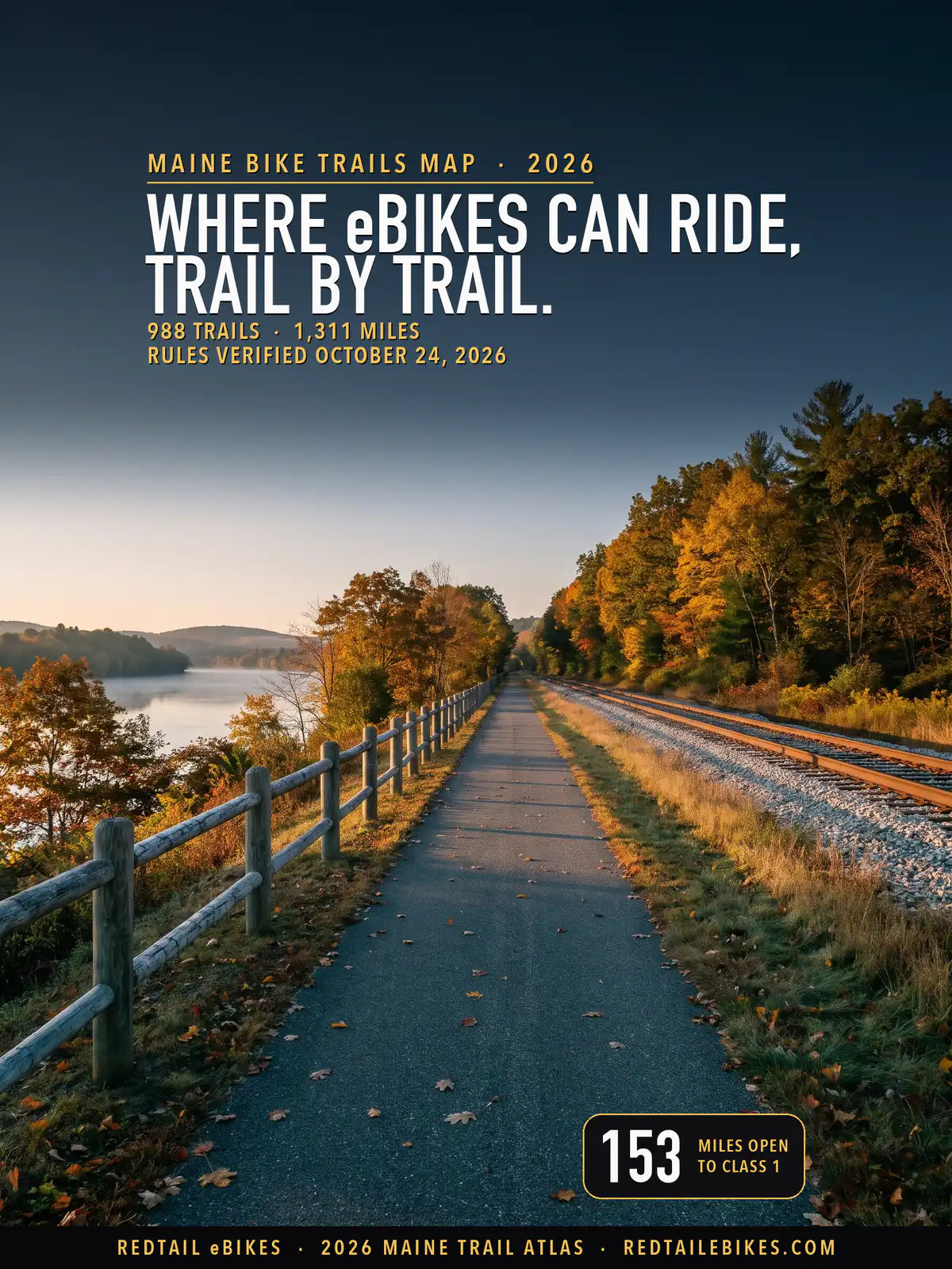
The Kennebec River Rail Trail in Augusta, paved beside the inactive railroad tracks above the Kennebec River, where the trail's own rules welcome Class 1 and 2 e-bikes, in a scene generated with Playcut from a photograph of the trail by Terry Ross.

Every line is a trail or path from the USDA Forest Service, the National Park Service or OpenStreetMap, colored by the e-bike rule its manager publishes. The numbers mark MaineDOT's five regions in the order this page maps them below.
Maine's law treats your e-bike as a bicycle on the trail and leaves each path's manager the last word.
29-A M.R.S. § 2063(14)(F)(1) says "A Class 1 electric bicycle or a Class 2 electric bicycle may be operated in any place where bicycles are permitted to travel, including, but not limited to, bicycle paths", and lets the town or agency with jurisdiction over a path prohibit them there. § 2063(14)(F)(2) keeps a Class 3 off a bicycle path unless it runs within a road or its manager has authorized Class 3.
A third rule decides most of Maine's woods trails. § 2063(14)(F)(3) says no e-bike may ride "a bicycle path designated for nonmotorized traffic if significant portions of the bicycle path have a natural surface, including gravel, stones or wooden bridging", unless its manager authorizes it.
On private land the owner decides: the statute "may not be construed to limit the authority of the owner of a private way or the owner of private property to restrict or allow" e-bikes (§ 2063(14)).
111 managers each hold part of that authority on this map. Every trail below carries its manager's name where a record names one and, where the rule could be read, what it says about e-bikes with a link to it, all kept in the trail register, so you can check your ride trail by trail.
For the rest of Maine's e-bike law, from labels to age limits, read Maine e-bike laws. To compare Maine's trail rules with other states', open bike trails by state.
Riding in another state? You will find the same trail-by-trail map for New York bike trails, Ohio bike trails, Michigan bike trails, Wisconsin bike trails, Arkansas bike trails, Indiana bike trails, Iowa bike trails, Florida bike trails, Texas bike trails, Colorado bike trails, Utah bike trails, Oregon bike trails and Washington State bike trails.
For California, our California trail guide explains who manages each kind of trail, and our national guide to e-bike trails near you shows how to find out who manages a trail anywhere in the US.
Takeaway
On Maine trails a Class 1 opens the most ground: 153 mapped miles against 52 for a Class 2 and 0.1 for a Class 3. Acadia's carriage roads, Katahdin Woods and Waters' multi-use trails, the Outdoor Center trails in Carrabassett Valley, the unpaved trails of the University of Maine's DeMeritt Forest, the Falmouth Land Trust's preserves and Presque Isle's bike path all take Class 1 alone.
79% of the mapped miles read gray. The largest cause is the state's own land: the Bureau of Parks and Lands manages 417 mapped miles, and none of the 74 Bureau rules, park pages and trail pages read for this map names an e-bike. Each gray trail's row in the downloadable register says why it is gray.
In this guide
- How to read the map
- Who decides on each trail
- Maine's state rail trails, parks and public lands
- Baxter State Park
- Acadia National Park
- Katahdin Woods and Waters and other federal land
- Trail groups and land trusts with their own rule
- Town and city rules
- Named trails riders ask about
- Maine bike trails, region by region
- Where riders get caught out
- Sidewalks, roads and bike lanes
- Choosing an e-bike for Maine trails
- Frequently asked questions
How to read the map
Find your trail's color, then read who manages it. Green takes all three classes, blue takes Class 1 and Class 2, orange takes Class 1 alone, and dashed red means a published rule closes the trail to your e-bike.
Gray covers four cases: the rule is unsettled and both readings are printed, we could not read the manager's rule, the land is private, tribal or a nonprofit's, or no record names a manager. The register says which one applies to the trail you ride.
Maine defines an electric bicycle as a two- or three-wheel bicycle "with fully operable pedals and an electric motor of less than 750 watts", in three classes. Check your label against this table:
| Class | How the motor helps | Assistance stops at |
|---|---|---|
| Class 1 | "provides assistance only when the rider is pedaling" | 20 mph |
| Class 2 | "capable of being used exclusively to propel the bicycle" | 20 mph |
| Class 3 | "provides assistance only when the rider is pedaling" | 28 mph |
Your e-bike should carry its class on a label. Since October 1, 2019, § 2063(14)(B) has required every maker, distributor and seller in Maine to fix a permanent label showing "the classification number, top assisted speed and motor wattage of the electric bicycle", and § 2063(14)(G) requires a Class 3 to carry a speedometer.
You must be 16 to ride a Class 2 or Class 3. § 2063(14)(H) says "A person under 16 years of age may not operate a Class 2 or Class 3 electric bicycle", and anyone under 16 riding or carried on any e-bike "shall wear a properly fitted and fastened bicycle helmet".
You need no license or registration for any class: § 2063(14)(A) frees an e-bike rider from the provisions on "financial responsibility, driver's licenses, registration and license plate requirements."
A motor of 750 watts is too big. Maine's definition says "less than 750 watts", so a bike rated at exactly 750 W falls outside it, and § 2063(14)(C) says a bike modified past 20 mph on the motor alone, or 28 mph with pedal assist, "is no longer an electric bicycle."
Who decides on each trail
Who manages your trail decides the rule. State land holds 37% of Maine's mapped miles, local governments' land 19%, land trusts and other nonprofits 17% and federal land 12%; find your trail's manager in the first column of the table below.
| Who manages the trail | Trails | Miles | What e-bikes may do |
|---|---|---|---|
| Bureau of Parks and Lands: multi-use rail trails | 14 | 341 | Gray: the Bureau's rules and pages name no e-bike (one stretch closed) |
| Bureau of Parks and Lands: state parks | 41 | 43 | Gray: the Bureau's rules and park pages name no e-bike |
| Bureau of Parks and Lands: public lands | 24 | 34 | Gray: the Bureau's rules and pages name no e-bike |
| Baxter State Park | 24 | 36 | Closed, except the Dwelley Pond Trail and maintained roads, which are unsettled |
| Inland Fisheries and Wildlife: wildlife management areas | 14 | 12 | Gray: the wildlife-area rules name no e-bike |
| Acadia National Park | 23 | 53 | Class 1 only on the carriage roads, Schoodic bike paths and service roads; every class on the motor roads; closed on hiking trails |
| Katahdin Woods and Waters National Monument | 10 | 40 | Class 1 on the multi-use trails; every class on the public motor roads; closed on hiking-only trails; the trails the monument neither lists nor names, gray |
| White Mountain National Forest | 33 | 50 | Closed: non-motorized Forest Service trails |
| National wildlife refuges | 6 | 7 | Gray: no refuge e-bike determination found |
| Other federal land | 2 | 2 | Gray: the managing agency's rule was not read |
| Eastern Trail | 1 | 16 | Class 1 and 2; Class 3 not on the district's list |
| Trail groups, land trusts and the University of Maine: their own rules | 63 | 79 | From Class 1 and 2 to closed: see each group below |
| Towns and cities: a rule that reaches e-bikes | 45 | 36 | From open to closed: see each town below |
| Towns and cities: a rule that leaves e-bikes unsettled | 169 | 99 | Unsettled: see each town below |
| Town trails under state law alone (the town's rules read, no e-bike trail rule) | 77 | 43 | State law's default: Class 1 and 2 on a paved path; the rest gray |
| Town trails whose rules, or the sign that decides them, could not be read | 53 | 25 | Gray: rules not read; state law's default may be changed by the town |
| Other state land | 4 | 5 | Gray: the agency's rule was not read |
| Private, nonprofit and tribal land | 233 | 276 | The owner decides |
| Manager not on record | 154 | 114 | Not determined |
| All Maine | 988 | 1,311 | Map above; every trail by region below |
A trail whose stretches fall under two rules sits in each row with the miles that lie there, so if you find a trail twice, that is why: 2 trails appear in more than one row, and the rows still add up to the state.
Takeaway
State law's default sets the color of 6 miles of town paths, where the town's rules were read and say nothing that reaches an e-bike. 26 towns and cities have written a rule that reaches a mapped trail, and 14 of them keep a "vehicle", a "motor vehicle" or a "motorized" machine off their trails without saying whether an e-bike is one.
Maine's state rail trails, parks and public lands
The Bureau of Parks and Lands manages 417 of this map's 1,311 miles, 32% of the total, and none of its rules or pages names an e-bike. The map reads 74 Bureau texts: its rules chapters, its park pages and its biking, trail and park-rules pages. So its rail trails, parks and public lands read gray, each with the rule the Bureau does publish.
The multi-use rail trails
The Bureau's long rail trails, from the Down East Sunrise Trail to the Aroostook Valley Trail, carry snowmobiles and ATVs as well as bicycles. Its "Policy Statement About Multi-use Rail Trails" says "Non-motorized use includes but is not limited to: walking, hiking, horseback riding, bicycling, snowshoeing, dog sledding, and skiing", and "All motorized vehicles permitted on Multi-use Rail Trails must be legally registered as either an ATV and/or snowmobile."
Whether your e-bike rides those trails as a bicycle or as a motorized vehicle, the Bureau has not said. Read one way, § 2063(1) counts an electric bicycle as a bicycle and § 2063(14)(F)(1) lets Class 1 and 2 go where bicycles may.
Read the other, an e-bike is a motorized vehicle, which the policy admits only when registered as an ATV or snowmobile. The map prints 332 miles of these trails gray for that reason, and the Bureau's rail-trail office is the one to ask.
One stretch is closed to everyone. The Bureau's Whistle Stop Trail page says the trail "From Rt 2/4 in Wilton to Jay is closed indefinitely due to extensive washouts" (closure update of June 30, 2023), so 8.9 mapped miles read red.
State parks
In a state park, a bicycle rides only where the Bureau designates it. Rule 8 of the Bureau's park rules confines "Wheeled vehicles including bicycles" to "roads and trails specifically designated for their use".
The rules and the park pages name no e-bike, so a natural-surface park trail falls under § 2063(14)(F)(3): if the Bureau designates it for nonmotorized traffic, it closes to every e-bike class unless the Bureau authorizes them. That is our reading, and the map prints 43 miles of park trail gray until a park posts a rule.
Public lands
On the Bureau's public reserved lands, its rules chapter 51 says "Off-road travel by wheeled vehicles of any sort is prohibited", while its own pages list "Mountain biking" at the Kennebec Highlands and "Off-road biking" at the Bigelow Preserve. Whether a trail listed for biking is "off-road travel", and whether an e-bike rides it, the rule's words do not settle, so these 34 miles read gray.
Wildlife management areas
On a state wildlife management area, a motor vehicle stays on the roads and the trails designated for it. Inland Fisheries and Wildlife's chapter 5 rule says "The operation of any motor vehicle, excluding motorboats, within the boundaries of any state-owned Wildlife Management Area, Boat Launch Facility or Shooting Range is prohibited except as provided below".
Its game law counts as a motor vehicle "any motor-driven vehicle, except motorboats". On our reading an e-bike falls inside that definition, and the Department publishes no e-bike rule, so its 12 mapped miles read gray.
Baxter State Park
In Baxter State Park, a bicycle rides only the maintained roads and the Dwelley Pond Trail. The Baxter State Park Authority's Rule 5.4 says "bicycle use within the Park shall be restricted to maintained roads and the Dwelley Pond Trail", and "Bicycle use is allowed on the Abol Stream Trail December 1 to April 1." Every other trail in the park is closed to bicycles, and so to e-bikes: 30 mapped miles read red.
On the Dwelley Pond Trail's 5.2 miles and the park's roads, the Authority's rules do not say whether an e-bike rides as a bicycle, so that trail reads gray. Ask the Authority before you bring one.
Acadia National Park
Acadia lets a Class 1 e-bike ride where a bicycle may, and keeps Class 2 and Class 3 to the park's motor roads. The park's compendium says "Bicycle and class 1 e-bike use is permitted on motor roads; on carriage roads; on designated bike paths; in parking areas", and on five named service roads, and that "All classes of e-bikes are allowed where motor vehicles are allowed."
Its bicycling page puts it plainly: "Class 1 E-bikes are permitted on carriage roads. Class 2 and 3 are not allowed."
| Where in Acadia | Class 1 | Class 2 | Class 3 |
|---|---|---|---|
| Carriage roads, 20 mph for everyone | Yes | No | No |
| Schoodic bike paths | Yes | No | No |
| Park motor roads, such as the Park Loop Road | Yes | Yes | Yes |
| Hiking trails and off-road areas | No | No | No |
| Privately owned carriage roads | No | No | No |
The carriage roads run 45 miles, by the park's carriage road guide, and this map draws 43.6 of them. "No bicycle may exceed 20 mph on the carriage roads", and "Bicycling is not permitted on hiking trails or on privately owned carriage roads" (bicycling page).
Three details catch visitors out. The carriage roads "often close to all traffic during mud season, typically March and April", the Island Explorer's Bicycle Express van does not carry e-bikes, and on Isle au Haut the compendium both opens Western Head Road to Class 1 and closes it "to all unauthorized motor vehicles including e-bikes", so that road reads gray.
Katahdin Woods and Waters and other federal land
At Katahdin Woods and Waters National Monument, a Class 1 rides the multi-use trails and every class rides the public motor roads. Its compendium says "Class 1 e-bikes are allowed on motor roads, service roads, parking areas and multi-use trails. Class 2 and 3 e-bikes are only permitted on motor roads open to the public." It also says "The use of bicycles and e-bikes on pedestrian-only hiking trails is prohibited" (compendium).
The monument's pages name its bike routes, such as the ride to Orin Falls, and 6.9 mapped miles follow them. Another 33 miles, most of them the International Appalachian Trail and the Telos Tote Trail, are neither listed as hiking-only nor named as a bike route, so they read gray: ask the monument before you ride them.
The White Mountain National Forest's trails in Maine are closed to e-bikes. The Forest Service counts an e-bike as a motor vehicle and allows one only where its motor vehicle use map designates it (36 CFR 261.13), and that map designates no trail in Maine, so 50 mapped miles read red.
On a national wildlife refuge, an e-bike rides only where the refuge manager has found it compatible. 50 CFR 27.31(m) gives an e-bike a bicycle's rights "If the refuge manager determines that electric bicycle (also known as e-bike) use is a compatible use on roads or trails".
No Maine refuge's pages publish that finding, so 7 miles of refuge roads and trails read gray, and at Rachel Carson the Carson Trail asks "no bicycles please".
Leave your e-bike at the trailhead on the Appalachian Trail. On the trail's federal lands, 36 CFR 7.100(a)(1) says "The use of bicycles, motorcycles or other motor vehicles is prohibited", and whichever your e-bike counts as, the rule bars it.
Trail groups and land trusts with their own rule
Some of Maine's best e-bike rides belong to a trail group that wrote its own rule. These managers name e-bike classes outright, so their trails carry a color of their own:
- The Eastern Trail. The Eastern Trail Management District says "Class 1 and Class 2 electric bikes and mobility devices for disabled individuals are allowed.", and asks cyclists to keep to "no more than 15 mph", so its 16 mapped miles, from Kennebunk to South Portland, read blue.
- The Kennebec River Rail Trail. Its friends group's rules say "Class 1 and Class 2 e-bikes are welcome." and ask riders not to bring a Class 3; the trail is open dawn to dusk and pedestrians have the right of way, over 6.4 mapped miles from Augusta to Gardiner.
- Portland Trails. "Portland Trails is permitting Class I and II e-bikes on our trails.", and "Class III e-bikes are not permitted on any Portland Trails trail", on 5.6 mapped miles.
- Libby Hill Forest in Gray. The trails' own site says "Class III E-Bikes are not allowed on any trails at Libby Hill or Thayer Brook Preserve.", which leaves Class 1 and 2 where bikes ride; in winter, the groomed ski trails are for skiers (5.8 mapped miles, with the Royal River Conservation Trust's Thayer Brook Preserve beside them).
- The Falmouth Land Trust. Its preserves allow bikes except at two properties, with "E-bikes: Class 1 only", on 9.2 mapped miles.
- The University of Maine's DeMeritt Forest. The university says "we will be allowing the use of Class 1 Electric Bikes on the University’s unpaved surface trails.", and its winter policy keeps bicycles off the groomed ski trails (11.5 mapped miles).
One trail group's network reads closed. Maine Huts & Trails says "Our trails are non-motorized multi-use.", and with no e-bike permission published, § 2063(14)(F)(3) closes its natural-surface trails to every class on our reading (22 mapped miles, red).
The Katahdin Region Multi-Use Trail lists "bicycling" among its non-motorized uses and says "Other vehicles such as golf carts, scooters/mopeds must be registered as an ATV." It sets 25 mph, no bicycles after snowfall and pedestrians only in mud season, and whether an e-bike rides as a bicycle there it does not say: 16 miles, gray.
On every other private or nonprofit trail, the owner decides. Land trusts, water districts, clubs and private owners hold 276 mapped miles, most of them silent on e-bikes, and the statute leaves them free "to restrict or allow" e-bikes. Snowmobile club trails cross private land by the owners' leave, so ask the club before you ride one in summer.
Town and city rules
51 towns and cities manage 210 mapped miles. The rules of 39 of them were read in full or in the chapters that reach a trail, covering 84.1% of local trail miles, and 12 could not be read. The table lists every town whose rule reaches a mapped trail, each rule linked to its section, and the register holds the verdict for every town.
| Government | Law or page | Where it applies | What it does | Trails | Miles |
|---|---|---|---|---|---|
| City of Augusta | Augusta City Code § 215-7 | a trail on property the City of Augusta owns | Unsettled: motorized vehicles barred from municipally owned property except where posted | 9 | 5.2 |
| City of Bangor | Bangor City Code § 291-59(B) | a trail in a Bangor city park | Unsettled: no bicycle in any city park inside the Downtown Development District | 6 | 2.7 |
| City of Bath | Bath Code Sec. 17-311; Sec. 17-1(a)(6) | a park, recreational area, school grounds, public parking lot or cemetery in the City of Bath | Unsettled: no 'motorbikes', defined by motor and wheel count | 2 | 0.2 |
| City of Belfast | Belfast Code of Ordinances Sec. 50-123 | the 2.3-mile Belfast Rail Trail the City owns | Unsettled: 'a motor vehicle of any kind' barred unless the City Manager authorizes it in writing | 1 | 2.3 |
| City of Belfast | Belfast Code of Ordinances Sec. 38-78 | a path inside a Belfast city park (Heritage Park on the Harbor Walk) | Unsettled: motor vehicles only on a public roadway or a designated parking area | 1 | 0.1 |
| City of Calais | Calais Park Use Ordinance (No. 2005-400) §§ 4-521(A)(e), 4-525 | the parks and recreation areas Sec. 4-521 lists, the Waterfront Walkway among them | Unsettled: no 'motor vehicle of any kind'; an e-bike unnamed | 1 | 1.8 |
| City of Gardiner | Gardiner Land Use Ordinance § 10.20.2.11; City Code § 11.2.4 | a public path or a city park in Gardiner (the Kennebec River Rail Trail's south end, the Cobbosseecontee Stream Trail) | Unsettled: no motorized vehicles except wheelchairs, maintenance and emergency vehicles | 1 | 0.3 |
| City of Lewiston | Lewiston Code Sec. 54-3; Sec. 70-266 | the open grounds of the City of Lewiston | Unsettled: no vehicle without the council's permission; an e-bike's place undefined | 2 | 1.8 |
| City of Portland | Portland City Code § 28-180 | a trail on City of Portland land (Back Cove, the Eastern Promenade, Bayside and the city's other trails) | Unsettled: the city's code bars a 'vehicle' from public property that is not a street, and does not say whether an e-bike is one | 26 | 13.3 |
| City of Presque Isle | Presque Isle Code Ch. 40, §§ 2, 6(D), 6(F)(a) | the City of Presque Isle's parks, recreation areas and facilities, the Bike/Walking Path among them | Class 1 only, on paved roads and paths designated for bicycles | 5 | 2.8 |
| City of Sanford | Sanford City Code § 169-25(E) (repeated as § 191-16(E)) | a trail in a Sanford park, the Sanford-Springvale rail trail's linear park included | Unsettled: unregistered motorized vehicles need the Parks and Recreation Department's permission | 2 | 6.1 |
| City of South Portland | South Portland Code of Ordinances Sec. 18-8; Sec. 4-1 | a park, beach or other property the City of South Portland owns, the Greenbelt Walkway included | Class 1 and 2; Class 3 barred from city property | 5 | 6.3 |
| Town of Bar Harbor | Bar Harbor Town Code § 144-12 | a path inside a Bar Harbor town park | Gray: bicycles only where the Town's signs designate; read the sign at the park | 1 | 0.1 |
| Town of Bethel | Bethel Town Code § 76-6(A)-(B); § 76-4 | the Cross New Hampshire Adventure Trail through Davis Park toward the Bethel Recreational Bridge | Unsettled: 'Bicycling' among the only uses allowed; e-bikes not named | 1 | 0.6 |
| Town of Cape Elizabeth | Cape Elizabeth Code Ch. 18, Sec. 18-5-4(g) | Town of Cape Elizabeth open space, the Greenbelt trails among it | Unsettled: no 'motorized vehicles'; an e-bike unnamed | 3 | 1.8 |
| Town of Carrabassett Valley | Town of Carrabassett Valley, Select Board minutes of April 10, 2023 ('E-bikes use on OC trails') | a CVTrails trail on town property on the Sugarloaf Outdoor Center side of Route 27 | Class 1 only | 27 | 18.1 |
| Town of Carrabassett Valley | Town of Carrabassett Valley, Select Board minutes of April 10, 2023 ('E-bikes use on OC trails') | the Narrow Gauge Pathway, Carrabassett Valley | Closed to e-bikes | 1 | 5.1 |
| Town of Falmouth | Falmouth Code of Ordinances § 14-121 ('Trails'); § 17-10 | a trail in a park, community forest or other public land the Town of Falmouth owns or holds a conservation easement on | Unsettled: trails for non-motorized recreation and motor-propelled vehicles barred, while the co-steward publishes 'E-bikes: Class 1 only' | 41 | 19.3 |
| Town of Fort Kent | Fort Kent Traffic and Motor Vehicles Ordinance Sec. 20-72 | a sidewalk, pathway or other way commonly provided for pedestrians in Fort Kent | Unsettled: no bicycle riding on pathways commonly provided for pedestrians | 2 | 0.7 |
| Town of Gorham | Gorham Town Code § 255-7 | a Gorham town trail that is a pedestrian way | Unsettled: motorized vehicles barred from sidewalks and other pedestrian ways (amended August 2025) | 24 | 10.0 |
| Town of Kennebunk | Kennebunk Town Ordinances Sec. 2-3, §§ 3.5.1, 3.5.2(A)-(B) | the Bridle Path and Wonderbrook Park, two of the nine Town properties Sec. 2-3 § 3.5.2 lists | Unsettled: no 'motor vehicle' under a repealed definition | 2 | 4.1 |
| Town of North Yarmouth | Regulations for the Use of Parks and Recreation Areas Ordinance §§ 5.1, 11.2 | a North Yarmouth park listed in Sec. 5.1, Knight's Pond Preserve (North Yarmouth portion) among them | Unsettled: no 'vehicle' off roads and parking areas; 'vehicle' undefined | 2 | 0.5 |
| Town of Scarborough | Scarborough Code Ch. 612, §§ 1(b), 9(a) | a Scarborough 'Park', which Ch. 612 says includes walkways and trails | Unsettled: no 'motor bikes'; an e-bike unnamed | 2 | 0.7 |
| Town of Topsham | Topsham Town Code § 161-4(A)(16) | a walking trail at a recreational facility the Town of Topsham owns and controls (the Foreside fields, the Ponds Area at the Solid Waste Facility, Head of Tide Park, the Riverwalk) | Unsettled: bicycles welcome on walking trails, 'all other motorized-type vehicles' parked | 8 | 5.9 |
| Town of Windham | Windham Town Code § 228-26(A); § 150-6(D)(1) | a trail on Town of Windham property or in a Windham park | Unsettled: motorized vehicles barred except on council-approved motorized trails; motor vehicles off foot trails | 26 | 15.9 |
| Town of Winslow | Winslow Town Code § 275-6 | a trail in a park or recreation area the Town of Winslow owns or operates | Unsettled: motor vehicles, 'including all types of motor-driven cycles', barred | 5 | 3.0 |
| Town of Yarmouth | Yarmouth Code Ch. 501 (Public Grounds), Art. IV(A)(9) | every municipal property of the Town of Yarmouth | Unsettled: bicycles and motorized equipment only on tracts designated for them | 2 | 2.7 |
| Town of York | Town of York, Mount Agamenticus Park Regulations § 6.7(A) | a trail the Mount Agamenticus Conservation Program designates for hiking and biking, on land the Town of York owns or leases | Class 1 and 2; Class 3 only on 'multiple use' trails | 6 | 3.5 |
| Town of York | Town of York, Mount Agamenticus Park Regulations § 6.7(B) | a trail the Mount Agamenticus trail map designates 'Multiple Use', on land the Town of York owns or leases | Class 1, 2 and 3 | 1 | 0.1 |
| Town of York | Town of York, Mount Agamenticus Park Regulations § 6.15(A) | a Town of York trail at Mount Agamenticus whose use designation no page we could read prints | Not read: the class follows a posted designation we could not read for this trail | 8 | 3.2 |
Towns that name e-bikes
South Portland rewrote its rules on April 7, 2026. Its bicycle chapter now says "Bicycle shall include the term Class 1 electric bicycle and Class 2 electric bicycle", and its parks chapter keeps a "class 3 electric bicycle or other motorized vehicle" off any park, beach or other city property, the Greenbelt Walkway included (6.3 mapped miles, blue).
Presque Isle lets a Class 1 ride its park paths, and no other class. Its parks chapter says "Where used in this ordinance, bicycle will include electric bicycle as defined herein.", then defines an electric bicycle as a pedal-assist Class 1 and confines a bicycle to "a paved vehicle road or path designated for that purpose".
A Class 2 or Class 3 counts as a vehicle there, kept to public ways, paved park roads and parking areas (2.8 mapped miles, orange).
At Mount Agamenticus, York's park regulations sort trails by use. "Class 1 & 2 E-Bikes are permitted on hike/bike trails.", and a Class 3 rides only trails designated "multiple use", which on the park's map is the Wheel Trail, the one green line on this map (3.5 miles of hike/bike trail, blue).
Carrabassett Valley's Select Board approved Class 1 e-mountain bikes on one side of Route 27. Its minutes of April 10, 2023 record "continuing approval of E-bikes on the Outdoor Center trails", so 18.1 mapped miles on the Sugarloaf Outdoor Center side read orange. The same minutes say e-bikes continue "not to be approved on the Narrow-Gauge Pathway", which reads red.
Rules that keep out a "vehicle" without naming e-bikes
14 towns and cities bar a "vehicle", a "motor vehicle" or a "motorized" machine from the land under their trails, over 46 mapped miles, without saying whether an e-bike is one. Windham's code, for one, bars "any motorized vehicle" from town property except motorized trails the council approves, over 15.9 mapped miles.
Read as a bicycle, an e-bike rides those trails under § 2063(14)(F); read as the vehicle the rule names, it may not ride them at all. The map prints both readings and colors those trails gray, so ask the town's parks office before you ride.
Kennebunk's rule shows how old some of this wording is. Its ordinance bars "a motor vehicle, as defined in 29 M.R.S.A., Section 1, subsection 7" from the Bridle Path and Wonderbrook Park, a definition in a chapter of Title 29 that the Legislature now lists as repealed, while today's motor vehicle definition leaves out an electric bicycle.
Where a town's own words close a path
Bangor keeps bicycles out of its downtown parks. Its code says "No person shall operate a bicycle in any City park, as designated in Chapter 231, Public Parks, § 231-2 of this Code, located in any portion of the Downtown Development District.", and § 2063(1) counts an e-bike as a bicycle. This map does not draw the district's boundary, so Bangor's park trails read gray: inside the district, the rule keeps your e-bike out.
Portland's traffic code bars a vehicle from "any publicly owned property not a street, highway or roadway" and names the Eastern Promenade Trail, while its own definition of a vehicle leaves out conveyances "propelled or drawn by human power". Where an e-bike falls between those words the code does not say, so the city's own trails read gray and Portland Trails' network keeps its blue.
What changed in 2025 and 2026
3 local governments on this map adopted or revised a rule in 2025 or 2026 that the map reads, each date read in the rule's own text:
- Presque Isle amended its parks chapter on June 17, 2025; it is the chapter that admits Class 1 and no other class.
- Gorham's Ordinance No. 25-82, August 5, 2025, bars "any motorized vehicle" from a sidewalk or other pedestrian way.
- South Portland's Ordinances Nos. 20-25/26 and 22-25/26, April 7, 2026, made Class 1 and 2 bicycles under its code and barred Class 3 from city land.
Named trails riders ask about
These are the trails, parks and towns Maine riders name in their searches, each row backed by a search string riders typed. The miles are the stretches this map draws, split by the rule that governs each stretch.
| Trail | Miles mapped | Managed by | What e-bikes may do |
|---|---|---|---|
| Acadia National Park carriage roads | 43.6 | Acadia National Park | Class 1 only, 20 mph for all uses on 43.6 mi |
| Eastern Trail | 16.5 | Eastern Trail Management District; Not on record; Town of Kennebunk | Class 1 and 2, 15 mph when cycling on 16.1 mi; Manager not on record on 0.2 mi; Unsettled on 0.1 mi |
| Down East Sunrise Trail | 87.4 | Bureau of Parks and Lands, Down East Sunrise Trail | Unsettled on 87.4 mi |
| Kennebec River Rail Trail | 6.4 | Town of Farmingdale; City of Hallowell; City of Augusta and 1 more | Class 1 and 2; dawn to dusk; pedestrians first on 6.4 mi |
| Kennebec Valley Trail (Madison Branch Rail Trail) | 39.6 | Bureau of Parks and Lands, Kennebec Valley Trail | Unsettled on 39.6 mi |
| Four Seasons Adventure Trail | 23.5 | Bureau of Parks and Lands, Four Seasons Adventure Trail; Bureau of Parks and Lands, Four Seasons Adventure Rail Trail | Unsettled on 23.5 mi |
| Bangor and Aroostook Trail | 62.3 | Bureau of Parks and Lands, Bangor and Aroostook Trail | Unsettled on 62.3 mi |
| Southern Bangor & Aroostook Trail | 37.3 | Bureau of Parks and Lands, Southern Bangor & Aroostook Trail | Unsettled on 37.3 mi |
| Lagrange to Medford Trail | 9.8 | Bureau of Parks and Lands, Lagrange to Medford Trail | Unsettled on 9.8 mi |
| Patten-Sherman Multi-Use Trail | 5.4 | Bureau of Parks and Lands, Sherman to Patten Trail | Unsettled on 5.4 mi |
| Aroostook Valley Trail | 42.4 | Bureau of Parks and Lands, Aroostook Valley Trail | Unsettled on 42.4 mi |
| St. John Valley Heritage Trail | 16.8 | Bureau of Parks and Lands, St. John Valley Heritage Trail | Unsettled on 16.8 mi |
| Whistle Stop Trail | 15.4 | Bureau of Parks and Lands, Whistle Stop Trail | Closed to e-bikes on 8.9 mi; Unsettled on 6.5 mi |
| Sanford-Springvale Rail Trail | 5.6 | City of Sanford | Unsettled on 5.6 mi |
| Mountain Division Trail | 9.5 | Maine Department of Transportation; Not on record; Town of Windham and 1 more | State agency rule not read on 3.9 mi; Manager not on record on 3.1 mi; Unsettled on 1.5 mi; Private land or a nonprofit: the owner decides on 1.1 mi |
| Narrow Gauge Pathway | 5.1 | Town of Carrabassett Valley | Closed to e-bikes on 5.1 mi |
| Belfast Rail Trail | 2.3 | City of Belfast | Unsettled on 2.3 mi |
| Eastern Promenade Trail, Portland | 2.0 | City of Portland | Unsettled on 2.0 mi |
| Maine Huts & Trails | 22.3 | Maine Huts & Trails | Closed to e-bikes on 22.3 mi |
| Dwelley Pond Trail, Baxter State Park | 5.2 | Baxter State Park Authority | Unsettled on 5.2 mi |
| Baxter State Park | 35.6 | Baxter State Park Authority | Closed to e-bikes on 30.3 mi; Unsettled on 5.2 mi |
| Bradbury Mountain State Park | 17.2 | Bureau of Parks and Lands, Bradbury Mountain State Park | Unsettled on 17.2 mi |
| Camden Hills State Park | 9.0 | Bureau of Parks and Lands, Camden Hills State Park | Unsettled on 9.0 mi |
| Kennebec Highlands | 7.5 | Bureau of Parks and Lands, Kennebec Highlands | Unsettled on 7.5 mi |
| White Mountain National Forest (Maine side) | 49.8 | White Mountain National Forest | Closed to e-bikes on 49.8 mi |
| Carrabassett Valley trails (CVTrails) | 23.2 | Town of Carrabassett Valley | Class 1 only on 18.1 mi; Closed to e-bikes on 5.1 mi |
| Bethel trails | 12.9 | Not on record; Mahoosuc Pathways; Town of Bethel | Manager not on record on 9.9 mi; Private land or a nonprofit: the owner decides on 1.6 mi; Unsettled on 1.4 mi |
| Portland city and Portland Trails | 18.8 | City of Portland; Portland Trails | Unsettled on 13.3 mi; Class 1 and 2 on 5.6 mi |
| Maine's snowmobile trails | 62.8 | Private landowners (snowmobile club trail); Private landowners (Moonlight Sno-Skimmers snowmobile trail) | Private land or a nonprofit: the owner decides on 62.8 mi |
The Eastern Trail and the Kennebec River Rail Trail are the surest long rides for a Class 1 or Class 2 e-bike in Maine. The Eastern Trail's own rule covers 16.1 of its 16.5 mapped miles, the Kennebec River Rail Trail's covers all 6.4, and both take Class 1 and 2 and no Class 3.
The Down East Sunrise Trail reads gray end to end. Its 87 mapped miles are a Bureau multi-use rail trail, where the Bureau's policy admits only bicycling and registered ATVs and snowmobiles and names no e-bike.
The Whistle Stop Trail is part closed and part gray. 9 mapped miles between Wilton and Jay are closed by washouts, and the other 6 sit under the Bureau's rail-trail policy.
Takeaway
Of the named trails riders ask about, Acadia's carriage roads take a Class 1, the Eastern Trail, the Kennebec River Rail Trail and Portland Trails' network take Class 1 and 2, and Baxter State Park's trails other than the Dwelley Pond Trail, Maine Huts & Trails' network and the White Mountain National Forest's trails in Maine are closed. The Bureau's long rail trails read gray.
Maine bike trails, region by region
The five regions below follow MaineDOT's own five regions, with each trail stretch placed in the region that holds its midpoint, and are drawn on the map above; the names are ours, after the places in each.
Open your region's section for its map, its longest named trails and their rules, and a collapsed list of every mapped trail by rule. A trail that crosses a region line appears in each region with the miles that lie there.
Portland, Lewiston and Southern Maine

Southern Maine holds the most trail open to a Class 2 on the map. Its 373 mapped miles lie in Cumberland County, York County, part of Androscoggin County, part of Sagadahoc County and part of Oxford County; 48 are open, 22 are closed and 303 read gray.
The Eastern Trail, South Portland's city land, Portland Trails' network, Libby Hill in Gray and the Falmouth Land Trust's preserves carry most of the open miles. The gray ones sit under Falmouth's, Windham's, Portland's and Gorham's town rules, on water district land, on Bradbury Mountain State Park's trails and on stretches whose manager no record names.
| Trail | Managed by | Miles | E-bikes |
|---|---|---|---|
| Eastern Trail | Eastern Trail Management District | 16.1 | Class 1 and 2, 15 mph when cycling |
| Sanford-Springvale Rail Trail | City of Sanford | 5.6 | Unsettled |
| KWD/YWD - Yellow Trail | Kittery Water District | 5.2 | Private land or a nonprofit: the owner decides |
| Greenbelt Walkway | City of South Portland | 4.9 | Class 1 and 2; Class 3 barred from city property |
| Conant Trail | White Mountain National Forest | 4.5 | Closed to e-bikes |
| Mountain Division Rail Trail | Maine Department of Transportation | 3.9 | State agency rule not read |
| Alewive Woods | Kennebunk Land Trust | 3.7 | Private land or a nonprofit: the owner decides |
| YKWD - White Trail | Kittery Water District | 3.4 | Private land or a nonprofit: the owner decides |
| Back Cove Trail | City of Portland | 3.4 | Unsettled |
| Steele Trail | Kennebunkport Conservation Trust | 3.3 | Private land or a nonprofit: the owner decides |
| Mountain Division Trail | Not on record | 3.1 | Manager not on record |
| Purple | Town of Windham | 3.1 | Unsettled |
Every mapped trail in Portland, Lewiston and Southern Maine (521 trails, 373 mi), by e-bike rule
Class 1, 2 and 3 (1, 0.1 mi)
Town of York:
- Wheel Trail (0.1 mi)
Class 1 and 2 (30, 39 mi)
Eastern Trail Management District:
- Eastern Trail (16.1 mi)
City of South Portland:
- Greenbelt Walkway (4.9 mi)
- Veterans Memorial Bridge Pathway (0.8 mi)
- Casco Bay Bridge Multi-Use Path (0.4 mi)
- Unnamed trails (0.2 mi, 2 stretches)
Libby Hill Forest Trails:
- Moose Odyssey (2.4 mi)
- Outback Trail (0.9 mi)
- Harold Libbey (0.9 mi)
- Turkey Trot (0.7 mi)
- Lynx Trail (0.5 mi)
- Holmquist Hollow (0.3 mi)
- Deer Run (0.1 mi)
Portland Trails:
- Presumpscot River Trail - East Bridge Street (2.0 mi)
- Presumpscot River Trail - Riverton Section (1.6 mi)
- River Trail (1.0 mi)
- Stroudwater Trail to Smiling Hill Farm (0.4 mi)
- Clark Brook Trail (0.4 mi)
- Hope Ave Trail (0.1 mi)
- Jack Path (0.1 mi)
Town of York:
- Ring Trail (1.6 mi)
- Big A (0.8 mi)
- Goose Foot (0.6 mi)
- Sweet Fern (0.2 mi)
- Fisher (0.2 mi)
- Witch Hazel (0.1 mi)
Royal River Conservation Trust:
- Mill Trail (0.7 mi)
- Ridge Runner Trail (0.5 mi)
Town of Cumberland:
- Paved Trail (0.2 mi)
City of Westbrook:
- Westbrook River Walk (0.1 mi)
Class 1 only (24, 9 mi)
Falmouth Land Trust:
- Red Trail (1.1 mi)
- Greenline Trail (0.8 mi)
- White Loop (0.8 mi)
- White Oak Trail (0.7 mi)
- Bobcat Trail (0.6 mi)
- Cross Falmouth Trail (0.5 mi)
- Green Trail (0.5 mi)
- Red/Greenline Trail (0.4 mi)
- Stone Ridge Trail (0.4 mi)
- Stoneridge Extension Trail (0.4 mi)
- Rocky Ridge Trail (0.3 mi)
- Saw Whet Trail (0.3 mi)
- Updraft Trail (0.3 mi)
- Snowmobile Falmouth Trail (0.3 mi)
- Dudley Trail (0.3 mi)
- Emtrance Trail (0.2 mi)
- River's Edge Trail (0.2 mi)
- Blake Trail (0.2 mi)
- Raggedy Run Trail (0.2 mi)
- Raven Trail (0.2 mi)
- Yellow Trail (0.2 mi)
- River Trail (0.1 mi)
- Falmouth SnoVoyagers (0.1 mi)
- Crosscut Trail (0.1 mi)
Closed to e-bikes (18, 22 mi)
White Mountain National Forest:
- Conant Trail (4.5 mi)
- Miles Notch Trail (also in Carrabassett Valley and the Western Mountains) (2.9 mi here)
- Great Brook Trail (2.6 mi)
- Deer Hill Trail (2.5 mi)
- Cold Brook Trail (2.2 mi)
- Deer Hills Bypass (1.2 mi)
- Leach Link Trail (1.2 mi)
- Horseshoe Pond Trail (1.0 mi)
- White Cairn Trail (1.0 mi)
- Evergreen Link Trail (1.0 mi)
- Mine Loop (0.9 mi)
- Shell Pond Loop (0.4 mi)
- Stone House Trail (0.3 mi)
- Ledges Trail (0.2 mi)
- Shell Pond Trail (0.2 mi)
- Stone House Spur A (0.2 mi)
- Deer Hill Trail Spur A (0.1 mi)
- Frost Trail (0.1 mi)
Unsettled (218, 143 mi)
Town of Falmouth:
- Cross Falmouth Trail (2.4 mi)
- Perimeter Trail (1.7 mi)
- River Trail (1.0 mi)
- Raggedy Run Trail (0.9 mi)
- Turkey Trail (0.8 mi)
- Hayfield Trail (0.8 mi)
- Hobbs Brook Trail (0.8 mi)
- Serenity Ridge Trail (0.8 mi)
- Falmouth Sno-Voyagers (0.7 mi)
- Huston Trail (0.7 mi)
- Happy Cats Trail (0.7 mi)
- Rocky Ridge Trail (0.7 mi)
- Highland Trail (0.6 mi)
- Yellow Trail (0.5 mi)
- White Pine Trail (0.5 mi)
- Flow Creek (0.5 mi)
- White Trail (0.4 mi)
- Red Pine Trail (0.4 mi)
- Moose Maple Trail (0.4 mi)
- Quarry Trail (0.3 mi)
- Saw Whet Trail (0.3 mi)
- Red Trail (0.3 mi)
- Bustamove (0.3 mi)
- Updraft Trail (0.3 mi)
- Stillings Loop (0.3 mi)
- Red (0.3 mi)
- Juniper Trail (0.2 mi)
- Porcupine Trail (0.2 mi)
- Wolf Tree Trail (0.2 mi)
- Ladyslipper Trail (0.2 mi)
- Cross Cumberland Trail (0.2 mi)
- Stone Ridge Trail (0.1 mi)
- Green Trail (0.1 mi)
- Farm Road Trail (0.1 mi)
- White (0.1 mi)
- Orchard Trail (0.1 mi)
- Presidential Trail (0.1 mi)
- Updraft (0.1 mi)
- East Coast Greenway (ME) (0.1 mi)
- U.S. Bicycle Route 1 path (under 0.1 mi)
- Falmouth SnoVoyagers (under 0.1 mi)
Bureau of Parks and Lands, Bradbury Mountain State Park:
- Ginn (2.1 mi)
- Snowmobile Trail (1.9 mi)
- "O" Trail (1.8 mi)
- Island (1.1 mi)
- Fox East (1.1 mi)
- Knight Woods (1.1 mi)
- Tote Road (1.0 mi)
- Northern Loop (1.0 mi)
- Ragan (0.9 mi)
- Fox West (0.8 mi)
- Krista's Trail (0.7 mi)
- Batcave (0.6 mi)
- Lanzo (0.6 mi)
- Owl (0.5 mi)
- Hemlock (0.4 mi)
- Link Trail (0.4 mi)
- Switchback Trail (0.3 mi)
- Boundry Connect (0.2 mi)
- Fox By-Pass (0.2 mi)
- Ski Trail (0.1 mi)
- Boundary Trail (0.1 mi)
- Tote Connect (0.1 mi)
- Boundry Detour (0.1 mi)
Town of Windham:
- Purple (3.1 mi)
- Blue (1.5 mi)
- Mountain Division Trail (1.5 mi)
- Red (1.3 mi)
- 2 (Lowell Preserve) (1.3 mi)
- Yellow Trail (1.0 mi)
- Bue (0.7 mi)
- 9 (Town of Windham) (0.6 mi)
- 3 (Town of Windham) (0.6 mi)
- 8 (Lowell Preserve) (0.5 mi)
- 11 (Lowell Preserve) (0.5 mi)
- 8 (Town of Windham) (0.5 mi)
- Green Trail (0.5 mi)
- Yellow (0.4 mi)
- 4 (Town of Windham) (0.3 mi)
- Cross Falmouth Trail (0.3 mi)
- 7 (Lowell Preserve) (0.3 mi)
- 4 (Lowell Preserve) (0.2 mi)
- Story Walk Trail (0.2 mi)
- 10 (Lowell Preserve) (0.2 mi)
- Orange (0.1 mi)
- 1 (Lowell Preserve) (0.1 mi)
- Red, purple (0.1 mi)
- 9 (Lowell Preserve) (0.1 mi)
- 3 (Lowell Preserve) (0.1 mi)
- 12 (Lowell Preserve) (under 0.1 mi)
City of Portland:
- Back Cove Trail (3.4 mi)
- Eastern Promenade Trail (2.0 mi)
- Bayside Trail (1.0 mi)
- Fore River Parkway Trail (0.9 mi)
- Evergreen Woods Trail (0.9 mi)
- Landfill loop (0.8 mi)
- River Trail (0.7 mi)
- Casco Bay Bridge Multi-Use Path (0.5 mi)
- West Commercial Street Path (0.5 mi)
- Veterans Memorial Bridge Pathway (0.5 mi)
- Unnamed trails (0.2 mi)
- North Loop (0.2 mi)
- Hope Ave Trail (0.2 mi)
- Middle Loop (0.2 mi)
- South Loop (0.2 mi)
- Tukey's Bridge Pathway (0.2 mi, 2 stretches)
- Front Street Path (0.2 mi)
- Back Cove Trail Connector (0.2 mi)
- Tukey's Bridge Sidewalk (0.2 mi)
- Hope Ave Loop (0.1 mi)
- North Boyd Street Trail (0.1 mi)
- Tukey Street Connector (0.1 mi)
- Back Cove Connector (0.1 mi)
- Murray Street Path (under 0.1 mi)
- Martin Road Path (under 0.1 mi)
Bureau of Parks and Lands, Leavitt Plantation Forest:
- Unnamed trails (11.3 mi)
- Gravity Cavity (0.1 mi)
Town of Gorham:
- Unchained (1.2 mi)
- Blue Doubletrack Loop (1.0 mi)
- 5G (Conservation Commission) (0.9 mi)
- Tow Path (0.8 mi)
- Mbweee Trail (0.6 mi)
- Red Pine Loop (0.5 mi)
- Tannery Trunk Trail (0.5 mi)
- Candyland (0.4 mi)
- River Run (0.4 mi)
- Orange Crush (0.4 mi)
- Bushwhack Loop (0.4 mi)
- Old Man (0.4 mi)
- Couch Potato (0.4 mi)
- Nirvana (0.4 mi)
- Slash (0.3 mi)
- Green Line Squiggle (0.3 mi)
- Yellow Trail (0.3 mi)
- Frazier Trail (0.2 mi)
- Pheasant Knoll Connector (0.2 mi)
- Squirrel Love (0.1 mi)
- Old Weeks Road (0.1 mi)
- Old Man Access (0.1 mi)
- Pump Track (under 0.1 mi)
- Presumpscot River Trail (under 0.1 mi)
Inland Fisheries and Wildlife, Mount Agamenticus WMA:
- Norman Mill Trail (2.7 mi)
- Notch (2.2 mi)
- Cedar Trail (1.3 mi)
- Ridge (1.3 mi)
- Porcupine Trail (0.8 mi)
- Stone Fence (0.5 mi)
- Darter (0.3 mi)
- Incline (0.2 mi)
- Second Hill (0.1 mi)
- Hidden (0.1 mi)
- Short Line Trail (0.1 mi)
Town of Cumberland:
- Blue (1.1 mi)
- Cross Cumberland Trail (1.1 mi)
- White Trail (1.0 mi)
- Snowmobile Trail (0.9 mi)
- Wilderness Trail (0.9 mi)
- Yellow (0.5 mi)
- Blue Trail (0.5 mi)
- Inner Loop Trail (0.4 mi)
- Green (0.4 mi)
- Morton Trail (0.4 mi)
- White (0.4 mi)
- Ravine Trail (0.4 mi)
- Yellow Trail (0.4 mi)
- Red (0.4 mi)
- Red Trail (0.3 mi)
- Dog Trail (0.2 mi)
- Orange (0.1 mi)
- Red/White Trail (0.1 mi)
City of Sanford:
- Sanford-Springvale Rail Trail (5.6 mi)
- Rail to Orchard (0.5 mi)
Town of Topsham:
- Gone Fishing 3 (1.1 mi)
- Gone Fishing 4 (1.0 mi)
- Recreation Fields Trail (0.9 mi)
- Gone Fishing 2 (0.8 mi)
- East Coast Greenway (ME Complementary route) (0.6 mi)
- Gone Fishing 5 (0.6 mi)
- Gone Fishing 1 (0.5 mi)
- Androscoggin Riverwalk (0.4 mi)
Town of Kennebunk:
- Kennebunk Bridle Path (2.5 mi)
- Wonderbrook Preserve (1.6 mi)
- Kennebunk Middle School Trails (0.9 mi)
- Eastern Trail Entrance (0.1 mi)
- Kennebunk Elementary Cut-Through (0.1 mi)
Bureau of Parks and Lands, Range Ponds State Park:
- Brook Trail (1.3 mi)
- Rock Ring Trail (1.0 mi)
- Old Camp Trail (0.9 mi)
- East Ridge Trail (0.7 mi)
- Deer Trail (0.5 mi)
- Range Pond State Park Trail (0.4 mi)
- Pine Trail (0.2 mi)
Town of Yarmouth:
- Unnamed trails (1.5 mi)
- Beth Condon Memorial Pathway (1.2 mi)
Inland Fisheries and Wildlife, Kennebunk Plains WMA:
- KBK Blueberry Plains (2.5 mi)
Rachel Carson National Wildlife Refuge:
- Atlantic Way Trail (0.9 mi)
- Wildwood Trail (0.8 mi)
- YKWD - White Trail (0.1 mi)
Town of Cape Elizabeth:
- Cross Town Trail (1.7 mi)
- Unnamed trails (0.1 mi, 2 stretches)
City of Lewiston:
- East Coast Greenway via Riverside Greenway (1.2 mi)
- East Coast Greenway (0.5 mi)
City of Westbrook:
- Westbrook River Walk (1.0 mi)
- Unnamed trails (0.5 mi)
- Black's Bridge (under 0.1 mi)
Bureau of Parks and Lands, Bradbury-Pineland Corridor:
- Quarry Access (0.5 mi)
- Unnamed trails (0.5 mi)
Town of Scarborough:
- Unnamed trails (0.6 mi)
- Ward Street Path (0.1 mi)
Town of North Yarmouth:
- White Trail (0.3 mi)
- Red Trail (0.2 mi)
Bureau of Parks and Lands:
- Range Pond State Park Trail (0.5 mi)
Inland Fisheries and Wildlife, Glenview Subdivision:
- Yellow (0.2 mi)
- Green (0.1 mi)
City of Bath:
- Dike-Newell Trail (0.1 mi)
- East Coast Greenway (ME) (0.1 mi)
Private land or a nonprofit: the owner decides (122, 87 mi)
Kittery Water District:
- KWD/YWD - Yellow Trail (5.2 mi)
- YKWD - White Trail (3.4 mi)
- YWD/KWD - Silver Trail (1.9 mi)
- YKWD - Green Trail (1.5 mi)
- Unnamed trails (1.1 mi)
Private owner:
- Muskrat Hollow (2.4 mi)
- Whitetail Way (2.2 mi)
- Oak Hill Trail (1.8 mi)
- Gloucester Hill Run (1.3 mi)
- Bobcat Way (1.1 mi)
- Unnamed trails (0.9 mi)
- Pownal Trail (0.9 mi)
- Access Loop (0.8 mi)
- Field Loop (0.6 mi)
- Fox Run (0.2 mi)
Kennebunkport Conservation Trust:
- Steele Trail (3.3 mi)
- Bobcat Ridge (2.6 mi)
- Beacon Trail (1.3 mi)
- Fox Den Trail (0.7 mi)
- Trolley Trail (0.2 mi)
Presumpscot Regional Land Trust (formerly Gorham-Sebago Lake Regional Land Trust):
- Diamond (1.1 mi)
- Red Loop (0.9 mi)
- Blue Loop (0.8 mi)
- Blue Trail (0.7 mi)
- Cumberland-Oxford Canal Towpath (0.5 mi)
- White Trail (0.4 mi)
- Falmouth Connector (0.4 mi)
- Great Falls Trail (0.4 mi)
- Frazier Trail (0.3 mi)
- Deer (0.2 mi)
- Gun Powder Mill Trail (0.2 mi)
- Hawkes (0.2 mi)
- Momentum (0.2 mi)
- Red Trail (0.1 mi)
- Hawkes Loop Connector (0.1 mi)
- Pond Loop (0.1 mi)
- Connector (0.1 mi)
- Pine Grove (0.1 mi)
- Hawkes Loop Trail (0.1 mi)
- Cemetery Trail (0.1 mi)
- Saint Pierre Trail (0.1 mi)
- Yellow Connector (under 0.1 mi)
Kennebunk Land Trust:
- Alewive Woods (3.7 mi)
- Hope Cemetery - Wiggins Pond Loop (0.6 mi)
- The Secret Garden (0.6 mi)
- Hope Cemetery Trail (0.5 mi)
- Mousam River Power Lines (0.4 mi)
- Wonderbrook Trails (0.2 mi)
- Blue Trail (0.1 mi)
York Water District:
- YWD - Red Trail (2.8 mi)
- YKWD - Blue Trail (2.5 mi)
- KWD/YWD - Yellow Trail (0.6 mi)
- Ring (0.1 mi)
Kennebec Estuary Land Trust:
- Marshall Lane (1.1 mi)
- Marsh View Trail (0.9 mi)
- G3 (0.6 mi)
- Swift Loop (0.5 mi)
- Grandpa's Trail (0.5 mi)
- Ledgeview Trail (0.5 mi)
- Wintergreen Ramble (0.3 mi)
- Salamander Crossing (0.3 mi)
- Lilly Pond Trail (0.1 mi)
York Land Trust, Inc.:
- Red Oak Trail (1.6 mi)
- Starflower Loop (1.0 mi)
- YWD/KWD - Silver Trail (0.7 mi)
- Ledge (0.4 mi)
- Bobcat (0.2 mi)
- Salamander Trail (0.2 mi)
- Overlook Trail (0.2 mi)
- Boulder Hill Loop (0.2 mi)
Presumpscot Regional Land Trust:
- Cross Town Trail (1.2 mi)
- Mill Brook Preserve South (1.0 mi)
- Presumpscot River Trail (0.6 mi)
- Frazier Trail (0.4 mi)
- PRLT Trail (0.4 mi)
- 7 Bridges Trail (0.2 mi)
- Sappi Portage Trail (0.1 mi)
- Hawkes Loop Connector (under 0.1 mi)
- Gun Powder Mill Trail (under 0.1 mi)
Great Works Regional Land Trust:
- Negutaquet Preserve Perimeter Trail (1.4 mi)
- Riverloop Trail (1.1 mi)
- Negutaquet Preserve (0.8 mi)
- Blueberry Trail (0.5 mi)
Cape Elizabeth Land Trust:
- Outer Loop Trail (1.3 mi)
- Pond Trail (0.7 mi)
- Davis Forest Trail (0.6 mi)
- Dyer Hutchinson Trail (0.4 mi)
- Wildflower Trail (0.3 mi)
- Cross Town Trail (0.2 mi)
- Canter Way Trail (0.2 mi)
- Cross Hill Connector (under 0.1 mi)
Brunswick-Topsham Land Trust:
- Puddle Pilot (1.3 mi)
- Fugazi (0.4 mi)
- Chutes and Ladders (0.3 mi)
- Bravo (0.2 mi)
- Fox Trot (0.2 mi)
- Wiskey (0.2 mi)
- Zulu (under 0.1 mi)
York and Kittery Water Districts:
- YKWD - Purple Trail (1.4 mi)
- YKWD - Orange Trail (0.7 mi)
Royal River Conservation Trust:
- Interurban Multi-use Trail (1.0 mi)
- Warbler Trail (0.5 mi)
- Foxcroft Multi-use Trail (0.4 mi)
Arundel Conservation Trust:
- Yellow Trail (0.6 mi)
- Red Trail (0.6 mi)
- Connector Trail (0.1 mi)
- Kennebunk River Overlook (under 0.1 mi)
The Nature Conservancy:
- New Meadows Trail (1.2 mi)
Portland Water District:
- Mountain Division Trail / Snowmobile ITS 89 (0.9 mi)
- Mountain Division Trail (0.2 mi)
Francis Small Heritage Trust, Inc.:
- Littlefield Pond Road (0.4 mi)
- Deer Ridge Path (0.3 mi)
- Snowmobile path (0.1 mi)
Chebeague and Cumberland Land Trust:
- Blue Trail (0.5 mi)
- Yellow Trail (0.1 mi)
Chebeague and Cumberland Land Trust, Inc.:
- Waterfall Trail (0.6 mi)
Kittery Land Trust:
- Red Trail (0.4 mi)
- White Trail (0.1 mi)
- Remick Trail (under 0.1 mi)
Loon Echo Land Trust:
- Peggy's Pasture Loop (0.5 mi)
Private landowners (Moonlight Sno-Skimmers snowmobile trail):
- Cross Cumberland Trail (0.4 mi)
York Kittery Water District:
- YWD - Red Trail (0.2 mi)
Rule or posted designation not read (47, 26 mi)
Town of Brunswick:
- Androscoggin River Bike & Pedestrian Path (2.6 mi)
- Given Trail (1.0 mi)
- Pickard Field Cross-Country Course (0.7 mi)
- Dunning Trail (0.6 mi)
- Unnamed trails (0.4 mi)
- U.S. Bicycle Route 1 path (0.3 mi)
- Pitch Pine Barren Trail (0.2 mi)
- Boundary Trail (0.2 mi)
- Lachapelle Loop (0.1 mi)
- Swinging Bridge (0.1 mi)
Maine Department of Transportation:
- Mountain Division Rail Trail (3.9 mi)
- Up and Over (1.0 mi)
- Straight Shot (0.3 mi)
- Happy Ending (0.2 mi)
Town of Freeport:
- Keith Loop (0.7 mi)
- Big Loop Trail (0.6 mi)
- Soule Road (0.4 mi)
- Senior Project Trail (0.4 mi)
- Summit Trail (0.4 mi)
- Edge Trail (0.3 mi)
- Hedgehog Trail (0.3 mi)
- Girls Bridge Loop (0.2 mi)
- Wentworth Trail (0.2 mi)
- Blueberry Loop (0.2 mi)
- Little Bridge Trail (0.2 mi)
- Stonewall Trail (0.2 mi)
- Upper Connector (0.1 mi)
- Field Trail (0.1 mi)
- Reed Road (0.1 mi)
- Dump Spur (0.1 mi)
- Foundation Trail (0.1 mi)
- Keith Cutoff (0.1 mi)
Town of York:
- Third Hill Trail (1.5 mi)
- Porcupine Trail (0.5 mi)
- Chestnut Oak (0.3 mi)
- Old Mountain Trail (0.2 mi)
- Steedman Woods Main Trail (0.2 mi)
- Rocky Road (0.2 mi)
- Bobcat (0.2 mi)
- Porcupine Trail Extension (0.2 mi)
- Hairpin Trail (0.2 mi)
City of Auburn:
- Blue (2.9 mi)
- Pettingill Park Greenway (0.2 mi)
- Union Street Gully Pathway (0.1 mi)
U.S. Department of Defense:
- Mt. Apatite (1.0 mi)
- Mare Brook Drive (0.8 mi)
Town of Lisbon:
- Androscoggin River Trail (1.7 mi)
Manager not on record (62, 46 mi)
Not on record:
- Unnamed trails (10.8 mi, 5 stretches)
- Mountain Division Trail (3.1 mi)
- Tributary Trail (2.1 mi)
- Great Marsh Trail (2.1 mi)
- Papermill Trail (1.7 mi)
- Connectivity (1.4 mi)
- Roaming (1.4 mi)
- Cross Cumberland Trail (1.3 mi)
- Whitten Road Power Lines (1.2 mi)
- Boundary Trail (1.2 mi)
- Falmouth SnoVoyagers (1.1 mi)
- Moody Blues (1.0 mi)
- Power Lines (1.0 mi)
- Cross Falmouth Trail (0.9 mi)
- Chadbourne Ridge Road (0.8 mi)
- Tango (0.8 mi)
- Dennett Road (0.7 mi)
- The Secret Garden (0.7 mi)
- Far Side Trail (0.7 mi)
- Deadzone (0.7 mi)
- Crank Call (0.7 mi)
- White Flag (0.7 mi)
- Jarrett trails north loop (0.7 mi)
- Party Line (0.6 mi)
- Cross Cumberrland Trail (0.6 mi)
- Cross Town Trail (0.6 mi)
- Phoenix Way (0.6 mi)
- Kennebunk Bridle Path (0.5 mi)
- Sugaree (0.5 mi)
- Switchboard (0.5 mi)
- Boundry Connect (0.4 mi)
- Lateralus (0.4 mi)
- Jarrett trails south trail (0.4 mi)
- Southern Cross (0.4 mi)
- Shakedown Street (0.3 mi)
- Murphy (0.3 mi)
- Dead Zone Down (0.2 mi)
- Stepping Stones Lane (0.2 mi)
- Happy Cats Trail (0.2 mi)
- Sledgehammer (0.2 mi)
- Entrance Trail (0.2 mi)
- Dead Zone Loop (0.2 mi)
- Bobcat Trail (0.2 mi)
- Spurwink Trail (0.2 mi)
- Raven Trail (0.2 mi)
- Raggedy Run Trail (0.2 mi)
- Roll Um Easy Flow trail (0.2 mi)
- Desire (0.2 mi)
- Eastern Trail Extension (0.2 mi)
- The Path (0.1 mi)
- Gold Digger (0.1 mi)
- Oliver Bypass Trail (0.1 mi)
- Presidential Trail (0.1 mi)
- Esker Bowl Trail (0.1 mi)
- Stone Ridge Trail (0.1 mi)
- Highland Trail (0.1 mi)
- Androscoggin River Trail (under 0.1 mi)
- Access Loop (under 0.1 mi)
Augusta, Camden and the Midcoast

In the Midcoast, the Kennebec River Rail Trail carries almost every open mile. Its 83 mapped miles lie in Lincoln County, Waldo County, part of Kennebec County, part of Knox County, part of Sagadahoc County and part of Androscoggin County; 7 are open and 76 read gray.
Camden Hills State Park and the Kennebec Highlands read gray under the Bureau's park and public land rules, and so do Augusta's and Winslow's park trails under their "motorized" bans, the Belfast Rail Trail and the land trusts' preserves, where the owner decides.
| Trail | Managed by | Miles | E-bikes |
|---|---|---|---|
| Madison Branch Rail Trail (also in Carrabassett Valley and the Western Mountains) | Bureau of Parks and Lands, Kennebec Valley Trail | 10.6 | Unsettled |
| RMT Trail | Coastal Mountains Land Trust | 4.9 | Private land or a nonprofit: the owner decides |
| A-Trail | Bureau of Parks and Lands, Kennebec Highlands | 3.5 | Unsettled |
| Multi-Use Trail (Camden Hills State Park) | Bureau of Parks and Lands, Camden Hills State Park | 2.8 | Unsettled |
| Kennebec River Rail Trail | Town of Farmingdale | 2.4 | Class 1 and 2; dawn to dusk; pedestrians first |
| Belfast Rail Trail | City of Belfast | 2.3 | Unsettled |
| Cameron Mountain Trail | Bureau of Parks and Lands, Camden Hills State Park | 2.0 | Unsettled |
| Kennebec River Rail Trail | City of Augusta | 1.9 | Class 1 and 2; dawn to dusk; pedestrians first |
| Frohock Mountain Trail | Bureau of Parks and Lands, Camden Hills State Park | 1.9 | Unsettled |
| Tracy's Mill Loop | Midcoast Conservancy | 1.8 | Private land or a nonprofit: the owner decides |
| Flowalnoskee | City of Waterville | 1.7 | Unsettled |
| Cony Cycle and Foot Paths | City of Augusta | 1.5 | Unsettled |
Every mapped trail in Augusta, Camden and the Midcoast (107 trails, 83 mi), by e-bike rule
Class 1 and 2 (9, 7 mi)
Town of Farmingdale:
- Kennebec River Rail Trail (2.4 mi)
City of Hallowell:
- Kennebec River Rail Trail (1.4 mi)
- Kennebec River Rail Trail - East Coast Greenway Trail (0.6 mi)
- Kennebec River Rail Trail Alt Route (0.1 mi)
City of Augusta:
- Kennebec River Rail Trail (1.9 mi)
City of Belfast:
- Harbor Walk (0.4 mi)
- East Coast Greenway (ME) (0.1 mi)
- Armistice Bridge (under 0.1 mi)
City of Gardiner:
- Kennebec River Rail Trail (0.2 mi)
Unsettled (61, 50 mi)
City of Waterville:
- Flowalnoskee (1.7 mi)
- East Coast Greenway (1.5 mi)
- North Koons (1.2 mi)
- Pine Ridge Loop (1.1 mi)
- Flight Trail (0.8 mi)
- South Koons (0.8 mi)
- Sheave Train (0.7 mi)
- Middle Trail (0.7 mi)
- Far Meadow Loop (0.4 mi)
- Upper Colby Sprint (0.4 mi)
- Charlie's Inner Loop (0.3 mi)
- River Trail (0.3 mi)
- Pine Tree Connectors (0.3 mi)
- Jetstream (0.2 mi)
- Charlie's Outer Loop (0.2 mi)
- Bullwheel (0.2 mi)
- Short Circuit (0.2 mi)
- John Deere (0.2 mi)
- Davis Trail (0.2 mi)
- Splice (0.1 mi)
- Pine Ridge Trail (0.1 mi)
- Pipeline (0.1 mi)
- Portal (0.1 mi)
- Meadowlark (0.1 mi)
- Low Road (0.1 mi)
- Cal's Climb (0.1 mi)
- Power Line Cut-Off (under 0.1 mi)
Bureau of Parks and Lands, Kennebec Valley Trail:
- Madison Branch Rail Trail (also in Carrabassett Valley and the Western Mountains) (10.6 mi here)
Bureau of Parks and Lands, Camden Hills State Park:
- Multi-Use Trail (Camden Hills State Park) (2.8 mi)
- Cameron Mountain Trail (2.0 mi)
- Frohock Mountain Trail (1.9 mi)
- Zeke's Trail (1.1 mi)
- Summer Bypass Trail (0.7 mi)
- Mount Battie Trail (0.5 mi)
City of Augusta:
- Cony Cycle and Foot Paths (1.5 mi)
- Augusta Greenway Trail (1.2 mi)
- Hayden Recovery Path (1.0 mi)
- Unnamed trails (0.9 mi)
- Cony-Farrington Trail (0.3 mi)
- Greenway Trail (0.2 mi)
- Old Old Belgrade Road (0.1 mi)
- Whitney Brook Trail (0.1 mi)
- Farrington-Cony Trail (under 0.1 mi)
Bureau of Parks and Lands, Kennebec Highlands:
- A-Trail (3.5 mi)
- Monataka Loop (0.9 mi)
- Monataka (0.4 mi)
- Monataka Alt. (0.2 mi)
Town of Winslow:
- East Coast Greenway (1.4 mi)
- Unnamed trails (0.6 mi)
- Kennebec-Messalonskee Trails - East Coast Greenway (0.5 mi)
- Kennebec-Messalonski Trails - East Coast Greenway (0.3 mi)
- Two Cent Bridge (0.1 mi)
City of Belfast:
- Belfast Rail Trail (2.3 mi)
- Harbor Walk (0.2 mi)
Town of Camden:
- Pitchpole Trail (1.1 mi)
- Camden Riverwalk - Tannery (0.2 mi)
City of Rockland:
- Harbor Trail (0.5 mi)
- Boardwalk (0.2 mi)
City of Gardiner:
- Cobbosseecontee Stream Trail (0.3 mi)
Bureau of Parks and Lands, Dodge Point:
- River Link (0.1 mi)
Town of Unity:
- Hills to Sea Trail (0.1 mi)
Private land or a nonprofit: the owner decides (25, 19 mi)
Midcoast Conservancy:
- Tracy's Mill Loop (1.8 mi)
- Joe's Trail (1.2 mi)
- Katie's Way East (1.1 mi)
- Lean-to Loop (0.9 mi)
- Katie's Way West (0.9 mi)
Coastal Mountains Land Trust:
- RMT Trail (4.9 mi)
- Lollipop Trail (0.4 mi)
Kennebec Estuary Land Trust:
- Carousel Trail (1.3 mi)
- Morse Pond Trail (0.6 mi)
- Trott Homestead Loop Trail (0.6 mi)
- Stone Wall Trail (0.4 mi)
- North Loop Trail (0.4 mi)
- Old Cart Road (0.3 mi)
- Ski Trail (0.2 mi)
- Upper North Loop (0.2 mi)
- Lower North Loop (0.1 mi)
- Memorial Plaque Trail (0.1 mi)
- Quarry Road (0.1 mi)
Friends of Quarry Road:
- Wally's Way (1.0 mi)
- Scarp (0.4 mi)
- Crosscut (0.2 mi)
- Summit Trail (0.2 mi)
- Pipeline (0.1 mi)
Boothbay Region Land Trust:
- White Trail (0.9 mi)
The Nature Conservancy:
- Whitney Brook Trail (0.5 mi)
Rule or posted designation not read (2, 0.3 mi)
City of Hallowell:
- Downtown Hallowell (0.2 mi)
- U.S. Bicycle Route 1 path (0.1 mi)
Manager not on record (11, 7 mi)
Not on record:
- Unnamed trails (2.0 mi)
- Rotary Centennial Trail - Kennebec-Messalonski Trails - East Coast Greenway (1.4 mi)
- Red Diamond Trail (0.8 mi)
- Kuller Trail (0.8 mi)
- Indian Trail (0.5 mi)
- Hills to Sea Trail (0.5 mi)
- River Link (0.4 mi)
- 5 Brooks Trail (0.3 mi)
- Kennebec-Messalonski Trails - East Coast Greenway (0.1 mi)
- East Coast Greenway (ME Complementary route) (0.1 mi)
- Pump Track (0.1 mi)
Carrabassett Valley and the Western Mountains

The western mountains hold the most closed trail on the map. Their 269 mapped miles lie in Franklin County, part of Oxford County, part of Somerset County, part of Androscoggin County, part of Piscataquis County and part of Kennebec County; 19 are open, 63 are closed and 187 read gray.
Almost all the open miles are the Sugarloaf Outdoor Center's trails, approved for Class 1, and Livermore Falls' paved Foundry Trail adds a short Class 1 and 2 stretch. The closed ones are the White Mountain National Forest's trails, Maine Huts & Trails' network, the Narrow Gauge Pathway and the washed-out Whistle Stop section, and the gray ones are mostly Bureau land, snowmobile club trails and trails no record names a manager for.
| Trail | Managed by | Miles | E-bikes |
|---|---|---|---|
| ITS 89 | Private landowners (snowmobile club trail) | 26.3 | Private land or a nonprofit: the owner decides |
| Madison Branch Rail Trail (also in Augusta, Camden and the Midcoast) | Bureau of Parks and Lands, Kennebec Valley Trail | 21.0 | Unsettled |
| Oodys Road | Not on record | 12.1 | Manager not on record |
| Snowmobile ITS 82 | Private landowners (snowmobile club trail) | 9.8 | Private land or a nonprofit: the owner decides |
| Old River Road Trail | Bureau of Parks and Lands, Androscoggin Riverlands State Park | 9.0 | Unsettled |
| Whistle Stop Trail | Bureau of Parks and Lands, Whistle Stop Trail | 8.9 | Closed to e-bikes |
| Kennebec Valley Rail Trail | Bureau of Parks and Lands, Kennebec Valley Trail | 8.0 | Unsettled |
| Chase Hill Drive/Snowmobile ITS 82 | Forest Society of Maine | 7.7 | Private land or a nonprofit: the owner decides |
| Snowmobile ITS 89 | Private landowners (snowmobile club trail) | 6.7 | Private land or a nonprofit: the owner decides |
| Whistle Stop Trail | Bureau of Parks and Lands, Whistle Stop Trail | 6.5 | Unsettled |
| Maine Huts Trail | Maine Huts & Trails | 6.2 | Closed to e-bikes |
| Narrow Gauge Pathway | Town of Carrabassett Valley | 5.1 | Closed to e-bikes |
Every mapped trail in Carrabassett Valley and the Western Mountains (181 trails, 269 mi), by e-bike rule
Class 1 and 2 (1, 0.7 mi)
Town of Livermore Falls:
- Foundry Trail (0.7 mi)
Class 1 only (27, 18 mi)
Town of Carrabassett Valley:
- Fifty (2.9 mi)
- Jabba The Hut (1.4 mi)
- Seven Bridges Trail (1.4 mi)
- Inferno (1.0 mi)
- Moose Pond Loop (0.9 mi)
- Buckshot (0.9 mi)
- V2 (0.9 mi)
- Sunny Breeze (0.9 mi)
- Highland Trail (0.7 mi)
- Hurricane Trail (0.7 mi)
- Cinderella (0.7 mi)
- T.O.A.D. (0.7 mi)
- Hurricane Knoll (0.7 mi)
- Lowland Trail (0.6 mi)
- The Real Deal (0.5 mi)
- Snowbrook Trail (0.5 mi)
- Rt 27 Connector (0.4 mi)
- Old Race Trail (0.4 mi)
- Moose Dip (0.4 mi)
- Bob's Backyard Boogie (0.3 mi)
- Snail Trail (0.3 mi)
- Bob's Bruiser (0.3 mi)
- Redington Connector (0.2 mi)
- Jabba The Hut Cut 2 (0.1 mi)
- First Tracks (0.1 mi)
- Hurricane Knoll Connector (0.1 mi)
- Jabba The Hut Cut 3 (0.1 mi)
Closed to e-bikes (28, 64 mi)
White Mountain National Forest:
- Royce Trail (4.0 mi)
- Caribou Trail (3.5 mi)
- Wheeler Brook Trail (3.4 mi)
- Albany Mountain Trail (3.2 mi)
- Highwater Trail (1.9 mi)
- Haystack Notch Trail (1.9 mi)
- Goose Eye Trail (1.8 mi)
- MUD Brook Trail (1.5 mi)
- Miles Notch Trail (also in Portland, Lewiston and Southern Maine) (1.5 mi here)
- East Royce Trail (1.2 mi)
- Roost and Spur (1.1 mi)
- Albany Brook Trail (0.9 mi)
- Laughing Lion Trail (0.9 mi)
- Albany Mountain Spur (0.4 mi)
- Royce Connector (0.2 mi)
- Spruce Hill Trail (0.1 mi)
Maine Huts & Trails:
- Maine Huts Trail (6.2 mi)
- Maine Hut Trail (4.4 mi)
- Crommett's Overlook (Maine Hut Trail) (3.2 mi)
- Sticky Trail (Maine Hut Trail) (2.7 mi)
- Poplar Stream Trail (Maine Hut Trail) (1.8 mi)
- Lower Newton's Revenge (Maine Hut Trail) (1.6 mi)
- Airport Trail (Maine Hut Trail) (1.1 mi)
- Upper Newton's Revenge (Maine Hut Trail) (0.6 mi)
- Poplar Approach Trail (Maine Hut Trail) (0.5 mi)
- Extra Sticky Trail (Maine Hut Trail) (0.2 mi)
Bureau of Parks and Lands, Whistle Stop Trail:
- Whistle Stop Trail (8.9 mi)
Town of Carrabassett Valley:
- Narrow Gauge Pathway (5.1 mi)
Unsettled (19, 61 mi)
Bureau of Parks and Lands, Kennebec Valley Trail:
- Madison Branch Rail Trail (also in Augusta, Camden and the Midcoast) (21.0 mi here)
- Kennebec Valley Rail Trail (8.0 mi)
Bureau of Parks and Lands, Androscoggin Riverlands State Park:
- Old River Road Trail (9.0 mi)
- Homestead Trail (1.5 mi)
- Porcupine Trail (0.8 mi)
- Harrington Path (0.2 mi)
Bureau of Parks and Lands, Whistle Stop Trail:
- Whistle Stop Trail (6.5 mi)
Bureau of Parks and Lands, Bigelow Preserve:
- Esker Trail (4.2 mi)
Bureau of Parks and Lands, Carrabassett Valley:
- Bigelow Approach Trail (1.8 mi)
- Bear (0.7 mi)
- Newton's Revenge Singletrack Alternative 4 (0.4 mi)
Bureau of Parks and Lands, Kennebec Highlands:
- McGaffey Mountain Crown (2.5 mi)
Bureau of Parks and Lands, Stowe Mountain Easement:
- Chase Hill Drive/Snowmobile ITS 82 (1.4 mi)
Town of Bethel:
- Bethel Village Trail Access Trail (0.8 mi)
- Cross New Hampshire Adventure Trail (0.6 mi)
- Unnamed trails (0.1 mi)
Bureau of Parks and Lands, Railroad Trail Canton:
- ITS 89 (0.8 mi)
Town of Skowhegan:
- Skowhegan Riverwalk (0.5 mi)
Bureau of Parks and Lands, Grafton Notch State Park:
- Chase Hill Drive/Snowmobile ITS 82 (under 0.1 mi)
Private land or a nonprofit: the owner decides (36, 73 mi)
Private landowners (snowmobile club trail):
- ITS 89 (26.3 mi, 4 stretches)
- Snowmobile ITS 82 (9.8 mi)
- Snowmobile ITS 89 (6.7 mi)
- Chase Hill Drive/Snowmobile ITS 82 (3.6 mi)
Forest Society of Maine:
- Chase Hill Drive/Snowmobile ITS 82 (7.7 mi)
- Craig's Orchard Loop (1.0 mi)
- Craig's Trail Loop (0.9 mi)
- Snake Trail (0.3 mi)
- Arthur's Loop (0.1 mi)
- Unnamed trails (under 0.1 mi)
Friends of a Fierce Chase Cross Country Ski Trails:
- Meandering Moose (1.9 mi)
- Fierce Fisher Loop (0.9 mi)
- Accipiter Alley Loop (0.7 mi)
- Wolf Chase Loop (0.6 mi)
- Bobcat Blaze (0.4 mi)
- T-Rex Loop (0.4 mi)
- Raven Tag Trail (0.4 mi)
- Coyote Connector (0.3 mi)
- Craig's Trail Loop (under 0.1 mi)
Appalachian Mountain Club:
- Trout Brook Trail (1.6 mi)
- Middle Shaw Mountain Road (1.5 mi)
- Pond Loop Trail (1.2 mi)
- Long Pond Trail (also in Bangor, Acadia and Down East) (0.8 mi here)
Private owner:
- Redington Pond Trail (1.2 mi)
- Pony Express (0.8 mi)
- Highland Trail (0.8 mi)
- Redington Connector (0.5 mi)
- North Reddington Trail (0.4 mi)
- Highland Connector (0.1 mi)
Mahoosuc Pathways:
- Tribute (1.5 mi)
- Flux (0.1 mi)
Western Foothills Land Trust:
- Half Witt Trail (0.5 mi)
Western Mountains Foundation:
- Summer Trail (0.4 mi)
Rule or posted designation not read (1, 0.3 mi)
Town of Dixfield:
- Unnamed trails (0.3 mi)
Manager not on record (70, 52 mi)
Not on record:
- Oodys Road (12.1 mi)
- Race Lp. (2.8 mi)
- Oak Knoll (2.3 mi)
- Unnamed trails (2.1 mi)
- Tote Road (2.0 mi)
- Geneva Loop (1.9 mi)
- Stonewall Alley (1.6 mi)
- Left Side (1.6 mi)
- Kyler's Loop (1.4 mi)
- Carriage Trail (1.3 mi)
- Original Climb (1.2 mi)
- Grassy Loops (1.2 mi)
- Cross New Hampshire Adventure Trail (1.0 mi)
- West Knoll (1.0 mi)
- Snowbrook Trail (0.8 mi)
- The Caboose (0.8 mi)
- Bingham Loop (0.8 mi)
- Miracle Mile (0.8 mi)
- Loop Road (0.8 mi)
- Snowy Loops (0.7 mi)
- West Branch (0.7 mi)
- Poplar Bypass (0.7 mi)
- Oh My Gosh Loop (0.6 mi)
- Heavy Flow (0.6 mi)
- Meade (0.6 mi)
- Grover's Grind (0.6 mi)
- Caribou Chute (0.6 mi)
- 121: Bracket Brook Trail (0.5 mi)
- Phoenix (0.5 mi)
- Jerusalem Town (0.5 mi)
- Superchicken (0.5 mi)
- Slippery When Wet (0.4 mi)
- Mike's Mile (0.4 mi)
- Flux (0.4 mi)
- Inferno (0.4 mi)
- Sargent Trail (0.4 mi)
- Snoop's Loop (0.4 mi)
- Ghost (0.4 mi)
- Great Carrying Place Portage Trail (0.3 mi)
- Soft Landing (0.3 mi)
- Grassy Loops #1 (0.3 mi)
- Widowmaker (0.3 mi)
- Cook's Corner (0.3 mi)
- Goldenrod (0.3 mi)
- DH Trail (0.3 mi)
- Grassy Loops #2 (0.2 mi)
- Esker Trail (0.2 mi)
- Newton's Revenge Singletrack Alternative 2 (0.2 mi)
- Camel Humps (0.2 mi)
- Falls Trail (0.2 mi)
- Whiplash (0.2 mi)
- Crockertown (0.2 mi)
- Valley Trailhead Spur (0.2 mi)
- Old Gauge (0.2 mi)
- F.O.R.D. (0.2 mi)
- Moose Tracks (0.1 mi)
- Spike (0.1 mi)
- Lynx Trail (0.1 mi)
- Newton's Revenge Singletrack Alternative 3 (0.1 mi)
- Moose (0.1 mi)
- Newton's Revenge Singletrack Alternative 1 (0.1 mi)
- Highland Connector (0.1 mi)
- Narrow Gauge Connector (0.1 mi)
- The Caboose 209 (0.1 mi)
- Newton's Revenge Singletrack Alternative 5 (under 0.1 mi)
- Vista Spur (under 0.1 mi)
- Newton's Revenge Singletrack Alternative 6 (under 0.1 mi)
- Chappell Bridge (under 0.1 mi)
- Mill Brooks Road (under 0.1 mi)
- Oak Knoll Connector (under 0.1 mi)
Bangor, Acadia and Down East

Acadia's carriage roads make Down East the best region for a Class 1. Its 244 mapped miles lie in Hancock County, part of Washington County, part of Penobscot County, part of Piscataquis County and part of Knox County; 69 are open and 175 read gray.
Acadia's carriage roads and Schoodic bike paths and the University of Maine's DeMeritt Forest take Class 1. The Down East Sunrise Trail, the region's longest, reads gray under the Bureau's policy, and so do Bangor's downtown parks, Calais' Waterfront Walkway and the Moosehorn refuge.
| Trail | Managed by | Miles | E-bikes |
|---|---|---|---|
| Down East Sunrise Trail | Bureau of Parks and Lands, Down East Sunrise Trail | 87.4 | Unsettled |
| Newport/Dover-Foxcroft Rail Trail | Bureau of Parks and Lands, Four Seasons Adventure Trail | 23.4 | Unsettled |
| Around-Mountain Carriage Road | Acadia National Park | 10.5 | Class 1 only, 20 mph for all uses |
| Lagrange to Medford Trail | Bureau of Parks and Lands, Lagrange to Medford Trail | 9.8 | Unsettled |
| Carriage Road | Acadia National Park | 9.3 | Class 1 only, 20 mph for all uses |
| Eagle Lake Carriage Road | Acadia National Park | 5.9 | Class 1 only, 20 mph for all uses |
| Aunt Betty Pond Carriage Road | Acadia National Park | 5.8 | Class 1 only, 20 mph for all uses |
| Corinna Loop Trail | Not on record | 5.0 | Manager not on record |
| Long Pond Trail (also in Carrabassett Valley and the Western Mountains) | Appalachian Mountain Club | 4.2 | Private land or a nonprofit: the owner decides |
| Day Mountain Carriage Road | Acadia National Park | 4.1 | Class 1 only, 20 mph for all uses |
| Witch Hole Pond Carriage Road | Acadia National Park | 3.3 | Class 1 only, 20 mph for all uses |
| Capstone Trail | Great Pond Mountain Conservation Trust | 3.1 | Private land or a nonprofit: the owner decides |
Every mapped trail in Bangor, Acadia and Down East (88 trails, 244 mi), by e-bike rule
Class 1 and 2 (6, 5 mi)
City of Old Town:
- Bike Road (1.4 mi)
- Unnamed trails (0.3 mi)
City of Ellsworth:
- Unnamed trails (1.3 mi)
University of Maine, Dwight B. DeMeritt Forest:
- Unnamed trails (0.9 mi)
Town of Bucksport:
- Bucksport Waterfront Walkway (0.8 mi)
Town of Bar Harbor:
- Eden Shared-Use Path (0.7 mi)
Class 1 only (24, 64 mi)
Acadia National Park:
- Around-Mountain Carriage Road (10.5 mi)
- Carriage Road (9.3 mi)
- Eagle Lake Carriage Road (5.9 mi)
- Aunt Betty Pond Carriage Road (5.8 mi)
- Day Mountain Carriage Road (4.1 mi)
- Witch Hole Pond Carriage Road (3.3 mi)
- Birch Harbor Mountain Bike Path (2.9 mi)
- Wonsqueak Bike Path (2.0 mi)
- Frazer Creek Bike Path (1.8 mi)
- Witch Hole Connector Carriage Road (1.1 mi)
- Paradise Hill Carriage Road (1.1 mi)
- Aunt Betty Pond Connector (1.0 mi)
- Carriage Trail (0.8 mi)
- Western Mountain Connector (0.8 mi)
- Mountain Brook Bike Path (0.7 mi)
- Hulls Cove Visitor Center Connector (0.5 mi)
- Buck Cove Bike Path (0.3 mi)
- Jordan Pond Loop (0.1 mi)
University of Maine, Dwight B. DeMeritt Forest:
- Unnamed trails (5.8 mi)
- Dorion Trail (2.4 mi)
- Corn Field Trail (1.3 mi)
- Pinkham Road (0.8 mi)
- Heart Attack Hill (0.8 mi)
- Griffin Road (0.3 mi)
Closed to e-bikes (4, 0.4 mi)
Acadia National Park:
- Unnamed trails (0.2 mi)
- Eden Shared-Use Path (0.1 mi)
- Base Trail (0.1 mi)
- Duck Brook Bridge (under 0.1 mi)
Unsettled (25, 141 mi)
Bureau of Parks and Lands, Down East Sunrise Trail:
- Down East Sunrise Trail (87.4 mi)
Bureau of Parks and Lands, Four Seasons Adventure Trail:
- Newport/Dover-Foxcroft Rail Trail (23.4 mi, 2 stretches)
Bureau of Parks and Lands, Lagrange to Medford Trail:
- Lagrange to Medford Trail (9.8 mi)
City of Old Town:
- Old Town Trail (3.1 mi)
- Unnamed trails (1.8 mi, 2 stretches)
- 100 Acre Wood (1.2 mi)
Moosehorn National Wildlife Refuge:
- South Ridge Road (3.1 mi)
- Greenway Trail (1.1 mi)
- Two-Mile Meadow Road (1.0 mi)
City of Bangor:
- Kenduskeag Stream Trail (0.6 mi)
- East Coast Greenway (ME Complementary route) (0.6 mi)
- Riverfront Trail (0.6 mi)
- Walden Parke Trail (0.5 mi)
- Penobscot River Walkway (0.3 mi)
- U.S. Bicycle Route 1 path (0.1 mi)
Town of Bucksport:
- Miles Lane Walking Trails (2.4 mi)
- Miles Lane Walking Trail (0.3 mi)
City of Calais:
- Calais Waterfront Walkway (1.8 mi)
Acadia National Park:
- Western Head Road (1.0 mi)
Bureau of Parks and Lands, Four Seasons Adventure Rail Trail:
- Dover-Foxcroft Recreational Rail Trail (0.9 mi)
- Unnamed trails (0.1 mi)
Town of Milford:
- Unnamed trails (0.3 mi)
Town of Southwest Harbor:
- Trail (Town of Southwest Harbor) (0.1 mi)
Private land or a nonprofit: the owner decides (21, 23 mi)
Great Pond Mountain Conservation Trust:
- Capstone Trail (3.1 mi)
- Dead River Road (2.7 mi)
- Connector Trail (0.7 mi)
- Picnic Trail (0.4 mi)
Appalachian Mountain Club:
- Long Pond Trail (also in Carrabassett Valley and the Western Mountains) (4.2 mi here)
- Chairback Mountain Road (1.0 mi)
- Houston Pond Road (0.4 mi)
Orono Land Trust:
- Caribou Bog Trails (1.2 mi)
- Double Track (0.7 mi)
- Otter (0.4 mi)
- Blue Jay (0.3 mi)
- Chickadee (0.1 mi)
Bangor Land Trust:
- Walden Parke Trail (1.7 mi)
- North Forest Loop (0.5 mi)
- Rock Bridge Trail (0.4 mi)
University of Maine at Orono:
- Bo's Run (1.2 mi)
- Ladies First (0.5 mi)
- Bracken (0.3 mi)
Passamaquoddy Indian Tribe:
- Sipayik Trail (1.9 mi)
Private owner:
- South Bay Trail (0.9 mi)
Maine Coast Heritage Trust:
- Bunker Harbor Bike Path (0.8 mi)
Rule or posted designation not read (7, 4 mi)
Town of Orono:
- Unnamed trails (0.7 mi)
- Orono Highschool Trails (0.5 mi)
- Bike Road (0.3 mi)
Town of Corinna:
- Corinna Loop Trail (1.0 mi)
City of Brewer:
- Brewer Riverwalk (0.8 mi)
- East Coast Greenway (ME Complementary route) (0.2 mi)
Town of Bar Harbor:
- Eden Shared-Use Path (0.1 mi)
Manager not on record (4, 7 mi)
Not on record:
- Corinna Loop Trail (5.0 mi)
- Unnamed trails (1.1 mi)
- Bar Island Trail (0.3 mi)
- Caribou Bog Trails (0.2 mi)
Aroostook, Katahdin and the North Woods

Most of the north reads gray. Its 341 mapped miles lie in Aroostook County, part of Piscataquis County, part of Penobscot County, part of Somerset County and part of Washington County; 10 are open, 30 are closed and 301 read gray.
Katahdin Woods and Waters' multi-use trails and Presque Isle's bike path take Class 1, and Baxter State Park's trails are closed. The Bureau's Aroostook rail trails, the Bangor and Aroostook and the Aroostook Valley Trail among them, read gray, and so do the Katahdin Region Multi-Use Trail and the land of the Appalachian Mountain Club, where the owner decides.
| Trail | Managed by | Miles | E-bikes |
|---|---|---|---|
| Bangor & Aroostook Trail | Bureau of Parks and Lands, Bangor and Aroostook Trail | 62.3 | Unsettled |
| Aroostook Valley Trail | Bureau of Parks and Lands, Aroostook Valley Trail | 42.4 | Unsettled |
| Southern Bangor & Aroostook Trail | Bureau of Parks and Lands, Southern Bangor & Aroostook Trail | 37.3 | Unsettled |
| International Appalachian Trail | Katahdin Woods and Waters National Monument | 17.1 | Unsettled |
| Saint John Valley Heritage Trail | Bureau of Parks and Lands, St. John Valley Heritage Trail | 16.8 | Unsettled |
| Katahdin Region Multi-Use Trail | Northern Timber Cruisers | 16.0 | Unsettled |
| Snowmobile ITS 85 | Private landowners (snowmobile club trail) | 15.5 | Private land or a nonprofit: the owner decides |
| Telos Tote Trail | Katahdin Woods and Waters National Monument | 8.0 | Unsettled |
| River Trail | Penobscot River Trails, Inc. | 6.6 | Private land or a nonprofit: the owner decides |
| Patten-Sherman Multi-Use Trail | Bureau of Parks and Lands, Sherman to Patten Trail | 5.4 | Unsettled |
| Valley View Trail | Katahdin Woods and Waters National Monument | 5.4 | Class 1 only |
| Tote Road | Penobscot River Trails, Inc. | 5.3 | Private land or a nonprofit: the owner decides |
Every mapped trail in Aroostook, Katahdin and the North Woods (94 trails, 341 mi), by e-bike rule
Class 1 only (7, 10 mi)
Katahdin Woods and Waters National Monument:
- Valley View Trail (5.4 mi)
- Orin Falls Trail (1.5 mi)
City of Presque Isle:
- Presque Isle Bike Path (1.7 mi)
- Mary's Mile (0.8 mi)
- Unnamed trails (0.3 mi, 3 stretches)
Closed to e-bikes (23, 30 mi)
Baxter State Park Authority:
- Hinckley Brook (4.0 mi)
- Black Brook (3.2 mi)
- Frost Pond (3.0 mi)
- Hudson Gap (2.5 mi)
- Fish Hawk (2.3 mi)
- Mid-Webster (1.9 mi)
- Wadleigh Bog (1.7 mi)
- Bobcat Road (1.5 mi)
- Thrush (1.0 mi)
- Ledge (1.0 mi)
- Traveler (1.0 mi)
- Wadleigh Mountain Road (0.9 mi)
- Phoebe (0.8 mi)
- South Fish Hawk (0.7 mi)
- Beaver Dam (0.7 mi)
- Pee Wee (0.6 mi)
- Coyote (0.6 mi)
- Indian Carry (0.6 mi)
- Snowshoe (0.6 mi)
- Hazelnut Brook (0.5 mi)
- Hornbeam (0.5 mi)
- Rhodora Road (0.4 mi)
- Redback (0.3 mi)
Unsettled (25, 223 mi)
Bureau of Parks and Lands, Bangor and Aroostook Trail:
- Bangor & Aroostook Trail (62.3 mi)
Bureau of Parks and Lands, Aroostook Valley Trail:
- Aroostook Valley Trail (42.4 mi)
Bureau of Parks and Lands, Southern Bangor & Aroostook Trail:
- Southern Bangor & Aroostook Trail (37.3 mi)
Katahdin Woods and Waters National Monument:
- International Appalachian Trail (17.1 mi)
- Telos Tote Trail (8.0 mi)
- Rocky Pond Trail (4.0 mi)
- High Water Trail (2.1 mi)
- Lichen Trail (0.6 mi)
- Stair Falls Trail (0.5 mi)
- Oxbow Road (0.4 mi)
- Hut Trail (0.3 mi)
Bureau of Parks and Lands, St. John Valley Heritage Trail:
- Saint John Valley Heritage Trail (16.8 mi)
Northern Timber Cruisers:
- Katahdin Region Multi-Use Trail (16.0 mi)
Bureau of Parks and Lands, Sherman to Patten Trail:
- Patten-Sherman Multi-Use Trail (5.4 mi)
Baxter State Park Authority:
- Dwelley Pond Trail (5.2 mi)
Bureau of Parks and Lands, Penobscot River Corridor:
- Old River Loop Road (1.9 mi)
- International Appalachian Trail (1.3 mi)
- Oxbow Road (0.3 mi)
- Pond Pitch Portage Trail (0.1 mi)
- Old River Loop Trail (under 0.1 mi)
Town of Fort Kent:
- Levee Trail (0.7 mi)
- Red Barn Trail Head (under 0.1 mi)
City of Caribou:
- Collins Pond Walking/Bicycling Path (0.3 mi)
Bureau of Parks and Lands, Salmon Brook Lake Bog:
- Salmon Brook Lake Trail (0.2 mi)
Bureau of Parks and Lands, Wassataquoik:
- Telos Tote Trail (0.1 mi)
Private land or a nonprofit: the owner decides (30, 74 mi)
Appalachian Mountain Club:
- East Side Trail (5.1 mi)
- Lodge to Lodge Trail (4.9 mi)
- North Lake Trail (4.2 mi)
- Skyline Trail (3.3 mi)
- East Side Road (3.0 mi)
- Lakeside Trail (2.7 mi)
- Gorman Lodge Trail (2.4 mi)
- Long Ridge Road (2.2 mi)
- Long Ridge Trail (2.0 mi)
- Emmit Brook Trail (1.4 mi)
- Hinckley Cove Trail (0.8 mi)
- Hinckley Cove Connector Trail (0.6 mi)
- Shaw Mountain Cutoff (0.5 mi)
- Henderson Brook Trail (0.4 mi)
- Forrest Folly (0.4 mi)
Penobscot River Trails, Inc.:
- River Trail (6.6 mi)
- Tote Road (5.3 mi)
- Silver Maple Trail (2.1 mi)
- Long Meadow Hill Trail (1.8 mi)
- Long Logan Loop (0.9 mi)
- Link 2 (0.8 mi)
- Link 4 (0.7 mi)
- Link 3 (0.6 mi)
- Link 1 (0.4 mi)
Private landowners (snowmobile club trail):
- Snowmobile ITS 85 (15.5 mi)
- Snowmobile trail (0.4 mi)
Katahdin Area Trails:
- Black Cat Peak (2.6 mi)
- Twin Pines Loop (1.9 mi)
- Saddle Loop (0.2 mi)
New England Forestry Foundation:
- Ruelle des Dumond (0.1 mi)
Rule or posted designation not read (2, 2 mi)
Town of Millinocket:
- Mike Michaud Trail (1.6 mi)
- KRMUT Connector Trail (0.5 mi)
Manager not on record (7, 2 mi)
Not on record:
- Bigiljeck Trail (0.5 mi)
- Ridge Trail (0.5 mi)
- Podgorski Trail (0.5 mi)
- Red Barn Trail North (0.2 mi)
- Parkway (0.2 mi)
- Bangor & Aroostook Rail Trail (0.1 mi)
- Wiley's Crossing (0.1 mi)
Where riders get caught out
Seven situations catch riders out on Maine trails, each one a detail the map's color alone does not show. Read the list before you plan your ride.
- A Class 3 on a bike path. Unless the path runs within a road or its manager authorizes Class 3, § 2063(14)(F)(2) keeps you off it, and on this map only York's Wheel Trail does.
- A throttle where Class 1 rides alone. Acadia's carriage roads, Katahdin Woods and Waters' multi-use trails, the Falmouth Land Trust's preserves, the Sugarloaf Outdoor Center's trails, the DeMeritt Forest's unpaved trails and Presque Isle's paths take Class 1 and no Class 2.
- A woods trail designated nonmotorized. § 2063(14)(F)(3) closes a natural-surface path designated for nonmotorized traffic to every class unless its manager authorizes e-bikes, which is why Maine Huts & Trails and the Narrow Gauge Pathway read red.
- A rider under 16 on a Class 2 or Class 3. The statute bars it outright, and a rider under 16 wears a helmet on any class, so if you are buying for a rider under 16, the class the law allows them is Class 1.
- A rule that says "no motorized vehicles". 14 towns and cities on this map write one without defining it, and the Bureau's rail-trail policy admits motorized vehicles only as registered ATVs and snowmobiles; ask before you ride.
- Mud season and snow. Acadia's carriage roads often close in March and April, the Katahdin Region Multi-Use Trail allows no bicycles after snowfall, and Libby Hill's and the DeMeritt Forest's groomed ski trails are for skiers in winter.
- A sidewalk. The state leaves sidewalks to each town, and Rockland, Caribou and Fort Kent are among those that keep bicycles off them, so read your town's rule before you ride one.
What a wrong turn can cost you
On the road, a rider 17 or older who breaks a bicycle rule of the road commits a traffic infraction. § 2063(7) sets a fine "of not less than $25 and not more than $250" for riding against the rules on keeping right, speed, yielding, signals, stop signs and one-way roads, and says "A person under 17 years of age is not subject to a fine under this section."
On a trail, your penalty is the one the manager's rule sets: North Yarmouth's park ordinance carries a fine "of not more than One Hundred dollars ($100) per offense", and Calais' park ordinance one "of not less than twenty-five dollars and not more than two hundred and fifty dollars".
Your Maine trail checklist, in five steps
- Find the trail and who manages it. Look it up on its region's map or in the downloadable register; the manager makes the rule you must follow.
- Check your label. If yours is a Class 3, you give up every bike path whose manager has not authorized Class 3, and if yours is a throttle Class 2, you give up Acadia's carriage roads and every trail that takes Class 1 alone.
- Check the surface. On a natural-surface trail designated nonmotorized, you need the manager's permission to ride any class.
- Check your age. You must be 16 to ride a Class 2 or Class 3, and under 16 you wear a helmet.
- Read the trailhead sign. A posted closure, season or speed limit applies to the trail you are on, so follow the sign you see, and yield to people on foot.
Sidewalks, roads and bike lanes
On the road, Maine treats you as a bicycle rider. § 2063(1) says "bicycle" includes "a motorized bicycle, a motorized tricycle, a motorized scooter and an electric bicycle", so the bicycle rules of the road in § 2063 apply to every class.
On a sidewalk, your town's rule decides. Rockland bars riding a bicycle "on any sidewalk area" and counts a motorized bicycle as a bicycle there (§ 17-502), Caribou lets only children under 16 ride its sidewalks outside the business district, and Fort Kent bars bicycles from sidewalks and from pathways "commonly provided for pedestrians" (Sec. 20-72).
For lights, passengers and the rest of the road rules, read Maine e-bike laws.
Choosing an e-bike for Maine trails
The class on the label decides how much of this map is yours: 153 mapped miles on a Class 1, 52 on a Class 2 and 0.1 on a Class 3. Each color here names the classes that may ride, so read your bike's class before you buy it.
| Your bike's class | Mapped miles it may ride | Against a Class 1 |
|---|---|---|
| Class 1: assist while you pedal, to 20 mph | 153 | The most of any class |
| Class 2: throttle, to 20 mph | 52 | 101 fewer: Acadia's carriage roads and every Class 1-only trail |
| Class 3: assist while you pedal, to 28 mph | 0.1 | Almost every mapped path is closed to it |
A Class 1 rides every open mile on this map. If you plan Acadia's carriage roads, the Sugarloaf Outdoor Center or Katahdin Woods and Waters, buy a bike whose maker states Class 1 on its label. A Class 3 suits a commute on Maine's roads, where § 2063 treats it as a bicycle, and almost no mapped path takes it.
Maine's trails reward wide tires and range. 176 of this map's miles are crushed stone or gravel and 503 are dirt or native surface, so a commuter or hybrid with wide tires suits the rail trails and carriage roads, and a fat-tire bike suits sand, snow and the soft spots of a spring ride. For Carrabassett Valley and the Outdoor Center's singletrack, choose a Class 1 e-mountain bike.
Why buy your trail e-bike from us
- Free shipping to Maine. Shipping is free on every e-bike to the lower 48 states. Your bike leaves us within 1 to 3 business days of your order's confirmation, and most arrive within 5 to 10 business days of shipping (shipping policy).
- A damaged delivery is our claim to make. Note the damage with the carrier and send us photos within 48 hours of delivery; we take the claim to the carrier and arrange a replacement or repair (refund policy).
- A fault on arrival is handled through us. If the bike will not power on or charge, shows an error code or has a faulty part when it arrives, the maker's warranty covers it, and we coordinate a repair or replacement remotely (refund policy).
- Support from a US team. Our team answers at support@redtailebikes.com and on (213) 444-4020.
- Card or wallet. Pay with Apple Pay, Google Pay, Shop Pay, American Express, Diners Club, Discover, Mastercard or Visa.
- The company behind your order. Our terms of service name the company you buy from, which answers for your order and for your e-bike after it reaches you.
The bottom line
Ride a Class 1 e-bike and every open mile of this map is yours: Acadia's carriage roads, the Eastern Trail, the Kennebec River Rail Trail, Portland Trails' network, Katahdin Woods and Waters' multi-use trails and the Sugarloaf Outdoor Center's trails.
On a Bureau rail trail, a state park trail or a town trail under a "motorized" ban, ask the manager before you ride; in Baxter State Park, on Maine Huts & Trails and in the White Mountain National Forest, keep your e-bike off the trails.
Shopping for one? Choose the class first: a Class 2 gives up 101 mapped miles here, and a Class 3 almost all of them. Then compare commuter e-bikes for the paved paths or long-range e-bikes for the rail trails, and the whole range ships to Maine free.
Before every new trail, find its color here, and read the sign at the trailhead before you ride. If you find a trail missing from the map, or a rule that has changed, email its name and a link to the new rule to support@redtailebikes.com, and we will read its register row again.
Frequently asked questions
Are e-bikes allowed on Maine bike trails?
Class 1 and Class 2 are, wherever a bicycle may ride, unless the trail's manager bars them. 29-A M.R.S. § 2063(14)(F)(1) opens bicycle paths to both, a Class 3 needs the manager's authorization, and a natural-surface path designated nonmotorized is closed to every class unless its manager allows e-bikes. Find your trail's color on the map above, then read its manager's rule.
Are e-bikes legal in Maine?
Yes, and Maine law treats an electric bicycle as a bicycle. § 101(22-B) defines its three classes, with a motor "of less than 750 watts", and § 2063(1) puts it under the bicycle rules of the road. No class needs a license or registration. For the rest, read Maine e-bike laws.
Are e-bikes allowed on the Acadia carriage roads?
A Class 1 is, and a Class 2 or Class 3 is not. Acadia's bicycling page says "Class 1 E-bikes are permitted on carriage roads. Class 2 and 3 are not allowed.", every rider keeps to 20 mph, and the roads often close in mud season, typically March and April. Privately owned carriage roads and hiking trails are closed to bikes.
Are e-bikes allowed in Acadia National Park?
Yes, on the roads and paths open to bicycles, by class. The compendium admits a Class 1 on motor roads, carriage roads, designated bike paths, parking areas and five service roads, and says "All classes of e-bikes are allowed where motor vehicles are allowed." So a Class 2 or 3 rides the Park Loop Road and the other motor roads, and no class rides a hiking trail.
Can you ride an e-bike in Maine state parks?
Only where the Bureau designates a trail for bikes, and no Bureau rule names e-bikes. Rule 8 confines "Wheeled vehicles including bicycles" to "roads and trails specifically designated for their use". A natural-surface park trail designated nonmotorized is closed to e-bikes unless the Bureau authorizes them, so read the park's sign or ask its office first.
Can you bike in Baxter State Park?
On the maintained roads and the Dwelley Pond Trail, yes; on its other trails, no. Rule 5.4 says "bicycle use within the Park shall be restricted to maintained roads and the Dwelley Pond Trail", adding the Abol Stream Trail from December 1 to April 1. The rules name no e-bike, so ask the Authority before you bring one.
Do e-bikes need to be registered in Maine?
No. § 2063(14)(A) says a person operating an electric bicycle "is not subject to the provisions of this Title relating to financial responsibility, driver's licenses, registration and license plate requirements." Your bike must still carry its class label, and you must be 16 to ride a Class 2 or Class 3.
Can you ride an e-bike on the Appalachian Trail?
No. On the trail's federal lands, 36 CFR 7.100(a)(1) says "The use of bicycles, motorcycles or other motor vehicles is prohibited", and in Baxter State Park the trail is closed to bicycles under the park's own rule. Ride the roads and rail trails near it instead.
Are e-bikes allowed on mountain bike trails in Maine?
It depends on the manager. Libby Hill Forest in Gray takes Class 1 and 2, the Sugarloaf Outdoor Center and the DeMeritt Forest take Class 1, and Maine Huts & Trails' trails are closed. A natural-surface trail designated nonmotorized is closed unless its manager authorizes e-bikes, so check the trail's row in the register.
Can you ride an e-bike on Maine ATV and snowmobile trails?
Not under any published rule. The Bureau's rail-trail policy admits motorized vehicles only when "legally registered as either an ATV and/or snowmobile", and snowmobile club trails cross private land by the owners' leave. Those trails read gray here, so ask the club or the Bureau before you ride one.
How old do you have to be to ride an e-bike in Maine?
16 for a Class 2 or Class 3. § 2063(14)(H) says "A person under 16 years of age may not operate a Class 2 or Class 3 electric bicycle", and a rider under 16 may ride a Class 1. Anyone under 16 on any e-bike, rider or passenger, must wear a fitted and fastened helmet.
Do you need a helmet to ride an e-bike in Maine?
If you are under 16, yes. § 2063(14)(H)(3) says a person under 16 "who is an operator or passenger on an electric bicycle shall wear a properly fitted and fastened bicycle helmet". The statute sets no helmet rule for riders 16 and older.
Can you ride an e-bike on the sidewalk in Maine?
Where your town allows it. The state leaves sidewalks to each town. Rockland bars bicycles from sidewalk areas, Caribou lets only children under 16 ride its sidewalks outside the business district, and Fort Kent bars bicycles from sidewalks and pedestrian pathways (Sec. 20-72), so read your town's code first.
Are e-bikes allowed on the Eastern Trail?
Class 1 and Class 2 are. The Eastern Trail Management District says "Class 1 and Class 2 electric bikes and mobility devices for disabled individuals are allowed." and asks cyclists to keep to 15 mph. A Class 3 is not on that list, and the 16.1 mapped miles under the District's rule read blue.
How long is the Kennebec River Rail Trail?
This map draws 6.4 miles of it, from Augusta through Hallowell and Farmingdale to Gardiner. Its rules say "Class 1 and Class 2 e-bikes are welcome.", ask riders not to bring a Class 3, and open the trail dawn to dusk, with pedestrians first.
Can you ride an e-bike on trails in Portland, Maine?
On Portland Trails' network, a Class 1 or 2 may. "Portland Trails is permitting Class I and II e-bikes on our trails." The city's own trails, the Eastern Promenade Trail among them, read gray under a traffic code that bars a "vehicle" from public property off the streets, and South Portland's Greenbelt Walkway takes Class 1 and 2.
How many miles of bike trails are in Maine?
This map draws 1,311 miles of trails and paths, across 988 trails in all 16 Maine counties. The count covers the Forest Service's and the Park Service's trail layers and OpenStreetMap's trails and bicycle ways, with ground two sources both map counted once, and it leaves out on-road bike lanes, shoulders and sidewalks.
How we verified this map
- Trails. 988 trails over 1,311 miles from the USDA Forest Service's and the National Park Service's trail layers and OpenStreetMap's trails and bicycle ways, in a Geofabrik extract of October 23, 2026; ground two sources both map counts once.
- Managers. Each trail's manager comes from the managing body's own page first, then the Maine Conserved Lands layer, federal boundaries and the land manager the PAD-US database names; the register says which record named it.
- Rules. Every rule the map applies is quoted from its own text, whether the statute, a manager's rules or pages, or a town's code, retrieved and read October 24, 2026, and every quote was checked against the copy we saved; Limitations lists the trails whose rule we could not read. Local codes were read on eCode360, EnCode Plus and the governments' own sites; 39 of 51 local governments' rules were read, covering 84.1% of local trail miles.
- The data. Every trail is a row in the register (CSV) with its manager, what its rule says about each class and the rule's source where one was read, and the same rows are published as JSON.
- Demand. The trails and questions on this page were chosen from 3,382 Google and Bing search suggestions, 350 headings from the pages that rank, 37 forum posts read one by one and an 8-prompt AI panel. 684 of those 3,777 map to a section of this page, and the demand ledger lists every row with its source.
By Milad Ghobadibeygvand, BScN (Western University, 2014), Redtail eBikes. Every rule this map quotes was read October 24, 2026, and every quote checked against the copy we saved. Found a rule that has changed since? Email the trail's name and a link to the new rule to support@redtailebikes.com, and we will read that trail's row in the register again.
Limitations
- Some rules could not be read. On 32.6 mapped miles the rule or posted designation that decides could not be read: town codes we could not open, Mount Agamenticus designations no page we read prints, a Bar Harbor park path the Town's signs decide, and state and federal land whose agency rule was not read. They read gray; the register gives the state default for the town trails and York's and Bar Harbor's own rules for theirs.
- Manager not on record. 113.9 mapped miles carry no record naming a manager, among them Oodys Road, the Corinna Loop Trail and stretches of the Mountain Division Trail; they are gray.
- Codes not read. The rules of 12 towns and cities could not be read in full, on 33.4 mapped miles: 25.3 of them read gray for that reason, and 8.1 take their color from a trail's own published rule, such as the Kennebec River Rail Trail's through Hallowell and Farmingdale. Municode answered with a bot check we did not work around, and the register's last column lists what was tried for each government and what each route returned.
- The Bureau of Parks and Lands. None of the 74 Bureau texts read for this map names an e-bike, so its 417 mapped miles read gray or, where its rule closes a trail, red. A Bureau ruling on e-bikes would change more of this map than any other single rule.
- Maine Trail Finder. The state's best-known trail directory is not a source here: its terms say its content "may not be published, posted, reproduced, or redistributed by third parties without the express written consent of Maine Trail Finder."
- Two texts, both printed. Acadia's compendium opens and closes Western Head Road on Isle au Haut, Portland's code bars a vehicle while its definition leaves out human-powered ones, Calais and Lewiston define their terms one way and use them another, and Kennebunk borrows a repealed definition; the map reads those trails gray and the register holds both texts.
- Our readings, labelled. Where a rule bars a "vehicle" or a "motorized" machine, or a manager designates a natural-surface trail nonmotorized without naming e-bikes, the color is our reading of § 2063(14)(F), and the register marks it so.
- Regions. MaineDOT's regions follow town lines, so a trail stretch is placed in the region that holds its midpoint, and a county can sit in two regions.
- Rules still moving. The map reads 3 local governments' rules adopted or revised in 2025 or 2026. The Revisor's pages for §§ 101 and 2063, extracted October 5, 2026, end the e-bike provisions' history at PL 2021, c. 86, and the legislative sweep found no 2025 or 2026 change.
- When this map expires. A rule here changes when the Legislature amends § 2063 or § 101, when the Bureau, Baxter's Authority or a park superintendent changes its rules, and when a town, a trail group or a land trust adopts one. Check the verification date at the top of this page before you ride.
- This is not legal advice. Rules change, and a posted sign at the trail governs. The map reflects the rules as read October 24, 2026.
Image credit: the cover scenes of the Kennebec River Rail Trail were generated with Nano Banana Pro on Playcut (playcut.ai) from a photograph of the trail by Terry Ross (Flickr, CC BY 2.0); their type was set in-house.
The statewide map and the five region maps were drawn from the trail register.
Source register
Every rule quoted on this page is linked where it is quoted, at the section its publisher serves. The primary sources, each retrieved and read October 24, 2026:
- Maine Revised Statutes: 29-A M.R.S. § 101 and § 2063; the contents of Title 29.
- Code of Maine Rules: the Bureau of Parks and Lands' park rules (01-670 ch. 1) and public lands rules (01-670 ch. 51); Inland Fisheries and Wildlife's wildlife management area rule (09-137 ch. 5); the Baxter State Park Authority's rules (94-293 ch. 1).
- The Bureau of Parks and Lands' multi-use rail trail policy and its park and public land pages; MaineDOT's regions.
- Code of Federal Regulations: 36 CFR 261.13, 36 CFR 7.100 and 50 CFR 27.31; the superintendents' compendiums for Acadia and Katahdin Woods and Waters; Acadia's bicycling page.
- The trail groups' and land trusts' own rules: the Eastern Trail, the Kennebec River Rail Trail, Portland Trails, Libby Hill Forest, the Falmouth Land Trust, the University of Maine, Maine Huts & Trails and the Katahdin Region Multi-Use Trail.
- Every town and city rule in the table of town and city rules, each linked to its section or document.
References
Each numbered source links to the text the map quotes, at the deepest page or section its publisher serves. All were read October 24, 2026.
- Maine Legislature, Office of the Revisor of Statutes: 29-A M.R.S. § 101, § 2063, Title 29 contents.
- Maine Department of Agriculture, Conservation and Forestry, Bureau of Parks and Lands: Rules, chapter 1; Rules, chapter 51; "Policy Statement About Multi-use Rail Trails"; Whistle Stop Trail; Kennebec Highlands Public Land; Bigelow Preserve Public Land.
- Maine Department of Inland Fisheries and Wildlife, Rules, chapter 5.
- Baxter State Park Authority, Rules and Regulations, chapter 1.
- National Park Service: Acadia National Park, Superintendent's Compendium, "Bicycling", "Carriage Roads"; Katahdin Woods and Waters National Monument, Superintendent's Compendium.
- Code of Federal Regulations: 36 CFR 261.13; 36 CFR 7.100; 50 CFR 27.31; U.S. Fish and Wildlife Service, Rachel Carson National Wildlife Refuge trails.
- Eastern Trail Management District, Rules and Use Guidelines; Friends of the Kennebec River Rail Trail, Policies and Rules; Portland Trails, Trail Tips & FAQs; Libby Hill Forest Trails, FAQs; Falmouth Land Trust, Property Use and Safety; University of Maine, DeMeritt Forest Trail System; Maine Huts & Trails, Trails; Katahdin Chamber of Commerce, Katahdin Region Multi-Use Trail rules.
- Town and city codes on eCode360, EnCode Plus and the governments' own sites, each linked in the table of town and city rules and where it is quoted.
- Town of Carrabassett Valley, Select Board minutes of April 10, 2023; Town of York, Mount Agamenticus Park Regulations (approved May 6, 2024).
- MaineDOT, regions; Maine Trail Finder, terms of use.



Share:
eBike Shops in Indianapolis (2026): 9 Verified Stores
Qlife eBikes 2026: Who Is Behind It, All 19 Listings