
1,966 trails · 2,810 miles in 82 counties · 1,838 miles open to Class 1 · 287 trail managers · Rules verified October 16, 2026
Quick Answer: In Ohio, Class 1 and Class 2 e-bikes may ride bike paths and shared-use paths unless the county, city, township, park district or state agency in control bans them. Class 3 needs a roadside path or that agency's permission, and no class rides a natural-surface, hiking, horse or mountain-bike trail unless it allows them. Verified October 16, 2026.
Every e-bike in our full range ships free to your Ohio door.

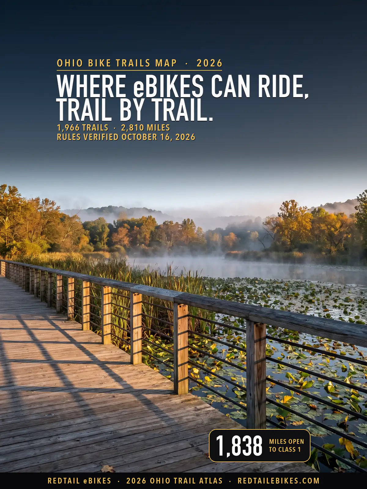
The Towpath Trail's boardwalk over the Beaver Marsh in Cuyahoga Valley National Park, where Class 1 and 2 e-bikes ride as bicycles do, in a scene generated with Playcut from a National Park Service photograph of the boardwalk.

Every line is a trail or path from the Ohio DNR's trails layer, the Forest Service, the National Park Service or OpenStreetMap, colored by the e-bike rule its manager publishes. The numbers mark JobsOhio's seven regions, mapped one by one below.
Ohio's traffic code gives your e-bike a default on paths and lets whoever controls the path change it.
ORC 4511.522(C)(1) says "The operation of a class 1 electric bicycle and a class 2 electric bicycle is permitted on a path set aside for the exclusive use of bicycles or on a shared-use path", unless "the county, township, municipal corporation, other local authority, or state agency" with control over the path "by resolution, ordinance, or rule prohibits" it.
The same section keeps a Class 3 off those paths unless the path "is within or adjacent to a highway" or the authority authorizes it, and it keeps every class off a path "intended to be used primarily for mountain biking, hiking, equestrian use", or "any other single track or natural surface trail", unless the authority authorizes it (§ 4511.522(C)(2) and (3)).
Ohio's definitions decide what a trail sign means for you. § 4511.01(B) excludes "electric bicycles" from "motor vehicle", and § 4511.01(G) says a bicycle is "a pedal-powered vehicle upon which a human operator sits, including an electric bicycle", so a rule that bars "motor vehicles" leaves your bike alone, unless the manager's own code still defines a motor vehicle the way the law did before 2019.
287 managers, from the Ohio DNR and the national forest to park districts, cities, villages, townships and trail nonprofits, each hold part of that authority. Every trail below carries its manager's name and the rule that manager publishes, quoted from the manager's own text and kept in the trail register, so you can check your ride trail by trail.
If you want the rest of Ohio's e-bike law, from age limits to sidewalks, read Ohio e-bike laws. To find a shop near your trailhead, open e-bike shops in Ohio, and to compare Ohio's trail rules with other states', open bike trails by state.
Riding in another state? The same trail-by-trail map covers eight more:
- Michigan bike trails
- Wisconsin bike trails
- Utah bike trails
- Colorado bike trails
- Washington State bike trails
- Texas bike trails
- Florida bike trails
- New York bike trails
Anywhere else in the US, our national guide to e-bike trails near you shows how to find out who manages a trail.
Takeaway
The class on your label decides a lot on Ohio trails. Class 1 rides 1,838 mapped miles, Class 2 rides 1,228 and Class 3 only 179: the state parks open natural-surface trails to Class 1 alone, and most paths stop at Class 2.
29% of the mapped miles are gray. On most of them the manager's own rule reads both ways: it bars "motorized" vehicles, predates Ohio's 2019 e-bike law, or says two different things, so ask the manager before you ride with the motor on.
Where no record names the manager or its rule could not be read, Ohio's default is where your answer starts and the sign at the trailhead is where it ends. You can look up any trail, its manager and its rule in the downloadable register.
In this guide
- How to read the map
- Who decides on each trail
- State parks, forests and wildlife areas
- The national forest, the national park and Corps lakes
- Park districts and metroparks
- City, village, township and county codes
- Named trails riders ask about
- Ohio bike trails, region by region
- Where riders get caught out
- Sidewalks, roads and the paths beside them
- Choosing an e-bike for Ohio trails
- Frequently asked questions
How to read the map
Find your trail's color, then read who manages it. Green takes all three classes, purple Class 1 and 3, blue Class 1 and 2, amber Class 1 alone. Dashed red means a published rule closes the trail to your e-bike.
Gray covers five cases: a rule that reads both ways, with both texts printed; a manager whose rules could not be found; a manager whose rule is not yet read; records that disagree; and no record naming a manager. The register says which one applies to the trail you ride.
Ohio defines an electric bicycle as a "class 1", "class 2" or "class 3" bicycle "equipped with fully operable pedals and an electric motor of less than seven hundred fifty watts". A bike with a bigger motor, or without working pedals, is not an electric bicycle under that definition. Check your label against this table:
| Class | How the motor helps | Assistance stops at |
|---|---|---|
| Class 1 | Only while you pedal | 20 mph |
| Class 2 | "regardless of whether the rider is pedaling" (throttle) | 20 mph |
| Class 3 | Only while you pedal | 28 mph |
Since January 1, 2020, the maker must put that class on a label: § 4511.522(A)(1) requires "a label, in a prominent location", that names the class, "the top assisted speed" and "the motor wattage". If you change the bike's top assisted speed, you must change the label too.
You must be 16 or older to ride a Class 3, and you need a helmet on one. § 4511.522(D) says "No person under sixteen years of age shall operate a class 3 electric bicycle" and that no one may ride or be a passenger on one "unless the person is wearing a protective helmet".
One word sets many colors on this map. Because "motor vehicle" excludes your e-bike, a trail rule that bars "motor vehicles" leaves it alone, while one that bars "motorized vehicles" or "motorized bicycles", or a park code written before 2019 that calls anything with a motor a motor vehicle, leaves the question open, and those trails are gray with both texts printed.
Who decides on each trail
Who manages your trail decides the rule. The Ohio DNR holds 26% of the mapped miles, cities, villages, townships and counties 24%, park districts 27% and federal agencies 10%; find your trail's manager in the first column of the table below.
| Who manages the trail | Trails | Miles | What e-bikes may do |
|---|---|---|---|
| Ohio DNR: state parks, forests and wildlife areas | 574 | 725 | Class 1 and 2 on paved or gravel trails built for bicycles; Class 1 on natural surface where bicycles ride |
| Ohio DNR: nature preserves and scenic river lands | 4 | 5 | Gray: the division's rules keep a bicycle to designated roads and trails; its trail records mark e-bikes 'Recommended' |
| Wayne National Forest | 104 | 222 | Class 1, 2 and 3 on motorized routes; closed on non-motorized trails |
| Cuyahoga Valley National Park | 25 | 34 | Class 1 and 2 where bicycles ride; Class 1 only on the East Rim mountain bike trails |
| Army Corps of Engineers lakes | 14 | 15 | Ohio law's default on bicycle paths; posted restrictions decide the rest |
| Miami Valley Trails (the agencies' joint statement) | 21 | 89 | Class 1 and 2; Class 3 not permitted |
| Park districts whose rule answers the question | 269 | 469 | From open to closed: see each district below |
| Park districts whose rule reads both ways | 133 | 275 | Unsettled: see each district below |
| Cities, villages, townships and counties whose code answers it | 436 | 458 | From open to closed: see each government below |
| Cities, villages, townships and counties whose code reads both ways | 146 | 117 | Unsettled: see each government below |
| Trails a nonprofit runs under its own published rules | 21 | 83 | See each trail below |
| Managers whose rules could not be found | 17 | 60 | Gray: no rules found to read |
| Managers whose rule is not yet read | 96 | 54 | Gray: Ohio's default may apply, but the manager's rule is not read |
| Lines whose records disagree on bicycles | 15 | 5 | Gray: the records disagree |
| Manager not on record | 123 | 199 | Not determined |
| All Ohio | 1,966 | 2,810 | Map above; every trail by region below |
A trail whose stretches fall under two rules sits in each row with the miles that lie there, so if you find a trail twice, that is why; the rows still add up to the state.
Takeaway
One DNR page sets the color of 725 miles of state park, forest and wildlife-area trail, 33 park districts have a rule that reaches a mapped trail, and 169 cities, villages, townships and counties have one too.
State parks, forests and wildlife areas
On DNR land, your class and the trail's surface decide. The ODNR e-bike page says "E-bikes are not permitted on trails where bicycles are not permitted", and then splits by trail:
| ODNR trail type | Who may ride | The page's words |
|---|---|---|
| Roads | Class 1, 2 and 3 | "All three classes of e-bike are allowed on ODNR roads, just like regular, non-motorized bicycles." |
| Hard surface trail or shared-use path | Class 1 and 2 | "allowed on paved or gravel trails specifically intended to accommodate bicycles" |
| Natural surface or mountain bike trail | Class 1 | "allowed on natural surface trails where bicycles are allowed" |
| All Purpose Vehicle trail | Class 1 | "Class 1 e-bikes are allowed." |
The ODNR e-bike page adds one exception by name: "No e-bikes are permitted at Scioto Trail State Forest." It names no trail on which a Class 3 may ride, so on DNR land your Class 3 belongs on the park roads.
On this map, DNR trails carry 102 miles open to Class 1 and 2 and 595 open to Class 1 alone, most of those the natural-surface and mountain-bike trails of the state parks and forests. The DNR's own trail records give the surface; where a line has no surface on record, it is gray (25 miles).
The Little Miami Scenic Trail is the DNR's longest bike trail on the map, at 50.5 mapped miles against 22.8 for the next, the Mohican Mountain Bike Trail. Little Miami State Park "contains 50 miles of paved trail from Terrace Park in Hamilton County to Hedges Road in Greene County," ODNR's park page says, and those paved miles take Class 1 and 2.
Past the state park, each manager's own row below applies: Greene County's park district north of Hedges Road, the National Trail Parks and Recreation District in Springfield, and Great Parks of Hamilton County in Newtown and Cincinnati.
Two agencies describe the Springfield end differently. ODNR's page says the rest of the trail to Springfield is "operated by Greene County Parks and Trails," while the Springfield district lists the Little Miami Scenic Trail among its own bicycling trails. The map follows the district in Clark County, where its row is gray; call the district before you ride that stretch.
Nature preserves are their own division, and its texts point two ways. The ODNR Division of Natural Areas and Preserves manages 5 mapped miles. Its rule for nature preserves says "No person shall operate a vehicle or bicycle within any nature preserve or natural area except over and upon roads, streets, driveways or parking lots which are designated or posted for such purposes" (OAC 1501:17-9-02).
On scenic river lands the division bars "Other similar, non-traditional vehicles designed for recreational use" (OAC 1501:17-9-06(F)). The DNR's own trail records mark the division's mapped trails, the paved Blackhand Trail in Blackhand Gorge among them, "Recommended" for e-bikes, so they are gray here: ask the preserve before you ride.
The national forest, the national park and Corps lakes
In the Wayne National Forest, your e-bike rides only routes open to motor vehicles. The Forest Service says "Class 1, 2, and 3 e-bikes are allowed on motorized trails and roads on national forests and grasslands", and opens a non-motorized trail to e-bikes only through a designation; the Wayne's motor vehicle use map publishes none for an Ohio trail.
Of the forest's 222 mapped miles, 132 are motorized trails open to every class, and 90 are non-motorized trails closed to your e-bike, the Baileys Trail System near Chauncey among them: its own trail pages say "motorized vehicles of any kind--including electric bicycles--are not currently permitted".
In Cuyahoga Valley National Park, your e-bike rides where a bicycle rides, with two limits. The superintendent's compendium says e-bikes "are allowed in Cuyahoga Valley National Park where traditional bicycles are allowed", that "No person shall operate a class 3 electric bicycle on any trail open to traditional bicycles", and that no Class 2 or Class 3 may ride the East Rim mountain bike trails.
That puts the park's 25 miles of Towpath Trail and connector trails open to Class 1 and 2, and its 9 miles of East Rim singletrack open to Class 1 alone. Where the national park and Summit Metro Parks share the Towpath, each one's stretch follows its own row, and both say Class 1 and 2.
At an Army Corps of Engineers lake, the Corps' vehicle rule applies. 36 CFR 327.2 covers "bicycles" with all other vehicles and says vehicles off "authorized roadways" are prohibited "except at locations and times designated by the District Commander", and 36 CFR 327.26(a) says "state and local laws and ordinances shall apply on project lands and waters", so the bike paths the Corps opens take Ohio's default and the rest follow the project's posted signs.
Park districts and metroparks
Ohio's park districts write their own trail rules, and they do not agree. 33 districts have a rule that reaches a mapped trail, so check your district's row in the table below before you ride.
Metroparks Toledo opens its marked multipurpose trails to every class and Darke County its bikeway to Class 1 and 3; 6 open their paths to Class 1 and 2, 7 do the same on some trails and leave others gray, and 18 are gray on every mapped mile, 14 under a rule that reads both ways and 4 because the district's rules could not be found.
The table lists every park district, trail nonprofit and joint agency statement that reaches a mapped trail, with the miles each one governs, and the link in the second column opens the rule itself. Cities, villages, townships and counties have their own list under City, village, township and county codes.
| Manager | Rule or page | Where it applies | What it does | Trails | Miles |
|---|---|---|---|---|---|
| Ashtabula County Metroparks | Ashtabula County Metroparks, Western Reserve Greenway Trail page (Rules) | Ashtabula County Metroparks' trails except the Pymatuning Valley Greenway (its own row) | Unsettled: a 'motorized' rule that does not name e-bikes | 4 | 25.6 |
| Ashtabula County Metroparks (Pymatuning Valley Greenway Trail) | Ashtabula County Metroparks, Pymatuning Valley Greenway Trail page; Rules & Regulations page | the Pymatuning Valley Greenway Trail | Manager's rules could not be found | 1 | 5.5 |
| Butler County Park District | MetroParks of Butler County Rules and Regulations (Resolution No. 50.08, May 13, 2008; amended October 18, 2016; revised November 17, 2022), Definitions and the vehicle rules F and I | MetroParks of Butler County's parks (the Great Miami River Trail follows the Miami Valley Trails record) | Unsettled: a 'motorized' rule that does not name e-bikes | 3 | 1.7 |
| Clermont County Park District | Clermont County Parks, Rules and Regulations | Clermont County Park District trails | Unsettled: a 'motorized' rule that does not name e-bikes | 1 | 4.0 |
| Cleveland Metroparks | Cleveland Metroparks Park Rules & Regulations; its codified Park District Regulations on American Legal Publishing | Cleveland Metroparks all purpose trails and reservations | Class 1 and 2 (105.2 mi); Unsettled: the surface decides, and it is not recorded (13.5 mi); Closed to e-bikes (6.5 mi) | 101 | 125.3 |
| Columbiana County Park District | Columbiana County Park District, Trails page | Columbiana County Park District trails, including the Little Beaver Creek Greenway | Manager's rules could not be found | 3 | 11.8 |
| Columbus and Franklin County Metro Parks | Franklin County Metropolitan Park District Rules and Regulations §§ 17.2, 18.1, 22.2 (adopted March 12, 2019, effective May 1, 2019) | Columbus and Franklin County Metro Parks trails and greenways | Unsettled: a 'motorized' rule that does not name e-bikes (85.5 mi); Closed to e-bikes (8.6 mi) | 45 | 94.2 |
| Darke County Park District | Darke County Park District Rules and Regulations (2024), Section 19: Recreational Multi-purpose Trail (Bikeway), items 1, 2a, 2b; 'Operation on the Trails' | the Tecumseh Trail & Bikeway and the district's other designated bikeways | Class 1 and 3; Class 2 (throttle) not permitted | 5 | 6.5 |
| Five Rivers MetroParks | Five Rivers MetroParks Code of Rules and Regulations §§ 75.01(A), 75.02, 75.11 (amendments approved 8-1-2022), 131.16 | Five Rivers MetroParks bikeways and designated trails; mountain-biking facilities; Twin Valley Trail closed to bicycles | Class 1 and 2 | 14 | 15.6 |
| Geauga Park District | Geauga Park District Rules & Regulations §§ 3.1, 18.1 (PDF uploaded August 2018) | Geauga Park District trails (Maple Highlands Trail and the reservations' paved paths) | Unsettled: a 'motorized' rule that does not name e-bikes | 6 | 17.1 |
| Great Parks of Hamilton County | Great Parks of Hamilton County Code of By-Laws § 75.01 (By-law 8-05) | Great Parks of Hamilton County roads and trails | Class 1 and 2 on shared-use paths; Class 3 on roadside paths only (20.9 mi); Unsettled: the surface decides, and it is not recorded (7.8 mi); Closed to e-bikes (1.1 mi) | 18 | 29.8 |
| Greene County Park District | Greene County Park District Code of Rules and Regulations § 70.23 (Reg. 20.4; rules adopted 4-19-90, revisions through September 1999) | Greene County Park District bikeways, transportation trails and linear parks | Unsettled: a 'motorized' rule that does not name e-bikes | 2 | 14.3 |
| Hancock Park District | Hancock Park District, power-driven mobility device policy; Use of Nature Trail | Hancock Park District trails | Unsettled: read both ways (1.9 mi); Closed to e-bikes (0.4 mi) | 6 | 2.3 |
| Holmes County Park District | Holmes County Trail, Trail Rules | the Holmes County Trail (Fredericksburg to Brinkhaven) | Class 1 and 2, 20 mph | 3 | 26.7 |
| Johnny Appleseed Metropolitan Park District | Johnny Appleseed Metropolitan Park District Park Rules & Regulations §§ 24.2, 24.14 | Johnny Appleseed Metropolitan Park District (Allen County) roads and trails, including its Miami and Erie Canal towpath | Unsettled: a 'motorized' rule that does not name e-bikes | 7 | 10.6 |
| Knox County Park District | Heart of Ohio Trail, Trail Info: Trail Rules | Heart of Ohio, Kokosing Gap and Mohican Valley trails (Knox County) | Class 1 and 2 (29.8 mi); Unsettled: a 'motorized' rule that does not name e-bikes (4.2 mi) | 8 | 34.0 |
| Lake Metroparks | Lake Metroparks Rules and Regulations § 21.1 (revised May 2026, Resolution No. 2026-013) | every Lake Metroparks trail open to bicycles; Penitentiary Glen's Gorge Rim Loop and Halle Home Loop are closed to biking | Class 1 and 2 (21.3 mi); Closed to e-bikes (1.2 mi) | 37 | 22.5 |
| Licking Park District | Licking Park District Code of Park Rules & Regulations § 2.11 (effective January 1, 2026) | Licking Park District paved multi-purpose trails (T.J. Evans, Panhandle, Buckeye Scenic and others) | Class 1 and 2 on paved trails, 15 mph; Class 3 prohibited | 10 | 30.4 |
| Lorain County Metroparks | Lorain County Metro Parks Rules and Regulations § 21.3 (January 2020) | Lorain County Metro Parks paved pathways (including its paved North Coast Inland Trail) | Class 1 and 2 (14.2 mi); Unsettled: the surface decides, and it is not recorded (2.9 mi) | 9 | 17.1 |
| Medina County Park District | Medina County Park District Rules & Regulations (2024), rule 9.8 | Medina County Park District trails | Class 1 and 2 on limestone or asphalt trails (3.9 mi); Unsettled: the surface decides, and it is not recorded (0.1 mi) | 3 | 4.0 |
| Metroparks Toledo | Metroparks Toledo Rules and Regulations § 20.44 (complete rules PDF); Rules and Regulations page | Metroparks Toledo all-purpose (multipurpose) trails; walking and mountain-bike trails closed to e-bikes | Class 1, 2 and 3 under 100 lb on marked multipurpose trails (35.2 mi); Closed to e-bikes (11.9 mi); Unsettled: the surface decides, and it is not recorded (4.5 mi) | 36 | 51.6 |
| Miami County Park District | Miami County Park District Rules and Regulations, Section 19 (Recreational Trail (Bikeway)) item 1; definitions; Operation on the Trails | Miami County Park District bikeways and park trails | Unsettled: a 'motorized' rule that does not name e-bikes | 3 | 1.3 |
| Mill Creek Metroparks | Mill Creek MetroParks, 'E-bikes allowed on Mill Creek MetroParks Bikeway, riders must follow 15 mph limit' (October 7, 2025) | Mill Creek MetroParks Bikeway and paved all-purpose trails; other trails by the statute | Class 1 and 2 (7.7 mi); Unsettled: the surface decides, and it is not recorded (0.8 mi); Closed to e-bikes (0.1 mi) | 10 | 8.6 |
| National Trail Parks and Recreation District | Clark County Park District Codified Ordinances §§ 70.01, 70.20, 70.23 (linked as NTPRD's 'Park Rules') | trails NTPRD manages in Clark County | Unsettled: a 'motorized' rule that does not name e-bikes | 5 | 20.6 |
| Portage Park District | Portage Park District, Headwaters Trail page (Wayback, February 25, 2025) | the Portage Park District's trails | Manager's rules could not be found | 2 | 7.7 |
| Preservation Parks of Delaware County | Preservation Parks of Delaware County Park Rules & Regulations §§ 20.1, 27.11 (Revised and Approved June 9, 2016; effective October 1, 2016) | Preservation Parks of Delaware County trails and multi-use paths, including its Ohio to Erie Trail segments | Unsettled: a 'motorized' rule that does not name e-bikes | 3 | 6.8 |
| Richland County Park District | Richland B&O Bike Trail page, rule 3 | Richland B&O Trail (Mansfield to Butler) | Unsettled: a 'motorized' rule that does not name e-bikes | 5 | 18.3 |
| Ross County Park District | Ross County Park District, Paint Creek Recreational Trail page | Ross County Park District trails, including the Paint Creek Recreational Trail in Ross County | Manager's rules could not be found | 3 | 23.8 |
| Sandusky County Park District | Sandusky County Park District rules pages | Sandusky County Park District trails | Class 1 and 2 | 4 | 18.0 |
| Stark Parks | Stark County Park District Code of Rules and Regulations §§ 2.13, 2.14 (effective February 3, 2025) | Stark County Park District trails open to bicycles | Class 1 and 2, 15 mph | 14 | 44.3 |
| Summit Metro Parks | Summit Metro Parks, Activities: Biking; Activities: Mountain Biking | Summit Metro Parks multipurpose trails (Bike & Hike, the Towpath sections it manages, Freedom Trail) and mountain-bike trails | Class 1 and 2 (54.9 mi); Closed to e-bikes (4.4 mi); Unsettled: the surface decides, and it is not recorded (2.8 mi) | 29 | 62.2 |
| Trumbull County MetroParks | Trumbull County MetroParks, Greenway Trail Guide 2026, Rules and Regulations, rule 4 | the Trumbull County sections of the Western Reserve Greenway | Unsettled: a 'motorized' rule that does not name e-bikes | 2 | 16.8 |
| Warren County Parks | Warren County Park District, park rules (auditor.co.warren.oh.us/Parks/ParkRules.pdf), not read | the Warren County Park District's parks (Landen-Deerfield Park's trails on this map) | Manager's rules could not be found | 6 | 2.2 |
| Wood County Park District | Wood County Park District Rules and Regulations (PDF created Sept. 6, 2018), definitions and 2(Y) | Wood County Park District trails, including the Slippery Elm Trail | Unsettled: a 'motorized' rule that does not name e-bikes | 3 | 13.2 |
| Miami Valley Trails managing agencies | Miami Valley Trails, Trail Information: Electric Bicycles (updated May 23, 2025) | the Miami Valley Trails network (Great Miami River, Little Miami north of Spring Valley, Creekside, Mad River, Stillwater, Wolf Creek, Iron Horse, Great-Little, Xenia-Jamestown Connector, Simon Kenton, Buck Creek, Ohio-to-Indiana and others) | Class 1 and 2; Class 3 not permitted | 21 | 88.8 |
| Athens Conservancy | Athens Conservancy, Explore page ('Ready for a visit?'), visitor rules | the Athens Conservancy's preserves | Closed to e-bikes | 5 | 2.5 |
| Camp Tuscazoar Foundation | Camp Tuscazoar's Rules of Use (effective January 2009), items prohibited on camp property | Camp Tuscazoar's property and its trails | Unsettled: a 'motorized' rule that does not name e-bikes (6.1 mi); Closed to e-bikes (3.5 mi) | 6 | 9.6 |
| Firelands Rails-to-Trails | Firelands Rails-to-Trails, Inc., Rules & Regulations for the North Coast Inland Trail §§ 34.03, 34.04, 40.02, 40.08 (PDF created Dec. 2, 2020) | the Huron County section of the North Coast Inland Trail (Bellevue, Monroeville, Norwalk, Collins) | Class 1 and 2 on the designated NCIT; Class 3 not permitted (19.3 mi); Unsettled: read both ways (0.1 mi) | 4 | 19.4 |
| Guernsey County Community Development Corporation | The Great Guernsey Trail, National Recreation Trails application (2020), Allowed Uses | the Great Guernsey Trail | Manager's rules could not be found | 1 | 6.8 |
| Northwest Ohio Rails to Trails | Wabash Cannonball Trail, FAQ and Guidelines for Trail Use pages | the Wabash Cannonball Trail, North and South Forks (Lucas, Fulton, Henry, Williams counties) | Unsettled: a 'motorized' rule that does not name e-bikes | 6 | 51.9 |
Districts that say Class 1 and 2
Most of the big metro districts open their paved trails to Class 1 and 2 and keep Class 3 off. Cleveland Metroparks says "Class 1 and 2 e-bikes and scooters are permitted on roadways and all purpose trails", and Summit Metro Parks "allows Class 1 and 2 e-bikes on its multipurpose trails", while its mountain biking page says "Electric bikes are prohibited."
Lake Metroparks applies its bicycle rules to "class 1 and class 2 e-bikes" and says "Class 3 e-bikes are not permitted". Lorain County Metro Parks permits "Only Class 1 and Class 2 e-bikes" and "only on such trails and paths as designated", and bars every e-bike at Sandy Ridge Reservation and Schoepfle Garden.
Five Rivers MetroParks in Dayton keeps bicycles and electric devices to "paved roads" and trails "designated for such purpose", and opens its designated mountain biking facilities to Class 1 alone. Mill Creek MetroParks in Youngstown says "Class 1 and Class 2 e-bikes are the type of electric bikes permitted on the trail", at the bikeway's 15 mph.
Stark Parks, the Licking Park District, the Medina County Park District and the Holmes County Park District on the Holmes County Trail say the same: Class 1 and 2, no Class 3.
The Class 3 exceptions
Two districts open a trail to Class 3. Metroparks Toledo permits micromobility devices "including, but not limited to, electric bicycles" with "all class ratings of electric motors permitted", under 100 pounds, on trails it marks as multipurpose. Darke County permits "Electric Bicycles (e-bikes) with pedal assist, class 1 or 3" on its recreational trail and says "Class 2 electric bicycles ... are not permitted."
Darke's rule is the only one on this map that takes a Class 3 and turns a Class 2 away, so check your label before you ride the Tecumseh Trail.
Rules that bar "motorized" vehicles without naming e-bikes
Some districts' rules still read as if your e-bike were a motor vehicle. Columbus and Franklin County Metro Parks says "Persons shall not operate motorized vehicles including electric personal assistive mobility devices on multi-use trails, bridle paths, footpaths, or bicycle paths", and Preservation Parks of Delaware County bars "a motorized vehicle or motorized bicycle" from trails and multi-use paths.
Ohio law says an electric bicycle is a bicycle and not a motor vehicle, and that a "motorized bicycle" is a moped that "does not include an electric bicycle" (§ 4511.01(H)). Neither rule names e-bikes, so their trails are gray here, with both texts in the register: ask the district before you ride with the motor on.
These districts are gray the same way:
- Geauga Park District
- Greene County Park District
- Miami County Park District
- National Trail Parks and Recreation District in Springfield
- Ashtabula County Metroparks
- Trumbull County MetroParks
- Johnny Appleseed Metropolitan Park District
The Richland B&O Trail is gray here, though the district has said Class 1 and 2 may ride it. The district's trail page says "Motorized vehicles, buggies, and horses are prohibited" and names no e-bike.
Its EBike policy, as Richland Source printed it, says "Class 1 and Class 2 EBikes as defined by Ohio Law are permitted to be used on the Richland B&O Trail" and "Class 3 EBikes are NOT permitted", and the district's director said the same in July 2026. The policy is not on the district's own site, so ask the district before you ride with the motor on.
The Miami Valley Trails agencies say in a joint statement that "safe, courteous, and responsible use of Class 1 and Class 2 e-bikes ... is welcomed on the Miami Valley Trails" and that Class 3 is "NOT permitted". Where Greene or Miami County's own rule covers a stretch, that rule sets its color here.
The Wood County Park District's two texts point opposite ways on the Slippery Elm Trail. Its 2018 rules define "Motorized Bicycle" as "any vehicle propelled or drawn by power other than muscular power" and keep motorized bicycles off "any paths, walks, or trails". Its board's May 8, 2018 minutes record "the consensus of the Board to take no action", after its director advised that state law allows "Class 1 and 2 Ebikes on bike lanes, bike trails".
City, village, township and county codes
On a city or village path, Ohio's default holds unless the code says otherwise. 169 cities, villages, townships and counties have a code section or page that reaches a mapped trail, and 137 of them leave the state's default, Class 1 and 2 on paths, in place; 122 do it by copying the statute's words into their own traffic code.
Columbus writes the e-bike into its shared-use path rules as a "mobility device", "a small motorized or electronic device, such as an e-scooter, e-bike", and keeps it off sidewalks. Dayton defines a bicycle to include an "electric bicycle" and lets you ride the bike trails its traffic engineer designates.
Hilliard goes further than the state: its Ordinance 21-30 says "The operation of a class 1 electric bicycle, a class 2 electric bicycle, or a class 3 electric bicycle is permitted on a path set aside for the exclusive use of bicycles or on a shared-use path", so its paths are green.
Older codes leave the question open. Akron's and Kettering's traffic codes still define a bicycle as "propelled solely by human power" and a motor vehicle as any other powered vehicle; Akron keeps motor vehicles off paths set aside for bicycles and Kettering keeps them off park paths not provided for them, so their own paths are gray until each city updates its definitions.
Lakewood, Euclid, Lima, Kelleys Island, Middleport and Niles are gray for the same reason: each code keeps motor vehicles off paths set aside for bicycles and still defines a motor vehicle without the 2019 exception for e-bikes.
In Cincinnati, the park board's rule and the city code differ. The city code applies the bicycle rules "upon any path set aside for the exclusive use of bicycles", while the Park Board's Rule 32 bars any "motor propelled vehicle" from park property without the board's permission; its park trails are gray.
Find your town in the list below: every city, village, township and county rule that reaches a mapped trail, with the trails and miles it governs and a link to the rule itself.
Every city, village, township and county rule that reaches a mapped trail (169 governments, 171 rules, 577 mi)
| Manager | Rule or page | Where it applies | What it does | Trails | Miles |
|---|---|---|---|---|---|
| Village of Ada | § 373.15, Electric bicycles | Village of Ada's paths and parks | Class 1 and 2 | 1 | 2.6 |
| City of Akron | Akron Municipal Code §§ 70.01, 72.38, 73.10 (codified through Ord. 40-2026, Supp. 64) | City of Akron bicycle paths | Unsettled: a 'motorized' rule that does not name e-bikes | 9 | 5.9 |
| City of Alliance | § 373.12, Electric bicycles | City of Alliance's paths and parks | Class 1 and 2 (3.1 mi); Unsettled: the surface decides, and it is not recorded (0.1 mi) | 3 | 3.2 |
| City of Amherst | § 373.14, Electric bicycles | City of Amherst's paths and parks | Class 1 and 2 | 1 | 0.5 |
| Anderson Township, Hamilton County | Anderson Township, Five Mile Trail brochure (2014), trail rule 2 | Anderson Township's Five Mile Trail; its Ohio River Trail has its own row | Unsettled: a 'motorized' rule that does not name e-bikes | 1 | 2.2 |
| Anderson Township, Hamilton County (Ohio River Trail) | Anderson Township Greenspace Rules (March 17, 2022) | Anderson Township's Ohio River Trail | Manager's rules could not be found | 1 | 2.0 |
| City of Ashtabula | § 373.12, Electric bicycles | City of Ashtabula's paths and parks | Class 1 and 2 (1.7 mi); Unsettled: the surface decides, and it is not recorded (0.1 mi) | 2 | 1.9 |
| City of Athens | Athens Code of Ordinances §§ 7.01.02(C), 9.15.01 (codified through Ord. 0-139-25, Supp. 17) | City of Athens bike paths and multi-use paths | Class 1 and 2 (7.6 mi); Closed to e-bikes (0.2 mi) | 7 | 7.8 |
| City of Aurora | § 373.13, Electric bicycles | City of Aurora's paths and parks | Class 1 and 2 | 1 | 2.8 |
| City of Avon | § 474.12, Electric bicycles | City of Avon's paths and parks | Class 1 and 2 | 1 | 0.5 |
| City of Avon Lake | § 1070.02, Municipal park rules | City of Avon Lake's paths and parks | Unsettled: a 'motorized' rule that does not name e-bikes (2.1 mi); Closed to e-bikes (0.9 mi) | 5 | 3.0 |
| City of Bay Village | Bay Village Codified Ordinances § 377.06(a), Riding on sidewalks, public ways, paths or trails (Ord. No. 25-99, November 3, 2025; the code codified through Ord. No. 26-66, June 15, 2026) | Bay Village's paths and trails | Closed to e-bikes | 1 | 0.2 |
| City of Beachwood | Beachwood Codified Ordinances § 474.11 (Codified through Ordinance No) | City of Beachwood bicycle and shared-use paths | Class 1 and 2 | 3 | 2.2 |
| City of Beavercreek | § 75.19, Electric bicycles | City of Beavercreek's paths and parks | Class 1 and 2 | 5 | 5.4 |
| City of Bellbrook | Bellbrook Code of Ordinances (Codified through Ordinance No) | City of Bellbrook paths and park trails | Class 1 and 2 | 1 | 1.5 |
| City of Bellefontaine | § 373.20, Electric bicycles | City of Bellefontaine's paths and parks | Closed to e-bikes | 1 | 0.3 |
| City of Bellevue | § 373.23, Electric bicycles | City of Bellevue's paths and parks | Class 1 and 2 | 1 | 2.1 |
| Village of Bluffton | § 75.03, Electric bicycles | Village of Bluffton's paths and parks | Class 1 and 2 | 8 | 3.0 |
| City of Brecksville | Brecksville Codified Ordinances § 373.13 (Codified through Ordinance No) | City of Brecksville bicycle and shared-use paths | Class 1 and 2 | 2 | 0.5 |
| City of Broadview Heights | § 474.12, Electric bicycles | City of Broadview Heights' paths and parks | Class 1 and 2 | 1 | 0.3 |
| City of Brooklyn | § 373.28, Electric bicycles | City of Brooklyn's paths and parks | Class 1 and 2 | 1 | 0.3 |
| City of Brookville | § 373.15, Electric bicycles | City of Brookville's paths and parks | Class 1 and 2 | 2 | 0.9 |
| City of Brunswick | § 474.18, Electric bicycles | City of Brunswick's paths and parks | Class 1 and 2 | 1 | 1.4 |
| City of Cambridge | § 75.03, Electric bicycles | City of Cambridge's paths and parks | Class 1 and 2 | 1 | 0.7 |
| City of Canfield | § 373.15, Electric bicycles | City of Canfield's paths and parks | Class 1 and 2 | 3 | 6.7 |
| City of Canton | § 539.06, Vehicles | City of Canton's paths and parks | Unsettled: a 'motorized' rule that does not name e-bikes | 5 | 10.0 |
| Village of Cedarville | § 373.12, Electric bicycles | Village of Cedarville's paths and parks | Class 1 and 2 | 1 | 0.2 |
| City of Celina | § 941.03, Operation of vehicles | City of Celina's paths and parks | Unsettled: a 'motorized' rule that does not name e-bikes | 2 | 0.4 |
| City of Centerville | § 474.12, Electric bicycles | City of Centerville's paths and parks | Class 1 and 2 | 2 | 2.4 |
| City of Chardon | § 373.18, Electric bicycles | City of Chardon's paths and parks | Class 1 and 2 | 2 | 1.2 |
| City of Cincinnati | Cincinnati Municipal Code § 505-14; Title V (codified through Ord. 0223-2026, effective June 17, 2026) | City of Cincinnati trails outside Park Board property (Wasson Way, Ohio River Trail and other city paths); trails the Cincinnati Recreation Commission (a city commission) runs | Class 1 and 2 | 14 | 17.4 |
| Cincinnati Park Board | Rules and Regulations of the Board of Park Commissioners, Rules 23 and 32 (Rule 32 enacted April 6, 1978, amended effective December 16, 2011), as codified in the Cincinnati Municipal Code | Cincinnati Park Board property | Closed to e-bikes (5.5 mi); Unsettled: a 'motorized' rule that does not name e-bikes (4.3 mi) | 18 | 9.8 |
| City of Cleveland | § 559.60, Restrictions on driving and parking | City of Cleveland's paths and parks | Unsettled: read both ways (17.7 mi); Unsettled: the surface decides, and it is not recorded (4.8 mi) | 28 | 22.4 |
| City of Cleveland Heights | § 331.37, Driving upon sidewalks, street lawns or curbs | City of Cleveland Heights' paths and parks | Unsettled: a 'motorized' rule that does not name e-bikes (0.2 mi); Class 1 and 2 (0.2 mi) | 2 | 0.4 |
| City of Clyde | Clyde Codified Ordinances § 373.19 (Codified through Ordinance No) | City of Clyde bicycle and shared-use paths | Class 1 and 2 | 1 | 1.6 |
| City of Columbus | Columbus City Codes §§ 2101.20, 2101.115, 2101.186, 2173.02, 2173.07, 2173.10, 2173.105; Chapter 919 (codified through Ord. 0923-2026, enacted April 20, 2026) | City of Columbus shared-use paths, greenways and park paths, including those the Recreation and Parks Department runs | Class 1 and 2 (23.3 mi); Unsettled: a 'motorized' rule that does not name e-bikes (0.2 mi); Closed to e-bikes (0.1 mi) | 31 | 23.6 |
| City of Conneaut | § 373.13, Electric bicycles | City of Conneaut's paths and parks | Unsettled: the surface decides, and it is not recorded | 1 | 0.2 |
| City of Cuyahoga Falls | § 373.14, Electric bicycles | City of Cuyahoga Falls' paths and parks | Class 1 and 2 | 2 | 0.4 |
| Village of Cuyahoga Heights | § 444.12, Electric bicycles | Village of Cuyahoga Heights' paths and parks | Class 1 and 2 (5.2 mi); Closed to e-bikes (1.1 mi) | 4 | 6.2 |
| City of Dayton | Dayton Code of Ordinances §§ 74.01, 74.07 (Ord. 31713-19, passed April 10, 2019; codified through Ord. 32173-25) | City of Dayton bikeways and designated bike trails | Class 1 and 2 | 13 | 26.3 |
| City of Dublin | § 75.10, Electric bicycles | City of Dublin's paths and parks | Class 1 and 2 | 3 | 1.5 |
| City of East Cleveland | § 373.14, Electric bicycles | City of East Cleveland's paths and parks | Class 1 and 2 | 1 | 0.2 |
| Village of East Palestine | § 474.24, Electric bicycles | Village of East Palestine's paths and parks | Class 1 and 2 | 2 | 2.0 |
| City of Eastlake | § 373.12, Electric bicycles | City of Eastlake's paths and parks | Class 1 and 2 | 1 | 0.3 |
| Village of Elmore | § 373.14, Electric bicycles | Village of Elmore's paths and parks | Class 1 and 2 | 1 | 1.9 |
| City of Elyria | § 373.26, Electric bicycles | City of Elyria's paths and parks | Class 1 and 2 | 4 | 6.3 |
| City of Englewood | § 474.12, Electric bicycles | City of Englewood's paths and parks | Class 1 and 2 | 1 | 1.6 |
| City of Euclid | § 331.39, Operation on paths set aside for bicycles | City of Euclid's paths and parks | Unsettled: a 'motorized' rule that does not name e-bikes | 3 | 0.8 |
| City of Fairborn | § 353.19, Electric bicycles | City of Fairborn's paths and parks | Class 1 and 2 | 1 | 4.0 |
| City of Fairfield | § 373.16, Electric bicycles | City of Fairfield's paths and parks | Closed to e-bikes (5.1 mi); Class 1 and 2 (3.7 mi); Unsettled: the surface decides, and it is not recorded (0.4 mi) | 7 | 9.1 |
| City of Findlay | § 373.16, Electric bicycles | City of Findlay's paths and parks | Class 1 and 2 | 6 | 2.2 |
| City of Franklin | City of Franklin Codified Ordinances §§ 311.07, 373.14 (Ord. 2024-30, November 4, 2024), 935.01 | the City of Franklin's paths (the Great Miami River Recreation Trail and the Clear Creek Trail on this map) | Class 1 and 2 | 2 | 5.8 |
| Village of Fredericktown | § 373.12, Electric bicycles | Village of Fredericktown's paths and parks | Class 1 and 2 | 1 | 2.2 |
| City of Fremont | § 373.19, Electric bicycles | City of Fremont's paths and parks | Class 1 and 2 | 1 | 2.0 |
| Village of Galena | § 75.03, Electric bicycles | Village of Galena's paths and parks | Class 1 and 2 | 1 | 0.5 |
| City of Galion | § 373.14, Electric bicycles | City of Galion's paths and parks | Class 1 and 2 | 1 | 0.8 |
| Village of Gallipolis | § 373.14, Electric bicycles | Village of Gallipolis' paths and parks | Class 1 and 2 | 1 | 0.6 |
| Village of Genoa | § 373.24, Electric bicycles | Village of Genoa's paths and parks | Class 1 and 2 (0.9 mi); Unsettled: the surface decides, and it is not recorded (under 0.1 mi) | 2 | 1.0 |
| Village of Glenwillow | § 373.12, Electric bicycles | Village of Glenwillow's paths and parks | Class 1 and 2 | 2 | 1.1 |
| City of Green | § 75.03, Electric bicycles | City of Green's paths and parks | Closed to e-bikes | 4 | 2.5 |
| City of Greenville | § 474.19, Electric bicycles | City of Greenville's paths and parks | Class 1 and 2 | 1 | 0.2 |
| City of Grove City | § 903.04, Traffic; off-road vehicles | City of Grove City's paths and parks | Unsettled: a 'motorized' rule that does not name e-bikes | 4 | 4.3 |
| City of Groveport | § 373.16, Electric bicycles | City of Groveport's paths and parks | Class 1 and 2 | 2 | 2.8 |
| City of Hamilton | § 977.07, Park rules and regulations | City of Hamilton's paths and parks | Unsettled: a 'motorized' rule that does not name e-bikes | 3 | 6.0 |
| Harrison County | Harrison County, Trails page | the Conotton Creek Trail (Jewett, Scio, Bowerston and the county between) | Class 1 and 2 (the trail's listing says e-bikes permitted) | 3 | 11.1 |
| City of Hilliard | Hilliard Codified Ordinances §§ 373.09, 373.10 (Ord. No. 21-30, 10-25-21; Codified through Ordinance No) | City of Hilliard bicycle and shared-use paths (including its Heritage Trail sections) | Class 1, 2 and 3 (Ord. 21-30) | 4 | 4.7 |
| Village of Hiram | § 373.12, Electric bicycles | Village of Hiram's paths and parks | Class 1 and 2 | 1 | 0.5 |
| City of Huber Heights | Huber Heights Codified Ordinances § 301.101 (Codified through Ordinance No) | City of Huber Heights paths and park trails | Class 1 and 2 | 1 | 0.1 |
| City of Hudson | § 1062.02, Rules and regulations | City of Hudson's paths and parks | Unsettled: a 'motorized' rule that does not name e-bikes | 1 | 0.9 |
| City of Huron | § 373.11, Electric bicycles | City of Huron's paths and parks | Class 1 and 2 | 1 | 1.2 |
| City of Independence | § 373.13, Electric bicycles | City of Independence's paths and parks | Class 1 and 2 | 1 | 0.2 |
| Village of Kelleys Island | § 72.103, Driving upon sidewalk area or paths exclusively for bicycles | Village of Kelleys Island's paths and parks | Unsettled: a 'motorized' rule that does not name e-bikes | 1 | 0.2 |
| City of Kent | § 373.13, Electric bicycles | City of Kent's paths and parks | Class 1 and 2 | 6 | 6.0 |
| City of Kettering | Kettering Codified Ordinances §§ 402.05, 402.21, 402.55 (Ch. 402, 2025 PDF), 941.08(a)(1) (Ch. 941, 2022 PDF); Ch. 474 (2025) has no e-bike text | City of Kettering parks and paths | Unsettled: a 'motorized' rule that does not name e-bikes | 3 | 6.6 |
| City of Lakewood | § 373.26, Paths exclusively for bicycles or mobility devices | City of Lakewood's paths and parks | Unsettled: a 'motorized' rule that does not name e-bikes | 1 | 0.2 |
| City of Lancaster | § 931.06, Motor vehicles in park | City of Lancaster's paths and parks | Unsettled: a 'motorized' rule that does not name e-bikes | 1 | 7.8 |
| City of Lebanon | § 373.17, Electric bicycles | City of Lebanon's paths and parks | Class 1 and 2 | 6 | 10.2 |
| City of Lima | § 432.42, Operation on paths set aside for bicycles | City of Lima's paths and parks | Unsettled: a 'motorized' rule that does not name e-bikes | 2 | 4.1 |
| City of London | § 444.13, Electric bicycles | City of London's paths and parks | Class 1 and 2 | 1 | 3.5 |
| City of Lorain | § 373.19, Electric bicycles | City of Lorain's paths and parks | Class 1 and 2 | 3 | 5.9 |
| Village of Loudonville | § 474.16, Electric bicycles | Village of Loudonville's paths and parks | Class 1 and 2 | 1 | 0.2 |
| City of Louisville | § 373.12, Electric bicycles | City of Louisville's paths and parks | Class 1 and 2 (3.3 mi); Unsettled: the surface decides, and it is not recorded (0.1 mi) | 3 | 3.4 |
| Village of Lowellville | § 373.12, Electric bicycles | Village of Lowellville's paths and parks | Class 1 and 2 | 2 | 1.9 |
| Village of Mariemont | § 75.10, Electric bicycles | Village of Mariemont's paths and parks | Closed to e-bikes (2.3 mi); Class 1 and 2 (0.6 mi) | 2 | 2.8 |
| City of Marietta | § 373.12, Electric bicycles | City of Marietta's paths and parks | Closed to e-bikes (4.1 mi); Class 1 and 2 (3.3 mi); Unsettled: the surface decides, and it is not recorded (1.8 mi) | 11 | 9.3 |
| City of Marysville | Marysville Codified Ordinances §§ 301.20, 951.02 (Codified through Ordinance No) | City of Marysville paths and park trails | Class 1 and 2 | 1 | 3.3 |
| City of Mason | § 373.17, Electric bicycles | City of Mason's paths and parks | Class 1 and 2 | 1 | 1.2 |
| City of Massillon | § 961.06, Motorized vehicles | City of Massillon's paths and parks | Unsettled: a 'motorized' rule that does not name e-bikes | 2 | 7.2 |
| City of Maumee | § 373.15, Electric bicycles | City of Maumee's paths and parks | Class 1 and 2 | 4 | 4.6 |
| Village of Mayfield | § 373.10, Electric bicycles | Village of Mayfield's paths and parks | Class 1 and 2 | 1 | 2.3 |
| Village of McDonald | § 373.14, Electric bicycles | Village of McDonald's paths and parks | Class 1 and 2 | 1 | 0.1 |
| City of Medina | § 373.15, Electric bicycles | City of Medina's paths and parks | Closed to e-bikes | 5 | 6.6 |
| City of Mentor | § 373.13, Electric bicycles | City of Mentor's paths and parks | Class 1 and 2 (6.6 mi); Unsettled: the surface decides, and it is not recorded (0.3 mi) | 5 | 7.0 |
| City of Miamisburg | § 444.13, Electric bicycles | City of Miamisburg's paths and parks | Class 1 and 2 | 3 | 5.8 |
| City of Middleburg Heights | § 474.06, Riding on sidewalks, public ways, paths or trails | City of Middleburg Heights' paths and parks | Class 1 and 2 | 1 | 0.4 |
| Village of Middlefield | § 373.13, Electric bicycles | Village of Middlefield's paths and parks | Class 1 and 2 | 2 | 2.2 |
| Village of Middleport | § 373.12, Paths exclusively for bicycles | Village of Middleport's paths and parks | Unsettled: a 'motorized' rule that does not name e-bikes | 1 | 1.4 |
| City of Middletown | § 474.24, Electric bicycles | City of Middletown's paths and parks | Class 1 and 2 | 1 | 9.7 |
| City of Milford | § 373.12, Electric bicycles | City of Milford's paths and parks | Closed to e-bikes (1.4 mi); Unsettled: the surface decides, and it is not recorded (0.7 mi) | 6 | 2.1 |
| City of Mount Vernon | § 373.16, Electric bicycles | City of Mount Vernon's paths and parks | Class 1 and 2 | 1 | 1.0 |
| City of Napoleon | § 373.13, Electric bicycles | City of Napoleon's paths and parks | Class 1 and 2 | 1 | 1.3 |
| City of Nelsonville | § 75.03, Electric bicycles | City of Nelsonville's paths and parks | Class 1 and 2 | 1 | 0.8 |
| City of New Albany | New Albany Codified Ordinances § 373.105 (Codified through Ordinance No) | City of New Albany bicycle and shared-use paths | Unsettled: the surface decides, and it is not recorded | 1 | 0.1 |
| Village of New Bremen | § 75.09, Electric bicycles | Village of New Bremen's paths and parks | Class 1 and 2 | 1 | 0.9 |
| Village of New Lebanon | § 76.35, Electric bicycles | Village of New Lebanon's paths and parks | Class 1 and 2 (0.4 mi); Unsettled: the surface decides, and it is not recorded (under 0.1 mi) | 2 | 0.5 |
| City of Newark | § 475.21, Electric bicycles | City of Newark's paths and parks | Class 1 and 2 | 1 | 3.5 |
| Village of Newton Falls | § 373.21, Electric bicycles | Village of Newton Falls' paths and parks | Class 1 and 2 | 1 | 1.0 |
| City of Niles | City of Niles Codified Ordinances § 301.20, Motor vehicle | the City of Niles' paths (the Niles Greenway on this map) | Unsettled: a 'motorized' rule that does not name e-bikes | 1 | 0.8 |
| Village of North Baltimore | North Baltimore Codified Ordinances § 373.12 (Codified through Ordinance No) | Village of North Baltimore bicycle and shared-use paths | Unsettled: the surface decides, and it is not recorded (0.1 mi); Class 1 and 2 (0.1 mi) | 2 | 0.2 |
| City of North Olmsted | § 373.26, Electric bicycles | City of North Olmsted's paths and parks | Unsettled: a 'motorized' rule that does not name e-bikes (2.5 mi); Class 1 and 2 (0.2 mi) | 2 | 2.7 |
| City of North Ridgeville | North Ridgeville Codified Ordinances § 474.12 (Codified through Ordinance No) | City of North Ridgeville bicycle and shared-use paths | Class 1 and 2 | 1 | 0.6 |
| City of Norwalk | § 373.15, Electric bicycles | City of Norwalk's paths and parks | Class 1 and 2 | 3 | 1.8 |
| City of Norwood | § 373.12, Electric bicycles | City of Norwood's paths and parks | Class 1 and 2 | 1 | 0.3 |
| City of Oakwood | § 373.11, Electric bicycles | City of Oakwood's paths and parks | Class 1 and 2 | 1 | 0.1 |
| City of Oberlin | § 927.22, Traffic and parking | City of Oberlin's paths and parks | Unsettled: read both ways | 1 | 1.7 |
| City of Oregon | § 373.14, Electric bicycles | City of Oregon's paths and parks | Class 1 and 2 | 2 | 6.6 |
| City of Orrville | § 373.14, Electric bicycles | City of Orrville's paths and parks | Class 1 and 2 | 1 | 1.4 |
| City of Oxford | § 373.12, Electric bicycles | City of Oxford's paths and parks | Class 1 and 2 | 3 | 3.1 |
| City of Parma | § 373.21, Electric bicycles | City of Parma's paths and parks | Closed to e-bikes | 5 | 2.6 |
| City of Parma Heights | § 373.12, Electric bicycles and electric personal assistive mobility devices | City of Parma Heights' paths and parks | Class 1 and 2 | 1 | 0.1 |
| Village of Pemberville | Schedule I, Prohibited parking | Village of Pemberville's paths and parks | Unsettled: a 'motorized' rule that does not name e-bikes | 1 | 0.1 |
| City of Pepper Pike | § 474.12, Electric bicycles | City of Pepper Pike's paths and parks | Class 1 and 2 | 3 | 1.5 |
| City of Perrysburg | § 474.10, Electric bicycles | City of Perrysburg's paths and parks | Class 1 and 2 | 1 | 0.3 |
| City of Piqua | § 75.03, Electric bicycles | City of Piqua's paths and parks | Class 1 and 2 | 9 | 12.9 |
| Village of Poland | § 432.41, Operation on paths set aside for bicycles | Village of Poland's paths and parks | Unsettled: a 'motorized' rule that does not name e-bikes (7.3 mi); Class 1 and 2 (0.2 mi) | 28 | 7.5 |
| City of Portsmouth | § 373.15, Electric bicycles | City of Portsmouth's paths and parks | Class 1 and 2 | 1 | 0.2 |
| City of Ravenna | § 444.12, Electric bicycles | City of Ravenna's paths and parks | Class 1 and 2 | 1 | 2.7 |
| City of Reynoldsburg | City of Reynoldsburg Codified Ordinances §§ 373.20(c)(1), 301.19, 971.01(f), 971.09(a) (codified through Ord. No. 81-2024, December 16, 2024) | the City of Reynoldsburg's paths (Pine Quarry Park's natural-surface trails keep the statute's default) | Class 1 and 2 (3.1 mi); Closed to e-bikes (1.7 mi) | 12 | 4.9 |
| City of Rittman | Rittman Codified Ordinances §§ 301.04, 301.19, 373.11 (Codified through Memo of February 6, 2026) | City of Rittman bicycle paths | Unsettled: a 'motorized' rule that does not name e-bikes | 1 | 3.4 |
| City of Riverside | Riverside Codified Ordinances § 373.10 (Codified through Code updates to Traffic and General Offenses, via the 2025 Legal Review) | City of Riverside paths and park trails | Class 1 and 2 | 1 | 1.5 |
| City of Shaker Heights | § 1173.18, Electric bicycles | City of Shaker Heights' paths and parks | Class 1 and 2 | 5 | 1.6 |
| Village of Sheffield | § 373.15, Electric bicycles | Village of Sheffield's paths and parks | Class 1 and 2 | 1 | 1.6 |
| City of Sheffield Lake | § 351.20, Parking on bike paths | City of Sheffield Lake's paths and parks | Unsettled: a 'motorized' rule that does not name e-bikes | 3 | 2.2 |
| City of Sidney | § 925.02, Vehicles in parks | City of Sidney's paths and parks | Unsettled: a 'motorized' rule that does not name e-bikes | 1 | 2.3 |
| City of Solon | § 432.39, Operation on paths set aside for bicycles | City of Solon's paths and parks | Class 1 and 2 | 2 | 2.7 |
| Village of South Charleston | § 75.03, Electric bicycles | Village of South Charleston's paths and parks | Class 1 and 2 | 1 | 0.1 |
| City of South Euclid | § 373.22, Electric bicycles | City of South Euclid's paths and parks | Class 1 and 2 | 2 | 0.1 |
| City of Springboro | § 474.15, Electric bicycles | City of Springboro's paths and parks | Class 1 and 2 | 1 | 0.5 |
| City of Springfield | § 373.16, Electric bicycles | City of Springfield's paths and parks | Class 1 and 2 (9.1 mi); Unsettled: the surface decides, and it is not recorded (0.4 mi) | 7 | 9.5 |
| City of St. Clairsville | § 375.02, Modes of transportation | City of St. Clairsville's paths and parks | Unsettled: a 'motorized' rule that does not name e-bikes | 1 | 2.5 |
| City of St. Marys | § 373.16, Electric bicycles | City of St. Marys' paths and parks | Class 1 and 2 (0.9 mi); Closed to e-bikes (0.9 mi) | 2 | 1.8 |
| City of Stow | § 373.27, Electric bicycles | City of Stow's paths and parks | Unsettled: the surface decides, and it is not recorded (0.5 mi); Class 1 and 2 (0.4 mi) | 2 | 0.9 |
| Village of Swanton | § 72.12, Parks and shared-use paths | Village of Swanton's paths and parks | Unsettled: read both ways | 1 | 0.7 |
| City of Sylvania | § 373.14, Electric bicycles | City of Sylvania's paths and parks | Class 1 and 2 (0.8 mi); Unsettled: the surface decides, and it is not recorded (0.1 mi) | 4 | 0.9 |
| City of Tiffin | § 373.20, Electric bicycles | City of Tiffin's paths and parks | Class 1 and 2 | 3 | 2.7 |
| City of Tipp City | § 75.03, Electric bicycles | City of Tipp City's paths and parks | Class 1 and 2 | 2 | 2.4 |
| City of Toledo | § 331.41., Operation on school, park grounds | City of Toledo's paths and parks | Class 1 and 2 (34.6 mi); Unsettled: the surface decides, and it is not recorded (0.2 mi) | 41 | 34.7 |
| City of Trotwood | § 373.16, Electric bicycles | City of Trotwood's paths and parks | Class 1 and 2 | 1 | 6.4 |
| City of Troy | § 373.15, Electric bicycles | City of Troy's paths and parks | Class 1 and 2 | 12 | 9.7 |
| City of Twinsburg | § 373.13, Electric bicycles | City of Twinsburg's paths and parks | Class 1 and 2 | 2 | 1.0 |
| City of Urbana | § 373.13, Electric bicycles | City of Urbana's paths and parks | Class 1 and 2 | 2 | 6.7 |
| Village of Valley View | § 474.12, Electric bicycles | Village of Valley View's paths and parks | Class 1 and 2 | 1 | 1.8 |
| City of Vandalia | § 444.13, Electric bicycles | City of Vandalia's paths and parks | Class 1 and 2 | 2 | 2.6 |
| City of Wadsworth | § 75.03, Electric bicycles | City of Wadsworth's paths and parks | Class 1 and 2 (1.8 mi); Closed to e-bikes (0.7 mi) | 2 | 2.5 |
| City of Warren | § 373.14, Electric bicycles | City of Warren's paths and parks | Class 1 and 2 | 3 | 2.0 |
| City of Wauseon | § 373.15, Electric bicycles | City of Wauseon's paths and parks | Class 1 and 2 | 1 | 2.0 |
| City of Wellston | § 75.12, Electric bicycles | City of Wellston's paths and parks | Class 1 and 2 | 2 | 1.6 |
| City of West Carrollton | § 74.28, Electric bicycles | City of West Carrollton's paths and parks | Class 1 and 2 | 1 | 4.9 |
| Village of West Unity | § 373.15, Electric bicycles | Village of West Unity's paths and parks | Class 1 and 2 | 1 | 0.1 |
| City of Westerville | § 373.13, Electric bicycles | City of Westerville's paths and parks | Class 1 and 2 | 7 | 6.1 |
| Village of Westfield Center | § 444.12, Electric bicycles | Village of Westfield Center's paths and parks | Class 1 and 2 | 1 | 0.8 |
| City of Westlake | § 373.25, Electric bicycles | City of Westlake's paths and parks | Class 1 and 2 | 2 | 2.7 |
| Village of Whitehouse | § 373.13, Electric bicycles | Village of Whitehouse's paths and parks | Class 1 and 2 | 2 | 2.8 |
| City of Wilmington | Wilmington Codified Ordinances §§ 301.20, 373.01, 373.14 (Codified through Ordinance No) | City of Wilmington paths and park trails | Closed to e-bikes (1.2 mi); Class 1 and 2 (1.1 mi); Unsettled: a 'motorized' rule that does not name e-bikes (0.1 mi) | 3 | 2.4 |
| Village of Woodlawn | § 474.13, Electric bicycles | Village of Woodlawn's paths and parks | Class 1 and 2 | 2 | 1.0 |
| City of Wooster | § 373.22, Electric bicycles | City of Wooster's paths and parks | Class 1 and 2 | 5 | 3.4 |
| City of Worthington | § 373.14, Electric bicycles | City of Worthington's paths and parks | Class 1 and 2 (2.0 mi); Closed to e-bikes (0.2 mi); Unsettled: the surface decides, and it is not recorded (0.1 mi) | 9 | 2.3 |
| City of Wyoming | § 373.15, Electric bicycles | City of Wyoming's paths and parks | Class 1 and 2 | 2 | 0.6 |
| City of Xenia | § 422.13, Driving on bike paths | City of Xenia's paths and parks | Unsettled: a 'motorized' rule that does not name e-bikes (0.6 mi); Class 1 and 2 (0.4 mi) | 6 | 1.0 |
| City of Youngstown | § 373.13, Riding or operating a bicycle or motorized bicycle on jogging path or sidewalks within wick park | City of Youngstown's paths and parks | Class 1 and 2 | 4 | 1.3 |
| City of Zanesville | § 373.14, Electric bicycles | City of Zanesville's paths and parks | Class 1 and 2 | 1 | 2.7 |
What changed in 2025 and 2026
12 managers wrote or amended the code or rules that carry their e-bike trail rule in 2025 or 2026: 9 cities and villages and 3 park districts. Each date is the manager's own record, and the last column is what its trails take on this map.
| Date | Manager | The record | What its trails take now |
|---|---|---|---|
| February 3, 2025 | Stark Parks | Code of Rules and Regulations, §§ 2.13 and 2.14, amended January 7, 2025 | Class 1 and 2, 15 mph |
| March 10, 2025 | Mill Creek Metroparks | Rules and Regulations, amended March 10, 2025; on October 7, 2025, the district's site posted that e-bikes are allowed on the MetroParks Bikeway at 15 mph | Class 1 and 2 (7.7 mi); Unsettled: the surface decides, and it is not recorded (0.8 mi); Closed to e-bikes (0.1 mi) |
| October 21, 2025 | City of New Albany | § 373.105, Ord. O-40-2025 | Unsettled: the surface decides, and it is not recorded |
| November 3, 2025 | City of Bay Village | § 377.06(a), Ord. No. 25-99 | Closed to e-bikes |
| November 17, 2025 | City of Parma | § 373.21, Ord. 163-25 | Closed to e-bikes |
| December 8, 2025 | City of Athens | § 7.01.02, its definitions, Ord. No. 0-133-25 | Class 1 and 2 (7.6 mi); Closed to e-bikes (0.2 mi) |
| January 1, 2026 | Licking Park District | Code of Park Rules and Regulations, § 2.11, in effect January 1, 2026 | Class 1 and 2 on paved trails, 15 mph; Class 3 prohibited |
| January 13, 2026 | City of Middleburg Heights | § 474.06, Ord. 2026-1 | Class 1 and 2 |
| April 13, 2026 | City of Parma Heights | § 373.12, Ord. 2026-20 | Class 1 and 2 |
| May 14, 2026 | City of Stow | § 373.27, Ord. 2026-099 | Unsettled: the surface decides, and it is not recorded (0.5 mi); Class 1 and 2 (0.4 mi) |
| May 26, 2026 | City of Twinsburg | § 373.13, Ord. 2026-081 | Class 1 and 2 |
| July 20, 2026 | Village of Swanton | § 72.12, Ord. 2026-13 | Unsettled: read both ways |
Two more changes are proposed and are not law: a $25 state registration for e-bikes in Senate Bill 477's proposed § 4503.184, and a registration and safety program that Upper Arlington is weighing. The registration answer below has where each stands. A rule can change between seasons, so at the start of each one, open your trail's rule from its row in the register.
Named trails riders ask about
The trails you search for change rules where they change managers. The table lists 20 trails and parks you may have typed into a search box, with the miles mapped and every rule that governs a stretch of each: the DNR's page, a federal agency's rule, a park district's rule, a city's or county's code, a trail nonprofit's rules or the Miami Valley Trails agencies' joint statement.
| Trail | Miles mapped | Managed by | What e-bikes may do |
|---|---|---|---|
| Ohio & Erie Canal Towpath Trail | 84.7 | Stark Parks; Summit Metro Parks; National Park Service and 9 more | Class 1 and 2 on 34.7 mi; Class 1 and 2, 15 mph on 23.0 mi; Class 1 and 2 where bicycles ride; no Class 3 on 19.8 mi; Unsettled: read both ways on 3.8 mi; Unsettled: a 'motorized' rule that does not name e-bikes on 1.7 mi; Unsettled: the surface decides, and it is not recorded on 0.8 mi; Manager's rule not yet read on 0.7 mi; Class 1 and 2 (paved or gravel bike trail) on 0.2 mi; Manager not on record on under 0.1 mi |
| Cuyahoga Valley National Park | 34.5 | National Park Service | Class 1 and 2 where bicycles ride; no Class 3 on 24.6 mi; Class 1 only (East Rim mountain bike trails) on 9.4 mi; Unsettled: read both ways on 0.4 mi; Records disagree on 0.2 mi |
| Little Miami Scenic Trail | 77.8 | Ohio DNR (state parks and forests); Greene County Park District; National Trail Parks and Recreation District and 4 more | Class 1 and 2 (paved or gravel bike trail) on 50.5 mi; Unsettled: a 'motorized' rule that does not name e-bikes on 21.5 mi; Class 1 and 2 on shared-use paths; Class 3 on roadside paths only on 5.5 mi; Unsettled: read both ways on 0.2 mi; Manager's rule not yet read on under 0.1 mi |
| Great Miami River Trail | 72.6 | Miami Valley Trails agencies; City of Dayton; City of Middletown and 16 more | Class 1 and 2 on 47.5 mi; Class 1 and 2; Class 3 not permitted on 17.7 mi; Unsettled: a 'motorized' rule that does not name e-bikes on 6.0 mi; Manager's rule not yet read on 1.4 mi |
| Olentangy Trail | 14.9 | Columbus and Franklin County Metro Parks; City of Worthington; City of Columbus | Unsettled: a 'motorized' rule that does not name e-bikes on 11.1 mi; Class 1 and 2 on 3.1 mi; Manager not on record on 0.7 mi |
| Alum Creek Trail | 21.9 | Columbus and Franklin County Metro Parks; City of Westerville | Unsettled: a 'motorized' rule that does not name e-bikes on 20.0 mi; Class 1 and 2 on 2.0 mi |
| Camp Chase Trail | 15.1 | Columbus and Franklin County Metro Parks | Unsettled: a 'motorized' rule that does not name e-bikes on 15.1 mi |
| North Coast Inland Trail | 78.2 | Firelands Rails-to-Trails; Sandusky County Park District; Lorain County Metro Parks and 11 more | Class 1 and 2 on 52.3 mi; Class 1 and 2 on the designated NCIT; Class 3 not permitted on 19.3 mi; Manager not on record on 3.6 mi; Unsettled: read both ways on 1.8 mi; Manager's rule not yet read on 1.3 mi |
| Wabash Cannonball Trail | 60.8 | Northwest Ohio Rails to Trails; Metroparks Toledo; City of Wauseon and 2 more | Unsettled: a 'motorized' rule that does not name e-bikes on 51.9 mi; Class 1 and 2 on 4.1 mi; Manager not on record on 2.7 mi; Class 1, 2 and 3 under 100 lb on marked multipurpose trails on 2.1 mi |
| Miami and Erie Canal Towpath | 32.6 | Johnny Appleseed Metropolitan Park District; Ohio DNR (state parks and forests); City of St. Marys and 2 more | Manager not on record on 17.7 mi; Unsettled: a 'motorized' rule that does not name e-bikes on 9.2 mi; Class 1 only (natural surface or mountain bike trail) on 3.2 mi; Class 1 and 2 on 1.7 mi; Closed to e-bikes on 0.9 mi; Manager's rule not yet read on under 0.1 mi |
| Bike & Hike Trail (Summit County) | 25.9 | Summit Metro Parks; Summit County | Class 1 and 2 on 25.8 mi; Manager's rule not yet read on under 0.1 mi |
| Western Reserve Greenway | 42.4 | Ashtabula County Metroparks; Trumbull County MetroParks | Unsettled: a 'motorized' rule that does not name e-bikes on 42.4 mi |
| Maple Highlands Trail | 20.1 | Geauga Park District; Village of Middlefield; City of Chardon | Unsettled: a 'motorized' rule that does not name e-bikes on 16.7 mi; Class 1 and 2 on 3.4 mi |
| Richland B&O Trail | 18.3 | Richland County Park District | Unsettled: a 'motorized' rule that does not name e-bikes on 18.3 mi |
| Holmes County Trail | 26.7 | Holmes County Park District | Class 1 and 2, 20 mph on 26.7 mi |
| Kokosing Gap Trail | 13.3 | Knox County; Knox County Park District | Class 1 and 2 on 13.3 mi |
| Heart of Ohio Trail | 16.8 | Knox County Park District; Knox County | Class 1 and 2 on 16.5 mi; Manager not on record on 0.2 mi |
| Simon Kenton Trail | 34.1 | Miami Valley Trails agencies; City of Urbana; City of Springfield and 2 more | Class 1 and 2; Class 3 not permitted on 20.3 mi; Class 1 and 2 on 9.5 mi; Unsettled: a 'motorized' rule that does not name e-bikes on 4.0 mi; Closed to e-bikes on 0.3 mi |
| Paint Creek Recreational Trail | 34.5 | Ross County Park District; Ohio DNR; City of Washington Court House and 1 more | Manager's rules could not be found on 23.8 mi; Manager not on record on 5.8 mi; Unsettled: the surface decides, and it is not recorded on 2.5 mi; Manager's rule not yet read on 1.6 mi; Class 1 and 2 on 0.8 mi |
| Hockhocking Adena Bikeway | 22.5 | City of Athens; City of Nelsonville; Village of Chauncey | Manager not on record on 14.5 mi; Class 1 and 2 on 7.3 mi; Manager's rule not yet read on 0.8 mi |
The Ohio & Erie Canal Towpath Trail takes Class 1 and 2 on 78 of its 85 mapped miles from Cleveland to Tuscarawas County. Stark Parks, Summit Metro Parks and the national park each open their stretches by their own rules, and the Army Corps of Engineers' stretch takes Ohio's default; the gray miles are stretches several cities and villages run, so read the row for the one you will ride.
The Ohio to Erie Trail is a route made of other trails, and each keeps its manager's rule. The Knox County Park District says its Heart of Ohio, Kokosing Gap and Mohican Valley trails "make up a greater trail system called Ohio to Erie Trail and spans 326 miles from Cincinnati to Cleveland".
Metro Parks lists the "Camp Chase Trail (part of the Ohio to Erie Trail)" (greenway page), the Miami Valley Trails' Ohio to Erie page runs from Xenia to London, "also known locally as The Prairie Grass Trail", and Preservation Parks lists its "Ohio to Erie Trail segments Sandel Legacy Trail & Hoover Scenic Trail"; read the row for each one you will ride.
Takeaway
Read the manager before the trail name. Your Class 1 rides the Little Miami's state park miles by the DNR's page and Greene County's miles only once the district answers, and of the trails on this list your Class 3 rides only Metroparks Toledo's stretches of the Wabash Cannonball.
The Holmes, Heart of Ohio and Kokosing Gap trails publish their own rules. The Holmes County Trail excepts "class 1 and 2 ebikes" from its ban on motorized vehicles, the Heart of Ohio Trail says "Class 1 and class 2 e-bikes are welcome", and the Kokosing Gap Trail says "Electric bicycles and wheelchairs are allowed".
The North Coast Inland Trail changes hands county by county and town by town. In Huron County, the Firelands Rails-to-Trails rules say "Only Class 1 and Class 2 e-bikes are permitted" and "Class III are NOT permitted".
Lorain County Metro Parks opens its stretch to Class 1 and 2 too, Sandusky County's park district publishes no bicycle rule, so Ohio's default gives its stretch Class 1 and 2, and Elyria, Lorain, Bellevue and Fremont copy the state's rule into their own codes, so the stretches those towns run take Class 1 and 2 as well.
Most of the Wabash Cannonball and all of the Western Reserve Greenway are gray. The Wabash Cannonball's rules say "No motorized vehicles are permitted other than for maintenance and emergency purposes", and both counties' Western Reserve Greenway rules bar motorized vehicles; none of them names e-bikes.
Metroparks Toledo's stretches of the Wabash take every class under its own rule, the stretches Wauseon, Whitehouse and Maumee run take Class 1 and 2 under their own codes, and the DNR's stretch in Henry County takes Class 1.
Ohio bike trails, region by region
The seven regions below are JobsOhio's regional networks, the same regions our Ohio e-bike shop directory uses, drawn on the map above. Open your region's section for its map, its longest named trails and their rules, and a collapsed list of every mapped trail by rule. A trail that crosses a region line appears in each region with the miles that lie there.
Toledo Region: Toledo, Findlay, Lima

In northwest Ohio, Metroparks Toledo's trails are the ones every class may ride. The region's 285 mapped miles lie in Allen, Crawford, Defiance, Fulton, Hancock, Hardin, Henry, Lucas, Ottawa, Paulding, Putnam, Sandusky, Seneca, Van Wert, Williams, Wood and Wyandot.
163 of those miles are open to your e-bike: the state parks' trails hold the largest share, then Metroparks Toledo's multipurpose trails, where every class rides under 100 pounds, and the City of Toledo's own paths, where its code sets no e-bike rule and Ohio's default stands.
West of Toledo, the Wabash Cannonball runs through Lucas, Fulton, Henry and Williams counties, gray under its trail's ban on motorized vehicles except on Metroparks Toledo's stretches, the short stretches three towns run, and the DNR's stretch in Henry County. In Allen County, the Johnny Appleseed district's towpath between Spencerville and Delphos is gray the same way.
| Trail | Managed by | Miles | E-bikes |
|---|---|---|---|
| Wabash Cannonball Trail (North Fork) | Northwest Ohio Rails to Trails | 37.3 | Unsettled: a 'motorized' rule that does not name e-bikes |
| Slippery Elm Trail | Wood County Park District | 12.9 | Unsettled: a 'motorized' rule that does not name e-bikes |
| Wabash Cannonball Trail (South Fork) | Northwest Ohio Rails to Trails | 11.9 | Unsettled: a 'motorized' rule that does not name e-bikes |
| Towpath Trail | Metroparks Toledo | 9.5 | Class 1, 2 and 3 under 100 lb on marked multipurpose trails |
| North Coast Inland Trail (Sandusky County) | Sandusky County Park District | 9.3 | Class 1 and 2 |
| Miami & Erie Canal Towpath (also in Dayton Region: Dayton, Springfield, Kettering) | Johnny Appleseed Metropolitan Park District | 9.0 | Unsettled: a 'motorized' rule that does not name e-bikes |
| North Coast Inland Trail | Sandusky County Park District | 8.7 | Class 1 and 2 |
| University/Parks Trail | Metroparks Toledo | 6.9 | Class 1, 2 and 3 under 100 lb on marked multipurpose trails |
| Route 20 | City of Oregon | 6.0 | Class 1 and 2 |
| Chessie Circle Trail | City of Toledo | 4.3 | Class 1 and 2 |
| Hognose Section | Metroparks Toledo | 4.1 | Closed to e-bikes |
| Quarry Ridge Trail | Not on record | 3.8 | Manager not on record |
Every mapped trail in the Toledo Region (203 trails, 285 mi), by e-bike rule
Each trail's manager, rule and source are in the downloadable register.
Class 1, 2 and 3 (24, 35 mi)
Metroparks Toledo (its rule):
- Towpath Trail (9.5 mi)
- University/Parks Trail (6.9 mi)
- Oaks Loop Trail (2.9 mi)
- Exercise Trail (2.8 mi)
- Wabash Cannonball Trail (North Fork) (2.1 mi)
- Brown Trail (Walk/Bike Path) (1.4 mi)
- Walk/Bike Path Loop (1.1 mi)
- Towpath Park Trail (1.0 mi)
- Walk/Bike Path (1.0 mi)
- Airport Highway Sidepath (1.0 mi)
- Swan Creek Connector Trail (0.8 mi)
- Riverside Trail East (0.8 mi)
- Regional Walk/Bike Connector (0.7 mi)
- Towpath Trail (Lucas County) (0.6 mi)
- Wabash-Cannonball Connector (0.5 mi)
- Sylvania Avenue Bike Trail (0.5 mi)
- Green Trail / Wood Duck Trail (0.4 mi)
- University/Parks Trail Connector (0.3 mi)
- Wabash-Cannonball Trail Connector (0.3 mi)
- Mosley Trail (0.2 mi)
- Wildwood Trail (0.2 mi)
- Riverside Trail (0.1 mi)
- Unnamed trails (0.1 mi, 2 stretches)
Class 1 and 2 (93, 99 mi)
City of Toledo (its rule):
- Chessie Circle Trail (4.3 mi)
- Overland Trail (3.6 mi)
- Anthony Wayne Sidepath (3.4 mi)
- Buckeye Basin Trail (2.7 mi)
- Robert Brundage Bike Trail (2.6 mi)
- Riverside Trail East (2.0 mi)
- Riverside Trail (1.9 mi)
- Parkside Sidepath (1.8 mi)
- Arlington Sidepath (1.4 mi)
- North Summit Sidepath (1.2 mi)
- Jefferson Avenue Cycle Track (1.2 mi)
- Howard H. and Mary A. Pinkley Memorial Trail (0.9 mi)
- Swan Creek Connector Trail (0.6 mi)
- East Manhattan Sidepath (0.6 mi)
- Oregon Trail (0.6 mi)
- Erie Street Bike Lane (0.5 mi)
- Sylvania Avenue Multi-use Trail (0.5 mi)
- Ottawa Park Trail (0.5 mi)
- Glass City Riverwalk (0.4 mi)
- Toledo Hospital Sidepath (0.4 mi)
- MLK Bridge Sidepath (0.3 mi)
- Willys Park Trail (0.3 mi)
- Michigan Street Bike Lane (0.3 mi)
- North Chessie Circle Trail (0.3 mi)
- Beatty Park Trail (0.3 mi)
- Wenz Sidepath (0.2 mi)
- Berdan Sidepath (0.2 mi)
- Centennial Mall (0.2 mi)
- Univeristy Hills Sidepath (0.2 mi)
- Angola Sidepath (0.1 mi)
- Tribute Park Trail (0.1 mi)
- Summit Sidepath (0.1 mi)
- U.S. Bicycle Route 30 (0.1 mi)
- Jermain Park Trail (0.1 mi)
- Jamie Farr Park Trail (0.1 mi)
- Parks Tower Walkway (0.1 mi)
- Cherry Sidepath (0.1 mi)
- Emerald Sidepath (0.1 mi)
- Door Sidepath (under 0.1 mi)
- Cherry Street Cycle Track (under 0.1 mi)
- Pioneer Sidepath (under 0.1 mi)
Sandusky County Park District (its rule):
- North Coast Inland Trail (Sandusky County) (9.3 mi, 2 stretches)
- North Coast Inland Trail (8.7 mi, 2 stretches)
Ohio DNR (state parks and forests) (its rule):
- Inland Lake Trail (2.8 mi)
- Lake Erie Bike Path (2.0 mi)
- Multi-Use Trail (1.0 mi)
- Red Trail (0.8 mi)
- Water's Edge Trail (0.6 mi)
- Beach Trail (Ottawa County) (0.4 mi)
- Towpath Trail (0.1 mi)
- Oak Point Lakeview Trail (0.1 mi)
City of Oregon (its rule):
- Route 20 (6.0 mi)
- Oregon Trail (0.6 mi)
City of Maumee (its rule):
- Anthony Wayne Sidepath (2.9 mi)
- Wabash-Cannonball Connector (1.4 mi)
- Unnamed trails (0.2 mi)
- South Detroit Sidepath (0.1 mi)
Village of Bluffton (its rule):
- Lions Way - Augsburger Path (0.7 mi)
- Triplett Bikeway (0.5 mi)
- Lions Way - Bentley South (0.4 mi)
- Lions Way - 103 Path (0.4 mi)
- Lions Way - Cobb Path (0.4 mi)
- Lions Way - County Line Path (0.3 mi)
- Lions Way - Bentley North (0.3 mi)
- Lions Way (0.1 mi)
Village of Whitehouse (its rule):
- Wabash Cannonball Trail (South Fork) (1.9 mi)
- Nona France Park Drive (0.9 mi)
City of Tiffin (its rule):
- Mad River Bike Trail (1.3 mi)
- Governor's Trail (0.9 mi)
- Tiffin Storybook Trail (0.4 mi)
Village of Ada (its rule):
- The Green Monster (2.6 mi)
City of Findlay (its rule):
- Walking Path (0.5 mi)
- Heritage Trail (0.5 mi)
- Greenway Trail (0.4 mi)
- Riverwalk (0.4 mi)
- Eagle Creek Greenway (0.3 mi)
- East Main Cross Street (0.1 mi)
City of Bellevue (its rule):
- North Coast Inland Trail (2.1 mi)
City of Wauseon (its rule):
- Wabash Cannonball Trail (North Fork) (2.0 mi)
City of Fremont (its rule):
- North Coast Inland Trail (2.0 mi)
Village of Elmore (its rule):
- North Coast Inland Trail (1.9 mi)
City of Clyde (its rule):
- North Coast Inland Trail (1.6 mi)
City of Napoleon (its rule):
- Towpath (1.3 mi)
Village of Genoa (its rule):
- North Coast Inland Trail (0.9 mi)
City of Sylvania (its rule):
- River Trail (0.4 mi)
- Pacesetter-Centennial Trail (0.3 mi)
- River Trail (North Fork) (0.1 mi)
City of Galion (its rule):
- Levant Dawson Trail (0.8 mi)
City of Perrysburg (its rule):
- Unnamed trails (0.3 mi)
Village of West Unity (its rule):
- Wabash Cannonball Trail (North Fork) (0.1 mi)
Village of North Baltimore (its rule):
- Slippery Elm Trail (0.1 mi)
Class 1 only (28, 29 mi)
Ohio DNR (state parks and forests) (its rule):
- Miami-Wabash-Erie Tow Path (3.2 mi)
- Buckeye Trail (2.7 mi)
- Mouse Trail (2.4 mi)
- Equestrian Trail (2.3 mi)
- Pink Trail (2.3 mi)
- Red Trail (2.1 mi)
- Blue Trail (Hancock County) (1.9 mi)
- Red Trail (Hancock County) (1.7 mi)
- Yellow Trail (Hancock County) (1.6 mi)
- Water's Edge Trail (1.5 mi)
- West Harbor Trail (1.5 mi)
- Orange Trail (Wood County) (1.2 mi)
- Green Trail (Hancock County) (0.9 mi)
- Orange Trail (Hancock County) (0.8 mi)
- White Trail (0.7 mi)
- Storybook Trail (Lucas County) (0.5 mi)
- Yellow Trail (Wood County) (0.4 mi)
- Haiku Trail (0.2 mi)
- Storybook Trail (Fulton County) (0.2 mi)
- Marblehead Lighthouse Trail (0.2 mi)
- Purple Trail (Hancock County) (0.2 mi)
- Campground Trail (Ottawa County) (0.2 mi)
- Orange Alternate Trail (0.2 mi)
- Day Use Connector (0.1 mi)
- Towpath Trail (0.1 mi)
- Cable Line Road Trail (0.1 mi)
- Campground connector (Hancock County) (0.1 mi)
- Storybook Trail (Henry County) (under 0.1 mi)
Closed to e-bikes (8, 12 mi)
Metroparks Toledo (its rule):
- Hognose Section (4.1 mi)
- Blue Racer Trail (1.9 mi)
- Oak Openings Hiking Trail (1.9 mi)
- Northwest Territory Trail (1.5 mi)
- Hognose Trail (1.4 mi)
- Trail (0.7 mi)
- Blazing Star Trail (0.5 mi)
Hancock Park District (its rule):
- River Trail (0.4 mi)
Unsettled: a 'motorized' rule that does not name e-bikes (18, 80 mi)
Northwest Ohio Rails to Trails (its rule):
- Wabash Cannonball Trail (North Fork) (37.3 mi, 2 stretches)
- Wabash Cannonball Trail (South Fork) (11.9 mi, 2 stretches)
- Wabash Cannonball Trail (2.4 mi)
- Wabash Cannonball Trail (Fulton County) (0.3 mi)
Wood County Park District (its rule):
- Slippery Elm Trail (12.9 mi)
- Skills Park (0.1 mi)
- Pump Track (0.1 mi)
Johnny Appleseed Metropolitan Park District (its rule):
- Miami & Erie Canal Towpath (9.0 mi here, 2 stretches)
- North Trail (0.5 mi)
- West Trail (0.4 mi)
- Rotary Riverwalk (0.4 mi)
- ImagiNature Loop (0.2 mi)
City of Lima (its rule):
- Rotary Riverwalk (3.1 mi)
- Unnamed trails (1.0 mi)
Village of Pemberville (its rule):
- Portage River Trail (0.1 mi)
Unsettled: the surface decides, and it is not recorded (11, 5 mi)
Metroparks Toledo (its rule):
- Brown Trail (3.4 mi)
- Floodplain Trail (Blue) (0.5 mi)
- Oak Openings Hiking Trail (0.3 mi)
- Wabash-Cannonball Connector & Oak Openings & Evergreen Lake Trail (0.1 mi)
- Wabash Cannonball Side Trail (0.1 mi)
- Trail Connector (under 0.1 mi)
Ohio DNR (its rule):
- Mosley Trail (0.3 mi)
City of Toledo (its rule):
- U.S. Bicycle Route 30 (0.2 mi)
Village of North Baltimore (its rule):
- Unnamed trails (0.1 mi)
City of Sylvania (its rule):
- The Maze (0.1 mi)
Village of Genoa (its rule):
- U.S. Bicycle Route 30 (under 0.1 mi)
Unsettled: read both ways (8, 4 mi)
Hancock Park District (its rule):
- Loop Trail (1.0 mi)
- Woodland Trail (0.4 mi)
- Meadow Trail (0.4 mi)
- Bridle Trail & Loop Trail (0.1 mi)
- Bike Path Conector (under 0.1 mi)
Ohio DNR (natural areas and preserves) (its rule):
- Clinton Trail (0.5 mi)
- Grassland Trail (0.5 mi)
Village of Swanton (its rule):
- Oaks Two Way Trail (0.7 mi)
Manager's rule not yet read (6, 2 mi)
University of Toledo:
- Hill Sidepath (0.5 mi)
Village of Lindsey:
- North Coast Inland Trail (0.4 mi)
State of Ohio (agency not named by PAD-US):
- Unnamed trails (0.4 mi)
Private owner:
- Quarry Ridge Trail (0.2 mi)
- Pacesetter-Centennial Trail (0.1 mi)
City of Bowling Green:
- Riedl Promenade (0.1 mi)
Manager not on record (14, 19 mi)
Not on record:
- Quarry Ridge Trail (3.8 mi)
- North Coast Inland Trail (Ottawa County) (3.6 mi)
- Rotary Riverwalk (3.4 mi)
- Wabash Cannonball Trail (South Fork) (2.7 mi)
- Mosley Trail (1.2 mi)
- Sylvania Avenue Multi-use Trail (1.0 mi)
- Miami & Erie Canal Towpath (0.9 mi here)
- Unnamed trails (0.7 mi, 2 stretches)
- Lions Way (0.6 mi)
- Sylvania Avenue Bike Trail (0.6 mi)
- Portage River Trail (0.5 mi)
- Pacesetter-Centennial Trail (0.3 mi)
- Wabash-Cannonball Connector (0.2 mi)
Cleveland Region: Cleveland, Akron, Parma

Northeast Ohio holds the most mapped miles, and its metroparks answer the question clearly. The region's 702 mapped miles lie in Ashland, Cuyahoga, Erie, Geauga, Huron, Lake, Lorain, Medina, Portage, Richland, Stark, Summit, Tuscarawas and Wayne; 492 are open to your e-bike, the largest share Cleveland Metroparks' all purpose trails, then the state parks' trails, Summit Metro Parks, Stark Parks and the national park.
Lake, Lorain and Medina counties' districts open their paved trails to Class 1 and 2, as does Firelands Rails-to-Trails on Huron County's North Coast Inland Trail, while Geauga's trails and Richland County's B&O Trail are gray.
Akron's own paths are gray until its code names e-bikes, and so are Lakewood's and Euclid's, whose codes still define a motor vehicle without the 2019 exception for e-bikes. Parma and Bay Village close their paths to an e-bike under power: Bay Village's code says "No person shall operate an electric bicycle with the motor engaged on a sidewalk, path, trail, or public way".
| Trail | Managed by | Miles | E-bikes |
|---|---|---|---|
| Ohio & Erie Canal Towpath Trail | Stark Parks | 23.0 | Class 1 and 2, 15 mph |
| Mohican Mountain Bike Trail | Ohio DNR | 22.5 | Class 1 only (natural surface or mountain bike trail) |
| Ohio and Erie Canal Towpath Trail | National Park Service | 19.8 | Class 1 and 2 where bicycles ride; no Class 3 |
| North Coast Inland Trail (also in Toledo Region: Toledo, Findlay, Lima) | Firelands Rails-to-Trails | 19.3 | Class 1 and 2 on the designated NCIT; Class 3 not permitted |
| Ohio & Erie Canal Towpath Trail | Summit Metro Parks | 18.7 | Class 1 and 2 |
| Richland B&O Trail | Richland County Park District | 18.3 | Unsettled: a 'motorized' rule that does not name e-bikes |
| Bike and Hike Trail | Summit Metro Parks | 15.0 | Class 1 and 2 |
| North Coast Inland Trail (also in Toledo Region: Toledo, Findlay, Lima) | Lorain County Metro Parks | 14.2 | Class 1 and 2 |
| Snowmobile Trail | Ohio DNR (state parks and forests) | 14.0 | Class 1 only (natural surface or mountain bike trail) |
| Rocky River All Purpose Trail | Cleveland Metroparks | 13.2 | Class 1 and 2 |
| Maple Highlands Trail | Geauga Park District | 11.2 | Unsettled: a 'motorized' rule that does not name e-bikes |
| All Purpose Trail | Cleveland Metroparks | 11.0 | Class 1 and 2 |
Every mapped trail in the Cleveland Region (535 trails, 702 mi), by e-bike rule
Each trail's manager, rule and source are in the downloadable register.
Class 1 and 2 (275, 390 mi)
Cleveland Metroparks (its rule):
- Rocky River All Purpose Trail (13.2 mi)
- All Purpose Trail (11.0 mi, 3 stretches)
- Mill Stream Run All Purpose Trail (8.9 mi)
- Valley Parkway Connector (7.5 mi)
- South Chagrin Reservation All Purpose Trail (6.7 mi, 2 stretches)
- Big Creek Bikeway (4.9 mi)
- North Chagrin Reservation All Purpose Trail (4.3 mi)
- Red MTB Trail (3.8 mi)
- Yellow MTB Trail (3.2 mi)
- Euclid Creek Greenway (3.0 mi)
- Cleveland Lakefront Bikeway (2.5 mi)
- Brookside Reservation All Purpose Trail (2.5 mi)
- Bedford Reservation All Purpose Trail (2.5 mi, 2 stretches)
- Ohio & Erie Canal Reservation All Purpose Trail (2.5 mi)
- Garfield Park Reservation All Purpose Trail Loop (2.1 mi)
- Red Line Greenway (1.8 mi)
- Expert Mountain Bike Loop (1.7 mi)
- Lake to Lake Trail (1.7 mi)
- Woodpecker Way Loop (1.5 mi)
- Whiskey Island Connector Trail (1.4 mi)
- Garfield Park Reservation All Purpose Trail (1.4 mi)
- Many Oaks Loop (1.0 mi)
- Whitney-Eastland Road Connector (0.9 mi)
- All Purpose Trail (Cuyahoga County) (0.9 mi, 3 stretches)
- Washington Reservation All Purpose Trail (0.9 mi)
- Big Creek Connector Trail (0.8 mi)
- East 49th Street All Purpose Trail (0.8 mi)
- Garfield Boulevard Connector Trail (0.7 mi)
- Ohio & Erie Canal Towpath Trail (Cuyahoga County) (0.7 mi)
- Headwaters Loop (0.7 mi)
- Edgewater Park Trail (0.6 mi)
- Washington Park Boulevard All Purpose Trail (0.6 mi)
- Old Lorain Rd Connector (0.5 mi)
- Cleveland Foundation Centennial Trail (0.4 mi)
- Brighton Park All Purpose Trail (0.4 mi)
- S.O.M. Center Road Connector Trail (0.4 mi)
- Squire's Castle Loop Trail (0.4 mi)
- Bonnie Park Loop Trail (0.4 mi)
- Scenic Park Loop (0.4 mi)
- Rockcliff Drive All Purpose Trail (0.4 mi)
- Novice Mountain Bike Loop (0.3 mi)
- Forbes Woods Ridge Trail (0.3 mi)
- West Creek Greenway (0.3 mi)
- Memorial Field All Purpose Trail (0.3 mi)
- Story Road Connector (0.3 mi)
- Mastick Woods Loop Trail (0.3 mi)
- Ruple Connector (0.3 mi)
- Edgepark Drive Connector (0.3 mi)
- Engle Road Connector (0.3 mi)
- Parkview Drive Connector Trail (0.2 mi)
- Little Woodpecker Way (0.2 mi)
- Woodpecker Way Loop;Many Oaks Loop (0.2 mi)
- Scenic Park All Purpose Trail (0.2 mi)
- South Quarry Lane Connector (0.2 mi)
- Edgewater Park Connector Trail (0.2 mi)
- Edgewater Park Connector (0.2 mi)
- Hinckley Lake Loop Trail (0.1 mi)
- Tremont bridge (0.1 mi)
- Wild Oaks Loop (0.1 mi)
- West 73rd Street Connector (0.1 mi)
- Turney Road Connector (0.1 mi)
- Bluestone Rd Connector (0.1 mi)
- Brookside Drive Connector (0.1 mi)
- Ohio to Erie Trail (0.1 mi)
- Ridgeview Road Connector (0.1 mi)
- Sanctuary Marsh Loop Trail (0.1 mi)
- Memorial Field Connector Trail (under 0.1 mi)
- U.S. Bicycle Route 21 (Stark County) (under 0.1 mi)
- South Chagrin Reservation All Purpose Trai (under 0.1 mi)
Summit Metro Parks (its rule):
- Ohio & Erie Canal Towpath Trail (18.7 mi, 5 stretches)
- Bike and Hike Trail (15.0 mi, 4 stretches)
- Bike & Hike Trail (10.8 mi)
- Freedom Trail (8.5 mi, 3 stretches)
- Ohio & Erie Canal Towpath Trail (Summit County) (1.6 mi, 2 stretches)
- Stanford Road (0.1 mi)
- OET Towpath detour (0.1 mi)
- Downtown Barberton Towpath Trail Connector (under 0.1 mi)
- OET detour (Towpath) (under 0.1 mi)
Stark Parks (its rule):
- Ohio & Erie Canal Towpath Trail (23.0 mi, 3 stretches)
- Olde Muskingum Trail (5.7 mi)
- Bridle Trail (3.5 mi)
- Iron Horse Trail (3.0 mi)
- Mountain Bike Trail (3.0 mi)
- Middle Branch Trail (1.9 mi)
- Mahoning Valley Trail (1.6 mi, 2 stretches)
- Sippo Lake Trail (1.0 mi)
- Saratoga Hills Trail (0.9 mi)
- Sandy Valley Trail (0.3 mi)
- Wetland Trail (0.2 mi)
National Park Service (its rule):
- Ohio and Erie Canal Towpath Trail (19.8 mi, 2 stretches)
- Hemlock Creek Trail (1.7 mi)
- Hale Farm Connector (0.8 mi, 2 stretches)
- Old Carriage Trail - Hike/Bike Trail Connector (0.8 mi)
- Towpath Connector (0.3 mi)
- Pinery Narrows (0.3 mi)
- Towpath/Buckeye Trail Access (0.2 mi)
- All Purpose Trail (0.2 mi)
- Canal Exploration Station Trail (0.2 mi)
- Visitor Center connector (0.2 mi)
- Rockside Station Trail (0.1 mi)
- Red Lock Trailhead (under 0.1 mi)
- Botzum Station (under 0.1 mi)
- Ira Trailhead (under 0.1 mi)
Lake Metroparks (its rule):
- Greenway Corridor (4.5 mi)
- Oak Leaf Loop Trail (3.2 mi)
- Bike Trail (1.5 mi)
- Surveyor's Woods Loop Trail (1.2 mi)
- Kirtland Connector Trail (1.2 mi)
- Grand View Loop Trail (0.9 mi)
- Brambleside Loop Trail (0.8 mi)
- Grand River Trail (0.8 mi)
- Woodland Loop Trail (0.7 mi)
- Red Fox Loop Trail (0.7 mi)
- Woodland Run Trail (0.6 mi)
- Song Bird Loop Trail (0.6 mi)
- Seeley Road (0.5 mi)
- Beech Ridge Loop Trail (0.5 mi)
- Swamp Forest Loop Trail (0.4 mi)
- Glen Meadow Loop Trail (0.4 mi)
- Paine Creek Trail (0.4 mi)
- Cardinal Loop Trail (0.4 mi)
- Connector Trail (0.4 mi)
- Brambleside Alternative (0.3 mi)
- Patriots Loop Trail (0.2 mi)
- Cardinal Loop Access Trail (0.2 mi)
- Riverwood Trail (0.1 mi)
- Lookout Trail (0.1 mi)
- Cardinal Loop Trail Alternate (0.1 mi)
- Mallard Point Trail (0.1 mi)
- Jordan Creek Crossing trail (0.1 mi)
- Glen Meadow Loop Alternate Trail (0.1 mi)
- Riverwood Alternate Trail (0.1 mi)
- Swamp Forest Loop Alternate Trail (under 0.1 mi)
- Brambleside Loop Trail Alternate (under 0.1 mi)
- Rabbit Run Alternate Trail (under 0.1 mi)
- Patriots Loop Alternate Trail (under 0.1 mi)
- Arbor Lane Alternate Trail (under 0.1 mi)
Firelands Rails-to-Trails (its rule):
- North Coast Inland Trail (19.3 mi here, 4 stretches)
Lorain County Metro Parks (its rule):
- North Coast Inland Trail (14.2 mi here, 2 stretches)
U.S. Army Corps of Engineers (its rule):
- Ohio & Erie Canal Towpath Trail (4.6 mi)
- Ohio & Erie Canal Towpath Trail / Zoar Valley Trail (2.9 mi)
- Mahoning Valley Trail (1.9 mi)
- Berlin Lake Trail (1.2 mi)
- Old Zoarville Road Northeast (0.2 mi)
- U.S. Bicycle Route 21 (0.2 mi)
City of Mentor (its rule):
- Mentor Bikeway (2.9 mi)
- Newell Bikeway (1.8 mi)
- Lakefront Trail (1.1 mi)
- U.S. Bicycle Route 30 (0.7 mi)
City of Elyria (its rule):
- North Coast Inland Trail (5.4 mi)
- Bridgeway Trail (0.4 mi)
- Riverside Trail (0.3 mi)
- North Coast Connector (0.1 mi)
City of Kent (its rule):
- Portage Hike & Bike Trail (2.6 mi)
- Lester A. Lefton Esplanade (1.9 mi)
- Portage Hike and Bike Trail (1.0 mi)
- Ernest B. Miller Trail (0.4 mi)
- Bike and Hike Trail (0.1 mi)
- Freedom Trail (0.1 mi)
City of Lorain (its rule):
- North Coast Inland Trail (4.4 mi)
- Martin's Run Bikeway (0.9 mi)
- Beaver Creek Trail (0.6 mi)
Village of Cuyahoga Heights (its rule):
- Ohio & Erie Canal Towpath Trail (4.2 mi)
- Bacci Park All Purpose Trail (0.9 mi)
Ohio DNR (its rule):
- Lucky Stone Loop Trail (1.1 mi)
- Quarry Trail (1.0 mi)
- Beech Woods Loop Trail (0.9 mi)
- Arbor Lane Loop Trail (0.8 mi)
- Turkey Trail (0.5 mi)
- Lucky Stone Loop Alternate Trail (0.3 mi)
- Arbor Lane Alternate Trail (0.2 mi)
- Lucky Stone Loop Access Trail (0.1 mi)
- Service Access Trail (under 0.1 mi)
Ohio DNR (state parks and forests) (its rule):
- Loudonville Mohican Bike Path (2.0 mi)
- Spillway Trail (1.2 mi)
- Sand Dune Trail (0.9 mi)
- Storybook Trail (Portage County) (0.4 mi)
- Ohio & Erie Canal Towpath Trail (0.2 mi)
- Mount Jeez Connector Trail (0.1 mi)
- Buckeye Trail (Lake County) (under 0.1 mi)
Medina County Park District (its rule):
- Lester Rail Trail (2.9 mi)
- Plum Creek Greenway (1.1 mi)
City of Wooster (its rule):
- Noble Trail (1.5 mi)
- Unnamed trails (0.7 mi)
- Wooster Bike Trail Kinney and High School (0.7 mi)
- Entrance path (0.3 mi)
- West Path (0.1 mi)
City of Louisville (its rule):
- Nickleplate Trail (1.8 mi)
- Metzger Trail (1.4 mi)
City of Alliance (its rule):
- Iron Horse Trail (3.0 mi)
- Pump Track (0.1 mi)
- ADA/Tot Pump Track (under 0.1 mi)
City of Aurora (its rule):
- Headwaters Trail (2.8 mi)
City of Solon (its rule):
- Solon To Chagrin Falls Trail (2.3 mi)
- Portz Parkway Walking Trail (0.4 mi)
City of Westlake (its rule):
- Westlake Recreation Center Trail (1.9 mi)
- Crocker Road Bike Path (0.8 mi)
City of Ravenna (its rule):
- Portage Hike & Bike Trail (2.7 mi)
Village of Mayfield (its rule):
- Greenway Trail (2.3 mi)
Village of Middlefield (its rule):
- Maple Highlands Trail (south) (1.8 mi)
- Maple Highlands Trail (0.4 mi)
City of Beachwood (its rule):
- Shaker Blvd Multi-Purpose Trail (1.5 mi)
- Unnamed trails (0.6 mi, 2 stretches)
Village of Valley View (its rule):
- Ohio & Erie Canal Towpath Trail (1.8 mi)
City of Norwalk (its rule):
- Norwlak Multi-Use Path (1.6 mi)
- Pump Track (0.1 mi)
- ADA Accessible Wheelchair and Tot Track (under 0.1 mi)
City of Wadsworth (its rule):
- Interurban Trail (1.8 mi)
Village of Sheffield (its rule):
- North Coast Inland Trail (1.6 mi)
City of Shaker Heights (its rule):
- Shaker Boulevard Multi-Purpose Trail (0.9 mi)
- Shaker Blvd Multi-Purpose Trail (0.6 mi)
- Opportunity Corridor Trail (0.1 mi)
- East 59th Street Pedestrian Bridge (under 0.1 mi)
- Unnamed trails (under 0.1 mi)
City of Pepper Pike (its rule):
- Gates Mills Boulevard Median Trail (1.3 mi)
- Unnamed trails (0.2 mi, 2 stretches)
City of Orrville (its rule):
- Heartland Trail (1.4 mi)
City of Brunswick (its rule):
- Plum Creek Greenway (1.4 mi)
City of Huron (its rule):
- Lake Shore Electric Trail (1.2 mi)
City of Chardon (its rule):
- Maple Highlands Trail (0.7 mi)
- Maple Highlands Trail - North (0.4 mi)
Village of Glenwillow (its rule):
- Tinkers Creek Trail (0.9 mi)
- Richmond Road Connector (0.2 mi)
City of Twinsburg (its rule):
- Razinger Family Community Trail (0.8 mi)
- Tree Sparrow Trail (0.1 mi)
Village of Westfield Center (its rule):
- Westfield Village Park Trail (0.8 mi)
Holmes County Park District (its rule):
- Holmes County Trail (0.6 mi here, 2 stretches)
City of North Ridgeville (its rule):
- Waterbury Bikeway (0.6 mi)
Village of Hiram (its rule):
- Hike-Bike Trail (0.5 mi)
City of Amherst (its rule):
- Beaver Creek Trail (0.5 mi)
City of Brecksville (its rule):
- Oakes Road Connector (0.5 mi)
- Valley Parkway Connector (0.1 mi)
City of Avon (its rule):
- Amberwood Bikeway (0.5 mi)
City of Stow (its rule):
- Stow Bikeway (0.4 mi)
City of Middleburg Heights (its rule):
- Lake to Lake Trail (0.4 mi)
City of Cuyahoga Falls (its rule):
- Kelsey Bikeway (0.3 mi)
- Kennedy Park (under 0.1 mi)
City of Broadview Heights (its rule):
- Valley Parkway Connector (0.3 mi)
City of Brooklyn (its rule):
- Kingdom Trail (0.3 mi)
City of Eastlake (its rule):
- U.S. Bicycle Route 30 (0.3 mi)
Village of Loudonville (its rule):
- Loudonville Mohical Bike Path (0.2 mi)
City of Cleveland Heights (its rule):
- The Cinder Path (0.2 mi)
City of Independence (its rule):
- Hemlock Creek Trail (0.2 mi)
City of North Olmsted (its rule):
- The Black Path (0.2 mi)
City of East Cleveland (its rule):
- Circle East Greenway (0.2 mi)
City of South Euclid (its rule):
- Pump Track (0.1 mi)
- ADA Accessible Tot Track (under 0.1 mi)
City of Parma Heights (its rule):
- Big Creek Connector Trail (0.1 mi)
Class 1 only (57, 102 mi)
Ohio DNR (state parks and forests) (its rule):
- Snowmobile Trail (14.0 mi)
- Thorn Mountain Bike Trail (9.4 mi)
- East Quarry Trail (5.3 mi)
- Lakeside Loop (3.9 mi)
- Southside Trail (3.2 mi)
- Silver Creek Loop (3.1 mi)
- Coyote Loop (3.1 mi)
- Blackberry Haven (2.9 mi)
- Osprey Trail (2.9 mi)
- East Davis Loop (2.7 mi)
- Quarry Loop (2.2 mi)
- Beaver Lodge Trail (1.6 mi)
- 30-06 Trail (1.4 mi)
- Picket Point (1.3 mi)
- Hickory Grove Trail (1.1 mi)
- North Loop Trail (0.9 mi)
- Lakeside Daisy Trail (0.8 mi)
- Bear Ridge (0.7 mi)
- Buzzard Trail (0.7 mi)
- Larch Trail (0.7 mi)
- Buckeye Trail (Lake County) (0.6 mi)
- Hawk Trail (0.6 mi)
- Wyandot Trail (0.5 mi)
- Buckeye Trail (Lorain County) (0.5 mi)
- Peek A Boo (0.5 mi)
- Thorn Mountain Bike Trail Shortcut 1 (0.5 mi)
- Lake Trail (Lorain County) (0.5 mi)
- Wilderness in Braille Trail (0.4 mi)
- Wingfoot Pond Main Trail (0.4 mi)
- Creekbank Trail (0.3 mi)
- Mohican Mountain Bike Trail (0.3 mi)
- Crusher Trail (0.3 mi)
- Expert Trail (0.3 mi)
- Pollinator Trail (0.3 mi)
- Hilltop Trail (0.3 mi)
- Black Locust Trail (0.2 mi)
- Alvar Trail (0.2 mi)
- Buckeye Branch Trail (0.1 mi)
- Carla's Trail (0.1 mi)
- Rocky Top (0.1 mi)
- North Rim Trail (0.1 mi)
- Thorn Mountain Bike Trail Shortcut 2 (0.1 mi)
- Cruise Control (0.1 mi)
- Dirt Surfin (0.1 mi)
- Trail Access (under 0.1 mi)
- Vernal Pool Trail (under 0.1 mi)
- Sand Dune Trail (under 0.1 mi)
- The Hub Connector (under 0.1 mi)
- Mountain Bike Trail (Stark County) (under 0.1 mi)
Ohio DNR (its rule):
- Mohican Mountain Bike Trail (22.5 mi)
- Mohican Mountain Bike Trail (Shortcut) (0.3 mi)
National Park Service (its rule):
- Lamb Loop (4.5 mi)
- East Rim Trails (2.3 mi)
- Edson Run (1.2 mi)
- East Rim Emergency Exit (0.8 mi)
- Post-Line (0.3 mi)
- East Rim Trail Emergency exit (0.3 mi)
Closed to e-bikes (43, 30 mi)
City of Medina (its rule):
- River Trail (2.2 mi)
- Huffman Trail (1.8 mi)
- Reagan Park Trail (1.5 mi)
- Unnamed trails (0.7 mi)
- Connector Trail (0.4 mi)
Cleveland Metroparks (its rule):
- Touch Stone Loop (1.4 mi)
- Unnamed trails (1.1 mi)
- Skinner's Run Trail (0.9 mi)
- Gateway Trail (0.8 mi)
- Gorge Loop (0.7 mi)
- Little Loop (0.5 mi)
- Canal Trail (0.5 mi)
- Greenbriar Trail (0.2 mi)
- Beginner Flow Trail (0.2 mi)
- Headwaters Loop (0.1 mi)
- Short Cut (under 0.1 mi)
Summit Metro Parks (its rule):
- D Loop (1.2 mi)
- Woodward Creek Loop (1.0 mi)
- C Loop (0.7 mi)
- B Loop (0.6 mi)
- Upper Loop (0.4 mi)
- Straightaway (0.3 mi)
- A Loop (0.2 mi)
- Blue Alternate (0.1 mi)
Camp Tuscazoar Foundation (its rule):
- Zoarite Mine (1.8 mi)
- Overlook (1.7 mi)
City of Parma (its rule):
- Satellite Loop (1.5 mi)
- Tower Loop (0.7 mi)
- Skinner's Run Trail (0.2 mi)
- Connector Trail (0.1 mi)
- Antenna (0.1 mi)
City of Green (its rule):
- Walking Path (1.1 mi)
- Bluebird Trail (1.0 mi)
- Unnamed trails (0.2 mi)
- Horseshoe Lake Trail (0.2 mi)
Lake Metroparks (its rule):
- Gorge Rim Loop Trail (0.9 mi)
- Halle Home Loop Trail (0.2 mi)
- Gorge Rim Trail (0.1 mi)
Village of Cuyahoga Heights (its rule):
- Flow Trail (0.9 mi)
- Flow Access Trail (0.1 mi)
City of Avon Lake (its rule):
- Gable Creek Trail (0.9 mi)
City of Wadsworth (its rule):
- Bayberry Nature path (0.7 mi)
City of Bay Village (its rule):
- Cahoon Basin Trail (0.2 mi)
Unsettled: a 'motorized' rule that does not name e-bikes (47, 77 mi)
Richland County Park District (its rule):
- Richland B&O Trail (18.3 mi, 5 stretches)
Geauga Park District (its rule):
- Maple Highlands Trail (11.2 mi, 2 stretches)
- Maple Highlands Trail - North (5.5 mi, 2 stretches)
- Evergreen Trail (0.3 mi)
- Griswold Creek Trail (0.1 mi)
City of Canton (its rule):
- West Branch Trail (4.3 mi)
- Middle Branch Trail (2.9 mi)
- Stark Electric Railway Trail (1.3 mi)
- Pioneer Trail (1.2 mi)
- Unnamed trails (0.2 mi)
City of Massillon (its rule):
- Sippo Valley Trail (7.1 mi)
- Buckeye Trail (0.2 mi)
Camp Tuscazoar Foundation (its rule):
- Icky's (2.9 mi)
- Pipestone (2.1 mi)
- Reclaim (0.8 mi)
- Roost Trail (0.3 mi)
City of Akron (its rule):
- Rubber City Heritage Trail (2.2 mi)
- Ohio & Erie Canal Towpath Trail (1.7 mi)
- Summit Lake Trail (1.2 mi)
- Main St Cycletrack (0.2 mi)
- Northside Train Station Connector (0.2 mi)
- Unnamed trails (0.2 mi)
- West State Street Bridge Cycle Trak connector (0.1 mi)
- Diamond Boardwalk (0.1 mi)
- Bowery St Cycle Trak Connection (0.1 mi)
City of Rittman (its rule):
- County Line Trail (3.4 mi)
City of North Olmsted (its rule):
- North Olmsted Walking & Bike Trail (2.5 mi)
City of Sheffield Lake (its rule):
- Lincoln Nature Trail (0.9 mi)
- Ferndale Bikeway (0.9 mi)
- Lake Erie Bikeway (0.4 mi)
City of Avon Lake (its rule):
- South Loop Trail (0.8 mi)
- Armour Road Trail (0.7 mi)
- Library Connector Trail (0.4 mi)
- Sunset Connector Trail (0.2 mi)
City of Hudson (its rule):
- Nicholson Trail (0.9 mi)
City of Euclid (its rule):
- Euclid Lakefront Trail (0.6 mi)
- Eudlic Lakefront Path (0.1 mi)
- Abandoned pathway (under 0.1 mi)
City of Lakewood (its rule):
- Bunts Road Shared Use Path (0.2 mi)
Village of Kelleys Island (its rule):
- Deerlook Lane (0.2 mi)
City of Cleveland Heights (its rule):
- Memorial Park footpath (0.2 mi)
Unsettled: the surface decides, and it is not recorded (54, 30 mi)
Cleveland Metroparks (its rule):
- Big Creek Bikeway (2.4 mi)
- Wight Oaks Loop (2.0 mi)
- Eddie's Wildlife Pass (1.4 mi)
- Parallel Universe (1.3 mi)
- Connector Trail (1.1 mi)
- Mars Quarry (0.8 mi)
- Volunteer Spirit Trail (0.8 mi)
- Grayton Road Connector (0.5 mi)
- Brookside Park Trail (0.4 mi)
- Denison Avenue Connector (0.4 mi)
- Mastick Connector Trail (0.4 mi)
- Moore Trails! (0.4 mi)
- Friendship Trail (0.3 mi)
- Lake to Lake Trail (0.3 mi)
- Karl's Corner (0.3 mi)
- North Quarry Lane Connector (0.2 mi)
- U.S. Bicycle Route 21 (0.1 mi)
- Broadway Avenue Connector (0.1 mi)
- Ridgeview Road Connector (0.1 mi)
- Euclid Creek Greenway (0.1 mi)
- Engle Road Connector (0.1 mi)
- Red Line Greenway (under 0.1 mi)
Ohio DNR (its rule):
- Snowmobile/horse/bike Trail (3.8 mi)
- Ohio & Erie Canal Towpath Trail (0.6 mi)
- Quarry Rim Trail (0.3 mi)
- Lucky Stone Loop Trail (0.2 mi)
- Berlin Lake Trail (0.1 mi)
- Walker Memorial Trail (0.1 mi)
City of Cleveland (its rule):
- Unnamed trails (1.8 mi, 2 stretches)
- Lake-to-Lakes Trail (1.7 mi)
- U.S. Bicycle Route 21 (0.5 mi)
- Thurgood Marshall Rec Center bike trial (0.2 mi)
- Heritage Trail (0.2 mi)
- Main Avenue Connector Trail (0.2 mi)
- Thurgood Marshall Rec Center walking trial (0.1 mi)
- East 89th Street (0.1 mi)
- Madison Avenue (under 0.1 mi)
Lorain County Metro Parks (its rule):
- Coopers Trail (1.1 mi)
- Bacon Woods Trail (0.8 mi)
- Bluebird Trail (0.6 mi)
- Hillside Trail (0.1 mi)
- North Coast Connector (0.1 mi)
- Sycamore Trail (0.1 mi)
- Coopers Cut Through Trail (under 0.1 mi)
Summit Metro Parks (its rule):
- Peninsula Loop (1.8 mi)
- Hardy Loop (1.0 mi)
City of Stow (its rule):
- Akron General Wellness Trail (0.5 mi)
City of Mentor (its rule):
- Woods Trail (0.3 mi)
City of Alliance (its rule):
- Iron Horse Trail (0.1 mi)
City of Louisville (its rule):
- Eagle Scout Trail (0.1 mi)
Ohio DNR (state parks and forests) (its rule):
- Cable Line Road (0.1 mi)
- 🟦East Davis Loop 0.6mi (under 0.1 mi)
Medina County Park District (its rule):
- Chippewa Rail Trail (0.1 mi)
Unsettled: read both ways (23, 20 mi)
City of Cleveland (its rule):
- Ohio & Erie Canal Towpath Trail (3.6 mi)
- Harrison Dillard Bikeway (2.9 mi)
- Mandel Community Trail (2.5 mi)
- Cleveland Lakefront Bikeway (2.5 mi)
- Morgana Run Trail (2.1 mi)
- Opportunity Corridor Trail (1.1 mi)
- Treadway Creek Trail (0.5 mi)
- U.S. Bicycle Route 30 (0.4 mi)
- Lower Shaker Lake Trail (0.4 mi)
- Slavic Village Downtown Connector Trail (0.4 mi)
- West 14th Street Connector (0.3 mi)
- Cleveland Foundation Centennial Trail (0.3 mi)
- Clark Avenue Connector (0.2 mi)
- West 73rd Street Connector (0.1 mi)
- West 11th Street Connector (0.1 mi)
- River Road Sidepath (0.1 mi)
- Wendy Park Bridge (0.1 mi)
- Edgewater Park Connector (under 0.1 mi)
City of Oberlin (its rule):
- North Coast Inland Trail (1.7 mi)
National Park Service (its rule):
- Ohio & Erie Canal Towpath Trail (0.3 mi)
- Ohio & Erie Canal Towpath Trail (Summit County) (under 0.1 mi)
- Ohio & Erie Canal Towpath Trail (Cuyahoga County) (under 0.1 mi)
Firelands Rails-to-Trails (its rule):
- North Coast Inland Trail (0.1 mi)
Manager's rules could not be found (2, 8 mi)
Portage Park District (its rule):
- Headwaters Trail (6.3 mi)
- Portage Hike & Bike Trail (1.4 mi)
Manager's rule not yet read (31, 17 mi)
City of North Canton:
- Hoover Park Connector Trail (2.9 mi)
Village of Mantua:
- Headwaters Trail (1.8 mi)
Lake County:
- Riverwood Trail (0.8 mi)
- Big Oak Loop Trail (0.4 mi)
- Reeves Trail (0.2 mi)
- Song Bird Alternate Trail (0.1 mi)
- Song Bird Trail (0.1 mi)
- Greenway Corridor (under 0.1 mi)
Bath Township, Summit County:
- North Fork Trail (1.6 mi)
City of Sandusky:
- Unnamed trails (1.4 mi)
- Sandusky Bay Pathway (0.1 mi)
Plain Township, Stark County:
- Middle Branch Trail (1.0 mi)
Private owner:
- Hoover Park Connector Trail (1.0 mi)
City of Ashland:
- Free Field Walking Trail (0.9 mi)
County of Lorain:
- North Coast Inland Trail (0.9 mi)
Village of Garrettsville:
- Headwaters Trail (0.8 mi)
Village of Bolivar:
- Ohio & Erie Canal Towpath Trail (0.7 mi)
Village of Waynesburg:
- Sandy Valley Trail (0.4 mi)
Village of Marshallville:
- Heartland Trail (0.4 mi)
Painesville Township, Lake County:
- Old Vrooman Road Trail (0.4 mi)
Village of Wellington & County of Lorain:
- Walker Memorial Trail (0.3 mi)
Village of Creston:
- County Line Trail (0.2 mi)
State of Ohio (agency not named by PAD-US):
- Cleveland Lakefront Bikeway (0.2 mi)
Stark County:
- U.S. Bicycle Route 21 (0.2 mi)
Village of Dalton:
- Sippo Valley Trail (0.1 mi)
Bd of Ed N Royalton Schools:
- Valley Parkway Connector (0.1 mi)
Fairview Park:
- Coe Creek Trail (0.1 mi)
Village of Wakeman:
- Red Cap Park Pump Track (0.1 mi)
Summit County:
- Bike and Hike Trail (under 0.1 mi)
Village of Gates Mills:
- Buckeye Trail (under 0.1 mi)
Jackson Township, Stark County:
- Crystal Springs Bridge (under 0.1 mi)
Records disagree (2, 0 mi)
Cleveland Metroparks:
- Bridle Trail (0.3 mi)
National Park Service:
- Brandywine Gorge Loop (0.2 mi)
Manager not on record (15, 27 mi)
Not on record:
- Heartland Trail (5.7 mi)
- Buckhorn Creek Trail (5.0 mi)
- Portage Hike & Bike Trail (4.4 mi)
- Sippo Valley Trail (2.4 mi)
- Chippewa Rail Trail (2.3 mi)
- County Line Trail (2.2 mi)
- Buckeye Trail (1.9 mi)
- Walker Memorial Trail (1.0 mi)
- Nickleplate Trail (0.8 mi)
- Berlin Lake Trail (0.7 mi)
- Plum Creek Greenway (0.2 mi)
- Hoover Park Connector Trail (0.2 mi)
- Everett Road (0.1 mi)
- Ohio & Erie Canal Towpath Trail (under 0.1 mi)
- Pineview Drive (under 0.1 mi)
Mahoning Valley Region: Youngstown, Warren, Niles

The state parks hold most of the Mahoning Valley's open miles, and Mill Creek MetroParks' Bikeway takes Class 1 and 2 at 15 mph. The region's 161 mapped miles lie in Ashtabula, Columbiana, Mahoning and Trumbull.
Ashtabula and Trumbull counties' stretches of the Western Reserve Greenway are gray under their rules against motorized vehicles. Ashtabula's Pymatuning Valley Greenway and Columbiana County's Little Beaver Creek Greenway are gray because their districts' rules could not be found.
| Trail | Managed by | Miles | E-bikes |
|---|---|---|---|
| Western Reserve Greenway Trail | Ashtabula County Metroparks | 25.6 | Unsettled: a 'motorized' rule that does not name e-bikes |
| Western Reserve Greenway Trail | Trumbull County MetroParks | 16.8 | Unsettled: a 'motorized' rule that does not name e-bikes |
| Little Beaver Creek Greenway | Columbiana County Park District | 11.8 | Manager's rules could not be found |
| Orange Trail | Ohio DNR (state parks and forests) | 7.7 | Class 1 only (natural surface or mountain bike trail) |
| Mill Creek MetroParks Bikeway | City of Canfield | 6.6 | Class 1 and 2 |
| Yellow Loop Trail | Ohio DNR (state parks and forests) | 5.8 | Class 1 only (natural surface or mountain bike trail) |
| Pymatuning Valley Greenway Trail | Ashtabula County Metroparks | 5.5 | Manager's rules could not be found |
| Yellow Trail | Ohio DNR (state parks and forests) | 4.3 | Class 1 only (natural surface or mountain bike trail) |
| Yellow Trail (Ashtabula County) | Ohio DNR (state parks and forests) | 3.6 | Class 1 and 2 (paved or gravel bike trail) |
| Orange Trail (Mahoning County) | Ohio DNR (state parks and forests) | 3.3 | Class 1 only (natural surface or mountain bike trail) |
| Niles Greenway | Not on record | 3.0 | Manager not on record |
| Mill Creek MetroParks Bikeway | Mill Creek MetroParks | 2.7 | Class 1 and 2 |
Every mapped trail in the Mahoning Valley Region (139 trails, 161 mi), by e-bike rule
Each trail's manager, rule and source are in the downloadable register.
Class 1 and 2 (35, 34 mi)
Ohio DNR (state parks and forests) (its rule):
- Yellow Trail (Ashtabula County) (3.6 mi)
- Orange Trail (Ashtabula County) (1.7 mi)
- Birches Trail (1.5 mi)
- Beach Trail (Mahoning County) (1.0 mi)
- Lake Milton Bike Bridge Trail (0.8 mi)
- South Walking Trail (0.6 mi)
- Storybook Trail (Mahoning County) (0.3 mi)
- Squirrel Run Trail (0.2 mi)
- Norh Parking Lot Connector (0.1 mi)
Mill Creek MetroParks (its rule):
- Mill Creek MetroParks Bikeway (2.7 mi, 2 stretches)
- East Cohasset Hike & Bike Trail (1.9 mi)
- East Golf Hike & Bike Trail (1.6 mi)
- Mill Creek MetroParks Bikeway (Mahoning County) (1.0 mi)
- East Park Hike & Bike Trail (0.5 mi)
- Newport Trail Link (0.1 mi)
City of Canfield (its rule):
- Mill Creek MetroParks Bikeway (6.6 mi)
- Briarcliff Bike Path (0.1 mi)
- CH Campbell Path (0.1 mi)
City of Warren (its rule):
- Garrett Wonders Bike Trail (1.9 mi)
- Freemont Trailhead (under 0.1 mi)
- North River Trailhead (under 0.1 mi)
Village of East Palestine (its rule):
- East Palestine Walking Trail (1.6 mi)
- Community Trail (0.4 mi)
Village of Lowellville (its rule):
- Stavich Bicycle Trail (1.8 mi)
- 2nd Street (under 0.1 mi)
City of Ashtabula (its rule):
- North Shore Trail (1.7 mi)
City of Youngstown (its rule):
- Mill Creek Metroparks Connector (0.6 mi)
- Unnamed trails (0.4 mi)
- Lincoln Park Walking Trail (0.2 mi)
- University Plaza (under 0.1 mi)
Village of Newton Falls (its rule):
- Newton Falls Trail (1.0 mi)
Village of Poland (its rule):
- Sheridan Road (0.2 mi)
Ohio DNR (its rule):
- Old West Lake Road Trail (0.1 mi)
Village of McDonald (its rule):
- East 7th Street (0.1 mi)
Class 1 only (42, 47 mi)
Ohio DNR (state parks and forests) (its rule):
- Orange Trail (7.7 mi)
- Yellow Loop Trail (5.8 mi)
- Yellow Trail (4.3 mi)
- Orange Trail (Mahoning County) (3.3 mi)
- Dogwood Trail (2.3 mi)
- Vondergreen Trail (2.1 mi)
- Turkey Run Trail (2.0 mi)
- Orange Trail Extension (1.7 mi)
- Reclamation Trail (1.6 mi)
- Blue Trail (Mahoning County) (1.3 mi)
- Deer Meadow Trail (1.2 mi)
- Yellow Trail Shortcut (1.1 mi)
- Red Trail (Columbiana County) (1.1 mi)
- Upper Salamander (0.9 mi)
- Purple Trail (Columbiana County) (0.9 mi)
- Green Trail (Mahoning County) (0.9 mi)
- North Pipeline Trail (0.8 mi)
- Blue Trail (Ashtabula County) (0.7 mi)
- Upper Vondergreen Trail (0.7 mi)
- Purple Trail (Ashtabula County) (0.7 mi)
- Lower Vondergreen Trail (0.6 mi)
- South Pipeline Trail (0.6 mi)
- Bloodroot Trail (0.6 mi)
- Blue Trail Shortcut (0.6 mi)
- Beaver Trail (0.6 mi)
- Blue Trail (Columbiana County) (0.4 mi)
- Pine Ridge Trail (0.4 mi)
- Red Trail (Ashtabula County) (0.4 mi)
- Guilford Lake Nature Trail (0.4 mi)
- Salamander Trail (0.3 mi)
- Connector Trail - Red Trail to Yellow, Blue and Pipeline trails (0.2 mi)
- Turkey Run Connector (0.2 mi)
- Campground connector (0.2 mi)
- Connector Trail - Orange Trail to Wildlife Education Center (0.1 mi)
- Purple Trail Shortcut (0.1 mi)
- Deer Meadow – Turkey Run Connector (0.1 mi)
- Bloodroot Connector (0.1 mi)
- Connector Trail - Blue to Purple Trail (0.1 mi)
- Bloodroot – Turkey Run Connector (under 0.1 mi)
- Connector Trail - Yellow Trail to Pipeline Trail (under 0.1 mi)
- Campground connector to reclamation trail (under 0.1 mi)
Ohio DNR (its rule):
- Lake Milton Loop (under 0.1 mi)
Closed to e-bikes (3, 0 mi)
Ohio DNR (state parks and forests) (its rule):
- Orange Trail (Ashtabula County) (0.2 mi)
- Dogwood Trail (0.1 mi)
Mill Creek MetroParks (its rule):
- East Cohasset Oak Grove Short Cut (0.1 mi)
Unsettled: a 'motorized' rule that does not name e-bikes (33, 50 mi)
Ashtabula County Metroparks (its rule):
- Western Reserve Greenway Trail (25.6 mi, 3 stretches)
- Western Reserve Greenway Trail (I-90 Tunnel) (under 0.1 mi)
Trumbull County MetroParks (its rule):
- Western Reserve Greenway Trail (16.8 mi, 2 stretches)
Village of Poland (its rule):
- Bluebell Trail (0.7 mi)
- Thatcher Trail (0.7 mi)
- East Beechwood Trail (0.5 mi)
- Butler Trail (0.5 mi)
- Beaver Dam Trail (0.5 mi)
- Edgewood Oval (0.4 mi)
- Big Willow Trail (0.4 mi)
- West Beechwood Trail (0.3 mi)
- Gutknecht Trail (0.3 mi)
- Lower McKinley Trail (0.3 mi)
- Upper McKinley Trail (0.3 mi)
- Tornado Trail (0.3 mi)
- Shipsky's Trail (0.2 mi)
- Manor Trail (0.2 mi)
- South Pine Trail (0.2 mi)
- Drake Run Trail (0.2 mi)
- Big Rock Trail (0.2 mi)
- East Shipsky's Trail (0.2 mi)
- Stinging Nettle Pass (0.2 mi)
- Log Cabin Trail (0.2 mi)
- North Pine Trail (0.1 mi)
- Shelter House Trail (0.1 mi)
- Tulip Tree Trail (0.1 mi)
- Butler Circle (0.1 mi)
- Trillium Trail (0.1 mi)
- Edgewood Connector (under 0.1 mi)
- Fading Path Trail (under 0.1 mi)
City of Niles (its rule):
- Niles Greenway (0.8 mi)
Unsettled: the surface decides, and it is not recorded (5, 1 mi)
Mill Creek MetroParks (its rule):
- MetroParks Farm Cross Country Course (0.7 mi)
- Lily Pond Trail (0.1 mi)
City of Conneaut (its rule):
- Old Mill Road Trail (0.2 mi)
City of Ashtabula (its rule):
- Indian Trail (0.1 mi)
Ohio DNR (its rule):
- Old West Lake Road Trail (0.1 mi)
Manager's rules could not be found (4, 17 mi)
Columbiana County Park District (its rule):
- Little Beaver Creek Greenway (11.8 mi, 3 stretches)
Ashtabula County Metroparks (its rule):
- Pymatuning Valley Greenway Trail (5.5 mi)
Manager's rule not yet read (6, 2 mi)
Howland Township, Trumbull County:
- Howland Park Loop (0.9 mi)
Boardman Township, Mahoning County:
- Hike & Bike Trail (0.5 mi)
Village of Leetonia:
- Unnamed trails (0.3 mi)
Village of Geneva-on-the-Lake:
- U.S. Bicycle Route 30 (0.3 mi)
City of Geneva:
- Harpersfield Spire Trail (0.2 mi)
Boardman Township Park District:
- Walkers Meadow Trail (0.2 mi)
Manager not on record (14, 8 mi)
Not on record:
- Niles Greenway (3.0 mi)
- Harpersfield Spire Trail (1.1 mi)
- Garrett Wonders Bike Trail (1.0 mi)
- Stavich Bicycle Trail (0.6 mi)
- Kline's Farm East Walking Trail (0.4 mi)
- Kline's Farm West Walking Trail (0.4 mi)
- AP Dearing Trail (0.3 mi)
- Community Trail (0.2 mi)
- Harpersfield Township Trail (0.2 mi)
- Paulin Drive Connector (0.2 mi)
- Pump Track (0.1 mi)
- Longview Avenue (0.1 mi)
- Riverview Trail (under 0.1 mi)
- Hitchcock Road (under 0.1 mi)
Dayton Region: Dayton, Springfield, Kettering

The Miami Valley's paved trails take Class 1 and 2 where the agencies' joint statement or a city's own code covers them. The region's 417 mapped miles lie in Auglaize, Champaign, Clark, Clinton, Darke, Fayette, Greene, Mercer, Miami, Montgomery, Preble and Shelby, and 303 of them are open to your e-bike, the state parks' trails, the Miami Valley Trails and Dayton's own bike trails the largest shares.
Along the Great Miami River, the stretches the cities run take Class 1 and 2 under their own codes, most of which copy the state's rule, except Hamilton's, gray under its park rule against "any motorized bicycle, scooter or similar device".
Darke County's Tecumseh Trail takes Class 1 and 3.
The Simon Kenton Trail takes Class 1 and 2 on 30 of its 34 mapped miles, under the joint statement and Springfield's and Urbana's own codes, which copy the state's rule; the National Trail Parks and Recreation District's stretch is gray. Greene County's, Miami County's and Springfield's park districts are gray, as are Kettering's own paths.
| Trail | Managed by | Miles | E-bikes |
|---|---|---|---|
| Miami & Erie Canal Towpath (also in Toledo Region: Toledo, Findlay, Lima) | Not on record | 16.8 | Manager not on record |
| Race Loop | Ohio DNR (state parks and forests) | 16.2 | Class 1 only (natural surface or mountain bike trail) |
| Little Miami Scenic Trail | Greene County Park District | 14.1 | Unsettled: a 'motorized' rule that does not name e-bikes |
| Jamestown Connector Bikeway | Miami Valley Trails agencies | 14.0 | Class 1 and 2; Class 3 not permitted |
| Simon Kenton Trail (also in Columbus Region: Columbus, Newark, Dublin) | Miami Valley Trails agencies | 12.9 | Class 1 and 2; Class 3 not permitted |
| Prairie Grass Trail | Miami Valley Trails agencies | 12.4 | Class 1 and 2; Class 3 not permitted |
| Prairie Grass Trail (also in Columbus Region: Columbus, Newark, Dublin) | National Trail Parks and Recreation District | 9.2 | Unsettled: a 'motorized' rule that does not name e-bikes |
| Clinton–Fayette Friendship Trail | Not on record | 8.2 | Manager not on record |
| Red Equestrian Trail | Ohio DNR (state parks and forests) | 8.1 | Class 1 only (natural surface or mountain bike trail) |
| Little Miami Scenic Trail | National Trail Parks and Recreation District | 7.5 | Unsettled: a 'motorized' rule that does not name e-bikes |
| Wolf Creek Trail | City of Trotwood | 6.4 | Class 1 and 2 |
| Little Miami Scenic Trail (also in Cincinnati Region: Cincinnati, Hamilton, Middletown) | Ohio DNR (state parks and forests) | 6.1 | Class 1 and 2 (paved or gravel bike trail) |
Every mapped trail in the Dayton Region (245 trails, 417 mi), by e-bike rule
Each trail's manager, rule and source are in the downloadable register.
Class 1 and 3 (5, 6 mi)
Darke County Park District (its rule):
- Tecumseh Multi-use Trail (4.2 mi, 2 stretches)
- Tecumseh Multi-Use Trail (2.2 mi)
- Tecumseh Trail (0.1 mi)
- Kay Poeppelman Memorial Covered Bridge (under 0.1 mi)
Class 1 and 2 (119, 207 mi)
Miami Valley Trails agencies (its rule):
- Jamestown Connector Bikeway (14.0 mi, 2 stretches)
- Simon Kenton Trail (12.9 mi here)
- Prairie Grass Trail (12.4 mi, 2 stretches)
- Creekside Trail (6.0 mi, 2 stretches)
- Great Miami River Recreation Trail (5.3 mi)
- Great Miami River Recreation Trail (Miami County) (5.2 mi)
- Wolf Creek Trail (5.1 mi)
- Great-Little Trail (4.4 mi)
- Great Miami River Trail (1.7 mi)
- Great Miami River Recreation Trail (Montgomery County) (1.6 mi, 2 stretches)
- Ohio-to-Indiana Trail (1.0 mi)
- Creekside (0.5 mi)
- Mad River Recreation Trail (0.5 mi)
- Wright Brothers Bikeway (0.3 mi)
- Stillwater River Recreation Trail (0.1 mi)
City of Dayton (its rule):
- Great Miami River Trail (5.1 mi)
- Great Miami River Recreation Trail (5.0 mi)
- Wolf Creek Trail (4.6 mi)
- U.S. Bicycle Route 50 (3.3 mi)
- Stillwater River Recreation Trail (2.9 mi)
- Iron Horse Trail (1.4 mi)
- Dayton-Kettering Connector (1.4 mi)
- Germantown Street Bike Lane (1.0 mi)
- West Third Street Bikeway (0.6 mi)
- Stewart Street Bikeway (0.5 mi)
- Mad River Recreation Trail (0.3 mi)
- Stonemill Avenue Bike Lane (0.2 mi)
- Rip Rap Road Bridge (0.1 mi)
Five Rivers MetroParks (its rule):
- Mad River Recreation Trail (4.5 mi)
- Creekside Trail (4.3 mi)
- Tadmor Trail (1.7 mi)
- Stillwater River Recreation Trail (1.3 mi)
- Great Miami River Trail (0.9 mi)
- Great Miami River Recreation Trail (0.8 mi)
- Stillwater River RecreationTrail (0.6 mi)
- Huffman Prairie Bikeway (0.5 mi)
- Upper Stealth (0.4 mi)
- Wolf Creek Trail (0.3 mi)
- Deeds Point Bridge (0.1 mi)
- Marl Road (0.1 mi)
- Great Miami River Recreation Trail (Montgomery County) (0.1 mi)
- Unnamed trails (under 0.1 mi)
City of Piqua (its rule):
- Great Miami River Trail (4.6 mi)
- Piqua Activities Trail for Health (3.9 mi)
- Canal Run (2.6 mi)
- Piqua Activity Trail for Health (1.0 mi)
- P.A.T.H. (Piqua Activity Trail for Health) (0.5 mi)
- Great Miami River Recreation Trail (0.1 mi)
- Commercial Street (0.1 mi)
- bike path spur / connector (0.1 mi)
- Atomic City Bridge (0.1 mi)
Ohio DNR (state parks and forests) (its rule):
- Little Miami Scenic Trail (6.1 mi here)
- Buck Creek Scenic Trail (2.1 mi)
- East Bank Multi-Use Trail (1.4 mi)
- West Bank Multi-Use Trail (1.2 mi)
- Dam Road (0.6 mi)
- Footpath Connector (0.1 mi)
City of Troy (its rule):
- Great Miami River Recreation Trail (3.8 mi)
- Duke Trail (1.7 mi)
- Robinson Trail (1.3 mi)
- Big Walnut (0.9 mi)
- The Jungle (0.7 mi)
- Swampy Ridge (0.5 mi)
- Barn Trail (0.4 mi)
- Adventure Loop (0.3 mi)
- Acces Trail (0.1 mi)
- Rivers Edge (0.1 mi)
- Foundation Trail (under 0.1 mi)
- Luv Shak Loop (under 0.1 mi)
City of Springfield (its rule):
- Simon Kenton Trail (4.4 mi)
- Buck Creek Scenic Trail (3.4 mi)
- Front Street (0.4 mi)
- Soccer Field Spur (0.3 mi)
- Pumphouse Road (0.3 mi)
- Splash Zone Spur (0.2 mi)
- Crestview - Northgate Path (0.1 mi)
City of Urbana (its rule):
- Simon Kenton Trail (5.1 mi)
- Unnamed trails (1.5 mi)
City of Trotwood (its rule):
- Wolf Creek Trail (6.4 mi)
City of Miamisburg (its rule):
- Great Miami River Recreation Trail (3.2 mi)
- Great-Little Trail (1.3 mi)
- Miamisburg Park Path (1.3 mi)
City of Beavercreek (its rule):
- Creekside Trail (4.3 mi)
- Beavercreek Trail Connector (0.9 mi)
- Trainview Spur (0.1 mi)
- Wright Way Bridge (0.1 mi)
- Research Park Spur (0.1 mi)
City of West Carrollton (its rule):
- Great Miami River Recreation Trail (4.9 mi)
City of Fairborn (its rule):
- Wright Brothers Bikeway (4.0 mi)
City of Vandalia (its rule):
- Tadmor Trail (1.9 mi)
- Great Miami River Recreation Trail (0.7 mi)
City of Tipp City (its rule):
- Great Miami River Recreation Trail (2.2 mi)
- Tadmor Trail (0.2 mi)
City of Centerville (its rule):
- Iron Horse Trail (1.8 mi)
- Great-Little Trail (0.6 mi)
City of Englewood (its rule):
- Stillwater River Recreation Trail (1.6 mi)
City of Bellbrook (its rule):
- Richard L. Frederick Memorial Bikeway (1.5 mi)
City of Riverside (its rule):
- Mad River Recreation Trail (1.5 mi)
City of Wilmington (its rule):
- Unnamed trails (1.1 mi, 2 stretches)
City of St. Marys (its rule):
- Miami & Erie Canal Towpath (0.8 mi)
- Unnamed trails (0.1 mi)
Village of New Bremen (its rule):
- Miami & Erie Canal Towpath (0.9 mi)
City of Brookville (its rule):
- Wolf Creek Trail (0.8 mi)
- Wolf Creek Recreational Trail Connector (0.1 mi)
U.S. Army Corps of Engineers (its rule):
- Mound Road (0.5 mi)
- North Mound Road (0.1 mi)
Village of New Lebanon (its rule):
- Mills Pond (0.3 mi)
- Don Rusk Park (0.1 mi)
City of Xenia (its rule):
- Wright Cycle Estates Spur (0.3 mi)
- Prairie Grass Trail (0.1 mi)
City of Greenville (its rule):
- Tecumseh Multi-Use Trail (0.2 mi)
Village of Cedarville (its rule):
- Prairie Grass Trail (0.2 mi)
City of Oakwood (its rule):
- Park Road (0.1 mi)
Village of South Charleston (its rule):
- Prairie Grass Trail (0.1 mi)
City of Huber Heights (its rule):
- Great Miami River Recreation Trail (0.1 mi)
Class 1 only (55, 89 mi)
Ohio DNR (state parks and forests) (its rule):
- Race Loop (16.2 mi)
- Red Equestrian Trail (8.1 mi)
- Equestrian Trail C (5.0 mi here)
- Buckhorn Trail (4.7 mi)
- Ward Road Loop Trail (4.4 mi here)
- Frankenlight Loop (3.5 mi)
- Powerline Trail (3.5 mi)
- Campground Loop Trail (3.3 mi)
- Equestrian Trail D (2.9 mi)
- Abracadabra Trail (2.7 mi)
- Lakeview Trail (2.5 mi)
- Hamilton Loop (2.3 mi)
- Upper Great Scott Trail (2.2 mi)
- Equestrian Trail A (2.2 mi)
- Equisetum Trail (1.8 mi)
- Blue Equestrian Trail (1.8 mi)
- Equestrian Trail B (1.8 mi)
- Yellow Equestrian Trail (1.5 mi)
- Gallion Run Trail (1.4 mi)
- Turkey Run Loop Trail (1.4 mi)
- Water Fall Trail (1.2 mi)
- Turkey Run Trail Connector (1.2 mi)
- Green Bridle Trail (Fayette County) (1.1 mi here)
- Meadow Trail (1.1 mi)
- Arboretum Trail (1.0 mi)
- Pink Equestrian Trail (0.9 mi)
- Green 1 Loop (0.8 mi)
- Silver Equestrian Trail (0.7 mi)
- Mound Road Trail (0.7 mi)
- North Ghost Hedge Trail (0.7 mi)
- Harveysburg Loop Trail (0.7 mi here)
- Disc Golf Trail (0.7 mi)
- Red Wing Trail (0.6 mi)
- Red Bridle Trail (Pickaway County) (0.5 mi here)
- Blue Loop (0.4 mi)
- Lower Great Scott Trail (0.4 mi)
- Equestrian Trail C Lodge Connector (0.4 mi)
- Mound Road Trail Connector (0.4 mi)
- Pink Equestrian Trail (Clark County) (0.3 mi)
- Walnut Hill Trail (0.3 mi)
- Campground Loop (0.3 mi)
- Trail to Lake (0.2 mi)
- Huck’s Run (0.1 mi)
- Harveysburg/Ward Loop Connector (0.1 mi)
- South Ghost Hedge-Pink Connector (0.1 mi)
- Connector Trail (0.1 mi)
- Campground Loop High Water Bypass (0.1 mi)
- Turkey Run/Ward Loop Connector (0.1 mi)
- Race Loop Connector 8 (0.1 mi)
- MTB Connector 1 (under 0.1 mi)
- Orton Mountain Bike Connector (under 0.1 mi)
- North Ghost Hedge Connector (under 0.1 mi)
- Lakeview Fishing Access Trail (under 0.1 mi)
- Green 2 Loop (under 0.1 mi)
- Green Equestrian Trail (under 0.1 mi)
Closed to e-bikes (2, 2 mi)
City of Wilmington (its rule):
- Luther E. Warren Peace Path (1.2 mi)
City of St. Marys (its rule):
- Miami & Erie Canal Towpath (0.9 mi)
Unsettled: a 'motorized' rule that does not name e-bikes (22, 46 mi)
National Trail Parks and Recreation District (its rule):
- Prairie Grass Trail (9.2 mi here)
- Little Miami Scenic Trail (7.5 mi, 3 stretches)
- Simon Kenton Trail (4.0 mi here)
Greene County Park District (its rule):
- Little Miami Scenic Trail (14.1 mi)
- Ellis Spur Bikeway (0.2 mi)
City of Kettering (its rule):
- Iron Horse Trail (5.9 mi)
- Dayton-Kettering Connector (0.7 mi)
- K3 (under 0.1 mi)
City of Sidney (its rule):
- Canal Feeder Trail (2.3 mi)
Miami County Park District (its rule):
- Great Miami River Recreation Trail (0.8 mi)
- Towpath Road (0.4 mi)
- Paul G. Duke Memorial Bikeway (0.1 mi)
City of Xenia (its rule):
- Glady Run Reserve Spur (0.2 mi)
- Spring Hill Park Track (0.2 mi)
- U.S. Bicycle Route 50 (0.1 mi)
- U.S. Bicycle Route 21 (0.1 mi)
City of Celina (its rule):
- Celina-Coldwater Bikeway (0.3 mi)
- Unnamed trails (0.2 mi)
Johnny Appleseed Metropolitan Park District (its rule):
- Miami & Erie Canal Towpath (0.2 mi)
City of Wilmington (its rule):
- Luther E. Warren Peace Path (0.1 mi)
Unsettled: the surface decides, and it is not recorded (5, 1 mi)
Ohio DNR (state parks and forests) (its rule):
- Campground Loop (0.4 mi)
- Water Fall Trail (0.3 mi)
City of Springfield (its rule):
- Buck Creek Scenic Trail (0.4 mi)
Village of New Lebanon (its rule):
- Don Rusk Park (under 0.1 mi)
Ohio DNR (its rule):
- Green Loop (under 0.1 mi)
Unsettled: read both ways (1, 0 mi)
Ohio DNR (natural areas and preserves) (its rule):
- Little Miami Scenic Trail Connector (0.2 mi)
Manager's rule not yet read (17, 9 mi)
City of Washington Court House:
- Paint Creek Recreational Trail (1.6 mi)
- Delbert Haines Trail (0.8 mi)
Miami Conservancy District:
- Inner Loop (0.8 mi)
- Great Miami River Recreation Trail (0.6 mi)
- Baseball Perimeter (0.5 mi)
Village of Jamestown:
- Jamestown Connector Bikeway (1.1 mi)
Village of Sabina:
- Clinton–Fayette Friendship Trail (0.8 mi)
Montgomery County:
- Great Miami River Recreation Trail (0.3 mi)
- U.S. Bicycle Route 50 (0.3 mi)
- Northcutt Place Connector (0.1 mi)
Village of St. Henry:
- South Park Walking Path (0.6 mi)
Village of Union City:
- Union City Gateway (0.6 mi)
Beavercreek Township Park District:
- Beavercreek Trail Connector (0.5 mi)
Board of Park Commissioners:
- Great Miami River Recreation Trail (0.4 mi)
Village of Yellow Springs:
- Ellis Spur Bikeway (0.1 mi)
Village of Minster:
- Miami & Erie Canal Towpath (under 0.1 mi)
Springfield Township, Clark County:
- Little Miami Scenic Trail (under 0.1 mi)
Manager not on record (29, 55 mi)
Not on record:
- Miami & Erie Canal Towpath (16.8 mi here)
- Clinton–Fayette Friendship Trail (8.2 mi)
- Paint Creek Recreational Trail (5.8 mi here)
- Franklin Township Greenway Trail (5.0 mi)
- Celina-Coldwater Bikeway (4.3 mi)
- Jamestown Connector Bikeway (2.9 mi)
- Tadmor Trail (1.9 mi)
- Indiana-Ohio Trail (1.5 mi)
- Paul G. Duke Memorial Bikeway (1.5 mi)
- Unnamed trails (1.3 mi, 3 stretches)
- Canal Feeder Trail (1.0 mi)
- Mary’s Way (0.9 mi)
- Central State University Spur (0.9 mi)
- Wildwood Footpath (0.7 mi)
- Hilltop Flow Trail (0.7 mi)
- North Lewisburg Trail (0.5 mi here)
- West Bank Trail (0.3 mi)
- Mill Road (0.3 mi)
- T-Connector (0.2 mi)
- Switchback (0.2 mi)
- Beavercreek Trail Connector (0.1 mi)
- Tot Track (0.1 mi)
- Connector (0.1 mi)
- Campground Loop Trail (0.1 mi)
- Robert J. Shook Bikeway Bridge (under 0.1 mi)
- Pumphouse Road (under 0.1 mi)
- East Bank Path (under 0.1 mi)
Columbus Region: Columbus, Newark, Dublin

Central Ohio's greenways are mostly Metro Parks', and its rule leaves them gray. The region's 375 mapped miles lie in Delaware, Fairfield, Franklin, Knox, Licking, Logan, Madison, Marion, Morrow, Pickaway and Union. Metro Parks says it manages 11 miles of the Olentangy Trail, 22 of the Alum Creek Trail, 8 of the Scioto Trail and all of the Camp Chase and Darby Creek trails, and its rule against "motorized vehicles" names no e-bike.
On the stretches the city runs, Columbus's code lets your e-bike ride as a mobility device, and Hilliard's paths take every class. East of the city, the Licking Park District's T.J. Evans, Panhandle and Buckeye Scenic trails take Class 1 and 2, and so do the Heart of Ohio and Kokosing Gap trails in Knox County.
| Trail | Managed by | Miles | E-bikes |
|---|---|---|---|
| Alum Creek Trail | Columbus and Franklin County Metro Parks | 20.0 | Unsettled: a 'motorized' rule that does not name e-bikes |
| Camp Chase Trail | Columbus and Franklin County Metro Parks | 15.1 | Unsettled: a 'motorized' rule that does not name e-bikes |
| Thomas J. Evans Trail | Licking Park District | 13.6 | Class 1 and 2 on paved trails, 15 mph; Class 3 prohibited |
| Marion Tallgrass Trail | Not on record | 11.8 | Manager not on record |
| Heart of Ohio Trail | Knox County Park District | 10.6 | Class 1 and 2 |
| Panhandle Trail | Licking Park District | 9.8 | Class 1 and 2 on paved trails, 15 mph; Class 3 prohibited |
| Olentangy Trail | Columbus and Franklin County Metro Parks | 9.5 | Unsettled: a 'motorized' rule that does not name e-bikes |
| Scioto Trail | Columbus and Franklin County Metro Parks | 9.3 | Unsettled: a 'motorized' rule that does not name e-bikes |
| Lancaster Bike Path | City of Lancaster | 7.8 | Unsettled: a 'motorized' rule that does not name e-bikes |
| Blacklick Creek Trail | City of Columbus | 7.7 | Class 1 and 2 |
| Simon Kenton Trail (also in Dayton Region: Dayton, Springfield, Kettering) | Miami Valley Trails agencies | 7.5 | Class 1 and 2; Class 3 not permitted |
| Kokosing Gap Trail | Knox County | 7.4 | Class 1 and 2 |
Every mapped trail in the Columbus Region (238 trails, 375 mi), by e-bike rule
Each trail's manager, rule and source are in the downloadable register.
Class 1, 2 and 3 (4, 5 mi)
City of Hilliard (its rule):
- Heritage Rail Trail (2.6 mi)
- Hoffman Farms West Cycle Path (1.6 mi)
- Cosgray Bike Trail (0.5 mi)
- Veterans Memorial Drive East Sidewalk (0.1 mi)
Class 1 and 2 (83, 138 mi)
Licking Park District (its rule):
- Thomas J. Evans Trail (13.6 mi, 4 stretches)
- Panhandle Trail (9.8 mi, 2 stretches)
- Buckeye Scenic Trail (5.4 mi, 2 stretches)
- Ohio Canal Greenway (1.1 mi)
- Thomas J. Evans Trail (Licking County) (0.5 mi)
City of Columbus (its rule):
- Blacklick Creek Trail (7.7 mi, 2 stretches)
- Interstate 670 Bikeway (2.8 mi)
- Scioto Trail (2.0 mi, 2 stretches)
- U.S. Bicycle Route 50 (1.6 mi)
- Olentangy Trail (1.5 mi)
- Joyce Avenue Bike Path (1.1 mi)
- Blacklick Creek Trail (Extension) (1.1 mi)
- Hudson Street Bike Path (0.9 mi)
- Hudson Shared-Use Path (0.8 mi)
- Heritage Rail Trail (0.8 mi)
- Olentangy to Alum Creek Connector (0.6 mi)
- Audubon Park Walking Path (0.4 mi)
- U.S. Bicycle Route 21 (0.3 mi, 2 stretches)
- Hudson Loop Connector (0.3 mi)
- Reynolds Crossing Path (0.3 mi)
- The Traditions (0.3 mi)
- Olentangy - Alum Creek Connector (0.2 mi, 2 stretches)
- County Line Trail (0.2 mi)
- Parkview Drive (0.2 mi)
- Antrim-Broadmeadows Connection (0.1 mi)
- South Pearl Street (under 0.1 mi)
- Burning Lake Trail (under 0.1 mi)
- Antrim Lake Parking Access (under 0.1 mi)
- Big Squirrel Bridge (under 0.1 mi)
- East 25th Avenue (under 0.1 mi)
Knox County Park District (its rule):
- Heart of Ohio Trail (10.6 mi, 3 stretches)
- Kokosing Gap Trail (5.9 mi, 2 stretches)
Miami Valley Trails agencies (its rule):
- Simon Kenton Trail (7.5 mi here)
- Prairie Grass Trail (6.4 mi here)
Knox County (its rule):
- Kokosing Gap Trail (7.4 mi)
- Heart of Ohio Trail (5.9 mi)
Ohio DNR (state parks and forests) (its rule):
- Buckeye Lake Multipurpose Trail (3.9 mi)
- Bike Trail (3.4 mi)
- Cherokee Trail (1.4 mi)
- Pew Island Trail (0.8 mi)
- Fairfield Beach Paved Path (0.4 mi)
- Fairfield Beach Hike-Bike Path A (0.3 mi)
- Mountain Bike Trail (0.3 mi)
City of Westerville (its rule):
- County Line Trail (2.4 mi)
- Alum Creek Trail (2.0 mi)
- U.S. Bicycle Route 21 (0.9 mi)
- Chipmunk Chatter Trail (0.4 mi)
- Hanawalt Road (0.2 mi)
- U.S. Bicycle Route 50 (0.1 mi)
- Westerville Library Connector (0.1 mi)
City of Newark (its rule):
- U.S. Bicycle Route 50 (3.5 mi)
City of London (its rule):
- Roberts Pass Trail (3.5 mi)
City of Marysville (its rule):
- Jim Simmons Memorial Trail (3.3 mi)
City of Reynoldsburg (its rule):
- Blacklick Creek Trail (2.3 mi)
- Multi-Purpose Trail (0.9 mi)
City of Groveport (its rule):
- Blacklick Creek Trail (1.6 mi)
- Foor Leisure Path (1.2 mi)
Village of Fredericktown (its rule):
- Owl Creek Trail (2.2 mi)
City of Worthington (its rule):
- Olentangy Trail (1.4 mi)
- Olentangy Trail: Troon Trail Extension (0.2 mi)
- Masefield Entrance (0.1 mi)
- Whitney Playground (0.1 mi)
- Highgate Playground (0.1 mi)
- Alloway cut through (under 0.1 mi)
- Bowerman cut through (under 0.1 mi)
City of Dublin (its rule):
- Red Trabue Walking Path (1.0 mi)
- Ashbaugh Road (0.4 mi)
- Dublin Link Bridge (0.1 mi)
City of Mount Vernon (its rule):
- U.S. Bicycle Route 21 (1.0 mi)
Village of Galena (its rule):
- Walnut Creek trail (0.5 mi)
U.S. Army Corps of Engineers (its rule):
- Mohican Valley Trail (0.1 mi)
Class 1 only (46, 60 mi)
Ohio DNR (state parks and forests) (its rule):
- Mountain Bike Trail (6.9 mi)
- Orange Bridle Trail (Pickaway County) (6.1 mi)
- Phase One Loop (5.7 mi)
- Phase Two Loop (5.4 mi)
- Blue Bridle Trail (Pickaway County) (4.0 mi)
- Freedom Flow Loop (2.9 mi)
- Red Bridle Trail (Pickaway County) (2.5 mi here)
- Liberty Line Loop (2.2 mi)
- Big Foot Trail (1.8 mi)
- Roll Model Trail (1.8 mi)
- Briar Patch Trail (1.6 mi)
- Rolling Hills Trail (1.6 mi)
- Lakeview Trail (Delaware County) (1.5 mi)
- Shredwalk Trail (1.4 mi)
- Adventure Trail (1.4 mi)
- Gnomewood Beginner Loop (1.3 mi)
- Lake View Trail (1.1 mi)
- Green Bridle Trail Subloop West (1.0 mi)
- Mink Run Trail (0.9 mi)
- Van Horn Trail (0.8 mi)
- Spring Trail (0.8 mi)
- Ridge Trail (0.8 mi)
- Marsh Walk Trail (0.7 mi)
- Heritage of Freedom Trail (0.7 mi)
- Whetstone Trail (0.6 mi)
- Boneyard Trail (0.5 mi)
- Lakeview Trail (Pickaway County) (0.5 mi)
- Fishing Access Trail 2 (0.4 mi)
- Sugar Maple Trail (0.4 mi)
- Fishermen's Trail (0.4 mi)
- Green Bridle Trail (Fayette County) (0.3 mi here)
- Coaster Loop (0.3 mi)
- Green Bridle Trail Subloop East (0.2 mi)
- Frogger Trail (0.2 mi)
- Fishing Access Trail 1 (0.2 mi)
- Sams Creek Trail (0.2 mi)
- Gnomewood Skills Park (0.1 mi)
- Gnomewood Connector Trail (0.1 mi)
- The Best Dam Connector Trail (0.1 mi)
- Campground Education Trail (0.1 mi)
- Lost In The Woods Trail (0.1 mi)
- Blue Bridle Trail Connector (0.1 mi)
- Footpath (under 0.1 mi)
- Bear Corn Trail (under 0.1 mi)
- Campground / Bear Corn / Mountain Bike Trail Connector (under 0.1 mi)
Ohio DNR (its rule):
- Bear Corn Trail / Mountain Bike Trail (under 0.1 mi)
Closed to e-bikes (18, 11 mi)
Columbus and Franklin County Metro Parks (its rule):
- Stage One - Chestnut Ridge MTB Trail (3.7 mi)
- Stage Two - Chestnut Ridge MTB Trail (3.5 mi)
- Squatch Loop (0.6 mi)
- More Cowbell (0.4 mi)
- Fireball Loop (0.3 mi)
City of Reynoldsburg (its rule):
- North Rim Trail (0.5 mi)
- New Northwest Loop (0.3 mi)
- South Rim Trail (0.2 mi)
- New North Woods Intermediate (0.1 mi)
- Southeast Pine Loop (0.1 mi)
- North Pine Loop (0.1 mi)
- Pump Path Alpha (0.1 mi)
- Cliffside Descender (0.1 mi)
- Upstream Descender (0.1 mi)
- Pump Path Bravo (0.1 mi)
City of Bellefontaine (its rule):
- Simon Kenton Trail (0.3 mi)
City of Worthington (its rule):
- Abolition Alley (0.2 mi)
City of Columbus (its rule):
- Unnamed trails (0.1 mi)
Unsettled: a 'motorized' rule that does not name e-bikes (50, 109 mi)
Columbus and Franklin County Metro Parks (its rule):
- Alum Creek Trail (20.0 mi, 4 stretches)
- Camp Chase Trail (15.1 mi, 3 stretches)
- Olentangy Trail (9.5 mi, 3 stretches)
- Scioto Trail (9.3 mi, 2 stretches)
- Darby Creek Greenway Trail (7.1 mi, 2 stretches)
- Multipurpose Trail (3.8 mi)
- Marsh Hawk Trail (3.7 mi)
- Blacklick Creek Trail (2.9 mi, 3 stretches)
- Ironweed Trail (2.7 mi)
- Sweetgum Trail (2.6 mi)
- Multi-Use Trail (2.25 mi) (1.8 mi)
- Beech Woodland Trail (1.2 mi)
- Penguin Trail (1.1 mi)
- Darby Creek Greenway Trail (Franklin County) (0.8 mi)
- Challenge Course (0.6 mi)
- Olentangy Trail Bethel Extension (0.5 mi, 2 stretches)
- Millstone Connector Trail (0.5 mi)
- Olentangy Trail (Extension) (0.5 mi)
- Monarch Trail (0.4 mi)
- Olentangy Trail (Harrison Park Extension) (0.3 mi, 2 stretches)
- Sharon Woods Park (0.3 mi)
- Olentangy Trail Hills Market Extension (0.2 mi)
- Annehurst Connector (0.2 mi)
- Blacklick Creek Trail (Extension) (0.2 mi)
- Blacklick Creek Greenway Trail (0.1 mi)
- Connector Trail (0.1 mi, 2 stretches)
City of Lancaster (its rule):
- Lancaster Bike Path (7.8 mi)
Preservation Parks of Delaware County (its rule):
- Ohio to Erie Trail (5.6 mi)
- Sandel Legacy Trail (0.7 mi)
- Hoover Scenic Trail (0.5 mi)
City of Grove City (its rule):
- Buckeye Parkway Multi-Use Path (3.4 mi)
- Hawthorne Parkway Multi-Use Path (0.8 mi)
- Solar System Path (0.1 mi)
- Pinnacle Woods Drive (under 0.1 mi)
Knox County Park District (its rule):
- Mohican Valley Trail (4.2 mi)
City of Columbus (its rule):
- Thompson Park Trail (0.2 mi)
Unsettled: read both ways (2, 6 mi)
Ohio DNR (natural areas and preserves) (its rule):
- Blackhand Trail (4.2 mi)
U.S. Army Corps of Engineers (its rule):
- Dam Trail (1.7 mi)
Unsettled: the surface decides, and it is not recorded (5, 0 mi)
Ohio DNR (its rule):
- Buckeye Lake Dam Trail (0.1 mi)
- Mountain Bike Trail (under 0.1 mi)
- Buckeye Lake Trail (under 0.1 mi)
City of New Albany (its rule):
- Bevelheimer Park path (0.1 mi)
City of Worthington (its rule):
- Stevenson Entrance (0.1 mi)
Manager's rule not yet read (10, 7 mi)
City of Westerville and Genoa Township:
- U.S. Bicycle Route 21 (1.8 mi)
- U.S. Bicycle Route 21 (Delaware County) (1.0 mi)
- Galena Brick Trail (0.4 mi)
- Ohio to Erie Trail (0.3 mi)
Franklin County:
- Buckeye Trail (1.9 mi)
Marion County Park District:
- Marion Tallgrass Trail (0.6 mi)
Blendon Township, Franklin County:
- Unnamed trails (0.4 mi)
New Albany Parks and Recreation:
- Bevelheimer Park path (0.2 mi)
Village of Buckeye Lake:
- Buckeye Lake Dam Trail (0.1 mi)
City of Circleville:
- Roundtown Trail (under 0.1 mi)
Records disagree (2, 0 mi)
Ohio DNR:
- Blackhand Gorge Trail (0.1 mi)
- Hargus Lake Perimeter Trail / Mountain Bike Trail (under 0.1 mi)
Manager not on record (24, 39 mi)
Not on record:
- Marion Tallgrass Trail (11.8 mi)
- Genoa Trail (4.6 mi)
- Roberts Pass Trail (3.3 mi)
- Heritage Rail Trail (3.0 mi)
- Pickaway Trail (2.7 mi)
- Brocklehurst Lake Trail (2.1 mi)
- Burning Lake Trail (1.6 mi)
- Roundtown Trail (1.4 mi)
- John's Trail (1.3 mi)
- North Lewisburg Trail (1.2 mi here)
- Heron Crossing Trails (1.1 mi)
- Heron Crossing West Trails (1.0 mi)
- Monarch Trail (1.0 mi)
- Spring Creek Footpath (0.8 mi)
- Olentangy Trail: Troon Trail Extension (0.7 mi)
- walking path (0.5 mi)
- Brooks Park Hike-Bike Path (0.4 mi)
- Heart of Ohio Trail (0.2 mi)
- Turkey Ridge Road (0.2 mi)
- Unnamed trails (0.2 mi)
- Fairfield Beach Hike-Bike Path B (0.2 mi)
- walking path (Delaware County) (0.1 mi)
- Broadmeadows Bridge (under 0.1 mi)
- walking path (Fairfield County) (under 0.1 mi)
Cincinnati Region: Cincinnati, Hamilton, Middletown

Southwest Ohio rides the Little Miami. The region's 242 mapped miles lie in Brown, Butler, Clermont, Hamilton and Warren. The DNR's state park stretches of the Little Miami Scenic Trail take Class 1 and 2, and so do Great Parks of Hamilton County's shared-use paths, where its code keeps Class 3 to "bike paths adjacent to roadways".
In the city, Cincinnati's code takes Ohio's default on its bike paths, while its park board's trails are gray. Clermont County's Williamsburg to Batavia Hike-Bike Trail and Anderson Township's Five Mile Trail bar motorized vehicles without naming e-bikes, so they are gray too.
| Trail | Managed by | Miles | E-bikes |
|---|---|---|---|
| Little Miami Scenic Trail (also in Dayton Region: Dayton, Springfield, Kettering) | Ohio DNR (state parks and forests) | 44.3 | Class 1 and 2 (paved or gravel bike trail) |
| Perimeter Trail | Ohio DNR (state parks and forests) | 11.0 | Class 1 only (natural surface or mountain bike trail) |
| Great Miami River Recreation Trail | City of Middletown | 9.7 | Class 1 and 2 |
| Red Mountain Bike Trail | Ohio DNR (state parks and forests) | 7.2 | Class 1 only (natural surface or mountain bike trail) |
| Lebanon Countryside Trail | City of Lebanon | 6.9 | Class 1 and 2 |
| Shaker Trace Outer Loop | Great Parks of Hamilton County | 6.6 | Class 1 and 2 on shared-use paths; Class 3 on roadside paths only |
| Little Miami Scenic Trail | Great Parks of Hamilton County | 5.1 | Class 1 and 2 on shared-use paths; Class 3 on roadside paths only |
| Lunken Loop | City of Cincinnati | 4.9 | Class 1 and 2 |
| Great Miami River Recreation Trail | City of Hamilton | 4.5 | Unsettled: a 'motorized' rule that does not name e-bikes |
| Great Miami River Recreation Trail | City of Franklin | 4.2 | Class 1 and 2 |
| B Loop | Great Parks of Hamilton County | 4.1 | Unsettled: the surface decides, and it is not recorded |
| Williamsburg-Batavia Hike Bike Trail | Clermont County Park District | 4.0 | Unsettled: a 'motorized' rule that does not name e-bikes |
Every mapped trail in the Cincinnati Region (183 trails, 242 mi), by e-bike rule
Each trail's manager, rule and source are in the downloadable register.
Class 1 and 2 (64, 126 mi)
Ohio DNR (state parks and forests) (its rule):
- Little Miami Scenic Trail (44.3 mi here)
- Buckeye Trail (Warren County) (0.9 mi)
- Antibantam 2 (0.8 mi)
- Antibantam 1 (0.4 mi)
- Slabcamp Run Road (0.2 mi)
- North Bethel Concord Road Trail (0.2 mi)
- Clover Road Trail (0.2 mi)
- Bethel Concord South Fishing Access (0.1 mi)
- Binning Road Trail (0.1 mi)
- Pinkham Lot Connector (0.1 mi)
- Perimeter Trail (under 0.1 mi)
Great Parks of Hamilton County (its rule):
- Shaker Trace Outer Loop (6.6 mi)
- Little Miami Scenic Trail (5.1 mi)
- Sharon Woods Lake Trail (2.5 mi)
- Armleder Trail (2.2 mi)
- Shared Use Trail (1.0 mi)
- West Trail (0.9 mi)
- Unnamed trails (0.8 mi, 3 stretches)
- Shaker Trace Trail (0.7 mi)
- Shaker Trace Inner Loop (0.4 mi)
- Little Miami Scenic River Trail (0.4 mi)
- Armleder Trail Connector (0.2 mi)
- Duck Creek Bridge (under 0.1 mi)
City of Cincinnati (its rule):
- Lunken Loop (4.9 mi)
- Wasson Way (3.9 mi, 2 stretches)
- Ohio River Trail (3.6 mi)
- Caldwell–Seymour Greenway Trail (1.2 mi)
- Armleder Trail Connector (0.9 mi)
- Mill Creek Greenway Trail (0.9 mi)
- Clifton Avenue (0.5 mi)
- Beechmont Connector (0.3 mi)
- Murray Path (0.2 mi)
- School Loop (under 0.1 mi)
City of Lebanon (its rule):
- Lebanon Countryside Trail (6.9 mi)
- Lebanon Countryside YMCA Trail (1.6 mi)
- Countryside YMCA Bike Trail (0.8 mi)
- Bowman Multi-Use Path (0.6 mi)
- Intermediate Pump Track (0.1 mi)
- Beginner Pump Track (under 0.1 mi)
City of Middletown (its rule):
- Great Miami River Recreation Trail (9.7 mi)
City of Franklin (its rule):
- Great Miami River Recreation Trail (4.2 mi)
- Clear Creek Trail (1.6 mi)
Miami Valley Trails agencies (its rule):
- Great Miami River Recreation Trail (Butler County) (2.6 mi)
- Great Miami River Recreation Trail (1.3 mi)
City of Fairfield (its rule):
- Great Miami River Recreation Trail (2.2 mi)
- Port Union Gilmore Ponds Historic Canal Trail (1.4 mi)
City of Oxford (its rule):
- Oxford Area Trail (2.5 mi)
- OATS Trail - Miami University Portion (0.5 mi)
- Slant Walk (0.1 mi)
City of Mason (its rule):
- Mason Lebanon Connector (1.2 mi)
Village of Woodlawn (its rule):
- West Fork Mill Creek Greenway Trail (0.7 mi)
- Wyoming Hike/Bike Trail (0.3 mi)
Cincinnati Recreation Commission (its rule):
- Lunken Loop (0.5 mi)
- LeBlond Walking Trail (0.2 mi)
- Ohio River Trail (0.2 mi)
City of Wyoming (its rule):
- Unnamed trails (0.4 mi)
- Wyoming Hike/Bike Trail (0.2 mi)
Village of Mariemont (its rule):
- Murray Path (0.6 mi)
City of Springboro (its rule):
- Clear Creek Trail (0.5 mi)
City of Norwood (its rule):
- Wasson Way (0.3 mi)
Ohio DNR (its rule):
- Little Miami Scenic Trail (0.1 mi)
Class 1 only (41, 51 mi)
Ohio DNR (state parks and forests) (its rule):
- Perimeter Trail (11.0 mi)
- Red Mountain Bike Trail (7.2 mi)
- Blue Heron Trail (3.4 mi)
- Fifty Springs Loop Trail (3.1 mi)
- Harveysburg Loop Trail (2.9 mi here)
- Blue Mountain Bike Trail (2.8 mi)
- Equestrian Trail C (2.7 mi here)
- White Mountain Bike Trail (2.5 mi)
- Yellow Mountain Bike Trail (2.0 mi)
- Orange Mountain Bike Trail (1.7 mi)
- Red Fox Trail (1.6 mi)
- Beechtree Trail (1.6 mi)
- Buckeye Trail (Warren County) (1.5 mi)
- Fern Hill Trail (1.3 mi)
- Peninsula Trail (0.8 mi)
- Lakeview Trail (Clermont County) (0.6 mi)
- Whippoorwill Trail (0.5 mi)
- Ward Road Loop Trail (0.4 mi here)
- Horseshoe Falls Trail (0.4 mi)
- Southwoods Trail (0.3 mi)
- Gorge Loop Trail (0.3 mi)
- Backpack Trail (0.2 mi)
- Lakeview Perimeter Passage (0.2 mi)
- Steve Newman Worldwalker-Cascades Connector (0.2 mi)
- Cascades-Twin Bridges Connector (0.2 mi)
- Cascades Connector (0.2 mi)
- Pin Oak-Red Fox Connector (0.2 mi)
- Twin Bridges Connector (0.1 mi)
- Connector Trail - Perimeter Trail to Fifty Springs Trail (0.1 mi)
- Perimeter Trail Access (0.1 mi)
- Steve Newman Worldwalker Perimeter Trail (0.1 mi)
- Sugar Maple Shortcut (0.1 mi)
- Mountain Bike Connector (0.1 mi)
- Perimeter Trail Bypass (0.1 mi)
- The Cove Trail (0.1 mi)
- Fishing Access Trail (Warren County) (0.1 mi)
- Orange Yellow Connector East (0.1 mi)
- Peninsula Trail Overlook (under 0.1 mi)
- Ward Break Area Connector (under 0.1 mi)
- Connector Trail - Moonlight Vista and Farmer's Trace trails (under 0.1 mi)
- Orange Yellow Connector West (under 0.1 mi)
Closed to e-bikes (19, 15 mi)
Cincinnati Park Board (its rule):
- Cherry on Top (1.3 mi)
- The Falls (1.2 mi)
- Creamy Whip (1.0 mi)
- The Wall (0.7 mi)
- Exit 14 (0.6 mi)
- Torrence Road (0.3 mi)
- Stone Steps (0.3 mi)
- Cherry On Top (Connector) (under 0.1 mi)
City of Fairfield (its rule):
- Orange Trail (3.9 mi)
- Green Trail (1.1 mi)
- Unnamed trails (0.1 mi, 2 stretches)
Village of Mariemont (its rule):
- Unnamed trails (2.3 mi)
City of Milford (its rule):
- Inner Loop (0.7 mi)
- Terrell River Trail (0.5 mi)
- Terrell Park Multi-Use Trail (0.2 mi, 2 stretches)
- Beach Blitz (0.1 mi)
Great Parks of Hamilton County (its rule):
- Avoca Trail (1.1 mi)
Unsettled: a 'motorized' rule that does not name e-bikes (18, 18 mi)
City of Hamilton (its rule):
- Great Miami River Recreation Trail (4.5 mi)
- Hamilton Beltline Trail (1.1 mi)
- Port Union Gilmore Ponds Historic Canal Trail (0.4 mi)
Cincinnati Park Board (its rule):
- Ohio River Trail (1.8 mi)
- Murray Path (0.8 mi)
- The Friends Bracelet Paths: Path of Man (0.4 mi)
- School Loop (0.3 mi)
- Skills Course Permieter Trail (0.3 mi)
- Geologic Timeline (0.3 mi)
- Wasson Way (0.2 mi)
- Beechmont Connector (0.1 mi)
- The Friends Bracelet Paths: Path of Nature (0.1 mi)
- Flag Court (under 0.1 mi)
Clermont County Park District (its rule):
- Williamsburg-Batavia Hike Bike Trail (4.0 mi)
Anderson Township, Hamilton County (its rule):
- Five Mile Trail (2.2 mi)
Butler County Park District (its rule):
- Miami 2 Miami (0.7 mi)
- Great Miami River Recreation Trail (0.7 mi)
- Port Union Gilmore Ponds Historic Canal Trail (0.3 mi)
Unsettled: the surface decides, and it is not recorded (10, 10 mi)
Great Parks of Hamilton County (its rule):
- B Loop (4.1 mi)
- A loop (2.9 mi)
- Mountain Bike Trail (0.5 mi)
- Armleder Trail (0.3 mi)
City of Milford (its rule):
- Carriage Way Trail (0.7 mi)
U.S. Army Corps of Engineers (its rule):
- Fifty Springs MTB Loop Trail (0.6 mi)
- Fifty Springs Loop Trail (under 0.1 mi)
City of Fairfield (its rule):
- Unnamed trails (0.2 mi)
- Orange Trail (0.2 mi)
Ohio DNR (its rule):
- Lebanon Countryside Trail (0.2 mi)
Unsettled: read both ways (1, 0 mi)
U.S. Army Corps of Engineers (its rule):
- Harveysburg Loop Trail (0.3 mi)
Manager's rules could not be found (7, 4 mi)
Warren County Parks (its rule):
- Yellow Trail (0.7 mi)
- Red Trail (0.4 mi)
- White Trail (0.4 mi)
- Blue Trail (0.3 mi)
- Purple Trail (0.2 mi)
- Orange Trail (0.2 mi)
Anderson Township, Hamilton County (its rule):
- Ohio River Trail (2.0 mi)
Manager's rule not yet read (15, 11 mi)
Liberty Township, Butler County:
- Miami 2 Miami Trail (1.8 mi)
- Wilhelmina Park Trail (1.1 mi)
Union Township, Butler County:
- Mountain Bike Trail (1.9 mi)
- Keehner Park Mountain Bike Loop (under 0.1 mi)
Village of Newtown:
- Lake Barber (1.4 mi)
Village of Aberdeen:
- U.S. Bicycle Route 21 (1.1 mi)
- Unnamed trails (0.1 mi)
Mill Creek Conservancy:
- Mill Creek Greenway Trail (0.8 mi)
- Queen City–South Mill Creek Greenway Trail (0.3 mi)
Anderson Township Park District:
- Five Mile Trail Nature Loop (0.5 mi)
Village of Fairfax:
- Murray Path (0.4 mi)
Private owner:
- Red Bird Hollow Trail (0.4 mi)
Hamilton County:
- West Fork Mill Creek Greenway Trail (0.3 mi)
Village of Williamsburg:
- Underground Railroad Bicycle Route (Ohio) (0.3 mi)
City of South Lebanon:
- Lebanon Countryside Trail (0.1 mi)
Records disagree (3, 2 mi)
Ohio DNR (state parks and forests):
- Perimeter Trail (Clermont County) (1.2 mi)
- Old Williamsburg-Bantam Road Trail (0.2 mi)
- Bunning Road Trail (0.2 mi)
Manager not on record (10, 5 mi)
Not on record:
- Port Union Gilmore Ponds Historic Canal Trail (1.6 mi)
- Green Township Bike and Walk Trail (1.0 mi)
- Unnamed trails (0.5 mi)
- Posey Hartman Rear Access (0.5 mi)
- Green Township Bike and Walk Path (0.4 mi)
- Oxford Area Trail (0.4 mi)
- Indian Bluffs Trail (0.3 mi)
- Black Trail (0.2 mi)
- Spruceglen Nieman Pathway (0.1 mi)
- Black Covered Bridge (under 0.1 mi)
Southeast Region: Zanesville, Athens, Chillicothe

The southeast is state forest, national forest and a handful of rail-trails. The region's 627 mapped miles lie in Adams, Athens, Belmont, Carroll, Coshocton, Gallia, Guernsey, Harrison, Highland, Hocking, Holmes, Jackson, Jefferson, Lawrence, Meigs, Monroe, Morgan, Muskingum, Noble, Perry, Pike, Ross, Scioto, Vinton and Washington.
The Wayne National Forest's motorized trails take every class and its non-motorized trails, the Baileys among them, are closed to your e-bike; the state forests' natural-surface trails take Class 1.
The Holmes County Trail and Harrison County's Conotton Creek Trail take Class 1 and 2, while Ross County's Paint Creek Recreational Trail and the Great Guernsey Trail are gray because their managers' rules could not be found. In Athens, the city's stretch of the Hockhocking Adena Bikeway takes Ohio's default.
| Trail | Managed by | Miles | E-bikes |
|---|---|---|---|
| Holmes County Trail (also in Cleveland Region: Cleveland, Akron, Parma) | Holmes County Park District | 26.1 | Class 1 and 2, 20 mph |
| Paint Creek Recreational Trail (also in Dayton Region: Dayton, Springfield, Kettering) | Ross County Park District | 23.8 | Manager's rules could not be found |
| Main Corridor Trail | U.S. Forest Service, Wayne National Forest | 16.3 | Class 1, 2 and 3 (motorized route) |
| Hockhocking Adena Bikeway | Not on record | 14.4 | Manager not on record |
| Dorr Run Loop | U.S. Forest Service, Wayne National Forest | 13.7 | Class 1, 2 and 3 (motorized route) |
| Hanging Rock Loop | U.S. Forest Service, Wayne National Forest | 11.7 | Class 1, 2 and 3 (motorized route) |
| Conotton Creek Trail | Harrison County | 11.1 | Class 1 and 2 (the trail's listing says e-bikes permitted) |
| Athens-Belpre Rail Trail | Not on record | 10.6 | Manager not on record |
| Orange Bridle Trail | Ohio DNR (state parks and forests) | 9.7 | Class 1 only (natural surface or mountain bike trail) |
| Superior Corridor | U.S. Forest Service, Wayne National Forest | 8.5 | Class 1, 2 and 3 (motorized route) |
| Bloodroot Trail | U.S. Forest Service, Wayne National Forest | 7.8 | Closed to e-bikes |
| Gallia County Hike and Bike Trail | Not on record | 7.6 | Manager not on record |
Every mapped trail in the Southeast Region (436 trails, 627 mi), by e-bike rule
Each trail's manager, rule and source are in the downloadable register.
Class 1, 2 and 3 (61, 132 mi)
U.S. Forest Service, Wayne National Forest (its rule):
- Main Corridor Trail (16.3 mi)
- Dorr Run Loop (13.7 mi)
- Hanging Rock Loop (11.7 mi)
- Superior Corridor (8.5 mi)
- Wolcott Trail (7.5 mi)
- Lyra Trail (4.1 mi)
- Powerline Trail (4.1 mi)
- Long Ridge Trail (3.7 mi)
- Purdum Loop (3.5 mi)
- Kacklemacker Loop (3.3 mi)
- Bowl Trail (3.1 mi)
- Telegraph Trail (3.0 mi)
- Copperhead Trail (2.8 mi)
- New Straitsville Loop (2.7 mi)
- Bear Top Loop (2.4 mi)
- Snake Hollow Trail (2.2 mi)
- Cawthorn Trail (2.1 mi)
- Mine Shaft Trail (2.0 mi)
- Deer Stand Loop (1.9 mi)
- Lakeview Ohv Trail (1.9 mi)
- Bear Claw Trail (1.8 mi)
- Gas Well Loop (1.7 mi)
- Grizzly Trail (1.6 mi)
- Greendale Connector (1.6 mi)
- 1985 Loop Trail (1.6 mi)
- Orbiston Loop (1.5 mi)
- Ccc #2 Trail (1.5 mi)
- Paramount Loop South (1.5 mi)
- Paramount Loop North (1.4 mi)
- Greendale Trail (1.4 mi)
- Missing Creek Loop (1.3 mi)
- Sunday Trail (1.2 mi)
- High Knob Loop (1.0 mi)
- 1985 Loop West Trail (0.9 mi)
- Orbiston Connector (0.9 mi)
- Timber Road Trail (0.8 mi)
- Dawley Connector (0.8 mi)
- Wolcott Loop (0.8 mi)
- Rocking Horse Loop (0.8 mi)
- New Straitsville Connector (0.7 mi)
- Wolcott Connector (0.7 mi)
- Oak Spur Trail (0.7 mi)
- Sawmill Trail (0.6 mi)
- Helipad Trail (0.6 mi)
- Bowl Trail North (0.6 mi)
- Long Ridge Connector A (0.5 mi)
- Pine Cutoff Trail (0.5 mi)
- Howard Ridge Connector (0.5 mi)
- 105B Connector (0.4 mi)
- Gas Well Connector (0.3 mi)
- Bobcat Trail (0.3 mi)
- X12 Trail (0.3 mi)
- Snake Hollow East (0.2 mi)
- Purdum Loop Connector (0.2 mi)
- Short Connector (0.2 mi)
- Red Fox Trail (0.1 mi)
- Timber Connector (0.1 mi)
- Central Loop Connector (0.1 mi)
- Hanging Rock Trailh Connector (0.1 mi)
- Missing Creek Connector (under 0.1 mi)
- Elm Trailhead Connector (under 0.1 mi)
Class 1 and 2 (35, 61 mi)
Holmes County Park District (its rule):
- Holmes County Trail (26.1 mi here, 2 stretches)
Harrison County (its rule):
- Conotton Creek Trail (11.1 mi, 3 stretches)
City of Athens (its rule):
- Hockhocking Adena Bikeway (6.5 mi)
- Athens Trail (0.4 mi)
- University Estates Spur (0.2 mi)
- Columbus Road Spur (0.2 mi)
- Morton Hill (0.1 mi)
- Currier Street Spur (0.1 mi)
- Oxbow Trail (0.1 mi)
Ohio DNR (state parks and forests) (its rule):
- Lake Trail (Vinton County) (1.2 mi)
- Storybook Trail (0.6 mi)
- Storybook Trail (Muskingum County) (0.5 mi)
- Park Loop (0.4 mi)
- Turkey Creek Nature Center Trail (0.4 mi)
- Lake Fishing Access (0.2 mi)
- Pioneer Trail (0.1 mi)
- Campground Loop Trail (Scioto County) (0.1 mi)
- Backpack Main Trail South Loop (0.1 mi)
- Wellston Bike Path (0.1 mi)
- Lakeview Trail (Athens County) (0.1 mi)
- Heritage of Freedom Trail (Belmont County) (0.1 mi)
- Park Loop Connector Nature Center (under 0.1 mi)
City of Marietta (its rule):
- River Trail (3.3 mi)
City of Zanesville (its rule):
- Zane's Landing Trail (2.7 mi)
City of Wellston (its rule):
- The Dan H. Lockard, Jr. Memorial Bike Path (1.2 mi)
- Wellston Bike Path (0.5 mi)
Ohio DNR (its rule):
- Moonville Rail Trail (1.5 mi)
U.S. Army Corps of Engineers (its rule):
- Paint Creek Recreational Trail (0.8 mi)
City of Nelsonville (its rule):
- Hockhocking Adena Bikeway (0.8 mi)
City of Cambridge (its rule):
- Unnamed trails (0.7 mi)
Village of Gallipolis (its rule):
- Gallia County Hike & Bike Trail (0.6 mi)
City of Portsmouth (its rule):
- Unnamed trails (0.2 mi)
Class 1 only (221, 226 mi)
Ohio DNR (state parks and forests) (its rule):
- Orange Bridle Trail (9.7 mi)
- Blue Bridle Trail (6.9 mi)
- Copperhead Trail (6.5 mi)
- Blue Trail (6.4 mi)
- Sundown Trail (6.0 mi)
- Purple Bridle Trail (5.8 mi)
- Red Bridle Trail (5.4 mi)
- Shawnee Ridge (5.4 mi)
- South Double Track Trail (4.9 mi)
- Logan Trail (4.6 mi)
- Ross Hollow Trail (3.5 mi)
- Wildcat Trail (3.3 mi)
- North Double Track Trail (3.2 mi)
- Hope Furnace Trail (3.0 mi)
- Lakeside Trail (2.9 mi)
- Campground Trail (2.8 mi)
- Licking Bend Trail (2.8 mi)
- Thunderbunny Trail (2.8 mi)
- Hickory Trail (2.7 mi)
- Sidewinder Trail (2.7 mi)
- Mount Ives (2.6 mi)
- Hollow Point Trail (2.6 mi)
- Yosemite Falls Trail (2.4 mi)
- Buckeye Loop Trail (2.4 mi)
- Athens Trail (2.4 mi)
- S'more Trail (2.3 mi)
- Little Sandy Trail (2.1 mi)
- Horse Trail Park Loop (2.0 mi)
- Homestead Trail (2.0 mi)
- Lake Trail (2.0 mi)
- Bobcat Trail (1.9 mi)
- Red Trail (Belmont County) (1.9 mi)
- Orange Trail (Hocking County) (1.9 mi)
- Sidewinder (1.8 mi)
- Shawnee Bike Trail (1.7 mi)
- Bunker Hill (1.7 mi)
- Parmiter’s Perimeter (1.7 mi)
- Purple Trail (1.7 mi)
- OHC Trail (1.6 mi)
- Oak Grove Trail (1.6 mi)
- Yellow Trail (Belmont County) (1.5 mi)
- Green Bridle Trail (1.5 mi)
- Rocky Knob (1.4 mi)
- Sugarloaf Mountain (1.4 mi)
- Pleasant Valley Loop Trail (1.4 mi)
- Founders Trail (1.4 mi)
- Mitchell Ridge Trail (1.4 mi)
- MTB Pine loop (1.3 mi)
- Single Track Alternative 1 Trail (1.3 mi)
- Trace Trail (1.3 mi)
- Orange Trail (Belmont County) (1.3 mi)
- Lower White Trail (1.2 mi)
- Beach Trail (1.2 mi)
- Yosemite Ridge Trail (1.2 mi)
- Green Trail (1.2 mi)
- Upper White Trail (1.2 mi)
- Acorn Trail (1.2 mi)
- Trail #4 (1.1 mi)
- Fernview Trail (1.1 mi)
- Brannon's Loop (1.1 mi)
- Habron Hollow Trail (1.1 mi)
- Trillium Trail (1.1 mi)
- Coal Hollow (1.1 mi)
- Grouse Rock (1.1 mi)
- Bunker Hill Ridgetop (1.1 mi)
- Lawn Chair (1.1 mi)
- Gillett Ridge Loop Trail (1.0 mi)
- Lakeview Trail (Noble County) (1.0 mi)
- MTB Cherry Trail (1.0 mi)
- Cypress Loop (1.0 mi)
- Lower Silver Trail (1.0 mi)
- Finger Rock Trail (1.0 mi)
- Rockhouse Trail (1.0 mi)
- Yellow Jacket (0.9 mi)
- Lampblack Trail (0.9 mi)
- Split Rock (0.9 mi)
- Big Run Loop Trail (0.9 mi)
- Scar Tissue Trail (0.9 mi)
- Single Track Alternative 4 Trail (0.9 mi)
- Cabin Trail (0.9 mi)
- Lake Trail (Scioto County) (0.9 mi)
- Loop Trail (0.8 mi)
- Lower Spandex (0.8 mi)
- Beaver Dam Trail (0.8 mi)
- Single Track Alternative 2 Trail (0.8 mi)
- Netha Region Trail (0.8 mi)
- Lake Rim Trail (0.8 mi)
- Bald Hill (0.8 mi)
- Judy Chop (0.8 mi)
- Wildcat Hollow Nature Trail (0.8 mi)
- Linear Loop Trail (0.7 mi)
- MTB Locust Loop (0.7 mi)
- North Shore Loop Trail (0.7 mi)
- MTB Maple (0.7 mi)
- Strouds Run Trail (0.7 mi)
- Upper Silver Trail (0.7 mi)
- Annie's Trail (0.7 mi)
- Upper Spandex Trail (0.7 mi)
- Hooper's Hollow (0.7 mi)
- Cabin Fever Trail (0.6 mi)
- Horseshoe Trail (0.6 mi)
- Rick's Revenge (0.6 mi)
- Marina Loop Trail (0.6 mi)
- White Ash Trail (0.6 mi)
- Gold Trail (0.5 mi)
- Scatter Ridge Trail (0.5 mi)
- Sunshine Brook (0.5 mi)
- Athens to Hickory connector (0.5 mi)
- Cowboy Trail (0.5 mi)
- High Meadow Trail (0.5 mi)
- Red Oak Trail (0.5 mi)
- Rock Garden (0.5 mi)
- Purple Trail (Belmont County) (0.5 mi)
- East Shore Loop Trail (0.5 mi)
- Whine Country (0.5 mi)
- Fast N Flowy Trail (0.5 mi)
- Down and Out Trail (0.5 mi)
- Island Loop (0.4 mi)
- Sand Hill (0.4 mi)
- Eagle Ridge Loop (0.4 mi)
- Greenbriar Trail (0.4 mi)
- Hardtail for Sale Trail (0.4 mi)
- Mount Ives Shawnee Ridge Connector (0.4 mi)
- Old Schrake (0.4 mi)
- Campground Hiking Trail (0.4 mi)
- Upper Timber (0.4 mi)
- Trillium Trail (Scioto County) (0.4 mi)
- Upper Skid Mark Trail (0.4 mi)
- South Double Track Trail Bypass (0.4 mi)
- MTB Oak (0.3 mi)
- Old Pine Nature Trail (0.3 mi)
- Hillside Trail (0.3 mi)
- Cucumbertree Trail (0.3 mi)
- Scatter Ridge Connector (0.3 mi)
- Single Track Alternative 6 Trail (0.3 mi)
- Basswood Trail (0.3 mi)
- Vista Point Trail (0.3 mi)
- Sidewinder / Little Sandy Connector Trail (0.3 mi)
- Park Loop (0.3 mi)
- Straker Run (0.3 mi)
- Connector Trail - Trillium to Logan Trail (0.3 mi)
- Ruffed Grouse Trail (0.3 mi)
- Supercross Trail (0.3 mi)
- White Pine Trail (0.3 mi)
- Single Track Alternative 3 Trail (0.3 mi)
- Island Ridge Trail (0.3 mi)
- Sassafras Trail (0.3 mi)
- Lower Timber (0.3 mi)
- CCC Nature Trail (0.3 mi)
- Shoreside Fishing Access Trail (0.2 mi)
- Hawk Trail (Belmont County) (0.2 mi)
- Bald Hill Fall Line (0.2 mi)
- Ground Cedar Trail (0.2 mi)
- White Oak Trail (0.2 mi)
- Lake Trail (Vinton County) (0.2 mi)
- Hollow Rock Trail (0.2 mi)
- Copperhead Connector Trail (0.2 mi)
- Upper Spandex Shawnee Ridge Connector (0.2 mi)
- Single Track Alternative 7 Trail (0.2 mi)
- Knighton Nature Trail (0.2 mi)
- Hope Furnace Connector Trail (0.2 mi)
- North-South Double Track Connector (0.2 mi)
- Rocky Knob Connector (0.2 mi)
- Single Track Alternative 5 Trail (0.2 mi)
- Fishing Access Trail (0.1 mi)
- Ruffed Grouse Trail (Muskingum County) (0.1 mi)
- Beach Connector (0.1 mi)
- Shawnee Ridge Connector (0.1 mi)
- Down and Out - Bridge Option (0.1 mi)
- East Shore-Pleasant Valley Connector (0.1 mi)
- Lake Ridge Trail (0.1 mi)
- Archery Range Connector (0.1 mi)
- Connector Trail - Beaver Dam to Logan Trail (0.1 mi)
- Mount Ives Connector (0.1 mi)
- Bridle Connector Trail (0.1 mi)
- Shawnee Ridge Mount Ives Connector (0.1 mi)
- e C (0.1 mi)
- Lookout Trail (0.1 mi)
- Copperhead / Yosemite Ridge/ Yosemite Falls Connector Trail (0.1 mi)
- Lick Run Connector (0.1 mi)
- Blackberry Ridge Trail (0.1 mi)
- Milkweed Meadow-South Doubletrack (0.1 mi)
- e B (0.1 mi)
- Pleasant Valley-Buckeye Connector (0.1 mi)
- Nature Center Connector (0.1 mi)
- North Double Track Trail Bypass 2 (under 0.1 mi)
- North Double Track Trail Bypass 1 (under 0.1 mi)
- Sled Hill Connector (under 0.1 mi)
- Rocky Knob Yellow Jacket Connector (under 0.1 mi)
- Schrake Road Connector (under 0.1 mi)
- Licking Bend Trail Access 2 (under 0.1 mi)
- Campground connector (Muskingum County) (under 0.1 mi)
- Grouse Rock Connector (under 0.1 mi)
- e A (under 0.1 mi)
- Turtle Head Cave Access Trail (under 0.1 mi)
- Deer Trail (under 0.1 mi)
- Sky Deck Trail Connector (under 0.1 mi)
- Fishing Access Trail (Ross County) (under 0.1 mi)
- Milkweed Meadow Nature Trail (under 0.1 mi)
- Lampblack Connector (under 0.1 mi)
Ohio DNR (its rule):
- Long Branch Trail (1.7 mi)
- Estep Hollow (1.6 mi)
- Airport Loop (1.4 mi)
- Airport Downhill (0.8 mi)
- Black Forest (0.5 mi)
- Cemetery Bridle Trail (0.4 mi)
- South Ridge Trail (0.4 mi)
- The Wall (0.3 mi)
- Connector (Vinton County) (0.2 mi)
- Connector (0.2 mi)
- C-9 (0.1 mi)
- South Loop (0.1 mi)
- Upper Skid Mark Trail (Blue) (0.1 mi)
- The Mauger (0.1 mi)
- Furnace Trail (0.1 mi)
- McBee North (0.1 mi)
- Horseshoe Trail (Blue) (0.1 mi)
- Mount Ives Summit (under 0.1 mi)
- Inner Cellar Trail (under 0.1 mi)
- High Meadow (Green) (under 0.1 mi)
- Furnace Trail Connector (under 0.1 mi)
Closed to e-bikes (59, 99 mi)
U.S. Forest Service, Wayne National Forest (its rule):
- Bloodroot Trail (7.8 mi)
- Pig Iron Trail (6.9 mi)
- Kinderhook Long Loop (5.2 mi)
- Nebo Spirit Trail (5.2 mi)
- Wild Turkey Trail (4.9 mi)
- Tipple Top Trail (4.3 mi)
- The Underground Trail (4.1 mi)
- Coal Train Trail (3.5 mi)
- Gorges Curves Trail (3.0 mi)
- Blue Devil Trail (2.9 mi)
- Holler Collar Trail (2.8 mi)
- Salt Works Trail (2.7 mi)
- Salameander Trail (2.6 mi)
- May Apple Mayhem (2.5 mi)
- Red Dog Trail (2.5 mi)
- Breaker Boy Trail (1.9 mi)
- Campfire Trail (1.9 mi)
- Star Brick Trail (1.9 mi)
- Corps Tour Trail (1.8 mi)
- Lost Marbles Trail (1.7 mi)
- Starin' Heron (1.6 mi)
- Clay Bake Trail (1.5 mi)
- Thrillium Trail (1.4 mi)
- Knights Labor Trail (1.3 mi)
- Bullfrog Loop (1.3 mi)
- Scenic River Trail (1.3 mi)
- Council Trail (1.3 mi)
- Hacksaw Trail (1.1 mi)
- Kinderhook Short Connector (0.9 mi)
- Beech Drop Trail (0.9 mi)
- Davis Run Spur (0.9 mi)
- Oak Rush Trail (0.9 mi)
- Till Hill Trail (0.8 mi)
- Doanville School Trail (0.7 mi)
- Tanager Twist (0.6 mi)
- Truetown Trail (0.5 mi)
- Bobcat Romp (0.5 mi)
- Bear-Corn Plunge (0.5 mi)
- Kidwell Trail (0.4 mi)
- Kinderhook Connector (0.3 mi)
- Pawpaw Trail (0.2 mi)
- Kimble Loop (0.2 mi)
- Sass-A-Fast Trail (0.2 mi)
City of Marietta (its rule):
- Old Walnut Trail (1.0 mi)
- Moon Trail (0.7 mi)
- North Hills Trail Western Section (0.6 mi)
- Frontier Loop Trail (0.6 mi)
- Glendale Trail (0.5 mi)
- Upper Frontier Trail (0.3 mi)
- Chimney Trail (0.3 mi)
Ohio DNR (state parks and forests) (its rule):
- Hewitt Trail (1.8 mi)
- Stewart Trail (0.8 mi)
- Big Run Loop Trail (0.2 mi)
Athens Conservancy and Corporation for Ohio Appalachian Development (its rule):
- Rockhouse Trail (1.3 mi)
Athens Conservancy (its rule):
- The Plains Spur (0.6 mi)
- Pawpaw Trail (0.3 mi)
- Rockhouse Trail (0.2 mi)
- Sourwood Trail (0.2 mi)
City of Athens (its rule):
- Athens Trail (0.2 mi)
Unsettled: the surface decides, and it is not recorded (24, 20 mi)
Ohio DNR (its rule):
- Moonville Rail Trail (4.8 mi)
- Zaleski Logging Track (3.0 mi)
- Paint Creek Recreational Trail (2.5 mi)
- Waterloo-Zaleski Access Road (1.1 mi)
- Bridle Trail 60-61 (0.9 mi)
- Bridle 15-17 (0.9 mi)
- Bridle 16-18 (0.8 mi)
- Bridle 31-33 (0.6 mi)
- Bridle 15-16 (0.6 mi)
- Bridle Trail 62-63 (0.5 mi)
- Bridle 17-18 (0.5 mi)
- Long Branch Trail (0.4 mi)
- Bridle 16-17 (0.4 mi)
- Bridle 18-19 (0.4 mi)
- Bridle Trail 63-65 (0.3 mi)
- Bridle 11-12 (0.3 mi)
- Bridle 14-15 (0.3 mi)
- Bridle 2-3 (0.2 mi)
- Connector (0.1 mi)
- Trillium (Blue) (0.1 mi)
- Scatter Ridge Trail (under 0.1 mi)
City of Marietta (its rule):
- Cisler Trail (1.1 mi)
- Ray Lang Trail (0.6 mi)
- Plum Trail (0.2 mi)
Unsettled: a 'motorized' rule that does not name e-bikes (2, 4 mi)
City of St. Clairsville (its rule):
- National Road Bikeway (2.5 mi)
Village of Middleport (its rule):
- Buckeye Border Trail (1.4 mi)
Unsettled: the rule does not name this surface (1, 0 mi)
Ohio DNR (state parks and forests) (its rule):
- Licking Bend Trail (under 0.1 mi)
Manager's rules could not be found (4, 31 mi)
Ross County Park District (its rule):
- Paint Creek Recreational Trail (23.8 mi here, 3 stretches)
Guernsey County Community Development Corporation (its rule):
- Great Guernsey Trail (6.8 mi)
Manager's rule not yet read (11, 6 mi)
Village of Chauncey:
- Hockhocking Adena Bikeway - Chauncey Spur (0.8 mi)
- Gob Pile Loop (0.7 mi)
- ABC Trail (0.4 mi)
- Chauncey Depot Trail (0.3 mi)
- Pump Track (0.1 mi)
Village of Pomeroy:
- Pomeroy Walking Path (1.6 mi)
- Buckeye Border Trail (0.3 mi)
Athens County:
- Moonville Rail Trail (1.8 mi)
Village of Bellaire:
- Great Stone Viaduct Trail (0.3 mi)
City of Steubenville:
- Steubenville Marina Shared Use Path (0.2 mi)
City of Chillicothe:
- Unnamed trails (under 0.1 mi)
Records disagree (8, 2 mi)
Ohio DNR:
- South Loop (0.6 mi)
- Caldwell Trail (0.5 mi)
- Old Sugarloaf (0.1 mi)
- Buckeye Trail (0.1 mi)
- Shawnee Trail 1 (0.1 mi)
- Shawnee Bike Trail (0.1 mi)
- Gorge Exit Trail (under 0.1 mi)
Not on record:
- Buchtel Spring Trail (1.0 mi)
Manager not on record (19, 45 mi)
Not on record:
- Hockhocking Adena Bikeway (14.4 mi)
- Athens-Belpre Rail Trail (10.6 mi)
- Gallia County Hike and Bike Trail (7.6 mi)
- Muskingum Recreational Trail (4.4 mi)
- Gallia County Hike & Bike Trail (2.2 mi)
- Moonville Rail Trail (1.6 mi)
- Hellbender Preserve Trail (0.8 mi)
- Millgate Entrance of Devola Multi-Use Trail (0.6 mi)
- U.S. Bicycle Route 50 (0.6 mi)
- River Trail (0.5 mi)
- Devola Multi-Use Trail (0.4 mi)
- Columbus Road Spur (0.3 mi)
- Armitage Road Spur (0.3 mi)
- U.S. Bicycle Route 21 (0.3 mi)
- Sugarloaf Mountain Trail (0.2 mi)
- Rock Cut Road (0.2 mi)
- Tunnel Rock Trail (0.2 mi)
- Moonville Rail Trail Connector (0.1 mi)
- Hockhocking Adena Bikeway - Chauncey Spur (0.1 mi)
Where riders get caught out
Eight situations catch you out on Ohio trails, each one a detail the map's color alone does not show. Read the list before you plan your ride.
- Your Class 3 on a bike path. State law keeps it off a path that is not beside a road unless the agency authorizes it, and few agencies do.
- Your Class 2 or 3 on a state park trail. The DNR opens natural-surface and mountain-bike trails to Class 1 alone.
- A national forest trail open to bicycles. The Forest Service counts your e-bike as a motor vehicle, so a non-motorized trail is closed to it, the Baileys included.
- The East Rim in Cuyahoga Valley. The national park keeps Class 2 and Class 3 off its mountain bike trails.
- A ban on "motorized" vehicles. Metro Parks in Columbus, Preservation Parks and several other districts bar motorized vehicles without naming e-bikes; on those trails you should ask first.
- Darke County's Tecumseh Trail with a throttle. Its rule takes Class 1 and 3 and turns Class 2 away.
- A trail that changes hands. The Towpath, the North Coast Inland Trail and the Little Miami cross several managers' land, and each stretch follows its own rule.
- An e-motorcycle sold as an e-bike. A bike with a motor of 750 watts or more, or without working pedals, is not an electric bicycle under § 4511.01, so a rule that opens a trail to e-bikes does not open it to that bike.
What a wrong turn can cost you
Riding where § 4511.522 keeps your class off is a minor misdemeanor, and it is strict liability. § 4511.522(E) makes it "a minor misdemeanor", rising to the fourth degree with one predicate traffic offense in the past year and to the third with two, and says these "are strict liability offenses", so not knowing the rule is no defense.
The fine for a minor misdemeanor is "not more than one hundred fifty dollars", for the fourth degree "not more than two hundred fifty dollars" and for the third "not more than five hundred dollars" (§ 2929.28).
On the national forest, riding a route the motor vehicle use map does not open can bring "imprisonment of not more than six months or a fine" (36 CFR 261.1b); in the national park, a violation carries "the criminal penalties provided under 18 U.S.C. 1865" (36 CFR 1.3); and at a Corps lake, "a fine of not more than $5,000 or imprisonment for not more than six months or both" (36 CFR 327.25).
Your Ohio trail checklist, in five steps
- Find the trail and who manages it. Look it up on its region's map or in the downloadable register; the manager makes the rule you must follow.
- Check your label. The class decides which colors you may ride, and a Class 3 is welcome on few Ohio paths.
- Read the surface. On DNR land a paved or gravel bike trail takes Class 1 and 2, and a natural-surface trail Class 1 alone.
- Read the manager's rule. Where a district bars "motorized" vehicles without naming e-bikes, ask its rangers before you ride with the motor on.
- Read the trailhead sign. A posted closure or speed limit applies to the trail you are on, so follow the sign you see, and yield to people on foot.
Sidewalks, roads and the paths beside them
On the road, Ohio treats your e-bike as a bicycle. The bicycle sections of the traffic code apply "whenever a bicycle or electric bicycle is operated upon any highway or upon any path set aside for the exclusive use of bicycles" (§ 4511.52(A)), and a ticket on an e-bike puts no points on your driver's license (§ 4511.52(B)).
On a sidewalk, you ride only with the motor off, and only where the city allows bicycles. § 4511.711(A) says "No person shall drive any vehicle, other than a bicycle or an electric bicycle if the motor is not engaged, upon a sidewalk", and lets local authorities regulate bicycles and e-bikes, except that none "may require that bicycles or electric bicycles be operated on sidewalks".
A path beside a road is where a Class 3 may ride: § 4511.522(C)(2) lets it use a bike or shared-use path "within or adjacent to a highway". Columbus keeps every e-bike off its sidewalks, and for helmets, ages and the rest of the traffic rules, read Ohio e-bike laws.
Choosing an e-bike for Ohio trails
The class on the label decides how much of this map is yours: 1,838 mapped miles on a Class 1, 1,228 on a Class 2 and 179 on a Class 3. Each color here names the classes that may ride, so read your bike's class before you buy it.
| Your bike's class | Mapped miles it may ride | Against a Class 1 |
|---|---|---|
| Class 1: assist while you pedal, to 20 mph | 1,838 | The most of any class |
| Class 2: throttle, to 20 mph | 1,228 | 610 fewer, most of them state park and forest trails open to Class 1 alone |
| Class 3: assist while you pedal, to 28 mph | 179 | 1,659 fewer: paths take a Class 3 only beside a road or where the manager allows it |
A Class 1 is the Ohio trail bike. It rides every open color on this map, including the natural-surface and mountain-bike trails of the state parks. If you mostly ride paved rail-trails and want a throttle for the climbs, a Class 2 keeps 1,228 mapped miles.
A Class 3 is a road and roadside-path bike here. It keeps 179 mapped miles, most of them Metroparks Toledo's multipurpose trails and the Wayne's motorized routes, and you must be 16 and wear a helmet to ride one.
For the crushed-limestone rail-trails, a Class 1 commuter or hybrid with wide tires is your fit. On the state parks' singletrack, choose a Class 1 e-mountain bike, and for sand, snow and the canal towpaths in mud season, a fat-tire model.
Why buy your trail e-bike from us
- Free shipping to Ohio. Shipping is free on every e-bike to the lower 48 states. Your bike leaves us within 1 to 3 business days of your order's confirmation, and most arrive within 5 to 10 business days of shipping (shipping policy).
- A damaged delivery is our claim to make. Note the damage with the driver and send us photos within 48 hours of delivery; we take the claim to the carrier and arrange a replacement or repair (refund policy).
- A fault on arrival is handled through us. If the bike will not power on or charge, shows an error code or has a faulty part when it arrives, the maker's warranty covers it, and we coordinate a repair or replacement remotely (refund policy).
- Support from a US team. Our team answers at support@redtailebikes.com and on (213) 444-4020.
- Card or wallet. Pay with Apple Pay, Google Pay, Shop Pay, American Express, Diners Club, Discover, Mastercard or Visa.
The bottom line
Ride a Class 1 or Class 2 e-bike and every blue and green trail on this map is yours, from the Towpath and the Little Miami to the metroparks' paved trails around Cleveland, Akron and Toledo and the Miami Valley network: 757 of its 1,250 mapped paved and crushed-stone miles in the register.
Ride a Class 1 and the state parks' natural-surface trails are yours too. Much of the rest is gray because its manager's rule reads both ways or could not be read, so on a park district or city trail, read the row for the manager that runs it.
Shopping for one? Choose the class first: on this map a Class 1 reaches 610 more miles than a Class 2. Then compare commuter e-bikes for the rail-trails or e-mountain bikes for the singletrack, and the whole range ships to Ohio free.
Before every new trail, find its color here, and read the sign at the trailhead before you ride. If you find a trail missing from the map, or a rule that has changed, email its name and a link to the new rule to support@redtailebikes.com, and we will read its register row again.
Frequently asked questions
Are e-bikes allowed on bike trails in Ohio?
Yes, Class 1 and Class 2, unless the agency that controls the trail bans them. § 4511.522(C)(1) permits them on "a path set aside for the exclusive use of bicycles or on a shared-use path". A Class 3 needs a roadside path or the agency's permission, and natural-surface trails need the agency's permission for every class. Find your trail's color on the map above.
Are e-bikes allowed in Ohio state parks?
Yes, by class and trail. The ODNR e-bike page allows all three classes on park roads, Class 1 and 2 on "paved or gravel trails specifically intended to accommodate bicycles", and Class 1 on "natural surface trails where bicycles are allowed". No e-bike rides a trail closed to bicycles, and none rides at Scioto Trail State Forest.
Where can I ride my e-bike in Ohio?
On 1,838 of the 2,810 mapped miles, if it is a Class 1. The map colors every trail by its manager's rule: blue and green for Class 1 and 2, amber for Class 1 alone, gray where the answer is not settled. The longest open rides are the Towpath, with 78 mapped miles open to Class 1 and 2, the North Coast Inland Trail (72), the Great Miami River Trail (65) and the Little Miami (56).
Can you ride an e-bike on the Ohio & Erie Canal Towpath Trail?
Yes, a Class 1 or Class 2. In Cuyahoga Valley National Park, e-bikes ride where bicycles ride and Class 3 is barred (compendium); Summit Metro Parks and Cleveland Metroparks take Class 1 and 2 on their stretches, and so does Stark Parks. Of the trail's 85 mapped miles, 78 are open.
Are e-bikes allowed on the Little Miami Scenic Trail?
Yes, Class 1 and 2, on the state park's stretches. The DNR runs most of the trail and opens its paved trails to Class 1 and 2 (ODNR); Great Parks of Hamilton County takes the same classes on its shared-use paths. Greene County's and Springfield's stretches are gray, because their rules bar motorized vehicles without naming e-bikes.
Are e-bikes allowed on the Wabash Cannonball Trail?
Unsettled: the trail's rules bar motorized vehicles without naming e-bikes. The Wabash Cannonball's FAQ says "No motorized vehicles are permitted other than for maintenance and emergency purposes". Ohio law says your e-bike is a bicycle and not a motor vehicle, so ask the Northwestern Ohio Rails-to-Trails Association before you ride it with the motor on.
Metroparks Toledo's stretches take every class, the short stretches Wauseon, Whitehouse and Maumee run take Class 1 and 2, and the DNR's stretch in Henry County takes Class 1.
Can you ride an e-bike in Cuyahoga Valley National Park?
Yes, where bicycles ride, and Class 3 nowhere on its trails. The superintendent's compendium says e-bikes "are allowed in Cuyahoga Valley National Park where traditional bicycles are allowed", bars a Class 3 "on any trail open to traditional bicycles", and keeps Class 2 and 3 off the East Rim mountain bike trails.
Are e-bikes allowed on mountain bike trails in Ohio?
Class 1 in the state parks, and rarely anything else. The DNR opens natural-surface and mountain bike trails to Class 1 (ODNR), Cleveland Metroparks opens its designated mountain bike trails to Class 1 and 2, and Five Rivers opens its mountain biking facilities to Class 1. Summit Metro Parks, the national forest and Cuyahoga Valley's East Rim beyond Class 1 are closed.
Where can I ride a Class 3 e-bike in Ohio?
On roads, on paths beside them, and where the manager allows it. § 4511.522(C)(2) keeps a Class 3 off bike paths unless the path is "within or adjacent to a highway" or the agency authorizes it. Metroparks Toledo, Darke County and Hilliard do; a Class 3 rides 179 mapped miles, and you must be 16 and wear a helmet.
Can you ride an e-bike on the sidewalk in Ohio?
Only with the motor off, and only where the city allows bicycles. § 4511.711(A) keeps vehicles off sidewalks "other than a bicycle or an electric bicycle if the motor is not engaged", and lets cities regulate further; Columbus keeps bicycles and e-bikes off its sidewalks "except when necessary to go on or off adjacent properties or to park" (§ 2173.10).
Do e-bikes need to be registered in Ohio?
No. An electric bicycle is not a motor vehicle under § 4501.01(B), so motor-vehicle registration and license rules do not reach it. Senate Bill 477, introduced in the 136th General Assembly, would require a $25 registration sticker (proposed § 4503.184); as of October 16, 2026, the Senate had not passed it.
A city can add a rule of its own: Upper Arlington's council has been considering a registration and safety program for e-scooters, e-bikes and other motorized vehicles, and the city says "If enacted, the registration and safety program would take effect early in 2027" (City of Upper Arlington).
Do you need a helmet to ride an e-bike in Ohio?
On a Class 3, yes, and you must be 16 to ride one. § 4511.522(D)(2) says "No person shall operate or be a passenger on a class 3 electric bicycle unless the person is wearing a protective helmet", and § 4511.522(D)(1) sets 16 as the age to operate one. The section asks no helmet or age of a Class 1 or Class 2 rider, and a city or park district may add its own rule.
What are the best e-bike trails in Ohio?
The Towpath, the North Coast Inland Trail, the Great Miami River Trail and the Little Miami carry the most open miles of any single trail on the map. Class 1 and 2 ride 78 mapped miles of the Towpath, 72 of the North Coast Inland Trail, 65 of the Great Miami River Trail and 56 of the Little Miami; the rest of each is gray on the map, so check each one's row before you go.
How long does it take to bike the Ohio to Erie Trail?
About 22 hours of riding at 15 mph. The Knox County Park District gives the route 326 miles from Cincinnati to Cleveland, and 15 mph is the trail speed limit in Stark Parks' and the Licking Park District's rules. Plan several riding days, and read each stretch's rule before you go.
Are e-bikes legal in Ohio?
Yes, and the law treats them as bicycles. § 4511.01(G) defines a bicycle to include an electric bicycle, and § 4511.01(B) leaves it out of "motor vehicle". For ages, helmets and city rules, read Ohio e-bike laws.
How we verified this map
- Trails. 1,966 trails over 2,810 miles, from the Ohio DNR's trails layer, the Forest Service's trail and motor vehicle use map layers, the National Park Service's public trails and OpenStreetMap's named bicycle ways and the paths of its bicycle routes. A line counts where its own source opens it to bicycles or, in the national forest, to motor vehicles, and ground that two sources both map counts once.
- Managers. Each trail's manager comes from its own record first, then the land manager PAD-US names, then the managing agency's own page for a named trail no record assigns, then the operator tagged on the OpenStreetMap park the trail runs through, then the city or village it lies in; the register says which record named it for every trail.
- Rules. Every rule on the map is quoted from the manager's own text, retrieved and read October 13 to 16, 2026, and every quote was checked against the copy we saved. City, village and township codes were searched for e-bike terms and for path and park bans on motorized vehicles, on American Legal Publishing and Municode, and the sections found were read, with each city's own definition of a motor vehicle where its path rule turned on it.
- The data. Every trail's manager, rule, quotation and source is a row in the register (CSV), and the same rows are published as JSON.
- Demand. The trails and questions on this page come from search strings riders typed, with questions from forum posts, the pages that rank and an AI prompt panel, each mapped in this page's demand ledger.
By Milad Ghobadibeygvand, BScN (Western University, 2014), Redtail eBikes. Every rule on this map was verified October 16, 2026. Found a rule that has changed since? Email the trail's name and a link to the new rule to support@redtailebikes.com, and we will read that trail's row in the register again.
Limitations
- Rules not yet read. 54 mapped miles belong to managers whose own rule is not yet read, most of them small cities, villages, townships and counties whose codes are on neither American Legal Publishing nor Municode, the two code libraries searched in full; they are gray, and Ohio's default is where their answer starts.
- Manager not on record. 199 mapped miles carry no record naming a manager; they are gray.
- Rules that could not be found. 60 mapped miles belong to managers whose rules could not be found or opened: the Ross, Columbiana and Portage park districts, the development corporation that runs the Great Guernsey Trail, Ashtabula County Metroparks' Pymatuning Valley Greenway, Anderson Township's Ohio River Trail and the Warren County Park District, whose rules file did not load from any route. The register lists what was tried for each.
- Rules that read both ways. A rule that bars "motorized" vehicles without naming e-bikes, a code written before 2019 that defines anything with a motor as a motor vehicle, or a code whose own sections disagree, as Xenia's parks chapter and traffic code do, is read as unsettled (483 miles). Wood County's rules and its board's minutes point opposite ways, and both are printed.
- A rule known only from a newspaper. The Richland County Park District's e-bike policy is printed in Richland Source, not on the district's own site, so the B&O Trail stays gray until the district publishes it.
- City codes were searched, then read. Each city and village code on American Legal Publishing was searched as a whole for e-bike terms, path terms and park or trail bans on motorized vehicles, and the sections found were read; where a city's path rule bars only "motor vehicles", the city's own definition of the term was read too. A code that copies the state's path rule and bars no "motorized" use of its trails takes Ohio's default. A rule about a corridor the search's words do not name, such as Pemberville's ban on vehicles along its old railroad right-of-way, turned up only in a city's own sections, and rules that keep ordinary bicycles out of a park were not searched for. Franklin's and Niles' codes, on Municode's newer platform, could be read only in part.
- Surfaces. On DNR land the color turns on the trail's surface, and a line whose surface is not on record is gray. Where OpenStreetMap records no surface on a trail its managing agencies publish as paved, as the Miami Valley Trails' guides do, the map uses the agencies' surface; a stretch where the two disagree is gray.
- Who runs a trail when no record says. Where neither the trail's own record nor the federal land database names a manager, the map uses the operator OpenStreetMap's mappers tagged on the park the trail runs through, and only then the town it lies in. A mapper's tag is a lead: an agency's own page outranks it, as at Indian Point Park, which Lake Metroparks' page claims and OpenStreetMap credits to Painesville Township. A conservation easement in the federal database names the easement's holder, not the trail's manager, and is set aside.
- Forest Service routes. On the Wayne, the Forest Service's national statement sets the color; the printed motor vehicle use map shows each route's vehicle classes and seasons.
- Where the map rests on our reading. A trail nonprofit's sentence that "Electric bicycles ... are allowed", with no class named, is read as Class 1 and 2, because a Class 3 needs a public agency's authorization. Stark Parks' Towpath miles follow its own page where the federal land database names another manager, and Metro Parks' miles on the Olentangy, Alum Creek and Scioto trails follow the sections its greenway page names.
- Rules still moving. Senate Bill 477 would change parts of the e-bike law if enacted, and a park district or city may change its rule at any meeting.
- When this map expires. A rule here changes when the General Assembly amends § 4511.522 or § 4511.01, when the DNR changes its e-bike page, when the Wayne issues a new motor vehicle use map, and when a park district, city or village adopts a rule. Check the verification date at the top of this page before you ride.
- This is not legal advice. Rules change, and a posted sign at the trail governs. The map reflects the rules as read October 16, 2026.
Image credit: the cover scenes of the Beaver Marsh boardwalk were generated with Nano Banana Pro on Playcut (playcut.ai) from a photograph of the boardwalk by the National Park Service (NPS / Sue Simenc, public domain); their type was set in-house. The statewide map and the 7 region maps were drawn from the trail register with Brush by Playcut.
Source register
Every rule quoted on this page is linked where it is quoted, at the section its publisher serves. The primary sources, each retrieved and read October 13 to 16, 2026:
- Ohio Revised Code: § 4511.522, § 4511.01, § 4501.01, § 4511.52, § 4511.711 and § 2929.28.
- Ohio Administrative Code: OAC 1501:17-9-02 and OAC 1501:17-9-06 (nature preserves and scenic river lands).
- Code of Federal Regulations: 36 CFR 327.2, 36 CFR 327.26, 36 CFR 327.25, 36 CFR 261.1b and 36 CFR 1.3.
- Every park district, county, city, village, township and nonprofit rule in the rules table, each linked to its section or page.
- Agency pages: the ODNR e-bike page, ODNR's Little Miami State Park page, the Forest Service, the Cuyahoga Valley compendium and the Miami Valley Trails statement.
- State data: the Ohio DNR's trails layer, whose bicycle and e-bike fields are the department's own record of each trail.
- Legislation: Senate Bill 477, 136th General Assembly and its text as introduced; the City of Upper Arlington's notice of its proposed registration and safety program.
References
Each numbered source links to the text the map quotes, at the deepest page or section its publisher serves. All were read October 13 to 16, 2026.
- Ohio General Assembly, Ohio Revised Code: § 4511.522 (effective April 15, 2021), § 4511.01 (effective September 30, 2025), § 4501.01 (effective June 30, 2025), § 4511.52, § 4511.711, § 2929.28.
- Ohio Department of Natural Resources, "Electric Bicycles (E-bikes)".
- USDA Forest Service, "E-bikes"; Office of the Federal Register, 36 CFR 261.1b.
- National Park Service, Cuyahoga Valley National Park Superintendent's Compendium; 36 CFR 1.3.
- U.S. Army Corps of Engineers, 36 CFR 327.2, 36 CFR 327.26 and 36 CFR 327.25.
- Miami Valley Trails, "Electric Bicycles".
- Ohio General Assembly, Senate Bill 477, 136th General Assembly; As Introduced.
- Ohio Department of Natural Resources, Division of Natural Areas and Preserves, OAC 1501:17-9-02 and OAC 1501:17-9-06.



Share:
eBike Shops in Chicago, IL (2026): 28 Verified Stores
Ridstar FM001 Review: Two Riders, One 330 lb Limit