
2,204 trails · 2,777 miles in 97 of Iowa's 99 counties · 1,135 miles open to Class 1 and 2 · 126 local governments' rules read · Rules verified October 21 and 22, 2026
Quick Answer: In Iowa, any e-bike class may ride wherever a bicycle may, and a Class 3 is held to 20 mph on paths unless a sign says otherwise. County boards, cities and the DNR set their own trail rules: 1,135 of 2,777 mapped miles are open to Class 1 and 2, and 1,001 to Class 3. Rules read Oct. 21–22, 2026.
Every e-bike in our full range ships free to your Iowa door.

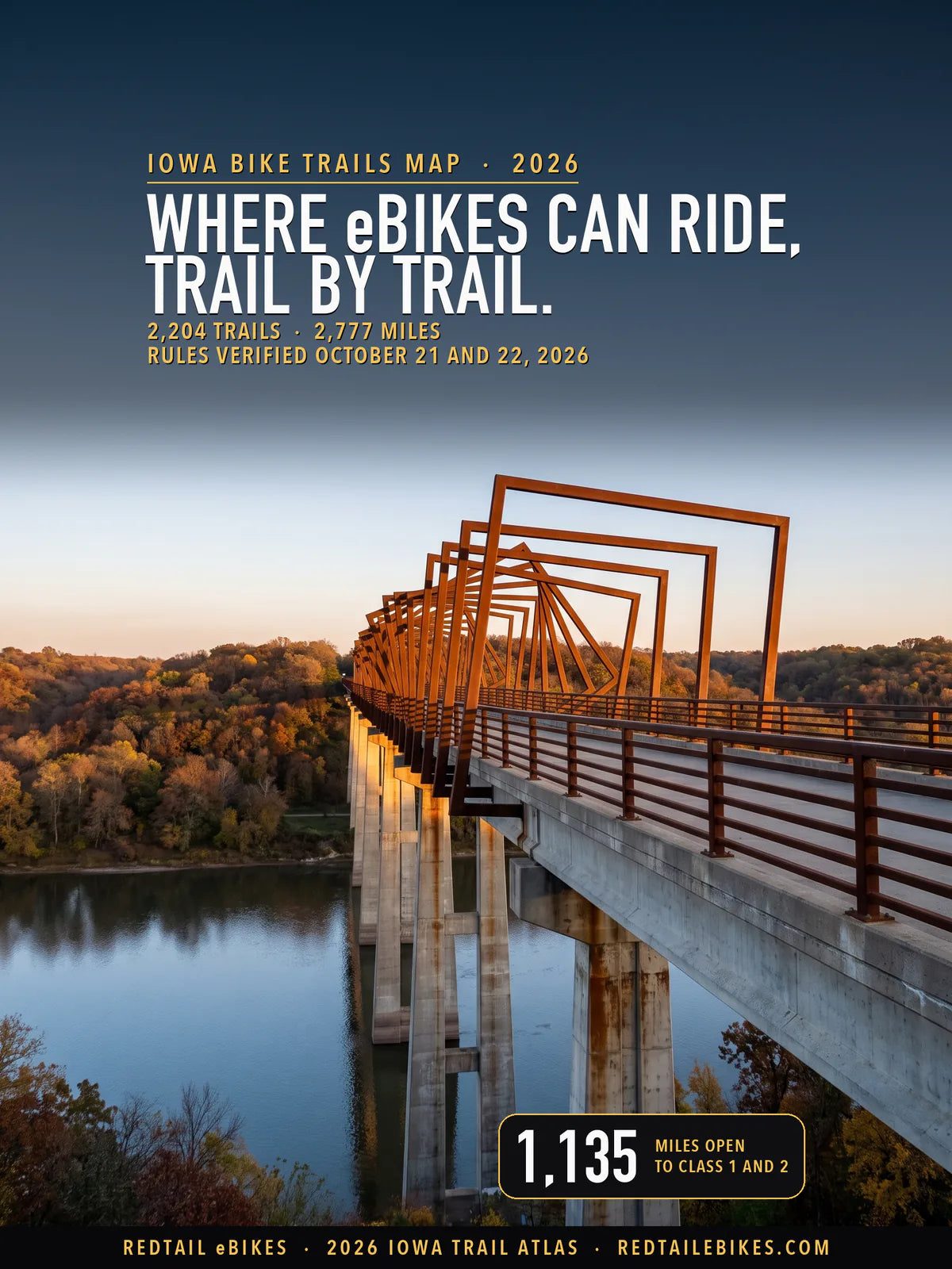
The High Trestle Trail bridge over the Des Moines River between Madrid and Woodward, on the Boone County stretch this map reads as open to all three classes, in a scene generated with Playcut from a photograph of the bridge by Phil Roeder.

Every line is a trail or path from the Iowa DOT's statewide trail layer, the Iowa DNR's state-park trail layer, the National Park Service or OpenStreetMap, colored by the e-bike rule its manager publishes. The numbers mark the Iowa DNR's five Parks Districts in the order this page maps them below.
Iowa's Code gives your e-bike a bicycle's place on the trail and lets the trail's manager write its own rules.
Iowa Code § 321.235B(9)(a) says "A low-speed electric bicycle may be operated in any place where a bicycle is allowed to operate, including but not limited to streets, highways, roadways, shoulders, bicycle lanes, bikeways, and bicycle or multi-use paths." The same Code counts "A low-speed electric bicycle" as a bicycle (§ 321.1(40)(c)) and, in its motor vehicle chapter, leaves it out of "vehicle".
Most Iowa trails belong to a county conservation board or a city. Boards write rules for their parks and trails under Iowa Code § 350.5, cities write ordinances, and the Iowa DNR runs the state parks, recreation areas and forests. On this map, boards manage 30% of the mapped miles, cities 44% and the DNR 12%.
339 managers each hold part of that authority. Every trail below carries its manager's name and the rule that manager publishes, quoted from the manager's own text and kept in the trail register, so you can check your ride trail by trail.
For the rest of Iowa's e-bike law, from labels to age limits, read Iowa e-bike laws. To compare Iowa's trail rules with other states', open bike trails by state, and for the cross-country route, our Great American Rail-Trail guide's Iowa section maps its gaps.
Riding in another state? You will find the same trail-by-trail map for Oregon bike trails, Washington State bike trails, Utah bike trails, Colorado bike trails, Wisconsin bike trails, Michigan bike trails, Ohio bike trails, Texas bike trails, Florida bike trails and New York bike trails, and our national guide to e-bike trails near you shows how to find out who manages a trail anywhere in the US.
Takeaway
On Iowa trails the class on your label decides less than the manager does. Class 1 and Class 2 ride the same 1,135 mapped miles, and Class 3 rides 1,001: the 134-mile gap is 90 miles under the Raccoon River Valley Trail's rule and 44 under Waterloo's, the two rules on this map that leave Class 3 out by name.
59% of the mapped miles read gray. The two largest causes are rules we could not read or could not tie to a managing body, on 472 miles, and board or city bans on "motorized" vehicles that do not name e-bikes, on 415. Each gray trail's row in the downloadable register says which.
In this guide
- How to read the map
- Who decides on each trail
- Iowa DNR parks, recreation areas and forests
- County conservation boards
- City rules
- Named trails riders ask about
- Corps of Engineers lakes and other federal land
- Iowa bike trails, region by region
- Where riders get caught out
- Sidewalks, roads and bike lanes
- Choosing an e-bike for Iowa trails
- Frequently asked questions
How to read the map
Find your trail's color, then read who manages it. Green takes all three classes and blue Class 1 and 2 only. Dashed red means a published rule closes the trail to your e-bike.
Gray covers four cases: the rule is unsettled and both readings are printed, we could not read the manager's rule and show the state default, the land is private, tribal or a nonprofit's, or no record names a manager. The register says which one applies to the trail you ride.
Iowa defines a low-speed electric bicycle by three classes. Check your label against this table:
| Class | How the motor helps | Assistance stops at |
|---|---|---|
| Class 1 | "provide assistance only when the rider is pedaling" | 20 mph |
| Class 2 | "may be used exclusively to propel the bicycle" | 20 mph |
| Class 3 | "provide assistance only when the rider is pedaling" | 28 mph |
Every e-bike sold in Iowa must carry its class on a label. Iowa Code § 321.235B(1) requires a permanent label showing "A classification number", "The low-speed electric bicycle's top assisted speed" and "The low-speed electric bicycle's motor wattage", and § 321.235B(5) requires a Class 3 to carry a speedometer.
You must be 16 to ride a Class 3. § 321.235B(6) says "A person under the age of sixteen shall not operate a class 3 low-speed electric bicycle." Class 1 and Class 2 carry no state age limit, and you need no license or registration for any class: § 321.235B(8) frees an e-bike from "Licensure, registration, titling, inspection, and proof of financial liability coverage."
The 750-watt line moved on July 1, 2026
Since July 1, 2026, an e-bike whose motor produces up to and including 750 watts can qualify. Before that date, the Code's definition required "an electric motor of less than seven hundred fifty watts", and the 2026 Code still prints those words (§ 321.1(36A)).
2026 Iowa Acts chapter 1053 (Senate File 490), approved April 30, 2026, amends the definition to a motor "that produces not more than seven hundred fifty watts". The Act names no other effective date, so under Iowa Code § 3.7(1) it took effect "on the first day of July following their passage".
If your bike is rated at exactly 750 watts, it was outside the definition before July 1 and has been inside it since. A city code written before then may still print "less than", as Cedar Rapids' § 53.01 does, and the table below quotes each code as it is printed.
Who decides on each trail
Who manages your trail decides the rule. Local governments' land holds 78% of Iowa's mapped miles, state land 13% and federal land 2%; find your trail's manager in the first column of the table below.
| Who manages the trail | Trails | Miles | What e-bikes may do |
|---|---|---|---|
| Iowa DNR: surfaced trails where bicycles ride | 66 | 65 | Class 1, 2 and 3 on multi-use trails that allow bikes; Class 3 at 20 mph unless posted |
| Iowa DNR: natural-surface trails, and trails whose surface no record gives | 206 | 256 | Gray: the state chart says 'Varies by park; check local signage' |
| Iowa DNR: lines another record opens to bicycles and the DNR's trail layer does not | 21 | 21 | Gray: two records disagree about bicycles; read the trailhead sign |
| Iowa DNR: wildlife areas | 9 | 5 | Class 1, 2 and 3: the areas' motor-vehicle rule does not reach an e-bike |
| U.S. Army Corps of Engineers lakes | 47 | 64 | Gray: no Corps district e-bike designation found |
| Other federal land | 1 | 1 | Gray: the managing agency's rule was not read |
| County conservation boards: a rule that reaches e-bikes | 93 | 251 | From open to closed: see each board below |
| Boards and cities: an "electrical engine" clause | 103 | 199 | Unsettled: Class 2 (throttle) reads barred on our reading; Class 1 and 3 are not settled |
| County conservation boards: other rules that leave the question open | 68 | 239 | Unsettled: see each board below |
| Cities: a rule that reaches e-bikes | 618 | 542 | From open to closed: see each city below |
| Cities: a 'motorized' ban that does not name e-bikes | 162 | 179 | Unsettled: see each city below |
| Trails under state law alone (the manager's rules read, no e-bike trail rule) | 347 | 286 | Class 1, 2 and 3: state law's default where the manager's rules say nothing |
| Trails whose manager's rules could not be read | 311 | 370 | Gray: rules not read; state law's default is open |
| County trails whose managing body no record names | 48 | 101 | Gray: the county is on record, not which of its bodies manages the trail |
| Private, nonprofit, university, school and tribal land | 37 | 34 | The owner decides |
| Manager not on record | 91 | 165 | Not determined |
| All Iowa | 2,204 | 2,777 | Map above; every trail by region below |
A trail whose stretches fall under two rules sits in each row with the miles that lie there, so if you find a trail twice, that is why: 24 trails appear in more than one row, and the rows still add up to the state.
Takeaway
State law's own default sets the color of 286 miles, where the manager's rules were read and say nothing that reaches an e-bike. 78 boards and cities have written a rule that reaches a mapped trail, and 42 of them bar "motorized" vehicles without saying whether an e-bike is one.
Iowa DNR parks, recreation areas and forests
On a DNR multi-use trail that allows bikes, every class may ride. The joint chart of the Iowa DOT, the State Patrol and the DNR answers the row "DNR-Designated Park Trail" with "Yes, on multi-use trails allowing bikes", and for Class 3 "Yes, 20 MPH limit (unless posted) on multi-use trails". The chart's file was created June 29, 2026 and last modified August 11, 2026.
On a natural-surface trail, read the park's sign. The same chart answers "Natural Surface/Soft Trail" with "Varies by park; check local signage" for all three classes. We read the DNR's pages for all 66 state parks and recreation areas it lists and its 7 state forests, and none names e-bikes, so those trails stay gray on this map.
The DNR's rules for its parks bar motor vehicles off roads: IAC 571—61.10(8)"a" says "Except as provided in these rules, motor vehicles are prohibited on state parks, recreation areas and preserves except on constructed and designated roads, parking lots and campgrounds." Iowa's motor vehicle code leaves an e-bike out of "vehicle", so the rule does not reach your e-bike on our reading, which is how the chart answers too.
Bicycles of any kind keep to the marked routes. The DNR's park rules page says "Horseback riding and bicycle riding are restricted to state park and recreation area roadways and designated and signed trails."
| DNR ground on this map | Miles | What e-bikes may do |
|---|---|---|
| Surfaced trails where bicycles ride | 65 | Class 1, 2 and 3; Class 3 at 20 mph unless posted |
| Natural-surface trails | 249 | Gray: the park's sign decides |
| Trails whose surface no record gives | 7 | Gray: the park's sign decides |
| Lines another record opens to bicycles and the DNR's own trail layer does not | 21 | Gray: two records disagree; read the trailhead sign |
| Wildlife areas | 5 | Class 1, 2 and 3 |
Wildlife areas
On a DNR wildlife area, the rule bars motor vehicles off roads and parking lots, and its own definition leaves your e-bike out. IAC 571—51.1 defines a motor vehicle as "any self-propelled vehicle having at least three wheels and registered as a motor vehicle under Iowa Code chapter 321, 321G, or 321I", and § 321.235B(8) frees an e-bike from registration, so the 5 mapped wildlife-area miles take every class.
County conservation boards
A county conservation board writes the rules for its own parks and trails. Iowa Code § 350.5(1) lets a board "make, alter, amend, or repeal regulations for the protection, regulation, and control of all museums, parks, preserves, parkways, playgrounds, recreation centers, and other property under its control", and a violation of a posted regulation "is guilty of a simple misdemeanor" (§ 350.5(3)).
Iowa's 71 boards on this map manage 835 miles, and the rules of 29 of them reach a mapped trail.
Boards that let every class ride
Several boards wrote e-bikes into their trail rules. Polk County Conservation says "Electric bikes and devices are allowed on paved recreation trails as long as they fall under the classification of an E-Bike or E-Scooter defined by State code, and stay within the posted speed limit not to exceed 20 MPH", which covers 76 mapped miles.
Polk's soft-surface trails are another matter: "Bikes are not allowed on soft-surface trails, with the exception of Sycamore Trail and Fourmile Mountain Bike Park." The Dickinson County Trails Board says "Low-speed electric bicycles are allowed on Dickinson County Trails" and caps every rider at 20 mph.
Story County Conservation lets "Bicycles, as defined in Iowa Code 321.1(40)(c)" use "all SCC owned or managed trails except in designated areas", and that Code definition includes the low-speed electric bicycle. Boone County's High Trestle Trail regulations adopt the Iowa Code's bicycle definition "and any amendments thereto", so on our reading its stretch of the trail, the bridge over the Des Moines River included, takes every class.
Linn County Conservation's own trail layer sets its "Ebike" field to "Yes" on some trails at Pinicon Ridge Park, and to "No" on one, Wyrmup.
The Raccoon River Valley Trail takes Class 1 and 2
On the Raccoon River Valley Trail, leave a Class 3 at home. The trail's own answer to "Who can use the trail?" is "Class 1 and Class 2 e-bikes are permitted.", and Class 3 is not among them, so its 90 mapped miles show blue. Greene County Conservation describes the trail as "an 89-mile-long paved trail along the branches of the Raccoon River through Greene, Guthrie, and Dallas Counties."
Boards with an "electrical engine" clause
Some of the oldest board rules bar machines by what moves them. Linn County Conservation's rules, revised April 2025, restrict "any other land conveyance propelled by a gasoline or electrical engine and run on wheels, tracks or runners in or on any area, except those trails and roads which the Board shall from time to time designate".
The boards of Black Hawk, Johnson, Jones, Bremer and Hardin counties write the same kind of clause, and Dubuque County's rules say "electric engine". A Class 2's throttle can move the bike by its motor alone, so on our reading these clauses bar a Class 2. A Class 1 or Class 3 moves only while you pedal, and whether the clause reaches it is not settled.
These clauses cover 155 mapped miles under 7 boards, the whole Cedar Valley Nature Trail included, and they read gray.
Boards that bar "motorized" vehicles
Where a board's rule says "no motorized vehicles", ask the board first. 16 boards bar motorized vehicles from their trails without defining the term, over 237 mapped miles: the Wabash Trace ("Motorized vehicles, including ATV's, are not permitted on the Trace"), the Great Western Trail in Warren County ("No horses or motorized vehicles are allowed.") and the Kewash Nature Trail among them.
An e-bike has a motor, and Iowa's motor vehicle code, § 321.1, counts it as a bicycle and leaves it out of "vehicle". Which of those readings a board meant, its rule does not say, so those trails read gray here and both readings stay in the register.
Where a board's rule closes the trail
Dubuque County Conservation lets bicycles ride only "on the surfaced trail section of the Heritage Trail" and on its roads, and says "It shall be unlawful to operate any bicycle or other wheeled vehicle powered by human power on any area leased, managed, or owned by the Board" elsewhere. Its other land is closed to e-bikes, as Polk's soft-surface trails are.
Can a board be stricter than state law?
The Code points two ways. Section 321.235B(9)(a) lets an e-bike go "in any place where a bicycle is allowed to operate", while § 350.5(1) says a board's regulations "shall not be contrary to, or inconsistent with, the laws of this state".
One reading says a board that bars an e-bike from a trail open to bicycles is inconsistent with § 321.235B. The other says the statute reaches only places "where a bicycle is allowed to operate", and a board decides that for its own land.
No Iowa appellate opinion we found decides it: none cites § 321.235B, and the one that uses the words "low-speed electric bicycle", Cornbelt Running Club v. City of Riverdale (Iowa Court of Appeals, 2022), turns on a fence across a paved path. The map colors each rule as the board wrote it, and the register prints both readings.
City rules
Many Iowa cities say outright that an e-bike rides their trails. Des Moines lets "Persons utilizing or operating an electric-motorized device of one horsepower or less, such as bicycles" use its multi-use trails, Iowa City lets e-assist bicycles ride "in all other City parks except where posted as prohibited", and Oskaloosa lists "Bicycling (traditional or electric)" among its trail's permitted uses.
Waukee and West Des Moines say it on their own rules pages. Waukee's lists e-bikes of 750 watts or less under "Multi-use trails: Allowed", and West Des Moines' Parks and Recreation page says e-bikes are "Allowed on streets, multi-use trails, and most sidewalks." Its council put a new chapter and a park rule to a third reading on October 19, 2026, and item 4 of the Limitations below says what they would change.
Iowa's 228 cities on this map manage 1,214 miles, and the rules of 49 of them reach a mapped trail. The table below lists the county boards first and the cities after them, each rule linked to its section.
| Government | Law or page | Where it applies | What it does | Trails | Miles |
|---|---|---|---|---|---|
| Audubon County Conservation Board | Audubon and Cass County Conservation Boards, 'The T-Bone Trail' brochure (June 2010) | the T-Bone Trail | Unsettled: motorized vehicles prohibited (the boards' 2010 brochure) | 2 | 19.7 |
| Benton County Conservation Board | Benton County Conservation, 'The Old Creamery Nature Trail' (PDF) | the Old Creamery Nature Trail | Unsettled: no motorized vehicles without a permit | 1 | 14.4 |
| Black Hawk County Conservation Board | Black Hawk County Conservation Board Rules & Regulations, Section 16 | a trail on land the Black Hawk County Conservation Board controls | Unsettled: electric-engine conveyances barred except by permit | 4 | 22.7 |
| Boone County Conservation Board | Boone County Conservation Board, High Trestle Trail Regulations 06.12 and 06.13 | the Boone County section of the High Trestle Trail and its trailhead parks | Class 1, 2 and 3; Class 3 at 20 mph unless posted | 1 | 9.9 |
| Bremer County Conservation Board | Bremer County Conservation Board Rules and Regulations, BCCB 9.33 | a trail on Bremer County Conservation land | Unsettled: electric-engine conveyances barred except on trails the Board designates | 6 | 8.7 |
| Carroll County Conservation Board | Carroll County Conservation & Recreation Areas Rules & Regulations, 'Vehicles' | a trail on Carroll County Conservation land, the Sauk Rail Trail included | Unsettled: motorized vehicles restricted to roadways (the term is not defined) | 5 | 22.7 |
| Cerro Gordo County Conservation Board | Cerro Gordo County Conservation Board Rules & Regulations CGC-5.1 | a trail on Cerro Gordo County Conservation land other than the Trolley and Easy Access trails | Unsettled: motor vehicles only on public roadways (the term is not defined) | 14 | 34.1 |
| Dallas County Conservation Board | Raccoon River Valley Trail, "Frequently Asked Questions": "Who can use the trail?" | the Raccoon River Valley Trail (Dallas, Guthrie and Greene county conservation boards) | Class 1 and 2; Class 3 is not among the classes permitted | 7 | 90.3 |
| Des Moines County Conservation Board | Des Moines County Conservation, 'Starr's Cave Park and Preserve' page | the Starr's Cave trails | Unsettled: no motorized vehicles on or off trails | 3 | 0.4 |
| Dickinson County Trails Board | Dickinson County Trails Board, "Policy for Use of Trails & Power-Driven Mobility Devices" | a trail of the Dickinson County Trails Board (the Spine Trail and the county's trails) | Class 1, 2 and 3; 20 mph for all; no e-motos | 1 | 10.4 |
| Dubuque County Conservation Board | Dubuque County Conservation Board Rules and Regulations, Section 12 | a trail on Dubuque County Conservation land other than the Heritage Trail | Closed to e-bikes | 24 | 12.7 |
| Dubuque County Conservation Board | Dubuque County Conservation Board Rules and Regulations, Sections 12, 16 and 17 | the surfaced Heritage Trail of the Dubuque County Conservation Board | Unsettled: bicycles allowed, electric-engine conveyances and motorized vehicles barred | 2 | 28.7 |
| Grundy County Conservation Board | Grundy County Conservation, 'Pioneer Trail' page | the Pioneer Trail | Unsettled: all motorized vehicles prohibited | 1 | 9.6 |
| Hardin County Conservation Board | Hardin County Conservation Board Rules & Regulations brochure (ATVs and snowmobiles restricted) | a trail on Hardin County Conservation land | Unsettled: electric-engine land conveyances barred except where the board designates | 2 | 1.1 |
| Harrison County Conservation Board | Harrison County Conservation, FAQ: 'Can I ride horses or use motorized vehicles on area trails?' | a trail on Harrison County Conservation land | Unsettled: bicycles permitted, motorized vehicles not (an e-bike is not placed) | 17 | 13.9 |
| Jackson County Conservation Board | Jackson County Conservation, 'Hurstville Recreation Trail' page | the Hurstville Recreation Trail | Unsettled: no motorized vehicles | 1 | 0.8 |
| Jasper County Conservation Board | Jasper County, Iowa, Conservation Board Notice Rules and Regulations (vehicles) | a trail on Jasper County Conservation land, the Chichaqua Valley Recreation Trail included | Unsettled: vehicles only on roadways; licensed motorized bikes only as conveyance | 4 | 21.2 |
| Johnson County Conservation Board | Johnson County Conservation Board Rules and Regulations, Section 18 | a trail on Johnson County Conservation land | Unsettled: electric-engine land conveyances barred unless the board approves the use | 6 | 6.1 |
| Jones County Conservation Board | Jones County Conservation Board Rules and Regulations (ATVs and snowmobiles section) | a trail on Jones County Conservation land, the Grant Wood and Wapsi trails included | Unsettled: electric-engine conveyances barred (snowmobiles excepted on designated trails) | 3 | 4.3 |
| Linn County Conservation Board | Linn County Conservation Board Rules and Regulations, Section 15 (ATVs, snowmobiles and golf carts restricted) | a trail on Linn County Conservation land the board's layer does not mark | Unsettled: electric-engine land conveyances barred except on trails the board designates | 22 | 67.9 |
| Linn County Conservation Board | Linn County GIS, Conservation trail layer (dsTrail/12), Ebike field | the Pinicon Ridge Park mountain-bike trails the layer marks Ebike Yes (26 named trails) | Class 1, 2 and 3; Class 3 at 20 mph unless posted | 23 | 7.2 |
| Marshall County Conservation Board | Marshall County Conservation Board brochure, 'Park Regulations' | a trail on Marshall County Conservation land (Linn Creek, Highway 330 and Heart of Iowa trails included) | Unsettled: motorized vehicles restricted to roadways (the term is not defined) | 5 | 18.5 |
| Mills County Conservation Board | Mills County, 'Wabash Trace Nature Trail' flyer | the Wabash Trace Nature Trail in Mills County | Unsettled: motorized vehicles not permitted | 1 | 25.9 |
| Mitchell County Conservation Board | Mitchell County Conservation, 'Cedar River Greenbelt Trail' page | the Cedar River Greenbelt Trail | Unsettled: no motorized vehicle on the trail | 6 | 8.5 |
| Polk County Conservation Board | Polk County Conservation rules, Section 29 "Bikes on Trail" | a Polk County Conservation trail whose surface is crushed stone or not on record | Unsettled: a crushed or unrecorded-surface trail (the rule turns on paved vs soft) | 3 | 1.6 |
| Polk County Conservation Board | Polk County Conservation rules, Section 29 "Bikes on Trail" | a paved trail on land the Polk County Conservation Board controls | Class 1, 2 and 3; 20 mph for every class; no mopeds or e-motos | 16 | 75.7 |
| Ringgold County Conservation Board | Ringgold County Conservation, 'Ringgold Trailway' page | the Ringgold Trailway | Class 1, 2 and 3; Class 3 at 20 mph unless posted | 1 | 2.1 |
| Sac County Conservation Board | Sac County Code of Ordinances § 8-1-17 (Use of Motor Vehicles Restricted) | a trail on Sac County Conservation land, the Sauk Rail Trail included | Unsettled: motorized vehicles restricted to roadways and parking areas on board areas (the term is not defined) | 1 | 7.6 |
| Story County Conservation Board | Story County Conservation Rules and Regulations 4.29 | a trail Story County Conservation owns or manages | Class 1, 2 and 3, except where signs bar bicycles | 20 | 43.1 |
| Tama County Conservation Board | Tama County Conservation, 'Wolf Creek Nature Trail' page | the Wolf Creek Nature Trail | Unsettled: no motorized vehicles on the trail | 1 | 3.2 |
| Warren County Conservation Board | Warren County Conservation, 'Great Western Trail' page | the Great Western Trail in Warren County | Unsettled: no motorized vehicles | 1 | 11.7 |
| Warren County Conservation Board | Warren County Conservation, 'Summerset Trail' page | the Summerset Trail | Unsettled: no motorized vehicles | 1 | 10.8 |
| Washington County Conservation Board | Washington County Conservation, 'Rules & Regulations' page (Kewash Nature Trail) | the Kewash Nature Trail | Unsettled: bicycle and pedestrian traffic only, no unauthorized motorized equipment | 1 | 14.0 |
| City of Algona | Algona Municipal Code § 10.16.090 | the Des Moines River Trail in Algona | Unsettled: any type of motorized vehicle, motorized bicycles included, barred from the Des Moines River Trail | 2 | 2.2 |
| City of Ames | Ames Municipal Code § 4.8(4) | an Ames bike path | Class 1, 2 and 3; Class 3 at 20 mph unless posted | 35 | 32.8 |
| City of Ankeny | Ankeny Code of Ordinances § 76.08 (Place of Riding) | an unpaved path inside an Ankeny park or green space | Closed to e-bikes | 4 | 0.8 |
| City of Ankeny | Ankeny Code of Ordinances § 82.02 (Permitted Uses) | an Ankeny multi-use recreational trail | Class 1, 2 and 3; 20 mph; paths 8 feet wide or more | 41 | 37.4 |
| City of Bettendorf | Bettendorf City Code § 6-1-248 (Traffic in Parks) | a Bettendorf bicycle path or trail | Unsettled: no motor vehicle or motorized vehicle on bicycle paths, fitness trails, jogging paths or park grounds | 9 | 7.4 |
| City of Cedar Falls | Cedar Falls Code of Ordinances § 17-275(2) | a Cedar Falls recreational trail | Unsettled: motorized vehicles prohibited on recreational trails; § 23-2 counts electric-assist bicycles as bicycles | 32 | 34.9 |
| City of Cedar Rapids | Cedar Rapids Municipal Code § 53.01 (Definitions: Bicycle) and § 53.12 (Riding on Roadways) | a Cedar Rapids bicycle/micromobility path or trail | Class 1, 2 and 3 (the city's e-bike definition, our reading beyond it) | 67 | 49.3 |
| City of Charles City | Charles City Code of Ordinances (bicycle paths) | a Charles City bicycle path or park trail | Unsettled: no motorized vehicle on a designated bicycle path or in a public park off the roadways (the term is not defined) | 2 | 6.5 |
| City of Clinton | Clinton Code of Ordinances § 72.14 (Recreational Trail) | the Discovery Trail from Eighth Avenue South to the Eagle Point Park entrance | Unsettled: motor vehicles and any motor-driven vehicle barred from the recreational trail from Eighth Avenue South to the Eagle Point Park entrance | 1 | 4.9 |
| City of Clive | Clive Code § 6-7-7(2)(a) and (c), as replaced by Ordinance No. 1178 | a Clive multi-use trail or public sidewalk | Class 1, 2 and 3; 20 mph for every class where none is posted; Class 3 from age 16 | 17 | 14.4 |
| City of Coralville | Coralville Code of Ordinances § 47.02(2) (Exclusions) | a Coralville trail | Class 1, 2 and 3; Class 3 at 20 mph unless posted | 41 | 32.1 |
| City of Council Bluffs | Council Bluffs Municipal Code § 9.09.030 | a Council Bluffs trail | Class 1, 2 and 3; Class 3 at 20 mph unless posted | 32 | 43.3 |
| City of Davenport | Davenport Municipal Code § 10.84.010(C) | a City of Davenport multi-use path or trail | Class 1, 2 and 3; 10 mph near pedestrians; over 750 W barred | 15 | 27.9 |
| City of Des Moines | Des Moines Municipal Code § 74-110(b)(3) | a City of Des Moines trail | Class 1, 2 and 3; motor of one horsepower or less | 80 | 61.4 |
| City of Dubuque | Dubuque City Code § 9-7-321.275A | a Dubuque park or recreation trail | Unsettled: no car, truck, motorcycle or other motorized vehicle on a sidewalk or trail in a park or recreation facility without the director's permission | 29 | 18.1 |
| City of Eldridge | Eldridge Code of Ordinances § 4.08 (Shared Use Paths) | an Eldridge shared use path or bike path | Unsettled: no motorized vehicle on designated shared use paths or city bike paths (the term is not defined) | 2 | 4.3 |
| City of Evansdale | Evansdale Code of Ordinances § 77.03 (Motorized Vehicles) | an Evansdale bike and recreation trail | Unsettled: no motorized vehicles on the bike and recreation trail | 2 | 2.1 |
| City of Forest City | Forest City Code of Ordinances § 48.03 (Acts Prohibited); § 48.02(4) (Motor vehicle) | the walking path within the Tim Coffey Recreational Area | Unsettled: no 'motor vehicle', in the chapter's own broad sense, within the Tim Coffey Recreational Area | 5 | 2.9 |
| City of Fort Madison | Fort Madison Code of Ordinances § 9-4-9(A) (Recreational Trail) | a Fort Madison recreational trail | Unsettled: motor vehicles and any motor-driven vehicle barred from city recreational trails | 7 | 6.6 |
| City of Fredericksburg | Fredericksburg Code of Ordinances § 93.02(A) (Use of Drives Required) | a Fredericksburg park or trail | Unsettled: no motorized vehicle in a city park or on the Plum Creek Bike and Nature Trail except on the drives or places the city designates | 4 | 4.7 |
| City of George | George City Code (sidewalks and recreational trails) | a George recreational trail | Class 1, 2 and 3; Class 3 at 20 mph unless posted | 1 | 2.9 |
| City of Grimes | Grimes City Code § 8-1-3 (Use of Drives Required) | a path or bikeway inside a Grimes city park | Unsettled: no motorized vehicle on walking paths or bikeways within the city parks (the term is not defined) | 6 | 2.6 |
| City of Hiawatha | Hiawatha Code of Ordinances § 47.06 (Travel and Speed) | a path inside a Hiawatha park | Unsettled: no motorized vehicle on walking paths or bikeways inside the city parks | 2 | 1.4 |
| City of Indianola | Indianola Code of Ordinances § 76.07 (Responsible Riding) | an Indianola multi-use trail | Class 1, 2 and 3; Class 3 at 20 mph unless posted | 7 | 4.8 |
| City of Iowa City | Iowa City City Code § 10-9-2 (Prohibited Actions in Parks) | an Iowa City trail | Class 1, 2 and 3; Class 3 at 20 mph unless posted | 91 | 50.7 |
| City of Johnston | Johnston City Code § 48.02 (Vehicles Prohibited; Exceptions) | a Johnston recreation trail, greenbelt or open-space area | Unsettled: devices driven by electric or battery power barred from recreation trails; § 76.01 counts an e-bike of one horsepower or less as a bicycle | 57 | 43.3 |
| City of Kingsley | Kingsley Code of Ordinances § 76.01 (Authorized Usage) | the Kingsley walking/biking trail | Unsettled: no motorized vehicle on the Kingsley walking/biking trail unless the mayor authorizes it | 1 | 1.9 |
| City of Knoxville | Knoxville Ordinance 26-4 (bicycles, electric scooters and micromobility devices) | a Knoxville multi-use trail | Class 1, 2 and 3; Class 3 at 20 mph unless posted | 1 | 1.7 |
| City of Lamoni | Lamoni Code of Ordinances § 76.01 (Motorized Vehicles Prohibited) | the Lamoni Biking/Walking Trail (Liberty Hall to the Welcome Center) | Unsettled: no motorized vehicle on the Lamoni Biking/Walking Trail unless the mayor authorizes it (the term is not defined) | 1 | 5.3 |
| City of Marion | Marion City Code § 238-2 | a City of Marion trail inside a park | Unsettled: 'motorized bikes' restricted to roads (the parks chapter does not define the term) | 8 | 5.4 |
| City of Marion | Marion City Code § 122-2 (definition of BICYCLE) | a City of Marion shared-use path or bike trail outside a park | Class 1, 2 and 3; 20 mph on shared-use paths | 7 | 5.0 |
| City of Mason City | Mason City Code of Ordinances § 5-2-1 (Control, Supervision) | a Mason City park-system path | Unsettled: no motorized vehicle on the park system's pedestrian or bicycle paths | 24 | 28.3 |
| City of Muscatine | Muscatine City Code § 7-14-3 (Riding on Sidewalks and Trails) | a Muscatine trail | Class 1, 2 and 3 with a motor of 750 W or less | 12 | 10.5 |
| City of Newton | Newton Code of Ordinances § 74.20 (Paved Multi-Use Paths) | a Newton paved multi-use trail | Class 1, 2 and 3; Class 3 at 20 mph unless posted | 4 | 4.4 |
| City of Oelwein | Oelwein Code of Ordinances § 21-9(3) (Oelwein bike trail rules and regulations) | the Oelwein Bike Trail | Unsettled: motorized vehicles, mopeds and motorized bicycles prohibited on the Oelwein Bike Trail | 3 | 5.0 |
| City of Orleans | Orleans Code of Ordinances § 47.08 (Vehicles and Horses in Parks) | a path inside an Orleans park | Unsettled: no motorized vehicle in a city park or recreation facility except on roadways and trails the council designates | 1 | 1.3 |
| City of Oskaloosa | Oskaloosa Municipal Code § 10.80.020 (Permitted uses) | the Oskaloosa multi-use recreation trail | Class 1, 2 and 3; Class 3 at 20 mph unless posted | 3 | 12.5 |
| City of Pella | Pella Code of Ordinances § 76.07 (Responsible Operation) | a Pella multi-use trail | Class 1, 2 and 3; Class 3 at 20 mph unless posted | 1 | 0.3 |
| City of Pleasant Hill | Pleasant Hill City Code § 62.03 (Vehicles on Public Walkways or Recreational Trail) | a Pleasant Hill recreational trail | Unsettled: all motorized vehicles, motorized bicycles included, barred from recreational trails; § 76.07 sets the Class 3 e-bike speed on multi-use trails | 5 | 5.6 |
| City of Prairie City | Prairie City Code of Ordinances § 62.07 (Recreational Trails) | a Prairie City recreational trail | Unsettled: no driver of a motorized vehicle on a Prairie City Recreational Trail | 1 | 0.8 |
| City of Riverdale | Riverdale Code of Ordinances § 75.03 (Uses Not Permitted) | a Riverdale multi-use recreational trail | Unsettled: motorized vehicles not permitted on multi-use recreational trails (no definition) | 3 | 3.3 |
| City of Rock Valley | Rock Valley Code of Ordinances (trails and pathways) | a Rock Valley public trail or pathway | Unsettled: no motorized vehicle on any public trail or pathway in the city (the term is not defined) | 6 | 5.2 |
| City of Sergeant Bluff | Sergeant Bluff Code of Ordinances § 77.05 (Places of Operation and Requirements), table | a Sergeant Bluff trail | Class 1 and 2 from age 10; Class 3 from age 16 | 3 | 1.6 |
| City of Sheldon | Sheldon Code of Ordinances § 62.10 (Sheldon Recreational Trail) | a Sheldon recreational trail | Unsettled: no driver of a motorized vehicle on a Sheldon Recreational Trail | 1 | 5.9 |
| City of Sioux City | Sioux City Municipal Code § 16.04.300 | the Perry Creek Greenway | Unsettled: all motorized vehicles barred from the Perry Creek Greenway, 'including those defined in section 10.54.020', which now defines low-speed e-bikes | 3 | 4.3 |
| City of Urbandale | Urbandale Code of Ordinances § 98.02 (Travel and Speed) | an Urbandale trail | Class 1, 2 and 3; 15 mph on park paths and bikeways, 20 mph on trails | 73 | 43.8 |
| City of Waterloo | Waterloo Code of Ordinances § 6-2-1 (Definitions; electric-assist bicycles) | a Waterloo multi-use recreational trail | Class 1 and 2; Class 3 not allowed on trails or sidewalks | 20 | 44.5 |
| City of Waukee | City of Waukee, 'Ride Safe' page (the July 20, 2026 personal transportation device ordinance) | a Waukee multi-use trail or paved park path | Class 1, 2 and 3; 20 mph on trails unless posted | 12 | 16.5 |
| City of Waukon | Waukon Code of Ordinances § 47.07(3) (Vehicles and Roadways) | a Waukon recreational trail or park path | Class 1, 2 and 3; Class 3 at 20 mph unless posted | 2 | 0.8 |
| City of Webster City | Webster City Code of Ordinances § 36-24(b) (Use of recreational trails) | a Webster City recreational trail | Unsettled: motorized vehicles prohibited on recreational trails (no definition) | 2 | 7.7 |
| City of West Des Moines | City of West Des Moines, Parks & Recreation, 'Do Your Part: Ride Smart' page | a West Des Moines multi-use trail | Class 1, 2 and 3; Class 3 at 20 mph unless posted | 52 | 42.4 |
Speed limits and size limits cities add
Some cities add their own limits. Urbandale caps an e-bike at 15 mph on its walking paths and bikeways (§ 98.02) and bars "devices operating at a speed exceeding 20 miles per hour" from any trail.
Waukee's page says "If there is no posted speed limit on the trail, the maximum speed is 20 mph.", and Davenport says "Bicycle and motorized micromobility device must reduce their speed to no more than 10 mph when within 30 feet of a pedestrian".
Muscatine leaves out "Any vehicle equipped with an electric motor of more than 750 watts" and any that can exceed 20 mph on the motor alone. Sergeant Bluff's table opens its streets and trails to a Class 3 rider from age 16 (§ 77.05), and Marion holds bicycles to 20 mph on its shared-use paths (§ 122-8(A)).
Ankeny opens its bicycle paths to e-bikes where they are "equal to or greater than eight feet (8') in width", unless a sign says otherwise.
Where a city bars Class 3 or closes the trail
In Waterloo, Class 3 stays off the trails. Its § 6-2-1 says "Class 3 bicycles are not allowed on multi-use recreational trails, or sidewalks.", which turns 44 mapped miles blue.
Ankeny lets e-bikes ride its trails, but inside its parks they "shall only be ridden on the paved portion of the bicycle paths and sidewalks". Iowa City closes two downtown parks: "No person shall travel upon or operate a bicycle, electric assist bicycle, electric scooter, electric skateboard, or nonmotorized vehicle within Chauncey Swan Park or Black Hawk Mini Park."
What changed in 2025 and 2026
9 local governments on this map adopted or revised an e-bike or trail rule in 2025 or 2026 that the map reads, each date read in the rule's own text:
- Davenport's Ordinance No. 2025-152, April 9, 2025, defines a multi-use path as one "designed for shared use by pedestrians, cyclists, and other non-motorized users, which includes e-bikes".
- Linn County Conservation's rules, revised April 2025, carry its "electrical engine" clause.
- The Dickinson County Trails Board's policy on trails and power-driven mobility devices, which the City of Orleans posts as its 2025 updated e-bikes policy, allows low-speed electric bicycles and sets 20 mph on its trails.
- Marion's Ordinance No. 26-03, April 9, 2026, amended its 20 mph limit on shared-use paths.
- Ankeny's Ordinance 2253, April 20, 2026, rewrote its bicycle chapter: e-bikes ride bicycle paths eight feet wide or more, and inside parks only their paved portion.
- Muscatine's trail and sidewalk section, § 7-14-3, carries Ordinance 2026-0120 of May 5, 2026 in its history.
- Clive's Ordinance No. 1178, passed July 9, 2026, rewrote its bicycle chapter for every personal transportation device: e-bikes ride its multi-use trails unless a sign bars them, at 20 mph where no limit is posted, and their riders yield to pedestrians and "human-powered bicycles".
- Waukee's personal transportation device ordinance, July 20, 2026, opens its multi-use trails to e-bikes at 20 mph unless posted.
- Urbandale's Ordinance 2026-30, September 1, 2026, rewrote its chapter 75 and holds every device to 20 mph on its trails.
Item 4 of the Limitations below names four more cities whose 2026 ordinances the map does not read yet: Norwalk, Spirit Lake, West Des Moines and Windsor Heights.
City codes that bar "motorized vehicles" without naming e-bikes
26 cities bar "motorized" vehicles from their trails or park paths without defining the term, over 179 mapped miles. Cedar Falls is one: "The use of motorized vehicles and snowmobiles is prohibited on recreational trails within the city", though its own traffic chapter counts "Electric-assist bicycles" as bicycles.
Mason City and Dubuque write the same kind of rule for their park paths. Those trails read gray: ask the city's parks office before you ride.
Johnston goes further. Its § 48.02 bars "any other device driven by electric or battery power" from its recreation trails, while its traffic chapter counts an e-bike of one horsepower or less as a bicycle. The two sections point different ways, and the map reads its 43 miles gray.
Named trails riders ask about
These are the trails, parks and cities Iowa riders name in their searches, each row backed by a search string riders typed. The miles are the stretches this map draws, split by the rule that governs each stretch.
| Trail | Miles mapped | Managed by | What e-bikes may do |
|---|---|---|---|
| Raccoon River Valley Trail | 89.8 | Dallas County Conservation Board; Guthrie County Conservation Board; Greene County Conservation Board and 2 more | Class 1 and 2; Class 3 is not among the classes permitted on 88.7 mi; Local rule could not be read on 1.1 mi |
| High Trestle Trail | 27.7 | Polk County Conservation Board; Boone County Conservation Board; Dallas County and 5 more | Class 1, 2 and 3; 20 mph for every class; no mopeds or e-motos on 13.7 mi; Class 1, 2 and 3; Class 3 at 20 mph unless posted on 10.1 mi; Local rule could not be read on 2.3 mi; Class 1, 2 and 3, except where signs bar bicycles on 1.5 mi; Manager not on record on 0.2 mi |
| Wabash Trace Nature Trail | 62.1 | Not on record; Mills County Conservation Board; City of Shenandoah | Manager not on record on 36.0 mi; Unsettled on 25.9 mi; Local rule could not be read on 0.2 mi |
| Cedar Valley Nature Trail | 52.3 | Black Hawk County Conservation Board; Linn County Conservation Board; Black Hawk and Linn County Conservation Boards (jointly) | Unsettled on 52.3 mi |
| Rolling Prairie Trail | 55.4 | Not on record; Franklin County Conservation Board; Butler County and 3 more | Local rule could not be read on 33.3 mi; Manager not on record on 22.1 mi |
| Hoover Nature Trail | 37.9 | Muscatine County Conservation Board; Linn County Trails Association; Linn County Conservation Board and 11 more | Local rule could not be read on 22.5 mi; Private land or a nonprofit: the owner decides on 5.5 mi; Unsettled on 5.5 mi; Class 1, 2 and 3; Class 3 at 20 mph unless posted on 2.2 mi; Manager not on record on 2.1 mi |
| Chichaqua Valley Trail | 29.2 | Jasper County Conservation Board; Polk County Conservation Board | Unsettled on 15.1 mi; Class 1, 2 and 3; 20 mph for every class; no mopeds or e-motos on 14.1 mi |
| Sauk Rail Trail | 27.5 | Carroll County Conservation Board; Sac County Conservation Board | Unsettled on 27.5 mi |
| Heart of Iowa Nature Trail | 25.8 | Story County Conservation Board; Marshall County Conservation Board | Class 1, 2 and 3, except where signs bar bicycles on 22.2 mi; Unsettled on 3.5 mi |
| Wapsi-Great Western Line Trail | 25.9 | Howard County; Mitchell County Conservation Board; Not on record and 1 more | Local rule could not be read on 25.4 mi; Manager not on record on 0.5 mi |
| Gay Lea Wilson Trail | 27.1 | Polk County Conservation Board | Class 1, 2 and 3; 20 mph for every class; no mopeds or e-motos on 26.5 mi; Unsettled on 0.5 mi |
| T-Bone Trail | 19.7 | Audubon County Conservation Board; Cass County Conservation Board | Unsettled on 19.7 mi |
| Prairie Farmer Recreational Trail | 18.6 | Winneshiek County Conservation Board; Howard County | Local rule could not be read on 18.6 mi |
| Neal Smith Trail | 18.4 | Corps of Engineers, Saylorville Lake; Polk County; City of Des Moines and 1 more | Unsettled on 13.1 mi; Local rule could not be read on 4.6 mi; Class 1, 2 and 3; motor of one horsepower or less on 0.7 mi |
| Great Western Trail | 17.5 | Warren County Conservation Board; Polk County Conservation Board | Unsettled on 11.7 mi; Class 1, 2 and 3; 20 mph for every class; no mopeds or e-motos on 5.9 mi |
| Volksweg Trail | 17.4 | U.S. Army Corps of Engineers; City of Pella; Not on record and 1 more | Unsettled on 16.8 mi; Class 1, 2 and 3; Class 3 at 20 mph unless posted on 0.3 mi; Manager not on record on 0.2 mi; Local rule could not be read on under 0.1 mi |
| Cinder Path | 15.9 | Lucas County Conservation Board; Wayne County Conservation Board | Local rule could not be read on 15.9 mi |
| Old Creamery Trail | 15.4 | Benton County Conservation Board; City of Dysart | Unsettled on 14.4 mi; Class 1, 2 and 3; Class 3 at 20 mph unless posted on 1.0 mi |
| Grant Wood Trail | 14.9 | Linn County Conservation Board; Jones County Conservation Board | Unsettled on 14.9 mi |
| Kewash Nature Trail | 14.0 | Washington County Conservation Board | Unsettled on 14.0 mi |
| Trout Run Trail, Decorah | 12.0 | Not on record; Winneshiek County Conservation Board; City of Decorah | Manager not on record on 6.6 mi; Local rule could not be read on 4.8 mi; Class 1, 2 and 3; Class 3 at 20 mph unless posted on 0.6 mi |
| Heritage Trail, Dubuque County | 29.4 | Dubuque County Conservation Board; City of Dubuque; Not on record | Unsettled on 29.3 mi; Manager not on record on 0.1 mi |
| Iowa River Corridor Trail | 13.0 | City of Iowa City; City of Coralville; City of North Liberty | Class 1, 2 and 3; Class 3 at 20 mph unless posted on 13.0 mi |
| Iowa Great Lakes Trail | 14.1 | Not on record; City of Orleans; Iowa DNR, Wildlife and 8 more | Local rule could not be read on 4.5 mi; Manager not on record on 4.2 mi; Class 1, 2 and 3; Class 3 at 20 mph unless posted on 4.1 mi; Unsettled on 1.3 mi |
| Brushy Creek State Recreation Area | 36.8 | Iowa DNR, Brushy Creek State Recreation Area | Unsettled on 23.7 mi; Class 1, 2 and 3; Class 3 at 20 mph unless posted on 13.0 mi |
| Backbone State Park | 9.8 | Iowa DNR, Backbone State Park | Unsettled on 9.7 mi; Class 1, 2 and 3; Class 3 at 20 mph unless posted on 0.1 mi |
| Volga River State Recreation Area | 20.3 | Iowa DNR, Volga River State Recreation Area | Unsettled on 20.0 mi; Class 1, 2 and 3; Class 3 at 20 mph unless posted on 0.3 mi |
| Yellow River State Forest | 21.7 | Iowa DNR, Yellow River State Forest - Paint Creek Unit; Iowa DNR, Yellow River State Forest - Luster Heights Unit; Iowa DNR, Yellow River State Forest - Creekside Equestrian Campground | Unsettled on 19.6 mi; Class 1, 2 and 3; Class 3 at 20 mph unless posted on 2.2 mi |
| Stephens State Forest | 18.7 | Iowa DNR, Stephens State Forest - White Breast Unit | Unsettled on 18.7 mi |
| Lake Darling State Park | 17.6 | Iowa DNR, Lake Darling State Park | Unsettled on 15.1 mi; Class 1, 2 and 3; Class 3 at 20 mph unless posted on 2.5 mi |
| Lake Manawa State Park | 9.1 | Iowa DNR, Lake Manawa State Park | Unsettled on 6.1 mi; Class 1, 2 and 3; Class 3 at 20 mph unless posted on 3.1 mi |
| Saylorville Lake (Corps of Engineers) | 23.7 | Corps of Engineers, Saylorville Lake | Unsettled on 23.7 mi |
| Des Moines city trails | 61.4 | City of Des Moines | Class 1, 2 and 3; motor of one horsepower or less on 61.4 mi |
| Cedar Rapids city trails | 49.3 | City of Cedar Rapids | Class 1, 2 and 3 (the city's e-bike definition, our reading beyond it) on 49.3 mi |
| Iowa City trails | 50.7 | City of Iowa City | Class 1, 2 and 3; Class 3 at 20 mph unless posted on 50.7 mi |
| Ankeny city trails | 38.2 | City of Ankeny | Class 1, 2 and 3; 20 mph; paths 8 feet wide or more on 37.4 mi; Closed to e-bikes on 0.8 mi |
| Ames city trails | 32.8 | City of Ames | Class 1, 2 and 3; Class 3 at 20 mph unless posted on 32.8 mi |
| Waterloo city trails | 44.5 | City of Waterloo | Class 1 and 2; Class 3 not allowed on trails or sidewalks on 44.5 mi |
| Sioux City trails | 51.1 | City of Sioux City | Class 1, 2 and 3; Class 3 at 20 mph unless posted on 46.8 mi; Unsettled on 4.3 mi |
| Davenport and Bettendorf trails (Quad Cities) | 35.3 | City of Davenport; City of Bettendorf | Class 1, 2 and 3; 10 mph near pedestrians; over 750 W barred on 27.9 mi; Unsettled on 7.4 mi |
| Dubuque city trails | 18.1 | City of Dubuque | Unsettled on 18.1 mi |
| Council Bluffs city trails | 43.3 | City of Council Bluffs | Class 1, 2 and 3; Class 3 at 20 mph unless posted on 43.3 mi |
| West Des Moines city trails | 42.4 | City of West Des Moines | Class 1, 2 and 3; Class 3 at 20 mph unless posted on 42.4 mi |
| Urbandale city trails | 43.8 | City of Urbandale | Class 1, 2 and 3; 15 mph on park paths and bikeways, 20 mph on trails on 43.8 mi |
| Cedar Falls city trails | 34.9 | City of Cedar Falls | Unsettled on 34.9 mi |
| Decorah city trails | 12.2 | City of Decorah | Class 1, 2 and 3; Class 3 at 20 mph unless posted on 12.2 mi |
The High Trestle Trail is open to every class on most of its length. 25 of its 28 mapped miles take Class 1, 2 and 3 under Boone, Polk and Story county rules that adopt the Code's bicycle definition or name e-bikes.
The Cedar Valley Nature Trail reads gray end to end. Black Hawk's and Linn's boards bar a "land conveyance propelled by a gasoline or electrical engine" on their stretches, and the two boards manage the middle stretch jointly, so all 52 mapped miles fall under an engine clause.
The Wabash Trace and the Sauk Rail Trail read gray for the same reason as most of the map. Mills, Carroll and Sac county boards bar "motorized" vehicles without naming e-bikes, and on most of the Wabash Trace's stretches in Pottawattamie, Fremont and Page counties no record names the manager.
Takeaway
Of the named trails riders ask about, the Raccoon River Valley Trail, the High Trestle Trail and the paved trails of Des Moines and Polk County Conservation are the surest rides for an e-bike: their managers name e-bikes or adopt the Code's definition. If you ride a Class 3, you give up the Raccoon River Valley Trail.
Corps of Engineers lakes and other federal land
At the Corps of Engineers' lakes, no e-bike designation has been published. The Corps counts bicycles as vehicles, and 36 CFR 327.2 says "The operation and/or parking of a vehicle off authorized roadways is prohibited except at locations and times designated by the District Commander." The Corps' lake pages for Saylorville, Red Rock, Coralville and Rathbun name no e-bike rule.
Saylorville's own trail page adds "Motorized vehicles are prohibited on the trail", without saying whether an e-bike is one. The Corps' 64 mapped miles, the Volksweg Trail at Lake Red Rock and much of the Neal Smith Trail among them, read gray.
On the Mississippi River, the Rock Island District's campground rules say "NO ELECTRIC/GAS POWERED VEHICLES THAT ARE NOT STATE REGISTERED. THIS IS TO INCLUDE ELECTRIC BIKES". That rule covers the Mississippi River Project's campgrounds, and none of the Corps miles on this map lies along the Mississippi: they are at Saylorville, Red Rock, Coralville and Rathbun.
Riding RAGBRAI on an e-bike
Yes, you may ride RAGBRAI on an e-bike. The ride's own FAQ says "Ebikes are also permitted but must follow Iowa State Electric Ebike Laws". On the road, that means a bicycle's rules apply to you (§ 321.235B(7)), and you must be 16 to ride a Class 3.
Iowa bike trails, region by region
The five regions below follow the Iowa DNR's own Parks Districts, each county placed whole in the district that holds most of it (every county but Harrison and Clarke lies at least 99% in one), and are drawn on the map above; the names are ours, after the places in each.
Open your region's section for its map, its longest named trails and their rules, and a collapsed list of every mapped trail by rule. A trail that crosses a region line appears in each region with the miles that lie there.
Des Moines, Ames and Central Iowa

Central Iowa holds the most open trail on the map. Its 901 mapped miles lie in Appanoose, Boone, Dallas, Grundy, Hamilton, Hardin, Jasper, Lucas, Madison, Mahaska, Marion, Marshall, Monroe, Polk, Poweshiek, Story, Tama, Warren and Wayne counties; 543 are open and 357 read gray.
More than half of the open miles lie in Polk County, on Polk County Conservation's paved trails and the trails of Des Moines, Ankeny, Urbandale and West Des Moines, all open to every class. The gray ones sit at Saylorville and Red Rock, on Johnston's trails and under Jasper and Marshall county rules.
| Trail | Managed by | Miles | E-bikes |
|---|---|---|---|
| Raccoon River Valley Trail | Dallas County Conservation Board | 56.1 | Class 1 and 2; Class 3 is not among the classes permitted |
| Gay Lea Wilson Trail | Polk County Conservation Board | 23.0 | Class 1, 2 and 3; 20 mph for every class; no mopeds or e-motos |
| Heart of Iowa Nature Trail | Story County Conservation Board | 22.2 | Class 1, 2 and 3, except where signs bar bicycles |
| Stevens Forest - Whitebreast Unit Trails | Iowa DNR, Stephens State Forest - White Breast Unit | 18.7 | Unsettled |
| Volksweg Trail | U.S. Army Corps of Engineers | 16.8 | Unsettled |
| Chichaqua Valley Trail | Jasper County Conservation Board | 15.1 | Unsettled |
| Cinder Path Trail | Lucas County Conservation Board | 13.4 | Local rule could not be read |
| High Trestle Trail | Polk County Conservation Board | 13.0 | Class 1, 2 and 3; 20 mph for every class; no mopeds or e-motos |
| Neal Smith Trail | Corps of Engineers, Saylorville Lake | 12.8 | Unsettled |
| Chichaqua Valley Trail | Polk County Conservation Board | 12.5 | Class 1, 2 and 3; 20 mph for every class; no mopeds or e-motos |
| Great Western Trail | Warren County Conservation Board | 11.7 | Unsettled |
| Summerset Trail | Warren County Conservation Board | 10.8 | Unsettled |
Every mapped trail in Des Moines, Ames and Central Iowa (687 trails, 901 mi), by e-bike rule
Class 1, 2 and 3 (466, 485 mi)
Polk County Conservation Board:
- Gay Lea Wilson Trail (23.0 mi)
- High Trestle Trail (13.0 mi)
- Chichaqua Valley Trail (12.5 mi)
- Great Western Trail (5.9 mi)
- Marc C. Akelson Trail (4.9 mi)
- Trestle-to-Trestle Trail (3.8 mi)
- Gay Lea Wilson Trail Extension (3.5 mi)
- North Ankeny Boulevard Trail (3.3 mi)
- Gray's Lake Bypass (1.8 mi)
- Chichaqua Valley Trail Corridor (1.5 mi)
- Greenway Trail (1.5 mi)
- High Trestle Trail - SW Cherry Street Connection (0.4 mi)
- High Trestle Trail - SW Cherry St Connection (0.3 mi)
- Great Western Connector (0.2 mi)
- Unnamed trails (0.1 mi)
- Gay Lea Wilson Trail West (under 0.1 mi)
City of Des Moines:
- Denmans Mountain Bike Trail (4.0 mi)
- Meredith Trail (3.4 mi)
- John Pat Dorrian Trail (2.9 mi)
- Southeast Connector Trail (2.8 mi)
- Unnamed trails (2.7 mi, 11 stretches)
- Des Moines River Trail (2.7 mi)
- Walnut Creek Trail (2.4 mi)
- Carl Voss Trail (2.3 mi)
- Easter Lake Spine Trail (2.2 mi)
- Kruidenier Trail (2.1 mi)
- Hillside Mountain Bike Trail (2.0 mi)
- Waveland Trail (1.9 mi)
- Karras-Kaul Connector Trail (1.9 mi)
- Purgatory Trail (1.7 mi)
- Bill Riley Trail (1.7 mi)
- Rollercoaster Mountain Bike Trail (1.7 mi)
- Central Place Levee Trail (1.4 mi)
- South Side Trail (1.3 mi)
- Inter-Urban Trail (1.2 mi)
- Squirrel's Nest Mountain Bike Trail (1.1 mi)
- Levee Trail (1.0 mi)
- MacRae Park Trail (0.9 mi)
- Gray's Lake Station (0.9 mi)
- Easter Lake Connector Trail (0.8 mi)
- Eastown Park Trail (0.8 mi)
- Ashby Park Trail (0.7 mi)
- McHenry to Interurban Trail (0.7 mi)
- Riverdale Park Trail (0.7 mi)
- Guthrie Avenue Sidepath (0.7 mi)
- Principal River Walk (0.7 mi)
- Pomerantz Family Trail (0.6 mi)
- Around the Block (0.6 mi)
- Rhythm Mountain Bike Trail (0.6 mi)
- McHenry Park Trail (0.5 mi)
- Poolside Trail (0.5 mi)
- Harry Piper Parkway Trail (0.5 mi)
- J11 Mountain Bike Trail (0.5 mi)
- Glen Eagles Park Trail (0.4 mi)
- Neal Smith Trail (0.4 mi)
- Whitmer Park Connector Trail (0.4 mi)
- Yard Sale (0.4 mi)
- Roosevelt Access Trail (0.4 mi)
- Indianola Avenue Trail (0.3 mi)
- Stone Park Trail (0.3 mi)
- Ingersoll Avenue Trail (0.3 mi)
- Martin Luther King Junior Trail (0.3 mi)
- Neal Smith Trail Spur (0.3 mi)
- Dirty Connector Mountain Bike Trail (0.2 mi)
- Blank Park Zoo Trail (0.2 mi)
- Lauren Hill Walking Loop (0.2 mi)
- Birdland Park Trail (0.2 mi)
- Chamberlain Park Walking Loop (0.2 mi)
- Meredith Trail Service Spur (0.2 mi)
- Riverview Park Service Spur (0.2 mi)
- Jordan Park Loop (0.1 mi)
- Cohen Park Walking Loop (0.1 mi)
- Waveland Trail Service Spur (0.1 mi)
- Bicycle-Pedestrian Bridge (0.1 mi)
- Principal River Walk Center Street Bridge Trail (0.1 mi)
- Tuttle Street Bikeway (0.1 mi)
- 6th Avenue Trail (0.1 mi)
- Meredith to Bill Riley Trail (0.1 mi)
- Indianola Avenue Sidepath (0.1 mi)
- Principal Riverwalk (0.1 mi)
- Waterbury Neighborhood Connector (0.1 mi)
- Ruan Connector (0.1 mi)
- Access to Grey's Lake Bypass (0.1 mi)
- 2nd Avenue Sidepath (under 0.1 mi)
- River Ridge Road Sidepath (under 0.1 mi)
- Cottage Grove Avenue Sidepath (under 0.1 mi)
City of Urbandale:
- Unnamed trails (5.3 mi, 9 stretches)
- Johnston to Urbandale Trail (2.7 mi)
- Walnut Trace Park Trail (2.5 mi)
- North Walnut Creek Trail (2.1 mi)
- Walnut Trace Trail (1.7 mi)
- Walnut Creek Regional Park Trail - Internal Access (1.7 mi)
- Bob Layton Trail (1.5 mi)
- Meredith Drive Trail (1.5 mi)
- 72nd Street Sidepath (1.5 mi)
- Colby Woods Trail (1.4 mi)
- Claiborne Circle Greenbelt Trail (1.4 mi)
- Meredith Drive Sidepath (1.4 mi)
- Colby Woods Trails (1.1 mi)
- Halibrook Park Trail (1.1 mi)
- Little Walnut Creek Trail (1.0 mi)
- Northpark Drive Sidepath (1.0 mi)
- 170th Street Sidepath (1.0 mi)
- Days Run Park Trail (0.8 mi)
- Timberline Park Trail (0.8 mi)
- Colby Woods Park North Trail (0.8 mi)
- USGA Softball Soccer Complex Trail (0.6 mi)
- Northwest 100th Street Sidepath (0.6 mi)
- Timberline East Trail (0.6 mi)
- Lakeview Park Trail (0.6 mi)
- Lakeview Park West Trail (0.5 mi)
- Little Walnut Creek Trail Connection to Clive (0.5 mi)
- Jeff Harm Park Trail (0.5 mi)
- Sunflower Park Trail (0.4 mi)
- Meredith Drive to Townsend Avenue (0.4 mi)
- Deer Ridge Park Trail (0.4 mi)
- Cross Creek West Trail (0.4 mi)
- Lakeview Park North Trail (0.4 mi)
- Cross Creek Park East Trail (0.4 mi)
- Parkview Greenbelt Central Trail (0.3 mi)
- Golfview Park North Trail (0.3 mi)
- Bent Creek Meadows Trail (0.3 mi)
- Country Club North Trail (0.3 mi)
- Brookshire Trail (0.3 mi)
- L.A. Ward Park Trail (0.3 mi)
- Aurora Avenue Sidepath (0.3 mi)
- Sutton Drive Sidepath (0.3 mi)
- Golfview Park Trail (0.3 mi)
- Days Run Greenbelt Trail (0.2 mi)
- 159th Street to Winston Avenue Sidewalk (0.2 mi)
- Barrett Boesen Park Trail (0.2 mi)
- Hickman Road Sidepath (0.1 mi)
- Bestland Park Trail (0.1 mi)
- Country Club North Trail Access (Sheridan Avenue) (0.1 mi)
- 156th Street Sidepath (0.1 mi)
- Glen Eagles Park Trail (0.1 mi)
- Northwest 54th Avenue Sidepath (0.1 mi)
- Halibrook Park Trail Access (150th Street) (0.1 mi)
- Beaver Creek Trail (0.1 mi)
- Parkview Greenbelt West Trail (0.1 mi)
- Timberline East Trail Access (0.1 mi)
- North Walnut Creek Trail Access (82nd Place) (0.1 mi)
- Lakeview Park East Trail (0.1 mi)
- Country Club North Trail Access (Rocklyn Drive) (0.1 mi)
- 125th Street Sidepath (0.1 mi)
- 84th Street to 83rd Street Access () (0.1 mi)
- Golfview Park Trail Access (Greenbelt Drive) (0.1 mi)
- Walnut Creek Trail- Internal Access (under 0.1 mi)
- Golf View Trail (under 0.1 mi)
- South Karen Acres Park Trail (under 0.1 mi)
- Cross Creek Park Central Trail (under 0.1 mi)
Story County Conservation Board:
- Heart of Iowa Nature Trail (22.2 mi)
- Praeri Rail Trail (7.0 mi)
- Tedesco Connector Trail (2.7 mi)
- Prairie Rail Trail (2.5 mi)
- High Trestle Trail (1.5 mi)
- Green Trail (1.2 mi)
- Unnamed trails (1.1 mi)
- Hertz Family Woods Trail (0.9 mi)
- Yellow Trail (0.9 mi)
- Red Trail (0.9 mi)
- Pink Trail (0.7 mi)
- Blue Trail (0.5 mi)
- Orange Trail (0.3 mi)
- Doug's Woodland Loop (0.2 mi)
- Purple Trail (0.2 mi)
- Marjory's Wildflower Trail (0.2 mi)
- Slater Roundabout (0.1 mi)
- Carl's Wetland Trail (0.1 mi)
- Skunk River Greenbelt Trail (0.1 mi)
- Mina & Cathy's Curve (under 0.1 mi)
City of West Des Moines:
- Unnamed trails (9.8 mi, 8 stretches)
- Raccoon River Park Trail (3.6 mi)
- Jordan Creek Greenbelt Trail (3.4 mi)
- Ashworth Road Trail (3.0 mi)
- Grand Avenue Trail (1.9 mi)
- E P True Parkway Trail (1.8 mi)
- Jordan Creek Parkway Trail (1.7 mi)
- West Lakes Trail (1.2 mi)
- Jordan Creek Trail (1.0 mi)
- Ashawa Greenbelt Trail (1.0 mi)
- Westridge Greenbelt Trail (1.0 mi)
- Holiday Park Trail (0.9 mi)
- Grand Prairie Parkway Trail (0.8 mi)
- Bridgewood Trail (0.8 mi)
- Woodland Hills Trail (0.8 mi)
- Chalk Street Trail (0.7 mi)
- Civic Campus Trail (0.6 mi)
- Peony Park Trail (0.6 mi)
- Quail Cove Park Trail (0.5 mi)
- 50th Street Trail (0.5 mi)
- Willow Springs Park Trail (0.5 mi)
- Fairmeadows Park Trail (0.5 mi)
- Crossroads Park Trail (0.5 mi)
- Vista Drive Trail (0.5 mi)
- Wild Rose Park Trail (0.4 mi)
- Scenic Valley Park Trail (0.4 mi)
- Southwoods Park Trail (0.4 mi)
- Valley Junction / Levee Trail Connection (0.4 mi)
- Knolls Park Trail (0.4 mi)
- Southwoods Park Singletrack Course: Fire Line Nature Trail (0.4 mi)
- Jaycee Park Trail (0.3 mi)
- Office Plaza Drive Trail (0.3 mi)
- Southwoods Park Singletrack Course: Green Loop (0.3 mi)
- Crossroads/Knolls Greenbelt Trail (0.3 mi)
- Brookview School Park Trail (0.2 mi)
- Brookview Greenbelt Trail (0.2 mi)
- Lake Drive Trail (0.2 mi)
- Prairie View Drive Trail (0.1 mi)
- Athene Pedestrian Bridge (0.1 mi)
- West Grand Avenue Trail (0.1 mi)
- Westown Parkway Trail (0.1 mi)
- Knolls Greenway Trail (under 0.1 mi)
- University Avenue Trail (under 0.1 mi)
- Railroad Ave Trail (under 0.1 mi)
- Valley View Park Trail (under 0.1 mi)
City of Ankeny:
- Unnamed trails (11.7 mi, 15 stretches)
- Prairie Ridge Sports Complex (5.8 mi)
- State Street Trail (3.1 mi)
- Northwest Ash Drive Trail (2.2 mi)
- SW Irvindale Drive Trail (1.7 mi)
- Hawkeye Park Trail (1.6 mi)
- SE Magazine Rd Trail (1.3 mi)
- Northcreek Park Trail (1.0 mi)
- Somersby Park Trail (1.0 mi)
- Sawgrass Trail (1.0 mi)
- Georgetown Park Trail (0.8 mi)
- Crestbruck Park Trail (0.7 mi)
- Sunrise Park Trail (0.7 mi)
- Springwood Park Trail (0.6 mi)
- North 14th Street Trail (0.5 mi)
- Briarwood South Park Trail (0.5 mi)
- SW Cherry St. Trail (0.5 mi)
- Watercrest Park Trail (0.5 mi)
- Summerbrook Parks Trail (0.5 mi)
- Westwinds Park Trail (0.4 mi)
- Village Park Trail (0.3 mi)
- Southeast Four Mile Drive Trail (0.3 mi)
- Sunset Park Trail (0.2 mi)
- Southeast Oralabor Road Trail (0.2 mi)
- Northeast 47th Street Trail (0.1 mi)
- Michael Park Trail (0.1 mi)
- Haubert Park Trail (0.1 mi)
City of Ames:
- Unnamed trails (9.7 mi, 10 stretches)
- Ada Hayden Park Trail (5.5 mi)
- Skunk River Trail (3.2 mi)
- Brookside Park Path (2.4 mi)
- Moore Memorial Park Trail (1.2 mi)
- Vet Med Trail (1.1 mi)
- George Washington Carver Trail (1.1 mi)
- Squaw Creek Trail (1.0 mi)
- Ioway Crek trail (1.0 mi)
- South Duff Path (0.9 mi)
- Ames High Path (0.8 mi)
- Emerson Rd Path (0.8 mi)
- South 5th Street Trail (0.7 mi)
- Emma McCarthy Lee Path (0.7 mi)
- East Elwood Drive Path (0.5 mi)
- Billy Sunday Path (0.4 mi)
- State Avenue Trail (0.4 mi)
- Stange Road (0.4 mi)
- Lincoln Way (0.3 mi)
- Main Street Path (0.2 mi)
- Northwestern Avenue Path (0.1 mi)
- Gateway Hills Dr Path (0.1 mi)
- Moore Park Trail (0.1 mi)
- South Grand Avenue Trail (0.1 mi)
- Beach Avenue Path (under 0.1 mi)
- University Boulevard Trail (under 0.1 mi)
City of Grimes:
- Unnamed trails (2.7 mi)
- South James Street Sidepath (1.8 mi)
- Northern Trail Connection (1.3 mi)
- Parkview Greenway Trail (1.2 mi)
- Meadowlark South Trail (1.1 mi)
- Meredith Drive Sidepath (1.0 mi)
- Beaverbrooke Greenway Trail (1.0 mi)
- West 1st Street Sidepath (0.8 mi)
- Chevalia Valley Greenway Trail (0.8 mi)
- Grimes Regional Trail Connection (East) (0.8 mi)
- James Street Trail (0.6 mi)
- Grimes North Sports Complex Trail (0.6 mi)
- Beaverbrooke West Greenway Trail (0.6 mi)
- Southeast 6th Street Sidepath (0.6 mi)
- Northeast Park Drive Sidepath (0.5 mi)
- Southeast Little Beaver Drive Sidepath (0.5 mi)
- Northwest 128th Street Trail (0.4 mi)
- Northwest Beaverbrook Boulevard Sidepath (0.4 mi)
- Northeast 5th Street Sidepath (0.4 mi)
- Beaverbrooke West Neighborhood Trails (0.3 mi)
- Northeast Beaverbrook Boulevard Sidepath (0.3 mi)
- Northwest Brookside Drive Sidepath (0.3 mi)
- Southeast Gateway Drive Sidepath (0.3 mi)
- Southeast Keystone Drive Sidepath (0.2 mi)
- Northwest 78th Avenue Trail (0.2 mi)
- Northeast 10th Street Sidepath (0.2 mi)
- North James Street Sidepath (0.2 mi)
- Southeast 37th Street (0.2 mi)
- Northwest 62nd Avenue Trail (0.2 mi)
- Autumn Park Greenway Trail (0.1 mi)
- Heritage Elementary School Trail (0.1 mi)
- Southeast 11th Street Sidepath (0.1 mi)
- Grimes North Sports Complex Trails (0.1 mi)
- Northeast 18th Street Sidepath (under 0.1 mi)
- Trail Access (From Nw 14th St.) (under 0.1 mi)
- Taylor Estates Greenway Trail (under 0.1 mi)
City of Waukee:
- Unnamed trails (7.8 mi)
- Heart of the Warrior Trail (1.9 mi)
- Fox Creek Park Trails (1.2 mi)
- Prairie Rose Trail (1.2 mi)
- Fairway Trail (1.2 mi)
- Brodie Street Sidepath (1.0 mi)
- Ashworth Road Trail (0.5 mi)
- V Avenue Trail (0.5 mi)
- South Warrior Lane Sidepath (0.5 mi)
- Kettlestone Trail (0.4 mi)
- Clive Greenbelt Trail (0.2 mi)
- RRVT Addition Access/Windfield Parkway (under 0.1 mi)
City of Altoona:
- Unnamed trails (9.5 mi, 6 stretches)
- Prairie Heritage Trail (2.8 mi)
- Tuscany Trail (1.1 mi)
- Ironwood trail (0.6 mi)
- Pheonix Park (0.3 mi)
- Andrews Acres Trail (0.3 mi)
- Country Cove Trail (0.3 mi)
- Cottonwood Trail (0.3 mi)
City of Clive:
- Clive Greenbelt Trail (8.3 mi)
- Clive Aquatic Center Trails (1.0 mi)
- Little Walnut Creek Trail (1.0 mi)
- Campbell Recreation Area Trails (0.9 mi)
- Walnut Creek Hills Trail Access (0.6 mi)
- Country Club Glen Park Trail (0.5 mi)
- Rio Valley Park Trail (0.4 mi)
- Mercy Wellness Center Trails (0.4 mi)
- Clive Greenbelt Trail Access (0.3 mi)
- Stonegate Park Trail (0.2 mi)
- Unnamed trails (0.2 mi)
- George Lundberg Park Trail (0.2 mi)
- Indian Hills Trail (0.2 mi)
- Clive Greenbelt Trail Access (Lakeshore Drive) (0.1 mi)
- Hungtington Park (0.1 mi)
- Northwest 86th Street Sidepath (under 0.1 mi)
- Wellington Ridge Greenbelt Trail (under 0.1 mi)
City of Oskaloosa:
- Mahaska Community Recreational Trail (10.6 mi)
- Mahaska Community Recreation Trail (1.4 mi)
- Unnamed trails (0.6 mi)
Boone County Conservation Board:
- High Trestle Trail (9.9 mi)
City of Carlisle:
- Karras-Kaul Connector Trail (4.3 mi)
- Danamere Farms Trail (1.4 mi)
- Market Street Pedestrian Facility (0.5 mi)
- Unnamed trails (0.2 mi)
City of Nevada:
- Indian Creek Greenbelt Trail (2.9 mi)
- SCORE Recreation Complex Trail (2.2 mi)
- Unnamed trails (0.2 mi)
- Indian Creek Greenbelt Trail Access (0.1 mi)
City of Indianola:
- McVay Trail (2.9 mi)
- Jerry Kelley Trail (0.7 mi)
- DeNelsky Hiking Trail (0.5 mi)
- Unnamed trails (0.4 mi, 2 stretches)
- Jerry Kelly Trail (0.2 mi)
- East Hillcrest Avenue Trail (0.1 mi)
City of Newton:
- South Newton Hike and Bike Trail (2.8 mi)
- East Newton Hike and Bike Trail (0.9 mi)
- North Newton Hike and Bike Trail (0.5 mi)
- Unnamed trails (0.1 mi)
Iowa DNR, Sycamore Wildlife Refuge:
- Ding Darling Greenway (4.2 mi)
City of Norwalk:
- Unnamed trails (0.9 mi, 2 stretches)
- Elizabeth Holland Park Trail (0.7 mi)
- Orchard Hill Trail (0.7 mi)
- Oak Creek Park Trail (0.5 mi)
- 50th Avenue Trail (0.5 mi)
- Windflower Park Trails (0.5 mi)
- Beardsley Street Trail (0.2 mi)
- Colonial Parkway Trail (0.1 mi)
City of Marshalltown:
- Unnamed trails (3.9 mi, 4 stretches)
City of Perry:
- Wiese Park Trail (2.0 mi)
- Perry Trail (1.0 mi)
- Pattee Park Trail (0.3 mi)
- Unnamed trails (0.3 mi)
- High Trestle Trail (0.1 mi)
City of Grinnell:
- Grinnell Trail (2.2 mi)
- Softball Complex Trail (0.9 mi)
- Unnamed trails (0.1 mi)
City of Story City:
- Story City Trails (1.9 mi)
- Story City Trail (0.8 mi)
- Unnamed trails (0.1 mi)
City of Adel:
- Unnamed trails (1.2 mi)
- Evans Park Path (0.9 mi)
- Kinnick-Fellen Park Path (0.6 mi)
Iowa DNR, Pine Lake State Park:
- Pine Lake Recreation (2.6 mi)
Iowa DNR, Big Creek State Park:
- Multi-Use (2.6 mi)
City of Knoxville:
- Competine Trail (1.7 mi)
City of Windsor Heights:
- Colby Parkway Trail (1.3 mi)
City of Dysart:
- Old Creamery Trail (1.0 mi)
City of Pleasantville:
- Unnamed trails (0.9 mi)
City of Boone:
- Unnamed trails (0.8 mi)
City of Steamboat Rock:
- Iowa River Trail (0.6 mi)
City of Reinbeck:
- Elmwood Park Trail (0.5 mi)
City of Ogden:
- Unnamed trails (0.3 mi)
- Lincoln Walk Trail (0.2 mi)
Iowa DNR, Forestry:
- State Forest Nursery Path (0.5 mi)
City of Van Meter:
- Unnamed trails (0.4 mi)
City of Pella:
- Volksweg Northwest (0.3 mi)
Iowa DNR, Union Grove State Park:
- South (0.3 mi)
Dallas County Conservation Board:
- Unnamed trails (0.2 mi)
Hamilton County Conservation Board:
- Briggs Woods Recreational Trail (0.1 mi)
City of Polk City:
- Unnamed trails (0.1 mi)
Iowa DNR, Lake Ahquabi State Park:
- Unnamed trails (0.1 mi)
Iowa DNR, Parks:
- Unnamed trails (under 0.1 mi)
Class 1 and 2 (5, 58 mi)
Dallas County Conservation Board:
- Raccoon River Valley Trail (56.1 mi)
- Heart of the Warrior Trail (1.3 mi)
- Raccoon River Valley Trail Addition (0.5 mi)
- Willis Avenue Trail (0.3 mi)
- Original Raccoon River Valley Trail (under 0.1 mi)
Closed to e-bikes (4, 1 mi)
City of Ankeny:
- Unnamed trails (0.8 mi, 4 stretches)
Unsettled (143, 252 mi)
City of Johnston:
- Ashton Pointe Trail (4.3 mi)
- Northwest 62nd Avenue Trail (3.4 mi)
- Unnamed trails (2.9 mi)
- Greenbelt Trail (City of Johnston) (2.1 mi)
- Northglenn Trail (1.9 mi)
- Northwest 70th Avenue Trail (1.5 mi)
- Northwest 96th Street Trail (1.4 mi)
- Long Meadow Trail (1.4 mi)
- Northwest 49th Street Trail (1.2 mi)
- Beaver Creek Trail (1.2 mi)
- Northwest Beaver Drive Sidepath (1.2 mi)
- Beaver Creek Elementary Trail (1.2 mi)
- Augustine Trail (1.2 mi)
- Green Meadows North Trail (1.1 mi)
- Summit Middle School Trail (1.0 mi)
- Windsor Parkway Trail (1.0 mi)
- Interurban Trail (1.0 mi)
- Johnston Commons Trail (0.9 mi)
- Northwest 86th Street Trail (0.9 mi)
- Green Meadows West Trail (0.8 mi)
- Northwest 62nd Avenue Sidepath (0.7 mi)
- Merle Hay Road Sidepath (0.6 mi)
- Birchwood Court Trail (0.6 mi)
- Johnston Town Center Sidepaths (0.6 mi)
- Terrace Drive Trail (0.6 mi)
- Top Shelf (0.5 mi)
- Dewey Park Trail (0.5 mi)
- Beaver Creek Greenbelt Trail (0.5 mi)
- Rittger's Oaks Trail (0.4 mi)
- Northwest 100th Street Sidepath (0.4 mi)
- Merle Hay Road Trail (0.4 mi)
- Van Dee's Trail (0.4 mi)
- Powell Avenue Sidepath (0.4 mi)
- Foxboro Drive Trail (0.4 mi)
- Valley Parkway Sidepath (0.4 mi)
- Newgate Vista Trail (0.4 mi)
- Northwest Johnston Drive Sidepath (0.3 mi)
- Northwest 57th Street Trail (0.3 mi)
- Green Meadows Trails (0.3 mi)
- Terra Park Trails (0.3 mi)
- Northwest 107th Street Sidepath (0.3 mi)
- Adam Ridge Trail (0.3 mi)
- Pioneer Parkway Sidepath (0.2 mi)
- Creekside Estates Trail (0.2 mi)
- Northwood Trail (0.2 mi)
- Northwest 103rd Street Sidepath (0.2 mi)
- Northwest 93rd Street Sidepath (0.2 mi)
- Horizon Elementary (0.2 mi)
- Northwest 90th Street Trail (0.2 mi)
- Northwest 106th Street Sidepath (0.1 mi)
- Lawson Elementary Access (Northwest 54th Court) (0.1 mi)
- Beaver Drive Trail (0.1 mi)
- Lew Clarkson Park Trails (0.1 mi)
- Meadow Park Trails (under 0.1 mi)
- Northwest 103rd Street Trail (under 0.1 mi)
- North Glenn Trails (under 0.1 mi)
- Northwest 70th Avenue Sidepath (under 0.1 mi)
Corps of Engineers, Saylorville Lake:
- Neal Smith Trail (12.8 mi)
- Low Line (2.1 mi)
- Sycamore Trail (2.0 mi)
- Top Shelf (1.4 mi)
- Owl Trail (1.1 mi)
- Swan Song (1.0 mi)
- Lake Loop (1.0 mi)
- Low Life Loop (0.6 mi)
- Pump Track Loop (0.3 mi)
- Fresh Cut (0.3 mi)
- Sycamore Bridge (0.3 mi)
- Unnamed trails (0.3 mi)
- High Life Loop (0.2 mi)
- Covid Cut (0.1 mi)
Warren County Conservation Board:
- Great Western Trail (11.7 mi)
- Summerset Trail (10.8 mi)
Jasper County Conservation Board:
- Chichaqua Valley Trail (15.1 mi)
- Rock Creek Trail (4.0 mi)
- Rock Creek Recreational Trail (1.8 mi)
- Rock Creek Recreation Bike Trail (0.2 mi)
U.S. Army Corps of Engineers:
- Volksweg Trail (16.8 mi)
- Low Line (1.2 mi)
- Unnamed trails (1.0 mi)
- East Southside Drive Trail (0.5 mi)
- Top Shelf (0.2 mi)
- Sycamore Bridge Trail (0.1 mi)
- Sycamore Trail (under 0.1 mi)
Iowa DNR, Stephens State Forest - White Breast Unit:
- Stevens Forest - Whitebreast Unit Trails (18.7 mi)
Marshall County Conservation Board:
- Linn Creek Greenbelt Parkway (9.1 mi)
- Heart of Iowa Nature Trail (3.5 mi)
- Linn Creek Highway 30 Trail (3.0 mi)
- Iowa River's Edge Trail (2.8 mi)
- Access to Linn Creek Trail (0.1 mi)
Grundy County Conservation Board:
- Pioneer Trail (9.6 mi)
Iowa DNR, Rock Creek State Park:
- Rock Creek Lake Trail (7.4 mi)
- Multi-Use Trail (Rock Creek State Park) (0.7 mi)
- Beach Trail (0.6 mi)
Corps of Engineers, Rathbun Lake:
- North Shore (8.0 mi)
- Rathbun Lake North Shore Trail (under 0.1 mi)
Iowa DNR, Lake Ahquabi State Park:
- Lake (4.3 mi)
- Prairie Loop (1.8 mi)
- Seven Bridges (0.7 mi)
- Trail 4 (Lake Ahquabi State Park) (0.5 mi)
- Whitley Monument (0.3 mi)
- Service Road (0.2 mi)
- Trail 6 (Lake Ahquabi State Park) (0.1 mi)
- Trail 10 (Lake Ahquabi State Park) (0.1 mi)
- Trail 8 (Lake Ahquabi State Park) (under 0.1 mi)
Iowa DNR, Elk Rock State Park:
- East Loop Trail (3.8 mi)
- West Loop Trail (2.1 mi)
- North Loop Trail (1.9 mi)
City of Webster City:
- Boone River Recreational Trail (5.5 mi)
- Brewer Creek Park Trail (2.3 mi)
Iowa DNR, Honey Creek Resort:
- Honey Creek (4.1 mi)
- Savanna Ridge (2.4 mi)
City of Pleasant Hill:
- Unnamed trails (3.1 mi, 2 stretches)
- Youngstown Bike Trail (1.8 mi)
- East Oakwood Drive Trail (0.4 mi)
- Energy Trail (0.4 mi)
Iowa DNR, Banner Lakes At Summerset State Park:
- Coal Miner's Daughter (2.0 mi)
- Riverside (0.9 mi)
- Corner Pocket (0.7 mi)
- Extra Credit (0.5 mi)
- Missing Link (0.4 mi)
- New Ed Beach (0.3 mi)
Iowa DNR, Rock Creek State Park - Reichelt Unit:
- Rock Creek- Reichelt Unit Trail (3.5 mi)
- Unnamed trails (0.4 mi)
Tama County Conservation Board:
- Wolf Creek Trail (3.2 mi)
City of Grimes:
- Grimes South Sports Complex Trails (1.7 mi)
- Grimes North Sports Complex Trails (0.5 mi)
- Termini Loops connecting to South James Street (0.2 mi)
- Unnamed trails (0.1 mi)
- Southeast Glenstone Drive Sidepath (0.1 mi)
- Northwest Brookside Drive Sidepath (under 0.1 mi)
Iowa DNR, Union Grove State Park:
- North (1.5 mi)
- South (0.9 mi)
Polk County Conservation Board:
- Great Western Connector (1.0 mi)
- Gay Lea Wilson Trail (0.5 mi)
- Unnamed trails (0.1 mi)
Hardin County Conservation Board:
- Iowa River Trail (1.1 mi)
- River's Edge Trail (0.1 mi)
Iowa DNR, Walnut Woods State Park:
- Bottomland Trail (1.1 mi)
City of Prairie City:
- Unnamed trails (0.8 mi)
Iowa DNR, Parks:
- Neal Smith Trail (0.3 mi)
- Riverside Trail (0.1 mi)
Private land or a nonprofit: the owner decides (8, 3 mi)
Private owner:
- Unnamed trails (1.2 mi)
Iowa State University:
- ISU Campus Trail (0.3 mi)
- Gilman Path (0.1 mi)
- ISU-Knoll Road Path (0.1 mi)
- Brookside Park Path (0.1 mi)
- Unnamed trails (under 0.1 mi)
Sac and Fox/Meskwaki Settlement:
- Meskwaki Pedestrian Trail (0.6 mi)
Des Moines ISD:
- Weeks Park 1/2 Mile Walking Loop (0.5 mi)
Local rule could not be read (57, 95 mi)
Lucas County Conservation Board:
- Cinder Path Trail (13.4 mi)
Dallas County:
- Connector Trail (7.5 mi)
- High Trestle Trail (1.7 mi)
- Perry to Woodward Trail (1.6 mi)
- Little Walnut Creek Trail (1.6 mi)
- Unnamed trails (0.8 mi)
Jasper County:
- Red Rock Prairie Trail (9.6 mi)
Marshall County:
- Iowa 330 Trail (7.9 mi)
Grundy County Conservation Board:
- Comet Trail (5.8 mi)
- Phil Kruger Memorial Lake Trail (1.5 mi)
- Wolf Creek Recreation Area (0.4 mi)
City of Tama:
- Tama/Toledo Rec Trail (4.4 mi)
- South Tama Recreational Trail (1.0 mi)
- ATV / Walking Trail (0.2 mi)
- South Tama Recreation Trail (under 0.1 mi)
Polk County:
- Neal Smith Trail (4.6 mi)
- Raccoon River Valley Trail (1.0 mi)
- Unnamed trails (0.1 mi)
City of Bondurant:
- Unnamed trails (3.8 mi)
- Lake Petocka Trail (0.7 mi)
- Grant Street North Trail (0.6 mi)
City of Ellsworth:
- JewEllsworth Trail (3.0 mi)
City of Iowa Falls:
- Iowa Falls Trail (1.6 mi)
- Iowa Fallls Trail (0.6 mi)
- Hardin County Trail (0.5 mi)
- Unnamed trails (0.2 mi)
City of Dike:
- Dike Trail (1.5 mi)
- 7th Street Trail (1.2 mi)
- Phil Kruger Memorial Trail (0.1 mi)
Wayne County Conservation Board:
- Cinder Path Trail (2.5 mi)
Appanoose County:
- Lelah Bradley Hike & Bike Trail (1.9 mi)
Poweshiek County:
- Rock Creek Trail (1.5 mi)
City of University Park:
- Mahaska Community Recreation Trail (1.4 mi)
Poweshiek County Conservation Board:
- Diamond Lake Trail (1.4 mi)
City of Slater:
- Unnamed trails (0.6 mi)
- High Trestle Trail (0.5 mi)
- Raccoon River Valley Trail (0.2 mi)
City of Conrad:
- Conrad Pool Trail (0.7 mi)
- Unnamed trails (0.5 mi)
City of Gilbert:
- Vision 2000 Trail (0.9 mi)
- Unnamed trails (0.2 mi)
Hardin County:
- Hubbard Trail (1.1 mi)
Warren County:
- Indianola/Martensdale Connector (0.9 mi)
City of Jewell Junction:
- Jewell Jubilee Trail (0.8 mi)
City of Granger:
- Unnamed trails (0.6 mi)
City of Albia:
- John Bike Trail (0.5 mi)
City of Eldora:
- Eldora Trail (0.5 mi)
City of Elkhart:
- Unnamed trails (0.4 mi)
Appanoose County Conservation Board:
- Lelah Bradley Hike & Bike Trail (0.4 mi)
City of Sully:
- Footpath (0.3 mi)
Story County:
- Slater Roundabout (0.3 mi)
City of Centerville:
- Lelah Bradley Hike & Bike Trail (0.2 mi)
City of Woodward:
- High Trestle Trail (0.2 mi)
Mahaska County Conservation Board:
- Mahaska Community Recreation Trail (0.1 mi)
Marion County Conservation Board:
- Volksweg Trail (under 0.1 mi)
City of Madrid:
- Unnamed trails (under 0.1 mi)
City of Gladbrook:
- Comet Trail (under 0.1 mi)
Manager not on record (12, 7 mi)
Not on record:
- River's Edge Trail (4.4 mi)
- Top Shelf (0.5 mi)
- Lincoln Walk Trail (0.4 mi)
- 143rd Street (0.4 mi)
- Unnamed trails (0.3 mi, 2 stretches)
- Welcome Home Soldier Trail (0.3 mi)
- Volksweg Trail (0.2 mi)
- High Trestle Trail (0.2 mi)
- Mahaska Community Recreation Trail (0.1 mi)
- Iowa Highway 330 Trail (0.1 mi)
- Chautauqua Valley Trail (0.1 mi)
Cedar Rapids, Iowa City and the Quad Cities

East central Iowa splits between open city trails and gray county ones. Its 574 mapped miles lie in Benton, Cedar, Clinton, Davis, Des Moines, Henry, Iowa, Jefferson, Johnson, Jones, Keokuk, Lee, Linn, Louisa, Muscatine, Scott, Van Buren, Wapello and Washington counties; 254 are open and 320 read gray.
Cedar Rapids, Iowa City, Coralville and Davenport open their trails, while Linn, Johnson and Benton county boards' trails read gray. Here 88 miles fall under an "electrical engine" clause, on the Linn, Johnson and Jones county boards' trails and on the jointly managed Cedar Valley Nature Trail in Benton County, and Benton's Old Creamery Trail allows "no motorized vehicles or horses" without a permit.
| Trail | Managed by | Miles | E-bikes |
|---|---|---|---|
| Cedar Valley Nature Trail | Linn County Conservation Board | 17.8 | Unsettled |
| Old Creamery Trail | Benton County Conservation Board | 14.4 | Unsettled |
| Kewash Nature Trail | Washington County Conservation Board | 14.0 | Unsettled |
| Cedar River Trail | Linn County Conservation Board | 13.9 | Unsettled |
| Duck Creek Parkway | City of Davenport | 13.6 | Class 1, 2 and 3; 10 mph near pedestrians; over 750 W barred |
| Grant Wood Trail | Linn County Conservation Board | 11.6 | Unsettled |
| Iowa River Corridor Trail | City of Iowa City | 11.6 | Class 1, 2 and 3; Class 3 at 20 mph unless posted |
| Hoover Nature Trail | Muscatine County Conservation Board | 11.5 | Local rule could not be read |
| Cedar Valley Nature Trail (also in Waterloo, Dubuque, Decorah and Northeast Iowa) | Black Hawk and Linn County Conservation Boards (jointly) | 10.1 | Unsettled |
| Main | Iowa DNR, Lake Darling State Park | 9.6 | Unsettled |
| Fairfield Trail Loop | Not on record | 8.7 | Manager not on record |
| Pleasant Creek Multi-Use | Iowa DNR, Pleasant Creek State Recreation Area | 8.6 | Unsettled |
Every mapped trail in Cedar Rapids, Iowa City and the Quad Cities (577 trails, 574 mi), by e-bike rule
Class 1, 2 and 3 (348, 254 mi)
City of Iowa City:
- Iowa River Corridor Trail (11.6 mi)
- Sycamore Greenway Trail (3.1 mi)
- Unnamed trails (2.3 mi, 3 stretches)
- Sand Lake Recreation Area (1.9 mi)
- Willow Creek Trail (1.8 mi)
- Highway 6 Trail (1.7 mi)
- Iowa River Trail - Terry Trueblood to Waterworks Prairie Park (1.4 mi)
- Court Hill Trail (1.2 mi)
- Clear Creek Trail (1.0 mi)
- Scott Park Trails (1.0 mi)
- Lower West Branch Road Sidepath (1.0 mi)
- Muscatine Avenue Sidepath (1.0 mi)
- South Gilbert Street Sidepath (0.8 mi)
- Newton Road Sidepath (0.8 mi)
- Peninsula Park Trails (0.8 mi)
- Whispering Meadows Wetland Park (0.7 mi)
- Windsor Ridge (0.7 mi)
- Wetherby Park Loop (0.7 mi)
- Brookside-Arbor (0.7 mi)
- Windsor Ridge Park Trails (0.6 mi)
- Hawkins Drive Sidepath (0.6 mi)
- Kiwanis Park Trail (0.6 mi)
- 420th Street Southeast Sidepath (0.6 mi)
- Ice House Loop (0.6 mi)
- Scott Park Greenway Trail (0.5 mi)
- Riverfront Crossings Park (0.5 mi)
- Stone Bridge Estates Trails (0.5 mi)
- Preston Lane Sidepath (0.5 mi)
- Northgate Drive Sidepath (0.4 mi)
- Foster Road Sidepath (0.4 mi)
- UIowa Finkbine Trail (0.4 mi)
- Bradford Drive Sidepath (0.4 mi)
- North Riverside Drive Sidepath (0.4 mi)
- North Dubuque Street Sidepath (0.4 mi)
- Moss Ridge Road Sidepath (0.4 mi)
- Compass Drive Sidepath (0.4 mi)
- South 1st Avenue Sidepath (0.3 mi)
- Windsor Ridge Trails (0.3 mi)
- Mormon Trek Village Trails (0.3 mi)
- Windsor West Park Trails (0.3 mi)
- Sycamore Street Sidepath (0.3 mi)
- Hunter's Run Trail (0.3 mi)
- Rohret Road Sidepath (0.3 mi)
- Frauenholtz-Miller Park Trails (0.3 mi)
- Covered Wagon Drive Sidepath (0.3 mi)
- Park Road Sidepath (0.3 mi)
- Saddlebrook Neighborhood Trail (0.3 mi)
- Hawkeye Tennis 7 Recreation Complex (0.3 mi)
- Cardigan Park Trails (0.2 mi)
- Dover Street Sidepath (0.2 mi)
- South Scott Boulevard Sidepath (0.2 mi)
- Hawkeye Park Road Sidepath (0.2 mi)
- North Dodge Street Sidepath (0.2 mi)
- Westbury Drive Sidepath (0.2 mi)
- Longfellow Nature Trail (0.2 mi)
- Wetherby Park Trails (0.2 mi)
- Willow Creek Park (0.2 mi)
- Highway 1 Trail (0.2 mi)
- Brookland Park Trails (0.2 mi)
- Foundation Skills Area (0.2 mi)
- Stone Bridge Estates (0.2 mi)
- Tipperary Road Sidepath (0.2 mi)
- Grant Wood Elementary School (0.2 mi)
- William Whiting Way (0.1 mi)
- Kiwanis Park Connector (0.1 mi)
- Hawkeye Ramp Drive Sidepath (0.1 mi)
- Mackinaw Drive Sidepath (0.1 mi)
- Flanigan, Woodbury, & Aburdeen Ct (0.1 mi)
- Middlebury Road Sidepath (0.1 mi)
- Rita Lyn Ct to N 1st Avenue (0.1 mi)
- Arlington Drive Sidepath (0.1 mi)
- Shannon Drive Sidepath (0.1 mi)
- Rochester Avenue Sidepath (0.1 mi)
- City High to Glendale Link (0.1 mi)
- Creekside Market (0.1 mi)
- Brookland Park Trail (0.1 mi)
- EPB Trail (0.1 mi)
- Ealing Dr to Denbigh Dr (0.1 mi)
- Weber Elementary Trail (0.1 mi)
- Hafor Dr to Graslon Dr (under 0.1 mi)
- East Court Street Sidepath (under 0.1 mi)
- Grand Avenue Sidepath (under 0.1 mi)
- Stephen Atkins Drive Sidepath (under 0.1 mi)
- Catskill Ct Trail (under 0.1 mi)
- Peninsula Neighborhood Trail (under 0.1 mi)
- Glendale link (under 0.1 mi)
- Waterworks Prairie Park Trails (under 0.1 mi)
- Rita's Ranch Dog Park (under 0.1 mi)
- Elliot Ct to Willowbrooke Ln (under 0.1 mi)
City of Cedar Rapids:
- Sac & Fox Trail (7.8 mi)
- Unnamed trails (3.2 mi, 3 stretches)
- Ellis Trail (3.2 mi)
- CeMar Trail (2.5 mi)
- Bowling Street Trail (2.1 mi)
- Aspen (1.9 mi)
- Prairie Park Fishery Trail (1.8 mi)
- Cherokee Park Trail (1.6 mi)
- Locust (1.4 mi)
- Bonanza (1.2 mi)
- Ash (1.1 mi)
- Sac and Fox Trail Ext (1.0 mi)
- Old Campground Trail (0.9 mi)
- Sherwood's (0.9 mi)
- Front Side (0.8 mi)
- Cherry Hill Park Trail (0.8 mi)
- Inner Loop (0.8 mi)
- Noelridge Park Trail (0.7 mi)
- Wiley Boulevard Southwest Sidepath (0.7 mi)
- Krumboltz Trail (0.7 mi)
- Porterhouse (0.7 mi)
- Trashmore Trail (0.6 mi)
- Cedar Lake Loop (0.6 mi)
- Back Side (0.6 mi)
- Cherokee Trail (0.6 mi)
- Bootlegger (0.5 mi)
- Neighborhood (0.5 mi)
- Jackson Park Trail (0.5 mi)
- Sinclair Levee Trail (0.5 mi)
- Van Buren Trail (0.5 mi)
- Extension (0.5 mi)
- Shelter Trail (0.5 mi)
- Interurban Trail (0.4 mi)
- Cedar River Trail (0.4 mi)
- Edgewood Trail (0.4 mi)
- Maple (0.4 mi)
- 6th Street SW Trail (0.4 mi)
- Tucker Park Trail (0.3 mi)
- Baby Birch (0.3 mi)
- Bowling St Trail (0.3 mi)
- 10th Street Northeast (0.3 mi)
- Creek Hugger (0.3 mi)
- Boyson Trail (0.3 mi)
- Deadwood (0.3 mi)
- Angler's Eyelet (0.3 mi)
- Patterflow (0.2 mi)
- Apogee (0.2 mi)
- Rob's Elbow (0.2 mi)
- K Ave (0.2 mi)
- River Park Trail (0.2 mi)
- McMorran's Trail (0.2 mi)
- Kids Trail (0.2 mi)
- Post derecho Reroute of Ash (0.2 mi)
- Cryptorchidism (0.2 mi)
- Ditch Digger West (0.2 mi)
- Ditch Digger East (0.2 mi)
- The Miscreant (0.1 mi)
- Meineke (0.1 mi)
- C Street Trail (0.1 mi)
- Czech Village Levee Trail (0.1 mi)
- P.A.G.A.N. (0.1 mi)
- Flowy McFlowface (0.1 mi)
- Jank Trail (0.1 mi)
- 16th Avenue Bridge Closed - Detour Route (under 0.1 mi)
- 6th St SW (under 0.1 mi)
City of Coralville:
- North Ridge Trail (6.3 mi)
- Clear Creek Trail (5.2 mi)
- 2nd Street Sidepath (2.9 mi)
- Woodpecker Trail (2.4 mi)
- Iowa River Landing (1.7 mi)
- Unnamed trails (1.2 mi)
- Coralville Youth Sports Complex (1.1 mi)
- Muddy Creek Trail (1.0 mi)
- Iowa River Corridor (1.0 mi)
- Dovetail Recreation Area (0.8 mi)
- Auburn Hills Trail (0.8 mi)
- North Ridge Park (0.7 mi)
- Ma Ewalt Recreation Area (0.6 mi)
- Oakdale Boulevard Sidepath (0.6 mi)
- Creekside Intermediate MTB Flow Trail (0.5 mi)
- St Morrison park (0.5 mi)
- Kennedy Parkway Sidepath (0.4 mi)
- Dvorsky Trail (0.4 mi)
- 1st Avenue Sidepath (0.4 mi)
- Creekside MTB Flow Trail (0.4 mi)
- Spring Rose Circle Sidepath (0.3 mi)
- Coralville Youth Sports Park Trails (0.3 mi)
- 25th Avenue Sidepath (0.3 mi)
- Sand Crane MTB Singletrack (0.3 mi)
- Westcor Drive Sidepath (0.2 mi)
- Jones Boulevard Sidepath (0.2 mi)
- Creekside MTB Climbing Trail (0.2 mi)
- NORTH RIDGE PARK Connection (0.2 mi)
- Holiday Ct to Coral Ridge Avenue (0.2 mi)
- Applewood Trail (0.1 mi)
- Northwest Junior High (0.1 mi)
- More Cowbell Singletrack Trail (0.1 mi)
- West Forevergreen Road Sidepath (0.1 mi)
- Holiday Road (0.1 mi)
- Apadana Ct (0.1 mi)
- Woodpecker Singletrack (0.1 mi)
- North Ridge Park Trails (0.1 mi)
- 20th Avenue Sidepath (0.1 mi)
- Dempster Drive Sidepath (0.1 mi)
- Ewalt Recreation Area Trails (under 0.1 mi)
- 5th Street (under 0.1 mi)
City of Davenport:
- Duck Creek Parkway (13.6 mi)
- Riverfront Trail (6.4 mi)
- Goose Creek Bike Path (1.6 mi)
- Sunderbruck Park Trail (1.3 mi)
- Credit Island Trail (1.2 mi)
- Unnamed trails (0.9 mi, 2 stretches)
- Goose Creek Trail (0.8 mi)
- Veterans Mem Trail (0.7 mi)
- Veterans Memorial Parkway Trail (0.6 mi)
- Alex Marietta Underpass (0.3 mi)
- Silver Creek Trail (0.2 mi)
- Lindsey Park Trail (0.2 mi)
- Davenport Riverfront Trail (0.1 mi)
- No Name (0.1 mi)
City of North Liberty:
- W Lake Wide Sidewalk (1.5 mi)
- Penn Meadows Park Trails (0.9 mi)
- Centennial Park Trail (0.8 mi)
- North Juniper Street Sidepath (0.7 mi)
- Unnamed trails (0.7 mi, 2 stretches)
- Creekside Commons Park (0.6 mi)
- Path between Penn St and 240th St (0.5 mi)
- North Jones Boulevard Sidepath (0.5 mi)
- Iowa River Corridor (0.5 mi)
- Liberty Center Pond Trail (0.5 mi)
- East Tartan Drive Sidepath (0.4 mi)
- East North Liberty Neighborhood Trails (0.4 mi)
- Fox Valley Trails (0.3 mi)
- Saint Andrews Drive Sidepath (0.3 mi)
- Cornerstone Park Nature Area Trail (0.3 mi)
- East Penn Street Sidepath (0.2 mi)
- West Zeller Street Sidepath (0.2 mi)
- Wheaton Road Sidepath (0.2 mi)
- Beaver Creek Park (0.2 mi)
- South Stewart Street Sidepath (0.2 mi)
- Birch Street Sidepath (0.2 mi)
- West Penn Street Sidepath (0.2 mi)
- Fox Valley Pond Trails (0.2 mi)
- North Liberty Trail (0.1 mi)
- Copper Mountain Drive Sidepath (0.1 mi)
- Pacha Parkway Sidepath (0.1 mi)
- Pheasant Ln to Chukar Ct (0.1 mi)
- N Juniper Street to Penn Ridge Drive (0.1 mi)
- Locust Dr to Red Oak Dr (0.1 mi)
- Centennial Park Trails (0.1 mi)
- Abigail Avenue Sidepath (0.1 mi)
- 240th Street Sidepath (under 0.1 mi)
- South Front Street Sidepath (under 0.1 mi)
- West Cherry Street Sidepath (under 0.1 mi)
- Creekside Commons Trails (under 0.1 mi)
- 12th Avenue Sidepath (under 0.1 mi)
City of Burlington:
- Flint River Trail (3.2 mi)
- Rec Plex Trail (2.5 mi)
- Crapo Park Trail (1.7 mi)
- Unnamed trails (1.1 mi)
- Dry Branch Creek Trail (1.1 mi)
- Riverside Park Trail (0.8 mi)
- Dankwardt Park Trail (0.1 mi)
- Cascade Bridge (0.1 mi)
- Mississippi River Trail (Iowa) (under 0.1 mi)
City of Muscatine:
- Riverfront Trail (2.9 mi)
- Unnamed trails (1.7 mi)
- Running River Trail (1.5 mi)
- Mad Creek Trail (1.1 mi)
- Kent Stein Trail (1.0 mi)
- Mississippi River Trail (Iowa) (0.8 mi)
- Fuller Park Trail (0.7 mi)
- Taylor Trail (0.2 mi)
- West Side Trail Spur (0.2 mi)
- Muscatine Loop Trail (0.2 mi)
- West Side Trail (0.1 mi)
- Mad Creek Greenbelt Trail (under 0.1 mi)
City of Ottumwa:
- Ottumwanoc Trail (5.0 mi)
- Chief Wapello Trail (3.0 mi)
- Unnamed trails (1.4 mi)
City of Clinton:
- Discovery Trail (3.0 mi)
- Eagle Point Park (2.4 mi)
- Liberty MRT (1.9 mi)
- Clinton-Camanche MRT (1.8 mi)
- Liberty-Lincolnway MRT Connection (0.3 mi)
Linn County Conservation Board:
- Old Wagon Trail (1.6 mi)
- Deep Woods (1.4 mi)
- Echo Bench (1.1 mi)
- Fern Pass (0.5 mi)
- Chopped Liver (0.4 mi)
- Whisperline (lower) (0.3 mi)
- Riverline 2 (0.3 mi)
- Riverline 1 (0.2 mi)
- Up Down (0.2 mi)
- Valhalla's Ascent (0.2 mi)
- Valkyrie's Flight (0.1 mi)
- Whisperline (upper) (0.1 mi)
- Coyote Cache (0.1 mi)
- Ghost Garden (0.1 mi)
- Bifrost Flow (0.1 mi)
- Eternal Flame (0.1 mi)
- Fire Fang's Rampage (0.1 mi)
- Council of Elders (0.1 mi)
- Chimera Chute (0.1 mi)
- Fenrir's Descent (0.1 mi)
- Fire Wyrm (0.1 mi)
- Slalom (0.1 mi)
- Thor's Hammer (under 0.1 mi)
City of Marion:
- Boyson Trail (1.2 mi)
- Cemar Trail (1.0 mi)
- Unnamed trails (1.0 mi)
- Indina Creek Trail (0.9 mi)
- Indian Creek Trail (0.6 mi)
- 35th Ave (0.3 mi)
- Tower Terrace Sidepaths (0.2 mi)
City of Mount Pleasant:
- Mount Pleasant Trail (3.7 mi)
- Mount Pleasant City Trail (0.8 mi)
- Unnamed trails (0.2 mi)
Iowa DNR, Lake Macbride State Park:
- North Shore (4.5 mi)
City of DeWitt:
- Paul Skeffington Memorial Trail (3.3 mi)
- Ashindel Park Trail (0.4 mi)
City of Solon:
- Hoover Nature Trail (1.5 mi)
- Unnamed trails (1.2 mi)
Iowa DNR, Lake Darling State Park:
- ADA Fishing (1.5 mi)
- ADA fishing/Main (0.4 mi)
- Main (0.2 mi)
- Ding Darling Interpretive Trail (0.2 mi)
- Foundation (0.1 mi)
Iowa DNR, Shimek State Forest - Lick Creek Unit:
- Wet Weather Trail (2.2 mi)
- Shimek Forest - Lick Creek Trails (0.2 mi)
City of Keokuk:
- Keokuk Riverfront Trail (1.2 mi)
- Rand Park Trail (0.4 mi)
- Keokuk Library Park Trail (0.1 mi)
City of Mount Vernon:
- Unnamed trails (0.9 mi)
- Highway 1 Trail (0.3 mi)
- Interurban Trail (0.2 mi)
Iowa DNR, Mississippi River:
- Unnamed trails (0.8 mi)
- Riverside Park Trail (0.3 mi)
- Riverview Park Trail - Jetty Walk (0.1 mi)
City of West Burlington:
- Unnamed trails (0.7 mi)
- Southeastern Community College Trail (0.5 mi)
Iowa DNR:
- Wet Weather Trail (0.7 mi)
- Credit Island Bridge (0.3 mi)
- Iowa River Trail - Terry Trueblood to Waterworks Prairie Park (0.2 mi)
Iowa DNR, Wapsipinicon State Park:
- Pine (0.5 mi)
- Overlook (0.3 mi)
- Hale Bridge (0.2 mi)
Iowa DNR, Wildlife:
- Mount Pleasant Trail (0.9 mi)
City of West Liberty:
- Hoover Nature Trail (0.8 mi)
City of Vinton:
- Vinton Rec Trail (0.6 mi)
Iowa DNR, Lacey-Keosauqua State Park:
- Concrete Trail (0.1 mi)
City of Lisbon:
- Unnamed trails (0.1 mi)
City of Hiawatha:
- CVNT Acces Trail (under 0.1 mi)
Unsettled (122, 202 mi)
Linn County Conservation Board:
- Cedar Valley Nature Trail (17.8 mi)
- Cedar River Trail (13.9 mi)
- Grant Wood Trail (11.6 mi)
- Hoover Nature Trail (4.9 mi)
- Equestrian/Multi-Use Trail (4.0 mi)
- Pinicon Ridge - Central City Trail (2.6 mi)
- Morgan Creek Trail (2.3 mi)
- Red Cedar (2.0 mi)
- Irene (1.7 mi)
- Cemar Trail (1.7 mi)
- IA 150 Trail (1.7 mi)
- C Avenue Trail (1.2 mi)
- Lindale Trail (0.8 mi)
- Meadowlark (0.3 mi)
- Derecho (0.3 mi)
- Troll Holler (0.2 mi)
- Woodpecker Trail (0.2 mi)
- White Oak Hill Trail (0.2 mi)
- Billy Goat (0.2 mi)
- Mercy Flush (0.1 mi)
- 4th Street Trail (0.1 mi)
- Unnamed trails (under 0.1 mi)
Iowa DNR, Lake Darling State Park:
- Main (9.6 mi)
- East Loop (1.9 mi)
- Rubio Loop (1.2 mi)
- Lake Shore Loop (0.6 mi)
- North Service (0.6 mi)
- Half-Mile Prairie Loop (0.5 mi)
- West Service (0.4 mi)
- Cemetery Loop (0.3 mi)
- Snowmobile Access (0.1 mi)
Benton County Conservation Board:
- Old Creamery Trail (14.4 mi)
Washington County Conservation Board:
- Kewash Nature Trail (14.0 mi)
Black Hawk and Linn County Conservation Boards (jointly):
- Cedar Valley Nature Trail (also in Waterloo, Dubuque, Decorah and Northeast Iowa) (10.1 mi here)
Iowa DNR, Pleasant Creek State Recreation Area:
- Pleasant Creek Multi-Use (8.6 mi)
- Pleasant Ridge Interpretive (0.6 mi)
- Unnamed trails (0.2 mi)
City of Bettendorf:
- Riverfront Trail (4.0 mi)
- Crow Creek Trail (1.5 mi)
- Kiwanis Park Trail (0.6 mi)
- I-74 Bridge Bike and Pedestrian Path (0.5 mi)
- Mississippi River Trail (Iowa) (0.4 mi)
- Unnamed trails (0.3 mi, 3 stretches)
- Duck Creek Trail Spur (0.2 mi)
Iowa DNR, Geode State Park:
- Lake (6.9 mi)
- Old Agency Road (0.1 mi)
- Access Trail (0.1 mi)
City of Fort Madison:
- Rodeo Park Trail (1.8 mi)
- Fort Madison PORT Trail (1.5 mi)
- Mississippi River Trail (1.3 mi)
- Riverview Park trail (1.1 mi)
- PORT-Rodeo Park Connector (0.6 mi)
- Fort Madison Hospital Trail Loop (0.2 mi)
- Ivanhoe Park Trail (0.2 mi)
Corps of Engineers, Coralville Lake - Sugarbottom Recreation Area:
- 101 (Coralville Lake - Sugarbottom Recreation Area) (2.1 mi)
- 104 (Coralville Lake - Sugarbottom Recreation Area) (1.0 mi)
- Unnamed trails (0.8 mi)
- 105 (Coralville Lake - Sugarbottom Recreation Area) (0.7 mi)
- 305 (Coralville Lake - Sugarbottom Recreation Area) (0.6 mi)
- 103 (Coralville Lake - Sugarbottom Recreation Area) (0.4 mi)
- 102 (Coralville Lake - Sugarbottom Recreation Area) (0.3 mi)
- 101b (Coralville Lake - Sugarbottom Recreation Area) (0.2 mi)
- 101x (Coralville Lake - Sugarbottom Recreation Area) (under 0.1 mi)
Johnson County Conservation Board:
- Prairie Trail (2.4 mi)
- Clear Creek Trail (1.3 mi)
- Lake Trail (1.2 mi)
- Conservation Education Center Trail (0.4 mi)
- Twin Fawns Trail (0.4 mi)
- Valley View Trail (0.4 mi)
Corps of Engineers, Coralville Lake:
- 304 (Coralville Lake) (0.9 mi)
- Bike Trail 201 (0.8 mi)
- 301 (Coralville Lake) (0.8 mi)
- 204 (Coralville Lake) (0.7 mi)
- 303 (Coralville Lake) (0.6 mi)
- 201 (Coralville Lake) (0.4 mi)
- 203 (Coralville Lake) (0.4 mi)
- 205 (Coralville Lake) (0.4 mi)
- 302 (Coralville Lake) (0.3 mi)
- 202 (Coralville Lake) (0.2 mi)
- 204x (Coralville Lake) (0.2 mi)
- Unnamed trails (under 0.1 mi)
- Hoover Nature Trail (under 0.1 mi)
City of Marion:
- Lowe Park Trail (2.9 mi)
- Indian Creek Trail (0.8 mi)
- Lowe Park (0.7 mi)
- Creek Confluence - Owl (0.3 mi)
- Waldo's Rock Park (0.3 mi)
- Unnamed trails (0.3 mi, 2 stretches)
- Creek Confluence Bonus Loop (0.2 mi)
City of Clinton:
- Discovery Trail (4.9 mi)
Iowa DNR, Shimek State Forest - Lick Creek Unit:
- Shimek Forest - Lick Creek Trails (4.6 mi)
Jones County Conservation Board:
- Grant Wood Trail (3.3 mi, 2 stretches)
- Wapsipinicon Trail (1.0 mi)
City of Eldridge:
- Eldridge-Long Grove Recreational Trail (2.8 mi)
- Lester Matzen Bike Path (1.5 mi)
City of Riverdale:
- Riverdale Riverfront Trail (1.8 mi)
- Unnamed trails (1.5 mi, 2 stretches)
Iowa DNR, Wapsipinicon State Park:
- Prairie (0.7 mi)
- River (0.6 mi)
- Prairie 2 (0.4 mi)
- Horse Thief Cave (0.2 mi)
- Dutch Creek (0.2 mi)
- Pond (0.2 mi)
- Dutch Hollow (0.2 mi)
- Pipeline (0.2 mi)
- Pond Loop (0.1 mi)
- Pine (under 0.1 mi)
- Overlook Spur (under 0.1 mi)
City of Hiawatha:
- Guthridge Park (0.9 mi)
- Nixon Park Trail (0.5 mi)
U.S. Army Corps of Engineers:
- Hoover Nature Trail (0.6 mi)
- Iowa River Trail - North Liberty to Mehaffey Bridge (0.1 mi)
Des Moines County Conservation Board:
- Flint River Trail (0.2 mi)
- Starr's Cave Trail (0.1 mi)
- Starr's Cave Trail Bridge (under 0.1 mi)
Iowa DNR:
- Shimek Forest - Lick Creek Trails (0.1 mi)
Iowa DNR, Parks:
- Unnamed trails (0.1 mi)
Private land or a nonprofit: the owner decides (14, 12 mi)
University of Iowa:
- Woodpecker Trail (1.8 mi)
- Clear Creek Trail (1.1 mi)
- UIowa Finkbine Trail (0.6 mi)
- For the Birds Loop (0.5 mi)
- UIowa Lower Finkbine Trail (0.5 mi)
- Mormon Handcart Trail (0.5 mi)
- Mormon Trek Boulevard Sidepath (0.3 mi)
- Lower Finkbine Trail (0.3 mi)
- 1st Avenue Sidepath (0.2 mi)
- Byington Road Sidepath (0.1 mi)
- Woodpecker Singletrack (0.1 mi)
Linn County Trails Association:
- Hoover Nature Trail (5.3 mi, 2 stretches)
- Hoover Trail (0.2 mi)
Local rule could not be read (82, 81 mi)
Muscatine County Conservation Board:
- Hoover Nature Trail (11.5 mi)
- Discovery Center Trail (2.3 mi)
City of Fairfield:
- Fairfield Trail Loop (6.5 mi)
- Fairfield Loop (DOT-South Segment) (0.6 mi)
- Southwood Park Trail (0.2 mi)
- Unnamed trails (under 0.1 mi)
Des Moines County:
- Flint River Trail (6.5 mi)
City of Tiffin:
- Clear Creek Trail (1.5 mi)
- Oakdale Boulevard Sidepath (0.8 mi)
- Park Place Trails (0.5 mi)
- Forevergreen Road Sidepath (0.4 mi)
- Village Drive Sidepath (0.4 mi)
- Potter Park Trail (0.3 mi)
- East Tiffin Trail (0.2 mi)
- West Marengo Road Sidepath (0.2 mi)
- College Street Sidepath (0.1 mi)
- Kimberlite Street Sidepath (0.1 mi)
- South Park Road Sidepath (0.1 mi)
- Roberts Ferry Road Sidepath (0.1 mi)
- North Park Road Sidepath (under 0.1 mi)
City of Buffalo:
- MRT Trail (4.3 mi)
- Front Street Foot and Bike Path (0.1 mi)
Jefferson County Conservation Board:
- Jefferson County Park Trail (2.5 mi)
- Cedar View Trail (1.0 mi)
Wapello County:
- Ottumwa Trail System (2.4 mi)
- Chief Wapello Trail (0.9 mi)
- Unnamed trails (0.1 mi)
City of Morning Sun:
- Hoover Nature Trail (3.2 mi)
Linn County:
- Unnamed trails (0.9 mi, 3 stretches)
- Clark Memorial Park Trail (0.7 mi)
- CeMar Trail (0.4 mi)
- Hawks Ridge Park (0.2 mi)
- Cox Lake Path (0.2 mi)
- Reed Park Trail (0.2 mi)
- Central City Trail (0.1 mi)
- Czech Village Levee Trail (0.1 mi)
Cedar County Conservation Board:
- Hoover Nature Trail (2.6 mi)
City of Camanche:
- Clinton-Camanche MRT (1.6 mi)
- 9th Street Recreational Trail (0.5 mi)
- Mississippi River Trail (Iowa) (0.5 mi)
- Unnamed trails (0.1 mi)
Louisa County Conservation Board:
- Hoover Nature Trail (1.9 mi)
- Chinkapin Bluffs Trail (0.2 mi)
- Hoover Nature Trail - Columbus Junction to Wapello (under 0.1 mi)
City of Wapello:
- Wapello City Trail (1.4 mi)
- North Park Trail (0.6 mi)
Des Moines County Conservation Board:
- Flint River Trail (2.0 mi, 2 stretches)
Van Buren County:
- Indian Lake Trail (1.8 mi)
City of Eldon:
- Chippewa Creek Trail (1.3 mi)
- Unnamed trails (0.3 mi)
Lee County Conservation Board:
- Pollmiller Trail (0.6 mi)
- Heron Park Trail (0.5 mi)
- Pollmiller Park Trail (0.1 mi)
City of Fairfax:
- Fairfax City Sports and Park Complex (0.7 mi)
- Prairie Creek Trail (0.5 mi)
Natural Resources Conservation Service (easement):
- Hoover Nature Trail - Columbus Junction to Wapello (1.2 mi)
Johnson County:
- Hoover Nature Trail (1.1 mi)
Iowa County Conservation Board:
- Unnamed trails (1.0 mi)
Muscatine County:
- Hoover Nature Trail (1.0 mi)
Davis County Conservation Board:
- Bloomfield Trail (1.0 mi)
City of Keosauqua:
- Keosaqua Bike Trail (1.0 mi)
Washington County:
- Ainsworth to Marr Park Trail (0.9 mi)
City of Milton:
- Milton Trail (0.8 mi)
City of Cantril:
- Cantril Trail (0.8 mi)
City of Long Grove:
- Eldridge/Long Grove Trail (0.7 mi)
City of Robins:
- Shimek Crossing (0.6 mi)
- South Troy Park Trail (0.1 mi)
Benton County Conservation Board:
- Bird blind trail (0.5 mi)
- Nature Center Trail (0.2 mi)
Keokuk County Conservation Board:
- Lake Belva Deer Trail (0.7 mi)
City of Wayland:
- West Park Trail Loop (0.4 mi)
City of Grand Mound:
- Grand Mound Ball Park Trail (0.4 mi)
City of Donnellson:
- Westview Park Trail (0.4 mi)
Wapello County Conservation Board:
- Chief Wapello Trail (0.3 mi)
City of Houghton:
- Houghton Loop Trail (0.3 mi)
City of Bloomfield:
- Bloomfield Trail (0.3 mi)
City of Blue Grass:
- Unnamed trails (0.2 mi)
City of West Point:
- 8th Street Connector (0.1 mi)
City of Columbus Junction:
- Columbus Community Trail (under 0.1 mi)
Manager not on record (17, 25 mi)
Not on record:
- Fairfield Trail Loop (8.7 mi)
- MRT - Musactine Trail (4.4 mi)
- Kolonieweg Trail (4.0 mi)
- Hoover Nature Trail (2.1 mi)
- Eldridge/Long Grove Trail (1.0 mi)
- Birch (0.9 mi)
- Keosaqua Bike Trail (0.8 mi)
- Houghton Loop Trail (0.8 mi)
- Muscatine Loop Trail (0.8 mi)
- Unnamed trails (0.5 mi, 3 stretches)
- Donnellson Athletic Park Trail (0.4 mi)
- Beach (0.3 mi)
- Eldridge-Long Grove Recreational Trail (0.2 mi)
- Flint River Trail (0.1 mi)
- Niemeyer Path (under 0.1 mi)
Waterloo, Dubuque, Decorah and Northeast Iowa

Northeast Iowa reads grayer than any other region. Its 598 mapped miles lie in Allamakee, Black Hawk, Bremer, Buchanan, Butler, Cerro Gordo, Chickasaw, Clayton, Delaware, Dubuque, Fayette, Floyd, Franklin, Howard, Jackson, Mitchell, Winneshiek and Worth counties; 84 are open and 502 read gray.
Waterloo's trails take Class 1 and 2. Cedar Falls', Mason City's and Cerro Gordo County's trails sit under "motorized" bans, the DNR's Yellow River State Forest and Backbone State Park trails depend on the park's sign, and Dubuque County's land off the Heritage Trail is closed.
| Trail | Managed by | Miles | E-bikes |
|---|---|---|---|
| Heritage Trail | Dubuque County Conservation Board | 28.3 | Unsettled |
| Rolling Prairie Trail | Not on record | 22.1 | Manager not on record |
| Cedar Valley Nature Trail | Black Hawk County Conservation Board | 18.7 | Unsettled |
| Prairie Farmer Recreational Trail | Winneshiek County Conservation Board | 16.8 | Local rule could not be read |
| Rolling Prairie Trail | Franklin County Conservation Board | 16.6 | Local rule could not be read |
| Prairie Lands Trail | Cerro Gordo County Conservation Board | 16.0 | Unsettled |
| Rolling Prairie Trail | Butler County | 12.8 | Local rule could not be read |
| Wapsi-Great Western Line Trail | Howard County | 12.8 | Local rule could not be read |
| Wapsi-Great Western Line Trail | Mitchell County Conservation Board | 12.5 | Local rule could not be read |
| River City Greenbelt Trail | City of Mason City | 10.1 | Unsettled |
| Sergeant Road Trail | City of Waterloo | 8.4 | Class 1 and 2; Class 3 not allowed on trails or sidewalks |
| Cedar Prairie Trail | City of Cedar Falls | 7.9 | Unsettled |
Every mapped trail in Waterloo, Dubuque, Decorah and Northeast Iowa (490 trails, 598 mi), by e-bike rule
Class 1, 2 and 3 (80, 40 mi)
City of Decorah:
- Little Bighorn (1.5 mi)
- The Prarie (1.5 mi)
- River Trail (0.8 mi)
- West Prarie (0.6 mi)
- Trout Run Trail (0.6 mi)
- Fred (0.5 mi)
- Public Television (0.5 mi)
- Decorah Baker Village (0.5 mi)
- Dunning Spring (0.5 mi)
- Upper Palisades (0.4 mi)
- Dead Pet (0.4 mi)
- Pines East (0.4 mi)
- Rocky Road (0.4 mi)
- Dust Bowl (0.4 mi)
- North 40 (0.4 mi)
- Middle Palisades (0.3 mi)
- Lower Dead Pet (0.3 mi)
- Oneota Riverview Trail (0.3 mi)
- Pines West (0.3 mi)
- Julia (0.3 mi)
- Gunnar (0.2 mi)
- Unnamed trails (0.2 mi, 2 stretches)
- Old Palisades Road (0.2 mi)
- Decoral Baker Village (0.2 mi)
- Lower Palisades (0.1 mi)
- Horsey (0.1 mi)
- Shortcut between Prarie (0.1 mi)
- Prarie Connector (0.1 mi)
- Connection to Pines West (under 0.1 mi)
City of Independence:
- LibertyTrail (1.5 mi)
- School Trail (1.0 mi)
- IA 150 Trail (0.8 mi)
- Freedom Trail (0.7 mi)
- 3rd Street NE Trail (0.5 mi)
- 1st Street Trail (0.5 mi)
- Triangle Park Trail/South Side Trail (0.4 mi)
- River Walk Trail (0.4 mi)
- South Side Trail (0.2 mi)
City of Manchester:
- Southeast Manchester Trail (1.3 mi)
- Manchester Main WEst Marion Street Trail (0.9 mi)
- North Manchester City and River Trail (0.9 mi)
- Manchester NE Paved Bikeway/Walkway (0.8 mi)
- Schram Park Path (0.7 mi)
- Unnamed trails (under 0.1 mi)
Iowa DNR, George Wyth State Park:
- Cedar Valley Lakes (3.4 mi)
- Cafield (0.4 mi)
- Campgroud (0.2 mi)
- Thory Cottonwood (under 0.1 mi)
Iowa DNR:
- Heery Woods Trail Loop (3.1 mi)
Iowa DNR, Yellow River State Forest - Paint Creek Unit:
- Kelly Road (0.7 mi)
- Day-Use Road (0.4 mi)
- Larkin Hill Road (0.4 mi)
- Donahue Rd. (0.3 mi)
- Cedar Point Overlook Rd. (0.3 mi)
City of Dyersville:
- Westside Park Trail (1.5 mi)
City of Hudson:
- US63 Trail (1.3 mi)
- Unnamed trails (0.2 mi)
City of Waukon:
- Unnamed trails (0.8 mi, 2 stretches)
City of Cascade:
- Cascade Riverfront Trail (0.5 mi)
- Unnamed trails (0.2 mi)
City of Fairbank:
- Riverside Park Trail (0.4 mi)
- West Bentley Park Trail (0.1 mi)
City of Postville:
- Unnamed trails (0.5 mi)
City of Maquoketa:
- Maquoketa River Trail (0.4 mi)
City of Jesup:
- Parker-Muncey Pioneer Park Trail (0.2 mi)
- Liberty Volunteer Park Trail (0.1 mi)
Iowa DNR, Clear Lake Woods:
- Ventura Cove (0.3 mi)
Iowa DNR, Volga River State Recreation Area:
- Depot Trail (0.2 mi)
- Fishing Dock (0.1 mi)
Iowa DNR, Bellevue State Park - Nelson Unit:
- Felderman Park Connection (0.1 mi)
- Butterfly Garden (0.1 mi)
Iowa DNR, Parks:
- Bellevue Riverview Walk (0.2 mi)
- Meadow Trail (under 0.1 mi)
Iowa DNR, Backbone State Park:
- Bluebird (0.1 mi)
Iowa DNR, Wildlife:
- Unnamed trails (0.1 mi)
Iowa DNR, Yellow River State Forest - Creekside Equestrian Campground:
- Equestrian Campground Trail (under 0.1 mi)
Iowa DNR, Pikes Peak State Park:
- Bridal Veil (under 0.1 mi)
Iowa DNR, Catfish Creek State Preserve:
- Julien Dubuque (under 0.1 mi)
Class 1 and 2 (20, 44 mi)
City of Waterloo:
- Sergeant Road Trail (8.4 mi)
- Cedar Valley Lakes Trail (7.1 mi)
- Greenhill Road Trail (4.4 mi)
- Shaulis Road Trail (4.2 mi)
- M L King Jr Drive Trail (3.7 mi)
- South Riverside Trail (3.1 mi)
- Unnamed trails (2.2 mi, 2 stretches)
- Donald Street Trail (2.0 mi)
- Riverside Trail (1.6 mi)
- Trolley/218 Trail (1.4 mi)
- Riverview Recreation Area (1.3 mi)
- Trolley Trail (1.1 mi)
- Downtown Riverwalk Loop (1.0 mi)
- Bishop Avenue Trail (0.8 mi)
- 18th Street Trail (0.7 mi)
- Greenhill Trail (0.6 mi)
- Ansborough Avenue Trail (0.4 mi)
- Lafayette Park Trail (0.4 mi)
- River Road Trail (under 0.1 mi)
Closed to e-bikes (24, 13 mi)
Dubuque County Conservation Board:
- Distribution Line (2.9 mi)
- Single Phase (1.3 mi)
- Ride Control (1.1 mi)
- Scrape Rock Wall (0.9 mi)
- Circuit Breaker (0.8 mi)
- Transformer (0.7 mi)
- Skidder Loop (0.7 mi)
- Back Drag (0.6 mi)
- Shakedown (0.6 mi)
- Heat Rise (0.5 mi)
- Dozer Drive (0.5 mi)
- Excavator Ridge (0.4 mi)
- Stump Grub (0.3 mi)
- Drop & Catch (0.3 mi)
- Push N Pry (0.3 mi)
- Excavator Ridge Connector (0.1 mi)
- Rap Out (0.1 mi)
- Panic Stop (0.1 mi)
- Short Circuit (0.1 mi)
- Skidder Connector (0.1 mi)
- Hot Start (0.1 mi)
- Rimpull (0.1 mi)
- Side Slap (under 0.1 mi)
- Skidder Point (under 0.1 mi)
Unsettled (215, 288 mi)
City of Cedar Falls:
- Cedar Prairie Trail (7.9 mi, 2 stretches)
- Cedar Valley Lakes Trail (6.0 mi)
- Prairie Lakes Trail (3.7 mi)
- Big Woods Trail (2.3 mi)
- Lone Tree Road Trail (1.7 mi)
- Hudson Road Trail (1.6 mi)
- South Riverside Trail (1.5 mi)
- 1st Street Trail (1.4 mi)
- Pinnacle Prairie Trail (0.9 mi)
- Big Woods Lake West Trail (0.8 mi)
- Greenhill Trail (0.8 mi)
- UNI Prairie Trail Spur (0.7 mi)
- W. 12th Street Trail (0.7 mi)
- UNI Trails (0.6 mi)
- Waterloo Road Trail (0.6 mi)
- Prairie Lakes Trails (0.6 mi)
- University Avenue Trail (0.4 mi)
- Married Student Housing Trail (0.4 mi)
- Main Street Trail (0.3 mi)
- Coneflower Parkway (0.3 mi)
- 27th St Trail (0.3 mi)
- Ohio Street Trail (0.2 mi)
- Tondo Pray Pump Track (0.2 mi)
- UNI Prairie Trail (0.2 mi)
- Unnamed trails (0.2 mi)
- Redeker Drive trail (0.1 mi)
- College Street (0.1 mi)
- Prairie Parkway Trail (0.1 mi)
- Washington Trail (0.1 mi)
- North Logan Avenue (0.1 mi)
- Greenhill Road Trail Spur (0.1 mi)
Cerro Gordo County Conservation Board:
- Prairie Lands Trail (16.0 mi)
- Shell Rock River Greenbelt Trail (6.3 mi)
- Winnebago Trail (4.3 mi)
- Lime Creek Nature Trails (4.2 mi)
- Red-Tailed Hawk Loop (0.6 mi)
- Wild Turkey Loop (0.5 mi)
- Clear Lake Trolly Trail (0.5 mi)
- Old Stage Run (0.4 mi)
- Quarry Lake Loop (0.3 mi)
- Brewery Loop (0.3 mi)
- Badlands Loop (0.3 mi)
- Barred Owl Loop (0.2 mi)
- Gray Fox Loop (0.2 mi)
- Whitetail Loop (0.1 mi)
Dubuque County Conservation Board:
- Heritage Trail (28.3 mi)
- Heritage Trail Connection (0.4 mi)
City of Mason City:
- River City Greenbelt Trail (10.1 mi)
- Trolley Trail (5.0 mi)
- Georgia Hanford Parks & Trails (1.6 mi)
- Unnamed trails (1.4 mi, 4 stretches)
- Asbury Trails (1.4 mi)
- Rorick Park Trail (1.4 mi)
- High Line Trail (1.2 mi)
- Estes Park Trail (1.2 mi)
- Brickyard Singletrack (1.0 mi)
- Riverhawk (0.9 mi)
- Scoop the Loop (0.8 mi)
- Haul Road Singletrack (0.7 mi)
- Swamp Cruise (0.4 mi)
- Monroe (0.3 mi)
- Rorick Park Trails (0.3 mi)
- Mason City Bicycle Routes (0.2 mi)
- Winnebago River Trail (0.2 mi)
- Georgia Hanford Park Trails (0.1 mi)
- River City Greenbelt Trail System (0.1 mi)
- Pumptrack Singletrack (0.1 mi)
- Riverside Singletrack (under 0.1 mi)
Black Hawk County Conservation Board:
- Cedar Valley Nature Trail (18.7 mi)
- Cedar Valley Lakes Trail (2.2 mi)
- River Forest Road Trail (1.6 mi)
- Lone Tree Rd. Trail (0.3 mi)
Iowa DNR, Volga River State Recreation Area:
- Lima (3.5 mi)
- Frog Hollow (3.1 mi)
- Depot (2.5 mi)
- Ridge (2.0 mi)
- Lower Lima (1.7 mi)
- Albany (1.6 mi)
- Orchard (1.5 mi)
- Upper Lima (1.4 mi)
- Prairie (1.3 mi)
- Unnamed trails (1.0 mi)
- Fishing Jetty Trail (0.4 mi)
City of Dubuque:
- Northwest Arterial Trail (2.2 mi)
- Bergfeld Recreation Trail (1.7 mi)
- NW Arterial Path (1.7 mi)
- Dubuque Jaycees Trail (1.3 mi)
- Mississippi Riverwalk Recreation Trail (1.0 mi)
- Audubon Overlook Trail (0.9 mi)
- Bee Branch Trail: Upper Loop (0.8 mi)
- Heron Pond Trail (0.8 mi)
- Peosta Channel Trail (0.8 mi)
- Chavenelle Trail (0.8 mi)
- Middle Fork Catfish Creek Trail (0.8 mi)
- Southern Levee Trail (0.7 mi)
- Heritage Trail (0.7 mi)
- Iowa Highway 32/NW Arterial Phase 2 (0.6 mi)
- U.S. Highway 20 - Julien Dubuque Bridge (0.5 mi)
- Trolley Line Trail (0.5 mi)
- Bee Branch Trail Lower Loop (0.4 mi)
- A.Y. McDonald Park (0.4 mi)
- North End Neighborhood Trail (0.3 mi)
- Lower Bee Branch Trail (0.3 mi)
- Iowa Highway 32/NW Arterial Phase 3 (0.2 mi)
- Millwork District South End Trail (0.1 mi)
- Bergfeld Recreational Trail (0.1 mi)
- Solar Field Trail (0.1 mi)
- Mississippi Riverwalk (0.1 mi)
- Main Street (0.1 mi)
- A.Y. McDonald Park Trail (under 0.1 mi)
- Northwest Arterial Bike/Hike Trail (under 0.1 mi)
- Unnamed trails (under 0.1 mi)
Iowa DNR, Yellow River State Forest - Paint Creek Unit:
- Saddle Loop Trail (2.7 mi)
- Paint Creek Trail (2.2 mi)
- Red Oak Loop Trail (2.2 mi)
- Larkin Valley Trail (1.4 mi)
- Firetower Trial (1.0 mi)
- Shortcut Trail (1.0 mi)
- Hefferns Hill Loop (0.9 mi)
- Nelson Bridge Loop (0.8 mi)
- Firetower Road (0.6 mi)
- Saddle Loop - Paint Creek Access (0.6 mi)
- Firetower Trail (0.6 mi)
- Little Paint Angler Access/Stocking Trail (0.5 mi)
- Cedar Point Overlook Trail (0.4 mi)
- Equestrian Campground Trail (0.4 mi)
- Saddlel Loop - Red Oak Access (0.3 mi)
- Paint Creek Access (0.1 mi)
- Saddle Loop - Donahue Rd. Access (0.1 mi)
- Bluff Trail Access (0.1 mi)
- Red Oak Loop Access (0.1 mi)
- Nelson Bridge Access (0.1 mi)
- Cedar Point Overlook Rd. (0.1 mi)
Iowa DNR, Parks:
- Mississippi (2.6 mi)
- Beeds Lake (1.4 mi)
- Paint rock trail (1.3 mi)
- Big Bear (1.0 mi)
- Bluff Trail (0.8 mi)
- Backbone Forest Trails (0.8 mi)
- Mud Hen (0.8 mi)
- Campground Trail (0.7 mi)
- Woodland Trail Blue (0.6 mi)
- Woodland Trail Yellow (0.6 mi)
- Quarry Trail (0.4 mi)
- Unnamed trails (0.4 mi, 2 stretches)
- Meadow Trail (0.2 mi)
- Nature Trail (Parks) (0.2 mi)
- Deer Trail (0.1 mi)
- Overlook (under 0.1 mi)
- Larkin Valley Trail (under 0.1 mi)
Iowa DNR, Backbone State Park:
- West Lake (3.1 mi)
- East Lake (2.5 mi)
- Bluebird (1.9 mi)
- Ryan Property Equestrian (1.7 mi)
- Forest Equestrian (0.5 mi)
Iowa DNR, George Wyth State Park:
- Perimeter (2.0 mi)
- PT (1.8 mi)
- Wyth Lake (1.4 mi)
- Lodge Loop (0.8 mi)
- Thory Cottonwood (0.8 mi)
- Thorny Cottonwood (0.7 mi)
- Cafield (0.6 mi)
- Campgroud (0.5 mi)
Bremer County Conservation Board:
- No Name (4.3 mi)
- Numbers (1.6 mi)
- Cedar Bend Interpretive Trail (1.1 mi)
- Eagle Loop (0.8 mi)
- Bottoms (0.8 mi)
- El Capitan (0.1 mi)
Mitchell County Conservation Board:
- Cedar River Greenbelt Trail (4.2 mi)
- Junkyard Goat (1.4 mi)
- Cedar River Greenbelt (1.2 mi)
- Cedar Bridge Park to Cedar River Greenbelt (0.7 mi)
- Tail of the Dragon (0.6 mi)
- Nature Center to Cedar River Greenbelt (0.4 mi)
City of Charles City:
- Charley Western Trail (4.5 mi)
- Riverside Trail (2.0 mi)
Black Hawk and Linn County Conservation Boards (jointly):
- Cedar Valley Nature Trail (also in Cedar Rapids, Iowa City and the Quad Cities) (5.7 mi here)
Iowa DNR, Backbone State Forest:
- Forest Equestrian (4.1 mi)
- Forest (1.1 mi)
City of Oelwein:
- Oelwein city park (2.9 mi)
- Oelwin city trail (1.3 mi)
- Unnamed trails (0.8 mi)
City of Fredericksburg:
- Plum Creek Nature Trail (2.8 mi)
- Plum Creek Trail (1.0 mi)
- Fredericksburg Trail (0.6 mi)
- Robert Mattke Park Trail (0.3 mi)
Iowa DNR, Yellow River State Forest - Luster Heights Unit:
- Luster Heights Unit Trails (3.3 mi)
- North Overlook (0.2 mi)
City of Evansdale:
- Trail of Angels (1.2 mi)
- Bunker Park Trail (0.8 mi)
Iowa DNR, McIntosh Woods State Park:
- Interpretive (0.5 mi)
- Unnamed trails (0.2 mi)
- Yurt-Lake (0.2 mi)
- Site 34 (0.1 mi)
- Beach (0.1 mi)
- Site 28 (0.1 mi)
- Site 1 (0.1 mi)
Iowa DNR, Bellevue State Park - Nelson Unit:
- Meadow (0.5 mi)
- Quarry (0.4 mi)
- Main Overlook (0.1 mi)
Jackson County Conservation Board:
- Hurstville Trail (0.8 mi)
Iowa DNR, Bellevue State Park - Dyas Unit:
- Deer (0.4 mi)
- Bluff (0.2 mi)
Iowa DNR:
- Unnamed trails (0.4 mi)
- Luster Heights Unit Trails (0.2 mi)
Iowa DNR, Pikes Peak State Park:
- Point Ann (0.5 mi)
Iowa DNR, Clear Lake State Park:
- Bike (0.1 mi)
- Clear Lake (0.1 mi)
- Prairie (0.1 mi)
Private land or a nonprofit: the owner decides (3, 2 mi)
Private owner:
- Unnamed trails (1.2 mi)
- K Line Drive (0.4 mi)
Target Corp.:
- Viking Road Target Trail (0.5 mi)
Local rule could not be read (118, 159 mi)
Winneshiek County Conservation Board:
- Prairie Farmer Recreational Trail (16.8 mi)
- Trout Run Trail (4.8 mi)
- Freeport Trail (2.3 mi)
- Unnamed trails (under 0.1 mi)
Howard County:
- Wapsi-Great Western Line Trail (12.8 mi)
- Prairie Springs Recreational Trail (2.0 mi)
- Prairie Farmer Recreational Trail (1.8 mi)
Franklin County Conservation Board:
- Rolling Prairie Trail (16.6 mi)
Mitchell County Conservation Board:
- Wapsi-Great Western Line Trail (12.5 mi)
- So Pitted (0.2 mi)
- Mr BlueSky (0.1 mi)
Butler County:
- Rolling Prairie Trail (12.8 mi, 2 stretches)
City of Waverly:
- Rolling Prairie Trail (3.3 mi, 2 stretches)
- Unnamed trails (1.1 mi)
- Soccer Complex Trail (1.0 mi)
- 10th Ave SW Trail (0.7 mi)
- Brookwood Park Trail Loop (0.7 mi)
- Brockwood to Babcock Woods Trai (0.7 mi)
- Crestwood Park to Brookland Park Trail Connection (0.6 mi)
- South Riverside Trail (0.6 mi)
- 1st Street NW Trail (0.5 mi)
- Red Cedar Park Trail (0.5 mi)
- Knight Avenue Trail (0.4 mi)
- Kohlmann Park Trail (0.3 mi)
- Brookwood to Soccer Complex (0.3 mi)
- 3rd St SW Trail (0.3 mi)
- 16th St SW Trail (0.3 mi)
- Bremer Avenue Trail (0.3 mi)
- West Bremer Avnue Trail (0.2 mi)
- 29th Ave SW Trail (0.2 mi)
- City Connector (0.1 mi)
- Waverly Rail Trail (0.1 mi)
- Eliasen Dr Trail (0.1 mi)
- Hickory Heights Park Access (under 0.1 mi)
Clayton County Conservation Board:
- Pony Hollow Trail (4.3 mi)
- Motor Mill Trail (2.9 mi)
Jackson County Conservation Board:
- Jackson County Recreational Trail (3.8 mi)
- Copper Creek Trail (2.1 mi)
- Jackson County Recreation Trail (0.5 mi)
Fayette County Conservation Board:
- Fayette County Trail (3.2 mi)
- Unnamed trails (1.1 mi, 2 stretches)
- Echo Valley Trail (1.0 mi)
- Sumner Trail (0.7 mi)
City of Asbury:
- Wedgewood Estates Trail (1.9 mi)
- Forrest Hills Trail (1.3 mi)
- Cloie Creek Trail (0.9 mi)
- Antler Ridge Drive Trail (0.7 mi)
City of New Hampton:
- Recreation Center Trail (1.9 mi)
- Unnamed trails (1.5 mi)
- Mikkelson Park Trail (0.9 mi)
- TRIBE Trail (0.4 mi)
City of Bellevue:
- Bellevue Rivervue Trail (1.5 mi)
- Bellevue Riverfront Trail (0.6 mi)
- Felderman Park Trail (0.5 mi)
- Felderman Park Connection (0.2 mi)
- Cole Park Connection (0.2 mi)
- Mill Creek Trail (0.1 mi)
- Bellevue Riverview Walk (0.1 mi)
- Unnamed trails (0.1 mi)
- State Street Connection (0.1 mi)
City of Tripoli:
- Tripoli Sweet Marsh Trail (2.2 mi)
- Unnamed trails (0.5 mi)
Floyd County Conservation Board:
- Fossil Park (1.4 mi)
- Fossil Trail (0.7 mi)
- Fossil Quarry Trail (0.6 mi)
City of Sumner:
- Sumner City Park (1.8 mi)
- Sumner Trail (under 0.1 mi)
City of Epworth:
- Jacoby Walkway (1.0 mi)
- Jacoby Walkway Extensions (0.7 mi)
City of Marquette:
- Main Line Trail (0.5 mi)
- Soo Line Trail (0.4 mi)
- Edgar St Trail (0.3 mi)
- Milwaukee Road Trail (0.3 mi)
- North Siding Trail (0.1 mi)
City of Dunkerton:
- Riverwalk Trail (0.8 mi)
- Charma Park Trail (0.4 mi)
- Unnamed trails (0.3 mi)
City of Fayette:
- Fayette Recreational Trail (1.4 mi)
Mitchell County:
- Harry Cook Nature Trail (1.4 mi)
City of Hampton:
- Wellness Center Trail (1.0 mi)
- Middle School Trail (0.2 mi)
- Unnamed trails (0.1 mi)
- Rolling Prarie Trail (under 0.1 mi)
City of Allison:
- Wilder Park Trail (1.2 mi)
City of Osage:
- Unnamed trails (1.1 mi)
Bremer County:
- Jefferson City Trail (1.0 mi)
City of Nashua:
- Lake Shore Park Trail (0.8 mi)
City of Strawberry Point:
- Strawberry Point multi purpose tr (0.8 mi)
City of Shell Rock:
- Unnamed trails (0.8 mi)
City of St. Ansgar:
- Unnamed trails (0.7 mi)
City of Riceville:
- Unnamed trails (0.6 mi)
- Wapsi Great Western Line Trail (0.1 mi)
City of Northwood:
- Unnamed trails (0.7 mi)
City of La Porte City:
- La Porte City Trail (0.5 mi)
- Unnamed trails (0.2 mi)
City of Readlyn:
- Rolling Prairie Trail (0.6 mi)
- Readlyn Park Trail (0.1 mi)
City of Farley:
- Farly Community Park trail (0.7 mi)
City of Elma:
- Old Roundhouse Trail (0.6 mi)
- Unnamed trails (0.1 mi)
City of Latimer:
- Latimer Bike Trail (0.6 mi)
Buchanan County Conservation Board:
- Fontana Park Trail (0.6 mi)
City of Rockwell:
- Ziedler Park Trail (0.6 mi)
City of Parkersburg:
- Schwartz Park Trail (0.3 mi)
City of Aurora:
- Aurora City Park Trail (0.3 mi)
City of Hazleton:
- Fontana Park Trail/Hazelton Trail (0.3 mi)
City of Dumont:
- Dumont City Park Trail (0.3 mi)
City of Winthrop:
- Winthrop City Park (0.3 mi)
Chickasaw County Conservation Board:
- Ringneck Haven (0.2 mi)
City of Guttenberg:
- Unnamed trails (0.2 mi)
Howard County Conservation Board:
- Prairie Springs Recreational Trail (0.2 mi)
City of Janesville:
- Unnamed trails (0.2 mi)
City of Denver:
- Denver Sports Complex Trail (0.1 mi)
City of Clarksville:
- Rolling Prairie Trail (under 0.1 mi)
- Heery Woods North-South Trail (under 0.1 mi)
Manager not on record (36, 53 mi)
Not on record:
- Rolling Prairie Trail (22.1 mi, 3 stretches)
- Trout Run Trail (6.6 mi)
- Unnamed trails (5.2 mi, 3 stretches)
- Path of Progress (5.1 mi)
- Clermont North Trail (2.5 mi)
- Clear Lake Trail (1.6 mi)
- Beehive (1.1 mi)
- Rudd Trail (0.9 mi)
- Upper Ice Cave (0.8 mi)
- Heart Attack Hill (0.8 mi)
- Pine Run (0.8 mi)
- Harry Cook Nature Trail (0.5 mi)
- New Randy's (0.5 mi)
- Wapsi Great Western Line Trail (0.5 mi)
- Happy Camper (0.3 mi)
- Shout at the Devil (0.3 mi)
- Cross Country (0.3 mi)
- Lee's Loop (0.3 mi)
- Captains (0.3 mi)
- Bellevue Rivervue Trail (0.3 mi)
- Devils Punchbowl (0.3 mi)
- The Luge (0.2 mi)
- Smelby's (0.2 mi)
- Jump Line (0.2 mi)
- Upper Backside (0.2 mi)
- Old Randy's (0.2 mi)
- Path to Smelbys (0.1 mi)
- Heritage Trail (0.1 mi)
- Rattle Snake Cave (0.1 mi)
- Pump Track (0.1 mi)
- Backbone-Caution (0.1 mi)
- Jump Line Connector (0.1 mi)
Sioux City, Okoboji and Northwest Iowa

Northwest Iowa's open trails are mostly city trails, Sioux City's above all. Its 418 mapped miles lie in Buena Vista, Calhoun, Carroll, Cherokee, Clay, Crawford, Dickinson, Emmet, Greene, Hancock, Humboldt, Ida, Kossuth, Lyon, Monona, O'Brien, Osceola, Palo Alto, Plymouth, Pocahontas, Sac, Sioux, Webster, Winnebago, Woodbury and Wright counties; 159 are open and 259 read gray.
The Dickinson County Trails Board opens its trails to low-speed electric bicycles at 20 mph. Sioux City's Perry Creek Greenway reads gray under its "motorized" ban, and Carroll and Sac county boards' stretches of the Sauk Rail Trail do the same.
| Trail | Managed by | Miles | E-bikes |
|---|---|---|---|
| Three Rivers Trail | Humboldt County Conservation Board | 29.2 | Local rule could not be read |
| Sauk Rail Trail | Carroll County Conservation Board | 19.8 | Unsettled |
| Lake | Iowa DNR, Brushy Creek State Recreation Area | 13.0 | Class 1, 2 and 3; Class 3 at 20 mph unless posted |
| Raccoon River Valley Trail | Greene County Conservation Board | 11.4 | Class 1 and 2; Class 3 is not among the classes permitted |
| Tatanka Ska Trace | Not on record | 11.3 | Manager not on record |
| Spine Trail | Dickinson County Trails Board | 10.4 | Class 1, 2 and 3; 20 mph for all; no e-motos |
| Lewis and Clark Trail | City of Sioux City | 9.6 | Class 1, 2 and 3; Class 3 at 20 mph unless posted |
| Soldier Creek Trail | City of Fort Dodge | 8.5 | Class 1, 2 and 3; Class 3 at 20 mph unless posted |
| Sauk Rail Trail | Sac County Conservation Board | 7.6 | Unsettled |
| Twin Lakes Recreation Trail | Not on record | 6.5 | Manager not on record |
| North Park Trail | City of Spencer | 6.2 | Class 1, 2 and 3; Class 3 at 20 mph unless posted |
| Sheldon Recreational Trail | City of Sheldon | 5.9 | Unsettled |
Every mapped trail in Sioux City, Okoboji and Northwest Iowa (299 trails, 418 mi), by e-bike rule
Class 1, 2 and 3 (125, 148 mi)
City of Sioux City:
- Lewis and Clark Trail (9.6 mi)
- Unnamed trails (7.9 mi, 4 stretches)
- Bacon Creek Park (4.0 mi)
- Floyd River Trail (4.0 mi)
- Outer Drive North (2.6 mi)
- This Way (2.4 mi)
- Singing Hills Blvd (1.5 mi)
- Railroad Museum Bike Path Extension (1.3 mi)
- Plywood Trail (1.2 mi)
- Chutes and Ladders (0.8 mi)
- War Eagle Drive (0.7 mi)
- Hamilton Blvd (0.7 mi)
- Western Iowa Tech (0.7 mi)
- Green Belt Park (0.7 mi)
- Stone Park Blvd Trail (0.5 mi)
- Stockyards Trail (0.5 mi)
- Stockyard Trail (0.5 mi)
- Palmersheim's Pass (0.4 mi)
- Well Well Well (0.4 mi)
- Riverfront Trail (0.4 mi)
- Cone Park Trail (0.4 mi)
- Bev's Lewis and Clark (0.4 mi)
- Kinetic Energy (0.4 mi)
- Cowboy's Coffee (0.3 mi)
- Highway 21 (0.3 mi)
- Veteran's Bridge (0.3 mi)
- Dusky Grouse (0.3 mi)
- Elevator Shaft (0.3 mi)
- Singing Hills Trail (0.3 mi)
- Wildflower Whirlwind (0.3 mi)
- Lane's Lane (0.2 mi)
- Pierce Street (0.2 mi)
- Sioux City State of Mind (0.2 mi)
- The Flying Irishman (0.2 mi)
- Wagon Wheel (0.2 mi)
- Singing Hills/Milwaukee Trail Connector (0.2 mi)
- Scheels Steeze (0.1 mi)
- Iron Horse (0.1 mi)
- Harvest Trail (0.1 mi)
- Gnarly Gully (0.1 mi)
- Mechanical Failure (0.1 mi)
- Prairie Path (0.1 mi)
- Flying Saucer (0.1 mi)
- Stairway to Singletrack (0.1 mi)
- Wheat Way (0.1 mi)
- Veterans Memorial Bridge Trail (0.1 mi)
- Treeline Trail (0.1 mi)
- Cloverleaf Crossing (0.1 mi)
- Valley View (0.1 mi)
- Water Jug (0.1 mi)
- Cunningham Drive (under 0.1 mi)
- Wildest Dream's Way (under 0.1 mi)
City of Fort Dodge:
- Soldier Creek Trail (8.5 mi)
- Sunkissed Meadows Loop (1.2 mi)
- South River Loop Trail (1.1 mi)
- 32nd Street Sidewalk Trail (1.0 mi)
- Loomis Park Drive (0.8 mi)
- 25th Avenue North Trail (0.7 mi)
- Phinney Park Trail (0.7 mi)
- Karl King - Central River Connector (0.5 mi)
- Unnamed trails (0.5 mi, 3 stretches)
- Wraywood Drive Trail (0.5 mi)
- Riverside Dr Connection (0.5 mi)
- Riverside Connection (0.5 mi)
- Little Dam Trail (0.4 mi)
- Oleson Park North Trail (0.3 mi)
- Trail Connection (0.3 mi)
- Karl Kig Trail (0.3 mi)
- Orchard Glen Trail (0.3 mi)
- Aquatic Center Loop (0.3 mi)
- Humane Society Trail (0.3 mi)
- Central Ave Connection (0.2 mi)
- Snell-Crawford Trail (0.2 mi)
- North 7th Street Connection (0.2 mi)
- Karl King Freedom Rock Connector (0.2 mi)
- N 22nd Street Trailhead Connection (0.1 mi)
- Crawford Park Avenue (0.1 mi)
City of Spencer:
- North Park Trail (6.2 mi)
- Leach Trail (3.2 mi)
- Unnamed trails (2.3 mi, 2 stretches)
- Stolley Park Trail (1.8 mi)
- Spencer Bike Trails (1.3 mi)
- Fairview Park Trail (0.7 mi)
- Pete's Pond Bike Trail (0.4 mi)
Iowa DNR, Brushy Creek State Recreation Area:
- Lake (13.0 mi)
Dickinson County Trails Board:
- Spine Trail (10.4 mi)
City of Le Mars:
- Le Mars Recreational Trail (5.4 mi)
- Maser Trail at Golf Course (2.5 mi)
- 4th Avenue East Loop (1.0 mi)
- Le Mars Bike Trail (0.7 mi)
City of Orange City:
- Landsmeer Trail (2.2 mi)
- Puddle Jumper Trail (2.0 mi)
- Unnamed trails (0.8 mi)
City of Orleans:
- Poyzer Trail (2.0 mi)
- Unnamed trails (1.2 mi)
- Iowa Great Lakes Recreational Trail (0.8 mi)
City of Denison:
- Wheels to Heels Trail (3.8 mi)
Iowa DNR, Wildlife:
- Iowa Great Lakes Recreational Trail (1.8 mi)
- Kettleson Hogs Back Nature Trail (0.7 mi)
- Black Hawk (0.3 mi)
- Lewis & Clark Trails (0.2 mi)
- Black Hawk Lake Trail (0.1 mi)
City of George:
- George Recreational Trail (2.9 mi)
City of Sanborn:
- Miller Park Complex (2.0 mi)
City of Carroll:
- Unnamed trails (1.9 mi, 2 stretches)
City of Arnolds Park:
- Iowa Great Lakes Trail (1.0 mi)
- Iowa Great Lakes Recreational Trail (0.5 mi)
- Unnamed trails (0.5 mi)
City of Humboldt:
- Cottonwood Trail (1.8 mi)
City of Sergeant Bluff:
- Recreation Complex Trail (0.8 mi)
- 1st St (0.5 mi)
- Unnamed trails (0.3 mi)
Iowa DNR, Elinor Bedell State Park:
- Unnamed trails (1.3 mi)
City of Holstein:
- Holstein Community Trail (1.3 mi)
City of Rockwell City:
- E. Patrick Minick Memorial Trail (0.9 mi)
Iowa DNR, Parks:
- Dickinson County Recreation Trail (0.4 mi)
- Forest City/Pilot Knob (0.2 mi)
- Iowa Great Lakes Trail (under 0.1 mi)
Class 1 and 2 (1, 11 mi)
Greene County Conservation Board:
- Raccoon River Valley Trail (11.4 mi)
Unsettled (79, 105 mi)
Iowa DNR, Brushy Creek State Recreation Area:
- West River Loop (5.7 mi)
- East River Loop (3.7 mi)
- Clay Hill (1.9 mi)
- Pond (1.9 mi)
- Cemetery (1.1 mi)
- Bridge (1.0 mi)
- Big rock trail (0.9 mi)
- Day Use (0.9 mi)
- Meadow (0.8 mi)
- Maple (0.7 mi)
- Creek (0.7 mi)
- Turkey (0.6 mi)
- Deer (0.6 mi)
- Cedar (0.5 mi)
- Preserve (0.5 mi)
- Quarry (0.4 mi)
- Swamp (0.4 mi)
- Hackberry (0.3 mi)
- Day Use Trail (0.2 mi)
- Lake (0.2 mi)
- Mouth (0.2 mi)
- Rocky (0.2 mi)
- Shortcut Hill (0.1 mi)
- Big rock (0.1 mi)
Carroll County Conservation Board:
- Sauk Rail Trail (19.8 mi)
- Riverside Park (1.7 mi)
- Great Western Park Trail (0.7 mi)
- Unnamed trails (0.5 mi, 2 stretches)
Iowa DNR, Parks:
- Unnamed trails (5.5 mi, 3 stretches)
- Forest City/Pilot Knob (1.9 mi)
- Lewis & Clark Trails (1.7 mi)
- Barney Peterson Memorial Nature Trail (1.3 mi)
- Broken Toe Trail (0.8 mi)
- Mount Lucia Trail (0.6 mi)
Sac County Conservation Board:
- Sauk Rail Trail (7.6 mi)
Iowa DNR, Stone State Park:
- Broken Toe (2.0 mi)
- Mount Lucia (0.9 mi)
- Big Sioux (0.8 mi)
- Ruth's Ridge (0.6 mi)
- Longfoot (0.6 mi)
- Mark's Glen (0.5 mi)
- Loess (0.5 mi)
- Lucia (0.1 mi)
- Springbrook (under 0.1 mi)
City of Sheldon:
- Sheldon Recreational Trail (5.9 mi)
City of Rock Valley:
- River Bend Trail (1.6 mi)
- Unnamed trails (1.6 mi)
- Old Catfish Way (0.6 mi)
- Henry's Trail (0.6 mi)
- Kiwana's Trail (0.5 mi)
- Eagle Trail (0.3 mi)
City of Sioux City:
- Perry Creek Greenway (3.3 mi)
- Perry Creek Trail (0.5 mi)
- Energy Greenway (0.4 mi)
City of Forest City:
- Bike trail (City of Forest City) (1.2 mi)
- Bike trail (Clarks Woods Park) (0.9 mi)
- Forest City (0.5 mi)
- Waldorf University (0.2 mi)
- Unnamed trails (under 0.1 mi)
Iowa DNR, Pilot Knob State Preserve:
- Equestrian (2.3 mi)
- East-West (0.5 mi)
City of Algona:
- Algona Trail (2.1 mi)
- Unnamed trails (under 0.1 mi)
Iowa DNR:
- Black Hawk (1.7 mi)
- East-West (0.2 mi)
City of Kingsley:
- Kingsley Community Biking/Walking Trail (1.9 mi)
Iowa DNR, Pilot Knob State Recreation Area:
- McGrady (1.4 mi)
- Dead End (0.4 mi)
City of Orleans:
- Iowa Great Lakes Recreational Trail (1.3 mi)
Iowa DNR, Brushy Creek State Preserve:
- Preserve (1.1 mi)
- Meadow (0.1 mi)
Iowa DNR, Wildlife:
- Lewis & Clark Trails (1.2 mi)
Iowa DNR, Pilot Knob State Park:
- East-West (0.3 mi)
- Equestrian (0.1 mi)
- Three Bridges (0.1 mi)
Iowa DNR, Black Hawk State Park:
- Black Hawk (0.3 mi)
Private land or a nonprofit: the owner decides (4, 2 mi)
Whiterock Conservancy:
- Unnamed trails (also in Council Bluffs and Southwest Iowa) (1.1 mi here)
- Riverside Park (0.4 mi)
Historic Arnold's Park Inc.:
- Arnolds Park Promenade (0.2 mi)
- Unnamed trails (under 0.1 mi)
Local rule could not be read (77, 115 mi)
Humboldt County Conservation Board:
- Three Rivers Trail (29.2 mi)
- Gotch Park Trail (2.8 mi)
Wright County Conservation Board:
- Prairie Lands Trail (2.7 mi)
- Three Rivers Trail (2.1 mi)
- Lake Cornelia Trail (1.3 mi)
- Franklin Grove Heritage Hiking and Biking (0.6 mi)
City of Sioux Center:
- Sioux Center Bike Path (4.5 mi)
- Unnamed trails (1.4 mi, 3 stretches)
Pocahontas County Conservation Board:
- Three Rivers Trail (4.0 mi)
- Sportsman Trail in Sportsman Park (0.6 mi)
City of Ida Grove:
- Pleasant Valley Trail (4.5 mi)
Osceola County Conservation Board:
- Ed Winkel Memorial Trail (4.3 mi)
Sioux County Conservation Board:
- Sandy Hollow Recreation Trail (3.1 mi)
- Unnamed trails (0.8 mi, 2 stretches)
Lyon County Conservation Board:
- Lake Pahoja Trail (3.5 mi)
Webster County Conservation Board:
- J.F. Kennedy Park Trail (3.5 mi)
Greene County Conservation Board:
- Spring Lake Trails (3.4 mi)
Winnebago County Conservation Board:
- Thorpe Park Trail (3.3 mi)
Winnebago County:
- Pilot Knob Trail (3.0 mi)
City of Wahpeton:
- Iowa Great Lakes Recreational Trail (1.6 mi)
- Dickinson County Recreation Trail (1.0 mi)
Carroll County:
- Manning Trail (2.4 mi)
City of Cherokee:
- Spring Lake Trail (1.3 mi)
- Highway 59 Trail (0.6 mi)
- Unnamed trails (0.3 mi)
City of Estherville:
- Unnamed trails (1.2 mi, 2 stretches)
- Riverside Park trail (0.6 mi)
- Estherville Recreational Trail (0.3 mi)
Plymouth County Conservation Board:
- Unnamed trails (1.9 mi)
Woodbury County Conservation Board:
- Correctionville-Little Sioux Park (1.7 mi)
City of Belmond:
- Franklin Grove Heritage Hiking and Biking (1.7 mi)
- Franklin Grove Heritage Trail (under 0.1 mi)
City of Manson:
- North Central Iowa Natural Heritage Trail (1.7 mi)
City of Spirit Lake:
- Iowa Great Lakes Trail (0.7 mi)
- Unnamed trails (0.5 mi)
Dickinson County Conservation Board:
- Iowa Great Lakes Trail (1.1 mi)
City of Glidden:
- Unnamed trails (1.0 mi)
City of Emmetsburg:
- Unnamed trails (1.0 mi)
Webster County:
- Unnamed trails (1.0 mi)
City of Lake Mills:
- Unnamed trails (0.9 mi)
City of Lake Park:
- Silver Lake Trail (0.8 mi)
Pocahontas County:
- Laurens Prairie Preservation Trail (0.8 mi)
City of Moville:
- Unnamed trails (0.8 mi)
O'Brien County Conservation Board:
- Mill Creek Fitness Trail (0.7 mi)
City of Jefferson:
- Daubendiek Park Trail (0.7 mi)
Calhoun County Conservation Board:
- Ralph Earwood Memorial Trail (0.7 mi)
City of West Okoboji:
- Unnamed trails (0.5 mi)
- Iowa Great Lakes Trail (0.2 mi)
Dickinson County:
- Spirit Lake Fish Hatchery Segment (0.6 mi)
City of Milford:
- Iowa Great Lakes Recreational Trail (0.6 mi)
- Unnamed trails (under 0.1 mi)
City of Rock Rapids:
- Rock Rapids Recreation Trail (0.5 mi)
- Trestle Bridge (0.1 mi)
City of Kiron:
- Memorial Park Trail (0.6 mi)
City of Ireton:
- Unnamed trails (0.5 mi)
City of Odebolt:
- Odebolt Memorial Walk (0.5 mi)
City of Remsen:
- Remsen Sunrise Park Trail (0.5 mi)
O'Brien County:
- Sneakers Run (0.5 mi)
City of Hawarden:
- Park Path (0.4 mi)
City of Hartley:
- Unnamed trails (0.4 mi)
City of Laurens:
- Prairie Park Trail (0.4 mi)
City of Lohrville:
- Kinney-Mohr Trail (0.2 mi)
- Ralph Earwood Memorial Trail (0.2 mi)
City of Merrill:
- Unnamed trails (0.3 mi)
City of Churdan:
- Churdan City Trail (0.3 mi)
City of Okoboji:
- Iowa Great Lakes Trail (0.3 mi)
City of Storm Lake:
- Unnamed trails (0.3 mi)
City of Lester:
- Unnamed trails (0.3 mi)
City of Scranton:
- Pond Park Path (0.3 mi)
City of Hull:
- Unnamed trails (0.2 mi)
City of Coon Rapids:
- Unnamed trails (0.2 mi)
City of Lake City:
- Opportunity Living Trail (0.2 mi)
City of Woolstock:
- The shortcut (0.1 mi)
Manager not on record (17, 37 mi)
Not on record:
- Tatanka Ska Trace (11.3 mi)
- Twin Lakes Recreation Trail (6.5 mi)
- Plywood Trail (4.4 mi)
- Iowa Great Lakes Recreational Trail (3.2 mi)
- North 15th Street Trail (2.7 mi)
- Dunlop Wildlife Trail (1.8 mi)
- Lost Island Lake Trail (1.1 mi)
- Iowa Great Lakes Trail (1.0 mi)
- Railroad Run (1.0 mi)
- Ed Winkel Memorial Trail (0.8 mi)
- Rolling Hills Bike Path (0.8 mi)
- Battle Creek Recreation Area (0.6 mi)
- Thorpe Park Trail (0.5 mi)
- Unnamed trails (0.5 mi, 2 stretches)
- Le Mars Bike Trail (0.4 mi)
- Prairie Park Trail (under 0.1 mi)
Council Bluffs and Southwest Iowa

Council Bluffs holds the largest share of southwest Iowa's open miles. Its 286 mapped miles lie in Adair, Adams, Audubon, Cass, Clarke, Decatur, Fremont, Guthrie, Harrison, Mills, Montgomery, Page, Pottawattamie, Ringgold, Shelby, Taylor and Union counties; 95 are open and 191 read gray.
Council Bluffs' code has an electric bicycle operated "as a bicycle" under its bicycle chapter, and Ringgold County's trailway is open on our reading. The Wabash Trace reads gray under Mills County's rule and, north and south of Mills, mostly for want of a recorded manager, and Audubon and Cass county boards bar "motorized" vehicles on the T-Bone Trail.
| Trail | Managed by | Miles | E-bikes |
|---|---|---|---|
| Wabash Trace Nature Trail | Not on record | 36.0 | Manager not on record |
| Wabash Trace Nature Trail | Mills County Conservation Board | 25.9 | Unsettled |
| Raccoon River Valley Trail | Guthrie County Conservation Board | 20.6 | Class 1 and 2; Class 3 is not among the classes permitted |
| T-Bone Trail | Audubon County Conservation Board | 15.5 | Unsettled |
| Trail 2 (Lake of Three Fires State Park) | Iowa DNR, Lake of Three Fires State Park | 9.2 | Unsettled |
| Mountain Bike | Iowa DNR, Lake Manawa State Park | 6.1 | Unsettled |
| Iowa Riverfront Trail | City of Council Bluffs | 5.8 | Class 1, 2 and 3; Class 3 at 20 mph unless posted |
| Lamoni Recreational Trail | City of Lamoni | 5.3 | Unsettled |
| Green Valley Lake (Natural) | Iowa DNR, Green Valley State Park | 5.3 | Unsettled |
| Indian Creek Trail | City of Council Bluffs | 4.6 | Class 1, 2 and 3; Class 3 at 20 mph unless posted |
| Lake | Iowa DNR, Lake Anita State Park | 4.3 | Class 1, 2 and 3; Class 3 at 20 mph unless posted |
| Long Creek Trail | Whiterock Conservancy | 4.3 | Private land or a nonprofit: the owner decides |
Every mapped trail in Council Bluffs and Southwest Iowa (153 trails, 286 mi), by e-bike rule
Class 1, 2 and 3 (62, 74 mi)
City of Council Bluffs:
- Iowa Riverfront Trail (5.8 mi)
- Indian Creek Trail (4.6 mi)
- Eastern Hills Trail (2.9 mi)
- Mid-City Trail (2.9 mi)
- Western Historic Trail (2.8 mi)
- Kanesville Bike Trail (2.5 mi)
- Unnamed trails (2.5 mi, 3 stretches)
- Veterans Memorial Trail (2.5 mi)
- Lake Manawa Trail (2.2 mi)
- Levee Road (2.2 mi)
- Wabash Trail Extension (1.9 mi)
- Indian Creek/Southside Bike Trail (1.5 mi)
- Valley View Bike Trail (1.1 mi)
- Tom Hanafan River's Edge Park Trail (1.1 mi)
- Valley View Trail (1.0 mi)
- Harrah's Bike Trail (0.8 mi)
- Ave G Trail (0.7 mi)
- Mid-America Dr Bike Trail (0.7 mi)
- Eastern Hills Bike Trail (0.6 mi)
- East Pierce Bike Trail (0.5 mi)
- Veterans Memorial Bridge (0.5 mi)
- Bob Kerry Pedestrian Bridge (0.5 mi)
- Big Lake Trail (0.3 mi)
- N 16th St Trail (0.3 mi)
- 24th Street Bike Trail (0.2 mi)
- West Broadway Trail (0.2 mi)
- Lewis and Clark Trail (0.2 mi)
- Avenue G Bike Trail (0.1 mi)
- Kanesville Trail (under 0.1 mi)
- First Avenue Trail (under 0.1 mi)
Iowa DNR, Springbrook State Park:
- Lake (1.3 mi)
- Fire (1.2 mi)
- Timber Loop (0.8 mi)
- Aquatic Life (0.6 mi)
- King (0.4 mi)
- Tank (0.3 mi)
- Range (0.3 mi)
- Buck's Run (0.2 mi)
- Prairie Pond (0.1 mi)
- River (0.1 mi)
Iowa DNR, Lake Anita State Park:
- Lake (4.3 mi)
- Grassroots (0.1 mi)
City of Carter Lake:
- Unnamed trails (1.4 mi)
- Carter Lake Club Trail (1.1 mi)
- Omaha Riverfront Trail (1.1 mi)
- Mayberry Park Trail (0.2 mi)
- Riverfront Trail (0.1 mi)
Iowa DNR, Green Valley State Park:
- Green Valley Lake (Paved) (3.3 mi)
- Green Valley Lake (Gravel) (0.4 mi)
City of Creston:
- Park to Park Trail (3.5 mi)
- Unnamed trails (0.1 mi)
City of Osceola:
- Q Pond Trail (1.8 mi)
- Unnamed trails (0.8 mi)
- Hembry Pathway (0.6 mi)
Iowa DNR, Lake Manawa State Park:
- Lake Manawa (3.1 mi)
Ringgold County Conservation Board:
- Ringgold Trailway (2.1 mi)
Iowa DNR, Mitchell Marsh WMA:
- Connection Lake-to-Lake Bike (0.8 mi)
City of Elk Horn:
- Friends Walk (0.6 mi)
City of Lamoni:
- Lamoni Bike Path (0.4 mi)
Iowa DNR, Wildlife:
- Railroad Highway Trail (under 0.1 mi)
Class 1 and 2 (1, 21 mi)
Guthrie County Conservation Board:
- Raccoon River Valley Trail (20.6 mi)
Unsettled (46, 110 mi)
Mills County Conservation Board:
- Wabash Trace Nature Trail (25.9 mi)
Audubon County Conservation Board:
- T-Bone Trail (15.5 mi)
Harrison County Conservation Board:
- Buffalo Run (2.0 mi)
- Foster's Pass (1.4 mi)
- Blazing Star Trail (1.3 mi)
- Winding Willow Way (1.3 mi)
- Stagecoach Loop (1.1 mi)
- Birddog Trail (1.0 mi)
- Prairie Passeur Trail (0.9 mi)
- Fire Break (0.8 mi)
- Red Tail Ridge Trail (0.7 mi)
- Bendy Oak Trail (0.7 mi)
- Whispering Pines Trail (0.5 mi)
- North Loop Trail (0.5 mi)
- Timber Ridge Trail (0.5 mi)
- Prairie Pass Trail (0.5 mi)
- Cricket Creek Trail (0.4 mi)
- Lake Shore Trail (0.4 mi)
- Trail (Willow Lake Recreation Area) (under 0.1 mi)
Iowa DNR, Nine Eagles State Park:
- North (4.3 mi)
- Lake (3.7 mi)
- Spur (1.4 mi)
- Campground (1.2 mi)
Iowa DNR, Lake of Three Fires State Park:
- Trail 2 (Lake of Three Fires State Park) (9.2 mi)
- Trail 1 (Lake of Three Fires State Park) (0.5 mi)
Iowa DNR, Lake Manawa State Park:
- Mountain Bike (6.1 mi)
Iowa DNR, Green Valley State Park:
- Green Valley Lake (Natural) (5.3 mi)
- Green Valley Lake Trail (0.3 mi)
- Unnamed trails (0.2 mi)
Iowa DNR, Prairie Rose State Park:
- Beach (2.2 mi)
- East (1.5 mi)
- Boardwalk (1.1 mi)
- North Shelter (0.6 mi)
- Unnamed trails (0.2 mi)
- Shelter (0.1 mi)
City of Lamoni:
- Lamoni Recreational Trail (5.3 mi)
Iowa DNR, Waubonsie State Park:
- Horse Thief Hollow Loop (2.1 mi)
- Pine Ridge (1.5 mi)
- Redtail (1.4 mi)
- Equestrian (0.1 mi)
- Bridge (0.1 mi)
Cass County Conservation Board:
- T-Bone Trail (4.1 mi)
Iowa DNR, Parks:
- Manawa MTB Trail West (1.1 mi)
- Unnamed trails (0.1 mi)
Iowa DNR, Lake Anita State Park:
- Nature (0.3 mi)
Iowa DNR, Springbrook State Park:
- Eagle Trail (0.3 mi)
Private land or a nonprofit: the owner decides (9, 16 mi)
Whiterock Conservancy:
- Long Creek Trail (4.3 mi)
- Unnamed trails (also in Sioux City, Okoboji and Northwest Iowa) (3.3 mi here)
- Big Dipper Trail (2.9 mi)
- Little Dipper Trail (1.8 mi)
- Pond Hopper Trail (1.0 mi)
- Shooting Star Trail (0.9 mi)
- River Trail (0.9 mi)
- Sunrise Trail (0.6 mi)
- Redrock Climb (0.4 mi)
Local rule could not be read (26, 22 mi)
City of Shelby:
- Rock Island Old Stone Arch Trail (3.7 mi)
- Old Stone Arch Nature Trail (0.1 mi)
- Unnamed trails (0.1 mi)
City of Atlantic:
- Unnamed trails (2.1 mi)
City of Red Oak:
- Red Oak Trails (2.1 mi)
Cass County:
- Schildberg Park Trail (1.7 mi)
- Bull Creek Trail (0.1 mi)
City of Leon:
- Little River Scenic Pathway (1.6 mi)
Ringgold County Conservation Board:
- Mapleleaf Pathway (1.6 mi)
City of Stanton:
- Stanton Greenbelt trail (1.4 mi)
- Unnamed trails (0.1 mi)
City of Avoca:
- East High Street Sidepath (0.6 mi)
- Buttermilk Flat Trail (0.4 mi)
- Unnamed trails (0.3 mi)
City of Lenox:
- Lenox Trail (1.0 mi)
City of Harlan:
- Pioneer Park Trail (0.9 mi)
City of Oakland:
- Unnamed trails (0.5 mi)
- Oakland Trail (0.3 mi)
City of Anita:
- Unnamed trails (0.8 mi)
Montgomery County Conservation Board:
- Pilot Grove Park Trail (0.5 mi)
City of Farragut:
- Farragut Admiral Trail (0.5 mi)
City of Clarinda:
- Clarinda City Park trail (0.5 mi)
City of Walnut:
- Walnut Wetland Trail (0.4 mi)
City of Audubon:
- Blue Grass Park Trail (0.3 mi)
City of Shenandoah:
- Wabash Trace Nature Trail (0.2 mi)
Pottawattamie County Conservation Board:
- Manawa MTB Trail East (under 0.1 mi)
Manager not on record (9, 43 mi)
Not on record:
- Wabash Trace Nature Trail (36.0 mi, 2 stretches)
- Farragut Admiral Trail (2.0 mi)
- Railroad Highway Trail (1.5 mi)
- Bobcat Trail (1.1 mi)
- Lewis and Clark Monument (1.1 mi)
- Redrock Spur (0.7 mi)
- Afton Walking Trail (0.7 mi)
- Unnamed trails (0.3 mi)
Where riders get caught out
Seven situations catch you out on Iowa trails, each one a detail the map's color alone does not show. Read the list before you plan your ride.
- A Class 3 on the Raccoon River Valley Trail or in Waterloo. The trail permits Class 1 and Class 2 only, and Waterloo's code bars Class 3 from its multi-use trails, so leave yours at home in both places.
- A Class 3 over 20 mph on a path. Unless a sign posts another limit, § 321.235B(9)(b) holds you to 20 mph on a Class 3 on any bicycle lane or multi-use path.
- A throttle on a board trail with an "electrical engine" clause. On our reading a Class 2 is barred there, and whether your pedal-assist bike is depends on the board.
- A soft-surface trail. Polk County's are closed to bikes outside Sycamore Trail and Fourmile, Ankeny's park paths take e-bikes only on pavement, and a DNR natural-surface trail is open to you only where the park's sign says so.
- A rule that says "no motorized vehicles". 42 boards and cities on this map write one without defining it; ask before you ride.
- A rider under 16 on a Class 3. The Code bars it outright, on the road and on the trail, so if you are buying for a teenager, the classes the state allows them are Class 1 and Class 2.
- A sidewalk. The state leaves sidewalks to each city, and Waterloo and Cedar Rapids are among those that limit e-bikes there, so read your city's rule before you ride one.
What a wrong turn can cost you
If you break a Class 3 rule on the road or the trail, it carries a $25 scheduled fine. Iowa Code § 805.8A(9A)(b) sets that fine for violations of § 321.235B, which covers the Class 3 speed limit on paths and the age limit.
On a county conservation board's land, a person breaking a posted regulation "is guilty of a simple misdemeanor" (§ 350.5(3)), and in a city, your penalty is the one its own ordinance sets, in the text the table links.
Your Iowa trail checklist, in five steps
- Find the trail and who manages it. Look it up on its region's map or in the downloadable register; the manager makes the rule you must follow.
- Check your label. If yours is a Class 3, you give up the Raccoon River Valley Trail and Waterloo's trails, and if yours is a throttle Class 2, you are barred on our reading wherever an "electrical engine" clause applies.
- Check the surface. Soft-surface trails close to bikes in Polk County, and a DNR natural-surface trail opens only where the park's sign says so.
- Check your age. You must be 16 to ride a Class 3.
- Read the trailhead sign. A posted closure or speed limit applies to the trail you are on, so follow the sign you see, and yield to people on foot.
Sidewalks, roads and bike lanes
On the road, Iowa treats you as a bicycle rider. § 321.235B(7) gives a person on an e-bike "all the rights and duties under this chapter applicable to a rider of a bicycle", and § 321.235B(9)(a) opens bicycle lanes and shoulders to every class.
On a sidewalk, your city's rule decides. The DOT, State Patrol and DNR chart answers the sidewalk row for each class with "Local rules apply", footnoted "Subject to local ordinances and posted signs". Cities may regulate bicycles under § 321.236(10), and Cedar Rapids, for one, bars bicycles and micromobility devices from the sidewalks "in the area extending from the west sidewalk on 2nd St SW to the east curb line of 5th Street East".
For helmets, lights and the rest of the road rules, read Iowa e-bike laws.
Choosing an e-bike for Iowa trails
The class on the label decides how much of this map is yours: 1,135 mapped miles on a Class 1, 1,135 on a Class 2 and 1,001 on a Class 3. Each color here names the classes that may ride, so read your bike's class before you buy it.
| Your bike's class | Mapped miles it may ride | Against a Class 1 |
|---|---|---|
| Class 1: assist while you pedal, to 20 mph | 1,135 | The most of any class |
| Class 2: throttle, to 20 mph | 1,135 | The same miles; gray under every "electrical engine" clause |
| Class 3: assist while you pedal, to 28 mph | 1,001 | 134 fewer: the Raccoon River Valley Trail and Waterloo |
A Class 1 or Class 2 rides every open mile on this map. If you plan the Raccoon River Valley Trail or ride in Waterloo, buy a bike whose maker states Class 1 or Class 2 on its label. A Class 3 suits a commute on roads and bike lanes, and on Iowa's paths it is held to 20 mph unless posted.
Iowa's long rail trails reward range. The Raccoon River Valley Trail alone runs 89 miles by Greene County's count, and 444 of this map's miles are crushed stone or gravel, so a commuter or hybrid with wide tires and a large battery fits them. For Decorah's dirt trails and the DNR's mountain-bike trails, choose an e-mountain bike, and check the park's sign first.
Why buy your trail e-bike from us
- Free shipping to Iowa. Shipping is free on every e-bike to the lower 48 states. Your bike leaves us within 1 to 3 business days of your order's confirmation, and most arrive within 5 to 10 business days of shipping (shipping policy).
- A damaged delivery is our claim to make. Note the damage with the driver and send us photos within 48 hours of delivery; we take the claim to the carrier and arrange a replacement or repair (refund policy).
- A fault on arrival is handled through us. If the bike will not power on or charge, shows an error code or has a faulty part when it arrives, the maker's warranty covers it, and we coordinate a repair or replacement remotely (refund policy).
- Support from a US team. Our team answers at support@redtailebikes.com and on (213) 444-4020.
- Card or wallet. Pay with Apple Pay, Google Pay, Shop Pay, American Express, Diners Club, Discover, Mastercard or Visa.
- The company behind your order. Our terms of service name the company you buy from, which answers for your order and for your e-bike after it reaches you.
The bottom line
Ride a Class 1 or Class 2 e-bike and every open mile of this map is yours: the paved trails of Polk, Story and Boone counties, the Raccoon River Valley Trail, the DNR's surfaced park trails and the city trails that open to e-bikes.
On a board trail with an "electrical engine" clause or a "motorized" ban, and at the Corps' lakes, ask the manager before you ride; on a DNR natural-surface trail, read the park's sign.
Shopping for one? Choose the class first: a Class 3 gives up 134 mapped miles here. Then compare commuter e-bikes for the paved trails or long-range e-bikes for the rail trails, and the whole range ships to Iowa free.
Before every new trail, find its color here, and read the sign at the trailhead before you ride. If you find a trail missing from the map, or a rule that has changed, email its name and a link to the new rule to support@redtailebikes.com, and we will read its register row again.
Frequently asked questions
Are e-bikes allowed on Iowa bike trails?
Yes, wherever a bicycle may ride, unless the trail's manager says otherwise. Iowa Code § 321.235B(9)(a) lets an e-bike go "in any place where a bicycle is allowed to operate", bicycle and multi-use paths included. County conservation boards and cities can add rules, and 42 of them bar "motorized" vehicles without saying whether an e-bike is one. Find your trail's color on the map above, then read its manager's rule.
Are e-bikes legal in Iowa?
Yes, and Iowa Code treats a low-speed electric bicycle as a bicycle. § 321.1(36A) defines its three classes, and since July 1, 2026 the motor may produce up to and including 750 watts under 2026 Iowa Acts chapter 1053. No class needs a license or registration. For the rest, read Iowa e-bike laws.
Are e-bikes allowed on RAGBRAI?
Yes. RAGBRAI's FAQ says "Ebikes are also permitted but must follow Iowa State Electric Ebike Laws". On the route, the bicycle rules of the road apply to you, and you must be 16 to ride a Class 3 (§ 321.235B(6)).
Where can I ride a Class 3 e-bike in Iowa?
You can ride one on 1,001 of this map's 2,777 mapped miles, at 20 mph on paths unless a sign posts another limit. § 321.235B(9)(b) sets that limit. The Raccoon River Valley Trail permits only Class 1 and Class 2, and Waterloo bars Class 3 from its multi-use trails and sidewalks, so plan around both.
Are Class 2 throttle e-bikes legal on Iowa trails?
Yes under state law, but not under every board's rule. § 321.235B(9)(a) opens bicycle paths to every class. Boards whose rules bar "any other land conveyance propelled by a gasoline or electrical engine", among them Linn, Black Hawk and Johnson counties, read barred for a throttle on our reading, so their trails show gray. The Raccoon River Valley Trail permits Class 2 by name.
Are e-bikes allowed in Iowa state parks?
On a DNR multi-use trail that allows bikes, yes, every class. The state's joint chart answers "Yes, on multi-use trails allowing bikes", with Class 3 at 20 mph unless posted. On natural-surface trails it says "Varies by park; check local signage", and none of the DNR's park or forest pages names e-bikes, so read the sign at the trailhead.
Are e-bikes allowed on mountain bike trails in Iowa?
It depends on the manager. On DNR land, a natural-surface trail "Varies by park; check local signage" (the chart). Polk County Conservation closes its soft-surface trails to bikes except Sycamore Trail and Fourmile Mountain Bike Park, and Linn County's trail layer marks Wyrmup at Pinicon Ridge Park closed to e-bikes. Check the trail's row in the register before you ride.
Why do some Iowa trails say no motorized vehicles?
Many board and city rules were written for ATVs, snowmobiles and mopeds, and few define "motorized". An e-bike has a motor, yet Iowa's motor vehicle code calls it a bicycle and leaves it out of "vehicle" (§ 321.1). Where a rule bars "motorized vehicles" without saying which reading it means, this map reads the trail gray: ask the manager first.
Can I ride an e-bike on the sidewalk in Iowa?
Where your city allows it. The state chart answers sidewalks with "Local rules apply" (the chart), and cities regulate bicycles under § 321.236(10). Waterloo bars Class 3 from sidewalks, and Cedar Rapids bars bicycles from the sidewalks between 2nd Street SW and 5th Street East (§ 53.14), so read your city's code first.
Do I need a license or registration to ride an e-bike in Iowa?
No. § 321.235B(8) says low-speed electric bicycles are not subject to provisions on "Licensure, registration, titling, inspection, and proof of financial liability coverage" or "Possession of a driver's license or permit." You must still be 16 to ride a Class 3.
Is there a minimum age for riding an e-bike in Iowa?
For a Class 3, yes: you must be 16. § 321.235B(6) says "A person under the age of sixteen shall not operate a class 3 low-speed electric bicycle." State law sets no age for Class 1 or Class 2, though a city may: Sergeant Bluff opens its trails to Class 1 and 2 riders from age 10 (§ 77.05).
What is the legal e-bike speed limit on Iowa trails?
On a Class 3, you are held to the posted limit, or 20 mph where none is posted. § 321.235B(9)(b) sets it for bicycle lanes and multi-use paths. Some managers set their own: Polk County Conservation, the Dickinson County Trails Board and Waukee cap every rider at 20 mph, Urbandale at 15 mph on park paths and 20 mph on trails, and Davenport at 10 mph within 30 feet of a pedestrian.
What is the motor watt limit for e-bikes in Iowa?
Since July 1, 2026, a motor that produces not more than 750 watts. 2026 Iowa Acts chapter 1053 changed the definition from "less than seven hundred fifty watts", which the 2026 Code still prints, to "not more than seven hundred fifty watts", in effect since July 1 under § 3.7(1). Some cities set their own line: Muscatine leaves out any motor "of more than 750 watts".
Can I ride on local trails in Des Moines?
Yes, you can ride any class on Des Moines' multi-use trails. The city lets "Persons utilizing or operating an electric-motorized device of one horsepower or less, such as bicycles" use them, and Polk County Conservation opens its paved trails at 20 mph. Johnston's trails read gray, and Polk's soft-surface trails close to bikes outside Sycamore Trail and Fourmile.
What is the longest bike trail in Iowa?
Of the trails this map draws, the Raccoon River Valley Trail, at 89.8 mapped miles. Greene County Conservation describes it as "an 89-mile-long paved trail" through Greene, Guthrie and Dallas counties. It permits Class 1 and Class 2 e-bikes.
How many miles of bike trails are in Iowa?
This map draws 2,777 miles of trail where bicycles ride, across 2,204 trails in 97 of Iowa's 99 counties. The count covers the Iowa DOT's statewide trail layer, the DNR's park trails and OpenStreetMap's bicycle ways, with ground two sources both map counted once, and it leaves out on-road bike lanes, shoulders and sidewalks.
How we verified this map
- Trails. 2,204 trails over 2,777 miles from the Iowa DOT's statewide trail layer, the Iowa DNR's state-park trail layer, the National Park Service's trail layer and OpenStreetMap's named bicycle ways; ground two sources both map counts once.
- Managers. Each trail's manager comes from its own record first, then DNR area boundaries, the land manager the federal PAD-US database names, county conservation boards' park lists and the managing body's own page; the register says which record named it.
- Rules. Every rule on the map is quoted from the manager's own text, retrieved and read October 21 and 22, 2026, and every quote was checked against the copy we saved. Local codes were read on American Legal, Municode, EnCode Plus, eCode360, Municipal Code Online and the governments' own sites, and where a 2026 ordinance is newer than the online code, on the city's own page or record of it; 126 of 328 local governments' rules were read, covering 73.0% of local trail miles.
- The data. Every trail's manager, rule, quotation and source is a row in the register (CSV), and the same rows are published as JSON.
- Demand. The trails and questions on this page were chosen from 3,166 Google and Bing search suggestions, 23 forum posts, 463 headings from the pages that rank and a 7-prompt AI panel. 785 of those 3,659 map to a section of this page, and one heading, whether a board can be stricter than state law, is our own addition. The demand ledger lists every row with its source.
By Milad Ghobadibeygvand, BScN (Western University, 2014), Redtail eBikes. Every rule on this map was read October 21 and 22, 2026, and every quote checked against the copy we saved. Found a rule that has changed since? Email the trail's name and a link to the new rule to support@redtailebikes.com, and we will read that trail's row in the register again.
Limitations
- Some rules could not be read. 472.3 mapped miles have no rule we could open: the rules of governments that could not be read, county trails whose managing body no record names, and federal land whose agency rule was not read. Their trails are gray, and the register shows the state default for each.
- Manager not on record. 165.1 mapped miles carry no record naming a manager, among them most of the Wabash Trace's stretches outside Mills County and much of the Rolling Prairie Trail; they are gray.
- Codes not read. The rules of 202 local governments could not be read in full, on 584.5 mapped miles: 471.1 of them read gray for that reason, and 113.4 take their color from a trail's own published rule. The register's last column lists what was tried for each government and what each route returned.
- Ordinances newer than the online codes. Clive's Ordinance No. 1178, passed July 9 and published July 15, 2026, is newer than the code American Legal prints for Clive, and the map reads the ordinance. West Des Moines and Windsor Heights put new chapters to a third reading on October 19, 2026 (West Des Moines agenda, Windsor Heights agenda), and the Des Moines Register reported that both councils "approved new ordinances Monday, Oct. 19" (Des Moines Register). An Iowa ordinance takes effect "when the ordinance or a summary of the ordinance is published" (§ 380.6(1)(a)), and neither city had posted a record of adoption or publication by October 22, 2026, so the map reads West Des Moines' current rule and Windsor Heights' printed code. As the West Des Moines packet prints its new park rule, an e-bike on city land "shall only be ridden on paved roadways and drive aisles, multi-use trails, and sidewalks" (packet, p. 210), and a multi-use trail there is one on the council's designated trail maps. Spirit Lake's council adopted Ordinance No. 3-2026 on park regulations on July 14 and No. 4-2026 on personal transportation devices on October 13, 2026 (July 14 minutes, October 13 minutes); KTIV reported the first as barring e-bikes from city parks (KTIV), neither text is on the city's site, and its trails read gray. Norwalk's council passed Ordinance 26-12 on its final reading on August 6, 2026 (minutes) after directing that it "allow Class 3 e-bikes wherever other e-bikes are permitted" and keep a 20 mph trail limit (July 16 minutes); its text was in neither the online code nor the agenda, and the map reads Norwalk's trails that way.
- The DOT layer's status field. The Iowa DOT's trail layer stores status code 2 on every one of its 3,219 lines, which its own field definition decodes as "Closed", while its status description reads "Open" on every line (read October 21, 2026). The map follows the description, and a trail closed for construction or a flood is not marked: check the manager's page before you ride.
- DNR natural-surface trails. The state chart leaves these to each park's signs, and none of the DNR's park or forest pages names e-bikes, so 249 miles read gray until a park posts a rule.
- Corps of Engineers lakes. No Rock Island District or Kansas City District e-bike designation was found on the lake pages for Saylorville, Red Rock, Coralville or Rathbun, read October 22, 2026. The "USACE Rules & Regulations" file the Saylorville page links, whose published time reads October 7, 2012, could not be read in full on any route we tried.
- Two texts, both printed. The 750-watt line in the Code and in 2026 Acts chapter 1053, Cedar Falls' trail rule and its bicycle definition, Johnston's §§ 48.02 and 76.01, Pleasant Hill's §§ 62.03 and 76.07, and Sioux City's Perry Creek rule each point two ways; the map reads those trails gray or prints the stricter, and the register holds both.
- Boards stricter than the state. Whether a board's rule that bars an e-bike from a trail open to bicycles is "inconsistent with" state law under § 350.5(1) is unsettled; the map colors each rule as written.
- Rules still moving. The map reads 9 local governments' rules adopted or revised in 2025 or 2026, and item 4 names four more cities' 2026 ordinances it does not read yet. House Study Bill 637, a 2026 bill on low-speed electric bicycles and other electric devices, was introduced and assigned to a subcommittee on January 28, 2026, with no later action in its history read October 21, 2026.
- When this map expires. A rule here changes when the General Assembly amends § 321.235B or § 321.1, when the DNR changes its rules or its chart, when the Corps designates trails for e-bikes, and when a board or city adopts a rule. Check the verification date at the top of this page before you ride.
- This is not legal advice. Rules change, and a posted sign at the trail governs. The map reflects the rules as read October 21 and 22, 2026.
Image credit: the cover scenes of the High Trestle Trail bridge were generated with Nano Banana Pro on Playcut (playcut.ai) from a photograph of the bridge by Phil Roeder (Wikimedia Commons, CC BY 2.0), with the people on its deck painted out of our reference copy, and the shape of its steel frames from a photograph by Tony Webster (Wikimedia Commons, public domain, CC0); their type was set in-house.
The statewide map and the five region maps were drawn from the trail register.
Source register
Every rule quoted on this page is linked where it is quoted, at the section its publisher serves. The primary sources, each retrieved and read October 21 or 22, 2026:
- Iowa Code: § 321.1, § 321.235B, § 321.236, chapter 350, § 805.8A, § 380.6 and § 3.7; 2026 Iowa Acts chapter 1053; the history of House Study Bill 637.
- Iowa Administrative Code: IAC 571—61 and IAC 571—51.
- Iowa DOT, Iowa State Patrol and Iowa DNR, the E-Bikes & More chart; the Iowa DNR's park rules page; the Iowa DOT's trail layer; the Iowa DNR's Parks Districts layer.
- The Iowa Court of Appeals' opinion in Cornbelt Running Club v. City of Riverdale (No. 21-0765, March 2, 2022).
- City council records: Clive's Ordinance No. 1178, West Des Moines' and Windsor Heights' October 19, 2026 agendas, West Des Moines' packet, and Spirit Lake's and Norwalk's minutes, each linked in item 4 of the Limitations.
- Code of Federal Regulations: 36 CFR 327.2; the Corps of Engineers' Saylorville trail page and Mississippi River Project campground rules.
- Every county conservation board and city rule in the table of board and city rules and the board sections above, each linked to its section or page.
- RAGBRAI's FAQ.
References
Each numbered source links to the text the map quotes, at the deepest page or section its publisher serves. All were read October 21 or 22, 2026.
- Iowa General Assembly, Iowa Code 2026: § 321.1, § 321.235B, § 321.236, chapter 350, § 805.8A, § 380.6, § 3.7.
- Iowa General Assembly, 2026 Iowa Acts chapter 1053 (Senate File 490); House Study Bill 637, bill history.
- Iowa Administrative Code, Natural Resource Commission: chapter 61, state parks and recreation areas and chapter 51, game management areas.
- Iowa Department of Transportation, Iowa State Patrol and Iowa Department of Natural Resources, "E-Bikes & More"; Iowa Department of Natural Resources, "Parks Use, Rules & Guidelines"; Iowa Department of Transportation, Trail layer; Iowa Department of Natural Resources, "Parks Districts" (ManagementBoundaries MapServer, layer 8).
- U.S. Army Corps of Engineers: 36 CFR 327.2; Rock Island District, "Saylorville Lake Trails" and Mississippi River Project "Camping Rules".
- Raccoon River Valley Trail, "Frequently Asked Questions"; Greene County Conservation, "Raccoon River Valley Trail".
- RAGBRAI, "FAQs".
- County conservation board rules and city codes on American Legal, Municode, EnCode Plus, eCode360, Municipal Code Online and the governments' own sites, each linked in the table of board and city rules and where it is quoted.
- Iowa Court of Appeals, Cornbelt Running Club v. City of Riverdale, No. 21-0765, filed March 2, 2022.
- City of Clive, Ordinance No. 1178 (passed July 9, 2026); City of West Des Moines, City Council agenda and packet, October 19, 2026; City of Windsor Heights, City Council agenda, October 19, 2026; City of Spirit Lake, City Council minutes of July 14 and October 13, 2026; City of Norwalk, City Council minutes of July 16 and August 6, 2026.

Share:
Aipas eBikes 2026: Who Makes Them, All 15 Models