
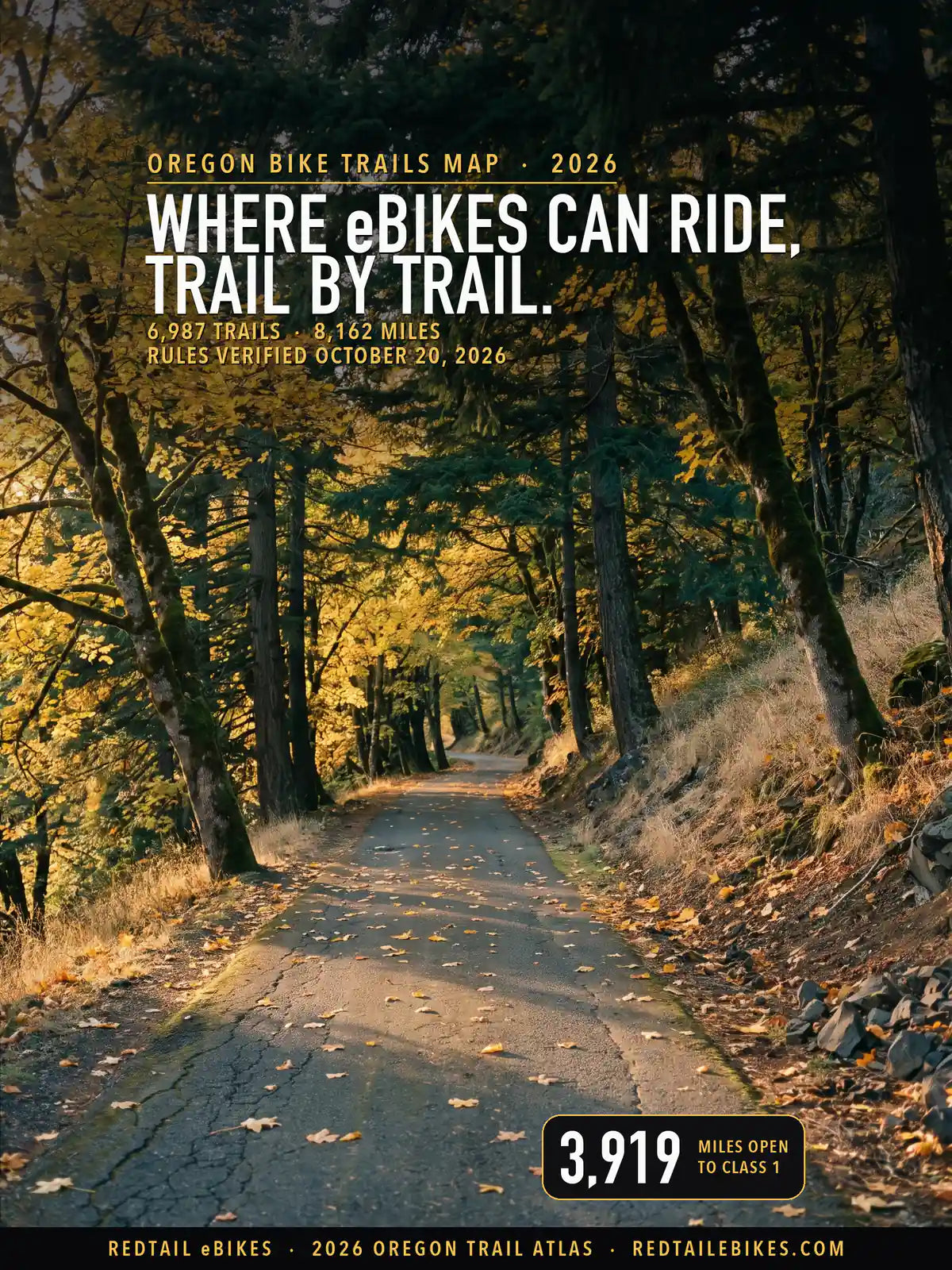
6,987 trails · 8,162 miles in all 36 counties · 3,919 miles open to Class 1 · 67 Deschutes trails opened to Class 1 · Rules verified October 20, 2026
Quick Answer: In Oregon, any class of e-bike may ride state park trails where bicycles may, unless the park posts otherwise, and beaches only on wet sand. On national forest and BLM land, e-bikes ride only routes open to motor vehicles, plus 67 Deschutes National Forest trails open to Class 1. City and county rules vary. Verified October 20, 2026.
Every e-bike in our full range ships free to your Oregon door.

The Historic Columbia River Highway State Trail near the Mosier Twin Tunnels, a state trail whose park page says e-bikes are allowed, in a scene generated with Playcut from a public-domain Forest Service photograph of the trail.

Every line is a trail or path from the Forest Service, the Bureau of Land Management, Oregon State Parks, the Oregon Department of Forestry, Metro, the Park Service or OpenStreetMap, colored by the e-bike rule its manager publishes. The numbers mark Business Oregon's eleven regions in the order this page maps them below.
Oregon's Vehicle Code gives your e-bike a bicycle's standing and leaves the trail to whoever runs it.
ORS 814.405 says "An electric assisted bicycle shall be considered a bicycle, rather than a motor vehicle, for purposes of the Oregon Vehicle Code, except when otherwise specifically provided by statute." A park rule or a forest rule is not the Vehicle Code, so each land manager's own rule decides what you may ride on its trails.
Federal land does not follow the state's definition. The Forest Service "identifies e-bikes under three classes of motor vehicles", and national forests hold 65% of the mapped miles, so on most of this map your question is which routes the forest has opened to motor vehicles.
152 managers, from the Forest Service and Oregon State Parks to counties, cities and park districts, each hold part of that authority. Every trail below carries its manager's name and the rule that manager publishes, quoted from the manager's own text and kept in the trail register, so you can check your ride trail by trail.
For the rest of the state's e-bike law, from age limits to helmets, read Oregon e-bike laws. To compare Oregon's trail rules with other states', open bike trails by state.
Riding in another state? You will find the same trail-by-trail map for Washington State bike trails, Utah bike trails, Colorado bike trails, Wisconsin bike trails, Michigan bike trails, Ohio bike trails, Iowa bike trails, Texas bike trails, Florida bike trails and New York bike trails, and our national guide to e-bike trails near you shows how to find out who manages a trail anywhere in the US.
Takeaway
The class on your label decides a lot on Oregon trails. Class 1 rides 3,919 mapped miles, Class 2 3,676 and Class 3 3,639: on 243 miles a Class 1 may ride and a Class 2 may not, 152 of them the Deschutes National Forest trails opened to Class 1 alone.
Oregon State Parks opens 373 mapped miles of park trail to all three classes, and the Bureau of Land Management 487 miles of road and trail open to motor vehicles. You can look up any trail, its manager and its rule in the downloadable register.
In this guide
- How to read the map
- Who decides on each trail
- State parks, beaches and state forests
- National forests, BLM and other federal land
- City, county and park district rules
- Named trails riders ask about
- Oregon bike trails, region by region
- Where riders get caught out
- Sidewalks, roads and bike lanes
- Choosing an e-bike for Oregon trails
- Frequently asked questions
How to read the map
Find your trail's color, then read who manages it. Green takes all three classes, purple Class 1 and 3, blue Class 1 and 2, amber Class 1 alone. Dashed red means a published rule closes the trail to your e-bike or to its motor.
Gray covers four cases: the rule is unsettled and both texts are printed, we could not read the manager's rule and show the state default, the land is private, tribal or a nonprofit's, or no record names a manager. The register says which one applies to the trail you ride.
Oregon defines an electric assisted bicycle as "a bicycle that is equipped with an electric motor and that is a Class 1 electric assisted bicycle, a Class 2 electric assisted bicycle or a Class 3 electric assisted bicycle". Check your label against this table:
| Class | How the motor helps | Assistance stops at |
|---|---|---|
| Class 1 | "Provides assistance only when the rider is pedaling" | 20 mph |
| Class 2 | "May be propelled by its motor without a rider pedaling" | 20 mph |
| Class 3 | Only while you pedal, and "Is equipped with a speedometer" | 28 mph |
A bike outside those classes is a motor vehicle in Oregon's state parks. The park rules say an e-bike that does not fit the classes, or has "been modified out of the classification criteria", counts as a motor vehicle, "only allowed where motor vehicles are allowed" (OAR 736-010-0015(17)), and the ocean shore rules say the same (OAR 736-021-0030(8)).
Today you must be 16 to ride any class without a license. ORS 807.020(15) says "A person may operate the following without any grant of driving privileges if the person is 16 years of age or older", then lists Class 1, Class 2 and Class 3.
From January 1, 2027, House Bill 4007 lowers that to 14 for a Class 1, keeps 16 for a Class 2 or Class 3, and lets riders of any age ride a Class 1 or Class 2 in a bicycle safety program under ORS 802.325.
Who decides on each trail
Who manages your trail decides the rule. Federal land holds 77% of Oregon's mapped miles, local governments' land 12% and state land 8%; find your trail's manager in the first column of the table below.
| Who manages the trail | Trails | Miles | What e-bikes may do |
|---|---|---|---|
| Oregon State Parks: trails where bicycles ride | 363 | 373 | Class 1, 2 and 3 where bicycles ride, unless a park posts otherwise |
| Oregon State Parks: trails a park closes to e-bikes | 22 | 13 | Closed: the park's own posted advisory |
| Oregon State Parks: lines whose park record names hiking or horse use | 51 | 69 | Gray: read the trailhead sign |
| Oregon Dept. of Forestry: state forest trails | 80 | 128 | Unsettled: the forest rules' 'Motor Vehicle' may take in an e-bike |
| Other state land (Fish and Wildlife, ODOT, State Lands) | 38 | 48 | From open to closed: see each agency below |
| National forests: routes open to motor vehicles | 2,116 | 2,350 | Class 1, 2 and 3, on routes the motor vehicle use map opens |
| Deschutes National Forest: the trails opened to Class 1 | 61 | 152 | Class 1 only, closed December 1 to March 31 |
| Deschutes National Forest: decision trails whose line runs past the listed miles | 3 | 12 | Gray: Class 1 on the listed part; the forest's e-bike map shows which part |
| National forests: every other trail | 1,026 | 2,747 | Closed: the Forest Service treats an e-bike as a motor vehicle |
| National forests: trails whose records disagree | 56 | 60 | Gray: the printed motor vehicle use map decides |
| Bureau of Land Management: routes open to motor vehicles | 288 | 487 | Class 1, 2 and 3, on roads and trails open to motor vehicles |
| Bureau of Land Management: non-motorized trails | 377 | 437 | Closed unless a BLM decision opens the route |
| National parks, monuments and historic parks | 2 | 5 | Crater Lake: every class on Grayback Drive; bikes off its trails |
| National wildlife refuges and other federal land | 5 | 9 | Gray: the refuge manager's determination was not read |
| Portland Parks & Recreation | 218 | 110 | Paved paths open; soft-surface trails and Forest Park closed |
| Cities, counties and park districts with a rule that reaches e-bikes | 591 | 328 | From open to closed: see each government below |
| Cities, counties and park districts whose code leaves the question unsettled | 463 | 270 | Unsettled: see each government below |
| Trails under state law alone (the manager's code read, no e-bike trail rule) | 517 | 158 | Class 1, 2 and 3: state law's default where the manager's code says nothing |
| Trails whose manager's rules could not be read | 270 | 101 | Gray: rules not read; state law's default is open |
| Oregon State University's research forests | 58 | 39 | Closed to every class |
| Private, nonprofit, school and tribal land | 183 | 68 | The owner decides |
| Manager not on record | 267 | 197 | Not determined |
| All Oregon | 6,987 | 8,162 | Map above; every trail by region below |
A trail whose stretches fall under two rules sits in each row with the miles that lie there, so if you find a trail twice, that is why: 68 trails appear in more than one row, and the rows still add up to the state.
Takeaway
The Forest Service's motor vehicle rule sets the color of 5,319 national forest miles, one Oregon State Parks rule sets the color of 455 park miles, and 42 cities, counties and park districts have written a rule that reaches a mapped trail.
State parks, beaches and state forests
In an Oregon state park, your e-bike rides the trails a bicycle rides, unless the park has posted a limit. OAR 736-010-0026(6) says "A person may operate an electric assisted bicycle on trails at any park property where bicycles are allowed except where designated to specifically exclude, prohibit or conditionally restrict such activity as determined by the District Manager".
The rule took effect July 1, 2025. Before it, the department's rulemaking page says, "e-assisted bikes are allowed on OPRD trails over eight feet in width", and the amendments "do away with the 8 feet width trail requirement". The rule covers all three classes, defined as "class 1, class 2 and class 3 electric assisted bicycles as defined under ORS 801.258" (OAR 736-010-0015).
Oregon State Parks puts it in one line on its e-bike page: "In most parks, the rule is simple: if bikes aren’t allowed, e-bikes aren’t either." Riding off roads and off trails, and on docks and piers, stays closed unless a park posts it open (OAR 736-010-0026(8)).
Four parks have closed some or all of their trails. The same page says "E-bikes are prohibited at the following trails and parks:" and lists Elijah Bristow State Park (all trails), Willamette Mission State Park (its equestrian trails and the Vision Trail), Clyde Holliday State Recreation Site (the Riverside Trail) and Emigrant Springs (the Lewis and Clark Trail).
Emigrant Springs' own park page goes further: "No e-bikes on the trails." The map prints the park's stricter text, and both are in the register.
On this map, 373 of the 455 mapped miles in 87 state parks are open to all three classes, 13 are closed, and 69 are gray because the department's own trail record names a hiking or horse use for a line another map draws as a bicycle trail. The trailhead sign decides those.
We read the 191 park pages Oregon State Parks' site serves for park numbers 1 to 700; 14 carry e-bike text. The five that limit e-bikes are Elijah Bristow, Willamette Mission, Emigrant Springs, the Deschutes River State Recreation Area and Clyde Holliday, and every one but Clyde Holliday, whose Riverside Trail is not among the lines we map, has its limit drawn.
The beach: wet sand only
On the ocean shore, ride the wet sand and nowhere else. OAR 736-021-0065(3) says "A person may operate an electric assisted bicycle only on the wet sand on ocean shore state recreation areas", adds that "Operation of electric assisted bicycles is prohibited in dry sand and in areas of sand dune vegetation", and holds you to "the posted speed limits for motor vehicles".
Oregon State Parks' e-bike page adds the season that catches riders out: e-bikes are prohibited in "Snowy plover management areas during nesting season, including wet sand (March 15–Sept. 15)." Look for the plover signs at the beach access before you roll onto the sand.
Fish and Wildlife land, ODOT paths and state forests
On the lower Deschutes River, e-bikes stop at mile 2. Oregon State Parks' advisory at the Deschutes River State Recreation Area says "E-Bikes are only permitted on the first 2 miles of the Deschutes River Trail (old railbed trail). After mile 2 the property ownership changes to Oregon Department Fish and Wildlife which does not allow e-bikes."
On other wildlife areas, OAR 635-008-0050(5) says "Motor vehicles are prohibited except on parking areas,open roads, areas posted as open to motor vehicles,or as provided for in the following rules." The rule does not say whether an e-bike is one, so those 2.3 miles are gray.
On a path the Department of Transportation runs, your e-bike is a bicycle. No ODOT rule sets it apart, so ORS 814.405 governs the 33.7 mapped miles of ODOT path.
On the Tillamook, Clatsop and Santiam state forests, the question is open. The Department of Forestry's rules call a self-propelled vehicle a "Motor Vehicle" and bar anyone to "Hike, bicycle, use a horse, llama, or other stock animal, or other Motor Vehicle on a trail not designated for that purpose" (OAR 629-025-0070(3)(b)).
They never say an e-bike is or is not one, so the 128 mapped miles read gray; ask the forest's district office before you ride.
On Oregon State University's research forests, no class rides. The college's visitor page says motorized vehicles are not allowed on its forest roads and "This includes all classes of electric bicycles".
National forests, BLM and other federal land
In a national forest your e-bike is a motor vehicle, so it rides only the routes the forest opens to motor vehicles. The Forest Service says "Class 1, 2, and 3 e-bikes are allowed on motorized trails and roads on national forests and grasslands".
Under 36 CFR 261.13, once a forest publishes its motor vehicle use map, "it is prohibited to possess or operate a motor vehicle on National Forest System lands in that administrative unit" except as the map designates.
Of the 5,319 mapped miles in Oregon's 11 national forests and the Columbia River Gorge National Scenic Area, 2,501 are open to your e-bike, 2,746 are closed and 72 are gray. A forest may still open a non-motorized trail: "Local Forest Service officials may consider new opportunities for e-bike use on non-motorized trails and in non-motorized areas by utilizing a designation process" (Forest Service).
The Deschutes National Forest's Class 1 trails
The Deschutes National Forest used that process on December 8, 2025, opening 67 trails to Class 1. The signed decision reads "Designating 67 trails, totaling 161.4 miles as open to class 1 e-bikes."
The Final Environmental Assessment it adopts says "The use of class 2 and class 3 e-bikes would remain prohibited on these select trails" and "all trails would be seasonally closed to e-bikes from December 1st through March 31st". Its trail list covers Phil's (62.5 miles), Wanoga (52.9), Peterson Ridge near Sisters (28.7), Sunriver (8.8) and the paved paths (8.5).
On this map those trails are amber on 151.8 miles. On three trails the Forest Service's line runs well past the miles the decision lists, and those 11.9 miles are gray: Class 1 rides the listed part, and the forest's e-bike map shows which part. The Deschutes River Trail upstream of Bend is not on the list, so it stays closed to your e-bike.
BLM land
On Bureau of Land Management land, your e-bike rides the roads and trails open to motor vehicles. BLM Oregon/Washington says "E-bikes are allowed on all roads and trails open to motorized vehicles, including Off-Highway Vehicle (OHV) recreation areas", and names Radar Hill, the Blue Ridge Trail System, Shotgun Creek, Upper Nestucca and Virtue Flat as places to ride.
On a BLM trail closed to motor vehicles, your e-bike counts as an off-road vehicle unless a BLM officer has decided otherwise (43 CFR 8340.0-5). The BLM's national e-bike page puts it plainly: "the rule does not, by itself, open any non-motorized trails to e-bike use." Of the 924 mapped BLM miles, 487 are open and 437 are closed.
National parks and wildlife refuges
In a national park, the superintendent's compendium decides. Crater Lake says "E-bikes are allowed in Crater Lake National Park where traditional bicycles are allowed", and Oregon Caves says the same of its monument and preserve.
At Crater Lake that means the park roads and Grayback Drive. The park's bicycling page says "Bikes are not allowed on trails" and "The park has one dirt road, Grayback Drive, where mountain biking is allowed."
Grayback's 4.5 mapped miles take every class, and since cars may not drive it, you pedal: the compendium says "using the electric motor to move an e-bike without pedaling is prohibited" off the public roads. The Pinnacles Trail, which the Park Service's own trail record lists for bicycles, reads gray.
At Lewis and Clark National Historical Park, the compendium counts e-bikes among bicycles and says "The use of bicycles ... are prohibited on all park trails except the portion of the Fort to Sea trail running from the Trailhead on Fort Clatsop Road to the Overlook."
On a national wildlife refuge, the refuge manager decides. The Fish and Wildlife Service says that where the manager finds e-bikes compatible, "e-bikes may be used on any refuge roads and trails where traditional bicycle use is allowed". The map reads the 1.8 refuge miles gray, so ask the refuge office before you ride.
City, county and park district rules
On city, county and park district trails, your e-bike rides as a bicycle unless the government's own rule says otherwise. ORS 814.405 makes the e-bike a bicycle under the Vehicle Code, and each city, county and park district writes its own park and trail rules.
The 2026 law gave local governments a new power that stops short of e-bikes. House Bill 4007 lets local governments "Prohibit the operation of powered micromobility devices on bicycle lanes, bicycle paths, sidewalks and trails", and its definition of that term "does not include" electric assisted bicycles.
We read the codes or published trail rules of 52 of the 101 cities, counties, park districts and other local bodies that manage a mapped trail, 89.5% of their trail miles; 42 hold a rule that reaches your e-bike on a trail, and 10 hold none, so state law governs their trails. The table lists every local rule that reaches a mapped trail.
| Government | Law or page | Where it applies | What it does | Trails | Miles |
|---|---|---|---|---|---|
| Benton County | Benton County Natural Areas, Parks & Events, 'Fitton Green Natural Area' page | Benton County's mapped trails, all at Fitton Green Natural Area | Class 1, 2 and 3; no bikes on the trails after November 1 | 4 | 1.0 |
| Columbia County | Columbia County Board of Commissioners Order No. 142-2007, para. 2 | the Crown Zellerbach Trail and other Columbia County trails | Unsettled: unauthorized motorized vehicles barred by a road-authority order; e-bikes not named | 1 | 22.0 |
| Coos County | Coos County Forestry page | trails of the Coos County Forest, Whiskey Run among them | Class 1, 2 and 3; carry a fire extinguisher in fire season | 25 | 17.5 |
| Crook County | Crook County Code § 16.08.020 | Crook County park trails | Unsettled: no motor vehicle on a trail not built or designated for motor vehicles; e-bikes not named | 8 | 5.7 |
| Hood River County | Hood River County Forestry, 'Recreation Trails', Electric Bicycle & Electric Moto Policy (A) | Hood River County Forestry trails designated for motorized use (Post Canyon) | Every class on trails designated for motorized use | 9 | 8.3 |
| Hood River County | Hood River County Forestry, 'Recreation Trails', Electric Bicycle & Electric Moto Policy (A) | Hood River County Forestry non-motorized trails (Post Canyon) | Class 1 only on non-motorized trails | 45 | 22.9 |
| Jackson County | Jackson County Codified Ordinances § 1228.06(d)(1) | the Bear Creek Greenway segments Jackson County manages | Unsettled: no motorized vehicle; its 'bicycle' is the human-powered one of ORS 801.150 | 2 | 18.0 |
| Jackson County | Jackson County Codified Ordinances §§ 1064.05(a), 1064.06(d) | Jackson County park trails where bicycles are allowed | Class 1, 2 and 3, only where bicycles are designated | 4 | 1.8 |
| Klamath County | Klamath Trails Alliance, 'Spence Mountain Trails' | the Spence Mountain trail network on Klamath County land | Class 1, 2 and 3 | 17 | 46.5 |
| Union County | Union County Ordinance 2021-05, §§ 1(E), 2 | trails of the Mt. Emily Recreation Area | Unsettled: trails carry designated uses; 'motor vehicle' means any self-propelled vehicle | 36 | 41.6 |
| Washington County | Washington County Code ch. 11.08, Section 2 | Washington County park areas and trails | Unsettled: no 'motor vehicle' on a trail not designated for motor vehicles; e-bikes not named | 10 | 17.0 |
| Bend Park & Recreation District | Bend Park & Recreation District Ordinance 14, §§ 8.4-8.5 | Bend Park & Recreation District trails and pathways | Class 1 and 3 (pedal-assist); no throttle e-bikes on trails | 51 | 45.8 |
| Bend Park & Recreation District | Bend Park & Recreation District, Big Sky Bike Park page | Big Sky Park trails | No e-bikes in the bike park; single-track rules read two ways | 1 | 0.9 |
| City of Albany | Albany Municipal Code § 14.28.130 | designated pedestrian and bicycle paths in Albany | Unsettled: no 'motorized vehicle' on a designated pedestrian or bicycle path (1975); the code does not say whether an e-bike is one | 4 | 6.1 |
| City of Ashland | Ashland Municipal Code § 10.68.410 (as captured April 24, 2024) | the Bear Creek Greenway inside the City of Ashland | Unsettled: Jackson County's Greenway ordinance applies inside the city (no motorized vehicle); e-bikes not named | 1 | 0.4 |
| City of Baker City | Baker City Code §§ 95.01, 95.06 | City of Baker City recreation grounds, the Leo Adler Memorial Parkway among them | Unsettled: no 'automobile or other motor vehicle' off park driveways and roadways; e-bikes not named | 1 | 0.7 |
| City of Cornelius | Cornelius Municipal Code § 10.30.020 | Cornelius public parks | Unsettled: no 'motor vehicle', defined as any device not moved by human power; a throttle e-bike is one | 6 | 1.9 |
| City of Corvallis | Corvallis Municipal Code § 5.01.030 | trails in Corvallis parks and the city's designated bicycle-pedestrian trails | Unsettled: 'motorized vehicles' on designated roads and parking only; the riverfront trail is for bicycles and pedestrians | 18 | 8.7 |
| City of Eugene | City of Eugene, 'Safety and Laws', E-Bike & E-Moto Laws tab | the northernmost and southernmost side paths through the Whilamut Natural Area | Closed while the motor is on; the main path stays open | 3 | 1.5 |
| City of Eugene | Eugene Code § 5.160(1) | City of Eugene off-street bicycle and pedestrian paths and trails | Class 1 and 2; Class 3 read both ways; 12 mph near others, 20 mph alone | 159 | 67.2 |
| City of Fairview | Fairview Municipal Code § 12.30.060 | Fairview parks | Unsettled: no motorized vehicles except authorized ones; e-bikes not named | 7 | 0.9 |
| City of Gladstone | Gladstone Municipal Code § 12.12.050(4) | Gladstone park areas | Unsettled: no motor vehicle (other motorized vehicles included) or bicycle off the trails designed for it | 6 | 1.0 |
| City of Gresham | Gresham Revised Code § 7.10.145(1)(d) | Gresham city parks, trails and open space | Unsettled: no motorized vehicle unless designated; 15 mph for any permitted vehicle | 48 | 24.2 |
| City of Happy Valley | Happy Valley Municipal Code § 10.45.020(A)(5) | City of Happy Valley paths and trails | Class 1, 2 and 3; not on park boardwalks | 22 | 6.1 |
| City of Hillsboro | Hillsboro Municipal Code § 9.32.060 | trails on Hillsboro park property | Unsettled: 'motorized vehicles' kept to roads and parking lots; the code does not say whether an e-bike is one | 50 | 17.9 |
| City of Jacksonville | Jacksonville Municipal Code § 6.01.030 | City of Jacksonville parks and open spaces, the Jacksonville Woodlands and Forest Park among them | Class 1, 2 and 3, subject to posted Council restrictions | 35 | 23.6 |
| City of Klamath Falls | Klamath Falls Code § 9.030(A)-(B) | all trails and trail systems within Klamath Falls city parks | Throttle e-bikes barred; Class 1 'may be exempted' | 9 | 4.3 |
| City of Lake Oswego | Lake Oswego Code § 32.10.810 | City of Lake Oswego paths and trails | Class 1, 2 and 3 unless a sign says otherwise | 66 | 9.3 |
| City of Medford | Medford Municipal Code § 6.380 (as captured October 13, 2024) | City of Medford parks and city property, Prescott Park and the city's Bear Creek Greenway and Larson Creek paths among them | Unsettled: no 'motor vehicle' in a city park or on city property off marked roadways; e-bikes not named | 26 | 18.9 |
| City of Milwaukie | Milwaukie Municipal Code § 9.28.090(D) | Milwaukie park areas | Unsettled: no motor vehicle or bicycle off the areas and trails designated for it; e-bikes not named | 3 | 0.2 |
| City of Molalla | Molalla Municipal Code § 12.08.040 | Molalla city parks | Unsettled: no motor vehicle; e-bikes not named | 1 | 0.9 |
| City of Oregon City | Oregon City Municipal Code § 12.16.020 | trails in Oregon City parks | Unsettled: no motor vehicle except on roads and parking areas; e-bikes not named | 15 | 4.9 |
| City of Pendleton | Pendleton Ordinance No. 2645, as amended | pathways in Pendleton's public parks, the Umatilla River Parkway among them | E-bikes under 100 pounds on park pathways | 4 | 6.9 |
| City of Portland | Portland Parks & Recreation, 'Forest Park' (park page) | Forest Park, Portland: Leif Erikson Drive, Saltzman and Springville roads, the firelanes and every trail | Closed to e-bikes | 19 | 27.2 |
| City of Portland | Portland Parks & Recreation administrative rule PRK-12.3, 5.01 | a Portland park trail with no surface on record | Unsettled: a park trail whose surface no record gives | 1 | 0.1 |
| City of Portland | Portland Parks & Recreation administrative rule PRK-12.3, 5.01 | a paved pathway or roadway in a Portland park | Class 1, 2 and 3 | 165 | 64.7 |
| City of Portland | Portland Parks & Recreation administrative rule PRK-12.3, 5.01 | a gravel or dirt trail in a Portland park | Closed to e-bikes | 51 | 18.3 |
| City of Prineville | Prineville Code § 73.04(C) | off-street bicycle and pedestrian paths and trails in Prineville | Closed under power; ride with the motor off | 3 | 2.1 |
| City of Salem | Salem Revised Code § 94.160 | trails in Salem parks | Unsettled: no 'automobile or other motor vehicle' off park drives and roads; e-bikes not named | 22 | 8.1 |
| City of Sandy | Sandy Municipal Code § 12.12.050(E) | Sandy public parks | Unsettled: motorized vehicles prohibited (wheelchairs and listed exceptions only); e-bikes not named | 12 | 2.8 |
| City of Sherwood | Sherwood Municipal Code § 12.12.240(A) | trails in Sherwood parks | Unsettled: no bicycle or motor vehicle off the drives designated for it; e-bikes not named | 15 | 5.6 |
| City of Tigard | Tigard Municipal Code § 7.52.270 | Tigard public parks, which the code says include its trails and greenways | Unsettled: 'motorized vehicles' kept to roads and parking lots; the code does not say whether an e-bike is one | 53 | 16.1 |
| City of Tualatin | Tualatin Municipal Code § 5-2-040 | Tualatin trails and park areas | Unsettled: no motor vehicle or bicycle on a trail not designated for that use; e-bikes not named | 48 | 13.6 |
| City of Umatilla | Umatilla City Code § 7-6-2(D) | City of Umatilla parks and trails | Unsettled: no 'automobile or other motor vehicle' off park driveways and roadways; e-bikes not named | 2 | 0.3 |
| City of Warrenton | Warrenton Municipal Code § 10.04.220(A)(2) | the Warrenton Trail System | Class 1, 2 and 3; never on a sidewalk | 1 | 1.3 |
| City of Wilsonville | Wilsonville Code § 3.000 | Wilsonville park trails | Unsettled: no motor vehicle on a trail not built or designated for motor vehicles; e-bikes not named | 25 | 5.8 |
| Metro | Metro Code § 10.03.060(d) | Metro parks, natural areas and trails | Unsettled: bicycles only on signed bicycle trails; motor vehicles kept to roads; e-bikes not named | 27 | 18.3 |
| Tualatin Hills Park & Recreation District | THPRD District Compiled Policies § 7.08(B)(1), (C) | THPRD trails outside the Regional Trail System | Closed to e-bikes | 114 | 28.0 |
| Tualatin Hills Park & Recreation District | THPRD District Compiled Policies § 7.08(D) | the four regional trails the district's policy names | Class 1 only, for transportation; yield to pedestrians | 22 | 23.1 |
| Tualatin Hills Park & Recreation District | THPRD District Compiled Policies § 7.08(D) | THPRD trails Metro's inventory classes as regional (River Terrace, Crescent Park, McKernan Creek, Beaverton Creek) | Class 1 if the trail is in the district's regional system | 6 | 2.9 |
| Willamalane Park & Recreation District | Willamalane Ordinance No. 100, § 18(e)(i)-(iii) | Willamalane district parks, trails and multi-use paths | Class 1 and 2; Class 2 off mountain-bike-only trails | 18 | 15.3 |
Park districts: Bend, Tualatin Hills and Willamalane
In Bend's parks, pedal-assist e-bikes ride and throttles do not. Bend Park & Recreation District Ordinance 14 says "Bicycles, pedal-assist electric-assisted bicycles and other Rolling Devices are permitted on pedestrian trails and pathways unless prohibited by the Executive Director", and "Motor vehicles, including electric-assisted bicycles with throttles, are prohibited except in roadways and parking areas designated for motor vehicles".
The district's rules took effect August 1, 2025, so its 45.8 mapped miles are purple. Its Big Sky Bike Park page says "Class 1 & 2 e-bikes only are allowed on single-track trails", a different answer for a throttle, so that park's trails are gray with both texts printed.
In the Tualatin Hills Park & Recreation District, only Class 1 rides, and only on the Regional Trail System. The district's compiled policies say "Electric motorized vehicles are permitted for transportation purposes on the Regional Trail System, including the Westside, Rock Creek, Fanno Creek, and Waterhouse trails. E-bicycles are limited to Class I type."
The four trails it names are amber on this map. The policy does not say which other trails belong to the system, so the 2.9 miles of district trail that Metro's inventory classes as regional read gray.
Everywhere else on district property, the same policies define motorized vehicles as "any conveyance with a motor, whether electric or fuel powered, including e-bicycles, and e-scooters" and keep them to roads and parking areas. The district's board told the Legislature in February 2024 that it "has elected to govern e-bikes as it would any other bike for the time being"; the policies in force are the rule printed.
In Springfield's Willamalane district, Class 1 and Class 2 ride and Class 3 does not. Ordinance No. 100 says "Class 3 Electric Assisted Bicycles may not be used on any Trail or Multi-use Path", and keeps a Class 2 off trails "designated exclusively for mountain bike use". The district's page says the board passed the update July 8, 2026.
Cities and counties that let every class ride
Many local rules open the trail to you, often with a condition. Lake Oswego lets you ride its paths and trails unless a posted restriction or trail designation says otherwise, under a chapter amended September 15, 2026. Happy Valley counts an e-bike "a bicycle, rather than a motor vehicle" under Ordinance 601 of May 19, 2026, but keeps it off park boardwalks.
Pendleton allows "Motorized electric vehicles which weigh less than 100 pounds, including e-bicycles" on park pathways, so a heavy cargo e-bike may be too heavy. Warrenton has you yield to pedestrians on its trail system, and Jacksonville makes e-bikes "subject to posted restrictions established by City Council resolution".
In Portland's parks, PRK-12.3 says "Electric bicycles and scooters must operate only on paved pathways and roadways in a park", in force since July 13, 2025, at 12 mph on park pathways. Unpaved park trails are closed, and so is Forest Park, below.
County forests are open on their own terms. Coos County says "Classes 1, 2, and 3 E-Bikes are allowed" in its forest, Whiskey Run among the trails, with a fire extinguisher in fire season. On Klamath County's Spence Mountain, the Klamath Trails Alliance's page for the trails on the county's land says "E-bikes Allowed".
Class 1 only, Class 1 and 2, or Class 1 and 3
Several rules on this map stop short of all three classes. Hood River County says "Class 1 e-bikes are allowed on Hood River County non-motorized and motorized trails", with every class on the trails designated for motorized use, and Tualatin Hills takes Class 1 on its Regional Trail System.
Eugene bars any "motorized transportation device" from city paths and trails, and its code counts an e-bike that assists only to 20 mph as a micromobility device, so Class 1 and Class 2 ride. A Class 3 assists to 28 mph, while the city's e-bike page treats every legal class as a bicycle, so a Class 3 reads both ways.
Eugene's speed limit on its paths is "12mph when others are present and 20mph if you're alone", its June 15, 2026 notice says, where an earlier June notice called 12 mph a suggested speed, and the city closes the northernmost and southernmost side paths in the Whilamut Natural Area while your motor is on. Willamalane stops at Class 2 and Bend's park district at Class 1 and 3, as above.
Klamath Falls bars "electric bikes with throttles" from its park trails and says "Class 1 e-bikes" and some others "may be exempted from the prohibition", which reads either as an exemption or as a power the city may use. Its trails are gray, and a violation can cost up to $2,000.
Where the rule closes the trail
A few rules keep your e-bike out. Portland Parks & Recreation says of Forest Park: "Beyond this exception, e-bikes, electric scooters, and other motorized transport are not allowed in the park", the exception being mobility devices for people with disabilities. Leif Erikson Drive, Saltzman Road and the firelanes are among the 27.2 mapped miles it closes.
Prineville says "No person may operate a micromobility device (when not being operated by human propulsion) on any off-street bicycle or pedestrian path or trail", so you pedal its paths with the motor off. Tualatin Hills' trails outside the regional system, Portland's unpaved park trails and Oregon State University's research forests are closed too.
What changed in 2025 and 2026
In 2025 and 2026, 7 local governments wrote or amended the rule that carries their e-bike trail answer: Bend Park & Recreation District, Central Point, Happy Valley, Klamath Falls, Lake Oswego, Portland, Willamalane Park & Recreation District. Each date below is the government's own record:
- July 13, 2025: Portland Parks & Recreation's rule PRK-12.3 took effect (PRK-12.3).
- August 1, 2025: Bend Park & Recreation District's updated park rules took effect (Ordinance 14).
- 2025: Central Point adopted its Greenway chapter, which counts an e-bike as a bicycle on its stretch of the Bear Creek Greenway (§ 4.06.020).
- May 19, 2026: Happy Valley adopted Ordinance 601 (§ 10.45.020).
- July 8, 2026: Willamalane's board passed its updated park rules (Ordinance No. 100).
- July 20, 2026: Klamath Falls adopted Ordinance 26-08 (§ 9.030).
- September 15, 2026: Lake Oswego amended its bicycle and micromobility section (§ 32.10.810).
The state and federal rules moved in the same months: Oregon State Parks' rule on July 1, 2025, the lower Deschutes advisory on October 20, 2025, the Deschutes National Forest's decision on December 8, 2025, and House Bill 4007's age rules on January 1, 2027.
Codes that bar "motor vehicles" without naming e-bikes
On 218 mapped miles, 24 governments bar "motor vehicles" or "motorized vehicles" from their parks or trails without naming e-bikes. ORS 814.405 makes your e-bike a bicycle "for purposes of the Oregon Vehicle Code", and a park code is not the Vehicle Code, so those words may or may not reach it, and the map reads those trails gray.
Salem bars "any automobile or other motor vehicle" from its parks except on drives and roads, Tigard and Hillsboro keep "motorized vehicles" to roadways and parking lots, and Gresham bars any motorized vehicle from its parks and trails "unless designated for such use".
Metro, Washington County, Corvallis, Albany and Medford write rules of the same kind. Jackson County's Bear Creek Greenway rule bars "any motorized vehicle" and borrows the human-powered "bicycle" of ORS 801.150, while Central Point's 2025 chapter counts an e-bike as a bicycle on its own stretch.
Our reading is that each of these leaves your e-bike's status open until the government says which it means. Those trails are gray, both texts are in the register, and the parks office is the one to ask before you ride with the motor on.
Named trails riders ask about
The trails you search for sit under one of five answers: Oregon State Parks' rule, the Forest Service's motor vehicle map, the BLM's, a county's or park district's rule, or a city's. The table lists 30 trails and places you may have typed into a search box, with the miles mapped and every rule that governs a stretch of each.
| Trail | Miles mapped | Managed by | What e-bikes may do |
|---|---|---|---|
| Deschutes River Trail, Bend and the national forest upstream | 29.5 | Deschutes National Forest; Bend Park & Recreation District; Oregon State Parks, Tumalo | Closed to e-bikes on 19.4 mi; Class 1 and 3 (pedal-assist); no throttle e-bikes on trails on 7.0 mi; Unsettled on 1.8 mi; Class 1, 2 and 3 where bicycles ride, unless posted on 1.4 mi |
| Deschutes River Trail, the lower river from Deschutes River State Recreation Area | 18.9 | Oregon Dept. of Fish and Wildlife; Bureau of Land Management; Oregon State Parks, Deschutes River | E-bikes stop at mile 2 of the trail on 9.3 mi; Closed to e-bikes on 7.4 mi; Class 1, 2 and 3 where bicycles ride, unless posted on 2.2 mi |
| Banks-Vernonia State Trail | 23.0 | Oregon State Parks, Banks-Vernonia; Oregon State Parks; Oregon State Parks, L.L. "Stub" Stewart and 2 more | Class 1, 2 and 3 where bicycles ride, unless posted on 21.2 mi; Unsettled on 1.2 mi; Manager not on record on 0.4 mi; Closed to e-bikes on 0.2 mi |
| Springwater Corridor | 20.0 | City of Portland (Portland Parks & Recreation); City of Gresham; Clackamas County and 3 more | Class 1, 2 and 3 on 11.9 mi; Unsettled on 5.6 mi; Local rule could not be read on 1.9 mi; Class 1, 2 and 3 where bicycles ride, unless posted on 0.5 mi |
| Historic Columbia River Highway State Trail | 14.4 | Oregon State Parks; ODOT; Oregon State Parks, Wygant and 3 more | Class 1, 2 and 3 where bicycles ride, unless posted on 9.4 mi; Class 1, 2 and 3 on 4.3 mi; Unsettled on 0.7 mi |
| OC&E Woods Line State Trail | 105.5 | Oregon State Parks, OC&E Woods Line; Fremont-Winema National Forest; Oregon State Parks and 4 more | Class 1, 2 and 3 where bicycles ride, unless posted on 82.7 mi; Closed to e-bikes on 19.3 mi; Private land or a nonprofit: the owner decides on 2.2 mi; Manager not on record on 1.4 mi |
| Bear Creek Greenway | 20.5 | Jackson County; Not on record; City of Medford and 2 more | Unsettled on 19.1 mi; Manager not on record on 1.0 mi; Class 1, 2 and 3, only where bicycles are designated on 0.3 mi; Local rule could not be read on under 0.1 mi |
| Crown Zellerbach Trail | 22.1 | Columbia County; Not on record; Bureau of Land Management | Unsettled on 22.0 mi; Manager not on record on under 0.1 mi; Closed to e-bikes on under 0.1 mi |
| Row River Trail | 16.8 | Bureau of Land Management; Not on record; City of Cottage Grove | Closed to e-bikes on 13.5 mi; Manager not on record on 2.7 mi; Local rule could not be read on 0.7 mi |
| Rogue River Greenway | 15.0 | Oregon State Parks; Bureau of Land Management; Oregon State Parks, Valley of the Rogue | Class 1, 2 and 3 where bicycles ride, unless posted on 11.2 mi; Closed to e-bikes on 3.8 mi |
| Marine Drive Trail | 15.1 | City of Portland (Portland Parks & Recreation); City of Portland (Portland Bureau of Transportation); Metro and 3 more | Class 1, 2 and 3 on 12.8 mi; Unsettled on 2.3 mi |
| Trolley Trail | 4.3 | North Clackamas Parks & Recreation District; City of Gladstone; Bureau of Land Management and 1 more | Local rule could not be read on 3.6 mi; Class 1, 2 and 3 on 0.4 mi; Closed to e-bikes on 0.1 mi; Unsettled on 0.1 mi; Manager not on record on under 0.1 mi |
| Wilson River Trail | 25.3 | Oregon Dept. of Forestry, Tillamook State Forest | Unsettled on 25.3 mi |
| Gales Creek Trail | 13.8 | Oregon Dept. of Forestry, Tillamook State Forest; Private owner; City of Forest Grove and 1 more | Unsettled on 11.7 mi; Private land or a nonprofit: the owner decides on 1.6 mi; Local rule could not be read on 0.5 mi |
| Elkhorn Crest Trail | 17.7 | Wallowa-Whitman National Forest | Closed to e-bikes on 17.7 mi |
| Sterling Mine Ditch Trail | 22.7 | Bureau of Land Management | Closed to e-bikes on 22.7 mi |
| Cline Buttes | 56.1 | Bureau of Land Management | Class 1, 2 and 3 on 54.3 mi; Closed to e-bikes on 1.9 mi |
| Oregon Coast Trail | 55.4 | Oregon State Parks, Samuel H. Boardman; Oregon State Parks, Oswald West; Oregon State Parks and 5 more | Unsettled on 28.6 mi; Class 1, 2 and 3 where bicycles ride, unless posted on 26.8 mi |
| Silver Falls State Park | 42.8 | Oregon State Parks, Silver Falls; Oregon State Parks, Golden and Silver Falls | Class 1, 2 and 3 where bicycles ride, unless posted on 32.3 mi; Unsettled on 10.6 mi |
| Fort Stevens State Park | 15.9 | Oregon State Parks, Fort Stevens | Class 1, 2 and 3 where bicycles ride, unless posted on 15.9 mi |
| Smith Rock State Park | 8.8 | Oregon State Parks, Smith Rock | Unsettled on 6.2 mi; Class 1, 2 and 3 where bicycles ride, unless posted on 2.6 mi |
| Forest Park, Portland | 27.2 | City of Portland (Portland Parks & Recreation); City of Portland (Bureau of Environmental Services) | Closed to e-bikes on 27.2 mi |
| Portland city trails | 158.0 | City of Portland (Portland Parks & Recreation); City of Portland; City of Portland (Portland Bureau of Transportation) and 2 more | Class 1, 2 and 3 on 112.5 mi; Closed to e-bikes on 45.5 mi; Unsettled on 0.1 mi |
| Bend Park & Recreation District trails | 46.7 | Bend Park & Recreation District | Class 1 and 3 (pedal-assist); no throttle e-bikes on trails on 45.8 mi; No e-bikes in the bike park; single-track rules read two ways on 0.9 mi |
| Eugene city paths | 68.7 | City of Eugene | Class 1 and 2; Class 3 read both ways; 12 mph near others, 20 mph alone on 67.2 mi; Closed while the motor is on; the main path stays open on 1.5 mi |
| Salem city trails | 17.8 | City of Salem | Class 1, 2 and 3 on 9.7 mi; Unsettled on 8.1 mi |
| Corvallis city trails | 15.8 | City of Corvallis | Unsettled on 8.7 mi; Class 1, 2 and 3 on 7.1 mi |
| Medford city trails | 18.9 | City of Medford | Unsettled on 18.9 mi |
| Klamath Falls city trails | 27.4 | City of Klamath Falls | Class 1, 2 and 3 on 23.1 mi; Throttle e-bikes barred; Class 1 'may be exempted' on 4.3 mi |
| Post Canyon (Hood River County) | 31.2 | Hood River County | Class 1 only on non-motorized trails on 22.9 mi; Every class on trails designated for motorized use on 8.3 mi |
The Banks-Vernonia State Trail takes every class. Oregon State Parks runs it, so 21 of its 23 mapped miles are green. Its park page still quotes the old test, "A person may operate an Electric Assisted Bicycle (e-bike) on roads and trails eight feet or wider unless otherwise posted. Currently the Banks-Vernonia State Trail fits that designation.", and the trail passes either way.
The same park's notice list carries a construction advisory: "The Shoofly Trail southern bridge is closed for safety. There is a temporary crossing in place until repairs can be completed."
The Historic Columbia River Highway State Trail takes every class too. Its park page says "E-bikes are allowed on the state trail" and bars "electric scooters, mountain boards, electric unicycles, and other similar devices".
Two trails share the name Deschutes River Trail. Around Bend, the park district's stretches take Class 1 and Class 3, while the Forest Service's trails upstream toward Benham Falls are not among the decision's 67 and stay closed to your e-bike. On the lower river, the first two miles from the state recreation area are open and the Fish and Wildlife land beyond them is not.
Takeaway
Read the manager before the trail name. Your Class 2 rides Oregon State Parks' Banks-Vernonia, may not ride Bend's park district trails with its throttle, and rides no Deschutes National Forest singletrack at all.
The OC&E Woods Line State Trail is open where the state runs it, and two closures cut it now. Oregon State Parks calls it "Oregon’s longest linear park" and a "100-mile trail" (park page), and 83 of its mapped miles take every class.
The same page lists a wildfire closure "from Hildebrand Road to Sprague River" since September 3, 2026, and says the Woods Line section, impacted by the Bootleg Fire in July 2021, "will remain closed at this time". Where the Woods Line crosses the Fremont-Winema National Forest, the Forest Service's record for trail 110 marks all three e-bike classes restricted from January 1 to December 31.
Forest Park in Portland is closed to your e-bike, roads and trails alike. All 27.2 of its mapped miles read closed under the park's own page, and you may still pedal an ordinary bicycle on the roads and firelanes Portland Parks & Recreation opens to bikes.
The Bear Creek Greenway changes rule with the government you are in, and this map reads almost all of it gray. Jackson County's rule bars motorized vehicles from its stretches, Ashland adopts the county's rule, and Medford's code as last captured bars motor vehicles from city parks. Central Point's 2025 chapter counts your e-bike as a bicycle on its stretch, which the county's rule also covers, so the register prints both.
The Row River Trail is BLM land, and the BLM has not opened it to e-bikes. The BLM's trail page describes "This 14-mile, paved, multi-use National Recreation Trail" and lists biking without an e-bike rule, so 13 of its mapped miles read closed; call the Northwest Oregon District before you ride it with the motor on.
Cline Buttes is a BLM riding area with open motorized trails. 54 of its 56 mapped miles are open to every class, and its non-motorized trails are not.
Post Canyon splits by trail type. On Hood River County's forest, Class 1 rides the non-motorized trails and every class rides the trails designated for motorized use (county page).
Silver Falls, Fort Stevens and Smith Rock follow the state park rule. Where a line reads gray, the park's own trail record names a hiking or horse use for it, so the trailhead sign decides.
| State park | Mapped miles | Open to every class | Gray |
|---|---|---|---|
| Silver Falls | 43 | 32 | 11 |
| Fort Stevens | 16 | 16 | 0 |
| Smith Rock | 9 | 3 | 6 |
At Smith Rock, the park's notice warns that from December 1, 2026 to May 31, 2027, "sections of the Rim Rock Trail, the North Point Loop Trail, and the adjacent parking area will experience periods of closure".
The Wilson River and Gales Creek trails are on the Tillamook State Forest, so they read gray under the Department of Forestry's motor vehicle rule, above. The Crown Zellerbach Trail is gray too: Columbia County's order "prohibits the use of unauthorized motorized vehicles" on it without naming e-bikes.
Sunriver's own paths take Class 1 only. The Sunriver Owners Association says "Sunriver boasts 34 miles of paved pathways for bicycle and pedestrian use only" and limits them to "Pedestrian, bicycle, Class 1 e-bikes and ADA transportation use only. Maximum speed is 15MPH on pathways."
Oregon bike trails, region by region
The eleven regions below are Business Oregon's own, whole counties each, drawn on the map above. Open your region's section for its map, its longest named trails and their rules, and a collapsed list of every mapped trail by rule. A trail that crosses a region line appears in each region with the miles that lie there.
Portland and the Metro Counties

The Portland region is a patchwork of park districts, cities and the Mt. Hood National Forest. Its 849 mapped miles lie in Clackamas, Multnomah and Washington counties; 330 are open and 304 read gray, the most of any region. The largest part, 129 miles, sits under city, county and Metro codes that bar "motor vehicles" or "motorized vehicles" without naming e-bikes.
Portland's paved park paths take every class and Forest Park takes none, Tualatin Hills takes Class 1 on its regional trails, Lake Oswego and Happy Valley open their paths, and Metro's natural areas read gray. National forest land holds 134 miles here: the Mt. Hood National Forest's are open only on its motorized routes, and the Columbia River Gorge National Scenic Area's read gray.
| Trail | Managed by | Miles | E-bikes |
|---|---|---|---|
| I-205 Trail | ODOT | 13.3 | Class 1, 2 and 3 |
| Scoggins Valley Park/Henry Hagg Lake Trail | Washington County | 12.3 | Unsettled |
| Gales Creek Trail | Oregon Dept. of Forestry, Tillamook State Forest | 11.6 | Unsettled |
| Leif Erikson Drive | City of Portland (Portland Parks & Recreation) | 10.9 | Closed to e-bikes |
| Banks-Vernonia State Trail (also in Astoria and the North Coast) | Oregon State Parks, Banks-Vernonia | 10.4 | Class 1, 2 and 3 where bicycles ride, unless posted |
| Pioneer Bridle Trail #795 | Mt. Hood National Forest | 9.6 | Closed to e-bikes |
| Springwater Trail | City of Portland (Portland Parks & Recreation) | 8.3 | Class 1, 2 and 3 |
| Cazadero State Trail | Oregon State Parks, Estacada - Boring | 7.0 | Class 1, 2 and 3 where bicycles ride, unless posted |
| Marine Drive Trail | City of Portland (Portland Parks & Recreation) | 6.6 | Class 1, 2 and 3 |
| Westside Trail | Tualatin Hills Park & Recreation District | 6.5 | Class 1 only, for transportation; yield to pedestrians |
| Forest Road 5810 | Mt. Hood National Forest | 6.5 | Class 1, 2 and 3 |
| Springwater Trail | City of Gresham | 5.4 | Unsettled |
Every mapped trail in Portland and the Metro Counties (1,875 trails, 849 mi), by e-bike rule
Class 1, 2 and 3 (807, 307 mi)
City of Portland (Portland Parks & Recreation):
- Springwater Trail (8.3 mi)
- Marine Drive Trail (6.6 mi, 2 stretches)
- Columbia Slough Trail (3.8 mi)
- Springwater On The Willamette (3.0 mi)
- Terwilliger Trail (2.7 mi)
- Gabriel Park Trail (1.8 mi)
- North Portland Willamette Greenway Trail (1.4 mi)
- Mt Tabor Park Trail (1.2 mi)
- Laurelhurst Park Trail (1.2 mi)
- Eastbank Esplanade (1.2 mi)
- Pier Park Trail (1.2 mi)
- Waterfront Park Trail (0.9 mi)
- Peninsula Crossing Trail (0.9 mi)
- Alderwood Trail (0.8 mi)
- Kelley Point Park Trail (0.8 mi)
- Parklane Park Trail (0.8 mi)
- Cully Park Trail (0.7 mi)
- Mountain View Trail (0.7 mi)
- Saltzman Road (0.7 mi)
- Willamette River Greenway (0.6 mi, 2 stretches)
- Reservoir Loop Rd (0.6 mi)
- Columbia Park Trail (0.6 mi)
- South Park Blocks Trail (0.6 mi)
- Grant Park Trail (0.6 mi)
- Ed Benedict Park Trail (0.5 mi)
- Sellwood Park Trail (0.5 mi)
- Columbia Children's Arboretum Trail (0.5 mi)
- Irving Park Trail (0.5 mi)
- North Woodland Trail (0.5 mi)
- Kenton Park Trail (0.5 mi)
- Lents Park Loop (0.4 mi)
- Brentwood Park Trail (0.4 mi)
- Kenilworth Park Trail (0.4 mi)
- Ventura Park Trail (0.4 mi)
- Washington Park Trail (0.4 mi)
- Woodlawn Park Trail (0.4 mi)
- Glenhaven Park Trail (0.3 mi)
- Westmoreland Park Trail (0.3 mi)
- Farragut Park Trail (0.3 mi)
- Powell Park Trail (0.3 mi)
- Mill Park Trail (0.3 mi)
- Delta Park Trail (0.3 mi)
- Woodstock Park Trail (0.3 mi)
- Rose City Park Trail (0.3 mi)
- Wallace Park Trail (0.3 mi)
- Verdell Burdine Rutherford Park Trail (0.3 mi)
- Earl Boyles Park Trail (0.3 mi)
- Water Bureau Access Rd (0.3 mi)
- East Holladay Park Trail (0.3 mi)
- Alberta Park Trail (0.3 mi)
- Harvey Scott Circle (0.3 mi)
- Northgate Park Trail (0.3 mi)
- Mt Scott Park Trail (0.3 mi)
- Burlingame Park Trail (0.3 mi)
- Wilshire Park Trail (0.3 mi)
- Normandale Park Trail (0.3 mi)
- Lincoln Park Trail (0.3 mi)
- Arbor Lodge Park Trail (0.3 mi)
- Creston Park Trail (0.3 mi)
- Holladay Park Trail (0.3 mi)
- Raymond Park Trail (0.2 mi)
- Cathedral Park Trail (0.2 mi)
- Tabor Summit Dr (0.2 mi)
- Willamette Greenway - Connector (0.2 mi)
- South Waterfront Central District Greenway Bike Path (0.2 mi)
- Sellwood Riverfront Park Trail (0.2 mi)
- John Luby Park Trail (0.2 mi)
- Montavilla Park Trail (0.2 mi)
- Southeast Portland Willamette Greenway Trail (0.2 mi)
- Pittock Mansion and Acres Trail (0.2 mi)
- South Waterfront Park Trail (0.2 mi)
- North Access Lane (0.2 mi)
- Clinton Park Trail (0.2 mi)
- Sellwood Riverfront Trail (0.2 mi)
- Zion Trail (0.2 mi)
- Berkeley Park Trail (0.2 mi)
- Gilbert Heights Park Trail (0.2 mi)
- Portland to Lake Oswego Willamette Greenway Trail (0.2 mi)
- Bloomington Park Trail (0.2 mi)
- Argay Park Trail (0.2 mi)
- Flavel Park Trail (0.2 mi)
- Peninsula Park Trail (0.2 mi)
- University Park Trail (0.2 mi)
- Park Center Trail (0.2 mi)
- Harney Park Trail (0.2 mi)
- Knott Park Trail (0.2 mi)
- Sullivan's Gulch Trail (0.1 mi)
- Sellwood Bridge - Macadam Ave Ramp (0.1 mi)
- Willamette Park Trail (0.1 mi)
- Tideman Johnson Trail (0.1 mi)
- NE Glisan St - NE 12th Ave Connector (0.1 mi)
- South Park Blocks (0.1 mi)
- April Hill Park Trail (0.1 mi)
- North Portland Willamette Greenway Trail Connector (0.1 mi)
- Creston Loop (0.1 mi)
- Glenwood Park Trail (0.1 mi)
- Colonel Summers Park Trail (0.1 mi)
- Wellington Park Trail (0.1 mi)
- Eastside Greenway Trail (0.1 mi)
- Springwater Corridor Connector (0.1 mi)
- Red Electric Trail (0.1 mi)
- Portland to Lake Oswego Willamette Greenway Trail - Sellwood Bridge Connector (0.1 mi)
- Willamette Greenway (0.1 mi)
- Eastridge Park Trail (0.1 mi)
- NE Klickitat St Trail (0.1 mi)
- South Waterfront Greenway Bike Path (0.1 mi)
- Essex Park Trail (0.1 mi)
- Hawthorne Bridge - Connector (0.1 mi)
- Floyd Light Middle School Trail (0.1 mi)
- Khunamokwst Park Trail (0.1 mi)
- Wilkes Park Trail (0.1 mi)
- Bertha Blvd Path (0.1 mi)
- Peninsula Crossing Trail - Connector (0.1 mi)
- Couch Park Trail (0.1 mi)
- Elizabeth Caruthers Park Trail (0.1 mi)
- Oregon Park Trail (0.1 mi)
- Dawson Park Trail (0.1 mi)
- Chimney Park Trail (0.1 mi)
- Harrison Park Trail (0.1 mi)
- Overlook Park Trail (0.1 mi)
- Summit Lane (0.1 mi)
- SE Division St - SE Sherman St Connector (0.1 mi)
- I-205 - Marine Dr Connection (0.1 mi)
- Cherry Blossom Park Trail (0.1 mi)
- Council Crest Park Trail (0.1 mi)
- Floyd Light Park Trail (0.1 mi)
- Lents Recreational Loop Trail (0.1 mi)
- Pier Park-Chimney Park Bridge (0.1 mi)
- Waterfront Park Trail Connector (0.1 mi)
- McKenna Park Trail (0.1 mi)
- Hamilton Park Trail (0.1 mi)
- Eastbank Esplanade - Burnside Bridge Connector (0.1 mi)
- Scott ES Trail (0.1 mi)
- 'Scht Wiwnu Park Trail (0.1 mi)
- SW Knights Blvd (0.1 mi)
- I-205 Multi-Use Path (0.1 mi)
- Unthank Park Trail (0.1 mi)
- SW Zoo Rd (0.1 mi)
- 2nd Ave - 3rd Ave Connector (under 0.1 mi)
- Columbia Slough Trail - Connector (under 0.1 mi)
- Sylvania Park Trail (under 0.1 mi)
- Holly Farm Park Trail (under 0.1 mi)
- Springwater Corridor Access (under 0.1 mi)
- Kern Park Trail (under 0.1 mi)
- North Going Street (under 0.1 mi)
- St Johns Park Trail (under 0.1 mi)
- George Park Trail (under 0.1 mi)
- Whitaker Ponds Nature Park Trail (under 0.1 mi)
- Gateway Green Trail (under 0.1 mi)
- Willamette River Greenway Trail (under 0.1 mi)
- McCoy Park Trail (under 0.1 mi)
- International Rose Test Garden Trail (under 0.1 mi)
- Hillside Park Trail (under 0.1 mi)
- Brooklyn Park Trail (under 0.1 mi)
- King Elementary School Paths (under 0.1 mi)
- SE 19th Ave (under 0.1 mi)
- Sewallcrest Park Trail (under 0.1 mi)
- Lotus Isle Park Trail (under 0.1 mi)
- Errol Heights Park Trail (under 0.1 mi)
- Jamison Square Park Trail (under 0.1 mi)
- Patton Square Park Trail (under 0.1 mi)
- Gateway Discovery Park Trail (under 0.1 mi)
- Stark Street Island Trail (under 0.1 mi)
City of Portland:
- Unnamed trails (1.7 mi, 7 stretches)
- Glenn L. Jackson Memorial Bridge (1.6 mi)
- Marine Drive Trail (1.4 mi, 2 stretches)
- Columbia Slough Trail (1.3 mi)
- Southwest Capitol Highway (1.1 mi)
- Southwest 4th Avenue (1.1 mi)
- North Lombard Street (0.9 mi)
- University of Western States Trail (0.9 mi)
- Wheels to Wings Trail (0.9 mi)
- Luuwit View Park Trail (0.8 mi)
- Beaverton-Hillsdale Bikeway (0.7 mi)
- North Columbia Boulevard (0.6 mi)
- N Going St (0.6 mi)
- Moody Ave Trail (0.5 mi)
- Northwest Springville Road (0.5 mi)
- N Lombard St (0.4 mi)
- Terwilliger Trail (0.4 mi)
- Interstate Bridge (0.4 mi)
- Southeast 17th Avenue (0.4 mi)
- Cathedral Park Trail (0.4 mi)
- Veterans Creek Trail (0.3 mi)
- Southeast Hawthorne Boulevard (0.3 mi)
- Kelley Point Park Trail (0.3 mi)
- HOA Trail (0.3 mi)
- Northeast 102nd Avenue (0.3 mi)
- Southwest Multnomah Boulevard (0.3 mi)
- Willamette Blvd Trail (0.3 mi)
- Southwest Madison Drive (0.3 mi)
- Powell Blvd Crossing Path (0.3 mi)
- Jenne Butte Trail (0.3 mi)
- Hawthorne Bridge (0.2 mi)
- MAX Path (0.2 mi)
- Chapman Elementary School Trail (0.2 mi)
- South Barbur Boulevard (0.2 mi)
- Cherry Park Path (0.2 mi)
- SE 22nd Ave - SE 26th Ave Connector (0.2 mi)
- Winterhaven Elementary School Trail (0.2 mi)
- Bridlemile Elementary School Trail (0.2 mi)
- Beaverton to Milwaukie Trail (0.2 mi)
- I-5 Bicycle Alternative (0.2 mi)
- Kelly Elementary School Trail (0.2 mi)
- Gateway Green Access Trail (0.2 mi)
- Southeast Powell Boulevard (0.2 mi)
- Stephenson Elementory School Trail (0.2 mi)
- Harbor Path (0.2 mi)
- Red Electric Trail (0.2 mi)
- McCoy Park Trail (0.2 mi)
- NE Schuyler St Alley (0.2 mi)
- Southwest Northwood Avenue Trail (0.2 mi)
- Eastbank Esplanade (0.2 mi)
- Siskiyou Pathway (0.1 mi)
- Delta Park MAX Station paths (0.1 mi)
- N Failing St Pedestrian Crossing (0.1 mi)
- NE 44th Ave - NE 47th Ave Connector (0.1 mi)
- Barbur TC Overpass Connector (0.1 mi)
- Southwest Kanan Street (0.1 mi)
- I-5 Trail - Connector (0.1 mi)
- NE 42nd Ave Pedestrian Walkway (0.1 mi)
- N Columbia Blvd - N Johnswood Dr Connector (0.1 mi)
- I-405 Trail (0.1 mi)
- PSU Block (0.1 mi)
- Northeast 28th Avenue (0.1 mi)
- Northwest Saltzman Road (0.1 mi)
- Northbound Martin Luther King Jr Path (0.1 mi)
- Marine Dr Trail - Connector (0.1 mi)
- Lloyd Center Parking Connector (0.1 mi)
- Dwight Ave - Woolsey Ave Connector (0.1 mi)
- Newman Ave - Dwight Ave Connector (0.1 mi)
- Southeast 12th Avenue (0.1 mi)
- Irvington Elementary School Paths (0.1 mi)
- N Bryant St I-5 Crossing (0.1 mi)
- NE Burnside St - NE Davis St Connector (0.1 mi)
- Columbia Blvd Pedestrian Bridge (0.1 mi)
- Lloyd Center Mall Connector (0.1 mi)
- SE Reedway St (0.1 mi)
- BES Water Quality Control Lab Trail (0.1 mi)
- Northwest 16th Avenue (0.1 mi)
- Franklin High School Trail (0.1 mi)
- SE Caruthers - SE 8th Ave Connector (0.1 mi)
- Da Vinci Middle School Path (0.1 mi)
- King Elementary School Paths (0.1 mi)
- HOP Greenway (0.1 mi)
- I-205 - Marine Dr Connection (0.1 mi)
- SE 22nd Ave - Powell Park Connector (0.1 mi)
- Buckman Elementary School Trail (0.1 mi)
- 148th - Belmore Connector (0.1 mi)
- Southwest 18th Drive (0.1 mi)
- Johnson Creek Trail (0.1 mi)
- NE Holladay St - NE Oregon St Connector (0.1 mi)
- Northeast Sandy Boulevard (0.1 mi)
- North Portland Willamette Greenway Trail (0.1 mi)
- Alberta Park Jogging Trail (0.1 mi)
- North Farragut Street (0.1 mi)
- Saint Johns Bridge (0.1 mi)
- Rivergate Trail (0.1 mi)
- Naito Pkwy Pedestrian Trail (0.1 mi)
- SW Naito Pedestrian Bridge (0.1 mi)
- 106th - Mll Ct Connector (0.1 mi)
- Springwater Corridor Access (0.1 mi)
- Johnson Creek Park Trail (0.1 mi)
- Emanuel Hospital Path (0.1 mi)
- Ira Keller Fountain Park Trail (0.1 mi)
- Lowell Ct - 48th Pl Connector (0.1 mi)
- N Hodge Ave - N Bowdoin St Connector (0.1 mi)
- Ron Russell Middle School Trail (0.1 mi)
- Southeast 30th Avenue (0.1 mi)
- Winning Way - Center Court St Connector (0.1 mi)
- Southwest Barbur Boulevard (0.1 mi)
- 130s Neighborhood Greenway (0.1 mi)
- Northeast 37th Avenue (0.1 mi)
- SE Powell Blvd Crossing (0.1 mi)
- North Greeley Avenue (0.1 mi)
- SW 1st Ave - SW Naito Pkwy (0.1 mi)
- SW 62nd Ave - SW 64th Ave Connector (0.1 mi)
- Salmon St - Salmon Ct (0.1 mi)
- Springwater Corridor (0.1 mi)
- Southwest Patton Road (0.1 mi)
- Powell Blvd Path (0.1 mi)
- Harrison St - Montgomery St Connector (0.1 mi)
- Condor - View Point Terrace Connector (under 0.1 mi)
- Fiske Ave - Newman Ave Connector (under 0.1 mi)
- Marine Drive Trail - Connector (under 0.1 mi)
- NE 112th Ave - NE 113th Ave Connector (under 0.1 mi)
- SE 38th Ave Connector (under 0.1 mi)
- SW 45th Ave Connector (under 0.1 mi)
- Sabin Elementart School Trail (under 0.1 mi)
- Ventura Park Elementary School Trail (under 0.1 mi)
- North Williams Avenue (under 0.1 mi)
- BES Water Pollution Control Lab Trail (under 0.1 mi)
- Council Crest Trail (under 0.1 mi)
- Northwest Marshall Street (under 0.1 mi)
- Springwater Corridor - Connector (under 0.1 mi)
- NE Martin Luther King Jr Blvd - Vancouver Blvd Connector (under 0.1 mi)
- 21st Ave Connector (under 0.1 mi)
- BPA Road (under 0.1 mi)
- Creston Park Trail - Connector (under 0.1 mi)
- SW 10th Ave - SW 11th Ave Connector (under 0.1 mi)
- Flint Ave (under 0.1 mi)
- Glisan St - Flanders St Connector (under 0.1 mi)
- Montgomery St (under 0.1 mi)
- N Kerby Ave - Connector (under 0.1 mi)
- NE 87th Ave - NE Lombard St Connector (under 0.1 mi)
- North Columbia Boulevard Path (under 0.1 mi)
- Southwest 55th Place (under 0.1 mi)
- Southwest Sweeney Street (under 0.1 mi)
- Twerwiller - VA Hospital Connector (under 0.1 mi)
- Southeast 37th Avenue (under 0.1 mi)
- Madrona Park Trail (under 0.1 mi)
- Lombard St Crossing (under 0.1 mi)
- River Pkwy - River Walk Connector (under 0.1 mi)
- SW Cardinell Way - SW Hoffman Ave Connector (under 0.1 mi)
- Water Ave - 1st Ave Connector (under 0.1 mi)
- SW Park Ave - SW 10th Ave Connector (under 0.1 mi)
- Hooker St - Meade St Connector (under 0.1 mi)
- The 80s Neighborhood Greenway (under 0.1 mi)
- Alameda St - 38th Ave Connector (under 0.1 mi)
- Albert Kelly Park Connector (under 0.1 mi)
- Congress Ave - Saratoga St Connector (under 0.1 mi)
- Northeast 49th Avenue (under 0.1 mi)
- Northeast Glisan Street (under 0.1 mi)
- SE 120th Ave - SE Pardee St Connector (under 0.1 mi)
- Southeast Salmon Street Connector (under 0.1 mi)
- Tioga Ave - Buchanan Ave Connector (under 0.1 mi)
- Burnside St - SW Morrison St Connector (under 0.1 mi)
- NE 18th Ave - NE 19th Ave Connector (under 0.1 mi)
- NE 15th Ave Connector (under 0.1 mi)
- Tanner Springs Park Trail (under 0.1 mi)
- North Concord Avenue Bridge (under 0.1 mi)
- McLoughlin Blvd - Brooklyn St Connector (under 0.1 mi)
- Anchor Way - Marine Dr Connector (under 0.1 mi)
- Eastbank Esplanade Access (under 0.1 mi)
- Haven Ave - Fiske Ave Connector (under 0.1 mi)
- Lynchview Elementary School Connector (under 0.1 mi)
- NE 102nd Ave - NE Davis St Connector (under 0.1 mi)
- NE Milton Pl - NE Fremont St Connector (under 0.1 mi)
- North Bryant Street (under 0.1 mi)
- Southwest 19th Avenue (under 0.1 mi)
- North Saratoga Street (under 0.1 mi)
- Northeast 33rd Avenue (under 0.1 mi)
- 20s Bikeway (under 0.1 mi)
- Sherwood Pl Connector (under 0.1 mi)
- Corbett Ave - Ross Island Bridge Connector (under 0.1 mi)
- Southwest Wapato Avenue (under 0.1 mi)
- North Sumner Street (under 0.1 mi)
- Tenino St to Tacoma Park and Ride Connector (under 0.1 mi)
- Wheels To Wings Trail Connector (under 0.1 mi)
- Springwater on the Willamette Art Loop (under 0.1 mi)
- Southwest Sterns Drive (under 0.1 mi)
Mt. Hood National Forest:
- Unnamed trails (14.6 mi, 2 stretches)
- Forest Road 5810 (6.5 mi)
- Forest Road 42 (5.0 mi)
- 130 Spur (2.1 mi)
- 4280250 (0.8 mi)
- Pioneer Bridle Trail #795 (0.6 mi)
ODOT:
- I-205 Trail (13.3 mi)
- I-84 Trail (4.2 mi)
- Highway 47 Trail (3.5 mi)
- Sunset Hwy Path (1.8 mi)
- Sunrise Corridor Trail (1.7 mi)
- I-5 Trail (1.6 mi)
- I-205 Bikepath Access (0.6 mi)
- Columbia River Trail Extension (0.4 mi)
- I-84 Trail Access (0.3 mi)
- Denver Avenue Trail (0.3 mi)
- I-205 Trail Connector (0.2 mi)
- I-205 - Marine Dr Access (0.2 mi)
- I-405 Trail (0.2 mi)
- I-205 Multi-Use Path - Connector (0.1 mi)
- I-84 Trail - Connector (0.1 mi)
- Columbia Slough Trail (0.1 mi)
- I-205 - Max Trail (0.1 mi)
- SW Caruthers St - SW Sheridan St Underpass Connector (0.1 mi)
- I-205 Corridor - Connector (0.1 mi)
- Beaverton to Milwaukie Trail - Connector (0.1 mi)
- Ch’ak–Ch’ak Trail - Connector (0.1 mi)
- Scholls Ferry Connector (0.1 mi)
- Columbia Slough Trail - Connector (under 0.1 mi)
- I-5 Trail Connector (under 0.1 mi)
- Sandy River Greenway (under 0.1 mi)
- I-205 Multi-Use Path (under 0.1 mi)
Oregon State Parks, L.L. "Stub" Stewart:
- Shoofly XC Trail (4.4 mi)
- Hares Canyon Trail (3.0 mi)
- Bumping Knots Loop (2.7 mi)
- Banks-Vernonia State Trail (1.9 mi)
- Williams Creek Trail (1.7 mi)
- Hollie's Point of View Trail (1.5 mi)
- Unfit Settlement View (1.1 mi)
- Boomscooter Trail (1.1 mi)
- Stub Stewart State Park Trail (0.9 mi)
- South Caddywhomper Way (0.8 mi)
- Skidder Row (0.6 mi)
- Peavey Hook Bridleway (0.6 mi)
- Brooke Creek Trail (0.6 mi)
- Swing Donkey Trail (0.5 mi)
- Jackstrawed Tarry (0.5 mi)
- Crazy Train (0.5 mi)
- North Caddywhomper Way (0.4 mi)
- Widow Maker Way (0.4 mi)
- Lasso Loop (0.4 mi)
- Timber Beast Trail (0.4 mi)
- Heartwood Trail (0.3 mi)
- Drip-Torch (0.3 mi)
- Hooktender Horseshoe (0.3 mi)
- Barber Chair Trail (0.3 mi)
- Matchcutters Lane (0.3 mi)
- Spur Trail (0.3 mi)
- Rinse'n'Repeat (0.3 mi)
- Bark Spud Trail (0.2 mi)
- Railyard (0.2 mi)
- Green Down Trail (0.2 mi)
- Lokie's Lollipop (0.2 mi)
- Brush Monkey (0.2 mi)
- Connector (0.2 mi)
- Log Flume Trail (0.2 mi)
- Rise'n'Shine (0.2 mi)
- Hike-in Camp Trail (0.2 mi)
- Greenhorn (lower) FR Trail (0.1 mi)
- Bullbucker Trail (0.1 mi)
- Greenhorn (upper) FR Trail (0.1 mi)
- Interpretation Trail (0.1 mi)
- Bucking Pass (0.1 mi)
- Vehicle Road Segment - Amphitheater Road (0.1 mi)
- Springboard Horseshoe (0.1 mi)
- Wigwag (0.1 mi)
- Spur Line (0.1 mi)
- Hollies Point Of View Trail (0.1 mi)
- No Name (0.1 mi)
- Unfit Settlement View Trail (0.1 mi)
- Little Brush Monkey (under 0.1 mi)
- Old Williams Creek Horseshoe (under 0.1 mi)
City of Portland (Portland Bureau of Transportation):
- Marine Drive Trail (3.5 mi)
- Columbia Blvd Trail (3.0 mi)
- Peninsula Crossing Trail (1.5 mi)
- Greeley Avenue Trail (1.1 mi)
- SW Pedestrian Walkways (0.9 mi)
- North Portland Willamette Greenway (0.7 mi)
- Naito Parkway Path (0.6 mi)
- North Park Blocks Trail (0.4 mi)
- MAX Path (0.3 mi)
- Waud Bluff Trail (0.3 mi)
- North Portland Willamette Greenway Trail (0.2 mi)
- Gibbs Street Pedestrian Bridge (0.1 mi)
- NW Kearney St Walkway (0.1 mi)
- SE 106th Ave Connector (0.1 mi)
- NW 20th Ave - NW 21st Ave Connector (0.1 mi)
- Blumenauer Bridge (0.1 mi)
- NW Thurman St (0.1 mi)
- SE 108th Ave - SE 109th Ave Connector (0.1 mi)
- Peninsula Crossing Trail - Connector (0.1 mi)
- Newell Ave - Westanna Ave Connector (under 0.1 mi)
- SW Broadway - 6th Ave Connector (under 0.1 mi)
- NW Flanders Crossing Bridge (under 0.1 mi)
- SW 1st Ave - SW Naito Pkwy Connector (under 0.1 mi)
- NW 20th Ave (under 0.1 mi)
- Bob Stacey Pedestrian Bridge (under 0.1 mi)
- NE Wasco St - NE 106th Ave Connector (under 0.1 mi)
City of Hillsboro:
- Unnamed trails (2.6 mi)
- Brookwood Parkway Trail (1.7 mi)
- Tualatin Valley Trail (1.0 mi)
- Northeast Brookwood Parkway Trail (0.8 mi)
- Crescent Park Greenway (0.7 mi)
- Reedville Trail (0.6 mi, 2 stretches)
- Beaverton Creek Trail (0.5 mi)
- Shute Road Multi-Use path (0.5 mi)
- NE Shute Rd Trail (0.4 mi)
- Butternut Creek Trail (0.4 mi)
- Hwy 26 Bike Path (0.3 mi)
- Northeast Dawson Creek Drive Trail (0.3 mi)
- Southeast Century Boulevard (0.3 mi)
- Reedville Trail - Connector (0.3 mi)
- South Hillsboro Regional Trail (0.2 mi)
- Rock Creek Trail (0.2 mi, 2 stretches)
- Quatama MAX Stop Trail (0.2 mi)
- Crescent Park Greenway Trail Network (0.2 mi)
- NW Cornelius Pass Rd - NW 73rd Ave Connector (0.2 mi)
- Baseline Rd Path (0.1 mi)
- Reed's Crossing Park Trail (0.1 mi)
- Rock Creek Trail - Connector (0.1 mi)
- SW Teakwood St - SW Olivewood St Connector (0.1 mi)
- SW Cottonwood Ave - SW Alexander St Connector (0.1 mi)
- SW Ironwood Ave - SW Sandalwood St Connector (0.1 mi)
- Crescent Park Greenway (proposed) (0.1 mi)
- 28th Ave Sports Complex Trail (0.1 mi)
- Northeast Hidden Creek Drive (0.1 mi)
- Tamarack Park Trail (0.1 mi)
- Bronson Creek Trail (0.1 mi)
- SW Cottonwood St - SW Ironwood Ave Connector (0.1 mi)
- SW Cottonwood Ave - SW Ironwood Ave Connector (under 0.1 mi)
- SW Davis Rd - SW Teakwood St Connector (under 0.1 mi)
- Shadywood Park Trail (under 0.1 mi)
- Butternut Creek Trail North (under 0.1 mi)
- NW 228th - NW 227th Ave Connector (under 0.1 mi)
- NE Hampton Ct - NE 28th Ave Connector (under 0.1 mi)
- Bagley Park Trail (under 0.1 mi)
- NE Nelly St - NE Shaleen St Connector (under 0.1 mi)
- Butternut Creek Park Trail (under 0.1 mi)
- Katie Dr - 1st Dr Connector (under 0.1 mi)
- Rock Creek Greenway (under 0.1 mi)
- Tamarack Park Connector (under 0.1 mi)
- Turner Creek Park Trail (under 0.1 mi)
Oregon State Parks, Banks-Vernonia:
- Banks-Vernonia State Trail (also in Astoria and the North Coast) (10.4 mi here)
- Banks-Vernonia Trail - Connector (also in Astoria and the North Coast) (0.1 mi here)
Oregon State Parks:
- Moffett Creek Trail (1.5 mi)
- Larch Mountain #441 (1.5 mi)
- HCRHST-Yeon to Tanner Creek (1.4 mi)
- Historic Columbia River Highway State Trail (also in Hood River and the Columbia Gorge) (1.1 mi here)
- Terwilliger Trail (0.9 mi)
- Lewis and Clark Trail 400; section not maintained? (0.7 mi)
- Springwater Corridor (0.5 mi)
- Gorge 400 Trail (0.5 mi)
- Englewood Horse Trail (0.4 mi)
- To Tanner Creek Trail (0.4 mi)
- Gorge Trail #400 (0.3 mi)
- Banks-Vernonia State Trail (0.3 mi)
- Glenn L. Jackson Memorial Bridge (0.2 mi)
- Lair Hill Park Trail (0.1 mi)
- #441A (0.1 mi)
- Cazadero State Trail (0.1 mi)
- Riverside Loop Trail (0.1 mi)
- Unnamed trails (under 0.1 mi)
- Willamette River Greenway (under 0.1 mi)
City of Sherwood:
- Tualatin-Sherwood Trail (5.2 mi)
- Ice Age Tonquin Trail (1.1 mi, 2 stretches)
- Cedar Creek Trail (1.1 mi, 2 stretches)
- Sherwood Open Space Trail (0.6 mi)
- SW Langer Farms Pkwy Trail (0.5 mi)
- Reedville-Sherwood Trail (0.3 mi)
- Sherwood Open Space Trail Connector (0.3 mi)
- Sherwood Highway Pedestrian Crossing (0.2 mi)
- Southwest Sunset Boulevard (0.2 mi)
- SW Elwert Road (0.2 mi)
- Sherwood Middle School Trail (under 0.1 mi)
- SW Kruger Rd - SW Elwert Rd Connector (under 0.1 mi)
- Handley St Connector (under 0.1 mi)
City of Lake Oswego:
- Kruse Way Trail (1.3 mi)
- William Stafford Pathway (0.8 mi, 2 stretches)
- Unnamed trails (0.6 mi, 4 stretches)
- Stafford Trail (0.5 mi)
- Kincade Curlicue Corridor (0.5 mi)
- Bryant Woods Nature Park Trail (0.4 mi)
- Vine Maple Trail (0.3 mi)
- Westlake Park Trail (0.3 mi)
- Atherton Heights Open Space Trail (0.3 mi)
- I-5 Kruse Way Connector (0.2 mi)
- Logans Run (0.2 mi)
- Foothills Park Trail (0.2 mi, 2 stretches)
- Kruse Commons (0.2 mi)
- Headlee Walkway (0.2 mi)
- Luscher Farms Trail (0.2 mi)
- George Rogers Park Trail (0.2 mi)
- Freepons Park Trail (0.1 mi)
- Davis Ln - Boones Ferry Connector (0.1 mi)
- Suncreek Drive (0.1 mi)
- Carmen Dr Trail (0.1 mi)
- Stafford/Rosemont (0.1 mi)
- Pilkington Park Trail (0.1 mi)
- South Shore Columbia River Access (0.1 mi)
- Baleine Street (0.1 mi)
- Stafford Road (0.1 mi, 2 stretches)
- Tigard to Lake Oswego Trail (0.1 mi)
- Hallinan Creek Open Space Trail (0.1 mi)
- Lakeridge High School Trail (0.1 mi)
- Willamette River Greenway (0.1 mi)
- Walluga Park Trail (0.1 mi)
- Westridge Park Trail (0.1 mi)
- Every Which Way But Loose (0.1 mi)
- Iron Mountain Boulevard (0.1 mi)
- Pennington Park Trail (0.1 mi)
- Rockwork Orange (0.1 mi)
- Willamette Greenway - Connector (0.1 mi)
- Rosemont Path at Luscher Farm (0.1 mi)
- Iron Mountain Park Trail (0.1 mi)
- Lake Oswego to Tualatin Trail (0.1 mi)
- Tryon Cove Park Trail (0.1 mi)
- South Shore Tennis Courts Connector (0.1 mi)
- Westview Dr - Riven Dell Rd Connector (0.1 mi)
- Pinecone Park Trail (under 0.1 mi)
- Greentree Cir Connector (under 0.1 mi)
- Andrews Road (under 0.1 mi)
- Aspen Park Trail (under 0.1 mi)
- 63rd - Kruise Oaks Blvd Connector (under 0.1 mi)
- Hideaway Park Trail (under 0.1 mi)
- Lee St Connector (under 0.1 mi)
- Schalit Way (under 0.1 mi)
- Shorenstein Properties LLC Connector (under 0.1 mi)
- McNary Park Trail (under 0.1 mi)
- Hallinan Elementary School Trail (under 0.1 mi)
- Rebecca Lane (under 0.1 mi)
- Sierra Ct - Sierra Vista Dr Connector (under 0.1 mi)
- Denton Dr - Westlake Dr Connector (under 0.1 mi)
- Hill Way - Wildwood Street Connector (under 0.1 mi)
- Millenium Plaza Park (under 0.1 mi)
- City of Lake Oswego Trail (under 0.1 mi)
- Ferry Rd Connector (under 0.1 mi)
Oregon State Parks, Milo McIver:
- Trail Segment - Horse Trails (4.5 mi)
- Trail Segment-Vortex Trail (1.4 mi)
- Trail Segment-Bat trail (1.1 mi)
- Trail Segment - Campground (0.7 mi)
- Trail Segment - Riverbend River Trail (0.7 mi)
Oregon State Parks, Estacada - Boring:
- Cazadero State Trail (7.0 mi)
City of Happy Valley:
- Scouters Mountain Trail (2.6 mi)
- Happy Valley Park Trail (0.9 mi)
- Scott Creek Park Trail (0.3 mi)
- Clackamas River Greenway Trail (0.3 mi)
- Mount Scott Trail (0.3 mi)
- Pleasant Valley Village Path (0.3 mi)
- King Rd - Rolling Meadows Dr Connector (0.2 mi)
- Sunrise Heights Homeowners Association Trail (0.1 mi)
- Happy Valley Wetland Park Trail (0.1 mi)
- Southern Lites Park Trail (0.1 mi)
- Scott Creek (0.1 mi)
- Scouters Mountain Trail Connector (0.1 mi)
- Ashley Meadows Park Trail (0.1 mi)
- SE 162nd Ave - SE Skyshow Pl Connector (0.1 mi)
- Scott Creek Park Trails (0.1 mi)
- East Buttes Power Line Corridor Trail (0.1 mi)
- SE Siefert Dr - SE Cedar Way Connector (under 0.1 mi)
- Trails at Rock Creek HOA Trail (under 0.1 mi)
- SE Scott Creek Ln Connector (under 0.1 mi)
- Spruce Ct - Emerald Lp Connector (under 0.1 mi)
- SE North Star Dr - SE Mountain Gate Rd Connector (under 0.1 mi)
- 147th Ave - Page Park Ct Connector (under 0.1 mi)
City of Wilsonville:
- Ice Age Tonquin Trail (1.9 mi, 2 stretches)
- Frog Pond West Trail (0.5 mi)
- Arrowhead Creek Trail (0.3 mi)
- SW Town Center Loop - SW Wilsonville Rd Connector (0.2 mi)
- Town Center Loop (0.2 mi)
- Boeckman Creek Trail (0.2 mi)
- Tonquin Trail (0.2 mi)
- Town Center Park to Town Center Loop (0.2 mi)
- Southwest Town Center Loop East (0.2 mi)
- SW Bailey St - SW 5th St Connector (0.1 mi)
- Commerce Cir - Elligsen Connector (0.1 mi)
- Canyon Creek Park Trail (0.1 mi)
- SW Boeckman Rd - SW Verdun Loop Connector (0.1 mi)
- Ice Age Tonquin Trail Connector (0.1 mi, 2 stretches)
- Ruth St - Memorial Dr Connector (0.1 mi)
- Wilsonville Waterfront Trail (under 0.1 mi)
- Roanoke Dr - Thornton Dr Connector (under 0.1 mi)
City of Troutdale:
- Ch’ak–Ch’ak Trail (2.0 mi, 2 stretches)
- Marine Drive Trail (0.6 mi)
- SE Stark St Trail (0.3 mi)
- Columbia Park Trail (0.3 mi)
- Sandy River Greenway Trail (0.2 mi, 2 stretches)
- Weedin Park Trail (0.2 mi)
- Lewellyn Park Trail (0.2 mi)
- Sunrise Park Trail (0.2 mi)
- 29th - Stark St Connector (0.1 mi)
- C.P. Park Trail (0.1 mi)
- Troutdale Market Path (0.1 mi)
- Sweetbriar Lane - 34th Circle Connector (under 0.1 mi)
- Lewellyn Greenway Trail (under 0.1 mi)
- Sweetbriar Rd - Topaz Dr Connector (under 0.1 mi)
- 15th St - 15th Ct Connector (under 0.1 mi)
- SW 257th Ave - SW Hewitt Pl Connector (under 0.1 mi)
- SW 257th Ave - Helen Althaus Park Connector (under 0.1 mi)
City of Gresham:
- SE Butler Rd Path (0.4 mi)
- Civic Neighborhood Multi-Use Path (0.4 mi)
- Glisan St Path (0.4 mi)
- Kane Road Park Trail (0.4 mi)
- SE Hogan Rd (0.3 mi)
- 282nd Ave (0.2 mi)
- SE Stark St - SE 185th Ave Connector (0.1 mi)
- SE Stark St - SE Alder Dr Connector (0.1 mi)
- NW Wallula Ave Connector (0.1 mi)
- Roberts - NE Hood Ave Connector (0.1 mi)
- I-84 Trail Connector (0.1 mi)
- SW Chastain Ave - SW Towle Ave Connector (under 0.1 mi)
- NW 15th St - Wy'East Way Path Connector (under 0.1 mi)
- SW Chastain Ave Connector (under 0.1 mi)
- 2nd St - 3rd St Connector (under 0.1 mi)
- SE 23rd St - SE 24th St Connector (under 0.1 mi)
- SW 39th St - SW 37th St Connector (under 0.1 mi)
- Mt Hood CC Drway - Kane Dr Connector (under 0.1 mi)
- SE Palmblad Rd - 24th Connector (under 0.1 mi)
- 5th Court - Towle Avenue Connector (under 0.1 mi)
- NE Oregon St - NE Hoyt St Connector (under 0.1 mi)
- SW Redfern Ave - SW Tegart Ln Connector (under 0.1 mi)
- SW Snowberry Ave - SW Redfern Ave Connector (under 0.1 mi)
City of Tigard:
- Tigard St Trail (1.1 mi)
- Southwest Pacific Highway (0.3 mi)
- 85th Avenue Trail (0.3 mi)
- Pacific Hwy Frontage Rd Connector (0.2 mi)
- Fanno Creek Connector (0.1 mi)
- Fanno Creek Trail - Connector (0.1 mi)
- Starview Dr Trail (0.1 mi)
- Fanno Creek Connection (0.1 mi)
- Thames Ct - 150th St Connector (0.1 mi)
- Fanno Creek Trail (0.1 mi)
- Colony Creek Greenway Trail (0.1 mi)
- 129th Avenue Trail (under 0.1 mi)
- 115th Avenue (under 0.1 mi)
- 129th Ave Trail (under 0.1 mi)
Oregon State Parks, Tryon Creek:
- Terwilliger Trail (1.1 mi)
- West Horse Loop (0.9 mi)
- Boones Ferry Horse Trail (0.3 mi)
- Middle Creek Trail (0.1 mi)
- Terwilliger Trail Connector (0.1 mi)
Oregon State Parks, John B. Yeon:
- Gorge Trail #400 (2.4 mi)
- Historic Columbia River Highway State Trail (under 0.1 mi)
City of Oregon City:
- Highway 213 (0.5 mi)
- Clackamas County Campus Trail (0.5 mi)
- Clackamas River Greenway Trail (0.2 mi)
- Clackamas Community College Loop Trail (0.2 mi)
- Clackamas Community College Trail (0.1 mi)
- McLoughlin Boulevard (0.1 mi)
- McLoughlin Promenade (0.1 mi)
- I-205 Multi-Use Path - Connector (0.1 mi)
- Hillendale Park Trail (0.1 mi)
- 4th St - 5th St Connector (0.1 mi)
- Andrea St - Moccasin Way Connector (0.1 mi)
- Tyrone S. Woods Memorial Park Trail (0.1 mi)
- Oregon City Loop Trail (under 0.1 mi)
- Rilance Lane - Gardiner Middle School (under 0.1 mi)
- Pebble Beach Dr - Beavercreek Road Connector (under 0.1 mi)
- Saddlehorn Ct - Abigail Ct Connector (under 0.1 mi)
City of Portland (Bureau of Environmental Services):
- Peninsula Crossing Trail (0.8 mi)
- Foster Floodplain Natural Area Trail (0.5 mi)
- Unnamed trails (0.3 mi)
- Brookside Wetland Natural Area Trail (0.1 mi)
- Columbia Slough Trail (0.1 mi)
- Red Electric Trail (under 0.1 mi)
City of Milwaukie:
- Linwood Avenue Trail (0.8 mi)
- Southeast 17th Avenue (0.5 mi)
- Springwater Corridor - Connector (0.1 mi)
- Beaverton to Clackamas Trail (0.1 mi)
- Southeast Willow Street (0.1 mi)
- Kellogg Lake Trail (0.1 mi)
- Adams St Plaza (0.1 mi)
Oregon State Parks, Guy W. Talbot:
- Natural trail (from 1st viewpoint at LF to top of lower falls) (1.4 mi)
City of Sandy:
- Tickle Creek Trail (0.4 mi)
- Averill Parkway Trail (0.1 mi)
- Antler Avenue Path (0.1 mi)
- Becke Court Path (under 0.1 mi)
- Coralburst St Path (under 0.1 mi)
- Emerald Cascade St Path (under 0.1 mi)
- Green Mountain St Path (under 0.1 mi)
- Timberline Ridge Park Path (under 0.1 mi)
- Miller Rd Path (under 0.1 mi)
- Ten Eyck Path (under 0.1 mi)
- Haskins Path (under 0.1 mi)
- Ichabod St - Katrina St Connector (under 0.1 mi)
- Meinig Park Access (under 0.1 mi)
- Hamilton Ridge Tot Lot Path (under 0.1 mi)
City of King City:
- King City Community Park Trail (0.4 mi)
- King City Park River Trail (0.3 mi)
- Tualatin River Greenway (0.2 mi)
City of Fairview:
- Marine Drive Trail (0.7 mi)
- Salish Ponds Trails (under 0.1 mi)
- Fairview Woods Wetland Park Trail (under 0.1 mi)
- Marine Drive (under 0.1 mi)
- Salish Ponds Trail - Connector (under 0.1 mi)
Oregon State Parks, Dabney:
- Sandy River Trail (0.3 mi)
- Shelter Loop Trail (0.1 mi)
- Up-river Access Trail (0.1 mi)
- Dabney 300 (0.1 mi)
- Picnic Loop Trail (0.1 mi)
- Unnamed trails (under 0.1 mi)
- Lower Picnic Way (under 0.1 mi)
- Asphalt trail (western parking lot to boat ramp) (under 0.1 mi)
Oregon State Parks, Molalla River:
- Pond Loop Trail (0.6 mi)
- Riverside Trail (0.1 mi)
City of Gladstone:
- Trolley Trail (0.4 mi)
- McLoughlin Boulevard (0.1 mi)
City of Cornelius:
- S 29th Blvd (0.2 mi)
- Freemont St Connector (0.1 mi)
- N Fremont St Connector (0.1 mi)
- 16th Avenue - Alpine Street Connector (under 0.1 mi)
- Adair Street - Baseline Street Connector (under 0.1 mi)
City of Molalla:
- Molalla Forest Road Trail (0.4 mi)
- Bear Creek Byway (0.1 mi)
Oregon State Parks, George W. Joseph:
- Natural trail (upper portion of Latourell Falls trail) (0.4 mi)
Oregon State Parks, Rooster Rock:
- Sand Island Trail (0.3 mi)
Oregon State Parks, Bridal Veil Falls:
- Overlook Trail (0.3 mi)
Oregon State Parks, Lewis and Clark:
- Sandy River Greenway (0.2 mi)
- Climbing Wall Trail (under 0.1 mi)
Oregon State Parks, Ainsworth:
- CG to Water Res Trail (0.1 mi)
- Unnamed trails (under 0.1 mi)
City of Portland (Portland Water Bureau):
- N Going St (0.1 mi)
Oregon State Parks, Benson:
- Hartmon Pond Trail (ADA) (0.1 mi)
Class 1 only (22, 23 mi)
Tualatin Hills Park & Recreation District:
- Westside Trail (6.5 mi)
- Rock Creek Trail (4.3 mi)
- Waterhouse Trail (3.8 mi)
- Fanno Creek Trail (3.1 mi)
- Fanno Creek Trail at Oregon Electric ROW (1.0 mi)
- Waterhouse Trail - Connector (0.9 mi)
- Murrayhill Powerline Park (0.8 mi)
- Waterhouse Trail - West Spur (0.5 mi)
- Barrows Powerline Trail (0.4 mi)
- Beaverton Creek Trail (0.3 mi)
- Bethany Terrace Trail (0.2 mi)
- North Bethany Neighborhood Trail (0.2 mi)
- Rock Creek Trail Access (0.2 mi)
- Greenway Park Trail (0.2 mi)
- H.M. Terpenning Recreation Complex Trail (0.1 mi)
- Rock Creek Trail - Connector (0.1 mi)
- Westside Trail - Connector (0.1 mi)
- Willow Creek Trail (0.1 mi)
- Kaiser Woods Park - Connector (0.1 mi)
- Fanno Creek Connection (0.1 mi)
- Oak Trail (0.1 mi)
- Murrayhill Powerline Park Trail (Westside Trail) (under 0.1 mi)
Closed to e-bikes (328, 215 mi)
Mt. Hood National Forest:
- Pioneer Bridle Trail #795 (9.6 mi)
- Timberline To Town Trail #756 (4.6 mi)
- Jackpot Meadows Trail #492 (4.5 mi)
- Fanton Trail #505 (4.3 mi)
- Timothy Bike Trail # 537 (4.1 mi)
- Gravy Train (4.0 mi)
- Sandy River Trail #770 (2.9 mi)
- Glade Trail #661 (2.9 mi)
- Crosstown Trail #755 (2.9 mi)
- Unknown (2.4 mi)
- Southshore Trail #529 (2.4 mi)
- Optimator Trail (2.3 mi)
- Dry Fir Trail #674A (2.2 mi)
- 4210 Road (2.1 mi)
- Miller Trail #534 (2.0 mi)
- Mirror Lake Trail #664 (1.8 mi)
- Sunrise Trail (1.7 mi)
- B-52 (Mt. Hood Park Division Recreation Area) (1.7 mi)
- The Rock (1.7 mi)
- Summit Trail #691 (1.6 mi)
- Camp Creek Trail (1.6 mi)
- Arctic Circle (1.3 mi)
- Mt. Hood Loop Highway (1925) (1.3 mi)
- Brobi Wan (1.3 mi)
- Eureka Peak Trail #671 (1.3 mi)
- Realign (1.2 mi)
- Forest Road 5810 (1.2 mi)
- Oneonta Trail #424 (1.1 mi)
- Gnar-Gnar Trail (0.9 mi)
- Trillium Lake Bike Trail (0.9 mi)
- Low Road (0.9 mi)
- Skyline Road (0.7 mi)
- Skiway Trail #755B (0.7 mi)
- Barlow Trail #601A (0.6 mi)
- Cannonball (0.6 mi)
- Powerline Trail (0.5 mi)
- Fire Hydrant Trail (0.5 mi)
- Maggie's Tie (0.4 mi)
- Wally's Tie Trail #755A (0.4 mi)
- Pro Line Trail (0.4 mi)
- Unnamed trails (0.3 mi, 2 stretches)
- Xerces (0.3 mi)
- Gotta Get Back (0.3 mi)
- Wally's Tie Trail (0.3 mi)
- Lodge Connector (0.2 mi)
- Old 26 (0.2 mi)
- Sunset Trail (0.1 mi)
- Old 1916 Trail #537 (0.1 mi)
- Ant Farm (0.1 mi)
- Mazama Lodge Footpath (0.1 mi)
Bureau of Land Management:
- Riverside Trail #723 (3.8 mi)
- Molalla-South Huckleberry Trail (3.5 mi)
- Sandy Ridge-Hide And Seek Trail (3.4 mi)
- Molalla-Huckleberry Trail (3.3 mi)
- Molalla-Rim Trail (2.9 mi)
- North Oxbow Trail (2.4 mi)
- Sandy Ridge-Three Thirty Eight Loop Trail (1.8 mi)
- Table Rock Access Trail (1.6 mi)
- Follow the Leader (1.6 mi)
- Sandy Ridge-Quid Pro Flow Trail (1.5 mi)
- Molalla-Fern Creek Trail (1.5 mi)
- Molalla-Bear Woods Loop Trail (1.4 mi)
- Molalla-Loop Trail (1.4 mi)
- Old Salmon River Trail (1.3 mi)
- Saint Johns Bridge (1.3 mi)
- Sandy Ridge-Communication Breakdown Trail (1.2 mi)
- Johnny Royale (1.2 mi)
- Sandy Ridge-Two Turntables Trail (1.1 mi)
- Old Salmon River Trail #742A (1.0 mi)
- Molalla-Amanda's Trail (1.0 mi)
- Dark Larch Wizard Trail (1.0 mi)
- Koennecke Road (0.9 mi)
- Deer Skull Trail (0.9 mi)
- Molalla-Rim Tie Trail (0.9 mi)
- Molalla-Looney's Trail (0.8 mi)
- Flow Motion (0.7 mi)
- Molalla-Red Vole Road Trail (0.7 mi)
- Molalla-Leap Frog Trail (0.7 mi)
- Sandy Ridge-Rock Drop Trail (0.7 mi)
- Hawthorne Bridge (0.7 mi)
- Unnamed trails (0.7 mi, 4 stretches)
- Northwest Portland Willamette Greenway Trail (0.6 mi)
- South Portland Willamette Greenway (0.6 mi)
- Logans Run (0.6 mi)
- Molalla-Macbeth Loop Trail (0.6 mi)
- Homestead Loop (0.5 mi)
- Southwest Naito Parkway (0.5 mi)
- Willamette River Greenway (0.5 mi)
- Sandy Ridge-Laura's Loop Trail (0.5 mi)
- Americorp Alley (0.4 mi)
- Molalla-Bob Cat Road Trail (0.4 mi)
- Molalla-Elk Run Loop Trail (0.4 mi)
- Molalla-Mark's Trail (0.4 mi)
- Molalla-Amandas Trail (0.4 mi)
- Looney's Gate Trail (0.4 mi)
- Huckleberry Trail (0.3 mi)
- Dry Creek Trail (0.3 mi)
- Molalla-Yellow Gate Road Trail (0.3 mi)
- Molalla-Clifford's Crossing Trail (0.3 mi)
- Rooster Rock Jeep Rd Trail (0.3 mi)
- Southwest Pacific Highway (0.3 mi)
- Molalla-Sandquist's Trail (0.3 mi)
- Watt's Whey Trail (0.3 mi)
- S Bond Ave (0.2 mi)
- Nyberg Creek Trail (0.2 mi)
- Molalla-Squirrel Creek Trail (0.2 mi)
- Portland to Lake Oswego Willamette Greenway Trail (0.2 mi)
- South Waterfront Greenway (0.2 mi)
- Northwest Naito Parkway (0.2 mi)
- Tualatin River Greenway Trail (0.2 mi)
- Riverplace Trail (0.2 mi)
- Steel Bridge (Lower Deck) (0.2 mi)
- Rose Quarter MAX Station Trail (0.2 mi)
- Molalla-Warm Up Loop Trail (0.1 mi)
- South Gibboney Road (0.1 mi)
- Molalla-Red Vole Trail (0.1 mi)
- Gate Connector Trail (0.1 mi)
- Willamette Greenway Trail (0.1 mi)
- Trolley Trail (0.1 mi)
- Rock Drop (0.1 mi)
- Willamette Greenway - Connector (0.1 mi)
- Tualatin River Greenway - Boones Ferry Connector (0.1 mi)
- Naito - Ironside Connector (0.1 mi)
- Northwest Broadway (0.1 mi)
- Southeast 17th Avenue (0.1 mi)
- SE 2nd Place (0.1 mi)
- Union Station Pedestrian Bridge (0.1 mi)
- Morrison Bridge (0.1 mi)
- Hedges Creek Trail (0.1 mi)
- BES Water Quality Control Lab Trail (0.1 mi)
- Hebb Park Trail (0.1 mi)
- South Waterfront Park Trail (0.1 mi)
- William Stafford Pathway (0.1 mi)
- Sandy Ridge-Connector Trail (under 0.1 mi)
- 1st Ave - Everett St Connector (under 0.1 mi)
- SW Hazelbrook Rd - SW 110th Ave Connector (under 0.1 mi)
- Waterfront Park Trail (under 0.1 mi)
- Steve's Camp Trail (under 0.1 mi)
- Tualatin River Trail (under 0.1 mi)
- North Williams Avenue (under 0.1 mi)
- Three Thirty Eight (under 0.1 mi)
- South Bond Avenue (under 0.1 mi)
- South Landing Square Drive (under 0.1 mi)
City of Portland (Portland Parks & Recreation):
- Leif Erikson Drive (10.9 mi)
- Mt Tabor Park Trail (3.8 mi)
- Saltzman Road (2.2 mi)
- Firelane 1 (2.2 mi)
- Newton Road (2.2 mi)
- BPA Road (1.8 mi)
- Firelane 12 (1.5 mi)
- Firelane 10 (1.4 mi)
- Elderberry Trail (1.3 mi)
- Firelane 15 (1.3 mi)
- Pipeline Lane (0.9 mi)
- South Trail (0.9 mi)
- Firelane 3 (0.9 mi)
- Summit Lane (0.8 mi)
- Firelane 5 (0.8 mi)
- Springville Road (0.8 mi)
- Holman Ln (0.8 mi)
- Hawthorn Trail (0.8 mi)
- Holgate Lane (0.7 mi)
- Douglas-Fir Trail (0.7 mi)
- Cedar Grove Trail (0.6 mi)
- Powers Marine Park Trail (0.5 mi)
- Columbia Slough Trail (0.5 mi)
- Anderegg Trail (0.4 mi)
- Gateway Green Trail (0.4 mi)
- Forest Edge Trail (0.4 mi)
- Cherry Park Path (0.4 mi)
- Meadowland Lane (0.4 mi)
- Wilshire Park Trail (0.3 mi)
- Northwest Springville Road (0.3 mi)
- Fence Line Trail (0.3 mi)
- Firelane 5 Extension (0.3 mi)
- Kaizer Trail (0.2 mi)
- Cliff Line Trail (0.2 mi)
- East Access Lane (0.2 mi)
- Water Tank Access Road (0.2 mi)
- Mt Scott Blvd Connector (0.2 mi)
- Toe Line Trail (0.2 mi)
- Conduit Lane (0.2 mi)
- Old Cornell (0.2 mi)
- Power House Trail (0.2 mi)
- Ted's Traverse Trail (0.2 mi)
- South Meadow Trail (0.2 mi)
- Westmoreland Park Trail (0.1 mi)
- Pier Park Trail (0.1 mi)
- Skills Park Trail (0.1 mi)
- Peninsula Park Trail (0.1 mi)
- Rebar Ridge Trail (0.1 mi)
- Unnamed trails (0.1 mi)
- Linda's Line Trail (0.1 mi)
- Orchard Trail (0.1 mi)
- Meadow Loop Trail (0.1 mi)
- 'Scht Wiwnu Park Trail (0.1 mi)
- Jump Line Trail (0.1 mi)
- Earl Boyles Park Trail (0.1 mi)
- Stairway To Heaven Trail (0.1 mi)
- Portland to Lake Oswego Willamette Greenway Trail (0.1 mi)
- Fence Line Trail Connector (0.1 mi)
- Alberta Park Trail (0.1 mi)
- Vermont Creek Trail (under 0.1 mi)
- Ventura Park Pump Track (under 0.1 mi)
- Northwest Mountain View Park Road (under 0.1 mi)
- Whitaker Ponds Nature Park Trail (under 0.1 mi)
- Johnson Creek Trail (under 0.1 mi)
- Elderberry Stairs (under 0.1 mi)
- Cliff and Fence Line Trail Connector (under 0.1 mi)
Tualatin Hills Park & Recreation District:
- Unnamed trails (3.0 mi, 5 stretches)
- H.M. Terpenning Recreation Complex Trail (2.0 mi)
- Kaiser Woods Natural Area Trail (0.8 mi)
- Vine Maple Trail (0.7 mi)
- Commonwealth Lake Park Trail (0.7 mi)
- Evelyn M. Schiffler Memorial Park Trail (0.6 mi)
- Peterkort Trail (0.6 mi)
- Oregon Oak Trail (0.5 mi)
- Willow Creek Trail (0.5 mi)
- Center St Park Trail (0.5 mi)
- Oak Trail (0.5 mi)
- Willamette Ridge Trail (0.5 mi)
- Hazeldale Park Trail (0.4 mi)
- The Bluffs Park Trail (0.4 mi)
- Sexton Mountain Park Trail (0.4 mi)
- A.M. Kennedy Park Trail (0.4 mi)
- Fanno Creek Connection (0.4 mi)
- Cedar Mill Creek Greenway Trail (0.4 mi)
- Camille Park Trail (0.4 mi)
- Thornbrook Woods Natural Area (0.4 mi)
- Bronson Creek Park Trail (0.4 mi)
- Cedar Hills Park Trail (0.4 mi)
- Foege Park Trail (0.4 mi)
- Sandhill Crane Trail (0.3 mi)
- Garden Home Park Trail (0.3 mi)
- Raleigh Park Trail (0.3 mi)
- Winkleman Trail (0.3 mi)
- Jenkins Estate Trail (0.3 mi)
- Cedar Mill Trail (0.3 mi)
- Rosa Park Trail (0.3 mi)
- Autumn Ridge Park Trail (0.3 mi)
- Terra Linda Park Trail (0.3 mi)
- Chahelim Trail (0.3 mi)
- Matrix Hill Park Trail (0.3 mi)
- Ridgewood View Park Trail (0.3 mi)
- Arnold Park Trail (0.2 mi)
- Bannister Creek Park Trail (0.2 mi)
- Brookhaven Park Trail (0.2 mi)
- Eichler Park Trail (0.2 mi)
- Pioneer Park Trail (0.2 mi)
- Ridgecrest Park Trail (0.2 mi)
- Carolwood Park Trail (0.2 mi)
- Moonshadow Woods Natural Area Trail (0.2 mi)
- Cedar Mill Park Trail (0.2 mi)
- Burnsridge Park Trail (0.2 mi)
- Fir Loop Trail (0.2 mi)
- McMillan Park Trail (0.2 mi)
- Greenway Park Trail (0.2 mi)
- Channing Heights Park Trail (0.2 mi)
- Somerset Meadows Park Trail (0.2 mi)
- Granada Woods Park Trail (0.2 mi)
- Vista Brook Park Trail (0.2 mi)
- Progress Lake Trail (0.2 mi)
- Forest Hills Park Trail (0.2 mi)
- Fir Grove Park Trail (0.2 mi)
- Hansen Ridge Park Trail (0.2 mi)
- Bauman Woods Natural Area Trail (0.2 mi)
- Summercrest Park Trail (0.2 mi)
- Cedar Falls Apartment Trail (0.2 mi)
- Mitchell Park Trail (0.2 mi)
- Jordan Woods Community Trail (0.2 mi)
- Bonny Slope Park Trail (0.2 mi)
- Whispering Woods Park Trail (0.2 mi)
- South Johnson Creek Trail (0.2 mi)
- Melilah Park Trail (0.2 mi)
- Roy E. Dancer Park Trail (0.2 mi)
- Roger Tilbury Memorial Park Trails (0.2 mi)
- Wanda L. Peck Memorial Park Trail (0.2 mi)
- Lost Park Trail (0.1 mi)
- Recuerdo Park Trail (0.1 mi)
- Lilly K. Johnson Woods Trail (0.1 mi)
- Stonegate Park Trail (0.1 mi)
- Barrows Park Trail (0.1 mi)
- Lupine Trail (0.1 mi)
- North Johnson Creek Trail (0.1 mi)
- North Bethany Trail (0.1 mi)
- Tallac Terrace Park Trail (0.1 mi)
- Roxbury Park Trail (0.1 mi)
- Kaiser Woods Park - Connector (0.1 mi)
- Harmony Park Trail (0.1 mi)
- Quarry Woods Natural Area Trail (0.1 mi)
- Steeplechase Park Trail (0.1 mi)
- Southwest Pintail Loop (0.1 mi)
- Harvest Park Trails (0.1 mi)
- Harman Swim Center Connector (0.1 mi)
- Veterans Memorial Park Trail (0.1 mi)
- Harman Swim Center Trail (0.1 mi)
- Raleigh Scholls Park Trail (0.1 mi)
- Southwest Shearwater Loop (0.1 mi)
- Eichler Park Pump Track (0.1 mi)
- Cooper Mountain Nature Park Trail (0.1 mi)
- 160th Ave - Mt Willams Connector (0.1 mi)
- Bruce Clere Trail (0.1 mi)
- Florence Pointe Park Trail (0.1 mi)
- Rock Creek Greenway (0.1 mi)
- Southwest Oriole Circle (0.1 mi)
- Cooper Park Trail (0.1 mi)
- Butternut Park Trail (0.1 mi)
- Meadow Waye Park Trail (under 0.1 mi)
- George W. Otten Park Trail (under 0.1 mi)
- Lawton Place Open Space (under 0.1 mi)
- Bronson Creek Park Trail - Connector (under 0.1 mi)
- Murrayhill Powerline Park - Connector (under 0.1 mi)
- Elizabeth Meadows Wetlands Natural Area Connector (under 0.1 mi)
- H.M. Terpenning Recreation Complex Trail - Connector (under 0.1 mi)
- Southwest Tuckerwood Court (under 0.1 mi)
- SW Oleson Rd - Bruce Clere Trail Connector (under 0.1 mi)
- Northwest Twoponds Drive (under 0.1 mi)
- Waterhouse Powerline Trail (under 0.1 mi)
- Willow Park Trail (under 0.1 mi)
City of Portland (Bureau of Environmental Services):
- Northwest BPA Road (under 0.1 mi)
Unsettled (386, 189 mi)
Oregon Dept. of Forestry, Tillamook State Forest:
- Gales Creek Trail (11.6 mi)
- Step Creek Loop Trail (3.0 mi)
- Low Divide Creek Trail (2.2 mi)
- Bat Country (1.8 mi)
- Triple C Trail (1.7 mi)
- Ravens Ridge Trail (1.7 mi)
- Fear & Loaming (also in Astoria and the North Coast) (1.3 mi here)
- Storey Burn Trail (also in Astoria and the North Coast) (1.3 mi here)
- Gnarstow (1.3 mi)
- Step Creek Trail (0.5 mi)
- Step Creek Loop Trail Access (0.3 mi)
- Renegade Mountain Bike Trail (0.3 mi)
- Low Divide Creek Rogers Rd Access (0.2 mi)
- Wildcat Connector (0.1 mi)
- Low Divide Loop (0.1 mi)
- Gales Creek spur trail (0.1 mi)
- Triple C CG Access Trail (under 0.1 mi)
- Historic Hiking Loop Trail Access (also in Astoria and the North Coast) (under 0.1 mi here)
City of Gresham:
- Springwater Trail (5.4 mi, 2 stretches)
- Gresham / Fairview Trail (4.3 mi)
- Wy'East Way Path (2.2 mi, 2 stretches)
- Butler Creek Greenway Trail (1.4 mi, 2 stretches)
- Jenne Butte Trail (1.3 mi)
- Gresham Butte Saddle Trail (1.2 mi, 2 stretches)
- Main City Park Trail (0.9 mi)
- Gradin Community Sports Park Perimeter Path (0.7 mi)
- North Gresham Park Trail (0.5 mi)
- Red Sunset Park Trail (0.5 mi)
- Gabbert Loop (0.5 mi)
- Vance Park Trail (0.4 mi)
- Butler Buttes Trail (0.4 mi)
- Bella Vista Park Trail (0.4 mi)
- Kelley Creek Trail (0.4 mi)
- Rockwood Central Park Trail (0.4 mi)
- Pat Pfeifer Barrier-Free Park Trail (0.3 mi)
- Hall Park Trail (0.3 mi)
- Hollybrook Park Trail (0.2 mi)
- Hogan Butte Trail (0.2 mi)
- Machete Woods Trail (0.2 mi)
- Gresham-Fairview Trail (0.2 mi)
- Aspen Highland Park Trail (0.2 mi)
- Johnson Creek Trail (0.2 mi)
- I-84 Bike Path (0.2 mi)
- Kirk Park Trail (0.2 mi)
- Davis Park Trail (0.2 mi)
- Kelly Creek Elementary School Trail (0.2 mi)
- Kelly Creek Greenway Trail (0.2 mi)
- Wy'East Way Path Connector (0.2 mi, 2 stretches)
- Springwater Corridor Access (0.1 mi, 2 stretches)
- Wonderview Path (0.1 mi)
- East Buttes Trail (0.1 mi)
- Unnamed trails (0.1 mi)
- Springwater Corridor (0.1 mi)
- Southeast 27th Court - Palmblad Connector (under 0.1 mi)
- Gresham / Fairview Trail Connector (under 0.1 mi)
- Springwater Corridor Connector (under 0.1 mi)
- Center For The Arts Path (under 0.1 mi)
- Salquist to 20th Connector (under 0.1 mi)
- Thom Park Trail (under 0.1 mi)
- Southwest Myers Place (under 0.1 mi)
Columbia River Gorge National Scenic Area:
- Multnomah Creek Way Trail #444 (2.9 mi)
- Gorge Trail #400 (also in Hood River and the Columbia Gorge) (2.3 mi here)
- Meadow Trail (2.1 mi)
- Oneonta Trail #424 (1.9 mi)
- Palmer Mill Road (1.8 mi)
- Larch Mountain Trail #441 (1.8 mi)
- Boundary Trail (1.5 mi)
- Ranch Dike Trail (1.3 mi)
- Pepper Mountain Trail (1.3 mi)
- Confluence Trail (1.2 mi)
- Old Channel Trail (1.0 mi)
- Donahue Creek Trail (0.8 mi)
- Multnomah Spur Trail #446 (0.7 mi)
- Meadow Road (0.5 mi)
- 1000 Acres Road (0.5 mi)
- Donahue Creek Trail (Rail Grade) (0.4 mi)
- Historic Columbia River Highway State Trail (also in Hood River and the Columbia Gorge) (0.3 mi here)
- Ranch Dike Trail - Confluence Trail Connector (0.3 mi)
- Multnomah County Road 798 (0.1 mi)
- Multnomah Creek Way #444 (0.1 mi)
- Sandy River Delta Trail (0.1 mi)
- Sandy River Greenway (0.1 mi)
- Historic Columbia River Highway State Trail (under 0.1 mi)
- Sandy River Greenway Trail (under 0.1 mi)
Metro:
- Marine Drive Trail (2.2 mi, 2 stretches)
- Chehalem Ridge Trail (1.7 mi)
- Timber Road (1.5 mi)
- Madrona Trail (1.4 mi)
- Woodland Trail (1.4 mi)
- Rivergate Trail (1.3 mi)
- Blue Lake Regional Park Trail (1.2 mi)
- Lone Fir Cemetery Trail (1.2 mi)
- Mampaɬ Trail (1.1 mi)
- Ice Age Tonquin Trail (0.9 mi)
- Witches' Butter Trail (0.7 mi)
- Tumble Falls Trail (0.5 mi)
- Cedar Grove Trail (0.4 mi)
- Zorzal Trail (0.4 mi)
- Red Soil Roller (0.4 mi)
- Douglas Cemetery Trail (0.4 mi)
- Shady Lane (0.4 mi)
- Gateway Trail (0.3 mi)
- Castor Trail (0.2 mi)
- Heavy Nettle (0.2 mi)
- College Nature Park at Beaver Creek Path (0.1 mi)
- Unnamed trails (under 0.1 mi)
- Spur Trail (under 0.1 mi)
- Whitaker Connector (under 0.1 mi)
- Graham Oaks Nature Park Trail (under 0.1 mi)
- Marine Drive Trail Access (under 0.1 mi)
City of Hillsboro:
- Rock Creek Trail (2.8 mi, 2 stretches)
- Reedville Trail (1.5 mi)
- Crescent Park Greenway (1.0 mi, 2 stretches)
- Orenco Woods Nature Park Trail (0.9 mi)
- Gordon Faber Recreation Complex Trail (0.7 mi)
- Dairy Creek Park Trail (0.7 mi)
- Hidden Creek Park West Trail (0.6 mi)
- Amberglen Open Space Trail (0.6 mi)
- Rood Bridge Park Trail (0.6 mi)
- Turner Creek Park Trail (0.5 mi)
- Butternut Creek Trail (0.5 mi)
- Shute Park Trail (0.4 mi)
- 28th Ave Sports Complex Trail (0.4 mi)
- Shadywood Park Trail (0.4 mi)
- Northeast Hidden Creek Drive (0.4 mi)
- Hidden Creek Park East Trail (0.4 mi)
- Evergreen Park Trail (0.4 mi)
- Reedville Creek Park Trail (0.3 mi)
- Century Oaks Park Trail (0.3 mi)
- Frances St Park Trail (0.3 mi)
- Unnamed trails (0.3 mi, 4 stretches)
- Reed's Crossing Park Trail (0.3 mi)
- Magnolia Park Trail (0.3 mi)
- Brookwood Crossing Park Trail (0.3 mi)
- Washington County Fairgrounds Trail (0.2 mi)
- Reedville Trail - Connector (0.2 mi)
- Rock Creek Trail - Connector (0.2 mi)
- Griffin Oaks Park Trail (0.2 mi)
- Orenco Gardens Park Trail (0.2 mi)
- Rosebay Park Trail (0.2 mi)
- Cornell Park Trail (0.2 mi)
- Bicentennial Park Trail (0.2 mi)
- Reed's Crossing Park North Trail (0.1 mi)
- UJ Hamby Park Trail (0.1 mi)
- Glencoe Creek Park Trail (0.1 mi)
- Butternut Creek Park Trail (0.1 mi)
- Quatama Park Trail (0.1 mi)
- Walnut St Park Trail (0.1 mi)
- Crescent Park Trail (0.1 mi)
- Tamarack Park Trail (0.1 mi)
- Bagley Park Trail (0.1 mi)
- Butternut Creek Trail - Connector (0.1 mi)
- McKinney Park Trail (under 0.1 mi)
- Rock Creek Trail (Alternate) (under 0.1 mi)
- Hondo Dog Park Trail (under 0.1 mi)
Washington County:
- Scoggins Valley Park/Henry Hagg Lake Trail (12.3 mi)
- North Bethany Neighborhood Trail (1.5 mi)
- Oregon Electric Railway Trail (0.9 mi)
- Hagg Lake Trail Section D (0.6 mi)
- Hagg Lake Trail Section C (0.5 mi)
- Hagg Lake Trail Section A (0.5 mi)
- Yoshihara Trail (0.3 mi)
- Hagg Lake Trail Section H (0.3 mi)
- Hagg Lake Trail Section B (0.1 mi)
- Westside Trail Connector (under 0.1 mi)
City of Tigard:
- Fanno Creek Trail (2.9 mi)
- River Terrace Trail (1.9 mi)
- Tualatin River Trail (1.2 mi)
- Red Rock Creek Trail (1.2 mi)
- Pathfinder - Genesis Trail (0.9 mi)
- Summerlake Park Trail (0.8 mi)
- Cook Park Trail (0.7 mi)
- Ascension Trail (0.7 mi)
- Englewood Park Trail (0.6 mi)
- Summer Creek Trail (0.5 mi)
- Dirksen Nature Trail (0.5 mi)
- Fields Apartments Trails (0.5 mi)
- Unnamed trails (0.4 mi, 4 stretches)
- Colony Creek Greenway Trail (0.3 mi)
- Jack Park Trail (0.3 mi)
- Blueberry Hill Park Trail (0.2 mi)
- Fanno Creek Greenway Trail (0.2 mi)
- Thornwood Trail (0.2 mi)
- Fowler Path (0.2 mi)
- Sunrise Trail (0.2 mi)
- Black Bull Greenway Trail (0.1 mi)
- Windsor Place Trail (0.1 mi)
- East Butte Park Trails (0.1 mi)
- Orchard Park Trail (0.1 mi)
- Elizabeth Price Park Trail (0.1 mi)
- Amelia Park Trail (0.1 mi)
- 113th Pl - Gallo Pl Connector (0.1 mi)
- Krueger Trail (0.1 mi)
- Gaarde Natural Area Trail (0.1 mi)
- Roshak Ridge Park Trail (0.1 mi)
- Commercial Park Trail (0.1 mi)
- Sabrina Park Trail (0.1 mi)
- Bull Mountain Park Trail (0.1 mi)
- Tualatin School Path (0.1 mi)
- Fanno Creek Connection (0.1 mi)
- Gaarde Walkway (0.1 mi)
- River Terrace Crossing Park Connector (under 0.1 mi)
- Southwest Ponderosa Place (under 0.1 mi)
- Bell Ct Trail (under 0.1 mi)
- Ames Lane Trail (under 0.1 mi)
- Universal Plaza Path (under 0.1 mi)
- 113th Pl Connector (under 0.1 mi)
- Applewood Trail (under 0.1 mi)
- Colony Creek Greenway Trail - Connector (under 0.1 mi)
- Pathfinder - Genesis Trail Connector (under 0.1 mi)
- River Terrace Crossing Park Trail (under 0.1 mi)
- Castle Hill Trail (under 0.1 mi)
- Hunters Glen Trail (under 0.1 mi)
- Red Rock Creek Trail - Connector (under 0.1 mi)
- Summer Creek Trail - Connector (under 0.1 mi)
City of Tualatin:
- Tualatin River Greenway Trail (2.2 mi)
- Browns Ferry Park Trail (0.9 mi)
- Ibach Park Trail (0.8 mi)
- Jurgens Park Trail (0.7 mi)
- Saum Creek Greenway (0.7 mi)
- Tualatin River Greenway (0.6 mi, 2 stretches)
- Hedges Creek Trail (0.6 mi)
- Nyberg Creek Trail (0.5 mi)
- Chieftain Dakota Greenway Trail (0.5 mi)
- Saum Creek Greenway Trail (0.5 mi)
- Hedges Greene Shopping Center Trail (0.4 mi)
- Indian Meadows Greenway Trail (0.4 mi)
- Norwood Rd (0.4 mi)
- Atfalati Park Trail (0.4 mi)
- Tualatin River Greenway Connector (0.4 mi)
- River Ridge Trail (0.3 mi)
- Lake at the Commons Park Trail (0.3 mi)
- Tualatin Community Park Trail (0.3 mi)
- Boone's Ferry Road Trail (0.3 mi)
- I-205 Trail (0.2 mi)
- Sweek Pond Trail (0.2 mi)
- Hedges Creek Greenway Trail (0.2 mi)
- I-5 Trail (0.2 mi)
- Hi-West Greenway Trail (0.1 mi)
- Brown's Ferry Park Trail (0.1 mi)
- Ki-A-Kuts Bridge (0.1 mi)
- Lake Forest HOA Trail (0.1 mi)
- Miama Drive - 104th Terrace Connector (0.1 mi)
- SW Tualatin-Sherwood Rd - Lake at the Commons Park Connector (0.1 mi)
- SW Boones Ferry Rd - Tualatin Community Park Connector (0.1 mi)
- SW Patwin Ct - SW Brown St Connector (0.1 mi)
- Lafky Park Trail (0.1 mi)
- SW Boones Ferry Rd - Lake at the Commons Park Connector (0.1 mi)
- SW 110th Pl - SW 108th Ave Connector (0.1 mi)
- SW Miami Place - SW Eno Place Connector (0.1 mi)
- SW Commanche Ter - Boones Ferry Connector (0.1 mi)
- 106th - Meier Connector (under 0.1 mi)
- SW 107th Ave - SW 106th Ave Connector (under 0.1 mi)
- SW Marilyn St - SW Oneida St Connector (under 0.1 mi)
- River Ridge Trail Connector (under 0.1 mi)
- Shaniko Greenway Trail (under 0.1 mi)
- Borland Rd - SW Sequoia Dr Connector (under 0.1 mi)
- SW 107th Ave - SW 108th Ave Connector (under 0.1 mi)
- SW Stono Dr - SW Norwook Rd Connector (under 0.1 mi)
- SW 90th Ct - SW 91st Ave Connector (under 0.1 mi)
- SW Madrone Ct - SW 110th Pl Connector (under 0.1 mi)
- 96th - Boones Ferry Rd Connector (under 0.1 mi)
City of Wilsonville:
- Memorial City Park Trail (1.3 mi)
- Ice Age Tonquin Trail (1.0 mi, 2 stretches)
- Wilsonville Waterfront Trail (0.5 mi, 2 stretches)
- Boeckman Creek Trail (0.4 mi)
- Tranquil Park Trail (0.4 mi)
- Boeckman Creek Crossing Trail (0.3 mi)
- Canyon Creek Park Trail (0.3 mi)
- Arrowhead Creek Trail (0.2 mi)
- Town Center Park Trail (0.2 mi)
- Edelweiss Park Trail (0.2 mi)
- River Fox Park Trail (0.1 mi)
- Merryfield Park Trail (0.1 mi)
- Hathaway Park Trail (0.1 mi)
- Courtside Park Trail (0.1 mi)
- Willow Creek / Landover Neighborhood Park Trail (0.1 mi)
- Boones Ferry To Memorial Park Trail (0.1 mi)
- Boones Ferry Park Trail (0.1 mi)
- Montague Park Trail (0.1 mi)
- Tonquin Woods at Villebois HOA Trail (under 0.1 mi)
- Sofia Park Trail (under 0.1 mi)
- Engelman Park Trail (under 0.1 mi)
- Palermo Park Trail (under 0.1 mi)
- Oulanka Park Trail (under 0.1 mi)
City of Sherwood:
- Sherwood Open Space Trail (2.1 mi)
- Snyder Park Trail (0.9 mi)
- Laurel Ridge Middle School Trail (0.7 mi)
- Cedar Creek Trail (0.5 mi)
- Langer Park Trail (0.5 mi)
- Unnamed trails (0.2 mi)
- Stella Olsen Park Trail (0.2 mi)
- Murdock Park Trail (0.2 mi)
- Atley Estates Park Trail (0.1 mi)
- Ladyfern Park Path (0.1 mi)
- Sherwood Open Space Trail Connector (under 0.1 mi)
- Ladyfern Park Trail (under 0.1 mi)
- Cinnamon Hills Park Path (under 0.1 mi)
- Oregon Trail Park Trail (under 0.1 mi)
- Stella Olsen Park Trails (under 0.1 mi)
City of Oregon City:
- Clackamas River Greenway Trail (0.7 mi)
- Wesley Lynn Park Trail (0.6 mi)
- Hillendale Park Trail (0.6 mi)
- Chapin Park Trail (0.5 mi)
- Singer Creek Park Trail (0.5 mi)
- McLoughlin Promenade (0.5 mi)
- Waterboard Park Road (0.4 mi)
- Tyrone S. Woods Memorial Park Trail (0.2 mi)
- Willamette River Greenway (0.2 mi)
- Clackamette Park Trail (0.2 mi)
- Holcomb Ridge Trail (0.1 mi)
- Canemah Bluffs Trail (0.1 mi)
- Park Place Park Trail (0.1 mi)
- Jon Storm Park Trail (0.1 mi)
- Gaffney Lane Elementary School Trail (0.1 mi)
Tualatin Hills Park & Recreation District:
- South Cooper Mountain Trail (1.1 mi)
- Southwest Beaverton Creek Wetlands Trail (0.6 mi)
- Barrows Powerline Trail (0.5 mi)
- McKernan Creek Trail (0.4 mi)
- Greenway Park Trail (0.3 mi)
- SW Augusta Ln Connector (0.1 mi)
City of Sandy:
- Tickle Creek Trail (1.1 mi)
- Jim Slagle Loop Trail (0.5 mi)
- Meinig Memorial Park Trail (0.4 mi)
- Sandy Bluff Park Path (0.3 mi)
- Hamilton Ridge Paths (0.1 mi)
- Nature Trail (Bell Street Fields) (0.1 mi)
- Cascadia Village Park Trail (0.1 mi)
- TBBV Path (0.1 mi)
- Timberline Ridge Park Path (0.1 mi)
- Salmon Creek Estates Paths (under 0.1 mi)
- Bachelor Ave Path (under 0.1 mi)
- Hamilton Ridge Tot Lot Path (under 0.1 mi)
City of Cornelius:
- Harleman Park Trail (0.5 mi)
- Mariposa North Pathway (0.4 mi)
- Tualatin River Greenway Trail (0.4 mi)
- Mariposa Park Trail (0.3 mi)
- S 29th Blvd (0.2 mi)
- Alpine Park Trail (0.1 mi)
Oregon State Parks, L.L. "Stub" Stewart:
- Banks-Vernonia State Trail (1.2 mi)
- Sidewinder Horseshoe (0.2 mi)
- Spur Trail (0.1 mi)
- Skycar (0.1 mi)
- Hooktender Horseshoe (0.1 mi)
U.S. Fish and Wildlife Service:
- Wapato Lake National Wildlife Refuge Trail (also in Salem and the Mid-Valley) (1.2 mi here)
City of Gladstone:
- Cross Park Trail (0.3 mi)
- Webstre - Oatfield Rd Connector (0.2 mi)
- Jenson Road Trail (0.2 mi)
- Chief Charles Ames Memorial Park Trail (0.1 mi)
- Trolley Trail (0.1 mi)
- Clackamas River Greenway Trail (0.1 mi)
City of Molalla:
- Ivor Davies Nature Park Trail (0.9 mi)
City of Fairview:
- Park Cleone Trail (0.3 mi)
- Lakeshore Park Trail (0.2 mi)
- Fairview Woods Wetland Park Trail (0.1 mi)
- Fairview Community Park Trail (0.1 mi)
- Salish Ponds Trail - Connector (0.1 mi)
- Salish Ponds Park Trail (0.1 mi)
- Salish Ponds Trails (under 0.1 mi)
Oregon State Parks, Tryon Creek:
- Terwilliger Trail (0.5 mi)
- Fourth Avenue Trail (0.1 mi)
Oregon State Parks, John B. Yeon:
- Gorge Trail #400 (0.4 mi)
Oregon State Parks, Guy W. Talbot:
- Lower Latourell Falls Trail (0.3 mi)
City of Milwaukie:
- Robert Kronberg Park Path (0.1 mi)
- Springwater Trail Spur (under 0.1 mi)
- Kronberg Multi-Use Trail (under 0.1 mi)
City of Portland (Portland Parks & Recreation):
- Creston Park Trail (0.1 mi)
Oregon Dept. of Forestry:
- Gales Creek Trail (under 0.1 mi)
Private land or a nonprofit: the owner decides (149, 35 mi)
Private owner:
- Unnamed trails (2.2 mi, 9 stretches)
- North Fork Gales Creek Road (1.6 mi)
- CF 120 (0.9 mi)
- CF 400 (0.7 mi)
- Jeff Johnson Trail (0.4 mi)
- CF 200 (0.4 mi)
- CF 220 (0.4 mi)
- CF 500 (0.4 mi)
- Pleasant Valley Village Path (0.4 mi)
- CF 210 (0.4 mi)
- Nike Woods Connector Trail (0.3 mi)
- CF 250 (0.3 mi)
- South Portland Willamette Greenway (0.3 mi)
- Mount Scott Trail (0.3 mi)
- Council Creek Homeowners Association Trails (0.3 mi)
- Johnson Creek Trail (0.3 mi)
- Quail Creek Path (0.3 mi)
- Northwest George W. Otten Parkway (0.3 mi)
- East Buttes Power Line Corridor Trail (0.2 mi)
- South Cooper Mountain Trail (0.2 mi)
- Northeast 30th Avenue (0.1 mi)
- Nike Woods Cycleway (0.1 mi)
- Darby St - Barberry Dr Connector (0.1 mi)
- Veterans Creek Trail (0.1 mi)
- Northeast Brookwood Parkway Trail (0.1 mi)
- CF 121 (0.1 mi)
- CF 122 (0.1 mi)
- Northeast Dawson Creek Drive Trail (0.1 mi)
- Salish Ponds Park Trail (0.1 mi)
- Northwest Forestel Loop (0.1 mi)
- Bouncy Bridge (0.1 mi)
- Blue Bridge (0.1 mi)
- Northwest Oak Hills Drive (0.1 mi)
- Pheasant - Rosefinch Connector (0.1 mi)
- SE Crown Vista Dr - SE Natalya St Connector (0.1 mi)
- Raptor Place Trail (0.1 mi)
- Willamette Greenway (under 0.1 mi)
- Colby's Driveway (under 0.1 mi)
- Ice Age Tonquin Trail (under 0.1 mi)
- Rock Creek Greenway (under 0.1 mi)
- Bergis Farm Drive (under 0.1 mi)
- Butternut Creek Elementary School Connector (under 0.1 mi)
- Northwest Bonneville Loop (under 0.1 mi)
- Northwest Oakmont Loop (under 0.1 mi)
Homeowners' association (private):
- Reed's Crossing Greenway Trail (0.9 mi)
- Waterhouse Park & Rose Garden Trail (0.5 mi)
- Northwest Portland Willamette Greenway Trail (0.4 mi)
- North Bethany Commons Trails (0.4 mi)
- McCormick Pier Trail (0.4 mi)
- Ice Age Tonquin Trail (0.3 mi)
- Ridgeline Street Trail (0.3 mi)
- Arbor Lakes Trail (0.2 mi)
- Meckenna Rdige HOA Trail (0.2 mi)
- Red Electric Trail (0.2 mi)
- Roth Estates Homeowners Association Trail (0.1 mi)
- Butternut Creek Park Trail (0.1 mi)
- Kemmer View Estates Trail (0.1 mi)
- Dobbin Park Trail (0.1 mi)
- Canyon Creek Estates No. 2 Homeowners Association Trail (0.1 mi)
- Baseline Woods Trail (0.1 mi)
- Rogue River Ter - Delta Ct Connector (0.1 mi)
- Market St - Mill Ct Connector (under 0.1 mi)
- Bethany Crossing Trail (under 0.1 mi)
- Ridge Ln - Summit St Connector (under 0.1 mi)
- Roanoke Ln - 135th Ave Connector (under 0.1 mi)
- Clackamas River Greenway Trail Connector (under 0.1 mi)
Beaverton School District:
- Mountainside High School Trail (0.7 mi)
- Highland Park Middle School Trail (0.4 mi)
- Unnamed trails (0.3 mi)
- Hassell Elementary School Trail (0.3 mi)
- Five Oaks Middle School Trail (0.3 mi)
- Scholls Heights ES Trail (0.3 mi)
- Whitford Middle School Trail (0.2 mi)
- Oak Hills Elementary School Trail (0.2 mi)
- Hiteon - Conestoga Trail (0.1 mi)
- McKinley Elementary School Trail (0.1 mi)
- Beaverton High School Trail (0.1 mi)
- Fir Grove Elementary School Trail (0.1 mi)
- Rock Creek Elementary School Trail (0.1 mi)
- 75th Ave - Ridgewood Ave Connector (under 0.1 mi)
- Scholls Heights Elementary Trail (under 0.1 mi)
Hillsboro School District:
- Butternut Creek Elementary School Trail (0.5 mi)
- Orenco Elementary School Trail (0.4 mi)
- Evergreen MS Trail (0.3 mi)
- Jackson Elementary School Trail (0.3 mi)
- Crescent Park Greenway (proposed segment) (0.3 mi)
- Rosedale Elementary Path (0.3 mi)
- Tamarack Elementary Trail (0.3 mi)
- Brookwood Elementary School Trail (0.2 mi)
- Imlay ES Trail (0.1 mi)
- Free Orchards Elementary School Trail (0.1 mi)
Portland Community College:
- PCC Rock Creek Campus Trail (1.2 mi)
- Portland Community College Trail (0.6 mi)
- Unnamed trails (0.4 mi)
- Portland Community College - Cascade Campus Trail (0.3 mi)
- Mountain Park Homeowners Association Trail (under 0.1 mi)
Lake Oswego School District:
- Lakeridge High School Trail (0.7 mi)
- Westridge Elementary School Trail (0.4 mi)
- Hallinan Elementary School Trail (0.3 mi)
- Lake Oswego High School Trail (0.3 mi)
- Lake Oswego Middle School Trail (0.2 mi)
- Uplands Elementary School Trail (0.1 mi)
- Bryant Elementary School Trail (0.1 mi)
- Palisades Elementary School Trail (under 0.1 mi)
Tigard-Tualatin School District:
- Tualatin High School Trail (1.0 mi)
- Bryon Elementary School Trail (0.5 mi)
- Alberta Rider Elementary School Trail (0.2 mi)
- Summer Creek Trail (0.2 mi)
- Bridgeport Elementary School Trail (under 0.1 mi)
- Hazelbrook Middle School Trail (under 0.1 mi)
Gresham-Barlow School District:
- Highland Elementary School Trail (0.4 mi)
- Dexter McCarty Middle School Trail (0.4 mi)
- Unnamed trails (0.2 mi)
- Hall Elementary School Trail (0.1 mi)
- Hall Park Trail (0.1 mi)
- Kelly Creek Elementary School Trail (0.1 mi)
Clackamas Community College:
- Clackamas Community College Trail (0.3 mi)
- Clackamas Community College Trail - Connector (0.2 mi)
- Clackamas Community College Loop Trail (0.2 mi)
- Beaver Lake Trail (under 0.1 mi)
David Douglas School District:
- Floyd Light Middle School Trail (0.3 mi)
- Ron Russell Middle School Trail (0.2 mi)
- North Powellhurst School Trail (0.1 mi)
- Ventura Park Elementary School Trail (under 0.1 mi)
North Clackamas School District:
- Happy Valley Elementary School Trail (0.4 mi)
- SE Donley Ln - SE Page Park Ct Connector (0.1 mi)
Oregon City School District:
- McLoughlin Elementary School Trail (0.4 mi)
Sherwood School District:
- Archer Glen Elementary School Trail (0.3 mi)
- Sherwood Middle School Trail (0.1 mi)
Portland School District:
- Kelly Elementary School Trail (0.1 mi)
- Clarendon Avenue - Fessenden Street Connector (0.1 mi)
- Bridlemile Elementary School Trail (0.1 mi)
- Stephenson Elementory School Trail (under 0.1 mi)
West Linn-Wilsonville School District:
- Lowrie Primary School Trail (0.3 mi)
Parkrose School District:
- Unnamed trails (0.2 mi)
Forest Grove School District:
- Forest Grove High Trail (0.1 mi)
- Harvey Clark Elementary School Trail (0.1 mi)
Columbia Land Trust:
- Unnamed trails (0.2 mi)
Portland State University:
- Montgomery St - 10th Ave Connector (under 0.1 mi)
Reynolds School District:
- Sweetbrier Elementary School (under 0.1 mi)
N Clackamas School District:
- Unnamed trails (under 0.1 mi)
Local rule could not be read (189, 50 mi)
City of West Linn:
- Rosemont Trail (2.0 mi)
- Tanner Creek Park Trail (0.9 mi)
- Salamo Trail (0.6 mi)
- Stafford Basin Trail (0.6 mi)
- Trillium Trail (0.5 mi)
- Mary S. Young State Recreation Area Trail (0.5 mi)
- Willamette River Greenway (0.4 mi)
- Coeur D Alene Dr - Crescent Dr Connector (0.4 mi)
- Marylhurst Heights Park Trail (0.4 mi)
- Fields Bridge Park Trail (0.3 mi)
- Tualatin River Greenway Trail (0.3 mi)
- Sunburst Park Trail (0.3 mi)
- Old Parker Road Trail (0.3 mi, 2 stretches)
- Riverside Loop Trail (0.3 mi)
- Unnamed trails (0.3 mi)
- Tannler Drive - Summerlin Drive Connection (0.3 mi)
- Parker Rd - Salamo Rd Connector (0.2 mi, 2 stretches)
- Midhill Park Trail (0.2 mi)
- Robinwood Park Trail (0.2 mi)
- North Willamette Neighborhood Park Trail (0.2 mi)
- Willamette Rd Side Trail (0.2 mi)
- Salamo Trail - Connector (0.2 mi)
- Crescent Dr Connector (0.1 mi)
- Tanner Open Space Trail (0.1 mi)
- Heron Creek Loop Trail (0.1 mi)
- Snowberry Ridge Court - Summerlin Drive Connection (0.1 mi)
- Parker Rd - Winkel Connector (0.1 mi)
- Island View Trail (0.1 mi)
- Skyline Ridge Park Trail (0.1 mi)
- Haverhill Ct Connector (under 0.1 mi)
- Chelan Dr - Belknap Dr Connector (under 0.1 mi)
- Tualatin River Open Space Trail (under 0.1 mi)
- Salamon Rd - Chelan Dr Connector (under 0.1 mi)
- St Moritz Lp - Alpine Dr Connector (under 0.1 mi)
- Furlong Ct Connector (under 0.1 mi)
- Kensington Ct - Reminton Dr Connector (under 0.1 mi)
City of Beaverton:
- Southwest 155th Avenue (0.7 mi)
- Hiteon - Conestoga Trail (0.7 mi)
- Waterhouse Trail (0.5 mi)
- Barlow Square Trail (0.5 mi)
- Southwest Greenway (0.4 mi)
- Unnamed trails (0.4 mi)
- Downing Path Trail (0.4 mi)
- Wake Robin Park Trail (0.3 mi)
- Central Park Condo Trail (0.3 mi)
- The Round at Beaverton Trail (0.3 mi)
- Beaverton Creek Trail (0.3 mi)
- Buckskin Mini-Park Trail (0.3 mi)
- Fir Grove Trail (0.2 mi)
- Southwest 154th Terrace (0.2 mi)
- Hall Creek Trail (0.2 mi)
- Fanno Creek Trail (0.2 mi)
- Crescent Trail (0.2 mi)
- Second Street and Menlo Drive Trail (0.1 mi)
- SW Farmington Rd (0.1 mi)
- Fanno Creek Trail connector (0.1 mi)
- Greenway ES (0.1 mi)
- Hwy 26 Bike Path (0.1 mi)
- SW Canyon Rd Trail (0.1 mi)
- Sunset Transit Center Cycle Track (0.1 mi)
- Hardt Rd (0.1 mi)
- NW Barnes Rd - NW Corby Dr Connector (0.1 mi)
- Cornhusker Ave Trail (0.1 mi)
- Lombard Ave Sidepath (0.1 mi)
- Bronson Creek Park Trail (0.1 mi)
- Stanton Meadows Trail (0.1 mi)
- Selback and Sapphire Drive Trail (0.1 mi)
- 5th - Chestnut Connector (0.1 mi)
- SW Hocken Ave (0.1 mi)
- Annie’s Place Trail (0.1 mi)
- Cougar Ridge - Deer Connector (0.1 mi)
- South Greenway Park Trail (under 0.1 mi)
- H.M. Terpenning Recreation Complex Trail - Connector (under 0.1 mi)
- Fox Woods - Murray Trail (under 0.1 mi)
- Southwest Waxwing Loop (under 0.1 mi)
- 131st Ave Trail (under 0.1 mi)
- 22nd Street Trail (under 0.1 mi)
- Ebberts Court Trail (under 0.1 mi)
- Greenway Lot Owners Trail (under 0.1 mi)
- Saddle Dr to Wildhorse Way Trail (under 0.1 mi)
- Waterhouse Park & Rose Garden Trail - Connector (under 0.1 mi)
- Burnett Lane Trail (under 0.1 mi)
- North Johnson Creek Trail (under 0.1 mi)
- Lily Place Trail (under 0.1 mi)
- SW 4th St - SW Washington Ave Connector (under 0.1 mi)
- Jasper Trail (under 0.1 mi)
- 173rd - 170th Connector (under 0.1 mi)
- Barlow Road - Hall Boulevard Connector (under 0.1 mi)
- Southwest Caldera Court (under 0.1 mi)
- Southwest Petrel Court (under 0.1 mi)
- Cedar Falls Apartment Trail (under 0.1 mi)
- Stillwell Lane Trail (under 0.1 mi)
- Westside Trail (under 0.1 mi)
North Clackamas Parks & Recreation District:
- Trolley Trail (3.6 mi)
- North Clackamas Park Path (0.6 mi)
- Hidden Falls Nature Park (0.6 mi)
- Milwaukie Waterfront Trail (0.3 mi)
- Stringfield Family Park Path (0.3 mi)
- North Clackamas Greenway Trail (0.3 mi)
- Risley Park Path (0.2 mi)
- Oak Bluff Trail (0.2 mi)
- Village Green Park Trail (0.1 mi)
- Harmony Road Neighborhood Park Path (0.1 mi)
- Altamont Park Path (0.1 mi)
- Sieben Park Path (0.1 mi)
- Rivervilla Park Trail (0.1 mi)
- Robert Kronberg Park Path (0.1 mi)
- Heddie Notz Park Path (0.1 mi)
- Stanley Park Path (0.1 mi)
Port of Portland:
- Wheels To Wings Trail (3.0 mi)
- Ch’ak–Ch’ak Trail (1.4 mi)
- NE Cornfoot Rd (0.3 mi)
- Ch’ak–Ch’ak Trail - Connector (0.2 mi)
- Northeast Brookwood Parkway Trail (0.2 mi)
City of Canby:
- Molalla Forest Road Trail (3.4 mi)
- Baker Prairie Trail (0.3 mi)
- Molalla Forest Road Connector (0.2 mi)
- Unnamed trails (0.1 mi)
- S Pine St - SE 12th Loop Connector (under 0.1 mi)
- SE 10 Ave Connector (under 0.1 mi)
- South Ivy Street Connector (under 0.1 mi)
City of Forest Grove:
- Forest Glen Park Trail (0.8 mi)
- B Street Trail (0.7 mi)
- Gales Creek Trail (0.5 mi)
- Thatcher Park Trail (0.4 mi)
- 1st St Pedestrian Path (0.3 mi)
- Bard Park Trail (0.2 mi)
- Highway 47 Trail (0.1 mi)
- Talisman Park Trail (0.1 mi)
- Tualatin River Greenway Trail (0.1 mi)
- Joseph Gale Park Trail (0.1 mi)
- Old Town Loop Trail (0.1 mi)
- Forest Grove Open Space Trail (0.1 mi)
- Kappel Ln (0.1 mi)
- Thatcher Park Trails (0.1 mi)
- Kellwood Ct - Ivy Crest Ct Connector (under 0.1 mi)
- Harvey Clark Elementary School Trail - Connector (under 0.1 mi)
- Knox Ridge Park Trail (under 0.1 mi)
- Nichols Ln - Alyssum Ave Connector (under 0.1 mi)
- Hwy 47 Trail - Connector (under 0.1 mi)
- NW Thatcher Rd - Oakcrest Dr Connector (under 0.1 mi)
- Snapdragon Ln - Brooke St Connector (under 0.1 mi)
Tri-County Metropolitan Transportation District of Oregon (TriMet):
- Tilikum Crossing (1.1 mi)
- Fairplex/Hillsboro Airport MAX Station Trail (0.3 mi)
- Sunset Transit Center Trail (0.3 mi)
- Beaverton Creek MAX Station (0.2 mi)
- Tigard St Trail (0.2 mi)
- Kenton MAX Transit Station Trail (0.2 mi)
- SE Division St MAX Station Trail (0.1 mi)
- Cleveland MAX Station Paths (0.1 mi)
- Cascades MAX Transit Station Trail (0.1 mi)
- SE Holgate Transit Center Trail (0.1 mi)
- Expo Center MAX Station Trail (0.1 mi)
- Downtown Hillsboro MAX Station Connector (0.1 mi)
- Gateway Transit Center Trail (0.1 mi)
- Marine Dr - Expo Max Connector (0.1 mi)
- Millikan Way MAX Station Trail (0.1 mi)
- Powell Blvd Transit Center Trail (0.1 mi)
- Hedges Greene Shopping Center Trail (0.1 mi)
- Lafayette St Pedestrian Bridge (0.1 mi)
- Cleveland MAX Station Trail (0.1 mi)
- Clackamas Town Center MAX Station Path (0.1 mi)
- Terry Hofferber Moore Pedestrian Bridge (0.1 mi)
- NE Fishbird Pedestrian Bridge (0.1 mi)
- Beaverton Transit Center Trail (under 0.1 mi)
- Orenco MAX Station Trail (under 0.1 mi)
Clackamas County:
- Springwater Trail (1.9 mi)
- Lakeshore Trail (0.6 mi)
- Hebb Park Trail (0.2 mi)
Multnomah County:
- Sellwood Bridge (0.8 mi)
- Broadway Bridge (0.7 mi)
- Morrison Bridge (0.3 mi)
- Hawthorne Bridge (0.1 mi)
- Columbia Slough Trail (0.1 mi)
- Sellwood Bridge - Macadam Ave Ramp (under 0.1 mi)
Clean Water Services:
- Unnamed trails (0.9 mi, 2 stretches)
- Wetlands At Durham Wastewater Trail (0.4 mi)
City of Durham:
- Fanno Creek Trail (0.7 mi)
- Durham City Park Trail (0.2 mi)
- SW Kingfisher Way - SW Upper Boones Ferry Rd Connector (0.1 mi)
- Tualatin River Greenway (0.1 mi)
City of North Plains:
- West Union Pedestrian Path (0.2 mi)
- Unnamed trails (under 0.1 mi)
Water Environment Services:
- Milwaukie Waterfront Trail (0.2 mi)
- Kellogg Creek Water Pollution Control Plant Path (under 0.1 mi)
Oregon Dept. of State Lands:
- Pitfall Road (0.1 mi)
Manager not on record (62, 30 mi)
Not on record:
- Coffee Creek Road (3.1 mi)
- Mt. Scott Trail (2.7 mi)
- AndyLand Loop (2.7 mi)
- Northwest Smoke Ranch Road (2.1 mi)
- Unnamed trails (2.0 mi, 2 stretches)
- Koennecke Road (1.9 mi)
- South Gibboney Road (1.5 mi)
- Sukho's Trail (1.5 mi)
- Serial Stage (1.3 mi)
- Farmington Bikeway (1.0 mi)
- Northwest Ridge Road (1.0 mi)
- Logging Road (0.8 mi)
- PU 100 (0.7 mi)
- Northwest Pottratz Road (0.7 mi)
- Palmer Mill Road (0.6 mi)
- Yoshihara Trail (0.6 mi)
- TNT Trail (0.5 mi)
- Clackamas Town Center Trail (0.5 mi)
- Rosemont Trail (0.4 mi)
- The Great Escape (0.4 mi)
- South Butte Creek Road (0.4 mi)
- Johnson Creek Blvd Trail (0.4 mi)
- Beaverton Creek Trail (0.4 mi)
- Little Monkey (0.3 mi)
- Wizard Trail North (0.3 mi)
- Northwest Parson Road (0.3 mi)
- DB 200 (0.2 mi)
- Waterhouse Trail (0.2 mi)
- Southeast Otty Road (0.1 mi)
- I-205 Multi-Use Path (0.1 mi)
- South Anderson Road (0.1 mi)
- David Hill Trail (0.1 mi)
- NW Milne St Extension (0.1 mi)
- Tualatin Valley Trail (0.1 mi)
- Highway 47 Trail (0.1 mi)
- Southeast Circle Avenue (0.1 mi)
- SW Woods St - SW 103rd Ave Connector (0.1 mi)
- Donahue Creek Trail (0.1 mi)
- Southeast Monterey Avenue (0.1 mi)
- Oregon Episcopal School Trail (0.1 mi)
- Bronson - Cornell Connector (0.1 mi)
- NE Vallevue Ct - NW Anderson St Connector (under 0.1 mi)
- Wildcat Connector (under 0.1 mi)
- SW Loma Vista St - SW Eaker Pl Connector (under 0.1 mi)
- Southwest 143rd Avenue (under 0.1 mi)
- Southeast Oatfield Road (under 0.1 mi)
- I-205 Corridor Connector (under 0.1 mi)
- Southeast Highway 212 (under 0.1 mi)
- Southeast River Road (under 0.1 mi)
- Trolley Trail (under 0.1 mi)
- Mather Road - Falbrook Dr Connector (under 0.1 mi)
- Southwest Landau Street (under 0.1 mi)
- Northwest 145th Avenue (under 0.1 mi)
- Northwest Bonneville Loop (under 0.1 mi)
- Northwest Jewell Lane (under 0.1 mi)
- Northwest Vance Drive (under 0.1 mi)
- Southeast Johnson Creek Boulevard (under 0.1 mi)
- 149th Ter - 150th Ter Connector (under 0.1 mi)
- Southwest 167th Place (under 0.1 mi)
- Northwest Townsend Court (under 0.1 mi)
- Rosemont Path at Luscher Farm (under 0.1 mi)
Salem and the Mid-Valley

The mid-valley is state park country. Of the region's 165 mapped miles, in Marion, Polk and Yamhill counties, Oregon State Parks manages 59, Silver Falls the largest, open to every class where bicycles ride. Willamette Mission closes its equestrian trails and the Vision Trail.
Salem's park trails read gray under its "automobile or other motor vehicle" rule, and the Santiam State Forest's trails read gray under the Department of Forestry's.
| Trail | Managed by | Miles | E-bikes |
|---|---|---|---|
| Northwest Trask Toll Road | Not on record | 6.9 | Manager not on record |
| Buck Mountain Loop | Oregon State Parks, Silver Falls | 6.8 | Class 1, 2 and 3 where bicycles ride, unless posted |
| Robb Mill Road;1924 | Not on record | 5.9 | Manager not on record |
| Perimeter Trail | Oregon State Parks, Silver Falls | 5.4 | Unsettled |
| Elkhorn Ridge Trail | Willamette National Forest | 5.4 | Closed to e-bikes |
| Catamount Trail | Oregon State Parks, Silver Falls | 5.2 | Class 1, 2 and 3 where bicycles ride, unless posted |
| Tumble Ridge Trail | Willamette National Forest | 5.2 | Closed to e-bikes |
| Harry Miller Road | Private owner | 4.2 | Private land or a nonprofit: the owner decides |
| South Breitenbush Gorge | Willamette National Forest | 4.1 | Closed to e-bikes |
| Oregon Timber Trail | Mt. Hood National Forest | 3.5 | Closed to e-bikes |
| Transportation - Trail Segment - Bicycle trail | Oregon State Parks, Champoeg | 3.1 | Class 1, 2 and 3 where bicycles ride, unless posted |
| Forest Road 2209 | Willamette National Forest | 3.1 | Closed to e-bikes |
Every mapped trail in Salem and the Mid-Valley (183 trails, 165 mi), by e-bike rule
Class 1, 2 and 3 (88, 65 mi)
Oregon State Parks, Silver Falls:
- Buck Mountain Loop (6.8 mi)
- Catamount Trail (5.2 mi)
- Howard Creek Loop (3.0 mi)
- Smith Creek Trail (2.8 mi)
- Rackett Ridge (2.0 mi)
- Bike Trail (Silver Falls) (1.8 mi)
- 214 Trail (1.8 mi)
- Roamers Meadow Trail (1.8 mi)
- Bike Path (Silver Falls) (1.7 mi)
- Newt Loop Trail (1.4 mi)
- Unnamed trails (1.3 mi)
- Rackett Ridge Connector Trail (1.2 mi)
- Rabbit Hole Trail (0.6 mi)
- Newt Loop Trail, Switchback Skill Station (0.2 mi)
- Newt Loop Trail, Corner Skill Station (0.1 mi)
- CAT 2.7 Access (0.1 mi)
- Newt Loop Trail, Rolling Drop Skill Station (0.1 mi)
- Roemer's Meadow (aka Boomer Meadow) (0.1 mi)
- Path to Evergreen Shelter (0.1 mi)
- Newt Loop Trail, Rock Up and Over Skill Station (under 0.1 mi)
City of Salem:
- Unnamed trails (2.9 mi)
- Doctor Martin Luther King Junior Parkway (2.5 mi)
- State Street Greenway (1.0 mi)
- Cordon Rd Path (0.7 mi)
- Mission Street Southeast (0.5 mi)
- Edgewater Trail (0.4 mi)
- River Road South (0.4 mi)
- Pringle Creek Path (0.2 mi)
- Battle Creek Rd Shared Use Path (0.2 mi)
- Byram Street Northeast (0.1 mi)
- Pringle Elementary School Path (0.1 mi)
- Mill Creek Path (0.1 mi)
- 13th Street Southeast (0.1 mi)
- Peter Courtney Minto Island Bridge (0.1 mi)
- Trade Street Southeast (0.1 mi)
- Seeger Lane Southeast (0.1 mi)
- Liberty Street Southeast (0.1 mi)
- Willamette Valley Scenic Bikeway (0.1 mi)
- Lone Oak Road Southeast (under 0.1 mi)
- Barberry Street Northwest (under 0.1 mi)
- Yvonne Court Southeast (under 0.1 mi)
- 13th Street Ramp (under 0.1 mi)
- Marietta Street Southeast (under 0.1 mi)
Bureau of Land Management:
- Hero Trail (0.9 mi)
- Snuffy's Snooze (0.8 mi)
- Duck Soup (0.6 mi)
- Nathan's Trail (0.6 mi)
- Grassy Flat Loop (0.6 mi)
- Bush Lane (0.5 mi)
- The Slot (0.4 mi)
- Saddam's Revenge (0.3 mi)
- Ducky Two (0.3 mi)
- Guy's Trail (0.3 mi)
- Coast Creek Shelter (0.2 mi)
- Atv X-Over (0.2 mi)
- Huey's Trail (0.1 mi)
- Elk Run (under 0.1 mi)
- Panama Canal (under 0.1 mi)
Oregon State Parks, Champoeg:
- Transportation - Trail Segment - Bicycle trail (3.1 mi)
- Transportation - Trail Segment - Pavilion Trail Loops (0.7 mi)
- Champoeg Bike Trail (0.3 mi)
- Unnamed trails (0.3 mi)
- VC entrance to crosswalk (0.1 mi)
- Champoeg Bike Path (0.1 mi)
Oregon State Parks, Willamette Mission:
- Trail Segment - Bicycle Trail (2.1 mi)
- The Mission Trail (1.0 mi)
- Unnamed trails (0.3 mi)
- Jogging Trail (0.1 mi)
Oregon State Parks, Spring Valley Access:
- TCC Trail (0.9 mi)
- Rook Trail (0.8 mi)
- Perimeter Trail (0.7 mi)
- Upper Spring Valley Trail (0.6 mi)
- Generator Trail (0.4 mi)
Oregon State Parks:
- Trail Segment-River Loop Trail (0.5 mi)
- Edgewater Trail (0.5 mi)
- CAT 1.7 Access (0.4 mi)
- Unnamed trails (0.2 mi)
City of Independence:
- Unnamed trails (1.5 mi, 2 stretches)
City of Newberg:
- Gettman Loop (1.2 mi)
- Unnamed trails (0.1 mi)
City of Keizer:
- Stadium Greenway (0.6 mi)
- Unnamed trails (0.3 mi)
- Claggett Creek Path (0.3 mi)
- Ulali Drive Northeast (0.1 mi)
- Tepper Lane Northeast (0.1 mi)
Oregon State Parks, Bald Peak:
- Main Trail (0.2 mi)
Oregon State Parks, State Capitol:
- Chemeketa (under 0.1 mi)
Closed to e-bikes (27, 39 mi)
Willamette National Forest:
- Elkhorn Ridge Trail (5.4 mi)
- Tumble Ridge Trail (5.2 mi)
- South Breitenbush Gorge (4.1 mi)
- Forest Road 2209 (3.1 mi)
- Kopetski / Opal Creek (1.6 mi)
- Gold Butte Lookout (1.2 mi)
- Humbug Flats Trail (1.1 mi)
- Tumble Lake Trail (1.1 mi)
- Piety Trail (0.9 mi)
- Rapidan Trail (0.5 mi)
- Dome Rock Trail (0.4 mi)
Mt. Hood National Forest:
- Oregon Timber Trail (3.5 mi)
- Rapidan Trail (1.1 mi)
- Round Lake Trail #565 (0.8 mi)
Bureau of Land Management:
- Edgewater Trail (2.3 mi)
- Unnamed trails (1.0 mi)
- Catamount Mountain Bike Trail (0.3 mi)
- Center Street Bridge (0.3 mi)
- Salem Arterial (0.2 mi)
- Union Street Northeast (0.1 mi)
- Marion Street Northeast (0.1 mi)
- Commercial Street Northeast (0.1 mi)
- Waterfront Ramp (under 0.1 mi)
Siuslaw National Forest:
- Pioneer Indian Trail (also in Astoria and the North Coast) (1.9 mi here)
- Niagra Falls Trail (1.0 mi)
Oregon State Parks, Willamette Mission:
- Willamette Vision Trail (1.3 mi)
National Forest System land:
- Robb Mill Road;1924 (0.2 mi)
Unsettled (55, 36 mi)
Oregon State Parks, Silver Falls:
- Perimeter Trail (5.4 mi)
- Rim Trail (1.5 mi)
- Canyon Trail (1.4 mi)
- Lost Creek Trail (1.0 mi)
- Old Maple Trail (0.8 mi)
- Unnamed trails (0.2 mi)
- Smith Creek Trail Access (0.1 mi)
- Covered Bridge (0.1 mi)
City of Salem:
- Unnamed trails (5.1 mi, 8 stretches)
- Willamette Valley Scenic Bikeway (0.5 mi)
- Old Strong Road Southeast (0.4 mi)
- Hoodview Park Path (0.3 mi)
- Edgewater Trail (0.3 mi)
- Union Street Bridge (0.3 mi)
- Mill Creek Path (0.2 mi)
- Union Street Northwest (0.2 mi)
- Hilfiker Park Foot Path (0.2 mi)
- Pringle Creek Path (0.2 mi)
- Mill Race Path (0.2 mi)
- Wiltsy Road Property Foot Path (0.1 mi)
- Waterfront Ramp (0.1 mi)
- 5th Street Northeast (0.1 mi)
- Columbia Street Northeast (under 0.1 mi)
Oregon Dept. of Forestry, Santiam State Forest:
- Shellburg Creek Trail (1.9 mi)
- Branubien (1.4 mi)
- Lost Creek Trail (1.2 mi)
- Bobblehead (0.8 mi)
- Pusher (0.6 mi)
- Jump Rd. (0.6 mi)
- Bullit (0.4 mi)
- Payback (0.4 mi)
Oregon Dept. of Forestry, Not in a State Forest:
- Bonzai Downhill (1.9 mi)
- Sickter Gnar (1.4 mi)
- Granny's Kitchen (1.1 mi)
- Sunday Stroll Brake Check (0.8 mi)
- Runaround (0.8 mi)
- Basic Training (0.2 mi)
- Push Up (0.2 mi)
- BR Climbing (0.2 mi)
Oregon State Parks, Willamette Mission:
- Unnamed trails (1.7 mi)
Oregon Dept. of Forestry:
- Access Road (0.5 mi)
- Sickter Gnar 6 (0.3 mi)
- Granny's Kitchen 4 (0.3 mi)
- Sickter Gnar 1 (under 0.1 mi)
- Bonzai Downhill 5 (under 0.1 mi)
- Bonzai Downhill 4 (under 0.1 mi)
- Sunday Stroll (under 0.1 mi)
U.S. Fish and Wildlife Service:
- Wapato Lake National Wildlife Refuge Trail (also in Portland and the Metro Counties) (0.6 mi here)
Private land or a nonprofit: the owner decides (1, 4 mi)
Private owner:
- Harry Miller Road (4.2 mi)
Local rule could not be read (11, 6 mi)
City of Dallas:
- Rickreall Creek Trail (1.9 mi)
- Rickreall Creek Trail System (0.9 mi, 2 stretches)
- Unnamed trails (0.1 mi, 2 stretches)
- Ron Lines Bridge (under 0.1 mi)
City of McMinnville:
- Westside Greenway (1.1 mi)
- Unnamed trails (0.2 mi)
City of Turner:
- Turner Lake Walking Path (0.9 mi)
Chehalem Park & Recreation District:
- Unnamed trails (0.5 mi)
City of Mount Angel:
- Otto Street (0.1 mi)
Manager not on record (8, 15 mi)
Not on record:
- Northwest Trask Toll Road (6.9 mi)
- Robb Mill Road;1924 (5.9 mi)
- Woodpecker (0.7 mi)
- Bear Meadow (0.7 mi)
- Glen Park gravel trial path (0.3 mi)
- Rickreall Road (0.3 mi)
- Unnamed trails (0.1 mi)
- Middle Grove Drive Northeast (under 0.1 mi)
Eugene, Corvallis and the Central Coast

Here the Willamette and Siuslaw national forests hold most of the miles. The region's 1,248 mapped miles lie in Benton, Lane, Lincoln and Linn counties; national forests hold 845 of them, open only on their motorized routes, and 736 miles of the region read closed.
Eugene's city paths take Class 1 and 2, Springfield's Willamalane district the same, Corvallis' park trails read gray, Benton County's Fitton Green trails take every class but the county's Fitton Green page bars bikes from them "after November 1st", Elijah Bristow State Park closes all its trails, and Oregon State University's research forests take no class. The Row River Trail near Cottage Grove reads closed on its BLM stretch.
| Trail | Managed by | Miles | E-bikes |
|---|---|---|---|
| Eugene to Pacific Crest | Willamette National Forest | 34.0 | Closed to e-bikes |
| Middle Fork Trail (also in Roseburg and the South Coast) | Willamette National Forest | 26.1 | Closed to e-bikes |
| McKenzie River NRT | Willamette National Forest | 23.7 | Closed to e-bikes |
| Jim Weaver Loop(waldo Lake) | Willamette National Forest | 19.7 | Closed to e-bikes |
| Santiam Wagon Road West | Willamette National Forest | 19.2 | Closed to e-bikes |
| Moto Trail | Not on record | 18.8 | Manager not on record |
| Alpine Trail | Willamette National Forest | 15.1 | Class 1, 2 and 3 |
| Grasshopper Trail | Willamette National Forest | 12.6 | Closed to e-bikes |
| Row River Trail-Asphalt | Bureau of Land Management | 12.6 | Closed to e-bikes |
| Fall Creek National Recreation | Willamette National Forest | 12.6 | Closed to e-bikes |
| Huckleberry Flats ATV #100 | Willamette National Forest | 12.2 | Class 1, 2 and 3 |
| Lawler Trail | Willamette National Forest | 8.6 | Class 1, 2 and 3 |
Every mapped trail in Eugene, Corvallis and the Central Coast (1,089 trails, 1,248 mi), by e-bike rule
Class 1, 2 and 3 (300, 301 mi)
Willamette National Forest:
- Alpine Trail (15.1 mi)
- Huckleberry Flats ATV #100 (12.2 mi)
- Lawler Trail (8.6 mi)
- Blair Lake Trail (6.5 mi)
- Huckleberry Flats ATV #200 (6.3 mi)
- Dead Mountain Trail (6.0 mi)
- Tire Mountain Trail (5.8 mi)
- Larison Creek Trail (5.8 mi)
- Huckleberry Flats ATV #107 (5.1 mi)
- Huckleberry Flats ATV #105 (4.3 mi)
- Winberry Divide Trail (4.2 mi)
- Huckleberry Flats ATV #101 (3.9 mi)
- Huckleberry Flats ATV #201 (3.7 mi)
- Clover Patch Trail (3.2 mi)
- Lost Creek Trail (2.7 mi)
- Huckleberry Flats ATV #104mc (2.6 mi)
- Huckleberry Flats ATV #304 (2.4 mi)
- Huckleberry Flats ATV #303mc (2.4 mi)
- Joe's Peak Trail (2.2 mi)
- Huckleberry Flats ATV #108 (2.1 mi)
- Huckleberry Flats ATV #302mc (1.9 mi)
- Lone Wolf/Patterson Mountain (1.9 mi)
- Huckleberry Flats ATV #301 (1.7 mi)
- Huckleberry Flats ATV #103 (1.7 mi)
- Saddleblanket Trail (1.5 mi)
- Huckleberry Flats ATV #300-Mc (1.4 mi)
- Santiam Pass OHV ATV Trail #18 (1.4 mi)
- Santiam Pass OHV ATV Trail #33 (1.1 mi)
- Huckleberry Flats ATV #108mc (1.1 mi)
- Huckleberry Flats ATV #106 (1.1 mi)
- Santiam Pass OHV ATV Trail #13 (1.0 mi)
- Santiam Pass OHV Trail #22 (1.0 mi)
- Huckleberry Flats ATV #102 (1.0 mi)
- Santiam Pass OHV ATV Trail #42 (1.0 mi)
- Santiam Pass OHV ATV Trail #19 (1.0 mi)
- Santiam Pass OHV ATV Trail #41 (1.0 mi)
- Santiam Pass OHV ATV Trail #44 (0.9 mi)
- Santiam Pass OHV ATV Trail #20 (0.9 mi)
- Santiam Pass OHV ATV Trail #210 (0.9 mi)
- Huckleberry Flats ATV #203 (0.9 mi)
- Santiam Pass OHV Jeep Trail #42 (0.9 mi)
- Santiam Pass OHV Jeep Trail #46 (0.8 mi)
- Abernethy Lake Trail (0.8 mi)
- Santiam Pass OHV ATV Trail #23 (0.8 mi)
- Santiam Pass OHV ATV Trail #40 (0.8 mi)
- Huckleberry Flats ATV #202 (0.7 mi)
- Santiam Pass OHV Jeep Trail #47 (0.7 mi)
- Santiam Advanced Play Loop (0.7 mi)
- Sanitam Pass OHV Jeep Trail #34 (0.7 mi)
- Santiam Pass OHV ATV Trail #12 (0.7 mi)
- Santiam Intermediate Play Loop (0.6 mi)
- Nfst-2213925 (0.6 mi)
- Santiam Pass OHV ATV Trail #48 (0.5 mi)
- Santiam Pass OHV ATV Trail #14 (0.5 mi)
- Huckleberry Flats ATV #200A (0.5 mi)
- Huckleberry ATV Warm UP A (0.5 mi)
- Santiam Pass OHV ATV Trail #11 (0.5 mi)
- Santiam Pass OHV ATV Trail #15 (0.5 mi)
- Huckleberry Flats Atv-4380.1 (0.4 mi)
- Huckleberry Flats ATV #109 (0.4 mi)
- Huckleberry Flats ATV #108B (0.4 mi)
- Santiam Pass OHV ATV Trail #17 (0.4 mi)
- Santiam Pass OHV Jeep Trail #10 (0.4 mi)
- Huckleberry Flats ATV #108C (0.4 mi)
- Santiam Pass OHV Jeep Trail 211 (0.4 mi)
- Santiam Pass OHV ATV Trail #43 (0.3 mi)
- Santiam Pass OHV ATV Trail #16 (0.3 mi)
- Santiam Pass OHV Jeep Trail #45 (0.3 mi)
- Huckleberry Flats ATV #105A (0.3 mi)
- Huckleberry Flats ATV #108A (0.2 mi)
- Huckleberry Flats ATV #300a-Mc (0.2 mi)
- Santiam Beginner Play Loop (0.2 mi)
- Huckleberry Flats ATV #201A (0.2 mi)
- Huckleberry ATV Warm UP B (0.2 mi)
- Huckleberry Flats ATV #102A (0.2 mi)
- Benson Play Loop (0.2 mi)
- Huckleberry Flats Atv302c (0.1 mi)
- Santiam Pass OHV Benson Jeep (0.1 mi)
- Huckleberry Flats ATV #200B (0.1 mi)
- Huckleberry Flats ATV Warm UP (0.1 mi)
- Huckleberry Flats ATV #104A Mc (0.1 mi)
- Huckleberry Flats Atv303j (under 0.1 mi)
Umpqua National Forest:
- Bohemia NRT Trail (also in Roseburg and the South Coast) (6.7 mi here)
- 4WD Noonday Wagon Road (6.2 mi)
- Knott Trail (4.2 mi)
- Nfst-5850610 (2.4 mi)
- Annie Trail (Noonday Connect) (2.1 mi)
- Nfst-1700632 (2.0 mi)
- Nfst-3850330 (2.0 mi)
- Nfst-2232433 (1.9 mi)
- Nfst-3827000 (1.7 mi)
- Nfst-2232640 (1.2 mi)
- Nfst-3825120 (0.9 mi)
- Nfst-2241502 (0.8 mi)
- Nfst-2263811 (0.8 mi)
- Nfst-5850606 (0.8 mi)
- Nfst-1746813 (0.7 mi)
- Nfst-2213421 (0.7 mi)
- Nfst-3818307 (0.7 mi)
- Nfst-3831010 (0.6 mi)
- Nfst-2300127 (0.6 mi)
- Nfst-3815115 (0.6 mi)
- Nfst-1746810 (0.6 mi)
- Nfst-3806600 (also in Roseburg and the South Coast) (0.6 mi here)
- Nfst-5850611 (0.6 mi)
- Nfst-2300808 (also in Roseburg and the South Coast) (0.6 mi here)
- Nfst-3818349 (0.5 mi)
- Nfst-1790728 (0.5 mi)
- Nfst-3850320 (also in Roseburg and the South Coast) (0.5 mi here)
- Nfst-3831135 (0.5 mi)
- Nfst-5850602 (0.5 mi)
- Nfst-2263110 (0.5 mi)
- Nfst-3825010 (0.5 mi)
- Nfst-3825110 (0.5 mi)
- Nfst-2232778 (0.4 mi)
- Nfst-1758513 (0.4 mi)
- Nfst-1721621 (0.4 mi)
- Champion Sluice Trail (0.4 mi)
- Nfst-3850335 (0.4 mi)
- Nfst-1746073 (0.4 mi)
- Nfst-3818250 (0.4 mi)
- Nfst-2212142 (0.3 mi)
- Nfst-2300602 (0.3 mi)
- Nfst-1746841 (0.3 mi)
- Nfst-1700197 (0.3 mi)
- Nfst-3850325 (0.3 mi)
- Nfst-3839020 (0.3 mi)
- Nfst-2328436 (0.3 mi)
- Nfst-5850607 (0.3 mi)
- Nfst-3850337 (0.3 mi)
- Nfst-3831113 (0.3 mi)
- Nfst-2300603 (0.3 mi)
- Nfst-3815052 (0.3 mi)
- Nfst-3825115 (0.3 mi)
- Nfst-2328453 (0.3 mi)
- Nfst-5850614 (0.3 mi)
- Nfst-3818305 (0.3 mi)
- Nfst-5850018 (0.3 mi)
- Nfst-1746205 (0.3 mi)
- Nfst-3825100 (0.3 mi)
- Nfst-3831070 (0.3 mi)
- Nfst-3825105 (0.2 mi)
- Nfst-5850968 (0.2 mi)
- Nfst-2241187 (0.2 mi)
- 4WD Sultana Way (0.2 mi)
- Nfst-3806500 (0.2 mi)
- Nfst-2460451 (0.2 mi)
- Nfst-3821105 (0.2 mi)
- Nfst-3831002 (0.2 mi)
- Nfst-5850601 (0.2 mi)
- Nfst-2212753 (0.2 mi)
- Nfst-2213506 (0.2 mi)
- Nfst-3831101 (0.2 mi)
- Nfst-5850605 (0.2 mi)
- Nfst-2241739 (0.2 mi)
- Nfst-1700464 (0.2 mi)
- Nfst-2213118 (0.2 mi)
- Nfst-3831136 (0.2 mi)
- Nfst-3825140 (0.1 mi)
- Nfst-2213111 (0.1 mi)
- Nfst-3839015 (0.1 mi)
- Nfst-1790501 (0.1 mi)
- Nfst-2212908 (0.1 mi)
- Nfst-5850616 (0.1 mi)
- Nfst-5850612 (0.1 mi)
- Nfst-2263019 (0.1 mi)
- Nfst-1702423 (0.1 mi)
- Nfst-2300601 (0.1 mi)
- Nfst-5850613 (0.1 mi)
- Nfst-1758155 (0.1 mi)
- Nfst-3825009 (0.1 mi)
- Nfst-3850326 (0.1 mi)
- Nfst-3837001 (0.1 mi)
- Nfst-5850617 (0.1 mi)
- Nfst-2200124 (0.1 mi)
- Nfst-1746807 (0.1 mi)
- Nfst-3817350 (0.1 mi)
- Nfst-3831059 (0.1 mi)
- Nfst-5850615 (0.1 mi)
- Nfst-1790130 (0.1 mi)
- Nfst-2232516 (0.1 mi)
- Nfst-5850609 (0.1 mi)
- Nfst-2213102 (0.1 mi)
- Nfst-1746445 (under 0.1 mi)
- Knott/Adams Connection Trail (under 0.1 mi)
Bureau of Land Management:
- Shotgun OHV Trail -33 (2.6 mi)
- Shotgun OHV Trail -1 (2.1 mi)
- Shotgun OHV Trail -20 (1.8 mi)
- Shotgun OHV Trail -23 (1.7 mi)
- Shotgun OHV Trail - 2 (1.3 mi)
- Shotgun OHV Trail -3 (1.3 mi)
- 3 Connection (1.2 mi)
- Shotgun OHV Trail -21 (1.2 mi)
- Shotgun OHV Trail -31 (1.2 mi)
- Shotgun OHV Trail -26 (1.1 mi)
- Shotgun OHV Trail -9 (1.0 mi)
- Shotgun OHV Trail -32 (1.0 mi)
- Shotgun OHV Trail -12 (1.0 mi)
- Shotgun OHV Trail -35 (0.9 mi)
- Shotgun OHV Trail -13 (0.8 mi)
- Shotgun OHV Trail -19 (0.8 mi)
- Shotgun OHV Trail -10 (0.7 mi)
- Shotgun OHV Trail -34 (0.7 mi)
- Shotgun OHV Trail -30 (0.6 mi)
- Shotgun OHV Trail -4 (0.5 mi)
- Shotgun OHV Trail -7 (0.5 mi)
- Shotgun OHV Trail -25 (0.5 mi)
- Shotgun OHV Trail -8 (0.5 mi)
- Shotgun OHV Trail -6 (0.4 mi)
- Shotgun OHV Trail -24 (0.4 mi)
- Shotgun OHV Trail -16 (0.4 mi)
- Shotgun OHV Trail -29 (0.3 mi)
- Shotgun OHV Trail -15 (0.3 mi)
- Shotgun OHV Trail -22 (0.3 mi)
- Shotgun OHV Trail -5 (0.3 mi)
- Shotgun OHV Trail -28 (0.3 mi)
- Shotgun OHV Trail -27 (0.3 mi)
- Shotgun OHV Trail -14 (0.2 mi)
- Shotgun OHV Trail -36 (0.2 mi)
- Shotgun OHV Trail -11 (0.2 mi)
- Shotgun OHV Trail -17 (0.1 mi)
Siuslaw National Forest:
- United States Forest Service Road 5081 (5.3 mi)
- Hunters OHV Trail (5.3 mi)
- Coast Guard North OHV Trail (5.2 mi)
- United States Forest Service Road 5083 (3.3 mi)
- South Jetty OHV Trail (1.3 mi)
- Driftwood II OHV Trail (0.8 mi)
- Chapmans OHV Trail (0.7 mi)
- Breach OHV Trail (0.5 mi)
- South Jetty OHV Trail C (0.5 mi)
- Red Buggy OHV Trail (0.4 mi)
- Incinerator OHV Trail (0.4 mi)
- South Jetty OHV Trail A (0.4 mi)
- Goose Pasture OHV Trail (0.4 mi)
- Lower Cleawox OHV Trail (0.3 mi)
- Incinerator OHV Trail A (0.3 mi)
- Frontier OHV Trail (0.2 mi)
- South Jetty OHV Trail E (0.2 mi)
- Woahink OHV Trail (0.1 mi)
- Upper Cleawox OHV Trail (0.1 mi)
- Woods Creek Road (under 0.1 mi)
City of Springfield:
- EWEB Bike Path (2.6 mi)
- Unnamed trails (2.1 mi)
- Mill Race Path (2.0 mi)
- Rosa Parks Path (1.7 mi)
- By-Gully Bike/Jog Path (1.2 mi)
- McKenzie Levee Path (1.1 mi)
- I-5 Path (0.3 mi)
- North Bank Path (0.2 mi)
Oregon State Parks:
- Oregon Coast Trail (8.6 mi)
- Ocean to Bay Trail (0.6 mi)
- Unnamed trails (0.3 mi, 2 stretches)
- Trail Segment-River Access Trail (0.1 mi)
- Steep Grade UT Maint Road (0.1 mi)
- Trail Segment - Angler's Trail (0.1 mi)
- Trail to Cove (0.1 mi)
City of Corvallis:
- Unnamed trails (4.1 mi)
- Corvallis-Philomath Multi-use Path (3.0 mi)
City of Lebanon:
- Mark Slough Trail (1.1 mi)
- Unnamed trails (0.5 mi)
Oregon State Parks, South Beach:
- South Beach Jetty Trail (0.9 mi)
- South Jetty Trail (0.4 mi)
- 1/2 Mile Trail (0.2 mi)
- Day Use Beach Trail (under 0.1 mi)
Oregon State Parks, Jasper:
- Kingfisher Trail (0.8 mi)
- Maple Trail (0.3 mi)
- Dog Park Trail (0.2 mi)
Oregon State Parks, Fogarty Creek:
- Oregon Coast Trail (1.2 mi)
- User Trails (under 0.1 mi)
City of Newport:
- Leprechaun Trail (0.6 mi)
- Unnamed trails (0.3 mi)
- Simple Jack Trail (0.2 mi)
- Skills Park Advanced Line (0.1 mi)
- Meadows Trail (under 0.1 mi)
Benton County:
- Cougar Ride (0.4 mi)
- Amy's Trail (0.3 mi)
- Allen Throop Loop (0.2 mi)
- Cardwell-Fitton Connection (0.1 mi)
Oregon State Parks, Pengra Access:
- Upper Oak Trail (0.5 mi)
- Lower Oak Trail (0.4 mi)
Oregon State Parks, Jessie M. Honeyman:
- East Woahink Trail (0.4 mi)
- Honeyman ATV Dune Access Road (0.2 mi)
- Sand Dunes Trail (under 0.1 mi)
Oregon State Parks, Luckiamute:
- South Pond Trail (0.6 mi)
- South Trailhead (under 0.1 mi)
Oregon State Parks, Brian Booth:
- Marsh Trail (0.4 mi)
- Overlook Trail (0.1 mi)
- Unnamed trails (0.1 mi)
Oregon State Parks, Simpson Lakes Access:
- Unnamed trails (0.4 mi)
Oregon State Parks, Dexter:
- East Angler Trail (0.4 mi)
Oregon State Parks, Cascara - Fall Creek:
- Unnamed trails (0.1 mi)
- User trail from site to CXT (under 0.1 mi)
Oregon State Parks, Neptune:
- Neptune South - Trail Segment - Trail from Parking Lot to Creek (0.1 mi)
- Trail Segment - Vault Toilet to Fountain (under 0.1 mi)
Oregon State Parks, Beverly Beach:
- Unnamed trails (0.1 mi)
- Spencer Creek Nature Trail (0.1 mi)
Oregon State Parks, H.B. Van Duzer Forest:
- Unnamed trails (0.1 mi)
Oregon State Parks, Boiler Bay:
- Boiler Bay Viewpoint Trail (under 0.1 mi)
ODOT:
- Unnamed trails (under 0.1 mi)
Class 1 and 2 (177, 82 mi)
City of Eugene:
- Unnamed trails (16.4 mi, 29 stretches)
- Fern Ridge Path (7.0 mi)
- East Bank Path (2.9 mi)
- North Bank Path (2.9 mi)
- South Bank Path (2.1 mi)
- I-5 Path (2.0 mi)
- Beltline Path (1.9 mi)
- Roosevelt Path (1.7 mi)
- West Bank Path (1.6 mi)
- Amazon Path (1.6 mi)
- Bethel Comm Park Paths (1.2 mi)
- Division Ave Conn Path (1.1 mi)
- Ruth Bascom Bike Path (1.0 mi)
- Jessen Path (0.9 mi)
- Wash/Jefferson E (0.9 mi)
- TransAmerica Trail (Oregon) (0.8 mi)
- Garden Way Trail (0.8 mi)
- Hwy 99 Path (0.7 mi)
- Marshall Ditch Path (0.7 mi)
- Westmoreland Path (0.7 mi)
- North Bank Path bicycle bypass (0.6 mi)
- West & South Bank Path (0.6 mi)
- Tugman Park Path (0.5 mi)
- Sheldon Path (0.5 mi)
- Day Island Road Path (0.5 mi)
- Coburg (East) (0.5 mi)
- Old Road Trail (0.5 mi)
- Santa Clara Park Gravel Path (0.4 mi)
- Wash/Jefferson W (0.4 mi)
- Walnut Path Rd (0.4 mi)
- Amazon West Side Path (0.4 mi)
- Lakeside Bike Path (0.4 mi)
- Santa Clara Dog Path (0.4 mi)
- North Iris Ridge Trail (0.4 mi)
- MLK Conn (0.4 mi)
- Treatment Plant Path (0.4 mi)
- Maurie Jacobs Loop (0.4 mi)
- Ascot Park Path (0.4 mi)
- Flat Creek West Path (0.4 mi)
- Autzen Connector (0.3 mi)
- Peterson Park Path (0.3 mi)
- North Goodpasture Bike Path (0.3 mi)
- Flat Creek East Path (0.3 mi)
- Path on the 6th (0.3 mi)
- Garden Way Path (0.3 mi)
- Kennedy Mid Sch Path (0.3 mi)
- 27th Ave Connector (0.3 mi)
- Meadows Path (0.3 mi)
- Monroe City Park Foot Path (0.2 mi)
- Roosevelt Palh (0.2 mi)
- Skyview Access Path (0.2 mi)
- Mill Race Path (0.2 mi)
- West Bank Foot Path (0.2 mi)
- Delta Ponds Path (0.2 mi)
- Delta Ponds Bridge (0.2 mi)
- Patriot Way Path (0.2 mi)
- Mirror Pond Path (0.2 mi)
- Santa Clara Park Path (0.2 mi)
- Malabon Path (0.2 mi)
- Amazon - E Side (0.2 mi)
- Ferry St Bdg Path West (0.1 mi)
- 29th Ave Path (0.1 mi)
- Frohnmayer Bridge (0.1 mi)
- Edgewood Path (0.1 mi)
- Hilyard Connector (0.1 mi)
- Canoe Canal Trail (0.1 mi)
- Rasor Park Path Conn (0.1 mi)
- Valley River Drive (0.1 mi)
- Millrace Path (0.1 mi)
- East Hillcrest Drive (0.1 mi)
- Riverfront Connector (0.1 mi)
- Rose Garden Path (0.1 mi)
- Brighton Access Path (0.1 mi)
- Maynard to West Bank Path (0.1 mi)
- Martin Street Trail (0.1 mi)
- West 12th Avenue Connector (0.1 mi)
- Coburg (West) (0.1 mi)
- Knickerbocker Bridge (0.1 mi)
- East Irwin Park Path (0.1 mi)
- Peter DeFazio Bridge (0.1 mi)
- Summit Sky Access (0.1 mi)
- Greenway Bike Bridge (0.1 mi)
- Barger Dr PUD Path (0.1 mi)
- Warbling Creek Path (0.1 mi)
- Owosso Bike Bridge (0.1 mi)
- Maynard tto West Bank Path (0.1 mi)
- DeFazio Bridge (0.1 mi)
- Blue Heron Path (0.1 mi)
- Autzen Path (0.1 mi)
- High Street Bikeway Northbound Section (0.1 mi)
- Duck Pond Path (0.1 mi)
- Colony Oaks Access (0.1 mi)
- Amazon Path - East Amazon Extension (0.1 mi)
- Chambers Connector (0.1 mi)
- McClure Lane (0.1 mi)
- Pinecress Access Path (0.1 mi)
- W 19th Access Path (0.1 mi)
- West 23rd Alley (0.1 mi)
- Happy Lane path (0.1 mi)
- West 21st Alley (0.1 mi)
- Hughes Street (0.1 mi)
- Marche Chase Park Path (0.1 mi)
- Saint Clair Lane - Footpath (under 0.1 mi)
- Sprague Street Path (under 0.1 mi)
- West 14th Avenue Path (under 0.1 mi)
- West 27th Connector (under 0.1 mi)
- West 37th Access Path (under 0.1 mi)
- Dellwood Access Path (under 0.1 mi)
- Hayes Street Path (under 0.1 mi)
- S Hilayard Connector (under 0.1 mi)
- Springwood Path (under 0.1 mi)
- Amazon W Side (under 0.1 mi)
- Wimble Path (under 0.1 mi)
- South Bank Trail (under 0.1 mi)
- Gilbert Park Path (under 0.1 mi)
- Cleveland Street Connector (under 0.1 mi)
- East 10th Alley (under 0.1 mi)
- East 5th Avenue (under 0.1 mi)
- Mill Street Connector (under 0.1 mi)
- Bike Path (City of Eugene) (under 0.1 mi)
- Highland Oaks Path (under 0.1 mi)
- Owosso Path (under 0.1 mi)
- Gilham Elemetary Access (under 0.1 mi)
- Knickerbocker Path (under 0.1 mi)
- Merry Lane (under 0.1 mi)
- Park Forest Connector (under 0.1 mi)
- Wilbur Connector (under 0.1 mi)
- East 34th Alley (under 0.1 mi)
- Olive Access Path (under 0.1 mi)
- Checkermallow Access (under 0.1 mi)
- Whitbeck Blvd Connector (under 0.1 mi)
Willamalane Park & Recreation District:
- Thurston Hills Multi-use Path (4.0 mi)
- Middle Fork Willamette Path (2.5 mi)
- Mossy Maple Trail (Lower) (1.1 mi)
- Acer Spades (1.1 mi)
- North Bank Path (1.1 mi)
- Sugar Maple Trail (1.0 mi)
- Yee Haw (1.0 mi)
- Middle Fork Willamette River Path (0.7 mi)
- Mill Race Path (0.5 mi)
- Unnamed trails (0.5 mi, 4 stretches)
- Camas Crest Trail (lower) (0.5 mi)
- Chinquapin Chute Trail (0.5 mi)
- Camas Crest Trail (upper) (0.3 mi)
- Canoe Canal Trail (0.3 mi)
- Walnut Road (0.2 mi)
Closed to e-bikes (430, 736 mi)
Willamette National Forest:
- Eugene to Pacific Crest (34.0 mi)
- Middle Fork Trail (also in Roseburg and the South Coast) (26.1 mi here)
- McKenzie River NRT (23.7 mi)
- Jim Weaver Loop(waldo Lake) (19.7 mi)
- Santiam Wagon Road West (19.2 mi)
- Grasshopper Trail (12.6 mi)
- Fall Creek National Recreation (12.6 mi)
- O Leary Mountain (8.5 mi)
- Olallie Trail (8.2 mi)
- Crescent Mountain Trail (7.7 mi)
- McKenzie River Trail #3507 (7.4 mi)
- Gordon Lakes Trail (7.1 mi)
- South Pyramid Creek (6.8 mi)
- Scar Mountain Trail (6.7 mi)
- Middle Fork Willamette Trail #3609 (also in Roseburg and the South Coast) (6.6 mi here)
- South Willamette Trail (6.4 mi, 2 stretches)
- Gordan Peak Trail (6.2 mi)
- Fuji Mountain Trail (6.1 mi)
- Chucksney Mountain Trail (6.0 mi)
- North Fork Segment #5 (6.0 mi)
- South Waldo Trail (5.8 mi)
- Hardesty Trail (5.8 mi, 2 stretches)
- McQuade Creek Trail (5.5 mi)
- Jones Trail (5.2 mi)
- Maiden Peak Trail (5.0 mi)
- Goodman Creek Trail (5.0 mi, 2 stretches)
- Deception Butte Trail (5.0 mi, 2 stretches)
- North Fork Segment #1 (4.8 mi)
- Frissel Trail (4.8 mi)
- North Fork Segment #2 (4.8 mi)
- Olallie Trail #3529 (4.7 mi)
- Young's Rock Trail (4.7 mi)
- Gold Lake Trail (4.5 mi)
- Indian Ridge Trail (4.4 mi)
- Castle Rock Trail (4.3 mi)
- South Salmon Creek (4.3 mi)
- King Castle Trail (4.1 mi)
- Eula Ridge Trail (4.1 mi, 2 stretches)
- Cloverpatch Extension (4.0 mi)
- North Fork Segment #4 (4.0 mi)
- Larison Rock Trail (3.8 mi)
- Goldhill - Quentin Segment (3.8 mi)
- Browder Ridge Trail (3.7 mi)
- McBee Trail (3.7 mi)
- Mount Ray Trail (3.5 mi)
- Buck Mountain Trail (3.4 mi)
- Cone Peak Trail (3.3 mi)
- Eagle's Rest Trail (3.3 mi, 2 stretches)
- North Waldo Shoreline (3.3 mi)
- Twins Peak Trail (3.1 mi)
- Gate Creek Trail (3.0 mi)
- Salmon Creek Trail (3.0 mi, 2 stretches)
- Santiam Wagon Road East (3.0 mi)
- North Pyramid Trail (2.9 mi)
- Crossing Way (2.6 mi)
- Roaring River Ridge (2.6 mi)
- Big Meadows Loop (2.6 mi)
- Warrior Cross Country Loop (2.5 mi)
- Clear Lake Trail (2.5 mi)
- Diamond Creek Falls (2.3 mi)
- Skyline Bike Trail (2.3 mi)
- Echo Trail (2.2 mi)
- Jim Weaver Loop Trail #3590 (2.1 mi)
- Clark Butte Trail (2.1 mi)
- Harralson Trail (2.1 mi)
- Stahlman Point Trail (2.1 mi)
- Aubrey Mountain Trail (2.0 mi)
- Eugene to Crest Trail #3559 (1.9 mi)
- McKenize River Trail (bicycles only section) (1.9 mi)
- Bobby Lake Trail (1.9 mi)
- Betty Lake Trail (1.8 mi)
- Bachelor Mountain Trail (1.8 mi)
- Box Canyon Trail (1.8 mi)
- Chimney Peak Trail (1.8 mi)
- Iron Mountain Trail (1.7 mi)
- Verdun Trail (1.7 mi)
- Lower Middle Fork (1.7 mi)
- Lawler Trail (1.6 mi)
- Fuji Mountain Trail #3674 (1.5 mi)
- Independence Rock Trail (1.5 mi)
- Charlton Lake Trail (1.5 mi)
- Skyline Bike Trail #4383 (1.4 mi)
- Waldo Mountain Trail (1.4 mi)
- Devil's Garden Trail (1.4 mi)
- Saddle Trail (1.4 mi)
- Saddle Trail #3326 (1.4 mi)
- Tidbits South Trail (1.3 mi)
- Cloverpatch Tie (1.3 mi)
- Echo Basin Trail (1.3 mi)
- Shadow Bay Shoreline (1.3 mi)
- Coffin Lookout Trail (1.3 mi)
- Bruno Meadows Trail (1.3 mi)
- Lost Creek Trail (1.3 mi, 2 stretches)
- Woodpecker Ridge Trail (1.3 mi)
- Tidbits Mountain Trail (1.3 mi)
- Oregon Timber Trail (1.2 mi, 3 stretches)
- Rigdon Bike Path (1.2 mi)
- Lone Wolf/Patterson Mountain Trail (1.2 mi)
- Horsepasture Mountain Trail (1.2 mi)
- Grasshopper Meadow Trail (1.1 mi)
- Young's Rock Trail #3685 (1.1 mi)
- Marilyn Lakes Trail (1.1 mi)
- Moon Point Trail (1.1 mi)
- Riggs Lake Trail (1.0 mi)
- Carpenter Mountain Trail (0.9 mi)
- Gordon Meadows Admin (0.9 mi)
- Pika-Fir (0.9 mi)
- High Divide Trail (0.9 mi, 2 stretches)
- Westfir Tie (0.9 mi)
- Heart Lake Trail (0.9 mi)
- Daly Lake Trail (0.9 mi)
- Twin Buttes Trail (0.9 mi)
- Saddleblanket Trail #3487 (0.8 mi)
- Clark Creek Nature Trail (0.8 mi)
- Wren Loop (0.8 mi)
- Santiam Wagon Spur (0.8 mi)
- Santiam Wagon Road Trail (#3413) (0.7 mi)
- Little Cowhorn Trail (0.7 mi)
- Cloverpatch Tie Trail (0.7 mi)
- Hackleman O.G Grove (0.7 mi)
- Tire Mountain Trail (0.7 mi)
- Black Canyon Nature Trail (0.7 mi)
- Greenwaters Trail (0.7 mi)
- Tombstone Nature Trail (0.7 mi)
- Unnamed trails (0.6 mi)
- Rainbow Falls Trail (0.6 mi)
- Frissell Crossing Trail (0.6 mi)
- Scott-Obsidian Tie (0.6 mi)
- Spirit Lake Trail (0.6 mi)
- Parish Lake Trail (0.5 mi)
- East Fork Trail (0.5 mi)
- Huckleberry Lake Trail (0.4 mi)
- Bunchgrass Tie (0.4 mi)
- Joe Goddard's Nature Trail (0.4 mi)
- Cascadia Day Use (0.4 mi)
- House Rock Loop (0.4 mi)
- Owl Cabin Way (0.4 mi)
- Koch Mountain Trail (0.4 mi)
- Hardesty Cut Off (0.4 mi)
- Walton Ranch Interpretive (0.3 mi)
- Rider Creek Trail (0.3 mi)
- Pool Creek Trail (0.3 mi)
- Chuckle Springs Trail (0.3 mi)
- Tall Trees Trail (0.3 mi)
- Indigo Springs Trail (0.2 mi)
- Charlton Lake Trail #3593 (0.2 mi)
- North Fork Trail #3666 (0.2 mi)
- Constitution Grove Trail (0.2 mi)
- Lily Lake Trail (0.2 mi)
- Sand Mountain Lookout (0.1 mi)
- Dead Mountain Trail (0.1 mi)
- Moon Point Trail #3688 (0.1 mi)
- Clark/Fall Tie (0.1 mi)
- Scar Mountain Tie (0.1 mi)
- Gold Lake Trail #3677 (0.1 mi)
- Klovdahl Trail (0.1 mi)
- Youngs Rock Tie (0.1 mi)
- Old Santiam Wagon Road Trail #3413 (0.1 mi)
- Moore Creek Trail (0.1 mi)
- Clear Lake Trail #4341 (0.1 mi)
- Taits Loop North Bike Tie (0.1 mi)
- Sardine Butte Trail (0.1 mi)
- Wren Loop Tie (0.1 mi)
- North Waldo Shoreline Tie (0.1 mi)
- Winberry Divide Trail #3476 (0.1 mi)
- Maiden Peak Summit (under 0.1 mi)
- Midnight Lake Tie (under 0.1 mi)
- McKenzie River National Recreation Trail (under 0.1 mi)
- 600 Loop Tie (under 0.1 mi)
- Kate's Cut-In (under 0.1 mi)
Siuslaw National Forest:
- Cummins Creek Trail (3.9 mi)
- North Ridge-Marys Peak (3.8 mi)
- Baker Beach Loop Trail (3.8 mi)
- Forest Road 2005 (3.3 mi)
- Gopher Ridge Segment (3.2 mi)
- Nelson Ridge (Cape Mountain Trail) (3.1 mi)
- Enchanted Valley Trail (2.8 mi)
- Forest Road 2005-111 (2.6 mi)
- United States Forest Service Road 3127 (2.4 mi)
- Cooks Ridge Trail (2.4 mi)
- East Ridge-Marys Peak (2.4 mi)
- Gwynn Creek Trail (2.3 mi)
- Sugarbowl Creek Segment (2.2 mi)
- Scurvy Ridge (Cape Mountain. Trail) (2.2 mi)
- Siltcoos Lake Trail (2.2 mi)
- Sweet Creek Trail (2.1 mi)
- Wapati (Cape Mountain. Trail) (1.9 mi)
- North Ridge Extension Trail (1.9 mi)
- Berry Creek (Cape Mountain. Trail) (1.8 mi)
- Amanda's Trail (1.6 mi)
- Cascade Head Trail (also in Astoria and the North Coast) (1.6 mi here)
- Meadow Edge Trail (1.6 mi)
- Sutton Creek North (1.6 mi)
- Lookout Loop (Cape Mountain. Trail) (1.5 mi)
- Cummins Creek Loop Trail (1.4 mi)
- Discovery Loop (1.4 mi)
- Drift Creek Falls (1.4 mi)
- Sutton Creek Bolduc's Meadow (1.3 mi)
- Lilly Lake Trail (1.2 mi)
- Sutton Creek Loop (1.2 mi)
- Giant Spruce Trail (1.2 mi)
- Oregon Coast Trail (1.1 mi)
- Tie Trail (1.1 mi)
- Horseshoe Ln (Cape Mountain. Trail) (1.1 mi)
- Waxmyrtle Trail (1.1 mi)
- Princes Tasha (Cape Mountain Trail) (1.1 mi)
- Summit Loop (0.9 mi)
- Berry Lane (Cape Mountain Trail) (0.8 mi)
- Chief Tsiltcoos Trail (0.7 mi)
- Lagoon Trail (0.6 mi)
- Alder Dune Trail (0.6 mi)
- Blue Horizon (Cape Mountain. Trail) (0.6 mi)
- Pawn Trail (0.6 mi)
- Captain Cook Trail (0.5 mi)
- Alder Lake Trail (0.5 mi)
- Berry Creek Loop (0.5 mi)
- Cape Mountain. (Cape Mountain. Trail) (0.4 mi)
- Pioneer Hill Trail (0.4 mi)
- Sutton Campground Tie (0.4 mi)
- Baker Beach Trail (0.4 mi)
- Restless Waters Trail (0.3 mi)
- Cape Cove Trail (0.3 mi)
- Heceta Lighthouse Trail (0.3 mi)
- Whispering Spruce Trail (0.3 mi)
- Sutton Lake Trail (0.2 mi)
- Amandas Loop Trail (0.2 mi)
- High Meadow Trail (0.1 mi)
- Darlingtonia Walkway Trail (0.1 mi)
- Alder Dune Day Use Trail (0.1 mi)
- Fraser Farm Road Trail (0.1 mi)
- Holman Vista Trail (0.1 mi)
- Waxmyrtle Trail Alternate Rte (under 0.1 mi)
- Ocean Beach Trail (under 0.1 mi)
Bureau of Land Management:
- Row River Trail-Asphalt (12.6 mi)
- Moto Trail (7.8 mi)
- Alsea Falls-Hard Rock Trail (3.5 mi)
- Shoots and Boulders (2.6 mi)
- Springboard (2.0 mi)
- Alsea Falls-Coyote Canyon Trail (1.5 mi)
- Honey Grove Creek Trail (1.4 mi)
- Unnamed trails (1.4 mi, 3 stretches)
- Big Fir Trail (1.4 mi)
- Alsea Falls-Billy Buster Trail (1.3 mi)
- Alsea Falls-Stellar Jay Trail (1.2 mi)
- Honey Grove Trail (1.1 mi)
- Dutchman (1.1 mi)
- Fun Girl (1.1 mi)
- Upper Honey Grove Trail (1.1 mi)
- Alsea Falls-1469 Trail (1.1 mi)
- Dave Clark Riverfront Path (1.0 mi)
- High Baller (1.0 mi)
- Alpha (1.0 mi)
- Whistlepunk (1.0 mi)
- Alsea Falls-South Fork Mile Trail (0.9 mi)
- B-Line (0.9 mi)
- Row River Trail - Aggregate (0.9 mi)
- Alsea Falls-14736 Trail (0.8 mi)
- Alsea Falls-Coleman's Return Trail (0.8 mi)
- Boneyard (0.8 mi)
- Shell Station Road (0.8 mi)
- Gut Robber (0.8 mi)
- Misery Whip (0.8 mi)
- Tree Prison (0.8 mi)
- Salal (0.8 mi)
- Drop Zone (0.8 mi)
- Bloody Stump (0.8 mi)
- Riverfront Path (0.8 mi)
- Don Sled (0.7 mi)
- Can't Be Done (0.6 mi)
- Alsea Falls-Switchback Trail (0.6 mi)
- Lyle Hatfield Riverside Trail (0.6 mi)
- Tree Hugger (0.6 mi)
- Alsea Falls-Bailout Trail (0.5 mi)
- Extra Credit (0.5 mi)
- South Fork Mile Trail (0.5 mi)
- Marcola Road Sidewalk (0.5 mi)
- NRA Trail (0.5 mi)
- Burial Ground (0.5 mi)
- Eric's Hole (0.4 mi)
- SST Trail (0.4 mi)
- Ode To Joy (0.4 mi)
- Boundary (0.4 mi)
- Sexy Tree (0.4 mi)
- Whole Nine Yards (0.4 mi)
- Letz Peek (0.4 mi)
- Moto Alley (0.3 mi)
- Northridge (0.3 mi)
- Soft Opening (0.3 mi)
- Forest Ridge Trail (0.3 mi)
- The Gift (0.3 mi)
- HE (0.3 mi)
- Lollipop (0.3 mi)
- Silver Bullet (0.3 mi)
- Alsea Falls-Fern Hopper Trail (0.2 mi)
- Stumps Don't Win (0.2 mi)
- Eric E. Austin Memorial Bypass (0.2 mi)
- Snake Path (0.2 mi)
- Your Sister (0.2 mi)
- Egress (0.2 mi)
- Meth Lab (0.2 mi)
- Micronet (0.2 mi)
- Bailout (0.2 mi)
- More Play (0.2 mi)
- Brad's Bad Gravity (0.2 mi)
- Mom's Muffins (0.2 mi)
- Love Connection (0.1 mi)
- Switchback Trail (0.1 mi)
- Oregon Railway and Navigation Company Bridge (0.1 mi)
- Longcut (0.1 mi)
- Love Connection (North) (0.1 mi)
- Hayden Bridge (under 0.1 mi)
Umpqua National Forest:
- Brice Creek Trail (5.4 mi)
- Canton Creek Trail (4.1 mi)
- Sawtooth Trail (4.0 mi, 2 stretches)
- Crawfish Trail (3.6 mi)
- Fairview Creek Trail (3.3 mi)
- Adams Mountain Way (3.2 mi)
- Hardscrabble Ridge Trail (2.3 mi)
- Upper Trestle Creek (2.1 mi)
- Hardesty Way (2.0 mi)
- Swordfern Trail (1.8 mi)
- Mount June Trail (1.0 mi)
- High Divide Trail (also in Roseburg and the South Coast) (0.9 mi here)
- Long Ridge Trail (0.8 mi)
- Parker Falls Trail (0.8 mi)
- Brice Creek Trail #1403 (0.8 mi)
- Bohemia Mountain Trail (0.8 mi)
- Marten Flume Trail (0.4 mi)
- Crawfish Lake Trail (0.4 mi)
- Moonfalls Trail (0.4 mi)
- Pinard Falls Trail (0.4 mi)
- Trestle Creek Trail (0.2 mi)
- Spirit Falls Trail (0.2 mi)
- Brice/Cedar Creek Camp Access (0.1 mi)
- Lund Park Trail (under 0.1 mi)
Oregon State University College of Forestry:
- Harry R. Patterson Road (5.1 mi)
- Harry J. Nettleton Road (3.2 mi)
- Road 420 (2.3 mi)
- Calloway Creek Trail (2.1 mi)
- Upper Dan's Trail (1.5 mi)
- Extendo Trail (1.4 mi)
- Homestead Trail (1.3 mi)
- No Secret (1.3 mi)
- Vineyard Mountain Trail (1.3 mi)
- Road 112 (0.9 mi)
- Iris Meadow (0.9 mi)
- Southside Slip (0.9 mi)
- Play Time (0.8 mi)
- High Horse (0.8 mi)
- Lower Dan's Trail (0.8 mi)
- Beautiful Trail / Hydra (0.8 mi)
- Intensive Management Trail (0.8 mi)
- Dave's Trail (0.7 mi)
- Lower Horse Trail (0.7 mi)
- Bombs Away (0.7 mi)
- Ridge Trail (0.6 mi)
- Upper Horse Trail (0.6 mi)
- Log Bridget (0.5 mi)
- Middle Dan's Trail (0.5 mi)
- Hocus Pocus (0.5 mi)
- Funnel Cake (0.5 mi)
- All About Frank (0.5 mi)
- John H. Beuter Road (0.5 mi)
- Marvin L. Rowley Road (0.4 mi)
- Humpty Bumpty / Bandit (0.4 mi)
- South Ridget (0.4 mi)
- Bonzai (0.3 mi)
- 543 Road/Bonzai (0.3 mi)
- Upper Vineyard Mountain Trail (0.3 mi)
- Middle Horse Trail (0.3 mi)
- New Groove (0.3 mi)
- All about Fwankie (0.3 mi)
- Gamma / Baker Creek Lower (0.3 mi)
- Unnamed trails (0.3 mi, 2 stretches)
- Gravel Peak Road (0.3 mi)
- Brown's Nose (0.3 mi)
- Alpha (0.3 mi)
- Uproute (0.2 mi)
- Poison Drunk (0.2 mi)
- Calloway Creek Connector (0.2 mi)
- Connector (0.2 mi)
- Quircus Meadow Trail (0.2 mi)
- Hansel & Gretel (0.2 mi)
- New Alpha (0.1 mi)
- Tin Can Alley (0.1 mi)
- Carnival (0.1 mi)
- Innuendo (0.1 mi)
- Wtc1 Trail (0.1 mi)
- Old Bombs Away (0.1 mi)
- Anti-face (0.1 mi)
- Rd 7020 (under 0.1 mi)
- 612 to Lower dans Connector (under 0.1 mi)
Oregon State Parks, Elijah Bristow:
- Middle Fork Trail (3.5 mi)
- East Meadow Trail (1.2 mi)
- Angler's Trail (1.1 mi)
- Beaver Pond Trail (1.1 mi)
- West Meadow Trail (1.0 mi)
- Channel Lake Trail (0.7 mi)
- Lost Creek Trail (0.7 mi)
- Turtle Trail (0.6 mi)
- Oak Grove Nature Trail (0.2 mi)
- Lost Creek to Channel Lake Connector 1 (0.2 mi)
- Creek Ford Trail (0.2 mi)
- Middle Fork Willamette Trail (0.1 mi)
- Camas Meadow Off Leash (0.1 mi)
- Trail Segment - Heron Trail (0.1 mi)
- Trail Segment - River Trail (0.1 mi)
- Lost Creek to Channel Lake Connector 2 (0.1 mi)
- Heron Trail (0.1 mi)
- Lost Creek to Channel Lake Connector 3 (0.1 mi)
- Trail Segment - Elk Trail (0.1 mi)
City of Eugene:
- North Bank Path (0.7 mi)
- Canoe Canal Trail (0.6 mi)
- Garden Way Trail (0.1 mi)
Deschutes National Forest:
- The Twins_19.1 Trail (0.6 mi)
Unsettled (35, 35 mi)
Oregon Dept. of Forestry, Santiam State Forest:
- Monument Peak Loop Trail (8.5 mi)
- Bobcat Trail (1.7 mi)
- Monument Peak Trail (1.1 mi)
- Turnidge Creek Trail (0.4 mi)
- Monument Peak Loop Trail Access (under 0.1 mi)
City of Corvallis:
- Unnamed trails (3.0 mi, 6 stretches)
- Main Chip Ross Loop (1.5 mi)
- Bald Hill Multi-Use Path (1.3 mi)
- Summit Trail (0.8 mi)
- Switchback (0.5 mi)
- Gutt Punch (0.5 mi)
- Into the Jungle (0.4 mi)
- Cannonball (0.2 mi)
- Barn House (0.2 mi)
- Shawala Point Loop (0.2 mi)
- Eric E. Austin Memorial Bypass (0.1 mi)
- Mooo've Along (under 0.1 mi)
- Riverfront Path (under 0.1 mi)
City of Albany:
- Unnamed trails (2.3 mi, 2 stretches)
- Oak Creek Greenbelt Trail (2.0 mi)
- Takena Landing Trail (1.9 mi)
Oregon State Parks, Carl G. Washburne:
- Oregon Coast Trail (3.3 mi)
- Oregon Coast Trail - Alternative Route (2.0 mi)
Oregon State Parks, Jessie M. Honeyman:
- Woahink Lakeside Trail (1.0 mi)
- Connector Trail (0.6 mi)
Oregon Dept. of Forestry:
- Sugarbowl Creek Segment (0.8 mi)
Oregon Dept. of Fish and Wildlife:
- Pond Trail (0.5 mi)
- Ryals Connector (0.3 mi)
Willamette National Forest:
- Blair Lake Trail (0.2 mi)
Private land or a nonprofit: the owner decides (22, 13 mi)
Private owner:
- Old Peak Road Segment (1.5 mi)
- 500 (1.4 mi)
- Unnamed trails (0.7 mi)
- Shave & A Haircut (0.5 mi)
- Baker Creek Upper (0.4 mi)
- Anti-face (0.4 mi)
- Face (0.3 mi)
- Innuendo (0.3 mi)
- North Goodpasture Bike Path (0.2 mi)
Greenbelt Land Trust:
- Mulkey Ridge (1.4 mi)
- Mulkey Creek (1.1 mi)
- Lollipop Loop (1.0 mi)
- Oak Savanna (0.5 mi)
- Mooo've Along (0.2 mi)
Crestmont Land Trust:
- Ol' Bessy (0.7 mi)
- Gnome Party (0.5 mi)
- Creek Road (0.4 mi)
- Amy's Lost (0.4 mi)
- River Trail (0.3 mi)
- North Road (0.3 mi)
- Lower Meadow Road (0.3 mi)
- Middleman (0.2 mi)
Local rule could not be read (16, 5 mi)
City of Adair Village:
- Santiam Christian Recreation Trail (1.0 mi)
- Calloway Creek Community Trail (0.3 mi)
City of Florence:
- 12th Street Bike Path (0.6 mi)
- Munsel Creek Bike Path (0.3 mi)
- Unnamed trails (0.2 mi)
- Upas Street Path (0.1 mi)
City of Cottage Grove:
- Row River Trail (0.7 mi)
Oregon Dept. of State Lands:
- Unnamed trails (0.6 mi)
- Campus Way Bikepath (0.1 mi)
City of Lincoln City:
- Unnamed trails (0.5 mi)
City of Coburg:
- Unnamed trails (0.3 mi, 2 stretches)
City of Junction City:
- Unnamed trails (0.2 mi)
City of Monroe:
- Unnamed trails (0.1 mi)
City of Philomath:
- Unnamed trails (0.1 mi)
U.S. Army Corps of Engineers:
- Unnamed trails (under 0.1 mi)
Manager not on record (113, 75 mi)
Not on record:
- Moto Trail (18.8 mi)
- Row River Trail (2.7 mi, 2 stretches)
- Unnamed trails (2.3 mi, 4 stretches)
- Corvallis-Philomath Multi-use Path (1.8 mi)
- Lookout Saddle Road (1.7 mi)
- Walterville Basin Trail (1.7 mi)
- Salal Trail (1.6 mi)
- Trail of Ferns (1.3 mi)
- As You Wish (1.3 mi)
- Walterville Pond Loop (1.2 mi)
- Forest Peak West Ridge Road (1.1 mi)
- Level Up (1.1 mi)
- Path of Imagination (1.0 mi)
- Tunnel Vision (1.0 mi)
- Long Gate Road (1.0 mi)
- Blodgett Staircase (0.9 mi)
- TransAmerica Trail (Oregon) (0.9 mi)
- Word To Your Mother (0.9 mi)
- Collarbone Alley (0.9 mi)
- Lunch Counter (0.9 mi)
- Lookout Mountain Peak Road (0.8 mi)
- Up and Away (0.8 mi)
- Sea Level (0.8 mi)
- Glide Path (0.8 mi)
- Midge Cramer Multi-Use Path (0.8 mi)
- Middle Fork Willamette Path (0.8 mi)
- Narnia (0.8 mi)
- Logjammin' Trail (0.8 mi)
- Vince's Trail (Starker closed) (0.8 mi)
- Cougar Trail (0.7 mi)
- Carl's Adventure (0.7 mi)
- Trail of Woe (0.7 mi)
- Suzanne Arlie-Dillard Path (0.7 mi)
- The Ritz (0.6 mi)
- Root Down (0.6 mi)
- South Dip Trail (0.6 mi)
- Mohawk (0.6 mi)
- All About Frank (Closed - Clearcut) (0.6 mi)
- Dude Sweet (0.6 mi)
- Mark Slough Trail (0.6 mi)
- Moto (0.6 mi)
- Stark Naked (0.5 mi)
- Beltline Path (0.5 mi)
- Panama Speedway (0.5 mi)
- D'yer Mak'er (0.5 mi)
- Peewee's Trail (0.5 mi)
- Relentless (0.4 mi)
- Supertree (0.4 mi)
- Jessen Path (0.4 mi)
- <Unknown> (0.4 mi)
- Middle Earth (0.4 mi)
- Newt Chute (0.4 mi)
- Mud Puddle Trail (0.4 mi)
- Lookout Saddle Tie (0.4 mi)
- Gentle Ben Trail (0.4 mi)
- Logout (0.4 mi)
- Ouch (0.4 mi)
- Short Cut (0.3 mi)
- Ocean View Trail (0.3 mi)
- Panama Canal (0.3 mi)
- Cottage Grove Dam Access Road (0.3 mi)
- Ridge Walker (0.3 mi)
- Forest Boulevard Bike Path (0.3 mi)
- Learning Curves (0.3 mi)
- Second Trail (0.3 mi)
- First Trail (0.3 mi)
- West Connection Trail (0.3 mi)
- South Bank Path (0.3 mi)
- Connectome (0.3 mi)
- Coleman's Return Trail (0.3 mi)
- Drop Zone Trail (0.3 mi)
- Knucklehead (0.2 mi)
- Southridge New (0.2 mi)
- To Trail of Ferns (0.2 mi)
- Bear Loop (0.2 mi)
- Top Level (0.2 mi)
- Division Ave Conn Path (0.2 mi)
- Firehouse Trail (0.2 mi)
- Shortcut (0.2 mi)
- All about Fwankie (0.2 mi)
- Norm!! (0.2 mi)
- Root Down Shortcut (0.2 mi)
- Slim Chance (0.2 mi)
- My Humps Trail (0.2 mi)
- Cardwell-Fitton Connection (0.2 mi)
- From Trail of Ferns (0.2 mi)
- Vestage Point Trail (0.1 mi)
- Lil Connector (0.1 mi)
- Stick in the Eye (0.1 mi)
- Manscape (0.1 mi)
- Wynoochee Connector (0.1 mi)
- Southridget Top (0.1 mi)
- Upper Logout (0.1 mi)
- Southridget (0.1 mi)
- Honey Grove Creek Trail (0.1 mi)
- North Iris Ridge Trail (0.1 mi)
- Slide Hill (0.1 mi)
- Panama Finale (0.1 mi)
- Kinsrow Avenue (0.1 mi)
- Palace Access Path (0.1 mi)
- Closed (0.1 mi)
- Carl Backtrack to RootDown (0.1 mi)
- The Hub (0.1 mi)
- Brotherton Avenue (under 0.1 mi)
- Fremont North Path (under 0.1 mi)
- The Ritz (Closed -- Clearcut) (under 0.1 mi)
- 210 Road (under 0.1 mi)
- Crocker Access Path (under 0.1 mi)
- Skills Park Intermediate Line (under 0.1 mi)
Astoria and the North Coast

The north coast is state forest and state park. Of its 216 mapped miles, in Clatsop, Columbia and Tillamook counties, 153 read gray, most of them the Tillamook and Clatsop state forests' trails and Columbia County's Crown Zellerbach Trail.
Fort Stevens State Park's paths take every class, Warrenton's trail system takes every class, and Lewis and Clark National Historical Park keeps e-bikes off its trails except a stretch of the Fort to Sea. On the beach, ride the wet sand only.
| Trail | Managed by | Miles | E-bikes |
|---|---|---|---|
| Wilson River Trail | Oregon Dept. of Forestry, Tillamook State Forest | 25.2 | Unsettled |
| Crown Zellerbach Trail | Columbia County | 22.0 | Unsettled |
| Oregon Coast Trail | Oregon State Parks, Oswald West | 12.7 | Unsettled |
| Oregon Coast Trail | Oregon State Parks, Ecola | 8.6 | Unsettled |
| Northrup Creek Horse Loop Trail | Oregon Dept. of Forestry, Clatsop State Forest | 8.5 | Unsettled |
| Historic Hiking Loop Trail | Oregon Dept. of Forestry, Tillamook State Forest | 8.4 | Unsettled |
| Banks-Vernonia State Trail (also in Portland and the Metro Counties) | Oregon State Parks, Banks-Vernonia | 5.6 | Class 1, 2 and 3 where bicycles ride, unless posted |
| Pioneer Indian Trail (also in Salem and the Mid-Valley) | Siuslaw National Forest | 5.5 | Closed to e-bikes |
| Astoria Riverwalk | City of Astoria | 4.1 | Local rule could not be read |
| Elk Creek Trail | Oregon Dept. of Forestry, Tillamook State Forest | 4.0 | Unsettled |
| Camp 9 Road | Not on record | 3.7 | Manager not on record |
| Gnat Creek Trail | Oregon Dept. of Forestry, Clatsop State Forest | 3.6 | Unsettled |
Every mapped trail in Astoria and the North Coast (163 trails, 216 mi), by e-bike rule
Class 1, 2 and 3 (70, 51 mi)
Bureau of Land Management:
- Bad Breath (1.8 mi)
- Mutant Ferns (1.7 mi)
- Joel's Jaunt (1.1 mi)
- Camp Cooper Bypass (1.0 mi)
- Special Test Trail (1.0 mi)
- Woody's Plunge (0.9 mi)
- Heart Attack Hill (0.7 mi)
- Linda Lee (0.7 mi)
- Liquor Loop (0.7 mi)
- In The Shade Grade (0.6 mi)
- Around-The-Bog (0.5 mi)
- Lower Rosie (0.5 mi)
- Jig Jog (0.5 mi)
- Upper Rosie's Trail (0.5 mi)
- Rich's Express (0.4 mi)
- Gary's Trail (0.4 mi)
- Hidden Trail (0.3 mi)
- Keith And Brad's Trail (0.3 mi)
- Dumpling Trail (0.3 mi)
- Mint Patty (0.3 mi)
- Bebop (0.2 mi)
- Mossyback (0.2 mi)
- Woodpecker Trail (0.2 mi)
- Bo's Bypass (0.2 mi)
- Mama Bear Tie (0.2 mi)
- Liquor Loop Tie (0.2 mi)
- Trail 501 (Nw Oregon Tillamook Field Office) (0.2 mi)
- Torpedo Alley (0.2 mi)
- Special Test Tie (0.2 mi)
- The Funky Loop (0.1 mi)
Oregon State Parks, Fort Stevens:
- Unnamed trails (5.4 mi)
- DeLaura Dune Trail (2.3 mi)
- Trail, Natural Surface, Coffenbury Lake Trail (2.3 mi)
- Isaac Stevens Trail (1.1 mi)
- Fort Stevens Trail (1.0 mi)
- Crossover Road (1.0 mi)
- Trail, Paved, Sunset Trail (0.9 mi)
- Jetty Trail (0.5 mi)
- South Campground Trail (0.4 mi)
- North Camp Entry Road at Cul-de-Sac to Isaac Stevens Trail (0.4 mi)
- Freedom Trail (0.4 mi)
- Burma Road (under 0.1 mi)
- Trail, Paved, Connector, O Loop to South Coffenbury Lake (under 0.1 mi)
- Footpath, M Loop to Yurt Village (under 0.1 mi)
Oregon State Parks, Banks-Vernonia:
- Banks-Vernonia State Trail (also in Portland and the Metro Counties) (5.6 mi here)
- Banks-Vernonia Trail - Connector (also in Portland and the Metro Counties) (under 0.1 mi here)
Oregon State Parks, Cape Lookout:
- Cape Lookout - Cape Trail (2.3 mi)
- Coast Trail - Cape Lookout North (2.0 mi)
- Cabin Access Trail (0.2 mi)
- Trail-Hiking Picnic Area and Hiker/Biker Camp (06) (0.1 mi)
Oregon State Parks, Nehalem Bay:
- Trail, Sand, Sand Spit Trail To End of Spit-Nehalem (2.0 mi)
- Bike Trail, Paved, End of Airport East Side of Gravel Trail Heading to Main Entrance Road -Nehalem (0.7 mi)
- Bike Trail (Nehalem Bay) (0.7 mi)
- Loop A Washrooms (0.2 mi)
- Trail, Sand, Horse Trail From Boat Ramp Road Crosswalk to S End of Day Use Parking Lot (R-Line) (0.2 mi)
- Bike Trail, Paved, W Side of Main Entrance to Campground Road-Nehalem (0.1 mi)
- Amphitheater Trail (under 0.1 mi)
- Unnamed trails (under 0.1 mi)
Oregon State Parks:
- Banks-Vernonia State Trail (2.8 mi)
- Unnamed trails (0.1 mi, 2 stretches)
- South Beach Access Trail (under 0.1 mi)
City of Warrenton:
- Burma Road (1.3 mi)
Oregon State Parks, Oswald West:
- Cape Falcon Trail (0.5 mi)
- Upper Short Sand Creek Trail (0.2 mi)
- Trail, Old Growth Forest Trail 1 (North of Restroom) (0.1 mi)
- Necarney Creek Trail (0.1 mi)
- Trail, Cape Falcon Trail 5 (Cape Falcon/Arch Cape intersection to Viewing Point) (0.1 mi)
- Trail, Short Sands Beach Trail 2 (Old Growth Forest Trail Inter to bridge over Short Sands Creek) (0.1 mi)
- Old Growth Forest Trail (under 0.1 mi)
Closed to e-bikes (9, 11 mi)
Siuslaw National Forest:
- Pioneer Indian Trail (also in Salem and the Mid-Valley) (5.5 mi here)
- Hart's Cove Trail (2.5 mi)
- Cascade Head Trail (also in Eugene, Corvallis and the Central Coast) (1.7 mi here)
- Battle Lake Trail (0.5 mi)
- Hebo Lake Loop (0.3 mi)
- Pioneer Indian Trail Tie in (0.2 mi)
Bureau of Land Management:
- California Avenue (0.4 mi)
- Banks-Vernonia Trail Extension (0.2 mi)
- Crown Zellerbach Rail Trail (under 0.1 mi)
Unsettled (44, 121 mi)
Oregon Dept. of Forestry, Tillamook State Forest:
- Wilson River Trail (25.2 mi)
- Historic Hiking Loop Trail (8.4 mi)
- Elk Creek Trail (4.0 mi)
- Fear & Loaming (also in Portland and the Metro Counties) (3.0 mi here)
- Storey Burn Trail (also in Portland and the Metro Counties) (2.9 mi here)
- Wilson River Wagon Road Trail (2.8 mi)
- Sickter Lars (1.6 mi)
- Outback Trail (0.9 mi)
- Side Step Trail (0.8 mi)
- Cedar Butte Trail (0.7 mi)
- Gravelle Brothers Trail (0.7 mi)
- Horseshoe Trail (0.4 mi)
- Footbridge Trail (0.2 mi)
- Smith Homestead Meadow Trail (0.2 mi)
- Jones Creek Day Use WRT Access (0.2 mi)
- Nels Rogers Trail (0.2 mi)
- Jones Creek Day Use Trail (0.2 mi)
- Jones Creek Day Use Riverside Trail (0.1 mi)
- University Falls Trail (0.1 mi)
- Smith Homestead Loop Trail (0.1 mi)
- Stagecoach Horse Camp Powerline Access Trail (0.1 mi)
- Storey Burn Access Trail (0.1 mi)
- Historic Hiking Loop Trail Access (also in Portland and the Metro Counties) (0.1 mi here)
- Jones Creek Day Use Access 2 (0.1 mi)
- Wilson River Trail Keenig Creek CG Access (under 0.1 mi)
- Jones Creek Day Use River Access 3 (under 0.1 mi)
- Jones Creek Day Use Access 3 (under 0.1 mi)
- Jones Creek Day Use Access 4 (under 0.1 mi)
Columbia County:
- Crown Zellerbach Trail (22.0 mi)
Oregon Dept. of Forestry, Clatsop State Forest:
- Northrup Creek Horse Loop Trail (8.5 mi)
- Unnamed trails (5.1 mi)
- Gnat Creek Trail (3.6 mi)
- Green Mountain Road (2.6 mi)
- Old quarry path (0.2 mi)
- Northrup Creek Horse Loop Trail Access (0.1 mi)
- Upper Gnat Creek Trail (0.1 mi)
Oregon State Parks, Oswald West:
- Oregon Coast Trail (12.7 mi)
- North Neah-Kah-Nie Mountain Trail (1.0 mi)
- Arch Cape to Cape Falcon Trail (0.7 mi)
- Short Sand Beach Trail (0.2 mi)
- Cape Falcon Trail (0.1 mi)
Oregon State Parks, Ecola:
- Oregon Coast Trail (8.6 mi)
Oregon State Parks:
- Oregon Coast Trail (1.5 mi)
Oregon State Parks, Cape Meares:
- Oregon Coast Trail (0.6 mi)
Private land or a nonprofit: the owner decides (1, 0 mi)
Private owner:
- Tukwila Lane (0.3 mi)
Local rule could not be read (13, 11 mi)
City of Astoria:
- Astoria Riverwalk (4.1 mi)
- Unnamed trails (3.4 mi)
- Astoria Riverfront Trolley (0.4 mi)
- Astoria Riverwalk Alderbrook Spur (0.4 mi)
- Big Spruce (0.3 mi)
- Oregon Coast Scenic Bikeway (0.1 mi)
- Violet LaPlante Park Pathway (0.1 mi)
- Alameda Avenue (under 0.1 mi)
City of Cannon Beach:
- Lagoon Trail Loop (0.6 mi)
- Cannon Beach Nature Trail (0.1 mi)
City of Gearhart:
- Ridge Path (0.5 mi)
City of Seaside:
- North Promenade (0.3 mi)
- Unnamed trails (0.1 mi)
Manager not on record (27, 21 mi)
Not on record:
- Camp 9 Road (3.7 mi)
- Burn Road (2.6 mi)
- Low Tide (1.6 mi)
- Unnamed trails (1.4 mi)
- Greenwood (1.3 mi)
- Ridgeline (1.3 mi)
- Escape-2 (1.1 mi)
- Chris Cross (0.8 mi)
- Tillamook Head Road (0.7 mi)
- Defibrulator (0.7 mi)
- Passive Aggressive (0.7 mi)
- T-Shirt MTB (0.6 mi)
- Evil Twin (0.5 mi)
- Sticky Buns (0.4 mi)
- Banks-Vernonia Trail - Connector (0.4 mi)
- PowerLine Ridge Skid (0.4 mi)
- Upper Chris Cross (0.4 mi)
- Escape-1 (0.4 mi)
- The Get Down (0.3 mi)
- Mo Flow (0.3 mi)
- Toads (0.3 mi)
- Escape-3 (0.3 mi)
- Recycle (0.2 mi)
- Roller Coaster (0.2 mi)
- Fleetgaurd Fun (0.2 mi)
- Chute Dang (0.1 mi)
- Crown Zellerbach Rail Trail (under 0.1 mi)
Roseburg and the South Coast

The south coast opens more of its trail than any other coastal region. 728 of its 1,136 mapped miles, in Coos, Curry and Douglas counties, are open, most of them the Umpqua and Rogue River-Siskiyou national forests' routes open to motor vehicles.
Coos County's forest, Whiskey Run among its trails, takes every class with a fire extinguisher in fire season. The forests' non-motorized trails are closed to your e-bike.
| Trail | Managed by | Miles | E-bikes |
|---|---|---|---|
| North Umpqua Trail | Umpqua National Forest | 59.6 | Closed to e-bikes |
| West OHV Trail (also in Medford, Grants Pass and Klamath Falls) | Rogue River-Siskiyou National Forests | 27.6 | Class 1, 2 and 3 |
| Oregon Coast Trail | Oregon State Parks, Samuel H. Boardman | 16.8 | Class 1, 2 and 3 where bicycles ride, unless posted |
| Upper Rogue River (also in Medford, Grants Pass and Klamath Falls) | Rogue River-Siskiyou National Forests | 16.3 | Closed to e-bikes |
| Dellenback Bike Path | Umpqua National Forest | 11.0 | Closed to e-bikes |
| North Umpqua Trail | Bureau of Land Management | 10.2 | Closed to e-bikes |
| Foster Creek OHV | Rogue River-Siskiyou National Forests | 9.6 | Class 1, 2 and 3 |
| Game Lake Trail | Rogue River-Siskiyou National Forests | 8.7 | Closed to e-bikes |
| North Crater Trail | Umpqua National Forest | 8.6 | Closed to e-bikes |
| Lake West OHV | Rogue River-Siskiyou National Forests | 8.3 | Class 1, 2 and 3 |
| Coast Guard - South OHV Trail | Siuslaw National Forest | 8.2 | Class 1, 2 and 3 |
| Discovery OHV (also in Medford, Grants Pass and Klamath Falls) | Rogue River-Siskiyou National Forests | 8.0 | Class 1, 2 and 3 |
Every mapped trail in Roseburg and the South Coast (1,436 trails, 1,136 mi), by e-bike rule
Class 1, 2 and 3 (1,244, 728 mi)
Umpqua National Forest:
- Summit Rock Trail (7.8 mi)
- Beaver Creek Trail (6.4 mi)
- Riverview Trail (6.2 mi)
- Yellow Jacket Loop (5.2 mi)
- Dread and Terror (4.4 mi)
- Waterbag Way (4.3 mi)
- Bunchgrass Meadows Trail (4.2 mi)
- Snowbird Trail (3.4 mi)
- Hemlock Creek Trail (3.1 mi)
- Nfst-6000830 (3.1 mi)
- Windy Pass Trail (2.6 mi)
- Nfst-4785010 (2.5 mi)
- Nfst-2800480 (2.4 mi)
- Nfst-6000892 (2.4 mi)
- Nfst-4776270 (2.4 mi)
- Nfst-1610547 (2.2 mi)
- Wild Rose Trail (2.1 mi)
- Nfst-2800950 (2.0 mi)
- Nfst-3702299 (1.9 mi)
- Nfst-3806600 (also in Eugene, Corvallis and the Central Coast) (1.9 mi here)
- Nfst-3704258 (1.9 mi)
- Nfst-4776252 (1.9 mi)
- Elkhorn Trail (1.8 mi)
- Calamut Lake Trail (1.8 mi)
- Calamut Way (1.8 mi)
- Nfst-2900300 (1.7 mi)
- Nfst-1613116 (1.7 mi)
- Nfst-6592100 (1.6 mi)
- Nfst-4776280 (1.6 mi)
- Nfst-2792303 (1.5 mi)
- Nfst-1610430 (1.5 mi)
- Nfst-4780450 (1.5 mi)
- Nfst-2900400 (1.5 mi)
- Nfst-6000845 (1.4 mi)
- Nfst-3700150 (1.4 mi)
- Nfst-2700250 (1.4 mi)
- Watson Butte Trail (1.4 mi)
- Nfst-4790200 (1.4 mi)
- Maranatha Trail (1.3 mi)
- Dumont Butte Trail (1.3 mi)
- Nfst-3704090 (1.3 mi)
- Nfst-4714135 (1.3 mi)
- Nfst-4780700 (1.3 mi)
- Nfst-4712033 (1.3 mi)
- Nfst-6000742 (1.3 mi)
- Nfst-2700716 (1.3 mi)
- Nfst-4775550 (1.3 mi)
- Nfst-2719540 (1.3 mi)
- Nfst-2925805 (1.3 mi)
- Nfst-2800450 (1.3 mi)
- Nfst-2715951 (1.3 mi)
- Nfst-4780176 (1.3 mi)
- Nfst-1610434 (1.2 mi)
- Nfst-2700061 (1.2 mi)
- Nfst-3701830 (1.2 mi)
- Nfst-6000746 (1.2 mi)
- Nfst-2925635 (1.2 mi)
- Nfst-3700170 (1.2 mi)
- Nfst-2700665 (1.2 mi)
- Nfst-4780440 (1.2 mi)
- Nfst-4792600 (1.2 mi)
- Nfst-2925680 (1.1 mi)
- Nfst-2154150 (1.1 mi)
- Nfst-2792745 (1.1 mi)
- Nfst-2700685 (1.1 mi)
- Nfst-3700823 (1.1 mi)
- Nfst-6000600 (1.1 mi)
- Nfst-3701410 (1.1 mi)
- Hemlock Lake Loop (1.1 mi)
- Nfst-3704251 (1.1 mi)
- Nfst-4780850 (1.1 mi)
- Nfst-2900530 (1.1 mi)
- Nfst-3401935 (1.1 mi)
- Nfst-2500910 (1.1 mi)
- Nfst-2980217 (1.1 mi)
- Nfst-2950200 (1.1 mi)
- Nfst-6000910 (1.0 mi)
- Nfst-4770110 (1.0 mi)
- Nfst-3201332 (1.0 mi)
- Nfst-1616250 (1.0 mi)
- Nfst-2700915 (1.0 mi)
- Nfst-4760030s (1.0 mi)
- Nfst-6000998 (1.0 mi)
- Nfst-4780401 (1.0 mi)
- Nfst-2719800 (1.0 mi)
- Nfst-3400081 (1.0 mi)
- Cavitt Tie (1.0 mi)
- Nfst-3810302 (1.0 mi)
- Nfst-3401860 (1.0 mi)
- Nfst-4776251 (1.0 mi)
- Nfst-6000930 (1.0 mi)
- Nfst-2719565 (1.0 mi)
- Nfst-4780025 (1.0 mi)
- Nfst-6000620 (1.0 mi)
- Nfst-3806450 (1.0 mi)
- Nfst-3243960 (1.0 mi)
- Nfst-2810450 (1.0 mi)
- Nfst-2980110 (1.0 mi)
- Nfst-6000945 (0.9 mi)
- Nfst-6000851 (0.9 mi)
- Nfst-2719526 (0.9 mi)
- Nfst-2925400 (0.9 mi)
- Nfst-2980820 (0.9 mi)
- Nfst-4793200 (0.9 mi)
- Nfst-3401480 (0.9 mi)
- Nfst-4713400 (0.9 mi)
- Nfst-2980216 (0.9 mi)
- Nfst-2700923 (0.9 mi)
- Nfst-2814780 (0.9 mi)
- Nfst-2900302 (0.9 mi)
- Nfst-4785012 (0.9 mi)
- Nfst-2792134 (0.9 mi)
- Nfst-3100740 (0.9 mi)
- Nfst-3704330 (0.9 mi)
- Nfst-3700210 (0.9 mi)
- Nfst-2781122 (0.9 mi)
- Nfst-3700850 (0.9 mi)
- Nfst-3401630 (0.9 mi)
- Nfst-1610656 (0.9 mi)
- Nfst-2715072 (0.9 mi)
- Nfst-4760203 (0.9 mi)
- Nfst-2610316 (0.9 mi)
- Nfst-2703756 (0.9 mi)
- Nfst-3702420 (0.9 mi)
- Nfst-2929410 (0.9 mi)
- Nfst-3114471 (0.9 mi)
- Nfst-3701020 (0.9 mi)
- Nfst-2715130 (0.9 mi)
- Nfst-6000760 (0.9 mi)
- Nfst-3701352 (0.9 mi)
- Nfst-3114320 (0.9 mi)
- Nfst-3242220 (0.9 mi)
- Nfst-2715110 (0.9 mi)
- Nfst-2700717 (0.9 mi)
- Nfst-3900510 (0.8 mi)
- Nfst-2814778 (0.8 mi)
- Nfst-2814703 (0.8 mi)
- Nfst-3201339 (0.8 mi)
- Nfst-3701400 (0.8 mi)
- Nfst-6000820 (0.8 mi)
- Nfst-4785075 (0.8 mi)
- Nfst-6000621 (0.8 mi)
- Nfst-2900600 (0.8 mi)
- Nfst-2610315 (0.8 mi)
- Nfst-2154125 (0.8 mi)
- Nfst-3816014 (0.8 mi)
- Nfst-2719445 (0.8 mi)
- Nfst-3702390 (0.8 mi)
- Nfst-6000870 (0.8 mi)
- Nfst-2814107 (0.8 mi)
- Nfst-6800235 (0.8 mi)
- Nfst-2759150 (0.8 mi)
- Nfst-6000828 (0.8 mi)
- Nfst-6000854 (0.8 mi)
- Nfst-2759420 (0.8 mi)
- Nfst-3850150 (0.8 mi)
- Nfst-2810952 (0.8 mi)
- Nfst-2814715 (0.8 mi)
- Nfst-2800482 (0.8 mi)
- Nfst-2925720 (0.8 mi)
- Nfst-2929700 (0.8 mi)
- Skookum Lake Trail (0.8 mi)
- Nfst-3400400 (0.8 mi)
- Nfst-2810840 (0.8 mi)
- Nfst-3701065 (0.8 mi)
- Nfst-2814622 (0.8 mi)
- Nfst-2703530 (0.8 mi)
- Nfst-1616160 (0.8 mi)
- Nfst-3114242 (0.8 mi)
- Nfst-3701714 (0.8 mi)
- Nfst-2800516 (0.8 mi)
- Nfst-6000853 (0.8 mi)
- Nfst-1800307 (0.8 mi)
- Nfst-2700702 (0.8 mi)
- Nfst-1610500 (0.8 mi)
- Nfst-2610634 (0.8 mi)
- Nfst-4760450 (0.8 mi)
- Nfst-6000822 (0.8 mi)
- Nfst-2715720 (0.8 mi)
- Nfst-2700550 (0.7 mi)
- Nfst-2154142 (0.7 mi)
- Nfst-2759657 (0.7 mi)
- Nfst-4711046 (0.7 mi)
- Nfst-2947320 (0.7 mi)
- Fuller Lake Trail (0.7 mi)
- Nfst-2925964 (0.7 mi)
- Nfst-2925914 (0.7 mi)
- Nfst-4786285 (0.7 mi)
- Nfst-2900295 (0.7 mi)
- Nfst-2947340 (0.7 mi)
- Nfst-2700840 (0.7 mi)
- Nfst-3114218 (0.7 mi)
- Nfst-3809190 (0.7 mi)
- Nfst-2900401 (0.7 mi)
- Nfst-2980990 (0.7 mi)
- Nfst-3701550 (0.7 mi)
- Nfst-3800046 (0.7 mi)
- Nfst-3401950 (0.7 mi)
- Nfst-4714730 (0.7 mi)
- Nfst-3850348 (0.7 mi)
- Nfst-2703360 (0.7 mi)
- Flat Rock Trail (0.7 mi)
- Nfst-3850430 (0.7 mi)
- Nfst-2759300 (0.7 mi)
- Nfst-3201414 (0.7 mi)
- Nfst-3114655 (0.7 mi)
- Nfst-4792101 (0.7 mi)
- Nfst-2929600 (0.7 mi)
- Nfst-3701712 (0.7 mi)
- Nfst-4760041 (0.7 mi)
- Nfst-3803154 (0.7 mi)
- Nfst-3701131 (0.7 mi)
- Nfst-4714146 (0.7 mi)
- Nfst-3243212 (0.7 mi)
- Nfst-3800017 (0.7 mi)
- Nfst-2719130 (0.7 mi)
- Nfst-2947460 (0.7 mi)
- Nfst-4790540 (0.7 mi)
- Nfst-6800610 (0.6 mi)
- Nfst-4720220 (0.6 mi)
- Nfst-4714313 (0.6 mi)
- Nfst-4785355 (0.6 mi)
- Nfst-4714110 (0.6 mi)
- Nfst-3201331 (0.6 mi)
- Little Black Rock (0.6 mi)
- Nfst-3114240 (0.6 mi)
- Nfst-2830960 (0.6 mi)
- Nfst-2610236 (0.6 mi)
- Nfst-2154099 (0.6 mi)
- Nfst-4792250 (0.6 mi)
- Nfst-4714475 (0.6 mi)
- Nfst-2300808 (also in Eugene, Corvallis and the Central Coast) (0.6 mi here)
- Nfst-4792700 (0.6 mi)
- Nfst-3701535 (0.6 mi)
- Nfst-2610560 (0.6 mi)
- Nfst-2700901 (0.6 mi)
- Nfst-4714715 (0.6 mi)
- Nfst-2823800 (0.6 mi)
- Nfst-2950840 (0.6 mi)
- Nfst-4760001 (0.6 mi)
- Nfst-2921280 (0.6 mi)
- Nfst-2800755 (0.6 mi)
- Nfst-2759515 (0.6 mi)
- Nfst-2610711 (0.6 mi)
- Nfst-3401938 (0.6 mi)
- Nfst-6000750 (0.6 mi)
- Nfst-2800515 (0.6 mi)
- Nfst-2610648 (0.6 mi)
- Nfst-2823550 (0.6 mi)
- Nfst-6800600 (0.6 mi)
- Nfst-2792153 (0.6 mi)
- Nfst-3701193 (0.6 mi)
- Nfst-2838845 (0.6 mi)
- Nfst-3704680 (0.6 mi)
- Nfst-1800340 (0.6 mi)
- Nfst-2700843 (0.6 mi)
- Nfst-3114640 (0.6 mi)
- Nfst-6800460 (0.6 mi)
- Nfst-2947342 (0.6 mi)
- Nfst-2610561 (0.6 mi)
- Nfst-2719620 (0.6 mi)
- Nfst-2700325 (0.6 mi)
- Nfst-4792200 (0.6 mi)
- Nfst-4711612 (0.6 mi)
- Nfst-6000831 (0.6 mi)
- Nfst-3701842 (0.6 mi)
- Nfst-3114330 (0.6 mi)
- Nfst-2840580 (0.6 mi)
- Nfst-6000900 (0.6 mi)
- Nfst-2929204 (0.6 mi)
- Nfst-3700050 (0.6 mi)
- Nfst-2700700 (0.6 mi)
- Nfst-2500585 (0.6 mi)
- Nfst-2800462 (0.6 mi)
- Nfst-4712036 (0.6 mi)
- Nfst-2814498 (0.6 mi)
- Nfst-3700140 (0.6 mi)
- Nfst-2700441 (0.6 mi)
- Nfst-4792102 (0.6 mi)
- Nfst-2921180 (0.6 mi)
- Nfst-3243961 (0.6 mi)
- Nfst-2921231 (0.6 mi)
- Nfst-6000902 (0.6 mi)
- Nfst-2900610 (0.6 mi)
- Nfst-2800662 (0.6 mi)
- Nfst-4710495 (0.6 mi)
- Nfst-2980821 (0.5 mi)
- Nfst-3850302 (0.5 mi)
- Nfst-2700635 (0.5 mi)
- Nfst-2500580 (0.5 mi)
- Nfst-2838857 (0.5 mi)
- Nfst-2703180 (0.5 mi)
- Nfst-4720680 (0.5 mi)
- Nfst-3401814 (0.5 mi)
- Nfst-4785060 (0.5 mi)
- Nfst-2700918 (0.5 mi)
- Nfst-2810830 (0.5 mi)
- Nfst-4714810 (0.5 mi)
- Nfst-2700707 (0.5 mi)
- Nfst-4713550 (0.5 mi)
- Nfst-6000743 (0.5 mi)
- Nfst-2792282 (0.5 mi)
- Nfst-3401871 (0.5 mi)
- Nfst-2500570 (0.5 mi)
- Nfst-4714765 (0.5 mi)
- Nfst-4720410 (0.5 mi)
- Nfst-4711520 (0.5 mi)
- Nfst-3401980 (0.5 mi)
- Nfst-2792443 (0.5 mi)
- Nfst-3201333 (0.5 mi)
- Nfst-2929610 (0.5 mi)
- Nfst-3810363 (0.5 mi)
- Nfst-2929313 (0.5 mi)
- Nfst-4714770 (0.5 mi)
- Nfst-3100675 (0.5 mi)
- Nfst-2947311 (0.5 mi)
- Nfst-3100220 (0.5 mi)
- Nfst-4713510 (0.5 mi)
- Nfst-2925445 (0.5 mi)
- Smith Ridge Trail (0.5 mi)
- Nfst-3242020 (0.5 mi)
- Nfst-3704320 (0.5 mi)
- Nfst-2827700 (0.5 mi)
- Nfst-3100180 (0.5 mi)
- Nfst-2938838 (0.5 mi)
- Nfst-4705520 (0.5 mi)
- Nfst-3700822 (0.5 mi)
- Nfst-4785370 (0.5 mi)
- Nfst-3701173 (0.5 mi)
- Nfst-2925950 (0.5 mi)
- Nfst-2980380 (0.5 mi)
- Nfst-2715420 (0.5 mi)
- Nfst-3114260 (0.5 mi)
- Nfst-4770320 (0.5 mi)
- Nfst-4792020 (0.5 mi)
- Nfst-3850300 (0.5 mi)
- Nfst-2947348 (0.5 mi)
- Nfst-2792167 (0.5 mi)
- Nfst-3704504 (0.5 mi)
- Nfst-2792052 (0.5 mi)
- Nfst-2925913 (0.5 mi)
- Nfst-2838825 (0.5 mi)
- Nfst-2835090 (0.5 mi)
- Nfst-2814110 (0.5 mi)
- Nfst-3703110 (0.5 mi)
- Nfst-2700063 (0.5 mi)
- Nfst-3220910 (0.5 mi)
- Elk Skull Bluff (0.5 mi)
- Nfst-2925815 (0.5 mi)
- Nfst-2154140 (0.5 mi)
- Nfst-2980192 (0.5 mi)
- Nfst-2980195 (0.5 mi)
- Nfst-2610640 (0.5 mi)
- Nfst-4711890 (0.5 mi)
- Nfst-6000780 (0.5 mi)
- Nfst-4780174 (0.5 mi)
- Nfst-6800700 (0.5 mi)
- Nfst-3701841 (0.5 mi)
- Nfst-6000896 (0.5 mi)
- Nfst-2703500 (0.5 mi)
- Nfst-2719627 (0.5 mi)
- Nfst-3701180 (0.5 mi)
- Nfst-6800615 (0.5 mi)
- Nfst-4714345 (0.5 mi)
- Nfst-2792279 (0.5 mi)
- Nfst-3701401 (0.5 mi)
- Nfst-3700816 (0.5 mi)
- Nfst-4792750 (0.5 mi)
- Nfst-6000646 (0.5 mi)
- Nfst-3701171 (0.5 mi)
- Nfst-2827552 (0.5 mi)
- Nfst-1615109 (0.4 mi)
- Nfst-2980193 (0.4 mi)
- Nfst-3401870 (0.4 mi)
- Nfst-4711763 (0.4 mi)
- Nfst-3220600 (0.4 mi)
- Nfst-1633000 (0.4 mi)
- Nfst-2701700 (0.4 mi)
- Nfst-1800430 (0.4 mi)
- Nfst-2715295 (0.4 mi)
- Nfst-3700130 (0.4 mi)
- Nfst-3850360 (0.4 mi)
- Nfst-4711680 (0.4 mi)
- Nfst-4776265 (0.4 mi)
- Nfst-2719400 (0.4 mi)
- Nfst-3816015 (0.4 mi)
- Nfst-3806001 (0.4 mi)
- Nfst-4711905 (0.4 mi)
- Lookout Mountain Trail (0.4 mi)
- Nfst-1610652 (0.4 mi)
- Nfst-1610455 (0.4 mi)
- Nfst-3100218 (0.4 mi)
- Nfst-3701840 (0.4 mi)
- Nfst-3701160 (0.4 mi)
- Nfst-2792965 (0.4 mi)
- Nfst-4785180 (0.4 mi)
- Nfst-6000751 (0.4 mi)
- Nfst-2950830 (0.4 mi)
- Nfst-2700017 (0.4 mi)
- Nfst-4792500 (0.4 mi)
- Nfst-4750100 (0.4 mi)
- Nfst-2500020 (0.4 mi)
- Nfst-3702375 (0.4 mi)
- Nfst-4750820 (0.4 mi)
- Nfst-1616110 (0.4 mi)
- Nfst-2700451 (0.4 mi)
- Nfst-3114298 (0.4 mi)
- Nfst-2719618 (0.4 mi)
- Nfst-2947415 (0.4 mi)
- Nfst-6000765 (0.4 mi)
- Nfst-3402400 (0.4 mi)
- Nfst-6000936 (0.4 mi)
- Nfst-2781103 (0.4 mi)
- Nfst-3806015 (0.4 mi)
- Nfst-3700818 (0.4 mi)
- Nfst-4713530 (0.4 mi)
- Nfst-1610215 (0.4 mi)
- Nfst-2700116 (0.4 mi)
- Nfst-2925848 (0.4 mi)
- Nfst-2921220 (0.4 mi)
- Nfst-2800412 (0.4 mi)
- Nfst-4770300 (0.4 mi)
- Nfst-2700903 (0.4 mi)
- Nfst-2826323 (0.4 mi)
- Nfst-2715210 (0.4 mi)
- Nfst-3230220 (0.4 mi)
- Nfst-2719145 (0.4 mi)
- Nfst-3850320 (also in Eugene, Corvallis and the Central Coast) (0.4 mi here)
- Nfst-4780330 (0.4 mi)
- Nfst-2813109 (0.4 mi)
- Nfst-3806602 (0.4 mi)
- Nfst-2900402 (0.4 mi)
- Nfst-6000935 (0.4 mi)
- Nfst-3401850 (0.4 mi)
- Nfst-3704700 (0.4 mi)
- Nfst-4760060 (0.4 mi)
- Nfst-2610260 (0.4 mi)
- Nfst-3702309 (0.4 mi)
- Nfst-2800740 (0.4 mi)
- Nfst-2900515 (0.4 mi)
- Nfst-3100676 (0.4 mi)
- Nfst-2700480 (0.4 mi)
- Nfst-3401575 (0.4 mi)
- Nfst-4780041 (0.4 mi)
- Nfst-2759800 (0.4 mi)
- Nfst-1610650 (0.4 mi)
- Nfst-2701210 (0.4 mi)
- Nfst-4790110 (0.4 mi)
- Nfst-2800406 (0.4 mi)
- Nfst-2980181 (0.4 mi)
- Nfst-3201402 (0.4 mi)
- Nfst-3242203 (0.4 mi)
- Nfst-4711447 (0.4 mi)
- Nfst-4720390 (0.4 mi)
- Nfst-6800461 (0.4 mi)
- Nfst-2925440 (0.4 mi)
- Nfst-2900535 (0.4 mi)
- Nfst-3703200 (0.4 mi)
- Nfst-2980020 (0.4 mi)
- Nfst-2500121 (0.4 mi)
- Nfst-2938200 (0.4 mi)
- Nfst-4780650 (0.4 mi)
- Nfst-4785250 (0.4 mi)
- Nfst-3817010 (0.4 mi)
- Nfst-4711614 (0.4 mi)
- Nfst-2924720 (0.4 mi)
- Nfst-2715710 (0.4 mi)
- Nfst-3806385 (0.4 mi)
- Nfst-2703509 (0.4 mi)
- Nfst-3114258 (0.4 mi)
- Nfst-4711380 (0.4 mi)
- Nfst-3803001 (0.4 mi)
- Nfst-4760039e (0.4 mi)
- Nfst-2715588 (0.4 mi)
- Nfst-3402096 (0.4 mi)
- Nfst-2792066 (0.4 mi)
- Nfst-3701522 (0.4 mi)
- Nfst-4711753 (0.4 mi)
- Nfst-2500722 (0.4 mi)
- Nfst-2610275 (0.4 mi)
- Nfst-6000601 (0.4 mi)
- Nfst-3200101 (0.4 mi)
- Nfst-2719460 (0.4 mi)
- Nfst-4785360 (0.4 mi)
- Nfst-2719155 (0.4 mi)
- Nfst-2700278 (0.4 mi)
- Nfst-3701261 (0.4 mi)
- Nfst-2700914 (0.4 mi)
- Nfst-2980236 (0.4 mi)
- Nfst-2950591 (0.4 mi)
- Nfst-2814705 (0.4 mi)
- Nfst-2835600 (0.4 mi)
- Nfst-2759600 (0.4 mi)
- Nfst-4780054 (0.4 mi)
- Nfst-6000901 (0.4 mi)
- Nfst-2840410 (0.4 mi)
- Nfst-3701102 (0.4 mi)
- Nfst-6000530 (0.4 mi)
- Nfst-3700815 (0.4 mi)
- Pit Lake Trail (0.4 mi)
- Nfst-1610225 (0.4 mi)
- Nfst-4760045 (0.4 mi)
- Nfst-2700093 (0.4 mi)
- Nfst-2715260 (0.4 mi)
- Nfst-2700498 (0.4 mi)
- Nfst-2715362 (0.4 mi)
- Nfst-2835100 (0.4 mi)
- Nfst-2938904 (0.4 mi)
- Nfst-6000946 (0.4 mi)
- Nfst-3401200 (0.4 mi)
- Nfst-2759575 (0.4 mi)
- Nfst-3100742 (0.4 mi)
- Nfst-6000774 (0.4 mi)
- Nfst-4776275 (0.4 mi)
- Nfst-4776281 (0.4 mi)
- Nfst-2700704 (0.4 mi)
- Nfst-3700450 (0.4 mi)
- Nfst-4720223 (0.4 mi)
- Nfst-3703243 (0.4 mi)
- Nfst-2814801 (0.4 mi)
- Nfst-3704430 (0.3 mi)
- Nfst-2715721 (0.3 mi)
- Nfst-3700857 (0.3 mi)
- Nfst-3701402 (0.3 mi)
- Nfst-4790390 (0.3 mi)
- Nfst-2929501 (0.3 mi)
- Nfst-3811105 (0.3 mi)
- Nfst-3701420 (0.3 mi)
- Nfst-3701704 (0.3 mi)
- Nfst-3200102 (0.3 mi)
- Nfst-2700409 (0.3 mi)
- Nfst-4790700 (0.3 mi)
- Nfst-6000994 (0.3 mi)
- Nfst-2925655 (0.3 mi)
- Nfst-2925960 (0.3 mi)
- Nfst-2792374 (0.3 mi)
- Nfst-2814793 (0.3 mi)
- Nfst-3100640 (0.3 mi)
- Nfst-2900621 (0.3 mi)
- Nfst-2980053 (0.3 mi)
- Nfst-4711820 (0.3 mi)
- Nfst-2719446 (0.3 mi)
- Nfst-3701234 (0.3 mi)
- Nfst-4720685 (0.3 mi)
- Nfst-3700877 (0.3 mi)
- Nfst-2921235 (0.3 mi)
- Nfst-2925840 (0.3 mi)
- Nfst-2154124 (0.3 mi)
- Nfst-4713153 (0.3 mi)
- Nfst-2823580 (0.3 mi)
- Nfst-3810200 (0.3 mi)
- Nfst-2947312 (0.3 mi)
- Nfst-4714680 (0.3 mi)
- Nfst-3704235 (0.3 mi)
- Nfst-3243235 (0.3 mi)
- Nfst-4750080 (0.3 mi)
- Nfst-4785251 (0.3 mi)
- Nfst-2814515 (0.3 mi)
- Nfst-4750240 (0.3 mi)
- Nfst-2715715 (0.3 mi)
- Nfst-2500920 (0.3 mi)
- Nfst-2500104 (0.3 mi)
- Nfst-4780042 (0.3 mi)
- Nfst-4786800 (0.3 mi)
- Nfst-3401890 (0.3 mi)
- Nfst-2715941 (0.3 mi)
- Nfst-6000903 (0.3 mi)
- Nfst-2792925 (0.3 mi)
- Nfst-3701705 (0.3 mi)
- Nfst-2830500 (0.3 mi)
- Nfst-4711617 (0.3 mi)
- Nfst-2500130 (0.3 mi)
- Nfst-2703361 (0.3 mi)
- Nfst-4713151 (0.3 mi)
- Nfst-2701620 (0.3 mi)
- Nfst-2900613 (0.3 mi)
- Nfst-3701421 (0.3 mi)
- Nfst-2703340 (0.3 mi)
- Nfst-4710335 (0.3 mi)
- Nfst-3100667 (0.3 mi)
- Nfst-4714465 (0.3 mi)
- Nfst-4713221 (0.3 mi)
- Nfst-2703532 (0.3 mi)
- Nfst-3701453 (0.3 mi)
- Nfst-6000871 (0.3 mi)
- Nfst-2900620 (0.3 mi)
- Nfst-2947341 (0.3 mi)
- Nfst-2719195 (0.3 mi)
- Nfst-2800653 (0.3 mi)
- Nfst-3700032 (0.3 mi)
- Nfst-4792060 (0.3 mi)
- Nfst-2980710 (0.3 mi)
- Nfst-3242301 (0.3 mi)
- Nfst-3200605 (0.3 mi)
- Nfst-6000860 (0.3 mi)
- Nfst-2980550 (0.3 mi)
- Nfst-2938150 (0.3 mi)
- Nfst-3402503 (0.3 mi)
- Nfst-2929702 (0.3 mi)
- Nfst-4785430 (0.3 mi)
- Nfst-4714700 (0.3 mi)
- Nfst-2792893 (0.3 mi)
- Nfst-2703549 (0.3 mi)
- Nfst-2700680 (0.3 mi)
- Nfst-6000753 (0.3 mi)
- Nfst-3401851 (0.3 mi)
- Nfst-3701353 (0.3 mi)
- Nfst-2701335 (0.3 mi)
- Nfst-3806451 (0.3 mi)
- Nfst-4780310 (0.3 mi)
- Nfst-3243921 (0.3 mi)
- Nfst-2715425 (0.3 mi)
- Nfst-4710355 (0.3 mi)
- Nfst-3811110 (0.3 mi)
- Nfst-4711825 (0.3 mi)
- Nfst-2700114 (0.3 mi)
- Nfst-4785480 (0.3 mi)
- Nfst-3704450 (0.3 mi)
- Nfst-2715921 (0.3 mi)
- Nfst-3114241 (0.3 mi)
- Nfst-4780690 (0.3 mi)
- Nfst-2715255 (0.3 mi)
- Nfst-2900303 (0.3 mi)
- Nfst-1613147 (0.3 mi)
- Nfst-3401981 (0.3 mi)
- Nfst-6000730 (0.3 mi)
- Nfst-3200250 (0.3 mi)
- Nfst-3703111 (0.3 mi)
- Nfst-3402504 (0.3 mi)
- Nfst-4711390 (0.3 mi)
- Nfst-2800481 (0.3 mi)
- Nfst-3704681 (0.3 mi)
- Nfst-2814121 (0.3 mi)
- Nfst-2823600 (0.3 mi)
- Nfst-4711375 (0.3 mi)
- Nfst-2500128 (0.3 mi)
- Nfst-4713203 (0.3 mi)
- Nfst-4714495 (0.3 mi)
- Nfst-2500890 (0.3 mi)
- Nfst-2700173 (0.3 mi)
- Nfst-3113359 (0.3 mi)
- Nfst-3701451 (0.3 mi)
- Nfst-6000890 (0.3 mi)
- Nfst-4710280 (0.3 mi)
- Nfst-4711465 (0.3 mi)
- Nfst-6000874 (0.3 mi)
- Nfst-6800120 (0.3 mi)
- Nfst-3700030 (0.3 mi)
- Nfst-3850365 (0.3 mi)
- Nfst-3200602 (0.3 mi)
- Nfst-2925612 (0.3 mi)
- Nfst-3243224 (0.3 mi)
- Nfst-3232867 (0.3 mi)
- Nfst-2980052 (0.3 mi)
- Nfst-3114850 (0.3 mi)
- Nfst-4711620 (0.3 mi)
- Nfst-4760050 (0.3 mi)
- Nfst-2703525 (0.3 mi)
- Nfst-2823575 (0.3 mi)
- Nfst-3401941 (0.3 mi)
- Nfst-2810799 (0.3 mi)
- Nfst-3243051 (0.3 mi)
- Nfst-4780451 (0.3 mi)
- Nfst-6000804 (0.3 mi)
- Nfst-2500145 (0.3 mi)
- Coffin Butte Trail (0.3 mi)
- Nfst-2810351 (0.3 mi)
- Nfst-2715132 (0.3 mi)
- Nfst-3232801 (0.3 mi)
- Nfst-2980021 (0.3 mi)
- Nfst-3850318 (0.3 mi)
- Nfst-4711758 (0.3 mi)
- Nfst-2610350 (0.3 mi)
- Nfst-3100851 (0.3 mi)
- Nfst-3700031 (0.3 mi)
- Camp Comfort Trail (0.3 mi)
- Nfst-2719300 (0.3 mi)
- Nfst-4710105 (0.3 mi)
- Nfst-4710320 (0.3 mi)
- Nfst-3702301 (0.3 mi)
- Nfst-2700505 (0.3 mi)
- Nfst-3806210 (0.3 mi)
- Nfst-2900725 (0.3 mi)
- Nfst-2700785 (0.3 mi)
- Nfst-2500310 (0.3 mi)
- Nfst-2700447 (0.3 mi)
- Nfst-4711770 (0.3 mi)
- Nfst-6000644 (0.3 mi)
- Nfst-2921196 (0.3 mi)
- Nfst-4786287 (0.3 mi)
- Nfst-2938802 (0.3 mi)
- Nfst-6000642 (0.3 mi)
- Nfst-2947455 (0.3 mi)
- Nfst-4714950 (0.3 mi)
- Nfst-3113112 (0.3 mi)
- Nfst-2700355 (0.3 mi)
- Nfst-2925140 (0.3 mi)
- Nfst-2719575 (0.3 mi)
- Nfst-2925636 (0.3 mi)
- Nfst-2950210 (0.3 mi)
- Nfst-3701407 (0.3 mi)
- Nfst-2715740 (0.3 mi)
- Nfst-2801250 (0.3 mi)
- Nfst-2830599 (0.3 mi)
- Nfst-2781376 (0.3 mi)
- Nfst-3401951 (0.3 mi)
- Nfst-2800486 (0.3 mi)
- Nfst-2950850 (0.3 mi)
- Nfst-4710074 (0.3 mi)
- Nfst-6000833 (0.3 mi)
- Nfst-2792058 (0.3 mi)
- Nfst-3200601 (0.3 mi)
- Nfst-3400300 (0.3 mi)
- Nfst-2929620 (0.3 mi)
- Nfst-2703515 (0.3 mi)
- Nfst-4712031 (0.3 mi)
- Nfst-3806114 (0.3 mi)
- Riverview Tie (0.3 mi)
- Nfst-3701520 (0.2 mi)
- Nfst-3114219 (0.2 mi)
- Nfst-2700018 (0.2 mi)
- Nfst-2703320 (0.2 mi)
- Nfst-3701235 (0.2 mi)
- Nfst-3704200 (0.2 mi)
- Nfst-3700230 (0.2 mi)
- Nfst-2980070 (0.2 mi)
- Nfst-2719175 (0.2 mi)
- Nfst-2800602 (0.2 mi)
- Nfst-3113330 (0.2 mi)
- Nfst-1610420 (0.2 mi)
- Nfst-2700395 (0.2 mi)
- Nfst-2900301 (0.2 mi)
- Nfst-2700795 (0.2 mi)
- Nfst-2900390 (0.2 mi)
- Nfst-3701452 (0.2 mi)
- Nfst-3701565 (0.2 mi)
- Nfst-2980225 (0.2 mi)
- Nfst-2715090 (0.2 mi)
- Nfst-3402085 (0.2 mi)
- Nfst-3232802 (0.2 mi)
- Nfst-6000865 (0.2 mi)
- Nfst-4711681 (0.2 mi)
- Nfst-2810453 (0.2 mi)
- Nfst-2781190 (0.2 mi)
- Nfst-2929750 (0.2 mi)
- Nfst-2500272 (0.2 mi)
- Nfst-3243223 (0.2 mi)
- Nfst-2925630 (0.2 mi)
- Nfst-2938837 (0.2 mi)
- Nfst-2929290 (0.2 mi)
- Nfst-2792003 (0.2 mi)
- Nfst-2810915 (0.2 mi)
- Nfst-2700425 (0.2 mi)
- Nfst-2700607 (0.2 mi)
- Nfst-2610684 (0.2 mi)
- Nfst-2900380 (0.2 mi)
- Nfst-4710508 (0.2 mi)
- Nfst-4790801 (0.2 mi)
- Nfst-4713551 (0.2 mi)
- Nfst-4714515 (0.2 mi)
- Nfst-2500935 (0.2 mi)
- Nfst-4713222 (0.2 mi)
- Nfst-1610549 (0.2 mi)
- Nfst-2700770 (0.2 mi)
- Nfst-2154143 (0.2 mi)
- Nfst-2700455 (0.2 mi)
- Nfst-2792441 (0.2 mi)
- Nfst-4713202 (0.2 mi)
- Nfst-3100741 (0.2 mi)
- Nfst-2700760 (0.2 mi)
- Nfst-2792500 (0.2 mi)
- Nfst-3806220 (0.2 mi)
- Nfst-3113361 (0.2 mi)
- Nfst-2925101 (0.2 mi)
- Nfst-2827556 (0.2 mi)
- Nfst-2950220 (0.2 mi)
- Nfst-4710260 (0.2 mi)
- Nfst-3702395 (0.2 mi)
- Nfst-3816202 (0.2 mi)
- Nfst-4720285 (0.2 mi)
- Boze Shelter Trail (0.2 mi)
- Nfst-3803155 (0.2 mi)
- Nfst-3114630 (0.2 mi)
- Nfst-4711800 (0.2 mi)
- Nfst-6800110 (0.2 mi)
- Nfst-4720340 (0.2 mi)
- Nfst-2719275 (0.2 mi)
- Nfst-4714148 (0.2 mi)
- Nfst-3113321 (0.2 mi)
- Nfst-2500448 (0.2 mi)
- Nfst-2792076 (0.2 mi)
- Nfst-2810330 (0.2 mi)
- Nfst-3800100 (0.2 mi)
- Nfst-2810261 (0.2 mi)
- Nfst-2980194 (0.2 mi)
- Nfst-3114311 (0.2 mi)
- Nfst-3401891 (0.2 mi)
- Nfst-6000840 (0.2 mi)
- Nfst-3703062 (0.2 mi)
- Nfst-2929601 (0.2 mi)
- Nfst-3100668 (0.2 mi)
- Nfst-4780331 (0.2 mi)
- Nfst-2700410 (0.2 mi)
- Nfst-3200642 (also in Medford, Grants Pass and Klamath Falls) (0.2 mi here)
- Nfst-4780179 (0.2 mi)
- Warm Springs Trail (0.2 mi)
- Nfst-3113245 (0.2 mi)
- Nfst-4750440 (0.2 mi)
- Nfst-2947313 (0.2 mi)
- Nfst-6000754 (0.2 mi)
- Hemlock Remote Camp (0.2 mi)
- Nfst-3811351 (0.2 mi)
- Nfst-3100100 (0.2 mi)
- Nfst-3701105 (0.2 mi)
- Nfst-3810151 (0.2 mi)
- Nfst-2610218 (0.2 mi)
- Road 30-2-25 (0.2 mi)
- Nfst-3113320 (0.2 mi)
- Nfst-4793309 (0.2 mi)
- Nfst-2792246 (0.2 mi)
- Nfst-2980310 (0.2 mi)
- Nfst-2792975 (0.2 mi)
- Nfst-3100635 (0.2 mi)
- Nfst-3220930 (0.2 mi)
- Nfst-4711911 (0.2 mi)
- Nfst-2715757 (0.2 mi)
- Nfst-2947495 (0.2 mi)
- Nfst-3242221 (0.2 mi)
- Nfst-3401845 (0.2 mi)
- Nfst-3114261 (0.2 mi)
- Nfst-4780165 (0.2 mi)
- Nfst-6000602 (0.2 mi)
- Overhang Trail (0.2 mi)
- Nfst-6000622 (0.2 mi)
- Nfst-6800121 (0.2 mi)
- Nfst-2759755 (0.2 mi)
- Nfst-2810452 (0.2 mi)
- Nfst-2700442 (0.2 mi)
- Nfst-3701423 (0.2 mi)
- Nfst-2500687 (0.2 mi)
- Nfst-2719447 (0.2 mi)
- Nfst-3703205 (0.2 mi)
- Nfst-3243228 (0.2 mi)
- Nfst-4711697s (0.2 mi)
- Nfst-4711640 (0.2 mi)
- Nfst-2719622 (0.2 mi)
- Nfst-4711673 (0.2 mi)
- Nfst-4780178 (0.2 mi)
- Nfst-2500124 (0.2 mi)
- Nfst-2801130 (0.2 mi)
- Nfst-4720185 (0.2 mi)
- Nfst-2500355 (0.2 mi)
- Nfst-2715940 (0.2 mi)
- Nfst-4770330 (0.2 mi)
- Nfst-3817011 (0.2 mi)
- Nfst-4775504 (0.2 mi)
- Nfst-2980869 (0.2 mi)
- Nfst-4713490 (0.2 mi)
- Nfst-3701497 (0.2 mi)
- Nfst-4711910 (0.2 mi)
- Nfst-1800440 (0.2 mi)
- Nfst-3114225 (0.2 mi)
- Nfst-4711920 (0.2 mi)
- Nfst-3700033 (0.2 mi)
- Nfst-3806490 (0.2 mi)
- Nfst-2835096 (0.2 mi)
- Nfst-4770302 (0.2 mi)
- Nfst-3201810 (0.2 mi)
- Nfst-2900505 (0.2 mi)
- Nfst-2925931 (0.2 mi)
- Nfst-2719625 (0.2 mi)
- Nfst-2715225 (0.2 mi)
- Nfst-2719200 (0.2 mi)
- Nfst-3850051 (0.2 mi)
- Nfst-2719810 (0.2 mi)
- Nfst-2700276 (0.2 mi)
- Nfst-2500440 (0.2 mi)
- Nfst-3114340 (0.2 mi)
- Nfst-2701070 (0.2 mi)
- Nfst-2900455 (0.2 mi)
- Nfst-2925370 (0.2 mi)
- Nfst-2980054 (0.2 mi)
- Nfst-2838846 (0.2 mi)
- Nfst-4720213 (0.2 mi)
- Nfst-6000991 (0.2 mi)
- Nfst-3401940 (0.2 mi)
- Nfst-1615170 (0.2 mi)
- Nfst-2719127 (0.2 mi)
- Nfst-3700821 (0.2 mi)
- Nfst-2700496 (0.2 mi)
- Nfst-3701495 (0.2 mi)
- Nfst-2925315 (0.2 mi)
- Nfst-3401952 (0.2 mi)
- Nfst-2759850 (0.2 mi)
- Nfst-4710077 (0.2 mi)
- Nfst-4714375 (0.2 mi)
- Nfst-1800312 (0.2 mi)
- Nfst-2950811 (0.2 mi)
- Nfst-2719210 (0.2 mi)
- Nfst-3232840 (0.2 mi)
- Nfst-3701430 (0.2 mi)
- Nfst-4711783 (0.2 mi)
- Nfst-4785014 (0.2 mi)
- Nfst-3113251 (0.2 mi)
- Nfst-3200555 (0.2 mi)
- Nfst-4711805 (0.2 mi)
- Nfst-2700390 (0.2 mi)
- Nfst-3700211 (0.2 mi)
- Nfst-3701498 (0.2 mi)
- Nfst-3816270 (0.2 mi)
- Nfst-4713223 (0.2 mi)
- Nfst-3100240 (0.2 mi)
- Nfst-3220551 (0.2 mi)
- Nfst-2792161 (0.2 mi)
- Nfst-4712980 (0.2 mi)
- Nfst-3806452 (0.2 mi)
- Nfst-4780177 (0.2 mi)
- Nfst-3701262 (0.2 mi)
- Nfst-3201350 (0.2 mi)
- Nfst-6000852 (0.2 mi)
- Nfst-6000872 (0.2 mi)
- Nfst-2921236 (0.2 mi)
- Nfst-2810461 (0.2 mi)
- Nfst-4714717 (0.2 mi)
- Nfst-2610317 (0.2 mi)
- Nfst-2826346 (0.2 mi)
- Nfst-3114310 (0.2 mi)
- Nfst-4780039 (0.2 mi)
- Nfst-4780413 (0.2 mi)
- Nfst-3815041 (0.2 mi)
- Nfst-2700664 (0.2 mi)
- Nfst-2700138 (0.2 mi)
- Nfst-2792156 (0.2 mi)
- Nfst-2929980 (0.2 mi)
- Nfst-3810389 (0.2 mi)
- Nfst-4775506 (0.2 mi)
- Nfst-2500898 (0.2 mi)
- Nfst-2759421 (0.2 mi)
- Nfst-3242049 (0.2 mi)
- Nfst-3806050 (0.2 mi)
- Nfst-4714774 (0.2 mi)
- Nfst-4790800 (0.2 mi)
- Nfst-2792285 (0.2 mi)
- Nfst-4760039w (0.2 mi)
- Nfst-2700640 (0.2 mi)
- Nfst-4714695 (0.2 mi)
- Nfst-3702750 (0.2 mi)
- Nfst-6000876 (0.2 mi)
- Nfst-2715480 (0.2 mi)
- Bohemia NRT Trail (also in Eugene, Corvallis and the Central Coast) (0.2 mi here)
- Nfst-4714600 (0.2 mi)
- Nfst-2700096 (0.2 mi)
- Nfst-2500133 (0.2 mi)
- Nfst-2500925 (0.2 mi)
- Nfst-2700710 (0.2 mi)
- Nfst-2810213 (0.2 mi)
- Nfst-2827309 (0.2 mi)
- Nfst-3402502 (0.2 mi)
- Nfst-4776273 (0.2 mi)
- Nfst-3201802 (0.2 mi)
- Nfst-3806102 (0.2 mi)
- Nfst-4750930 (0.2 mi)
- Nfst-6800150 (0.2 mi)
- Nfst-6000801 (0.2 mi)
- Nfst-6000932 (0.2 mi)
- Nfst-2703045 (0.2 mi)
- Nfst-2792117 (0.2 mi)
- Nfst-3201700 (0.2 mi)
- Nfst-3402401 (0.2 mi)
- Nfst-4711840 (0.2 mi)
- Nfst-2792335 (0.2 mi)
- Nfst-2792474 (0.1 mi)
- Nfst-2947440 (0.1 mi)
- Nfst-2980196 (0.1 mi)
- Nfst-3702391 (0.1 mi)
- Nfst-4711377 (0.1 mi)
- Nfst-4775505 (0.1 mi)
- Nfst-2700477 (0.1 mi)
- Nfst-2792136 (0.1 mi)
- Nfst-2800657 (0.1 mi)
- Nfst-3704020 (0.1 mi)
- Nfst-2719630 (0.1 mi)
- Nfst-6800430 (0.1 mi)
- Nfst-2700458 (0.1 mi)
- Nfst-2800951 (0.1 mi)
- Nfst-2900403 (0.1 mi)
- Nfst-3700020 (0.1 mi)
- Nfst-4720221 (0.1 mi)
- Nfst-1610840 (0.1 mi)
- Nfst-2154126 (0.1 mi)
- Nfst-2715070 (0.1 mi)
- Nfst-2925605 (0.1 mi)
- Nfst-2947347 (0.1 mi)
- Nfst-2950480 (0.1 mi)
- Nfst-2980828 (0.1 mi)
- Nfst-4786300 (0.1 mi)
- Nfst-6000908 (0.1 mi)
- Nfst-4770245 (0.1 mi)
- Nfst-2900375 (0.1 mi)
- Deerlick Falls Trail (0.1 mi)
- Nfst-3702302 (0.1 mi)
- Nfst-2700720 (0.1 mi)
- Nfst-2813990 (0.1 mi)
- Nfst-2929314 (0.1 mi)
- Nfst-6000821 (0.1 mi)
- Nfst-3400305 (0.1 mi)
- Nfst-3900511 (0.1 mi)
- Nfst-4776260 (0.1 mi)
- Nfst-3701103 (0.1 mi)
- Nfst-2810252n (0.1 mi)
- Nfst-3100655 (0.1 mi)
- Nfst-4790701 (0.1 mi)
- Nfst-3243234 (0.1 mi)
- Nfst-2950340 (0.1 mi)
- Nfst-6000850 (0.1 mi)
- Nfst-2500697 (0.1 mi)
- Nfst-2925420 (0.1 mi)
- Nfst-3701021 (0.1 mi)
- Nfst-3900506 (0.1 mi)
- Nfst-3900513 (0.1 mi)
- Nfst-2719851 (0.1 mi)
- Nfst-3402162 (0.1 mi)
- Nfst-4714435 (0.1 mi)
- Nfst-2830788 (0.1 mi)
- Nfst-1616141 (0.1 mi)
- Nfst-2810451 (0.1 mi)
- Campbell Falls Trail (0.1 mi)
- Nfst-2810331 (0.1 mi)
- Nfst-3201690 (0.1 mi)
- Nfst-3220652 (0.1 mi)
- Nfst-4780824 (0.1 mi)
- Nfst-2835400 (0.1 mi)
- Nfst-6000898 (0.1 mi)
- Nfst-2715080 (0.1 mi)
- Nfst-2823551 (0.1 mi)
- Nfst-3243955 (0.1 mi)
- Nfst-3701717 (0.1 mi)
- Nfst-3850003 (0.1 mi)
- Nfst-4785016 (0.1 mi)
- Nfst-3113491 (0.1 mi)
- Nfst-3114641 (0.1 mi)
- Nfst-2700487 (0.1 mi)
- Nfst-3702392 (0.1 mi)
- Nfst-2500356 (0.1 mi)
- Nfst-2700499 (0.1 mi)
- Nfst-2700929 (0.1 mi)
- Nfst-2715074 (0.1 mi)
- Nfst-2715370 (0.1 mi)
- Nfst-1610842 (0.1 mi)
- Nfst-2700260 (0.1 mi)
- Nfst-3230211 (0.1 mi)
- Nfst-3401576 (0.1 mi)
- Nfst-3700051 (0.1 mi)
- Nfst-1615122 (0.1 mi)
- Nfst-2800483 (0.1 mi)
- Nfst-2810320 (0.1 mi)
- Nfst-2900404 (0.1 mi)
- Nfst-2980111 (0.1 mi)
- Nfst-3701524 (0.1 mi)
- Nfst-3809031 (0.1 mi)
- Nfst-4714485 (0.1 mi)
- Nfst-2700924 (0.1 mi)
- Nfst-2924617 (0.1 mi)
- Nfst-3100210 (0.1 mi)
- Nfst-2792480 (0.1 mi)
- Nfst-4711034 (0.1 mi)
- Nfst-2900801 (0.1 mi)
- Nfst-2781124 (0.1 mi)
- Nfst-2610310 (0.1 mi)
- Nfst-2700724 (0.1 mi)
- Nfst-4786286 (0.1 mi)
- Nfst-2792201 (0.1 mi)
- Nfst-3242048 (0.1 mi)
- Nfst-4713212 (0.1 mi)
- Nfst-2800407 (0.1 mi)
- Nfst-1600060 (0.1 mi)
- Nfst-2814672 (0.1 mi)
- Nfst-3242211 (0.1 mi)
- Nfst-3200372 (0.1 mi)
- Nfst-1610432 (0.1 mi)
- Nfst-2810252s (0.1 mi)
- Nfst-2715546 (0.1 mi)
- Nfst-2900296 (0.1 mi)
- Nfst-2925841 (0.1 mi)
- Emile Shelter Big Tree (0.1 mi)
- Nfst-4711659 (0.1 mi)
- Nfst-2700718 (0.1 mi)
- Nfst-4711405 (0.1 mi)
- Nfst-2925405 (0.1 mi)
- Nfst-2715942 (0.1 mi)
- Nfst-2830780 (0.1 mi)
- Nfst-2838856 (0.1 mi)
- Nfst-3114642 (0.1 mi)
- Nfst-2792287 (0.1 mi)
- Nfst-6800210 (0.1 mi)
- Nfst-4711435 (0.1 mi)
- Nfst-4720400 (0.1 mi)
- Nfst-4760030n (0.1 mi)
- Nfst-2715960 (0.1 mi)
- Nfst-2715547 (0.1 mi)
- Nfst-2921181 (0.1 mi)
- Nfst-2925102 (0.1 mi)
- Nfst-3402070 (0.1 mi)
- Nfst-2719205 (0.1 mi)
- Nfst-3243940 (0.1 mi)
- Nfst-3701715 (0.1 mi)
- Nfst-3810315 (0.1 mi)
- Nfst-3242224 (0.1 mi)
- Nfst-2759080 (0.1 mi)
- Nfst-2792205 (0.1 mi)
- Nfst-2929355 (0.1 mi)
- Emile Big Tree (0.1 mi)
- Nfst-1616230 (0.1 mi)
- Nfst-2700677 (0.1 mi)
- Nfst-2950300 (0.1 mi)
- Nfst-4714830 (0.1 mi)
- Nfst-4785181 (0.1 mi)
- Nfst-4711697n (0.1 mi)
- Nfst-2823552 (0.1 mi)
- Nfst-4776285 (0.1 mi)
- Nfst-2800490 (0.1 mi)
- Nfst-2719541 (0.1 mi)
- Nfst-2929412 (0.1 mi)
- Nfst-2700275 (0.1 mi)
- Nfst-2792047 (0.1 mi)
- Nfst-2925410 (0.1 mi)
- Nfst-4711855 (0.1 mi)
- Nfst-2800484 (0.1 mi)
- Nfst-4720355 (0.1 mi)
- Cathedral Falls Trail (0.1 mi)
- Nfst-3232861 (also in Medford, Grants Pass and Klamath Falls) (under 0.1 mi here)
- Nfst-1610380 (under 0.1 mi)
- Nfst-2921211 (under 0.1 mi)
- Nfst-2759303 (under 0.1 mi)
- Nfst-4700550 (under 0.1 mi)
- Nfst-4714925 (under 0.1 mi)
- Nfst-2759570 (under 0.1 mi)
- Nfst-2947343 (under 0.1 mi)
- Nfst-3701022 (under 0.1 mi)
- Nfst-2792927 (under 0.1 mi)
- Tiller Historical Trail (under 0.1 mi)
Rogue River-Siskiyou National Forests:
- West OHV Trail (also in Medford, Grants Pass and Klamath Falls) (27.6 mi here)
- Foster Creek OHV (9.6 mi)
- Lake West OHV (8.3 mi)
- Discovery OHV (also in Medford, Grants Pass and Klamath Falls) (8.0 mi here)
- Hershberger OHV (7.5 mi)
- Sherwood OHV Trail (5.6 mi)
- Minnehaha OHV (5.2 mi)
- Hamaker Butte Trail (4.6 mi)
- Hamaker Bluff OHV (also in Medford, Grants Pass and Klamath Falls) (4.5 mi here)
- Illinois River Trail (also in Medford, Grants Pass and Klamath Falls) (4.1 mi here)
- River Loop OHV (4.1 mi)
- Golden Stairs OHV Trail (also in Medford, Grants Pass and Klamath Falls) (3.2 mi here)
- Highway OHV (also in Medford, Grants Pass and Klamath Falls) (3.1 mi here)
- Pine Grove Trail (2.7 mi)
- Quail Trail (2.4 mi)
- Hershberger Lookout OHV (2.4 mi)
- Fish Hook Interpretive (2.3 mi)
- Sucker Creek (Powers) (2.1 mi)
- Horse OHV (1.9 mi)
- Chimney Camp 1279 (1.9 mi)
- Phone Trail (1.4 mi)
- Bob's Garden Mountain Trail (1.2 mi)
- Azelea Lake Trail (0.7 mi)
- Unnamed trails (0.6 mi)
- Valley Trail (also in Medford, Grants Pass and Klamath Falls) (0.2 mi here)
Siuslaw National Forest:
- Coast Guard - South OHV Trail (8.2 mi)
- 430 OHV Trail (4.5 mi)
- Hauser OHV Trail (1.8 mi)
- Riley Ranch Trail (1.1 mi)
- 10 Mile OHV Trail (0.9 mi)
- Saunders Lake OHV Trail (0.8 mi)
- Clam Bed Trail (0.8 mi)
- Bark OHV Trail (0.7 mi)
- Bull Run OHV Trail A (0.5 mi)
- Hauser Beach Loop OHV Trail (0.4 mi)
- 430 West OHV Trail (0.1 mi)
- Coast Guard Beach Access OHV (under 0.1 mi)
Oregon State Parks, Samuel H. Boardman:
- Oregon Coast Trail (16.8 mi)
- Unnamed trails (0.8 mi)
- Sam Boardman 343 to Hooskenaden Trail (0.1 mi)
Coos County:
- Sir Lance-a-lot (2.4 mi)
- Hollerback Trail (1.9 mi)
- Wing and a Prayer (1.7 mi)
- Copperhead Road (1.6 mi)
- Outlaw (1.1 mi)
- Bourbon Street (0.8 mi)
- White Lightning (0.7 mi)
- Jughead (0.7 mi)
- Well Shot (0.7 mi)
- Bootlegger (0.6 mi)
- Sour Mash (Lower) (0.6 mi)
- Hangover (0.6 mi)
- Boot Scoot N Boogie (0.6 mi)
- Gnomewrecker (0.6 mi)
- Top Shelf (0.5 mi)
- Blind Tiger (0.5 mi)
- Speakeasy (0.4 mi)
- Landing Pad Road (0.3 mi)
- Meadow Skipper (0.2 mi)
- Tumbler (0.2 mi)
- Lower Reboot (0.2 mi)
- Upper Reboot (0.2 mi)
- Sour Mash (Upper) (0.2 mi)
- Warm Up Loop (0.1 mi)
- Beaver Hill Climb (0.1 mi)
Willamette National Forest:
- Windy Pass Trail (5.9 mi)
- Sawtooth Trail (2.4 mi)
- June Lake Trail (2.1 mi)
- Indigo Lake Trail (1.9 mi)
- Indigo Extention Trail (1.2 mi)
- Start 'O Willamette (1.0 mi)
- June-Indigo Tie (0.5 mi)
- Opal Lake Trail (0.2 mi)
City of Coquille:
- Trail 1 (City of Coquille) (1.0 mi)
- Trail 4 (City of Coquille) (0.7 mi)
- Trail 3 (City of Coquille) (0.6 mi)
- Trail 7 (City of Coquille) (0.5 mi)
- Trail 2 (City of Coquille) (0.4 mi)
- Trail 6 (City of Coquille) (0.3 mi)
- Trail 8 (City of Coquille) (0.2 mi)
City of Roseburg:
- Unnamed trails (2.3 mi, 3 stretches)
Oregon State Parks:
- Unnamed trails (1.3 mi, 3 stretches)
- Cape Blanco Beach Access (0.3 mi)
Oregon State Parks, Floras Lake:
- Floras Lake SNA Trail (1.0 mi)
Oregon State Parks, Harris Beach:
- Harris Beach bike path (0.4 mi)
- Harris Beach - multi-use trail segment along park road (0.3 mi)
- Rock Beach Trail (0.1 mi)
Oregon State Parks, Sunset Bay:
- Loop (Day Use Amphitheater to Coast Trail) (0.2 mi)
- Day Use Amphitheater to Overnight Camp (0.1 mi)
Oregon State Parks, Bullards Beach:
- <Null> (0.1 mi)
- Unnamed trails (0.1 mi)
- Beach Trail (under 0.1 mi)
Oregon State Parks, Golden and Silver Falls:
- Lower Golden Falls Trail (0.2 mi)
Oregon State Parks, Tseriadun:
- Oregon Coast Trail (0.1 mi)
Oregon State Parks, Otter Point:
- Otter Point SRS (0.1 mi)
Oregon State Parks, Umpqua Lighthouse:
- Foot Path - From A loop to Lake Marie (Hiker Biker Path) (0.1 mi)
Oregon State Parks, Cape Blanco:
- Hiker Biker Camp (0.1 mi)
Oregon State Parks, Shore Acres:
- Unnamed trails (0.1 mi)
Oregon State Parks, Paradise Point:
- Beach Access Trail (under 0.1 mi)
Closed to e-bikes (178, 390 mi)
Umpqua National Forest:
- North Umpqua Trail (59.6 mi)
- Dellenback Bike Path (11.0 mi)
- North Crater Trail (8.6 mi)
- Rodley Butte Trail (7.2 mi)
- Lemolo Lake Trail (6.1 mi)
- Windigo Pass Trail (6.0 mi)
- Devil's Flat Trail (5.3 mi)
- Bulldog Rock Trail (5.0 mi)
- Williams Creek Trail (4.9 mi)
- Mt. Bailey Trail (4.8 mi)
- Mace Mountain Trail (4.3 mi)
- Rogue Umpqua Divide (4.2 mi)
- Cow Creek Trail (also in Medford, Grants Pass and Klamath Falls) (3.8 mi here)
- Donegan Prairie Trail (3.8 mi)
- Castle Creek Trail (3.7 mi)
- Rocky Ridge Trail (3.6 mi)
- Cougar Creek Trail (3.4 mi)
- McDonald Trail (3.3 mi)
- Cougar Butte Trail (3.3 mi)
- Howlock Mountain. Trail (3.2 mi)
- Lakes Trail (3.2 mi)
- Tenas Peak Trail (2.9 mi)
- West Lake Trail (2.6 mi)
- Fish Lake Trail (2.6 mi)
- Pig Iron Trail (2.5 mi)
- Spruce Ridge Trail (2.4 mi)
- Calamut Way (2.2 mi)
- Twin Lakes Trail (2.2 mi)
- High Divide Trail (2.0 mi)
- Mt. Thielsen Trail (1.9 mi)
- Deception Trail (1.7 mi)
- Clearwater River Trail (1.6 mi)
- Tolo Creek Trail (1.6 mi)
- Illahee Flat Trail (1.5 mi)
- High Divide Trail (also in Eugene, Corvallis and the Central Coast) (1.5 mi here)
- Garwood Butte Trail (1.4 mi)
- Silent Creek Trail (1.3 mi, 2 stretches)
- Lemolo Falls Trail (1.1 mi)
- Rogue Umpqua Divide (also in Medford, Grants Pass and Klamath Falls) (1.0 mi here)
- Tipsoo Trail (1.0 mi)
- Acker Divide Trail (1.0 mi)
- Bradley Ridge Trail (0.9 mi)
- Twin Lakes Loop (0.8 mi)
- Yakso Falls Trail (0.7 mi)
- Fall Creek Trail (0.7 mi)
- Nature Trail (Umpqua National Forest) (0.6 mi)
- Illahee Lookout Trail (0.6 mi)
- Shadow Falls Trail (0.6 mi)
- Diamond Lake Loop (0.5 mi)
- Umpqua Hot Springs (0.5 mi)
- Porcupine Creek Nature (0.5 mi)
- Broken Arrow Connection South (0.5 mi)
- Twin Lake West (0.5 mi)
- Hemlock Falls Trail (0.4 mi)
- Toketee Falls Trail (0.4 mi)
- Horse Lake Trail (0.4 mi)
- Acker Rock Trail (0.4 mi)
- Toketee Lake Trail (0.4 mi)
- Boulder Creek Trail (0.3 mi)
- Grotto Falls Trail (0.3 mi)
- Rattlesnake Mountain. Trail (0.3 mi)
- Howlock Mountain Trail (0.3 mi)
- Silent Connection Trail (0.3 mi)
- Teal Lake Trail (0.3 mi)
- Cougar Shelter Trail (0.3 mi)
- Porcupine Connection Trail (0.2 mi, 2 stretches)
- Watson Falls Trail (0.2 mi)
- Broken Arrow Connection North (0.2 mi)
- Medicine Creek Rock Shelter (0.2 mi)
- Horseshoe Bend Trail (0.2 mi)
- Bradley Trail (0.2 mi)
- Thorn Prairie Connection (0.2 mi)
- Cow Creek Falls (0.2 mi)
- Lemolo Lake Peninsula (0.2 mi)
- Lemolo Lake Shortcut (0.2 mi)
- Williams Tie (0.1 mi)
- Watson Falls West (0.1 mi)
- Jobs Garden Trail (0.1 mi)
- Thielsen View Connect (0.1 mi)
- Skipper Lakes Trail (0.1 mi)
- Whitehorse Trail (0.1 mi)
- Soda Springs Trail (0.1 mi)
- Lemolo Lake Tie (0.1 mi)
Rogue River-Siskiyou National Forests:
- Upper Rogue River (also in Medford, Grants Pass and Klamath Falls) (16.3 mi here)
- Game Lake Trail (8.7 mi)
- Snow Camp Trail (7.9 mi)
- Lawson Creek Trail (7.6 mi)
- Bearcamp Ridge Trail (5.3 mi)
- Tincup Trail (4.4 mi)
- Sourdough Trail (3.5 mi)
- Muir Creek Trail (3.2 mi)
- Pine Grove Trail (3.1 mi)
- Fritsche Cabin Trail (2.8 mi)
- Mislatnah Trail (2.4 mi)
- North Fork Smith River (2.0 mi)
- Johnson Creek Trail (1.8 mi)
- Chetco Gorge Trail (1.7 mi)
- Panther Lake Trail (1.0 mi)
- Rogue River (NRT) (1.0 mi)
- Boundary Springs Trail (0.9 mi)
- Snow Camp Lookout (0.6 mi)
- Horse Sign Butte (0.6 mi)
- Southard Lake Trail (0.4 mi)
- Windy Valley Trail (0.4 mi)
- Rogue Umpqua Divide (0.4 mi)
- Quosatana Butte Trail (0.4 mi)
- Bronson Way (0.3 mi)
- Lake O Woods (0.3 mi)
- National Creek Falls (0.2 mi)
Bureau of Land Management:
- North Umpqua Trail (10.2 mi)
- Middle Ridge Trail (5.5 mi)
- East Boundary Road (4.2 mi)
- Blacktail Basin Road (3.4 mi)
- Cedar Spring Road (also in Medford, Grants Pass and Klamath Falls) (3.1 mi here)
- Soggy Bottoms Road (2.8 mi)
- White Rock Jeep Road (2.7 mi)
- Ridge Trail (2.4 mi)
- Powerline Road (2.0 mi)
- Jigiiyat (1.9 mi)
- Thistle Ridge Trail (1.8 mi)
- Tunnel Road (1.7 mi)
- North Spit Trail (1.6 mi)
- Danny Boy (1.6 mi)
- Emerald Trail (1.5 mi)
- Blacktail Ridge Trail (1.5 mi)
- Miller's Madness (1.5 mi)
- Talburt Trail (1.4 mi)
- North Gate Trail (1.3 mi)
- Deer Creek East (1.2 mi)
- Nccc Trail (1.1 mi)
- North Boundary Road (0.9 mi)
- West Barn Trail (0.9 mi)
- Slugfest (0.7 mi)
- Heart's Content (0.7 mi)
- Unnamed trails (0.7 mi)
- Steinnon Creek (0.5 mi)
- Chasm Creek Road (0.5 mi)
- Middle Tie (0.5 mi)
- Mud Bog Alley (0.4 mi)
- Steaming Donkey (0.4 mi)
- Lactic Acid (0.3 mi)
- North Park Cutoff (0.2 mi)
- Bear Cutoff (0.1 mi)
- Deadline Falls Trail (0.1 mi)
- Northeast Rowe Avenue (0.1 mi)
Siuslaw National Forest:
- North Fork Smith River Trail (5.0 mi)
- Oregon Dunes Loop Trail (3.6 mi)
- Tahkenitch Creek Trail (3.0 mi)
- Three Mile Lake North (2.9 mi)
- John Dellenback Dune (2.8 mi)
- Kentucky Falls Trail (1.9 mi)
- Tahkenitch Dunes Trail (1.7 mi)
- Tahkenitch-Three Mile Tie Trail (1.2 mi)
- Bluebill Trail (1.1 mi)
- Three Mile Lake South (1.0 mi)
- Wildmare Horse Trail (0.8 mi)
- Taylor Dunes Trail (0.7 mi)
- Hall Lake Loop (0.7 mi)
- Carter Dunes Trail (0.7 mi)
- North Fork Smith Nature Loop (0.4 mi)
- Schuttpelz Lake Trail (0.3 mi)
- Schuttspelz East Trail (0.3 mi)
- Oregon Dunes Trail (0.2 mi)
- John Dellenback Dunes (0.2 mi)
- Umpqua Beach Vista (under 0.1 mi)
Willamette National Forest:
- Middle Fork Trail (also in Eugene, Corvallis and the Central Coast) (5.0 mi here)
- Middle Fork Willamette Trail #3609 (also in Eugene, Corvallis and the Central Coast) (2.1 mi here)
- Indigo Extension Trail (1.3 mi)
- Sawtooth Trail (1.0 mi)
- Start O'Williamette Trail (0.9 mi)
- Timpanogas Lake Trail (0.8 mi)
- Indigo Lake Loop (0.8 mi)
- June Lake Trail (0.6 mi)
- Indigo Lake Trail (0.4 mi)
- Indigo Lake Loop Trail (0.1 mi)
- June-Indigo Tie Trail (0.1 mi)
Unsettled (8, 8 mi)
Oregon State Parks, Floras Lake:
- Floras Lake SNA Trail (2.2 mi)
- Trail Segment (1.7 mi)
Oregon State Parks, Bullards Beach:
- North Loop Trail (1.4 mi)
- Paved Bikeway (1.1 mi)
- Beach Trail (0.1 mi)
Oregon State Parks, Cape Blanco:
- South Swamp Trail (1.2 mi)
Oregon State Parks:
- Unnamed trails (0.6 mi)
Umpqua National Forest:
- Fuller Lake Trail (0.2 mi)
Local rule could not be read (4, 2 mi)
City of Sutherlin:
- Unnamed trails (0.5 mi)
- Red Rock Trail (0.5 mi)
City of Coos Bay:
- Coos Bay Boardwalk (0.6 mi)
City of Drain:
- Unnamed trails (0.1 mi)
Manager not on record (4, 8 mi)
Not on record:
- Cooper Creek Trail (5.7 mi)
- Smith River Spur (1.2 mi)
- Dog Farm (0.9 mi)
- Unnamed trails (0.1 mi)
Medford, Grants Pass and Klamath Falls

Southern Oregon holds the second most mapped miles of any region, after Central Oregon. Its 1,636 mapped miles lie in Jackson, Josephine, Klamath and Lake counties; the Fremont-Winema and Rogue River-Siskiyou national forests hold most of them, and 815 miles read closed.
The OC&E Woods Line State Trail, where Oregon State Parks runs it, and Spence Mountain take every class, Jacksonville's parks take every class under posted restrictions, Klamath Falls bars throttles from its park trails, and the Bear Creek Greenway reads gray on almost all of its length. Crater Lake and Oregon Caves let your e-bike go where a bicycle may.
| Trail | Managed by | Miles | E-bikes |
|---|---|---|---|
| Southern Oregon Intertie Trail | Fremont-Winema National Forest | 120.5 | Closed to e-bikes |
| Fremont National Recreation Trail | Fremont-Winema National Forest | 91.8 | Closed to e-bikes |
| OC&E Woods Line State Trail | Oregon State Parks, OC&E Woods Line | 63.1 | Class 1, 2 and 3 where bicycles ride, unless posted |
| Discovery OHV (also in Roseburg and the South Coast) | Rogue River-Siskiyou National Forests | 41.7 | Class 1, 2 and 3 |
| West OHV Trail (also in Roseburg and the South Coast) | Rogue River-Siskiyou National Forests | 38.7 | Class 1, 2 and 3 |
| Metolius-Windigo (also in Bend and Central Oregon) | Deschutes National Forest | 27.8 | Closed to e-bikes |
| Crane Mountain. Nat'l Rec Trail | Fremont-Winema National Forest | 27.2 | Closed to e-bikes |
| Upper Rogue River (also in Roseburg and the South Coast) | Rogue River-Siskiyou National Forests | 26.2 | Closed to e-bikes |
| Woods Line Rails to Trails | Fremont-Winema National Forest | 18.8 | Closed to e-bikes |
| Crane Mountain National Recreation Trail | Fremont-Winema National Forest | 18.8 | Closed to e-bikes |
| Bear Creek Greenway | Jackson County | 17.9 | Unsettled |
| Trail Segment- Woods Line (01) | Oregon State Parks, OC&E Woods Line | 16.0 | Class 1, 2 and 3 where bicycles ride, unless posted |
Every mapped trail in Medford, Grants Pass and Klamath Falls (792 trails, 1,636 mi), by e-bike rule
Class 1, 2 and 3 (418, 732 mi)
Rogue River-Siskiyou National Forests:
- Discovery OHV (also in Roseburg and the South Coast) (41.7 mi here)
- West OHV Trail (also in Roseburg and the South Coast) (38.7 mi here)
- Boundary Trail (8.6 mi)
- Round Top OHV Trail (8.2 mi)
- Briggs Creek Trail (7.9 mi)
- Red Blanket OHV (7.6 mi)
- Dutchy Creek Trail (7.5 mi, 2 stretches)
- New London Trail (7.3 mi)
- Taylor Creek Trail (6.7 mi, 2 stretches)
- Shan Creek Trail (6.6 mi)
- Golden Stairs OHV Trail (also in Roseburg and the South Coast) (6.6 mi here)
- Nordic OHV (4.7 mi)
- China Creek Trail (4.6 mi)
- Union Creek (South) OHV (4.5 mi)
- Stein Butte Trail (4.5 mi)
- Silver Peak - Hobson Horn Trai (4.0 mi)
- Little Grayback Trail (4.0 mi)
- McCall Creek OHV (3.6 mi)
- Elk OHV (3.6 mi)
- Minnow Creek Trail (3.5 mi)
- River Road OHV (3.5 mi)
- Woodruff Pavement OHV (3.1 mi)
- Charlie Buck/Baldy Peak Trail (2.9 mi)
- O'brien Creek Trail (2.7 mi)
- Needle Creek OHV (2.5 mi)
- Summit Lake Trail (2.3 mi)
- Carlton Pasture Trail (2.2 mi)
- Hamaker Bluff OHV (also in Roseburg and the South Coast) (2.1 mi here)
- Onion Way (2.1 mi)
- Union Creek (North) OHV (2.0 mi)
- Jim Creek OHV (2.0 mi)
- Taylor Camp Trail (2.0 mi, 2 stretches)
- Secret Way (1.8 mi)
- Perimeter OHV (1.3 mi)
- Kimball Trail (1.3 mi)
- Sunshine OHV (1.3 mi)
- Elkhorn Mine Jeep (1.2 mi)
- Elk Creek Trail (1.2 mi)
- Sturgis Fork Trail (0.9 mi, 2 stretches)
- Illinois River Trail (also in Roseburg and the South Coast) (0.9 mi here)
- Union Creek (South) OHV Trail (0.8 mi)
- Green Valley Trail (0.6 mi)
- Illinois River Trail (0.5 mi)
- Secret Way Spur Trail (0.4 mi)
- Valley Trail (also in Roseburg and the South Coast) (0.4 mi here)
- Sam Brown Tie (0.3 mi)
- Huckleberry Mountain OHV (0.3 mi)
- Highway OHV (also in Roseburg and the South Coast) (0.2 mi here)
Fremont-Winema National Forest:
- Crane Mountain. Nat'l Rec Trail (7.8 mi)
- Mtr1300443 Trail (3.4 mi)
- Mtr4582290 Trail (3.2 mi)
- Mtr4518250 Trail (3.1 mi)
- Mtr3100260 Trail (2.9 mi)
- Mtr4454623 Trail (2.5 mi)
- Mtr4947210 Trail (2.2 mi)
- Mtr9711170 Trail (2.2 mi)
- Mtr4454130 Trail (2.1 mi)
- Mtr1370090 Trail (2.1 mi)
- Mtr4518225 Trail (2.1 mi)
- Mtr4505040 Trail (2.0 mi)
- Mtr2800397 Trail (2.0 mi)
- Mtr2313380 Trail (1.9 mi)
- Mtr5811640 Trail (1.9 mi)
- Mtr3239251 Trail (1.8 mi)
- Mtr3509142 Trail (1.8 mi)
- Mtr7600680 Trail (1.8 mi)
- Mtr5850580 Trail (1.8 mi)
- Mtr4450060 Trail (1.8 mi)
- Mtr3610470 Trail (1.8 mi)
- Mtr4947120 Trail (1.8 mi)
- Mtr5812050 Trail (1.7 mi)
- Mtr4452170 Trail (1.7 mi)
- Mtr5817422 Trail (1.7 mi)
- Mtr4400704 Trail (1.6 mi)
- Mtr9718480 Trail (1.6 mi)
- Mtr4015015 Trail (1.6 mi)
- Mtr5825340 Trail (1.6 mi)
- Mtr3372112 Trail (1.6 mi)
- Mtr4450180 Trail (1.6 mi)
- Mtr9718482 Trail (1.6 mi)
- Mtr9718820 Trail (1.6 mi)
- Mtr3510175 Trail (1.5 mi)
- Mtr3510115 Trail (1.5 mi)
- Mtr2200873 Trail (1.5 mi)
- Mtr3664140 Trail (1.4 mi)
- Mtr1119160 Trail (1.4 mi)
- Mtr2303050 Trail (1.4 mi)
- Mtr3662080 Trail (1.3 mi)
- Mtr2242232 Trail (1.3 mi)
- Mtr6210330 Trail (1.2 mi)
- Mtr3510035 Trail (1.2 mi)
- Mtr3372114 Trail (1.2 mi)
- Mtr7004180 Trail (1.2 mi)
- Mtr5840520 Trail (1.2 mi)
- Mtr3664200 Trail (1.2 mi)
- Mtr8600440 Trail (1.2 mi)
- Mtr1370010 Trail (1.2 mi)
- Mtr3184190 Trail (1.2 mi)
- Mtr9718491 Trail (1.1 mi)
- Mtr3510188 Trail (1.1 mi)
- Mtr1119380 Trail (1.1 mi)
- Mtr3678021 Trail (1.1 mi)
- Mtr9718490 Trail (1.1 mi)
- Mtr7004185 Trail (1.1 mi)
- Mtr4502400 Trail (1.1 mi)
- Mtr4505310 Trail (1.1 mi)
- Mtr9718560 Trail (1.1 mi)
- Mtr3556240 Trail (1.1 mi)
- Mtr4502360 Trail (1.1 mi)
- Mtr5814180 Trail (1.1 mi)
- Mtr3513776 Trail (1.1 mi)
- Mtr9418495 Trail (1.1 mi)
- Mtr9714220 Trail (1.1 mi)
- Mtr5817670 Trail (1.1 mi)
- Mtr6210220 Trail (1.1 mi)
- Mtr3184150 Trail (1.1 mi)
- Mtr3664070 Trail (1.0 mi)
- Mtr2303310 Trail (1.0 mi)
- Mtr3716109 Trail (1.0 mi)
- Mtr5813870 Trail (1.0 mi)
- Mtr3510183 Trail (1.0 mi)
- Mtr7015210 Trail (1.0 mi)
- Mtr3510123 Trail (1.0 mi)
- Mtr2800563 Trail (1.0 mi)
- Mtr2916055 Trail (1.0 mi)
- Mtr3228000 Trail (1.0 mi)
- Mtr3228600 Trail (0.9 mi)
- Mtr4452440 Trail (0.9 mi)
- Mtr4600570 Trail (0.9 mi)
- Mtr4526790 Trail (0.9 mi)
- Mtr4015117 Trail (0.9 mi)
- Mtr2800562 Trail (0.9 mi)
- Mtr4502100 Trail (0.9 mi)
- Mtr3555600 Trail (0.9 mi)
- Mtr1370330 Trail (0.8 mi)
- Mtr3184370 Trail (0.8 mi)
- Mtr3372013 Trail (0.8 mi)
- Mtr4454080 Trail (0.8 mi)
- Mtr5812057 Trail (0.8 mi)
- Mtr3510124 Trail (0.7 mi)
- Mtr5812150 Trail (0.7 mi)
- Mtr3513770 Trail (0.7 mi)
- Mtr3510122 Trail (0.7 mi)
- Mtr4452172 Trail (0.7 mi)
- Mtr3282420 Trail (0.7 mi)
- Mtr3626030 Trail (0.7 mi)
- Mtr4454230 Trail (0.7 mi)
- Mtr3510049 Trail (0.6 mi)
- Mtr3510103 Trail (0.6 mi)
- Mtr4682202 Trail (0.6 mi)
- Mtr3184350 Trail (0.6 mi)
- Mtr3664071 Trail (0.6 mi)
- Mtr5817700 Trail (0.6 mi)
- Mtr3673106 Trail (0.6 mi)
- Mtr5817695 Trail (0.6 mi)
- Mtr3510125 Trail (0.6 mi)
- Mtr5817200 Trail (0.6 mi)
- Road 447 (0.6 mi)
- Mtr4450064 Trail (0.6 mi)
- Mtr3510050 Trail (0.6 mi)
- Mtr4600590 Trail (0.5 mi)
- Mtr2800403 Trail (0.5 mi)
- Mtr2228250 Trail (0.5 mi)
- Mtr7004231 Trail (0.5 mi)
- Mtr5810160 Trail (0.5 mi)
- Mtr3716106 Trail (0.5 mi)
- Mtr4450093 Trail (0.5 mi)
- Mtr5811450 Trail (0.5 mi)
- Mtr3510128 Trail (0.5 mi)
- Crane Mt Motorized (0.5 mi)
- Mtr9718492 Trail (0.5 mi)
- Mtr5802700 Trail (0.5 mi)
- Mtr2242234 Trail (0.5 mi)
- Mtr6210050 Trail (0.5 mi)
- Mtr3510101 Trail (0.5 mi)
- Mtr2800440 Trail (0.5 mi)
- Mtr3610476 Trail (0.5 mi)
- Mtr3510135 Trail (0.5 mi)
- Mtr2242236 Trail (0.5 mi)
- Mtr4450094 Trail (0.5 mi)
- Mtr5811644 Trail (0.4 mi)
- Mtr3184270 Trail (0.4 mi)
- Mtr3678118 Trail (0.4 mi)
- Mtr3555540 Trail (0.4 mi)
- Mtr3787230 Trail (0.4 mi)
- Mtr5817699 Trail (0.4 mi)
- Mtr4584306 Trail (0.4 mi)
- Mtr5817210 Trail (0.4 mi)
- Mtr9714070 Trail (0.4 mi)
- Mtr3510104 Trail (0.4 mi)
- Mtr5840530 Trail (0.4 mi)
- Mtr3664076 Trail (0.4 mi)
- Mtr3500237 Trail (0.4 mi)
- Mtr4400701 Trail (0.4 mi)
- Mtr4450183 Trail (0.4 mi)
- Mtr1300441 Trail (0.3 mi)
- Mtr2242230 Trail (0.3 mi)
- Mtr3664060 Trail (0.3 mi)
- Mtr4465620 Trail (0.3 mi)
- Mtr3513118 Trail (0.3 mi)
- Mtr3510133 Trail (0.3 mi)
- Mtr3500236 Trail (0.3 mi)
- Mtr4454190 Trail (0.3 mi)
- Mtr3662270 Trail (0.3 mi)
- Mtr3828780 Trail (0.3 mi)
- Mtr3510099 Trail (0.3 mi)
- Mtr9732140 Trail (0.3 mi)
- Mtr3510111 Trail (0.3 mi)
- Mtr3510048 Trail (0.2 mi)
- Mtr9718488 Trail (0.2 mi)
- Mtr3500233 Trail (0.2 mi)
- Mtr3689019 Trail (0.2 mi)
- Mtr3510102 Trail (0.2 mi)
- Mtr5817702 Trail (0.2 mi)
- Mtr3510038 Trail (0.2 mi)
- Mtr7600683 Trail (0.2 mi)
- Mtr3610473 Trail (0.2 mi)
- Mtr3510213 Trail (0.2 mi)
- Mtr9718500 Trail (0.1 mi)
- Mtr2800050 Trail (0.1 mi)
- Mtr3282425 Trail (0.1 mi)
- Mtr3510184 Trail (0.1 mi)
Deschutes National Forest:
- OHV #90 (also in Bend and Central Oregon) (15.4 mi here)
- Three Trails OHV #13 (9.1 mi)
- OHV #39 (7.8 mi)
- Three Trails OHV #10 (6.9 mi)
- Three Trails OHV #20 (6.1 mi)
- Three Trails OHV #55 (6.0 mi)
- Three Trails OHV #16 (5.3 mi)
- Three Trails OHV #39 (5.0 mi)
- Three Trails OHV #42 (4.6 mi)
- Three Trails OHV #30 (4.1 mi)
- Three Trails OHV #23 (3.5 mi)
- Three Trails OHV #17 (3.2 mi)
- Three Trails OHV #32 (3.0 mi)
- Three Trails OHV #41 (2.9 mi)
- Three Trails OHV #46 (2.3 mi)
- Three Trails OHV #40 (2.3 mi)
- Three Trails OHV #31 (2.0 mi)
- Three Trails OHV #18 (1.9 mi)
- Three Trails OHV #04 (1.8 mi)
- Three Trails OHV #47 (1.8 mi)
- OHV #30 (also in Bend and Central Oregon) (1.8 mi here)
- OHV #40 (1.7 mi)
- Three Trails OHV #48 (1.6 mi)
- Three Trails OHV #12 (1.3 mi)
- Three Trails OHV #51 (1.3 mi)
- Three Trails OHV #25 (1.0 mi)
- OHV #94 (1.0 mi)
- Three Trails OHV #45 (1.0 mi)
- Three Trails OHV #43 (1.0 mi)
- Three Trails OHV #24 (0.7 mi)
- Three Trails OHV #21 (0.7 mi)
- Three Trails OHV #26 (0.7 mi)
- Three Trails OHV #15 (0.6 mi)
- Three Trails OHV #27 (0.4 mi)
- OHV #07 (0.4 mi)
- Three Trails OHV #11 (0.3 mi)
- Three Trails OHV #50 (0.3 mi)
- Three Trails OHV #49 (0.1 mi)
- OHV #96 (0.1 mi)
Oregon State Parks, OC&E Woods Line:
- OC&E Woods Line State Trail (63.1 mi)
- Trail Segment- Woods Line (01) (16.0 mi)
- Camp 6 Spur (1.8 mi)
- <Null> (1.2 mi, 2 stretches)
- OC&E Woods Line State Trail (Woods Line Section) (0.7 mi)
- Unnamed trails (0.6 mi)
Klamath County:
- Spence Peak Trail (5.6 mi)
- Mazama (4.8 mi)
- South Ridge Trail (4.4 mi)
- North Star (3.4 mi)
- Winema (3.0 mi)
- Shoalwater (2.9 mi)
- Captain Jack (2.8 mi)
- North Ridge (2.4 mi)
- Modoc (2.3 mi)
- Speed King (2.3 mi)
- Lower Hooligan (2.2 mi)
- Chinquapin (2.0 mi)
- Upper Hooligan (1.9 mi)
- Queen of the Lake (1.9 mi)
- Old Eagle (1.7 mi)
- Nighthawk (1.6 mi)
- Peak Tie (1.3 mi)
City of Jacksonville:
- Atsahu Trail (2.0 mi)
- Halls of Manzanita Trail (1.9 mi)
- Ol' Miners' Trail (1.5 mi)
- Canyon Vista Trail (1.3 mi)
- Jackson Ridge Trail (1.2 mi)
- Jackson Creek Bike Trail (1.2 mi)
- Boulder Trail (1.1 mi)
- Naversen Family Trail (1.1 mi)
- Granite Bike Trail (1.1 mi)
- Owl Hoot Trail (1.0 mi)
- Rail Trail (1.0 mi)
- Arrowhead Pass Trail (0.9 mi)
- Sofie's Trail (0.8 mi)
- Twin Peaks Trail (0.7 mi)
- Twister Bike Trail (0.7 mi)
- Legburner Trail (0.7 mi)
- Claimjumper Trail (0.6 mi)
- Jackson Ridge Hiking Trail (0.6 mi)
- China Ditch Trail (0.6 mi)
- Ridgeview Trail (0.5 mi)
- Jackson Ridge Bike Trail (0.5 mi)
- Norling Trail (0.4 mi)
- Steep Canyon Rangers Trail (0.4 mi)
- Ponderosa Snag Trail (0.4 mi)
- Slip 'n' Slide Bike Trail (0.3 mi)
- Atsahu Trail Spur to P7 (0.2 mi)
- Grinders Cutoff (0.2 mi)
- Lower Granite Trail (0.2 mi)
- Connector from Panoramic Point to Rich Gulch Trails (0.1 mi)
- Canyon Falls Trail (0.1 mi)
- Lower Twin Peaks Trail (0.1 mi)
- Connector Trail P4 to Cantrall Creek (under 0.1 mi)
- Spur Trail to Jackson Ridge Viewpoint (under 0.1 mi)
- Connector to Rail Trail (under 0.1 mi)
- Connector to P6 (under 0.1 mi)
City of Klamath Falls:
- Klamath Ridgeview (2.7 mi)
- Scratch (1.8 mi)
- Unnamed trails (1.3 mi)
- Five Gallon (1.2 mi)
- Powerline (1.2 mi)
- Tank (0.9 mi)
- Eulalona Trail (0.8 mi)
- Enduro (0.8 mi)
- Geo Trail (0.7 mi)
- Blueberry (0.7 mi)
- Big Sky (0.7 mi)
- Hotsprings Backside (0.7 mi)
- Junker (0.7 mi)
- Meathook (0.6 mi)
- Buzzard (0.6 mi)
- Endo (0.6 mi)
- Southie (0.5 mi)
- Ridge Trail (0.5 mi)
- Chain Slapper (0.5 mi)
- Link River Trail (0.5 mi)
- Archery (0.5 mi)
- T-Bag (City of Klamath Falls) (0.5 mi)
- Whiskeytown (0.5 mi)
- Lakeview (0.4 mi)
- Tunnel of Love (0.3 mi)
- Express Lane (0.3 mi)
- Linda's Trail (0.3 mi)
- Hayride (0.3 mi)
- Cutter (0.3 mi)
- Use the Force (0.3 mi)
- Hot Lava (0.3 mi)
- Boom (0.3 mi)
- Gooseberry (0.2 mi)
- Sunrise (0.2 mi)
- T-Bar (City of Klamath Falls) (0.1 mi)
- Ratcamp Spur (0.1 mi)
- 911 (City of Klamath Falls) (0.1 mi)
- Middle Archery (under 0.1 mi)
Oregon State Parks:
- Rogue River Greenway Trail (11.1 mi)
- Trail Segment - Bike (4.4 mi)
- OC&E Woods Line State Trail (Woods Line Section) (2.3 mi)
- Unnamed trails (0.1 mi, 2 stretches)
Umpqua National Forest:
- Nfst-3200670 (1.0 mi)
- Nfst-3232905 (1.0 mi)
- Nfst-3200900 (0.8 mi)
- Nfst-3200851 (0.8 mi)
- Nfst-3242215 (0.8 mi)
- Nfst-3200770 (0.7 mi)
- Nfst-3242410 (0.7 mi)
- Nfst-3232891 (0.5 mi)
- Nfst-3200901 (0.5 mi)
- Nfst-3200700 (0.4 mi)
- Nfst-3200710 (0.4 mi)
- Nfst-3232946 (0.3 mi)
- Nfst-3200752 (0.3 mi)
- Nfst-3232948 (0.3 mi)
- Nfst-3232901 (0.3 mi)
- Nfst-3200865 (0.3 mi)
- Nfst-3200870 (0.2 mi)
- Nfst-3200889 (0.2 mi)
- Nfst-3200630 (0.2 mi)
- Nfst-3200801 (0.2 mi)
- Nfst-3232921 (0.2 mi)
- Nfst-3200902 (0.2 mi)
- Nfst-3200703 (0.2 mi)
- Nfst-3200771 (0.2 mi)
- Nfst-3200702 (0.2 mi)
- Nfst-3200812 (0.2 mi)
- Nfst-3232885 (0.1 mi)
- Nfst-3200642 (also in Roseburg and the South Coast) (0.1 mi here)
- Nfst-3200950 (0.1 mi)
- Nfst-3200760 (0.1 mi)
- Nfst-3232890 (0.1 mi)
- Nfst-3200701 (0.1 mi)
- Nfst-3232926 (0.1 mi)
- Nfst-3232861 (also in Roseburg and the South Coast) (0.1 mi here)
- Nfst-3200753 (0.1 mi)
- Nfst-3231750 (0.1 mi)
Crater Lake National Park:
- Grayback Road (4.5 mi)
Oregon State Parks, Valley of the Rogue:
- Paved Trail (3.7 mi)
- Rogue Valley Green Way Trail 201 Crossing at Twin Bridge Road (0.1 mi)
- Rogue River Greenway Trail (0.1 mi)
Bureau of Land Management:
- Hart Bar Interpretive Trail (3.0 mi)
Oregon State Parks, Illinois River Forks:
- Trail Segment - Riverside Trail (2.1 mi)
Jackson County:
- Old Greensprings Highway (0.9 mi)
- Old Siskiyou Highway (0.5 mi)
- Unnamed trails (0.3 mi)
- Connector from Britt Ridge to Sarah Zigler (0.1 mi)
Oregon State Parks, Tub Springs:
- Loop Trail (0.4 mi)
- Trail - picnic area/uv bldg - paved (under 0.1 mi)
Oregon State Parks, Chandler:
- Unnamed trails (0.4 mi)
Oregon State Parks, Tou Velle:
- Trail Segment - Path along river (0.2 mi)
Oregon State Parks, Goose Lake:
- Pine Creek Trail (0.1 mi)
Closed to e-bikes (272, 815 mi)
Fremont-Winema National Forest:
- Southern Oregon Intertie Trail (120.5 mi)
- Fremont National Recreation Trail (91.8 mi, 2 stretches)
- Crane Mountain. Nat'l Rec Trail (27.2 mi)
- Woods Line Rails to Trails (18.8 mi)
- Crane Mountain National Recreation Trail (18.8 mi)
- Dead Horse Rim (12.6 mi)
- Bluebuck Trail (9.3 mi)
- Hanan Trail (7.4 mi)
- Lakes Loop (6.6 mi)
- High Lakes Bike Trail (6.2 mi)
- Rye Spur (6.0 mi)
- Cache Cabin Trail (4.0 mi)
- Cottonwood Creek Trail (3.8 mi)
- Cougar Peak Trail (3.7 mi)
- Cottonwood Loop (3.4 mi)
- Yamsay Ski Trail (3.3 mi)
- Spur (3.2 mi, 2 stretches)
- Miller Lake Trail (3.2 mi, 2 stretches)
- Tomahawk Trail (3.0 mi)
- Rye Spur Trail (2.9 mi)
- Mountain Lakes Trail (2.8 mi)
- Maidu Lake Trail (2.6 mi)
- Lofton Big Swamp (2.5 mi)
- Brown Mountain North (2.4 mi)
- High Lakes Trail #6200 (2.3 mi)
- Rogger Peak Loop (2.3 mi)
- Lofton Loop (2.2 mi)
- Dead Cow Trail (1.9 mi)
- Hanan-Bear Creek Intertie (1.9 mi)
- Family Loop Bike (1.8 mi)
- Lofton to Heart Lake (1.7 mi)
- Sevenmile Trail (1.6 mi)
- Old Deep Creek Trail (1.5 mi)
- Sunset CG Trail (1.5 mi)
- Antler Loop Trail (1.4 mi)
- Williamson River CG (1.3 mi)
- Hager Spur (1.1 mi)
- Pines in the Pumice (0.7 mi)
- South Ridge Trail (0.7 mi)
- Rye Loop (0.7 mi)
- Brown Mountain North Trail #3724 (0.6 mi)
- Twin Ponds Trail (0.6 mi)
- Cross Over Spur (0.6 mi)
- West Spur (0.5 mi)
- Auger Valley Trail (0.4 mi)
- Cold Springs Trail (0.4 mi)
- Slide Lake Trail (0.4 mi)
- Billie Creek Nature (0.4 mi)
- FSR 3650120 (0.3 mi)
- Wood River Trail (0.3 mi)
- Badger Lake Trail (0.3 mi)
- Tomahawk Spur (0.3 mi)
- Bull Swamp Trail (0.2 mi)
- Harvey Spur (0.2 mi)
- Spur to Campbell Lake (0.2 mi)
- Lakes Loop Tie (0.2 mi)
- Oux Kanee Trail (0.1 mi)
- Family Loop Bike Tie (0.1 mi)
Rogue River-Siskiyou National Forests:
- Upper Rogue River (also in Roseburg and the South Coast) (26.2 mi here)
- Silver Peak - Hobson Horn Trai (13.0 mi)
- South Fork Trail (10.9 mi)
- Brown Mountain Trail (8.6 mi)
- Willow Prairie East Loop (8.2 mi)
- Payette Trail (7.5 mi)
- Horn Gap Trail (7.2 mi, 2 stretches)
- Collings Mountain Trail (6.3 mi)
- Willow Prairie North Loop (5.4 mi)
- Bull Gap Trail (5.3 mi, 2 stretches)
- Buckskin Peak Trail (4.9 mi)
- Wagner Butte Trail (4.5 mi)
- Seven Mile Ridge (4.3 mi)
- Da-Ku-Be-Te-De (4.1 mi)
- Union Creek Trail (4.1 mi)
- Miller Lake Trail (3.9 mi, 2 stretches)
- Fish Lake Trail (3.9 mi)
- Mule Mountain Trail (3.9 mi)
- Taylor Creek Trail (3.9 mi)
- Mule Creek Trail (3.8 mi)
- Time Warp (3.8 mi)
- Red Dog Trail (3.4 mi)
- Rogue Gorge Trail (3.3 mi)
- Split Rock Trail (3.0 mi)
- Lake Mountain Trail (2.7 mi)
- Illinois River Trail (2.4 mi)
- Willow Prairie Horse Trail (2.4 mi)
- Eastview Trail (2.4 mi)
- Soda Springs Trail (2.2 mi)
- Old Man Trail (2.2 mi)
- No Candles Trail (2.2 mi)
- Wagner Glade Trail (2.1 mi)
- Maple Dell/Teel Creek (2.1 mi)
- Rye Flat Loop (2.1 mi)
- High Lakes Bike Trail (1.9 mi)
- Little Silver Lake (1.8 mi)
- Grouse Loop (1.8 mi)
- Fell on Knee (1.7 mi)
- Catwalk Trail (1.6 mi)
- Wonder Trail (1.5 mi)
- Lower Wonder Trail (1.5 mi)
- Sanger Peak Trail (1.5 mi, 2 stretches)
- Snailback Falls Trail (1.4 mi)
- Big Pine Access Spur (1.4 mi)
- Boundary Trail (1.4 mi)
- Bolan Lake Trail (1.3 mi)
- Upper Eastview Trail (1.3 mi)
- Dunlop Trail (1.3 mi)
- Jabberwocky Trail (1.3 mi)
- MIddle Earth Trail (1.2 mi)
- Corp Camp Trail (1.2 mi)
- Red Queen Trail (1.1 mi)
- Upper Missing Link (1.1 mi)
- Caterpillar Trail (1.1 mi)
- Forest Road 4103-011 (1.1 mi)
- Bear Pan Springs Loop (1.1 mi)
- Kings Saddle Trail (1.0 mi)
- Lower Missing Link (1.0 mi)
- Sinns Bar Trail (1.0 mi)
- Lamb Mine Trail (0.9 mi, 2 stretches)
- Kerby Flat Trail (0.9 mi)
- Prospectors Loop (0.9 mi)
- Lewis Loops Trail (0.9 mi)
- Stump Jump Trail (0.9 mi)
- Gyre Trail (0.8 mi)
- Summit Trail (0.8 mi)
- Shaken Trail (0.8 mi)
- Marty's Trail (0.7 mi)
- Barrel Ride Trail (0.7 mi)
- Toothpick Trail (0.7 mi)
- Lower Marty's Trail (0.6 mi)
- East Fork Illinois River Trail (0.6 mi)
- Osprey Trail (0.5 mi)
- Potlicker Trail (0.5 mi)
- Willow Prairie Spur C (0.5 mi)
- Calsh Trail (0.5 mi)
- Harr Ridge Trail (0.5 mi)
- Brown Mountain Trail #1005 (0.5 mi)
- High Lakes Trail #6200 (0.4 mi)
- Willow Prairie Spur B (0.4 mi)
- White Rabbit Trail (0.4 mi)
- Marty's Tie (0.4 mi)
- Willow Prairie Spur A (0.4 mi)
- Phone Trail (0.3 mi)
- Cutover Trail (0.3 mi)
- Alice in Wonderland (0.2 mi)
- Gimble Trail (0.2 mi)
- Upper Missing Link Trail (0.2 mi)
- East Loop Shortcut (0.2 mi)
- O'Brien Creek Trail #900 (0.2 mi)
- Giant Sugarpine Trail (0.2 mi)
- Natural Bridge Interp Trail (0.2 mi)
- Cut Off Trail (0.2 mi)
- View Point Trail (0.1 mi)
- Forest Road 826 (0.1 mi)
- Lizard Trail (0.1 mi)
- Culy Trail (0.1 mi)
- Rogue Gorge Interp (0.1 mi)
- Teel Point Trail (0.1 mi)
- Sketchy (0.1 mi)
- Forest Road 4201-838 (0.1 mi)
- Queen of Hearts (0.1 mi)
Bureau of Land Management:
- Sterling Mine Trail (14.3 mi)
- Jack-Ash Trail (12.3 mi)
- Layton Ditch Trail (11.0 mi)
- Gerber Potholes Trail (8.8 mi)
- Grayback Mountain Trail (8.6 mi)
- Sterling Mine Ditch (8.4 mi)
- East Applegate Ridge Trail (5.1 mi)
- Rogue River Greenway Trail (3.8 mi)
- Bolt Mountain Trail (3.2 mi)
- Outback Loop (3.0 mi)
- Heart Trail (2.7 mi)
- Rat Pack Trail (2.5 mi)
- Brown Mountain Trail #1005 (2.2 mi)
- Bike Wash Trail (1.9 mi)
- Sasquatch Trail (1.8 mi)
- Provolt Perimeter Trail (1.5 mi)
- Provolt Single Track Trail (1.5 mi)
- Wolf Gap Trail (1.4 mi)
- Enchanted Forest Trail (1.3 mi)
- Felton Trail (1.3 mi)
- Pay Dirt Trail (1.2 mi)
- Rock Creek Road (1.2 mi)
- Timber Riders (1.1 mi)
- Petard Ditch Loop Trail (1.1 mi)
- Arm Bar Trail (1.1 mi)
- Freewheel (1.0 mi)
- Breakdown Trail (1.0 mi)
- Skycrest Loop (1.0 mi)
- Darkside Trail (1.0 mi)
- Bear Gulch Trail (1.0 mi)
- Zeds (0.9 mi)
- Tunnel Ridge Trail (0.9 mi)
- Backside Loop (0.8 mi)
- Mountain Top Trail (0.8 mi)
- Old fort rock road (0.7 mi)
- Madrone (0.7 mi)
- Ponderosa Pine (0.6 mi)
- Wild Rose Loop (0.6 mi)
- Wood River Wetlands Trail (0.6 mi)
- No Joke (0.6 mi)
- Cloverlawn Loop (0.5 mi)
- Sugar Bowl (0.5 mi)
- South Fork View Trail (0.5 mi)
- Hogback (0.4 mi)
- Cedar Spring Road (also in Roseburg and the South Coast) (0.4 mi here)
- Long Cut Trail (0.4 mi)
- W (0.4 mi)
- Eagle Alternative Trail (0.4 mi)
- White Oak Trail (0.4 mi)
- Bridges (0.4 mi)
- "W" Trail (0.4 mi)
- Dollar Mountain Trail (0.4 mi)
- Shortcut (0.3 mi)
- L (0.3 mi)
- Easy Street Trail (0.3 mi)
- Enchanted Forest Trail - Horse and Bicycle Bypass (0.3 mi)
- K (0.3 mi)
- Unnamed trails (0.3 mi, 2 stretches)
- Skycrest (0.3 mi)
- Panorama Point Trail (0.3 mi)
- Bowl (0.3 mi)
- Sugar Pine Trail (0.3 mi)
- Short Cut Trail (0.3 mi)
- Dos Vias Trail (0.3 mi)
- Manzanita Tunnel (0.3 mi)
- Allen Creek Trail (0.2 mi)
- Lower Hogback (0.2 mi)
- Rich Gulch Trail (0.2 mi)
- Rose Ranch Trail (0.2 mi)
- Environmental Education Trail (0.2 mi)
- Wild Rose Loop Trail (0.2 mi)
- Chinese Diggings Trail (0.2 mi)
- Lake Trail (0.2 mi)
- Upper Hogback (0.2 mi)
- Middle Mountain Trail (0.2 mi)
- Oregon Trail (0.1 mi)
- Walker (0.1 mi)
- Liz's Loop Trail (0.1 mi)
- Ponderosa Pine Trail (0.1 mi)
- Rich Gulch Alternative Trail (0.1 mi)
- Jane Naverson Trail (0.1 mi)
- 39-2-3 (under 0.1 mi)
- OC&E Woods Line State Trail Bly Spur (under 0.1 mi)
- Bob and Weave (under 0.1 mi)
- French Gulch Trail (under 0.1 mi)
- "L" Trail (under 0.1 mi)
Deschutes National Forest:
- Metolius-Windigo (also in Bend and Central Oregon) (27.8 mi here)
- Summit Lake Trail (9.3 mi)
- Maiden Lake Trail (5.6 mi)
- Windy Lakes Trail (4.1 mi)
- Windy Lakes Trail #46 (3.3 mi)
- Summit Lake Trail #3846 (2.7 mi)
- Meek Lake Trail (2.3 mi)
- Oldenberg Lake Trail #3845 (2.2 mi)
- Taits Loop Bike (1.6 mi)
- Simax Trail (1.0 mi)
- Taits Loop North Bike Tie (0.4 mi)
- Maiden Peak Summit (also in Bend and Central Oregon) (0.3 mi here)
- Skyline Bike Trail #4383 (0.2 mi)
- Oldenburg Lake Trail (0.2 mi)
Umpqua National Forest:
- Cow Creek Trail (also in Roseburg and the South Coast) (2.3 mi here)
- Rogue Umpqua Divide (also in Roseburg and the South Coast) (0.3 mi here)
National Forest System land:
- OC&E Woods Line State Trail (Woods Line Section) (0.5 mi)
Unsettled (44, 46 mi)
City of Medford:
- Unnamed trails (1.8 mi, 6 stretches)
- Equestrian Loop Trail (1.8 mi)
- Twilight Trail (1.8 mi)
- McAndrews Multi-Use Path (1.7 mi)
- Larson Creek Greenway (1.7 mi)
- Lithic Trail (1.3 mi)
- Pali Trail (1.2 mi)
- Ponderosa Trail (1.1 mi)
- CCC Trail (1.1 mi)
- Manzanita Trail (1.1 mi)
- Rock & Roll Trail (1.1 mi)
- Equestrian Ridge Trail (1.0 mi)
- Greenhorn Trail (1.0 mi)
- Bear Creek Greenway (0.6 mi)
- Cedar Links Open Space Multi-Use Path (0.3 mi)
- Deshutes Drive Multi-Use Path (0.1 mi)
- Highland Bikeway (0.1 mi)
- Skyway Connection (0.1 mi)
- King Street Commons Bike Path (0.1 mi)
- Bear Creek Greenway Access (under 0.1 mi)
- Cedar Links Park Multi-Use Path (under 0.1 mi)
Jackson County:
- Bear Creek Greenway (17.9 mi)
- Bear Creek Greenway Access (0.1 mi)
City of Klamath Falls:
- Sidewinder (0.7 mi)
- Ratcamp (0.7 mi)
- Sawmill Trail (0.6 mi)
- Autobahn (0.5 mi)
- Nature Trail (Moore Park) (0.5 mi)
- Stonehenge (0.4 mi)
- Upper Sidewinder (0.3 mi)
- Up and Over (0.3 mi)
- Hayride (0.3 mi)
Rogue River-Siskiyou National Forests:
- Learners Loop OHV (0.9 mi)
- Maze OHV (0.8 mi)
- Boring OHV (0.8 mi)
- Union Creek (South) OHV (0.5 mi)
- Motocross Track OHV (0.5 mi)
City of Ashland:
- Bear Creek Greenway (0.4 mi)
Crater Lake National Park:
- The Pinnacles Trail (0.4 mi)
Private land or a nonprofit: the owner decides (1, 2 mi)
The Nature Conservancy:
- OC&E Woods Line State Trail (Woods Line Section) (2.2 mi)
Local rule could not be read (28, 10 mi)
City of Ashland:
- White Rabbit (1.4 mi)
- Lower Wonder (1.1 mi)
- Jabberwocky (0.8 mi)
- Wasabi (0.7 mi)
- Unnamed trails (0.7 mi)
- Oredsen-Todd Woods Trail (0.4 mi)
- Oredsen-Todd Woods Loop (0.4 mi)
- Mimsy (0.3 mi)
- Cheshire Cat Trail (0.3 mi)
- Hitt Road (0.2 mi)
- Waterline Trail (bikes only section) (0.2 mi)
- Waterline Trail (0.2 mi)
- Looking Glass Trail (0.1 mi)
- Jubjub (0.1 mi)
- March Hare Trail (under 0.1 mi)
- Lower Wasabi (under 0.1 mi)
City of Grants Pass:
- Unnamed trails (0.7 mi)
- Nebraska Canal Trail (0.3 mi)
- Allen Creek Trail (0.3 mi)
- Pedestrian Bridge (0.1 mi)
City of Eagle Point:
- Unnamed trails (0.5 mi, 2 stretches)
City of Gold Hill:
- River Loop Trail (0.4 mi)
Josephine County:
- Walker Trail (0.3 mi)
City of Rogue River:
- Unnamed trails (0.2 mi, 2 stretches)
City of Talent:
- Bear Creek Greenway (under 0.1 mi)
City of Phoenix:
- Unnamed trails (under 0.1 mi)
Manager not on record (31, 31 mi)
Not on record:
- A Canal Trail (6.0 mi)
- Unnamed trails (5.9 mi, 3 stretches)
- Bullard Canyon Trail (3.3 mi)
- Stringer Gap Trail (2.0 mi)
- North Branch Road (2.0 mi)
- Forest Road 2060-300 (1.6 mi)
- OC&E Woods Line State Trail Bly Spur (1.4 mi)
- Klamath Ridgeview (1.1 mi)
- Bear Creek Greenway (1.0 mi, 2 stretches)
- Hitt Road (1.0 mi)
- Diabolical Trail (0.9 mi)
- Snark (0.8 mi)
- BTI Trail (0.7 mi)
- Dollar Mountain Trail (0.6 mi)
- Toothpick (0.5 mi)
- Skid Road Trail Easement (0.4 mi)
- Mimsy (0.4 mi)
- Dave's Bailout Trail (0.3 mi)
- Geo Trail (0.3 mi)
- Rabbit Hole (0.2 mi)
- Snark Trail (ped and bike uphill) (0.2 mi)
- Lizard Trail (0.2 mi)
- Timber Riders Trail (0.1 mi)
- Alice In Wonderland (0.1 mi)
- Bandersnatch (0.1 mi)
- Dead Man Trail (0.1 mi)
- Greenway Access (0.1 mi)
- Lower Red Queen (under 0.1 mi)
Bend and Central Oregon

Central Oregon has the most mapped miles of any region, and the Deschutes Class 1 trails. Of its 1,772 mapped miles, in Crook, Deschutes and Jefferson counties, 946 are open, most of them the Deschutes National Forest's 67 Class 1 trails and motorized routes and the BLM's open routes, Cline Buttes among them.
In Bend, the city's e-bike page says "E-bikes are not permitted on sidewalks", and the park district's trails take Class 1 and Class 3. Sunriver's paved paths take Class 1 at 15 mph, Prineville's paths take your bike with the motor off, and Crook County's park trails read gray.
| Trail | Managed by | Miles | E-bikes |
|---|---|---|---|
| Metolius-Windigo | Deschutes National Forest | 77.0 | Closed to e-bikes |
| OHV #10 | Deschutes National Forest | 59.2 | Class 1, 2 and 3 |
| Metolius-Windigo (Klamath County; also in Medford, Grants Pass and Klamath Falls) | Deschutes National Forest | 25.0 | Closed to e-bikes |
| Swamp Wells Trail | Deschutes National Forest | 23.9 | Closed to e-bikes |
| Ridge Rider - Cole Loop | Ochoco National Forest | 23.5 | Closed to e-bikes |
| 9030 | Deschutes National Forest | 21.5 | Class 1, 2 and 3 |
| OHV #40 | Deschutes National Forest | 21.3 | Class 1, 2 and 3 |
| South Millican Ohv Trail 30 | Bureau of Land Management | 21.0 | Class 1, 2 and 3 |
| 9060 | Deschutes National Forest | 20.5 | Class 1, 2 and 3 |
| Arnold Ice Cave | Deschutes National Forest | 20.0 | Class 1, 2 and 3 |
| 9063 | Deschutes National Forest | 18.1 | Class 1, 2 and 3 |
| Crater Rim Trail | Deschutes National Forest | 17.7 | Closed to e-bikes |
Every mapped trail in Bend and Central Oregon (724 trails, 1,772 mi), by e-bike rule
Class 1, 2 and 3 (250, 748 mi)
Bureau of Land Management:
- South Millican Ohv Trail 30 (21.0 mi)
- Millican Plateau Ohv Trail 10 (12.6 mi)
- North Millican Ohv Trail 15 (12.0 mi)
- Millican Plateau Ohv Trail 120 (11.7 mi)
- North Millican Ohv Trail 25 (10.1 mi)
- Millican Plateau Ohv Trail 50 (9.9 mi)
- Millican Plateau Ohv Trail 96 (9.4 mi)
- Millican Plateau Ohv Trail 81 (9.3 mi)
- Millican Plateau Ohv Trail 83 (9.0 mi)
- Millican Plateau Ohv Trail 55 (8.1 mi)
- North Millican Ohv Trail 70 (7.2 mi)
- North Millican Ohv Trail 41 (7.0 mi)
- Millican Plateau Ohv Trail 12 (6.6 mi)
- North Millican Ohv Trail 27 (6.6 mi)
- North Millican Ohv Trail 20 (6.5 mi)
- Cline Buttes Ohv Trail 11 (6.2 mi)
- South Millican Ohv Trail 36 (6.1 mi)
- Millican Plateau Ohv Trail 90 (5.7 mi)
- OHV Trail 99 (5.6 mi)
- Cline Buttes Ohv Trail 27 (5.5 mi)
- North Millican Ohv Trail 24 (5.4 mi)
- North Millican Ohv Trail 73 (5.2 mi)
- Cline Buttes Ohv Trail 43 (5.1 mi)
- North Millican Ohv Trail 74 (4.9 mi)
- Millican Plateau Ohv Trail 15 (4.6 mi)
- Millican Plateau Ohv Trail 88 (4.5 mi)
- Millican Plateau Ohv Trail 17 (4.5 mi)
- Millican Plateau Ohv Trail 91 (4.2 mi)
- North Millican Ohv Trail 40 (4.2 mi)
- Millican Plateau Ohv Trail 94 (4.2 mi)
- South Millican Ohv Trail 32 (4.2 mi)
- Cline Buttes Ohv Trail 31 (4.0 mi)
- North Millican Ohv Trail 47 (3.9 mi)
- OHV Trail 71 (3.9 mi)
- Millican Plateau Ohv Trail 84 (3.8 mi)
- Millican Plateau Ohv Trail 86 (3.7 mi)
- North Millican Ohv Trail 10 (3.7 mi)
- Millican Plateau Ohv Trail 82 (3.5 mi)
- Millican Plateau Ohv Trail 93 (3.2 mi)
- Cline Buttes Ohv Trail 20 (3.1 mi)
- Millican Plateau Ohv Trail 100 (3.1 mi)
- OHV Trail 83 (3.0 mi)
- OHV Trail 72 (3.0 mi)
- North Millican Ohv Trail 21 (2.6 mi)
- Millican Plateau Ohv Trail 110 (2.5 mi)
- Cline Buttes Shared Use Rd 37 (2.5 mi)
- North Millican Ohv Trail 75 (2.4 mi)
- Millican Plateau Ohv Trail 52 (2.3 mi)
- North Millican Ohv Trail 12 (2.2 mi)
- Millican Plateau Ohv Trail 89 (2.2 mi)
- Cline Buttes Ohv Trail 15 (2.1 mi)
- Rosland Play Area Tr 10 (2.1 mi)
- Millican Plateau Ohv Trail 97 (2.0 mi)
- OHV Trail 92 (1.9 mi)
- Cline Buttes Ohv Trail 26 (1.9 mi)
- North Millican Ohv Trail 50 (1.9 mi)
- Millican Plateau Ohv Trail 16 (1.8 mi)
- North Millican Ohv Trail 43 (1.8 mi)
- OHV Trail 95 (1.8 mi)
- North Millican Ohv Trail 45 (1.8 mi)
- Cougar Butte Atv Trail (1.7 mi)
- Cline Buttes Ohv Trail 24 (1.7 mi)
- OHV Trail 73 (1.7 mi)
- Cline Buttes Ohv Trail 33 (1.7 mi)
- OHV Trail 97 (1.7 mi)
- South Millican Ohv Trail 39 (1.6 mi)
- Cline Buttes Ohv Trail 42 (1.6 mi)
- Cline Buttes Ohv Trail 21 (1.5 mi)
- OHV Trail 75 (1.5 mi)
- Cline Buttes Ohv Trail 32 (1.5 mi)
- South Millican Ohv Trail 34 (1.5 mi)
- OHV Trail 80 (1.5 mi)
- OHV Trail 84 (1.3 mi)
- Cline Buttes Ohv Trail 12 (1.3 mi)
- Millican Plateau Ohv Trail 95 (1.3 mi)
- OHV Trail 74 (1.3 mi)
- Cline Buttes Ohv Trail 25 (1.3 mi)
- Millican Plateau Ohv Trail 80 (1.2 mi)
- South Millican Ohv Trail 31 (1.2 mi)
- South Millican Ohv Trail 35 (1.2 mi)
- Millican Plateau Ohv Trail 98 (1.2 mi)
- North Millican Ohv Trail 16 (1.2 mi)
- Cline Buttes Ohv Trail 34 (1.2 mi)
- Millican Plateau Ohv Trail 51 (1.2 mi)
- North Millican Ohv Trail 76 (1.1 mi)
- Cline Buttes Ohv Trail 41 (1.1 mi)
- Cline Buttes Ohv Trail 45 (1.1 mi)
- Millican Plateau Ohv Trail 56 (1.1 mi)
- Cline Buttes Ohv Trail 29 (1.0 mi)
- OHV Trail 93 (1.0 mi)
- Cline Buttes Ohv Trail 23 (1.0 mi)
- Cline Buttes Ohv Trail 35 (0.9 mi)
- Cline Buttes Ohv Trail 47 (0.9 mi)
- OHV Trail 91 (0.9 mi)
- Millican Plateau Ohv Trail 87 (0.9 mi)
- South Millican Ohv Trail 33 (0.9 mi)
- Cline Buttes Ohv Trail 16 (0.8 mi)
- Rosland Play Area Tr 40 (0.8 mi)
- North Millican Ohv Trail 72 (0.8 mi)
- Cline Buttes Ohv Trail 13 (0.7 mi)
- Cline Buttes Ohv Trail 46 (0.7 mi)
- Millican Plateau Ohv Trail 92 (0.7 mi)
- OHV Trail 85 (0.7 mi)
- Cline Buttes Ohv Trail 55 (0.6 mi)
- OHV Trail 82 (0.6 mi)
- Cline Buttes Ohv Trail 22 (0.6 mi)
- OHV Trail 90 (0.5 mi)
- North Millican Ohv Trail 71 (0.5 mi)
- OHV Trail 96 (0.5 mi)
- OHV Trail 94 (0.4 mi)
- Cline Buttes Ohv Trail 44 (0.4 mi)
- OHV Trail 81 (0.4 mi)
- North Millican Ohv Trail 14 (0.4 mi)
- Millican Plateau Ohv Trail 121 (0.4 mi)
- Cline Buttes Ohv Trail 51 (0.4 mi)
- Cline Buttes Ohv Trail 28 (0.4 mi)
- North Millican Ohv Trail 26 (0.3 mi)
- Cline Buttes Ohv Trail 57 (0.3 mi)
- OHV Trail 70 (0.3 mi)
- Cline Buttes Ohv Trail 36 (0.3 mi)
- Cline Buttes Ohv Trail 17 (0.3 mi)
- Rolsand Play Area Tr30 (0.3 mi)
- North Millican Ohv Trail 11 (0.3 mi)
- Millican Plateau Ohv Trail 85 (0.3 mi)
- Cline Buttes Ohv Trail 52 (0.2 mi)
- Millican Plateau Ohv Trail 119 (0.2 mi)
- Rosland Play Area Tr 20 (0.1 mi)
- Cline Buttes Ohv Trail 14 (0.1 mi)
Deschutes National Forest:
- OHV #10 (59.2 mi)
- 9030 (21.5 mi)
- OHV #40 (21.3 mi)
- 9060 (20.5 mi)
- Arnold Ice Cave (20.0 mi)
- 9063 (18.1 mi)
- OHV #70 (17.6 mi)
- Edison # 34-4-2 (16.4 mi)
- Edison # 3 (13.3 mi)
- Forest Road 4600-370 (10.0 mi)
- 9032 (9.1 mi)
- OHV #81 (7.7 mi)
- OHV #36 (5.8 mi)
- OHV #12 (5.4 mi)
- 9035 (5.0 mi, 2 stretches)
- OHV #18 (5.0 mi)
- OHV #85 (4.0 mi)
- OHV #47 (3.8 mi)
- OHV #24 (3.8 mi)
- OHV #44 (3.5 mi)
- OHV #78 (3.3 mi)
- OHV #76 (3.2 mi)
- OHV #13 (3.2 mi)
- OHV #74 (3.1 mi)
- 9038 (3.0 mi)
- OHV #46 (2.9 mi)
- Edison-Lava (2.9 mi)
- Forest Road 4133 (2.8 mi)
- OHV #45 (2.7 mi)
- OHV #48 (2.5 mi)
- OHV #77 (2.4 mi)
- OHV #23 (2.3 mi)
- OHV #42 (2.1 mi)
- OHV #86 (2.0 mi)
- OHV #14 (1.7 mi)
- OHV #16 (1.5 mi)
- OHV #02 (1.5 mi)
- OHV #31 (1.5 mi)
- OHV #05 (1.3 mi)
- OHV #51 (1.3 mi)
- OHV #22 (1.3 mi)
- OHV #26 (1.3 mi)
- OHV #66 (1.1 mi)
- OHV #57 (1.1 mi)
- OHV #41 (1.1 mi)
- OHV #55 (1.0 mi)
- OHV #19 (1.0 mi)
- OHV #04 (1.0 mi)
- OHV #25 (1.0 mi)
- OHV #21 (1.0 mi)
- OHV #71 (1.0 mi)
- OHV #17 (0.9 mi)
- Edison 300 Road (0.8 mi)
- OHV #64 (0.8 mi)
- Forest Road 4600-222 (0.7 mi)
- Forest Road 4601-520 (0.6 mi)
- OHV #60 (0.5 mi)
- OHV #03 (0.4 mi)
- Camp 2 Learners Loop (0.4 mi)
- Edison #343 (0.3 mi)
- Road 2510 Learners Loop (0.3 mi)
- OHV #01 (0.3 mi)
- OHV #90 (also in Medford, Grants Pass and Klamath Falls) (0.2 mi here)
- OHV #30 (also in Medford, Grants Pass and Klamath Falls) (0.2 mi here)
- OHV #08 (0.1 mi)
- Forest Road 4613-980 (0.1 mi)
- Forest Road 2000-350 (0.1 mi)
- Forest Road 2000-380 (0.1 mi)
- OHV #10 Access (0.1 mi)
- OHV #84 (under 0.1 mi)
- Forest Road 2000-360 (under 0.1 mi)
Ochoco National Forest:
- Green Mountain OHV (8.0 mi)
- OHV # 10 (6.4 mi)
- OHV # 20 (2.4 mi)
- OHV # 16 (2.0 mi)
- OHV # 24 (1.5 mi)
- OHV # 18 (0.8 mi)
- OHV # 26 (0.8 mi)
- OHV # 22 (0.7 mi)
- OHV # 28 (0.6 mi)
- OHV # 01 (0.5 mi)
- OHV # 25 (0.5 mi)
- OHV # 36 (0.4 mi)
- OHV # 12 (0.4 mi)
- OHV # 38 (0.3 mi)
- OHV # 14 (0.2 mi)
- OHV # 32 (0.2 mi)
- OHV # 30 (0.1 mi)
- OHV # 34 (0.1 mi)
Oregon State Parks:
- Unnamed trails (2.8 mi, 2 stretches)
- Burma Road (1.0 mi)
- Grey Butte Trail (USFS) (0.3 mi)
- River Trail (0.2 mi)
Oregon State Parks, LaPine:
- Unnamed trails (1.4 mi)
- McGregor Loop Trail (1.1 mi)
- Fall River Trail (0.4 mi)
Oregon State Parks, Smith Rock:
- Canyon Trail (1.6 mi)
- Wolf Tree Trail (0.5 mi)
- Climbers Access Trail (0.2 mi)
- Unnamed trails (0.2 mi)
- Student Wall (under 0.1 mi)
- Burma Road Trail (under 0.1 mi)
Oregon State Parks, Ochoco:
- Brewers Choice (1.0 mi)
- Rocky Raccoon (0.8 mi)
- Pebbles (0.5 mi)
Oregon State Parks, Prineville Reservoir:
- Unnamed trails (1.5 mi)
- Owl Creek Trail (0.7 mi)
- Owl Creek Trail Alternates (under 0.1 mi)
Oregon State Parks, The Cove Palisades:
- Unnamed trails (0.7 mi)
- UDDU Lower Lot / CXT / UDDU Boat Launch Hiking Trail (0.4 mi)
- Tam-a-la`u Access Trail (0.4 mi)
- Rim Trail (0.3 mi)
- Wetland Trail (0.2 mi)
Oregon State Parks, Pilot Butte:
- Larkspur Trail (0.8 mi)
- Base Loop Trail (0.8 mi)
- Unnamed trails (0.3 mi)
Oregon State Parks, Tumalo:
- Deschutes River Trail (1.4 mi)
- Campground Nature Trail (0.3 mi)
- River Trail (0.1 mi)
Oregon State Parks, Peter Skene Ogden:
- Unnamed trails (0.1 mi)
Class 1 and 3 (51, 46 mi)
Bend Park & Recreation District:
- Unnamed trails (7.7 mi, 24 stretches)
- Deschutes River Trail (4.8 mi)
- Discovery Trail (4.8 mi)
- Haul Road Trail (3.5 mi)
- Cascade Highlands Trail (3.1 mi)
- Shevlin Loop Trail (2.9 mi)
- Central Oregon Canal Trail (2.5 mi)
- West Bend Trail (2.4 mi)
- Descutes River Trail (2.1 mi)
- Central Oregon Historic Canal Trail (1.8 mi)
- Larkspur Trail (1.5 mi)
- Pine Nursery Park Path (1.5 mi)
- Tumalo Creek Trail (1.4 mi)
- Manzanita Trail (1.3 mi)
- Coyner Trail (1.0 mi)
- Outback Trail (0.8 mi)
- Juniper Park Trail (0.6 mi)
- Cascade Highlands Connector (0.6 mi)
- Waterline Trail (0.3 mi)
- Haul Road Connector (0.3 mi)
- Mountain View Park Walking Path (0.2 mi)
- Railroad Trail (0.2 mi)
- Larkspur Trail Detour (0.2 mi)
- Dog Path (0.1 mi)
- Larkspur Connector (South) (0.1 mi)
- Pump Track (0.1 mi)
- Deschutes River Trail Access (0.1 mi)
- Discovery West Trail (under 0.1 mi)
Class 1 only (61, 152 mi)
Deschutes National Forest:
- Peterson Ridge Trail East (8.8 mi)
- Storm King Trail (8.7 mi)
- COD Trail (8.0 mi)
- Phil's Trail (8.0 mi)
- Peterson Ridge Trail West (7.8 mi)
- Tiddlywinks Trail (7.0 mi)
- Tylers's Trail (6.5 mi)
- Dynah-Moe Humm (6.3 mi)
- Ticket to Ride (6.1 mi)
- Tyler's Uphill Tie (5.7 mi)
- Ben's Trail (5.3 mi)
- Grand Slam Trail (5.3 mi)
- Sun-Lava (4.9 mi)
- Catch and Release (4.8 mi)
- KGB Trail (4.5 mi)
- Funner Trail (4.3 mi)
- Kent's Trail (4.1 mi)
- Afternoon Delight Trail (4.1 mi)
- Roundabout Trail (3.3 mi)
- Rimrock Paved Trail (3.1 mi)
- Voodoo Trail (3.0 mi)
- Duodenem Trail (2.9 mi)
- Larsen Trail (2.7 mi)
- Elk Ranch Trail (2.2 mi)
- MTB Trail (2.2 mi)
- Peterson Ridge Middle (2.0 mi)
- Pinedrops Trail (1.9 mi)
- Eagle Rock Loop (1.5 mi)
- Kiwa Butte Trail (1.4 mi)
- Royal Flush Trail (1.2 mi)
- Swan Song Trail (1.2 mi)
- Lone Wolf (1.2 mi)
- Expressway Trail (1.1 mi)
- Top Run Connector (1.0 mi)
- Phil's Trailhead Skills Loop (0.9 mi)
- Chain Reaction Trail (0.9 mi)
- ELV Trail (0.9 mi)
- Voodoo Child Trail (0.7 mi)
- Whychus Footbridge Tie (0.7 mi)
- Summer Range Connector (0.5 mi)
- EXT Trail (0.5 mi)
- Marvin's Garden (0.5 mi)
- Boneyard Connector (0.4 mi)
- Elko Point Trail (0.4 mi)
- Whychus Footbridge Tie South (0.4 mi)
- Telegraph Connector (0.4 mi)
- Hawk's Flight Trail (0.4 mi)
- Hello Kitty Connector (0.3 mi)
- Tiddlywinks (Black Hole) (0.3 mi)
- Double Ditch Connector (0.2 mi)
- Tin Can Alley Connector (0.2 mi)
- The Lair Trail (0.2 mi)
- Turkey Hollow Connector (0.2 mi)
- Running Elk Connector (0.1 mi)
- Twist and Shout Connector (0.1 mi)
- Rimrock Trailhead Tie (0.1 mi)
- Powerline Connector (0.1 mi)
- Old Stump Connector (0.1 mi)
- Duodenum (0.1 mi)
- Benham Trail (0.1 mi)
- Prt Trailhead Connector (under 0.1 mi)
Closed to e-bikes (315, 762 mi)
Deschutes National Forest:
- Metolius-Windigo (77.0 mi)
- Metolius-Windigo (Klamath County; also in Medford, Grants Pass and Klamath Falls) (25.0 mi here)
- Swamp Wells Trail (23.9 mi)
- Crater Rim Trail (17.7 mi)
- Arnold Ice Cave (14.2 mi)
- Deschutes River Hiking (13.8 mi)
- Mrazek Trail (13.0 mi, 2 stretches)
- Green Ridge Trail (11.7 mi)
- Upper Butte Loops (11.5 mi)
- Coyote Loop (11.2 mi)
- Forest Road 1499 (9.6 mi)
- Sisters Tie Trail (9.5 mi)
- Newberry Crater Trail (9.0 mi)
- Peter Skene Ogden (8.4 mi)
- Peterson Burn Horse (8.3 mi)
- Lower Butte Loops (7.5 mi)
- Charlton Trail (7.0 mi)
- Swampy-Dutchman (7.0 mi)
- Edison-Lava (6.9 mi)
- Flagline Trail #41 (6.2 mi)
- Suttle Tie (5.4 mi)
- Four Mile Butte Loop (5.4 mi)
- Jimerson Trail (5.1 mi)
- Blackrock Trail (4.9 mi)
- Winopee Lake Trail (4.8 mi)
- Moore Creek Trail (4.7 mi)
- Tumalo Ridge Trail (4.7 mi)
- Lake Creek Trail (4.4 mi, 2 stretches)
- Evergreen Trail (4.2 mi)
- Benchmark Butte Trail (4.0 mi)
- Katsuk Pond Trail (3.9 mi)
- Lost Lake Trail (3.8 mi)
- Swampy Lakes Trail (3.8 mi)
- Suttle Lake Loop (3.5 mi)
- North Fork Trail (3.4 mi)
- Unnamed trails (3.3 mi)
- Skyliners Trail (3.3 mi)
- Peterson Ridge Horse Trail (3.2 mi)
- Farewell Trail (3.2 mi)
- Peterson Ridge Tie (3.2 mi)
- Sector 16 (3.2 mi)
- Deschutes River Mountain. Bike Trail (3.0 mi)
- Metolius-Windigo Trail (3.0 mi, 4 stretches)
- Swede Ridge Loop (2.9 mi)
- Whychus Creek Metolius-Windigo (2.8 mi)
- Rockpile Lake Trail (2.7 mi)
- Quinn Creek Trail (2.6 mi)
- Winopee Tie (2.6 mi)
- Deschutes River Horse (2.5 mi)
- Lazy Z Horse Loop (2.5 mi)
- Clover Meadow Trail (2.5 mi)
- Deer Lake Trail (2.3 mi)
- Camp Sherman "H" (2.3 mi)
- The Twins Trail (2.2 mi)
- Sunriver Horse Trail (2.2 mi)
- Tumalo Creek Trail (2.2 mi)
- Ramble on Trail (2.1 mi)
- Flagline Access (2.0 mi)
- Tumalo Mountain Trail #38 (2.0 mi)
- One Hour Horse Loop (2.0 mi)
- Sparks Lake Trail (2.0 mi)
- Two Hour Horse Loop (2.0 mi)
- Sink Creek Trail (1.9 mi)
- Swamp Thing (1.9 mi)
- Fly Creek Trail (1.9 mi)
- Parallel Trail (1.9 mi)
- Lava Flow (Upper) (1.8 mi)
- Shut-In (1.8 mi)
- Swede Ridge Trail (1.8 mi)
- South Fork Trail (1.8 mi)
- Upper Pinedrops (1.7 mi)
- Appaloosa Trail (1.7 mi)
- Lily Lake Trail (1.7 mi)
- Peterson Horse Tie (1.7 mi)
- Corral Swamp Trail (1.6 mi)
- Sisters to Crossroads (1.6 mi)
- Elk Lake Trail (1.6 mi)
- South Twin Lake (1.6 mi)
- Peterson Ridge Horse Loop (1.5 mi)
- Redline (1.5 mi)
- Last Chance (Middle) (1.4 mi)
- Twin Lake Trail (1.4 mi)
- Maiden Peak Summit (also in Medford, Grants Pass and Klamath Falls) (1.4 mi here)
- Last Chance (Upper) (1.4 mi)
- Little Three Creek Lake (1.3 mi)
- Flagline Tie (1.3 mi)
- Lava Flow (Middle) (1.3 mi)
- Swampy Loop (1.3 mi)
- Prt - Whychus Horse Ford Tie (1.3 mi)
- Two Lakes Trail (1.2 mi)
- Cone Run (1.2 mi)
- Swamp Wells Trail Number 61 (1.2 mi, 2 stretches)
- Bessie Butte Trail (1.1 mi)
- Forest Road 4220-600 (1.1 mi)
- Rattlesnake (1.1 mi)
- Mrazek Trail #32 (1.0 mi)
- Metolius-Windigo Connector (1.0 mi)
- River Loop (1.0 mi)
- Upper Butte Loop (1.0 mi)
- Arnold Ice Cave Trail Number 63 (0.9 mi)
- 200 Road Horse Trail (0.9 mi)
- Rockfall (0.8 mi)
- Dark Lake Trail (0.8 mi)
- Dillion Falls Horse (0.8 mi)
- Tiddly Winks (Lower) Uphill (0.8 mi)
- Lomax Climbing (0.8 mi)
- Boyd Cave Trail (0.8 mi)
- Crater Rim Trail #3957 (0.8 mi)
- Metolius-Windigo Trail #99 (0.8 mi)
- Pondo (0.8 mi)
- Driftwood Trail (0.8 mi)
- Three Creek Meadow (0.7 mi)
- Quinn Springs Trail (0.7 mi)
- Forest Road 4220-990 (0.7 mi)
- Ridge Loop (0.7 mi)
- Metolius-Windigo Connector Trail (0.7 mi)
- Last Chance (Lower) (0.7 mi)
- Tollgate Emergency Route (0.7 mi)
- Way Out (0.7 mi)
- Lava Flow (Lower) (0.7 mi)
- Blue Lagoon Trail (0.7 mi)
- Lost Lake-South (0.7 mi)
- Swampy Lakes Trail #23 (0.7 mi)
- Hanger (0.7 mi)
- Skeleton Cave Trail (0.6 mi)
- Upper Butte Loop #4093.1 (0.6 mi)
- Black Butte Trail (0.6 mi)
- East Fork Trail (0.6 mi)
- FTL Trail (First Timer Line) (0.5 mi)
- Osprey Point Trail (0.5 mi)
- Phil's Shevlin Park Connector (0.5 mi)
- Vista Butte Trail (0.5 mi)
- Lemish Lake Trail (0.5 mi)
- Head of Jack Creek (0.5 mi)
- Park Meadow Trail (0.5 mi)
- Charlton Trail #19 (0.5 mi)
- Funner (Cowbell) Trail (0.5 mi)
- Black Rock #3935 (0.5 mi)
- Johnny Lake Trail (0.5 mi)
- Entrada Loop (0.5 mi)
- Swamp Wells Tech (0.5 mi)
- Funner Climbing Route (0.5 mi)
- Eagle Rock Trail (0.4 mi)
- Forest Road 390 (0.4 mi)
- Butte Loops Tie (0.4 mi)
- Tumalo Creek Th Tie (0.4 mi)
- 9032 (0.4 mi)
- Blade Runner (0.4 mi)
- DSM Trail (0.4 mi)
- Found Lake Trail (0.3 mi)
- Upper Butte Link (0.3 mi)
- Lava Butte Rim (0.3 mi)
- Big Wood (0.3 mi)
- Five Pine Connector (0.3 mi)
- Hot Dust (0.3 mi)
- Gimme Two (0.3 mi)
- Swede Ridge Loop Trail #53 (0.3 mi)
- Swampy Tie (0.3 mi)
- Tumalo Overflow Trail (0.3 mi)
- Old Mill Interpretive Loop (0.3 mi)
- Eagle Rock Two Viewpoint (0.3 mi)
- Point Brake (0.3 mi)
- Maiden Peak Trail (0.3 mi)
- Upper Butte Loops Connector (0.3 mi)
- 50 Shades of Blue (0.3 mi)
- Tyler's Traverse (0.2 mi)
- Funner (Downhill Route) (0.2 mi)
- Lower Butte Loop #4093 (0.2 mi)
- Seventh Mountain Stretch (0.2 mi)
- Tiddlywinks (Terrain Park) (0.2 mi)
- Metolious-Windigo Connector (0.2 mi)
- Forest Road 2000-350 (0.2 mi)
- Swamp Wells Tie (0.2 mi)
- Mirror Lakes Trail (0.2 mi)
- Elk-Devils (0.2 mi)
- Cod Connector (Rimrock) (0.2 mi)
- Four Mile Butte (0.2 mi)
- Tangent Connect Trail (0.2 mi)
- Senoj Lake Trail (0.1 mi)
- Lower Mrazek (0.1 mi)
- Tiddlywinks (Heavy Hitter) (0.1 mi)
- Upper Butte Loop Connector #4093.15 (0.1 mi)
- Peterson Ridge Horse Peak View (0.1 mi)
- Upper Whoops (0.1 mi)
- Pso Bridge Tie (0.1 mi)
- Senoj Lake Trail #14.1 (0.1 mi)
- Tiddlywinks (Rare Option) (0.1 mi)
- Benham Falls Overlook (0.1 mi)
- Deschutes River Trail (0.1 mi)
- Swizzle Sticks (0.1 mi)
- Tyler's Secret Rock Drop (0.1 mi)
- Swede Ridge Trail #52 (0.1 mi)
- Kent's Trail (0.1 mi)
- Pct: Def Bend South (0.1 mi)
- Tiddly Winks (Upper) (0.1 mi)
- Catch and Release Trailhead (0.1 mi)
- Skyliner Trail #28 (0.1 mi)
- Edison-Lava Trail (under 0.1 mi)
- Charlton Lake Trail (under 0.1 mi)
- Lomax 2-way (under 0.1 mi)
- Swampy Loop Trail #23.2 (under 0.1 mi)
- Tumalo Creek Trail #25.1 (under 0.1 mi)
- Swampy Tie Trail #23.1 (under 0.1 mi)
- 9038 (under 0.1 mi)
- Butte Loops Tie Trail (under 0.1 mi)
Ochoco National Forest:
- Ridge Rider - Cole Loop (23.5 mi)
- Lookout Mountain Trail (11.0 mi)
- Hammer Creek Trail (9.3 mi)
- Ridge Rider - Warner Loop (8.8 mi)
- Round Mountain Trail (8.8 mi)
- Giddy-Up-Go (7.1 mi)
- Potlid Trail (6.4 mi)
- Cougar Creek Trail (also in Pendleton and the Columbia Plateau) (5.8 mi here)
- Scotty Creek Trail (4.3 mi)
- McGinnis Creek Trail (4.0 mi, 2 stretches)
- Independent Mine Trail (4.0 mi)
- Gray Butte Trail (3.8 mi)
- Line Butte (3.6 mi)
- Lookout Mountain Trail #804 (3.6 mi)
- Opal Canyon Trail (2.8 mi)
- Line Butte Tie (2.7 mi)
- Wildcat Trail (2.3 mi)
- Line Butte Trail #807 (2.2 mi)
- Ochoco Way Trail (also in Pendleton and the Columbia Plateau) (2.2 mi here)
- Cole Loop Trail #854 (2.1 mi)
- Steins Pillar Trail (1.8 mi)
- Walton Lake Trail (1.8 mi)
- Ponderosa Loop (1.6 mi)
- Giddy-Up-Go Tie (1.4 mi)
- Line Butte Tie Trail #804A (1.3 mi)
- Mother Lode Mine (1.2 mi)
- Woodpecker Trail (1.2 mi)
- Baneberry Trail (0.8 mi)
- Sugar Creek Trail (0.5 mi)
- Bike Tie (0.5 mi)
- Ridge Climb (0.4 mi)
- Easy Trail (0.3 mi)
- Round Mountain Trail #805 (0.3 mi)
- South Prong Trail (also in Pendleton and the Columbia Plateau and John Day, Burns and Ontario) (0.2 mi here)
- Cougar Creek Trail #835 (0.1 mi)
- Sugar Creek Spur A (under 0.1 mi)
Bureau of Land Management:
- Trout Creek Trail (6.1 mi)
- Crazy Horse (4.5 mi)
- Horse Ridge (4.4 mi)
- Lost Dream Trail (4.4 mi)
- Parkway (4.2 mi)
- Lava Castle (3.3 mi)
- Stinger East Trail (3.2 mi)
- Rattler (3.2 mi)
- Dry River Canyon Trail (3.2 mi)
- Fat Rabbit Loop Trail (3.1 mi)
- Talon Trail (2.6 mi)
- Headgate Trail (2.5 mi)
- Crazy Horse - Horse to Horse (2.4 mi)
- Old Southwest Canyon Road (2.2 mi)
- Blue Belly Loop Trail (2.2 mi)
- Carey Act Trail (2.1 mi)
- Sand Canyon (2.0 mi)
- Alpaca (2.0 mi)
- Forgotten Fields Trail (1.9 mi)
- Legal Eagle (1.9 mi)
- Blue Belly Stem Trail (1.9 mi)
- Cline Buttes XC (1.9 mi)
- Pumice Foot Trail (1.8 mi)
- Otter Bench Trail (1.7 mi)
- Check Yo Self (1.6 mi)
- Kremlin (1.6 mi)
- Horse to Horse (1.5 mi)
- Stinger West Trail (1.5 mi)
- Horny Hollow Trail (1.5 mi)
- Escape from Moscow (1.5 mi)
- Cover Charge (1.4 mi)
- Whiptail (1.4 mi)
- Grey Butte Trail (1.3 mi)
- Crossfire (1.3 mi)
- A La Rockbar Trail (1.2 mi)
- Hummingbird (1.2 mi)
- Crooked Arm (1.1 mi)
- Big Bark Trail (1.1 mi)
- Oregon Sunshine Trail (1.0 mi)
- Trail 3 (Prineville Deschutes Field Office) (0.8 mi)
- Chainbreak (0.8 mi)
- Crazy Horse - Has No Horse (0.8 mi)
- Folley Waters Trail (0.7 mi)
- Maston Loop Alternate (0.7 mi)
- Buttes XC (0.7 mi)
- Trail 1 (Prineville Deschutes Field Office) (0.6 mi)
- Molotov (0.6 mi)
- Dark Side of the Cline (0.5 mi)
- Bull Snake (0.5 mi)
- Trail 2 (Prineville Deschutes Field Office) (0.5 mi)
- The Saddle (0.5 mi)
- Cline Summit (Bikes uphill only) (0.5 mi)
- Steelhead Falls Trail (0.5 mi)
- Return Policy (0.5 mi)
- Jack Rabbit Connector Trail (0.4 mi)
- Positive Vibrations (0.3 mi)
- Karman Line (0.3 mi)
- Goat (0.3 mi)
- Unnamed trails (0.2 mi)
- Giddy Up > Escape from Moscow connector (0.1 mi)
- Unkown Horse Ridge (0.1 mi)
- Rockbar Trail (0.1 mi)
- Summit (0.1 mi)
- Broken Elevator (under 0.1 mi)
City of Prineville:
- Ochoco Creek Bike Path (1.2 mi)
- Ochoco Bike Path (0.5 mi)
- Unnamed trails (0.4 mi)
Unsettled (24, 31 mi)
Deschutes National Forest:
- Marvins Garden Trail (4.7 mi)
- Whoops Trail (3.7 mi)
- Sisters High School South (3.5 mi)
Oregon State Parks, Smith Rock:
- Summit Trail (2.3 mi)
- River Trail East (1.8 mi)
- Trail Segment- Homestead (0.8 mi)
- Wolf Tree Trail (0.6 mi)
- Trail Segment- Rope-DE-Dope (0.4 mi)
- River Trail (0.3 mi)
- Canyon Trail (under 0.1 mi)
Crook County:
- Seth's Highway (1.5 mi)
- Rim Trail (1.4 mi)
- Trashalanche (0.8 mi)
- Unnamed trails (0.6 mi)
- Antiques Roadshow (0.5 mi)
- The Crossing (0.5 mi)
- Ochoco Creek Bike Path (0.3 mi)
- Let'er Buck (0.1 mi)
Oregon State Parks, LaPine:
- Fall River Loop (3.6 mi)
- Unnamed trails (0.1 mi)
Oregon State Parks, Tumalo:
- Deschutes River Trail (1.8 mi)
- Unnamed trails (0.1 mi)
Bend Park & Recreation District:
- Unnamed trails (0.9 mi)
Oregon State Parks, Pilot Butte:
- Base Loop Trail (0.9 mi)
Private land or a nonprofit: the owner decides (8, 6 mi)
Deschutes Land Trust:
- Larch Trails (1.9 mi)
- Road 300 (1.7 mi)
- Road 330 (0.9 mi)
- "Blue" Birding Loop (0.8 mi)
- Road 333 (0.3 mi)
- Summit Trail (under 0.1 mi)
Warm Springs Reservation:
- Unnamed trails (0.2 mi)
Private owner:
- Central Oregon Historic Canal Trail (0.2 mi)
Local rule could not be read (9, 18 mi)
City of Bend:
- Unnamed trails (7.9 mi)
- Waterline Trail (0.8 mi)
City of Redmond:
- Dry Canyon Trail (4.6 mi)
Oregon Dept. of State Lands:
- Cline/Stinger Transfer (1.5 mi)
- Buttes XC Extension (0.7 mi)
- Rock Drop option (0.1 mi)
Jefferson County:
- Unnamed trails (1.3 mi)
City of Madras:
- Unnamed trails (0.5 mi)
City of Sisters:
- Unnamed trails (0.3 mi)
Manager not on record (12, 9 mi)
Not on record:
- Unnamed trails (3.9 mi)
- Tetherow Trail (1.3 mi)
- Golden Mantle Loop (0.9 mi)
- Old Southwest Canyon Road (0.8 mi)
- Tree Farm Trail (0.8 mi)
- Trail 3 (old) (0.4 mi)
- Tetherow Loop (0.4 mi)
- Cod Connector (Tetherow) (0.3 mi)
- Phil's Shevlin Park Connector (0.2 mi)
- Erv's IceHowes (0.2 mi)
- SROA Access (under 0.1 mi)
- Skyline Ranch Road (under 0.1 mi)
Hood River and the Columbia Gorge

The Gorge pairs a state trail open to every class with Mt. Hood National Forest trails mostly closed to your e-bike. The region's 351 mapped miles lie in Hood River, Sherman and Wasco counties; the Mt. Hood National Forest and the Scenic Area hold 244 of them.
The Historic Columbia River Highway State Trail takes every class, Post Canyon takes Class 1 on its non-motorized trails and every class on its motorized ones, and the lower Deschutes River Trail stops your e-bike at mile 2.
| Trail | Managed by | Miles | E-bikes |
|---|---|---|---|
| USFS Trail | Mt. Hood National Forest | 42.3 | Closed to e-bikes |
| Fifteenmile Trail #456 | Mt. Hood National Forest | 10.8 | Closed to e-bikes |
| Surveyor's Ridge Trail #688 | Mt. Hood National Forest | 9.6 | Closed to e-bikes |
| Deschutes River Trail | Oregon Dept. of Fish and Wildlife | 9.3 | E-bikes stop at mile 2 of the trail |
| Riverfront Trail | Columbia River Gorge National Scenic Area | 7.7 | Unsettled |
| Deschutes River Trail | Bureau of Land Management | 7.4 | Closed to e-bikes |
| Suicide Grade | Private owner | 7.3 | Private land or a nonprofit: the owner decides |
| Cooks Meadow Trail #639 | Mt. Hood National Forest | 6.5 | Closed to e-bikes |
| Historic Columbia River Highway State Trail | Oregon State Parks | 5.9 | Class 1, 2 and 3 where bicycles ride, unless posted |
| Eightmile Loop Trail #496 | Mt. Hood National Forest | 5.5 | Closed to e-bikes |
| Dog River Trail #675 | Mt. Hood National Forest | 5.3 | Closed to e-bikes |
| Bottle Prairie Trail #455 | Mt. Hood National Forest | 4.6 | Closed to e-bikes |
Every mapped trail in Hood River and the Columbia Gorge (171 trails, 351 mi), by e-bike rule
Class 1, 2 and 3 (60, 141 mi)
Mt. Hood National Forest:
- Unnamed trails (90.2 mi, 2 stretches)
- Nf48-240 (0.6 mi)
Oregon State Parks:
- Historic Columbia River Highway State Trail (5.9 mi, 2 stretches)
- 140 Hybrid (2.6 mi)
- Unnamed trails (1.5 mi, 4 stretches)
- Spaghetti Factory (1.2 mi)
- Trail Segment-Rowena-Tom McCall-South (1.1 mi)
- 115 PF Loop (1.1 mi)
- 110 Mitchell Rdg (1.1 mi)
- 100 7 Streams (1.0 mi)
- Trail Segment-HCRH-CL-Eagle Creek (1.0 mi)
- Mobius Strip (0.8 mi)
- 130 Basswood (0.6 mi)
- Historic Columbia River Highway State Trail (Multnomah County; also in Portland and the Metro Counties) (0.6 mi here)
- 116 Spaghetti Factory (0.6 mi)
- Grape Smuggler (0.4 mi)
- 112L RH (0.4 mi)
- 137 Post Flats (0.3 mi)
- 117 Frankenstein (0.2 mi)
- To Mitchell Ridge (0.1 mi)
- 140 Trail (0.1 mi)
Oregon State Parks, Cottonwood Canyon:
- Pinnacles Trail (4.2 mi)
- Hard Stone Trail (2.7 mi)
- Upper Walnut Trail (0.6 mi)
- Lower Walnut Trail (0.4 mi)
- Trail -Connection Day Use to Hard Stone Trailhead (0.4 mi)
- Sage Knob Trail-Camp DU Trail (0.1 mi)
Hood River County:
- 170 Dirt Surfer (1.9 mi)
- 130 Moto Trail (1.4 mi)
- 160 Trail (1.4 mi)
- 130 Whipsnake (1.2 mi)
- 140 Trail (1.1 mi)
- 160 Baby Heads (1.0 mi)
- Hybrid 140 Trail (0.2 mi)
- 130 Hogs Back (0.2 mi)
- 160 Connector (under 0.1 mi)
ODOT:
- Historic Columbia River Highway State Trail (4.3 mi)
Oregon State Parks, Wygant:
- Historic Columbia River Highway State Trail (1.6 mi)
- 112L RH (0.8 mi)
- Mitchell Ridge Trail (0.3 mi)
- Seven Streams 100 (0.2 mi)
- Mobius Strip (0.2 mi)
- 100 7 Streams (0.1 mi)
Oregon State Parks, Deschutes River:
- Deschutes River Trail (2.2 mi)
- Connector Trail (0.1 mi)
- Unnamed trails (0.1 mi)
Oregon State Parks, Seneca Fouts:
- Unnamed trails (1.0 mi)
- To Mitchell Ridge (0.9 mi)
Oregon State Parks, Viento:
- Water Tank Trail (0.4 mi)
- Unnamed trails (0.1 mi)
- River Trail (0.1 mi)
Oregon State Parks, Vinzenz Lausmann:
- Unnamed trails (0.2 mi)
Oregon State Parks, Memaloose:
- Unnamed trails (0.1 mi)
Oregon State Parks, Starvation Creek:
- Picnic Loop Trail (0.1 mi)
Oregon State Parks, Historic Columbia River Highway:
- Unnamed trails (0.1 mi)
Class 1 only (45, 23 mi)
Hood River County:
- Upper El Dorado (2.7 mi)
- Lower 8 Track (150) (1.8 mi)
- Upper 8 Track (150) (1.3 mi)
- Remix (1.2 mi)
- Super D (1.1 mi)
- Seven Streams 100 (1.0 mi)
- 130 Moto Trail (0.8 mi)
- Charley's Loop (0.7 mi)
- Twin Peaks Loop (0.7 mi)
- Sexy beast (0.7 mi)
- Green Point Connector Trail (0.6 mi)
- 150L The Boot (0.6 mi)
- 100L Toilet Bowl (0.6 mi)
- Shadow (0.6 mi)
- Lower El Dorado (0.6 mi)
- A Side (0.5 mi)
- Kleeway Trail (101) (0.5 mi)
- Borderline (0.5 mi)
- Float On 101 (0.5 mi)
- 140 Trail (0.5 mi)
- Upper Grand Prix (158) (0.5 mi)
- Lower Grand Prix (105) (0.5 mi)
- Bad Motor Scooter (158) (0.4 mi)
- El Dorado (0.3 mi)
- 150 2 Chair 2 (0.3 mi)
- Thee Way (101) (0.3 mi)
- Splash & Giggle (0.3 mi)
- Cardiac Bypass (0.3 mi)
- Twin Peaks (0.2 mi)
- X Chorus X (0.2 mi)
- Unnamed trails (0.2 mi)
- Connector (0.2 mi)
- 106 (Forestry) (0.2 mi)
- Trail #118 (0.2 mi)
- Mix Tape (0.1 mi)
- 3 Blind Mice (0.1 mi)
- To Boot (0.1 mi)
- Donkey Boy (0.1 mi)
- Mobius (0.1 mi)
- G.U.T (0.1 mi)
- FMX Trail (0.1 mi)
- Baby Grand Prix (105) (0.1 mi)
- Spaghetti Factory (116) (0.1 mi)
- Charley's Trail (0.1 mi)
- Shorline Path (under 0.1 mi)
Closed to e-bikes (32, 137 mi)
Mt. Hood National Forest:
- USFS Trail (42.3 mi)
- Fifteenmile Trail #456 (10.8 mi)
- Surveyor's Ridge Trail #688 (9.6 mi, 2 stretches)
- Cooks Meadow Trail #639 (6.5 mi)
- Eightmile Loop Trail #496 (5.5 mi)
- Dog River Trail #675 (5.3 mi)
- Bottle Prairie Trail #455 (4.6 mi)
- Cedar Creek Trail #457 (4.5 mi)
- Rim Rock Trail #487A (3.8 mi)
- Hidden Meadows Trail #472 (2.9 mi)
- Underhill Trail #683 (2.8 mi)
- Clear Lake Trail (2.5 mi)
- Boulder Lake Trail #463 (2.5 mi)
- Gumjuwac Trail #480 (2.3 mi)
- Crane Prairie Trail #464 (2.2 mi)
- Knebal Springs Trail #474 (1.9 mi)
- North South Road Trail (1.7 mi)
- Umbrella Falls Trail #667 (1.6 mi)
- Camp Friend Road (1.5 mi)
- Camas Trail #490 (1.1 mi)
- Zigzag Trail #678 (1.0 mi)
- The Hub (0.9 mi)
- Little Boulder Trail #463A (0.6 mi)
- Eight Mile Interpretive Trail (0.6 mi)
- Sahale Falls Trail #667C (0.4 mi)
- Lookout Mountain Trail #450 (0.2 mi)
- NF 240 (0.2 mi)
- Super Connector Trail (0.1 mi)
Oregon Dept. of Fish and Wildlife:
- Deschutes River Trail (9.3 mi)
Bureau of Land Management:
- Deschutes River Trail (7.4 mi)
National Forest System land:
- Borderline Trail (0.7 mi)
Unsettled (30, 35 mi)
Columbia River Gorge National Scenic Area:
- Riverfront Trail (7.7 mi)
- Gorge Trail #400 (also in Portland and the Metro Counties) (4.6 mi here)
- Whoopdee Trail (2021 Reroute) (4.4 mi)
- Whoopdee Trail (2.3 mi)
- Easy Climb Trail (1.9 mi)
- Diluvian Loop #4903 (1.4 mi)
- Ronnoc Trail (1.4 mi)
- Ouroboros (1.3 mi)
- Jökulhlaup #4094 (1.3 mi)
- Buteo Drop #4097 (1.1 mi)
- Herman Creek Trail #406 (0.8 mi)
- Peregrination (West) #4906 (0.8 mi)
- Unnamed trails (0.6 mi, 2 stretches)
- Hood River Mountain Trail (0.6 mi)
- Talus Ridge Trail (NF8400-240) (0.6 mi)
- Deaf-Jam (0.4 mi)
- Talus Ridge Trail (NF8400-022) (0.3 mi)
- Historic Columbia River Highway State Trail (also in Portland and the Metro Counties) (0.3 mi here)
- Indian Creek Trail (0.3 mi)
- 130 (Mt. Hood National Forest) (0.2 mi)
- Hidden Trail (0.2 mi)
- Shorline Path (0.2 mi)
- Diluvian Spur (0.1 mi)
- 130 Whipsnake (0.1 mi)
- Country Club Road (0.1 mi)
- Columbia Gorge Sailpark Pedestrian Bridge (0.1 mi)
Oregon Dept. of Fish and Wildlife:
- Rock Pile Trail (1.5 mi)
Oregon State Parks, Cottonwood Canyon:
- Pinnacles Trail (0.5 mi)
Oregon State Parks, Deschutes River:
- Connector Trail (under 0.1 mi)
Private land or a nonprofit: the owner decides (1, 7 mi)
Private owner:
- Suicide Grade (7.3 mi)
Local rule could not be read (1, 1 mi)
City of Hood River:
- Indian Creek Trail (1.1 mi)
Manager not on record (6, 6 mi)
Not on record:
- Forest Road 1800-100 (3.4 mi)
- Hood River Mountain Trail (0.8 mi)
- 160 (Mitchell Point Trail No. 417) (0.7 mi)
- 170 Dirt Surfer (0.5 mi)
- Super D (0.4 mi)
- Unnamed trails (0.2 mi)
Pendleton and the Columbia Plateau

The plateau has the largest open share on this map, 84%. 283 of its 335 mapped miles, in Gilliam, Morrow, Umatilla and Wheeler counties, are open, almost all of them the Umatilla National Forest's routes open to motor vehicles.
Pendleton lets e-bikes under 100 pounds ride its park pathways, the Umatilla River Parkway among them, and Umatilla's city parks read gray. At Emigrant Springs, the park's trails are closed to your e-bike.
| Trail | Managed by | Miles | E-bikes |
|---|---|---|---|
| Ochoco Mountain Trail (also in John Day, Burns and Ontario) | Ochoco National Forest | 19.4 | Closed to e-bikes |
| S Fork Walla Walla Motorcycle (also in La Grande, Baker City and Wallowa County) | Umatilla National Forest | 15.4 | Class 1, 2 and 3 |
| Tower Loop ATV | Umatilla National Forest | 10.3 | Class 1, 2 and 3 |
| N Fork Walla Walla Motorcycle | Umatilla National Forest | 9.1 | Class 1, 2 and 3 |
| Butcher Knife ATV | Umatilla National Forest | 8.7 | Class 1, 2 and 3 |
| Keeton Trail | Ochoco National Forest | 8.4 | Closed to e-bikes |
| Hidaway Meadows OHV | Umatilla National Forest | 8.1 | Class 1, 2 and 3 |
| Umatilla Rim Motorcycle (also in La Grande, Baker City and Wallowa County) | Umatilla National Forest | 8.1 | Class 1, 2 and 3 |
| Lennis ATV | Umatilla National Forest | 7.1 | Class 1, 2 and 3 |
| Roundaway ATV | Umatilla National Forest | 6.7 | Class 1, 2 and 3 |
| Table Springs/Bear Creek Mc | Umatilla National Forest | 6.5 | Class 1, 2 and 3 |
| Cut Across ATV | Umatilla National Forest | 6.4 | Class 1, 2 and 3 |
Every mapped trail in Pendleton and the Columbia Plateau (272 trails, 335 mi), by e-bike rule
Class 1, 2 and 3 (249, 283 mi)
Umatilla National Forest:
- S Fork Walla Walla Motorcycle (also in La Grande, Baker City and Wallowa County) (15.4 mi here)
- Tower Loop ATV (10.3 mi)
- N Fork Walla Walla Motorcycle (9.1 mi)
- Butcher Knife ATV (8.7 mi)
- Hidaway Meadows OHV (8.1 mi)
- Umatilla Rim Motorcycle (also in La Grande, Baker City and Wallowa County) (8.1 mi here)
- Lennis ATV (7.1 mi)
- Roundaway ATV (6.7 mi)
- Table Springs/Bear Creek Mc (6.5 mi)
- Cut Across ATV (6.4 mi)
- Round Meadows ATV (5.8 mi)
- Chimney Rock ATV (5.0 mi)
- 6512020 ATV (5.0 mi)
- Bobsled Ridge Motorcycle (4.7 mi)
- Cable Creek Trail (4.5 mi)
- Lehman ATV (4.2 mi)
- Huckleberry Mountain ATV (3.3 mi)
- River Trail ATV (also in John Day, Burns and Ontario) (2.8 mi here)
- Tiger Ridge ATV (2.8 mi)
- Whoop De Doo ATV (2.7 mi)
- Burnt Cabin Motorcycle (2.5 mi)
- Lookout Creek Motorcycle (2.4 mi)
- 24 By-Pass ATV (also in John Day, Burns and Ontario) (2.4 mi here)
- Short Cable ATV (2.0 mi)
- 3135077 ATV (1.9 mi)
- Christensen Trail (also in La Grande, Baker City and Wallowa County and John Day, Burns and Ontario) (1.9 mi here)
- 3133030 ATV (1.8 mi)
- Frazier Creek ATV (1.8 mi)
- Line Creek ATV (1.7 mi)
- 3128080 ATV (1.6 mi)
- 3100102 ATV (1.6 mi)
- Meadow Creek ATV (also in John Day, Burns and Ontario) (1.6 mi here)
- 3133037 ATV (1.5 mi)
- Deduct Link ATV (also in La Grande, Baker City and Wallowa County) (1.5 mi here)
- 3128115 ATV (1.5 mi)
- 3128114 ATV (1.5 mi)
- 6512060 ATV (1.4 mi)
- 6401025 ATV (1.4 mi)
- 6512040 ATV (1.4 mi)
- 5450 ATV (1.4 mi)
- Rough Fork Motorcycle (also in La Grande, Baker City and Wallowa County) (1.3 mi here)
- 3200130 ATV (also in La Grande, Baker City and Wallowa County) (1.3 mi here)
- 3128078 ATV (1.3 mi)
- 3715034 ATV (1.3 mi)
- 3128071 ATV (1.3 mi)
- 3128075 ATV (1.3 mi)
- 3109030 ATV (1.2 mi)
- 2142033 ATV (1.2 mi)
- 6512205 ATV (1.2 mi)
- Lost Trail Motorcycle (1.1 mi)
- 3128028 ATV (1.1 mi)
- 3128072 ATV (1.1 mi)
- Little Fly Creek (1.1 mi)
- 3719060 ATV (1.1 mi)
- 3130029 ATV (1.1 mi)
- Cut Across Easy (1.1 mi)
- 3128085 ATV (1.0 mi)
- 3128119 ATV (1.0 mi)
- 3133026 ATV (1.0 mi)
- Collins Butte ATV (1.0 mi)
- 3128129 ATV (1.0 mi)
- 3100238 ATV (1.0 mi)
- 3130072 ATV (1.0 mi)
- 3030030 ATV (0.9 mi)
- 3128076 ATV (0.9 mi)
- 6512056 ATV (0.9 mi)
- 3130045 ATV (0.9 mi)
- Wall Creek ATV (also in John Day, Burns and Ontario) (0.9 mi here)
- Indian Ridge Trail (0.9 mi)
- 3200135 ATV (also in La Grande, Baker City and Wallowa County) (0.9 mi here)
- 2141035 ATV (0.8 mi)
- 3133020 ATV (0.8 mi)
- 3128105 ATV (0.8 mi)
- 3700031 ATV (also in La Grande, Baker City and Wallowa County) (0.8 mi here)
- 3128140 ATV (0.8 mi)
- Fairview ATV (0.8 mi)
- 6401040 ATV (0.8 mi)
- 3133025 ATV (0.8 mi)
- 3100051 ATV (0.8 mi)
- 6512058 ATV (0.8 mi)
- 6512080 ATV (0.8 mi)
- 6511011 ATV (0.8 mi)
- 3128050 ATV (0.8 mi)
- 6512090 ATV (0.8 mi)
- 3133039 ATV (0.8 mi)
- 3109025 ATV (0.8 mi)
- 3128014 ATV (0.8 mi)
- 6401110 ATV (0.8 mi)
- 6500015 ATV (0.7 mi)
- 3135076 ATV (0.7 mi)
- 3128018 ATV (0.7 mi)
- 3133019 ATV (0.7 mi)
- 6401030 ATV (0.7 mi)
- 3715120 ATV (0.7 mi)
- 3133041 ATV (0.7 mi)
- 6500031 ATV (0.7 mi)
- 3128133 ATV (0.7 mi)
- 6401022 ATV (0.7 mi)
- 3133045 ATV (0.7 mi)
- 3102018 ATV (0.7 mi)
- 3715037 ATV (0.7 mi)
- 3135027 ATV (0.7 mi)
- 6403015 ATV (also in La Grande, Baker City and Wallowa County) (0.7 mi here)
- 2142031 ATV (0.6 mi)
- 3719070 ATV (0.6 mi)
- 3030065 ATV (0.6 mi)
- 3130068 ATV (0.6 mi)
- 6511025 ATV (0.6 mi)
- 6401100 ATV (0.6 mi)
- Porter Creek ATV (0.6 mi)
- 6401010 ATV (0.6 mi)
- 3100080 ATV (0.6 mi)
- 3130026 ATV (0.6 mi)
- 6401120 ATV (0.6 mi)
- 6500409 ATV (0.6 mi)
- 3128020 ATV (0.6 mi)
- 6500030 ATV (0.6 mi)
- 3100187 ATV (0.6 mi)
- 3718200 ATV (0.6 mi)
- 3030023 ATV (0.6 mi)
- 3100190 ATV (0.6 mi)
- 3128190 ATV (0.6 mi)
- Lake Creek Trail (also in La Grande, Baker City and Wallowa County) (0.5 mi here)
- 6403077 ATV (0.5 mi)
- 6401060 ATV (0.5 mi)
- 3128031 ATV (0.5 mi)
- 3128315 ATV (0.5 mi)
- 3100160 ATV (also in La Grande, Baker City and Wallowa County) (0.5 mi here)
- 3135023 ATV (0.5 mi)
- 3030031 ATV (0.5 mi)
- Wheeler Lookout ATV (0.5 mi)
- 6401080 ATV (0.5 mi)
- 3030061 ATV (0.5 mi)
- 3133021 ATV (0.5 mi)
- 3116026 ATV (0.5 mi)
- 3133042 ATV (0.5 mi)
- 3100225 ATV (0.5 mi)
- 6512581 ATV (0.5 mi)
- 3130066 ATV (0.5 mi)
- 3030080 ATV (0.4 mi)
- 3100096 ATV (0.4 mi)
- 3135067 ATV (0.4 mi)
- 6401140 ATV (0.4 mi)
- 3128083 ATV (0.4 mi)
- 3030032 ATV (0.4 mi)
- 3113014 ATV (0.4 mi)
- 3030028 ATV (0.4 mi)
- Unnamed trails (0.4 mi, 2 stretches)
- Winom Campground ATV (0.4 mi)
- 3030092 ATV (0.4 mi)
- 3715035 ATV (0.4 mi)
- 3133046 ATV (0.4 mi)
- 6512582 ATV (0.4 mi)
- 6500880 ATV (0.4 mi)
- 3133043 ATV (0.4 mi)
- 3128088 ATV (0.4 mi)
- 3128116 ATV (0.4 mi)
- 3128118 ATV (0.4 mi)
- 3030026 ATV (0.4 mi)
- 3135051 ATV (0.4 mi)
- 6403072 ATV (0.4 mi)
- 6401070 ATV (0.4 mi)
- 3133035 ATV (0.4 mi)
- 3030027 ATV (0.4 mi)
- 3133040 ATV (0.3 mi)
- 6401015 ATV (0.3 mi)
- 3135045 ATV (0.3 mi)
- 3128016 ATV (0.3 mi)
- 3128026 ATV (0.3 mi)
- 3133015 ATV (0.3 mi)
- 3030085 ATV (0.3 mi)
- 3128069 ATV (0.3 mi)
- 3100463 ATV (0.3 mi)
- 3135073 ATV (0.3 mi)
- 3130027 ATV (0.3 mi)
- 3133018 ATV (0.3 mi)
- 3128024 ATV (0.3 mi)
- 3200143 ATV (also in La Grande, Baker City and Wallowa County) (0.3 mi here)
- 3100103 ATV (0.3 mi)
- 3719083 ATV (0.3 mi)
- 3130011 ATV (0.3 mi)
- 3135031 ATV (0.3 mi)
- 3128156 ATV (0.3 mi)
- 3100175 ATV (0.3 mi)
- 3100189 ATV (0.3 mi)
- 6500014 ATV (0.3 mi)
- 3130071 ATV (0.3 mi)
- 6511012 ATV (0.3 mi)
- 3715036 ATV (0.3 mi)
- 3130016 ATV (0.3 mi)
- 3102016 ATV (0.3 mi)
- 3135064 ATV (0.2 mi)
- 6511024 ATV (0.2 mi)
- 3130015 ATV (0.2 mi)
- 3135028 ATV (0.2 mi)
- 3130070 ATV (0.2 mi)
- 3100135 ATV (0.2 mi)
- 3128019 ATV (0.2 mi)
- 3128138 ATV (0.2 mi)
- 6401031 ATV (0.2 mi)
- 3128082 ATV (0.2 mi)
- 3718300 ATV (0.2 mi)
- 3133027 ATV (0.2 mi)
- 3135044 ATV (0.2 mi)
- 3133036 ATV (0.2 mi)
- 3030024 ATV (0.2 mi)
- 3100210 ATV (0.2 mi)
- 3133012 ATV (0.2 mi)
- 3102020 ATV (0.2 mi)
- 3100087 ATV (0.2 mi)
- 3130024 ATV (0.2 mi)
- 3135066 ATV (0.2 mi)
- 3109013 ATV (0.2 mi)
- 6401041 ATV (0.2 mi)
- 3128023 ATV (0.2 mi)
- 6512057 ATV (0.2 mi)
- 6511027 ATV (0.2 mi)
- 6512083 ATV (0.2 mi)
- 3128055 ATV (0.2 mi)
- 3130050 ATV (0.2 mi)
- 3128084 ATV (0.2 mi)
- 3128025 ATV (0.1 mi)
- 3128089 ATV (0.1 mi)
- 6500013 ATV (0.1 mi)
- 3100462 ATV (0.1 mi)
- 3128137 ATV (0.1 mi)
- 3128015 ATV (0.1 mi)
- 3200138 ATV (0.1 mi)
- 3128017 ATV (0.1 mi)
- 6401090 ATV (0.1 mi)
- 6401011 ATV (0.1 mi)
- 6401016 ATV (0.1 mi)
- 3130012 ATV (0.1 mi)
- 3135042 ATV (0.1 mi)
- 3113031 ATV (0.1 mi)
- 3128051 ATV (0.1 mi)
City of Pendleton:
- Unnamed trails (4.2 mi)
- Umatilla River Parkway (1.4 mi)
- Pendleton River Parkway (1.2 mi)
- Bedford Foot Bridge (0.1 mi)
Oregon State Parks, Cottonwood Canyon:
- Lost Corral Trail (4.4 mi)
- Lost Corral-Esau Canyon Loop Trail (0.7 mi)
Wallowa-Whitman National Forest:
- Frazier Creek ATV (3.3 mi)
City of Boardman:
- Unnamed trails (1.2 mi)
Oregon State Parks:
- Unnamed trails (0.3 mi)
- Trail Segment - Horse Camp to West Boundary (0.3 mi)
Oregon State Parks, Hat Rock:
- Trail Segment - Lewis and Clark East (0.4 mi)
City of Umatilla:
- Unnamed trails (0.3 mi)
Closed to e-bikes (20, 51 mi)
Ochoco National Forest:
- Ochoco Mountain Trail (also in John Day, Burns and Ontario) (19.4 mi here)
- Keeton Trail (8.4 mi)
- Barnhouse Trail (2.4 mi)
- Mascall Corral Trail (2.0 mi)
- Cougar Creek Trail (also in Bend and Central Oregon) (1.9 mi here)
- Ochoco Way Trail (also in Bend and Central Oregon) (0.7 mi here)
- South Prong Trail (also in Bend and Central Oregon and John Day, Burns and Ontario) (0.3 mi here)
- Fry Spring Spur Trail (0.2 mi)
Umatilla National Forest:
- North Fork Walla Walla Trail #3222 (5.0 mi)
- South Fork Walla Walla Trail #3225 (4.2 mi)
- Burnt Cabin Trail (1.1 mi)
- Tiger Ridge Trail #3224 (1.1 mi)
- Table Springs/Bear Creek Trail #3223 (0.9 mi)
- Forest Road 070 (0.8 mi)
- Intake/Deadman Peak Trail #3211 (0.7 mi)
- Forest Road 055 (0.5 mi)
- Forest Road 409 (0.5 mi)
Bureau of Land Management:
- South Fork Walla Walla Trail #3225 (0.9 mi)
Oregon State Parks, Emigrant Springs:
- Trail Segment - Horse Camp to West Boundary (0.1 mi)
- Trail Segment - Cabins to Restroom/Shower (0.1 mi)
Unsettled (2, 0 mi)
City of Umatilla:
- Unnamed trails (0.3 mi, 2 stretches)
Manager not on record (1, 1 mi)
Not on record:
- Umatilla Bridge (0.6 mi)
La Grande, Baker City and Wallowa County

Northeast Oregon is national forest, BLM land and Union County's Mt. Emily Recreation Area. The region's 299 mapped miles lie in Baker, Union and Wallowa counties; 136 are open, mostly forest and BLM routes open to motor vehicles.
Union County's MERA ordinance keeps each trail to its designated uses and defines a motor vehicle as "any vehicle which is self-propelled", so its trails read gray. The Elkhorn Crest Trail is on national forest land and is not a motor vehicle use map route, so it is closed to your e-bike.
Baker City's park code bars any "automobile or other motor vehicle" from city recreation grounds without naming e-bikes, so the Leo Adler Memorial Parkway reads gray.
| Trail | Managed by | Miles | E-bikes |
|---|---|---|---|
| Elkhorn Crest Trail | Wallowa-Whitman National Forest | 17.7 | Closed to e-bikes |
| Virtue Flat Loop Trail | Bureau of Land Management | 10.5 | Class 1, 2 and 3 |
| Dutch Flat Creek Trail | Wallowa-Whitman National Forest | 8.1 | Closed to e-bikes |
| Redmont Trail | Wallowa-Whitman National Forest | 8.1 | Closed to e-bikes |
| Eagle Ridge Motorcycle | Umatilla National Forest | 6.7 | Class 1, 2 and 3 |
| Phillips Lake North Shoreline Trail | Wallowa-Whitman National Forest | 6.6 | Closed to e-bikes |
| South Shore Trail | U.S. Bureau of Reclamation | 6.6 | Local rule could not be read |
| 724 Mera Loop | Union County | 6.1 | Unsettled |
| Mottet Trail | Umatilla National Forest | 5.0 | Closed to e-bikes |
| South Buck Fire Road | Wallowa-Whitman National Forest | 4.2 | Closed to e-bikes |
| Jeep Ride Trail | Wallowa-Whitman National Forest | 4.1 | Closed to e-bikes |
| Forest Road 3920-012 | Wallowa-Whitman National Forest | 4.0 | Closed to e-bikes |
Every mapped trail in La Grande, Baker City and Wallowa County (247 trails, 299 mi), by e-bike rule
Class 1, 2 and 3 (154, 136 mi)
Umatilla National Forest:
- Eagle Ridge Motorcycle (6.7 mi)
- Umatilla Rim Motorcycle (also in Pendleton and the Columbia Plateau) (3.7 mi here)
- 3148000 ATV (3.5 mi)
- 6300120 ATV (2.8 mi)
- 3148040 ATV (2.7 mi)
- S Fork Walla Walla Motorcycle (also in Pendleton and the Columbia Plateau) (2.5 mi here)
- 3100362 ATV (2.4 mi)
- Christensen Trail (also in Pendleton and the Columbia Plateau and John Day, Burns and Ontario) (2.4 mi here)
- 6406100 ATV (1.6 mi)
- 3740027 ATV (1.5 mi)
- 3148041 ATV (1.4 mi)
- 3217900 ATV (1.3 mi)
- 6406090 ATV (1.2 mi)
- Rough Fork Motorcycle (also in Pendleton and the Columbia Plateau) (1.2 mi here)
- Lookinglass Rim Motorcycle (1.2 mi)
- Deduct Link ATV (also in Pendleton and the Columbia Plateau) (1.2 mi here)
- 3148030 ATV (1.2 mi)
- 3148049 ATV (1.2 mi)
- 6306090 ATV (1.2 mi)
- 3740019 ATV (1.1 mi)
- 3740051 ATV (1.1 mi)
- 3148045 ATV (1.1 mi)
- 6306020 ATV (1.1 mi)
- 3200140 ATV (1.1 mi)
- 6231021 ATV (1.0 mi)
- 6306041 ATV (1.0 mi)
- 3148016 ATV (0.9 mi)
- 6200480 ATV (0.9 mi)
- 3148046 ATV (0.9 mi)
- 6406015 ATV (0.8 mi)
- 6406110 ATV (0.8 mi)
- 6306035 ATV (0.8 mi)
- 6231050 ATV (0.7 mi)
- 3148047 ATV (0.7 mi)
- 6306031 ATV (0.7 mi)
- 6306032 ATV (0.6 mi)
- 6306034 ATV (0.6 mi)
- 3148051 ATV (0.6 mi)
- 6200507 ATV (0.6 mi)
- 3740021 ATV (0.6 mi)
- 6406010 ATV (0.6 mi)
- 3100380 ATV (0.6 mi)
- 2100141 ATV (0.5 mi)
- 6200410 ATV (0.5 mi)
- 3700031 ATV (also in Pendleton and the Columbia Plateau) (0.5 mi here)
- 6300090 ATV (0.5 mi)
- 3200135 ATV (also in Pendleton and the Columbia Plateau) (0.5 mi here)
- 6406051 ATV (0.5 mi)
- 6406030 ATV (0.4 mi)
- 3200130 ATV (also in Pendleton and the Columbia Plateau) (0.4 mi here)
- 6306140 ATV (0.4 mi)
- 3100383 ATV (0.3 mi)
- 6406070 ATV (0.3 mi)
- 3200142 ATV (0.3 mi)
- 6300070 ATV (0.3 mi)
- 3200120 ATV (0.3 mi)
- 3100363 ATV (0.3 mi)
- 6231051 ATV (0.3 mi)
- 3700032 ATV (0.3 mi)
- 6406035 ATV (0.2 mi)
- 6300050 ATV (0.2 mi)
- 6200481 ATV (0.2 mi)
- 3740052 ATV (0.2 mi)
- 3148053 ATV (0.2 mi)
- 3148042 ATV (0.2 mi)
- 3148043 ATV (0.2 mi)
- 6406160 ATV (0.2 mi)
- 6413360 ATV (0.2 mi)
- 3100160 ATV (also in Pendleton and the Columbia Plateau) (0.2 mi here)
- 3740028 ATV (0.2 mi)
- 3740053 ATV (0.2 mi)
- Lake Creek Trail (also in Pendleton and the Columbia Plateau) (0.2 mi here)
- 6403015 ATV (also in Pendleton and the Columbia Plateau) (0.1 mi here)
- 3148050 ATV (0.1 mi)
- 3200143 ATV (also in Pendleton and the Columbia Plateau) (0.1 mi here)
- 3740055 ATV (0.1 mi)
- 3148015 ATV (under 0.1 mi)
Bureau of Land Management:
- Virtue Flat Loop Trail (10.5 mi)
- Unnamed trails (8.6 mi)
- Frontage Trail (3.8 mi)
- Happy (2.5 mi)
- Rollercoaster (2.0 mi)
- Fence Line Trail (1.6 mi)
- Sage Saddle (1.6 mi)
- Antelope Hill (1.6 mi)
- Columbia Mine (1.2 mi)
- High Country (1.2 mi)
- Blue Hill (1.1 mi)
- Rattlesnake (1.0 mi)
- Gate Five Cutoff (1.0 mi)
- Lower Bobsled (1.0 mi)
- Keating Cutoff (0.9 mi)
- Gate 6 Cutoff (0.9 mi)
- Safari (0.9 mi)
- Baja (0.9 mi)
- Fog Hollow (0.9 mi)
- Sand Hills (0.8 mi)
- Middle Bobsled (0.8 mi)
- Pyramid Hill (0.8 mi)
- Lark Trail (0.7 mi)
- Wheaties (0.7 mi)
- Hidden Treasure (0.7 mi)
- Prospector (0.7 mi)
- Rock Quarry (0.7 mi)
- Stubby (0.6 mi)
- Camel's Hump (0.6 mi)
- Rocky Bottom (0.6 mi)
- Gate Seven Cutoff (0.6 mi)
- Prince Albert Hill (0.6 mi)
- Windmill (0.5 mi)
- Tie Rod (0.5 mi)
- Dry Falls (0.5 mi)
- Upper Bobsled (0.5 mi)
- Captain Crunch (0.5 mi)
- Quarry Gulch (0.5 mi)
- Coyote Hill (0.5 mi)
- Vista Quarry (0.5 mi)
- Cactus Hill (0.5 mi)
- Orange Peel (0.5 mi)
- Driveshaft (0.4 mi)
- Fruit Loops (0.4 mi)
- Gate 5 Cutoff (0.4 mi)
- U-Joint (0.4 mi)
- The Steps (0.4 mi)
- Twister (0.4 mi)
- Forget It (0.4 mi)
- Pepper Shaker (0.4 mi)
- Breadcrumbs (0.4 mi)
- Friday Mine East (0.3 mi)
- Desert Rose (0.3 mi)
- Rustbucket (0.3 mi)
- Waltz (0.3 mi)
- Sidewall (0.3 mi)
- Tumbler (0.3 mi)
- Three-Wheeler (0.3 mi)
- Black Pipe (0.3 mi)
- Rock 'n Roll (0.3 mi)
- Gate One Cutoff (0.2 mi)
- Black Rock (0.2 mi)
- Friday Mine (0.2 mi)
- Hay Bale Hill (0.2 mi)
- 40 Yards of Hell (0.2 mi)
- Granite (0.2 mi)
- Clyde's Gulch (0.2 mi)
- Short Stack (0.2 mi)
- Teryx (0.1 mi)
- Crawl It (0.1 mi)
- Elevator (0.1 mi)
- Living Carnage (0.1 mi)
- Rough Housin' (under 0.1 mi)
Oregon State Parks, Sumpter Valley Dredge:
- ATV Trail (0.5 mi)
- North Trail (0.4 mi)
Oregon State Parks:
- Unnamed trails (0.5 mi)
Oregon State Parks, Wallowa Lake:
- Nature Trail (Wallowa Lake) (0.2 mi)
Closed to e-bikes (51, 113 mi)
Wallowa-Whitman National Forest:
- Elkhorn Crest Trail (17.7 mi)
- Dutch Flat Creek Trail (8.1 mi)
- Redmont Trail (8.1 mi)
- Phillips Lake North Shoreline Trail (6.6 mi)
- South Buck Fire Road (4.2 mi)
- Jeep Ride Trail (4.1 mi)
- Forest Road 3920-012 (4.0 mi)
- Sout Fork Burnt Barney Creek OHV (4.0 mi)
- RIm Rock Trail (3.2 mi)
- Lost Lake Trail (2.9 mi)
- Merry-Go-Round Road (2.6 mi)
- North Powder River Trail (2.5 mi)
- Broadway Flow Trail (2.4 mi)
- Stevens Creek OHV (2.3 mi)
- Two Dragons Climb (2.1 mi)
- Dempsey Road (2.0 mi)
- Two Dragons (1.9 mi)
- Summer Road (1.7 mi)
- Sout Fork OHV (1.6 mi)
- OHV Trail 4065 (1.5 mi)
- Trail 4065 (1.5 mi)
- Unnamed trails (1.1 mi, 2 stretches)
- Jim Creek Road (1.1 mi)
- Hoffer Lakes Trail (1.0 mi)
- Barney Ridge SOV (1.0 mi)
- Stevens Barney OHV (0.8 mi)
- Flat Top OHV (0.8 mi)
- Lower Francy's Loop (0.8 mi)
- Gunsight Loop (0.7 mi)
- Little Catherine Meadows Road (0.7 mi)
- Upper Francy's Loop (0.7 mi)
- College Loop (0.5 mi)
- Forest Road 155 (0.5 mi)
- Lilypad Loop (0.5 mi)
- Middle Fork Catherine Creek Road (0.5 mi)
- Ponderosa Trail (0.4 mi)
- Black Lake Trail (0.4 mi)
- Anthony Lake Shoreline Trail (0.3 mi)
- Tenderfoot Wagon Road (0.3 mi)
- Lodgepole Trail (0.3 mi)
- Trail 4210 (0.2 mi)
- National Forest Development Road 7300-210 (also in John Day, Burns and Ontario) (0.1 mi here)
- Velvet Creek Trail (under 0.1 mi)
- Ferguson Ridge Road (under 0.1 mi)
- Grouse (under 0.1 mi)
Umatilla National Forest:
- Mottet Trail (5.0 mi)
- Unnamed trails (3.6 mi, 2 stretches)
Malheur National Forest:
- Little Baldy Trail (also in John Day, Burns and Ontario) (3.6 mi here)
- Horseshoe Trail #363 (3.2 mi)
Unsettled (37, 42 mi)
Union County:
- 724 Mera Loop (6.1 mi)
- 716 Caffine (2.9 mi)
- 600 Archer Lane (2.4 mi)
- 789 Doing Time (2.3 mi)
- 700 Red Apple (2.3 mi)
- 761 Parent Trap (1.8 mi)
- 765 Slammer (1.8 mi)
- 747 Upper Conley (1.8 mi)
- 775 Depends (1.8 mi)
- Owsley Canyon Road (1.7 mi)
- 755 Sasquatch (1.6 mi)
- 766 Red Ledge (1.3 mi)
- 710 Rock Garden (1.3 mi)
- 738 Pebbles (1.1 mi)
- 750 Ricochet (1.0 mi)
- 725 Lower Hotshot (1.0 mi)
- 740 Rubble (1.0 mi)
- 635 Heli Pad (0.8 mi)
- Bridleway (0.8 mi)
- 788 Dirt Circus (0.7 mi)
- 790 Link (0.7 mi)
- 777 Zig Zag (0.7 mi)
- 745 Whoopsy Doo (0.6 mi)
- 725 Upper Hotshot (0.6 mi)
- 602 Apple Drop (0.4 mi)
- Igo Edge (0.4 mi)
- 723 Skills Slalom (0.4 mi)
- 790 Ride On (0.4 mi)
- 601 B Line (0.4 mi)
- 731 Saddle Bag (0.4 mi)
- 786 Compound Fracture (0.2 mi)
- 785 Fractured Zone (0.2 mi)
- 704 Bamm Bamm (0.2 mi)
- 606 Rock Pit (0.2 mi)
- 727 Skills (0.2 mi)
- 792 Connect (0.1 mi)
City of Baker City:
- Leo Adler Memorial Parkway (0.7 mi)
Local rule could not be read (3, 8 mi)
U.S. Bureau of Reclamation:
- South Shore Trail (6.6 mi)
- Deer Lick Trail (0.7 mi)
- Coyote Cove Trail (0.3 mi)
Manager not on record (2, 0 mi)
Not on record:
- Unnamed trails (0.1 mi)
- Redmont Trail (0.1 mi)
John Day, Burns and Ontario

The southeast is open country with few mapped trails. Of its 156 mapped miles, in Grant, Harney and Malheur counties, 101 are open, most of them the Umatilla National Forest's motorized routes.
Clyde Holliday State Recreation Site closes its Riverside Trail to your e-bike. The Malheur National Forest publishes its trails without the uses they allow, so its non-motorized trails are drawn only where OpenStreetMap maps a bicycle trail (Limitation 4).
| Trail | Managed by | Miles | E-bikes |
|---|---|---|---|
| Beeman Junkins ATV | Umatilla National Forest | 9.9 | Class 1, 2 and 3 |
| Davis Creek Trail #244 | Malheur National Forest | 8.6 | Closed to e-bikes |
| Sharps Ridge ATV | Umatilla National Forest | 7.8 | Class 1, 2 and 3 |
| Wilson Creek ATV | Umatilla National Forest | 5.3 | Class 1, 2 and 3 |
| Meadow Creek ATV (also in Pendleton and the Columbia Plateau) | Umatilla National Forest | 4.9 | Class 1, 2 and 3 |
| Battle Creek ATV | Umatilla National Forest | 4.4 | Class 1, 2 and 3 |
| Tombstone Canyon Trail | Bureau of Land Management | 4.4 | Closed to e-bikes |
| Martin Creek ATV | Umatilla National Forest | 4.2 | Class 1, 2 and 3 |
| Ochoco Mountain Trail (also in Pendleton and the Columbia Plateau) | Ochoco National Forest | 4.0 | Closed to e-bikes |
| River Trail ATV (also in Pendleton and the Columbia Plateau) | Umatilla National Forest | 3.8 | Class 1, 2 and 3 |
| Sunshine Flat Trail #369 | Malheur National Forest | 3.7 | Closed to e-bikes |
| Lost Lake Trail | Umatilla National Forest | 3.5 | Closed to e-bikes |
Every mapped trail in John Day, Burns and Ontario (94 trails, 156 mi), by e-bike rule
Class 1, 2 and 3 (60, 101 mi)
Umatilla National Forest:
- Beeman Junkins ATV (9.9 mi)
- Sharps Ridge ATV (7.8 mi)
- Wilson Creek ATV (5.3 mi)
- Meadow Creek ATV (also in Pendleton and the Columbia Plateau) (4.9 mi here)
- Battle Creek ATV (4.4 mi)
- Martin Creek ATV (4.2 mi)
- River Trail ATV (also in Pendleton and the Columbia Plateau) (3.8 mi here)
- Balogna ATV (3.5 mi)
- North Fork John Day ATV (3.3 mi)
- Bull Prairie ATV (3.0 mi)
- 1000520 ATV (2.9 mi)
- 1010370 ATV (2.8 mi)
- Howard Creek ATV (2.7 mi)
- Skinner Diggins ATV (2.7 mi)
- 1038060 ATV (2.6 mi)
- 24 By-Pass ATV (also in Pendleton and the Columbia Plateau) (2.5 mi here)
- Welch Creek ATV (2.5 mi)
- Indian Creek ATV (2.1 mi)
- 1035060 ATV (1.9 mi)
- Pack Saddle Trail (1.8 mi)
- 7350070 ATV (1.8 mi)
- 3990040 ATV (1.6 mi)
- 3980120 ATV (1.4 mi)
- 1000460 ATV (1.4 mi)
- Wall Creek ATV (also in Pendleton and the Columbia Plateau) (1.2 mi here)
- 7350052 ATV (1.1 mi)
- 7350050 ATV (1.0 mi)
- 3974401 ATV (1.0 mi)
- Christensen Trail (also in Pendleton and the Columbia Plateau and La Grande, Baker City and Wallowa County) (0.9 mi here)
- 3969070 ATV (0.9 mi)
- Willow Springs ATV (0.8 mi)
- 3969090 ATV (0.8 mi)
- 2408060 ATV (0.8 mi)
- 2400218 ATV (0.8 mi)
- 5505020 ATV (0.7 mi)
- 1035080 ATV (0.7 mi)
- Little Tamarak ATV (0.5 mi)
- 2128067 ATV (0.5 mi)
- Tamarak ATV (0.2 mi)
- 2400182 ATV (0.2 mi)
- 3969075 ATV (0.2 mi)
Oregon State Parks, Bates:
- Bridge Creek Trail (0.8 mi)
- Bates Pond Trail (0.5 mi)
- Dixie Trail (0.5 mi)
- Meadow Trail (0.5 mi)
- Clear Creek Trail (0.4 mi)
- Boulder Loop Trail (0.3 mi)
- South Fork Trail (0.2 mi)
- Cut-off Trail (0.2 mi)
- North Fork Trail (0.2 mi)
- Boulder Overlook Trail (0.1 mi)
Bureau of Land Management:
- Unnamed trails (1.8 mi, 2 stretches)
- Mud Creek-Ankle Creek Trail (0.6 mi)
- Indian Creek Road (0.6 mi)
- Big Indian Trail (0.1 mi)
Oregon State Parks, Succor Creek:
- Trail Segment - Gravel Path (0.4 mi)
- Unnamed trails (under 0.1 mi)
Oregon State Parks, Lake Owyhee:
- Unnamed trails (0.2 mi)
Oregon State Parks, Ontario:
- Trail Segment - Day Use (0.2 mi)
Closed to e-bikes (27, 52 mi)
Malheur National Forest:
- Davis Creek Trail #244 (8.6 mi)
- Sunshine Flat Trail #369 (3.7 mi)
- Back of Beyond Trail (3.2 mi)
- Tinker Bell Trail (3.1 mi)
- Lake Butte Trail (3.0 mi)
- Little Baldy Trail (also in La Grande, Baker City and Wallowa County) (3.0 mi here)
- Porcupine Spring Trail (2.6 mi)
- Bert's Trail (1.7 mi)
- Pumphouse Trail (1.6 mi)
- EZ Street Trail (1.3 mi)
- Forest Road 307 (1.0 mi)
- Deadhead Trail (0.8 mi)
- Forest Road 471 (0.6 mi)
- Phlo Trail (0.6 mi)
- Beyond Trail (0.6 mi)
- Hook Trail (0.5 mi)
- Forest Road 960 (0.4 mi)
- Lookout Mountain Trail (0.2 mi)
- Magone Lake Trail (0.1 mi)
Ochoco National Forest:
- Ochoco Mountain Trail (also in Pendleton and the Columbia Plateau) (4.0 mi here)
- Payten Trail (1.4 mi)
- Kelsey Trail (0.6 mi)
- South Prong Trail (also in Bend and Central Oregon and Pendleton and the Columbia Plateau) (0.2 mi here)
Bureau of Land Management:
- Tombstone Canyon Trail (4.4 mi)
Umatilla National Forest:
- Lost Lake Trail (3.5 mi)
- Olive Lake tie trail (0.2 mi)
Wallowa-Whitman National Forest:
- National Forest Development Road 7300-210 (also in La Grande, Baker City and Wallowa County) (1.5 mi here)
Local rule could not be read (6, 2 mi)
Grant County:
- Prospectors Trail (1.0 mi)
City of John Day:
- Nugget (0.5 mi)
- Prospector (0.2 mi)
- Claim Jumper (0.1 mi)
- Mother Lode (0.1 mi)
- Pump Track (under 0.1 mi)
Manager not on record (1, 1 mi)
Not on record:
- Pike Creek Trail (0.6 mi)
Where riders get caught out
Eight situations catch you out on Oregon trails, each one a detail the map's color alone does not show. Read the list before you plan your ride.
- A national forest trail open to bicycles. The Forest Service counts your e-bike as a motor vehicle, so a non-motorized trail is closed to it unless the forest designates it, as the Deschutes did for 67 trails.
- Winter on the Deschutes Class 1 trails. They close to e-bikes from December 1 through March 31, and a Class 2 or Class 3 may not ride them at any time.
- Dry sand and plover beaches. On the ocean shore you ride the wet sand only, and not even that in a snowy plover area from March 15 to September 15.
- A throttle in Bend's parks. The park district bars e-bikes with throttles from its trails, and Tualatin Hills takes Class 1 only.
- Forest Park's roads. Leif Erikson Drive, Saltzman Road and the firelanes are closed to your e-bike, though the park opens "Leif Erikson Drive, Saltzman Road, Springville Road, and many firelanes" to an ordinary bicycle.
- A city code that bars "motor vehicles". 24 governments on this map leave the question open, and on those trails you should ask first.
- The sidewalk. State law makes riding an e-bike on any sidewalk an offense, whatever the city.
- A bike modified out of its class. In a state park or on the beach it becomes a motor vehicle, allowed only where motor vehicles may go.
What a wrong turn can cost you
On a sidewalk, the offense is a traffic violation. ORS 814.410 makes it "unsafe operation of a bicycle on a sidewalk" when a person "Operates an electric assisted bicycle on a sidewalk", and says the offense "is a Class D traffic violation".
In a national forest, riding a route the motor vehicle use map does not open violates 36 CFR 261.13, and "the punishment for violation of any prohibition in or order issued under this part shall be imprisonment of not more than six months or a fine in accordance with the applicable provisions of 18 U.S.C. 3571 or both" (36 CFR 261.1b).
In a national park, a person convicted of violating the Park Service's regulations "shall be subject to the criminal penalties provided under 18 U.S.C. 1865" (36 CFR 1.3(a)). Klamath Falls' park rule carries a fine of up to $2,000, and each other government sets the penalty for its own rule in the text the table links.
Your Oregon trail checklist, in five steps
- Find the trail and who manages it. Look it up on its region's map or in the downloadable register; the manager makes the rule you must follow.
- Check your label. The class decides which colors you may ride, and in a national forest only the routes open to motor vehicles, or the Deschutes Class 1 trails, are yours.
- Check the season. The Deschutes Class 1 trails close December 1 to March 31, and snowy plover areas close to e-bikes March 15 to September 15.
- Check your age. You must be 16 to ride any class today; from January 1, 2027, a Class 1 rider may be 14.
- Read the trailhead sign. A posted closure or speed limit applies to the trail you are on, so follow the sign you see, and yield to people on foot.
Sidewalks, roads and bike lanes
On the road, Oregon treats your e-bike as a bicycle. ORS 814.405 makes it a bicycle "for purposes of the Oregon Vehicle Code", so the bicycle rules of chapter 814 are yours, from bike lanes to turn signals.
On a sidewalk, you may not ride it anywhere in the state. ORS 814.410(1)(e) makes it an offense when a person "Operates an electric assisted bicycle on a sidewalk", a Class D traffic violation. Bend's e-bike page repeats it for the city: "E-bikes are not permitted on sidewalks."
Where a bike lane or path runs beside the road, ORS 814.420 can require you to use it once the road authority has found it "suitable for safe bicycle use at reasonable rates of speed". For helmets, lights and the rest of the traffic rules, read Oregon e-bike laws.
Choosing an e-bike for Oregon trails
The class on the label decides how much of this map is yours: 3,919 mapped miles on a Class 1, 3,676 on a Class 2 and 3,639 on a Class 3. Each color here names the classes that may ride, so read your bike's class before you buy it.
| Your bike's class | Mapped miles it may ride | Against a Class 1 |
|---|---|---|
| Class 1: assist while you pedal, to 20 mph | 3,919 | The most of any class |
| Class 2: throttle, to 20 mph | 3,676 | 243 fewer: 152 on federal land and 91 on city, county and district trail |
| Class 3: assist while you pedal, to 28 mph | 3,639 | 280 fewer: 152 on federal land and 128 on city, county and district trail |
Every open color on this map takes Class 1. The Deschutes National Forest's 67 trails, Tualatin Hills' regional trails and Hood River County's non-motorized trails take Class 1 and nothing else, and Sunriver's paths do the same. If you ride around Bend, buy a bike whose maker states Class 1 in writing.
A Class 2 throttle costs you Bend's park district and the Deschutes trails. It still rides Oregon State Parks' trails, the BLM's open routes and most open city paths. A Class 3 gives up Willamalane's trails and Eugene's paths are unsettled for it, but it keeps Bend's park district.
For the rail trails and state park paths, a Class 1 commuter or hybrid with wide tires is your fit. For Bend's singletrack and Post Canyon, choose a Class 1 e-mountain bike, and for the wet sand at the coast, a fat-tire model.
Why buy your trail e-bike from us
- Free shipping to Oregon. Shipping is free on every e-bike to the lower 48 states. Your bike leaves us within 1 to 3 business days of your order's confirmation, and most arrive within 5 to 10 business days of shipping (shipping policy).
- A damaged delivery is our claim to make. Note the damage with the driver and send us photos within 48 hours of delivery; we take the claim to the carrier and arrange a replacement or repair (refund policy).
- A fault on arrival is handled through us. If the bike will not power on or charge, shows an error code or has a faulty part when it arrives, the maker's warranty covers it, and we coordinate a repair or replacement remotely (refund policy).
- Support from a US team. Our team answers at support@redtailebikes.com and on (213) 444-4020.
- Card or wallet. Pay with Apple Pay, Google Pay, Shop Pay, American Express, Diners Club, Discover, Mastercard or Visa.
The bottom line
Ride a Class 1 e-bike and more of this map is yours than on any other class: state park trails where bicycles ride, the BLM's open routes, the Deschutes National Forest's 67 Class 1 trails out of winter, and every city path that opens to e-bikes.
On a national forest elsewhere, ride the routes its motor vehicle use map opens; in a city, a county or a park district, read the row for the government that runs your trail.
Shopping for one? Choose the class first: on this map a Class 1 reaches 243 more miles than a Class 2. Then compare commuter e-bikes for the paths or e-mountain bikes for the singletrack, and the whole range ships to Oregon free. To ride one before you buy, our Portland shop directory lists the city's verified e-bike stores.
Before every new trail, find its color here, and read the sign at the trailhead before you ride. If you find a trail missing from the map, or a rule that has changed, email its name and a link to the new rule to support@redtailebikes.com, and we will read its register row again.
Frequently asked questions
Are e-bikes allowed on trails in Oregon?
Yes, where the trail's manager allows them, and that is most state park trails and many city paths. Oregon State Parks lets every class ride where bicycles may (OAR 736-010-0026), while national forests and the BLM open only routes open to motor vehicles, plus the Deschutes National Forest's 67 Class 1 trails. Find your trail's color on the map above, then read its manager's rule.
Are e-bikes allowed in Oregon state parks?
Yes, all three classes, on any park trail where bicycles are allowed, unless the park posts otherwise. That has been the rule since July 1, 2025 (OAR 736-010-0026(6)). Elijah Bristow, Willamette Mission, Clyde Holliday and Emigrant Springs close some or all of their trails, and a bike modified out of its class counts as a motor vehicle.
Are e-bikes allowed on Oregon beaches?
Yes, on the wet sand only. OAR 736-021-0065(3) allows an e-bike "only on the wet sand on ocean shore state recreation areas" and prohibits it "in dry sand and in areas of sand dune vegetation". Oregon State Parks also closes snowy plover management areas to e-bikes, wet sand included, from March 15 to September 15.
Are e-bikes allowed in the Deschutes National Forest?
Class 1 only, on 67 designated trails, and on the forest's motorized routes. The forest's decision of December 8, 2025 opened 67 trails totaling 161.4 miles to Class 1, closed December 1 to March 31 (decision). Every class may ride the routes its motor vehicle use map opens, and every other trail is closed to e-bikes.
Are e-bikes allowed in Bend, Oregon?
Yes, with limits that depend on who runs the trail. Bend Park & Recreation District's trails take pedal-assist e-bikes and bar throttles (Ordinance 14), and the Deschutes National Forest's Class 1 trails around Bend take Class 1 only. The city's e-bike page adds that e-bikes may not ride its sidewalks.
Are e-bikes allowed in Sunriver?
Class 1 only, at 15 mph, on Sunriver's paved paths. The Sunriver Owners Association limits its 34 miles of pathways to "Pedestrian, bicycle, Class 1 e-bikes and ADA transportation use only" and sets a 15 mph maximum. The Deschutes National Forest's Sunriver-area trails on the decision's list take Class 1 too.
Are e-bikes allowed on the Deschutes River Trail?
It depends which Deschutes River Trail. In Bend, the park district's stretches take Class 1 and Class 3, while the Forest Service's trails upstream toward Benham Falls are closed to e-bikes. On the lower river, Oregon State Parks says "E-Bikes are only permitted on the first 2 miles of the Deschutes River Trail" from the state recreation area (advisory).
Are e-bikes allowed on the Banks-Vernonia Trail?
Yes, every class. Oregon State Parks runs the Banks-Vernonia State Trail, and its rule lets e-bikes ride park trails where bicycles are allowed (OAR 736-010-0026). The trail's notice list carries a temporary crossing at the closed Shoofly Trail southern bridge.
Are e-bikes allowed on national forest trails?
Only on the routes a forest opens to motor vehicles, unless the forest designates a trail for e-bikes. The Forest Service says "Class 1, 2, and 3 e-bikes are allowed on motorized trails and roads on national forests and grasslands" (Forest Service). The Deschutes National Forest has opened 67 non-motorized trails to Class 1 by decision.
Are e-bikes allowed on BLM land?
On BLM roads and trails open to motor vehicles, yes. BLM Oregon/Washington says "E-bikes are allowed on all roads and trails open to motorized vehicles, including Off-Highway Vehicle (OHV) recreation areas" (BLM). On a non-motorized BLM trail, such as the Row River Trail, an e-bike needs a BLM decision opening it.
Can you ride an e-bike on the sidewalk in Oregon?
No. ORS 814.410(1)(e) makes it an offense to operate "an electric assisted bicycle on a sidewalk", a Class D traffic violation, anywhere in the state. Ride the street, the bike lane or a path instead.
Do you need a license to ride an electric bike in Oregon?
No, if you are 16 or older. ORS 807.020(15) lets you ride any class "without any grant of driving privileges if the person is 16 years of age or older". From January 1, 2027, House Bill 4007 sets 14 for a Class 1 and keeps 16 for Class 2 and Class 3.
How old do you have to be to ride an e-bike in Oregon?
16 today, for every class. ORS 807.020(15) sets 16 for Class 1, 2 and 3. From January 1, 2027, House Bill 4007 lets a 14-year-old ride a Class 1, keeps 16 for Class 2 and Class 3, and lets younger riders use a Class 1 or Class 2 in a bicycle safety program.
Can you bike the Oregon Coast Trail?
On parts of it, and with an e-bike only where the stretch's manager allows bicycles. Oregon State Parks says "Most of the route is on the beach, although some segments wind through state parks or public lands" (Oregon Coast Trail), and on the beach your e-bike rides the wet sand only. Of the 55 miles this map draws as bicycle lines, 27 are open.
Where can you ride an e-bike in Portland?
On Portland's paved park paths and roadways, its streets and bike lanes, and not in Forest Park. PRK-12.3 keeps e-bikes to "paved pathways and roadways in a park" at 12 mph, and Forest Park's page says e-bikes "are not allowed in the park". The Springwater Corridor takes every class on Portland's stretches.
Are e-bikes legal in Oregon?
Yes, and the Vehicle Code treats them as bicycles. ORS 814.405 makes an electric assisted bicycle "a bicycle, rather than a motor vehicle" under the Vehicle Code, and ORS 801.258 defines its three classes. For helmets, lights and the rest, read Oregon e-bike laws.
How we verified this map
- Trails. 6,987 trails over 8,162 miles from the Forest Service's trail and motor vehicle use map layers, the Bureau of Land Management's trail network, Oregon State Parks' trail and centerline layers, the Department of Forestry's state forest trails, Metro's regional trails, the Park Service's public trails and OpenStreetMap's named bicycle ways. Oregon publishes no statewide trail layer, so ground two sources both map counts once.
- Managers. Each trail's manager comes from its own record first, then park and forest boundaries, the land manager the federal PAD-US database names, OpenStreetMap's park areas and the managing body's own page; the register says which record named it.
- Rules. Every rule on the map is quoted from the manager's own text, retrieved and read October 20, 2026, and every quote was checked against the copy we saved. Local codes were read on Municode, eCode360 and the governments' own sites, and sections of three walled codes from the Internet Archive's copies; 52 of 101 local governments' rules were read, covering 89.5% of local trail miles.
- The data. Every trail's manager, rule, quotation and source is a row in the register (CSV), and the same rows are published as JSON.
- Demand. The trails and questions on this page come from 3,939 search strings riders typed, with questions from forum posts, the pages that rank and an AI prompt panel, each mapped in this page's demand ledger.
By Milad Ghobadibeygvand, BScN (Western University, 2014), Redtail eBikes. Every rule on this map was verified October 20, 2026. Found a rule that has changed since? Email the trail's name and a link to the new rule to support@redtailebikes.com, and we will read that trail's row in the register again.
Limitations
- Some rules could not be read. 111.4 mapped miles have no rule we could open: the codes of governments that could not be read, state and federal land whose agency rule was not read. Their trails are gray, and the register shows the state default for each.
- Manager not on record. 197.3 mapped miles carry no record naming a manager; they are gray.
- Codes not read. The codes of 7 governments could not be read in full, among them Bend's, Beaverton's and West Linn's, and Ashland's beyond its Greenway section. Another 42 (56.8 miles) were not searched. The register's last column lists what was tried for each.
- Forest Service trail records. The Mt. Hood, Malheur and Willamette national forests and the Columbia River Gorge National Scenic Area publish some or all of their trails without the uses each allows, and in the Forest Service's trail layer the Umatilla publishes none and the Wallowa-Whitman three. On those forests the map draws every route the motor vehicle use map opens and the non-motorized trails only where OpenStreetMap maps a bicycle trail. The national motor vehicle use map layer carries no Malheur trail, so no Malheur route is drawn open.
- Private paths. Sunriver's 34 miles of paved pathways belong to its owners association and are not drawn; their rule is quoted above.
- Two texts, both printed. Eugene's Class 3, Bend's Big Sky Bike Park, Klamath Falls' Class 1, Tualatin Hills' 2024 letter, Emigrant Springs, Forest Park and the Bear Creek Greenway each have two texts that point different ways; the map prints the stricter or reads the trail gray, and the register holds both.
- Archived codes. Eugene's, Medford's and Ashland's codes refuse automated reading, so their sections were read from the Internet Archive's copies of the code host's own pages, each dated in the register.
- Deschutes trail lengths. On three Class 1 trails the Forest Service's line runs well past the miles the decision lists; those lines are gray, and the forest's e-bike map shows the open part.
- Rules still moving. House Bill 4007 changes the age rules on January 1, 2027, a county or city may adopt an ordinance at any meeting, and 7 local governments changed theirs in 2025 or 2026.
- When this map expires. A rule here changes when the Legislature amends ORS 814.405 or ORS 807.020, when Oregon State Parks changes its rules, when a forest issues a new motor vehicle use map or e-bike decision, and when a local government adopts an ordinance. Check the verification date at the top of this page before you ride.
- This is not legal advice. Rules change, and a posted sign at the trail governs. The map reflects the rules as read October 20, 2026.
Image credit: the cover scenes of the Historic Columbia River Highway State Trail near the Mosier Twin Tunnels were generated with Nano Banana Pro on Playcut (playcut.ai) from a photograph of the trail by the USDA Forest Service Pacific Northwest Region (Wikimedia Commons, public domain); their type was set in-house. The statewide map and the 11 region maps were drawn from the trail register with Brush by Playcut.
Source register
Every rule quoted on this page is linked where it is quoted, at the section its publisher serves. The primary sources, each retrieved and read October 20, 2026:
- Oregon Revised Statutes: ORS 801.258 and 801.150, ORS 807.020, ORS 814.405, 814.410 and 814.420; House Bill 4007 (2026), enrolled.
- Oregon Administrative Rules: OAR 736-010-0026, OAR 736-010-0015, OAR 736-021-0030, OAR 736-021-0065, OAR 629-025-0070 and OAR 635-008-0050.
- Code of Federal Regulations: 36 CFR 261.13, 36 CFR 261.1b, 36 CFR 1.3 and 43 CFR 8340.0-5.
- Every city, county and park district rule in the city, county and park district table, each linked to its section or page.
- Agency pages: Oregon State Parks' e-bike page, the Forest Service, the Deschutes National Forest's decision, BLM Oregon/Washington, the Fish and Wildlife Service, the Crater Lake and Lewis and Clark compendiums and Crater Lake's bicycling page.
References
Each numbered source links to the text the map quotes, at the deepest page or section its publisher serves. All were read October 20, 2026.
- Oregon Legislature, Oregon Revised Statutes, 2025 edition: chapter 801, chapter 807, chapter 814; House Bill 4007, enrolled (Oregon Laws 2026, chapter 101).
- Oregon Secretary of State, Oregon Administrative Rules: OAR 736-010-0026, OAR 736-010-0015, OAR 736-021-0030, OAR 736-021-0065, OAR 629-025-0070, OAR 635-008-0050.
- Oregon Parks and Recreation Department, "E-bikes in Oregon State Parks, ocean shore", the e-bike rulemaking page, and the park pages for Banks-Vernonia State Trail, the Historic Columbia River Highway State Trail, the OC&E Woods Line State Trail and the Deschutes River State Recreation Area.
- USDA Forest Service, "E-bikes"; Deschutes National Forest, Class 1 E-bikes on Select Trails, decision notice and Final Environmental Assessment; Office of the Federal Register, 36 CFR 261.13 and 36 CFR 261.1b.
- Bureau of Land Management, "E-biking" (Oregon/Washington), "E-Bikes on BLM-Managed Public Lands" and "Row River Trail"; 43 CFR 8340.0-5.
- National Park Service, superintendents' compendiums for Crater Lake, Oregon Caves and Lewis and Clark, and Crater Lake's "Bicycling" page; 36 CFR 1.3.
- U.S. Fish and Wildlife Service, "E-Bikes on Refuges".
- Sunriver Owners Association, "Pathway Safety & Rules"; City of Bend, "E-Biking in Bend".
- City, county and park district codes and rules on Municode, eCode360, the governments' own sites and the Internet Archive, each linked in the city, county and park district table and where it is quoted.

Share:
eBike Stores in South Carolina (2026): 59 Verified
eBike Shops in Charlotte, NC (2026): 12 Verified Stores