














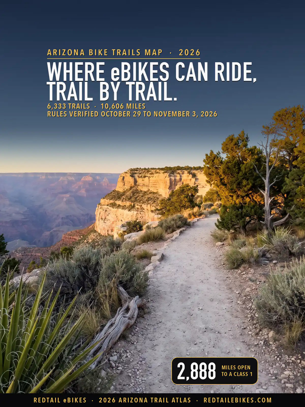
6,333 trails · 10,606 miles across Arizona's 15 counties · 2,888 miles open to a Class 1 · 6 national forests read · Rules verified October 29 to November 3, 2026
Quick Answer: Arizona lets Class 1 and 2 e-bikes ride paths unless the manager bars them, and keeps Class 3 to paths beside a road unless that manager allows it. The Forest Service and the BLM count an e-bike as a motor vehicle, allowed on their motorized routes. Of 10,606 mapped miles, 2,888 take a Class 1 and 1,850 a Class 3.
Every e-bike in our full range ships free to Arizona within the contiguous United States.

The Hermit Road Greenway on the Grand Canyon's South Rim, which the park opens to bicycles and Class 1 and Class 3 e-bikes, in a scene generated with Playcut from a photograph of the greenway by Michael Quinn of the National Park Service.

Each line is a trail or path from the USDA Forest Service's trail records, Motor Vehicle Use Map and Apache-Sitgreaves travel decision layers, Arizona State Parks and Trails (Trails of Arizona and its park trails), the BLM, the Maricopa Association of Governments, Pima County, Maricopa County, the Cities of Phoenix, Scottsdale and Flagstaff, the Town of Marana, the Central Arizona Project, the National Park Service or OpenStreetMap, colored by the e-bike rule of whoever manages it.
The numbers mark the six regions below, Arizona's councils of governments, in the order the page reads them.
Arizona's statute answers one question for you: which classes may use a bicycle path. Out on the forest, desert and canyon trails that hold most of this map's miles, the answer passes to whoever manages the ground, and most of those managers treat your e-bike as a motor vehicle. The map sorts every trail by its manager and by what that manager's own rule lets your class do.
A.R.S. § 28-819(D) reads: "A class 1 electric bicycle, a class 2 electric bicycle or an electric standup scooter may be used on bicycle and multiuse paths. A local authority or agency of this state having jurisdiction over a bicycle or multiuse path may prohibit the operation of a class 1 electric bicycle, class 2 electric bicycle or electric standup scooter on the path."
Subsection (E) keeps your Class 3 off those paths "unless it is within or adjacent to a highway or roadway or unless the local authority or agency of this state having jurisdiction over the path allows the operation".
Section 28-101 defines the bike itself: "a bicycle or tricycle that is equipped with fully operable pedals and an electric motor of less than seven hundred fifty watts", in three classes. A Class 1 assists only while you pedal, to 20 mph; a Class 2 may move the bike by its motor alone, to 20 mph; a Class 3 assists only while you pedal, to 28 mph.
| Where you ride | What decides whether your e-bike may | Who can change it |
|---|---|---|
| A city, town or county path | Arizona law: Class 1 and 2 may ride a bicycle or multiuse path, Class 3 only beside a road (§ 28-819) | The city, town or county, which may bar Class 1 and 2 or let a Class 3 ride |
| A national forest | The forest's Motor Vehicle Use Map, because an e-bike is a motor vehicle there (36 CFR 261.13) | The forest, route by route; the Tonto and Apache-Sitgreaves have not yet published theirs |
| BLM land | Motorized routes, or a non-motorized trail a written decision opens to e-bikes (43 CFR 8340.0-5) | The field office, by a decision |
| An Arizona state park | Park roads and designated motorized trails (Arizona State Parks and Trails) | Arizona State Parks and Trails |
| A national park or monument | Only where the superintendent designates (36 CFR 4.30) | The park's superintendent, in its compendium |
The Legislature wrote the three classes and the path rule into the statutes in 2018 (House Bill 2652, Laws 2018, chapter 324), and what subsections (D) and (E) allow each class has not changed since; a later act added electric standup scooters to subsection (D).
We listed all 2,587 chapters of the 11 sessions from 2018 through 2026; two 2026 bills on path speeds stopped short, Senate Bill 1008 "Held awaiting Second Reading" and Senate Bill 1073 "Held in Committees".
144 managers share the decision across this map. Each trail below carries its manager's name where a record names one and, where that manager's rule could be read, what the rule says about your class, linked to the rule itself. The same rows sit in the trail register, so you can check a ride trail by trail.
For the rest of Arizona's e-bike law, from labels to road rules, read our Arizona e-bike laws guide. For Phoenix and its suburbs city by city, our Phoenix e-bike trails map goes deeper. For federal land in other states, read the e-bike rules on public land guide, and to compare Arizona with other states, see the bike trails by state hub.
Riding across a state line? The same trail-by-trail map covers California to the west and Utah to the north.
Takeaway
Your class decides less in Arizona than your trail's manager does. A Class 1 may ride 2,888 mapped miles, a Class 2 2,873 and a Class 3 1,850. A Class 2 gives up only Grand Canyon's greenways, which open to Class 1 and 3; a Class 3 gives up mostly the city and county paths of the Phoenix area and Flagstaff's urban trails, where it rides only beside a road or not at all.
36% of the mapped miles read gray. The largest gray block is the non-motorized trails of the Tonto and Apache-Sitgreaves national forests, 1,023 miles on two forests that have signed travel decisions but not yet published the maps that make them binding; the downloadable register tells you why each gray trail is gray.
In this guide
- How to read the map
- Who decides on each trail
- National forests: the map decides
- The Arizona Trail
- BLM land
- State parks, State Trust land and Game and Fish land
- Canal paths
- Grand Canyon, Saguaro and the other park units
- City, town and county rules
- Named trails riders ask about
- Arizona bike trails, region by region
- Where riders get caught out
- Roads, labels and riders
- What changed, and what could change next
- Choosing an e-bike for Arizona trails
- Frequently asked questions
How to read the map
Every line on the map is a trail, path or greenway, colored by what its manager's rule lets your e-bike do. Forest roads and city streets stay off unless a trail record runs along one; the road network belongs on a road map.
- Green: Class 1, 2 and 3 may ride. Green miles are mostly national forest and BLM motor trails, where your e-bike rides as a motor vehicle, with Tucson's paths, Gilbert's and Goodyear's, and city paths that run beside a road.
- Purple: any class, with the motor helping only while you pedal. Saguaro National Park's bicycle routes and Tuzigoot's Tavasci Marsh trails carry this condition.
- Magenta: Class 1 and 3, the pedal-assist classes. Grand Canyon's greenways, where the park's compendium names those two classes and leaves out Class 2.
- Blue: Class 1 and 2; a Class 3 is barred or rides only where the path runs beside a road. Blue miles are mostly city and county paths around Phoenix, Phoenix's, Scottsdale's, Mesa's and Chandler's among them, with Maricopa County's regional parks and Flagstaff's urban trails.
- Dashed red: closed to e-bikes. Red miles are mostly national forest trails that are not motorized, then BLM non-motorized routes, the Arizona Trail, the state parks' trails, and the preserves, parks and county trails whose managers bar e-bikes.
- Gray: the rule is unsettled, could not be read, or belongs to a private owner. Each gray trail's reason is in the register.
The map shows the rule. A seasonal closure, a fire restriction or a sign at the trailhead can still close a green line on the day you ride.
Who decides on each trail
On nearly half of this map a national forest decides. The six national forests hold 47% of the mapped miles, 4,938 in all. The BLM holds 675, Arizona's state agencies 481 between them, the Bureau of Reclamation 197, and the cities, towns and counties 3,971, about 37% of the map.
| Who manages the trail | Trails | Miles | What e-bikes may do |
|---|---|---|---|
| National forests: trails the Motor Vehicle Use Map opens to e-bikes | 30 | 52.6 | Class 1, 2 and 3: the map's own e-bike columns |
| National forests: motorized trails on the map | 201 | 714.1 | Class 1, 2 and 3, as motor vehicles |
| National forests: map roads, mapped as trails | 70 | 220.1 | Class 1, 2 and 3, on a road the map designates |
| National forests with a published map: every other trail | 978 | 1,568.9 | Closed: e-bikes count as motor vehicles |
| National forests: the records disagree or do not say | 87 | 174.6 | Gray: each trail's records, printed |
| Tonto and Apache-Sitgreaves (no published map): motorized trails | 181 | 280.7 | Class 1, 2 and 3 on motorized trails |
| Tonto and Apache-Sitgreaves: trails the forest's record restricts | 127 | 395.8 | Closed: the forest's own record |
| Tonto and Apache-Sitgreaves: every other trail | 402 | 1,022.5 | Gray: no map yet; two readings, both printed |
| The Arizona National Scenic Trail | 151 | 673.9 | Closed on its trail pieces |
| BLM: motorized routes | 123 | 154.1 | Class 1, 2 and 3, as off-road vehicles |
| BLM: non-motorized routes and closed areas | 157 | 270.2 | Closed: no decision opens them to e-bikes |
| BLM: lines no route record carries | 127 | 232.6 | Gray: no route record |
| Grand Canyon's greenways | 9 | 15.4 | Class 1 and 3 |
| Saguaro and Tuzigoot: designated bicycle routes | 5 | 6.6 | Every class, pedaling |
| Other Park Service trails | 45 | 38.2 | Closed to e-bikes |
| Reclamation land and the Salt River Project's canals | 186 | 288.3 | Gray: two readings, both printed |
| The CAP Trail | 16 | 35.0 | Gray: two readings, both printed |
| Arizona state parks | 68 | 61.2 | Closed off park roads and motorized trails |
| State Trust Land | 229 | 333.4 | Gray: a permit whose terms could not be read |
| Game and Fish wildlife areas | 35 | 27.6 | Gray: the Commission's rules could not be read |
| Cities, towns and counties: open by their own rule | 942 | 1,445.0 | Each government's own rule: see each below |
| Cities, towns and counties: closed by their own rule | 611 | 879.0 | Each government's own rule: see each below |
| Cities, towns and counties: their own rule, read two ways | 437 | 280.7 | Gray: each government's words, printed below |
| Cities, towns and counties whose rule could not be read | 860 | 992.8 | Gray: state law's default, which a local rule may change |
| Lines only OpenStreetMap draws, on land no record assigns | 354 | 193.1 | Gray: no one's rule on record |
| Canal banks of other owners | 6 | 4.9 | Gray: the canal owner's rule was not read |
| Tribal land | 25 | 27.6 | Gray: the tribe's rule was not read |
| Schools, districts and other public bodies | 41 | 32.6 | Gray: the body's rule was not read |
| Private, nonprofit and HOA land | 179 | 184.6 | The owner decides |
| All Arizona | 6,333 | 10,606.1 | Map above; every trail by region below |
Takeaway
On forest and BLM land, ask whether the trail is open to motor vehicles: if it is, every class may ride it, and if it is not, your e-bike may ride it only where a map or a written decision opens it to e-bikes. On a city path, ask which class you ride: the state lets Class 1 and 2 ride and keeps Class 3 beside the road, and your city can change either.
National forests: the map decides
On a national forest your e-bike is a motor vehicle, and the forest's Motor Vehicle Use Map lists the routes a motor vehicle may use. The Forest Service defines a motor vehicle as "Any vehicle which is self-propelled". Once a forest publishes its map, 36 CFR 261.13 makes it "prohibited to possess or operate a motor vehicle on National Forest System lands in that administrative unit or Ranger District other than in accordance with those designations".
The agency's e-bike page states the result: "Class 1, 2, and 3 e-bikes are allowed on motorized trails and roads on national forests and grasslands." It adds that "Local Forest Service officials may consider new opportunities for e-bike use on non-motorized trails" through the travel management rule's designation process.
Four forests with a published map
The Coconino, Coronado, Kaibab and Prescott national forests have published their maps. None of the 7,431 routes the Forest Service's map layer draws on Arizona's forests carries an e-bike class of its own, so on these four the forests' own words decide.
The Coronado says: "E-bikes are only allowed on motorized trails within the Coronado National Forest." The Prescott says "Prescott National Forest has nearly 400 miles of motorized trails and 1200 miles of Forest Road that allow use of e-bikes.", and "E-bikes are not allowed on the Forest's non-motorized trails (including the Prescott Circle Trail)."
The map's motor trails, 714 miles on this map, take your e-bike whatever its class. Another 220 miles of trail run along a road the map designates for motor vehicles, the Great Western Trail longest among them, and the map lists another 52.6 miles of trail by number, without drawing a line, as open to Class 1, 2 and 3. The vehicle classes and dates each map route carries are printed with its trail in the register.
Nearly every other trail on these forests is closed to your e-bike, whatever a bicycle may do on it; the trails their maps do not open come to 1,407 miles, the largest closed block in Arizona. A further 101.0 miles read gray: trails that a Forest Service record, Trails of Arizona or Flagstaff's e-bike map lists for motor vehicles but the map does not show. Ask the ranger district before you ride one.
The Kaibab's trail routes
The Kaibab's map layer lists 95 trail routes as a "Special Designation" with every vehicle column blank. Its three district maps show roads only, and each prints the note: "Note: E-bikes only allowed on motorized roads and routes on the Kaibab National Forest."
Where the forest's own trail record lists such a route as non-motorized, it is closed to you: 162.2 miles. Where the trail record calls it motorized, the map and the record point opposite ways, and 51.0 miles read gray until the district answers.
The Tonto and Apache-Sitgreaves: decisions signed, maps not yet published
The Forest Service's Southwestern Region says it plainly: "MVUMs are not available for the Apache-Sitgreaves National Forests and Tonto National Forest." The Tonto released its travel management decision on October 5, 2021, and its own page says "The Tonto is currently drafting a Motor Vehicle Use Map (MVUM)" and that "at this time a MVUM is not yet available".
The decision itself says that "Prior to implementation of this decision, it will be necessary to prepare a Motor Vehicle Use Map (MVUM)".
The Apache-Sitgreaves' project page reads "Public Motorized Travel Management Plan Decision Signed Date: 10/18/2024", and its map is not published either. On these two forests the map reads three ways:
- Motorized trails are open. Where the forests' own records list a trail as motorized or open to e-bikes, your e-bike rides it whatever its class, 281 miles. The Forest Service's map layer already holds 1,499 Tonto records without lines, 1,460 of them with e-bike values: the map's entries, not yet published.
- Trails the record closes are closed. Where the Forest Service's trail record restricts all three classes all year, the trail is red, 396 miles. The layer's own metadata defines the field: "Indicates date range of TERRA trails where class 1 e-bike use is restricted year-round."
- The other non-motorized trails are unsettled. The Forest Service treats your e-bike as a motor vehicle and opens a non-motorized trail to it only by designation; but the regulation that makes the map binding applies once a map is published, and a forest closes a trail to a vehicle by an order under 36 CFR 261.55. The orders in force on these two forests close described areas, and none closes the forests' trails to e-bikes. These 1,023 miles read gray; call the ranger district before you ride one.
The Arizona Trail
The Arizona National Scenic Trail is closed to e-bikes, except where it runs on a paved greenway or a road that allows them. The Forest Service, which administers it, says: "The AZNST is a non-motorized trail." and "E-Bikes and off-highway vehicles are not allowed." Congress set that rule for every national scenic trail: "The use of motorized vehicles by the general public along any national scenic trail shall be prohibited".
The agency names its exceptions: "Electronic bicycles (e-bikes) are generally prohibited on the AZNST because all federal agencies define them as motorized. The only exceptions are on dirt roads and some paved sections where e-bike use is allowed."
The trail's own line covers 685 miles of this map, and 680.4 of them are closed. The open stretches are Grand Canyon's Tusayan and Kaibab greenways, 4.8 miles where the park opens its paved greenways to Class 1 and 3.
Inside Flagstaff the city's code adds its own sign rule: "on the Arizona Trail, Nate Avery Trail and Buffalo Park trails, no person shall ride an electric bike, in its motorized capacity, or an electric scooter on a multiuse path".
Trails of Arizona also carries the Arizona Trail Association's mountain bike route; where that route leaves the trail on passages of its own, it is not the Arizona Trail, and this map reads those stretches under their own managers, so check the one you plan to ride by its own row.
BLM land
On BLM land your e-bike is an off-road vehicle unless a written decision says otherwise. The BLM's rules define an off-road vehicle as "any motorized vehicle capable of, or designed for, travel on or immediately over land, water, or other natural terrain", and its e-bike page sends you to the motorized network: "Search for an Open OHV area or motorized trail to ride your e-bike."
The BLM's motorized routes on this map, 154 miles, take your e-bike whatever its class; each route's vehicle and season limits are printed in the register, so check yours before you ride.
A non-motorized route opens only by a decision in which "the authorized officer has expressly determined, as part of a land-use planning or implementation-level decision, that e-bikes should be treated the same as non-motorized bicycles", and the agency adds that "the rule does not, by itself, open any non-motorized trails to e-bike use."
We found no decision that opens an Arizona non-motorized BLM route to e-bikes, so the BLM's non-motorized routes are red, 209 miles. The Black Canyon Trail's corridor plan says so outright: "For the TMP the field office considers e-bikes an OHV and will not be permitted on Limited to non-motorized use routes."
Another 233 miles of trail lie on BLM land that the BLM's route record does not carry; they read gray, so ask the field office before you ride one.
State parks, State Trust land and Game and Fish land
Arizona's state parks keep e-bikes to park roads and designated motorized trails. Arizona State Parks and Trails answers the question in its trail FAQ: "Electrically assisted mountain bikes are considered motorized", allowed on "state park roadways and designated motorized trails". Catalina State Park puts it in one line: "Motorized vehicles and electric bicycles are only allowed on designated park roads."
Red Rock State Park's rules say "No e-bikes allowed." The parks' trails on this map, 61.2 miles in 11 parks, are red: leave your e-bike at the trailhead.
State Trust land asks for a permit before you set foot on its trails: "A recreation permit is required for: hiking, horseback riding, picnicking, photography, bird watching, sightseeing, camping or traveling on existing trails over Trust Land." The State Land Department's permit terms could not be read, so its 297 trail miles read gray.
The Maricopa Trail crosses Trust land on rights of way "purchased from the Trust as perpetual Rights of Way, making them available to the public"; the County's e-bike policy speaks of its parks and does not say whether it reaches that corridor, so those miles read gray too.
On Game and Fish land, the Commission may close an area to motor vehicles under A.R.S. § 17-452; its rules could not be read either, and its 27.6 trail miles read gray, so check with the Department before you ride them.
Canal paths
The Salt River Project's canal banks are Bureau of Reclamation land, and two rules meet on them. Reclamation says that "In September 2022, all Bureau of Reclamation lands underlying and adjacent to canals, open ditches, and licensed municipal paths over underground facilities of the Salt River Federal Reclamation Project became a Special Use Area".
Its rule closes Reclamation land to off-road vehicles: "Reclamation lands are closed to off- road vehicle use, except for an area or trail specifically opened to use of off- road vehicles in accordance with § 420.21."
It counts an e-bike as one unless the Regional Director decides "that E-bikes should be treated the same as non-motorized bicycles", and 43 CFR 423.3 says "This part 423 and other Federal laws will govern over any conflicting regulations of a non-Federal entity."
We found no such decision for Arizona. Against it, § 28-819(D) lets you ride a Class 1 or 2 on a bicycle or multiuse path. Both readings stand, so the Salt River Project's canal banks read gray, 218 miles.
Chandler settles its own canal paths: "No motorized vehicles, including E-bikes, are permitted on canal shared-use paths, such as the Paseo Trail and Western Canal Path." The Central Arizona Project's CAP Trail is "for multiple non-motorized recreational uses: walking, jogging, equestrian, cycling and roller blading", and "public motorized uses will not be allowed". Section 28-101 says a motor vehicle "Does not include" an electric bicycle, so the CAP Trail reads gray as well.
Grand Canyon, Saguaro and the other park units
Grand Canyon opens its greenways to the pedal-assist classes. Its compendium says: "(103) Open Areas to Bicycles & Class 1 and Class 3 E-Bikes: The following are open to bicycles and Class 1 and Class 3 e-bikes:", then lists the South Rim greenways, the Hermit Road Greenway and the others; "All other areas of Grand Canyon National Park remain closed to the use of bicycles and all e-bikes".
That is 15.3 magenta miles on this map, and if you ride a Class 2, it is not on the list.
Saguaro says "E-bikes are permitted only where traditional bicycles are allowed." Off its roads, federal rules forbid "using the electric motor exclusively to move an electric bicycle for an extended period of time without pedaling", so its 5.3 miles of bicycle routes are purple, and Tuzigoot's Tavasci Marsh trails, where "Bicycles are permitted on the established trails within Tavasci Marsh", read the same way.
Everywhere else in a park unit, "The use of an electric bicycle is prohibited in locations not designated by the Superintendent under paragraph (i)(1) of this section." The other units' compendia designate roads and parking areas, not trails, so their trails on this map are closed to your e-bike. The park units' own rules govern 60.1 mapped miles across 9 units.
City, town and county rules
Arizona's cities, towns and counties manage 3,971 mapped miles, and the rules of 18 of the 81 were read in full and 28 more in part. State law lets each of them bar Class 1 and 2 from a path or let a Class 3 ride one, so a local rule can be stricter than the state's, looser for a Class 3, or silent.
Where we read one, the table shows what it lets you ride; where we could not, the trail reads gray.
| Government | Law or page | Where it applies | What it does | Trails | Miles |
|---|---|---|---|---|---|
| City of Apache Junction | Apache Junction City Code, Chapter 15 (Public Parks) | a path or trail in a City of Apache Junction park | Unsettled: the code bars 'any motor vehicle' and 'motor bikes' | 1 | 0.4 |
| City of Buckeye | State of Arizona: Class 1, Class 2 and standup scooters on bicycle and multiuse paths | a City of Buckeye path outside its parks | Class 1 and 2; Class 3 beside a roadway (the City's location table names no paths) | 7 | 44.4 |
| City of Buckeye | City of Buckeye: the City's location table (Class 3 out of parks) | a path or trail in a City of Buckeye park | Class 1 and 2; no Class 3 in parks (the ordinance's effective date: November 6, 2026) | 13 | 22.0 |
| City of Chandler | City of Chandler: canal shared-use paths | a City of Chandler canal shared-use path | Closed on the City's canal paths | 18 | 18.2 |
| City of Chandler | City of Chandler: Class 3 (Ordinance No. 5164, in force July 11, 2026) | a City of Chandler shared-use path or park outside the canals | Class 1 and 2 at 15 mph; Class 3 prohibited | 70 | 97.7 |
| City of Cottonwood | City of Cottonwood, City Parks, Trails and Bikeways | a trail in the City of Cottonwood's Riverfront Park | Unsettled: trails for 'non-motorized vehicles' | 2 | 1.2 |
| City of Flagstaff | Flagstaff City Code § 9-05-001-0008(B) | the Arizona Trail, the Nate Avery Trail and the Buffalo Park trails inside Flagstaff | Closed where signed | 5 | 8.6 |
| City of Flagstaff | Flagstaff City Code § 9-05-001-0004(A) (the facilities table) | a Flagstaff Urban Trails System path, paved or unpaved | Class 1 and 2; no Class 3 on the urban trails | 83 | 55.9 |
| City of Glendale | City of Glendale (Ordinance O25-50): pathways where bicycles may ride | a City of Glendale path outside its parks | Class 1 and 2 unless signed; Class 3 beside a roadway | 12 | 28.8 |
| City of Glendale | City of Glendale Parks and Recreation: parks: motorized vehicles | a path or trail in a City of Glendale park | Unsettled: 'motorized vehicles' kept to paved roads | 42 | 22.8 |
| City of Goodyear | City of Goodyear: Class 3 on shared-use paths (ordinance of April 28, 2026) | a City of Goodyear shared-use path or park path | Class 1, 2 and 3; Class 3 at 20 mph or less | 22 | 95.3 |
| City of Mesa | City of Mesa: shared-use paths, Class 1 and Class 2 (Legistar 25-1083; in force Feb. 11, 2026 per the City) | a City of Mesa shared-use path | Class 1 and 2; no other motorized vehicle on a shared-use path | 23 | 73.5 |
| City of Mesa | City of Mesa: shared-use paths, Class 1 and Class 2 (Legistar 25-1083; in force Feb. 11, 2026 per the City) | a path or trail in a City of Mesa park | Class 1 and 2 at 5 mph in a park; Class 3 only on park roads | 38 | 21.0 |
| City of Phoenix | City of Phoenix Parks and Recreation: every desert park and mountain preserve: trails | a trail or path in a City of Phoenix desert park or mountain preserve (off its established park roads) | Closed in a desert park or preserve, off established park roads | 215 | 276.9 |
| City of Phoenix | City of Phoenix (City Council): Class 1 and Class 2 legalised in the public right-of-way (2022-03-02) | a City of Phoenix path outside its desert parks and preserves | Class 1 and 2; the City's Class 3 section was not read; Class 3 unsettled | 111 | 217.6 |
| City of Prescott | Prescott City Code § 15-1-12(A) | a trail or path in the City of Prescott's park and trail system | Unsettled: 'motorized vehicles' kept to roadways in the park system | 191 | 116.8 |
| City of Scottsdale | City of Scottsdale: McDowell Sonoran Preserve trails | a trail in the McDowell Sonoran Preserve | Closed in the McDowell Sonoran Preserve | 167 | 229.8 |
| City of Scottsdale | State of Arizona: Class 1, Class 2 and standup scooters on bicycle and multiuse paths | a City of Scottsdale paved path, park path or side path | Class 1 and 2; Class 3 beside a roadway, no Class 3 rider under 16 | 167 | 174.0 |
| City of Scottsdale | City of Scottsdale: the City's trails outside the Preserve (unpaved) | an unpaved City of Scottsdale trail outside the Preserve | Unsettled: the City bars 'motorized vehicles' on its trails | 183 | 122.7 |
| City of Tempe | City of Tempe: multi-use paths (rules in effect July 25, 2026) | a City of Tempe multi-use path | Class 1 and 2 at 15 mph; Class 3 beside a roadway | 30 | 21.9 |
| City of Tucson | Tucson Code § 5-13(b) (Ordinance No. 11582, 2018) | a path under the City of Tucson's jurisdiction (not The Loop) | Class 1, 2 and 3 under 20 mph; no rider under 16 | 82 | 61.7 |
| City of Tucson | Tucson Code § 5-13(b) (Ordinance No. 11582, 2018) | a natural-surface trail under the City of Tucson's jurisdiction (the City's e-bike permission names paths) | Unsettled: a Tucson natural-surface trail | 8 | 7.3 |
| Maricopa County | Maricopa County Parks and Recreation, FAQ: E-Bike Policy | a trail in a Maricopa County regional park | Class 1 and 2; Class 3 only beside a road or where the park permits | 172 | 260.0 |
| Maricopa County | A.R.S. § 28-819(D), (E) | a public path on unincorporated Maricopa County land outside a regional park | Class 1 and 2 by state law; Class 3 only beside a roadway | 56 | 80.9 |
| Mohave County | Mohave County Parks, Code of Conduct: Park Behavior Policy | a trail in a Mohave County park (Hualapai Mountain Park, Davis Camp, the Dolan Springs trails) | Closed on County park trails | 5 | 3.9 |
| Mohave County | Lake Havasu City Parks and Recreation: SARA Park | a trail in SARA Park, south of Lake Havasu City | Unsettled: whether the County's park policy reaches SARA Park | 9 | 6.9 |
| Pima County | A.R.S. § 28-819(D), (E) | a paved path Pima County manages outside The Loop | Not read: the County's rule not found | 51 | 27.7 |
| Pima County | Pima County, About The Loop (FAQ) | The Loop, inside Tucson and in unincorporated Pima County (Pima County's management) | Closed: the County bars e-bikes on The Loop | 18 | 147.3 |
| Pima County | Pima County Natural Resources, Parks and Recreation: trailhead guidelines | an unpaved trail Pima County manages | Closed: no e-bikes on County trails | 154 | 172.4 |
| Town of Fountain Hills | Town of Fountain Hills: Fountain Hills McDowell Mountain Preserve | a trail in the Fountain Hills McDowell Mountain Preserve | Closed in the McDowell Mountain Preserve | 17 | 14.4 |
| Town of Gilbert | Town of Gilbert: sidewalks, multi-use paths and Town parks (June 9, 2026) | a Town of Gilbert multi-use path or park | Class 1, 2 and 3 except where signs prohibit | 51 | 125.5 |
| Town of Queen Creek | Town of Queen Creek: Town parks (Ordinance 890-26, effective May 21, 2026) | a Town of Queen Creek park | Closed in Town parks | 12 | 7.4 |
| Town of Queen Creek | Town of Queen Creek: 15 mph on multi-use trails | a Town of Queen Creek multi-use trail outside a park | Class 1 and 2 at 15 mph; Class 3 beside a roadway | 13 | 64.8 |
| Town of Wickenburg | Town of Wickenburg, Parks, Trails and Campgrounds | the Town of Wickenburg's Sunset Multi-Use Path | Unsettled: open to 'non-motorized forms of travel' | 1 | 2.8 |
Phoenix: paths open, desert parks closed
Phoenix's code of conduct lists what "is not permitted in any desert park or mountain preserve", and the list includes "Riding electric bicycles or other types of motorized vehicles on trails or off established park roads". South Mountain, the Phoenix Sonoran Preserve and the other desert parks and preserves are red on this map, 277 miles.
On the City's other paths, the 2022 ordinance that legalized e-bikes "will permit the use of Class 1 and Class 2 e-bikes in the public right-of-way". The City's Class 3 section could not be read, so on a Class 3 there you follow § 28-819(E): beside a road, or not at all.
Scottsdale and Fountain Hills: the preserves closed
"Electric bikes are not allowed in the Scottsdale McDowell Sonoran Preserve." Next door, Fountain Hills' code bars "Using any motorized or electric mode of transportation, except for authorized maintenance vehicles and as necessary." in its McDowell Mountain Preserve.
Scottsdale's other unpaved trails sit under a different sentence: "The city prohibits the use of motorized vehicles, including ATVs and motorcycles, on Scottsdale's trails and in the McDowell Sonoran Preserve." State law says a motor vehicle does not include an electric bicycle, so those 123 miles read gray. Scottsdale's paved paths follow the state's path rule, and its code keeps you off a Class 3 anywhere on city property if you are under 16.
Maricopa County's regional parks
The County's parks follow the state's classes: "Class 1 and Class 2 e-bikes are allowed on bicycle and multi-use trails, unless otherwise restricted by park management", and "Class 3 e-bikes are not allowed on multi-use or bike paths unless the path is adjacent to a roadway or specifically permitted by park management".
McDowell Mountain, White Tank, Usery, Estrella and the other regional parks are blue, 260 miles, except where a park path runs beside a road and your Class 3 may ride it too.
Outside its parks, the County has no e-bike ordinance in force, so on its paths you follow the state's rule. A supervisor's newsletter says that "an ordinance for unincorporated Maricopa County land is being drafted in accordance with existing state statute".
The East Valley: Mesa, Chandler, Gilbert, Queen Creek and Tempe
- Mesa. Its shared-use paths take Class 1 and 2, and "Effective Feb. 11, 2026, Class 1 and Class 2 E-Bikes, electric standup scooters, and electric miniature scooters may be ridden within a Mesa park." In a park the limit is "five miles per hour", and your Class 3 rides only on park roads.
- Chandler. Ordinance No. 5164, in force July 11, 2026: "THE OPERATION OF CLASS 3 ELECTRIC BICYCLES IS PROHIBITED ON SIDEWALKS, IN CITY PARKS, AND ON SHARED-USE PATHS WITHIN THE CITY OF CHANDLER." You may ride a Class 1 or 2 on its paths and in its parks at 15 mph or less, and its canal paths are closed to you.
- Gilbert. "Bicycles, e‑bikes, electric scooters, motorized skateboards, motorized wheelchairs, and personal mobile cargo‑carrying devices may be used on sidewalks, multi‑use paths, and in Town parks, except where posted signage prohibits their use."
- Queen Creek. "Electric bikes, other power-driven mobility devices and motor vehicles are not allowed in Town parks, including sidewalks within the park." On its multi-use trails, "The ordinance establishes a speed limit of 15 miles per hour for sidewalks, multi-use trails, parking lots, and bicycle lanes."
- Tempe. "The speed limit for electric bicycles on multi-use paths was lowered from 20 mph to 15 mph", and on a Class 3 you follow the state's rule.
The West Valley: Glendale, Goodyear and Buckeye
Glendale's paths follow the state's classes, and its ordinance, in force January 9, 2026, bars e-bikes wherever "authorized signs are erected on a roadway, Sidewalk, or other pathway prohibiting the riding of bicycles". Its park rules say "Motorized vehicles are restricted to paved roads.", which may or may not reach your e-bike, so its park trails read gray.
Goodyear's shared-use paths take every class, and its ordinance lists "Class 3 e‑bikes exceeding 20 MPH on shared‑use paths" among the behaviors it prohibits. Buckeye's paths follow the state's rule, and its new e-bike ordinance keeps your Class 3 out of its parks; the City's release gives November 6, 2026, as its effective date.
Tucson and Pima County: the City's paths open, the Loop closed
Tucson's code opens its paths: "(b) Electric bicycles are permitted on bicycle, shared and multiuse paths under the jurisdiction of the City of Tucson, in the same manner as any other bicycle and when operated at posted or regulated speeds, or under twenty (20) miles per hour, whichever is lower." It also says "(c) No person under the age of sixteen (16) may operate an electric bicycle."
That permission names paths, and the same ordinance names trails apart from them: "(c) A person riding a bicycle on a multi-use path, trail, or shared use path under the jurisdiction of the City of Tucson must yield the right-of-way to any pedestrian or horse and shall slow to ten (10) miles per hour and communicate to the pedestrian or equestrian rider before overtaking or passing."
So the map shows the City's paved and stabilized paths green and leaves its 7 miles of natural-surface trail gray, because the code does not say whether a dirt trail is one of the paths it opens to you.
The Loop is Pima County's, and the County bars e-bikes on it: "the sections of the Loop within the City of Tucson incorporated limits and in unincorporated Pima County are under the management authority of Pima County and the Pima County Regional Flood Control District and the use of electric bikes on the path is prohibited as declared on our Loop Guideline signage". On the County's unpaved trails: "No motorized vehicles or e-bikes permitted on trails."
Flagstaff, Sedona and Prescott
Flagstaff's code sets the rule in a table of facilities. On a Class 1 or 2 you may ride sidewalks, bike lanes, roadways and the Flagstaff Urban Trails System, paved or gravel; on a Class 3 you may ride bike lanes and roadways, and not the sidewalks or the urban trails.
Sedona's trails are nearly all the Coconino National Forest's, in its Red Rock Ranger District, where the forest's map decides: its motor routes are green and its non-motorized trails are red, whatever your class.
Prescott's park code says motorized vehicles "shall be operated only on maintained roadways" in a park system that includes the City's trails, and it points to title 28, under which an e-bike is not a motor vehicle; both readings stand, and the City's 117 trail miles read gray.
Mohave County and the smaller towns
Mohave County's parks bar "Riding electric bicycles or other types of motorized vehicles on trails or off established park roads", so Hualapai Mountain Park's trails are red. Lake Havasu City calls SARA Park "a county leased recreation area", and neither page says whether the County's rule reaches it, so it reads gray.
Three more rules turn on the word "motorized". Wickenburg's Sunset path "is open to all non-motorized forms of travel" while the Town calls an e-bike "a motorized bicycle"; Cottonwood describes Riverfront Park's trails as "for hiking and non-motorized vehicles"; Apache Junction's park code bars "any motor vehicle of any type". Each reads gray, both ways printed, so ask the town before you ride.
Rules that could not be read
Where a city or county publishes its code on American Legal or municipal.codes, those hosts could not be read on November 3, 2026, and neither could several cities' own sites. 34 of the 81 cities, towns and counties on this map had no website that could be read that day.
Their trails, 747 miles of city and town paths and 81 of county trails, read gray, and the register's last column says what was tried for each. Where no ordinance or sign bars it, state law lets you ride a Class 1 or 2 on a public path. Another 193 miles are unpaved lines only OpenStreetMap draws, on ground no record assigns to a manager; they read gray too.
Named trails riders ask about
These are the trails and places riders search for by name, each matched to its pieces in the register so you can check the one you plan to ride. Where a trail crosses more than one manager, its row splits the miles by rule.
Takeaway
Four of the places riders ask about are closed to e-bikes: the Arizona Trail outside Grand Canyon's greenways, the Loop, Scottsdale's McDowell Sonoran Preserve and Phoenix's desert parks and mountain preserves. McDowell Mountain Regional Park, one of Maricopa County's parks, takes a Class 1 or 2 on its trails.
Arizona bike trails, region by region
The six regions below are Arizona's councils of governments, each a set of whole counties, named for its two largest cities. Each map shows the region's trails in the statewide map's colors, and each table lists its longest trails by rule.
Yuma and Lake Havasu City

Western Arizona has the fewest mapped miles, and every open one is a BLM motor route. Its 417 mapped miles lie in La Paz, Mohave and Yuma counties; 105 are open, 85 are closed and 227 read gray.
Nearly all the closed miles are BLM routes kept non-motorized, with Mohave County's park trails at Hualapai Mountain and a state park's trails. More than half the region reads gray, most of it BLM trail the agency's route record does not carry; most of the rest is the paths of Yuma, Kingman, Bullhead City and Somerton, whose rules could not be read, with Reclamation land and SARA Park.
| Trail | Managed by | Miles | E-bikes |
|---|---|---|---|
| Wikieup Cutoff to Alamo Lake Mohave/La Paz County Line | Bureau of Land Management, Lake Havasu Field Office | 12.7 | Not on the BLM's route record |
| Wikieup Cutoff to Alamo Lake Mohave/La Paz County Line | Bureau of Land Management, Kingman Field Office | 10.7 | Not on the BLM's route record |
| Sunkist Trail | Bureau of Land Management, Yuma Field Office | 8.7 | Not on the BLM's route record |
| Monolith Gardens Loop | Bureau of Land Management, Kingman Field Office | 7.9 | Not on the BLM's route record |
| 2000 | Bureau of Land Management, Arizona Strip Field Office | 7.1 | Class 1, 2 and 3 as off-road vehicles; the route's limits apply |
| Foothills Rim | Bureau of Land Management, Kingman Field Office | 6.4 | Not on the BLM's route record |
| 2042 | Bureau of Land Management, Arizona Strip Field Office | 6.2 | Class 1, 2 and 3 as off-road vehicles; the route's limits apply |
| Castle Rock Trail | Bureau of Land Management, Kingman Field Office | 6.0 | Not on the BLM's route record |
| East Main Canal Path | City of Yuma | 5.6 | City or town rule not read |
| 1545 | Bureau of Land Management, Arizona Strip Field Office | 5.2 | Closed: no decision opens the route to e-bikes |
| 1246 | Bureau of Land Management, Grand Canyon-Parashant National Monument | 5.0 | Closed: no decision opens the route to e-bikes |
| Rattler Trail | Bureau of Land Management, Kingman Field Office | 4.9 | Not on the BLM's route record |
Every mapped trail in Yuma and Lake Havasu City (395 trails, 417 mi), by e-bike rule
Class 1, 2 and 3 (110, 105 mi)
Bureau of Land Management, Arizona Strip Field Office:
- 2000 (7.1 mi)
- 2042 (6.2 mi)
- 2047 (3.5 mi)
- 2055 (3.1 mi)
- 2044 (2.7 mi)
- 2014 (1.8 mi)
- 2006 (1.8 mi)
- 1995 (1.8 mi)
- 2048 (1.7 mi)
- 1990 (1.6 mi)
- 2045 (1.5 mi)
- 2005 (1.4 mi)
- 2057 (1.3 mi)
- 2066 (1.2 mi)
- 2013 (1.2 mi)
- 1988 (1.0 mi)
- 2026 (1.0 mi)
- 2034 (0.8 mi)
- 1989 (0.7 mi)
- 2046 (0.6 mi)
- 1987 (0.6 mi)
- 1985 (0.6 mi)
- 1986 (0.6 mi)
- 2043 (0.5 mi)
- 2033 (0.4 mi)
- 1991 (0.4 mi)
- 1035F (0.4 mi)
- 2068 (0.3 mi)
- 2032 (0.3 mi)
- 2065 (0.2 mi)
- 2031 (0.2 mi)
- 2017 (0.1 mi)
- 2051 (0.1 mi)
Bureau of Land Management, Yuma Field Office:
- Lp615 (3.5 mi)
- Lp779 (2.3 mi)
- Lp411 (1.8 mi)
- Lp597 (1.5 mi)
- Lp571 (1.4 mi)
- Lp620 (1.2 mi)
- Lp623 (1.2 mi)
- Lp567 (1.1 mi)
- Lp617 (1.1 mi)
- Lp621 (1.0 mi)
- Lp604 (1.0 mi)
- Lp568 (1.0 mi)
- Lp618 (0.9 mi)
- Lp614 (0.9 mi)
- Lp537 (0.9 mi)
- Lp605 (0.9 mi)
- Lp581 (0.8 mi)
- Lp559 (0.8 mi)
- Lp627 (0.7 mi)
- Lp219 (0.7 mi)
- Lp612 (0.7 mi)
- Lp609 (0.7 mi)
- Lp570 (0.7 mi)
- Lp579 (0.7 mi)
- Lp588 (0.6 mi)
- Lp591 (0.6 mi)
- Lp601 (0.6 mi)
- Lp542 (0.6 mi)
- Lp527 (0.6 mi)
- Lp602 (0.5 mi)
- Lp592 (0.5 mi)
- Lp532 (0.5 mi)
- Lp583 (0.5 mi)
- Lp573 (0.5 mi)
- Lp535 (0.4 mi)
- Lp575 (0.4 mi)
- Lp607 (0.4 mi)
- Lp526 (0.4 mi)
- Lp600 (0.4 mi)
- Lp539 (0.4 mi)
- Lp616 (0.4 mi)
- Lp533 (0.4 mi)
- Lp611 (0.4 mi)
- Lp599 (0.4 mi)
- Lp553 (0.3 mi)
- Lp593 (0.3 mi)
- Lp541 (0.3 mi)
- Lp610 (0.3 mi)
- Lp586 (0.3 mi)
- Lp518 (0.3 mi)
- Lp529 (0.3 mi)
- Lp569 (0.3 mi)
- Lp538 (0.2 mi)
- Lp530 (0.2 mi)
- Lp598 (0.2 mi)
- Lp525 (0.2 mi)
- Lp522 (0.2 mi)
- Lp580 (0.2 mi)
- Lp519 (0.2 mi)
- Lp608 (0.2 mi)
- Lp534 (0.2 mi)
- Lp603 (0.2 mi)
- Lp520 (0.2 mi)
- Lp528 (0.1 mi)
- Lp613 (0.1 mi)
- Lp547 (0.1 mi)
- Lp523 (0.1 mi)
- Lp606 (0.1 mi)
- Lp524 (0.1 mi)
Bureau of Land Management, Lake Havasu Field Office:
- 4436A (4.9 mi)
- 4442 (3.2 mi)
- 4390A (2.3 mi)
- 4395A (1.7 mi)
- 4381A (1.7 mi)
- 4378 (1.3 mi)
- 4379A (1.0 mi)
- 4402U (0.3 mi)
Closed to e-bikes (88, 85 mi)
Bureau of Land Management, Lake Havasu Field Office:
- Unnamed trails (4.1 mi, 2 stretches)
- 4467 (3.2 mi)
- 4466 (3.0 mi)
- 4455 (2.7 mi)
- 4456 (2.6 mi)
- 4469 (2.6 mi)
- 4470 (2.4 mi)
- 4460 (2.0 mi)
- 4464 (1.9 mi)
- 4319 (1.7 mi)
- 4463 (1.6 mi)
- 4455B (1.6 mi)
- 4453F (1.4 mi)
- 7389F (1.3 mi)
- 4464B (1.2 mi)
- 4454A (1.1 mi)
- 4466B (1.1 mi)
- 4453C (1.0 mi)
- 4462 (1.0 mi)
- 4465 (1.0 mi)
- 4466C (0.9 mi)
- 4459B (0.9 mi)
- 4461A (0.9 mi)
- 4482 (0.9 mi)
- 4467A (0.9 mi)
- 4454 (0.8 mi)
- 4457C (0.7 mi)
- 4457 (0.6 mi)
- 4461 (0.6 mi)
- 4455C (0.6 mi)
- 4462B (0.6 mi)
- 4464C (0.6 mi)
- 4467B (0.6 mi)
- 4459A (0.6 mi)
- 4402S (0.6 mi)
- 4440D (0.5 mi)
- 4464A (0.5 mi)
- 4402E (0.5 mi)
- 4436F (0.5 mi)
- 4449B (0.5 mi)
- 4402I (0.4 mi)
- 4455D (0.4 mi)
- 4468 (0.4 mi)
- 4304 (0.4 mi)
- 4457D (0.4 mi)
- 4461B (0.4 mi)
- 4462A (0.4 mi)
- Sonny's Trail (0.4 mi)
- 4449E (0.3 mi)
- 4454D (0.3 mi)
- 4458 (0.3 mi)
- 4456J (0.3 mi)
- 4460B (0.2 mi)
- 4448A (0.2 mi)
- 4455A (0.2 mi)
- 4447I (0.2 mi)
- 4448D (0.1 mi)
- 4402H (0.1 mi)
- 4463C (0.1 mi)
- 4456A (0.1 mi)
- Lizard Peak Trail (0.1 mi)
- 4456G (0.1 mi)
- 4456K (0.1 mi)
- 4402J (0.1 mi)
- 4458A (0.1 mi)
- 4447H (0.1 mi)
- 4461bb (0.1 mi)
- 4463A (0.1 mi)
Bureau of Land Management, Grand Canyon-Parashant National Monument:
- 1246 (5.0 mi)
- 1524 (4.1 mi)
- 1511 (2.5 mi)
- 1522 (1.0 mi)
- Unnamed trails (0.8 mi)
- 1530 (0.2 mi)
- 1506 (0.2 mi)
Bureau of Land Management, Arizona Strip Field Office:
- 1545 (5.2 mi)
- 2070 (0.6 mi)
- 1531 (0.4 mi)
- 1511 (0.1 mi)
- 1035A (0.1 mi)
Mohave County:
- Sawmill Canyon Spur (1.3 mi)
- Hualapai Peak (0.8 mi)
- Hayden Peak Drive (0.7 mi)
- Levi Levi Camp Road (0.7 mi)
- South Hayden Peak Show (0.4 mi)
Arizona State Parks and Trails, Buckskin Mountain State Park:
- Abandoned Mine (2.6 mi)
Arizona State Parks and Trails, Cattail Cove State Park:
- Connector (0.3 mi)
Unsettled (29, 22 mi)
Bureau of Reclamation:
- Davis Dam Trail (3.1 mi)
- Recycle (2.1 mi)
- Pilot Rock Trail (1.3 mi)
- Frontyard (1.0 mi)
- Ryan (1.0 mi)
- Moab (1.0 mi)
- Adventure Trail (1.0 mi)
- Bart (0.8 mi)
- Beach (0.6 mi)
- Long Ridge (0.5 mi)
- Razorback (0.4 mi)
- Crossover (0.4 mi)
- Wellton cutoff to Ligurta (0.4 mi)
- Dos Equis (0.3 mi)
- New Line Cinema (0.2 mi)
- Unnamed trails (0.2 mi, 2 stretches)
- Moon Rocks (0.2 mi)
- No Name Trail (0.1 mi)
- Upper Overlook (under 0.1 mi)
Mohave County:
- Friendly Fair Trail (3.2 mi)
- Watershed Loop (1.0 mi)
- Trash Can (0.7 mi)
- Sonny's Trail (0.6 mi)
- Multiple Offers WRE (0.6 mi)
- Unnamed trails (0.3 mi)
- Ghost Bikes (0.2 mi)
- Naked Man Trail (0.2 mi)
- Watershed Loop - Crack Trail (Yellow) (0.1 mi)
Private, nonprofit or HOA land: the owner decides (1, 0.1 mi)
Private owner:
- West Main Canal Linear Park (0.1 mi)
Rule could not be read (local code, agency or owner) (171, 205 mi)
Bureau of Land Management, Kingman Field Office:
- Wikieup Cutoff to Alamo Lake Mohave/La Paz County Line (10.7 mi, 2 stretches)
- Monolith Gardens Loop (7.9 mi)
- Foothills Rim (6.4 mi)
- Castle Rock Trail (6.0 mi)
- Rattler Trail (4.9 mi)
- Badger Trail (3.1 mi)
- Sidewinder (3.0 mi)
- Sue B. Loop (1.9 mi)
- Red Trail Connector (1.5 mi)
- Basalt Connector (1.2 mi)
- Cholla Loop North (1.1 mi)
- Hualapai Peak (0.9 mi)
- Lost Mine Trail (0.9 mi)
- Tech Ridge (0.8 mi)
- T. & Carl Schroeder Loop (0.7 mi)
- Mitten Loop (0.7 mi)
- Johnimal's Junction (0.6 mi)
- Cholla Loop South (0.6 mi)
- Land of the Lost (0.5 mi)
- Unnamed trails (0.5 mi)
- Igneous Connector (0.5 mi)
- Powerline Connector (0.3 mi)
- Tech Ridge Loop (0.2 mi)
- Slide Rock Bypass (0.2 mi)
- Mars Attacks (0.2 mi)
- Baby Bottle Connector (0.1 mi)
- Nick (under 0.1 mi)
Bureau of Land Management, Yuma Field Office:
- Sunkist Trail (8.7 mi)
- Unnamed trails (3.1 mi)
- Dateland cutoff to Wellton Cutoff (2.7 mi)
- Champagne (2.7 mi)
- Westside (2.6 mi)
- Ryan (1.9 mi)
- Liberty Bell (1.6 mi)
- Johnny Walker (1.5 mi)
- Long Ridge (1.5 mi)
- Paradise (1.1 mi)
- Dos Equis (1.0 mi)
- Picnic Table (1.0 mi)
- Moab (1.0 mi)
- Sidewalk (0.7 mi)
- Bart (0.7 mi)
- T-Bird (0.6 mi)
- Moon Rocks (0.6 mi)
- Black Canyon (0.6 mi)
- Birdpole Bypass (0.5 mi)
- Backyard (0.5 mi)
- Beach (0.4 mi)
- Birdpole (0.3 mi)
- Heavenly Pass (0.3 mi)
- Crossover (0.2 mi)
- 8 Ball (0.1 mi)
Bureau of Land Management, Lake Havasu Field Office:
- Wikieup Cutoff to Alamo Lake Mohave/La Paz County Line (12.7 mi)
- Spoke (3.0 mi)
- Cosmic (2.5 mi)
- Social (0.7 mi)
- Beer Bottle (0.7 mi)
- Trash Can (0.5 mi)
- Watershed Loop (0.4 mi)
- Naked Man Trail (0.4 mi)
- Unnamed trails (0.3 mi)
- Pilot Rock Trail (0.2 mi)
- Alamo Lake C/L to Wayside (0.2 mi)
- Butler Valley to Salome (0.1 mi)
- Sonny's Trail (under 0.1 mi)
- Recycle (under 0.1 mi)
City of Yuma:
- East Main Canal Path (5.6 mi)
- Colorado River Trail (3.4 mi)
- Unnamed trails (1.2 mi)
- E 32nd Street (1.1 mi)
- Unnamed trails (1.1 mi)
- East 32nd Street (1.0 mi)
- West Main Canal Path (1.0 mi)
- Pacific Avenue Athletic Complex Path (0.9 mi)
- Gateway Park Path (0.9 mi)
- S Avenue 3 E (0.9 mi)
- Horse Trail (0.8 mi)
- 20th Street Bike Path (0.8 mi)
- West Wetlands Park Path (0.8 mi)
- 45th Avenue Foot Path (0.5 mi)
- Lower Lateral Path (0.5 mi)
- West Jones Avenue (0.3 mi)
- W 32nd Street (0.2 mi)
- South 15th Avenue (under 0.1 mi)
- South 22nd Avenue (under 0.1 mi)
- North 12th Avenue (under 0.1 mi)
City of Kingman:
- Camp Beale Loop (3.3 mi)
- Mohave Wash Walking Path (2.7 mi)
- Camp Beale Divider (1.0 mi)
- Red Ghost Loop (0.9 mi)
- Downtown Connector (0.9 mi)
- Uptown Connector (0.9 mi)
- Upper Loop (0.8 mi)
- 1 Mile Path (0.8 mi)
- Ledges Loop (0.7 mi)
- Skyline Technical Loop (0.7 mi)
- Lower Loop (0.6 mi)
- Beale-Monolith Connector (0.6 mi)
- I-40 Walk Path (0.6 mi)
- Scorpion Trail (0.6 mi)
- Golf Course Technical Loop North (0.5 mi)
- Chuckwallas Loop (0.4 mi)
- Golf Course Technical Loop South (0.4 mi)
- Doc's Trail (0.4 mi)
- Tuff Break (0.3 mi)
- Happy Place (0.3 mi)
- Cactus Loop (0.3 mi)
- Jackrabbit Loop (0.3 mi)
- 4th Street Connector (0.2 mi)
- Wagon Wheels (0.2 mi)
- Joe's Line (0.2 mi)
- Camp Beale-Monolith Connector (0.2 mi)
- Wash (0.2 mi)
- Quail (0.2 mi)
- Creosote (0.1 mi)
- Lower Quail (0.1 mi)
- White Cliffs Wagon Road (0.1 mi)
- Lower Divide (0.1 mi)
- Spicy Pickle (0.1 mi)
- Lower Cactus Derby (0.1 mi)
- Upper Cactus Derby (0.1 mi)
- Fort Beale Drive Connector (0.1 mi)
- Off the Wall (0.1 mi)
- Upper Trail Bypass (0.1 mi)
- Unnamed trails (0.1 mi)
- Jalapeno Roll (0.1 mi)
- Dad Jumps (under 0.1 mi)
Bureau of Land Management, Arizona Strip Field Office:
- Unnamed trails (15.4 mi)
City of Bullhead City:
- Unnamed trails (4.6 mi, 3 stretches)
- Riverview Drive Multi-use Path (1.5 mi)
- Lakeside Drive Multi-use Path (1.0 mi)
Arizona Game and Fish Department, Colorado River Nature Center:
- Unnamed trails (4.8 mi)
City of Somerton:
- North Cesar Chavez Multiuse Pathway (0.7 mi)
- Las Estrellas Pathway (0.5 mi)
- Somerton Canal Pathway (0.5 mi)
- County 17th Street Pathway (0.5 mi)
- West Main Street Pathway (0.5 mi)
- Madison Street Pathway (0.5 mi)
- East Main Street Pathway (0.5 mi)
- Garvin Street Walkway (0.2 mi)
- Somerton Avenue Multiuse Pathway (0.1 mi)
Arizona State Land Department:
- Island Trail (2.9 mi)
- Mohave Wash Walking Path (0.5 mi)
- Unnamed trails (0.2 mi, 2 stretches)
- Gross Spring (under 0.1 mi)
Fort Yuma Indian Reservation:
- Unnamed trails (3.0 mi, 2 stretches)
- Sunrise Point Trails (0.6 mi)
Bureau of Land Management:
- Dateland cutoff to Wellton Cutoff (3.1 mi)
City of Lake Havasu City:
- Unnamed trails (1.3 mi)
- Island Trail (0.7 mi)
La Paz County:
- Avenue 22E (0.8 mi)
- Avenue 22 (0.8 mi)
- Boyer Gap (0.2 mi)
- 90 (Arizona) (0.1 mi)
Town of Wellton:
- Los Angeles Avenue Multi-use Path (1.2 mi)
- Butterfield Park Paths (0.4 mi)
- San Jose Avenue Multi-use Path (0.3 mi)
Mohave County:
- Levi Levi Camp Road (0.7 mi)
- Gross Spring (0.5 mi)
- Unnamed trails (0.3 mi)
- Hayden Peak Drive (0.2 mi)
U.S. Department of Defense:
- Unnamed trails (0.6 mi)
City of San Luis:
- Unnamed trails (0.3 mi)
Yuma County:
- Foothills Community Park Path (0.3 mi)
Quechan Tribe:
- Unnamed trails (0.2 mi)
Colorado River Indian Reservation:
- Unnamed trails (0.1 mi, 2 stretches)
Flagstaff and Prescott Valley

Northern Arizona holds the most mapped miles, and four national forests decide most of them. The region's 3,804 mapped miles lie in Apache, Coconino, Navajo and Yavapai counties; 1,234 are open, 1,748 are closed and 822 read gray.
Most of the open miles are the Prescott's, the Coconino's, the Apache-Sitgreaves' and the Kaibab's motor trails and map roads, the Great Western Trail longest among them, with Flagstaff's urban trails and Grand Canyon's greenways.
Most of the closed miles are those forests' non-motorized trails, with the Arizona Trail, the Black Canyon Trail and the Kaibab's no-class routes. The largest share of the gray is the Apache-Sitgreaves' non-motorized trails, which wait on its map; then come Prescott's own trails, whose park code reads two ways, and the paths of Prescott Valley, Snowflake and other towns whose rules could not be read.
| Trail | Managed by | Miles | E-bikes |
|---|---|---|---|
| Great Western Trail | Kaibab National Forest, Williams Ranger District | 87.5 | Class 1, 2 and 3 as motor vehicles, on a road the map designates |
| General Crook Trail | Apache-Sitgreaves National Forests, Black Mesa Ranger District | 58.3 | Unsettled: no published map yet; ask the ranger district |
| Arizona Trail | Kaibab National Forest, North Kaibab Ranger District | 51.0 | Closed: the Arizona National Scenic Trail is non-motorized |
| Arizona Trail | Coconino National Forest, Peaks Ranger District | 49.2 | Closed: the Arizona National Scenic Trail is non-motorized |
| General George Crook | Coconino National Forest, Red Rock Ranger District | 48.5 | Closed: off the map's routes an e-bike counts as a motor vehicle |
| Arizona | Coconino National Forest, Peaks Ranger District | 45.9 | Closed: the Arizona National Scenic Trail is non-motorized |
| Great Western Trail | Kaibab National Forest, Williams Ranger District | 45.8 | Unsettled: the forest's map and trail records disagree |
| Arizona | Coconino National Forest, Mogollon Rim Ranger District | 42.0 | Closed: the Arizona National Scenic Trail is non-motorized |
| Arizona Trail | Kaibab National Forest, Tusayan Ranger District | 38.7 | Closed: the Arizona National Scenic Trail is non-motorized |
| North Timp Snowmobile Trail | Kaibab National Forest, North Kaibab Ranger District | 36.7 | Class 1, 2 and 3 as motor vehicles, on a road the map designates |
| Black Canyon Trail (also in Phoenix and Mesa) | Bureau of Land Management, Hassayampa Field Office | 35.5 | Closed: the corridor's travel plan bars e-bikes on non-motorized routes |
| White Hills Loop | Coconino National Forest, Red Rock Ranger District | 35.2 | Class 1, 2 and 3 as motor vehicles; the map's dates govern |
Every mapped trail in Flagstaff and Prescott Valley (2,097 trails, 3,804 mi), by e-bike rule
Class 1, 2 and 3 (365, 1,158 mi)
Prescott National Forest, Bradshaw Ranger District:
- Bullroad Trail (12.7 mi)
- Wagoner Trail (12.3 mi)
- Yankee Doodle Trail (11.1 mi)
- Blind Indian Trail (9.9 mi)
- Arrastra Creek Trail (8.5 mi)
- Lane Mountain Trail (6.9 mi)
- Bradshaw Trail (6.3 mi)
- Nemo Spring Trail (5.5 mi)
- Wolf Creek Loop (4.9 mi)
- Cherry Creek Trail (4.8 mi)
- Trail End Mine Road (4.8 mi)
- Old Bodie Mine Road (4.8 mi)
- Little Wolf Trail (4.8 mi)
- Unnamed trails (4.8 mi, 2 stretches)
- Tonto Trail (4.8 mi)
- Salida Trail (4.4 mi)
- Pine Creek Trail (4.2 mi)
- Pine Flat Connector (3.8 mi)
- Charcoal Gulch Trail (3.7 mi)
- Box Culvert Trail (3.7 mi)
- Grindstone Trail (3.6 mi)
- East Copper Trail (3.6 mi)
- Minni Trail (3.6 mi)
- Crystal Springs Trail (3.5 mi)
- Tuscumbia Trail (3.2 mi)
- Buckhorn Trail (3.2 mi)
- Seven Mile Gulch (3.1 mi)
- Watershed Trail (3.1 mi)
- Golden Eagle Trail (2.9 mi)
- Little Wolf Creek (2.9 mi)
- Buzzard Trail (2.8 mi)
- Dandrea Trail (2.8 mi)
- Salida Connection Trail (2.8 mi)
- Climax Trail (2.7 mi)
- Tip Top Trail (2.7 mi)
- Alto Pit OHV 1 (2.5 mi)
- Schoolhouse Gulch Trail (2.5 mi)
- Elbow Springs Trail (2.4 mi)
- Prospectors Trail (2.3 mi)
- Sierra Prieta Trail (2.2 mi)
- Granite Tank Trail (2.2 mi)
- Horsethief Lookout Trail (2.1 mi)
- Glen Oaks Trail (2.0 mi)
- Alto Coop Trail (2.0 mi)
- Ponderosa Trail (1.9 mi)
- Red Mountain Trail (1.8 mi)
- Orofino Trail (1.7 mi)
- Chalk Springs Trail (1.7 mi)
- Horse Mountain Trail (1.6 mi)
- White Horse Tank (1.6 mi)
- Dolphin Trail (1.4 mi)
- Daniels Ridge Trail (1.4 mi)
- Kentuck Trail (1.3 mi)
- Kendall Camp Trail (1.2 mi)
- West Spruce Trail (1.2 mi)
- Venezia Trail (1.2 mi)
- Keegan Trail (1.1 mi)
- Battle Flat Trail (1.1 mi)
- Alto Pit OHV 9 (1.0 mi)
- Blind Indian Connection (1.0 mi)
- Alto Pit OHV 3 (0.9 mi)
- Cat Walk Trail (0.6 mi)
- Alto Pit OHV 2 (0.5 mi)
- Alto Pit OHV 12 (0.5 mi)
- Alto Pit OHV 5 (0.3 mi)
- Alto Pit OHV 11 (0.3 mi)
- Alto Pit OHV 7 (0.3 mi)
- Alto Pit OHV 10 (0.3 mi)
- Alto Pit 14 (0.3 mi)
- Alto Pit OHV 8 (0.2 mi)
- Twin Peaks Start (0.2 mi)
- Alto Pit 16 (0.2 mi)
- Alto Pit OHV 6 (0.2 mi)
- Alto Pit OHV 4 (0.2 mi)
- Alto Pit 13 (0.1 mi)
- Alto Pit 18 (0.1 mi)
- Alto Pit 15 (0.1 mi)
- Alto Pit 17 (0.1 mi)
Coconino National Forest, Flagstaff Ranger District:
- Airport Trail (31.3 mi)
- Interstate Trail (21.2 mi)
- Seminary Trail (20.6 mi)
- Leap Frog Trail (19.2 mi)
- Little Horse Trail (13.4 mi)
- Ward Trail (12.1 mi)
- Howard Trail (11.9 mi)
- Secret Trail (11.5 mi)
- Willard Trail (9.7 mi)
- Moto Trail (9.4 mi)
- Rocky Road (9.1 mi)
- Rocky Moto Trail (7.6 mi)
- Frog Tank Loop (5.7 mi)
- Marys Diner Trail (3.6 mi)
- Geronimo Trail (2.7 mi)
- Jump Trail (2.7 mi)
- GT (2.5 mi)
- Chimney Trail (2.3 mi)
- Munds Canyon Trail (2.2 mi)
- Iron Springs Connector (2.1 mi)
- Waterline Trail (2.1 mi)
- Flue Trail (1.9 mi)
- Rock Rut Trail (1.4 mi)
- Airport Connector (1.3 mi)
- Big Bear Trail (1.3 mi)
- Damper Trail (0.9 mi)
- Flagstaff Loop Trail (0.8 mi)
- Frog Tank D (0.7 mi)
- Poker Trail (0.6 mi)
- Newham Trail (0.5 mi)
- Janice Place Trail (0.5 mi)
- Baby Step Trail (0.1 mi)
Prescott National Forest, Chino Valley Ranger District:
- Military Trail (12.0 mi)
- Cold Water Trail (8.2 mi)
- South Benches Trail (8.0 mi)
- Toohey Trick Tank (7.6 mi)
- Sob Canyon Trail (6.8 mi)
- Unnamed trails (6.3 mi)
- Martin Canyon Trail (6.3 mi)
- Anderson Trail (6.0 mi)
- Cedar Mesa Trail (5.7 mi)
- Shivers Trap Trail (5.6 mi)
- Cottonwood Mountain Trail (4.4 mi)
- Adra Loop (4.4 mi)
- Coop Tank Trail (4.3 mi)
- Alligator Spring Trail (4.1 mi)
- Tailhoit Mesa Trail (3.9 mi)
- Sheridan Mountain Trail (3.9 mi)
- Sycamore Trail (3.1 mi)
- Connel Mountain Trail (2.8 mi)
- Burke Spring Trail (2.7 mi)
- Bt Butte Trail (2.6 mi)
- Cutoff (2.4 mi)
- 7 UP to Hyde Mountain (2.3 mi)
- Dead Steer Basin (2.1 mi)
- Hyde Mountain Trail (2.1 mi)
- Pass Tank Trail (2.1 mi)
- Coyote Trail (2.0 mi)
- Pasture Tank Trail (1.9 mi)
- Black Mesa Trail (1.9 mi)
- Sycamore Canyon Trail (1.8 mi)
- Shivers Trail (1.8 mi)
- Smith Mesa Corral (1.7 mi)
- Merritt Spring Trail (1.6 mi)
- Bullwater Trail (1.6 mi)
- Red Hat Trail (1.5 mi)
- Spur Gulch (1.2 mi)
- Queens Tank Trail (1.1 mi)
- Powerline Two Trail (1.1 mi)
- Stinson Tank Trail (1.1 mi)
- Grapevine Springs Trail (1.0 mi)
- Cabin Springs Trail (1.0 mi)
- Cottonwood Spring Trail (0.8 mi)
- Stringtown Trail (0.8 mi)
- Government Canyon Trail (0.7 mi)
- Slackjaw Trail (0.7 mi)
- Brushy Tank Trail (0.6 mi)
- Section 23 Tank (0.5 mi)
- Short Cut Trail (0.5 mi)
- Cement Troughs Trail (0.5 mi)
- Duff Springs Trail (0.2 mi)
Kaibab National Forest, Williams Ranger District:
- Great Western Trail (87.5 mi, 4 stretches)
- Beale Wagon Road (12.4 mi, 2 stretches)
- Sunflower Flat Mountain Bike Trail (12.0 mi)
- Overland Road Historic Trail (4.2 mi)
- Ash Fork Hill Mountain Bike Trail (2.9 mi)
- Spring Valley Mountain Bike Trail (0.7 mi)
- Perkins Tank Trail (0.6 mi)
- Spring Valley Connector A (0.2 mi)
Apache-Sitgreaves National Forests, Black Mesa Ranger District:
- Long Draw OHV Loop (23.3 mi)
- ATV 1 (4.9 mi)
- 717jatv Trail (4.0 mi)
- 238 (Black Mesa Ranger District) (3.6 mi)
- 99A OHV (2.6 mi)
- 9976patv Trail (2.6 mi)
- ATV 56 (2.5 mi)
- ATV 14 (2.5 mi)
- 9965atv Trail (2.1 mi)
- ATV 13 (2.0 mi)
- Long Draw OHV Shortcut (1.9 mi)
- 9883watv Trail (1.8 mi)
- Newatv0201 Trail (1.8 mi)
- 9951atv Trail (1.8 mi)
- ATV 54 (1.8 mi)
- Long Draw OHV South (1.7 mi)
- ATV 19 (1.6 mi)
- Newatv0203 Trail (1.5 mi)
- 63eatv Trail (1.4 mi)
- ATV 20 (1.4 mi)
- 299A (Black Mesa Ranger District) (1.3 mi)
- 170batv Trail (1.1 mi)
- 9976katv Trail (1.1 mi)
- ATV 49 (1.1 mi)
- 50gatv Trail (1.0 mi)
- 9572eatv Trail (1.0 mi)
- ATV 15 (1.0 mi)
- ATV 18 (1.0 mi)
- 9886X (1.0 mi)
- 9002atv Trail (0.9 mi)
- 298 (Black Mesa Ranger District) (0.9 mi)
- 611 (Black Mesa Ranger District) (0.9 mi)
- 9599ratv Trail (0.9 mi)
- 9598eatv Trail (0.8 mi)
- 9888vatv Trail (0.8 mi)
- 51jatv Trail (0.8 mi)
- 488katv Trail (0.8 mi)
- 9583catv Trail (0.8 mi)
- ATV 16 (0.7 mi)
- ATV 5 (0.7 mi)
- ATV 10 (0.7 mi)
- 260aatv Trail (0.7 mi)
- 9133atv Trail (0.7 mi)
- 9002catv Trail (0.7 mi)
- 488qatv Trail (0.6 mi)
- Newatv0710 Trail (0.6 mi)
- ATV 17 (0.6 mi)
- ATV 11 (0.6 mi)
- 9598natv Trail (0.6 mi)
- 237B OHV (0.4 mi)
- 9588hatv Trail (0.4 mi)
- ATV 43 (0.4 mi)
- 9583satv Trail (0.4 mi)
- 406 (Black Mesa Ranger District) (0.4 mi)
- ATV 47 (0.3 mi)
- 296 (Black Mesa Ranger District) (0.3 mi)
- ATV 4 (0.2 mi)
- 406B (Black Mesa Ranger District) (0.2 mi)
- ATV 21 (0.2 mi)
- 297 (Black Mesa Ranger District) (0.2 mi)
- 655 (Black Mesa Ranger District) (0.2 mi)
- ATV 6 (0.2 mi)
- 488iatv Trail (0.2 mi)
- 9976ratv Trail (0.1 mi)
- 9950aatv Trail (0.1 mi)
- Newatv0202 Trail (0.1 mi)
Apache-Sitgreaves National Forests, Lakeside Ranger District:
- Maverick Motorized Trail (28.3 mi, 2 stretches)
- 655 (Lakeside Ranger District) (19.7 mi)
- Los Burros Motorized A (7.4 mi)
- 656 (Lakeside Ranger District) (5.8 mi)
- Porter Mountain Motorized (5.3 mi)
- 9019batv Trail (1.5 mi)
- 9019atv Trail (1.5 mi)
- Newatv0705 Trail (1.5 mi)
- 655A (Lakeside Ranger District) (1.4 mi)
- 283E (Lakeside Ranger District) (1.3 mi)
- Newatv0710 Trail (1.3 mi)
- 9890g1atv Trail (1.3 mi)
- Newatv0702 Trail (1.0 mi)
- 9720eatv Trail (1.0 mi)
- 656B (Lakeside Ranger District) (0.9 mi)
- 6hatv Trail (0.9 mi)
- 9890xatv Trail (0.8 mi)
- Porter-Maverick Connector C (0.8 mi)
- 7hatv Trail (0.7 mi)
- 656A (Lakeside Ranger District) (0.7 mi)
- Atv107 Trail (0.7 mi)
- 267fatv Trail (0.7 mi)
- 3katv Trail (0.6 mi)
- Newatv0701 Trail (0.5 mi)
- 182fatv Trail (0.5 mi)
- 221eatv Trail (0.4 mi)
- 9706fatv Trail (0.4 mi)
- ATV 41 (0.4 mi)
- 9723katv Trail (0.4 mi)
- 9katv Trail (0.3 mi)
- Newatv0704 Trail (0.3 mi)
- 271katv Trail (0.3 mi)
- Newatv0706 Trail (0.2 mi)
- Newatv0709 Trail (0.2 mi)
- 9701k1atv Trail (0.2 mi)
- ATV 32 (0.2 mi)
- 9890yatv Trail (0.1 mi)
- Newatv0707 Trail (0.1 mi)
- Newatv0708 Trail (0.1 mi)
- Newatv0703 Trail (0.1 mi)
- 9707satv Trail (under 0.1 mi)
Coconino National Forest, Red Rock Ranger District:
- White Hills Loop (35.2 mi)
- Middle Verde Loop (24.2 mi)
- Casner Mountain Trail (13.8 mi)
- Lower Smasher (3.0 mi)
- Lime Kiln (2.5 mi)
- Apache Maid (1.7 mi)
- Walker Basin (1.5 mi)
- Kel Fox (1.2 mi)
- General George Crook (1.2 mi)
- Lime Kiln Trail (0.7 mi)
- Turkey Creek Trail Road (0.5 mi)
- Middle Verde Loop Connector (0.1 mi)
- Turkey Creek Trail Rd FR 9892 (0.1 mi)
- Elmerville Spur C (0.1 mi)
- Schnebly Hill Trail (under 0.1 mi)
Prescott National Forest, Verde Ranger District:
- Camp Verde Trail (12.9 mi)
- BOX T Trail (10.4 mi)
- Cottonwood Loop (6.0 mi)
- Tomkins Trail (4.4 mi)
- Aultman Trail (4.3 mi)
- Sand Wash Trail (4.3 mi)
- Middle Sand Wash (3.1 mi)
- Cottonwood Trail (2.8 mi)
- Grapevine Gulch Trail (2.5 mi)
- Ryal Canyon Trail (2.4 mi)
- Crucifixion Trail (2.3 mi)
- Grapevine Trail (1.5 mi)
- Blue Monster Wash (1.3 mi)
- Sycamore Trail (1.3 mi)
- Yellow Jacket Trail (1.3 mi)
- General Crook Trail (0.5 mi)
- Gaddes Trail (0.2 mi)
- Gaddes Trail #110 (0.1 mi)
- Ladders Trail (0.1 mi)
Kaibab National Forest, North Kaibab Ranger District:
- North Timp Snowmobile Trail (36.7 mi)
- Great Western Trail (8.5 mi)
- South Canyon Trail (2.2 mi)
- Snake Gulch Trail (0.4 mi)
- Gooseneck Trail (0.3 mi)
- Ceballos Trail (0.2 mi)
Apache-Sitgreaves National Forests, Springerville Ranger District:
- 606 (Springerville Ranger District) (16.5 mi)
- 273aatv Trail (3.3 mi)
- 606A (Springerville Ranger District) (2.7 mi)
- Saffel OHV (2.1 mi)
- 65aatv Trail (1.4 mi)
- 8643atv Trail (1.2 mi)
- 8956atv Trail (0.8 mi)
- ATV 33 (0.6 mi)
- 117matv Trail (0.6 mi)
- 60patv Trail (0.2 mi)
- 8633atv Trail (0.1 mi)
- ATV 35 (0.1 mi)
Apache-Sitgreaves National Forests, Alpine Ranger District:
- 88satv Trail (3.8 mi)
- 275catv Trail (2.6 mi)
- 8200satv Trail (1.3 mi)
- 59batv Trail (1.3 mi)
- 8432eatv Trail (1.0 mi)
- ATV 26 (0.9 mi)
- 60atv Trail (0.8 mi)
- ATV 28 (0.8 mi)
- 287H (Alpine Ranger District) (0.8 mi)
- 403matv Trail (0.5 mi)
- ATV 34 (0.4 mi)
- ATV 33 (0.3 mi)
- ATV 36 (0.3 mi)
- 8249f2atv Trail (0.2 mi)
- 8067g1atv Trail (0.2 mi)
- 8067gatv Trail (0.2 mi)
Bureau of Land Management, Hassayampa Field Office:
- Unnamed trails (11.8 mi)
Kaibab National Forest, Tusayan Ranger District:
- Great Western Trail (4.4 mi, 3 stretches)
- Tusayan Mountain Bike Trail (2.7 mi)
- Arizona Trail (1.2 mi)
- Tusayan Mountain Bike Loop (0.1 mi)
Coconino National Forest, Peaks Ranger District:
- Howard Spur (6.7 mi)
- Chimney (under 0.1 mi)
Coconino National Forest, Mogollon Rim Ranger District:
- Cross Road (1.0 mi)
- Cash (0.9 mi)
- U-Bar (Mogollon Rim Ranger District) (0.7 mi)
- Forest Trail 135A (0.7 mi)
Prescott National Forest:
- Homestead Trail (under 0.1 mi)
Apache-Sitgreaves National Forests:
- Porter-Maverick Connector B (under 0.1 mi)
Coconino National Forest:
- Unnamed trails (under 0.1 mi)
Kaibab National Forest, Chino Valley Ranger District:
- Secret Trail (under 0.1 mi)
Every class, pedaling (2, 1 mi)
Tuzigoot National Monument:
- TUZI Tavasci Marsh Trail (1.1 mi)
- Tavasci Marsh Trail (0.2 mi)
Class 1 and 3 (9, 15 mi)
Grand Canyon National Park:
- Tusayan Greenway (5.8 mi)
- Hermit Road Greenway (2.8 mi)
- Village Greenway (2.5 mi)
- Kaibab Greenway (2.2 mi)
- Bridal Path (1.9 mi)
- Trailer Village Greenway Spur (0.1 mi)
- Mather Campground (Spur) (under 0.1 mi)
- Trailer Village (Spur 2) (under 0.1 mi)
- Trailer Village (Spur 1) (under 0.1 mi)
Class 1 and 2 (87, 59 mi)
City of Flagstaff:
- Sinclair Wash Trail (5.1 mi)
- Route 66 Trail (5.0 mi)
- Karen Cooper Trail (3.6 mi)
- Tom Moody Trail (3.2 mi)
- Ponderosa Trail (2.5 mi)
- Fort Valley Trail (2.4 mi)
- JWP Trail (2.3 mi)
- Santa Fe Trail (2.0 mi, 2 stretches)
- Mars Hill Trail (1.9 mi)
- Tunnel Springs Trail (1.8 mi)
- High Country Trail (1.5 mi)
- Switzer Canyon Trail (1.4 mi)
- Cedar Trail (1.3 mi)
- Bow & Arrow Trail (1.3 mi)
- Country Club Trail (1.3 mi)
- Lone Tree Trail (1.1 mi)
- North 89 Trail (1.1 mi)
- Fourth Street Trail (1.1 mi)
- Koch Field Trail (0.9 mi)
- Dry Lake Trail (0.8 mi)
- Pine Knoll Trail (0.8 mi)
- Foxglenn Trail (0.7 mi)
- Switzer Wash Trail (0.7 mi)
- Sego Lily Trail (0.6 mi)
- Don Weaver Trail (0.6 mi)
- Winifred Lynch Trail (0.6 mi)
- Sunset Trail (0.6 mi)
- Lake Mary Trail (0.6 mi)
- Wild West Trail (0.6 mi)
- Southwest Crossing Trail (0.6 mi)
- McMillan Mesa Trail (0.5 mi)
- Sheep Crossing Trail (0.5 mi)
- Woody Mtn Trail (0.5 mi)
- Cliffs Trail (0.5 mi)
- Fisher Point Trail (0.4 mi)
- Thorpe Trail (0.4 mi)
- Railroad Springs Trail (FUTS) (0.4 mi)
- Arizona Trail (0.3 mi)
- Sinclair Ridge Trail (0.3 mi)
- Arroyo Trail (0.3 mi)
- El Paso Trail (0.3 mi)
- Hospital Rim Trail (0.3 mi)
- Route 66 West Trail (0.3 mi)
- Mesa Ridge Trail (0.3 mi)
- Arrowhead Trail (0.3 mi)
- Thomas Trail (0.2 mi)
- Crestiview Neighborhood Cutover (0.2 mi)
- Sawmill Trail (0.2 mi)
- Unnamed trails (0.2 mi, 2 stretches)
- Boulder Run Trail (0.2 mi)
- Schultz Y Access Trail (0.1 mi)
- Dog Pound Access (0.1 mi)
- Gemini Access (0.1 mi)
- Switzer Canyon Cutover (0.1 mi)
- Museum Access (0.1 mi)
- Big Valley Trail (0.1 mi)
- Country Club Access (0.1 mi)
- Maple Access (0.1 mi)
- Crest-Noria Access (0.1 mi)
- Aztec Access (0.1 mi)
- Ponderosa Trails Subdivision Trails (0.1 mi)
- Wheeler Park Cuthrough (0.1 mi)
- Railroad Springs Trail (0.1 mi)
- Eagle Crest Access (under 0.1 mi)
- Fremont Access (under 0.1 mi)
- Chattanooga Access (under 0.1 mi)
- Payton Access (under 0.1 mi)
- Altair Access (under 0.1 mi)
- Owen Access (under 0.1 mi)
- Jay Lively Access (under 0.1 mi)
- JWP Access (under 0.1 mi)
- Campus Separated Path (under 0.1 mi)
- Nicholas Access (under 0.1 mi)
- Fourth St - Route 66 Connector (under 0.1 mi)
- Millis Access (under 0.1 mi)
- Sinclair Wash Trail (FUTS) (under 0.1 mi)
- Southwest Crossing Trail (FUTS) (under 0.1 mi)
- John Wesley Powell Trail (under 0.1 mi)
- Stop 6 Access (under 0.1 mi)
- Lone Tree Access (under 0.1 mi)
- Lynette Access (under 0.1 mi)
Maricopa County, Lake Pleasant Regional Park:
- Yavapai Point Trail (also in Phoenix and Mesa) (1.4 mi here)
- Cottonwood Trail (1.2 mi)
- Pipeline Canyon Trail (also in Phoenix and Mesa) (0.7 mi here)
- Pipeline - Yavapai Point Connector (0.1 mi)
Closed to e-bikes (943, 1,748 mi)
Coconino National Forest, Red Rock Ranger District:
- General George Crook (48.5 mi)
- Chaves (8.6 mi)
- Towel Creek (8.0 mi)
- Lime Kiln Trail (7.1 mi)
- Outer Limits (6.1 mi)
- Bones (5.9 mi)
- Walker Basin (5.8 mi)
- Mail (5.4 mi)
- Chuckwagon (5.3 mi)
- Apache Maid (5.3 mi)
- Bell (5.1 mi)
- Raptor Hill (4.6 mi)
- Girdner (4.5 mi)
- Backbone Trail (4.2 mi)
- Hot Loop (3.8 mi)
- Hackberry (3.6 mi)
- Turkey Creek (3.6 mi)
- Munds Wagon (3.5 mi)
- Bell Rock Pathway (3.5 mi)
- Cockscomb (3.4 mi)
- Templeton (3.4 mi)
- Long Canyon (3.3 mi)
- Elmerville Spur A (3.3 mi)
- Airport Loop (3.2 mi)
- Rustbucket (3.2 mi)
- Jacks Canyon (3.0 mi)
- Huckaby (3.0 mi)
- Hiline (3.0 mi)
- Llama (2.8 mi)
- Aerie (2.7 mi)
- Ridge (2.7 mi)
- Last Frontier (2.7 mi)
- Woods Canyon (2.7 mi)
- Old Post (2.7 mi)
- Mescal (2.6 mi)
- Baldwin (2.5 mi)
- Blodgett Basin (2.4 mi)
- Slim Shady (2.4 mi)
- Jim Thompson (2.4 mi)
- Cookstove (2.3 mi)
- Sycamore Spring (2.3 mi)
- Schuerman Mountain (2.3 mi)
- Elmerville Spur K (2.2 mi)
- Black Grama Loop (2.2 mi)
- Thumper (2.1 mi)
- Easy Breezy (2.1 mi)
- Adobe Jack (2.1 mi)
- Rabbit Ears (2.1 mi)
- Sunset Loop (2.0 mi)
- Grand Central (2.0 mi)
- Scorpion (2.0 mi)
- Side Oats Loop (2.0 mi)
- Elmore Wash (2.0 mi)
- Schnebly Hill (1.9 mi)
- Buckskin (1.9 mi)
- Skywalker (1.9 mi)
- Elmerville Spur R (1.9 mi)
- Elmerville Spur C (1.8 mi)
- Bill Ensign (1.8 mi)
- Red Rock Loop (1.7 mi)
- Anaconda (1.7 mi)
- Casner Canyon (1.7 mi)
- Dawa (1.7 mi)
- Tea Cup (1.7 mi)
- Roundabout (1.6 mi)
- Arizona Cypress (1.6 mi)
- Carroll Canyon (1.5 mi)
- Big Park Loop (1.5 mi)
- Hot Loop A (1.5 mi)
- Thunder Mountain (1.5 mi)
- Jordan (1.5 mi)
- Hog Wash (1.5 mi)
- Little Horse (1.5 mi)
- Courthouse Loop (1.4 mi)
- Broken Arrow (1.4 mi)
- Thompson Ladder (1.4 mi)
- Bull Run Connector (1.4 mi)
- Elmerville Spur M (1.3 mi)
- Creosote Loop (1.3 mi)
- Made In The Shade (1.2 mi)
- Canyon Of Fools (1.2 mi)
- Pyramid (1.2 mi)
- Deadmans Pass (1.2 mi)
- Javelina (1.2 mi)
- Lower Chimney Rock (1.2 mi)
- Sketch (1.2 mi)
- Ramshead (1.1 mi)
- Little Rock (1.1 mi)
- Brins Mesa (1.1 mi)
- Long Canyon Trail (1.1 mi)
- Soldier Pass Trail (1.0 mi)
- Herkenham (1.0 mi)
- Wilson Mountain (1.0 mi)
- Mystic (0.9 mi)
- Thomas Point (0.9 mi)
- Rupp (0.9 mi)
- Courthouse Butte Loop (0.9 mi)
- Loy Canyon (0.9 mi)
- Telephone (0.9 mi)
- Harding Springs (0.9 mi)
- Bruce Brockett (0.9 mi)
- Hog Heaven (0.8 mi)
- Loy Link (0.8 mi)
- Wilson Mountain Spur A (0.8 mi)
- Ledge N Airy (0.8 mi)
- Brewer (0.8 mi)
- Ht (0.8 mi)
- Golden Gulch (0.8 mi)
- Powerline Plunge (0.7 mi)
- Elmerville Spur S (0.7 mi)
- Lizard Head (0.7 mi)
- Two Fence (0.7 mi)
- Chapel (0.7 mi)
- Sedona View (0.7 mi)
- Pigtail (0.7 mi)
- Remnant (0.7 mi)
- Summit Route (0.6 mi)
- Twin Buttes (0.6 mi)
- Doe Mountain (0.6 mi)
- Cedar Knoll (0.6 mi)
- Elmerville Spur E (0.6 mi)
- Rector Connector (0.6 mi)
- Andante (0.6 mi)
- Chimney Rock Pass (0.6 mi)
- Cathedral Rock (0.6 mi)
- West Clear Creek (0.6 mi)
- Broken Arrow Spur (0.6 mi)
- Apache Maid Spur (0.5 mi)
- Ant Hill Loop (0.5 mi)
- Purtyman (0.5 mi)
- Allens Bend (0.5 mi)
- Manzanita (0.5 mi)
- Oak Creek Spur C (0.5 mi)
- Dog Leg Link (0.5 mi)
- Kel Fox (0.5 mi)
- Snake (0.5 mi)
- West Fork (0.5 mi)
- Sugar Loaf Loop (0.5 mi)
- Well Overlook (0.5 mi)
- Middle (0.4 mi)
- Table Top (0.4 mi)
- Bandit (0.4 mi)
- Cibola Pass (0.4 mi)
- Crusty (0.4 mi)
- V-V (Red Rock Ranger District) (0.4 mi)
- Peccary (0.4 mi)
- Sacred Mountain (0.4 mi)
- Devils Bridge (0.4 mi)
- Coconino (0.4 mi)
- Cave Springs (0.4 mi)
- Yucca (0.4 mi)
- Zalesky Loop (0.4 mi)
- Bail (0.3 mi)
- Wilson Canyon Trail (0.3 mi)
- Cowpies (0.3 mi)
- Schuerman Mountain Vista (0.3 mi)
- Mallard (0.3 mi)
- Red Cliff (0.3 mi)
- Coyote (0.3 mi)
- Oak Creek Spur A (0.3 mi)
- Wilson Mountain Spur B (0.3 mi)
- Yavapai Vista (0.3 mi)
- Hermit (0.3 mi)
- Phone Extension (0.3 mi)
- High On The Hog (0.3 mi)
- Baby Bell Spur (0.3 mi)
- Wilson Mountain Spur D (0.3 mi)
- Mescal Connector (0.3 mi)
- Baby Bell (0.3 mi)
- Bull Pasture (0.3 mi)
- Ok (0.2 mi)
- Centennial (0.2 mi)
- Sugar Loaf Summit (0.2 mi)
- Tissaw Link (0.2 mi)
- Overeasy (0.2 mi)
- Palatki Ruins Loop (0.2 mi)
- Palatki Ruins Loop Spur (0.2 mi)
- Phone (0.2 mi)
- Andante West (0.2 mi)
- Raptor Bones Connector (0.2 mi)
- Jordan Spur A (0.2 mi)
- Honanki (0.2 mi)
- Red Rock Crossing (0.2 mi)
- Oak Creek Vista (0.2 mi)
- Chimney Rock Pass Trail (0.2 mi)
- Bell Rock Loop Extension (0.2 mi)
- Bell Trail #13 (0.2 mi)
- Shorty (0.1 mi)
- Verde Link (0.1 mi)
- Jim Thompson Trail (0.1 mi)
- Boynton Canyon Trail (0.1 mi)
- Coconino Loop (0.1 mi)
- Kaibab (0.1 mi)
- Palatki Ruins Face (0.1 mi)
- Devils Bridge Extension (0.1 mi)
- Agave (0.1 mi)
- Jordan Spur B (0.1 mi)
- V-V Entry (0.1 mi)
- Basalt (0.1 mi)
- Summit (0.1 mi)
- Bell Rock Pathway Spur (under 0.1 mi)
- Coconino Spur (under 0.1 mi)
- Sedona View Spur (under 0.1 mi)
- Oak Creek Spur B (under 0.1 mi)
- Baldwin Spur (under 0.1 mi)
Coconino National Forest, Peaks Ranger District:
- Arizona Trail (49.2 mi)
- Arizona (45.9 mi, 3 stretches)
- Waterline Road (13.1 mi)
- Loop Trail (9.6 mi)
- Campbell Mesa Loop (5.7 mi)
- Little Elden Trail (5.6 mi)
- Brookbank Trail (5.6 mi)
- Rogers Trail (5.3 mi)
- Deer Hill Trail (5.2 mi)
- Sunset Trail (4.9 mi)
- Oldham Trail (4.9 mi)
- Big Bang Trail (4.6 mi)
- Heart Trail (4.0 mi)
- Inner Basin (3.7 mi)
- Little Bear Trail (3.4 mi)
- Pipeline Trail (3.4 mi)
- Broadside Trail (3.2 mi)
- Walnut Meadows Loop (3.1 mi)
- Fay Canyon Trail (2.9 mi)
- Fisher Point Trail (2.8 mi)
- Schultz Creek Trail (2.8 mi)
- Rocky Ridge Trail (2.7 mi)
- Elden Lookout Trail (2.7 mi)
- Mormon Mountain (2.6 mi)
- Lower Oldham (2.4 mi)
- Old Caves Crater Trail (2.3 mi)
- Slate Mountain (2.2 mi)
- Full Sail Trail (2.1 mi)
- Weatherford (1.9 mi)
- Continental Loop (1.7 mi)
- Caves West Trail (1.7 mi)
- Christmas Tree Trail (1.5 mi)
- Priest Draw Trail (1.5 mi)
- Dipper Trail (1.4 mi)
- Swell Trail (1.4 mi)
- Scott Springs (1.4 mi)
- Down Under Trail (1.4 mi)
- Caves East Trail (1.4 mi)
- Sandy Seep Trail (1.4 mi)
- Navajo Springs (1.3 mi)
- Fatmans Loop (1.3 mi)
- Casner Canyon (1.3 mi)
- Red Mountain (1.3 mi)
- Sandys Canyon Trail (1.3 mi)
- Anasazi Loop (1.3 mi)
- Aspen Nature Trail (1.3 mi)
- Lunar Tide Trail (1.2 mi)
- Full Sail (1.1 mi)
- Crystal Point (1.1 mi)
- Bismarck Lake Trail (1.0 mi)
- Griffiths Spring Trail (1.0 mi)
- Brads (1.0 mi)
- Space Walk Trail (0.8 mi)
- Thompson Ladder (0.8 mi)
- Horse Camp Access (0.8 mi)
- Mud Tank (0.8 mi)
- Kachina (0.8 mi)
- Chimney Trail (0.7 mi)
- Unnamed trails (0.6 mi, 2 stretches)
- Cinders (0.6 mi)
- Rocky Ridge Connector (0.6 mi)
- Ledges (0.6 mi)
- Kendrick Park Wildlife Trail (0.5 mi)
- Apollo (0.5 mi)
- William Wood Memorial Trail (0.5 mi)
- Lakeview (0.5 mi)
- Canyon Vista Trail (0.5 mi)
- Azt - Weatherford Spur (0.4 mi)
- Sinagua Loop (0.4 mi)
- Kachina Access (0.4 mi)
- Little Elden (0.3 mi)
- Afterglow Trail (0.3 mi)
- Old Caves South Access (0.3 mi)
- Abalone Trail (0.3 mi)
- Arboretum Spur (0.3 mi)
- Apollo Trail (0.3 mi)
- Pluto Trail (0.3 mi)
- Caves East Connector (0.3 mi)
- Doney Interpretive Spur (0.3 mi)
- Doney (0.2 mi)
- Cinders Access (0.2 mi)
- Dairy Springs Loop (Frd) (0.2 mi)
- Sunset (0.2 mi)
- Humphreys Spur (0.2 mi)
- Schultz Y Access Trail (0.1 mi)
- Caves East Access (0.1 mi)
- Aspen Nature Loop (0.1 mi)
- Narrows (0.1 mi)
- Schultz Creek (0.1 mi)
- Caves Summit Trail (0.1 mi)
- Deer Hill (0.1 mi)
- Winter Cabin Trail (0.1 mi)
- Griffith Spring (under 0.1 mi)
Prescott National Forest, Bradshaw Ranger District:
- Groom Creek Loop (9.0 mi)
- Ranch Trail (8.5 mi)
- West Spruce Trail (6.9 mi)
- Willow Trail (6.8 mi)
- Javalina Trail (6.7 mi)
- Homestead Trail (6.7 mi)
- Tin Trough Springs (5.3 mi)
- Almosta Trail (5.1 mi)
- Wolverton Mountain Trail (5.0 mi)
- Stringfield Trail (4.7 mi)
- E Cross L (4.6 mi)
- Goldwater Lakes Trail (4.5 mi)
- Mint Wash Trail (4.0 mi)
- Salida Gulch Trail (4.0 mi)
- Jim N Gayle (3.5 mi)
- North Granite Trail (3.4 mi)
- Aspen Creek Trail (3.4 mi)
- Potts Creek Trail (3.2 mi)
- Balancing Rock Trail (3.1 mi)
- Smith Ravine Trail (2.9 mi)
- Dennys Trail (2.8 mi)
- Feldmeier Trail (2.5 mi)
- Thumb Butte Bypass (2.5 mi)
- Horsecamp Loop (2.2 mi)
- Upper Pasture Trail (2.2 mi)
- Jim Higgs Trail (2.2 mi)
- Honey Bucket Trail (2.1 mi)
- West Trail (2.1 mi)
- Ridge Top Trail (2.1 mi)
- White Rock Spring (2.1 mi)
- Clark Spring Trail #40 (1.8 mi)
- Little Granite Mountain Trail #37 (1.6 mi)
- Pine Lakes Trail (1.6 mi)
- West Lake Trail (1.5 mi)
- Cold Springs Trail (1.5 mi)
- Garden Grove Trail (1.5 mi)
- Banning Creek Trail (1.4 mi)
- Hokaygon Trail (1.4 mi)
- Towers Mountain Trail (1.3 mi)
- Apple Blossom Trail (1.3 mi)
- Surprise Spring Trail (1.3 mi)
- Isabella Trail (1.3 mi)
- Lost Shoe Trail (1.2 mi)
- Little Granite Trail (1.2 mi)
- Firewater Trail (1.2 mi)
- Mint Wash Connector (1.2 mi)
- Butte Creek Trail (1.2 mi)
- Highlands Trail (1.1 mi)
- Johns Tank Trail (1.0 mi)
- High Valley Ranch (0.9 mi)
- Garden Party Trail (0.9 mi)
- Water Tower Trail (0.7 mi)
- Rancho Vista Trail (0.7 mi)
- Chimbley Water Trail (0.7 mi)
- Miller Creek Trail (0.6 mi)
- Piglet Trail (0.6 mi)
- Twist & Shout (0.6 mi)
- Porter Spur (0.5 mi)
- Circle Connection Trail (0.5 mi)
- Butte Connection Trail (0.5 mi)
- Collins Trail (0.5 mi)
- Lynx Ruins Trail (0.5 mi)
- Stretch Pebble Trail (0.5 mi)
- Gold Pan Trail (0.4 mi)
- Hidden Valley Trail (0.4 mi)
- Willow Connector (0.4 mi)
- American Ranch Trail (0.3 mi)
- Northshore Trail (0.3 mi)
- Metate Connector (0.3 mi)
- Lynx Spillway Trail (0.2 mi)
- Camp 28 (0.2 mi)
- Trail 326 (Bradshaw Ranger District) (0.2 mi)
- Twin Peaks Start (0.2 mi)
- Love Lane Trail (0.2 mi)
- Whitespar Trail (0.2 mi)
- Lynx Lake Loop F (0.2 mi)
- Pine Lake Connector (0.2 mi)
- Lynx Lake Loop D (0.1 mi)
- Tin Trough Springs Trail #308 (0.1 mi)
- Lynx Lake Loop E (0.1 mi)
- Lynx Lake Loop C (0.1 mi)
- Lynx Lake Loop G (0.1 mi)
Apache-Sitgreaves National Forests, Lakeside Ranger District:
- Los Caballos Trail (15.8 mi)
- Los Burros Trail (13.2 mi)
- Juniper Ridge Trail (12.0 mi)
- Buena Vista Trail (9.0 mi)
- Blue Ridge National Recreation (8.5 mi)
- Four Springs Trail (8.2 mi)
- Land of the Pioneers (8.2 mi)
- Panorama Trail (7.9 mi)
- Chipmunk Springs Trail (7.4 mi)
- Timber Mesa Trail (6.9 mi)
- General Crook Connector (5.7 mi)
- Sawmill Connector (4.3 mi)
- Chihuahua Pine Connector (4.2 mi)
- Lookout Connector (3.7 mi)
- Springs Trail (3.4 mi)
- Ice Cave Trail (3.3 mi)
- Country Club Trail (3.2 mi)
- Hitching Post Loop (2.5 mi)
- Osprey Connector (2.4 mi)
- Los Burros Shortcut (1.9 mi)
- Iron Horse Connector (1.6 mi)
- Turkey Track (1.4 mi)
- Juniper Ridge Shortcut (1.1 mi)
- Woodland Park Lake Loop (1.0 mi)
- Pioneers Shortcut #2 (0.8 mi)
- Panorama Shortcut Trail (0.7 mi)
- Billy Creek Connector (0.7 mi)
- Walnut Creek Trail (0.7 mi)
- Four Springs Connector (0.7 mi)
- Flume Connector (0.6 mi)
- Big Springs Trail (0.6 mi)
- Old Hatchery Trail (0.5 mi)
- Pat Mullen Mountain Connector (0.5 mi)
- Pioneers Shortcut #1 (0.4 mi)
- Pintail Lake Trail (0.3 mi)
- South Big Springs Connector (0.2 mi)
- Pineview Connector (0.2 mi)
- Meadowview Trail (0.2 mi)
- Big Springs Connector (0.1 mi)
- Pinecrest Trail (0.1 mi)
Coconino National Forest:
- Coconino Loop (5.1 mi)
- Unnamed trails (4.9 mi, 6 stretches)
- O'Leary Peak Trail (4.9 mi)
- Hangover Trail (3.4 mi)
- Del Sol (3.3 mi)
- Axis Trail (3.2 mi)
- Transept (3.0 mi)
- Kelly Pocket (2.9 mi)
- Arizona Trail (2.7 mi, 2 stretches)
- Dog (2.3 mi)
- Crystal Point trail (2.3 mi)
- Loop Trail (2.1 mi, 2 stretches)
- Walnut Canyon Trail (2.0 mi)
- Little Rock (1.9 mi)
- El Viejo Corazon Trail (1.9 mi)
- Skunk Canyon (1.8 mi)
- Three Sisters Trail (1.6 mi)
- Saddle Up (1.6 mi)
- Dog Food Trail (1.5 mi)
- Rabbit Ears (1.5 mi)
- Forces of Nature (1.5 mi)
- MeteoRide Trail (1.4 mi)
- Stirrup (1.4 mi)
- Pumphouse Wash Trail (1.4 mi)
- Lower Side Oats Sec. 1 (1.3 mi)
- VOC Loop (1.3 mi)
- Walnut Canyon (1.3 mi)
- Blue Dot Trail (1.3 mi)
- Fort Valley Trail (1.2 mi)
- Bill Ensign Trail (1.2 mi)
- Bottom Out (1.2 mi)
- Longshot (1.2 mi)
- Ricochet Trail (1.2 mi)
- Old Little Elden Trail (1.2 mi)
- Ledge-n-Airy (1.1 mi)
- Easy Oldham Trail (1.0 mi)
- Thunder Mountain Trail (1.0 mi)
- Forces of Nature Trail (1.0 mi)
- Verde View (1.0 mi)
- Private Reserve (1.0 mi)
- Easter Island Trail (1.0 mi)
- Lower Oldham Trail (1.0 mi)
- Upper Dog Food Trail (0.9 mi)
- Upper Dry Lakes Trail (0.8 mi)
- Lion King (0.8 mi)
- Lakeview Trail (0.8 mi)
- Middle Tier Trail (0.8 mi)
- Wasabi Trail (0.8 mi)
- Kendrick Park Wildlife Trail (0.8 mi)
- Lower Hotshots Trail (0.8 mi)
- Ground Control (0.8 mi)
- Lower Side Oats Sec. 3 (0.8 mi)
- Fisher Point Trail (0.8 mi)
- Tissaw Direct (0.7 mi)
- Scarlet Begonias Trail (0.7 mi)
- Oldham Alternate Trail (0.7 mi)
- Dry Lakes West Overlook Trail (0.7 mi)
- Hyena (0.7 mi)
- Schultz Creek Connector (0.6 mi)
- Rocky Moto Trail (0.6 mi)
- Lower Dogfood Trail (0.6 mi)
- Yo Mama Trail (0.6 mi)
- Singletrack Bypass (0.6 mi)
- Rover (0.6 mi)
- Little Gnarly Trail (0.6 mi)
- Boiling Point Trail (0.6 mi)
- Can I? (0.5 mi)
- Hardline (0.5 mi)
- Deer Hill Trail (0.5 mi)
- Oldham Trail (0.5 mi)
- Pipeline Trail (0.5 mi)
- Harding Springs Trail (0.5 mi)
- Arizona Trail-Saddle Mountain (0.5 mi)
- Little Elden Trail (0.5 mi)
- Full Sail Trail (0.5 mi)
- Kentucky Waterfalls Trail (0.4 mi)
- Upper Hotshots Trail (0.4 mi)
- Bolo (0.4 mi)
- S Trail (0.4 mi)
- Schultz Loop (0.4 mi)
- Pickle Trail (0.4 mi)
- Rusty Pipe (0.4 mi)
- Schultz Creek-Quintana Trail (0.4 mi)
- Secret Slickrock (0.4 mi)
- Carousel (0.4 mi)
- Schuerman Peak Social Trail (0.3 mi)
- Brookbank Trail (0.3 mi)
- Moto Trail (0.3 mi)
- Pegg Trail (0.3 mi)
- Lower Side Oats Sec. 2 (0.3 mi)
- Highland (0.3 mi)
- AZT - Walnut Canyon Alternate (0.3 mi)
- Lynx Drive Trail (0.3 mi)
- Pine Valley Trail (0.3 mi)
- Pony Up (0.3 mi)
- Rattlesnake Wash Overlook (0.3 mi)
- Rocky Ridge Access Trail (0.3 mi)
- Mescal (Difficult) (0.3 mi)
- Aspen Corner Trail (0.3 mi)
- Dry Lakes Overlook Trail (0.2 mi)
- Church Lot Trail (0.2 mi)
- Broken Arrow Spur (0.2 mi)
- Fay Canyon Trail (0.2 mi)
- Oak Creek Spur C (0.2 mi)
- Baldwin Access (0.2 mi)
- Backbone (0.2 mi)
- Girdner (0.2 mi)
- Rupp Trail (0.2 mi)
- Parking Access Trail (0.2 mi)
- Oldham Transition Trail (0.2 mi)
- Lasso (0.2 mi)
- Winifred Ranch Trail (0.2 mi)
- Campbell Mesa Loop (0.2 mi)
- White Line (0.2 mi)
- Red Rock Crossing (0.2 mi)
- Old Schultz Creek Trail (0.2 mi)
- Bismarck Lake Spur (0.2 mi)
- Schultz Tank Trail (0.2 mi)
- Tea Cup Trail (0.1 mi)
- Turkey Creek Access (0.1 mi)
- Centennial (0.1 mi)
- Jim Thompson Trail (0.1 mi)
- Mormon Mountain Trail #58 (0.1 mi)
- High Noon (0.1 mi)
- Jordan (0.1 mi)
- Munds Wagon Trail (0.1 mi)
- Arizona Trail-Rocky Ridge (0.1 mi)
- Arizona Cypress Trail (0.1 mi)
- Cutoff Trail (0.1 mi)
- Anaconda Bypass (0.1 mi)
- Turkey Creek #92 (0.1 mi)
- Sinagua Loop (0.1 mi)
- Schnebly Hill Trail (0.1 mi)
- Trail 89 (Coconino National Forest) (0.1 mi)
- Arizona Trail 89 (0.1 mi)
- Bell Rock Pathway (0.1 mi)
- Cockscomb Trail (0.1 mi)
- Wilson Canyon Trail (0.1 mi)
- Dog Connector (0.1 mi)
- Jordan Trail (0.1 mi)
- Crucifixion (0.1 mi)
- Hog Wash Trail (0.1 mi)
- Aspen Nature Loop (0.1 mi)
- Manzanita Trail (0.1 mi)
- Brins Mesa Trail (0.1 mi)
- Little Elden Spring Trail (0.1 mi)
- Flagstaff Loop Trail (under 0.1 mi)
- Aerie Trail (under 0.1 mi)
- To Munds Wagon (under 0.1 mi)
- Fox (under 0.1 mi)
- Yucca Trail (under 0.1 mi)
- Lost And Found (under 0.1 mi)
- Oak Creek Spur B (under 0.1 mi)
- Airport Loop Trail (under 0.1 mi)
- Dairy Springs Loop (under 0.1 mi)
- Baby Bell Spur (under 0.1 mi)
- Arizona Trail 89C (under 0.1 mi)
- Prom Night Shortcut (under 0.1 mi)
- Crusty (under 0.1 mi)
- Andante Trail (under 0.1 mi)
- Baldwin Spur (under 0.1 mi)
- Huckaby Trail (under 0.1 mi)
Prescott National Forest:
- Copper Chief #535 (9.6 mi)
- Quail Springs #534 (6.4 mi)
- Black Canyon Trail (BCT - Osborne Spring Wash) (5.6 mi)
- Hoot Owl Trail #745 (4.9 mi)
- Williams Peak TR #738 (3.5 mi)
- Black Canyon Trail (BCT - Russian Well) (3.4 mi)
- West Spruce Trail #264 (Extension) (3.2 mi)
- Blowout Canyon #551 (3.0 mi)
- Higher Learning #552 (3.0 mi)
- Cool Beans #26 (2.5 mi)
- Verde Divide Trail #751 (east) (2.2 mi)
- West Side Story #725 (2.1 mi)
- Bullseye Trail #557 (2.1 mi)
- Ponderosa Trail #382 (2.0 mi)
- Tatanka #735 (1.9 mi)
- Moby Trail #737 (1.8 mi)
- Willy NillyTractor #707 (1.8 mi)
- Almosta Trail (1.7 mi)
- Black Canyon Trail (General Crook Trail to Old Cherry Road) (1.6 mi)
- North Mingus Trail #105 (1.6 mi)
- Aspen Springs Trail #746 (1.6 mi)
- Clown Town #708 (1.6 mi)
- Middle Trail #537 (1.5 mi)
- Vista Trail #706 (1.5 mi)
- Tunnel Vision #714 (1.5 mi)
- Noodle Trail (1.5 mi)
- Yeager Cabin Trail #111 (1.5 mi)
- Missing Link #724 (1.4 mi)
- Supreme Bean #36 (1.3 mi)
- Sparrow Trail #744 (1.2 mi)
- FR 9707T (1.2 mi)
- Campus Trail #559 (1.2 mi)
- Russ T. Fender #728 (1.2 mi)
- Sidekick #721 (1.2 mi)
- Juniper Gate #701 (1.1 mi)
- Waterline #733 (1.1 mi)
- 9003P (1.0 mi)
- BLM #729 (1.0 mi)
- Little Italy #703 (1.0 mi)
- Yankee Doodle Trail #284 (1.0 mi)
- Skyline Trail #712 (1.0 mi)
- Santa Fe #709 (1.0 mi)
- Quakey Trail #741 (0.9 mi)
- General Crook Trail #64 (0.9 mi)
- Trail #531 (0.9 mi)
- Holy Frijoles #70 (0.8 mi)
- Bonanza Trail #743 (0.8 mi)
- Zygomatic (0.8 mi)
- Gaddes Trail #110 (0.8 mi)
- Bean D'Huez (0.8 mi)
- Ranch Trail (0.7 mi)
- Boyscout Trail #126 (0.7 mi)
- Willow Creek Trail (0.7 mi)
- String Bean (0.6 mi)
- Extra Credit #581 (0.6 mi)
- Coleman Trail #108 (0.6 mi)
- Bean Me Up (0.6 mi)
- Horsecamp Loop Trail #383 (0.5 mi)
- Blowout Butte #556 (0.5 mi)
- Feldmeier Trail #330 (0.5 mi)
- Watershed Trail #299 (0.5 mi)
- Flowing Well Trail #580 (0.5 mi)
- Trail 326 (Prescott National Forest) (0.5 mi)
- Mesquite Hills Trail #558 (0.4 mi)
- Trail #530 (0.4 mi)
- Bug Hollow Trail #548 (0.4 mi)
- Rocky Top (0.4 mi)
- Expresso (0.3 mi)
- Limestone Trail #554 (0.3 mi)
- Butterfly Trail #536 (0.3 mi)
- Trail #743 (0.3 mi)
- Happy Ending #705 (0.3 mi)
- Powerline Trail #549 (0.3 mi)
- Spence Creek Trail (0.3 mi)
- Fenceline Trail #553 (0.2 mi)
- Trail #322 (0.2 mi)
- Butte Creek Trail (0.2 mi)
- View Point Trail #106 (0.2 mi)
- Clark Spring Trail #40 (0.2 mi)
- TR #300 (0.2 mi)
- Javelina Trail #332 (0.2 mi)
- TR 366 (0.2 mi)
- Homestead Trail #305 (0.2 mi)
- American Ranch Trail (0.2 mi)
- Campground Connector Trail (0.2 mi)
- The Village (0.2 mi)
- Surprise Spring Trail #350 (0.1 mi)
- Campground Connector (0.1 mi)
- West Lake Trail #351 (0.1 mi)
- Wolf Creek Loop Trail (0.1 mi)
- Goldwater Lake Trail #396 (0.1 mi)
- Trail #9415 (0.1 mi)
- Beany Baby #18 (under 0.1 mi)
- 315 Watertower (under 0.1 mi)
- Horsecamp Loop Connector (under 0.1 mi)
- Hidden Valley Trail (under 0.1 mi)
- Ash Canyon TR #539 (under 0.1 mi)
- Willow Connector Trail #346 (under 0.1 mi)
- Little Granite Mountain Trail #37 (under 0.1 mi)
- Ranch Trail #62 (under 0.1 mi)
- Mr Bean #7 (under 0.1 mi)
- Lynx Recreation Trail (under 0.1 mi)
Kaibab National Forest, North Kaibab Ranger District:
- Arizona Trail (51.0 mi)
- Rainbow Rim Trail (26.8 mi)
- Navajo Trail (12.4 mi)
- Jacob Canyon Trail (5.4 mi)
- Ceballos Trail (2.2 mi)
- Big Spring Lookout (1.4 mi)
- Brow Monument Trail (1.0 mi)
- Kai-Vav-WI Nature Trail (0.8 mi)
- North Canyon Trail (0.8 mi)
- Bill Hall Trail (0.8 mi)
- South Canyon Trail (0.7 mi)
- Swapp Trail (0.6 mi)
- Jumpup/Nail Trail (0.4 mi)
- Horse Spring Trail (0.3 mi)
- Thunder River Trail (0.2 mi)
- Ranger Trail (0.1 mi)
- Crazy Jug Point (0.1 mi)
Bureau of Land Management, Hassayampa Field Office:
- Black Canyon Trail (also in Phoenix and Mesa) (35.5 mi here)
- Unnamed trails (also in Phoenix and Mesa) (26.2 mi here)
- Copper Mountain Loop (8.3 mi)
- Sophies Flat, A (6.6 mi)
- Unnamed trails (4.5 mi)
- Sophies Flat, C (0.7 mi)
- 9956 (also in Phoenix and Mesa) (0.6 mi here)
- 9033A (0.6 mi)
- Sophies Flat, B (0.6 mi)
- Black Canyon Trail Connector (also in Phoenix and Mesa) (0.5 mi here)
- Sophies Flat, D (0.5 mi)
- 9033B (0.4 mi)
- Little Pan Loop (also in Phoenix and Mesa) (0.4 mi here)
- 9033 (under 0.1 mi)
Kaibab National Forest, Williams Ranger District:
- Overland Road Historic Trail (23.6 mi)
- Sycamore Rim Trail (11.2 mi)
- Beale Wagon Road (10.8 mi, 2 stretches)
- Spring Valley Mountain Bike Trail (6.3 mi)
- Benham Trail (3.8 mi)
- Bill Williams Trail (3.7 mi)
- Ash Fork Hill Mountain Bike Trail (3.1 mi)
- Davenport Hill Trail (2.7 mi)
- Dogtown Lake Trail (2.4 mi)
- Bixler Saddle Trail (2.0 mi)
- Deadman Trail (1.6 mi)
- Pumpkin-Bull Basin Connector (1.3 mi)
- City of Williams Link (1.2 mi)
- Whitehorse Trail (1.1 mi)
- Summit Mountain Trail (1.1 mi)
- Canyon Overlook Trail (1.0 mi)
- Sunflower Flat Mountain Bike Trail (1.0 mi)
- Route 66 Hiking (0.9 mi)
- Spring Valley Connector A (0.8 mi)
- Yew Thicket Trail (0.7 mi)
- Keyhole Sink Trail (0.7 mi)
- Parks Rest Area Nature Trail (0.5 mi)
- Bill Williams Connector Trail (0.4 mi)
- Clover Spring Trail (0.3 mi)
- Spring Valley Connector B (0.2 mi)
- Perkins Tank Trail (0.2 mi)
- Scholz Lake Trail (0.1 mi)
- Ponderosa Nature Trail (0.1 mi)
- Deadman Pocket Trail (0.1 mi)
- Laws Spring Trail (0.1 mi)
Coconino National Forest, Mogollon Rim Ranger District:
- Arizona (42.0 mi)
- Houston Brothers (7.2 mi)
- U-Bar (Mogollon Rim Ranger District) (6.6 mi)
- Fred Haught (6.5 mi)
- Barbershop (4.4 mi)
- Babe Haught (2.2 mi)
- Willow Crossing (2.1 mi)
- Rock Crossing (1.9 mi)
- Kinder Crossing (1.9 mi)
- Horse Crossing (1.4 mi)
- Leonard Point (1.3 mi)
- Donahue (0.9 mi)
- Cross Road (0.7 mi)
- Cash (0.7 mi)
- Victorine Crossing (0.7 mi)
- Red Hill (0.5 mi)
- Turkey Springs (also in Casa Grande and Apache Junction) (0.5 mi here)
- Soldiers Crossing (0.4 mi)
- West Webber (0.3 mi)
- Pine Canyon (0.1 mi)
- Foot (under 0.1 mi)
Prescott National Forest, Verde Ranger District:
- General Crook Trail (9.5 mi)
- Black Canyon Trail (7.7 mi)
- Bug Hollow Trail (2.9 mi)
- Ash Canyon Trail (2.9 mi)
- Copper Falls Trail (2.9 mi)
- View Point Trail (2.6 mi)
- Ash Creek Trail (2.5 mi)
- Gaddes Trail (2.4 mi)
- Sheep Trail (2.4 mi)
- Yeager Canyon Trail (2.3 mi)
- Gaddes 2 Trail (2.2 mi)
- Powerline Trail (2.0 mi)
- Coleman Trail (1.9 mi)
- North Mingus Trail (1.9 mi)
- Little Yeager Canyon (1.8 mi)
- Yeager Cabin Trail (1.7 mi)
- Dripping Spring Trail (1.7 mi)
- Medlar Springs Trail (1.6 mi)
- Salt Flat Trail (1.6 mi)
- Mescal Trail (1.3 mi)
- Butterfly Trail (1.3 mi)
- West Rim Trail (1.0 mi)
- Mingus View Trail (1.0 mi)
- Yeager Mine Trail (1.0 mi)
- Upper Mescal Trail (0.9 mi)
- Silver Trail (0.9 mi)
- Middle Trail (0.7 mi)
- One O Five A (0.7 mi)
- Gap Creek Trail (0.6 mi)
- Arnold Trail (0.5 mi)
- Old Dump Trail (0.3 mi)
Kaibab National Forest, Tusayan Ranger District:
- Arizona Trail (38.7 mi, 2 stretches)
- Tusayan Mountain Bike Trail (10.8 mi)
- Tusayan Mountain Bike Loop (3.3 mi)
- Red Butte Trail (1.5 mi)
- Vishnu Overlook Trail (1.0 mi)
- Ten-X Nature Trail (0.5 mi)
Grand Canyon National Park:
- South Kaibab Trail (6.4 mi)
- Arizona Trail (5.5 mi)
- Long Jim (5.0 mi)
- Rim (4.5 mi)
- Arizona National Scenic Trail (2.2 mi, 2 stretches)
- Cape Final Trail (2.1 mi)
- Residential Loop (1.9 mi)
- Arizona (1.4 mi)
- Village Loop (1.0 mi)
- Unnamed trails (0.5 mi)
- Mather Campground (0.5 mi)
- Hermits Rest Access (0.5 mi)
- Trailer Village (0.4 mi)
- Zuni Trail (0.3 mi)
- Greenway (0.3 mi)
- Center Street Trail (0.2 mi)
- South Entrance Spur (0.2 mi)
- Grand Canyon Market Spur (0.2 mi)
- Kaibab Street Trail (0.1 mi)
- Kaibab Suspension Bridge (0.1 mi)
- Mule Road to Grand Canyon Village Cutover (0.1 mi)
- Bridle Trail (0.1 mi)
- North Kaibab Trail (0.1 mi)
- Maswik Sidewalk (0.1 mi)
- Juniper Hill Trail (under 0.1 mi)
- Redwall Bridge (under 0.1 mi)
- Center Street Trail Crossing (under 0.1 mi)
- Grand Canyon School to Muav Court Cutover (under 0.1 mi)
- Village Loop Drive (under 0.1 mi)
- Supai Tunnel (under 0.1 mi)
- Trailer Village Crosswalk (under 0.1 mi)
- El Tovar Access Path (under 0.1 mi)
Coconino County:
- Arizona Trail (19.1 mi, 2 stretches)
Arizona State Parks and Trails, Dead Horse Ranch State Park:
- Lime Kiln Trail (2.0 mi)
- Verde River Greenway (1.7 mi)
- Mesa (1.4 mi)
- Hickey Ditch Trail (1.3 mi)
- Jail Trail (1.1 mi)
- Lower Raptor Hill (1.0 mi)
- Kish Trail (0.9 mi)
- River Loop (0.9 mi)
- East Lagoon Loop (0.7 mi)
- Forest Loop (0.6 mi)
- Coconino Trail (0.5 mi)
- West Lagoon Loop (0.4 mi)
- Creosote Trail (0.4 mi)
- Middle Lagoon Loop (0.4 mi)
- Connector (0.3 mi)
- Arroyo Nature Trail (0.2 mi)
- To Hickey Ditch (0.2 mi)
- Lime Kiln Connector Trail (0.2 mi)
- Horse Detour (0.2 mi)
- Tavasci Marsh Trail (0.2 mi)
- Raven Loop To Kish (0.2 mi)
- Canopy Trail (0.1 mi)
- San Luis Rey Cemetery (0.1 mi)
- Verde River Access (0.1 mi)
- Unnamed trails (under 0.1 mi)
Prescott National Forest, Chino Valley Ranger District:
- Government Canyon Trail (2.6 mi)
- Secret Trail (1.6 mi)
- R.R. Draw Trail (1.5 mi)
- Trestle River Trail (1.4 mi)
- Hell Point Trail (1.1 mi)
- King Springs Trail (1.0 mi)
- Mc Canyon Point (0.9 mi)
- Atchison-River (0.8 mi)
- Duff Springs Trail (0.8 mi)
- Prospect Point Trail (0.6 mi)
- River Trail (0.5 mi)
- Sand Trap Trail (0.1 mi)
Bureau of Land Management, Arizona Strip Field Office:
- Arizona Trail (11.9 mi)
Apache-Sitgreaves National Forests, Springerville Ranger District:
- East Fork (6.2 mi)
- Robinson Hollow Trail (2.1 mi)
- West Baldy (1.1 mi)
- Mt Baldy Crossover (0.9 mi)
- East Baldy (0.6 mi)
Apache-Sitgreaves National Forests:
- Buena Vista Trail (6.3 mi)
- Lumberjack Trail (3.2 mi)
- Chihuahua Pine Connector (0.7 mi)
- Robinson Hollow Trail (under 0.1 mi)
- Woods Canyon Lake Connector (under 0.1 mi)
City of Flagstaff:
- Arizona Trail (6.0 mi)
- Nate Avery Trail (2.0 mi)
- Tom Moody Trail (0.4 mi)
- Schultz Y Access Trail (0.1 mi)
- Nate Avery Cutoff (0.1 mi)
Kaibab National Forest:
- Arizona Trail (5.0 mi, 3 stretches)
- Tusayan Mountain Bike Loop 703 (1.2 mi)
- Tusayan Mountain Bike Loop 702 (0.6 mi)
- Pomeroy Tanks Trail (0.3 mi)
- Sycamore Rim Trail (0.2 mi)
- Arizona Trail 101 (0.1 mi)
- Deadman Pocket Trail (under 0.1 mi)
Arizona State Parks and Trails, Rockin' River Ranch State Park:
- White Cliffs Trail (1.7 mi)
- Pasture Loop (1.2 mi)
- Buckaroo Trail (0.3 mi)
- Miano Trail (0.2 mi)
- Outlaw Trail (0.2 mi)
- Shady Acres Trail (0.2 mi)
Kaibab National Forest, Chino Valley Ranger District:
- Secret Trail (1.6 mi)
- Government Canyon Trail (0.9 mi)
- Deadman Pocket Trail (0.8 mi)
Apache-Sitgreaves National Forests, Black Mesa Ranger District:
- Pine Loop (1.3 mi)
- Gray Wolf Trail (0.8 mi)
Bureau of Land Management, Vermilion Cliffs National Monument:
- 1501 (1.6 mi)
Sunset Crater Volcano National Monument:
- Lenox Crater Trail (1.3 mi)
Prescott National Forest, Williams Ranger District:
- Yew Thicket Trail (1.2 mi)
Arizona State Parks and Trails, Verde River Greenway State Natural Area:
- Tuzigoot Trail (1.1 mi)
- ADA Path (under 0.1 mi)
- River Access (under 0.1 mi)
Coconino National Forest, Payson Ranger District:
- Pine Canyon Trail (0.5 mi)
- East Webber Trail (0.2 mi)
- Myrtle Trail (0.2 mi)
Arizona State Parks and Trails, Red Rock State Park:
- Kisva Trail (0.3 mi)
- Bunkhouse Trail (0.2 mi)
- East Gate Trail (0.2 mi)
- Kingfisher Bridge (under 0.1 mi)
Tuzigoot National Monument:
- Tavasci Marsh (0.5 mi)
Glen Canyon National Recreation Area:
- Colorado River Viewpoint (0.4 mi)
- Navajo Pedestrian Bridge (0.1 mi)
Apache-Sitgreaves National Forests, Mogollon Rim Ranger District:
- Babe Haught (0.2 mi)
Prescott National Forest, Payson Ranger District:
- Donahue Trail (0.2 mi)
Apache-Sitgreaves National Forests, Alpine Ranger District:
- Escudilla National Recreation (0.2 mi)
Arizona State Land Department:
- AZT - Mt Elden (under 0.1 mi)
Unsettled (366, 499 mi)
Apache-Sitgreaves National Forests, Black Mesa Ranger District:
- General Crook Trail (58.3 mi)
- Willow Springs Bike Loop (7.4 mi)
- Cottonwood Trail (6.7 mi)
- Aspen Trail (5.4 mi)
- Carr Lake Trail (4.9 mi)
- 235 Road (4.1 mi)
- Rim Run (3.0 mi)
- Woods Canyon Lake (2.8 mi)
- Back Alley (2.3 mi)
- Sardine Snowmobile (2.3 mi)
- Ross Draw Trail (1.7 mi)
- Rim Lakes Vista (also in Casa Grande and Apache Junction) (1.7 mi here)
- Meadow Trail (1.6 mi)
- Bear Canyon Lake (1.6 mi)
- Spring Loop (1.5 mi)
- Wedding Day (1.4 mi)
- Hangman Trail (1.3 mi)
- Pasture Trail (1.3 mi)
- One Eighty Trail (1.2 mi)
- 7th Heaven Trail (0.9 mi)
- Section Line (0.9 mi)
- Heber Hollow Trail (0.9 mi)
- Telephone Ridge Trail (0.9 mi)
- The Maze Trail (0.9 mi)
- Boulder Hop Trail (0.9 mi)
- Soldier Trail (0.8 mi)
- Woods Canyon Nature (0.8 mi)
- Fenceline Trail (0.8 mi)
- Sinkhole Trail (0.7 mi)
- Chevelon Crossing Trail (0.6 mi)
- Rocky Bluff Trail (0.6 mi)
- Drew Canyon Trail (0.6 mi)
- Durfee Crossing Trail (0.5 mi)
- Military Sinkhole Trail (0.4 mi)
- Promontory Snowmobile Loop (0.4 mi)
- Three Oaks Trail (0.4 mi)
- Fisherman Trail (0.4 mi)
- Rock Shelter Trail (0.4 mi)
- Carr Connector (0.3 mi)
- Horton Spring Trail (0.3 mi)
- Merganser Trail (0.2 mi)
- Two-O-Eight (0.2 mi)
- Rim Campground Trail (0.2 mi)
- Polimana Trail (0.2 mi)
- See Canyon Trail (0.2 mi)
- Mallard Trail (0.1 mi)
- Al Fulton Trail (0.1 mi)
- Woods Canyon Nature Trail Conn (0.1 mi)
City of Prescott:
- Pioneer Park Trails (12.1 mi)
- Peavine Trail (6.2 mi)
- Badger Mountain Trail (5.3 mi)
- Sundog Trail (4.6 mi)
- Unnamed trails (3.6 mi, 3 stretches)
- Willow Lake Trail (3.2 mi)
- Headwaters Trail (3.1 mi)
- Jan Alfano/Embry Riddle Trail (2.4 mi)
- Turley Trail (1.9 mi)
- Goldwater Loop Trail (1.9 mi)
- Centennial Trail (1.8 mi)
- Limey Bean #23 (1.6 mi)
- Eagle Trail (1.6 mi)
- Lakeshore Trail (1.6 mi)
- Red Tail Trail (1.6 mi)
- Legacy Trail (1.5 mi)
- Glassford Hill (1.2 mi)
- Jelly Bean #25 (1.2 mi)
- Badger Mountain Extension Trail (1.2 mi)
- Watson Lake Trail (1.0 mi)
- East Bay Loops (1.0 mi)
- Granite Creek Trail (1.0 mi)
- Prescott Lakes Pkwy MUP (1.0 mi)
- Butter Bean #75 (1.0 mi)
- Northwest Passage (0.9 mi)
- Miller Creek Trail (0.9 mi)
- Green Bean #7 (0.9 mi)
- Granite Dells Estates Trail (0.9 mi)
- Dells Bonanza Trail (0.9 mi)
- Prescott Lakes Pkwy Trail (0.8 mi)
- Aspen Creek Trail (0.8 mi)
- North Shore Trail (0.8 mi, 2 stretches)
- Red Bridge Trail (0.8 mi)
- Boblett Trail (0.8 mi)
- Lower Granite Creek Trail (0.7 mi)
- Splash (0.7 mi)
- Rock Wall Trail (0.7 mi)
- Canyon Trail (0.7 mi)
- Boyscout Trail #126 (0.7 mi)
- High Chaparral Trail (0.7 mi)
- Silverback Trail (0.7 mi)
- Flume Trail (0.7 mi)
- Rattler Trail (0.7 mi)
- Hall Pass Trail (0.7 mi)
- Refried Beans #54 (upper) (0.7 mi)
- Balancing Boulder Trail (0.7 mi)
- Granite Dells Estates Trails (0.6 mi)
- Captain's Trail (0.6 mi)
- Boyle Debusk Open Space Trails (0.6 mi)
- Refried Beans #54 (lower) (0.6 mi)
- Rosser - Watson Woods Trails (0.6 mi)
- 69/89 Multi-Use Path (0.6 mi)
- Virginian Trail (0.6 mi)
- Dobberteen MUP (0.6 mi)
- Prescott Circle Trail (0.6 mi)
- Rumble (0.6 mi)
- Upper Elisabeth Creek Trail (0.6 mi)
- Soggy Bottom Trail (0.6 mi)
- Source Trail (0.6 mi)
- Gateway Trail (0.6 mi)
- Bedrock City (0.6 mi)
- Kestrel Trail (0.6 mi)
- Willow Creek MUP (0.6 mi)
- Magic Beans #15 (0.6 mi)
- Hole in the Wall Trail (0.6 mi)
- Lost Wall Trail (0.5 mi)
- Astoria Loop Trail (0.5 mi)
- Ecosa Trail (0.5 mi)
- Vista View Loop (0.5 mi)
- Hill Top (0.5 mi)
- Smoke Tree MUP (0.4 mi)
- Bedrock City Trail (0.4 mi)
- Vista Trail (0.4 mi)
- Raptor Trail (0.4 mi)
- Bean Sprout (0.4 mi)
- Mr Bean #7 (0.4 mi)
- Ridge Trail (0.4 mi)
- Granite Creek Park Paths (0.4 mi)
- Tom Mix Trail (0.4 mi)
- Beany Baby #18 (0.4 mi)
- Basin Trail (0.4 mi, 2 stretches)
- Rice and Beans#18 (0.4 mi)
- North 40 Trail (0.4 mi)
- Watson Dam Trail (0.4 mi)
- Rock Stacker Trail (0.4 mi)
- Dells 89 Trail (0.3 mi)
- Industral Way (0.3 mi)
- Spicy Bean #17 (0.3 mi)
- Trampus Trail (0.3 mi)
- Pronghorn Trail (0.3 mi)
- Easter Island (0.3 mi)
- Approach Trail (0.3 mi)
- Over the Hill (0.3 mi)
- Low Water Trail (0.3 mi)
- Golf Trail (0.3 mi)
- Big Rock Canyon (0.3 mi)
- Lower Elisabeth Creek Trail (0.3 mi)
- Bald Eagle Trail (0.3 mi)
- Summerfield Trail (0.3 mi)
- Watson Woods Trails (0.3 mi)
- Century Trail (0.3 mi)
- Big Piney (0.3 mi)
- Panorama Trail (0.3 mi)
- Candy Loop (0.3 mi)
- Black Hawk Trail (0.3 mi)
- Pebbles (0.3 mi)
- Frank and Beans #45 (0.2 mi)
- Bam Bam (0.2 mi)
- Prescott Lakes Trails (0.2 mi)
- Boulder Creek (0.2 mi)
- Gunsmoke Trail (0.2 mi)
- Middle Elisabeth Creek Trail (0.2 mi)
- Quartz Canyon Trails (0.2 mi)
- Porcupine Trail (0.2 mi)
- Supreme Bean #36 (0.2 mi)
- Easter Island Trail (0.2 mi)
- Willow Lake Path (0.2 mi)
- Willow Lake Road (0.2 mi)
- Dealership Bypass (0.2 mi)
- Champion Trail (0.2 mi)
- Boulder Creek Trail (0.2 mi)
- Ron James Approach Trail (0.2 mi)
- Phippen Recon Trail (0.2 mi)
- Yabba Dabba View (0.2 mi)
- Basis School Loop Trail (0.2 mi)
- Black Hole (0.2 mi)
- Rawhide Trail (0.2 mi)
- Bean There #57 (0.2 mi)
- Eastwood Access (0.2 mi)
- Ranch Road Shortcut (0.2 mi)
- Hully Gully (0.2 mi)
- Ham And Cheese (0.2 mi)
- Goldwater Connector S (0.2 mi)
- Glide (0.2 mi)
- Javalina Connector (0.2 mi)
- Hawkeye Loop (0.2 mi)
- Treehouse Loop (0.2 mi)
- PMBA Trail (0.2 mi)
- Blaster Trail (0.1 mi)
- Bobcat Trail (0.1 mi)
- Canyon Breeze Trail (0.1 mi)
- Elisabeth's Creek Trail (0.1 mi)
- Apex Trail (0.1 mi)
- 396 (0.1 mi)
- Nature Center Trails (0.1 mi)
- Hillcrest Trail (0.1 mi)
- Flume Canyon Trail (0.1 mi)
- Retreat Park Trails (0.1 mi)
- Goldwater West Shore (0.1 mi)
- Constellation Trails (0.1 mi)
- Lone Ranger (0.1 mi)
- Ridgeback Trail (0.1 mi)
- Tennille (0.1 mi)
- Dino Canyon Trail (0.1 mi)
- Watson Woods Trail (0.1 mi)
- Grotto Trail (0.1 mi)
- FS (0.1 mi)
- Blackhawk Connector (0.1 mi)
- Tom's Trail (0.1 mi)
- Golden Eagle Trail (0.1 mi)
- 69/89 Interchange MUP (0.1 mi)
- Gap Trail (0.1 mi)
- Low Chaparral Trail (0.1 mi)
- Connector (0.1 mi)
- Back In The Saddle (0.1 mi)
- MavErick Trail (0.1 mi)
- Stricklin Park Trail (0.1 mi)
- Rooster Point Trail (0.1 mi)
- Northwest Passage-Peavine Connector (0.1 mi)
- Washington (0.1 mi)
- Powerline (0.1 mi)
- Red Bridge Loops (0.1 mi)
- Picnic Trail (0.1 mi)
- To Be Named 1 (0.1 mi)
- Granite Park Loop (0.1 mi)
- Quartz Canyon (0.1 mi)
- Hackathorn Trail (0.1 mi)
- Stairway Loop (0.1 mi)
- Acker Park Trails (0.1 mi)
- Northwest Passage Trail (0.1 mi)
- Secret Cove (0.1 mi)
- Longview Trail (0.1 mi)
- Jack Rabbit Loop (0.1 mi)
- Dam Trail (under 0.1 mi)
- To Be Named 3 (under 0.1 mi)
- Granite Gardens Trails (under 0.1 mi)
- Granite Park Connector (under 0.1 mi)
Apache-Sitgreaves National Forests, Springerville Ranger District:
- Railroad Grade Trail (19.1 mi)
- Overland Trail (17.6 mi)
- Indian Springs Trail (7.4 mi)
- Pole Knoll Trail (6.1 mi)
- South Fork Trail (6.0 mi)
- West Fork (Lc) (5.3 mi)
- Murray Basin Trail (4.3 mi)
- Flat Top Trail (3.4 mi)
- Summit Trail (3.0 mi, 2 stretches)
- Homestead Trail (2.9 mi)
- Juniper Trail (2.9 mi)
- Ponderosa Trail (2.5 mi)
- Apache Vista Trail (2.5 mi)
- Thompson Trail (2.4 mi)
- Pinyon Trail (2.4 mi)
- West Fork (Br) (2.3 mi)
- West Fork Loop (2.3 mi)
- Cedar Trail (2.2 mi)
- Meadow Lark Trail (2.1 mi)
- Windmill Trail (1.7 mi)
- Pine J Trail (1.5 mi)
- Aspen Trail (1.4 mi)
- Willow Trail (1.3 mi)
- ELK Trail (1.3 mi)
- Viewpoint Trail (1.3 mi)
- Grouse Trail (1.2 mi)
- Crossover Trail (1.0 mi)
- Raven Trail (1.0 mi)
- Butler Canyon Trail (0.9 mi)
- FIR Trail (0.8 mi)
- Tank Trail (0.6 mi)
- Meadow Trail (0.5 mi)
- Indian Springs Connector (0.5 mi)
- Spruce Trail (0.4 mi)
- Big Lake Lookout (0.4 mi)
- Osprey Trail (0.4 mi)
- Big Lake Nature (0.4 mi)
- Overland Connector (0.3 mi)
- OWL Trail (0.3 mi)
- Red Tail Trail (0.3 mi)
- Power Line (0.3 mi)
- Rainbow Connector (0.2 mi)
Kaibab National Forest, Williams Ranger District:
- Great Western Trail (45.8 mi, 4 stretches)
- Unnamed trails (0.9 mi)
Apache-Sitgreaves National Forests, Alpine Ranger District:
- Luna Lake Long Loop (7.4 mi)
- Terry Flat Trail (5.9 mi)
- Black River Trail (also in Sierra Vista and Nogales) (5.5 mi here)
- Three Forks Trail (4.7 mi)
- Half Moon Trail (3.6 mi)
- Georges Lake Trail (3.5 mi)
- Valley Bike Trail (2.8 mi)
- Isolation Trail (2.3 mi)
- Luna Lake Short Loop (1.9 mi)
- Lookout Meadow Loop (1.3 mi)
- Sidewinder Trail (0.9 mi)
- High Road (0.4 mi)
- Yahoo Trail (0.1 mi)
Apache-Sitgreaves National Forests:
- Feelin' Blue Trail (1.8 mi)
- Overland Trail #615 (1.7 mi)
- Differential (1.1 mi)
- Flinstone (1.1 mi)
- Naked (1.0 mi)
- Project X (1.0 mi)
- Petrified (0.9 mi)
- Uncle Tom's (0.8 mi)
- Cottonwood Trail (0.7 mi)
- Unnamed trails (0.7 mi)
- Billy Creek Connector Trail 107A (0.6 mi)
- Cortalis (0.6 mi)
- Fernau's Fantasy (0.6 mi)
- Sierra Game Trail (0.5 mi)
- 7th Heaven Trail (0.5 mi)
- Hole in the Rock (0.4 mi)
- Cortalis II (0.4 mi)
- Grindstone (0.4 mi)
- General Crook Trail (0.2 mi)
- Four Springs Trail (0.2 mi, 2 stretches)
- Rim Lakes Vista (under 0.1 mi)
- Horton Springs Trail (under 0.1 mi)
- Four Springs Trail (Vista) (under 0.1 mi)
- Chevelon Crossing Access (under 0.1 mi)
Apache-Sitgreaves National Forests, Lakeside Ranger District:
- Ghost of the Coyote (9.7 mi)
- Mogollon Rim (0.9 mi)
- Ghost of the Coyote Shortcut (0.4 mi)
- Billy Creek Connector Trail 107A (0.1 mi)
- Buena Vista Short Loop (0.1 mi)
- Turkey Track Road (0.1 mi)
- Pintail Lake #2 (0.1 mi)
Tonto National Forest, Cave Creek Ranger District:
- Hogan Trail (7.7 mi)
Kaibab National Forest, North Kaibab Ranger District:
- North Timp Snowmobile Trail (5.7 mi)
- Great Western Trail (0.5 mi)
- Unnamed trails (0.2 mi)
Prescott National Forest, Chino Valley Ranger District:
- Tailhoit Mesa Trail (3.9 mi)
Coconino National Forest, Peaks Ranger District:
- Schultz Creek Trail (1.4 mi)
- Moto Trail (0.6 mi)
- Unnamed trails (0.1 mi)
- Secret Trail (0.1 mi)
- Flue Trail (0.1 mi)
Prescott National Forest, Bradshaw Ranger District:
- Elouise Trail (1.6 mi)
Tonto National Forest, Black Mesa Ranger District:
- Rim Lakes Vista (also in Casa Grande and Apache Junction) (1.2 mi here)
City of Cottonwood:
- Riverfront Park Loop (1.1 mi)
- 6th St Link (under 0.1 mi)
Apache-Sitgreaves National Forests, Mogollon Rim Ranger District:
- Victorine Crossing (0.9 mi)
- Cross Road (0.2 mi)
Tonto National Forest, Payson Ranger District:
- Donahue Trail (0.7 mi)
- Sheep's Bridge (0.1 mi)
- Drew Trail (also in Casa Grande and Apache Junction) (under 0.1 mi here)
Coconino National Forest, Flagstaff Ranger District:
- Rusty Pipe (0.2 mi)
- Flagstaff Loop Trail (0.2 mi)
- Schultz Loop (0.2 mi)
- Schultz Creek Trail (0.1 mi)
Kaibab National Forest, Tusayan Ranger District:
- Great Western Trail (0.7 mi)
Coconino National Forest, Red Rock Ranger District:
- Lime Kiln Trail (0.2 mi)
- Parking Access Trail (0.2 mi)
- Munds Wagon Trail (0.1 mi)
Coconino National Forest:
- Magdalena Access (0.2 mi)
- Rocky Moto Trail (0.1 mi)
- Schultz Pass Trail (0.1 mi)
Coconino National Forest, Mogollon Rim Ranger District:
- Forest Trail 135A (0.2 mi)
Prescott National Forest:
- Unnamed trails (0.2 mi)
- Quail Spring Ranch (under 0.1 mi)
Prescott National Forest, Verde Ranger District:
- Campus Trail #559 (0.2 mi)
Private, nonprofit or HOA land: the owner decides (31, 30 mi)
Private owner:
- Babbitt Trail (4.5 mi)
- Thunder Trail (3.2 mi)
- Little America Trail (2.3 mi)
- HP Route 3 (1.9 mi)
- Goshawk Trail (1.8 mi)
- Wind Trail (1.7 mi)
- Wapiti Trail (1.4 mi)
- HP Route 7 (1.2 mi)
- Wild Turkey Trail (1.1 mi)
- Tornado Trail (1.1 mi)
- Deer Trail (1.1 mi)
- Lightning Trail (1.0 mi)
- HP Route 4 (0.8 mi)
- Black Canyon Trail (BCT - Russian Well) (0.7 mi)
- El Nino Trail (0.6 mi)
- Prairie Dog Trail (0.5 mi)
- Black Bear Trail (0.5 mi)
- HP Route 1 (0.4 mi)
- Snowflake Trail (0.4 mi)
- Coyote Trail (0.4 mi)
- Golden Eagle Trail (0.4 mi)
- HP Route 2 (0.3 mi)
- HP Route 5 (0.3 mi)
- Blizzard Trail (0.3 mi)
- Noodle Trail (0.2 mi)
- Fox Trail (0.2 mi)
- Squirrel Trail (0.1 mi)
- Porcupine Trail (0.1 mi)
- Unnamed trails (0.1 mi)
- Basalt Trail (0.1 mi)
HOA:
- Show Low Bluff (0.9 mi)
Rule could not be read (local code, agency or owner) (360, 293 mi)
Town of Prescott Valley:
- Iron King Trail (3.3 mi)
- Antelope Meadows MUP (2.7 mi)
- Sr 69 MUP (2.6 mi)
- Mountain Valley Park Path (2.4 mi)
- Navajo MUP (2.4 mi)
- Glassford Hill Summit Trail (2.4 mi)
- Central Core MUP (2.3 mi)
- Pipeline MUP (2.2 mi)
- Stoneridge Trail MUP (2.2 mi)
- Stoneridge Drive MUP (1.8 mi)
- Unnamed trails (1.8 mi)
- Disc Golf MUP (1.4 mi)
- Viewpoint MUP (1.4 mi)
- Unnamed trails (1.3 mi, 7 stretches)
- Iron King MUP (1.3 mi)
- Old Black Canyon MUP (1.1 mi)
- Granville Fairway MUP (1.1 mi)
- Glassford Southside Trail (1.0 mi)
- Tuscany Way North MUP (1.0 mi)
- Bronco MUP (0.9 mi)
- Bradshaw Mtn Rd. MUP (0.9 mi)
- Park View MUP (0.9 mi)
- Lynx Creek Loop (0.9 mi)
- Tuscany South MUP (0.8 mi)
- Lucky Draw MUP (0.7 mi)
- Calvary Trail (0.7 mi)
- Granville Parkway MUP (0.7 mi)
- Powers MUP (0.6 mi)
- Canyon Trail (0.6 mi)
- Lakeshore MUP (0.5 mi)
- Starlight MUP (0.5 mi)
- Bison Lane MUP (0.5 mi)
- Trail (Town of Prescott Valley) (0.5 mi)
- Eastridge MUP (0.5 mi)
- Jasper MUP (0.4 mi)
- Civic Center MUP (0.4 mi)
- Pine View MUP (0.4 mi)
- Lasso Loop MUP (0.4 mi)
- Pronghorn Park Paths (0.4 mi)
- Jasper Dr MUP (0.4 mi)
- Granville Park Trails (0.4 mi)
- Glassford Summit Trail (0.4 mi)
- Lone Cactus MUP (0.4 mi)
- Lone Cactus MUP (0.4 mi)
- Lake Valley MUP (0.4 mi)
- Prescott East MUP (0.3 mi)
- Florentine MUP (0.3 mi)
- Cattletrack MUP (0.3 mi)
- Viewpoint Park Trail (0.3 mi)
- Bmhs Trail (0.3 mi)
- Antelope Park Trail (0.3 mi)
- Bison Ln. MUP (0.3 mi)
- Civic Center Grounds (0.3 mi)
- Fence Line Trails (0.3 mi)
- Jasper Clubhouse MUP (0.3 mi)
- Mountain South MUP (0.3 mi)
- Glassford Hill Rd MUP (0.3 mi)
- Viewpoint Dr. MUP (0.2 mi)
- Farm Trail (0.2 mi)
- Shoreline Trail (0.2 mi)
- Granville Pkwy MUP (0.2 mi)
- George Andersen Path (0.2 mi)
- Pronghorn Park Paths (0.2 mi)
- Urban Forest Lake Trail (0.2 mi)
- Town of Prescott Valley Bicycle Route 1 {ToPVBR1} (0.2 mi)
- Stoneridge Clubhouse MUP (0.1 mi)
- Tonto South Trail (0.1 mi)
- Mountain South (0.1 mi)
- George Andersen Trail (0.1 mi)
- Overlook Trail (0.1 mi)
- Fain Park Paths (0.1 mi)
- Chapel Trail (0.1 mi)
- Village Square Trails (0.1 mi)
- Loos MUP (0.1 mi)
- Navajo MUP (0.1 mi)
- Clubhouse MUP (under 0.1 mi)
- Vidal St. MUP (under 0.1 mi)
- Eastridge MUP (under 0.1 mi)
- Viewpoint Dr. MUP (under 0.1 mi)
- Town of Prescott Valley Bicycle Route 1 {ToPVBR1} (under 0.1 mi)
- Lucky Draw Dr MUP (under 0.1 mi)
Town of Snowflake:
- Vortex Trail (8.9 mi)
- Coyote Loop (8.6 mi)
- Road Runner Loop (8.2 mi)
- West Garden (8.1 mi)
- Canyon Trail (6.7 mi)
- East Connector Loop Ride (4.0 mi)
- Cottonwood Multi-use Path (3.0 mi)
- Cottonwood Wash Trail (1.9 mi)
- S Trail (1.5 mi)
- Copperstate Loop (1.0 mi)
- Porter Connector (0.9 mi)
- 7th South (0.8 mi)
- Pin Head Connector (0.8 mi)
- Wash Connector (0.4 mi)
- 277 Connector (0.4 mi)
- Pioneer Park (0.2 mi)
Coconino County:
- Soldiers Trail (5.3 mi)
- Highland Trail (4.9 mi)
- Gold Digger Trail (4.3 mi)
- Fire Tower Two Track (3.5 mi)
- Two Spot Trail (2.4 mi)
- Observatory Mesa Trail (2.0 mi)
- Bridge Trail (1.9 mi)
- Brandis Trail (1.5 mi)
- Highland West Trail (1.3 mi)
- Sinclair Wash Trail (0.9 mi)
- Unnamed trails (0.8 mi)
- Quintana Trail (0.7 mi)
- Dry Lakes Loop Trail (0.7 mi)
- O'Neil Spring Trail (0.7 mi)
- Loop Trail (0.6 mi, 2 stretches)
- Pumphouse Nature Trail (0.6 mi)
- Pumphouse Meadow Trail (0.3 mi)
- Harrenburg Trail (0.3 mi)
- Lower Brookbank Trail (0.2 mi)
- Amphitheater Access (0.2 mi)
- SGT Swoop (0.2 mi)
- Unnamed trails (0.2 mi, 2 stretches)
- Pickle Trail (0.2 mi)
- Sawmill Connector Trail (0.1 mi)
- USFS Access (0.1 mi)
- Highland (0.1 mi)
- Sinclair Wash Trail (FUTS) (under 0.1 mi)
- MAJ Drop (under 0.1 mi)
- Gold Digger Overlook (under 0.1 mi)
- Tover Access (under 0.1 mi)
- Connector (under 0.1 mi)
- Bridge (under 0.1 mi)
- Soldier (under 0.1 mi)
- Pumphouse Wash Trail (under 0.1 mi)
- Tunnel Springs Trail FUTS (under 0.1 mi)
Bureau of Land Management, Hassayampa Field Office:
- Black Canyon Trail System (16.5 mi, 2 stretches)
- Black Canyon Trail (also in Phoenix and Mesa) (5.2 mi here)
- Unnamed trails (0.8 mi)
- Commerce Dr MUP (0.4 mi)
- Outback Trail (0.2 mi)
- Jan Alfano Trail (0.1 mi)
- Unnamed trails (also in Phoenix and Mesa) (under 0.1 mi here)
City of Page:
- Rimview Trail (10.0 mi)
- Red Mesa Loop (2.0 mi)
- Hives & Hoodoos Trail (1.9 mi)
- Mushroom Rock Loop (1.3 mi)
- Eastern Ledge (0.8 mi)
- Easy Rider Trail (0.7 mi)
- Northern Runway Loop (0.4 mi)
- Sandy Bailout Loop (0.4 mi)
- Fin Rock Ledge (0.2 mi)
- Cuddy Corner Trail (0.2 mi)
- Eagle Rock Loop (0.1 mi)
Yavapai County:
- Outback Trail (3.2 mi)
- North Mingus Trail #105 (1.6 mi)
- Cliff Rose (1.3 mi)
- Farm Trail (1.3 mi)
- Monster Mile (1.0 mi)
- Spurghetti (0.7 mi)
- Bill Ensign (0.6 mi)
- Sunset (0.6 mi)
- Little League Wash (0.5 mi)
- Turtle Turnpike (0.5 mi)
- Steakhouse Loop (0.5 mi)
- Extra Noodles (0.5 mi)
- Boone Court (0.4 mi)
- T-Bone (0.3 mi)
- Upper Loop (0.3 mi)
- Lime Kiln Trail (0.2 mi)
- High Water Trail (0.2 mi)
- 9003P (0.2 mi)
- Fire Hall (0.2 mi)
- Ron James Approach Trail (0.2 mi)
- West Link (0.2 mi)
- Unnamed trails (0.2 mi)
- Coleman Trail #108 (0.2 mi)
- Spurgehetti Return (0.2 mi)
- Hotspur (0.1 mi)
- East Link (0.1 mi)
- Phippen MUP (0.1 mi)
- Hole in the Wall Trail (under 0.1 mi)
- Easter Island (under 0.1 mi)
- Starlight MUP (under 0.1 mi)
- Willow Creek MUP (under 0.1 mi)
- Willow Creek MUP (under 0.1 mi)
Arizona State Land Department:
- Traveler Way (2.5 mi)
- Lime Kiln Trail (2.0 mi)
- Longview Trail (1.7 mi)
- Lasso Loop (1.6 mi)
- Outback Trail (1.5 mi)
- Unnamed trails (1.1 mi, 2 stretches)
- Glassford Hill (0.7 mi)
- Glassford Summit Trail (0.4 mi)
- Dealership Bypass (0.4 mi)
- P Mountain (0.3 mi)
- Pioneer Park Trails (0.3 mi)
- Lifted (0.2 mi)
- Steakhouse Loop (0.2 mi)
- Turtle Turnpike (0.2 mi)
- Rio de Flag Trail-West (0.2 mi)
- Soldiers Trail (0.2 mi)
- Tilted (0.2 mi)
- Black Canyon Trail (0.2 mi)
- Twisted (0.2 mi)
- Bridge Trail (0.1 mi)
- SR 69 Mup (0.1 mi)
- Rocamadour (0.1 mi)
- Loop Trail (0.1 mi)
- Glassford Hill Rd MUP (0.1 mi)
- Fort Tuthill Bike Trail (0.1 mi)
- Robinson Hollow Trail (under 0.1 mi)
- Roundup Dr. MUP (under 0.1 mi)
- Prescott Valley Pipeline Trail (under 0.1 mi)
Navajo County:
- Unnamed trails (3.5 mi, 2 stretches)
- Nizhoni Community Walking Path Primary Trail Loop (2.4 mi)
- Rockin R Ranch Trail (1.7 mi)
- Charolais Trail (1.5 mi)
- Nizhoni Community Walking Path Secondary Trail (0.3 mi)
- Nizhoni Community Walking Path Primitive Trail (0.2 mi)
City of Flagstaff:
- Unnamed trails (1.7 mi)
- Rio de Flag Trail-West (1.3 mi)
- Bow & Arrow Trail (0.9 mi)
- Foxglenn Trail (0.6 mi)
- Ponderosa Trails Subdivision Trails (0.5 mi)
- North Fremont Boulevard South Sidewalk (0.4 mi)
- Sinclair singletrack (0.3 mi)
- Mt. Dell Futs singletrack bypass (0.2 mi)
- East Butler Avenue North Sidewalk (0.2 mi)
- South Lone Tree Trail (0.2 mi)
- Schultz Creek Access Trail (0.2 mi)
- Switzer Canyon Cutover (0.1 mi)
- North 4th Street East Sidewalk (0.1 mi)
- Country Club Trail (0.1 mi)
- Pine Knoll Subdivision Cutover (0.1 mi)
- Campus Separated Path (0.1 mi)
- Coconino Loop (0.1 mi)
- Cochise Drive Cutover (under 0.1 mi)
- Boulder Point Neighborhood Cutover (under 0.1 mi)
- North Izabel Cutover (under 0.1 mi)
- South Woodlands Village Crossing (under 0.1 mi)
- South O'Leary Street Crossover (under 0.1 mi)
- Karen Cooper Trail Cutover (under 0.1 mi)
- South Lone Tree Crossing (under 0.1 mi)
- Switzer Ridge Cutover (under 0.1 mi)
City of Prescott:
- Smoke Tree MUP (1.2 mi)
- Blooming Hills MUP (1.0 mi)
- Unnamed trails (0.8 mi)
- Jenna Ln MUP (0.6 mi)
- Sarafina MUP (0.6 mi)
- Prescott Lakes Pkwy MUP (0.3 mi)
- Phippen MUP (0.3 mi)
- Hillcrest Watershed Loop (0.2 mi)
- Embry Riddle Trail (0.2 mi)
- Dobberteen MUP (0.2 mi)
- Industral Way (0.2 mi)
- Granite Creek Trail (0.1 mi)
- Willow Creek MUP (0.1 mi)
- Whip Tail Loop (0.1 mi)
- City of Prescott Bicycle Route 1 {CoPBr1} (0.1 mi)
- Miller Creek Trail (under 0.1 mi)
- Big Piney Connector (under 0.1 mi)
- Bench Trail (under 0.1 mi)
- Sundog Connector MUP (under 0.1 mi)
- Vista Trails (under 0.1 mi)
- Prescott Lakes Powerline Trail (under 0.1 mi)
- Hillcrest Lane (under 0.1 mi)
Town of Chino Valley:
- Peavine Trail (5.4 mi)
City of Sedona:
- Sunrise Trail (0.7 mi)
- Carruth Trail (0.6 mi)
- Sedona Wetlands Preserve Trail (0.5 mi)
- Soldiers Pass Road (0.4 mi)
- Dry Creek Road SUP (0.4 mi)
- Loop Trail (0.3 mi)
- Bump & Jump Flow Trail (0.2 mi)
- Vortex Tech Flow Trail (0.2 mi)
- Unnamed trails (0.2 mi, 2 stretches)
- Little Horse Th SUP (0.2 mi)
- Trail Connector (0.2 mi)
- Lost And Found (0.2 mi)
- Navoti Dr SUP (0.2 mi)
- Chapel Road westbound (0.2 mi)
- N State Route 89A SUP (0.1 mi)
- Dual Slalom Track (0.1 mi)
- Crucifixion (0.1 mi)
- Sunset Drive SUP (0.1 mi)
- Pump Park (0.1 mi)
- Drop Zone (0.1 mi)
- Posse Grounds Park Rd SUP (0.1 mi)
- Wildcat Flow Trail (0.1 mi)
- Jordan Historic Park Path (0.1 mi)
- Cline Rd SUP (under 0.1 mi)
- Thunder Mtn Rd Bike Route - W SR 89A Bypass (under 0.1 mi)
- Andante Trail (under 0.1 mi)
Yavapai College:
- Nature Trail (City of Prescott) (1.3 mi)
- Campus Interface Trail (0.7 mi)
- Campus Trail (0.5 mi)
- #107 (0.4 mi)
- #104 (0.3 mi)
- Art/Sculpture Garden Footpath (0.2 mi)
- Nature Trail (Roughrider Park) (0.2 mi)
- Creekside Trail (0.2 mi)
- Creekside Trail Connector (under 0.1 mi)
Arizona Game and Fish Department, Sipe White Mountain:
- Rudd Creek Loop Trail (2.1 mi)
- Homestead Trail (0.9 mi)
- High Point Loop Trail (0.8 mi)
- Trinity Trail (0.1 mi)
City of St. Johns:
- 24th W (1.4 mi)
- N 13Th W (1.0 mi)
- 15th N (0.7 mi)
- Patterson Ponds Trail (0.5 mi)
City of Holbrook:
- Holbrook Levy Walking Trail - Non-Motorized (3.6 mi)
Navajo Nation Reservation:
- Navajo Route 5102 (1.5 mi)
- Navajo Route 5050 (0.9 mi)
- Louise Yellowman Trail (0.4 mi)
- Unnamed trails (0.3 mi, 2 stretches)
- Concrete sidewalk (0.2 mi)
Arizona Game and Fish Department, White Mountain Grasslands:
- Ocote Loop Trail (2.3 mi)
- Unnamed trails (0.8 mi)
City of Winslow:
- Unnamed trails (2.6 mi, 6 stretches)
- Unnamed trails (0.1 mi)
City of Show Low:
- 260 Multi-use Path (1.4 mi)
- Unnamed trails (1.2 mi, 2 stretches)
City of Cottonwood:
- Blowout (1.3 mi)
- Groseta Ranch (0.3 mi)
- Javelina (0.3 mi)
- Swale (0.2 mi)
- Civic (0.2 mi)
- Trail to Old Town (0.1 mi)
- Pinal St Link (under 0.1 mi)
Northern Arizona University:
- NAU Trail (1.2 mi)
- San Francisco Trail (0.9 mi)
Arizona Game and Fish Department, Wenima:
- Beavertail Trail (1.1 mi)
- Powerhouse Trail (0.8 mi)
Town of Camp Verde:
- Community Loop (1.5 mi)
- Unnamed trails (0.2 mi)
Arizona Department of Transportation:
- State Route 179 SUP (1.0 mi)
- State Route 179 Southbound (0.3 mi)
- Winifred Lynch Trail (0.3 mi)
- West Historic Route 66 South Sidewalk (0.2 mi)
Arizona Game and Fish Department:
- Veit Spring Trail (1.4 mi)
- Riverwalk (0.2 mi)
Town of Clarkdale:
- #106 (0.4 mi)
- #105 (0.3 mi)
- #103 (0.2 mi)
- #107 (0.2 mi)
- #102 (0.2 mi)
Town of Pinetop-Lakeside:
- Mountain Meadows Recreation Complex Loop (1.1 mi)
Arizona Game and Fish Department, Becker Lake:
- Riverwalk (0.8 mi)
Yavapai-Prescott Reservation:
- 69/89 Multi-Use Path (0.4 mi)
Town of Fredonia:
- Fredonia City Park Path (0.4 mi)
Arizona Game and Fish Department, Lamar Haines:
- Veit Springs (0.2 mi)
Coconino County, Parks & Recreation:
- Coconino Loop (under 0.1 mi)
Phoenix and Mesa

The Valley holds the most open miles, and most of them are blue: city and county paths where a Class 3 rides only beside a road. The region's 3,412 mapped miles all lie in Maricopa County; 1,327 are open, 667 are closed and 1,418 read gray.
Most of the open miles are the County's regional parks and the paths of Phoenix, Scottsdale, Gilbert, Chandler, Goodyear and Mesa, with the County's unincorporated paths. Most of the closed miles are Phoenix's desert parks and preserves and Scottsdale's McDowell Sonoran Preserve, with BLM non-motorized routes, the Arizona Trail and Chandler's canal paths.
The gray is spread wide, and most of it lies on paths in Peoria, Surprise and other cities whose rules could not be read, the Salt River Project's canal banks, the Tonto's non-motorized trails, city parks whose park rule could not be read, Scottsdale's unpaved trails, private land and State Trust land.
Every mapped trail in Phoenix and Mesa (2,377 trails, 3,412 mi), by e-bike rule
Class 1, 2 and 3 (219, 376 mi)
Town of Gilbert:
- Unnamed trails (96.1 mi, 20 stretches)
- Maricopa Trail (San Tan - Freestone) (8.2 mi)
- Roosevelt Irrigatin District Canal Path (3.8 mi)
- San Tan Freeway Trail (3.2 mi)
- Sun Circle Trail (Freestone - Estrella) (2.5 mi)
- Powerline Trail (1.8 mi)
- Eastern Canal Path (1.8 mi)
- Powerline Corridor (1.8 mi)
- SRP Right of Way (1.4 mi)
- Sun Circle Trail (0.7 mi, 2 stretches)
- Roosevelt WCD Canal Road (0.7 mi)
- Sun Circle Trail (Freestone Spur) (0.4 mi)
- Cooley Station MUP (0.3 mi)
- Whistling Duck Way (0.3 mi)
- Rwcd (0.3 mi)
- Cattail Crawl (0.3 mi)
- Knox Road To Cosmo Park Trail (0.3 mi)
- Prickly Pear Pass (0.2 mi)
- Tiger Moth Territory (0.2 mi)
- Western Powerline Trail (0.2 mi)
- Jackrabbit Jaunt (0.2 mi)
- Whispering Wind (0.2 mi)
- Sandpiper Escape (0.2 mi)
- Porcupine Path (0.1 mi)
- Desert Willow Walk (0.1 mi)
- Rattlesnake Ridge (0.1 mi)
- Willow Way (0.1 mi)
- Floating Boardwalk (0.1 mi)
- Burro Bush Boulevard (0.1 mi)
- Maricopa Trail (Discovery Spur) (under 0.1 mi)
- Western Canal Path (under 0.1 mi)
City of Goodyear:
- Unnamed trails (59.1 mi, 9 stretches)
- Maricopa Trail (North of Estrella) (7.9 mi)
- Maricopa Trail (Estrella - Buckeye) (6.6 mi)
- Anza Trail (6.2 mi)
- Corgett Wash (5.1 mi)
- Litchfield Road (2.4 mi)
- Roosevelt Canal (1.8 mi)
- Powerline (1.8 mi)
- Pebble Creek Pkwy (1.4 mi)
- Bullard Wash (1.2 mi)
- Maricopa Tr (0.7 mi)
- Crossover Trail Extension (0.6 mi)
- Park Path (0.5 mi)
- Maricopa Trail (Westar Spur) (under 0.1 mi)
City of Scottsdale:
- Unnamed trails (8.3 mi, 3 stretches)
- Pima Path (7.3 mi, 2 stretches)
- Thompson Peak Py Path (6.7 mi)
- Shea Path (5.8 mi)
- Scottsdale Rd Path (4.5 mi, 2 stretches)
- Shea Bl Path (4.0 mi)
- Indian Bend Wash Path (3.8 mi)
- Maricopa Trail (Scottsdale) (3.5 mi)
- Hayden Rd Side Path (2.6 mi)
- Via Linda Side Path (2.4 mi)
- Pima Rd Path (2.4 mi, 2 stretches)
- Frank Lloyd Wright Bl Path (2.3 mi)
- Westland Dr Path (2.2 mi)
- Hayden Rd Path (2.1 mi, 2 stretches)
- Happy Valley Rd Path (1.9 mi)
- NationWide side path system (1.8 mi)
- Thompson Pk Pkwy Side Path (1.6 mi)
- Grayhawk Path (1.4 mi)
- 92nd/94th St Side Path (1.4 mi)
- Cactus Rd Path (1.3 mi)
- Scottsdale Complex Path (1.3 mi)
- Cactus Rd Side Path (1.3 mi)
- Thompson Peak Pky Side Path (1.3 mi)
- Miller Rd Path (1.1 mi)
- McDowell Mountain Ranch Path (1.1 mi)
- 96th St Path (1.1 mi)
- Indian Bend Rd Path (1.0 mi)
- 76th St Path (1.0 mi)
- Legacy Bl Path (0.9 mi)
- Bell Rd Side Path (0.9 mi)
- 91st St Path (0.9 mi)
- L101 SB Path (0.8 mi)
- Deer Valley Rd Path (0.7 mi)
- Scottsdale Rd Side Path (0.7 mi, 2 stretches)
- Thunderbird Rd Side Path (0.7 mi)
- 100th St Path (0.7 mi)
- DC Ranch Path (0.7 mi)
- Grayhawk Dr Path (0.7 mi)
- 132nd St Side Path (0.6 mi)
- Gold Dust Av/74th St Side Path (0.5 mi)
- 128th St Side Path (0.5 mi)
- Pinnacle Peak Rd Side Path (0.5 mi)
- Indian Bend Rd Side Path (0.5 mi)
- McDowell Rd Path (0.4 mi)
- McDonald Rd Side Path (0.4 mi)
- Legacy Blvd Path (0.4 mi)
- One Scottsdale Path (0.4 mi)
- Coyote Trail (0.4 mi)
- Chaparral Park Path (0.3 mi)
- Trailside Park Trail (0.3 mi)
- Lone Mountain Pkwy Side Path (0.3 mi)
- Dixileta Dr Side Path (0.3 mi)
- 79th St Path (0.3 mi)
- Bell Path (0.2 mi)
- Winfield Dr Path (0.2 mi)
- San Travesia Path (0.2 mi)
- Whisper Rock Path (0.2 mi)
- Pima/Legacy Trail (0.2 mi)
- Valley Vista Dr Path (0.2 mi)
- 2nd St Path (0.2 mi)
- Villages Path (0.2 mi)
- Hayden Rd Trail (0.2 mi)
- Cactus Rd Trail (0.2 mi)
- 78th St alignment Path (0.2 mi)
- Mayo Bl Path (0.2 mi)
- Sonoran Hills Path (0.2 mi)
- Williams Dr Path (0.1 mi)
- Cholla St Path (0.1 mi)
- Javelina Trail (0.1 mi)
- Carefree Hwy Path (0.1 mi)
- Desert Canyon Middle School Path (0.1 mi)
- Verde Canal Trail (0.1 mi)
- Shea Bl Shared Use Path Ramp/Tunnel (0.1 mi)
- Sun Circle Trail (Nature Park Spur) (0.1 mi)
- Maricopa Trail (Quartz Spur) (0.1 mi)
- Hualapai Path (0.1 mi)
- Arizona Canal Path (0.1 mi)
- Cholla Park Path (under 0.1 mi)
- Gainey Ranch Path (under 0.1 mi)
- Legacy Path (under 0.1 mi)
- Waterfront Path (under 0.1 mi)
- Shea Bl Trail (under 0.1 mi)
- 90 (Arizona) (under 0.1 mi)
- Lone Mountain Py Trail (under 0.1 mi)
Bureau of Land Management, Lower Sonoran Field Office:
- Unnamed trails (25.1 mi)
Maricopa County:
- Sun Circle Trail (1.5 mi, 2 stretches)
- Maricopa Trail (North of Estrella) (1.5 mi)
- Maricopa Trail (San Tan - Freestone) (1.3 mi, 2 stretches)
- Sun Circle Trail (Estrella - Scottsdale) (1.2 mi, 2 stretches)
- Maricopa Trail (White Tank - I-10) (1.0 mi)
- Maricopa Trail (Lake Pleasant - Anthem) (0.5 mi)
- Maricopa Tr (0.5 mi)
- Unnamed trails (0.3 mi, 2 stretches)
- Maricopa Trail (White Tank - Grand Ave) (0.2 mi)
- Sun Circle Trail (Freestone - Estrella) (0.2 mi)
- Maricopa Trail (Grand Ave - Happy Valley Rd) (0.2 mi)
- Power Rd Trail (Easy) (0.2 mi)
- New River Trail (0.1 mi)
City of Glendale:
- Bridle Path (5.6 mi)
- Sun Circle Trail (Estrella - Scottsdale) (0.9 mi, 2 stretches)
- Unnamed trails (0.6 mi)
- New River Trail (0.4 mi)
- Thunderbird Paseo (0.2 mi)
- Arizona Diversion Trail (under 0.1 mi)
Town of Queen Creek:
- Maricopa Trail (San Tan - Freestone) (2.1 mi)
- Unnamed trails (also in Casa Grande and Apache Junction) (1.5 mi here)
- Sonoqui Wash Trail (1.2 mi)
- Trail Loop East Connector (0.4 mi)
- Town Center Trail (0.3 mi)
City of Buckeye:
- Maricopa Trail (White Tank - I-10) (1.7 mi)
- Maricopa Trail (North of Estrella) (1.2 mi)
- Unnamed trails (0.4 mi)
- Maricopa Trail (Southeast of White Tank) (0.2 mi)
- Verrado Temporary Trail (0.1 mi)
Bureau of Land Management, Hassayampa Field Office:
- Unnamed trails (also in Flagstaff and Prescott Valley) (3.1 mi here)
- Black Canyon Trail (0.2 mi)
Tonto National Forest, Cave Creek Ranger District:
- Stateline Trail (1.9 mi)
- Delta Trail (1.0 mi)
Maricopa County, Estrella Mountain Regional Park:
- Maricopa Trail (North of Estrella) (1.2 mi)
- Maricopa Trail (Tres Rios - Estrella) (0.2 mi)
City of Tempe:
- Unnamed trails (0.5 mi)
- Rio Salado Pathway (0.2 mi)
- Highline Canal (0.2 mi)
- Library Walking Path (0.1 mi)
- Pedal (0.1 mi)
- Rural Road Access TTL North Path (0.1 mi)
- Indian Bend Wash (0.1 mi)
- Tempe Town Lake North Path (under 0.1 mi)
- Kyrene Canal Path (under 0.1 mi)
Maricopa County, Lake Pleasant Regional Park:
- Maricopa Trail (Lake Pleasant - Anthem) (0.2 mi)
- Maricopa Trail (Happy Valley Rd - Lake Pleasant) (0.2 mi)
Maricopa County, Usery Mountain Regional Park:
- Meridian Trail (0.2 mi)
Maricopa County, McDowell Mountain Regional Park:
- Dixie Mine Trail (0.2 mi)
Maricopa County, Spur Cross Ranch Conservation Area:
- Spur Cross (Spur) (0.2 mi)
Class 1 and 2 (610, 951 mi)
City of Phoenix:
- Unnamed trails (98.5 mi, 3 stretches)
- AZ Canal North (13.4 mi)
- AZ Canal South (12.8 mi)
- Baseline (6.0 mi)
- Highly Falkner (5.8 mi)
- LACC North (4.2 mi)
- 51 Trail (4.2 mi)
- Murphy Bridle Path (2.9 mi)
- Paradise Lane (2.8 mi)
- Greenway Loop (2.7 mi)
- Rio Salado South Bank Path (2.7 mi)
- SR51 Shared Use Path (2.6 mi, 2 stretches)
- Phoenix–Sonoran Bikeway (2.4 mi)
- Greenbelt Path (2.4 mi)
- Old Cross Cut (2.4 mi)
- Ray Rd (2.3 mi)
- Sun Circle Trail (Estrella - Scottsdale) (2.2 mi)
- Cave Creek Rd (2.1 mi)
- 44th St (2.0 mi)
- Sun Circle Trail (Freestone - Estrella) (2.0 mi, 2 stretches)
- Cave Creek Wash (2.0 mi)
- Elliot / Warner Loop (1.9 mi)
- Mountain Park Ranch Trail (1.9 mi)
- 62nd St Alignment Wash (1.6 mi)
- SRP Right of Way (1.3 mi, 2 stretches)
- 48th St (1.2 mi)
- Acoma Dr (1.1 mi)
- 39th Drive (1.0 mi)
- Central Arizona Project (1.0 mi, 2 stretches)
- 101 (City of Phoenix) (1.0 mi)
- 20th St (1.0 mi)
- North Valley Parkway (1.0 mi)
- Yavapai Trail (0.9 mi)
- Indian Bend Wash Bikeway (0.9 mi)
- 65th Place (0.8 mi)
- Lakewood Parkway Path (0.8 mi)
- Indian Bend Wash Trail (0.8 mi)
- Ranch Circle South (0.7 mi)
- Highline Canal (0.7 mi)
- Path 25 (0.6 mi)
- 24th St (0.6 mi)
- 28th St (0.6 mi)
- 10th St (0.6 mi)
- Tramonto Trail (0.5 mi)
- 29th Ave (0.5 mi)
- 58th St Alignment Wash (0.5 mi)
- Greenway (0.5 mi)
- Loop 101 (City of Phoenix) (0.5 mi)
- Roeser Rd (0.5 mi)
- 51st Ave (0.5 mi)
- Happy Valley Rd (0.5 mi)
- Little Canyon Trail (0.5 mi)
- Sun Ray Park Bikeway (0.4 mi)
- Cave Creek Wash - Bridge (0.4 mi)
- Sr51@thomas Nb on Rmp (0.4 mi)
- Mountain Park Ranch (0.4 mi)
- Cave Creek - East Fork (0.4 mi)
- Deer Valley Dr (0.4 mi)
- Paradise Valley Equestrian Trail (0.4 mi)
- Aguila Golf Course (0.4 mi)
- 66th St (0.4 mi)
- SR51 Path (0.3 mi)
- Cave Creek Wash - East Bank (0.3 mi)
- Rose Garden Lane (0.3 mi)
- Greenway Parkway Path (0.3 mi)
- 16th St (0.3 mi)
- Indian Bend Wash Bikeway Bridge (0.3 mi)
- South Mountain Ave (0.2 mi)
- Dobbins (0.2 mi)
- Cholla St (0.2 mi)
- SR51 Bridge Trail (0.2 mi)
- Greenway Rd (0.2 mi)
- Kierland (0.2 mi)
- Desert Horizon Park (0.2 mi)
- Grand Canal North Bank (0.2 mi)
- Campbell Avenue Ped Bridge (0.2 mi)
- Bell Road Bridge (0.1 mi)
- Lakewood Parkway Path Access (0.1 mi)
- Warpaint South (0.1 mi)
- Wash Path (0.1 mi)
- 18th St Ped Bridge (0.1 mi)
- West Skip Rimsza Paseo (0.1 mi)
- Maryland Avenue/Black Canyon Freeway (0.1 mi)
- I-17 Tunnel (0.1 mi)
- W Greenway Parkway (0.1 mi)
- Lookout Mountain Connector Trail #25 (0.1 mi)
- Oak St Ped Bridge (0.1 mi)
- Greenway Parkway Bridge (0.1 mi)
- 11th Avenue Ped Bridge (0.1 mi)
- W Rose Garden Ln (0.1 mi)
- I-10 Bridge (0.1 mi)
- SR51 Underpass Trail (0.1 mi)
- Greenway Road Bridge (0.1 mi)
- 7th Avenue Ped Bridge (0.1 mi)
- Indian Bend Wash Greenbelt Path (0.1 mi)
- E Rancho Paloma Drive (under 0.1 mi)
- Ranch Cir Shared Use Path (under 0.1 mi)
- N 31st Avenue (under 0.1 mi)
- Dreamy Draw Bikeway (under 0.1 mi)
- E Greenway Parkway Tunnel (under 0.1 mi)
- Arizona Canal Path (under 0.1 mi)
- E Greenway Parkway (under 0.1 mi)
- Sun Circle Trail (under 0.1 mi)
- Mountain Park Bikeway Path Access (under 0.1 mi)
City of Chandler:
- Unnamed trails (82.9 mi, 44 stretches)
- SRP Right of Way (2.1 mi)
- Maricopa Trail (San Tan - Freestone) (1.2 mi)
- Arrowhead Meadows Park (1.0 mi)
- Ryan Park (1.0 mi)
- San Marcos Park (0.9 mi)
- Quail Haven Park (0.8 mi)
- Tumbleweed Park (0.7 mi)
- Price Park (0.7 mi)
- Lantana Ranch Park (0.7 mi)
- Citrus Vista Park (0.7 mi)
- Meadowbrook Park (0.6 mi)
- Nozomi Park (0.5 mi)
- Maricopa Trail (0.5 mi)
- Provinces Park Trails (0.5 mi)
- Ashley Trail (0.4 mi)
- Windmills West Park (0.4 mi)
- Los Arboles Park (0.4 mi)
- Sunset Park (0.3 mi)
- Dr. A.J. Chandler Park (0.3 mi)
- Crossbow Park (0.3 mi)
- Sundance Park (0.2 mi)
- Armstrong Park (0.2 mi)
- 101 Overpass at Galveston Rd (0.2 mi)
- Pine Shadows Park (0.1 mi)
- Pinelake Park (0.1 mi)
- Homestead Park South (under 0.1 mi)
City of Mesa:
- Unnamed trails (66.8 mi, 29 stretches)
- Roosevelt Irrigatin District Canal Path (14.3 mi)
- Upper Hawes (2.9 mi)
- Mesa Gateway Pathway (2.0 mi)
- Rio Salado Pathway (1.7 mi)
- Power Rd Trail (1.5 mi)
- Fence Line Trail (1.0 mi)
- Rollie Pollie Trail (0.8 mi)
- Lehi Loop Shared Use Path (0.4 mi)
- Park Exercise Course (0.3 mi)
- Sonoran Arroyo Mall (0.3 mi)
- South Avery Mall (0.3 mi)
- Backus Mall (0.3 mi)
- Stadium Connector Path (0.2 mi)
- Butte Pass Trail (0.2 mi)
- Sundevil Mall (0.2 mi)
- Hawes Loop Trail (0.2 mi)
- Double Trouble Trail (0.2 mi)
- South Amulet Mall (0.1 mi)
- Sun Circle Trail (Palo Verde Spur) (0.1 mi)
- East Desert Mall (0.1 mi)
- Squirrel Catcher Trail (0.1 mi)
- Coyote Crossing Trail (0.1 mi)
- Moon Rock (Boulder Mtn Spur) (0.1 mi)
- Runaway Train Trail (0.1 mi)
- Sterling Mall (0.1 mi)
- East Sonoran Arroyo Mall (0.1 mi)
- Mountain Wash Trail (under 0.1 mi)
Maricopa County, McDowell Mountain Regional Park:
- Pemberton Trail (15.3 mi)
- McDowell Competitive Track - Long Loop (7.9 mi)
- Escondido Trail (6.2 mi)
- Dixie Mine Trail (5.0 mi)
- Stoneman Wash Trail (4.5 mi)
- Granite Trail (3.5 mi)
- Scenic Trail (3.4 mi)
- McDowell Competitive Track - Sport Loop (3.0 mi)
- Verde Trail (2.9 mi)
- North Trail (2.8 mi)
- Tonto Tank Trail (2.7 mi)
- Coachwhip Trail (2.6 mi)
- McDowell Competitive Track - Technical Loop (2.5 mi)
- Delsie Trail (2.5 mi)
- Bluff Trail (2.2 mi)
- Shallmo Wash Trail (1.8 mi)
- Lariat Trail (1.5 mi)
- 168th St. Spur (1.2 mi)
- Boulder Trail (1.1 mi)
- Wagner Trail (1.1 mi)
- Sonoran Trail (0.8 mi)
- Scout Trail (0.8 mi)
- 150th St. Spur (0.7 mi)
- 158th St. Spur (0.7 mi)
- Tortoise Trail (0.7 mi)
- Cinch Trail (0.6 mi)
- Rock Knob Trail (0.6 mi)
- Chuparosa Trail (0.5 mi)
- Eagle Trail (Youth Groups Only) (0.4 mi)
- Unnamed trails (0.3 mi)
- Verde - North Connector (0.3 mi)
- Granite (Campground North Spur) (0.3 mi)
- McDowell Competitive Track - Connector (0.2 mi)
- Windmill Trail (0.2 mi)
- Granite (Campground South Spur) (0.1 mi)
- Wagner (Family Campground Spur) (0.1 mi)
- Wagner (Group Campground Spur) (0.1 mi)
- Granite (Spur) (under 0.1 mi)
- Long Loop (under 0.1 mi)
City of Scottsdale:
- Unnamed trails (26.2 mi, 21 stretches)
- Indian Bend Wash Path (8.4 mi)
- Maricopa Trail (Scottsdale) (3.7 mi)
- Grayhawk Path (2.9 mi)
- McDowell Mountain Ranch Path (2.5 mi)
- Pinnacle Peak Trail (2.3 mi)
- Javelina Trail (2.2 mi)
- Scottsdale Complex Path (2.2 mi)
- Pima Path (1.6 mi, 2 stretches)
- DC Ranch Path (1.5 mi)
- Scottsdale Ranch Path (1.3 mi)
- Coyote Trail (1.3 mi)
- Chaparral Park Path (1.2 mi)
- Casa Rica Trail (1.0 mi)
- Maricopa Trail (Quartz Trail) (0.9 mi)
- CAP Canal Path (0.8 mi)
- Grayhawk Elementary School Path (0.8 mi)
- 78th St alignment Path (0.7 mi)
- Indian Bend Wash Greenbelt (0.7 mi)
- Thompson Peak Py Path (0.7 mi)
- 96th St Path (0.6 mi)
- Scottsdale Rd Path (0.6 mi)
- Trailside Park Trail (0.6 mi)
- West World (0.5 mi)
- Sun Circle Trail (Estrella - Scottsdale) (0.5 mi)
- Maricopa Trail (Paradise Trail) (0.5 mi)
- Sun Circle Trail (Scottsdale - Granite Reef) (0.5 mi)
- Bent Tree Path (0.5 mi)
- Thunderbird Rd Trail (0.5 mi)
- Mescal Park Path (0.4 mi)
- Stonegate Trail (0.4 mi)
- Gainey Ranch Path (0.4 mi)
- Pima Rd Path (0.4 mi)
- Thompson Peak Apartment Path (0.4 mi)
- Cholla Park Path (0.4 mi)
- Cactus Park Path (0.4 mi)
- Adero Canyon Path (0.4 mi)
- Hualapai Path (0.4 mi)
- One Scottsdale Path (0.4 mi)
- Northsight Bl Trail (0.4 mi)
- La Mirada Trail (0.4 mi)
- Powerline Trail (0.3 mi)
- Sonoran Highlands Trail (0.3 mi)
- Scottsdale Auto Park Path (0.3 mi)
- Desert Canyon Middle School Path (0.3 mi)
- Rio Montana Park Path (0.3 mi)
- Casa Buena Path (0.2 mi)
- Mescal Park Trail (0.2 mi)
- Power Line Path (0.2 mi)
- East Lincoln Drive (0.2 mi)
- Stonegate Equestrian Park Trail (0.2 mi)
- Scottsdale Country Club Trail (0.2 mi)
- San Travesia Path (0.2 mi)
- Sweetwater Av Path (0.2 mi)
- Whisper Rock Path (0.2 mi)
- Whisper Roc Path (0.2 mi)
- 82nd St Alley Path (0.2 mi)
- Maricopa Trail (Mountain View Spur) (0.2 mi)
- Crosscut Canal Connection (0.2 mi)
- Villages Path (0.2 mi)
- Dick Van Dyke Path (0.2 mi)
- Summit at Scottsdale Path (0.2 mi)
- Mule Deer Trail (0.2 mi)
- WestWorld Path (0.2 mi)
- Scottsdale Ridge Path (0.2 mi)
- Sonoran Hills Path (0.2 mi)
- Ironwood Path (0.1 mi)
- South Corp Yard Path (0.1 mi)
- Reata Sports Complex Path (0.1 mi)
- Patterson Ranch Trail (0.1 mi)
- McDowell Mountain Ranch Park Path (0.1 mi)
- Paseo Village Path (0.1 mi)
- Arizona Canal Path (0.1 mi)
- Zuni Park Path (0.1 mi)
- Cattletrack Rd Path (0.1 mi)
- Thunderbird Park Path (0.1 mi)
- Scottsdale Healthcare Path (0.1 mi)
- Mountain View Park Path (under 0.1 mi)
- Sands Scottsdale Path (under 0.1 mi)
- Velocis Edison Connector (under 0.1 mi)
- WestWorld Single Track (under 0.1 mi)
- Cactus Path (under 0.1 mi)
- Rawhide Wash Trail (under 0.1 mi)
- Elm Dr Path Connection (under 0.1 mi)
- 76th St Path (under 0.1 mi)
- Shea Bl Path (under 0.1 mi)
Maricopa County:
- Unnamed trails (45.3 mi, 10 stretches)
- Maricopa Trail (White Tank - Grand Ave) (3.7 mi)
- Sun Circle Trail (Estrella - Scottsdale) (3.5 mi, 4 stretches)
- Sun Circle Trail (Freestone - Estrella) (2.7 mi, 2 stretches)
- Maricopa Trail (Lake Pleasant - Anthem) (2.2 mi)
- Talon Trail (2.0 mi)
- Maricopa Trail (Grand Ave - Happy Valley Rd) (2.0 mi)
- Ford Canyon Trail (1.7 mi)
- Lousley Hill Trail (1.1 mi)
- Maricopa Trail (Cave Creek - Anthem) (1.0 mi)
- Shallmo Wash Trail (1.0 mi)
- 26th Street (0.7 mi)
- Sun Circle Trail (0.7 mi, 2 stretches)
- Eastern Canal Path (0.7 mi)
- Roosevelt Irrigatin District Canal Path (0.6 mi)
- Maricopa Trail (Southeast of White Tank) (0.5 mi)
- Desert Hawk Trail (0.4 mi)
- Maricopa Trail (0.4 mi, 2 stretches)
- Connector Trail (0.3 mi)
- Hilltop Trail (0.3 mi)
- Nursery Tank Trail (0.3 mi)
- Usery Mountains (0.3 mi)
- Maricopa Trail (Anthem Spur) (0.2 mi)
- Boulder Trail (0.1 mi)
- Overton (Spur) (0.1 mi)
- Cave Creek Nature Center - Overton Spur (0.1 mi)
- Pass Mountain Trail (0.1 mi)
- North Canal Bank Road (under 0.1 mi)
- Lost Sheep Trail (under 0.1 mi)
- Dixie Mine Trail (under 0.1 mi)
- Pemberton Trail (under 0.1 mi)
- Tortoise Trail (under 0.1 mi)
City of Buckeye:
- Unnamed trails (34.9 mi, 2 stretches)
- Unnamed trails (4.5 mi, 2 stretches)
- Turnbuckle Trail (2.9 mi)
- Quartz Mine Trail (2.6 mi)
- Chuckwalla Trail (2.3 mi)
- Maricopa Trail (White Tank - I-10) (2.2 mi)
- Pyrite (2.0 mi)
- Maricopa Trail (Southeast of White Tank) (1.9 mi)
- Granite Falls Trail (1.6 mi)
- Maricopa Trail (North of Estrella) (1.5 mi)
- Tortuga (1.5 mi)
- Skyline Crest Trail (1.3 mi)
- Mountain Wash Trail (1.2 mi)
- Lost Creek Trail (1.0 mi)
- Parking Lot Connector Trail (0.6 mi)
- Pyrite Summit (0.3 mi)
- Tortuga (0.1 mi)
Maricopa County, Estrella Mountain Regional Park:
- Estrella Competitive Track - Long Loop (9.5 mi)
- Pedersen Trail (8.7 mi)
- Gadsden Trail (6.5 mi)
- Rainbow Valley Trail (4.3 mi)
- Toothaker Trail (4.1 mi)
- Desert Rose (3.1 mi)
- Coldwater Trail (2.9 mi)
- Estrella Competitive Track - Technical Loop (2.8 mi)
- Butterfield Trail (2.5 mi)
- Homestead Trail (2.4 mi)
- Estrella Competitive Track - Long Loop (Mountain Pass) (1.9 mi)
- Dysart Trail (1.9 mi)
- Flycatcher (1.1 mi)
- Horseshoe Trail (1.0 mi)
- Quail Trail (1.0 mi)
- Maricopa Trail (North of Estrella) (1.0 mi)
- Baseline Trail (1.0 mi)
- Estrella Competitive Track - Junior Loop (0.9 mi)
- Crossover Trail (0.9 mi)
- Estrella Beginner Competitive Track- Beginner (0.7 mi)
- Estrella Competitive Track - Connector (0.6 mi)
- Coldwater Tr (0.3 mi)
- Saddle Trail (0.3 mi)
- Sun Circle Trail (0.2 mi)
- Maricopa Trail (Tres Rios - Estrella) (0.2 mi)
- Coldwater - Butterfield Connector (0.2 mi)
- Horseshoe - Baseline Connector (0.2 mi)
- Baseline - Rainbow Valley Connector (0.1 mi)
- Dysart (Spur) (under 0.1 mi)
Town of Queen Creek:
- Unnamed trails (also in Casa Grande and Apache Junction) (33.9 mi here)
- Queen Creek Wash Trail (5.3 mi)
- Sonoqui Wash Trail (3.5 mi)
- Queen Creek Wash (2.5 mi)
- Maricopa Trail (San Tan - Freestone) (1.9 mi)
- Sonoqui Wash Equestrian Trail (1.2 mi)
- Pecans Trail (1.1 mi)
- Montelena Trail (0.7 mi)
- HPEC Trail (0.2 mi)
- Maricopa Trail (Horseshoe Spur) (0.2 mi)
- Queen Creek Wash Connector (0.2 mi)
- Trail Loop East Connector (0.1 mi)
Maricopa County, White Tank Mountain Regional Park:
- Sonoran Loop Competitive Track (8.3 mi)
- Goat Camp Trail (6.3 mi)
- Ford Canyon Trail (5.5 mi)
- Mesquite Canyon Trail (5.0 mi)
- Mule Deer Trail (3.4 mi)
- Willow Canyon Trail (1.6 mi)
- Sonoran Loop Competitive Track - Technical Segment (1.1 mi)
- Bajada Trail (1.1 mi)
- South Trail (1.0 mi)
- Waddell Trail (1.0 mi)
- Sonoran Loop Competitive Track - Beginner (1.0 mi)
- Ironwood Trail (0.9 mi)
- Gray Fox Trail (0.9 mi)
- Maricopa Trail (Southeast of White Tank) (0.2 mi)
- Mule Deer - Bajada Connector (0.2 mi)
- Ford Canyon (Spur) (0.2 mi)
- Ironwood (Group Campground Spur) (0.2 mi)
- Wildlife Trail (0.2 mi)
- Unnamed trails (0.1 mi)
- Mesquite (Willow Campground Spur) (0.1 mi)
- Ford Canyon (Youth Campground Spur) (0.1 mi)
- Mule Deer (Black Rock Rest Picnic Area Spur) (0.1 mi)
- Bajada (Spur - Restrooms) (0.1 mi)
- Bajada (Spur) (0.1 mi)
- Ironwood (Family Campground Spur) (0.1 mi)
- Waddell (Spur) (under 0.1 mi)
- Bajada (Spur - Quartz Grove Picnic Area) (under 0.1 mi)
Maricopa County, Usery Mountain Regional Park:
- Blevins Trail (3.0 mi)
- Levee Trail (1.6 mi)
- Lost Sheep Trail (1.6 mi)
- Moon Rock Trail (1.4 mi)
- Ruidoso Trail (1.3 mi)
- Channel Trail (1.2 mi)
- Amigos Wash Trail (1.2 mi)
- Cat Peaks Trail (1.1 mi)
- Spillway Trail (1.1 mi)
- County Line Trail (1.0 mi)
- Crismon Wash Trail (1.0 mi)
- Chain Fruit Trail (1.0 mi)
- Noso Trail (1.0 mi)
- Pass Mountain Trail (0.8 mi)
- Meridian Trail (0.7 mi)
- Nighthawk Wash Trail (0.5 mi)
- Signal Wash Trail (0.5 mi)
- Cat Peaks Pass Trail (0.3 mi)
- Chain Fruit (Spur) (0.2 mi)
- Moon Rock (Boulder Mtn Spur) (0.2 mi)
- Blevins (Spur) (0.1 mi)
- Levee (150th St Spur East) (0.1 mi)
- Levee (103rd St Spur) (0.1 mi)
- Levee (Crismon Rd Spur) (under 0.1 mi)
- Signal Wash - Spillway Connector (under 0.1 mi)
- Levee (150th St Spur West) (under 0.1 mi)
- Unnamed trails (under 0.1 mi)
- Signal Wash (Spur) (under 0.1 mi)
- Desert Hawk Trail (under 0.1 mi)
- Pass Mountain - Cat Peaks Connector (under 0.1 mi)
- Levee - Channel Connector (West) (under 0.1 mi)
City of Glendale:
- Unnamed trails (18.0 mi)
- Sun Circle Trail (Estrella - Scottsdale) (1.7 mi)
- Skunk Creek Linear (0.3 mi)
- New River Trail (0.3 mi)
- Skunk Creek Linear Connector (0.2 mi)
- Coach Whip (0.2 mi)
- Bridle Path (0.1 mi)
- Sun Circle Trail (Northern Spur) (0.1 mi)
- Sun Circle Trail (Glendale Spur South) (under 0.1 mi)
City of Tempe:
- Unnamed trails (11.4 mi)
- El Paso Gasline Multi-use Path (1.4 mi)
- Sun Circle Trail (Freestone - Estrella) (1.2 mi)
- Rio Salado (1.1 mi)
- Rio Salado Pathway (0.9 mi)
- Highline Canal Path (0.4 mi)
- South Cady Mall (0.4 mi)
- Palm Walk (0.4 mi)
- Lemon Mall (0.4 mi)
- East Orange Mall (0.3 mi)
- Library Walking Path (0.3 mi)
- Tyler Mall (0.3 mi)
- Indian Bend Wash Greenbelt (0.2 mi)
- South Forest Mall (0.2 mi)
- Tempe (0.2 mi)
- McAllister Mall (0.2 mi)
- Highline Canal (0.2 mi)
- Goldwater Mall (0.2 mi)
- Terrace Rd (0.2 mi)
- Hayden Mall (0.1 mi)
- East Tyler Mall (0.1 mi)
- Pedal (0.1 mi)
- Paseo del Saber (0.1 mi)
- East 10th Street (0.1 mi)
- E Alameda Dr (under 0.1 mi)
- East Orange Street (under 0.1 mi)
Maricopa County, Cave Creek Regional Park:
- Go John Trail (5.8 mi)
- Flume Trail (2.3 mi)
- Overton Trail (2.0 mi)
- Slate Trail (1.6 mi)
- Clay Mine Trail (1.5 mi)
- Quartz Trail (1.4 mi)
- Town of Cave Creek (0.4 mi)
- Flat Rock Trail (0.3 mi)
- Overton West Boundary Spur (0.2 mi)
- Jasper Trail (0.2 mi)
- Flume Spur (0.1 mi)
- Overton Access (0.1 mi)
- Slate - Overton Connector (0.1 mi)
- Go John (Spur) (0.1 mi)
- South Boundary Access (under 0.1 mi)
- Overton Connector (under 0.1 mi)
- Overton Horse Access (under 0.1 mi)
- Slate Horse Access (under 0.1 mi)
- Slate Trail Access (under 0.1 mi)
- Overton (Spur) (under 0.1 mi)
- Go John - Overton Parking Connector (under 0.1 mi)
- Overton Trail Access (under 0.1 mi)
Maricopa County, Lake Pleasant Regional Park:
- Beardsley Trail (4.4 mi)
- Wild Burro Trail (2.0 mi)
- Bald Eagle Trail (2.0 mi)
- Pipeline Canyon Trail (also in Flagstaff and Prescott Valley) (1.2 mi here)
- Agua Fria Trail (0.9 mi)
- Frog Tanks Trail (0.3 mi)
- Yavapai Point Trail (also in Flagstaff and Prescott Valley) (0.1 mi here)
Maricopa County, Spur Cross Ranch Conservation Area:
- Spur Cross Trail (5.2 mi)
City of Phoenix, Water Services Department:
- Sun Circle Trail (Freestone - Estrella) (3.2 mi)
Closed to e-bikes (503, 667 mi)
City of Scottsdale, McDowell Sonoran Preserve:
- Hawknest Trail (11.7 mi)
- Unnamed trails (8.1 mi, 7 stretches)
- Stagecoach Trail (7.6 mi)
- Powerline Road #2 (7.0 mi)
- 136th Street Express (6.7 mi)
- Latigo Trail (5.9 mi)
- Powerline Road #1 (5.9 mi)
- Maricopa Trail (Gooseneck Trail) (4.7 mi)
- West Express (4.6 mi)
- Tom's Thumb Trail (4.5 mi)
- Rawhide Wash (4.5 mi)
- Axle Grease Trail (4.4 mi)
- High Desert Trail (4.0 mi)
- Sunrise Trail (3.9 mi)
- Dove Valley Trail (3.6 mi)
- Quartz Trail (3.4 mi)
- Bell Pass Trail (3.2 mi)
- Desert Park Trail (3.1 mi)
- Maricopa Trail (Windgate Pass Trail) (3.1 mi)
- Cholla Mountain Loop Trail (3.0 mi)
- Whiskey Bottle Trail (2.9 mi)
- Lost Dog Wash Trail (2.8 mi)
- Granite Mountain Loop Trail (2.7 mi)
- Browns Ranch Road (2.6 mi)
- Chuckwagon Trail (2.5 mi)
- Scorpion Trail (2.4 mi)
- Ringtail Trail (2.3 mi)
- Taliesin Trail (2.3 mi)
- Corral Trail (2.3 mi)
- Dixileta Trail (2.3 mi)
- E Thompson Peak Rd (2.2 mi)
- Gooseneck Trail (2.2 mi)
- Malpais Trail (2.2 mi)
- Upper Ranch Trail (2.2 mi)
- Maricopa Trail (Gateway Loop Trail) (2.1 mi)
- State Land Temporary Road (2.1 mi)
- Renegade Trail (2.0 mi)
- Andrews-Kinsey Trail (2.0 mi)
- Cone Mountain Trail (1.9 mi)
- Broken Spoke Trail (1.9 mi)
- Dare A Sarah (1.9 mi)
- Maricopa Trail (The Divide Trail) (1.9 mi)
- Marcus Landslide Trail (1.7 mi)
- Hackamore Trail (1.6 mi)
- Marys Trail (1.6 mi)
- Saguaro Nest Trail (1.6 mi)
- Old Paint Wash (1.6 mi)
- Maricopa Trail (Granite Mountain Loop Trail) (1.6 mi)
- North Diablo Trail (1.6 mi)
- Redbird Trail (1.5 mi)
- Balanced Rock Trail (1.5 mi)
- South Diablo Trail (1.5 mi)
- Maricopa Trail (Black Hill Trail) (1.5 mi)
- Gateway Loop Trail (1.4 mi)
- Old Camp Trail (1.4 mi)
- Old Jeep Trail (1.4 mi)
- Corridor J (1.4 mi)
- Brown's Mountain Trail (1.4 mi)
- Turpentine Trail (1.4 mi)
- Maverick Trail (1.3 mi)
- Maricopa Trail (Bootlegger Trail) (1.3 mi)
- East End Trail (1.3 mi)
- Prospector Trail (1.3 mi)
- Black Hill Trail (1.2 mi)
- St24 (1.2 mi)
- Coyote Canyon Trail (1.2 mi)
- Rock Tank Trail (1.2 mi)
- Cow Poke Trail (1.1 mi)
- Rawhide Wash Trail (1.1 mi)
- Westworld Trail (1.1 mi)
- Sidewinder Technical Trail (1.0 mi)
- Yucca Trail (1.0 mi)
- Wrangler Trail (1.0 mi)
- Snake Eyes Trail (1.0 mi)
- Levee Trail (1.0 mi)
- 118th St Trail (1.0 mi)
- Service Road #2 (1.0 mi)
- Maricopa Trail (Paradise Trail) (1.0 mi)
- Maricopa Trail (Windmill Trail) (0.9 mi)
- Via Dona Trail (0.9 mi)
- Cloudburst Trail (0.9 mi)
- Vaquero Trail (0.9 mi)
- Maricopa Trail (136th Street Express) (0.9 mi)
- 104th St Spur (0.8 mi)
- Service Road #1 (0.8 mi)
- Maricopa Trail (Branding Iron Trail) (0.8 mi)
- Morning Vista Trail (0.8 mi)
- Buckshot Trail (0.8 mi)
- Maricopa Trail (Turpentine Trail) (0.8 mi)
- Watershed Trail (0.7 mi)
- Feldspar Trail (0.7 mi)
- Barb's Trail (0.7 mi)
- Tarantula Trail (0.7 mi)
- Rustler Trail (0.7 mi)
- Horseshoe Trail (0.7 mi)
- Soapberry Wash Trail (0.6 mi)
- Service Road #3 (0.6 mi)
- ST5 (0.6 mi)
- Caballo Trail (0.5 mi)
- Monument Trail (0.5 mi)
- Lookout Trail (0.5 mi)
- Anasazi Spur (0.5 mi)
- Rock Knob Trail (0.5 mi)
- Desperado Trail (0.5 mi)
- Temporary Connector Trail (0.4 mi)
- Old Trail 22 - Stage Route (0.4 mi)
- Jane Rau Trail (0.4 mi)
- Basalt Ridge Trail (0.4 mi)
- Maricopa Trail (Saguaro Trail) (0.4 mi)
- Bajada Nature Trail (0.4 mi)
- Service Road #4 (0.4 mi)
- County Park Connector (0.4 mi)
- Sunrise EQ Connector (0.4 mi)
- Old Trail 21 (0.4 mi)
- St50 (0.4 mi)
- Sidewinder Trail (0.3 mi)
- Brown's Ranch Interpretive Trail (0.3 mi)
- Old Trail 15 - Bail Out (0.3 mi)
- Peak Spur (0.3 mi)
- Legend Trail Parkway Connector (0.3 mi)
- Saguaro Loop Trail (0.3 mi)
- Tom's Thumb Spur (0.3 mi)
- Equestrian Bypass (0.2 mi)
- Dry Gulch Trail (0.2 mi)
- Sunset Vista Trail (0.2 mi)
- St44 (0.2 mi)
- Mesquite Canyon Trail (0.2 mi)
- Crossover Trail (0.2 mi)
- Soapberry Wash Bypass Trail (0.2 mi)
- Saddlehorn Trail (0.2 mi)
- 114th St. Trail (0.2 mi)
- Branding Iron Trail (0.1 mi)
- The Divide Trail (0.1 mi)
- Bootlegger Trail (0.1 mi)
- Amphitheater Spur (0.1 mi)
- Pinnacle Peak Trail (0.1 mi)
- Desert Park Spur (0.1 mi)
- Balanced Rock Spur (0.1 mi)
- Old Trail 20 (0.1 mi)
- Old Trail 16 - Dare A Sarah (under 0.1 mi)
- Jane Rau Trail Connector (under 0.1 mi)
- Connector Trail (under 0.1 mi)
- Bell Pass Trail (Alternate) (under 0.1 mi)
- Cathedral Rock Spur (under 0.1 mi)
- Scenic Spur (under 0.1 mi)
- 22/23 Connector (under 0.1 mi)
- Burn Out (under 0.1 mi)
- Maverick (Moderate) (under 0.1 mi)
- Ringtail (Moderate) (under 0.1 mi)
City of Phoenix, South Mountain:
- Maricopa Trail (15.8 mi)
- Desert Classic Trail (8.6 mi)
- Ma-Ha-Tuak Perimeter Trail (7.1 mi)
- Guadalupe Perimeter Trail (5.8 mi)
- Alta Trail (4.4 mi)
- Gila Trail (4.1 mi)
- Bajada Trail (3.4 mi)
- Pima Canyon Loop (3.3 mi)
- Javelina Canyon Trail (3.0 mi)
- Bursera Trail (2.8 mi)
- Corona de Loma Loop (2.6 mi)
- Hau'pal Loop (2.6 mi)
- Las Lomitas Trail (2.6 mi)
- Geronimo Trail (2.4 mi)
- Holbert Trail (2.4 mi)
- Cholla Flats Loop (2.4 mi)
- Max Delta Trail (2.3 mi)
- Crosscut Trail (2.1 mi)
- Ranger Trail (1.7 mi)
- Ridgeline Trail (1.6 mi)
- Pima Wash Trail (1.4 mi)
- Mormon Trail (1.3 mi)
- Lost Ranch Trail (1.3 mi)
- Marcos de Niza Trail (1.2 mi)
- Bursera Canyon Trail (1.2 mi)
- Telegraph Pass Trail (1.1 mi)
- Beverly - Pima Connector (1.1 mi)
- Kiwanis Trail (1.0 mi)
- Beacon Hill Trail (1.0 mi)
- National Trail (0.9 mi)
- Warpaint Loop (0.7 mi)
- Shaughnessey Access (0.6 mi)
- Hidden Valley Trail (0.5 mi)
- DC to Corona de Loma Connector 1 (0.5 mi)
- Hau'pal to Alta Connector (0.4 mi)
- MHTP to Alta Connector (0.3 mi)
- Ridgeline to PCL Connector (0.2 mi)
- Dobbins Extension (0.2 mi)
- Kyrene de Las Lomas Access (0.2 mi)
- CC to LL Connector (0.2 mi)
- Javelina to National Connector (0.2 mi)
- Pima to Beacon Connector (0.2 mi)
- 42nd Place Connector (0.2 mi)
- DC to Corona de Loma Connector 2 (0.2 mi)
- Max Delta to Crosscut Connector (0.1 mi)
- 35th Ave Access (0.1 mi)
- Gila to Bursera Connector (0.1 mi)
- DC to Black Rock Canyon Connector (0.1 mi)
- GPT - DC Connector 1 (0.1 mi)
- CFL to Lost Ranch Connector (0.1 mi)
- Equestrian Water Tank Access (0.1 mi)
- GPT - DC Connector 2 (0.1 mi)
- GPT - DC Connector 3 (0.1 mi)
- Alta to Bajada Connector (under 0.1 mi)
- Lost Ranch to Bursera Connector (under 0.1 mi)
City of Phoenix:
- Charles M. Christiansen Trail (8.2 mi)
- Rio Salado South Bank (4.3 mi)
- Rio Salado North Bank (3.7 mi)
- Perl Charles Memorial (3.6 mi)
- E211S (3.4 mi)
- E211N (3.1 mi)
- 5K Fitness Trail (2.8 mi)
- Crosscut Canal (2.3 mi)
- Rio Salado North Bank - West (2.2 mi)
- Rio Salado South Bank Path (2.2 mi)
- Charles M. Christiansen Memorial Trail (1.8 mi)
- Prospector Loop (1.8 mi)
- 51 Trail (1.7 mi)
- Rio Salado North Bank - East (1.7 mi)
- Quartz Ridge (1.7 mi)
- Connector Trail (1.6 mi, 2 stretches)
- Shadow Mountain Big Loop Trail (1.6 mi)
- Unnamed trails (1.5 mi, 4 stretches)
- Phoenix Mountain Preserve Path (1.4 mi)
- Eliot Ramada Path (1.4 mi)
- Galvin Bikeway (1.4 mi)
- Undesignated Trail (1.3 mi, 2 stretches)
- Tramonto Trail (1.2 mi)
- Freedom Trail (1.2 mi)
- Black Rock Trail (1.1 mi)
- North Terrace Trail (1.1 mi)
- Marcos de Niza Trail (1.0 mi)
- Ludden Mountain Trail (0.8 mi)
- Ruth Hamilton (0.8 mi)
- Highline Connector Trail (0.8 mi)
- Gila Trail (0.8 mi)
- Perl Charles Memorial Trail (0.7 mi)
- East Point Drop (0.7 mi)
- Access Trail (0.7 mi)
- Hairpin Alley (0.7 mi)
- Reach 11 Barrier Free Trail (0.7 mi)
- Lost Ranch Trail (0.7 mi)
- Trail #100A (0.5 mi)
- E211N - Barrier Free Connector (0.5 mi)
- Reach 11 Trail (0.5 mi)
- Two Bit Peak (0.5 mi)
- Nature Trail (Papago Park) (0.5 mi)
- Coyote Trail (0.5 mi)
- Gila Valley Lookout to National (0.5 mi)
- Nature Trail (Phoenix Mountains Preserve) (0.4 mi)
- Shadow Mountain Small Loop Trail (0.4 mi)
- Jackrabbit Trail (0.4 mi)
- Shaw Butte Trail (0.4 mi)
- Cliffhugger (0.4 mi)
- Connector (0.4 mi, 2 stretches)
- Alta Trail (0.4 mi)
- Zoo Connector (0.4 mi)
- E Moreland St (0.3 mi)
- South Overbank Trail (0.3 mi)
- Pima West Loop Trail (0.3 mi)
- Lookout Mountain Connector Trail #25 (0.3 mi)
- Holbert Trail (0.3 mi)
- Pyramid Trail (0.3 mi)
- Sun Circle Trail (Freestone - Estrella) (0.2 mi)
- Javelina Pass (0.2 mi)
- Summit Trail (0.2 mi)
- T-Bone Trail (0.2 mi)
- E Papago Park (0.1 mi)
- Papago Golf Course Path (0.1 mi)
- Bursera Canyon Trail (0.1 mi)
- Sidewinder Trail Access (0.1 mi)
- National to Prospector Connector (0.1 mi)
- Ocotillo Trail Access (0.1 mi)
- Bursera Trail (0.1 mi)
- Trail 150 - Summit Trail (0.1 mi)
- Pima East Loop Trail (0.1 mi)
- North Overbank Trail (0.1 mi)
- Rio Salado Connector (0.1 mi)
- Beverly Canyon Tr (0.1 mi)
- Javelina Connector Trail (0.1 mi)
- Ma-Ha-Tuak Perimeter Trail (0.1 mi)
- Ma Ha Tuak Trail (0.1 mi)
- Pima Wash Trail (0.1 mi)
- Sun Circle Trail (under 0.1 mi)
- Service Road (under 0.1 mi)
- Papago Park Nameless (under 0.1 mi)
- To Paseo Pathway (under 0.1 mi)
City of Phoenix, Phoenix Sonoran Preserve:
- Sidewinder (7.0 mi)
- Ocotillo (6.0 mi)
- Apache Wash Loop (5.8 mi)
- Connector (3.9 mi)
- Dixie Mountain Loop (3.8 mi)
- Badger Brawl Trail (3.4 mi)
- Esplanade Trail (3.4 mi)
- Great Horned Owl Trail (3.1 mi)
- West Skip Rimsza Paseo (3.0 mi)
- Cliff Walk Trail (2.8 mi)
- East Skip Rimsza Paseo (1.9 mi)
- Ridgeback (1.5 mi)
- Cactus Wren Trail (1.4 mi)
- Valle Verde Trail (1.2 mi)
- Desert Tortoise Trail (1.1 mi)
- Bobcat Trail (1.0 mi)
- Apache Wash Vista Trail (0.5 mi)
- Apache Wash Paseo (0.5 mi)
- Union Peak Trail (0.5 mi)
- Apache Wash Trail (0.4 mi)
- Hawks Nest Trail (0.4 mi)
- Western Vista Trail (0.3 mi)
- Dixie Mountain Summit (0.2 mi)
- Ridgeback Overlook (0.2 mi)
Bureau of Land Management, Hassayampa Field Office:
- Unnamed trails (also in Flagstaff and Prescott Valley) (21.1 mi here)
- Black Canyon Trail (also in Flagstaff and Prescott Valley) (9.6 mi here)
- 9986A (2.8 mi)
- Little Pan Loop (also in Flagstaff and Prescott Valley) (2.2 mi here)
- Vulture Peak Trail (2.0 mi)
- Black Canyon Trail (0.9 mi)
- 9986 (0.7 mi)
- 9986C (0.7 mi)
- 9986D (0.6 mi)
- 9986E (0.5 mi)
- 9956 (also in Flagstaff and Prescott Valley) (0.5 mi here)
- 9986B (0.3 mi)
- Black Canyon Trail Connector (also in Flagstaff and Prescott Valley) (0.2 mi here)
- 9948 (0.1 mi)
Bureau of Land Management, Lower Sonoran Field Office:
- Unnamed trails (19.6 mi)
- Stegosaurus (3.6 mi)
- Hiway & Byways (1.7 mi)
- Bird Trail (1.4 mi)
- Exit trail (1.1 mi)
- Marty's Meander (1.1 mi)
- Maricopa Trail (1.1 mi)
- Kyle" Greenhorn (1.0 mi)
- Maricopa Trail (Estrella - Buckeye) (1.0 mi)
- Connector (1.0 mi)
- Chloe's Climb (1.0 mi)
- Well Trail (0.7 mi)
- Untitled Path (0.7 mi)
- Well (0.7 mi)
- Big Bird (0.6 mi)
- Coyote Trail (0.6 mi)
- Jim's Sidewinder (0.6 mi)
- Lot's Wife (0.6 mi)
- Painted Tree (0.5 mi)
- Miners (0.3 mi)
- Caleb's Cruise (0.3 mi)
- Laree's Loop (0.3 mi)
- Shortcut (0.2 mi)
- Red Mt. (0.2 mi)
- Deathwish (0.2 mi)
- Roller Coaster (0.2 mi)
- Infinity Trail (0.1 mi)
- Bonzi (0.1 mi)
- Tin Can Alley (0.1 mi)
- Hot Springs (0.1 mi)
- Lauree's Loop 2 (under 0.1 mi)
- Red Mt. 2 (under 0.1 mi)
- Bird (under 0.1 mi)
- MBT Trail (under 0.1 mi)
- Short Cut Trail (under 0.1 mi)
- Unnamed trails (also in Casa Grande and Apache Junction) (under 0.1 mi here)
City of Phoenix, Phoenix Mountain Preserve:
- Shaw Butte (3.6 mi)
- Freedom Trail (3.1 mi)
- Lookout Mountain Circumference Trail (2.6 mi)
- L.V Yates (2.5 mi)
- Perl Charles Memorial Connector (1.1 mi)
- Maxine Lakin Nature Trail (1.1 mi)
- Piestewa Peak Summit Trail (1.1 mi)
- Dreamy Draw Nature Trail (1.0 mi)
- Mohave Connector (0.9 mi)
- North Mountain Park Loop Road (0.8 mi)
- North Mountain Tower Road (0.8 mi)
- Lookout Mountain Connector (0.6 mi)
- Mohave Trail (0.6 mi)
- VOAZ Summit (0.5 mi)
- Connector (0.1 mi)
Town of Fountain Hills:
- Lower Sonoran Trail (2.2 mi)
- Sonoran Trail (1.8 mi)
- Ridgeline Trail (1.6 mi)
- Wilderness Trail (1.3 mi)
- Mesquite Hollow Trail (1.2 mi)
- Western Trail (1.0 mi)
- Lower Ridgeline Trail (1.0 mi)
- Andrews-Kinsey Trail (0.9 mi)
- Promenade Trail (0.8 mi)
- Overlook Trail (0.7 mi)
- North Leg Trail (0.7 mi)
- Sunrise Trail (0.4 mi)
- 136Th Street Spur (0.2 mi)
- Dixie Mine Trail (0.2 mi)
- Mesquite Spur (0.1 mi)
- Alternate Route (0.1 mi)
- Andrews-Kinsey Trail (Moderately Difficult) (under 0.1 mi)
City of Phoenix, Deem Hills:
- Deem Hills Circumference Trail (5.7 mi)
- Community Multi-Use Access (privately maintained) (2.5 mi)
- CAP Service Road (1.5 mi)
- Deem Hills Ridgeline Trail (1.4 mi)
- Palisade Trail (1.2 mi)
- Basalt Trail (0.5 mi)
- Water Tank Road (0.4 mi)
- Connector (0.1 mi)
Tonto National Forest, Mesa Ranger District:
- Sunflower Trail (5.1 mi)
- Cornucopia Trail (also in Casa Grande and Apache Junction) (2.5 mi here)
- Little Saddle Trail (2.1 mi)
- Boulder Creek Trail (1.5 mi)
- Arizona Trail/Thicket Trail #95 (0.9 mi)
- West Fork Trail (0.6 mi)
- El Oso Trail (0.3 mi)
- Arizona Trail/Sunflower Trail #344 (0.2 mi)
- Thicket Trail (0.1 mi)
Tonto National Forest:
- Arizona Trail (also in Casa Grande and Apache Junction) (6.8 mi here, 2 stretches)
- Arizona Trail for Mountain Bikes (4.9 mi)
- Arizona Trail/Cornucopia Trail #86 (0.5 mi)
- Arizona Trail/Sunflower Trail #344 (0.4 mi)
- Arizona Trail/Thicket Trail #95 (0.2 mi)
- Arizona Trail/West Fork Trail #260 (0.2 mi)
- Cottonwood Trail (also in Casa Grande and Apache Junction) (under 0.1 mi here)
- Arizona Trail/Little Saddle Mountain Trail #244 (under 0.1 mi)
City of Chandler:
- Maricopa Trail (4.5 mi)
- Chandler Paseo Trail (3.7 mi)
- Eastern Canal Path (2.4 mi)
- Maricopa Trail (San Tan - Freestone) (1.5 mi)
- Kyrene Canal Path (0.7 mi)
- Unnamed trails (0.3 mi, 4 stretches)
- Pinelake Park (under 0.1 mi)
- Consolidated Canal Path (under 0.1 mi)
Bureau of Land Management, Sonoran Desert National Monument:
- 8003 (3.7 mi)
- 8003A (2.1 mi)
- 8005 (1.5 mi)
- 8005C (1.2 mi)
Town of Queen Creek:
- Unnamed trails (2.5 mi, 4 stretches)
- The Trails at Horseshoe Park (1.3 mi)
- Unnamed trails (also in Casa Grande and Apache Junction) (1.1 mi here)
- Sonoqui Wash Equestrian Trail (0.9 mi)
- Maricopa Trail (Horseshoe Spur) (0.5 mi)
- Maricopa Trail (San Tan - Freestone) (0.5 mi)
- Desert Mountain Park Trail (0.4 mi)
- Queen Creek Wash Trail (0.2 mi)
- Maricopa Trail (Desert Wells Spur) (0.1 mi)
City of Phoenix, Parks and Recreation Department:
- Undesignated Trail (2.6 mi)
- Trail 100B (1.1 mi)
- Unnamed trails (0.9 mi)
- VOAZ loop (0.5 mi)
- #220 - Dreamy Draw Nature Trail (0.4 mi)
- Rattle Saddle Trail (0.2 mi)
- VoAZ Trail (0.1 mi)
- #1A - Perl Charles Trail (0.1 mi)
- N 40th St (0.1 mi)
- Nature Trail 304 (0.1 mi)
- #100 - Charles M. Christiansen Trail (0.1 mi)
- #302 - Circumference Trail (0.1 mi)
- 35th Place Trail Access (0.1 mi)
- Double Butte Loop (under 0.1 mi)
- Cross Cut Canal Path (under 0.1 mi)
- To Trail 100 (under 0.1 mi)
- Elliot Ramada Loop (under 0.1 mi)
Bureau of Reclamation, Salt River Project canal:
- Sun Circle Trail (Freestone - Estrella) (3.0 mi)
- Maricopa Trail (0.7 mi)
- Chandler Western Canal Trail (0.5 mi)
- Highline Canal Multi-Use Path (0.4 mi)
- Maricopa Trail (San Tan - Freestone) (0.2 mi)
- Unnamed trails (0.2 mi)
- Chandler Paseo Trail (under 0.1 mi)
City of Phoenix, Papago Park I:
- Double Butte Loop (2.2 mi)
- Big Butte Loop (0.7 mi)
- Connector (0.6 mi)
- Little Butte Loop (0.4 mi)
Tonto National Forest, Four Peaks Ranger District:
- Cottonwood Trail (also in Casa Grande and Apache Junction) (2.9 mi here)
- Thompson Trail (also in Casa Grande and Apache Junction) (0.2 mi here)
City of Phoenix, Camelback:
- Cholla Trail (1.2 mi)
- Echo Canyon Trail (1.1 mi)
- Cholla Lane Trail (0.3 mi)
- Ramada Loop (0.2 mi)
City of Scottsdale:
- Unnamed trails (0.9 mi, 2 stretches)
- Whisper Ridge Trail (0.2 mi)
- Pima Rd Trail (0.2 mi)
- Corral Trail (0.2 mi)
- Chuckwagon Trail (0.2 mi)
- Unknown St Trail (0.2 mi)
- Brown's Summit Spur (0.1 mi)
- Cactus Path (0.1 mi)
- Pinnacle Peak Trail (0.1 mi)
- Upper Ranch Trail (under 0.1 mi)
- Wrangler Trail (under 0.1 mi)
Unsettled (525, 640 mi)
City of Scottsdale:
- Unnamed trails (8.3 mi, 2 stretches)
- Dynamite Bl Trail (5.6 mi)
- Doubletree Trail (4.0 mi)
- Scottsdale Rd Trail (3.9 mi)
- Arizona Canal Path (3.8 mi)
- Dixileta Dr Trail (3.5 mi)
- Pima Rd Trail (3.5 mi)
- DC Ranch Trail (3.4 mi)
- Shea Bl Trail (3.0 mi)
- Happy Valley Rd Trail (2.9 mi)
- Terravita Trail (2.7 mi)
- Cave Creek Rd Trail (2.6 mi)
- CAP Canal Trail (2.6 mi)
- Thompson Peak Py Trail (2.2 mi)
- Cactus Rd Trail (2.1 mi)
- Via Dona Rd Trail (2.0 mi)
- Lone Mountain Rd Trail (2.0 mi)
- Whisper Rock Trail (1.8 mi)
- Sereno Canyon Trail (1.5 mi)
- Arizona Canal Trail (1.4 mi)
- 84th St Trail (1.4 mi, 2 stretches)
- Lone Mountain Py Trail (1.4 mi)
- 136Th Street Spur (1.3 mi)
- Mountain View Rd Trail (1.3 mi, 2 stretches)
- 96th St Trail (1.2 mi)
- Hayden Rd Trail (1.2 mi)
- Sand Flower Trail (1.2 mi)
- Los Alisos Trail (1.2 mi)
- Jomax Rd Trail (1.2 mi)
- Crosscut Canal Trail (1.2 mi)
- Arizona Crosscut Canal Path (1.1 mi)
- Turquesa Trail (1.0 mi)
- Pinnacle Vista Dr Trail (1.0 mi)
- Stonegate Cr Trail (1.0 mi)
- 76th St Trail (1.0 mi)
- Los Diamantes Trail (1.0 mi)
- Bob-O-Link Trail (0.9 mi)
- Mountain View Trail Segment #1 (0.9 mi)
- Frank Lloyd Wright Bl Trail (0.9 mi)
- Foot Path / Horse Trail (0.9 mi)
- Via Linda Trail (0.9 mi)
- Gainey Ranch Path (0.9 mi)
- 64th St Path (0.9 mi)
- Deer Valley Rd alignment Trail (0.9 mi)
- Sonoran Highlands Trail (0.9 mi)
- Mountain View Trail Segment #3 - east side (0.9 mi)
- Taliesin Trail (0.9 mi)
- Saguaro Canyon Trail (0.8 mi)
- Thunderbird Trail (0.8 mi)
- Sonoran Hills Trail (0.8 mi)
- Hidden Hills Trail (0.7 mi)
- Sonoran Arroyos North Trail (0.7 mi)
- Rio Verde Dr Trail (0.7 mi)
- Sun Circle Trail (Scottsdale - Granite Reef) (0.7 mi)
- Pinnacle Peak Trail (0.7 mi)
- Gainey Ranch Trail (0.7 mi)
- Ashler Hills Dr Trail (0.7 mi)
- Pinnacle Peak Rd Trail (0.7 mi)
- Bent Tree Trail (0.7 mi, 2 stretches)
- Pinnacle Vista Trail (0.7 mi)
- 64th St Trail (0.7 mi)
- Deer Valley Rd Trail (0.7 mi)
- Frank Lloyd Wright Bl Path (0.6 mi)
- Via de Ventura Trail (0.6 mi)
- Reata Wash Trail (0.6 mi)
- Rawhide Wash Trail (0.6 mi)
- Firehouse Trail (0.6 mi)
- Sundown Estates Trail (0.6 mi)
- Mayo Clinic Trail (0.6 mi)
- Mountain View Trail Segment #3 - west side (0.5 mi)
- Sierra Estates Trail (0.5 mi)
- 136th St Trail (0.5 mi)
- Cattletrack Trail (0.5 mi)
- Carino Canyon Trail (0.5 mi)
- 112th St Trail (0.5 mi)
- 128th St Trail (0.5 mi)
- 128th St Side Path (0.5 mi)
- Paradise Valley Farms Trail (0.5 mi)
- Ranch Rd Trail (0.5 mi)
- Arizona Canal Trail - north (0.5 mi)
- Mountain View Trail Segment #2 (0.5 mi)
- 94th St Trail (0.5 mi)
- 80th St Trail (0.5 mi)
- Scottsdale Rd Path (0.5 mi, 2 stretches)
- 87th St Trail (0.5 mi)
- Shea Blvd Trail (0.4 mi)
- Pinnacle Vista Dr alignment Trail (0.4 mi)
- Monterra Trail (0.4 mi)
- Corvalian Estates Trail (0.4 mi)
- Corvalian Trail (0.4 mi)
- Arizona Canal (0.4 mi)
- 110th St Trail (0.4 mi)
- Grayhawk Trail (0.4 mi)
- Corvalian / Casa Del Oeste Trail (0.4 mi)
- Crescent Moon Ranch Trail (0.4 mi)
- Verde Canal Trail (0.4 mi)
- Preston Hills / Knoell Trail (0.4 mi)
- Scottsdale Mountain Trail (0.4 mi, 2 stretches)
- Mirage Mountain Trail (0.4 mi)
- Peak View Rd Trail (0.4 mi)
- McDowell Mountain Business Trail (0.4 mi)
- Pima/Legacy Trail (0.3 mi)
- La Colina Trail (0.3 mi)
- Knoell Trail (0.3 mi)
- Scottsdale Rd Unpaved Trail (0.3 mi)
- Sundown Gardens Trail (0.3 mi)
- Mountainview Place / Scottsdale Ranch Trail (0.3 mi)
- 90th St Trail (0.3 mi)
- Bell Rd Trail (0.3 mi)
- Scottsdale Mountain View Trail (0.3 mi)
- Mirada Trail (0.3 mi)
- Casa Rica Trail (0.3 mi)
- Waterfront Path (0.3 mi)
- Powerline Trail (0.3 mi)
- Catavina Trail (0.3 mi)
- Oberlin Wy Trail (0.3 mi)
- Whisper Ridge Trail (0.2 mi)
- Lor Villa Trail (0.2 mi)
- Lor Villa / Sundown Trail (0.2 mi)
- Desert Hills / Sundown Gardens Trail (0.2 mi)
- 118th St Trail (0.2 mi)
- Sundown / Las Sombras Trail (0.2 mi)
- Eastwood Ln Trail (0.2 mi)
- Crestwood / Golomb Trail (0.2 mi)
- Whisper Rock access (0.2 mi)
- Black Mountain Trail (0.2 mi)
- Scottsdale Arizona Canal Trail (0.2 mi)
- Raintree Dr Trail (0.2 mi)
- Alameda Rd Trail (0.2 mi)
- Cortez St Trail (0.2 mi)
- 16425 N. Pima Rd Trail (0.2 mi)
- L101 Frontage Trail (0.2 mi)
- Mountain View Rd Path (0.2 mi)
- Dove Valley Rd Trail (0.2 mi)
- Thunderbird Rd Trail (0.2 mi)
- Jomax Trail (0.2 mi)
- Arizona Crosscut Canal Trail - east (0.2 mi)
- Los Diamantes / Catavina Trail (0.2 mi)
- Alterra Trail (0.2 mi)
- Casa Santa Fe Trail (0.2 mi)
- 104th St Trail (0.2 mi)
- 68th Pl Trail (0.2 mi)
- 68th St Trail (0.2 mi)
- 100th St Path (0.2 mi)
- 108th St Trail (0.2 mi)
- Turquoise Av Trail (0.2 mi)
- Miller Rd Trail (0.2 mi)
- Crestwood Trail (0.2 mi)
- Bent Tree Path (0.2 mi)
- Arroyo Hondo Rd Trail (0.2 mi)
- McDowell Rd Trail (0.2 mi)
- Los Gatos Trail (0.2 mi)
- Coyote Canyon Trail (0.2 mi)
- Desert Hills Trail (0.2 mi)
- Olesen Rd Trail (0.2 mi)
- Alma School Rd Trail (0.2 mi)
- 92nd St Trail (0.2 mi)
- Pima Path (0.2 mi)
- Sierra Foothills Trail (0.2 mi)
- Pinnacle Peak Patio Trail (0.2 mi)
- Corvalian / Bob-O-Link Trail (0.2 mi)
- Sonora Vista Trail (0.2 mi)
- 116th St Trail (0.2 mi)
- Stonegate Trail (0.2 mi)
- Cavedale Trail (0.1 mi)
- WestWorld Single Track (0.1 mi)
- McCormick Ranch Trail (0.1 mi)
- Corvalian Estates / Casa Del Oeste Trail (0.1 mi)
- Desert Highlands Trail (0.1 mi)
- 124th St Trail (0.1 mi)
- Jenan Dr alignment Trail (0.1 mi)
- Sundown Vista Trail (0.1 mi)
- McDowell Mountain Ranch Trail (0.1 mi)
- Pinnacle Vista Dr Trail (Center Section) (0.1 mi)
- Pinnacle Vista Dr Trail (East Section) (0.1 mi)
- Casa del Oeste Trail (0.1 mi)
- Sundown / Crestwood Trail (0.1 mi)
- Windgate Ranch Trail (0.1 mi)
- Casa del Ceste / Bob-O-Link Trail (0.1 mi)
- Scottsdale Ranch Trail (0.1 mi)
- Pima Rd Path (0.1 mi)
- Reata Sports Complex Trail (0.1 mi)
- PipeWave Trail (0.1 mi)
- 90 (Arizona) (0.1 mi)
- Sundown / Scottsdale Country Club Trail (0.1 mi)
- Black Cross Trail (0.1 mi)
- Boulder Wash Trail (0.1 mi)
- Preston Hills Trail (0.1 mi)
- 126th St Alignment Trail (under 0.1 mi)
- Legacy Path (under 0.1 mi)
- Sun Circle Trail (under 0.1 mi)
- Sweetwater Av Path (under 0.1 mi)
- Arizona Crosscut Canal Path Connection (under 0.1 mi)
- Cattletrack Rd Path (under 0.1 mi)
- Thompson Peak Py Path (under 0.1 mi)
- Arizona Canal Connection (under 0.1 mi)
Bureau of Reclamation, Salt River Project canal:
- Sun Circle Trail (Estrella - Scottsdale) (15.3 mi)
- Sun Circle Trail (Granite Reef - Freestone) (8.4 mi)
- Eastern Canal (7.3 mi)
- Santan Vista Trail (6.8 mi)
- Thunderbird Paseo (6.3 mi)
- Grand Canal Linear (4.8 mi)
- Tempe Western Canal Trail (4.7 mi)
- Arizona Canal Path (4.4 mi, 2 stretches)
- Arizona Canal Trail (4.3 mi)
- Powerline Corridor (3.6 mi)
- Highline Canal (3.5 mi)
- Grand Canalscape (3.5 mi, 2 stretches)
- Tempe Canal (3.0 mi)
- Mesa Tempe Canal Trail (2.7 mi)
- Maricopa Trail (San Tan - Freestone) (2.7 mi)
- Unnamed trails (2.3 mi)
- Western Canal (2.2 mi)
- Sun Circle Trail (Freestone - Estrella) (2.2 mi)
- Kyrene Canal (2.2 mi)
- Old Crosscut Canal (2.1 mi)
- Powerline Trail (2.0 mi)
- Consolidated Canal Path (1.6 mi, 2 stretches)
- Grand Canal (1.3 mi)
- Gilbert Heritage Trail (1.1 mi)
- Grand Canal North Bank (1.0 mi, 2 stretches)
- Tempe Centerline Path (1.0 mi)
- ROW Trail (0.9 mi)
- Handlebars (0.9 mi)
- Tempe Canal Path (0.9 mi)
- Chandler Paseo Trail (0.9 mi)
- Indian Bend Canal Trail (0.9 mi)
- Sun Circle Trail (Kiwanis Spur) (0.6 mi)
- Highline Canal Multi-Use Path (0.6 mi)
- E Osborn Road (0.5 mi)
- Western Canal Path (0.5 mi)
- Grand Canal Path (0.4 mi)
- Western Powerline Trail (0.4 mi)
- Sun Circle Trail (Harmony Spur) (0.3 mi)
- Grand Canal South Bank (0.3 mi)
- Crosscut Canal Multi-use Path (0.2 mi)
- SRP Right of Way (0.2 mi)
- Biltmore Trail (0.2 mi)
- Phoenix Zanjero Canal Trail (0.1 mi)
- Grand Canal Trail (under 0.1 mi)
- E Hubbell St (under 0.1 mi)
- Crosscut Canal Trail (under 0.1 mi)
- Crosscut Canal Path (under 0.1 mi)
- Eastern Canal Path (under 0.1 mi)
- Sun Circle Trail / Maricopa Trail (under 0.1 mi)
- Sun Circle Trail (under 0.1 mi)
- Rio Salado Pathway (under 0.1 mi)
- Porter Park Pathway (under 0.1 mi)
Tonto National Forest:
- Maricopa Trail (Usery) (7.1 mi)
- Pass Mountain Loop (6.7 mi)
- Maricopa Trail (Cottonwood - Bronco) (6.1 mi)
- Ballantine Connector Trail (4.5 mi)
- Harris Hawk Tr (3.9 mi)
- Arizona Trail for Mountain Bikes (also in Casa Grande and Apache Junction) (3.5 mi here)
- Maricopa Trail (Bronco - Sonoran) (3.4 mi)
- Pass Mountain Trail (3.3 mi)
- Limestone Trail (Tonto N.F.) (2.8 mi)
- Red Mountain Rush (2.5 mi)
- Northern Exposure (2.5 mi)
- Riverview Trail (2.1 mi)
- Stinger Loop (2.1 mi)
- High Noon Trail (2.0 mi)
- Cave Creek Trail #4 (1.9 mi)
- Scorpion Trail (1.7 mi)
- Saguaro Trail (1.6 mi)
- Bush Lite West (1.6 mi)
- High Ridge Trail (1.6 mi)
- Bush Lite (1.6 mi)
- Lower Gidro (1.5 mi)
- Ballantine Trail #283 (1.5 mi)
- Wind Cave Trail (1.4 mi)
- Bulldog Saddle Trail (1.4 mi)
- Sunset Ridge Trail (1.3 mi)
- Lance's Trail (1.2 mi)
- Maricopa Madness (1.2 mi)
- L'Alpe D'Huez Trail (1.2 mi)
- Upper Hawes (1.2 mi)
- Short N Sweet (1.2 mi)
- Big Sister Trail (1.2 mi)
- Gold Link Trail (1.2 mi)
- Iron Goat Trail (1.2 mi)
- Boulderdash Trail (1.1 mi)
- Lone Mountain Trail (1.0 mi)
- Secret Trail (1.0 mi)
- Maricopa Trail (Spur Cross - Tonto N.F.) (1.0 mi)
- Pass Mountain Summit Trail (0.9 mi)
- Bush Lite Loop (0.9 mi)
- Cactus Garden Trail (0.9 mi)
- Lower Salt River Interpretive Trail (0.9 mi)
- Scorpion Alley Trail (0.8 mi)
- Cactus Nectar Trail (0.8 mi)
- Granite Reef Dam Road (Closed) (0.8 mi)
- Boulderdash (0.6 mi)
- Unnamed trails (0.6 mi)
- Pure O (0.5 mi)
- Granite Trail (0.5 mi)
- Dirt Therapy (0.5 mi)
- Goat Trail (0.5 mi)
- NRA All Mountain Party D (0.4 mi)
- Arizona Trail (also in Casa Grande and Apache Junction) (0.4 mi here)
- Jumping Jack's Cut (0.4 mi)
- NWO Trail (0.4 mi)
- Bull Run (0.4 mi)
- Skull Mesa Trail #248 (0.4 mi)
- Bulldog Saddle (0.3 mi)
- Rattler (0.3 mi)
- Hawes Loop Trail (0.3 mi)
- NRA: All Mountain Park 3 (0.3 mi)
- The Cut (0.3 mi)
- Magic Mountain Trail (0.3 mi)
- Upper Secret Trail (0.3 mi)
- Microwave DH (0.3 mi)
- Jojoba Trail (0.3 mi)
- Mo Ridge Trail (0.3 mi)
- Twisted Sister Trail (0.3 mi)
- NRA All Mountain Park 2 (0.2 mi)
- Ridge Trail (0.2 mi)
- Pass Mountain Spur (Tonto N.F.) (0.2 mi)
- Power Rd Trail (Easy) (0.2 mi)
- Fence Line Trail (Easy) (0.2 mi)
- Maricopa Trail (Tonto Spur) (0.2 mi)
- Salt River Trail (0.1 mi)
- NRA: All Mountain Park 5 (0.1 mi)
- Bush Lite East (0.1 mi)
- L'Alpe d'Huez (0.1 mi)
- NRA: All Mountain Park 3A (0.1 mi)
- NRA All Mountain Party E (0.1 mi)
- Pass Mountain (Spur) (0.1 mi)
- Iron Spine (0.1 mi)
- NRA All Mountain Park 4 (0.1 mi)
- Hot Link Two (0.1 mi)
- Sunset Ridge (0.1 mi)
- Hot Link (under 0.1 mi)
- Usery Mountain Trails (under 0.1 mi)
- Saddle Trail (under 0.1 mi)
- Jacobs Crosscut Trail #58 (also in Casa Grande and Apache Junction) (under 0.1 mi here)
- Iron Goat (under 0.1 mi)
City of Phoenix:
- Grand Canal South Bank (17.6 mi)
- Grand Canal North Bank (17.4 mi)
- Western Canal (6.2 mi)
- Unnamed trails (2.2 mi, 3 stretches)
- CAP Canal Trail (1.6 mi, 2 stretches)
- Western Canal Bikeway (1.6 mi)
- AZ Canal North (1.5 mi)
- Arizona Canal Bikeway (1.2 mi)
- Sun Circle Trail (Freestone - Estrella) (1.0 mi)
- AZ Canal South (0.9 mi)
- Western Canal Path (0.5 mi)
- SRP Right of Way (0.5 mi)
- Arizona Canal Path (0.4 mi)
- Grand Canal Bikeway (0.3 mi)
- E Grand Canal Dr E (0.2 mi)
- Grand Canalscape (0.2 mi)
- Grand Canal Trail (0.1 mi)
- Nevitt Park Bridge Path (0.1 mi)
- N 3rd Avenue (0.1 mi)
- Grand Canal Bikeway Bridge (under 0.1 mi, 2 stretches)
- SR51/Arizona Canal Bridge (under 0.1 mi)
- Arizona Canal Bridge (under 0.1 mi)
- 15th Avenue Shortcut (under 0.1 mi)
- 23rd Avenue/Grand Canal (under 0.1 mi)
- 56th St Bridge (under 0.1 mi)
- Grand Canal Path (under 0.1 mi)
Tonto National Forest, Cave Creek Ranger District:
- Maricopa Trail (Bronco - Sonoran) (12.3 mi)
- Cottonwood Creek Trail (10.2 mi)
- Cave Creek Trail (9.1 mi)
- Skunk Tank Trail (4.8 mi)
- Skull Mesa Trail (4.1 mi)
- Bronco Trail (3.1 mi)
- Quien Sabe Trail (2.3 mi)
- Palo Verde Trail (2.1 mi)
- Jojoba Trail (0.8 mi)
- Cave Creek Trail #4 (0.4 mi)
- Maricopa Trail (Cottonwood - Bronco) (0.2 mi)
Tonto National Forest, Mesa Ranger District:
- Ballantine Trail (10.0 mi)
- Hawes Trail (3.4 mi)
- Salt River Trail (3.0 mi)
- Butcher Jones Trail (2.8 mi)
- Pine Creek Loop (2.5 mi)
- Maricopa Trail (Usery) (2.4 mi)
- Diamond Trail (2.1 mi)
- Lower Salt River Interpretive (1.8 mi)
- Boulder Creek Trail (1.7 mi)
- Ridge Trail (1.7 mi)
- Saguaro Trail (1.6 mi)
- Saddle Trail (1.4 mi)
- Bulldog Saddle Trail (0.9 mi)
- Jacobs Crosscut Trail (also in Casa Grande and Apache Junction) (0.5 mi here)
- Cactus Wren (0.5 mi)
- Saguaro Lake Vista (0.4 mi)
- Gold Link Trail (0.4 mi)
- Scorpion Trail (0.2 mi)
- Granite Trail (0.2 mi)
- Maricopa Trail (Bike) (0.2 mi)
Arizona State Land Department:
- Maricopa Trail (Lake Pleasant - Anthem) (8.8 mi)
- Maricopa Trail (Cave Creek - Anthem) (5.7 mi)
- Maricopa Trail (Pleasant Parkway) (4.5 mi)
- Maricopa Trail (Estrella - Buckeye) (3.9 mi)
- Maricopa Trail (White Tank - Grand Ave) (3.0 mi, 2 stretches)
- Maricopa Trail (Cave Creek - Spur Cross) (2.7 mi)
- Maricopa Trail (Grand Ave - Happy Valley Rd) (2.4 mi)
- Maricopa Trail (Southeast of White Tank) (2.4 mi)
- Sun Circle Trail (Freestone - Estrella) (1.2 mi)
- Maricopa Trail (Happy Valley Rd - Lake Pleasant) (1.0 mi)
- Maricopa Trail (North of Estrella) (0.5 mi)
- Maricopa Trail (Tres Rios - Estrella) (0.5 mi)
- Maricopa Trail (0.1 mi)
- Maricopa Trail (Bob Bentley Spur) (0.1 mi)
City of Glendale:
- Unnamed trails (6.7 mi, 24 stretches)
- Skunk Creek Linear (6.0 mi)
- Sun Circle Trail (Estrella - Scottsdale) (5.7 mi)
- Arizona Canal Trail (4.2 mi)
- Coach Whip (2.1 mi)
- Arrowhead Point (1.9 mi)
- Coach Whip Tr (1.5 mi)
- Sunrise (1.1 mi)
- Flatlander (1.1 mi)
- Desert Iguana (0.7 mi)
- Glendale Heroes Regional Park Path (0.5 mi)
- Ridgeline (0.4 mi)
- Chuckwalla (0.3 mi)
- Grand Canalscape (0.2 mi)
- Desert Iguana Trail (0.2 mi)
- Thunderbird Paseo (0.1 mi)
- Cholla Loop Tr (0.1 mi)
- Wildlife Viewing Blind (0.1 mi)
- Pedestrian Bridge (0.1 mi)
- Arizona Diversion Trail (0.1 mi)
- Arizona Diversion Trail Access (under 0.1 mi)
- Arizona Canal Path (under 0.1 mi)
- Desert Iguana Tr (under 0.1 mi)
City of Mesa:
- Eastern Canal Path (14.4 mi)
- Mesa Consolidated Canal Trail (4.9 mi)
- Sun Circle Trail (Granite Reef - Freestone) (3.7 mi)
- Tempe Canal Trail (3.5 mi)
- Tempe Canal Path (1.5 mi)
- Southern Canal Path (1.2 mi)
- Stadium Connector Path (0.6 mi)
- Porter Park Pathway (0.6 mi)
- SRP Right of Way (0.4 mi)
- Unnamed trails (0.3 mi, 2 stretches)
- Consolidated Canal Path (0.2 mi, 2 stretches)
- E Pueblo Ave (0.1 mi)
Bureau of Reclamation:
- Unnamed trails (10.2 mi, 7 stretches)
- Sun Circle Trail (Granite Reef - Freestone) (4.0 mi)
- Maricopa Trail (Happy Valley Rd - Lake Pleasant) (3.2 mi)
- Maricopa Trail (Scottsdale) (2.5 mi)
- Maricopa Trail (Lake Pleasant - Anthem) (1.7 mi)
- Hide (1.5 mi)
- Flatlands (1.3 mi)
- Maricopa Trail (Usery) (0.7 mi)
- Maricopa Trail (McDowell Mountain Ranch Park Spur) (0.5 mi)
- Maricopa Trail (Quartz Trail) (0.5 mi)
- Maricopa Trail (Bush Hwy Spur) (0.3 mi)
- Maricopa Trail (Pleasant Parkway) (0.2 mi)
- Maricopa Trail (0.2 mi)
- Westworld (0.2 mi)
Central Arizona Project:
- CAP Trail (14.6 mi)
Town of Gilbert:
- Maricopa Trail (San Tan - Freestone) (1.0 mi)
- Unnamed trails (0.9 mi, 3 stretches)
- Sun Circle Trail (Granite Reef - Freestone) (0.5 mi)
- Eastern Canal Path (0.4 mi)
- Consolidated Canal Path (0.2 mi)
- Gilbert Heritage Trail (0.1 mi)
Town of Wickenburg:
- Sunset (2.8 mi)
Bureau of Reclamation, Usbr:
- New River Trail (0.5 mi)
- Burro Range (0.4 mi)
- Central Arizona Project (0.1 mi)
City of Tempe:
- Tempe Western Canal Trail (0.2 mi)
- Tempe Centerline Path (0.2 mi)
- Cross Cut Canal Path (0.1 mi)
- Kiwanis Park Lakefront Foot Path (under 0.1 mi)
Private owner:
- 32nd St (0.2 mi)
- CAP Canal Trail (0.2 mi)
Tonto National Forest, Four Peaks Ranger District:
- Sycamore Trail (also in Casa Grande and Apache Junction) (0.2 mi here)
Tonto National Forest, Tonto Basin Ranger District:
- Arizona Trail (also in Casa Grande and Apache Junction) (0.1 mi here)
U.S. Forest Service:
- Roadrunner Trail (0.1 mi)
Private, nonprofit or HOA land: the owner decides (125, 113 mi)
Private owner:
- Lower Buckeye (6.7 mi)
- 51st Ave (6.4 mi, 2 stretches)
- Baseline (6.4 mi, 2 stretches)
- Elwood Alignment (4.9 mi)
- Chandler Blvd (4.3 mi)
- Desert Willow (3.5 mi)
- Desert Foothills Parkway (2.7 mi)
- Rough Rider Rd (2.3 mi)
- 27th Ave (2.3 mi, 2 stretches)
- Broadway Rd (1.9 mi)
- Tatum Blvd (1.9 mi)
- Liberty Lane (1.8 mi)
- Deer Valley Dr (1.7 mi)
- Dobbins (1.7 mi)
- Lookout Mountain Connector (1.6 mi)
- Tatum Ranch Trail (1.6 mi)
- Dove Valley Ranch Trail (1.5 mi)
- 43rd Ave (1.5 mi)
- Cashman Dr (1.4 mi)
- Tatum (1.4 mi)
- Inspiration Mountain Pkwy (1.3 mi)
- Paradise Valley Equestrian Trail (1.3 mi)
- Meadows Loop (1.2 mi)
- 55th Ave (1.2 mi, 2 stretches)
- North Valley Parkway (1.1 mi)
- 26th St Alignment Equestrian Trail (1.1 mi)
- Vineyard (1.1 mi)
- Skunk Creek Wash (1.0 mi)
- 40th St (1.0 mi)
- 32nd St (1.0 mi)
- Carefree Highway North (1.0 mi)
- 63rd Ave (1.0 mi)
- 67th Ave (1.0 mi)
- 47th Power Alignment (1.0 mi)
- Deem Hills Parkway (1.0 mi)
- Happy Valley Rd (0.9 mi)
- 31st Ave (0.9 mi)
- 95th Ave (0.9 mi)
- Dove Valley Road (0.9 mi)
- Yorkshire Dr (0.8 mi)
- Dixileta Drive Wash Trail (0.8 mi)
- TH 2 (0.7 mi)
- Dixileta (0.7 mi)
- Euclid (0.7 mi)
- Lone Mountain Road (0.7 mi)
- TH 1 (0.7 mi)
- Mountain Park Ranch (0.6 mi)
- 71st Ave (0.6 mi)
- 7th St (0.6 mi)
- 19th Ave (0.6 mi, 2 stretches)
- Carefree Crossing West (0.6 mi)
- 58th St Alignment Wash (0.5 mi)
- Unnamed trails (0.5 mi)
- 87th Ave (0.5 mi)
- Fremont Rd (0.5 mi)
- Lockwood Dr (0.5 mi)
- Carefree Crossing East (0.5 mi)
- 44th St (0.5 mi)
- Westland (0.5 mi)
- 48th St (0.5 mi)
- Power Line Corridor (0.5 mi)
- 24th Ave (0.5 mi)
- Sienna Vista (0.5 mi)
- Paloma Parkway (0.5 mi)
- Pyramid Peak Trail (0.5 mi)
- 24th St (0.4 mi)
- Pointe Golf Club (0.4 mi)
- 32nd Ave (0.4 mi)
- South Mountain Ave (0.4 mi)
- Amber Hills (0.4 mi)
- Pinnacle Vista (0.4 mi)
- Foothills Reserve West (0.4 mi)
- Foothills Reserve East (0.4 mi)
- Stetson Valley - Ludden Mountain Connector (0.4 mi)
- TH 3 (0.4 mi)
- 68th Alignment (0.3 mi)
- 32nd St Broadway to Rio Salado (0.3 mi)
- 35th Ave & Dobbins (0.3 mi)
- 103rd Ave (0.3 mi)
- 16th St (0.3 mi)
- Central Ave (0.3 mi)
- 15th Ave (0.2 mi)
- Olney (0.2 mi)
- Trail 25A (City of Phoenix) (0.2 mi)
- Aviano Way (0.2 mi)
- 7th Ave (0.2 mi)
- Roeser Rd (0.2 mi)
- Ranch Circle South (0.2 mi)
- Euclid Ave (0.1 mi)
- Rancho Caliente (0.1 mi)
- Ludden Mountain Trail (0.1 mi)
- 35th Ave (0.1 mi)
- Pinnacle Peak (0.1 mi)
- 20th Street (0.1 mi)
- Sunrise Mountain Trail (0.1 mi)
- Stetson Valley HOA Trail (0.1 mi)
- Beardsley Rd (0.1 mi)
- Grand Canalscape (under 0.1 mi)
HOA:
- Unnamed trails (3.3 mi, 2 stretches)
Desert Foothills Land Trust:
- Overlook Trail (0.6 mi)
- Military Trail (0.5 mi)
- NRNR Trail (0.5 mi)
- Legacy Trail (0.5 mi)
- P.A. Seitts (Desert Foothills Land Trust) (0.5 mi)
- Desert Enclave Trail (0.2 mi)
- Unnamed trails (0.2 mi)
- Flat Rock Trail (0.2 mi)
- Louis Menk Trail (0.1 mi)
Coronado Ranch HOA:
- Unnamed trails (1.8 mi)
Dreamland Villa:
- Unnamed trails (1.2 mi)
Anthem Community Council Inc:
- Maricopa Trail (Lake Pleasant - Anthem) (0.7 mi)
Marley Park HOA:
- Unnamed trails (0.6 mi)
Homeowners Association:
- Unnamed trails (0.5 mi)
Anthem Parkside Community Association:
- Unnamed trails (0.3 mi, 2 stretches)
Rio Crossing Homeowner's Association:
- Unnamed trails (0.1 mi)
Power Ranch Community Association:
- Unnamed trails (0.1 mi)
Southern Hills HOA:
- Unnamed trails (0.1 mi)
Seville Homeowners Association:
- Unnamed trails (under 0.1 mi)
Rule could not be read (local code, agency or owner) (607, 666 mi)
City of Peoria:
- Unnamed trails (54.8 mi, 28 stretches)
- New River Trail (11.6 mi)
- Sun Circle Trail (Estrella - Scottsdale) (7.4 mi)
- Westwing Mountain Trail (3.7 mi)
- Discovery Trail (3.7 mi)
- Happy Valley Wash Trail (3.6 mi)
- Maricopa Trail (Pleasant Parkway) (2.9 mi)
- Calderwood Butte (2.3 mi)
- New River Trail (2.3 mi)
- Multi-Use Path A (2.3 mi)
- Ridgeline (2.1 mi)
- Skunk Creek Trail (2.0 mi)
- Biscuit Flat (1.7 mi)
- Saguaro Family Loop (1.7 mi)
- Granite trail (1.4 mi)
- Sunrise Ridgeline (1.3 mi)
- East Wing Mountain Trail (1.3 mi)
- Speckled Rattler (1.3 mi)
- Outer Loop South (1.3 mi, 2 stretches)
- Sunrise Loop (1.2 mi)
- East-West Connector (1.1 mi)
- Compass Rose (1.1 mi)
- Crankset (1.0 mi)
- Maricopa Trail (Paloma Spur) (1.0 mi)
- Mine Shaft Pass (0.9 mi)
- Miner's Draw (0.9 mi)
- Buckhorn (0.8 mi)
- Bat Cave (0.8 mi)
- Greenway Canal Trail (0.7 mi)
- Miner's Ruin (0.6 mi)
- West Winging It (0.6 mi)
- Keefer Hill (0.5 mi)
- Serend Trail (0.3 mi)
- Vista (0.3 mi)
- North Peak Vista (0.2 mi)
- Boulders (0.2 mi)
- Sunrise Mountain Trail (0.2 mi)
- Burro Range (0.2 mi)
- Solar Garden Walkway (0.2 mi)
- Discovery Trail (0.2 mi)
- East Peak Vista (0.1 mi)
- Buckhorn (0.1 mi)
- Westwing Mountain Trail spur (0.1 mi)
- West Peak Vista (0.1 mi)
- Unnamed trails (0.1 mi)
- Ridgeline Viewpoint (under 0.1 mi)
- Agua Fria Trail (under 0.1 mi)
- New River Trail West (under 0.1 mi)
- Connector (under 0.1 mi)
- New River Shore (under 0.1 mi)
City of Phoenix:
- Unnamed trails (29.6 mi, 50 stretches)
- Highline Canal (5.5 mi)
- LACC North (4.4 mi)
- Cave Creek Wash - East Bank (3.7 mi)
- E211S (3.6 mi)
- Thunderbird Park Path (3.3 mi)
- E211N (3.3 mi)
- Cave Creek Wash - West Bank (3.0 mi)
- Unnamed trails (2.9 mi, 2 stretches)
- Reach 11 Trail (2.0 mi)
- Paseo Highlands (1.7 mi)
- Rio Salado South Bank (1.5 mi)
- Steel Indian School Nameless (1.5 mi)
- Old Man Trail (1.4 mi)
- Highland Canal Bikeway (1.2 mi)
- 51 Trail (1.2 mi)
- Lacc South (1.2 mi)
- Alvord Lake Path (1.2 mi)
- Cave Creek - East Fork (1.0 mi)
- Sun Circle Trail (Freestone - Estrella) (1.0 mi)
- Cypress Ridge Community Walking Trail (0.9 mi)
- Conocido Park (0.8 mi)
- DC-Ray Connector (0.8 mi)
- Cesar Chavez Park (0.8 mi)
- Washington Nameless (0.8 mi)
- Sidewinder (0.8 mi)
- Degoba Loop (0.8 mi)
- Grover's Park North Trail (0.7 mi)
- Grover's Park South Trail (0.7 mi)
- Dirt Devil Trail (0.7 mi)
- Western Canal Bikeway (0.6 mi)
- Phoenix trail (0.6 mi)
- Paradise Cove (0.6 mi)
- 44th St to 48th St (0.6 mi)
- Dynamite Nameless (0.6 mi)
- Coyote Basin (0.6 mi)
- Deer Valley Park (0.6 mi)
- Old Trail 308 (0.6 mi)
- LV Village Park Nameless (0.6 mi)
- Western Canal Path (0.5 mi)
- Happy Valley Rd (0.5 mi)
- South Mountain Ave (0.5 mi)
- Circle K Park (0.5 mi)
- 71st Ave & Elwood Park Trail (0.5 mi)
- Lookout Mountain Park (0.5 mi)
- AZ Canal South (0.5 mi)
- Desert West Nameless (0.5 mi)
- Pecos Park Nameless (0.5 mi)
- Desert Horizon Park (0.5 mi)
- Flatlands (0.5 mi)
- SR51 Shared Use Path (0.4 mi)
- Oasis South (0.4 mi)
- Keirland Park (0.4 mi)
- Lookout Mountain Park Trail (0.4 mi)
- Cholla Cove Trail (0.4 mi)
- Greenbelt Path (0.4 mi)
- Indian Bend Wash Trail (0.4 mi)
- Gila Trail (0.4 mi)
- AZ Canal North (0.4 mi)
- Papago Golf Course Path (0.4 mi)
- Cactus Park (0.4 mi)
- Sweetwater Park Trail (0.4 mi)
- Moon Valley Nameless (0.4 mi)
- Trail 25A (City of Phoenix) (0.4 mi)
- Portal Loop Trail (0.4 mi)
- E Beautiful Ln (0.4 mi)
- Western Canal (0.3 mi)
- Mountain View Park Path (0.3 mi)
- Paradise Lane (0.3 mi)
- Cave Creek Washington Trail (0.3 mi)
- Cave Creek Wash - Bridge (0.3 mi)
- Desert Classic - Kyrene School Connector (0.3 mi)
- Trail 25A (Lookout Mountain Preserve) (0.3 mi)
- 71st Ave (0.3 mi)
- Aguila Golf Course (0.2 mi)
- Sun Ray Park (0.2 mi)
- Desert Willow Park (0.2 mi)
- Indian Bend Pathway (0.2 mi)
- Cliffhugger (0.2 mi)
- Mountain Park Ranch (0.2 mi)
- Elwood Alignment (0.2 mi)
- Sonoran Flats Exercise Trail (0.2 mi)
- Access Trail (0.2 mi)
- Phoenix–Sonoran Bikeway (0.2 mi)
- Cholla St (0.1 mi)
- Trail 25/25A (0.1 mi)
- Thondum Wihom Trail (0.1 mi)
- Lower Corona de Loma Trail (0.1 mi)
- Kachina Access Trail (0.1 mi)
- Path 25 (0.1 mi)
- 41st Street Greenway Loop (0.1 mi)
- Central Arizona Project (0.1 mi)
- De Las Lomas Access Trail (0.1 mi)
- Upper Gila Trail (0.1 mi)
- Trail 308 (Lookout Mountain Preserve) (0.1 mi)
- Trail 1A (City of Phoenix) (0.1 mi)
- North 20th Street (0.1 mi)
- 310 & 312 - Shadow Mountain Loop Trails (0.1 mi)
- Sweetwater Ave Connector (0.1 mi)
- Overpass Walk (under 0.1 mi)
- Cholla Loop Tr (under 0.1 mi)
- Lost Ranch to Cholla (under 0.1 mi)
- Highline Canal Path (under 0.1 mi)
- Bobcat Trail (under 0.1 mi)
- Connector (under 0.1 mi)
- Phoenix–Sonoran Bikeway (under 0.1 mi)
- Dobbin's Lookout Extension Trail (under 0.1 mi)
- 70th Ave Pedestrian Bridge (under 0.1 mi)
- Cave Creek Bikeway (under 0.1 mi)
- Charles M. Christiansen Trail 100 (under 0.1 mi)
- Connector (Moderate) (under 0.1 mi)
City of Surprise:
- Unnamed trails (52.0 mi, 9 stretches)
- Maricopa Trail (White Tank - Grand Ave) (6.0 mi)
- Asante Park (2.6 mi)
- Heritage Park (1.8 mi)
- Tierra Verde MUP (1.7 mi)
- Maricopa Trail (Grand Ave - Happy Valley Rd) (1.5 mi)
- Rancho Mercado MUP (1.4 mi)
- Paloma Creek MUP (1.3 mi)
- Unnamed trails (1.3 mi)
- Paradisi MUP (1.2 mi)
- Desert Oasis MUP (0.8 mi)
- Surprise Farms Loop (0.8 mi)
- Maricopa Trail (0.7 mi)
- Sunrise MUP (0.7 mi)
- North Copper Canyon MUP (0.6 mi)
- Canal Trail (0.6 mi)
- Sierra Montana Park (0.4 mi)
- Lizard Run Trail (0.3 mi)
- Asante MUP (0.3 mi)
- Sycamore Farms MUP (0.3 mi)
- Lizard Run (0.3 mi)
- Tierra Rico Lane (0.3 mi)
- Asante MUP (0.2 mi)
- Asante Park (0.2 mi)
Arizona State Land Department:
- Unnamed trails (10.4 mi, 6 stretches)
- Outer Loop North (3.6 mi)
- Wrangler Loop (3.6 mi)
- Daisy Mountain Trail (3.3 mi)
- The Long Way Home (3.2 mi)
- Two Gloves (3.1 mi)
- C-B (State Trust Land) (3.0 mi)
- Outer Loop South (2.8 mi)
- Old 60 Parallel (2.5 mi)
- Candy Bar (2.2 mi)
- Interloop (2.1 mi)
- The Corral Trail (1.7 mi)
- Nitty Gritty (1.6 mi)
- Oasis (1.4 mi)
- Nailbiter (1.3 mi)
- N Spur Cross Trail (1.2 mi)
- Pyramid Peak Access (1.2 mi)
- Nighthawk (1.2 mi)
- Dim Sum Trail (1.1 mi)
- Black Canyon Trail (1.1 mi)
- Pipe Dream (1.0 mi)
- Boulders (0.9 mi)
- 13 Ditches (0.9 mi)
- Rhino (0.8 mi)
- Connector Trail (0.8 mi)
- Roughshod (0.7 mi)
- Military Trail (0.7 mi)
- Dirt Devil Trail (0.7 mi)
- Flatlands (0.7 mi)
- Bronco (0.6 mi)
- Jump Off Joe (0.6 mi)
- Service Road #3 (0.6 mi)
- Twin Peaks (0.5 mi)
- Big Rock (0.5 mi)
- Kick Rocks (0.5 mi)
- All Star (0.5 mi)
- 26th Street (0.5 mi)
- Zig Zag (0.4 mi)
- Go Joe (0.4 mi)
- Saguaro Trail (0.4 mi)
- Slate Trail (0.4 mi)
- Go John Spur (State Land) (0.4 mi)
- Cottontrail (0.3 mi)
- Jomax (0.3 mi)
- Tramonto From the North (0.3 mi)
- Achy Breaky (0.3 mi)
- P.A. Seitts (Desert Foothills Land Trust) (0.3 mi)
- Gun Slinger (0.3 mi)
- Short Shot (0.3 mi)
- Boot Hill (0.3 mi)
- Jackpot (0.3 mi)
- Rocky Chute (0.2 mi)
- Javelina Pass (0.2 mi)
- New River Trail (0.2 mi)
- Burro Range (0.2 mi)
- Fence Line (0.2 mi)
- To Equestrian Parking Area (0.2 mi)
- KJ's Kicker (0.1 mi)
- True Grit (0.1 mi)
- Shortcut (0.1 mi)
- The Plunge (0.1 mi)
- Connector (0.1 mi)
- Cemetery Trail (under 0.1 mi)
City of Avondale:
- Unnamed trails (27.6 mi, 3 stretches)
- Sun Circle Trail (Estrella - Scottsdale) (10.7 mi)
- Agua Fria River Trail (4.6 mi)
- Coldwater Springs Blvd (3.1 mi)
- W Whyman Ave (2.0 mi)
- W Van Buren St (1.4 mi)
- Roosevelt Canal Trail (1.2 mi)
- W Durango St (1.2 mi)
- W Thomas Rd (1.1 mi)
- Maricopa Trail (Tres Rios - Estrella) (0.7 mi)
- Sun Circle Trail (Friendship Spur) (0.2 mi)
- W McDowell Rd (0.2 mi)
City of Goodyear:
- Round Up (3.4 mi)
- Blackjack (2.0 mi)
- Coyote Creek (2.0 mi)
- Queen Anne's Revenge (2.0 mi)
- Roxy's Road (1.8 mi)
- Pirate's Cove (1.8 mi)
- Roadrunner (1.8 mi)
- Estrella Loop Trail (D-Votion) (1.5 mi)
- Jolly Roger (1.2 mi)
- Upside Down (1.2 mi)
- Estrella Loop Trail (Market) (1.2 mi)
- Saddle Up (1.2 mi)
- Cicada Trail (1.1 mi)
- Up There (1.1 mi)
- Copper State Crosscut (1.0 mi)
- Up Yonder (0.9 mi)
- Tortuga (0.9 mi)
- Doubloon (0.9 mi)
- What Up (0.7 mi)
- 1 Up (0.7 mi)
- Beam Me Up (0.7 mi)
- Cottontail (0.6 mi)
- Bootlegger (0.6 mi)
- Jumpline (0.5 mi)
- Rum Runner (0.5 mi)
- Recluse (0.5 mi)
- Grasky (0.5 mi)
- Sidewinder (0.4 mi)
- Buccaneer (0.4 mi)
- Doubletrack Connector (0.4 mi)
- Giddy Up (0.4 mi)
- Tarantula (0.3 mi)
- Coyote (0.3 mi)
- Upper Pass (0.3 mi)
- Entrance Trail (0.3 mi)
- Connector (0.3 mi)
- Thrasher (0.3 mi)
- Nitro Knoll (0.2 mi)
- Giddy Up Alt (0.2 mi)
- Black Widow (0.2 mi)
- Beam Me Down (0.2 mi)
- Surf's Up (0.1 mi)
- Hook Up (0.1 mi)
- Scurvy Spine (0.1 mi)
- Upside Connector (0.1 mi)
- Beam Me Around (0.1 mi)
- Scallywag (under 0.1 mi)
Bureau of Land Management, Lower Sonoran Field Office:
- Butterfield Trail (16.6 mi)
- Maricopa Trail (Estrella - Buckeye) (8.0 mi)
- Magic Mile (1.0 mi)
- North Linear Park Path (0.5 mi)
- Cicada Trail (0.5 mi)
- Big Bird (0.4 mi)
- Unnamed trails (0.2 mi)
- Rio Salado Pathway (under 0.1 mi)
City of Phoenix, Parks and Recreation Department:
- Unnamed trails (23.9 mi)
- #100 - Charles M. Christiansen Trail (0.1 mi)
- 90 (Arizona) (under 0.1 mi)
City of Tempe:
- Unnamed trails (10.6 mi, 20 stretches)
- Rio Salado Pathway (3.1 mi)
- Tempe Town Lake North Path (2.5 mi)
- Lizard Trail (1.1 mi)
- North Linear Park Path (1.0 mi)
- Indian Bend Wash Greenbelt (1.0 mi)
- Unnamed trails (1.0 mi, 4 stretches)
- Kiwanis Park Lakefront Foot Path (0.8 mi)
- Crosscut Canal Multi-use Path (0.5 mi)
- Tempe Town Lake Marina Walking Path (0.3 mi)
- Handlebars (0.3 mi)
- Rio Salado (0.2 mi)
- Papago South (0.2 mi)
- Elmore Pedestrian Bridge (0.2 mi)
- Library Walking Path (0.2 mi)
- Loma Trail (0.1 mi)
- Orange St (0.1 mi)
- Canal Trail (0.1 mi)
- Connector (under 0.1 mi)
- Highline Canal Path (under 0.1 mi)
- North Linear Park Path (under 0.1 mi)
- Tempe Greenbelt (under 0.1 mi)
Town of Cave Creek:
- Unnamed trails (7.5 mi, 4 stretches)
- School House Trail (2.4 mi)
- Spur Cross Trail (1.6 mi)
- Town of Cave Creek (1.1 mi)
- N Spur Cross Trail (1.1 mi)
- Canyon Ridge Estates Trail (1.0 mi)
- Water Ranch Trail (1.0 mi)
- Saguaro Trail (0.8 mi)
- Black Mountain Summit Trail (0.5 mi)
- Maricopa Trail (Cave Creek - Spur Cross) (0.5 mi)
- Legacy Trail (0.3 mi)
- North School House Road (0.3 mi)
- Estado de Cholla II Trail (0.3 mi)
- Estado de Cholla Trail (0.3 mi)
- Cave Creek South 40 Trail (0.3 mi)
- Floyd Brooks Trail / New River Rd. (0.3 mi)
- Maricopa Trail (Cave Creek - Anthem) (0.2 mi)
- Saguaro Trail (0.2 mi)
- Slate Trail (0.2 mi)
- North Conestoga Trail (0.2 mi)
- 52nd St Trail (0.1 mi)
- Surrey Trail (0.1 mi)
- Maricopa Trail (0.1 mi)
- Desert Enclave Trail (under 0.1 mi)
Bureau of Land Management, Hassayampa Field Office:
- Black Canyon Trail System (7.4 mi)
- SOB Trail (1.5 mi)
- Black Canyon Trail (also in Flagstaff and Prescott Valley) (1.3 mi here)
- The Long Way Home (1.2 mi)
- Maricopa Trail (Lake Pleasant - Anthem) (1.2 mi)
- Skyline D-Track (1.1 mi)
- Down Periscope (0.9 mi)
- The Corral Trail (0.7 mi)
- Overhead Pass Loop Access (0.7 mi)
- Unnamed trails (0.6 mi, 2 stretches)
- Alternate (0.5 mi)
- Deadhead Pass Loop (0.4 mi)
- Tortuga (0.2 mi)
- Justin's Trail (0.2 mi)
- Saguaro Trail (0.2 mi)
- Round Up (0.2 mi)
- Central Arizona Project (0.2 mi)
- Vulture Peak Trail (0.2 mi)
- Petro Ridge (0.2 mi)
- New River Trail (0.1 mi)
- SOB Cut (0.1 mi)
- Con (under 0.1 mi)
Salt River Reservation:
- Sun Circle Trail (Scottsdale - Granite Reef) (12.8 mi)
- Unnamed trails (2.7 mi)
- Riverwalk at Talking Stick (0.3 mi)
Roosevelt Irrigation District:
- Roosevelt Canal (6.8 mi)
- Roosevelt Canal Trail (3.6 mi)
City of Mesa:
- Upper Hawes (5.6 mi)
- Lehi Trail (1.5 mi)
- Unnamed trails (1.1 mi)
- Mountain Wash Trail (0.5 mi)
- Red Mountain (0.3 mi)
- South Terripin Mall (0.3 mi)
- Hawes Loop Trail (0.2 mi)
- East Desert Mall (0.2 mi)
- Country Club Heights 3 (0.1 mi)
- East Texas Mall (0.1 mi)
- South Sterling Mall (under 0.1 mi)
City of Buckeye:
- Sunrise D-Track (1.1 mi)
- Petroglyph (1.1 mi)
- Cholla (0.9 mi)
- Justin's Trail (0.7 mi)
- Upper Ridge (0.7 mi)
- Spine to Split (0.5 mi)
- Unnamed trails (0.5 mi)
- Widowmaker (0.4 mi)
- Tecate (0.4 mi)
- Loosey Goosey (0.4 mi)
- Glory (0.4 mi)
- Lower Ridge (0.2 mi)
- Connector (0.2 mi)
- Petro Ridge (0.2 mi)
- Lost Creek Trailhead (under 0.1 mi)
City of El Mirage:
- El Mirage Road (1.2 mi)
- Gateway Park (0.9 mi)
- Hohokam Multi-use Trail (0.7 mi)
- Basin Park Paths (0.7 mi)
- Sundial IV (0.5 mi)
- Montana Blanca (0.5 mi)
- Gentry Park Paths (0.4 mi)
- Buena Vida Park Paths (0.1 mi)
- Parque Verde Paths (0.1 mi)
- Unnamed trails (0.1 mi, 2 stretches)
City of Litchfield Park:
- Unnamed trails (4.3 mi, 4 stretches)
- Sidewalk (0.4 mi)
Roosevelt Water Conservation District:
- Unnamed trails (1.9 mi, 2 stretches)
- Roosevelt Irrigatin District Canal Path (1.8 mi)
- Roosevelt WCD Canal Road (0.5 mi)
- Rwcd Canal (0.1 mi)
Town of Fountain Hills:
- Unnamed trails (3.3 mi, 3 stretches)
- Four Peaks Park Fit Trail - Urban Trail (0.4 mi)
- Dixie Mine Trail (0.2 mi)
- Desert Vista - Connector (0.1 mi)
- Sonoran Trail (Difficult) (under 0.1 mi)
Town of Wickenburg:
- Sunset Park Path (0.9 mi)
- Out-n-Back (0.9 mi)
- Candy Bar (0.7 mi)
- Easy Out (0.4 mi)
- Unnamed trails (0.3 mi)
- Boette Park Path (0.1 mi)
- MacGuire Park Path (0.1 mi)
Gila River Indian Reservation:
- Sun Circle Trail (Freestone - Estrella) (2.5 mi)
- Maricopa Trail (Tres Rios - Estrella) (0.2 mi)
- Sun Circle Trail (under 0.1 mi)
Maricopa County:
- Daisy Mountain Trail (0.7 mi)
- Unnamed trails (0.4 mi, 2 stretches)
- Eastern Canal Path (0.4 mi)
- Dixileta Trail (0.3 mi)
- Upper Hawes (0.2 mi)
- Lehi Trail (0.2 mi)
- Tramonto From the North (0.2 mi)
- Maricopa Trail Access (0.2 mi)
- DMZ Crossing (under 0.1 mi)
- Sun Circle Trail (under 0.1 mi)
City of Chandler:
- Eastern Canal Path (1.3 mi)
- Kyrene Canal Path (0.6 mi)
- Ashley Trail (0.4 mi)
Town of Gilbert:
- Unnamed trails (2.3 mi)
Town of Queen Creek:
- Unnamed trails (also in Casa Grande and Apache Junction) (2.1 mi here)
Town of Guadalupe:
- Unnamed trails (1.0 mi, 3 stretches)
- Sun Circle Trail (Freestone - Estrella) (0.7 mi)
- Highline Canal Multi-use Path (0.1 mi)
- South Highline Lateral Canal Path (under 0.1 mi)
U.S. Fish and Wildlife Service:
- Powers Butte (1.4 mi)
City of Scottsdale:
- Unnamed trails (0.9 mi)
- Legend Trail Parkway Connector (0.1 mi)
- Rotary Path (under 0.1 mi)
City of Glendale:
- Coach Whip Trail (0.3 mi)
- Sunrise Trail (0.2 mi)
- Desert Iguana Trail (0.1 mi)
- Unnamed trails (under 0.1 mi)
Town of Carefree:
- Galloway Wash Trail (0.7 mi)
City of Tolleson:
- Veterans Park Path (0.5 mi)
- Splash Pad Path (0.1 mi)
Private owner:
- Unnamed trails (0.6 mi)
U.S. Department of Defense:
- Unnamed trails (0.5 mi)
Town of Youngtown:
- Unnamed trails (0.5 mi, 4 stretches)
Arizona Game and Fish Department, Ben Avery Shooting Facility:
- Maricopa Trail (Lake Pleasant - Anthem) (0.5 mi)
Bureau of Land Management:
- Butterfield Trail (0.2 mi)
Arizona Game and Fish Department, Base and Meridian Wildlife Area:
- Maricopa Trail (Tres Rios - Estrella) (0.2 mi)
Arizona State University:
- Unnamed trails (0.1 mi)
- Palm Walk (under 0.1 mi)
Town of Paradise Valley:
- Unnamed trails (0.1 mi)
- Summit Trail (under 0.1 mi)
Tribal trust land (Bureau of Indian Affairs record):
- Unnamed trails (under 0.1 mi)
- Sun Circle Trail (under 0.1 mi)
Casa Grande and Apache Junction

Central Arizona is the grayest region on the map, and the largest share of its gray waits on the Tonto's map. The region's 823 mapped miles lie in Gila and Pinal counties; 38 are open, 218 are closed and 567 read gray.
Its few open miles are San Tan Mountain Regional Park's trails, which Maricopa County runs, BLM motor routes and Queen Creek's trails. Most of the closed miles are the Arizona Trail, with the state parks' trails.
Most of the gray is the Tonto's non-motorized trails, the Highline Trail among them, then the paths of Casa Grande, Maricopa and San Tan Valley, whose rules could not be read, State Trust land, Reclamation land and Pinal County's trails, whose park rules could not be read.
| Trail | Managed by | Miles | E-bikes |
|---|---|---|---|
| Arizona Trail | Arizona State Land Department | 45.8 | Closed: the Arizona National Scenic Trail is non-motorized |
| Highline Trail | Tonto National Forest, Payson Ranger District | 26.6 | Unsettled: no published map yet; ask the ranger district |
| Arizona Trail | Tonto National Forest, Globe Ranger District | 22.6 | Closed: the Arizona National Scenic Trail is non-motorized |
| Highline Trail #31 | Tonto National Forest | 20.4 | Unsettled: no published map yet; ask the ranger district |
| Highline Trail | Tonto National Forest, Payson Ranger District | 17.9 | Closed: the Arizona National Scenic Trail is non-motorized |
| Arizona Trail for Mountain Bikes | U.S. Forest Service | 15.5 | Forest not placed |
| Arizona Trail | Bureau of Reclamation | 12.3 | Closed: the Arizona National Scenic Trail is non-motorized |
| Highline Trail #31 | Tonto National Forest | 11.7 | Closed: the Arizona National Scenic Trail is non-motorized |
| Sheep Drive Multi-use Trail | Bureau of Land Management, Lower Sonoran Field Office | 10.2 | Not on the BLM's route record |
| Arizona Trail | Tonto National Forest | 9.2 | Closed: the Arizona National Scenic Trail is non-motorized |
| Arizona Trail for Mountain Bikes | Tonto National Forest | 8.4 | Unsettled: no published map yet; ask the ranger district |
| Lost Goldmine | Arizona State Land Department | 7.9 | Trust Land permit terms not read |
Every mapped trail in Casa Grande and Apache Junction (342 trails, 823 mi), by e-bike rule
Class 1, 2 and 3 (10, 9 mi)
Bureau of Land Management, Tucson Field Office:
- 6120-R3 (1.8 mi)
- 6120-R2B (1.8 mi)
- 6134-C (1.3 mi)
- 6133 (1.2 mi)
- 6110-U3A (1.2 mi)
- 6134-G2 (0.7 mi)
- 6120-R2 (0.5 mi)
- 6110-U3 (0.1 mi)
Bureau of Land Management, Lower Sonoran Field Office:
- Unnamed trails (also in Phoenix and Mesa) (0.4 mi here)
Town of Queen Creek:
- Unnamed trails (also in Phoenix and Mesa) (under 0.1 mi here)
Class 1 and 2 (13, 29 mi)
Maricopa County, San Tan Mountain Regional Park:
- San Tan Trail (6.4 mi)
- Malpais Trail (4.1 mi)
- Goldmine Trail (2.6 mi)
- Dynamite Trail (2.4 mi)
- Moonlight Trail (1.2 mi)
- Hedgehog Trail (1.0 mi)
- Rock Peak Wash Trail (0.9 mi)
- Stargazer Trail (0.8 mi)
- Little Leaf Trail (0.7 mi)
- Major Trails Spur (Staging Area) (0.1 mi)
- Major Trails Spur (Roadside Parking) (under 0.1 mi)
Town of Queen Creek:
- Unnamed trails (also in Phoenix and Mesa) (8.6 mi here)
Maricopa County:
- Maricopa Trail (under 0.1 mi)
Closed to e-bikes (84, 218 mi)
Arizona State Land Department:
- Arizona Trail (45.8 mi, 2 stretches)
- Arizona Trail for Mountain Bikes (0.8 mi)
- Oracle Trail (0.4 mi)
Tonto National Forest, Payson Ranger District:
- Highline Trail (17.9 mi)
- Powerline Trail (4.3 mi)
- Arizona Trail (3.8 mi)
- Col Devin Trail (1.9 mi)
- Walnut Trail (1.0 mi)
- Oak Spring Trail 16 (0.6 mi)
- Arizona (0.5 mi)
- Trail 11 (Payson Ranger District) (0.1 mi)
Tonto National Forest, Globe Ranger District:
- Arizona Trail (22.6 mi)
- Reavis Canyon Trail (4.9 mi)
Arizona State Parks and Trails, Oracle State Park:
- Arizona Trail (4.8 mi)
- Power Line Trail (3.6 mi)
- Windmill Loop Trail (3.0 mi)
- Gasline Road (2.4 mi)
- Manzanita Trail (1.9 mi)
- Wildlife Corridor Trail (1.6 mi)
- Arizona Trail - Oracle Passage (1.4 mi)
- Cottonwood Wash (1.3 mi)
- Mariposa Trail (1.1 mi)
- Horse Detour (1.1 mi)
- Kannally Wash Trail (1.1 mi)
- Cherry Valley Wash Trail (1.1 mi)
- Nature Trail Loop (0.8 mi)
- Firebreak Trail (0.7 mi)
- Oracle Trail (0.5 mi)
- Nature Trail (Oracle State Park) (0.2 mi)
- Connector Trail (0.2 mi)
Tonto National Forest:
- Highline Trail #31 (11.7 mi)
- Arizona Trail (9.2 mi, 4 stretches)
- Arizona Trail (Maricopa County; also in Phoenix and Mesa) (1.6 mi here)
- Arizona Trail/Walnut Trail #251 (1.1 mi)
- Arizona Trail #31 (0.4 mi)
- Oak Spring Trail 16 (0.2 mi)
- Pine Canyon Trail #26 (0.2 mi)
- Walnut Trail #251 (0.1 mi)
- Arizona Trail (also in Phoenix and Mesa) (under 0.1 mi here)
Bureau of Reclamation:
- Arizona Trail (12.3 mi)
- Arizona Trail (Gila River Canyons) (0.3 mi, 2 stretches)
Tonto National Forest, Four Peaks Ranger District:
- Vineyard Trail (5.1 mi)
- Thompson Trail (also in Phoenix and Mesa) (2.4 mi here)
- Cottonwood Trail (also in Phoenix and Mesa) (2.0 mi here)
- Arizona Trail (1.4 mi, 2 stretches)
- Four Peaks Trail (1.0 mi)
Coronado National Forest, Santa Catalina Ranger District:
- Oracle Ridge Trail (also in Tucson and Marana) (7.0 mi here)
- Cody Trail (3.1 mi)
- Samaniego Trail (also in Tucson and Marana) (0.6 mi here)
- Canada Del Oro (also in Tucson and Marana) (0.1 mi here)
Bureau of Land Management, Tucson Field Office:
- Arizona Trail (4.6 mi, 2 stretches)
- Arizona National Scenic Trail (2.0 mi)
- 6180-U (1.0 mi)
- 6134 (0.5 mi)
- 6143-L (0.4 mi)
- 6134-K (0.1 mi)
- 6143-L1 (0.1 mi)
Pinal County:
- Arizona Trail (6.6 mi)
Arizona State Parks and Trails, Lost Dutchman State Park:
- Mountain Bike Trail (2.7 mi)
- Discovery Trail (0.7 mi)
- Connector (0.7 mi)
- Quail Loop (0.6 mi)
- Vista Loop (0.3 mi)
- Native Plant Trail (0.2 mi)
- Siphon Draw Trail (0.2 mi)
- Treasure Loop Trail (0.1 mi)
- Sundial Trail (0.1 mi)
Arizona Game and Fish Department, Three Bar Wildlife Area:
- Arizona Trail (3.5 mi, 2 stretches)
Coronado National Forest:
- Cody Trail (0.7 mi)
Bureau of Land Management, Ironwood Forest National Monument:
- 6681A1 (0.7 mi)
Tonto National Forest, Tonto Basin Ranger District:
- Arizona Trail (0.4 mi)
Tonto National Forest, Mesa Ranger District:
- Cornucopia Trail (also in Phoenix and Mesa) (0.3 mi here)
Coconino National Forest, Mogollon Rim Ranger District:
- Myrtle (0.1 mi)
- Turkey Springs (also in Flagstaff and Prescott Valley) (under 0.1 mi here)
Bureau of Land Management, Lower Sonoran Field Office:
- Unnamed trails (also in Phoenix and Mesa) (0.1 mi here)
U.S. Forest Service:
- Arizona Trail (0.1 mi)
Unsettled (117, 298 mi)
Tonto National Forest, Payson Ranger District:
- Highline Trail (26.6 mi, 2 stretches)
- Pine Canyon Trail (6.9 mi)
- Horton Creek Trail (3.4 mi)
- Pine/Strawberry Trail (3.3 mi)
- Walnut Trail (2.9 mi)
- See Canyon Trail (2.7 mi)
- East Webber Trail (2.5 mi)
- Derrick Trail (2.3 mi)
- Geronimo Trail (2.2 mi)
- Cyprus Trail (2.1 mi)
- Military Sink Hole (1.8 mi)
- Rock Wall Trail (1.5 mi)
- Highline Trail #31 (1.2 mi, 3 stretches)
- Drew Trail (also in Flagstaff and Prescott Valley) (1.0 mi here)
- Redrock Trail (0.9 mi)
- Myrtle Trail (0.8 mi)
- Derrick Spur (0.8 mi)
- Good Enough Trail (0.7 mi)
- Pine View Trail (0.6 mi)
- Houston Trail (0.5 mi)
- See Spring Trail (0.5 mi)
- Donahue Trail (0.5 mi)
- Horton Spring Trail (0.5 mi)
- Mohawk Trail (0.3 mi)
Tonto National Forest:
- Highline Trail #31 (20.4 mi)
- Arizona Trail for Mountain Bikes (8.4 mi, 2 stretches)
- Old Apache Trail (4.3 mi)
- Six Shooter Trail (3.9 mi)
- Unnamed trails (3.5 mi)
- Jacobs Crosscut Trail #58 (also in Phoenix and Mesa) (3.3 mi here)
- Highline Trail (2.6 mi)
- Icehouse Canyon Trail (1.3 mi)
- Derrick Trail #33 (0.9 mi)
- Frazier Trail (0.7 mi)
- Walnut Trail #251 (0.5 mi)
- Lost Goldmine Trail (West) (0.5 mi)
- Jacob's Crosscut #58 (0.4 mi)
- Prospectors View Trail #57 (0.3 mi)
- Arizona Trail for Mountain Bikes (Maricopa County; also in Phoenix and Mesa) (0.3 mi here)
- Del Shay Trail #41 (0.2 mi)
- Thompson Trail (0.1 mi)
- Cottonwood Canyon Trail #120 - Incomplete - Northern Section (0.1 mi)
- Cottonwood Trail (also in Phoenix and Mesa) (0.1 mi here)
- See Canyon Trail (under 0.1 mi)
- Treasure Loop Trail (under 0.1 mi)
Tonto National Forest, Globe Ranger District:
- Haunted Canyon Trail (5.3 mi)
- Sixshooter Canyon Trail (5.0 mi)
- Toll Road (4.3 mi)
- East Mountain Trail (4.0 mi)
- Telephone Trail (3.8 mi)
- Kellner Trail (3.7 mi)
- Icehouse Trail (3.3 mi)
- Legends of Superior Trails - Arnett Canyon (3.1 mi)
- Bobtail Ridge Trail (2.9 mi)
- Check Dam Trail (1.7 mi)
- Pioneer Trail (1.7 mi)
- Telegraph Canyon Connector Trail (1.3 mi)
- LOST Loop (0.6 mi)
- Ferndell Trail (0.6 mi)
- Pineline Trail (0.5 mi)
- Middle Trail (0.5 mi)
- Pinal City Loop (0.4 mi)
- Una Del Oso (0.3 mi)
- Legends of Superior Trail - Pinal City Panther (0.2 mi)
Tonto National Forest, Four Peaks Ranger District:
- Del Shay Trail #41 (6.2 mi)
- Sycamore Trail (also in Phoenix and Mesa) (5.7 mi here)
- Gold Ridge Trail (5.5 mi)
- Denton Trail (5.2 mi)
- Park Trail (3.4 mi)
- South Fork Trail (1.4 mi)
- Cottonwood Trail (also in Phoenix and Mesa) (1.3 mi here)
- Deer Creek Trail (1.0 mi)
- JUG Trail (0.5 mi)
- Cemetery Trail (0.2 mi)
Tonto National Forest, Pleasant Valley Ranger District:
- Dans Trail (6.4 mi)
- McFadden Park Trail (5.0 mi)
- Cienega Trail (3.2 mi)
- Parker Creek Trail (3.1 mi)
- Reynolds Creek Trail (2.8 mi)
- Hells Hole Trail (1.9 mi)
- Lucky Strike Trail (1.9 mi)
- Abbeys Way (1.6 mi)
- Center Mountain Trail (1.6 mi)
- Valentine Trail (1.3 mi)
- Murphy Trail (0.8 mi)
- Pleasant Valley Vista Loop (0.4 mi)
Bureau of Reclamation:
- Unnamed trails (26.6 mi, 5 stretches)
- Arizona Trail (0.2 mi)
- CAP Trail (under 0.1 mi)
Tonto National Forest, Mesa Ranger District:
- Lost Goldmine Trail (6.4 mi)
- Millsite Trail (5.2 mi)
- Jacobs Crosscut Trail (also in Phoenix and Mesa) (4.9 mi here)
- Treasure Loop (2.0 mi)
- Arizona Trail (1.9 mi)
- Siphon Draw Trail (0.8 mi)
- Prospectors Trail (0.6 mi)
U.S. Forest Service:
- Arizona Trail for Mountain Bikes (15.5 mi)
- Unnamed trails (0.2 mi)
Town of Marana:
- Cap National Recreation Trail (also in Tucson and Marana) (5.7 mi here)
Tonto National Forest, Tonto Basin Ranger District:
- Arizona Trail (also in Phoenix and Mesa) (1.1 mi here)
- Arizona Trail (0.7 mi)
Tonto National Forest, Black Mesa Ranger District:
- Rim Lakes Vista (also in Flagstaff and Prescott Valley) (1.3 mi here)
- Rim Campground Trail (under 0.1 mi)
- Rim Run (under 0.1 mi)
Central Arizona Project:
- CAP Trail (1.0 mi)
Tonto National Forest, Mogollon Rim Ranger District:
- Donahue (0.5 mi)
City of Apache Junction:
- Unnamed trails (0.4 mi)
Bureau of Reclamation, Usbr:
- Unnamed trails (0.4 mi)
Apache-Sitgreaves National Forests, Black Mesa Ranger District:
- Rim Lakes Vista (also in Flagstaff and Prescott Valley) (0.1 mi here)
Private, nonprofit or HOA land: the owner decides (8, 4 mi)
Resolution Copper:
- Legends of Superior Trail - Queen Creek Canyon (2.3 mi)
Private owner:
- Unnamed trails (1.0 mi, 5 stretches)
Morning Sun Farms:
- Unnamed trails (0.6 mi)
Johnson Ranch Community Association:
- Unnamed trails (0.4 mi)
Rule could not be read (local code, agency or owner) (124, 265 mi)
Arizona State Land Department:
- Unnamed trails (40.5 mi, 8 stretches)
- Lost Goldmine (7.9 mi)
- Badlands Trail (6.3 mi)
- Arizona Trail (6.1 mi, 2 stretches)
- Painter Boy (4.6 mi)
- High Point Singletrack (4.2 mi)
- Rattlesnake (3.6 mi)
- GET Segment 06 (3.2 mi)
- Honeybee East (also in Tucson and Marana) (3.1 mi here)
- His/Her Trail (2.5 mi)
- GET Segment 05 (2.2 mi)
- Gasline ByPass (1.6 mi)
- Junebug (1.6 mi)
- Gasline Trail (1.5 mi)
- Old AZT (1.4 mi)
- Window Rock Loop (1.2 mi)
- Rail X Ranch - Honey Bee Canyon Loop (also in Tucson and Marana) (1.0 mi here)
- Honey Bee Canyon Loop (1.0 mi)
- North Mountain Park (0.9 mi)
- GET Segment 04 (0.7 mi)
- Oracle Trail (0.7 mi)
- June Bug (0.5 mi)
- Maus (0.4 mi)
- Lost Goldmine Trail (West) (0.2 mi)
- His/Hers North (0.2 mi)
- High Point Express (0.2 mi)
- Old Horse Trail (0.1 mi)
City of Casa Grande:
- Unnamed trails (19.1 mi, 7 stretches)
- Connecting Trail (5.9 mi)
- Ridge Trail (4.7 mi)
- North Loop (3.0 mi)
- Spine Trail (2.4 mi)
- East Butte Trail (2.3 mi)
- Unnamed trails (1.6 mi)
- West Butte Trail (1.5 mi)
- Path 3 (1.0 mi)
- Path 2 (0.5 mi)
- North Pinal Avenue (0.5 mi)
- Seriously, Phil? (0.5 mi)
- Saguaro Fork Trail (0.4 mi)
- North Tucker Road (0.3 mi)
- Path 4 (0.3 mi)
- Switchy (0.3 mi)
- Chain Cholla Forest Trail (0.1 mi)
- Ridge Trail (Nature Loop) (0.1 mi)
City of Maricopa:
- Unnamed trails (25.0 mi, 3 stretches)
- Santa Rosa Wash (1.4 mi)
- Murphy Rd (0.5 mi)
- Farrell Rd (0.1 mi)
Pinal County:
- Unnamed trails (9.7 mi)
- Desperado Trail (2.7 mi)
- Serenity Loop (1.3 mi)
- Saguaro Loop (1.3 mi)
- Maricopa Trail (San Tan - Freestone) (1.3 mi)
- Gasline Trail (1.2 mi)
- Old AZT (1.1 mi)
- Oro Vista Loop (1.1 mi)
- Oracle Trail (0.9 mi)
- Painter Boy (0.7 mi)
- Gasline ByPass (0.7 mi)
- North Star Trail (0.6 mi)
- Wanderer Trail (0.4 mi)
- Camping East Connector (0.4 mi)
- Trail Connector (0.3 mi)
- Backpack Connector (0.3 mi)
- Stargazing Trail (0.3 mi)
- Lazy Daisy Connector (0.3 mi)
- Lago cycle path-two way (0.2 mi)
- Backpack Connector Spur (0.1 mi)
- Unnamed trails (0.1 mi)
Bureau of Land Management, Lower Sonoran Field Office:
- Sheep Drive Multi-use Trail (10.2 mi)
- Unnamed trails (10.1 mi)
- Superstition View Trail (0.8 mi)
- Palo Verde Trail (0.4 mi)
- Brittlebush Trail (0.4 mi)
- Old Mine Trail (0.3 mi)
- Botanical Walk (0.3 mi)
- Crest Trail (0.3 mi)
- Jackrabbit Trail (0.2 mi)
- Old Baldy Trail (0.2 mi)
- Huff & Puff Trail (0.2 mi)
- Silly Mountain (0.1 mi)
- High Point Trail (0.1 mi)
- Coyote Loop Trail (0.1 mi)
- Dynamite Trail (under 0.1 mi)
Town of San Tan Valley:
- Unnamed trails (19.1 mi)
- Unnamed trails (1.6 mi)
Town of Florence:
- Unnamed trails (6.6 mi)
- Poston Butte Summit Trail (1.0 mi)
- Unnamed trails (0.5 mi)
City of Coolidge:
- Unnamed trails (3.9 mi, 2 stretches)
Town of Marana:
- Cap National Recreation Trail (also in Tucson and Marana) (3.2 mi here)
- Maus (also in Tucson and Marana) (under 0.1 mi here)
Bureau of Land Management, Tucson Field Office:
- Arizona Trail (2.9 mi)
Town of Superior:
- Legends of Superior Trail - Pinal City Panther (1.1 mi)
- Legends of Superior Trail - Miners & Ranchers (1.0 mi)
- Legends of Superior Trail - Superior Town Center (0.2 mi)
Town of Payson:
- College Center Trail (0.8 mi)
- Rumsey Park (0.5 mi)
- Cyprus Trail (0.4 mi)
- Houston Trail (0.3 mi)
City of Apache Junction:
- Unnamed trails (0.8 mi)
- Arroyo Verde Trail (0.6 mi)
- Renaissance Point Trail (0.6 mi)
City of Eloy:
- Unnamed trails (0.9 mi, 2 stretches)
- Seriously, Phil? (0.2 mi)
Town of Kearny:
- Kearny Lake Loop (0.6 mi)
- Unnamed trails (0.2 mi)
Gila County:
- Highline Trail #31 (0.1 mi)
Tucson and Marana

Pima County is the most closed region on the map: more than half its mapped miles are red. The region's 1,008 mapped miles lie in Pima County; 89 are open, 582 are closed and 337 read gray.
Most of the open miles are the City of Tucson's own paths, with the Coronado's motor routes and Saguaro's bicycle routes. Nearly all the closed miles are Pima County's trails, the Loop, the Coronado's non-motorized trails and the Arizona Trail.
Most of the gray is the paths of Oro Valley and Marana, whose rules could not be read, and State Trust land, with private land and the County's paved paths off the Loop.
| Trail | Managed by | Miles | E-bikes |
|---|---|---|---|
| Santa Cruz River Park | Pima County, The Loop | 54.7 | Closed: the County bars e-bikes on The Loop |
| Rillito River Park | Pima County, The Loop | 30.5 | Closed: the County bars e-bikes on The Loop |
| Juan Bautista De Anza National Historic Trail | Pima County | 21.4 | Closed: no e-bikes on County trails |
| Julian Wash Greenway | Pima County, The Loop | 19.2 | Closed: the County bars e-bikes on The Loop |
| Arizona Trail | Pima County | 13.8 | Closed: the Arizona National Scenic Trail is non-motorized |
| Pantano River Park | Pima County, The Loop | 12.7 | Closed: the County bars e-bikes on The Loop |
| Las Cienegas Trail | Pima County | 12.6 | Closed: the Arizona National Scenic Trail is non-motorized |
| Gladden Farms Trail | Private owner, HOA | 12.0 | Private, nonprofit or HOA land: the owner decides |
| Canada Del Oro River Park | Pima County, The Loop | 11.1 | Closed: the County bars e-bikes on The Loop |
| Bellota Trail | Coronado National Forest, Santa Catalina Ranger District | 10.5 | Closed: the Arizona National Scenic Trail is non-motorized |
| Las Colinas Trail | Coronado National Forest, Nogales Ranger District | 10.3 | Closed: the Arizona National Scenic Trail is non-motorized |
| Tortolita Preserve Trail | Arizona State Land Department | 9.8 | Trust Land permit terms not read |
Every mapped trail in Tucson and Marana (707 trails, 1,008 mi), by e-bike rule
Class 1, 2 and 3 (98, 84 mi)
City of Tucson:
- Aviation Parkway Trail (8.5 mi)
- Houghton Greenway (4.4 mi)
- Arroyo Chico Greenway (4.4 mi)
- Old Spanish Trail (4.1 mi)
- Unnamed trails (4.0 mi, 4 stretches)
- Houghton Road (2.9 mi, 2 stretches)
- 36th Street Trail (2.2 mi)
- Lincoln Regional Park (2.0 mi)
- El Paso and Southwestern Greenway (1.9 mi)
- Greasewood Road (1.8 mi)
- Morris K Udall Park (1.4 mi)
- Chuck Ford Lakeside Park (1.4 mi)
- Purple Heart Park (1.3 mi)
- Atterbury Wash Greenway (1.1 mi)
- Rodeo Wash Trail (1.0 mi)
- Silvercroft Wash Trail (1.0 mi)
- Mission Manor Park (0.9 mi)
- Mansfield Park Trail (0.9 mi)
- Silverlake Park Trail (0.8 mi)
- Drexel Road (0.8 mi)
- Jacobs Park Trail (0.8 mi)
- Palo Verde Park (0.8 mi)
- Freedom Park Trail (0.7 mi)
- Rio Vista Park (0.7 mi)
- Julian Wash Archaeological Park (0.6 mi)
- Gil Catalan Memorial Walkway (0.5 mi)
- Sabino Canyon Cycleway (0.5 mi)
- Ironhorse Park Trail (0.5 mi)
- Toumey Park Trail (0.5 mi)
- Metropolitan Drive (0.5 mi)
- Vista Del Prado Park (0.5 mi)
- Rudy Garcia Park (0.5 mi)
- Twenty Thirty Park (0.4 mi)
- Case Park Trail (0.4 mi)
- Airport Wash Greenway (0.4 mi)
- Bravo Park Trail (0.4 mi)
- Manuel Herrera Jr Park (0.4 mi)
- Rolling Hills Park (0.3 mi)
- South Sarnoff Drive (0.3 mi)
- Hoffman Park Trail (0.3 mi)
- San Juan Park (0.3 mi)
- Cherry Avenue Recreation Center (0.3 mi)
- Parque De San Juan (0.3 mi)
- Grijalva Park Trail (0.2 mi)
- Arroyo Chico Urban Greenway on E Winsett Street (0.2 mi)
- Vista Del Rio Cultural (0.2 mi)
- Anklam Road (0.2 mi)
- El Camino Del Cerro (0.2 mi)
- Aviation Bikeway (0.2 mi)
- 22nd Street Trail (0.2 mi)
- Amphi Neighborhood Park (0.2 mi)
- Golf Links Sports Complex (0.2 mi)
- Colossal Cave Road (0.2 mi)
- Kain Trail (0.2 mi)
- Seneca Park Trail (0.2 mi)
- Pima Community College (0.2 mi)
- Atterbury Wash Trail (0.2 mi)
- Robb Wash Greenway (0.1 mi)
- The Loop (0.1 mi, 3 stretches)
- Rita Road (0.1 mi)
- The Diamondback Bridge (0.1 mi)
- Cherry Avenue Path (0.1 mi)
- University (0.1 mi)
- Stefan Gollob Park (0.1 mi)
- Keeling Desert Trail (0.1 mi)
- North Fremont Avenue (0.1 mi)
- 7th Street Trail (0.1 mi)
- North Park Avenue (0.1 mi)
- Jim Glock Bypass (0.1 mi)
- 3rd St Bicycle Boulevard (0.1 mi)
- The Bridges Trail (under 0.1 mi)
- Treat Bicycle Boulevard (under 0.1 mi)
- Treat Walkway (under 0.1 mi)
- Rillito River Path (under 0.1 mi)
- Julian Wash Greenway Path (under 0.1 mi)
Coronado National Forest, Santa Catalina Ranger District:
- Chiva Loop (5.6 mi)
- OHV 4 (1.5 mi)
- OHV 3 (1.5 mi)
- OHV Rte 1 (1.4 mi)
- OHV 2 (1.2 mi)
- Azt Connector (0.5 mi)
- Baby Jesus Trail (0.3 mi)
- Sunset Trail (0.2 mi)
Coronado National Forest, Nogales Ranger District:
- Fish Canyon OHV (2.0 mi)
- Moyza Plateau Trail (2.0 mi)
- Sardina Trail (also in Sierra Vista and Nogales) (1.9 mi here)
- Moyza South Trail (1.8 mi)
- Sardina East Trail (also in Sierra Vista and Nogales) (0.5 mi here)
- Kentucky Camp Connector (also in Sierra Vista and Nogales) (0.1 mi here)
Coronado National Forest:
- Link (1.4 mi)
Coronado National Forest, Sierra Vista Ranger District:
- Wakefield Canyon Trail (also in Sierra Vista and Nogales) (0.4 mi here)
City of Tucson, Parks:
- Unnamed trails (under 0.1 mi)
Every class, pedaling (3, 5 mi)
Saguaro National Park:
- Cactus Forest Trail (2.5 mi)
- Hope Camp Trail (2.2 mi)
- Belmont Trail (0.7 mi)
Closed to e-bikes (317, 582 mi)
Pima County:
- Juan Bautista De Anza National Historic Trail (21.4 mi, 2 stretches)
- Arizona Trail (13.8 mi)
- Las Cienegas Trail (12.6 mi)
- Ironwood Loop (6.8 mi)
- Lozen Loop (6.6 mi)
- David Yetman Trail (6.2 mi)
- Explorer Trail (5.0 mi)
- Brown Mountain Trail (5.0 mi)
- Prospector Trail (4.1 mi, 2 stretches)
- Catalina Regional Park Trail (3.9 mi)
- Desperado Loop (3.6 mi)
- Orcut Trail (3.3 mi)
- Dahteste Loop (3.3 mi)
- Hohokam Trail West (3.2 mi)
- El Grupo Loop Trail (2.9 mi)
- Caliche Flats Trail (2.9 mi)
- Las Colinas Trail (2.7 mi)
- Sarasota Trail (2.6 mi)
- Rock Wren Trail (2.6 mi)
- Sunset Pass Trail (2.5 mi)
- Gilbert Ray Trail (2.4 mi)
- Starr Pass Trail (2.4 mi, 2 stretches)
- Gates Pass Trail (2.3 mi)
- Well Road (2.3 mi)
- Golden Gate Trail (2.3 mi)
- Camaro Loop (2.2 mi)
- Maeveen Behan Trail (2.2 mi)
- Arizona Trail Equestrian Bypass (2.0 mi)
- Bittersweet Trail (1.9 mi)
- Chaparral Trail (1.9 mi)
- Kinney Trail (1.8 mi)
- Prickly Poppy Trail (1.6 mi)
- Black Rock Loop (1.6 mi)
- Ringtail Trail (1.6 mi)
- Cascabel Trail (1.5 mi)
- Hidden Canyon Trail (1.5 mi)
- Adamson-Catino (1.5 mi)
- Ledge Surfer Trail (1.5 mi)
- Slingshot Trail (1.5 mi)
- 36th Street Trail (1.4 mi)
- Max Shemwell Trail (1.4 mi)
- Flying Dutchman Trail (1.4 mi)
- Tucson Estates Trail (1.3 mi)
- Milagrosa Trail (1.3 mi)
- Tribute Trail - Big Wash Phase I (1.3 mi)
- Tanque Verde Road (1.3 mi)
- Red Tail Ridge (1.3 mi)
- Cougar Trail (1.2 mi)
- Portal Trail (1.2 mi)
- Anza Trail (1.2 mi)
- Boulder Belt Trail (1.1 mi)
- 360 Vista (1.1 mi)
- Saguaro Vista Trail (1.1 mi)
- Coatimundi Trail (1.0 mi)
- Mosaic Trail (1.0 mi)
- Flight Path (1.0 mi)
- Little Cat Trail (1.0 mi)
- Homestead Trail (1.0 mi)
- Canoa Preserve Park Trail (0.9 mi)
- Triple C Trail (0.9 mi)
- Monsoon Loop (0.9 mi)
- Wildflower Ridge Trail (0.9 mi)
- Cliff Wash Trail (0.9 mi)
- Crooked Tree Trail (0.8 mi)
- Bowen Trail (0.8 mi)
- Rincon Valley Trail (0.8 mi)
- Ocotillo Hill Trail (0.8 mi)
- Harrison Greenway (0.7 mi)
- Unnamed trails (0.7 mi, 7 stretches)
- West Desert Trail 337 (0.7 mi)
- Lost Arrow Trail (0.7 mi)
- Posta Quemada Ranch Link (0.6 mi)
- Sun Circle Loop (0.6 mi)
- Frick Trail (0.6 mi)
- The Spine Trail (0.6 mi)
- Wild West Trail (0.6 mi)
- Rocky 13 (0.6 mi)
- Creosote Loop (0.5 mi)
- Bundrick Trail (0.5 mi)
- Ancestor Loop Trail (0.5 mi)
- Mariposa Trail (0.5 mi)
- Tecolote Trail (0.5 mi)
- Red Canyon Trail (0.5 mi)
- Hardy Wash Trail (0.5 mi)
- Old Explorer Trail (0.4 mi)
- Hedgehog Trail (0.4 mi)
- De Oeste Link (0.4 mi)
- Arizona Trail // Las Cienegas (0.4 mi)
- Oasis Trail (0.4 mi)
- Lozen Link (0.4 mi)
- Night Hawk Trail (0.4 mi)
- Ball Field Loop (0.4 mi)
- Chicos Hay Trail (0.4 mi)
- Fire 7 Trail (0.3 mi)
- Arroyo Chico Greenway (0.3 mi)
- Roller Coaster Trail (0.3 mi)
- High Noon Trail (0.3 mi)
- Greasewood Express Trail (0.3 mi)
- Pima Prickly Park (0.3 mi)
- XC (0.3 mi)
- Siphon (0.3 mi)
- Oxbow Trail (0.2 mi)
- Enchanted Peak Trail (0.2 mi)
- Sego Trail (0.2 mi)
- Rift Trail (0.2 mi)
- Recoil Peak Trail (0.2 mi)
- Fish Hook Trail (0.2 mi)
- Pincushion Trail (0.2 mi)
- Ironwood Loop Trail (0.2 mi)
- Bactrian Summit Trail (0.2 mi)
- Anza Recreational Trail (0.2 mi)
- Manzanita Park Cycling Facility (0.1 mi)
- Speedway Link (0.1 mi)
- Colossal Cave Interpretive Loop (0.1 mi)
- De Los Rancheros Link (0.1 mi)
- El Paso and Southwestern Greenway (0.1 mi)
- Arizona Trail Link (0.1 mi)
- Campground Trail (0.1 mi)
- El Bosquecito Link Trail (0.1 mi)
- Cheops (0.1 mi)
- Stone House Trail (0.1 mi)
- Bedrock Mortars Trail (0.1 mi)
- Kain Trail (0.1 mi)
- Link Trail (under 0.1 mi)
- Union Pacific Railroad (under 0.1 mi)
- Dove Link (under 0.1 mi)
- Santa Catalina Vista (under 0.1 mi)
- The Loop (under 0.1 mi)
- Parking Lot Trail (under 0.1 mi)
Pima County, The Loop:
- Santa Cruz River Park (54.7 mi)
- Rillito River Park (30.5 mi)
- Julian Wash Greenway (19.2 mi)
- Pantano River Park (12.7 mi)
- Canada Del Oro River Park (11.1 mi)
- Harrison Greenway (6.5 mi)
- Santa Cruz Optional Loop Trail (3.2 mi)
- Big Wash River Park (3.1 mi)
- Kino Environmental Restoration Project (2.4 mi)
- Tucson Diversion Channel (2.2 mi)
- El Camino Del Cerro (0.7 mi)
- Ted Walker Park (0.6 mi)
- Canada Del Oro River Park at Oracle Road (0.4 mi)
- Santa Cruz River Park - East (under 0.1 mi)
- Gladden Farms Neighborhood Park (under 0.1 mi)
- Rillito River Park - South (under 0.1 mi)
- Pantano River Park - East (under 0.1 mi)
- Santa Cruz River Park - West (under 0.1 mi)
Coronado National Forest, Santa Catalina Ranger District:
- Bellota Trail (10.5 mi)
- Canada Del Oro (also in Casa Grande and Apache Junction) (8.1 mi here)
- Italian Spring Trail (7.0 mi)
- Samaniego Trail (also in Casa Grande and Apache Junction) (6.6 mi here)
- Brush Corral Trail (6.3 mi)
- Davis Spring Trail (6.0 mi)
- Evans Mountain Trail (5.9 mi)
- Oracle Ridge Trail (also in Casa Grande and Apache Junction) (5.3 mi here)
- Bug Springs Trail (4.7 mi)
- Butterfly Trail (4.7 mi)
- Red Ridge Trail (4.7 mi)
- Agua Caliente Hill (4.5 mi)
- Knagge Trail (4.1 mi)
- Green Mountain Trail (4.1 mi)
- Bear Canyon Trail #29 (4.0 mi)
- Milagrosa Trail (3.7 mi)
- Crystal Spring Trail (3.7 mi)
- Molino Basin Trail (2.8 mi)
- Phoneline Trail (2.5 mi)
- Aspen Draw Trail (1.9 mi)
- Incinerator Ridge Trail (1.9 mi)
- Mount Lemmon Trail (1.7 mi)
- Catalina Camp Trail (1.6 mi)
- Azt Connector (1.4 mi)
- Palisade Trail (1.1 mi)
- South Tanque Verde Rim (1.0 mi)
- Sunset Trail (1.0 mi)
- Bigelow Trail (0.8 mi)
- North Tanque Verde Rim (0.8 mi)
- Sycamore Reservoir Trail (0.8 mi)
- Guthrie Trail (0.8 mi)
- Meadow Trail (0.8 mi)
- Ventana Trail (0.8 mi)
- Brush Corral Shortcut (0.7 mi)
- Phoneline Link (0.7 mi)
- Sabino Lake Trail (0.6 mi)
- Kellogg Trail (0.5 mi)
- Sabino Walkway Trail (0.5 mi)
- Creek Trail (0.4 mi)
- Rattlesnake Trail (0.4 mi)
- Lower Tanque Verde Falls (0.4 mi)
- Maverick Springs Trail (0.4 mi)
- Upper Tanque Verde Falls (0.4 mi)
- Sabino Overflow Connector (0.3 mi)
- Babad Do'ag Trail (0.3 mi)
- Turkey Creek Trail (0.3 mi)
- Sabino Dam Trail (0.3 mi)
- Cdo Link (0.3 mi)
- Phoneline Link North (0.2 mi)
- Sabino Creek Trail (0.2 mi)
- Bajada Loop (0.2 mi)
- Aspen Trail (0.2 mi)
- Pontatoc Trail (0.2 mi)
- Bluff Trail (0.2 mi)
- Rose Canyon Lake (0.2 mi)
- Central Access (0.1 mi)
- Molino Vista Trail (0.1 mi)
- Finger Rock Trail (0.1 mi)
- Connector B (0.1 mi)
- North Upper Lot Spur (under 0.1 mi)
- Overlook Spur (under 0.1 mi)
- North Middle Lot Spur (under 0.1 mi)
- North Lower Lot Spur (under 0.1 mi)
Coronado National Forest:
- Kentucky Camp Trail (also in Sierra Vista and Nogales) (8.5 mi here)
- Elephant Head Mtn Bike Trail (3.3 mi)
- 50 Year (3.1 mi)
- Sutherland Trail (2.5 mi)
- Middle Gate Trail (2.1 mi)
- Baby Jesus Trail (2.0 mi)
- Around the Mountain (2.0 mi)
- Stone Cactus Trail (1.9 mi)
- Bridle Trail (1.6 mi, 2 stretches)
- Dynamite Trail (1.6 mi)
- Canyon Loop (1.5 mi)
- Sunset Trail #90 (1.2 mi)
- Cañada del Oro #4 (1.1 mi)
- Cowboy Slick Rock (1.0 mi)
- Birding Loop (1.0 mi)
- Prospect Trail (0.9 mi)
- Nature Loop (0.8 mi)
- Upper 50 Year (0.8 mi)
- Fr4432 Connector (0.7 mi)
- Link (0.7 mi)
- Cherry Tank (0.6 mi)
- Romero Ruin Interpretive (0.5 mi)
- Aviator Trail (0.4 mi)
- Middle Gate to Dynamite (0.3 mi)
- Old AZT (0.3 mi)
- Vista Trail (0.3 mi)
- Aspen Draw Trail #423 (0.1 mi)
- Slabs Trail (0.1 mi)
- Samaniego Ridge Trail #7 (0.1 mi)
- Bug Springs Trail #10 (0.1 mi)
- Box Ridge Trail (0.1 mi)
- Creek Trail (under 0.1 mi)
- Bellota Trail #15 (under 0.1 mi)
- Green Mountain Trail #21 (under 0.1 mi)
- Bajada Loop (under 0.1 mi)
- Tanque Verde Rim Loop (under 0.1 mi)
- Palisades Trail #99 (under 0.1 mi)
- Sycamore Reservoir Trail #39 (under 0.1 mi)
- Connector A (under 0.1 mi)
- Bigelow Trail #520 (under 0.1 mi)
- Arizona Trail (under 0.1 mi)
- Unnamed trails (under 0.1 mi)
- TVR Loop Access Trail (under 0.1 mi)
Coronado National Forest, Nogales Ranger District:
- Las Colinas Trail (10.3 mi)
- Kentucky Camp Trail (also in Sierra Vista and Nogales) (9.1 mi here)
- Ophir Trail (1.7 mi)
- Petes Mountain Trail (1.3 mi)
- Barrel Tank Trail (0.6 mi)
- Box Ridge Trail (0.4 mi)
- Madera Nature Loop B (0.2 mi)
- Madera Nature Loop A (0.2 mi)
- Bog Springs Trail (also in Sierra Vista and Nogales) (0.1 mi here)
Coronado National Forest, Sierra Vista Ranger District:
- Wild Cow Trail (6.4 mi)
- Lobo Pass Trail (6.1 mi)
- Death Trap Trail (also in Sierra Vista and Nogales) (1.3 mi here)
- Coyote Spring Trail (also in Sierra Vista and Nogales) (1.2 mi here)
- Miller Canyon Trail (0.1 mi)
Arizona State Parks and Trails, Catalina State Park:
- 50-Year Trail (6.7 mi)
- Alamo Canyon Loop (2.9 mi)
Bureau of Land Management, Las Cienegas NCA:
- 6916 (3.3 mi)
- Unnamed trails (2.3 mi)
Saguaro National Park:
- Golden Gate Trail (2.6 mi)
- Hope Camp Trail (1.4 mi)
- Desert Ecology Trail (0.6 mi)
- Unnamed trails (0.1 mi)
- Rincon Mountains Trail (under 0.1 mi)
Organ Pipe Cactus National Monument:
- Palo Verde Trail (1.4 mi)
- Desert View Trail (1.1 mi)
- Alamo Canyon Trail (1.0 mi, 2 stretches)
- Campground Perimeter Trail (0.9 mi)
- Visitor Center Nature (0.2 mi)
- Bull Pasture Trail (0.1 mi)
Pima County, Colossal Cave Mountain Park:
- Historic Ranch Road (1.0 mi)
- East Ccmp Trail (0.6 mi)
- Wash Trail (0.4 mi)
- Flying Dutchman Trail (0.1 mi)
Pima County, Feliz Paseos Park:
- Shay Park Trail (0.5 mi)
- Bob Mora Trail (0.4 mi)
- Christine Molina Trail (0.2 mi)
- Peter Axelson Trail (0.1 mi)
- Glenns Trail (under 0.1 mi)
- Tods Overlook Trail (under 0.1 mi)
- Elezabeths Overlook Trail (under 0.1 mi)
Pima County, Cardinal Neighborhood Park:
- Unnamed trails (0.4 mi)
Pima County, Arthur Pack Regional Park:
- Mountain View Trail (0.3 mi)
- Maeveen Behan Trail (under 0.1 mi)
Pima County, Tucson Mountain Park:
- Brown Mountain Spur (0.3 mi)
- Gates Pass Spur (under 0.1 mi)
- Prickly Pear Trail (under 0.1 mi)
Pima County, Winston Reynolds-manzanita District Park:
- Unnamed trails (0.3 mi)
Bureau of Land Management, Tucson Field Office:
- Unnamed trails (0.2 mi)
Pima County, Canoa Preserve Park:
- Canoa Preserve Park Trail (0.1 mi)
Pima County, Painted Hills Trails Park:
- Anklam Connector (0.1 mi)
Pima County, Julian Wash Greenway:
- Unnamed trails (under 0.1 mi)
Pima County, Richardson Neighborhood Park:
- Unnamed trails (under 0.1 mi)
Pima County, Sweetwater Preserve:
- Desperado Loop (under 0.1 mi)
Unsettled (13, 15 mi)
City of Tucson:
- Fire Loop (2.1 mi)
- Lone Cactus Loop (1.3 mi)
- Rez Loop (1.0 mi)
- Gilbert Escandon Jimenez Trail (1.0 mi)
- Christmas Tree Loop (0.9 mi)
- Bunny Trail (0.8 mi)
- Connector (0.1 mi)
- Hope Camp Trail (under 0.1 mi)
Town of Marana:
- Cap National Recreation Trail (also in Casa Grande and Apache Junction) (6.6 mi here)
Town of Sahuarita:
- Pima Mine MUP (1.0 mi)
Coronado National Forest, Santa Catalina Ranger District:
- Sunset Trail #90 (0.2 mi)
- Cherry Tank (0.2 mi)
Central Arizona Project:
- CAP Trail (0.1 mi)
Private, nonprofit or HOA land: the owner decides (14, 38 mi)
Private owner, HOA:
- Gladden Farms Trail (12.0 mi)
- Rancho Sahuarita Trail (6.7 mi)
- Dove Mountain Boulevard (6.5 mi)
- Star Valley Trail (4.3 mi)
- Civano Trail (1.4 mi)
- The Villages Trail (1.2 mi)
- Farm Field Five (0.8 mi)
- Hoa Trail (0.8 mi)
- Rancho Marana Trail (0.7 mi)
- Boulder Bridge Pass (0.7 mi)
- Shared Use Path (0.5 mi)
- Secret Springs Drive (0.3 mi)
- Northwest Neighborhood Trail (0.2 mi)
Private owner:
- The Bridges Trail (1.9 mi)
Rule could not be read (local code, agency or owner) (282, 283 mi)
Arizona State Land Department:
- Tortolita Preserve Trail (9.8 mi)
- West Desert Trail Unknown (9.5 mi)
- Lone Cactus Loop (4.9 mi)
- Bunny Trail (4.8 mi)
- Unnamed trails (4.0 mi, 3 stretches)
- Honeybee East (also in Casa Grande and Apache Junction) (3.1 mi here)
- West Desert Trail 335 (2.9 mi)
- Houghton Road (2.6 mi)
- Powerline (2.6 mi)
- Honeybee Canyon Acc (2.6 mi)
- Rail X Ranch - Honey Bee Canyon Loop (also in Casa Grande and Apache Junction) (2.3 mi here)
- Burro Pit Loop (2.3 mi)
- West Desert Trail 306 (2.1 mi)
- Pandemic Loop (2.1 mi)
- Valencia Road (2.1 mi)
- Honeybee Meadow (2.0 mi)
- Snake Dance Loop (1.9 mi)
- Houghton Street (1.9 mi)
- Let It Roll (1.6 mi)
- Bunny's Revenge Trail (1.6 mi)
- Dragon's Back (1.6 mi)
- Bos Loop (1.5 mi)
- West Desert Trail 337 (1.3 mi)
- West Desert Trail 342 (1.2 mi)
- West Desert Trail 306A (1.1 mi)
- East Equestrian Trail (1.0 mi)
- Harrison Road (1.0 mi)
- West Desert Trail 341 (1.0 mi)
- Around the Block (1.0 mi)
- West Desert Trail 340 (1.0 mi)
- Golder DT North (0.9 mi)
- Link to Chutes (0.9 mi)
- Golder DT (0.9 mi)
- Coyote Crossing (0.9 mi)
- Connector (0.9 mi)
- Gem Trail (0.9 mi)
- Central Pike (0.8 mi)
- West Desert Trail 338 (0.8 mi)
- Central Pike Loop (0.7 mi)
- Big Wash Connector (0.7 mi)
- Upper 50 Year/Deer Camp Loop (0.6 mi)
- West Desert Trail 335B (0.6 mi)
- Sun Corridor Trail (0.6 mi)
- West Desert Trail 306C (0.6 mi)
- Catalina (0.5 mi)
- Anza Recreational Trail (0.5 mi)
- West Desert Trail 335A (0.5 mi)
- West Desert Trail 336 (0.5 mi)
- Camino Verde Trail (0.5 mi)
- West Desert Trail 306B (0.5 mi)
- West Desert Trail 306D (0.5 mi)
- Gladden Farms Trail (0.4 mi)
- The Chutes (0.4 mi)
- 50 Year Trail (0.4 mi)
- Middle Gate (0.4 mi)
- Finally Some Fun (0.3 mi)
- OK Corral (0.3 mi)
- West Desert Trail 339 (0.3 mi)
- Jackrabbit Jump & Connector (0.3 mi)
- Arizona Trail (0.3 mi)
- The Chutes Connector (0.2 mi)
- Deer Camp Loop (0.2 mi)
- 50 Year Trail/Deer Camp Loop (0.2 mi)
- More Slippery When Wet (0.2 mi)
- Snake Dance (0.1 mi)
- More Rolling (0.1 mi)
- Colossal Cave Road (0.1 mi)
- 50 Year Connector (0.1 mi)
- Hohokam Trail (0.1 mi)
- Around the Mountain (under 0.1 mi)
- High Five Connector (under 0.1 mi)
Town of Oro Valley:
- Tangerine Road (4.3 mi)
- #33 (4.0 mi)
- Naranja Trail (3.3 mi)
- Vistoso Trails #1 (3.0 mi)
- W Tangerine Road (3.0 mi)
- Vistoso Trails #2 (2.9 mi)
- Lambert Lane Trail (2.8 mi)
- La Canada Drive (2.7 mi)
- La Canada Dirt Path (2.4 mi)
- Unnamed trails (2.3 mi, 4 stretches)
- E Innovation Park Drive (2.3 mi)
- #326 (2.2 mi)
- N La Cholla Boulevard (1.5 mi)
- #325 (1.5 mi)
- 1st Avenue Trail (1.4 mi)
- Sausalito Wash (1.4 mi)
- Naranja Drive (1.3 mi)
- Tranquilo (1.3 mi)
- La Cholla Boulevard (1.1 mi)
- #327 (1.1 mi)
- N Moore Loop (1.0 mi)
- W Naranja Drive (1.0 mi)
- Palisades (0.9 mi)
- #328 (0.8 mi)
- La Posada/Palisades (0.8 mi)
- Wapa Line #180 (0.8 mi)
- #2 (0.8 mi)
- River Front Park Shared Use Path (0.8 mi)
- Innovation Park Paths (0.7 mi)
- Moore/RV (0.7 mi)
- Glover Road (0.6 mi)
- Palisades/Tangerine (0.6 mi)
- West Lambert Upper Loop (0.6 mi)
- Eagle View (0.6 mi)
- Public Trail Easement (0.5 mi)
- Naranja/Glover Trail (0.5 mi)
- Westward Look Path (0.4 mi)
- Alterra at Vistoso Trails (0.4 mi)
- La Posada (0.4 mi)
- W Glover Road (0.4 mi)
- #331 (0.4 mi)
- La Reserve (0.3 mi)
- Silverhawke Connection (0.3 mi)
- Honeybee Meadow (0.2 mi)
- #240 (0.2 mi)
- W Lambert Lane (0.2 mi)
- Wapa Line (0.2 mi)
- N Calle Buena Vista (0.2 mi)
- 1st Ave/La Pasoda (0.2 mi)
- Pump Track (0.2 mi)
- West Lambert Road Access (0.2 mi)
- CDO Access Trail (0.2 mi)
- Naranja Dr (0.1 mi)
- #217 (0.1 mi)
- Big Wash River Park (0.1 mi)
- Vistoso Trail #3 (0.1 mi)
- Unnamed trails (under 0.1 mi)
- Canada Del Oro River Park (under 0.1 mi)
- #161 (under 0.1 mi)
- Canada Del Oro Riverfront Park (under 0.1 mi)
Town of Marana:
- Wild Burro Trail (7.2 mi)
- Shared Use Path (5.8 mi)
- Ridgeline Trail (4.4 mi)
- Alamo Springs Trail (3.9 mi)
- Wild Mustang Trail (3.8 mi)
- Tangerine Road (3.6 mi, 2 stretches)
- Cochie Springs Trail (3.6 mi)
- Twin Peaks Road (3.2 mi)
- Upper Javalina Trail (2.8 mi)
- Tangerine Farms Road (2.4 mi)
- Unnamed trails (2.0 mi)
- Lower Javalina Trail (1.6 mi)
- Maus (also in Casa Grande and Apache Junction) (1.6 mi here)
- Tangerine Sky Park (1.3 mi)
- Cap National Recreation Trail (also in Casa Grande and Apache Junction) (1.2 mi here)
- Hotel Spur (0.9 mi)
- Gladden Farms Trail (0.5 mi)
- Unnamed trails (0.4 mi, 2 stretches)
- El Rio Preserve (0.3 mi)
- Santa Cruz River Park (0.3 mi)
- Gladden Farms Neighborhood Park (0.2 mi)
- The Loop (0.2 mi)
- Marana Heritage River Park (0.2 mi)
- Marana Golf Trail (0.2 mi)
- Santa Cruz River Path (0.2 mi)
- 90 (Arizona) (0.2 mi)
Pima County:
- Unnamed trails (4.8 mi)
- Urban Assault Trail (3.0 mi, 2 stretches)
- Valencia Road (2.2 mi)
- Via Rancho Del Lago (2.2 mi)
- Old Spanish Trail (1.6 mi)
- Oracle Road (1.5 mi)
- Arroyo Chico Greenway (1.5 mi)
- La Cholla Boulevard (1.4 mi)
- El Paso and Southwestern Greenway (1.0 mi)
- Bear Canyon Road (1.0 mi)
- Mary Anne Cleveland Way (1.0 mi)
- Flowing Wells District Park (0.9 mi)
- N La Cholla Boulevard (0.9 mi)
- Sycamore Leaf Trail (0.8 mi)
- Star Valley Trail (0.8 mi)
- Whitehouse Canyon Road (0.7 mi)
- Tetakusim Road (0.7 mi)
- Rillito River Park (0.7 mi)
- Manzanita Park Trail System (0.7 mi)
- Unnamed trails (0.6 mi, 5 stretches)
- Continental Road (0.5 mi)
- Finger Rock Wash (0.5 mi)
- Houghton Road (0.5 mi)
- Dan Felix Recreation Area (0.5 mi)
- Palo Verde Road (0.5 mi)
- Bowman Road (0.5 mi)
- Colossal Cave Road (0.5 mi)
- W Magee Road (0.4 mi)
- Camino Loma Alta (0.3 mi)
- Fennimore Avenue Trail (0.3 mi)
- Kino Environmental Restoration Project (0.3 mi)
- Wilds Road (0.3 mi)
- Big Wash Connector (0.2 mi)
- Ball Field Loop (0.2 mi)
- Anza Trail Access (0.2 mi)
- Brandi Fenton Memorial Park (0.2 mi)
- La Milagrosa (0.1 mi)
- The Loop (0.1 mi, 2 stretches)
- Settler Avenue Trail (0.1 mi)
- Santa Cruz River Park (0.1 mi)
- Richey Boulevard Trail (0.1 mi)
- Julian Wash Greenway Path (0.1 mi)
- Maeveen Behan Trail (under 0.1 mi)
- Urban Assault Connector (under 0.1 mi)
- Ledge Surfer Trail (under 0.1 mi)
- Rillito River Path (under 0.1 mi)
- The Loop (under 0.1 mi)
- Rillito Connector (under 0.1 mi)
Arizona Game and Fish Department, Tucson Mountain Wildlife Area:
- Unnamed trails (2.2 mi)
- Explorer Trail (1.3 mi)
- North Trail (0.7 mi)
- Old Indian Path (0.7 mi)
- Far West Trail (0.7 mi)
- Peak View Trail (0.6 mi)
- Coyote Loop (0.5 mi)
- Ringtail (0.5 mi)
- Sanders Road (0.5 mi)
- Golden Gate Trail (0.4 mi)
- Ghost Gulch Bypass (0.4 mi)
- Ridge Loop (0.4 mi)
- Ghost Gulch (0.4 mi)
- Starr Pass Trail (0.4 mi)
- Starr Pass (0.3 mi)
- Saguaro Rib Trail (0.2 mi)
- Starr Pass Cutoff (0.2 mi)
- West Loop (0.2 mi)
- Old Mine (0.1 mi)
- MTB Connector (0.1 mi)
Town of Sahuarita:
- Juan Bautista De Anza National Historic Trail (2.0 mi)
- Man in the Maze (1.7 mi)
- Unnamed trails (1.5 mi)
- Quail Crossing MUP (1.2 mi)
- Anamax (1.0 mi)
- Sahuarita Lake (0.9 mi)
- Santo Tomas Villas (0.8 mi)
- Unnamed trails (0.5 mi)
- Parque los Arroyos (0.4 mi)
- Anza Recreational Trail (0.1 mi)
City of Tucson:
- Unnamed trails (7.4 mi, 6 stretches)
- South Shannon Road (0.7 mi)
- Treat Bicycle Boulevard (0.2 mi)
- Aviation Bikeway (0.2 mi)
- Robles Pass Trail (0.2 mi)
- Starr Pass Trail (0.2 mi)
- Bunny Trail Access (0.1 mi)
- Jim Glock Bypass (0.1 mi)
- The Loop (0.1 mi, 2 stretches)
- Liberty Avenue Bicycle Boulevard (0.1 mi)
- Chico's Hay Trail (0.1 mi)
- 3rd St Bicycle Boulevard (0.1 mi)
- Greasewood Connector (0.1 mi)
- East 3rd Street (0.1 mi)
University of Arizona:
- University of Arizona (1.7 mi)
- Highland Avenue Trail (0.1 mi)
Pima County, Southeast Regional Park:
- Houghton Road (1.7 mi)
- Unnamed trails (under 0.1 mi)
Town of Marana, Parks & Recreation Department:
- Maus (0.9 mi)
- Wild Burro (0.4 mi)
- Loop (Parks & Recreation Department) (0.2 mi)
Tohono O'odham Nation Reservation:
- Star Valley Trail (0.7 mi)
- San Xavier Road (0.4 mi)
State of Arizona (agency not named by the record):
- Christmas Tree Loop (0.5 mi)
Pascua Pueblo Yaqui Reservation:
- Tetakusim Road (0.2 mi)
Pima County, Feliz Paseos Park:
- Charlies Loop (0.2 mi)
Pima County, Cardinal Neighborhood Park:
- Unnamed trails (0.1 mi)
Pima County, Julian Wash Greenway:
- Unnamed trails (under 0.1 mi)
- Julian Wash Greenway Path (under 0.1 mi)
Pima County, Augie Acuna Los Ninos Neighborhood Park:
- Unnamed trails (under 0.1 mi)
Bureau of Land Management, Tucson Field Office:
- Unnamed trails (under 0.1 mi)
City of South Tucson:
- 90 (Arizona) (under 0.1 mi)
Sierra Vista and Nogales

Southeastern Arizona's open miles are the forests' motor routes, and the Apache-Sitgreaves holds most of its gray. The region's 1,142 mapped miles lie in Cochise, Graham, Greenlee and Santa Cruz counties; 95 are open, 582 are closed and 465 read gray.
The open miles split between the Apache-Sitgreaves' motorized routes in its Clifton and Alpine districts and the Coronado's motor routes. Nearly all the closed miles are the Coronado's non-motorized trails, the Apache-Sitgreaves trails whose record restricts e-bikes all year and the Arizona Trail's southern passages, the Canelo Hills the longest.
Most of the gray is the Apache-Sitgreaves' other non-motorized trails, the Blue River and Black River country among them, with Sierra Vista's paths, whose city rule could not be read.
| Trail | Managed by | Miles | E-bikes |
|---|---|---|---|
| Arizona Trail Canelo Hills | Coronado National Forest, Sierra Vista Ranger District | 30.2 | Closed: the Arizona National Scenic Trail is non-motorized |
| Casa Blanca Trail | Coronado National Forest, Nogales Ranger District | 19.3 | Closed: the Arizona National Scenic Trail is non-motorized |
| Highline Trail | Apache-Sitgreaves National Forests, Clifton Ranger District | 17.7 | Unsettled: no published map yet; ask the ranger district |
| Blue River Trail | Apache-Sitgreaves National Forests, Alpine Ranger District | 16.7 | Unsettled: no published map yet; ask the ranger district |
| Eagle National Recreation Trail | Apache-Sitgreaves National Forests, Clifton Ranger District | 16.5 | Closed: the forest's trail record restricts every class all year |
| Round the Mountain | Coronado National Forest, Safford Ranger District | 15.1 | Closed: off the map's routes an e-bike counts as a motor vehicle |
| 215 (Clifton Ranger District) | Apache-Sitgreaves National Forests, Clifton Ranger District | 13.9 | Class 1, 2 and 3 on a motorized trail; the forest's map is not yet published |
| Steeple | Apache-Sitgreaves National Forests, Alpine Ranger District | 13.4 | Closed: the forest's trail record restricts every class all year |
| Strayhorse | Apache-Sitgreaves National Forests, Clifton Ranger District | 12.3 | Closed: the forest's trail record restricts every class all year |
| Black River Trail (also in Flagstaff and Prescott Valley) | Apache-Sitgreaves National Forests, Alpine Ranger District | 12.0 | Unsettled: no published map yet; ask the ranger district |
| Ad Bar Trail | Apache-Sitgreaves National Forests, Clifton Ranger District | 11.9 | Unsettled: no published map yet; ask the ranger district |
| Anza Trail | Santa Cruz County | 11.9 | County rule not read |
Every mapped trail in Sierra Vista and Nogales (456 trails, 1,142 mi), by e-bike rule
Class 1, 2 and 3 (90, 95 mi)
Apache-Sitgreaves National Forests, Clifton Ranger District:
- 215 (Clifton Ranger District) (13.9 mi)
- Eagle National Recreation Trail (5.5 mi)
- 215A (Clifton Ranger District) (3.3 mi)
- Coyote Trail (3.2 mi)
- 215B (Clifton Ranger District) (1.6 mi)
- 215D (Clifton Ranger District) (1.0 mi)
- 146 (Clifton Ranger District) (0.3 mi)
- 112 (Clifton Ranger District) (0.3 mi)
- 1001 (0.2 mi)
- 70 (Clifton Ranger District) (0.2 mi)
- 168 (Clifton Ranger District) (0.2 mi)
- 190 (Clifton Ranger District) (0.2 mi)
- 69 (Clifton Ranger District) (0.1 mi)
- 215C (Clifton Ranger District) (0.1 mi)
- 194 (Clifton Ranger District) (0.1 mi)
- 243 (Clifton Ranger District) (0.1 mi)
- 151 (Clifton Ranger District) (0.1 mi)
- 231 (Clifton Ranger District) (0.1 mi)
- 174 (Clifton Ranger District) (0.1 mi)
- 246 (Clifton Ranger District) (0.1 mi)
- 161 (Clifton Ranger District) (under 0.1 mi)
- 164 (Clifton Ranger District) (under 0.1 mi)
- 74 (Clifton Ranger District) (under 0.1 mi)
- 232 (Clifton Ranger District) (under 0.1 mi)
- 84 (Clifton Ranger District) (under 0.1 mi)
- 248 (Clifton Ranger District) (under 0.1 mi)
- 235 (Clifton Ranger District) (under 0.1 mi)
- 169 (Clifton Ranger District) (under 0.1 mi)
- 90 (Clifton Ranger District) (under 0.1 mi)
- 160 (Clifton Ranger District) (under 0.1 mi)
- 78 (Clifton Ranger District) (under 0.1 mi)
- 89 (Clifton Ranger District) (under 0.1 mi)
- 157 (Clifton Ranger District) (under 0.1 mi)
- 170 (Clifton Ranger District) (under 0.1 mi)
- 233 (Clifton Ranger District) (under 0.1 mi)
- 159 (Clifton Ranger District) (under 0.1 mi)
- 234 (Clifton Ranger District) (under 0.1 mi)
Coronado National Forest, Nogales Ranger District:
- Coyote Trail (4.6 mi)
- Sardina Trail (also in Tucson and Marana) (3.2 mi here)
- Puerto Trail (2.7 mi)
- Upper Puerto Trail (2.6 mi)
- Upper Red Spring (2.1 mi)
- Red Spring Trail (1.2 mi)
- Red Spring Pass (0.9 mi)
- Kentucky Camp Connector (also in Tucson and Marana) (0.8 mi here)
- Sardina East Trail (also in Tucson and Marana) (0.7 mi here)
- Border Trail (0.2 mi)
- Upper Puerto Spur (0.2 mi)
- Walker Basin Trail (0.2 mi)
- Gardner OHV (0.2 mi)
- Upper Puerto Link (0.1 mi)
Apache-Sitgreaves National Forests, Alpine Ranger District:
- 8758atv Trail (5.1 mi)
- 8759atv Trail (4.6 mi)
- 576catv Trail (2.9 mi)
- 8758fatv Trail (2.2 mi)
- 8759 (1.6 mi)
Coronado National Forest, Safford Ranger District:
- Gillespie Trail (2.4 mi)
- Grant Creek Trail (1.7 mi)
- Eureka Canyon Trail (1.7 mi)
- Lindsey Trail (1.5 mi)
- W. Ash Creek (1.4 mi)
- John's Canyon Trail (1.0 mi)
- Deer Tank Trail (0.8 mi)
- Frye Canyon Trail (0.7 mi)
- Cove Canyon Trail (0.7 mi)
- Owl Canyon Trail (0.2 mi)
- Lindsey Spur A (0.1 mi)
- Stowe Gulch Trail (0.1 mi)
- Gibson Canyon Trail #308 (0.1 mi)
- Lindsey Spur B (under 0.1 mi)
Coronado National Forest, Douglas Ranger District:
- Horseshoe Canyon Road (3.1 mi)
- Meadows Tank Trail (1.2 mi)
- Bruno Pipeline Trail (1.0 mi)
- Pine Canyon Road (1.0 mi)
- Forest Road 4286 (0.8 mi)
- Rock Creek Trail (0.8 mi)
- Swaggert Trail (0.7 mi)
- Emigrant Canyon Trail (0.5 mi)
- Middlemarch Canyon Trail (0.2 mi)
Coronado National Forest, Sierra Vista Ranger District:
- Wakefield Canyon Trail (also in Tucson and Marana) (2.3 mi here)
- Motorized Trail 3 (0.8 mi)
- Motorized Trail 10 (0.6 mi)
- Arizona Trail (0.5 mi)
- Motorized Trail 7 (0.4 mi)
- Motorized Trail 4 (0.4 mi)
- Motorized Trail 5 (0.4 mi)
- Motorized Trail 1 (0.4 mi)
- Motorized Trail 6 (0.3 mi)
- Guindani Trail (0.2 mi)
- Motorized Trail 2 (0.1 mi)
Closed to e-bikes (203, 582 mi)
Coronado National Forest, Safford Ranger District:
- Round the Mountain (15.1 mi)
- Nuttall Trail (10.5 mi)
- Gibson Canyon Trail (7.5 mi)
- Cunningham Loop (7.4 mi)
- Ash Creek Trail (6.8 mi)
- Grant Goudy Ridge (6.4 mi)
- Taylor Trail (6.4 mi)
- Dutch Henry Canyon (5.7 mi)
- John's Canyon Trail (5.7 mi)
- Deadman Highline Trail (5.6 mi)
- Ladybug Trail (5.4 mi)
- Bear Canyon Trail (5.2 mi)
- Jesus Goudy Ridge (4.9 mi)
- Arcadia Trail (4.9 mi)
- Grant Creek Trail (4.9 mi)
- Shingle Mill Trail (4.9 mi)
- Clark Peak Trail (4.8 mi)
- Blue Jay Ridge (4.0 mi)
- Shake Trail (3.8 mi)
- Frye Canyon Trail (3.7 mi)
- Grant Hill Loop (3.6 mi)
- Fisher Canyon Trail (3.3 mi)
- Deadman Trail (3.2 mi)
- Ash Ridge Trail (3.2 mi)
- Hell's Hole Trail (2.7 mi)
- Noon Creek Ridge (2.5 mi)
- Shingle Mill Loop (2.4 mi)
- Webb Peak Trail (2.2 mi)
- Rincon Spring Trail (1.9 mi)
- Colter Spring Trail (1.8 mi)
- Hawkins Trail (1.3 mi)
- Grant Hill Loop A (1.1 mi)
- Bear Spring Trail (1.1 mi)
- Carter Canyon Trail (1.1 mi)
- Big Creek Trail (1.1 mi)
- Grant Hill Loop D (1.1 mi)
- Ash Creek Detour (1.1 mi)
- Blair Canyon Trail (1.0 mi)
- Jesus Babcock Trail (0.9 mi)
- Grant Hill Loop B (0.7 mi)
- Carter Nuttall Trail (0.7 mi)
- Lakeshore Trail #340 (0.7 mi)
- Turkey Flat Trail (0.4 mi)
- Grant Hill Loop C (0.4 mi)
- Heliograph Trail (0.3 mi)
- W. Ash Creek Spur (0.1 mi)
Apache-Sitgreaves National Forests, Alpine Ranger District:
- Steeple (13.4 mi)
- Cow Flat (11.6 mi)
- Grant Creek (9.2 mi)
- WS Lake (9.0 mi)
- Kp (8.5 mi)
- Bonanza Bill Trail (8.3 mi)
- Red Hill (7.5 mi)
- S Canyon (5.9 mi)
- McKittrick (5.9 mi)
- Lanphier (5.6 mi)
- Sawmill (5.3 mi)
- Largo (4.7 mi)
- Paradise (4.4 mi)
- Upper Grant (4.3 mi)
- Hinkle (4.2 mi)
- Horse Ridge (4.0 mi)
- Foote Creek A (3.6 mi)
- Tutt Creek (3.4 mi)
- Franz Spring (2.9 mi)
- Old Sawmill (2.8 mi)
- Blue Cabin Ruins (2.6 mi)
- North Fork Kp (2.3 mi)
- Kp Rim (1.4 mi)
- Rose Spring (1.3 mi)
- P-Bar Lake (0.9 mi)
- Telephone Short Cut (0.8 mi)
- Grant Cabin Shortcut (0.5 mi)
- Bear Wallow (0.3 mi)
- Franz Spring Cut-Off (0.2 mi)
- White Oak Spring (0.2 mi)
- Aker Lake/Kp Connector (0.2 mi)
- Tige Rim (0.1 mi)
- Reno (under 0.1 mi)
Apache-Sitgreaves National Forests, Clifton Ranger District:
- Eagle National Recreation Trail (16.5 mi)
- Strayhorse (12.3 mi)
- Woods Trail (8.8 mi)
- Pigeon Loop (4.8 mi)
- Deerhead Ranch Trail (4.4 mi)
- Thomas Creek Trail (4.1 mi)
- Cottonwood Tank Trail (4.0 mi)
- Smokey Trail (3.9 mi)
- Hannah Trail (3.0 mi)
- Yam Canyon Trail (2.7 mi)
- Crabtree Park Trail (2.5 mi)
- Pigeon Trail (2.3 mi)
- Tule Trail (2.2 mi)
- Turkey Trail (2.1 mi)
- Cottonwood Trail (2.1 mi)
- Yellowjacket Trail (2.0 mi)
- Buchanan Tank Trail (1.4 mi)
- Auger (1.4 mi)
- White Tank Trail (1.4 mi)
- Ac Trail (1.2 mi)
- Mallet Trail (1.0 mi)
- Charlie Moore Trail (1.0 mi)
- Bullard Spring Trail (1.0 mi)
- Falls Trail (0.8 mi)
- Pasture Trail (0.7 mi)
- Santa Cruz Trail (0.7 mi)
- Pigeon Connection Trail (0.6 mi)
- Blowout Trail (0.6 mi)
- Rose Peak Trail (0.5 mi)
- Silver Trail (0.5 mi)
- Hobo Trail (0.4 mi)
- Webster Spring Trail (0.3 mi)
- Blue Vista Trail (0.3 mi)
- Granville Spring Trail (0.3 mi)
- Yellowstone Trail (0.2 mi)
- Crystal Cave Trail (0.1 mi)
- Granville Connection Trail (0.1 mi)
- Horse Canyon Connection Trail (0.1 mi)
- Turkey Spring Trail (0.1 mi)
Coronado National Forest, Sierra Vista Ranger District:
- Arizona Trail Canelo Hills (30.2 mi)
- Perimeter Trail (5.9 mi)
- Lakeshore Trail #128 (4.9 mi)
- Scotia Canyon Trail (4.6 mi)
- Guindani Trail (3.7 mi)
- Cottonwood Saddle Trail (3.6 mi)
- Lyle Canyon Trail (2.9 mi)
- Huachuca Trail (2.8 mi)
- Mine Canyon Trail (2.0 mi)
- Lower Miller Canyon (1.9 mi)
- John Cooper Trail (1.2 mi)
- Hunter Creek Trail (0.9 mi)
- Reef Townsite Loop (0.7 mi)
- Coyote Spring Trail (also in Tucson and Marana) (0.7 mi here)
- Brown Canyon Ranch (0.5 mi)
- Carr Nature Trail (0.5 mi)
- Barchas Ranch Trail 6 (0.4 mi)
- Barchas Ranch Trail 9 (0.3 mi)
- Powerline Trail (0.3 mi)
- Death Trap Trail (also in Tucson and Marana) (0.2 mi here)
- Ramsey Vista Link (0.2 mi)
- Hang Glider Trail (0.2 mi)
- Barchas Ranch Trail 5 (0.2 mi)
- Barchas Ranch Trail 1 (0.2 mi)
- Miller Creek Link (0.2 mi)
- Barchas Ranch Trail 4 (0.1 mi)
- Barchas Ranch Trail 2 (0.1 mi)
- Brown Canyon Ranch Spur (0.1 mi)
- Clark Spring Trail (0.1 mi)
- Barchas Ranch Trail 8 (under 0.1 mi)
- Barchas Ranch Trail 7 (under 0.1 mi)
Coronado National Forest, Douglas Ranger District:
- Indian Creek Trail (8.9 mi)
- Shaw Peak Trail (5.1 mi)
- Cottonwood Trail (4.9 mi)
- Silver Peak Trail #280 (4.8 mi)
- Cochise Trail (4.6 mi)
- Emigrant Canyon Trail (4.5 mi)
- North Bruno Trail (3.8 mi)
- Slavin Gulch Trail (3.3 mi)
- Devils Canyon Trail (3.2 mi)
- Middlemarch Canyon Trail (2.2 mi)
- Jhus-Horse Saddle (1.1 mi)
- Ash Spring Trail (0.6 mi)
Coronado National Forest, Nogales Ranger District:
- Casa Blanca Trail (19.3 mi)
- Border Trail (8.4 mi)
- Little Casa Connector (4.5 mi)
- Bog Springs Trail (also in Tucson and Marana) (2.6 mi here)
- Atascosa Trail (2.3 mi)
- Kent Springs Trail (1.4 mi)
- Kentucky Camp Trail (also in Tucson and Marana) (1.2 mi here)
- Walker Basin Trail (0.7 mi)
- Bog Springs Connector (0.6 mi)
- Kentucky Camp Connector (also in Tucson and Marana) (0.1 mi here)
Coronado National Forest:
- Arizona Trail Canelo Hills Alt (3.7 mi)
- Arizona Trail (2.4 mi, 2 stretches)
- GET Segment 10 (2.2 mi, 2 stretches)
- Gibson Canyon Trail #308 (2.0 mi)
- Kentucky Camp Trail (also in Tucson and Marana) (1.2 mi here)
- Unnamed trails (0.9 mi)
- North Bruno Trail #237A (0.8 mi)
- Old Sawmill Spring (0.7 mi)
- Kanye's Krazy Loop (0.7 mi)
- Barchas Ranch Trail 1 (0.6 mi)
- Pine Canyon Road (0.2 mi)
- Barchas Ranch Trail 6 (0.2 mi)
- Barchas Ranch Trail 8 (under 0.1 mi)
- Silver Prince Road (under 0.1 mi)
Coronado National Memorial:
- Joe's Canyon Trail (3.1 mi)
- Crest Trail #103 (1.7 mi)
- Yaqui Ridge Trail (1.0 mi)
- Arizona Trail (0.1 mi)
Bureau of Land Management, Gila Box Riparian NCA:
- Unnamed trails (3.9 mi)
- Safford-Morenci Trail (1.0 mi)
- Owl Creek Trail (0.1 mi)
U.S. Forest Service:
- Arizona Trail (3.3 mi)
- Arizona Trail for Mountain Bikes (under 0.1 mi)
Arizona State Parks and Trails, Tubac Presidio State Historic Park:
- Juan Bautista De Anza National Historic Trail (1.7 mi)
Gila National Forest, Alpine Ranger District:
- Bonanza Bill Trail (0.5 mi)
Tumacacori National Historical Park:
- Juan Bautista De Anza National Historic Trail (0.3 mi)
Arizona State Parks and Trails, Kartchner Caverns State Park:
- Guindani Trail (0.3 mi)
National Park Service:
- Crest Trail #103 (0.2 mi)
Chiricahua National Monument:
- Campground (0.2 mi)
Apache-Sitgreaves National Forests:
- Salt House Connection (under 0.1 mi)
Unsettled (83, 369 mi)
Apache-Sitgreaves National Forests, Clifton Ranger District:
- Highline Trail (17.7 mi)
- Ad Bar Trail (11.9 mi)
- Pat Mesa Trail (11.4 mi)
- Horse Canyon Trail (11.4 mi)
- Pipestem Trail (11.1 mi)
- Painted Bluff Trail (10.8 mi)
- East Eagle Trail (10.8 mi)
- Robinson Mesa Trail (10.3 mi)
- Squirrel Canyon Trail (10.0 mi)
- Hickey Springs Trail (9.8 mi)
- Little Blue Trail (9.7 mi)
- Raspberry Trail (9.4 mi)
- Wildbunch Trail (8.8 mi)
- Little Dutch Blue (8.4 mi)
- Winter Trail (8.2 mi)
- Pinyon Trail (7.5 mi)
- Red Mountain Trail (7.2 mi)
- Baseline Trail (6.7 mi)
- McBride Mesa Trail (6.5 mi)
- Pleasant Valley Trail (6.5 mi)
- Clear Creek Trail (6.5 mi)
- Spring Trail (6.3 mi)
- Spur Cross (5.6 mi)
- Salthouse Trail (5.4 mi)
- Hl Canyon Trail (5.4 mi)
- Crabtree Trail (4.9 mi)
- Winter Cabin Trail (3.7 mi)
- Pat Mountain Trail (3.6 mi)
- Stateline Trail (3.6 mi)
- Bear Pen Springs (3.5 mi)
- Frye Trail (3.5 mi)
- Buck Park Trail (3.5 mi)
- Lengthy Canyon Trail (3.4 mi)
- Warren Canyon Trail (3.4 mi)
- Black Jack Trail (3.4 mi)
- Corral Trail (2.9 mi)
- Hagan Corral Trail (2.9 mi)
- Hu Bar Trail (2.9 mi)
- Alder Trail (2.7 mi)
- Border Trail (2.7 mi)
- War Finance Trail (2.3 mi)
- Bear Canyon Trail (2.1 mi)
- Sardine Saddle Trail (2.0 mi)
- Cow Head Trail (1.9 mi)
- Cave Creek Trail (1.9 mi)
- Pinal Trail (1.9 mi)
- Brushy Trail (1.7 mi)
- Plateau Trail (1.7 mi)
- Hog Canyon Trail (1.7 mi)
- Chitty Creek Trail (1.7 mi)
- Sheep Saddle Trail (1.5 mi)
- Deerhead Trail (1.4 mi)
- Connect Trail (1.3 mi)
- MUD Springs Trail (1.2 mi)
- Horse Mesa Trail (1.2 mi)
- Keller Trail (1.1 mi)
- Burns Trail (1.1 mi)
- Hot Air Spur (1.1 mi)
- Bohom Trail (0.9 mi)
- Hot Air Trail (0.7 mi)
- M-C (Clifton Ranger District) (0.4 mi)
- Big Tree Trail (0.3 mi)
Apache-Sitgreaves National Forests, Alpine Ranger District:
- Blue River Trail (16.7 mi)
- Black River Trail (also in Flagstaff and Prescott Valley) (12.0 mi here)
- Foote Creek C (6.0 mi)
- Horseshoe Cienega Trail (4.9 mi)
- Aker Lake Trail (4.8 mi)
- Clell Lee Loop (4.4 mi)
- Double Cienega Trail (3.4 mi)
- Bear Creek Trail (0.8 mi)
- Fish Bench Trail (0.7 mi)
National Park Service:
- Juan Bautista De Anza National Historic Trail (4.3 mi)
- Anza Trail (0.9 mi)
Apache-Sitgreaves National Forests:
- GET Segment 16 (1.7 mi)
- Acker Lake TR #17 (1.5 mi)
- GET Segment 15 (0.7 mi)
- Blackjack Spur Trail (568A) (0.4 mi)
- Connector Trail (0.2 mi)
- Hannagan Meadow Loop (0.2 mi)
Coronado National Forest, Sierra Vista Ranger District:
- Arizona Trail (0.4 mi)
Coronado National Forest, Douglas Ranger District:
- Pine Canyon Road (0.2 mi)
Coronado National Forest, Nogales Ranger District:
- Unnamed trails (0.2 mi)
Coronado National Forest:
- Barchas Ranch Trail 3 (0.1 mi)
Rule could not be read (local code, agency or owner) (92, 96 mi)
City of Sierra Vista:
- Country Club (5.0 mi)
- Garden Canyon (3.2 mi)
- BST South of Coronado (2.3 mi)
- Fitness Loop (1.3 mi)
- Unnamed trails (1.1 mi)
- Mlk (1.0 mi)
- Hwy 92 East (1.0 mi)
- Path To Higher Learning Charleston (0.9 mi)
- Giulio Cesare Hs Charleston (0.9 mi)
- Hwy 90 Byp West (0.9 mi)
- SR 92 Path (0.9 mi)
- Bella Vista (0.9 mi)
- Coronado City Hall (0.8 mi)
- Snyder (0.8 mi)
- Hwy 90 Hospital (0.7 mi)
- Soldier's Creek (0.7 mi)
- E Hwy 90 North (0.6 mi)
- Lenzner (0.6 mi)
- Hwy 90 Avenida Del Sol (0.6 mi)
- Avenida Del Sol (0.5 mi)
- Hwy 92 (0.5 mi)
- Arizona Highway 92 (0.5 mi)
- Walmart (0.5 mi)
- Avenida Cochise (0.5 mi)
- Canada Vista Path (0.5 mi)
- Summit Heights (0.5 mi)
- Snyder South (0.5 mi)
- Hwy 90 Byp (0.4 mi)
- Unnamed trails (0.4 mi, 3 stretches)
- Giulio Cesare Pw (0.4 mi)
- Hwy 90 Byp East (0.4 mi)
- Golden Acres MUP (0.3 mi)
- Arizona Highway 92 Cochise Vista (0.3 mi)
- Canyon De Flores (0.3 mi)
- Town and Country (0.3 mi)
- Forrest Doerner (0.3 mi)
- BST Path (0.2 mi)
- Luci's Path (0.1 mi)
- Path to Higher Education (0.1 mi)
- Country Club Park (0.1 mi)
- Brown Canyon (0.1 mi)
- Buffalo Soldier Trail Recreational Trail (under 0.1 mi)
- Newman Trail (under 0.1 mi)
Santa Cruz County:
- Anza Trail (11.9 mi)
- Cross Corridor Trail (2.2 mi)
- De Anza Trail (1.9 mi)
- Kanye's Krazy Loop (1.4 mi)
- Unnamed trails (0.6 mi)
- Jay Z's Jag (0.2 mi)
- Juan Bautista De Anza National Historic Trail (0.2 mi)
Arizona State Land Department:
- Tubac Shakur SST (4.9 mi)
- GET Segment 11 (3.4 mi)
- Notorious B.I.G. (2.0 mi)
- Jay Z's Jag (1.9 mi)
- Kanye's Krazy Loop (1.3 mi)
- Unnamed trails (0.6 mi)
City of Safford:
- MUP (5.0 mi)
Eastern Arizona College:
- Discovery Trail (1.6 mi)
- Ecology Park Trail (0.7 mi)
- Serenity Trail (0.6 mi)
- Ranch House Drive (0.5 mi)
- Dead Man's Loop (0.5 mi)
- Nature's Hideaway Trail (0.4 mi)
- Unnamed trails (0.2 mi)
- Cottonwood Trail (0.2 mi)
- Pond Walk (0.1 mi)
- Chester's Shortcut (0.1 mi)
- Dead Man's Loop Spur (under 0.1 mi)
U.S. Department of Defense:
- Huachuca Canton Trail (1.4 mi)
- Split Rock Canyon (1.3 mi)
- Heritage Hill Nature Trail (1.1 mi)
- Unnamed trails (0.8 mi)
Bureau of Land Management, San Pedro Riparian NCA:
- San Pedro Trail (4.1 mi)
Town of Thatcher:
- Reay Lane (2.6 mi)
- Unnamed trails (0.9 mi)
- Ball Park Road Mup (0.2 mi)
City of Douglas:
- East Geronimo (2.5 mi)
- Paseo De Las Americas (1.1 mi)
Cochise County:
- Newman Path (1.1 mi)
- Cochise Vista Trail (0.8 mi)
- Cherokee (0.7 mi)
City of Willcox:
- Quail Park Trail (0.5 mi)
- Keiller Park Trail (0.5 mi)
Graham County:
- Fairgrounds Walking Path (1.0 mi)
Bureau of Land Management, Gila Box Riparian NCA:
- GET Segment 13 (0.4 mi)
Patagonia Montessori School:
- Animal Tracks Trail (0.4 mi)
Town of Clifton:
- Levee Walk (0.2 mi)
- Veterans Memorial Park Path (under 0.1 mi)
City of Bisbee:
- Laverne Williams Arboretum Trail (0.2 mi)
San Carlos Reservation:
- Border Trail (0.1 mi)
Where riders get caught out
- A trail your mountain bike may ride can be closed to your e-bike. On a national forest with a map, on BLM land and on the Arizona Trail, your e-bike rides with the motor vehicles. Sedona's mountain bike trails, and the Black Canyon Trail where the BLM's own route record carries it, are closed to e-bikes, though bicycles ride them.
- One canal network, three answers. Chandler bars your e-bike from its canal paths, the CAP Trail is "non-motorized", and the Salt River Project's banks sit between a federal rule and a state one.
- The city line moves the rule. Tucson's own paths take every class, while the Loop through the same city is the County's and closed to you. Mesa lets your Class 1 or 2 into its parks at 5 mph; Queen Creek keeps your e-bike out of its parks.
- A Class 3 is a road-side bike on most paths. If you ride one, the state keeps you to paths beside a road, Chandler bars you from its parks and paths, Mesa keeps you to park roads, and Flagstaff bars you from its urban trails.
- Age rules are local. Section 28-819 sets no minimum age, but Tucson, Mesa and six more cities whose rules this map read set one, most of them for a Class 3; the table under Roads, labels and riders lists each.
What a wrong turn can cost you
On a national forest, breaking a rule of Part 261, which holds the map's motor vehicle rule, "shall be imprisonment of not more than six months or a fine in accordance with the applicable provisions of 18 U.S.C. 3571 or both".
On BLM land, breaking the off-road vehicle rules may bring "a fine of not more than $1,000 or imprisonment for not longer than 12 months, or both". In a park unit, a violation "shall be subject to the criminal penalties provided under 18 U.S.C. 1865".
Cities carry their own. Scottsdale's under-16 Class 3 rule is "a civil traffic offense and shall be punished by a minimum of one hundred (100) dollars".
Your Arizona trail checklist, in five steps
- Find your trail's color on the map and its row in the register, which names the manager.
- On a national forest, open that forest's Motor Vehicle Use Map for the Coconino, Coronado, Kaibab or Prescott; on the Tonto or Apache-Sitgreaves, call the ranger district, because their maps are not yet published.
- On BLM land, keep to motorized routes; no decision we found opens an Arizona non-motorized BLM trail to your e-bike.
- On a city, town or county path, know your class and read the sign. Your Class 1 or 2 rides unless the path's manager bars it; your Class 3 rides beside a road unless the manager allows more.
- Read your bike's label. Since January 1, 2019, makers and distributors must fix a label giving "the classification number, top assisted speed and motor wattage".
Roads, labels and riders
Your e-bike needs no title, plate or license in Arizona: "An electric bicycle or an electric standup scooter is not subject to the provisions of this title relating to certificates of title, registration, vehicle license tax, driver licenses or vehicle insurance." On the road you have "all the rights and privileges" of a person riding a bicycle, and its duties.
The label the law requires names your bike's class, top assisted speed and motor wattage (§ 28-819(C)), so read it before you match your bike to a rule here.
Section 28-819 sets no minimum age, and the cities fill the gap. These are the age rules in the city codes and pages this map read; a city not listed may still have one, so check yours.
| City | Who may operate an e-bike | Source |
|---|---|---|
| Tucson | No one under 16, any class | Ordinance No. 11582 |
| Mesa | 16 or older for any e-bike on public rights of way | City of Mesa |
| Chandler | 16 or older for a Class 3 | Ordinance No. 5164 |
| Tempe | 16 or older for a Class 3 | City of Tempe |
| Scottsdale | 16 or older for a Class 3 on city property | City of Scottsdale |
| Glendale | 14 or older for a Class 1 or 2; 16 for a Class 3 | Ordinance O25-50 |
| Goodyear | 14 or older for a Class 1 or 2; 16 for a Class 3 | City of Goodyear |
| Gilbert | 12 or older for a Class 1 or 2; 16 for a Class 3 | Town of Gilbert |
Chandler, Gilbert, Glendale, Mesa, Tempe and Flagstaff require a helmet under 18, and Goodyear under 16; Buckeye's new ordinance, effective November 6, 2026, adds age limits for all three classes (City of Buckeye). For sidewalks and road rules, read our Arizona e-bike laws guide.
Is an e-mountain bike an off-highway vehicle in Arizona? The statutes read two ways. Section 28-101 says a motor vehicle "Does not include" an electric bicycle.
But § 28-1171 defines an off-highway vehicle as "a motorized vehicle that is operated primarily off of highways and that is designed, modified or purpose-built primarily for recreational nonhighway all-terrain travel", including "any other means of land transportation deriving motive power from a source other than muscle or wind", with no e-bike exception.
Since 2024, "A person may not drive an off-highway vehicle in this state without a valid driver license", so the question matters most if you ride without a license. We found no agency reading that settles it; on public land the land manager's rule still decides where your e-bike may go.
What changed, and what could change next
The latest change is Buckeye's: the City's release gives November 6, 2026, as the effective date of the ordinance that keeps your Class 3 out of its parks, and the map already reads those parks that way. Four records could still change what this map shows you. Check each one below before you ride.
- The path rule. What § 28-819(D) and (E) allow each class of e-bike has not changed since the 2018 act. Two 2026 bills on bicycle and path speeds, SB 1008 and SB 1073, did not pass.
- The Tonto's and Apache-Sitgreaves' maps. When each forest publishes its Motor Vehicle Use Map, the 1,023 gray miles on those forests will turn green or red. The Tonto's page says its map is being drafted.
- The Loop. At Pima County's Parks and Recreation Advisory Commission on November 14, 2025, a staff report said "the Loop Sub-Committee recommended allowing Class 1 and Class 2 e-bikes on all sections of The Loop while continuing to prohibit gas-powered bikes, Class 3 e-bikes, and any out-of-category devices", and that an ordinance change would be required. The County Administrator's June 1, 2026, memo on the Loop survey adopts no rule change, and as of November 3, 2026, the County's FAQ still prohibits e-bikes.
- Unincorporated Maricopa County. A supervisor's bulletin of September 30, 2026, says an ordinance is being drafted; until one is in force, the state's path rule applies outside the County's parks.
Choosing an e-bike for Arizona trails
The class on your label decides how much of this map you may ride: 2,888 mapped miles on a Class 1, 2,873 on a Class 2 and 1,850 on a Class 3.
| Your bike's class | Mapped miles it may ride | Against a Class 1 |
|---|---|---|
| Class 1: assist while you pedal, to 20 mph | 2,888 | Every open mile on this map |
| Class 2: throttle, to 20 mph | 2,873 | 15 fewer: Grand Canyon's greenways, which open to Class 1 and 3 only |
| Class 3: assist while you pedal, to 28 mph | 1,850 | 1,038 fewer, nearly all of them city and county paths in the Phoenix area and Flagstaff's urban trails |
On Arizona's motor trails every class rides; on its city paths, a Class 3 mostly waits by the road. If your rides are the Valley's paths, Tucson's paths or Flagstaff's urban trails, a Class 1 or 2 rides every open one as sold. If they are forest and BLM motor trails, any class works, and what matters more is a frame, tires and range that suit long climbs on rock and dirt.
Where the records give a surface, Arizona's trails run mostly dirt. 4,472 of this map's miles are natural surface, 834 are paved and 136 are crushed stone or gravel; the records of the other 5,163 give no surface. If you ride forest motor trails, an e-mountain bike suits you; for canal paths and greenways, a commuter or long-range e-bike does.
Why buy your trail e-bike from us
- Free shipping to Arizona. Every e-bike ships free within the contiguous United States. It leaves us within 1 to 3 business days of your order's confirmation, and most arrive within 5 to 10 business days of shipping (shipping policy).
- Damage in transit is our problem. Note the damage with the carrier and send us photos within 48 hours of delivery, and we file the claim and arrange the repair or replacement (refund policy).
- We coordinate warranty work. If your e-bike arrives with a faulty part, will not power on or charge, or shows an error code, the maker's warranty covers it and we coordinate the repair or replacement (refund policy).
- A US support team. Write to support@redtailebikes.com or call (213) 444-4020.
- Pay the way you like. Checkout takes Apple Pay, Google Pay, Shop Pay, American Express, Diners Club, Discover, Mastercard and Visa.
- A named company behind every order. Our terms of service name the company you buy from, which answers for your order and your e-bike after delivery.
The bottom line
A Class 1 e-bike rides every open mile of this map, most of them the forests' and the BLM's motor trails, the Valley's paths, Tucson's paths and Flagstaff's urban trails. On a Class 3 you ride 64% as many miles, because 49% of the open miles are motor trails and roads, which take every class, while most city paths keep a Class 3 beside the road.
Off the motor trails, the land decides where you ride. On a forest with a map, keep to the routes the map opens; on the Tonto and Apache-Sitgreaves, ask the district; on BLM land, keep to motorized routes; on the Arizona Trail, the Loop and the desert preserves, leave the e-bike at the trailhead.
Shopping for one? Choose your class first: a Class 2 gives up 15 mapped miles here and a Class 3 gives up 1,038. Then compare e-mountain bikes for forest and BLM motor trails, the best e-bikes for Phoenix or for Tucson for city paths, or long-range e-bikes for canal rides; every e-bike we sell ships free to Arizona.
Frequently asked questions
Are e-bikes allowed on trails in Arizona?
On some, and the trail's manager decides which. On a city or county path, your Class 1 or 2 may ride unless the manager bars it, and your Class 3 only beside a road (§ 28-819). On a national forest or BLM land, your e-bike rides the motorized routes.
The Arizona Trail, state park trails, the Loop and Phoenix's and Scottsdale's preserves are closed to e-bikes. This map reads 2,888 of 10,606 mapped miles as open to a Class 1.
Are e-bikes legal in Arizona?
Yes. Arizona defines an electric bicycle as "a bicycle or tricycle that is equipped with fully operable pedals and an electric motor of less than seven hundred fifty watts", in Classes 1, 2 and 3. You need no title, registration, license or insurance for it (§ 28-819(B)), and you ride it with a bicyclist's rights and duties.
Are e-bikes allowed on non-motorized trails in Arizona?
Usually not on federal land. On the Coconino, Coronado, Kaibab and Prescott national forests and on BLM land, a non-motorized trail is closed to your e-bike unless a map or a written decision opens it: the four forests' maps open 52.6 miles of trail to e-bikes by trail number, and we found no BLM decision that does.
On the Tonto and Apache-Sitgreaves, whose maps are not yet published, those trails are unsettled. On a city or county path, state law lets you ride a Class 1 or 2 unless the manager bars it.
Are e-bikes allowed on the Arizona Trail?
No, except on its paved greenways in Grand Canyon. The Forest Service says "The AZNST is a non-motorized trail." and that e-bikes "are not allowed", with exceptions only "on dirt roads and some paved sections where e-bike use is allowed". Inside Flagstaff, the city's code also bars e-bikes on the Arizona Trail (§ 9-05-001-0008). On this map, 680.4 of the trail's 685 mapped miles are closed.
Are e-bikes allowed on the Loop in Tucson?
No. Pima County manages the Loop inside Tucson and in unincorporated Pima County, and says "the use of electric bikes on the path is prohibited". A County sub-committee recommended allowing Class 1 and 2 on all sections in November 2025, and an ordinance change would be needed; as of November 3, 2026, the County's Loop page still prohibits e-bikes. Tucson's own paths off the Loop allow your e-bike.
Are e-bikes allowed on trails in Tucson?
On the City of Tucson's own paths, yes: its code permits e-bikes on "bicycle, shared and multiuse paths under the jurisdiction of the City of Tucson" under 20 mph or the posted speed, and no one under 16 may operate one. The Loop and Pima County's trails are closed to e-bikes, the Coronado's non-motorized trails are closed, and Saguaro's bicycle routes take an e-bike while you pedal.
Are e-bikes allowed on Sedona trails?
On the forest's motor routes, and not on its other trails. Sedona's trails are nearly all the Coconino National Forest's, in its Red Rock Ranger District, where the forest's Motor Vehicle Use Map decides: of the district's 419.8 mapped miles, 85.9 are open to every class and 333.3 are closed.
Red Rock State Park says "No e-bikes allowed." The City of Sedona's own paths read gray: its rule could not be read.
Are e-bikes allowed on Flagstaff trails?
On the City's urban trails, you may ride a Class 1 or 2 but not a Class 3 (Flagstaff code). The city's code bars e-bikes on the Arizona Trail, the Nate Avery Trail and the Buffalo Park trails where signs give notice. On the Coconino's Flagstaff Ranger District around the city, the forest's map opens its motor routes and closes its other trails.
Where can I ride my e-bike in Phoenix?
On the City's paths: Phoenix's 2022 ordinance allows Class 1 and 2 in the public right-of-way (City of Phoenix). Not in its desert parks and mountain preserves, where the code of conduct bars "Riding electric bicycles or other types of motorized vehicles on trails or off established park roads". Maricopa County's regional parks around the city take Class 1 and 2 on their trails.
Are e-bikes allowed at McDowell Mountain Regional Park?
Yes, if yours is a Class 1 or 2. Maricopa County's parks allow "Class 1 and Class 2 e-bikes" on bicycle and multi-use trails unless park management restricts them, and a Class 3 only on a path beside a roadway or where park management permits it. All 81.2 mapped miles of the park are open to Class 1 and 2.
Are e-bikes allowed in the Tonto National Forest?
On its motorized trails and roads, yes; you may ride them on any class (Forest Service). Its non-motorized trails are unsettled, because the Tonto has not yet published the Motor Vehicle Use Map that makes its 2021 travel decision binding: "MVUMs are not available for the Apache-Sitgreaves National Forests and Tonto National Forest." Of the forest's 572.6 mapped miles, 445.4 read gray; call the ranger district.
Are e-bikes allowed on national forest trails in Arizona?
Only on the routes the forest's map opens to motor vehicles, e-bikes among them. The Forest Service says "Class 1, 2, and 3 e-bikes are allowed on motorized trails and roads". On the Coconino, Coronado, Kaibab and Prescott, a trail the map does not open is closed to your e-bike, even where bicycles ride it. On the Tonto and Apache-Sitgreaves, whose maps are not yet published, the non-motorized trails are unsettled.
Are e-bikes allowed on BLM land in Arizona?
Yes, on the BLM's motorized routes, which take your e-bike whatever its class (BLM). A non-motorized BLM trail opens to e-bikes only by a written decision, and we found none for an Arizona trail; the Black Canyon Trail's plan treats e-bikes as off-highway vehicles that "will not be permitted on Limited to non-motorized use routes".
Are e-bikes allowed in Arizona state parks?
On park roads and designated motorized trails only. Arizona State Parks and Trails says e-bikes "are considered motorized" and limits them to "state park roadways and designated motorized trails", and Red Rock State Park says "No e-bikes allowed." The state parks' trails on this map are closed to your e-bike.
Are e-bikes allowed in national parks in Arizona?
At Grand Canyon, you may ride a Class 1 or 3 on the greenways the compendium lists (compendium); a Class 2 is not on the list, and the park's trails are closed. At Saguaro, "E-bikes are permitted only where traditional bicycles are allowed", pedaling off the roads. The other units allow e-bikes on roads and parking areas, not on their trails (36 CFR 4.30).
Can I ride a Class 2 e-bike on Arizona bike paths?
Yes, unless the path's manager bars it. § 28-819(D) lets Class 1 and 2 ride bicycle and multiuse paths and lets the path's local authority or state agency prohibit them. A Class 3 is the one kept off: it rides a path only "within or adjacent to a highway or roadway" or where the path's manager allows it. Phoenix, Mesa, Chandler, Tempe and Glendale allow Class 1 and 2 on their paths.
Do you need a license for an e-bike in Arizona?
No. Arizona says an electric bicycle "is not subject to the provisions of this title relating to certificates of title, registration, vehicle license tax, driver licenses or vehicle insurance". Since January 1, 2019, makers and distributors must label each e-bike with its class, top assisted speed and motor wattage (§ 28-819(C)).
Are there any age restrictions for riding an electric bike in Arizona?
The state sets none in § 28-819; many cities do. Tucson's code says "No person under the age of sixteen (16) may operate an electric bicycle.", and Mesa requires 16 for any e-bike on public rights of way. Chandler, Tempe, Scottsdale, Glendale, Gilbert and Goodyear require 16 for a Class 3; Glendale and Goodyear require 14 for a Class 1 or 2, and Gilbert 12. Our city age table links each city's rule.
How we verified this map
- Trails. 6,333 trails over 10,606 miles from the USDA Forest Service's trail records and Motor Vehicle Use Map, Trails of Arizona (Arizona State Parks and Trails), the BLM's route layer, the Maricopa Association of Governments' regional trails, Pima County, Maricopa County, the Cities of Phoenix, Scottsdale and Flagstaff, the Town of Marana, the Central Arizona Project, the Apache-Sitgreaves' 2024 travel decision layers, the National Park Service and OpenStreetMap. A stretch two sources both map is counted once, and lines that are streets or roads are left out.
- Managers. Each trail's manager comes from the source layer where it is the manager's own record, then the BLM's surface management layer, federal unit boundaries, USGS PAD-US, OpenStreetMap park areas and the place a trail lies in, unless a line record of its own name that it touches names one; the register says which record named it.
- Rules. Every rule the map applies is quoted from its own text, whether the statute, a federal regulation, a forest map or page, a BLM plan, a park compendium, or a city, town or county code or page, or read from a Motor Vehicle Use Map's own records, retrieved October 29 to November 3, 2026, and every quote was checked against the copy we saved; where no rule could be read, the trail is gray. The rules of 18 of 81 cities, towns and counties were read in full and 28 more in part.
- Forest maps. Each forest trail was tested against both of the map's layers, its trails and its roads, and the map's records without lines were read by trail number. On the Tonto and Apache-Sitgreaves, the forests' trail records and travel decision layers were read, because their maps are not published.
- The Arizona Trail. A trail is the Arizona Trail's where the trail's own line covers it: Trails of Arizona's records for the trail, OpenStreetMap's route for it read whole, and the Forest Service's, Pima County's and Flagstaff's lines named for it. A name on a nearby line was never enough.
- Law changes. All 2,587 chapters of the 11 legislative sessions from 2018 through 2026 were listed from the Legislature's session law tables; four of them, the 2018 e-bike act and three off-highway vehicle acts, were read at their chaptered text.
- The data. Every trail is a row in the register (CSV) with its manager, what its rule says about each class and the rule's source where one was read, and the same rows are published as JSON.
- Demand. The trails and questions on this page were chosen from 4,665 Google and Bing search suggestions, 709 headings from the pages that rank, 42 forum posts and a 10-prompt AI panel. 675 of those 5,426 map to a section of this page, and the demand ledger lists every row with its source.
By Milad Ghobadibeygvand, BScN (Western University, 2014), Redtail eBikes. Every rule this map applies was read October 29 to November 3, 2026, and every quote checked against the copy we saved. Found a rule that has changed since? Email the trail's name and a link to the new rule to support@redtailebikes.com, and we will read that trail's row in the register again.
Limitations
- Local codes. The rules of 35 cities, towns and counties could not be read and 28 were read in part: American Legal and municipal.codes, and several cities' own sites, could not be read on November 3, 2026, and some cities' pages state no e-bike rule. Where a city's own site could not be read, its rule is quoted from the copy read for our Phoenix map on October 29, 2026, and dated so. Unread rules leave their trails gray, and the register's last column says what was tried for each.
- The Tonto and Apache-Sitgreaves. With no published Motor Vehicle Use Map, those forests' non-motorized trails rest on two readings, both printed; only the Arizona Trail and the trails a Forest Service record closes to e-bikes all year are shown closed.
- Map records without lines. Some of the map's records carry no line and were matched to a trail by its number; where no trail carries that number, the record could not be placed.
- Forest maps and records. The map's trail and road layers may leave out a route a forest designates. Where a trail record, Trails of Arizona or Flagstaff's e-bike map lists motor use and neither map layer draws the route, the trail is gray.
- State agencies behind a security check. The State Land Department's permit terms, Game and Fish's rules and the Administrative Code sit behind a security check on their sites and could not be read; those agencies' trails read gray.
- The canals. Reclamation's rule and the state's path rule disagree on the Salt River Project's canal banks, and the CAP's "non-motorized" may or may not reach an e-bike; both readings are printed.
- Managers by place. Where no record names a manager, the map gives a trail to the city it lies in, or to its county outside every city: 1,060 miles carry a government's name only as a location. The register flags each one.
- Off-highway vehicles. Whether an e-mountain bike is an off-highway vehicle under § 28-1171 is printed both ways; no agency reading was found.
- BLM decisions. No decision opening an Arizona non-motorized BLM route to e-bikes was found in the BLM's e-bike pages, its plans read for this map or two searches of its planning register; the register was not walked office by office.
- Age rules. The age table lists the cities whose rules were read; a city whose rule could not be read may set its own.
- After our read. Buckeye's effective date is the City's own, from its release as read October 29, 2026; the City's site could not be read on November 6, 2026, the day itself. The County Board had a formal meeting scheduled for November 4, 2026, and its agenda could not be read, so ask the County whether its ordinance for unincorporated land has moved.
- When this map expires. A rule here changes when the Legislature amends § 28-819 or § 28-101, when a forest publishes or reissues its map, when the BLM decides on a trail, when a park changes its compendium, and when a city, town or county adopts a rule. Check the verification date at the top before you ride.
- This is not legal advice. Rules change, and a posted sign at the trail governs. The map reflects the rules as read October 29 to November 3, 2026.
Image credit: the cover scenes of the Hermit Road Greenway were generated with Nano Banana Pro on Playcut (playcut.ai) from a photograph of the greenway by Michael Quinn, Grand Canyon National Park (Wikimedia Commons, CC BY 2.0); their type was set in-house.
The statewide map and the six region maps were drawn from the trail register. Trail data: USDA Forest Service; Arizona State Parks and Trails (Trails of Arizona); BLM; Maricopa Association of Governments; Pima County; Maricopa County; Cities of Phoenix, Scottsdale and Flagstaff; Town of Marana; Central Arizona Project; National Park Service; OpenStreetMap contributors (ODbL).
Source register
Every rule quoted on this page is linked where it is quoted, at the section its publisher serves. The primary sources, each retrieved and read October 29 to November 3, 2026, except where an entry gives its own date:
- Arizona Revised Statutes, at the Legislature's site: § 28-101, § 28-819, § 28-1171, § 28-3151 and § 17-452; Laws 2018, chapter 324 and Laws 2024, chapter 240; the Legislature's records for SB 1008 and SB 1073.
- Code of Federal Regulations and the U.S. Code: 36 CFR 212.1, 36 CFR 261.13, 36 CFR 261.55, 36 CFR 261.1b, 43 CFR 8340.0-5, 43 CFR 8340.0-7, 36 CFR 4.30, 36 CFR 1.3, 43 CFR 420.2, 43 CFR 420.5, 43 CFR 423.3 and 16 U.S.C. 1246.
- Federal agencies: the Forest Service's e-bike page, the Southwestern Region's maps and guides, each forest's page quoted above, the Tonto's 2021 travel decision, the Apache-Sitgreaves' travel management project, the TrailNFS metadata and the Arizona National Scenic Trail; the BLM's e-bike page and the Black Canyon Corridor plan; the compendia of Grand Canyon and Tuzigoot and Montezuma Castle and Saguaro's bicycling page; Reclamation's Salt River Project page.
- Arizona agencies and districts: Arizona State Parks and Trails' FAQ, Catalina, Red Rock and State Trust land pages; the Central Arizona Project's CAP Trail.
- Every city, town and county rule in the table of local rules, each linked to its page or document.
References
Each numbered source links to the text the map quotes, at the deepest page or section its publisher serves. All were read October 29 to November 3, 2026, except where an entry gives its own date.
- Arizona Legislature, Arizona Revised Statutes § 28-101, § 28-819, § 28-1171, § 28-3151, § 17-452; Laws 2018, chapter 324 (House Bill 2652); Laws 2024, chapter 240 (Senate Bill 1567); bill records, SB 1008 and SB 1073 (2026).
- USDA Forest Service, e-bike page; Southwestern Region, maps and guides; Coronado National Forest, Biking; Prescott National Forest, Biking; Kaibab National Forest, Williams Ranger District Motor Vehicle Use Map; Tonto National Forest, Record of Decision for Travel Management (2021) and Safety and Ethics; Apache-Sitgreaves National Forests, Travel Management project; TrailNFS metadata; Code of Federal Regulations, 36 CFR 212.1, 36 CFR 261.13, 36 CFR 261.55, 36 CFR 261.1b.
- USDA Forest Service, Arizona National Scenic Trail: recreation opportunities; 16 U.S.C. 1246; City of Flagstaff, City Code chapter 9-05.
- Bureau of Land Management, E-Bikes; Hassayampa Field Office, Black Canyon Corridor Travel Management Plan, Final EA (September 2022); Code of Federal Regulations, 43 CFR 8340.0-5, 43 CFR 8340.0-7.
- Arizona State Parks and Trails, Trails FAQ, Catalina State Park trails, Red Rock State Park, Trails on State Trust land.
- Bureau of Reclamation, Salt River Project; Code of Federal Regulations, 43 CFR 420.2, 43 CFR 420.5, 43 CFR 423.3; Central Arizona Project, CAP Trail; City of Chandler, canal shared-use paths.
- National Park Service, Superintendent's Compendia: Grand Canyon, Tuzigoot and Montezuma Castle; Saguaro National Park, Bicycling; Code of Federal Regulations, 36 CFR 4.30, 36 CFR 1.3.
- City of Phoenix, Parks code of conduct and Ordinance G-6967 report; City of Scottsdale, McDowell Sonoran Preserve, paths and trails, alternative transportation laws; Town of Fountain Hills, Town Code 9-5-3; Maricopa County Parks and Recreation, FAQ: E-Bike Policy; Maricopa County District 3, newsletter.
- City of Mesa, Ordinance 25-1083 and E-Bikes; City of Chandler, Ordinance No. 5164; Town of Gilbert, news release; Town of Queen Creek, Motorized devices; City of Tempe, Bike and scooter safety; City of Glendale, Ordinance O25-50, notice and park rules; City of Goodyear, Ride Safe; City of Buckeye, e-bike ordinance (effective November 6, 2026, by the City's release) and news.
- City of Tucson, Ordinance No. 11582; Pima County, About The Loop, Trailhead guidelines, Parks and Recreation Advisory Commission minutes, November 14, 2025, Loop survey memo, June 1, 2026.
- City of Prescott, City Code 15-1; Mohave County Parks, Code of Conduct; Lake Havasu City, SARA Park; Town of Wickenburg, Parks, Trails and Campgrounds and Outdoor Recreation; City of Cottonwood, Park Trails and Bikeways; City of Apache Junction, Chapter 15, Public Parks.
- Arizona's councils of governments, NACOG's list of the six councils.



Share:
eBike Shops in Milwaukee (2026): 20 Stores, 4 in the City
VTUVIA SN100 Review 2026: Hunting Fat Tire, 672 Wh