












535.7 miles of trail and path · 119 named trails of a mile or more · 374.9 miles open to every class of e-bike · 41 passages quoted from the bodies that wrote them · Rules read November 9 and 10, 2026
Verified November 10, 2026: every rule here is quoted from the body that wrote it: the Texas Legislature; the City of Dallas's ordinances, its Council memo and its parks pages; Texas Parks and Wildlife; the U.S. Army Corps of Engineers; and every other city in Dallas County whose own rules could be read. Each stretch of ground counts once.
Quick Answer: Texas bars cities from banning e-bikes anywhere a regular bicycle may ride, except on natural-surface paths, so you may ride any class on Dallas's paved trails, the Katy Trail and White Rock Lake loop included. The exceptions: Cedar Hill State Park's trails, Coppell's nature trails, and park paths in cities whose older rules keep motorized vehicles out.
Every e-bike we sell ships free within the contiguous United States, Dallas included. Browse our e-bikes, or use our Dallas e-bike guide to match a bike to your district, your commute and the Texas heat.

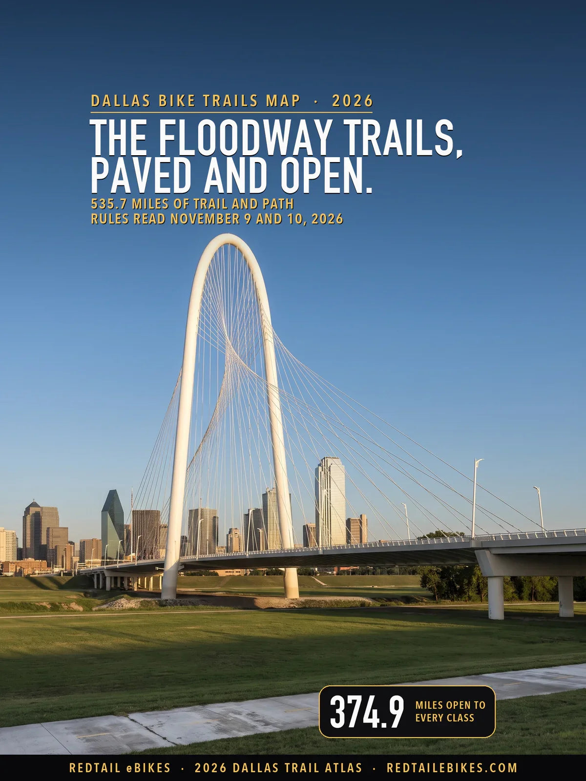
The Margaret Hunt Hill Bridge over the Trinity floodway, beside the Trinity Skyline Trail, in a scene generated with Playcut from a photograph of the bridge by Carol M. Highsmith.
Texas settles most of your trail question before any city gets to it. Transportation Code § 551.106(a) says a local authority "may not prohibit the operation of an electric bicycle" in "an area in which the operation of a nonelectric bicycle is permitted", unless the path is closed to motor vehicles and has a natural-surface tread.
This map reads that rule against every mapped trail in Dallas County, 535.7 miles of it in 3,830 pieces, and colors each one by what you may do there.
The City of Dallas reads the statute the same way. Its staff told the Mayor and Council in June 2022: "Electric bicycles must be allowed on trails because, under SEC. 551.106 of the Texas Transportation Code, a local authority may not prohibit the operation of electric bicycles in an area where non-electric bicycles are permitted" (City memorandum). Every line you see on this map, with its rule and its source, is a row in the register.
Key takeaways
- 374.9 miles are open to every class. Your e-bike rides most of the City's hike-and-bike network, from the Katy Trail to the Trinity Skyline Trail, and the paved paths of Irving, Richardson, Farmers Branch, Addison, Coppell and Grand Prairie.
- 20.9 miles are closed. 17.4 of them are the trails of Cedar Hill State Park, where Texas Parks and Wildlife lets you ride the park roads only; the rest are Coppell's nature trails and a few hiking-only paths.
- 42.3 miles read two ways. Most are the City's natural-surface trails, open to you by the City's own word and closable under state law, and park paths in Mesquite and Cedar Hill, whose older park rules keep motorized vehicles to roads.
- 97.6 miles are not established. No record read says a regular bicycle rides them, or the manager's rules could not be read; Garland's Rowlett Creek Preserve loops are the largest block.
- Speed is the City's own rule. On a City trail your e-bike may not go faster than "20 miles per hour" or "the posted speed limit on a public street or trail"; a peace officer can write you a citation, and the fine runs up to $200 (Ordinance No. 32235).
In this guide
- How to read the map
- Who decides on each trail in Dallas County
- The state rule that protects your ride
- The Katy Trail
- White Rock Lake and the linear trails
- The Trinity River trails
- Dirt trails: open by the City's word
- Cedar Hill State Park and Joe Pool Lake
- The other cities of Dallas County
- What Texas law says
- Dallas bike trails riders ask about
- Dallas County trails, area by area
- Where riders get caught out
- Streets, bike lanes and sidewalks
- Choosing an e-bike for Dallas's trails
- The bottom line
- Frequently asked questions
How to read the map
Green means open to every class of e-bike, amber means the trail reads two ways, red means closed, and gray means the rule could not be established. Texas defines Class 1, 2 and 3 (§ 664.001) and draws no line between them on a trail (§ 551.106), so one color covers all three; you must be at least 15 to ride a Class 3 (§ 551.107(c)).

Dallas and Dallas County: 535.7 miles of trail and path, 374.9 open to e-bikes, 42.3 read two ways, 20.9 closed and 97.6 not established.
| Color | What an e-bike may do | Where | Miles |
|---|---|---|---|
| Green | Open to every class of e-bike | The other cities, the City's parks, the City's other paths, the City's trail corridors, Coppell and Mesquite | 374.9 |
| Amber | Read two ways: check the trail's row | The City's parks, Mesquite, the City's other paths, the other cities, the Katy Trail on Highland Park's line and the City's trail corridors | 42.3 |
| Red | Closed to e-bikes | Cedar Hill State Park, Coppell and the other cities | 20.9 |
| Gray | Rule not established | The other cities, the City's parks, Cedar Ridge Preserve, Coppell, the City's trail corridors and Mesquite | 97.6 |
Amber is a warning, never a shrug. It marks a trail where a local rule and the state statute point different ways, or where the City says yes and the law lets it say no. Read the trail's row before you ride it, and when a posted sign says no, the sign is what a ranger or officer will enforce on the day.
Takeaway
You may ride 374.9 of this map's 535.7 miles on any e-bike that meets Texas's definition, every class alike. 20.9 miles are closed, 17.4 of them in Cedar Hill State Park, and 42.3 miles turn on a local rule or an open question you should read first.
Who decides on each trail in Dallas County
Whoever runs the ground under your wheels decides, inside the limit Texas sets. A city or county is a "local authority" (§ 541.002(3)) and is bound by § 551.106. Texas Parks and Wildlife is neither a local authority nor "the department", which in these chapters "means the Department of Public Safety" (§ 541.002(1)), so its own park rule stands. A federal agency's rule stands on its own land.
| Manager | Miles | The rule and its source |
|---|---|---|
| City of Dallas, park land | 180.3 | Open where a surfaced trail carries bicycles; a natural-surface trail bicycles ride reads two ways (open by the City's word, closable under § 551.106(a)); a walking loop with no bicycle record is not established (source) |
| City of Dallas, its trail corridors | 31.8 | Open where a surfaced trail carries bicycles (source) |
| City of Dallas, outside its parks | 36.8 | A surfaced path a record shows bicycles ride is open (source) |
| Texas Parks and Wildlife (Cedar Hill State Park) | 17.4 | No e-bikes on park trails, every class; park roads open (source) |
| U.S. Army Corps of Engineers (Joe Pool Lake) | 3.5 | E-bikes on project roads and most bike trails; none on trails rated intermediate or harder (source) |
| Audubon Dallas (Cedar Ridge Preserve, City land) | 5.7 | No record read says bicycles ride it (Limitations) |
| Town of Highland Park (the Katy Trail on its line) | 0.7 | A driver's license and a Town permit inside the Town (source) |
| City of Coppell | 21.1 | E-bikes wherever a bicycle may ride; no bicycle on the unpaved nature trails (source) |
| City of Mesquite | 24.9 | Open outside parks; park paths read two ways against a 2003 rule that keeps motorized bicycles to park roads (source) |
| The other cities in Dallas County | 212.8 | A surfaced path a record shows bicycles ride is open: a city may not bar an e-bike from it (source) |
| Private, joint and utility owners | 0.4 | The owner decides; not read (Limitations) |
| No manager on record | 0.3 | No file assigns these lines (Limitations) |
The City of Dallas holds 248.8 of the county's 535.7 mapped miles: 180.3 on park land, the rest along its trail corridors and streets. Its parks department calls the network "over 200 miles of the most beautiful and diverse urban hike and bike trails in the country" (Dallas Park and Recreation). This map counts the part inside Dallas County, every connector and parallel path included.
The state rule that protects your ride
A city in Texas may not ban your e-bike from a path a regular bicycle may ride, and only a natural-surface path is an exception.
The statute's words: a local authority may not prohibit an e-bike "in an area in which the operation of a nonelectric bicycle is permitted, unless the area is a path that: (A) is not open to motor vehicles; and (B) has a natural surface tread made by clearing and grading the native soil without adding surfacing materials" (§ 551.106(a)).
What a city may still do sits in § 551.106(b): "prohibit the operation of a bicycle on a sidewalk" and "establish speed limits for bicycles on paths set aside for the exclusive operation of bicycles and other paths on which bicycles may be operated." Dallas uses the second power, a limit on your speed, not a ban.
Dallas wrote the state rule into its own code in 2019. The caption of Ordinance No. 31403, adopted December 11, 2019, says the amendment is "providing that the city may not prohibit electric bicycles from areas where non-electric bicycles are permitted". The 2022 memo restated it for trails, and added: "Under the existing City Code, SEC. 9.1 and SEC. 28-41.1.1, electric bicycles and motor assisted scooters are currently allowed on public trails" (City memorandum).
The protection has one condition you must meet: a regular bicycle must be allowed there. The City's trail etiquette asks cyclists to "never ride on paths intended exclusively for walking or jogging" (trail etiquette), so a neighborhood walking loop with no record of bicycle use reads gray on this map, never green.
The Katy Trail
Dallas's Katy Trail is paved, open to your e-bike whatever its class, and capped by its own posted speed. It is a different trail from Missouri's Katy Trail State Park, whose rules do not apply here. The City describes "The 3.5 mile Katy Trail" running "between the Uptown and Oaklawn neighborhoods just north of downtown Dallas", from just north of the American Airlines Center to Central Expressway (Linear Trails).

The Katy Trail to White Rock Lake: 161.3 miles of trail and path, 126.6 open to e-bikes, 16.8 read two ways, 0.5 closed and 17.4 not established.
The register holds 3.8 miles under the trail's name, 3.8 of them recorded paved. On it, Dallas caps your e-bike at "20 miles per hour" or "the posted speed limit on a public street or trail" (Ordinance No. 32235), and the trail's nonprofit partner tells every user to "Obey the 10 MPH speed limit signs" (Friends of the Katy Trail).
The same partner asks you to "Disengage electric bicycles" (Friends of the Katy Trail). That is the Friends' request on their own page. The City's ordinance for trails is a speed rule, and the City's park code could not be read for this map (see Limitations), so plan your Katy ride at 10 mph with the motor at its lowest assist, and switch it off when the trail is crowded.
For 0.7 miles around Knox Street and Cole Avenue the trail runs along the Town of Highland Park's limit, and the Census boundary sits within a few meters of the path. If you ride inside the Town, Highland Park says "The operator must have a valid driver's license" and "The operator must obtain an E-Bike permit from the Highland Park Department of Public Safety (DPS)" (Highland Park DPS).
The map draws that stretch amber, because which side of the line the path lies on is not settled by the boundary data. If you ride it often, the permit settles the question for you.
Riding the Katy and the lake? Our Dallas guide matches a bike to the heat, the south wind and your council district, and every bike in it ships free.
Find your Dallas e-bikeWhite Rock Lake and the linear trails
The City's linear trails tie the Katy Trail to White Rock Lake, and every one between them is paved and green. The White Rock Lake loop is the City's "9.4 mile White Rock Lake Park Loop Trail" (Loop Trails).
From the lake, the SoPac Trail "currently spans 5.5 miles from White Rock Lake north to Greenville Avenue at Meadow Road", and the Santa Fe Trail runs 4.7 miles in "a former railroad right of way in East Dallas" (Linear Trails).
North of the lake, "The 9.2-mile White Rock Creek Trail" and "The 3.75-mile Cottonwood Creek Trail" meet the Northaven Trail at what the City calls the "Low Five", and "The 8.5-mile Northaven trail is located in an overhead utility corridor in north central Dallas" (Linear Trails).
You reach this network from the Katy Trail through two short links: the University Crossing Trail connects to "the Ridgewood Trail, and the Katy Trail", and the Ridgewood Trail "ends at the SoPac Trail near Fisher Road" (Linear Trails).
The table lets you compare 18 lengths the City publishes with what this map holds under the same name. Register miles count every mapped line once, connectors and parallel paths included, and only the part inside Dallas County.
| Trail | City's figure, miles | Miles on this map under the name | Why they differ |
|---|---|---|---|
| Katy Trail | 3.5 | 3.8 | Within a mile; the City's own line measures 3.7 mi |
| Northaven Trail | 8.5 | 9.2 | Within a mile; the City's own line measures 8.6 mi |
| Preston Ridge Trail | 6.3 | 3.7 | The City's own line measures 5.3 mi; 1.6 of it runs north into Collin County |
| Santa Fe Trail | 4.7 | 4.8 | Within a mile; the City's own line measures 4.7 mi |
| SoPac Trail | 5.5 | 5.6 | Within a mile; the City's own line measures 5.4 mi |
| White Rock Creek Trail | 9.2 | 9.4 | Within a mile; the City's own line measures 9.2 mi |
| White Rock Lake Park Loop Trail | 9.4 | 9.7 | Within a mile; the City's own line measures 9.8 mi |
| Trinity Skyline Trail | 11.6 | 12.7 | The City's own line measures 11.8 mi; other inventories add 0.9 mi under the name |
| AT&T and Trinity Forest Trails | 8.1 | 13.1 | The City's own line measures 8.8 mi; other inventories add 4.3 mi under the name |
| Cottonwood Creek Trail | 3.75 | 4.0 | Within a mile; the City's own line measures 3.7 mi |
| Coombs Creek Trail | 4 | 3.9 | Within a mile; the City's own line measures 3.9 mi |
| Runyon Creek Trail | 2.7 | 3.0 | Within a mile; the City's own line measures 2.7 mi |
| University Crossing Trail | nearly 2 | 1.5 | Within a mile; the City's own line measures 1.4 mi |
| Bachman Lake Park Loop Trail | 3.5 | 3.5 | Within a mile; the City's own line measures 3.5 mi |
| Crawford Memorial Park Loop Trail | 2 | 2.0 | Within a mile; the City's own line measures 2.0 mi |
| Glendale Park Loop Trail | 1.5 | 1.4 | Within a mile; the City's own line measures 1.4 mi |
| Kiest Park Loop Trail | 2.8 | 3.2 | Within a mile; the City's own line measures 3.3 mi |
| Texas Buckeye Nature Trail | 1.6 | 1.8 | Within a mile; the City's own line measures 1.6 mi |
If you ride north, the Preston Ridge Trail is the one to plan around. The City gives 6.3 miles ending "at the city limits of Plano at Hillcrest and S.H. 190" (Linear Trails).
The City's own line for the trail measures 5.3 miles, and 1.6 of them run north of the Dallas County line, so 3.7 miles are drawn here. North of that line you are in Collin County, which this map does not cover; the Texas trail atlas covers the rest of the state.
The Trinity River trails
The floodway trails are paved and open, and the levee-top paths beside them read two ways where their tread is natural. The City calls the Trinity Skyline Trail "the first trail to bring visitors close to the Trinity River in the Dallas floodway", and says "The 11.6 mile hard surface trail is perfect for hiking and biking" (Linear Trails).
The City's own trail map gives "Distance: 11.6 Miles" and marks the trailheads at Trammell Crow Park, 3700 Sylvan Ave., at Singleton Blvd., and on Commerce St. (Trinity Skyline Trail map). This map holds 12.7 miles under the name: the City's own line of 11.8 miles plus 0.9 miles that other inventories carry under the same name.
Downstream, the City describes "The 8.1-mile AT&T and Trinity Forest Trails" passing "a bridge over the Trinity River" with trailheads at the Trinity River Audubon Center and on Great Trinity Forest Way (Linear Trails).
That ground is green. The register holds another 4.3 miles of path that the regional inventory names Trinity Forest Trail, more than 80 meters from the City's own line, so the name covers more ground on this map than in the City's figure.
The levee-top lines are different ground. 20.1 miles carry the name Trinity Levee Trail, 7.5 of them amber where their tread is natural: open by the City's statement that e-bikes "must be allowed on trails", and closable because state law exempts a natural-surface path.
Dirt trails: open by the City's word
The City's off-road trails are open to your e-bike on the City's own reading, but Texas lets a city close a natural-surface path, so they read amber. The parks department lists "4 major Off-Road Cycling Trails": Boulder, Harry S Moss, Katie Jackson and L.B. Houston, built with the Dallas Off Road Bicycle Association (Off-Road Cycling).
Katie Jackson Park lies in the part of Dallas inside Collin County, so it is not on this Dallas County map.
The City defines nature trails as "natural-surfaced trails that are typically located in a major greenbelt park" (Nature Trails), and of Harry S Moss it says "the nearly 5 miles of natural surface trails provide an off-road biking experience in the middle of the city" (Nature Trails). On this map L.B. Houston holds 6.5 miles, Boulder Park 5.1 and Harry S Moss 4.3, all amber.
Amber here means two true things at once. The City told its Council e-bikes must be allowed on trails, and no ordinance in the City's legislative record from 2014 to November 2026 closes one to them by title; and § 551.106(a) still lets a city close a natural-surface path. DORBA's own trail rules could not be read for this map. Ride them on a pedal-assist setting, and read the trailhead sign before you start.
Takeaway
The City's dirt trails are open by its own word and closable by law, which is why they read amber. No closure was found, so you may ride them; keep to low assist and follow what the trailhead posts.
Cedar Ridge Preserve is not one of them. The City describes "a natural habitat of 600 acres featuring about 9 miles of trails" (Cedar Ridge Preserve), run on City land by Audubon Dallas. No page read for this map says bicycles ride it, so its 5.7 mapped miles are gray; ask Audubon Dallas before you take a bike there. The Texas Buckeye Nature Trail in the Great Trinity Forest reads gray for the same reason.
Cedar Hill State Park and Joe Pool Lake
You may not ride an e-bike of any class on the trails of Cedar Hill State Park, the DORBA Trail included; the park roads are open to you. Texas Parks and Wildlife's rule for every state park: "Electric bicycles are not allowed on park trails. This includes all classes of e-bikes." and "You may use an electric bicycle on state park roads where a regular bicycle is allowed" (Texas Parks and Wildlife).
That closes 17.4 mapped miles, the red block in the southwest corner of the county map. The park's own page invites visitors to "Explore our trails on bike or on foot" (Cedar Hill State Park); under the statewide rule above, that means a bicycle without a motor. On this map the park's DORBA Trail is 5.6 miles on its 8-mile loop and 3.5 on its 12-mile loop, all red.
The park sits on the U.S. Army Corps of Engineers' Joe Pool Lake. The Corps' Fort Worth District says "E-bikes may be ridden on project roads and most of the bike trails where traditional bicycles are allowed. However, E-bikes are NOT authorized to be ridden on trails rated intermediate difficulty or higher" (Corps policy POL-22-01).
The same policy adds: "Class 2 and higher rated E-bikes are NOT authorized on trails rated intermediate difficulty or higher under any circumstances" (POL-22-01). If you ride one there anyway, you risk a federal citation: the policy says violators "may be ordered to leave the premises and cited under Title 36 of the Code of Federal Regulations § 327" (POL-22-01).
Inside the state park both rules apply and the state's is the stricter, so the trails stay red. Outside it, on Corps land in Dallas County, you may ride the 3.5 miles of surfaced path that bicycles use; they are green. For national forests and other federal land, see our public land e-bike guide.
Takeaway
At Cedar Hill State Park, keep your e-bike on the roads and leave the trails, the DORBA Trail included, to regular bikes and walkers. That one rule closes most of the red on this map.
The other cities of Dallas County
Every other city's paved paths that bicycles ride are open to you under the state rule, and a few cities' own rules change the picture inside their parks. This map read the websites of 17 of the 21 local governments with trails in the county (Lewisville's has no park pages); Carrollton's, Grand Prairie's, Wilmer's and Addison's sites answered a research client with HTTP 403, so their paths follow the state rule alone.
Coppell spells out its rule. Its Police Department says "E-bikes can operate anywhere a bicycle can, including paved roads, sidewalks, and bike paths." and "E-bikes and bicycles are not permitted on the unpaved Coppell Nature Trails." (Coppell Police Department).
Its parks page adds "Park trail users must travel at 15 mph or under" (Coppell trails). You may ride Coppell's 17.4 paved miles, at 15 mph or under on its park trails, and the 1.8 miles inside Coppell Nature Park are closed to you.
Mesquite's park code predates the state rule. The City's park rules page defines "motor vehicle" to include "motorized bicycles" and makes it unlawful to drive one in a public park "except on paved roadways and parking areas specifically designed for motor vehicle traffic" (Mesquite park rules), in text dated 2003.
Texas law today says a motor vehicle "does not include an electric bicycle" (§ 541.201(11)). No Mesquite text read names electric bicycles, so 8.9 miles of path inside 19 Mesquite parks read amber. If you ride a Mesquite park path, read its posted rules first.
Three more cities keep motorized vehicles to designated areas in their parks. Cedar Hill allows them "in designated areas only" (Cedar Hill park rules), Lancaster "in designated parking areas and drives only" (Lancaster park rules), and DeSoto bars driving one "on any walk, turf, grass or soil in a city park" (DeSoto park regulations). Where a mapped park path in those cities carries bicycles, it reads amber: 0.7 miles in Cedar Hill, and none in Lancaster or DeSoto.
Takeaway
Outside the City of Dallas, the state rule opens the paved paths a regular bicycle may ride. Before you ride a park path in Coppell, Mesquite, Cedar Hill, Lancaster or DeSoto, read that city's park rules, and keep off Coppell's nature trails.
Garland's preserve loops are gray. Garland's own map describes Rowlett Creek Preserve as "a single track, natural surface, stack loop system" of 16.3 miles (Garland trail map). OpenStreetMap maps 16.7 miles of its numbered loops, which reach State Highway 66, East Centerville Road and Firewheel Parkway.
Garland's code could not be read, and a natural-surface path is the one kind of trail a city may close, so they read gray rather than green. Ask Garland's parks department before you ride them.
In Irving, you may ride 9.8 of the 11.1 miles this map holds under the Campion name, every one of them paved, and Irving's own trail file lists its stretches as concrete and open to road cycling. The other 1.3 miles, from the regional bikeway inventory, carry no surface record, and a natural-surface path is one a city may close, so they read gray.
Riding in from the suburbs? Our Dallas guide shows how your weight, fitness and height change a Dallas mile, and matches a bike to the commute, the errand run and the long flat ride.
Match a bike to your districtWhat Texas law says
A Texas e-bike has working pedals, a motor of "fewer than 750 watts", and one of three classes; no license, registration or title applies to it. The motor limb is the statute's own words: "an electric motor of fewer than 750 watts" (§ 664.001(4)).
The class is printed on a permanent label that whoever makes or sells the bike must apply, beside its top assisted speed and motor wattage (§ 664.002(a)), and you must be at least 15 to ride a Class 3 (§ 551.107(c)).
You need no driver's license to ride one: "Subtitles A, B, and D and Chapter 551A do not apply to the operation of an electric bicycle" (§ 551.107(a)), and those subtitles cover certificates of title and registration, driver's licenses and motor vehicle safety responsibility, the financial-responsibility rules.
The motor must also stop: "A person may not operate an electric bicycle unless the electric motor disengages or ceases to function either: (1) when the operator stops pedaling; or (2) when the brakes are applied" (§ 551.107(b)).
Highland Park is the local exception to the license point: inside the Town you need a driver's license and a Town permit, a rule that "took effect" on January 1, 2025 (Highland Park DPS). The Texas e-bike law guide answers the state-law questions on licenses, age and helmets, and our state-by-state e-bike law table sets Texas beside the other 49 states.
Dallas bike trails riders ask about
How long is the Katy Trail in Dallas?
The City gives 3.5 miles, from just north of the American Airlines Center to Central Expressway (Linear Trails). The City's own trail file draws 3.7 miles under the name and this map holds 3.8; you ride it on pavement, under a posted 10 mph limit.
Does the Katy Trail connect to White Rock Lake?
Yes, and you can ride the whole way on paved City trails. The Katy Trail meets the Ridgewood and University Crossing trails near Mockingbird Station, and those lead to the SoPac Trail, which "currently spans 5.5 miles from White Rock Lake north" (Linear Trails). Every link is paved and green on the Katy-to-White Rock map.
Is the Trinity Skyline Trail paved?
Yes, all 11.8 miles of the City's own line read green here. The City calls it "The 11.6 mile hard surface trail" in the Trinity floodway (Linear Trails). You can park at Trammell Crow Park, 3700 Sylvan Ave., or at the Singleton Blvd. and Commerce St. trailheads (trail map).
Are there mountain bike trails in Dallas?
Yes: the City lists four off-road cycling trails, Boulder, Harry S Moss, Katie Jackson and L.B. Houston, built with DORBA (Off-Road Cycling). Three are in Dallas County and read amber for e-bikes, open by the City's word but closable as natural-surface paths. Cedar Hill State Park's DORBA Trail is closed to your e-bike.
Dallas County trails, area by area
The county is grouped into eight areas by compass direction from the center of the City of Dallas, each a set of council districts and nearby cities. Find your area below; within each, the City's districts come first, then the other cities, and every named trail carries its color.
| Area | Green miles | Amber | Red | Gray |
|---|---|---|---|---|
| North | 58.1 | 0.0 | 1.1 | 2.9 |
| Northeast | 40.6 | 0.0 | 0.0 | 39.2 |
| East | 14.4 | 9.1 | 0.0 | 3.2 |
| Southeast | 18.4 | 0.3 | 0.0 | 10.8 |
| South | 32.0 | 2.1 | 0.0 | 5.8 |
| Southwest | 50.7 | 5.8 | 17.4 | 15.2 |
| West | 89.6 | 18.7 | 0.0 | 8.3 |
| Northwest | 71.3 | 6.3 | 2.4 | 12.1 |
North

North Dallas County: 62.0 miles of trail and path, 58.1 open to e-bikes, 1.1 closed and 2.9 not established.
Council District 10: 14.8 miles. 14.6 green; 0.2 gray.
- White Rock Creek Trail 3.9 mi (green)
- Cottonwood Creek Trail 3.1 mi (green)
- Lake Highlands Trail 1.7 mi (green)
- Lake Highlands Trail Phase 2A 1.4 mi (green)
- Lake Highlands Trail Phase 2B 1.0 mi (green)
- Lake Highlands Trail South Phase 2 0.8 mi (green)
- Flag Pole Hill Trail 0.7 mi (green)
- Lake Highlands Trail South 0.6 mi (green)
- Northaven Trail Phase Ib 0.4 mi (green)
- Richland College Walking/Jogging Path 0.3 mi (green)
- Also: 0.3 mi of shorter named stretches and 0.5 mi of unnamed trail and path
Council District 11: 12.9 miles. 11.5 green; 1.5 gray.
- White Rock Creek Trail 3.6 mi (green)
- Northaven Trail 2.5 mi (green)
- Preston Ridge Trail 2.5 mi (green)
- Cottonwood Creek Trail 1.0 mi (green)
- Bert Fields Trail 0.7 mi (green)
- Kiowa Parkway 0.5 mi (gray)
- Cotton Belt Trail 0.4 mi (green)
- Fretz Park Trail 0.4 mi (green)
- Valley View Woods Trail 0.4 mi (gray)
- Cottonwood Park Trail 0.3 mi (gray)
- Northaven Trail Phase 1C 0.3 mi (green)
- Also: 0.4 mi of shorter named stretches and 0.2 mi of unnamed trail and path
Council District 12: 3.2 miles. 2.8 green; 0.4 gray.
- Preston Ridge Trail 1.2 mi (green)
- Marni Kaner Trail 1.1 mi (green)
- Salado Park Trail 0.4 mi (gray)
- Campbell Green 0.3 mi (green)
- Also: 0.2 mi of shorter named stretches
Richardson: 20.3 miles. 19.1 green; 0.5 red; 0.7 gray.
- Central Trail 4.1 mi (green)
- Glenville Trail 2.6 mi (green)
- University Trail 2.5 mi (green)
- Owens Trail 2.2 mi (mostly green)
- Duck Creek Trail 1.9 mi (green)
- Duck Creek Trail Extension 1.6 mi (green)
- Park Trail at Cottonwood 1.0 mi (green)
- Cottonwood Trail 0.7 mi (green)
- Huffhines Park Trail 0.4 mi (green)
- Spring Creek Trail 0.3 mi (green)
- Also: 1.2 mi of shorter named stretches and 1.8 mi of unnamed trail and path
Addison: 10.8 miles. 10.1 green; 0.6 red.
- Redding Trail 0.6 mi (mostly red)
- Cotton Belt Trail 0.4 mi (green)
- Also: 0.1 mi of shorter named stretches and 9.7 mi of unnamed trail and path
Northeast

Northeast Dallas County: 79.8 miles of trail and path, 40.6 open to e-bikes and 39.2 not established.
Council District 9: 24.7 miles. 20.8 green; 3.9 gray.
- White Rock Lake Park Trail 9.7 mi (green)
- Norbuck 3.7 mi (gray)
- SoPac Trail 3.6 mi (green)
- White Rock Creek Trail 1.6 mi (green)
- Flag Pole Hill Trail 1.5 mi (green)
- Ridgewood Trail 1.5 mi (green)
- University Crossing Trail 1.1 mi (green)
- Matilda Trail 0.6 mi (green)
- East Lawther Drive 0.3 mi (green)
- Also: 1.0 mi of shorter named stretches
Garland: 35.8 miles. 13.2 green; 22.6 gray.
- Duck Creek Trail 5.2 mi (green)
- Duck Creek Greenbelt Southern Extension 1.4 mi (gray)
- Bobtown Road Sidepath 1.1 mi (mostly green)
- Holford Road Sidepath 1.0 mi (gray)
- Duck Creek Central Trail Segment 3 0.9 mi (gray)
- Sprink Creek Greenbelt Trail 0.9 mi (green)
- Winters Park Spine Trail 0.8 mi (green)
- Spring Creek Trail 0.6 mi (green)
- Also: 0.4 mi of shorter named stretches and 23.6 mi of unnamed trail and path
Rowlett: 17.6 miles. 6.1 green; 11.4 gray.
- Rowlett Nature Trail 3.0 mi (gray)
- Blackbird 1.9 mi (gray)
- Merritt Road Sidepath 1.7 mi (green)
- Lucy 1.5 mi (gray)
- Lake Highland Trail 1.4 mi (green)
- Bayside Trail 1.2 mi (green)
- Rita 1.1 mi (gray)
- Eleanor 1.1 mi (gray)
- Penny 1.0 mi (gray)
- Lakeside Park Trail 0.6 mi (green)
- Shorewood Park Trail 0.4 mi (green)
- Liberty Grove Road Sidepath 0.4 mi (gray)
- Miller Road Bridge Sidepath 0.3 mi (gray)
- Springfield Park Trail 0.3 mi (gray)
- Also: 1.7 mi of unnamed trail and path
Sachse: 1.2 miles. 0.4 green; 0.8 gray.
- Merritt Road Sidepath 0.3 mi (green)
- Also: 0.9 mi of unnamed trail and path
Wylie: 0.6 miles. 0.1 green; 0.5 gray.
- Muddy Creek Preserve Trail 0.5 mi (gray)
- Also: 0.1 mi of shorter named stretches
East

East Dallas County: 26.7 miles of trail and path, 14.4 open to e-bikes, 9.1 read two ways and 3.2 not established.
Mesquite: 24.9 miles. 14.3 green; 8.9 amber; 1.7 gray.
- Mesquite Heritage Trail 4.1 mi (mostly green)
- Paschall Park Trail 1.9 mi (mostly amber)
- Military Parkway Trail 1.6 mi (green)
- Skyline Trail 1.6 mi (mostly green)
- Westover Greenbelt Extension Trail 1.3 mi (mostly amber)
- Heritage Trail 1.2 mi (mostly green)
- Town East Park Trail 1.1 mi (mostly amber)
- Gus Thomasson Trail 1.0 mi (mostly green)
- Skyline Drive Sidepath 1.0 mi (green)
- Karla-Whiteson Trail 0.7 mi (gray)
- Lambert Park Trail 0.7 mi (green)
- Westover Park Trail 0.7 mi (mostly green)
- Hanby School Park Trail 0.6 mi (amber)
- Valley Creek Park Trail 0.6 mi (amber)
- Bill Blackwood Park Trail 0.6 mi (amber)
- Caymen Estates 2 Trail 0.6 mi (mostly green)
- Pioneer Road Trail 0.5 mi (mostly green)
- City Lake Park Trail 0.5 mi (amber)
- Debusk Park Trail 0.5 mi (amber)
- Creek Crossing #4 Trail 0.5 mi (green)
- Gentry Park Trail 0.4 mi (mostly green)
- Achziger Elementary Park Trail 0.4 mi (mostly green)
- McWhorter Elementary Park Trail 0.3 mi (amber)
- North Mesquite to Franklin Drive Trail 0.3 mi (green)
- Duck Creek Trail 0.3 mi (green)
- Also: 1.3 mi of shorter named stretches and 0.9 mi of unnamed trail and path
Unincorporated Dallas County: 1.0 miles. 0.1 green; 0.1 amber; 0.8 gray.
- Samuell East Farm Park Trail 0.5 mi (gray)
- Also: 0.5 mi of shorter named stretches
Sunnyvale: 0.7 miles. 0.7 gray.
- 0.2 mi of shorter named stretches and 0.6 mi of unnamed trail and path
Southeast

Southeast Dallas County: 29.5 miles of trail and path, 18.4 open to e-bikes, 0.3 read two ways and 10.8 not established.
Council District 5: 9.4 miles. 8.1 green; 1.3 gray.
- Crawford Memorial 2.0 mi (green)
- Trinity Forest Spine Trail 1.8 mi (green)
- Elam Road 1.0 mi (green)
- AT&T Trail 0.7 mi (green)
- Trinity Forest Trail 0.7 mi (green)
- Umphress Park Trail 0.4 mi (gray)
- Gateway Park Trail 0.4 mi (gray)
- Urbandale Park Trail 0.3 mi (gray)
- Also: 0.3 mi of shorter named stretches and 1.8 mi of unnamed trail and path
Council District 7: 18.7 miles. 8.9 green; 0.3 amber; 9.5 gray.
- William Blair Jr Park Trail 4.0 mi (gray)
- Trinity Forest Trail 2.6 mi (green)
- Texas Buckeye Trail 1.8 mi (mostly gray)
- Trinity Forest Spine Trail 1.1 mi (green)
- Rochester Park Trail 0.9 mi (gray)
- Everglade Park Trail 0.7 mi (gray)
- Ash Creek Greenbelt Trail 0.6 mi (green)
- JJ Craft Park Trail 0.6 mi (gray)
- Parkdale Park Trail 0.5 mi (gray)
- Opportunity Park Trail 0.5 mi (gray)
- Lakeland Hills Trail 0.5 mi (gray)
- The Loop 0.3 mi (amber)
- Also: 0.6 mi of shorter named stretches and 4.1 mi of unnamed trail and path
Wilmer: 1.4 miles. 1.4 green.
- 1.4 mi of unnamed trail and path
South

South Dallas County: 39.9 miles of trail and path, 32.0 open to e-bikes, 2.1 read two ways and 5.8 not established.
Council District 4: 17.9 miles. 15.0 green; 1.0 amber; 2.0 gray.
- Kiest Park Trail 3.2 mi (green)
- Cedar Crest Trail 2.4 mi (green)
- Honey Springs Trail 2.3 mi (green)
- Trinity Forest Trail 1.7 mi (green)
- Trinity Skyline Trail 1.2 mi (green)
- Five Mile Creek Greenbelt 1.0 mi (green)
- Kiest WFAA Creekside 0.9 mi (amber)
- John C Phelps Trail 0.9 mi (green)
- Kiest WFAA Burr Oak Loop 0.8 mi (gray)
- Santa Fe Trestle Trail 0.8 mi (green)
- Elmwood Parkway Trail 0.5 mi (green)
- Kiest Meadow Loop 0.4 mi (gray)
- Herndon Park Trail 0.3 mi (gray)
- Kiest Bridle Trail 0.3 mi (gray)
- Also: 0.9 mi of shorter named stretches and 0.4 mi of unnamed trail and path
Council District 8: 17.7 miles. 13.0 green; 1.1 amber; 3.6 gray.
- Trinity Forest Trail 4.7 mi (green)
- AT&T Trail 2.8 mi (green)
- Runyon Creek Trail 2.4 mi (green)
- Trinity Audubon Center Trail 1.7 mi (mostly amber)
- Alta Mesa Park Trail 0.7 mi (gray)
- Fireside Park Trail 0.6 mi (green)
- Pemberton Hill Park Trail 0.6 mi (gray)
- Gateway Park Trail 0.6 mi (green)
- JJ Lemmon Park Trail 0.5 mi (gray)
- Tommie Allen Park Trail 0.5 mi (gray)
- Meadowstone Trail 0.3 mi (gray)
- Kleberg Park Trail 0.3 mi (gray)
- Also: 0.6 mi of shorter named stretches and 1.3 mi of unnamed trail and path
Lancaster: 4.2 miles. 3.9 green; 0.3 gray.
- Pleasant Run Hike and Bike Trail 2.3 mi (green)
- Also: 1.9 mi of unnamed trail and path
Southwest

Southwest Dallas County: 89.2 miles of trail and path, 50.7 open to e-bikes, 5.8 read two ways, 17.4 closed and 15.2 not established.
Council District 1: 10.7 miles. 8.9 green; 1.8 gray.
- Coombs Creek Trail 3.1 mi (green)
- Trinity Levee Trail 1.2 mi (green)
- Elmwood Parkway Trail 0.9 mi (green)
- Trinity Skyline Trail 0.9 mi (green)
- Margaret McDermott Bridge 0.6 mi (green)
- Elmwood Parkway Trail Phase Ii 0.6 mi (green)
- Martin Weiss Park Trail 0.5 mi (gray)
- Oak Cliff Founders 0.5 mi (gray)
- Coombs Creek Trail Phase Iv 0.4 mi (green)
- Coombs Creek Trail Phase V 0.4 mi (green)
- Kidd Springs Park Trail 0.4 mi (gray)
- Lake Cliff Park Trail 0.3 mi (gray)
- Also: 0.5 mi of shorter named stretches and 0.4 mi of unnamed trail and path
Council District 3: 20.9 miles. 9.2 green; 5.1 amber; 6.6 gray.
- Boulder Park Trails 5.1 mi (amber)
- Southwest Dallas Trail 2.7 mi (green)
- Kiestwood Trail 1.5 mi (green)
- Fm 1382 Trail 1.4 mi (green)
- Glendale Park Trail 1.4 mi (green)
- Five Mile Creek Greenbelt 1.1 mi (green)
- Cedar Ridge Preserve at Cedar Brake Trail 1.0 mi (gray)
- Cedar Ridge Preserve at Bluebonnet Trail 1.0 mi (gray)
- Cedar Ridge Preserve at Escarpment Road 0.9 mi (gray)
- Cedar Ridge Preserve Fossil Valley Trail 0.8 mi (gray)
- Cedar Ridge Preserve at Cattail Pond Trail 0.8 mi (gray)
- Camp Wisdom Trail 0.7 mi (green)
- Runyon Creek Trail 0.6 mi (green)
- Emerald Lake Trail 0.5 mi (gray)
- Cedar Ridge Preserve Possumhaw Trail 0.5 mi (gray)
- Fox Hollow Trail 0.4 mi (gray)
- Twin Falls Park Trail 0.3 mi (gray)
- Cedar Ridge Preserve Little Bluestem Trl 0.3 mi (gray)
- Also: 0.2 mi of shorter named stretches
Cedar Hill: 34.9 miles. 14.7 green; 0.7 amber; 17.4 red; 2.1 gray.
- DORBA Trail 8 Mile 5.6 mi (red)
- DORBA Trail 12 Mile 3.5 mi (red)
- Balcones Trail 3.4 mi (green)
- Red Oak Creek Trail 3.2 mi (mostly green)
- Lake Ridge Trail 3.1 mi (mostly green)
- DORBA Trail 3 Mile 2.7 mi (red)
- Talala Trail 2.3 mi (red)
- Mansfield Road Trail 2.1 mi (green)
- Shoreline Trail 1.1 mi (red)
- South Clark Road Trail 1.0 mi (green)
- Pleasant Run Trail 1.0 mi (green)
- Duck Pond Trail 0.8 mi (red)
- Plum Valley Trail 0.8 mi (red)
- Penn Farm Trail 0.6 mi (red)
- Cedar Ridge Preserve at Cedar Brake Trail 0.6 mi (gray)
- Signature Park Trail 0.6 mi (green)
- Also: 2.7 mi of unnamed trail and path
Grand Prairie: 15.2 miles. 14.4 green; 0.7 gray.
- Lone Star Trail 5.1 mi (green)
- Good Link Linear Park Trail 1.4 mi (green)
- Mike Lewis Trail 1.2 mi (green)
- Mike Lewis Trails 1.1 mi (green)
- Camp Wisdom Road Sidepath 1.0 mi (green)
- South Campion Trail 0.8 mi (green)
- Also: 0.3 mi of shorter named stretches and 4.3 mi of unnamed trail and path
DeSoto: 6.9 miles. 3.4 green; 3.5 gray.
- Roy Orr Trail 3.5 mi (mostly green)
- Also: 3.5 mi of unnamed trail and path
Duncanville: 0.6 miles. 0.6 gray.
- 0.6 mi of unnamed trail and path
West

West Dallas County: 116.5 miles of trail and path, 89.6 open to e-bikes, 18.7 read two ways and 8.3 not established.
Council District 6: 62.1 miles. 41.5 green; 18.7 amber; 2.0 gray.
- Trinity Levee Trail 16.4 mi (mostly green)
- Trinity Skyline Trail 10.4 mi (green)
- L.B. Houston Nature Area Trails 6.5 mi (amber)
- Trinity River Levee 4.8 mi (amber)
- Cypress Waters Trail 4.3 mi (green)
- Bachman Lake Park Trail 3.3 mi (green)
- Trinity Strand Trail 2.4 mi (green)
- Harry Hines Shared Use Path 1.7 mi (green)
- Fish Trap Lake 1.4 mi (green)
- Northaven Trail 0.8 mi (green)
- Lemmon Avenue Trail 0.7 mi (green)
- Margaret McDermott Ped Bridge 0.7 mi (green)
- Bernal Trail 0.7 mi (green)
- Hi-Line Connector Trail 0.6 mi (green)
- Crow Lake Trail 0.6 mi (green)
- Continental Bridge 0.5 mi (green)
- Trinity Strand Trail Phase II 0.5 mi (green)
- Jaycee Zaragoza Park Trail 0.5 mi (gray)
- Benito Juarez Park Trail 0.5 mi (gray)
- Pegasus Park Trail 0.4 mi (gray)
- Bickers Park Trail 0.3 mi (gray)
- Also: 0.7 mi of shorter named stretches and 3.4 mi of unnamed trail and path
Irving: 54.4 miles. 48.1 green; 6.3 gray.
- Sam Houston Trails Park 4.4 mi (green)
- Campion Trail 2.6 mi (green)
- Trinity River Levee 2.5 mi (gray)
- North Campion Trail 2.4 mi (green)
- Rock Island Road 2.3 mi (green)
- South Campion Trail 2.2 mi (green)
- Mountain Creek Preserve 2.1 mi (green)
- Northwest Park 2.0 mi (green)
- Campion Trails River Hills Extension 2.0 mi (mostly gray)
- Twin Wells Park 1.7 mi (green)
- Bird's Fort Trail Park 1.6 mi (green)
- Keenan’s Crossing Trail Park 1.5 mi (green)
- Thomas Jefferson Park 1.4 mi (green)
- Running Bear Park 1.3 mi (green)
- Towne Lake Park 1.1 mi (green)
- Delaware Creek 1.1 mi (green)
- Lively Park Jogging Trail 1.1 mi (gray)
- Spring Trail Park 1.0 mi (green)
- Valley Ranch Canal Trail 1.0 mi (mostly gray)
- Cottonwood Creek Park 1.0 mi (green)
- Cabell Drive Sidepath 0.9 mi (green)
- Delaware Creek Trail 0.9 mi (green)
- Centennial Park 0.9 mi (green)
- Delaware Creek at Senter Park 0.9 mi (green)
- Mustang Park 0.9 mi (green)
- Trinity View Park 0.8 mi (green)
- Cimarron Park 0.7 mi (green)
- Nature Trail 0.7 mi (green)
- Victoria Park 0.7 mi (green)
- Shady Grove Trail Park 0.6 mi (green)
- Sunrise Park 0.6 mi (green)
- Fritz Park 0.5 mi (green)
- T.W. Richardson Grove 0.5 mi (green)
- Lee Park 0.5 mi (green)
- North Lake Ranch Park 0.5 mi (green)
- Wyche Park 0.5 mi (green)
- Champions Park 0.5 mi (green)
- Markwood Park 0.4 mi (green)
- North O'Connor Boulevard Sidepath 0.4 mi (green)
- California Crossing Park 0.4 mi (green)
- Hurwitz Park 0.4 mi (green)
- West Park 0.3 mi (green)
- Rose Meadows Park 0.3 mi (green)
- Appolon Hills Park Trail 0.3 mi (green)
- Jaycee Park 0.3 mi (green)
- Nicholes Park 0.3 mi (green)
- Sally B. Elliott Elementart School Park 0.3 mi (green)
- Also: 2.0 mi of shorter named stretches and 0.9 mi of unnamed trail and path
Northwest

Northwest Dallas County: 92.1 miles of trail and path, 71.3 open to e-bikes, 6.3 read two ways, 2.4 closed and 12.1 not established.
Council District 2: 15.2 miles. 12.4 green; 2.9 gray.
- Santa Fe Trail 3.2 mi (green)
- Trinity Levee Trail 2.4 mi (green)
- Trinity Strand Trail Phase II 1.7 mi (green)
- Trinity Forest Spine Trail 1.0 mi (green)
- Katy Trail 0.7 mi (green)
- Grauwyler Park Trail 0.7 mi (gray)
- Samuell Grand Park Trail 0.6 mi (gray)
- Harry Stone Park Trail 0.5 mi (gray)
- Turtle Creek Trail 0.4 mi (green)
- Garrett Park Trail 0.3 mi (gray)
- Old East Dallas Work Yard Park Trail 0.3 mi (green)
- Ferguson Park Trail 0.3 mi (gray)
- Also: 0.9 mi of shorter named stretches and 2.1 mi of unnamed trail and path
Council District 13: 15.9 miles. 9.0 green; 5.6 amber; 1.3 gray.
- Northaven Trail 5.3 mi (green)
- Harry S Moss Nature Trails 4.3 mi (amber)
- SoPac Trail 2.0 mi (green)
- Lemmon Avenue Trail 1.0 mi (green)
- Bachman Greenbelt Trail 0.8 mi (amber)
- Preston Hollow Park Trail 0.5 mi (gray)
- Marcus Trail 0.4 mi (gray)
- Also: 1.6 mi of shorter named stretches
Council District 14: 10.1 miles. 7.5 green; 2.6 gray.
- Katy Trail 2.3 mi (green)
- Turtle Creek Trail 1.7 mi (green)
- Santa Fe Trail 1.2 mi (green)
- Exall Park Trail 0.8 mi (gray)
- Lindsley Park Trail 0.5 mi (green)
- Tietze Park Trail 0.5 mi (gray)
- Cole Park Trail 0.5 mi (gray)
- Glencoe Park Trail 0.5 mi (gray)
- Bryan Street 0.4 mi (green)
- Pacific Avenue 0.4 mi (green)
- Craddock Park Trail 0.4 mi (gray)
- University Crossing Trail 0.4 mi (green)
- Ridgewood Trail 0.3 mi (green)
- Also: 0.1 mi of shorter named stretches and 0.2 mi of unnamed trail and path
Coppell: 21.1 miles. 17.4 green; 1.8 red; 1.9 gray.
- Andy Brown East 2.3 mi (green)
- Andy Brown West 2.0 mi (mostly green)
- Natches Trace 1.2 mi (green)
- Freeport Pkwy Sidepath 1.1 mi (green)
- Senior & Community Center at Grapevine Springs 1.1 mi (mostly gray)
- Westhaven 0.9 mi (green)
- Moore Road Park 0.9 mi (green)
- Denton Creek 0.8 mi (green)
- Hunterwood Park 0.7 mi (gray)
- Town Center 0.6 mi (green)
- Campion 0.6 mi (green)
- Creekview 0.4 mi (green)
- Magnolia Park 0.4 mi (green)
- Andy Brown East Community Connection 0.4 mi (green)
- Parish Trail 0.3 mi (red)
- Andy Brown Central 0.3 mi (green)
- Also: 2.1 mi of shorter named stretches and 5.0 mi of unnamed trail and path
Farmers Branch: 18.9 miles. 17.2 green; 0.6 red; 1.1 gray.
- Marsh Lane Trail South 1.1 mi (green)
- Brookhaven East Trail 0.8 mi (green)
- Marsh Lane Pedestrian Bridge 0.7 mi (green)
- Inwood Oncor Trail 0.3 mi (green)
- Also: 1.4 mi of shorter named stretches and 14.7 mi of unnamed trail and path
Carrollton: 9.9 miles. 7.6 green; 2.3 gray.
- Green Trail 2.6 mi (green)
- Broadway Trail 2.4 mi (mostly gray)
- Purple Trail 2.0 mi (green)
- Blue Trail 1.1 mi (green)
- Westside ART Trail 0.5 mi (green)
- Also: 0.4 mi of shorter named stretches and 1.0 mi of unnamed trail and path
Highland Park: 0.7 miles. 0.7 amber.
- Katy Trail 0.7 mi (amber)
Lewisville: 0.3 miles. 0.3 green.
- Vista Ridge Park Trail 0.3 mi (green)
Where riders get caught out
Five mistakes can cost you a closed trail, a citation or a fine, and each has a fix. Because the rules above are mostly permissive, the few that are not are the ones to learn.
- Riding a state-park trail. Cedar Hill State Park's trails, the DORBA Trail among them, are closed to every class (Texas Parks and Wildlife). Keep your e-bike on the park roads instead.
- Riding the Katy at road speed. The posted limit is 10 mph, and the City's code caps your e-bike at the posted limit (Ordinance No. 32235).
- Crossing into Highland Park without a permit. Inside the Town you need a driver's license and a DPS permit (Highland Park DPS).
- Taking a walking loop for a trail. The City's etiquette keeps cyclists off "paths intended exclusively for walking or jogging" (trail etiquette), and the state rule only protects you where a regular bicycle may ride.
- Riding the sidewalk downtown. Dallas allows sidewalk riding only "outside of the central business district", and on conviction a violation can bring you a fine of up to $500 (Ordinance No. 31403).
Want a bike that keeps these rules easy? Our Dallas guide measures every council district and matches a bike to the ride you actually take.
See our Dallas e-bike picksYour Dallas trail checklist
- Check your trail's color on the map and its row in the register.
- Pedal-assist at the posted speed: 10 mph on the Katy Trail, 15 mph on Coppell's park trails.
- You need no license or registration, unless you ride into Highland Park.
- Skip state-park trails; you may ride their roads.
- Yield and give an audible signal on shared paths.
Streets, bike lanes and sidewalks
On Dallas streets the City's 20 mph cap applies to you, and you may ride a sidewalk anywhere outside downtown. The City's code, as amended in 2019, says "it shall not be unlawful to ride a bicycle or an electric bicycle on a public sidewalk anywhere in the city outside of the central business district" (Ordinance No. 31403); the same section has a sidewalk rider yield to pedestrians.
On the street and on trails, the City's speed rule applies: you may not ride faster than "20 miles per hour" or "the posted speed limit on a public street or trail" (Ordinance No. 32235). The City's traffic engineer may also mark "slow ride zones for motor assisted scooters and electric bicycles" (Ordinance No. 32235). Scooters are a separate case: "Motorized scooters are not permitted in City of Dallas parks or on trails" (trail etiquette).
Bike lanes are left off this map, which draws trails and off-street paths; Dallas lists its lanes in its bikeway inventory. By our count that inventory holds 38.3 miles of completed bike lanes, buffered bike lanes and cycle tracks and 51.5 miles of shared-lane markings, and on all of them the City's speed cap applies to you as on any street.
Choosing an e-bike for Dallas's trails
For Dallas's paved network, a Class 1 or Class 2 bike with wide tires and an upright riding position is the practical choice, and every green mile on this map is open to it. On shared paths with a posted 10 mph limit, top speed matters less to you than smooth, low assist, and our commuter e-bike guide has 18 picks for city riding. A Class 3 bike still rides every green trail, at the posted speed.
If you plan to ride the amber dirt trails at L.B. Houston, Boulder Park or Harry S Moss, pick a bike whose lowest assist level is gentle and whose tires carry tread; our electric mountain bike guide has ten picks.
Our Dallas e-bike guide matches a bike to the heat, the wind and your district, and the Texas trail atlas covers the rest of the state. Riding west? The Fort Worth e-bike guide grades 45,311 of that city's blocks.
Why buy your Dallas e-bike from us
- Shipped free to your Dallas door. Every electric bike we sell ships free within the contiguous United States; it is dispatched within 1 to 3 business days of your order's confirmation, and most bikes arrive within 5 to 10 business days after dispatch (shipping policy).
- A damaged delivery is ours to fix. Note any damage with the carrier and email us photos within 48 hours of delivery; we file the carrier claim and arrange the replacement or repair (refund policy).
- Warranty problems come to us. If your bike won't power on, won't charge, shows an error code or has a faulty component, the manufacturer's warranty covers it and we coordinate the repair or replacement (refund policy).
- A person answers. Email support@redtailebikes.com, which typically replies within one business day, or call (213) 444-4020 and leave a voicemail if nobody picks up; every voicemail is returned (contact page).
- Pay with a wallet. Apple Pay, Google Pay and Shop Pay are accepted at checkout.
- You know who sells it. Our terms of service name the company behind the store.
Shop every e-bike we carry, or find a shop near you in our Dallas e-bike shop directory or, statewide, the Texas e-bike shop directory.
The bottom line
Ride your e-bike on any green trail in Dallas County, which is 374.9 of its 535.7 mapped miles, and treat amber as a decision you make with the sign in front of you. Texas law protects you on every city and county path a regular bicycle may ride, except natural-surface ones, and the City of Dallas agrees in writing.
Stay off Cedar Hill State Park's trails, Coppell's nature trails and any path a sign closes, keep to 10 mph on the Katy, and carry a Highland Park permit if you ride through the Town. Everything else on the green network is yours.
For Texas's other big cities, see the Houston bike trails map and the San Antonio bike trails map; for the rest of the country, e-bike trails by state and e-bike trails near you.
Frequently asked questions
Are e-bikes allowed on the Katy Trail in Dallas?
Yes, every class. Texas bars a city from banning an e-bike where a regular bicycle may ride (§ 551.106(a)), and the City says e-bikes "must be allowed on trails" (City memorandum). Keep to the posted 10 mph; the trail's partner also asks you to switch the motor off (Friends of the Katy Trail).
Where does the Katy Trail start and end?
The City says it begins "just north of the American Airlines Center" and ends "at Central Expressway", 3.5 miles between Uptown and Oaklawn (Linear Trails). Around Knox Street it runs along the Highland Park town line.
Is the Katy Trail in Dallas paved?
Yes. All 3.8 miles this map holds under the name are recorded paved, most of it concrete in the City's trail file. Every class may ride it, and the 0.7 miles at the Highland Park line read amber for the Town's permit rule. Missouri's Katy Trail State Park is a different trail.
How long is the White Rock Lake trail?
The City gives 9.4 miles for the White Rock Lake Park Loop Trail (Loop Trails). This map holds 9.7 miles under the name, all paved and green.
How long does it take to bike the Katy Trail?
The City gives 3.5 miles (Linear Trails), and the posted limit is 10 mph (Friends of the Katy Trail). At that speed you ride it in about 21 minutes one way and 42 there and back, our arithmetic.
Does Dallas have bike lanes?
Yes, and Dallas lists them in its bikeway inventory. By our count it holds 38.3 miles of completed bike lanes, buffered bike lanes and cycle tracks and 51.5 miles of shared-lane markings; this map draws trails and off-street paths, so it leaves them out.
Can you ride an e-bike at Cedar Hill State Park?
You can on park roads, not on park trails. Texas Parks and Wildlife says "Electric bicycles are not allowed on park trails. This includes all classes of e-bikes." and allows them "on state park roads where a regular bicycle is allowed" (Texas Parks and Wildlife). The DORBA Trail is a park trail.
Are electric bikes street legal in Texas?
Yes. A Texas e-bike has a motor of "fewer than 750 watts" (§ 664.001(4)) and rides where bicycles ride, with no license or registration (§ 551.107(a)). Its motor must cut out when you stop pedaling or brake (§ 551.107(b)).
Can you ride an e-bike on the sidewalk in Dallas?
Yes, outside downtown. Dallas lets you ride a bicycle or an electric bicycle on a public sidewalk "anywhere in the city outside of the central business district" (Ordinance No. 31403); yield to pedestrians and give a signal before passing.
Do you need a license to ride an e-bike in Texas?
No. The state's licensing and registration subtitles "do not apply to the operation of an electric bicycle" (§ 551.107(a)). Inside the Town of Highland Park, though, the Town requires a driver's license and a DPS permit (Highland Park DPS).
Are e-bikes legal in Dallas?
Yes. An e-bike that meets the Texas definition, working pedals and "an electric motor of fewer than 750 watts" (§ 664.001(4)), may ride Dallas streets, sidewalks outside downtown and every trail a regular bicycle may ride (§ 551.106). The City caps it at "20 miles per hour" or the posted limit (Ordinance No. 32235).
How we verified this map
Every trail mileage on this page was computed from the register, and every rule was checked against the text that governs it:
- Lines. 3,830 pieces of trail and off-street path, 535.7 miles, from the City of Dallas's trail file and the completed off-street paths in its bikeway inventory; the trail files of Richardson, Irving, Farmers Branch, Addison and Coppell; NCTCOG's regional inventory of existing shared-use paths; Texas Parks and Wildlife's state park trail file; and OpenStreetMap (Geofabrik's Texas extract of November 8, 2026). Each stretch of ground counts once, the managers' own files first, every piece is cut into runs of a quarter mile or less before it is placed, and every vertex outside Dallas County is cut away. Every register mile figure is rounded once, to a tenth of a mile, so a map legend's rows can add up to a tenth more or less than the total printed above them.
- Places. Each piece is placed by the Census Bureau's county and city boundaries, the City's park polygons and 14 council districts, and the Protected Areas Database for state and federal land. A City piece on the City's edge that no district covers is counted in the nearest one (0.5 miles).
- Rules. 49 passages from the bodies that govern the ground, each quoted from the copy saved when it was read on November 9 and November 10, 2026, 41 of them quoted on this page. Every local government with trails in the county was looked up on its own website: 17 of the 21 sites could be read (1 of them with no park pages), and 4 could not. Where search failed, the federal .gov registry supplied the leads.
- What readers ask. 4,010 questions and search phrasings harvested from 3 kinds of source (search suggestions on two engines, the headings of the pages that answer them, and an AI search panel); 1,133 are answered on this page and the rest are logged with the reason they were set aside.
- Sources. 49 sources are linked, each saved as it was read. The City Code's publisher answers 403 to an identified research client, so the City's rules are read in the ordinances the City adopted and in its own memorandum and parks pages; see Limitations.
- Names. Each stretch counts once, under the name its source file gives it; a section the file writes after a colon or a dash is listed under its trail, while a phase written into the name itself (Coombs Creek Trail Phase Iv) is listed as the file writes it, a spelling is changed only where the manager's own page or file shows it, and numbered loop labels are listed as unnamed path.
- The data. Every trail is a row in the register (CSV) for each district or city it crosses, with its manager, its verdict, the rule behind it and the names the files give it; the same rows are published as JSON.
- Cover. The cover scenes of the Margaret Hunt Hill Bridge were generated with Nano Banana Pro on Playcut (playcut.ai) from a photograph by Carol M. Highsmith (Library of Congress, via Wikimedia Commons, public domain); their type was set in-house.
- Byline. Researched and written by Milad Ghobadibeygvand, BScN (Western University, 2014), for Redtail eBikes; corrections to support@redtailebikes.com.
Limitations
- The City of Dallas's park code was not read. Its publisher (American Legal) answers 403 to our identified research client. The City's rules are read in Ordinance No. 32235 (2022) and No. 31403 (2019), as adopted, in its June 17, 2022, memorandum to the Council, and on its parks pages; the City's legislative record was searched by title from 2014 to November 2026 for any ordinance closing a trail to e-bikes, and none was found. Whether a later ordinance changed a section without naming it in a title is not settled here.
- DORBA's and Audubon Dallas's rules were not read. Both websites answer 403 to our research client. The City's off-road trails are read on the City's own pages, and Cedar Ridge Preserve's 5.7 miles read gray.
- Four cities' websites could not be read. Carrollton's, Grand Prairie's, Wilmer's and Addison's sites answered a research client with HTTP 403 (Carrollton's .gov lead does not resolve), so their paths follow the state rule alone. For the cities whose sites were read, a city code hosted elsewhere (Municode, eCode360) answered a challenge page and was not read; a city's park rule is applied only where its own website states it.
- A city's park rule is applied inside a mapped park. Mesquite, Cedar Hill, Lancaster, DeSoto and Wylie keep motorized vehicles to designated areas in their parks; this map applies that to a path inside a park that OpenStreetMap maps, so a park path in a park the map does not show reads by the state rule.
- The Highland Park line. The Census boundary runs within a few meters of the Katy Trail around Knox Street, so whether that stretch lies inside the Town is not settled by the boundary data; its 0.7 miles read amber.
- Coppell's nature trails are read as the trails of Coppell Nature Park. No surface is recorded inside the park; the City's Police Department describes its nature trails as unpaved, and the trails inside the park's mapped boundary read closed.
- The state parks rule is read on the agency's page. Texas Parks and Wildlife's e-bike rule is quoted from its specialty vehicles page; its regulation in the Texas Administrative Code could not be read.
- The frame is Dallas County. The City of Dallas reaches into Collin and Denton counties; trails there, Katie Jackson Park and the north end of the Preston Ridge Trail among them, are not on this map (4.2 miles of line crossing the county line were cut at it).
- Surfaces come from the files. A piece's tread is the surface its own record gives, or, where it gives none, the surface most of five sample points share with nearby recorded lines; a stretch whose surface could not be read and whose rule turns on it reads gray.
- Slivers are dropped. Where two drawings overlap, the register keeps one, and the leftover piece is dropped when it is shorter than 50 m, or 20 m where both drawings come from the same file: 6.1 miles in all, 0.6% of the 998.0 miles of input line, which the map's totals leave out.
- Mapped miles are line miles. The register counts every mapped line once, connectors, loops and parallel paths included; it is not a measure of any single route's length, so a trail's mapped miles can run past the length the City gives it.
- Search volumes are not stated. The paid keyword instrument returned no data on the day of this build, so this page makes no claim about how many people search for any phrase.
When to re-check this map: whenever the City of Dallas amends Chapter 9, Chapter 32 or § 28-41.1.1 of its Code; when Mesquite, Cedar Hill, Lancaster or DeSoto updates its park rules; when Texas Parks and Wildlife changes its specialty vehicles rule; and whenever the Legislature amends Chapter 551 or § 664.001 of the Transportation Code, which it can do in the regular session that opens in January 2027.
Source register
Every rule and length on this map comes from these primary sources, grouped by the body that issues them, each retrieved and read November 9 and November 10, 2026, and each linked to the deepest page that states it:
| Source | Tier | What it supports |
|---|---|---|
| Tex. Transp. Code Title 7, Subtitle A, Certificates of Title and Registration of Vehicles (Chapter 501) | T1 | What Subtitle A covers: certificates of title and registration |
| Tex. Transp. Code Title 7, Subtitle B, Driver's Licenses and Personal Identification Cards (Chapter 521) | T1 | What Subtitle B covers: driver's licenses |
| Tex. Transp. Code Title 7, Subtitle D, Motor Vehicle Safety Responsibility (Chapter 601) | T1 | What Subtitle D covers: motor vehicle safety (financial) responsibility |
| Tex. Transp. Code § 541.002, Governmental Authorities | T1 | Who is a "local authority", and that "department" means the Department of Public Safety |
| Tex. Transp. Code § 541.201, Vehicles | T1 | A motor vehicle "does not include an electric bicycle" |
| Tex. Transp. Code § 551.106, Regulation of Bicycles by Department or Local Authority | T1 | A city or county may not bar an e-bike where a regular bicycle may ride, unless the path is natural-surface and closed to motor vehicles; sidewalks and speed limits |
| Tex. Transp. Code § 551.107, Operation of Electric Bicycle | T1 | No license or registration; the motor must cut out; Class 3 riders at least 15 |
| Tex. Transp. Code § 664.001, Definitions (Chapter 664, Standards for Electric Bicycles) | T1 | The state's e-bike definition and its motor limb |
| Tex. Transp. Code § 664.002, Labeling (Chapter 664, Standards for Electric Bicycles) | T1 | The permanent label with the class, top assisted speed and motor wattage |
| Cedar Ridge Preserve, Dallas Park and Recreation Department | T2 | Cedar Ridge Preserve's size and trails |
| Dallas Ordinance No. 31403 (adopted December 11, 2019), amending Dallas City Code §§ 9-1, 9-6 and 28-159 | T1 | Sidewalk riding outside the central business district; the City may not prohibit e-bikes where bicycles may ride |
| Dallas Ordinance No. 32235 (adopted June 22, 2022), amending Dallas City Code § 28-41.1.1 | T1 | The e-bike speed limits on streets and trails, slow-ride zones, and the code's definition of a trail |
| Dockless Vehicle Program Proposed Changes, memorandum to the Mayor and City Council, City of Dallas, June 17, 2022 | T2 | That e-bikes must be allowed on trails under § 551.106, and that the City Code allows them |
| Etiquette and Emergency System, Dallas Park and Recreation Department | T2 | Cyclists off walking-only paths; no motorized scooters in parks or on trails |
| Linear Trails, Dallas Park and Recreation Department | T2 | The published lengths, ends and connections of the City's linear trails, the Katy Trail and the Trinity Skyline Trail |
| Loop Trails, Dallas Park and Recreation Department | T2 | The published lengths of the White Rock Lake, Bachman Lake, Crawford, Glendale and Kiest loop trails |
| Nature Trails, Dallas Park and Recreation Department | T2 | Nature trails are natural-surfaced; Harry S Moss's off-road biking; the Texas Buckeye Nature Trail's length |
| Off-road Cycling, Dallas Park and Recreation Department | T2 | The City's four off-road cycling trails, built with DORBA |
| Trails, Dallas Park and Recreation Department | T2 | The City's hike-and-bike trail network |
| Trinity Skyline Trail map, City of Dallas Park and Recreation Department | T2 | The Trinity Skyline Trail's 11.6-mile distance and trailheads |
| Trail Information, Friends of the Katy Trail | T2 | The Katy Trail's posted 10 mph limit and the partner's request to disengage e-bike motors |
| E-Bike Information, Town of Highland Park Department of Public Safety | T2 | Highland Park's driver's license and Town permit rule, in effect January 1, 2025 |
| Cedar Hill State Park, Texas Parks and Wildlife Department | T2 | Cedar Hill State Park invites riders onto its trails by bicycle |
| Specialty Vehicles, Texas Parks and Wildlife Department | T2 | No e-bikes on state park trails; e-bikes on park roads where bicycles ride |
| Policy POL-22-01, Off-Highway Vehicle Policy, U.S. Army Corps of Engineers Fort Worth District (January 13, 2022) | T1 | E-bikes on Corps project roads and most bike trails; none on trails rated intermediate or harder |
| E-Bike Resources, City of Coppell Police Department | T2 | E-bikes wherever a bicycle may ride in Coppell; no bicycle or e-bike on the unpaved nature trails |
| Park Rentals (general park rules), City of Cedar Hill | T2 | Motorized vehicles in designated park areas only |
| Park Rules (Mesquite City Code Chapter 10.5, Article V), City of Mesquite | T1 | The 2003 park rule that keeps motor vehicles, "motorized bicycles" included, to paved park roads |
| Park Rules (Ordinance No. 2008-02-07), City of Lancaster | T2 | Motorized vehicles on designated parking areas and drives only |
| Parks, Plans and Projects (DeSoto Park Regulations), City of DeSoto | T2 | No motorized vehicle on a park walk, turf, grass or soil except in designated areas |
| Rowlett Creek Preserve Trail Map, City of Garland | T2 | Rowlett Creek Preserve's single-track, natural-surface stacked loops, 16.3 miles |
| Trails, City of Coppell Parks and Recreation | T2 | Coppell's 15 mph park-trail limit |
T1 is the rule's own text at its publisher, the ordinance as adopted, or a city's own copy of its Code; T2 is the managing body's own page, memorandum, map or policy summary. The trail lines come from the data publishers named in the method. News reports, retailers' pages and other guides were read as leads only and are not cited.
References
These are the documents this page quotes, in the order of the source register, each with the section quoted, the date it was read and its address:
- State of Texas. "Tex. Transp. Code Title 7, Subtitle A, Certificates of Title and Registration of Vehicles (Chapter 501)". Accessed November 10, 2026. https://tcss.legis.texas.gov/resources/TN/htm/TN.501.htm
- State of Texas. "Tex. Transp. Code Title 7, Subtitle B, Driver's Licenses and Personal Identification Cards (Chapter 521)". Accessed November 10, 2026. https://tcss.legis.texas.gov/resources/TN/htm/TN.521.htm
- State of Texas. "Tex. Transp. Code Title 7, Subtitle D, Motor Vehicle Safety Responsibility (Chapter 601)". Accessed November 10, 2026. https://tcss.legis.texas.gov/resources/TN/htm/TN.601.htm
- State of Texas. "Tex. Transp. Code § 541.002, Governmental Authorities". § 541.002(1), § 541.002(3). Accessed November 10, 2026. https://tcss.legis.texas.gov/resources/TN/htm/TN.541.htm#541.002
- State of Texas. "Tex. Transp. Code § 541.201, Vehicles". § 541.201(11). Accessed November 10, 2026. https://tcss.legis.texas.gov/resources/TN/htm/TN.541.htm#541.201
- State of Texas. "Tex. Transp. Code § 551.106, Regulation of Bicycles by Department or Local Authority". § 551.106(a), § 551.106(b). Accessed November 10, 2026. https://tcss.legis.texas.gov/resources/TN/htm/TN.551.htm#551.106
- State of Texas. "Tex. Transp. Code § 551.107, Operation of Electric Bicycle". § 551.107(a), § 551.107(b), § 551.107(c). Accessed November 10, 2026. https://tcss.legis.texas.gov/resources/TN/htm/TN.551.htm#551.107
- State of Texas. "Tex. Transp. Code § 664.001, Definitions (Chapter 664, Standards for Electric Bicycles)". § 664.001(4). Accessed November 10, 2026. https://tcss.legis.texas.gov/resources/TN/htm/TN.664.htm#664.001
- State of Texas. "Tex. Transp. Code § 664.002, Labeling (Chapter 664, Standards for Electric Bicycles)". Accessed November 10, 2026. https://tcss.legis.texas.gov/resources/TN/htm/TN.664.htm#664.002
- City of Dallas Park and Recreation Department (Cedar Ridge Preserve). "Cedar Ridge Preserve, Dallas Park and Recreation Department". Accessed November 10, 2026. https://www.dallasparks.org/217/Cedar-Ridge-Preserve
- City of Dallas (Dallas City Code § 9-1, as amended by Ordinance No. 31403, adopted December 11, 2019). "Dallas Ordinance No. 31403 (adopted December 11, 2019), amending Dallas City Code §§ 9-1, 9-6 and 28-159". caption, § 9-1(b). Accessed November 10, 2026. https://files.amlegal.com/pdffiles/Dallas/31403.pdf
- City of Dallas (Dallas City Code § 28-41.1.1(g)(2), as amended by Ordinance No. 32235, adopted June 22, 2022). "Dallas Ordinance No. 32235 (adopted June 22, 2022), amending Dallas City Code § 28-41.1.1". § 28-41.1.1(a), Trail, § 28-41.1.1(c), § 28-41.1.1(g)(2), § 28-41.1.1(g)(2)(A), § 28-41.1.1(g)(2)(C). Accessed November 9, 2026. https://files.amlegal.com/pdffiles/Dallas/32235.pdf
- City of Dallas (memorandum to the Mayor and City Council, June 17, 2022). "Dockless Vehicle Program Proposed Changes, memorandum to the Mayor and City Council, City of Dallas, June 17, 2022". Accessed November 9, 2026. https://www.dallascityhall.com/government/citymanager/Documents/FY%2021-22%20Memos/5-Dockless%20Vehicle%20Program%20Proposed%20Changes_memo_061722.pdf
- City of Dallas Park and Recreation Department. "Etiquette and Emergency System, Dallas Park and Recreation Department". Accessed November 10, 2026. https://www.dallasparks.org/150/Etiquette-Emergency-System
- City of Dallas. "Linear Trails, Dallas Park and Recreation Department". Accessed November 10, 2026. https://www.dallasparks.org/406/Linear-Trails
- City of Dallas. "Loop Trails, Dallas Park and Recreation Department". Accessed November 10, 2026. https://www.dallasparks.org/408/Loop-Trails
- City of Dallas Park and Recreation Department. "Nature Trails, Dallas Park and Recreation Department". Accessed November 10, 2026. https://www.dallasparks.org/407/Nature-Trails
- City of Dallas Park and Recreation Department. "Off-road Cycling, Dallas Park and Recreation Department". Accessed November 10, 2026. https://www.dallasparks.org/208/Off-road-Cycling
- City of Dallas Park and Recreation Department. "Trails, Dallas Park and Recreation Department". Accessed November 10, 2026. https://www.dallasparks.org/149/Trails
- City of Dallas. "Trinity Skyline Trail map, City of Dallas Park and Recreation Department". Accessed November 10, 2026. https://golfindallas.net/DocumentCenter/View/19724/Trinity-Skyline-Trail
- Friends of the Katy Trail (the trail's nonprofit partner). "Trail Information, Friends of the Katy Trail". Accessed November 9, 2026. https://katytraildallas.org/trail-info/
- Town of Highland Park (its Department of Public Safety's e-bike page). "E-Bike Information, Town of Highland Park Department of Public Safety". Accessed November 9, 2026. https://hptx.org/1000/E---Bike-Information
- Texas Parks and Wildlife Department (Cedar Hill State Park). "Cedar Hill State Park, Texas Parks and Wildlife Department". Accessed November 9, 2026. https://tpwd.texas.gov/state-parks/cedar-hill
- Texas Parks and Wildlife Department. "Specialty Vehicles, Texas Parks and Wildlife Department". Accessed November 9, 2026. https://tpwd.texas.gov/state-parks/park-information/specialty-vehicles
- U.S. Army Corps of Engineers, Fort Worth District (Policy POL-22-01, 13 January 2022). "Policy POL-22-01, Off-Highway Vehicle Policy, U.S. Army Corps of Engineers Fort Worth District (January 13, 2022)". Accessed November 9, 2026. https://www.swf-wc.usace.army.mil/lake/POL22-01%20SWF%20Off-Highway%20Vehicle%20Policy%20-%20Signed.pdf
- City of Coppell (its Police Department's e-bike guide). "E-Bike Resources, City of Coppell Police Department". Accessed November 10, 2026. https://www.coppelltx.gov/1298/E-Bike-Resources
- City of Cedar Hill (its general park rules). "Park Rentals (general park rules), City of Cedar Hill". Accessed November 10, 2026. https://www.cedarhilltx.com/370/Park-Rentals
- City of Mesquite (Mesquite City Code § 10.5-41, Ord. No. 3617, 2003, on the City's Park Rules page). "Park Rules (Mesquite City Code Chapter 10.5, Article V), City of Mesquite". § 10.5-41, § 10.5-42. Accessed November 10, 2026. https://www.cityofmesquite.com/3513/Park-Rules
- City of Lancaster (its park rules, citing Ordinance No. 2008-02-07). "Park Rules (Ordinance No. 2008-02-07), City of Lancaster". Accessed November 10, 2026. https://www.lancaster-tx.com/389/Park-Rules
- City of DeSoto (its Parks and Recreation park regulations). "Parks, Plans and Projects (DeSoto Park Regulations), City of DeSoto". Accessed November 10, 2026. https://www.desototexas.gov/643/Parks-Plans-Projects
- Other cities. "Rowlett Creek Preserve Trail Map, City of Garland". Accessed November 10, 2026. https://www.garlandtx.gov/DocumentCenter/View/2019/Rowlett-Creek-Preserve-Trail-Map-PDF
- City of Coppell (its Parks and Recreation trails page). "Trails, City of Coppell Parks and Recreation". Accessed November 10, 2026. https://www.coppelltx.gov/353/Trails

Share:
Massachusetts Bike Trails Map 2026: Where eBikes Can Ride
Eahora Luna Review 2026: $799 Step-Through Fat Bike