















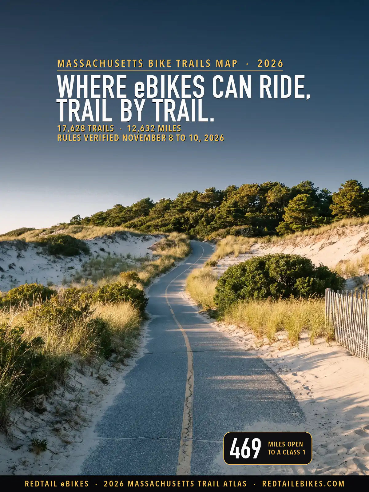
17,628 trails · 12,632 miles across Massachusetts's 14 counties · 469 miles open to a Class 1 · 568 managers named · Rules verified November 8 to 10, 2026
Quick Answer: Massachusetts lets Class 1 and 2 e-bikes ride public bike paths unless the city, town or agency running it restricts them after a public hearing, and bars them from a public body's natural-surface trails until it opens them. DCR parks allow Class 1 only, on improved trails 8 feet or wider. Of 12,632 mapped miles, 469 take a Class 1.
Every e-bike in our full range ships free to Massachusetts within the contiguous United States.

The Province Lands Bike Trail in Cape Cod National Seashore, where an e-bike may ride while you pedal, in a scene generated with Playcut from a photograph of the trail by Giorgio Galeotti.

Each line is a trail or path from DCR's Roads and Trails inventory and its Division of Water Supply Protection, MassDOT's shared-use paths, MassGIS's Published Trail Segments and NextGen 911 trail compilation, the National Park Service or OpenStreetMap, colored by the e-bike rule of whoever manages it.
The numbers mark the 13 regions below, Massachusetts's regional planning agencies, in the order the page reads them, west to east.
Massachusetts puts its two trail rules in one section of the General Laws, and between them they decide most of this map. On a paved or surfaced path, your e-bike has a bicycle's rights until the public body that runs the path restricts it.
On a natural-surface trail that a public body runs, your e-bike is barred until that body opens it. Other states draw these lines differently, and electric bike laws in all 50 states sets them side by side in one table. The map sorts every trail by who manages it and what that manager's rule lets your class do.
G.L. c.85, § 11B¾(b) gives your e-bike "all of the rights and privileges" of a bicycle, "provided, however, that electric bicycles shall not be ridden or operated on sidewalks." Subsection (c) lets "A municipality, local authority or state agency with jurisdiction over a bike path or bikeway" prohibit or regulate e-bikes on it "after public notice and a public hearing".
Subsection (d) runs the other way on dirt: "An electric bicycle shall not be operated on a trail designated for nonmotorized traffic, that a municipality, local authority or state agency has jurisdiction over, if such trail has a natural surface tread made by clearing and grading the soil and no surfacing materials have been added". The same body may open such a trail to e-bikes after notice and a hearing.
| Where you ride | What decides whether your e-bike may | Who can change it |
|---|---|---|
| A city or town path, paved or surfaced | Class 1 and 2 ride with a bicycle's rights (§ 11B¾(b), (c)) | The city or town, after public notice and a hearing |
| A city or town natural-surface trail | Closed to e-bikes (§ 11B¾(d)) | The city or town, which may open it after notice and a hearing |
| A DCR park, forest or rail trail | Class 1 only, on improved trails 8 feet wide or wider (302 CMR 12.12(4)) | DCR |
| DCR watershed land | Roads and rail trails where the Division allows e-bikes, never natural-surface trails (Ware River policy, Wachusett plan) | DCR's Division of Water Supply Protection |
| Cape Cod National Seashore | Its designated bike routes, with the motor helping only while you pedal (compendium) | The Seashore's superintendent |
| A land trust's or other private property | The owner's rules; § 11B¾(d) reaches only a public body's trails | The owner |
Section 1 of chapter 90 defines the bike: "a bicycle or tricycle equipped with fully operable pedals and an electric motor of 750 watts or less that meets the requirements of a class 1 electric bicycle or a class 2 electric bicycle."
A Class 1 assists only while you pedal and stops at 20 mph; a Class 2 may move the bike on its motor alone, also to 20 mph. The same section says "The definition of ''Motor vehicles'' shall not include electric bicycles".
Massachusetts defines no Class 3. A bike that assists you to 28 mph falls outside the definition, and no statute says what it is instead. Read one way, it is a "motorized bicycle", which section 1B of chapter 90 excludes "from off-street recreational bicycle paths"; read the other, it belongs to no category, and no statute opens a path to it either way. Where only the statute speaks, this map prints Class 3 as unsettled.
The section dates from August 10, 2022, when section 14 of chapter 176 of the Acts of 2022 inserted it; its label rule took effect January 1, 2023, under section 63. We read every chapter of the Acts of 2025 and 2026, 365 in all, and none changed the e-bike sections.
Bills of the 2025–2026 session would change them, the furthest along an economic development bill now before a committee of conference; what changed, and what could change next names each with its last recorded action.
568 managers named in the land and trail records share the decision across this map, each counted once however its records spell it. Each trail below carries its manager's name where a record names one and, where that manager's rule could be read, what the rule says about your class, linked to the rule itself. The same rows sit in the trail register, so you can check a ride trail by trail.
For the rest of the state's e-bike law, from labels to helmets, read our Massachusetts e-bike laws guide. To find a shop near your trailhead, see e-bike shops in Massachusetts, and to compare states, the bike trails by state hub. Riding across the line? The same trail-by-trail map covers New York to the west, and away from home the 50-state e-bike trail atlas finds the trails near you.
Takeaway
The surface under your wheels decides more in Massachusetts than your class does. A Class 1 may ride 469 mapped miles and a Class 2 185; in DCR's parks, forests and rail trails the Class 2 gives up every trail, because the agency opens their improved trails to Class 1 alone. A Class 3 rides 59 miles where a manager names it, and reads unsettled on the 120 open miles where no rule names it.
66% of the mapped miles read gray. The largest gray blocks are city and town land whose own code we could not read, 1,008 miles of natural-surface trail and 214 of surfaced path among them, and 2,116 miles on ground the state's protected-land layer records no owner for. The downloadable register tells you why each gray trail is gray.
In this guide
- How to read the map
- Who decides on each trail
- DCR parks, forests and rail trails
- The Appalachian Trail
- Watershed land: the Ware River, Quabbin and Wachusett
- Cape Cod National Seashore and the other park units
- The Cape Cod Canal
- Wildlife refuges
- City and town rules
- Land trusts and other owners
- Named trails riders ask about
- Massachusetts bike trails, region by region
- Where riders get caught out
- Roads, labels and riders
- What changed, and what could change next
- Choosing an e-bike for Massachusetts trails
- Frequently asked questions
How to read the map
Every line on the map is a trail, path or rail trail, colored by what its manager's rule lets your e-bike do. Streets, sidewalks and bike lanes on roads stay off; the road network belongs on a road map.
- Green: Class 1, 2 and 3 may ride. Green is rare here: Haverhill opens its conservation areas, Winnekenni Park among them, to Class 1, 2 and 3.
- Purple: any class, with the motor helping only while you pedal. Cape Cod National Seashore's bike routes and Minute Man's Battle Road and North Bridge trails carry this condition.
- Magenta: Class 1 and 3, the pedal-assist classes. The Cape Cod Canal's service roads, where the Army Corps of Engineers names those two classes and bars Class 2.
- Blue: Class 1 and 2, with Class 3 unsettled. Blue miles are the surfaced paths of cities and towns whose code we read, the state's own surfaced paths outside DCR, the Ware River watershed's roads and rail trails, and the Mass Central Rail Trail's Wachusett miles.
- Orange: Class 1 only. DCR's improved trails recorded 10 feet wide or wider, the improved paths of the facilities DCR lists for e-bikes, and Upton's conservation lands, where the town's rule names Class 1 alone.
- Dashed red: closed to e-bikes. Red miles are natural-surface trails that public bodies run, DCR's natural-surface trails and its improved trails recorded under 5 feet wide, the national parks' trails closed to bicycles, the Appalachian Trail, Mass Audubon's sanctuaries, the Trustees properties whose pages bar mountain biking, Nantucket Conservation Foundation land, the refuges' closed trails, and the town land whose own rule closes it.
- Gray: the rule is unsettled, could not be read, or belongs to a private owner, or the record names no owner or surface for the trail. Each gray trail's reason is in the register.
The map shows the rule. A posted closure, a seasonal rule or a sign at the trailhead can still close a colored line on the day you ride.
Who decides on each trail
On most of this map a city or town decides, and on the next largest share DCR does. Cities and towns manage 5,415 of the mapped miles, about 43% of the map, though 2,116 of those carry a town's name only because no record names an owner. DCR manages 3,692 miles, land trusts 1,331, private owners 595 and federal agencies 417.
| Who manages the trail | Trails | Miles | What e-bikes may do |
|---|---|---|---|
| DCR parks and forests: improved trails recorded 10 feet wide or wider | 503 | 208.9 | Class 1 only |
| DCR's listed e-bike facilities (rail trails and parks) | 19 | 51.5 | Class 1 only |
| DCR: improved trails recorded 5 to 10 feet wide | 594 | 299.9 | Gray: the recorded width straddles 8 feet |
| DCR: a listed bike path recorded under 5 feet | 2 | 9.2 | Gray: two DCR records disagree |
| DCR: natural-surface trails and improved trails recorded under 5 feet | 2,267 | 2,581.0 | Closed |
| DCR: width or surface not on record | 688 | 333.8 | Gray: the record omits what the rule turns on |
| The Appalachian Trail | 34 | 79.2 | Closed |
| Watershed land: Ware River roads and rail trails, the Wachusett's rail trail | 14 | 20.2 | Class 1 and 2; Class 3 read two ways |
| Watershed land: other roads, natural-surface trails | 99 | 112.0 | Gray or closed roads; closed natural-surface trails |
| Other state land (Fish and Game, MassDOT and others) | 391 | 561.2 | By surface: paths Class 1 and 2, natural-surface trails closed |
| Cape Cod National Seashore, Minute Man and Salem Maritime: designated routes | 10 | 19.5 | Every class, pedaling |
| Other National Park Service trails | 56 | 169.6 | Closed off designated routes |
| The Cape Cod Canal's service roads | 6 | 13.3 | Class 1 and 3 |
| Other Army Corps of Engineers land | 78 | 126.4 | Gray: the project's rule was not read |
| National wildlife refuges and fish hatcheries | 69 | 68.1 | Closed or gray: each refuge's own page |
| Other federal land | 12 | 2.3 | Gray: the agency's rule was not read |
| Cities and towns whose code was read: paths | 147 | 41.8 | Class 1 and 2; Class 3 read two ways |
| Cities and towns whose code was read: natural-surface trails | 819 | 350.6 | Closed until the town opens them |
| Cities and towns whose code was read: surface not on record | 966 | 357.1 | Gray: the surface decides and is not on record |
| Cities and towns: their own e-bike rule | 151 | 125.9 | Each town's own rule: see the table below |
| Cities and towns whose code could not be read | 4,507 | 2,423.6 | Gray: the statute's default, which a town may change |
| Ground with no owner of record | 2,584 | 2,116.2 | Gray: whose rule governs is not on record |
| Areas only OpenStreetMap credits to an operator | 1,442 | 373.4 | Gray: no owner on record |
| Mass Audubon wildlife sanctuaries | 380 | 204.0 | Closed: foot travel only |
| The Trustees: properties whose page bars mountain biking | 60 | 41.3 | Closed: each page bars mountain biking |
| The Trustees: every other property | 367 | 277.5 | The Trustees decide |
| Nantucket Conservation Foundation land | 28 | 58.5 | Closed |
| Martha's Vineyard Land Bank | 275 | 63.6 | Gray: two readings, both printed |
| Other land trusts and nonprofits | 1,996 | 895.9 | The owner decides |
| Counties, land banks, water districts and other public bodies | 76 | 51.3 | Gray: the body's rule was not read |
| Private land | 750 | 595.0 | The owner decides |
| Manager not on record | 4 | 0.3 | Not determined |
| All Massachusetts | 17,628 | 12,632.1 | Map above; every trail by region below |
Takeaway
On a public trail, ask what is under your wheels: a paved or stone-dust path takes your Class 1 or 2 unless its town or agency has restricted it, and a dirt trail is closed unless its town or agency has opened it. In a DCR park, forest or rail trail, ask the width too, and leave a Class 2 or 3 at the trailhead.
DCR parks, forests and rail trails
In DCR's parks, forests and rail trails, your e-bike may ride a trail only if it is a Class 1, and only an improved trail 8 feet wide or wider.
302 CMR 12.12(4) reads: "The use of electric bicycles is prohibited on sidewalks and on improved or natural surface trails, regardless of trail width or other conditions, except that Class 1 electric bicycles are permitted as follows: (a) on improved DCR trails of 8 feet in width or greater; (b) in places where vehicular traffic is permitted and bicycles are not otherwise prohibited; and (c) in bicycle lanes on DCR roadways."
If yours is a Class 2 or 3, you get less: "The use of Class 2 and Class 3 electric bicycles is permitted as follows: (a) where vehicular traffic is permitted and bicycles are not otherwise prohibited; and (b) in bicycle lanes on DCR roadways." In a DCR park, forest or rail trail, your throttle bike or 28 mph bike rides the park roads and the bike lanes on DCR parkways, and no trail.
The rule covers all DCR property outside the land of its Division of Water Supply Protection (302 CMR 12.01(3)(g)); the watershed land has its own rules, below.
DCR manages 3,692 of this map's miles across 288 parks, forests, reservations and rail trails. Its own trail inventory records each trail's surface and its width in bands, and the map reads those records: 209 miles of improved trail recorded 10 feet wide or wider take a Class 1, and 2,498 miles of natural-surface trail are closed.
When DCR adopted the rule, its response to comments put it plainly: "Under the amended regulation, e-bikes will not be permitted on any natural surface trails where motor vehicles are not permitted, regardless of width."
The facilities DCR lists for e-bikes
DCR's page "E-Bikes on DCR Property" says "DCR allows the operation of class 1 e-bikes on improved trails of an appropriate width", and its location list names 17 facilities (list, page 2, page 3, in the Internet Archive's latest copies, from October 16 and September 4, 2025).
They are Alewife Brook Reservation, Ashuwillticook Rail Trail, Blackstone River and Canal Heritage State Park, Breakheart Reservation, Canalside Rail Trail, Cape Cod Rail Trail, Charles River Reservation, Chicopee Memorial State Park, Manuel F. Correllus State Forest, Myles Standish State Forest, Mystic River State Reservation, Nashua River Rail Trail, Neponset River Reservation, Nickerson State Park, Norwottuck Rail Trail, Southern New England Trunkline Trail and Wompatuck State Park.
On a listed rail trail, your Class 1 rides the trail itself, and the map reads it as a Class 1 route, 52 miles; inside a listed park, the regulation's width test still decides each trail.
DCR's own trail pages say the same where they speak. On the Nashua River Rail Trail, "Class 1 e-bikes, pedal-assist electric bikes that reach 20 mph, are permitted on the trail."
One listed forest's records disagree with each other. DCR lists Manuel F. Correllus State Forest on Martha's Vineyard, while its own trail inventory records the Correllus Bike Path, asphalt, at "3' - 5'" wide, under the rule's 8 feet. The map prints those 9.2 miles gray, both records in the register.
Where the record leaves the width open
DCR records width in bands, and one band straddles the rule: "5' - 10'". A trail in that band may be 8 feet wide or 6, so the map prints its 300 miles as unsettled, with both readings in the register.
Another 88 miles of improved trail on DCR ground are lines DCR's inventory does not draw, so no width is on record, and 246 miles carry no surface at all. On those trails, look for DCR's posting at the trailhead before you ride, or ask the park.
The Appalachian Trail
The Appalachian Trail is closed to your e-bike for its whole length in Massachusetts. 302 CMR 12.05(2) reads: "No person shall operate any snow vehicle, recreation vehicle, or other vehicle, or ride a bicycle, electric bicycle, motorized conveyance, horse, or other animal upon any portion of the Appalachian Trail except at designated crossings."
On the Park Service's corridor land, the trail's compendium lists the trails authorized for bicycles as "None at this time". The map reads 79.2 miles of trail as the Appalachian Trail's, located by DCR's own line for it. At the trail's northern end, Maine's trail atlas reads it closed to e-bikes too.
Watershed land: the Ware River, Quabbin and Wachusett
DCR's Division of Water Supply Protection guards the land around the state's drinking-water reservoirs, and two of its rules speak of e-bikes. For the Ware River watershed: "Electronic bicycles are allowed on DWSP roads and rail trails, but they are prohibited on all natural surface trails."
The same policy adds, "E-bikes are allowed only on existing roads and rail trails; they are not permitted on single track or other natural surface trails."
For the Wachusett Reservoir, the Division's 2023 public access plan reads: "E-bikes – like traditional bicycles – can be used only in areas designated by the Commissioner. These areas are limited to the Mass Central Rail Trail, the road below the Wachusett Dam and along the Spillway to Gate 39 via the old rail bed only." The plan counts a Class 1 or 2 as an e-bike.
The map reads 12.0 miles of Ware River roads and rail trails and 8.2 miles of the Mass Central Rail Trail on Wachusett land as open to your Class 1 or 2, and every natural-surface watershed trail as closed to you.
The Wachusett's other roads read closed, but its 2.7 miles at the dam in Clinton read gray. One of the plan's tables reads "Bicycling and e-bikes are allowed from the area below the dam to Gate 39 via the lower access road (old rail bed) only.", and another "E-bikes allowed on Lower Road paved surface only."
The Quabbin's and the other watersheds' roads the Division opens to bicycles, 28.5 miles, read gray: the Quabbin's bicycle brochure, access summary and park access map name no e-bike. Ask the watershed rangers before you ride them.
Cape Cod National Seashore and the other park units
On the Seashore, your e-bike rides the bike routes, and the motor helps only while you pedal. The Superintendent's Compendium designates five routes for bicycles: the Nauset Bike Trail, the park's fire roads, the Head of the Meadow Bike Trail, the Cape Cod Rail Trail and the Province Lands Bike Trail.
It reads: "E-bikes are allowed in Cape Cod National Seashore where traditional bicycles are allowed", and "Except where use of motor vehicles by the public is allowed, using the electric motor to move an e-bike without pedaling is prohibited."
So if yours is a Class 2, you may ride the Seashore's routes too, with the throttle off. Off those routes, a bicycle "is prohibited except on park roads, in parking areas and on routes designated for bicycle use", and the compendium adds that bicycles, "including Fat Bikes and e-bikes", may not ride "on beaches or dune areas". The map reads 13.4 miles as the Seashore's open routes.
Two smaller units open some ground too. At Minute Man National Historical Park, the compendium says e-bikes are "allowed on park roads, parking areas, and on the Battle Road Trail and North Bridge Trail", and that "Using an E-bike without pedaling is Prohibited".
At Salem Maritime and Saugus Iron Works, "E-bikes are allowed at both Salem Maritime & Saugus Iron Works National Historic Sites where traditional bicycles are allowed.", and the motor may help only while you pedal.
Salem Maritime has no trail on this map, and Saugus Iron Works' paths read closed: its compendium opens no trail there to bicycles and bars them from the fenced site, "No bicycles are permitted to be ridden within the fenced-in area of Saugus Iron Works National Historic Site."
Every other Park Service trail reads closed: under 36 CFR 4.30, "The use of an electric bicycle is prohibited in locations not designated by the Superintendent".
The Cape Cod Canal
The Canal's service roads take your e-bike if it is a Class 1 or Class 3, and bar a Class 2. The Army Corps of Engineers' notice on motorized vehicles on the service roads permits "Class I & III Pedal-Assist Bicycles" and states: "Class II (throttle-assist) e-bikes are not permitted along the Service Roads". The map reads 13.3 miles of the North and South service roads that way.
The Corps holds other land in Massachusetts too, around its flood-control dams from Tully Lake to Knightville and Hodges Village. We found no e-bike rule for those projects; their 126.4 miles read gray, and the Corps' general rule keeps a vehicle "off authorized roadways" unless the District Commander designates otherwise (36 CFR 327.2).
Wildlife refuges
Each refuge decides, and none on this map opens its trails to your bike. Parker River's page says "Both conventional and electric ("e-bikes") bicycles are permitted at the refuge." on its 6.4-mile refuge road, and "Biking is never permitted on refuge trails, boardwalks, or the beach." At Assabet River, "Biking is only allowed on roads and ways."; its page does not mention e-bikes, so its roads read gray.
Massasoit and Nomans Land Island are "closed to all public access". Great Meadows, Oxbow, Monomoy, Mashpee, Nantucket and the Conte refuge's Massachusetts divisions list wildlife watching among their activities and no biking, so their 28.2 miles read gray: the Fish and Wildlife Service lets e-bikes use refuge roads and trails "where traditional bicycle use is allowed", and only after the refuge manager finds them compatible. Ask the refuge before you ride.
City and town rules
Your town decides its own paths and trails, and most towns' codes could not be read from here. Under § 11B¾, a city or town may restrict e-bikes on a path, or open a natural-surface trail to them, only by an ordinance or regulation adopted after public notice and a hearing. Until it does, the statute's two defaults hold: a surfaced path takes your Class 1 or 2, and a natural-surface trail is closed.
We read the own websites of 292 of the 350 cities and towns on this map for their e-bike rules and codes, every e-bike mention in its sentence; for the other 58, no site could be shown to be the town's own, or none of its pages answered.
A website counts as the town's own only when the federal .gov registry files it to that town, the Massachusetts Municipal Association lists it as the town's site, or its own pages read as the town's official site.
A town's code counts as read only where its own title page shows its general bylaws or ordinances, or its rules for conservation land, trails or parks, in an edition of 2023 or later.
| Government | Law or page | Where it applies | What it does | Trails | Miles |
|---|---|---|---|---|---|
| City of Haverhill | City of Haverhill, Conservation Areas Rules and Regulations | a trail in a conservation area the City of Haverhill's Conservation Commission manages | Class 1, 2 and 3 | 24 | 26.5 |
| Town of Hingham | Town of Hingham, Bare Cove Park: Regulations (Prohibited in Bare Cove Park) | a trail in Bare Cove Park, Hingham | Closed to e-bikes | 6 | 11.5 |
| Town of Hingham | Town of Hingham, Rules and Regulations for Conservation Land | a trail on land the Town of Hingham's Conservation Commission manages | Closed to e-bikes | 13 | 9.1 |
| Town of Holbrook | Town of Holbrook, Town Forest Rules and Regulations (amended February 4, 2026) | a trail in the Holbrook Town Forest | Closed to e-bikes | 10 | 2.9 |
| Town of Hopkinton | Town of Hopkinton, Trail Guide: Center Trail | the Center Trail, Hopkinton | Class 1 and 2, 10 mph; Class 3 unsettled | 1 | 0.7 |
| Town of Mashpee | Town of Mashpee, Chapter 173 Regulation 1: Activities on Mashpee Conservation Lands | a trail on land the Town of Mashpee's Conservation Commission manages | Closed to e-bikes | 42 | 24.3 |
| Town of Milford | Milford Upper Charles Trail Committee, Final Report (March 2024) | the Upper Charles Trail in Milford | Class 1 and 2, under 15 mph; Class 3 unsettled | 5 | 2.7 |
| Town of Nantucket | Town of Nantucket, e-Bikes (Nantucket's E-Bike Rules) | a paved or surfaced path the Town of Nantucket runs | Class 1 and 2, 20 mph; every rider wears a helmet | 14 | 28.9 |
| Town of Upton | Town of Upton Conservation Commission, Land Use Regulations (v4, March 2024), rule 3 | a trail on land the Town of Upton's Conservation Commission manages | Class 1 only; Class 2 and 3 unsettled | 8 | 10.2 |
| Town of Winthrop | Town of Winthrop Code, Chapter 8.50, § 8.50.030 (effective September 1, 2026) | any trail or path on Winthrop's parkland | Closed to e-bikes | 11 | 2.2 |
| Town of Yarmouth | Town of Yarmouth, Conservation Areas and Trail Maps | a trail on land the Town of Yarmouth's Conservation Commission manages | Closed to e-bikes | 17 | 6.9 |
What the towns' own rules say
11 towns publish an e-bike rule of their own for their trails, and they split both ways. Haverhill opens its conservation areas: "Class 1, 2, and 3 electric pedal assist bicycles may be used within Conservation Areas." Nantucket opens its multi-use paths to Class 1 and 2, with a 20 mph limit and a helmet for every rider: "Class 1 and Class 2 e-bikes are allowed on our paths."
Hopkinton's trail guide permits electric bikes on the Center Trail at 10 mph, Milford's 2023 bylaw amendment opens its stretch of the Upper Charles Trail, and Upton's conservation commission permits "Pedal-assisted class-1 electronic bikes without the use of a throttle".
Six towns close ground to you. Hingham bars "Electric bikes" from its conservation lands and lists "Motorized vehicles, including ebikes" among what is prohibited in Bare Cove Park. Mashpee's conservation lands, Yarmouth's conservation areas and the Holbrook Town Forest are closed to e-bikes.
Winthrop's 2026 ordinance bars them from "Any natural surface trail; or 2. Any parkland within the Town of Winthrop", with fines of $25 to $100. Templeton's Parks and Recreation Commission rules that "all bicycles, electric bikes, scooters, skateboards, and any motorized vehicles not authorized by the town of Templeton Parks and Recreation Commission are hereby banned from the walking path" in Gilman Waite Park, a path this map does not carry.
The towns whose code we read
58 more cities and towns were read in their general bylaws or ordinances, and 12 in their rules for conservation land, each in an edition of 2023 or later, with no e-bike provision (12 of them read in the Internet Archive's copy of a town website that answered this client with a security check); Wellesley's police department states that "The Town of Wellesley has not adopted e-bike ordinances or bylaws."
On that ground the statute decides, and the map reads it the same way on state land outside DCR: 87 miles of surfaced path take your Class 1 or 2, and 558 miles of natural-surface trail are closed to you.
Rules that could not be read
The rules of 268 of the 350 cities and towns on this map could not be read. Their trails read gray; each row gives the trail's surface and links section 11B¾, whose default holds there: closed on natural surface unless the town has opened it, open to your Class 1 or 2 on a path unless the town has restricted it. Why each town's rules could not be read:
- A security check on the code host. 110 publish their code on eCode360, American Legal, Municode or Code Publishing, each of which answered with a security check.
- A security check on the town's website. The websites of 33 answered with the same check, so their code was looked for in the Internet Archive's earlier copies of those sites instead.
- An old edition. 33 post only an edition of their bylaws or land rules from before 2023, too old to show what a town has done under the 2022 statute.
- No website of their own. For 5, no website could be shown to be the town's own.
- No code found. On the websites of the other 87, a search led by code words found no copy of their bylaws or conservation land rules, though for 37 of them it stopped at 40 pages with links left to read.
Three towns are working on rules that are not yet in force. Groveland's Select Board held a public hearing on November 9, 2026, on an interim regulation that would let Class 1 and 2 ride its Community Trail "at a speed not greater than 15 miles per hour" and bar devices sold as Class 3 (notice); the town's website had posted no decision when this page was read on November 10, 2026.
Easthampton's proposed e-bike ordinance has no hearing date: the agenda of the City's Manhan Rail Trail Committee for October 26, 2026, lists it as "city council public hearing postponed; no date set" (agenda), and the City Council's Public Safety Committee carried the amendment, "to include E-Bike Regulations and Use", as continuing business for its meeting on the evening of November 10, 2026 (agenda).
A trail plan prepared for Canton's Conservation Commission recommends, for the Ward Well Conservation Area, that "only Class 1 electric bicycles (e-bikes) are allowed and only on the Old Haul Road Trail", among its proposed changes to the Commission's rules for its land, adopted September 25, 2019. None of the three was in force when read.
Land trusts and other owners
On a land trust's property, the owner's rules decide whether you may ride, because § 11B¾(d) reaches only a public body's trails. Land trusts hold 1,331 of this map's miles across 118 organizations, and we read the rules of the largest.
- Mass Audubon closes its sanctuaries to every bicycle. Its property regulations say, of its wildlife sanctuaries, "Foot travel only; please stay on trails". Its 204 miles read closed.
- The Trustees publish rules property by property. We read all 132 of their property pages; 0 carry an e-bike line. 31 bar mountain biking or bicycles, and since an e-bike is a bicycle with a motor, the map reads 21 of those properties, 41.3 miles, as closed. Bear Swamp's page is one: "Mountain biking is not allowed." On the rest, where a page allows mountain biking on designated trails or says nothing, whether an e-bike may ride is the Trustees' call, and 278 miles read gray.
- The Nantucket Conservation Foundation bars them outright: "Motorized dirt bikes, ATVs, UTVs, electric assisted scooters and bikes, and the like – regardless of their status under the law – are prohibited on Foundation-owned properties."
- The Martha's Vineyard Land Bank lists "mountain-biking" among the uses its properties offer and says nothing of e-bikes. Whether § 11B¾(d) reaches a land bank turns on whether it is a "local authority", which the statute does not define, so its 63.6 miles read gray, both readings in the register.
Every other land trust, nonprofit and private owner decides for its own land; their trails read gray as owner land, 896 miles of land trusts and nonprofits and 595 of private land. Look for the owner's posted rules at the trailhead before you ride.
Named trails riders ask about
These are the trails riders search for by name, each with every mile the map holds under that name and the rules those miles follow. A long rail trail crosses several managers, so one trail can read in several colors. For the longest rides beyond Massachusetts, see the longest bike trails in the US, ranked for e-bikes.
The Cape Cod Rail Trail is the clearest long ride: DCR lists it for Class 1, and 24.1 of its 32.0 mapped miles read Class 1 only. The Cape Cod Canal's service roads take Class 1 and 3, and the Seashore's Province Lands Bike Trail takes every class while you pedal.
The Minuteman Bikeway, the Bruce Freeman Rail Trail and the Mass Central Rail Trail cross town after town; where a town's code could not be read or no owner is on record, those miles read gray.
Takeaway
On a named rail trail, check the stretch you will ride: the Cape Cod Rail Trail and the Norwottuck read Class 1 on DCR's list, while the Minuteman and the Bruce Freeman change with the town you are in.
Massachusetts bike trails, region by region
The regions are Massachusetts's 13 regional planning agencies, west to east. Each region's table lists its longest named trails, and the list under it its named trails of half a mile or more, by e-bike rule; every trail is a row in the register.
Pittsfield and North Adams

1,363 trails over 1,250 miles in Berkshire County. 27 miles are open to an e-bike, 691 are closed and 532 read gray.
The Berkshires' long trails are closed to you, and the Ashuwillticook is open. The Appalachian Trail crosses the region from Mount Everett to Mount Greylock and is closed for its whole length. DCR's natural-surface forest trails here, the Taconic Skyline and Taconic Crest trails in Pittsfield State Forest and Beartown's Ski and Bridle Trail among them, are closed.
DCR's Ashuwillticook Rail Trail, recorded as improved and 10 feet wide or wider, is the region's longest Class 1 ride.
| Trail | Managed by | Miles | E-bikes |
|---|---|---|---|
| Appalachian Trail | Appalachian National Scenic Trail | 20.8 | Closed: the Appalachian Trail |
| Appalachian Trail | Department of Conservation and Recreation | 14.7 | Closed: the Appalachian Trail |
| Ashuwillticook Rail Trail | Department of Conservation and Recreation | 10.8 | Class 1 only: an improved DCR trail recorded at 10 feet or wider |
| Appalachian Trail | Department of Conservation and Recreation, Mount Greylock State Reservation | 10.5 | Closed: the Appalachian Trail |
| Appalachian Trail | Department of Conservation and Recreation, Appalachian Trail Corridor | 10.3 | Closed: the Appalachian Trail |
| Taconic Skyline Trail | Department of Conservation and Recreation, Pittsfield State Forest | 9.9 | Closed: a natural-surface DCR trail |
| Taconic Crest Trail | Department of Conservation and Recreation, Pittsfield State Forest | 9.1 | Closed: a natural-surface DCR trail |
| Ski and Bridle Trail | Department of Conservation and Recreation, Beartown State Forest | 8.7 | Closed: a natural-surface DCR trail |
| Appalachian Trail | Department of Conservation and Recreation, October Mountain State Forest | 7.5 | Closed: the Appalachian Trail |
| Appalachian Trail | Department of Conservation and Recreation, Mount Everett State Reservation | 7.3 | Closed: the Appalachian Trail |
| Utility Corridor | Department of Conservation and Recreation, October Mountain State Forest | 6.0 | Closed: a natural-surface DCR trail |
| Bartholomew's Cobble Trail | The Trustees of Reservations, Bartholomew's Cobble | 6.0 | Land trust, nonprofit or private land: the owner decides |
Named trails of half a mile or more in Pittsfield and North Adams (476 of 1,363 trails, 686 of 1,250 mi), by e-bike rule
Class 1 only (8, 16 mi)
Department of Conservation and Recreation:
- Ashuwillticook Rail Trail (10.6 mi)
- West Branch Road (0.7 mi)
- School House Road Extension (0.5 mi)
Department of Conservation and Recreation, October Mountain State Forest:
- Schemerhorn Trail (1.0 mi)
- Watson Road Extension (0.6 mi)
- Buckley Dunton Trail (0.5 mi)
Department of Conservation and Recreation, Beartown State Forest:
- Old Benedict Pond Road (0.9 mi)
Department of Conservation and Recreation, East Mountain State Forest:
- East Mountain Road (0.7 mi)
Closed to e-bikes (219, 388 mi)
Department of Conservation and Recreation, Pittsfield State Forest:
- Taconic Skyline Trail (9.2 mi)
- Taconic Crest Trail (9.1 mi)
- Shaker Trail (5.0 mi)
- Honwee Loop Trail (3.1 mi)
- Balance Rock Trail (2.7 mi)
- CCC Trail (2.5 mi)
- Pine Mountain Trail (2.4 mi)
- Griffin Trail (1.8 mi)
- Daniels Trail (1.8 mi)
- Burgoyne Trail (1.5 mi)
- Brickhouse Mountain Road (1.4 mi)
- Churchill Brook Trail (1.4 mi)
- Parker Brook Trail (1.3 mi)
- Lulu Brook Trail (1.3 mi)
- Turner Trail (1.2 mi)
- Brook Trail (1.1 mi)
- Doll Mountain Trail (1.1 mi)
- Connector Trail (1.1 mi)
- Brickhouse Mountain Trail (1.0 mi)
- Deer Run Trail (0.9 mi)
- Hawthorne Trail (0.8 mi)
- Circuit Trail (0.8 mi)
- North Branch Trail (0.7 mi)
- Potter Mountain Trail (0.7 mi)
- Shadow Trail (0.7 mi)
- West Mountain Trail (0.6 mi)
- Tranquility Trail (0.5 mi)
- Ghost Trail (0.5 mi)
Department of Conservation and Recreation, Mount Greylock State Reservation:
- Appalachian Trail (10.3 mi)
- Hopper Trail (3.6 mi)
- Old Adams Road (3.5 mi)
- Northrup Trail (3.4 mi)
- Money Brook Trail (3.2 mi)
- Bradley Farm Trail (3.1 mi)
- Woodason Spring Trail (2.4 mi)
- Bellows Pipe Trail (2.2 mi)
- Mt. Prospect Trail (1.8 mi)
- Haley Farm Trail (1.7 mi)
- Overlook Trail (1.7 mi)
- Stony Ledge Ski Trail (1.6 mi)
- Gould Trail (1.6 mi)
- Cheshire Harbor Trail (1.4 mi)
- CCC Dynamite Trail (1.3 mi)
- Bernard Farm Trail (1.3 mi)
- Roaring Brook Trail (1.2 mi)
- Silver Fox Trail (1.1 mi)
- Old Cutbank Road (1.1 mi)
- Rounds Rock Trail (1.0 mi)
- Deer Hill Trail (1.0 mi)
- Jones Nose Trail (1.0 mi)
- Red Gate (0.9 mi)
- Old Summit Road (0.9 mi)
- Thunderbolt Trail (0.8 mi)
- Circle Trail (0.7 mi)
- Stage Trail (0.7 mi)
Department of Conservation and Recreation, October Mountain State Forest:
- Appalachian Trail (7.5 mi)
- Utility Corridor (6.0 mi)
- Switchback Trail (2.9 mi)
- Boulder Trail (2.7 mi)
- Felton Trail (2.6 mi)
- Cordonier Trail (2.1 mi)
- Washington Mountain Marsh Trail (1.9 mi)
- Roaring Brook Trail (1.8 mi)
- Buckley Dunton Trail (1.7 mi)
- Gorge Trail (1.7 mi)
- Vagabond Trail (1.6 mi)
- October Mountain Trail (1.5 mi)
- Gorilla Trail (1.4 mi)
- Eagle Ledge Trail (1.3 mi)
- Aqueduct Trail (1.1 mi)
- Navin Trail (1.1 mi)
- Quicksand Trail (0.9 mi)
- Tannery Trail (0.8 mi)
- Schemerhorn Trail (0.7 mi)
Department of Conservation and Recreation, Savoy Mountain State Forest:
- Savoy Kanary Kats Trail (2.6 mi)
- North Pond Loop (2.3 mi)
- Lost Pond Trail (2.3 mi)
- Tannery Trail (2.2 mi)
- Tyler Swamp Loop (2.2 mi)
- Old Florida Road (2.0 mi)
- Mahican Mohawk Trail (1.8 mi)
- Florida Trail (1.6 mi)
- Blackburnian Loop (1.6 mi)
- Sherman Road (1.5 mi)
- Adams Sno-Drifter Trail (1.4 mi)
- Tilton Brook Trail (1.4 mi)
- Carpenter Trail (1.3 mi)
- Busby Trail (1.3 mi)
- Adams Sno-Drifters Trail (1.3 mi)
- Lewis Hill Trail (1.2 mi)
- Ross Brook Trail (1.1 mi)
- Trail to Balance Rock (1.1 mi)
- Balanced Rock Trail (1.0 mi)
- CCC Trail (1.0 mi)
- Hathaway Trail (1.0 mi)
- Burnett Pond Trail (1.0 mi)
- H. H. Fitzroy Trail (0.9 mi)
- Fire Tower Trail (0.9 mi)
- Sucker Brook Trail (0.8 mi)
- Kamick Trail (0.8 mi)
- 2 (Savoy Mountain State Forest) (0.6 mi)
- Bog Pond Trail (0.6 mi)
- Torrey Road (0.5 mi)
- D Poland Loop (0.5 mi)
- Tilton Road (0.5 mi)
Department of Conservation and Recreation, Beartown State Forest:
- Ski and Bridle Trail (8.7 mi)
- Appalachian Trail (4.4 mi)
- Wildcat Trail (4.3 mi)
- Sky Peak Trail (3.8 mi)
- Turkey Trail (3.3 mi)
- Airplane Trail (2.8 mi)
- Loop Trail (1.6 mi)
- Beebe Trail (1.4 mi)
- Long Walk Road (1.0 mi)
- Snowshoe, Mt. Bike, Bridle Trail (1.0 mi)
- Brace Road (0.6 mi)
Department of Conservation and Recreation:
- Appalachian Trail (13.2 mi, 2 stretches)
- Bellows Pipe Trail (1.8 mi)
- Ski Trail (1.6 mi)
- Sykes Mountain Trail (1.4 mi)
- New Lenox Road (1.1 mi)
- Taconic Skyline Trail (0.9 mi)
- Lebanon Springs Road (0.8 mi)
- Brickhouse Mountain Trail (0.8 mi)
- Rrr Brooks Trail (0.8 mi)
- Torrey Mountain Road (0.7 mi)
- Red Gate (0.7 mi)
- Sykes Mountain Road (0.7 mi)
- Thompson's ATV (0.6 mi)
- Fitch Trail (0.6 mi)
- Ridge Trail (0.6 mi)
- Race Brook Trail (0.6 mi)
- Bassett Brook Trail (0.6 mi)
Appalachian National Scenic Trail:
- Appalachian Trail (20.7 mi, 2 stretches)
Department of Conservation and Recreation, Mount Washington State Forest:
- South Taconic Trail (5.4 mi)
- Ashley Hill Trail (3.4 mi)
- Alander Mountain Trail (2.6 mi)
- Laurel Trail (1.1 mi)
- Charcoal Pit Trail (1.0 mi)
- Stetson Trail (0.8 mi)
- Mt. Frissell Trail (0.6 mi)
Department of Conservation and Recreation, Greylock Glen:
- Gould Trail (1.4 mi)
- Bellows Pipe Trail (1.3 mi)
- Wolf Tree Trail (1.0 mi)
- Moser Farm Loop East (1.0 mi)
- Glen Meadow Loop (1.0 mi)
- Moser Farm Loop West (0.8 mi)
- Little Dragon Tail (0.7 mi)
- Old Adams Road (0.7 mi)
- Cottontail Trail (0.7 mi)
- Snowmobile Trail (0.7 mi)
- South Side Connector (0.7 mi)
- Moonwort (0.6 mi)
- Brookside Trail (0.6 mi)
- Hidden Meadow Trail (0.5 mi)
- Bellows South Trail (0.5 mi)
Department of Conservation and Recreation, Appalachian Trail Corridor:
- Appalachian Trail (10.1 mi, 4 stretches)
- AT Spur Trail (1.0 mi)
- Former AT (0.6 mi)
Department of Conservation and Recreation, Mount Everett State Reservation:
- Appalachian Trail (7.3 mi)
- Race Brook Trail (1.8 mi)
- Guilder Pond Loop (0.7 mi)
Department of Conservation and Recreation, East Mountain State Forest:
- Ski Trail (5.5 mi)
- Appalachian Trail (1.9 mi)
Department of Conservation and Recreation, Mohawk Trail State Forest:
- Mahican Mohawk Trail (also in Greenfield and Montague) (3.8 mi here)
- Harwood Road Extension (1.5 mi)
The Trustees of Reservations, Field Farm Reservation:
- North Trail (1.8 mi)
- South Trail (1.4 mi)
- Oak Loop (0.7 mi)
- Field Farm Trail (0.6 mi)
Department of Conservation and Recreation, Taconic Trail State Park:
- Taconic Crest Trail (2.7 mi)
- Phelps Trail (1.5 mi)
Massachusetts Audubon Society, Pleasant Valley Wildlife Sanctuary:
- Yokun Ridge Trail (1.9 mi)
- Log Hop (0.7 mi)
- Trail of the Ledges (0.6 mi)
- Yokun Trail (0.5 mi)
Department of Conservation and Recreation, Clarksburg State Forest:
- Appalachian Trail (3.6 mi)
Town of Egremont, French Park:
- Blue Trail (1.5 mi)
- Red Trail (0.7 mi)
- Yellow Trail (0.7 mi)
Department of Conservation and Recreation, Sandisfield State Forest:
- Richards Road Trail (1.0 mi)
- Richards-Whitney Road Connector (0.6 mi)
- Whitney Trail (0.6 mi)
- Richards Road Extension (0.5 mi)
Department of Conservation and Recreation, Windsor State Forest:
- Jambs Trail (1.2 mi)
- Steep Bank Brook Trail (0.7 mi)
- Phoebe Memorial Trail (0.7 mi)
Massachusetts Audubon Society, Canoe Meadows Wildlife Sanctuary:
- Sacred Way Trail (1.3 mi)
- Carriage Road (0.7 mi)
- Wolf Pine Trail (0.5 mi)
The Trustees of Reservations, Mountain Meadow Preserve:
- Mountain Meadow Trails (2.4 mi)
Department of Conservation and Recreation, Monroe State Forest:
- Smith Hollow Trail (also in Greenfield and Montague) (1.0 mi here)
- Dunbar Brook Trail (also in Greenfield and Montague) (0.6 mi here)
- Spruce Hill Trail (also in Greenfield and Montague) (0.6 mi here)
Department of Conservation and Recreation, Clarksburg State Park:
- Pond Loop Trail (2.0 mi)
Department of Conservation and Recreation, Lindon Bates Memorial Park:
- Beacon Trail (1.8 mi)
Department of Conservation and Recreation, Otis State Forest:
- Knox Trail (1.7 mi)
Department of Fish and Game, Agawam Lake WMA:
- Unmaintained Trail (1.5 mi)
Department of Conservation and Recreation, Arthur Wharton Swann State Forest:
- Appalachian Trail (1.4 mi)
Massachusetts Audubon Society, Lime Kiln Farm Wildlife Sanctuary:
- Ovenbird Trail (0.7 mi)
- Lime Kiln Loop (0.7 mi)
Department of Conservation and Recreation, Kenneth Dubuque Memorial State Forest:
- Roger Willis Trail (also in Greenfield and Montague) (1.3 mi here)
Department of Conservation and Recreation, Clam Lake Flood Control Site:
- 8 (Clam Lake Flood Control Site) (1.2 mi)
Department of Conservation and Recreation, Bash Bish Falls State Park:
- South Taconic Trail (1.2 mi)
Department of Fish and Game, Farmington River WMA:
- 95 (Farmington River WMA) (1.2 mi)
The Trustees of Reservations, Dry Hill Reservation:
- Dry Hill (1.1 mi)
Town of Sandisfield, Yanner Park:
- Vista Loop Trail (1.0 mi)
Department of Fish and Game, Misery Mountain WMA:
- Taconic Crest Trail (1.0 mi)
Department of Fish and Game, Peru WMA:
- 8 (Peru WMA) (1.0 mi)
Department of Conservation and Recreation, Jug End State Reservation and WMA:
- Jug End Loop Trail (0.6 mi)
Town of Monterey, Town Beach:
- Brewer Pond Loop Trail (0.6 mi)
Department of Fish and Game, Stafford Hill WMA:
- 90/2 (0.6 mi)
The Trustees of Reservations, Questing Reservation:
- Questing Trail (0.6 mi)
Town of Sandisfield, Sandisfield Center Cemetery:
- 24 (Sandisfield Center Cemetery) (0.6 mi)
Unsettled (15, 18 mi)
Department of Conservation and Recreation:
- Washington Mountain Road (2.5 mi)
- New Lenox Road (2.2 mi)
- West Mountain Road (2.0 mi)
- Ashley Trail (1.0 mi)
- Ashley Lake Road (0.9 mi)
- Finerty Trail (0.7 mi)
Department of Conservation and Recreation, October Mountain State Forest:
- School House Trail (2.5 mi)
- Finerty Pond Road (1.3 mi)
- Spruce Trail (0.9 mi)
- Finerty Trail (0.9 mi)
- Ashley Lake Road (0.9 mi)
- Washington Mountain Marsh Trail (0.5 mi)
Department of Conservation and Recreation, Greylock Glen:
- Glen Meadow Loop (0.5 mi)
- Grass Hopper (0.5 mi)
Department of Conservation and Recreation, Savoy Mountain State Forest:
- Kamick Trail (0.9 mi)
Land trust, nonprofit or private land: the owner decides (109, 123 mi)
The Trustees of Reservations, Notchview Reservation:
- Bumpus Trail (2.2 mi)
- Snowshoe Trail (2.1 mi)
- Notchview Trail (1.8 mi)
- Circuit Trail (1.8 mi)
- Minor Trail (1.8 mi)
- Whitestone Trail (1.6 mi)
- Mixed Wood Trail (1.3 mi)
- Dog Loop (1.2 mi)
- Whitman Trail (not GPS'd) (1.1 mi)
- Skating Loop (1.0 mi)
- Steep Bank Brook Trail (0.9 mi)
- Judges Loop (0.9 mi)
- Windsor Trail (0.9 mi)
- Orchard Trail (0.7 mi)
- Hume Brook Interpretive T (0.7 mi)
- Bates Bypass (0.6 mi)
- Tamarack Hollow Trail (0.6 mi)
- Berkshire (0.6 mi)
Private owner:
- Constitution Hill Trail (1.6 mi)
- 90 (Town of Lanesborough) (1.6 mi)
- 90/2 (1.2 mi)
- Trail D (Town of Hancock) (1.1 mi)
- Clam River Loop Trail (1.0 mi)
- Trail E (Town of Hancock) (1.0 mi)
- Mount Plantain (1.0 mi)
- Stevens Glen Trail (1.0 mi)
- Hammertown Trail (0.7 mi)
- Perimeter Trail (0.7 mi)
- 32 (Town of Sandisfield) (0.7 mi)
- Grouse Lodge Road (0.7 mi)
- Trail A (Town of Hancock) (0.7 mi)
- Donato's Trail (0.6 mi)
- Skyline Trail (0.6 mi)
- Artery Trail (0.6 mi)
- Jericho (0.6 mi)
- Wild Turkey (0.5 mi)
- Crosscut (0.5 mi)
The Trustees of Reservations, Bartholomew's Cobble:
- Bartholomew's Cobble Trail (6.0 mi)
- Tractor Path (1.3 mi)
Berkshire Natural Resources Council, Boulders WCE:
- Red Trail (2.3 mi)
- Blue Trail (1.8 mi)
- Green Trail (1.3 mi)
- Unmarked Trail (1.1 mi)
- Boulder Back Side (0.7 mi)
Berkshire Natural Resources Council, Alford Springs WCE:
- Father Loop (3.5 mi)
- Mother Loop (2.1 mi)
The Trustees of Reservations, Monument Mountain Reservation:
- Mohican Monument Trail (1.5 mi)
- Hickey Trail (0.9 mi)
- Flag Rock Trail (0.8 mi)
- Peeskawso Peak Trail (0.7 mi)
- Cross Over Trail (0.6 mi)
The Trustees of Reservations, Becket Quarry Reservation:
- Becket Quarry Trail (1.0 mi)
- Laurel Knob Trail (0.8 mi)
- Old Motion Loop (0.7 mi)
- Mossy Bottom Trail (0.6 mi)
- Quarry Trails (0.5 mi)
Berkshire Natural Resources Council:
- Bob's Way (2.6 mi)
- Burbank Trail (0.9 mi)
New England Forestry Foundation, Rice Sanctuary:
- Red Trail (1.0 mi)
- Orange Trail (0.8 mi)
- Pink Trail (0.8 mi)
- White Trail (0.8 mi)
Berkshire Natural Resources Council, Lenox Mountain:
- Burbank Trail (2.5 mi)
- Old Baldhead Road (0.8 mi)
Berkshire Natural Resources Council, Perry Peak Reserve:
- Hollow Fields Trails (3.4 mi)
Williamstown Rural Lands Foundation, Pine Cobble Preserve:
- Pine Cobble Trail (1.7 mi)
- Class of '98 Trail (1.0 mi)
- Chestnut Trail (0.7 mi)
New Marlborough Land Trust, Goodnow Preserve:
- Blue (1.5 mi)
- Yellow Trail (1.5 mi)
Berkshire Natural Resources Council, Berkshire Natural Resource Council I CR:
- Hoosac Trail (2.9 mi)
Berkshire Natural Resources Council, Mahanna Cobble Reserve:
- Mahanna Cobble Trail (0.8 mi)
- Vista (0.7 mi)
- Glge's Cabin (0.6 mi)
- Yokun Ridge Trail (0.6 mi)
The Trustees of Reservations, Tyringham Cobble:
- Cobble Loop (1.4 mi)
- Appalachian Trail (0.9 mi)
Berkshire Natural Resources Council, Yokun Ridge Reserve:
- Charcoal Trail (1.6 mi)
- Brothers Trail (0.7 mi)
Berkshire Natural Resources Council, Basin Pond Reserve:
- Basin Pond Trail (2.0 mi)
Berkshire Natural Resources Council, Hollow Hills Conservation Area:
- Hollow Fields Trails (2.0 mi)
Williamstown Rural Lands Foundation, Tenney Woodland:
- Tenney Hill Trail (0.9 mi)
- Bee Hill Road (0.6 mi)
Berkshire Natural Resources Council, Housatonic River East Branch WCE:
- Old Mill Trail (1.5 mi)
William J Gould Associates Inc, Gould William J APR:
- Diane's Trail (1.3 mi)
Berkshire Natural Resources Council, Clam River Reserve:
- Hammertown Trail (0.7 mi)
- Hammertown Loop (0.6 mi)
Laurel Hill Association, Sedgwick Reservation:
- Laura's Tower (0.7 mi)
- Mary Flynn Trail (0.6 mi)
Young Mens Christian Association, Camp Becket for Boys:
- Outer Limits (0.7 mi)
- Rudd Trail (0.6 mi)
Williamstown Rural Lands Foundation, Berlin Road Preserve:
- WRLF Loop Trail (1.2 mi)
The Nature Conservancy, Westfield River Highlands:
- Headwaters Trail (1.0 mi)
Williamstown Rural Lands Foundation, Williamstown Rural Lands Foundation CR:
- Rosenburg Ramble (1.0 mi)
The Trustees of Reservations, Goose Pond Reservation:
- Donato's Trail (1.0 mi)
The Nature Conservancy, Schenob Brook Fen:
- Drury Trail (0.9 mi)
Laurel Hill Association, Lower Bowker's Woods:
- Lower Loop Trail (0.9 mi)
Bidwell House Inc, Bidwell House CR:
- Loom Brook Trail (0.8 mi)
Berkshire Natural Resources Council, Housatonic Flats Conservation Area:
- Housatonic Flats (0.8 mi)
Great Barrington Land Conservancy, Pfeiffer Arboretum at Long Pond:
- Pfeiffer Arboretum (0.8 mi)
Berkshire Natural Resources Council, Kelly Reserve:
- Turnpike Trail (0.7 mi)
Berkshire Natural Resources Council, Mt. Darby WCE:
- Mount Darby (0.7 mi)
Boston Symphony Orchestra, Tanglewood:
- Baldhead spur trail (0.7 mi)
Berkshire Natural Resources Council, Perry Peak Conservation Area:
- Hollow Fields Trails (0.7 mi)
Berkshire Natural Resources Council, New Bald Head:
- Baldhead spur trail (0.7 mi)
Berkshire Natural Resources Council, Thomas and Palmer Brook Reserve:
- Woodland Trail (0.6 mi)
Sheffield Land Trust, Cosgriff Natural Area:
- Deborah Reich Trail (0.6 mi)
The Trustees of Reservations, McLennan Reservation:
- McLennan Reservation Trail (0.6 mi)
Alford Land Trust, West Street Conservation Area:
- Shiffman Woods Reserve (0.5 mi)
Rule could not be read (local code, agency or owner) (32, 27 mi)
Town of Lenox, Kennedy Park:
- Coakley Main (1.6 mi)
- Weaver (0.9 mi)
- Loop (Kennedy Park) (0.6 mi)
- Under Mountain (0.6 mi)
- Balance Rock (0.6 mi)
- Deer Run (0.5 mi)
Town of Lenox, Lenox Water Supply Land:
- Veda Trail (1.5 mi)
- Yokun Ridge Trail (1.4 mi)
- Bob T (1.0 mi)
City of Pittsfield, Kirvin Memorial Park:
- Mountain Drive Climb (1.6 mi)
- Ledges (0.6 mi)
Great Barrington Fire District, Great Barrington Water Supply Land:
- East Rock (1.2 mi)
- The Res (0.7 mi)
City of Pittsfield, Pittsfield Water Supply Land:
- Whitney Place Road (1.5 mi)
Town of Stockbridge, Gould Meadows:
- Orange (0.8 mi)
- Blue (0.6 mi)
Town of Williamstown, Hunter Conservation Area:
- Buxton Ravine Trail (0.8 mi)
- Smith Trail (0.6 mi)
City of Pittsfield, Springside Park:
- Down By The River (0.7 mi)
- BMBTS Singletrack (0.6 mi)
Town of Adams, Fire District Land:
- Logging Trail (0.7 mi)
- Bassett Brook Trail (0.5 mi)
Town of Williamstown, Stone Hill Conservation Area:
- Hopkins-Gale Trail (0.6 mi)
- Carl Reidel Trail (0.6 mi)
Town of Lee, Town Forest:
- Golden Hill Trail (1.0 mi)
Town of Great Barrington, McAllister Wildlife Refuge:
- Green River Trail (0.8 mi)
City of North Adams, Historic Valley Campground:
- Trail 1 (Historic Valley Campground) (0.8 mi)
Connecticut Metropolitan District Commission, Farmington River Watershed:
- Route 8 Former Alignment (0.7 mi)
Town of Williamstown, Burbank Conservation Area:
- Burbank Trail (0.7 mi)
Town of Lenox, Pleasant Valley Conservation Area:
- Log Hop (0.7 mi)
Town of Williamstown, Deans Lot Conservation Area:
- Mountain Meadow Trails (0.7 mi)
City of North Adams, The Cascades:
- Cascades Trail (0.6 mi)
Not determined: no owner on record, or the surface the rule turns on not on record (101, 116 mi)
Town of Williamstown:
- Upper Loop Trail (2.6 mi)
- Mohican Recreational Path (2.4 mi)
- Mills Hollow Trail (1.6 mi)
- Class of '33 Trail (1.6 mi)
- Lower Loop Trail (1.5 mi)
- Hoosic River Trail (1.4 mi)
- Birch Brook Trail (1.2 mi)
- Bullock Trail (1.0 mi)
- Taconic Crest Trail (0.8 mi)
- Old Williams Ski Trail (0.8 mi)
- Kite Hill Trail (0.8 mi)
- Hoosic River Walk (0.7 mi)
- Pine Cobble School Trail (0.7 mi)
- Shepard's Well Trail (0.6 mi)
- Linear Park Field Loop (0.6 mi)
- Field Loop (0.5 mi)
Town of Becket:
- 95 (Town of Becket) (5.7 mi)
- Esau's Heel trail (1.3 mi)
- Snowshoe Trail (0.9 mi)
- Brook Trail (0.6 mi)
- Outer Limits (0.6 mi)
- Fox Trot (0.6 mi)
Town of Otis:
- 7 (Town of Otis) (3.3 mi)
- 95 (Town of Otis) (2.3 mi)
- 10 (Town of Otis) (1.6 mi)
- 19 (Town of Otis) (0.9 mi)
- 9 (Town of Otis) (0.5 mi)
- Trail 9 (Town of Otis) (0.5 mi)
Town of Sandisfield:
- 11 (Town of Sandisfield) (2.0 mi)
- Route 8 Former Alignment (1.0 mi)
- 32 (Town of Sandisfield) (1.0 mi)
- 12 (Town of Sandisfield) (0.7 mi)
- Deer Trail (0.6 mi)
- 10 (Town of Sandisfield) (0.6 mi)
Department of Conservation and Recreation, Beartown State Forest:
- Wilcox Road (2.6 mi)
- Sky Peak Road (1.5 mi)
- Brett Road (0.8 mi)
- Old Benedict Pond Road (0.5 mi)
Town of Hancock:
- Skyline Trail (1.4 mi)
- Taconic Crest Trail (1.1 mi)
- Trail C (Town of Hancock) (0.9 mi)
- Taconic Trail (0.7 mi)
Sheffield Land Trust Inc, Ashley Falls Woods:
- Inner Trail (1.9 mi)
- Main Outer Loop (1.8 mi)
Town of Lanesborough:
- 90 (Town of Lanesborough) (2.4 mi)
- 8 (Town of Lanesborough) (1.2 mi)
Town of Savoy:
- 90 (Town of Savoy) (3.5 mi)
Town of Florida:
- 2 (Town of Florida) (2.4 mi)
- 3A (Town of Florida) (1.0 mi)
Town of New Marlborough:
- The New Marlboro Preserve (1.4 mi)
- Idle Hour Road (1.2 mi)
- Joffe Nature Sanctuary (0.7 mi)
Department of Conservation and Recreation, Windsor State Forest:
- Ridge Road (1.4 mi)
- Upper Road (1.2 mi)
- Middle Road (0.6 mi)
Dcr - Division Of State Parks And Recreation, Savoy Mountain State Forest:
- Tannery Road (2.1 mi)
- Savoy Road (1.0 mi)
Town of Adams:
- 90 (Town of Adams) (1.7 mi)
- 2 (Town of Adams) (0.9 mi)
Town of Lenox:
- Roaring Brook Road (0.9 mi)
- Upper Po-Knee (0.9 mi)
- Portugese (0.7 mi)
Department of Conservation and Recreation, Mount Greylock State Reservation:
- Sperry Road (1.8 mi)
- Greylock Road (0.7 mi)
Town of Hinsdale:
- 95 (Town of Hinsdale) (1.4 mi)
- New Windsor Road (1.1 mi)
City of Pittsfield:
- Ashuwillticook Rail Trail (1.4 mi)
- Arrowhead (0.9 mi)
Department of Conservation and Recreation, Peru State Forest:
- Garnet Hill Road (1.5 mi)
- Bradshaw Road (also in Springfield and Chicopee) (0.5 mi here)
Town of Egremont:
- Taconic Trail (1.4 mi)
- Ursala Cliff Trail (0.5 mi)
Commonwealth of Massachusetts DCR, Pittsfield State Forest:
- Potter Mountain Road (1.7 mi)
Town of New Ashford:
- 90 (Town of New Ashford) (1.0 mi)
- Skyline Trail (0.5 mi)
Town of Lee:
- Roaring Brook Road (1.5 mi)
Town of Windsor:
- Nobodys Road (0.7 mi)
- Bush Road (0.6 mi)
Division of State Parks and Recreation, Mount Greylock State Reservation:
- Greylock Road (1.1 mi)
Department of Conservation and Recreation, Otis State Forest:
- Otis Surface Road (1.0 mi)
Department of Conservation and Recreation, Clarksburg State Park:
- Park Road (0.9 mi)
Department of Fish and Game, Chalet WMA:
- Corridor 95 (0.9 mi)
X, Shadow Brook Farm Historic District:
- Kripalu Trail (0.9 mi)
Department of Fish And Game, Chalet Wildlife Management Area:
- Flintstone Road (0.8 mi)
Department of Conservation and Recreation, Tolland State Forest:
- Main Road (also in Springfield and Chicopee) (0.8 mi here)
Town of Stockbridge:
- Ice Glen Trail (0.8 mi)
Town of Peru:
- 8 (Town of Peru) (0.7 mi)
Division of State Parks and Recreation, October Mountain State Forest:
- Lenox - Whitney Place Road (0.7 mi)
Town of Great Barrington:
- Housatonic Rail Trail (0.7 mi)
Town of Cheshire:
- 90/2 (0.7 mi)
Dcr, Mohawk Trail State Forest:
- Route 2 Mohawk Trail (0.7 mi)
City of North Adams:
- Old Mohawk Trail (0.7 mi)
Clark, Sterling & Francine Art Institute, The Clark Art Institute:
- Stone Bench Trail (0.7 mi)
Department of Fish And Game, Peru Wildlife Management Area:
- Nobodys Road (0.7 mi)
Commonwealth of Massachusetts, Monroe State Forest:
- Raycroft Road (0.7 mi)
Cricket Trails, Llc, Shaker Ridge Trails:
- 90 (Shaker Ridge Trails) (0.6 mi)
Williams College:
- The Cirque (0.6 mi)
Town of Lenox, Lenox Water Supply Land:
- Yokun Ridge Trail (0.6 mi)
Berkshire South Regional Community Center, Berkshire South:
- Threemile Hill Trail (0.6 mi)
Town of Washington:
- Taylors Trail (0.5 mi)
Department of Conservation and Recreation, Balance Rock State Park:
- Balance Rock State Park Road (0.5 mi)
The other 887 trails here (564 mi), most of them unnamed lines and short connectors, are each a row in the trail register, with their manager and rule.
Springfield and Chicopee

1,499 trails over 1,253 miles in Hampshire and Hampden counties. 39 miles are open to an e-bike, 375 are closed and 839 read gray.
The Norwottuck Rail Trail is the valley's longest Class 1 ride. DCR lists it for Class 1 e-bikes, and its River Road segment reads the same way.
Springfield's Forest Park trails and its reservoir land read gray, because the City's code could not be read, and so do the Corps of Engineers' trails at Conant Brook and Knightville. The Manhan Rail Trail in Easthampton is on ground with no owner of record, and most of the D.A.R. State Forest's trails are natural surface and closed.
| Trail | Managed by | Miles | E-bikes |
|---|---|---|---|
| D.A.R. State Forest Trails | Department of Conservation and Recreation | 14.0 | Closed: a natural-surface DCR trail |
| Norcross Wildlife Sanctuary Trails | Norcross Wildlife Foundation, Norcross Wildlife Sanctuary | 13.9 | Land trust, nonprofit or private land: the owner decides |
| Nobelview Trails | Appalachian Mountain Club, Noble View CR | 10.1 | Land trust, nonprofit or private land: the owner decides |
| Norwottuck Rail Trail | Department of Conservation and Recreation, Norwottuck Rail Trail | 8.9 | Class 1 only: a facility on DCR's e-bike list |
| Conant Brook Reservoir Trails | U.S. Army Corps of Engineers, Conant Brook Dam Flood Risk Management Project | 6.7 | The Corps project's rule not read |
| Ludlow/Springfield Reservoir Trails | City of Springfield, Ludlow Reservoir WCE | 6.7 | City or town rule not read |
| Forest Park Trails | City of Springfield, Forest Park | 5.8 | City or town rule not read |
| Manhan Rail Trail | City of Easthampton | 5.4 | No owner of record |
| Knightville Dam Trails | U.S. Army Corps of Engineers, Knightville Dam and Reservation | 4.7 | The Corps project's rule not read |
| River Road | Department of Conservation and Recreation | 4.4 | Class 1 only: an improved DCR trail recorded at 10 feet or wider |
| Nobelview Trails | City of Springfield, Russell Watershed | 4.3 | City or town rule not read |
| Amherst College Trails | Town of Amherst | 4.1 | No owner of record |
Named trails of half a mile or more in Springfield and Chicopee (408 of 1,499 trails, 535 of 1,253 mi), by e-bike rule
Class 1 and 2 (1, 3 mi)
Town of Southampton, Rail Trail:
- Southwick Rail Trail (3.3 mi)
Class 1 only (10, 24 mi)
Department of Conservation and Recreation, Norwottuck Rail Trail:
- Norwottuck Rail Trail (8.9 mi)
Department of Conservation and Recreation:
- River Road (4.4 mi)
- Norwottuck Rail Trail (1.7 mi)
- FAA Road (0.7 mi)
Department of Conservation and Recreation, Chester-Blandford State Forest:
- Sanderson Brook Road (2.2 mi)
- Griffin Brook Road (1.5 mi)
- Beulah Land Road (1.3 mi)
- State Road (0.5 mi)
Department of Conservation and Recreation, Robinson State Park:
- River Road (1.8 mi)
Department of Conservation and Recreation, Mount Tom State Reservation:
- Christopher Clark Road (1.3 mi)
Closed to e-bikes (160, 183 mi)
Department of Conservation and Recreation:
- D.A.R. State Forest Trails (14.0 mi)
- Metacomet - Monadnock Trail (Hampshire County) (3.1 mi)
- Lithia Springs Trail (2.6 mi)
- Ireland Street Branch (1.6 mi)
- Ore Hill Trail (1.4 mi)
- Robert Frost Trail (1.4 mi)
- Hen Hawk Trail (1.4 mi)
- Gilbert A. Bliss State Forest Trails (1.3 mi)
- West Farm Road (0.9 mi)
- John Knox Road (0.9 mi)
- AT&T Right of Way (0.8 mi)
- Sanderson Brook Road (0.8 mi)
- Powerline Trail (0.8 mi)
- Dry Brook Trail (0.8 mi)
- Northside Trail (0.7 mi)
- Red Barn Road (0.6 mi)
- Lithia Springs Road (0.6 mi)
- Wales Brook Trail (0.5 mi)
- Sweet Alice Trail (0.5 mi)
Department of Conservation and Recreation, Mount Holyoke Range State Park:
- Metacomet - Monadnock Trail (4.0 mi)
- Metacomet - Monadnock and Robert Frost Trails (3.2 mi)
- Powerline Trail (1.7 mi)
- Trambed Trail (1.6 mi)
- Upper Access Trail (1.6 mi)
- Lithia Springs Trail (1.5 mi)
- Robert Frost Trail (1.5 mi)
- Northside and Sweet Alice Trail (1.3 mi)
- Southside Trail (1.1 mi)
- Southern Belle (1.1 mi)
- Roller Coaster (0.9 mi)
- Roller Coaster Trail (0.9 mi)
- Twister (0.8 mi)
- East Farm Road (0.8 mi)
- Hollow Trail (0.7 mi)
- Glenna Bell (0.7 mi)
- Link Trail (0.7 mi)
- IMBA Access (0.7 mi)
- Low Place (0.7 mi)
- Mechanic's Trail (0.7 mi)
- Long Mountain Road (0.7 mi)
- Mt. Hitchcock Trail (0.6 mi)
- Black Rock Trail (0.6 mi)
- Red Trail (0.6 mi)
- Lower Access (0.6 mi)
- Serpent God (0.6 mi)
- Lower Access Trail (0.6 mi)
- Pond Trail (0.6 mi)
- Private Investigation (0.5 mi)
- Pete's Wicked Trail (0.5 mi)
- Parker Trail (0.5 mi)
- Condo Singletrack (0.5 mi)
- Lithia Bypass Trail (0.5 mi)
Department of Conservation and Recreation, Mount Tom State Reservation:
- Metacomet - Monadnock Trail (3.4 mi)
- Old Fire Road Trail (1.4 mi)
- Bray Loop Trail (1.3 mi)
- Quarry Trail (1.1 mi)
- Knox Trail (1.0 mi)
- John McCool Trail (1.0 mi)
- D.O.C. Trail (0.9 mi)
- Keystone Trail (0.9 mi)
- Lost Boulder Trail (0.8 mi)
- Nature Trail (Mount Tom State Reservation) (0.8 mi)
- Teabag Trail (0.8 mi)
- Kay Bee Trail (0.7 mi)
- Tote Road Trail (0.6 mi)
- Keystone Extension Trail (0.6 mi)
- Beau Bridge Trail (0.5 mi)
Department of Conservation and Recreation, Tolland State Forest:
- Gilmore Trail (2.8 mi)
- Farmington River Trail (2.2 mi)
- Woodruff Trail (2.0 mi)
- Sawmill Trail (1.3 mi)
- Lair Mountain Ridge Trail (0.9 mi)
- Otis Tolland Road (0.8 mi)
- SCA Blue Blaze Trail (0.7 mi)
- Gilmore Loop Trail (0.7 mi)
Department of Conservation and Recreation, Brimfield State Forest:
- Murphy Road (1.0 mi)
- Needham Road (1.0 mi)
- Durgin Road (1.0 mi)
- MBO Road (1.0 mi)
- Wales Brook Trail (0.9 mi)
- Summit Trail (0.8 mi)
- Robinson Road (0.8 mi)
- Dean Pond Trail (0.7 mi)
- Stage Road (0.7 mi)
- Hemlock Gorge Trail (0.6 mi)
- Anderson Road (0.6 mi)
- Gleason Road (0.6 mi)
Department of Conservation and Recreation, D.A.R. State Forest:
- Long Trail (1.8 mi)
- Pine Marten Trail (1.2 mi)
- NEMBA Trail (1.2 mi)
- Black Bear Trail (1.1 mi)
- Bobcat Trail (1.1 mi)
- Tilton Farm Trail (0.7 mi)
- Boy Scout Trail (0.6 mi)
- Darling Trail (0.6 mi)
- Camp Howe Trail (0.6 mi)
Department of Conservation and Recreation, Granville State Forest:
- Pipeline (1.9 mi)
- Hubbard River Trail (1.4 mi)
- Ordway Trail (1.2 mi)
- CCC Trail (1.1 mi)
- Searles Road Trail (0.9 mi)
- Sattler Trail (0.7 mi)
- Ore Hill Trail (0.7 mi)
- Halfway Brook Trail (0.5 mi)
Department of Conservation and Recreation, Robinson State Park:
- Yellow Trail (2.4 mi)
- Red Trail (1.5 mi)
- White Trail (1.2 mi)
- Bar-B-Q (0.6 mi)
- Metacomet - Monadnock Trail (0.6 mi)
- Powerline (0.5 mi)
- Timber Mile (0.5 mi)
Massachusetts Audubon Society, West Mountain Wildlife Sanctuary:
- West Mountain Trail (2.7 mi)
- Loop Trail (2.5 mi)
Department of Conservation and Recreation, Chicopee Memorial State Park:
- Central Spaghetti (1.0 mi)
- Yellow Jacket (0.9 mi)
- Log Run (0.9 mi)
- East Side Wizard (0.8 mi)
- White blazes (0.7 mi)
Department of Conservation and Recreation, J.A. Skinner State Park:
- Metacomet - Monadnock Trail (1.3 mi)
- Halfway House Trail (1.2 mi)
- Dry Brook Trail (0.6 mi)
- Conglomerate Rock Trail (0.6 mi)
- Two Forest Trail (0.6 mi)
Massachusetts Audubon Society, Laughing Brook Wildlife Sanctuary:
- Laughing Brook Trails (3.9 mi)
Department of Conservation and Recreation, Gilbert A. Bliss State Forest:
- AT&T Right of Way (1.4 mi)
- Caulkers Pond Emergency Access Road (0.9 mi)
- Caulkers Pond Trail (0.7 mi)
- State Forest Road (0.5 mi)
Department of Conservation and Recreation, Bryant Mountain State Forest:
- Bryant Mountain Trail (1.8 mi)
- Sugar Run Trail (0.6 mi)
- Ruthy's Run Trail (0.5 mi)
- College Highway Trail (0.5 mi)
Department of Conservation and Recreation, Huntington State Forest:
- Roaring Brook Road (1.6 mi)
- Horse Hill Brook Road (1.1 mi)
- Jourdan Road (0.7 mi)
Massachusetts Audubon Society, Arcadia Wildlife Sanctuary:
- Arcadia Trails Trail (3.1 mi)
Department of Conservation and Recreation, Chester-Blandford State Forest:
- Mica Mine Trail (0.8 mi)
- H. Newman Marsh Trail (0.7 mi)
- Memorial Trail (0.7 mi)
- C.C.C. Ski Trail (0.6 mi)
Massachusetts Audubon Society, Graves Farm Wildlife Sanctuary:
- Graves Farm Sanctuary Trail (1.1 mi)
- Hall Conservation Area and O'niel Hill Trails (0.7 mi)
- Hall/O'neil Conservation Area Trails (0.6 mi)
Department of Conservation and Recreation, Middlefield State Forest:
- Factory Brook Loop Trail (1.9 mi)
Department of Conservation and Recreation, Peru State Forest:
- Fuller Brook Trail (0.9 mi)
- Lost Brook Trail (0.8 mi)
Department of Fish and Game, East Mountain WMA:
- Net/M&m Trail (White) (1.7 mi)
Commonwealth of Massachusetts, Cadwell Memorial Forest:
- NET/M&M Trail (white) (1.5 mi)
Massachusetts Audubon Society, Richardson Brook Wildlife Sanctuary:
- Richardson Brook Trail (1.0 mi)
- Charlotte Clark Loop (0.5 mi)
Massachusetts Audubon Society, Lynes Woods Wildlife Sanctuary:
- Lyman Brook Loop Trail (1.4 mi)
The Trustees of Reservations, Petticoat Hill Reservation:
- Petticoat Hill Trail (1.1 mi)
Massachusetts Audubon Society, Roads End Wildlife Sanctuary:
- Road's End Trail (1.0 mi)
The Trustees of Reservations, William Cullen Bryant Homestead:
- Rivulet Trail (1.0 mi)
Department of Conservation and Recreation, Kenneth Dubuque Memorial State Forest:
- Pond Trail (also in Greenfield and Montague) (0.9 mi here)
Department of Fish and Game, Walnut Hill WMA:
- Keystone Arches Bridge Trail & Float (also in Pittsfield and North Adams) (0.9 mi here)
Department of Fish and Game, Tekoa Mountain WMA:
- Shatterack Path (White) (0.8 mi)
Town of Southampton, Alice Brown Conservation Area:
- Alice Brown Trail (0.8 mi)
Department of Conservation and Recreation, Worthington State Forest:
- Knowles Hill Trail (0.7 mi)
Massachusetts Audubon Society, Mass Audubon - O'Neil Hill CR:
- Hall Conservation Area and O'niel Hill Trails (0.6 mi)
Unsettled (8, 6 mi)
Department of Conservation and Recreation, Division of Water Supply Protection: Quabbin Reservoir watershed:
- Goodnough Dike Road (1.7 mi)
- Amherst Road (0.9 mi)
- Winsor Dam Road (0.7 mi)
- Power Station Road (0.5 mi)
Department of Conservation and Recreation, Chester-Blandford State Forest:
- Observation Hill Road (0.8 mi)
Department of Conservation and Recreation, Granville State Forest:
- Hubbard River Road (0.7 mi)
Department of Conservation and Recreation, Brimfield State Forest:
- Wales Road (0.5 mi)
Department of Conservation and Recreation, Chicopee Memorial State Park:
- Park Entrance Road (0.5 mi)
Land trust, nonprofit or private land: the owner decides (36, 61 mi)
Norcross Wildlife Foundation, Norcross Wildlife Sanctuary:
- Norcross Wildlife Sanctuary Trails (13.9 mi)
Appalachian Mountain Club, Noble View CR:
- Nobelview Trails (10.1 mi)
- Border Trail (0.8 mi)
Private owner:
- Holyoke Range State Park Trails (2.2 mi)
- Mount Warner Loop Trail (2.0 mi)
- The Wedge/Ridge Line (1.1 mi)
- Salamander Loop Trail (1.1 mi)
- Robert Frost Trail (Orange) (0.9 mi)
- Phased and Confused (0.8 mi)
- Chickadee Trail (0.7 mi)
- Missing Persons (0.7 mi)
- Jeffrey R. Wood Farm Trail (0.6 mi)
- Trail (Town of Hadley) (0.6 mi)
The Trustees of Reservations, Peaked Mountain Reservation:
- Peaked Mountain Reservation Trails (3.5 mi)
- Florence Way (0.7 mi)
- Miller Forest Loop (0.7 mi)
- Luden Pond Loop (0.5 mi)
Frank Stanley Beveridge Foundation, Stanley Park:
- Stanley Park Trails (3.2 mi)
Belchertown Land Trust, Valuation Section Conservation Area:
- Mass Central Rail Trail (1.0 mi)
- Belchertown Greenway (0.9 mi)
The Trustees of Reservations, Chesterfield Gorge Reservation:
- Gilbert A. Bliss State Forest Trails (1.5 mi)
Hilltown Land Trust:
- Bradley Sanctuary Trails (1.4 mi)
Hilltown Land Trust, Breckenridge Sanctuary:
- Breckenridge Sanctuary Trails (1.4 mi)
Kestrel Land Trust, Pelham Wildlife Sanctuary:
- Pelham Wildlife Sanctuary Trails (1.3 mi)
Amherst College, Mount Holyoke Range CR:
- Tinker Trail (0.7 mi)
- Tinker Toy (0.6 mi)
The Nature Conservancy, Westfield River Highlands:
- Gobble Mountain Trail (1.3 mi)
The Trustees of Reservations, Quinebaug Woods:
- Quinebaug Woods Trail (1.0 mi)
Allen Bird Club, Fannie Stebbins Memorial Wildlife Refuge:
- Fanny Stebbins Wldlf Refg Trails (0.9 mi)
Belchertown Land Trust, Swift River Conservation Area:
- Chickadee Trail (0.9 mi)
Hilltown Land Trust, Pisgah Forest Preserve:
- Stevens Property Trails (0.9 mi)
Kestrel Land Trust, Buffam Brook Community Forest:
- John W. Oliver Trail (0.6 mi)
The Trustees of Reservations, Sarah Cowls Forest at Pelham Hills:
- Down Deep (0.6 mi)
Kestrel Land Trust, Pemberton Memorial Forest:
- Pelham Wildlife Sanctuary Trails (0.5 mi)
The Nature Conservancy, Fannie Stebbins Memorial Wildlife Refuge:
- Fanny Stebbins Wldlf Refg Trails (0.5 mi)
Kestrel Land Trust, Flat Hills Road Conservation Area:
- Robert Frost Trail (0.5 mi)
Rule could not be read (local code, agency or owner) (102, 141 mi)
City of Springfield, Ludlow Reservoir WCE:
- Ludlow/Springfield Reservoir Trails (6.7 mi)
- Springfield Reservoir Trail (3.4 mi)
Town of West Springfield, Town of West Springfield - Bear Hole CR:
- Metacomet-Monadnock (1.7 mi)
- Bear Hole Reservoir Trails (1.6 mi)
- Chumbawumba Trail (1.1 mi)
- Grinch (0.9 mi)
- Adrenalize Trail (0.9 mi)
- Gibbs Surprise Trail (0.8 mi)
- Caldron Trail (0.7 mi)
- Green Eggs and Ham (0.6 mi)
U.S. Army Corps of Engineers, Conant Brook Dam Flood Risk Management Project:
- Conant Brook Reservoir Trails (6.7 mi)
City of Northampton, Broad Brook - Fitzgerald Lake Greenway:
- Fitzgerald Lake Cons Area Trails (3.8 mi)
- Middle Path (1.2 mi)
- Loop Trail (0.6 mi)
- Swamp Forest Trail (0.6 mi)
City of Springfield, Forest Park:
- Forest Park Trails (5.6 mi)
U.S. Army Corps of Engineers, Knightville Dam and Reservation:
- Knightville Dam Trails (4.7 mi)
City of Springfield, Russell Watershed:
- Nobelview Trails (4.3 mi)
City of Holyoke, Holyoke Water Supply Land:
- Trolley Trail (1.5 mi)
- Rhodes Road (1.3 mi)
- Net/M&m Trail (White) (0.8 mi)
- Hellgate Trail (0.6 mi)
City of Northampton, Saw Mill Hills Conservation Area:
- Old Carriage Trail (1.1 mi)
- Flat Rock (0.8 mi)
- The Blue Trail (0.7 mi)
- Dingleberry (0.7 mi)
- The White Trail (0.7 mi)
Town of Wilbraham, Rice Nature Preserve:
- Rice Nature Preserve Trails (3.4 mi)
U.S. Army Corps of Engineers, East Brimfield Lake Flood Risk Management Project:
- Grand Trunk Trail (3.4 mi)
City of Northampton, Mineral Hills Conservation Area:
- Mineral Hills Trails (3.4 mi)
Town of South Hadley, Bachelor Brook-Stony Brook Resource Area:
- Bachelor Brook Trails (3.3 mi)
City of Holyoke, Whiting Street Watershed:
- Whiting Reservoir Road (2.4 mi)
- Whitting St Reservoir Trail (0.7 mi)
Town of Palmer, Midura Family Conservation Area:
- White Trail (2.4 mi)
- Yellow Trail (0.6 mi)
Town of Amherst, Amherst Water Supply Land:
- NET Trail (white) (2.1 mi)
- Metacomet-Monadnock (0.8 mi)
U.S. Army Corps of Engineers, Littleville Lake Flood Control Area:
- Littleville Lake Trail (2.8 mi)
U.S. Fish and Wildlife Service, Silvio O. Conte National Fish And Wildlife Refuge:
- Fanny Stebbins Wldlf Refg Trails (1.1 mi)
- Fort River Birding and Nature Trail (1.0 mi)
- Parsons Swamp Road (0.6 mi)
Town of Southwick, Southwick Rail Trail:
- Southwick Rail Trail (2.6 mi)
Town of South Hadley, Bynan Conservation Area:
- Bryant Homestead Trail (2.6 mi)
City of Holyoke, Ashley Watershed:
- Ashley Reservoir Loop Trail (2.0 mi)
Town of West Springfield, Mittineague Park:
- Westfield River Trail (2.0 mi)
City of Westfield, Westfield Watershed WCE:
- Tekoa Road (1.4 mi)
- Mountain House Road (0.6 mi)
Town of Russell, Russell Water Supply Land:
- Huntington Road (1.8 mi)
Springfield Water and Sewer Commission, Springfield Water Supply Land:
- NET/M&M Trail (white) (1.2 mi)
- Metacomet-Monadnock (0.6 mi)
Town of Wilbraham, Conservation Area:
- Crane Hill Trails (1.7 mi)
City of Springfield, Riverfront Park:
- Connecticut River Walk and Bikeway (1.6 mi)
City of Easthampton, Boruchowski Parcel:
- Dcr Grant Trail (0.8 mi)
- Broad Brook Loop (0.8 mi)
Town of Hadley, Hadley Water Supply Land:
- Glenna Bell (0.9 mi)
- Swiss Miss (0.6 mi)
Town of Hatfield, Town of Hatfield CR:
- Three Bridges Trails (1.5 mi)
Town of Amherst, Lawrence Swamp Conservation Area:
- Robert Frost Trail (Orange) (ORANGE) (0.8 mi)
- Jan Dizard Trail (Red) (0.7 mi)
U.S. Army Corps of Engineers, Knightville Dam WMA:
- Knightville Dam Trails (1.4 mi)
City of Easthampton:
- Broad Brook Loop (0.7 mi)
- Old Trail (0.6 mi)
City of Springfield, Springfield Water Supply Land:
- Ghost Train (0.7 mi)
- 95 (Springfield Water Supply Land) (0.6 mi)
Town of Amherst, North Plum Brook Conservation Area:
- Holyoke Range State Park Trails (1.3 mi)
Town of Amherst, Plum Spring Conservation Area:
- Holyoke Range State Park Trails (1.2 mi)
City of Northampton, Roberts Reservoir Complex:
- Spatula (1.1 mi)
City of Westfield, Columbia Greenway Rail Trail Phase I:
- Columbia Greenway Rail Trail (1.1 mi)
City of Northampton, Look Memorial Park:
- Northampton Bikeway (1.1 mi)
City of Northampton, Northampton City of_Mineral Hills APR:
- Mineral Hills Trails (1.0 mi)
Town of Amherst, Podick Cole Sanctuary:
- Podick Cole Sanctuary Trails (1.0 mi)
City of Westfield, Columbia Greenway Rail Trail Phase II:
- Columbia Greenway Rail Trail (1.0 mi)
Town of Amherst, Eastman Brook Conservation Area:
- Eastman Brook Conservation Area Trails (1.0 mi)
City of Holyoke, Holyoke Watershed Lands:
- Crooked Ledge Road (1.0 mi)
Town of Wilbraham, McDonald Nature Preserve:
- McDonald Conservation Area Trails (1.0 mi)
Town of South Hadley, Black Stevens Conservation Area:
- Main Trail (Orange Rectangle Blaze) (0.9 mi)
Town of Amherst, Katherine Cole Conservation Area:
- Podick Cole Sanctuary Trails (0.9 mi)
Town of Amherst, Amherst Watershed:
- NET Trail (white) (0.9 mi)
Town of West Springfield, Connecticut River Walk And Bikeway:
- Connecticut River Walk and Bikeway (0.9 mi)
Town of Wilbraham, Wilbraham Middle School Athletic Fields:
- McDonald Conservation Area Trails (0.8 mi)
Town of Amherst, Lower Mill River Conservation Area:
- Upper Mill River Conservation Area Trails (0.8 mi)
Town of Amherst, Cider Mill Pond Conservation Area:
- Cider Mill Pond Conservation Area Trails (0.8 mi)
City of Springfield, Connecticut Riverwalk and Bikeway:
- Connecticut River Walk and Bikeway (0.8 mi)
Town of Longmeadow, Floodplain Conservation Area:
- Fanny Stebbins Wldlf Refg Trails (0.7 mi)
U.S. Fish and Wildlife Service, Silvio O Conte National Fish and Wildlife Refuge:
- Fanny Stebbins Wldlf Refg Trails (0.7 mi)
Town of Wilbraham, White Cedar Swamp Conservation Area:
- McDonald Conservation Area Trails (0.7 mi)
Town of Amherst, South Plum Brook Conservation Area:
- Holyoke Range State Park Trails (0.7 mi)
Town of Williamsburg, O'Neil Hill Conservation Area:
- Hall Conservation Area and O'niel Hill Trails (0.7 mi)
Town of Amherst, Water Department Land:
- Robert Frost Trail (Orange) (0.7 mi)
City of Northampton, Brookwood Marsh Conservation Area:
- Burts Bog Greenway (0.7 mi)
City of Northampton, Nagle Downtown Walkway:
- Manhan Rail Trail (0.7 mi)
Town of Amherst, Harkness Brook Conservation Area:
- Harkness Brook Trail (Yellow) (0.6 mi)
Town of West Springfield, The Ledges Conservation Area:
- Possum Path (0.6 mi)
City of Northampton, Mill River Greenway:
- Northampton Bikeway (0.6 mi)
Town of Wilbraham, Twelve Mile Brook Conservation Area:
- Crane Hill Trails (0.6 mi)
Town of Belchertown, Holland Glen Forest:
- Holland Glen East (0.6 mi)
City of Northampton, Water Department Land:
- Lowland Loop (0.6 mi)
Town of Amherst, Wentworth Farm Conservation Area:
- Holyoke Range State Park Trails (0.6 mi)
Town of Williamsburg, Horse Mountain Conservation Area:
- Horse Mountain Trail (0.5 mi)
Town of South Hadley, Bagg-Pierce Conservation Area:
- Stony Brook Trails (0.5 mi)
Town of Amherst, Elf Meadow Conservation Area:
- Holyoke Range State Park Trails (0.5 mi)
City of Easthampton, Lower Mill Pond Park:
- Manhan Rail Trail (0.5 mi)
Not determined: no owner on record, or the surface the rule turns on not on record (93, 116 mi)
Town of Belchertown:
- Ma Central Rail Trail (3.8 mi)
- For the Animals (1.3 mi)
- NET/M&M Trail (white) (1.1 mi)
- Sand Trap/Driver (1.1 mi)
- Blood Donor / Night Owl (0.8 mi)
- Mass Central Rail Trail (0.6 mi)
- Fitzgerald's Follies (0.6 mi)
- Bunker Hill Trail (0.6 mi)
- Capen Street Trail (0.5 mi)
Town of Amherst:
- Amherst College Trails (4.1 mi)
- UMass Connector Bikeway (1.6 mi)
- +bsg_6+ Trail (1.2 mi)
- Robert Frost Trail (Orange) (1.2 mi)
- UMass Campus Paths (1.1 mi)
- Holyoke Range State Park Trails (0.5 mi)
City of Northampton:
- Northampton Bikeway (3.7 mi)
- Manhan Rail Trail (3.5 mi)
- Village Hill Path (0.9 mi)
City of Westfield:
- Westfield River Levee Trail (1.7 mi)
- Court St/Western Ave Shared Use Path (1.5 mi)
- Western Ave/Court St Multi-Use Path (1.3 mi)
- Columbia Greenway Rail Trail (0.8 mi)
- Owen District Road (0.8 mi)
Department of Fish and Game, Facing Rock WMA:
- Phased and Confused (2.7 mi)
- Carwash-Chamois (1.1 mi)
- Koala Trail (1.1 mi)
- Ludlow/Springfield Reservoir Trails (0.6 mi)
City of Easthampton:
- Manhan Rail Trail (5.4 mi)
Town of Hadley:
- Russell Street Shared Use Paths (3.6 mi)
- Podick Cole Sanctuary Trails (0.7 mi)
Department of Conservation and Recreation, Mount Holyoke Range State Park:
- Jacob's Ladder (0.8 mi)
- Tessman Loop (0.7 mi)
- Far Out (0.7 mi)
- Falling Bridge (0.6 mi)
- Serpentine (0.6 mi)
- Christmas Trail (0.6 mi)
City of Chicopee:
- Connecticut Riverwalk & Bikeway, North (2.6 mi)
- Fenceline (0.8 mi)
- Icky, Sticky and Goo (0.7 mi)
Commonwealth of Massachusetts, Cadwell Memorial Forest:
- Caldwell Memorial Forest Trails (3.8 mi)
Town of Pelham, Butternut Hill Wildlife Sanctuary:
- Harkness Conservation Area Trails (2.7 mi)
- Pelham Wildlife Sanctuary Trails (0.7 mi)
City Of West Springfield, West Springfield Watershed Land:
- Bear Hole Road (1.3 mi)
- Prospect Avenue (1.2 mi)
Town of Pelham, Harkness Conservation Area:
- Harkness Conservation Area Trails (2.3 mi)
Town of Hatfield:
- Three Bridges Trails (1.7 mi)
- Chestnut Mountain Road (0.6 mi)
Town of Holland:
- South Wales Road (1.5 mi)
- Butterworth Extension (0.7 mi)
Town of Ware:
- Mass Central Rail Trail (1.9 mi)
Town of Southwick:
- NET/M&M Trail (white) (1.8 mi)
Department of Conservation and Recreation, Tolland State Forest:
- Alan Road (1.2 mi)
- Otis Tolland Road (0.5 mi)
Town of Hampden, Minnechaug Mountain Conservation Area:
- Old Coach Trail (0.9 mi)
- Algonquin Trail (0.8 mi)
Department of Conservation and Recreation, Brimfield State Forest:
- Dearth Hill Road (0.9 mi)
- Titterman Road (0.8 mi)
Department of Conservation and Recreation, D.A.R. State Forest:
- Oak Hill Road (1.0 mi)
- Headquarters Road (0.6 mi)
Town of East Longmeadow:
- Red Stone Trail (1.6 mi)
Town Of Ware, Old Railroad Bed:
- Mass Central Rail Trail (1.5 mi)
Town of Blandford:
- Negro Hill Road (0.9 mi)
- 95 (Town of Blandford) (0.6 mi)
Town of Middlefield:
- Glendale Falls Trail (1.5 mi)
City of Holyoke:
- Mount Tom Rail Trail (0.9 mi)
- Net/M&m Trail (White) (0.6 mi)
City of Springfield:
- Connecticut River Walk and Bikeway (1.3 mi)
Town of Granby:
- Far Side (0.7 mi)
- Phased and Confused (0.6 mi)
Town of Pelham:
- Harkness Conservation Area Trails (1.3 mi)
Commonwealth Of Massachusetts, Connecticut River Frontage:
- Connecticut River Walk and Bikeway (1.2 mi)
Town of Agawam:
- NET/M&M Trail (white) (1.2 mi)
Town of Tolland:
- Hartland Road (1.1 mi)
Town of Williamsburg:
- Big View Trail (1.1 mi)
Norcross Wildlife Foundation, Norcross Wildlife Sanctuary:
- Crow Hill Road (1.1 mi)
Department of Fish and Game, Coy Hill WMA:
- Prendiville Road;town Farm Road (also in Worcester and Shrewsbury) (1.1 mi here)
Department of Conservation and Recreation, Robinson State Park:
- River Road (1.1 mi)
Town of West Springfield:
- Metacomet-Monadnock (1.1 mi)
Town of Hampden, Goat Rock Conservation Area:
- Goat Rock Trail (1.0 mi)
City Of Holyoke, Ashley Watershed:
- Ashley Reservoir Loop Trail (1.0 mi)
Town of Russell:
- Nobelview Trails (1.0 mi)
University Of Massachusetts, UMass Orchards:
- Orchard Hill Mtb Trail (0.8 mi)
Town of Williamsburg, Briar Hill Conservation Area:
- Williamsburg Conservation Trail (0.8 mi)
Town of Ludlow:
- Ludlow Riverwalk (0.8 mi)
Town of Westhampton:
- Tob Road (0.7 mi)
Town of Chesterfield:
- River Road (0.7 mi)
Department of Fish and Game, Ware River Access:
- Mass Central Rail Trail (0.7 mi)
Town of Brimfield:
- Grand Trunk Trail (0.7 mi)
Town of South Hadley:
- Leaping Well Nature Trail (0.6 mi)
MassWildlife, Fox Den Wildlife Management Area:
- Chipman Road (0.6 mi)
Town of Westhampton Conservation Commission, Spruce Hill Road Conservation Area:
- Spruce Hill Road (0.6 mi)
Department of Fish and Game, Fisk Meadows WMA:
- Old Chesterfield Road (0.6 mi)
Town of Wales:
- Ainsworth Hill Road (0.5 mi)
The other 1,091 trails here (717 mi), most of them unnamed lines and short connectors, are each a row in the trail register, with their manager and rule.
Greenfield and Montague

826 trails over 851 miles in Franklin County. 23 miles are open to an e-bike, 313 are closed and 515 read gray.
Most of Franklin County's trail miles read gray, and most of the natural-surface trails public bodies run there are closed to you. The Metacomet-Monadnock Trail crosses DCR's Warwick, Mount Grace, Northfield and Wendell state forests and is closed across nearly all of them, and most of the Robert Frost Trail through the Montague Wildlife Management Area is closed under the statute's default.
Stretches of the M&M Trail on private land read gray: the owner decides.
| Trail | Managed by | Miles | E-bikes |
|---|---|---|---|
| Metacomet - Monadnock Trail (also in Leominster and Fitchburg) | Department of Conservation and Recreation, Warwick State Forest | 6.0 | Closed: a natural-surface DCR trail |
| M&M Trail (Old Route) | Private owner | 4.7 | Land trust, nonprofit or private land: the owner decides |
| Metacomet - Monadnock Trail (also in Leominster and Fitchburg) | Department of Conservation and Recreation | 4.5 | Closed: a natural-surface DCR trail |
| Mm Trail | Private owner | 4.4 | Land trust, nonprofit or private land: the owner decides |
| Metacomet - Monadnock Trail | Department of Conservation and Recreation, Mount Grace State Forest | 4.2 | Closed: a natural-surface DCR trail |
| Round the Mountain Trail | Department of Conservation and Recreation, Mount Grace State Forest | 4.1 | Closed: a natural-surface DCR trail |
| Robert Frost Trail | Department of Fish and Game, Montague WMA | 4.0 | Closed: a natural-surface trail a public body runs, until it opens it |
| Metacomet - Monadnock Trail | Department of Conservation and Recreation, Northfield State Forest | 4.0 | Closed: a natural-surface DCR trail |
| Metacomet - Monadnock Trail | Department of Conservation and Recreation, Wendell State Forest | 3.8 | Closed: a natural-surface DCR trail |
| NET Trail | Department of Conservation and Recreation, Quabbin Reservoir Watershed | 3.8 | Closed: a natural-surface watershed trail |
| Middle Road | Department of Conservation and Recreation | 3.3 | Class 1 only: an improved DCR trail recorded at 10 feet or wider |
| Old Orchard Trail (Blue) | Department of Conservation and Recreation, Northfield State Forest | 3.2 | Closed: a natural-surface DCR trail |
Named trails of half a mile or more in Greenfield and Montague (279 of 826 trails, 336 of 851 mi), by e-bike rule
Class 1 and 2 (3, 2 mi)
Department of Fish and Game, Poland Brook WMA:
- Two Bridges Trail (0.7 mi)
Commonwealth of Massachusetts, Tea Street Conservation Area:
- Lower West Side (0.6 mi)
Town of Leverett, Rattlesnake Hill Conservation Area:
- Rattlesnake Hill Inner Loop (0.5 mi)
Class 1 only (12, 14 mi)
Department of Conservation and Recreation:
- Middle Road (3.3 mi)
- Canalside Trail (1.4 mi)
- North Road (0.7 mi)
- Massaemett Mountain Road (0.7 mi)
Department of Conservation and Recreation, Erving State Forest:
- Mountain Road (1.2 mi)
- Pinnacle Road (1.2 mi)
Department of Conservation and Recreation, Kenneth Dubuque Memorial State Forest:
- Kiln Road (0.9 mi)
- King Corner Road (0.7 mi)
Department of Conservation and Recreation, H.O. Cook State Forest:
- Newton Road (1.5 mi)
Department of Conservation and Recreation, Wendell State Forest:
- Metacomet - Monadnock Trail and Hemingway Road (0.9 mi)
Department of Conservation and Recreation, Connecticut River Greenway State Park:
- Canalside Trail (0.9 mi)
Department of Conservation and Recreation, Monroe State Forest:
- Raycroft Extension Road (also in Pittsfield and North Adams) (0.5 mi here)
Closed to e-bikes (96, 134 mi)
Department of Conservation and Recreation, Kenneth Dubuque Memorial State Forest:
- Moody Spring Trail (2.1 mi)
- Hitchcock Meadow Trail (1.9 mi)
- Basin Brook Trail (1.9 mi)
- Hawley Pass Trail (1.8 mi)
- SnowShoe (1.6 mi)
- Poverty Square Trail (1.4 mi)
- Marsh Trail (1.3 mi)
- Greenwood Walls Trail (1.2 mi)
- Bog Trail (0.9 mi)
- Gould Meadow Trail (0.9 mi)
Department of Conservation and Recreation, Wendell State Forest:
- Metacomet - Monadnock Trail (3.8 mi)
- Sears Road (2.0 mi)
- Bear Mountain Road (1.5 mi)
- Loop Trail (1.2 mi)
- Nipmuc Trail (1.1 mi)
- Nipmuck (1.0 mi)
- Wicket Pond Trail (0.9 mi)
- Old Farley Road (0.9 mi)
- Baker Road (0.7 mi)
- Hannah Swarton Trail (0.6 mi)
Department of Conservation and Recreation:
- Metacomet - Monadnock Trail (also in Leominster and Fitchburg) (4.5 mi here)
- Robert Frost Trail (2.4 mi)
- Mahican Mohawk Trail (1.7 mi)
- Old M&M Trail (1.1 mi)
- Metacomet - Monadnock and Hermit Mountain Trails (0.9 mi)
- Round the Mountain Trail (0.6 mi)
- Middle Mountain Road (0.6 mi)
- Upper Link Trail (0.5 mi)
- Robbins Road and Metacomet - Monadnock Trail (0.5 mi)
- Lake Pleasant Road (0.5 mi)
Town of Rowe, Pelham Lake Park:
- Dead Moose (2.1 mi)
- Davenport (1.3 mi)
- Davis Mine Loop (1.3 mi)
- 1792 Trail (1.1 mi)
- Lakeview Trail (1.0 mi)
- Williams Trail (1.0 mi)
- Whitetail (0.9 mi)
- Todd Mountain (0.8 mi)
- Adams Mountain Trail (0.7 mi)
- Beach Trail (0.6 mi)
- Sabrina Rice Trail (0.5 mi)
- Percy Brown Trail (0.5 mi)
Department of Conservation and Recreation, Erving State Forest:
- Moss Brook Road (1.3 mi)
- North Road (1.3 mi)
- Bear Loop Trail (1.3 mi)
- Metacomet - Monadnock and Hermit Mountain Trails (1.0 mi)
- Cut Off Road (1.0 mi)
- Cross Road (0.9 mi)
- Woodman's Trail (0.8 mi)
- The Chute Trail (0.7 mi)
- Foster Road (0.7 mi)
- Mountain Road (0.7 mi)
- Metacomet - Monadnock Trail (0.6 mi)
- Rocky Road Trail (0.6 mi)
- College Nature Trail (0.5 mi)
Department of Conservation and Recreation, Mount Grace State Forest:
- Metacomet - Monadnock Trail (4.2 mi)
- Round the Mountain Trail (4.1 mi)
Department of Conservation and Recreation, Warwick State Forest:
- Metacomet - Monadnock Trail (also in Leominster and Fitchburg) (6.0 mi here)
- Raymond Road (also in Leominster and Fitchburg) (1.2 mi here)
- Old Athol Road (0.5 mi)
Department of Conservation and Recreation, Northfield State Forest:
- Metacomet - Monadnock Trail (4.0 mi)
- Old Orchard Trail (Blue) (3.2 mi)
Department of Conservation and Recreation, Monroe State Forest:
- Spruce Hill Trail (also in Pittsfield and North Adams) (2.4 mi here)
- Dunbar Brook Trail (also in Pittsfield and North Adams) (2.4 mi here)
- Raycroft Road (1.5 mi)
- Gore Road (0.9 mi)
Department of Conservation and Recreation, Division of Water Supply Protection: Quabbin Reservoir watershed:
- New Boston Road (3.2 mi)
- Mt. Mineral Road (1.0 mi)
- Rockwell Hill Road (1.0 mi)
Department of Conservation and Recreation, Mohawk Trail State Forest:
- Mahican Mohawk Trail (also in Pittsfield and North Adams) (1.9 mi here)
- Trout Brook Trail (also in Pittsfield and North Adams) (1.6 mi here)
- Totem Trail (1.0 mi)
Department of Conservation and Recreation, Quabbin Reservoir Watershed:
- NET Trail (3.5 mi)
- Macedonia Road (0.9 mi)
Department of Fish and Game, Montague WMA:
- Robert Frost Trail (4.0 mi)
Department of Fish and Game, Mt. Toby WMA:
- North Mountain Road (1.3 mi)
- Downspout (1.3 mi)
- Robert Frost Trail (0.7 mi)
The Trustees of Reservations, Bear Swamp Reservation:
- Bear Swamp Trail (2.6 mi)
Massachusetts Audubon Society, High Ledges Wildlife Sanctuary:
- Dutch and Mary Barnard Trail (0.9 mi)
- North Trail (0.7 mi)
- Wolves Den Loop Trail (0.6 mi)
Department of Conservation and Recreation, D.A.R. State Forest:
- Moose Run (also in Springfield and Chicopee) (1.8 mi here)
Department of Fish and Game, Flagg Mountain WMA:
- Flagg Mountain (1.4 mi)
Town of Leverett, Cave Hill Conservation Area:
- Town Farm Loop (0.8 mi)
- Cave Hill Loop (0.5 mi)
Department of Conservation and Recreation, Conway State Forest:
- Guinea Gulch Road (1.1 mi)
Department of Conservation and Recreation, Catamount State Forest:
- Camp Wee Wee Road (1.0 mi)
The Trustees of Reservations, Chapel Brook Reservation:
- D.A.R. Trail (1.0 mi)
Town of Heath, Burnt Hill Road Conservation Area:
- Burnt Hills Catamount Trail (0.9 mi)
Department of Conservation and Recreation, Shutesbury State Forest:
- N. Macedonia Rd. (0.9 mi)
Department of Fish and Game, Warwick WMA:
- Beech Hill Road (0.8 mi)
Town of Leverett, Conservation Area:
- East Leverett Trails (0.7 mi)
Town of Leverett, Ruth McIntire Conservation Area:
- Robert Frost Trail (0.7 mi)
Massachusetts Audubon Society, Conway Hills Wildlife Sanctuary:
- Wolf Tree Trail (0.6 mi)
Commonwealth of Massachusetts, Mount Toby State Forest:
- Summit Trail (0.5 mi)
Unsettled (23, 30 mi)
Department of Conservation and Recreation, Division of Water Supply Protection: Quabbin Reservoir watershed:
- Millington Road (2.4 mi)
- Hager Road (1.7 mi)
- North Main Street (also in Leominster and Fitchburg) (1.2 mi here)
- Regulating Dam Road (1.1 mi)
- Blackington Road (0.8 mi)
- Orange Millington Road (0.6 mi)
Department of Conservation and Recreation:
- Tower Road (2.6 mi)
- Kempfield Road (1.4 mi)
- Canalside Trail (1.1 mi)
Department of Conservation and Recreation, Wendell State Forest:
- Bear Mountain Road (1.5 mi)
- Jerusalem Road (1.4 mi)
- Damon Camp Road (1.1 mi)
- Saxon Bridge Road (0.5 mi)
Department of Conservation and Recreation, Kenneth Dubuque Memorial State Forest:
- Penobscot Road (1.2 mi)
- Stetson Road (1.2 mi)
- Klingholt Road (also in Springfield and Chicopee) (1.0 mi here)
- King Corner Road (0.6 mi)
Department of Conservation and Recreation, Warwick State Forest:
- Kelton Road (1.7 mi)
- State Fire Road (1.7 mi)
Department of Conservation and Recreation, Conway State Forest:
- Sinkpot Road (1.4 mi)
- Henhawk Trail Road (1.4 mi)
- Avery Road (0.7 mi)
Department of Conservation and Recreation, Quabbin Reservoir Watershed:
- Macedonia Road (1.4 mi)
Land trust, nonprofit or private land: the owner decides (51, 56 mi)
Private owner:
- M&M Trail (Old Route) (4.7 mi)
- Mm Trail (4.4 mi)
- Sugar Run (2.8 mi)
- Former Hoosac Tunnel and Wilmington Railroad (1.7 mi)
- Roxie's Run (1.7 mi)
- Shakey Knees Trail (1.5 mi)
- The Gronk (1.4 mi)
- Hawks Brook Trail (1.3 mi)
- East Leverett Trails (1.1 mi)
- Walnut Hill Trail (1.1 mi)
- Orange Newt Trail (1.0 mi)
- E. Stranged Moose (1.0 mi)
- Trillium (1.0 mi)
- Easy Slider Trail (1.0 mi)
- Tully Trail (also in Leominster and Fitchburg) (0.9 mi here)
- Wine Tree (0.9 mi)
- Silver Doetrail Trail (0.9 mi)
- MST Trail (0.9 mi)
- Western Loop (0.8 mi)
- RRR Trail (0.8 mi)
- Benson Place Blueberry Trail (0.8 mi)
- Two Bridges Trail (0.7 mi)
- Too Easy (0.7 mi)
- Sleeping Jake's (0.7 mi)
- Nick's Notion Trail (0.7 mi)
- Homestead Trail (0.7 mi)
- Farmstead Trail (0.7 mi)
- Burnt Hills Catamount Trail (0.7 mi)
- Chapelbrook to DAR (0.7 mi)
- Truck Stop Trail (0.7 mi)
- NET Trail (0.6 mi)
- Trenholm Way (0.6 mi)
- Wilderness Brook Trail (0.6 mi)
- Billy Badger (0.6 mi)
- Juggernaut (0.6 mi)
New England Forestry Foundation, Flagg Mountain WCE:
- Lucky Dog (2.0 mi)
Franklin Land Trust, Franklin Land Trust - Sandri CR:
- Otter Pond Trail (0.7 mi)
- Esker Trail (0.6 mi)
- North Pond Trail (0.6 mi)
Franklin Land Trust, North River West Branch WCE:
- Crowninshield Trails (1.7 mi)
Rattlesnake Gutter Trust, Dan Glazier Forest:
- Dan Glazier (1.5 mi)
New England Forestry Foundation, New England Forestry Foundation - Hosmer Woods CR:
- Old Brattleboro Road (1.3 mi)
Rattlesnake Gutter Trust, Long Hill Natural Area:
- Long Hill Trails (1.1 mi)
Rattlesnake Gutter Trust, East Leverett Meadow Conservation Area:
- East Leverett Trails (1.0 mi)
Franklin Land Trust, Maitland Memorial Forest:
- Betty Maitland Forest (0.9 mi)
Kestrel Land Trust, Whately Center Woods:
- Big Loop Trail (0.9 mi)
The Trustees of Reservations, Bullitt Reservation:
- Pebble Trail (0.7 mi)
Whetstone Wood Trust Fund, Whetstone Wood Wildlife Sanctuary:
- Double Oak Trail (0.6 mi)
Rattlesnake Gutter Trust, Ellamoose Repose:
- Ellamoose Repose (0.6 mi)
Rattlesnake Gutter Trust, Whitney Road Conservation Area:
- Whitney Road (0.6 mi)
The Nature Conservancy, Mohawk Brook Conservation Area:
- Greene Swamp Trail (0.5 mi)
Rule could not be read (local code, agency or owner) (8, 8 mi)
Town of Northfield, Brush Mountain Conservation Area:
- Town Forest (2.0 mi)
- Brush Mountain (0.6 mi)
Town of Wendell, Town of Wendell CR:
- Pond Loop Trail (White) (1.1 mi)
- NET Trail (0.6 mi)
Town of Deerfield, South Deerfield Water Supply Land:
- Norton Hollow Road (1.1 mi)
City of Greenfield, GTD Conservation Area:
- Stewardship Trail (1.1 mi)
City of Greenfield, Griswold Wildlife Sanctuary:
- Stewardship Trail (1.0 mi)
Town of Deerfield, Deerfield Town Forest:
- Vernal Pool (0.6 mi)
Not determined: no owner on record, or the surface the rule turns on not on record (93, 91 mi)
Town of Erving:
- Tooleybush (2.5 mi)
- Reservoir Road (2.4 mi)
- 10th Mountain (1.9 mi)
- West Slope (1.4 mi)
- Rose Ledge (1.2 mi)
- Hemlock Hill (1.0 mi)
- Lower Ledge (0.8 mi)
- Hill N Dale (0.7 mi)
- Sidewinder (0.7 mi)
- Red Trail (0.7 mi)
- Summit Trail (0.7 mi)
- Gold Dot Trail (0.6 mi)
- Blue Trail (0.6 mi)
- Orange Trail (0.5 mi)
Town of Charlemont:
- Red Zone (1.9 mi)
- Lower Loop (1.3 mi)
- Sugar Woods (1.3 mi)
- Riddel Trail (1.2 mi)
- Sweet 16 (0.9 mi)
- Middle Loop (0.8 mi)
- Lost (0.8 mi)
- RRR Trail (0.7 mi)
- Skidder (0.7 mi)
- Outer Loop (0.7 mi)
- Bridge Road (0.6 mi)
- Get Smart (0.6 mi)
Town of Northfield:
- Mill Brook Trail (1.6 mi)
- Tooleybush (1.0 mi)
- Rock Oak Ramble (0.8 mi)
- NET Trail (0.8 mi)
- West Slope (0.7 mi)
- Sugarbush (0.6 mi)
- Jug End (0.5 mi)
Town of Ashfield:
- Sanderson to Bear Swamp Trail (2.8 mi)
- The Ridge Trail (1.6 mi)
- Overlook to Stroheker Trail (1.4 mi)
Department of Conservation and Recreation, Wendell State Forest:
- Mormon Hollow / Hannah Swarton (1.4 mi)
- Thompson Road (1.2 mi)
- Diamond Match Road (1.2 mi)
- Carlton Road (1.1 mi)
- Perry Farm Road (0.8 mi)
DCR - Division Of State Parks And Recreation, Kenneth Dubuque Memorial State Forest:
- Hallockville Road (1.1 mi)
- Hells Kitchen Road (0.8 mi)
- South Road (0.7 mi)
- Hunt Road (0.7 mi)
Town of Sunderland:
- Robert Frost Trail (2.4 mi)
- Sugar Farms Trail (0.6 mi)
Town of Shelburne:
- Orange Loop Trail (0.9 mi)
- Tower Trail (0.7 mi)
- Mm Trail (0.7 mi)
- Big Trees Trail (0.6 mi)
Department of Fish and Game, Montague WMA:
- Robert Frost Trail (Orange) (2.7 mi)
Town of Wendell:
- NET Trail (2.2 mi)
- M&M Trail (Discontinued Section) (0.5 mi)
Department of Conservation and Recreation, Warwick State Forest:
- Flagg Road (1.9 mi)
- Allen Road (0.7 mi)
Department of Fish and Game, Montague Plains WMA:
- Bartlett Road (1.4 mi)
- Plains Road (0.9 mi)
Town of Leverett:
- Robert Frost Trail (0.9 mi)
- East Leverett Trails (0.9 mi)
Town of Deerfield:
- Blueberry (1.1 mi)
- Pocumtuck Ridge Trail (0.8 mi)
Town of Warwick:
- Royalston Road (1.1 mi)
- Tully Brook Road (0.6 mi)
City of Greenfield:
- Riverside Greenway (1.0 mi)
- Greenfield Paths (0.6 mi)
Dcr - Division Of State Parks And Recreation, Montague State Forest:
- Upham Road (1.5 mi)
Town of Hawley:
- South Road (0.8 mi)
- Hunt Road (0.7 mi)
Department of Fish and Game, Catamount WMA:
- Stacey Road (0.8 mi)
- South Catamount Road (0.6 mi)
Department of Conservation and Recreation, Catamount State Forest:
- South Catamount Road (0.7 mi)
- East Catamount Road (0.6 mi)
Town of Montague:
- Robert Frost Trail (0.6 mi)
- Dry Hill Road (0.6 mi)
Town of Shutesbury:
- NET Trail (1.1 mi)
Town of Leverett, 4-H Forest Conservation Area:
- East Leverett Trails (1.1 mi)
Department of Conservation and Recreation, Mohawk Trail State Forest:
- Picnic Area Road (0.9 mi)
Town Of Montague, Watershed Protection Area:
- Dry Hill Road (0.9 mi)
Town of Monroe:
- Gore Road (0.7 mi)
Town of Leverett, Williams Family Conservation Area:
- East Leverett Trails (0.7 mi)
Commonwealth of Massachusetts, Monroe State Forest:
- North Road (0.7 mi)
Bear Swamp Power Company LLC, Bear Swamp Conservation Restriction:
- Hoosac Tunnel Loop (0.7 mi)
Town of Heath:
- Burnt Hills Catamount Trail (0.7 mi)
Town of Conway:
- Poplar Hill Road (0.7 mi)
Department of Conservation and Recreation, Montague State Forest:
- Robert Frost Trail (Orange) (0.7 mi)
Town of Colrain:
- South Catamount Road (0.6 mi)
Town of Rowe, Pelham Lake Park:
- Davis Mine Loop (0.6 mi)
Town of Buckland:
- Walnut Hill Trail (0.6 mi)
Department of Fish and Game, Mt. Toby WMA:
- Gunn Mountain Road (0.6 mi)
Town of Leverett, Conservation Area:
- East Leverett Trails (0.5 mi)
Town of Bernardston:
- Doctor White Road (0.5 mi)
Department of Conservation and Recreation, South River State Forest:
- Totman Camp Road (0.5 mi)
The other 547 trails here (516 mi), most of them unnamed lines and short connectors, are each a row in the trail register, with their manager and rule.
Leominster and Fitchburg

1,849 trails over 1,090 miles in parts of Worcester and Middlesex counties. 34 miles are open to an e-bike, 296 are closed and 760 read gray.
Two DCR rail trails carry your Class 1 here: the Ware River Rail Trail and the Nashua River Rail Trail. The Corps of Engineers' stretches of the Tully Trail, and its Birch Hill Dam trails, read gray, because the Corps' project rules were not read, and most of the Harvard Forest's trails sit on private land, where the owner decides. Where the Midstate Trail crosses DCR land it is closed on almost every mile.
| Trail | Managed by | Miles | E-bikes |
|---|---|---|---|
| Harvard Forest Trails | Private owner | 19.7 | Land trust, nonprofit or private land: the owner decides |
| Tully Trail | U.S. Army Corps of Engineers, Tully Lake | 11.0 | The Corps project's rule not read |
| Birch Hill Dam Trails | U.S. Army Corps of Engineers | 9.3 | The Corps project's rule not read |
| Ware River Rail Trail | Department of Conservation and Recreation, Ware River Rail Trail | 8.9 | Class 1 only: an improved DCR trail recorded at 10 feet or wider |
| Midstate Trail (also in Worcester and Shrewsbury) | Department of Conservation and Recreation | 8.8 | Closed: a natural-surface DCR trail |
| Nashua River Rail Trail (also in Lowell and Billerica) | Department of Conservation and Recreation, Nashua River Rail Trail | 6.8 | Class 1 only: a facility on DCR's e-bike list |
| Lancaster Town Forest | Town of Lancaster, Lancaster-Blood Town Forest | 6.4 | City or town rule not read |
| Marked Loop Trail | Town of Groton, Groton Town Forest WCE | 5.8 | City or town rule not read |
| Fish and Wildlife Trail | Department of Fish and Game, Ashby WMA | 4.5 | Gray: the surface decides (paths open, natural trails closed) and is not on record |
| Ware River Rail Trail | Town of Winchendon | 4.0 | No owner of record |
| High Ridge WMA Trails | Department of Fish and Game, High Ridge WMA | 4.0 | Class 1 and 2; Class 3 read two ways |
| Monoosnoc Trail | City of Leominster, City of Leominster CR | 3.7 | City or town rule not read |
Named trails of half a mile or more in Leominster and Fitchburg (420 of 1,849 trails, 528 of 1,090 mi), by e-bike rule
Class 1 and 2 (2, 5 mi)
Department of Fish and Game, High Ridge WMA:
- High Ridge WMA Trails (4.0 mi)
Department of Conservation and Recreation, Division of Water Supply Protection: Wachusett Reservoir watershed:
- Mass Central Rail Trail (also in Worcester and Shrewsbury) (1.4 mi here)
Class 1 only (6, 19 mi)
Department of Conservation and Recreation, Ware River Rail Trail:
- Ware River Rail Trail (8.9 mi)
Department of Conservation and Recreation, Nashua River Rail Trail:
- Nashua River Rail Trail (also in Lowell and Billerica) (6.8 mi here)
Department of Conservation and Recreation:
- Parmenter Street (1.5 mi)
- Ware River Rail Trail (0.6 mi)
Department of Conservation and Recreation, Leominster State Forest:
- Fenton Road (0.8 mi)
- Steam Mill Brook Road (also in Worcester and Shrewsbury) (0.7 mi here)
Closed to e-bikes (91, 98 mi)
Department of Conservation and Recreation:
- Midstate Trail (also in Worcester and Shrewsbury) (8.8 mi here)
- Cook Conservation Area Trails (2.5 mi)
- Monoosnoc Trail Network (1.0 mi)
- West Road (1.0 mi)
- Oakmont Trails (0.9 mi)
- Coughlin Road (0.9 mi)
- Pheasant Ridge Trail (0.8 mi)
- Wapack Trail (0.7 mi)
- Birch Hill Dam Trails (0.6 mi)
- Blueberry Trail (0.6 mi)
- Old Cross Road Trail (0.5 mi)
- Mount Watatic Reservation Trails (0.5 mi)
Department of Conservation and Recreation, Willard Brook State Forest:
- Rattlesnake Hill Trail (2.5 mi)
- Friends Loop Trail (Orange) (2.3 mi)
- Friends' Trail (Yellow) (2.2 mi)
- Friends Pearl Hill SP Loop Trail (1.3 mi)
- Willard Brook Trail (1.1 mi)
- Vinton Pond Forest Road (0.7 mi)
- Trilogy - Northeast Singletrack (0.6 mi)
Department of Conservation and Recreation, Leominster State Forest:
- Ball Hill Trail (3.0 mi)
- Midstate Trail (also in Worcester and Shrewsbury) (1.9 mi here)
- Mamouth Brook Trail (0.9 mi)
- Rocky Pond Trail (0.8 mi)
- Loop Trail (0.6 mi)
Department of Conservation and Recreation, Division of Water Supply Protection: Ware River watershed:
- Midstate Trail (also in Worcester and Shrewsbury) (1.7 mi here)
- Lovewell Loop Trail (1.3 mi)
- Joslin Brook Trail (1.2 mi)
- Greenwood Loop Trail (1.0 mi)
- Ragged Hill Trail (1.0 mi)
- Cpt. Wheeler Trail (0.8 mi)
Massachusetts Audubon Society, Flat Rock Wildlife Sanctuary:
- Flat Rock Wildlife Sanctuary (1.7 mi)
- Power Line (1.2 mi)
- Main Path (1.1 mi)
- Pipeline Path (0.9 mi)
- Link Path (0.7 mi)
- Hemlock Hill Path (0.6 mi)
- Pigpen Path (0.5 mi)
Department of Conservation and Recreation, Wachusett Reservoir Watershed:
- Pine Hill Esker Trail (1.6 mi)
- North Dike Trail (1.5 mi)
- Stillwater Basin Trail (1.0 mi)
Department of Fish and Game, Squannacook River WMA:
- Squannacook Upland Road (1.2 mi)
- Squannacook River Trail Network (0.7 mi)
- Pheasant Ridge Trail (0.7 mi)
- Squannocook River Road (0.6 mi)
Department of Conservation and Recreation, Wachusett Mountain State Reservation:
- Balance Rock Road (also in Worcester and Shrewsbury) (1.1 mi here)
- North Road (0.7 mi)
- Bolton Pond Trail (0.5 mi)
- West Side Trail (also in Worcester and Shrewsbury) (0.5 mi here)
Department of Conservation and Recreation, Division of Water Supply Protection: Quabbin Reservoir watershed:
- Southworth Road (1.3 mi)
- North Main Street (also in Greenfield and Montague) (1.3 mi here)
Department of Conservation and Recreation, Hubbardston State Forest:
- Mill Pond Trail (1.2 mi)
- Copper Mine Trail (0.8 mi)
- Muzzy Ridge Trail (0.6 mi)
Department of Conservation and Recreation, Ashburnham State Forest:
- Midstate Trail (2.5 mi)
The Trustees of Reservations, Jacobs Hill Reservation:
- Tully Trail (1.8 mi)
Department of Conservation and Recreation, Ware River Watershed:
- Hale Fire Road (1.0 mi)
- Midstate Trail (0.8 mi)
Town of Harvard, Holy Hill:
- Holy Hill- Primary (1.1 mi)
- Holy Hill- Secondary (0.6 mi)
Department of Conservation and Recreation, Townsend State Forest:
- Townsend State Forest (1.6 mi)
Town of Harvard, Hermann Orchard:
- Hermann Orchard- Primary (1.5 mi)
Massachusetts Audubon Society, Lake Wampanoag Wildlife Sanctuary:
- Moosewood Trail (1.0 mi)
- Meadow Loop (0.5 mi)
Town of Harvard, Prospect Hill (Newman Land):
- Prospect Hill- Primary (0.7 mi)
- Prospect Hill- Secondary (0.7 mi)
Town of Harvard, East Bear Hill Road Conservation Area:
- Powell/Reed/Abbot- Primary (0.7 mi)
- Powell/Reed/Abbot- Secondary (0.6 mi)
Massachusetts Audubon Society, Lincoln Woods:
- Lincoln Woods Trails (1.2 mi)
Town of Harvard, Bare Hill Wildlife Sanctuary:
- Bower Springs/Bare Hill Wild. Sanctuary- Primary (1.0 mi)
Massachusetts Audubon Society, Rutland Brook Wildlife Sanctuary:
- Rutland Brook Loop Trail (0.5 mi)
- House Pond Trail (0.5 mi)
Department of Conservation and Recreation, Otter River State Forest:
- Wilder - McKenzie Nature Trail (0.9 mi)
Department of Fish and Game, Millers River WMA:
- Paine Swamp Trail (0.9 mi)
Department of Conservation and Recreation, Dunn State Park:
- Dunn Pond Loop Trail (0.9 mi)
Department of Conservation and Recreation, Westminster State Forest:
- Oakmont Trails (0.8 mi)
Town of Harvard, Williams Pond Conservation Area:
- Williams Land- Primary (0.8 mi)
Town of Harvard, Great Elms Farmland Conservation Area:
- Great Elms- Primary (0.8 mi)
Town of Harvard, Conservation Area:
- Clapp Trail- Secondary (0.8 mi)
Massachusetts Audubon Society, Rocky Hill Wildlife Sanctuary:
- Chestnut Oak Loop Trail (0.7 mi)
Town of Harvard, Whitcomb Road Conservation Area:
- Unmarked Future Trail? (0.7 mi)
Massachusetts Audubon Society, Cheshire Pond Wildlife Sanctuary:
- Old County Road (0.7 mi)
Town of Harvard, Shaker Springhouse:
- Shaker Spring House- Primary (0.7 mi)
Department of Conservation and Recreation, Squannacook Brook State Forest:
- Squannacook River Rail Trail (0.7 mi)
Town of Harvard, Blomfelt Land:
- Blomfelt- Primary (0.7 mi)
Town of Harvard:
- Sprague Land- Primary (0.7 mi)
Department of Fish and Game, High Ridge WMA:
- High Ridge WMA Trails (0.6 mi)
Department of Conservation and Recreation, Warwick State Forest:
- Metacomet - Monadnock Trail (also in Greenfield and Montague) (0.6 mi here)
Town of Harvard, Old Mill Road:
- Old Mill Road- Primary (0.6 mi)
Department of Conservation and Recreation, J. Harry Rich State Forest:
- Track 9 (0.6 mi)
Town of Harvard, Bowers Spring Conservation Area:
- Bower Springs/Bare Hill Wild. Sanctuary- Primary (0.6 mi)
Department of Conservation and Recreation, Division of Water Supply Protection: Wachusett Reservoir watershed:
- Sterling Section of the Mass Central Rail Trail (0.6 mi)
Unsettled (10, 12 mi)
Department of Conservation and Recreation, Division of Water Supply Protection: Quabbin Reservoir watershed:
- Greenwich Dana Road (1.9 mi)
- Petersham Road (1.9 mi)
- Skinner Hill Road (1.1 mi)
- Thayer Road (0.9 mi)
- Whitney Hill Road (0.8 mi)
Department of Conservation and Recreation, Division of Water Supply Protection: Wachusett Reservoir watershed:
- Wachusett Dam Hike (2.1 mi)
Department of Conservation and Recreation:
- Old County Road (1.3 mi)
Department of Conservation and Recreation, Willard Brook State Forest:
- Vinton Pond Forest Road (1.0 mi)
Department of Conservation and Recreation, Dunn State Park:
- Woodland Trail (0.7 mi)
Department of Conservation and Recreation, Warwick State Forest:
- Raymond Road (also in Greenfield and Montague) (0.6 mi here)
Land trust, nonprofit or private land: the owner decides (94, 105 mi)
Private owner:
- Harvard Forest Trails (19.7 mi)
- Harvard Forest (2.4 mi)
- Red Apple Farm (2.4 mi)
- Ellinwood Tree Farm (2.3 mi)
- Track 4 (1.9 mi)
- Prospect Hill (1.3 mi)
- Slab City Tract (1.2 mi)
- Beaver Pond Loop (1.2 mi)
- Midstate Trail (1.1 mi)
- Bob Marshall Trail (1.1 mi)
- Nate's Run (0.9 mi)
- Spruce Swamp Brook Trail (0.9 mi)
- Yellow Trail (0.9 mi)
- Pine Meadow Conservation Trails (0.8 mi)
- Orange Trail (0.8 mi)
- Harvard Snowmobile Club Trail (Permit Required) (0.8 mi)
- Blue Loop (0.7 mi)
- Robbs Hill Trails (0.7 mi)
- Shoddy Mill Trail (0.7 mi)
- Skyfields (0.7 mi)
- Lynde Basin Trails (0.7 mi)
- Monoosnoc Trail Network (0.7 mi)
- Metacomet-Monadnock Trail (0.6 mi)
- Red Trail (0.6 mi)
- Graves Pasture Loop (0.6 mi)
- Track 1 (0.5 mi)
- Far Boundary Trail (0.5 mi)
- Track 3 (0.5 mi)
The Trustees of Reservations, Swift River Reservation:
- Nichewaug Tract (3.5 mi)
- Davis Tract (1.8 mi)
- Swift River Reservation (1.3 mi)
- Slab City Tract (1.0 mi)
The Trustees of Reservations, Brooks Woodland Preserve:
- Yellow Loop (1.6 mi)
- Red Loop (1.5 mi)
- Blue Loop (1.3 mi)
- Brooks Woodland Preserve (1.1 mi)
- Surprise Meadow Trail (0.8 mi)
- Connor's Pond Trail (0.5 mi)
- Dudley Trail (0.5 mi)
New England Forestry Foundation, Wharton Plantation:
- Sledgehammer (♦) (1.6 mi)
- Track 005 (0.8 mi)
- Boombox (■) (0.7 mi)
- Track 013 (0.6 mi)
- Track 011 (0.5 mi)
The Trustees of Reservations, Doyle Community Park and Center:
- Blue Route - Universal Access (1.2 mi)
- Yellow Route (1.1 mi)
- Other (0.9 mi)
- Doyle Reservation Trail (0.5 mi)
North County Land Trust, Crocker Conservation Area:
- Overlook Trail (0.7 mi)
- Big's Bushwhack (0.7 mi)
- Power Line (0.7 mi)
- Crocker Conservation Area (0.6 mi)
- Roey's Ramble (0.5 mi)
Groton Conservation Trust, Groton Conservation Trust - Throne Hill II CR:
- Track 3 (0.8 mi)
- Track 9 (0.6 mi)
- Track 24 (0.5 mi)
Groton Conservation Trust, Cow Pond Brook WCE:
- Track 18 (0.8 mi)
- Track 3 (0.6 mi)
- Track 16 (0.5 mi)
The Trustees of Reservations, Royalston Falls:
- Tully Trail (1.7 mi)
New England Forestry Foundation, Thayer Forest:
- Thayer Memorial Forest (1.7 mi)
Mount Grace Land Conservation Trust, Fox Valley Wildlife Sanctuary:
- Fox Valley Loop (1.1 mi)
- Ward Hill Road (0.5 mi)
North County Land Trust, North County Land Trust CR:
- Barred Owl Trail (0.7 mi)
- Hillside Trail (0.5 mi)
The Trustees of Reservations, Dexter Drumlin Reservation:
- Dexter Drumlin (1.1 mi)
North County Land Trust, Underwood Road Conservation Area:
- Nonesuch Loop (1.1 mi)
East Quabbin Land Trust, Lombard Road Conservation Area:
- Main Trail (1.0 mi)
Mount Grace Land Conservation Trust, Paul Dunn Woodland Preserve:
- Dunn Trail (1.0 mi)
Mount Grace Land Conservation Trust, Benjamin Hill WCE:
- Ware River Rail Trail (0.9 mi)
Harvard Conservation Trust, Horse Meadows Knoll Conservation Area:
- Horse Meadow Knoll (0.9 mi)
Harvard Conservation Trust, Great Elms Conservation Area:
- Great Elms- Secondary (0.9 mi)
North County Land Trust, North Common Road Conservation Area:
- Midstate Trail (0.8 mi)
Groton Conservation Trust, Fitch Woods Conservation Area:
- Track 3 (0.8 mi)
New England Forestry Foundation, Parker Property:
- Parker Woods (0.8 mi)
Sterling Land Trust, Poor Farm Conservation Area:
- Lynde Basin Trails (0.8 mi)
Harvard Conservation Trust, Littleton County Road Conservation Area:
- Muller Trail- Primary (0.7 mi)
Sterling Land Trust, Allenwood Conservation Area:
- Allenwood Trail (0.7 mi)
Harvard Conservation Trust, Murray Lane Conservation Area:
- Great Elms- Primary (0.7 mi)
Mount Grace Land Conservation Trust, Old Keene Road Conservation Area:
- Skyfields (0.7 mi)
The Trustees of Reservations, Doane's Falls:
- Tully Trail (0.7 mi)
Groton Conservation Trust, Shepley Hill Farm CR:
- Track 2 (0.7 mi)
Groton Conservation Trust, Skinner Forest:
- Track 1 (0.6 mi)
Groton Conservation Trust, Bates-Blackman Conservation Area:
- Track 1 (0.6 mi)
North County Land Trust, Dwelly Farm Conservation Area:
- Trillium Trail (0.6 mi)
Mount Grace Land Conservation Trust, Nineteenth Hill WCE:
- Fern Glenn Trail (0.6 mi)
Harvard Conservation Trust, Stow Road Conservation Area:
- Eastern Greenway (Central) Trail (0.6 mi)
The Trustees of Reservations, Eliot Laurel Reservation:
- Hemlock Loop (0.6 mi)
Lancaster Land Trust, Ballard Hill Conservation Area:
- Powerline Trail (0.6 mi)
New England Forestry Foundation, Phoebe R Keyes Woods:
- Track 1 (0.6 mi)
Massachusetts Land Conservation Trust, Jewell Hill Farm Project:
- Jewell Hill Trail (0.6 mi)
Townsend Conservation Land Trust, Meetinghouse Road Conservation Area:
- Blue Trail (0.5 mi)
Mount Grace Land Conservation Trust, Eagle Reserve:
- Rustic Trail (0.5 mi)
Groton Conservation Trust, Sabine Memorial Woods:
- Sabine River Trail (0.5 mi)
Rule could not be read (local code, agency or owner) (129, 176 mi)
U.S. Army Corps of Engineers:
- Birch Hill Dam Trails (9.3 mi)
- McLaughlin Trail (1.9 mi)
- Old Mainline Alignment (1.9 mi)
- Wetmore Road (0.9 mi)
U.S. Army Corps of Engineers, Tully Lake:
- Tully Trail (11.0 mi)
City of Gardner, Gardner Water Supply Land:
- Calvin Coolidge (2.3 mi)
- Dirt Road (1.8 mi)
- Perley Loop Trail (1.6 mi)
- Bottle Tree Lane Extension (1.1 mi)
- Bottle Tree Lane (0.8 mi)
- Brook Loop Outlet (0.7 mi)
Town of Athol, Bearsden Forest Conservation Area:
- Fire Road (1.8 mi)
- Pipeline Trail (1.4 mi)
- Bearsden Conservation Area (1.4 mi)
- Round Top Trail (1.2 mi)
- Bemis Hill Trail (0.8 mi)
- Deep Cut Bypass Trail (0.7 mi)
- Sheep Rock Trail (0.6 mi)
City of Leominster, City of Leominster CR:
- Monoosnoc Trail (3.7 mi)
- Monoosnoc Trail Network (2.2 mi)
- Leominster State Forest (0.6 mi)
- Mt Elam to post #30 (0.6 mi)
Town of Groton, Groton Town Forest WCE:
- Marked Loop Trail (5.6 mi)
- Track 8 (0.6 mi)
Town of Lancaster, Lancaster-Blood Town Forest:
- Lancaster Town Forest (6.0 mi)
U.S. Fish and Wildlife Service, Oxbow National Wildlife Refuge:
- Tank Road (1.8 mi)
- Esker Loop (1.6 mi)
- Oxbow National Wildlife Refuge Trail (1.2 mi)
- Riverside Trail (0.7 mi)
- Turnpike Trail (0.6 mi)
City of Fitchburg, Fitchburg Watershed WCE:
- Fitchburg Watershed Trails (1.3 mi)
- Lovell Reservoir Trail (1.0 mi)
- Thurston Road (0.9 mi)
- Billings Road Trail (0.9 mi)
- Fallulah Brook Trail (0.8 mi)
Town of Clinton, Wekepeke WCE:
- Lynde Basin Trails (2.4 mi)
- Heywood Reservoir Trail (1.7 mi)
Town of Lunenburg, Lane Property at Lunenburg Town Forest:
- Lane Property (3.7 mi)
Town of Lancaster, Cook Conservation Area:
- Cook Conservation Area Trails (1.4 mi)
- Nashua River Trail (1.1 mi)
- McGovern Loop (0.9 mi)
Town of Ayer, Pine Meadow Conservation Area:
- Pine Meadow Conservation Trails (3.3 mi)
City of Leominster, City of Leominster CR/APR:
- Monoosnoc Trail (1.8 mi)
- Sholan Farms Trails (0.7 mi)
- Monoosnoc Trail Network (0.7 mi)
U.S. Army Corps of Engineers, Lake Dennison Recreation Area:
- Birch Hill Dam Trails (2.6 mi)
- Diagle Trail (0.5 mi)
Town of Lunenburg, Lunenburg Town Forest:
- Large Town Forest (3.1 mi)
Massachusetts Development Finance Agency, Mdfa Cr:
- Mirror Lake/Devens- Secondary (1.3 mi)
- Mirror Lake/Devens- Primary (1.2 mi)
- Robbins Pond Trail (0.6 mi)
U.S. Army Corps of Engineers, Birch Hill Dam:
- Birch Hill Dam Trails (2.5 mi)
- Beaver Pond (0.6 mi)
Town of Athol, Newton Reservoir WCE:
- Bearsden Conservation Area (1.3 mi)
- Mandell Road Trail (0.9 mi)
- Round Top Trail (0.6 mi)
Town of Ashburnham, Town of Ashburnham II CR:
- Bush Hill Town Forest Trail (2.6 mi)
Town of Athol, South Athol Conservation Area:
- South Athol Conservation Area (2.4 mi)
Town of Lunenburg, Cowdrey Nature Center:
- Cowdrey Nature Center (1.2 mi)
- Old Tote Road (0.6 mi)
- Pine Point Trail (0.5 mi)
Town of Westminster, Hager Park:
- Hagar Park (2.2 mi)
Town of Townsend, Old Meetinghouse Park:
- Meetinghouse Park Trails (1.4 mi)
- OMP Eagle Scout Trail (0.8 mi)
City of Leominster, Twin Cities Rail Trail:
- Twin Cities Rail Trail (2.1 mi)
Town of Lunenburg, Robbs Hill Conservation Area:
- Robbs Hill Trails (2.1 mi)
U.S. Army Corps of Engineers, Birch Hill:
- Birch Hill Dam Trails (2.1 mi)
City of Fitchburg, Coggshall Park:
- Coggshall Park Trail (1.3 mi)
- Pond Passage Trail (0.7 mi)
Town of Shirley:
- Marsh Loop (1.2 mi)
- Erratic Trail (0.6 mi)
City of Gardner, Bailey Brook Conservation Area:
- Bailey Brook Trail (1.1 mi)
- Alisauskas Trail (0.6 mi)
Town of Athol, Bearsden Forest Cons Area:
- Thousand Acre Brook Trail (1.0 mi)
- Observation Hill Trail (0.8 mi)
Town of Winchendon, Winchendon Community Park:
- Winchendon Community Park (1.7 mi)
Town of Lunenburg, Laurel Bank Conservation Area:
- Laurel Bank Trails (1.6 mi)
City of Fitchburg, Twin Cities Rail Trail:
- Twin Cities Rail Trail (1.6 mi)
Massachusetts Development Finance Agency, Shepley's Hill CR:
- Devens Disc Golf Course (0.9 mi)
- Shepley's Trail (0.6 mi)
Town of Westminster, Schenk Farm Conservation Area:
- Hertel Farm (1.5 mi)
Town of Groton, Flavell Crossing Conservation Area:
- Track 1 (0.8 mi)
- Special Ops (♦) (0.7 mi)
Town of Hubbardston, Mount Jefferson Conservation Area:
- Gates Hill Trail (0.8 mi)
- Malone Road Conservation Area (0.7 mi)
Town of Lancaster, Eagle Ridge Estates Conservation Area:
- Eagle Ridge Conservation Area Trails (1.5 mi)
Town of Groton, Chicopee Row Conservation Area:
- Track 1 (0.7 mi)
- Chestnut Hill Loop Trail (0.7 mi)
Town of Phillipston, Baldwin Hill Conservation Area:
- Loop Trail (1.5 mi)
Town of Lunenburg, Town Forest:
- Small Town Forest - Main Path (0.8 mi)
- Large Town Forest (0.6 mi)
Town of Townsend, Howard Park:
- Howard Park (1.5 mi)
Town of Athol, New England Equestrian Center:
- Neeca Trail (1.4 mi)
Town of Clinton, Nashua River Greenway:
- Nashua River Trail (1.2 mi)
City of Leominster, Nashua Valley Conservation Area:
- Monoosnoc Trail (1.2 mi)
West Groton Water Supply District, West Groton Water District:
- Track 1 (1.2 mi)
Town of Lunenburg, Hunting Hills WCE:
- Hunting Hill Trails (1.2 mi)
Town of Groton, Surrenden Farm West WCE:
- Boat House to Joy Lane (0.6 mi)
- River Trail (Unmarked Path) (0.5 mi)
City of Leominster:
- Monoosnoc Trail Network (1.0 mi)
City of Fitchburg, Coolidge Park:
- Coolidge Park Loop (0.9 mi)
Town of Shirley, Hunting Hills WCE:
- Hunting Hill Trails (0.9 mi)
Town of Groton, Groton Hills Conservation Area:
- Kaileysgrotonhillsbrooks Trail (0.8 mi)
City of Gardner, Smith/Rodecki Water Supply Land:
- Old Logging Road (0.8 mi)
Town of Clinton, Rauscher Farm Conservation Area:
- Rauscher Farm (0.8 mi)
Town of Lancaster, Lunenburg Road Conservation Area:
- Nashua River Trail (0.8 mi)
Town of Winchendon, North Central Pathway:
- North Central Pathway (0.8 mi)
Town of Petersham, Davenport Pond Forest Legacy Restriction:
- Davenport Property Trails (0.8 mi)
Town of Lunenburg, Long Swamp Conservation Area:
- Robbs Hill Trails (0.8 mi)
Town of Lunenburg:
- No Name Trail (0.8 mi)
City of Gardner, Bailey Brook Park:
- Omealia Property Loop Trail (0.7 mi)
Town of Shirley, Holden Road Conservation Area:
- Stonewall Ramble (0.7 mi)
Town of Sterling, Sterling Town Forest:
- Lynde Basin Trails (0.7 mi)
City of Leominster, Fournier Park:
- Fournier Park (0.7 mi)
City of Leominster, Barrett Park:
- Outer Loop (0.7 mi)
City of Leominster, Prospect Park Conservation Area:
- Outer Loop (0.7 mi)
Town of Groton, McClains Woods Conservation Area:
- Track 3 (0.6 mi)
City of Fitchburg, Fitchburg Steamline Greenway:
- Steamline Trail (0.6 mi)
Town of Groton, Groton Meadows Conservation Area:
- Track 1 (0.6 mi)
Town of Lancaster, Atherton Bridge Cons Area:
- Atherton Bridge River Greenway (0.6 mi)
Town of Shirley, Pumpkin Brook Conservation Area:
- Pumpkin Brook Link Trail (0.6 mi)
City of Leominster, Pierce Street Conservation Area:
- Pierce Street Conservation Area Loop (0.5 mi)
Town of Groton, Brown Lane/Watson Way Conservation Area:
- Brown Trail (0.5 mi)
City of Leominster, Cutler Conservation Area:
- Orange Loop (0.5 mi)
Town of Shirley, Leominster Road Conservation Area:
- Fairbanks Gift from Page Street (0.5 mi)
Town of Lancaster, Nathaniel Thayer Memorial Park:
- Nathaniel Thayer Memorial Park (0.5 mi)
Town of Sterling, East Lake Waushacum Overlook Conservation Area:
- Woonkechauxitt Trail (0.5 mi)
Town of Lunenburg, Proctor Park:
- Proctor Park (0.5 mi)
Town of Groton, Fritz and Helen Walker Conservation Area:
- Brown Trail (0.5 mi)
Not determined: no owner on record, or the surface the rule turns on not on record (92, 112 mi)
Town of Groton:
- Squannacook River Rail Trail (2.4 mi)
- Anaconda (1.9 mi)
- Copperhead (1.3 mi)
- Ice Line Trail (1.1 mi)
- Half Moon Road (1.0 mi)
- Track 1 (0.9 mi)
- Track 2 (0.9 mi)
- Track 8 (0.8 mi)
- Track 7 (0.8 mi)
- Track 4 (0.8 mi)
- Track 3 (0.6 mi)
Town of Winchendon:
- Ware River Rail Trail (4.0 mi)
- North Central Pathway (3.0 mi)
- North Central Pathway- Proposed (1.4 mi)
- Heywood Branch Trail (0.9 mi)
- Kinglet's Caper Trail (0.9 mi)
- Four-Toed Frolic (0.6 mi)
Department of Conservation and Recreation, Willard Brook State Forest:
- No Name (1.4 mi)
- Valley Road (1.0 mi)
- The Berm (1.0 mi)
- Rock and Roll (0.8 mi)
- Trilogy - Northeast Singletrack (0.6 mi)
- Lil' Ditty (0.6 mi)
- Trilogy East - Northeast Singletrack (0.5 mi)
Town of Lancaster:
- McGovern Loop (3.1 mi)
- Nashua River Trail (2.8 mi)
Department of Conservation and Recreation, Wachusett Reservoir Watershed:
- DCR Access Road (2.8 mi)
- Hog Hill Trail (2.3 mi)
- Open Field Bypass Route (0.6 mi)
Town of Ashburnham:
- Old Gardner Road (1.7 mi)
- Ashburnham Rail Trail (1.5 mi)
- Oakmont Trails (0.8 mi)
- Old County Road (0.7 mi)
Town of Athol:
- Millers River Blue Trail (3.4 mi)
- Neeca Trail (1.1 mi)
Department of Fish and Game, Ashby WMA:
- Fish and Wildlife Trail (4.5 mi)
Town of Harvard:
- Harvard Snowmobile Club Trail (Permit Required) (1.1 mi)
- Cold Spring Brook Trail (0.8 mi)
- Recreation Trail (0.7 mi)
- Great Elms- Secondary (0.6 mi)
- Paved Multi-Purpose Trail (0.6 mi)
- Mirror Lake/Devens- Secondary (0.6 mi)
Department of Fish and Game, Millers River WMA:
- Stockwell Road (1.6 mi)
- Blue and Yellow Trail (0.9 mi)
- Thousand Acre Brook Trail (0.7 mi)
- Gulf Road (0.5 mi)
- Alan E. Rich Environmental Park Trail (0.5 mi)
Harvard University, Harvard Forest:
- Harvard Forest Trails (3.5 mi)
- Poor Farm Road Public Foot Path (0.7 mi)
Town of Templeton:
- Blue Trail (3.1 mi)
- Ware River Rail Trail (0.7 mi)
City of Leominster:
- Monoosnoc Trail Network (1.6 mi)
- Bayberry Hill Trail (1.0 mi)
- Monoosnoc Brook Greenway Trail (0.8 mi)
City of Gardner:
- North Central Pathway (2.1 mi)
- Gardner City Forest Trails (1.2 mi)
Town of Phillipston:
- Red Apple Farm (2.5 mi)
- Harvard Forest Trails (0.7 mi)
Department of Conservation and Recreation, Federation of Women's Clubs State Forest:
- Federation State Forest Road (1.7 mi)
- West Street (1.2 mi)
Town of Sterling:
- Lynde Basin Trails (0.9 mi)
- Gaylord Trail at Hardscrabble Road (0.7 mi)
- Fitch Basin Trails (0.6 mi)
- Heywood Reservoir Trail (0.5 mi)
Department of Fish and Game, Townsend Hill WMA:
- Heading North Trail (1.9 mi)
- H2W (0.8 mi)
Department of Fish and Game, Phillipston WMA:
- Narrow Lane Trail (1.9 mi)
Town of Townsend:
- Squannacook River Rail Trail (1.7 mi)
Town of Lunenburg:
- Large Town Forest (0.9 mi)
- Main Trail (0.6 mi)
Department of Fish and Game, Fish Brook WMA:
- Tully Trail (also in Greenfield and Montague) (1.5 mi here)
DCR - Division Of State Parks And Recreation, Townsend State Forest:
- Fessenden Hill Road (1.4 mi)
Department of Conservation and Recreation, Ashburnham State Forest:
- Old Pierce Road (1.3 mi)
City of Fitchburg:
- Caswell Road (0.6 mi)
- Spur Trail (0.5 mi)
Town of Westminster:
- Midstate Trail (1.1 mi)
Department of Fish and Game, Winchendon Springs WMA:
- North Ashburnham Road (1.1 mi)
Army Corps of Engineers, Birch Hill Reservoir Area:
- Birch Hill Dam Trails (1.0 mi)
Town of Harvard, Mccurdy Track and Woods:
- Harvard Park Trails (0.8 mi)
Town Of Clinton Conservation Commission, Rauscher Farm:
- Rauscher Farm (0.8 mi)
Town of Royalston:
- Falls Road (0.8 mi)
City Of Gardner, Gardner Water Supply Land:
- North Central Pathway (0.7 mi)
Dcr, Ware River Watershed:
- Adams Road (0.7 mi)
Department of Fish and Game, Birch Hill WMA:
- Wetmore Road (0.7 mi)
Town of Clinton:
- Maffei Property (0.7 mi)
Department of Conservation and Recreation, Petersham State Forest:
- Nelson Road (0.6 mi)
Department Of Fish And Game, Squannacook River Wildlife Management Area:
- Squannacook River Trail (0.6 mi)
Town of Petersham:
- Harvard Forest Trails (0.6 mi)
Town of Athol, Bearsden Conservation Area:
- Bearsden Conservation Area (0.6 mi)
Department of Fish and Game, High Ridge WMA:
- Beech Hill Trail (0.5 mi)
Town of Ashby:
- Mount Watatic Reservation Trails (0.5 mi)
Department of Conservation and Recreation, Royalston State Forest:
- Falls Road (0.5 mi)
The other 1,429 trails here (561 mi), most of them unnamed lines and short connectors, are each a row in the trail register, with their manager and rule.
Worcester and Shrewsbury

1,251 trails over 965 miles in part of Worcester County. 73 miles are open to an e-bike, 378 are closed and 514 read gray.
On watershed land, the Mass Central Rail Trail takes your Class 1 or 2. The Division of Water Supply Protection allows e-bikes on the Ware River watershed's rail trails, and its 2023 plan for the Wachusett names the trail among the three places e-bikes may ride.
The Division's other Wachusett roads are closed to e-bikes. The Southern New England Trunkline Trail is DCR's and reads Class 1 on nearly all of its improved miles, and closed on its natural-surface stretches; most of Douglas State Forest's trails, and nearly all of the Midstate Trail where it crosses DCR land, are natural surface and closed.
| Trail | Managed by | Miles | E-bikes |
|---|---|---|---|
| Mass Central Rail Trail | Department of Conservation and Recreation, Division of Water Supply Protection: Ware River watershed | 8.6 | Class 1 and 2 on the Ware River watershed's roads and rail trails; Class 3 unsettled |
| Midstate Trail (also in Leominster and Fitchburg) | Department of Conservation and Recreation, Division of Water Supply Protection: Ware River watershed | 7.4 | Closed: a natural-surface watershed trail |
| Midstate Trail | Department of Conservation and Recreation, Douglas State Forest | 7.0 | Closed: a natural-surface DCR trail |
| Mass Central Rail Trail (also in Leominster and Fitchburg) | Department of Conservation and Recreation, Division of Water Supply Protection: Wachusett Reservoir watershed | 6.4 | Class 1 and 2 on the Mass Central Rail Trail's Wachusett miles; Class 3 unsettled |
| Ware River Rail Trail (also in Leominster and Fitchburg) | Department of Conservation and Recreation, Division of Water Supply Protection: Ware River watershed | 5.7 | Closed: a natural-surface watershed trail |
| Southern New England Trunkline Trail (also in Boston and Cambridge) | Department of Conservation and Recreation | 5.6 | Class 1 only: an improved DCR trail recorded at 10 feet or wider |
| Southern New England Trunkline Trail | Department of Conservation and Recreation, Southern New England Trunkline Trail | 4.7 | Class 1 only: an improved DCR trail recorded at 10 feet or wider |
| South Loop | U.S. Army Corps of Engineers, Buffumville Lake Flood Risk Management Project | 4.1 | The Corps project's rule not read |
| The Old TT Loop | Department of Conservation and Recreation | 3.8 | Closed: a natural-surface DCR trail |
| Quinebaug Valley Rail Trail | Town of Southbridge | 3.4 | No owner of record |
| Grand Trunk Trail | U.S. Army Corps of Engineers, Westville Lake Recreation Area | 3.2 | The Corps project's rule not read |
| Midstate Trail | Department of Conservation and Recreation | 2.9 | Closed: a natural-surface DCR trail |
Named trails of half a mile or more in Worcester and Shrewsbury (250 of 1,251 trails, 299 of 965 mi), by e-bike rule
Class 1 and 2 (4, 16 mi)
Department of Conservation and Recreation, Division of Water Supply Protection: Ware River watershed:
- Mass Central Rail Trail (8.6 mi)
- Rutland Road (0.8 mi)
- Pine Plain Road (0.6 mi)
Department of Conservation and Recreation, Division of Water Supply Protection: Wachusett Reservoir watershed:
- Mass Central Rail Trail (also in Leominster and Fitchburg) (6.4 mi here)
Class 1 only (19, 29 mi)
Department of Conservation and Recreation, Douglas State Forest:
- Ridge Trail (2.5 mi)
- Southern New England Trunkline Trail (2.5 mi)
- Schmidt Trail (1.3 mi)
- Streeter Trail (0.8 mi)
- Grand Trunk Trail (0.5 mi)
Department of Conservation and Recreation:
- Southern New England Trunkline Trail (also in Boston and Cambridge) (5.6 mi here)
- Rocky Pond Road (0.7 mi)
Department of Conservation and Recreation, Southern New England Trunkline Trail:
- Southern New England Trunkline Trail (4.5 mi)
- Southern New England Trunkline Trail (also in Boston and Cambridge) (1.1 mi here)
Department of Conservation and Recreation, Wachusett Mountain State Reservation:
- Administration Road (1.1 mi)
- West Road (also in Leominster and Fitchburg) (0.9 mi here)
- Echo Lake Road (0.7 mi)
Department of Conservation and Recreation, Upton State Forest:
- Park Road (2.0 mi)
Town of Upton, Peppercorn Hill Conservation Area:
- Track 0002 (1.1 mi)
- Walleston Trail (also in Boston and Cambridge) (0.7 mi here)
Town of Upton, Mechanic Street Conservation Area:
- Orange Trail (0.7 mi)
- Yellow Trail (0.6 mi)
Department of Conservation and Recreation, Blackstone River and Canal Heritage State Park:
- Plummer's Trail (0.7 mi)
Department of Conservation and Recreation, Sutton State Forest:
- State Forest Road (0.6 mi)
Closed to e-bikes (129, 142 mi)
Department of Conservation and Recreation, Division of Water Supply Protection: Ware River watershed:
- Midstate Trail (also in Leominster and Fitchburg) (7.4 mi here)
- Ware River Rail Trail (also in Leominster and Fitchburg) (5.7 mi here)
- Riis Farm Trail (1.4 mi)
- White Pine Trail (1.4 mi)
- Walker Lewis Trail (1.3 mi)
- Red Oak Trail (1.2 mi)
- Pitch Pine Trail (1.1 mi)
- Turner Trail (1.0 mi)
- Pine Plain Road (1.0 mi)
- Naramore Children Trail (0.8 mi)
- Oakhampton Trail (0.8 mi)
- Bartlett Trail (0.7 mi)
- Black Oak Trail (0.7 mi)
- Marsh Lane Connector (0.7 mi)
- Red Pine Trail (0.7 mi)
- White Oak Trail (0.7 mi)
Department of Conservation and Recreation, Douglas State Forest:
- Midstate Trail (7.0 mi)
- Wallis Pond Trail (1.1 mi)
- Chamberlain Pond Trail (1.1 mi)
- Coffeehouse Loop (1.0 mi)
- Reservoir Trail (1.0 mi)
- Swamp Trail (1.0 mi)
- Grand Trunk Trail (0.8 mi)
- Badluck Pond Trail (0.7 mi)
- CCC Water Hole Trail (0.7 mi)
- Midstate Trail and Coffeehouse Loop (0.6 mi)
- White Pine Trail (0.6 mi)
- Wallis Pond Loop Trail (0.5 mi)
- Eagle Bridge Trail (0.5 mi)
- Rocky Brook Trail (0.5 mi)
- Red Pine Trail (0.5 mi)
Department of Conservation and Recreation:
- The Old TT Loop (3.8 mi)
- Midstate Trail (2.9 mi, 2 stretches)
- Southern New England Trunkline Trail (also in Boston and Cambridge) (2.2 mi here)
- Joe's Trail (1.1 mi)
- Midstate Trail (also in Leominster and Fitchburg) (1.1 mi here)
- Oak Ridge Trail (0.7 mi)
- Eagle Bridge Trail (0.6 mi)
Department of Conservation and Recreation, Blackstone River and Canal Heritage State Park:
- Greenway Trail (1.9 mi)
- Wind Up (1.8 mi)
- Goat Hill Trail (1.5 mi)
- King Phillip's Trail (0.9 mi)
- Towpath Trail (0.9 mi)
- Reload North (0.7 mi)
- Oxbow Trail (0.6 mi)
Department of Conservation and Recreation, Leominster State Forest:
- Wolf Den Trail (2.0 mi)
- Wolf Rock Road (1.4 mi)
- Midstate Trail (also in Leominster and Fitchburg) (1.1 mi here)
- Hell's Highway (also in Leominster and Fitchburg) (1.0 mi here)
- King Tut's Highway (0.9 mi)
- Old County Road (0.7 mi)
Department of Conservation and Recreation, Upton State Forest:
- Old Hopkinton Spring Trail (1.6 mi)
- Rabbit Run Trail (1.4 mi)
- Nuthatch Trail (1.3 mi)
- Middle Road (0.8 mi)
- Loop Road (0.7 mi)
- Whistling Cave Trail (0.6 mi)
- Pratt Hill Road (0.5 mi)
Massachusetts Audubon Society, Wachusett Meadow Wildlife Sanctuary:
- Chapman Trail (1.1 mi)
- Brown Hill Loop (1.1 mi)
- Pasture Trail (1.1 mi)
- Fern Forest Trail (0.6 mi)
- Brook Loop (0.6 mi)
- Beaver Bend Trail (0.5 mi)
- Fieldstone Farm Trail (0.5 mi)
Department of Conservation and Recreation, Wells State Park:
- Mission Trail (1.5 mi)
- North Trail (1.5 mi)
- South Trail (0.8 mi)
- Mountain Road Trail (0.8 mi)
- New Boston Trail (0.5 mi)
Department of Conservation and Recreation, Wachusett Mountain State Reservation:
- Harrington Trail/Midstate Trail (1.2 mi)
- Bicentennial Trail (1.0 mi)
- Jack Frost Trail (0.6 mi)
- Mountain House Trail (0.6 mi)
- Donbrowo Trail (0.6 mi)
- Semuhenna Trail (0.6 mi)
Town of Holden, Trout Brook Conservation Area:
- Blue Dot Trail (Bob Elms) (1.8 mi)
- White Dot Trail (1.0 mi)
- Red Dot Trail (0.6 mi)
Department of Conservation and Recreation, Moore State Park:
- Davis Hill Field Trail (1.1 mi)
- Laurel Loop Trail (0.8 mi)
- Davis Road Trail (0.7 mi)
- The Stairway Loop Trail (0.7 mi)
Town of Northborough, Mount Pisgah Conservation Area:
- Mentzer Trail (0.9 mi)
- Berlin Road T (0.7 mi)
- Tyler Trail (0.6 mi)
- Sparrow Trail (0.6 mi)
Department of Conservation and Recreation, Division of Water Supply Protection: Wachusett Reservoir watershed:
- Mass Central Rail Trail (also in Leominster and Fitchburg) (1.7 mi here)
- Pleasant Street (0.8 mi)
Town of Berlin, Mount Pisgah Conservation Area:
- Mt. Pisgah Trail (2.3 mi)
Massachusetts Audubon Society, Eagle Lake Wildlife Sanctuary:
- Appleton Loop (0.9 mi)
- Asnebumskit Loop (0.7 mi)
- Pipeline Trail (0.6 mi)
Department of Conservation and Recreation, Tyler Flood Control Site:
- Old Farm Trail (1.1 mi)
- Birdsong Trail (0.9 mi)
Department of Conservation and Recreation, Spencer State Forest:
- Midstate Trail (2.0 mi)
Department of Fish and Game, Moose Hill WMA:
- Midstate Trail (1.9 mi)
Town of Mendon:
- Bobcat Run (1.1 mi)
- Inman Hill Loop (0.7 mi)
Department of Fish and Game, Poutwater Pond WMA:
- White Oak Trail (1.7 mi)
Department of Conservation and Recreation, George H. Nichols Flood Control Site:
- John Malley Trail (0.8 mi)
- Charm Bracelet Trail (0.8 mi)
Department of Conservation and Recreation, Oakham State Forest:
- Midstate Trail (1.5 mi)
Town of Berlin, Horseshoe Pond Conservation Area:
- Mt. Pisgah Trail (1.4 mi)
Massachusetts Audubon Society, Mass Audubon - Fieldstone Farm CR:
- CHCA East Loop (0.7 mi)
- CHCA West Loop (0.6 mi)
Department of Fish and Game, Hitchcock Mountain WMA:
- Hitchcock Mountain Trail (1.3 mi)
Town of Millbury, Brierly Pond Conservation Area:
- Brierly Pond Conservation Area (1.1 mi)
Department of Conservation and Recreation, Purgatory Chasm State Reservation:
- Old Purgatory Trail (0.6 mi)
- Charley's Loop (0.5 mi)
Department of Fish and Game, Savage Hill WMA:
- Midstate Trail (1.1 mi)
Town of Mendon, Meadow Brook Uplands Conservation Area:
- Great Blue Heron Loop Trail (0.9 mi)
Massachusetts Audubon Society, Cook's Canyon Wildlife Sanctuary:
- Cook's Canyon Trail (0.9 mi)
Town of Mendon, Quisset WCE:
- East Trail (0.9 mi)
Town of Northborough, Edmund Hill Woods Conservation Area:
- Edmund Hill Trail (0.8 mi)
Department of Fish and Game, McKinstry Brook WMA:
- Plimpton Street Trail (0.8 mi)
City of Worcester, Gods Acre:
- Tetasset Hills Trail (Red Sq) (0.8 mi)
Department of Conservation and Recreation, Hop Brook Flood Control Site:
- Levee Road (0.7 mi)
Massachusetts Audubon Society, Burncoat Pond Wildlife Sanctuary:
- Midstate Trail (0.7 mi)
Town of Berlin, Lancaster Road Conservation Area:
- Mountain Laurel Trail (0.6 mi)
Department of Fish and Game, Four Chimneys WMA:
- Midstate Trail (0.6 mi)
City of Worcester, Dawson Road Conservation Area:
- Cook's Path (0.6 mi)
City of Worcester, Perkins Farm:
- Oak Trail (0.6 mi)
City of Worcester, Moreland Woods:
- Red Circle Trail (0.6 mi)
City of Worcester, Broad Meadow Brook:
- Troiano Brookside Trail (0.5 mi)
Department of Conservation and Recreation, Southern New England Trunkline Trail:
- Southern New England Trunkline Trail (also in Boston and Cambridge) (0.5 mi here)
City of Worcester, Broad Meadow Brook Wildlife Sanctuary:
- Smiley Face Trail (0.5 mi)
Town of Berlin, Forty Caves Forest:
- Forty Caves Trail (0.5 mi)
Unsettled (6, 7 mi)
Department of Conservation and Recreation, Division of Water Supply Protection: Quabbin Reservoir watershed:
- Shaft 12 Road (2.0 mi)
- Hell Huddle Road (1.8 mi)
Department of Conservation and Recreation, Blackstone River and Canal Heritage State Park:
- Towpath Trail (1.0 mi)
Department of Conservation and Recreation, Wells State Park:
- Walker Pond Road (1.0 mi)
Department of Conservation and Recreation, Leominster State Forest:
- Steam Mill Brook Road (also in Leominster and Fitchburg) (0.7 mi here)
Department of Conservation and Recreation, Upton State Forest:
- Loop Road (0.5 mi)
Land trust, nonprofit or private land: the owner decides (32, 29 mi)
Private owner:
- Midstate Trail (1.6 mi, 2 stretches)
- Blue Trail (0.7 mi)
- Power Line Trail (0.5 mi)
The Trustees of Reservations, Rock House Reservation:
- Rock House Reservation (2.1 mi)
The Trustees of Reservations, Cormier Woods:
- Cormier Woods Trail (2.1 mi)
The Opacum Land Trust, Opacum Land Trust CR:
- Blue Trail (1.0 mi)
- Yellow Trail (1.0 mi)
Grafton Land Trust, Brigham Hill Wildlife Area:
- Brigham Hill Wildlife Area Trail Network (2.0 mi)
East Quabbin Land Trust, Mass Central Rail Trail:
- Mass Central Rail Trail (1.7 mi)
Greater Worcester Land Trust, Sibley/Warner Farms CR:
- Sibley Trail (0.9 mi)
- Midstate Trail (0.6 mi)
Greater Worcester Land Trust, Sibley Farm APR:
- Corridor 71 (0.9 mi)
- Beaver Meadow Trail (0.5 mi)
White Oak Land Conservation Society:
- White Oak Trail (1.5 mi)
Sudbury Valley Trustees, Garfield Woods:
- Garfield Woods Trail (1.2 mi)
Greater Worcester Land Trust, Kinney Woods:
- Dresser Loop (0.9 mi)
Princeton Land Trust, Bullock Memorial Conservation Area:
- Bullock McElroy Loop (0.9 mi)
Greater Worcester Land Trust, Cascades West:
- Meadow Ridge Trail (0.8 mi)
The Trustees of Reservations, Tantiusques Reservation:
- Leadmine Loop (0.7 mi)
Dudley Conservation Land Trust, Wieloch Pond Conservation Area:
- Frank's Trail (0.7 mi)
New England Forestry Foundation, Carlstrom II Memorial Forest:
- Carlstrom Trail (0.7 mi)
Westborough Conservation Land Trust, Upper Jackstraw Brook Reservation:
- Upper Jackstraw Trail (0.7 mi)
Princeton Land Trust, Calamint Hill Road Conservation Area:
- PLT Appell Loop (0.7 mi)
White Oak Land Conservation Society, Holbrook Forest:
- Blackberry Trail (0.7 mi)
The Opacum Land Trust, Claire Birtz Wildlife Sanctuary:
- Blue Trail (0.6 mi)
The Opacum Land Trust, Thompson Family Forever Wild Preserve:
- Yellow Blaze Trail (0.6 mi)
Greater Worcester Land Trust, Tetasset Ridge Conservation Area:
- East-West Trail (Blue Sq) (0.6 mi)
Sudbury Valley Trustees, Cedar Hill CR:
- Cedar Hill Trail (0.6 mi)
Greater Worcester Land Trust, Bovenzi Conservation Area:
- North-South Path (Blue Rect.) (0.6 mi)
East Quabbin Land Trust, Moose Brook WCE:
- Ridge Road (0.6 mi)
Greater Worcester Land Trust, Nick's Woods:
- Blue Square Trail (0.5 mi)
Rule could not be read (local code, agency or owner) (26, 30 mi)
Town of Sturbridge, Leadmine Mountain WCE:
- Seven Ridges Trail (2.4 mi)
- Arbutus Park Trail (1.6 mi)
- Leadmine Trail (1.0 mi)
- Raven Rookery Trail (0.6 mi)
- Knife Edge Trail (0.5 mi)
U.S. Army Corps of Engineers, Buffumville Lake Flood Risk Management Project:
- South Loop (4.1 mi)
- North Loop (1.4 mi)
U.S. Army Corps of Engineers, West Hill Dam WMA:
- Oscar (1.1 mi)
- Romeo (1.0 mi)
- Quebec (0.9 mi)
- Charlie (0.8 mi)
- Lima (0.6 mi)
- Papa (0.6 mi)
U.S. Army Corps of Engineers, Westville Lake Recreation Area:
- Grand Trunk Trail (3.2 mi)
- Heritage Trail (1.1 mi)
Town of Hopedale, Hopedale Pond and Parklands:
- The Parklands Blue Trail (2.3 mi)
Town of Sturbridge, The Riverlands Conservation Area:
- Flow Trail #2 (0.6 mi)
- Flow Trail #3 (0.5 mi)
Town of Sturbridge, Heins Farm Conservation Area:
- Stafford Turnpike Loop (1.0 mi)
Town of Shrewsbury, Prospect Park:
- Prospect Park Trail (1.0 mi)
Town of Westborough, Libbey Property:
- Libbey Trail (0.9 mi)
U.S. Army Corps of Engineers, Hodges Village Dam Flood Risk Management Project:
- Midstate Trail (0.8 mi)
Town of Sturbridge, Leadmine Mountain Conservation Area:
- Leadmine Trail (0.6 mi)
Town of Westborough, Westborough Country Club:
- Country Club Trail (0.6 mi)
Town of Charlton, Fay Mountain Farm Conservation Area:
- Midstate Trail (0.6 mi)
Town of Shrewsbury, Jordan Pond Recreational Area:
- Jordan Pond Walking Trail (0.6 mi)
Not determined: no owner on record, or the surface the rule turns on not on record (42, 45 mi)
Town of Spencer:
- Depot Rail Trail (1.6 mi)
- Meadow Road Shared Use Path (1.6 mi)
- Corridor 71 (1.5 mi)
- Old Corridor 71 (0.6 mi)
Town of Southbridge:
- Quinebaug Valley Rail Trail (3.4 mi)
City of Worcester:
- Blackstone River Bikeway (1.4 mi)
- East-West Trail (1.0 mi)
- Quinsigamond Village to Webster Sq. (0.6 mi)
Town of North Brookfield:
- North Brookfield Rail Trail (2.9 mi)
Town of Dudley:
- Quinebaug Valley Rail Trail (2.6 mi)
Town of Hardwick:
- Mass Central Rail Trail (1.6 mi)
- Simpson Road (0.7 mi)
Town of Berlin:
- Indian Head Farm (1.0 mi)
- Mass Central Rail Trail (0.6 mi)
Town of Millbury:
- Blackstone River Bikeway (1.5 mi)
Town of Berlin, Mount Pisgah Conservation Area:
- Mt. Pisgah Trail (1.4 mi)
Department of Conservation and Recreation, Wachusett Aqueduct:
- Wachusett Aqueduct Trail (1.3 mi)
Department of Conservation and Recreation, Mass Central Rail Trail:
- Wachusett Greenways (1.3 mi)
City of Worcester, Green Hill Park:
- East Side Trail (Blue Rctgl.) (1.3 mi)
Town of Sturbridge:
- Warriors Way (0.7 mi)
- Legendary Loop (0.6 mi)
Town of Barre:
- Mass Central Rail Trail (1.2 mi)
Town of Northborough:
- Mt. Pisgah Trail (1.1 mi)
Department of Fish and Game, Prince River WMA:
- Hawes Hill Road (0.5 mi)
- Skelly Road (0.5 mi)
United States Army Corps of Engineers, Buffumville Lake Park:
- North Loop (1.0 mi)
Department of Fish and Game, Raccoon Hill WMA:
- Racoon Hill Road (1.0 mi)
Town of Mendon:
- Old Quissett Trail (0.9 mi)
Town of East Brookfield:
- North Brookfield Rail Trail (0.9 mi)
Town of Holden:
- Shrewsbury Street Shared Use Path (0.8 mi)
City of Worcester, Crow Hill Conservation Area:
- Red Circle Blazed Loop Trail (0.8 mi)
Town of Charlton:
- Midstate Trail (0.8 mi)
Town of West Brookfield:
- Coy Hill Road (0.7 mi)
Capen Hill Nature Sanctuary:
- Field Connector (0.7 mi)
Department Of Fish And Game, Muddy Brook Wildlife Management Area:
- Muddy Brook Road (0.6 mi)
Town of Douglas:
- Summit Loop (0.6 mi)
Commonwealth of Massachusetts, Worcester Flood Diversion Channel:
- Pakachoag Hiking Trail (0.6 mi)
Department Of Fish And Game, Palmer Wildlife Management Area:
- North Street Trail (0.6 mi)
Department of Fish And Game, Savage Hill Wildlife Management Area:
- Bigelow Road (0.5 mi)
Summer Star, Summer Star Wildlife Sanctuary:
- Mountain Laurel Trail (Blue Blaze) (0.5 mi)
Town of Mendon, Meadow Brook Woods Conservation Area:
- Inman Pond Loop (0.5 mi)
Town of Northbridge:
- India (0.5 mi)
The other 1,001 trails here (666 mi), most of them unnamed lines and short connectors, are each a row in the trail register, with their manager and rule.
Lowell and Billerica

685 trails over 371 miles in part of Middlesex County. 11 miles are open to an e-bike, 72 are closed and 288 read gray.
The Bruce Freeman Rail Trail reads gray here. Its stretches through Chelmsford and Westford lie on ground the protected-land layer records no owner for, so the towns' rules decide and could not be read. The Nashua River Rail Trail's eastern end is DCR's and reads Class 1; Westford's and Tewksbury's conservation trails read gray: neither town's current code could be read.
| Trail | Managed by | Miles | E-bikes |
|---|---|---|---|
| Bruce Freeman Rail Trail | Town of Chelmsford | 5.2 | No owner of record |
| Nashua River Rail Trail (also in Leominster and Fitchburg) | Department of Conservation and Recreation, Nashua River Rail Trail | 4.2 | Class 1 only: a facility on DCR's e-bike list |
| Nashoba Brook Area | Town of Westford | 3.1 | City or town rule not read |
| State Hospital Trail | Commonwealth of Massachusetts, Tewksbury State Hospital Land | 2.6 | Closed: a natural-surface trail a public body runs, until it opens it |
| Chandler Well Fields Trail | Town of Tewksbury, Indian Spring Conservation Area | 2.0 | City or town rule not read |
| Rail Bed Trail | Town of Westford | 2.0 | No owner of record |
| Greystone Pond Loop | Town of Westford, Greystone Estates Conservation Area | 1.8 | City or town rule not read |
| Primary Trail | Town of Westford, Greystone Estates Conservation Area | 1.7 | City or town rule not read |
| Bruce Freeman Rail Trail | Town of Westford | 1.7 | No owner of record |
| Kissacook Trail | Private owner | 1.7 | Land trust, nonprofit or private land: the owner decides |
| Jones Forest Trail | Town of Billerica, Jones Town Forest | 1.6 | Closed: a natural-surface trail a public body runs, until it opens it |
| Shady Glade Trail | Town of Tyngsborough, Applewood Construction Corp Property | 1.6 | City or town rule not read |
Named trails of half a mile or more in Lowell and Billerica (112 of 685 trails, 112 of 371 mi), by e-bike rule
Class 1 only (4, 6 mi)
Department of Conservation and Recreation, Nashua River Rail Trail:
- Nashua River Rail Trail (also in Leominster and Fitchburg) (4.2 mi here)
Department of Conservation and Recreation, Lowell-Dracut-Tyngsborough State Forest:
- Trotting Park Road (0.6 mi)
- Carney Road (0.5 mi)
Department of Conservation and Recreation, Lowell Heritage State Park:
- Merrimack River Trail (0.9 mi)
Closed to e-bikes (20, 19 mi)
Department of Conservation and Recreation, Lowell-Dracut-Tyngsborough State Forest:
- Gumpus Trail (1.5 mi)
- Healthy Heart Trail (1.4 mi)
- Bob's bypass (1.0 mi)
- Lower Valley Trail (1.0 mi)
- Claypit Brook Trail (0.8 mi)
- Lowell - Dracut Connector (0.6 mi)
Massachusetts Audubon Society, Nashoba Brook Wildlife Sanctuary:
- Emmet Conservation Land (1.3 mi)
- Alan Emmet Trail (1.2 mi)
- Wayside (Audubon) Trail (0.6 mi)
- Wilson (Nashoba Brook) (0.6 mi)
- Woodland Loop (0.5 mi)
Commonwealth of Massachusetts, Tewksbury State Hospital Land:
- State Hospital Trail (2.6 mi)
- Pines Cemetery Side Loop (0.7 mi)
Town of Billerica, Jones Town Forest:
- Jones Forest Trail (1.6 mi)
Department of Conservation and Recreation, Billerica State Forest:
- Yellow Rabbit (0.7 mi)
- Flow Rock Flow (0.7 mi)
Town of Dracut, East Richardson Preserve:
- Thorton Hill Trail (0.8 mi)
Town of Billerica, Vietnam Veterans Park:
- Green Trail (0.6 mi)
Town of Dracut, Cross Road Conservation Area:
- Main Loop Trail (0.6 mi)
Town of Dracut, Beaver Brook Farm:
- Beaver Brook Trail (0.5 mi)
Unsettled (2, 2 mi)
Department of Conservation and Recreation:
- Merrimack River Paths (1.0 mi)
Department of Conservation and Recreation, Lowell-Dracut-Tyngsborough State Forest:
- Park Road (0.6 mi)
Land trust, nonprofit or private land: the owner decides (17, 13 mi)
Private owner:
- Kissacook Trail (1.7 mi)
- Long Trail (1.1 mi)
- Tom Paul Trail (1.1 mi)
- Woodland Trail (0.7 mi)
- Buckboard Trail (0.6 mi)
- Bay Circuit (0.6 mi)
- Red (0.5 mi)
- Jarvis Way loop (0.5 mi)
Dunstable Rural Land Trust, Tully Wildlife Refuge:
- Main Street Trail (1.2 mi)
- Robbins Farm Trail (0.6 mi)
Dunstable Rural Land Trust, Conservation Area:
- Tully Woods Trail (1.0 mi)
Nashoba Conservation Trust, Keyes Farm Conservation Area:
- Blue Trail Loop (0.8 mi)
Sudbury Valley Trustees, Ralph Hill Conservation Area:
- Ralph Hill Homestead (0.7 mi)
Westford Conservation Trust, Hildreth Street Conservation Area:
- Prospect Hill (0.6 mi)
Westford Conservation Trust, Stony Brook Conservation Area:
- Acker / Desilva (0.5 mi)
Dunstable Rural Land Trust, Flat Rock Hill Quarry Conservation Area:
- Flat Rock Trail (0.5 mi)
Dracut Land Trust, Ogonowski Farm:
- Tranquilty (0.5 mi)
Rule could not be read (local code, agency or owner) (46, 44 mi)
Town of Westford:
- Nashoba Brook Area (3.1 mi)
- Primary Trail (0.9 mi)
- Kennedy Pond Loop (0.7 mi)
- Tom Paul Trail (0.6 mi)
- Nashoba Trail (0.6 mi)
- Kloppenburg Trail (0.6 mi)
- Stone Arch Trail (0.5 mi)
Town of Westford, East Boston Camps CR:
- Burges Pond Trail (1.2 mi)
- Stony Brook Trail (0.9 mi)
- East Boston Camps (0.9 mi)
- Access Road (0.6 mi)
- Waki Trail (0.6 mi)
Town of Westford, Greystone Estates Conservation Area:
- Greystone Pond Loop (1.8 mi)
- Primary Trail (1.4 mi)
Town of Chelmsford, Chelmsford Town Forest:
- Orange Goose Loop (1.5 mi)
- Green Birdhouse Loop (0.8 mi)
- Upper White Owl (0.7 mi)
Town of Tewksbury, Indian Spring Conservation Area:
- Chandler Well Fields Trail (2.0 mi)
Town of Dunstable, Spaulding-Proctor Reservation:
- Spaulding Proctor Pond Trail (0.8 mi)
- Larter Trail (0.5 mi)
- Spaulding Proctor Woods Trail (0.5 mi)
Town of Chelmsford, Lime Kiln Quarry Conservation Area:
- Blue Jay Loop (1.1 mi)
- Lime Kiln Extension (0.5 mi)
Town of Tyngsborough, Applewood Construction Corp Property:
- Shady Glade Trail (1.6 mi)
Town of Westford, Keyes Pond Conservation Area:
- Snake Meadow Brook Trail (1.5 mi)
Town of Tyngsborough, Town of Tyngsborough CR:
- Long Pond Trail (1.2 mi)
Town of Dunstable, Pierce Town Forest:
- Town Forest Trail (1.2 mi)
Town of Chelmsford, Crooked Springs Brook Reservation:
- Main Loop (1.2 mi)
Town of Westford, Grass Pond Conservation Area:
- Grassy Pond Trail (1.1 mi)
Town of Westford, Burns Hill Conservation Area:
- Burn's Hill Loop Trail (1.1 mi)
Town of Dunstable, Kennedy Conservation Area:
- Salmon Brook Trail (1.1 mi)
Town of Chelmsford, Wright Reservation:
- Blue Loop (1.1 mi)
Town of Chelmsford, Thanksgiving Forest:
- Thanksgiving Forest Reservation (1.0 mi)
Town of Dunstable, Unkety Brook Conservation Area:
- Unkety Woods Trail (0.9 mi)
Town of Pepperell, Nashua River West Rail Corridor:
- Westside Trail (0.9 mi)
Town of Westford, Mill Pond:
- Cider Mill Pond (0.9 mi)
Town of Chelmsford, Russell Mill Pond Recreation Area:
- Blue Heron Loop (0.9 mi)
Town of Pepperell, Nissitissit River WCE:
- Jeff Smith Trail (0.8 mi)
U.S. Fish and Wildlife Service, Great Meadows National Wildlife Refuge:
- Great Meadows Dudley Trail (0.7 mi)
Town of Tewksbury, Foster Park:
- Foster Park Trail (0.6 mi)
Town of Tyngsborough, Hunter Property:
- Hunter Property Trail (0.6 mi)
Town of Chelmsford, Redwing Farm Conservation Area:
- Red Wing Farm Reservation (0.6 mi)
Town of Pepperell, Bloods Brook Ravine:
- Jeff Smith Trail (0.6 mi)
Town of Chelmsford, Cranberry Bog Conservation Land:
- Peninsula Trail (0.5 mi)
Town of Westford, Westford Town Forest:
- Westford Town Forest (0.5 mi)
Town of Westford, Conscience Hill Conservation Area:
- Timberlake Trail (0.5 mi)
Not determined: no owner on record, or the surface the rule turns on not on record (25, 27 mi)
Town of Westford:
- Rail Bed Trail (2.0 mi)
- Bruce Freeman Rail Trail (1.7 mi)
- Tom Paul Trail (1.5 mi)
- Sassafras Trail (1.4 mi)
- Primary Trail (1.0 mi)
- John Gagnon / White Birch Nature Trail (0.5 mi)
Town of Chelmsford:
- Bruce Freeman Rail Trail (5.2 mi)
- Main Trail (0.9 mi)
- Upland Loop (0.6 mi)
Department of Conservation and Recreation, Billerica State Forest:
- Gilson Hill Loop (1.2 mi)
- Northern Loop (1.0 mi)
City of Lowell:
- Merrimack River Paths (1.1 mi)
- Lowell Connector Trail (0.6 mi)
- Concord River Greenway (0.5 mi)
Town Of Westford, Adams Conservation Land:
- Cider Mill Pond (1.4 mi)
Department of Conservation and Recreation, Lowell-Dracut-Tyngsborough State Forest:
- B Town (0.5 mi)
- Zipper (0.5 mi)
Department of Fish and Game, Nissitissit River WMA:
- B&M Railroad Brookline & Pepperell Branch (0.9 mi)
Westford Conservation Trust, Stone Arch Bridge Conservation Area:
- Stone Arch Trail (0.7 mi)
Town of Billerica, Cider Mill Land:
- Cider Mill & Bay Circuit Trail (0.7 mi)
National Park Service, Lowell National Historical Park:
- NPS Canalway Walking Path (0.7 mi)
Town of Pepperell:
- Old Country Road Trail (0.7 mi)
Town of Billerica:
- Yankee Doodle Bikeway (0.7 mi)
Town of Dunstable:
- Nashua Acton & Boston Railroad (0.6 mi)
Commonwealth of Massachusetts, Tewksbury State Hospital Land:
- Pines Cemetery Side Trail (0.5 mi)
The other 573 trails here (259 mi), most of them unnamed lines and short connectors, are each a row in the trail register, with their manager and rule.
Boston and Cambridge

5,973 trails over 3,646 miles in Suffolk County, and parts of Norfolk, Middlesex, Essex, Plymouth and Worcester counties. 98 miles are open to an e-bike, 709 are closed and 2,839 read gray.
Along the Charles, DCR's paths read Class 1 only where a record gives the width. The Dr. Paul Dudley White Bike Path runs through the Charles River Reservation, which DCR lists for Class 1 e-bikes, so the width on record decides.
Of its 20.9 mapped miles, the 1.8 recorded 10 feet wide or wider read Class 1, those recorded 5 to 10 feet wide or with no width on record read gray, and 0.8 recorded narrower, or as natural surface, are closed.
At Wompatuck State Park, the improved trails recorded 10 feet or wider read Class 1, and most of its trails are natural surface and closed. Minute Man's Battle Road Trail takes every class while you pedal. The Weston Aqueduct is the water authority's natural-surface trail and closed; Broadmoor is Mass Audubon's and closed.
Most of the region's town paths read gray, most of them because no record names their owner and the rest because the town's code could not be read. For a test ride or a repair near the Charles, see our directory of Boston e-bike shops.
| Trail | Managed by | Miles | E-bikes |
|---|---|---|---|
| Dr. Paul Dudley White Bike Path | Department of Conservation and Recreation, Charles River Reservation | 16.1 | Gray: an improved DCR trail whose width is not on record |
| Whitehall Yellow Trail | Department of Conservation and Recreation, Whitehall State Park | 7.4 | Closed: a natural-surface DCR trail |
| Upper Charles Trail | Town of Holliston, Upper Charles River Rail Trail | 6.7 | City or town rule not read |
| Wompatuck State Park Trails | Department of Conservation and Recreation, Wompatuck State Park | 6.6 | Class 1 only: an improved DCR trail recorded at 10 feet or wider |
| Local Trail | City of Marlborough | 6.4 | No owner of record |
| Castle Neck Trail | The Trustees of Reservations, Crane Beach on the Crane Estate | 6.3 | Land trust, nonprofit or private land: the owner decides |
| Weston Aqueduct | Massachusetts Water Resources Authority, Weston Aqueduct | 6.0 | Closed: a natural-surface trail a public body runs, until it opens it |
| Minuteman Bikeway | Town of Lexington | 5.6 | No owner of record |
| Bruce Freeman Rail Trail | Town of Sudbury | 5.4 | No owner of record |
| Broadmoor Wildlife Sanctuary | Massachusetts Audubon Society, Broadmoor Wildlife Sanctuary | 5.3 | Closed: foot travel only |
| Battle Road Trail (multi-purpose recreational path) | Minute Man National Historical Park | 5.1 | Every class while pedaling, on the Battle Road and North Bridge trails |
| Franklin Trail | Department of Conservation and Recreation, Franklin State Forest | 4.9 | Closed: a natural-surface DCR trail |
Named trails of half a mile or more in Boston and Cambridge (685 of 5,973 trails, 828 of 3,646 mi), by e-bike rule
Every class, pedaling (1, 5 mi)
Minute Man National Historical Park:
- Battle Road Trail (multi-purpose recreational path) (5.1 mi)
Class 1 and 2 (18, 20 mi)
Massachusetts Bay Transportation Authority, Southwest Corridor Park:
- Pierre Lallemont Bike Path (3.5 mi)
Massachusetts Bay Transportation Authority, East Coast Greenway:
- Northern Strand Community Trail (1.9 mi)
Town of Wellesley, Fuller Brook Park:
- Brook Path (1.8 mi)
Massachusetts Bay Transportation Authority, Mass Central Rail Trail:
- Mass Central Rail Trail -- Wayside (1.5 mi)
Town of Milford, Upper Charles River Rail Trail:
- Upper Charles Trail (1.2 mi)
Town of Carlisle, Cranberry Bog Conservation Land:
- Cranberry Bogs Trail (1.2 mi)
Town of Maynard, Assabet River Trail:
- Assabet River Rail Trail (1.0 mi)
Town of Milford, Louisa Lake Park:
- Upper Charles Trail (1.0 mi)
Town of Brookline, The Riverway:
- Emerald Necklace Trail (1.0 mi)
Massachusetts Department of Transportation, Dorchester Shores Reservation:
- Boston Harbor Walk and Neponset River Greenway (0.9 mi)
Commonwealth of Massachusetts, Nut Island:
- Boston Greenbelt (0.8 mi)
Commonwealth of Massachusetts, Topsfield Linear Common:
- Border to Boston Trail (0.7 mi)
Commonwealth of Massachusetts, Watertown Greenway:
- Watertown Branch (0.7 mi)
Town of Hopkinton, Hopkinton High School CR:
- Upper Charles Trail (0.7 mi)
Town of Norwell, Donovan Fields Conservation Area:
- Norwell Recreational Bikeway (0.7 mi)
Town of Norwell, Miller Conservation Land:
- Norwell Recreational Bikeway (0.7 mi)
Town of Brookline, Olmsted Park:
- Emerald Necklace Trail (0.5 mi)
Massport, Harborside Walkway:
- Boston Harborwalk (0.5 mi)
Class 1 only (11, 14 mi)
Department of Conservation and Recreation, Wompatuck State Park:
- Wompatuck State Park Trails (6.6 mi)
- Doane Street (0.8 mi)
- South Pleasant Street (0.6 mi)
Department of Conservation and Recreation, Charles River Reservation:
- Dr. Paul Dudley White Bike Path (1.6 mi)
- Charles River Paths (0.6 mi)
Department of Conservation and Recreation:
- Mystic River Reservation Bike Path (0.7 mi)
- Charles River Link Trail (0.5 mi)
Department of Conservation and Recreation, Middlesex Fells Reservation:
- Bear Hill Road (0.5 mi)
- Hemlock Pool Road (0.5 mi)
Department of Conservation and Recreation, Southern New England Trunkline Trail:
- Southern New England Trunkline Trail (also in Worcester and Shrewsbury) (1.0 mi here)
Department of Conservation and Recreation, Mystic River Reservation:
- Mystic River Reservation Bike Path (0.8 mi)
Closed to e-bikes (164, 192 mi)
Department of Conservation and Recreation, Middlesex Fells Reservation:
- Rock Circuit Trail (3.6 mi)
- Reservoir Trail (2.5 mi)
- Cross Fells Trail (2.4 mi)
- Mountain Bike (1.7 mi)
- Skyline (1.4 mi)
- Crystal Spring Trail (1.3 mi)
- Reservoir (0.9 mi)
- Whip Hill Path (0.7 mi)
- Middle Road (0.7 mi)
- Skyline, Reservoir and Mountain Bike (0.6 mi)
- Spot Pond Brook Historic Trail (0.6 mi)
- Mountain Bike and Nanepashemet Rd (0.6 mi)
- Rock Circuit Connector (0.5 mi)
- Reservoir and Mountain Bike (0.5 mi)
Department of Conservation and Recreation, Willowdale State Forest:
- Bay Circuit Trail (also in Lawrence and Haverhill) (4.5 mi here)
- Willowdale State Forest (also in Lawrence and Haverhill) (2.4 mi here)
- Bartholomew Hill Trail (2.4 mi)
- Gravelly Brook Trail (2.3 mi)
- Willowdale Road West (1.3 mi)
- BeeTo (0.9 mi)
- Found (0.9 mi)
- Bay Circuit Trail/Gravelly Brook Trail (0.8 mi)
- "G" Spot (0.7 mi)
Department of Conservation and Recreation, Great Brook Farm State Park:
- Acorn Trail (1.6 mi)
- Pine Point Loop Trail (1.5 mi)
- Tophet Loop (1.1 mi)
- Woodchuck Trail (1.0 mi)
- Fern Loop Trail (1.0 mi)
- Deer Run Trail (0.9 mi)
- Stone Row Trail (0.9 mi)
- Litchfield Loop Trail (0.8 mi)
- East Farm Trail (0.6 mi)
- Acorn South Trail (0.6 mi)
- Erickson Loop Trail (0.6 mi)
- Heartbreak Ridge Trail (0.5 mi)
Department of Conservation and Recreation, Callahan State Park:
- Backpacker Trail (1.3 mi)
- Rocky Road (1.1 mi)
- Acorn Trail (0.8 mi)
- Bear Paw Trail (0.8 mi)
- Pine Tree Loop (0.7 mi)
- Pinecone Trail (0.7 mi)
- Lady Slipper Trail (0.6 mi)
- Fox Hunt Trail (0.6 mi)
- Woodchuck Trail (0.6 mi)
- Juniper Trail (0.5 mi)
Massachusetts Audubon Society, Moose Hill Wildlife Sanctuary:
- Forest Trail (1.3 mi)
- Bluff Trail (1.2 mi)
- Warner Trail (1.0 mi)
- Kettle Trail (0.9 mi)
- Old Pasture Trail (0.9 mi)
- Hobbs Hill Trail (0.7 mi)
- Vernal Pool Loop (0.7 mi)
- Billings Loop (0.6 mi)
- Ovenbird Trail (0.5 mi)
U.S. Fish and Wildlife Service, Assabet River National Wildlife Refuge:
- Assabet River NWR (2.4 mi)
- Winterberry Way (1.1 mi)
- Towhee Trail (0.9 mi)
- Harry's Way (0.8 mi)
- Petapawag Trail (0.8 mi)
- Patrol Road (0.8 mi)
- Fischer Loop (0.6 mi)
Department of Conservation and Recreation, Whitehall State Park:
- Whitehall Yellow Trail (7.4 mi)
Massachusetts Water Resources Authority, Weston Aqueduct:
- Weston Aqueduct (6.0 mi)
- Bruce Freeman Rail Trail 3 (1.0 mi)
Department of Conservation and Recreation, Borderland State Park:
- Granite Hills Trail (Upper Loop) (1.1 mi)
- Morse Loop Trail (0.9 mi)
- Quarry Loop Trail (0.8 mi)
- Bay Circuit and Ridge Trail (0.8 mi)
- Friend's Trail (0.8 mi)
- Northwest Trail (0.8 mi)
- Ridge Trail (0.6 mi)
- Granite Hills Trail (Lower Loop) (0.6 mi)
- NEMBA Trail (0.6 mi)
Department of Conservation and Recreation, Franklin State Forest:
- Franklin Trail (4.9 mi)
- Forge Hill Trail (1.7 mi)
Massachusetts Audubon Society, Broadmoor Wildlife Sanctuary:
- Broadmoor Wildlife Sanctuary (5.3 mi)
- Little Pond Trail (1.1 mi)
Town of Hingham, Bare Cove Park:
- Bare Cove Park Trails (3.7 mi)
- Bare Cove Path (1.6 mi)
- Fresh River Path (0.6 mi)
Department of Conservation and Recreation, F. Gilbert Hills State Forest:
- Acorn Trail (1.6 mi)
- Warner Trail (1.6 mi)
- Healthy Heart Trail (1.2 mi)
- Mountain Bike Route (0.9 mi)
- Wolf Meadow Road (0.5 mi)
Department of Conservation and Recreation, Hopkinton State Park:
- Long Trail (1.3 mi)
- Duck Pond Trail (1.2 mi)
- Reservoir Trail (1.0 mi)
- Pipeline Trail (0.9 mi)
- Glebe Trail (0.7 mi)
Department of Conservation and Recreation, Wrentham State Forest:
- Warner Trail (4.1 mi)
- Warner Trail and Hollow Road Trail (0.8 mi)
Massachusetts Water Resources Authority, Hultman Aqueduct:
- Hultman Aqueduct Path (3.6 mi, 2 stretches)
Department of Conservation and Recreation, Sudbury Aqueduct:
- Sudbury Path (2.1 mi)
- Sudbury Aqueduct (1.1 mi)
Department of Conservation and Recreation:
- Mass Central Rail Trail -- Wayside (0.7 mi)
- Willowdale State Forest (0.6 mi)
- Southern New England Trunkline Trail (also in Worcester and Shrewsbury) (0.6 mi here)
- Middleton Trail (also in Lawrence and Haverhill) (0.6 mi here)
- Jethro Trail (0.5 mi)
Town of Littleton, Oak Hill Conservation Area:
- Oak Hill Trail (2.8 mi)
Department of Conservation and Recreation, Southern New England Trunkline Trail:
- Southern New England Trunkline Trail (also in Worcester and Shrewsbury) (2.8 mi here)
Massachusetts Audubon Society, Ipswich River Wildlife Sanctuary:
- Drumlin Trail (0.7 mi)
- White Pine Loop (0.7 mi)
- Mill Pond Trail (0.6 mi)
- South Esker Trail (0.5 mi)
Department of Conservation and Recreation, Walden Pond State Reservation:
- Pond Path - Healthy Heart Trail (1.3 mi)
- Esker Trail (0.6 mi)
- Goose Pond Spur (0.5 mi)
The Trustees of Reservations, Great Misery Island Reservation:
- Misery Islands Trail (2.4 mi)
Department of Conservation and Recreation, Blue Hills Reservation:
- Ponkapoag Trail (0.9 mi)
- Coon Hollow Path (0.6 mi)
- Prescott Foot Path (0.6 mi)
Massachusetts Audubon Society, Waseeka Wildlife Sanctuary:
- Holliston Greenbelt Trail (1.5 mi)
- Track 0001 (0.5 mi)
Department of Conservation and Recreation, Neponset River Reservation:
- Burma Road Trail (2.0 mi)
Town of Littleton, Frost and Whitcomb Conservation Area:
- Long Lake Trail (1.2 mi)
- Main Loop Trail - Yellow (0.7 mi)
Town of Carlisle, Greenough Land:
- Greenough Trail (1.3 mi)
- Greenough (0.6 mi)
Department of Conservation and Recreation, Cutler Park Reservation:
- Blue Heron Trail (1.6 mi)
Town of Acton, Spring Hill Conservation Area:
- Bay Circuit Feeder Trail (1.5 mi)
Town of Wellesley, Cochituate Aqueduct:
- Crosstown Trail (1.5 mi)
Town of Acton, Camp Acton Conservation Area:
- Bay Circuit Feeder Trail (1.4 mi)
The Trustees of Reservations, Chase Woodlands:
- Chase Woodlands Trail (1.3 mi)
Town of Holbrook, Holbrook Town Forest:
- Long Trail (0.7 mi)
- Wiggins Trail (0.6 mi)
Town of Hingham, McKenna Marsh Conservation Area:
- McKenna Marsh Trail (1.2 mi)
Department of Conservation and Recreation, Upton State Forest:
- Mammoth Rock Trail (also in Worcester and Shrewsbury) (0.6 mi here)
- Whitehall Road (also in Worcester and Shrewsbury) (0.6 mi here)
Town of Acton, Pratts Brook Conservation Area:
- Pb Yellowtrail Trail (1.2 mi)
Massachusetts Audubon Society, N Hill Marsh Sanctuary:
- Pond Loop (1.1 mi)
Town of Acton, Grassy Pond Conservation Area:
- YellowTrail- Section 3 (0.6 mi)
- Yellowtrail Trail (0.5 mi)
Massachusetts Audubon Society, Drumlin Farm:
- Drumlin Farm Trail (1.1 mi)
Department of Conservation and Recreation, Ashland State Park:
- Ashland - Holliston (0.9 mi)
Town of Wellesley, Boulder Brook Reservation:
- Boulder Brook Reservation Trail (0.9 mi)
The Trustees of Reservations, Coolidge Reservation:
- Coolidge Point Reservation (0.9 mi)
Department of Conservation and Recreation, Charles River Reservation:
- Blue Heron Trail (0.9 mi)
Town of Wellesley, Cochituate Aqueduct Trail:
- Crosstown Trail (0.9 mi)
U.S. Fish and Wildlife Service, Parker River National Wildlife Refuge:
- Stage Island Trail (0.9 mi)
Division of Capital Asset Management, Beaver Brook North Reservation:
- Western Greenway (0.9 mi)
Town of Wellesley, Centennial Park:
- Centennial Park Trail (0.9 mi)
Town of Swampscott, Harold A King Town Forest:
- Orange Trail (0.8 mi)
Town of Norwell, Norwell Water Supply Land:
- McKenna Marsh Trail (0.7 mi)
Town of Norwell, Miller Conservation Land:
- Miller Wood (0.7 mi)
Town of Hanover, Summer Street Conservation Area:
- Forge Pond Trail (0.7 mi)
Town of Littleton, Morgan Property:
- Prouty Woods Community Forest (0.7 mi)
Town of Acton, Wills Hole Conservation Area:
- Whtf Yellowtrail Trail (0.7 mi)
Department of Conservation and Recreation, Beaver Brook North Reservation:
- Western Greenway (0.7 mi)
Town of Carlisle, Conant Land:
- Conant Trail (0.7 mi)
Department of Conservation and Recreation, Wilson Mountain Reservation:
- Blue Blazed Trail (0.7 mi)
Town of Carlisle, Foss Farm Conservation Area:
- Foss Farm (0.7 mi)
Department of Conservation and Recreation, Mystic River Reservation:
- Mystic River Reservation Bike Path (0.7 mi)
Town of Maynard, Summer Hill Conservation Area:
- Summer Hill Trail (0.6 mi)
Department of Conservation and Recreation, Breakheart Reservation:
- Ash Path (0.6 mi)
Department of Conservation and Recreation, Bradley Palmer State Park:
- Heart Healthy Trail (0.6 mi)
Department of Conservation and Recreation, Wompatuck State Park:
- Rogue Dead Guy (0.6 mi)
Town of Natick, Coolidge Hill Park:
- Coolidge Hill Trail (0.6 mi)
Department of Conservation and Recreation, Medfield Charles River State Reservation:
- Charles River Link Trail (0.6 mi)
Town of Natick, Hunnewell Town Forest:
- Hunnewell Town Forest (0.5 mi)
Massachusetts Audubon Society, Habitat Education Center And Wildlife Sanctuary:
- Western Greenway (0.5 mi)
Town of Reading, Town Forest:
- Ipswich River Greenway (0.5 mi)
Unsettled (40, 72 mi)
Department of Conservation and Recreation, Charles River Reservation:
- Dr. Paul Dudley White Bike Path (16.1 mi)
- Cambridge Parkway Bike Path (0.8 mi)
- Dr. Paul Dudley White Path (0.8 mi)
- Charles River Paths (0.7 mi)
- Charles River Greenway (0.6 mi)
Department of Conservation and Recreation, Wompatuck State Park:
- Wompatuck State Park Trails (4.0 mi)
- Whitney Spur Rail Trail (1.7 mi)
- Bridle Trail (1.2 mi)
- Doane Street (0.9 mi)
Department of Conservation and Recreation, Old Harbor Reservation:
- Boston HarborWalk (3.1 mi)
- Harborwalk (2.4 mi)
- Castle Island (0.6 mi)
Department of Conservation and Recreation, Neponset River Reservation:
- Neponset River Greenway (3.1 mi)
- Boston HarborWalk (0.8 mi)
- Harborwalk (0.7 mi)
Department of Conservation and Recreation, Stony Brook Reservation:
- Stony Brook Reservation Trails (4.2 mi)
Department of Conservation and Recreation, Blue Hills Reservation:
- Blue Hill River Road (1.0 mi)
- Acton Path (1.0 mi)
- Wolcott Path (0.9 mi)
- Redman Farm Path (0.7 mi)
- Chestnut Run Path (0.6 mi)
U.S. Fish and Wildlife Service, Assabet River National Wildlife Refuge:
- Taylor Way (2.2 mi)
- Patrol Road (1.9 mi)
Department of Conservation and Recreation, Mystic River Reservation:
- Mystic River Reservation Bike Path (2.0 mi)
- Torbert Macdonald Park Bike Path (1.3 mi)
Department of Conservation and Recreation, Lynn Shore Reservation:
- Lynn Nahant Beach Reservation Trail (2.9 mi)
Department of Conservation and Recreation, Breakheart Reservation:
- Breakheart Reservation Paths (2.7 mi)
Department of Conservation and Recreation, Revere Beach Reservation:
- Revere Beach Boardwalk (2.6 mi)
Department of Conservation and Recreation, Alewife Brook Reservation:
- Alewife Brook Greenway (1.7 mi)
- Alewife Greenway (0.5 mi)
Department of Conservation and Recreation, F. Gilbert Hills State Forest:
- High Rock Road (1.2 mi)
- Megley Trail (0.9 mi)
Department of Conservation and Recreation, Borderland State Park:
- Pond Walk (also in Brockton and Plymouth) (0.9 mi here)
- Tisdale Road (0.6 mi)
Department of Conservation and Recreation, Middlesex Fells Reservation:
- Reservoir Access Road (0.9 mi)
Department of Conservation and Recreation, Cutler Park Reservation:
- Blue Heron Trail (0.8 mi)
Department of Conservation and Recreation, Belle Isle Marsh Reservation:
- Belle Isle Marsh (0.8 mi)
Department of Conservation and Recreation:
- Mystic River Reservation Bike Path (0.8 mi)
Department of Conservation and Recreation, Mystic Valley Parkway:
- Tri-Community Bikeway (0.6 mi)
Department of Conservation and Recreation, Beaver Brook Reservation:
- Western Greenway (0.5 mi)
Land trust, nonprofit or private land: the owner decides (96, 98 mi)
Private owner:
- Bruce Freeman Rail Trail (3.3 mi)
- NO (2.4 mi)
- Holliston Greenbelt Trail (2.2 mi)
- Turner Hill Trails (1.6 mi)
- Vineyard Hill Trail (1.5 mi)
- New England Biolabs (1.0 mi)
- Marion's Trail (0.9 mi)
- Blue Trail (0.8 mi)
- Huckins Farm Perimeter Path (0.8 mi)
- Centralst Blue Trail (0.7 mi)
- Central St Yellow Trail (0.6 mi)
- Derby Woods Trail (0.6 mi)
- Circle Trail (0.6 mi)
- Bay Circuit Trail (0.6 mi)
- Endean Trail (0.6 mi)
- West Hubbard Trail (0.6 mi)
- Minnie Reid Huckins Farm Trail (0.5 mi)
- Shire Trail (0.5 mi)
The Trustees of Reservations, Crane Beach on the Crane Estate:
- Castle Neck Trail (6.3 mi)
The Trustees of Reservations, Appleton Farms:
- Grass Rides Loop (1.5 mi)
- Farmstead Loop (1.3 mi)
- Plains Loop (1.1 mi)
- C.L.A. Mile (1.0 mi)
The Trustees of Reservations, Ravenswood Park:
- Ravenswood Park Trail (2.2 mi)
- Fernwood Lake Trail (Blue) (1.1 mi)
- Ledge Hill Trail (Orange) (1.1 mi)
The Trustees of Reservations, Crane Wildlife Refuge on the Crane Estate:
- Hog Island (3.4 mi)
The Trustees of Reservations, Rocky Woods Reservation:
- Blue Trail (1.4 mi)
- Yellow Loop (1.3 mi)
- Red Loop (0.5 mi)
The Trustees of Reservations, Noanet Woodlands:
- Larabee Trail (1.4 mi)
- Peabody Loop (0.8 mi)
- Noanet Park Trail (0.7 mi)
Hale Reservation Inc, Hale Education:
- Powerglide (0.8 mi)
- Yellow Blaze Trail (0.8 mi)
- Peacock Ridge Trail (0.7 mi)
- Highway to Hell (0.5 mi)
The Trustees of Reservations, Rocky Narrows Reservation:
- Red Trail (0.8 mi)
- Yellow Trail (0.7 mi)
- Grandfather's Field Trail (0.7 mi)
- River Trail (0.5 mi)
The Trustees of Reservations, Moose Hill Farm:
- Old Farm Trail (1.0 mi)
- Marsh Trail (0.9 mi)
- Woodland Trail (0.7 mi)
The Trustees of Reservations, Bradley Reservation:
- Bradley Reservation Trail (2.4 mi)
The Trustees of Reservations, World's End Reservation:
- Worlds End Reservation (2.2 mi)
Manchester-Essex Conservation Trust, Essex-Manchester Woods:
- Bishop's Grave Cartway (0.7 mi)
- Homestead Trail (0.6 mi)
- Old Manchester Road (0.6 mi)
Littleton Conservation Trust, Sarah Doublet Forest:
- Sarah Doublet Forest (1.5 mi)
Sudbury Valley Trustees, Memorial Forest:
- Memorial Forest Trail (1.4 mi)
The Trustees of Reservations, Bates - Trustees of Reservations CR:
- Signal Hill Trail (1.4 mi)
The Trustees of Reservations, The Monoliths Reservation:
- Agassiz Rock Reservation (0.9 mi)
- Agassiz Rock Trail (0.5 mi)
Boxborough Conservation Trust, Beaver Brook Valley Preserve:
- Ciscotrail Trail (1.4 mi)
The Trustees of Reservations, Peters Reservation:
- Peters Reservation Trail (1.3 mi)
New England Forestry Foundation, Prouty Woods Community Forest:
- Prouty Woods Community Forest (1.2 mi)
Hopkinton Area Land Trust, Emerald Hills East:
- Greenwood Trail (1.2 mi)
Stow Conservation Trust, Corzine Woodlands:
- Yellow Trail (0.6 mi)
- Blue Trail (0.5 mi)
Wildlands Trust, Hoyt Hall Preserve:
- Hoyt-Hall Trail (1.1 mi)
The Trustees of Reservations, Norris Reservation:
- River Loop Trail (1.1 mi)
Concord Land Conservation Trust, October Farm Riverfront Conservation Area:
- River Front Trail (yellow) (0.6 mi)
- Secondary Trail (red) (0.5 mi)
The Trustees of Reservations, Castle Hill on the Crane Estate:
- Cedar Point/Steep Hill (1.1 mi)
Concord Land Conservation Trust, Newbury Land:
- Spencer Brook Valley (1.0 mi)
The Trustees of Reservations, Fork Factory Brook:
- Orange Loop (1.0 mi)
The Trustees of Reservations, Whitney and Thayer Woods:
- Bancroft Trail (1.0 mi)
Sudbury Valley Trustees, Sudbury Valley Trustees - Paine Estate CR:
- ConCom (0.9 mi)
Wildlands Trust, Tucker Preserve:
- Indian Head River Trail (0.9 mi)
Essex County Greenbelt Association, Tompson Street Reservation:
- Red Maple Swamp Trail (0.9 mi)
Hopkinton Area Land Trust, Peloquin Estates Conservation Area:
- Peloquin Trail (0.8 mi)
The Trustees of Reservations, Hamlin Reservation:
- Hamlin Reservation (0.8 mi)
Dover Land Conservation Trust, Snow Hill Conservation Area:
- Fire Tower Trail (0.8 mi)
Middlesex Canal Historical Society, Middlesex Canal:
- Middlesex Canal (0.8 mi)
Essex County Greenbelt Association, Essex Street Conservation Area:
- Fort (0.8 mi)
Littleton Conservation Trust, Whitetail Woods Conservation Area:
- Outer Loop Trail (0.7 mi)
Danvers Alarm List, Rebecca Nurse Homestead:
- Border to Boston Trail (0.7 mi)
Wellesley Conservation Council, Guernsey Sanctuary:
- Guernsey Sanctuary Trail (0.7 mi)
New England Forestry Foundation, Adams Farm Preserve:
- Red Trail (0.7 mi)
Knollwood Cemetery Corporation, Knollwood Memorial Park:
- Warner Trail (0.7 mi)
Essex County Greenbelt Association, Laurel Lane Conservation Area:
- Tombstone (0.7 mi)
Dover Land Conservation Trust, Sanger Conservation Area:
- Donelly's Trail (0.7 mi)
Sudbury Valley Trustees, Wayside Inn Road Conservation Area:
- Bay Circuit Trail (0.6 mi)
Manchester-Essex Conservation Trust, Wyman Hill/Christian Hill Conservation Area:
- Pallet (0.6 mi)
Essex County Greenbelt Association, Common Hill Conservation Area:
- Snowshoe (0.6 mi)
Essex County Greenbelt Association, Allyn Cox Reservation:
- Allyn Cox Reservation (0.6 mi)
Bolton Conservation Trust, Levison Conservation Area:
- Bolton Loop Trail (0.6 mi)
Stow Conservation Trust, Shepherd Woodlands:
- White (0.6 mi)
Manchester-Essex Conservation Trust, Hooper-Trask Pasture Conservation Area:
- Hooper Track Pasture (0.6 mi)
The Trustees of Reservations, Noon Hill Reservation:
- Bay Circuit Trail (0.6 mi)
Sudbury Valley Trustees, Cowassock Woods:
- Red Diamond (0.6 mi)
New England Forestry Foundation, Mumford Wildlife Forest:
- Pegan Hill Trails (0.5 mi)
Boxborough Conservation Trust, Shurtleff Woods:
- Blue Trail (0.5 mi)
New England Forestry Foundation, Goodale Memorial Forest:
- Goodale Family Forest (0.5 mi)
Manchester-Essex Conservation Trust, Wilderness Conservation Area:
- Dug Hill Trail (0.5 mi)
Rule could not be read (local code, agency or owner) (156, 152 mi)
Town of Holliston, Upper Charles River Rail Trail:
- Upper Charles Trail (6.7 mi)
Town of Needham, Town Forest:
- Yellow Triangle (3.5 mi)
- Red Path (1.0 mi)
- Blue Trail (0.5 mi)
Town of Stow, Flagg Hill Conservation Area:
- Flagghilltrails (1.5 mi)
- White (0.9 mi)
- Unmarked Trail (0.8 mi)
- Yellow (0.7 mi)
- Green (0.6 mi)
Town of Burlington, Landlocked Land:
- Landlocked Forest Yellow Trail (1.1 mi)
- Penacook (1.0 mi)
- Milk Crate (0.8 mi)
- Abenaki (0.7 mi)
- Ali-Waji (0.5 mi)
City of Lynn, City and LWSC - Lynn Woods CR:
- Birch Pond Trail (1.4 mi)
- Overlook Trail (1.2 mi)
- Deep Woods Trail East (0.8 mi)
- Cornel Path (0.6 mi)
City of Gloucester, Gloucester Water Supply Land:
- Resdawg (1.5 mi)
- Fishbone (1.2 mi)
- The Gloucester Spot (1.1 mi)
Town of Walpole, Adams Farm Preserve:
- Blue Trail (1.0 mi)
- Red Trail (0.9 mi)
- Orange Trail (0.7 mi)
- White Trail (0.7 mi)
Town of Stow, Stow Town Forest:
- Blue (1.9 mi)
- White (0.7 mi)
- AT&T Easement (0.6 mi)
City of Boston, Franklin Park:
- Franklin Park Paths (3.1 mi)
Town of Marblehead, Marblehead Rail Trail:
- Salem-Marblehead (2.4 mi)
- Marblehead Rail Trail (0.7 mi)
City of Gloucester, Goose Cove Res/Babson Watershe:
- Nellie's Trail (0.9 mi)
- Art's Trail (0.8 mi)
- Babson Boulder Trail (0.7 mi)
- Moraine Trail (0.5 mi)
Town of Boxborough, Patch Hill Conservation Area:
- Patch Hill Yellow Trail (2.0 mi)
- Patch Hill Blue Trail (0.8 mi)
Weymouth-Braintree Conservation-Recreation District, Pond Meadow Park:
- Pond Meadow Park Trails (2.0 mi)
- Red Trail (0.8 mi)
City of Boston, Back Bay Fens:
- Emerald Necklace Trail (2.8 mi)
Town of Bolton, Vaughn Hills Conservation Area:
- Vaughn Hills Trail (1.8 mi)
- Trail (Vaughn Hills Conservation Area) (0.9 mi)
City of Boston, Millennium Park:
- Skyline Loop (1.0 mi)
- Millennium Park Loop (0.9 mi)
- Mezzanine Loop (0.8 mi)
Town of Sherborn, Town Forest:
- Red Trail (1.3 mi)
- Pine Thrill Trail (0.7 mi)
- Extended Day Trail (0.5 mi)
Town of Wayland, Cutler:
- Concom Trail (2.3 mi)
Town of Stoughton, Stoughton Memorial Conservation Land:
- Roy Robinson Trail (1.2 mi)
- Tim Manning Trail (1.1 mi)
City of Boston, Arnold Arboretum I:
- Arnold Arboretum Trails (2.1 mi)
City of Newton, Cochituate Aqueduct:
- Cochituate Aqueduct (2.1 mi)
Town of Hopkinton, Cameron Woods Conservation Area:
- Track 0001 (2.0 mi)
Town of Weymouth, Great Esker Park:
- Back River Trail (2.0 mi)
City of Boston, Jamaica Pond Park:
- Emerald Necklace Trail (2.0 mi)
Town of Lexington, Whipple Hill Conservation Area:
- Geology Trail (1.5 mi)
- ACROSS Lexington Trail (blue) (0.5 mi)
Town of Bedford, Narrow Gauge Rail-Trail:
- Yankee Doodle Bikeway (1.9 mi)
Town of Ipswich, Ipswich Water Supply Land:
- Dow Brook Reservoir (1.9 mi)
Town of Weymouth, Weymouth Great Pond Water Supply Land:
- Great Pond Trail (1.8 mi)
Town of Franklin, Town Forest:
- Blue Triangle Trail (0.6 mi)
- Red Square Trail (0.6 mi)
- White Circle Trail (0.5 mi)
Town of Needham, Ridge Hill Reservation:
- Fit-Trail (0.6 mi)
- Esker Trail (0.6 mi)
- Beard Trail (0.5 mi)
Town of Hopkinton, Fruit Street Water Department Land CR:
- Whitehall Brook Trail (1.0 mi)
- Mary Pratt South Trail (0.6 mi)
Town of Milton, Granite Links:
- Granite Links (1.5 mi)
Town of Ashland, Ashland Town Forest:
- Ashland Town Forest (0.8 mi)
- Yellow Diamond Trail (0.6 mi)
U.S. Fish and Wildlife Service, Great Meadows National Wildlife Refuge:
- Great Meadows Nwr (1.4 mi)
Town of Dover, Wylde Woods:
- Blue Trail (0.9 mi)
- Willoughby (0.5 mi)
Town of Stow, Heath Hen Meadow Conservation Area:
- Blue (0.8 mi)
- Flagghilltrails (0.5 mi)
Town of Holliston, Town of Holliston CR:
- Middle Sister (0.6 mi)
- The Main Trail (0.6 mi)
Town of Franklin, Franklin Reservoirs Conservation Area:
- Lower Loop (0.6 mi)
- Upper Loop (0.6 mi)
City of Woburn, Horn Pond Conservation Area:
- Horn Pond Trail (1.2 mi)
Town of Wayland, Paine Estate Conservation Area:
- Concom Trail (1.2 mi)
City of Cambridge, Kingsley Park:
- Fresh Pond Paths (1.1 mi)
Town of Bedford, Minuteman Bike Path:
- Minuteman Bikeway (1.1 mi)
Town of Hopkinton, Town Forest:
- Track 0001 (1.1 mi)
Town of Concord, Nagog Pond Watershed District Land:
- Nagog Hill Trail (1.1 mi)
City of Gloucester:
- Tarr Trail (1.1 mi)
City of Boston, Mary Cummings Park:
- Mary Cummings Park (1.0 mi)
Town of Bedford, Wilderness Park Conservation Area:
- Wilderness Park Loop (1.0 mi)
City of Cambridge, Fresh Pond Golf Course:
- Fresh Pond Path (1.0 mi)
City of Boston, Olmsted Park:
- Emerald Necklace Trail (0.9 mi)
Town of Holliston, Town Forest:
- Burial By-pass (0.9 mi)
Town of Concord, Punkatasset Conservation Area:
- NO (0.9 mi)
Town of Bedford, Hartwell Town Forest:
- Orange (0.9 mi)
Town of Sherborn, Sherborn Town Forest:
- Bay Circuit Trail (0.9 mi)
Town of Bedford, Bedford Water Supply Land:
- Main Trail (blue) Reservoir Loop (0.9 mi)
Town of Wayland, Sears Land:
- Pine Brook (Sears) (0.9 mi)
Town of Sharon, Apple Valley CR:
- Warner Trail (0.9 mi)
City of Woburn, Whispering Hill Woods:
- Whispering Hill Loop (0.9 mi)
Town of Ipswich, Dow Brook Conservation Area:
- Dow Brook Conservation Area (0.8 mi)
City of Beverly, JC Phillips Nature Preserve:
- J.C. Phillips Nature Preserve (0.8 mi)
Town of Boxborough, Heath Hen Meadow Conservation Area:
- Heath Hen Yellow (0.8 mi)
Town of Foxborough, Harold B Clark Town Forest:
- Warner Trail (0.8 mi)
City of Framingham, Morency Woods Conservation Area:
- Morency Woods Trail (0.8 mi)
Town of Ipswich, Town of Ipswich CR:
- Ross Property (0.8 mi)
City of Boston, The Riverway:
- Emerald Necklace Trail (0.8 mi)
Town of Dedham, Dedham Rail-Trail:
- Dedham Rail Trail (0.8 mi)
Town of Wayland, Cow Common Conservation Area:
- ConCom (0.8 mi)
Town of Ipswich, The Trust for Public Land - Wendel CR:
- Strawberry Hill Trail (0.8 mi)
Town of Dover, Larrabee Estate Conservation Area:
- Strawberry Hill Trail (0.7 mi)
Town of Scituate, Conservation Park:
- Driftway Trail (0.7 mi)
U.S. Army Corps of Engineers, Charles River WMA:
- Brentwood Trail (0.7 mi)
City of Cambridge, Fresh Pond:
- Fresh Pond Path (0.7 mi)
City of Cambridge, Cambridge Common:
- Cambridge Common (0.7 mi)
City of Newton, Auburndale Park:
- Boston Greenbelt (0.7 mi)
Town of Concord, October Farm Riverfront Conservation Area:
- Main Trail (yellow) (0.7 mi)
City of Boston, Arnold Arboretum II:
- Arnold Arboretum Trails (0.7 mi)
City of Chelsea, Chelsea Greenway:
- Chelsea Greenway (0.7 mi)
Town of Walpole, High Street Conservation Area:
- White Trail (0.7 mi)
City of Waltham, Shandys Pond Conservation Area:
- Western Greenway (0.7 mi)
Town of Boxborough, Beaver Brook Meadows:
- Beaver Steele CG Bluetrails (0.7 mi)
Town of Boxborough, Wolf Swamp Conservation Area:
- Wolf Swamp Yellow (0.7 mi)
Town of Winchester, Town Forest:
- Loop Trail (0.7 mi)
City of Beverly, J C Phillips Nature Preserve:
- J.C. Phillips Nature Preserve (0.6 mi)
Town of Hopkinton, Town of Hopkinton CR:
- Upper Charles Trail (0.6 mi)
Town of Belmont, Rock Meadow Conservation Area:
- Western Greenway (0.6 mi)
Town of Holliston, Poitras Memorial Land:
- White Trail (0.6 mi)
Town of Lexington, Lower Vine Brook Conservation Area:
- Lower Vine Brook Path (0.6 mi)
Town of Concord, Hapgood Wright Town Forest:
- NO (0.6 mi)
Town of Stow, Captain Sargent Conservation Area:
- Red (0.6 mi)
City of Boston, Charlestown Naval Shipyard Park I:
- Boston Harborwalk (0.6 mi)
Town of Stow, Marble Hill Conservation Area:
- Marble Hill (0.6 mi)
Town of Topsfield, Topsfield Town Forest:
- Hood Pond Trail (0.6 mi)
Town of Concord, White Pond Park:
- NO (0.6 mi)
Town of Boxborough, Have Not Pond Conservation Area:
- Hager to Havenot (0.6 mi)
Town of Holliston, Mellen Street Conservation Area CR:
- Blue Trail (0.6 mi)
Town of Needham, Memorial Park:
- Needham Memorial Park (0.6 mi)
Town of Ashland, Warren Woods Conservation Area:
- Holliston Greenbelt Trail (0.6 mi)
Town of Rockland, McCarthy Farm Conservation Area:
- McCarthy Farm Trail (0.6 mi)
Town of Sharon, Massapoag Trail and Brook Conservation Area:
- Massapoag Trail (0.6 mi)
Town of Bedford, Bedford Woods Conservation Area:
- Main Trail (Blue Blaze) (also in Lowell and Billerica) (0.5 mi here)
Town of Lexington, Lincoln Park:
- Lincoln Path (0.5 mi)
Town of Ipswich, Mile Lane Recreation Complex:
- Bull Brook Reservoir (0.5 mi)
City of Waltham, Woods behind Waltham High School:
- Western Greenway (0.5 mi)
Town of Wayland:
- ConCom (0.5 mi)
City of Waltham, Storer Conservation Area:
- Boston Greenbelt Trail (0.5 mi)
Town of Wayland, Generazio/Richardson:
- ConCom (0.5 mi)
Town of Arlington, Menotomy Rocks Park:
- Ring Path (0.5 mi)
Town of Boxborough, Rolling Meadows Conservation Area:
- Rolling Meadows Yellow Trail (0.5 mi)
City of Marlborough, Fort Meadow Grove Conservation Area:
- The Grove Trail (0.5 mi)
Town of Braintree, Cranberry Pond:
- Red Trail (0.5 mi)
City of Newton, Coldspring Park:
- Lifecourse Trail (0.5 mi)
Town of Boxborough, Steele Farm CR:
- Beaver Steele CG Redtrails (0.5 mi)
Town of Weston, Jericho Town Forest:
- Weston Town Forest (0.5 mi)
Town of Franklin, Charles River / Rosa:
- Green Trail (0.5 mi)
Not determined: no owner on record, or the surface the rule turns on not on record (216, 275 mi)
City of Boston:
- Boston HarborWalk (4.7 mi)
- American Legion Highway (3.9 mi)
- Harborwalk (2.8 mi)
- South Bay Harbor Trail (1.9 mi)
- Massachusetts Avenue (1.2 mi)
- East Boston Greenway (1.1 mi)
- Northern Avenue (1.1 mi)
- Melnea Cass Path (0.8 mi)
- Seaport Boulevard (0.8 mi)
- Arborway (0.8 mi)
- Commonwealth Avenue (0.7 mi)
- Truman Highway Sidepath (0.6 mi)
- North Washington Street (0.5 mi)
- Dedham Heritage Rail Trail (0.5 mi)
- Summer Street (0.5 mi)
Department of Conservation and Recreation, Blue Hills Reservation:
- Skyline Trail (4.6 mi)
- Sawcut Notch Path (1.3 mi)
- North Skyline Trail (1.3 mi)
- Pipe Line (1.1 mi)
- Headquarters Path (1.1 mi)
- Accord Path (1.1 mi)
- Crags Foot Path (0.9 mi)
- Quarries Foot Path (0.6 mi)
- Skyline Trail South (0.6 mi)
- Wildcat Notch Trail (0.5 mi)
- Tucker Hill Path (0.5 mi)
- Half Way Path (0.5 mi)
City of Marlborough:
- Local Trail (6.4 mi)
- Assabet River Rail Trail (2.2 mi)
- Panther Trail (1.3 mi)
- The Ward Trail (1.3 mi)
- Sheepfalls Brook Trail (1.0 mi)
- Hermit Cave Trail (0.7 mi)
Town of Sudbury:
- Bruce Freeman Rail Trail (5.4 mi)
- Mass Central Rail Trail -- Wayside (4.2 mi)
City of Cambridge:
- Vassar Street (1.6 mi)
- Alewife Brook Parkway Path (1.4 mi)
- Brattle Street (1.3 mi)
- Monsignor O'Brien Highway (0.7 mi)
- Binney Street (0.6 mi)
- Western Avenue (0.6 mi)
- Cambridge Street (0.5 mi)
- Huron Avenue (0.5 mi)
- Concord Avenue (0.5 mi)
Town of Concord:
- Bruce Freeman Rail Trail (3.5 mi)
- Reformatory Branch Trail (1.7 mi)
- Estabrook Trail (1.3 mi)
- NO (0.8 mi)
Town of Milford:
- Upper Charles Trail (3.6 mi)
- Rocky Woods / Town Forest (1.6 mi)
- White Trail (1.1 mi)
- The Main Trail (0.6 mi)
Town of Danvers:
- Border to Boston Trail (3.8 mi)
- Danvers Rail Trail (1.1 mi)
- Essex Railroad Rail Trail (1.0 mi)
- Middleton Rail Trail (0.8 mi)
Town of Acton:
- Bruce Freeman Rail Trail (4.7 mi)
- Assabet River Rail Trail (1.0 mi)
- Nashua Acton & Boston Railroad Trail (0.7 mi)
Town of Lexington:
- Minuteman Bikeway (5.6 mi)
Town of Hudson:
- Assabet River Rail Trail (3.1 mi)
- Mass Central Rail Trail -- Wayside (1.6 mi)
- Mass Central Rail Trail (0.9 mi)
City of Peabody:
- Independence Greenway (4.3 mi)
- Border to Boston Trail (0.6 mi)
- South Peabody Trail (0.6 mi)
City of Somerville:
- Somerville Community Path (1.7 mi)
- Washington Street (1.2 mi)
- Beacon Street (1.1 mi)
- Summer Street (0.7 mi)
- Somerville Avenue (0.6 mi)
Town of Rockland:
- Rockland Rail Trail (2.4 mi)
- Twin Pond Trail (1.5 mi)
- Reservoir Path (1.3 mi)
City of Newton:
- Needham Street (1.6 mi)
- Upper Falls Greenway (1.2 mi)
- Hammond Pond Parkway (1.0 mi)
- Washington Street (0.7 mi)
Town of Pembroke:
- Bay Circuit Trail (3.1 mi, 2 stretches)
- Bay Circuit Trail (1.4 mi)
Town of Bedford:
- Reformatory Branch Trail (1.6 mi)
- Massport Designated Trail (1.0 mi)
- Yankee Doodle Bikeway (0.8 mi)
- Middlesex Comm. College Trail (0.7 mi)
Town of Middleton:
- Essex Railroad Rail Trail (2.0 mi)
- Middleton Rail Trail (1.9 mi)
Town of Arlington:
- Minuteman Bikeway (3.5 mi)
Town of Marshfield:
- South River Trail (3.4 mi)
Town of Natick:
- Cochituate Rail Trail (2.1 mi)
- Cochituate Aqueduct Trail (0.7 mi)
- Morses Pond (0.6 mi)
City of Waltham:
- Waltham Wayside Trail (2.6 mi)
- Charles River Greenway (0.6 mi)
Massachusetts Department of Conservation and Recreation, Mass Central Rail Trail Corridor:
- Mass Central Rail Trail -- Wayside (3.2 mi)
Town of Topsfield:
- Border to Boston (1.7 mi)
- Border to Boston Trail (0.9 mi)
- Topsfield Linear Common (0.6 mi)
Manchester-Essex Conservation Trust, Manchester Essex Woods:
- Sesame Street Trail (0.9 mi)
- Bishop's Grave Cartway (0.9 mi)
- Pulpit Rock (0.8 mi)
- Warren-Weld Woodland (0.5 mi)
Town of Stow:
- Assabet River Rail Trail (2.1 mi)
- Pine Bluffs (1.0 mi)
Department of Conservation and Recreation, Cutler Park Reservation:
- Blue Heron Trail (2.3 mi)
- Healthy Heart Trail (0.7 mi)
Town of Hanover, Fireworks Property:
- Fireworks Trails (2.8 mi)
National Park Service, Deer Island Park:
- Judge A. David Mazzone Park Trails (2.7 mi)
City of Salem:
- Salem-Marblehead (1.1 mi)
- East Coast Greenway (MA) (0.9 mi)
- Mayor Anthony Salvo Bike Path (0.6 mi)
Town of Needham:
- Bay Colony Rail Trail (1.6 mi)
- Highland Avenue (1.1 mi)
Town of Wellesley, Wellesley Water Supply Land:
- Longfellow Pond Trail (1.9 mi)
- Esker Trail (0.7 mi)
Town of Hanover:
- Denham Pond Trail (1.0 mi)
- Ludlam's Ford Park Trails (0.7 mi)
- Hanover Branch Rail-Trail (0.7 mi)
Town of Natick, Hunnewell Town Forest:
- Hunnewell Town Forest (2.5 mi)
Town of Saugus:
- Northern Strand Community Trail (2.4 mi)
Town of Sherborn:
- Macgregor Quarry Trail (2.4 mi)
Town of Wakefield:
- Lake Quannapowitt main st side bike path (1.4 mi)
- Wakefield Lynnfield Rail Trail (0.9 mi)
Town of Essex:
- Stu & Erin's (0.8 mi)
- Stupid Trail (0.8 mi)
- Dark Tower (0.5 mi)
Town of Maynard:
- Assabet River Rail Trail (1.4 mi)
- School Woods Trail (0.7 mi)
Town of Holliston:
- Upper Charles Trail (1.5 mi)
- Rocky Woods / Town Forest (0.5 mi)
City of Lynn:
- Northern Strand Trail (1.9 mi)
Town of Wellesley:
- Wellesley College (1.2 mi)
- Guernsey Path (0.7 mi)
Town of Acton, Great Hill Conservation Area:
- GH Yellowtrail Trail (1.7 mi)
Massachusetts Water Resources Authority, Sudbury Aqueduct Trail:
- Sudbury Aqueduct (1.0 mi)
- Sudbury Aqueduct Linear District (0.7 mi)
Town of Stoneham:
- Tri-Community Greenway (1.2 mi)
- Tri-Community Bikeway (0.5 mi)
Town of Wrentham:
- Ten Mile River Trail (1.7 mi)
City of Everett:
- Northern Strand Community Trail (1.7 mi)
Town of Boxborough:
- Cisco (1.6 mi)
City of Malden:
- Northern Strand Community Trail (1.6 mi)
Town of Acton, Nagog Hill Conservation Area:
- Nh Yellowtrail Trail (1.5 mi)
New England Mountain Bike Association Inc, NEMBA Land:
- Dirty Little Secret (0.9 mi)
- Nemba Loop (0.6 mi)
Town of Hanover, Merry Property:
- Phillips Sanctuary & Firehouse (1.5 mi)
Town of Carlisle:
- Great Brook Farm Sp (0.7 mi)
- Great Meadows Nwr (0.7 mi)
Town of Boxborough, Hager Land:
- Hager Blue Trail (0.8 mi)
- Hager Yellow Trail (0.6 mi)
Town of Duxbury, Waiting Hill Preserve:
- Teeter (0.8 mi)
- Deadwood (0.6 mi)
Town of Burlington:
- Burlington Bikeway (1.4 mi)
Town of Hanover, Broadway Well Site:
- Folly Hill & Bog Iron Trails (1.4 mi)
Town of Hamilton:
- TR Maple Swamp Connector (0.7 mi)
- Hamilton-Essex Trail (0.6 mi)
Town of Medfield:
- Bay Colony Rail Trail (1.3 mi)
Department of Conservation and Recreation, Franklin State Forest:
- Spring Street (1.3 mi)
Town of Pembroke, Tubbs Meadow:
- Bay Circuit Trail (1.3 mi)
Town of Hopkinton:
- Deer Run (0.8 mi)
- Kelleigh Trail (0.5 mi)
Department of Conservation and Recreation, Breakheart Reservation:
- Breakheart Reservation Paths (1.2 mi)
Department of Conservation and Recreation, Hopkinton State Park:
- Hopkinton State Park Road (1.2 mi)
City of Quincy:
- Boston Greenbelt (1.2 mi)
City of Revere:
- Northern Strand Community Trail (1.2 mi)
Department of Conservation and Recreation, Wilson Mountain Reservation:
- Blue Blazed Trail (1.1 mi)
Littleton Conservation Trust (LCT), Long Lake Park:
- Long Lake Trail (1.1 mi)
City of Framingham:
- Cochituate Rail Trail (1.1 mi)
Town of Wayland:
- Mass Central Rail Trail -- Wayside (1.1 mi)
Town of Wellesley, Centennial Reservation:
- Centennial Park Trail (1.1 mi)
Town of Hanover, Plain St. Site:
- Plain Street & Pine Island Trails (1.1 mi)
Town of Wellesley, Morses Pond Water Supply Land:
- Morses Pond Trail (1.0 mi)
Town of Natick, Natick Town Forest:
- Timothy Coolidge Hill (1.0 mi)
Town of Pembroke, Veterans Commemorative Town Forest:
- Bay Circuit Trail (1.0 mi)
City of Woburn:
- Middlesex Canal (0.9 mi)
Town of Medway:
- Marion Community Trail (0.9 mi)
Town of Reading, Pinevale:
- Pinevale (0.8 mi)
Department of Conservation and Recreation, Sudbury Reservoir Watershed:
- Aqueduct (0.8 mi)
Department of Conservation and Recreation, Mystic River Reservation:
- Torbert Macdonald Park Bike Path (0.8 mi)
Town of Hanover, Beal / Riverside Drive Well Property:
- Chapman's Landing & Iron Mine Brk (0.8 mi)
Commonwealth of Massachusetts, Willowdale State Forest:
- Gravelly Brook Road (0.8 mi)
Massachusetts Department of Conservation and Recreation, Upper Charles River Reservation:
- Charles River Greenway (0.8 mi)
Town of Duxbury, North Hill Country Club:
- Pond Loop (0.8 mi)
City of Everett, Department of Recreation and Enrichment, Rivergreen Park:
- Everett Riverwalk (0.7 mi)
Town of Wellesley, Centennial Park:
- Centennial Park Trail (0.7 mi)
Town of Hanover, Cedar & Jr. High Schools:
- Melzar Hatch Wildlands Trust (0.7 mi)
Town of Carlisle, Towle Field:
- Towle Field Trail (0.7 mi)
Town of Acton, Nashoba Brook Conservation Area:
- Bay Circuit Feeder Trail (0.7 mi)
Gordon College, Gordon College Woods:
- Shiftlever (0.7 mi)
Town Of Milton, Pine Tree Brook Greenway:
- Pine Tree Brook Path (0.7 mi)
Town of Duxbury, North Hill Purchase:
- Barking Dog (0.7 mi)
Town of Reading, Town Forest:
- Ipswich River Greenway (0.7 mi)
MA Department of Conservation and Recreation, Cochituate State Park:
- Cochituate Rail Trail (0.7 mi)
Town Of Saugus, Prankers Pond:
- Saugus River Trail (0.7 mi)
City of Marlborough, Cider Knoll Conservation Land:
- Cider Knoll Trail (0.7 mi)
Town of Acton, Acton Town Forest:
- Buletteyellowtrail Trail (0.7 mi)
Town of Bolton:
- Bolton Loop Trail (0.6 mi)
Town of Littleton:
- Oak Hill Trail (0.6 mi)
Town of Hanover, Indian Head Conservation Area:
- Chapman's Landing & Iron Mine Brk (0.6 mi)
Scituate Conservation Commission, Bates Lane Conservation Area:
- Bates Lane Trail (0.6 mi)
Town of Brookline:
- Commonwealth Avenue (0.6 mi)
City of Watertown:
- Watertown Branch Rail Trail (0.6 mi)
Town of Manchester-by-the-Sea:
- Hooter (0.6 mi)
Dcr - Division Of Urban Parks And Recreation, Neponset River Reservation:
- Neponset River Greenway (0.6 mi)
Town of Rockport, Norwood Mills Conservation Area:
- Cape Anne Trail (0.6 mi)
Town of Weymouth:
- Union Point Trail Network (0.6 mi)
Dcr - Division Of Urban Parks And Recreation, Alewife Brook Reservation:
- Fitchburg Cutoff (0.6 mi)
Town of Boxborough, Steele Farm:
- Beaver Steele CG Redtrails (0.6 mi)
Town of Natick, Sunkaway Conservation Area:
- Pickerel Pond North (0.6 mi)
Town of Natick, University Park Conservation Area:
- Pine Hill Trail (0.6 mi)
City of Gloucester:
- Cape Anne Trail (0.6 mi)
Town of Wilmington:
- Salem & Lowell Rail Bed (0.6 mi)
The Trustees of Reservations, Whitney & Thayer Woods:
- Bancroft Trail (0.5 mi)
Town of Reading, Memorial Park:
- Memorial Park Trail (0.5 mi)
Town of Acton, Robbins Mill Conservation Land:
- Robbins Mill Loop Trail (0.5 mi)
Town Of Norwell, Hatch Lots Conservation Area:
- Hatch Lots Conservation Area (0.5 mi)
Town of Wellesley, North 40:
- Morses Pond Trail (0.5 mi)
The other 5,288 trails here (2,817 mi), most of them unnamed lines and short connectors, are each a row in the trail register, with their manager and rule.
New Bedford and Fall River

809 trails over 664 miles in parts of Bristol, Plymouth and Norfolk counties. 21 miles are open to an e-bike, 190 are closed and 453 read gray.
Nearly all of this region's trail miles are closed or gray, and most of its open riding is DCR's. The natural-surface trails of the Rocky Gutter and Haskell Swamp wildlife management areas are closed, and the rest read gray, their surface not on record.
In DCR's Southeastern Massachusetts Bioreserve, the Gasline Trail reads Class 1, and most of the trail its record names The Gem reads gray, its surface not on record. Fairhaven's Phoenix Bike Trail reads gray, the town's code unread; ask the Town before you ride it.
| Trail | Managed by | Miles | E-bikes |
|---|---|---|---|
| Rocky Gutter Wildlife Management Area | Department of Fish and Game, Rocky Gutter WMA | 5.2 | Closed: a natural-surface trail a public body runs, until it opens it |
| Haskell Swamp Wildlife Management Area | Department of Fish and Game, Haskell Swamp WMA | 4.6 | Closed: a natural-surface trail a public body runs, until it opens it |
| Stony Point Dyke Road | U.S. Army Corps of Engineers, Stony Point Dike | 4.2 | The Corps project's rule not read |
| The Gem Trail | Department of Conservation and Recreation, SE Mass Bioreserve | 3.6 | Gray: a DCR trail whose surface is not on record |
| World War II Veterans Memorial Trail | Town of Norton | 3.5 | No owner of record |
| Partial Serpentine Trail | Department of Conservation and Recreation, SE Mass Bioreserve | 3.0 | Gray: a DCR trail whose surface is not on record |
| Woodman Forest | Land Preservation Society of Norton | 2.6 | Land trust, nonprofit or private land: the owner decides |
| Copicut Woods Trail | Massachusetts Land Conservation Trust, Massachusetts Land Conservation Trust – Copicut Woods CR | 2.5 | Land trust, nonprofit or private land: the owner decides |
| Gasline Trail | Department of Conservation and Recreation, SE Mass Bioreserve | 2.5 | Class 1 only: an improved DCR trail recorded at 10 feet or wider |
| Phoenix Bike Trail | Town of Fairhaven, Phoenix Bike Trail | 2.5 | City or town rule not read |
| Marion Rail Trail | Town of Marion, Marion Rail Trail | 2.4 | City or town rule not read |
| Joseph D. Saulnier Memorial Bike Trail | City of New Bedford | 2.3 | No owner of record |
Named trails of half a mile or more in New Bedford and Fall River (186 of 809 trails, 209 of 664 mi), by e-bike rule
Class 1 and 2 (3, 2 mi)
Commonwealth of Massachusetts, Quequechan River Rail Trail:
- Fall River Bike Path (0.8 mi)
- Quequechan Rail Trail (0.7 mi)
- Quequechan River Trail (0.7 mi)
Class 1 only (4, 5 mi)
Department of Conservation and Recreation, SE Mass Bioreserve:
- Gasline Trail (2.5 mi)
Department of Conservation and Recreation, Sweets Knoll State Park:
- Abandoned Railroad Tracks (1.7 mi)
Department of Conservation and Recreation, Myles Standish State Forest:
- Lunxus Road (0.6 mi)
Department of Conservation and Recreation, Freetown-Fall River State Forest:
- Ledge Road (0.5 mi)
Closed to e-bikes (38, 46 mi)
Department of Conservation and Recreation, Freetown-Fall River State Forest:
- CCC Loop Trail (1.9 mi)
- Gas Line Trail (1.8 mi)
- Landon Hill Path (1.3 mi)
- Clark Field Path (1.3 mi)
- Massasoit Trail (0.8 mi)
- Donahue Trail (0.8 mi)
- Grinnell Path (0.6 mi)
- Daly Path (0.5 mi)
- Railroad Trail (0.5 mi)
Department of Fish and Game, Rocky Gutter WMA:
- Rocky Gutter Wildlife Management Area (5.2 mi)
Department of Fish and Game, Haskell Swamp WMA:
- Haskell Swamp Wildlife Management Area (4.6 mi)
Department of Conservation and Recreation, SE Mass Bioreserve:
- Edmond House Trail (1.1 mi)
- Horseshoe Trail (0.9 mi)
- Town Line Trail (0.9 mi)
- Boiling Spring Trail (0.9 mi)
Department of Conservation and Recreation:
- Canfield Trail (1.1 mi)
- Easthead Reservoir Trail (also in Brockton and Plymouth) (0.9 mi here)
- Mowry Path (0.7 mi)
- Gas Line Trail (0.5 mi)
Department of Conservation and Recreation, Myles Standish State Forest:
- Musquash Road (1.3 mi)
- Rocky Pond Path (also in Brockton and Plymouth) (1.2 mi here)
City of Attleboro, Manchester Pond Reservoir Water Department Land:
- Manchester Pond Loop (2.1 mi)
Massachusetts Audubon Society, Great Neck Wildlife Sanctuary:
- Old pasture loop (1.5 mi)
- Heron Point Loop (0.6 mi)
Massachusetts Audubon Society, Mass Audubon - Isaacs CR:
- Woodland Loop Trail (1.0 mi)
- Grassland Loop Trail (0.9 mi)
The Trustees of Reservations, Slocums River Reservation:
- Slocum's River Reserve (1.8 mi)
Department of Conservation and Recreation, Massasoit State Park:
- Rico Trail (1.2 mi)
- BearHole Road (0.5 mi)
Department of Conservation and Recreation, Nasketucket Bay State Reservation:
- Bridle Trail (0.7 mi)
- Holly Trail (0.7 mi)
The Trustees of Reservations, East Over Farm Conservation Area:
- East Over Reservation (1.2 mi)
Department of Fish and Game, Maple Springs WMA:
- Gas Line (1.0 mi)
Town of Seekonk, Seekonk Water Supply Land:
- Gamino Pond Conservation Area (1.0 mi)
Massachusetts Audubon Society, Mass Audubon - Dabney CR:
- Quansett Trail (0.9 mi)
Department of Fish and Game, Hartley Reservoir WMA:
- Hartley Preserve (0.8 mi)
Massachusetts Audubon Society, Allens Pond Wildlife Sanctuary:
- Quansett Trail (0.6 mi)
The Trustees of Reservations, Lyman Reserve:
- Lyman Reserve Trail (0.5 mi)
Unsettled (21, 27 mi)
Department of Conservation and Recreation, Freetown-Fall River State Forest:
- Copicut Road (2.2 mi)
- Cedar Swamp Road (1.8 mi)
- Hathaway Road (1.7 mi)
- Make Peace Road (1.4 mi)
- Upper Ledge Road (1.4 mi)
- Payne Road (1.3 mi)
- Bent Rim Trail (1.2 mi)
- Haskal Path (1.0 mi)
- White Tail Loop (0.8 mi)
- Wampanoag Path (0.6 mi)
Department of Conservation and Recreation, Myles Standish State Forest:
- West Line Road (also in Brockton and Plymouth) (2.3 mi here)
- Dunham Road (2.1 mi)
- Halfway Pond Road (also in Brockton and Plymouth) (1.7 mi here)
- Three Cornered Pond Road (also in Brockton and Plymouth) (0.9 mi here)
- Jessop Road (0.7 mi)
Department of Conservation and Recreation:
- Electric Utility Trail (2.1 mi)
- South Line Road (0.7 mi)
- Shoestring Road (0.6 mi)
Department of Conservation and Recreation, SE Mass Bioreserve:
- Quanipaug Road (1.0 mi)
- Electric Utility Trail (0.9 mi)
- Edmond House Trail (0.7 mi)
Land trust, nonprofit or private land: the owner decides (50, 51 mi)
Dartmouth Natural Resources Trust, Destruction Brook Woods:
- Red Trail (1.5 mi)
- Yellow Trail (1.2 mi)
- Approx. Location of Blue Trail (0.7 mi)
Land Preservation Society of Norton:
- Woodman Forest (2.6 mi)
- The Henrich and Johnson Woods (0.6 mi)
Caratunk Wildife Refuge Trust, Caratunk Wildlife Refuge:
- Perimeter Trail (Red) (1.7 mi)
- Hemlock Loop Trail (Green) (0.6 mi)
- Cole's Brook Loop (Yellow) (0.6 mi)
Massachusetts Land Conservation Trust, Massachusetts Land Conservation Trust – Copicut Woods CR:
- Copicut Woods Trail (2.5 mi)
Private owner:
- Eastover Reservation (1.2 mi)
- Blue Trail (0.6 mi)
- Orange Trail (Paskamansett & Gidley) (0.5 mi)
Buzzards Bay Coalition, Decas Bogs Conservation Area:
- The Bogs Bog Loop (2.2 mi)
Westport Land Conservation Trust, Angeline Brook WCE:
- Herb Hadfield (2.1 mi)
Wildlands Trust, Great Neck Conservation Area:
- Red Trail (1.2 mi)
- Green Trail (0.7 mi)
Sippican Lands Trust, Radio Tower:
- Radio Tower Trails (1.8 mi)
Westport Land Conservation Trust, Headwaters Conservation Area:
- Headwaters Conservation Area (1.8 mi)
Dartmouth Natural Resources Trust, Ridge Hill Reserve:
- Green Trail (1.1 mi)
- Blue Trail (0.7 mi)
Norton Historical Society, Bertha Smith Land:
- Leo G. Yelle Conservation Area (1.5 mi)
Attleboro Land Trust, Colman Reservation:
- Colman Reservation (1.3 mi)
Attleboro Land Trust, Nickerson Walking Woods Preserve:
- Nickerson Walking Woods (1.2 mi)
Westport Land Conservation Trust, Saint Vincent DePaul Camp Conservation Area:
- Westport Woods Conservation Park (1.1 mi)
Rochester Land Trust, Conservation Area:
- Church's Wildlife (0.6 mi)
- Church¿s Field (0.5 mi)
Wildlands Trust, Stephen C L Delano Memorial Forest:
- Delano Memorial Forest Loop (1.1 mi)
Westport Land Conservation Trust, Old Wild Harbor Refuge Area:
- Old Harbor Wildlife Refuge (1.1 mi)
Buzzards Bay Coalition, LaPalme Riverside Farm Conservation Area:
- LaPalme Farm (1.0 mi)
Land Preservation Society of Norton, Elwin Nason Nature Preserve:
- Nason Wildlife Preserve LPSN 2013 (1.0 mi)
Wildlands Trust, Rounseville II Preserve:
- Rounseville II Preserve (1.0 mi)
Dartmouth Natural Resources Trust, Frank Knowles Reserve:
- Orange Trail (0.9 mi)
Crystal Spring Center for Ecology Spirituality and Earth Education Inc, Crystal Spring CR:
- Red Trail (0.8 mi)
Dartmouth Natural Resources Trust, Ridge Hill Expansion CR:
- Red Trail (0.8 mi)
Westport Land Conservation Trust, Shannon Meadow Conservation Area:
- Dunhams Brook (0.8 mi)
New England Forestry Foundation, Weld Memorial Forest:
- Green Trail (0.8 mi)
Buzzards Bay Coalition, Acushnet Sawmill Conservation Area:
- Acushnet Sawmill (0.8 mi)
Attleboro Land Trust, Roger and Deborah Richardson Nature Preserve:
- Roger and Deborah Richardson Nature Preserve (0.7 mi)
Seekonk Land Conservation Trust, Edna Martin Wildlife Refuge:
- Martin Wildlife Refuge (0.7 mi)
Wildlands Trust, Lincoln Holmes Memorial Woods:
- Doggets Brook Conservation Area (0.7 mi)
Westport Land Conservation Trust, Dunham's Brook Conservation Area:
- Dunhams Brook (0.7 mi)
Buzzards Bay Coalition, Town Line Parcels Conservation Area:
- The Bogs Bog Loop (0.7 mi)
Fairhaven-Acushnet Land Preservation Trust, Fairhaven Land Preservation Trust CR:
- Winsegansett Marsh Trail (0.7 mi)
Rochester Land Trust, Haskell Woods Conservation Area:
- Lionberger Woods (0.6 mi)
Attleboro Land Trust, Phil and Ginny Leach Wildlife Sanctuary:
- Phil and Ginny Leach Wildlife Sanctuary (0.6 mi)
Westport Land Conservation Trust, King Hill Conservation Area:
- Dunhams Brook (0.6 mi)
Westport Land Conservation Trust, Pine Hill Road CR:
- Noquochoke (0.6 mi)
Mattapoisett Land Trust, Brandt Island Cove WCE:
- Brandt Island Cove Trail (0.6 mi)
Westport Land Conservation Trust, Camara Conservation Area:
- Camara Conservation Area (0.5 mi)
Massachusetts Land Conservation Trust, Cornell Farm Conservation Area:
- Cornell Farm Trail (0.5 mi)
Rule could not be read (local code, agency or owner) (52, 51 mi)
City of Fall River, SE Mass Bioreserve - Fall River Watershed CR:
- Dead Man's Trail (1.0 mi)
- Woodchuck Trail (0.9 mi)
- Corduroy Path (0.8 mi)
- Brightman Path (0.8 mi)
- Break Bridge Trail (0.8 mi)
- Canfield East Line Trail (0.6 mi)
U.S. Army Corps of Engineers, Stony Point Dike:
- Stony Point Dyke Road (4.2 mi)
Town of Mansfield, Great Woods Conservation Area:
- Red Trail (1.0 mi)
- Blue Trail (0.9 mi)
- Green Trail (0.9 mi)
- Yellow Trail (0.7 mi)
- Orange Trail (0.5 mi)
Town of Plainville, Cowell Conservation Area:
- John Bowmar Memorial Trail (1.4 mi)
- Segment 4 (Cowell Conservation Area) (0.6 mi)
- Segment 3 (Cowell Conservation Area) (0.6 mi)
Town of Fairhaven, Phoenix Bike Trail:
- Phoenix Bike Trail (2.5 mi)
Town of Marion, Marion Rail Trail:
- Marion Rail Trail (2.4 mi)
City of Taunton, Boyden Refuge Addition:
- Trail Loop H (0.9 mi)
- Trail Loop F (0.7 mi)
- Trail Loop G (0.6 mi)
Town of Swansea, Village Park:
- Village Park (1.9 mi)
Town of North Attleborough, WWI Memorial Park and Zoo:
- West Loop Trail (0.9 mi)
- Disc Golf Course (0.6 mi)
Town of Wareham, Westgate Conservation Area:
- Douglas S. Westgate Conservation Area (1.5 mi)
Town of Norton, Lincoln Woods Conservation Area:
- Lincoln Woods Conservation Area (1.3 mi)
City of New Bedford, Assawompsett Pond Complex WCE:
- NB Waterworks (1.2 mi)
Town of Norton, Leo G Yelle Conervation Area:
- Leo G. Yelle Conservation Area (1.2 mi)
City of New Bedford, Fort Taber/Fort Rodman:
- Joseph D. Saulnier Memorial Bike Trail (1.2 mi)
Town of Middleborough, Frederick Weston Memorial Forest:
- Frederick Weston Memorial Forest (1.2 mi)
Town of North Attleborough, Town Forest:
- Green Trail (1.0 mi)
Town of Mattapoisett, Old Railroad Bed:
- Phoenix Bike Trail (1.0 mi)
Town of Carver, Water Supply Land:
- Orange Trail Loop (0.9 mi)
Town of Fairhaven, Bike Trail:
- Phoenix Bike Trail (0.9 mi)
Town of Plainville, Conservation Land A:
- Eagle Scout nature trail (0.9 mi)
City of New Bedford, East Beach:
- Joseph D. Saulnier Memorial Bike Trail (0.9 mi)
City of Fall River, Watuppa Reservation:
- Tattapanum. Trail (0.9 mi)
Town of Mansfield, Sweet-Kaling Conservation Area:
- Sweet-Kalnins Conservation Area (0.8 mi)
Town of Wareham, Fearing Hill Conservation Area:
- Douglas S. Westgate Conservation Area (0.8 mi)
Town of Lakeville, Lakeville Baseball Camp:
- John J. DiCarlo Memorial Fitness Trail (0.8 mi)
Town of Wareham, Wareham Water Supply Land:
- Non-Res (Wareham Water Supply Land) (0.8 mi)
Town of Fairhaven, Little Bay Conservation Area:
- Phoenix Bike Trail (0.8 mi)
City of New Bedford, West Beach:
- Joseph D. Saulnier Memorial Bike Trail (0.7 mi)
Town of Mansfield, Plymouth Road Recreation Area:
- Stephen K. Holford Memorial Trail (0.7 mi)
Town of Mansfield, Marie Streese Conservation Area:
- Blue Trail (0.7 mi)
Town of Carver, Lawrence S and Ruth J Cole Conservation Area:
- Old Cranberry Bog Loop (0.6 mi)
City of Fall River, Miller Brook Conservation Area:
- Non-Res (Miller Brook Conservation Area) (0.6 mi)
Town of Rochester, Doggett Brook Conservation Area:
- Doggets Brook Conservation Area (0.6 mi)
Town of Mansfield, Maple Park Conservation Area:
- Cope land trail (0.6 mi)
City of Fall River, Britland Park:
- Quequechan River Trail (0.6 mi)
Town of Norton, Water Department Land:
- Lincoln Woods Conservation Area (0.5 mi)
City of Fall River, Walkway:
- Bicentennial Park Trail (0.5 mi)
Town of Fairhaven:
- Dike Trail (0.5 mi)
Not determined: no owner on record, or the surface the rule turns on not on record (19, 26 mi)
Department of Conservation and Recreation, SE Mass Bioreserve:
- The Gem Trail (3.6 mi)
- Partial Serpentine Trail (3.0 mi)
Town of Swansea:
- Village Park (2.1 mi)
- Swansea Bikeway (1.3 mi)
- Lakeside Trail to Rusty Car Loop (1.1 mi)
Town of Norton:
- World War II Veterans Memorial Trail (3.5 mi)
City of New Bedford:
- Joseph D. Saulnier Memorial Bike Trail (2.3 mi)
- Harborwalk (0.7 mi)
Town of Mansfield:
- WWII Veteran's Memorial Trail (1.7 mi)
- World War II Veterans Memorial Trail (0.6 mi)
Town Of Swansea, Village Park:
- Village Park (1.2 mi)
Town of Middleborough:
- Off-Site/Posted (0.7 mi)
Town of Seekonk:
- Runnins River Trail (0.7 mi)
Town Of Seekonk, Conservation Commission:
- Runnins River Trail (0.7 mi)
Town of Plainville:
- Peck Road (0.7 mi)
Town of Westport, Poor Farm:
- Westport Town Farm (0.7 mi)
City Of Taunton, Arthur Sharp Estate:
- Glebe Street Trail (0.6 mi)
City Of New Bedford, Buttonwood Park:
- Buttonwood Park Path (0.6 mi)
City of Fall River:
- BCC Walking Path (0.5 mi)
The other 623 trails here (456 mi), most of them unnamed lines and short connectors, are each a row in the trail register, with their manager and rule.
Lawrence and Haverhill

954 trails over 567 miles in part of Essex County. 35 miles are open to an e-bike, 143 are closed and 389 read gray.
Haverhill is the one city on this map that opens its conservation areas to every class. Winnekenni Park and the City's other conservation areas read Class 1, 2 and 3 under its own rule. Most of the Crane Pond Wildlife Management Area's trails are natural surface and closed, Harold Parker State Forest's Bay Circuit Trail is DCR's and closed on almost all of it, and the Trustees' Ward Reservation is the owner's call.
| Trail | Managed by | Miles | E-bikes |
|---|---|---|---|
| Crane Pond | Department of Fish and Game, Crane Pond WMA | 15.3 | Closed: a natural-surface trail a public body runs, until it opens it |
| Winnekenni Park Conservation Area | City of Haverhill, Winnekenni Park | 7.3 | Class 1, 2 and 3 |
| Mill Pond | Town of West Newbury, Mill Pond and Pipestave Hill Recreation Area | 6.0 | City or town rule not read |
| Meadow Brook Conservation Area | City of Haverhill, Millvale Reservoir Water Supply Land | 4.9 | Class 1, 2 and 3 |
| Bay Circuit Trail | Department of Conservation and Recreation, Harold Parker State Forest | 4.3 | Closed: a natural-surface DCR trail |
| Wildcat Conservation Area | Town of Boxford, Wildcat Forest Conservation Area | 4.3 | City or town rule not read |
| Connector Trail | The Trustees of Reservations, Ward Reservation | 4.0 | Land trust, nonprofit or private land: the owner decides |
| Crane Pond | Department of Fish and Game, Crane Pond WMA | 3.9 | Gray: the surface decides (paths open, natural trails closed) and is not on record |
| Old Town Hill | The Trustees of Reservations, Old Town Hill Reservation | 3.4 | Land trust, nonprofit or private land: the owner decides |
| Den Rock Park | City of Lawrence, Den Rock Park | 3.3 | City or town rule not read |
| Goldsmith Trail | Boston Foundation Conservation Fund Inc, Goldsmith | 3.2 | Land trust, nonprofit or private land: the owner decides |
| Riverbend Conservation Area | Town of West Newbury, John C Page Elementary School Playground | 3.1 | City or town rule not read |
Named trails of half a mile or more in Lawrence and Haverhill (212 of 954 trails, 272 of 567 mi), by e-bike rule
Class 1, 2 and 3 (7, 19 mi)
City of Haverhill, Winnekenni Park:
- Winnekenni Park Conservation Area (7.3 mi)
City of Haverhill, Millvale Reservoir Water Supply Land:
- Meadow Brook Conservation Area (4.9 mi)
City of Haverhill, Tattersall Farm Park:
- Tattersall Farm (2.0 mi)
- John's Loop (1.1 mi)
City of Haverhill, Crystal Gorge Conservation Area:
- Crystal Gorge (1.5 mi)
City of Haverhill, American Legion Athletic Fields:
- Clement Farm Trail (1.4 mi)
City of Haverhill, Plug Pond Conservation Area:
- Winnekenni Park Conservation Area (1.2 mi)
Class 1 and 2 (4, 5 mi)
Massachusetts Bay Transportation Authority, Methuen Rail Trail:
- Methuen Rail Trail (2.2 mi)
Commonwealth of Massachusetts, Old Eastern Marsh Rail Trail:
- Old Eastern Marsh Trail (1.8 mi)
City of Amesbury, Battis Farm Conservation Area:
- Powow River Conservation Area (0.5 mi)
City of Methuen, Town Forest:
- Methuen Town Forest (0.5 mi)
Closed to e-bikes (39, 55 mi)
Department of Fish and Game, Crane Pond WMA:
- Crane Pond (15.3 mi)
Department of Conservation and Recreation, Harold Parker State Forest:
- Bay Circuit Trail (4.1 mi)
- Yellow Diamond Trail (also in Boston and Cambridge) (3.1 mi here)
- Lock 'n' Load Trail (0.9 mi)
- Blue Loop (0.8 mi)
- Upper Salem Pond Road (0.8 mi)
- Walker Road (0.7 mi)
- Bay Circuit Trail (old) (0.7 mi)
- Woodchuck Trail (0.7 mi)
- Salem Pond Road (0.6 mi)
- Bracket Pond Road (0.6 mi)
- Bear Pond Trail (0.5 mi)
Department of Conservation and Recreation:
- Bay Circuit Trail (also in Boston and Cambridge) (2.3 mi here)
- Boxford State Forest (2.2 mi)
- Bay Circuit Trail bypass (0.7 mi)
- Wunnegen (0.7 mi)
- Bay Circuit Trail reroute (0.6 mi)
- Skug River Trail (0.5 mi)
Department of Conservation and Recreation, Georgetown-Rowley State Forest:
- New Nans Trail (1.3 mi)
- Pingree Farm Road (1.0 mi)
- Bay Circuit Trail (1.0 mi)
- BCT Trail (0.9 mi)
- Hollow Log Road (0.8 mi)
Department of Conservation and Recreation, Boxford State Forest:
- Towne Pond Loop (1.4 mi)
- Bald Hill Trail (1.3 mi)
- Fuller Pond Loop (0.9 mi)
- Winding Oaks Trail (0.5 mi)
- Bay Circuit Trail (0.5 mi)
Department of Conservation and Recreation, Maudslay State Park:
- Merrimack River Trail (0.8 mi)
- Pine Trail (0.7 mi)
- Artichoke Woods Main Trail (0.7 mi)
- Overlook Road (0.7 mi)
Department of Fish and Game, Upper Parker River WMA:
- Meadow Pond (1.3 mi)
- Turtleland/Hampshire Woods (1.0 mi)
Department of Conservation and Recreation, Cleaveland Farm:
- Willowdale State Forest (1.3 mi)
Department of Conservation and Recreation, Willowdale State Forest:
- Bay Circuit Trail (also in Boston and Cambridge) (0.7 mi here)
- Willowdale State Forest (also in Boston and Cambridge) (0.5 mi here)
City of Methuen, Town Forest:
- Methuen Town Forest (0.9 mi)
Department of Conservation and Recreation, Bay Circuit Trail:
- Bay Circuit Trail (0.7 mi)
Unsettled (5, 5 mi)
Department of Conservation and Recreation, Harold Parker State Forest:
- Stearns Pond Road (1.0 mi)
- Harold Parker Road (0.9 mi)
- Bradford Pond Road (also in Boston and Cambridge) (0.9 mi here)
Department of Conservation and Recreation, Maudslay State Park:
- Main Road (1.1 mi)
- Merrimack River Trail (0.9 mi)
Land trust, nonprofit or private land: the owner decides (64, 67 mi)
The Trustees of Reservations, Ward Reservation:
- Connector Trail (4.0 mi)
- Charles W. Ward Reservation (2.2 mi)
- Ward Reservation Trail (1.7 mi)
- Bay Circuit Trail (1.5 mi)
- Old Chestnut street (0.9 mi)
- Sanborn Trail (0.8 mi)
- Elephant Rock Trail (0.8 mi)
- Judy Family Trail (0.8 mi)
- Greg's Trail (0.8 mi)
- Ward Trail (0.7 mi)
- Graham Trail (0.7 mi)
Private owner:
- Cochran Bird Sanctuary (3.0 mi)
- Dorman/Coolidge Woods (2.6 mi)
- Deer Jump Trail (0.9 mi)
- Den Rock Park (0.8 mi)
- Chestnut Hill Farm (0.7 mi)
- Connector Trail (0.6 mi)
- Osgood Hill (0.6 mi)
- Crane Pond (0.5 mi)
The Trustees of Reservations, Old Town Hill Reservation:
- Old Town Hill (3.4 mi)
- Old Town Hill Reservation (0.5 mi)
Andover Village Improvement Society, Deer Jump Reservation:
- Bay Circuit (2.0 mi)
- Deer Jump Trail (0.9 mi)
- Harold Rafton Memorial (0.8 mi)
Boston Foundation Conservation Fund Inc, Goldsmith:
- Goldsmith Trail (3.2 mi)
The Trustees of Reservations, Weir Hill Reservation:
- Weir Hill Reservation (0.7 mi)
- Weir Hill Trail (0.7 mi)
- Stevens Trail (0.7 mi)
- Edgewood Farm Trail (0.6 mi)
- Scrub Oak Trail (0.6 mi)
Andover Village Improvement Society, Peggy Keck Reservation:
- Peggy Keck Reservation (2.2 mi)
Andover Village Improvement Society:
- Harold's Trail (1.5 mi)
- Helen's Trail (0.5 mi)
Andover Village Improvement Society, Indian Ridge Reservation:
- Bay Circuit Trail (0.9 mi)
- Indian Ridge Trail (0.5 mi)
Andover Village Improvement Society, Taft Reservation:
- Amy Gordon Taft Reservation (1.5 mi)
New England Forestry Foundation, Mary A Herrick Forest:
- Herrick Forest/Tree Farm Trail (1.2 mi)
Andover Village Improvement Society, Bakers Meadow Reservation:
- Baker's Meadow Pond Trail (0.6 mi)
- Bakers Meadow Trail (0.5 mi)
The Trustees of Reservations, William Forward WCE:
- Old Town Hill (1.1 mi)
Essex County Greenbelt Association, Indian Hill Farm Reservation:
- Indian Hill (1.1 mi)
Essex County Greenbelt Association, South Street Woodlots Reservation:
- Indian Hill (1.1 mi)
Andover Village Improvement Society, Shawsheen/Vale Reservation:
- Vale Trail (0.9 mi)
Andover Village Improvement Society, Smith Reservation:
- Nat Smith Reservation (0.9 mi)
Boxford Trails Association/Boxford Open Lands Trust, Potter's Farm Conservation Area:
- Nason Conservation Land/Potters Farm (0.9 mi)
Andover Village Improvement Society, Stanley Reservation:
- Stanley Reservation (0.8 mi)
Essex County Greenbelt Association, Price Reservation:
- Price Property (0.8 mi)
Essex County Greenbelt Association, Artichoke River Woods:
- Artichoke River Woods (0.8 mi)
Boxford Trails Association/Boxford Open Lands Trust, Perkins Woods:
- Perkins Wood (0.8 mi)
Andover Village Improvement Society, Greene Reservation:
- Ann Rawlins Greene Reservation (0.7 mi)
Essex County Greenbelt Association, Main Street Conservation Area:
- Haynes Field (0.7 mi)
Essex County Greenbelt Association, Bruin Hill Conservation Area:
- Bruin Hill (0.7 mi)
Andover Village Improvement Society, Wilkinson Reservation:
- Dagger's Ridge Trail (0.7 mi)
Essex County Greenbelt Association, Ordway Reservation:
- Ordway (0.7 mi)
Boxford Trails Association/Boxford Open Land Trust, Ericson Woods:
- Ericson Woods/Lord Woods (0.6 mi)
Essex County Greenbelt Association, Farnsworth Reservation:
- Farnsworth Reservation (0.6 mi)
Boxford Trails Association/Boxford Open Land Trust, Highland Road Conservation Area:
- Shaven Crown Hill (0.6 mi)
Andover Village Improvement Society, Hammond Reservation:
- Hammond Trail (0.6 mi)
Essex County Greenbelt Association, Martin H. Burns WCE:
- Hans Morris Trail (0.6 mi)
Andover Village Improvement Society, Cross Street Conservation Area:
- Bonier Reservation (0.6 mi)
Andover Village Improvement Society, Sunset Rock Reservation:
- Sunset Rock Reservation (0.6 mi)
Essex County Greenbelt Association, Bailey Conservation Area:
- Shawsheen River Trail (0.6 mi)
Essex County Greenbelt Association, River Road Conservation Area:
- River Road Conservation Area (0.5 mi)
Andover Village Improvement Society, West Parish Meadow:
- West Parish Trail (0.5 mi)
Rule could not be read (local code, agency or owner) (61, 77 mi)
Town of Boxford, Wildcat Forest Conservation Area:
- Wildcat Conservation Area (3.9 mi)
- Twisted Lamb Trail (1.2 mi)
- Lynx Trail (1.0 mi)
- Witch Hollow Trail (0.5 mi)
Town of West Newbury, Mill Pond and Pipestave Hill Recreation Area:
- Mill Pond (6.0 mi)
Town of Merrimac, Merrimac Town Forest:
- Long Hill Trail (0.9 mi)
- Town Forest Trail (0.9 mi)
- Red Oak Trail (0.8 mi)
- Red Oak Cobbler's Brook Connector (0.6 mi)
- Cobbler's Brook Trail (0.6 mi)
City of Lawrence, Den Rock Park:
- Den Rock Park (3.3 mi)
Town of Georgetown, Lufkins Brook Conservation Area:
- Lufkin's Brook Conservation Area (3.0 mi)
Town of West Newbury, John C Page Elementary School Playground:
- Riverbend Conservation Area (2.9 mi)
Town of Rowley, Dodge Reservation:
- Dodge Reservation (2.8 mi)
Town of North Andover, Town Farm Conservation Area:
- Town Farm Recreation Area (2.7 mi)
Town of Andover, Fish Brook North Reservation:
- Bay Circuit Trail (1.2 mi)
- Harold's Trail (1.1 mi)
Town of North Andover, Windrush Farm Conservation Area:
- Windrush Farm Conservation Area (2.2 mi)
Town of Andover, Bald Hill Conservation Area:
- Wood Hill Trail (1.1 mi)
- Bald Hill Trail (0.9 mi)
Town of Merrimac, Jay McClaren Memorial Trail:
- The Jay McClaren Memorial Trail (2.0 mi)
Town of Boxford, Rowley Village Forge Conservation Area:
- Owen Land Trails (1.9 mi)
Town of Groveland, Town of Groveland CR:
- Veasey Memorial Park (1.9 mi)
Town of North Andover, Osgood Hill Conservation Area:
- Osgood Hill (1.0 mi)
- Stevens Trail (0.7 mi)
Town of Groveland, Meadow Pond WCE:
- Meadow Pond (1.5 mi)
Town of Rowley, Hunsley Hills Conservation Area:
- Hunsley Hills (1.4 mi)
Town of West Newbury, West Newbury Reserve:
- Mill Pond (1.4 mi)
Town of Boxford, Town of Boxford CR:
- Wunnegen (1.4 mi)
Town of Georgetown, Georgetown Water Supply Land:
- Water Department Trail (1.3 mi)
Town of Salisbury, Salisbury Point Ghost Rail Trail:
- Salisbury Point Ghost Trail (1.3 mi)
Town of Andover, Doyle Link:
- Bay Circuit Trail (1.3 mi)
City of Haverhill, Riverside Park:
- Riverside Trail (1.2 mi)
Town of Boxford, Town Forest:
- Lower Town Forest (0.6 mi)
- First Town Forest (0.5 mi)
City of Newburyport, Water Department Land:
- Moseley Woods (1.1 mi)
Town of Andover, Former Boston And Maine Railroad Property:
- Main Rail Trail (1.0 mi)
Town of Boxford, Margaret Lane Conservation Area:
- Lord Forest and Fields (1.0 mi)
Town of Boxford, Boxford Common CR:
- Haynes Field (1.0 mi)
Town of Andover, Sunset Rock Road Conservation Area:
- Pustell Trail (1.0 mi)
Town of Merrimac, Perkins Conservation Area:
- The Marshview Trail (1.0 mi)
Town of West Newbury, Upper Artichoke Reservoir Conservation Area:
- Withers (0.9 mi)
Town of Georgetown, MacLennen Conservation Area:
- Turtleland/Hampshire Woods (0.9 mi)
Town of Boxford, Anvil Farms Conservation Area:
- Anvil Farm (0.9 mi)
Town of Groveland, Groveland Town Forest:
- Craven/Nichols (0.9 mi)
City of Newburyport, Moseley Woods Park:
- Moseley Woods (0.9 mi)
Town of West Newbury, Riverbend Conservation Area:
- Riverbend Conservation Area (0.9 mi)
Town of Andover, Pomps Pond Conservation Area:
- Foster's Island Nature Trail (0.8 mi)
Town of Rowley, Town of Rowley - Pingree Farm West CR:
- Pingree Farm Conservation Area (0.8 mi)
Town of Andover, Shawsheen River Conservation Area:
- Serio's Grove (0.8 mi)
Town of Boxford, Thurston Woodlot Conservation Area:
- Twisted Lamb Trail (0.7 mi)
Town of Andover, Fosters Pond Reservation:
- Fosters Pond Reservation (0.7 mi)
City of Newburyport, Market Landing Park:
- Clipper City Rail Trail (0.6 mi)
Town of Andover, Carmel Woods:
- Carmel Woods (0.6 mi)
Town of Georgetown, Bailey Lane Conservation Area:
- Bailey Lane Trail (0.6 mi)
Town of North Andover, Carter Hill Conservation Area:
- Vista Loop Trail (0.6 mi)
Town of Boxford, Witch Hollow Farm Conservation Area:
- Witch Hollow (0.6 mi)
City of Lawrence, Costello Park:
- Costello Park (0.6 mi)
Town of Georgetown, Littles Hill Conservation Area:
- Little Hill (0.6 mi)
City of Haverhill, Bradford Rail Trail:
- Bradford Rail Trail (0.6 mi)
Town of North Andover, James Swamp Conservation Area:
- James Swamp Trail (0.5 mi)
Not determined: no owner on record, or the surface the rule turns on not on record (37, 44 mi)
Department of Fish and Game, Crane Pond WMA:
- Crane Pond (3.9 mi)
- Georgetown-Byfield Rail Trail (0.9 mi)
- Crane Pond Rock Road (0.6 mi)
City of Newburyport:
- Clipper City Rail Trail (2.8 mi)
- Gloria Braunhardt Bike Trail (1.2 mi)
- William Lloyd Garrison Trail (0.9 mi)
Department of Conservation and Recreation, Harold Parker State Forest:
- Oak Tree Hill (1.4 mi)
- Lorraine Road (1.3 mi)
- Black Ops (1.0 mi)
- Harold Parker Road (0.7 mi)
Town of Andover:
- Bay Circuit Trail (1.2 mi)
- Deer Jump Trail (0.9 mi)
- Whole Back Trail From Deer Field and the Point (0.9 mi)
- Andover Trail (0.5 mi)
Town of Georgetown:
- Georgetown-Byfield Rail Trail (1.7 mi)
- Georgetown Rail Trail right-of-way (1.6 mi)
City of Amesbury:
- Powow Riverwalk (1.5 mi)
- William Lloyd Garrison Trail (0.9 mi)
City of Haverhill:
- Wheeler Woods (0.9 mi)
- Brandy Brow Road (0.7 mi)
- Whittier Birthplace Trail (0.6 mi)
Town of Salisbury:
- Old Eastern Marsh Trail (2.1 mi)
City of Lawrence:
- Methuen Rail Trail (1.3 mi)
- Spicket River Greenway (0.7 mi)
Town of Boxford:
- Boxford Rail Trail (1.2 mi)
- Topsfield Linear Common (0.7 mi)
Town of Groveland:
- Groveland Community Trail (1.9 mi)
Town of West Newbury, Brake Hill:
- Craven/Nichols (1.9 mi)
City of Amesbury, Battis Farm Conservation Area:
- Powow River Conservation Area (1.5 mi)
Town of Newbury:
- Downfall Road (0.8 mi)
- Martin H. Burns Wildlife Management Area Trail (0.7 mi)
Department of Fish And Game, Crane Pond Wildlife Management Area:
- Crane Pond (1.2 mi)
City of Amesbury, Batchelder Park:
- Powow River Conservation Area (0.8 mi)
Town of North Andover:
- Forest Farm (0.8 mi)
Town of North Andover, Bruin Hill Access:
- Bruin Hill (0.7 mi)
Town of Rowley:
- Linebrook Horse Farm (0.7 mi)
City of Amesbury, Amesbury Town Forest:
- Amesbury Town Forest (0.6 mi)
The other 742 trails here (295 mi), most of them unnamed lines and short connectors, are each a row in the trail register, with their manager and rule.
Brockton and Plymouth

286 trails over 390 miles in parts of Plymouth and Bristol counties. 7 miles are open to an e-bike, 114 are closed and 269 read gray.
Myles Standish State Forest holds this region's longest trails, and its records split them three ways. DCR lists the forest for Class 1 e-bikes, so the width on record decides: its trails recorded 10 feet wide or wider read Class 1, those recorded 5 to 10 feet wide read gray, and those recorded as natural surface or under 5 feet, the Pine Barren Path and the Frost Pocket Path among them, are closed.
Look for DCR's posting before you ride a Myles Standish road.
| Trail | Managed by | Miles | E-bikes |
|---|---|---|---|
| Pine Barren Path | Department of Conservation and Recreation, Myles Standish State Forest | 6.2 | Closed: a natural-surface DCR trail |
| Frost Pocket Path | Department of Conservation and Recreation, Myles Standish State Forest | 5.5 | Closed: an improved DCR trail recorded under 5 feet |
| Charge Pond Loop | Department of Conservation and Recreation, Myles Standish State Forest | 4.6 | Closed: a natural-surface DCR trail |
| Camping Pond Loops | Department of Conservation and Recreation, Myles Standish State Forest | 3.7 | Closed: an improved DCR trail recorded under 5 feet |
| Bentley Loop | Department of Conservation and Recreation, Myles Standish State Forest | 3.7 | Closed: a natural-surface DCR trail |
| Three Cornered Pond Road (also in New Bedford and Fall River) | Department of Conservation and Recreation, Myles Standish State Forest | 3.6 | Unsettled: DCR records 5 to 10 feet; Class 1 needs 8 |
| East Line Road | Department of Conservation and Recreation, Myles Standish State Forest | 3.2 | Unsettled: DCR records 5 to 10 feet; Class 1 needs 8 |
| Rocky Pond Path (also in New Bedford and Fall River) | Department of Conservation and Recreation, Myles Standish State Forest | 2.7 | Closed: an improved DCR trail recorded under 5 feet |
| Kamesit Way | Department of Conservation and Recreation, Myles Standish State Forest | 2.6 | Unsettled: DCR records 5 to 10 feet; Class 1 needs 8 |
| Hog Rock Road | Department of Conservation and Recreation, Myles Standish State Forest | 2.3 | Closed: a natural-surface DCR trail |
| Wildlands Trust Great River Preserve Trail | Wildlands Trust, Taunton River WCE | 2.3 | Land trust, nonprofit or private land: the owner decides |
| Myles Standish State Forest Trails | Department of Conservation and Recreation, Myles Standish State Forest | 2.2 | Closed: an improved DCR trail recorded under 5 feet |
Named trails of half a mile or more in Brockton and Plymouth (65 of 286 trails, 98 of 390 mi), by e-bike rule
Class 1 only (3, 3 mi)
Department of Conservation and Recreation:
- King's Pond Plain Road (1.3 mi)
Department of Conservation and Recreation, Myles Standish State Forest:
- East Line Road (0.8 mi)
Department of Conservation and Recreation, Borderland State Park:
- Bay Road Lane (0.7 mi)
Closed to e-bikes (25, 45 mi)
Department of Conservation and Recreation, Myles Standish State Forest:
- Pine Barren Path (6.2 mi)
- Frost Pocket Path (5.4 mi)
- Charge Pond Loop (4.6 mi)
- Camping Pond Loops (3.7 mi)
- Bentley Loop (3.7 mi)
- Rocky Pond Path (also in New Bedford and Fall River) (2.7 mi here)
- Hog Rock Road (2.3 mi)
- Myles Standish State Forest Trails (2.2 mi)
- Friends Loop (1.6 mi)
- Pokanoket Road (1.4 mi)
- Haynes Road (1.4 mi)
- Easthead Reservoir Trail (also in New Bedford and Fall River) (1.0 mi here)
- Sabbatia Road (0.9 mi)
- Maple Springs Road (0.6 mi)
- Briggs Road (0.6 mi)
- Liggett Road (0.6 mi)
- Cobb Road (0.6 mi)
- Priscilla Road (0.5 mi)
Department of Conservation and Recreation, Borderland State Park:
- Bob's Trail (1.0 mi)
- Bay Circuit and Rockland Street Trail (0.9 mi)
- Pond Edge Trail (0.6 mi)
Massachusetts Audubon Society, Tidmarsh Wildlife Sanctuary:
- Volunteer Trail (1.0 mi)
- Madar Loop (0.6 mi)
Department of Conservation and Recreation, Ames Nowell State Park:
- Johnny D's (0.6 mi)
- Witch Trail (0.5 mi)
Unsettled (18, 26 mi)
Department of Conservation and Recreation, Myles Standish State Forest:
- Three Cornered Pond Road (also in New Bedford and Fall River) (3.6 mi here)
- East Line Road (3.2 mi)
- Kamesit Way (2.6 mi)
- Webster Springs Road (1.8 mi)
- Federal Pond Road (also in New Bedford and Fall River) (1.8 mi here)
- Southeast Line Road (also in New Bedford and Fall River) (1.7 mi here)
- Southwest Line Road (1.5 mi)
- Cobb Road (1.3 mi)
- Haynes Road (1.2 mi)
- Doctor's Pond Road (1.0 mi)
- Priscilla Road (1.0 mi)
- Hog Rock Road (1.0 mi)
- West Line Road (also in New Bedford and Fall River) (1.0 mi here)
- Halfway Pond Road (also in New Bedford and Fall River) (1.0 mi here)
- Howland Road (0.9 mi)
- Wayout Road (0.6 mi)
- Torrey Pond Road (0.5 mi)
- Stringer Road (0.5 mi)
Land trust, nonprofit or private land: the owner decides (8, 11 mi)
Wildlands Trust, Halfway Pond Conservation Area:
- Leona's Loop (1.9 mi)
- Gramp's Loop (1.8 mi)
Wildlands Trust, Taunton River WCE:
- Wildlands Trust Great River Preserve Trail (2.3 mi)
- Main Trail (0.7 mi)
Wildlands Trust, Emery Preserve West:
- Emery West Red Trail (1.2 mi)
- Beech Tree Loop - Blue Trail (0.5 mi)
Buzzards Bay Coalition, Maple Springs WCE:
- Kennard Reservoir East Trail (1.3 mi)
Wildlands Trust, Brockton Audubon Preserve:
- Trail (Brockton Audubon Preserve) (1.0 mi)
Rule could not be read (local code, agency or owner) (11, 9 mi)
Town of Kingston, Cranberry Watershed Preserve:
- Bay Circuit Trail (1.6 mi)
Town of Kingston, Sampson Forest And Memorial Park:
- Bay Circuit Trail (1.0 mi)
Town of West Bridgewater, West Bridgewater Rail Trail:
- West Bridgewater Rail Trail (1.0 mi)
Town of Hanson, Town Forest:
- Bay Circuit Trail (0.7 mi)
Town of Plymouth, Plymouth Pine Hill WCE:
- Emery West Red Trail (0.7 mi)
Town of Hanson, Indian Head Bog:
- Bay Circuit Trail (0.7 mi)
Town of Plymouth, Center Hill I CR West:
- Old Back Road (0.6 mi)
City of Brockton, Stone Farm Preserve:
- Center Loop Trail (0.6 mi)
Town of Kingston, Silver Lake Sanctuary:
- Bay Circuit Trail (0.6 mi)
Town of Plymouth, Plymouth Town Forest WCE:
- Atlantic Circuit Trail (proposed) (0.6 mi)
Town of Kingston, Hathaway Preserve:
- Bay Circuit Trail (0.5 mi)
Not determined: no owner on record, or the surface the rule turns on not on record (5, 4 mi)
Town of Plymouth:
- White Island Road (1.2 mi)
- Sandy Pond Road (0.7 mi)
- Seaside Bike Trail (0.7 mi)
Town of East Bridgewater:
- Bay Circuit Trail (0.7 mi)
Town of Abington:
- Thompson Pond Trail (0.7 mi)
The other 221 trails here (293 mi), most of them unnamed lines and short connectors, are each a row in the trail register, with their manager and rule.
Martha's Vineyard

821 trails over 307 miles in Dukes County. 3 miles are open to an e-bike, 51 are closed and 253 read gray.
Most of the island's bike paths read gray, for two different reasons. The Correllus Bike Path is DCR's, in a forest DCR lists for Class 1, but DCR's record gives it under 5 feet, so the map prints both records; where DCR's record does not place it in that forest, that width closes it.
The paths along the Edgartown, Katama and County roads lie on ground with no owner of record. The Martha's Vineyard Land Bank's trails read gray too, on the question of whether the statute reaches a land bank.
| Trail | Managed by | Miles | E-bikes |
|---|---|---|---|
| Correllus Bike Path | Department of Conservation and Recreation, Manuel F. Correllus State Forest | 8.6 | Unsettled: DCR lists the facility; its record gives the path under 5 feet |
| Correllus Bike Path | Department of Conservation and Recreation | 4.5 | Closed: an improved DCR trail recorded under 5 feet |
| Katama Road Path | Town of Edgartown | 4.3 | No owner of record |
| Edgartown-Vineyard Haven Road Path | Town of Edgartown | 3.6 | No owner of record |
| County Road Path | Town of Oak Bluffs | 2.8 | No owner of record |
| Fire Road 50 | Department of Conservation and Recreation, Manuel F. Correllus State Forest | 2.6 | Unsettled: DCR records 5 to 10 feet; Class 1 needs 8 |
| Edgartown-Vineyard Haven Road Path | Town of Oak Bluffs | 2.3 | No owner of record |
| Fire Trail C - West | Department of Conservation and Recreation, Manuel F. Correllus State Forest | 2.0 | Unsettled: DCR records 5 to 10 feet; Class 1 needs 8 |
| Edgartown-West Tisbury Road Path | Town of Edgartown | 1.9 | No owner of record |
| Fire Road 52 | Department of Conservation and Recreation, Manuel F. Correllus State Forest | 1.8 | Unsettled: DCR records 5 to 10 feet; Class 1 needs 8 |
| Quampache Trail | Department of Conservation and Recreation, Manuel F. Correllus State Forest | 1.7 | Closed: a natural-surface DCR trail |
| Ec-Tpr-26 (N-S Route) | Martha's Vineyard Land Bank, Three Ponds Reservation | 1.7 | Unsettled: whether the statute reaches the Land Bank's trails |
Named trails of half a mile or more in Martha's Vineyard (120 of 821 trails, 133 of 307 mi), by e-bike rule
Class 1 and 2 (2, 2 mi)
Town of Chilmark, Fulling Mill Brook Conservation Area:
- C-Fmbp-1 (0.8 mi)
- C-Fmbp-4 (0.8 mi)
Class 1 only (1, 1 mi)
Department of Conservation and Recreation:
- Pohoganot Road (1.1 mi)
Closed to e-bikes (23, 27 mi)
Department of Conservation and Recreation, Manuel F. Correllus State Forest:
- Quampache Trail (1.7 mi)
- Booming Ben Trail (1.5 mi)
- Fire Trail 3 (1.5 mi)
- Willow Tree Bottom Trail (1.5 mi)
- Red Trail East (1.5 mi)
- Fire Trail 4 (1.4 mi)
- Fire Trail 10 (1.3 mi)
- Earl's Folly Trail (1.3 mi)
- Fire Trail 8 (1.3 mi)
- Dr. Fisher Road (Edg. State Forest) (1.3 mi)
- Doctor Fisher Road (0.9 mi)
- Fire Road 56 (0.8 mi)
- Pine Trail (0.8 mi)
- Nor'easter Trail (0.7 mi)
- Whippoorwill Way (0.7 mi)
- Fire Trail D - West (0.6 mi)
- Dr. Fisher Road (0.5 mi)
Department of Conservation and Recreation:
- Correllus Bike Path (4.5 mi)
- Fire Trail 6 (0.6 mi)
Massachusetts Audubon Society, Felix Neck Wildlife Sanctuary:
- Marsh Trail (0.6 mi)
- Felix Neck Entry Path (0.6 mi)
- Sassafras Trail (0.5 mi)
- Old Farm Road (0.5 mi)
Unsettled (41, 47 mi)
Department of Conservation and Recreation, Manuel F. Correllus State Forest:
- Correllus Bike Path (8.5 mi)
- Fire Road 50 (2.6 mi)
- Fire Trail C - West (2.0 mi)
- Fire Road 52 (1.8 mi)
- Fire Road 54 (1.5 mi)
- Fire Trail D - West (1.5 mi)
- Fire Trail 5 (1.5 mi)
- Fire Road 58 (1.2 mi)
- Fire Trail 6 (0.6 mi)
- Fire Road 57 (0.5 mi)
- Fire Road 56 (0.5 mi)
Martha's Vineyard Land Bank, Three Ponds Reservation:
- Ec-Tpr-26 (N-S Route) (1.7 mi)
- EC-Poucha Pond Reservation Connector (0.7 mi)
- Ec-Cmp-2 (0.5 mi)
Martha's Vineyard Land Bank, Southern Woodlands Reservation:
- Road to Farm Neck (0.8 mi)
- Old Back Road to Oak Bluffs (North) (0.6 mi)
- O-Swr-3 (0.5 mi)
Martha's Vineyard Land Bank, Seppiessa:
- W-Spr-4 (1.3 mi)
- W-Spr-2 (0.6 mi)
Martha's Vineyard Land Bank, Waskosims Rock Reservation:
- W-Wrr-1 (1.1 mi)
- C-Wrr-1 (0.6 mi)
Department of Conservation and Recreation:
- Edgartown-Oak Bluffs Road Path (0.9 mi)
- Correllus Bike Path (0.6 mi)
Martha's Vineyard Land Bank, Trade Wind Fields Preserve:
- O-Twf-5 (1.5 mi)
Martha's Vineyard Land Bank, Wapatequa Woods Preserve:
- T-Wwr-3 (0.8 mi)
- O-Wwr-3 (0.6 mi)
Martha's Vineyard Land Bank, Poucha Pond Reservation:
- Ec-Ppr-5 (1.3 mi)
Martha's Vineyard Land Bank, Blackwater Pond Reservation:
- W-Bpr-4 (1.1 mi)
Martha's Vineyard Land Bank, Tisbury Meadow Preserve:
- T-Tmp-3 (1.0 mi)
Department of Conservation and Recreation, Joseph Sylvia State Beach:
- Edgartown-Oak Bluffs Road Path (0.9 mi)
Martha's Vineyard Land Bank, Gay Head Moraine:
- A-Ghm-1 (0.8 mi)
Martha's Vineyard Land Bank, Flat Point Conservation Area:
- W-Scp-2 (0.8 mi)
Martha's Vineyard Land Bank, Ophelia's Way Conservation Area:
- W-Jpnf-2 (0.8 mi)
Martha's Vineyard Land Bank, Pasture Hill Conservation Area:
- C-Phr-7 (0.8 mi)
Martha's Vineyard Land Bank, Red Gate Farm:
- Ron Rappaport Trail (Red) (0.7 mi)
Martha's Vineyard Land Bank, Tiasquam River Reservation:
- C-Tvr-6 (0.7 mi)
Martha's Vineyard Land Bank, Middle Ridge Preserve:
- C-Mrp-2 (0.6 mi)
Martha's Vineyard Land Bank, Middle Line Woods Preserve:
- C-Mlwp-2 (0.6 mi)
Martha's Vineyard Land Bank, Dolphine Merry Road Conservation Area:
- W-Mp-7 (0.6 mi)
Martha's Vineyard Land Bank, Farm Pond Preserve:
- O-Fpp-5 (0.6 mi)
Martha's Vineyard Land Bank, Tea Lane Farm:
- C-Tlf-1 (0.5 mi)
Land trust, nonprofit or private land: the owner decides (22, 18 mi)
Sheriffs Meadow Foundation, Cedar Tree Neck Preserve:
- CTN-Orange (1.1 mi)
- CTN-White (0.9 mi)
- CTN-Green (0.8 mi)
- CTN-Green-White (0.6 mi)
Sheriffs Meadow Foundation, Caroline Tuthill Preserve:
- CTP-Purple (1.3 mi)
- Garrett Trail (1.1 mi)
The Trustees of Reservations, Menemsha Hills Reservation:
- Nashawakemuck Loop (1.5 mi)
- Harris Loop (0.9 mi)
Sheriffs Meadow Foundation, Quansoo Farm:
- C-Qf-2 (1.4 mi)
Private owner:
- Ellen's Path (0.6 mi)
- Mv Golf East (0.5 mi)
Sheriffs Meadow Foundation, Phillips Preserve:
- PP-Blue-Red (0.6 mi)
- Lindsay (Red) Trail (0.5 mi)
Sheriffs Meadow Foundation, Cedar Tree Neck Sanctuary:
- CTN-Green (1.0 mi)
Sheriffs Meadow Foundation, Middle Road Sanctuary:
- MRS-Yellow (0.9 mi)
Sheriffs Meadow Foundation, Brookside Ridge Preserve:
- SR Crampton Trail (0.8 mi)
Sheriffs Meadow Foundation, Nat's Farm Preserve:
- NF-Purple (0.7 mi)
The Trustees of Reservations, Wasque Reservation:
- Pocha Pond Loop (0.7 mi)
Polly Hill Arboretum Inc, Polly Hill Arboretum CR:
- Native Tree Trail Northern Loop (0.6 mi)
The Trustees of Reservations, Long Point Wildlife Refuge:
- Central Long Cove Loop (0.6 mi)
Sheriffs Meadow Foundation, West Chop Woods:
- WCW-Red (West Chop Woods) (0.6 mi)
Island Housing Trust Corporation, Island Housing Trust CR:
- Old Holmes Hole Rd (W Tis.) (0.5 mi)
Rule could not be read (local code, agency or owner) (7, 5 mi)
Town of Edgartown, Katama Farm:
- Red Trail (1.4 mi)
- Blue Trail (0.6 mi)
Town of West Tisbury, Greenlands Conservation Area:
- Parallel Great Plains Rd (0.9 mi)
- North Trail (0.5 mi)
- East End Trail (0.5 mi)
Town of Edgartown, Edgartown Water Supply Land:
- Edgartown-West Tisbury Road Path (0.7 mi)
Town of Edgartown, Cr #19:
- Three Cornered Rock Road (0.6 mi)
Not determined: no owner on record, or the surface the rule turns on not on record (28, 34 mi)
Town of Edgartown:
- Katama Road Path (4.3 mi)
- Edgartown-Vineyard Haven Road Path (3.6 mi)
- Edgartown-West Tisbury Road Path (1.9 mi)
- Herring Creek Road Path (1.5 mi)
- Dr. Fisher Road (0.9 mi)
- Edgartown-Oak Bluffs Road Path (0.9 mi)
- Pennywise Path (0.7 mi)
- Middle Line Path (0.6 mi)
- Quenomica Road (0.5 mi)
Town of Oak Bluffs:
- County Road Path (2.8 mi)
- Edgartown-Vineyard Haven Road Path (2.3 mi)
- Edgartown-Oak Bluffs Road Path (1.1 mi)
- Old Holmes Hole Road (OB) (0.8 mi)
- Eastville Ave Path (0.7 mi)
Town of West Tisbury:
- Old Holmes Hole Road (0.7 mi)
- Watcha Path (0.7 mi)
- Stoney Hill Path (0.7 mi)
- Correllus State Forest Paths (0.6 mi)
- Roger's Path (0.6 mi)
- W-Scp-1 (0.6 mi)
- W-Scp-4 (0.5 mi)
Department of Conservation and Recreation, Manuel F. Correllus State Forest:
- Deep Bottom Path (1.6 mi)
- Nor'easter Trail (1.1 mi)
Town of Tisbury:
- Nstar Row South (1.1 mi)
- Edgartown-Vineyard Haven Road Path (0.6 mi)
Town of Chilmark:
- North-South Trail (0.6 mi)
- Holman Road (0.6 mi)
Town of Aquinnah:
- A-Mnp-1 (0.7 mi)
The other 701 trails here (174 mi), most of them unnamed lines and short connectors, are each a row in the trail register, with their manager and rule.
Cape Cod

1,321 trails over 1,127 miles in Barnstable County. 69 miles are open to an e-bike, 461 are closed and 597 read gray.
Three trails carry most of Cape Cod's open riding, each on its own manager's rule. DCR lists the Cape Cod Rail Trail for Class 1; the Canal's service roads take Class 1 and 3; the Seashore's Province Lands Bike Trail takes every class while you pedal.
The Shining Sea Bikeway in Falmouth reads Class 1 and 2 on the 5.8 of its 10.8 mapped miles that are state land, and the rest read gray: the Town's stretches because Falmouth's code could not be read, others because no record names an owner or a surface.
Most of the Frances A. Crane Wildlife Management Area's trails are natural surface and closed, and nearly all of Sandy Neck's trails are natural surface and closed under the statute's default, Barnstable's bylaws carrying no e-bike provision.
| Trail | Managed by | Miles | E-bikes |
|---|---|---|---|
| Eastern area trails | Department of Fish and Game, Frances A. Crane WMA | 30.3 | Closed: a natural-surface trail a public body runs, until it opens it |
| Cape Cod Rail Trail | Department of Conservation and Recreation, Cape Cod Rail Trail | 19.6 | Class 1 only: a facility on DCR's e-bike list |
| Western area trails | Department of Fish and Game, Frances A. Crane WMA | 18.3 | Closed: a natural-surface trail a public body runs, until it opens it |
| Cape Cod Canal Bike Paths | U.S. Army Corps of Engineers, Cape Cod Canal Access | 11.3 | Class 1 and 3; no Class 2 on the Canal's service roads |
| Province Lands Trails | Cape Cod National Seashore | 7.8 | Every class while pedaling, on the Seashore's bike routes |
| Southern area trails | Department of Fish and Game, Frances A. Crane WMA | 6.2 | Closed: a natural-surface trail a public body runs, until it opens it |
| Shining Sea Bikeway | Commonwealth of Massachusetts, Shining Sea Bikeway | 5.7 | Class 1 and 2; Class 3 read two ways |
| Beach Trail | Town of Barnstable, Sandy Neck Beach Conservation Area | 4.8 | Closed: a natural-surface trail a public body runs, until it opens it |
| Great Island Trail | Cape Cod National Seashore | 4.6 | Closed: no designation opens the trail |
| Cape Cod Rail Trail | Department of Conservation and Recreation | 4.3 | Class 1 only: a facility on DCR's e-bike list |
| Sandwich Service Road Trail | Town of Sandwich | 4.0 | No owner of record |
| Shining Sea Bikeway | Town of Falmouth, Shining Sea Bikeway | 3.5 | City or town rule not read |
Named trails of half a mile or more in Cape Cod (247 of 1,321 trails, 363 of 1,127 mi), by e-bike rule
Every class, pedaling (5, 13 mi)
Cape Cod National Seashore:
- Province Lands Trails (7.8 mi)
- Nauset Trail (2.0 mi)
- Head of the Meadow Trail (1.9 mi)
- Province Lands Bike Trail (0.9 mi)
- Head of the Meadow Bicycle Trail Connector (0.6 mi)
Class 1 and 3 (2, 13 mi)
U.S. Army Corps of Engineers, Cape Cod Canal Access:
- Cape Cod Canal Bike Paths (11.3 mi)
- Bournedale Hills Trail (1.3 mi)
Class 1 and 2 (3, 10 mi)
Commonwealth of Massachusetts, Shining Sea Bikeway:
- Shining Sea Bikeway (5.7 mi)
Massachusetts Department of Transportation, Cape Cod Rail Trail:
- Cape Cod Rail Trail (3.4 mi)
Town of Yarmouth, Bayberry Hills Golf Course:
- Old Townhouse Road Path (1.0 mi)
Class 1 only (3, 25 mi)
Department of Conservation and Recreation, Cape Cod Rail Trail:
- Cape Cod Rail Trail (19.5 mi)
Department of Conservation and Recreation:
- Cape Cod Rail Trail (4.2 mi)
- Cabal Service Road (1.5 mi)
Closed to e-bikes (112, 167 mi)
Department of Fish and Game, Frances A. Crane WMA:
- Eastern area trails (30.3 mi)
- Western area trails (18.3 mi)
- Southern area trails (6.2 mi)
Town of Barnstable, West Barnstable Conservation Area:
- Town Line Trail (1.9 mi)
- Popple Bottom Road (1.8 mi)
- West Barnstable Biking Trail South (1.6 mi)
- Power Line (1.6 mi)
- Crooked Cartway (1.5 mi)
- Broken Arrow Trail (1.4 mi)
- West Barnstable Biking Trail North (1.4 mi)
- Big Ring Trail (1.2 mi)
- The Flats Trail (1.0 mi)
- North Ridge Trail (0.9 mi)
- Tractor Tire Trail (0.8 mi)
- Walker Point Trail (0.8 mi)
- Crocker Road (0.8 mi)
- Old Mill Road (0.8 mi)
- Dube Rock Trail (0.7 mi)
- Deer Run Trail (0.7 mi)
- Highway Trail (0.7 mi)
- Access Road (0.7 mi)
- Three Witches Trail (0.6 mi)
- Car Wash Trail (0.6 mi)
- Stonehenge Trail (0.6 mi)
- Beech Trail (0.5 mi)
- Look Out Lane Trail (0.5 mi)
Cape Cod National Seashore:
- Great Island Trail (4.6 mi)
- Nauset Marsh Trail (1.8 mi)
- Fort Hill Trail (1.5 mi)
- Atlantic White Cedar Swamp Trail (1.1 mi)
- Beech Forest Trail (1.1 mi)
- Higgins Hollow Road (0.7 mi)
- Pilgrim Spring Trail (0.6 mi)
- Old Kings Highway (0.6 mi)
- Small's Swamp Trail (0.6 mi)
- Red Maple Swamp Trail (0.6 mi)
- Bell Road (0.5 mi)
- Atlantic White Cedar Swamp Extended Trail (0.5 mi)
- Munson Road (0.5 mi)
Department of Conservation and Recreation, Nickerson State Park:
- Cliff Pond Loop Trail (2.5 mi)
- Flax Pond Loop Trail (1.4 mi)
- Little Cliff Pond Trail (1.4 mi)
- Higgin's Pond Trail (1.3 mi)
- Ober Trail (1.2 mi)
- Silas Road (0.8 mi)
- Ober Road (0.6 mi)
- Cedar Trail (0.5 mi)
Department of Fish and Game, Hyannis Ponds WMA:
- The Back Nine (2.1 mi)
- Bushwood (1.6 mi)
- Cape Cod Rail Trail (1.3 mi)
- Automile (1.0 mi)
- Burning Man (0.8 mi)
- Art's Trail (0.5 mi)
- The Wall (0.5 mi)
Town of Barnstable, Sandy Neck Beach Conservation Area:
- Beach Trail (4.8 mi)
- Horse Trail (1.9 mi)
- Trail 6 (Sandy Neck Beach Conservation Area) (0.9 mi)
Town of Yarmouth, Water Department Land:
- Loop Trail (1.7 mi)
- Main Trail (1.0 mi)
- Panty Bucket Trail (0.6 mi)
Town of Mashpee, Mashpee River Woodlands Conservation Area:
- Long River Trail (1.6 mi)
- Simons Narrows Road (0.6 mi)
- Johnson Trail (0.6 mi)
- Partridge Berry Trail (0.5 mi)
The Trustees of Reservations, Mashpee River Reservation:
- Ashers Path (1.0 mi)
- Cottontail Loop (1.0 mi)
- Thorp Trail (0.6 mi)
- Non-Res (Mashpee River Reservation) (0.5 mi)
Massachusetts Audubon Society, Wellfleet Bay Wildlife Sanctuary:
- Bay View Trail (1.4 mi)
- Goose Pond Trail (1.2 mi)
- Silver Spring Trail (0.5 mi)
Town of Sandwich, Maple Swamp Conservation Area:
- Craddock Trail (1.9 mi)
- Wing Cart Path (0.8 mi)
Town of Sandwich, Conservation Area:
- Main Trail (1.8 mi)
- Side Trail (0.7 mi)
Town of Barnstable, William and Hilma Danforth Recreation Area:
- Danforth Trails (1.2 mi)
- Airport Trail (0.7 mi)
- Crocker Road (0.6 mi)
Department of Conservation and Recreation:
- Sagamore Hill Trail (1.1 mi)
- Jehu Conservation Trail (0.7 mi)
- Abigail Brook Trail (0.6 mi)
Town of Sandwich, Cape Cod Land Bank Acquisition:
- Popple Bottom Road (Cart Path) (1.2 mi)
- Powerlines (1.1 mi)
Town of Sandwich, Ryder Conservation Area:
- Orange Trail (0.9 mi)
- Blue Trail (0.9 mi)
Town of Barnstable, Bridge Creek Conservation Area:
- North Loop Trail (1.1 mi)
- Main Trail (0.7 mi)
Town of Barnstable, Long Pond Conservation Area:
- North Trail (1.0 mi)
- Main Trail (0.9 mi)
Town of Barnstable, Otis Atwood Conservation Area:
- Main Trail (1.6 mi)
Town of Barnstable, Cape Cod Land Bank Acquisition:
- Main Trail (0.8 mi)
- North Loop Trail (0.7 mi)
Town of Barnstable, Crocker Neck Conservation Area:
- South Trail (0.9 mi)
- Main Trail (0.6 mi)
Town of Barnstable, Hathaways Pond Conservation Area:
- North Trail (0.7 mi)
- Main Trail (0.7 mi)
Town of Barnstable, Old Jail Lane Conservation Area:
- Red Pine Trail (0.7 mi)
- Easy Street Trail (0.6 mi)
Town of Yarmouth, Yarmouth Water Supply Land:
- Maintained Trail (1.3 mi)
Department of Conservation and Recreation, Shawme-Crowell State Forest:
- Bayview Road (0.9 mi)
Town of Barnstable, Barnstable Water Supply Land:
- C-O-MM and Get It! Trail (0.9 mi)
Department of Conservation and Recreation, Waquoit Bay National Estuarine Research Reserve:
- Abigail Brook Trail (0.9 mi)
Town of Barnstable, Commwc/Blt Cr:
- Main Trail (0.9 mi)
Town of Barnstable, Santuit Pond WCE:
- North Trail (0.8 mi)
Town of Yarmouth, Sandy Pond Recreation Area:
- Maintained Trail (0.8 mi)
Town of Mashpee, South Mashpee Pine Barrens Conservation Area:
- Holland Mill Road (0.7 mi)
Town of Mashpee, Mashpee River Woodland Conservation Area:
- Grotzke Grove Trails (0.7 mi)
Massachusetts Audubon Society, Skunknett River Wildlife Sanctuary:
- West Pond Circuit Trail (0.7 mi)
Town of Sandwich, Murkwood Conservation Area:
- Main Trail (0.6 mi)
Town of Barnstable, Conservation Area:
- Main Trail (0.6 mi)
Town of Sandwich, Sandwich Hollows Golf Club:
- Popple Bottom Road (Cart Path) (0.6 mi)
Massachusetts Audubon Society, Ashumet Holly Wildlife Sanctuary:
- Grassy Pond Trail (0.6 mi)
Unsettled (6, 7 mi)
Department of Conservation and Recreation, Nickerson State Park:
- Nook Road Trail (1.5 mi)
- Silas Road (1.5 mi)
- Deer Park Trail (1.5 mi)
- Ruth Pond Trail (1.2 mi)
- Nickerson State Park Trails (0.6 mi)
Department of Conservation and Recreation, South Cape Beach State Park:
- Willswork Road (0.8 mi)
Land trust, nonprofit or private land: the owner decides (12, 8 mi)
The Trustees of Reservations, Lowell Holly Reservation:
- White Trail (0.9 mi)
- Red Trail (0.7 mi)
- Summer Entrance Road (0.7 mi)
Barnstable Land Trust, Fuller Farm Conservation Area:
- Jaci Barton Trail (0.9 mi)
Barnstable Land Trust, Eagle Pond Sanctuary:
- Main Trail (0.8 mi)
The 300 Committee Land Trust, Shallow Pond Woodlands:
- Green Trail (0.7 mi)
Barnstable Land Trust, Conservation Area:
- Main Trail (0.7 mi)
Brewster Conservation Trust, Eddy Bay Trail Conservation Area:
- Eddy Bay Trail (0.6 mi)
Cape Cod Museum of Natural History Inc, Cape Cod Museum of Natural History CR:
- Lee Baldwin Trail (0.6 mi)
Wellfleet Conservation Trust, Chequessett Neck Road Conservation Area:
- Herring River Overlook Trail (0.6 mi)
Oyster Pond Environmental Trust Inc, Whoi Cr:
- Main Trail (Blue) (0.6 mi)
Barnstable Land Trust, Lowell Park Woodlands:
- Lowell Park Woodlands Trail (0.5 mi)
Rule could not be read (local code, agency or owner) (44, 53 mi)
Town of Brewster:
- Calf Field Pond Trails (3.2 mi)
- Seymour Pond Trail (1.1 mi)
- Quaking Bog Trail (0.9 mi)
Town of Bourne, Town Forest:
- Town Forest Trail (2.0 mi)
- Pine Trail (1.8 mi)
Town of Falmouth, Coonamessett Reservation:
- Purple Trails (Dupee) (1.3 mi)
- Blue Trail (1.1 mi)
- Yellow Trail (1.0 mi)
Town of Falmouth, Shining Sea Bikeway:
- Shining Sea Bikeway (3.5 mi)
Town of Mashpee, Santuit Pond WCE:
- North Trail (1.4 mi)
- Main Trail (1.2 mi)
- South Trail (0.6 mi)
Town of Falmouth, Coonamessett Bogs Conservation Area:
- Red Trails (1.6 mi)
- Blue Trails (0.9 mi)
- Orange Trails (0.5 mi)
Town of Falmouth, Peterson Farm Conservation Area:
- Peterson Farm (2.9 mi)
Town of Falmouth, Long Pond Watershed:
- South/Long Pond (1.5 mi)
- Moraine Trail (1.3 mi)
Town of Falmouth, Anna Gordon Moraine Trail Conservation Area:
- North (2.5 mi)
Town of Harwich, Water Department Land:
- Old Colony Rail Trail (1.7 mi)
Town of Bourne, Four Ponds Conservation Area:
- Four Ponds Loop (1.7 mi)
Town of Brewster, Brewster Water Supply Land:
- Blue Trail (0.8 mi)
- Red Trail (0.7 mi)
Town of Provincetown, Old Colony Trail Nature Path:
- Old Colony Nature Trail (1.0 mi)
- Old Colony Nature Path (0.6 mi)
Town of Chatham, Old Colony Rail Trail:
- Old Colony Rail Trail (1.5 mi)
Town of Falmouth, Falmouth Water Supply Land:
- Moraine Trail (1.5 mi)
Town of Dennis, Indian Lands Conservation Area:
- Trail 1 (Indian Lands Conservation Area) (0.8 mi)
- Trail 2 (Indian Lands Conservation Area) (0.5 mi)
Town of Harwich, Chatham Rail Trail Extension:
- Old Colony Rail Trail (1.2 mi)
Town of Falmouth, Breivogel Ponds Conservation Area:
- Main Trail (1.2 mi)
Town of Dennis, Scargo Park:
- Princess Beach Trail (1.0 mi)
Town of Brewster, Water Department Land:
- Eagle Point Trails (0.9 mi)
Town of Falmouth, Mock Moraine Trail Conservation Area:
- Moraine Trail (0.8 mi)
Town of Harwich, Island Pond Conservation Area:
- Island Loop Trail (0.8 mi)
Town of Dennis, John Kelley Park:
- Johnny Kelley Park (0.8 mi)
Town of Dennis, Shoop Gardens:
- Shoop Trail (0.8 mi)
Town of Brewster, Quivett Creek/Paines Creek Marsh:
- John Wing Trail (0.8 mi)
Town of Dennis, Flax Pond Conservation Land:
- Orange Trail (0.7 mi)
Town of Provincetown, West End Breakwater:
- Breakwater Trail (0.7 mi)
Town of Brewster, Baker's Pond Conservation Area:
- Yellow Trail (0.6 mi)
Town of Harwich:
- Francis Worrell Loop Trail (0.6 mi)
Town of Falmouth, Rt-28 North Falmouth Hwy:
- Western area trails (0.6 mi)
Town of Falmouth, Fonseca / Jones / Deprizio / Servis Property:
- Turner Road (0.6 mi)
Not determined: no owner on record, or the surface the rule turns on not on record (62, 66 mi)
Town of Barnstable:
- Route 28 Path (2.6 mi)
- Old Stage Road Path (1.9 mi)
- Main Trail (1.6 mi)
- Claire Saltonstall Bikeway (1.6 mi)
- Cordwood Road (1.1 mi)
- Farmersville Road (0.6 mi)
- South Loop (0.5 mi)
Town of Sandwich, Maple Swamp Conservation Area:
- West South Hill Trail (1.1 mi)
- Freemans Cart Path (0.9 mi)
- Nye Cart Path (0.8 mi)
- Craddock Trail (0.8 mi)
- Sasquatch (0.7 mi)
- Home From the Forest (0.7 mi)
- Tee Pee Trail (0.7 mi)
- Jawbones Trail (0.5 mi)
- The Sandwich Side North (0.5 mi)
Town of Mashpee:
- Route 130 Path (3.2 mi)
- Great Hay Road South (1.5 mi)
- Route 151 Path (0.7 mi)
- Old Ockway Road (0.7 mi)
- Hay Road (0.5 mi)
Town of Dennis:
- Old Bass River Road Path (3.2 mi)
- Setucket Road Path (2.3 mi)
- Old Chatham Road Path (0.6 mi)
Town of Sandwich:
- Sandwich Service Road Trail (4.0 mi)
- Powerlines (0.7 mi)
- Spectacle Trail (0.6 mi)
Town of Yarmouth:
- Forest Road Path (1.5 mi)
- Higgins Crowell Road Shared Use Path (1.2 mi)
- Setucket Road Path (0.9 mi)
- Thacher Trail (0.8 mi)
- Pond Trail (0.5 mi)
Town of Falmouth:
- North (1.4 mi)
- Shining Sea Bikeway (1.3 mi)
- Center (0.7 mi)
Town of Chatham:
- South Beach (1.7 mi)
- Cape Cod Rail Trail (0.8 mi)
- Old Colony Rail Trail (0.7 mi)
National Park Service, Cape Cod National Seashore:
- Duck Harbor Road (1.7 mi)
- Race Point Beach (1.4 mi)
Town of Brewster:
- Milestone Road Sidewalk (1.5 mi)
- Underpass and Snow Road Sidewalks (0.8 mi)
- Underpass Road Sidewalks (0.6 mi)
Town of Sandwich, Cape Cod Land Bank Acquisition:
- Jawbones Trail (1.0 mi)
- Hook, Line, and Sinker (1.0 mi)
- Holy Rollers Trail (0.7 mi)
Department of Conservation and Recreation, Shawme-Crowell State Forest:
- Road B (0.8 mi)
- Road E (0.7 mi)
- Road A (0.5 mi)
Town of Falmouth, Kettle Holes:
- Moraine Trail (1.2 mi)
- Center (0.7 mi)
Department of Conservation and Recreation, South Cape Beach State Park:
- Dead Neck Trail (1.2 mi)
Town of Barnstable, Old Jail Lane Conservation Area:
- Central Park Trail (0.6 mi)
- Fin's Folly Trail (0.5 mi)
Massachusetts Department of Fish & Game, Frances A. Crane Wildlife Management Area:
- Eastern area trails (0.6 mi)
- Western area trails (0.5 mi)
Town of Yarmouth, Yarmouth Water Supply Land:
- Cape Cod Rail Trail (0.8 mi)
Town of Bourne:
- Bourne Bridge (0.7 mi)
Town of Truro:
- Corn Hill Rail Bed (0.7 mi)
Town of Eastham, Sandy Meadow Open Space:
- Sandy Meadow Loop (0.6 mi)
Town of Sandwich, Sandwich Hollows Golf Club:
- Just Kidding Around (0.6 mi)
Town of Yarmouth, Water Department Land:
- Cape Cod Pathways (0.5 mi)
The other 1,074 trails here (764 mi), most of them unnamed lines and short connectors, are each a row in the trail register, with their manager and rule.
Nantucket

118 trails over 151 miles in Nantucket County. 29 miles are open to an e-bike, 67 are closed and 55 read gray.
Nantucket's town paths take your Class 1 or 2, at 20 mph, with a helmet on every rider. The Polpis Road, Madaket Road, Milestone Road and Surfside Road paths are the Town's, and its e-bike page bars anything faster than 20 mph from them. The Nantucket Conservation Foundation closes its land to e-bikes "regardless of their status under the law".
| Trail | Managed by | Miles | E-bikes |
|---|---|---|---|
| Polpis Road Path | Town of Nantucket | 7.5 | Class 1 and 2, 20 mph; every rider wears a helmet |
| Madaket Road Path | Town of Nantucket | 7.0 | Class 1 and 2, 20 mph; every rider wears a helmet |
| Milestone ('Sconset) Road Path | Town of Nantucket | 5.3 | Class 1 and 2, 20 mph; every rider wears a helmet |
| Surfside Road Path | Town of Nantucket | 2.2 | Class 1 and 2, 20 mph; every rider wears a helmet |
| Hummock Pond Road Path | Town of Nantucket | 1.7 | No owner of record |
| Cliff Road Path | Town of Nantucket | 1.6 | Class 1 and 2, 20 mph; every rider wears a helmet |
| Old South Road Path | Town of Nantucket | 1.1 | Class 1 and 2, 20 mph; every rider wears a helmet |
| Bartlett Road Path | Town of Nantucket | 1.1 | Class 1 and 2, 20 mph; every rider wears a helmet |
| Outer Loop Trail | Nantucket Land Council, Squam Swamp | 1.0 | Land trust, nonprofit or private land: the owner decides |
| South Shore Road Path | Town of Nantucket | 1.0 | No owner of record |
| Hindsdale Road | Nantucket Conservation Foundation, South Pasture Conservation Area | 0.9 | Closed: the Foundation bars e-bikes |
| Serengeti Road | Nantucket Conservation Foundation, Middle Moors | 0.9 | Closed: the Foundation bars e-bikes |
Named trails of half a mile or more in Nantucket (19 of 118 trails, 37 of 151 mi), by e-bike rule
Class 1 and 2 (9, 27 mi)
Town of Nantucket:
- Polpis Road Path (7.5 mi)
- Madaket Road Path (7.0 mi)
- Milestone ('Sconset) Road Path (5.3 mi)
- Surfside Road Path (2.2 mi)
- Cliff Road Path (1.6 mi)
- Old South Road Path (1.1 mi)
- Bartlett Road Path (1.1 mi)
- Fairgrounds Road Path (0.9 mi)
- Nobadeer Farm Road Path (0.8 mi)
Closed to e-bikes (3, 2 mi)
Nantucket Conservation Foundation, South Pasture Conservation Area:
- Hindsdale Road (0.9 mi)
- New South Road (0.6 mi)
Nantucket Conservation Foundation, Middle Moors:
- Serengeti Road (0.9 mi)
Land trust, nonprofit or private land: the owner decides (1, 1 mi)
Nantucket Land Council, Squam Swamp:
- Outer Loop Trail (1.0 mi)
Not determined: no owner on record, or the surface the rule turns on not on record (6, 6 mi)
Town of Nantucket:
- Hummock Pond Road Path (1.7 mi)
- South Shore Road Path (1.0 mi)
- Sconset Foot Path (0.9 mi)
- Eel Point Road Path (0.9 mi)
- Boulevarde Bike Path (0.8 mi)
- Somerset Path (0.6 mi)
The other 99 trails here (114 mi), most of them unnamed lines and short connectors, are each a row in the trail register, with their manager and rule.
Where riders get caught out
- A paved path and a dirt trail in the same park follow opposite rules. Your Class 1 or 2 may ride a town's paved path and is barred from the dirt trail beside it, unless the town has voted otherwise after a hearing.
- DCR is stricter than the statute. On a DCR rail trail or park path outside its watershed land, only a Class 1 rides, and only on an improved trail 8 feet wide or wider; a Class 2 that rides a town's path legally is barred from DCR's.
- Sidewalks are closed to every class. Section 11B¾(b) bars e-bikes from sidewalks statewide, and DCR's rule bars them from its sidewalks too.
- A Class 3 has no settled place. Massachusetts defines Class 1 and 2 only; on a path where only the statute speaks, a 28 mph bike reads two ways, and DCR's parks rule bars it from every trail.
- Land trusts are not public land. A Trustees reservation or a Mass Audubon sanctuary can close to bicycles a trail a town would leave open.
What a wrong turn can cost you
On DCR property, a person who violates the agency's rules "may be denied admittance to a DCR property, and may be subject to fine, eviction, banning or a combination of those penalties" (302 CMR 12.20(1)), and DCR rangers may issue citations.
Section 11B¾(b) gives you a bicycle rider's duties, and under the bicycle section, "Violations of any provision of this section except violations of subclause (iii) of clause (2) shall be punished by a fine of not more than twenty dollars." A town that restricts e-bikes by ordinance or bylaw sets its own penalty.
Your Massachusetts trail checklist, in five steps
- Find your trail's color on the map and its row in the register, which names the manager.
- Check the surface. A paved or stone-dust path takes your Class 1 or 2 unless its town or agency has restricted it; a dirt trail a public body runs is closed unless that body has opened it.
- In a DCR park, forest or rail trail, check your class and the trail's width: Class 1 only, on improved trails 8 feet wide or wider; on the watershed roads and rail trails open to e-bikes, Class 1 or 2.
- On a land trust's property, read the owner's rules at the trailhead or on its property page.
- Read your bike's label. Since January 1, 2023 (chapter 176 of the Acts of 2022, section 63), makers and distributors must fix a label giving "the classification number, top assisted speed and motor wattage".
Roads, labels and riders
Off the trail, your Class 1 or 2 rides as a bicycle does. Section 11B¾(b) gives it "all of the rights and privileges" of a bicycle and makes it "subject to all of the duties" set for bicycle riders in sections 11B and 11B½, so the bicycle rules of the road bind you on an e-bike too.
Helmets. One of those duties is the bicycle helmet rule: "Any person 16 years of age or younger operating a bicycle or being carried as a passenger on a bicycle on a public way, bicycle path or on any other public right-of-way shall wear a helmet." The section's $20 fine leaves that clause out, and a violation "shall not be used as evidence of contributory negligence in any civil action".
Nantucket goes further on its paths: "Everyone has to wear a helmet." Section 11B¾ sets no minimum age of its own.
If yours assists past 20 mph. Read as a "motorized bicycle", it comes under section 1B of chapter 90: no rider "under sixteen years of age", no speed "in excess of twenty-five miles per hour", "a valid driver's license or learner's permit", "protective headgear" for you and any passenger, and no off-street recreational bicycle paths.
The fine is up to $25 for a first offense, $25 to $50 for a second and $50 to $100 after that. Read the other way, none of that applies, and section 11B¾ gives it no path rights either.
Your label and your settings. Match the class on your bike's label (step 5 of the checklist above) to the rule of the trail you plan to ride. Raising the assist speed changes more than the label: "No person shall tamper with or modify an electric bicycle so as to change the motor-powered speed capability or engagement of an electric bicycle, unless the person appropriately replaces the label required by subsection (f)."
A bike that keeps helping past 20 mph no longer meets the Class 1 or 2 definition in section 1 of chapter 90. The statute also requires e-bikes to meet the federal bicycle rules: "Electric bicycles shall comply with the equipment and manufacturing requirements for bicycles adopted by the United States Consumer Product Safety Commission."
For registration and road rules beyond the trail, read our Massachusetts e-bike laws guide.
What changed, and what could change next
No act of 2025 and 2026 has amended section 11B¾, which dates from chapter 176 of the Acts of 2022. DCR's e-bike rule comes from its 2022 amendments to 302 CMR 12, on which the agency answered public comments on June 10, 2022.
The latest changes are local: Winthrop's ordinance closing its natural-surface trails and parkland took effect September 1, 2026 (Chapter 8.50), and Holbrook amended its Town Forest rules on February 4, 2026 (Town Forest rules). These records could still change what this map shows you:
- The economic development bill. Both chambers' texts of House Bill 5576, "An Act relative to economic development in the commonwealth", would add "a class 3 electric bicycle" to the state's definition of an electric bicycle, and the House text would also sort micromobility devices into speed tiers from January 1, 2028. That text would also require a motorized bicycle to carry an annual registration and liability insurance and bar it from bike lanes, and would require an e-bike sold, rented or ridden in the state to meet the UL 2849 electrical standard (sections 101 to 103 and 108); sections 101 and 108 would take effect on January 1, 2028, and the other two 90 days after the act does (House text, sections 162 and 163). The House passed its text on July 8, 2026, the Senate its own on July 24, and on July 30 the two chambers appointed a committee of conference; the bill's record shows no later action as of November 9, 2026. In the House text the Class 3 definition takes effect 90 days after the act does, in the Senate's on January 1, 2028. If it is enacted, the Class 3 rows this map prints unsettled will be read again.
- The Transportation committee's bill. Senate Bill 3168 would also define Class 3, and its text says the top speed for micromobility devices on shared use paths "shall be 20 miles per hour, unless decided otherwise by the municipality". It has been with the Senate Ways and Means committee since July 6, 2026.
- Two House bills. House Bill 3758, "An Act relative to class 3 electric bicycles", and House Bill 3761, "An Act definition and requirements of motorized vehicle", remain with the Transportation committee; the last action on each extended its reporting date to July 31, 2026.
- An electric moped docket. House Docket 5664, "An Act relative to the definition of electric mopeds", would define an "electric moped" as a pedal bicycle with a helper motor "with an electric motor of no more than 2 horsepower or 1500 watts", "capable of a maximum speed of no more than 30 miles per hour", and count it as a motorized bicycle, the definition the first reading above applies. Its only recorded action sent it to the House Rules committee on February 11, 2026.
- The Secretary's regulations. Section 11B¾(h) lets the Secretary of Transportation adopt e-bike regulations. The law library's lists of MassDOT's regulations name none, as archived in May 2026 for 700 CMR and January 2026 for 701 CMR; Mass.gov's current lists could not be read on November 9, 2026, so a regulation adopted since could not be ruled out.
- Groveland and Easthampton. The interim regulation and the proposed ordinance under city and town rules would change those towns' rows.
Choosing an e-bike for Massachusetts trails
Your class decides how much of this map you may ride: 469 mapped miles on a Class 1, 185 on a Class 2 and 59 on a Class 3 where a manager names it.
| Your bike's class | Mapped miles it may ride | Against a Class 1 |
|---|---|---|
| Class 1: assist while you pedal, to 20 mph | 469 | Every open mile on this map |
| Class 2: throttle, to 20 mph | 185 | 284 fewer: DCR's improved trails and listed rail trails, which open to Class 1 alone, Upton's conservation land, whose rule names Class 1 only, and the Cape Cod Canal's service roads, where the Corps bars Class 2 |
| Class 3: assist while you pedal, to 28 mph | 59, and 120 more unsettled | 410 fewer: every DCR trail, Upton's conservation land, and the paths that leave Class 3 unsettled or bar it |
Most of the miles you may ride are paved or stone dust. Of the 469 miles open to a Class 1, 245 are paved and 176 crushed stone, against 9 of natural surface; the records of 31 give no surface.
If your rides are rail trails and town paths, a Class 1 commuter or hybrid e-bike covers every open mile as sold. An e-mountain bike earns its keep only where a manager opens dirt, as Haverhill does for every class and Upton for Class 1. For the climbs of the Berkshires, compare e-bikes built for hills.
Why buy your trail e-bike from us
- Free shipping to Massachusetts. Every e-bike ships free within the contiguous United States, Massachusetts included. It leaves us within 1 to 3 business days of your order's confirmation, and most arrive within 5 to 10 business days of shipping (shipping policy).
- Transit damage is ours to fix. Note the damage with the carrier and send us photos within 48 hours of delivery, and we file the claim and arrange the repair or replacement (refund policy).
- Warranty work, coordinated. If your e-bike arrives with a faulty part, will not power on or charge, or shows an error code, the maker's warranty covers it and we coordinate the repair or replacement (refund policy).
- A US support team. Write to support@redtailebikes.com or call (213) 444-4020.
- Pay how you like. Checkout takes Apple Pay, Google Pay, Shop Pay, American Express, Diners Club, Discover, Mastercard and Visa.
- A named company behind your order. Our terms of service name the company you buy from, which answers for your order and your e-bike after delivery.
The bottom line
A Class 1 rides every open mile of this map, and on DCR's rail trails and park paths outside its watershed land it is the only class that rides at all. A Class 2 rides the open town and state paths, the watershed roads and rail trails open to e-bikes, Haverhill's conservation areas, and the Seashore's and Minute Man's routes while you pedal.
A Class 3 rides where a manager names it: Haverhill's conservation areas, the Cape Cod Canal's service roads, and the Seashore's and Minute Man's routes while you pedal. Most dirt trails a public body runs stay closed until that body opens them, and a land trust's rules govern its own land.
Shopping for one? Choose Class 1 if your rides are DCR's rail trails, the Cape Cod, Norwottuck and Nashua River trails among them; a Class 2 gives up 284 mapped miles here. Then compare commuter e-bikes for town paths, long-range e-bikes for a full day on a rail trail, or e-bikes picked for Boston; every e-bike we sell ships free to Massachusetts.
Frequently asked questions
Are e-bikes allowed on bike trails in Massachusetts?
On many of them; the manager decides. A paved or stone-dust path a city, town or state agency runs takes your Class 1 or 2 until that body restricts e-bikes after a hearing (§ 11B¾(c)); a natural-surface trail it runs stays closed until it opens one (§ 11B¾(d)).
Outside its watershed land, DCR opens only improved trails 8 feet wide or wider, and only to Class 1 (302 CMR 12.12(4)). This map reads 469 of 12,632 mapped miles open to a Class 1.
Are e-bikes legal in Massachusetts?
Yes. Massachusetts defines an electric bicycle as "a bicycle or tricycle equipped with fully operable pedals and an electric motor of 750 watts or less that meets the requirements of a class 1 electric bicycle or a class 2 electric bicycle". It is not a motor vehicle, it carries a bicycle's rights and duties, and it may not be ridden on a sidewalk (§ 11B¾(b)). A bike that assists you past 20 mph falls outside that definition.
Are e-bikes allowed on the Cape Cod Rail Trail?
A Class 1 is, on the trail DCR runs. DCR lists the Cape Cod Rail Trail for Class 1 e-bikes (DCR), and its rule keeps Class 2 and 3 to roads open to vehicles and DCR's bike lanes (302 CMR 12.12(5)). Of the trail's 32.0 mapped miles, 24.1 read Class 1 only; the 3.4 miles MassDOT manages take Class 1 and 2 under the state's path rule.
Are e-bikes allowed on Cape Cod bike trails?
On the three that carry most of the Cape's open riding, yes: DCR lists the Cape Cod Rail Trail for Class 1, the Canal's service roads take Class 1 and 3 (Corps), and the Seashore's Province Lands Bike Trail takes every class while you pedal (compendium).
The Shining Sea Bikeway reads Class 1 and 2 on its state-land miles and gray on the Town's. A natural-surface trail a public body runs stays closed until that body opens it (section 11B¾(d)).
Are e-bikes allowed on paved bike paths like the Minuteman Bikeway?
On a town's paved path, your Class 1 or 2 rides unless the town has restricted e-bikes after public notice and a hearing (§ 11B¾(c)). The codes of the Minuteman's three towns, Arlington, Lexington and Bedford, could not be read here, and the map prints 9.1 of the bikeway's 10.4 mapped miles gray because no land record names its owner.
Are e-bikes allowed on mountain bike trails in Massachusetts?
Mostly not on public land. A natural-surface trail a city, town or state agency runs is closed to e-bikes unless that body opens it after a hearing (§ 11B¾(d)), and DCR closes its natural-surface trails (302 CMR 12.12(4)). Haverhill opens its conservation areas to Class 1, 2 and 3 (Haverhill), and Upton opens its conservation land to a Class 1 ridden without a throttle (Upton). On a land trust's trails, the owner decides.
Are e-bikes allowed in Massachusetts state parks?
Only a Class 1, and only on improved trails 8 feet wide or wider: DCR's rule, 302 CMR 12.12(4), closes its other park trails to every e-bike. A Class 2 or 3 may ride only park roads open to vehicles and DCR's bike lanes (302 CMR 12.12(5)).
DCR's location list names 17 facilities (list, as archived October 16, 2025), and this map reads 209 miles of DCR trail recorded 10 feet wide or wider as open to your Class 1.
Are e-bikes considered motorized vehicles in Massachusetts?
Not under the motor vehicle law: "The definition of ''Motor vehicles'' shall not include electric bicycles or motorized bicycles." A land manager may still group e-bikes with motorized vehicles in its own rules. Hingham's Bare Cove Park prohibits "Motorized vehicles, including ebikes", and Mashpee's conservation regulation lists "e-bikes" among the motorized vehicles it bars from town conservation land.
Can you ride an e-bike on the sidewalk in Massachusetts?
No. The statute gives your e-bike a bicycle's rights, "provided, however, that electric bicycles shall not be ridden or operated on sidewalks", whatever its class. DCR's rule bars e-bikes from its sidewalks too (302 CMR 12.12(4)). Ride the road or a path instead.
Are e-bikes allowed on rail trails in Massachusetts?
Usually, though the manager decides the class. DCR's location list names 6 rail trails for Class 1, the Ashuwillticook Rail Trail, Canalside Rail Trail, Cape Cod Rail Trail, Nashua River Rail Trail, Norwottuck Rail Trail and Southern New England Trunkline Trail (list, page 2, as archived in 2025), and DCR keeps Class 2 and 3 off its park trails (302 CMR 12.12(5)).
A town's rail trail takes Class 1 and 2 unless the town has restricted e-bikes after a hearing (§ 11B¾(c)).
Do you need a license for an e-bike in Massachusetts?
Not for a Class 1 or 2. The license rule in chapter 90, section 1B binds a "motorized bicycle", and section 1 says that term "shall not include an electric bicycle"; the same section keeps electric bicycles out of "Motor vehicles". A bike that assists past 20 mph is outside the e-bike definition, and read as a motorized bicycle, its rider needs "a valid driver's license or learner's permit".
Do you have to wear a helmet on an e-bike in Massachusetts?
If you are 16 or younger, yes. Your e-bike carries a bicycle rider's duties (§ 11B¾(b)), including this one: "Any person 16 years of age or younger operating a bicycle or being carried as a passenger on a bicycle on a public way, bicycle path or on any other public right-of-way shall wear a helmet." Nantucket asks it of every rider on its paths (Town of Nantucket).
Are e-bikes legal in Boston?
Yes, under the same state law, and off the sidewalks. Along the Charles, DCR's Paul Dudley White Bike Path reads Class 1 where a record shows it 10 feet wide or wider, and gray or closed elsewhere (302 CMR 12.12(4)). The City of Boston's own code could not be read, so the City's paths read gray; the statute's default is Class 1 and 2 on a path unless the City has restricted them.
Where can you ride an e-bike in Worcester, Massachusetts?
Worcester's code, read in its 2026 edition, has no e-bike provision, so on the City's land the statute decides: a paved or stone-dust path takes your Class 1 or 2, and a natural-surface trail is closed (section 11B¾).
At DCR's Quinsigamond State Park, the improved trails recorded 10 feet wide or wider read Class 1 (302 CMR 12.12(4)). The Blackstone River Bikeway's Worcester stretch reads gray, its owner or its surface not on record.
Where can you ride an e-bike in Springfield, Massachusetts?
Springfield's code is published on eCode360, behind a security check, so the City's trails read gray, the Forest Park trails and the Connecticut River Walk and Bikeway among them.
Until the City says otherwise, the statute's default holds: a paved path takes your Class 1 or 2 unless the City has restricted e-bikes, and a natural-surface trail is closed unless it has opened one (section 11B¾). The valley's longest Class 1 ride is DCR's Norwottuck Rail Trail (DCR's list).
Where can you ride an e-bike in Lowell, Massachusetts?
Every mile that reads open in Lowell is DCR's. Its paths along the Merrimack read Class 1 where DCR records them 10 feet wide or wider, and gray where the record's 5-to-10-foot band straddles the 8-foot rule (302 CMR 12.12(4)); most of the Lowell-Dracut-Tyngsborough State Forest's trails are natural surface and closed.
No copy of the City's bylaws or conservation land rules was found on its website, so the City's own paths read gray.
Are Class 3 e-bikes legal on Massachusetts trails?
Only where a manager names them, because Massachusetts law defines Class 1 and 2 alone. Haverhill's conservation areas (Haverhill), the Cape Cod Canal's service roads (Corps) and, while you pedal, the Seashore's and Minute Man's routes take a Class 3.
In its parks, forests and rail trails, DCR keeps Class 2 and 3 to roads open to vehicles and its bike lanes (302 CMR 12.12(5)). Where a path is open to e-bikes and no rule names a Class 3, it reads unsettled: 120 miles on this map.
Can you ride a throttle e-bike on Massachusetts trails?
On town and state paths and the watershed roads and rail trails open to e-bikes, yes; on DCR's park trails, no. A throttle bike that stops helping at 20 mph is a Class 2 (§ 1), with a Class 1's path rights (§ 11B¾(b)).
DCR's parks rule opens improved trails to Class 1 only; Minute Man lets the motor help only while you pedal, and the Seashore does the same off roads open to cars. This map reads 185 mapped miles open to a Class 2, 469 to a Class 1.
How we verified this map
- Trails. 17,628 trails over 12,632 miles from DCR's Roads and Trails inventory and its Division of Water Supply Protection's trails, MassDOT's shared-use paths, MassGIS's Published Trail Segments and its NextGen 911 trail compilation, the National Park Service's trail layer and OpenStreetMap. A stretch two sources both map is counted once, and roads, sidewalks and bike lanes on streets are screened out.
- Managers. Each trail's manager comes from the source layer where it is the manager's own record, then the owner of record in MassGIS's Protected and Recreational OpenSpace, MassWildlife's lands, federal unit boundaries and OpenStreetMap's park operators, which are flagged as a lead. Where no record names an owner, the trail carries the city or town it lies in only as a location, and the register flags it.
- Rules. Every rule the map applies is quoted from its own text, whether the statute, DCR's regulation or pages, a park compendium, a federal agency's page, a town's code, regulation or page, or a land trust's property page, retrieved November 8 to 10, 2026, and every quote was checked against the copy we saved; where no rule could be read, the trail is gray.
- DCR's widths. DCR's inventory records each trail's surface and a width band. A trail recorded 10 feet wide or wider meets the rule's 8 feet, one recorded under 5 feet does not, and the 5-to-10-foot band, or no width on record, reads gray.
- City and town codes. The own websites of 292 of the 350 cities and towns on this map were read for their e-bike rules and codes on November 9 and 10, 2026; for 58, no site could be shown to be the town's own, or none of its pages answered. A website counted as the town's only when the federal .gov registry files it to the town, the Massachusetts Municipal Association lists it, or its pages read as the town's official site; a town site that answered with a security check was searched in the Internet Archive's existing copies instead. A code counted as read only when its own title page shows the general bylaws or ordinances, or rules for conservation land, trails or parks, in an edition of 2023 or later. The rules of 82 of the 350 cities and towns on this map were read: 11 publish an e-bike rule of their own, 58 were read in their general bylaws or ordinances and 12 in their land rules with no e-bike provision, and 1 says on its own page that it has adopted none.
- The Trustees. All 132 of the Trustees' property pages were read for their bicycle rules.
- Law changes. All 365 chapters of the Acts of 2025 and 2026 were read whole, and the 48 bills the Legislature's own search returns for e-bike, micromobility and motorized-bicycle terms were read at their records and texts.
- The data. Every trail is a row in the register (CSV) with its manager, what its rule says about each class and the rule's source where one was read, and the same rows are published as JSON.
- Demand. The trails and questions on this page were chosen from 2,883 Google and Bing search suggestions, 587 headings from the pages that rank, 27 forum posts and a 14-prompt AI panel. 720 of those 3,511 map to a section of this page, and the demand ledger lists every row with its source.
By Milad Ghobadibeygvand, BScN (Western University, 2014), Redtail eBikes. Every rule this map applies was read November 8 to 10, 2026, and every quote checked against the copy we saved. Found a rule that has changed since? Email the trail's name and a link to the new rule to support@redtailebikes.com, and we will read that trail's row in the register again.
Limitations
- City and town codes. The rules of 268 cities and towns could not be read, for the reasons given under city and town rules, and their trails read gray, each row giving the trail's surface and the statute whose default holds there. For 37 towns, the search of the town's website stopped at 40 pages with links left to read. A town read in an edition of 2023 or later may have amended its bylaws since, and a vote by a conservation commission or select board that never reached its website was not read.
- Sites that refused. Mass.gov, the codes on eCode360, American Legal, Municode and Code Publishing, and the websites of 45 towns answered with a refusal or a security check when read in November 2026. DCR's regulation and pages, and the codes of the walled towns where the Internet Archive held a copy, were read in Wayback captures, each dated in the register; no capture was requested. DCR's list of the facilities it opens to Class 1 is the Internet Archive's latest copy, from October 16, 2025 (its later pages September 4, 2025), so a facility DCR has listed since is not marked.
- No owner on record. 2,116 miles lie on ground for which the state's protected-land layer records no owner; they read gray, and the city or town named beside each is only its location.
- DCR's widths. DCR records widths in bands, so a trail in the 5-to-10-foot band may or may not meet the 8-foot rule, and a path in a listed park with no width on record reads gray. The Correllus Bike Path's two DCR records disagree, and both are printed.
- Class 3. Massachusetts law defines no Class 3; where only the statute speaks, the map prints a Class 3 as unsettled and gives both readings.
- Land trusts and private land. The rules of the Trustees, Mass Audubon, the Nantucket Conservation Foundation and the Martha's Vineyard Land Bank were read; other land trusts' and private owners' were not, and their trails read as the owner's call.
- The Land Bank. The Martha's Vineyard Land Bank's policies list mountain biking among the uses its land is for and say nothing of e-bikes, and whether the statute's natural-surface rule reaches a land bank is unsettled, so its trails read gray.
- Federal sites. The Fish and Wildlife Service's hatcheries were not read, and a refuge whose page lists no biking reads gray.
- Demand measured from outside the United States. The machine that ran the search-suggestion harvest and the AI panel geolocates outside the United States; suggestions and answers about places outside Massachusetts were set aside, not counted.
- After our read. Groveland's Select Board heard its interim regulation on the evening of November 9, 2026, and the town's website had posted no decision when this map was read on November 10; ask the Town whether it was adopted. Easthampton's proposed ordinance was on the agenda of the City Council's Public Safety Committee for the evening of November 10, 2026; ask the City whether a hearing has since been set.
- When this map expires. A rule here changes when the Legislature amends § 11B¾ or the e-bike definition, when DCR amends 302 CMR 12 or its list, when a park changes its compendium, when a refuge changes its page, and when a city, a town or a land trust adopts a rule. Check the verification date at the top before you ride.
- This is not legal advice. Rules change, and a posted sign at the trail governs. The map reflects the rules as read November 8 to 10, 2026.
Image credit: the cover scenes of the Province Lands Bike Trail were generated with Nano Banana Pro on Playcut (playcut.ai) from a photograph of the trail by Giorgio Galeotti (Wikimedia Commons, CC BY 4.0); their type was set in-house.
The statewide map and the thirteen region maps were drawn from the trail register. Trail data: Massachusetts Department of Conservation and Recreation; MassDOT; MassGIS; National Park Service; OpenStreetMap contributors (ODbL).
Source register
Every rule quoted on this page is linked where it is quoted, at the section its publisher serves. The primary sources, each retrieved and read November 8 to 10, 2026, except where an entry gives its own date:
- The General Laws, at the Legislature's site: c.85, § 11B, c.85, § 11B¾, c.90, § 1 and c.90, § 1B; chapter 176 of the Acts of 2022; the Legislature's records and texts of Senate Bill 3168 (text) and House Bill 3758 (text).
- The Department of Conservation and Recreation: 302 CMR 12.00, E-Bikes on DCR Property, the Nashua River Rail Trail, its response to comments of June 10, 2022, and the Division of Water Supply Protection's Ware River bicycling policy.
- Federal agencies: the compendia of Cape Cod National Seashore, Minute Man and the Appalachian Trail; 36 CFR 4.30; the Army Corps of Engineers' Cape Cod Canal rules; the Fish and Wildlife Service's refuge pages, Parker River among them.
- Land trusts and nonprofits: Mass Audubon, the Nantucket Conservation Foundation, the Martha's Vineyard Land Bank, and the Trustees' property pages linked in land trusts and other owners.
- Every city and town rule in city and town rules, each linked to its page or document.
References
Each numbered source links to the text the map quotes, at the deepest page or section its publisher serves. All were read November 8 to 10, 2026, except where an entry gives its own date.
- General Court of Massachusetts, General Laws c.85, § 11B, c.85, § 11B¾, c.90, § 1, c.90, § 1B; St. 2022, c. 176, "An Act relative to Massachusetts's transportation resources and climate".
- General Court of Massachusetts, 194th General Court, Senate Bill 3168, "An Act to enhance the safe use of micromobility devices" (reported July 6, 2026); House Bill 3758, "An Act relative to class 3 electric bicycles".
- Department of Conservation and Recreation, 302 CMR 12.00: Parks and Recreation Rules, §§ 12.05(2), 12.12(4), 12.12(5) and 12.20(1); E-Bikes on DCR Property; Nashua River Rail Trail; Response to Comments on Amendments to 302 CMR 11, 302 CMR 12 (June 10, 2022).
- Department of Conservation and Recreation, Division of Water Supply Protection, Ware River Watershed bicycling policy.
- National Park Service, Superintendent's Compendia: Cape Cod National Seashore, Minute Man National Historical Park, Appalachian National Scenic Trail; Code of Federal Regulations, 36 CFR 4.30.
- U.S. Army Corps of Engineers, New England District, Cape Cod Canal: motorized vehicles on the service roads.
- U.S. Fish and Wildlife Service, Parker River National Wildlife Refuge.
- Mass Audubon, Property Regulations; Nantucket Conservation Foundation, Visitor Information; Martha's Vineyard Land Bank, All Public Use Policies.
- City of Haverhill, Conservation Areas Rules and Regulations; Town of Upton Conservation Commission, Land Use Regulations; Town of Hingham, Bare Cove Park; Town of Mashpee, Chapter 173, Regulation 1; Town of Nantucket, e-Bikes; Town of Winthrop, Chapter 8.50; Town of Holbrook, Town Forest Rules and Regulations; the other city and town rules in city and town rules.



Share:
Best E-Bike for Your Daughter: 13 Picks That Fit Her
Dallas Bike Trails Map 2026: Where eBikes Can Ride