











390 named trails · 797.3 miles in Harris County · 219.5 miles open to Class 1, 2 and 3 · 66 passages quoted from the bodies that wrote them · Rules verified October 28, 2026
Verified: every rule on this map is quoted from the body that makes it, the State of Texas, the City of Houston and the conservancies that run its big parks, Harris County's four commissioner precincts, The Woodlands Township, the Kingwood Service Association and the federal land agencies, and was read on October 28, 2026 by Milad Ghobadibeygvand, BScN; the method closes the page.
Quick Answer: Texas bars cities and counties from banning e-bikes on paths open to bicycles, natural-surface trails aside. Precinct 4's trails and the Bayou Greenways outside City parks take Class 1, 2 and 3. Memorial Park's single track and Jesse H. Jones Park are closed; City parks, Buffalo Bayou Park and Precincts 1 to 3 post rules that read against state law.
Every e-bike in our full range ships free to Houston, and our Houston e-bike guide picks bikes for the city's heat, flood-season rain and long flat commutes.

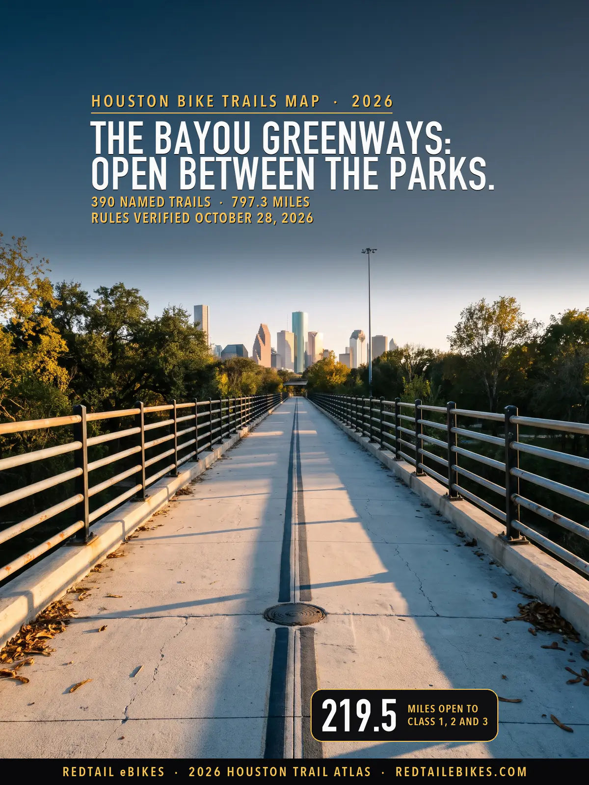
The view along the old MKT railroad trestle over White Oak Bayou toward downtown Houston, on a stretch of the White Oak Bayou Greenway this map reads open to Class 1, 2 and 3 e-bikes, in a scene generated with Playcut from a photograph of the trestle by Patrick Feller.

Green runs along the bayous between the City's parks and through Precinct 4's parks in the west; amber marks City parks and the trails of Precincts 1, 2 and 3, and the gray web in the northeast corner is Kingwood's greenbelt.
Texas settled most of the question in 2019, and Houston's park rules have not all caught up. § 551.106(a) says a city or county "may not prohibit the operation of an electric bicycle" anywhere "the operation of a nonelectric bicycle is permitted", unless the path is closed to motor vehicles and "has a natural surface tread made by clearing and grading the native soil without adding surfacing materials".
Several of the bodies that run Houston's trails still post older wording. Harris County's park regulations, effective September 1, 2015, keep every "vehicle" on roads and parking lots and define a vehicle as any device "except a device moved by human power" (§ 4(q), § 7(a)). The Buffalo Bayou Partnership bars "Motorized or electric riding devices" (visitor rules).
Guessing wrong can cost you. The County calls a breach of its park rules "an offense punishable as a Class C misdemeanor" (§ 32), and a Class C misdemeanor carries "a fine not to exceed $500" (Penal Code § 12.23).
This map shows which of Harris County's 797.3 mapped miles of trail and off-street path your e-bike may ride today, where a posted rule and state law disagree, and who says so. It ties 6,549 pieces of trail, counted once, to the body that runs each one, all but 60.3 miles whose records name none, and you can download the whole of it in the trail register.
For the rest of the state's e-bike law, read Texas e-bike laws, and for trails outside Houston, the Texas e-bike trail atlas. E-bike trails by state compares the states, and the same method maps New York City's bike paths, Los Angeles's trails and Chicago's.
Takeaway
Your e-bike may ride 219.5 of this map's 797.3 miles on rules that state law and the manager agree on, and 14.5 miles are closed by a published rule. The other 563.3 miles are amber or gray: a posted rule reads against state law there, or no rule could be read, so the sign at the trailhead is your best guide.
In this guide
- How to read the map
- Who decides on each trail in Harris County
- The Bayou Greenways: open between the parks
- Buffalo Bayou Park: a ban that reads against state law
- Memorial Park: closed single track, contested paths
- City of Houston parks and paths
- Harris County's precinct trails
- Kingwood, The Woodlands and the districts
- Sam Houston National Forest and state parks
- What the Legislature tried in 2025
- Houston bike trails riders ask about
- Harris County trails, precinct by precinct
- Where riders get caught out
- Streets, bike lanes and sidewalks
- Choosing an e-bike for Houston's trails
- Frequently asked questions
How to read the map
Find your trail's color, then find whose ground it crosses. Green is open to Class 1, 2 and 3. Amber means the body that runs the path posts a rule that keeps e-bikes off where state law says it may not, or a rule that reaches e-bikes on only one reading. Dashed red is closed by a published rule on ground the state lets a manager close, and gray means no e-bike rule could be read.
| Color on the map | What it means | Miles | Share |
|---|---|---|---|
| Green | Open to Class 1, 2 and 3: the manager posts no rule against e-bikes, or allows them, and state law agrees | 219.5 | 28% |
| Amber | Contested: the manager posts a rule that keeps e-bikes off, on ground where state law bars a city or county from doing so, or a rule that reaches e-bikes on only one reading | 312.1 | 39% |
| Dashed red | Closed to e-bikes: a published rule closes it, on ground the state lets a manager close (a natural-surface path, or a path closed to every bicycle) | 14.5 | 2% |
| Gray | Not established: no e-bike rule could be read for the path's manager, no record names one, or the surface the rule turns on is not on record | 251.2 | 31% |
Texas draws no class line on trails. § 551.106(a) speaks of "an electric bicycle", and every rule this map applies treats a Class 1, a Class 2 and a Class 3 alike, so one color serves all three classes. The class still matters for the rider: a Class 3 operator must be "at least 15 years of age" (§ 551.107(c)).
Surface decides the most for your ride. The state's one exception is the natural-surface path, so a manager's ban holds on a dirt trail you ride and reads against state law on a paved or gravel one. Where the records show no surface for a City of Houston path and no posted rule could be read, the map draws it gray, because a natural-surface stretch could lawfully be closed.
Each line comes from one of seven sources, counted once where two draw the same ground: the Houston Parks Board's Bayou Greenway trails, its other trails and trails by others, Harris County's trail file, the City of Houston's bikeway file, the Houston-Galveston Area Council's bikeway network and OpenStreetMap. Streets, on-street bike lanes and proposed paths are left off; their rules are under Streets, bike lanes and sidewalks.
The map stops at the Harris County line. The Woodlands Township's pathways inside the county are on it, and the rest of The Woodlands, Sam Houston National Forest and the state parks outside the county are covered in their own sections below.
Who decides on each trail in Harris County
The body that runs the ground under your trail writes its e-bike rule, and state law limits what a city or county may write. In Harris County that body is the Houston Parks Board, the City of Houston and the conservancies that run its big parks, one of the County's four commissioner precincts, another city, a homeowners' association, a management or utility district, or a federal agency.
Each row is rounded to a tenth of a mile on its own, so the rows can add to a tenth more or less than the 797.3 miles counted once.
The limit that protects your ride binds a "local authority", which § 541.002(3) defines as "a county, municipality, or other local entity authorized to enact traffic laws under the laws of this state". The City of Houston and Harris County are local authorities, and so are the other cities you ride through.
The state also keeps an e-bike out of the motor-vehicle category. § 541.201(11) defines a motor vehicle and adds: "The term does not include an electric bicycle or an electric personal assistive mobility device". A rule that keeps "motor vehicles" off a trail therefore does not, by the state's definition, reach your e-bike; the managers quoted below read their own rules more widely.
Amber trails, read both ways
The amber paths are where a posted rule and state law point different ways, and no court ruling or rule change has settled any of them in the records this map read. Each side below is quoted from the bodies that wrote it.
The managers' side. Harris County's regulations keep every "vehicle" on roads and parking lots and count any device not "moved by human power" as one (§ 4(q), § 7(a)). Precinct 1 posts that "Motorized vehicles are prohibited on grass areas, trails, and sidewalks" (Precinct One), and the City's park rules say "Motorized vehicles prohibited off roadways and beyond parking areas" (HPARD).
The state's side. § 551.106(a)(2) forbids a city or county to prohibit e-bikes where bicycles may ride unless the path is natural-surface, and the County's own regulations say they apply "in addition to, and not in lieu of, all federal, state, and municipal laws" (§ 27). Precinct 4 reads the same county rules and tells riders that "electric bikes are allowed on the trails" (Precinct 4 FAQ).
Until a manager rewrites its rule or a court reads one, your safe course on an amber trail is to follow the sign at the trailhead. A ranger or deputy enforces the posted rule, and if you are ticketed, you argue it in court, after the ride.
Takeaway
Before you ride a path for the first time, find out who runs it. On green ground the manager and the state agree you may ride; on amber ground they disagree, and the trail register names the body and its rule for every trail whose records name one.
The Bayou Greenways: open between the parks
Your Class 1, 2 or 3 e-bike may ride 91.2 of the 154.2 miles the Houston Parks Board maps as its Bayou Greenway trails, and 54.8 more read amber where a greenway runs through a City park or the Buffalo Bayou Partnership's ground. Outside the parks no manager posts an e-bike rule this map could read, and state law bars the City from adding one on a path open to bicycles.

Each greenway runs green outside the parks it crosses and turns amber in the City's parks and in Precinct 1, 2 and 3 parks; Greens Bayou's gray is a North Houston District reach and a stretch the records draw without a surface.
| Greenway | Mapped miles | Open | Contested | Not established |
|---|---|---|---|---|
| Brays Bayou Greenway | 49.0 | 22.0 | 26.9 | 0.0 |
| Buffalo Bayou Greenway | 26.6 | 13.7 | 12.9 | 0.0 |
| Sims Bayou Greenway | 24.7 | 20.3 | 4.4 | 0.0 |
| White Oak Bayou Greenway | 17.8 | 12.6 | 5.2 | 0.0 |
| Greens Bayou Greenway | 15.5 | 5.7 | 1.6 | 8.2 |
| Hunting Bayou Greenway | 10.2 | 7.8 | 2.4 | 0.0 |
| Halls Bayou Greenway | 8.0 | 6.7 | 1.4 | 0.0 |
| San Jacinto Bayou Greenway | 2.5 | 2.5 | 0.0 | 0.0 |
| All eight | 154.2 | 91.2 | 54.8 | 8.2 |
Each figure is rounded to a tenth of a mile on its own, so a row's columns can add to a tenth more or less than its total.
Much of the greenway you ride is City parkland. The City's parks layer lists Braeswood Parkway beside Brays Bayou, where the map counts 18.4 miles of trail, and the MacGregor, T.C. Jester and Watonga parkways as "Linear Park/Greenway" parks, so the parks department's motor-vehicle rule reaches the trail there.
For the most open riding, Sims Bayou has the highest open share, 20.3 of its 24.7 greenway miles. Brays carries the most open miles, 22.0, in stretches between the parkways, and the Buffalo and White Oak greenways add 13.7 and 12.6.
The Parks Board publishes the trails, and the City's parks department says it maintains trails that "loop within parks or run along streets and bayous" (Trails). Neither the Parks Board's cycling pages nor the department's trails page, read on October 28, 2026, names an e-bike rule, so outside the parks the state's rule decides (§ 551.106(a)).
Local speed rules still bind you. The state lets a city or county "establish speed limits for bicycles on paths set aside for the exclusive operation of bicycles and other paths on which bicycles may be operated" (§ 551.106(b)(2)), and those limits reach your e-bike as a bicycle.
Buffalo Bayou Park: a ban that reads against state law
The Buffalo Bayou Partnership bars "Motorized or electric riding devices" in Buffalo Bayou Park (visitor rules), and state law bars the City from banning e-bikes on the park's paved paths, so the map draws the park's 11.5 miles amber. If you ride there, the posted rule is the one a ranger will enforce on you.
The Partnership's own page calls Buffalo Bayou Park "the 160-acre green space just west of downtown Houston" (Buffalo Bayou Park), and the City's parks layer lists it as a City park. Its visitor rules list as prohibited "Motorized or electric riding devices with the exception of mobility aids as defined by the Americans with Disabilities Act (ADA)" (visitor rules).
You have less room on a bike in the park than its trail count suggests. The Partnership says "Buffalo Bayou Park asphalt trails from Shepherd to Sabine Street are for walkers/runners only" (cycling tips), so no bicycle, electric or not, belongs on those, and it asks cyclists to "Reduce speed under 10 mph and maintain a 3-foot distance from pedestrians" (cycling tips).
Plan your ride around two sets of hours: "Lighted areas: 6 AM-11 PM Other areas: Dawn to dusk" (park hours).
The Partnership's rules reach past the park. Its visitor page speaks for the parks and trails "along the waterway between Shepherd Drive and the Port of Houston Turning Basin" (visitor information), and its Downtown page repeats the ban on "Motorized or electric riding devices" (Buffalo Bayou Downtown). The map draws the Buffalo Bayou trail from Shepherd Drive east amber too, 6.5 more miles; west of Shepherd Drive the greenway reads green outside Memorial Park.
Memorial Park: closed single track, contested paths
Memorial Park's natural-surface trails are closed to e-bikes, and its other 12.7 mapped miles are amber. The Memorial Park Conservancy, which runs "1,100 of the Park's 1,500 acres" (About), says "Motorized bikes and e-bikes are not permitted" (FAQ).

The dashed red lines are the park's natural-surface trails, most of them the Conservancy's southside trail system, closed to every e-bike; the amber lines are the paths where the Conservancy's ban reads against state law.
On the dirt trails, the Conservancy's ban holds against your e-bike. Its trails page says "Electric or motorized vehicles such as motorized bikes are strictly prohibited in Memorial Park's southside trail system" (trails page), and those trails are the kind of natural-surface path the state lets a manager close (§ 551.106(a)(2)). The map draws the park's 6.9 miles of natural-surface trail dashed red, most of it the southside system.
On the paved and gravel paths the same ban reads against state law, so the map draws them amber. Three places are closed to every bicycle: the Conservancy keeps bikes off "the Seymour Lieberman Trail and Cullen Timing Track" (FAQ), and of the Clay Family Eastern Glades trails it says "Bicycles are not allowed on these trails" (trails page).
City of Houston parks and paths
On the City's off-street paths outside its parks your e-bike may ride 24.1 mapped miles, and inside City parks, the linear parks along the bayous included, the parks department's motor-vehicle rule makes 77.9 miles amber. The parks department says it "maintains over 163.12 miles of trails that loop within parks or run along streets and bayous" (Trails).
The parks department posts "Motorized vehicles prohibited off roadways and beyond parking areas" and "Scooters and skateboards prohibited" (park rules). The state says an e-bike is not a motor vehicle (§ 541.201(11)), so the first rule reads one way in the park's words and another in the state's; the map draws Hermann Park, the Willow Waterhole Greenway, the bayou parkways and the City's other parks amber.
City parks keep short hours, so time your ride. "City of Houston Parks are open from Dawn to Dusk unless otherwise posted" (park rules), so a sunrise or after-work ride inside a park can start or end outside its hours.
The night curfew covers scooters, not e-bikes
The City Council passed a curfew in November 2025 that bans riding micromobility devices and off-highway vehicles on "public roadways, streets, alleys, sidewalks, trails, and city parks within the Houston city limits between the hours of 8 p.m. and 4 a.m." (Chapter 45 FAQ). The City says "The ordinance became effective after passage by City Council and the Mayor" (press release, November 19, 2025).
Your e-bike falls outside it, whatever time you ride. The City's own answer to what counts as a micromobility device says "The term does not include all-terrain vehicles (although ATVs are subject to the regulations in this ordinance), mopeds, motorcycles, electric bicycles" (Chapter 45 FAQ). A park's own closing hour still applies to you.
Paths whose rule the map could not settle
Most of the gray you meet inside the city is City path with no surface on record (49.5 mi). On a paved or gravel stretch the state's rule would open it, and on a dirt stretch the City could close it; the City's code, which would say whether it has, could not be read on October 28, 2026.
The rest of the gray inside the city belongs to management and utility districts, the Houston Public Works department and the Harris County Flood Control District, none of which posts an e-bike rule this map could read (37.5 mi together).
Harris County's precinct trails
Each of the County's four commissioner precincts runs its own parks and trails, and they read the County's 2015 regulations differently: Precinct 4 opens its trails to e-bikes, and Precincts 1, 2 and 3 post rules that read against state law. The difference is 85.5 open miles on one side of a precinct line and 178.1 amber miles on the other.
| Precinct | Mapped miles | Open | Contested | Closed or not established |
|---|---|---|---|---|
| Precinct 1 (Rodney Ellis) | 178.6 | 61.6 | 96.8 | 20.3 |
| Precinct 2 (Adrian Garcia) | 157.4 | 53.3 | 58.2 | 45.9 |
| Precinct 3 (Tom S. Ramsey) | 287.1 | 2.9 | 128.9 | 155.4 |
| Precinct 4 (Lesley Briones) | 174.1 | 101.8 | 28.2 | 44.1 |
Precinct 4 opens its trails
Precinct 4, which runs Terry Hershey Park and George Bush Park on the west side, tells riders: "Motorized vehicles are not permitted. However, electric bikes are allowed on the trails." (Precinct 4 FAQ). Its prohibited list names "Motorized vehicles off pavement" (park rules), so stay on the paved trails.
Terry Hershey Park "spans 496 acres, with over 11 miles of trail" (Terry Hershey Park); the map counts 18.7 miles of mapped line inside the park, its loops and spurs included. George Bush Park adds 16.9 mapped miles.
Precincts 1, 2 and 3 post the older rule
Precinct 1 says "Motorized vehicles are prohibited on grass areas, trails, and sidewalks" (Precinct One), and Precinct 3 that "Vehicles are restricted to designated roads and parking areas" (Precinct 3). Precinct 2 lists "Motorized vehicles off pavement" among its prohibited activities (Precinct 2), and the County's regulations keep vehicles off its trails too.
The County's regulations are the common text. They were adopted under "chapter 320 of the Texas Local Government Code for parks owned, operated, or maintained by the County" (§ 1) and took effect September 1, 2015, four years before the Legislature wrote today's e-bike rule. The map draws these precincts' trails amber: 41.0 miles in Precinct 1, 38.2 in Precinct 2 and 99.0 in Precinct 3.
On a county hike-and-bike trail you must also slow when you pass walkers: "A bicyclist using a hike and bike trail shall not exceed the posted speed limit while passing a pedestrian using the hike and bike trail" (§ 24).
Jesse H. Jones Park is closed to every bike
In Precinct 3's Jesse H. Jones Park and Nature Center, the County's rules say "Bicycles, skates, and skateboards allowed on Spring Creek Greenway only" (§ 24). A path closed to your pedal bicycle is closed to your e-bike too, with no state-law question, so the map draws the park's 6.5 miles dashed red.
Kingwood, The Woodlands and the districts
Kingwood's greenbelt trails, 82.1 mapped miles in the northeast, read gray, and The Woodlands Township's pathways inside Harris County read amber. Both run on ground owned by an association or a township, where the state's rule for cities and counties may not reach.
Kingwood's greenbelt
The greenbelt trails run through land the records give to Kingwood's village associations and the Kingwood Service Association, and no e-bike rule for the greenbelt could be read. The Service Association's park rules govern "parks owned, operated, or maintained by KSA for the recreation and enjoyment of the Kingwood residents" (KSA park rules).
Those rules define a vehicle as any device "except devices moved by human power" and say "No person shall operate a vehicle within a park except on the roads or parking lots" (definitions, vehicles). An association is a private owner, so the state's limit on cities and counties may not protect you there; the map draws its own parks amber and the greenbelt gray.
The Woodlands Township
The Township's order makes it "unlawful for any person to operate a Motor Vehicle on a Pathway", and defines a motor vehicle as any device "except devices moved by human power" (Order 019-09, definitions). It covers "the paved and unpaved area that comprises the Township Pathway System" (Order 019-09).
Writing about the state law on electric scooters, the Township's pathways page says that law "only extends to counties and municipalities" (Pathways) and that its pathways "are owned by The Woodlands. Therefore, motorized vehicles are prohibited from using the pathways." (Pathways). Whether the Township is an "other local entity authorized to enact traffic laws" (§ 541.002(3)) is the open question, so the map draws its 23.5 miles in Harris County amber.
Districts and other cities
Other cities in the county run 47.2 mapped miles, most of it open: Pasadena, Seabrook, La Porte and Bellaire among them. Management districts, utility districts and the Exploration Green Conservancy in Clear Lake run more, and none posts an e-bike rule this map could read.
Sam Houston National Forest and state parks
Sam Houston National Forest's 85 miles of multiple-use trail, open to registered off-highway vehicles, take Class 1, 2 and 3 e-bikes under the Forest Service's rule, and Texas state parks keep e-bikes off their trails. Both are run by agencies whose rules come from their own law, so the state's limit on cities and counties does not protect your ride there.
The Forest Service says "Class 1, 2, and 3 e-bikes are allowed on motorized trails and roads on national forests and grasslands" (Forest Service). The Sam Houston's trail system offers "85 miles of multiple-use trails designated and developed for hiking, biking, horses, and registered Off-Highway Vehicles (OHVs)" (Sam Houston multiple-use trails).
The forest's page lists a $5 daily or $25 annual trail pass. If you ride the forest's trails, browse our mountain e-bikes, and e-bike laws on public land explains how national forests and other federal ground decide.
Texas Parks and Wildlife says "E-bikes are allowed on public roadways but not on park trails" (Biking in state parks) and "Electric bicycles are not allowed on park trails" (Specialty vehicles). That includes Sheldon Lake State Park, whose lines in the department's trail file are marked for hiking, one short path aside.
Lake Houston Wilderness Park, "located three miles east of New Caney (approximately 30 miles north of Houston)" (Lake Houston Wilderness Park), is a City of Houston park: the parks department says "All the trails are bike accessible" (Lake Houston Wilderness Park), and its motor-vehicle rule reads against state law there as it does in town. For how federal, state park and rail-trail managers decide across the country, see e-bike trails near me.
On Corps of Engineers land at the Addicks and Barker reservoirs, federal rules apply "to all vehicles, including ... bicycles" and allow riding off roadways only "at locations and times designated by the District Commander" (36 CFR § 327.2). Where the Corps leases the land to the City or County, "all applicable Federal, state and local laws and regulations remain in full force and effect" (§ 327.1(e)).
What the Legislature tried in 2025
Two 2025 bills would have let cities, counties and state agencies regulate e-bikes on any path or trail, and both died in committee, so the 2019 rule stands. House Bill 4089 and Senate Bill 1865, filed in the 89th Legislature's regular session, carried the same text.
Each would have added a § 551.108: "Notwithstanding any other law, a state agency or a political subdivision of this state may regulate the operation of an electric bicycle on a path or trail on public land under the state agency's or political subdivision's jurisdiction" (HB 4089, SB 1865).
Neither passed. The House bill's record ends "Last Action: 05/08/2025 H Left pending in committee" (HB 4089 history), and the Senate bill's "Last Action: 03/17/2025 S Referred to Transportation" (SB 1865 history). None of the 9,456 House and Senate bills filed in the 2025 regular and two called sessions that this map's sweep read changed the e-bike rules.
The state parks tried their own change first. In 2022, Parks and Wildlife staff proposed rules that "would allow the use of ebikes on trails and paths unless specifically prohibited by posted signage or printed instruction" (Commission item, November 3, 2022); the Commission's page marks the item withdrawn.
The next chance for a change that reaches your ride comes in 2027. The Legislature convenes "in regular session at 12 noon on the second Tuesday in January of each odd-numbered year" (Government Code § 301.001), which is January 12, 2027.
Takeaway
Texas has not changed its e-bike trail rule since 2019, and the 2025 bills that would have handed the decision to every city, county and agency died in committee. Check this map again after the 2027 session.
Houston bike trails riders ask about
These are the trails Houston riders search for and ask about, with what the map reads on each. A trail's miles here count every mapped line that carries its name, so one stretch can count under two names, and the column does not add up to the map's total.
| Trail | Mapped miles | What the map reads | Who runs most of it |
|---|---|---|---|
| Brays Bayou Greenway | 51.8 | Open 22.2 · contested 28.1 · not established 1.5 | City of Houston parks; Houston Parks Board |
| Buffalo Bayou Greenway | 27.0 | Open 13.7 · contested 13.2 | Harris County Precinct 4; Buffalo Bayou Partnership |
| White Oak Bayou Greenway | 36.0 | Open 12.7 · contested 22.8 · not established 0.5 | Harris County Precinct 1; Houston Parks Board |
| Sims Bayou Greenway | 25.0 | Open 20.4 · contested 4.4 · not established 0.2 | Houston Parks Board; City of Houston parks |
| Greens Bayou Greenway | 15.9 | Open 5.7 · contested 1.7 · not established 8.5 | Houston Parks Board; North Houston District |
| Hunting Bayou Greenway | 10.8 | Open 7.8 · contested 2.8 · not established 0.2 | Houston Parks Board; City of Houston parks |
| Halls Bayou Greenway | 10.3 | Open 6.7 · contested 3.5 · not established 0.2 | Houston Parks Board; Harris County Precinct 2 |
| Heights Hike & Bike Trail | 2.6 | Open 2.6 | City of Houston |
| Columbia Tap | 4.2 | Open 4.2 | City of Houston |
| Terry Hershey Park Hike & Bike Trail | 3.9 | Open 2.7 · contested 0.9 · not established 0.4 | Harris County Precinct 4; City of Houston parks |
| Anthills | 7.1 | Open 6.8 · not established 0.3 | Harris County Precinct 4; City of Houston |
| George Bush Park Hike & Bike Trail | 16.3 | Open 16.2 · not established 0.1 | Harris County Precinct 4; City of Houston |
| Spring Creek Greenway | 23.4 | Contested 23.0 · not established 0.4 | Harris County Precinct 3; The Woodlands Township |
| Cypress Creek Greenway | 10.2 | Contested 9.1 · not established 1.1 | Harris County Precinct 3; No manager on record |
| Kingwood Trails | 86.4 | Contested 1.2 · not established 85.3 | Kingwood village associations; City of Houston |
| Hermann Park | 4.0 | Contested 4.0 | City of Houston parks |
| Bay Area Hike & Bike Trail | 12.4 | Open 0.2 · contested 12.0 · not established 0.2 | Harris County Precinct 2; City of Houston |
| Armand Bayou Hike and Bike Trail | 5.4 | Open 4.4 · contested 0.7 · not established 0.2 | Pasadena; Harris County Precinct 2 |
| Jesse H. Jones Park trails | 5.1 | Closed 5.1 | Harris County Precinct 3 |
The Heights Hike and Bike Trail and the Columbia Tap are City paths outside parks, and you may ride them on any class.
The White Oak Bayou Greenway reads green between parks and amber through the T.C. Jester and Watonga parkways and the other City parks along it. Its row also counts the White Oak Bayou trails northwest of the greenway, in unincorporated Harris County and Jersey Village, which the regional records give to Precinct 1 and which read amber under the County's park rules.
The Memorial Park "hike and bike trailhead" searches lead to a park where the paved and gravel paths read amber, the natural-surface trails are closed and the Seymour Lieberman Trail is closed to every bicycle. North of the city, the Spring Creek and Cypress Creek greenways are Precinct 3 trails and read amber.
Harris County trails, precinct by precinct
The four commissioner precincts divide the county, and each map below shows the trails inside one of them, whoever runs them. The precinct is a place on the map here, not the body that decides: on a City path in Precinct 1 you follow the City's rule.
Precinct 1
Precinct 1 (Commissioner Rodney Ellis) holds 178.6 mapped miles of trail and path: 61.6 open, 96.8 contested and 20.3 not established.

The bayou greenways carry most of Precinct 1's green; the amber stretches are City parks, the Buffalo Bayou Partnership's trails and the precinct's own park trails.
| Trail | Mapped miles | What the map reads |
|---|---|---|
| Brays Bayou Greenway | 24.6 | Open 5.9 · contested 18.8 |
| Sims Bayou Greenway | 16.8 | Open 13.8 · contested 2.9 |
| White Oak Bayou Greenway | 14.2 | Open 9.8 · contested 4.5 |
| White Oak Bayou Trails | 10.1 | Contested 10.1 |
| Buffalo Bayou Greenway | 7.7 | Contested 7.7 |
| Halls Bayou Greenway | 7.2 | Open 6.5 · contested 0.7 |
| Greens Bayou Greenway | 6.8 | Open 2.5 · contested 1.5 · not established 2.8 |
| Hunting Bayou Greenway | 4.9 | Open 4.0 · contested 0.9 |
| Hermann Park | 4.0 | Contested 4.0 |
| Tom Bass Park Trails | 3.8 | Contested 3.8 |
| Columbia Tap | 3.7 | Open 3.7 |
| Hill at Sims | 3.1 | Contested 3.1 |
Every other Precinct 1 trail in the register (103 named trails, 71.7 mi), by its main color
Open to Class 1, 2 and 3 (green) (30)
- Heights Hike & Bike Trail (2.6 mi)
- CenterPoint Trail (1.7 mi)
- Nicholson St (1.6 mi)
- Almeda Rd (1.4 mi)
- Holly Hall St (1.3 mi)
- Vogel Creek Greenway (1.2 mi)
- Columbia Tap Rail Trail (0.4 mi)
- Bike Track (0.3 mi)
- Brays Oaks Trail (0.3 mi)
- Westbrae Parkway Hike & Bike Trail (0.3 mi)
- Harris Gully Connection (0.2 mi)
- Oliver Street Trail (0.2 mi)
- Heights Blvd Connector Trail (0.2 mi)
- Cambridge St (0.2 mi)
- Wastewater Plant (0.1 mi)
- Victory Drive to Arncliffe Dr (0.1 mi)
- White Oak Bayou Greenway (NHHIP) (0.1 mi)
- Studemont St (0.1 mi)
- Main St (0.1 mi)
- Heights Blvd Trail (under 0.1 mi)
- Centerpoint Trail (under 0.1 mi)
- Brays Bayou Hike & Bike Trail (under 0.1 mi)
- Keegan's Bayou Trail (under 0.1 mi)
- M-K-T Trail (under 0.1 mi)
- Halls Bayou Greenway Trail (under 0.1 mi)
- Connection to Rankin (under 0.1 mi)
- South Trail (under 0.1 mi)
- Bretshire to Hirsch (under 0.1 mi)
- Hillcroft Avenue (under 0.1 mi)
- Almeda Road (under 0.1 mi)
Contested (amber) (49)
- Newcastle St (2.1 mi)
- Matt's Trail (1.9 mi)
- Kevin Shanley Trail (1.8 mi)
- Greater Greenspoint Management District Shared Use Path (1.7 mi)
- Scott Street Greenway (1.4 mi)
- Kinder Foundation Trail (1.4 mi)
- Cullen Foundation Trail (1.2 mi)
- Macgregor Park (1.2 mi)
- Sunnyside Park (0.9 mi)
- Adair Park Trails (0.9 mi)
- Hail Cesar! 2.0 (0.8 mi)
- White Oak Bayou (0.8 mi)
- Overlook Trail (0.7 mi)
- Willow Waterhole (0.6 mi)
- White Oak H&B Trail (Pct 1) (0.6 mi)
- Brown Foundation Trail (0.6 mi)
- Hunting Bayou (0.5 mi)
- Slowpoke Rodriguez (0.5 mi)
- Audubon Trail (0.5 mi)
- Hutcheson Park (0.5 mi)
- Mercer Trails (0.4 mi)
- John M. O'Quinn Foundation Trail (0.4 mi)
- Herman Brown Park Bike & Hike Trail (0.4 mi)
- Lake Forest Park Trails (0.3 mi)
- Brays Bayou (0.3 mi)
- Halls Bayou Connection (0.3 mi)
- Doctor Alma Allen Bridge (0.2 mi)
- Beech-White Park (0.2 mi)
- Little Thicket Park (0.2 mi)
- Kerr Park Connection (0.1 mi)
- Donald Perkins Trail (0.1 mi)
- Buffalo Bayou (0.1 mi)
- Buffalo Bayou North Trail (0.1 mi)
- Karankawa Trail (0.1 mi)
- Pier Trail (0.1 mi)
- Silo Ridge (0.1 mi)
- Turner Park (0.1 mi)
- West Tidwell Park (0.1 mi)
- Sabine Street Trail (0.1 mi)
- Spotts Park Trail (0.1 mi)
- Gator Run (0.1 mi)
- Sabine Street Bridge (under 0.1 mi)
- Akokisa Trail (under 0.1 mi)
- Allen Parkway Crossing (under 0.1 mi)
- Stude Park Path (under 0.1 mi)
- Montrose Pedestrian Bridge (under 0.1 mi)
- Sesquicentennial Park (under 0.1 mi)
- Old Sixth Ward Trail (under 0.1 mi)
- Ellis Island Trail (under 0.1 mi)
- Unnamed paths (23.1 mi)
Not established (gray) (24)
- Deussen Pkwy (2.6 mi)
- Wheeler St (1.7 mi)
- The Ray (1.3 mi)
- Cypress Creek Greenway (1.0 mi)
- Fondren Channel Trail (0.7 mi)
- Tall Pines Trail (0.6 mi)
- Keegans Bayou Trail (0.6 mi)
- Gears Rd to Greens Parkway (0.5 mi)
- Houston International Promenade Trail (0.5 mi)
- Existing Sidewalks (0.5 mi)
- Sims Bayou (0.2 mi)
- Greens Bayou (0.2 mi)
- Holcombe Blvd (0.2 mi)
- Tierwester St (0.2 mi)
- White Oak Bayou Hike & Bike Trail (0.2 mi)
- Halls Bayou (0.1 mi)
- La Branch St (0.1 mi)
- Polk Street Bikeway (0.1 mi)
- Southeast TC (0.1 mi)
- Prairie St (0.1 mi)
- West Airport Trail (0.1 mi)
- Schweikhardt Ped Bridge (0.1 mi)
- Gray St Bikeway (under 0.1 mi)
- 11th St Bikeway (under 0.1 mi)
Precinct 2
Precinct 2 (Commissioner Adrian Garcia) holds 157.4 mapped miles of trail and path: 53.3 open, 58.2 contested and 45.9 not established.

Green runs through Pasadena and along the greenways; the Bay Area Hike and Bike Trail is a Precinct 2 trail and reads amber.
| Trail | Mapped miles | What the map reads |
|---|---|---|
| Bay Area Hike & Bike Trail | 12.2 | Contested 12.0 · not established 0.2 |
| Greens Bayou Greenway | 8.7 | Open 3.2 · contested 0.2 · not established 5.4 |
| Sims Bayou Greenway | 8.0 | Open 6.5 · contested 1.5 |
| Brays Bayou Greenway | 7.5 | Open 4.5 · contested 2.9 · not established 0.1 |
| Clear Lake Trail | 7.0 | Contested 1.0 · not established 5.9 |
| Hunting Bayou Greenway | 5.4 | Open 3.8 · contested 1.6 |
| Armand Bayou Hike and Bike Trail | 5.0 | Open 4.0 · contested 0.7 · not established 0.2 |
| Southbelt Hike & Bike Trail | 4.3 | Contested 4.3 |
| Herman Brown Park Trails | 3.6 | Contested 3.3 · not established 0.3 |
| Buffalo Bayou Greenway | 3.0 | Contested 3.0 |
| Exploration Green Trail | 2.9 | Not established 2.9 |
| Strawberry Trail | 2.8 | Open 2.5 · contested 0.2 |
Every other Precinct 2 trail in the register (81 named trails, 87.1 mi), by its main color
Open to Class 1, 2 and 3 (green) (22)
- Lynn Gripon to Challenger Connector (1.6 mi)
- Clear Creek Trail (1.5 mi)
- Harrisburg-Sunset Trail (1.5 mi)
- White Oak Bayou Greenway (1.5 mi)
- Egret Bay Blvd Cycle path (0.9 mi)
- Armand Bayou Hike and Bike Trail (Fairmont) (0.4 mi)
- Bayou Rd (0.4 mi)
- US 59 Eado Trail (0.4 mi)
- E-Meyer Trail (0.3 mi)
- S Jensen Dr (0.2 mi)
- Bay Area Hike and Bike Trail (0.2 mi)
- University Dr S (0.1 mi)
- Nature Trail (0.1 mi)
- N Loop E Frwy (under 0.1 mi)
- Cavalcade Street (under 0.1 mi)
- Reveille Park Connections and SI02 Rebuild (under 0.1 mi)
- Sims Bayou (under 0.1 mi)
- Botanic Gardens (under 0.1 mi)
- Red Bluff Trail (under 0.1 mi)
- Stuart Park to FM Law Park (under 0.1 mi)
- Heritage East Trail (under 0.1 mi)
- Commerce-Elysian Bikeway (under 0.1 mi)
- Unnamed paths (44.4 mi)
Contested (amber) (23)
- Keith Wiess Park (2.7 mi)
- Mason Park Trails (2.1 mi)
- Halls Bayou Hike & Bike Trail (1.7 mi)
- Carpenters Bayou Hike & Bike Trail (1.7 mi)
- Aldine Mail Road Sidewalks (1.2 mi)
- Mount Houston Road Pedestrian Walkway (0.9 mi)
- Halls Bayou Greenway (0.8 mi)
- Little White Oak Bayou (0.8 mi)
- Clear Lake Park Hike & Bike Trail (0.6 mi)
- Ella Hike & Bike Trail (0.6 mi)
- Goose Creek Trail (phase 2) (0.6 mi)
- Gus Wortham Park (0.5 mi)
- Tony Marron Park Trails (0.4 mi)
- Halls Bayou (0.4 mi)
- Todville Road Hike/bike Trail (0.4 mi)
- Ingrando Park (0.3 mi)
- Botanic Gardens Access (0.3 mi)
- Buffalo Bayou (0.3 mi)
- North Channel Hike & Bike Trail (0.2 mi)
- Garver Park (0.1 mi)
- Herman Brown Park (0.1 mi)
- Mason Park (under 0.1 mi)
- Brays Bayou (under 0.1 mi)
Not established (gray) (36)
- Brays Bayou Path (2.1 mi)
- Maxey Rd Sidewalks (1.7 mi)
- El Dorado Trail (1.4 mi)
- Red Bluff Hike & Bike Trail (1.4 mi)
- Crenshaw Rd Hike & Bike Trail (1.1 mi)
- Baytown Hike & Bike Trail (phase 2) (1.0 mi)
- Pine Brook Trail (0.9 mi)
- Gator Run (0.8 mi)
- East side trail Clear Creek (0.7 mi)
- Lounge Car (0.6 mi)
- W Hendrick St (0.5 mi)
- Fulton St (0.5 mi)
- N-Gauge (0.3 mi)
- Coyote Gulch Exit Trail (0.3 mi)
- Me So Thorny Exit Trail (0.3 mi)
- FM 270 Bicycle and Pedestrian Improvements (0.3 mi)
- Goose Creek Trail in Bayton (0.3 mi)
- City of Houston Super Neighborhood Action Plan (0.3 mi)
- Navigation Blvd (0.2 mi)
- Harrisburg Blvd (0.2 mi)
- Okay Corral (0.2 mi)
- Greens Bayou (0.2 mi)
- Windmill Lakes (0.2 mi)
- Bay Area Blvd (0.2 mi)
- Me So Thorny (0.2 mi)
- Oxbow Bluff (0.2 mi)
- Pinckney Trail (0.1 mi)
- Gulf Fwy. Ped Bridge (0.1 mi)
- Goose Creek Trail (0.1 mi)
- Paige St (0.1 mi)
- Trail Crossing (0.1 mi)
- N Bastrop St (0.1 mi)
- Hays St (0.1 mi)
- Coyote Gulch (under 0.1 mi)
- Hardy Rd (under 0.1 mi)
- Hardy St (under 0.1 mi)
Precinct 3
Precinct 3 (Commissioner Tom S. Ramsey) holds 287.1 mapped miles of trail and path: 2.9 open, 128.9 contested, 7.6 closed and 147.7 not established.

Precinct 3 holds the most amber and the most gray: the precinct's own trails along Spring and Cypress creeks, and Kingwood's greenbelt in the east.
| Trail | Mapped miles | What the map reads |
|---|---|---|
| Kingwood Trails | 81.0 | Contested 1.1 · not established 79.9 |
| Spring Creek Greenway | 23.0 | Contested 22.9 |
| Spring Creek Nature Trail | 10.6 | Contested 6.5 · closed 1.0 · not established 3.1 |
| Cypress Creek Greenway | 9.3 | Contested 8.7 · not established 0.6 |
| Collins Bike Trails | 9.0 | Contested 8.7 · not established 0.3 |
| Turkey Creek Park Trail | 8.9 | Contested 8.1 · not established 0.8 |
| White Oak Bayou Trails | 7.0 | Contested 7.0 |
| Kingwood | 5.5 | Contested 0.1 · not established 5.3 |
| Timber Lane Trail System | 5.4 | Contested 0.1 · not established 5.3 |
| Jesse H. Jones Park trails | 5.1 | Closed 5.1 |
| Cypresswood Park Trails | 4.5 | Contested 4.5 |
| HCFCD 54 Acre Trails | 3.3 | Contested 3.1 · not established 0.2 |
Every other Precinct 3 trail in the register (78 named trails, 114.7 mi), by its main color
Open to Class 1, 2 and 3 (green) (4)
- San Jacinto Bayou Greenway (2.5 mi)
- W Loop S (0.2 mi)
- Terry Hershey (0.1 mi)
- Triway Connection (under 0.1 mi)
Contested (amber) (34)
- Timberlane Hike & Bike Trail (Pct 3) (3.3 mi)
- Faulkey Gully Hike & Bike Trail (2.7 mi)
- Atascocita Hike & Bike Trail (1.6 mi)
- Mercer Trails (1.4 mi)
- Barbecue Run (1.0 mi)
- Cypress Creek Pedestrian Bicycle Path (1.0 mi)
- Gourley Nature Trail (1.0 mi)
- Creekside (0.8 mi)
- Grantwood trail (0.8 mi)
- Bird Blind Trail (0.8 mi)
- 100 Acre Wood North (0.7 mi)
- Emnora Hike & Bike Trail (0.7 mi)
- Waterfall (0.6 mi)
- Cypresswood Equestrian Trail (0.6 mi)
- River Grove Park (0.5 mi)
- Rabbit Run (0.4 mi)
- North Ridge (0.4 mi)
- W Loop N Fwy (0.4 mi)
- Buffalo Bayou Greenway (0.4 mi)
- Happy Trail (0.4 mi)
- Fast and Furious (0.3 mi)
- 100 Acre Wood South (0.3 mi)
- The Old Trail (0.3 mi)
- Rimbender (0.3 mi)
- 8 Ball (0.2 mi)
- Beaver Pond Loop Trail (0.2 mi)
- Judge Lindsay Trail (0.2 mi)
- The Waterfall (0.1 mi)
- The Bowl (0.1 mi)
- The Y Loop (0.1 mi)
- Willow Lane (0.1 mi)
- Xlr8 (0.1 mi)
- SCG Phase III Preliminary Trail (0.1 mi)
- Armadillo Dash (0.1 mi)
- Unnamed paths (68.3 mi)
Closed to e-bikes (dashed red) (3)
- Spring Creet Nature Trail Bypass (0.2 mi)
- Spring Creek (under 0.1 mi)
- Bridge 2 (under 0.1 mi)
Not established (gray) (37)
- Cypress Creek Nature Trail (2.4 mi)
- Bunker Hill Village Trail (2.0 mi)
- Sandpiper Trails (1.8 mi)
- House-Hahl Trail (1.2 mi)
- House Hahl Trail (1.2 mi)
- Briar Branch Trail (1.1 mi)
- Malcomson Hike & Bike Trail (1.1 mi)
- W Lake Houston Pkwy (1.0 mi)
- Mile Loop (1.0 mi)
- Runaway Rickshaw (1.0 mi)
- East End Park (0.9 mi)
- Kings River Dr (0.8 mi)
- YMCA Trails (0.8 mi)
- Water Haven Trail (0.7 mi)
- Spring Branch Trail (0.7 mi)
- Moore (0.6 mi)
- Caligari Equestrian trail (0.6 mi)
- Spring Creek Greenway Trail (0.4 mi)
- Pines Lake Loop (0.4 mi)
- Joiner Pond Trail (0.3 mi)
- Mathewson Ln (0.3 mi)
- High Valley Dr (0.2 mi)
- Northpark Dr (0.2 mi)
- Woodland Hills to US 59 (0.2 mi)
- Shadowdale Dr (0.2 mi)
- Bike Barn Access Trail (0.2 mi)
- West Metzler Gully Traill (0.1 mi)
- Woodway Dr (0.1 mi)
- Majestic Pines Dr (0.1 mi)
- Quail Trail (under 0.1 mi)
- Valley Rim Dr (under 0.1 mi)
- Kingwood Dr (under 0.1 mi)
- Willow Terrace Dr (under 0.1 mi)
- Mill Bridge Way (under 0.1 mi)
- Gunslinger Kids (under 0.1 mi)
- Springrock Lane (under 0.1 mi)
- Bunker Hill Elementary Bridge (under 0.1 mi)
Precinct 4
Precinct 4 (Commissioner Lesley Briones) holds 174.1 mapped miles of trail and path: 101.8 open, 28.2 contested, 6.9 closed and 37.2 not established.

Precinct 4's own parks run green in the west; Memorial Park, inside the precinct's boundary, keeps its own rule.
| Trail | Mapped miles | What the map reads |
|---|---|---|
| Brays Bayou Greenway | 17.1 | Open 11.7 · contested 5.3 |
| Buffalo Bayou Greenway | 15.5 | Open 13.6 · contested 1.9 |
| George Bush Park Hike & Bike Trail | 13.9 | Open 13.9 |
| Mason Creek South Hike & Bike Trail | 7.2 | Open 7.2 |
| Anthills | 7.1 | Open 6.8 · not established 0.3 |
| Archbishop J. A. Fiorenza Park North Hike & Bike Trail | 6.3 | Open 6.3 |
| Addicks Reservoir | 5.9 | Open 0.2 · contested 5.7 |
| Westchase Trails | 4.4 | Not established 4.4 |
| Keegans Bayou Trail | 3.4 | Not established 3.4 |
| Mason Creek Park North Hike & Bike Trail | 3.1 | Open 3.1 |
| Gary & Bonnie Trietsch Hike & Bike Trail | 2.7 | Open 2.7 |
| Spring Branch Trail | 2.5 | Not established 2.5 |
Every other Precinct 4 trail in the register (112 named trails, 84.9 mi), by its main color
Open to Class 1, 2 and 3 (green) (52)
- George Bush Park (2.3 mi)
- Terry Hershey Park Hike & Bike Trail (2.3 mi)
- White Oak Bayou Greenway (2.2 mi)
- Mayde Creek South Hike & Bike Trail (1.8 mi)
- Mason Road Park Hike & Bike Trail (1.7 mi)
- Mayde Creek North Hike & Bike Trail (1.5 mi)
- Westchase Management District Trail North (1.4 mi)
- Richard & Meg Weekley Hike & Bike Trail (1.3 mi)
- Arthur Storey Park (1.0 mi)
- Mike Driscoll Park (1.0 mi)
- McClendon Park (1.0 mi)
- Half Mile Loop (0.7 mi)
- Dumfries Hike & Bike Trail (0.6 mi)
- South Mayde Creek Pedestrian/bike Facility- Harris County Precinct 3 (0.5 mi)
- Donald Perkins Trail (0.4 mi)
- Baker Road Pocket Park Hike & Bike Trail (0.4 mi)
- Nature Trail (0.4 mi)
- Sylvia's Garden (0.3 mi)
- Mason Creek Hike and Bike Trail (0.3 mi)
- Nature Center Trail (0.2 mi)
- Brays Bayou Connector (0.2 mi)
- Picnic Loop (0.2 mi)
- Half Mile Trail (0.2 mi)
- Wetlands Trail (0.1 mi)
- Crossover Trail (0.1 mi)
- George Bush Park H&B Trail (0.1 mi)
- Picnic Trail (0.1 mi)
- Scout Camp Loop (0.1 mi)
- Quail Trail (0.1 mi)
- Scout Camp Trail (0.1 mi)
- Terry Hershey (0.1 mi)
- Art Storey Park (0.1 mi)
- Mason Creek Park Hike & Bike Trail (under 0.1 mi)
- Birdhouse Trail (under 0.1 mi)
- George Bush Hike and Bike Trail (under 0.1 mi)
- Republic Square East Access (under 0.1 mi)
- Reddleshire Connector (under 0.1 mi)
- Republic Square West Access (under 0.1 mi)
- Live Oak Trail (under 0.1 mi)
- Addicks Clodine Road (under 0.1 mi)
- Hillcroft Avenue (under 0.1 mi)
- Windmill Trail (under 0.1 mi)
- Bird Blind Trail (under 0.1 mi)
- Turkey Creek Drive Access (under 0.1 mi)
- White Oak Bayou (under 0.1 mi)
- S. Mayde Creek Access (under 0.1 mi)
- Keegan's Bayou Trail (under 0.1 mi)
- Mason Creek Hike & Bike Trail (under 0.1 mi)
- Mockingbird Trail (under 0.1 mi)
- George Bush Hike & Bike Trail (under 0.1 mi)
- Shortcut (under 0.1 mi)
- Brays Bayou Hike & Bike Trail (Pct 4) (under 0.1 mi)
- Unnamed paths (29.0 mi)
Contested (amber) (16)
- Outer Loop Trail (1.8 mi)
- Terry Hershey Park & Trails (1.6 mi)
- Green Ridge Trail (1.5 mi)
- Cullen Park (1.2 mi)
- W Memorial Loop (1.1 mi)
- Memorial Dr (1.0 mi)
- Hogg Woods Trail (0.9 mi)
- Memorial Park Trail (0.5 mi)
- West Lawn Multi-Use Path (0.3 mi)
- Connector Trails (0.2 mi)
- Brays Bayou (0.2 mi)
- Living Bridge (0.2 mi)
- Gail Reeves Park (0.1 mi)
- Woodway Memorial (0.1 mi)
- Hogg Bird Sanctuary Trail (0.1 mi)
- Terry Hershey Extension (under 0.1 mi)
Closed to e-bikes (dashed red) (8)
- Purple Trail (1.9 mi)
- The Triangle (1.0 mi)
- Blue Trail (0.8 mi)
- Aqua Trail (0.8 mi)
- Orange Trail (0.7 mi)
- Yellow Trail (0.7 mi)
- South Land Bridge Trail (0.5 mi)
- Red Trail (0.2 mi)
Not established (gray) (36)
- Sharpstown Trail (1.8 mi)
- N Eldridge Pkwy (1.4 mi)
- Drainage Corridor (1.2 mi)
- Clay Rd (1.0 mi)
- Katy Fwy (0.8 mi)
- Ashford Point Dr Trail (0.8 mi)
- Citywest Blvd (0.8 mi)
- SH 6 N (0.7 mi)
- Gessner Briarpark Trail (0.6 mi)
- West Line Trail (0.6 mi)
- Elmside Dr (0.6 mi)
- Woodchase (0.6 mi)
- Stoney Brook Dr (0.5 mi)
- Centerpoint Corridor (0.5 mi)
- Keegans Bayou (0.5 mi)
- W Loop N Fwy (0.4 mi)
- South Greenhouse Road Sidepath (0.4 mi)
- Eldridge Detention to McClendon Park (0.3 mi)
- George Bush and Westheimer Connector (0.3 mi)
- W Sam Houston Pkwy S (0.2 mi)
- Westview Connection (0.2 mi)
- Deerwood Road Access (0.2 mi)
- Eldridge Pkwy (0.2 mi)
- Utility Corridor (0.1 mi)
- Richmond Ave (0.1 mi)
- Cohn Bridge (0.1 mi)
- Yorktown St (0.1 mi)
- Stillhollow-Baker Bridge (under 0.1 mi)
- Fiorenza Park (under 0.1 mi)
- Belle Park Bridge (under 0.1 mi)
- Westchase Trail (under 0.1 mi)
- Chatterton Bridge (under 0.1 mi)
- Brays Bayou Connector Trail (under 0.1 mi)
- Fairdale Connection (under 0.1 mi)
- Wortham Foundaiton Bridge (under 0.1 mi)
- Archbishop Joseph A. Fiorenza H&B Trail (under 0.1 mi)
Where riders get caught out
Six mistakes catch riders on Houston's trails, and you can avoid each one by reading its rule before you go. Most come from carrying one manager's rule onto another's ground: a greenway that is open on one side of a park boundary can be amber on the other.
Taking a greenway rule into a park. Between the parks a Bayou Greenway reads open; inside Braeswood Parkway and the City's other parks the rule is "Motorized vehicles prohibited off roadways" (park rules), and from Shepherd Drive east along Buffalo Bayou the Partnership bars "Motorized or electric riding devices" (visitor rules).
Riding Memorial Park's single track. The southside trail system is closed to e-bikes (trails page), and the state lets the Conservancy close a natural-surface trail.
Carrying Precinct 4's welcome north. Precinct 4 says "electric bikes are allowed on the trails" (Precinct 4 FAQ); Precinct 3 restricts vehicles "to designated roads and parking areas" (Precinct 3).
Riding the asphalt in Buffalo Bayou Park. The asphalt trails from Shepherd to Sabine are "for walkers/runners only" (cycling tips), whatever bike you ride.
Staying in a City park after dusk. City parks open "from Dawn to Dusk unless otherwise posted" (park rules); the 8 p.m. curfew covers scooters, and the park's hours cover you.
Riding a motor rated at 750 watts. Texas defines an e-bike by "an electric motor of fewer than 750 watts" (§ 664.001(4)), so a 750-watt motor sits outside the definition, and outside every protection on this page.
Your Houston trail checklist
- Read your bike's label. Texas requires one showing "(1) whether the electric bicycle is a Class 1, Class 2, or Class 3 electric bicycle; (2) the top assisted speed of the electric bicycle; and (3) the motor wattage of the electric bicycle" (§ 664.002(a)).
- Find who runs the path. The trail register names the body for each trail wherever a record names one.
- On green ground, ride any class, slow for walkers, and keep to posted speed limits.
- On amber ground, follow the sign at the trailhead; a ranger enforces it.
- On dirt, expect a closure: the state lets a manager close a natural-surface path.
Streets, bike lanes and sidewalks
On Texas streets your e-bike may ride wherever a bicycle may, and a city or county may not ban it from a road used mainly by cars; the state expressly lets a city or county close sidewalks to every bicycle. The trails on this map are off-street, so these are the rules for the streets you ride between them.
The state says a city or county "may not prohibit the operation of an electric bicycle: (1) on a highway that is used primarily by motor vehicles" (§ 551.106(a)(1)). A bike lane is open to bicycles, so under § 551.106(a)(2) a city may not keep your e-bike out of it either.
Sidewalks are different for you. The same section lets a city or county "prohibit the operation of a bicycle on a sidewalk" (§ 551.106(b)(1)), and a ban on bicycles there covers your e-bike. Houston's own sidewalk rule sits in its city code, which could not be read on October 28, 2026, so look for posted signs downtown.
If you ride a Class 3, you have one more line: Texas says "A person may not operate a Class 3 electric bicycle" unless the person is "at least 15 years of age" (§ 551.107(c)); a younger rider may still ride on one as a passenger, and our kids' e-bikes are a place to start for a rider under 15. For helmets, lights and the rest of the street rules, see Texas e-bike laws.
Choosing an e-bike for Houston's trails
For Houston's trails choose any class you like, as long as the motor is rated at fewer than 750 watts: every rule on this map treats a Class 1, 2 and 3 alike. The choice that matters is the label, and the place you plan to ride.
| Class | What the motor does | Top assisted speed | Youngest rider | Source |
|---|---|---|---|---|
| Class 1 | Assists only while you pedal | 20 mph or less | None in ch. 551 | § 664.001(1) |
| Class 2 | May propel the bike without pedaling (a throttle) | 20 mph or less | None in ch. 551 | § 664.001(2) |
| Class 3 | Assists only while you pedal | More than 20, less than 28 mph | 15 to operate | § 664.001(3), § 551.107(c) |
A Class 2 throttle costs you nothing on these trails. No rule this map read treats a throttle differently from pedal assist, and Texas's own definitions differ only in whether the motor "assists the rider only when the rider is pedaling" (§ 664.001(1)) or "may be used to propel the bicycle without the pedaling of the rider" (§ 664.001(2)).
Every class must also cut its motor: a person "may not operate an electric bicycle unless the electric motor disengages or ceases to function either: (1) when the operator stops pedaling; or (2) when the brakes are applied" (§ 551.107(b)).
A Class 3 asks more of you. Its "top assisted speed of more than 20 but less than 28 miles per hour" (§ 664.001(3)) is a street speed, and on a greenway the County's passing rule and the Partnership's 10 mph request bring you back down.
The 750-watt line is strict, so read your bike's label. Texas requires "an electric motor of fewer than 750 watts" (§ 664.001(4)), and e-bike laws by state shows how other states word the same line. For motors, real-world range, price and battery safety, the e-bike buying guide works through each.
Browse our full range, or narrow it by the riding you do in the commuter and city, mountain, folding, fat-tire, cargo and electric trike collections. Check each bike's motor rating against the 750-watt line. Current markdowns are on sale, and add-ons are under accessories.
To find a shop near your trailhead, see e-bike shops in Houston and, beyond the city, e-bike shops in Texas.
Why buy your Houston e-bike from us
- Shipping is free to Houston. Every e-bike ships free within the contiguous United States. Your bike is dispatched within 1 to 3 business days of your order being confirmed, and most bikes arrive within 5 to 10 business days of dispatch (shipping policy).
- A damaged delivery is ours to sort out. Report the damage to the carrier and send us photos within 48 hours of delivery, and we file the claim and arrange the repair or replacement (refund policy).
- A fault on arrival goes through us. If your bike will not power on or charge, shows an error code or arrives with a faulty part, its maker's warranty covers it, and we coordinate the repair or replacement (refund policy).
- A US support team answers. Email support@redtailebikes.com, which typically answers within one business day, or call (213) 444-4020; every voicemail is returned (contact page).
- Card or wallet, your choice. Apple Pay, Google Pay and Shop Pay are accepted at checkout.
- A named company stands behind the sale. Our terms of service name the company you buy from.
The bottom line
On Precinct 4's trails, the City's paths outside its parks and the Bayou Greenways between the parks, your Class 1, 2 or 3 e-bike may ride today; slow for walkers and keep to posted speed limits. In Memorial Park, stay off the southside single track, the Seymour Lieberman Trail and the Cullen Timing Track, and in Jesse H. Jones Park keep every bike on the Spring Creek Greenway.
In City parks, the bayou parkways included, along Buffalo Bayou from Shepherd Drive east and on the trails of Precincts 1, 2 and 3, the posted rule and state law disagree, so follow the sign until the manager rewrites it. Check the register before you ride somewhere new, and this map again after the Legislature meets in January 2027.
If you are choosing a bike for these trails and want to talk it through first, call (213) 444-4020 or write to support@redtailebikes.com, which typically answers within one business day; every e-bike in our range ships free to Houston when you are ready.
Frequently asked questions
Are e-bikes allowed on Houston's bike trails?
On many of them. Texas bars cities and counties from banning e-bikes where bicycles may ride, natural-surface paths aside (§ 551.106(a)), and Precinct 4's trails, the City's paths outside parks and the Bayou Greenways between the parks take Class 1, 2 and 3. Memorial Park's single track and Jesse H. Jones Park are closed, and City parks, Buffalo Bayou Park and Precincts 1, 2 and 3 post rules that read against state law.
Does Houston have bike trails?
Yes. This map counts 797.3 miles of trail and off-street path in Harris County, 462.2 of them inside the City of Houston, along 390 named trails and 164.8 miles of path with no name on record. The Houston Parks Board's Bayou Greenways carry 154.2 of those miles along 8 bayous, and the City's parks department says it maintains "over 163.12 miles of trails" (Trails).
What are the best e-bike trails in Houston?
For an e-bike, the best are the long runs that read open: Precinct 4's trails at George Bush Park, Terry Hershey Park and Mason Creek, the Sims Bayou Greenway (20.3 of its 24.7 miles open) and the open stretches of Brays Bayou (22.0 miles). Each is open to Class 1, 2 and 3 on this map; inside the City's parks along the bayous, follow the posted rule.
Are e-bikes allowed on the Bayou Greenways?
Between the parks, yes. Your Class 1, 2 or 3 e-bike may ride 91.2 of the 154.2 miles the Houston Parks Board maps as its Bayou Greenway trails, and state law bars the City from banning it on a path open to bicycles (§ 551.106(a)). The other 54.8 miles run through City parks or the Buffalo Bayou Partnership's ground, whose posted rules read against state law.
Are e-bikes allowed on the Buffalo Bayou Park trails?
The Buffalo Bayou Partnership says no: it bars "Motorized or electric riding devices" in the park (visitor rules), and applies its rules to its trails downtown and east too. State law bars the City from banning e-bikes on a paved path open to bicycles, so the map draws them amber; a ranger enforces the posted rule. The park's asphalt trails from Shepherd to Sabine are for walkers and runners only.
What are Buffalo Bayou Park's hours?
The Partnership lists "Lighted areas: 6 AM-11 PM Other areas: Dawn to dusk" (park hours). The park is the "160-acre green space just west of downtown Houston" (Buffalo Bayou Park), and the map counts 11.5 miles of trail and path inside it.
Can you ride an e-bike on the Memorial Park trails?
Not on the mountain-bike trails. The Memorial Park Conservancy says "Motorized bikes and e-bikes are not permitted" (FAQ), and the state lets it close the natural-surface southside trail system. On the park's paved and gravel paths the same ban reads against state law, so the map draws them amber; follow the posted rule.
How long is the Terry Hershey Park trail, and can you ride an e-bike on it?
Precinct 4 says Terry Hershey Park "spans 496 acres, with over 11 miles of trail" (Terry Hershey Park), and yes, you may ride your e-bike there: the precinct says "electric bikes are allowed on the trails" (Precinct 4 FAQ). Stay on the pavement; the precinct prohibits motorized vehicles off it.
Does Houston's night curfew apply to e-bikes?
No. The curfew bans micromobility devices and off-highway vehicles on streets, trails and parks from 8 p.m. to 4 a.m., and the City's own FAQ says a micromobility device does not include "electric bicycles" (Chapter 45 FAQ). City parks still close at dusk unless posted otherwise (park rules).
Can you ride an e-bike on the pathways in The Woodlands?
The Township says no. Its order makes it "unlawful for any person to operate a Motor Vehicle on a Pathway" and counts any device not moved by human power as a motor vehicle (Order 019-09). Whether state law's limit on local authorities reaches the Township is an open question, so the map draws the pathways amber; follow the Township's rule.
Are e-bikes allowed in Texas state parks?
Not on the trails. Texas Parks and Wildlife says "E-bikes are allowed on public roadways but not on park trails" (Biking in state parks). A 2022 staff proposal to open park trails to e-bikes is marked withdrawn on the Commission's page (Commission item).
Can you ride an e-bike in Sam Houston National Forest?
Yes, on the multiple-use trail and the forest's roads. The Forest Service allows Class 1, 2 and 3 e-bikes "on motorized trails and roads on national forests and grasslands" (Forest Service), and the Sam Houston's 85 miles of multiple-use trail are open to registered off-highway vehicles (multiple-use trails). Trails closed to motor vehicles stay closed to e-bikes unless the forest designates them.
Are e-bikes street legal in Texas?
Yes. A bike with fully operable pedals, a motor of "fewer than 750 watts" and a top assisted speed of 28 mph or less is an electric bicycle (§ 664.001(4)), not a motor vehicle (§ 541.201(11)), and no city or county may ban it from a road used mainly by cars (§ 551.106(a)(1)).
Can you ride an e-bike in Houston bike lanes?
Yes. The state bars a city or county from prohibiting e-bikes "on a highway that is used primarily by motor vehicles" or where bicycles may ride (§ 551.106(a)), and a bike lane is part of the street. Sidewalks are different: a city may "prohibit the operation of a bicycle on a sidewalk" (§ 551.106(b)(1)).
How we verified this map
Every line, manager and rule on this map traces to a saved source, and every mileage and count on the page is computed by a script, from the register and the saved records, that can be run again. The method, step by step:
- Trails. 6,549 pieces of trail and path over 797.3 miles from the Houston Parks Board's Bayou Greenway trails, other trails and trails by others, Harris County's trail file, the City of Houston's bikeway file, the Houston-Galveston Area Council's network and OpenStreetMap in a Geofabrik extract of October 27, 2026. Ground two sources draw is counted once; streets, on-street bike lanes, proposed paths and lines on a road's centerline are left out. Every line is cut into runs of a quarter mile or less, so each stretch is placed under the park and manager it crosses.
- Managers. Each run's manager comes from the City's parks, Harris County's parks, the trail files' own owner and maintenance fields and PAD-US; where none names one, the city the run lies in, from the Census Bureau's places. Where no record names a manager outside every city, the run reads gray (60.3 mi). The register gives each trail's manager as the map applied it.
- Rules. 67 passages, each copied from the body that wrote it and checked word for word against the copy saved on October 28, 2026, 66 of them quoted on this page. Texas's statutes were read on the Legislature's statute site, and the 2025 bills in the Texas Legislative Council's own bill records.
- Legislation. Every House and Senate bill of the 89th Legislature's 2025 regular session and its two called sessions, 9,456 in all, was read from the Council's filed-bill reports, each session's count checked against its own statistics table, for any caption naming a bicycle, an e-bike, a trail or a greenway, and the records of all 1,234 bills that passed, for the Legislature's own BICYCLES subject.
- Regions. Harris County's four commissioner precincts, as the County drew them in its layer edited October 27, 2026; 7.0 miles on the county line, which the precinct layer does not reach, are placed in the nearest precinct.
- Sources. 58 sources are cited, each saved as it was read. Unreachable on October 28, 2026: the City of Houston's Code of Ordinances, whose publisher's challenge page refuses automated reading, and the County's own copy of its park regulations, which answers 404; the regulations are cited from the Internet Archive's copy of August 28, 2025.
- The data. Every named trail is a row in the register (CSV) with its precinct, its manager, what the map reads there ('not established' where no rule could be read) and the rule's source where there is one, and the same rows are published as JSON.
- Demand. The trails and questions on this page were chosen from 1,373 harvested search suggestions, ranking-page headings, forum posts and answers from 4 kinds of source; 477 of them map to a section of this page.
- Cover. The cover scenes of the MKT trestle were generated with Nano Banana Pro on Playcut (playcut.ai) from a photograph by Patrick Feller (Wikimedia Commons, CC BY 2.0); their type was set in-house.
- Byline. Researched and written by Milad Ghobadibeygvand, BScN (Western University, 2014), for Redtail eBikes; corrections to support@redtailebikes.com.
Limitations
These are the places where the map's records are thin, read two ways or could not be reached on October 28, 2026, and what each one means for your ride:
- Amber is a disagreement, not a verdict. On 312.1 miles a manager's posted rule keeps e-bikes off ground where § 551.106(a) bars a city or county from doing so. The map does not decide those disputes; the rule on the sign is the one a ranger enforces.
- Houston's city code could not be read. The City's Code of Ordinances sits with a publisher whose challenge page refused automated reading on October 28, 2026, so a City rule on its own paths would not show here. That is why 49.5 miles of City path whose surface is not on record read gray: on dirt, the City could lawfully close them.
- City parks follow the parks department's posted rule. Inside the City's park polygons, the linear parks the City lists along the bayous included (26.5 mi), the map applies "Motorized vehicles prohibited off roadways and beyond parking areas" (park rules). The state says an e-bike is not a motor vehicle (§ 541.201(11)), so those paths read amber.
- Buffalo Bayou Park's asphalt trails are not drawn apart. The Partnership keeps its asphalt trails from Shepherd to Sabine for walkers and runners (cycling tips), and the records do not say which mapped lines are asphalt; the map draws the park's paths amber, so ride the concrete trails.
- The Partnership's rules are applied from Shepherd Drive east. Its visitor page gives one set of rules for its spaces "between Shepherd Drive and the Port of Houston Turning Basin", and its Downtown page repeats them; the map applies them to Buffalo Bayou trail east of Shepherd Drive outside other parks (6.5 mi).
- The County's regulations are an archived copy. The County's own link to its park regulations answered 404 on October 28, 2026; the map reads the Internet Archive's copy of August 28, 2025, effective September 1, 2015, and each precinct's own posted rules.
- Kingwood's greenbelt rules were not found. The greenbelt's 82.1 miles run through village associations' land; no e-bike rule for it could be read, so it reads gray, and a posted sign governs there.
- Managers come from records. Where a park polygon or a trail file names a manager the map follows it, and where none does it uses the city the path lies in; 60.3 miles outside every city have no manager on record.
- The register counts lines, not routes. A trail system's loops, spurs and second lines add miles that a signed route length does not, so register miles and a manager's published length can differ: Precinct 4 says Terry Hershey Park has "over 11 miles of trail", and the map counts 18.7 miles of line inside the park.
- The City's bikeway file is dated. It describes itself as "Final Houston Bike Plan data, for City Council consideration. Updated: 12/14/2021"; paths built since then appear where the Parks Board, H-GAC or OpenStreetMap draw them.
- When to re-check this map. After the Legislature's next regular session, which convenes January 12, 2027; when Harris County republishes its park regulations; and when the City, a precinct or a conservancy posts a new e-bike rule.
Source register
Every rule quoted on this page is linked where it is quoted, at the deepest page or section its publisher serves. The primary sources, grouped by the body that issues them, each retrieved and read October 28, 2026:
- State of Texas: Transportation Code § 551.106, Regulation of Bicycles by Department or Local Authority, Transportation Code § 551.107, Operation of Electric Bicycle, Transportation Code § 664.001, Definitions, Transportation Code § 541.002, Governmental Authorities, Transportation Code § 541.201, Vehicles, Biking in State Parks, Specialty Vehicles, Transportation Code § 664.002, Labeling, Penal Code § 12.23, Class C Misdemeanor, Government Code § 301.001, Time and Place of Meeting, H.B. 4089, 89th Legislature, Regular Session, as introduced: proposed § 551.108, S.B. 1865, 89th Legislature, Regular Session, as introduced: proposed § 551.108, H.B. 4089 (89R), bill history, S.B. 1865 (89R), bill history, Commission Meeting Agenda Item 1, November 3, 2022: Electric Bicycle Use On State Park Trails (withdrawn).
- City of Houston: Park Safety and Park Rules, Chapter 45 Micromobility Devices: Answers to Frequently Asked Questions (as of November 10, 2025), City Council Approves a Citywide Curfew for Riding e-Scooters and ATVs (November 19, 2025), Visitor Information: Park Rules, Trails & Connectors, Trails, Buffalo Bayou Park, About the Conservancy, Lake Houston Wilderness Park, Buffalo Bayou Downtown: park rules.
- Harris County: Rules and Regulations for County Parks in Harris County, Texas, Parks FAQ: Where can I walk or ride my bike in the parks?, Parks: Policies & Regulations, Prohibited Items, Parks: park rules, Frequently Asked Questions Regarding County Park Rules, Terry Hershey Park, Park Rules: prohibited.
- Associations and townships: Kingwood Service Association Park Rules, Order No. 019-09 (As Amended), last amended May 21, 2026, Pathways.
- Federal agencies: E-bikes, Sam Houston Multiple-Use Trails, 36 CFR § 327.2, Vehicles, 36 CFR § 327.1, Policy.
- Map data: Parks Board Bayou Greenway trails, other trails and trails by others, Harris County trails and parks, City of Houston bikeways and parks, H-GAC bikeways, commissioner precincts, PAD-US, Census places, OpenStreetMap.
References
Each numbered source links to the text this map quotes or the data it reads, at the deepest page or section its publisher serves. All were read October 28, 2026.
- Texas Legislature: Transportation Code § 551.106, Regulation of Bicycles by Department or Local Authority; Transportation Code § 551.107, Operation of Electric Bicycle; Transportation Code § 664.001, Definitions; Transportation Code § 541.002, Governmental Authorities; Transportation Code § 541.201, Vehicles; Transportation Code § 664.002, Labeling; Penal Code § 12.23, Class C Misdemeanor; Government Code § 301.001, Time and Place of Meeting; H.B. 4089, 89th Legislature, Regular Session, as introduced: proposed § 551.108; S.B. 1865, 89th Legislature, Regular Session, as introduced: proposed § 551.108; H.B. 4089 (89R), bill history; S.B. 1865 (89R), bill history.
- Texas Parks and Wildlife Department: Biking in State Parks; Specialty Vehicles; Commission Meeting Agenda Item 1, November 3, 2022: Electric Bicycle Use On State Park Trails (withdrawn).
- City of Houston: Chapter 45 Micromobility Devices: Answers to Frequently Asked Questions (as of November 10, 2025).
- City of Houston Parks and Recreation Department: Park Safety and Park Rules; Park Safety and Park Rules: Hours of Operation; Trails; Lake Houston Wilderness Park; Lake Houston Wilderness Park: General Information.
- City of Houston, Administration & Regulatory Affairs: City Council Approves a Citywide Curfew for Riding e-Scooters and ATVs (November 19, 2025).
- Buffalo Bayou Partnership: Visitor Information: Park Rules; Visitor Information: Cycling Tips; Visitor Information: Park & Trail Hours; Buffalo Bayou Park; Visitor Information: Plan Your Visit; Buffalo Bayou Downtown: park rules.
- Memorial Park Conservancy: Trails & Connectors; Trails & Connectors: Where can I ride a bike at the Park?; Trails & Connectors: Clay Family Eastern Glades; About the Conservancy.
- Harris County Commissioner Precinct 1: Parks: park rules.
- Harris County Commissioner Precinct 2: Park Rules: prohibited.
- Harris County Commissioner Precinct 3: Frequently Asked Questions Regarding County Park Rules.
- Harris County Commissioner Precinct 4: Parks FAQ: Where can I walk or ride my bike in the parks?; Parks: Policies & Regulations, Prohibited Items; Terry Hershey Park.
- Harris County Commissioners Court: Rules and Regulations for County Parks in Harris County, Texas.
- Kingwood Service Association: Kingwood Service Association Park Rules.
- The Woodlands Township: Order No. 019-09 (As Amended), last amended May 21, 2026; Pathways; Pathways: Electric Scooters on Streets and Pathways.
- U.S. Army Corps of Engineers: 36 CFR § 327.2, Vehicles; 36 CFR § 327.1, Policy.
- USDA Forest Service: E-bikes.
- USDA Forest Service, National Forests and Grasslands in Texas: Sam Houston Multiple-Use Trails.
- Map data: Houston Parks Board trails; Harris County trails; City of Houston bikeways; H-GAC bikeways; OpenStreetMap contributors (ODbL), read in a Geofabrik extract; U.S. Census Bureau TIGERweb; PAD-US.




Share:
Actbest eBikes 2026: Who Makes Them, All 19 Models
DWMEIGI MG708 Hera Review: A 15-Inch Step-In Trike