











560.1 miles of trail and path · 104 named trails of a mile or more · 269.4 miles open to every class of e-bike · 51 passages quoted from the bodies that wrote them · Rules read November 12, 2026
Verified November 12, 2026: every rule on this map is quoted from the body that wrote it: the Texas Legislature, Texas Parks and Wildlife, the City of Fort Worth's code and parks pages, the Fort Worth Nature Center & Refuge, the U.S. Army Corps of Engineers, and the cities of Arlington, Colleyville, North Richland Hills, Grapevine, Mansfield, Burleson and Southlake. Each stretch of ground in Tarrant County counts once.
Quick Answer: Texas bars cities from banning e-bikes where a regular bicycle may ride, natural-surface paths aside, so every class may ride Fort Worth's park trails and paved paths. The exceptions: the Fort Worth Nature Center's trails (no bicycles at all), Arlington's park trails (its own departments disagree), and Trinity Trails on Water District land, whose rules are not quoted here.
Every e-bike we sell ships free within the contiguous United States, Fort Worth included. Browse our e-bikes, or use our Fort Worth e-bike guide to match a bike to your side of town, your commute and the trails below.

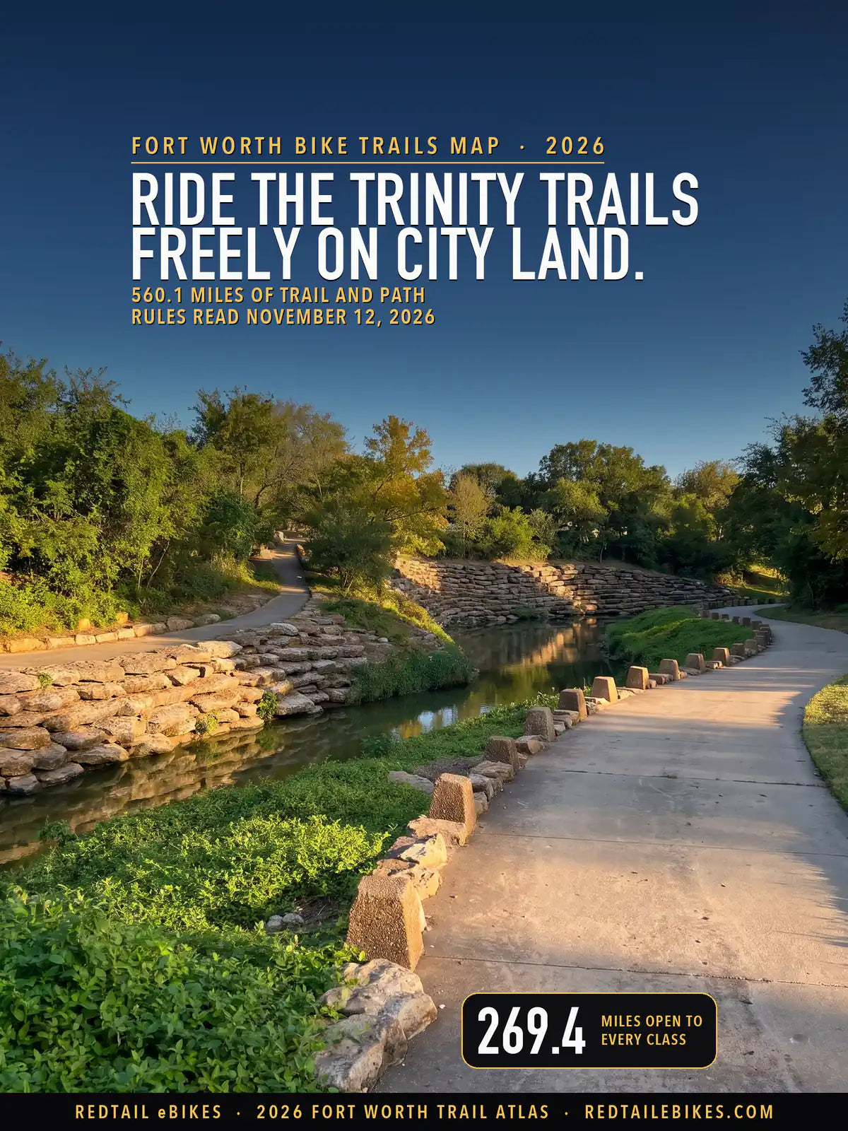
Marine Creek and the Trinity Trails in the Fort Worth Stockyards, a stretch this map reads open to every class, in a scene generated with Playcut from a photograph by Dameon Hudson (CC BY 3.0).
The state answers most of your trail question before Fort Worth gets a say. Transportation Code § 551.106(a) says a local authority "may not prohibit the operation of an electric bicycle" in "an area in which the operation of a nonelectric bicycle is permitted", unless the path is closed to motor vehicles and "has a natural surface tread made by clearing and grading the native soil without adding surfacing materials."
This map lays that rule, and every local rule that could be read, over every mapped trail and off-street path in Tarrant County: 560.1 miles in 4,170 pieces, each colored by what you may do there.
Fort Worth's own park code arrives at the same answer from another direction. Section 24-18 makes it unlawful to ride a bicycle or any wheeled device "whether self-propelled or motor-assisted" in a park only "where such use is prohibited and has been so designated by signs indicating such prohibition." Every line on the map, with its rule and its source, is a row in the register.
Key takeaways
- 269.4 miles are open to every class. That covers Fort Worth's park trails and paved paths, Grapevine's trail network, North Richland Hills' trails, Colleyville's paved trails and most of the Cotton Belt Trail.
- 23.0 miles are closed. 21.2 of them are the trails of the Fort Worth Nature Center & Refuge, which allows no bicycles of any kind; the other 1.8 are Mansfield park paths that are not concrete.
- 88.8 miles read two ways, every one of them in an Arlington park. Arlington's Parks department says e-bikes are not allowed on its hike and bike trails, while its Transportation department says they go wherever a bicycle goes.
- 178.9 miles are not established. 82.6 of them are on Tarrant Regional Water District land, 76.0 of those on the Trinity Trails, and 43.9 are in Keller, whose own pages could not be read.
- Speed is a local rule. Colleyville caps e-bikes at 10 mph on its sidewalks and on its trails other than the Cotton Belt, and North Richland Hills at 12 mph on its trail system and 10 mph inside its parks.
In this guide
- How to read the map
- Who decides on each trail in Tarrant County
- The state rule that protects your ride
- The Trinity Trails
- Fort Worth's parks and paths
- The Fort Worth Nature Center & Refuge
- Arlington: River Legacy and two answers
- Colleyville and the Cotton Belt Trail
- North Richland Hills, Grapevine and Keller
- Corps of Engineers land at Grapevine and Benbrook
- The other cities of Tarrant County
- What Texas law says
- Fort Worth bike trails riders ask about
- Tarrant County trails, area by area
- Where riders get caught out
- Streets, bike lanes and sidewalks
- Choosing an e-bike for Fort Worth's trails
- The bottom line
- Frequently asked questions
How to read the map
Green is open to every class of e-bike, amber reads two ways, red is closed, and gray means the rule could not be established. Texas defines Class 1, Class 2 and Class 3 e-bikes (§ 664.001) and draws no line between them on a trail (§ 551.106), so one color covers all three; the one class line the state does draw is an age line, at least 15 to operate a Class 3 (§ 551.107(c)).

Fort Worth and Tarrant County: 560.1 miles of trail and path, 269.4 open to e-bikes, 88.8 read two ways, 23.0 closed and 178.9 not established.
| Color | What an e-bike may do | Where | Miles |
|---|---|---|---|
| Green | Open to every class of e-bike | Grapevine, Fort Worth's parks, Fort Worth's other paths, the other cities, North Richland Hills, Colleyville and Arlington's other paths | 269.4 |
| Amber | Read two ways: check the trail's row | Arlington's parks | 88.8 |
| Red | Closed to e-bikes | The Fort Worth Nature Center & Refuge and Mansfield | 23.0 |
| Gray | Rule not established | Water District land along the Trinity and at Eagle Mountain Lake, Keller, the other cities, Fort Worth's other paths and Corps of Engineers land | 178.9 |
Read amber as your cue to stop at the trailhead and check. It marks the Arlington park trails where the City's two departments give opposite answers and state law backs the bicycle on paved paths. On any color, a posted sign is what a ranger or an officer can enforce on the day you ride.
Takeaway
269.4 of this map's 560.1 miles are open to any e-bike that meets the Texas definition, every class alike. 23.0 miles are closed, 21.2 of them inside the Fort Worth Nature Center & Refuge, and 88.8 miles in Arlington's parks turn on which of the City's own answers you follow.
Who decides on each trail in Tarrant County
On the bike trails in Fort Worth and around it, a trail's rule belongs to whoever runs the ground under it: a city, the Water District, the Corps of Engineers or a private owner. So before you ride a trail, know whose ground you are on: the register names the manager of every piece and the rule that follows from it.
| Manager | Miles | The rule and its source |
|---|---|---|
| Fort Worth Nature Center & Refuge (City of Fort Worth) | 21.2 | No bicycles on its trails, e-bikes included (source) |
| Tarrant Regional Water District (its land along the Trinity and at Eagle Mountain Lake) | 82.6 | Its own trail rules are not quoted on this map (Limitations) |
| City of Fort Worth, park land | 60.1 | Open: wheeled riding, motor-assisted included, is barred only where signs say so (source) |
| City of Fort Worth, outside its parks | 63.9 | A surfaced path a record shows bicycles ride is open (source) |
| City of Arlington, park land | 90.7 | Read two ways: its Parks department says no e-bikes on its hike and bike trails, its Transportation department says yes (source) |
| City of Arlington, outside its parks | 10.0 | E-bikes go where a bicycle goes, in the City's own words (source) |
| City of Colleyville | 21.4 | Every class on paved trails at 10 mph, the Cotton Belt Trail at its own limit; no e-bike on an unimproved surface (source) |
| City of North Richland Hills | 20.8 | All three classes; 12 mph on its trails, 10 mph in parks (source) |
| City of Grapevine | 69.3 | Sidewalks, park paths and designated trails permitted (source) |
| City of Mansfield | 9.5 | Bikes stay on concrete park trails (source) |
| City of Keller | 50.0 | The state rule alone: the City's own rules are not quoted here (Limitations) |
| U.S. Army Corps of Engineers (Grapevine and Benbrook lakes) | 10.1 | Project roads and most bike trails; no trail rated intermediate or harder (source) |
| The other cities in Tarrant County | 48.4 | A surfaced path a record shows bicycles ride is open: a city may not bar an e-bike from it (source) |
| Unincorporated Tarrant County | 2.3 | A surfaced path a record shows bicycles ride is open (source) |
A city's own rule counts on this map only where its own words could be read, and the state rule fills in everywhere else. For a surfaced path that bicycles ride, the state rule is enough to make it green.
The state rule that protects your ride
If a regular bicycle may ride a path in Texas, a city may not ban your e-bike from it, unless the path is a natural-surface trail closed to motor vehicles. Section 551.106(a) says no more than that, and a "local authority" under it includes "a county, municipality, or other local entity authorized to enact traffic laws" (§ 541.002(3)).
The natural-surface exception is narrow. The statute describes a tread "made by clearing and grading the native soil without adding surfacing materials", so a crushed-limestone path with added stone is still protected, while a dirt singletrack is one a city may close. That split is why, under Colleyville's ordinance, this map would read a paved path green, a gravel path amber and a dirt path red.
An e-bike is not a motor vehicle under Texas law: the Transportation Code's definition of a motor vehicle "does not include an electric bicycle" (§ 541.201(11)). A park rule written against "motor vehicles" therefore does not reach your e-bike by its own words, and this map reads it that way unless the body that wrote it says otherwise in its own text.
The Trinity Trails
Ride the Trinity Trails freely where they cross City of Fort Worth land, and check the posted rules where they run on the Water District's levees and river banks. The City's 2019 trails plan credits the Tarrant Regional Water District with building the river system and says it has "maintained, much of the existing Trinity Trails system" (Trails Master Plan).
This map holds 113.3 miles of the Trinity Trails in Tarrant County, 111.6 of them from the District's own trail file.

Trinity Trails, Fort Worth map of the central city: 109.4 miles of trail and path, 37.4 open to e-bikes and 72.0 not established.
Fort Worth's Trinity Trails follow the Trinity River's Clear Fork and West Fork through the middle of the city. 36.3 of their miles read green: 32.5 cross City parks or other City land, where you ride under § 24-18 and state law, and 3.8 run through Benbrook, 1.3 of them on Corps of Engineers land, where the state rule and the Corps' policy apply.
Another 76.0 of their miles sit on District land, and the District's own trail ordinance is not quoted on this map, so they read gray (see Limitations), as does the last 1.0, City path with no recorded surface.
Gray marks a rule this map could not establish, so on District land the District's own signs are your guide.
| River branch in the District's file | Miles on City land (green) | Miles on District land (gray) |
|---|---|---|
| Lower West Fork | 12.7 | 20.4 |
| Clear Fork | 10.2 | 22.1 |
| Upper West Fork | 0.0 | 26.7 |
| Marine Creek Lake | 6.7 | 6.2 |
| Overton | 6.0 | 0.6 |
The line between the two is the land, not the park around it. Inside Trinity Park, the District's file records most of the riverside lines as its own, so 5.3 of the park's 5.7 trail miles read gray, while most of Gateway Park's read green.
The District's file records the tread of every line; counted once on this map, its lines come to 74.7 miles paved or asphalt, 41.3 miles of crushed limestone and 1.4 miles it marks "Other" or "Earthen" in Tarrant County. Crushed limestone is an added surfacing material, so where a city runs one of these paths, § 551.106(a) protects your e-bike on it as fully as on concrete.
The same file marks 2.1 miles as "Trail Closures" and 0.6 miles as "Trail Reroutes", all on the Lower West Fork; 0.7 of the closed miles run through Gateway Park. Its amenities map also marks 16 "Slow Zone" points, every one of them on the Clear Fork (District slow zones); the map gives no speed, so ride them at a walker's pace.
Every green mile of the river suits any class of e-bike. Our Fort Worth guide matches bikes to the Trinity Trails and to every part of town.
Find your Fort Worth e-bikeTakeaway
On the Trinity Trails, ride any class freely on City land and follow the Water District's posted signs on its levees; 36.3 of the trails' 113.3 mapped miles in Tarrant County are open on this map's reading today.
Fort Worth's parks and paths
Inside the City's 313 parks, ride your e-bike on any trail unless a sign there, or the park's own rules, say no. The City enforces Chapter 24 "in all parks, recreation areas and community centers of the city" (City park rules), and its § 24-18 bars wheeled riding, motor-assisted included, only where signs say so (§ 24-18).
The bike trails Fort Worth runs itself, in its parks and along its streets, come to 124.0 miles. 60.1 of them lie in City parks and all of those read green, 9.5 miles on natural-surface trails. Every natural-surface mile is in Marion Sansom Park, where the dirt paths are Fort Worth mountain bike trails that OpenStreetMap's mappers grade on the IMBA difficulty scale (OpenStreetMap).
Another 63.9 miles are City paths outside the parks: 48.1 miles are surfaced paths a record shows bicycles ride, and the rest have a natural tread or no recorded surface, so they read gray.
Two other rules travel with you in a Fort Worth park. Parks are open "5:00 a.m. to 10:00 p.m." unless the director posts otherwise (§ 24-8), and the City forbids riding "in such a reckless, indifferent or careless manner as to unreasonably endanger any person or property" on any street, park or public property (§ 22-244).
The City closes Tandy Hills Natural Area to bicycles: its page reads "Foot traffic only, no bicycles, or motorized vehicles" (Tandy Hills Natural Area), and adds that "Tandy Hills, Stratford, and Broadcast Hill are closed to ALL vehicles including, cars, trucks, 4-wheelers, bicycles and motorcycles" (same page). Their trails carry no line in the files this map is built from, so they add no miles here; treat all three as closed to your e-bike.
The Fort Worth Nature Center & Refuge
Leave the e-bike at the gate: the Fort Worth Nature Center's hiking trails are for walking only. Its guidelines say "Bicycles, jogging, motorized vehicles, and horses are not permitted on trails" (Nature Center guidelines), and its newer guidelines repeat "Trails for hiking only" (new guidelines).
All 21.2 miles of the Nature Center's mapped trails read red, the largest closed block on this map. Its trail rules do not address its roads, so ask the Nature Center before you ride in on one.
Arlington: River Legacy and two answers
Arlington's park trails read amber because the City itself gives two answers, so check the trailhead signs before you ride. In June 2025 the City told residents that "motorized vehicles, including e-scooters and electric bikes, are not permitted on our hike and bike trails per City ordinance" (Arlington parks notice).
Its Transportation Planning page answers the same question the other way: "Personally owned electric bicycles can be operated in the same places a standard bicycle operates. Both are allowed citywide" (Arlington Active Transportation). The park code behind the first answer makes any "wheeled device of conveyance, propelled by motor or engine" a vehicle (§ 1.01) and keeps vehicles to "park roadways and designated parking areas" (§ 3.04).
State law sides with the second answer on paved and gravel paths, since § 551.106(a) bars a city from prohibiting an e-bike where a bicycle may ride. On dirt it sides with neither: a natural-surface trail is one a city may close. So all 88.8 miles of Arlington park trails that bicycles ride read amber, River Legacy's 8.6-mile hike and bike trail, Village Creek and Fish Creek among them.
Outside its parks, Arlington's own words govern, and its 10.0 miles of off-street paths and sidepaths are yours to ride: they read green. At River Legacy, the park code also keeps bicycles off unpaved trails "except when riding on a specifically marked unpaved trail designated by official signs for bicycles" (§ 5.10(D)), so if you ride dirt there, stay on the marked mountain bike loops.
For a shop in Arlington, see our Arlington e-bike shop directory.
Takeaway
Until Arlington settles its two answers, ride its streets and the paths outside its parks with confidence, and on its park trails follow the sign at each trailhead.
Colleyville and the Cotton Belt Trail
Colleyville lets every class ride its paved trails, at 10 mph on all but the Cotton Belt Trail, and bars e-bikes from unpaved ground. Its Ordinance O-25-2329, approved 7 to 0 on May 13, 2025, permits Class 1 and Class 2 e-bikes "in public parks, on city sidewalks, on paved trails" for riders 10 and older (§ 86-3(a)), and Class 3 in the same places for riders 15 and older (§ 86-3(b)).
The same ordinance makes it unlawful to ride an e-bike "on an unimproved surface of public property within the city", except a crossing of 20 feet or less to reach a paved surface or trail (§ 86-4(a)(5)). The City's own page reads that as "No riding on unimproved (unpaved) surfaces" (Colleyville police).
If you ride a Class 3 in Colleyville, you also need the City's sticker: the ordinance makes it unlawful "to operate a Class 3 electronic bicycle without a classification sticker issued by the Colleyville Police Department displayed on the Class 3 electronic bicycle in a visible manner" (§ 86-4(a)(4)).
Break a rule of § 86-4(a), the unpaved ban and the sticker among them, and a first offense brings a $100 fine and "a bicycle safety course", a second $200 and a third $500 (§ 86-4(b)). "Upon issuance of a citation following a first offense", your e-bike "shall be confiscated by the issuing officer" (§ 86-4(b)(4)).
On the Cotton Belt Trail the ordinance prints a mixed figure, "fifteen (20) miles per hour" (§ 86-3), and the City's page says "20 mph on the Cotton Belt Trail" (Colleyville police). Hold 15 mph on the Cotton Belt Trail until the City corrects one of the two; on Colleyville's other trails and its sidewalks your limit is 10 mph (§ 86-3).
18.6 of Colleyville's 21.4 miles read green; the other 2.8 have no recorded surface, so whether the paved-trail rule or the unpaved ban applies cannot be read from the files. The Cotton Belt Trail carries 8.9 miles under that name across North Richland Hills, Colleyville and Hurst, and Grapevine's file adds 4.9 miles it writes as "Cottonbelt Trail".
North Richland Hills, Grapevine and Keller
North Richland Hills welcomes every class on its trails, at 12 mph. The City says "All three classes of e-bikes (1, 2, and 3) may be ridden in the same manner as a bicycle in Texas" and that "The max speed on the city's trail system is 12 mph" (NRH trails etiquette); inside its parks, "Speed limits within parks is reduced to 10 mph" (same page).
All 20.8 of its mapped miles read green, so you can ride its whole system.
Grapevine's parks department puts it in one sentence: "Sidewalks, park paths, and designated trails are permitted" (Grapevine e-bike page). All 69.3 miles of the City of Grapevine's own trails and paths in Tarrant County read green, the largest city network on this map that is green from its first mile to its last.
The 7.9 gray miles in Grapevine's list below are Corps of Engineers land inside the city limits, the H2O trails among them.
Keller is the gap in the northeast. Its own e-bike rules are not quoted on this map (see Limitations), so its 50.0 miles follow the state rule alone: 6.0 miles of surfaced path that bicycles ride read green, and the other 43.9 read gray, because Keller's own trail file records no surface and its trail types carry no published key. Before you ride Big Bear Creek, read Keller's own e-bike page.
North and northeast Tarrant County read green on a larger share of their miles than any other part of this map. Riding out to them from Fort Worth? Our Fort Worth guide matches bikes to the city's streets, its trails and the ride home.
Match a bike to your trailsCorps of Engineers land at Grapevine and Benbrook
On Corps of Engineers land, ride the project roads and the easier bike trails, and skip any trail rated intermediate or harder. The Fort Worth District's policy reads: "E-bikes may be ridden on project roads and most of the bike trails where traditional bicycles are allowed. However, E-bikes are NOT authorized to be ridden on trails rated intermediate difficulty or higher" (POL-22-01).
The policy's one exception is narrow: a rider with a mobility impairment may ask the lake manager for a written permit to ride a Class 1 e-bike on those trails, and "Class 2 and higher rated E-bikes are NOT authorized on trails rated intermediate difficulty or higher under any circumstances" (POL-22-01).
At Grapevine Lake, "Knob Hills and Northshore is designed for mountain biking (NO HORSES) with segments ranging from beginner to difficult" (Grapevine Lake trails), so your access turns on the segment you are on.
The Corps also closes "all Horse and Bike trails" to "equestrian and bike traffic when wet and muddy conditions are present" (Grapevine Lake trails), and its equestrian trails carry "NO BIKES" (same page). Only 0.6 miles of Northshore lie inside Tarrant County, the frame of this map.
10.1 miles of this map are Corps land. 1.8 miles read green, the paved paths at Benbrook Lake and the Grapevine Recreation Area among them; the rest read gray because no trail rating appears in the files this map reads, so read the rating posted at a trailhead before you ride one.
The other cities of Tarrant County
In most other Tarrant County cities, the state rule decides: a surfaced path that bicycles ride is open to you. Mansfield is the stricter exception. Its park rules say "Bikes, skates, skateboards & scooters must stay on concrete trails" (Mansfield park rules), and Julian Feild Park, its veterans memorial park, asks visitors to "refrain from using amplified sound, skateboarding/electric bikes or scooters" (Julian Feild Park).
That puts 1.8 of Mansfield's 9.5 miles in red, so in Mansfield's parks keep your e-bike on concrete. Mansfield's ban on "unauthorized motor vehicles on trails or park areas" (same rules) does not reach an e-bike by its own words, since Texas excludes e-bikes from "motor vehicle."
Burleson took Fort Worth's approach in October 2026. Its Ordinance CSO#6316-10-2026, passed and approved October 19, 2026, adds "electric bicycles to the list of wheeled equipment that may be prohibited at city parks if designated by proper signage" (Burleson ordinance), so in Burleson's parks the sign at the trail is your rule. Once the ordinance takes effect, a violation can be fined up to $500 an offense (Section VII).
Southlake's park code bars off-road "motorized" vehicles such as "off-road motorbikes, go-carts, and dune buggies" (Southlake park rules), which does not describe a pedal-assist bicycle.
If you ride in Keller, Euless or Hurst, whose own websites could not be read, the state rule alone is the one you can count on: the floor every city must respect on a surfaced path. Grand Prairie, Westlake, Haltom City, Bedford, Benbrook, Saginaw and the other cities whose websites were read publish no e-bike trail rule on the pages read, so the state rule is the rule there too.
What Texas law says
E-bike laws in Fort Worth, Texas, start with the state's: Texas treats an e-bike as a bicycle, with three classes and one age line. An electric bicycle under state law has "fully operable pedals", "an electric motor of fewer than 750 watts" and "a top assisted speed of 28 miles per hour or less" (§ 664.001(4)); a bike over either line is not an e-bike, and none of this map's rules protect it.
You need no title, registration or driver's license: "Subtitles A, B, and D and Chapter 551A do not apply to the operation of an electric bicycle" (§ 551.107(a)). The motor must cut out "when the operator stops pedaling" or "when the brakes are applied" (§ 551.107(b)), and you must be "at least 15 years of age" to operate a Class 3, though a younger child may ride one "as a passenger" (§ 551.107(c)).
At night the state requires a front lamp that "emits a white light visible from a distance of at least 500 feet" (§ 551.104), and Fort Worth adds a front reflector or "an electric headlight" between 7 p.m. and 5 a.m. (§ 22-241).
Chapter 551, the state's bicycle chapter, does not mention helmets. Fort Worth's helmet ordinance covers riders under 18 on a "bicycle" (§ 22-245), a word it defines as "A human powered vehicle" (§ 22-245(a)), so whether it reaches an e-bike is not settled by its words.
Fort Worth bike trails riders ask about
How long is the Trinity Trail in Fort Worth?
This map holds 113.3 miles of Trinity Trails line in Tarrant County, each stretch counted once, and 74.7 of the 111.6 miles from the District's own file are paved. That counts both river banks and parallel paths separately, so the route you ride along the river is shorter; a Corps of Engineers page still describes "approximately twenty-five miles of paved hike & bike trails" (Benbrook Lake trails), a figure today's paved line far exceeds.
Is Gateway Park open?
Fort Worth parks open at 5 a.m. and close at 10 p.m. unless posted otherwise (§ 24-8). The District's trail file, read November 12, 2026, marks 0.7 miles of the Trinity Trails inside Gateway Park as a trail closure, so if you ride through Gateway Park, expect a detour on that stretch.
How long is the River Legacy trail?
Arlington's trail file names the River Legacy bike trail the River Legacy 7 Mile Trail, yet records its length as 8.8 and draws 8.8 miles of line; this map holds 8.6 miles under that name once overlaps are counted. The table below sets each manager's published figure beside the map's measure.
| Trail | Published miles | Published by | Miles on this map | Why they differ |
|---|---|---|---|---|
| North Richland Hills' trail system | over 30 | City of North Richland Hills | 20.8 | The City's figure is a floor for a system it says runs 'on road, in parks, and through residential areas'; this map counts 20.8 mi of off-street trail and path in the city, NCTCOG maps 1.8 mi of on-street bike route there, and 1.2 mi of roadside sidepath was screened from this map; the other 6.2 mi or more is not measured here |
| Paved Trinity Trails | approximately twenty-five | U.S. Army Corps of Engineers, Benbrook Lake page | 74.7 | The Corps' page is undated; the Water District's own trail file draws 79.6 mi of paved line in Tarrant County today, all of it inside the county, both banks and parallel paths counted; this map holds 74.7 mi of it once overlaps are counted once |
| River Legacy 7 Mile Trail | 7 (in the trail's name) | City of Arlington, its trail file | 8.6 | The 7 is in the trail's name; Arlington's own file records the line's Length as 8.8 (no unit given) and its drawn line measures 8.8 mi in Tarrant County; this map holds 8.6 mi under the name after overlaps are counted once |
Is the Northshore Trail open?
The Corps of Engineers closes all bike trails at Grapevine Lake "when wet and muddy conditions are present" (Grapevine Lake trails), so Northshore's status changes with the weather. Check the Corps' Grapevine Lake page or the trailhead before you go, and remember that an e-bike may not ride its segments rated intermediate or harder.
Tarrant County trails, area by area
Find the part of the county you ride below. Each area groups the council districts of Fort Worth, Texas, and the county's other cities by their direction from the center of Fort Worth. The table gives each area's miles by color, and each list names the area's trails with their color on the map.
| Area | Green miles | Amber | Red | Gray |
|---|---|---|---|---|
| North | 41.2 | 0.0 | 0.0 | 19.0 |
| Northeast | 131.0 | 0.0 | 0.0 | 59.6 |
| East | 16.3 | 0.0 | 0.0 | 13.5 |
| Southeast | 25.7 | 88.8 | 1.8 | 16.8 |
| South | 18.3 | 0.0 | 0.0 | 25.4 |
| Southwest | 17.8 | 0.0 | 0.0 | 13.1 |
| West | 0.0 | 0.0 | 0.0 | 4.8 |
| Northwest | 19.2 | 0.0 | 21.2 | 26.7 |
North

North Tarrant County: 60.1 miles of trail and path, 41.2 open to e-bikes and 19.0 not established.
Council District 2: 25.2 miles. 8.9 green; 16.3 gray.
- Trinity Trails 20.9 mi (mostly gray)
- Trail Drivers Park Trail 0.4 mi (green)
- Also: 3.9 mi of unnamed trail and path
Council District 4: 17.8 miles. 17.3 green; 0.5 gray.
- Founders Way Shared Use Path 1.3 mi (green)
- Arcadia Trail Interpretive Trail 0.4 mi (green)
- Arcadia Trail North 0.3 mi (green)
- Also: 0.2 mi of shorter named stretches and 15.6 mi of unnamed trail and path
Council District 10: 14.4 miles. 12.6 green; 1.7 gray.
- 0.5 mi of shorter named stretches and 13.9 mi of unnamed trail and path
Haslet: 1.5 miles. 1.2 green; 0.2 gray.
- 1.5 mi of unnamed trail and path
Saginaw: 1.4 miles. 1.1 green; 0.3 gray.
- 1.4 mi of unnamed trail and path
Northeast

Northeast Tarrant County: 190.6 miles of trail and path, 131.0 open to e-bikes and 59.6 not established.
Grapevine: 77.6 miles. 69.7 green; 7.9 gray.
- Horseshoe Trails 5.4 mi (green)
- Cottonbelt Trail 4.9 mi (green)
- Big Bear Creek Trail 3.3 mi (green)
- C. Shane Wilbanks Trail 3.3 mi (green)
- H2O Trail Lakeview to Oak Grove 2.9 mi (gray)
- Texan Trail 2.8 mi (green)
- Hall Johnson Connector 2.7 mi (green)
- Northwest Hwy Connector from Texan Trail to 114 2.6 mi (green)
- H2O Trail Oak Grove to Meadowmere 2.3 mi (gray)
- The Links Trail 2.2 mi (green)
- Meadowmere Trail 2.0 mi (green)
- Lakeview Trails 2.0 mi (green)
- H2O Trail Meadowmere to Lakeview 2.0 mi (gray)
- Stone Myers to Main Connector 1.9 mi (green)
- Dove Loop Trail 1.8 mi (green)
- Bear Creek Trail 1.7 mi (green)
- Katie's Woods Trails 1.7 mi (green)
- Timberline to Cotton Belt Connector 1.6 mi (green)
- Main Connector from Northwest Hwy to Airfield 1.6 mi (green)
- Pool Road Trail 1.6 mi (green)
- Glade Connector 1.5 mi (green)
- Cottonbelt Trail Connector 1.4 mi (green)
- Katie's Woods Hard Surface Trail 1.3 mi (green)
- Oak Grove Trail 1.2 mi (green)
- Mills Run Trail 1.1 mi (green)
- Mustang Sidewalk Main to Texan Trail 1.1 mi (green)
- Heritage Connector 1.1 mi (green)
- Settlers Park Trail 1.0 mi (green)
- Northwest Hwy Connector from Northwest Hwy to Dove Rd 0.9 mi (green)
- Wall-Farrar Trails 0.9 mi (green)
- Parr Park Trail 0.9 mi (green)
- The REC Trail 0.9 mi (green)
- Parr Road Trail 0.9 mi (green)
- Kimball Road Trail 0.8 mi (green)
- Dove Rd Connector from Horseshoe Trails to Kimball 0.8 mi (mostly green)
- Bear Creek Park Trail 0.7 mi (green)
- Oak Grove Loop Trail 0.7 mi (green)
- Dallas Rd Connector from Texan Trail to Dooley 0.7 mi (green)
- Dooley Rd Connector from Dove Loop to Katie's Woods 0.7 mi (mostly green)
- The Links Trail Connector behind Mills Mall 0.7 mi (green)
- Northfield Trail 0.6 mi (green)
- Ball Connector from 26 to Northwest Hwy 0.6 mi (green)
- SH 2499 Loop 0.5 mi (green)
- Dove Park Trail 0.5 mi (green)
- The Vineyards Trail 0.5 mi (green)
- Fairway Drive Trail 0.5 mi (green)
- Wall-Farrar to Heritage Connector 0.4 mi (green)
- Dove Park/Dove Loop Connector from Park Rd to Dove Loop 0.4 mi (green)
- Pickering Park Trail 0.4 mi (green)
- Main Connector from Northwest Hwy to Dove Loop 0.4 mi (green)
- Dove Park/Horseshoe Trails Connector 0.4 mi (green)
- The Links Trail Connector section in front of apartments 0.3 mi (green)
- Sunbelt Trail 0.3 mi (green)
- Minters Chapel Connector from Northfield to Dallas 0.3 mi (green)
- Northfield Trail Extension 0.3 mi (green)
- Also: 1.4 mi of shorter named stretches and 0.1 mi of unnamed trail and path
Keller: 50.0 miles. 6.0 green; 43.9 gray.
- Big Bear Creek Greenbelt Tr 5.6 mi (mostly gray)
- Northeast Trail 4.2 mi (gray)
- Marshall Ridge Loop Trail 2.6 mi (gray)
- Indian Trail 2.5 mi (mostly gray)
- Meandering Trail 1.9 mi (mostly green)
- Shady Grove Trail 1.7 mi (mostly gray)
- Little Bear Creek Trail 1.7 mi (mostly gray)
- Rufe Snow Trail 1.6 mi (gray)
- The Parks at Town Center Tr 1.4 mi (mostly gray)
- Keller Smithfield Greenwalk 1.4 mi (gray)
- Florence Trail 1.4 mi (gray)
- Johnson Greenwalk 1.3 mi (gray)
- Town Center Trail 1.2 mi (gray)
- Mount Gilead Trail 1.2 mi (gray)
- Eastern Trail 1.2 mi (gray)
- Keller Sports Park Loop 1.1 mi (gray)
- Whitley Greenwalk 1.0 mi (gray)
- Hwy 377 Trail 1.0 mi (gray)
- Preston Trail 0.9 mi (gray)
- Overton Ridge Trail 0.9 mi (gray)
- Rapp Greenwalk 0.9 mi (mostly green)
- Chisholm-Sports Park Trail 0.9 mi (gray)
- Meandering Connector 0.8 mi (gray)
- Bear Creek Eastern Trail 0.8 mi (mostly gray)
- Bancroft Trail 0.8 mi (gray)
- Ridge Trail 0.8 mi (mostly green)
- Johnson Park Trail 0.6 mi (gray)
- Danbury Parks Trail 0.5 mi (gray)
- Eastern Trail Connector 0.5 mi (gray)
- Keller-Smithfield Trail 0.5 mi (gray)
- Gibson Trail 0.5 mi (gray)
- Brentwood Trail 0.5 mi (gray)
- Elm Greenwalk 0.5 mi (gray)
- Milestone Trail 0.5 mi (green)
- Davis - Southlake Connector Opt 1 0.5 mi (gray)
- Davis - Southlake Connector Opt 2 0.5 mi (gray)
- Shady Grove Greenwalk 0.4 mi (gray)
- Windemere-Bear Creek Trail 0.3 mi (gray)
- Roanoke Mount Gilead Connector 0.3 mi (gray)
- Southern Greenwalk 0.3 mi (gray)
- North Tarrant Connector 0.3 mi (green)
- Also: 1.3 mi of shorter named stretches and 1.2 mi of unnamed trail and path
Colleyville: 21.4 miles. 18.6 green; 2.8 gray.
- Cotton Belt Trail 3.8 mi (mostly green)
- Colleyville Blvd 3.0 mi (green)
- Pleasant Run Road Sidepath 0.7 mi (green)
- Bradford Rd 0.7 mi (mostly gray)
- John McCain Road Sidepath 0.6 mi (green)
- Pleasant Run Rd 0.5 mi (green)
- Westcoat 0.4 mi (gray)
- John McCain Rd Side Path 0.3 mi (green)
- Also: 0.4 mi of shorter named stretches and 11.0 mi of unnamed trail and path
North Richland Hills: 20.8 miles. 20.8 green.
- Cotton Belt Trail 4.1 mi (green)
- John Barfield Trail 3.5 mi (green)
- Walker's Creek Trail 2.6 mi (green)
- North Electric Trail 2.6 mi (green)
- Joann Johnson Trail 1.7 mi (green)
- Calloway Branch Trail 1.7 mi (green)
- Cross Timbers Loop Walking Trail West 1.3 mi (green)
- Northfield Park Trail 0.7 mi (green)
- Randy Moresi Trail 0.6 mi (green)
- City Point Trail 0.3 mi (green)
- Also: 0.2 mi of shorter named stretches and 1.5 mi of unnamed trail and path
Westlake: 10.5 miles. 9.2 green; 1.3 gray.
- Glenwyck Trail 1.0 mi (mostly green)
- Dove-Davis Trail 0.8 mi (green)
- Entrada Trail 0.5 mi (green)
- Granada Trail 0.5 mi (green)
- Solana Trail 0.4 mi (mostly green)
- Pearson Trail 0.4 mi (green)
- Also: 0.1 mi of shorter named stretches and 6.7 mi of unnamed trail and path
Haltom City: 5.2 miles. 4.5 green; 0.7 gray.
- 5.2 mi of unnamed trail and path
Southlake: 3.8 miles. 1.2 green; 2.6 gray.
- 0.2 mi of shorter named stretches and 3.6 mi of unnamed trail and path
Flower Mound: 1.4 miles. 0.9 green; 0.4 gray.
- Long Prairie Road 0.6 mi (green)
- Northshore Trail 0.4 mi (gray)
- Gerault Road 0.3 mi (green)
Watauga: under 0.1 mile.
East

East Tarrant County: 29.7 miles of trail and path, 16.3 open to e-bikes and 13.5 not established.
Council District 5: 17.0 miles. 11.1 green; 5.9 gray.
- Trinity Lakes Trail 2.6 mi (green)
- River Legacy Prairie Loop Trail 1.9 mi (gray)
- Trinity Blvd Sidepath 1.6 mi (mostly green)
- River Legacy Ridge Loop Trail 1.0 mi (gray)
- American Way 1.0 mi (green)
- River Legacy 7 Mile Trail 0.6 mi (green)
- River Legacy West Loop Trail 0.5 mi (gray)
- River Legacy East Loop Trail 0.4 mi (gray)
- River Legacy Skilz Loop Trail 0.4 mi (gray)
- Kemp Road 0.3 mi (gray)
- Also: 0.2 mi of shorter named stretches and 6.4 mi of unnamed trail and path
Euless: 5.9 miles. 4.7 green; 1.2 gray.
- 5.9 mi of unnamed trail and path
Bedford: 4.3 miles. 4.3 gray.
- Bedford Trails 3.7 mi (gray)
- Bedford Trail 0.5 mi (gray)
- Also: 0.1 mi of unnamed trail and path
Richland Hills: 1.7 miles. 0.3 green; 1.3 gray.
- 1.7 mi of unnamed trail and path
Hurst: 0.8 miles. 0.1 green; 0.7 gray.
- Cotton Belt Trail 0.7 mi (gray)
- Also: 0.1 mi of unnamed trail and path
Southeast

Southeast Tarrant County: 133.1 miles of trail and path, 25.7 open to e-bikes, 88.8 read two ways, 1.8 closed and 16.8 not established.
Council District 11: 16.7 miles. 8.3 green; 8.4 gray.
- Trinity Trails 14.3 mi (mostly gray)
- Also: 0.2 mi of shorter named stretches and 2.2 mi of unnamed trail and path
Arlington: 100.7 miles. 10.0 green; 88.8 amber; 1.9 gray.
- River Legacy 7 Mile Trail 8.0 mi (amber)
- Village Creek Trail 5.6 mi (amber)
- Fish Creek Trail 4.4 mi (amber)
- Bowman Branch Linear Trail 3.9 mi (amber)
- Lynn Creek Trail 2.8 mi (amber)
- River Legacy Trail 2.6 mi (amber)
- Richard Greene Linear Trail 2.3 mi (amber)
- SCNP Trail 2.1 mi (amber)
- Randol Mill Trail 2.0 mi (amber)
- MLK Trail 1.9 mi (amber)
- Julia Burgen Trail 1.9 mi (amber)
- Dr. Robert Cluck Linear Trail 1.8 mi (amber)
- Harold Patterson Sports Center Trail 1.8 mi (amber)
- Sublett Creek Linear Trail 1.7 mi (amber)
- River Legacy North Loop Trail 1.6 mi (amber)
- River Legacy East Loop Trail 1.5 mi (amber)
- S.J. Stovall Trail 1.5 mi (amber)
- Centennial Trail 1.5 mi (amber)
- Vandergriff Trail 1.5 mi (amber)
- River Legacy EKG Loop Trail 1.4 mi (amber)
- O.W. Fannin Trail 1.4 mi (amber)
- River Legacy South Loop Trail 1.3 mi (amber)
- Bob Cooke Trail 1.3 mi (amber)
- Kelley Trail 1.1 mi (amber)
- Cravens Trail 1.1 mi (amber)
- Clarence Foster Trail 1.1 mi (amber)
- Clete McAlister Trail 1.1 mi (amber)
- Bob Duncan Trail 1.1 mi (amber)
- River Legacy East Trail 0.8 mi (amber)
- O.S. Gray Trail 0.7 mi (amber)
- Richard Simpson Trail 0.7 mi (amber)
- Meadowbrook Trail 0.7 mi (amber)
- Webb Community Park Trail 0.7 mi (amber)
- California LaneTrail 0.6 mi (amber)
- High Oak Trail 0.6 mi (amber)
- Wimbledon Granite Trail 0.6 mi (amber)
- Cliff Nelson Trail 0.6 mi (amber)
- The Beacon Recreation Center Trail 0.6 mi (amber)
- Dunsworth Trail 0.6 mi (amber)
- Veterans Trail 0.6 mi (amber)
- Eden Road Park Trail 0.6 mi (amber)
- Don Misenhimer Park Trail 0.6 mi (amber)
- Duncan Robinson Trail 0.6 mi (amber)
- Hinshaw Trail 0.6 mi (amber)
- Bob McFarland Trail 0.5 mi (amber)
- Allan Saxe Trail 0.5 mi (amber)
- Fish Creek Neighborhood Trail 0.5 mi (amber)
- Bowman Springs Trail 0.5 mi (amber)
- Wimbledon Trail 0.5 mi (amber)
- Crystal Canyon Trail 0.5 mi (amber)
- F.J. Red Kane Trail 0.5 mi (amber)
- J.W. Dunlop BMX Trail 0.5 mi (amber)
- Mary & Jimmie Hooper Trail 0.5 mi (amber)
- Workman Trail 0.5 mi (amber)
- Marrow Bone Spring Trail 0.5 mi (amber)
- Marti Van Ravenswaay Trail 0.4 mi (amber)
- Harris Road Trail 0.4 mi (amber)
- River Legacy EKG Inner Loop (OMG) Trail 0.4 mi (amber)
- Howard Moore Trail 0.4 mi (amber)
- Martha Walker Trail 0.4 mi (amber)
- Deaver Trail 0.4 mi (amber)
- Woodland West Trail 0.4 mi (amber)
- Carl Knox Trail 0.4 mi (amber)
- Treepoint Trail 0.4 mi (amber)
- Dixon Holman Trail 0.4 mi (amber)
- Arlington Tennis Center Trail 0.4 mi (amber)
- Burl L. Wilkes Trail 0.4 mi (amber)
- West Fork Rock Island 0.3 mi (amber)
- Gene Schrickel Trail 0.3 mi (amber)
- Gateway Trail 0.3 mi (amber)
- Meadowbrook Sculpture Garden Trail 0.3 mi (amber)
- Bowman Branch Linear Park Trail 0.3 mi (green)
- Gibbins Trail 0.3 mi (amber)
- Johnson Creek 0.3 mi (gray)
- BC Barnes Trail 0.3 mi (amber)
- Pirie Trail 0.3 mi (amber)
- Lana Wolff Trail 0.3 mi (amber)
- Also: 3.8 mi of shorter named stretches and 12.4 mi of unnamed trail and path
Mansfield: 9.5 miles. 2.6 green; 1.8 red; 5.1 gray.
- Walnut Creek Linear Park Trail 3.4 mi (mostly gray)
- Watson Branch Park Trail 0.7 mi (green)
- James McKnight Park Trail 0.3 mi (red)
- Also: 5.0 mi of unnamed trail and path
Grand Prairie: 6.3 miles. 4.8 green; 1.5 gray.
- Mira Lagos Jogging and Bicycle Trail 3.1 mi (mostly green)
- Great Southwest Nature Park 0.8 mi (gray)
- Also: 2.4 mi of unnamed trail and path
South

South Tarrant County: 43.7 miles of trail and path, 18.3 open to e-bikes and 25.4 not established.
Council District 6: 5.9 miles. 5.9 green.
- Chisholm Trail Park Trail 1.6 mi (green)
- Also: 4.3 mi of unnamed trail and path
Council District 8: 11.9 miles. 7.2 green; 4.8 gray.
- Trinity Trails 11.1 mi (mostly green)
- Also: 0.8 mi of unnamed trail and path
Council District 9: 23.3 miles. 3.7 green; 19.7 gray.
- Trinity Trails 19.2 mi (gray)
- Trinity Trail 0.4 mi (gray)
- Also: 0.3 mi of shorter named stretches and 3.5 mi of unnamed trail and path
Crowley: 1.1 miles. 0.2 green; 0.9 gray.
- 1.1 mi of unnamed trail and path
Everman: 0.9 miles. 0.9 green.
- Clyde Pittman Park 0.9 mi (green)
Burleson: 0.5 miles. 0.5 green.
- 0.5 mi of unnamed trail and path
Southwest

Southwest Tarrant County: 30.9 miles of trail and path, 17.8 open to e-bikes and 13.1 not established.
Council District 3: 26.7 miles. 13.6 green; 13.0 gray.
- Trinity Trails 24.8 mi (mostly gray)
- Also: 0.2 mi of shorter named stretches and 1.7 mi of unnamed trail and path
Benbrook: 4.2 miles. 4.1 green; 0.1 gray.
- Trinity Trails 4.1 mi (green)
- Also: 0.1 mi of unnamed trail and path
West

West Tarrant County: 4.8 miles of trail and path, 4.8 not established.
Westworth Village: 4.8 miles. 4.8 gray.
- Trinity Trails 3.8 mi (gray)
- Also: 1.0 mi of unnamed trail and path
River Oaks: 0.1 miles.
Northwest

Northwest Tarrant County: 67.1 miles of trail and path, 19.2 open to e-bikes, 21.2 closed and 26.7 not established.
Council District 7: 58.9 miles. 19.2 green; 21.2 red; 18.5 gray.
- Trinity Trails 15.3 mi (gray)
- Riverbottom Trail 4.6 mi (red)
- Lone Wolf Loop 3.4 mi (green)
- Canyon Ridge Trail 3.2 mi (red)
- Cross Timbers Trail 2.6 mi (red)
- Oak Motte Trail 2.4 mi (red)
- The Dam Drop 1.9 mi (green)
- Thunder Road 1.7 mi (green)
- Palmilla Spring Walking Trail 1.3 mi (mostly gray)
- Greer Island/Margaret Parker Memorial Trail 1.2 mi (red)
- Prairie Trail 1.1 mi (red)
- Spillway Road 1.1 mi (red)
- Reclamation Trail 1.0 mi (red)
- Wild Plum Trail 0.7 mi (red)
- Gangster 0.7 mi (green)
- Deer Mouse Trail 0.7 mi (red)
- River Road 0.6 mi (red)
- Jojo's 0.6 mi (green)
- Forked Tail Creek Trail 0.6 mi (red)
- Caprock Trail 0.5 mi (red)
- Skyline 0.4 mi (green)
- Grass Loop 0.3 mi (green)
- Wild Plum South Trail 0.3 mi (red)
- Candy Bar 0.3 mi (green)
- Fire Line Trail 0.3 mi (red)
- Also: 0.7 mi of shorter named stretches and 11.6 mi of unnamed trail and path
Unincorporated Tarrant County: 8.1 miles. 8.1 gray.
- Eagle Mountain Lake Park trails 5.8 mi (gray)
- Cotton Belt Trail 0.3 mi (gray)
- Also: 0.1 mi of shorter named stretches and 1.9 mi of unnamed trail and path
Where riders get caught out
Watch for the boundaries you cannot see. The Trinity Trails cross from City land to District land with no change in the pavement, and an Arlington path turns amber the moment it enters a park.
The traps worth knowing by name: the Nature Center's no-bicycle rule, Colleyville's 10 mph and its unpaved ban, North Richland Hills' 10 mph inside parks, Mansfield's concrete-only rule, the Corps' wet-trail closures, and the Class 3 age line of 15. A Fort Worth officer can also cite you for riding "in such a reckless, indifferent or careless manner" on any street, park or public property in the city (§ 22-244).
The right bike makes the rules easy to keep: a clear class label, a speedometer you can read and lights that meet the night rule. Our Fort Worth guide lists the ones that fit these trails.
See our Fort Worth picksYour Fort Worth trail checklist
- Check the trail's color here, then the sign at the trailhead; the sign wins on the day.
- Carry a front light and rear reflector after dark (§ 551.104).
- Keep to one rider per seat; a Fort Worth bicycle may not "carry more persons at one time than the number for which it is designed or equipped" (§ 22-242(b)).
- Helmet every rider under 18: Fort Worth requires one on a bicycle (§ 22-245), and it is the safe reading on an e-bike.
- Know your class: a Class 3 rider must be at least 15.
- After rain, leave the Corps' bike trails at Grapevine Lake for another day: it closes all of them when they are wet and muddy.
Streets, bike lanes and sidewalks
On the street, your e-bike follows the same traffic rules as a bicycle, and a city may keep it off the sidewalk. Texas lets "the department or a local authority" both "prohibit the operation of a bicycle on a sidewalk" and set speed limits on bicycle paths (§ 551.106(b)), so the sidewalk answer is local.
On a road, slower than traffic, you keep "as near as practicable to the right curb or edge of the roadway" (§ 551.103(a)), unless you are passing, turning left or avoiding a hazard, or your outside lane is "less than 14 feet in width and does not have a designated bicycle lane adjacent to that lane" (§ 551.103(a)(4)). Where a narrow lane has a bike lane beside it, the right-edge rule applies.
Colleyville permits all three classes "on city sidewalks" at up to 10 mph (§ 86-3(a), (b)), Grapevine lists sidewalks as permitted (Grapevine e-bike page), and Arlington says "Riding a bike on sidewalks is not specifically prohibited in the City of Arlington" (Arlington Active Transportation). In Fort Worth, read the signs on your block, and ride slowly where people walk.
Choosing an e-bike for Fort Worth's trails
Pick the class for the trails you will actually ride, then the tire for their surface. A Class 1 or Class 2 bike suits every green line on this map, including the Corps' paths and Colleyville's trails for riders from 10; a Class 3 is legal on the same trails at 15 and over (in Colleyville, with the police department's sticker), though the 10 and 12 mph local limits leave its extra assist for the street.
The Trinity Trails carry 41.3 miles of crushed limestone, so choose a tire you trust on loose stone as well as on concrete. If you plan to ride Northshore or other dirt, buy for the beginner segments the Corps allows, and look at our electric mountain bike guide for bikes built for them.
If the river is your commute, our commuter e-bike guide has 18 city picks, and if you ride both sides of the metroplex, see our Dallas e-bike guide as well.
Ready to compare bikes? See every e-bike we carry, each shipped free within the contiguous United States.
For the rest of the region, our Texas trails map covers the state, our Dallas map covers the county next door, and our Texas e-bike law guide sets out the state's rules and 60 city ordinances. Need a test ride or a mechanic? Our Fort Worth e-bike shop directory lists the local stores, and our Texas directory the rest of the state's.
Riding beyond Tarrant County? The Houston bike trails map and the San Antonio bike trails map read those cities the same way; for other states, start at bike trails by state or e-bike trails near you.
Why buy your Fort Worth e-bike from us
- Free shipping to Fort Worth. Every electric bike we sell ships free within the contiguous United States; it is dispatched within 1 to 3 business days of your order's confirmation, and most bikes arrive within 5 to 10 business days after dispatch (shipping policy).
- Damage in transit is ours to fix. Note any damage with the carrier and email us photos within 48 hours of delivery; we file the carrier claim and arrange the repair or replacement (refund policy).
- We handle the warranty with you. A bike that won't power on, won't charge, shows an error code or has a faulty part is covered by its manufacturer's warranty, and we coordinate the repair or replacement for you (refund policy).
- Real people on the line. Write to support@redtailebikes.com, which typically answers within one business day, or call (213) 444-4020 and leave a voicemail if no one picks up; every voicemail gets a call back (contact page).
- Checkout with your wallet. Apple Pay, Google Pay and Shop Pay are accepted.
- A company you can name. Our terms of service identify the business behind this store.
The bottom line
Ride Fort Worth's park trails, its paved paths and the Trinity Trails on City land with any class of e-bike: Texas law and the City's own code both back you there. Stay off the Nature Center's trails entirely, keep to concrete in Mansfield's parks and to 10 mph in Colleyville, and treat Arlington's park trails and the District's levees as places to read the sign first.
269.4 of this map's 560.1 miles are open to every class today. Find your Fort Worth e-bike and start with the river.
Frequently asked questions
Are e-bikes allowed on the Trinity Trails in Fort Worth?
Yes on the stretches that cross City of Fort Worth land, where 32.5 miles read green under the City's park code (§ 24-18) and state law (§ 551.106(a)), and on 3.8 more in Benbrook. Another 76.0 miles run on Tarrant Regional Water District land, whose own trail rules are not quoted on this map, so follow the District's posted signs there.
Are e-bikes legal in Fort Worth?
Yes. Texas law defines an electric bicycle as "a bicycle" (§ 664.001(4)), a city may not ban it where a regular bicycle may ride (§ 551.106(a)), and Fort Worth's park code bars wheeled riding, motor-assisted included, only where signs say so (§ 24-18). The Fort Worth Nature Center & Refuge and Tandy Hills Natural Area are closed to bicycles, e-bikes included (Nature Center guidelines; Tandy Hills).
Where can you ride an e-bike in Fort Worth?
On the City's park trails and paved paths, and on the Trinity Trails where they cross City land. Texas bars a city from banning an e-bike where a regular bicycle may ride (§ 551.106(a)), and the park code bars wheeled riding only where signs say so (§ 24-18). Skip the Nature Center's trails, closed to bicycles, and follow the signs on District levees.
Can you ride an e-bike at River Legacy Park?
Arlington gives two answers. Its Parks department says e-bikes are not permitted on its hike and bike trails (parks notice), while its Transportation page says e-bikes may go wherever a bicycle goes (Active Transportation). State law backs the bicycle on paved paths, so the trail reads amber; follow the posted signs at the park.
Can you ride an e-bike at the Fort Worth Nature Center?
No. The Nature Center's guidelines say "Bicycles, jogging, motorized vehicles, and horses are not permitted on trails" (guidelines), and its trails are for hiking only (new guidelines). That rule covers every class of e-bike, so leave your bike behind before you walk the trails.
Can you ride an e-bike on the sidewalk in Texas?
It depends on the city. Texas lets a city prohibit bicycles on sidewalks (§ 551.106(b)), and an e-bike follows the bicycle rule. Colleyville says all three classes may ride city sidewalks at up to 10 mph (§ 86-3(a), (b)), Grapevine lists sidewalks as permitted (Grapevine), and Arlington says sidewalk riding is not specifically prohibited (Arlington).
Do you need a license to ride an e-bike in Texas?
No. The state's rules on title, registration and driver's licenses do not apply to an electric bicycle (§ 551.107(a)), so you need no license, plate or registration. You must be at least 15 to operate a Class 3, and the motor must cut out when you stop pedaling or brake (§ 551.107).
Do you need a helmet to ride an e-bike in Texas?
Texas's bicycle chapter of the Transportation Code does not mention helmets, but cities can require them. Fort Worth requires a helmet on any rider under 18 riding a bicycle (§ 22-245), Colleyville on riders under 16, with a fine of up to $50 for a first violation (Colleyville; § 86-5(b)) and Arlington on bicyclists under 18 (Arlington). Wearing one on the trails is the safe choice at any age, and our accessories collection carries helmets.
Are class 3 e-bikes legal in Texas?
Yes. A Class 3 has pedal assist only, with a top assisted speed under 28 miles per hour (§ 664.001), and Texas lets it ride wherever a bicycle may, provided the operator is at least 15 (§ 551.107(c)). Local trail limits still apply, such as 10 mph in Colleyville (§ 86-3) and 12 mph on North Richland Hills' trail system (NRH).
Are e-bikes allowed in Texas state parks?
Not on the trails. Texas Parks and Wildlife says "Electric bicycles are not allowed on park trails. This includes all classes of e-bikes" (TPWD), though you may ride state park roads where a regular bicycle is allowed (same page). No state park trail lies inside Tarrant County.
Are electric bikes street legal in Texas?
Yes. An e-bike with working pedals, a motor of fewer than 750 watts and a top assisted speed of 28 miles per hour or less is a bicycle under Texas law (§ 664.001(4)), legal on streets and bike lanes. It needs a front light and a rear reflector or lamp to ride at night (§ 551.104).
How we verified this map
This map's 560.1 miles were measured from the trail register we built for it, and each of its 71 rules was read in the words of the body that wrote it.
- Lines. 4,170 pieces of trail and off-street path, 560.1 miles, from the City of Fort Worth's Active Transportation and Micromobility Network, the Tarrant Regional Water District's trail file, the Fort Worth Nature Center & Refuge's trail map, the trail files of Arlington and its off-street paths, Grapevine and Keller, NCTCOG's regional inventory of existing shared-use paths, and OpenStreetMap (Geofabrik's Texas extract of November 11, 2026). Each stretch of ground counts once, the managers' own files first, every piece is cut into runs of a quarter mile or less before it is placed, and every vertex outside Tarrant County is cut away. Every register mile figure is rounded once, to a tenth of a mile, so a legend's rows can add up to a tenth more or less than the total printed above them.
- Places. Each piece is placed by the Census Bureau's city boundaries, the City of Fort Worth's park polygons and ten council districts, the Water District's own parcels, and the Protected Areas Database for federal land. A City piece that no district covers is counted in the nearest one (0.2 miles). Five City of Fort Worth parks that the Protected Areas Database files under the Corps of Engineers carry the City's own park records, and they are read as City parks.
- Rules. 71 passages from the bodies that govern the ground, each quoted from the copy saved when it was read on November 12, 2026, 51 of them quoted on this page; two of them, the Corps of Engineers' POL-22-01 and Colleyville's Ordinance O-25-2329, are scanned documents, read word by word at the page image. Every local government with trails in the county was looked up on its own website: 22 of 25 could be read, and for 3 the site turned the reader away. Leads came from the federal .gov registry and the Texas Municipal League's directory.
- What readers ask. 3,030 questions and search phrasings harvested from 3 kinds of source (search suggestions on two engines, the headings of the pages that answer them, and an AI search panel); 636 are answered on this page and the rest are logged with the reason they were set aside.
- Sources. 55 sources are linked, each saved as it was read; the Water District's site and those of Keller, Euless and Hurst could not be read, see Limitations.
- Names. Each stretch counts once, under the name its source file gives it, with a section the file writes after a colon or a dash listed under its trail. The Water District's file carries no trail names, so its lines are listed as the Trinity Trails, the name the City's own trails plan gives the District's system, and its Eagle Mountain Lake Park lines under that park's name. A spelling is changed only where the manager's own page or file shows it, so Keller's "Big Bear Creek Greenbelt Tr" and Grapevine's "Cottonbelt Trail" are listed as their files write them.
- The data. Every trail is a row in the register (CSV) for each district or city it crosses, with its manager, its verdict, the rule behind it and the names the files give it; the same rows are published as JSON.
- Cover. The cover scenes of Marine Creek and the Trinity Trails in the Fort Worth Stockyards were generated with Nano Banana Pro on Playcut (playcut.ai) from the photograph 'Fort Worth Stock Yards - Fort Worth - Texas - USA' by Dameon Hudson (Wikimedia Commons, licensed CC BY 3.0); their type was set in-house.
- Byline. Researched and written by Milad Ghobadibeygvand, BScN (Western University, 2014), for Redtail eBikes; corrections to support@redtailebikes.com.
Limitations
- The Tarrant Regional Water District's own rules were not read. Its website refuses connections from outside the United States, so its General Ordinance and its recreational area guidelines are not quoted here, and the 82.6 miles on District land, 76.0 of them on the Trinity Trails, read gray. Whether § 551.106(a) binds the District turns on whether it is a "local entity authorized to enact traffic laws" under § 541.002(3), which no text read here settles.
- Keller's, Euless's and Hurst's websites could not be read. Each answered our identified research reader with an access-denied page, so their paths follow the state rule alone; Keller's 50.0 miles are the largest share. Keller's own trail file records no surface and labels its trails with codes it does not publish a key for.
- Fort Worth's park code is read by its bicycle section. Section 24-18 names wheeled devices "whether self-propelled or motor-assisted" and bars them only where signs say so, and this map reads it as the rule for an e-bike in a City park. Section 24-15(a), a traffic section, keeps "any motorized vehicle" to park drives (§ 24-15); read to reach an e-bike, it would close the 9.5 miles of natural-surface park trail, which state law lets the City close.
- Arlington's two answers are printed together, not resolved. The map colors Arlington's park trails amber because the City's own pages disagree; a court could read § 551.106(a) to open the paved ones, and nothing here decides it.
- Corps of Engineers trails turn on a rating this map does not hold. The Corps allows e-bikes on most bike trails but none rated intermediate or harder; no trail file read here carries a rating, so Corps trails without a paved, bicycle-carrying record read gray.
- Colleyville's Cotton Belt Trail limit is printed two ways. Its ordinance reads "fifteen (20) miles per hour" and its police page "20 mph"; this page prints both and advises the lower until the City corrects one.
- Burleson's ordinance is read in its published caption. The City publishes the caption of Ordinance CSO#6316-10-2026, passed and approved October 19, 2026; its effective date is not printed in the caption.
- The frame is Tarrant County. Fort Worth reaches into Denton, Parker, Johnson and Wise counties, and trails there are not on this map (0.9 miles of line crossing the county line were cut at it).
- Surfaces come from the files. A piece's tread is the surface its own record gives, or, where it gives none, the surface most of five sample points share with nearby recorded lines; a stretch whose surface could not be read and whose rule turns on it reads gray.
- Slivers are dropped. Where two drawings overlap, the register keeps one, and a leftover piece shorter than 50 m (20 m where both drawings come from the same file) is dropped: 5.2 miles in all, 0.5% of the 1,108.9 miles of input line, which the map's totals leave out.
- Mapped miles are line miles. The register counts every mapped line once, connectors, loops and parallel paths included; it is not a measure of any single route's length, so a trail's mapped miles can run past the length its manager gives it.
- Search volumes are not stated. The paid keyword instrument returned no data on the day of this build, so this page makes no claim about how many people search for any phrase.
When to re-check this map: whenever the Tarrant Regional Water District amends its General Ordinance; when Fort Worth amends Chapter 24 or Arlington settles its park rule; when Colleyville corrects its Cotton Belt Trail figure; when Burleson's ordinance takes effect; and whenever the Legislature amends Chapter 551 or § 664.001 of the Transportation Code, which it can do in the regular session that opens in January 2027.
Source register
Every rule and length on this map comes from these primary sources, grouped by the body that issues them, each retrieved and read November 12, 2026, and each linked to the deepest page that states it:
| Source | Tier | What it supports |
|---|---|---|
| Tex. Transp. Code § 541.002, Governmental Authorities | T1 | Who is a "local authority" |
| Tex. Transp. Code § 541.201, Vehicles | T1 | A motor vehicle "does not include an electric bicycle" |
| Tex. Transp. Code § 551.103, Operation on Roadway | T1 | Where a bicycle rides on a roadway, and the narrow-lane exception that names a designated bicycle lane |
| Tex. Transp. Code § 551.104, Safety Equipment | T1 | The front lamp a bicycle needs at night |
| Tex. Transp. Code § 551.106, Regulation of Bicycles by Department or Local Authority | T1 | A city may not bar an e-bike where a regular bicycle may ride, unless the path is natural-surface and closed to motor vehicles; sidewalks and path speed limits |
| Tex. Transp. Code § 551.107, Operation of Electric Bicycle | T1 | No title, registration or driver's license; the motor must cut out; Class 3 riders at least 15 |
| Tex. Transp. Code § 664.001, Definitions (Chapter 664, Standards for Electric Bicycles) | T1 | The state's e-bike definition: pedals, a motor of fewer than 750 watts, 28 mph or less |
| Fort Worth Active Transportation Plan, Trails Master Plan Executive Summary (April 2019), City of Fort Worth | T2 | The Water District built and maintains much of the Trinity Trails system |
| Fort Worth City Code § 22-241, Reflectors Required | T1 | A reflector or headlight on a bicycle between 7 p.m. and 5 a.m. |
| Fort Worth City Code § 22-242, Riding on Bicycles | T1 | No more riders than a bicycle is built for |
| Fort Worth City Code § 22-244, Riding in Reckless Manner | T1 | No reckless riding on any street, park or public property |
| Fort Worth City Code § 22-245, Bicycle Helmets | T1 | A helmet for a child on a bicycle; the code's definitions of bicycle and child |
| Fort Worth City Code § 24-15, Traffic Regulations | T1 | Motorized vehicles kept to park drives |
| Fort Worth City Code § 24-18, Bicycles, Roller Blades, Skateboards, and Other Wheeled Vehicles or Equipment | T1 | Wheeled riding in parks, motor-assisted included, barred only where signs say so |
| Fort Worth City Code § 24-8, Hours | T1 | Park hours, 5 a.m. to 10 p.m. |
| Park Rules & Regulations, City of Fort Worth Park & Recreation | T2 | Chapter 24 enforced in all parks |
| Parks & Trails, City of Fort Worth Park & Recreation | T2 | The City's 313 parks |
| Tandy Hills Natural Area, City of Fort Worth Park & Recreation | T2 | Foot traffic only at Tandy Hills; Tandy Hills, Stratford and Broadcast Hill closed to all vehicles |
| Guidelines, Fort Worth Nature Center & Refuge | T2 | No bicycles, jogging, motorized vehicles or horses on the Nature Center's trails |
| New Guidelines, Fort Worth Nature Center & Refuge | T2 | The Nature Center's trails are for hiking only |
| Slow Zone layer, Recreation Amenities map service, Tarrant Regional Water District | T2 | The District's sixteen slow zones, all on the Clear Fork |
| Grapevine Lake trails, U.S. Army Corps of Engineers Fort Worth District | T2 | Knob Hills and Northshore built for mountain biking; equestrian trails closed to bikes; wet-trail closures |
| Policy POL-22-01, Off-Highway Vehicle Policy, U.S. Army Corps of Engineers Fort Worth District (January 13, 2022) | T1 | E-bikes on Corps project roads and most bike trails; none on trails rated intermediate or harder |
| Trails at Benbrook Lake, U.S. Army Corps of Engineers Fort Worth District | T2 | The Corps' description of the City's paved trails along the Trinity River |
| Active Transportation, City of Arlington Transportation Planning | T2 | Arlington's Transportation department: e-bikes where bicycles go; sidewalks; helmets under 18 |
| Arlington Code of Ordinances, Parks and Recreation Chapter, City of Arlington | T1 | Arlington's park code: a motor-propelled device is a vehicle, kept to park roads; River Legacy's unpaved trails |
| How To Responsibly Enjoy Arlington Parks This Summer, City of Arlington (June 2025) | T2 | Arlington's Parks department: no e-bikes on its hike and bike trails |
| E-Bikes & E-Scooters, Colleyville Police Department | T2 | Colleyville's summary of its ordinance: unpaved surfaces, the Cotton Belt Trail at 20 mph, helmets under 16 |
| E-Bikes, Grapevine Parks & Recreation | T2 | Grapevine permits e-bikes on sidewalks, park paths and designated trails |
| Julian Feild Park, City of Mansfield | T2 | Julian Feild Park asks riders to refrain from electric bikes |
| NRH Trails Etiquette & Safety, City of North Richland Hills | T2 | All three classes on North Richland Hills' trails; 12 mph on trails and 10 mph in parks; its trail system's length |
| Ordinance CSO#6316-10-2026, City of Burleson (October 19, 2026) | T1 | Burleson lets a park close to e-bikes by signs, with a fine of up to $500 an offense |
| Ordinance O-25-2329, City of Colleyville (May 13, 2025) | T1 | Colleyville's e-bike classes, places, ages and speeds, its ban on unimproved surfaces, its Class 3 sticker, and its fines, confiscation and helmet fine |
| Park Rules & Ordinances, City of Mansfield | T2 | Mansfield keeps bikes to concrete park trails |
| Park Rules, City of Southlake | T2 | Southlake's off-road motorized vehicle rule |
| Specialty Vehicles, Texas Parks and Wildlife Department | T2 | No e-bikes on state park trails; e-bikes on park roads where bicycles ride |
T1 is the rule's own text at its publisher, the ordinance as adopted, or a city's own copy of its code; T2 is the managing body's own page, map, data layer or policy summary. The trail lines come from the data publishers named in the method. News reports, retailers' pages and other guides were read as leads only and are not cited.
References
These are the documents this page quotes, in the order of the source register, each with the section quoted, the date it was read and its address:
- State of Texas. "Tex. Transp. Code § 541.002, Governmental Authorities". § 541.002(3). Accessed November 12, 2026. https://tcss.legis.texas.gov/resources/TN/htm/TN.541.htm#541.002
- State of Texas. "Tex. Transp. Code § 541.201, Vehicles". § 541.201(11). Accessed November 12, 2026. https://tcss.legis.texas.gov/resources/TN/htm/TN.541.htm#541.201
- State of Texas. "Tex. Transp. Code § 551.103, Operation on Roadway". § 551.103(a), § 551.103(a)(4). Accessed November 12, 2026. https://tcss.legis.texas.gov/resources/TN/htm/TN.551.htm#551.103
- State of Texas. "Tex. Transp. Code § 551.104, Safety Equipment". § 551.104(b). Accessed November 12, 2026. https://tcss.legis.texas.gov/resources/TN/htm/TN.551.htm#551.104
- State of Texas. "Tex. Transp. Code § 551.106, Regulation of Bicycles by Department or Local Authority". § 551.106(a), § 551.106(b). Accessed November 12, 2026. https://tcss.legis.texas.gov/resources/TN/htm/TN.551.htm#551.106
- State of Texas. "Tex. Transp. Code § 551.107, Operation of Electric Bicycle". § 551.107(a), § 551.107(b), § 551.107(c). Accessed November 12, 2026. https://tcss.legis.texas.gov/resources/TN/htm/TN.551.htm#551.107
- State of Texas. "Tex. Transp. Code § 664.001, Definitions (Chapter 664, Standards for Electric Bicycles)". § 664.001(4). Accessed November 12, 2026. https://tcss.legis.texas.gov/resources/TN/htm/TN.664.htm#664.001
- City of Fort Worth. "Fort Worth Active Transportation Plan, Trails Master Plan Executive Summary (April 2019), City of Fort Worth". Accessed November 12, 2026. https://www.fortworthtexas.gov/files/assets/public/v/1/tpw/documents/trails-executive-summary.pdf
- City of Fort Worth. "Fort Worth City Code § 22-241, Reflectors Required". § 22-241. Accessed November 12, 2026. https://codelibrary.amlegal.com/codes/ftworth/latest/ftworth_tx/0-0-0-25058#JD_22-241
- City of Fort Worth. "Fort Worth City Code § 22-242, Riding on Bicycles". § 22-242(b). Accessed November 12, 2026. https://codelibrary.amlegal.com/codes/ftworth/latest/ftworth_tx/0-0-0-25058#JD_22-242
- City of Fort Worth. "Fort Worth City Code § 22-244, Riding in Reckless Manner". § 22-244. Accessed November 12, 2026. https://codelibrary.amlegal.com/codes/ftworth/latest/ftworth_tx/0-0-0-25058#JD_22-244
- City of Fort Worth. "Fort Worth City Code § 22-245, Bicycle Helmets". § 22-245(a), § 22-245(b)(1). Accessed November 12, 2026. https://codelibrary.amlegal.com/codes/ftworth/latest/ftworth_tx/0-0-0-25068#JD_22-245
- City of Fort Worth. "Fort Worth City Code § 24-15, Traffic Regulations". § 24-15(a). Accessed November 12, 2026. https://codelibrary.amlegal.com/codes/ftworth/latest/ftworth_tx/0-0-0-25730#JD_24-15
- City of Fort Worth. "Fort Worth City Code § 24-18, Bicycles, Roller Blades, Skateboards, and Other Wheeled Vehicles or Equipment". § 24-18. Accessed November 12, 2026. https://codelibrary.amlegal.com/codes/ftworth/latest/ftworth_tx/0-0-0-46484#JD_24-18
- City of Fort Worth. "Fort Worth City Code § 24-8, Hours". § 24-8. Accessed November 12, 2026. https://codelibrary.amlegal.com/codes/ftworth/latest/ftworth_tx/0-0-0-25696#JD_24-8
- City of Fort Worth Park & Recreation. "Park Rules & Regulations, City of Fort Worth Park & Recreation". Accessed November 12, 2026. https://www.fortworthtexas.gov/departments/parks/parks-and-trails/park-rules
- City of Fort Worth Park & Recreation. "Parks & Trails, City of Fort Worth Park & Recreation". Accessed November 12, 2026. https://www.fortworthtexas.gov/departments/parks/parks-and-trails
- City of Fort Worth Park & Recreation. "Tandy Hills Natural Area, City of Fort Worth Park & Recreation". Accessed November 12, 2026. https://www.fortworthtexas.gov/departments/parks/parks-and-trails/tandy-hills-natural-area
- Fort Worth Nature Center & Refuge. "Guidelines, Fort Worth Nature Center & Refuge". Accessed November 12, 2026. https://www.fwnaturecenter.org/guidelines/
- Fort Worth Nature Center & Refuge. "New Guidelines, Fort Worth Nature Center & Refuge". Accessed November 12, 2026. https://www.fwnaturecenter.org/new-guidelines/
- Tarrant Regional Water District. "Slow Zone layer, Recreation Amenities map service, Tarrant Regional Water District". Accessed November 12, 2026. https://utility.arcgis.com/usrsvcs/servers/7f54cb3ce4b64ba8bb2b443307122eb9/rest/services/Recreation/Recreation_Amenities/MapServer/45?f=pjson
- U.S. Army Corps of Engineers, Fort Worth District. "Grapevine Lake trails, U.S. Army Corps of Engineers Fort Worth District". Accessed November 12, 2026. https://www.swf-wc.usace.army.mil/grapevine/Recreation/Trails/
- U.S. Army Corps of Engineers, Fort Worth District. "Policy POL-22-01, Off-Highway Vehicle Policy, U.S. Army Corps of Engineers Fort Worth District (January 13, 2022)". para. 4.c. Accessed November 12, 2026. https://www.swf-wc.usace.army.mil/lake/POL22-01%20SWF%20Off-Highway%20Vehicle%20Policy%20-%20Signed.pdf
- U.S. Army Corps of Engineers, Fort Worth District. "Trails at Benbrook Lake, U.S. Army Corps of Engineers Fort Worth District". Accessed November 12, 2026. https://www.swf-wc.usace.army.mil/benbrook/Recreation/Trails/
- City of Arlington. "Active Transportation, City of Arlington Transportation Planning". Accessed November 12, 2026. https://www.arlingtontx.gov/Government/Departments/Department-Directory/Transportation/Transportation-Planning/Active-Transportation
- City of Arlington. "Arlington Code of Ordinances, Parks and Recreation Chapter, City of Arlington". § 1.01, § 3.04, § 5.10(A), § 5.10(D). Accessed November 12, 2026. https://www.arlingtontx.gov/files/assets/city/v/3/city-secretary/documents/city-code-of-ordinances/parks-and-recreation-chapter.pdf
- City of Arlington. "How To Responsibly Enjoy Arlington Parks This Summer, City of Arlington (June 2025)". Accessed November 12, 2026. https://www.arlingtontx.gov/News-Articles/2025/June/How-To-Responsibly-Enjoy-Arlington-Parks-This-Summer
- City of Colleyville. "E-Bikes & E-Scooters, Colleyville Police Department". Accessed November 12, 2026. https://www.colleyville.com/353/E-Bikes-E-Scooters
- City of Grapevine. "E-Bikes, Grapevine Parks & Recreation". Accessed November 12, 2026. https://gograpevine.com/ebikes/
- City of Mansfield. "Julian Feild Park, City of Mansfield". Accessed November 12, 2026. https://www.mansfieldtexas.gov/1094/Julian-Feild-Park
- City of North Richland Hills. "NRH Trails Etiquette & Safety, City of North Richland Hills". Accessed November 12, 2026. https://www.nrhtx.com/1131/NRH-Trails-Etiquette-Safety
- City of Burleson. "Ordinance CSO#6316-10-2026, City of Burleson (October 19, 2026)". Section VII, adoption, caption. Accessed November 12, 2026. https://www.burlesontx.com/DocumentCenter/View/43486/CSO6316-10-2026-ORD-Amending-Ch-58-prohibit-electric-motorcycles-E-bikes-and-Ch-78-signage
- City of Colleyville. "Ordinance O-25-2329, City of Colleyville (May 13, 2025)". § 86-2, § 86-3(a), § 86-3(a)(1), (b)(1), § 86-3(a)(2), (b)(2), § 86-3(b), § 86-4(a)(4), § 86-4(a)(5), § 86-4(b)(1), § 86-4(b)(2), § 86-4(b)(3), § 86-4(b)(4), § 86-5(b)(1). Accessed November 12, 2026. https://www.colleyville.com/DocumentCenter/View/837/Ordinance-O252329-ebikes-and-escooters
- City of Mansfield. "Park Rules & Ordinances, City of Mansfield". Accessed November 12, 2026. https://www.mansfieldtexas.gov/1512/Park-Rules-Ordinances
- City of Southlake. "Park Rules, City of Southlake". Accessed November 12, 2026. https://www.experiencesouthlaketexas.com/421/Park-Rules
- Texas Parks and Wildlife Department. "Specialty Vehicles, Texas Parks and Wildlife Department". Accessed November 12, 2026. https://tpwd.texas.gov/state-parks/park-information/specialty-vehicles


Share:
Hyper eBikes 2026: Who Makes Them, All 12 Bikes
Winter E-Bike Maintenance (2026): 10 Jobs, Measured