










87.7 miles of trail and off-street path · 20 named trails of a mile or more · 22.3 miles open to a Class 1 · 55 passages quoted from the bodies that wrote them · Rules read through November 16, 2026
Verified November 16, 2026: each rule on this map is quoted from its author: the California Legislature, the National Park Service at Golden Gate National Recreation Area and San Francisco Maritime National Historical Park, the Presidio Trust, the Golden Gate Bridge, Highway and Transportation District, California State Parks, San Francisco Recreation and Park, the SFMTA, the Metropolitan Transportation Commission's 511 and the U.S. Fish and Wildlife Service.
The deposits behind those quotes are kept, and every mile here comes from this map's own register, a file you can download and check row by row.
Quick Answer: In San Francisco the ground under your wheels sets the rule. Every class rides the Golden Gate Bridge's sidewalks at 15 mph and the Park Service's named routes at Crissy Field, Fort Mason and Fort Funston. The Presidio Trust keeps e-bikes to its roads, Lands End's Coastal Trail is closed, and the City's park code could not be read.
Every e-bike we sell ships free within the contiguous United States, San Francisco included. Our San Francisco guide matches its picks to the city's hills and your neighborhood. For these trails, the bike must fit one of California's three classes: 750 watts or under, with help that stops at 20 mph, or at 28 mph on a pedal-only Class 3. Past those lines, it is not an e-bike in California.
Find a bike for SF's hills
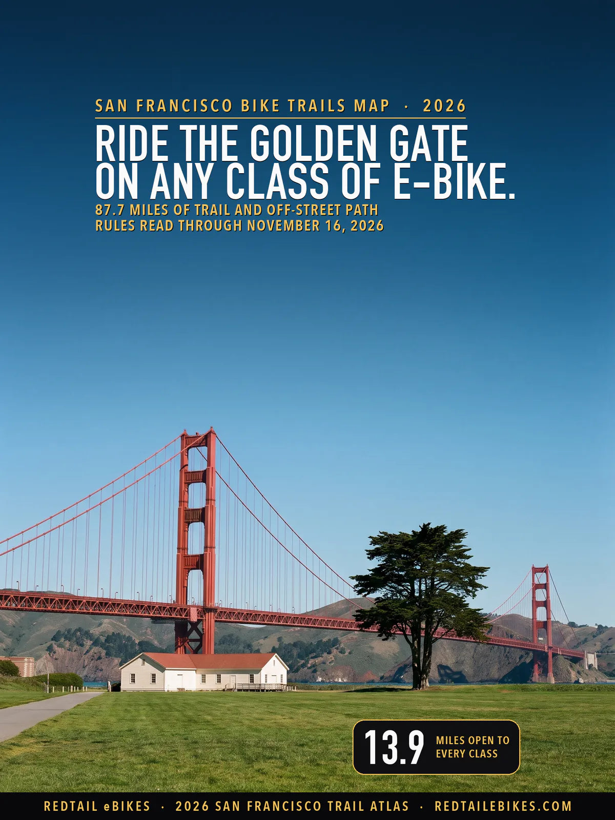
The Golden Gate Bridge beyond the lawn at the west end of Crissy Field, in a scene generated with Playcut from a photograph by Robert Barlow (CC BY 3.0).
The state settles what your e-bike is. California's Vehicle Code says in section 231, "An electric bicycle is a bicycle." The definition behind it stops at a motor that "does not exceed 750 watts of power," so a machine past that line rides under other rules.
Whoever runs the trail settles where it may go. A local body over a hiking or recreational trail "may prohibit, by ordinance, the operation of an electric bicycle or any class of electric bicycle" on it. The Department of Parks and Recreation may do the same on its own paths. Federal land answers to federal rules: the Park Service opens e-bikes only where "The Superintendent will designate the areas open to electric bicycles."
This map puts every rule that could be read over the bike trails in San Francisco, every mapped trail and off-street path in the city: 87.7 miles in 697 pieces, each colored by the classes of e-bike that may ride it. Every line, with its manager, rule and source, is a row in the trail register.
Key takeaways
- 22.3 miles take a Class 1 and a Class 2, and 13.9 take a Class 3. The difference is the City's off-street paths, where the SFMTA's own table and the Vehicle Code read Class 3 differently.
- 13.9 miles are open to every class: the Park Service's named routes (7.3 miles), its paved park roads (0.3), Sunset Dunes' Multi-Use Zone (4.8), the Presidio Trust's roads (0.1) and the Golden Gate Bridge's sidewalks (1.4).
- 26.2 miles are closed to e-bikes: the Presidio Trust's trails (9.9), Park Service trails outside its named routes (9.7), Candlestick Point (5.0) and San Francisco Maritime's paths and piers (1.6).
- 39.2 miles are not settled by any rule read today, most of them on Rec and Park ground (21.7), the Port's waterfront (7.7) and Treasure Island (3.5), whose codes or pages could not be read.
In this guide
- How to read the map
- Who decides on each trail in San Francisco
- The state rule, and what changes in 2027
- The Golden Gate Bridge
- The Presidio: two managers, two rules
- Crissy Field, Fort Point and Fort Mason
- Lands End and Fort Funston
- Sunset Dunes
- Golden Gate Park and the City's parks
- The City's off-street paths
- Aquatic Park and the waterfront
- Candlestick Point, Treasure Island and Mount Sutro
- San Francisco bike trails riders ask about
- San Francisco trails, neighborhood by neighborhood
- Where riders get caught out
- Streets, bike lanes and sidewalks
- Choosing an e-bike for these trails
- Frequently asked questions
- The bottom line
- How we verified this map
- Limitations
- Source register
- References
How to read the map
Each line's color tells you which classes of e-bike may ride it. Green takes all three classes. Blue takes Class 1 and Class 2, with Class 3 read two ways, and purple would mark a line open to Class 1 only.
Red is closed to your e-bike. Gray means no rule read on November 16, 2026, settles the line, which in this city usually means the manager's code could not be read. Amber would mark two rules that disagree about Class 1 and 2; no San Francisco line reads that way today.

San Francisco: 87.7 miles of trail and off-street path, 13.9 open to every class, 8.4 open to Class 1 and 2, 26.2 closed and 39.2 not settled.
| Color | Which e-bikes may ride | Where | Miles |
|---|---|---|---|
| Green | Every class | The Park Service's Golden Gate ground, Sunset Dunes and the Golden Gate Bridge | 13.9 |
| Blue | Class 1 and Class 2; Class 3 read two ways | The City's off-street paths | 8.4 |
| Red | Closed to e-bikes | The Presidio Trust's trails, the Park Service's Golden Gate ground, Candlestick Point and San Francisco Maritime | 26.2 |
| Gray | Not settled by any rule read today | Rec and Park's parks, the Port's waterfront, land with no manager on record and Treasure Island | 39.2 |
The colors assume your e-bike meets section 312.5 of the Vehicle Code: working pedals, a motor of 750 watts or less, and one of the three classes. On Park Service land the federal definition sets the same ceiling, a motor "of not more than 750 watts." A machine past either line is outside every color here.
Mapped miles are line miles. The register counts a path once where several files draw it on the same ground, so a trail's mileage here can differ from the length its manager prints.
Who decides on each trail in San Francisco
Federal, state, district and City bodies run the trails on this map, and the rule you ride under changes where one's ground meets another's. In the Presidio, Park Service ground along the shore meets Presidio Trust ground inland, and the two read your e-bike in opposite ways.
| Manager | Miles | The rule and its source |
|---|---|---|
| National Park Service, Golden Gate National Recreation Area (Fort Point included) | 17.2 | Named routes and paved park roads open to every class, 5 mph on Crissy Field's and Fort Mason's paths; every other trail closed (source) |
| Presidio Trust, its roads | 0.1 | Every class on Trust roads and in parking areas (source) |
| Presidio Trust, its trails | 9.9 | An e-bike is a motor vehicle on Trust land: no trail, paved trails included (source) |
| Golden Gate Bridge, Highway and Transportation District | 1.4 | Every class on the sidewalks, 15 mph, 5 mph at the towers (source) |
| National Park Service, San Francisco Maritime National Historical Park | 1.6 | Bicycles, and so e-bikes, only on its three roads; Municipal Pier and Hyde Street Pier closed (source) |
| California State Parks, Candlestick Point State Recreation Area | 5.0 | Not on State Parks' e-bike list: e-bikes on roads open to street-legal vehicles only (source) |
| San Francisco Recreation and Park, Sunset Dunes | 4.8 | E-bikes in the Multi-Use Zone on the east side (source) |
| City and County of San Francisco (SFMTA), Class I paths outside parks | 8.4 | Class 1 and 2; Class 3 read two ways (the SFMTA Board's table against the Vehicle Code) (source) |
| San Francisco Recreation and Park, its other parks | 21.7 | No e-bike rule on its pages; the Park Code could not be read (Limitations) |
| Port of San Francisco | 7.7 | The Port Code could not be read (Limitations) |
| Treasure Island Development Authority | 3.5 | Its pages could not be read (Limitations) |
| University of California, San Francisco (Mount Sutro Open Space Reserve) | 1.1 | Its rules could not be read (Limitations) |
| Caltrans (the Bay Bridge path) | 0.1 | No e-bike rule found for the path (Limitations) |
| City and County of San Francisco, other City land | 0.6 | The City's codes could not be read (Limitations) |
| No manager on record | 4.5 | No manager's rule (Limitations) |
Fort Point National Historic Site is run with Golden Gate National Recreation Area, under "Title 36 CFR" and the same superintendent's compendium, so this map reads Fort Point's paths by Golden Gate's rules. San Francisco Maritime, the park around Aquatic Park, keeps its own compendium.
The state rule, and what changes in 2027
California sets the three classes in section 312.5(a): a Class 1 helps only while you pedal and a Class 2 also runs on a throttle, both to 20 mph, while a Class 3 helps only while you pedal, to 28 mph. Two state rules follow your Class 3 onto every path in the city.
- Age. "A person under 16 years of age shall not operate a class 3 electric bicycle."
- Helmets. No one rides a Class 3, as operator or passenger, on a street, bikeway or "any other public bicycle path or trail" without a fitted, fastened helmet. Our accessories collection carries helmets.
- Riders under 18. California's bicycle helmet rule covers every rider under 18 on a street, bikeway, path or trail, and an e-bike is a bicycle, so it covers yours. Riding without one is "an infraction punishable by a fine of not more than twenty-five dollars ($25)," and a parent "shall be jointly and severally liable with the minor for the amount of the fine imposed."
- Mopeds. Section 21207.5 keeps one machine off bike paths on the state's own authority, the motorized bicycle: one "shall not be operated on a bicycle path or trail" unless the path runs beside a road or the local body allows it.
- Local reach. Any public agency may set conditions for e-bikes "on public property under the jurisdiction of that agency," and State Parks may bar a class "on any bicycle path or trail within the department's jurisdiction."
Two laws change things on January 1, 2027. Assembly Bill 2346 lets a city set "a speed limit on a bicycle path of 15 or 20 miles per hour" by ordinance, and sets a sidewalk's "prima facie speed limit" at 10 mph unless signs posted under the law change it.
Senate Bill 1167 lists the machines that "shall not be advertised, sold, offered for sale, or labeled as electric bicycles": over 750 watts, faster than 20 mph on the motor alone, or built to be changed past either line. Every color here describes the law in force on November 16, 2026.
The Golden Gate Bridge
Ride the Golden Gate on any class of e-bike: the Bridge's sidewalks take all three, at 15 mph and 5 mph around the towers. The Bridge District's page says "All classes of eBikes are allowed on the Bridge and expected to adhere to rules for cyclists." and "Cyclists must observe 15 mph bicycle speed limit on Bridge sidewalks, and slow to 5 mph around the towers."
The District's announcement said "The new policies will take effect on January 1, 2022." This map draws 1.4 miles of the Bridge and its approaches in green. Your Golden Gate Bridge bike path is whichever sidewalk the District opens to cyclists, and that changes with the season, the day and the hour.
- Weekdays, November to March. "5:00 am to 3:30 pm: East sidewalk 3:30 pm to 6:30 pm: West sidewalk," then the east sidewalk overnight.
- Weekends and holidays, November to March. The west sidewalk from 5:00 am to 6:30 pm, and the east sidewalk overnight.
- Weekdays, March to November. The east sidewalk until 3:30 pm, then the west sidewalk until 9:00 pm.
- Weekends and holidays, March to November. "5:00 am to 9:00 pm: East & West sidewalks."
- At night. The east sidewalk is reached "via remotely-controlled security gates located at both ends of the east sidewalk": you press the buzzer and wait for staff to open each gate.
E-scooters stay off: the District lists "Electric scooters (E-Scooters) and similar devices." among devices not permitted on its sidewalks. Check its page before you cross, because construction and wind close sidewalks at short notice, though "one sidewalk will always remain open to cyclists."
Takeaway
On the Golden Gate Bridge any class rides the open sidewalk at 15 mph, slowing to 5 mph at the towers; which sidewalk is open depends on the day and the hour.
The Presidio: two managers, two rules
In the Presidio's interior your e-bike is a motor vehicle and stays on the roads; along its shoreline the Park Service opens named routes. The Presidio Trust's rules call a bicycle a device "propelled solely by human power," and they count "every vehicle that is propelled by electric power" as a motor vehicle.
Motor vehicles are confined: "Operating a motor vehicle is prohibited except on Presidio Trust roads and in parking areas." The Trust says it plainly for e-bikes: "Electric bikes may only be used on roads in the Presidio and are not allowed on trails." Its answer to riders adds "including paved trails."
Riding a Trust trail anyway puts you in breach of those rules, and a person convicted of breaking them "shall be punished by a fine as provided by law, or by imprisonment not exceeding 6 months, or both."
That closes the Trust's 9.9 miles of trail to your e-bike, whatever its class, the Ecology, Mountain Lake and Park trails and the Trust's stretches of the Ridge and Anza trails among them. The 0.1 miles of Trust road on this map, where a trail rides the road itself, take your e-bike in any class.
On the Park Service's ground along the Presidio's shore a different rule applies to you. There the compendium designates "Coastal Trail, from GG Bridge to intersection of Lincoln and Washington Blvds." except the Batteries to Bluffs section, and Exhibit #22 draws the Battery East Trail from Crissy Field up to the Bridge plaza in the same red as the routes it opens.
The Battery East Trail is not in the compendium's list of routes, but its e-bike speed table names it, so both texts are printed here and the line is drawn green. South of the Lincoln and Washington junction the Coastal Trail is no longer designated, and Exhibit #22's red line stops there too.
Takeaway
In the Presidio's interior keep your e-bike to the roads; along its shore ride the designated routes: the Coastal Trail north of Lincoln and Washington Boulevards, the Battery East Trail, the Crissy Field promenade and the Mason Street path.
Crissy Field, Fort Point and Fort Mason
Crissy Field and Fort Mason open their main paths to every class at 5 mph. The compendium designates the "Crissy Promenade," the Mason Street multi-use path, Fort Mason's Great Meadow paths and the Fort Mason Bay Trail, the former McDowell Road. Its speed table caps your e-bike at 5 mph "on all roads and paved paths in the following areas," naming each.
On this map the named routes along this shore come to 3.3 miles at Crissy Field and Fort Point and 1.2 at Fort Mason. Ride with no more than nine others in your group: "The maximum number of electric bicyclists in any one group is 10."
- Closed by name. The compendium closes the "Crissy Field Lagoon Boardwalk Fort Point Pier (Torpedo Wharf)." Walk your bike across both.
- Roads stay open. Each exhibit's legend reads "E-Bicycles are allowed on all paved roads or sidewalks unless posted." On this map that opens Long Avenue and the paved roads to Fort Point to you on any class, 0.3 miles of park road.
- Everything else is closed. The same legends say "All trails or paths not specifically identified here as open to E-bikes are closed to" them. Exhibit #23 marks the stairs down to Lower Fort Mason and the Black Point Battery Trail that way.
Riding the Marina to the Presidio for work? Our commuter guide sorts its picks by range, hills, rain and the stairs you carry a bike up.
Pick a waterfront commuterLands End and Fort Funston
At Lands End your e-bike rides the west end of El Camino del Mar and nothing else; at Fort Funston it rides the Coastal Trail's south stretch. The compendium closes the "Coastal Trail, Lands End" to e-bikes and designates the "El Camino Del Mar Trail." Exhibit #24 draws only the trail's western stretch in red, and labels its east part "hiking only."
That leaves you 0.5 miles at Lands End, with 4.0 closed, the Coastal Trail along the cliffs, the Sutro Baths Trail and the paths around Sutro Heights among them.

The ground from Sutro Baths along Lands End to Lincoln Park: 6.3 miles of trail and off-street path, 0.5 open to every class, 0.3 open to Class 1 and 2, 4.3 closed and 1.2 not settled.
At Fort Funston the designation reads "Coastal Trail (except north of Horse Trail intersection)." On this map that is 1.1 miles, from the parking lot toward the Great Highway; the other 3.3 miles at Fort Funston, the horse trail and the dune paths, are closed to your e-bike.

The ground around Lake Merced and Fort Funston: 14.3 miles of trail and off-street path, 2.1 open to every class, 5.7 open to Class 1 and 2, 3.3 closed and 3.2 not settled.
Takeaway
At Lands End stay on El Camino del Mar's western stretch, and at Fort Funston on the Coastal Trail south of the Horse Trail junction.
Sunset Dunes
On Sunset Dunes your e-bike rides the Multi-Use Zone on the east side. The park runs over "2 miles of the former Great Highway from Lincoln Way to Sloat Boulevard," and Rec and Park's notice of August 15, 2025, describes that zone as "a shared space for cyclists, runners, walkers, scooters, and e-bikes or e-scooters."
The Park Zone on the west side is "a calm, family-friendly space designed for walking"; there, "Non-motorized bikes or scooters will be welcome if ridden by children." This map draws 4.8 miles of Sunset Dunes in green, with the condition that you keep to the east side.
Golden Gate Park and the City's parks
Golden Gate Park's bike trails and the City's other parks read gray: Rec and Park's own pages state no e-bike rule, and the Park Code could not be read. That covers 21.7 miles, 12.1 of them in Golden Gate Park, the JFK Promenade's 2.7 among them, plus John McLaren Park, Glen Canyon Park and Lake Merced Park.
Gray here does not close the park to you. State law lets a local body bar e-bikes from a recreational trail "by ordinance." A San Francisco ordinance of that kind would sit in the City's own codes, the Park Code among them, and those could not be read. Until they can be, this map does not color those lines either way.
If you are biking Golden Gate Park on an e-bike, ride as a bicycle: keep to the paths and drives open to bicycles, and read the signs at each entrance. The Sunset Dunes section above covers the one Rec and Park place where the department's own words open the ground to e-bikes.

The ground from Ocean Beach through Golden Gate Park to the Panhandle: 20.9 miles of trail and off-street path, 2.2 open to every class, 0.9 open to Class 1 and 2, 2.9 closed and 14.8 not settled.
The City's off-street paths
On the City's off-street bike paths outside its parks, you ride a Class 1 or a Class 2, and a Class 3 reads two ways. These are the SFMTA's Class I paths, 8.4 miles on this map, among them the path beside Lake Merced Boulevard (2.6 miles) and a stretch of Twin Peaks Boulevard (0.8).
The SFMTA Board's table of October 6, 2026, gives a Class 3 "Yes (no offstreet paths)" in its bike-lane column, while the Vehicle Code read today bars no e-bike class from a bike path. The same presentation says "State law defines the device. Operating authorities determine where it may go." Until the City's own code can be read, Class 3 reads two ways on these paths.
Riding the City's paths to work or for fun? Our San Francisco guide sets its picks against the city's hills, and every e-bike we sell ships free within the contiguous United States.
Bikes for SF's pathsAquatic Park and the waterfront
San Francisco Maritime's paths at Aquatic Park are closed to your e-bike, and Municipal Pier and Hyde Street Pier are closed to everyone. The park's compendium says "With the exception of established roads, roadways, parking areas, or designated bicycle routes, the use of bicycles in San Francisco Maritime National Historical Park is prohibited." Its e-bike rule follows: "E-bikes are prohibited where traditional bicycles are prohibited."
It counts three roads, the west end of Jefferson Street, lower Van Ness Avenue and Municipal Pier's roadway, and adds "All other areas of travel within the park are considered paths or trails." The compendium designates no bicycle route, so the walkways of Victorian Park and Aquatic Park, 1.6 miles with the piers, are closed to your e-bike.
- Municipal Pier. "This area is closed permanently due to public safety concerns."
- Hyde Street Pier. "Closed for the duration of the Hyde Street Rebuild Project."
East of Aquatic Park the waterfront is the Port's, and the Port Code could not be read, so its 7.7 miles read gray. The SFMTA's guidelines for share programs say "Riding a powered Mobility Device on the Embarcadero Promenade is a violation of Port Code." That sentence is written for rental scooters and bikes, and no Port text read says how it treats an e-bike you own.
Candlestick Point, Treasure Island and Mount Sutro
Candlestick Point State Recreation Area is closed to your e-bike off its roads. State Parks' policy says "State Parks units not listed below do not allow electric bicycle (e-bike) use except on roads open to public, street-legal vehicle use." Candlestick Point is not on the list, so its 5.0 miles of trail are closed to your e-bike.
- Treasure Island and Yerba Buena Island (3.5 miles, gray). The island authority's own pages could not be read. The map below also draws 0.1 miles of Caltrans road on Yerba Buena Island, gray as well.
- The Bay Bridge path. The East Span path is "open daily from 6:00 AM to 9:00 PM," but 511's page states no e-bike rule for it, and no Caltrans page for the path was found.
- Mount Sutro (1.1 miles, gray). The open space reserve is the University of California's, and its rules could not be read.

Treasure Island and Yerba Buena Island, the island authority's ground and Caltrans's: 3.6 miles of trail and off-street path, 3.6 not settled.
San Francisco bike trails riders ask about
Riders search for each of these trails by name in at least 14 different ways. The first three cross more than one manager's ground, so the color changes where the manager changes; read the stretch you plan to ride.

The Presidio and the northern waterfront: 22.8 miles of trail and off-street path, 6.7 open to every class, 0.1 open to Class 1 and 2, 13.4 closed and 2.6 not settled.
The San Francisco Bay Trail
17.4 miles of the Bay Trail cross the city, and 2.3 of them are open to every class. The miles open to you are the Park Service's: the Crissy Field promenade, the Mason Street path and the Fort Mason Bay Trail, each at 5 mph. Along the Embarcadero the Bay Trail is the Port's (7.3 miles, gray).
Another 3.9 miles are closed, nearly all at Candlestick Point and Aquatic Park, and the other 3.9 read gray, on Rec and Park ground, on Treasure Island and where no manager is on record.
The Coastal Trail
8.1 miles carry the Coastal Trail's name, 4.1 of them open to every class. The miles open to you are the Presidio's bluff trail north of Lincoln and Washington Boulevards, the Bridge approaches, Sunset Dunes and Fort Funston's south stretch. Of the 3.7 closed miles, 2.2 are at Lands End.
The Bay Area Ridge Trail
7.5 miles carry the Ridge Trail's name, and only 0.6 are open to your e-bike. Through the Presidio it runs mostly on Trust trails, closed to every class (2.0 miles). Across the City's parks, Mount Sutro and the stairways between them, 4.7 miles read gray.
Golden Gate Park's JFK Promenade
The JFK Promenade reads gray for its full 2.7 miles. It is Rec and Park ground. None of the department's 446 sitemap pages read on November 16, 2026, names e-bikes. Its Sunset Dunes notice, a news item, is the one page of its own read that does. Ride it as a bicycle, at a pace that suits the people on foot around you.
Our San Francisco guide sorts its picks by the hill you climb and the neighborhood you start from, with free shipping on every one.
See our San Francisco picksSan Francisco trails, neighborhood by neighborhood
Find your neighborhood below. The areas are the 41 Analysis Neighborhoods. DataSF, the City's open-data portal, publishes them, and a line counts in the neighborhood its midpoint falls in. 28 of the 41 hold mapped trail or off-street path.
| Neighborhood | Miles | Green (mi) | Blue (mi) | Red (mi) | Gray (mi) |
|---|---|---|---|---|---|
| Presidio | 16.9 | 5.3 | 0.0 | 11.5 | 0.0 |
| Golden Gate Park | 13.4 | 0.2 | 0.5 | 0.5 | 12.2 |
| Lakeshore | 11.0 | 1.6 | 4.8 | 3.3 | 1.3 |
| Bayview Hunters Point | 8.3 | 0.0 | 0.2 | 5.0 | 3.2 |
| Sunset/Parkside | 7.0 | 4.1 | 0.9 | 0.0 | 2.0 |
| Marina | 3.8 | 1.2 | under 0.1 | 0.3 | 2.3 |
| Treasure Island | 3.6 | 0.0 | 0.0 | 0.0 | 3.6 |
| Outer Richmond | 3.1 | 0.2 | 0.1 | 2.6 | 0.2 |
| Twin Peaks | 2.6 | 0.0 | 0.8 | 0.0 | 1.8 |
| McLaren Park | 2.5 | 0.0 | 0.2 | 0.0 | 2.3 |
| Financial District/South Beach | 2.2 | 0.0 | under 0.1 | 0.0 | 2.2 |
| Lincoln Park | 2.1 | 0.2 | 0.0 | 1.5 | 0.4 |
| Mission Bay | 2.0 | 0.0 | 0.0 | 0.0 | 2.0 |
| Russian Hill | 1.8 | 0.0 | 0.1 | 1.5 | 0.2 |
| Inner Sunset | 1.6 | 0.0 | 0.0 | 0.0 | 1.6 |
| Glen Park | 1.5 | 0.0 | 0.2 | 0.0 | 1.3 |
| North Beach | 1.0 | 0.0 | 0.0 | 0.0 | 1.0 |
| Bernal Heights | 0.6 | 0.0 | 0.2 | 0.0 | 0.4 |
| Potrero Hill | 0.3 | 0.0 | 0.1 | 0.0 | 0.2 |
| Mission | 0.2 | 0.0 | 0.2 | 0.0 | 0.1 |
| Tenderloin | 0.2 | 0.0 | 0.0 | 0.0 | 0.2 |
| Castro/Upper Market | 0.2 | 0.0 | 0.2 | 0.0 | 0.0 |
| Inner Richmond | 0.1 | 0.0 | 0.0 | 0.0 | 0.1 |
| Oceanview/Merced/Ingleside | 0.1 | 0.0 | under 0.1 | 0.0 | 0.1 |
| Portola | 0.1 | 0.0 | under 0.1 | 0.0 | 0.1 |
| West of Twin Peaks | 0.1 | 0.0 | 0.0 | 0.0 | 0.1 |
| Haight Ashbury | under 0.1 | 0.0 | 0.0 | 0.0 | under 0.1 |
| Hayes Valley | under 0.1 | 0.0 | 0.0 | 0.0 | under 0.1 |
| Outside a neighborhood | 1.5 | 1.0 | 0.0 | 0.0 | 0.5 |

The west side, from Lands End to Fort Funston: 41.9 miles of trail and off-street path, 6.4 open to every class, 6.3 open to Class 1 and 2, 11.5 closed and 17.7 not settled.

The southeast, from McLaren Park to Candlestick Point: 11.2 miles of trail and off-street path, 0.2 open to Class 1 and 2, 5.0 closed and 6.0 not settled.
Presidio: 16.9 miles. 5.3 green; 11.5 red.
- Presidio Promenade 1.9 mi (mostly red)
- Bay Trail 1.8 mi (green)
- Bay Area Ridge Trail 1.8 mi (red)
- Mountain Lake Trail 1.8 mi (red)
- Coastal Trail 1.5 mi (mostly red)
- Anza Trail 1.3 mi (red)
- Crissy Field Promenade 1.2 mi (green)
- Park Boulevard 1.1 mi (red)
- Bay Area Ridge Trail & Anza Trail & Coastal Trail 0.6 mi (green)
- Ecology Trail 0.5 mi (red)
- Park Trail 0.4 mi (red)
- Presidio Promenade Trail 0.4 mi (mostly red)
- Mountain Lake Trail & Anza Trail 0.3 mi (red)
- Ridge Trail 0.3 mi (red)
- Rob Hill Campground Trail 0.3 mi (red)
- Also: 1.6 mi of shorter named stretches and 0.2 mi of unnamed trail and path
Golden Gate Park: 13.4 miles. 0.2 green; 0.5 blue; 0.5 red; 12.2 gray.
- John F Kennedy Drive 2.7 mi (gray)
- Great Highway 1.0 mi (mostly blue)
- Martin Luther King Jr Drive 0.7 mi (gray)
- Coastal Trail 0.6 mi (mostly red)
- Kezar Drive 0.6 mi (gray)
- Middle Drive 0.4 mi (gray)
- Overlook Drive 0.4 mi (gray)
- Market to Ocean Beach 0.4 mi (gray)
- Conservatory East Drive 0.4 mi (gray)
- Ridge Trail 0.4 mi (gray)
- Chain Of Lakes Drive 0.3 mi (gray)
- Also: 1.2 mi of shorter named stretches and 4.6 mi of unnamed trail and path
Lakeshore: 11.0 miles. 1.6 green; 4.8 blue; 3.3 red; 1.3 gray.
- Lake Merced Boulevard 1.9 mi (blue)
- John Muir Drive 1.1 mi (blue)
- Coastal Trail 1.1 mi (green)
- Skyline Boulevard 1.0 mi (blue)
- Funston Horse Trail 0.9 mi (red)
- Great Highway Extension 0.7 mi (mostly green)
- Sfsu Path 0.5 mi (blue)
- Lake Merced Bike Path 0.5 mi (gray)
- Battery Davis Trail 0.3 mi (red)
- Ridge Trail 0.3 mi (gray)
- Also: 1.0 mi of shorter named stretches and 2.0 mi of unnamed trail and path
Bayview Hunters Point: 8.3 miles. 0.2 blue; 5.0 red; 3.2 gray.
- Bay Trail 4.1 mi (mostly red)
- San Francisco Bay Trail 2.0 mi (mostly gray)
- Shoreline Trail 0.8 mi (red)
- Bayview Park Road 0.6 mi (gray)
- Also: 0.2 mi of shorter named stretches and 0.7 mi of unnamed trail and path
Sunset/Parkside: 7.0 miles. 4.1 green; 0.9 blue; 2.0 gray.
- Coastal Trail 2.0 mi (green)
- Great Highway 2.0 mi (green)
- Ridge Trail 1.4 mi (gray)
- Lake Merced Boulevard 0.7 mi (blue)
- Also: 0.6 mi of shorter named stretches and 0.3 mi of unnamed trail and path
Marina: 3.8 miles. 1.2 green; 0.3 red; 2.3 gray.
- San Francisco Bay Trail 1.2 mi (gray)
- Great Meadow Paths 0.8 mi (green)
- Fort Mason Bay Trail 0.4 mi (green)
- Also: 0.3 mi of shorter named stretches and 1.1 mi of unnamed trail and path
Treasure Island: 3.6 miles. 3.6 gray.
- San Francisco Bay Trail 2.2 mi (gray)
- Perimeter Path 1.1 mi (gray)
- Also: 0.2 mi of shorter named stretches and 0.1 mi of unnamed trail and path
Outer Richmond: 3.1 miles. 0.2 green; 0.1 blue; 2.6 red; 0.2 gray.
- Coastal Trail 1.5 mi (mostly red)
- Sutro Heights Loop Trail 0.4 mi (red)
- Also: 0.8 mi of shorter named stretches and 0.5 mi of unnamed trail and path
Twin Peaks: 2.6 miles. 0.8 blue; 1.8 gray.
- Ridge Trail 1.3 mi (gray)
- Twin Peaks Boulevard 0.8 mi (blue)
- Sutro Tower Trail 0.4 mi (gray)
- Also: 0.1 mi of unnamed trail and path
McLaren Park: 2.5 miles. 0.2 blue; 2.3 gray.
- Mansell Street 1.3 mi (gray)
- Philosopher's Way 1.0 mi (gray)
- Also: 0.2 mi of shorter named stretches
Financial District/South Beach: 2.2 miles. 2.2 gray.
- San Francisco Bay Trail 2.1 mi (gray)
- Also: 0.1 mi of shorter named stretches
Lincoln Park: 2.1 miles. 0.2 green; 1.5 red; 0.4 gray.
- Coastal Trail 1.0 mi (red)
- Golf Course Road 0.3 mi (mostly gray)
- Also: 0.5 mi of shorter named stretches and 0.3 mi of unnamed trail and path
Mission Bay: 2.0 miles. 2.0 gray.
- San Francisco Bay Trail 1.0 mi (gray)
- Bay Trail 0.6 mi (gray)
- Also: 0.2 mi of shorter named stretches and 0.2 mi of unnamed trail and path
Russian Hill: 1.8 miles. 0.1 blue; 1.5 red; 0.2 gray.
- Victorian Park Walkway 0.7 mi (mostly red)
- Bay Trail 0.5 mi (mostly red)
- Also: 0.5 mi of shorter named stretches
Inner Sunset: 1.6 miles. 1.6 gray.
- Ridge Trail 1.4 mi (gray)
- Also: 0.2 mi of shorter named stretches
Glen Park: 1.5 miles. 0.2 blue; 1.3 gray.
- O'Shaughnessy Boulevard 1.1 mi (mostly gray)
- Also: 0.4 mi of shorter named stretches
North Beach: 1.0 miles. 1.0 gray.
- San Francisco Bay Trail 0.7 mi (gray)
- Also: 0.2 mi of shorter named stretches
Bernal Heights: 0.6 miles. 0.2 blue; 0.4 gray.
- Bernal Cut Path 0.3 mi (gray)
- Also: 0.3 mi of shorter named stretches
Potrero Hill: 0.3 miles. 0.1 blue; 0.2 gray.
- 0.3 mi of shorter named stretches
Mission: 0.2 miles. 0.2 blue; 0.1 gray.
- 0.2 mi of shorter named stretches
Tenderloin: 0.2 miles. 0.2 gray.
- 0.2 mi of shorter named stretches
Castro/Upper Market: 0.2 miles. 0.2 blue.
- 0.2 mi of shorter named stretches
Inner Richmond: 0.1 miles. 0.1 gray.
- 0.1 mi of shorter named stretches
Oceanview/Merced/Ingleside: 0.1 miles. 0.1 gray.
- 0.1 mi of unnamed trail and path
Portola: 0.1 miles. 0.1 gray.
- 0.1 mi of shorter named stretches
West of Twin Peaks: 0.1 miles. 0.1 gray.
Haight Ashbury: under 0.1 mile.
Hayes Valley: under 0.1 mile.
Outside a neighborhood: 1.5 miles. 1.0 green; 0.5 gray.
- The Golden Gate Bridge 1.0 mi (green)
- Also: 0.4 mi of shorter named stretches and 0.1 mi of unnamed trail and path
Where riders get caught out
Most of these are lines on the map where the color changes under you, and in this city that can happen inside a single park.
- Crossing into Trust ground. Leave the shoreline routes for a trail inland and you may be on Presidio Trust ground, where an e-bike is a motor vehicle, closed to every trail "including paved trails."
- Riding Lands End's cliff trail. The compendium closes the "Coastal Trail, Lands End." Only El Camino del Mar's western stretch is open to you.
- Holding speed at Crissy Field. The Park Service caps you at 5 mph on the promenade, the Mason Street path and Fort Mason's paths, well under the 15 mph allowed on the Bridge.
- Riding as a big group. On Park Service land "The maximum number of electric bicyclists in any one group is 10."
- The wrong Bridge sidewalk. Which side is open changes with the day and season, and after hours you cross through the east sidewalk's buzzer gates.
- The piers at Aquatic Park. Municipal Pier and Hyde Street Pier are closed to everyone, and the park's walkways are closed to your bike.
- The Park Zone at Sunset Dunes. Only the east-side Multi-Use Zone takes your e-bike.
Your San Francisco trail checklist
- Check the line's color here, then the posted signs: gray means no rule could be read, not that you may ride.
- On the Golden Gate Bridge, hold 15 mph and 5 mph at the towers, and check which sidewalk is open.
- In the Presidio, keep to roads on Trust ground and to the designated routes on the shoreline.
- At Crissy Field and Fort Mason, ride at 5 mph and in groups of 10 or fewer.
- Helmet every Class 3 rider and passenger and every rider under 18 on any e-bike, and keep kids under 16 off a Class 3; you will find helmets in our accessories collection.
- At Sunset Dunes, ride the east side.
Streets, bike lanes and sidewalks
On the street your e-bike follows the bicycle rules, because the Vehicle Code makes it a bicycle in section 231. In a bike lane you ride any class: the SFMTA Board's own table answers "Yes" for all three in its bike-lane column, and it lists no license for any of them.
Sidewalks are a local question, and San Francisco's sidewalk rule sits in its Transportation Code, which could not be read on November 16, 2026. From January 1, 2027, state law will set a 10 mph "prima facie speed limit" on sidewalks, changed only where signs give notice of a different one.
Choosing an e-bike for these trails
In San Francisco the class matters less than the ground: a Class 1 and a Class 2 open the same 22.3 miles to you here. The Park Service, the Bridge and Sunset Dunes take every class, so a Class 3 gives up only the City's off-street paths, where it reads two ways, leaving you 13.9 miles on it.
A Class 2's throttle helps you on a steep start, and section 312.5 lets that motor "be used exclusively to propel the bicycle." On Park Service land away from public traffic, the federal rule bars running on the motor alone "for an extended period of time without pedaling." Plan to pedal your way along the Crissy Field promenade.
The trail register lists 18.7 of this map's miles as unpaved in their own records, and 9.7 of those are closed to e-bikes, at Fort Funston, Lands End, Candlestick Point and on the Presidio's trails. 72% of the open miles are paved, so a commuter tire suits most of your rides here.
Riding beyond the city? Our California trails map covers the state, and our California e-bike law guide sets out its rules. To the south, our San Jose trails map, Los Angeles trails map and San Diego trails map read their counties the same way.
For the rest of the country, start with bike trails by state and our trail atlas, and the longest bike trails in the US ranks the big ones for e-bikes.
Need a test ride or a mechanic? Our San Francisco e-bike shop directory lists the city's stores, the Oakland and Daly City directories cover its neighbors, and our California directory lists the state's verified shops.
Our San Francisco guide sets each pick against the hills you will climb and the neighborhood you ride from; every e-bike we sell ships free within the contiguous United States.
Read our San Francisco guideWhy buy your San Francisco e-bike from us
- Free shipping to San Francisco. Every electric bike we sell ships free within the contiguous United States; it is dispatched within 1 to 3 business days of your order's confirmation, and most bikes arrive within 5 to 10 business days after dispatch (shipping policy).
- Damage in transit is ours to fix. Note any damage with the carrier and email us photos within 48 hours of delivery; we file the carrier claim and arrange the repair or replacement (refund policy).
- We handle the warranty with you. A bike that won't power on, won't charge, shows an error code or has a faulty part is covered by its manufacturer's warranty, and we coordinate the repair or replacement for you (refund policy).
- Real people on the line. Write to support@redtailebikes.com, which typically answers within one business day, or call (213) 444-4020 and leave a voicemail if no one picks up; every voicemail gets a call back (contact page).
- Checkout with your wallet. Apple Pay, Google Pay and Shop Pay are accepted.
- A company you can name. Our terms of service identify the business behind this store.
Frequently asked questions
Where can I ride an e-bike in San Francisco?
On any class you can ride the Golden Gate Bridge's sidewalks, the Park Service's named routes at Crissy Field, Fort Mason, the Presidio shoreline and Fort Funston, and Sunset Dunes' Multi-Use Zone. Class 1 and Class 2 also ride the City's off-street paths. Presidio Trust trails, Lands End's Coastal Trail and Candlestick Point's trails are closed to you, and the City's parks read gray.
Can you bike the Golden Gate Bridge on an e-bike?
Yes, any class. The District says "All classes of eBikes are allowed on the Bridge and expected to adhere to rules for cyclists." Ride the open sidewalk at 15 mph and slow to 5 mph around the towers; e-scooters are not allowed.
Can you ride an e-bike in Golden Gate Park?
No rule read today settles it. Golden Gate Park is Rec and Park ground, and the department's pages state no e-bike rule for it while the Park Code could not be read, so its 12.1 mapped miles read gray. Ride yours as a bicycle, on the paths and drives open to bicycles, and read the posted signs.
Is the Great Highway open?
As a park, yes. Rec and Park says Sunset Dunes runs over "2 miles of the former Great Highway from Lincoln Way to Sloat Boulevard," and your e-bike rides its east-side Multi-Use Zone, "a shared space for cyclists, runners, walkers, scooters, and e-bikes or e-scooters." A November 3, 2026, ballot measure, Proposition G, would reopen it to private vehicles on weekdays; its count could not be read on November 16, 2026.
Where can I ride a Class 3 e-bike in San Francisco?
On 13.9 miles of this map: the Golden Gate Bridge, the Park Service's named routes and paved roads, the Presidio Trust's roads and Sunset Dunes' Multi-Use Zone. On the City's off-street paths, Class 3 reads two ways. Every rider must be 16 or older, and every rider and passenger wears a helmet.
Can you bike across the Bay Bridge?
From Oakland to Yerba Buena Island, yes, you can: the Bay Bridge Trail runs "connecting Oakland to Yerba Buena Island along the East Span of the Bay Bridge" and is "open daily from 6:00 AM to 9:00 PM." 511 gives the path on the bridge as 2.2 miles long. 511's page states no e-bike rule for the path, and no Caltrans page for it was found.
Is the San Francisco Bay Trail paved?
In San Francisco, mostly: 79% of the 17.4 miles this map draws under the Bay Trail's name inside the city carry a paved surface in their own records, from the Presidio along the waterfront to Candlestick Point.
How long is the Lands End Trail?
The compendium calls it the "Coastal Trail, Lands End," and this map measures 2.2 miles of it, all closed to e-bikes. Of the 4.5 miles of Park Service trail at Lands End and Sutro Heights, only El Camino del Mar's western stretch, 0.5 miles, takes an e-bike.
Can you ride an e-bike on the Lands End Trail?
Only on its western end. The Park Service closes the "Coastal Trail, Lands End" to e-bikes and designates the "El Camino Del Mar Trail," and its Exhibit #24 draws only that trail's western stretch in red. On this map that leaves 0.5 miles open to every class at Lands End and 4.0 closed, the cliff-top Coastal Trail and the Sutro Baths Trail among them.
What is the difference between a Class 2 and a Class 3 e-bike?
A Class 2 can run on its throttle and stops helping at 20 mph; a Class 3 helps only while you pedal, up to 28 mph, under section 312.5(a). On this map the difference decides 8.4 miles, the City's off-street paths among them: those take a Class 1 and a Class 2, while a Class 3 is barred there or read two ways. A Class 3 rider must also be 16 or older.
Are Class 3 e-bikes legal in California?
Yes. Section 312.5 defines a Class 3 as assisting only while you pedal, up to 28 mph. Riders must be 16 or older, everyone aboard wears a helmet, and any agency running a trail may bar the class there.
What are the new California e-bike laws?
Two take effect on January 1, 2027. Assembly Bill 2346 lets a city set a 15 or 20 mph limit on a bike path and sets 10 mph on sidewalks unless signs say otherwise; Senate Bill 1167 bars selling a machine as an e-bike if it exceeds 750 watts, tops 20 mph on the motor alone, or is built to be modified past either.
The bottom line
San Francisco's e-bike map is drawn by who owns the ground. Your e-bike, whatever its class, has the Golden Gate Bridge, Crissy Field, Fort Mason, the Presidio shoreline, Fort Funston's coast and Sunset Dunes; the Presidio Trust keeps you to its roads, and Lands End's cliff trail is closed.
The City's parks and the Port's waterfront read gray until their codes can be read, so check the posted signs where you ride.
Ready to ride the Bridge and the bay? Our San Francisco guide sets each pick against the ground you ride, and every e-bike we sell ships free within the contiguous United States.
Shop our San Francisco picksHow we verified this map
This map's 87.7 miles were measured from the trail register we built for it, and each of its 60 rules was read in the words of the body that wrote it.
- Lines. 697 pieces of trail and off-street path, 87.7 miles in all. They come from the Park Service's trail file, the Golden Gate National Parks Conservancy's roads and trails, State Parks' route file, the SFMTA's bike network, the Bay Trail's file, the Bay Area Trails Collaborative's trail network and OpenStreetMap (Geofabrik's Northern California extract). The OpenStreetMap extract is the one Geofabrik served for November 15, 2026. Where two files draw one path within 10 meters in one file or 20 meters across files, it counts once, the managers' own files first, and a line a file stores twice counts once (176 such copies set aside). Where an inventory file redraws a line a park manager's own file draws farther off on that manager's land, its copy is set aside (0.2 miles in 6 pieces). Lines that are not a trail open to riders are set aside too, each with its reason logged: 427.2 miles of on-street bikeways, which the road rules govern; 31.8 of trails planned but not built; 4.6 of paths running beside a road; and 6.0 for other recorded reasons. Every piece is cut into runs of a quarter mile or less before it is placed. Every mile figure is rounded once, to a tenth, so the parts printed with a total (a legend's rows, a caption's figures, a neighborhood's colors) can add up to a tenth more or less than it.
- Places. Each piece is placed by the Analysis Neighborhoods, Rec and Park's properties, the Port's jurisdiction, the Presidio's boundary, the City's land records, the Park Service's land tracts, State Parks' park boundaries and the California Protected Areas Database. Inside the Presidio, the Presidio Trust's own trail and road files decide which ground is the Trust's, and the Park Service's own paved-roads file decides which of its lines are park roads. A trail's manager is the body that runs its ground.
- Rules. 60 passages from the bodies that govern the ground, each quoted from the copy saved when it was read, 55 of them quoted on this page, all read on November 16, 2026. The Park Service's designated routes are placed by its compendium's words and the red lines of its Exhibits #22 to #24, read at full size. Where two records disagree about bicycles, the manager's own record decides.
- What readers ask. 4,468 questions and search phrasings harvested from 3 kinds of source (search suggestions on two engines, the headings of the pages that answer them, and an AI search panel); 474 are answered on this page and the rest are logged with the reason they were set aside.
- Sources. 48 sources are linked, each saved as it was read. Building the map, we requested 515 pages and documents from the managers' and publishers' own sites, Rec and Park's whole sitemap among them: 500 were retrieved in full, 8 were refused or challenged and 7 had no page at the address. The City's Park, Port and Transportation codes, Treasure Island's authority and the University's reserve rules could not be read, see Limitations.
- Names. Each piece of the map is listed under one name, the one its source file gives it, so a trail two files name differently (the Bay Trail and the San Francisco Bay Trail) is listed under both names; the SFMTA's street-style names are written out ("GREAT HWY HWY" is printed as Great Highway).
- The data. Every trail is a row in the register (CSV) for each neighborhood it crosses, with its manager, its verdict for each class, the rule behind it and the names the files give it; the same rows are published as JSON.
- Cover. The cover scenes of the Golden Gate Bridge from Crissy Field were generated with Nano Banana Pro on Playcut (playcut.ai) from a photograph by Robert Barlow (Wikimedia Commons, CC BY 3.0); their type was set in-house.
- Byline. Researched and written by Milad Ghobadibeygvand, BScN (Western University, 2014), for Redtail eBikes; corrections to support@redtailebikes.com.
Limitations
- The City's own codes were not read. San Francisco's Park Code, Port Code and Transportation Code are published on a host that refused this research reader on November 16, 2026, and the Board of Supervisors' ordinance files answered with an empty challenge. Rec and Park's own pages state no e-bike rule beyond Sunset Dunes' zones (all 446 pages of its sitemap were read, and its news archive beyond that notice was not), so its 21.7 miles read gray, as do the Port's 7.7 and 0.6 on other City land.
- The City's off-street paths read from the state code and the SFMTA's table. Class 1 and Class 2 are drawn open on the 8.4 miles of the SFMTA's Class I paths outside parks because the Vehicle Code makes an e-bike a bicycle and the SFMTA Board's own table lets every class use a bike lane; a restriction in the Transportation Code would not show here.
- Three other managers' rules could not be read. Treasure Island's authority answered with a challenge (3.5 miles), the University of California's Mount Sutro reserve with a refusal (1.1), and 511 states no e-bike rule for the Bay Bridge path and no Caltrans page for it was found (0.1). All read gray, and 4.5 miles with no manager on record read gray too.
- The Park Service's exhibits are drawings. Its maps say they are for illustrative purposes, and this map places the designated stretches where its compendium names them and its exhibits draw them: El Camino del Mar's western stretch, the Coastal Trail at Fort Funston south of the Horse Trail junction, and the Presidio's Coastal Trail north of Lincoln and Washington Boulevards. A line drawn a few meters off where the exhibit runs could carry the wrong color.
- The Battery East Trail rests on two texts. The compendium's list of routes does not name it, while Exhibit #22 draws it red and the e-bike speed table names it; this map follows the exhibit and the table.
- Sunset Dunes is drawn as one corridor. Only the east-side Multi-Use Zone takes e-bikes, and the files read do not separate the zones, so the whole corridor is drawn green with that condition. A November 3, 2026, ballot measure on the Upper Great Highway, Proposition G, would restrict private vehicles there only from Friday at 6:00 p.m. until Monday at 4:00 a.m. and on holidays, reopening it to them on weekdays. The Department of Elections' count could not be read, so this map draws Sunset Dunes as Rec and Park's notice of August 15, 2025, describes it.
- Some paths may be counted twice. Where two inventories draw one path a few tens of meters apart and no manager's file draws it, both drawings stay on this map. Measured against every other file's lines, 12.2 miles of line run within 60 meters of another file's line, the same way, for at least 80% of their length; counted once per pair, that is about 5.3 of the 87.7 miles. Some of those pairs are two real paths side by side.
- The frame is the City and County of San Francisco on the mainland and its bay islands. The Farallon Islands, part of the county, are a refuge whose manager says "The Refuge is closed to the public due to the sensitivity of wildlife." and are not drawn.
- Mapped miles are line miles. The register counts a line once where several files draw it on the same ground, connectors, loops and parallel paths included; it is not a measure of any single route's length.
- Search volumes are not stated. The paid keyword instrument returned no data on the day of this build, so this page makes no claim about how many people search for any phrase; its questions come from the harvest described in the method.
When to re-check this map: on January 1, 2027, when Senate Bill 1167 and Assembly Bill 2346 take effect; whenever the City sets a 15 or 20 mph path limit under the new law; when the Park Service publishes its next compendium; when the Bridge District changes its sidewalk hours; and when the City's Park, Port or Transportation Code can be read.
Source register
Every rule on this map comes from these sources, grouped by the body that issues them, each saved as it was read and linked to the deepest page that states it:
| Source | Tier | What it supports |
|---|---|---|
| Assembly Bill 2346 (Stats. 2026), chaptered text | T1 | From January 1, 2027: local 15 or 20 mph limits on bike paths; a 10 mph sidewalk limit unless signs change it |
| Cal. Veh. Code § 21113, Public grounds | T1 | Any public agency may set conditions for e-bikes on its property |
| Cal. Veh. Code § 21207.5, Motorized and electric bicycles on paths and trails | T1 | Local bodies may bar a class from hiking and recreational trails; State Parks from any path it runs; mopeds off bike paths |
| Cal. Veh. Code § 21212, bicycle helmets for riders under 18 | T1 | A helmet for every rider under 18, an e-bike included; a fine of up to $25, a parent liable with the minor |
| Cal. Veh. Code § 21213, Class 3 electric bicycles | T1 | No Class 3 rider under 16; a helmet for every Class 3 rider and passenger |
| Cal. Veh. Code § 231, Electric bicycle | T1 | An electric bicycle is a bicycle |
| Cal. Veh. Code § 312.5, Electric bicycle: definition and classes | T1 | The three classes and the 750-watt motor limit; a Class 2's motor may propel the bike alone |
| Senate Bill 1167 (Stats. 2026, Ch. 846), chaptered text | T1 | From January 1, 2027: the machines that may not be sold or labeled as e-bikes |
| 36 CFR § 1.4, What terms do I need to know? | T1 | The federal e-bike definition: pedals and a motor of not more than 750 watts |
| 36 CFR § 4.30, Bicycles | T1 | E-bikes on Park Service land only where the superintendent designates; no long motor-only riding off public roads |
| Exhibit #22, Regulations for Electric Bikes, Baker Beach and Crissy Field, Golden Gate National Recreation Area | T1 | Every trail not marked open is closed to e-bikes; the Battery East Trail's red line |
| Exhibit #23, Regulations for Electric Bikes, Fort Mason, Golden Gate National Recreation Area | T1 | E-bikes on all paved park roads and sidewalks unless posted |
| Laws & Policies, Fort Point National Historic Site | T2 | Fort Point is governed with Golden Gate National Recreation Area |
| Superintendent's Compendium, Golden Gate National Recreation Area (2025) | T1 | San Francisco's designated e-bike routes, the routes closed by name, park roads, speed limits and group size |
| Superintendent's Compendium, San Francisco Maritime National Historical Park | T1 | Bicycles and e-bikes only on the park's three roads; Municipal Pier and Hyde Street Pier closed |
| 36 CFR Part 1001, Presidio Trust: Applicability and scope; definitions | T1 | On Trust land a bicycle is human-powered and an electric-powered vehicle is a motor vehicle |
| 36 CFR § 1004.10, Travel on Presidio Trust roads and routes | T1 | Motor vehicles only on Trust roads and in parking areas |
| Lyft Bike, Presidio Trust | T2 | E-bikes on Presidio roads only, never on its trails, paved trails included |
| Bike Safety: New Measures on the Golden Gate Bridge, Golden Gate Bridge District | T2 | The e-bike policy's effective date, January 1, 2022 |
| Bikes & Pedestrians, Golden Gate Bridge, Highway and Transportation District | T2 | Every e-bike class on the sidewalks, 15 mph and 5 mph at the towers; sidewalk hours; e-scooters barred |
| E-Bikes in CA State Parks, California State Parks | T2 | E-bikes only on roads in units the list does not name; Candlestick Point is not on it |
| City Launches Next Phase of Improvements at Sunset Dunes (August 15, 2025), San Francisco Recreation and Park | T2 | Sunset Dunes' Multi-Use Zone and Park Zone; the park's two miles of the former Great Highway |
| Powered Scooter Share Parking Guidelines, SFMTA | T2 | Powered share devices on the Embarcadero Promenade violate the Port Code |
| Safe E-Device Information Item (October 6, 2026), SFMTA Board of Directors | T2 | The SFMTA Board's device table: every class in bike lanes, Class 3 'no offstreet paths' |
| Proposition G, The Great Highway for Everyone Act, legal text, City and County of San Francisco | T2 | The 2026 ballot measure on the Upper Great Highway's weekday car traffic |
| Bay Bridge Trail, 511 (Metropolitan Transportation Commission) | T2 | The Bay Bridge Trail's route on the East Span and its hours |
| Farallon Islands National Wildlife Refuge, U.S. Fish and Wildlife Service | T2 | The Farallon Islands refuge is closed to the public |
T1 is the rule's own text at its publisher: the statute and the bills, the federal regulations, and each park's adopted compendium with its exhibits. T2 is the managing body's own page, notice or presentation.
The trail lines come from the data publishers named in the method. News reports, rental shops' pages and other guides were read as leads only and are not cited.
References
These are the documents this page quotes, in the order of the source register, each with the section quoted, the date it was read and its address. Each rule is cited to the body that makes it and to no second publisher, so those citations stand alone:
- State of California. "Assembly Bill 2346 (Stats. 2026), chaptered text". sec. adding § 21214.8; sec. adding § 22352.1. Accessed November 16, 2026.
- State of California. "Cal. Veh. Code § 21113, Public grounds". § 21113(g). Accessed November 16, 2026.
- State of California. "Cal. Veh. Code § 21207.5, Motorized and electric bicycles on paths and trails". § 21207.5(a); § 21207.5(b); § 21207.5(c). Accessed November 16, 2026.
- State of California. "Cal. Veh. Code § 21212, bicycle helmets for riders under 18". § 21212(e)(1); § 21212(e)(2). Accessed November 16, 2026.
- State of California. "Cal. Veh. Code § 21213, Class 3 electric bicycles". § 21213(a); § 21213(b). Accessed November 16, 2026.
- State of California. "Cal. Veh. Code § 231, Electric bicycle". § 231. Accessed November 16, 2026.
- State of California. "Cal. Veh. Code § 312.5, Electric bicycle: definition and classes". § 312.5(a). Accessed November 16, 2026.
- State of California. "Senate Bill 1167 (Stats. 2026, Ch. 846), chaptered text". sec. amending § 312.5(c). Accessed November 16, 2026.
- National Park Service. "36 CFR § 1.4, What terms do I need to know?". § 1.4(a). Accessed November 16, 2026.
- National Park Service. "36 CFR § 4.30, Bicycles". § 4.30(i)(1); § 4.30(i)(2); § 4.30(i)(3). Accessed November 16, 2026.
- National Park Service. "Exhibit #22, Regulations for Electric Bikes, Baker Beach and Crissy Field, Golden Gate National Recreation Area". Accessed November 16, 2026.
- National Park Service. "Exhibit #23, Regulations for Electric Bikes, Fort Mason, Golden Gate National Recreation Area". Accessed November 16, 2026.
- National Park Service. "Laws & Policies, Fort Point National Historic Site". Accessed November 16, 2026.
- National Park Service. "Superintendent's Compendium, Golden Gate National Recreation Area (2025)". 36 CFR 4.30(i): San Francisco, closed routes, group size, speed limits. Accessed November 16, 2026.
- National Park Service. "Superintendent's Compendium, San Francisco Maritime National Historical Park". 36 CFR 1.5: closures; 36 CFR 4.30; 36 CFR 4.30(i); Roads and Paths. Accessed November 16, 2026.
- Presidio Trust. "36 CFR Part 1001, Presidio Trust: Applicability and scope; definitions". § 1001.3; § 1001.4. Accessed November 16, 2026.
- Presidio Trust. "36 CFR § 1004.10, Travel on Presidio Trust roads and routes". § 1004.10(a). Accessed November 16, 2026.
- Presidio Trust. "Lyft Bike, Presidio Trust". Accessed November 16, 2026.
- Golden Gate Bridge, Highway and Transportation District. "Bike Safety: New Measures on the Golden Gate Bridge, Golden Gate Bridge District". Accessed November 16, 2026.
- Golden Gate Bridge, Highway and Transportation District. "Bikes & Pedestrians, Golden Gate Bridge, Highway and Transportation District". Accessed November 16, 2026.
- California State Parks. "E-Bikes in CA State Parks, California State Parks". Accessed November 16, 2026.
- San Francisco Recreation and Park Department. "City Launches Next Phase of Improvements at Sunset Dunes (August 15, 2025), San Francisco Recreation and Park". Accessed November 16, 2026.
- San Francisco Municipal Transportation Agency. "Powered Scooter Share Parking Guidelines, SFMTA". Accessed November 16, 2026.
- San Francisco Municipal Transportation Agency. "Safe E-Device Information Item (October 6, 2026), SFMTA Board of Directors". Accessed November 16, 2026.
- City and County of San Francisco. "Proposition G, The Great Highway for Everyone Act, legal text, City and County of San Francisco". Accessed November 16, 2026.
- Metropolitan Transportation Commission (511). "Bay Bridge Trail, 511 (Metropolitan Transportation Commission)". Accessed November 16, 2026.
- U.S. Fish and Wildlife Service. "Farallon Islands National Wildlife Refuge, U.S. Fish and Wildlife Service". Accessed November 16, 2026.
Share:
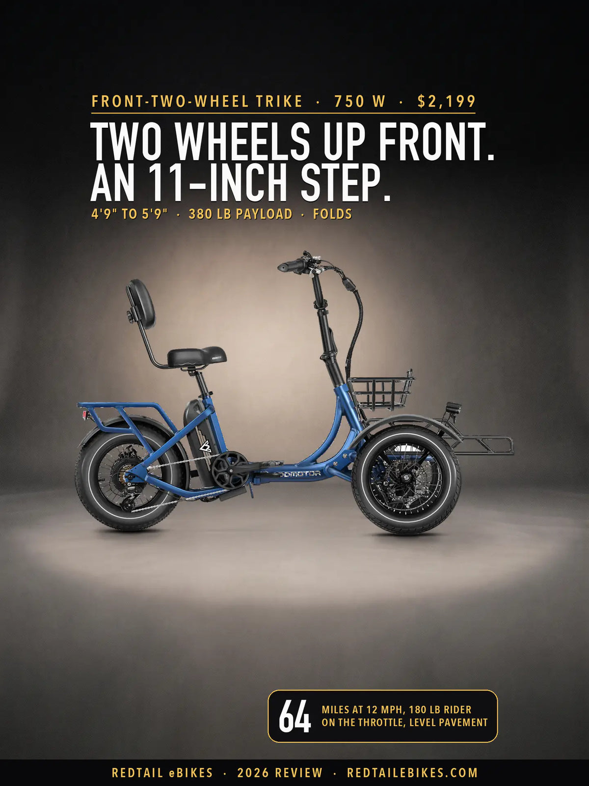
Addmotor Spytan 2 Review: Two Front Wheels From 4'9"