











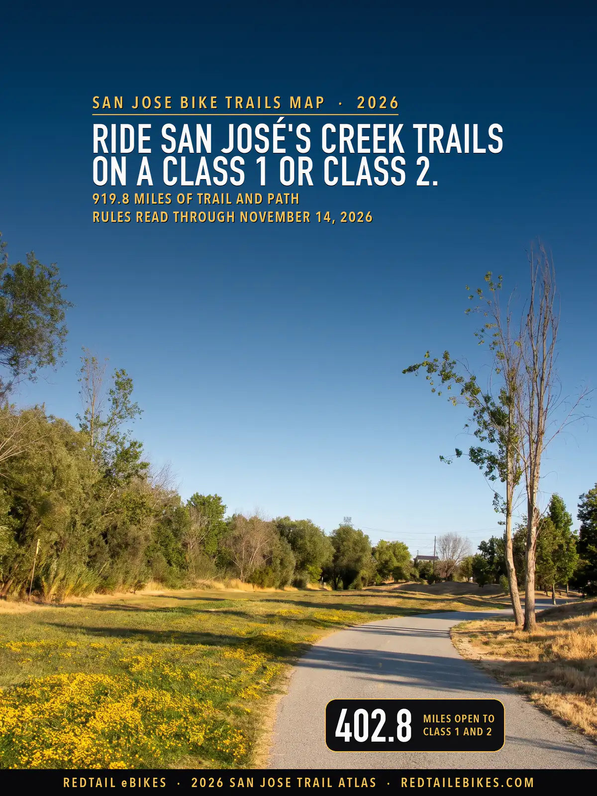
919.8 miles of trail and path · 209 named trails of a mile or more · 667.1 miles open to a Class 1 · 62 passages quoted from the bodies that wrote them · Rules read through November 14, 2026
Verified November 14, 2026: every rule on this map is quoted from the body that wrote it: the California Legislature, California State Parks, the County of Santa Clara, the City of San José and seven other cities and towns, the Midpeninsula Regional Open Space District, the Santa Clara Valley Open Space Authority, Valley Water, the U.S. Fish and Wildlife Service and Stanford University.
Each was saved as it was read, and every mile below was computed from this map's own register, which you can download and check line by line.
Quick Answer: California treats your e-bike as a bicycle and lets whoever runs a trail narrow that. In this county a Class 1 or Class 2 rides San José's creek trails and the County's parks, only a Class 1 rides Henry W. Coe, and almost no e-bike rides Midpen or Open Space Authority land. Check Class 3 before every ride.
Every e-bike we sell ships free within the contiguous United States, San José included. For the ground on this map, start with our San José guide: it sets its picks against the city's grades and the neighborhood you ride from, and covers charging through its summer heat. On a trail here, choose a bike whose motor does not exceed 750 watts: past that line California does not count your bike as an e-bike.
Match a bike to your trails
The paved Guadalupe River Trail curving past a meadow of wildflowers beside the river's woods, in a scene generated with Playcut from a photograph by Alexey Komarov (CC BY 3.0).
California answers the first half of your trail question. Section 231 of the Vehicle Code says "An electric bicycle is a bicycle." Your e-bike may use a bike path for the same reason a pedal bike may.
A 2022 law, in force since January 1, 2023, set out to "remove the prohibition of class 3 electric bicycles on these facilities," bike paths among them, so whatever class you ride, the state no longer bars it from one. The state's definition sets the ceiling: a motor that "does not exceed 750 watts of power."
The agency that runs the trail answers the second half. A local body "may prohibit, by ordinance, the operation of an electric bicycle or any class of electric bicycle" on an equestrian, hiking or recreational trail it governs. State Parks may do the same "on any bicycle path or trail within the department's jurisdiction." Any public agency may set conditions for e-bikes "on public property under the jurisdiction of that agency."
This map lays every manager's rule that could be read over every mapped trail and off-street path in Santa Clara County: 919.8 miles in 5,691 pieces, each colored by the classes of e-bike you may ride there. Every line, with its manager, its rule and its source, is a row in the trail register.
Key takeaways
- 667.1 miles take a Class 1, 402.8 take a Class 2 and 48.2 take a Class 3. The gaps between those three numbers are mostly State Parks' Class 1 line and the County's and San José's Class 3 lines.
- 48.2 miles are open to every class: Stanford's campus paths (27.3 miles), Sunnyvale's trails (14.2) and Palo Alto's park paths and paved preserve trails (6.8).
- 354.6 miles take a Class 1 and a Class 2. On 207.5 of them, in the County's parks, and 5.0 at Midpen's Rancho San Antonio, Class 3 is barred; on the trails of San José, Mountain View, Cupertino, Los Gatos and Saratoga, the two texts that govern Class 3 disagree, so it reads two ways.
- 264.3 miles take a Class 1 only: the roads and trails of Henry W. Coe State Park and the trails State Parks lists at Pacheco, where its e-bike list opens Class 1 and no other class.
- 133.0 miles are closed to e-bikes: Midpen preserves outside Rancho San Antonio's designated trails (73.4), Open Space Authority land (29.4) and the unpaved trails of Palo Alto's preserves (17.1), among others. If you have a mobility disability, you may still ride the Midpen and Authority trails open to bicycles.
- 116.5 miles are not settled by any rule read today: 55.3 in seven cities and towns whose own rules could not be read, the Don Edwards refuge (22.4), Palo Alto paths whose surface or setting no record settles (15.6), San José's park paths that open only where posted (15.5) and unincorporated land with no manager on record (7.5), among others.
In this guide
- How to read the map
- Who decides on each trail in Santa Clara County
- The state rule, and what changes in 2027
- San José's creek trails
- County parks: Class 1 and 2 where bicycles ride
- Henry W. Coe and Pacheco: Class 1 only
- Midpen preserves: designated trails only
- Open Space Authority land: mobility devices only
- The Don Edwards refuge
- Palo Alto's preserves: pavement only
- The other cities and Stanford
- San Jose bike trails riders ask about
- Santa Clara County trails, area by area
- Where riders get caught out
- Streets, bike lanes and sidewalks
- Choosing an e-bike for these trails
- Frequently asked questions
- The bottom line
- How we verified this map
- Limitations
- Source register
- References
How to read the map
Each color answers one question: which classes of e-bike may you ride on this line? Green is all three. Blue is Class 1 and Class 2, with Class 3 either barred or read two ways, and purple is Class 1 only.
Amber marks a line where two rules, or two records, disagree about Class 1 and Class 2. Red is closed to e-bikes, and gray means no rule read today settles the line.

Santa Clara County: 919.8 miles of trail and path, 48.2 open to every class, 354.6 open to Class 1 and 2, 264.3 open to Class 1 only, 3.1 read two ways, 133.0 closed and 116.5 not settled.
| Color | Which e-bikes may ride | Where | Miles |
|---|---|---|---|
| Green | Every class | Stanford, Sunnyvale and Palo Alto | 48.2 |
| Blue | Class 1 and Class 2; Class 3 barred or read two ways | The County's parks, San José and Mountain View | 354.6 |
| Purple | Class 1 only | Henry W. Coe | 264.3 |
| Amber | Two rules disagree about Class 1 and Class 2 | Martial Cottle Park and Campbell | 3.1 |
| Red | Closed to e-bikes | Midpen preserves, Open Space Authority land, Palo Alto and the County's parks | 133.0 |
| Gray | Not settled by any rule read today | Cities whose rules could not be read, the Don Edwards refuge, Palo Alto, San José and unincorporated land | 116.5 |
The colors describe e-bikes that meet California's definition in section 312.5 of the Vehicle Code: pedals that work, a motor that does not exceed 750 watts, and one of the three classes. A machine that fails that test is not an e-bike under the Vehicle Code, and the colors on this map do not describe it.
The County's code draws its own line a little tighter, at "less than 750 watts," which the County parks section quotes.
Mapped miles are line miles: the register counts each line it keeps once, connectors and parallel paths included, so a preserve's miles here can differ from the length its manager publishes. The table sets the two side by side, with the measured reason for every gap of more than a mile.
| Trail or preserve | Published miles | Published by | Miles on this map | Why they differ |
|---|---|---|---|---|
| San José's trail network | 65 | City of San José | 80.3 | The City's own trail file draws this map's miles; its page does not say what its figure counts |
| Sierra Azul Open Space Preserve | approximately 26 | Midpen | 28.9 | Midpen's own trail file draws 24.6 of this map's 28.9 miles here, and other files' lines inside the preserve the rest; the page does not say what its figure counts |
| Fremont Older Open Space Preserve | 11 | Midpen | 11.2 | Within a mile |
| Sierra Vista Open Space Preserve | 9 | Open Space Authority | 11.3 | The Authority's own trail file draws 8.7 of this map's 11.3 miles here, and other files' lines inside the preserve the rest; the page does not say what its figure counts |
| Coyote Valley Open Space Preserve | 4 | Open Space Authority | 4.2 | Within a mile |
| Coyote Ridge Open Space Preserve | 5 | Open Space Authority | 5.4 | Within a mile |
| Rancho Cañada del Oro Open Space Preserve | 12 | Open Space Authority | 7.9 | The Authority's own trail file draws 9.4 miles of trail it shows on its brochures in this preserve (every manager); this map carries 7.9 of them as the Authority's: the page states a figure its own file does not reach |
| Rancho Cañada del Oro Open Space Preserve | about 10 | Open Space Authority | 7.9 | The Authority's own trail file draws 9.4 miles of trail it shows on its brochures in this preserve (every manager); this map carries 7.9 of them as the Authority's: the page states a figure its own file does not reach |
| Pearson-Arastradero Preserve | approximately 10.3 | Palo Alto Parks and Recreation Commission | 10.3 | Within a mile |
| Palo Alto Baylands Nature Preserve | approximately 15 | Palo Alto Parks and Recreation Commission | 9.5 | OpenStreetMap draws 16.7 miles of path inside the preserve's boundary; this map counts a path only where a manager's file, an inventory or OpenStreetMap names it and opens it to bicycles, and about 7.5 miles of the preserve's paths carry no name or no bicycle tag (logs/baylands-osm-trace_20261113.csv) |
| Martial Cottle Park | over 3 | County Parks | 3.2 | Within a mile |
Who decides on each trail in Santa Clara County
The agency that runs the trail you are on sets its e-bike rule, and in this county one creek trail can cross City, County and Valley Water land. Valley Water owns the land under parts of 55 named trails on this map and says the trails on its land are run by "the city, special district, or Santa Clara County" where they lie, so this map reads the operator's rule there.
| Manager | Miles | The rule and its source |
|---|---|---|
| California State Parks, Henry W. Coe State Park | 261.1 | Pedal-assist Class 1 where bicycles ride; some trails and the Orestimba Wilderness closed to every bicycle (source) |
| California State Parks, Pacheco State Park | 5.2 | Class 1 on the trails its e-bike list names (source) |
| California State Parks, Castle Rock State Park | 1.8 | E-bikes on public roads only; the unit is not on the e-bike list (source) |
| County of Santa Clara Parks | 214.0 | Class 1 and 2 on trails signed for bicycles, 15 mph; Class 3 barred (source) |
| County of Santa Clara Parks, Martial Cottle Park's state recreation area | 1.7 | The County's Class 1 and 2 rule and State Parks' roads-only rule both reach it (source) |
| City of San José | 113.8 | Class 1 and 2 on its trail network at 15 mph, Class 3 two ways; park paths only where posted (source) |
| Midpeninsula Regional Open Space District | 78.4 | Designated trails only: Class 1 and 2 on Rancho San Antonio's improved trails (source) |
| Santa Clara Valley Open Space Authority | 29.4 | Only as a mobility device, for a rider with a mobility disability (source) |
| U.S. Fish and Wildlife Service, Don Edwards refuge | 22.4 | A bicycle's rights only after a compatibility finding; none found (source) |
| City of Palo Alto | 40.6 | Every class on park trails and paved preserve trails; unpaved preserve trails closed (source) |
| Stanford University | 27.3 | E-bikes ride as bicycles; 10 mph in the Pedestrian Zone (source) |
| City of Mountain View | 25.6 | Electric-assist bicycles on its trails at 15 mph; Class 3 two ways (source) |
| City of Sunnyvale | 14.2 | A bicycle under the Vehicle Code, on park roads and designated paths (source) |
| City of Cupertino | 8.0 | Class 1 and 2 on all bike facilities; Class 3 two ways (source) |
| Town of Los Gatos | 5.3 | Class 1 and 2 where bicycles ride (its archived page); Class 3 two ways (source) |
| City of Saratoga | 4.9 | Every class where bicycles ride, with a hedge on Class 3 (source) |
| City of Campbell | 1.7 | No motorized vehicle or cycle in its parks except where designated; reads two ways (source) |
| Seven cities and towns: Gilroy, Milpitas, Santa Clara, Morgan Hill, Los Altos Hills, Los Altos and Monte Sereno | 55.3 | Their own rules could not be read (Limitations) |
| California Department of Fish and Wildlife, Cañada de los Osos Ecological Reserve | 0.2 | Its reserve rule was not read (Limitations) |
| Unincorporated land, no manager on record | 8.9 | No manager's rule; closed where County Parks' trail file opens a path to no bicycles (Limitations) |
Martial Cottle Park is "a state and county park operated by Santa Clara County Parks," so the County's rule governs its County part; inside the state recreation area's boundary, State Parks' rule reaches the same paths and the two disagree, so those paths read two ways. Stanford's campus paths are Stanford's, read from the university's own traffic code.
The state rule, and what changes in 2027
California sets three classes in section 312.5(a). Class 1 assists only while you pedal, Class 2 can also run on a throttle, and both stop helping at 20 mph; Class 3 assists only while you pedal, up to 28 mph, and must carry a speedometer.
A Class 1 or Class 3 may also have a start or walk mode that moves it on the motor alone, up to 3.7 mph. The state's rules below reach the public paths and trails on this map, whoever runs them.
- Helmets. Anyone under 18 must wear a helmet on a bicycle "upon a street, bikeway, as defined in Section 890.4 of the Streets and Highways Code, or any other public bicycle path or trail," and section 231 makes your e-bike a bicycle. On a Class 3, every rider and passenger of any age wears one: "unless that person is wearing a properly fitted and fastened bicycle helmet."
- What a missing helmet costs. A rider under 18 without one commits an infraction "punishable by a fine of not more than twenty-five dollars ($25)," and the parent or guardian "shall be jointly and severally liable with the minor for the amount of the fine." A first charge is dismissed when the rider says under oath in court that it is the first, unless the court finds otherwise. Pack a helmet for every rider in your group: our accessories collection carries them.
- Age. "A person under 16 years of age shall not operate a class 3 electric bicycle." The law reaches the sale too: "A person shall not sell a class 3 electric bicycle to a person under 16 years of age."
- Who may restrict. Local bodies may bar a class from equestrian, hiking and recreational trails by ordinance, and State Parks may bar a class on any path it runs.
Two laws signed in 2026 take effect on January 1, 2027. Senate Bill 1167 will list the machines that "shall not be advertised, sold, offered for sale, or labeled as electric bicycles": over 750 watts, faster than 20 mph on the motor alone, or built to be modified past either line, and will call section 21207.5's motorized bicycle a moped.
Assembly Bill 2346 will let a city or county set, by ordinance and with signs, "a speed limit on a bicycle path of 15 or 20 miles per hour," or 10 mph where crowds or sight lines call for it. Every color here describes the law in force on November 14, 2026.
San José's creek trails
Ride San José's creek trails on a Class 1 or Class 2, at up to 15 mph. On the City's stretches of the Guadalupe River, Coyote Creek and Los Gatos Creek trails, its trail rules page sets "Maximum speed is 15 mph (municipal code section 13.44.100)" and bars "No motorized vehicles (except motorized mobility devices)."
For your e-bike, the same page points you to the state law in a link titled "Learn More About New California State Law that Permits Use of Type 1 and Type 2 E-Bikes Upon Class I Trails."
That page names Class 1 and Class 2 and says nothing of Class 3. State law has barred no class from a bike path since 2023, when Assembly Bill 1909 took effect, and the City's code holds no e-bike class rule that this map could read.
So Class 3 reads two ways on the 98.3 miles of the City's trail network and its other paths outside parks. If you ride a Class 3 here, hold it to 15 mph: that limit binds every rider, and no text read settles your class.
- Park paths are the exception. Inside a City park, the code says no one may ride a bicycle on any path or trail "unless such activity is permitted by notices posted by the director." The 15.5 miles of park paths outside the City's trail file read gray, Alum Rock Park's 3.6 among them: whether a given path is posted for bicycles, no record read says.
- Speed in parks. Where no limit is posted, the code caps every vehicle on a park road or trail at "fifteen miles per hour."
- The City's own count. San José says it has "65 miles developed and open to the public." The City's own trail file draws 80.3 miles of open reaches on City-run ground, and the page does not say what its 65 miles count. The published-lengths table sets the managers' published figures beside this map's.
Riding the creek trails to work? Our commuter guide checks every pick against California's 750-watt line and sorts them by what your ride asks: range, hills, rain and the bike you carry up the stairs.
Pick a creek-trail commuterTakeaway
On the City's creek trails your Class 1 or Class 2 rides at up to 15 mph; inside a City park, a path opens to bicycles only where the City has posted it.
County parks: Class 1 and 2 where bicycles ride
In Santa Clara County's parks your Class 1 or Class 2 rides the trails the signs open to bicycles, at up to 15 mph, and your Class 3 does not. Santa Clara County Parks' e-bike rule is plain on its bike page: "Only class 1 and class 2 e-bikes are allowed." It adds "Speed limit for paved and dirt trails is 15 mph." and requires you to wear a helmet "regardless of age" on unpaved trails.
Those rules cover 214.0 miles of this map, more than any manager but State Parks. The County parks with the most trail here are Joseph D. Grant (42.3 miles), Coyote Lake–Harvey Bear Ranch (35.0), the Coyote Creek Parkway (23.3), Calero (19.2), Santa Teresa (17.7) and Almaden Quicksilver (16.7), and in each your Class 1 or Class 2 rides the trails its signs open to bicycles.
The County's code says the same thing in its own terms. Park trails and roads "may be used by any person possessing or operating a bicycle, including an Electric Bicycle, in the manner consistent with the posted designation," and e-bikes go "on trails and roads where appropriate signage allows for such use."
Its definition stops at "an electric motor of less than 750 watts" and two categories, pedal-assist and throttle, both limited to 20 mph. The state's definition reaches 750 watts itself; the County's stops just under it.
- Read the sign at the trailhead. The code ties every e-bike ride to the posted designation, so a trail signed for hikers and horses is closed to your e-bike even where the map draws it.
- A throttle-only machine is out. The County's rules page says "No fully electric bicycles or scooters are allowed within County Parks."
- Martial Cottle Park reads two ways inside its state boundary. The County runs it, and part of it is a state recreation area; State Parks' policy keeps e-bikes to public roads in units its list does not name, and this one is not named. Its 1.7 miles inside the state recreation area read amber; its 1.6 County miles take Class 1 and 2.
Takeaway
In the County's parks your Class 1 or Class 2 rides every trail the signs open to bicycles, at up to 15 mph; your Class 3 does not, and a helmet goes on every rider on dirt.
Henry W. Coe and Pacheco: Class 1 only
Henry W. Coe State Park, the largest single block of trail on this map, takes a pedal-assist Class 1 and nothing else. State Parks' page for the park says "Class 1 eBikes that are pedal assist only are allowed on trails where bicycle riding is permitted." Its statewide list gives Coe "All trail routes currently open to traditional bicycles."
That is 259.9 miles of roads and trails open to your Class 1 and closed to a Class 2 or Class 3.
Some of Coe is closed to every bicycle: State Parks' page for the park shuts several trails near the Coe Ranch Entrance, and the Orestimba Wilderness, to all of them.
Pacheco State Park, in the county's Diablo Range division, opens a named list of trails to Class 1, 4.4 miles on this map. Everywhere else in a state park the default keeps you to the roads: "No person shall operate an e-bike in a park unit of the State Parks System, except on public roadways."
Takeaway
At Henry W. Coe only a pedal-assist Class 1 rides the trails, and a Class 2 ridden on its pedals is still a Class 2.
Midpen preserves: designated trails only
On the Midpeninsula Regional Open Space District's preserves, your e-bike rides only where the District designates it. Its regulation reads: "No person shall possess or operate an electric powered bicycle, or similar device on District Lands, except on trails or locations specifically designated for such use." Its biking page is blunter: "E-bikes are not allowed on most Midpen trails."
The exception in this county is Rancho San Antonio, where "Class 1 and Class 2 e-bikes are allowed on limited improved trails." On this map those are 5.0 miles, the trails the District's own file marks open to e-bikes.
The other 73.4 miles of Midpen trail here, from Sierra Azul to Monte Bello, are closed to your e-bike unless you ride with a mobility disability. Then you may ride "on trails where bicycles are allowed" under the District's mobility-device policy.
Open Space Authority land: mobility devices only
On Santa Clara Valley Open Space Authority land you may ride an e-bike only as a mobility device, and only if you have a mobility disability. Each preserve page answers "Are e-bikes allowed?" with a pedal-assist allowance framed for "those with disabilities," and the Authority's policy settles who may ride: "Persons without mobility disabilities may not use OPDMDs on Authority lands." The same policy names "electric bicycles" among those devices.
That closes the Authority's 29.4 miles to your e-bike unless you qualify, at Sierra Vista, Coyote Valley, Rancho Cañada del Oro and Máyyan 'Ooyákma, Coyote Ridge. If you do, you may use the Authority's dirt roads open to the public and the single-track "open to other bicycles," and "No person shall operate an OPDMD at a speed in excess of 10 miles per hour."
Takeaway
On Midpen land your e-bike rides only Rancho San Antonio's designated trails, and on Open Space Authority land only as a mobility device.
The Don Edwards refuge
The Alviso levees of the Don Edwards San Francisco Bay National Wildlife Refuge read gray, and the reason is a missing finding, not a missing rule. Federal law gives your e-bike a bicycle's rights on a refuge only "If the refuge manager determines that electric bicycle (also known as e-bike) use is a compatible use."
The 2020 rule behind it adds: "A refuge manager will determine if e-biking is a compatible use before allowing it on a national wildlife refuge."
The refuge's own activities page repeats that condition and names no determination. A search of the Federal Register found none for Don Edwards either. Until the refuge publishes one, its 22.4 miles on this map are not settled for any class; if you want to ride the Alviso Slough levees on an e-bike, ask the refuge office first.
Palo Alto's preserves: pavement only
In Palo Alto's open space preserves your e-bike rides pavement and nothing else; in its parks it rides any trail. The City's Park and Open Space Regulations give Class 1, 2 and 3 e-bikes in the preserves one line: "Permitted on paved trails; prohibited elsewhere (including unpaved trails)." In the parks the same table reads "Permitted on paved and unpaved trails; prohibited elsewhere (including courts, playgrounds, landscaped areas)."
- Foothills Nature Preserve. Bicycles of any kind "are allowed on paved roads only, and not on trails"; the City's Foothills e-bike map opens the asphalt roadways to e-bikes and closes the gravel and dirt trails, and the City names "Wildhorse Road (Foothills Nature Preserve)" among the unpaved ones.
- Pearson-Arastradero Preserve. The Parks and Recreation Commission's 2024 review found "There are no paved trails, thus no ebikes permitted," and the City's Arastradero Preserve e-bike map draws every trail inside the preserve as gravel.
- Baylands Nature Preserve. The City's Baylands e-bike map opens the asphalt trails and roadways and closes the gravel levees, as the Commission's review put it: "ebikes allowed on paved trails only."
On this map that makes 6.8 Palo Alto miles open to every class, 18.1 closed, and 15.6 not settled: preserve paths whose surface no record states, and paths outside the City's parks and preserves, which the City's park and preserve regulations do not reach.
The other cities and Stanford
Each city decides for its own paths and parks, as section 21113 of the Vehicle Code lets a public agency do on property it runs, so the rule you ride under changes at the city line. Where a city's rule could not be read, its lines read gray, and the gap is named in Limitations.
- Mountain View (25.6 miles). Its code says bicycles and e-bikes in parks "shall comply with Chapter 38 of the City Code," and the trail rules the City quotes say "The use of electric-assist bicycles and electric scooters, as defined by the California Vehicle Code, and skateboards, is permitted." at up to 15 mph. Its police page still keeps Class 3 off "separated bike paths or barrier-protected bike lanes per the California Vehicle Code," a line state law dropped in 2023, so Class 3 reads two ways.
- Sunnyvale (14.2 miles). In a park a bicycle rides "a vehicular road or on a path designated for that purpose," and the City's bicycle chapter takes its definition of a bicycle from the Vehicle Code, which makes your e-bike one. The code draws no class line, so every class rides where a bicycle may.
- Cupertino (8.0 miles). Class 1 and Class 2 are "Allowed to use all bike facilities." For Class 3 the City's page says "Biking is prohibited on shared-use trails (Class I)." while state law no longer says so, and no Cupertino ordinance was read; Class 3 reads two ways.
- Los Gatos (5.3 miles). The Town's e-bike page, which its site no longer serves, read from the archived copy of March 31, 2026, put Class 1 and 2 "wherever regular bicycles are allowed," kept Class 3 "Not allowed on trails," and asked you to "Dismount and walk your e-bike" on trails under 5 feet wide near walkers and horses. The Town's code bars bicycles and e-bikes alike from sidewalks and pedestrian paths and draws no class line.
- Saratoga (4.9 miles). All three classes "May ride wherever traditional bicycles may ride (CVC 21200)," on a page that also warns "Use of certain bike facilities may be restricted based on the electric bicycle's classification." Class 3 reads two ways.
- Campbell (1.7 miles). In its parks and on its part of the Los Gatos Creek Trail, no one may drive "any motorized vehicle, cycle" except where the council designates, and the section never names e-bikes. So 1.4 of Campbell's 1.7 miles read amber, and the rest, where County Parks' trail file opens a path to no bicycles, read red.
- Stanford (27.3 miles). The university's traffic code says "In this chapter "bicycle" also refers to motorized electric bicycles and motorized scooters." Your e-bike rides the campus paths a bicycle may, at up to "10 mph" in the Pedestrian Zone.
- Not settled. Milpitas (10.7 miles), Gilroy (14.1), Morgan Hill (9.3), Los Altos Hills (8.7), Los Altos (2.6) and Monte Sereno (0.1): their own websites, read page by page, state no e-bike rule, and their park codes could not be read. Santa Clara's own rule could not be read either, so its 9.8 miles read gray as well.
San Jose bike trails riders ask about
Of the bike trails in San José and the towns around it, more distinct searches name these five than any others in the county, and each crosses more than one manager's ground. The colors change where the manager changes, so read the part you plan to ride.

The valley's creek trails: 73.6 miles of trail and path, 68.9 open to Class 1 and 2, 0.3 read two ways, 2.5 closed and 1.9 not settled.
The Coyote Creek Trail
30.6 miles on this map, 89% of them paved, and every mile with a settled rule takes a Class 1 or Class 2. The southern 17.7 miles run through the County's Coyote Creek Parkway, where Class 3 is barred; the City of San José runs the northern 12.6, where Class 3 reads two ways.
Short stretches inside City parks, 0.3 miles in all, read gray, because the City's park code opens a park path to bicycles only where it is posted. Everywhere else on the trail, your Class 1 or Class 2 at 15 mph stays inside every rule.
The Guadalupe River Trail
15.3 miles, 95% paved, almost all of it the City of San José's. 14.6 miles take your Class 1 or Class 2 at up to 15 mph. The other 0.7 read gray: paths inside City parks, which open only where posted, and a short stretch inside the City of Santa Clara, whose own rule could not be read.
The Los Gatos Creek Trail
10.6 miles, 94% paved, through San José, County parkland at Vasona, Los Gatos Creek County Park and Lexington Reservoir, Campbell and Los Gatos. San José's and the County's stretches take your Class 1 or Class 2, and so does Los Gatos's own stretch under the Town's archived page.
Campbell's part reads amber, because Campbell's park section bars "any motorized vehicle, cycle" without naming e-bikes. A short unincorporated stretch reads gray. On Los Gatos trails under 5 feet wide, the Town asked you to "Dismount and walk your e-bike" within 50 feet of a walker or horseback rider.
The Stevens Creek Trail
9.4 miles carry the name, 68% paved. The paved trail through Mountain View takes Class 1 and Class 2 under the City's trail rules, and so does Cupertino's stretch. Farther south, 2.5 miles are closed to e-bikes: 1.8 in Stevens Creek County Park, where the County's own trail file opens them to no bicycles, and 0.7 on Midpen's Fremont Older preserve.
The San Francisco Bay Trail
16.7 miles of the Bay Trail cross this county's shoreline, nearly all of them run by six managers. The County's Sunnyvale Baylands Park (4.9 miles), Mountain View's shoreline (2.9) and San José's stretch (1.7) take your Class 1 or Class 2, and Sunnyvale's own 1.0 miles take every class.
Palo Alto's Baylands, by the City's e-bike map for it, opens its paved path to every class (0.2 miles), closes its unpaved paths (2.5) and leaves 1.3 gray where no record states the surface; the refuge's 2.1 miles at Alviso read gray until the refuge publishes its finding.
Planning rides on the Coyote Creek, Guadalupe River or Los Gatos Creek trail? Our San José guide has the picks for them, and free shipping comes with every one.
Bikes for the creek trailsSanta Clara County trails, area by area
Find your part of the county below: the areas are the Census Bureau's six county subdivisions, a published frame that covers every acre of the county. The valley floor, the Bureau's San Jose division, holds 13 cities and towns with mapped trail, so its trails are listed place by place. A city or town that reaches into two divisions is listed in each with the miles inside that division, and unincorporated land is listed in every division.
| Area | Green (mi) | Blue (mi) | Purple (mi) | Amber (mi) | Red (mi) | Gray (mi) |
|---|---|---|---|---|---|---|
| San Jose division | 48.2 | 237.5 | 0.0 | 3.1 | 53.4 | 81.1 |
| West Santa Clara division | 0.0 | 25.9 | 0.0 | 0.0 | 33.6 | 7.3 |
| Lexington Hills division | 0.0 | 3.2 | 0.0 | 0.0 | 24.0 | 0.0 |
| Diablo Range division | 0.0 | 42.5 | 264.3 | 0.0 | 14.0 | 0.8 |
| Llagas-Uvas division | 0.0 | 9.3 | 0.0 | 0.0 | 8.0 | 1.2 |
| South Santa Clara Valley division | 0.0 | 36.2 | 0.0 | 0.0 | 0.0 | 26.1 |
San Jose division

Santa Clara County, San Jose division: 423.3 miles of trail and path, 48.2 open to every class, 237.5 open to Class 1 and 2, 3.1 read two ways, 53.4 closed and 81.1 not settled.
San José, in the San Jose division: 151.6 miles. 117.0 blue; 1.7 amber; 5.2 red; 27.7 gray.
- Coyote Creek Trail 18.3 mi (blue)
- Guadalupe River Trail 15.3 mi (blue)
- Alviso Slough Trail 10.5 mi (gray)
- Highway 237 Bikeway 4.8 mi (blue)
- Los Alamitos Creek Trail 4.7 mi (blue)
- Lisa Killough Trail 4.5 mi (blue)
- Penitencia Creek Trail 4.4 mi (blue)
- Highway 87 Bikeway 4.2 mi (blue)
- Bay Trail 3.9 mi (mostly blue)
- Silver Creek Valley Trail 3.8 mi (blue)
- Cottle Trail 3.1 mi (blue)
- Thompson Creek Trail 2.8 mi (blue)
- Boccardo Loop Trail 2.7 mi (red)
- Martial Cottle Trail 2.6 mi (mostly amber)
- Los Gatos Creek Trail 2.3 mi (mostly blue)
- Guadalupe Creek Trail 2.2 mi (blue)
- Ridge Trail 2.1 mi (gray)
- Lower Silver Creek Trail 1.8 mi (blue)
- Lake Almaden Trail 1.4 mi (blue)
- Fowler - Evergreen Connector Trail 1.3 mi (blue)
- Stile Ranch Trail 1.3 mi (blue)
- Lake Cunningham - Lake Path 1.2 mi (blue)
- Evergreen Creek Trail 1.2 mi (blue)
- Saratoga Creek Trail 1.2 mi (blue)
- Three Creeks Trail 1.1 mi (blue)
- Sierra Vista Trail 1.1 mi (red)
- Lake Cunningham - Meadow Path 1.1 mi (blue)
- Five Wounds Trail 1.1 mi (mostly blue)
- Calero Creek 1.0 mi (mostly gray)
- Coyote Creek - Shady Oaks Odette Morrow Trail 1.0 mi (blue)
- Fowler Creek Trail 0.9 mi (blue)
- Upper Silver Creek Trail 0.9 mi (blue)
- Bay Area Ridge Trail 0.8 mi (mostly blue)
- Aquila Loop Trail 0.7 mi (red)
- Juan Bautista de Anza NHT 0.7 mi (mostly blue)
- Communications Hill (Phase II) Trail 0.7 mi (blue)
- Calero Creek Trail 0.7 mi (blue)
- Umbarger Road Pathway 0.7 mi (blue)
- Clark Connector Trail 0.6 mi (blue)
- Communications Hill Trail 0.6 mi (blue)
- Quimby Creek Trail 0.6 mi (blue)
- Yerba Buena Creek Trail 0.6 mi (blue)
- Silver Valley Trail 0.5 mi (mostly blue)
- Penitencia Creek Gardens Trail 0.5 mi (blue)
- Park / Penitencia 0.5 mi (blue)
- Barberry Lane Pathway 0.5 mi (mostly blue)
- Valley Oak Crossing 0.5 mi (mostly blue)
- Alviso Marina Pathway 0.4 mi (blue)
- Montgomery Hill Trail 0.4 mi (blue)
- Communications Hill (Phase I) Trail 0.4 mi (blue)
- Woodland Trail 0.4 mi (gray)
- Albertson Parkway 0.4 mi (blue)
- Evergreen Lake Path 0.4 mi (blue)
- North Rim Trail 0.4 mi (gray)
- Todd L. Quick Trail 0.4 mi (gray)
- Ryland Parkway 0.4 mi (blue)
- Saratoga Creek 0.3 mi (blue)
- Shady Oaks Park Trail 0.3 mi (blue)
- Sorci Path 0.3 mi (blue)
- Basking Ridge 0.3 mi (blue)
- Peacock Gap Trail 0.3 mi (gray)
- Also: 6.9 mi of shorter named stretches and 20.6 mi of unnamed trail and path
Palo Alto, in the San Jose division: 29.0 miles. 6.8 green; 0.1 blue; 7.1 red; 15.0 gray.
- Bay Trail 4.0 mi (mostly red)
- Adobe Creek Loop Trail 3.8 mi (mostly red)
- Ohlone-Portolá Heritage Trail 0.8 mi (gray)
- Juan Bautista de Anza NHT 0.7 mi (mostly gray)
- Esther Clark Path 0.4 mi (red)
- San Francisquito Creek Trail 0.3 mi (mostly green)
- Also: 0.9 mi of shorter named stretches and 17.9 mi of unnamed trail and path
Stanford (campus): 27.3 miles. 27.3 green.
- Stanford Perimeter Trail 0.8 mi (green)
- Cooper Lane 0.5 mi (green)
- Ohlone-Portolá Heritage Trail 0.3 mi (green)
- Lomita Mall 0.3 mi (green)
- Lasuen Street 0.3 mi (green)
- Also: 1.6 mi of shorter named stretches and 23.6 mi of unnamed trail and path
Mountain View: 25.9 miles. 25.2 blue; 0.7 red.
- Stevens Creek Trail 5.2 mi (blue)
- Bay Trail 2.8 mi (blue)
- Permanente Creek Trail 1.6 mi (blue)
- Adobe Creek Loop Trail 0.9 mi (mostly red)
- Hetch-Hetchy 0.6 mi (blue)
- Vista Slope 0.5 mi (blue)
- Ames Research Center Access Trail 0.5 mi (blue)
- Shoreline-Miramonte Corridor 0.4 mi (blue)
- Crittenden Hill 0.4 mi (blue)
- Stierlin Court 0.3 mi (blue)
- Also: 0.5 mi of shorter named stretches and 12.1 mi of unnamed trail and path
Sunnyvale: 25.5 miles. 14.2 green; 7.4 blue; 4.0 gray.
- Bay Trail 5.8 mi (mostly blue)
- Hetch-Hetchy Trail 0.8 mi (green)
- Hetch Hetchy Trail 0.6 mi (green)
- LinkedIn Blue Line 0.3 mi (green)
- Also: 1.2 mi of shorter named stretches and 16.9 mi of unnamed trail and path
Los Gatos: 18.0 miles. 9.7 blue; 8.3 red; 0.1 gray.
- Kennedy Trail 3.7 mi (red)
- Los Gatos Creek Trail 2.9 mi (blue)
- Manzanita Trail (SJ) 1.5 mi (red)
- Vasona Lake Trail 0.7 mi (blue)
- Gateway Trail 0.6 mi (blue)
- Jones Trail 0.5 mi (mostly red)
- Rocky Ridge Trail 0.4 mi (blue)
- Guadalupe Trail 0.3 mi (blue)
- Novitiate Trail 0.3 mi (red)
- Range Trail 0.3 mi (red)
- Also: 1.1 mi of shorter named stretches and 5.8 mi of unnamed trail and path
Santa Clara: 15.9 miles. 2.5 blue; 13.3 gray.
- San Tomas Aquino Creek Trail 2.0 mi (blue)
- Calabazas Creek Trail 1.9 mi (gray)
- Levee Regional Trail 1.9 mi (gray)
- San Tomas Aquino Creek 1.8 mi (gray)
- San Tomas Aquino 0.8 mi (gray)
- River Oaks Pathway 0.3 mi (blue)
- Highway 237 Bikeway 0.3 mi (blue)
- Also: 1.1 mi of shorter named stretches and 5.7 mi of unnamed trail and path
Cupertino, in the San Jose division: 15.0 miles. 9.9 blue; 5.1 red.
- Stevens Creek Trail 1.4 mi (mostly blue)
- Toyon Trail 1.2 mi (red)
- Coyote Ridge Trail 1.0 mi (red)
- Regnart Creek Trail 0.9 mi (blue)
- Rim Trail 0.8 mi (blue)
- Tamien Innu 0.7 mi (blue)
- Saratoga Creek Trail 0.6 mi (blue)
- East Channel Trail 0.6 mi (blue)
- Bay View Trail 0.5 mi (red)
- Vista Loop Trail 0.5 mi (red)
- Don Burnett Bicycle-Pedestrian Bridge 0.4 mi (blue)
- Wedding Trail 0.3 mi (red)
- Stevens Creek -Tony Look Trail 0.3 mi (blue)
- Also: 1.3 mi of shorter named stretches and 4.4 mi of unnamed trail and path
Milpitas: 13.1 miles. 2.5 blue; 10.7 gray.
- Coyote Creek Trail 2.2 mi (blue)
- Calaveras Connector Trail 1.8 mi (gray)
- Also: 0.4 mi of shorter named stretches and 8.7 mi of unnamed trail and path
Campbell: 8.7 miles. 5.0 blue; 1.4 amber; 2.3 red.
- Los Gatos Creek Trail 4.7 mi (mostly blue)
- Los Gatos Creek 0.3 mi (red)
- Also: 0.7 mi of shorter named stretches and 3.0 mi of unnamed trail and path
Saratoga: 4.9 miles. 4.9 blue.
- PG&E De Anza Trail (Joe's Trail) 0.8 mi (blue)
- Southern Pacific Rail Trail - Joe's Trail At Saratoga De Anza 0.5 mi (blue)
- Also: 0.1 mi of shorter named stretches and 3.5 mi of unnamed trail and path
Los Altos: 2.6 miles. 2.6 gray.
- 2.6 mi of unnamed trail and path
Los Altos Hills, in the San Jose division: 2.1 miles. 2.0 gray.
- Dori Path 0.5 mi (gray)
- Robleda to La Paloma Pathway 0.4 mi (gray)
- Bullis School Path 0.3 mi (gray)
- Also: 0.9 mi of shorter named stretches and 0.1 mi of unnamed trail and path
Monte Sereno: 0.1 miles. 0.1 gray.
- 0.1 mi of shorter named stretches
Unincorporated land in the San Jose division: 83.7 miles. 53.4 blue; 24.7 red; 5.6 gray.
- Coyote Creek Trail 8.6 mi (blue)
- Mine Hill Trail 4.9 mi (blue)
- Randol Trail 3.9 mi (blue)
- Aquinas Trail 3.4 mi (red)
- Arrowhead Loop Trail 3.4 mi (red)
- Stevens Creek Trail 2.7 mi (mostly red)
- Mine Trail 2.2 mi (blue)
- Coyote Peak Trail 1.8 mi (blue)
- Rocky Ridge Trail 1.8 mi (blue)
- Seven Springs Loop Trail 1.7 mi (red)
- Ridge Trail 1.7 mi (mostly red)
- Song Sparrow Trail 1.7 mi (gray)
- Ohlone Trail 1.6 mi (blue)
- Wood Road Trail 1.5 mi (blue)
- Dutch Flat Trail 1.4 mi (blue)
- Virl O. Norton Trail 1.4 mi (blue)
- Overlook Trail 1.3 mi (red)
- Calera Creek Trail 1.2 mi (blue)
- Castillero Trail 1.2 mi (blue)
- Almaden Trail 1.2 mi (blue)
- Joice Trail 1.1 mi (blue)
- Hidden Springs Trail 1.1 mi (blue)
- Heron Trail 1.1 mi (blue)
- Matadero Creek Trail 1.0 mi (red)
- Coyote Ridge Trail 0.9 mi (mostly red)
- Serenity Trail 0.9 mi (red)
- Pueblo Trail 0.9 mi (blue)
- Bernal Hill Trail 0.9 mi (blue)
- Norred Trail 0.8 mi (blue)
- Fortini Trail 0.8 mi (blue)
- April Trail 0.8 mi (blue)
- Boundary Line Trail 0.7 mi (blue)
- Matadero Trail 0.7 mi (blue)
- Los Gatos Creek Trail 0.7 mi (mostly gray)
- Levee Trail 0.7 mi (mostly red)
- Enriquita Trail 0.6 mi (blue)
- Vista Loop 0.6 mi (blue)
- Jones Trail 0.6 mi (mostly blue)
- Novitiate Trail 0.6 mi (red)
- Hidalgo Cemetery Trail 0.6 mi (blue)
- Cottonwood Lake Loop Trail 0.6 mi (blue)
- Coyote Creek 0.5 mi (blue)
- Agua Caliente Trail 0.5 mi (blue)
- Hayfield Trail 0.5 mi (red)
- Ranch Road 0.5 mi (red)
- Loma Vista Trail 0.5 mi (red)
- Silver Creek Valley Trail 0.5 mi (blue)
- Santa Isabel Trail 0.5 mi (blue)
- Bald Peaks 0.4 mi (red)
- Lisa Killough Trail 0.4 mi (blue)
- Aquila Loop Trail 0.4 mi (red)
- Hacienda Trail 0.4 mi (blue)
- Montevina Ridge Trail 0.4 mi (red)
- North Ridge Trail 0.4 mi (blue)
- Cora Older Trail 0.4 mi (red)
- Providencia Trail 0.4 mi (blue)
- Cottonwood Turf Loop Trail 0.4 mi (blue)
- Coyote Alamitos Canal 0.4 mi (blue)
- Woodhills Loop Trail 0.3 mi (red)
- Sierra Vista Trail 0.3 mi (red)
- Stile Ranch Trail 0.3 mi (blue)
- Also: 4.3 mi of shorter named stretches and 5.9 mi of unnamed trail and path
West Santa Clara division

Santa Clara County, West Santa Clara division: 66.8 miles of trail and path, 25.9 open to Class 1 and 2, 33.6 closed and 7.3 not settled.
Palo Alto, in the West Santa Clara division: 29.2 miles. 2.6 blue; 25.9 red; 0.6 gray.
- Canyon Trail 3.5 mi (mostly red)
- Montebello Road 3.1 mi (red)
- Juan Bautista de Anza NHT 2.6 mi (mostly red)
- Meadowlark Trail 2.0 mi (red)
- White Oak Trail 2.0 mi (red)
- Redtail Loop Trail 1.5 mi (red)
- Indian Creek Trail 1.2 mi (red)
- Bowl Loop Trail 1.2 mi (red)
- Adobe Creek Trail 1.1 mi (red)
- Grizzly Flat Trail 1.1 mi (blue)
- Old Ranch Trail 1.0 mi (red)
- Grizzly Flat Trail North 0.9 mi (blue)
- Bella Vista Trail 0.8 mi (red)
- Matadero Creek/Page Mill Trail 0.7 mi (mostly red)
- Stevens Creek Nature Trail 0.6 mi (red)
- Woodland Star Trail 0.6 mi (red)
- Skid Road Trail 0.6 mi (red)
- Waterwheel Creek Trail 0.6 mi (red)
- Woodrat Trail 0.4 mi (red)
- Wild Rye Trail 0.4 mi (red)
- Paseo del Roble Trail 0.4 mi (red)
- Portola Pastures Trail 0.3 mi (red)
- Acorn Trail 0.3 mi (red)
- Also: 1.1 mi of shorter named stretches and 1.3 mi of unnamed trail and path
Los Altos Hills, in the West Santa Clara division: 6.6 miles. 6.6 gray.
- Bob Stutz Path 0.8 mi (gray)
- Packard Trail 0.7 mi (gray)
- Central Drive (Dirt Moody) 0.5 mi (gray)
- Natoma Oaks Pathway 0.5 mi (gray)
- Dawson Path 0.5 mi (gray)
- Broken House Path 0.4 mi (gray)
- Page Mill Trail 0.4 mi (gray)
- Matadero Creek/Page Mill Trail 0.3 mi (gray)
- Also: 1.7 mi of shorter named stretches and 0.8 mi of unnamed trail and path
Cupertino, in the West Santa Clara division: 1.0 miles. 1.0 blue.
- Hammond-Snyder Loop Trail 0.6 mi (blue)
- Hammond-Snyder Cutoff Trail 0.3 mi (blue)
- Also: 0.1 mi of shorter named stretches
Unincorporated land in the West Santa Clara division: 30.0 miles. 22.3 blue; 7.7 red; 0.1 gray.
- Skyline Trail 6.6 mi (mostly blue)
- John Nicholas Trail 5.3 mi (blue)
- Saratoga Gap Trail 2.0 mi (mostly red)
- Charcoal Road 1.6 mi (mostly blue)
- Canyon Trail 1.4 mi (mostly red)
- Table Mountain Trail 1.3 mi (blue)
- Summit Rock Loop Trail 1.3 mi (blue)
- Rancho San Antonio Dr 1.2 mi (blue)
- Table Mountain Fire Road 1.0 mi (blue)
- Waterwheel Creek Trail 0.9 mi (red)
- Grizzly Flat Trail South 0.8 mi (blue)
- Permanente Creek Trail 0.7 mi (blue)
- Rancho San Antonio Bike Path 0.7 mi (blue)
- Sanborn Trail 0.6 mi (red)
- Mora Dr 0.6 mi (blue)
- Lake Ranch Trail 0.5 mi (blue)
- Montebello Road 0.5 mi (red)
- Sunny Jim Trail 0.4 mi (red)
- Bay Area Ridge Trail 0.3 mi (red)
- Also: 1.3 mi of shorter named stretches and 0.9 mi of unnamed trail and path
Lexington Hills division

Santa Clara County, Lexington Hills division: 27.3 miles of trail and path, 3.2 open to Class 1 and 2 and 24.0 closed.
Unincorporated land in the Lexington Hills division: 27.3 miles. 3.2 blue; 24.0 red.
- Woods Trail 6.5 mi (red)
- Limekiln Trail 5.1 mi (mostly red)
- Priest Rock Trail 3.8 mi (mostly red)
- Mt. Umunhum Trail 3.7 mi (red)
- Barlow Road 1.8 mi (red)
- Kennedy Trail 1.4 mi (red)
- Bald Mountain Trail 0.7 mi (red)
- Also: 0.5 mi of shorter named stretches and 3.7 mi of unnamed trail and path
Diablo Range division

Santa Clara County, Diablo Range division: 321.5 miles of trail and path, 42.5 open to Class 1 and 2, 264.3 open to Class 1 only, 14.0 closed and 0.8 not settled.
San José, in the Diablo Range division: 0.7 miles. 0.6 blue; 0.1 red.
- Coyote Canal Trail 0.6 mi (blue)
- Also: 0.1 mi of shorter named stretches and 0.1 mi of unnamed trail and path
Unincorporated land in the Diablo Range division: 320.8 miles. 41.8 blue; 264.3 purple; 13.9 red; 0.8 gray.
- Coit Road 13.4 mi (purple)
- Wagon Road 9.9 mi (purple)
- Willow Ridge Road 8.9 mi (purple)
- Cañada de Pala Trail 8.7 mi (blue)
- Pacheco Ridge Road 7.1 mi (purple)
- Benito-Clara-Merced Trail 7.0 mi (purple)
- Blue Ridge Road 5.8 mi (purple)
- Hobbs Road 5.3 mi (purple)
- Bear Mountain Road 5.2 mi (purple)
- Center Flats Road 4.8 mi (purple)
- China Hole Trail 4.6 mi (purple)
- Cross Canyon Trail 4.4 mi (purple)
- Big Canyon Road 4.4 mi (purple)
- Bear Mountain Peak Trail 4.3 mi (purple)
- Poverty Flat Road 4.2 mi (purple)
- Pacheco Creek Trail 4.1 mi (purple)
- Grizzly Gulch Trail 3.9 mi (purple)
- Washburn Trail 3.8 mi (blue)
- Hotel Trail 3.6 mi (blue)
- Kaiser Aetna Road 3.6 mi (purple)
- Middle Ridge Trail 3.6 mi (purple)
- County Line Road 3.4 mi (purple)
- Vasquez Road 3.4 mi (purple)
- Dutch Flat Trail 3.4 mi (blue)
- Mahoney Meadows Road 3.3 mi (purple)
- Jim Donnelly Trail 3.1 mi (purple)
- Dutchs Trail 3.1 mi (purple)
- Steer Ridge Road 3.1 mi (purple)
- Hunting Hollow Road 3.0 mi (purple)
- Rock House Ridge Trail 3.0 mi (mostly purple)
- Mississippi Ridge Trail 2.9 mi (purple)
- Kelly Cabin Canyon Trail 2.8 mi (purple)
- Wasno Road 2.7 mi (purple)
- Ridge Trail 2.7 mi (mostly red)
- Whiskey Flat Road 2.7 mi (purple)
- Tie Down Trail 2.7 mi (purple)
- Manzanita Point Road 2.6 mi (purple)
- Halls Valley Trail 2.6 mi (blue)
- Yerba Buena Trail 2.6 mi (mostly blue)
- Lyman Willson Ridge Trail 2.6 mi (purple)
- Narrows Trail 2.5 mi (purple)
- Bay Checkerspot Trail 2.5 mi (red)
- Spike Jones Trail 2.4 mi (purple)
- Bowl Trail 2.3 mi (purple)
- Middle Steer Ridge Trail 2.2 mi (purple)
- Mississippi Creek Trail 2.2 mi (purple)
- Flat Frog Trail 2.2 mi (purple)
- Black Oak Spring Trail 2.1 mi (purple)
- Anza Trail 2.0 mi (purple)
- White Tank Spring Trail 1.8 mi (purple)
- Edwards Loop Trail 1.8 mi (blue)
- Grapevine Trail 1.8 mi (purple)
- Los Huecos Trail 1.7 mi (blue)
- Kelly Lake Trail 1.7 mi (purple)
- Phegley Ridge Road 1.7 mi (purple)
- Live Oak Spring Road 1.6 mi (purple)
- Vasquez Trail 1.6 mi (purple)
- Willow Ridge Trail 1.6 mi (purple)
- Manzanita Trail 1.5 mi (blue)
- Redfern Trail 1.5 mi (purple)
- Upper Calaveras Fault Trail 1.5 mi (red)
- NN139 1.4 mi (purple)
- Jackass Trail 1.4 mi (purple)
- Steer Ridge Trail 1.4 mi (purple)
- Rock Tower Trail 1.4 mi (purple)
- Tule Elk Trail 1.4 mi (red)
- Jackson Trail 1.4 mi (purple)
- Jackson Road 1.3 mi (purple)
- Foothill Trail 1.3 mi (blue)
- NN120 1.3 mi (purple)
- Pala Seca Trail 1.3 mi (blue)
- Serpentine Spring Trail 1.3 mi (red)
- Max Corral Trail 1.3 mi (purple)
- Booze Lake Road 1.3 mi (purple)
- Domino Pond Trail 1.3 mi (purple)
- Eagle Pines Trail 1.3 mi (purple)
- Dog Trail 1.2 mi (purple)
- Cullen Trail 1.2 mi (purple)
- Walsh Trail 1.2 mi (purple)
- Little Long Canyon Road 1.2 mi (purple)
- Timm Trail 1.2 mi (purple)
- Burra Burra Trail 1.2 mi (purple)
- Bill'S Hill Trail 1.2 mi (purple)
- Burnett Trail 1.2 mi (blue)
- Bollinger Ridge Road 1.1 mi (purple)
- Mudd Spring Trail 1.1 mi (purple)
- Scherrer Trail 1.1 mi (purple)
- Long Dam Trail 1.1 mi (purple)
- nn148 1.1 mi (purple)
- NN016 1.1 mi (purple)
- Lower Hotel Trail 1.1 mi (blue)
- Bear Spring Trail 1.0 mi (purple)
- North Fork Trail 1.0 mi (purple)
- Willson Peak Trail 1.0 mi (purple)
- Coit Lake Trail 1.0 mi (purple)
- Snell Trail 1.0 mi (blue)
- Heritage Trail 1.0 mi (purple)
- Crest Trail 1.0 mi (purple)
- Elderberry Spring Trail 1.0 mi (purple)
- Red Creek Road 1.0 mi (purple)
- Bear Spring Road 1.0 mi (purple)
- Frog Lake Trail 0.9 mi (red)
- Rat Spring Road 0.9 mi (purple)
- Divide Ridge Road 0.9 mi (purple)
- County Line Road. 0.9 mi (purple)
- Coyote Creek Trail 0.9 mi (blue)
- Coit Dam Trail 0.9 mi (purple)
- Serpentine Trail 0.9 mi (purple)
- Pacheco Falls Trail 0.9 mi (purple)
- Rose Dam Trail 0.9 mi (purple)
- Ponderosa Trail 0.9 mi (purple)
- NN207 0.9 mi (purple)
- Mississippi Lake Trail 0.9 mi (purple)
- Bonhoff Trail 0.9 mi (blue)
- Lost Spring Trail 0.9 mi (purple)
- Braen Canyon Trail 0.9 mi (purple)
- Coit Ridge Trail 0.9 mi (purple)
- Hoover Lake Trail 0.8 mi (purple)
- Coit Spring Trail 0.8 mi (purple)
- Drift Fence Trail 0.8 mi (purple)
- Fitzgerald Ridge Road 0.8 mi (purple)
- George Milias Trail 0.8 mi (purple)
- Canteen Trail 0.8 mi (purple)
- Cougar Trail 0.7 mi (purple)
- Purple Pond Trail 0.7 mi (purple)
- Lower San Felipe Trail 0.7 mi (blue)
- McAllister Homestead Trail 0.7 mi (purple)
- Phegley Ridge Trail 0.7 mi (purple)
- Coit Spring Road 0.7 mi (purple)
- Laurel Trail 0.6 mi (purple)
- Up & Over Trail 0.6 mi (red)
- Dexter Trail 0.6 mi (purple)
- Tule Pond Trail 0.6 mi (purple)
- Juan Bautista de Anza NHT 0.6 mi (red)
- NN008 0.6 mi (purple)
- Grizzly Gulch Road 0.6 mi (purple)
- Jack Sturla Spring Trail 0.6 mi (purple)
- Yellowjacket Trail 0.6 mi (purple)
- Unnamed Trail 0.6 mi (purple)
- Spikes Peak Road 0.6 mi (purple)
- Cattle Duster Trail 0.6 mi (purple)
- Creekside Trail 0.6 mi (purple)
- Coyote Canal Trail 0.6 mi (blue)
- Gibson Trail 0.5 mi (purple)
- Little Long Canyon Road. 0.5 mi (purple)
- Raven Pond Trail 0.5 mi (purple)
- Equestrian Trail 0.5 mi (blue)
- Mississippi Dam Road 0.5 mi (purple)
- Eagle Trail 0.5 mi (blue)
- Live Oak Spring Trail 0.5 mi (purple)
- Sierra Vista Trail 0.5 mi (red)
- Live Oak Trail 0.4 mi (purple)
- Phoneline Trail 0.4 mi (purple)
- Willson Pond Trail 0.4 mi (purple)
- Cordoza Ridge Road 0.4 mi (purple)
- Cowgirl Trail 0.4 mi (purple)
- new road 0.4 mi (purple)
- Corral Trail 0.4 mi (blue)
- Antler Point Trail 0.4 mi (blue)
- Deer Camp Trail 0.4 mi (purple)
- Cut-Off Trail 0.4 mi (red)
- Thomas Road 0.4 mi (purple)
- Schafer Corral Trail 0.4 mi (purple)
- Pig Pond Trail 0.4 mi (purple)
- Dinosaur Lake Trail 0.4 mi (purple)
- NN020 0.4 mi (purple)
- Malaguerra Trail 0.4 mi (blue)
- Horse Camp Road 0.4 mi (purple)
- Willow Tree Spring Trail 0.3 mi (purple)
- Spike Jones Spring Trail 0.3 mi (purple)
- Cold Flat Trail 0.3 mi (purple)
- Bills Hill Trail 0.3 mi (purple)
- Woodcutters Canyon Trail 0.3 mi (purple)
- Skeels Meadow Road 0.3 mi (purple)
- Horse Camp Trail 0.3 mi (purple)
- Hersman Pond Trail 0.3 mi (purple)
- Barn Trail 0.3 mi (blue)
- Lower Calaveras Fault Trail 0.3 mi (red)
- Fish & Game Trail 0.3 mi (purple)
- Lakeview Trail 0.3 mi (red)
- Cattle Master Connector Trail 0.3 mi (purple)
- Rattlesnake Trail 0.3 mi (purple)
- NN014 0.3 mi (purple)
- Coit Road. 0.3 mi (purple)
- Loop Trail 0.3 mi (red)
- Coit Dam Road. 0.3 mi (purple)
- NN019 0.3 mi (purple)
- Wagon Road. 0.3 mi (purple)
- nnxxx 0.3 mi (purple)
- Dowdy Ranch 0.3 mi (purple)
- Rose Spring Trail 0.3 mi (purple)
- Also: 6.9 mi of shorter named stretches and 1.1 mi of unnamed trail and path
Llagas-Uvas division

Santa Clara County, Llagas-Uvas division: 18.5 miles of trail and path, 9.3 open to Class 1 and 2, 8.0 closed and 1.2 not settled.
San José, in the Llagas-Uvas division: 2.7 miles. 0.6 blue; 2.0 red.
- Mayfair Ranch Trail 1.1 mi (red)
- Longwall Canyon Trail 0.7 mi (mostly blue)
- Llagas Loop Trail 0.5 mi (red)
- Casa Loma Road 0.3 mi (red)
Gilroy, in the Llagas-Uvas division: 1.2 miles. 1.2 gray.
- 1.2 mi of unnamed trail and path
Unincorporated land in the Llagas-Uvas division: 14.7 miles. 8.6 blue; 6.0 red.
- Oak Cove Trail 5.4 mi (blue)
- Chisnantuk Peak Trail 2.5 mi (blue)
- Longwall Canyon Trail 2.0 mi (red)
- Mayfair Ranch Trail 1.7 mi (red)
- Catamount Trail 1.6 mi (red)
- Bald Peaks 0.7 mi (red)
- Cottle Trail 0.6 mi (blue)
- Also: 0.1 mi of shorter named stretches
South Santa Clara Valley division

Santa Clara County, South Santa Clara Valley division: 62.3 miles of trail and path, 36.2 open to Class 1 and 2 and 26.1 not settled.
Gilroy, in the South Santa Clara Valley division: 11.6 miles. 11.6 gray.
- West Valley Trail 0.6 mi (gray)
- Also: 0.1 mi of shorter named stretches and 10.9 mi of unnamed trail and path
Morgan Hill: 9.6 miles. 0.3 blue; 9.3 gray.
- Juan Bautista de Anza NHT 2.0 mi (gray)
- West Little Llagas Creek Trail 1.2 mi (gray)
- Benito-Clara-Merced Trail 1.2 mi (gray)
- Butterfield Linear Park Path 0.9 mi (gray)
- Edmundson Creek Trail 0.8 mi (gray)
- Willow Springs Trail 0.5 mi (gray)
- Monterey Road Connector 0.5 mi (gray)
- Butterfield Boulevad Linear Park Path 0.4 mi (gray)
- Also: 1.0 mi of shorter named stretches and 1.2 mi of unnamed trail and path
Unincorporated land in the South Santa Clara Valley division: 41.2 miles. 35.9 blue; 5.2 gray.
- Coyote Ridge Trail 6.9 mi (blue)
- Woodland Valley Trail 2.6 mi (blue)
- Rancho San Ysidro Trail 2.4 mi (blue)
- Savannah Trail 2.3 mi (blue)
- Calaveras Trail 2.3 mi (blue)
- Gaviota Trail 2.2 mi (blue)
- Harvey Bear Trail 2.1 mi (blue)
- Martin Murphy Trail 2.0 mi (blue)
- Ed Willson Trail 1.8 mi (blue)
- Ojo de Agua Trail 1.7 mi (blue)
- Willow Springs Trail 1.7 mi (blue)
- Mendoza Trail 1.7 mi (blue)
- Townsprings Trail 1.4 mi (blue)
- Valley Oak Trail 1.1 mi (blue)
- Juan Bautista de Anza NHT 0.9 mi (gray)
- Benito-Clara-Merced Trail 0.9 mi (gray)
- Harvey Bear Connector Trail 0.8 mi (blue)
- Equestrian Trail 0.7 mi (blue)
- Campground Trail 0.4 mi (blue)
- Roop Pond Trail 0.4 mi (blue)
- Woodland Valley Spur Trail 0.3 mi (blue)
- Also: 1.4 mi of shorter named stretches and 3.1 mi of unnamed trail and path
Crossing the county to work? Start with the picks in our commuter guide; every e-bike we sell ships free within the contiguous United States.
Compare commuter e-bikesWhere riders get caught out
Each item below is a place where the map changes color under you: an e-bike welcome a mile back may not be welcome here.
- A Class 3 in a County park. The County allows "Only class 1 and class 2 e-bikes," so a Class 3 is out on every County trail. That includes the County's stretches of the Coyote Creek and Los Gatos Creek trails.
- A throttle at Henry W. Coe. Coe's rule names "Class 1 eBikes that are pedal assist only." Your Class 2, ridden on its pedals, is still a Class 2, because the Vehicle Code sets the class by what the motor can do.
- A Midpen trailhead. Your e-bike rides only on the trails the District designates, and in this county that means Rancho San Antonio's improved trails.
- An Open Space Authority preserve. Sierra Vista, Coyote Valley, Coyote Ridge and Rancho Cañada del Oro take e-bikes only as mobility devices.
- Gravel in a Palo Alto preserve. The City's line is the pavement. At Foothills that leaves the asphalt roads, and at Arastradero it leaves nothing inside the preserve.
- A San José park path. Outside the City's trail network, a park path opens to bicycles only where the director has posted it.
- A helmet on County dirt. On the County's unpaved trails every rider wears a helmet, "regardless of age," and you will find helmets in our accessories collection.
- The speed you hold. 15 mph is the limit on San José's trails, in County parks and on Mountain View's trails; 10 mph is the limit for a mobility device on Authority land and in Stanford's Pedestrian Zone.
Your Santa Clara County trail checklist
- Check the trail's color here, then the sign at the trailhead: the County and San José open trails by posting them.
- Hold 15 mph on San José's trails and in County parks, and 10 mph in Stanford's Pedestrian Zone.
- Know your class: only a pedal-assist Class 1 rides Henry W. Coe's trails, and a Class 3 stays out of every County park.
- Helmet every rider under 18, every Class 3 rider of any age, and every rider on the County's unpaved trails.
- Leave Midpen trails to their designated e-bike stretches at Rancho San Antonio, and Open Space Authority land to riders with a mobility disability.
- Stay on the pavement in Palo Alto's preserves.
Streets, bike lanes and sidewalks
On the street your e-bike follows the bicycle rules: "A person riding an electric bicycle, as defined in this section, is subject to Article 4 (commencing with Section 21200)" of the Vehicle Code, the article that governs bicycle riders. Sidewalks are each city's call.
Los Gatos bars bicycles and e-bikes alike "on any sidewalk or pedestrian path," and if you break that chapter, the Town's code sets the penalty at "fifty dollars ($50.00)" for a first violation, $75 for a second and $100 for a third.
Sunnyvale makes it "unlawful for any person to ride or operate a bicycle, motor driven cycle or motor scooter upon any sidewalk," though "children under the age of thirteen years or persons sixty-two years of age or older" may ride a sidewalk away from schools and commercial buildings, and anyone may where the street would be unsafe. Check the city you are in before you take to the sidewalk.
Choosing an e-bike for these trails
Choose the class first: in this county it decides which trails are open to you. A Class 1 is welcome on 667.1 miles of this map, a Class 2 on 402.8 and a Class 3 on 48.2. If you plan to ride Henry W. Coe or move between San José's trails and the County's parks, a pedal-assist Class 1 keeps every one of those miles open to you.
A Class 2's motor "may be used exclusively to propel the bicycle," so its throttle can start you up a steep grade without a pedal stroke. It also costs you Henry W. Coe. A Class 3 assists to 28 mph, a speed the 15 mph trail limits leave to the street, and it is barred from every County park and reads two ways on San José's trails.
587.8 of this map's miles are unpaved in their own records, most of them in Henry W. Coe and the County's parks, so if those are your weekends, pick a wider tire.
When you ride beyond this county, our California trails map covers the rest of the state and our California e-bike law guide sets out its rules.
To the south, our San Diego trails map and our Los Angeles trails map read their counties the same way, and bike trails by state covers the rest of the country, with our 50-state trail atlas and the longest bike trails in the US, ranked for e-bikes. Riding north? Our San Francisco guide covers that city's 117 neighborhoods.
Need a test ride or a mechanic? Our San José e-bike shop directory lists the local stores, the Sunnyvale and Santa Clara directories cover the cities next door, and our California directory lists the state's verified stores.
Our San José guide matches its picks to the city's hills, measured block by block, and shows how to charge through its summer heat; every e-bike we sell ships free within the contiguous United States.
See our San José picksWhy buy your San José e-bike from us
- Free shipping to San José. Every electric bike we sell ships free within the contiguous United States; it is dispatched within 1 to 3 business days of your order's confirmation, and most bikes arrive within 5 to 10 business days after dispatch (shipping policy).
- Damage in transit is ours to fix. Note any damage with the carrier and email us photos within 48 hours of delivery; we file the carrier claim and arrange the repair or replacement (refund policy).
- We handle the warranty with you. A bike that won't power on, won't charge, shows an error code or has a faulty part is covered by its manufacturer's warranty, and we coordinate the repair or replacement for you (refund policy).
- Real people on the line. Write to support@redtailebikes.com, which typically answers within one business day, or call (213) 444-4020 and leave a voicemail if no one picks up; every voicemail gets a call back (contact page).
- Checkout with your wallet. Apple Pay, Google Pay and Shop Pay are accepted.
- A company you can name. Our terms of service identify the business behind this store.
Frequently asked questions
Where can I ride an e-bike in San Jose?
The creek trails take your Class 1 or Class 2 at up to 15 mph, under the City's trail rules on its stretches and the County's on its parkland, where signs open a trail to bicycles. They include the Guadalupe River, Coyote Creek, Los Gatos Creek and Penitencia Creek trails.
Class 3 reads two ways on the City's trails and is barred in County parks, and a path inside a City park opens only where the City has posted it.
Are e-bikes allowed in Santa Clara County parks?
Yes, Class 1 and Class 2, on the trails and roads the County's signs open to them. The County says "Only class 1 and class 2 e-bikes are allowed." with a 15 mph limit on paved and dirt trails and a helmet for every rider on unpaved trails. Class 3 and throttle-only machines are not allowed.
Are e-bikes allowed in California state parks?
Only where State Parks has said so. Its default is "No person shall operate an e-bike in a park unit of the State Parks System, except on public roadways." In this county, Henry W. Coe State Park opens every trail open to bicycles to pedal-assist Class 1 e-bikes, and Pacheco State Park opens a named list of trails to Class 1. Class 2 and Class 3 stay off both parks' trails.
Can you ride an e-bike at Arastradero Preserve?
Not inside the preserve. Palo Alto allows e-bikes in its preserves only on paved trails, and its Parks and Recreation Commission found "There are no paved trails, thus no ebikes permitted" at Arastradero. The City's Arastradero e-bike map opens only the asphalt roads around it.
Can you bike on the San Francisco Bay Trail?
On an e-bike, on most of it in this county: 10.8 of the 16.7 miles this map draws take a Class 1 and Class 2, at the County's Sunnyvale Baylands Park, on Mountain View's shoreline, San José's stretch, Sunnyvale's own path and Palo Alto's paved Baylands path. Palo Alto's unpaved paths are closed to e-bikes, and the refuge's Alviso stretch reads gray until the refuge publishes a finding.
Is Coyote Creek Trail paved?
Mostly. 89% of the 30.6 miles on this map carry a paved surface in their own records; the rest are unpaved or carry no surface in theirs.
How long is Guadalupe River Trail?
This map measures 15.3 miles carrying the Guadalupe River Trail's name inside Santa Clara County, 95% of them paved, almost all of it run by the City of San José.
How long is Los Gatos Creek Trail?
This map measures 10.6 miles carrying the name inside Santa Clara County, through San José, Campbell, County parkland and Los Gatos, 94% of them paved.
Is Los Gatos Creek Trail paved?
Almost entirely: 94% of its 10.6 mapped miles carry a paved surface in their own records.
How long is the Los Alamitos Creek Trail?
This map measures 4.7 miles of the Los Alamitos Creek Trail, all of it on the City of San José's network and open to your Class 1 or Class 2 at up to 15 mph.
Is Stevens Creek Trail paved?
68% of its 9.4 mapped miles carry a paved surface in their own records. The paved miles are Mountain View's and Cupertino's, and the County and Midpen stretches farther south carry no paved surface in theirs.
What are the new California e-bike laws?
Two laws signed in 2026 take effect on January 1, 2027: Senate Bill 1167 will bar selling or labeling a machine as an e-bike if it exceeds 750 watts, tops 20 mph on the motor alone, or is built to be modified past either line, and Assembly Bill 2346 will let a city or county set a 15 or 20 mph limit on a bike path by ordinance and signs. Neither changes where you may ride today.
The bottom line
In Santa Clara County the class you ride decides most of the trail map. Your Class 1 or Class 2 has the creek trails of San José, the County's parks and Stanford's paths; only a pedal-assist Class 1 gets you onto Henry W. Coe; and Midpen and Open Space Authority preserves stay closed except a few designated trails and riders with a mobility disability.
Check the sign at the trailhead, because the County and San José's parks both open trails by posting them.
Ready to ride the creek trails? Our San José guide sets its picks against the ground you ride, and every e-bike we sell ships free within the contiguous United States.
Read our San José guideHow we verified this map
This map's 919.8 miles were measured from the trail register we built for it, and each of its 90 rules was read in the words of the body that wrote it.
- Lines. 5,691 pieces of trail and off-street path, 919.8 miles, from County Parks' trail file and its Countywide Trails Master Plan, the City of San José's trail file, Midpen's trail file, the Open Space Authority's trails, State Parks' route file, Cupertino's trails, the Valley Transportation Authority's countywide bikeways, the Bay Area Trails Collaborative's trail network and OpenStreetMap (Geofabrik's Northern California extract of November 13, 2026). Where two files draw one path within 10 meters in one file or 20 meters across files, it counts once, the managers' own files first; where an inventory file redraws a line a park manager's own file draws farther off on that manager's land, its copy is set aside (28.6 miles in 261 pieces). Lines that are not a trail open to riders are set aside too, each with its reason logged: 918.5 miles of on-street bikeways, which the road rules govern; 677.4 of trails planned but not built; 428.3 the Authority's file keeps off its public trail maps; 54.3 of paths running beside a road; and 80.9 for other recorded reasons, from hiking-only trails to closed ground. Every piece is cut into runs of a quarter mile or less before it is placed. Every mile figure is rounded once, to a tenth, so a legend's rows can add up to a tenth more or less than the total printed above them.
- Places. Each piece is placed by the Census Bureau's county subdivisions, places and Stanford's census-designated place, State Parks' park boundaries, the County's park boundaries, the California Protected Areas Database, the Fish and Wildlife Service's refuge boundaries and Valley Water's land records. A trail's manager is the body that runs it, never only the owner of the land under it: a creek trail on Valley Water land takes the rule of the city, district or County that runs it, and a park one of the county's cities runs is that city's, whatever Census place it lies in.
- Rules. 90 passages from the bodies that govern the ground, each quoted from the copy saved when it was read, 62 of them quoted on this page. 60 were read on November 14, 2026; 13 come from copies of five codes saved in August and September 2026, the County's, San José's, Campbell's, Los Gatos's and Mountain View's, whose host now refuses this research reader; and 17 come from the Internet Archive's copies of pages whose hosts refuse this reader or no longer serve them, each dated by its capture. Where two records disagree about bicycles, the manager's own record decides.
- What readers ask. 3,514 questions and search phrasings harvested from 3 kinds of source (search suggestions on two engines, the headings of the pages that answer them, and an AI search panel); 544 are answered on this page and the rest are logged with the reason they were set aside.
- Sources. 70 sources are linked, each saved as it was read; the rules of seven cities and towns, an ecological reserve and the refuge's compatibility finding could not be read, see Limitations.
- Names. Each stretch counts once, under the name its source file gives it; route codes are dropped, abbreviations such as Rd and Trl are spelled out, and a City of San José trail name gains "Trail" where its file leaves the word off.
- The data. Every trail is a row in the register (CSV) for each area it crosses, with its manager, its verdict for each class, the rule behind it and the names the files give it; the same rows are published as JSON.
- Cover. The cover scenes of the Guadalupe River Trail were generated with Nano Banana Pro on Playcut (playcut.ai) from the photograph 'Guadalupe River Trail' by Alexey Komarov (Wikimedia Commons, CC BY 3.0); their type was set in-house.
- Byline. Researched and written by Milad Ghobadibeygvand, BScN (Western University, 2014), for Redtail eBikes; corrections to support@redtailebikes.com.
Limitations
- Seven cities' and towns' own rules were not read. Gilroy, Milpitas, Santa Clara, Morgan Hill, Los Altos Hills, Los Altos and Monte Sereno state no e-bike rule on their own websites, read page by page in November 2026, and their codes are published on hosts that refused this research reader; Santa Clara's own website refused it too. Their 55.3 miles read gray.
- Five codes were read from copies saved earlier. The County's park ordinance and San José's park section were read from copies saved on September 16, 2026, and Campbell's, Los Gatos's and Mountain View's from copies saved on August 13, 2026. The host that publishes them now refuses this research reader, so an amendment made since would not show here.
- Some managers' pages were read from the Internet Archive. County Parks' e-bike, park-rules and Martial Cottle pages, Los Gatos's e-bike page, Mountain View's trail and police pages and Sunnyvale's code were read from archived copies, each dated by its capture, because their hosts refused this research reader or no longer serve the page; a change since the capture would not show here. Sunnyvale's legislative record shows no ordinance amending either chapter since its capture.
- The refuge's compatibility finding was not found. Federal rules give an e-bike a bicycle's rights on a refuge only after its manager finds e-bikes compatible, and the refuge's pages and the Federal Register name no finding for Don Edwards. Midpen's 2022 e-bike study lists the refuge as allowing e-bikes, reading the refuge's conditional sentence as a yes. This map follows the federal rule's condition, so the refuge's 22.4 miles read gray.
- San José's posted park paths are not on any record read. The City's code opens a park path to bicycles only where the director posts it, and no record read lists the posted paths, so 15.5 miles of park path outside the City's trail file read gray.
- Some Palo Alto paths have no stated surface. The City's preserve line is the pavement, and 2.2 miles of preserve path carry no surface in any record read; another 13.5 miles lie outside the parks and preserves the City's regulations reach. Both read gray.
- An ecological reserve's rule was not read. 0.2 miles of a State Parks route cross the Department of Fish and Wildlife's Cañada de los Osos Ecological Reserve and read gray.
- Some unincorporated land has no manager on record. 7.5 miles lie on unincorporated ground that no park, district or other manager's record covers, and read gray.
- Some paths may be counted twice. Where two inventories draw one path a few tens of meters apart and no manager's file draws it, such as the Bay Area Trails Collaborative's and the Valley Transportation Authority's lines along the bay, or OpenStreetMap's beside the transportation authority's, both drawings stay on this map; and off the park managers' land, where city creek parks carry paths on both banks, no drawing is set aside either. Measured against every other file's lines, 39.4 miles of line run within 60 meters of another file's line, the same way, for at least 80% of their length; counted once per pair, that is about 18.1 of the 919.8 miles. Some of those pairs are two real paths, such as the trails on both banks of a creek. Shorter overlaps, and drawings 60 to 90 meters apart, are not in that figure.
- The frame is Santa Clara County. Trails that cross into a neighboring county are cut at the county line, and trails wholly outside it are not on this map.
- Mapped miles are line miles. The register counts every mapped line once, connectors, loops and parallel paths included; it is not a measure of any single route's length, so a trail's mapped miles can differ from the length its manager gives it, as the published-lengths table shows.
- Search volumes are not stated. The paid keyword instrument returned no data on the day of this build, so this page makes no claim about how many people search for any phrase; its questions come from the harvest described in the method.
When to re-check this map: on January 1, 2027, when Senate Bill 1167 and Assembly Bill 2346 will take effect; whenever a city or the County sets a 15 or 20 mph path limit under the new law; when the refuge publishes a compatibility finding; when Midpen designates more trails for e-bikes; and when Santa Clara's, Milpitas's, Gilroy's or Morgan Hill's code can be read.
Source register
Every rule and published length on this map comes from these sources, grouped by the body that issues them, each saved as it was read and linked to the deepest page that states it:
| Source | Tier | What it supports |
|---|---|---|
| Assembly Bill 1909 (Stats. 2022, Ch. 343), chaptered text and Legislative Counsel's Digest | T1 | The Class 3 path bar the 2022 bill removed, effective January 1, 2023 |
| Assembly Bill 2346 (Stats. 2026, Ch. 842), chaptered text | T1 | From January 1, 2027: local 15 or 20 mph limits on bike paths, 10 mph in limited areas |
| Cal. Veh. Code § 21113, Public grounds | T1 | Any public agency may set conditions for e-bikes on its property |
| Cal. Veh. Code § 21207.5, Motorized and electric bicycles on paths and trails | T1 | Local bodies may bar a class from equestrian, hiking and recreational trails; State Parks from any path it runs; no class barred from bike paths |
| Cal. Veh. Code § 21212, Bicycle helmets for riders under 18 | T1 | Helmets under 18 on streets, bikeways and public paths and trails |
| Cal. Veh. Code § 21212.5, Sale of class 3 electric bicycles | T1 | No sale of a Class 3 to anyone under 16 |
| Cal. Veh. Code § 21213, Class 3 electric bicycles | T1 | No Class 3 rider under 16; a helmet for every Class 3 rider and passenger |
| Cal. Veh. Code § 231, Electric bicycle | T1 | An electric bicycle is a bicycle |
| Cal. Veh. Code § 312.5, Electric bicycle: definition and classes | T1 | The three classes and the 750-watt motor limit; e-bike riders follow the bicycle rules of Article 4 |
| Senate Bill 1167 (Stats. 2026, Ch. 846), chaptered text | T1 | From January 1, 2027: the machines that may not be sold or labeled as e-bikes; the motorized bicycle renamed a moped |
| E-Bikes in CA State Parks, California State Parks | T2 | E-bikes only on public roadways in units the list does not name; Coe's and Pacheco's Class 1 rows |
| Henry W. Coe State Park, California State Parks | T2 | Coe's pedal-assist Class 1 rule and the trails closed to all bicycles |
| Bike in County parks, County of Santa Clara Parks (archived January 8, 2026) | T2 | Class 1 and 2 only, 15 mph on paved and dirt trails, helmets at every age on unpaved trails |
| County of Santa Clara Ordinance Code, Division B14, Parks and Recreation | T1 | E-bikes on park trails and roads as posted; the County's definition: under 750 watts, two categories |
| Martial Cottle Park, County of Santa Clara Parks (archived September 12, 2025) | T2 | Martial Cottle Park is a state and county park the County runs; its paved trails' length |
| Park rules, County of Santa Clara Parks (archived January 2, 2026) | T2 | No fully electric bicycles or scooters in County Parks |
| San José Municipal Code § 13.44.100, Vehicles in parks | T1 | Bicycles on park paths only where the director posts them; 15 mph on park roads and trails |
| San José Trail Network, City of San José | T2 | The City's 65 miles of developed and open trail |
| San José Trail Network, City of San José | T2 | The City's 65 miles of developed and open trail |
| Biking, Midpeninsula Regional Open Space District | T2 | E-bikes on most Midpen trails barred; Class 1 and 2 on Rancho San Antonio's improved trails; the mobility-device policy; preserve trail lengths |
| E-Bikes Study (report R-22-78, June 29, 2022), Midpeninsula Regional Open Space District | T2 | Midpen's 2022 survey of other agencies, listing the Don Edwards refuge as allowing e-bikes |
| Ordinance for Use of Midpeninsula Regional Open Space District Lands | T1 | E-bikes on District land only on trails designated for them |
| Coyote Valley, Santa Clara Valley Open Space Authority | T2 | The preserve pages' e-bike answer, for riders with disabilities; Coyote Valley's trail miles |
| Máyyan 'Ooyákma, Coyote Ridge, Santa Clara Valley Open Space Authority | T2 | Coyote Ridge's trail miles |
| Other Power-Driven Mobility Devices Policy (Resolution 24-45), Santa Clara Valley Open Space Authority | T1 | Only riders with a mobility disability may use an e-bike on Authority land; where, and at 10 mph |
| Rancho Cañada del Oro, Santa Clara Valley Open Space Authority | T2 | Rancho Cañada del Oro's two trail-mile figures |
| Sierra Vista, Santa Clara Valley Open Space Authority | T2 | Sierra Vista's trail miles |
| Public Trails Policy Criteria and Guidance, Valley Water | T2 | Trails on Valley Water land are run by the city, district or County where they lie |
| 50 CFR § 27.31, General provisions regarding vehicles | T1 | An e-bike has a bicycle's rights on a refuge only where the refuge manager finds e-bikes compatible |
| Don Edwards San Francisco Bay National Wildlife Refuge, Activities, U.S. Fish and Wildlife Service | T2 | The refuge's own statement of the compatibility condition |
| National Wildlife Refuge System; Use of Electric Bicycles, 85 Fed. Reg. (November 2, 2020), final rule | T1 | A refuge manager decides compatibility before allowing e-bikes |
| Baylands Nature Preserve e-bike map, City of Palo Alto | T2 | The Baylands paths open and closed to e-bikes |
| Bicycle / E-Bike Access Policy, Parks and Recreation Commission (April 23, 2024), City of Palo Alto | T2 | No paved trails at Arastradero, so no e-bikes; e-bikes on paved Baylands trails only; both preserves' trail miles |
| Foothills Nature Preserve e-bike map, City of Palo Alto | T2 | Foothills' asphalt roads open to e-bikes, its trails closed |
| Foothills Nature Preserve, City of Palo Alto | T2 | Bicycles on Foothills' paved roads only |
| Park and Open Space Regulations (effective April 15, 2023), City of Palo Alto | T1 | Class 1, 2 and 3 e-bikes on paved preserve trails and on all park trails; what paved means |
| Pearson-Arastradero Preserve e-bike map, City of Palo Alto | T2 | Arastradero's trails drawn as gravel |
| Rules & Regulations, Open Space Preserves, City of Palo Alto | T2 | Wildhorse Road among the unpaved preserve trails |
| E-Bikes, E-Scooters, and E-Motorcycles, Mountain View Police Department (archived September 11, 2026) | T2 | The police page's Class 3 line on separated paths |
| Mountain View City Code, Chapter 19, Article VI, Bicycles, Electric Bicycles, Motorized Scooters and Transportation Devices | T1 | Bicycles and e-bikes in parks follow Chapter 38 |
| Trails Visitor Information, City of Mountain View (archived January 23, 2026) | T2 | Electric-assist bicycles permitted on the City's trails, at 15 mph |
| Sunnyvale Municipal Code Chapter 10.56, Bicycles (archived September 26, 2024) | T1 | The chapter's bicycle is the Vehicle Code's; sidewalk riding and its exceptions |
| Sunnyvale Municipal Code Chapter 9.62, Public Parks (archived May 2, 2025) | T1 | Bicycles in parks on roads and designated paths |
| E-Bike and E-Scooter Resources, City of Cupertino | T2 | Class 1 and 2 on all bike facilities; the page's Class 3 line |
| Electric Bikes, Town of Los Gatos (archived March 31, 2026) | T2 | Class 1 and 2 where bicycles ride, the Class 3 line, and walking an e-bike on narrow trails |
| Town of Los Gatos Town Code, Chapter 5, Bicycles and Regulated Mobility Devices | T1 | No bicycle or e-bike on a sidewalk or pedestrian path |
| Pedestrian and Bicycle Safety, City of Saratoga | T2 | Every class where bicycles ride, and the page's hedge on classes |
| Campbell Municipal Code § 13.04.080, Use of roads and trails | T1 | No motorized vehicle or cycle in Campbell's parks and on its part of the Los Gatos Creek Trail, except as designated |
| Comply with Bike Laws, Stanford Transportation | T2 | On Stanford property a bicycle includes an e-bike; 10 mph in the Pedestrian Zone |
T1 is the rule's own text at its publisher, or an archived copy of it: the statute and the bills, a code or ordinance, a district's or the Authority's adopted policy, the federal regulation and its rule, and Palo Alto's adopted regulations. T2 is the managing body's own page, posted rules, map or report.
The trail lines come from the data publishers named in the method. News reports, retailers' pages and other guides were read as leads only and are not cited.
References
These are the documents this page quotes, in the order of the source register, each with the section quoted, the date it was read (or, for an archived copy, the date of the capture read) and its address:
- State of California. "Assembly Bill 1909 (Stats. 2022, Ch. 343), chaptered text and Legislative Counsel's Digest". Legislative Counsel's Digest (1). Accessed November 14, 2026.
- State of California. "Assembly Bill 2346 (Stats. 2026, Ch. 842), chaptered text". sec. adding § 21214.8(a). Accessed November 14, 2026.
- State of California. "Cal. Veh. Code § 21113, Public grounds". § 21113(g). Accessed November 14, 2026.
- State of California. "Cal. Veh. Code § 21207.5, Motorized and electric bicycles on paths and trails". § 21207.5(a), § 21207.5(b), § 21207.5(c). Accessed November 14, 2026.
- State of California. "Cal. Veh. Code § 21212, Bicycle helmets for riders under 18". § 21212(a), § 21212(d), § 21212(e)(1), § 21212(e)(2). Accessed November 14, 2026.
- State of California. "Cal. Veh. Code § 21212.5, Sale of class 3 electric bicycles". § 21212.5(a). Accessed November 14, 2026.
- State of California. "Cal. Veh. Code § 21213, Class 3 electric bicycles". § 21213(a), § 21213(b). Accessed November 14, 2026.
- State of California. "Cal. Veh. Code § 231, Electric bicycle". § 231. Accessed November 14, 2026.
- State of California. "Cal. Veh. Code § 312.5, Electric bicycle: definition and classes". § 312.5(a), § 312.5(b). Accessed November 14, 2026.
- State of California. "Senate Bill 1167 (Stats. 2026, Ch. 846), chaptered text". sec. amending § 312.5(c), sec. amending § 21207.5(a). Accessed November 14, 2026.
- California State Parks. "E-Bikes in CA State Parks, California State Parks". Accessed November 14, 2026.
- California State Parks. "Henry W. Coe State Park, California State Parks". Accessed November 14, 2026.
- County of Santa Clara Parks. "Bike in County parks, County of Santa Clara Parks (archived January 8, 2026)". Internet Archive capture of January 8, 2026; read November 13, 2026.
- County of Santa Clara Parks. "County of Santa Clara Ordinance Code, Division B14, Parks and Recreation". § B14-11.2(k), § B14-33.1(a), § B14-33.1(c), § B14-42.3(a), § B14-42.3(c)(2), § B14-42.3(d)(2). Accessed September 16, 2026.
- County of Santa Clara Parks. "Martial Cottle Park, County of Santa Clara Parks (archived September 12, 2025)". Internet Archive capture of September 12, 2025; read November 13, 2026.
- County of Santa Clara Parks. "Park rules, County of Santa Clara Parks (archived January 2, 2026)". Internet Archive capture of January 2, 2026; read November 13, 2026.
- City of San José. "San José Municipal Code § 13.44.100, Vehicles in parks". § 13.44.100(C), § 13.44.100(D). Accessed September 16, 2026.
- City of San José. "San José Trail Network, City of San José". Accessed November 14, 2026.
- City of San José. "San José Trail Network, City of San José". Accessed November 14, 2026.
- Midpeninsula Regional Open Space District. "Biking, Midpeninsula Regional Open Space District". Accessed November 14, 2026.
- Midpeninsula Regional Open Space District. "E-Bikes Study (report R-22-78, June 29, 2022), Midpeninsula Regional Open Space District". Accessed November 14, 2026.
- Midpeninsula Regional Open Space District. "Ordinance for Use of Midpeninsula Regional Open Space District Lands". § 502.8. Accessed November 14, 2026.
- Santa Clara Valley Open Space Authority. "Coyote Valley, Santa Clara Valley Open Space Authority". Accessed November 14, 2026.
- Santa Clara Valley Open Space Authority. "Máyyan 'Ooyákma, Coyote Ridge, Santa Clara Valley Open Space Authority". Accessed November 14, 2026.
- Santa Clara Valley Open Space Authority. "Other Power-Driven Mobility Devices Policy (Resolution 24-45), Santa Clara Valley Open Space Authority". BRD-038. Accessed November 14, 2026.
- Santa Clara Valley Open Space Authority. "Rancho Cañada del Oro, Santa Clara Valley Open Space Authority". Accessed November 14, 2026.
- Santa Clara Valley Open Space Authority. "Sierra Vista, Santa Clara Valley Open Space Authority". Accessed November 14, 2026.
- Valley Water. "Public Trails Policy Criteria and Guidance, Valley Water". Accessed November 14, 2026.
- U.S. Fish and Wildlife Service. "50 CFR § 27.31, General provisions regarding vehicles". § 27.31(m). Accessed November 14, 2026.
- U.S. Fish and Wildlife Service. "Don Edwards San Francisco Bay National Wildlife Refuge, Activities, U.S. Fish and Wildlife Service". Accessed November 14, 2026.
- U.S. Fish and Wildlife Service. "National Wildlife Refuge System; Use of Electric Bicycles, 85 Fed. Reg. (November 2, 2020), final rule". 85 Fed. Reg. 69,230. Accessed November 14, 2026.
- City of Palo Alto. "Baylands Nature Preserve e-bike map, City of Palo Alto". Accessed November 14, 2026.
- City of Palo Alto, Parks and Recreation Commission. "Bicycle / E-Bike Access Policy, Parks and Recreation Commission (April 23, 2024), City of Palo Alto". Accessed November 14, 2026.
- City of Palo Alto. "Foothills Nature Preserve e-bike map, City of Palo Alto". Accessed November 14, 2026.
- City of Palo Alto. "Foothills Nature Preserve, City of Palo Alto". Accessed November 14, 2026.
- City of Palo Alto. "Park and Open Space Regulations (effective April 15, 2023), City of Palo Alto". R1-1, R1-18. Accessed November 14, 2026.
- City of Palo Alto. "Pearson-Arastradero Preserve e-bike map, City of Palo Alto". Accessed November 14, 2026.
- City of Palo Alto. "Rules & Regulations, Open Space Preserves, City of Palo Alto". Accessed November 14, 2026.
- City of Mountain View. "E-Bikes, E-Scooters, and E-Motorcycles, Mountain View Police Department (archived September 11, 2026)". Internet Archive capture of September 11, 2026; read November 13, 2026.
- City of Mountain View. "Mountain View City Code, Chapter 19, Article VI, Bicycles, Electric Bicycles, Motorized Scooters and Transportation Devices". § 19.56. Accessed August 13, 2026.
- City of Mountain View. "Trails Visitor Information, City of Mountain View (archived January 23, 2026)". Internet Archive capture of January 23, 2026; read November 13, 2026.
- City of Sunnyvale. "Sunnyvale Municipal Code Chapter 10.56, Bicycles (archived September 26, 2024)". § 10.56.010, § 10.56.140(a), § 10.56.140(d), § 10.56.285(a). Internet Archive capture of September 26, 2024; read November 13, 2026.
- City of Sunnyvale. "Sunnyvale Municipal Code Chapter 9.62, Public Parks (archived May 2, 2025)". § 9.62.040(g). Internet Archive capture of May 2, 2025; read November 13, 2026.
- City of Cupertino. "E-Bike and E-Scooter Resources, City of Cupertino". Accessed November 14, 2026.
- Town of Los Gatos. "Electric Bikes, Town of Los Gatos (archived March 31, 2026)". Internet Archive capture of March 31, 2026; read November 13, 2026.
- Town of Los Gatos. "Town of Los Gatos Town Code, Chapter 5, Bicycles and Regulated Mobility Devices". § 5.10.010, § 5.10.030(a), § 5.10.090(a). Accessed August 13, 2026.
- City of Saratoga. "Pedestrian and Bicycle Safety, City of Saratoga". Accessed November 14, 2026.
- City of Campbell. "Campbell Municipal Code § 13.04.080, Use of roads and trails". § 13.04.080. Accessed August 13, 2026.
- Stanford University. "Comply with Bike Laws, Stanford Transportation". Accessed November 14, 2026.


Share:
Bike Shops in New Rochelle NY: 5 eBike Stores Within 2 Miles