















7,373 trails · 17,852 miles in 43 of Idaho's 44 counties · 9,677 miles open to Class 1 · 15 national forests' maps read · Rules verified October 30, 2026
Quick Answer: Idaho lets you ride any e-bike class where bicycles may go unless a local ordinance or posted sign excludes it. On national forest and BLM land your e-bike is a motor vehicle: a trail closed to motor vehicles is closed to you unless a map or decision opens it. Of 17,852 mapped miles, 9,677 take Class 1, 9,129 Class 3.
Every e-bike in our full range ships free to Idaho within the contiguous United States.

A high trestle on the Route of the Hiawatha, the rail-trail the Idaho Panhandle National Forests manage through the Bitterroot Mountains, where the Forest Service's permit holder allows a Class 1 e-bike, in a scene generated with Playcut from a photograph of the trail by Gina Davis of the USDA Forest Service.

Each line is a trail or path from the USDA Forest Service's trail records and Motor Vehicle Use Maps, BLM Idaho's route layer, the Idaho Department of Parks and Recreation's statewide route layer, the City of Boise, COMPASS, the City of Hailey, the University of Idaho, the National Park Service or OpenStreetMap, colored by the e-bike rule that governs it. The numbers mark Idaho's seven tourism regions, in the order the regions appear below.
On a city path, Idaho's law asks almost nothing of you or your e-bike. On a mountain trail, it hands the decision to whoever manages the land, and most of Idaho's trail miles sit on land where your e-bike counts as a motor vehicle. The map sorts those miles trail by trail, by who manages each trail and what that manager's rule allows.
Idaho Code § 49-728 says: "Electric-assisted bicycles may be used in places where bicycles are permitted to travel including but not limited to multiuse paths, unless excluded by local ordinance or by signage posted by the public agency with jurisdiction after notice by inclusion on a governing board agenda."
The statute names no class. § 49-106(1) defines an electric-assisted bicycle as "a bicycle equipped with fully operable pedals and an electric motor of less than seven hundred fifty (750) watts" and sorts it into Class 1 (pedal assist to 20 mph), Class 2 (throttle to 20 mph) and Class 3 (pedal assist to 28 mph). Where a path is open to bicycles and no ordinance or sign excludes them, you may ride any of the three.
| Where you ride | What decides whether your e-bike may | Who can change it |
|---|---|---|
| A path or trail open to bicycles, on city, county or district land | Idaho law: every class rides where bicycles may (§ 49-728) | The city, county or district, by ordinance or posted signage |
| A national forest | The forest's Motor Vehicle Use Map: an e-bike is a motor vehicle there (36 CFR 212.1, 261.13) | The forest, route by route |
| BLM land | Where off-road vehicles may go, or a non-motorized trail a decision opens to e-bikes (43 CFR 8342.2) | The field office, by a written decision |
| An Idaho state park or Department trail | Class 1 and 2 (the Department's biking page) | The Department of Parks and Recreation |
| State endowment land or a Fish and Game area | Motorized-use rules: an e-bike rides where motor vehicles may (IDL Policy 2205, Fish and Game) | Each agency, by its route designations |
The Legislature wrote §§ 49-106(1) and 49-725 to 49-729 in 2019. We listed all 5,000 bills of the 8 sessions since, 2019 through 2026, and none has changed the path rule; the one 2026 law that names e-bikes, House Bill 500, deals with drivers and riders on the road.
121 managers share the decision across this map. Each trail below carries its manager's name where a record names one and, where that manager's rule could be read, what the rule says about each class, with a link to it. The same rows sit in the trail register, so you can check a ride trail by trail.
If you need the rest of Idaho's e-bike law, from labels to road rules, read our Idaho e-bike laws guide instead. If you ride federal land in other states, read the e-bike rules on public land guide, and to compare Idaho with other states, see the bike trails by state hub.
Crossing a state line? Read the same trail-by-trail map for Washington and Oregon if you ride west, or Utah if you ride south.
Takeaway
On a Class 1 e-bike you may ride 9,677 of Idaho's mapped miles, on a Class 2 9,637 and on a Class 3 9,129. The gap between them is small because most open miles are national forest and BLM motor trails, which take every class; the trails that turn a Class 3 away are mostly the state parks', the rail trails and city paths in Boise and Coeur d'Alene.
11% of the mapped miles read gray. The largest gray block is the Nez Perce zone of the Nez Perce-Clearwater National Forests, 879 miles where the Forest Service's data holds no motor vehicle use map and the forest's own records disagree; the downloadable register tells you why each gray trail is gray.
In this guide
- How to read the map
- Who decides on each trail
- National forests: the map decides
- BLM land
- Idaho state parks and the Department's trails
- Endowment land and Fish and Game land
- City of Rocks, Craters of the Moon and other federal land
- City, county and district rules
- Named trails riders ask about
- Idaho bike trails, region by region
- Where riders get caught out
- Roads, labels and riders
- What changed, and what could change next
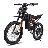
- Choosing an e-bike for Idaho trails
- Frequently asked questions
How to read the map
Every line on the map is a trail, path or rail trail, colored by what its manager's rule lets an e-bike do. Forest roads are left off unless a trail record runs along one; the road network belongs to a road map.
- Green: Class 1, 2 and 3 may ride. Most green lines are national forest and BLM motor trails, where an e-bike rides as a motor vehicle.
- Purple: Class 1, 2 and 3, with the motor helping only while you pedal: a Class 2 rides with its throttle unused. The BLM's decisions that open non-motorized trails to e-bikes carry this condition, as do City of Rocks' bicycle routes and Hailey's paths.
- Blue: Class 1 and 2; Class 3 is barred or unsettled. Idaho's state parks, the Trail of the Coeur d'Alenes, the Ashton-Tetonia Trail, Boise's Greenbelt and pathways, Coeur d'Alene's city trails, and the Weiser River Trail and the Route of the Hiawatha, where a Class 2 rides with its throttle unused or disabled.
- Orange: Class 1; a Class 2 or 3 is barred or unsettled. The Wood River Valley's Class 1 trails, Ada County's Greenbelt and the trails the state's records keep to Class 1.
- Dashed red: closed to e-bikes. On a national forest that is every trail the motor vehicle use map leaves off; on BLM land, every non-motorized trail no decision has opened.
- Gray: the rule is unsettled, could not be read, or belongs to a private owner. Each gray trail's reason is in the register.
The map shows the rule. A seasonal closure, a fire restriction or a sign at the trailhead can still close a green line on the day you ride.
Who decides on each trail
On most of this map a federal manager decides. National forests hold 82% of the mapped miles, 14,573 in all, across 15 national forests whose trails reach into Idaho. The BLM holds 1,486, Idaho's three land agencies 626, and the cities, counties and districts 884, about 5% of the map.
| Who manages the trail | Trails | Miles | What e-bikes may do |
|---|---|---|---|
| National forests: trails the Motor Vehicle Use Map opens to e-bikes | 2,217 | 6,584.7 | Class 1, 2 and 3: the map's own e-bike columns |
| National forests: map motor trails on forests whose map names no e-bike class | 681 | 1,051.0 | Class 1, 2 and 3, as motor vehicles |
| National forests: map trails that name no e-bike class on forests whose maps do | 17 | 44.6 | Gray: the map lists motor vehicles and names no e-bike class |
| National forests: map roads, mapped as trails | 90 | 91.3 | Class 1, 2 and 3, on a road the map designates |
| The Route of the Hiawatha | 3 | 14.3 | Class 1; a Class 2 with its throttle disabled |
| National forests: a record lists motor vehicles, the map does not | 236 | 140.4 | Gray: a record lists motor vehicles, the map does not |
| National forests: map records with no lines name the trail (Beaverhead-Deerlodge) | 10 | 25.4 | Gray: the map names the trail but carries no line to place it |
| National forests: every other trail | 2,050 | 5,325.4 | Closed: e-bikes count as motor vehicles |
| Nez Perce zone (no map): the 2008 guide closes the trail to every vehicle | 117 | 406.5 | Closed: closed to every vehicle class the guide lists |
| Nez Perce zone (no map): every other trail | 364 | 878.9 | Gray: no map; the 2008 guide and the 2016 plan disagree |
| BLM: motorized trails and routes | 149 | 1,030.7 | Class 1, 2 and 3, as off-road vehicles |
| BLM: non-motorized trails a decision opens to e-bikes | 43 | 29.7 | Class 1, 2 and 3 by the decision, pedaling |
| BLM: Wood River Valley e-bike trails | 14 | 27.1 | Class 1, 2 and 3 or Class 1 only, trail by trail |
| BLM: non-motorized trails | 118 | 312.2 | Closed: no decision opens them to e-bikes |
| BLM: lines no route record carries | 60 | 32.3 | Gray: no route record |
| Idaho state parks and the Department's trails | 156 | 299.4 | Class 1 and 2 |
| The Lewiston Levee Parkway | 3 | 2.3 | Closed: excepted from the Department's e-bike allowance |
| State endowment land: routes open to motorized use | 116 | 201.7 | Class 1, 2 and 3, as motorized use |
| State endowment land: every other trail | 110 | 98.8 | Closed, or gray where no record lists the line |
| Fish and Game land | 30 | 20.6 | Where motor vehicles may go: see each below |
| City of Rocks National Reserve | 13 | 18.3 | The compendium's bicycle routes: see each below |
| Craters of the Moon and other Park Service land | 2 | 0.9 | Closed on every Craters of the Moon trail |
| Corps lakes, refuges, Reclamation and military land | 39 | 53.2 | Gray: no designation read |
| Boise foothills: the Ridge to Rivers record | 159 | 192.2 | By the trail's record: see each below |
| Cities, counties and districts: a rule of their own | 121 | 158.9 | Each government's own rule: see each below |
| Ada/Eagle Bike Park: three county records disagree | 34 | 10.7 | Gray: three county records, all printed |
| Trails the state's route record opens to e-bikes | 59 | 73.3 | By the state's record: see each below |
| Cities, counties and districts whose rule could not be read | 338 | 248.2 | Gray: state law's default, which a local rule may change |
| Trails outside cities with no manager on record | 359 | 289.4 | Gray: no one's rule on record |
| The Weiser River Trail | 1 | 85.8 | Pedal assist at 20 mph or less, no throttle |
| Trails a public record lists without bicycles | 23 | 12.7 | Gray: one public record lists no bicycles |
| Private, nonprofit and institutional land | 94 | 90.7 | The owner decides |
| All Idaho | 7,373 | 17,851.6 | Map above; every trail by region below |
Takeaway
On the forest and BLM land that make up most of this map, ask one question before you ride: is this trail open to motor vehicles? If it is, you may ride it on any class of e-bike. If it is not, you may ride your e-bike there only where a map or a written decision opens it to e-bikes by name.
National forests: the map decides
On a national forest, your e-bike is a motor vehicle, and the forest's Motor Vehicle Use Map lists every route a motor vehicle may use. The Forest Service defines a motor vehicle as "Any vehicle which is self-propelled", and once a forest has published its map, 36 CFR 261.13 makes it "prohibited to possess or operate a motor vehicle on National Forest System lands in that administrative unit or Ranger District other than in accordance with those designations".
The agency's own e-bike page puts the result plainly: "Class 1, 2, and 3 e-bikes are allowed on motorized trails and roads on national forests and grasslands." It adds that a forest "may consider new opportunities for e-bike use on non-motorized trails" only through the travel-management process.
Forests whose map names each e-bike class
Forests holding 77% of this map's national forest miles print e-bike classes on the map itself, route by route, with the dates each class may ride. The Boise, Caribou-Targhee, Idaho Panhandle, Payette, Salmon-Challis and Sawtooth forests do so on nearly every route of their maps.
Where a route's map record lists Class 1, 2 and 3 as open, this map shows it green: 6,585 miles on 2,217 trails. The record's own e-bike season is printed with each trail in the register.
On these forests a handful of motor routes list motorcycles or ATVs and leave the e-bike columns blank, 31.9 miles in all. The agency's statement would open them; the forest's own map, which names e-bike classes everywhere else, does not. They read gray until the district answers.
Forests whose map lists no e-bike class
The Nez Perce-Clearwater's map for its Clearwater zone (the North Fork, Lochsa/Powell and Palouse districts), and the Kootenai's, Lolo's and Bitterroot's maps where those forests reach into Idaho, print no e-bike class on any route.
There the forest's own words decide. The Nez Perce-Clearwater's biking page says: "Electric bikes (or E-bikes) are considered motorized vehicles and are ONLY allowed on motorized routes." Its motorized trails, 1,051 miles on this map, take every class.
Every other forest trail
A trail the map leaves off is closed to e-bikes, whatever bicycles may do on it: 5,325 miles, the largest single closed block in Idaho.
The Caribou-Targhee says e-bikes are welcome "but only on trails and roads open to motorized use", and the Payette: "All motorized vehicles including e-bikes are restricted from non-motorized trails." Each trail we mark closed was checked against both of the map's layers, its trails and its roads, and appears on neither.
Two smaller sets read gray: 46.8 miles of trail the Forest Service's own trail records list as motorized but its map does not draw, and 79.4 miles the state's route layer lists for motor vehicles off the map. A map can omit a designated route, and a record can outlive a closure; ask the district before you ride either.
The Nez Perce zone, where the records disagree
The Moose Creek, Red River and Salmon River districts of the Nez Perce-Clearwater carry no motor vehicle use map in the Forest Service's data, for trails or for roads. Three records speak instead, and they do not agree.
- The 2016 plan standard. On February 1, 2016, the Forest Supervisor changed the Nez Perce Forest Plan's road and trail standard to: "10. Roads, Trails or Areas will be closed to motorized use unless displayed as open on the motor vehicle use map." The old standard it replaced read: "10. Roads and Trails will be considered open to motorized use unless posted (informational signing) otherwise."
- The 2008 access guide. The forest's off-highway page still offers the "2008 Nez Perce National Forest Trail Access Guide", whose trail table, "Updated: 18 May 2007", marks each trail open or closed to vehicles over 50 inches, ATVs and motorcycles.
- The state's route layer. It records these trails as "No Travel Management Plan in effect (Open unless Ordered Closed)".
Where the guide closes a trail to every vehicle it lists, every reading agrees, and the trail is red: 407 miles. Where the guide opens a trail to a motor vehicle, or does not list it, the plan standard and the guide point opposite ways, and the trail is gray: 879 miles. Before you ride one, call the district and ask whether your e-bike may use that trail today.
The Route of the Hiawatha
The rail-trail through the Taft Tunnel runs on the Idaho Panhandle National Forests under a Forest Service special use permit, and the permit holder sets the e-bike terms: "Class 1 e-Bikes & Class 2 e-bikes with disabled throttles can be used on the trail."
A Class 2 rides only if "the e-bike throttle has been disabled for the entire trail, and checked by Hiawatha Trail staff to fit within the FS definition of a Class 1 e-bike", and "Class 3 e-bikes are prohibited at all times."
The Lolo National Forest's page confirms that "The Idaho Panhandle National Forests manages this trail." The operator describes "15 miles of scenic rail-trail through the Bitterroot Mountains", with shuttle buses that "operate between the Pearson and Roland trailheads only". Its e-bike page adds that e-bikes "will be charged an additional FEE TBD to be shuttled", because they "are heavier and many do not fit well in our shuttle racks".
The trail's 2026 season ran May 22 through September 20, by the operator's schedule. As of October 31, 2026, a notice the operator posted on May 27 says the trail "remains OPEN", but "the United States Forest Service has requested that all trestle walkways and bridge walkways along the route be closed" while a trestle repair plan is under way, and it tells riders to "Stay on designated riding surfaces only".
BLM land
On BLM land an e-bike is an off-road vehicle unless a written decision says otherwise. BLM's rules define an off-road vehicle as "any motorized vehicle capable of, or designed for, travel on or immediately over land, water, or other natural terrain", and the agency's e-bike page sends riders to the motorized network: "BLM-managed public lands offer many opportunities for riding e-bikes, including motorized areas and OHV trails."
The BLM's motorized trails on this map, 704 miles, take every class; the vehicle and season limits each route's record carries are printed in the register.
A non-motorized BLM trail opens to e-bikes only by decision.
43 CFR 8342.2(d) lets an authorized officer allow e-bikes "whose motorized features are not being used exclusively to propel the e-bike for an extended period of time on roads and trails upon which mechanized, non-motorized use is allowed", and the BLM's own FAQ adds that "the rule does not, by itself, open any non-motorized trails to e-bike use." Without such a decision the trail is red.
The BLM's e-bike decisions in Idaho
Four decisions open non-motorized BLM trails to e-bikes in Idaho, 59.6 mapped miles in all.
- The Challis Foothills (Challis Field Office, 2023). The field manager decided "to implement the actions outlined in Alternative B", under which "all class e-bikes, class I, II, and III, would be authorized" on the new mountain bike trails. On the motorcycle single-track, "e-bikes and other non-motorized and mechanized travel are authorized".
- The Wood River Valley (Shoshone Field Office, 2021). The decision made two e-bike designations, "Motorized Class 1 e-bikes" and "Motorized Class 1, 2, & 3 e-bikes", and changed "Croy Creek non-motorized trails to Motorized Class 1, 2, and 3 e-bikes". The state's route record gives each trail's class: Belle, Vue 1.0 and 2.0, Muldoon Connector and the Quigley-area trails take Class 1 only; Two Dog, Punchline, Centerline and Wilson Gulch take every class.
- Pioneer Ridge (Pocatello Field Office, 2020). The decision record adopts the plan under which "Electric-bikes (e-bikes), as defined in SO3376, would also be allowed to use the proposed trail."
- The Upper Snake Field Office's travel plan. BLM's own route layer records its mountain bike and greenway trails, the St. Anthony Greenway, Kepps, Stinking Springs and Iona's among them, as "E-bikes allowed with non-motorized use". We could not find the decision document itself, so these trails rest on the BLM's route record.
On the Challis Foothills, Pioneer Ridge and Upper Snake trails, which stay non-motorized, the regulation's condition applies: the motor may not move the bike by itself for long, so a Class 2 rides with its throttle unused. That is why the map draws them purple. The Wood River Valley's trails and the Challis motorcycle single-track are motorized e-bike routes, drawn by the classes each allows.
Idaho state parks and the Department's trails
Class 1 and 2 e-bikes ride Idaho's state parks; Class 3 does not.
The Department of Parks and Recreation says: "Class 1 and 2 E-Bikes are allowed in Idaho State Parks and on department-administered trails and paths - except for the Lewiston Levee Parkway, a portion of which runs through Hells Gate State Park." Its rules also keep e-bikes out of the definition of a motor vehicle in a park: "Every vehicle that is self-propelled except for vehicles moved solely by human power, electric bikes, and motorized wheelchairs."
That covers 193 miles of trail in 25 parks and Department trails on this map, and three trails with pages of their own.
- The Trail of the Coeur d'Alenes. "Class 1 and 2 E-Bikes are allowed on the trail." The stretch from Plummer to Harrison, co-managed by the Coeur d'Alene Tribe and the Department, follows the same terms on the state's record.
- The Ashton-Tetonia Trail. "Class 3 e-bikes, motorized ATVs, OHVs, & vehicles are not permitted on the trail."
- Massacre Rocks State Park. The park's route record says "E-Bikes: Class-1/2/3 authorized for use on all Park trails", while the Department's biking page allows Class 1 and 2 in every state park. Until the park clarifies, ride a Class 1 or 2 there.
- Castle Rocks State Park. Its trails also appear in the National Park Service's trail records, under which bicycles ride off park roads only on routes a park designates. Until the two records agree, 9.3 miles of its trails read gray.
The Lewiston Levee Parkway is the one stretch the Department's page takes out of its e-bike allowance. We read that sentence as closing the parkway to e-bikes and mark it red; the levee belongs to the Army Corps of Engineers, whose own rule for it we did not read.
Endowment land and Fish and Game land
On state endowment land and Fish and Game land, an e-bike is motorized use. The Idaho Department of Lands' recreation policy of November 10, 2025, says an e-bike "is considered a motorized vehicle on endowment lands" and that "E-bikes and pedal assist bikes are considered motorized use."
Its rules permit "Motorized and mechanized travel" on the Department's "designated roads, trails, and cross-country travel areas." Routes the state's record opens to motor vehicles take every class, 202 miles; non-motorized trails are closed to e-bikes, and lines no record carries read gray.
Fish and Game says the same of its land. Its 2023 article for hunters says: "No matter how you slice it, e-bikes are motorized vehicles in Idaho", and "E-bikes are not allowed on any road, trail or area that is closed to motorized travel, including at Wildlife Management Areas, Wildlife Habitat Areas, Access Yes! properties and Large Tracts Access lands."
Its rules bar any motorized vehicle "except on designated roads and trails", and the Boise River WMA's page adds: "E-bikes are only allowed on motorized roads when those roads are open for motorized travel." Fish and Game's own site answered with a maintenance page throughout the day we read it, so these quotations come from the Internet Archive's copies.
City of Rocks, Craters of the Moon and other federal land
City of Rocks National Reserve opens its listed bicycle routes to e-bikes and closes the rest. Its compendium says "E-bikes are allowed in City of Rocks National Reserve where traditional bicycles are allowed. E-bikes are prohibited where traditional bicycles are prohibited."
You may ride your e-bike on the park roads and the routes it lists, among them the Stripe Rock Loop, Tea Kettle Trail, Smoky Mountain Connector, the California Trail Retracement and Skyline Connector; "All other trails not listed above are closed to bicycle use." Three listed routes are designated only between named points, the California Trail, the North Fork Circle Creek Trail and the Indian Grove route; they read gray, because we could not place the designated stretch.
Off park roads, federal rules forbid "using the electric motor exclusively to move an electric bicycle for an extended period of time without pedaling". At Craters of the Moon the compendium closes every trail: "The use of an electric bicycle is prohibited in locations not designated by the superintendent under paragraph (i)(1) of this section including all trails."
On Army Corps of Engineers land around Dworshak, Albeni Falls and Lucky Peak, on the national wildlife refuges and on Bureau of Reclamation land, we read the federal rule for each and found no e-bike designation for these trails.
The Corps keeps vehicles to "authorized roadways" except where the District Commander designates. A refuge opens e-bikes only "If the refuge manager determines" it compatible. Reclamation treats an e-bike as an off-road vehicle unless a regional decision says otherwise (43 CFR 420.5). Those trails read gray.
City, county and district rules
Idaho's cities, counties and recreation districts manage 884 mapped miles, and their own rules were read for 7 of the 71. Idaho law lets each of them exclude e-bikes by ordinance or posted sign, so a local rule can be stricter than the state's or say nothing at all. Where we read one, the table shows what it does; where we could not, the trail reads gray.
| Government | Law or page | Where it applies | What it does | Trails | Miles |
|---|---|---|---|---|---|
| Ada County | Ada County Code § 2-2-10 (Ordinance No. 974) | the Boise River Greenbelt where Ada County maintains it | E-bikes permitted by ordinance; county staff say Class 1 only; 10 mph unless posted; Class 2 and 3 unsettled | 10 | 9.6 |
| Blaine County | Blaine County Code § 6-1-5(D)(2) | a paved recreational pathway on a Blaine County designated right of way easement | Class 1, 2 and 3 at 20 mph or less | 1 | 0.6 |
| Blaine County Recreation District | BCRD, Wood River Trail e-bike regulations; Blaine County Code § 6-1-5; BCRD e-bike resolution | the Wood River Trail outside Hailey, Ketchum and Sun Valley | Class 1, 2 and 3 at 20 mph or less | 4 | 20.0 |
| City of Boise | City of Boise, E-Mobility page | the Boise River Greenbelt within Boise | Class 1 and 2; Class 3 not allowed | 34 | 35.0 |
| City of Boise | City of Boise, E-Mobility page | a City of Boise pathway off the Greenbelt | Class 1 and 2; the City lists Class 3 as not recommended; Class 3 unsettled | 39 | 44.6 |
| City of Coeur d'Alene | City of Coeur d'Alene, e-bike clarification (posted August 14, 2024) | a City of Coeur d'Alene trail where bicycles ride (the North Idaho Centennial Trail, Prairie and Atlas trails among them) | E-bikes with pedals where bicycles ride, 15 mph or less; the state's record says up to Class 2; Class 3 unsettled | 7 | 28.3 |
| City of Hailey | Hailey Municipal Code §§ 10.40.010, 12.04.060, 12.12.030 (Ordinance No. 1307) | a City of Hailey public pathway, the Wood River Trail's railroad right-of-way within the city included | E-bikes under 20 mph with human power primary: a Class 2 rides pedaling | 7 | 5.7 |
| City of Idaho Falls | Idaho Falls City Code §§ 9-8-1, 9-8-10, 9-8-12 | a City of Idaho Falls paved path or greenbelt | Class 1, 2 and 3; posted speed limits; no e-bikes in the zoo | 19 | 15.0 |
Boise and the foothills
The City of Boise sets two rules for its paved network. On the river: "In Boise, Class 3 E-bikes that can reach speeds of 28 miles per hour are not allowed on the Boise River Greenbelt, on sidewalks, or in crosswalks." On its other pathways the City lists Class 1 and 2 as allowed and Class 3 as "Not Recommended", which advises against a Class 3 without forbidding it.
The foothills are Ridge to Rivers country, and there the rule turns on motor use: "You can ride e-bikes on Ridge to Rivers trails and roads that already allow motorized vehicles. In total, about 52 miles of motorized trails and primitive roads are open to e-bikes."
The City's trail layer marks each trail "No E-Bikes", "E-Bikes allowed with permit only" or "E-Bikes allowed (motorized trails/roads)", and this map follows it: 152.9 miles red, 17.4 miles green.
The permit is an accommodation under the Americans with Disabilities Act: "individuals with mobility disabilities may use e-bikes and other certain other power-driven mobility devices (OPDMDs) on City of Boise-owned trails that are open to pedestrians".
The City's Accessibility Pass is optional for those riders: "While not required, having a pass can help prevent confusion and reduce the likelihood of being stopped by individuals who may have questions about your device." For any other rider, those trails are closed to e-bikes.
Ada County's Greenbelt and the Ada/Eagle Bike Park
Ada County's ordinance, adopted July 2, 2024, settles its stretch of the Greenbelt and its foothill trails in two sentences: "E-bikes are prohibited on the foothill trails. E-bikes are permitted on the Greenbelt." The county's parks property carries a 10 mph limit unless another speed is posted.
At the county's advisory board on August 27, 2025, county staff described the rule more narrowly: "Class 1 E-Bikes are permitted. Class 2 and 3 are not permitted." We print both, and the map shows a Class 1 as settled on the county's Greenbelt and the other classes as unsettled.
The Ada/Eagle Bike Park sits on three county records that disagree. The county's page says "on trails managed by Ada County, you are allowed to use your E-Bikes!", the ordinance prohibits e-bikes "on the foothill trails", and the regional trail layer marks the park's trails "E-Bikes allowed with permit only". Its 10.7 miles read gray until the county answers.
Coeur d'Alene
The City of Coeur d'Alene posted its reading on August 14, 2024: "The City of Coeur d'Alene has opted to follow the state's ruling on our trails. In summary, e-bikes are allowed on all trails where mechanical bikes are allowed if they have pedals, but they must not be operated faster than 15 miles per hour."
The page has since moved off the city's site; we read it in the Internet Archive's copy. The state's route record for the city's stretch of the North Idaho Centennial Trail and its Prairie and Atlas trails says "E-Bikes up to Class 2 allowed", so a Class 3 reads unsettled there.
The Wood River Valley
The Wood River Trail runs through several jurisdictions, and its operator says so: "The regulations governing e-bike usage on the Wood River Trail (WRT) are established by ordinances at both city and county levels."
On Blaine County's pathway easements the county exempts "Electric-assisted bicycles (E-bikes) with fully operable pedals and an electric motor of no more than 750 watts, provided the electric-assisted bicycle is operated at no more than 20 miles per hour" from its ban on motorized vehicles.
Hailey's ordinance of October 24, 2022, defines an e-bike as one where "the primary propulsion occurs through human power with the assistance of an electric motor", and the City's own page adds the speed: "On Hailey pathways and in our Parks, you can only ride an e-bike, electric scooter, skateboard, or one-wheel if the "electrical assist" is less than 750 watts and you are traveling less than 20 mph."
Ketchum's and Sun Valley's ordinances sit on code hosts we could not read.
Idaho Falls and the Weiser River Trail
Idaho Falls writes e-bikes into its definition of a bicycle path, "which shall also accommodate operation of E-bikes and E-scooters", with posted speed limits and one exception, the zoo at Tautphaus Park.
The Weiser River Trail is owned by a nonprofit, the Friends of the Weiser River Trail, and its rule is the strictest long trail on this map: "Pedal assist E-bikes are allowed, with a top speed of 20 miles per hour. E-bikes that can exceed speeds of 20 miles per hour are not allowed. Throttle use prohibited."
Rules that could not be read
Where a city, county or district publishes its code on Municode or American Legal, those hosts answered with a challenge page (HTTP 403) on October 30, 2026, and the governments' own pages state no e-bike rule. Meridian's and Nampa's e-bike pages could not be read that day, and the Internet Archive holds no copy of either.
Their trails, 283.5 miles across 46 governments, read gray; the register's last column says what was tried for each. Where no ordinance or posted sign excludes e-bikes, state law lets every class ride where bicycles may.
Another 291 miles lie outside every city on ground no record attributes to anyone, 78% of them in Latah, Bonner, Ada, Valley and Boise counties. The map names the county the trail lies in, which is not a record that the county manages it; those trails read gray too.
Named trails riders ask about
These are the trails riders search for by name, each matched to its pieces in the register so you can check the one you plan to ride. Where a trail crosses more than one manager, its row splits the miles by rule.
| Trail | Miles mapped | Managed by | What e-bikes may do |
|---|---|---|---|
| Route of the Hiawatha | 14.3 | Idaho Panhandle National Forests, St. Joe Ranger District | 14.3 mi: Class 1, and a Class 2 with its throttle disabled and checked; no Class 3 |
| Trail of the Coeur d'Alenes | 72.2 | Idaho Department of Parks and Recreation, Trail of the Coeur d'Alenes; Coeur d'Alene Tribe | 72.2 mi: Class 1 and 2 |
| Boise River Greenbelt | 45.6 | City of Boise; Ada County; City of Garden City and 3 more |
35.0 mi: Class 1 and 2; Class 3 not allowed 9.6 mi: E-bikes permitted by ordinance; county staff say Class 1 only; 10 mph unless posted; Class 2 and 3 unsettled 0.5 mi: Rule could not be read 0.4 mi: Class 1 and 2 0.1 mi: Unsettled |
| Ridge to Rivers (the Boise foothills) | 192.2 | City of Boise; Bureau of Land Management, Four Rivers Field Office; Ada County and 8 more |
174.8 mi: Closed to e-bikes 17.4 mi: Class 1, 2 and 3 on trails and roads open to motor vehicles |
| North Idaho Centennial Trail | 20.9 | City of Coeur d'Alene | 20.9 mi: E-bikes with pedals where bicycles ride, 15 mph or less; the state's record says up to Class 2; Class 3 unsettled |
| Weiser River Trail | 85.8 | Friends of the Weiser River Trail | 85.8 mi: Pedal assist at 20 mph or less, no throttle: a Class 2 rides pedaling; no Class 3 |
| Wood River Trail (Ketchum to Bellevue) | 20.0 | Blaine County Recreation District | 20.0 mi: Class 1, 2 and 3 at 20 mph or less |
| Ashton-Tetonia Trail | 28.4 | Idaho Department of Parks and Recreation, Harriman State Park | 28.4 mi: Class 1 and 2; Class 3 not permitted |
| City of Rocks National Reserve | 18.3 | City of Rocks National Reserve; Idaho Department of Parks and Recreation, City of Rocks Natural Reserve |
8.5 mi: Class 1, 2 and 3 where bicycles ride; off park roads, pedal 6.7 mi: Unsettled 3.1 mi: Closed to e-bikes |
| Ada/Eagle Bike Park | 10.7 | Ada County; City of Eagle | 10.7 mi: Unsettled |
| Idaho Falls Greenbelt | 15.0 | City of Idaho Falls | 15.0 mi: Class 1, 2 and 3; posted speed limits; no e-bikes in the zoo |
| Farragut State Park | 37.6 | Idaho Department of Parks and Recreation, Farragut State Park | 37.6 mi: Class 1 and 2 |
| Harriman State Park | 50.5 | Idaho Department of Parks and Recreation, Harriman State Park |
28.4 mi: Class 1 and 2; Class 3 not permitted 22.1 mi: Class 1 and 2 |
| Lewiston's trails and the Levee Parkway | 7.2 | City of Lewiston; Nez Perce County; Idaho Department of Parks and Recreation, Hells Gate State Park |
4.9 mi: Rule could not be read 2.3 mi: Closed to e-bikes |
| Pocatello's trails and Pioneer Ridge | 44.5 | City of Pocatello; Bureau of Land Management, Pocatello Field Office |
29.9 mi: Rule could not be read 7.3 mi: Class 1, 2 and 3 by the 2020 decision; the motor may not propel the bike alone for long 7.3 mi: Class 1, 2 and 3 on a route the state's record opens to motor vehicles |
| Twin Falls's trails | 8.3 | City of Twin Falls | 8.3 mi: Rule could not be read |
| Moscow's trails | 3.7 | City of Moscow | 3.7 mi: Rule could not be read |
Takeaway
Three of Idaho's rail trails do not share a rule. The Trail of the Coeur d'Alenes takes Class 1 and 2; the Route of the Hiawatha takes Class 1, and a Class 2 only with its throttle disabled; the Weiser River Trail takes pedal assist alone, at 20 mph or less. A Class 1 e-bike rides all three.
Idaho bike trails, region by region
The seven regions below are Idaho's tourism regions, each named for its two largest cities. Each map shows the region's trails in the same colors as the statewide map, and each table lists its longest trails by rule.
Coeur d'Alene and Post Falls

The Panhandle's open miles are the Idaho Panhandle National Forests' motor trails and two rail trails. Its 2,865 mapped miles lie in Benewah, Bonner, Boundary, Kootenai and Shoshone counties; 1,637 are open, 1,034 are closed and 194 read gray.
The forest's motor trails, among them the 4th of July Pass and Huckleberry OHV trails and the St. Joe Divide National Recreation Trail, carry most of the open miles, and the map names the e-bike classes on nearly all of them.
The Trail of the Coeur d'Alenes takes Class 1 and 2, and so does the city's stretch of the North Idaho Centennial Trail, where a Class 3 reads unsettled; the Route of the Hiawatha takes a Class 1, and a Class 2 with its throttle disabled.
Nearly all the closed miles are the national forests' non-motorized trails, Beetop-Roundtop and the St. Joe River trail among them. Most of the gray lies on Bonner County trails no record attributes to a manager, on forest trails whose map lists motorcycles but no e-bike class (the State Line trail the longest) or that only a record calls motorized, and on the paths of Dover, Post Falls, Sandpoint and Rathdrum, whose rules could not be read.
| Trail | Managed by | Miles | E-bikes |
|---|---|---|---|
| Trail of the Coeur d'Alenes | Idaho Department of Parks and Recreation, Trail of the Coeur d'Alenes | 56.5 | Class 1 and 2 |
| 4th of July Pass OHV | Idaho Panhandle National Forests, Coeur d'Alene River Ranger District | 27.2 | Class 1, 2 and 3: the map opens the trail to e-bikes; its dates govern |
| State Line | Idaho Panhandle National Forests, Coeur d'Alene River Ranger District | 25.4 | Unsettled |
| North Idaho Centennial Trail | City of Coeur d'Alene | 20.9 | E-bikes with pedals where bicycles ride, 15 mph or less; the state's record says up to Class 2; Class 3 unsettled |
| Huckleberry OHV | Idaho Panhandle National Forests, Coeur d'Alene River Ranger District | 19.1 | Class 1, 2 and 3: the map opens the trail to e-bikes; its dates govern |
| Beetop-Roundtop | Idaho Panhandle National Forests, Sandpoint Ranger District | 18.7 | Closed to e-bikes |
| St. Joe River | Idaho Panhandle National Forests, St. Joe Ranger District | 17.7 | Closed to e-bikes |
| Big Creek Trail | Idaho Panhandle National Forests, St. Joe Ranger District | 15.8 | Class 1, 2 and 3: the map opens the trail to e-bikes; its dates govern |
| Trail of the Coeur d'Alenes | Coeur d'Alene Tribe | 15.7 | Class 1 and 2 |
| Little N. Fk Clearwater | Idaho Panhandle National Forests, St. Joe Ranger District | 15.6 | Closed to e-bikes |
| Laverne Creek OHV | Idaho Panhandle National Forests, Coeur d'Alene River Ranger District | 15.6 | Class 1, 2 and 3: the map opens the trail to e-bikes; its dates govern |
| St. Joe Divide NRT | Idaho Panhandle National Forests, St. Joe Ranger District | 15.5 | Class 1, 2 and 3: the map opens the trail to e-bikes; its dates govern |
Every mapped trail in Coeur d'Alene and Post Falls (1,167 trails, 2,865 mi), by e-bike rule
Class 1, 2 and 3 (521, 1,444 mi)
Idaho Panhandle National Forests, St. Joe Ranger District:
- Big Creek Trail (15.8 mi)
- St. Joe Divide NRT (15.5 mi, 2 stretches)
- Gold Ctr. Marble Creek (14.6 mi)
- West Fork Merry Creek OHV (13.5 mi)
- Marble Creek Trail (10.8 mi)
- Nelson Ridge NRT (9.3 mi)
- Dunn Peak OHV (9.2 mi)
- Mineral Creek OHV (8.5 mi)
- Eena Creek OHV (8.4 mi)
- Simmons Ridge Trail (7.8 mi)
- Furlong OHV (7.3 mi)
- Peggy Peak Trail (7.0 mi)
- Butte OHV (7.0 mi)
- Angle Point Trail (6.8 mi)
- State Line (6.6 mi)
- Forage Creek OHV (6.3 mi)
- Slate Peak Trail (6.1 mi)
- Prince Peak Trail (6.1 mi)
- Whitetail Peak OHV (6.0 mi)
- Fly Creek Trail (5.8 mi)
- Foehl Creek Trail (5.8 mi)
- Daugherty Hill NRT (5.8 mi)
- Beaver Creek Trail (5.7 mi)
- Heller Simmons Divide (5.7 mi)
- Malin Peak OHV (5.6 mi)
- Adair Ridge OHV (5.5 mi)
- Stony Butte OHV (5.5 mi)
- Dam Creek Trail (5.4 mi)
- Malin Ridge Trail (5.3 mi)
- Long Liz Trail (5.3 mi)
- Lucky Swede Trail (5.2 mi)
- Telichpah Creek NRT (5.1 mi)
- Bear Bluff OHV (5.1 mi)
- Turner Peak Trail (5.1 mi)
- East Fork Big Creek (5.1 mi)
- Quartz-Haggerty OHV (5.1 mi)
- Haggerty Ridge Trail (4.8 mi)
- Cedar Mountain Trail (4.8 mi)
- Big Dick Trail (4.7 mi)
- Dunn Peak Trail (4.7 mi)
- Dam Ridge Trail (4.7 mi)
- Cornwall OHV (4.6 mi)
- Crooked Ridge OHV (4.5 mi)
- Anthony Peak OHV (4.5 mi)
- Flume Creek Trail (4.5 mi)
- Hammond Kyle Divide (4.4 mi)
- North Fork Trail (4.3 mi)
- Indian Peak Trail (4.3 mi)
- Wonderful Peak Trail (4.3 mi)
- Three Lakes Divide (4.3 mi)
- Bronson Meadows NRT (4.2 mi)
- Cross Country OHV (4.2 mi)
- Moolock Trail (4.1 mi)
- Bear Creek Trail (4.1 mi)
- Cedar Creek Trail (4.0 mi)
- Bootleg OHV (4.0 mi)
- Freezeout Hemlock Conn OHV (4.0 mi)
- Champion Mine OHV (3.9 mi)
- Flemming Ridge OHV (3.8 mi)
- Wawa OHV (3.8 mi)
- Sherlock Creek Trail (3.8 mi)
- Mozier Peak Trail (3.7 mi)
- Roundhouse Gulch OHV (3.7 mi)
- Upper Slate Creek (3.6 mi)
- Aspen Saddle OHV (3.6 mi)
- Washout Point Trail (3.6 mi)
- Calico OHV (3.5 mi)
- Kyle Creek Trail (3.5 mi)
- Upper Graves Creek OHV (3.5 mi)
- Marble Divide -Grandfather NRT (3.4 mi)
- St Joe Face (East) OHV (3.4 mi)
- Big Cedar OHV (3.4 mi)
- Pack OHV (3.3 mi)
- Ames Ridge NRT (3.3 mi)
- Twin Creek OHV (3.3 mi)
- Dam Creek Divide (3.2 mi)
- Quarles Peak Trail (3.2 mi)
- Indian Creek Trail (3.2 mi)
- Little Berge OHV (3.2 mi)
- Simmons Creek Trail (3.2 mi)
- Windy Creek OHV (3.1 mi)
- Buzzard Foehl Trail (3.1 mi)
- North Wosner OHV (3.1 mi)
- Bad Tom Trail (3.0 mi)
- Pierce Ridge Trail (3.0 mi)
- Prospect Trail (3.0 mi)
- Wampus Creek Trail (3.0 mi)
- Windy Three Forks OHV (3.0 mi)
- Malamute Connection OHV (3.0 mi)
- Wawa Creek OHV (2.9 mi)
- Mowat Creek Trail (2.9 mi)
- Craddock Peak Trail (2.8 mi)
- Arid Peak Trail (2.7 mi)
- Lemonade Peak Trail (2.7 mi)
- Easy Money OHV (2.7 mi)
- Fly Peak Trail (2.6 mi)
- Siamese OHV (2.6 mi)
- Lines Creek Historical (2.6 mi)
- Swan OHV (2.5 mi)
- Grey Gulch OHV (2.5 mi)
- Mariah OHV (2.5 mi)
- Delaney Creek NRT (2.4 mi)
- Upper Sisters OHV (2.3 mi)
- Moss Creek OHV (2.3 mi)
- Fuzzy OHV (2.3 mi)
- Whos Fuzzy OHV (2.3 mi)
- Bluff Spur Connection OHV (2.3 mi)
- Fagen Preston OHV (2.2 mi)
- Cold Face OHV (2.2 mi)
- Hill 36 OHV (2.2 mi)
- Beaver Creek Spur OHV (2.2 mi)
- Foehls to Butte (2.1 mi)
- Shoe OHV (2.1 mi)
- Blow OHV (2.1 mi)
- Black Jack OHV (2.1 mi)
- Hume Ridge OHV (2.1 mi)
- Fishhook Face OHV (2.1 mi)
- Backpack OHV (2.1 mi)
- Stubtoe Trail (2.1 mi)
- Upper Grouse Creek OHV (2.1 mi)
- Middle Shoepack Point OHV (2.1 mi)
- Quartz Ridge OHV (2.1 mi)
- Foolhen Mountain Trail (2.0 mi)
- Lin-Nor Divide OHV (2.0 mi)
- Lower 36 OHV (2.0 mi)
- Cemetery Ridge OHV (2.0 mi)
- 3570 A OHV (2.0 mi)
- Little Rock OHV (2.0 mi)
- Upper Tyson Divide OHV (2.0 mi)
- Elsie Peak Trail (1.9 mi)
- Boast OHV (1.9 mi)
- Brown Creek OHV (1.9 mi)
- Easy Gold OHV (1.9 mi)
- Norton Creek OHV (1.9 mi)
- Ew Drop OHV (1.9 mi)
- White Woman Trail (1.9 mi)
- Cornwall Point Trail (1.8 mi)
- Upper Lin-Nor OHV (1.8 mi)
- Northwest Harvey OHV (1.8 mi)
- Snowline OHV (1.8 mi)
- Eagle Creek Face OHV (1.7 mi)
- Berge Peak OHV (1.7 mi)
- Dare OHV (1.7 mi)
- Flemming Creek OHV (1.6 mi)
- Shoepack Extra OHV (1.6 mi)
- Lower Tyson OHV (1.6 mi)
- Dunn Peak Lookout OHV (1.6 mi)
- Long Walk - B OHV (1.6 mi)
- Cranberry OHV (1.6 mi)
- Shoepack OHV (1.5 mi)
- Little Bear Creek OHV (1.5 mi)
- BPA OHV (1.5 mi)
- Lazy OHV (1.5 mi)
- Lower Lin-Nor OHV (1.5 mi)
- Pegleg Mountain Trail (1.5 mi)
- North Point OHV (1.4 mi)
- Legwash OHV (1.4 mi)
- Rutledge Creek Spur 3 OHV (1.4 mi)
- Lower Sisters OHV (1.4 mi)
- Golden Axe Too OHV (1.4 mi)
- Chute Creek OHV (1.3 mi)
- Berge Creek OHV (1.3 mi)
- Thirty-Six Nineteen OHV (1.3 mi)
- Jug Camp Trail (1.3 mi)
- Upper Forage Creek OHV (1.3 mi)
- Mineral Spur, Kelly Div OHV (1.3 mi)
- Upper Eena Creek OHV (1.3 mi)
- Upper Gold OHV (1.3 mi)
- Saddle OHV (1.2 mi)
- Giant Slalom OHV (1.2 mi)
- Flatiron Stinger OHV (1.2 mi)
- St Joe Face (West) OHV (1.2 mi)
- Walo Point Trail (1.1 mi)
- Chapman OHV (1.1 mi)
- Angora OHV (1.1 mi)
- Black Jack Harvey OHV (1.1 mi)
- Windmill OHV (1.1 mi)
- Dew OHV (1.1 mi)
- Bussel Ridge OHV (1.1 mi)
- MUD Cabin OHV (1.1 mi)
- Norton Creek E Spur OHV (1.1 mi)
- Flume Ridge Trail (1.1 mi)
- Daveggio Meadows OHV (1.1 mi)
- Francis Sheep OHV (1.0 mi)
- Broadaxe Creek OHV (1.0 mi)
- Yellow Gold OHV (1.0 mi)
- Mineral-Kelly Spur A OHV (1.0 mi)
- Blackwell OHV (1.0 mi)
- Piaute OHV (1.0 mi)
- Moolock Conn OHV (1.0 mi)
- West Fork Alpine Creek OHV (0.9 mi)
- Blow-Heart OHV (0.9 mi)
- Cornwall View OHV (0.9 mi)
- Little Bluff OHV (0.9 mi)
- Niagra OHV (0.9 mi)
- Freezeout OHV (0.9 mi)
- Lower Lookout OHV (0.9 mi)
- Lower Hilo Creek OHV (0.9 mi)
- Upper Shoepack Point OHV (0.9 mi)
- Lower Dennis OHV (0.8 mi)
- Lower Shoepack South OHV (0.8 mi)
- West Gold Hill OHV (0.7 mi)
- Kingfish OHV (0.7 mi)
- Flemming Point OHV (0.7 mi)
- Bear Skull Lookout OHV (0.7 mi)
- Coeur D'alene Divide NRT 8 (0.7 mi)
- Tailings OHV (also in Lewiston and Moscow) (0.7 mi here)
- Grandmother Mountain OHV (0.7 mi)
- Lower Tyson Divide OHV (0.7 mi)
- Dunce Creek OHV (0.7 mi)
- Garnet Stone OHV (also in Lewiston and Moscow) (0.6 mi here)
- Slalom OHV (0.6 mi)
- Avery Timber Creek OHV (0.6 mi)
- Freezeout Mary Mix Con OHV (0.6 mi)
- West Fork Alpine OHV (0.6 mi)
- West Fork Merry Spur OHV (0.5 mi)
- Boulder Creek OHV (0.5 mi)
- Aconite OHV (0.5 mi)
- Fast OHV (0.5 mi)
- East Nakarna OHV (0.5 mi)
- Legwash D Spur OHV (0.5 mi)
- Spring OHV (0.5 mi)
- Kelley-Shoshone Con OHV (0.4 mi)
- Turkey OHV (0.4 mi)
- Splash Dam Trail (0.4 mi)
- Snow Bunny OHV (0.4 mi)
- Dirty Fran OHV (0.4 mi)
- Monumental Butte Trail (0.4 mi)
- Trapper OHV (0.4 mi)
- Fuzzy Bear OHV (0.4 mi)
- Simmons Meadow Trail (0.4 mi)
- Mineral Spur Kelly/Man OHV (0.4 mi)
- MUD Cabin Overlook OHV (0.4 mi)
- 3504 Ab OHV (0.3 mi)
- Whistling OHV (0.3 mi)
- Marble Homestead Trail (0.3 mi)
- Moon Pass Spur OHV (0.3 mi)
- 3504 Aa OHV (0.3 mi)
- Pretty Creek OHV (0.3 mi)
- Glover Slope OHV (0.3 mi)
- Ames Ridge Cabin (0.3 mi)
- Mosquito Creek Trail (0.3 mi)
- Peak OHV (0.3 mi)
- Boulder Creek Trail (0.2 mi)
- Packup OHV (0.2 mi)
- Spotted Pineapple OHV (0.2 mi)
- Agatha Cliff OHV (0.2 mi)
- Mid-Seg Monitor Mine OHV (0.2 mi)
- West Nakarna OHV (0.2 mi)
- Grandmother Mountain Trail (0.2 mi)
- Polecat OHV (0.2 mi)
- Bear Tooth OHV (0.2 mi)
- Snowline Spur OHV (0.2 mi)
- Graves Creek OHV (0.2 mi)
- Short Walk OHV (0.1 mi)
Idaho Panhandle National Forests, Coeur d'Alene River Ranger District:
- 4th of July Pass OHV (27.2 mi)
- Huckleberry OHV (19.1 mi)
- Laverne Creek OHV (15.6 mi)
- Steamboat OHV (13.5 mi)
- Independence Creek NRT (13.5 mi)
- Deer Kid OHV (12.6 mi)
- South Canfield OHV (10.9 mi)
- Monument Trail (10.4 mi)
- St. Joe Divide NRT (10.0 mi)
- Canfield Mountain Trail Cmplex Trail-A (9.3 mi)
- Larch Mountain Trail (9.2 mi)
- Idaho Gulch OHV (8.9 mi)
- Graham Ridge Trail (7.8 mi)
- East Little Guard OHV (7.2 mi)
- Felder OHV (6.9 mi)
- Cascade Connection OHV (6.7 mi)
- NorPac Trail (6.5 mi)
- Jewel Gulch Trail (6.0 mi)
- Sob Creek 4WD (5.9 mi)
- King's Pass-Sunset Pk. (5.8 mi)
- Skitwish Ridge ATV (5.4 mi)
- Monument OHV (5.3 mi)
- Head of Avery Creek 4WD (5.2 mi)
- Graham Creek Trail (5.0 mi)
- Echo Peak OHV (5.0 mi)
- Blue Sky OHV (4.9 mi)
- Felder Too OHV (4.8 mi)
- Norris Draw OHV (4.7 mi)
- St Joe Divide Spur (4.6 mi)
- Bumblebee Ridge Trail (4.6 mi)
- Ermine Ridge Trail (4.4 mi)
- Linfor Loop OHV (4.4 mi)
- Goose Creek Trail (4.4 mi)
- Barton Creek Trail (4.3 mi)
- Coal Creek Trail (4.3 mi)
- Hells Canyon Trail (4.3 mi)
- Bunco Bypass OHV (4.3 mi)
- Magee Pk-Bear Creek (4.1 mi)
- Scott Gulch OHV (4.1 mi)
- Evolution Trail (4.0 mi)
- John's Draw OHV (3.9 mi)
- Unnamed trails (3.8 mi)
- Canfield Mountain Trail Cmplex Trail-B (3.8 mi)
- George Gulch 4WD (3.8 mi)
- Red Oak Trail (3.8 mi)
- Huckleberry Mountain Trail (3.7 mi)
- Boulder Creek Trail (3.7 mi)
- Graham Coal Connect (3.7 mi)
- Granite Peak Trail (3.6 mi)
- Mosquito Ridge Trail (3.5 mi)
- Bobtail-W Eagle (3.4 mi)
- South Canfield Trail (3.4 mi)
- E Declaration Trail (3.4 mi)
- Dry-State OHV (3.4 mi)
- Little No. Fork 4WD (3.3 mi)
- Canfield Mountain Trail Cmplex Trail-D (3.2 mi)
- Bobtail Spur OHV (3.2 mi)
- Devil Peak Trail (3.2 mi)
- Haystack Loop OHV (3.1 mi)
- Nicholas Creek Trail (3.0 mi)
- Barney Creek Trail (3.0 mi)
- Lost Lake Trail (2.9 mi)
- Dot Creek Trail (2.9 mi)
- Canfield Mountain Trail Cmpx-Penn Trail-8 (2.8 mi)
- Little No. Fork (2.8 mi)
- Hulliman Ridge Trail (2.8 mi)
- Lavoie OHV (2.4 mi)
- Emerson Ridge Trail (2.4 mi)
- Canyon Fork Trail (2.2 mi)
- Canfield Mountain Trail Cmplex Trail-10 (2.2 mi)
- Silver Hill Trail (2.2 mi)
- Canfield Mountain Trail Cmpx Jump Trail-9 (2.2 mi)
- Raven Gulch Trail (2.0 mi)
- Haystack Mountain OHV (2.0 mi)
- Treasure Mountain 4WD (2.0 mi)
- Striped Peak Trail (1.7 mi)
- Marie Connection OHV (1.7 mi)
- Kelly Mountain 4WD (1.7 mi)
- Dam Creek Connection OHV (1.6 mi)
- Canfield Mountain Trail Cmplex Trail-11 (1.6 mi)
- Beefcamp Trail (1.6 mi)
- Chute Creek OHV (1.6 mi)
- Copper Mountain Connection OHV (1.4 mi)
- Canfield Mountain Trail Cmplex Trail-3 (1.3 mi)
- Lake Elsie Trail (1.3 mi)
- Canfield Mountain Trail Cmplex Trail-6 (1.2 mi)
- Clee Creek-Bloom Peak 4WD (1.2 mi)
- Coeur D'alene Divide NRT 8 (1.2 mi)
- Cranky Gulch Trail (1.2 mi)
- Canfield Mountain Trail Cmplex Trail-1 (1.1 mi)
- Dry Gulch Bypass OHV (1.1 mi)
- Canfield Mountain Trail Cmplex Trail-7 (1.1 mi)
- Lake Elsie Ridge (1.0 mi)
- Hill OHV (1.0 mi)
- Polaris Lookout 4WD (0.9 mi)
- Canfield Mountain Trail Cmplex-Cave-4 (0.8 mi)
- Canfield Mountain Trail Cmplex Trail-5 (0.8 mi)
- Spruce Creek OHV (0.6 mi)
- Kickbush Trail (0.5 mi)
- Marie Creek (0.2 mi)
- Beauty Creek/Carlin Creek (0.2 mi)
- Dam Creek Divide (0.2 mi)
- Canfield Mountain Trail Cmplex Trail-2 (0.2 mi)
- Independence Creek Trail (0.2 mi)
- Canfield Mountain Trail Cmplex Trail-C (0.2 mi)
Idaho Panhandle National Forests, Sandpoint Ranger District:
- Strong Creek Trail (6.4 mi)
- Minerva Ridge Trail (5.7 mi)
- Johnson Cabin Trail (5.6 mi)
- Packsaddle Mountain Trail (5.4 mi)
- Talache-Blacktail (5.1 mi)
- Porcupine Creek Trail (5.0 mi)
- Branch North Gold Creek (5.0 mi)
- Kickbush Trail (4.9 mi)
- Delyle Creek Trail (4.9 mi)
- Falls Creek Trail (4.7 mi)
- Conjecture Mine OHV (4.3 mi)
- Martin Creek Trail (4.2 mi)
- Dixie Queen Trail (4.2 mi)
- Granite Creek Trail (4.1 mi)
- Twin Creek Trail (4.0 mi)
- West Gold A OHV (3.9 mi)
- Green Monarchs Trail (3.9 mi)
- Derr Creek Trail (2.8 mi)
- Auxor Mine OHV (2.5 mi)
- Granite-Packsaddle (2.2 mi)
- Little Blacktail Trail (2.1 mi)
- Silver Leaf OHV (2.0 mi)
- Maiden Creek Trail (1.9 mi)
- Torrent Creek OHV (1.7 mi)
- White Mountain Trail (1.6 mi)
- Teepee Gulch Trail (1.6 mi)
- Delyle Ridge Trail (1.6 mi)
- Gold Hill Trail (1.5 mi)
- Green Mountain Trail (1.5 mi)
- Cocolalla E OHV (1.4 mi)
- Caribou Lake Trail (1.2 mi)
- Evans Landing Trail (1.1 mi)
- Peep-A-Day (1.1 mi)
- French Creek A OHV (1.1 mi)
- Cat Tail OHV (1.0 mi)
- French Creek B OHV (0.7 mi)
- Mosquito Ridge Trail (0.7 mi)
- Cocolalla Section 12 OHV (0.6 mi)
- Schafer Peak Trail (0.5 mi)
- Radar Hill Trail (0.5 mi)
- McPearson OHV (0.5 mi)
- Snow Prospect Aa OHV (0.3 mi)
- Chimney Rock Trail (0.2 mi)
- Halfway Creek Trail (0.2 mi)
- Gold Hill Vista (under 0.1 mi)
Idaho Panhandle National Forests, Bonners Ferry Ranger District:
- Sidehill Trail (12.1 mi)
- Bussard Mountain Trail (7.9 mi)
- Danquist Trail (7.7 mi)
- Ruby Ridge Trail (7.7 mi)
- Arndt Trail (6.0 mi)
- Rutledge Creek Trail (5.6 mi)
- Snyder Creek Trail (4.3 mi)
- Deer Ridge Trail (3.4 mi)
- Stampede Trail (3.1 mi)
- Bethlehem Mountain Trail (2.7 mi)
- White Mountain Trail (2.1 mi)
- Tungsten OHV (1.8 mi)
- Deer Ridge-Buckhorn (1.7 mi)
- Mission Mountain Trail (1.7 mi)
- American Girl OHV (1.6 mi)
- Tilly Mine Trail (1.6 mi)
- Wall Creek Trail (1.4 mi)
- Unnamed trails (1.2 mi)
- Brush Lake OHV (1.1 mi)
- Ruby Ridge A (0.7 mi)
- American Girl A OHV (0.7 mi)
- American Girl B OHV (0.7 mi)
- Tungsten Hill Trail (0.6 mi)
- Rutledge Creek A (0.5 mi)
- Keno Ridge Trail (0.5 mi)
- Queen Mine Trail (0.4 mi)
- American Girl C OHV (0.3 mi)
- Stampede Spur D (0.2 mi)
- Stampede Spur B (0.1 mi)
- Stampede Spur A (0.1 mi)
Bureau of Land Management, Coeur d'Alene Field Office:
- Unnamed trails (13.2 mi)
- Lookout Mountain (6.6 mi)
- Lost Lake (4.1 mi)
- Little Lost Lake Creek (3.6 mi)
- Fish Lake (2.2 mi)
- Reed Ridge (2.0 mi)
- Middle Fork Pine Creek (1.7 mi)
- West Fork Pine Creek Trail (1.7 mi)
- Pearsons Peak (0.7 mi)
- Little Lost Lake (0.1 mi)
Idaho Panhandle National Forests:
- Coeur D'alene Divide NRT 8 (4.3 mi)
- Red Oak Trail (2.6 mi)
- Delaney Creek NRT (2.4 mi)
- Blue Sky OHV (2.1 mi)
- Cranky Gulch Trail (1.9 mi)
- NorPac Trail (1.4 mi)
- State Line (1.2 mi)
- Anthony Peak OHV (1.2 mi)
- Grandmother Mountain OHV (1.1 mi)
- Caribou Lake Trail (1.0 mi)
- Evolution Trail (0.9 mi)
- King's Pass-Sunset Pk. (0.7 mi)
- Granite Peak Trail (0.7 mi)
- Eena Creek OHV (0.7 mi)
- West Fork Merry Creek OHV (0.7 mi)
- Pierce Ridge Trail (0.7 mi)
- Upper Grouse Creek OHV (0.7 mi)
- Lemonade Peak Trail (0.5 mi)
- Idaho Gulch OHV (0.5 mi)
- French Creek B OHV (0.5 mi)
- French Creek A OHV (0.5 mi)
- Lost Lake Trail (0.2 mi)
- Stony Butte OHV (0.2 mi)
- Dunn Peak Trail (0.2 mi)
- Strong Creek Trail (0.2 mi)
- Butte OHV (0.2 mi)
- Blow OHV (0.2 mi)
- St. Joe Divide NRT (0.2 mi)
- Polecat OHV (0.2 mi)
Idaho Panhandle National Forests, Priest Lake Ranger District:
- Lakeview Mountain Trail (5.3 mi)
- Quartz View Trail (4.3 mi)
- Binarch Creek Trail (4.1 mi, 2 stretches)
- Pee Wee Trail (4.0 mi)
- Kalispell - Reeder Bay (3.9 mi)
- John Wayne Loop (2.0 mi)
- Steep Creek Trail (2.0 mi)
- John Wayne A Spur (1.0 mi)
- John Wayne Trail (0.2 mi)
- Hughes Ridge Trail (under 0.1 mi)
Idaho Department of Lands:
- Claim Jumper (2.7 mi)
- Hayes Gulch (1.9 mi)
- Sagle Trail (1.7 mi)
- Upper Logger (1.6 mi)
- Gordon's (0.7 mi)
- Gordons (0.6 mi)
- Buster's Bullion (0.6 mi)
- Tepee Mountain (0.6 mi)
- Larry's (0.5 mi)
- Sluice Box (0.3 mi)
- Russ Keene Trail (0.2 mi)
- Mine Shaft (0.2 mi)
- Rosie's (0.2 mi)
- Double Jack (0.1 mi)
Nez Perce-Clearwater National Forest, Palouse Ranger District:
- Old Sampson Trail (also in Lewiston and Moscow) (3.0 mi here)
- East Dennis Trail (also in Lewiston and Moscow) (2.4 mi here)
- Three Tree Butte (also in Lewiston and Moscow) (2.1 mi here)
- Upper Piah Trail (1.7 mi)
- Palouse Divide J (0.5 mi)
- East Fork Meadow Creek (also in Lewiston and Moscow) (0.5 mi here)
- Gone Road (0.2 mi)
Lolo National Forest:
- State Line (6.2 mi, 2 stretches)
- St. Joe Divide NRT (0.2 mi)
Kootenai National Forest, Cabinet Ranger District:
- State Line (5.3 mi)
- Hulliman Ridge Trail (0.2 mi)
Kootenai National Forest:
- State Line (2.9 mi, 2 stretches)
- Trout Ridge Trail (0.3 mi)
Kootenai National Forest, Coeur d'Alene River Ranger District:
- State Line (1.7 mi)
- Trout Ridge Trail (0.2 mi)
Nez Perce-Clearwater National Forest:
- Mineral Trail (1.6 mi)
Lolo National Forest, Coeur d'Alene River Ranger District:
- State Line (0.7 mi)
Kootenai National Forest, Three Rivers Ranger District:
- Caribou Creek Trail (0.2 mi)
Lolo National Forest, St. Joe Ranger District:
- State Line (0.2 mi)
Class 1 and 2 (48, 192 mi)
Idaho Department of Parks and Recreation, Trail of the Coeur d'Alenes:
- Trail of the Coeur d'Alenes (56.5 mi)
- Unnamed trails (under 0.1 mi)
Idaho Department of Parks and Recreation, Farragut State Park:
- Unnamed trails (11.7 mi)
- Buggy Trail (8.8 mi)
- Lynx Trail (6.4 mi)
- Boundary Trail (5.2 mi)
- Lakeshore Trail (2.7 mi)
- Highpoint Trail (2.1 mi)
- Packwell Point (0.7 mi)
City of Coeur d'Alene:
- North Idaho Centennial Trail (20.9 mi)
- Prairie Trail (3.4 mi, 2 stretches)
- Unnamed trails (2.4 mi, 3 stretches)
- Atlas (1.6 mi)
Idaho Department of Parks and Recreation, Heyburn State Park:
- Whitetail Loop Bike Trail (7.0 mi)
- Shoeffler Butte Loop Bike (3.2 mi)
- Appaloosa Horse Trail (2.8 mi)
- Indian Cliffs Hike Trail (2.5 mi)
- Plummer Cr Fire Bike Trail (2.0 mi)
- Hidden Lake Bike Trail (1.2 mi)
- Hawleys Landing Hike Trail (1.2 mi)
- Lakeshore Loop Bike Trail (1.2 mi)
- Mullan Road Hike Trail (0.7 mi)
- CCC Nature Trail (0.6 mi)
- Plummer Creek Trail (0.6 mi)
Coeur d'Alene Tribe:
- Trail of the Coeur d'Alenes (15.7 mi)
Idaho Panhandle National Forests, St. Joe Ranger District:
- Hiawatha Rail Trail (13.8 mi)
- Bear Creek Trail (0.5 mi)
- Route of the Hiawatha Trail (0.1 mi)
Idaho Department of Parks and Recreation, Priest Lake State Park:
- Flume Trail (1.5 mi)
- Lakeshore Trail (0.9 mi)
- Unnamed trails (0.7 mi)
- Lone Star Loop (0.6 mi)
- Viewpoint Trail (0.4 mi)
- Indian Creek Nature Trail (0.2 mi)
Idaho Department of Parks and Recreation, Round Lake State Park:
- Stewardship Trail (2.0 mi)
- Trappers Trail (1.7 mi)
- Swamp Tromp (0.2 mi)
- Stewardship Cutoff Trail (0.1 mi)
Idaho Department of Parks and Recreation:
- Farragut Naval Training Station Spur or Farragut Railroad Trail (3.9 mi)
Idaho Department of Parks and Recreation, McCroskey State Park:
- Iron Mtn Trail (also in Lewiston and Moscow) (1.8 mi here)
- James E. Dewey Trail (1.6 mi)
- Trail McCroskey State Park (0.2 mi)
- Lazy T Trail (also in Lewiston and Moscow) (0.1 mi here)
- Unnamed trails (also in Lewiston and Moscow) (0.1 mi here)
City of Post Falls:
- Highway 41 Trail (0.9 mi)
Closed to e-bikes (414, 1,034 mi)
Idaho Panhandle National Forests, St. Joe Ranger District:
- St. Joe River (17.7 mi)
- Little N. Fk Clearwater (15.6 mi)
- Bacon Loop (11.6 mi)
- Copper Ridge Trail (8.6 mi)
- Surveyor's Ridge Trail (8.5 mi)
- Mosquito Creek Trail (8.5 mi)
- Buck Creek Trail (8.1 mi)
- Stateline Trail (7.9 mi)
- Scribner Falls Trail (6.7 mi)
- Yankee Peak Trail (6.5 mi)
- Skookum Creek Trail (6.0 mi)
- Northbound Creek Trail (6.0 mi)
- Upper Canyon Creek (5.9 mi)
- Elbow Ridge NRT (5.8 mi)
- Copper Creek Trail (5.8 mi)
- St. Joe Lake (5.6 mi)
- Wahoo-Indian Divide (5.2 mi)
- Timber Creek Trail (5.1 mi)
- Cataract Creek Trail (5.0 mi)
- Spotted Louis Trail (4.9 mi)
- Larkins Creek Trail (4.8 mi)
- Horseshoe Loop (4.8 mi)
- Bussel Creek Trail (4.7 mi)
- Snow Peak Trail (4.5 mi)
- Fawn Lake Trail (4.4 mi)
- Bernier Creek Trail (4.3 mi)
- Sawtooth Creek Trail (4.2 mi)
- Papoose Mountain Trail (4.2 mi)
- Mallard Peak Trail (4.1 mi)
- Pegleg Mountain Trail (4.0 mi)
- Black Jack Peak (3.9 mi)
- Hero Lake Trail (3.8 mi)
- Never Sweat Trail (3.4 mi)
- Allen Ridge Trail (3.4 mi)
- Buzzard Saddle Trail (3.4 mi)
- Pole Mountain Trail (3.4 mi)
- My Ruby Creek (3.4 mi)
- Lightning Ridge Trail (3.3 mi)
- Line Creek (3.3 mi)
- Simmons Creek Trail (3.3 mi)
- Bean Divide Trail (3.3 mi)
- Packsaddle Trail (3.2 mi)
- Brush Hill Trail (3.2 mi)
- Papoose Creek Trail (3.1 mi)
- Martin Creek Trail (3.1 mi)
- Conrad Peak Trail (3.0 mi)
- Pass Creek Trail (2.9 mi)
- Foolhen Mountain Trail (2.8 mi)
- Beaver Peak Trail (2.7 mi)
- Craddock Ridge Trail (2.7 mi)
- Marble Divide -Grandfather NRT (2.3 mi)
- Cabin Ridge Trail (2.2 mi)
- Broken Leg Trail (2.2 mi)
- Haggerty Ridge Trail (2.1 mi)
- Yankee Bar/Neversweat Trail (2.0 mi)
- St. Joe Divide (2.0 mi)
- Crescendo (1.8 mi)
- Indian Dip Trail (1.7 mi)
- Monumental Butte Trail (1.6 mi)
- Hobo Historical Trail (1.6 mi)
- Steamboat Lake Trail (1.6 mi)
- Clear Creek Trail (1.6 mi)
- Cougar-Horse Creek (1.6 mi)
- Wahoo-Fly Connection (1.3 mi)
- Arid Peak Trail (1.3 mi)
- Bear Creek Trail (1.2 mi)
- Heart Pass Trail (1.2 mi)
- Dip Creek Trail (1.2 mi)
- Round Top Lookout (1.1 mi)
- Ward Peak Trail (1.1 mi)
- Fly Creek Trail (0.9 mi)
- Slate Creek Access (0.9 mi)
- Hobo Cedar Grove Big Loop (0.9 mi)
- Roundhouse Gulch Trail (0.8 mi)
- Cornwall Creek Trail (0.8 mi)
- Twin Creek Cabin (0.8 mi)
- Stateline National Recreation Trail (0.8 mi)
- Bacon - Five Lakes (0.7 mi)
- Stubtoe Trail (0.6 mi)
- Whitetail Peak Trail (0.6 mi)
- Copper Lines Connection (0.6 mi)
- Bacon Lake Trail (0.6 mi)
- Three Lakes Divide (0.6 mi)
- Waterfall Trail (0.4 mi)
- Hobo Cedar Grove Botanical (0.4 mi)
- Jug Rock Trail (0.3 mi)
- Upper St Joe Lake (0.3 mi)
- Larkins Lake Trail (0.3 mi)
- Buzzard Foehl Trail (0.2 mi)
- Heart Lake Trail (0.2 mi)
- Skyland Lake Trail (0.2 mi)
- Lower Ward Peak (0.2 mi)
- St Joe Lake Spur (0.1 mi)
- Hobo Log Camp (0.1 mi)
- MUD Lake Trail (0.1 mi)
Idaho Panhandle National Forests, Bonners Ferry Ranger District:
- Parker Ridge Trail (14.6 mi)
- Canyon Creek NRT (14.5 mi)
- Montana Line (13.5 mi)
- Clifty Mountain Trail (9.4 mi)
- Timber Mountain Trail (8.5 mi, 2 stretches)
- East Fork Boulder (8.0 mi)
- Buck Mountain Trail (7.7 mi)
- Red Top Trail (7.0 mi)
- Brush Lake Loop (5.7 mi)
- Smith Ridge Trail (5.5 mi)
- Fisher Peak Trail (5.2 mi)
- Middle Fork Boulder (4.5 mi)
- Kootenai River Walk (4.4 mi)
- Snow Lake Trail (4.1 mi)
- Big Fisher Lake (4.0 mi)
- Two Mouth Lakes (4.0 mi)
- Orville Heath Trail (4.0 mi)
- Dobson McGinty Trail (3.8 mi)
- Russell Ridge Trail (3.6 mi)
- Kelly Pass Trail (3.6 mi)
- Smith Creek-Red Top (3.5 mi)
- Bald Eagle Grouse Mountain (3.5 mi)
- Myrtle Peak-Lake (3.5 mi)
- Pyramid Trail (3.3 mi)
- Russell Peak Trail (3.2 mi)
- West Fork Mountain (3.2 mi)
- Keno Ridge Trail (2.6 mi)
- Italian Ridge Trail (2.4 mi)
- Pyramid Pass Trail (2.4 mi)
- Burton Ridge Trail (2.4 mi)
- Myrtle Creek Pack River (2.3 mi)
- Pyramid Ball Lakes (2.0 mi)
- Ruby Ridge Trail (1.9 mi)
- Smythe Trail (1.8 mi)
- Parker Creek NRT (1.8 mi)
- Bottleneck Lake Trail (1.7 mi)
- Robinson Lake Trail (1.6 mi)
- Roman Nose Lakes (1.4 mi)
- Roman Nose Interpretive Loop (1.3 mi)
- Boulder Meadows Trail (1.1 mi)
- Cooks Peak Trail (0.9 mi)
- White Mountain Trail (0.7 mi)
- Copper Falls (0.7 mi)
- Parker Lake Trail (0.6 mi)
- Parker Peak Trail (0.6 mi)
- Roman Nose Middle Lake (0.5 mi)
- Robinson Lake A (0.5 mi)
- Smith Creek-Ridge (0.5 mi)
- Two Mouth Lakes Spur (0.5 mi)
- Brush Lake Hiking (0.5 mi)
- Russell Peak Lookout (0.5 mi)
- Bald Eagle Mountain (0.5 mi)
- Snow Creek Falls (0.5 mi)
- Clifty Peak Trail (0.5 mi)
- Copper Lake Trail (0.4 mi)
- Iron Mountain Trail (0.4 mi)
- Kootenai River Walk Overlook (0.4 mi)
- Long Mountain Lake (0.3 mi)
- Robinson Lake Ridge (0.3 mi)
- Shorty Spring Trail (0.3 mi)
- Brush Lake Connection (0.3 mi)
- Katka Peak Trail (0.3 mi)
- Roman Nose Lower Lake (0.2 mi)
- Roman Nose Campsite (0.2 mi)
- Pend Oreille Divide (0.2 mi)
- Spruce Lake Trail (0.2 mi)
- Brush Lake Overlook (0.2 mi)
- Montana Line A (0.2 mi)
- Queen Mountain Trail (0.1 mi)
- Brush Lake View (0.1 mi)
- Robinson Lake Day Use (0.1 mi)
- Copper Falls Overlook (0.1 mi)
- Robinson Lake Cutoff (0.1 mi)
- Lower Snow Falls (0.1 mi)
- West Fork Lake (under 0.1 mi)
Idaho Panhandle National Forests, Sandpoint Ranger District:
- Beetop-Roundtop (18.7 mi)
- Pend Oreille Divide (7.8 mi)
- Chimney Rock Trail (7.3 mi, 2 stretches)
- Lake Darling Trail (6.0 mi, 2 stretches)
- Char Creek Trail (5.9 mi)
- Fault Lake Trail (5.8 mi, 2 stretches)
- MUD Creek Trail (5.7 mi)
- Mineral Point Trail (5.5 mi)
- Trestle Ridge Trail (5.4 mi)
- Gold Hill Trail (4.5 mi)
- Strawberry Mountain Trail (4.4 mi)
- Wylie Knob Trail (4.2 mi)
- Rattle Ridge Trail (4.2 mi)
- Scotchman Peak Trail (4.0 mi)
- East Fork Peak (3.8 mi)
- Hemlock Trail (3.4 mi)
- Mt. Eagen Trail (3.2 mi)
- Beehive Lakes Trail (3.0 mi)
- Bernard Peak Trail (2.9 mi)
- Blacktail Lake Trail (2.6 mi)
- MUD Lake Trail (2.5 mi)
- Bald Eagle Grouse Mountain (2.4 mi)
- Regal Mine Trail (2.3 mi)
- Moose Mountain Trail (2.3 mi)
- Harrison Lake Trail (2.2 mi)
- Trout Peak Trail (2.1 mi)
- Beetop Ridge Trail (1.9 mi)
- Porcupine Lake Trail (1.8 mi)
- Gordon Creek Trail (1.8 mi)
- Sam Owen Trail (1.7 mi)
- Mickinnick Trail (1.6 mi)
- Moose Lake Trail (1.6 mi)
- Lost Lake Trail (1.6 mi)
- Thunder Creek Trail (1.4 mi)
- East Fork Creek (1.4 mi)
- Cedar Dreams (1.4 mi)
- Gem Lake Trail (1.3 mi)
- Quartz Trail (1.3 mi)
- Martin Creek Trail (1.3 mi)
- Myrtle Creek Pack River (0.9 mi)
- Caribou Lake Trail (0.8 mi)
- Chilco Mountain NRT (0.7 mi)
- South Fork Callahan (0.7 mi)
- Lake Estelle Trail (0.7 mi)
- Upper Freedom to Loam (0.5 mi)
- Callahan Trail (0.5 mi)
- McCormick Lake Trail (0.5 mi)
- Rattle Ridge Spur (0.5 mi)
- White Mountain Trail (0.5 mi)
- Pend Oreille Divide Trail (0.4 mi)
- Regal Mine Spur (0.4 mi)
- Grouse Falls Trail (0.4 mi)
- Gold Hill Connector (0.2 mi)
- Big Dipper (0.2 mi)
- Torrent Creek OHV Trail (0.1 mi)
- Little Dipper (0.1 mi)
- Trestle Peak Summit (0.1 mi)
- Char Falls Trail (0.1 mi)
- Lost Lake Connector (under 0.1 mi)
Idaho Panhandle National Forests, Coeur d'Alene River Ranger District:
- Coeur D'alene River NRT (13.9 mi)
- Marie Creek (10.3 mi)
- Lost Creek-State Line (8.5 mi)
- Shoshone Ridge Trail (7.4 mi)
- Boundary Peak Trail (6.5 mi)
- Magee Pk-Bear Creek (5.4 mi)
- E Fork Lost Creek (5.3 mi)
- English Point NRT (5.3 mi)
- Deer Creek Trail (5.0 mi)
- Chilco Mountain NRT (5.0 mi)
- Beauty Creek/Carlin Creek (4.9 mi)
- West Fork of Eagle Creek (4.1 mi)
- Cataract Creek Trail (4.0 mi)
- Halsey Creek Trail (4.0 mi)
- Caribou Ridge NRT (4.0 mi)
- Alden Creek Trail (3.6 mi)
- Little Elk Creek (3.5 mi)
- Pleasant Creek Trail (3.5 mi)
- Fearn Creek Trail (2.9 mi)
- Lost Creek Trail (2.8 mi)
- Trail D (Coeur d'Alene River Ranger District) (2.7 mi)
- Trail 258 (Coeur d'Alene River Ranger District) (2.4 mi)
- Caribou Ridge (2.4 mi)
- Trail 257 South (2.4 mi)
- Big Foot Ridge (2.2 mi)
- West Willow (Lone Lake) (2.1 mi)
- E. Fk Willow Ck-Stevens Lakes (2.0 mi)
- Lost Creek Ridge (1.9 mi)
- Trail 29 "Big Trees" (1.9 mi)
- Thompson Pass Revett Lake (1.6 mi)
- Trail 227 (Coeur d'Alene River Ranger District) (1.3 mi)
- Reserve Creek Trail (1.3 mi)
- Spur (1.2 mi)
- Upper Glidden Trail (1.1 mi)
- Unnamed trails (1.0 mi)
- Trail 257 (Coeur d'Alene River Ranger District) (0.9 mi)
- Trail 10 (Coeur d'Alene River Ranger District) (0.8 mi)
- Trail C (Coeur d'Alene River Ranger District) (0.6 mi)
- State Line Motor Trail (0.6 mi)
- Trail 8 "Penn Trail" (0.6 mi)
- Trail 9 "Jump Trail" (0.5 mi)
- Chilco Cutoff (0.5 mi)
- Bell Bay Trail (0.5 mi)
- Trail 29 Tottens Pond (0.4 mi)
- Trail A (Coeur d'Alene River Ranger District) (0.4 mi)
- Trail 29 Packsaddle Drive (0.3 mi)
- Dry-State OHV Trail (0.3 mi)
- Centennial Falls Trail (0.3 mi)
- Cave Trail (0.2 mi)
- Trail 5 (Coeur d'Alene River Ranger District) (0.2 mi)
- Trail 7 (Coeur d'Alene River Ranger District) (0.1 mi)
- Shadow Falls (0.1 mi)
- Trail 2 (Coeur d'Alene River Ranger District) (0.1 mi)
- Trail B (Coeur d'Alene River Ranger District) (0.1 mi)
- Trail 1 (Coeur d'Alene River Ranger District) (under 0.1 mi)
Idaho Panhandle National Forests, Priest Lake Ranger District:
- Upper Hughes Trail (9.7 mi)
- Navigation Trail (9.0 mi, 2 stretches)
- Upper Priest River (8.1 mi)
- Salmo Basin Trail (7.5 mi)
- Lakeshore Trail (6.9 mi)
- Little Snowy Top (6.9 mi)
- Beach Trail (5.8 mi)
- Chipmunk Rapids Trail (5.2 mi)
- Hughes Fork Trail (5.0 mi)
- Shedroof Divide Trail (4.6 mi)
- Woodrat Trail (4.6 mi, 2 stretches)
- Bismark Trail (4.4 mi)
- Boulder Creek Trail (4.1 mi)
- North Lamb Trail (3.7 mi)
- Plowboy Mountain Trail (3.5 mi)
- Upper Priest River Trail (3.2 mi)
- Zero Creek Trail (2.9 mi)
- Kalispell Island Trail (2.6 mi)
- Binarch Creek Trail (2.5 mi)
- Upper Priest Lake (2.5 mi)
- North Blacktail Trail (2.5 mi)
- Jackson Creek Trail (2.5 mi)
- Blacktail Mountain Trail (2.1 mi)
- Roosevelt Trail (2.1 mi)
- Continental Creek Trail (1.8 mi, 2 stretches)
- Continental Mountain Trail (1.7 mi)
- Bulldog Point Trail (1.7 mi, 2 stretches)
- Indian Creek Cutoff (1.6 mi)
- Gold Peak Trail (1.4 mi)
- Riverview Trail (1.4 mi)
- Cabinet Pass Trail (1.3 mi)
- North Binarch Trail (1.3 mi)
- Upper Priest Lake Trail (1.1 mi)
- Peewee Trail (1.0 mi)
- Hanna Cutoff (1.0 mi)
- Binarch Mountain Trail (0.9 mi)
- Pine Ridge Trail (0.9 mi)
- Kaniksu Marsh Trail (0.9 mi)
- Little Grass Mountain (0.8 mi)
- Boulder Mountain Trail (0.8 mi)
- Reeder Bay Trail (0.7 mi)
- John Wayne Trail (0.7 mi)
- Hanna Flat Trail (0.7 mi, 2 stretches)
- Jack Pine Trail (0.7 mi)
- Hughes Ridge Trail (0.7 mi)
- Indian Creek Road C (0.5 mi)
- Pine Ridge Spur (0.4 mi)
- Little Snowy Lookout NRT (0.4 mi)
- Steep Creek Trail (0.3 mi)
- Kalispell Island A Spur (0.2 mi)
- Tola Ridge Trail (0.2 mi)
- Indian Mountain Trail (0.2 mi)
- Chipmunk Rapids Spur Trail (0.1 mi)
- Chipmunk Rapids Spur (0.1 mi)
- Quartz View Trail (0.1 mi)
- Pine Ridge Spur Trail (0.1 mi)
Nez Perce-Clearwater National Forest, North Fork Ranger District (NPCNF):
- St. Joe Divide (7.5 mi)
- Stateline Trail (also in Lewiston and Moscow) (5.4 mi here, 2 stretches)
- North Fork of The Clearwater (also in Lewiston and Moscow) (4.8 mi here)
- Bostonian Creek (3.7 mi)
- Heart Pass Trail (3.6 mi)
- Pole Mountain Trail (2.9 mi)
- Smith Ridge Trail (also in Lewiston and Moscow) (1.7 mi here)
- Mallard Peak Trail (1.7 mi)
- Lost Ridge (also in Lewiston and Moscow) (1.4 mi here)
- Chamberlain Mountain (also in Lewiston and Moscow) (1.0 mi here)
- Stateline National Recreation Trail (0.6 mi)
- Bean Divide Trail (0.4 mi)
- Cataract Creek Trail (0.2 mi)
- Nub (also in Lewiston and Moscow) (under 0.1 mi here)
Kootenai National Forest, Three Rivers Ranger District:
- Timber Mountain Trail (7.4 mi)
- Caribou Creek Trail (5.1 mi)
- North Fork Callahan/Timber (4.4 mi)
- Roberts Mountain Trail (3.9 mi)
- South Fork Callahan (3.0 mi)
- Montana Line (2.7 mi)
- Pend Oreille Divide (1.9 mi)
- Smith Mountain Trail (1.1 mi)
- Lake Estelle Trail (1.1 mi)
- Orville Heath Trail (1.0 mi)
- Smith Lake Trail (0.7 mi)
Idaho Department of Lands:
- Upper Priest Lake (6.1 mi)
- Bernard Peak (0.4 mi)
- Rosie's Connector (0.2 mi)
Bureau of Land Management, Coeur d'Alene Field Office:
- Blue (2.7 mi)
- Two Tail Peak (1.5 mi)
- Orange (1.0 mi)
- Red (0.5 mi)
- Mirror Lake (0.3 mi)
- Unnamed trails (0.1 mi)
Lolo National Forest:
- Stateline Trail (also in Lewiston and Moscow) (4.5 mi here)
- Stateline National Recreation Trail (0.3 mi, 2 stretches)
- Ward Peak Trail (0.2 mi)
- Stateline Trail (0.1 mi)
Idaho Panhandle National Forests:
- Mickinnick Trail (1.4 mi)
- Timber Mountain Trail (0.5 mi)
- Stateline Trail (0.5 mi, 2 stretches)
- Montana Line (0.2 mi)
- Parker Ridge Trail (0.2 mi)
- Bernard Peak Trail (0.2 mi)
- Upper Priest Lake (0.2 mi)
- Canyon Creek NRT (0.2 mi)
- Ward Peak Trail (under 0.1 mi)
Idaho Panhandle National Forests, Three Rivers Ranger District:
- Montana Line (1.9 mi)
- Timber Mountain Trail (1.2 mi)
Lolo National Forest, North Fork Ranger District (NPCNF):
- Stateline Trail (also in Lewiston and Moscow) (1.4 mi here)
- Stateline Trail (under 0.1 mi)
Kootenai National Forest, Bonners Ferry Ranger District:
- Montana Line (1.0 mi, 2 stretches)
- Timber Mountain Trail (0.2 mi)
Nez Perce-Clearwater National Forest, St. Joe Ranger District:
- Pole Mountain Trail (1.0 mi)
Kootenai National Forest:
- Montana Line (0.2 mi)
- Pend Oreille Divide (0.2 mi)
- Timber Mountain Trail (0.2 mi)
Idaho Panhandle National Forests, North Fork Ranger District (NPCNF):
- St. Joe Divide (0.5 mi)
Lolo National Forest, St. Joe Ranger District:
- Stateline Trail (0.2 mi)
Kootenai National Forest, Sandpoint Ranger District:
- Pend Oreille Divide (0.2 mi)
Nez Perce-Clearwater National Forest:
- Stateline Trail (0.2 mi)
Unsettled (86, 76 mi)
Idaho Panhandle National Forests, Coeur d'Alene River Ranger District:
- State Line (25.4 mi)
- Solitare Creek 4WD (4.3 mi)
- Trout Ridge Trail (1.6 mi)
- Little No. Fork (1.1 mi)
- Devil Peak Trail (1.0 mi)
- Sob Creek 4WD (0.9 mi)
- Laverne Creek OHV (0.7 mi)
- Canfield Mountain Trail Cmplex Trail-A (0.5 mi)
- Mosquito Ridge Trail (0.5 mi)
- Huckleberry Mountain Trail (0.4 mi)
- Canfield Mountain Trail Cmpx-Penn Trail-8 (0.3 mi)
- Huckleberry OHV (0.3 mi)
- 4th of July Pass OHV (0.3 mi)
- NorPac Trail (0.2 mi)
- State Line Motor Trail (0.2 mi)
- Canfield Mountain Trail Cmpx Jump Trail-9 (0.2 mi)
- Graham Ridge Trail (0.2 mi)
- Canfield Mountain Trail Cmplex Trail-3 (0.2 mi)
- Canfield Mountain Trail Cmplex Trail-D (0.2 mi)
- Dry-State OHV (0.1 mi)
- East Little Guard OHV (0.1 mi)
- Canfield Mountain Trail Cmplex Trail-5 (under 0.1 mi)
- Felder OHV (under 0.1 mi)
Idaho Panhandle National Forests, St. Joe Ranger District:
- Aspen Saddle OHV (4.0 mi)
- Simmons Creek Trail (1.9 mi)
- Aspen Hill OHV (1.7 mi)
- Entente Creek OHV (0.7 mi)
- Backpack OHV (0.6 mi)
- Aspen Pond OHV (0.6 mi)
- Quarles Peak Trail (0.6 mi)
- Angle Point Trail (0.5 mi)
- Cedar Creek Trail (0.5 mi)
- Gramps Creek (0.4 mi)
- Black Jack OHV (0.4 mi)
- Dunn Peak Lookout OHV (0.2 mi)
- Furlong OHV (0.1 mi)
- Dominion Peak Trail (0.1 mi)
- Broadaxe Creek OHV (0.1 mi)
- North Point OHV (0.1 mi)
- Dunn Peak OHV (0.1 mi)
- Brown Creek OHV (0.1 mi)
- St Joe Face (West) OHV (0.1 mi)
- Fuzzy OHV (under 0.1 mi)
- Moolock Trail (under 0.1 mi)
- Moolock Conn OHV (under 0.1 mi)
- Freezeout Mary Mix Con OHV (under 0.1 mi)
- Bluff Spur Connection OHV (under 0.1 mi)
Bureau of Land Management, Coeur d'Alene Field Office:
- Red Loop Trail (2.0 mi)
- Yellow Loop Trail (1.1 mi)
- Blue Loop Trail (1.0 mi)
- Gray Loop Trail (0.8 mi)
- Gnarnia (0.2 mi)
- Unnamed trails (0.1 mi)
- Platform Access Trail (0.1 mi)
Idaho Panhandle National Forests:
- State Line (2.9 mi, 3 stretches)
- Gramps Creek (0.8 mi)
- Trout Ridge Trail (0.4 mi)
- Catspur (0.3 mi)
Idaho Panhandle National Forests, Priest Lake Ranger District:
- Lakeview Mountain Trail (2.5 mi)
- Tola Ridge Trail (0.8 mi, 2 stretches)
- Stone Johnny Trail (0.6 mi)
- Kalispell - Reeder Bay (0.3 mi)
Idaho Department of Lands:
- Stormking Parkway (1.9 mi)
- Uleda Ridge Trail (0.7 mi)
- Upper Priest Lake Trail (0.2 mi)
Idaho Panhandle National Forests, Sandpoint Ranger District:
- Green Mountain Trail (1.5 mi)
- Derr Creek Trail (0.5 mi)
- Mosquito Ridge Trail (0.2 mi)
- Martin Creek Trail (0.1 mi)
- Schafer Peak Trail (0.1 mi)
- McPearson OHV (0.1 mi)
Nez Perce-Clearwater National Forest, Palouse Ranger District:
- East Fork Meadow Creek (also in Lewiston and Moscow) (1.9 mi here)
U.S. Army Corps of Engineers:
- BPA-Ar-77-1/77-2 (1.2 mi)
- Creekside Trail (0.2 mi)
- 10 (Idaho) (0.1 mi)
- International Selkirk Loop (under 0.1 mi)
Nez Perce-Clearwater National Forest, North Fork Ranger District (NPCNF):
- Mallard Peak Trail (0.7 mi)
Idaho Panhandle National Forests, Cabinet Ranger District:
- Trout Ridge Trail (0.4 mi)
- State Line (0.2 mi)
Idaho Panhandle National Forests, Bonners Ferry Ranger District:
- Wall Creek Trail (0.2 mi)
Lolo National Forest:
- State Line (0.2 mi)
Idaho Department of Fish and Game, Coeur d'Alene River Wildlife Management Area:
- Unnamed trails (0.2 mi)
Idaho Panhandle National Forests, Palouse Ranger District:
- Palouse Divide J (under 0.1 mi)
Private, nonprofit or institutional land: the owner decides (14, 8 mi)
Kaniksu Land Trust:
- Sherwood Forest (1.7 mi)
- Bier Bridge (1.2 mi)
- Pipeline Trail (0.8 mi)
- Ripple (0.7 mi)
- Little John (0.3 mi)
- Cardiac Bypass (0.2 mi)
- Fenceline Trail (0.2 mi)
- Steep and Straight (0.2 mi)
- Rock Steps (0.1 mi)
- Rusty Bucket (0.1 mi)
- Connector (0.1 mi)
- Baby Rock Drop (under 0.1 mi)
- Little John Connector (under 0.1 mi)
Private owner:
- Hoyt Mountain (2.4 mi)
Rule could not be read (local code, agency or park) (158, 110 mi)
Bonner County:
- Overland (4.3 mi)
- Bear Grass (3.8 mi)
- Sagle Trail (2.9 mi)
- Terraflow (2.7 mi)
- Highpoint (2.6 mi)
- Shedwater (2.4 mi)
- Coyote Canyon (2.3 mi)
- Pinch Flat (1.7 mi)
- Gnarnia (1.6 mi)
- Sunnyside Trail (1.6 mi)
- Solar Ecstasy (1.3 mi)
- Boomerang (1.2 mi)
- View-Ski Loop (1.2 mi)
- Wolf Ridge (1.1 mi)
- Cloud Walker (1.1 mi)
- Lower Flo (1.1 mi)
- Upper Basin (1.0 mi)
- Cougar Gulch (1.0 mi)
- Phone Home (0.9 mi)
- Sidewinder (0.9 mi)
- Lower GRR (0.9 mi)
- Moffit's Edge (0.9 mi)
- Sparky (0.9 mi)
- Upper GRR (0.9 mi)
- Missing Lynx (0.9 mi)
- Galaxie (0.9 mi)
- Collab (0.8 mi)
- Upper Gnarnia (0.8 mi)
- Extraterrestrial (0.7 mi)
- Intergalactic (0.7 mi)
- Ziggy (0.7 mi)
- Uleda Ridge Trail (0.7 mi)
- Waterfall (0.7 mi)
- Hucks & Bucks (0.7 mi)
- Shenanigans (0.7 mi)
- Stardust (0.7 mi)
- Rolling Thunder (0.7 mi)
- Screech Owl (0.6 mi)
- The Collector (0.6 mi)
- Upper High Point (0.6 mi)
- Upper Bear Grass (0.5 mi)
- Zig Zag (0.5 mi)
- Butterstuff (0.5 mi)
- Redemption (0.5 mi)
- Ursa Major (0.5 mi)
- Huckleberry Hill (0.5 mi)
- Telemark Trail (0.5 mi)
- Papa Bear (0.5 mi)
- Yew Can Do It (0.5 mi)
- Unnamed trails (0.5 mi)
- Freedom to Loam (0.5 mi)
- Cedar Dreams (0.5 mi)
- Morris Mile (0.4 mi)
- Corkscrew (0.4 mi)
- Thunder Cat (0.4 mi)
- Moose Trot (0.4 mi)
- Greta's Segway (0.4 mi)
- Upper Missing Lynx (0.4 mi)
- Stumpy's (0.3 mi)
- 10 (Idaho) (0.3 mi)
- Sandpoint-Dover Community Trail (0.2 mi)
- Squirrel Master (0.2 mi)
- Simple Jack Connector (0.2 mi)
- Mama Bear (0.2 mi)
- Jumpy's (0.2 mi)
- Rock Garden Spur (0.2 mi)
- Reeder Bay Trail (0.2 mi)
- BSR Trail (0.2 mi)
- Big Dipper (0.2 mi)
- Spires - Highpoint Connector (0.2 mi)
- Homestead (0.2 mi)
- Colburn Lake (0.1 mi)
- Upper Redemption (0.1 mi)
- Bear Ridge (0.1 mi)
- Cutoff (under 0.1 mi)
- Connector (under 0.1 mi)
- Moffitt's Edge (under 0.1 mi)
- Soldier Creek Bridge (under 0.1 mi)
City of Dover:
- Rotarian (1.5 mi)
- Sandpoint-Dover Community Trail (1.4 mi)
- Butterfly (1.3 mi)
- Crooked Tree (1.2 mi)
- Ruby (1.0 mi)
- Meadow Trail (0.9 mi)
- Mushroom (0.9 mi)
- Sled (0.8 mi)
- Momentum (0.8 mi)
- Homestead (0.6 mi)
- Green Heart (0.6 mi)
- Greta's Segway (0.6 mi)
- Meadow Loop (0.6 mi)
- Pinecone (0.6 mi)
- Zen Garden (0.4 mi)
- The Rollers (0.4 mi)
- Owl (0.4 mi)
- Wabi Sabi (侘 寂) (0.4 mi)
- Outhouse (0.4 mi)
- Rotarian Return (0.3 mi)
- Unnamed trails (0.3 mi)
- Pajama Party (0.3 mi)
- Chaos Theory (0.3 mi)
- Downward Dog (0.3 mi)
- Grandma's Trail (0.3 mi)
- Cardiac Bypass (0.2 mi)
- Dover Overlook (0.2 mi)
- Heart Rate Hill (0.2 mi)
- Sherwood - Blue Gate Connector (0.2 mi)
- Shortcut (0.1 mi)
- Greta's Connect (0.1 mi)
- Fenceline Trail (0.1 mi)
- Zen Garden Connect (under 0.1 mi)
City of Post Falls:
- Karen Streeter Memorial Trail (3.4 mi)
- Unnamed trails (1.9 mi, 2 stretches)
- Prairie Trail (0.4 mi)
- West Homestead Avenue (under 0.1 mi)
City of Sandpoint:
- Sandpoint-Dover Community Trail (1.9 mi)
- Unnamed trails (1.8 mi, 5 stretches)
- Sagle Trail (0.7 mi)
- North-South (0.5 mi)
- Creekside Trail (0.5 mi)
- Pend d' Oreille Bay Trail (0.2 mi)
- Popsicle Bridge (under 0.1 mi)
City of Rathdrum:
- Stormking Parkway (2.2 mi)
- Majestic Passage (1.1 mi)
- High Frequency (0.7 mi)
- South Fork Spring Creek Trail (0.6 mi)
- Unnamed trails (0.6 mi)
- Skyline (0.5 mi)
Kootenai County:
- Prairie Trail (1.3 mi)
- Return To Sender (0.8 mi)
- Trail 1 (0.7 mi)
- Cats-up (0.6 mi)
- Grade Escape (0.6 mi)
- Trail 29 Tottens Pond (0.6 mi)
- Unnamed trails (0.3 mi)
- Cardinal Run (0.1 mi)
- Ocean Spray Bay (0.1 mi)
- Trail 2 (0.1 mi)
- North Dike Road (under 0.1 mi)
City of Ponderay:
- Creekside Trail (1.7 mi)
- Pend d' Oreille Bay Trail (1.5 mi)
- Kootenai Cutoff Road shared-use path (0.9 mi)
- US 95 Shared Use Pathway (0.8 mi)
- Unnamed trails (0.3 mi)
- 10 (Idaho) (0.2 mi)
Benewah County:
- Kerttu Trail McCroskey State Park (0.4 mi)
- Trail McCroskey State Park (0.2 mi)
City of Wallace:
- Unnamed trails (0.3 mi)
City of Athol:
- Farragut Naval Training Station Spur or Farragut Railroad Trail (0.2 mi)
City of Kootenai:
- Kootenai Cutoff Road shared-use path (0.2 mi)
City of Kellogg:
- Unnamed trails (0.1 mi)
- Spiralus Trail (under 0.1 mi)
Shoshone County:
- Stateline National Recreation Trail (under 0.1 mi)
Lewiston and Moscow

North central Idaho holds more than half of the map's gray miles, most of them in the Nez Perce zone, where the Forest Service's data holds no motor vehicle use map. The region's 3,849 mapped miles lie in Clearwater, Idaho, Latah, Lewis and Nez Perce counties; 1,364 are open, 1,402 are closed and 1,083 read gray.
In the Nez Perce-Clearwater's Clearwater zone, e-bikes ride the forest's motor trails as motor vehicles: Weitas Creek, Windy Ridge and Lochsa Down River are among the longest. The Payette's French Creek and Bear Pete Ridge trails are open too.
Nearly all the closed miles are the national forests' non-motorized trails, the Nee-Me-Poo and Kelly Creek trails and the Hells Canyon National Recreation Area's among them, and the Nez Perce zone's trails the 2008 guide closes to every vehicle.
Nearly all the gray is the rest of the Nez Perce zone (Divide, Meadow Creek and Indian Hill are among its longest trails), Latah County's trails with no manager on record, the University of Idaho's experimental forest, where the owner decides, and the Corps of Engineers' trails around Dworshak.
| Trail | Managed by | Miles | E-bikes |
|---|---|---|---|
| Lewis and Clark | Nez Perce-Clearwater National Forest, Lochsa/Powell Ranger District | 29.5 | Closed to e-bikes |
| Weitas Creek Trail | Nez Perce-Clearwater National Forest, North Fork Ranger District (NPCNF) | 28.2 | Class 1, 2 and 3 as motor vehicles; the map's dates govern |
| Divide | Nez Perce-Clearwater National Forest, Red River Ranger District | 24.8 | Unsettled |
| Pot Mountain Ridge | Nez Perce-Clearwater National Forest, North Fork Ranger District (NPCNF) | 21.4 | Class 1, 2 and 3 as motor vehicles; the map's dates govern |
| Meadow Creek | Nez Perce-Clearwater National Forest, Moose Creek Ranger District | 21.3 | Unsettled |
| Parallel | Nez Perce-Clearwater National Forest, Red River Ranger District | 21.1 | Closed to e-bikes |
| Kelly Creek | Nez Perce-Clearwater National Forest, North Fork Ranger District (NPCNF) | 20.9 | Closed to e-bikes |
| Windy Ridge Trail | Nez Perce-Clearwater National Forest, North Fork Ranger District (NPCNF) | 18.8 | Class 1, 2 and 3 as motor vehicles; the map's dates govern |
| Blacklead | Nez Perce-Clearwater National Forest, Lochsa/Powell Ranger District | 18.1 | Closed to e-bikes |
| Indian Hill | Nez Perce-Clearwater National Forest, Moose Creek Ranger District | 16.6 | Unsettled |
| Feather Creek | Nez Perce-Clearwater National Forest, Palouse Ranger District | 15.1 | Closed to e-bikes |
| Bear Pete Ridge (also in Boise and Meridian) | Payette National Forest, McCall Ranger District | 14.8 | Class 1, 2 and 3: the map opens the trail to e-bikes; its dates govern |
Every mapped trail in Lewiston and Moscow (1,727 trails, 3,849 mi), by e-bike rule
Class 1, 2 and 3 (788, 1,329 mi)
Nez Perce-Clearwater National Forest, North Fork Ranger District (NPCNF):
- Weitas Creek Trail (28.2 mi)
- Pot Mountain Ridge (21.4 mi)
- Windy Ridge Trail (18.8 mi)
- Unnamed trails (18.0 mi, 3 stretches)
- Junction Mountain Trail (12.9 mi)
- Spring Hill Trail (11.1 mi)
- Lodge Creek Loop (11.1 mi)
- Elk Clarke Contour (10.7 mi)
- Windy Bill (10.6 mi)
- Cabin Point Trail (8.0 mi)
- Elizabeth Mountain Trail (7.6 mi)
- Deadhorse Loop (7.6 mi)
- Indian Henry Ridge (7.5 mi)
- Lunde Creek-Rock Garden (7.5 mi)
- Cave Point Trail (7.0 mi)
- Washington Ridge Trail (6.8 mi)
- Salmon Creek Trail (6.5 mi)
- China Creek Trail (6.4 mi)
- Fish Lake (6.1 mi)
- Noah Creek Trail (5.9 mi)
- Lake Creek 4 (5.9 mi)
- Sheep Mountain Loop (5.8 mi)
- Deadhorse Creek Road (5.7 mi)
- Comet Creek (5.4 mi)
- North Fork Down River (5.3 mi)
- Larch Butte Trail (5.0 mi)
- Smith Ridge Trail (also in Coeur d'Alene and Post Falls) (4.8 mi here)
- Sneaky Snake Trail (4.5 mi)
- Swanson Creek Road (4.4 mi)
- Upper Cold Springs (4.3 mi)
- West Fork Rosebud Creek (4.0 mi)
- Hemlock Ridge Trail (3.9 mi)
- Boundary (3.8 mi)
- Hornby Creek Trail (3.7 mi)
- Scurvy Mountain Trail (3.5 mi)
- Clarke Mountain (3.4 mi)
- Rock Bar Tie (3.4 mi)
- Lake Creek 10 (3.3 mi)
- Cool Creek Trail (3.3 mi)
- Shake Creek A (3.0 mi)
- North River (3.0 mi)
- Len Connection (2.9 mi)
- French Ford Trail (2.8 mi)
- Osier Drainage 2 (2.8 mi)
- Trapper Gulch (2.8 mi)
- Lake Creek 8 (2.8 mi)
- Washington Creek Trail (2.8 mi)
- Horsetail Trail (2.8 mi)
- Moscow Bar Ridge (2.7 mi)
- Clarke Mountain Road A (2.7 mi)
- Cougar Creek #1 (2.6 mi)
- Deadhorse North #2 (2.6 mi)
- Puma Trail (2.6 mi)
- Sylvan Creek Trail (2.6 mi)
- Osier Ridge A (2.5 mi)
- Short Moose Trail (2.5 mi)
- Laundry Ridge Trail (2.5 mi)
- Lodge Creek A (2.5 mi)
- Osier Drainage 14 (2.5 mi)
- Honey Creek Trail (2.4 mi)
- China C Trail (2.4 mi)
- China D Trail (2.3 mi)
- Sylvan Brc Trail (2.3 mi)
- Tumble Hill B (2.2 mi)
- Tamarack Face G (2.2 mi)
- Osier Drainage 5 (2.1 mi)
- South Washington Trail (2.1 mi)
- Tumble Creek A (2.0 mi)
- Bighorn Point (2.0 mi)
- Dan Lee Ridge (2.0 mi)
- Cedars 1 Trail (2.0 mi)
- Upper Rock Creek C (1.9 mi)
- Swanson Saddle Trail (1.9 mi)
- Deep Sheep Creek (1.9 mi)
- June Trail (1.9 mi)
- Tepee Creek North #4 (1.9 mi)
- Charlie Creek Trail (1.8 mi)
- China A Trail (1.8 mi)
- Bald Knob Trail (1.8 mi)
- Honey Creek A (1.8 mi)
- Upper Smith Ridge (1.8 mi)
- Osier Ridge C (1.7 mi)
- Tepee Creek East #4 (1.7 mi)
- Rocky Point Trail (1.7 mi)
- Teepee Creek (1.7 mi)
- Teepee Creek A (1.6 mi)
- Cedars (1.6 mi)
- Watt Creek #2 (1.6 mi)
- Shake Creek B (1.6 mi)
- Syringa Creek Trail (1.6 mi)
- Upper Cold Springs D (1.6 mi)
- China B Trail (1.6 mi)
- Deadwood Ridge Conn (1.6 mi)
- China Switchback (1.6 mi)
- Clarke Mountain Lookout (1.5 mi)
- Tamarack Ridge G (1.5 mi)
- Lost Hat Saddle A (1.5 mi)
- Shake Creek Trail (1.5 mi)
- Tamarack Face J (1.5 mi)
- Flat Mountain Trail (1.5 mi)
- Protection East C (1.5 mi)
- Eagle Ridge Trail (1.5 mi)
- South Skull Creek A (1.5 mi)
- Hemlock Creek Trail (1.4 mi)
- Tumble Creek M (1.4 mi)
- Minnesaka Trail (1.4 mi)
- Sheep Mountain Saddle D (1.4 mi)
- Stolen Creek Trail (1.4 mi)
- Hemlock Ridge H (1.4 mi)
- Swanson F Trail (1.4 mi)
- Sheep Creek A (1.3 mi)
- Groves Connection K (1.3 mi)
- Larch Creek F (1.3 mi)
- Deception Point Trail (1.3 mi)
- Laundry Trail (1.3 mi)
- Eagle Creek B (1.3 mi)
- Tumble Creek N (1.3 mi)
- June Creek Trail (1.2 mi)
- Pierce Superior K (1.2 mi)
- Tumble Creek North (1.2 mi)
- Broken Nose West (1.2 mi)
- Minne Trail (1.2 mi)
- Head of Sneak (1.2 mi)
- Osier Drainage 3 (1.2 mi)
- Sheep Creek G (1.2 mi)
- Work Center #2 (1.1 mi)
- French Mountain A (1.1 mi)
- Red Cloud Ridge A (1.1 mi)
- Spring Hill A (1.1 mi)
- Hemlock Ridge B (1.1 mi)
- French Mountain B (1.1 mi)
- Cold Sprs 16 (1.1 mi)
- Tepee Creek F (1.1 mi)
- Cayuse Creek & Monroe Creek (1.0 mi)
- Watt Creek #1 (1.0 mi)
- Upper Rock Creek A (1.0 mi)
- Pierce Superior J (1.0 mi)
- Clarke Mountain A (1.0 mi)
- Fly Creek F (1.0 mi)
- Osier Ridge North (1.0 mi)
- China Connect Trail (1.0 mi)
- Jackpot Trail (0.9 mi)
- Mush Lake Trail (0.9 mi)
- Swanson E Trail (0.9 mi)
- Jackpot A Trail (0.9 mi)
- Tamarack Face C (0.9 mi)
- North Trail (0.9 mi)
- Hem Ridge Trail (0.9 mi)
- June Saddle C (0.9 mi)
- Sneak Point Trail (0.9 mi)
- China F Trail (0.9 mi)
- Honey Creek B (0.9 mi)
- Deception Pt 15 (0.9 mi)
- Sneaky Snake A (0.9 mi)
- Cross Tie (0.9 mi)
- Indian Henry Ridge #1 (0.9 mi)
- Wash D Trail (0.9 mi)
- Swanson B Trail (0.8 mi)
- Tepee Creek North #1 (0.8 mi)
- Groves Connection H (0.8 mi)
- Hemlock Ridge R (0.8 mi)
- Swanson C Trail (0.8 mi)
- Chicken Hawk Trail (0.8 mi)
- Bald Mountain Lake (0.8 mi)
- Little George Trail (0.8 mi)
- East Ridge Trail (0.8 mi)
- Little Washington Creek (0.8 mi)
- Pear Creek F (0.8 mi)
- Salmon Creek B (0.8 mi)
- Tumbling Washington Trail (0.8 mi)
- Fly Creek Saddle (0.8 mi)
- Pine Creek Six (0.8 mi)
- Jackass Ridge Trail (0.8 mi)
- Scofields Horseshoe Trail (0.7 mi)
- Tumble Hill C (0.7 mi)
- Cold Sprs 13 (0.7 mi)
- Eagle Creek C (0.7 mi)
- Tumble Lodge Road (0.7 mi)
- Deadhorse North Road #2 (0.7 mi)
- East Ridge B (0.7 mi)
- Sylvan Ridge (0.7 mi)
- Wash C Trail (0.7 mi)
- Upper Rock Creek B (0.7 mi)
- Minnesaka A Trail (0.7 mi)
- Sheep Creek D (0.7 mi)
- Ararat Point Trail (0.7 mi)
- Hemlock Ridge Butte (0.6 mi)
- Lean to Point (0.6 mi)
- Syringa A Trail (0.6 mi)
- Sylvan Brc B (0.6 mi)
- Camp 60 G (0.6 mi)
- Honey Creek C (0.6 mi)
- Work Center #3 (0.6 mi)
- Hemlock Ridge C (0.6 mi)
- Larch Butte C (0.6 mi)
- Swanson A Trail (0.6 mi)
- Rocky Trail (0.5 mi)
- Deadhorse Creek D (0.5 mi)
- Swanson D Trail (0.5 mi)
- Tumble Creek F (0.5 mi)
- Camp 60 H (0.5 mi)
- Johnson Gulch C (0.5 mi)
- Thompson M (0.5 mi)
- Deception Pt 14 (0.5 mi)
- Upper Cold Springs A (0.5 mi)
- LOW Trail (0.5 mi)
- Stolen Creek A (0.5 mi)
- Sylvan Brc A (0.5 mi)
- Jungle Point Trail (0.5 mi)
- Lost Hat Saddle C (0.5 mi)
- Syringa B Trail (0.5 mi)
- Isaiah Mine Trail (0.5 mi)
- Tumble Creek G (0.5 mi)
- Johnson Gulch B (0.4 mi)
- Tumble Creek L (0.4 mi)
- Groves Connection F (0.4 mi)
- Hidden Creek Overlook (0.4 mi)
- Cold Sprs 17 (0.4 mi)
- South Washington A (0.4 mi)
- Bradbury Spur (0.4 mi)
- Mush Lake A (0.4 mi)
- Elk Mountain Lo (0.4 mi)
- Junction Lookout Trail (0.4 mi)
- Cold Sprs 14 (0.4 mi)
- Pierce Superior S (0.4 mi)
- Cold Sprs 15 (0.4 mi)
- Blue Gulch Trail (0.4 mi)
- Tumble Creek B (0.4 mi)
- Tamarack Face K (0.4 mi)
- Tumble Creek K (0.4 mi)
- Tepee Creek M (0.4 mi)
- Tumble Creek 0 (0.4 mi)
- Hemlock Ridge W (0.4 mi)
- Tumble Creek Q (0.4 mi)
- Lodge Creek B (0.3 mi)
- Wash E Trail (0.3 mi)
- Saka Trail (0.3 mi)
- Horse Trail (0.3 mi)
- Cougar Creek #2 (0.3 mi)
- Camp 60 I (0.3 mi)
- June Saddle X (0.3 mi)
- Horse A Trail (0.3 mi)
- ROC Trail (0.3 mi)
- Pear Creek D (0.3 mi)
- Watt Creek #3 (0.3 mi)
- Donkey Ridge Trail (0.3 mi)
- Little Wash Trail (0.3 mi)
- Hemlock Ridge D (0.3 mi)
- BEA Trail (0.3 mi)
- Cold Sprs 18 (0.3 mi)
- Camp 60 J (0.3 mi)
- Groves Connection E (0.2 mi)
- Deadhorse Creek A (0.2 mi)
- Thompson P Trail (0.2 mi)
- Hemlock Ridge T (0.2 mi)
- Len Creek A (0.2 mi)
- Upper Cold Springs C (0.2 mi)
- Hemlock Ridge M (0.2 mi)
- Tamarack Knob Trail (0.2 mi)
- Nesa Trail (0.2 mi)
- Hem Creek Connection F (0.2 mi)
- Pear Creek I (0.2 mi)
- Tumble Creek J (0.2 mi)
- Gobblers Knob Trail (0.2 mi)
- French Ford E (0.2 mi)
- Salmon Creek A (0.2 mi)
- Fly Creek Saddle A (0.2 mi)
- Tumble Creek H (0.2 mi)
- Tumble Creek P (0.2 mi)
- Teepee Creek Spur (0.2 mi)
- June Saddle Z (0.2 mi)
- Tamarack Face H (0.2 mi)
- Powder Trail (0.2 mi)
- Groves Connection C (0.2 mi)
- Wallow Mountain Lookout (0.2 mi)
- Deadhorse Creek C (0.2 mi)
- French Ford G (0.2 mi)
- Sheep Creek C (0.2 mi)
- Jackass Ridge A (0.1 mi)
- Hemlock Ridge X (0.1 mi)
- Junction Creek Trail (0.1 mi)
- Salmon Creek E (0.1 mi)
- Lost Hat Saddle D (0.1 mi)
- Dead Mule Trail (0.1 mi)
- Mush Lake C (0.1 mi)
- Deadhorse Mountain Trail (0.1 mi)
- French Horn Trail (0.1 mi)
- Johnson Gulch A (0.1 mi)
- Horsetail A Trail (0.1 mi)
- Deception Saddle D (0.1 mi)
- Lo Mountain Trail (0.1 mi)
- Groves Connection J (0.1 mi)
- Donkey Ridge A (0.1 mi)
- Charlie Creek A (0.1 mi)
- Tumble Hill D (0.1 mi)
- Salmon Creek C (0.1 mi)
- Sylvan Brc C (0.1 mi)
- Osier Drainage 4 (0.1 mi)
- Shake Trail (0.1 mi)
- Syringa C Trail (0.1 mi)
- Horse B Trail (0.1 mi)
- Ecao Trail (under 0.1 mi)
- Syringa D Trail (under 0.1 mi)
- Cougar Creek #3 (under 0.1 mi)
- Lewis and Clark (under 0.1 mi)
Nez Perce-Clearwater National Forest, Lochsa/Powell Ranger District:
- Lochsa Down River (14.6 mi)
- Canyon Creek (11.6 mi)
- Fish Creek Trail (7.9 mi)
- Pete King Ridge (6.8 mi)
- Sherman Creek (6.7 mi)
- Camp Moose Horn (6.3 mi)
- Austin Ridge Trail (6.2 mi)
- Border Trail (5.4 mi)
- Lunde Creek-Rock Garden (5.1 mi)
- Higgins Hump Trail (4.8 mi)
- Skookum Creek (4.6 mi)
- Austin Creek Trail (4.6 mi)
- Apgar Creek (4.4 mi)
- Post Office Ridge (4.4 mi)
- Rudd-Moore Lakes (4.2 mi)
- Van Camp Trail (4.1 mi)
- Eldorado Face Trail (4.0 mi)
- Camp Creek Connection (3.9 mi)
- Ant Hill (3.9 mi)
- Upper Smith Trail (3.9 mi)
- Windy Ridge Trail (3.8 mi)
- Fish Butte Trail (3.7 mi)
- East Cabin Trail (3.3 mi)
- Dewey Contour Trail (3.3 mi)
- Tina Creek Trail (3.3 mi)
- Fish Butte Saddle (3.2 mi)
- Pete King Creek (3.2 mi)
- Old Musselshell (3.2 mi)
- Dan Lee Ridge (3.1 mi)
- Mystery Creek (3.0 mi)
- Upper Deadman Trail (3.0 mi)
- Brady Creek Trail (3.0 mi)
- Cedar Creek Exchange (2.8 mi)
- Bridge Creek G (2.6 mi)
- High Yakus Trail (2.6 mi)
- Frenchman Butte (2.4 mi)
- Windy Bill (2.4 mi)
- Camp Creek Connection A (2.4 mi)
- Walde Ridge Trail (2.3 mi)
- Camp Creek Face (2.3 mi)
- Bradford Connection Trail (2.3 mi)
- Ox Creek Trail (2.3 mi)
- East Fan Creek C (2.3 mi)
- Deadman Ridge Trail (2.2 mi)
- Linda Creek Trail (2.2 mi)
- Walde Higgins Trail (2.2 mi)
- Shell Desert Trail (2.2 mi)
- Grouse Ridge (2.1 mi)
- Marten Hill (2.1 mi)
- Trail Ridge (2.0 mi)
- West Polar Trail (2.0 mi)
- Brady Creek G (2.0 mi)
- Chute Loop (1.9 mi)
- MUD Head Waters (1.9 mi)
- Bridge Creek L (1.9 mi)
- Snow Creek C (1.8 mi)
- Trail 58 (Lochsa/Powell Ranger District) (1.7 mi)
- Deadman Forks Trail (1.7 mi)
- Camp Moose Horn A (1.7 mi)
- Musselshell Face Trail (1.6 mi)
- Bradford Connection B (1.6 mi)
- Bridge Creek C (1.6 mi)
- Castle Butte (1.6 mi)
- MUD Creek Lookout (1.6 mi)
- Syringa Trail (1.6 mi)
- Bradford C Trail (1.5 mi)
- Fan Saddle South A (1.5 mi)
- Cedar Creek C (1.5 mi)
- Upper Half Dollar (1.5 mi)
- Siberia Contour Trail (1.5 mi)
- Big Hill (1.5 mi)
- Gold Shell Trail (1.5 mi)
- Marten Creek Trail (1.5 mi)
- Brady Creek E (1.5 mi)
- Far Side Trail (1.4 mi)
- Eldorado Ridge D (1.4 mi)
- Tumble Cross Cut (1.4 mi)
- Stray Ridge Trail (1.4 mi)
- Border M Trail (1.4 mi)
- May Creek Contour A (1.3 mi)
- Long Ridge Top (1.3 mi)
- MUD Creek Lookout A (1.3 mi)
- Rye Patch J (1.3 mi)
- Shell Contour B (1.3 mi)
- Shell Desert C (1.3 mi)
- Upper Yakus B (1.2 mi)
- Border A Trail (1.2 mi)
- Shell Contour C (1.2 mi)
- Dora Circle Trail (1.2 mi)
- Fan Creek A (1.2 mi)
- Musselshell Desert Road B (1.2 mi)
- Shell Contour A (1.1 mi)
- Van Camp S (1.1 mi)
- Coons Road A (1.1 mi)
- Brady Creek A (1.1 mi)
- Eva Creek B (1.1 mi)
- Pioneer Contour A (1.1 mi)
- Shell Desert D (1.0 mi)
- MUD Contour B (1.0 mi)
- Camp Moose Horn B (1.0 mi)
- Shell Ridge Trail (1.0 mi)
- Swan Creek A (1.0 mi)
- Cedar Creek B (1.0 mi)
- Bridge Creek D (1.0 mi)
- Steel Bridge Trail (0.9 mi)
- Upper Dollar Trail (0.9 mi)
- East Fan Creek (0.9 mi)
- Swan Trail (0.9 mi)
- Upper Brady Creek (0.9 mi)
- Rye Patch U (0.9 mi)
- Raspberry Butte Trail (0.8 mi)
- In Between Trail (0.8 mi)
- Lolo Breaks D (0.8 mi)
- Cedar Creek A (0.8 mi)
- Pioneer Contour D (0.8 mi)
- Eldorado Ridge B (0.8 mi)
- Eldorado Contour Trail (0.8 mi)
- Mystery Creek D (0.8 mi)
- White Creek Trail (0.8 mi)
- Dummy Ridge B (0.8 mi)
- Musselshell Face B (0.8 mi)
- Snow Connection Trail (0.8 mi)
- Pioneer Contour C (0.8 mi)
- Smith Creek B (0.7 mi)
- Hemlock F Trail (0.7 mi)
- Hornet Ridge Trail (0.7 mi)
- Wapiti Creek Trail (0.7 mi)
- Swan Creek F (0.7 mi)
- Close Corner Trail (0.7 mi)
- Lower Deadman A (0.7 mi)
- Long Ridge A (0.7 mi)
- Musselshell Face C (0.7 mi)
- Bradford Connection A (0.7 mi)
- Swan Creek D (0.7 mi)
- Swan Creek C (0.7 mi)
- Musselshell Face A (0.7 mi)
- Kate Creek Trail (0.6 mi)
- View Trail (0.6 mi)
- Dutchman D Trail (0.6 mi)
- Old Fan Creek A (0.6 mi)
- Border C Trail (0.6 mi)
- Brady Creek F (0.6 mi)
- High Ridge B (0.6 mi)
- Murder Road (0.6 mi)
- High Ridge C (0.6 mi)
- Upper Yakus K (0.6 mi)
- Dora Creek Trail (0.6 mi)
- Eldorado Ridge F (0.6 mi)
- Boundary Peak A (0.6 mi)
- Pioneer Mine Trail (0.6 mi)
- High Yakus A (0.6 mi)
- MUD Contour C (0.5 mi)
- MUD Creek Ridge H (0.5 mi)
- Lower Half Dollar (0.5 mi)
- Bradford B Trail (0.5 mi)
- North Fork MUD Creek G (0.5 mi)
- Brick Creek Trail (0.5 mi)
- Mystery Creek M (0.5 mi)
- Walde M Trail (0.5 mi)
- Nevada Creek E (0.5 mi)
- Musselshell Desert A (0.5 mi)
- Lolo Breaks B (0.5 mi)
- Musselshell Trail (0.5 mi)
- Dan Lee Connection E (0.5 mi)
- LO (0.5 mi)
- High Ridge D (0.5 mi)
- North Fork MUD Creek F (0.5 mi)
- Bradford A Trail (0.4 mi)
- High Ridge H (0.4 mi)
- Coons Road (0.4 mi)
- Long Ridge Trail (0.4 mi)
- Border E Trail (0.4 mi)
- East Walde Road (0.4 mi)
- Shell Trail (0.4 mi)
- Cedar Creek Exchange A (0.4 mi)
- Swan Creek E (0.4 mi)
- Snow Creek A (0.4 mi)
- Old Higgins Trail (0.4 mi)
- Siberia Ridge Trail (0.4 mi)
- Chute Loop A (0.4 mi)
- Dora Creek B (0.4 mi)
- Border L Trail (0.4 mi)
- Old Fan Creek B (0.4 mi)
- Pioneer Contour B (0.4 mi)
- Mystery Creek E (0.3 mi)
- East Walde Trail (0.3 mi)
- Trail 58 B (0.3 mi)
- Wapiti Back Trail (0.3 mi)
- Mystery Creek F (0.3 mi)
- Border B Trail (0.3 mi)
- High Ridge G (0.3 mi)
- Snyder Creek Trail (0.3 mi)
- Walde J Trail (0.3 mi)
- High Ridge F (0.3 mi)
- Eldorado Short Trail (0.3 mi)
- North Fork MUD Creek E (0.3 mi)
- May Creek Contour (0.3 mi)
- Trail 58 A (0.3 mi)
- Shell Ridge A (0.3 mi)
- S. Cabin Ridge (0.3 mi)
- Brady Contour A (0.3 mi)
- Eldorado Ridge J (0.3 mi)
- Higgins Walde A (0.3 mi)
- Bridge Creek K (0.3 mi)
- Ridge Trail (0.3 mi)
- Stray Ridge A (0.3 mi)
- Bridge Creek A (0.3 mi)
- Lolo Forks Trail (0.2 mi)
- Alder Creek B (0.2 mi)
- Outfitter Connector (0.2 mi)
- Brady Creek D (0.2 mi)
- Walde N Trail (0.2 mi)
- Lewis and Clark (0.2 mi)
- Fan Creek Fiasco (0.2 mi)
- Shell Desert B (0.2 mi)
- High Yakus B (0.2 mi)
- Shell Contour Road A (0.2 mi)
- East Fan Creek D (0.2 mi)
- Dora Creek A (0.2 mi)
- Dummy Ridge Log Set (0.2 mi)
- Pete King South G (0.2 mi)
- Gold Trail (0.2 mi)
- Brick Creek A (0.2 mi)
- Smith Creek E (0.2 mi)
- Hornet Ridge A (0.2 mi)
- West Side A (0.2 mi)
- Bridge Creek J (0.2 mi)
- Upper Yakus L (0.2 mi)
- MUD Creek Ridge B (0.2 mi)
- Mystery Creek H (0.2 mi)
- Wapiti Trail (0.2 mi)
- Mystery Creek G (0.2 mi)
- Beaver Flats Connector (0.1 mi)
- Snow Connection C (0.1 mi)
- Benchmark Trail (0.1 mi)
- Wapiti C Trail (0.1 mi)
- Walde S Trail (0.1 mi)
- Alder Creek C (0.1 mi)
- Bird Watching (0.1 mi)
- Swan Creek R (0.1 mi)
- Mystery Creek J (0.1 mi)
- Trail 58 C (0.1 mi)
- Pete King Trail (0.1 mi)
- Bridge Creek F (0.1 mi)
- Snow Creek P (0.1 mi)
- View A Trail (0.1 mi)
- Upper Smith A (0.1 mi)
- Brady Creek I (0.1 mi)
- Bridge Creek B (0.1 mi)
- High Ridge E (0.1 mi)
- Dummy Ridge D (0.1 mi)
- Upper Yakus J (0.1 mi)
- Bridge Creek E (0.1 mi)
- Eldorado Ridge H (0.1 mi)
- Border D Trail (under 0.1 mi)
Nez Perce-Clearwater National Forest, Palouse Ranger District:
- Palouse OHV - Sand-Moose (12.4 mi)
- Beason Meadows (8.2 mi)
- Palouse OHV - Flat Cr South (5.3 mi)
- Wheelbarrow Mine (4.7 mi)
- Palouse - OHV - Klawa Cr (4.5 mi)
- Waterhole Creek Trail (4.2 mi)
- Strychnine Ridge (4.1 mi)
- Palouse OHV-NF Palouse Riv (3.9 mi)
- Palouse - OHV - Ruby Cr (3.9 mi)
- Palouse OHV-Akers-Excavation (3.8 mi)
- Palouse OHV - Greenhorn (3.0 mi)
- East Fork Meadow Creek (also in Coeur d'Alene and Post Falls) (2.9 mi here)
- Sand Mountain (2.6 mi)
- Elk-Morris Connection (2.2 mi)
- Palouse - OHV - Disal (2.1 mi)
- Palouse - OHV - Boundary Point (2.0 mi)
- Chesley Creek Trail (2.0 mi)
- Cleveland Gulch (2.0 mi)
- Banks Gulch Trail (1.9 mi)
- Chesley Creek B (1.9 mi)
- McGary Butte Trail (1.9 mi)
- Sypah (1.8 mi)
- Old Sampson Trail (also in Coeur d'Alene and Post Falls) (1.8 mi here)
- Old Sampson Connection (1.7 mi)
- East Fork Gold Creek (1.7 mi)
- Sherwin Trail (1.6 mi)
- Three Tree Butte (also in Coeur d'Alene and Post Falls) (1.6 mi here)
- Palouse - OHV - Little Sand Mt (1.6 mi)
- West Fork Lindley (1.5 mi)
- Klawa Creek Trail (1.4 mi)
- Blue Jacket Ridge A (1.3 mi)
- Little Sand Mountain A (1.3 mi)
- Poorman Trail (1.3 mi)
- Sand Mountain Trail (1.3 mi)
- Excavation Gulch Trail (1.3 mi)
- Butterfield Creek Trail (1.3 mi)
- Palouse - OHV - Little Bear (1.2 mi)
- Sand-Moose Ridge (1.1 mi)
- East Fork Meadow Creek C (1.0 mi)
- Upper Excavation Gulch (1.0 mi)
- Palouse OHV - Excavation Conn (1.0 mi)
- Palouse OHV - Linn Gulch (1.0 mi)
- Lower Dry Gulch (1.0 mi)
- Oviat Creek Trail (1.0 mi)
- Kameron Ridge Trail (0.9 mi)
- East Fork Meadow Creek A (0.9 mi)
- Brush Creek Trail (0.9 mi)
- Ruby Creek E (0.9 mi)
- Ruby Creek A (0.9 mi)
- Meadow Creek Breaks E (0.9 mi)
- Potlatch River B (0.9 mi)
- Kameron Ridge B (0.9 mi)
- West Fork Lindley Creek (0.9 mi)
- Ruby Ridge Trail (0.9 mi)
- Boundary Point South B (0.9 mi)
- Mineral A Trail (0.9 mi)
- Palouse OHV - Wemp (0.8 mi)
- Palouse OHV - Linn East (0.8 mi)
- N F Palouse River B (0.8 mi)
- Chesley Creek C (0.8 mi)
- Purdue D Trail (0.8 mi)
- Piccolo Creek Trail (0.7 mi)
- East Fork Meadow Creek B (0.7 mi)
- East Dennis Trail (also in Coeur d'Alene and Post Falls) (0.7 mi here)
- Potlatch River A (0.7 mi)
- Oviat Creek A (0.7 mi)
- Dinner Ridge Trail (0.6 mi)
- Yakala A Trail (0.6 mi)
- Strychnine North A (0.6 mi)
- Little Boulder Creek (0.6 mi)
- Potlatch River D (0.6 mi)
- Jerome Creek A (0.6 mi)
- Butterfield Creek X (0.6 mi)
- Pepper Trail (0.6 mi)
- Kameron Ridge A (0.6 mi)
- Little Boulder H (0.6 mi)
- Palouse OHV - Poor Man (0.5 mi)
- Upper Excavation A (0.5 mi)
- Klawa Creek B (0.5 mi)
- Palouse OHV - Hath (0.5 mi)
- Elk-Breakfast Conn (0.5 mi)
- Boundary Point South A (0.4 mi)
- Excavation - Dry Tie (0.4 mi)
- Ipsoot Trail (0.4 mi)
- Little Bear Creek A (0.4 mi)
- Elk Creek Falls (0.4 mi)
- Excavation Gulch A (0.4 mi)
- Bovill Quarry Trail (0.4 mi)
- Excavation Gulch E (0.3 mi)
- Sand-Moose Ridge B (0.3 mi)
- Excavation Gulch C (0.3 mi)
- Palouse OHV - Greenhorn Conn 2 (0.3 mi)
- Piccolo Creek A (0.3 mi)
- Oviatt East A (0.3 mi)
- West Excavation A (0.3 mi)
- Mineral Trail (0.3 mi)
- Purdue Ridge Trail (0.3 mi)
- Yakala Creek Trail (0.3 mi)
- Beals Ridge A (0.3 mi)
- Little Bear Ridge (0.3 mi)
- Greenhorn Ridge C (0.3 mi)
- Oviat Creek B (0.3 mi)
- Emerald Creek Cutoff OHV (0.2 mi)
- Sherwin A Trail (0.2 mi)
- Sypah Creek Trail (0.2 mi)
- Ruby Creek Trail (0.2 mi)
- West Excavation Trail (0.2 mi)
- N F Palouse River A (0.2 mi)
- Little Boulder South A (0.2 mi)
- Cleveland Gulch A (0.1 mi)
- Little Boulder Campground Loop (0.1 mi)
- Strychnine North B (0.1 mi)
- Palouse OHV - Greenhorn Conn (0.1 mi)
- Ruby Creek B (0.1 mi)
- Ruby Creek D (0.1 mi)
- Upper Excavation Gulch 1 (0.1 mi)
- Palouse - OHV - Ruby Cr C (0.1 mi)
- Dry Gulch Ridge (0.1 mi)
- Palouse OHV - Beagle (0.1 mi)
- Palouse OHV - Potlatch Connect (under 0.1 mi)
Payette National Forest, New Meadows Ranger District:
- Patrick Butte Trail (12.8 mi)
- Lava Ridge Trail (12.0 mi)
- Elkhorn Creek Trail (9.3 mi)
- Grass Mountain (Off 257) (8.6 mi)
- Elk Lake Trail (6.4 mi)
- Elk Meadow Trail (6.3 mi)
- French Creek Trail (6.2 mi)
- Teepee Springs/Hard Butte (5.1 mi)
- Upper Hazard/Hard Creek Basin (4.2 mi)
- Center Ridge Trail (4.0 mi)
- Hard Butte Trail (3.9 mi)
- Sheep Mountain Trail (3.9 mi)
- Clayburn Creek Trail (3.8 mi)
- Vance Creek Trail (3.7 mi)
- Hidden Lake Loop (3.2 mi)
- 549 (New Meadows Ranger District) (1.6 mi)
- Lava Lake Trail (1.5 mi)
- Big Hazard ATV (1.4 mi)
- Cirque Basin Trail (1.2 mi)
- Scribner Ridge Trail (1.2 mi)
- Lake Creek Trail (1.0 mi)
- Morgan Lake Trail (0.7 mi)
- 371 (New Meadows Ranger District) (0.4 mi)
Payette National Forest, McCall Ranger District:
- Bear Pete Ridge (also in Boise and Meridian) (14.8 mi here)
- French Creek Trail (also in Boise and Meridian) (8.4 mi here)
- Houston Creek Trail (7.4 mi)
- Jeanette Creek Trail (6.9 mi)
- Carey Creek Trail (6.4 mi)
- Willow Basket Creek (also in Boise and Meridian) (5.9 mi here)
- Floyd Meadows Trail (5.1 mi)
- Center Ridge Trail (also in Boise and Meridian) (4.8 mi here)
- Pete Creek Trail (4.6 mi)
- North Creek Trail (4.4 mi)
- Raines Creek/Slaughter Gulch (4.2 mi)
- Willow Creek Trail (3.8 mi)
- Nethker Creek Trail (3.0 mi)
- Willow Basket Trail (2.6 mi)
- Loon Creek/Loon Lake (also in Boise and Meridian) (2.1 mi here)
- Burgdorf-1 (1.6 mi)
- Secesh River Trail (also in Boise and Meridian) (1.3 mi here)
- Marshal Mountain Spur (1.1 mi)
- Burgdorf-2 (1.0 mi)
- Schissler-3 (1.0 mi)
- Ruby-2 (0.8 mi)
- Schissler-2 (0.5 mi)
- Kelly Ridge Trail (0.4 mi)
- Ruby-1 (0.4 mi)
- S/F Salmon River (also in Boise and Meridian) (0.2 mi here)
Idaho Panhandle National Forests, St. Joe Ranger District:
- Emerald Creek Cutoff OHV (9.8 mi)
- Butte OHV (3.5 mi)
- Emerald Crest OHV (3.2 mi)
- Upper Flat Creek OHV (2.1 mi)
- Emerald Butte OHV (1.7 mi)
- Swamp Ridge OHV (1.2 mi)
- Coke Can OHV (1.2 mi)
- Rams Head OHV (1.0 mi)
- Tanglefoot OHV (0.9 mi)
- Red Gem OHV (0.7 mi)
- Tailings OHV (also in Coeur d'Alene and Post Falls) (0.7 mi here)
- Palouse Spur OHV (0.6 mi)
- Garnet Stone OHV (also in Coeur d'Alene and Post Falls) (0.6 mi here)
- Emerald Crest A Spur OHV (0.4 mi)
Idaho County:
- Idaho Centennial Trail (Milner Tr.) (12.6 mi)
- Milner Trail (Idaho Co.) (4.8 mi)
- Milner Trail (4.3 mi, 2 stretches)
- Miller Creek (Milner Tr.) (1.4 mi)
- Florence to Miller Creek (Milner Tr.) (1.3 mi)
- Red Pony (1.0 mi)
- Big Adam (Milner Tr.) (0.8 mi)
- Hump Trail (Milner Tr.) (0.4 mi)
Idaho Department of Lands:
- Unnamed trails (5.3 mi, 2 stretches)
- Palouse OHV-Flat Cr South (5.1 mi)
- Sheep Mountain (2.5 mi)
- Potato Hill Loop (2.2 mi)
- Luella Mine (1.6 mi)
- Brush Creek (1.4 mi)
- Alpine Meadows (1.2 mi)
- Alpine Meadows A (0.6 mi)
- French Creek (0.5 mi)
- Marsh Meadow (0.5 mi)
- Marsh Meadow A (0.4 mi)
Bureau of Land Management, Cottonwood Field Office:
- Unnamed trails (11.9 mi, 6 stretches)
- Lower E.F. American R. (0.9 mi)
- Sheep Mountain (0.7 mi)
- Lower Kirks Fork (0.5 mi)
- Butcher Bar Road (0.5 mi)
- Bally (0.3 mi)
- Rusty Oven (0.1 mi)
- Pine Bar (0.1 mi)
Payette National Forest:
- Grass Mountain (Off 257) (2.2 mi)
- 549 (Hard Creek) (0.9 mi)
- French Creek Trail (0.7 mi)
- Patrick Butte Trail (0.7 mi)
Nez Perce-Clearwater National Forest:
- Oviat Creek Trail (1.4 mi)
- Lodge Creek Loop (0.2 mi)
- Sherwin Trail (0.2 mi)
- Sherwin A Trail (0.2 mi)
- Little Boulder South A (0.2 mi)
- Swan Creek B (under 0.1 mi)
Class 1 and 2 (39, 35 mi)
Idaho Department of Parks and Recreation, McCroskey State Park:
- Korth Trail (9.2 mi)
- Unnamed trails (also in Coeur d'Alene and Post Falls) (3.8 mi here)
- Lazy T Trail (also in Coeur d'Alene and Post Falls) (2.8 mi here)
- Iron Mtn Trail (also in Coeur d'Alene and Post Falls) (0.3 mi here)
Idaho Department of Parks and Recreation, Hells Gate State Park:
- Rivers Edge Trail Bike (2.0 mi)
- Everest Trail (1.9 mi)
- Clearwater & Snake NRT (1.8 mi)
- LHS Cross Country Trail (1.2 mi)
- Sundown (1.1 mi)
- Power Line Traverse (1.0 mi)
- The Rollers (0.9 mi)
- Easy Street Trail Bike (0.7 mi)
- Charlies Point Trail (0.6 mi)
- Devils Slide (0.6 mi)
- Laurel Vista (0.6 mi)
- Winchester (0.5 mi)
- The Chute (0.4 mi)
- Unnamed trails (0.4 mi)
- Griffin's Cutoff (0.2 mi)
- Gunpowder Ridge (0.2 mi)
- Easy Street Cutoff (0.2 mi)
- Sundown Cutoff (0.1 mi)
- Endurence Cutoff (0.1 mi)
- Everest (0.1 mi)
- Bypass (0.1 mi)
- Gunpowder Cutoff (0.1 mi)
- Devil's Slide (0.1 mi)
- O'Conner Cutoff (0.1 mi)
- Snake River Multi-Purpose Trail (under 0.1 mi)
- Jawbone (under 0.1 mi)
- River Run (under 0.1 mi)
- Old Billy (under 0.1 mi)
Idaho Department of Parks and Recreation, Winchester Lake State Park:
- Lakeshore Trail (1.9 mi)
- Discovery Nature Trail (0.8 mi)
- White Tail Trail (0.4 mi)
- Eco Trail (0.2 mi)
- Discovery Connector (0.1 mi)
- Lakeshore Spur Trail (under 0.1 mi)
Idaho Department of Parks and Recreation, Dworshak State Park:
- Big Eddy Trail (0.1 mi)
Closed to e-bikes (435, 1,402 mi)
Nez Perce-Clearwater National Forest, North Fork Ranger District (NPCNF):
- Kelly Creek (20.9 mi)
- Bruin Hill (12.9 mi)
- Stateline Trail (also in Coeur d'Alene and Post Falls) (12.7 mi here, 2 stretches)
- Pollock Ridge (11.2 mi)
- Hemlock Creek Trail (10.4 mi)
- Nub (also in Coeur d'Alene and Post Falls) (10.2 mi here)
- Cayuse Creek & Monroe Creek (9.4 mi)
- Goose Ridge (9.3 mi)
- Cook Mountain (8.8 mi)
- Nee-Me-Poo (8.8 mi, 2 stretches)
- Chamberlain Mountain (also in Coeur d'Alene and Post Falls) (8.6 mi here)
- Windy Creek (8.3 mi)
- Black Mountain (8.2 mi)
- Pot Mountain Ridge (7.9 mi)
- Weitas Ridge (7.6 mi)
- Little Moose Ridge (7.5 mi)
- Lost Ridge (also in Coeur d'Alene and Post Falls) (7.2 mi here)
- Smith Butte (7.0 mi)
- Little Weitas (6.7 mi)
- Snow Creek (6.6 mi)
- Junction Creek Trail (6.6 mi)
- North Fork of The Clearwater (also in Coeur d'Alene and Post Falls) (6.4 mi here)
- Isabella Creek (6.2 mi)
- Deer Creek (6.1 mi)
- Porphyry Peak (6.0 mi)
- Bugle Point (5.8 mi)
- Jackknife Creek (5.6 mi)
- Johnny Basin Trail (5.5 mi)
- Flat Mountain Trail (5.3 mi)
- Trail Creek (5.2 mi)
- Moose Creek (5.1 mi)
- Rocky Ridge (5.1 mi)
- Goose Creek (5.1 mi)
- Hanson Ridge (5.1 mi)
- Weitas Butte (5.0 mi)
- Osier Ridge (4.9 mi)
- Short Point (4.9 mi)
- Lunde Ridge (4.7 mi)
- Johnagan Mountain (4.4 mi)
- Lewis and Clark (4.3 mi)
- Ruby Creek (4.0 mi)
- Rapid Creek (4.0 mi)
- Barnard Creek (4.0 mi)
- Liz Butte (4.0 mi)
- Hidden Creek (3.9 mi)
- Smith Ridge Trail (also in Coeur d'Alene and Post Falls) (3.8 mi here)
- Elmer Creek (3.8 mi)
- Footrot Corrals (3.7 mi)
- Raspberry Butte (3.7 mi)
- Bald Ridge (3.6 mi)
- Wolf Ridge (3.0 mi)
- Skull Creek (2.9 mi)
- Lean to Point (2.7 mi)
- Bald Mountain (2.6 mi)
- Cave Creek (2.5 mi)
- Black Lake (2.5 mi)
- Williams Peak (2.5 mi)
- Moose Mountain (2.4 mi)
- Yokum Ridge (2.4 mi)
- Preceptor Point (2.4 mi)
- Hem Creek (2.3 mi)
- Sylvan Creek Trail (2.1 mi)
- Larson Point (2.1 mi)
- Lost Pete (2.1 mi)
- South Fork Kelly Creek (2.1 mi)
- Yokum Creek (2.1 mi)
- Flame Ridge (1.8 mi)
- Burst Creek (1.8 mi)
- Never Again Ridge (1.7 mi)
- Smith Ridge Trail (Clearwater County) (1.6 mi)
- Quartz Creek (1.5 mi)
- Bar Point (1.4 mi)
- Flat Ridge (1.3 mi)
- Game Creek West (1.2 mi)
- Fish Lake Alternate (1.0 mi)
- Cooked Salmon Road (0.9 mi)
- Morgan Gulch Overlook (0.5 mi)
- Deception Pt 31 (0.5 mi)
- Willow Ridge (0.4 mi)
- Seven Mile Point (0.3 mi)
- Fish Lake (0.3 mi)
- Noseeum Butte (0.2 mi)
- Lookout Monroe (0.2 mi)
- Liz Saddle (0.2 mi)
- Deception Point Trail (0.1 mi)
Nez Perce-Clearwater National Forest, Lochsa/Powell Ranger District:
- Lewis and Clark (29.5 mi, 4 stretches)
- Blacklead (18.1 mi)
- Cayuse Creek (14.5 mi)
- Nee-Me-Poo (13.3 mi, 3 stretches)
- Fish Creek Trail (9.5 mi)
- Cooperation (8.7 mi)
- Walton Lakes (8.3 mi)
- Cayuse Creek & Monroe Creek (8.3 mi)
- Jay Ridge (7.4 mi)
- Dutch Ridge (7.4 mi)
- Raspberry Butte Trail (6.9 mi)
- Cliff Ridge (6.8 mi)
- Noseeum Butte (6.6 mi)
- Williams Peak (6.4 mi)
- Eagle Mountain (6.3 mi, 2 stretches)
- Coolwater (6.1 mi)
- Deception Point (5.7 mi)
- Sheep Hill (5.6 mi)
- Eldorado Creek (5.4 mi)
- Kerr Creek (4.6 mi)
- Mocus Point (4.4 mi)
- Deadman Creek (4.4 mi)
- Gass Creek (4.2 mi)
- Lone Knob (4.0 mi)
- Lochsa Peak (3.7 mi)
- Lookout Monroe (3.6 mi)
- Split Creek Ridge (3.6 mi)
- Warm Springs (3.4 mi)
- State Line (Granite Peak) (3.4 mi)
- McConnell Mountain (3.3 mi)
- Obia Point (3.3 mi)
- Gold Meadows (2.9 mi)
- Jerry Johnson (2.7 mi)
- Raspberry Creek (2.7 mi)
- Fish Creek Meadows (2.7 mi)
- Higgins Hump Trail (2.7 mi)
- Silver Creek (2.6 mi)
- Lost Lake (2.5 mi)
- Eldorado Creek Connector (2.4 mi)
- Holly Creek (2.4 mi)
- Gravey Creek (2.4 mi)
- Savage Ridge (2.4 mi)
- Jay Point Crossover (2.4 mi)
- Potato Creek (2.3 mi)
- Brushy Fork (2.3 mi)
- Higgins Hump Hill Climb (2.2 mi)
- Boulder Creek (2.1 mi)
- Tumble Cross Cut (1.9 mi)
- Upper Kerr Creek (1.7 mi)
- Rascal Ridge Road D (1.7 mi)
- Boundary Peak (1.5 mi)
- Lodgepole Ridge (1.4 mi)
- Willow Creek (1.4 mi)
- Warmsprings Stock Bypass (1.3 mi)
- Bird Watching (1.2 mi)
- Austin (1.1 mi)
- Chamook Ridge (1.0 mi)
- South Fork Canyon Creek (0.7 mi)
- Dummy Ridge A (0.7 mi)
- Austin Creek Trail (0.6 mi)
- Fire Point Road C (0.6 mi)
- Rascal Ridge Road C (0.6 mi)
- Colgate Licks (0.6 mi)
- Scenic Overlook (0.5 mi)
- East Walde Connector (0.5 mi)
- Imnamatnoon Creek Road G (0.5 mi)
- Cedar-Moose Creek (0.4 mi)
- Canyon Creek (0.4 mi)
- South Walde Connector (0.3 mi)
- Jay Point Lookout (0.3 mi)
- Lolo Pass Wetlands (0.3 mi)
- Windy Saddle (0.2 mi)
- Rocky Ridge (0.2 mi)
- Outfitter Connector (0.2 mi)
- Crooked Fork Road D (0.2 mi)
- Rye Patch Creek Connector (0.2 mi)
- Devoto Grove (0.2 mi)
- Loop D (Lochsa/Powell Ranger District) (0.2 mi)
- Glade Creek Connection (0.1 mi)
- Musselshell Meadow (0.1 mi)
- Lolo Forks Trail (0.1 mi)
- Trailhead Parking Lot (0.1 mi)
- Wendover Spring (under 0.1 mi)
- Loop A (Lochsa/Powell Ranger District) (under 0.1 mi)
- Loop B (Lochsa/Powell Ranger District) (under 0.1 mi)
Nez Perce-Clearwater National Forest, Red River Ranger District:
- Parallel (21.1 mi)
- Porters (14.0 mi)
- Miners Ditch (10.4 mi)
- Columbia Ridge (9.5 mi)
- Churchill (9.4 mi)
- American River (8.3 mi)
- Cook Ranch (7.9 mi)
- Reed Bar (7.4 mi)
- Newsome Creek (7.2 mi)
- Noble Creek (6.8 mi)
- Altemont (6.2 mi)
- Sing Lee (6.2 mi)
- Bilk Mountain (5.9 mi)
- Flint Creek (5.4 mi)
- Simmons Ridge (5.3 mi)
- West Fork Sable Creek (5.2 mi)
- Lemhi (5.0 mi)
- Indian Creek (4.9 mi)
- Bargamin Creek (4.9 mi)
- Table Ridge (4.6 mi)
- Sourdough Wing Creek (4.4 mi)
- Old Dixie Wagon Road (4.2 mi)
- Trapper Creek (4.2 mi)
- Sheep Drive Rdg. (4.1 mi)
- Table Meadows (3.7 mi)
- Rabbit Point (3.7 mi)
- Bat Creek (3.6 mi)
- Otterson (3.5 mi)
- Lick Creek (3.5 mi)
- Red Horse Ridge (3.3 mi)
- Dent Point (3.2 mi)
- Blowout Divide (3.1 mi)
- Twentymile Creek (2.6 mi)
- Blowout Mountain (2.5 mi)
- Tenmile (2.2 mi)
- Old Golden-Northill (2.2 mi)
- Limber Luke (1.9 mi)
- Crystal Lake (1.9 mi)
- Running Creek (1.9 mi)
- Parallel-Divide (1.8 mi)
- Boise Bar (1.8 mi)
- Panting Badger (1.8 mi)
- Williams Creek (1.7 mi)
- Melted Butter (1.6 mi)
- Painter (1.6 mi)
- Jersey Ridge (1.5 mi)
- Red Horse Ridge Spur (1.4 mi)
- Jumbo Canyon (1.4 mi)
- Lake Creek (1.3 mi)
- Driveway Extension (1.2 mi)
- Frozen Butter (0.9 mi)
- Crooked Creek (0.7 mi)
- Bear Lake (0.6 mi)
- Driveway Extension Trail (0.5 mi)
- Unnamed trails (0.4 mi)
- Olive Creek (0.3 mi)
- Rhett Creek (0.3 mi)
- North Wheeler Mtn (0.2 mi)
- Lost Lake Trail (0.2 mi)
- Dent Cutoff (0.1 mi)
- Sheep Creek (0.1 mi)
- Arlington Ridge (0.1 mi)
Nez Perce-Clearwater National Forest, Salmon River Ranger District:
- Little Slate (11.7 mi)
- West Fork Rapid River (11.1 mi)
- Snoose Creek (11.1 mi)
- Frank Brown (10.6 mi)
- Driveway (9.0 mi)
- South Fork White Bird Creek (8.5 mi)
- Silver Ridge (7.2 mi)
- Nellie Mountain (7.2 mi)
- Timbered Bench (6.9 mi)
- North Trail (6.7 mi)
- Cannon Ball Mountain (6.5 mi)
- Bentz Ridge (6.3 mi)
- Nut Basin (5.7 mi)
- Mill Creek (5.3 mi)
- Rainbold Ridge (5.2 mi)
- Rattlesnake (4.0 mi)
- Hump Trail (4.0 mi, 2 stretches)
- Potter Trail (3.9 mi)
- Whitebird Ridge (FDR) (3.8 mi)
- Rapid River (3.7 mi)
- Reed Mountain (3.5 mi)
- Blue Ridge (3.5 mi)
- Sampson Spring (3.4 mi)
- Indian Springs (3.4 mi)
- Silver Creek Head (2.9 mi)
- Dog Ridge (2.6 mi)
- Silver Dome Connection (2.6 mi)
- Earthquake (2.6 mi)
- Castle Creek (2.5 mi)
- Peter Ready (2.5 mi)
- Center Ridge (2.4 mi)
- Frank Wurl (2.4 mi)
- Wickiup Creek (2.3 mi)
- Morrison Ridge (2.3 mi)
- Pinnacle Ridge (2.2 mi)
- Hayes Creek (2.2 mi)
- Van Ridge (2.1 mi)
- Deer Creek (1.9 mi)
- Blacktail Connection (1.8 mi)
- Unnamed trails (1.8 mi)
- Blacktail Butte (1.7 mi)
- Patrol Point (1.5 mi)
- Alder Springs (1.2 mi)
- Square Mountain (1.1 mi)
- Driveway Extension Trail (1.0 mi)
- Lime Bluff (0.8 mi)
- Camp Howard (0.7 mi)
- Moores (0.6 mi, 3 stretches)
- Jackley Mtn. (0.6 mi)
- Lovell Gulch (0.5 mi)
- Hanover Creek (0.5 mi)
- Castle Cr W C (0.5 mi)
- Driveway Extension (0.5 mi)
- Meadow Creek (0.4 mi)
- Castle Ruins (0.3 mi)
- Rapid River Ridge (0.3 mi)
- Sourdough Wing Creek (0.2 mi)
- Nut Basin Lake (0.2 mi)
- Round Top (0.1 mi)
- Moores Lake (0.1 mi)
- Rocky Bluff/Ragg Station (under 0.1 mi)
Wallowa-Whitman National Forest, Hells Canyon National Recreation Area:
- Unnamed trails (45.5 mi)
- Deer Creek (5.9 mi)
- Klopton Creek Trail (5.9 mi)
- Old Corral Creek Trail (2.0 mi)
- Trail Creek Trail (1.9 mi)
- Camp Howard (0.9 mi)
- Camp Howard Trail (0.3 mi)
- Circle C Hayfield Road (0.2 mi)
- Deer Creek Trail (0.2 mi)
Nez Perce-Clearwater National Forest, Palouse Ranger District:
- Feather Creek (15.1 mi)
- Potlatch Canyon (5.2 mi)
- Upper Basin Interpretive (4.9 mi)
- Falls Reservoir Link (3.1 mi)
- Mizpah (3.0 mi)
- Lower Corral Creek (2.5 mi)
- Little Boulder Ridge (2.0 mi)
- Trestle Creek (1.7 mi)
- Dry Meadows (1.6 mi)
- W Fork Corral Creek A (1.6 mi)
- Wet Meadows A (1.5 mi)
- Fern Creek (1.3 mi)
- Dry Meadows A (1.1 mi)
- Boulder East (1.1 mi)
- Bog Meadows (0.7 mi)
- Wet Meadows (0.7 mi)
- Little Boulder G (0.6 mi)
- Boulder East A (0.6 mi)
- Morris Creek Cedar Grove (0.6 mi)
- Lower Falls Extension (0.6 mi)
- Wet Meadows C (0.5 mi)
- Jim E. Dewey (0.5 mi)
- Bog Meadows A (0.5 mi)
- Giant Red Cedar (0.5 mi)
- Wet Meadows B (0.5 mi)
- Little Sand Single Track (0.4 mi)
- Boulder East B (0.4 mi)
- W Fork Corral Creek B (0.4 mi)
- Trestle Creek B (0.4 mi)
- South Dry Meadows (0.3 mi)
- Upper Falls Loop (0.3 mi)
- Trestle Creek A (0.3 mi)
- Wet Meadows D (0.2 mi)
- Elk Creek Falls (0.2 mi)
- East Dry Meadows (0.2 mi)
- Erickson Meadows (0.2 mi)
- Middle Falls (0.2 mi)
- Sand Mountain Trail (0.2 mi)
- North Morris East (0.2 mi)
- Little Boulder Campground Loop (0.1 mi)
- Upper Falls Overlook (0.1 mi)
Payette National Forest, McCall Ranger District:
- S/F Salmon River (also in Boise and Meridian) (7.8 mi here)
- Rattlesnake Peak Trail (also in Boise and Meridian) (7.0 mi here)
- Warren Creek (6.9 mi)
- French Creek Spur (6.2 mi)
- James Creek Trail (5.8 mi)
- Raines Creek/Slaughter Gulch (4.3 mi)
- Steamboat Ridge Trail (also in Boise and Meridian) (3.8 mi here)
- Smith Creek on Pollock (3.5 mi)
- Cottontail Point Trail (2.9 mi)
- Raines Creek (0.9 mi)
- Josephine Lake Trail (0.7 mi)
- Chinese Cemetery Trail (0.2 mi)
- Nelson Point Trail (0.1 mi)
Payette National Forest, New Meadows Ranger District:
- Little French Creek (7.3 mi)
- Lake Creek Trail (4.8 mi)
- Partridge Creek Trail (4.6 mi)
- Vance Creek Trail (3.9 mi)
- Little French Creek Meadow (3.9 mi)
- Hard Butte Trail (3.3 mi)
- Hard Creek/Granite Mountain (2.9 mi)
- Hard Butte Lookout (2.5 mi)
- Lake Point Trail (2.4 mi)
- Gay Lake Trail (1.8 mi)
- Bear Grass Saddle (1.8 mi)
- Elk Creek Trail (1.3 mi)
- Bally Mountain Trail (also in Boise and Meridian) (1.2 mi here)
- Denny Creek Trail (1.2 mi)
- Serene Lake Trail (1.1 mi)
- Duck Lake Trail (1.0 mi, 2 stretches)
- Frog Lake Trail (0.9 mi)
- Dempsey Flat Trail (0.8 mi)
- Hazard Creek Trail (0.7 mi)
- Coffee Cup Lake (0.6 mi)
- Scribner Lake Trail (0.4 mi)
- Big Hazard Lake (0.3 mi)
- Paradise Lake Trail (0.3 mi)
- Lake Creek Point (0.2 mi)
- Kennith Lake Trail (0.2 mi)
- Rainbow Lake Spur (0.2 mi)
- Granite Mountain Trail (also in Boise and Meridian) (under 0.1 mi here)
Nez Perce-Clearwater National Forest, Moose Creek Ranger District:
- Clear Creek (6.4 mi)
- Trapper Creek (5.6 mi)
- Silver Ridge (5.4 mi)
- South Fork Clear Creek (3.3 mi)
- Eagle Mountain (3.1 mi)
- Baldy Mountain (2.0 mi)
- Mule Corral (1.7 mi)
- Dent Point (1.7 mi)
- Kay Creek (1.5 mi)
- Kay-Trapper (1.2 mi)
- Big Fog Mountain (0.8 mi)
- Coolwater (0.2 mi)
Lolo National Forest:
- Stateline Trail (also in Coeur d'Alene and Post Falls) (8.1 mi here)
- State Line (Granite Peak) (2.4 mi)
- Stateline Trail (0.5 mi)
Bureau of Land Management, Cottonwood Field Office:
- Lava Ridge-Elkhorn Cr (3.5 mi)
- Unnamed trails (3.2 mi)
- Partridge Crk-Lave Butte (0.4 mi)
- Denny Creek (0.3 mi)
Nez Perce-Clearwater National Forest:
- Lower Corral Creek (1.1 mi)
- Stateline Trail (0.7 mi)
- Red Horse Ridge (0.5 mi)
- Lewis and Clark (0.2 mi)
- Deer Creek (0.2 mi)
- Falls Reservoir Link (0.2 mi)
- Hem Creek (0.2 mi)
- Erickson Meadows (0.2 mi)
Payette National Forest:
- Hazard Creek Trail (1.1 mi)
- Dempsey Flat (1.0 mi)
Idaho Department of Lands:
- Denny Creek (1.5 mi)
Nez Perce County:
- Levee Path (1.0 mi)
Wallowa-Whitman National Forest, Salmon River Ranger District:
- Camp Howard (0.9 mi)
Idaho Department of Parks and Recreation, Hells Gate State Park:
- Levee Path (0.7 mi)
City of Lewiston:
- Levee Path (0.6 mi)
Nez Perce-Clearwater National Forest, Hells Canyon National Recreation Area:
- Camp Howard (0.5 mi)
- Unnamed trails (0.1 mi)
Lolo National Forest, Lochsa/Powell Ranger District:
- State Line (Granite Peak) (0.5 mi)
Bitterroot National Forest, West Fork Ranger District:
- Salmon Mtn Lookout (0.4 mi)
Lolo National Forest, North Fork Ranger District (NPCNF):
- Stateline Trail (also in Coeur d'Alene and Post Falls) (0.2 mi here)
- Stateline Trail (under 0.1 mi)
Unsettled (412, 940 mi)
Nez Perce-Clearwater National Forest, Red River Ranger District:
- Divide (24.8 mi)
- Center Star (11.8 mi)
- Kirks Fork (11.5 mi)
- Radcliff Ridge (11.4 mi)
- Moose Butte (8.4 mi)
- Green Mountain (8.0 mi)
- Unnamed trails (7.6 mi, 2 stretches)
- E. Fk. American River (6.9 mi)
- Butte Creek (6.4 mi)
- Lynx Creek (6.1 mi)
- Dawson Creek (5.8 mi)
- Grouse Ridge (5.7 mi)
- Nugget Point (5.6 mi)
- Sable Hill (5.6 mi)
- Rabbit Ear (5.0 mi)
- Archer (4.9 mi)
- Otto (4.7 mi)
- Mule Ridge (4.6 mi)
- Donkey Creek (4.6 mi)
- Hot Springs Creek (4.5 mi)
- Ditch Creek (4.5 mi)
- Granite Peak (4.4 mi)
- Beaver Creek (4.3 mi)
- Little Elk Creek (4.2 mi)
- Lower Kirks Fork (4.2 mi)
- Boundary NRT (4.2 mi)
- Flatiron Ridge (4.0 mi)
- Butter Creek (4.0 mi)
- Shissler Cr (3.8 mi)
- Lost Trail (3.8 mi)
- Patrol Ridge (3.6 mi)
- Spook Creek (3.5 mi)
- Umatilla Creek (3.5 mi)
- Silver Creek/Sawmill (3.4 mi)
- Buckhorn Cr (3.3 mi)
- Radcliff Creek (3.2 mi)
- Five Mile (3.2 mi)
- Franklin-Buckhorn Cutoff (3.2 mi)
- Mule Creek (3.2 mi)
- Hot Springs (3.0 mi)
- Pell Cabin (3.0 mi)
- Queen Creek (2.7 mi)
- Matteson Ridge (2.6 mi)
- Dutch Oven (2.6 mi)
- Radcliff Loop (2.6 mi)
- Center Star Mtn (2.5 mi)
- Dixie Summit (2.5 mi)
- French Bread (2.5 mi)
- W Fk American River (2.5 mi)
- Indian Trail (2.4 mi)
- Flat Iron Ridge (2.4 mi)
- Mackey Mine (2.4 mi)
- Nugget Gulch (2.3 mi)
- Beaver Cr (2.3 mi)
- French Gulch (2.2 mi)
- Table Ridge Spur (2.2 mi)
- Pratt Connection (2.1 mi)
- Some Relief (2.1 mi)
- American Eagle Mine (2.1 mi)
- Broken Hand Brown (2.1 mi)
- Trail Creek Road (2.1 mi)
- West Fork 20 Mile (2.0 mi)
- Upper Flat Iron (1.9 mi)
- Parachute Ridge (1.9 mi)
- Laughing Mary (1.8 mi)
- Hercules Mine (1.8 mi)
- 20 Mile Cutoff (1.7 mi)
- Red Horse Ridge (1.7 mi)
- Box Sing (1.7 mi)
- Nugget Road (1.6 mi)
- Grubing Bear (1.6 mi)
- Lower Center Star (1.6 mi)
- Silver Nugget (1.5 mi)
- Dutch Whiskey (1.5 mi)
- Whiskey Cr (1.5 mi)
- Lone Pine (1.5 mi)
- Three Finger Sally (1.4 mi)
- West Rabbit (1.4 mi)
- Compound Fitness (1.4 mi)
- Salmon River East (1.4 mi)
- Relief Creek (1.4 mi)
- Blue Ribbon Mine (1.3 mi)
- Center Star Mine Road (1.3 mi)
- Lucky Reed (1.3 mi)
- Ace of Clubs (1.3 mi)
- Twentymile Cutoff Trail (1.3 mi)
- Nugget Ridge (1.2 mi)
- Driveway Extension Trail (1.2 mi)
- Stamper's Folly (1.1 mi)
- Elk Summit-Monroe Creek (1.1 mi)
- Alberta Mine (1.1 mi)
- Little Elk Spur C (1.1 mi)
- Long Tail (1.1 mi)
- Waltzing Matilda (1.1 mi)
- Silver Creek (1.1 mi)
- Baker Gulch (1.0 mi)
- Dirty Oven (1.0 mi)
- Singing Alice (0.9 mi)
- Joe Reed (0.9 mi)
- Clean Oven (0.9 mi)
- Porter Spur (0.9 mi)
- Rusty Pick (0.9 mi)
- Steamiron (0.8 mi)
- Horn Toad (0.8 mi)
- Donkey Tail (0.7 mi)
- Meadow Creek (0.7 mi)
- Moose Trail Road (0.7 mi)
- Little Elk Spur A (0.7 mi)
- Porters Mountain Trail (0.6 mi)
- Walker Cabin (0.6 mi)
- Olive Placer (0.6 mi)
- Coyote Trail Road (0.6 mi)
- Twisted Tail (0.6 mi)
- Gold Nugget (0.6 mi)
- Lost Nugget (0.6 mi)
- Queen of Hearts (0.5 mi)
- Blackhawk Connect (0.5 mi)
- Boulder Placer (0.5 mi)
- Elk Trail Road (0.4 mi)
- East Rabbit Creek (0.4 mi)
- Spotted Dog (Little Elk Spur B) (0.4 mi)
- Black Donkey (0.4 mi)
- Tall Donkey (0.3 mi)
- Dixie Gulch (0.3 mi)
- Lost Lake Trail (0.3 mi)
- Short Donkey (0.3 mi)
- Dixie Store (0.3 mi)
- Rusty Shovel (0.3 mi)
- Short Tail (0.3 mi)
- White Donkey (0.2 mi)
- Horse Flat (0.2 mi)
- Middle Star (0.2 mi)
- Three P Road (0.2 mi)
- Dawson Cabin (0.2 mi)
- Skylark Mine (0.2 mi)
- Cold Oven (0.2 mi)
- Joe Reed Road (0.2 mi)
- No Thumb Sal (0.2 mi)
- Dancing Carey (0.2 mi)
- Beacham Road (0.2 mi)
- Dixie Gulch Mine (0.1 mi)
- Slew Foot Sue (0.1 mi)
- Ontario Mine (0.1 mi)
- Juanita Mine (0.1 mi)
- Table Ridge (0.1 mi)
- Sixty Four Mine (0.1 mi)
- Prospect Mine (0.1 mi)
- French Bread Spur (0.1 mi)
- Reed Bar Trail (0.1 mi)
- Three P Spur (0.1 mi)
Nez Perce-Clearwater National Forest, Salmon River Ranger District:
- Idaho Centennial Trail (8.8 mi, 2 stretches)
- Swan Creek (8.3 mi)
- Oxbow Trail (8.2 mi)
- North Fork Slate Creek (7.5 mi)
- Marble Point (7.2 mi)
- Warren/Scott (aka Milner) (6.7 mi)
- Grave Creek (6.2 mi)
- Fish Creek (5.8 mi)
- Little Van Buren Creek (5.5 mi)
- Boundary Bufford (5.4 mi)
- Yakima Mine (5.1 mi)
- Big Burn Point (5.0 mi)
- Upper Cougar (5.0 mi)
- Dead Point (4.7 mi)
- Wild Horse Corrals (4.7 mi)
- Lower Salmon River (4.6 mi)
- Telephone Ridge (4.5 mi)
- Southwest Butte (4.4 mi)
- Van Buren Creek (4.4 mi)
- Bungalow-Florence (4.4 mi)
- John Day Mountain (4.3 mi)
- Mid Tamarack Ridge (4.2 mi)
- Tamarack Snag (4.1 mi)
- Blue Mountain (3.9 mi)
- Bald Mountain (3.8 mi)
- Long Bully Spur (3.8 mi)
- Driveway (3.6 mi)
- Mill Creek Crossing (3.6 mi)
- Waterspout Creek (3.4 mi)
- Dead Horse Ridge (3.3 mi)
- Green Cr Point (FDR) (3.2 mi)
- Lower Green Creek (3.0 mi)
- Cougar Creek (2.9 mi)
- Mackey Mine (2.9 mi)
- Thunder Storm (2.8 mi)
- No Business (2.7 mi)
- Doc Denny (2.7 mi)
- South Green Creek (2.6 mi)
- Peter Ready Trail (2.6 mi)
- North Fork Slate Creek Trail (2.4 mi)
- Idaho Centennial Trail (Quick Sand 683B) (2.3 mi)
- Sherwin Creek (2.3 mi)
- Snoose Creek Trail (2.3 mi)
- Kelly Mountain (2.2 mi)
- John Day Creek (2.2 mi)
- Little Berg (2.1 mi)
- Yakima Mine Trail (2.0 mi)
- Twisted Knee (1.9 mi)
- Cabin Trail (1.8 mi)
- Timbered Bench Trail (1.8 mi)
- Boundary Cutoff (1.6 mi, 2 stretches)
- Jungle Point (1.6 mi)
- Unnamed trails (1.5 mi, 2 stretches)
- Martin Springs (1.5 mi)
- Thorn Gulch (1.5 mi)
- Deer Creek Spur (1.5 mi)
- Reed Mountain Trail (1.4 mi)
- Brushy Ridge (1.4 mi)
- West Lightning Loop (1.4 mi)
- Graves Creek (1.4 mi)
- Lost Fir (1.4 mi)
- Frank Brown Trail (1.4 mi)
- Flying Grouse (1.4 mi)
- Asbestos Connection (1.4 mi)
- Lower Grave Creek (1.4 mi)
- Dead Point Trail (1.3 mi)
- West Bully Spur (1.3 mi)
- North Meadow Creek (1.2 mi)
- Bivouac Cr Spur (1.2 mi)
- Old Florence Road (1.2 mi)
- Goose Step (1.2 mi)
- Yew Creek (1.2 mi)
- Fish Eyes (1.1 mi)
- Fish Tail (1.1 mi)
- Cougar Creek Trail (1.1 mi)
- Parrot Beak (1.0 mi)
- Debbie's Cutoff (1.0 mi)
- Wall Point (1.0 mi)
- American Creek Road (0.9 mi)
- Sears Creek Spur B (0.9 mi)
- No Business Trail (0.9 mi)
- Strutting Grouse (0.9 mi)
- East Fk Bully Spur (0.9 mi)
- Van Ridge Trail (0.9 mi)
- Kessler Creek (0.8 mi)
- Broken Toe (0.8 mi)
- Alder West (0.8 mi)
- Doc Denny Trail (0.8 mi)
- Twin Tepees (0.8 mi)
- Broken Horse (0.7 mi)
- White Goose (0.7 mi)
- Black Swan (0.7 mi)
- Floating Fish (0.7 mi)
- Smoke Springs (0.7 mi)
- Fix Gap (0.6 mi)
- Rubie Creek (0.6 mi)
- Steel Trap (0.6 mi)
- Hungry Ridge Spur A (0.6 mi)
- Little Grave Creek (0.5 mi)
- Fish Creek First Loop (0.5 mi)
- Martin Springs Trail (0.5 mi)
- Milner Trail (0.4 mi)
- Bully Ridge Spur (0.4 mi)
- Deer Creek Trail (0.4 mi)
- Dead Horse Ridge Trail (0.3 mi)
- North Fork Slate Connector (0.3 mi)
- Mass Grave (0.3 mi)
- Camp Howard Trail (0.3 mi)
- Grouse Feathers (0.3 mi)
- Gimpy Fred (0.3 mi)
- Waterspout Creek (Spur) (0.3 mi)
- Matthorn Saddle (0.3 mi)
- Kelly Mountain Trail (0.3 mi)
- Little Bivouac Spur (0.3 mi)
- Smoking Pipe Road (0.2 mi)
- Coyote Trap (0.2 mi)
- Waterspout Trail (0.2 mi)
- Wild Horse Corrals Trail (0.2 mi)
- Blacktail Butte Trail (0.1 mi)
- Patrol Point Trail (0.1 mi)
- Fish Fin (0.1 mi)
- Little Matthorn (0.1 mi)
- South Fork White Bird Creek Trail (0.1 mi)
- Meadow Cutoff (0.1 mi)
- Short Cut (0.1 mi)
- Cabin Cutoff (0.1 mi)
- Telephone Ridge Trail (0.1 mi)
- Moores (0.1 mi)
- Nut Basin Trail (under 0.1 mi)
- Hackberry Flat (under 0.1 mi)
- Meadow Cr Camp Bridge Trail (under 0.1 mi)
- Castle Creek CG Bridge Trail (under 0.1 mi)
- Blue Ridge Trail (under 0.1 mi)
- Silver Creek Head Trail (under 0.1 mi)
Nez Perce-Clearwater National Forest, Moose Creek Ranger District:
- Meadow Creek (21.3 mi)
- Indian Hill (16.6 mi)
- Disgrace Butte (11.8 mi)
- Glover NRT (10.9 mi)
- Five Mile Contour (10.8 mi)
- Gedney (9.1 mi)
- Clear Creek (8.5 mi)
- Horse Point (8.2 mi)
- O'Hara (8.0 mi)
- Horse Creek (7.9 mi)
- East Boyd NRT (7.5 mi)
- Boundary NRT (6.7 mi)
- CCC Trail (6.6 mi)
- Rackcliff (6.1 mi)
- Goddard Creek (5.7 mi)
- Hot Point (5.2 mi)
- Sears Creek (5.1 mi)
- West Boyd Trail (4.9 mi)
- West Glover Trail (4.9 mi)
- Lower Buck Lake (4.8 mi)
- Upper Buck Lake (4.8 mi)
- Stillman Ridge (4.3 mi)
- Pine Knob (4.2 mi)
- Prospect Ridge (3.9 mi)
- Glover Trail (3.9 mi)
- Horse Creek Connector (3.9 mi)
- Copper Butte (3.8 mi)
- Goddard Point (3.7 mi)
- West Fork Crosscut (3.7 mi)
- Green Ridge (3.4 mi)
- 23 Mile Trail (3.2 mi)
- West Fork Lookout (2.8 mi)
- Swiftwater Crosscut (2.8 mi)
- Middle Fork Clear Creek (2.4 mi)
- Big Cedar (2.2 mi)
- Rackliff Trail (2.2 mi)
- Upper Clear Creek (2.2 mi)
- Indian Hill Cutoff (2.1 mi)
- Lonesome Pine (2.1 mi)
- West Fork Lookout Trail (2.1 mi)
- Brown Springs (2.0 mi)
- Selway River Trail (1.8 mi)
- Middle Fork Solo Creek (1.7 mi)
- Upper Solo (1.6 mi)
- Trail 183 Ridge Road (1.5 mi)
- Bear Lake (1.4 mi)
- Pine Knob Ridge (1.4 mi)
- Pine Cone (1.2 mi)
- Otter Creek (1.1 mi)
- Upper Middle Fork (1.1 mi)
- East Boyd Trail (1.1 mi)
- Peterson Burn (1.1 mi)
- Big Rock (1.0 mi)
- Muddy Creek (0.9 mi)
- Middle Fk Clear Cr Spur (0.8 mi)
- Spruce Creek (0.8 mi)
- Stillman Ridge Trail (0.8 mi)
- Bear Creek (0.7 mi)
- Cove Lakes (0.6 mi)
- Tall Center (0.6 mi)
- Webers Finale (0.6 mi)
- O'Hara Nature Loop (0.5 mi)
- Upper Clear Spur 2 (0.5 mi)
- Horse Creek Trail (0.4 mi)
- Trail 183 Ridge Spur B (0.4 mi)
- Tall Center Spur A (0.4 mi)
- Pine Knob Spur (0.3 mi)
- Upper Middle Fk Spur A (0.3 mi)
- Radcliff Loop (0.2 mi)
- Upper Solo Spur A (0.2 mi)
- Trail 183 Ridge Spur A (0.2 mi)
- Browns Cabin (0.2 mi)
- Trail 183 Ridge Spur B1 (0.1 mi)
- West Fork Crosscut Trail (under 0.1 mi)
U.S. Army Corps of Engineers:
- Big Eddy (9.0 mi)
- Cold Springs (5.2 mi)
- Elk Creek Meadows (4.9 mi)
- West Ridge (2.0 mi)
- Dent (1.6 mi)
- Little Meadow Creek Ormv Camp (1.3 mi)
- Canyon Creek (1.2 mi)
- Merry's Bay (1.2 mi)
- Unnamed trails (0.5 mi)
- Dent Campground (0.1 mi)
Nez Perce-Clearwater National Forest:
- Palouse OHV-Flat Cr South (5.9 mi)
- Palouse-OHV-Ruby Cr (2.0 mi)
- Palouse OHV-Potlatch Connect (2.0 mi)
- Elk City Loop (1.1 mi)
- Box Sing (0.5 mi)
- Stamper's Folly (0.2 mi)
- Unnamed trails (0.2 mi)
- Little Matthorn (0.1 mi)
- Ruby Creek C (0.1 mi)
Nez Perce-Clearwater National Forest, North Fork Ranger District (NPCNF):
- Osier Drainage 2 (4.4 mi)
- Game Creek (3.4 mi)
- Junction Lookout Trail (0.4 mi)
- Morgan Gulch Overlook (0.2 mi)
- Johnny Basin Trail (0.1 mi)
Nez Perce-Clearwater National Forest, Palouse Ranger District:
- Palouse OHV - Flat Cr South (2.1 mi)
- Palouse - OHV - Klawa Cr (1.1 mi)
- Palouse - OHV - Boundary Point (1.0 mi)
- Chesley Creek Trail (0.9 mi)
- Dry Gulch Ridge (0.5 mi)
- Blue Jacket Ridge (0.3 mi)
- Beals Ridge (0.3 mi)
- Waterhole Creek Trail (0.2 mi)
- Little Boulder South A (0.1 mi)
- Old Sampson Trail (also in Coeur d'Alene and Post Falls) (0.1 mi here)
- East Fork Meadow Creek (also in Coeur d'Alene and Post Falls) (0.1 mi here)
- West Excavation Trail (0.1 mi)
Bureau of Land Management, Cottonwood Field Office:
- Unnamed trails (4.3 mi)
- Levee Path (under 0.1 mi)
Idaho Department of Lands:
- Latah Trail (1.2 mi)
- Wonderpup (0.9 mi)
- Cedar Grove (0.4 mi)
- Ed Corkill Memorial River Trail (0.2 mi)
Payette National Forest, McCall Ranger District:
- Nethker Creek Trail (1.0 mi)
- Pete Creek Trail (under 0.1 mi)
Payette National Forest, New Meadows Ranger District:
- Vance Creek Trail (0.3 mi)
Idaho Panhandle National Forests, St. Joe Ranger District:
- Sherwin (0.2 mi)
- Upper Flat Creek OHV (under 0.1 mi)
- Emerald Crest OHV (under 0.1 mi)
Nez Perce-Clearwater National Forest, Lochsa/Powell Ranger District:
- Nevada Creek E (0.2 mi)
Kooskia National Fish Hatchery:
- Looking Glass Trail (0.2 mi)
Private, nonprofit or institutional land: the owner decides (40, 62 mi)
University of Idaho:
- Shady Grade (7.7 mi)
- Big Meadow Creek (4.9 mi)
- Unnamed trails (4.8 mi)
- Basalt Hill - East Hatter (4.6 mi)
- Timber 10K Loop (2.7 mi)
- Camp 1 (2.6 mi)
- Uneven (1.4 mi)
- Basalt Hill (0.9 mi)
- Forestry Loop (0.9 mi)
- Cold Plunge Trail (0.9 mi)
- Deadhead (0.7 mi)
- Uneven-Aged Loop (0.5 mi)
- Big Meadow-Tamarack Connector (0.3 mi)
- Brown's Meadow-Cabin Connector (0.3 mi)
- Cedar Rock Trail (0.3 mi)
- West Hatter Loop (under 0.1 mi)
Private owner:
- Colt Killed (12.9 mi)
- Palouse-OHV-Little Sand Mt (3.2 mi)
- Hoteling Creek (2.4 mi)
- Palouse OHV-Greenhorn (0.9 mi)
- Dry Meadows (0.8 mi)
- Little Sand Single Track (0.7 mi)
- Jay Point Crossover (0.6 mi)
- Deadhorse North #2 (0.5 mi)
- Ruby Creek C (0.4 mi)
- Moose Creek (0.2 mi)
- Sherwin (0.2 mi)
- Lewis and Clark Eastbound (0.1 mi)
- Little Boulder Creek (0.1 mi)
- Floyd Meadows (0.1 mi)
- Waterhole Creek (under 0.1 mi)
PotlatchDeltic:
- Palouse OHV-Greenhorn (0.8 mi)
- Palouse OHV - Ruby Cr (0.6 mi)
- Palouse OHV - Flat Cr South (0.6 mi)
Western Pac. Timber, fmly Plum Cr Easement to USFS:
- Brushy Fork (1.4 mi)
Various owners, fmly Plum Cr Easement to USFS:
- Brushy Fork (0.9 mi)
Western Pacific Timber LLC:
- Rudd-Moore Lakes (0.7 mi)
Palouse Land Trust:
- Penstemon Path (0.2 mi)
Rayonier:
- Deadhorse North #2 (0.2 mi)
Lochsa Holdings LLC, fmly Plum Cr Easement to USFS:
- Brushy Fork (0.1 mi)
Rule could not be read (local code, agency or park) (72, 81 mi)
Latah County:
- Latah Trail (13.4 mi)
- Over Easy (5.0 mi)
- Headwaters Loop (3.9 mi)
- Gemini (3.7 mi)
- PLT Trail (2.7 mi)
- LaFortunes Flight (2.7 mi)
- Ed Corkill Memorial River Trail (2.6 mi)
- Queen Mary's Revenge (2.3 mi)
- Unnamed trails (1.8 mi)
- Cave Trail (1.6 mi)
- Hare Line (1.5 mi)
- Rock & A Hard Place (1.5 mi)
- Moose Marbles (1.4 mi)
- Nemesis Landing (1.3 mi)
- Triple Crown (1.2 mi)
- Switchblade (1.1 mi)
- Balsam Route (1.0 mi)
- North Contour Trail (1.0 mi)
- Nemesis (1.0 mi)
- Penstemon Path (1.0 mi)
- Jack's Route (1.0 mi)
- Subaru Hollow (0.9 mi)
- Jump Trail (0.7 mi)
- Love Connection (0.7 mi)
- Rock Taco (0.7 mi)
- Mild Dog (0.6 mi)
- Sidewinder (0.6 mi)
- Wagon Trail (0.6 mi)
- Cabin Trail (0.5 mi)
- Somalia (0.5 mi)
- Hey Noose (0.4 mi)
- Lower PLT (0.4 mi)
- Lickity Split (0.4 mi)
- Grumpy Grouse (0.4 mi)
- Huckle Up (0.4 mi)
- Scottie's Trail (0.3 mi)
- The Tusks (0.3 mi)
- Up & Over (0.3 mi)
- Shades of Blue (0.3 mi)
- Southside (0.3 mi)
- Foot-Moose Connector (0.3 mi)
- Velo (0.3 mi)
- Whoop De Doo (0.3 mi)
- Easy Out (0.2 mi)
- Moscow Mule (0.2 mi)
- Meadow Trail (0.2 mi)
- Flipside (0.2 mi)
- Lower Balsam Route (0.1 mi)
- Tusks Connector (0.1 mi)
- Needle Drop (0.1 mi)
- Huckle Up Connector (0.1 mi)
- Crumerine Creek Trail (under 0.1 mi)
- Taco Bypass (under 0.1 mi)
City of Lewiston:
- Unnamed trails (4.9 mi, 2 stretches)
City of Moscow:
- Paradise Path (3.2 mi)
- Heron's Hideout (0.3 mi)
- Unnamed trails (0.1 mi)
- Appaloosa Foot Path (0.1 mi)
Idaho County:
- Milner Trail (0.9 mi)
- Kelly Mountain Trail (0.7 mi)
- South Fork White Bird Creek Trail (0.5 mi)
- Walker Connection (0.5 mi)
- Pinnacle Ridge Trail (0.2 mi)
- Swan Creek Road A (0.2 mi)
- Mud Contour Road B (0.1 mi)
- Van Ridge Trail (under 0.1 mi)
City of Juliaetta:
- Ed Corkill Memorial River Trail (1.4 mi)
City of Troy:
- Latah Trail (1.4 mi)
Nez Perce County:
- Spalding Walking Path (1.3 mi)
- Unnamed trails (under 0.1 mi)
City of Kendrick:
- Ed Corkill Memorial River Trail (0.9 mi)
Hailey and Ketchum

Central Idaho is the most settled region on the map: fewer than two miles in a hundred read gray. The region's 3,384 mapped miles lie in Blaine, Butte, Custer, Lemhi and Camas counties; 2,001 are open, 1,323 are closed and 60 read gray.
The Salmon-Challis's and the Sawtooth's motor trails, whose maps name every e-bike class, carry most of the open miles, with the BLM's motorized routes around Challis and Salmon, the Challis Foothills trails, the Wood River Trail and the Wood River Valley's Class 1 trails. Two closures catch riders out. The Sawtooth's Harriman Trail, which the Forest Service manages for bicycles, is closed to e-bikes over all its mapped miles.
The Continental Divide Trail is the region's longest closed trail, though not over its whole length: where it follows a road or a motor trail on the Forest Service's map, e-bikes may ride it, and elsewhere on the Beaverhead-Deerlodge's stretches it reads gray, because that forest's map records carry no lines.
Most of the rest of the gray is forest trails the state's or the Forest Service's records list for motor vehicles but the map leaves off; the Wood River Land Trust's Hailey Greenway, where the owner decides, is among the rest.
| Trail | Managed by | Miles | E-bikes |
|---|---|---|---|
| Continental Divide NST | Salmon-Challis National Forest, Leadore Ranger District | 25.2 | Closed to e-bikes |
| Divide NRT Trail | Salmon-Challis National Forest, North Fork Ranger District | 22.2 | Class 1, 2 and 3: the map opens the trail to e-bikes; its dates govern |
| Hay-Knapp Creek | Salmon-Challis National Forest, Challis-Yankee Fork Ranger District | 20.4 | Class 1, 2 and 3: the map opens the trail to e-bikes; its dates govern |
| Harriman Trail | Sawtooth National Forest, Sawtooth National Recreation Area | 19.1 | Closed to e-bikes |
| Wood River Tr | Blaine County Recreation District | 19.0 | Class 1, 2 and 3 at 20 mph or less |
| Big Smoky Trail | Sawtooth National Forest, Fairfield Ranger District | 17.9 | Class 1, 2 and 3: the map opens the trail to e-bikes; its dates govern |
| Thunder Mountain Historic | Salmon-Challis National Forest, Salmon-Cobalt Ranger District | 17.6 | Closed to e-bikes |
| Snow Bank Trail | Salmon-Challis National Forest, Lost River Ranger District | 17.2 | Class 1, 2 and 3: the map opens the trail to e-bikes; its dates govern |
| Continental Divide NST | Beaverhead-Deerlodge National Forest | 16.1 | Unsettled |
| Little Jacket Trail | Salmon-Challis National Forest, Salmon-Cobalt Ranger District | 16.1 | Closed to e-bikes |
| Owl Creek Trail | Salmon-Challis National Forest, North Fork Ranger District | 16.0 | Closed to e-bikes |
| Iron-Lola Creek (also in Boise and Meridian) | Salmon-Challis National Forest, Middle Fork Ranger District | 16.0 | Class 1, 2 and 3: the map opens the trail to e-bikes; its dates govern |
Every mapped trail in Hailey and Ketchum (1,272 trails, 3,384 mi), by e-bike rule
Class 1, 2 and 3 (665, 1,950 mi)
Sawtooth National Forest, Fairfield Ranger District:
- Big Smoky Trail (17.9 mi)
- Soldier Cr-Miller Cr (13.6 mi)
- Paradise Creek Trail (13.1 mi)
- Skeleton Creek Trail (11.3 mi)
- Big Peak/East Fork Big Peak (10.6 mi)
- Bluff Creek/West Fork Big Peak (9.6 mi)
- Johnson Creek Jeep Trail (8.9 mi)
- Boardman Creek Trail (8.3 mi)
- West Fork Big Smoky Creek (7.8 mi)
- Johnson Creek Trail (7.8 mi)
- South Fork Ross Fork (6.9 mi)
- Ditto Flat Jeep Trail (6.4 mi)
- Bear Creek Jeep Trail (6.3 mi)
- Warm Springs Driveway (6.1 mi)
- Emma Creek Trail (6.1 mi)
- Bremner Trail (6.0 mi)
- Little Skeleton Trail (5.9 mi)
- East Fork Beaver Creek (5.8 mi)
- High Creek Trail (5.8 mi)
- Stovepipe-Carrie Creek (5.7 mi)
- Boardman Driveway Trail (5.6 mi)
- Little Water Gulch (also in Boise and Meridian) (5.5 mi here)
- West Fork Beaver Creek (5.5 mi)
- Front Trail East - ATV (5.4 mi)
- North Fork Ross Fork (5.3 mi)
- Mule Creek Trail (5.3 mi)
- Bass Creek Trail (5.3 mi)
- Lick Creek Trail (5.3 mi)
- Skunk Creek Trail (5.1 mi)
- Roanhide Trail (4.9 mi)
- Dollarhide Jeep Trail (4.9 mi)
- Free Gold Creek (4.9 mi)
- Iron Mountain Trail (also in Boise and Meridian) (4.5 mi here)
- South Fork Lime Creek (also in Boise and Meridian) (4.5 mi here)
- Deadwood Creek Trail (4.4 mi)
- Narrow Canyon Trail (4.4 mi)
- Willow Creek East (4.3 mi)
- Grindstone-Big Peak (4.1 mi)
- Big Peak-Carrie Creek (3.8 mi)
- Miller Fence Jeep (3.7 mi)
- Vienna Creek Trail (3.5 mi)
- Tip Top Mine Trail (2.9 mi)
- Conant Creek Trail (2.8 mi)
- Coyote Trail (2.6 mi)
- Pine Creek North Jeep (2.6 mi)
- Bridge Creek Trail (2.6 mi)
- Gardner Gulch Trail (also in Boise and Meridian) (2.4 mi here)
- West Basalt Jeep (2.4 mi)
- Calf Creek Trail (2.3 mi)
- Royal Gorge Trail (2.3 mi)
- Smoky Dome ATV (2.1 mi)
- Wood Gulch Jeep (2.0 mi)
- Miller-Boardman (2.0 mi)
- Wolftone-Curran (2.0 mi)
- Fleck Summit Access Trail (1.9 mi)
- Cannonball Liberal ATV (1.9 mi)
- Middle Fork Lime Creek (also in Boise and Meridian) (1.7 mi here)
- South Couch Summit Shortcut (1.7 mi)
- Pine Creek N Jeep South Spur (1.6 mi)
- Camp Creek Jeep (1.6 mi)
- Liberal Loop Jeep Trail (1.6 mi)
- Front Trail West - Jeep (1.5 mi)
- Phillips Creek Trail (1.3 mi)
- Wash Canyon North Jeep (1.3 mi)
- Cold Springs Ridge (1.3 mi)
- Middle Fork-South Fork (1.3 mi)
- Bear-Willow Connector (also in Boise and Meridian) (1.3 mi here)
- Skeleton-Red Horse Connector (1.2 mi)
- Middle Fork Warm Springs (1.2 mi)
- Pine Creek South ATV (1.1 mi)
- Deadwood-East Fork Beaver Conn (1.0 mi)
- Dollarhide Summit Trail (1.0 mi)
- Sawmill West Jeep (1.0 mi)
- North Couch Summit Shortcut (1.0 mi)
- Willow Creek East Ridge (0.9 mi)
- Goat Lake Trail (0.9 mi)
- Pine Creek South Spur (0.9 mi)
- Dollarhide Jeep Spur (0.7 mi)
- Little Beaver Jeep Trail #7418 (0.7 mi)
- Ross Fork Horse Trail (0.7 mi)
- Blue Ridge Trail (also in Boise and Meridian) (0.6 mi here)
- Pine Creek Jeep North Loop 1 (0.5 mi)
- Jones Gulch Overlook (0.4 mi)
- Royal Gorge-Norton Connector (0.3 mi)
- Sheep Camp Jeep Trail (0.2 mi)
- Boardman Connector (0.2 mi)
- Pine Creek Jeep North Loop 2 (0.2 mi)
- Pine Creek Jeep North Loop 3 (0.1 mi)
- Pine Creek Jeep North Loop 4 (0.1 mi)
Salmon-Challis National Forest, Challis-Yankee Fork Ranger District:
- Hay-Knapp Creek (20.4 mi)
- Peach-Cinnabar (14.1 mi)
- East Fork Valley (11.0 mi)
- Westfork Yankee Fork (10.4 mi)
- Corral Creek-Hat Creek (8.9 mi)
- North Fork Big Creek (8.8 mi)
- Eleven Mile-Martin Creek (8.6 mi)
- Ramey-Fivemile (7.9 mi)
- Happy Hallow/Juliette Creek (7.7 mi)
- Darling-Castle Creek (7.5 mi)
- East Mayfield - Yankee Fork (6.6 mi)
- Fivemile Creek Trail (6.4 mi)
- Paasasikwana Naokwaide Trail (6.4 mi)
- Gardner Creek Trail (6.1 mi)
- Deadwood Creek Trail (5.9 mi)
- Estes Mountain Trail (5.7 mi)
- Ennis Gulch Trail (5.4 mi)
- Valley Creek Trail (5.3 mi)
- Sage Brush Trail (4.8 mi)
- Basin Butte-Prospect Creek (4.8 mi)
- Little Morgan-Cow Creek (4.6 mi)
- McKay-Eleven (4.5 mi)
- Camas-Eddy Creek (4.5 mi)
- Trealor Creek Trail (4.4 mi)
- Lower Muley Creek (4.3 mi)
- Poison-Cow Creek (4.2 mi)
- Buster Lake Trail (4.2 mi)
- Pine-McDonald (4.1 mi)
- Burnt Creek Trail (4.0 mi)
- Fannys Hole Trail (3.9 mi)
- Spud-Marco Creek (3.9 mi)
- Snake Trail (3.8 mi)
- Meadow Creek Trail (3.7 mi)
- Sunday Creek Trail (3.6 mi)
- Challis Creek Lakes (3.6 mi)
- Eddy Lake Trail (3.5 mi)
- Peach Muley Cutoff (3.4 mi)
- Sawmill Creek Trail (3.3 mi)
- Park Fork-Lake Fork (3.3 mi)
- Lake Fork Trail (3.2 mi)
- Lower Basin Trail (2.9 mi)
- Silver Creek Trail (2.9 mi)
- Upper Harden Creek (2.8 mi)
- East Fork Patterson Creek (2.8 mi)
- Patterson Trail (2.7 mi)
- Corral Creek Spur (2.7 mi)
- Eddy Basin Trail (2.6 mi)
- Van Horn Trail (2.6 mi)
- Second Cr Trail (2.5 mi)
- Leg Creek Trail (2.4 mi)
- West Fork Morgan Creek (2.3 mi)
- Jimmy Smith Creek (2.3 mi)
- Kinnikinic Creek Trail (2.3 mi)
- Cabin-Pioneer Creek (2.3 mi)
- Patterson-Morse Creek (2.3 mi)
- Morse Creek Canyon (2.3 mi)
- Lt Basin Cutoff (2.2 mi)
- Carlson Lake Trail (2.1 mi)
- Pack Creek Trail (2.1 mi)
- Lick Creek Trail (2.0 mi)
- Black-Alder Creek (2.0 mi)
- Challis Creek Trail (1.9 mi)
- Keystone-Ramshorn (1.9 mi)
- McDonald Taylor Trail (1.9 mi)
- Beef Pasture Trail (1.7 mi)
- Spruce Lake Trail (1.7 mi)
- Big Gulch Trail (1.7 mi)
- Kelly Creek Trail (1.7 mi)
- Pacific Mines Trail (1.6 mi)
- Big Timber Creek (1.5 mi)
- Woods Basin Trail (1.4 mi)
- West Fork Lakes (1.4 mi)
- West Fork Lakes Cutoff (1.3 mi)
- Rattlesnake Spring Trail (1.2 mi)
- Skylark Trail (1.2 mi)
- Pine Summit Trail (1.1 mi)
- Big Hat Creek (1.1 mi)
- Little Basin Creek (1.0 mi)
- E. Basin Lake (1.0 mi)
- Iron Creek Point (1.0 mi)
- Camp Spur (0.9 mi)
- Alkali Springs Trail (0.9 mi)
- Lime Creek Trail (0.9 mi)
- Crane Basin Trail (0.8 mi)
- Snow Bank Trail (0.7 mi)
- Summerhouse Canyon Trail (0.7 mi)
- Valley Creek Cut-Off (0.7 mi)
- Custer Lookout Cutoff (0.7 mi)
- Lombard Trail (0.6 mi)
- Second Cr Spur (0.6 mi)
- Trough Loop (0.5 mi)
- Little West Fork (0.4 mi)
- Rock Springs Trail (0.4 mi)
- Toolbox-Herd Creek (0.4 mi)
- Rocky Creek Trail (0.2 mi)
- Doublsprings Spur (0.2 mi)
- Custer Interpretive Trail (0.2 mi)
- Gooseberry Trail (0.2 mi)
- Iron Mountain Trail (0.1 mi)
Sawtooth National Forest, Ketchum Ranger District:
- Osberg Ridgeline Trail (11.3 mi)
- Warfield-South Fork (9.3 mi)
- Eves Gulch-Old Adams Gulch Road (8.1 mi)
- Greenhorn Trail (8.1 mi)
- Wolftone-Curran (7.8 mi)
- Red Warrior Trail (7.8 mi)
- Porcupine Trail (7.6 mi)
- Castle Rock Trail (7.4 mi)
- Parker - Bear Gulch (6.8 mi)
- Oregon Gulch Trail (6.2 mi)
- Rooks Creek Trail (6.1 mi)
- Middle Fork-South Fork (6.0 mi)
- Skyline Trail (5.6 mi)
- Fisher Creek Trail (5.5 mi)
- Deer Creek Trail (5.3 mi)
- Mahoney Butte Trail (5.2 mi)
- Middle Fork Warm Springs (4.9 mi)
- Copper Creek Trail (4.7 mi)
- Meadow Creek Trail (4.1 mi)
- Cow Creek Trail (4.1 mi)
- Red Warrior-Lodgepole (4.1 mi)
- Barr Gulch Trail (3.9 mi)
- Placer Creek Trail (3.9 mi)
- Coyote Ridge Trail (3.9 mi)
- Kinsey Creek Trail (3.8 mi)
- North Fork Deer Creek (3.6 mi)
- Rough Canyon Trail (3.3 mi)
- Howard's Trail (3.2 mi)
- Cove Creek Connector (2.6 mi)
- Red Rocks Trail (2.4 mi)
- Norton Creek-Prairie Creek (2.4 mi)
- Kinsey-Curran Connector (2.3 mi)
- Lick Gulch Trail (2.0 mi)
- Big Peak/East Fork Big Peak (1.9 mi)
- Driveway Trail (1.7 mi)
- Panther Gulch-Imperial Connect (1.4 mi)
- Red Warrior-Warfield Connector (1.3 mi)
- Willow Creek East Ridge (1.0 mi)
- Mahoney-Lodgepole Connector (1.0 mi)
- Fox Peak Connector (0.9 mi)
- Wolftone Logging Road Trail (0.8 mi)
- Dollarhide Summit Trail (0.8 mi)
- Cow Creek Shortcut (0.5 mi)
- Adams Gulch Trail (0.5 mi)
- Baugh Creek Connector (0.4 mi)
- Baker Ck - Norton Cr (0.4 mi)
- Finley Gulch Trail (0.3 mi)
- Scree Quarry Trail (0.3 mi)
- Fowler Gulch Trail (0.2 mi)
- Big Witch Creek (0.2 mi)
- Royal Gorge-Norton Connector (0.1 mi)
Sawtooth National Forest, Sawtooth National Recreation Area:
- Martin-Big Casino (13.5 mi)
- Grand Prize Trail (11.9 mi)
- Germania Creek Trail (11.2 mi)
- Sunny Gulch Trail (9.3 mi)
- Williams Creek Trail (9.1 mi)
- Big Lake Creek (8.4 mi)
- Corrals ATV Trail (7.0 mi)
- Washington Lake Trail (7.0 mi)
- Rough Creek-Skyline (6.3 mi)
- Little Casino Creek (5.8 mi)
- Alturas Lake-Mattingly (5.1 mi)
- Warm Springs Creek (4.9 mi)
- Mule Creek Trail (4.8 mi)
- Bench Creek - Stanley Creek (4.8 mi)
- Little Boulder Creek (4.7 mi)
- French Creek Trail (4.5 mi)
- Norton Creek-Prairie Creek (4.5 mi)
- Bowery Trail (4.2 mi)
- Elk Meadow - Park Creek (4.0 mi)
- Trap Creek Trail (3.8 mi)
- Elk Mountain Trail (3.6 mi)
- Iron Creek - Stanley Lake (3.5 mi)
- Eureka Gulch Trail (3.2 mi)
- Rainbow Creek Trail (3.2 mi)
- Redfish Ridge Trail (3.1 mi)
- West Fork Big Smoky Creek (2.9 mi)
- Boundary Creek Trail (2.8 mi)
- Mill Creek Trail (2.1 mi)
- Four Aces Trail (2.0 mi)
- King Creek Trail (1.9 mi)
- Little Basin Creek (1.7 mi)
- Pigtail Trail (1.5 mi)
- King Creek North (1.2 mi)
- Swamp Creek Trail (1.1 mi)
- Stanley Lake Inlet Trail (0.7 mi)
- Johnson Creek Trail (0.7 mi)
- Lookout Mountain Cutoff (0.6 mi)
- Valley Road Connector (0.5 mi)
- Beaver Creek ATV (0.5 mi)
- East Fork Valley Creek (0.4 mi)
- Valley Creek Trail (0.4 mi)
- Big Smoky Trail (0.4 mi)
- Cut-Off Connector (0.4 mi)
- Emma Creek Trail (0.3 mi)
- Burnt Creek Trail (0.3 mi)
- Washington Basin Trail (0.3 mi)
- Lower Muley Creek (0.3 mi)
- Grand Prize Connector (0.3 mi)
- Beaver Creek Horseshoe Road (0.2 mi)
- Elk Creek Trail (0.2 mi)
- North Fork Ross Fork (0.2 mi)
- Corrals Connector (0.2 mi)
- Spring Creek Trail (under 0.1 mi)
Salmon-Challis National Forest, Lost River Ranger District:
- Snow Bank Trail (17.2 mi)
- Blacktail/MUD Lake Trail (11.0 mi)
- Corral-Stewart (8.7 mi)
- Lake Creek Trail (8.2 mi)
- North Creek Trail (also in Idaho Falls and Rexburg) (7.1 mi here)
- Burnt Aspen Trail (6.6 mi)
- Trail Creek-Cherry Creek (6.4 mi)
- Warm Creek Trail (6.2 mi)
- Sands Canyon Trail (6.0 mi)
- Van Dorn Canyon (5.4 mi)
- Uncle Ike Trail (4.2 mi)
- West Fork Navarre (3.9 mi)
- Bear-Wet Creek Trail (3.8 mi)
- South Creek Trail (3.8 mi)
- Bear Canyon-Sawmill (3.6 mi)
- Wildhorse Lookout Trail (3.5 mi)
- Wildhorse Trail (3.4 mi)
- Arco Pass Spur #1 (3.3 mi)
- Jumpoff Peak Trail (3.2 mi)
- Timber Creek Trail (2.8 mi)
- Bedy Canyon Trail (2.8 mi)
- Big Fall Creek (2.6 mi)
- Foss Mountain Trail (2.4 mi)
- South Fork Big Creek-Iron Creek (2.2 mi)
- Red Rock Loop Trail (2.0 mi)
- Black Canyon Trail (1.8 mi)
- Bartlett-Burnt Trail (1.6 mi)
- Mikes Trail (1.6 mi)
- East Fork Navarre (1.6 mi)
- Summerhouse Canyon Trail (1.5 mi)
- Big Gulch Trail (1.5 mi)
- Cedar Run Trail (1.4 mi)
- MUD Lake Canyon (1.4 mi)
- Phi Kappa Trail (1.4 mi)
- Star Hope Mine (1.4 mi)
- Horsethief Spur #1 (1.2 mi)
- Jumpoff Canyon Trail (1.2 mi)
- Little Burnt Trail (1.1 mi)
- Golden Lake Cutoff Trail (1.1 mi)
- Grant Creek Trail (1.1 mi)
- Starhope Creek Camping #7 (1.0 mi)
- Sawmill Canyon Trail (1.0 mi)
- Red Rock Creek (1.0 mi)
- Mormon Gulch Mines (1.0 mi)
- Bartlett Creek Trail (0.9 mi)
- Hurst Canyon Trail (0.8 mi)
- Muldoon Creek Trail (0.8 mi)
- Garden Creek BLM Connector (0.8 mi)
- Starhope Creek Camping #1 (0.8 mi)
- South Big Burnett (0.7 mi)
- North Creek Claims Trail (0.7 mi)
- North Fork Deer Creek (0.7 mi)
- Rams Horn Canyon (0.7 mi)
- Mt Breitenbach Access (0.7 mi)
- Starhope Creek Camping #2 (0.7 mi)
- Birch Basin Trail (0.6 mi)
- Long Lake Cutoff Trail (0.6 mi)
- Lost River Peak Access (0.6 mi)
- Right Fork Death Canyon (0.6 mi)
- Iron Creek Point (0.5 mi)
- Lake Cr Canyon Camping #2 (0.5 mi)
- Starhope Creek Camping #6 (0.3 mi)
- Wood Canyon Cutoff (0.3 mi)
- Starhope Creek Camping #3 (0.2 mi)
- Muldoon Canyon Camping #3 (0.2 mi)
- Maddox Canyon Trail (0.2 mi)
- North Fork Eightmile (0.2 mi)
- Unnamed trails (0.2 mi)
- Marcroft Camping Trail (0.2 mi)
- Summit BLM Connector (0.2 mi)
- Big Buck Springs Camping (0.2 mi)
- Starhope Creek Camping #5 (0.2 mi)
- Starhope Creek Camping #9 (0.2 mi)
- Middle Fork Cherry Cr Camping (0.2 mi)
- Rough Lake Cutoff Trail (0.2 mi)
- Muldoon Canyon Camping #4 (0.2 mi)
- Shay Trestle Trail (0.2 mi)
- MUD Lake Cutoff (0.2 mi)
- Chicken Creek Trail (0.2 mi)
- Big Lake Trail (0.2 mi)
- Lower Cedar Cr BLM Connector (0.1 mi)
- Big Springs Trail (0.1 mi)
- Lake Cr Canyon Camping #1 (0.1 mi)
- Muldoon Canyon Camping #2 (0.1 mi)
- Starhope Creek Camping #4 (0.1 mi)
- Trail Creek Access (0.1 mi)
- Muldoon Canyon Camping #6 (0.1 mi)
- Maddock Canyon Trail (0.1 mi)
- Lost River Garden Cr Camping 1 (0.1 mi)
- Starhope Creek Camping #8 (0.1 mi)
- Muldoon Canyon Camping #1 (0.1 mi)
- Wildhorse Creek Camping #4 (0.1 mi)
- Wildhorse Creek Camping #13 (0.1 mi)
- Wildhorse Creek Camping #2 (0.1 mi)
- Wildhorse Creek Camping #3 (0.1 mi)
- Wildhorse Creek Access #1 (0.1 mi)
- Wildhorse Creek Camping #9 (under 0.1 mi)
- Wildhorse Creek Camping #11 (under 0.1 mi)
- Wildhorse Creek Camping #8 (under 0.1 mi)
- Wildhorse Creek Camping #5 (under 0.1 mi)
- Wildhorse Creek Camping #12 (under 0.1 mi)
- Wildhorse Creek Camping #10 (under 0.1 mi)
- Lost River Garden Cr Camping 2 (under 0.1 mi)
- Wildhorse Creek Camping #7 (under 0.1 mi)
- Natural Arch Trail (under 0.1 mi)
Salmon-Challis National Forest, Leadore Ranger District:
- Big Timber Creek (9.9 mi)
- Hayden Creek Trail (9.8 mi)
- Big Eightmile Trail (5.8 mi)
- Patterson Trail (5.6 mi)
- Bear Valley Lakes NRT (5.4 mi)
- Basin Creek-High (5.2 mi)
- Salt Creek Repeater (5.1 mi)
- Mollies Gulch Spur (4.5 mi)
- Rocky Creek Trail (4.5 mi)
- Soapstone Spring Trail (4.4 mi)
- Trail Creek (3.9 mi)
- Continental Divide NST (3.6 mi, 2 stretches)
- Cabin Creek Trail (3.5 mi)
- Middle Fork Little Timber Creek (3.5 mi)
- WAY 91 (3.4 mi)
- Deadhorse Trail (3.3 mi)
- Everson Creek Trail (3.2 mi)
- Stroud Creek Trail (3.0 mi)
- Rocky Canyon Trail (3.0 mi)
- Cheney Trail (2.9 mi)
- Goldstone Pass Trail (2.8 mi)
- Deer Creek Trail (2.8 mi)
- Haynes Trail (2.6 mi)
- Sidehill Silver Moon (2.6 mi)
- Dairy Creek Trail (2.5 mi)
- Carol Creek Trail (2.5 mi)
- Kadletz Creek Trail (2.4 mi)
- Hood Gulch North (2.1 mi)
- Rocky Peak Trail (2.0 mi)
- Mulkey Creek Trail (1.7 mi)
- Waugh Gulch Trail (1.5 mi)
- Basin Creek Trail (1.4 mi)
- Goldstone Mine Trail (1.4 mi)
- Buckhorn Mine Trail (1.3 mi)
- Devils Lake Trail (1.3 mi)
- Chippie Trail (1.1 mi)
- San-Ken (Leadore Ranger District) (1.1 mi)
- Upper Bear Valley Lakes (1.0 mi)
- Thompson Trail (1.0 mi)
- Irish Boy Springs (0.9 mi)
- Basin- BLM Cutoff (0.8 mi)
- Big Eightmile Lake (0.7 mi)
- UP Silver Moon (0.7 mi)
- Snow Bank Trail (0.6 mi)
- Baby Joe Trail (0.6 mi)
- Wagonbox Springs Trail (0.5 mi)
- Long Canyon Trail (0.4 mi)
- Lewis and Clark NHT (0.4 mi)
- Silver Moon Trail (0.4 mi)
- Railroad Trail (0.3 mi)
- Relay Station Trail (0.2 mi)
Salmon-Challis National Forest, Salmon-Cobalt Ranger District:
- Big Hat Creek (11.5 mi)
- Furnace Creek Trail (10.8 mi)
- Beagle Creek Trail (9.1 mi)
- Prairie Basin Trail (7.7 mi)
- Darling-Castle Creek (7.6 mi)
- Perreau Trail (7.6 mi)
- Porcupine Spring Trail (5.7 mi)
- Little Moose Creek (5.2 mi)
- Daly Creek Trail (4.9 mi)
- Hornet Creek Trail (4.9 mi)
- Bob Moore Trail (4.6 mi)
- Mukluk Trail (4.3 mi)
- U P Lake (4.2 mi)
- Twelvemile Meadow Trail (3.9 mi)
- Upper Twelvemile Trail (3.8 mi)
- Moose Creek Driveway (2.7 mi)
- Lime Creek Trail (2.7 mi)
- Iron Mountain Trail (2.6 mi)
- North Fork Hat Creek (2.6 mi)
- Blackrock Trail (2.5 mi)
- Deep Creek Ridge (2.0 mi)
- North Basin Trail (1.9 mi)
- Wallace Creek Trail (1.9 mi)
- Lee-UP (Salmon-Cobalt Ranger District) (1.7 mi)
- Moyer Basin Trail (1.6 mi)
- Opal Trail (1.3 mi)
- Sevenmile Trail (1.3 mi)
- Coty Gulch Trail (1.2 mi)
- Diamond-Moose (1.1 mi)
- McKim Trail (0.8 mi)
- Sawmill Gulch Trail (0.7 mi)
- Rattlesnake Spur E (0.6 mi)
- Sawmill-Diamond (0.5 mi)
- Coffee Gulch Trail (0.5 mi)
- Diamond Gulch Trail (0.5 mi)
- Blackrock Spur 2 (0.4 mi)
- Diamond-Bird (0.3 mi)
- Gannett Creek Trail (0.3 mi)
- Thunder Mountain Historic (0.2 mi)
- Little Jacket Trail (0.2 mi)
- Singheiser Trail (0.2 mi)
- Blackrock Spur 3 (0.2 mi)
- Black-Alder Creek (0.2 mi)
- 5 Corner Trail (0.2 mi)
- Corral Creek-Hat Creek (0.1 mi)
- Sevenmile Spur (0.1 mi)
Bureau of Land Management, Challis Field Office:
- Unnamed trails (63.5 mi)
- Pennal Gulch Trail (8.6 mi)
- Lombard Trail (8.2 mi)
- Bayhorse System Trail (3.4 mi)
- Spud-Marco Creek (2.9 mi)
- McDonald Creek (2.8 mi)
- Blue Mountain Connector (2.6 mi)
- Blaze Canyon Trail (2.3 mi)
- Jimmy Smith Trail (2.3 mi)
- Snake Ridge Trail (1.9 mi)
- Pine Creek (1.8 mi)
- Blue Mountain Trail (1.5 mi)
- Toolbox-Herd Creek (1.4 mi)
- Big-Hat Section 2 (1.2 mi)
- Carlson Lake Trail (1.1 mi)
- French Creek Trail (1.0 mi)
- Lower Buzztail (1.0 mi)
- Elk Meadows (0.8 mi)
- Birch Creek Trail (0.7 mi)
- Dead Cow Trail (0.7 mi)
- Summit Ln (0.7 mi)
- Herd Creek (0.6 mi)
- Blue Mountain Motorcycle Trail (0.4 mi)
- Lombard Connector (0.3 mi)
- Jimmy Smith OHV (0.3 mi)
- Spur (0.3 mi)
- Willow Creek Spring (0.1 mi)
- Land of the Yankee Fork (0.1 mi)
- Dry Creek (0.1 mi)
- Land of The Yankee Fork Trail (under 0.1 mi)
Salmon-Challis National Forest, North Fork Ranger District:
- Divide NRT Trail (22.2 mi)
- Sheep Creek Trail (11.3 mi)
- Continental Divide NST (7.6 mi)
- Ditch Creek Trail (5.7 mi)
- Butcher Knife Ridge (5.5 mi)
- Henderson Ridge Trail (5.5 mi)
- Marlin Spring Trail (5.2 mi)
- South Fork Sheep Creek (5.2 mi)
- Twin Creek Ridge (5.1 mi)
- Three Mile Ridge (4.6 mi)
- Keystone Gulch Trail (3.6 mi)
- Powder Gulch Trail (3.5 mi)
- Hughes Creek Trail (3.1 mi)
- Stein Mountain Trail (2.7 mi)
- Freeman Creek Trail (2.4 mi)
- Ax Park Cutoff (1.8 mi)
- East Indian Peak (1.6 mi)
- Silverleads Ridge Trail (1.6 mi)
- Indian Peak Summit (1.6 mi)
- Badger Spring Trail (0.6 mi)
- Stoddard Access (0.4 mi)
Bureau of Land Management, Salmon Field Office:
- Unnamed trails (72.4 mi, 6 stretches)
- McKim Creek (3.5 mi)
- Pratt Creek (3.3 mi)
- East Fork Kirtley Creek (2.7 mi)
- North Henry Creek (2.5 mi)
- Henry Creek (2.0 mi)
- Twin Peaks to Forest Connector (1.4 mi)
- Mulkey Creek (1.4 mi)
- Sevenmile (1.3 mi)
- Dry Gulch Trail (1.1 mi)
- Rocky Canyon (0.7 mi)
- North Fork Kirtley Creek (0.6 mi)
Salmon-Challis National Forest, Middle Fork Ranger District:
- Iron-Lola Creek (also in Boise and Meridian) (16.0 mi here)
- Hay-Knapp Creek (9.4 mi)
- Winnemucca Creek Trail (5.6 mi)
- Swamp Creek Trail (4.5 mi)
- Beaver-Trail Creek (1.9 mi)
- Knapp Creek Cutoff (1.2 mi)
- Cape Horn Lakes (1.2 mi)
- Beaver Creek Camping 3 (0.5 mi)
- Beaver Creek Camping 2 (0.2 mi)
- Cape Horn Cr User 1 (0.2 mi)
- Beaver Creek Camping 5 (0.2 mi)
- Beaver Creek Camping 1 (0.1 mi)
- Beaver Creek Camping 4 (0.1 mi)
- Beaver Creek Camping 8 (0.1 mi)
- Cape Horn Cr User 2 (0.1 mi)
- Beaver Creek Camping 7 (0.1 mi)
- Beaver Creek Camping 6 (under 0.1 mi)
Caribou-Targhee National Forest, Dubois Ranger District:
- Crooked Creek - Willow Creek (also in Idaho Falls and Rexburg) (12.8 mi here)
- Middle Fork Pass Creek (4.9 mi)
- North Fork Eightmile (3.8 mi)
- Italian Canyon Trail (2.7 mi)
- Pass Creek Lake (also in Idaho Falls and Rexburg) (2.1 mi here)
- South Fork Eightmile (also in Idaho Falls and Rexburg) (1.9 mi here)
- Right Fork Scott Canyon (1.2 mi)
- North Fork Webber Creek (also in Idaho Falls and Rexburg) (1.0 mi here)
- Scott Canyon Trail (0.9 mi)
- Coal Kilns Trail (0.7 mi)
Bureau of Land Management, Shoshone Field Office:
- Two Dog (7.0 mi)
- Samsons Rampage (5.6 mi)
- Hidden Valley (5.5 mi)
- Bullion Connector (2.3 mi)
- Democrat Gulch (1.6 mi)
- Punchline (1.2 mi)
- Kelly Camp (1.1 mi)
- Centerline (1.0 mi)
- Advanced Loop (0.9 mi)
- Wilson Gulch (0.7 mi)
- Wolftone Fence (0.7 mi)
- Unnamed trails (0.4 mi)
- Moran Trail (0.2 mi)
- Driveway Trail (0.2 mi)
- Beginner Loop (0.1 mi)
Blaine County Recreation District:
- Wood River Tr (19.0 mi)
- Wood River Trails (1.0 mi, 3 stretches)
- Croy Creek (0.7 mi)
- Nadya's Trail (0.1 mi)
Sawtooth National Forest:
- Front Trail East - ATV (3.0 mi)
- South Fork Lime Creek (2.7 mi)
- French Creek Trail (1.7 mi)
- Little Boulder Creek (1.7 mi)
- Roanhide Trail (1.2 mi)
- Coyote Trail (1.2 mi)
- Boardman Driveway Trail (0.7 mi)
- Driveway Trail (0.5 mi)
- Dollarhide Summit Trail (0.2 mi)
Bitterroot National Forest, West Fork Ranger District:
- Divide NRT Trail (7.6 mi)
Beaverhead-Deerlodge National Forest:
- Continental Divide NST (7.1 mi, 2 stretches)
City of Challis:
- Land of The Yankee Fork Trail (1.4 mi)
- Round Valley View (1.3 mi)
- Ridge Runner (1.0 mi)
- Low Line (0.7 mi)
- Zoomies (0.4 mi)
- Round Valley Connector (0.3 mi)
- The Biscuit Burner (0.3 mi)
- Dave's Wave (0.3 mi)
- Blue Mountain Connector (0.3 mi)
- Lower Foothills (0.2 mi)
- Kid's Reconnect (0.2 mi)
- Amanda's (0.2 mi)
- Round Valley (0.1 mi)
- Ridge Runner Connector (0.1 mi)
Salmon-Challis National Forest:
- Continental Divide NST (1.7 mi, 3 stretches)
- Mulkey Creek Trail (1.5 mi)
- Big Hat Creek (1.4 mi)
- Sidehill Silver Moon (0.7 mi)
- French Creek Trail (0.5 mi)
- Patterson Trail (0.2 mi)
- Bear Canyon-Sawmill (0.2 mi)
- Pine-McDonald (0.2 mi)
Idaho Department of Lands:
- Unnamed trails (5.1 mi, 3 stretches)
- North Fork Kirtley Creek (0.6 mi)
- Mulkey Creek (0.1 mi)
Blaine County:
- Democrat Gulch (3.0 mi)
- Bullion Gulch Road (0.6 mi)
Idaho Department of Fish and Game:
- Jimmy Smith Trail (0.9 mi)
- Big Lake Creek (0.6 mi)
- Jimmy Smith OHV (0.3 mi)
Bitterroot National Forest, North Fork Ranger District:
- Divide NRT Trail (1.5 mi, 2 stretches)
Beaverhead-Deerlodge National Forest, North Fork Ranger District:
- Continental Divide NST (1.4 mi)
Beaverhead-Deerlodge National Forest, Leadore Ranger District:
- Continental Divide NST (0.7 mi)
Boise National Forest, Lowman Ranger District:
- Iron-Lola Creek (also in Boise and Meridian) (0.5 mi here)
- Iron-Lola Creek (Boise County; also in Boise and Meridian) (under 0.1 mi here)
Salmon-Challis National Forest, West Fork Ranger District:
- Divide NRT Trail (0.2 mi)
Sawtooth National Forest, Challis-Yankee Fork Ranger District:
- Gardner Creek Trail (0.2 mi)
Class 1, 2 and 3, pedaling only (32, 21 mi)
Bureau of Land Management, Challis Field Office:
- John Henry (2.1 mi)
- Ebb and Flow (1.6 mi)
- Upper Grand (1.6 mi)
- Foothills (1.3 mi)
- Rattlesnake Alley (0.9 mi)
- Lower Blue View (0.9 mi)
- Overlook (0.7 mi)
- Upper Blue View (0.7 mi)
- Lower Grand (0.7 mi)
- Valley (0.6 mi)
- Skull Valley (0.6 mi)
- Joy Ride B (0.5 mi)
- Joy Ride A (0.4 mi)
- Upper Buzztail (0.3 mi)
- Mahogany (0.3 mi)
- Ebb and Flow Connector (0.3 mi)
- Rocky Road (0.3 mi)
- Sharks Tooth (0.3 mi)
- Chukar (0.3 mi)
- Rumble (0.2 mi)
- Overlook Connector (0.2 mi)
- Bridge (0.2 mi)
- Cutoff (0.2 mi)
- Playground (0.1 mi)
- Dave's Wave (under 0.1 mi)
City of Hailey:
- Unnamed trails (5.0 mi, 2 stretches)
- BCRD Bike Path (0.4 mi, 2 stretches)
- QHC Trail (Quigley/Hangman Connector) (0.2 mi)
- Bus Stop Walkway (0.1 mi)
- Silver Lining Trail (under 0.1 mi)
Class 1 and 2 (7, 5 mi)
Idaho Department of Parks and Recreation, Bayhorse State Park:
- Beardsley Gulch Bayhorse Connector (1.3 mi)
- Pacific Mines (1.2 mi)
- Sherman Lode (0.6 mi)
- Sherman Lode Spur (0.2 mi)
- Unnamed trails (0.1 mi)
Idaho Department of Parks and Recreation, Twin Peaks Ranch State Park:
- Twin Peaks Park Connector (1.0 mi)
Idaho Department of Parks and Recreation, Land of Yankee Fork State Park:
- Lombard / Land of Yankee Fork (IDPR) (0.2 mi)
Class 1 only (19, 25 mi)
Bureau of Land Management, Shoshone Field Office:
- Golden Hour (4.0 mi)
- Silver Lining (3.4 mi)
- Belle Trail (2.3 mi)
- Hang Tight (2.1 mi)
- Belle Trail (North Side) (1.7 mi)
- Hang Loose (1.2 mi)
- Quigley-Hangmans Connector Trail (0.9 mi)
- Vue 1.0 (0.7 mi)
- Muldoon Connector (0.5 mi)
- Vue 2.0 (0.4 mi)
Blaine County Recreation District:
- Quigley Loop Trail South (4.4 mi)
- Quigley Loop Trail North (1.9 mi)
- Quigley Climbing Trail (0.7 mi)
- Quigley Flow Trail-Blue (0.4 mi)
- Quigley Flow Trail-Green (0.3 mi)
- Quigley Flow Trail-Black (0.3 mi)
- Quigley Pump Track (0.1 mi)
- Quigley Blue Jump Line (0.1 mi)
- Quigley Black Jump Line (0.1 mi)
Closed to e-bikes (547, 1,323 mi)
Salmon-Challis National Forest, Salmon-Cobalt Ranger District:
- Thunder Mountain Historic (17.6 mi)
- Little Jacket Trail (16.1 mi)
- Castle/Alder Creek Trail (9.8 mi)
- Williams Creek Trail (9.2 mi)
- Woodtick Trail (7.6 mi)
- Little Jureano Creek (6.5 mi)
- Trail Creek (5.8 mi)
- McDonald Gulch Trail (5.5 mi)
- Old Indian Trail (5.2 mi)
- North Fork McKim (5.2 mi)
- Hoodoo Creek Trail (5.1 mi)
- Point of Rocks (5.0 mi)
- Birch Creek Trail (5.0 mi)
- Comet Creek Trail (4.7 mi)
- Deer Creek Trail (4.6 mi)
- Chipps Creek Trail (4.5 mi)
- Rattlesnake Trail (4.5 mi)
- Henry Creek Trail (4.1 mi)
- Pretty Gulch Trail (4.0 mi)
- Fritzer Gulch Trail (4.0 mi)
- Indian Creek Trail (3.9 mi)
- Duck Creek Point (3.7 mi)
- Meadow Creek Trail (3.5 mi)
- Powderhouse Gulch Trail (3.5 mi)
- Lime Creek Trail (3.4 mi)
- White Horse Basin (3.2 mi)
- North Moccasin Trail (3.1 mi)
- North Fork Iron Creek (3.1 mi)
- Meadow Trail (2.9 mi)
- North Basin Trail (2.9 mi)
- Middle Fork Hat Creek (2.8 mi)
- Swampy Meadows Trail (2.8 mi)
- Stormy Pk.-Virginia (2.7 mi)
- Lick Creek Trail (2.5 mi)
- Singheiser Trail (2.5 mi)
- Webfoot Trail (2.2 mi)
- Goodluck Meadows Trail (2.1 mi)
- Bird Creek Trail (2.1 mi)
- Perreau Meadows Trail (2.1 mi)
- Lake Mountain Trail (2.0 mi)
- Buckhorn Trail (1.9 mi)
- Badger Basin Trail (1.9 mi)
- Brushy Gulch Trail (1.7 mi)
- Upper Yellowjacket Creek (1.6 mi)
- Gannett Creek Trail (1.6 mi)
- Pony Lake Trail (1.5 mi)
- Shoshoni Trail (1.5 mi)
- North Moccasin Spur 1 (1.4 mi)
- Beartrack Trail (1.3 mi)
- West Fork Iron Creek (1.1 mi)
- Lower Moose Trail (1.1 mi)
- Opal Creek Trail (1.1 mi)
- Wapiti Meadows Trail (1.0 mi)
- McKim Creek Trail (0.9 mi)
- Aspen Loop (0.8 mi)
- Williams Lake Campground (0.6 mi)
- Napoleon Gulch Trail (0.6 mi)
- Lower Iron Lake (0.5 mi)
- Warm Springs Trail (0.5 mi)
- McKim Stock Trail (0.4 mi)
- Hot Springs Trail (0.2 mi)
- Cougar Point Trail (0.1 mi)
Sawtooth National Forest, Ketchum Ranger District:
- Adams Gulch Trail (11.9 mi, 2 stretches)
- Federal Gulch Trail (10.2 mi)
- Long Gulch Trail (9.8 mi, 2 stretches)
- Trail Cr.-West Fork (9.4 mi)
- Little Wood Trail (9.2 mi)
- Warm Springs (8.3 mi)
- High Ridge Trail (8.1 mi)
- Fox Creek Loop (6.2 mi)
- Kale Creek Trail (5.9 mi)
- Osberg Ridgeline Trail #147 (5.8 mi)
- Buckhorn Trail (5.3 mi)
- Johnstone Creek Trail (5.0 mi)
- Alden Gulch Trail (4.8 mi)
- Skyline Trail (4.7 mi)
- Iron Mine Trail (4.6 mi)
- Box Canyon Trail (4.4 mi)
- Moran Creek Road (4.3 mi)
- Hyndman-North Fork (4.1 mi)
- Taylor Canyon Trail (4.0 mi)
- Timber Draw Trail (3.9 mi)
- Baker Ck - Norton Cr (3.9 mi)
- Corral Creek Trail (3.9 mi)
- Pioneer Cabin Trail (3.7 mi)
- Oregon-Fox Connector (3.6 mi)
- Hyndman Creek Trail (3.6 mi)
- Norton-Miner Canyon (3.3 mi)
- Easley Gulch Aka Curlies (3.1 mi)
- Chocolate Gulch Trail (3.0 mi)
- Saddle Up (2.7 mi)
- Proctor Mountain Trail (2.7 mi)
- Apollo Creek Trail (2.6 mi)
- Spruce Creek Road (2.4 mi)
- Lupine (2.3 mi)
- Cold Springs (2.3 mi)
- Harper's Trail (2.2 mi)
- Broadway (2.1 mi)
- Lane's Trail - Sunnyside (2.1 mi)
- Big Basin Trail (1.9 mi)
- Saddle Trail (1.9 mi)
- North Fork Loop (1.6 mi)
- Driveway Trail (1.6 mi)
- Adams Rib Trail #142 (1.6 mi)
- Shady Side Trail (1.5 mi)
- Griffin Butte Connector (1.5 mi)
- Adam-Lake Creek Connector (1.4 mi)
- Swede Peak Trail (1.4 mi)
- Citizens Trail (1.2 mi)
- Trail Creek (1.1 mi)
- Forbidden Fruit Trail (1.0 mi)
- Wanderer's Way - Heidelberg Hill Trail (1.0 mi)
- Harper's Trail #323 (0.9 mi)
- Mahoney Trail #821 (0.8 mi)
- Moran Trail (0.7 mi)
- Eve Gulch (0.7 mi)
- Maiden Lane (0.7 mi)
- Norton Creek-Prairie Creek (0.7 mi)
- Aspen Loop (0.7 mi)
- Coyote Ridge Trail #153 (0.6 mi)
- Lilly Marlane (0.6 mi)
- Bench Trail (0.5 mi)
- Forbidden Fruit Trail #159 (0.5 mi)
- Lodgepole Trail #310 (0.4 mi)
- Squib Canyon Trail (0.4 mi)
- Sun Valley Service Road (0.4 mi)
- Oregon Gulch Trail #183 (0.3 mi)
- Serpent Trail (0.3 mi)
- Mindbender (0.2 mi)
- Bear Cave Trail (0.2 mi)
- Baker Lake Trail (0.2 mi)
- Cow Creek Short Cut Tr. #930 (0.2 mi)
- Trail Creek Corral Creek Connector (0.2 mi)
- Christmas Lane (0.2 mi)
- Easley Hot Springs Tr. #148 (A.K.A. Curly's) (0.2 mi)
- Red Warrior Warfield Trail #120 (0.1 mi)
- Saddle Trail #326 (0.1 mi)
- Old Adams Gulch Road -Trail #146 (0.1 mi)
- Shadyside Trail #317 (0.1 mi)
- Fox Creek Trail (0.1 mi)
- Kane-Summit (0.1 mi)
- Greenhorn Trail #156 (under 0.1 mi)
- Aspen Loop Trail (under 0.1 mi)
- Upper Old Adams Gulch Road Trail #177 (under 0.1 mi)
Sawtooth National Forest, Sawtooth National Recreation Area:
- Harriman Trail (19.1 mi)
- The Grinder Trail (12.7 mi, 2 stretches)
- Champion Creek Trail (11.1 mi)
- Grand Mogul Trail (8.8 mi, 2 stretches)
- Spring Creek Trail (7.0 mi, 2 stretches)
- Twin Creek Trail (6.8 mi)
- Titus Lake Trail (6.0 mi)
- Bluett Creek Trail (4.9 mi)
- Jake's Gulch Trail (4.9 mi)
- Galena Gulch Trail (4.7 mi)
- Redfish - Stanley (4.6 mi)
- Redfish Creek - Baron Creek (4.2 mi)
- Old Toll Road Trail (3.7 mi)
- Iron Creek - Stanley Lake (3.7 mi)
- Senate Meadows Loop (3.5 mi)
- Horton Peak (3.4 mi)
- Livingston Creek Trail (3.4 mi)
- Sullivan - Corral Creek (3.4 mi)
- Yellowbelly Trail (3.3 mi)
- Alpine Way (3.2 mi, 2 stretches)
- Hell Roaring Trail (3.1 mi)
- Unnamed trails (3.1 mi)
- Big Wood Loop (3.0 mi)
- Holman Creek Trail (3.0 mi)
- Mill Creek Trail (2.8 mi)
- Cabin Creek Trail (2.7 mi)
- Livingston Mill-Castle Divide (2.6 mi)
- Warm Springs Creek (2.5 mi)
- West Fork Prairie Creek (2.5 mi)
- Norton-Miner Canyon (2.4 mi)
- Washington Peak Trail (2.4 mi)
- Murdock Creek Trail (2.3 mi)
- Psycho Trail (2.3 mi)
- Washington Lake Creek (2.3 mi)
- Mays Creek Trail (2.2 mi)
- Huckleberry Trail (2.1 mi)
- Fishhook Trail (2.1 mi)
- Gladiator Creek Trail (2.0 mi)
- Northwood Trail (2.0 mi, 2 stretches)
- Martin Creek Trail (2.0 mi)
- Cemetery Loop (1.9 mi)
- Enid's Trail (1.8 mi)
- Miner Creek-Prairie (1.8 mi)
- Bull Moose Trail (1.8 mi)
- Gladiator Trail (1.7 mi)
- Outhouse Loop (1.6 mi)
- Silver Lake (1.6 mi)
- Pettit Lake Cutoff (1.5 mi)
- Rip and Tear (1.4 mi)
- Galena Summit Toll Road Trail (1.2 mi)
- Pettit Creek Trail (1.2 mi)
- Antz Basin Trail (1.1 mi)
- Galena View Loop (1.0 mi)
- Observation Peak Trail (also in Boise and Meridian) (0.9 mi here)
- Alturas Lake-Mattingly (0.9 mi)
- Horsefly Hill Trail (0.8 mi)
- Cross Cut Trail (0.8 mi)
- Pearl's Trail (0.8 mi, 2 stretches)
- Norton Creek-Prairie Creek (0.8 mi)
- Upper Hell Roaring (0.7 mi)
- Alpine Creek Trail (0.7 mi)
- Tin Cup Horse (0.7 mi)
- Bench Lakes Trail (0.6 mi)
- Lodge Loop (0.6 mi)
- Elk Meadow - Park Creek (0.6 mi)
- Meadow Creek Trail (0.6 mi)
- Marshall Lake Cutoff (0.6 mi)
- Boulder Trail (0.5 mi)
- Mine Shaft Trail (0.5 mi)
- Little Redfish Lake (0.5 mi)
- Old Gladiator Creek Road (0.4 mi)
- Phyllis Lake Trail (0.4 mi)
- Beaver Creek Trail (0.4 mi)
- Crosscut (0.4 mi)
- Spur Trail South (0.3 mi)
- Fishhook Nature Trail (0.3 mi)
- Big Wood River Trail (0.3 mi)
- East Fork/North Fork (0.2 mi)
- Big Wood Loop Trail (0.2 mi)
- Pole Creek Cabin (0.2 mi)
- Stanley Creek Interpretive (0.2 mi)
- Stanley Lake Inlet Trail (0.2 mi)
- Titus Road (0.2 mi)
- Outhouse Psycho Connector (0.2 mi)
- Titus-Northwood Connector (0.2 mi)
- Orion Trail (0.1 mi)
- Bear Cave Trail (0.1 mi)
- Elk Creek Trail (0.1 mi)
- Trail 616 (Sawtooth National Recreation Area) (0.1 mi)
- Eureka Gulch Trail (0.1 mi)
- Bear Trap Trail (0.1 mi)
- Redfish Inlet Trail (0.1 mi)
- Redfish-Stanley Trail (0.1 mi)
- Iron Creek-Stanley Lake Trail (0.1 mi)
- Cove Hot Springs (0.1 mi)
- Gladiator Pass Trail (0.1 mi)
- Goat South Trail (0.1 mi)
- Old Goat Trail (0.1 mi)
- Alpine Way Trail (0.1 mi)
- Stanley Lake Interpretive (0.1 mi)
- Psycho Ridge (0.1 mi)
- North Fork West Pass (0.1 mi)
- West Fork-North Fork (0.1 mi)
- Pole Creek Vista Point (under 0.1 mi)
- Williams Creek Trail (under 0.1 mi)
- Hell Roaring Spur (under 0.1 mi)
- Gladiator Loop (under 0.1 mi)
- Redfish Creek-Baron Creek Trail (under 0.1 mi)
- Redfish Corral Trail (under 0.1 mi)
Salmon-Challis National Forest, Lost River Ranger District:
- Long Lost-Wet Creek (9.5 mi)
- Mill Creek Trail (8.6 mi)
- Highline Trail (8.2 mi)
- Hurst Canyon Trail (8.1 mi)
- Fall Creek Trail (7.7 mi)
- Broad Canyon Trail (7.2 mi)
- Smithie Fork Trail (7.1 mi)
- Dry Creek Trail (6.9 mi)
- Kane-Summit (6.7 mi)
- Swauger Lake Trail (6.0 mi)
- Muldoon-Ironbog (6.0 mi)
- Fish Creek Summit (5.8 mi)
- East Fork Boone Creek (4.7 mi)
- Jarvis Trail (4.6 mi)
- Squib Canyon Trail (4.1 mi)
- Boulder Creek Trail (3.9 mi)
- Borah Peak Trail (3.8 mi)
- Little Kane Creek (3.6 mi)
- Kane Lake Trail (3.6 mi)
- Bear Canyon-Broad Canyon (3.3 mi)
- Fish Creek Summit Spur 1 (3.0 mi)
- Left Fork Wildhorse Creek (2.9 mi)
- Bellas Canyon Trail (2.8 mi)
- Massacre Creek Trail (2.8 mi)
- Uncle Ike Mines (2.8 mi)
- Big Creek-Massacre (2.7 mi)
- Hunter Creek Trail (2.7 mi)
- Toolbox-Herd Creek (2.5 mi)
- Slide Creek Trail (2.4 mi)
- Long Lost Trail (2.3 mi)
- North Fork Lake (2.1 mi)
- Skyline Trail (2.1 mi)
- Sawmill Canyon Trail (2.0 mi)
- Taylor Canyon-Arco Pass (2.0 mi)
- Brockie Lake Trail (2.0 mi)
- Moose Lake Spur (2.0 mi)
- Right Fork Wildhorse Creek (2.0 mi)
- Phi Kappa Trail (1.9 mi)
- Leatherman Pass (1.7 mi)
- Badger Creek Trail (1.7 mi)
- Badger Creek Mine (1.7 mi)
- Swauger Lake Spur 1 (1.6 mi)
- Fall Creek Spur 1 (1.5 mi)
- Lower Cedar Creek (1.5 mi)
- Bellas-Broad Connector (1.4 mi)
- Jackson Creek Trail (1.3 mi)
- White Mountain Trail (1.2 mi)
- Bear Creek Lake (1.1 mi)
- Bear Canyon-Broad Canyon Spur1 (1.1 mi)
- Middle Canyon Trail (0.9 mi)
- Fish Creek Summit Spur 2 (0.9 mi)
- East Canyon Trail (0.9 mi)
- Upper Iron Bog (0.9 mi)
- Waterfall Trail (0.7 mi)
- South Fork Big Creek-Iron Creek (0.6 mi)
- Natural Arch Trail (0.4 mi)
- Green Lake Trail (0.3 mi)
- Long Lost-Wet Creek Spur 1 (0.3 mi)
- Bunting Canyon Trail (0.2 mi)
- Eightmile Trail (0.2 mi)
- Muldoon Creek Spur (0.1 mi)
- Muldoon Canyon Camping #5 (0.1 mi)
- North Creek Cutoff (under 0.1 mi)
Salmon-Challis National Forest, North Fork Ranger District:
- Owl Creek Trail (16.0 mi)
- Boulder Basin Trail (9.4 mi)
- Lewis & Clark NHT (9.2 mi)
- Stormy Pk.-Virginia (8.2 mi)
- East Owl Creek (7.5 mi)
- Cramer Basin Trail (7.1 mi)
- Big Silverleads Trail (6.3 mi)
- Dawa Agai Naokwaide (6.1 mi)
- Sheepeater Trail (5.2 mi)
- Wagonhammer Trail (5.1 mi)
- Twin Creek Trail (4.9 mi)
- Cove Creek Trail (4.7 mi)
- Grizzly Spring Trail (4.5 mi)
- Pierce Creek Trail (4.3 mi)
- Virginia Gulch Trail (4.2 mi)
- Stud Creek Trail (4.1 mi)
- Continental Divide NST (3.6 mi)
- Anderson Mountain Loop (3.4 mi)
- Silverleads Ridge Trail (3.3 mi)
- Carmen Creek Trail (3.3 mi)
- Bear Basin Trail (3.2 mi)
- Nez Perce Ridge (2.9 mi)
- Hughes Creek Trail (2.7 mi)
- Carl Gulch Trail (2.6 mi)
- Bare and Tincan Springs (1.8 mi)
- Birch Creek Trail (1.7 mi)
- South Nez Perce Indian (1.4 mi)
- Burns Gulch Trail (1.3 mi)
- Little Silverleads Trail (1.2 mi)
- Freeman Creek Trail (1.0 mi)
- Pretty Gulch Trail (0.9 mi)
- Skunk Camp Trail (0.7 mi)
- Duck Creek Point (0.7 mi)
- Point of Rocks (0.4 mi)
- Upper Yellowjacket Creek (0.2 mi)
- Lower Moose Trail (0.2 mi)
Sawtooth National Forest, Fairfield Ranger District:
- Barlow Creek Trail (8.5 mi)
- Narrow Creek Trail (6.7 mi)
- Salt Creek Trail (6.7 mi)
- North Fork Big Smoky (5.9 mi)
- North Fork Soldier (5.3 mi)
- Ross Fork Horse Trail (5.1 mi)
- Royal Gorge Trail (5.0 mi)
- Skillern Creek Trail (4.1 mi)
- Front Trail East (2.7 mi)
- Perkins Creek Trail (2.6 mi)
- Little Bear Trail (2.4 mi)
- Gold Run (2.3 mi)
- Bridge Creek Trail (2.2 mi)
- Headquarters Camp Creek (2.1 mi)
- West Fork Skeleton Cr (Mill) (2.0 mi)
- East Fork Gold Run (1.8 mi)
- Monumental (1.6 mi)
- Poison Creek Trail (1.5 mi)
- Black Flag (1.3 mi)
- Calf Creek Cut-Off (1.3 mi)
- Norton Creek-Prairie Creek (1.0 mi)
- Steep Creek Trail (1.0 mi)
- Boa (0.7 mi)
- Hand Cut (0.4 mi)
- Soldier Creek-Miller Creek (0.2 mi)
- Skeleton Creek Trail (0.2 mi)
- Perkons Creek (0.1 mi)
Salmon-Challis National Forest, Challis-Yankee Fork Ranger District:
- Patterson-Morse Creek (13.7 mi)
- South Fork Big Creek-Iron Creek (9.5 mi)
- Lightning Creek Trail (9.4 mi)
- Little Morgan-Morse Creek (7.5 mi)
- Beef Pasture-Bayhorse (4.1 mi)
- East Fork Upper Pahsimeroi (4.0 mi)
- Leatherman Pass (3.4 mi)
- Cabin-Pioneer Creek (3.3 mi)
- Garden Creek (3.0 mi)
- Merriam Lake (1.8 mi)
- Right Fork of Lick Creek (1.7 mi)
- Camas-Eddy Creek (1.5 mi)
- Crimson Lake Trail (1.0 mi)
- Pass Lake (1.0 mi)
- Left Fork Marco (0.9 mi)
- Trealor Creek Spur 1 (0.9 mi)
- Dead Cat Trail (0.8 mi)
- Little Bayhorse Trail (0.8 mi)
- Custer Interpretive Trail (0.6 mi)
- Joe Jump Basin (0.5 mi)
- Fox Creek Trail (0.5 mi)
- Sunday Creek Trail (0.4 mi)
- Sullivan-Corral Creek (0.2 mi)
- Dredge Interpretive Trail (0.1 mi)
- Little Basin Cutoff (0.1 mi)
Salmon-Challis National Forest, Leadore Ranger District:
- Continental Divide NST (25.2 mi, 3 stretches)
- East Fork Hayden Creek (6.3 mi)
- Flatiron Mountain Loop (4.6 mi)
- Little Eightmile Creek (4.3 mi)
- North Fork Little Timber Creek (2.7 mi)
- Basin Creek-High Spur 1 (2.5 mi)
- Harmony Trail (2.4 mi)
- Allison-Bear Valley (2.1 mi)
- Buck Lake Trail (2.1 mi)
- Lewis and Clark NHT (2.0 mi)
- Nez Perce NHT (2.0 mi)
- Nez Perce Lake (1.9 mi)
- Deer Creek Trail (1.7 mi)
- Lake Creek Trail (1.6 mi)
- Little Mulkey Trail (1.3 mi)
- Mollies Gulch Spur (1.0 mi)
- North Fork McKim (0.7 mi)
- Wagonbox Springs Trail (0.7 mi)
- Lewis and Clark Natl Historic Trail (0.1 mi)
Bureau of Land Management, Salmon Field Office:
- Continental Divide NST (10.7 mi, 2 stretches)
- Discovery Hill (4.8 mi)
- Spare Rib (2.1 mi)
- Gambler (2.0 mi)
- Slump Ridge (1.7 mi)
- Enduro (1.5 mi)
- Pelvis (1.5 mi)
- Slump Gulch (1.5 mi)
- Pandemic (1.4 mi)
- Wendigo (1.2 mi)
- Hillside (1.0 mi)
- Owl Canyon (1.0 mi)
- Lewis & Clark (North) (1.0 mi)
- Sheriff (0.9 mi)
- Spike Gulch (0.9 mi)
- Lewis and Clark Podcast Trail (0.9 mi)
- Disco Doubletrack (0.8 mi)
- Lewis and Clark (South) (0.7 mi)
- Wampus (0.7 mi)
- Muskrat (0.6 mi)
- Slump Gulch (Upper) (0.5 mi)
- Disco Flyer (East) (0.5 mi)
- Slump Bumps (0.3 mi)
- Sheriff's Cutoff (0.3 mi)
- Disco Flyer (West) (0.3 mi)
- RC 2-Track (North) (0.2 mi)
- BLM 121 Cutoff (Lewis & Clark) (0.2 mi)
- RC 2-Track (West) (0.2 mi)
- RC 2-Track (East) (0.1 mi)
- Sacajawea Overlook (0.1 mi)
- Deadman Pass Water Source (0.1 mi)
Caribou-Targhee National Forest, Dubois Ranger District:
- Rocky Canyon Trail (6.5 mi)
- South Fork Meadow (4.4 mi)
- Buckhorn Canyon Trail (4.2 mi)
- Meadow Canyon Trail (2.3 mi)
- Montana Canyon Trail (2.1 mi)
- Right Fork Rocky Canyon (1.7 mi)
- Nicholia Trail (also in Idaho Falls and Rexburg) (1.1 mi here)
- Montana Canyon East (1.0 mi)
- Bell Mountain Trail (0.9 mi)
- Pierce Canyon Trail (also in Idaho Falls and Rexburg) (0.7 mi here)
- Jump Creek Trail (0.5 mi)
Bureau of Land Management, Shoshone Field Office:
- Sun Valley Trail/Elkhorn Path (4.9 mi)
- River Run Trail (3.4 mi)
- Toe of The Hill (3.0 mi)
- Unnamed trails (2.7 mi)
- White Clouds Loop (2.6 mi)
- Saddle/Trail Creek Path (1.9 mi)
- Valley View Loop (1.6 mi)
- Pale Rider (0.9 mi)
- Sun Valley Trail (0.9 mi)
- Lambs Gulch Re-Route N (0.7 mi)
- Big Wood Connector (0.7 mi)
- Wood River Trail Serenade Conn (0.3 mi)
- Arboretum (0.1 mi)
- Lambs Gulch (under 0.1 mi)
Salmon-Challis National Forest:
- Fox Creek Trail (3.6 mi)
- Continental Divide NST (2.7 mi, 3 stretches)
- Nez Perce NHT (2.0 mi)
- Joe Jump Basin (1.9 mi)
- Lime Creek Trail (1.9 mi)
- Henry Creek Trail (1.7 mi)
- Massacre Creek Trail (1.5 mi)
- Lewis and Clark NHT (1.5 mi)
- Warm Springs Trail (1.4 mi)
- Badger Basin Trail (1.0 mi)
- Little Morgan-Morse Creek (0.5 mi)
- Williams Creek Trail (0.5 mi)
- Left Fork Marco (0.5 mi)
- Bluett Creek (0.4 mi)
- Fish Creek Summit (0.2 mi)
Salmon-Challis National Forest, Middle Fork Ranger District:
- Rapid River Trail (5.1 mi)
- Hard Scrabble Trail (4.1 mi)
- Knapp-Loon Creek (2.7 mi, 2 stretches)
- Beaver-Trail Creek (2.0 mi, 2 stretches)
- Fall Creek (1.0 mi)
- Deer Creek (0.7 mi)
- Soldier Basin (0.6 mi)
- Rat Creek (0.4 mi)
Sawtooth National Forest:
- Cold Springs (3.5 mi)
- Mindbender (2.7 mi)
- Proctor Mountain Trail (1.7 mi)
- Sullivan - Corral Creek (1.2 mi)
- Sun Valley Service Road (0.7 mi)
- Corral Creek Trail (0.6 mi)
- Unnamed trails (0.5 mi)
- Hemingway Trail (0.5 mi)
- Aspen Loop (0.4 mi)
- Bench Trail (0.4 mi)
- Aspen Loop Trail (0.3 mi)
- Fox Creek Loop (0.3 mi)
- Mountain Bike Connector Trail (0.3 mi)
- Bluett Creek Trail (0.2 mi)
- Lilly Marlane (0.2 mi)
- Fairway Access Trail (0.1 mi)
Bureau of Land Management, Challis Field Office:
- Lower Herd Creek Trail (2.5 mi)
- Unnamed trails (1.9 mi)
- Swauger Lake (1.7 mi)
- Malm Gulch Trail (1.1 mi)
- Mackay Fishing Access (0.7 mi)
- Little Morgan-Morse Creek (BLM) (0.6 mi)
- Red Cliffs Trail (0.5 mi)
- Herd Lake Campsite Trail (0.3 mi)
- Sheep Creek Trail (0.3 mi)
- Upper Lake Creek Trail (0.2 mi)
- Herd Lake Trail (0.1 mi)
Bureau of Land Management, Upper Snake Field Office:
- Massacre Creek (1.4 mi)
Idaho Department of Fish and Game:
- Jimmy Smith Footpath (0.2 mi)
Craters of the Moon National Monument and Preserve:
- North Crater Flow Spur (under 0.1 mi)
Unsettled (76, 49 mi)
Beaverhead-Deerlodge National Forest:
- Continental Divide NST (16.1 mi, 2 stretches)
Sawtooth National Forest, Ketchum Ranger District:
- Imperial Gulch (6.2 mi)
- Lick Gulch Trail (0.9 mi)
- Castle Rock Trail (0.6 mi)
- Greenhorn Trail (0.4 mi)
- Copper Creek Trail (0.2 mi)
- Coyote Ridge Trail (0.1 mi)
- Red Warrior-Lodgepole (0.1 mi)
- Cowhorn (0.1 mi)
- Lodgepole Trail #310 (0.1 mi)
- Norton Creek-Prairie Creek (under 0.1 mi)
Salmon-Challis National Forest:
- Continental Divide NST (2.0 mi)
- Jimmy Smith Creek (1.7 mi)
- Henry Creek Trail (1.5 mi)
- Pacific Mines Trail (0.6 mi)
- Little Morgan-Morse Creek (0.5 mi)
- North Basin Trail (0.4 mi)
- Sands Canyon Trail (0.2 mi)
Sawtooth National Forest, Sawtooth National Recreation Area:
- Livingston Mill-Castle Divide (2.4 mi)
- Little Casino Creek (0.5 mi)
- Gardner Creek (0.3 mi)
- Spring Creek Trail (0.2 mi)
- Valley Creek Trail (0.2 mi)
- Williams Creek Trail (0.2 mi)
- Titus Road (0.2 mi)
- Redfish Outlet Connector (0.2 mi)
- Alturas Lake-Mattingly (0.2 mi)
- Lois Lane Trail (0.2 mi)
- Unnamed trails (0.1 mi)
- Eureka Gulch Trail (0.1 mi)
- Martin-Big Casino (0.1 mi)
- King Creek North (under 0.1 mi)
- Warm Springs Creek (under 0.1 mi)
- Lookout Mountain Cutoff (under 0.1 mi)
Bureau of Land Management, Shoshone Field Office:
- Lamb's Gulch (1.4 mi)
- Two Dog (0.6 mi)
- Toe of The Hill (0.3 mi)
- Unnamed trails (0.3 mi)
- Moran Trail (0.3 mi)
- Cold Springs (0.3 mi)
- Front Trail East (0.2 mi)
- Driveway Trail (0.2 mi)
- Bullion Connecter (0.1 mi)
- Wood River Trails (under 0.1 mi)
- Valley View Loop (under 0.1 mi)
Salmon-Challis National Forest, Challis-Yankee Fork Ranger District:
- Challis Creek Trail (1.0 mi)
- East Mayfield - Yankee Fork (0.2 mi)
- Unnamed trails (0.2 mi)
- Cabin-Pioneer Creek (0.2 mi)
- Kinnikinic Creek Trail (0.1 mi)
- Jimmy Smith Creek (0.1 mi)
- Lick Creek Trail (under 0.1 mi)
Beaverhead-Deerlodge National Forest, Leadore Ranger District:
- Continental Divide NST (1.7 mi, 4 stretches)
Salmon-Challis National Forest, Salmon-Cobalt Ranger District:
- North Basin Trail (0.6 mi)
- Little Jacket Trail (0.2 mi)
- Wallace Creek Trail (0.2 mi)
- Rattlesnake Spur E (0.2 mi)
Minidoka National Wildlife Refuge:
- Unnamed trails (also in Twin Falls and Jerome) (1.0 mi here)
Sawtooth National Forest:
- Wolftone-Curran (0.9 mi)
Idaho Department of Lands:
- Lamb's Gulch (0.7 mi)
Salmon-Challis National Forest, Lost River Ranger District:
- Natural Arch Trail (0.2 mi)
- Lake Creek Trail (under 0.1 mi)
- Bartlett Creek Trail (under 0.1 mi)
Sawtooth National Forest, Fairfield Ranger District:
- Boardman Connector (0.2 mi)
- Pine Creek South Spur (0.1 mi)
- Pine Creek South ATV (under 0.1 mi)
Salmon-Challis National Forest, Middle Fork Ranger District:
- Trap Creek Trail (0.1 mi)
- Beaver-Trail Creek (under 0.1 mi)
- Winnemucca Creek Trail (under 0.1 mi)
Salmon-Challis National Forest, North Fork Ranger District:
- Stoddard Access (0.2 mi)
Salmon-Challis National Forest, Leadore Ranger District:
- Deer Creek Trail (0.2 mi)
Bureau of Land Management, Challis Field Office:
- Skull Valley (under 0.1 mi)
Private, nonprofit or institutional land: the owner decides (10, 7 mi)
Wood River Land Trust:
- Hailey Greenway (3.1 mi)
- Howard Preserve Figure Eight (0.8 mi)
- Simons-Bauer Trail (0.2 mi)
- Howard Preserve Access Trail (0.1 mi)
Private owner:
- EF Salmon Workaround (1.1 mi)
- Unnamed trails (0.7 mi, 2 stretches)
- Everson Lake Spur B (0.5 mi)
- North Fork Kirtley Creek (0.3 mi)
- Livingston Creek (0.2 mi)
Rule could not be read (local code, agency or park) (12, 4 mi)
Blaine County:
- Lamb's Gulch (1.1 mi)
- Unnamed trails (0.3 mi)
- QHC Trail (Quigley/Hangman Connector) (0.2 mi)
- Croy Creek Trail (0.1 mi)
City of Challis:
- Golf Course Loop (1.0 mi)
- Blue Mountain Fish Pond (0.3 mi)
Butte County:
- Unnamed trails (0.8 mi)
City of Ketchum:
- Unnamed trails (0.2 mi)
- Ketchum Bike Park/Pump Park (0.1 mi)
City of Arco:
- Unnamed trails (0.3 mi)
City of Sun Valley:
- Unnamed trails (0.1 mi)
- White Cloud Loop (under 0.1 mi)
Idaho Falls and Rexburg

Around Idaho Falls, the Caribou-Targhee's map decides most of the miles. The region's 1,381 mapped miles lie in Bonneville, Clark, Fremont, Jefferson, Madison and Teton counties; 717 are open, 613 are closed and 51 read gray.
The forest's motor trails, its Railroad Right-of-Way and the Big Bend Ridge trail among the longest, carry most of the open miles, with the Ashton-Tetonia Trail (Class 1 and 2) and Idaho Falls' paths, which the city code opens to e-bikes.
The closed miles are the forest's non-motorized trails, the Continental Divide Trail longest among them, and BLM trails the Upper Snake Field Office keeps non-motorized. Most of the gray lies on the Beaverhead-Deerlodge's stretches of the Continental Divide Trail, on the Victor-Driggs Rail Trail, which no record assigns to a manager, and on the paths of Rexburg, Driggs, Victor and Ammon, whose rules we could not read.
| Trail | Managed by | Miles | E-bikes |
|---|---|---|---|
| Railroad Right-Of-Way | Caribou-Targhee National Forest, Ashton/Island Park Ranger District | 33.7 | Class 1, 2 and 3: the map opens the trail to e-bikes; its dates govern |
| Continental Divide Trail | Caribou-Targhee National Forest, Ashton/Island Park Ranger District | 32.9 | Closed to e-bikes |
| Ashton-Tetonia Trail | Idaho Department of Parks and Recreation, Harriman State Park | 28.4 | Class 1 and 2; Class 3 not permitted |
| Continental Divide Trail | Caribou-Targhee National Forest, Dubois Ranger District | 23.1 | Closed to e-bikes |
| Big Bend Ridge Trail | Caribou-Targhee National Forest, Ashton/Island Park Ranger District | 17.7 | Class 1, 2 and 3: the map opens the trail to e-bikes; its dates govern |
| Continental Divide Trail | Caribou-Targhee National Forest | 13.7 | Closed to e-bikes |
| Decoster Trail | Caribou-Targhee National Forest, Teton Basin Ranger District | 13.5 | Closed to e-bikes |
| Webber Creek - Divide Creek | Caribou-Targhee National Forest, Dubois Ranger District | 13.3 | Class 1, 2 and 3: the map opens the trail to e-bikes; its dates govern |
| Bald Mountain Trail | Caribou-Targhee National Forest, Soda Springs Ranger District | 12.4 | Closed to e-bikes |
| Piney Pass Trail | Caribou-Targhee National Forest, Teton Basin Ranger District | 11.7 | Class 1, 2 and 3: the map opens the trail to e-bikes; its dates govern |
| Sheep Driveway Trail | Caribou-Targhee National Forest, Palisades Ranger District | 11.0 | Closed to e-bikes |
| Red Ridge Trail | Caribou-Targhee National Forest, Palisades Ranger District | 10.5 | Class 1, 2 and 3: the map opens the trail to e-bikes; its dates govern |
Every mapped trail in Idaho Falls and Rexburg (550 trails, 1,381 mi), by e-bike rule
Class 1, 2 and 3 (257, 655 mi)
Caribou-Targhee National Forest, Palisades Ranger District:
- Red Ridge Trail (10.5 mi)
- Bear Creek/Sheep Trail (8.3 mi)
- South Fork Bear Creek (8.1 mi)
- Deadhorse Ridge Trail (7.9 mi)
- Blacktail Canyon Trail (7.3 mi)
- Echo/Indian Creek Trail (7.2 mi)
- Fleming Canyon Trail (6.8 mi)
- Old Ranger Trail (6.8 mi)
- South Fork Fall Creek (6.6 mi)
- Fourth of July/Red Ridge (6.3 mi)
- Black Mountain Trail (6.0 mi)
- Big Burns Creek (6.0 mi)
- Blacks Canyon Trail (5.8 mi)
- Pritchard Creek Trail (5.6 mi)
- South Fork Rim (5.5 mi)
- North Fork Bear Creek (5.3 mi)
- Fourth of July Ridge (5.0 mi)
- Spencer Mountain Trail (5.0 mi)
- Dry Canyon Trail (4.9 mi)
- Little Burns Creek (4.6 mi)
- Deadman Creek Trail (4.5 mi)
- Elk Mountain Ridge (4.4 mi)
- Bear Creek Trail (4.2 mi)
- Burnt Canyon/Dry Canyon (4.1 mi)
- Willow Springs/Beaver Creek (4.1 mi)
- Indian Creek Trail (4.0 mi)
- Wolverine Creek Trail (4.0 mi)
- Little Elk Mountain (3.9 mi)
- Elk Mountain Trail (3.9 mi)
- Horse Creek Trail (3.7 mi)
- Rash Canyon Trail (3.6 mi)
- Garden/Pritchard Trail (3.4 mi)
- Ruby Creek Trail (3.3 mi)
- South Fork Rainey Creek (3.3 mi)
- Warm Springs Trail (3.3 mi)
- Coalmine Trail (3.2 mi)
- Thousand Springs Trail (3.1 mi)
- Burns/Trout Creek Trail (3.0 mi)
- Mike Spencer Loop (3.0 mi)
- Hells Hole Trail (2.9 mi)
- Fish Creek Trail (2.9 mi)
- Long Gulch/Indian Trail (2.7 mi)
- Porcupine Creek Trail (2.7 mi)
- Jim Hill Trail (2.7 mi)
- Flat Iron Trail (2.7 mi)
- North/South Rainey Creek (2.6 mi)
- South Fork/Rash Canyon (2.4 mi)
- Spring Canyon Trail (2.2 mi)
- Rainey Creek Trail (2.1 mi)
- Wood Canyon Ridge-Black Grove (2.1 mi)
- Morning Glory Mine (2.0 mi)
- Nelson Creek Trail (2.0 mi)
- Hawley Gulch Trail (1.9 mi)
- Leaning Fir Trail (1.9 mi)
- Golden Gate Trail (1.8 mi)
- Muddy Creek Trail (1.7 mi)
- Allen Canyon-Pole Canyon (1.6 mi)
- Road Canyon (1.6 mi)
- Calamity Cutoff (1.5 mi)
- Carlton Cutoff (1.5 mi)
- Corral Canyon Trail (1.5 mi)
- Nelson/Blacktail Trail (1.3 mi)
- Wolverine/Hawley Gulch Trail (1.3 mi)
- Pritchard/Nelson Creek Trail (1.3 mi)
- Stucki By-Pass (1.2 mi)
- Prospect Peak 121 (1.2 mi)
- Tag Alder Trail (1.2 mi)
- Lookout Mountain Trail (1.1 mi)
- Indian Fork Connector (1.1 mi)
- North Fork Bear Creek By-Pass (1.0 mi)
- Five Pines Trail (1.0 mi)
- South State Trail (0.7 mi)
- Castle Lake Trail (0.7 mi)
- Flat Iron Pond (0.7 mi)
- Mike Spencer Connect (0.6 mi)
- Blacktail-Piney Pass (0.5 mi)
- Graham Hallow Road (0.4 mi)
- Windy Ridge Connector (0.4 mi)
- Red Butte Trail (0.2 mi)
- Clear Creek Trail (0.2 mi)
Caribou-Targhee National Forest, Teton Basin Ranger District:
- Piney Pass Trail (11.7 mi)
- Big Hole Crest (8.2 mi)
- BPA Line (7.6 mi)
- Carlton Cutoff (6.6 mi)
- South Fork Canyon Creek (6.6 mi)
- Canyon Creek-North Fork (5.9 mi)
- South Horseshoe Trail (5.7 mi)
- Allen Canyon-Pole Canyon (5.2 mi)
- Calamity Creek Trail (5.0 mi)
- N. Mahogany Trail (4.9 mi)
- Dry Henderson Trail (4.7 mi)
- Graham Springs Trail (4.4 mi)
- Nickerson Grove Trail (3.8 mi)
- Garns Mountain Trail (3.0 mi)
- Elk Flat-Relay Station (2.9 mi)
- Rocky Peak Trail (2.8 mi)
- Grandview Trail (2.8 mi)
- Dry Hollow (2.7 mi)
- Wood Canyon Ridge-Black Grove (2.5 mi)
- Patterson Trail (2.4 mi)
- Twin Creek Trail (2.2 mi)
- Thousand Springs Trail (2.2 mi)
- Power Line (2.1 mi)
- South Grove Creek (2.0 mi)
- Fleming Canyon Trail (2.0 mi)
- Hilton Creek Trail (1.9 mi)
- Blacktail-Piney Pass (1.7 mi)
- Kirkham-Relay (1.7 mi)
- Dude Creek (1.7 mi)
- Blacktail Creek Trail (1.6 mi)
- Packsaddle Dam (1.6 mi)
- Henderson Wet Trail (1.5 mi)
- Dude Spur (1.5 mi)
- Drake Creek Trail (1.4 mi)
- South Packsaddle Lake (1.0 mi)
- Grandview-Relay (1.0 mi)
- North Grove Creek (1.0 mi)
- Henderson Cutoff (0.6 mi)
- Dry Hollow Spur (0.5 mi)
- Prospect Peak 121 (0.4 mi)
- Ruby Creek Trail (0.2 mi)
- Red Butte Trail (0.2 mi)
- Calamity Spur (0.2 mi)
- Elk Flat-Relay Station Spur (0.1 mi)
Caribou-Targhee National Forest, Ashton/Island Park Ranger District:
- Railroad Right-Of-Way (33.7 mi)
- Big Bend Ridge Trail (17.7 mi)
- Continental Divide Trail (7.2 mi, 2 stretches)
- Eccles Trail (5.4 mi)
- Last Chance Trail (4.2 mi)
- Ripley Butte Trail (3.8 mi)
- Dynamite Springs Trail (3.4 mi)
- Ponds Trail (2.4 mi)
- West End Loop (1.9 mi)
- West End Trail (1.5 mi)
- Lakeside Trail (1.5 mi)
- Buttermilk Trail (1.3 mi)
- West End Well (1.0 mi)
- Rattlesnake Loop Trail (1.0 mi)
- Ponds Trail C (0.9 mi)
- Lakeside Trail E (0.9 mi)
- Mill Creek Trail A (0.7 mi)
- Lakeside Trail D (0.7 mi)
- Mill Creek Trail B (0.7 mi)
- Shotgun Trail (0.6 mi)
- Eccles Cutoff Trail (0.5 mi)
- Ponds Trail A (0.2 mi)
- Ponds Trail B (0.2 mi)
- Crows Landing Trail (0.1 mi)
- Bear Gulch Railroad Access (0.1 mi)
- Shotgun Trail A (0.1 mi)
- Lakeside Trail B (0.1 mi)
- Lakeside Trail C (under 0.1 mi)
- Lakeside Trail A (under 0.1 mi)
Caribou-Targhee National Forest, Dubois Ranger District:
- Webber Creek - Divide Creek (13.3 mi)
- Alex Draw to McGary Canyon (9.8 mi)
- Myers Creek Trail (4.4 mi)
- Van Noy - Stoddard (4.2 mi)
- Crooked Creek - Willow Creek (also in Hailey and Ketchum) (4.2 mi here)
- Lone Pine Pass (3.8 mi)
- Stoddard Cr Loop (3.6 mi)
- Stoddard Cr Ridge (3.6 mi)
- Long Canyon Trail (3.2 mi)
- Corral Canyon Trail (3.0 mi)
- Modoc-Corral Creek (2.9 mi)
- Picnic Ridge Trail (2.9 mi)
- Little Table Trail (2.6 mi)
- Continental Divide Trail (2.2 mi, 2 stretches)
- Stoddard Creek Trail (1.8 mi)
- West Threemile Creek (1.4 mi)
- South Fork Eightmile (also in Hailey and Ketchum) (1.3 mi here)
- Lookout Point South (1.2 mi)
- West Modoc Creek (1.2 mi)
- Pete Creek Trail (1.1 mi)
- Tepee Draw Trail (1.0 mi)
- Goldmine Trail (1.0 mi)
- North Fork Webber Creek (also in Hailey and Ketchum) (0.8 mi here)
- Lookout Point Spur (0.5 mi)
- Pass Creek Lake (also in Hailey and Ketchum) (0.4 mi here)
- Bearcat Point Spur (0.1 mi)
City of Idaho Falls:
- Boundary Trail (6.1 mi)
- Unnamed trails (5.2 mi, 9 stretches)
- Noise Park Twister ATV (4.1 mi)
- Idaho Canal Trail (2.4 mi)
- Temple Loop (2.2 mi)
- Meppen Canal Trail (1.6 mi)
- Twister (1.4 mi)
- Sunny Side Connections (1.2 mi)
- North Nills (1.0 mi)
- Memorial Loop (0.8 mi)
- Community Park Trail (0.7 mi)
- South Hills (0.7 mi)
- Whoops (0.6 mi)
- Noise Park Beginner Loop (0.3 mi)
- Sunny Side Bridge (0.3 mi)
- Greenbelt Path (0.3 mi)
- Snake River Path (0.3 mi)
- Cutoff (0.2 mi)
- Snake River Landing Trail (0.2 mi)
- Noise Park Jumper (0.2 mi)
- Boundary Short Cut (0.1 mi)
- Rock Crack (under 0.1 mi)
Idaho Department of Lands:
- Cranky Cowboy (3.4 mi)
- Biting Goat (3.3 mi)
- Unnamed trails (2.8 mi)
- Mad Cow (2.0 mi)
- Bear Wallow (1.8 mi)
- Lyons Creek (1.7 mi)
- Dam (1.7 mi)
- Rodeo (1.6 mi)
- Buck Spring (1.1 mi)
- Cranky Chicken (1.0 mi)
- Little Buck (1.0 mi)
- More Cowbell (0.8 mi)
- Roadside Attraction (0.7 mi)
- Cow Pie (0.6 mi)
- Billy Goat (0.5 mi)
- Wrangler (0.4 mi)
- Buck Horn (0.4 mi)
- Randy's Rodeo (0.3 mi)
- John's Hole Bridge (under 0.1 mi)
Caribou-Targhee National Forest, Soda Springs Ranger District:
- Caribou Mountain ATV (5.5 mi)
- McCoy-Pole Trail (4.1 mi)
- North Fork Eagle Creek (3.6 mi)
- Black Mountain Trail (3.5 mi)
- Sq___ Creek Trail (1.7 mi)
- Spring Creek Trail (1.5 mi)
- North Fork Tincup (also in Pocatello and Chubbuck) (1.1 mi here)
- Clear Creek Trail (1.1 mi)
- Five Pines Trail (0.8 mi)
- Iowa Creek Trail (0.7 mi)
- Caribou Mountain Mine Trail (0.7 mi)
- Elk Mountain Ridge (0.5 mi)
- Washout Trail (0.3 mi)
Bureau of Land Management, Upper Snake Field Office:
- Stinking Springs OHV Trail (5.0 mi)
- Unnamed trails (4.1 mi, 2 stretches)
- Canyon Rim Trail (1.2 mi)
- Leaning Fir OHV Trail (1.1 mi)
- Unnamed trails (also in Pocatello and Chubbuck) (0.7 mi here)
- Pritchard Creek (0.3 mi)
- Dry Canyon Trail (0.1 mi)
- Idaho Falls Greenbelt Trail (under 0.1 mi)
Caribou-Targhee National Forest:
- Railroad Right-Of-Way (1.5 mi)
- Continental Divide Trail (under 0.1 mi)
Salmon-Challis National Forest, Lost River Ranger District:
- North Creek Trail (also in Hailey and Ketchum) (0.5 mi here)
Beaverhead-Deerlodge National Forest, Dubois Ranger District:
- Continental Divide Trail (0.4 mi)
Beaverhead-Deerlodge National Forest:
- Continental Divide Trail (0.2 mi)
Class 1, 2 and 3, pedaling only (6, 7 mi)
Bureau of Land Management, Upper Snake Field Office:
- Stinking Springs Single Track Trail/Sidewinder (2.7 mi)
- Proposed Stinking Springs Single Track Extension (1.3 mi)
- Unnamed trails (also in Pocatello and Chubbuck) (1.3 mi here)
- St Anthony Greenway (0.9 mi)
- Kepps proposed mountain bike trail (0.7 mi)
- Pioneered Kepps proposed mountain bike trail (0.1 mi)
Class 1 and 2 (25, 54 mi)
Idaho Department of Parks and Recreation, Harriman State Park:
- Ashton-Tetonia Trail (28.4 mi)
- Big Bend Loop Trail (4.3 mi)
- Golden Lake Loop Trail (3.9 mi)
- Silver Lake Trail (3.8 mi)
- Thurmon Creek Loop (2.1 mi)
- Ranch Loop (1.5 mi)
- Bing Lempke (North Gate) Trail (1.4 mi)
- River Trail (1.3 mi)
- East Gate Trail (1.1 mi)
- John Muir (0.8 mi)
- Golden Lake Shortcut (0.8 mi)
- Ridge Shortcut Trail (0.6 mi)
- Railroad Ranch (0.2 mi)
- Off The Ridge Trail (0.2 mi)
- Thurmon Connector Trail (0.1 mi)
- Thurmon Overlook (0.1 mi)
Idaho Department of Parks and Recreation, Henry's Lake State Park:
- Aspen Loop Trail (1.5 mi)
- Outlook Overlook Trail (0.7 mi)
- Sage Hill Trail (0.4 mi)
- Howards Slough Trail (0.4 mi)
- The Shortcut (0.2 mi)
Idaho Department of Parks and Recreation:
- Howard Slough Trail (0.3 mi)
- Sage Hill Trail (0.1 mi)
- Aspen Loop (0.1 mi)
- River Trail (under 0.1 mi)
Closed to e-bikes (223, 613 mi)
Caribou-Targhee National Forest, Palisades Ranger District:
- Sheep Driveway Trail (11.0 mi)
- Quaker Flat Trail (6.2 mi)
- West Pine Trail (5.9 mi)
- Lower Palisades Creek (5.9 mi)
- Palisades Peak Ridge (5.9 mi)
- Williams Creek Trail (5.7 mi)
- Dry Canyon Trail (5.4 mi)
- North Fork Palisades Creek (5.2 mi)
- Thunder Mountain Trail (5.2 mi)
- Van Point Trail (5.0 mi)
- Big Elk Creek (5.0 mi)
- Bitters Peak Trail (5.0 mi)
- Corral Canyon Trail (4.7 mi)
- Poker Peak Trail (4.5 mi)
- Rainey Creek Bench (4.4 mi)
- Lake Canyon Trail (4.4 mi)
- Poison Creek Trail (4.2 mi)
- Yeaman Creek Trail (4.2 mi)
- Thompson Peak Trail (4.1 mi)
- Austin Canyon Trail (3.9 mi)
- Russell Creek Trail (3.9 mi)
- Waterfall Trail (3.8 mi)
- Little Elk Creek (3.7 mi)
- Hunts Corral Trail (3.7 mi)
- Sheep Creek Trail (3.5 mi)
- Sheep Creek/Little Elk (3.4 mi)
- Dry Elk Trail (3.3 mi)
- Vacation Canyon Trail (3.1 mi)
- North Fork Rainey Creek (3.0 mi)
- Garden Creek Trail (3.0 mi)
- Corkscrew Trail (3.0 mi, 2 stretches)
- Upper Palisades Creek (3.0 mi)
- Big Springs Trail (3.0 mi)
- Water Canyon Trail (3.0 mi)
- Chicken Springs Trail (2.9 mi)
- Tie Canyon (2.9 mi)
- Waterfall Crest Trail (2.7 mi)
- Chicken Springs Ridge (2.7 mi)
- Lorain Canyon Trail (2.7 mi)
- Fogg Hill Trail (2.6 mi)
- Moose Pond Trail (2.5 mi)
- Cabin Creek Trail (2.5 mi)
- Austin/Neely Trail (2.4 mi)
- East Fork Palisades Creek (2.4 mi)
- Landslide Trail (2.2 mi)
- Pritchard Creek Cutoff (2.2 mi)
- Little Sheep Trail (2.2 mi)
- Spring Run 120 (2.1 mi)
- Upper Tie Canyon (2.1 mi)
- Blow Out Trail (2.1 mi)
- Pole Canyon Ridge 174 (2.0 mi)
- Neely Cove Trail (2.0 mi)
- Ice Cove Trail (1.9 mi)
- Trail Canyon (1.9 mi)
- Pine Creek Trail (1.8 mi)
- Upper Lake Trail (1.8 mi)
- Paradise Basin Trail (1.8 mi)
- Kelly Mountain Trail (1.8 mi)
- Elbow Fork Trail (1.8 mi)
- Old Sheep Trail (1.7 mi)
- Buckskin Morgan Ridge (1.7 mi)
- Little Currant Trail (1.6 mi)
- Pine Loop (1.5 mi)
- Upper Bear Trail (1.5 mi)
- Antelope Creek Trail (1.4 mi)
- Sheep Camp Trail (1.4 mi)
- Mikesell Trail (1.4 mi)
- Indian Creek Trail (1.4 mi)
- Current Creek Trail (1.3 mi)
- Upper Lake Bench (1.3 mi)
- Starvation Peak Trail (1.2 mi)
- Fogg Hill/N. Fork Palisades (1.2 mi)
- 5 O'clock Shadow (1.2 mi)
- Just For the Halibut (1.0 mi)
- Whiskey Springs Trail (1.0 mi)
- $300 Haircut (1.0 mi)
- McCarthy Trail (0.9 mi)
- Glen's Grunt (0.9 mi)
- Dragonfish (0.8 mi)
- Stargazer (0.8 mi)
- Buckhorn Spring (0.8 mi)
- Hawley Gulch Singletrack (0.8 mi)
- Hidden Vista Loop (0.7 mi)
- Hunter Trail (0.7 mi)
- Blue Tang (0.7 mi)
- Fishbone (0.7 mi)
- Little Burns/Blacks Canyon (0.6 mi)
- Hawley Hollow Trail (0.6 mi)
- Electric Eel Trail (0.6 mi)
- Bubble Guppy (0.6 mi)
- Cutthroat (0.6 mi)
- Glens Grunt Trail (0.6 mi)
- Bear Creek By-Pass (0.5 mi)
- Riverview Trail (0.4 mi)
- Fish Ladder (0.4 mi)
- Red Ridge Repeater (0.3 mi)
- Hidden Face (0.3 mi)
- Pine Loop Overlook (0.3 mi)
- Poison Flats (0.2 mi)
- Lyons Creek Connect (0.2 mi)
- Unnamed trails (0.1 mi)
- Overlook (0.1 mi)
- Lil' Pine Trail (0.1 mi)
- Hidden Vista Overlook (0.1 mi)
- Hawley's Hallow (0.1 mi)
- Rodeo Trail (0.1 mi)
- Table Rock Trail (0.1 mi)
- Upper Fish Creek ATV #083 (under 0.1 mi)
Caribou-Targhee National Forest, Soda Springs Ranger District:
- Bald Mountain Trail (12.4 mi)
- Trail-Jacknife-Tincup Creek (9.5 mi)
- Trail Creek (7.4 mi)
- Box Canyon Trail (7.0 mi)
- Fish - Sq___ Creek (6.4 mi)
- Caribou City- Morgan Meadows (6.0 mi)
- Bald Mountain-Box Canyon (5.9 mi)
- Wolverine Ck-Little Elk Mountain (4.9 mi)
- Trail Creek - Haderlie (also in Pocatello and Chubbuck) (4.6 mi here)
- Raymond Creek - Haderlie (3.6 mi)
- Tincup Creek Trail (also in Pocatello and Chubbuck) (3.3 mi here)
- Clear Creek Caribou Basin (2.8 mi)
- Sq___ Creek Trail (2.6 mi)
- Haderlie-Cabin Creek (also in Pocatello and Chubbuck) (2.4 mi here)
- Sq___ Creek - Bald Mountain (2.2 mi)
- Pole Creek Trail (2.0 mi)
- Tincup Mountain Trail (also in Pocatello and Chubbuck) (1.6 mi here)
- Bear-Jacknife (also in Pocatello and Chubbuck) (1.3 mi here)
- Bear-Hubler-Jacknife Creek (also in Pocatello and Chubbuck) (1.1 mi here)
- Tincup Connector (1.1 mi)
- Haderlie Ridge Trail (also in Pocatello and Chubbuck) (0.6 mi here)
Caribou-Targhee National Forest, Ashton/Island Park Ranger District:
- Continental Divide Trail (32.9 mi, 2 stretches)
- Dry Fork Trail (7.0 mi)
- Trail Canyon (6.8 mi)
- Moose Creek Trail (6.3 mi)
- Targhee Creek Trail (6.1 mi)
- Howard Creek Trail (4.7 mi)
- Sawtell Peak Trail (3.5 mi)
- Flat Canyon Trail (3.4 mi)
- Railroad Right-Of-Way (3.0 mi)
- Box Canyon Trail (2.8 mi)
- Lionhead Mountain C D N S T (2.5 mi)
- Coffee Pot Rapids (2.2 mi)
- Camp Ridge Trail (1.4 mi)
- Buffalo River Trail (1.2 mi)
- Big Springs Interpretive Trail (0.9 mi)
- Railroad Grade Connector (0.5 mi)
- Sheep Falls Trail (0.4 mi)
- Unnamed trails (0.1 mi)
Caribou-Targhee National Forest, Teton Basin Ranger District:
- Decoster Trail (13.5 mi)
- Dude Creek (6.7 mi)
- Corral Creek Trail (6.4 mi)
- Liars Pass Trail (6.3 mi)
- Happy Hour Trail (3.4 mi)
- Grand View (3.3 mi)
- Mikesell Canyon Trail (3.0 mi)
- Lady Slipper Trail (2.9 mi)
- Yeti's Loop (2.5 mi)
- Red Creek Trail (2.3 mi)
- North Pine Trail (2.2 mi)
- Rush Hour (2.2 mi)
- Grumpy's Loop (1.8 mi)
- Wright Trail (1.8 mi)
- Nemo Trail (1.7 mi)
- Idaho (1.3 mi)
- Mikesell Trail (1.2 mi)
- Little Pine (Spooky) (1.2 mi)
- Channel Lock (1.0 mi)
- Campground Trail (0.8 mi)
- Mc Renolds Trail (0.8 mi)
- North Packsaddle Lake (0.8 mi)
- Iris (0.7 mi)
- Training Wheels Trail (0.7 mi)
- Pole Canyon Ridge 174 (0.7 mi)
- Mikesell Canyon Spur (0.6 mi)
- Bovine Bliss (0.6 mi)
- Teton Pass Bike Trail (0.6 mi)
- Corral Creek Spur (0.3 mi)
- Old Sheep Trail (0.2 mi)
- Drake Creek Trail (0.1 mi)
- Sodbuster (0.1 mi)
- Shark's Belly (0.1 mi)
Caribou-Targhee National Forest, Dubois Ranger District:
- Continental Divide Trail (23.1 mi, 3 stretches)
- East Dry Creek (5.3 mi)
- Bear Gulch-Table Mountain (5.0 mi)
- Lone Pine - West Fork (3.9 mi)
- East Camas - Table Mountain (3.8 mi)
- Huntley Canyon Trail (3.6 mi)
- Edie Creek - Dry Creek (3.4 mi)
- Fritz Creek Trail (3.4 mi)
- Lake Creek Trail (2.8 mi)
- Trail Creek (2.4 mi)
- Coalmine Trail (2.3 mi)
- Irving Creek Trail (2.1 mi)
- East Fork Indian Creek (2.0 mi)
- West Camas Creek (1.8 mi)
- Salamander Lake Trail (1.3 mi)
- Pierce Canyon Trail (also in Hailey and Ketchum) (1.2 mi here)
- Fritz Creek Spur (1.0 mi)
- Trail Creek Cutoff (0.9 mi)
- Nicholia Trail (also in Hailey and Ketchum) (0.9 mi here)
- Hancock Lake Trail (0.9 mi)
- Aldous Lake Loop (0.4 mi)
- Aldous Lake Trailhead (0.1 mi)
Bureau of Land Management, Upper Snake Field Office:
- Unnamed trails (also in Pocatello and Chubbuck) (18.6 mi here)
- Unnamed trails (10.7 mi, 4 stretches)
- Fisher Bottoms (1.2 mi)
- Little Kelly Canyon Trail (1.0 mi)
- Perimeter Trail - Iona Mtn Bike Park - Proposed (0.9 mi)
- Canyon Rim Trail (0.5 mi)
Caribou-Targhee National Forest:
- Continental Divide Trail (13.7 mi, 4 stretches)
- Lionhead Mountain C D N S T (0.5 mi)
Custer Gallatin National Forest:
- Lionhead Mountain C D N S T (1.7 mi)
Beaverhead-Deerlodge National Forest:
- Sawtell Peak Trail (0.5 mi)
Custer Gallatin National Forest, Ashton/Island Park Ranger District:
- Lionhead Mountain C D N S T (0.2 mi)
Unsettled (28, 21 mi)
Beaverhead-Deerlodge National Forest:
- Continental Divide Trail (10.5 mi, 3 stretches)
Idaho Department of Lands:
- Goat Roper (1.1 mi)
- Cranky Chicken (0.7 mi)
- Ashton-Tetonia Rail Trail (0.5 mi)
- Wrangler (0.3 mi)
- Howard Slough Trail (0.2 mi)
- Broadway Bridge (0.1 mi)
- Memorial Loop (0.1 mi)
- Randy's Rodeo (0.1 mi)
- Unnamed trails (0.1 mi)
Caribou-Targhee National Forest, Ashton/Island Park Ranger District:
- Big Bend Ridge Trail (2.6 mi)
- Unnamed trails (0.1 mi)
Caribou-Targhee National Forest, Teton Basin Ranger District:
- Garns Mountain Trail (0.7 mi)
- South Grove Creek (0.6 mi)
- Teton Pass Bike Trail (0.2 mi)
- Training Wheels Trail (0.2 mi)
- Packsaddle Dam (0.2 mi)
- Bovine Bliss (0.2 mi)
Caribou-Targhee National Forest, Palisades Ranger District:
- North Indian Trail (1.2 mi)
- Dragonfish (0.2 mi)
- Electric Eel Trail (0.1 mi)
- Glen's Connector (0.1 mi)
Camas National Wildlife Refuge:
- Birding Trail (0.7 mi)
- Wildlife Viewing Trail (0.1 mi)
Beaverhead-Deerlodge National Forest, Dubois Ranger District:
- Continental Divide Trail (0.5 mi)
Caribou-Targhee National Forest, Soda Springs Ranger District:
- North Fork Eagle Creek (0.1 mi)
Private, nonprofit or institutional land: the owner decides (2, 1 mi)
Private owner:
- Snake River Landing Trail (0.8 mi)
- Unnamed trails (0.4 mi)
Rule could not be read (local code, agency or park) (33, 29 mi)
Teton County:
- Victor-Driggs Rail Trail (6.3 mi)
- Unnamed trails (2.5 mi)
City of Rexburg:
- Unnamed trails (2.7 mi, 2 stretches)
- Sage Runner (0.8 mi)
- The Plunge (0.6 mi)
- Rocky Road (0.6 mi)
- The Draw (0.5 mi)
- Flow State (0.4 mi)
- The High Road (0.4 mi)
- Humpty Dumpty (0.2 mi)
- Surge (0.2 mi)
- Valley Connector (0.1 mi)
- Rusty Ridge (0.1 mi)
- ABCs (0.1 mi)
- Pulse (0.1 mi)
- C (under 0.1 mi)
- Little Loop (under 0.1 mi)
- B (under 0.1 mi)
City of Driggs:
- Driggs Pathway (3.0 mi)
- Unnamed trails (1.2 mi)
- Victor-Driggs Rail Trail (0.8 mi)
City of Ammon:
- Unnamed trails (2.5 mi, 2 stretches)
- Big Lost Trail (1.5 mi)
- Ammon Bike Path (0.1 mi)
City of Victor:
- Victor-Driggs Rail Trail (1.0 mi)
- South Victor Bike Route to Pass (0.9 mi)
- Unnamed trails (0.1 mi)
Fremont County:
- Ashton-Tetonia Rail Trail (0.7 mi)
- Unnamed trails (0.6 mi)
Bonneville County:
- Meppen Canal Trail (0.2 mi)
City of Menan:
- Unnamed trails (0.2 mi)
Boise and Meridian

Southwest Idaho holds the most mapped miles, and most of its open ones are motor routes on national forest, BLM and endowment land. The region's 4,494 mapped miles lie in Ada, Adams, Boise, Canyon, Elmore, Gem, Owyhee, Payette, Valley and Washington counties; 2,787 are open, 1,308 are closed and 399 read gray.
The Boise and Payette national forests' motor trails and the BLM's motorized routes in the Owyhee, Bruneau and Four Rivers field offices carry most of the open miles, with endowment land open to motorized use, the Boise River Greenbelt (Class 1 and 2 within Boise) and the Weiser River Trail (pedal assist only).
Nearly all the closed miles are the forests' non-motorized trails, the BLM's non-motorized routes, the Ridge to Rivers trails closed to e-bikes and endowment land closed to motorized use. Most of the gray lies on the trails of Eagle, Meridian and Nampa, whose rules we could not read, on Ada, Valley and Boise County trails no record attributes to a manager, and on endowment land no route record carries.
| Trail | Managed by | Miles | E-bikes |
|---|---|---|---|
| Weiser River Trail | Friends of the Weiser River Trail | 85.8 | Pedal assist at 20 mph or less, no throttle: a Class 2 rides pedaling; no Class 3 |
| Kirkham Ridge Trail | Boise National Forest, Lowman Ranger District | 35.4 | Class 1, 2 and 3: the map opens the trail to e-bikes; its dates govern |
| Deadwood Ridge Trail | Boise National Forest, Lowman Ranger District | 22.1 | Class 1, 2 and 3: the map opens the trail to e-bikes; its dates govern |
| Indian Ridge Trail | Payette National Forest, Krassel Ranger District | 17.4 | Class 1, 2 and 3: the map opens the trail to e-bikes; its dates govern |
| Rabbit Creek Loop | Boise National Forest, Idaho City Ranger District | 16.4 | Class 1, 2 and 3: the map opens the trail to e-bikes; its dates govern |
| Danskin #317 | Boise National Forest, Mountain Home Ranger District | 15.5 | Class 1, 2 and 3: the map opens the trail to e-bikes; its dates govern |
| Bull Creek Trail | Boise National Forest, Emmett Ranger District | 15.1 | Class 1, 2 and 3: the map opens the trail to e-bikes; its dates govern |
| Council Mountain Trail | Payette National Forest, Council Ranger District | 14.0 | Class 1, 2 and 3: the map opens the trail to e-bikes; its dates govern |
| Warm Springs Trail | Boise National Forest, Lowman Ranger District | 13.9 | Class 1, 2 and 3: the map opens the trail to e-bikes; its dates govern |
| Crestline Trail | Payette National Forest, McCall Ranger District | 13.2 | Class 1, 2 and 3: the map opens the trail to e-bikes; its dates govern |
| West Fork Wet Foot | Boise National Forest, Emmett Ranger District | 12.9 | Class 1, 2 and 3: the map opens the trail to e-bikes; its dates govern |
| William Pogue National Recreat | Boise National Forest, Mountain Home Ranger District | 12.6 | Class 1, 2 and 3: the map opens the trail to e-bikes; its dates govern |
Every mapped trail in Boise and Meridian (1,788 trails, 4,494 mi), by e-bike rule
Class 1, 2 and 3 (598, 2,562 mi)
Bureau of Land Management, Owyhee Field Office:
- Unnamed trails (498.9 mi, 3 stretches)
- Nickel Creek Cherry Stem (4.3 mi)
- N3039 (0.6 mi)
- W410 (0.1 mi)
Boise National Forest, Mountain Home Ranger District:
- Danskin #317 (15.5 mi)
- William Pogue National Recreat (12.6 mi)
- Lava Mountain Trail (12.2 mi)
- Crosscut South Trail (11.8 mi)
- Danskin #500 (11.3 mi)
- Devils Creek Trail (9.9 mi)
- Corral Creek Trail (9.7 mi)
- Sheep Mountain Trail (8.9 mi)
- Danskin #300 (8.3 mi)
- Roaring River Trail (7.7 mi)
- Gardiner Peak Trail (7.2 mi)
- Camp Creek Trail (7.2 mi)
- Upper Sheep Creek (7.1 mi)
- Danskin #400 (7.0 mi)
- Wilson Flat #606 (6.9 mi)
- Danskin #310 (6.1 mi)
- Danskin #340 (6.0 mi)
- Danskin #321 (5.7 mi)
- Danskin #316 (5.4 mi)
- Danskin #412 (5.4 mi)
- Danskin #410 (5.3 mi)
- Paradise Trail (5.3 mi)
- Porcupine Gulch Trail (5.0 mi)
- Rattlesnake Basin Trail (4.8 mi)
- Bear Hole Trail (4.8 mi)
- Yellow Pine Loop (4.4 mi)
- Green Creek Trail (4.3 mi)
- Pine Gulch Trail (4.3 mi)
- Slickear Ridge Trail (3.9 mi)
- Bear Gulch Trail (3.7 mi)
- Danskin #510 (3.5 mi)
- Danskin #322 (3.5 mi)
- Wilson Flat #607 (3.4 mi)
- Yellow Pine Ridge (3.4 mi)
- Danskin #560 (3.4 mi)
- Elk Creek Trail (3.4 mi)
- Danskin #331 (3.3 mi)
- Danskin #424 (3.3 mi)
- Danskin #501 (3.2 mi)
- Boise Peak Trail (3.1 mi)
- Plantation Trail (3.1 mi)
- Tally Baker Trail (3.0 mi)
- Lava Ridge Trail (3.0 mi)
- Trail Creek (2.9 mi)
- Virginia Gulch Trail (2.9 mi)
- Trinity Creek Lower (2.8 mi)
- Deer Creek Ridge (2.7 mi)
- Danskin Ridge Southeast (2.7 mi)
- Lake Creek Jeep Trail (2.6 mi)
- Mineral Creek Trail (2.6 mi)
- Danskin #520 (2.6 mi)
- Danskin #550 (2.6 mi)
- Danskin #512 (2.5 mi)
- Danskin #301 (2.5 mi)
- Danskin #325 (2.4 mi)
- Danskin #531 (2.2 mi)
- Meadow Creek Loop (2.2 mi)
- Deer Creek (2.1 mi)
- Danskin #530 (2.1 mi)
- Crosscut Mid-South (2.1 mi)
- Danskin #521 (2.0 mi)
- Wilson Flat #609 (2.0 mi)
- Cow Creek Jeep Trail (1.9 mi)
- Lupine Gulch Trail (1.8 mi)
- Trinity Lookout (1.8 mi)
- Lupine Ridge Trail (1.8 mi)
- Burgy Creek Trail (1.7 mi)
- Knox Creek Trail (1.7 mi)
- Trinity Creek Upper (1.7 mi)
- 8th St Motorcycle (1.6 mi)
- Danskin #311 (1.6 mi)
- Danskin #502 (1.6 mi)
- Granite Creek Trail (1.5 mi)
- Danskin #401 (1.4 mi)
- Danskin #312 (1.4 mi)
- Danskin #320 (1.3 mi)
- Danskin #420 (1.3 mi)
- Danskin #402 (1.3 mi)
- Danskin #319 (1.2 mi)
- Danskin #532 (1.2 mi)
- Danskin #423 (1.2 mi)
- Danskin #503 (1.1 mi)
- Danskin #330 (1.0 mi)
- Danskin #542 (1.0 mi)
- Danskin #561 (1.0 mi)
- Danskin #411 (1.0 mi)
- Upper Mineral Trail (0.9 mi)
- Crosscut North End (0.9 mi)
- Danskin #403 (0.8 mi)
- Danskin #414 (0.8 mi)
- Danskin #528 (0.8 mi)
- Wilson Flat #611 (0.8 mi)
- Danskin #323 (0.8 mi)
- Danskin #425 (0.7 mi)
- Danskin #540 (0.6 mi)
- Danskin #332 (0.6 mi)
- Danskin #333 (0.6 mi)
- Danskin #315 (0.6 mi)
- Lower Mineral Trail (0.6 mi)
- Danskin #409 (0.6 mi)
- Middle Mineral Trail (0.6 mi)
- Little Deer Creek (0.6 mi)
- Danskin #533 (0.5 mi)
- Danskin #421 (0.5 mi)
- Crosscut Mid-North (0.4 mi)
- Wilson Flat #608 (0.4 mi)
- Hulls Ridge Trail (0.4 mi)
- Wilson Flat #612 (0.3 mi)
- Danskin #302 (0.3 mi)
- West Mineral Trail (0.3 mi)
- Danskin #314 (0.3 mi)
- Danskin #527 (0.3 mi)
- Mahalo (Non-motorized) (0.2 mi)
- #LT5 Ponderosa Pine Overlook (under 0.1 mi)
Boise National Forest, Idaho City Ranger District:
- Rabbit Creek Loop (16.4 mi)
- Hot Creek Trail (11.7 mi)
- Hungarian Ridge Trail (10.7 mi)
- Corbus Creek Trail (10.1 mi)
- Bear Summit Trail (9.7 mi)
- Grand Mountain Trail (9.4 mi)
- Crooked Pike Loop (9.2 mi)
- Horse Heaven Trail (8.7 mi)
- West Warrior Trail (8.6 mi)
- Haga Creek Trail (8.2 mi)
- Browns Creek Trail (8.0 mi)
- Rabbit Creek Trail (8.0 mi)
- Going Down Thorn (7.9 mi)
- 660003 (6.8 mi)
- Decker Creek Trail (6.8 mi)
- Snowline Trail (6.6 mi)
- Long Trail (6.4 mi)
- Coulter Summit Trail (5.7 mi)
- Black Warrior Trail (5.6 mi)
- Meadow Creek North (5.6 mi)
- Hoodoo Trail (5.4 mi)
- Trail Creek (5.2 mi)
- French Bee Trail (5.0 mi)
- 596003 (4.8 mi)
- Meadow Creek South (4.5 mi)
- California Gulch Trail (4.2 mi)
- Grouse Creek Trail (4.2 mi)
- Grimes Creek Trail (3.7 mi)
- Barber Flat Trail (3.7 mi)
- Warm Springs Gulch (3.6 mi)
- Granite High Country (3.5 mi)
- Middle Rabbit Trail (3.2 mi)
- Eagle Creek Trail (3.2 mi)
- 684003 (3.2 mi)
- Lodgepole Trail (3.1 mi)
- Short Creek Trail (3.0 mi)
- Clay Creek Ridge (2.8 mi)
- Senator Creek Trail (2.5 mi)
- 688003 (2.4 mi)
- Grimes Elk Divide (2.3 mi)
- Flint Creek Trail (2.2 mi)
- Bear Summit West (2.2 mi)
- Jack Rabbit Trail (2.1 mi)
- 695003 (2.0 mi)
- Town Creek Trail (2.0 mi)
- Above Crooked River (2.0 mi)
- West Fork Bannock (2.0 mi)
- Rabbit Stew Trail (1.8 mi)
- Franer Canal Trail (1.7 mi)
- German Rabbit Overlook (1.7 mi)
- 578003 (1.6 mi)
- 573003 (1.6 mi)
- Willow Creek Overlook (1.6 mi)
- 687003 (1.5 mi)
- Mores Creek Trail (1.5 mi)
- Rabbit Switchbacks (1.5 mi)
- 694003 (1.4 mi)
- 664003 (1.4 mi)
- Upper Swede Creek (1.4 mi)
- Lager Beer Trail (1.3 mi)
- Lower Pike Trail (1.3 mi)
- Upper Mores Creek (1.2 mi)
- Thomas Gulch Trail (1.2 mi)
- Rabbit Headwaters Trail (1.1 mi)
- Upper Zigzag Trail (1.1 mi)
- 691003 (1.1 mi)
- American Girl Trail (1.0 mi)
- Lower Zigzag Trail (1.0 mi)
- 674003 (1.0 mi)
- 672003 (1.0 mi)
- 677003 (1.0 mi)
- Washington Ridge Trail (0.9 mi)
- South of Town (0.9 mi)
- 692003 (0.9 mi)
- 682003 (0.9 mi)
- Rabbit Hoo Trail (0.9 mi)
- 686003 (0.8 mi)
- German Ridge Trail (0.8 mi)
- 567003 (0.7 mi)
- 594003 (0.7 mi)
- Archie Mountain View (0.7 mi)
- K-Connector (0.6 mi)
- 577003 (0.6 mi)
- Zigzag Extension Trail (0.6 mi)
- 663003 (0.6 mi)
- Hoodoo Rabbit Trail (0.5 mi)
- B-Saddle (0.5 mi)
- A-Connector (0.5 mi)
- Elevation 6400 (0.4 mi)
- Bunnee Rabbit Trail (0.4 mi)
- 667003 (0.4 mi)
- Lykow Flat Trail (0.4 mi)
- J-Connecter (0.3 mi)
- Motorcycle Humdinger Trail (0.3 mi)
- Mineral Hill Trail (0.3 mi)
- 678003 (0.3 mi)
- 668003 (0.3 mi)
- 673003 (0.3 mi)
- 685003 (0.3 mi)
- L-Connector (0.2 mi)
- 587003 (0.2 mi)
- Haga Creek (Near Bald Mountain) (0.1 mi)
- Lykow South Trail (0.1 mi)
- Elkhorn Loop (0.1 mi)
Boise National Forest, Emmett Ranger District:
- Bull Creek Trail (15.1 mi)
- West Fork Wet Foot (12.9 mi)
- Table Mountain Trail (12.2 mi)
- Upper Pine Creek (10.7 mi)
- Airline Trail (10.1 mi)
- Kyaott Trail (9.7 mi)
- Sixmile Highlands Trail (7.3 mi)
- Peace Creek Trail (7.3 mi)
- Silver Creek Summit (6.7 mi)
- Bear Wallow Trail (6.6 mi)
- Bitter Creek-Silver Creek (5.7 mi)
- East Mountain Way (5.5 mi)
- West Mountain Trail (5.3 mi)
- Pine Creek Loop (5.1 mi)
- Above M F Payette (4.5 mi)
- Left Fork Danskin (4.5 mi)
- Danskin Creek Trail (4.4 mi)
- West Fork Too (4.1 mi)
- Main Scriver Loop (4.0 mi)
- Sagehen A Trail (3.7 mi)
- Rattlesnake Trail (3.7 mi)
- Onion Valley Trail (3.2 mi)
- Anderskin Trail (3.1 mi)
- Sagehen J Trail (3.0 mi)
- Alley (3.0 mi)
- One-Spoon (2.9 mi)
- Fool Creek Trail (2.9 mi)
- Upper Sixmile Trail (2.7 mi)
- Wet Foot Trail (2.5 mi)
- Bacon Creek Trail (2.5 mi)
- Joe's Creek Trail (2.4 mi)
- Stratton Creek Trail (2.4 mi)
- Lightning Ridge Trail (2.3 mi)
- Sixmile North Ridge (2.2 mi)
- Skunk Creek - Wet Foot (2.2 mi)
- Sagehen H Trail (2.0 mi)
- Eggers Trail (1.8 mi)
- B-High (1.8 mi)
- Upper West Fork (1.6 mi)
- Sagehen E Trail (1.4 mi)
- Sagehen I Trail (1.3 mi)
- Sagehen K Trail (1.2 mi)
- Pine Creek Extension (1.1 mi)
- Telephone Ridge Trail (1.1 mi)
- Mountain Top Trail (1.0 mi)
- Sagehen D Trail (1.0 mi)
- Sagehen F Trail (1.0 mi)
- Sagehen C Trail (0.9 mi)
- Sagehen F Too (0.5 mi)
- Viewpoint Trail (0.4 mi)
- Sagehen G Trail (0.4 mi)
- Bear Wallow Six Shortcut (0.3 mi)
- Lightning Creek Trail (0.3 mi)
- Nellies Basin Trail (0.2 mi)
- Sagehen Reservoir Trail (0.2 mi)
- Section 29 Spur (0.2 mi)
- Wet Foot Overlook (0.2 mi)
Boise National Forest, Lowman Ranger District:
- Kirkham Ridge Trail (35.4 mi)
- Deadwood Ridge Trail (22.1 mi)
- Warm Springs Trail (13.9 mi)
- Link (11.6 mi)
- Julie Creek Trail (11.2 mi)
- Wyoming-Fir Cr (8.2 mi)
- Logging Gulch Trail (7.0 mi)
- Wapiti Creek Trail (6.8 mi)
- Whitehawk Basin Trail (6.4 mi)
- Gates Creek Trail (5.8 mi)
- Bitter Creek Trail (5.1 mi)
- Ten Mile Ridge (4.7 mi)
- Lightning Ridge Trail (4.7 mi)
- Blue Jay Trail (4.6 mi)
- Nellies Basin Trail (4.6 mi)
- Jackson Peak Trail (4.4 mi)
- Habit Creek Trail (4.3 mi)
- Stratton Creek Trail (4.3 mi)
- Miller Mountain Trail (3.3 mi)
- Long Creek Trail (2.4 mi)
- Iron-Lola Creek (also in Hailey and Ketchum) (2.1 mi here, 2 stretches)
- Stevens Point Trail (1.9 mi)
- Tranquil Basin Trail (0.5 mi)
- Logging Gulch Spur (0.3 mi)
Boise National Forest, Cascade Ranger District:
- East Mountain Way (11.1 mi)
- Tyndall Creek Trail (11.0 mi)
- Burnt Log Trail (8.5 mi)
- McCann Trail (8.0 mi)
- Lodgepole Creek Trail (7.3 mi)
- Sixteen to One (6.6 mi)
- Needles Route (6.5 mi)
- Bear - Riordan (6.3 mi)
- Yellow Jacket Trail (5.8 mi)
- Eagle Nest Trail (5.4 mi, 2 stretches)
- Telephone Ridge Trail (5.4 mi)
- Riordan Lake Trail (5.3 mi)
- North Gold Fork (5.0 mi)
- Foolhen Way (4.6 mi)
- Blue Point Ridge (4.4 mi)
- Clear Creek Summit (4.1 mi)
- McClure Trail (4.0 mi)
- Bull Creek Trail (3.9 mi, 2 stretches)
- Buck Creek Trail (3.8 mi)
- Thunder Mountain Trail (3.5 mi)
- Bear Creek / Warm Lake (3.2 mi)
- Cup Corral Cutoff (3.2 mi)
- Trout -Thunderbolt (3.1 mi)
- Gold Fork North (3.0 mi)
- Rock Creek Trail (3.0 mi)
- Meadows Trail (2.7 mi)
- Dollar Creek Way (2.7 mi)
- Mosquito Creek Trail (2.6 mi)
- Arling Trail (1.9 mi)
- Poison Creek Trail (1.9 mi)
- South Fork Sand Creek (1.9 mi)
- Van Wyck Trail (1.8 mi)
- Middle Gold Fork (1.7 mi)
- Johnson Way (1.6 mi)
- Rice Lake Trail (1.6 mi)
- Nickel Creek Trail (1.5 mi)
- Kline Mountain South (1.5 mi)
- Camp Trail (1.3 mi)
- South Bear Creek (1.2 mi)
- Warm Bear Saddle (1.1 mi)
- West Mountain Jeep Trail (1.1 mi)
- Middle Gold Fork South (1.0 mi)
- Fool Creek Trail (1.0 mi)
- Caton Creek Trail (0.8 mi)
- Middle Fork Payette River (0.8 mi)
- Horse Heaven Meadow (0.8 mi)
- Willow Spur (0.7 mi)
- Middle Gold Fork North (0.6 mi)
- Kline Mountain North (0.5 mi)
- Skunk Creek - Wet Foot (0.3 mi)
- Summit Trail (0.2 mi)
- Wewukiye Trail (0.2 mi)
Payette National Forest, Krassel Ranger District:
- Indian Ridge Trail (17.4 mi)
- Tailholt Trail (12.3 mi)
- Buckhorn Creek Trail (10.8 mi)
- Secesh River Trail (9.1 mi)
- Blackmare Creek Trail (7.4 mi)
- Cow Creek Trail (7.3 mi)
- Teapot Mountain Trail (6.9 mi)
- Krassel Knob Trail (6.1 mi)
- Quartz Creek Trail (6.0 mi)
- Phoebe Meadow Trail (5.8 mi)
- Rainbow Ridge Trail (5.7 mi)
- S/F Sheep Creek (5.5 mi)
- S/F Salmon River East (5.0 mi)
- Smith Creek Krassel (4.9 mi)
- Fitsum Creek Trail (4.8 mi)
- Deadman Creek Trail (4.4 mi)
- Buckhorn Creek Cut-Off (4.2 mi)
- Golden Cup Mine (4.1 mi)
- Camp Creek Cut-Off (4.0 mi)
- Caton Lake Trail (3.8 mi)
- Williams Peak Trail (3.1 mi)
- Six Mile Ridge (3.1 mi)
- S/F Salmon River (2.9 mi)
- Zena Creek Trail (2.5 mi)
- Fitsum Creek - Tie Creek Connector (2.4 mi)
- Twenty Mile Trail (2.2 mi)
- Lower McCrae Basin (2.2 mi)
- Four Mile Trail (1.5 mi)
- North Fk Logan Creek (1.5 mi)
- Upper McCrae Basin (1.4 mi)
- West Fork Buckhorn (1.4 mi)
- Cougar Creek Trail (1.0 mi)
- Golden Cup Mine East Fork (0.8 mi)
- Red Bluffs Spur (0.7 mi)
- Steamboat Ridge Trail (0.4 mi)
- East Fork Kennally Creek (0.2 mi)
Idaho Department of Lands:
- Unnamed trails (44.8 mi, 9 stretches)
- Johnny Woods-Placer Creek (9.1 mi)
- Eagle Nest (8.7 mi)
- New Yorker-Greenland Gulch (7.2 mi)
- Easter Creek (4.4 mi)
- Pegs Leg (3.7 mi)
- Minneha Ridge (3.6 mi)
- Xxx-Mc (Southwest Supervisory Area) (3.6 mi)
- Fire 2 (3.4 mi)
- Interstate 84 (3.3 mi)
- Trail #141 (3.2 mi)
- Fudgie (3.1 mi)
- Picaso (2.7 mi)
- Basin Front (2.6 mi)
- SS (2.6 mi)
- Pine Creek (2.5 mi)
- Kevin's Hand (2.0 mi)
- A-Hill (1.9 mi)
- North Fork Thorn (1.8 mi)
- Blue Grouse (1.7 mi)
- Long Gulch (1.5 mi)
- Trail #142 (1.4 mi)
- Beehive (1.4 mi)
- 587003 (1.4 mi)
- Steamboat (1.1 mi)
- Bairds Gulch (1.1 mi)
- Campground Ridge (1.1 mi)
- Chuck Wells (0.9 mi)
- Pine Creek ATV (0.9 mi)
- Fall Creek Saddle (0.8 mi)
- Cookery (0.8 mi)
- W300 (0.7 mi)
- South of Town (0.7 mi)
- Steamboat ATV (0.6 mi)
- Hippie Camp (0.5 mi)
- Bannock Loop (0.5 mi)
- Lager Beer (IDL) (0.5 mi)
- W310 (0.4 mi)
- Going Down Thorn (0.4 mi)
- Long Trail (0.4 mi)
- Shaws Ridge ATV (0.3 mi)
- Pine Creek Connector (0.3 mi)
- Trail B (Southwest Supervisory Area) (0.3 mi)
- W301 (0.2 mi)
- Fall Creek Saddle Bypass (0.2 mi)
- Dry Creek (0.2 mi)
- Trail G (Southwest Supervisory Area) (0.2 mi)
- Fall Creek Cutoff (0.2 mi)
- Trail D (Southwest Supervisory Area) (0.2 mi)
- Granite Creek (0.1 mi)
- Rd 347J1 (0.1 mi)
- Noble Gulch Connector (0.1 mi)
- Rd 203Q (0.1 mi)
Payette National Forest, Weiser Ranger District:
- Boundary Trail (11.2 mi)
- Neil Gulch Trail (9.1 mi)
- E/F Pine Creek (7.7 mi)
- Sturgill Peak Trail (6.9 mi)
- Big Flat Trail (6.1 mi)
- Cracker Jack Creek (5.7 mi)
- Dukes Creek-Starveout Creek (5.3 mi)
- Surdam Loop (3.8 mi)
- Keithly Creek Trail (3.8 mi)
- Camp Creek Trail (3.6 mi)
- Coffee Flat Trail (3.1 mi)
- Brownlee Ck/Grade Ck Conn (3.0 mi)
- Tool Cache Trail (2.9 mi)
- Iron Mountain Trail (2.9 mi)
- Hitt Creek Trail (2.9 mi)
- E/F Brownlee Creek (2.9 mi)
- Summers Grave-Lost Basin (2.9 mi)
- Sturgill Ridge Trail (2.7 mi)
- Weiser/Council Boundary Trail (2.4 mi)
- W/F Pine Creek (2.3 mi)
- Dukes Creek Rim (2.3 mi)
- Dukes Creek Trail (1.9 mi)
- Mill Creek Trail (1.4 mi)
- Saddle Trail (1.3 mi)
- Fox Prairie Trail (1.1 mi)
- Grouse Creek/Grizzly Creek (1.0 mi)
- Cottonwood Creek-Box Spring (0.8 mi)
Bureau of Land Management, Bruneau Field Office:
- Unnamed trails (96.0 mi, 4 stretches)
- Sheep Creek Road Closer (3.7 mi)
Sawtooth National Forest, Fairfield Ranger District:
- Willow Creek Trail (11.2 mi)
- North Fork Lime Creek (10.4 mi)
- Shake Creek Trail (9.5 mi)
- Presidents Trail (7.0 mi)
- Van Gulch Trail (5.7 mi)
- Blue Ridge Trail (also in Hailey and Ketchum) (5.6 mi here)
- Little Water Gulch (also in Hailey and Ketchum) (5.6 mi here)
- Middle Fork Lime Creek (also in Hailey and Ketchum) (5.3 mi here)
- Iron Mountain Trail (also in Hailey and Ketchum) (5.3 mi here)
- West Fork Kelly Creek (4.4 mi)
- Virginia Gulch Trail (3.2 mi)
- Big Water Gulch (3.2 mi)
- South Fork Lime Creek (also in Hailey and Ketchum) (2.6 mi here)
- Hunter Creek-Lime Creek (2.0 mi)
- Camp Gulch Trail (1.9 mi)
- Kelly Creek/Virginia Gulch Con (1.8 mi)
- Decker Connector (1.2 mi)
- Kelly Flats Trail (1.1 mi)
- Bear-Willow Connector (also in Hailey and Ketchum) (1.0 mi here)
- Little Water-Big Water Con (0.8 mi)
- Ponderosa Loop (0.7 mi)
- Gardner Gulch Trail (also in Hailey and Ketchum) (0.6 mi here)
- Abbot Jeep Trail (0.5 mi)
- Ponderosa ATV Access Trail (0.4 mi)
- Abbot Gulch Trail (0.4 mi)
- North Fork Lime-Blue Ridge Con (0.3 mi)
- Kelly-Virginia Gulch Access (0.2 mi)
- Ponderosa Loop Shortcut (0.2 mi)
- Gardner Gulch Corral (under 0.1 mi)
Payette National Forest, McCall Ranger District:
- Crestline Trail (13.2 mi)
- North Fork Kennally Creek (12.4 mi)
- Victor Creek Trail (10.8 mi)
- Twenty Mile Trail (8.1 mi)
- Grimmet Creek Trail (6.3 mi)
- Fall Creek Saddle (5.5 mi)
- Secesh River Trail (also in Lewiston and Moscow) (3.9 mi here)
- Paddy Flat-Lake Fork Creek (3.9 mi)
- East Fork Kennally Creek (3.6 mi)
- Green Mountain Trail (2.8 mi)
- Bear Pete Ridge (also in Lewiston and Moscow) (2.4 mi here)
- Loon Creek/Loon Lake (also in Lewiston and Moscow) (2.2 mi here)
- Buckhorn Creek Trail (1.7 mi)
- Loon Creek Trail (1.7 mi)
- Willow Basket Creek (also in Lewiston and Moscow) (1.6 mi here)
- Steamboat Ridge Trail (also in Lewiston and Moscow) (1.3 mi here)
- Needles Summit Trail (0.9 mi)
- Center Ridge Trail (also in Lewiston and Moscow) (0.9 mi here)
- Box Lake Trail (0.8 mi)
- Foolhen Way (0.7 mi)
- French Creek Trail (also in Lewiston and Moscow) (0.6 mi here)
- Tailholt Trail (0.2 mi)
- Upper McCrae Basin (0.2 mi)
- High Voltage (under 0.1 mi)
Payette National Forest, Council Ranger District:
- Council Mountain Trail (14.0 mi)
- Sheep Creek Trail (8.5 mi)
- Lick Creek Ridge (7.0 mi)
- Upper Indian Creek (5.3 mi)
- Upper Bear Creek (4.4 mi)
- Crooked River Trail (3.9 mi)
- Granite Creek Trail (3.9 mi)
- Lost Basin Trail (3.5 mi)
- Indian Mountain/Fall Creek (3.2 mi)
- West Mountain Jeep Trail (3.2 mi)
- Grouse Creek Trail (2.4 mi)
- Haley Ridge Trail (2.4 mi)
- June Creek Trail (2.3 mi)
- Deseret Cabin Trail (2.3 mi)
- Upper Lick Creek (2.2 mi)
- Weiser/Council Boundary Trail (2.2 mi)
- Lynes Ridge Trail (2.0 mi)
- Cold Spring Trail (1.9 mi)
- Poison Timber Trail (1.8 mi)
- Kinney Creek Trail (1.7 mi)
- Middle Fk Weiser-Fall Cr (1.7 mi)
- Mickey Creek Trail (1.5 mi)
- Grouse Creek/Grizzly Creek (0.8 mi)
- Cow Point North (0.6 mi)
- Council Mountain Spur (0.6 mi)
- Van Wyck Trail (0.1 mi)
- Arling Trail (0.1 mi)
Bureau of Land Management, Four Rivers Field Office:
- Unnamed trails (35.9 mi, 4 stretches)
- 8th Street Motorcycle (4.1 mi)
- Femrite's Patrol (3.6 mi)
- Mill Creek (0.7 mi)
- Route of the Oregon Trail (0.6 mi)
- Oregon Trail (0.5 mi)
- California Gulch (0.2 mi)
Payette National Forest, New Meadows Ranger District:
- Rapid River Ridge (9.9 mi)
- Indian Spring Trail (3.6 mi)
- Echols Ridge Trail (3.4 mi)
- Lake Fork Ridge (2.6 mi)
- Frypan Creek Trail (2.2 mi)
- Cub Creek Trail (0.5 mi)
- Ant Basin South (0.5 mi)
Idaho Department of Fish and Game, Boise River Wildlife Management Area:
- Route G Lucky Peak Road (6.0 mi)
- #F Route F East Highland Valley Road (1.4 mi)
City of Boise:
- Route E Shaw Mountain Road (3.7 mi)
Boise National Forest:
- Danskin #500 (0.8 mi, 2 stretches)
- Mores Creek Trail (0.2 mi)
- Willow Spur (0.2 mi)
Boise National Forest, Fairfield Ranger District:
- Virginia Gulch Trail (0.5 mi)
Boise National Forest, McCall Ranger District:
- Foolhen Way (0.2 mi)
Salmon-Challis National Forest, Lowman Ranger District:
- Iron-Lola Creek (0.2 mi)
Salmon-Challis National Forest, Middle Fork Ranger District:
- Iron-Lola Creek (also in Hailey and Ketchum) (0.1 mi here)
Boise National Forest, Council Ranger District:
- West Mountain Jeep Trail (0.1 mi)
Class 1 and 2 (108, 211 mi)
Friends of the Weiser River Trail:
- Weiser River Trail (85.8 mi)
City of Boise:
- Unnamed trails (31.9 mi, 5 stretches)
- Boise River Greenbelt (8.2 mi, 2 stretches)
- Federal Way Trail (4.9 mi)
- Greenbelt - North - Fairgrounds to Main (3.8 mi)
- Greenbelt - North - Broadway to Warm Springs Golf Course (3.0 mi)
- Greenbelt - South - Capitol to River Run (2.1 mi)
- Existing Pathway (2.1 mi, 3 stretches)
- Surprise Valley Path (2.0 mi)
- Greenbelt - North - Main to Capitol (1.8 mi)
- Greenbelt - North - Marianne Williams (1.4 mi)
- Federal Way (1.3 mi, 2 stretches)
- Greenbelt - North - Marianne Williams to Warm Springs (1.1 mi)
- Greenbelt - South - Ann Morrison Park (1.1 mi)
- Greenbelt - North - Eckert to Alta Harris (1.0 mi)
- Greenbelt - South - East Parkcenter (1.0 mi)
- FACTS Trail (1.0 mi)
- Greenbelt - Connection - Orchard (1.0 mi)
- Greenbelt - South - Wood Duck Island (1.0 mi)
- Greenbelt - North - Julia Davis Park (0.8 mi)
- Greenbelt - North - Marianne Williams Bypass (0.7 mi)
- Chinden-McMillan Bikeway (0.7 mi, 2 stretches)
- Greenbelt - South - Americana to Fairview (0.7 mi)
- Greenbelt - North - Veterans Park (0.7 mi)
- #16 Table Rock Loop (east) (0.6 mi, 2 stretches)
- Dallas Harris Memorial Trail (0.5 mi)
- Boise Greenbelt Bike Route (0.5 mi)
- Holcomb Trail (0.4 mi, 2 stretches)
- Veterans Memorial Bikeway (0.4 mi, 2 stretches)
- Granger Ave Bikeway (0.4 mi, 2 stretches)
- Pioneer Pathway (0.4 mi)
- Grove Street Pathway (0.4 mi)
- Parkcenter Blvd Bikeway (0.3 mi)
- Pennsylvania Path (0.3 mi)
- Shamrock Ave Bikeway (0.3 mi)
- Harris Ranch Bikeway Loop (0.2 mi)
- #36 Red Fox Trail (0.2 mi)
- Greenbelt - North side - Fairgrounds to Main (0.2 mi, 2 stretches)
- Greenbelt - North - Firefighter Memorial (0.1 mi)
- Oregon Trail Connect (0.1 mi)
- Philippi St Bikeway (0.1 mi)
- Greenbelt - Golf Course to Lucky Peak (0.1 mi)
- Cassia Park Bikeway (0.1 mi)
- Greenbelt - Connection - Wylie to State (0.1 mi)
- Records Way Bikeway (0.1 mi)
- Ash Park Ln Bikeway (0.1 mi)
- Locust Grove-Eagle Bikeway (0.1 mi)
- Greenbelt - South - River Run (under 0.1 mi)
- Mountain View Dr Bikeway (under 0.1 mi)
- West Gage Street (under 0.1 mi)
- Bethine Church River Trail (under 0.1 mi)
- Boise Greenbelt (under 0.1 mi)
- Vista De Amor (under 0.1 mi)
- 23rd St Bikeway (under 0.1 mi)
- Boise Greenbelt Trail (under 0.1 mi)
- North Shamrock Street (under 0.1 mi)
- Greenbelt - Ann Morrison Park area (Americana to Capitol) (under 0.1 mi)
- Pennsylvania Path (under 0.1 mi)
- #29 Lower Hulls Gulch (under 0.1 mi)
- East San Felipe Way (under 0.1 mi)
Idaho Department of Parks and Recreation, Bruneau Dunes State Park:
- Equine Loop Trail (8.8 mi)
- Top of Dune Hiking Trail (5.1 mi)
- Equine Short Loop Trail (2.3 mi)
- Education Center Trail (0.6 mi)
- Broken Wheel CG (0.4 mi)
- Cabins to Observatory (0.3 mi)
- Big Dune Shortcut (0.3 mi)
Idaho Department of Parks and Recreation, Ponderosa State Park:
- Huckleberry Bay Loop (4.8 mi)
- Peninsula (2.0 mi)
- Meadow Marsh (1.7 mi)
- Fox Run (1.4 mi)
- Lily Marsh (1.2 mi)
- Ridgeline (0.9 mi)
- Lakeview (0.4 mi)
- Miles Standish (0.4 mi)
- Lupine (0.2 mi)
- Fir Grove Cutoff (0.2 mi)
- Monarch (under 0.1 mi)
- Pine Grove (under 0.1 mi)
Idaho Department of Parks and Recreation, Eagle Island State Park:
- Unnamed trails (7.1 mi)
Idaho Department of Parks and Recreation, Lake Cascade State Park:
- Crown Point (2.9 mi)
- Unnamed trails (0.3 mi)
Idaho Department of Parks and Recreation:
- Unnamed trails (0.9 mi)
- Greenbelt - Eckert to Lucky Peak (0.5 mi)
- Huckleberry Loop (0.4 mi)
- Sunrise Trail (0.1 mi)
- Boise River Greenbelt (0.1 mi)
- Greenbelt - North side - Fairgrounds to Main (under 0.1 mi)
- Peninsula Trail (under 0.1 mi)
- Greenbelt - Veterans Park area - unpaved (under 0.1 mi)
Idaho Department of Parks and Recreation, Three Island Crossing State Park:
- Boundary Trail (1.4 mi)
- Old Ferry Trail (0.2 mi)
Idaho Department of Parks and Recreation, Lucky Peak State Park:
- Boise River Greenbelt (0.3 mi)
Idaho Foundation for Parks and Lands:
- Greenbelt - Southside - IFPL (0.2 mi)
Class 1 only (16, 14 mi)
Ada County:
- Greenbelt - Eckert to Lucky Peak (3.0 mi)
- FACTS Trail (1.7 mi)
- Barber Park Area Greenbelt (1.4 mi)
- Greenbelt - Golf Course to Marianne Williams (1.2 mi)
- Greenbelt - Southside - Ada County Fairgrounds (0.9 mi)
- Greenbelt - South - Surprise to Boise Ave (0.5 mi)
- Boise Greenbelt Trail (0.4 mi)
- Boise River Greenbelt (0.3 mi, 2 stretches)
- Greenbelt - North - Marianne Williams to Warm Springs (0.1 mi)
Private owner:
- Stairway to Kevin (Green) (1.4 mi)
- Stairway to Kevin (Blue) (1.1 mi)
- Lower Milkshake Meadow (0.6 mi)
- Lower Soft Serve (0.5 mi)
- Upper Soft Serve (0.4 mi)
- Upper Milkshake Meadow (0.4 mi)
Closed to e-bikes (587, 1,308 mi)
Bureau of Land Management, Owyhee Field Office:
- Unnamed trails (143.9 mi, 3 stretches)
- N2171 (1.8 mi)
- N2176 (1.7 mi)
- Buck Mtn (1.7 mi)
- W610 (1.4 mi)
- W262 (1.0 mi)
- N2247 (0.8 mi)
- N2055 (0.8 mi)
- River Road (0.7 mi)
- N2165 (0.5 mi)
- W251 (0.3 mi)
- N2104A (0.1 mi)
- W200 (0.1 mi)
- W260 (0.1 mi)
Payette National Forest, McCall Ranger District:
- E/F Lake Fork Creek (10.0 mi)
- Loon Creek Trail (9.5 mi)
- Brundage-Bear Basin (6.2 mi)
- S/F Salmon River East (5.6 mi)
- Rattlesnake Peak Trail (also in Lewiston and Moscow) (5.4 mi here)
- Paddy Flat-Lake Fork Creek (5.0 mi)
- Deep Creek Trail (4.7 mi)
- Fall Creek Loop (4.4 mi)
- South Fork Elk Creek (4.2 mi)
- Box Lake Trail (4.0 mi)
- Growler (3.7 mi)
- Duck Lake Trail (3.6 mi)
- Needles Summit Trail (3.6 mi)
- West Fork Elk Creek (3.5 mi)
- North Lake/Twenty Mile Lakes (2.9 mi)
- Lakeview Vista (2.9 mi)
- Middle Fork Elk Creek (2.9 mi)
- Rising Sun Trail (2.7 mi, 2 stretches)
- Rock Garden (2.6 mi)
- Maki Lake Trail (2.6 mi)
- Upper Elk (2.5 mi)
- Boulder Creek Trail (2.5 mi)
- Lower Elk (2.3 mi)
- Westy Trail (2.0 mi)
- Cougar Saddle Trail (2.0 mi)
- Upper Payette Lake Connector (2.0 mi)
- Grouse (1.9 mi)
- Polar Express Trail (1.9 mi)
- Loon Creek/Loon Lake (also in Lewiston and Moscow) (1.8 mi here)
- Tailholt Trail (1.8 mi)
- S/F Salmon River (1.7 mi)
- Grand Traverse (1.6 mi)
- Cougar Creek/Deep Creek (1.6 mi)
- Hum Lake/North Fork Lick (1.5 mi)
- Lake Fork First Bridge (1.4 mi)
- Steamboat Ridge Trail (also in Lewiston and Moscow) (1.3 mi here)
- Blue Ridge Trail (1.3 mi)
- South Fork Buckhorn Creek (1.2 mi)
- Hidden Valley (1.2 mi)
- Upper/Lower Drain Trail (1.1 mi)
- Ditch Witch Trail (1.0 mi)
- Fall Creek Saddle (1.0 mi)
- Payette Rim Spur (0.8 mi)
- Little Bear Basin Meadow Cutoff (0.7 mi)
- Wildcat (0.7 mi)
- Baby Bear Trail (0.6 mi)
- Middle Elk (0.6 mi)
- Sleepy Hollow Trail (0.5 mi)
- Payette Rim-837 Connect (0.5 mi)
- Payette Rim Trail (0.5 mi)
- Unnamed trails (0.5 mi)
- Brush Lake Trail (0.5 mi)
- Black Bear (0.5 mi)
- Fogg Lake Trail (0.5 mi)
- Della's Delight Trail (0.5 mi)
- Too Short Trail (0.5 mi)
- Lower Hidden Valley (0.4 mi)
- Twenty Mile Trail (0.4 mi)
- Zorro (0.4 mi)
- High Voltage (0.3 mi)
- Polar Express-Rising Sun Conn (0.2 mi)
- Mack's Connector (0.2 mi)
- Pearl Lake Trail (0.2 mi)
- Blue Ridge Connector (0.2 mi)
- To Elk Trail (0.2 mi)
- 836 Connector (0.1 mi)
- 837 Connector (0.1 mi)
- S/F Salmon River (also in Lewiston and Moscow) (0.1 mi here)
- Grand Traverse Connector (under 0.1 mi)
- Upper Hidden Valley (under 0.1 mi)
- Payette Rim / 837 Connect (under 0.1 mi)
Payette National Forest, Krassel Ranger District:
- Martin Ridge Trail (10.6 mi)
- Hum Lake/North Fork Lick (9.2 mi)
- Cougar Creek Trail (9.0 mi)
- Four Mile Trail (8.9 mi)
- Loon Creek/Loon Lake (7.8 mi)
- Fitsum Creek Trail (7.3 mi)
- South Fork Buckhorn Creek (6.8 mi)
- Parks Peak Trail (6.5 mi)
- West Fork Buckhorn (6.0 mi)
- S/F Sheep Creek (5.9 mi)
- Rainbow Ridge Trail (5.6 mi)
- South Fork Blackmare Cut-Off (5.0 mi)
- S/F Salmon River East (4.7 mi)
- Log Mountain Trail (4.6 mi)
- Six Mile Ridge (4.3 mi)
- Sheep Creek Trail (4.3 mi)
- Williams Peak Trail (4.0 mi)
- Missouri Creek Trail (3.3 mi)
- Miners Peak Trail (2.8 mi)
- Parks Peak Cut-Off (1.9 mi)
- Split Creek Lookout (1.1 mi)
- Lookout Mountain Trail (0.9 mi)
- S/F Salmon River (0.6 mi)
- Poverty Overlook Interpretive (0.5 mi)
- Loon Creek Trail (0.2 mi)
- Cougar Basin (0.2 mi)
- Indian Ridge Trail (0.1 mi)
- Pit House Interp (0.1 mi)
Boise National Forest, Idaho City Ranger District:
- Crooked River Trail (11.7 mi)
- Bear River Trail (8.7 mi)
- North Fork Boise River (8.5 mi)
- Willow Owl Trail (6.2 mi)
- Big Owl Trail (5.7 mi)
- Black Warrior Trail (5.5 mi)
- Elkhorn Loop (5.1 mi)
- Johnson Creek Trail (4.6 mi)
- Jennie Lake Trail (4.4 mi)
- Wayout Trail (3.0 mi)
- Summit (2.8 mi)
- Cougar Trail (2.6 mi)
- Power Plant Trail (2.6 mi)
- Alpine Trail (2.4 mi)
- Skyline Trail (2.4 mi)
- Whoop-Um-UP Loop (2.2 mi)
- Lehn's Loop (2.0 mi)
- Gold Fork Trail (2.0 mi)
- Mores Mountain Mountain Bike Trail (1.5 mi)
- Snowshoe Trail (1.4 mi)
- Lamar Creek Trail (1.4 mi)
- Moose Trail (1.4 mi)
- Joe Daley Cr. (1.4 mi)
- Mores Mountain Interpretive (1.3 mi)
- Wet Gulch Trail (1.2 mi)
- Bayhouse Trail (1.1 mi)
- Beaver Trail (1.1 mi)
- Ralph's Trail (1.0 mi)
- North Lamar Trail (1.0 mi)
- Beaver Creek Trail (0.9 mi)
- Wagon Trail (0.8 mi)
- Valley Trail (0.8 mi)
- Lower Lamar Trail (0.8 mi)
- Charcoal Gulch Trail (0.8 mi)
- Banner Ridge Trail (0.7 mi)
- Grouse Creek Trail (0.7 mi)
- Ridge Trail (0.7 mi)
- Hennessy Yurt (0.6 mi)
- Pilgrim Loop (0.6 mi)
- Snowshoe Connector (0.6 mi)
- 596003 (0.5 mi)
- Around the Mountain (0.5 mi)
- Jenny Lake (0.5 mi)
- Buena Vista Trail (0.5 mi)
- Double Dip Trail (0.4 mi)
- Granite Ck Interpretive (0.4 mi)
- Lower Lamar Spur A (0.3 mi)
- Aspen Grove Trail (0.3 mi)
- Twister Link (0.3 mi)
- Lodgepole Gold Trail (0.3 mi)
- Mores Connection Trail (0.3 mi)
- Elk Meadows Trail (0.3 mi)
- Middle Fork Boise River (0.2 mi)
- Cougar Link (0.2 mi)
- Rocky Ridge Yurt Access (0.2 mi)
- Whispering Pine Yurt Access (0.2 mi)
- Bannock Look (0.2 mi)
- Stargaze Trail (0.1 mi)
- Stargaze Yurt Access (0.1 mi)
- 660 (Idaho City Ranger District) (0.1 mi)
- Skyline Yurt Access (0.1 mi)
- Elkhorn Yurt Access (0.1 mi)
- #596-003 (0.1 mi)
- West Fork Bannock (under 0.1 mi)
Boise National Forest, Cascade Ranger District:
- Wewukiye Trail (11.3 mi)
- Summit Trail (8.9 mi)
- Middle Fork Payette River (8.4 mi)
- Caton Lake Trail (7.2 mi)
- Dollar Creek Way (6.0 mi)
- Dollar Creek Ridge (5.6 mi)
- Old SFSR Road (4.8 mi)
- South Gold Fork (3.8 mi)
- Kline Mountain Loop (3.5 mi)
- Big Creek Summit (3.4 mi)
- Needles Route (3.4 mi)
- Tyndall - Sulphur (3.1 mi)
- Wilson Creek Trail (3.1 mi)
- North Fork of Sulphur Creek (2.9 mi)
- Campbell Creek Trail (2.7 mi)
- South Fork Gold Fork (2.5 mi)
- Nickel Creek Trail (2.2 mi)
- Cougar Rock Trail (2.1 mi)
- Sulphur - West Elk (2.0 mi)
- Honeymoon Trail (2.0 mi)
- Monumental Trail (1.8 mi)
- Cabin - Thunderbolt (1.7 mi)
- Ligget Trail (1.6 mi)
- Skein Lake Trail (1.4 mi)
- Willow Creek Trail (1.3 mi)
- Middle Fork Payette Cutoff (1.1 mi)
- Needles Summit Trail (1.0 mi)
- Sulphur Creek Trail (0.9 mi)
- Buck Creek Trail (0.9 mi)
- South Fork Salmon River (0.9 mi)
- Blue Lake Trail (0.8 mi)
- Square Top Trail (0.8 mi)
- Pistol Lake Trail (0.8 mi)
- Vulcan Hot Springs (0.8 mi)
- Long Lake Trail (0.7 mi)
- Switchback (0.6 mi)
- Rainbow Lake Trail (0.4 mi)
- Summit Lake Trail (0.2 mi)
Boise National Forest, Emmett Ranger District:
- West Mountain Trail (11.2 mi)
- Lightning Ridge Trail (7.6 mi)
- Middle Fork Payette River (6.8 mi)
- Scott Mountain Trail (6.7 mi)
- Greenfield Flat Trail (6.6 mi)
- Devil's Slide Trail (5.8 mi)
- Anderson Creek Trail (5.5 mi)
- Wilson Corrals Trail (5.0 mi)
- Antelope Trail (4.6 mi)
- Poison Creek Trail (4.1 mi)
- Sagehen Reservoir Trail (4.1 mi)
- Renwyck Trail (4.1 mi)
- Gabe's Peak Trail (3.9 mi)
- Wilson Creek Trail (3.5 mi)
- Sheep Jack (3.1 mi)
- Onion Valley Trail (2.2 mi)
- Granite Basin Trail (2.2 mi)
- Station Creek Trail (1.9 mi)
- Lightning Basin Trail (1.8 mi)
- Sagehen C Trail (1.2 mi)
- Campbell Creek Trail (1.0 mi)
- Sagehen Nature Trail (0.5 mi)
- Tripod Lookout Trail (0.5 mi)
- Sagehen Annex Trail (0.4 mi)
- Willow Creek Trail (0.3 mi)
- Renwyk (0.1 mi)
- Bull Creek Trail (0.1 mi)
City of Boise:
- Sweet Connie (6.0 mi)
- Dry Creek (5.4 mi)
- Shingle Creek (4.8 mi)
- Peggy's (4.7 mi)
- Hawkins (3.3 mi)
- Chukar Butte (3.2 mi)
- Cartwright Ridge (2.2 mi)
- Crestline (2.0 mi)
- Lower Hull's Gulch (STM) (2.0 mi)
- Central Ridge (1.8 mi)
- Buena Vista (1.7 mi)
- Basalt (1.7 mi)
- Table Rock (1.6 mi)
- Chukar Butte (Dog On-Leash) (1.5 mi)
- Barn Owl (1.4 mi)
- Red Cliffs (1.4 mi)
- Five Mile Gulch (1.3 mi)
- Connector (1.3 mi)
- Who Now Loop (1.3 mi)
- Bucktail (1.3 mi)
- Tram (1.2 mi)
- Full Sail (1.1 mi)
- Ridge Crest (1.1 mi)
- Table Rock Quarry (1.0 mi)
- Oregon Trail (1.0 mi)
- Kestrel (1.0 mi)
- Shoshone-Bannock Tribes Trail (1.0 mi)
- Eagle Ridge Loop (AWT) (1.0 mi)
- Mountain Cove (1.0 mi)
- Eagle Ridge (AWT) (1.0 mi)
- Cottonwood Creek (0.9 mi)
- Heroes Trail (0.9 mi)
- Red Fox (Dog Off-Leash) (0.8 mi)
- Rock Island (West) (0.8 mi)
- Robert Smylie (0.8 mi)
- River View (0.8 mi)
- Shoshone-Paiute Tribes Trail (0.8 mi)
- Sheep Camp (0.8 mi)
- Big-Stack Cutoff (0.7 mi)
- Rock Island (East) (0.7 mi)
- Toll Road Trail (0.6 mi)
- Military Reserve Connection (0.6 mi)
- Owl's Roost (0.6 mi)
- Rock Garden (0.6 mi)
- Chickadee Ridge (0.6 mi)
- Rim (Bike Only) (0.6 mi)
- Harrow (0.6 mi)
- Old Pen (0.5 mi)
- Quarry (0.5 mi)
- Access Trail (Quarry) (0.5 mi)
- East Foothills Trails (0.5 mi)
- Lower Hull's Gulch (0.5 mi)
- Elephant Rock Loop (0.5 mi)
- Quick Draw (0.5 mi)
- 15th St. Trail (0.5 mi)
- Lower Pete's Spur (0.4 mi)
- BSP Flow Trail (0.4 mi)
- Hippie Shake (0.4 mi)
- The Ponds Loop (0.4 mi)
- Red Fox (Dog On-Leash) (0.4 mi)
- Gold Finch (0.3 mi)
- Upper Pete's Spur (0.3 mi)
- West Climb (0.3 mi)
- Access Trail (Table Rock) (0.2 mi)
- Rock Island (Jump Line) (0.2 mi)
- Hull's Pond (0.2 mi)
- BSP Return Trail (0.2 mi)
- #102 Rim Trail (0.2 mi)
- Eagle Ridge (0.2 mi)
- Access Trail (Central Ridge) (0.2 mi)
- BSP Multi-Use (0.1 mi)
- Eagle Ridge Loop (0.1 mi)
- BSP Advanced Freeride (0.1 mi)
- BSP Beginner Freeride (0.1 mi)
- Access Trail (Shoshone-Paiute Tribes Trail) (0.1 mi)
- Intermediate Pump Track (under 0.1 mi)
Payette National Forest, Council Ranger District:
- Deep Creek (9.6 mi)
- Eckels Creek/Kinney Creek (8.3 mi)
- Little Weiser River (5.7 mi)
- Lime Point Creek (5.5 mi)
- Eckels Creek Trail (5.2 mi)
- Little Bear Creek (5.2 mi)
- Upper Lick Creek (4.1 mi)
- Trail Creek (4.0 mi)
- Sheep Creek Trail (3.5 mi)
- Grouse Creek/Grizzly Creek (3.2 mi)
- Copper Creek Trail (2.8 mi)
- Grouse Creek Trail (2.6 mi)
- Goodrich Creek Trail (2.5 mi)
- Oxbow Creek Trail (2.1 mi)
- Allison Creek Trail (2.1 mi)
- Kinney Creek Trail (2.1 mi)
- Calamity Creek Trail (2.0 mi)
- Cold Spring Trail (1.7 mi)
- Warm Spring Creek (1.7 mi)
- Shingle Flat Loop (1.6 mi)
- Wilson Creek Trail (0.9 mi)
- Hells Canyon Reservoir Viewpt (0.7 mi)
- Indian Mountain/Fall Creek (0.6 mi)
- Smith Mountain Trail (0.5 mi)
- Lost Creek Trail (0.5 mi)
- Sheep Rock Trail (0.4 mi)
- Council Mountain Trail (0.3 mi, 2 stretches)
- Deseret Cabin Trail (0.3 mi)
- Deep Creek Stairway (0.2 mi)
- Cow Creek Trail (0.2 mi)
- Granite Creek Trail (under 0.1 mi)
Boise National Forest, Mountain Home Ranger District:
- Cottonwood Trail (8.0 mi)
- Eastside Trail (7.1 mi)
- Around the Mountain (6.2 mi)
- Rainbow Basin Trail (4.5 mi)
- Stack Rock Trail (4.0 mi, 2 stretches)
- Mahalo Trail (3.6 mi, 2 stretches)
- Freddys Stack Rock Trail (3.3 mi)
- Sinker Creek Trail (3.3 mi)
- Deer Point Trail (2.7 mi, 2 stretches)
- 5-Mile (1.8 mi)
- Mr. Big Trail (1.7 mi)
- Dry Creek (1.7 mi)
- Danskin Ridge Southeast (1.5 mi)
- Pat's Trail (1.5 mi, 2 stretches)
- The Face Trail (1.3 mi)
- Elk Meadows Trail (1.3 mi)
- Brewers Byway Trail (1.2 mi)
- Hard Guy Trail (1.2 mi)
- Watchman (1.0 mi)
- Mores Mountain Interpretive (1.0 mi)
- Lodge Trail (0.8 mi)
- Lower Loop Nordic (0.8 mi)
- Hulls Gulch Interpretive (0.8 mi)
- Tempest Trail (0.8 mi)
- Cabin Traverse (0.8 mi)
- Packing Trail (0.7 mi)
- #98 Around the Mountain (0.7 mi)
- Shindig Trail (0.7 mi)
- Redtail Trail (0.7 mi)
- DB Connector (0.7 mi)
- Sunshine XC (0.6 mi)
- Route E Shaw Mountain Road (Non-Motorized) (0.5 mi)
- Brewers Byway Ext (0.5 mi)
- Big Trinity Lake (0.5 mi)
- Sapper's Return Trail (0.4 mi)
- D B Connector (0.4 mi)
- Fiddle Lake Trail (0.3 mi)
- Orchard Gulch Trail (0.3 mi)
- Shingle Creek Trail (0.3 mi)
- Big Rainbow Lake (0.3 mi)
- Mineral Creek Trail (0.3 mi)
- Green Island Lake (0.2 mi)
- Sunshine Trail (0.2 mi)
- Middle Rainbow Lake (0.2 mi)
- Nordic Connector (0.2 mi)
- Gardiner Peak Trail 155 (0.2 mi)
- Big Lookout Lake (0.2 mi)
- South Sawtooth Connector (0.1 mi)
- #78 Dry Creek (0.1 mi)
- Heart Lake Trail (0.1 mi)
- Mahalo (Non-motorized) (0.1 mi)
- #FS 210 Mahalo (Non-Motorized) (0.1 mi)
- Little Lookout Lake (under 0.1 mi)
- Rock Drop Cut-Off (under 0.1 mi)
Payette National Forest, New Meadows Ranger District:
- Cow Camp Trail (7.9 mi)
- Goose Creek Trail (5.7 mi)
- Granite Mountain Trail (also in Lewiston and Moscow) (5.6 mi here)
- Copper Creek Trail (5.2 mi)
- Six Mile Creek (4.9 mi)
- Pollock Mountain/Cow Camp (4.5 mi)
- Rapid River Ridge (4.3 mi)
- Trail Creek (4.2 mi)
- Paradise Creek Trail (4.0 mi)
- Lonesome Ridge Trail (3.8 mi)
- Fall Creek Trail (3.5 mi)
- Curren Mountain Trail (2.4 mi)
- Rankin Mill Trail (2.3 mi)
- Lost Creek Trail (2.1 mi)
- Bryan Mountain Trail (2.0 mi)
- Frypan Creek Trail (1.6 mi)
- Goose Creek Falls (1.2 mi)
- Ant Basin Trail (1.1 mi)
- Rapid River Trail (0.9 mi)
- Twin Lakes (Granite Lookout) (0.6 mi)
- Campbells Cow Camp By-Pass (0.6 mi)
- Bally Mountain Trail (also in Lewiston and Moscow) (0.5 mi here)
- Twin Lakes (Hard Butte) (0.3 mi)
- Lost Valley Interpretive Trail (0.2 mi)
Payette National Forest, Weiser Ranger District:
- Rush Creek Trail (8.6 mi)
- Grouse Creek/Grizzly Creek (8.1 mi)
- Grade Creek/044 (End of Road 0 (8.0 mi)
- Porcupine Creek Trail (5.5 mi)
- E/F Sturgill Creek (3.8 mi)
- Big Flat Trail (3.7 mi)
- W/F Brownlee Creek (3.7 mi)
- Cottonwood Creek Trail (3.1 mi)
- Wash Pan-Mill Creek (3.0 mi)
- W/F Sturgill Creek (2.9 mi)
- Stacey Creek Trail (2.8 mi)
- Benton Creek Trail (2.7 mi)
- Bear Saddle Trail (2.6 mi)
- Cow Creek Trail (2.2 mi)
- Grizzly Basin Trail (1.6 mi)
- W/F Pine Creek (1.5 mi)
- Fox Prairie Trail (1.3 mi)
- Sleeping Spring Trail (1.1 mi)
- Upper Camp Creek Trail (0.8 mi)
Bureau of Land Management, Four Rivers Field Office:
- Unnamed trails (6.0 mi, 2 stretches)
- Corrals (5.4 mi)
- Polecat Loop (STM) (5.2 mi)
- Three Bears (4.7 mi)
- Hulls Gulch Interpretive (4.0 mi)
- Hard Guy (3.7 mi)
- Curlew Connection (2.8 mi)
- Oregon Trail NHT (2.6 mi)
- Hawkins (2.3 mi)
- Shane's (2.2 mi)
- Freestone Ridge (2.0 mi)
- Watchman (2.0 mi)
- Wild Horse (1.7 mi)
- Highlands (1.6 mi)
- Bob's (1.6 mi)
- Sideshow (1.5 mi)
- Sidewinder (1.3 mi)
- Orchard Gulch (1.2 mi)
- Fat Tire Traverse (1.2 mi)
- Urban Connector (1.2 mi)
- Charcoal Gulch (1.2 mi)
- Polecat Loop (1.0 mi)
- Scott's (1.0 mi)
- Doe Ridge (0.9 mi)
- Big Springs Loop (0.8 mi)
- Connector (0.6 mi)
- 8th Street Connection (0.6 mi)
- Dry Creek (0.5 mi)
- Veterans (0.4 mi)
- Five Mile Gulch (0.3 mi)
- Highlands Trail (under 0.1 mi)
Boise National Forest, Lowman Ranger District:
- Ten Mile Ridge (7.7 mi)
- Westside Trail (6.8 mi)
- Switchback (3.7 mi)
- Porter Creek Trail (3.4 mi)
- Clear Creek Trail (2.9 mi)
- Chapman Scenic Trail (2.1 mi)
- Red Mountain Trail (1.6 mi)
- Bear Valley Creek (1.2 mi)
- Sulphur - West Elk (1.1 mi)
- Lost Lake Trail (1.0 mi)
- Bonneville Trail (0.6 mi)
- Devil's Slide Trail (0.5 mi)
- Banner Ridge Trail (0.5 mi)
- Banner Ridge Yurt (0.3 mi)
- Catpaw Lake Trail (0.3 mi)
- Kirkham Interpretive Trail (0.1 mi)
Idaho Department of Lands:
- Unnamed trails (12.2 mi, 2 stretches)
- Brush Creek (9.2 mi)
- Copet Creek (3.9 mi)
- Sylvan Creek (3.3 mi)
- Cottonwood Creek (1.8 mi)
- Calamity Creek (1.2 mi)
- Payette Lake (0.4 mi)
- Grouse Creek/Grizzly Creek (0.3 mi)
- W270 (0.2 mi)
- Table Rock Loop (West) (0.1 mi)
Ada County:
- Red Tail (2.9 mi)
- Landslide Loop (2.2 mi)
- Currant Creek (1.8 mi)
- Seaman Gulch (1.7 mi)
- Ezra Meeker Loop (1.4 mi)
- Joel Palmer Trail (1.0 mi)
- Historic Oregon Trail (0.9 mi)
- Rabbit Run (Dog Off-Leash) (0.9 mi)
- Wild Phlox (0.8 mi)
- Bitterbrush (0.6 mi)
- Veterans (Dog On-Leash) (0.6 mi)
- Kelton Freight Trail (0.5 mi)
- REI Connection (0.5 mi)
- Access Trail (#110 Seaman Gulch) (0.4 mi)
- Sarah Sutton Trail (0.4 mi)
- Lookout Loop (0.3 mi)
- Valley View (0.3 mi)
- Joel Palmer Connector (0.1 mi)
- Kelton Cutoff (0.1 mi)
Idaho Department of Fish and Game, Boise River Wildlife Management Area:
- Adelman Mine Trail (3.7 mi)
- Hammer Flat Trail (2.4 mi)
- West Highland Valley (1.7 mi)
- Homestead (1.7 mi)
- Cobb (1.6 mi)
- Wilhite (1.4 mi)
- Deer Creek Trail (1.3 mi)
- Shaw Mountain Road Trail (0.8 mi)
- Wild Horse (0.6 mi)
- West Highland Valley Trail (0.3 mi)
- Route E Shaw Mtn. Road (Non-Motorized) (under 0.1 mi)
Land Trust of the Treasure Valley:
- To Dry Creek (3.3 mi)
- Doug Fir Loop (1.8 mi)
- Headwaters Out/Back (1.5 mi)
- Headwaters Connection (1.1 mi)
- Ponderosa Pine Overlook (1.0 mi)
- Snowshoe Hare Loop (0.9 mi)
- Harrison Hollow Loop (0.7 mi)
- Harrison Hollow (AWT) (0.7 mi)
- Harrison Hollow (0.2 mi)
- Connector (0.1 mi)
- Down and Out (0.1 mi)
Sawtooth National Forest, Fairfield Ranger District:
- Jumbo Creek Trail (3.1 mi)
- Haypress Creek Trail (3.1 mi)
- Big Water Gulch (2.0 mi)
Sawtooth National Forest, Sawtooth National Recreation Area:
- Trail Creek (3.6 mi)
- Bayhouse Trail (1.6 mi)
- South Fork Payette River (1.6 mi)
- Johnson Creek Trail (0.2 mi)
- Observation Peak Trail (also in Hailey and Ketchum) (0.2 mi here)
- South Fork Payette River Trail (under 0.1 mi)
Salmon-Challis National Forest, Middle Fork Ranger District:
- Summit Trail (6.7 mi)
- Sulphur - West Elk (0.2 mi)
Bureau of Land Management, Bruneau Field Office:
- Unnamed trails (4.7 mi)
Wallowa-Whitman National Forest, Hells Canyon National Recreation Area:
- Black Lake Creek (1.9 mi)
- Black Lake/Six Lake Basin (0.3 mi)
Payette National Forest:
- Cottonwood Creek (1.0 mi)
- Fall Creek Loop (1.0 mi)
Land Trust of the Treasure Valley and Boise Parks and Recreation:
- Harrison Ridge (1.1 mi)
- Kemper's Ridge (0.8 mi)
Boise National Forest:
- Buena Vista Trail (1.2 mi)
- Station Creek Trail (0.2 mi)
Bureau of Land Management, Jarbidge Field Office:
- Unnamed trails (1.2 mi, 2 stretches)
Boise County:
- Bogus Creek Loop (0.8 mi)
Boise National Forest, Middle Fork Ranger District:
- Summit Trail (0.7 mi, 2 stretches)
U.S. Forest Service:
- Watchman (0.5 mi)
- Buena Vista (0.2 mi)
Idaho Department of Fish and Game, Cecil D. Andrus Wildlife Management Area:
- Grouse Creek/Grizzly Creek (0.5 mi)
Boise National Forest, Sawtooth National Recreation Area:
- Bayhouse Trail (0.5 mi)
Salmon-Challis National Forest, Cascade Ranger District:
- Summit Trail (0.2 mi)
Idaho Department of Fish and Game:
- Homestead (0.2 mi)
Sawtooth National Forest, Idaho City Ranger District:
- Johnson Creek Trail (0.2 mi)
Payette National Forest, Cascade Ranger District:
- Square Top Trail (0.2 mi)
Unsettled (224, 143 mi)
Idaho Department of Lands:
- Unnamed trails (9.5 mi, 10 stretches)
- Payette Rim (4.5 mi)
- Payette Lake (3.3 mi)
- Super G (2.4 mi)
- Pura Vida (2.0 mi)
- Upper Rim (2.0 mi)
- Waltz (1.6 mi)
- Lower Grove Way (1.1 mi)
- Upper Waltz (1.1 mi)
- North Grove (1.0 mi)
- Hot Shot (1.0 mi)
- Los Azulejos (1.0 mi)
- Smokejumper (0.9 mi)
- Apollo (0.8 mi)
- Pirate Vida (0.8 mi)
- Tamarack Traverse (0.8 mi)
- South Grove (0.8 mi)
- Star River Walk (0.7 mi)
- Dirty Blonde (0.7 mi)
- Skypilot (0.7 mi)
- Hockey Mom (0.6 mi)
- Upper Grove Way (0.6 mi)
- The Original (0.5 mi)
- Oblivion (0.5 mi)
- Payette Rim Trail (0.5 mi)
- Huckleberry (0.5 mi)
- Whiptail Road - #32 (0.5 mi)
- Louie Lake Trail (0.5 mi)
- Money Pit (0.5 mi)
- Show-Low (0.5 mi)
- Golden Whey - #102 (0.5 mi)
- Caldwell Greenbelt (0.4 mi)
- Fire 2 (0.4 mi)
- Ridgeline trail (0.4 mi)
- Shark Bait (0.3 mi)
- Hibernator (0.3 mi)
- W310 (0.3 mi)
- Lupine (0.2 mi)
- Old School Connector (0.2 mi)
- Upper Bovine Nirvana - #31 (0.2 mi)
- Coyote Tail (0.2 mi)
- Rock Star (0.2 mi)
- Fall Creek Saddle (0.2 mi)
- Paper Boy (0.2 mi)
- ESR Trail (Exit Stage Right) (0.2 mi)
- Buttercup (0.1 mi)
- Access Trail (Table Rock) (0.1 mi)
- North Bogus Creek Road (0.1 mi)
- ESL Trail (Exit Stage Left) (0.1 mi)
- Guffey Bridge (0.1 mi)
- Boise River Greenbelt (0.1 mi)
- Skyline Connector (0.1 mi)
- Eastdale Access To Quarry Trail (0.1 mi)
- Chuck Wells (0.1 mi)
- #143 Bogus Creek Trail (0.1 mi)
- Canal Access Road (0.1 mi)
- Middleton Bike Path (under 0.1 mi)
- W270 (under 0.1 mi)
- Eagle Nest Trail (under 0.1 mi)
- Pine Creek (under 0.1 mi)
- #14 Tram (under 0.1 mi)
- #15 Table Rock Trail (under 0.1 mi)
- #140 Lodge Trail (under 0.1 mi)
Boise National Forest, Cascade Ranger District:
- Burnt Log Trail (4.3 mi)
- Tyndall Creek Trail (2.7 mi)
- Meadow Creek Trail (2.5 mi)
- Horse Heaven Meadow (2.1 mi)
- Lodgepole Creek Trail (2.0 mi)
- McCann Trail (1.2 mi)
- Blue Point Ridge (0.7 mi)
- Telephone Ridge Connector (0.6 mi)
- Summit Trail (0.2 mi)
- Wewukiye Trail (0.2 mi)
Deer Flat National Wildlife Refuge:
- Kingfisher Trail (3.7 mi)
- Observation Hill Trail (3.4 mi)
- Unnamed trails (2.4 mi, 2 stretches)
- Centennial Trail (1.2 mi)
- Nature Trail (Deer Flat National Wildlife Refuge) (0.8 mi)
- Gott's Point Trail (0.7 mi)
- Easy Dike Trail (0.7 mi)
- Upper Embankment (0.1 mi)
- Pollinator Trail (0.1 mi)
Boise National Forest, Mountain Home Ranger District:
- Slickear Trail (5.5 mi)
- S. Fork Deer Creek Connector (1.3 mi)
- N Fork Deer Creek (1.3 mi)
- Trail Creek (0.6 mi)
- Boise Peak Trail (0.6 mi)
- Trinity Creek Lower (0.6 mi)
- William Pogue NRT (MVUM-Omitted Segment) (0.4 mi)
- Virginia Gulch Trail (0.2 mi)
- Pine Gulch Trail (0.2 mi)
- Danskin #402 (under 0.1 mi)
- Danskin #400 (under 0.1 mi)
- Danskin #316 (under 0.1 mi)
Ada County:
- Junk Yard (1.6 mi)
- D's Chaos (1.2 mi)
- Twisted Sister (0.9 mi)
- Barber Park Area Greenbelt (0.9 mi)
- Rabbit Run (0.8 mi)
- Stormin Mormon (0.8 mi)
- Low Rider (0.6 mi)
- Flow Trail (0.5 mi)
- Shake n' Bake (0.4 mi)
- BMX Track (0.3 mi)
- Connector (0.3 mi)
- Goose Creek Connector (0.2 mi)
- Snoop Loop (0.1 mi)
- TS Connector (0.1 mi)
- Treasure View Traverse (0.1 mi)
- Free Ride Connector (0.1 mi)
Bureau of Land Management, Four Rivers Field Office:
- Unnamed trails (3.6 mi, 3 stretches)
- Spring Creek - #9 (1.7 mi)
- Burnt Car Draw - #10 (0.9 mi)
- Lydle Ridge (0.7 mi)
- Route of the Oregon Trail (0.4 mi)
- Harlow's Hollows - #16 (0.4 mi)
- Harlow's Hollows Connector (HHC) - #16a (0.4 mi)
- The Wall - #29 (0.2 mi)
- #31 Corrals (0.1 mi)
- #4 8th Street Motorcycle (0.1 mi)
Payette National Forest, Council Ranger District:
- Cold Spring (Motorcycle) (3.8 mi)
- Kinney Creek Trail (2.1 mi)
- Upper Indian Creek (0.8 mi)
- Little Bear Creek (0.2 mi)
Payette National Forest, Krassel Ranger District:
- Phoebe Meadow Trail (3.1 mi)
- Krassel Knob Trail (2.2 mi)
- Indian Ridge Trail (0.3 mi)
- Cougar Creek Trail (0.2 mi)
Payette National Forest, New Meadows Ranger District:
- Rankin Mill Trail (3.5 mi)
- Smoke Springs (0.9 mi)
- Ant Basin South (0.4 mi)
- Rapid River Ridge (0.1 mi)
- Indian Spring Trail (0.1 mi)
Idaho Department of Fish and Game:
- Unnamed trails (0.8 mi)
- Wild Turkey (0.7 mi)
- Gemni (0.7 mi)
- Eagle (0.5 mi)
- Sand Hill (0.2 mi)
- Wilson Trail (0.2 mi)
- Wilson Pathway (under 0.1 mi)
Sawtooth National Forest, Fairfield Ranger District:
- West Fork Kelly Creek (0.9 mi)
- Van Gulch Trail (0.9 mi)
- Little Water-Big Water Connector (0.7 mi)
- North Fork Lime-Blue Ridge Connector (0.3 mi)
- Virginia Gulch Trail (0.1 mi)
- Blue Ridge Trail (also in Hailey and Ketchum) (0.1 mi here)
- North Fork Lime Creek (0.1 mi)
City of Eagle:
- Rolly Pollie (0.4 mi)
- Sage Fright (0.3 mi)
- Velodrome Connector (0.3 mi)
- Concrete Jungle (0.2 mi)
- Feeling Lucky (0.2 mi)
- Hell Mary (0.2 mi)
- Goats Only (0.2 mi)
- Return Ridge (0.2 mi)
- B.O.Y.D. (0.2 mi)
- Six Pack (0.2 mi)
- Soiler (0.1 mi)
- 7 Sins (0.1 mi)
- Rolling Thunder (0.1 mi)
- Weekend at Bermy's (0.1 mi)
- Roll (0.1 mi)
- Expert Jump Line (0.1 mi)
- Zipper (0.1 mi)
- Stairway to Heaven North (under 0.1 mi)
- Huck (under 0.1 mi)
Boise National Forest, Idaho City Ranger District:
- Rabbit Switchbacks (0.6 mi)
- Rabbit Creek Loop (0.4 mi)
- West Warrior Trail (0.4 mi)
- Alpine Trail (0.2 mi)
- Elevation 6400 (0.2 mi)
- Rabbit Creek Trail (0.2 mi)
- Archie Mountain View (0.2 mi)
- Bannock Look (0.1 mi)
- Upper Zigzag Trail (0.1 mi)
- Snowline Trail (0.1 mi)
- Mores Creek Trail (under 0.1 mi)
- Trail Creek (under 0.1 mi)
- Grimes Creek Trail (under 0.1 mi)
Bureau of Reclamation:
- Unnamed trails (2.0 mi, 4 stretches)
- Virginia Gulch (0.1 mi)
City of Boise:
- Bethine Church River Trail (1.6 mi)
- Dallas Harris Memorial Trail (0.4 mi)
- #102 Rim Trail (0.1 mi)
Idaho Department of Fish and Game, Boise River Wildlife Management Area:
- Unnamed trails (0.5 mi)
- River Heights Trail (0.2 mi)
- Lydle Ridge (0.2 mi)
- National Forestry Road 232 (0.1 mi)
- #13 Cobb (under 0.1 mi)
- Lydle Gulch (under 0.1 mi)
Bureau of Land Management, Owyhee Field Office:
- Unnamed trails (0.3 mi)
- W150 (Northwest Passage) (0.3 mi)
- W100 (0.2 mi)
- Northwest Passage (0.1 mi)
- W500 (Bingo) (0.1 mi)
- W301 (under 0.1 mi)
- W510 (Jacob's Ladder) (under 0.1 mi)
- W300 (under 0.1 mi)
- W140 (under 0.1 mi)
Wallowa-Whitman National Forest, Hells Canyon National Recreation Area:
- Rankin Mill Trail (0.7 mi)
Payette National Forest, McCall Ranger District:
- Pearl Lake (0.3 mi)
- Greenhorn (0.2 mi)
Payette National Forest, Weiser Ranger District:
- Fox Prairie Trail (0.2 mi)
- E. Fk. Pine Creek (0.2 mi)
- Dukes Creek Trail (under 0.1 mi)
Payette National Forest:
- Fall Creek Loop (0.2 mi)
Boise National Forest:
- Gemni (0.2 mi)
Boise National Forest, Emmett Ranger District:
- Sagehen C Trail (0.1 mi)
Boise National Forest, Lowman Ranger District:
- Nellies Basin Trail (under 0.1 mi)
Private, nonprofit or institutional land: the owner decides (27, 12 mi)
Bogus Basin Recreational Assoc. Inc.:
- Morningstar Trail (1.6 mi)
- Redtail (1.0 mi)
- Sapper's Return (0.8 mi)
- Pioneer (0.7 mi)
- Bogus Creek (0.4 mi)
- Sunshine (0.4 mi)
- Pioneer Trail (0.2 mi)
- Deer Point (0.1 mi)
- Lower Loop Extension (0.1 mi)
- The Face (under 0.1 mi)
Private owner:
- S/F Salmon River (1.5 mi, 2 stretches)
- S/F Sheep Creek (0.9 mi)
- Grouse Creek/Grizzly Creek (0.8 mi)
- Cougar Basin (0.4 mi)
- Bryan Mountain (0.3 mi)
- Grouse Creek (0.3 mi)
- Benton Creek (0.2 mi)
- Williams Peak (0.1 mi)
- Redtail (under 0.1 mi)
- West Chair Lift Lane (under 0.1 mi)
DF Development LLC:
- Boston Gulch (1.8 mi)
Idaho Foundation for Parks and Lands:
- Unnamed trails (0.2 mi)
- Mulligan (0.1 mi)
- Morel (0.1 mi)
Boise Independent School District:
- Unnamed trails (0.1 mi, 2 stretches)
Rule could not be read (local code, agency or park) (351, 244 mi)
Ada County:
- Unnamed trails (14.6 mi, 5 stretches)
- Fiddleneck Ridge - #13 (3.4 mi)
- Fisher Lane - #12 (2.3 mi)
- Aerie Lane - #101 (2.0 mi)
- #52 Bill's (1.7 mi)
- Bauns Eye - #15 (1.5 mi)
- Cartwright Road - #20 (1.2 mi)
- #26 Upper Ridge (1.1 mi)
- #22 Shady Grove Loop (1.0 mi)
- #14 Humphrey's (1.0 mi)
- #12 Dry Creek Loop (1.0 mi)
- Harlow's Hollows - #16 (0.9 mi)
- Skull Candy - #27 (0.9 mi)
- #53 Inside Loop (0.7 mi)
- Burnt Car Draw - #10 (0.7 mi)
- Warp Speed - #14 (0.7 mi)
- #19 Rabbit Brush (0.6 mi)
- Ranch Access Connector (RAC) - #18a (0.6 mi)
- Five Mile Pathway (0.6 mi)
- Lydle Gulch (0.5 mi)
- #24 South Trail (0.5 mi)
- Lydle Ridge (0.5 mi)
- #21 Schick's (0.5 mi)
- Harlow's Hollows Connector (HHC) - #16a (0.4 mi)
- #20 Schick's Ridge Draw (0.4 mi)
- 36th Street Chute (0.4 mi)
- #17 Orchard Trail (0.4 mi)
- #51 Bill's Connector (0.4 mi)
- #8 Andy's Gulch (0.3 mi)
- #28 West Currant Creek (0.3 mi)
- #11 Deer Valley (0.3 mi)
- #50 Barn Owl Access (0.3 mi)
- Spring Creek - #9 (0.2 mi)
- Star River Walk (0.2 mi)
- #16 Meadowlark (0.2 mi)
- #9 Border Trail (0.2 mi)
- BLM Track (0.2 mi)
- #13 Homestead (0.2 mi)
- Federal Way (0.2 mi)
- Canyon Crossing - #103 (0.2 mi)
- Fox Run - #23 (0.2 mi)
- #10 Coyote Connector (0.2 mi)
- Meridian Pathway (0.2 mi)
- #54 Sunny Grove Connector (0.2 mi)
- Shorty - #19 (0.1 mi)
- #78 Dry Creek (0.1 mi)
- #71 Red Tail (0.1 mi)
- #25 Switchback (0.1 mi)
- #27 West Currant Creek Access (0.1 mi)
- #7 14th Ave. Trail (0.1 mi)
- #12 Homestead Trail (0.1 mi)
- Return To Starting Block (under 0.1 mi)
- #5 11th Ave. Trail (under 0.1 mi)
- TS Connector (under 0.1 mi)
- Advanced Jump Track (under 0.1 mi)
- #75 Currant Creek (under 0.1 mi)
- #75 Currant Creek Trail (West) (under 0.1 mi)
- #28 Crestline (under 0.1 mi)
- #110 Seaman Gulch Trail (under 0.1 mi)
- #80 Sheep Camp (under 0.1 mi)
- #74 Chukar Butte (under 0.1 mi)
- Greenbelt - Golf Course to Lucky Peak (under 0.1 mi)
City of Eagle:
- Unnamed trails (5.8 mi, 5 stretches)
- Eagle South Trail (4.5 mi)
- Towers of Power - #107 (3.4 mi)
- Aerie Lane - #101 (3.2 mi)
- Golden Whey - #102 (1.8 mi)
- Lower Willow - #106 (1.5 mi)
- Highway 44 Trail (1.4 mi)
- Upper Willow - #108 (1.3 mi)
- East Eagle Trail (1.3 mi)
- Downtown Eagle - East Loop (1.2 mi)
- Whistling Pig - #3 (1.1 mi)
- Brookwood (1.1 mi)
- Cow Patty - #115 (1.0 mi)
- Knecht Loop - #7 (1.0 mi)
- Canyon Crossing - #103 (0.8 mi)
- Meekers Folly - #17 (0.8 mi)
- Peg Leg - #109 (0.8 mi)
- Downtown Eagle - West Loop (0.7 mi)
- Ricochet - #2 (0.7 mi)
- Twisted Spring Trail - #8 (0.7 mi)
- Shooting Range - #5 (0.7 mi)
- Pick Your Poison - #6 (0.7 mi)
- Cat Track - #105 (0.5 mi)
- Spring Creek - #9 (0.5 mi)
- Bauns Eye - #15 (0.5 mi)
- Fisher Lane - #12 (0.5 mi)
- Eagle Trail - Riverside Dr to Boise River (0.4 mi)
- East Eagle Trail - Paved Section (0.4 mi)
- Eagle Nature Trail (0.4 mi)
- East Eagle Trail - Unpaved Section (0.3 mi)
- Dry Creek Trail (0.3 mi)
- Fox Run - #23 (0.2 mi)
- Eagle Primitive Trail (0.1 mi)
- Whiptail Road - #32 (0.1 mi)
Valley County:
- Unnamed trails (2.2 mi, 2 stretches)
- Crown Point Trail (2.2 mi)
- Mainline (1.8 mi)
- Vandelay (1.7 mi)
- Harper's Hallow (1.5 mi)
- Shoreline (1.5 mi)
- DoeJoe (1.3 mi)
- North Elk (1.3 mi)
- Buttercup (1.2 mi)
- Double-Shot (1.2 mi)
- Basic Training (1.1 mi)
- Merlin (1.0 mi)
- Berm & Ernie (1.0 mi)
- Show-Low (0.7 mi)
- Lower Blackbird (0.7 mi)
- Lower Pinnacle (0.7 mi)
- Mid Mountain Doubletrack (0.6 mi)
- Ve Trail (0.6 mi)
- Morel (0.6 mi)
- Payette Rim Trail (0.6 mi)
- South Boundary (0.6 mi)
- Lupine (0.5 mi)
- Upper Vandelay (0.5 mi)
- Exfoliator (0.5 mi)
- Fireweed (0.5 mi)
- Payette Rim (0.5 mi)
- Shark Bait (0.5 mi)
- Sand Hill (0.4 mi)
- Rolling Rock (0.4 mi)
- Eagle (0.4 mi)
- South Elk (0.4 mi)
- Creek Song (0.3 mi)
- Cottage Trail (0.3 mi)
- Stiches (0.3 mi)
- Culebra Loca (0.3 mi)
- Mulligan (0.3 mi)
- Wild Turkey (0.2 mi)
- Firebird (0.2 mi)
- Easy Way Out (0.2 mi)
- Kestrel (0.2 mi)
- Upper Pinnacle (0.1 mi)
- Bombs Away! (0.1 mi)
- Flow Line (under 0.1 mi)
City of Meridian:
- Unnamed trails (10.1 mi, 8 stretches)
- Five Mile Pathway (4.1 mi)
- Ten Mile (2.8 mi)
- Meridian Pathway (2.0 mi)
- Existing Pathway (1.1 mi)
- Central Meridian Bikeway (1.1 mi)
- H. R. Bud Porter Pathway (1.1 mi)
- Diane & Winston Moore Pathway (1.1 mi)
- Nourse/Lemp (1.0 mi)
- Gondola-Malta Bikeway (0.7 mi)
- South Slough (0.6 mi)
- Settlers Creek (0.4 mi)
- Five Mile (0.4 mi)
- Gordon Harris (0.4 mi)
- Ridenbaugh (0.3 mi)
- Chinden-McMillan Bikeway (0.3 mi)
- Eight Mile (0.3 mi)
- Records Way Bikeway (0.2 mi)
- Linder-Meridian Bikeway (0.2 mi)
- Destiny Cove Walkway (0.1 mi)
- Black Cat-Ten Mile Bikeway (0.1 mi)
- Ten Mile-Linder Bikeway (0.1 mi)
- Kleiner (under 0.1 mi)
- Ten Mile Drain (under 0.1 mi)
- Northwest 4th Street (under 0.1 mi)
- Ustick-Cherry Bikeway (under 0.1 mi)
Boise County:
- Whiptail Road - #32 (2.2 mi)
- Dirt Magurt - #22 (2.0 mi)
- Meadow Route (1.6 mi)
- Shooting Range - #5 (1.5 mi)
- Willow Creek - #1 (1.5 mi)
- #98 Around the Mountain (1.5 mi)
- Upper Bovine Nirvana - #31 (1.4 mi)
- Mahalo Trail (1.2 mi)
- Bovine Nirvana - #4 (1.2 mi)
- New To This (1.2 mi)
- Avy-To-Stacky (1.0 mi)
- You Scream Ice Scream (0.8 mi)
- Berm Baby Berm (0.7 mi)
- TBird Traverse - #28 (0.6 mi)
- Cartwright Road - #20 (0.5 mi)
- Garden Valley Trail (0.5 mi)
- Hobo Juice (0.5 mi)
- Pearly Gate - #113 (0.5 mi)
- Creekside - #35 (0.5 mi)
- Unnamed trails (0.4 mi)
- Student Rider (0.3 mi)
- Road Rules (0.3 mi)
- #78 Dry Creek (0.3 mi)
- Highway 40 (0.3 mi)
- G-19 (0.3 mi)
- Space Nugget (0.3 mi)
- Scout Trail - #26 (0.3 mi)
- Shingle Creek Trail (0.2 mi)
- Spring Creek - #9 (0.2 mi)
- Pick Your Poison - #6 (Drop Line) (0.2 mi)
- Judgement Day - #24 (0.2 mi)
- Corrals Road - #21 (0.2 mi)
- Burnt Car Draw - #10 (0.2 mi)
- Nordic Connector (0.2 mi)
- Walking Trail (0.2 mi)
- Air Traffic Control (0.2 mi)
- The Wall - #29 (0.2 mi)
- Trents Trench - #30 (0.1 mi)
- Pick Your Poison - #6 (Jump Line) (0.1 mi)
- Pick Your Poison - #6 (0.1 mi)
- Cowboy Coffee (0.1 mi)
- Loam Star Runner (0.1 mi)
- Brewers Cut-Off (0.1 mi)
- MX 27 (0.1 mi)
- Fisher Lane - #12 (under 0.1 mi)
- Colt 45 (under 0.1 mi)
- Rip 'N Dipp (under 0.1 mi)
- Hobo Juice Ride Around (under 0.1 mi)
- #79 Shingle Creek (under 0.1 mi)
- #97 Morning Star (under 0.1 mi)
- Keg Stand (under 0.1 mi)
- Rim Tingler (under 0.1 mi)
City of Nampa:
- Unnamed trails (6.7 mi, 7 stretches)
- Wilson Trail (3.5 mi)
- Stoddard Pathway (3.1 mi)
- Grimes Pathway (1.6 mi)
- Indian Creek Pathway (1.4 mi)
- Edwards Pathway (1.4 mi)
- Wilson to Stoddard (0.5 mi)
- Dog Park (0.4 mi)
- Wilson Creek (0.3 mi)
- York (0.1 mi)
- Chicago (0.1 mi)
Gem County:
- Loopinus Maximus - #104 (3.7 mi)
- Canyon Crossing - #103 (1.4 mi)
- Pearly Gate - #113 (1.3 mi)
- Reservoir Trail (1.2 mi)
- Towers of Power - #107 (0.8 mi)
- Upper Willow - #108 (0.6 mi)
City of Garden City:
- Garden City Greenbelt - Southside (4.5 mi)
- Garden City Greenbelt - Nature Trail (1.5 mi)
- Garden City Greenbelt - Northside (1.2 mi)
- Unnamed trails (0.6 mi)
- Boise River Greenbelt (0.5 mi)
- Veterans Memorial Bikeway (0.4 mi)
- Greenbelt - West Bridge - Garden City (under 0.1 mi)
- Garden City Greenbelt (under 0.1 mi)
- Strawberry Glenn Road (under 0.1 mi)
City of Caldwell:
- Caldwell Bike Route #1 (2.1 mi)
- Indian Creek (1.7 mi)
- Unnamed trails (1.4 mi, 5 stretches)
- Caldwell Greenbelt (1.1 mi)
- Brothers Park (0.8 mi)
- Rotary Pond (0.8 mi)
- Curtis Park (0.4 mi)
- Greenbelt (0.3 mi)
- Centennial Park (0.1 mi)
- Griffiths Park (under 0.1 mi)
City of Boise:
- Camel's Back Trail (1.1 mi)
- River Heights Trail (1.1 mi)
- Unnamed trails (0.7 mi, 2 stretches)
- Avy-To-Stacky (0.7 mi)
- #26 Upper Ridge (0.7 mi)
- #14 Humphrey's (0.4 mi)
- 36th Street Chute (0.4 mi)
- Big-Stack Cutoff (0.3 mi)
- #24 South Trail (0.2 mi)
- Oregon Trail (0.2 mi)
- M18 To Tram (0.2 mi)
- Red Tail (0.2 mi)
- Hawkins (seasonal closure) (0.2 mi)
- Robert Smylie Trail (0.1 mi)
- Castle Rock Loop (0.1 mi)
- Down and Out (0.1 mi)
- M17 To Tram (0.1 mi)
- Stack Rock (0.1 mi)
- M16 To Tram (0.1 mi)
- Polecat Loop (0.1 mi)
- #19A Shoshone-Bannock Tribes Trail (0.1 mi)
- Seaman Gulch Trail (0.1 mi)
- Harrison Ridge (under 0.1 mi)
- Connector (under 0.1 mi)
- Wild Phlox Trail (under 0.1 mi)
- #16A Rock Garden (under 0.1 mi)
- Cottonwood Creek (under 0.1 mi)
- Access Trail (Central Ridge) (under 0.1 mi)
- #103 Oregon Trail (under 0.1 mi)
- #22A Access Trail (Central Ridge) (under 0.1 mi)
- 23rd St Bikeway (under 0.1 mi)
- Chickadee Ridge #36A (under 0.1 mi)
- Basalt Trail (under 0.1 mi)
- Red-Winged Blackbird Trail (under 0.1 mi)
City of Kuna:
- Unnamed trails (3.0 mi)
- Indian Creek Pathway (1.3 mi)
- Kuna Greenbelt (under 0.1 mi)
Adams County:
- Thorn Creek (0.7 mi)
- Unnamed trails (0.7 mi)
- Sheep Creek Trail (0.5 mi)
- West River Recreational Trail (0.4 mi)
- Roller Coaster (0.3 mi)
- Greenhorn (0.3 mi)
- Temptation (0.3 mi)
- Black Bear (0.2 mi)
- Lower Elk (0.2 mi)
- To Greenhorn (0.2 mi)
- Growler (under 0.1 mi)
City of Middleton:
- Internal trail n/o Main and e/o Marjorie (0.9 mi)
- Middleton Bike Path (0.6 mi)
- Middleton River Walk (0.5 mi)
- Unnamed trails (0.3 mi)
City of McCall:
- Idaho Northern and Pacific Railroad (1.1 mi)
- Bear Basin Connector Path (0.9 mi)
- North Valley Trail (0.2 mi)
City of Mountain Home:
- Unnamed trails (1.7 mi)
- Northeast Saddleridge Street (under 0.1 mi)
- North 10th East Street (under 0.1 mi)
- North 6th East Street (under 0.1 mi)
Canyon County:
- Unnamed trails (0.9 mi)
- Wilson to Stoddard (0.5 mi)
- Caldwell Greenbelt (0.4 mi)
City of Star:
- Star River Walk (0.7 mi)
- West Star Bikeway (0.4 mi)
- Star Canal Trail (0.1 mi)
- Unnamed trails (under 0.1 mi)
Elmore County:
- Unnamed trails (1.0 mi)
U.S. Department of Defense:
- Unnamed trails (0.7 mi)
- Lydle Ridge (0.2 mi)
City of Crouch:
- Garden Valley Trail (0.2 mi)
City of Parma:
- Unnamed trails (0.1 mi)
Twin Falls and Jerome

South central Idaho holds the fewest mapped miles, and the Sawtooth National Forest's motor trails carry most of them. The region's 393 mapped miles lie in Cassia, Gooding, Jerome, Lincoln, Minidoka and Twin Falls counties; 289 are open, 50 are closed and 54 read gray.
The Skyline Trail, Harrington Fork and Telephone Canyon are among the forest's longest open trails, and City of Rocks' listed bicycle routes take e-bikes where bicycles ride. Nearly all the closed miles are the forest's non-motorized trails, Rim View and Ranger among them, and City of Rocks' trails closed to bicycles.
Most of the gray lies on Twin Falls County trails with no manager on record, on Castle Rocks State Park's trails, whose records disagree, on Twin Falls' Canyon Rim Trail, whose city rule we could not read, and on City of Rocks routes designated only in part.
| Trail | Managed by | Miles | E-bikes |
|---|---|---|---|
| Skyline Trail | Sawtooth National Forest, Minidoka Ranger District | 14.8 | Class 1, 2 and 3: the map opens the trail to e-bikes; its dates govern |
| Rim View Trail | Sawtooth National Forest, Minidoka Ranger District | 10.2 | Closed to e-bikes |
| Ranger Trail | Sawtooth National Forest, Minidoka Ranger District | 10.0 | Closed to e-bikes |
| Harrington Fork Trail | Sawtooth National Forest, Minidoka Ranger District | 8.7 | Class 1, 2 and 3: the map opens the trail to e-bikes; its dates govern |
| Big Cottonwood Trail | Sawtooth National Forest, Minidoka Ranger District | 8.2 | Class 1, 2 and 3: the map opens the trail to e-bikes; its dates govern |
| Telephone Canyon Trail | Sawtooth National Forest, Minidoka Ranger District | 8.2 | Class 1, 2 and 3: the map opens the trail to e-bikes; its dates govern |
| Third Fork Rock Creek | Sawtooth National Forest, Minidoka Ranger District | 7.8 | Class 1, 2 and 3: the map opens the trail to e-bikes; its dates govern |
| Cave Canyon Trail | Sawtooth National Forest, Minidoka Ranger District | 5.8 | Class 1, 2 and 3: the map opens the trail to e-bikes; its dates govern |
| Smitty's | Bureau of Land Management, Burley Field Office | 5.6 | Class 1, 2 and 3 as off-road vehicles, on a route the state's record lists |
| Canyon Rim Trail | City of Twin Falls | 5.6 | Rule could not be read |
| Second Fork Trail | Sawtooth National Forest, Minidoka Ranger District | 5.1 | Class 1, 2 and 3: the map opens the trail to e-bikes; its dates govern |
| Marsh Creek Trail | Sawtooth National Forest, Minidoka Ranger District | 5.1 | Class 1, 2 and 3: the map opens the trail to e-bikes; its dates govern |
Every mapped trail in Twin Falls and Jerome (217 trails, 393 mi), by e-bike rule
Class 1, 2 and 3 (129, 275 mi)
Sawtooth National Forest, Minidoka Ranger District:
- Skyline Trail (14.8 mi)
- Harrington Fork Trail (8.7 mi)
- Big Cottonwood Trail (8.2 mi)
- Telephone Canyon Trail (8.2 mi)
- Third Fork Rock Creek (7.8 mi)
- Cave Canyon Trail (5.8 mi)
- Second Fork Trail (5.1 mi)
- Marsh Creek Trail (5.1 mi)
- Trout Creek Trail (5.0 mi)
- Pike Mountain Trail (4.5 mi)
- Birch Spring Trail (4.4 mi)
- War Eagle Peak (4.3 mi)
- Indian Fork Trail (4.0 mi)
- Fifth Fork Rock Creek (3.9 mi)
- Goose Creek Trail (3.8 mi)
- Antelope Trail (3.7 mi)
- Deadline Ridge Trail (3.6 mi)
- Cotton Ridge Trail (3.6 mi)
- Middle Fork Shoshone Creek (3.5 mi)
- Kirkham-Shoshone Creek (3.4 mi)
- Martindale Fork Trail (3.3 mi)
- Willow Creek ATV (3.1 mi)
- Telephone Springs Trail (3.1 mi)
- Almo Creek Trail (3.1 mi)
- Wahlstrom Hollow Trail (3.1 mi)
- Coal Banks SW (3.0 mi)
- Little Fork Trail (2.8 mi)
- Red Bluff Jeep Trail (2.7 mi)
- Electric Spr Trail (2.6 mi)
- Donahue Creek Trail (2.5 mi)
- Cave Creek Connector (2.4 mi)
- Smith Creek Trail (2.4 mi)
- MUD Springs Trail (2.4 mi)
- Bear Gulch West (2.3 mi)
- Connor Creek Trail (2.2 mi)
- Cross Creek Trail (2.2 mi)
- McMullen Creek Trail (2.1 mi)
- High Loop (2.1 mi)
- Sawmill Creek Trail (2.1 mi)
- Pipeline Jeep Trail (2.1 mi)
- Swanty Creek Trail (2.1 mi)
- First Fork Trail (2.1 mi)
- Buzzard Spring Trail (2.0 mi)
- Badger Gulch-Beaverdam Pass (1.9 mi)
- Swanty Peak Mtc. (1.9 mi)
- Trapper Creek Trail (1.9 mi)
- Bald Hill Trail (1.8 mi)
- Cottonwood Creek Trail (1.8 mi)
- Jones Creek Road (1.8 mi)
- Dry Fork Trail (1.8 mi)
- Stinson Trail (1.8 mi)
- Electric/MUD Spr Trail (1.7 mi)
- Trail Canyon (1.6 mi)
- Eagle Spring Creek (1.6 mi)
- Little Piney Access (1.6 mi)
- Line Canyon (1.6 mi)
- Fs Spring Trail (1.5 mi)
- Buttars Spring Trail (1.5 mi)
- Fawn Spring Trail (1.5 mi)
- Mill Flat ATV (1.5 mi)
- Porcupine East Trail (1.5 mi)
- MUD Spring Trail (1.4 mi)
- Cold Spring Canyon (1.4 mi)
- A-H Creek (1.4 mi)
- Fs Number One (1.4 mi)
- Dry Gulch Trail (1.4 mi)
- Joes Mountain-Beaverdam Pass Mtc. (1.3 mi)
- Winecup Spring Trail (1.3 mi)
- Blind Creek Trail (1.3 mi)
- Piney Spring Trough (1.1 mi)
- Upper Walker Hollow Cutoff (1.1 mi)
- Middle Fork North (1.1 mi)
- Bear Gulch East (1.1 mi)
- Thoroughbred Spring Trail (1.1 mi)
- Upper Fall Creek ATV (1.1 mi)
- Blind Loop (1.0 mi)
- Little Piney Spring (1.0 mi)
- Howell Creek Trail (1.0 mi)
- Monument Peak East (0.9 mi)
- Bald Hill Spring #2 (0.9 mi)
- Kirkham Connector (0.9 mi)
- North Deadline Connector (0.8 mi)
- Third Fork-Trapper (0.8 mi)
- Pine Loop (0.8 mi)
- Swanty-Thoroughbred Cutoff (0.8 mi)
- Antelope Spur (0.7 mi)
- Middle Fork Shoshone Cr Spur (0.7 mi)
- Bald Hill Connector (0.7 mi)
- Dry Hill Trail (0.7 mi)
- Willow Jeep Trail (0.7 mi)
- South Deadline Connector (0.6 mi)
- Telephone Can-Third Fk Connect (0.6 mi)
- Jim Carter Spur (0.6 mi)
- Robber Peak Road Connector (0.5 mi)
- OLD 176 (0.5 mi)
- Jim Carter Trail (0.5 mi)
- Bear Hollow Burn (0.4 mi)
- Fs Overlook Trail (0.4 mi)
- Spring Canyon Trail (0.4 mi)
- Brim Canyon Trail (0.3 mi)
- Little Fork Cutoff (0.2 mi)
- Fall Creek Trail (0.2 mi)
- Blind Loop A Connector (0.1 mi)
- Fs #1-Telephone Cyn Connector (0.1 mi)
- Blind Loop B Connector (under 0.1 mi)
- Fs Spur One (under 0.1 mi)
Bureau of Land Management, Burley Field Office:
- Smitty's (5.6 mi)
- Upper Dry Gulch (4.1 mi)
- Upper Sugarloaf (3.8 mi)
- Lower Dry Gulch (3.0 mi)
- Hot Shot (2.5 mi)
- Lower Sugarloaf (2.5 mi)
- Sly Gulch (2.3 mi)
- Sidewinder (1.9 mi)
- Sweet N' Low (1.9 mi)
- Backdoor (1.8 mi)
- Rockstar (1.7 mi)
- Swami (1.5 mi)
- Snakeskin (1.3 mi)
- Raggitt (1.3 mi)
- Jummi (1.2 mi)
- Matt's Gulch (0.9 mi)
- Skull (0.9 mi)
- Middle Skills (0.7 mi)
- Dry Gulch Access (0.7 mi)
- Sugarloaf (0.1 mi)
- Brennan (under 0.1 mi)
Sawtooth National Forest:
- Jim Carter Trail (0.5 mi)
Idaho Department of Lands:
- Unnamed trails (0.2 mi)
Class 1, 2 and 3, pedaling only (4, 8 mi)
City of Rocks National Reserve:
- Tea Kettle Trail (2.5 mi)
- Stripe Rock Loop Trail (2.4 mi)
- Retracement Trail (2.4 mi)
- Smoky Mountain Connector (1.2 mi)
Class 1 and 2 (7, 6 mi)
Idaho Department of Parks and Recreation, Thousand Springs State Park:
- Box Canyon (2.5 mi)
Idaho Department of Parks and Recreation, Lake Walcott State Park:
- Lake Walcott State Park Trail (1.9 mi)
Idaho Department of Parks and Recreation, Castle Rocks State Park:
- Johnson Creek Trail (1.2 mi)
- North Towers (0.2 mi)
- The Foil (0.1 mi)
- Eagle Rock Loop (0.1 mi)
- Backyard Boulders Overlook (under 0.1 mi)
Closed to e-bikes (26, 50 mi)
Sawtooth National Forest, Minidoka Ranger District:
- Rim View Trail (10.2 mi)
- Ranger Trail (10.0 mi)
- Independence Lakes Trail (4.5 mi)
- Big Cottonwood Trail (3.8 mi)
- Pomerelle XC (3.0 mi)
- Magic Mania (3.0 mi)
- Eagle (Interp. Trail) (2.4 mi)
- Phantom Falls Trail (1.5 mi)
- Tator Tot (1.2 mi)
- Skyline Connection Trail (1.1 mi)
- Tight Loose (1.1 mi)
- Howell Canyon Trail (1.1 mi)
- More Cowbell (0.9 mi)
- Pomerelle Traverse (0.4 mi)
- Eagle Connector (0.2 mi)
- Ross Falls (Interp. Trail) (0.2 mi)
- Unnamed trails (under 0.1 mi)
- Skyline Trail (under 0.1 mi)
City of Rocks National Reserve:
- Geo Watt Trail (1.5 mi)
- Box Top Trail (1.1 mi)
- Trail Canyon Trail (0.2 mi)
- Graham Creek Trail (0.2 mi)
Idaho Department of Fish and Game, Big Cottonwood Wildlife Management Area:
- Big Cottonwood (1.6 mi)
Sawtooth National Forest:
- Skyline Connection Trail (0.3 mi)
Bureau of Land Management, Shoshone Field Office:
- Unnamed trails (0.1 mi, 2 stretches)
Unsettled (49, 24 mi)
Idaho Department of Parks and Recreation, Castle Rocks State Park:
- Cr Trail (2.8 mi)
- Two Track Gate to Cr Trail (1.1 mi)
- Johnson Creek Section Cr Trail (1.1 mi)
- Backyard Boulders Loop (0.9 mi)
- Johnson Creek Trail (0.7 mi)
- Backyard Boulders West Section (0.7 mi)
- Eagle Rock Grove (0.6 mi)
- Cow Trail (0.4 mi)
- Brackenbery Gulch (0.3 mi)
- Castle Rock South Access (0.2 mi)
- Edward's Homesite (0.2 mi)
- Comp East (0.1 mi)
- Tiny Town (0.1 mi)
- Fenceline South (0.1 mi)
- Taco Rock (0.1 mi)
- Eagle Rock Grove Connector (0.1 mi)
- Kid Rock (0.1 mi)
- Pic Nic Area (under 0.1 mi)
City of Rocks National Reserve:
- North Fork Circle Cr Trail (3.5 mi)
- Indian Grove Trail (1.9 mi)
- California Trail (0.7 mi)
- Breadloaves Approach (0.4 mi)
- Stripe Rock Loop Trail (0.2 mi)
Bureau of Land Management, Burley Field Office:
- Connect To Sugarloaf (2.7 mi)
- Brennan (1.9 mi)
- Lower Dry Gulch (0.5 mi)
- Hot Shot (0.2 mi)
- Backdoor (0.2 mi)
- Upper Sugar Loaf (0.1 mi)
- Unnamed trails (0.1 mi, 2 stretches)
- Snakeskin Cut-Off (0.1 mi)
- Jummi (0.1 mi)
- Raggitt (under 0.1 mi)
- Matt's Gulch (under 0.1 mi)
- Canyon Rim Trail (under 0.1 mi)
- Swami (under 0.1 mi)
- Snakeskin (under 0.1 mi)
Sawtooth National Forest, Minidoka Ranger District:
- Smith Creek Trail (0.4 mi)
- Pomerelle XC (0.3 mi)
- Pomerelle Traverse (0.1 mi)
- Little Piney Spring (0.1 mi)
- Little Piney Access (0.1 mi)
Idaho Department of Lands:
- Unnamed trails (0.4 mi, 2 stretches)
- Smitty's Loop (under 0.1 mi)
Idaho Department of Parks and Recreation, City of Rocks Natural Reserve:
- North Fork Circle Creek (0.3 mi)
Idaho Department of Fish and Game:
- Unnamed trails (0.2 mi)
Minidoka National Wildlife Refuge:
- Unnamed trails (also in Hailey and Ketchum) (0.2 mi here)
Rule could not be read (local code, agency or park) (21, 30 mi)
Twin Falls County:
- Unnamed trails (9.3 mi)
- 17: Riverview Trail (1.7 mi)
- Rock Creek Trail (1.4 mi)
- 11: Rock Creek Trail (1.1 mi)
- Canyon Rim Trail (1.0 mi)
- 10: Blue Gill Trail (1.0 mi)
- 8: Paleo Channel Trail (0.9 mi)
- 15: Porcupine Trail (0.8 mi)
- 5: Mattie's Trail (0.7 mi)
- 14: Haunted Forest (0.6 mi)
- 9: Sam's Edge Trail (0.5 mi)
- 1: Homestead Loop (0.4 mi)
- 4: Blue Bottle Trail (0.4 mi)
- Tristan's Flow (0.3 mi)
- Knievel's Revenge (0.2 mi)
City of Twin Falls:
- Canyon Rim Trail (5.6 mi)
- Olde Town Parkway (2.3 mi)
- Unnamed trails (0.3 mi)
- 21st Century Memorial Bridge (under 0.1 mi)
National Park Service:
- California Trail (0.9 mi)
City of Hagerman:
- Unnamed trails (0.4 mi)
Pocatello and Chubbuck

Most of southeast Idaho's open miles are the Caribou-Targhee's, the Highline the longest of them. The region's 1,486 mapped miles lie in Bannock, Bear Lake, Bingham, Caribou, Franklin, Oneida and Power counties; 882 are open, 549 are closed and 55 read gray.
The forest's motor trails, the Highline, the Boundary Trail and the West Elkhorn Foothills trail among them, carry most of the open miles, with the BLM's Pocatello Field Office routes and the Pioneer Ridge mountain bike trails. The closed miles are the national forests' non-motorized trails and a few BLM non-motorized routes.
Most of the gray lies on the City of Pocatello's trails, Over The Top and Sap Tree among them, whose city rule we could not read, and on Bear Lake National Wildlife Refuge's trails, where no refuge determination was found.
| Trail | Managed by | Miles | E-bikes |
|---|---|---|---|
| Highline Trail | Caribou-Targhee National Forest, Montpelier Ranger District | 59.3 | Class 1, 2 and 3: the map opens the trail to e-bikes; its dates govern |
| Boundary Trail | Caribou-Targhee National Forest, Westside Ranger District | 24.7 | Class 1, 2 and 3: the map opens the trail to e-bikes; its dates govern |
| West Elkhorn Foothills | Caribou-Targhee National Forest, Westside Ranger District | 13.3 | Class 1, 2 and 3: the map opens the trail to e-bikes; its dates govern |
| SF Tincup Ck- NF Hyde Ck | Caribou-Targhee National Forest, Soda Springs Ranger District | 10.7 | Closed to e-bikes |
| Dunns/Home Canyon Trail | Caribou-Targhee National Forest, Montpelier Ranger District | 10.3 | Class 1, 2 and 3: the map opens the trail to e-bikes; its dates govern |
| New Canyon to Third Creek | Caribou-Targhee National Forest, Westside Ranger District | 9.6 | Class 1, 2 and 3: the map opens the trail to e-bikes; its dates govern |
| Salt Basin Trail | Caribou-Targhee National Forest, Montpelier Ranger District | 8.8 | Closed to e-bikes |
| White Canyon Trail | Caribou-Targhee National Forest, Montpelier Ranger District | 8.7 | Closed to e-bikes |
| Webster Ridge Trail | Caribou-Targhee National Forest, Soda Springs Ranger District | 8.5 | Class 1, 2 and 3: the map opens the trail to e-bikes; its dates govern |
| Water Canyon Limekiln | Caribou-Targhee National Forest, Soda Springs Ranger District | 8.1 | Closed to e-bikes |
| Lander Trail-Terrace Canyon | Caribou-Targhee National Forest, Soda Springs Ranger District | 8.0 | Closed to e-bikes |
| North Boundary Trail | Caribou-Targhee National Forest, Westside Ranger District | 7.7 | Class 1, 2 and 3: the map opens the trail to e-bikes; its dates govern |
Every mapped trail in Pocatello and Chubbuck (709 trails, 1,486 mi), by e-bike rule
Class 1, 2 and 3 (377, 869 mi)
Caribou-Targhee National Forest, Montpelier Ranger District:
- Highline Trail (59.3 mi)
- Dunns/Home Canyon Trail (10.3 mi)
- Snowdrift Trail (7.0 mi)
- Paris Peak Trail (6.9 mi)
- Superior Trail (5.9 mi)
- Horse Flat Trail (5.7 mi)
- Bear Wallow Trail (5.5 mi)
- Stauffer Creek Trail (5.3 mi)
- Sugar Creek Trail (5.2 mi)
- Bailey Creek Trail (5.1 mi)
- Trail Hollow (4.9 mi)
- Dry Fork Trail (4.8 mi)
- Midland Trail (4.8 mi)
- Clear Creek Trail (4.6 mi)
- Lowline Trail (4.6 mi)
- Cub River Trail (4.6 mi)
- Thorne Spring Trail (4.5 mi)
- Upper Pruess Trail (4.4 mi)
- North Fork St. Charles (4.4 mi)
- ANT Trail (4.3 mi)
- Rock Creek Trail (4.3 mi)
- Worm Creek Trail (4.2 mi)
- Sherman Peak Trail (4.1 mi)
- Ranger Dip Trail (4.1 mi)
- Williams Creek Trail (4.1 mi)
- Geneva Summit Trail (3.8 mi)
- Maple Canyon Trail (3.7 mi)
- Main Canyon Trail (3.5 mi)
- Red Sinks Trail (3.5 mi)
- Sink Hollow Trail (3.4 mi)
- Snow Hollow Trail (3.3 mi)
- Aegetter Hollow Trail (3.1 mi)
- Pine Creek Trail (3.1 mi)
- Crow Creek Trail (3.0 mi)
- Boss Canyon Trail (3.0 mi)
- Lt. Fork Maple Canyon (3.0 mi)
- Midnight Mountain Trail (3.0 mi)
- Hogsback Trail (3.0 mi)
- To-WI-Da (2.9 mi)
- Snowslide Trail (2.9 mi)
- Squirrel Hollow Trail (2.9 mi)
- Aspen Springs Trail (2.9 mi)
- Upper Montpelier Creek (2.9 mi)
- The Dell Trail (2.9 mi)
- Church Hollow Trail (2.9 mi)
- Post Hollow Trail (2.8 mi)
- Joe's Gap Trail (2.8 mi, 2 stretches)
- White Dugway Trail (2.8 mi)
- Shale Trail (2.7 mi)
- Emigration Trail (2.7 mi)
- Wookie Ridge Trail (2.7 mi)
- Fern Creek Trail (2.5 mi)
- Eightmile Trail (2.5 mi)
- Maple Creek Trail (2.5 mi)
- Lone Pine Trail (2.5 mi)
- Maple Sugar Trail (2.4 mi)
- North Wilson Trail (2.3 mi)
- Steep Springs Trail (2.3 mi)
- McPherson Trail (2.3 mi)
- Meade Basin Trail (2.3 mi)
- North Ant Trail (2.3 mi)
- Litz Basin Trail (2.1 mi)
- Camel Hollow Trail (2.1 mi)
- Bailey Trail (2.0 mi)
- Cow Fork Bench (2.0 mi)
- Sinks Trail (2.0 mi)
- North Stauffer Trail (1.9 mi)
- Williams Powerline Trail (1.8 mi)
- Parks Trail (1.7 mi)
- Moonlight Meadow Trail (1.7 mi)
- Red Pine Trail (1.7 mi)
- Slate Rock Trail (1.7 mi)
- Three Ponds Trail (1.7 mi)
- The Hole Trail (1.7 mi)
- Transmission Line (1.6 mi)
- Davis Canyon Trail (1.6 mi)
- King's Canyon Trail (1.5 mi)
- Dry Basin Trail (1.5 mi)
- Goodheart Springs Trail (1.5 mi)
- CO-OP (Montpelier Ranger District) (1.5 mi)
- Cheatbeck Trail (1.5 mi)
- Meadow Creek Ridge (1.4 mi)
- Alleman Trail (1.3 mi)
- Stauffer Ridge Trail (1.3 mi)
- South Lateral Trail (1.3 mi)
- Mill Hollow Trail (1.2 mi)
- Telegraph Hollow Trail (1.2 mi)
- Telegraph Flat Trail (1.2 mi)
- Nounan Peak Trail (1.2 mi)
- North Middle Trail (1.2 mi)
- Rcd Connector (1.0 mi)
- Slate Trail (1.0 mi)
- Bailey Ridge Trail (0.7 mi)
- Alexander Powerline Trail (0.7 mi)
- Trail Hollow Extension (0.7 mi)
- Main / Post (0.7 mi)
- Dell Alt Trail (0.6 mi)
- Lateral Canyon Trail (0.6 mi)
- Goodheart Springs Alt (0.6 mi)
- Bear Wallow Alt (0.6 mi)
- Bloomington /Highline Trail (0.6 mi)
- Muddy Ridge Trail (0.6 mi)
- Double D Trail (0.5 mi)
- Trappers Cabin Trail (0.5 mi)
- Red Pass Trail (0.5 mi)
- Dry Basin Alt (0.4 mi)
- Summit View North (0.4 mi)
- Midland Alt Trail (0.4 mi)
- Carlson Mill Trail (0.4 mi)
- The Sinks Trail (0.4 mi)
- Cub River Alt B (0.3 mi)
- Hess Park Alt (0.3 mi)
- Trail Hollow Connector (0.2 mi)
- Cub River Alt A (0.2 mi)
- Hess Park Trail (0.1 mi)
- Bailey Ridge Branch (0.1 mi)
- Cub River Alt C (0.1 mi)
- Little Rolph Trail (under 0.1 mi)
Caribou-Targhee National Forest, Westside Ranger District:
- Boundary Trail (24.7 mi)
- West Elkhorn Foothills (13.3 mi)
- New Canyon to Third Creek (9.6 mi)
- North Boundary Trail (7.7 mi)
- Wright Creek National Recreation T (7.2 mi)
- Slate Mountain Trail (7.1 mi)
- Oxford Ridge Trail (6.1 mi)
- Big Creek to Potter Creek (5.9 mi)
- Robbers Roost Trail (5.7 mi)
- Bell Marsh-Walker-Goodenough (5.6 mi)
- Crestline Trail (5.5 mi)
- Elk Meadows Loop (5.5 mi)
- Kents Canyon Trail (5.2 mi)
- Indian Mill to Cliff Canyon (4.8 mi)
- Mill Canyon Trail (4.5 mi)
- Mine Hollow Trail (4.5 mi)
- West Fork Gibson Jack (4.5 mi)
- Burnett to Dry Canyon (4.2 mi)
- South Canyon Loop (4.0 mi)
- Valve House--Ptma (4.0 mi)
- Wendigo Trail (3.9 mi)
- South Oxford Ridge (3.8 mi)
- Lead Draw- Motorcycle (3.7 mi)
- Bell Marsh Creek (3.7 mi)
- Fourmile Canyon Trail (3.6 mi)
- Midnight Creek Trail (3.5 mi)
- East Fork Mink Creek (3.3 mi)
- South Fork Inman (3.2 mi)
- Big Creek to Rowley (3.2 mi)
- Summit to Station Canyon (3.2 mi)
- East Bob Smith Trail (3.2 mi)
- Deep Creek/ White Canyon (3.1 mi)
- Second Creek to Pine Corral (3.1 mi)
- Cherry Creek to Chicken Creek (3.1 mi)
- Aspen Hollow to Chicken Creek (2.9 mi)
- Ruben Hollow to Weston Peak (2.9 mi)
- Dry Canyon to Henderson (2.9 mi)
- Mormon Canyon Trail (2.9 mi)
- Maple Hollow Trail (2.7 mi)
- Summit to Rowley Canyon (2.7 mi)
- Trail Hollow to Maple Hollow (2.6 mi)
- West Wakely Peak (2.6 mi)
- Ruben Hollow to Davis Basin (2.5 mi)
- Reed Canyon Trail (2.4 mi)
- Upper Evans Road (2.4 mi)
- Hornet Canyon Trail (2.3 mi)
- Clifton Basin to Weston Peak (2.3 mi)
- Jenkins Hollow to Dry Canyon (2.3 mi)
- Bear Camp Trail (2.3 mi)
- Weston Trail (2.3 mi)
- Lead Draw-Crestline Connector (2.2 mi)
- Blind Springs--Ptma (2.2 mi)
- Upper East Bob Smith (2.2 mi)
- Black Canyon Trail (2.1 mi)
- East Slope of Old Baldy (2.1 mi)
- Lead Draw Trail (2.1 mi)
- Old Baldy Connector (2.1 mi)
- South Fork Toponce (2.0 mi)
- Corral Creek Trail (2.0 mi)
- Pine Corral to Oxford Peak (2.0 mi)
- East Fork of Wright Creek (1.9 mi)
- Upper Valve House (1.9 mi)
- Upper Deep Creek Res. (1.9 mi)
- Rowley Canyon Trail (1.8 mi)
- Cherry Creek Trail (1.7 mi)
- Trail Hollow (Malad) (1.7 mi)
- East Wild Horse Mountain Trail (1.6 mi)
- Transmission Line Trail (1.6 mi)
- North Pebble-Wood Road Connector (1.6 mi)
- New Canyon Trail (1.6 mi)
- Old Tom Trail (1.5 mi)
- Upper Fivemile Road (1.5 mi)
- Deep Creek to Ruben Hollow (1.4 mi)
- North Weston Peak (1.4 mi)
- Old Canyon-Station Canyon Con (1.3 mi)
- Upper Box Canyon (1.3 mi)
- Pole Canyon Trail (1.3 mi)
- Monson Creek to Elkhorn (1.2 mi)
- Susan Hollow Trail (1.2 mi)
- Clifton Creek Trail (1.2 mi)
- Inkom Pass Loop (1.2 mi)
- Gooseberry Trail (1.1 mi)
- Slate Mt-Valvehouse Connector (1.0 mi)
- Box Canyon Trail (1.0 mi)
- Crystal Creek Trail (1.0 mi)
- East Trail Creek (1.0 mi)
- Third Creek to Ruben Hollow (0.9 mi)
- Upper Jackson Creek (0.9 mi)
- Picnic Spring Trail (0.9 mi)
- Unnamed trails (0.9 mi)
- South Fork of Deep Creek (0.8 mi)
- Cusick Creek Trail (0.8 mi)
- Secret Spring Connector (0.8 mi)
- Bird Canyon Trail (0.8 mi)
- Deep Creek Trail (0.8 mi)
- Oxford Ridge Overlook (0.7 mi)
- Lower Robbers Roost Trail (0.7 mi)
- Middle Burnett Canyon (0.7 mi)
- Upper Burnett Canyon (0.6 mi)
- Old Canyon Trail (0.5 mi)
- Beach Bird Connector (0.5 mi)
- Wright Creek to Rowley Canyon (0.5 mi)
- Connector (0.5 mi)
- Clear Creek Connector (0.3 mi)
- Boundary Trail Connector (0.2 mi)
- Inman Spur (0.2 mi)
- BLM Connector, East Fork Trail (0.1 mi)
Caribou-Targhee National Forest, Soda Springs Ranger District:
- Webster Ridge Trail (8.5 mi)
- Lanes - Suicide Pass (4.6 mi)
- Hornet Canyon ATV (4.5 mi)
- Meadow-Sadie Springs (4.4 mi)
- Harrington Peak Trail (3.4 mi)
- Burchertt Spring Trail (3.2 mi)
- Harrington Peak Access (3.1 mi)
- Upper Sheep Creek (3.0 mi)
- Lander Trail-Terrace Canyon (2.7 mi)
- Slug Creek to Harrington (2.7 mi)
- Boulder-Timothy Creek (2.6 mi)
- Wilde Canyon Trail (2.5 mi)
- North Sulfur - Sulfur Johnson (2.5 mi)
- Sheep Creek Trail (2.5 mi)
- To Observation Platform (2.4 mi)
- Sulphur Peak Trail (2.3 mi)
- Wood Canyon Loop (2.3 mi)
- Bear Canyon Trail (2.2 mi)
- Coyote Creek Trail (2.2 mi)
- Old Man Ridge (2.2 mi)
- Cold Springs/Upper Dry Valley (2.1 mi)
- Wooley Valley Trail (1.9 mi)
- Reservoir Canyon Trail (1.9 mi)
- Lanes - Lander Creek (1.9 mi)
- Aspen Range-Middle Sulphur (1.9 mi)
- Middle-South Sulphur Canyon (1.8 mi)
- Angus Creek North (1.7 mi)
- Dry Valley Trail (1.7 mi)
- Hyde Canyon Trail (1.7 mi)
- Dry Fork Trail (1.7 mi)
- South Sulphur Canyon (1.5 mi)
- Gravel Creek Trail (1.5 mi)
- Mosquito West Trail (1.5 mi)
- North to Middle Sulphur Canyon (1.5 mi)
- The Ponds Trail (1.5 mi)
- Cold Spring - Summit View (1.4 mi)
- South Fork Timber Creek (1.4 mi)
- Old Road 1257 (1.3 mi)
- Huckleberry Basin Trail (1.3 mi)
- Trail Canyon East (1.3 mi)
- Daves Creek Trail (1.2 mi)
- Deer to Grouse Creek (1.2 mi)
- Swan Lakes Trail (1.2 mi)
- South Bridge Creek (1.2 mi)
- Fossil Canyon Trail (1.2 mi)
- Hess Park Trail (1.2 mi)
- Diamond-Bear (1.2 mi)
- Chippy-Olsen (1.2 mi)
- Horseshoe to Harrington (1.2 mi)
- Stewart-South Stewart ATV (1.2 mi)
- Toms Canyon Trail (1.1 mi)
- Petterson Canyon Trail (1.1 mi)
- Lateral Canyon Trail (1.1 mi)
- Rassmussen Face West (1.0 mi)
- Trail Canyon (1.0 mi)
- Cabin-Yellowjacket Access (1.0 mi)
- Green Basin Trail (1.0 mi)
- Dry Basin Ridge (1.0 mi)
- Fossil Ridge Spur (1.0 mi)
- North Big Basin Spur (0.9 mi)
- Dry Fork - Meadow Springs (0.8 mi)
- Caribou Loop Connector Trail (0.8 mi)
- Pritchert Springs West (0.8 mi)
- Diamond Creek Trail (0.8 mi)
- Cold Spring ATV Loop (0.8 mi)
- Mosquito East Trail (0.8 mi)
- Old Man Ridge Spur (0.8 mi)
- Old Road 395 (0.7 mi)
- Olsen Creek Spur (0.7 mi)
- Bacon Creek Trail (0.7 mi)
- North Sulphur Canyon (0.7 mi)
- Johnson Creek Trail (0.7 mi)
- Stewart Flat Trail (0.7 mi)
- Swan Lake Gulch (0.7 mi)
- Gravel Creek North (0.6 mi)
- Hornet Canyon ATV East (0.6 mi)
- Connects 5441 to 5443 (0.6 mi)
- North Fork Tincup (also in Idaho Falls and Rexburg) (0.6 mi here)
- Trail Canyon West (0.6 mi)
- Dry Canyon ATV West (0.6 mi)
- Ed's Canyon Spur (0.6 mi)
- Dry Fork - Meadow Spring (0.6 mi)
- Cold Springs North (0.6 mi)
- Summit View North (0.6 mi)
- Yellowjacket Access (0.6 mi)
- Gravel Creek West (0.5 mi)
- Harrington Access Spur (0.5 mi)
- Slug Creek to Harrington North (0.4 mi)
- Hemry's Boundary Trail (0.4 mi)
- Cold Springs to Hess Park (0.4 mi)
- Wood Canyon East (0.4 mi)
- Spruce Spur West (0.4 mi)
- Diamond Flat to Terrace Can (0.4 mi)
- Lower Huckleberry Spur (0.4 mi)
- Swan Gulch Spur (0.3 mi)
- Dry Canyon East (0.3 mi)
- Hess Spring Trail (0.3 mi)
- Wilde Flat West (0.3 mi)
- North Sulfur Access (0.3 mi)
- South Green Basin (0.3 mi)
- Horseshoe Springs West (0.3 mi)
- Pond North Spur (0.3 mi)
- South Sulfur Spur (0.2 mi)
- Old Man Ridge Connector (0.2 mi)
- 5223 (0.2 mi)
- Angus Creek North Spur (0.2 mi)
- Upper Swan Sulfur Connector (0.2 mi)
- Horseshoe Connector (0.2 mi)
- Hess Park Alt (0.2 mi)
- White Canyon Spur (0.2 mi)
- Diamond Flat Trail (0.1 mi)
- Sulfur Access (0.1 mi)
- Bear Canyon Loop (0.1 mi)
Bureau of Land Management, Pocatello Field Office:
- Unnamed trails (45.3 mi, 8 stretches)
- Ridgeline Road (3.3 mi)
- Right Fork (2.8 mi)
- Right Fork Sand Hollow (2.4 mi)
- Hunter Canyon (1.9 mi)
- Ridge Line Track (1.4 mi)
- Ranger Dip (1.2 mi)
- Old Two Track (1.2 mi)
- French Hollow to Fish Haven (0.6 mi)
- Bell Marsh-Walker-Goodenough (0.5 mi)
- Robbers Roost (0.3 mi)
- Mormon Canyon (BLM) (0.1 mi)
Caribou-Targhee National Forest:
- Bell Marsh-Walker-Goodenough (4.8 mi)
- Boundary Trail (2.8 mi)
- Bailey Creek Trail (0.7 mi)
- Hemry's Boundary Trail (0.6 mi)
- Maple Sugar Trail (0.2 mi)
- Mormon Canyon Trail (0.2 mi)
- Williams Creek Trail (0.2 mi)
- Camel Hollow Trail (0.2 mi)
City of Pocatello:
- Water Tank Ridge (2.3 mi)
- Black Cairn (1.9 mi)
- Cusick Creek (1.6 mi)
- Serengeti (1.2 mi)
- Outlaw (0.3 mi)
Idaho Department of Lands:
- Cusick Creek (0.9 mi)
- North Sulphur Canyon (0.6 mi)
- Unnamed trails (0.4 mi)
- Cone (0.1 mi)
Bureau of Land Management, Upper Snake Field Office:
- Unnamed trails (also in Idaho Falls and Rexburg) (0.4 mi here)
Uinta-Wasatch-Cache National Forest:
- Boss Canyon Trail (0.3 mi)
Class 1, 2 and 3, pedaling only (12, 7 mi)
Bureau of Land Management, Pocatello Field Office:
- Around the Horn (1.1 mi)
- South Paw (1.0 mi)
- Hit for the Cycle (1.0 mi)
- Frozen Rope (1.0 mi)
- Wacko's Way (0.6 mi)
- Line Drive (0.5 mi)
- Otta Here (0.5 mi)
- Triple Play (0.4 mi)
- Four Bagger (0.4 mi)
- Pickle (0.4 mi)
- Cutoff Man (0.3 mi)
Bureau of Land Management, Upper Snake Field Office:
- Unnamed trails (0.1 mi)
Class 1 and 2 (11, 6 mi)
Idaho Department of Parks and Recreation, Massacre Rocks State Park:
- River Trail (3.3 mi)
- Trail Ruts Trail (0.6 mi)
- Rest Area Trail (0.5 mi)
- Visitor Center Trail (0.4 mi)
- Fishing Access Trail (0.3 mi)
- Program Trail (0.3 mi)
- Campground Connection (0.1 mi)
- River Trail Connector (0.1 mi)
- Campground Connector (under 0.1 mi)
- Unnamed trails (under 0.1 mi)
- Fishing Dock (under 0.1 mi)
Closed to e-bikes (257, 548 mi)
Caribou-Targhee National Forest, Montpelier Ranger District:
- Salt Basin Trail (8.8 mi)
- White Canyon Trail (8.7 mi)
- Ephraim-Dry Creek (6.9 mi)
- Horse Basin Trail (5.7 mi)
- Crooked Creek Trail (5.7 mi)
- Worm Creek Trail (5.2 mi)
- R. Fork Rock Creek (5.0 mi)
- Lower Pruess Creek (4.9 mi)
- Deep Creek/Maple Creek (4.6 mi)
- Red Mountain Trail (4.4 mi)
- Deer Creek Trail (4.3 mi)
- Montpelier Canyon Trail (4.3 mi)
- Graham Hollow Trail (4.2 mi)
- Limekiln Trail (4.2 mi)
- Station Creek Trail (3.8 mi)
- Beaver Dam Creek (3.8 mi)
- Gertsch Hollow Trail (3.7 mi)
- Maple Creek Trail (3.6 mi)
- Manning Creek Trail (3.5 mi)
- Coggins Hollow Trail (3.5 mi)
- Shoshone Indian Trail (3.3 mi)
- Warm Creek Trail (3.3 mi)
- Table Top Trail (3.2 mi)
- Rt. Fork Georgetown Canyon (3.1 mi)
- Dry Creek Trail (3.0 mi)
- South Wilson Trail (3.0 mi)
- Bennington Canyon Trail (3.0 mi)
- Sage Creek Trail (2.9 mi)
- Giraffe Creek Trail (2.8 mi)
- South Canyon Trail (2.8 mi)
- Willow Flat Trail (2.8 mi)
- Rock Creek Ridge (2.7 mi)
- Maple Springs Trail (2.7 mi)
- Camp Trail (2.7 mi)
- Peterson Spring Trail (2.6 mi)
- South Fork Bloomington (2.6 mi)
- Gannet Ridge Trail (2.6 mi)
- Fox Ridge Trail (2.5 mi)
- Water Canyon Trail (2.5 mi)
- Cabin Trail (2.4 mi)
- Beartrap Trail (2.2 mi)
- N. Fork Deer Creek (2.2 mi)
- Middle Fork St. Charles (2.2 mi)
- Red/Pruess Trail (2.1 mi)
- Worm Lake Trail (2.1 mi)
- Hells Kitchen Trail (1.9 mi)
- Thorne Springs Trail (1.9 mi)
- Trout Creek Trail (1.8 mi)
- South Canyon Powerline (1.8 mi)
- Hawks Roost Trail (1.8 mi)
- Weasel Pass Trail (1.8 mi)
- Red Rock Trail (1.8 mi)
- Dip Creek Trail (1.8 mi)
- Sotter Creek Trail (1.7 mi)
- Joe's Gap/Bennington Trail (1.7 mi)
- Telephone Draw Trail (1.5 mi)
- North Fork Sheep Drive (1.5 mi)
- S. Fork Sage Creek (1.5 mi)
- Porcupine Trail (1.4 mi)
- Jones Canyon Trail (1.4 mi)
- Litz Basin Trail (1.3 mi)
- Boulevard/Dry Trail (1.3 mi)
- Egan Basin Trail (1.3 mi)
- Little Elk Creek (1.3 mi)
- Corral Hollow Trail (1.2 mi)
- Pinnacle Peak Trail (1.2 mi)
- Bailey Creek Springs (1.2 mi)
- Reservoir Trail (1.2 mi)
- Wildcat Trail (1.2 mi)
- Sage Meadow Trail (1.1 mi)
- Midway Trail (1.0 mi)
- Birch Creek-Horse Basin (0.9 mi)
- Wells Park Trail (0.9 mi)
- Lateral Canyon Trail (0.9 mi)
- Polethief Trail (0.8 mi)
- Joe's Gap Trail (0.7 mi)
- S. Crow Creek (0.7 mi)
- Upper Salt Basin (0.6 mi)
- Whiskey Creek Trail (0.6 mi)
- Bloomington Lake Trail (0.6 mi)
- Minnetonka Trail (0.5 mi)
- Willow Flat Alt (0.5 mi)
- Foster Creek Trail (0.5 mi)
- White Pass Trail (0.4 mi)
- North Fork High Creek (0.4 mi)
- Spring Divide III (0.3 mi)
- Spring Divide II (0.2 mi)
- North Fork High Creek West (0.1 mi)
- Paris Ice Cave (under 0.1 mi)
Caribou-Targhee National Forest, Westside Ranger District:
- Sterling Justice Trail (6.5 mi, 2 stretches)
- Upper Webb Creek (5.0 mi)
- Cherry Creek-Curly Jack (5.0 mi)
- Middlefork Toponce Trail (4.8 mi)
- Rattlesnake Trail (3.7 mi)
- North Fork Gibson Jack--John (3.7 mi)
- West Fork Mink Creek (3.7 mi)
- Big Canyon Haystack Connector (3.7 mi)
- McNabe Creek Trail (3.4 mi)
- Hornet Wood Connector (3.3 mi)
- Indian Creek Trail (3.3 mi)
- Bull Canyon Trail (3.1 mi)
- Bonneville Peak Trail (3.0 mi)
- South Walker Trail (3.0 mi)
- Hawkens Creek Trail (2.9 mi)
- North Webb Creek (2.9 mi)
- Rowley to Big Creek Connector (2.9 mi)
- Black Canyon Trail (2.8 mi)
- South Wakely Trail (2.8 mi)
- Weston Peak Connector (2.7 mi)
- Upper Middlefork Trail (2.6 mi)
- Upper Hawkens Loop (2.6 mi)
- Goodenough Trail (2.6 mi)
- Kinney Creek Trail (2.5 mi)
- South Fork Springs (2.4 mi)
- Buckskin Trail (2.4 mi)
- North Wright Creek (2.3 mi)
- Birthday (2.2 mi)
- Clifton Creek Trail (2.2 mi)
- Upper Cottrel Springs (2.1 mi)
- Middlefork Southfork Connector (2.1 mi)
- South Oxford Peak (2.0 mi)
- Secret Springs Station Connect (2.0 mi)
- East Hawkins Trail (1.9 mi)
- Reed Canyon Connector (1.9 mi)
- Burnett Canyon Connector (1.9 mi)
- Gooseberry to Oxford Peak (1.9 mi)
- Sheep Cave Trail (1.8 mi)
- Overlook Trail (1.8 mi)
- Black Cy to Dry Cy Connector (1.7 mi)
- Upper Crystal Trail (1.7 mi)
- Bell Canyon Trail (1.7 mi)
- Dry Gulch Trail (1.7 mi)
- Hornet Springs Spur (1.5 mi)
- North Fork Indian Creek (1.5 mi)
- Webb Creek Connector (1.5 mi)
- Rocky Knoll Trail (1.5 mi)
- Crystal Summit South Mink Con (1.4 mi)
- North Fork of Reed Canyon Trail (1.4 mi)
- Swan Flat Point (1.4 mi)
- Campbell Creek Ridge (1.3 mi)
- Slate Mountain West (1.3 mi)
- Scout - Bell Marsh (1.3 mi)
- South Hawkens Loop (1.3 mi)
- Pole Springs Trail (1.3 mi)
- South Fork Pebble (1.2 mi)
- South Fork of Reed Canyon Trail (1.1 mi)
- 5 Mile Creek Connector (1.1 mi)
- Upper Box Canyon (1.1 mi)
- North Crystal Creek (1.1 mi)
- Lower Potter Trail (1.1 mi)
- Cottrel Springs Trail (1.1 mi)
- Campbell Creek Trail (1.0 mi)
- Trail Canyon Springs (1.0 mi)
- Monson Canyon Trail (1.0 mi)
- Upper Blind Springs (1.0 mi)
- Weston Fork Connector (1.0 mi)
- Black Turtle (0.9 mi)
- Pebble Creek South (0.9 mi)
- Birch Creek Trail (0.9 mi)
- Camp Taylor South (0.9 mi)
- Scout-Bone Canyon (0.9 mi)
- Rockslide Trail (0.9 mi)
- Wursten Springs Cut-Off (0.9 mi)
- West Mink Rna (0.8 mi)
- North Rowley Canyon (0.8 mi)
- North Hornet Canyon (0.8 mi)
- Middle City Creek (0.8 mi)
- Upper King Creek (0.7 mi)
- Big Creek Trail (0.7 mi)
- Wild Horse Divide (0.7 mi)
- Maple Hollow Connector (0.6 mi)
- Cherry Springs South (0.6 mi)
- North Potter Trail (0.6 mi)
- Scout Mountain Ridge (0.6 mi)
- North Elkhorn Ridge (0.6 mi)
- Scout Mt Nature Trail (0.5 mi)
- Gibson-Dry (0.5 mi)
- Cherry Springs North (0.5 mi)
- Rna Trail (0.5 mi)
- North City Creek (0.5 mi)
- Chimney Creek Trail (0.5 mi)
- Pebble Creek North (0.5 mi)
- Slate Mountain Downhill (0.4 mi)
- Trail Creek Connector (0.4 mi)
- Scout-Crestline (0.4 mi)
- Lower Rock Creek Trail (0.4 mi)
- Outlaw (0.3 mi)
- Black Cairn (under 0.1 mi)
Caribou-Targhee National Forest, Soda Springs Ranger District:
- SF Tincup Ck- NF Hyde Ck (10.7 mi)
- Water Canyon Limekiln (8.1 mi)
- Lander Trail-Terrace Canyon (8.0 mi)
- Stump Creek Trail (7.6 mi)
- Boulder Creek-Diamond Pk (5.9 mi)
- North Fork Stump Creek (5.6 mi)
- Lau Creek Trail (5.6 mi)
- Webster Creek Trail (5.5 mi)
- Lower Timothy Creek (5.2 mi)
- Horse Creek Trail (5.0 mi)
- Hyde Canyon Trail (4.8 mi)
- Cow Creek Trail (4.5 mi)
- Tincup Creek Trail (also in Idaho Falls and Rexburg) (4.2 mi here)
- Tincup Mountain Trail (also in Idaho Falls and Rexburg) (4.1 mi here)
- Tincup Driveway (Marshall Cyn) (4.0 mi)
- West Fork Toms Canyon (3.7 mi)
- Bacon Creek Trail (3.6 mi)
- Limekiln Creek Trail (3.5 mi)
- Draney Creek Trail (3.2 mi)
- Yellowjacket Trail (3.2 mi)
- Crooked Creek Trail (2.9 mi)
- Cabin Creek Trail (2.9 mi)
- Bechler Creek Trail (2.8 mi)
- Bear-Hubler-Jacknife Creek (also in Idaho Falls and Rexburg) (2.7 mi here)
- Brush Creek Trail (2.3 mi)
- Bear-Jacknife (also in Idaho Falls and Rexburg) (2.3 mi here)
- Haderlie Ridge Trail (also in Idaho Falls and Rexburg) (2.2 mi here)
- Terrace Canyon Trail (2.0 mi)
- South Fork Smith Canyon (2.0 mi)
- Browns Canyon Trail (1.7 mi)
- Deep-Miller Creek (1.6 mi)
- South Fork Tincup Access (1.5 mi)
- Rick Creek Trail (1.5 mi)
- North Fork Tincup (also in Idaho Falls and Rexburg) (1.4 mi here)
- NF Stump-Bechler (1.3 mi)
- NF Stump-SF Tincup (1.2 mi)
- East Fork Hyde Canyon Creek (1.1 mi)
- Haderlie-Cabin Creek (also in Idaho Falls and Rexburg) (1.0 mi here)
- Smith Canyon Trail (1.0 mi)
- Bear - Hubler Connector (0.9 mi)
- Weber Creek North (0.7 mi)
- Stump-NF Stump Connector (0.6 mi)
- Trail Creek - Haderlie (also in Idaho Falls and Rexburg) (0.6 mi here)
- Bechler-SF Tincup (0.5 mi)
- OLD 272 (0.5 mi)
- NF Hyde- Hyde (0.4 mi)
- Trail Canyon (0.3 mi)
- Lander-Stump Connector (0.1 mi)
- Terrace Cyn-Stump Connector (0.1 mi)
- Terrace Cyn-Bechler Ck Connect (0.1 mi)
Bureau of Land Management, Pocatello Field Office:
- Unnamed trails (3.7 mi, 2 stretches)
- Stump Hollow (3.5 mi)
- Midnight Creek (BLM-Pole Canyon) (2.3 mi)
- Switchback (1.5 mi)
- Top of the First (1.1 mi)
- Dry Canyon (0.9 mi)
- Fams Id L95880 (0.6 mi)
- Roller Coaster Connector to 5 minute Hill (0.5 mi)
- Whiff (0.3 mi)
- Roller Coaster North (0.2 mi)
- Roller Coaster South (0.2 mi)
- Four Bagger (under 0.1 mi)
Caribou-Targhee National Forest:
- North Crystal Creek (1.0 mi)
- North Webb Creek (1.0 mi)
- Salt Basin Trail (0.8 mi)
- Sterling Justice Trail (0.2 mi)
Bridger-Teton National Forest:
- Salt Basin Trail (0.2 mi)
Unsettled (20, 12 mi)
Bear Lake National Wildlife Refuge:
- Rainbow Canal Trail (3.9 mi)
- Rainbow Trail Loop (1.8 mi)
- Rainbow Trail (0.8 mi)
- Rainbow Subunit Hunting Blind Trail (0.1 mi)
Bureau of Land Management, Pocatello Field Office:
- Skinny (2.4 mi)
- The Grove (0.5 mi)
- Outlaw Upper (0.3 mi)
Caribou-Targhee National Forest, Montpelier Ranger District:
- Highline Trail (0.6 mi)
- Ranger Dip Trail (0.5 mi)
- Joe's Gap Trail (0.2 mi)
- Cub River Alt B (0.1 mi)
- Bloomington /Highline Trail (0.1 mi)
Idaho Department of Lands:
- Black Turtle (0.4 mi)
- Over the Top (0.2 mi)
- Slate Mountain (0.2 mi)
Caribou-Targhee National Forest, Westside Ranger District:
- East Wild Horse Mountain Trail (0.2 mi)
- Lead Draw Trail (under 0.1 mi)
Caribou-Targhee National Forest, Soda Springs Ranger District:
- Lander Trail-Terrace Canyon (0.1 mi)
- South Bridge Creek (under 0.1 mi)
- Daves Creek Trail (under 0.1 mi)
Private, nonprofit or institutional land: the owner decides (1, 0.3 mi)
Private owner:
- Lander Trail-Terrace Canyon (0.3 mi)
Rule could not be read (local code, agency or park) (53, 42 mi)
City of Pocatello:
- Over The Top (5.1 mi)
- Sap Tree (1.9 mi)
- Middle City Creek Trail (1.8 mi)
- Bench Trail (1.5 mi)
- Sullivans (1.5 mi, 2 stretches)
- Upper City Creek (1.3 mi)
- South Serengeti (1.2 mi)
- Lower City Trail (1.2 mi)
- Death Valley (1.1 mi)
- Mushroom (1.0 mi)
- Under the Top (1.0 mi)
- Unnamed trails (0.9 mi)
- Lifeflight Trail (0.7 mi)
- White Cairn (0.7 mi)
- Cross-Cut (0.7 mi)
- Prison (0.7 mi)
- Burrito (0.6 mi)
- Fremont Street Experience (0.6 mi)
- Bump (0.6 mi)
- Millward Mile (0.6 mi)
- Meadowlark (0.6 mi)
- Portneuf Health Trust Unity Trail (0.5 mi)
- Fenceline Trail (0.4 mi)
- White Dove (0.4 mi)
- Lichen (0.4 mi)
- Old Two Track (0.4 mi)
- Arenalin (0.4 mi)
- Rim Trail (0.3 mi)
- Rocky Point (0.3 mi)
- Scout (0.3 mi)
- Ritalin (0.3 mi)
- White Cairn Connector (0.2 mi)
- Death Valley Connector (0.2 mi)
- Bail Trail (0.1 mi)
- Dairy (0.1 mi)
- Over the Top Connector (under 0.1 mi)
Bannock County:
- Unnamed trails (3.0 mi, 2 stretches)
- Meadowlark (0.2 mi)
City of Blackfoot:
- Unnamed trails (2.9 mi, 2 stretches)
Bingham County:
- Unnamed trails (1.3 mi, 2 stretches)
- City of Shelley Nature Path (1.0 mi)
City of Aberdeen:
- Unnamed trails (1.2 mi)
City of Shelley:
- City of Shelley Nature Path (0.5 mi)
- Shelley Nature Path (0.5 mi)
- Unnamed trails (under 0.1 mi)
City of Firth:
- Unnamed trails (0.8 mi)
City of Chubbuck:
- Unnamed trails (0.5 mi, 2 stretches)
Bear Lake County:
- Joe's Gap Trail (0.3 mi)
Where riders get caught out
- A trail open to mountain bikes can be closed to your e-bike. On national forest and BLM land your e-bike rides with the motor vehicles, not with the bicycles. The Sawtooth's Harriman Trail, which the Forest Service manages for bicycles all year, is closed to e-bikes, and so are the Ridge to Rivers trails in the Boise foothills that do not allow motor vehicles.
- A forest map gives each e-bike class its own dates. On the forests whose maps name e-bike classes, each route carries the dates each class may ride; you will find yours in the register. A trail that is green on this map can be closed on the day you ride it.
- Three rail trails, three rules. The Trail of the Coeur d'Alenes allows Class 1 and 2. The Route of the Hiawatha allows a Class 2 only with its throttle disabled and prohibits Class 3. The Weiser River Trail prohibits throttle use and any e-bike that can exceed 20 mph. If you own a Class 1, you may ride all three.
- A city line can change the rule mid-ride. On the Boise River Greenbelt, if you ride a Class 3, you are barred inside Boise, while Ada County's ordinance permits "E-bikes" on its stretch. On the Wood River Trail, its operator says, the e-bike rules "are established by ordinances at both city and county levels".
- In hunting season your e-bike is a motor vehicle. Idaho's Fish and Game code counts as a motorized vehicle "any water, land or air vehicle propelled by means of steam, petroleum products, electricity, or any other mechanical power", and the Motorized Hunting Rule says: "In designated units from August 30 through November 14, hunters may only use motorized vehicles on established roadways that are open to motorized traffic and capable of travel by full-sized automobiles."
What a wrong turn can cost you
On roads and paths, if you break Idaho's e-bike and road rules, the state makes it an infraction: "A violation of applicable provisions in this chapter or in chapter 6, title 49, Idaho Code, by a rider of an electric-assisted bicycle shall be an infraction."
Local rules carry their own penalties. Ada County's parks ordinance, the one that keeps e-bikes off the county's foothill trails, makes a breach of that section "an infraction and each violation is punishable by a one hundred dollar ($100.00) fine".
On federal land you face criminal penalties. On a national forest, the punishment for breaking a rule of Part 261, which holds the map's motor vehicle rule, "shall be imprisonment of not more than six months or a fine in accordance with the applicable provisions of 18 U.S.C. 3571 or both".
On BLM land, breaking the off-road vehicle rules may bring "a fine of not more than $1,000 or imprisonment for not longer than 12 months, or both". In a park unit, a violation "shall be subject to the criminal penalties provided under 18 U.S.C. 1865".
Your Idaho trail checklist, in five steps
- Find your trail's color on the map and its row in the register, which names the manager.
- On a national forest, open the forest's Motor Vehicle Use Map and check the route's e-bike classes and dates for your class on the day you ride.
- On BLM land, check that your trail is motorized, or one of the trails a decision opens to e-bikes.
- On a city, county or district path, read the signs at the trailhead: Idaho law lets a posted sign exclude your e-bike.
- Know your class. Since September 1, 2019, makers and distributors have had to label each e-bike with its class, top assisted speed and motor wattage; if you bought yours after that date, its label tells you.
Roads, labels and riders
Your e-bike needs no license, title or registration in Idaho: "An electric-assisted bicycle and any person operating an electric-assisted bicycle are not subject to the provisions of this title relating to financial responsibility, driver's licenses, titles, registration, and license plate requirements." Since September 1, 2019, makers and distributors must fix a label to each e-bike that gives "the classification number, top assisted speed, and motor wattage".
On the road, a 2026 law adds to a driver's duties toward you. House Bill 500's statement of purpose explains: "A recent court ruling found that drivers do not have a duty to avoid colliding with operators of electric assisted bicycles; this legislation would clarify that they do."
It adds that the change to § 49-714 "would make clear that operators of electric assisted bicycles must also follow traffic laws and that they have the same duties that motor vehicle operators have". The bill changed no trail rule.
What changed, and what could change next
Four things could change what this map shows you: the Legislature's path rule, a 2026 bill that went back to committee, the forests' reissued maps and the Nez Perce zone's missing map. Check each one below before you ride.
- The path rule has not changed since 2019. The Idaho Code's history notes for §§ 49-725 and 49-728 list a single act, the 2019 law that wrote them, and none of the 45 bills since then whose index entries name bicycles, trails, paths, off-highway vehicles or recreation touches either section.
- A 2026 bill to narrow the definition went back to committee. House Bill 880 would have amended § 49-106, the e-bike definition, to say what the term does not include. It was introduced on March 12, 2026, reported out of committee on March 16 and sent back to the Transportation and Defense Committee on March 17, where the Legislature's bill page still lists it.
- Forest maps are reissued. This page follows the maps as the Forest Service served them on October 30, 2026; check the current map for your route before you ride.
- The Nez Perce zone has no map in the Forest Service's data. Its 2016 plan standard closes roads, trails and areas to motorized use "unless displayed as open on the motor vehicle use map". Until the Forest Service's data carries a map for the Moose Creek, Red River and Salmon River districts, the trails there that the 2008 guide does not close stay gray.
Choosing an e-bike for Idaho trails
The class on your label decides how much of this map you may ride: 9,677 mapped miles on a Class 1, 9,637 on a Class 2 and 9,129 on a Class 3.
| Your bike's class | Mapped miles it may ride | Against a Class 1 |
|---|---|---|
| Class 1: assist while you pedal, to 20 mph | 9,677 | Every open mile on this map |
| Class 2: throttle, to 20 mph | 9,637 | 40 fewer: the Wood River Valley's Class 1 BLM trails, trails whose state record allows Class 1 only, and Ada County's Greenbelt, where a Class 2 is unsettled |
| Class 3: assist while you pedal, to 28 mph | 9,129 | 548 fewer, most of them in the state parks, on the rail trails and on paths in Boise and Coeur d'Alene |
On Idaho's motor trails every class rides; on its rail trails and in its state parks, a Class 3 does not. If your rides are the Panhandle's rail trails, the Weiser River Trail or the state parks, buy a bike whose label says Class 1, which rides all of them as sold. If they are forest and BLM motor trails, any class works, and what matters more is a frame, tires and range that suit long climbs on dirt.
Where the records give a surface, Idaho's trails run mostly dirt. 4,453 of this map's miles are natural surface, 192 are paved and 26 are crushed stone or gravel; the records of the other 13,181 give no surface. If you ride the forest trails, an e-mountain bike suits them; if you ride the Greenbelt and the rail trails, a commuter or long-range e-bike does.
Why buy your trail e-bike from us
- Free shipping to Idaho. Every e-bike ships free within the contiguous United States. It leaves us within 1 to 3 business days of your order's confirmation, and most arrive within 5 to 10 business days of shipping (shipping policy).
- We handle a damaged delivery. Note the damage with the carrier and send us photos within 48 hours of delivery, and we file the claim and arrange a repair or replacement (refund policy).
- A fault on arrival goes through us. If your e-bike will not power on or charge, shows an error code or arrives with a faulty part, the maker's warranty covers it and we coordinate the repair or replacement (refund policy).
- A US support team. Write to support@redtailebikes.com or call (213) 444-4020.
- Pay by card or wallet. Checkout takes Apple Pay, Google Pay, Shop Pay, American Express, Diners Club, Discover, Mastercard and Visa.
- A named company behind the sale. Our terms of service name the company you buy from, which answers for your order and your e-bike after delivery.
The bottom line
A Class 1 e-bike rides every open mile of this map, the forests' and the BLM's motor trails, the state parks and Idaho's rail trails among them. On a Class 3 you ride 94% as many miles, because 93% of the open miles are motor trails and roads, but the state parks and the rail trails do not list it, and Boise bars it from the Greenbelt.
Off the motor trails, the land decides where you may ride. On a national forest, keep to the routes the Motor Vehicle Use Map opens; on BLM land, keep to motorized routes and the trails a decision opens to e-bikes; on a city path, read the sign at the trailhead before you ride.
Shopping for one? Choose your class first: a Class 2 gives up 40 mapped miles here and a Class 3 gives up 548. Then compare e-mountain bikes for forest and BLM motor trails, long-range e-bikes for the rail trails, or hunting e-bikes if you ride to hunt; every e-bike we sell ships free to Idaho.
Frequently asked questions
Are e-bikes allowed on non-motorized trails in Idaho?
It depends on who manages the trail you ride. On a national forest or BLM land, a non-motorized trail is closed to e-bikes unless the forest's map or a BLM decision opens it to them.
On a city, county or district path, Idaho law lets you ride any class where bicycles may, "unless excluded by local ordinance or by signage posted by the public agency with jurisdiction after notice by inclusion on a governing board agenda". State parks allow Class 1 and 2 on their trails and paths.
Are e-bikes legal in Idaho?
Yes. Idaho defines an electric-assisted bicycle as "a bicycle equipped with fully operable pedals and an electric motor of less than seven hundred fifty (750) watts", in Classes 1, 2 and 3. You need no license, title or registration for it (§ 49-726), and you may ride it where bicycles may unless a local ordinance or a posted sign excludes it (§ 49-728).
Are e-bikes considered motorized vehicles in Idaho?
On the road, the vehicle code exempts you and your e-bike from license, title and registration rules (§ 49-726). On land, the manager decides.
The Forest Service and the BLM treat an e-bike as a motor vehicle; the Department of Lands says "E-bikes and pedal assist bikes are considered motorized use"; Fish and Game's code counts any vehicle propelled by electricity as motorized. State parks define a motor vehicle "except for vehicles moved solely by human power, electric bikes, and motorized wheelchairs".
Are e-bikes allowed in Idaho state parks?
Yes, if yours is a Class 1 or 2. The Department of Parks and Recreation allows "Class 1 and 2 E-Bikes" in state parks and on the trails and paths it runs, except the Lewiston Levee Parkway (biking page). Class 3 is not on that list, and the Ashton-Tetonia Trail's page says Class 3 e-bikes "are not permitted on the trail" (trail page).
Are e-bikes allowed in national forests in Idaho?
Only on the routes a forest's Motor Vehicle Use Map opens to motor vehicles. The Forest Service says "Class 1, 2, and 3 e-bikes are allowed on motorized trails and roads". Forests holding 77% of this map's national forest miles print e-bike classes and dates on the map itself, route by route. A trail the map leaves off is closed to your e-bike, even where bicycles may ride it.
Are e-bikes allowed on BLM land in Idaho?
Yes, you may ride the BLM's motorized routes on any class (BLM). A non-motorized BLM trail opens to e-bikes only by a written decision. In Idaho those cover the Challis Foothills trails, the Wood River Valley's e-bike trails, Pioneer Ridge in the Pocatello Field Office, and the Upper Snake Field Office trails that BLM's route layer records as open to e-bikes.
Are e-bikes allowed on the Boise Greenbelt?
Yes, if yours is a Class 1 or 2, within Boise: "Class 3 E-bikes that can reach speeds of 28 miles per hour are not allowed on the Boise River Greenbelt". Ada County's ordinance permits "E-bikes" on the stretch it manages, under a 10 mph limit on county parks property unless another speed is posted, though county staff described the rule as Class 1 only.
Can you ride an e-bike on Ridge to Rivers trails?
Yes, you can on the trails and roads that allow motor vehicles, about 52 miles by Ridge to Rivers' own count (e-bike page). The other trails are closed to e-bikes, except that riders with mobility disabilities may use e-bikes on City of Boise-owned trails open to pedestrians. The City's Accessibility Pass helps those riders but is not required.
Are e-bikes allowed on the Trail of the Coeur d'Alenes?
Yes, if yours is a Class 1 or 2. The Department of Parks and Recreation says "Class 1 and 2 E-Bikes are allowed on the trail.", and the Friends of the Coeur d'Alene Trails' FAQ agrees. The stretch from Plummer to Harrison, co-managed by the Coeur d'Alene Tribe and the Department, follows the same terms on the state's record.
Are e-bikes allowed on the Hiawatha Trail?
Yes, if yours is a Class 1. A Class 2 rides only if "the e-bike throttle has been disabled for the entire trail, and checked by Hiawatha Trail staff to fit within the FS definition of a Class 1 e-bike", and "Class 3 e-bikes are prohibited at all times." The trail runs on the Idaho Panhandle National Forests under a Forest Service special use permit, whose holder sets these terms (Route of the Hiawatha).
Can you hunt with an e-bike in Idaho?
Yes, but your e-bike counts as a motor vehicle. Fish and Game's code counts any vehicle propelled by electricity as motorized (§ 36-202), and its article for hunters says e-bikes "are not allowed on any road, trail or area that is closed to motorized travel, including at Wildlife Management Areas".
In designated units from August 30 through November 14, the Motorized Hunting Rule keeps hunters' motorized vehicles to established roads open to motor traffic that a full-sized car can travel (IDAPA 13.01.08.411).
Where can you ride a Class 3 e-bike in Idaho?
On 9,129 mapped miles, 99% of them motor trails and roads. Class 3 is not among the classes the state parks or the Trail of the Coeur d'Alenes allow, and it is barred from the Ashton-Tetonia Trail, the Route of the Hiawatha, the Weiser River Trail and the Boise River Greenbelt within Boise. On other city paths, state law lets you ride it unless a local rule says otherwise.
Do you need a license or registration for an e-bike in Idaho?
No, you do not. Idaho Code § 49-726 says an e-bike and its rider "are not subject to the provisions of this title relating to financial responsibility, driver's licenses, titles, registration, and license plate requirements". Since September 1, 2019, makers and distributors must label each e-bike with its class, top assisted speed and motor wattage (§ 49-727).
Are e-bikes allowed in national parks in Idaho?
At City of Rocks National Reserve, yes, you may ride where bicycles are allowed: on park roads and the routes its compendium lists (compendium). At Craters of the Moon, the compendium prohibits e-bikes on all trails and opens to them only the Loop Road, the visitor center and other parking areas, and Lava Flow Campground (compendium).
How we verified this map
- Trails. 7,373 trails over 17,852 miles from the USDA Forest Service's trail records and Motor Vehicle Use Map, BLM Idaho's route layer, the Idaho Department of Parks and Recreation's statewide route layer, the City of Boise's trail layer, COMPASS's pathway inventory, the City of Hailey's pathway layer, the University of Idaho Experimental Forest's trail map, the National Park Service's trail layer, and OpenStreetMap's trails and bicycle ways. A stretch two sources both map is counted once, and OpenStreetMap tracks that are roads are left out.
- Managers. Each trail's manager comes from the source layer where it is the manager's own record, then the state's route record, a trail's own operator, BLM Idaho's surface management layer, federal unit boundaries, USGS PAD-US, OpenStreetMap park operators and the place a trail lies in; the register says which record named it.
- Rules. Every rule the map applies is quoted from its own text, whether the statute, a state rule or policy, a federal regulation, a forest map, a BLM decision, a park compendium or a city, county or district page, retrieved October 30, 2026, and every quote was checked against the copy we saved. The rules of 7 of 71 cities, counties and districts were read.
- Forest maps. Each forest trail was tested against both of the map's layers, its trails and its roads. Where a forest's map records carry no lines, they were read by attribute, record by record.
- Law changes. All 5,000 bills of the 8 legislative sessions from 2019 through 2026 were listed from the Legislature's own bill tables, and the 45 whose index entries name bicycles, trails, paths, off-highway vehicles or recreation were read at their bill texts.
- The data. Every trail is a row in the register (CSV) with its manager, what its rule says about each class and the rule's source where one was read, and the same rows are published as JSON.
- Demand. The trails and questions on this page were chosen from 3,184 Google and Bing search suggestions, 431 headings from the pages that rank, 12 forum posts and an 8-prompt AI panel. 545 of those 3,635 map to a section of this page, and the demand ledger lists every row with its source.
By Milad Ghobadibeygvand, BScN (Western University, 2014), Redtail eBikes. Every rule this map applies was read October 30, 2026, and every quote checked against the copy we saved. Found a rule that has changed since? Email the trail's name and a link to the new rule to support@redtailebikes.com, and we will read that trail's row in the register again.
Limitations
- Local codes. The rules of 64 cities, counties and districts could not be read: where they publish a code, it sits on Municode or American Legal, which answered with a challenge page (HTTP 403) on October 30, 2026, and their own pages state no e-bike rule. Their trails read gray, and the register's last column says what was tried for each.
- The Nez Perce zone. With no motor vehicle use map in the Forest Service's data for the Moose Creek, Red River and Salmon River districts, those trails rest on a 2008 access guide, a 2016 plan standard and the state's route layer, which disagree. Only trails every record closes are shown closed.
- Map records without lines. The Forest Service's map layer lists the Beaverhead-Deerlodge's routes without lines, so they cannot be placed against a trail. Its map names Continental Divide Trail segments, so that forest's stretches of the Divide trail, 25.4 miles, read gray.
- Forest maps and records. The map's trail and road layers may leave out a route a forest designates. Where a trail record or the state's layer lists motor use and neither map layer draws the route, the trail is gray.
- The Upper Snake decision. BLM's route layer records e-bikes allowed on the Upper Snake Field Office's mountain bike and greenway trails; the decision document itself could not be found on the BLM's planning site, so those trails rest on the BLM's own route record.
- Records in the state's layer. Idaho Parks and Recreation's route layer is authoritative on state land and representative elsewhere, by its own note. Where it alone records a trail's e-bike class on city or private ground, the register says so.
- Managers by place. Where no record names a manager, the map gives a trail to the city it lies in, or to its county outside every city: 291 miles carry a county's name only as a location. The register flags each one.
- Archived pages. Fish and Game's site answered with a maintenance page the day we read it, and Coeur d'Alene's clarification has left the city's site; both are quoted from the Internet Archive's copies, linked where quoted.
- Two texts, both printed. Massacre Rocks' route record and the Department's biking page disagree on Class 3; Castle Rocks' trails lie on Park Service trail records as well as the state's; Ada County's ordinance and its staff disagree on Classes 2 and 3 on the Greenbelt; the Ada/Eagle Bike Park's three county records disagree. Each is printed both ways.
- When this map expires. A rule here changes when the Legislature amends §§ 49-106 or 49-728, when a forest reissues its map, when the BLM decides on a trail, when a park or agency changes its rule, and when a city, county or district adopts one. Check the verification date at the top before you ride.
- This is not legal advice. Rules change, and a posted sign at the trail governs. The map reflects the rules as read October 30, 2026.
Image credit: the cover scenes of the Route of the Hiawatha were generated with Nano Banana Pro on Playcut (playcut.ai) from a photograph of the trail by Gina Davis, USDA Forest Service (Wikimedia Commons, public domain as a work of the U.S. government); their type was set in-house.
The statewide map and the seven region maps were drawn from the trail register. Trail data: USDA Forest Service; BLM Idaho; Idaho Department of Parks and Recreation; City of Boise; COMPASS; City of Hailey; University of Idaho; National Park Service; OpenStreetMap contributors (ODbL).
Source register
Every rule quoted on this page is linked where it is quoted, at the section its publisher serves. The primary sources, each retrieved and read October 30 or 31, 2026:
- Idaho Code: § 49-106, § 49-726, § 49-727, § 49-728, § 49-729 and § 36-202, at the Legislature's site; House Bill 500 (2026), statement of purpose, House Bill 880 (2026) and its bill page.
- Idaho agencies: the Department of Parks and Recreation's biking page and IDAPA 26.01.20; the Department of Lands' Policy 2205 and IDAPA 20.05.01; Fish and Game's e-bike article, IDAPA 13.01.03, IDAPA 13.01.08 and 2026 big-game rules.
- Code of Federal Regulations: 36 CFR 212.1, 36 CFR 261.13, 36 CFR 261.1b, 43 CFR 8340.0-5, 43 CFR 8340.0-7, 43 CFR 8342.2, 36 CFR 4.30, 36 CFR 1.3, 36 CFR 327.2, 43 CFR 420.5 and 50 CFR 27.31.
- Federal agencies: the Forest Service's e-bike page and each forest's page quoted above; the Nez Perce-Clearwater's 2016 plan change and 2008 trail access guide; the BLM's e-bike page and FAQ; the Challis Foothills, Wood River Valley and Pioneer Ridge decision records; the compendia of City of Rocks and Craters of the Moon.
- Every city, county and district rule in the table of local rules, each linked to its page or document.
References
Each numbered source links to the text the map quotes, at the deepest page or section its publisher serves. All were read October 30, 2026, except where an entry gives its own date.
- Idaho Legislature, Idaho Code § 49-106, § 49-726, § 49-727, § 49-728, § 49-729, § 36-202; House Bill 500 (2026), statement of purpose; House Bill 880 (2026) and bill page.
- Idaho Department of Parks and Recreation, Biking; Trail of the Coeur d'Alenes; Ashton-Tetonia Trail; IDAPA 26.01.20.
- Idaho Department of Lands, Policy 2205, Recreational Use of State Endowment Lands; IDAPA 20.05.01.
- Idaho Department of Fish and Game, "Hunters using e-bikes are reminded to be aware of motor vehicle use restrictions on public lands" (archived); Boise River WMA (archived); IDAPA 13.01.03; IDAPA 13.01.08; 2026 Big Game Seasons and Rules.
- USDA Forest Service, e-bike page; Nez Perce-Clearwater National Forests, Biking, Maps and guides, Nez Perce Forest Plan administrative change (2016), Trail Access Guide (2008); Caribou-Targhee National Forest, Biking; Payette National Forest, Biking; Code of Federal Regulations, 36 CFR 212.1, 36 CFR 261.13, 36 CFR 261.1b.
- Route of the Hiawatha, E-Bikes, and its Trail and Shuttle Schedule and Forest Service Notice, both read October 31, 2026; Lolo National Forest, Biking.
- Bureau of Land Management, E-Bikes, E-Bikes FAQ; Challis Field Office, Challis Foothills decision record and environmental assessment; Shoshone Field Office, Wood River Valley decision record; Pocatello Field Office, Pioneer Ridge decision record and environmental assessment; Code of Federal Regulations, 43 CFR 8340.0-5, 43 CFR 8340.0-7, 43 CFR 8342.2.
- National Park Service, Superintendent's Compendia: City of Rocks National Reserve, Craters of the Moon; Code of Federal Regulations, 36 CFR 4.30, 36 CFR 1.3.
- Army Corps of Engineers, Fish and Wildlife Service and Bureau of Reclamation, Code of Federal Regulations, 36 CFR 327.2, 50 CFR 27.31, 43 CFR 420.5.
- City of Boise, E-Bikes, E-Scooters & E-Motos; Ridge to Rivers, E-Bikes; Ada County, Ordinance No. 974, parks advisory board minutes and Ada/Eagle Bike Park; City of Coeur d'Alene, e-bike clarification (archived); Blaine County, pathway ordinance; Blaine County Recreation District, Wood River Trail e-bike rules; City of Hailey, Ordinance No. 1307 and e-bike rules; City of Idaho Falls, Chapter 8, E-Bikes and E-Scooters; Friends of the Weiser River Trail, Trail Rules & Etiquette.
- Idaho tourism regions, regional boundaries.


Share:
Himiway C1 Review 2026: $799, 15 mph, No Pedals
eBike Shops in Detroit (2026): 9 Stores, 1 in the City