




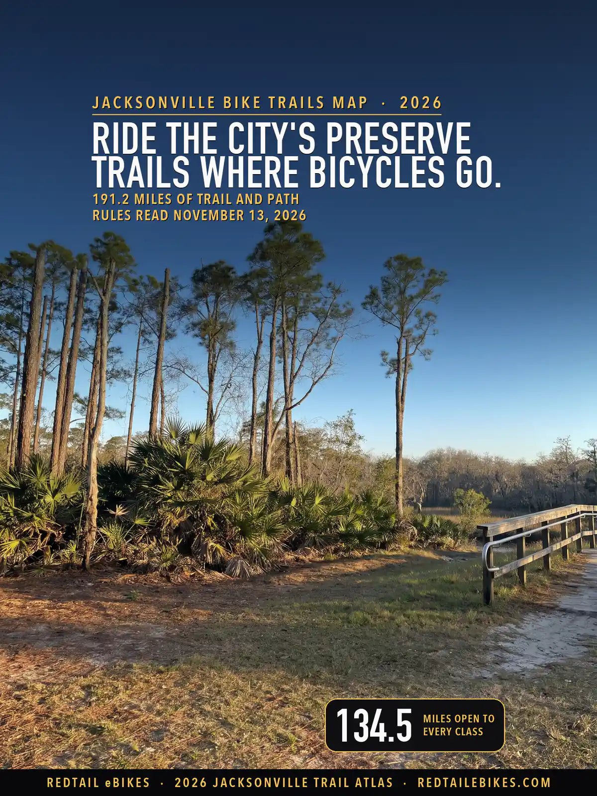
191.2 miles of trail and path · 44 named trails of a mile or more · 134.5 miles open to every class of e-bike · 46 passages quoted from the bodies that wrote them · Rules read November 13, 2026
Verified November 13, 2026: every rule on this map is quoted from the body that wrote it: the Florida Legislature, the City of Jacksonville's Council, parks and planning pages, the National Park Service, the St. Johns River Water Management District, the Florida Department of Environmental Protection, the University of North Florida, and the cities of Neptune Beach and Jacksonville Beach. Each stretch of ground in Duval County counts once.
Quick Answer: Florida lets your e-bike ride wherever a bicycle may, so every class rides Jacksonville's shared-use paths and the Jacksonville-Baldwin Rail Trail, at up to 15 mph under the City's 2026 ordinance. Three exceptions: Hanna Park allows Class 1 only, motor off on its trails; the rail trail's spurs are for hikers and horses; state park rules could not be read.
Every e-bike we sell ships free within the contiguous United States, Jacksonville included. For these trails, start with our Jacksonville guide: all nine of its picks meet Florida's e-bike definition, matched to your neighborhood, your commute and Jacksonville's summer heat.
Match a bike to your trails
A clearing and its footbridge on the trails of Cedar Point Preserve, where the City opens its trails to off-road bicyclists and this map reads every class open, in a scene generated with Playcut from a National Park Service photograph (public domain).
Florida answers most of your trail question first. Section 316.20655(7) says: "An operator may ride an electric bicycle where bicycles are allowed, including, but not limited to, streets, highways, roadways, shoulders, bicycle lanes, and bicycle or multiuse paths." The same section lets a city, county or state agency that runs a path or trail network restrict or prohibit e-bikes on it (§ 316.20655(1)), so the manager of each trail has the last word.
This map lays that rule, and every manager's rule that could be read, over every mapped trail and off-street path in Duval County: 191.2 miles in 1,007 pieces, each colored by what you may do there. Every line, with its manager, its rule and its source, is a row in the register.
Key takeaways
- 134.5 miles are open to every class. That covers the City's shared-use paths, the Jacksonville-Baldwin Rail Trail's 14.8 paved miles, the City's preserves where bicycles ride, the Riverwalks and the S-Line, and the paths of Neptune Beach and Jacksonville Beach.
- 11.6 miles are open with a condition. 10.5 of them are Kathryn Abbey Hanna Park, where you may ride only a Class 1 and its motor stays off on the trails; the other 1.1 are the Willie Browne Trail, where you must pedal to use a Class 2's motor.
- 7.3 miles are closed: the rail trail's spur trails, which the City designates for hiking and horseback riding.
- 37.8 miles are not settled by any rule read today. 19.4 of them are in the state parks, most on the Talbot Islands and Fort George Island, 12.0 on Water Management District land, and 4.4 on Park Service land beyond the Willie Browne Trail.
- Speed is the City's rule. Jacksonville's Ordinance 2026-570-E caps your e-bike at 15 mph on sidewalks and shared-use paths, and every rider or passenger under 16 wears a helmet.
In this guide
- How to read the map
- Who decides on each trail in Duval County
- Jacksonville's 2026 e-bike ordinance
- The Jacksonville-Baldwin Rail Trail
- Kathryn Abbey Hanna Park
- The City's parks and preserves
- The Timucuan Trail and the Talbot Islands
- Park Service land: the Willie Browne Trail
- Water Management District land
- The Beaches
- Jacksonville bike trails riders ask about
- Duval County trails, area by area
- Where riders get caught out
- Streets, bike lanes and sidewalks
- Choosing an e-bike for Jacksonville's trails
- Frequently asked questions
- The bottom line
How to read the map
Green is open to every class of e-bike, amber is open with a condition or to some classes only, red is closed, and gray means no rule read today settles it. Florida's definition covers a bicycle or tricycle with "fully operable pedals" and "an electric motor of less than 750 watts" (§ 316.003(23)), in three classes; a Class 3 assists "only when the rider is pedaling" and stops at 28 miles per hour (§ 316.003(23)(c)).

Jacksonville and Duval County: 191.2 miles of trail and path, 134.5 open to e-bikes, 11.6 open with a condition, 7.3 closed and 37.8 not settled.
| Color | What an e-bike may do | Where | Miles |
|---|---|---|---|
| Green | Open to every class of e-bike | The City's paths, the City's parks and the rail trail | 134.5 |
| Amber | Open with a condition, or to some classes only | Hanna Park and the Willie Browne Trail | 11.6 |
| Red | Closed to e-bikes | The rail trail's spurs | 7.3 |
| Gray | Not settled by any rule read today | The state parks, Water Management District land, other Park Service land and Atlantic Beach | 37.8 |
Read amber as the trail telling you which class may ride and how. At Hanna Park the answer is Class 1 with the motor off on the trails; on the Willie Browne Trail every class rides, and on a Class 2 you pedal whenever the motor runs. On any color, a posted sign is what a ranger or an officer can enforce on the day you ride.
Takeaway
134.5 of this map's 191.2 miles are open to your e-bike if it meets Florida's definition, whatever its class. 11.6 miles are open with a condition, 7.3 miles are closed, and 37.8 miles turn on a manager's rule that could not be read or reads two ways.
Who decides on each trail in Duval County
On the bike trails in Jacksonville, the rule you ride by belongs to whoever runs the ground under the trail (§ 316.20655(1)): the City, a state park, the Park Service, the Water Management District, a university or a beach city. Every mapped mile outside Atlantic Beach, Neptune Beach, Jacksonville Beach and Baldwin lies inside the City of Jacksonville's own boundary, so there the City is the local government.
| Manager | Miles | The rule and its source |
|---|---|---|
| City of Jacksonville, Kathryn Abbey Hanna Park | 10.5 | Class 1 only, its motor off on the trails; helmets for every rider (source) |
| City of Jacksonville, the rail trail's spur trails | 7.3 | Designated for hiking and horseback riding (source) |
| City of Jacksonville, the Jacksonville-Baldwin Rail Trail | 14.8 | Every class, 15 mph, unless the City posts a restriction (source) |
| National Park Service, the Willie Browne Trail | 1.1 | Every class where bicycles ride; off motor roads, the motor only while pedaling (source) |
| City of Jacksonville, park and preserve land | 49.3 | Open where bicycles ride, unless the City posts a restriction; the parks' vehicle rule names ATVs, dirt bikes and four-wheelers (source) |
| City of Jacksonville, outside its parks | 67.2 | Every class on sidewalks and shared-use paths, at 15 mph or less (source) |
| City of Neptune Beach | 2.7 | Anywhere a regular bicycle can go; beach sand at 15 mph or less (source) |
| City of Jacksonville Beach | 0.5 | Every class wherever bicycles are allowed (source) |
| FDEP Division of Recreation and Parks (state parks) | 19.4 | Open to bicycles; the Division's e-bike rule is not quoted on this map (Limitations) |
| St. Johns River Water Management District | 12.0 | Bicycling on designated trails; its motorized-vehicle rule reads two ways (source) |
| National Park Service, other Timucuan Preserve land | 4.4 | Bicycles only on roads open to cars and designated trails (source) |
| City of Atlantic Beach | 1.2 | Its own code is not quoted on this map (Limitations) |
| University of North Florida | 0.4 | No bicycles on its nature trails; which this line is, no record says (source) |
| Florida Forest Service | 0.4 | Its trail rule is not quoted on this map (Limitations) |
A manager's own rule counts on this map only where its own words could be read. Where they could not, the line reads gray, and you will find the reason in Limitations; the state rule alone never turns a trail green on land whose manager may restrict e-bikes and has not been read.
Jacksonville's 2026 e-bike ordinance
On a City sidewalk or shared-use path, ride at 15 mph or less, yield to people on foot and signal before you pass. The City Council passed Ordinance 2026-570-E on September 22, 2026, by a vote of 19-0. Its first rule: "Electric bicycles may be operated on bicycle lanes, bicycle paths, bikeways, rights-of-way, roadways, sidewalks, and shared-use paths consistent with this Part."
On sidewalks and shared-use paths you must "not exceed a speed of 15 miles per hour" (§ 804.901(a)(2)), obey pedestrian signs and signals, yield to pedestrians at all times and give an audible signal before you pass. The ordinance defines a shared-use path as "a paved or improved path, trail, boardwalk, or other facility" for pedestrians and bicyclists, "whether located within or outside a roadway right-of-way" (§ 804.102).
The ordinance takes effect "upon signature by the Mayor or upon becoming effective without the Mayor’s signature" (section 5); the City's legislative record shows it enacted and leaves the effective date blank. The City's own e-bike page states the rule as current: "15-mph Speed Limit: You may not exceed 15 mph on sidewalks or shared-use paths."
Two more of its rules apply on every City trail. An operator or passenger under 16 "must wear a properly fitted, securely fastened bicycle helmet" (§ 804.901(d)).
Between sunset and sunrise your bike needs a white front lamp visible from 500 feet and a red rear lamp and reflector visible from 600 feet (§ 804.901(h)). The City may also post "class-specific operating restrictions" on designated parks and trails (§ 804.901(i)), which is why the sign at a trailhead outranks this map.
Break one of these rules and you commit "a civil infraction", which § 804.902 also makes "a Class C offense". A parent or guardian may not "authorize or knowingly permit" a child to break them, so if your child rides, the rules are yours to keep too.
Takeaway
On City sidewalks and shared-use paths, you ride any class at up to 15 mph, every rider and passenger under 16 wears a helmet, and after dark your bike carries a white front light and a red rear light and reflector.
The Jacksonville-Baldwin Rail Trail
Ride the paved rail trail on any class of e-bike, and leave the unpaved spurs beside it to hikers and horses. The City's page describes "A 12’ wide paved trail currently exists for hikers, bikers and roller-bladers to enjoy.", running approximately 14.5 miles from Imeson Road to the Town of Baldwin. This map holds 14.8 miles of it, all green.
The spurs are another matter. The City writes that "There are approx. 8.5 miles of spur trails onto the Jacksonville Rail Trail Buffer Properties that are designated for unpaved day hiking and equestrain use." The state's trail inventory draws 7.3 miles of them and lists them multi-use; this map follows the City, the manager, and colors them red.
The trailheads the City lists are Imeson Road, Camp Milton Historic Preserve on Halsema Road, Otis Road, the old depot in Baldwin and Brandy Branch Road. In the City's words, "The ROW is flat and passes through rural areas with abundant plant life, wildlife and trees." A commuter e-bike is all it asks of you.
The rail trail is flat and open to every class, so the bike that suits you turns on the ride that gets you there. Our Jacksonville guide measured the streets of all 206 of the City's neighborhoods and matched its picks to four kinds of ride.
See our Jacksonville picksKathryn Abbey Hanna Park
Bring a Class 1 e-bike and pedal it like a bicycle: Hanna Park's rules let no other e-bike in, and you may not run its motor on the trails. The park's posted rules read: "No unlicensed vehicles or electric/battery powered vehicles are allowed. Authorized mobility equipment for disabled persons must be properly permitted and documented. Class 1 E-Bikes are only exception, and motor may not be utilized on trails."
The City's bike page adds that "Helmets are required to ride bikes throughout Hanna Park.", so you wear one there at any age, which is stricter than the state's under-16 rule. The City gives the park "20+ miles of bicycle trails with opportunities for all skill levels". This map draws 10.5 miles, the loops the state's trail inventory maps, and colors them amber for the Class 1 condition.
Plan Hanna as a pedal ride: a light Class 1 with its assist switched off on the trails rides like the bicycle the rule asks for, and the assist is yours again on the park road out. Pack a helmet for every rider in your group, too: our accessories collection carries them.
The City's parks and preserves
Ride the City's preserve trails where bicycles go, and read the sign at each entrance. The parks' posted rule sheet lists "NON-LICENSED MOTORIZED VEHICLES (I.E. ALL TERRAIN VEHICLE, DIRT BIKE, 4-WHEELER ETC.) PROHIBITED – SEC 28.721"; its examples are off-road motor vehicles, Florida gives an e-bike a bicycle's rights, and the City's ordinance opens shared-use paths to e-bikes and lets the City post class rules in parks.
So this map colors 49.3 miles of City park path green where a record shows bicycles ride, from the 20.5 miles of the Cecil Field Conservation Corridor to Cedar Point Preserve, which the City opens to "hikers, off-road bicyclists and horseback riders". Tillie K. Fowler Regional Park sits on land the City first leased from the Navy in 1979, and the City says it has "improved and expanded the hiking and off-road bike trails".
Two parks need a word of warning. Seaton Creek Historic Preserve "currently offers more than five miles of trails for hikers, off-road bicyclists and horseback riders", in the City's words, but no trail file read here draws them, so you will not find them on the map.
The City's page for Pumpkin Hill Creek Preserve State Park says "Equestrians, hikers, and off-road bicyclists can explore more than 16 miles of trails", while the Florida Department of Environmental Protection, which runs the park, lists every one of its trails in its own trail file for hiking or horseback riding; ask the park before you ride.
The Timucuan Trail and the Talbot Islands
Ride the Timucuan Trail's road-side stretches on any class; inside the state parks, check the park's e-bike rule at the ranger station. The paved trail carries you along Heckscher Drive and A1A to the Talbot Islands. In the road's right of way it is a City shared-use path, and 3.4 of its miles read green; where it crosses Big and Little Talbot Island state parks, 3.2 miles read gray.
The Department of Environmental Protection's approved management plan for the Talbot Islands keeps the trail open to bicycles: "However, the Timucuan Trail still allows bicycle-pedestrian access."
Florida lets an "agency of the state" with jurisdiction over a trail network restrict e-bikes on it (§ 316.20655(1)), and the state parks' own e-bike rule could not be read today, so the 19.4 miles of state park trail on this map, Big Talbot's, Little Talbot's, Fort George Island's and George Crady Bridge's among them, read gray.

Hanna Park to the Talbot Islands: 52.8 miles of trail and path, 19.5 open to e-bikes, 11.6 open with a condition and 21.6 not settled.
Park Service land: the Willie Browne Trail
On Timucuan Preserve land, ride only the roads open to cars and the trails the Park Service opens to bicycles. The preserve's compendium says "Bicycles are prohibited [36 CFR 4.30] except on roadways open to vehicular traffic and on designated trails. Designated trails are limited to the Willie Browne Trail in the Theodore Roosevelt Area; unpaved roads at Cedar Point", plus trails the Park Service signs open.
E-bikes follow the bicycles: "E-bikes are allowed in Timucuan Ecological and Historic Preserve where traditional bicycles are allowed." Off the roads open to cars, "using the electric motor to move an e-bike without pedaling is prohibited", so on a Class 2 you pedal whenever the motor helps, all 1.1 miles of the Willie Browne Trail.
The preserve's other 4.4 mapped miles are lines the state's inventory draws on Park Service land. The compendium opens the Willie Browne Trail, Cedar Point's unpaved roads and any trail a Park Service sign marks open to bicycles, and no file read here shows which of these lines, if any, are among them, so they read gray.
Water Management District land
Treat Julington-Durbin and Thomas Creek as bicycle land where your e-bike's place is an open question. The District's rule allows "Bicycling is allowed on District Lands but only on designated trails or areas, established roads, and fire lines, except where restricted by signs." The same chapter bars "All-terrain, off-road, or other motorized vehicles not licensed for Florida highway use" and defines a motorized vehicle as one "partially or completely powered by a motor".
Read as written, that definition reaches an e-bike; read with Florida's statute, an e-bike carries a bicycle's rights. No text read here settles which governs, so the District's 12.0 miles read gray: 7.0 at Julington-Durbin Preserve and 5.0 at Thomas Creek Conservation Area. Call the District before you take your e-bike onto its fire lines.
The Beaches
At Neptune Beach and Jacksonville Beach, an e-bike goes where a bicycle goes; in Atlantic Beach, slow down and stay off park trails until you have read the city's code. Neptune Beach says "E-bikes are permitted anywhere regular bicycles can go, including roads, bike lanes, and multi-use paths.", and its Ordinance 2025-06 "allows e-bikes on beach sand if operated safely at speeds of 15 mph or less".
Neptune Beach's police department says it "strictly enforces reckless operation", and lists fines of $62.50 for riders aged 15 and older and $15.00 for riders 14 and younger.
Jacksonville Beach's police department says "Class 1, 2 and 3 electric bicycles may be ridden wherever bicycles are allowed including bicycle paths and multi-use paths." Atlantic Beach's own code could not be read; the North Florida TPO's July 2026 study summarizes it as a 10 mph limit on sidewalks, paths and multi-use trails and no e-bikes "within city parks, trails, unpaved portions of public rights-of-way", so its 1.2 miles read gray.
Jacksonville Beach also warns that a machine marked as an e-bike can be an e-motorcycle: "An E-Motorcycle has no functional pedals, is capable of speeds beyond E-Bike speeds or produces more than 750 watts of power." Such a machine needs registration, a plate, a motorcycle endorsement and insurance where the law requires it.
If you ride an e-motorcycle there without a proper license or registration, Jacksonville Beach police list what follows: at first contact, education, a documented warning, notice to a parent or guardian, and towing and storage fees if necessary; for repeat violations, traffic citations, criminal charges and towing and storage fees.
On the sand itself, the state gives the call to the local government: Florida's statute lets a city, county or state agency with jurisdiction over a beach or dune restrict or prohibit e-bikes there (§ 316.20655(1)).
Takeaway
Neptune Beach and Jacksonville Beach open every class wherever a bicycle may ride, and Neptune Beach adds the sand at 15 mph or less. Atlantic Beach's own code could not be read, so slow down and read its signs before you ride its paths or parks.
Heading for the Beaches? Our Jacksonville guide measured the wind on the way: on one hour in ten, it costs you more than the biggest bridge in the city. Start with its picks for the long flat haul.
Plan your ride to the coastJacksonville bike trails riders ask about
Where is the Emerald Trail in Jacksonville, Florida?
The Emerald Trail circles downtown Jacksonville: the Jacksonville Transportation Authority describes "a 30-mile bicycle/pedestrian trail and linear park system that will connect 14 historic neighborhoods and downtown Jacksonville". Its first phase, the LaVilla Link, is "the 1.3-mile LaVilla Link which officially opened on May 6, 2024". The City's network lists the S-Line, part of the system, as 3.4 miles of shared-use path, green on this map.
Mountain biking at Kathryn Abbey Hanna Park
Hanna Park's mountain bike loops carry the one City park rule on this map that names e-bikes: a Class 1 e-bike only, ridden with the motor off on the trails, and a helmet for every rider. Plan a pedal ride, and save your assist for the road home.
Mountain biking around Cecil
The trails of the Cecil Field Conservation Corridor, on City land west of the Cecil Commerce Center, read green on this map: 20.5 miles where the state's trail inventory and the City's network record bicycle use. The City's own park page lists a hiking trail there and no bike trail, so look for the signs at the trailhead before you ride.
Black Creek, and other trails outside Duval County
Many guides to Jacksonville riding send you to the Black Creek Mountain Bike Trail. Clay County lists it at "7890 US 17 Fleming Island, FL 32003", south of the county line, so it is outside this map and its rules are Clay County's.
The Timucuan bike trail map
The county map and the coastal map above draw the Timucuan Trail from Heckscher Drive to Big Talbot Island, green in the road's right of way and gray inside the state parks. The register lists every stretch with its manager and rule.
| Trail | Published miles | Published by | Miles on this map | Why they differ |
|---|---|---|---|---|
| Jacksonville-Baldwin Rail Trail | approximately 14.5 | City of Jacksonville | 14.8 | Within a mile |
| Rail-trail spur trails (hiking and horseback riding) | approx. 8.5 | City of Jacksonville | 7.3 | The City's figure is for every spur; the state's trail inventory draws the spurs at Otis Road and on the International Paper tract, the stretches this map holds |
| Kathryn Abbey Hanna Park bike trails | 20+ | City of Jacksonville | 10.5 | The register holds the four named loops the state's trail inventory draws (South Loop, East Line, Z Trail, Scout Trail); the park's own map names more singletrack that no trail file read here draws |
| Cedar Point Preserve | 7.3 | City of Jacksonville | 6.7 | Within a mile |
| Seaton Creek Historic Preserve | more than five | City of Jacksonville | 0.0 | No trail file read here draws Seaton Creek's trails; OpenStreetMap maps track and footway there with no bicycle tag, so the map holds none of them |
| Pumpkin Hill Creek Preserve State Park | more than 16 | City of Jacksonville's park page | 0.6 | FDEP, which manages the park, lists every Pumpkin Hill trail in its own trail file for hiking or horseback riding, so none is on this map as a bike trail; the City's park page is not the manager's |
| The City's existing shared-use paths | 76 | City of Jacksonville | 72.4 | The City's network file draws 77.1 mi of existing shared-use and recreational path in Duval County, against the 76 its undated page gives; this map holds 72.4 of it, the rest sharing ground with a line counted first (4.3 mi under a state park's line; 0.1 mi under coj's line) or dropped as slivers |
Duval County trails, area by area
These are the bike trails in Jacksonville, FL, area by area. The City groups its neighborhoods into six planning districts, and this map lists the trails of each, with the beach cities and Baldwin beside the district nearest them. Find your area: each list gives a trail's mapped miles there and its color.
| Area | Green (mi) | Amber (mi) | Red (mi) | Gray (mi) |
|---|---|---|---|---|
| Urban Core | 12.8 | 0.0 | 0.0 | 0.0 |
| North | 19.7 | 0.0 | 0.0 | 28.8 |
| Northwest | 16.1 | 0.0 | 1.2 | 0.0 |
| Southwest | 46.1 | 0.0 | 6.1 | 0.4 |
| Southeast | 26.9 | 0.0 | 0.0 | 7.5 |
| Greater Arlington/Beaches | 12.9 | 11.6 | 0.0 | 1.2 |
Urban Core

Jacksonville, Urban Core: 12.8 miles of trail and path, 12.8 open to e-bikes.
Urban Core planning district: 12.8 miles. 12.8 green.
- S-Line Trail 2.6 mi (green)
- Northbank Riverwalk 2.4 mi (green)
- Southbank Riverwalk 2.0 mi (green)
- Bay Street East 1.7 mi (green)
- Model Mile 1.5 mi (green)
- Hogans Creek Greenway 0.7 mi (green)
- Fuller Warren Shared Use Path 0.4 mi (green)
- Prudential Dr 0.3 mi (green)
- Broadcast Pl 0.3 mi (green)
- Also: 0.9 mi of shorter named stretches
North

Jacksonville, North: 48.5 miles of trail and path, 19.7 open to e-bikes and 28.8 not settled.
North planning district: 48.5 miles. 19.7 green; 28.8 gray.
- Cedar Point Preserve Trail 7.7 mi (mostly green)
- Timucuan Trail 6.6 mi (mostly green)
- Big Talbot Island State Park Trail 5.4 mi (gray)
- Fort George Island Cultural State Park Trail 3.8 mi (gray)
- Dune Ridge Trail 3.4 mi (gray)
- Yellow Trail 3.0 mi (green)
- Jones Cut 2.3 mi (gray)
- Thomas Creek Area 2.2 mi (gray)
- Timucuan Trail System 2.2 mi (gray)
- Heckscher Drive 1.4 mi (green)
- Blue Trail 0.8 mi (green)
- Braddock Rd 0.8 mi (green)
- Flatwoods Trail 0.7 mi (green)
- Duval County Corridor (SR A1A Bridge) 0.6 mi (green)
- Bridge Trail 0.6 mi (gray)
- Clapboard Crossing Way 0.5 mi (green)
- Piney Loop Trail 0.4 mi (green)
- Service Roads/Firebreaks 0.3 mi (green)
- Also: 0.8 mi of shorter named stretches and 5.1 mi of unnamed trail and path
Northwest

Jacksonville, Northwest: 17.2 miles of trail and path, 16.1 open to e-bikes and 1.2 closed.
Northwest planning district: 17.2 miles. 16.1 green; 1.2 red.
- Jacksonville-Baldwin Rail Trail 8.0 mi (green)
- Pritchard Road 4.8 mi (green)
- Chaffee Road North 1.3 mi (green)
- Camp Milton Historic Preserve Trail 1.3 mi (green)
- Jacksonville-Baldwin Rail Trail spur trails 1.2 mi (red)
- S-Line Trail 0.7 mi (green)
Southwest

Jacksonville, Southwest: 52.6 miles of trail and path, 46.1 open to e-bikes, 6.1 closed and 0.4 not settled.
Southwest planning district: 51.1 miles. 44.6 green; 6.1 red; 0.4 gray.
- Cecil Field Conservation Corridor Trail 16.5 mi (green)
- Jacksonville-Baldwin Rail Trail spur trails 6.1 mi (red)
- Jacksonville-Baldwin Rail Trail 5.4 mi (green)
- Argyle Forest Blvd 5.1 mi (green)
- Sal Taylor Creek Preserve Trail 4.5 mi (green)
- Cecil Recreation Trail 3.9 mi (green)
- Tillie K. Fowler Regional Park Trail 2.9 mi (green)
- Cecil Field Greenway 2.3 mi (mostly green)
- Oakleaf Plantation/Argyle Forest 1.4 mi (green)
- Oakleaf Plantation Pkwy 0.9 mi (green)
- Merchants Way 0.6 mi (green)
- WKC Trail 0.6 mi (green)
- Cecil Connector Rd 0.6 mi (green)
- Cherry Ridge Dr 0.3 mi (green)
- Also: 0.1 mi of shorter named stretches
Baldwin: 1.5 miles. 1.5 green.
- Jacksonville-Baldwin Rail Trail 1.5 mi (green)
Southeast

Jacksonville, Southeast: 34.4 miles of trail and path, 26.9 open to e-bikes and 7.5 not settled.
Southeast planning district: 33.9 miles. 26.5 green; 7.5 gray.
- Bartram Park Blvd 3.6 mi (green)
- Etown Pkwy 3.3 mi (green)
- Valley Ridge Blvd 1.9 mi (green)
- Kernan Blvd S 1.8 mi (green)
- Stillwood Pines Blvd 1.5 mi (green)
- Holsinger Blvd 1.3 mi (green)
- Del Webb Pkwy 1.2 mi (green)
- Nocatee 1.2 mi (green)
- Town Center Pkwy 1.0 mi (green)
- North Entrance Rd 0.9 mi (green)
- Eco Rd 0.9 mi (mostly green)
- Wells Creek Pkwy 0.8 mi (green)
- Yellow Blaze Trail 0.7 mi (gray)
- Fuller Warren Shared Use Path 0.6 mi (green)
- Stonemason Way 0.5 mi (green)
- Park Village Dr 0.5 mi (green)
- San Pablo Rd S 0.4 mi (green)
- UNF Trail 0.4 mi (green)
- Ryar Road 0.3 mi (green)
- Kernan Boulevard 0.3 mi (green)
- Cypress Park Circular Footpath 0.3 mi (green)
- Apex Trl 0.3 mi (green)
- Also: 1.9 mi of shorter named stretches and 8.4 mi of unnamed trail and path
Jacksonville Beach: 0.5 miles. 0.5 green.
- Jacksonville Drive 0.5 mi (green)
Greater Arlington/Beaches

Jacksonville, Greater Arlington/Beaches: 25.7 miles of trail and path, 12.9 open to e-bikes, 11.6 open with a condition and 1.2 not settled.
Greater Arlington/Beaches planning district: 21.8 miles. 10.2 green; 11.6 amber.
- South Loop Trail 4.5 mi (amber)
- East Line Loop North Trail 3.7 mi (amber)
- Kernan Blvd N 2.7 mi (green)
- Kernan Blvd S 2.2 mi (green)
- Z Trail 2.1 mi (amber)
- Dutton Island Park and Preserve Trail 1.1 mi (green)
- Main Trail 1.1 mi (green)
- Willie Browne Trail 1.1 mi (amber)
- Abess Blvd 0.9 mi (green)
- Tamaya Blvd 0.8 mi (green)
- Meritage Boulevard 0.7 mi (green)
- Marketplace Dr 0.3 mi (green)
- Also: 0.6 mi of shorter named stretches
Neptune Beach: 2.7 miles. 2.7 green.
- Florida Boulevard/Mayport Road 1.7 mi (green)
- Jarboe Park 0.4 mi (green)
- Also: 0.6 mi of unnamed trail and path
Atlantic Beach: 1.2 miles. 1.2 gray.
- Florida Boulevard/Mayport Road 1.2 mi (gray)
Where riders get caught out
Watch for the boundaries you cannot see. The Timucuan Trail runs on from a City path into Big and Little Talbot Island state parks, where another manager's rule takes over, and the rail trail's unpaved spurs branch off a path you may ride onto ground the City keeps for hikers and horses.
The traps worth knowing by name: Hanna Park's Class 1 rule and its helmet-for-everyone rule, the 15 mph limit on every City sidewalk and shared-use path, the Park Service's pedal rule on the Willie Browne Trail, and the District's motorized-vehicle rule on its fire lines. Florida also expects you to yield to people walking on a sidewalk and give "an audible signal before overtaking and passing" them.
If you let a rider under 16 skip the helmet, that rider "may be issued a citation by a law enforcement officer and assessed a fine for a pedestrian violation". A court dismisses a first helmet charge on proof that a compliant helmet was bought, so buy the helmet before the ride, not after the stop; you will find helmets in our accessories collection.
The right bike makes the rules easy to keep: a clear class label, a speedometer you can read and lights that meet the City's night rule. Our Jacksonville guide screened our shelf against Florida's definition before it chose its nine picks.
See the nine Florida picksYour Jacksonville trail checklist
- Check the trail's color here, then the sign at the trailhead; the sign wins on the day you ride.
- Hold 15 mph or less on City sidewalks and shared-use paths, and slower where people walk.
- After dark, run a white front light seen from 500 feet and a red rear light and reflector seen from 600.
- Helmet every rider under 16, and everyone in your group at Hanna Park.
- Know your class: only a Class 1 rides Hanna Park, and a Class 2 pedals on the Willie Browne Trail.
- Leave the rail trail's unpaved spurs, and Pumpkin Hill's trails, to hikers and riders on horseback.
Streets, bike lanes and sidewalks
On the street, your e-bike follows the same traffic rules as a bicycle; on a sidewalk, you yield and keep to 15 mph. Florida gives an e-bike "all the rights and privileges" of a bicycle and "all of the duties" (§ 316.20655(1)), and the City's ordinance adds that on lanes, paths and roadways you "shall comply with all traffic regulations including posted speed limits".
The City's bikeway network draws 567.0 miles of on-street bike lane, buffered lane, protected lane and shared lane, which this map leaves out as street facilities; the City's planning page explains each type. In Jacksonville the ordinance opens sidewalks to your e-bike at up to 15 mph; on any sidewalk in the county, Florida's bicycle rule asks you to yield to people walking and signal before you pass (§ 316.2065(10)).
Choosing an e-bike for Jacksonville's trails
Choose an e-bike that meets Florida's definition, then the class and the tire for your trails. This map's green miles are open to your e-bike if Florida counts it as one, and Florida's line is "an electric motor of less than 750 watts", so a motor rated at 750 watts falls outside it. Most of the e-bikes we sell fall outside it too; all nine picks in our Jacksonville guide meet it.
Then the class: a Class 2 or Class 3 suits every green mile, though the 15 mph path limit leaves a Class 3's extra speed for the street. Hanna Park admits only a Class 1, whose motor "provides assistance only when the rider is pedaling", so a throttle keeps a bike out. Most of the e-bikes we sell have a throttle, all nine Jacksonville picks included, so none may ride into Hanna Park.
46.3 of this map's miles carry an unpaved surface in their own records, most of them in the City's preserves, so if Cedar Point, Betz-Tiger Point or Tillie K. Fowler Regional Park is your weekend, choose the widest tire among those nine. If the rail trail or the Riverwalk is your commute, start with the guide's picks for the everyday flat commute.
For the rest of the state, our Florida trails map covers the other counties and our Florida e-bike law guide sets out the state's rules, while our Miami e-bike guide, our Tampa e-bike guide and our Orlando e-bike guide pick bikes for riders in those cities.
North of the state line, our Georgia trails map maps Georgia's trails the same way, and for other states, start at bike trails by state or e-bike trails near you.
Need a test ride or a mechanic? Our Jacksonville e-bike shop directory lists the local stores, and our Florida directory the rest of the state's.
Why buy your Jacksonville e-bike from us
- Free shipping to Jacksonville. Every electric bike we sell ships free within the contiguous United States; it is dispatched within 1 to 3 business days of your order's confirmation, and most bikes arrive within 5 to 10 business days after dispatch (shipping policy).
- Damage in transit is ours to fix. Note any damage with the carrier and email us photos within 48 hours of delivery; we file the carrier claim and arrange the repair or replacement (refund policy).
- We handle the warranty with you. A bike that won't power on, won't charge, shows an error code or has a faulty part is covered by its manufacturer's warranty, and we coordinate the repair or replacement for you (refund policy).
- Real people on the line. Write to support@redtailebikes.com, which typically answers within one business day, or call (213) 444-4020 and leave a voicemail if no one picks up; every voicemail gets a call back (contact page).
- Checkout with your wallet. Apple Pay, Google Pay and Shop Pay are accepted.
- A company you can name. Our terms of service identify the business behind this store.
Frequently asked questions
Can I still ride my e-bike on beach paths in Florida?
Yes, on most of them. Florida lets an e-bike ride where bicycles are allowed, multiuse paths included, but a city, county or state agency with jurisdiction over a beach or dune may restrict or prohibit e-bikes there. Neptune Beach allows e-bikes on the sand at 15 mph or less, and Jacksonville Beach where bicycles go; Atlantic Beach's own code could not be read, so read the sign before you ride its paths.
What is the speed limit for e-bikes on sidewalks?
In Jacksonville, 15 mph on sidewalks and shared-use paths, under Ordinance 2026-570-E, and you must yield to pedestrians and give an audible signal before you pass. The City may post lower limits on designated paths and in parks, so a sign can set a slower number.
Will I need a license for a Class 3 e-bike in Florida?
No. Florida says an e-bike and its operator are not subject to the law on "driver or motor vehicle licenses, vehicle registration, title certificates", so you need no license, plate or title for any class. Riders and passengers under 16 wear a helmet, and Jacksonville caps every class at 15 mph on sidewalks and shared-use paths.
What are the best e-bike trails in Jacksonville for families and relaxed riding?
The Jacksonville-Baldwin Rail Trail is a flat, paved ride: 14.8 miles open to every class, through rural land the City describes as rich in trees and wildlife. The Northbank and Southbank Riverwalks and the S-Line are open too, in the city's heart. Keep to 15 mph where people walk, and helmet every child under 16 in your group.
How long is the Jacksonville-Baldwin Rail Trail?
The City gives its paved trail as approximately 14.5 miles from Imeson Road to the Town of Baldwin; this map's line along it measures 14.8 miles, every one open to every class of e-bike. Beside it run about 8.5 miles of unpaved spur trails that the City designates for hiking and horseback riding, so keep your e-bike on the paved line.
Where does the Jacksonville-Baldwin Rail Trail start?
At Imeson Road, and it runs from there to the Town of Baldwin. The City lists five trailheads: Imeson Road, Camp Milton Historic Preserve on Halsema Road, Otis Road, the old depot in Baldwin and Brandy Branch Road. Any of them puts you on the paved trail, open to every class of e-bike.
Can you mountain bike on the Jacksonville-Baldwin Rail Trail?
Not on its dirt. The trail itself is a 12-foot paved path, and the unpaved spur trails beside it are ones the City designates for hiking and horseback riding, so this map colors them red. For trail riding on your e-bike, try the City's preserves: Cedar Point and Tillie K. Fowler Regional Park both read green where bicycles ride.
What are the best e-bike trails in Jacksonville for mountain bike riding?
For Jacksonville mountain bike trails, start your search with the City's preserves: Cedar Point, Betz-Tiger Point, Sal Taylor Creek and Tillie K. Fowler Regional Park all read green where bicycles ride. At Hanna Park you may ride only a Class 1, with its motor off on the trails. The Black Creek Mountain Bike Trail that many guides list is on Fleming Island, in Clay County, outside this map.
How long is the Timucuan Trail?
Inside Duval County, the line this map draws along it measures 6.6 miles: 3.4 green where it runs as a City path beside Heckscher Drive and A1A, and 3.2 gray inside Big and Little Talbot Island state parks. The state's management plan for the Talbot Islands describes a paved multiuse trail that parallels State Road A1A and counts it part of the much larger East Coast Greenway.
Are high-power e-bikes considered motorcycles?
Florida's e-bike definition stops below 750 watts, with pedals that work, so if your machine has a bigger motor or no working pedals, it is not an e-bike under § 316.003(23). Jacksonville Beach's police department calls such a machine an e-motorcycle, needing registration, a license plate, a motorcycle endorsement and insurance where the law requires it, and lists traffic citations and criminal charges for repeat violations without them.
What is the Emerald Trail in Jacksonville Florida?
A planned 30-mile trail and linear park system that will connect 14 historic neighborhoods and downtown, in the Jacksonville Transportation Authority's words. Its first phase, the 1.3-mile LaVilla Link, opened May 6, 2024, and the S-Line, part of the system, is a City shared-use path open to every class of e-bike.
The bottom line
Ride the rail trail, the City's shared-use paths, the Riverwalks and the City's preserves on any class of e-bike at 15 mph or less where people walk. Bring only a Class 1 to Hanna Park and pedal it on the trails, leave the rail trail's spurs to hikers and horses, and read the sign before you ride a state park, the District's land or Atlantic Beach's trails.
134.5 of this map's 191.2 miles are open to you today on any class of e-bike, so start with the rail trail.
Shopping for those miles? For the rail trail and the Riverwalks, start with our Jacksonville guide's commuter picks; for the unpaved trails of the City's preserves, choose the widest tire among its nine Florida picks. Hanna Park takes only a Class 1, and none of those nine is one.
Our Jacksonville guide adds what the trails leave out: the heat, the wind and the bridges, with every pick inside Florida's definition.
Read our Jacksonville guideHow we verified this map
This map's 191.2 miles were measured from the trail register we built for it, and each of its 75 rules was read in the words of the body that wrote it.
- Lines. 1,007 pieces of trail and off-street path, 191.2 miles, from the City of Jacksonville's bikeway network, the North Florida TPO's paved trail network, the state's trail inventory and its state park trails, the Water Management District's trail file, the Park Service's public trails, the Florida Forest Service's recreation trails and OpenStreetMap (Geofabrik's Florida extract of November 12, 2026). Each stretch of ground counts once, the managers' own files first; every piece is cut into runs of a quarter mile or less before it is placed, and every vertex outside Duval County is cut away. Every mile figure is rounded once, to a tenth, so a legend's rows can add up to a tenth more or less than the total printed above them.
- Places. Each piece is placed by the Census Bureau's city boundaries, the City's six planning districts, the Florida Natural Areas Inventory's managed areas, the University of Florida GeoPlan Center's park polygons and the Protected Areas Database. A City piece that no planning district covers is counted in the nearest one (0.5 miles). A park's manager is the body that runs it, never only the owner of the land under it, so Tillie K. Fowler Regional Park is the City's, on Navy land.
- Rules. 75 passages from the bodies that govern the ground, each quoted from the copy saved when it was read on November 13, 2026, 46 of them quoted on this page; the City's ordinance was read in its enacted text, filed with the Council's legislative record. Where two records disagree about bicycles, the manager's own record decides: the state's trail inventory types three City shared-use paths 'Hiking', and the City's own network, which lists them as shared-use paths, is followed.
- What readers ask. 1,493 questions and search phrasings harvested from 3 kinds of source (search suggestions on two engines, the headings of the pages that answer them, and an AI search panel); 204 are answered on this page and the rest are logged with the reason they were set aside.
- Sources. 40 sources are linked, each saved as it was read; the state parks' e-bike rule, the City's park code section and Atlantic Beach's code could not be read, see Limitations.
- Names. Each stretch counts once, under the name its source file gives it, spelled as the manager's own page or rule spells it where the two differ: the Jacksonville-Baldwin Rail Trail (the City's page), the Willie Browne Trail (the Park Service's compendium) and Heckscher Drive (the City's park pages). Names the City's file writes in capitals are printed in title case.
- The data. Every trail is a row in the register (CSV) for each area it crosses, with its manager, its verdict for each class, the rule behind it and the names the files give it; the same rows are published as JSON.
- Cover. The cover scenes of a clearing and its footbridge on the Cedar Point trails were generated with Nano Banana Pro on Playcut (playcut.ai) from the photograph 'Pines at the Bridge' by the National Park Service (Wikimedia Commons, public domain); their type was set in-house.
- Byline. Researched and written by Milad Ghobadibeygvand, BScN (Western University, 2014), for Redtail eBikes; corrections to support@redtailebikes.com.
Limitations
- The state parks' own e-bike rule was not read. Florida State Parks' website and the Florida Administrative Code's site refused this research reader on November 13, 2026, so the Division of Recreation and Parks' rule is not quoted, and the 19.4 miles of state park trail on this map, most of them listed for hiking and biking in the Division's own trail file, read gray. Florida lets an agency of the state restrict e-bikes on a trail network it runs, and the Division's rule is the text that would settle these miles.
- The City's park code section was not read in its own words. Section 28.721 of the City's Ordinance Code is published on a host that refused this research reader, so the City's posted park-rule sheets, which cite it, are quoted instead. This map reads their rule against non-licensed motorized vehicles by its own examples, all-terrain vehicles, dirt bikes and four-wheelers, and the City's 2026 ordinance, which opens shared-use paths to e-bikes and lets the City post class rules in parks; a court could read the section more broadly.
- The ordinance's effective date is not on the record. Ordinance 2026-570-E takes effect on the Mayor's signature or on becoming effective without it; the City's legislative record, read November 13, 2026, shows it enacted on September 22 and leaves the effective date blank, and the City's e-bike page states its rules as current.
- The ordinance names the offense, not the fine. Ordinance 2026-570-E makes a violation of its bicycle rules a civil infraction and a Class C offense, and its enacted text, read in full, states no amount. It amends the City's Ordinance Code, which is published on the host that refused this research reader, so no amount is printed here.
- Atlantic Beach's code was not read. Its code is published on the same host, and the city's website carries no e-bike page, so its 1.2 miles read gray and the North Florida TPO's July 2026 summary is printed beside them.
- The Water Management District's rule reads two ways. Its definition of a motorized vehicle reaches an e-bike by its words, and Florida's statute gives an e-bike a bicycle's rights; no text read settles which governs, so its 12.0 miles read gray.
- Some City trails are not drawn in any file read. Seaton Creek Historic Preserve's trails, which the City opens to off-road bicyclists, and the singletrack beyond the four Hanna Park loops the state's inventory draws are not on this map.
- The frame is Duval County. Trails that cross into Nassau, Baker, Clay or St. Johns County are cut at the line (1.4 miles of line), and trails wholly outside, Black Creek among them, are not on this map.
- Slivers are dropped. Where two drawings overlap, the register keeps one, and a leftover piece shorter than 50 m is dropped: 0.9 miles in all, 0.2% of the 364.4 miles of input line.
- Mapped miles are line miles. The register counts every mapped line once, connectors, loops and parallel paths included; it is not a measure of any single route's length, so a trail's mapped miles can differ from the length its manager gives it.
- Search volumes are not stated. The paid keyword instrument returned no data on the day of this build, so this page makes no claim about how many people search for any phrase.
When to re-check this map: when Florida State Parks' e-bike rule can be read; when the City amends Chapter 28 or posts class rules on a park; when Atlantic Beach adopts the e-bike rules it was weighing in October 2026; and whenever the Legislature amends s. 316.20655, which it can do in the session that opens in March 2027.
Source register
Every rule and length on this map comes from these sources, grouped by the body that issues them, each retrieved and read November 13, 2026, and each linked to the deepest page that states it:
| Source | Tier | What it supports |
|---|---|---|
| Fla. Stat. § 316.003, Definitions | T1 | The state's e-bike definition: pedals, a motor of less than 750 watts, three classes |
| Fla. Stat. § 316.2065, Bicycle regulations | T1 | Helmets under 16, the citation and fine for riding without one and a first charge dismissed on proof of a helmet; yield to pedestrians and signal before passing on a sidewalk |
| Fla. Stat. § 316.20655, Electric bicycle regulations | T1 | E-bikes ride where bicycles are allowed; a manager may restrict them on its paths, trails, beaches and dunes; no license or registration |
| Bike Trails at Hanna Park, City of Jacksonville | T2 | Helmets for every rider in Hanna Park; its 20+ miles of bicycle trails |
| Cedar Point Preserve, City of Jacksonville | T2 | Cedar Point's trails for hikers, off-road bicyclists and horseback riders |
| E-Bike Rules & Safety, City of Jacksonville Transportation Planning Division | T2 | The City's statement of its e-bike rules: 15 mph, where e-bikes ride, the ordinance's approval |
| File 2026-0570-E, Jacksonville City Council legislative record | T1 | The ordinance enacted 19-0 on September 22, 2026; the effective date field |
| Jacksonville-Baldwin Rail Trail, City of Jacksonville | T2 | The rail trail's 12-foot paved trail, its length, trailheads and spur trails |
| Kathryn Abbey Hanna Park Rules, City of Jacksonville | T2 | Class 1 e-bikes the only exception to Hanna Park's ban on electric vehicles, motor off on the trails |
| On-Street Bikeways and Shared-Use Paths (Trails), City of Jacksonville Planning Department | T2 | The City's 76 miles of existing shared-use paths and its definitions of each bikeway type |
| Ordinance 2026-570-E, City of Jacksonville (enacted September 22, 2026) | T1 | Where e-bikes ride in the City, 15 mph on sidewalks and shared-use paths, helmets, lights, posted park rules, the civil infraction and Class C offense, the effective date |
| Park Rules, City of Jacksonville Parks, Recreation and Community Services | T2 | The City parks' posted rule on non-licensed motorized vehicles, citing § 28.721 |
| Pumpkin Hill Creek Preserve State Park, City of Jacksonville | T2 | The City's page for Pumpkin Hill and the bicyclists it names |
| Seaton Creek Historic Preserve, City of Jacksonville | T2 | Seaton Creek's trails for hikers, off-road bicyclists and horseback riders |
| Tillie K. Fowler Regional Park, City of Jacksonville | T2 | Tillie K. Fowler Regional Park's lease from the Navy and its off-road bike trails |
| Superintendent's Compendium, Timucuan Ecological and Historic Preserve, National Park Service | T1 | Bicycles only on roads open to cars and designated trails; e-bikes where bicycles ride; the pedal rule |
| Big Talbot Island and Little Talbot Island State Parks Unit Management Plan (ARC-approved), Park Chapter, FDEP | T2 | The Timucuan Trail keeps bicycle-pedestrian access |
| State park trails layer, FDEP Division of Recreation and Parks | T2 | The uses FDEP records for each state park trail, Pumpkin Hill's included |
| Chapter 40C-9, F.A.C., Use of District Lands, St. Johns River Water Management District | T1 | Bicycling on District trails, roads and fire lines; the motorized-vehicle definition and ban |
| E-bike Laws, Safety & Important Info, City of Neptune Beach | T2 | E-bikes anywhere regular bicycles go in Neptune Beach; the beach at 15 mph or less; its fines and its enforcement of reckless riding |
| Electric Bikes, Jacksonville Beach Police Department | T2 | Every class wherever bicycles are allowed in Jacksonville Beach; what an e-motorcycle is, and what follows riding one without a license or registration |
| Beaches E-Bike Study (July 2026), North Florida Transportation Planning Organization | T2 | Atlantic Beach's e-bike rules, as the TPO summarizes them |
| Emerald Trail, Jacksonville Transportation Authority (MobilityWorks 2.0) | T2 | The Emerald Trail's planned 30 miles and 14 neighborhoods |
| LaVilla Link, Emerald Trail, Groundwork Jacksonville | T2 | The LaVilla Link, the Emerald Trail's first phase, opened May 6, 2024 |
| Black Creek Mountain Bike Trail, Clay County Parks and Recreation | T2 | The Black Creek Mountain Bike Trail's address on Fleming Island, Clay County |
| Nature Trails, University of North Florida Recreation and Wellness | T2 | No bicycles or motor vehicles on the University's nature trails |
T1 is the rule's own text at its publisher: the statute, the ordinance as enacted, the Council's record, the District's rule or the Park Service's compendium; T2 is the managing body's own page, posted rules, plan, data layer or summary. The trail lines come from the data publishers named in the method. News reports, retailers' pages and other guides were read as leads only and are not cited.
References
These are the documents this page quotes, in the order of the source register, each with the section quoted, the date it was read and its address:
- State of Florida. "Fla. Stat. § 316.003, Definitions". § 316.003(23), § 316.003(23)(c), § 316.003(46). Accessed November 13, 2026. https://www.leg.state.fl.us/statutes/index.cfm?App_mode=Display_Statute&URL=0300-0399/0316/Sections/0316.003.html
- State of Florida. "Fla. Stat. § 316.2065, Bicycle regulations". § 316.2065(3)(d), § 316.2065(3)(e), § 316.2065(10). Accessed November 13, 2026. https://www.leg.state.fl.us/statutes/index.cfm?App_mode=Display_Statute&URL=0300-0399/0316/Sections/0316.2065.html
- State of Florida. "Fla. Stat. § 316.20655, Electric bicycle regulations". § 316.20655(1), § 316.20655(2), § 316.20655(7), § 316.20655(8). Accessed November 13, 2026. https://www.leg.state.fl.us/statutes/index.cfm?App_mode=Display_Statute&URL=0300-0399/0316/Sections/0316.20655.html
- City of Jacksonville. "Bike Trails at Hanna Park, City of Jacksonville". Accessed November 13, 2026. https://www.jacksonville.gov/departments/parks-and-recreation/jaxparks/oceanfront-parks/kathryn-abbey-hanna-park/bike-trails-at-hanna-park
- City of Jacksonville. "Cedar Point Preserve, City of Jacksonville". Accessed November 13, 2026. https://www.jacksonville.gov/departments/parks-and-recreation/jaxparks/preservation-parks/cedar-point-preserve
- City of Jacksonville. "E-Bike Rules & Safety, City of Jacksonville Transportation Planning Division". Accessed November 13, 2026. https://www.jacksonville.gov/departments/planning-department/transportation-planning/ped-bike-planning/bicycle-and-pedestrian-advisory-committee
- City of Jacksonville. "File 2026-0570-E, Jacksonville City Council legislative record". action of September 22, 2026, status. Accessed November 13, 2026. https://jaxcityc.legistar.com/LegislationDetail.aspx?ID=8144675&GUID=F68F3489-B3BC-4928-9623-EBEDF8524B8E
- City of Jacksonville. "Jacksonville-Baldwin Rail Trail, City of Jacksonville". Accessed November 13, 2026. https://www.jacksonville.gov/departments/parks-and-recreation/jaxparks/preservation-parks/jacksonville-baldwin-rails-to-trails
- City of Jacksonville. "Kathryn Abbey Hanna Park Rules, City of Jacksonville". Accessed November 13, 2026. https://www.jacksonville.gov/getmedia/434e21b1-a4d0-43c5-a371-26e226ab459a/Hanna-Park-Rules.pdf
- City of Jacksonville. "On-Street Bikeways and Shared-Use Paths (Trails), City of Jacksonville Planning Department". Accessed November 13, 2026. https://www.jacksonville.gov/departments/planning-department/transportation-planning/ped-bike-planning/on-street-bikeways-and-shared-use-paths-%28trails%29
- City of Jacksonville. "Ordinance 2026-570-E, City of Jacksonville (enacted September 22, 2026)". section 5, § 804.102, § 804.901(a), § 804.901(a)(1), § 804.901(a)(2), § 804.901(d), § 804.901(h), § 804.901(i), § 804.902(a), § 804.902(b), § 804.902(c). Accessed November 13, 2026. https://jaxcityc.legistar1.com/jaxcityc/attachments/e25ae63f-cc46-4406-bedb-23bb38c6fca3.pdf
- City of Jacksonville. "Park Rules, City of Jacksonville Parks, Recreation and Community Services". Accessed November 13, 2026. https://www.jacksonville.gov/getContentAsset/2902e55d-e188-476b-82f7-7a408d0cd0e8/135b97c9-84fa-4e82-b956-0fbccec4aa1f/ALL-PARK-RULES.pdf?language=en
- City of Jacksonville. "Pumpkin Hill Creek Preserve State Park, City of Jacksonville". Accessed November 13, 2026. https://www.jacksonville.gov/departments/parks-and-recreation/jaxparks/preservation-parks/pumpkin-hill-creek-state-preserve
- City of Jacksonville. "Seaton Creek Historic Preserve, City of Jacksonville". Accessed November 13, 2026. https://www.jacksonville.gov/departments/parks-and-recreation/jaxparks/preservation-parks/seaton-creek-preserve
- City of Jacksonville. "Tillie K. Fowler Regional Park, City of Jacksonville". Accessed November 13, 2026. https://www.jacksonville.gov/departments/parks-and-recreation/jaxparks/all-parks/tillie-k-fowler-regional-park
- National Park Service. "Superintendent's Compendium, Timucuan Ecological and Historic Preserve, National Park Service". Accessed November 13, 2026. https://www.nps.gov/timu/learn/management/superintendent-s-compendium.htm
- FDEP Division of Recreation and Parks. "Big Talbot Island and Little Talbot Island State Parks Unit Management Plan (ARC-approved), Park Chapter, FDEP". Accessed November 13, 2026. https://floridadep.gov/sites/default/files/Big%20Talbot%20Island%20and%20Little%20Talbot%20Island%20state%20parks%20-%20Park%20Chapter_1.pdf
- Florida Department of Environmental Protection. "State park trails layer, FDEP Division of Recreation and Parks". Accessed November 13, 2026. https://ca.dep.state.fl.us/arcgis/rest/services/OpenData/PARKS_BOUNDARIES/MapServer/8
- St. Johns River Water Management District. "Chapter 40C-9, F.A.C., Use of District Lands, St. Johns River Water Management District". r. 40C-9.021(12), r. 40C-9.160, r. 40C-9.320(1). Accessed November 13, 2026. https://aws.sjrwmd.com/SJRWMD/permitting/40C-9.pdf
- City of Neptune Beach. "E-bike Laws, Safety & Important Info, City of Neptune Beach". Accessed November 13, 2026. https://www.nbfl.gov/1283/E-bike-Laws-Safety-Important-Info
- City of Jacksonville Beach. "Electric Bikes, Jacksonville Beach Police Department". Accessed November 13, 2026. https://www.jacksonvillebeach.org/635/Electric-Bikes
- North Florida Transportation Planning Organization. "Beaches E-Bike Study (July 2026), North Florida Transportation Planning Organization". Accessed November 13, 2026. https://cdn.northfloridatpo.com/v1/uploads/Beaches-E-Bike-Study-07.2026-FINAL.pdf
- Jacksonville Transportation Authority. "Emerald Trail, Jacksonville Transportation Authority (MobilityWorks 2.0)". Accessed November 13, 2026. https://jtafla.com/mobilityworks-20/projects/emerald-trail/
- Groundwork Jacksonville. "LaVilla Link, Emerald Trail, Groundwork Jacksonville". Accessed November 13, 2026. https://www.groundworkjacksonville.org/emerald-trail/emerald-trail-jacksonville/
- Clay County. "Black Creek Mountain Bike Trail, Clay County Parks and Recreation". Accessed November 13, 2026. https://www.claycountygov.com/Home/Components/FacilityDirectory/FacilityDirectory/1522/1024
- University of North Florida. "Nature Trails, University of North Florida Recreation and Wellness". Accessed November 13, 2026. https://www.unf.edu/recwell/ecoadventure/naturetrails.html


Share:
The Fastest eBikes 2026: 19 Picks by Torque and Speed
eBike Shops in Mississippi (2026): 10 Verified Stores