















5,827 trails · 8,711 miles in 39 counties · 4,066 miles open to Class 1 · 3,074 to Class 3, 2,957 to Class 2 · Rules verified October 10 and 12, 2026
Quick Answer: On bike trails in Washington State, the trail's manager decides which e-bikes may ride. Of 8,711 mapped miles, 4,066 are open to Class 1, 3,074 to Class 3 and 2,957 to Class 2, which State Parks' trails bar. DNR, except one Class 1 pilot, and the national forests keep e-bikes to motorized routes. Rules verified October 10, 2026.

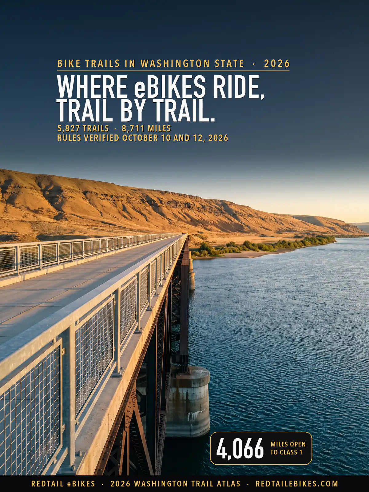
The Beverly Bridge carries the Palouse to Cascades State Park Trail, open to Class 1 and 3 e-bikes, across the Columbia River, in a scene generated with Playcut from photographs of the bridge.
Washington writes the default into one statute and lets the land manager change it. Under RCW 46.61.710(7), Class 1 and 2 e-bikes "may be operated on a shared-use path", "but local jurisdictions or state agencies may restrict or otherwise limit the access" of e-bikes. Subsection (8) keeps Class 3 off shared-use paths "except where local jurisdictions may allow" it.
That leaves every trail to its owner. Trail by trail, this map names the manager of each mapped trail in Washington, quotes the rule that manager publishes, and colors the trail by what that rule lets your e-bike do.
For the rest of the state's e-bike law, from age limits to sidewalks and rebates, read Washington's e-bike laws.
Riding across a state line? Start with our guide to e-bike trails near you, or open the same kind of e-bike trail map for Colorado bike trails, Florida bike trails, Michigan bike trails, Utah bike trails, Wisconsin bike trails, Ohio bike trails, Oregon bike trails, Arizona bike trails, Arkansas bike trails, Georgia bike trails, Idaho bike trails, Indiana bike trails, Iowa bike trails, Maine bike trails, Massachusetts bike trails, New York bike trails or Texas bike trails.
Bike trails by state sets every mapped state side by side. To find a shop, see our directory of e-bike shops in Washington.
The class on your label changes the map more than anything else. On a Class 1 you may ride 1,109 more mapped miles than on a Class 2, and most of the gap is Washington State Parks' long-distance rail trails and park trails (899 miles), where Class 1 and 3 ride and Class 2 does not. You can look up every trail, its manager and its rule in the downloadable register.
Every bike in our full e-bike range ships free to Washington.

Each line is a trail mapped for bicycles by Washington State Parks, the state trail inventory, a federal agency, King or Thurston County, Seattle DOT or OpenStreetMap, colored by the e-bike rule its manager publishes. The numbers mark WSDOT's six regions, each mapped below.
In this guide
- How to read the map
- What changed in 2026
- Who decides on each trail
- County and city rules
- Named trails riders ask about
- Riding the Palouse to Cascades Trail on an e-bike
- Bike trails in Washington State, region by region
- Where riders get caught out
- Roads, sidewalks and paths beside a highway
- Choosing an e-bike for Washington trails
- The bottom line
- Frequently asked questions
- How we verified this map
How to read the map
Match the color of your trail to the class on your e-bike's label, then check who manages the trail. Green means all three classes may ride, blue means Class 1 and 2, teal means Class 1 and 3, and amber means Class 1 only. Dashed red means the trail's manager has closed it to your e-bike, whatever its class, by a published rule.
Dotted purple means state law leaves the answer to the trail's designation: a natural-surface trail is closed to you if its manager has designated it nonmotorized, and open where bicycles ride if not. Gray means the rule is unsettled, the land is private or tribal, or the manager or its rule could not be determined, so read the trailhead sign before you ride a gray trail.
The state's definition changed on June 11, 2026. RCW 46.04.169, as amended by ESSB 6110, defines an electric-assisted bicycle as a bicycle with "two or three wheels, a saddle, fully operative pedals for human propulsion, and an electric motor" whose motor "must have a power output of no more than 750 watts", in one of three classes:
| Class | How the motor helps | Help stops at | Shared-use paths under state law |
|---|---|---|---|
| Class 1 | Only while you pedal | 20 mph | Allowed unless the manager restricts it |
| Class 2 | Can move the bike without pedaling | 20 mph | Allowed unless the manager restricts it |
| Class 3 | Only while you pedal, with a speedometer | 28 mph | Not allowed unless the local jurisdiction allows it |
The same section now excludes "Any vehicle capable of exceeding 20 miles per hour on solely its electric motor" and any vehicle built or sold "to be easily configured in order not to meet the requirements of an electric-assisted bicycle", whether "by a mechanical switch or button" or a software setting (RCW 46.04.169(2)). A bike like that is not an e-bike in Washington, and no color on this map opens a trail to it.
Natural-surface trails follow their own subsection. Under RCW 46.61.710(9), you "shall not operate an electric-assisted bicycle" on a trail "specifically designated as nonmotorized and that has a natural surface tread", unless the agency or local authority that runs the trail allows it.
Two state texts describe that subsection differently. WSDOT's bicyclist laws page says "All classes of e-bikes are not allowed on trails designated as non-motorized or that have a natural surface", while the statute joins the two tests with "and". This map follows the statute and prints both.
What changed in 2026
Five rules you will meet on this map carry a 2026 date: the state's rewritten e-bike definition, Spokane County's park rule, the Green Dot maps' line keeping e-bikes to Green Dot roads, and new park rules in Anacortes and Kirkland. Each was read on October 10, 2026:
- The e-bike definition, June 11, 2026. ESSB 6110 rewrote RCW 46.04.169: a motor of "no more than 750 watts", and no vehicle "capable of exceeding 20 miles per hour on solely its electric motor" or built "to be easily configured" past the limits (ESSB 6110).
- Spokane County's parks, April 14, 2026. Resolution 2026-0205 added SCC 6.14.110, which opens the county's parks and single-track that allows bicycles to Class 1 and 3 where the director approves, and bars Class 2 (SCC 6.14.110).
- The Green Dot maps, May 1, 2026. DNR and WDFW's six central-Washington Green Dot maps carry a May 1, 2026 issue date and the line "Ebikes as defined in RCW 46.04.169 are restricted to Green Dot Roads." (Ahtanum Green Dot map).
- Anacortes's forest lands, July 2026. Ordinance 5029 added AMC 8.10.130, which makes it unlawful to ignore "a prominently posted restriction on the public use of trails" in the city's parks and Community Forest Lands: a civil infraction of up to $50, or $125 for anyone who breaks it more than twice in a year (AMC 8.10.130).
- Kirkland's parks, August 2026. Ordinance 4945 added KMC 11.80.132: "Bicycles, electric-assisted bicycles, and motorized foot scooters are permitted only on park paths, trails, sidewalks and where motor vehicles are allowed" (KMC 11.80.132).
Who decides on each trail
The agency, county or city that manages the trail decides, and most of Washington's trail miles belong to federal and state agencies that admit e-bikes where motor vehicles ride. The national forests, DNR and WDFW together manage most of the miles on this map, and each lets you ride its trails on an e-bike only where motor vehicles may ride, with one exception: DNR's Class 1 pilot on the North Mountain trails near Darrington.
State Parks, King County, the other counties and the cities write their own rules for bicycle trails, and the table below sums the register by the kind of manager, so you can see which managers hold the most miles.
| Who manages the trail | Trails | Miles | What e-bikes may do |
|---|---|---|---|
| Washington State Parks: long-distance trails and park trails open to bicycles | 71 | 899 | Class 1 and 3; Class 2 not allowed; all classes on park roads |
| DNR: motorized trails and forest roads | 278 | 310 | Class 1, 2 and 3 |
| DNR: North Mountain trail system (Class 1 pilot) | 25 | 13 | Class 1 under DNR's pilot |
| DNR: trails DNR's maps or the trail records show for non-motorized use | 310 | 375 | Closed: DNR keeps e-bikes off its non-motorized trails |
| DNR: trails that no record or DNR map designates | 208 | 173 | Unsettled: open only if the trail is motorized; no record says |
| Green Dot areas, central Washington (DNR and WDFW land) | 58 | 162 | Green Dot roads only: e-bikes are off the trails |
| WDFW wildlife areas elsewhere | 53 | 69 | Motorized trails and roads only |
| National forests: trails open to motor vehicles | 459 | 1,597 | Class 1, 2 and 3 (motor vehicles allowed) |
| National forests: non-motorized trails | 690 | 1,685 | Closed: an e-bike is a motor vehicle on national forest land |
| National forests: records disagree or no trail page | 278 | 481 | Unsettled: one record says motorized, another does not |
| National parks | 31 | 46 | Park by park: some roads and one rail trail open, other trails closed |
| BLM land | 39 | 150 | Closed on non-motorized routes; unsettled where no record states |
| Other federal land (refuges, the Corps of Engineers) | 28 | 40 | Not determined: no published e-bike rule read |
| WSDOT paths beside state highways | 86 | 92 | Class 1 and 2 |
| King County Parks | 378 | 406 | Class 1 and 2 on regional trails; closed on backcountry trails |
| Other counties with an e-bike rule | 212 | 355 | From Class 1, 2 and 3 to closed: see each county below |
| Counties whose codes ban motor vehicles without naming e-bikes | 184 | 275 | Unsettled: see each county below |
| Cities and towns with an e-bike rule | 460 | 267 | From Class 1, 2 and 3 to closed: see each city below |
| Cities and towns whose codes ban motor vehicles without naming e-bikes | 356 | 230 | Unsettled: see each city below |
| Public land under state law alone (the manager's code read, no e-bike rule) | 1,541 | 911 | Class 1 and 2 on shared-use paths; natural trails turn on their designation |
| Public land whose manager's rules could not be read | 60 | 57 | State law's default, a local rule could not be read |
| Tribal land | 9 | 8 | The tribe decides |
| Private land, land trusts and owners' associations | 111 | 73 | The owner decides |
| Manager not recorded in any dataset read | 17 | 37 | Not determined |
| All Washington | 5,827 | 8,711 | Map above; every trail by region below |
A trail whose stretches fall under two rules is counted in each of those rows, with the miles that lie there, so 114 trails appear in more than one row and the rows' miles add up to the state's.
State Parks: Class 1 and 3 on trails, every class on park roads
Washington State Parks manages 899 of the mapped miles, and its e-bike information sheet sets one rule for them: "Class 1 and Class 3 pedal-assist e-bikes are allowed on state park non-motorized long-distance trails." The same sheet allows Class 1 and 3 "on single-track non-motorized natural surface trails that allow conventional bicycles". Our guide to electric bikes for gravel roads and rail-trails reads the Palouse to Cascades rule for a bike with a throttle.
On a throttle bike you ride only the roads. The sheet says "All classes of e-bikes are allowed on roads within State Parks" and that e-bikes "are not allowed on single-track, non-motorized natural surface hiking-only trails or any other trails that do not permit bicycles" (State Parks).
The five long-distance trails the sheet names are the Columbia Plateau, Klickitat, Palouse to Cascades, Spokane River Centennial and Willapa Hills State Park Trails. Bicycles of any kind ride a park trail only "where designated and posted to specifically or conditionally permit such activity" (WAC 352-32-075(3)), so a hiking-only path stays closed whatever your class.
DNR: motorized trails and roads, and one Class 1 pilot
The Department of Natural Resources manages 916 of the mapped miles, and its e-bike page states the rule in one line: "Class 1, 2, and 3 e-bikes are currently only allowed on motorized trails and forest roads open to motorized public use." On this map that opens 310 miles to every class.
DNR's mountain bike trails are the ones riders ask about, and outside the North Mountain pilot below they are closed to your e-bike. DNR's own trail maps count as notice of what each trail is for: under WAC 332-52-400 the department may designate use "by specific recreation activity, e.g., hiking, horseback riding, mountain biking", through "signs, information boards, kiosks, websites, maps".
On DNR's trail maps and in the state's trail records, 375 miles of DNR trail are for hiking, horses or mountain bikes, and you may not ride them on an e-bike. They include Tiger Mountain's trails and the Raging River State Forest system, which DNR says will grow to "35-plus miles of non-motorized trails" (DNR).
Capitol State Forest near Olympia shows both halves of the rule. DNR's Capitol Forest page says "E-bikes (motorized assist bikes) are not allowed on non-motorized trails in Capitol Forest" and "E-bikes are allowed on Capitol Forest motorized trails and roads open to motor vehicles", and it counts "89 miles of motorized trail".
One DNR trail system opens to Class 1. "Currently, there is a Class 1 e-bike pilot project in the Darrington/North Mountain trail system," DNR's e-bike page says, which covers 13.1 mapped miles. DNR's 2019 announcement said the pilot was "expected to last through October 2020"; this map follows the current page and prints both.
For 173 miles of DNR trail, no record or DNR map says whether motor vehicles may ride, so they show as unsettled; the sign at your trailhead decides them.
The agencies' 2022 report to the Legislature records a temporary allowance: "Under ESSB 5452, until June 30, 2023, or until legislation is enacted, riders with an ADA placard may use class 1 and class 2 e-bikes" on nonmotorized trails where bicycles ride (p. 9). SB 5471, which would have extended it, did not pass, and DNR's current page names no exception.
Green Dot areas: roads only
In central Washington, six DNR and WDFW maps issued May 1, 2026 carry one sentence: "Ebikes as defined in RCW 46.04.169 are restricted to Green Dot Roads." The maps cover Ahtanum, L.T. Murray, Naneum/Colockum, Oak Creek, Wenas and Whiskey Dick/Quilomene.
On this map that closes 125 miles of trail and other road inside those areas and opens 30 miles of Green Dot road. The maps mark those roads with "round green reflectors on white route markers", so the marker on the road is the rule on the ground (Ahtanum map).
WDFW wildlife areas
Outside the Green Dot areas, the Department of Fish and Wildlife follows the rule DNR states. The two agencies' report to the Legislature says "DNR (WAC 332-52-010) and WDFW allow e-bikes on trails and forest roads open to motorized public use" and "Neither agency allows e-bike use on nonmotorized trails" (p. 9). That covers 69 mapped miles of wildlife-area trail.
National forests: motorized routes only
Federal land carries 3,998 of the mapped miles, most of it national forest, and the Forest Service's directives identify e-bikes "under three classes of motor vehicles". "Class 1, 2, and 3 e-bikes are allowed on motorized trails and roads on national forests and grasslands," its national e-bike page says, and anywhere else a forest must first designate the trail.
The Gifford Pinchot puts it plainly: "Please remember that e-bikes are restricted to motorized trails" (Gifford Pinchot NF). The Umatilla adds that "E-bikes are prohibited on non-motorized trails, including trails open to bicycles" (Umatilla NF).
The Okanogan-Wenatchee says the same on its trail pages: "E-Bikes (with full electric motor power or pedal assist) are not allowed on Echo Ridge trails or any forest trail designated non-motorized" (Echo Ridge). The legal hook is 36 CFR 261.13, which bars operating a motor vehicle "other than in accordance with those designations".
On this map 1,597 miles of national forest trail are open to motor vehicles, so you may ride them on any class, and 1,685 miles are closed to your e-bike. For 481 miles the records disagree or the forest publishes no page for the trail, so they show as unsettled, and on those you ride by the forest's printed Motor Vehicle Use Map.
You may not ride any e-bike in a wilderness. The Wilderness Act allows "no other form of mechanical transport" inside a designated wilderness (16 U.S.C. 1133(c)).
National parks, BLM land and other federal land
The national parks open far less to you. Olympic National Park bars "a pedal-assist e-bike" except "on park roads" and a short list of hardened trails, and its compendium adds that "Class 3 e-bikes are prohibited from operating on the Spruce Railroad Trail" (Olympic NP).
Mount Rainier allows e-bikes whose motor "only assists with pedal propulsion" on the bike-only roads, "including the Westside Road to Klapache Point and the Carbon River Road" (Mount Rainier NP). North Cascades allows e-bikes "where traditional bicycles are allowed" (North Cascades).
On Bureau of Land Management land, you may ride an e-bike where off-road vehicles ride unless a field office decides otherwise. 43 CFR 8342.2(d) lets an officer open non-motorized routes to e-bikes by a planning decision, and BLM's own page says "the rule does not, by itself, open any non-motorized trails to e-bike use."
On a wildlife refuge you may ride an e-bike only where the refuge manager finds it "a compatible use" (50 CFR 27.31(m)). This map shows 40 miles of trail on refuges, Corps of Engineers land and other federal units as not determined, because no published rule for those units was read.
WSDOT's paths beside state highways
The Washington State Department of Transportation keeps 92 mapped miles of shared-use path in highway right-of-way. Its laws page says "Class 1 and 2 e-bikes are allowed on shared-use paths" and "Class 3 e-bikes are not allowed on shared-use paths."
Bottom line On a Class 1 you ride the most of Washington: State Parks' trails, King County's regional trails, the paths that follow state law, and every motorized trail and road. A Class 3 keeps State Parks and loses most paved paths; a Class 2 keeps the paths and loses State Parks' trails. On any class you are off non-motorized trails on WDFW, national forest and DNR land, except on a Class 1 at North Mountain.
Not sure which class to buy for the trails near you? The buying guide explains what Class 1, 2 and 3 each do and matches the class to where you ride; this map then shows which trails take it.
Choose your e-bike classCounty and city rules
Counties, cities and local districts manage 2,477 of the mapped miles, and 92 of them publish a rule that reaches a mapped trail. Some let you ride their paths on a Class 1 or 2 as state law does, some add Class 3, and some close their park trails to you on every class.
Where a code bars "motor vehicles" from park trails without naming e-bikes, your answer is unsettled. RCW 46.04.071 makes an e-bike a bicycle, while RCW 46.04.320 does not list it among the vehicles it excludes from "motor vehicle", so this map prints both and colors those trails gray.
A park rule reaches its park. For 1,326 trails (808 miles) no record confirms a manager, so the map names the city or county each lies in and lets state law decide, because RCW 46.61.710(7) says "local jurisdictions or state agencies may restrict" e-bikes on shared-use paths. That government's park rules stay off such a trail; only a rule whose words reach every trail in its limits, or name the trail, applies.
King County: regional trails open, backcountry trails closed
King County manages 455 of the mapped miles. Its code lets you ride "a Class 1 or Class 2 electric-assisted bicycle only on regional trails and paved pathways within park areas", and "A person shall not operate a Class 3 electric-assisted bicycle on any trails or pathways within park areas" (K.C.C. 7.12.315).
That opens 185 miles of regional trail to you on a Class 1 or 2, among them the Burke-Gilman north of Seattle and the Sammamish River, East Lake Sammamish, Snoqualmie Valley and Cedar River Trails. From a Seattle home, the best e-bikes for Seattle computes the climb back from the trail, block by block, and Seattle's e-bike shop directory lists the stores inside the city, neighborhood by neighborhood, with their hours. The other 220 miles of King County park trail, the backcountry trails among them, are closed to your e-bike of any class.
Eastrail Partners, a nonprofit, says that under the county's rules "e-bikes and e-scooters are now allowed on all segments of the Eastrail, as well as other King County regional trails" (Eastrail). The county code also asks you, like every trail user, to "Travel at a speed of fifteen miles per hour or less on regional and backcountry trails unless otherwise posted" (K.C.C. 7.12.315(F)).
Spokane County: Class 1 and 3 in the parks
Spokane County takes the State Parks approach. "Class 1 and 3 pedal assist e-bikes when used in pedal assist mode are allowed in parks and on single track natural trail systems that allow bicycles, where approved by the director", and "Class 2 electric assisted bicycles are prohibited from use, in parks, or on any single track natural trail" (SCC 6.14.110). That covers 135 mapped miles.
Snohomish, Pierce and Skagit counties: Class 1 and 2
Snohomish County's trails page says Class 1 and 2 e-bikes "can operate on a shared-use regional trail path (Centennial Regional Trail, Interurban Regional Trail, and Whitehorse Regional Trail)" and that "Class 3 e-bikes are not permitted on a shared-use path" (97 miles).
Pierce County permits "micromobility devices", a term that covers Class 1 and 2, "on roads, sidewalks, paths, or trails in the park system, unless otherwise prohibited" (PCC 14.08.090), at 15 mph on regional trails and 10 mph on other trails unless posted (50 miles).
Skagit County permits "electrically assisted pedaled bicycles ('e-bikes')" on "all maintained soft or hard surface trails unless otherwise posted" at 15 mph (SCC 9.41.130), the Cascade Trail included (21 miles).
Whatcom and Jefferson counties: closed in the parks
Two counties name e-bikes to keep them out of their parks. Whatcom County's park rules say "Motorized vehicles, including motorbikes, motorcycles, and e-bikes, are prohibited except on designated roads and parking areas", which closes 27 mapped miles of county park trail.
Jefferson County's parks page says "e-bikes are not allowed in our parks except on roadways and the Rick Tollefson Trail in HJ Carroll Park" (12 miles closed). Whether the county's Larry Scott Trail counts as one of its parks, no record says, so its 15 miles show as unsettled.
Counties whose codes do not name e-bikes
Clark, Kitsap, Clallam, Thurston, San Juan, Island and several smaller counties bar motor vehicles from park trails without naming e-bikes, which leaves 275 mapped miles unsettled. Clark County's code, for one, forbids operating "a motor-driven vehicle of any kind except on roads or designated parking areas" in its parks (Clark County Code 9.05.120).
Clallam County's ban covers most of the Olympic Discovery Trail. The code says "Use of any type of motorized vehicle (except wheelchairs) is strictly prohibited" on the trail's off-road portions (CCC 23.03.170), while the trail's coalition lists "No motorized vehicles, aside from electric assisted bikes and wheelchairs" (Olympic Discovery Trail). This map prints both.
Cities and towns
Seattle's parks allow Class 1 and 2 on multi-use trails, and "Class 3 electric-assisted bicycles are not allowed on any park trail" (Seattle Parks Bicycle Use Policy, §§ 5.10-5.11). Seattle DOT's multi-use trails, the Burke-Gilman inside the city among them, follow state law, so you may ride them on a Class 1 or 2 and not on a Class 3.
Tacoma permits micromobility devices "on roads, sidewalks, paths or trails in any park unless otherwise prohibited and signed" (TMC 8.27.200), and Federal Way opens its park trails to "all classes of electric-assisted bicycles" (FWRC 4.05.400).
Bellingham lets you ride an e-bike on "paved and graveled roads and established trails", natural-surface trails included, "unless otherwise posted" (BMC 8.04.060), but "Bicycle riding is not permitted on any Sehome Hill Arboretum Trail" (BMC 8.04.060(C)).
Several cities publish their own e-bike pages. Everett's e-bike page lets you ride a Class 1 or 2 on "shared-use paths and trails", and Auburn's "E-bikes - Rules & Safety" page says Class 3 "cannot be ridden on sidewalks and trails". Monroe opens "City trailways unless signs prohibit their operation" but not "natural surface trails" (Monroe's e-bike page).
Mercer Island's e-bike page says "E-bikes cannot be ridden on trails marked as non-motorized and trails with a natural dirt surface," and names the Bike Skills Area and Pioneer Park as closed (Mercer Island). Pasco's park code excepts "any disabled person utilizing an electric assisted bicycle" from its ban on motor vehicles in parks and on trails (PMC 9.100.150), which reads as keeping other e-bikes off its park trails.
Town rules on a trail another government keeps
A town's own code can reach a county's or district's trail inside it when its words cover every trail in town or name the trail. Both rules then bind you on that stretch, and the map takes the stricter answer for each class:
- Sequim: "No motorized vehicles are allowed on trails within the city limits", a rule that "does not apply to wheelchairs powered by electric motors or class 1 and 2 electric-assisted bicycles" (SMC 12.24.020). It meets Clallam County's ban on the Olympic Discovery Trail through town.
- Buckley: bars "any automobile, truck, motorcycle, motorbike or other motorized vehicle on any trail" (BMC 10.84.230), the Foothills Trail through town included.
- East Wenatchee: "it is unlawful to drive or park a motorcycle or motor vehicle on the paved surface of the Apple Capital Loop Trail" (EWMC 9.46.080).
- Ilwaco: "Class 1 and Class 3 electric-assisted bicycles are allowed on the Discovery Trail" (IMC 10.10.020).
- Sedro-Woolley: you wear a helmet "on any public area in the city of Sedro-Woolley" (SWMC 10.92.055(A)), the Cascade Trail included.
- Ridgefield: bars any "other motorized vehicle on any trail" (RMC 10.16.030).
- La Center: bars any "vehicle other than a bicycle" from "any designated path or trail within the city limits", and its code counts a "motor-powered assisted, pedal-driven" bike as a bicycle, so a Class 1 rides on (LCMC 10.07.025).
- Concrete: closes "any trail specifically designated as nonmotorized" to e-bikes, paved or not, and keeps riders under 16 off a Class 3 (CMC 10.20.030).
- Gig Harbor: bars only "vehicles, bicycles and scooters with internal combustion engines" from the Cushman Trail (GHMC 11.05.030), so on the city's stretch a Class 1 or 2 rides on, and state law keeps a Class 3 off it, as on any shared-use path the city has not opened (RCW 46.61.710(8)).
- Everett: the city's e-bike page keeps a Class 3 to "streets and bike lanes" (Everett), and the map lays that over every trail in the city outside its parks.
A park district and a utility
Two trail managers keep no code. Most of Bainbridge Island's trails belong to its park district, not the city, and the district's policy says "Motorized vehicles are restricted to roadways and designated parking areas" without naming e-bikes (Park Use Policy, § 3.b), so 17.0 miles show as unsettled.
Chelan County PUD bars motor vehicles from "all park areas", and "Motor-driven vehicles shall include all types of electric vehicles such as motorcycles, UTVs, ATVs, side by sides, snowmobiles and automobiles" (Chelan PUD park rules, § 16). E-bikes are not named, so the 4.1 miles of trail the PUD keeps, nearly all on the Apple Capital Loop, show as unsettled. Its rules also set "Maximum trail speed is 10 mph".
The table lists every county, city and town rule that reaches a mapped trail, with the law it rests on and the miles it governs, so you can open the rule where you ride.
| Government | Law | Where it applies | What it does | Trails | Miles |
|---|---|---|---|---|---|
| Benton County | BCC 7.28.010(b)(2) | park paths and trails designated for non-motorized use | Unsettled: a vehicle ban that does not name e-bikes | 4 | 6.7 |
| Clallam County | 23.03.170 | park trails | Unsettled: motor-vehicle ban that does not name e-bikes | 5 | 56.6 |
| Clark County | 9.05.120 | park trails | Unsettled: motor-vehicle ban that does not name e-bikes | 97 | 77.4 |
| Cowlitz County | 9.06.050 | park trails | Unsettled: motor-vehicle ban that does not name e-bikes | 1 | 2.6 |
| Ferry County | Ferry County Ordinance 2017-03 | the rail corridor | Unsettled: a vehicle ban that does not name e-bikes | 1 | 22.4 |
| Island County | 9.40.200 | park trails | Unsettled: a vehicle ban that does not name e-bikes | 39 | 17.2 |
| Jefferson County | Jefferson County Parks & Recreation, park information page | road-numbered routes in county parks | Unsettled: a road-numbered route: e-bikes ride roadways only | 1 | under 0.1 |
| Jefferson County | Jefferson County Parks & Recreation, park information page | trails in county parks | Closed: e-bikes named among the equipment barred | 26 | 12.0 |
| Jefferson County | Jefferson County Parks & Recreation, park information page | the Larry Scott Trail and the Olympic Discovery Trail on county land | Unsettled: park land or not | 2 | 15.2 |
| Jefferson County | Jefferson County Parks & Recreation, park information page | the Rick Tollefson Trail | Class 1 and 2 | 2 | 1.1 |
| King County | 7.12.315 | backcountry and other park trails | Closed: backcountry and other trails | 322 | 220.4 |
| King County | 7.12.315 | regional trails and paved pathways in park areas | Class 1 and 2 | 63 | 185.2 |
| Kitsap County | 10.12.100 | trails inside county parks | Unsettled: trails marked for bicycles, horses or motorcycles | 8 | 4.6 |
| Lewis County | 12.05.140 | park trails | Unsettled: motor-vehicle ban that does not name e-bikes | 1 | 0.9 |
| Pierce County | 14.08.090 | roads, sidewalks, paths and trails in the park system | Class 1 and 2 | 30 | 50.3 |
| San Juan County | 12.08.210 | trails in county parks and land bank preserves | Unsettled: a vehicle ban that does not name e-bikes | 16 | 20.8 |
| Skagit County | 9.41.130 | maintained soft and hard surface trails | Class 1 and 2, 15 mph | 2 | 21.4 |
| Skagit County | 9.41.130 | maintained soft and hard surface trails | Class 1 and 2, 15 mph; helmet required) | 1 | 0.8 |
| Skamania County | 10.26.010 | public pathways and county parks | Unsettled: a vehicle ban that does not name e-bikes | 1 | 4.8 |
| Snohomish County | Snohomish County Parks, 'Trails' | county park trails | Class 1 and 2 | 56 | 97.3 |
| Spokane County | 6.14.110 | county parks and single-track natural trails | Class 1 and 3 | 74 | 135.1 |
| Thurston County | 10.76.040 | park trails | Unsettled: a vehicle ban that does not name e-bikes | 7 | 37.3 |
| Whatcom County | Whatcom County Parks & Recreation, 'Park Rules' (General) | trails on county park land | Closed: e-bikes named among the motorized vehicles barred | 21 | 27.3 |
| Whitman County | Whitman County, 'Bill Chipman Palouse Trail' (Rules) | the Bill Chipman Palouse Trail | Class 1 only, 15 mph | 1 | 9.4 |
| Yakima County | 11.04.170 | park trails | Unsettled: motor-vehicle ban that does not name e-bikes | 1 | 8.1 |
| Bainbridge Island Metropolitan Park and Recreation District | Park Use Policy, § 3.b (Resolution 2010-25, revised by Resolution 2011-25) | trails in the district's parks | Unsettled: a vehicle ban that does not name e-bikes | 27 | 17.0 |
| Chelan County Public Utility District | Chelan PUD Park Rules and Regulations, § 16 | the PUD's parks and trails, its stretches of the Apple Capital Loop Trail among them | Unsettled: a vehicle ban that reaches 'all types of electric vehicles' and does not name e-bikes | 2 | 3.0 |
| Cities of Grandview and Sunnyside | 10.62.010 | the pathway outside both cities' limits | Unsettled: both cities' pathway rules ban motor vehicles without naming e-bikes | 1 | 1.0 |
| City of Anacortes | City of Anacortes, 'Personal Transportation Devices' (table 'Where can you ride e-bikes?') | Community Forest Lands trails open to bicycles | Class 1, 2 and 3 | 108 | 45.8 |
| City of Anacortes | AMC 10.38.110(B)(2) | trails inside city parks | Class 1 and 2 | 4 | 1.1 |
| City of Anacortes | AMC 10.38.110(A) | shared-use paths | Class 1, 2 and 3 | 6 | 4.5 |
| City of Arlington | 22.04.160 | park trails | Unsettled: a vehicle ban that does not name e-bikes | 3 | 3.9 |
| City of Auburn | City of Auburn, 'E-Bikes Rules & Safety' | city trails | Class 1 and 2 | 7 | 7.8 |
| City of Battle Ground | 8.18.040 | park trails | Unsettled: motor-vehicle ban that does not name e-bikes | 10 | 1.7 |
| City of Bellevue | City of Bellevue, 'E-bike and electric motorcycle safety' | paths | Class 1 and 2 | 13 | 5.7 |
| City of Bellevue | 3.43.160 | trails inside city parks | Unsettled: a vehicle ban that does not name e-bikes | 10 | 4.9 |
| City of Bellingham | 8.04.060 | park roads and established trails, natural surface included | Class 1, 2 and 3 | 27 | 15.8 |
| City of Bellingham | BMC 8.04.060(C) | Sehome Hill Arboretum trails | Closed: no bicycles | 1 | 0.4 |
| City of Black Diamond | 10.34.040 | shared use paths and park trails | Class 1 and 2 | 25 | 11.6 |
| City of Bonney Lake | 12.12.020 | park trails | Unsettled: motor-vehicle ban that does not name e-bikes | 21 | 7.0 |
| City of Bremerton | 13.04.100 | park trails | Unsettled: motor-vehicle ban that does not name e-bikes | 1 | 0.3 |
| City of Buckley | 10.84.230 | park trails | Unsettled: motor-vehicle ban that does not name e-bikes | 1 | 1.1 |
| City of Buckley | 10.84.230 | park trails (both rules apply) | Unsettled: regional trails and paved pathways | 2 | 0.1 |
| City of Buckley | 10.84.230 | park trails (both rules apply) | Unsettled: park system trails | 1 | 1.9 |
| City of Camas | 12.32.110 | parks | Class 1 and 2 | 5 | 3.9 |
| City of Chehalis | 7.04.320 | park trails | Unsettled: motor-vehicle ban that does not name e-bikes | 1 | 3.5 |
| City of Cle Elum | CEMC 10.21.010 | the Coal Mines Trail and other unpaved trails in city limits | Unsettled: the Coal Mines Trail and unpaved trails; a vehicle ban that does not name e-bikes | 2 | 1.4 |
| City of Cle Elum | 10.22.010 | the Progress Path and other trails in city limits (the Coal Mines Trail excepted) | Unsettled: a vehicle ban that does not name e-bikes | 1 | 0.9 |
| City of East Wenatchee | 9.46.080 | park trails | Unsettled: motor-vehicle ban that does not name e-bikes | 1 | 0.4 |
| City of East Wenatchee | 9.46.080 | park trails (both rules apply) | Unsettled: a vehicle ban that reaches 'all types of electric vehicles' and does not name e-bikes | 1 | 1.0 |
| City of East Wenatchee | 9.46.080 | park trails (both rules apply) | Unsettled: motor-vehicle ban that does not name e-bikes | 1 | 0.1 |
| City of Edmonds | 5.32.030 | paths inside city parks | Closed: battery-operated vehicles barred outside posted vehicle areas | 10 | 1.9 |
| City of Enumclaw | EMC 9.86.100 | city trails | Unsettled: trails for human power, horses and wheelchairs, under a motor-vehicle heading | 2 | 1.5 |
| City of Everett | EMC 9.06.134(A) | trails inside city parks | Decided by the trail's designation: e-bikes only where signs open an area | 1 | 2.2 |
| City of Everett | 46.82.040 | shared-use paths | Class 1 and 2 | 1 | 0.7 |
| City of Everett | City of Everett, 'E-Bikes & Other Devices' (Class 1 & 2) | trails outside city parks | Class 1 and 2 | 15 | 11.3 |
| City of Everett | City of Everett, 'E-Bikes & Other Devices' (Class 1 & 2) | trails outside city parks (both rules apply) | Unsettled: motor-vehicle ban that does not name e-bikes | 3 | 3.0 |
| City of Everett | City of Everett, 'E-Bikes & Other Devices' (Class 1 & 2) | trails outside city parks (both rules apply) | Class 1 and 2 | 1 | 6.1 |
| City of Everett | City of Everett, 'E-Bikes & Other Devices' (Class 1 & 2) | trails outside city parks (both rules apply) | Decided by the trail's designation: surface not recorded, no local rule found | 1 | under 0.1 |
| City of Federal Way | 4.05.400 | park trails | Class 1, 2 and 3 | 4 | 5.0 |
| City of Gig Harbor | 11.05.030 | the Cushman Trail | Class 1 and 2 | 2 | 6.5 |
| City of Gig Harbor | 11.05.030 | the Cushman Trail (both rules apply) | Local rule could not be read: shared-use path, manager's code not read | 1 | 0.2 |
| City of Grandview | 10.62.010 | designated pedestrian and bicycle pathways | Unsettled: a vehicle ban that does not name e-bikes | 1 | 4.6 |
| City of Ilwaco | 10.10.020 | the Discovery Trail in city limits | Class 1 and 3 | 1 | 0.9 |
| City of Ilwaco | 10.10.020 | the Discovery Trail in city limits (both rules apply) | Local rule could not be read: shared-use path, manager's code not read | 1 | 0.1 |
| City of Issaquah | 10.48.030 | park trails, shared use paths and city property | Class 1 and 2 | 20 | 11.6 |
| City of Kennewick | 10.08.040 | park trails and walking paths | Unsettled: a vehicle ban that does not name e-bikes | 2 | 5.9 |
| City of Kent | 4.01.080 | park trails | Class 1 and 2 | 8 | 11.8 |
| City of Kirkland | 11.80.132 | paths and trails inside city parks | Class 1 and 2 | 6 | 1.1 |
| City of Kirkland | 19.40.020 | city trails | Class 1 and 2 | 5 | 5.2 |
| City of La Center | LCMC 10.07.025(1) | any designated path or trail in the city | Class 1 only | 6 | 2.8 |
| City of La Center | LCMC 10.07.025(1) | any designated path or trail in the city (both rules apply) | Unsettled: motor-vehicle ban that does not name e-bikes | 1 | 0.1 |
| City of Lake Stevens | 7.36.025 | multipurpose trails | Class 1 and 2 | 1 | 0.6 |
| City of Lakewood | 8.76.200 | trails inside city parks | Unsettled: a vehicle ban that does not name e-bikes | 4 | 3.5 |
| City of Leavenworth | 12.24.100 | park paths | Unsettled: a vehicle ban that does not name e-bikes | 9 | 2.2 |
| City of Lynden | 12.24.165 | city trails | Class 1 and 2 | 4 | 1.5 |
| City of Lynnwood | 10.16.020 | paths inside city parks | Unsettled: a vehicle ban that does not name e-bikes | 3 | 1.5 |
| City of Medical Lake | 9.11.080 | paths inside city parks | Unsettled: a vehicle ban that does not name e-bikes | 1 | 0.4 |
| City of Mercer Island | City of Mercer Island, 'E-Bike & E-Motorcycle Safety' | paved and mixed-use city trails | Class 1 and 2 | 2 | 0.4 |
| City of Mercer Island | City of Mercer Island, 'E-Bike & E-Motorcycle Safety' | city trails, surface not recorded | Decided by the trail's designation: closed if natural dirt or marked non-motorized; Class 1 and 2 otherwise | 2 | 1.3 |
| City of Mercer Island | City of Mercer Island, 'E-Bike & E-Motorcycle Safety' | Pioneer Park | Closed: named closed on the city's page | 12 | 3.8 |
| City of Milton | 12.16.110 | park trails | Unsettled: motor-vehicle ban that does not name e-bikes | 1 | 2.9 |
| City of Monroe | City of Monroe, 'E-Bikes' (Ordinance 26-006) | city trails, surface not recorded | Decided by the trail's designation: open unless natural surface or signed closed | 2 | 1.6 |
| City of Monroe | City of Monroe, 'E-Bikes' (Ordinance 26-006) | city trailways | Class 1, 2 and 3, 10 mph where no limit is posted | 1 | 0.1 |
| City of Montesano | MMC 8.36.025 | city forest lands | Unsettled: motorized vehicles need the forester's permission | 29 | 14.8 |
| City of Mount Vernon | 12.32.075 | parks and trails | Unsettled: a vehicle ban that does not name e-bikes | 15 | 5.7 |
| City of Mountlake Terrace | 12.10.010 | parks and trails | Unsettled: motor-driven devices only on areas designated for them; neither rule names e-bikes | 2 | 3.1 |
| City of Mukilteo | 9.60.150 | park trails | Unsettled: motor-vehicle ban that does not name e-bikes | 2 | 0.3 |
| City of Newcastle | 12.55.210 | city trails | Unsettled: a vehicle ban that does not name e-bikes | 2 | 1.9 |
| City of North Bend | 12.04.190 | city trails | Class 1 and 2 | 2 | 0.4 |
| City of Oak Harbor | 6.12.120 | paths inside city parks | Decided by the trail's designation: motorized bicycles only where designated | 1 | 0.1 |
| City of Olympia | 12.60.100 | park trails | Unsettled: motor-vehicle ban that does not name e-bikes | 80 | 33.6 |
| City of Pacific | 10.80.020 | shared use trails | Class 1 and 2 | 1 | 0.1 |
| City of Pasco | 9.100.150 | parks and trails | Closed: parks and trails | 4 | 15.4 |
| City of Pullman | 12.10.090 | paths inside city parks | Unsettled: a vehicle ban that does not name e-bikes | 4 | 1.1 |
| City of Redmond | 9.31.130 | city trails | Class 1 and 2 | 55 | 26.5 |
| City of Renton | 2-9-8 | park trails | Unsettled: motor-vehicle ban that does not name e-bikes | 8 | 8.7 |
| City of Richland | 9.22.070 | park trails | Unsettled: motor-vehicle ban that does not name e-bikes | 11 | 18.4 |
| City of Ridgefield | RMC 10.16.030 | any trail in the city | Unsettled: a vehicle ban that does not name e-bikes | 6 | 8.4 |
| City of Ridgefield | RMC 10.16.030 | any trail in the city (both rules apply) | Unsettled: motor-vehicle ban that does not name e-bikes | 1 | 0.1 |
| City of Roslyn | 10.05.090 | the Coal Mines Trail in city limits | Unsettled: Coal Mines Trail; a vehicle ban that does not name e-bikes | 1 | 1.2 |
| City of Sammamish | 7A.11.050 | maintained soft surface trails | Decided by the trail's designation: soft-surface trails: bicycles of any kind only where posted | 5 | 0.9 |
| City of SeaTac | 2.45.200 | trails inside city parks | Unsettled: a vehicle ban that does not name e-bikes | 2 | 1.2 |
| City of Seattle | SPR Bicycle Use Policy 060-P 7.11.1.2, §§ 5.10-5.11 | park multi-use trails | Class 1 and 2 | 43 | 17.8 |
| City of Sequim | 12.24.020 | trails within city limits | Class 1 and 2 | 1 | 0.1 |
| City of Sequim | 12.24.020 | trails within city limits (both rules apply) | Unsettled: motor-vehicle ban that does not name e-bikes | 1 | 4.3 |
| City of Shoreline | 8.12.170 | trails inside city parks | Decided by the trail's designation: e-bikes only on designated park trails posted for them | 2 | 0.8 |
| City of Snoqualmie | 12.12.180 | park trails (the code's 'park' includes trails) | Unsettled: a vehicle ban that does not name e-bikes | 4 | 2.9 |
| City of Spokane | City of Spokane, 'Park Rules' | paths and trails inside city parks | Unsettled: the park code's motorized-device ban leaves e-assist bicycles out; the park rules bar motorized vehicles from pathways | 25 | 16.6 |
| City of Sunnyside | SMC 12.44.010 | designated pedestrian and bicycle pathways | Unsettled: a vehicle ban that does not name e-bikes | 1 | 2.6 |
| City of Tacoma | 8.27.200 | paths and trails in any park | Class 1 and 2 | 43 | 30.3 |
| City of Tukwila | 12.08.250 | paths and trails in any park | Class 1 and 2 | 3 | 0.9 |
| City of Walla Walla | 10.25.020 | park trails | Unsettled: motor-vehicle ban that does not name e-bikes | 30 | 14.2 |
| City of Wenatchee | 6A.18.060 | park trails | Unsettled: motor-vehicle ban that does not name e-bikes | 8 | 7.8 |
| City of Westport | 10.52.010 | the Westport Light Trail system | Unsettled: Westport Light Trail; a vehicle ban that does not name e-bikes | 1 | 0.6 |
| City of Woodinville | WMC 12.50.200 | the city's parks, trails and public facilities | Unsettled: a vehicle ban that does not name e-bikes | 1 | 0.5 |
| City of Yakima | 13.16.090 | park pathways | Unsettled: a vehicle ban that does not name e-bikes | 9 | 4.3 |
| City of Yelm | 9.68.090 | park trails | Unsettled: motor-vehicle ban that does not name e-bikes | 2 | 2.5 |
| Town of Concrete | CMC 10.20.030(3) | any trail in the town (both rules apply) | Decided by the trail's designation: maintained trails, incl. the Cascade Trail | 1 | 0.9 |
| Town of Winthrop | 12.18.020 | town trails | Unsettled: posted multiuse trails only | 2 | 0.7 |
Riding the Burke-Gilman, the Interurban or a county regional trail to work? The commuter guide looks for bikes that ship with fenders, a rack and lights and counts which do; for these trails, choose a Class 1 or 2.
Compare commuter e-bikesBottom line King and Snohomish counties open their regional trails to you on a Class 1 or 2, as do Pierce County's park paths and Skagit County's maintained trails. Spokane County opens its parks to Class 1 and 3 where its parks director approves. Whatcom and Jefferson counties keep e-bikes out of their parks except on roads and Jefferson's Rick Tollefson Trail.
Where a code bars motor vehicles without naming e-bikes, read the trailhead sign or ask the manager before you ride.
Named trails riders ask about
These are the trails Washington riders search for by name, each summed across every manager it crosses. A trail that changes hands changes rules, so check the row for the stretch you mean to ride.
| Trail | Miles mapped | Managed by | What e-bikes may do |
|---|---|---|---|
| Palouse to Cascades State Park Trail | 248.4 | State Parks | Class 1 and 3 on 248.4 mi |
| Columbia Plateau State Park Trail | 129.8 | State Parks | Class 1 and 3 on 129.8 mi |
| Burke-Gilman Trail | 20.1 | City of Seattle; King County; City of Bothell | Class 1 and 2 on 19.4 mi; Decided by the trail's designation on 0.5 mi; Local rule could not be read on 0.2 mi |
| Sammamish River Trail | 12.9 | King County | Class 1 and 2 on 12.8 mi; Closed on under 0.1 mi |
| East Lake Sammamish Trail | 10.9 | King County | Class 1 and 2 on 10.9 mi; Closed on under 0.1 mi |
| Snoqualmie Valley Trail | 29.5 | King County; WDFW; State Parks | Class 1 and 2 on 29.2 mi; Closed on 0.3 mi; Unsettled on 0.1 mi; Class 1 and 3 on under 0.1 mi |
| Cedar River Trail | 17.3 | King County; City of Renton | Class 1 and 2 on 12.9 mi; Unsettled on 4.4 mi; Closed on 0.1 mi |
| Spokane River Centennial State Park Trail | 45.7 | State Parks | Class 1 and 3 on 45.7 mi |
| Centennial Trail (Snohomish County) | 30.6 | Snohomish County | Class 1 and 2 on 30.6 mi |
| Olympic Discovery Trail | 102.3 | Clallam County; DNR; WSDOT | Unsettled on 75.7 mi; Closed on 12.9 mi; Class 1 and 2 on 12.8 mi; Manager not recorded on 0.7 mi; Tribal land: the tribe decides on 0.1 mi |
| Willapa Hills State Park Trail | 57.0 | State Parks | Class 1 and 3 on 57.0 mi |
| Klickitat State Park Trail | 30.4 | State Parks | Class 1 and 3 on 30.4 mi |
| Cascade Trail (Skagit County) | 23.0 | Skagit County; State Parks | Class 1 and 2, 15 mph on 21.2 mi; Decided by the trail's designation on 0.9 mi; Class 1 and 2, 15 mph; helmet required) on 0.8 mi; Class 1 and 3 on under 0.1 mi |
| Whitehorse Trail | 27.0 | Snohomish County | Class 1 and 2 on 27.0 mi |
| Ferry County Rail Trail | 24.6 | Ferry County; BLM | Unsettled on 22.4 mi; Closed on 2.2 mi |
| Tiger Mountain State Forest | 30.4 | DNR | Closed on 30.4 mi |
| Raging River State Forest | 33.7 | DNR | Closed on 33.3 mi; Unsettled on 0.5 mi |
| Capitol State Forest | 168.2 | DNR | Class 1, 2 and 3 on 85.1 mi; Closed on 70.7 mi; Unsettled on 12.4 mi |
| Mount Spokane State Park | 68.0 | State Parks | Class 1 and 3 on 68.0 mi |
| Riverside State Park | 82.8 | State Parks | Class 1 and 3 on 82.8 mi |
| Deception Pass State Park | 14.9 | State Parks | Class 1 and 3 on 14.9 mi |
| Apple Capital Recreation Loop | 16.4 | WSDOT; Chelan County Public Utility District; City of Wenatchee | Unsettled on 7.4 mi; Class 1 and 2 on 6.7 mi; Class 1 and 3 on 2.3 mi |
On the State Parks rail trails you may ride a Class 1 or 3 from end to end, and on the county regional trails around Seattle a Class 1 or 2. The Olympic Discovery Trail is the long trail whose answer depends on the county, and the state forests at Tiger Mountain and Raging River are closed to you on any class.
Two Centennial Trails share a name and differ by class. Snohomish County's admits Class 1 and 2; the Spokane River Centennial State Park Trail admits Class 1 and 3 (State Parks), and Spokane Valley opens its stretch to riders "at a speed no greater than 15 miles per hour" (SVMC 9.20.050(C)).
State Parks gives the Spokane River Centennial Trail as "The 40-mile" trail on its park page and as a "37-mile trail" on its e-bike sheet. Mapped lines with spurs and access paths measure longer than either.
Riding the Palouse to Cascades Trail on an e-bike
The Palouse to Cascades State Park Trail is the longest trail on this map, and you may ride it on a Class 1 or Class 3 along its whole length. State Parks describes "this 251-mile trail" running "in sections from Cedar Falls near North Bend east to the Idaho border" on its park page, and "285 miles from North Bend to the Idaho border" on its e-bike sheet.
Rails to Trails Conservancy's 2025 route assessment starts the Washington section of the Great American Rail-Trail on this trail, which it gives as "more than 247 miles" long. The named-trail table above gives the trail's mapped length.
Across the country it ranks third on our list of the longest bike trails in the US, behind the Erie Canalway and the Maricopa Trail.
On a throttle Class 2 you may not ride it. The trail's park page adds that "No motorized vehicles are allowed on the trail except for snowmobiles in the winter"; an e-bike is a bicycle under RCW 46.04.071, and State Parks' e-bike sheet names this trail among those open to Class 1 and 3.
The western section runs east from the Cedar Falls Trailhead to "the 2.3-mile-long Snoqualmie Tunnel", so carry lights (State Parks). Past Ellensburg you cross the Columbia River on the Beverly Bridge, a former railroad bridge "85 feet high with a total of 15 trusses" that reopened as part of the trail on April 8, 2022 (State Parks).
The Columbia Plateau State Park Trail, its southern partner from Cheney to Pasco, has a "nearly 100-mile midsection" that "remains undeveloped" (State Parks), so plan your tires for a rough surface.
Riding the tunnel or the passes after October? The winter guide covers lights, tires and cold-weather range.
Read the winter e-bike guideBike trails in Washington State, region by region
The six regions follow WSDOT's map of the state, and each region's trails are listed below by e-bike rule. A trail that crosses a region line is listed in each region with the miles that lie there, so the regions add up to the state.
Northwest: Seattle, Everett, Bellingham and the San Juans

Island, King, San Juan, Skagit, Snohomish and Whatcom counties. In King County, at the south of the map, the county's own park trails carry about half the mapped miles; State Parks' trails at Moran, Larrabee and Deception Pass lie to the north.
The Northwest holds 1,766 mapped miles, and on a Class 1 you may ride 910 of them. King County's regional trails, Snohomish County's Centennial and Whitehorse trails and Skagit County's Cascade Trail make this the region's open spine for Class 1 and 2, at 15 mph on King County's trails.
On a Class 3 you may ride only 317 miles here, because the county regional trails and Seattle's park trails keep it off. Close to half are State Parks' trails, the longest at Moran and Larrabee, on the Palouse to Cascades Trail's western end and at Deception Pass, and most of the rest are motorized trails and roads, Bellingham's park trails and Anacortes's Community Forest Lands.
Whatcom County's parks and DNR's Tiger Mountain and Raging River trails close to you on every class, while DNR's North Mountain trails near Darrington open to you on a Class 1.
| Trail | Managed by | Miles | E-bikes |
|---|---|---|---|
| Centennial Trail | Snohomish County | 30.6 | Class 1 and 2 |
| Snoqualmie Valley Trail | King County | 28.4 | Class 1 and 2 |
| Whitehorse Trail | Snohomish County | 27.0 | Class 1 and 2 |
| Moran trails | State Parks | 25.7 | Class 1 and 3 |
| Larrabee trails | State Parks | 21.2 | Class 1 and 3 |
| Cascade Trail | Skagit County | 21.2 | Class 1 and 2, 15 mph |
| Palouse to Cascades State Park Trail (also in the North Central and South Central regions) | State Parks | 19.8 | Class 1 and 3 |
| Deception Pass trails | State Parks | 15.2 | Class 1 and 3 |
| Burke-Gilman Trail | City of Seattle | 13.6 | Class 1 and 2 |
| Cedar River Trail | King County | 12.7 | Class 1 and 2 |
| Fort Ebey trails | State Parks | 12.2 | Class 1 and 3 |
| Lord Hill Regional Park Trails | Snohomish County | 12.1 | Class 1 and 2 |
Every mapped trail in the Northwest region (2,140 trails, 1,766 mi), by e-bike rule
Class 1, 2 and 3 (261, 181 mi)
- Canyon Ridge (10.0 mi, Mt. Baker-Snoqualmie National Forest)
- Divide Trail (7.6 mi, Mt. Baker-Snoqualmie National Forest)
- Naches Pass West (also in the South Central region) (5.4 mi here, Mt. Baker-Snoqualmie National Forest)
- Meadow Mountain (5.2 mi, Mt. Baker-Snoqualmie National Forest)
- Finney Peak (4.4 mi, Mt. Baker-Snoqualmie National Forest)
- Grass Mountain (4.1 mi, Mt. Baker-Snoqualmie National Forest)
- BPA Trail (3.3 mi, City of Federal Way)
- DFML to Area 7 (2.9 mi, DNR)
- Interurban Trail (2.7 mi, City of Bellingham)
- Padden Loop Trail (2.6 mi, City of Bellingham)
- Chockwich (2.4 mi, Mt. Baker-Snoqualmie National Forest)
- Muddled Meanderings (2.3 mi, DNR)
- Pat's (2.3 mi, DNR)
- Tommy Thompson Parkway (2.2 mi, City of Anacortes)
- Tooler (2.2 mi, DNR)
- Kim and Monica (2.0 mi, DNR)
- Christoff Trail (1.9 mi, Mt. Baker-Snoqualmie National Forest)
- 21 (1.8 mi, City of Anacortes)
- Grass Mountain Trail (1.7 mi, Mt. Baker-Snoqualmie National Forest)
- Centennial (1.7 mi, DNR)
- Northridge Park Trail (1.6 mi, City of Bellingham)
- Webers Wanderings (1.6 mi, DNR)
- 247 (1.6 mi, City of Anacortes)
- Short Timers (1.5 mi, DNR)
- Dougs Loop (1.5 mi, DNR)
- 10 (1.5 mi, City of Anacortes)
- 4X4 Connector Trail (1.5 mi, DNR)
- Upper Mainline (1.4 mi, DNR)
- Bens Revenge (1.4 mi, DNR)
- Hudson Way (1.4 mi, Mt. Baker-Snoqualmie National Forest)
- SMC (1.3 mi, DNR)
- Martys Mania (1.2 mi, DNR)
- Gee Point (1.2 mi, Mt. Baker-Snoqualmie National Forest)
- 218 (1.2 mi, City of Anacortes)
- 115 (1.2 mi, City of Anacortes)
- Judys Grade (1.2 mi, DNR)
- Curt's Connundrum (1.2 mi, DNR)
- 300 (1.2 mi, City of Anacortes)
- Buck Run (1.1 mi, DNR)
- Jam (1.1 mi, DNR)
- Ron's Run (1.1 mi, DNR)
- West Campus Trail (1.1 mi, City of Federal Way)
- 302 (1.0 mi, City of Anacortes)
- Red Line (1.0 mi, DNR)
- Guemes Channel Trail (1.0 mi, City of Anacortes)
- Cavanaugh (1.0 mi, DNR)
- I-5 (1.0 mi, DNR)
- Ridge Ram (1.0 mi, DNR)
- 116 (1.0 mi, City of Anacortes)
- Challenge (1.0 mi, DNR)
- Bay-to-Baker Trail (1.0 mi, City of Bellingham)
- Trunk Trail (1.0 mi, DNR)
- 27 (0.9 mi, City of Anacortes)
- Humps and Bumps (0.9 mi, DNR)
- 205 (0.9 mi, City of Anacortes)
- Upper Backcountry Loop (0.9 mi, City of Bellingham)
- 212 (0.9 mi, City of Anacortes)
- 22 (0.9 mi, City of Anacortes)
- Expressway (0.8 mi, DNR)
- 113 (0.8 mi, City of Anacortes)
- Twizzler (0.8 mi, DNR)
- 28 (0.8 mi, City of Anacortes)
- 20 (0.8 mi, City of Anacortes)
- Railroad Trail (0.8 mi, City of Bellingham)
- 250 (0.8 mi, City of Anacortes)
- Ridge Line (0.8 mi, DNR)
- Webfoot (0.8 mi, DNR)
- 217 (0.7 mi, City of Anacortes)
- 201 (0.7 mi, City of Anacortes)
- 215 (0.7 mi, City of Anacortes)
- 100 (0.7 mi, City of Anacortes)
- 129 (0.7 mi, City of Anacortes)
- Woody Trail (0.7 mi, DNR)
- 200 (0.7 mi, City of Anacortes)
- Sand Hill (0.7 mi, DNR)
- 226 (0.7 mi, City of Anacortes)
- Moose Tracks (0.7 mi, DNR)
- Moon Landing (0.7 mi, DNR)
- Houser Hollow (0.7 mi, DNR)
- Wandering View (0.7 mi, DNR)
- Kenny Oaks Trail (204) (0.6 mi, City of Anacortes)
- Gold Line (0.6 mi, DNR)
- Twisted Tree (0.6 mi, DNR)
- 108 (0.6 mi, City of Anacortes)
- 220 (0.6 mi, City of Anacortes)
- Panther Lake Trail (0.6 mi, City of Federal Way)
- Green Line (0.6 mi, DNR)
- Damfino Lakes/Excelsior (0.6 mi, Mt. Baker-Snoqualmie National Forest)
- Whatcom Creek Trail (0.6 mi, City of Bellingham)
- 202 (0.6 mi, City of Anacortes)
- 304 (0.6 mi, City of Anacortes)
- Artzen’s Way (0.6 mi, DNR)
- Currant Pass (0.6 mi, DNR)
- Post Point Trail (0.6 mi, City of Bellingham)
- Outer Limits (0.6 mi, DNR)
- Timber Tamer (0.6 mi, DNR)
- 103 (0.6 mi, City of Anacortes)
- Coyote (0.6 mi, DNR)
- 131 (0.6 mi, City of Anacortes)
- 128 (0.6 mi, City of Anacortes)
- Cordata Park Trail (0.6 mi, City of Bellingham)
- 306 (0.5 mi, City of Anacortes)
- Ridge Trail (0.5 mi, City of Bellingham)
- ATV ST Connector (0.5 mi, DNR)
- Padden Gorge Trail (0.5 mi, City of Bellingham)
- 208 (0.5 mi, City of Anacortes)
- Anacortes Community Forest Lands Trail (0.5 mi, City of Anacortes)
- Rotary Marina Walkway (0.5 mi, City of Anacortes)
- Colquhoun Peak Trail (0.5 mi, Mt. Baker-Snoqualmie National Forest)
- Langley's Legacy (0.5 mi, DNR)
- Weasel Run (0.5 mi, DNR)
- 234 (0.5 mi, City of Anacortes)
- Blue Line (0.5 mi, DNR)
- 123 (0.5 mi, City of Anacortes)
- 102 (0.5 mi, City of Anacortes)
- 316 (0.5 mi, City of Anacortes)
- 311 (0.5 mi, City of Anacortes)
- Ante Up (0.4 mi, City of Bellingham)
- SeaFarer's Marina Walkway (0.4 mi, City of Anacortes)
- 11 (0.4 mi, City of Anacortes)
- 118 (0.4 mi, City of Anacortes)
- Trail 100 (0.4 mi, City of Anacortes)
- 105 (0.4 mi, City of Anacortes)
- Lover's Lane (0.4 mi, DNR)
- Spaghetti Tracks (0.4 mi, DNR)
- Outer Expressway (0.4 mi, DNR)
- 104 (0.4 mi, City of Anacortes)
- 312 (0.4 mi, City of Anacortes)
- Bert's Trail (0.4 mi, DNR)
- 120 (0.4 mi, City of Anacortes)
- EZ Valley Connector (0.4 mi, DNR)
- Boulder Bend Trail (0.4 mi, City of Bellingham)
- Main Line (0.4 mi, DNR)
- Fox Den (0.4 mi, DNR)
- 124 (0.4 mi, City of Anacortes)
- Tight and Twisty (0.4 mi, DNR)
- 313 (0.4 mi, City of Anacortes)
- Damfino Lakes (0.4 mi, Mt. Baker-Snoqualmie National Forest)
- Around the Sound (0.4 mi, DNR)
- 231 (0.4 mi, City of Anacortes)
- 203 (0.4 mi, City of Anacortes)
- 29 (0.4 mi, City of Anacortes)
- 237 (0.4 mi, City of Anacortes)
- Trunk (0.3 mi, DNR)
- Unnamed trails (Whatcom Falls Park) (0.3 mi, City of Bellingham)
- 206 (0.3 mi, City of Anacortes)
- 230 (0.3 mi, City of Anacortes)
- Wolverine way (0.3 mi, DNR)
- SST - Lower (0.3 mi, City of Bellingham)
- 209 (0.3 mi, City of Anacortes)
- Bear Cave (0.3 mi, DNR)
- 111 (0.3 mi, City of Anacortes)
- Osprey (0.3 mi, DNR)
- 310 (0.3 mi, City of Anacortes)
- Upper Padden Access Trail (0.3 mi, City of Bellingham)
- Graham Grade (0.3 mi, DNR)
- Wolf Trail (0.3 mi, DNR)
- Easy Green (0.3 mi, DNR)
- 211 (0.3 mi, City of Anacortes)
- Clarita Moore Trail (0.3 mi, City of Bellingham)
- Chris Cross (0.3 mi, DNR)
- 23 (0.3 mi, City of Anacortes)
- 305 (0.3 mi, City of Anacortes)
- Boy Scout (0.3 mi, DNR)
- Whatcom Creek Greenway (0.3 mi, City of Bellingham)
- 109 (0.3 mi, City of Anacortes)
- Getting Tanked (0.3 mi, DNR)
- ATV (0.3 mi, DNR)
- Green Line Green (0.3 mi, DNR)
- 207 (0.2 mi, City of Anacortes)
- Unnamed trails (Acfl Whistle Lake) (0.2 mi, City of Anacortes)
- Larrabee (0.2 mi, City of Bellingham)
- The Ridge (0.2 mi, City of Bellingham)
- 309 (0.2 mi, City of Anacortes)
- 121 (0.2 mi, City of Anacortes)
- 117 (0.2 mi, City of Anacortes)
- Ups and Downs (0.2 mi, DNR)
- Forest Line (0.2 mi, DNR)
- Langley Lane (0.2 mi, DNR)
- 25 (0.2 mi, City of Anacortes)
- 132 (0.2 mi, City of Anacortes)
- I Avenue (0.2 mi, City of Anacortes)
- 224 (0.2 mi, City of Anacortes)
- Boulder Alley (0.2 mi, DNR)
- 133 (0.2 mi, City of Anacortes)
- 26 (0.2 mi, City of Anacortes)
- 210 (0.2 mi, City of Anacortes)
- Sky Rider TS (0.2 mi, DNR)
- 242 (0.2 mi, City of Anacortes)
- 221 (0.2 mi, City of Anacortes)
- Old School (0.2 mi, DNR)
- 303 (0.2 mi, City of Anacortes)
- First Timer (0.2 mi, DNR)
- Rocky Road (0.2 mi, DNR)
- 12 (0.2 mi, City of Anacortes)
- 112 (0.2 mi, City of Anacortes)
- Bigfoot Bypass (0.2 mi, DNR)
- Easy Peasy (0.2 mi, DNR)
- 106 (0.2 mi, City of Anacortes)
- 107 (0.2 mi, City of Anacortes)
- 233 (0.2 mi, City of Anacortes)
- 314 (0.2 mi, City of Anacortes)
- Beam Me Up Scotty (0.2 mi, DNR)
- Anacortes Community Forest Lands Trails (0.2 mi, City of Anacortes)
- 232 (0.2 mi, City of Anacortes)
- Trials Line (0.2 mi, DNR)
- Cavanaugh & Timber Tamer (0.2 mi, DNR)
- 236 (0.2 mi, City of Anacortes)
- Pat's and Upper Mainline (0.2 mi, DNR)
- Axel Alley (0.2 mi, DNR)
- 320 (0.2 mi, City of Anacortes)
- 18th St. Connector (0.1 mi, City of Bellingham)
- B5 (0.1 mi, DNR)
- 101 (0.1 mi, City of Anacortes)
- Padden Gorge Loop Tail (0.1 mi, City of Bellingham)
- SeaFarer's Memorial Walkway (0.1 mi, City of Anacortes)
- Devil's Staircase (0.1 mi, DNR)
- 225 (0.1 mi, City of Anacortes)
- 240 (0.1 mi, City of Anacortes)
- 229 (0.1 mi, City of Anacortes)
- 235 (0.1 mi, City of Anacortes)
- 134 (0.1 mi, City of Anacortes)
- Euclid Park Trail (0.1 mi, City of Bellingham)
- B-4 Trail Yellow (0.1 mi, DNR)
- 244 (0.1 mi, City of Anacortes)
- Lake Tye Trail (0.1 mi, City of Monroe)
- Driveway (0.1 mi, DNR)
- Turning Wheel TS (0.1 mi, DNR)
- 307 (0.1 mi, City of Anacortes)
- 127 (0.1 mi, City of Anacortes)
- Black Line (0.1 mi, DNR)
- 315 (0.1 mi, City of Anacortes)
- 319 (0.1 mi, City of Anacortes)
- P2 (0.1 mi, DNR)
- 136 (0.1 mi, City of Anacortes)
- 110 (0.1 mi, City of Anacortes)
- 223 (0.1 mi, City of Anacortes)
- 130 (0.1 mi, City of Anacortes)
- KaBoom (0.1 mi, DNR)
- 238 (0.1 mi, City of Anacortes)
- 308 (0.1 mi, City of Anacortes)
- 245 (0.1 mi, City of Anacortes)
- Twisty Turvey (0.1 mi, DNR)
- No Newbies (0.1 mi, DNR)
- Break It Upper Yellow And Lower Green (0.1 mi, DNR)
- Stairstep (0.1 mi, DNR)
- BPA Trail Viewpoint (0.1 mi, City of Federal Way)
- Up 2 Something (0.1 mi, City of Bellingham)
- 122 (0.1 mi, City of Anacortes)
- 135 (0.1 mi, City of Anacortes)
- Pathfinder TS (0.1 mi, DNR)
- Connector Trail (0.1 mi, DNR)
- Old Village Trail (0.1 mi, City of Bellingham)
- Unofficial Trail (under 0.1 mi, City of Bellingham)
- 241 (under 0.1 mi, City of Anacortes)
- Washing Machine Loop (under 0.1 mi, DNR)
- 318 (under 0.1 mi, City of Anacortes)
- Colquhoun Peak (under 0.1 mi, Mt. Baker-Snoqualmie National Forest)
- 317 (under 0.1 mi, City of Anacortes)
- Expressway Exit (under 0.1 mi, DNR)
- West Hill Place Connector (under 0.1 mi, City of Bellingham)
Class 1 and 2 (581, 579 mi)
- Centennial Trail (30.6 mi, Snohomish County)
- Snoqualmie Valley Trail (28.4 mi, King County)
- Whitehorse Trail (27.0 mi, Snohomish County)
- Cascade Trail (21.2 mi, Skagit County)
- Burke-Gilman Trail (13.6 mi, City of Seattle)
- Cedar River Trail (12.7 mi, King County)
- Lord Hill Regional Park Trails (12.1 mi, Snohomish County)
- Interurban Trail (11.8 mi, Snohomish County)
- Tolt Pipeline Trail East (11.0 mi, King County)
- East Lake Sammamish Trail (10.9 mi, King County)
- Eastrail (10.1 mi, King County)
- Sammamish River Trail (10.0 mi, King County)
- Green River Trail - Kent (9.7 mi, King County)
- Lake Youngs Trail (9.1 mi, King County)
- Green River Trail - Tukwila (8.0 mi, King County)
- Preston Snoqualmie Trail (6.2 mi, King County)
- Interurban Trail - Kent (6.1 mi, King County)
- SR 520 Trail (5.9 mi, WSDOT)
- Soos Creek Trail (5.8 mi, King County)
- Frager Road Trail (5.4 mi, City of Kent)
- I 90 Trail (5.3 mi, WSDOT)
- Burke-Gilman Trail - North (4.8 mi, King County)
- Cross Kirkland Corridor (4.7 mi, City of Kirkland)
- 87 (4.4 mi, City of Redmond)
- Redmond Ridge Trail (4.3 mi, King County)
- Alki Trail (4.3 mi, City of Seattle, 2 mapped stretches)
- Green to Cedar Rivers Trail (4.2 mi, King County)
- Interurban Trail - Auburn (4.2 mi, King County)
- Mountains to Sound Trail (4.0 mi, City of Seattle)
- Unnamed trails (City of Black Diamond) (4.0 mi, City of Black Diamond)
- Chief Sealth Trail (3.7 mi, City of Seattle)
- Elliott Bay Trail (3.7 mi, City of Seattle, 2 mapped stretches)
- Sr520 Trail (3.7 mi, City of Seattle)
- Mill Town Trail (3.6 mi, WSDOT)
- Issaquah To Preston Trail (3.2 mi, King County)
- Green Lake Trail (2.8 mi, City of Seattle)
- Duwamish River Trail (2.7 mi, City of Seattle)
- Japanese Gulch Loop (2.7 mi, City of Everett)
- North Creek Trail (2.6 mi, Snohomish County)
- Green Lake Cycle Path (2.6 mi, City of Seattle)
- Lake to Sound Trail - SeaTac (2.5 mi, King County)
- 86 (2.5 mi, City of Redmond)
- Middle Fork-Main Line 9000 FKA Weyerhauser Road (2.4 mi, Whatcom County)
- East Plateau Trail (2.4 mi, King County)
- White River Trail (2.4 mi, City of Auburn)
- 9000 (2.4 mi, Whatcom County)
- West Sammamish River Trail (2.3 mi, King County)
- Kulshan Trail (2.3 mi, City of Mount Vernon)
- Seward Park Trail (2.2 mi, City of Seattle)
- Tolt Pipeline Trail West (2.2 mi, King County)
- Ship Canal Trail (2.2 mi, City of Seattle)
- Padilla Bay Shore Trail (2.2 mi, Skagit County)
- (Pnt) (PNT) (2.2 mi, Whatcom County)
- Interurban Trail - Tukwila (2.2 mi, King County)
- Riverfront Trail (2.2 mi, City of Everett)
- Newport Way Trail (2.2 mi, City of Issaquah)
- Tanner Trail (2.2 mi, City of North Bend)
- 89 (2.2 mi, City of Redmond)
- Des Moines Creek Trail (2.2 mi, City of Des Moines)
- Issaquah To High Point Trail (2.2 mi, King County)
- Shoreline Interurban Trail (2.0 mi, City of Shoreline)
- North Creek Trail/SR522 UW Campus Trail (1.9 mi, City of Bothell)
- Unnamed trails (1.9 mi, WSDOT, 3 mapped stretches)
- Lake Washington / East Rail Corridor Trail (1.9 mi, King County)
- Unnamed trails (City of Everett) (1.9 mi, City of Everett)
- Aldergrove Road (1.7 mi, Whatcom County)
- Magic Carpet Ride (1.7 mi, King County)
- Toy Tree (1.7 mi, City of Black Diamond)
- Mainline Trail (1.6 mi, Snohomish County)
- 2nd Avenue Cycletrack (1.6 mi, City of Seattle)
- East Plateau Trail (1.6 mi, City of Sammamish)
- South Fork Levee Trail (1.6 mi, King County)
- 28 (1.6 mi, City of Redmond)
- Green River Trail (1.6 mi, City of Kent)
- 27 (1.6 mi, City of Redmond)
- Marymoor Connector Trail (1.6 mi, King County)
- 4th Avenue Cycletrack (1.5 mi, City of Seattle)
- (Pnt) Fr 1100 (1.5 mi, Skagit County)
- Ebey Trail (1.5 mi, City of Marysville)
- Lake-to-Lake Trail (1.5 mi, City of Bellevue)
- Interurban Trail - Algona (1.5 mi, King County)
- John Paddington Trail (1.5 mi, City of Auburn)
- Marymoor Park Trails (1.4 mi, King County)
- Redmond Central Connector Trail (1.4 mi, City of Redmond)
- Southern Traverse Trail (1.4 mi, Snohomish County)
- Pickering Creek/Sammamish Trail (1.4 mi, City of Issaquah)
- Centennial Trail Connector (1.3 mi, City of Marysville)
- Golf Course Trail (1.3 mi, City of Newcastle)
- Bayview Trail (1.3 mi, City of Marysville)
- Red Alder Trail (1.3 mi, Snohomish County)
- Rainier Greenway Trail (1.3 mi, City of Issaquah)
- Tolt River Trail (1.3 mi, King County)
- Green River Trail (1.3 mi, WSDOT)
- I 90 Trail (1.3 mi, City of Bellevue)
- S 277th Corridor Trail (1.2 mi, City of Kent)
- The Berm (1.2 mi, Whatcom County)
- Interurban Trail - Pacific (also in the Olympic region) (1.2 mi here, King County)
- Arboretum Loop Trail (1.2 mi, City of Seattle)
- Jim Kaemingk Sr. Trail (1.2 mi, City of Lynden)
- Mukilteo trail (1.1 mi, WSDOT)
- Lake Washington Trail (1.1 mi, WSDOT)
- Squalicum Creek Trail (1.1 mi, City of Bellingham)
- Lake to Sound Trail - Burien (1.1 mi, King County)
- South 277th Corridor Trail (1.1 mi, City of Kent)
- Lake to Sound Trail (1.1 mi, King County)
- Longfellow Creek Legacy Trail (1.1 mi, City of Seattle)
- Kent Puget Power Trail (1.1 mi, City of Kent)
- West Seattle Bridge Trail (1.1 mi, City of Seattle, 2 mapped stretches)
- Unnamed trails (1.1 mi, City of Auburn)
- Foothills Trail (also in the Olympic region) (1.1 mi here, King County)
- Trumpeter Trail (1.1 mi, City of Mount Vernon)
- Twin Bridge Ped Path (1.1 mi, WSDOT)
- North Creek Trail (1.1 mi, City of Bothell)
- Green River Trail - Lower (1.0 mi, King County)
- Harbor View Park Trail (1.0 mi, City of Marysville)
- Unnamed trails (1.0 mi, City of Issaquah, 2 mapped stretches)
- Gilman Avenue West Cycletrack (1.0 mi, City of Seattle)
- 64th Ave South Trail (1.0 mi, City of Kent)
- Sodo Trail (1.0 mi, City of Seattle)
- Point Whitehorn Road (1.0 mi, Whatcom County)
- PSE Trail (1.0 mi, City of Redmond)
- Rainier Trail (1.0 mi, City of Issaquah)
- Eagle Loop (1.0 mi, City of Lynden)
- (Pnt) (PNT) (1.0 mi, Skagit County)
- Bridle Crest Trail (1.0 mi, King County)
- Mountain Bike Park (1.0 mi, Snohomish County)
- Bigleaf Trail (1.0 mi, Snohomish County)
- I 90 Trail Crossing MP13.04 (0.9 mi, WSDOT)
- Interurban Trail (0.9 mi, City of Seattle)
- 30 (0.9 mi, City of Redmond)
- Trail #2 (0.9 mi, City of Seattle)
- 42 (0.9 mi, City of Redmond)
- Green River Natural Resources Area (0.9 mi, City of Kent)
- Highway 20 Trail (0.9 mi, Skagit County)
- Lloyd Trail (0.9 mi, Snohomish County)
- Klahanie Trail (0.9 mi, King County)
- Puget Power (0.9 mi, City of Issaquah)
- Jennings Park Trails (0.9 mi, City of Marysville)
- Cascade Trail (0.8 mi, Skagit County)
- Two Trees Trail (0.8 mi, Snohomish County)
- Everett Commuter path (0.8 mi, City of Everett)
- Wetland Plateau Trail (0.8 mi, Snohomish County)
- Westside Trail (0.8 mi, City of SeaTac)
- 63 (0.8 mi, City of Redmond)
- Everson Road Trail (0.8 mi, WSDOT)
- Fall City to Snoqualmie Valley Trail (0.8 mi, King County)
- 13 (0.8 mi, City of Redmond)
- Ramstead park loop (0.8 mi, City of Everson)
- Zylstra Lake Trail (open seasonally) (0.8 mi, San Juan County)
- Aeration Stabilization Basin Trail (0.8 mi, City of Bellingham)
- Mukraker (0.8 mi, City of Everett)
- Ephemeral Trail (0.8 mi, Snohomish County)
- Par Course (0.7 mi, King County)
- 7th Avenue Bike Path (0.7 mi, City of Seattle)
- Lake Boren Esplanade (0.7 mi, City of Newcastle)
- Trillium Loop (0.7 mi, City of Seattle)
- Pigeon Creek Trail (0.7 mi, City of Everett)
- Klahanie Community Trail (0.7 mi, King County)
- 44 (0.7 mi, City of Redmond)
- Main Trail (0.7 mi, City of Bellingham)
- Red Dog (0.7 mi, City of Black Diamond)
- Klipsun Trail (0.7 mi, City of Bellingham)
- Trail Along the Rail (0.7 mi, City of Shoreline)
- Riverside Business Trail (0.7 mi, City of Everett)
- 35 (0.7 mi, City of Redmond)
- Northpointe Park Trails (0.7 mi, City of Marysville)
- Highway 20 Trail (0.7 mi, City of Burlington)
- Challenge Road (0.6 mi, Skagit County)
- Issaquah Boardwalk (0.6 mi, WSDOT)
- Broadway (0.6 mi, City of Black Diamond)
- South Fork Levee Trail (0.6 mi, City of North Bend)
- Trail #1 (0.6 mi, City of Seattle)
- Beach Walk (0.6 mi, City of Seattle)
- Forest Ridge Trail (0.6 mi, Snohomish County)
- Skyway Park Trails (0.6 mi, King County)
- 23 (0.6 mi, City of Redmond)
- Cheshiahud Lake Union Loop (0.6 mi, City of Seattle)
- Bayview Trail (0.6 mi, City of Lake Stevens)
- Cascara Trail (0.6 mi, Snohomish County)
- Meet Cutter (0.6 mi, Snohomish County)
- Waterfront Bike Path (0.6 mi, City of Seattle)
- Burke-Gilman Trail (0.6 mi, City of Bothell)
- West Duwamish Trail (0.6 mi, City of Seattle)
- Erratic (Rogue Knight) (0.5 mi, Snohomish County)
- Division (0.5 mi, City of Bellingham)
- Cedar Loop (0.5 mi, City of Marysville)
- Barkley Neighborhood Connector (0.5 mi, City of Bellingham)
- Portside Trail (0.5 mi, City of Seattle)
- Pipeline Trail (0.5 mi, City of Bellevue)
- 46 (0.5 mi, City of Redmond)
- Freeland Trail (0.5 mi, WSDOT)
- First Street By-Pass Trail (0.5 mi, City of Marysville)
- Unnamed trails (Centennial Trail) (0.5 mi, Snohomish County)
- Airport Way South Cycletrack (0.5 mi, City of Seattle)
- 520 Spurs (0.5 mi, WSDOT)
- Duwamish Trail (0.5 mi, City of Seattle)
- Lake Washington Public Access Trail (0.5 mi, City of Kirkland)
- Sammamish Multiple Use Trail (0.5 mi, City of Issaquah)
- Japanese Gulch Loop (0.5 mi, City of Mukilteo)
- No Dabs (0.5 mi, City of Black Diamond)
- Narbeck Trail (0.5 mi, City of Everett)
- Miller Creek Trail (0.5 mi, City of Burien)
- Cedar Run Trail (0.5 mi, Snohomish County)
- 1st Avenue S Bridge Trail (0.5 mi, City of Seattle)
- Liquid Bread (0.5 mi, Snohomish County)
- 85 (0.5 mi, City of Redmond)
- Tolt River JM Park Trails (0.5 mi, King County)
- Earthworks Trail (0.4 mi, City of Kent)
- Issaquah Highlands Connector (0.4 mi, City of Issaquah)
- Rocket 88 (0.4 mi, City of Everett)
- 47 (0.4 mi, City of Redmond)
- Green Lake Cycle Path (0.4 mi, Seattle Parks and Recreation)
- Cityside Trail (0.4 mi, City of Seattle)
- Maple-Juniper Trail (0.4 mi, City of Issaquah)
- SR 520 Trail/Sidewalk (0.4 mi, City of Bellevue)
- East Interlaken Boulevard (0.4 mi, City of Seattle)
- Foothills Park Trail (0.4 mi, City of Marysville)
- Green River Trail Site - Kent Trails (0.4 mi, King County)
- Two Bridges Trail (0.4 mi, Snohomish County)
- Easy 8 (0.4 mi, Snohomish County)
- 516 (0.4 mi, City of Anacortes)
- Central Park Trail (0.4 mi, City of Seattle)
- Old Market Street Trail (0.4 mi, City of Kirkland)
- White Center Trail (0.4 mi, King County)
- Lloyd Detour Trail (0.4 mi, Snohomish County)
- Alaskan Way Cycletrack (0.4 mi, City of Seattle)
- Laurelwood Trail (0.4 mi, City of Bellingham)
- Mts Dearborn Connctr Trail (0.4 mi, City of Seattle)
- South Pond Loop Trail (0.4 mi, City of Issaquah)
- Elliott Bay Marina Path (0.4 mi, City of Seattle)
- Green River Trail (0.4 mi, City of Tukwila)
- 8th Avenue Bike Path (0.4 mi, City of Seattle)
- Creekside West (0.4 mi, City of Black Diamond)
- Upper Springboard (0.4 mi, Snohomish County)
- Issaquah-Preston Trail (0.4 mi, WSDOT)
- Redline (0.4 mi, Snohomish County)
- 520 (0.4 mi, City of Anacortes)
- Forest Paved Trail (0.4 mi, City of Issaquah)
- Riverview Wildlife Refuge Trail (0.4 mi, City of Snohomish)
- Tommy Thompson Parkway (0.4 mi, Skagit County)
- Queen Anne Avenue North Cycletrack (0.4 mi, City of Seattle)
- Goldeneye (0.4 mi, Snohomish County)
- Border Crossing (0.4 mi, WSDOT)
- 73 (0.4 mi, City of Redmond)
- Bike Path Connector (0.4 mi, City of Bellevue)
- Mill Creek Blvd Connector (0.4 mi, City of Mill Creek)
- Uptown Funk (0.4 mi, King County)
- Creekside East (0.4 mi, City of Black Diamond)
- Quarrible (0.3 mi, City of Everett)
- Rogue Fern (0.3 mi, Snohomish County)
- Feely (0.3 mi, City of Black Diamond)
- Whispering Firs Trail (0.3 mi, Snohomish County)
- The Rainier Trail (0.3 mi, City of Issaquah)
- Unnamed trails (0.3 mi, City of Tukwila)
- Bill Dawson Trail (0.3 mi, City of Seattle)
- Sammamish River Trail - NE 51st Street Connector (0.3 mi, King County)
- (Pnt) (0.3 mi, Skagit County)
- Cross Park Trail North (0.3 mi, City of Seattle)
- Old Village Trail (0.3 mi, City of Bellingham)
- Parallel cable way (0.3 mi, City of Bellevue)
- 45 (0.3 mi, City of Redmond)
- Buster (0.3 mi, City of Black Diamond)
- Tammi Wilson Memorial Trail (0.3 mi, City of Burlington)
- 58 (0.3 mi, City of Redmond)
- Left "Y" Road (0.3 mi, Snohomish County)
- Street of Dreams Trail (0.3 mi, City of Bellevue)
- Skagit Riverwalk (0.3 mi, City of Mount Vernon)
- Real Life Road (0.3 mi, King County)
- 148th Bridge Overcrossing (0.3 mi, City of Bellevue)
- Upper Lot Entrance Trail (0.3 mi, Snohomish County)
- Frog Lake (0.3 mi, City of Black Diamond)
- Green to Cedar Rivers Trail (0.3 mi, City of Black Diamond)
- Interurban Trail (0.3 mi, City of Everett)
- Wilkinson Road (0.3 mi, Island County)
- Honey Dew Creek Trail (0.3 mi, City of Renton)
- Centennial Trail (0.3 mi, WSDOT)
- Kiwanis Park Trail (0.3 mi, City of Marysville)
- Marymoor Gateway Trail (0.3 mi, King County)
- Factoria Trail (0.3 mi, WSDOT)
- High School (0.3 mi, City of Issaquah)
- Ninth Green at Nine (0.3 mi, City of Bothell)
- Climbing Stump (0.3 mi, City of North Bend)
- Aisle 17 (0.3 mi, City of Black Diamond)
- Comeford Road (0.3 mi, City of Marysville)
- Bonneville (0.3 mi, City of Issaquah)
- Montare Trail (0.3 mi, Snohomish County)
- Burke-Gilman Sand Point Trail (0.3 mi, City of Seattle)
- Snowberry Trail (0.3 mi, City of Seattle)
- 18 (0.3 mi, City of Redmond)
- Allen Creek Trail (0.3 mi, City of Marysville)
- 107 (0.3 mi, City of Redmond)
- 106 (0.3 mi, City of Redmond)
- 20th Avenue West Cycletrack (0.3 mi, City of Seattle)
- Cross Park Trail South (0.3 mi, City of Seattle)
- Power Line Trail (0.3 mi, City of Redmond)
- Petrovitsky Road Trail (0.3 mi, King County)
- Sultan Evacuation Trail (0.3 mi, City of Sultan)
- 6th Avenue South Cycletrack (0.3 mi, City of Seattle)
- Lake Washington Loop Trail (0.3 mi, City of Bellevue)
- Trail #8 (0.3 mi, City of Seattle, 2 mapped stretches)
- Mill Town Trail (0.3 mi, City of Everett)
- Pipeline Regional Trail (0.3 mi, City of Redmond)
- Under I5 Ped Path (0.2 mi, WSDOT)
- Everett path (0.2 mi, City of Everett)
- Whatcom Creek Trail (0.2 mi, City of Bellingham)
- 33 (0.2 mi, City of Redmond)
- Logans Run (0.2 mi, City of Black Diamond)
- Two Trees More Trail (proposed) (0.2 mi, Snohomish County)
- Petrovitsky Park Trails (0.2 mi, King County)
- Larrabee (0.2 mi, City of Bellingham)
- Lower Springboard (0.2 mi, Snohomish County)
- Neighborhood Connector (0.2 mi, City of Bellingham)
- Willows Road Regional Trail Connection (0.2 mi, City of Kirkland)
- Unnamed trails (0.2 mi, City of Mercer Island)
- PSE Trail (0.2 mi, King County)
- Red Barn (0.2 mi, Snohomish County)
- Soos Creek To Lake Youngs Trail (0.2 mi, King County)
- Serenity Loop (0.2 mi, Island County)
- Tolt Pipeline Trail (0.2 mi, King County)
- 55 (0.2 mi, City of Redmond)
- Trail (0.2 mi, City of Issaquah)
- Waterfront Pump Track (0.2 mi, City of Bellingham)
- Mann Road Trail (0.2 mi, Snohomish County)
- Scriber Creek Trail (0.2 mi, City of Lynnwood)
- (Pnt) DNR B-1600 (0.2 mi, Skagit County)
- Delridge Connctr Trail (0.2 mi, City of Seattle)
- Frog Pond Trail (0.2 mi, City of Seattle)
- Tollgate Farm Park Trail Extension (0.2 mi, City of North Bend)
- Montlake Cut Connctr Trail (0.2 mi, City of Seattle)
- Interurban Trail (0.2 mi, City of Shoreline)
- Eagle Tail (0.2 mi, City of Lynden)
- Wishbone (0.2 mi, Snohomish County)
- Totem Lake Connector (0.2 mi, City of Kirkland)
- Trail #7 (0.2 mi, City of Seattle)
- Quarry Trail (0.2 mi, Snohomish County)
- 522 (0.2 mi, Skagit County)
- Burke-Gilman Access Trail (0.2 mi, City of Seattle)
- The Sink (0.2 mi, Snohomish County)
- Semiahmoo Spit Trail (0.2 mi, City of Blaine)
- Cross Town Trail (0.2 mi, City of Newcastle)
- Ear Therapy (0.2 mi, Snohomish County)
- Chuckie (0.2 mi, City of Black Diamond)
- Bike bypass (0.2 mi, WSDOT)
- Cottonwood Trail (0.2 mi, City of Seattle)
- 519 (0.2 mi, City of Anacortes)
- Coal Mine Loop Trail (0.2 mi, City of Issaquah)
- Owl Trail (0.2 mi, City of Lynden)
- Climbing Woodpecker (0.2 mi, City of North Bend)
- 84th Street Trail (0.2 mi, City of Newcastle)
- Briscoe Park Trails (0.2 mi, City of Kent)
- Parallel cable way (0.2 mi, City of Seattle)
- Touchy (0.2 mi, City of Black Diamond)
- Two Step (0.2 mi, City of Black Diamond)
- I-5 Colonnade Path (0.2 mi, WSDOT)
- Melrose Connector Trail (0.2 mi, City of Seattle)
- 99 (0.2 mi, City of Redmond)
- Lakeview Trail (0.2 mi, City of Mountlake Terrace)
- Library Trail (0.2 mi, City of Marysville)
- 520 Connection (0.2 mi, City of Redmond)
- South 1st Street (0.2 mi, City of Mount Vernon)
- 106th Drive Trail (0.2 mi, Snohomish County)
- McTavish Trail (0.2 mi, City of Bellevue)
- Flying Bee (0.2 mi, City of North Bend)
- Trippy (0.2 mi, City of Black Diamond)
- Benneville Powerline Trail (0.2 mi, City of Issaquah)
- Ashworth Avenue North (0.2 mi, City of Seattle)
- Lake Front (0.2 mi, City of Black Diamond)
- Unnamed trails (King County) (0.2 mi, King County)
- Green River Trail - Tukwila (0.2 mi, City of Tukwila)
- Ewe Tube (0.2 mi, Snohomish County)
- Ebey Waterfront Park Trail (0.2 mi, City of Marysville)
- 124 (0.2 mi, City of Redmond)
- Emily Harst Park Trail (0.2 mi, City of Issaquah)
- Mts S Rainier Connct Trail (0.2 mi, City of Seattle)
- Trail #9 (0.2 mi, City of Seattle)
- Twisted Hemlock (0.2 mi, Snohomish County)
- NE 85th Park and Ride Trail (0.2 mi, City of Kirkland)
- Greider/Boulder Lakes Trail (0.2 mi, Snohomish County)
- Racoon (0.2 mi, City of North Bend)
- 1st Avenue Cycletrack (0.1 mi, City of Seattle)
- 1st Avenue North Cycletrack (0.1 mi, City of Seattle)
- South Alaska Street Cycletrack (0.1 mi, City of Seattle)
- Trail (0.1 mi, City of Auburn)
- 34 (0.1 mi, City of Redmond)
- Kansas Avenue (0.1 mi, City of Seattle)
- Viewlands Trail (0.1 mi, City of Seattle)
- E Mercer Way Bridge (0.1 mi, WSDOT)
- Supermall Trail (0.1 mi, City of Auburn)
- Ridge Connector (0.1 mi, Whatcom County)
- Broad Street Protected Bike Lane (0.1 mi, City of Seattle)
- Unnamed trails (Lord Hill Regional Park) (0.1 mi, Snohomish County)
- Yesler Hillclimb (0.1 mi, City of Seattle)
- Jason (0.1 mi, City of Black Diamond)
- Sammamish River Trail Site Trails (0.1 mi, King County)
- Access to East Rail Corridor Trail (0.1 mi, City of Bellevue)
- 72 (0.1 mi, City of Redmond)
- Bell St Cycle Track (0.1 mi, City of Seattle)
- West Duwamish Greenbelt Trail (0.1 mi, City of Seattle)
- 98 (0.1 mi, City of Redmond)
- South Pond Access Trail (0.1 mi, City of Issaquah)
- O.S.W. (0.1 mi, City of Black Diamond)
- Elk (0.1 mi, City of North Bend)
- Hippy (0.1 mi, City of Black Diamond)
- 20th Avenue Ne (0.1 mi, City of Seattle)
- Zimmerman Road (0.1 mi, Island County)
- Thirsty Thursday (0.1 mi, City of Black Diamond)
- Cordata to Meadowbrook Trail (0.1 mi, City of Bellingham)
- Meadow Walk (0.1 mi, City of Seattle)
- Farm Hill Trail (0.1 mi, City of Monroe)
- Verda Ridge Park Walkway (0.1 mi, City of Marysville)
- Weekend Trail (0.1 mi, City of Kirkland)
- Stevenson Property Trail (0.1 mi, City of Mercer Island)
- 96 (0.1 mi, City of Redmond)
- Mts 28th Avenue Connctr Trail (0.1 mi, City of Seattle)
- Overlake Transit Center (0.1 mi, City of Redmond)
- Mapes Walkway (0.1 mi, City of Seattle)
- Olympic View South (0.1 mi, City of Marysville)
- 40 (0.1 mi, City of Redmond)
- Jumping Frog (0.1 mi, City of North Bend)
- UW Bike Trail (0.1 mi, City of Seattle)
- W Thomas St Overpass (0.1 mi, City of Seattle)
- Bell Street Cycle Track (0.1 mi, City of Seattle)
- 119 (0.1 mi, City of Redmond)
- 103rd Avenue Southwest (0.1 mi, King County)
- 28th Avenue Southwest (0.1 mi, City of Seattle)
- Cedar River Trail (0.1 mi, City of Renton)
- 120th Place Southeast (0.1 mi, King County)
- Trail #13 (0.1 mi, City of Seattle)
- Interurban Trail (0.1 mi, City of Bellingham)
- Southwest Findlay Street (0.1 mi, City of Seattle)
- King County Interurban Trail (0.1 mi, King County)
- Texas Way (0.1 mi, City of Seattle)
- West Emerson Place Cylcletrack (0.1 mi, City of Seattle)
- Japanese Gulch Trail (0.1 mi, City of Everett)
- Twisty (0.1 mi, City of North Bend)
- Tambark Trail (0.1 mi, Snohomish County)
- Tuscany Ridge Park (0.1 mi, City of Marysville)
- Loop Trail (0.1 mi, Snohomish County)
- Marine Drive (0.1 mi, City of Blaine)
- Northeast 28th Street (0.1 mi, City of Medina)
- Gloria's Path (0.1 mi, City of Shoreline)
- 101 (0.1 mi, City of Redmond)
- BPA Trail (0.1 mi, King County)
- Thirdeye (0.1 mi, Snohomish County)
- Little Lake Forest Trails (0.1 mi, King County)
- Red Cedar Trail (0.1 mi, City of Seattle)
- 156th Cycle Track (0.1 mi, City of Redmond)
- 105th Avenue Trail (0.1 mi, Snohomish County)
- 5th Avenue Cycletrack (0.1 mi, City of Seattle)
- Juel Park Trail (0.1 mi, City of Redmond)
- 23rd Avenue Sw (0.1 mi, City of Seattle)
- Grey Street (0.1 mi, City of Black Diamond)
- Fern Trail (0.1 mi, City of Marysville)
- White Ox (0.1 mi, Snohomish County)
- 50 (0.1 mi, City of Redmond)
- Little Dipper (0.1 mi, City of Black Diamond)
- Flowdeneye (0.1 mi, Snohomish County)
- Richards Creek (0.1 mi, City of Bellevue)
- Ravensdale Park Trails (0.1 mi, King County)
- 94 (0.1 mi, City of Redmond)
- Boyz 2 Men (0.1 mi, City of Everett)
- 153 Street Southeast Connector (0.1 mi, City of Mill Creek)
- N Mercer Way Bridge (0.1 mi, WSDOT)
- Shasta Ridge Park Walkway (0.1 mi, City of Marysville)
- Dallas Avenue South (0.1 mi, City of Seattle)
- NE 60th Ped Bridge (0.1 mi, WSDOT)
- North Creek Trail/SR522 UW Campus Trail (0.1 mi, WSDOT)
- Vining Connector (0.1 mi, City of Bellingham)
- 93 (0.1 mi, City of Redmond)
- 31 (0.1 mi, City of Redmond)
- Family (0.1 mi, City of North Bend)
- 521 (0.1 mi, City of Anacortes)
- Tuck's Trail (0.1 mi, Snohomish County)
- Strawberry Fields Trails (0.1 mi, City of Marysville)
- 9th Ave Cycle Track (0.1 mi, City of Seattle)
- Broad Street Cycletrack (0.1 mi, City of Seattle)
- Gilman Avenue West (0.1 mi, City of Seattle)
- NE 80th Ped Bridge (0.1 mi, WSDOT)
- Shorewood Dr Bridge (0.1 mi, WSDOT)
- 123 (0.1 mi, City of Redmond)
- Mts N Rainier Connct Trail (0.1 mi, City of Seattle)
- 75 (0.1 mi, City of Redmond)
- Structural Limit (0.1 mi, City of Everett)
- Mainline Trail / The Clearing (0.1 mi, Snohomish County)
- Bike Path (0.1 mi, WSDOT)
- CCF-Boeing (0.1 mi, City of Bellevue)
- Cemetery Reach Natural Area Trails (0.1 mi, King County)
- John Lewis Memorial Bridge (0.1 mi, City of Seattle)
- NE 100th Ped Bridge (0.1 mi, WSDOT)
- Points Loop Trail (0.1 mi, Town of Yarrow Point)
- West Seattle Br Nr Trail (0.1 mi, City of Seattle)
- Redmond Central Connector (0.1 mi, City of Redmond)
- North Side Connector (0.1 mi, City of North Bend)
- Ebey Overlook Trail (0.1 mi, City of Marysville)
- South Fisher Place (0.1 mi, City of Seattle)
- 57 (0.1 mi, City of Redmond)
- East Alder Street (0.1 mi, City of Seattle)
- Snowberry Loop (0.1 mi, City of Seattle)
- 520 Trail (0.1 mi, WSDOT)
- Everest Creek Trail Park Fork (0.1 mi, City of Kirkland)
- Plan A (0.1 mi, City of Black Diamond)
- Squalicum Creek Trail Sunset Pond Connector (0.1 mi, City of Bellingham)
- Tukwila Community Center Trail (0.1 mi, City of Tukwila)
- Northeast 133rd Street (0.1 mi, City of Seattle)
- Unnamed trails (Pine Ridge Park) (0.1 mi, City of Edmonds)
- 41 (under 0.1 mi, City of Redmond)
- 41 (under 0.1 mi, City of Seattle)
- Access to 520 Trail (under 0.1 mi, WSDOT)
- Ferry Entrance (under 0.1 mi, City of Seattle)
- Lenora St Ped Br (under 0.1 mi, City of Seattle)
- Madison Court (under 0.1 mi, City of Seattle)
- Northshore Athletic Fields Trails (under 0.1 mi, King County)
- South Barton Street (under 0.1 mi, City of Seattle)
- South Main Street Cycletrack (under 0.1 mi, City of Seattle)
- Dawn of Spring (under 0.1 mi, Snohomish County)
- Mts Judkins Connctr Trail (under 0.1 mi, City of Seattle)
- Bradner Pl S (under 0.1 mi, City of Seattle)
- King County Interurban Trail (under 0.1 mi, City of Kent)
- Paul Pigott Memorial Corridor (under 0.1 mi, City of Seattle)
- Marymoor Bellevue Ballfield Complex Trails (under 0.1 mi, King County)
- SR 20 Ped Overpass (under 0.1 mi, WSDOT)
- 54th Drive Connector (under 0.1 mi, City of Marysville)
- Allentown Foot Bridge (under 0.1 mi, City of Tukwila)
- Frager Road South (under 0.1 mi, City of Tukwila)
- Klickitat Dr over I5 (under 0.1 mi, WSDOT)
- Northeast 58th Street (under 0.1 mi, City of Seattle)
- South Henderson Street (under 0.1 mi, City of Seattle)
- Unnamed trails (City of Bellingham) (under 0.1 mi, City of Bellingham)
- West Riverside Drive Trail - Blyth Bridge (under 0.1 mi, King County)
- Loop Path (under 0.1 mi, City of Redmond)
- 91 (under 0.1 mi, City of Redmond)
- Eastrail Access Trails (under 0.1 mi, King County)
- 107th Drive Trail (under 0.1 mi, Snohomish County)
- Trail to Broadway (under 0.1 mi, WSDOT)
- Unnamed trails ( ) (under 0.1 mi, Snohomish County)
- Unnamed trails (Lord Hill County Park) (under 0.1 mi, Snohomish County)
- 122 (under 0.1 mi, City of Redmond)
- East Roy Street (under 0.1 mi, City of Seattle)
- 60 (under 0.1 mi, City of Redmond)
- Centennial Trail (under 0.1 mi, Skagit County)
- Issaquah-High Point Trail (under 0.1 mi, King County)
- Jumping Spider (under 0.1 mi, City of North Bend)
- Railroad Trail (under 0.1 mi, City of Bellingham)
- South Weller Street (under 0.1 mi, City of Seattle)
- South Side Collector Trail (under 0.1 mi, City of North Bend)
- Foothills Trail - White River Bridge (under 0.1 mi, King County)
- Yost to Pine Ridge Trail (under 0.1 mi, Snohomish County)
- Sword Fern Trail (under 0.1 mi, Snohomish County)
- Unnamed trails ( ) (under 0.1 mi, City of Kirkland)
- 38 (under 0.1 mi, City of Redmond)
- Lower Mall (under 0.1 mi, City of Seattle)
- Soos Creek Park and Trail Trail (under 0.1 mi, King County)
- 128 (under 0.1 mi, City of Redmond)
- 14th Avenue West (under 0.1 mi, City of Kirkland)
- 20th Avenue East (under 0.1 mi, City of Seattle)
- 33rd Avenue West (under 0.1 mi, City of Seattle)
- 4To1 (under 0.1 mi, City of Maple Valley)
- Lake Union Park Bridge (under 0.1 mi, City of Seattle)
- Southwest Rose Street (under 0.1 mi, City of Seattle)
- Bobcat (under 0.1 mi, City of North Bend)
- East Spring Street (under 0.1 mi, City of Seattle)
- Everest Creek Trail (under 0.1 mi, City of Kirkland)
- River View Quarry Road (under 0.1 mi, Snohomish County)
- Shannon's Shin (under 0.1 mi, City of Federal Way)
- West Marginal Way Southwest (under 0.1 mi, City of Seattle)
- 121 (under 0.1 mi, City of Redmond)
- 180th Avenue Northeast (under 0.1 mi, City of Redmond)
- 45th Avenue South (under 0.1 mi, City of Seattle)
- South Donovan Street (under 0.1 mi, City of Seattle)
- East Pine Street (under 0.1 mi, City of Seattle)
- East Howell Street (under 0.1 mi, City of Seattle)
- East Columbia Street (under 0.1 mi, City of Seattle)
- Turnpike Alley (under 0.1 mi, King County)
- Northup Connector (under 0.1 mi, King County)
- 120th Place Southeast (under 0.1 mi, City of Renton)
Class 1 and 3 (21, 136 mi)
- Moran trails (25.7 mi, State Parks)
- Larrabee trails (21.2 mi, State Parks)
- Palouse to Cascades State Park Trail (also in the North Central and South Central regions) (19.8 mi here, State Parks)
- Deception Pass trails (15.2 mi, State Parks)
- Fort Ebey trails (12.2 mi, State Parks)
- Olallie trails (8.9 mi, State Parks)
- State Parks trails (7.7 mi, State Parks, 4 mapped stretches)
- Saint Edward trails (5.5 mi, State Parks)
- Lake Sammamish trails (4.3 mi, State Parks)
- Kanaskat-Palmer trails (3.5 mi, State Parks)
- Wallace Falls trails (3.1 mi, State Parks)
- Spencer Spit trails (2.9 mi, State Parks)
- Saltwater trails (2.3 mi, State Parks)
- Dash Point trails (also in the Olympic region) (1.9 mi here, State Parks)
- Nolte trails (1.7 mi, State Parks)
- Palouse to Cascades State Park Connector (0.2 mi, State Parks)
- Palouse to Cascades trails (under 0.1 mi, State Parks)
- Snoqualmie Valley Trail (under 0.1 mi, State Parks)
Class 1 only (25, 13 mi)
- Out of the Blue (3.8 mi, DNR)
- Showcase Showdown (2.2 mi, DNR)
- Skyline (2.1 mi, DNR)
- Jackpot (0.7 mi, DNR)
- Backcut (0.6 mi, DNR)
- Hoot Owl (0.6 mi, DNR)
- Pathfinder (0.4 mi, DNR)
- Highlead (0.4 mi, DNR)
- Showcase Showdown Optional (0.3 mi, DNR)
- Haulback (0.3 mi, DNR)
- Scaler (0.2 mi, DNR)
- Quick Release (0.2 mi, DNR)
- Yarder (0.2 mi, DNR)
- Faller (0.2 mi, DNR)
- Cruiser (0.2 mi, DNR)
- Hooktender (0.2 mi, DNR)
- Logger (0.1 mi, DNR)
- Lower Lokie (0.1 mi, DNR)
- Slash (0.1 mi, DNR)
- Upper Lokie (0.1 mi, DNR)
- Millwright (0.1 mi, DNR)
- Chopper (0.1 mi, DNR)
- High Grade (under 0.1 mi, DNR)
- Crosscut (under 0.1 mi, DNR)
- Tieback (under 0.1 mi, DNR)
Closed (543, 498 mi)
- Cady Pass (8.7 mi, Okanogan-Wenatchee National Forest)
- Taylor Mountain Trails (8.7 mi, King County)
- Harris Lake (7.5 mi, Mt. Baker-Snoqualmie National Forest)
- Dutch Miller Gap (7.4 mi, Mt. Baker-Snoqualmie National Forest)
- Danville-Georgetown Open Space Trails (7.2 mi, King County)
- Alpine Baldy (7.1 mi, Mt. Baker-Snoqualmie National Forest)
- Tolt River JM Park Trails (6.3 mi, King County)
- Maury Island Natural Area Trails (6.0 mi, King County)
- Kelly Butte (5.9 mi, Mt. Baker-Snoqualmie National Forest)
- Snoqualmie Lake (5.8 mi, Mt. Baker-Snoqualmie National Forest)
- C C C (5.7 mi, Mt. Baker-Snoqualmie National Forest)
- Black Diamond Open Space Trails (5.6 mi, King County)
- Lost Lake Mainline (5.5 mi, DNR)
- Raging Ridge (5.3 mi, DNR)
- McGarvey Park Open Space Trails (5.0 mi, King County)
- Upper Raging River Forest Trails (4.7 mi, King County)
- Old White Chuck Road (4.5 mi, Mt. Baker-Snoqualmie National Forest)
- Garcia (4.5 mi, Mt. Baker-Snoqualmie National Forest)
- Pinnacle Peak Trail (4.4 mi, King County)
- Redmond Ridge Trail Site Trails (4.4 mi, King County)
- Quartz Creek (4.3 mi, Mt. Baker-Snoqualmie National Forest, 2 mapped stretches)
- Big Finn Hill Loop Trails (4.2 mi, King County)
- Monte Cristo Trail (4.2 mi, Mt. Baker-Snoqualmie National Forest)
- Hertz Trail (4.1 mi, Whatcom County)
- Elliot Creek (4.0 mi, Mt. Baker-Snoqualmie National Forest)
- Lily Lizard (3.9 mi, DNR)
- Chanterelle Trail (3.9 mi, DNR)
- Beckler Peak (3.8 mi, Mt. Baker-Snoqualmie National Forest)
- Len's Trail (3.6 mi, King County)
- South Fork Nooksack (3.6 mi, Mt. Baker-Snoqualmie National Forest)
- Marymoor Park Trails (3.5 mi, King County)
- Preston RR Grade (3.4 mi, DNR)
- CCC Trail (3.4 mi, DNR)
- Wax Orchard Site Trails (3.3 mi, King County)
- Maury Island Marine Park Trails (3.3 mi, King County)
- Spring Lake Lake Desire Trails (3.2 mi, King County)
- Fr1570 (3.0 mi, Mt. Baker-Snoqualmie National Forest)
- Sawmill Creek (3.0 mi, Mt. Baker-Snoqualmie National Forest)
- Old Sauk (2.9 mi, Mt. Baker-Snoqualmie National Forest)
- Moss Lake Natural Area Trails (2.9 mi, King County)
- DNR B-1000 (2.9 mi, DNR)
- Big Finn Hill Trails (2.8 mi, King County)
- Canyon Ridge Trail (2.8 mi, Mt. Baker-Snoqualmie National Forest)
- Interurban Trail (2.7 mi, Whatcom County)
- Return Policy (2.7 mi, DNR)
- Monte Cristo Bypass (2.6 mi, Mt. Baker-Snoqualmie National Forest)
- Lost Lake Trail (2.6 mi, Whatcom County)
- Frog Holler Forest Trails (2.6 mi, King County)
- Forest Road 1540 (2.6 mi, Mt. Baker-Snoqualmie National Forest)
- CCC Road (2.6 mi, DNR)
- Raging Tiger (2.5 mi, DNR)
- CCC North Loop (2.5 mi, DNR)
- Lower Return Policy (2.4 mi, DNR)
- Master Link (2.4 mi, DNR)
- Canyon Creek (2.4 mi, DNR)
- Sugarloaf Mountain Trails (2.4 mi, King County)
- Dockton Forest Trails (2.3 mi, King County)
- Flowing Fir Loop (2.3 mi, King County)
- Nooksack River Trail (2.3 mi, Whatcom County)
- Off-the-Grid (2.3 mi, DNR)
- Brown Pow (2.3 mi, DNR)
- Canyon Lake (2.2 mi, Mt. Baker-Snoqualmie National Forest)
- Squire's Lake Trail (2.1 mi, Whatcom County)
- Rocky Bluff (2.1 mi, DNR)
- Pine and Cedar Lakes Trail (2.1 mi, Whatcom County)
- Hemlock Trail (2.0 mi, Whatcom County)
- Iron Brigade (2.0 mi, King County)
- Northwest Timber (2.0 mi, DNR)
- MF-225 Road (2.0 mi, Mt. Baker-Snoqualmie National Forest)
- Greider/Boulder Lakes Trail (1.9 mi, DNR)
- Way Back! (South) (1.9 mi, DNR)
- Coal Mine Loop (1.8 mi, King County)
- Reverence (1.8 mi, DNR)
- Sasquatch (1.8 mi, King County)
- Huckleberry Trail (1.8 mi, Whatcom County)
- Lowdown Road (1.8 mi, Mt. Baker-Snoqualmie National Forest)
- CCC (1.8 mi, DNR)
- East Fork Trail (1.8 mi, King County)
- Rock Creek Natural Area Trails (1.8 mi, King County)
- No Service (1.7 mi, DNR)
- May Valley Park Trails (1.7 mi, King County)
- Big Bend Natural Area Trails (1.7 mi, King County)
- The Horn (1.7 mi, DNR)
- Trail (Local) (1.7 mi, King County)
- Predator (1.7 mi, DNR)
- Side Hustle (1.7 mi, DNR)
- Lion's Mane (1.6 mi, DNR)
- North Trail (1.6 mi, King County, 2 mapped stretches)
- Inside Passage (1.6 mi, DNR)
- Elk Ridge (1.5 mi, King County)
- Iverson RR Grade (1.5 mi, DNR)
- Hansen Ridge (1.5 mi, Mt. Baker-Snoqualmie National Forest)
- Rock Crusher (1.5 mi, Mt. Baker-Snoqualmie National Forest)
- Holder Ridge (1.5 mi, King County)
- Middle Fork Snoqualmie Natural Area Trails (1.5 mi, King County)
- (PNT) Chuckanut Trail (1.5 mi, DNR)
- Maxs Shortcut (1.4 mi, DNR)
- Silent Swamp (1.4 mi, DNR)
- Earth Star (1.4 mi, DNR)
- East Tiger Summit (1.4 mi, DNR)
- Hedgehog (1.4 mi, DNR)
- Anaconda (1.4 mi, King County)
- Unnamed trails (Burton Acres Park) (1.4 mi, King County)
- Bessemer Road (1.3 mi, Mt. Baker-Snoqualmie National Forest)
- Landsburg Reach Natural Area Trails (1.3 mi, King County)
- Ravensdale Retreat Natural Area Trails (1.3 mi, King County)
- Holder Creek (1.3 mi, King County)
- Once Upon A Time (1.3 mi, King County)
- 5010-350 (1.3 mi, Mt. Baker-Snoqualmie National Forest)
- Semiahmoo Spit Trail (1.3 mi, Whatcom County)
- Easy Tiger (1.3 mi, DNR)
- Grand Ridge Park Trails (1.3 mi, King County)
- Step It Up (1.2 mi, King County)
- Bessemer Road (1.2 mi, DNR)
- Soos Creek Equestrian Trail (1.2 mi, King County)
- Route 66 (1.2 mi, King County)
- Boxley Creek Site Trails (1.2 mi, King County)
- Henrys Ridge Open Space Trails (1.2 mi, King County)
- Klahanie Equestrian Trail (1.2 mi, King County)
- Extra Terrestrial (1.2 mi, DNR)
- Pipeline Trail (1.1 mi, King County)
- Bear's Head (1.1 mi, DNR)
- Alternate Incline (1.1 mi, DNR)
- North Mountain Road (1.1 mi, DNR)
- Upward Mobility 1 (1.1 mi, DNR)
- Holder Knob (1.1 mi, King County)
- Hush Hush Trail (1.1 mi, Whatcom County)
- Boot Camp (1.1 mi, King County)
- Duthie Hill Park Trails (1.0 mi, King County)
- Unnamed trails (1.0 mi, DNR)
- Way Back! (North) (1.0 mi, DNR)
- (PNT) British Army Trail (1.0 mi, DNR)
- Physical Therapy ( Upper) (1.0 mi, DNR)
- Bayview Loop (1.0 mi, Mt. Baker-Snoqualmie National Forest)
- Raptor Ridge (1.0 mi, Whatcom County)
- Morooka Motion (1.0 mi, Mt. Baker-Snoqualmie National Forest)
- Crosshaul (1.0 mi, DNR)
- Brain Bucket (1.0 mi, King County)
- Rick Rolled (1.0 mi, DNR)
- Devil's Slide (1.0 mi, King County)
- Knee Knocker (1.0 mi, King County)
- North Shelter Loop Trail (1.0 mi, King County)
- Northwest Perimiter Trail (0.9 mi, Mercer Island Conservation Trust)
- Bone Trail (0.9 mi, King County)
- Larry Reed (0.9 mi, DNR)
- Northwest Passage (0.9 mi, King County)
- Iron Gate Trail (0.9 mi, King County)
- Tanner Landing Park Trails (0.9 mi, King County)
- Bone Lake (0.9 mi, Mt. Baker-Snoqualmie National Forest)
- Echo Quarry Trail (0.9 mi, King County)
- Boot (0.9 mi, King County)
- Unnamed trails (Lily Point Marine Reserve) (0.9 mi, Whatcom County)
- Tuck Creek Trail (0.9 mi, King County)
- Golden Spike (0.9 mi, Mt. Baker-Snoqualmie National Forest)
- Executive Decision (ED) (0.9 mi, DNR)
- Midtown (0.9 mi, King County)
- Grinder (0.8 mi, King County)
- Joyride (0.8 mi, DNR)
- Brain Wave (0.8 mi, King County)
- Garfield Ledges (0.8 mi, Mt. Baker-Snoqualmie National Forest)
- Notg (0.8 mi, DNR)
- Python (0.8 mi, King County)
- Island Center Forest Trails (0.8 mi, King County)
- Feeder Line (0.8 mi, King County)
- Annette Lake (0.8 mi, Mt. Baker-Snoqualmie National Forest)
- LogRoller (0.8 mi, King County)
- Upper Beaver Tracks (0.8 mi, King County)
- Little Lake Forest Trails (0.8 mi, King County)
- CCC Trail (0.8 mi, Mt. Baker-Snoqualmie National Forest)
- Cottonwood Loop Trail (0.8 mi, King County)
- PBR (Powered by Rudolph) (0.8 mi, Mt. Baker-Snoqualmie National Forest)
- Lichen It (0.7 mi, Mt. Baker-Snoqualmie National Forest)
- Master Link (0.7 mi, King County)
- Wild Cedars Trail (0.7 mi, King County)
- Raging River Natural Area Trails (0.7 mi, King County)
- Loop (0.7 mi, King County)
- Perry Creek Road (0.7 mi, Mt. Baker-Snoqualmie National Forest)
- Soos Creek Park and Trail Trail (0.7 mi, King County)
- Mann Road Trail (0.7 mi, DNR)
- Upper Elliott Trail 647 (0.7 mi, Mt. Baker-Snoqualmie National Forest)
- Sam Dog Creek Trail (0.7 mi, King County)
- Peace Trail (0.7 mi, King County)
- Piranha Bird (0.7 mi, Mt. Baker-Snoqualmie National Forest)
- SE Perimeter Trail (0.7 mi, City of Mercer Island)
- Carey Creek (0.7 mi, King County)
- Sick n Twisted (0.7 mi, DNR)
- Homestead Trail (0.7 mi, King County)
- Big Finn Hill Park Hiking Trails (0.7 mi, King County)
- Rock n Roll (0.7 mi, King County)
- Dockton Natural Area Trails (0.7 mi, King County)
- Pacific Climbing Trail (PCT) (0.7 mi, DNR)
- Upward Mobility 2 (0.7 mi, DNR)
- Lily Max Connector (0.7 mi, DNR)
- Ridge Loop (0.7 mi, King County)
- Trunk (0.7 mi, DNR)
- Kathleen (0.7 mi, King County)
- Hermit (0.6 mi, King County)
- Grand Ridge Summit Trail (0.6 mi, King County)
- Spruce Coaster Trail (0.6 mi, King County)
- Turkey Tail (0.6 mi, DNR)
- Lake Sawyer Railroad Company Trail (0.6 mi, King County)
- Invictus (0.6 mi, DNR)
- Funner (0.6 mi, DNR)
- Little Beaver (0.6 mi, King County)
- 188th (0.6 mi, King County)
- Lightning Trail (0.6 mi, King County)
- Tom Ring Trail (0.6 mi, King County)
- Wetland 17 Natural Area Trails - Southeast 170th Street (0.6 mi, King County)
- Movin' On (0.6 mi, King County)
- Mt Beaver (0.6 mi, King County)
- Lower Flow State (0.6 mi, DNR)
- Mistress (0.6 mi, King County)
- Lily Lizard Connector (0.6 mi, DNR)
- Curly Fries (0.6 mi, King County)
- Sherwood (0.6 mi, King County)
- Main Line (0.6 mi, King County)
- Berserker (0.6 mi, Mt. Baker-Snoqualmie National Forest)
- Madrone Crest Trail (0.6 mi, Whatcom County)
- Cyclops (0.6 mi, DNR)
- Beaver Tracks (0.6 mi, King County)
- Middle Fork (0.6 mi, King County)
- Gary Patrick Trail (0.6 mi, King County)
- Atlas (0.6 mi, DNR)
- Salal Trail (0.6 mi, Whatcom County)
- Katie Lane (0.6 mi, King County)
- Tennant Lake Boardwalk Trail (0.6 mi, Whatcom County)
- Fairie Lane (0.6 mi, King County)
- Wetland Interpretive Trail (0.6 mi, King County)
- Big Beaver (0.6 mi, King County)
- Luvin' It (0.6 mi, Mt. Baker-Snoqualmie National Forest)
- McClellan Butte (0.6 mi, Mt. Baker-Snoqualmie National Forest)
- Bushy (0.6 mi, King County)
- The Legend (0.6 mi, DNR)
- Bingaman Pond Trails (0.6 mi, King County)
- East Bound & Down (0.6 mi, DNR)
- Spooky (0.6 mi, King County)
- Borrow Pit Loop (0.5 mi, King County)
- NWT Bypass (0.5 mi, DNR)
- Powerlink (0.5 mi, DNR)
- You're Going Down (0.5 mi, DNR)
- Whisky Still (0.5 mi, King County)
- Creekside West (0.5 mi, King County)
- Ridge Trail (0.5 mi, King County)
- Dense (0.5 mi, DNR)
- Cross Kirkland Corridor (0.5 mi, King County)
- Snoqualmie Connector (0.5 mi, Mt. Baker-Snoqualmie National Forest)
- Clearcut (0.5 mi, King County)
- Blind Pig (0.5 mi, King County)
- Snake Handler (0.5 mi, King County)
- Shady Lake Trail (0.5 mi, King County)
- Fir Hill Trail (0.5 mi, King County)
- Cougar Mountain E16 - Precipice Bottom Trail (0.5 mi, King County)
- Ravensdale Creek Trail (0.5 mi, King County)
- Upper Poppin' Tops (0.5 mi, DNR)
- McClellan Butte Trail (0.5 mi, Mt. Baker-Snoqualmie National Forest)
- Dump Run (0.5 mi, King County)
- Sleigh Ride (0.5 mi, King County)
- DNR B-1600 (0.5 mi, DNR)
- Black Bear Trail (0.5 mi, King County)
- Goose Chase (0.5 mi, King County)
- Pendragon's Loop (0.5 mi, King County)
- Island Center Forest Natural Area Trails (0.5 mi, King County)
- Gnomes (0.4 mi, King County)
- Medusa - Downhill Mtn. Bike (0.4 mi, DNR)
- SemiahmooT003 Trails (0.4 mi, Whatcom County)
- Jack's Trail (0.4 mi, King County)
- Yost to Pine Ridge Trail (0.4 mi, City of Edmonds)
- Techmo Trail (0.4 mi, King County)
- Upward Mobility 4 (0.4 mi, DNR)
- Viper (0.4 mi, King County)
- Upper Flow State (0.4 mi, DNR)
- Deer Trail (0.4 mi, King County)
- Super T (0.4 mi, DNR)
- Quick Link (0.4 mi, DNR)
- Old Road 22 (0.4 mi, Mt. Baker-Snoqualmie National Forest)
- Mitchell Hill Connector Forest Trails (0.4 mi, King County)
- Babe's Way Connector (0.4 mi, King County)
- Upward Mobility 3 (0.4 mi, DNR)
- Raven's Watch (0.4 mi, King County)
- Lily Lake to Oyster Dome (0.4 mi, DNR)
- Hovander Tennant Trail (0.4 mi, Whatcom County)
- Teddy's Trail (0.4 mi, King County)
- Kamikaze (0.4 mi, King County)
- Nooksack River Trail (0.4 mi, WDFW)
- Cougar Mountain E2 - Surprise Creek Trail (0.4 mi, King County)
- Edge (0.4 mi, King County)
- Little Lake Forest Trails - SE 435th Place (0.4 mi, King County)
- Bear Way (0.4 mi, King County)
- Slingshot Wookie (0.4 mi, Mt. Baker-Snoqualmie National Forest)
- Lily Lake (0.4 mi, DNR)
- Huntoon Trail (0.4 mi, City of Bellingham)
- Do Loop (0.4 mi, King County)
- Hansen Ridge Trail (0.4 mi, Mt. Baker-Snoqualmie National Forest)
- Cedar Creek Trail (0.4 mi, King County)
- Chuckanut (0.4 mi, DNR)
- Extraterrestrial (ET) (0.4 mi, DNR)
- Cedar Cone Loop (0.4 mi, King County)
- Owl Trail (0.4 mi, King County, 2 mapped stretches)
- Back 9 (0.4 mi, King County)
- Echo Peak Trail (0.4 mi, King County)
- Grassy Road (0.4 mi, King County)
- Unnamed trails (Soaring Eagle Regional Park) (0.4 mi, King County)
- Service (0.4 mi, DNR)
- Blue Jay Way (0.4 mi, King County)
- Salal Trail (0.4 mi, King County)
- Mountain Bike 1 (0.4 mi, DNR)
- 9200 (0.4 mi, DNR)
- Overlook Trail (0.4 mi, Mercer Island Conservation Trust)
- Dockton Park Trails (0.4 mi, King County)
- Fully Rigid (0.4 mi, DNR)
- Horse Trail (0.4 mi, King County)
- Braveheart (0.4 mi, King County)
- Creekside East (0.4 mi, King County)
- Ferdinand the Bull (Upper) (0.4 mi, DNR)
- Black Label (0.4 mi, DNR)
- Caboose (0.4 mi, King County)
- Cold Creek Natural Area Trails (0.4 mi, King County)
- Horseshoe Bend Mainline (0.4 mi, DNR)
- Bear Point Trail (0.4 mi, King County)
- Mike's Corner (0.4 mi, King County)
- Poppin Tops Lower (0.3 mi, DNR)
- Hilltop (0.3 mi, King County)
- Physical Therapy (Lower) (0.3 mi, DNR)
- Ogre (0.3 mi, King County)
- Ferdinand the Bull (Lower) (0.3 mi, DNR)
- South Trail (0.3 mi, King County)
- Severance (0.3 mi, DNR)
- Green River Trail (0.3 mi, King County)
- Crooshal (0.3 mi, King County)
- Bail Out (0.3 mi, DNR)
- Huckleberry Trail (0.3 mi, King County)
- The Gallops (0.3 mi, King County)
- Highline Trail (0.3 mi, City of Edmonds)
- Fern World (0.3 mi, King County)
- Boogeyman - Downhill Mtn. Bike (0.3 mi, DNR)
- Acorn (0.3 mi, DNR)
- Dr. Jekyll (0.3 mi, King County)
- Lost Lucy Trail (0.3 mi, King County)
- 115th Bypass (0.3 mi, King County)
- Natural Area Trail (0.3 mi, King County)
- Tarzan (0.3 mi, King County)
- Ryan's Eternal Flow Line (0.3 mi, King County)
- Dueces Wild (0.3 mi, King County)
- Bad Wolf (0.3 mi, King County)
- Meadowlake Trail (0.3 mi, King County)
- UFO (0.3 mi, King County)
- Cougar Mountain E14 - Military Ridge Trail (0.3 mi, King County)
- Gravel Grinder (0.3 mi, King County)
- Lower Peterson Creek Corridor Trails (0.3 mi, King County)
- Forestry Loop (0.3 mi, King County)
- Terror Trail (0.3 mi, King County)
- Super Charger (0.3 mi, King County)
- Stinger (0.3 mi, King County)
- Side Hustle Lower (0.3 mi, DNR)
- Bike Trail (0.3 mi, Mercer Island Conservation Trust)
- Max Eagle (0.3 mi, King County)
- Flying Monkey (0.3 mi, King County)
- Rainier (0.3 mi, King County)
- Downhill Loop (0.3 mi, King County)
- Madrone Crest Viewpoint Trail (0.3 mi, Whatcom County)
- Craig's Trail (0.3 mi, King County)
- Unnamed trails (Loth210) (0.3 mi, King County)
- The Lorax's Trail (0.3 mi, King County)
- Duthie Hill Trail (0.3 mi, King County)
- Maury Island Natural Area Trail (0.3 mi, King County)
- Upper Tokyo Drift (0.3 mi, King County)
- Old School (0.3 mi, King County)
- Unnamed trails (Pine Ridge Park) (0.2 mi, City of Edmonds)
- Goldmyer Hot Springs Trail (0.2 mi, Mt. Baker-Snoqualmie National Forest)
- Camino Espinosa (0.2 mi, King County)
- Connector (0.2 mi, DNR)
- Warbler Trail (0.2 mi, Mercer Island Conservation Trust)
- Loam Star (0.2 mi, Mt. Baker-Snoqualmie National Forest)
- Gravy Train (0.2 mi, King County)
- 115th (0.2 mi, King County)
- Yellow Brick (0.2 mi, King County)
- Woodpecker Trail (0.2 mi, Mercer Island Conservation Trust)
- Mtn. Bike and Olympic Overlook Trail (0.2 mi, DNR)
- Ravensdale History Trail (0.2 mi, King County)
- Snoqualmie View Loop (0.2 mi, King County)
- Humpty Dumpty (0.2 mi, King County)
- New 188th Trail (0.2 mi, King County)
- Tolt River JM Mountain Bike Trails (0.2 mi, King County)
- Mr. Hyde (0.2 mi, King County)
- Unnamed trails (Yost Park) (0.2 mi, City of Edmonds)
- Princess Trail (0.2 mi, King County)
- Megafauna (0.2 mi, DNR)
- TNT (0.2 mi, King County)
- Greta's Trail (0.2 mi, King County)
- Landtrust Trail (0.2 mi, King County)
- Physical Therapy ( Middle) (0.2 mi, DNR)
- Close Encounters (0.2 mi, DNR)
- Creek Bed (0.2 mi, King County)
- Trailing Blackberry Trail (0.2 mi, King County)
- Bumpy Monkey (0.2 mi, King County)
- Cemetery Run (0.2 mi, King County)
- Chicane (unauthorized) (0.2 mi, King County)
- Northeast 15th Street Connector (0.2 mi, King County)
- Cedar Loop Trail (0.2 mi, City of Edmonds)
- Jenkins Creek Trail (0.2 mi, King County)
- Soaring Eagle Regional Park Trails (0.2 mi, King County)
- 3rd Line (0.2 mi, King County)
- Hufflepuff (0.2 mi, King County)
- Intro (0.2 mi, King County)
- Erratic (0.2 mi, King County)
- Snoqualmie Valley Trail (0.2 mi, King County)
- Maple Trail (0.2 mi, Mercer Island Conservation Trust)
- Jim Kaemingk Sr. Trail (0.2 mi, Whatcom County)
- MegaWatt (0.2 mi, King County)
- Water Tower (0.2 mi, King County)
- Red Dog (0.2 mi, King County)
- Rabbit Trail (0.2 mi, King County)
- Mukai Meadow Trail (0.2 mi, King County)
- Walk-up (0.2 mi, King County)
- Fire Station Trail (0.2 mi, Mercer Island Conservation Trust)
- Lake Youngs Trailhead Trails (0.2 mi, King County)
- Voodoo Child (0.2 mi, King County)
- Spike (0.2 mi, King County)
- Big Tree (Walk Up) (0.2 mi, King County)
- Schrader (0.2 mi, King County)
- Double D (0.2 mi, King County)
- Lorax (0.2 mi, King County)
- Horseshoe Cove (0.2 mi, Mt. Baker-Snoqualmie National Forest)
- No Road (0.2 mi, DNR)
- Horse Trail (0.2 mi, Mercer Island Conservation Trust)
- Chocwich Mountain Bike Trail 647.5 (0.2 mi, Mt. Baker-Snoqualmie National Forest)
- Iverson Alternate (0.2 mi, DNR)
- Plan B (0.2 mi, King County)
- Shell Creek Trail (0.2 mi, City of Edmonds)
- Fir Trail (0.2 mi, Mercer Island Conservation Trust)
- Derailer (0.2 mi, King County)
- Jabulani (0.2 mi, King County)
- Salal Trail (0.2 mi, Mercer Island Conservation Trust)
- Chairlift (0.2 mi, King County)
- Chilly Bin (0.1 mi, King County)
- Coal Train (0.1 mi, Mt. Baker-Snoqualmie National Forest)
- Midtown Climb (0.1 mi, King County)
- Movin' On (Extension) (0.1 mi, King County)
- Cottonwood Loop (0.1 mi, King County)
- Interurban Trail (0.1 mi, City of Edmonds)
- G.H.Y. Line (0.1 mi, King County)
- Feeder Line - Dockton (0.1 mi, King County)
- Sunny's Trail (0.1 mi, King County)
- Field View Loop (0.1 mi, King County)
- 5-North Trail (0.1 mi, King County)
- Miner's Trail (0.1 mi, King County)
- Flicker Trail (0.1 mi, Mercer Island Conservation Trust)
- Black Lagoon (0.1 mi, King County)
- Chanterelle Trail (0.1 mi, Whatcom County)
- 276th Avenue Northeast Connector (0.1 mi, King County)
- Maple Hills Trail (0.1 mi, King County)
- Rehab (0.1 mi, King County)
- Cemetery Reach Natural Area Trails (0.1 mi, King County)
- HLC Line (0.1 mi, King County)
- Jack Leg / Plan A (0.1 mi, King County)
- Rocky Road (0.1 mi, King County)
- Valley Of The Firs (0.1 mi, King County)
- Lower Poppin' Tops (0.1 mi, DNR)
- Semper Dirticus (0.1 mi, King County)
- Grassy (0.1 mi, King County)
- Little Something Special (0.1 mi, King County)
- Red Town Access Trail (0.1 mi, King County)
- Ryan's Connector (0.1 mi, King County)
- British Army (0.1 mi, DNR)
- Deliverance (0.1 mi, DNR)
- Big Tree (Blue Line) (0.1 mi, King County)
- Lancelot's Short Cut (0.1 mi, King County)
- Interurban Trail - Auburn connector (0.1 mi, King County)
- Double Trouble (0.1 mi, King County)
- Pump Track (0.1 mi, King County)
- Old 169 Trail (0.1 mi, King County)
- Unnamed trails (Black Diamond Natural Area) (0.1 mi, King County)
- Westside Connector (0.1 mi, King County)
- North Green River Park Trails (0.1 mi, King County)
- Physical Therapy ( Optional) (0.1 mi, DNR)
- Blackberry Ally (0.1 mi, King County)
- Oregon (Rock-drop) (0.1 mi, Mt. Baker-Snoqualmie National Forest)
- 3-West Easement Trail (0.1 mi, King County)
- Super Pump (0.1 mi, King County)
- Big Tree (0.1 mi, King County)
- Middle Fork Tie #1 Trail (0.1 mi, Mt. Baker-Snoqualmie National Forest)
- Cougar/Squak Corridor Maintenance Road (0.1 mi, King County)
- Unnamed trails (Frog Holler Forest) (0.1 mi, King County)
- Green River to Cedar River Trail Site Trails (0.1 mi, King County)
- Interurban Trail - Tukwila connector (0.1 mi, King County)
- Creature (0.1 mi, King County)
- Mountain Beaver Trail (0.1 mi, King County)
- Flying Squirrel (0.1 mi, King County)
- Drop In (0.1 mi, DNR)
- Snoqualmie Valley Trail Site Trails (0.1 mi, King County)
- North Mountain Road (0.1 mi, Mt. Baker-Snoqualmie National Forest)
- Frog Trail (0.1 mi, King County)
- Lily Campground Trail (0.1 mi, DNR)
- Great Space Coaster (0.1 mi, King County)
- Preston Snoqualmie Trail Site Trails (0.1 mi, King County)
- Stossel Creek Road Northeast (0.1 mi, DNR)
- Sword Fern Trail (0.1 mi, City of Edmonds)
- Gravy Train Walk-Up (0.1 mi, King County)
- Honey Badger (0.1 mi, King County)
- Covington Connector Trail (0.1 mi, King County)
- Lost and Found (0.1 mi, King County)
- Faerie Hill Trail (0.1 mi, King County)
- Cuss Hollow (0.1 mi, King County)
- Petrovitsky Park Trails (0.1 mi, King County)
- Outro (0.1 mi, King County)
- False Flat / Black Bear Connector (under 0.1 mi, King County)
- Luna Lines Climb (under 0.1 mi, King County)
- Unnamed trails (Snoqualmie National Forest) (under 0.1 mi, Mt. Baker-Snoqualmie National Forest)
- Wetland 79 Natural Area Trails (under 0.1 mi, King County)
- Ripper (under 0.1 mi, King County)
- NWT Connector (under 0.1 mi, DNR)
- Green River Natural Area Trails (under 0.1 mi, King County)
- Luna Lines (Pop-up Jump Line) (under 0.1 mi, King County)
- Sammamish River Trail connector (under 0.1 mi, King County)
- Youngs River Truck Trail (under 0.1 mi, DNR)
- Paramount (under 0.1 mi, King County)
- Wetland 17 Natural Area Trails (under 0.1 mi, King County)
- Interurban Trail - Kent connector (under 0.1 mi, King County)
- Luna Lines to Flow Park Connector (under 0.1 mi, King County)
- Holder Ridge Trail (under 0.1 mi, King County)
- Granite Creek Boat Put-in Access Trail (under 0.1 mi, King County)
- Miner (under 0.1 mi, King County)
- Day Break Trail (under 0.1 mi, King County)
- Weir Trail (under 0.1 mi, City of Edmonds)
- Cold Creek Natural Area Entrance Trail (under 0.1 mi, King County)
- Maintenance Access (under 0.1 mi, DNR)
- Slag (under 0.1 mi, King County)
- Deep Water Horizon (under 0.1 mi, King County)
- Highland Drive (under 0.1 mi, King County)
- Luna Lines (Baby Jumps) (under 0.1 mi, King County)
- PSE Trail (under 0.1 mi, King County)
- Poodle Dog Pass Trail (under 0.1 mi, Mt. Baker-Snoqualmie National Forest)
- West Sammamish Trail Site Trails (under 0.1 mi, King County)
- PT (Upper) (under 0.1 mi, DNR)
- Dockton Forest Mountain Bike Trails (under 0.1 mi, King County)
- Northwest Timber Trail (under 0.1 mi, DNR)
- East Lake Sammamish Trail Site Trails (under 0.1 mi, King County)
- Tennant Lake Boardwalk Trail (under 0.1 mi, WDFW)
- Connector Trail (under 0.1 mi, City of Edmonds)
- North Lake Whatcom Trail (under 0.1 mi, Whatcom County)
Decided by the trail's designation (508, 204 mi)
- Rufus Creek Trail (4.3 mi, Whatcom County)
- North Creek Trail (4.0 mi, City of Bothell)
- 5010-310 (3.8 mi, City of Seattle)
- Y-LakeLoopRoad (3.3 mi, San Juan County)
- Langus Riverfont Trail (2.2 mi, City of Everett)
- Strawberry Fields Trails (2.1 mi, City of Marysville)
- Trail (1.9 mi, City of Sammamish)
- The Tapeworm (1.8 mi, City of Renton)
- Unnamed trails (1.8 mi, City of Bellevue)
- Golden Spike (1.7 mi, King County)
- Cougar Ridge Trail (1.7 mi, Whatcom County)
- Tribulation (1.6 mi, King County)
- Danville-Georgetown Open Space Private Trails (1.6 mi, City of Maple Valley)
- Cady Mtn Trail (1.6 mi, San Juan County)
- Rim Trail (1.6 mi, King County)
- Whoopsie Woodle (1.6 mi, Whatcom County)
- Monroe trail - Lake Tye Park (1.5 mi, City of Monroe)
- Burma Shave (1.4 mi, King County)
- Bottoms Up (1.3 mi, Whatcom County)
- Dad Bod (1.3 mi, Whatcom County)
- Devilcross (1.3 mi, Whatcom County)
- Sweet'N'Low (1.3 mi, Whatcom County)
- Westlake Cycle Track (1.3 mi, City of Seattle)
- Green Mamba (1.2 mi, King County)
- Goldilocks (1.2 mi, Whatcom County)
- Huff and Puff (1.2 mi, Whatcom County)
- Baneberry Trail (1.2 mi, Whatcom County)
- Hooty Hoot (1.1 mi, Whatcom County)
- Interurban Trail (1.1 mi, City of Lynnwood)
- Y-SunriseRidgeSpur (1.1 mi, San Juan County)
- Wonderland (1.0 mi, Whatcom County)
- Silkworm (1.0 mi, City of Renton)
- Air Chair (1.0 mi, Whatcom County)
- Waterline Trail (1.0 mi, City of Newcastle)
- Bob's Trail (1.0 mi, Whatcom County)
- Harris Lake Trail (1.0 mi, King County)
- Happy Hour (1.0 mi, Whatcom County)
- The Phoenix (1.0 mi, King County)
- Orient Express (0.9 mi, Whatcom County)
- Greywacke Trail (0.9 mi, San Juan County)
- Kaiser (0.9 mi, Whatcom County)
- Beaver Pond (0.9 mi, King County)
- Cascade Trail (0.9 mi, Skagit County)
- Floam (0.9 mi, Whatcom County)
- Candy (0.9 mi, Whatcom County)
- Unnamed trails (0.9 mi, Skagit County)
- Pony Express (0.8 mi, Whatcom County)
- Holy Roller (0.8 mi, King County)
- Adventure Road (0.8 mi, Skagit County)
- Blue Ribbon (0.8 mi, Whatcom County)
- Swan Loop Road (0.8 mi, King County)
- Keystone (0.8 mi, Whatcom County)
- Papa Bear (0.8 mi, Whatcom County)
- Interurban Trail (North) (0.8 mi, City of Seattle)
- Overtime (0.8 mi, Whatcom County)
- (Pnt) 1300 (0.8 mi, Skagit County)
- Mullet (0.8 mi, Whatcom County)
- Mitchell Connector (0.7 mi, King County)
- Crazy Ivan (0.7 mi, King County)
- Larry's Pizza (0.7 mi, Whatcom County)
- CCF-Boeing (0.7 mi, City of Bellevue)
- Unemployment Line (0.7 mi, Whatcom County)
- FlowTron (0.7 mi, King County)
- Parasite (0.7 mi, City of Renton)
- Atomic Dog (0.7 mi, Whatcom County)
- Subduction Loop (0.7 mi, San Juan County)
- El Pollo Elastico (0.7 mi, Whatcom County)
- Ridge (0.7 mi, King County)
- Gr-EnglishCampConn1 (0.7 mi, San Juan County)
- SST - Upper (0.7 mi, Whatcom County)
- Arlington Valley Rd Trail (0.7 mi, City of Arlington)
- Meeker (0.7 mi, City of Kent)
- Cy-RHConn16 (0.7 mi, San Juan County)
- Unnamed trails (0.7 mi, City of Mercer Island)
- Creek bed trail (PNT) (0.7 mi, Whatcom County)
- Trail (0.7 mi, City of Bothell)
- Tour de Stump (0.7 mi, King County)
- Cy-RH1 (0.7 mi, San Juan County)
- Frager Road South Trail (0.7 mi, City of Tukwila)
- Up 2 Something (0.7 mi, Whatcom County)
- Dogma (0.7 mi, Whatcom County)
- Mama Bear (0.7 mi, Whatcom County)
- Tolt Pipeline Trail (0.7 mi, City of Bothell)
- Midtown Upper/XC (0.7 mi, King County)
- Boot Dryer (0.7 mi, Whatcom County)
- Tough Love (0.7 mi, Whatcom County)
- Redemption (0.6 mi, King County)
- Shoreline Interurban Trail (0.6 mi, City of Shoreline)
- Salvation (0.6 mi, King County)
- Southern Comfort (0.6 mi, Whatcom County)
- Dos Copas (0.6 mi, Whatcom County)
- Lotl (0.6 mi, King County)
- Swordfern Lane (0.6 mi, Island County)
- Main Loop (0.6 mi, City of Bellingham)
- Jack & the Beanstalk (0.6 mi, Whatcom County)
- Mole Trap (Evil Twin) (0.6 mi, Whatcom County)
- Bunny Trails (0.6 mi, Whatcom County)
- Cabin (0.6 mi, Whatcom County)
- Trail (0.6 mi, City of Mercer Island)
- Straw (0.6 mi, Whatcom County)
- Swan Mill Road (0.6 mi, King County)
- Art's Trail (0.6 mi, Whatcom County)
- RD 1000 (0.6 mi, Whatcom County)
- Crop Circles (0.6 mi, City of Renton)
- Unnamed trails (North Seatac Park) (0.6 mi, City of SeaTac)
- Rock & Roll (0.6 mi, Whatcom County)
- Mohawk (0.6 mi, Whatcom County)
- Middle (0.6 mi, King County)
- Space Wolf (0.6 mi, Whatcom County)
- Bandito (0.6 mi, Whatcom County)
- Bonnie Road (0.6 mi, King County)
- Waterfall trail (Gnargus) (0.6 mi, Whatcom County)
- Stroller Coaster (0.6 mi, King County)
- Lair of the Bear (0.6 mi, Whatcom County)
- SST - Lower (0.6 mi, Whatcom County)
- Salish Estates Forest Trail (0.6 mi, King County)
- Safety 1st (0.6 mi, King County)
- Cedar Dust (0.6 mi, Whatcom County)
- Lost Giants (0.6 mi, Whatcom County)
- Y-Spur5_RH (0.5 mi, San Juan County)
- In & Out (0.5 mi, King County)
- Geneva Connector South (0.5 mi, Whatcom County)
- Double Vision (0.5 mi, Whatcom County)
- Kaya (0.5 mi, Whatcom County)
- Poo Pee Dee (0.5 mi, King County)
- RD 2020 (0.5 mi, Whatcom County)
- Cedar Fever (0.5 mi, Whatcom County)
- Cheech and Chong's Wild Ride (0.5 mi, Whatcom County)
- Y-Spur1_RH (0.5 mi, San Juan County)
- The Ridge (0.5 mi, Whatcom County)
- Bob's Run (new) (0.5 mi, King County)
- Moto's Run (0.5 mi, Whatcom County)
- 911 (0.5 mi, Whatcom County)
- Lost Creek (0.5 mi, Whatcom County)
- Grasshopper (0.5 mi, Whatcom County)
- Cy-RHConn3 (0.5 mi, San Juan County)
- Hidden Valley (0.5 mi, Whatcom County)
- Bottle Opener (0.5 mi, Whatcom County)
- Interurban Trail (0.5 mi, City of Snohomish)
- Bear Down (0.5 mi, Whatcom County)
- Southern Comfort (0.5 mi, King County)
- Gate and Switch (0.5 mi, Whatcom County)
- Bonbon (0.5 mi, King County)
- Son of Sam (0.5 mi, Whatcom County)
- False Flat Drag (0.5 mi, King County)
- Olé (0.5 mi, Whatcom County)
- Steam Donkey (0.5 mi, King County)
- Crazy 8's (0.5 mi, King County)
- Intestine (0.5 mi, Whatcom County)
- 2 1/2 (0.5 mi, Whatcom County)
- Knowhere (0.5 mi, King County)
- Oly (0.5 mi, Whatcom County)
- Secret Squirrel (0.5 mi, King County)
- Golden Spike - Upper (0.5 mi, Whatcom County)
- RD 2310 (0.5 mi, Whatcom County)
- Exodus (0.5 mi, King County)
- 119 (0.4 mi, City of Anacortes)
- Trail (0.4 mi, City of Bellevue)
- Unnamed trails (Snoqualmie Forest) (0.4 mi, King County)
- Ursa Major (0.4 mi, Whatcom County)
- Bear Back (0.4 mi, Whatcom County)
- Mabel's Monkey-Wrench (0.4 mi, Whatcom County)
- 241 (0.4 mi, City of Anacortes)
- Outhouse (0.4 mi, King County)
- Unnamed trails (0.4 mi, King County)
- Geneva Connector North (0.4 mi, Whatcom County)
- Windy 90 (0.4 mi, King County)
- Irish Death (0.4 mi, Whatcom County)
- Shoreline Burke-Gilman Connector (0.4 mi, City of Shoreline)
- Pour Decisions (0.4 mi, Whatcom County)
- Dog Patch (0.4 mi, Whatcom County)
- Upper Outback (0.4 mi, King County)
- Bobsled (0.4 mi, King County)
- Baby Bear (0.4 mi, Whatcom County)
- Ninebark Trail (0.4 mi, City of Seattle)
- Arsenio (0.4 mi, Whatcom County)
- Brick (0.4 mi, Whatcom County)
- Interurban Trail (0.4 mi, City of Edmonds)
- Cedar Dust Jumps Climb (0.4 mi, Whatcom County)
- Jennings Park Trails (0.4 mi, City of Marysville)
- Horse Trail (0.4 mi, City of Newcastle)
- Cinco (0.4 mi, Whatcom County)
- Prism Love (0.4 mi, Whatcom County)
- Northgate (0.4 mi, City of Seattle)
- Unnamed trails (Skagit County) (0.4 mi, Skagit County)
- Simple Green (0.4 mi, Whatcom County)
- Back Door (0.4 mi, City of Bellingham)
- Y-DamSpur (0.4 mi, San Juan County)
- Vitamin R (0.4 mi, Whatcom County)
- High Life (0.4 mi, Whatcom County)
- Brer Rabbit (0.4 mi, Whatcom County)
- Cougar (0.4 mi, Whatcom County)
- Billy Jack (0.4 mi, Whatcom County)
- Here To There (0.4 mi, Whatcom County)
- Stick (0.4 mi, Whatcom County)
- 187 (0.4 mi, Whatcom County)
- Cousins (0.4 mi, King County)
- Pump Track (0.4 mi, Whatcom County)
- Cleavage (0.3 mi, Whatcom County)
- Brown Dog (0.3 mi, Whatcom County)
- GGR (0.3 mi, Whatcom County)
- Unnamed trails (Steven & Rosina Kipper Preserve) (0.3 mi, City of Sammamish)
- Pick Up Sticks (0.3 mi, Whatcom County)
- Supercross (0.3 mi, Whatcom County)
- Donkey Kong (0.3 mi, Whatcom County)
- Old Kaiser (0.3 mi, Whatcom County)
- Blue Rock (0.3 mi, King County)
- Eagle Scout (0.3 mi, Whatcom County)
- Lone Wolf (0.3 mi, Whatcom County)
- Y-MYnorth (0.3 mi, San Juan County)
- North of Knowhere (0.3 mi, King County)
- Family Fun Center (0.3 mi, Whatcom County)
- Little Dipper (0.3 mi, Whatcom County)
- Boot Dryer (0.3 mi, City of Bellingham)
- Hacked Through (0.3 mi, King County)
- Toothpick (0.3 mi, King County)
- Happy Devil (0.3 mi, Whatcom County)
- Radical Dragon (0.3 mi, Whatcom County)
- Unnamed trails (King County) (0.3 mi, King County)
- Fun Connector (0.3 mi, Whatcom County)
- Revival (0.3 mi, King County)
- Lost World (0.3 mi, King County)
- Trail (0.3 mi, City of Snohomish)
- Derby (0.3 mi, King County)
- Ewok Village (0.3 mi, Whatcom County)
- Stinky Dual-uxe (0.3 mi, Whatcom County)
- Quattro (0.3 mi, Whatcom County)
- Trail 100 (0.3 mi, City of Anacortes)
- Middle of Knowhere (0.3 mi, King County)
- Breaking Bad (0.3 mi, Island County)
- Catch - N - Release (0.3 mi, Whatcom County)
- Golden Spike - Lower (0.3 mi, Whatcom County)
- Y-Spur2_RH (0.3 mi, San Juan County)
- Clarmar Place Southwest (0.3 mi, City of Seattle)
- Tobogan (0.3 mi, King County)
- Blair Witch Project (0.3 mi, King County)
- Karma (0.3 mi, City of Bellingham)
- Airport Path (0.3 mi, San Juan County)
- Tetherball (0.3 mi, King County)
- Last Call (0.3 mi, Whatcom County)
- Center Loop Trail (0.3 mi, San Juan County)
- Gun Range (0.3 mi, King County)
- Bordercurve (0.3 mi, King County)
- Sweet'N'Low (0.3 mi, Skagit County)
- Roosevelt Pond Trail (0.3 mi, City of Monroe)
- Natural Delight (0.3 mi, Whatcom County)
- Cow Belle (0.3 mi, Whatcom County)
- DIY (0.3 mi, King County)
- Ogxc (0.3 mi, King County)
- RD 3200 (0.3 mi, Whatcom County)
- MLR (0.3 mi, King County)
- Mukraker (0.3 mi, City of Mukilteo)
- Buckhorn (0.3 mi, King County)
- Southern Connector (0.3 mi, City of Mount Vernon)
- Uno (0.3 mi, Skagit County)
- Unnamed trails (City of SeaTac) (0.3 mi, City of SeaTac)
- Kelcema Trail (0.3 mi, Skagit County)
- Last Frontier (0.3 mi, King County)
- Sidewinder North (0.3 mi, King County)
- Quick Way Out (0.3 mi, Whatcom County)
- Cloud 9 (0.3 mi, King County)
- Doleshel Park Trails (0.3 mi, City of Marysville)
- Pink Beaver (0.3 mi, King County)
- New Issues (0.2 mi, Whatcom County)
- 173rd (0.2 mi, City of Arlington)
- Pioneer Park Trail (0.2 mi, Town of La Conner)
- Out of Knowhere (0.2 mi, King County)
- Blue Ribbon (0.2 mi, King County)
- Alder Alley (0.2 mi, Island County)
- Hop Connector (0.2 mi, City of Mount Vernon)
- Lost Sole (0.2 mi, Whatcom County)
- Elliott Bay Trail (0.2 mi, City of Seattle)
- Young Hill Backside (0.2 mi, San Juan County)
- 126 (0.2 mi, Skagit County)
- The Finger (0.2 mi, Whatcom County)
- No Name (0.2 mi, King County)
- 224th Community Trail (0.2 mi, King County)
- 2.5 Extended (0.2 mi, Whatcom County)
- Ogdh (0.2 mi, King County)
- TulalipTrail (0.2 mi, Skagit County)
- Evolution (0.2 mi, Whatcom County)
- Lost Sailor (0.2 mi, Skagit County)
- Old Bob's (0.2 mi, Whatcom County)
- Scorpion (0.2 mi, Whatcom County)
- Chewy (0.2 mi, King County)
- Bandwagon Road (0.2 mi, King County)
- Briar Rabbit (0.2 mi, Whatcom County)
- GS to Ivan CrossOver (0.2 mi, King County)
- Deja Vu (0.2 mi, Whatcom County)
- Pink Ribbon Jumps (0.2 mi, King County)
- Tokyo Drift (0.2 mi, King County)
- Climber's Approach (0.2 mi, Skagit County)
- Lower Service Road (0.2 mi, Skagit County)
- Rank Advancement (0.2 mi, Whatcom County)
- Blue Jay Way (0.2 mi, City of Sammamish)
- Railroad Trail (0.2 mi, City of Bellingham)
- 247 (0.2 mi, Skagit County)
- Yellow (0.2 mi, King County)
- Kung Fu (0.2 mi, Whatcom County)
- Hot Wok (0.2 mi, King County)
- Lower Mabel's Monkey-Wrench (0.2 mi, Whatcom County)
- Purgatory (0.2 mi, King County)
- Go-Kart (0.2 mi, King County)
- Bearly There (0.2 mi, Whatcom County)
- Phoenix Rising (0.2 mi, King County)
- Lower Service Road (0.2 mi, City of Mount Vernon)
- Steakhouse (0.2 mi, King County)
- (Pnt) (PNT) (0.2 mi, Whatcom County)
- Da Rock (0.2 mi, King County)
- Dos (0.2 mi, Whatcom County)
- Unnamed trails (Thirty Acres Park) (0.2 mi, City of Sammamish)
- Sasquatch (0.2 mi, Whatcom County)
- Fr-Agile (L) (0.2 mi, King County)
- Old Keystone (0.2 mi, Whatcom County)
- Old skid road access (0.2 mi, King County)
- Jerry Springer (0.2 mi, King County)
- Y-Spur5A (0.2 mi, San Juan County)
- Cedar Dust Black Jump Line (0.2 mi, Whatcom County)
- V Trail (0.2 mi, Whatcom County)
- Plunger (abandoned?) (0.2 mi, King County)
- Lunazul (0.2 mi, Whatcom County)
- Closing Time (0.2 mi, Whatcom County)
- Bear Knuckle (0.2 mi, Whatcom County)
- Das Auto Bahn (0.2 mi, Whatcom County)
- Mt Grant Summit Trail (0.2 mi, San Juan County)
- RD 2030 (0.2 mi, Whatcom County)
- Fr-Agile (R) (0.2 mi, King County)
- 126 (0.2 mi, City of Anacortes)
- Backside Trail (0.2 mi, Whatcom County)
- 84th Street Trail (0.2 mi, City of Newcastle)
- Cain Creek Trail (0.2 mi, City of Blaine)
- Swirlz (0.2 mi, Whatcom County)
- Bandwagon (abandoned?) (0.2 mi, King County)
- Coyote Ripp (0.2 mi, Whatcom County)
- The Old Up (0.2 mi, Whatcom County)
- Mossy Way (0.2 mi, Island County)
- Meth Lab (0.2 mi, Whatcom County)
- Donkey Trail (0.2 mi, Whatcom County)
- Intro/Outro (0.2 mi, King County)
- Slow Burn (0.2 mi, King County)
- Cedar Dust Green Jump Line (0.2 mi, Whatcom County)
- Bonhouse (0.2 mi, King County)
- 80th Street Trail (0.2 mi, City of Renton)
- Up 2 Something (0.2 mi, City of Bellingham)
- Tyree Trail (0.2 mi, Skagit County)
- Small Fries (0.2 mi, King County)
- Tye Lake Trail (0.2 mi, City of Monroe)
- Trail #11 (0.2 mi, City of Seattle)
- Sticks (0.2 mi, King County)
- Tweedle Dee Tweedle Dum (0.2 mi, Whatcom County)
- Hopscotch (0.2 mi, Whatcom County)
- Outer Limits Trail (0.2 mi, San Juan County)
- Plywood Peninsula Access Trail (0.2 mi, Whatcom County)
- Eastrail (0.2 mi, City of Bellevue)
- Knucklehead (0.2 mi, King County)
- Blue Steel (0.2 mi, Whatcom County)
- Old Issues (0.2 mi, Whatcom County)
- Curly Fries (0.2 mi, King County)
- Knowhere Else (0.2 mi, King County)
- Cabin-SST Spur (0.2 mi, Whatcom County)
- Wild Riley Connector (0.1 mi, King County)
- Mali (0.1 mi, Whatcom County)
- Nooksack River Trail (0.1 mi, City of Ferndale)
- Tres (0.1 mi, Whatcom County)
- Cedar Dust Blue Jump Line (0.1 mi, Whatcom County)
- Unnamed trails (0.1 mi, Snohomish County)
- Sobriety (0.1 mi, King County)
- Trail (0.1 mi, City of Snoqualmie)
- Bunny Cutoff (0.1 mi, Whatcom County)
- Apa's Trail (0.1 mi, Whatcom County)
- Roller Derby (0.1 mi, King County, 2 mapped stretches)
- Lower Spine (0.1 mi, King County)
- Stones (0.1 mi, King County)
- Upper-middle Jerry Springer (0.1 mi, King County)
- 248 (0.1 mi, Skagit County)
- Big Dipper (0.1 mi, King County)
- RD 2100 (0.1 mi, Whatcom County)
- Short Pipe (0.1 mi, Whatcom County)
- Unnamed trails (City of Langley) (0.1 mi, City of Langley)
- Woodle Bypass (0.1 mi, Whatcom County)
- Briggs Lake Connector Trail (0.1 mi, San Juan County)
- Out Chute (0.1 mi, King County)
- Trail (0.1 mi, City of Shoreline)
- Spirit Bear (0.1 mi, Whatcom County)
- Cedar Dust Pro Jump Line (0.1 mi, Whatcom County)
- Northeast 5th Street Connector (0.1 mi, King County)
- Bermanator (0.1 mi, King County)
- Trail (0.1 mi, City of Sultan)
- Pony Express Connector (0.1 mi, Whatcom County)
- Trials (0.1 mi, King County)
- Geneva Climber (0.1 mi, Whatcom County)
- Northeast 148th Street (0.1 mi, City of Shoreline)
- Trunk (0.1 mi, Snohomish County)
- Dragonfly (0.1 mi, Whatcom County)
- Harbor View Park Trail (0.1 mi, City of Marysville)
- Cady Viewpoint Trail (0.1 mi, San Juan County)
- Bear Connector (0.1 mi, Whatcom County)
- Zazi's Trail (0.1 mi, Whatcom County)
- Plush Plunge (0.1 mi, Island County)
- 124th (0.1 mi, City of Bothell)
- Erratic (0.1 mi, Island County)
- 269th Avenue Northeast Connector (0.1 mi, King County)
- Blair Witch Project / Go-Kart (0.1 mi, King County)
- Cady Mtn Trail spur (0.1 mi, San Juan County)
- Mitchell Hill South Trail (0.1 mi, San Juan County)
- Sidewinder (0.1 mi, King County)
- Pier 3 (0.1 mi, City of Seattle)
- (PNT) South Ridge Trail (0.1 mi, Skagit County)
- RD 1240 (0.1 mi, Whatcom County)
- Access Trail (0.1 mi, City of Federal Way)
- Cy-16a RH (0.1 mi, San Juan County)
- Crop Circles Connector (0.1 mi, City of Renton)
- NE Spring Boulevard NE 12th Street Multipurpose Path (0.1 mi, City of Bellevue)
- Tommy Thompson Parkway (0.1 mi, City of Anacortes)
- Everest Creek Trail (0.1 mi, City of Kirkland)
- GloWorm (0.1 mi, City of Renton)
- Woodridge North Playgrounds Walking Path (0.1 mi, City of Bothell)
- Bridge path connecting to Interurban Trail (0.1 mi, City of Lynnwood)
- Southwest Hudson Street (0.1 mi, City of Seattle)
- H&P Connector (0.1 mi, Whatcom County)
- Princess Trail (0.1 mi, City of Sammamish)
- Longfellow Creek Legacy Trail (0.1 mi, City of Seattle)
- Burke-Gilman Trail connector (0.1 mi, City of Seattle)
- Boot Dryer Connector (0.1 mi, City of Bellingham)
- Arsenio Connector (0.1 mi, Whatcom County)
- Mousetrap (0.1 mi, King County)
- Unnamed trails (0.1 mi, Whatcom County)
- Papa Locks (0.1 mi, Whatcom County)
- Green Connector (0.1 mi, Whatcom County)
- Marina Way Path (0.1 mi, City of Oak Harbor)
- Unnamed trails (City of Edmonds) (0.1 mi, City of Edmonds)
- Unnamed trails (0.1 mi, City of Maple Valley)
- Lake Front (0.1 mi, King County)
- SpurA (0.1 mi, San Juan County)
- Unnamed trails (City of Sammamish) (0.1 mi, City of Sammamish)
- Sneaky (0.1 mi, King County)
- Ridge Trail (0.1 mi, City of Federal Way)
- Briar Patch (0.1 mi, Whatcom County)
- Mohawk Pro Line (0.1 mi, Whatcom County)
- Upper Groovy (0.1 mi, City of Monroe)
- Swedish Fish Trail (0.1 mi, City of Redmond)
- Lower Groovy (0.1 mi, City of Monroe)
- Strawberry Creek Trail (0.1 mi, Whatcom County)
- Interurban Trail connector (0.1 mi, City of Lynnwood)
- Skid Row (0.1 mi, City of Mukilteo)
- Cedar Dust Black Drop Line (0.1 mi, Whatcom County)
- Bob's Trail (0.1 mi, City of Bellingham)
- Simple Green Connector (0.1 mi, Whatcom County)
- Art's Connector (0.1 mi, Whatcom County)
- Lake-to-Lake Trail (0.1 mi, City of Bellevue)
- North Creek Trail connector (0.1 mi, City of Mill Creek)
- Pilchuck River Trail (0.1 mi, Snohomish County)
- Parallel cable way (0.1 mi, City of Bellevue)
- Gate and Switch Cutoff (0.1 mi, Whatcom County)
- Ship Canal Trail connector (0.1 mi, City of Seattle)
- Nave (0.1 mi, King County)
- Cedar Dust Blue Drop Line (0.1 mi, Whatcom County)
- El Pollo Connector (0.1 mi, Whatcom County)
- Bypass (0.1 mi, King County)
- Pearl (0.1 mi, King County)
- Jordan Bridge (0.1 mi, Snohomish County)
- Pioneer Trail (0.1 mi, Town of La Conner)
- Bob's Drop Cutout (0.1 mi, Whatcom County)
- Yost to Pine Ridge Trail (0.1 mi, City of Edmonds)
- Cy-Spur2A RH (0.1 mi, San Juan County)
- Libbey (0.1 mi, Island County)
- Southwest Holly Street (0.1 mi, City of Seattle)
- Bottle Cap (0.1 mi, Whatcom County)
- Unnamed trails (Beaver Lake Preserve) (0.1 mi, City of Sammamish)
- In-and-Out Trail (0.1 mi, City of Seattle)
- 22nd Avenue Southwest (under 0.1 mi, City of Seattle)
- Cy-Spur4_RH (under 0.1 mi, San Juan County)
- Unnamed trails (San Juan County/Cypress Island Marine Biological Preserve) (under 0.1 mi, San Juan County)
- South Morgan Street (under 0.1 mi, City of Seattle)
- 47th Avenue Southwest (under 0.1 mi, City of Seattle)
- Southwest Austin Street (under 0.1 mi, City of Seattle)
- Two Bridges Trail (under 0.1 mi, Snohomish County)
- Whitehorse Connector (under 0.1 mi, Snohomish County)
- Cy-Overlook spur (under 0.1 mi, San Juan County)
- SR-520 Trail (under 0.1 mi, City of Redmond)
- Mitchell Hill North Trail (under 0.1 mi, San Juan County)
- A.T.M. (under 0.1 mi, King County)
- Rusty Can (under 0.1 mi, Whatcom County)
- Papa Bear Connector (under 0.1 mi, Whatcom County)
- Alki Trail (under 0.1 mi, City of Seattle)
- Dos (under 0.1 mi, Skagit County)
- Candy Gut (under 0.1 mi, Whatcom County)
- Private (under 0.1 mi, Snohomish County)
- Trail #2 (under 0.1 mi, City of Seattle)
- Cedar Dust Jumps Exit (under 0.1 mi, Whatcom County)
- Interurban Trail (under 0.1 mi, City of Shoreline)
- Old Buckhorn (under 0.1 mi, King County)
- Pipeline / Gate and Switch Connector (under 0.1 mi, Whatcom County)
- (Pnt) (under 0.1 mi, Skagit County)
- 30340 (under 0.1 mi, King County)
- Cedar Dust Jumps Connector (under 0.1 mi, Whatcom County)
- Delridge Connector Trail (under 0.1 mi, City of Seattle)
- Master Link (under 0.1 mi, King County)
- Northridge Park Trail (under 0.1 mi, City of Bellingham)
- Old Hoypus Hill Logging Road (under 0.1 mi, Island County)
- Tough Love Cutoff (under 0.1 mi, Whatcom County)
- Meridian Avenue South (under 0.1 mi, Snohomish County)
- Big Mossy (under 0.1 mi, King County)
- Martha's Trail (under 0.1 mi, King County)
- Switcheroo (under 0.1 mi, Whatcom County)
- 45th Avenue Northeast (under 0.1 mi, City of Seattle)
- Goldilocks Connector (under 0.1 mi, Whatcom County)
Unsettled (201, 137 mi)
- San Juan County Land Bank - Turtleback Mountain Preserve Trails (7.5 mi, San Juan County)
- Alder Creek (5.0 mi, DNR)
- Cedar River Trail (4.3 mi, City of Renton)
- Unnamed trails (Washington State Department of Natural Resources (WADNR) State Resource Management Area) (3.9 mi, DNR)
- Wrangler Connection (3.5 mi, DNR)
- Springbrook Trail (3.1 mi, City of Renton)
- Kettles Trail (3.1 mi, Island County)
- Unnamed trails (3.1 mi, San Juan County)
- Smokey Point Airport Trail (2.8 mi, City of Arlington)
- Grandy Creek (2.4 mi, DNR)
- Interurban Trail (2.3 mi, City of Mountlake Terrace)
- Cherry Creek Falls Trail (2.3 mi, DNR)
- Lake-to-Lake Trail (2.1 mi, City of Bellevue)
- Lower Josephine Lake (1.9 mi, DNR)
- Dueling Cedars (1.7 mi, City of Mukilteo)
- May Creek Trail (1.7 mi, City of Newcastle)
- Butterfly (1.7 mi, DNR)
- Lushootseed Whispers (1.6 mi, DNR)
- Rhododendron Trail (1.6 mi, Island County)
- Upper Red Cabin Creek (1.5 mi, DNR)
- Forest Glen Loop (1.5 mi, San Juan County)
- Inner Loop Road (1.4 mi, San Juan Island National Historical Park)
- Roche Harbor Road (1.4 mi, San Juan County)
- Swan Loop Road (1.3 mi, DNR)
- Firebreak (1.3 mi, DNR)
- Interurban Trail (1.3 mi, City of Lynnwood)
- Foothills Trail (1.3 mi, City of Enumclaw)
- Heritage Hill (1.3 mi, DNR)
- Roche Harbor Airport (1.2 mi, San Juan County)
- Boulder Lake Trail (1.2 mi, DNR)
- Centennial Trail (1.2 mi, City of Snoqualmie)
- Interurban Trail (also in the Olympic region) (1.2 mi here, City of Milton)
- Westside Trail (1.1 mi, City of SeaTac)
- JR (1.0 mi, DNR)
- Bonnie & Clyde's (1.0 mi, City of Mount Vernon)
- Big Stump (1.0 mi, DNR)
- Jack Sims (1.0 mi, DNR)
- Rouleau Road (1.0 mi, San Juan County)
- Unnamed trails (Japanese Gulch) (1.0 mi, City of Mukilteo)
- Burnt Stump (1.0 mi, San Juan County)
- Mitchell Hill South Trail (0.9 mi, San Juan Island National Historical Park)
- Trail (0.9 mi, City of Arlington)
- 3 Cedars (0.9 mi, San Juan County)
- Lakeview Trail (0.8 mi, City of Mountlake Terrace)
- Freemont's Favorite (0.8 mi, DNR)
- Elk Overlook (0.8 mi, DNR)
- Picnic Table (0.8 mi, DNR)
- Fakkema Trail (0.8 mi, Island County)
- Just An Hour (0.8 mi, DNR)
- East Fork (0.8 mi, DNR)
- Pilchuck River Trail (0.8 mi, DNR)
- Meadowbrook Trail (0.8 mi, City of Snoqualmie)
- Fern Gulley (0.8 mi, DNR)
- Rhododendron Park Road (0.7 mi, Island County)
- Sidewinder (0.7 mi, City of Mount Vernon)
- Unnamed trails (0.7 mi, Island County, 2 mapped stretches)
- Max Johnson (0.7 mi, DNR)
- Rainbow (0.7 mi, San Juan County)
- Deep Creek Trail (0.7 mi, City of Snoqualmie)
- McTavish Extension (0.7 mi, City of Bellevue)
- Talking Tree trail (0.6 mi, DNR)
- Edgewood (0.6 mi, Island County)
- Donna's (0.6 mi, DNR)
- Mitchell Hill Center Trail (0.6 mi, San Juan Island National Historical Park)
- Dry Creek (0.6 mi, DNR)
- Erratic (0.6 mi, Island County)
- Salal Loop (0.6 mi, Island County)
- Roller Coaster (0.6 mi, Island County)
- Down South (0.6 mi, City of Mount Vernon)
- Canter Berry (0.6 mi, Island County)
- Outer Limits Trail (0.6 mi, San Juan Island National Historical Park)
- Japanese Gulch Trail (0.6 mi, City of Mukilteo)
- Dojo (0.6 mi, San Juan County)
- Wetlands Loop (0.5 mi, San Juan County)
- CCC (0.5 mi, DNR)
- Traverse Trail (0.5 mi, San Juan Island National Historical Park)
- Butterfly Spur (0.5 mi, DNR)
- Pteromys (0.5 mi, Island County)
- Mary's (0.5 mi, DNR)
- Cairn (0.5 mi, City of Mount Vernon)
- Tolt Pipeline Trail (0.5 mi, City of Woodinville)
- Moss Valley (0.5 mi, Island County)
- Kick The Dog (0.5 mi, DNR)
- Rooty (0.5 mi, City of Mount Vernon)
- Green River Trail - Tukwila (0.5 mi, City of Renton)
- Bellevue Botanical Garden Trails (0.5 mi, City of Bellevue)
- Muerte (0.5 mi, San Juan County)
- Seven Minute (0.5 mi, DNR)
- Canyon Ridge (0.5 mi, Mt. Baker-Snoqualmie National Forest)
- English Camp Connector Trail (0.5 mi, San Juan Island National Historical Park)
- Road (0.5 mi, DNR)
- Jane Eyre (0.5 mi, Island County)
- Mitchell Hill North Trail (0.5 mi, San Juan Island National Historical Park)
- Peanuts (0.5 mi, DNR)
- Rocky Road (0.5 mi, Island County)
- High School (0.4 mi, DNR)
- North Leg Saratoga Loop (0.4 mi, Island County)
- Debbie's (0.4 mi, DNR)
- Express (0.4 mi, DNR)
- Huff-N-Puff (0.4 mi, City of Mount Vernon)
- S Leg Saratoga Loop (0.4 mi, Island County)
- Woodridge Open Space Loop (0.4 mi, City of Bellevue)
- Cady Mountain Trail (0.4 mi, San Juan Island National Historical Park)
- Cady Viewpoint Trail (0.4 mi, San Juan Island National Historical Park)
- Whispering Pines E (0.4 mi, Island County)
- Bonneville (0.4 mi, DNR)
- The Trail of Wind Fell (0.4 mi, Island County)
- English Camp Connector (0.4 mi, San Juan Island National Historical Park)
- Hilltop (0.4 mi, San Juan County)
- WIlburton Hill Park Trails (0.4 mi, City of Bellevue)
- Forest Road 840 (0.3 mi, Mt. Baker-Snoqualmie National Forest)
- Peanut Spur (0.3 mi, DNR)
- Whoopsie Woodle (0.3 mi, DNR)
- Puget Power (0.3 mi, DNR)
- Upper Surfer's Way (0.3 mi, City of Mount Vernon)
- Pipeline Trail (0.3 mi, City of Bellevue)
- Pollywog Pond (0.3 mi, San Juan County)
- Camp Three (0.3 mi, DNR)
- Briggs Lake Trail (0.3 mi, San Juan Island National Historical Park)
- Powerline Trail (0.3 mi, Island County)
- Pipe Gate Trail (0.3 mi, San Juan Island National Historical Park)
- McMillin Mausoleum Trails (0.3 mi, San Juan County)
- Lower Surfer's Way (0.3 mi, City of Mount Vernon)
- Evolution (0.3 mi, DNR)
- Wile E. Coyote (0.3 mi, Island County)
- Pitch-N-Roll (0.3 mi, City of Mount Vernon)
- Centennial Park Trail (0.3 mi, City of Snoqualmie)
- Whispering Pines W (0.3 mi, Island County)
- La-Z-Boy (0.3 mi, City of Mount Vernon)
- Tinder Match (0.3 mi, DNR)
- Pete's Path (0.3 mi, Island County)
- Coyote (0.3 mi, Island County)
- McTavish (0.3 mi, City of Bellevue)
- North 8th Hauser to Garden Connector (0.2 mi, City of Renton)
- Scorpion (Upper) (0.2 mi, DNR)
- Cedar Grove Trail (0.2 mi, San Juan Island National Historical Park)
- Upper Josephine (0.2 mi, DNR)
- Blazing Saddles (0.2 mi, Island County)
- 120th Place Southeast (0.2 mi, City of Renton)
- Oliver Twist (0.2 mi, Island County)
- Salal (0.2 mi, Island County)
- Lake Boren Esplanade (0.2 mi, City of Newcastle)
- Oc-04 (0.2 mi, DNR)
- Lake Hills Trail (0.2 mi, City of Bellevue)
- Fern Trail (0.2 mi, Island County)
- Airport Trail (0.2 mi, City of Arlington)
- Salish Songs (0.2 mi, DNR)
- Mossy Rock (0.2 mi, City of Mount Vernon)
- Nature Trail (0.2 mi, City of Mount Vernon)
- Wuthering Heights (0.2 mi, Island County)
- Springbrook Side Trail (0.2 mi, City of Renton)
- Strix Varia (0.2 mi, Island County)
- Fern Gulley Connector (0.2 mi, DNR)
- American Camp Connector (0.2 mi, San Juan Island National Historical Park)
- Big Ditch (0.2 mi, DNR)
- Fallen Forest (0.2 mi, DNR)
- Enumclaw-Foothills Trail (0.2 mi, City of Enumclaw)
- Swirlz (0.2 mi, DNR)
- Sidekick (0.2 mi, City of Mount Vernon)
- Four Firs (0.2 mi, DNR)
- Lost Creek (0.2 mi, DNR)
- Tricholoma (0.2 mi, Island County)
- Das Auto Bahn (0.2 mi, DNR)
- Hook-up (0.2 mi, San Juan County)
- Cantharellis (0.2 mi, Island County)
- Old Traverse Trail (0.1 mi, San Juan Island National Historical Park)
- Naches Trail (0.1 mi, Mt. Baker-Snoqualmie National Forest)
- Spider Web (0.1 mi, Island County)
- Switchback Spur (0.1 mi, DNR)
- Unnamed trails (North Seatac Park) (0.1 mi, City of SeaTac)
- Rocky - Moss (0.1 mi, Island County)
- Two Kitties (0.1 mi, Island County)
- Over The Top (0.1 mi, City of Mount Vernon)
- Rocky Road North (0.1 mi, Island County)
- Kiddie Pool (0.1 mi, DNR)
- Scriber Creek Trail (0.1 mi, City of Lynnwood)
- Wraparound (0.1 mi, DNR)
- Dead End Trail (0.1 mi, San Juan Island National Historical Park)
- Cedar River Trail Link (0.1 mi, City of Renton)
- Lynndale Trail (0.1 mi, City of Lynnwood)
- Tower (0.1 mi, DNR)
- Huck Loop (0.1 mi, Island County)
- North Lake Whatcom Trail (0.1 mi, DNR)
- Scorpion (0.1 mi, DNR)
- Snoqualmie Valley Trail (0.1 mi, WDFW)
- Evolution Option (0.1 mi, DNR)
- Weowna Trail (0.1 mi, City of Bellevue)
- Scorpion Option (0.1 mi, DNR)
- Lake Washington Trail (0.1 mi, City of Renton)
- Huck Loop Spur (0.1 mi, Island County)
- Frog Lane (0.1 mi, Island County)
- Das Autobahn Cutoff (0.1 mi, DNR)
- Unnamed trails (0.1 mi, San Juan Island National Historical Park)
- Cyan05_deadendspur (0.1 mi, San Juan Island National Historical Park)
- Drag Race (under 0.1 mi, DNR)
- High Road (under 0.1 mi, City of Mount Vernon)
- Firebreak Spur (under 0.1 mi, DNR)
- Cy-connector3 (under 0.1 mi, San Juan Island National Historical Park)
- Woodridge Open Space Trail (under 0.1 mi, City of Bellevue)
- Foothills Trail - White River Bridge (under 0.1 mi, King County)
Private land: the owner decides (44, 13 mi)
- Y-Mitchell Hill Road (2.5 mi, Private owner)
- Carey Creek Trail (1.0 mi, Private owner)
- 290th Way Northeast (0.8 mi, Private owner)
- 115 (0.7 mi, Skagit Land Trust)
- Dancing (0.7 mi, Private owner)
- Sidewinder South (0.5 mi, Private owner)
- North Road (0.5 mi, Private owner)
- Unnamed trails (Pat Ryan Memorial Field) (0.5 mi, Private owner)
- West Road (0.4 mi, Private owner)
- East Road (0.4 mi, Private owner)
- Unnamed trails (0.3 mi, Private owner)
- The Spine (0.3 mi, Private owner)
- 109 (0.3 mi, Skagit Land Trust)
- False Flat Drag (0.3 mi, Private owner)
- Whiplash (0.3 mi, Private owner)
- 116 (0.2 mi, Skagit Land Trust)
- Northwest Passage (0.2 mi, Private owner)
- BW's (0.2 mi, Private owner)
- 113 (0.2 mi, Skagit Land Trust)
- Quail Trail (0.2 mi, Private owner)
- 111 (0.2 mi, Skagit Land Trust)
- 112 (0.1 mi, Skagit Land Trust)
- 118 (0.1 mi, Skagit Land Trust)
- 10 (0.1 mi, Skagit Land Trust)
- Mossy Mountain Way (0.1 mi, Private owner)
- 17 (0.1 mi, Skagit Land Trust)
- 129 (0.1 mi, Skagit Land Trust)
- Rabbithole (0.1 mi, Private owner)
- 107th Avenue Southwest (0.1 mi, Private owner)
- 114 (0.1 mi, Skagit Land Trust)
- 108 (0.1 mi, Skagit Land Trust)
- Route 66 (0.1 mi, Private owner)
- 12 (0.1 mi, Skagit Land Trust)
- 105 (0.1 mi, Skagit Land Trust)
- 11 (0.1 mi, Skagit Land Trust)
- Root 86 / Scout's Trail (0.1 mi, Private owner)
- 120 (0.1 mi, Skagit Land Trust)
- 107 (0.1 mi, Skagit Land Trust)
- 134 (0.1 mi, Skagit Land Trust)
- Highway To Heaven (under 0.1 mi, Private owner)
- Mitchell Hill South Trail (under 0.1 mi, Private owner)
- 2 Craters (under 0.1 mi, Private owner)
- 110 (under 0.1 mi, Skagit Land Trust)
- 124 (under 0.1 mi, Skagit Land Trust)
Tribal land: the tribe decides (1, 1 mi)
- Quil Ceda Village Trail (0.7 mi, Tulalip Indian Reservation)
Local rule could not be read (11, 3 mi)
- Heritage Park Pedestrian Path (0.5 mi, City of Stanwood)
- Huntoon Trail (0.5 mi, Western Washington University)
- Northeast Wahkiakum Lane (0.4 mi, University of Washington)
- Rainier Vista Northeast (0.3 mi, University of Washington)
- Unnamed trails (0.2 mi, City of Stanwood)
- Burke-Gilman Trail connector (0.2 mi, University of Washington)
- Franklin Place Northeast (0.1 mi, University of Washington)
- Northeast Walla Walla Lane (0.1 mi, University of Washington)
- Northeast Kitsap Lane (0.1 mi, University of Washington)
- Northeast Stevens Lane (0.1 mi, University of Washington)
- Snohomish Overpass (under 0.1 mi, University of Washington)
Manager not recorded (2, 0 mi)
- Cy-03 (0.2 mi, Not on record)
- Alder Creek (under 0.1 mi, Not on record)
Olympic: Tacoma, Olympia, Kitsap and the Peninsula

Clallam, Grays Harbor, Jefferson, Kitsap, Mason, Pierce and Thurston counties. The Olympic Discovery Trail runs along the north of the peninsula; Capitol State Forest's network sits west of Olympia.
The Olympic region holds 1,498 mapped miles, and on a Class 1 you may ride 560. DNR's Tahuya State Forest and Capitol State Forest hold the region's largest networks open to every class, 94 and 85 mapped miles of motorized trail and road, while their non-motorized trails are closed.
On Pierce County's park trails and Tacoma's park paths you may ride a Class 1 or 2. Thurston County's Chehalis Western and Yelm-Tenino trails and most of the Olympic Discovery Trail in Clallam County show as unsettled, because their codes bar motor vehicles without naming e-bikes.
Olympic National Park opens park roads and the Spruce Railroad Trail to pedal-assist e-bikes, Class 3 excepted on that trail, and the Olympic National Forest's non-motorized trails are closed.
| Trail | Managed by | Miles | E-bikes |
|---|---|---|---|
| Olympic Discovery Trail | Clallam County | 59.8 | Unsettled |
| Chehalis Western | Thurston County | 21.4 | Unsettled |
| Wynoochee Lake Shore | Olympic National Forest | 17.9 | Closed |
| West Fork Humptulips | Olympic National Forest | 14.8 | Closed |
| Yelm-Tenino | Thurston County | 14.1 | Unsettled |
| Overland | DNR | 13.8 | Class 1, 2 and 3 |
| TESC Trails | The Evergreen State College | 12.2 | Local rule could not be read |
| Olympic Discovery Trail Adventure Route | DNR | 12.0 | Closed |
| Mt. Muller | Olympic National Forest | 11.1 | Closed |
| Porter | DNR | 10.6 | Closed |
| Port Townsend City Trails | City of Port Townsend | 10.3 | Decided by the trail's designation |
| Lower South Fork Skokomish | Olympic National Forest | 10.2 | Closed |
Every mapped trail in the Olympic region (1,409 trails, 1,498 mi), by e-bike rule
Class 1, 2 and 3 (188, 293 mi)
- Overland (13.8 mi, DNR)
- North Rim #3 (9.6 mi, DNR, 2 mapped stretches)
- Mission Creek (9.3 mi, DNR)
- Waddell Basin West (9.1 mi, DNR, 2 mapped stretches)
- Waddell Basin East (8.2 mi, DNR)
- Tahuya River (8.0 mi, DNR)
- Howell Lake Loop (7.9 mi, DNR)
- Suntop Trail (7.8 mi, Mt. Baker-Snoqualmie National Forest)
- Larch Trail West (7.5 mi, DNR)
- Gold Creek (6.3 mi, Olympic National Forest)
- Lower Big Quilcene (6.2 mi, Olympic National Forest)
- Lower Dungeness (6.1 mi, Olympic National Forest)
- Rock Candy (5.9 mi, DNR, 2 mapped stretches)
- Divide Trail North (5.4 mi, DNR)
- Twin Peaks (5.3 mi, DNR, 2 mapped stretches)
- Divide Trail South (4.9 mi, DNR)
- Larch Trail East (4.8 mi, DNR)
- Poch Peak (4.1 mi, Mt. Baker-Snoqualmie National Forest)
- Wildcat (3.8 mi, DNR)
- Randys H20 Stop (3.6 mi, DNR)
- Evans 1140 (3.6 mi, Mt. Baker-Snoqualmie National Forest)
- JT 102 (3.5 mi, Mt. Baker-Snoqualmie National Forest)
- North Rim #2 (3.5 mi, DNR)
- Evans 1146 (3.4 mi, Mt. Baker-Snoqualmie National Forest)
- Poch Ridge (3.4 mi, Mt. Baker-Snoqualmie National Forest)
- Twin Lakes (3.4 mi, DNR)
- ORV Park Tie (3.4 mi, DNR)
- Church Creek (3.3 mi, Olympic National Forest)
- Busywild (3.2 mi, DNR)
- Evans Ck-jeep 311 (2.9 mi, Mt. Baker-Snoqualmie National Forest)
- Overland Trail (2.9 mi, DNR)
- North Rim #1 (2.8 mi, DNR, 2 mapped stretches)
- Beaver Pond (2.7 mi, DNR)
- Evans 1145 (2.7 mi, Mt. Baker-Snoqualmie National Forest)
- Loki Trail (2.7 mi, DNR)
- Frog Mountain (2.6 mi, Mt. Baker-Snoqualmie National Forest)
- Tin Mine (2.5 mi, DNR)
- NW Passage (2.5 mi, DNR)
- West Loop (2.4 mi, DNR)
- 1.9 Mile (2.2 mi, DNR)
- Gold Creek (2.1 mi, DNR)
- Wedekind (2.1 mi, DNR)
- Raines Grade (2.1 mi, DNR, 2 mapped stretches)
- Howell Lake (2.1 mi, DNR)
- Steep Grade (2.1 mi, Mt. Baker-Snoqualmie National Forest)
- Road Apple Road (2.1 mi, DNR)
- Jt520 (2.0 mi, Mt. Baker-Snoqualmie National Forest)
- Slide (2.0 mi, DNR)
- Davis (1.9 mi, DNR)
- Suntop (1.8 mi, Mt. Baker-Snoqualmie National Forest)
- Mt. Zion (1.7 mi, Olympic National Forest)
- Tahuya River Staging (1.7 mi, DNR)
- South Loop (1.7 mi, DNR)
- JT 198 (1.6 mi, Mt. Baker-Snoqualmie National Forest)
- Evans 1140.1 (1.5 mi, Mt. Baker-Snoqualmie National Forest)
- Gotcha (1.4 mi, DNR)
- Mission Creek Stagin (1.4 mi, DNR)
- Mainline (1.4 mi, DNR)
- Derailleur (1.4 mi, DNR)
- Tommy (1.4 mi, DNR)
- Nucleus (1.4 mi, DNR)
- Rock Candy West (1.4 mi, DNR)
- Evans 1150 (1.4 mi, Mt. Baker-Snoqualmie National Forest)
- Alder Loop (1.4 mi, DNR)
- Salmon (1.3 mi, DNR)
- Evans 1154 (1.3 mi, Mt. Baker-Snoqualmie National Forest)
- Sims (1.3 mi, DNR)
- Hoof & Tail (1.3 mi, DNR)
- Evans 1148 (1.3 mi, Mt. Baker-Snoqualmie National Forest)
- Tahuya River Trail (1.2 mi, DNR)
- Quarry (1.2 mi, DNR)
- Evans 1151 (1.2 mi, Mt. Baker-Snoqualmie National Forest)
- Evans Ck-jeep 520 (1.2 mi, Mt. Baker-Snoqualmie National Forest)
- Plummer (1.1 mi, DNR)
- West Sunny Side (1.1 mi, DNR)
- East Sunny Side (1.1 mi, DNR)
- Capitol Peak (1.1 mi, DNR)
- Evans Ck-jeep 120 (1.1 mi, Mt. Baker-Snoqualmie National Forest)
- Al Davis (1.0 mi, DNR)
- D-3040 Road (1.0 mi, DNR)
- 55 (1.0 mi, DNR)
- Rainier Vista (1.0 mi, DNR)
- Evans 1147 (1.0 mi, Mt. Baker-Snoqualmie National Forest)
- Evans Ck-jeep 102 (0.9 mi, Mt. Baker-Snoqualmie National Forest)
- Water World (0.9 mi, DNR)
- Evans Ck-jeep 920 (0.9 mi, Mt. Baker-Snoqualmie National Forest)
- TTC (0.9 mi, DNR)
- Connector (0.8 mi, DNR)
- Riff Raff (0.8 mi, DNR)
- Shire (0.8 mi, DNR)
- UB Lost (0.8 mi, DNR)
- On Ramp (0.8 mi, DNR)
- The Grunt (0.8 mi, DNR)
- Noble (0.7 mi, DNR)
- JT 519A (0.7 mi, Mt. Baker-Snoqualmie National Forest)
- JBX (0.7 mi, DNR)
- Army Road Tie (0.7 mi, DNR)
- Swamp (0.7 mi, DNR)
- Sunrise (0.6 mi, DNR)
- Evans Ck-jeep 930 (0.6 mi, Mt. Baker-Snoqualmie National Forest)
- 84 North (0.6 mi, DNR)
- Evans 1153 (0.6 mi, Mt. Baker-Snoqualmie National Forest)
- Evans Ck-jeep 510 (0.6 mi, Mt. Baker-Snoqualmie National Forest)
- Mainline Extension (0.6 mi, DNR)
- Stouffer (0.6 mi, DNR)
- West Loop Connector (0.5 mi, DNR)
- JT 199 (0.5 mi, Mt. Baker-Snoqualmie National Forest)
- 84 North Connector (0.5 mi, DNR)
- Evans Ck-jeep 517 (0.5 mi, Mt. Baker-Snoqualmie National Forest)
- Tahuya Lookout Rd (0.5 mi, DNR)
- 84 South A (0.5 mi, DNR)
- JBxR (0.5 mi, DNR)
- Mission Creek Trail (0.4 mi, DNR)
- Vista (0.4 mi, DNR)
- Santa's Village (0.4 mi, DNR)
- Upper Elkspur (0.4 mi, DNR)
- Yonda Loop (0.4 mi, DNR)
- Tahuya River Staging Trail (0.4 mi, DNR)
- Pauls Grade (0.4 mi, DNR)
- Gold Ck/Little Wing (0.4 mi, DNR)
- N Loop E (0.4 mi, DNR)
- West Bench (0.4 mi, DNR)
- Tahuya River and 55 (0.3 mi, DNR)
- Mission Creek Staging Trail (0.3 mi, DNR)
- JT 197 (0.3 mi, Mt. Baker-Snoqualmie National Forest)
- Evans Ck-jeep 196 (0.3 mi, Mt. Baker-Snoqualmie National Forest)
- 1.9 Mile Trail (0.3 mi, DNR)
- Evans Ck-jeep 198 (0.3 mi, Mt. Baker-Snoqualmie National Forest)
- South Loop Connector (0.3 mi, DNR)
- 84 South Loop (0.3 mi, DNR)
- C-8220 (0.3 mi, DNR)
- Inner Alder Loop (0.3 mi, DNR)
- South Loop Rock Hill Climb (0.3 mi, DNR)
- 84 North Loop (0.3 mi, DNR)
- Rock Candy 2 (0.3 mi, DNR)
- Yellow Jacket (0.3 mi, DNR)
- Evans 1145.1 (0.3 mi, Mt. Baker-Snoqualmie National Forest)
- D-3045 Road (0.3 mi, DNR)
- J-1100 Road (0.3 mi, DNR)
- J-1200 Rd (0.2 mi, DNR)
- 4x4 Loop (0.2 mi, DNR)
- Salmon Trail (0.2 mi, DNR)
- Jt 311 Trailhead (0.2 mi, Mt. Baker-Snoqualmie National Forest)
- Three Hills Connector (0.2 mi, DNR)
- South Loop Old Rd (0.2 mi, DNR)
- Evans Ck-jeep 197 (0.2 mi, Mt. Baker-Snoqualmie National Forest)
- Kammenga Campground (0.2 mi, DNR)
- Waddell Basin West Cmpgd (0.2 mi, DNR)
- West Loop Ridge (0.2 mi, DNR)
- JT 198A (0.2 mi, Mt. Baker-Snoqualmie National Forest)
- Evans Ck-jeep 311A (0.2 mi, Mt. Baker-Snoqualmie National Forest)
- 84 South Braid (0.2 mi, DNR)
- Tie Piece (0.2 mi, DNR)
- Connector B (0.2 mi, DNR)
- Bypass Hill (0.1 mi, DNR)
- Unnamed trails (0.1 mi, DNR)
- Evans 1154.1 (0.1 mi, Mt. Baker-Snoqualmie National Forest)
- Kammenga Loop (0.1 mi, DNR)
- Lug Wrench (0.1 mi, DNR)
- Mud Lake Spur (0.1 mi, DNR)
- Broken Axle (0.1 mi, DNR)
- Rock Candy Alternate (0.1 mi, DNR)
- Lug Wrench Rock Hill Climb (0.1 mi, DNR)
- Connector C (0.1 mi, DNR)
- Connector A (0.1 mi, DNR)
- Middle Waddell Novice Trail 1 (0.1 mi, DNR)
- North Loop 84S (0.1 mi, DNR)
- Climbing Trail (0.1 mi, DNR)
- South Loop Bypass (0.1 mi, DNR)
- Tahuya River and N Loop E (0.1 mi, DNR)
- To Three Hills Connector (0.1 mi, DNR)
- 84N Rock Hill Climb (0.1 mi, DNR)
- Yellow Jacket Rock Hill Climb (under 0.1 mi, DNR)
- Plummer Trail (under 0.1 mi, DNR)
- Unnamed trails (Washington State Department of Natural Resources (WADNR) State Resource Management Area) (under 0.1 mi, DNR)
- Yellow Jacket Hill (under 0.1 mi, DNR)
- Wildcat Trail (under 0.1 mi, DNR)
- Evans Ck-jeep 519 (under 0.1 mi, Mt. Baker-Snoqualmie National Forest)
- D-3040 Connector (under 0.1 mi, DNR)
- Mount Molly Loop (under 0.1 mi, DNR)
- Horse Camp Access (under 0.1 mi, DNR)
- West Loop A (under 0.1 mi, DNR)
Class 1 and 2 (242, 189 mi)
- Olympic Discovery Trail (10.2 mi, WSDOT, 3 mapped stretches)
- Foothills Trail - Orting to South Prairie (7.3 mi, Pierce County)
- Foothills Trail (6.5 mi, Pierce County, 2 mapped stretches)
- Cushman Trail (6.2 mi, City of Gig Harbor)
- Foothills Trail - Meeker Junction to McMillin (4.5 mi, Pierce County)
- Foothills Trail - South Prairie to Buckley (3.9 mi, Pierce County)
- Scott Pierson Trail (3.9 mi, City of Tacoma)
- Point Defiance - Square Outer Loop (3.7 mi, City of Tacoma)
- Riverwalk Trail (3.5 mi, City of Puyallup)
- Puyallup Riverwalk Trail (3.3 mi, Pierce County)
- Cascade Junction to Wilkeson (3.3 mi, Pierce County)
- Chehalis River Trailway (3.2 mi, City of Aberdeen)
- Puyallup Riverwalk Trail (3.1 mi, City of Orting)
- Foothills Trail - McMillin to Orting (3.1 mi, Pierce County)
- Point Defiance - Traingle Inner Loop (3.0 mi, City of Tacoma)
- Gate-Belmore Trail (2.8 mi, Thurston County)
- Sumner Link Trail (2.7 mi, Pierce County)
- Karen Fraser Woodland Trail (2.7 mi, City of Lacey)
- Pipeline Trail (2.6 mi, City of Tacoma)
- NF 74 (2.6 mi, Pierce County)
- Olympic Discovery Trail (2.5 mi, City of Port Angeles)
- Ruston Way Esplanade (2.4 mi, City of Tacoma)
- Lakeland Hills (2.3 mi, City of Auburn)
- 510 Alt (2.2 mi, WSDOT)
- Wilkeson-Carbonado Trail (2.2 mi, Pierce County)
- Water Flume Trail (2.2 mi, City of Tacoma)
- Nathan Chapman Memorial Trail (2.0 mi, Pierce County)
- Tacoma Narrows Trail (1.9 mi, WSDOT)
- Dungeness Levee Setback Foot Path (1.9 mi, Clallam County)
- Soundview (1.9 mi, Pierce County)
- Unnamed trails (1.8 mi, Thurston County)
- Vance Creek Park Loop (1.8 mi, Grays Harbor County)
- Hawks Prairie Trail (1.8 mi, City of Lacey)
- White River (Sumner) (1.8 mi, Pierce County)
- Hustle and Flow (1.7 mi, City of Tacoma)
- I5 Trail (1.5 mi, City of Lacey)
- Pipeline Trail - Swan Creek to Orangegate Park (1.5 mi, Pierce County)
- Friends Landing Loop (1.5 mi, Grays Harbor County)
- I5 Trail (1.5 mi, City of Olympia)
- Five Mile Drive (1.5 mi, Metro Parks Tacoma)
- Morrison Riverfront Walkway (1.4 mi, City of Aberdeen)
- Foothills Trail - Pioneer to Shaw Rd (JEB III Trail - Dixie Gatchel Trail) (1.4 mi, Pierce County)
- Foothills Trail to Train to Mountain RTW (1.4 mi, Pierce County)
- Scott Pierson Trail (1.2 mi, WSDOT)
- Forbidden Forest (1.0 mi, Kitsap County)
- Clear Creek Trail (1.0 mi, Kitsap County)
- Corner Pocket (1.0 mi, Thurston County)
- Cool Runnings (1.0 mi, Thurston County)
- Derailed (0.9 mi, Kitsap County)
- Wapato Lake Trail (0.9 mi, Metro Parks Tacoma)
- South Fork Road East (0.9 mi, Pierce County)
- White River Flume Trail - Prinz Basin to Lake Tapps (0.9 mi, Pierce County)
- Sound to Olympics Trail (0.9 mi, City of Poulsbo)
- Foothills Trail - Carbonado to Cascade Junction (Wilkeson Section) (0.9 mi, Pierce County)
- Grandview - Cirque Dr to 64th St (0.9 mi, Pierce County)
- Dinger (0.9 mi, Thurston County)
- Ruston Way path (0.9 mi, Metro Parks Tacoma)
- Basich Trailway (0.8 mi, City of Aberdeen)
- Leland's (0.8 mi, Thurston County)
- Cold Case (0.8 mi, Thurston County)
- Interurban Trail - Pacific (also in the Northwest region) (0.8 mi here, King County)
- Puyallup Street Trail (0.8 mi, City of Sumner)
- South Tacoma Way Bike Route (0.8 mi, City of Tacoma)
- Point Defiance - Promenade (0.8 mi, City of Tacoma)
- Bud Blancher Trail (0.8 mi, Town of Eatonville)
- Anderson Point Park Trail (0.7 mi, Kitsap County)
- Braking Bad (0.7 mi, City of Tacoma)
- Flag (0.7 mi, Thurston County)
- H. J. Carroll Park Perimeter Trail (0.7 mi, Jefferson County)
- Interurban Trail (0.7 mi, City of Edgewood)
- Sound To Olympics Trail (0.6 mi, Kitsap County)
- GD 900 (0.6 mi, Mason County)
- Beaver Pond (0.6 mi, Kitsap County)
- Bay Street Path (0.6 mi, City of Port Orchard)
- Puget Canyon Trail (0.6 mi, City of Tacoma)
- Mike-O-Rama (0.6 mi, Grays Harbor County)
- Puyallup Riverwalk Trail (0.6 mi, City of Puyallup)
- Woah, Nelly! (0.6 mi, Grays Harbor County)
- Suzuki (0.6 mi, Thurston County)
- To The Wild West (0.6 mi, Kitsap County)
- East Slope Trail (0.6 mi, Pierce County)
- Fern Gully (0.6 mi, Kitsap County)
- Prairie Line Trail (0.5 mi, City of Tacoma)
- Sound to Olympics Trail (0.5 mi, WSDOT, 2 mapped stretches)
- Cosi Levee (0.5 mi, City of Cosmopolis)
- Bless Up (0.5 mi, Thurston County)
- White River (Auburn) (0.5 mi, Pierce County)
- Chehalis River Trail (0.5 mi, City of Aberdeen)
- Frank Herbert Trail (0.5 mi, Metro Parks Tacoma)
- Bird of Prey (0.5 mi, Thurston County)
- Murphy's Law (0.5 mi, City of Tacoma)
- Paved Trail (0.5 mi, City of Lacey)
- Lefty (0.5 mi, Thurston County)
- Salamander (0.4 mi, Kitsap County)
- Old Mill Trail (0.4 mi, City of Bainbridge Island)
- Bay Street Pathway (0.4 mi, City of Port Orchard)
- Unnamed trails (0.4 mi, WSDOT, 2 mapped stretches)
- Woodland Trail Connector (0.4 mi, City of Lacey)
- Pipeline Trail - Half Dollar to STOP (0.4 mi, Pierce County)
- The Hood (0.4 mi, Kitsap County)
- Pinnacle (0.4 mi, Thurston County)
- 3 to 5 (0.4 mi, Thurston County)
- Basich Trailway (0.4 mi, City of Cosmopolis)
- Western Border Trail (0.4 mi, City of Tacoma)
- Point Defiance - Spine (0.4 mi, City of Tacoma)
- Farm Trail (0.4 mi, City of Bainbridge Island)
- Ready Made (0.4 mi, Thurston County)
- I 5 Trail (0.4 mi, WSDOT)
- Thea Foss Esplanade (0.4 mi, City of Tacoma)
- Rick Tollefson Memorial Trail (0.4 mi, Jefferson County)
- Ankle Biter (0.4 mi, Kitsap County)
- Central Meadow Outer Loop (0.4 mi, Pierce County)
- Itchy Scratchy (0.4 mi, Thurston County)
- Multi-Use Trail (0.4 mi, Jefferson County)
- Unnamed trails (Carbon River Landing) (0.4 mi, City of Orting)
- Kimball (0.4 mi, Thurston County)
- Tani Creek Trail (0.4 mi, City of Bainbridge Island)
- Salmon (0.4 mi, Clallam County)
- Fed Ex Trail (0.4 mi, City of Fife)
- Milton Interurban Trail (0.3 mi, City of Tacoma)
- Pt Defiance Path (0.3 mi, City of Tacoma)
- Thea Foss Esplanade (0.3 mi, Metro Parks Tacoma)
- Little Tree (0.3 mi, Thurston County)
- Oddfellows Trail (0.3 mi, City of Bainbridge Island)
- Cushman Power Line - Pioneer to Narrows (0.3 mi, City of Gig Harbor)
- Thunder cat (0.3 mi, Kitsap County)
- Boogie Boulevard (0.3 mi, Thurston County)
- Dirt Devil (0.3 mi, Kitsap County)
- Tecnu (0.3 mi, Thurston County)
- Valley Trail (0.3 mi, City of Port Townsend)
- Yamaha (0.3 mi, Thurston County)
- Sumner Link Trail (0.3 mi, City of Sumner)
- Trolley Lane (0.3 mi, Metro Parks Tacoma)
- Wilson Bridge trail - Ruston (0.3 mi, City of Tacoma)
- Grandview - Soundview Trail to Cirque Dr (0.3 mi, Pierce County)
- Pipeline Trail (0.3 mi, Pierce County)
- Eager Beaver (0.3 mi, Thurston County)
- Lake Tapps Parkway Trail (0.3 mi, City of Auburn)
- Titan (0.3 mi, Kitsap County)
- Foothills Trail to JEB III Trail - Dixie Gatchel Trail (0.3 mi, Pierce County)
- Arbor Trail (0.3 mi, City of Bainbridge Island)
- Major Tom (0.3 mi, City of Tacoma)
- Fu Manchu (0.3 mi, Thurston County)
- Pt Defiance Promenade (0.3 mi, City of Tacoma)
- Narnia Trail (0.3 mi, Grays Harbor County)
- Shart (0.3 mi, Thurston County)
- Ride the Lightning (0.2 mi, Thurston County)
- Resurrection (0.2 mi, Thurston County)
- Jump Line (0.2 mi, Thurston County)
- US 101 Non-motorized Underpass (0.2 mi, WSDOT)
- Scott Pierson Trail (0.2 mi, Metro Parks Tacoma)
- I-5 Ped Bridge (0.2 mi, WSDOT)
- Zipline Trail (0.2 mi, Grays Harbor County)
- Maid Brigade Trail (0.2 mi, Grays Harbor County)
- Old Big Jump Line (0.2 mi, Pierce County)
- Unnamed trails (0.2 mi, City of Sumner)
- El Chapo (0.2 mi, Thurston County)
- Dirty Jesus (0.2 mi, Thurston County)
- Ground Control (0.2 mi, City of Tacoma)
- Chutes and Ladders (0.2 mi, Thurston County)
- Springs (0.2 mi, Kitsap County)
- Stumps (0.2 mi, Kitsap County)
- Olympic View (0.2 mi, Clallam County)
- East Aberdeen Waterfront Walkway (0.2 mi, City of Aberdeen)
- Feedback (0.2 mi, City of Tacoma)
- Lake Tapps Parkway Trail (0.2 mi, Pierce County)
- Back Haul (0.2 mi, Thurston County)
- Lookout (0.2 mi, Thurston County)
- Dried Mango (0.2 mi, Thurston County)
- Beaver (0.2 mi, Thurston County)
- RCA (0.2 mi, City of Tacoma)
- Path to Tacoma Community College (0.1 mi, City of Tacoma)
- Viewpoint Trail (0.1 mi, Jefferson County)
- Buzzcut (0.1 mi, Kitsap County)
- Groot (0.1 mi, Grays Harbor County)
- Stewart Road Trail (0.1 mi, City of Pacific)
- Dual Slalom (0.1 mi, Thurston County)
- Extinction (0.1 mi, Thurston County)
- Wormhole (0.1 mi, Grays Harbor County)
- South Derailed Connector (0.1 mi, Kitsap County)
- Frigid Air (0.1 mi, City of Tacoma)
- The East Wing Lower (0.1 mi, Pierce County)
- Cosi Levee (0.1 mi, City of Aberdeen)
- S'Klallam Ped Tunnel (0.1 mi, WSDOT)
- Hood Water Ditch Trail (0.1 mi, City of Tacoma)
- Pancho (0.1 mi, Thurston County)
- South Washington Street Bike Path (0.1 mi, City of Tacoma)
- Loamsome (0.1 mi, Kitsap County)
- Brookville Gardens Park Trail (0.1 mi, City of Fife)
- Callanan Park Path (0.1 mi, City of Shelton)
- Washington Boulevard Northeast (0.1 mi, Kitsap County)
- Light Rail (0.1 mi, City of Tacoma)
- Prairie Line Trail (0.1 mi, Thurston County)
- Pavilion Trail (0.1 mi, Jefferson County)
- Extra Credit (0.1 mi, City of Tacoma)
- Joyride (0.1 mi, City of Tacoma)
- Chihuly Bridge of Glass (0.1 mi, City of Tacoma)
- Camelbacks (0.1 mi, Kitsap County)
- Pump Track (0.1 mi, City of Tacoma)
- Lakeland Hills (0.1 mi, Pierce County)
- Commerce Street (0.1 mi, City of Tacoma)
- The V (0.1 mi, Thurston County)
- Erratic Beaver (0.1 mi, Thurston County)
- BMX Track (0.1 mi, Pierce County)
- Milton Interurban Trail (0.1 mi, Pierce County)
- Wilson Way Bridge (0.1 mi, City of Tacoma)
- Cushman Trail (0.1 mi, Pierce County)
- Northeast Swanson Way (0.1 mi, City of Poulsbo)
- Death Cookie (0.1 mi, Thurston County)
- Scott Pierson Trail - Skyline Drive Bridge (0.1 mi, City of Tacoma)
- Olympic Discovery Trail (0.1 mi, City of Sequim)
- Indian Creek Community Pathway (0.1 mi, City of Olympia)
- Ihland Way Trail (0.1 mi, City of Bainbridge Island)
- North Yakima Avenue (0.1 mi, City of Tacoma)
- Pipeline Trail (0.1 mi, WSDOT)
- Prairie Line Trail Connector (0.1 mi, City of Tacoma)
- Gm-10 (0.1 mi, Kitsap County)
- Jumpin' Zac Flash (0.1 mi, City of Tacoma)
- Unnamed trails (City of Bainbridge Island) (0.1 mi, City of Bainbridge Island)
- North Owen Beach Trail (0.1 mi, Metro Parks Tacoma)
- Riff Raff (0.1 mi, Clallam County)
- Adams Street (under 0.1 mi, City of Port Townsend)
- Prairie Line Trail (under 0.1 mi, Pierce County)
- Thea Foss Connector (under 0.1 mi, City of Tacoma)
- Trail (under 0.1 mi, City of Tacoma)
- TNT (under 0.1 mi, City of Tacoma)
- OG Narnia Trail (under 0.1 mi, Grays Harbor County)
- Ferry Lane 11 (under 0.1 mi, City of Bremerton)
- Jefferson (under 0.1 mi, City of Port Townsend)
- Olympic Discovery Trail East Central - River and Prairie Section (under 0.1 mi, WSDOT)
- Thea Foss Esplanade Connector (under 0.1 mi, Metro Parks Tacoma)
- I-5 Bicycle Trail Connector (under 0.1 mi, City of Olympia)
- Larry Scott Memorial Trail (under 0.1 mi, City of Port Townsend)
- Yelm-Tenino Trail (under 0.1 mi, City of Yelm)
- Recess (under 0.1 mi, City of Tacoma)
- Foothills Trail (also in the Northwest region) (under 0.1 mi here, King County)
- Foothills Trail - Buckley (under 0.1 mi, Pierce County)
Class 1 and 3 (19, 67 mi)
- Miller Peninsula trails (9.8 mi, State Parks)
- Westside Road (7.6 mi, Mount Rainier National Park)
- Anderson Lake trails (7.5 mi, State Parks)
- Olympic Hot Springs Road (6.8 mi, Olympic National Park)
- Millersylvania trails (6.4 mi, State Parks)
- Carbon River Trail (4.9 mi, Mount Rainier National Park)
- Dash Point trails (also in the Northwest region) (4.4 mi here, State Parks)
- Whiskey Bend Road (4.4 mi, Olympic National Park)
- Penrose Point trails (2.8 mi, State Parks)
- Fort Townsend trails (2.6 mi, State Parks)
- Harstine Island trails (2.0 mi, State Parks)
- Fort Worden trails (1.8 mi, State Parks)
- Westport Light trails (1.7 mi, State Parks)
- Lake Sylvia trails (1.7 mi, State Parks)
- West Side Road Trail (1.3 mi, Mount Rainier National Park)
- Jarrell Cove trails (0.9 mi, State Parks)
- Fort Flagler trails (0.6 mi, State Parks)
- Altair Campground Road (0.3 mi, Olympic National Park)
- Sequim Bay trails (under 0.1 mi, State Parks)
Class 1 only (2, 10 mi)
- Spruce Railroad Trail (10.2 mi, Olympic National Park)
- North Shore Spruce Railroad Access Trail (0.1 mi, Olympic National Park)
Closed (316, 417 mi)
- Wynoochee Lake Shore (17.9 mi, Olympic National Forest)
- West Fork Humptulips (14.8 mi, Olympic National Forest)
- Olympic Discovery Trail Adventure Route (12.0 mi, DNR)
- Mt. Muller (11.1 mi, Olympic National Forest)
- Porter (10.6 mi, DNR)
- Lower South Fork Skokomish (10.2 mi, Olympic National Forest)
- Sleepy Hollow (7.9 mi, Olympic National Forest)
- Skookum Flats (7.7 mi, Mt. Baker-Snoqualmie National Forest)
- Pyramid Peak (7.4 mi, Olympic National Forest)
- Dry Creek (7.3 mi, Olympic National Forest)
- McKenny (7.1 mi, DNR)
- Crystal Mountain (6.8 mi, Mt. Baker-Snoqualmie National Forest)
- Ranger Creek (6.5 mi, Mt. Baker-Snoqualmie National Forest)
- Palisade (6.2 mi, Mt. Baker-Snoqualmie National Forest)
- North Strait View 3040 Trail (5.9 mi, Olympic National Forest)
- Upper South Fork Skokomish (5.7 mi, Olympic National Forest)
- Lost Valley (5.6 mi, DNR)
- Greenline (5.3 mi, DNR)
- Mima Falls West (5.0 mi, DNR)
- Northway Trail (5.0 mi, Mt. Baker-Snoqualmie National Forest)
- White River (4.7 mi, Mt. Baker-Snoqualmie National Forest)
- Upper Big Creek Loop (4.1 mi, Olympic National Forest)
- Crestline (4.1 mi, DNR)
- Dry Creek Extension (4.0 mi, Olympic National Forest)
- Dosewallips Road (4.0 mi, Olympic National Forest)
- Little Quilcene (4.0 mi, Olympic National Forest)
- Wedekind (4.0 mi, DNR)
- Notch Pass (4.0 mi, Olympic National Forest)
- Deep Creek (3.7 mi, Mt. Baker-Snoqualmie National Forest)
- Quinault Loop (3.7 mi, Olympic National Forest)
- Forest Road 2419 (3.7 mi, Olympic National Forest)
- Lena Lake (3.6 mi, Olympic National Forest)
- Crystal Ridge (3.2 mi, Mt. Baker-Snoqualmie National Forest)
- Mt. Ellinor (3.0 mi, Olympic National Forest)
- MnM (2.9 mi, DNR)
- Kloshe Nanitch (2.9 mi, Olympic National Forest)
- Palisades (2.9 mi, Mt. Baker-Snoqualmie National Forest)
- Mt. Muller Snider Ridge (2.8 mi, Olympic National Forest)
- Reede Hill Loop (2.8 mi, DNR)
- Pine Lake (2.8 mi, Olympic National Forest)
- Lena Lake Trail (2.7 mi, Olympic National Forest)
- Olympic Adventure Trail (2.7 mi, DNR)
- Sitkum Trail (2.6 mi, Olympic National Forest)
- Snow Creek (2.6 mi, Olympic National Forest)
- Ticket to Ride (MTB Trail - one-way) (2.5 mi, DNR)
- Lower Dungeness Trail (2.5 mi, Olympic National Forest)
- Muller Divide Trail (2.5 mi, Olympic National Forest)
- Elbo Creek (2.5 mi, Olympic National Forest)
- Anvil Loop (2.4 mi, DNR)
- Equine Loop (2.3 mi, DNR)
- Lower South Fork Skokomish River Trail #873 (2.3 mi, Olympic National Forest)
- Perimeter Trail (2.3 mi, DNR)
- Little Larch (2.3 mi, DNR)
- Unnamed trails (Washington State Department of Natural Resources (WADNR) State Resource Management Area) (2.2 mi, DNR, 3 mapped stretches)
- Mima Falls East (2.0 mi, DNR)
- Copper Creek (2.0 mi, Olympic National Forest)
- Walt Hoffman (2.0 mi, Jefferson County)
- DNR Trails (2.0 mi, DNR)
- Campground (1.9 mi, DNR)
- Down 'N Rowdy (1.9 mi, DNR)
- Church Creek (1.9 mi, Olympic National Forest)
- Quinault Loop Trail (1.8 mi, Olympic National Forest)
- Elk Lake (1.8 mi, Olympic National Forest)
- Dalles Ridge (1.8 mi, Mt. Baker-Snoqualmie National Forest)
- South Lyre (1.7 mi, DNR)
- 9406 (1.7 mi, DNR)
- Silent Alder Loop (1.6 mi, Jefferson County)
- Gm-9 (1.6 mi, DNR)
- Bogachiel Rain Forest (1.6 mi, Olympic National Forest)
- Living Legacy Interpretive (1.6 mi, Olympic National Forest)
- Mt. Walker (1.6 mi, Olympic National Forest)
- Jefferson Ridge (1.6 mi, Olympic National Forest)
- Clark's Creek Trail (1.6 mi, WDFW)
- Deadfall (1.6 mi, Olympic National Forest)
- Upper Elkspur (1.5 mi, DNR)
- Susie Creek (1.5 mi, DNR)
- Lower Maynard Burn (1.5 mi, Olympic National Forest)
- Spider Lake (1.5 mi, Olympic National Forest)
- Sadie Creek Trail (1.5 mi, DNR)
- 140 Access Trail (1.4 mi, Olympic National Forest)
- Bogachiel Rain Forest Wetland (1.4 mi, Olympic National Forest)
- Upper Gatton Creek Loop (1.4 mi, Olympic National Forest)
- Sitkum-Sol Duc Connector (1.4 mi, Olympic National Forest)
- Greenline Tie (1.4 mi, DNR)
- Powerline (1.3 mi, DNR)
- Scoby (1.3 mi, DNR)
- Mima Falls Tie (1.3 mi, DNR)
- Silver Creek (1.3 mi, Mt. Baker-Snoqualmie National Forest)
- Buck Lake Loop (1.3 mi, DNR)
- Mt. Ellinor Connector (1.3 mi, Olympic National Forest)
- Willaby Creek Trail (1.2 mi, Olympic National Forest)
- Kloshe Nanitch Trail (1.2 mi, Olympic National Forest)
- The Switchbacks (1.1 mi, DNR)
- East Highland (1.1 mi, DNR)
- Gm-31 (1.1 mi, DNR)
- Upper Lena Lake (1.1 mi, Olympic National Forest)
- Ranger Hole (1.1 mi, Olympic National Forest)
- Hunter Flat (1.1 mi, Olympic National Forest)
- Ned Hill (1.0 mi, Olympic National Forest)
- Jefferson Pass (1.0 mi, Olympic National Forest)
- Willaby Creek (1.0 mi, Olympic National Forest)
- Falls View Canyon (1.0 mi, Olympic National Forest)
- Forest Road 2300-220 (1.0 mi, Olympic National Forest)
- Silver Creek Trail (1.0 mi, Mt. Baker-Snoqualmie National Forest)
- Lower Pete's Creek (1.0 mi, Olympic National Forest)
- Buck Creek (0.9 mi, Mt. Baker-Snoqualmie National Forest)
- Big Creek Campground (0.9 mi, Olympic National Forest)
- Jefferson Lake Trail (0.9 mi, Olympic National Forest)
- Livin' the Dream (0.9 mi, DNR)
- Jacks Track (0.9 mi, Jefferson County)
- Noble Knob (0.9 mi, Mt. Baker-Snoqualmie National Forest)
- Stormy (0.9 mi, DNR)
- Elk Lake Trail (0.8 mi, Olympic National Forest)
- Lower SF Skokomish Campcomfort (0.8 mi, Olympic National Forest)
- UTF/GMSF Connector (0.8 mi, DNR)
- AmeriCorps (0.8 mi, Jefferson County)
- Crystal Mountain Trail (0.8 mi, Mt. Baker-Snoqualmie National Forest)
- Silent Alder (0.8 mi, Jefferson County)
- Sunburnt (0.8 mi, DNR)
- Bob Bammert Grove (0.8 mi, DNR)
- 2700 (0.8 mi, DNR)
- Forever Ferns (0.8 mi, DNR)
- Murhut Falls (0.8 mi, Olympic National Forest)
- Brown Creek (0.8 mi, Olympic National Forest)
- Porter Falls (0.8 mi, DNR)
- Pond Loop (0.8 mi, DNR)
- Merit Badge (0.8 mi, Jefferson County)
- The East Wing (0.8 mi, DNR)
- Slick Jimmy (lower) (0.8 mi, DNR)
- Level Up (0.7 mi, DNR)
- Springboard (0.7 mi, Jefferson County)
- Olympic Discovery Trail (0.7 mi, DNR)
- Forestry (0.7 mi, DNR)
- That One Trail (0.7 mi, DNR)
- Johns River Crossover Trail (0.7 mi, WDFW)
- Northern Trace (0.7 mi, DNR)
- Shakedown Street (0.7 mi, DNR)
- Mt. Zion (0.7 mi, Olympic National Forest)
- Lodge Trail (0.7 mi, Olympic National Forest)
- Fuzzy Top (0.6 mi, DNR)
- Upper Swanson (0.6 mi, DNR)
- Hamma Hamma Beaver Pond (0.6 mi, Olympic National Forest)
- Slick Jimmy (upper) (0.6 mi, DNR)
- Happy Horse (0.6 mi, DNR)
- Scouts Trail (0.6 mi, Jefferson County)
- Gm-10 (0.6 mi, DNR)
- Dalles River (0.6 mi, Mt. Baker-Snoqualmie National Forest)
- Gm-6 (0.6 mi, DNR)
- Cat Creek Loop (0.6 mi, Olympic National Forest)
- Lower Swanson (0.6 mi, DNR)
- Little River (0.6 mi, Olympic National Forest)
- Gatton Creek (0.6 mi, Olympic National Forest)
- Isthmus Trail (0.5 mi, Jefferson County)
- Unnamed trails (Snoqualmie National Forest) (0.5 mi, Mt. Baker-Snoqualmie National Forest)
- Buck Creek Trail (0.5 mi, Mt. Baker-Snoqualmie National Forest)
- Forest Road 2270-180 (0.5 mi, Olympic National Forest)
- Elk Lake South (0.5 mi, Olympic National Forest)
- Henskin Lake (0.5 mi, Mt. Baker-Snoqualmie National Forest)
- Mr. Bones (Upper) (0.5 mi, DNR)
- Lookout Loop Trail (0.5 mi, Olympic National Forest)
- Boundary Trail Northwest (0.5 mi, DNR)
- Silver Springs (0.5 mi, Mt. Baker-Snoqualmie National Forest)
- Gm-103 (0.5 mi, DNR)
- Gm-94 (0.5 mi, DNR)
- Church Creek Shelter (0.5 mi, Olympic National Forest)
- Dog Patch (0.5 mi, Jefferson County)
- Quinault Maintenance Trail (0.5 mi, Olympic National Forest)
- Jim's Junction to 3040 Trail (0.5 mi, Olympic National Forest)
- Gm-102 (0.5 mi, DNR)
- Get the Stink Out (0.5 mi, DNR)
- Rain Forest Interpretive (0.4 mi, Olympic National Forest)
- Higley Peak (0.4 mi, Olympic National Forest)
- Lower Big Quilcene Trail #833 (0.4 mi, Olympic National Forest)
- Skookum Flats Trail (0.4 mi, Mt. Baker-Snoqualmie National Forest)
- Gm-5 (0.4 mi, DNR)
- 3 O'clock Ridge (0.4 mi, Olympic National Forest)
- Falls Trail (0.4 mi, DNR)
- North Lyre (0.4 mi, DNR)
- Blowdown Alley (0.4 mi, DNR)
- Wynoochee Summer Ford (0.4 mi, Olympic National Forest)
- Gold Creek Trail (0.4 mi, Olympic National Forest)
- Banner Loop (0.4 mi, DNR)
- Snider-jackson Trail (0.4 mi, Olympic National Forest)
- Salalom (0.4 mi, DNR)
- Little Loop (0.4 mi, DNR)
- Kloshe Nanitch Trail (0.4 mi, DNR)
- Gm-105 (0.4 mi, DNR)
- Unnamed trails (0.4 mi, Jefferson County, 2 mapped stretches)
- Quick Release (0.3 mi, DNR)
- Mt. Ellinor Access (0.3 mi, Olympic National Forest)
- Skyline Trail (0.3 mi, Mount Rainier National Park)
- Riff Raff (0.3 mi, DNR)
- Coyote Howl (0.3 mi, DNR)
- The Collector (0.3 mi, Jefferson County)
- Gm-3 (0.3 mi, DNR)
- Steep Grade (0.3 mi, Mt. Baker-Snoqualmie National Forest)
- H-1020 (0.3 mi, DNR)
- Impossi-bowl (0.3 mi, Jefferson County)
- Waterfall Trail (0.3 mi, Mount Rainier National Park)
- Switchback Trail (0.3 mi, Olympic National Forest)
- Roller Coaster (0.3 mi, Jefferson County)
- Seal Rock Marine Interpretive (0.3 mi, Olympic National Forest)
- Wright's Canyon Trail (0.3 mi, Olympic National Forest)
- Morgenroth Homestead Trail (0.3 mi, Olympic National Forest)
- 13 Tables (0.3 mi, DNR)
- Southern Loop (0.3 mi, DNR)
- Church Creek Shelter Trail #870 (0.3 mi, Olympic National Forest)
- Gm-582 (0.3 mi, DNR)
- Lower SF Skokomish -lebar Creek (0.3 mi, Olympic National Forest)
- Cougar's Lair (0.3 mi, DNR)
- Service Trail (0.3 mi, DNR)
- Stella (0.3 mi, DNR)
- Doc Werner (0.3 mi, Jefferson County)
- Poseidon (0.3 mi, DNR)
- Copper Creek Road (0.3 mi, Gifford Pinchot National Forest)
- DNR Access Trail (0.3 mi, DNR)
- Bypass Trail (0.3 mi, Olympic National Forest)
- Quinault Rain Forest Nature (0.3 mi, Olympic National Forest)
- Bullion Basin (0.3 mi, Mt. Baker-Snoqualmie National Forest)
- Resort Trail (0.3 mi, Olympic National Forest)
- Crosscut (0.3 mi, DNR)
- George Lake Trail (0.2 mi, Mt. Baker-Snoqualmie National Forest)
- Oak Patch Lake Road (0.2 mi, DNR)
- Klosche Nanich Trail (0.2 mi, Olympic National Forest)
- Jump Line (0.2 mi, DNR)
- Giraffe (0.2 mi, DNR)
- Twin Peaks Mtn Bike (0.2 mi, DNR)
- Dosewallips Road Trail (0.2 mi, Olympic National Forest)
- Highland Connector (0.2 mi, DNR)
- Rainbow (0.2 mi, Olympic National Forest)
- Log Jam (0.2 mi, Jefferson County)
- Mt Muller Loop Trail (0.2 mi, Olympic National Forest)
- Gm-580 (0.2 mi, DNR)
- Lower SF Skokomish 120 Access (0.2 mi, Olympic National Forest)
- East Highland Connector (0.2 mi, DNR)
- Highway 1-o-Fun (0.2 mi, DNR)
- Working Forest Interpretive (0.2 mi, Olympic National Forest)
- High Steel Bridge (0.2 mi, Olympic National Forest)
- Olympic Discovery Trail (0.2 mi, Olympic National Forest)
- Tsunami (0.2 mi, DNR)
- Spoon Creek Falls (0.2 mi, Olympic National Forest)
- Snoquera Falls Trail (0.2 mi, Mt. Baker-Snoqualmie National Forest)
- Upper Mt. Ellinor (0.2 mi, Olympic National Forest)
- Falls Creek Trail (0.2 mi, Olympic National Forest)
- Wapiti Run (0.2 mi, DNR)
- Upper Elk Lake (0.2 mi, Olympic National Forest)
- Forsaken Loop (0.2 mi, DNR)
- Bluff's Edge (0.2 mi, DNR)
- Gm-106 (0.2 mi, DNR)
- Octagon (upper) (0.2 mi, DNR)
- Pioneer's Path Interpretive (0.2 mi, Olympic National Forest)
- Fall Line (0.2 mi, DNR)
- Happy Valley Ridge (0.2 mi, DNR)
- Snider Ridge Trail (0.2 mi, Olympic National Forest)
- Gm-583 (0.2 mi, DNR)
- Seal Rock Native American (0.2 mi, Olympic National Forest)
- Boundary Ridge Trail (0.2 mi, DNR)
- Wynoochee Pass (0.2 mi, Olympic National Forest)
- Water Tank Downs (0.2 mi, Jefferson County)
- Marmot Den (0.2 mi, DNR)
- TDS (0.2 mi, Jefferson County)
- Family Time (0.2 mi, DNR)
- Trail 873.2 (0.2 mi, Olympic National Forest)
- Monarch Tree Grove (0.2 mi, Olympic National Forest)
- Pond Loop Alternate (0.1 mi, DNR)
- Interrorem Interpretive (0.1 mi, Olympic National Forest)
- Riptide (0.1 mi, DNR)
- Gm-91 (0.1 mi, DNR)
- Big Creek Confluence (0.1 mi, Olympic National Forest)
- Gm-101 (0.1 mi, DNR)
- Clearwater (0.1 mi, Mt. Baker-Snoqualmie National Forest)
- West Fork Humptulips Access (0.1 mi, Olympic National Forest)
- Stop Drop and Roll (0.1 mi, Jefferson County)
- Gm-93 (0.1 mi, DNR)
- Lopeman Trail (0.1 mi, Jefferson County)
- Gm-92 (0.1 mi, DNR)
- Power Lines (0.1 mi, Jefferson County)
- Escalator (0.1 mi, Jefferson County)
- Jefferson Lake (0.1 mi, Olympic National Forest)
- South Trail (0.1 mi, Mt. Baker-Snoqualmie National Forest)
- Gm-584 (0.1 mi, DNR)
- Access (0.1 mi, DNR)
- Port Townsend City Trails (0.1 mi, Jefferson County)
- Chehalis Western Trail (0.1 mi, DNR)
- Fletcher Canyon (0.1 mi, Olympic National Forest)
- Pete's Creek (0.1 mi, Olympic National Forest)
- Gm-941 (0.1 mi, DNR)
- South Race St Sidewalk (0.1 mi, Olympic National Park)
- Bee Line (0.1 mi, DNR)
- ADA Trail (0.1 mi, DNR)
- Interpretive Trail (0.1 mi, Olympic National Forest)
- Tahuya Shooting Pit Foot Path (0.1 mi, DNR)
- Horse Path (0.1 mi, Jefferson County)
- Rocky's Rock (0.1 mi, DNR)
- Mount Zion Trail (0.1 mi, Olympic National Forest)
- Falls View Loop (0.1 mi, Olympic National Forest)
- Poch Peak (0.1 mi, Mt. Baker-Snoqualmie National Forest)
- Bullwinkle's (0.1 mi, DNR)
- Roller Coaster (0.1 mi, DNR)
- Greenline Approach (under 0.1 mi, DNR)
- Viewing #1 (under 0.1 mi, DNR)
- Pump Track (under 0.1 mi, DNR)
- Gm-942 (under 0.1 mi, DNR)
- Push Up (under 0.1 mi, Jefferson County)
- Poch Ridge (under 0.1 mi, Mt. Baker-Snoqualmie National Forest)
- Wedekind Approach (under 0.1 mi, DNR)
- Submarine Canyon (under 0.1 mi, DNR)
- 878.1 (under 0.1 mi, Olympic National Forest)
- Quinault Lodge Loop Trail (under 0.1 mi, Olympic National Forest)
- Douglas Fir Loop Trail (under 0.1 mi, Olympic National Forest)
- Lower Big Quilcene Trail (under 0.1 mi, Olympic National Forest)
- Crestline Extra (under 0.1 mi, DNR)
- (Shortcut) (under 0.1 mi, DNR)
Decided by the trail's designation (322, 190 mi)
- Port Townsend City Trails (10.3 mi, City of Port Townsend, 2 mapped stretches)
- 7100 (8.5 mi, Clallam County)
- 7000 (4.9 mi, Clallam County)
- 5000 (4.7 mi, Clallam County)
- 4000 (4.3 mi, Clallam County)
- Cappy's Trails (3.7 mi, City of Port Townsend)
- 5300 (2.9 mi, Clallam County)
- 7600 (2.9 mi, Clallam County)
- 5200 (2.8 mi, Clallam County)
- 9400 (2.6 mi, Clallam County)
- Spine Line (2.3 mi, Kitsap County)
- 2000 (2.2 mi, Clallam County)
- U1100 (2.1 mi, Kitsap County)
- 7109 (2.1 mi, Clallam County)
- Unnamed trails (2.0 mi, Thurston County)
- 5400 (2.0 mi, Clallam County)
- 2100 (2.0 mi, Clallam County)
- 5100 (1.8 mi, Clallam County)
- 1300 (1.8 mi, Clallam County)
- Madrona Loop (1.8 mi, Pierce County)
- 5501 (1.7 mi, Clallam County)
- 460 (1.7 mi, Clallam County)
- DuPont path (1.5 mi, City of DuPont)
- G-3300 (1.5 mi, Jefferson County)
- 39th (1.4 mi, City of Port Townsend)
- 4300 (1.4 mi, Clallam County)
- 1101 (1.3 mi, Clallam County)
- Capitulate (1.3 mi, Kitsap County)
- Unnamed trails (City of Bainbridge Island) (1.3 mi, City of Bainbridge Island)
- Ozette Mainline (1.3 mi, Clallam County)
- 5500 (1.3 mi, Clallam County)
- Wired Brain (1.3 mi, Kitsap County)
- Bws50 (1.3 mi, Kitsap County)
- Yelm XC Course (1.2 mi, City of Yelm)
- 5600 (1.2 mi, Clallam County)
- Inner Loop Trail (1.2 mi, Pierce County)
- 7116 (1.2 mi, Clallam County)
- 1100 (1.2 mi, Clallam County)
- 4100 (1.2 mi, Clallam County)
- Bluff Trail (1.1 mi, Kitsap County)
- Heavy Nettle (1.1 mi, Pierce County)
- Sumner Link Trail (1.1 mi, City of Sumner)
- Bay Ridge (1.1 mi, Kitsap County)
- G-3200 (1.1 mi, Jefferson County)
- Mishmash (1.1 mi, Kitsap County)
- South 40 (1.0 mi, Clallam County)
- Wormhole (1.0 mi, Kitsap County)
- Seeley Lake Trail (1.0 mi, City of Lakewood)
- Clear Creek Trail (1.0 mi, Kitsap County)
- Fusion Loop (1.0 mi, Kitsap County)
- Beaver Ridge (1.0 mi, Kitsap County)
- Outer Loop Trail (0.9 mi, Pierce County)
- Boundary Trail (0.9 mi, Kitsap County)
- Koenemann Lake Trail (0.9 mi, Kitsap County)
- Around the Bay Trail (0.9 mi, Jefferson County)
- Mordor (0.9 mi, Kitsap County)
- Twisted Sister (0.9 mi, Kitsap County)
- Petrichor (0.9 mi, Kitsap County)
- Unnamed trails (Banner Forest Heritage Park) (0.8 mi, Kitsap County)
- Kah Tai (0.8 mi, City of Port Townsend)
- Brazil (0.8 mi, City of Yelm)
- Wolf Ridge (0.8 mi, Kitsap County)
- Unnamed trails (0.8 mi, Grays Harbor County)
- Lower Mirkwood (0.8 mi, Kitsap County)
- Bobsled (0.8 mi, Kitsap County)
- Howard (0.8 mi, City of Port Townsend)
- Wild Hare Loop (0.8 mi, Kitsap County)
- Sound to Olympics Trail (0.8 mi, City of Bainbridge Island)
- Sidewinder (0.7 mi, Kitsap County)
- 5508 (0.7 mi, Clallam County)
- Trail (0.7 mi, City of Sumner)
- 4000B (0.7 mi, Clallam County)
- Clearcut Trails (0.7 mi, Kitsap County)
- Dr John (0.7 mi, Kitsap County)
- Trepidation (0.7 mi, Kitsap County)
- 4000A (0.7 mi, Clallam County)
- Stumps (0.7 mi, Kitsap County)
- Verne Samuelson (0.7 mi, Clallam County)
- Strange Days (0.7 mi, Kitsap County)
- 7402-J (0.7 mi, Clallam County)
- Fife off-street path (0.7 mi, City of Fife)
- Hyper Space Trail (0.7 mi, Kitsap County)
- Donald Duck (0.7 mi, Kitsap County)
- 4010 (0.6 mi, Clallam County)
- 5000A (0.6 mi, Clallam County)
- 1200 (0.6 mi, Clallam County)
- Buzzcut Extension (0.6 mi, Kitsap County)
- Boogie Boulevard (0.6 mi, Thurston County)
- Wild West (0.6 mi, Kitsap County)
- Big Rose (0.6 mi, Kitsap County)
- Wally World (0.6 mi, Kitsap County)
- Fort Ward Hill Trail (0.6 mi, City of Bainbridge Island)
- Cross Country Trail (0.6 mi, Kitsap County)
- Valleytrail (0.6 mi, Kitsap County)
- Forked Tongue Trail (0.6 mi, Kitsap County)
- Ravine Run (0.6 mi, Kitsap County)
- Coyote Loop (0.6 mi, Kitsap County)
- Seabrook Perimeter Trail (0.6 mi, Grays Harbor County)
- Ewok (0.6 mi, Kitsap County)
- Lizard King (0.6 mi, Kitsap County)
- Pipeline Trail (0.6 mi, City of Tacoma)
- Trail (0.6 mi, City of Poulsbo)
- Mishmash II (0.5 mi, Kitsap County)
- 2100A (0.5 mi, Clallam County)
- White Horse Public Trail (0.5 mi, Kitsap County)
- Roots (0.5 mi, Kitsap County)
- Lower Easy Street (0.5 mi, Kitsap County)
- LBA Alderwood Loop (0.5 mi, City of Olympia)
- Hendricks (0.5 mi, City of Port Townsend)
- Multi-Use Paths (0.5 mi, City of Tumwater)
- 7800 (0.5 mi, Clallam County)
- Gear Jammer (0.5 mi, Kitsap County)
- Dissidents Trail (0.5 mi, Pierce County)
- Arbutus (0.5 mi, Kitsap County)
- 2100B (0.5 mi, Clallam County)
- Vincent Road to Gazzam Lake Trail (0.4 mi, City of Bainbridge Island)
- Raven's Trail (0.4 mi, Kitsap County)
- Bonzer Loop (0.4 mi, Kitsap County)
- Bayview (0.4 mi, Mason County)
- Unnamed trails (Port Gamble Forest Heritage Park) (0.4 mi, Kitsap County)
- Oakland (0.4 mi, Kitsap County)
- Yellow Brick Road (0.4 mi, Kitsap County)
- Cottonwood (0.4 mi, City of Yelm)
- Bluff Trail (0.4 mi, City of Bainbridge Island)
- 463 (0.4 mi, Clallam County)
- Broken Arrow (0.4 mi, Kitsap County)
- Bay Club Gazebo/Wards Walk (0.4 mi, Jefferson County)
- Trail (0.4 mi, City of Bainbridge Island)
- 462 (0.4 mi, Clallam County)
- Bloviate (0.4 mi, Kitsap County)
- Cougar's Knoll (0.4 mi, Kitsap County)
- Bluff Trail (0.4 mi, Clallam County)
- Thomas (0.4 mi, City of Port Townsend)
- Warlock (0.4 mi, Kitsap County)
- Resto Mod (0.4 mi, Pierce County)
- 461 (0.4 mi, Clallam County)
- Roller Coaster (0.4 mi, Kitsap County)
- Chestnut (0.4 mi, City of Port Townsend)
- Raven's Call (0.4 mi, Kitsap County)
- 5000B (0.4 mi, Clallam County)
- Bayview (0.4 mi, Thurston County)
- San Francisco (0.4 mi, Kitsap County)
- Fortnight (0.4 mi, Kitsap County)
- Fort Steilacoom (NW) (0.3 mi, Town of Steilacoom)
- 5601 (0.3 mi, Clallam County)
- Laurel Heights (0.3 mi, City of Port Townsend)
- Mycelium (0.3 mi, Kitsap County)
- Big Cedar Trail (0.3 mi, Kitsap County)
- Ricochet (0.3 mi, Kitsap County)
- Deer Loop (0.3 mi, Kitsap County)
- East To West Trail (0.3 mi, City of Yelm)
- 53rd (0.3 mi, City of Port Townsend)
- Ranger (0.3 mi, Kitsap County)
- Echoes (0.3 mi, Kitsap County)
- Instant Larry (0.3 mi, Pierce County)
- Outer Limits (0.3 mi, Kitsap County)
- Hood Access (0.3 mi, Kitsap County)
- 30th (0.3 mi, City of Port Townsend)
- Bent Pedal (0.3 mi, Kitsap County)
- Steam Donkey (0.3 mi, Kitsap County)
- Happy Holiday (0.3 mi, Kitsap County)
- Lost Trail (0.3 mi, Kitsap County)
- Oak Tree Trail (0.3 mi, City of Tacoma)
- Croaking Frog (0.3 mi, Kitsap County)
- Kah Tai Lagoon Nature Park (0.3 mi, City of Port Townsend)
- Awesome and Radical Journeys (0.3 mi, Pierce County)
- KSS (0.3 mi, Kitsap County)
- Kojima Trail (0.3 mi, City of Bainbridge Island)
- Unnamed trails (Dawson Playfield) (0.3 mi, Pierce County)
- Trail 4 (0.3 mi, Kitsap County)
- Okilly Dokilly (0.3 mi, Kitsap County)
- Taylor Trail (0.3 mi, City of Bainbridge Island)
- Unnamed trails (Newberry Hill Heritage Park) (0.3 mi, Kitsap County)
- Drop Trail (0.3 mi, Kitsap County)
- Coast or Brake (0.3 mi, Pierce County)
- Fast & The Curious (0.3 mi, Pierce County)
- Gamma (0.3 mi, Kitsap County)
- Mantis (0.3 mi, Kitsap County)
- LBA Connector Trails (0.3 mi, City of Olympia)
- Deer Meadow (0.3 mi, City of Yelm)
- Missing Link (0.3 mi, Pierce County)
- Ewok Climb Trail (0.3 mi, Kitsap County)
- Blaine (0.3 mi, City of Port Townsend)
- Coyote (0.3 mi, Kitsap County)
- Puffball (0.3 mi, Kitsap County)
- Koenemann Lake Trail (0.2 mi, Pierce County)
- West Loop Trail (0.2 mi, City of Bainbridge Island)
- Bacon Pancakes (0.2 mi, Pierce County)
- Slippery Slopes (0.2 mi, Pierce County)
- Upper Mirkwood (0.2 mi, Kitsap County)
- Rocky Road (0.2 mi, Kitsap County)
- Hansville Greenway Benchmark Ave Connector (0.2 mi, Kitsap County)
- Fife path (0.2 mi, City of Fife)
- Sylvia Ridge Trail (0.2 mi, Grays Harbor County)
- E. Diamond (0.2 mi, City of Port Townsend)
- Pulverizer (0.2 mi, Kitsap County)
- Pb&j (0.2 mi, Pierce County)
- Parkside Drive (0.2 mi, City of Port Townsend)
- Hancock (0.2 mi, City of Port Townsend)
- Sorceress Hollow (0.2 mi, Kitsap County)
- Cool Runnings (0.2 mi, Kitsap County)
- Maggie Rocks (0.2 mi, Kitsap County)
- T.V. Party (0.2 mi, Pierce County)
- Pitt-A-Patt (0.2 mi, Kitsap County)
- Rhythm & Berms (0.2 mi, Pierce County)
- Iota (0.2 mi, Kitsap County)
- D&D (0.2 mi, Kitsap County)
- Twizzler (0.2 mi, Pierce County)
- Curveball (0.2 mi, Kitsap County)
- Sashay (0.2 mi, Kitsap County)
- Unnamed trails (0.2 mi, Kitsap County)
- Shortcut (0.2 mi, Kitsap County)
- Salal (0.2 mi, Kitsap County)
- Hip-oppotomus (0.2 mi, Kitsap County)
- Stinky Seat (0.2 mi, Kitsap County)
- Sims Way (0.2 mi, City of Port Townsend)
- PR1 (0.2 mi, Kitsap County)
- Crosscut (0.2 mi, Pierce County)
- Haul Road (0.2 mi, Kitsap County)
- Yellow Jacket (0.2 mi, Kitsap County)
- Next Day Air (0.2 mi, Kitsap County)
- Old Narnia Trail (0.2 mi, Grays Harbor County)
- Northeast Bergman Road (0.2 mi, City of Bainbridge Island)
- Lite Speed (0.2 mi, Kitsap County)
- Skid Road (0.2 mi, Kitsap County)
- Dragonfly (0.2 mi, Kitsap County)
- Spur Road (0.2 mi, Kitsap County)
- Over Hard (0.2 mi, Kitsap County)
- Weekend at Bermies (0.2 mi, Kitsap County)
- Cleveland (0.2 mi, City of Port Townsend)
- Mushroom (0.2 mi, Kitsap County)
- San Juan Ave (0.2 mi, City of Port Townsend)
- Pine Street Trail (0.2 mi, City of Tacoma)
- Mr. Sparkle (0.2 mi, Kitsap County)
- K2 Loop (0.2 mi, Kitsap County)
- Sherman (0.2 mi, City of Port Townsend)
- Cut-Off (0.2 mi, Kitsap County)
- School Nature Trail (0.2 mi, Thurston County)
- Shralp Wiggum (0.1 mi, Kitsap County)
- 15th (0.1 mi, City of Port Townsend)
- Power Lines (0.1 mi, City of Port Townsend)
- Jump to Conclusions (0.1 mi, Kitsap County)
- Melody (0.1 mi, Kitsap County)
- Rose Wind Trail (0.1 mi, City of Port Townsend)
- The V (0.1 mi, Thurston County)
- Golf Course (0.1 mi, City of Port Townsend)
- Dual Slalom (0.1 mi, Kitsap County)
- Ewok - ET (0.1 mi, Kitsap County)
- PR2 (0.1 mi, Kitsap County)
- Zeta (0.1 mi, Kitsap County)
- Morgan Road Path (0.1 mi, City of Bainbridge Island)
- Greek Row (0.1 mi, Kitsap County)
- Flying Squirrel (0.1 mi, Kitsap County)
- Night Owl (0.1 mi, Kitsap County)
- Omega (0.1 mi, Kitsap County)
- Zig Zag (0.1 mi, Kitsap County)
- Heyday Farm Trail (0.1 mi, City of Bainbridge Island)
- A-1600 Trail (0.1 mi, Grays Harbor County)
- Buniess Park (0.1 mi, City of Port Townsend)
- Golden Gate (0.1 mi, Kitsap County)
- Steep Horse (0.1 mi, Kitsap County)
- Iceman (0.1 mi, Kitsap County)
- Bonzer (0.1 mi, Kitsap County)
- Trail (0.1 mi, City of Tacoma)
- Verne Samuelson (0.1 mi, City of Port Angeles)
- Over Easy (0.1 mi, Kitsap County)
- K2 Land (0.1 mi, Kitsap County)
- Mirkwood (0.1 mi, Kitsap County)
- Falls Trail (0.1 mi, Thurston County)
- Grant Street (0.1 mi, City of Port Townsend)
- Foothills Trail (0.1 mi, Town of Wilkeson)
- Coffee tables (0.1 mi, Kitsap County)
- Gaines (0.1 mi, City of Port Townsend)
- Elk Club (0.1 mi, Pierce County)
- Sunbelt (0.1 mi, Kitsap County)
- Erin (0.1 mi, City of Port Townsend)
- Jackman (0.1 mi, City of Port Townsend)
- Maverick (0.1 mi, Kitsap County)
- 42nd (0.1 mi, City of Port Townsend)
- Froggy Bottoms (0.1 mi, City of Port Townsend)
- Unnamed trails (Port Gamble Upland Block) (0.1 mi, Kitsap County)
- Lariat Loop (0.1 mi, Kitsap County)
- Madison (0.1 mi, City of Port Townsend)
- Rose (0.1 mi, City of Port Townsend)
- Season of the Witch (0.1 mi, Kitsap County)
- Fort Steilacoom (NW) (0.1 mi, City of Lakewood)
- Jam Session Skill Zone (0.1 mi, Pierce County)
- 16th (0.1 mi, City of Port Townsend)
- Tacoma S 25th Station (0.1 mi, City of Tacoma)
- Yacht Club Rd Path (0.1 mi, City of Ruston)
- McNeil (0.1 mi, City of Port Townsend)
- Drop Lines (0.1 mi, Kitsap County)
- 32nd (0.1 mi, City of Port Townsend)
- Landes (0.1 mi, City of Port Townsend)
- Jefferson (0.1 mi, City of Port Townsend)
- Franklin (under 0.1 mi, City of Port Townsend)
- Lauridsen to 9th connector (under 0.1 mi, City of Port Angeles)
- Reed (under 0.1 mi, City of Port Townsend)
- 25th Street (under 0.1 mi, City of Port Townsend)
- Adams (under 0.1 mi, City of Port Townsend)
- Arbors/Long Lake Access Path (under 0.1 mi, City of Lacey)
- E Caroline (under 0.1 mi, City of Port Townsend)
- Emerald (under 0.1 mi, City of Port Townsend)
- Gise (under 0.1 mi, City of Port Townsend)
- Q (under 0.1 mi, City of Port Townsend)
- Taylor (under 0.1 mi, City of Port Townsend)
- Unnamed trails (City of Port Townsend) (under 0.1 mi, City of Port Townsend)
- 43rd St. (under 0.1 mi, City of Port Townsend)
- Unnamed trails (Kitsap County) (under 0.1 mi, Kitsap County)
- Pedestrian Trail (under 0.1 mi, City of Fircrest)
- Drop & Roll Skill Zone (under 0.1 mi, Pierce County)
- Grant (under 0.1 mi, City of Port Townsend)
- UW Tacoma Trail (under 0.1 mi, City of Tacoma)
- Vista Blvd (under 0.1 mi, City of Port Townsend)
- 29th (under 0.1 mi, City of Port Townsend)
- Way West (under 0.1 mi, Kitsap County)
- 35th (under 0.1 mi, City of Port Townsend)
- Harrison (under 0.1 mi, City of Port Townsend)
- Spruce (under 0.1 mi, City of Port Townsend)
- Fort Townsend Lane (under 0.1 mi, Jefferson County)
- Cascade Junction to Wilkeson (under 0.1 mi, Pierce County)
Unsettled (309, 285 mi)
- Olympic Discovery Trail (59.8 mi, Clallam County, 3 mapped stretches)
- Chehalis Western (21.4 mi, Thurston County)
- Yelm-Tenino (14.1 mi, Thurston County)
- Olympic Discovery Trail (7.9 mi, Jefferson County)
- Larry Scott Memorial Trail (7.3 mi, Jefferson County)
- Olympic Discovery Trail Adventure Route (6.9 mi, DNR)
- Gold Creek Trail (4.3 mi, Olympic National Forest)
- LBA Woods (4.0 mi, City of Olympia)
- Chehalis River Surge Plain Trail (3.8 mi, DNR)
- Olympic Adventure Trail (3.7 mi, DNR)
- Priest Point Park Trail (3.2 mi, City of Olympia)
- Unnamed trails (Washington State Department of Natural Resources (WADNR) State Resource Management Area) (2.9 mi, DNR)
- Horse (2.5 mi, DNR)
- Olympia Woodland (2.5 mi, City of Olympia)
- Porter (2.4 mi, DNR)
- Striped Peak Trail (2.3 mi, DNR)
- Lower Big Quilcene Trail (2.2 mi, Olympic National Forest)
- Grass Lake Trail (2.2 mi, City of Olympia)
- Unnamed trails (360 Project) (1.9 mi, DNR)
- Foothills Trail - Buckley (1.9 mi, Pierce County)
- Lower Off-Ramp (1.8 mi, DNR)
- Interurban Trail (also in the Northwest region) (1.8 mi here, City of Milton)
- Uproot (1.7 mi, DNR)
- Level Up (1.7 mi, DNR)
- Forest Road 037 (1.6 mi, Gifford Pinchot National Forest)
- Sylvia Ridge Trail (1.5 mi, City of Montesano)
- Scaler (1.5 mi, DNR)
- Greenline Climbing (1.5 mi, DNR)
- Main Loop Trail (1.5 mi, Bainbridge Island Metropolitan Park and Recreation District)
- Secret Squirrel (1.4 mi, Kitsap County)
- Yelm Prairie Line Trail (1.3 mi, City of Yelm)
- Jeep Trail (1.3 mi, Mt. Baker-Snoqualmie National Forest)
- Watershed Trail Main Loop (1.3 mi, City of Olympia)
- Gazzam Lake Main Trail (1.3 mi, Bainbridge Island Metropolitan Park and Recreation District)
- Sylvia Creek Forestry Trail (1.2 mi, City of Montesano)
- Firnobyl (1.2 mi, DNR)
- Unnamed trails (Manzanita) (1.2 mi, Bainbridge Island Metropolitan Park and Recreation District)
- Hidden Cove Trail #2 (1.2 mi, Bainbridge Island Metropolitan Park and Recreation District)
- Trillium Trail (1.2 mi, Bainbridge Island Metropolitan Park and Recreation District)
- Midtown Park Trail (1.2 mi, City of Bonney Lake)
- Fennel Creek Trail (1.2 mi, City of Bonney Lake)
- Burlington Rail Trail (1.1 mi, City of Yelm)
- Bunker Ridge Trail (1.1 mi, DNR)
- Brownie Trail (1.1 mi, City of Montesano)
- East Bay View to Priest Point (1.1 mi, City of Olympia)
- Cedar Creek Trail (1.1 mi, Kitsap County)
- Trail (1.1 mi, City of Buckley)
- Contour (1.0 mi, DNR)
- Llama Lady (1.0 mi, DNR)
- Low Key (1.0 mi, DNR)
- Black Lake Meadows Reserve (1.0 mi, City of Olympia)
- Waughop Lake Trail (1.0 mi, City of Lakewood)
- Salsa Verde (1.0 mi, DNR)
- Olympic Discovery Trail - East End section (1.0 mi, Clallam County)
- Fort Steilacoom Park Trail (1.0 mi, City of Lakewood)
- Flutterby (1.0 mi, DNR)
- East Bench (1.0 mi, DNR)
- East Capitol Lake Trail (1.0 mi, City of Olympia)
- Porter Tie (1.0 mi, DNR)
- West Phantom Bear (1.0 mi, DNR)
- Manzanita Park Trail (1.0 mi, Bainbridge Island Metropolitan Park and Recreation District)
- McLane Trail (1.0 mi, Thurston County)
- Fort Steilacoom (SE) (0.9 mi, City of Lakewood)
- Mr. Bones (0.9 mi, DNR)
- Billy Frank Jr Trail (North) (0.9 mi, City of Olympia)
- Schilly Trail (0.9 mi, City of Montesano)
- Forest to Sky Trail (0.9 mi, Bainbridge Island Metropolitan Park and Recreation District)
- Veterane Trail (0.8 mi, Bainbridge Island Metropolitan Park and Recreation District)
- East Phantom Bear (0.8 mi, DNR)
- Outer Loop (0.8 mi, DNR)
- Freefall (0.8 mi, DNR)
- Brappy Ending (0.8 mi, DNR)
- Bumble Magic (0.8 mi, DNR)
- Grand Forest to Miller connection (0.8 mi, Bainbridge Island Metropolitan Park and Recreation District)
- BioChar Climbing Trail (0.8 mi, DNR)
- Grand Forest North Trail System (0.7 mi, Bainbridge Island Metropolitan Park and Recreation District)
- Jungle Trail (0.7 mi, City of Montesano)
- I-5 Trail (0.7 mi, City of Olympia)
- One Liner (0.7 mi, DNR)
- LBA Park Jogging Trail (0.7 mi, City of Olympia)
- Newt (0.7 mi, DNR)
- Bills Hill Trail (0.7 mi, DNR)
- Percival Landing (0.7 mi, City of Olympia)
- A-1600 Trail (0.7 mi, City of Montesano)
- Sergeant Meowstein (0.6 mi, City of Montesano)
- Rusty McLeod (0.6 mi, DNR)
- Unnamed trails (Loth96) (0.6 mi, City of Montesano)
- Gazzam Lake Loop Trail (0.6 mi, Bainbridge Island Metropolitan Park and Recreation District)
- I5 (0.6 mi, DNR)
- Hope (0.6 mi, Kitsap County)
- North Trail (0.6 mi, City of Montesano)
- Westwood Shore Trail (0.6 mi, Bainbridge Island Metropolitan Park and Recreation District)
- Highland (0.6 mi, DNR)
- Brazilian (0.6 mi, DNR)
- Brookside Storm Pond Trail (0.6 mi, City of Bonney Lake)
- East Road (0.6 mi, DNR)
- Unnamed trails (0.6 mi, DNR)
- Unnamed trails (Grand Forest - Tolo) (0.6 mi, Bainbridge Island Metropolitan Park and Recreation District)
- Westport Light Trail (0.6 mi, City of Westport)
- Mid-Earth (0.6 mi, City of Montesano)
- Unnamed trails (Fort Steilacoom Park) (0.6 mi, City of Lakewood)
- Capitol Lake Trail (0.6 mi, City of Olympia)
- Priest Point Park Trail - Phillips Road (0.6 mi, City of Olympia)
- Ridgetrail (0.5 mi, Kitsap County)
- Opal Ridge Trail (0.5 mi, Bainbridge Island Metropolitan Park and Recreation District)
- West Fork Link-The Jungle (0.5 mi, City of Montesano)
- Hilltop Trail (0.5 mi, Bainbridge Island Metropolitan Park and Recreation District)
- Unnamed trails (Kaiser Woods) (0.5 mi, City of Olympia)
- Jim's Trail (0.5 mi, Bainbridge Island Metropolitan Park and Recreation District)
- Porter Trailhead (0.5 mi, DNR)
- Falls Trail (0.5 mi, DNR)
- Russ Knudsen Trail (0.5 mi, Bainbridge Island Metropolitan Park and Recreation District)
- Horsey Trail (0.5 mi, DNR)
- Tight Like Tiger (0.5 mi, DNR)
- Watershed Trail Henderson Access (0.5 mi, City of Olympia)
- Espresso Shot (0.5 mi, City of Montesano)
- X Link (Dirty Peanut) (0.5 mi, City of Montesano)
- Neopolitan Charlie (0.5 mi, City of Montesano)
- Chehalis Western Trail (0.5 mi, Thurston County, 2 mapped stretches)
- Gnarwhal (0.5 mi, DNR)
- Farmers Market to East Bay (0.5 mi, City of Olympia)
- Fennek Creek Trail (0.5 mi, City of Bonney Lake)
- Livin' the Dream (Lower) (0.5 mi, DNR)
- Porter Alternate (0.4 mi, DNR)
- LBA Connector Trails (0.4 mi, City of Olympia)
- Viking Park (0.4 mi, City of Bonney Lake)
- I-5 Bicycle Trail (0.4 mi, City of Olympia)
- Muffin Top (0.4 mi, DNR)
- Hamby Hill Loop (0.4 mi, City of Montesano)
- East Bay Park to East Bay View (0.4 mi, City of Olympia)
- Mission Creek Main Loop (0.4 mi, City of Olympia)
- Yo Mama (0.4 mi, DNR)
- Viewpoint South (0.4 mi, DNR)
- Temple of Justice to Capitol Lake (0.4 mi, City of Olympia)
- Extra Credit? (MTB One Way) (0.4 mi, DNR)
- Donkey (0.4 mi, DNR)
- Allan Yorke Park Forested Trail (0.4 mi, City of Bonney Lake)
- West Bay Dr (0.4 mi, City of Olympia)
- West Bay Woods (0.4 mi, City of Olympia)
- Solar (0.4 mi, DNR)
- Double Bypass (0.4 mi, DNR)
- Peacock (0.4 mi, DNR)
- Gary Laser Eyes (0.4 mi, City of Montesano)
- Yelm-Tenino Trail (0.4 mi, Thurston County)
- Willow Brook HOA Park Trail (0.4 mi, City of Bonney Lake)
- Safe Routes To School Trail (0.4 mi, City of Bonney Lake)
- Mount Angles Connection (0.4 mi, DNR)
- Hamby Hill East (0.4 mi, City of Montesano)
- Aunt Bethany (0.3 mi, City of Montesano)
- Pop Vulture (0.3 mi, DNR)
- Hidden Cove Trail #4 (0.3 mi, Bainbridge Island Metropolitan Park and Recreation District)
- Snake Oil (0.3 mi, City of Montesano)
- Renwood Trail (0.3 mi, City of Bonney Lake)
- Garfield Nature Trail (0.3 mi, City of Olympia)
- Single Track Connector (0.3 mi, DNR)
- Blakely Cemetery Trail (0.3 mi, Bainbridge Island Metropolitan Park and Recreation District)
- Hangry Hippo (0.3 mi, DNR)
- Steam Donkey (0.3 mi, City of Montesano)
- Geronimo (0.3 mi, City of Montesano)
- Watershed Trail Eastside Access (0.3 mi, City of Olympia)
- Beehive (0.3 mi, DNR)
- Pine Winder (0.3 mi, City of Montesano)
- Blue Ringer (0.3 mi, DNR)
- Waynes World (0.3 mi, DNR)
- Phantom Pit Connector (0.3 mi, DNR)
- Margaret McKenny Trail (0.3 mi, City of Olympia)
- Joels Trail (0.3 mi, City of Montesano)
- Springridge Trail (0.3 mi, Bainbridge Island Metropolitan Park and Recreation District)
- Waterfall (0.3 mi, DNR)
- Meigs Park Main Trail (0.3 mi, Bainbridge Island Metropolitan Park and Recreation District)
- Cousin Eddie (0.3 mi, City of Montesano)
- Quickie (0.3 mi, DNR)
- Yauger Park Jogging Path (Westside) (0.3 mi, City of Olympia)
- Buzzcut (0.3 mi, Kitsap County)
- Shorewood Drive (0.3 mi, City of Bremerton)
- Decatur Woods (0.3 mi, City of Olympia)
- Sewer Line Road (0.3 mi, City of Olympia)
- Sky Island Sewer Main Trail (0.3 mi, City of Bonney Lake)
- Naches Terrace Skystone Trail (0.3 mi, City of Bonney Lake)
- Unnamed trails (Grand Forest - Mandus Ols) (0.3 mi, Bainbridge Island Metropolitan Park and Recreation District)
- Dantes Inferno (0.3 mi, DNR)
- McRedmond Trail (0.3 mi, Bainbridge Island Metropolitan Park and Recreation District)
- Friendly Grove Park Trail (0.3 mi, City of Olympia)
- Cakewalk (0.3 mi, DNR)
- Blood Pressure (0.3 mi, DNR)
- Mount Pleasant DNR Access Road (0.3 mi, DNR)
- Yauger Park Jogging Path (Eastside) (0.3 mi, City of Olympia)
- Tin Mine Trail (0.3 mi, DNR)
- John Nelson Trail (0.2 mi, Bainbridge Island Metropolitan Park and Recreation District)
- Seven Oars Park to Percival Landing (0.2 mi, City of Olympia)
- Upper Pro (0.2 mi, DNR)
- Lower White Knuckle (0.2 mi, DNR)
- West Bay Park (0.2 mi, City of Olympia)
- Straight Shot (0.2 mi, DNR)
- Yauger Park Jogging Path (Northside) (0.2 mi, City of Olympia)
- Fairy Dell Trail (0.2 mi, Bainbridge Island Metropolitan Park and Recreation District)
- Billy Frank Jr Trail (South) (0.2 mi, City of Olympia)
- Hot Tomato (0.2 mi, City of Montesano)
- Priest Point Park - Mission Creek Trail (0.2 mi, City of Olympia)
- Springwood Parcel (0.2 mi, City of Olympia)
- West Road (0.2 mi, DNR)
- Stanky Legg (0.2 mi, DNR)
- Connector (0.2 mi, DNR)
- Clear Creek Trail (0.2 mi, Kitsap County)
- Chunderdome (0.2 mi, DNR)
- Evergreen Park Trail (0.2 mi, City of Olympia)
- Ewok (0.2 mi, Kitsap County)
- Priest Point Park Trail - Connection to East Bay Drive (0.2 mi, City of Olympia)
- Taylor Wetlands KFWT to Home Depot (0.2 mi, City of Olympia)
- Upper White Knuckle (0.2 mi, DNR)
- 95th St E Bypass Trail (0.2 mi, City of Bonney Lake)
- McGrath Woods Trail (0.2 mi, City of Olympia)
- Clamborghini (0.2 mi, DNR)
- Serpent's Tail (0.2 mi, City of Montesano)
- Tom's Turns (0.2 mi, DNR)
- Frog Mountain (0.2 mi, Mt. Baker-Snoqualmie National Forest)
- Priest Point Park - Howard Avenue Trail (0.2 mi, City of Olympia)
- Mission Creek Trail (0.2 mi, City of Olympia)
- Westwood Link Trail (0.2 mi, Bainbridge Island Metropolitan Park and Recreation District)
- Octagon (0.2 mi, DNR)
- Up Trail (0.2 mi, DNR)
- Mission Creek Bike Path (0.2 mi, City of Olympia)
- Sunrise Park Trail (0.2 mi, City of Olympia)
- King Diamond (0.2 mi, DNR)
- Burri Park Trail (0.2 mi, City of Olympia)
- Mission Creek Northern Entrance Trail (0.2 mi, City of Olympia)
- Cooper Crest Park Trail 20th Street Access (0.2 mi, City of Olympia)
- Yauger Park Jogging Path (Southside) (0.2 mi, City of Olympia)
- Kettle View (0.2 mi, City of Olympia)
- Bobcat (0.2 mi, DNR)
- Cedarview Park Trail (0.2 mi, City of Bonney Lake)
- Aunt Edna (0.2 mi, City of Montesano)
- Church (0.2 mi, City of Olympia)
- Burke Trail (0.2 mi, City of Montesano)
- Aces High (0.2 mi, DNR)
- Lower Pro (0.2 mi, DNR)
- Machete (0.2 mi, DNR)
- Mission Creek Northern Loop Trail (0.2 mi, City of Olympia)
- Flash (0.2 mi, Kitsap County)
- Eglon Trail (0.2 mi, DNR)
- Middle White Knuckle (0.2 mi, DNR)
- Priest Point Park Trail - Trail down to beach from shelter loop (0.2 mi, City of Olympia)
- Walmart to Brookside HOA Park Trail (0.2 mi, City of Bonney Lake)
- Mission Creek Meadow Trail (0.1 mi, City of Olympia)
- Heritage Park Loop (0.1 mi, City of Olympia)
- Railage (0.1 mi, DNR)
- Feline Frisky (0.1 mi, DNR)
- Allan Yorke Park Ball Field Trail (0.1 mi, City of Bonney Lake)
- Merry-Go-Round (0.1 mi, DNR)
- Trillium Park Trail Eskridge Access (0.1 mi, City of Olympia)
- Rekluse (0.1 mi, DNR)
- Beeline (0.1 mi, DNR)
- Taylor Wetlands Onyx Street (0.1 mi, City of Olympia)
- Motoguzzi (0.1 mi, DNR)
- Sound Bike & Yak (0.1 mi, DNR)
- Queen Diamond (0.1 mi, DNR)
- Powerline (0.1 mi, DNR)
- Mission Creek NE Trail and Fairview Entrance (0.1 mi, City of Olympia)
- Cooper Crest Park Trail Neighborhood Access (0.1 mi, City of Olympia)
- Old Evergreen Parkway Trail (0.1 mi, Thurston County)
- Short Shorts (0.1 mi, DNR)
- Viewing Bridge (0.1 mi, DNR)
- Victor Falls Park Trails (0.1 mi, City of Bonney Lake)
- Macy's Zipper (0.1 mi, DNR)
- Hidden Cove Trail #1 (0.1 mi, Bainbridge Island Metropolitan Park and Recreation District)
- Heritage Fountain (0.1 mi, City of Olympia)
- KFWT Indian Creek SW Frederick St to trail (0.1 mi, City of Olympia)
- Burk's Bypass (0.1 mi, City of Montesano)
- Woodbriar Village Open Space Trail (0.1 mi, City of Bonney Lake)
- Watershed Trail Eastside Service Entrance (0.1 mi, City of Olympia)
- Olympic Discovery Trail West Central - Lake and Foothills Section (0.1 mi, Clallam County)
- Camptown (0.1 mi, DNR)
- Trillium Park Trail (0.1 mi, City of Olympia)
- Port Plaza Trail (0.1 mi, City of Olympia)
- Trilium Loop Trail (0.1 mi, City of Olympia)
- Ball Field 4 Field Trail (0.1 mi, City of Bonney Lake)
- Livin' the Dream (Upper) (0.1 mi, DNR)
- Staircase (0.1 mi, City of Bonney Lake)
- Drops (0.1 mi, DNR)
- Blood Puddle (0.1 mi, DNR)
- Tasi Connector (0.1 mi, DNR)
- Yashiro Japanese Garden Gravel Trail (0.1 mi, City of Olympia)
- LBA Log Cabin Entrance (0.1 mi, City of Olympia)
- Mission Creek McCormick St Entrance (0.1 mi, City of Olympia)
- Yauger Park Storm Pond Interpretive Path (0.1 mi, City of Olympia)
- Church Creek Trail #871 (0.1 mi, Olympic National Forest)
- Madison Scenic Park (0.1 mi, City of Olympia)
- Mission Creek Entrance Trail (San Francisco) (0.1 mi, City of Olympia)
- Watershed Park Main Henderson Entrance Trail (0.1 mi, City of Olympia)
- PWC to Ball Field 4 Trail (0.1 mi, City of Bonney Lake)
- Ticket to Ride (0.1 mi, DNR)
- Salalad (0.1 mi, DNR)
- Cooper Crest Park Trail Extension (0.1 mi, City of Olympia)
- Foothills Trail (also in the Northwest region) (under 0.1 mi here, King County)
- Watershed Trail McCormick Court Access (under 0.1 mi, City of Olympia)
- 450 (under 0.1 mi, Jefferson County)
- Chehalis Western Trail Connector (under 0.1 mi, WDFW)
- East Phantom Bear Alternate (under 0.1 mi, DNR)
- Priest Point Park Trail - Connection to 26th Ave (under 0.1 mi, City of Olympia)
- Mount Muller Trail (under 0.1 mi, DNR)
- Copper Crest Park Trail (under 0.1 mi, City of Olympia)
- Sunrise Park (under 0.1 mi, City of Olympia)
- Grass Lake Trail Connector 2 (under 0.1 mi, City of Olympia)
- KFWT Indian Creek SW Wheeler to trail (under 0.1 mi, City of Olympia)
- Walmart to Brookside Trail Dead End (under 0.1 mi, City of Bonney Lake)
- Drop Bypass (under 0.1 mi, DNR)
Private land: the owner decides (9, 14 mi)
- Timberton Loop (4.2 mi, Private owner (homeowners' association))
- Golf 9 Loop (2.6 mi, Private owner (homeowners' association))
- Niblicks Loop (2.2 mi, Private owner (homeowners' association))
- Teal Lake Loop (1.8 mi, Private owner (homeowners' association))
- McCormick Loop Trail (1.3 mi, Private owner (homeowners' association))
- Talbot Trail (0.8 mi, Private owner (homeowners' association))
- Rainier Loop (0.8 mi, Private owner (homeowners' association))
- Timberton Homes Trail (0.6 mi, Private owner (homeowners' association))
- East Aberdeen Waterfront Walkway (0.1 mi, Private owner)
Tribal land: the tribe decides (8, 7 mi)
- Ozette Mainline (5.5 mi, Makah Managed Land)
- Power Line (0.8 mi, Port Madison Suquamish Indian Reservation)
- Anderson Road Pathway (0.8 mi, Chehalis Tribe)
- Olympic Discovery Trail (0.1 mi, Lower Elwha Off-Reservation Trust Land)
- Riverwalk Trail (under 0.1 mi, Puyallup Indian Reservation)
- Unnamed trails (Port Madison Reservation) (under 0.1 mi, Port Madison Suquamish Indian Reservation)
- Access Trail (under 0.1 mi, Puyallup Indian Reservation)
- Olympic Discovery Trail (under 0.1 mi, Jamestown S'Klallam Off-Reservation Trust Land)
Local rule could not be read (11, 20 mi)
- TESC Trails (12.2 mi, The Evergreen State College)
- Evergreen Parkway Bicycle and Pedestrian Trail (3.2 mi, The Evergreen State College)
- Foothills Trail - Within Carbonado Town Limits (1.5 mi, Town of Carbonado)
- Healthy Hoquiam River Loop (0.8 mi, City of Hoquiam)
- Geoduck Beach Trail (0.6 mi, The Evergreen State College)
- Bud Blancher Trail (0.5 mi, Charles L Pack Experimental Forest (UW))
- Johnny Green Dike Pathway (0.4 mi, City of Hoquiam)
- Cushman Trail (0.4 mi, Peninsula Metropolitan Park District)
- Cushman Power Line - 96th St NW to Pioneer (0.2 mi, Peninsula Metropolitan Park District)
- Levee Street Pathway (0.2 mi, City of Hoquiam)
- Ralph Munro Trail (0.1 mi, The Evergreen State College)
Manager not recorded (6, 4 mi)
- Ralph Monroe Trl (1.2 mi, Not on record)
- Ralph Munro Trail (1.0 mi, Not on record)
- Olympic Discovery Trail Adventure Route (0.7 mi, Not on record)
- Portage Trail (0.5 mi, U.S. Department of Defense)
- Lagoon Trail (0.3 mi, U.S. Department of Defense)
- Ralph Monroe/McClane Trail (0.1 mi, Not on record)
Southwest: Vancouver, Longview and the Columbia Gorge

Clark, Cowlitz, Klickitat, Lewis, Pacific, Skamania and Wahkiakum counties. The Gifford Pinchot National Forest covers most of the mapped miles east of Interstate 5.
The Southwest holds 1,352 mapped miles, and on a Class 1 you may ride 468. The Gifford Pinchot National Forest manages most of them and keeps e-bikes to its motorized trails, so its non-motorized trails, the Loowit Trail around Mount St. Helens among them, are closed to your e-bike, whatever its class.
State Parks' Willapa Hills and Klickitat trails take Class 1 and 3. Clark County's park trails show as unsettled under the county's motor-vehicle ban, and DNR's Yacolt Burn non-motorized trails, the Tarbell Trail among them, are closed.
| Trail | Managed by | Miles | E-bikes |
|---|---|---|---|
| Willapa Hills State Park Trail | State Parks | 55.8 | Class 1 and 3 |
| Klickitat State Park Trail | State Parks | 30.4 | Class 1 and 3 |
| Boulder | Gifford Pinchot National Forest | 25.2 | Class 1, 2 and 3 |
| Boundary | Gifford Pinchot National Forest | 23.0 | Unsettled |
| Tarbell Trail | DNR | 22.1 | Closed |
| Berryfield Sm Loop | Gifford Pinchot National Forest | 18.4 | Closed |
| Big Tire Sm Loop | Gifford Pinchot National Forest | 17.3 | Closed |
| Loowit Trail | Gifford Pinchot National Forest | 16.2 | Closed |
| Unnamed trails | City of Camas | 14.3 | Class 1 and 2 |
| Klickitat | Gifford Pinchot National Forest | 13.8 | Closed |
| Lewis River | Gifford Pinchot National Forest | 13.2 | Unsettled |
| Unnamed trails | Clark County | 13.1 | Unsettled |
Every mapped trail in the Southwest region (657 trails, 1,352 mi), by e-bike rule
Class 1, 2 and 3 (94, 263 mi)
- Boulder (25.2 mi, Gifford Pinchot National Forest)
- Juniper Ridge (11.2 mi, Gifford Pinchot National Forest)
- Langille Ridge (9.7 mi, Gifford Pinchot National Forest)
- Jones Creek (9.1 mi, DNR)
- Valley (8.5 mi, Gifford Pinchot National Forest)
- Wright Meadow (8.2 mi, Gifford Pinchot National Forest)
- Blue Lake Ridge Trail #271 (7.9 mi, Gifford Pinchot National Forest)
- Quartz Creek Butte (7.8 mi, Gifford Pinchot National Forest)
- Bishop Ridge (7.7 mi, Gifford Pinchot National Forest)
- Boundary (7.2 mi, Gifford Pinchot National Forest, 2 mapped stretches)
- Cat Creek Short Loop (6.7 mi, Gifford Pinchot National Forest)
- Blue Lake Ridge (6.1 mi, Gifford Pinchot National Forest)
- Big Creek (5.9 mi, Gifford Pinchot National Forest)
- Berryfield Sm Loop (5.6 mi, Gifford Pinchot National Forest)
- Bishop Ridge Trail #272 (5.5 mi, Gifford Pinchot National Forest)
- East Canyon (5.5 mi, Gifford Pinchot National Forest)
- Tongue Mountain (5.0 mi, Gifford Pinchot National Forest)
- Blue Lake 3 (4.9 mi, Gifford Pinchot National Forest)
- Osborne Mountain (4.8 mi, Gifford Pinchot National Forest)
- Green Mountain (4.7 mi, Gifford Pinchot National Forest)
- High Lakes (4.4 mi, Gifford Pinchot National Forest)
- Table Mountain (4.3 mi, Gifford Pinchot National Forest)
- Service (4.1 mi, Gifford Pinchot National Forest)
- Blue Lake Butte (3.7 mi, Gifford Pinchot National Forest)
- Pipeline Road (3.6 mi, Gifford Pinchot National Forest)
- Unnamed trails (3.6 mi, Gifford Pinchot National Forest)
- Cussed Hollow (3.5 mi, Gifford Pinchot National Forest)
- Bradley Truck Trail (3.5 mi, DNR)
- Forest Road 5240-015 (3.4 mi, Gifford Pinchot National Forest)
- Dry Creek (3.3 mi, Gifford Pinchot National Forest)
- Summit Springs (3.2 mi, Gifford Pinchot National Forest)
- Paradise Hills (3.1 mi, Gifford Pinchot National Forest)
- Kraus Ridge (3.1 mi, Gifford Pinchot National Forest)
- Dark Meadow (3.0 mi, Gifford Pinchot National Forest)
- Spencer Butte (3.0 mi, Gifford Pinchot National Forest)
- Blue Lake Hiker Trail #274 (2.7 mi, Gifford Pinchot National Forest)
- Allen Mountain (2.7 mi, Gifford Pinchot National Forest)
- Greenwood Lake (2.7 mi, Gifford Pinchot National Forest)
- Wobbly Creek (2.6 mi, Gifford Pinchot National Forest)
- Boundary ORV Trail (2.3 mi, Gifford Pinchot National Forest)
- Stabler Camp (2.1 mi, Gifford Pinchot National Forest)
- Rough (2.0 mi, Gifford Pinchot National Forest)
- Snagtooth (1.9 mi, Gifford Pinchot National Forest)
- Snyder Pasture (1.9 mi, Gifford Pinchot National Forest)
- L-1123 Road (1.8 mi, DNR)
- Jackson Pass Trail (1.8 mi, DNR)
- Unnamed trails (Gifford Pinchot National Forest) (1.6 mi, Gifford Pinchot National Forest)
- Loop Trail #120A (1.5 mi, Gifford Pinchot National Forest)
- Little Washougal Trail (1.5 mi, DNR)
- Skyline Trail (1.3 mi, DNR)
- Jumpoff (1.2 mi, Gifford Pinchot National Forest)
- Mosquito Meadows (1.2 mi, Gifford Pinchot National Forest)
- High Bridge (1.1 mi, Gifford Pinchot National Forest)
- Sunrise (1.1 mi, Gifford Pinchot National Forest)
- Mountain View 4x4 Trail (1.1 mi, DNR)
- Cougar Ridge Trail (1.0 mi, DNR)
- Badger Ridge (1.0 mi, Gifford Pinchot National Forest)
- Blue Lake Butte Trail #119 (0.8 mi, Gifford Pinchot National Forest)
- French Butte (0.8 mi, Gifford Pinchot National Forest)
- Old Ugly (0.8 mi, DNR)
- Hagen Vista Trail (0.7 mi, DNR)
- Hamilton Peak (0.7 mi, Gifford Pinchot National Forest)
- N-4000 Road (0.7 mi, DNR)
- Kermode Krossing Trail (0.7 mi, DNR)
- Rock N Roll Trail (0.7 mi, DNR)
- Sidewinder (0.7 mi, DNR)
- N-1700 Road (0.6 mi, DNR)
- McCoy Peak (0.5 mi, Gifford Pinchot National Forest)
- Hagen Creek (0.5 mi, DNR)
- Baz Trail (0.5 mi, DNR)
- Zig Zag Lake (0.5 mi, Gifford Pinchot National Forest)
- Snaggle Tooth Trail (0.5 mi, DNR)
- Cave Creek (0.5 mi, Gifford Pinchot National Forest)
- House Rock (0.4 mi, Gifford Pinchot National Forest)
- Deer Pen 4x4 Trail (0.4 mi, DNR)
- Mouse Lake Trail #271C (0.3 mi, Gifford Pinchot National Forest)
- Badger Peak (0.3 mi, Gifford Pinchot National Forest)
- Hamilton Buttes (0.3 mi, Gifford Pinchot National Forest)
- Screech Owl Trail (0.3 mi, DNR)
- Hamilton Ridge (0.3 mi, Gifford Pinchot National Forest)
- Old Ugly Trail (0.3 mi, DNR)
- Spring Creek (0.3 mi, Gifford Pinchot National Forest)
- Bear Garden Trail (0.3 mi, DNR)
- Campground (0.2 mi, Gifford Pinchot National Forest)
- Green Mountain Viewpoint (0.2 mi, Gifford Pinchot National Forest)
- Beginner Trail 1 (0.2 mi, DNR)
- Tumble Creek Challenge Trail (0.2 mi, DNR)
- Horseshoe Lake (0.2 mi, Gifford Pinchot National Forest)
- Little Washougal Trail Beginner Bypass (0.1 mi, DNR)
- Beginner Trail 2 (0.1 mi, DNR)
- Old Ugly Challenge Trail (0.1 mi, DNR)
- Snaggle Tooth Challenge Trail (under 0.1 mi, DNR)
- Screech Owl Challenge Trail (under 0.1 mi, DNR)
Class 1 and 2 (105, 83 mi)
- Unnamed trails (14.3 mi, City of Camas, 2 mapped stretches)
- Unnamed trails (12.6 mi, City of Vancouver, 2 mapped stretches)
- Burnt Bridge Creek Greenway (8.9 mi, City of Vancouver)
- Columbia Renaissance (3.6 mi, City of Vancouver)
- Discovery Historic Loop (2.5 mi, City of Vancouver)
- Frenchmans Bar Trail (2.2 mi, WSDOT)
- Padden Parkway Trail (2.1 mi, WSDOT)
- Cowlitz River Trail (1.9 mi, City of Kelso)
- Riverfront Trail (1.7 mi, City of Castle Rock)
- Washougal River Greenway (1.5 mi, City of Camas)
- Northwest Lower River Road (1.4 mi, WSDOT)
- Highlands Trail (1.3 mi, City of Longview)
- Discovery (1.3 mi, City of Centralia)
- 141 Walking Path (1.2 mi, WSDOT)
- Ellen Davis (1.1 mi, City of Vancouver)
- David Douglas Park (1.0 mi, City of Vancouver)
- Discovery Trail (0.9 mi, City of Long Beach)
- Target Trail (0.9 mi, WSDOT)
- Leroy Hagen Park (0.9 mi, City of Vancouver)
- I 205 Corridor (0.7 mi, WSDOT)
- Unnamed trails (0.7 mi, City of Washougal)
- Bay Ave Trail (0.7 mi, WSDOT)
- Washougal Waterfront (0.7 mi, City of Washougal)
- Columbia River (0.7 mi, City of Washougal)
- Unnamed trails (0.6 mi, City of Battle Ground)
- Padden Parkway (0.6 mi, City of Vancouver)
- Interstate Bridge (0.6 mi, WSDOT)
- Bagley (0.6 mi, City of Vancouver)
- Cowlitz River Trail (0.6 mi, Cowlitz County)
- Airport Road Trail (0.5 mi, Lewis County)
- Oakbrook (0.5 mi, City of Vancouver)
- Fruit Valley (0.5 mi, City of Vancouver)
- SR 503 Trail Caples Rd to Eaton Blvd (0.5 mi, City of Battle Ground)
- Leverich (0.5 mi, City of Vancouver)
- Burnt Bridge Creek School Park (0.4 mi, City of Vancouver)
- Marine Park (0.4 mi, City of Vancouver)
- Heritage (0.4 mi, City of Vancouver)
- Biddlewood (0.4 mi, City of Vancouver)
- Kiggins Bowl (0.4 mi, City of Vancouver)
- Lewis & Clark Discovery Greenway Trail (0.3 mi, City of Vancouver)
- Hamllik (0.3 mi, City of Washougal)
- Marshall Park (0.3 mi, City of Vancouver)
- Hanna Acres (0.3 mi, City of Vancouver)
- Unnamed trails (0.3 mi, WSDOT, 2 mapped stretches)
- Ellsworth School (0.3 mi, City of Vancouver)
- Hathaway Park (0.3 mi, City of Washougal)
- Bella Vista (0.3 mi, City of Vancouver)
- Pipeline Trail (0.3 mi, City of White Salmon)
- Esther Short (0.3 mi, City of Vancouver)
- John And Margrette Coop Park (0.3 mi, City of Vancouver)
- Oak Meadows Park (0.3 mi, City of Battle Ground)
- Centerpointe (0.3 mi, City of Vancouver)
- Endeavour School Park (0.3 mi, City of Vancouver)
- Diamond (0.2 mi, City of Vancouver)
- Homestead (0.2 mi, City of Vancouver)
- West Minnehaha (0.2 mi, City of Vancouver)
- Hearthwood (0.2 mi, City of Vancouver)
- Mad Dawg Trail (0.2 mi, City of White Salmon)
- Discovery Historic Loop (0.2 mi, WSDOT)
- Lieser School (0.2 mi, City of Vancouver)
- Clearmeadows (0.2 mi, City of Vancouver)
- Cascade Park (0.2 mi, City of Vancouver)
- Quarnberg (0.2 mi, City of Vancouver)
- Dorothy Fox (0.2 mi, City of Camas)
- The Downs (0.2 mi, City of Vancouver)
- St Helens Park (0.2 mi, City of Vancouver)
- Elizabeth Park (0.2 mi, City of Camas)
- Wyeast (0.2 mi, City of Vancouver)
- Airport Levee Trail (0.2 mi, City of Chehalis)
- Nikkei Park (0.2 mi, City of Vancouver)
- Marina Park (0.2 mi, City of Washougal)
- Village Woods (0.2 mi, City of Vancouver)
- Lewis & Clark Discovery Greenway Trail (0.2 mi, WSDOT)
- Gustafson (0.2 mi, City of Vancouver)
- Gretchen Fraser (0.2 mi, City of Vancouver)
- Airport Rd (0.1 mi, WSDOT)
- Summers Walk (0.1 mi, City of Vancouver)
- H J Biddle Nature Preserve (0.1 mi, City of Vancouver)
- Ellsworth Springs Park (0.1 mi, City of Vancouver)
- Goot (0.1 mi, City of Camas)
- Meadowbrook Marsh (0.1 mi, City of Vancouver)
- Fifth Plain Creek Crossing (0.1 mi, Clark County)
- Ellsworth South Trail (0.1 mi, WSDOT)
- Van Fleet (0.1 mi, City of Vancouver)
- Triangle Park (0.1 mi, City of Battle Ground)
- Jaggy Road (0.1 mi, City of Vancouver)
- Brickyard (0.1 mi, City of Vancouver)
- John Ball (0.1 mi, City of Vancouver)
- Parkviews West (0.1 mi, City of Battle Ground)
- Liberty (0.1 mi, City of Vancouver)
- Mellen Street (0.1 mi, City of Centralia)
- Ellsworth North Trail (0.1 mi, WSDOT)
- Main Street (under 0.1 mi, City of Vancouver)
- Columbia Riverfront Renaissance Trail (under 0.1 mi, City of Vancouver)
- Oak Park (under 0.1 mi, City of Camas)
- Orchards West Park (under 0.1 mi, City of Vancouver)
- Florence Robison Park (under 0.1 mi, City of Battle Ground)
- Lieser Crest (under 0.1 mi, City of Vancouver)
- Lacamas (under 0.1 mi, City of Camas)
- Captain William Clark Park at Cottonwood Beach (under 0.1 mi, City of Washougal)
- Columbia Lancaster Park (under 0.1 mi, City of Vancouver)
- I-5 @ Interstate Bridge (under 0.1 mi, WSDOT)
Class 1 and 3 (12, 119 mi)
- Willapa Hills State Park Trail (55.8 mi, State Parks)
- Klickitat State Park Trail (30.4 mi, State Parks)
- Beacon Rock trails (12.5 mi, State Parks)
- Brooks Memorial trails (6.6 mi, State Parks)
- Columbia Hills trails (5.8 mi, State Parks)
- State Parks trails (4.5 mi, State Parks)
- Cape Disappointment trails (1.1 mi, State Parks)
- Willapa Hills Trail (1.0 mi, State Parks)
- Discovery Trail (0.9 mi, City of Ilwaco)
- Willapa Hills Access (0.3 mi, State Parks)
- Klickitat Trail - Jackpot Lake Access (0.2 mi, State Parks)
- Seashore Conservation Area trails (0.1 mi, State Parks)
Class 1 only (6, 3 mi)
- La Center Heritage (0.7 mi, City of La Center)
- Unnamed trails (0.6 mi, City of La Center)
- Brezee Creek (0.6 mi, City of La Center)
- Sternwheeler (0.4 mi, City of La Center)
- La Center Community (0.4 mi, City of La Center)
- Holley Park Habitat Trail (0.2 mi, City of La Center)
Closed (252, 627 mi)
- Tarbell Trail (22.1 mi, DNR)
- Berryfield Sm Loop (18.4 mi, Gifford Pinchot National Forest)
- Big Tire Sm Loop (17.3 mi, Gifford Pinchot National Forest)
- Loowit Trail (16.2 mi, Gifford Pinchot National Forest)
- Klickitat (13.8 mi, Gifford Pinchot National Forest)
- Green River (12.9 mi, Gifford Pinchot National Forest)
- Lakes (12.4 mi, Gifford Pinchot National Forest)
- Buck Creek Trail (11.3 mi, DNR)
- Siouxon (10.5 mi, Gifford Pinchot National Forest)
- Toutle (10.5 mi, Gifford Pinchot National Forest)
- Huffman Peak (9.7 mi, Gifford Pinchot National Forest)
- Quartz Creek (9.6 mi, Gifford Pinchot National Forest)
- Valley Trail #270 (9.5 mi, Gifford Pinchot National Forest)
- Upper Falls Creek (9.3 mi, Gifford Pinchot National Forest)
- Goat Mountain (9.3 mi, Gifford Pinchot National Forest)
- Smith Creek (9.0 mi, Gifford Pinchot National Forest)
- Strawberry Mountain (9.0 mi, Gifford Pinchot National Forest)
- Bells Mountain Trail (8.6 mi, DNR)
- Hard Time Loop (8.5 mi, Gifford Pinchot National Forest)
- Tumwater (8.5 mi, Gifford Pinchot National Forest)
- Three Corner Rock Trail (8.2 mi, DNR)
- Lookout Mountain Road (8.1 mi, Gifford Pinchot National Forest)
- Monte Carlo (7.3 mi, Gifford Pinchot National Forest)
- Horseshoe Ridge (6.4 mi, Gifford Pinchot National Forest)
- Boundary Trail #1 (6.2 mi, Gifford Pinchot National Forest)
- Bluff Mountain (6.2 mi, Gifford Pinchot National Forest)
- Pompey Peak (6.2 mi, Gifford Pinchot National Forest)
- Falls Creek Trail #152 (6.1 mi, Gifford Pinchot National Forest)
- Paradise (6.1 mi, Gifford Pinchot National Forest)
- Mitchell Peak Trail (5.9 mi, DNR)
- Blue Lake Trail (5.9 mi, Gifford Pinchot National Forest, 2 mapped stretches)
- Siouxon Trail #130 (5.4 mi, Gifford Pinchot National Forest)
- Atwood Road (5.4 mi, Columbia River Gorge National Scenic Area)
- Middle Trail (5.3 mi, Gifford Pinchot National Forest)
- Goat Creek (5.2 mi, Gifford Pinchot National Forest)
- E1000 Road (5.1 mi, WDFW)
- Unnamed trails (4.7 mi, DNR, 2 mapped stretches)
- Tillicum (4.7 mi, Gifford Pinchot National Forest)
- Sasquatch (4.5 mi, Gifford Pinchot National Forest)
- Box Canyon Road (4.5 mi, WDFW)
- Wicky Creek (also in the South Central region) (4.4 mi here, Gifford Pinchot National Forest)
- Terminator (4.2 mi, Gifford Pinchot National Forest)
- Alec Creek Trail (3.9 mi, Gifford Pinchot National Forest)
- French Creek (3.9 mi, Gifford Pinchot National Forest)
- Ape Canyon (3.8 mi, Gifford Pinchot National Forest)
- Truman (3.8 mi, Gifford Pinchot National Forest)
- Fossil Trail (3.8 mi, Gifford Pinchot National Forest)
- Snofoot (3.6 mi, Gifford Pinchot National Forest)
- Green River Trail #213 (3.6 mi, Gifford Pinchot National Forest)
- Buck Creek (3.6 mi, Gifford Pinchot National Forest)
- Vanson Ridge (3.5 mi, Gifford Pinchot National Forest)
- Tumwater Mountain Trail #218 (3.5 mi, Gifford Pinchot National Forest)
- West Fork Snowmobile Trail (3.4 mi, Gifford Pinchot National Forest)
- Chinook Creek (3.4 mi, Gifford Pinchot National Forest)
- Ridge (3.4 mi, Gifford Pinchot National Forest)
- Red Mountain Lookout Road (3.3 mi, Gifford Pinchot National Forest)
- Appaloosa (3.3 mi, DNR)
- South Coldwater (3.3 mi, Gifford Pinchot National Forest)
- Purcell Lookout (3.3 mi, Gifford Pinchot National Forest)
- Starway (3.3 mi, Gifford Pinchot National Forest)
- Forest Road 2588 (3.3 mi, DNR)
- South Point Lookout (3.2 mi, Gifford Pinchot National Forest)
- FR 83 Extension (3.2 mi, Gifford Pinchot National Forest)
- Falls Creek NWTA Trail 152 (3.1 mi, Gifford Pinchot National Forest)
- Monte Cristo (3.0 mi, Gifford Pinchot National Forest)
- Sixth Sense (2.9 mi, DNR)
- Forest Road 5701 (closed) (2.9 mi, Gifford Pinchot National Forest)
- McClellan Meadows (2.9 mi, Gifford Pinchot National Forest)
- Terminator Trail #159 (2.8 mi, Gifford Pinchot National Forest)
- Butte Camp (2.7 mi, Gifford Pinchot National Forest)
- Quartz Creek Trail (2.7 mi, Gifford Pinchot National Forest)
- Silver Star (2.7 mi, Gifford Pinchot National Forest)
- Wildcat (2.7 mi, Gifford Pinchot National Forest)
- Osborne Mountain Trail #250 (2.7 mi, Gifford Pinchot National Forest)
- Backbone Lake (2.6 mi, Gifford Pinchot National Forest)
- Old Ranch Road #4426 (2.6 mi, Columbia River Gorge National Scenic Area)
- Service Trail (2.6 mi, Gifford Pinchot National Forest)
- Snagtooth (2.6 mi, Gifford Pinchot National Forest)
- Old Man Pass Trail #154 (2.5 mi, Gifford Pinchot National Forest)
- Thrillium Mtn Bike Trail (2.5 mi, DNR)
- Smith Creek Trail (2.5 mi, Gifford Pinchot National Forest)
- Coldwater Trail (2.4 mi, Gifford Pinchot National Forest)
- Blue Lake Hiker Trail #274 (2.4 mi, Gifford Pinchot National Forest)
- Little Huckleberry (2.3 mi, Gifford Pinchot National Forest)
- Bluff (2.3 mi, Gifford Pinchot National Forest)
- Sword Fern Way (2.3 mi, DNR)
- Ski Loops West (2.3 mi, Gifford Pinchot National Forest)
- Swift Creek Ski (2.3 mi, Gifford Pinchot National Forest)
- Toutle Trail (2.2 mi, Gifford Pinchot National Forest)
- Grouse Vista Trail (2.1 mi, Gifford Pinchot National Forest)
- High Lakes Trail #116 (2.1 mi, Gifford Pinchot National Forest)
- Paradise Hills Trail #153 (2.0 mi, Gifford Pinchot National Forest)
- L-1070 Road (1.9 mi, DNR)
- Old Forest Road 99 (1.9 mi, Gifford Pinchot National Forest)
- Ptarmigan (1.9 mi, Gifford Pinchot National Forest)
- Abraham (1.9 mi, Gifford Pinchot National Forest)
- Lower Falls Creek (1.9 mi, Gifford Pinchot National Forest)
- L-1050 Road (1.8 mi, DNR)
- Blue Lake 3 (1.8 mi, Gifford Pinchot National Forest)
- Silver Shadow Trail (1.8 mi, DNR)
- Quartz Creek Butte (1.8 mi, Gifford Pinchot National Forest)
- Pine Martin (1.7 mi, Gifford Pinchot National Forest)
- Vanson Ridge Trail #213A (1.7 mi, Gifford Pinchot National Forest)
- Teeley Creek Trail #251 (1.7 mi, Gifford Pinchot National Forest)
- Chinook (1.6 mi, DNR)
- P-1400 (1.6 mi, WDFW)
- Valley Ski (1.6 mi, Gifford Pinchot National Forest)
- Bitterroot Trail #4422 (1.6 mi, Columbia River Gorge National Scenic Area)
- Unnamed trails (1.5 mi, Gifford Pinchot National Forest)
- High Rock Lookout (1.5 mi, Gifford Pinchot National Forest)
- Eds (1.5 mi, Gifford Pinchot National Forest)
- Horse Camp Trail (1.5 mi, Gifford Pinchot National Forest)
- L-1520 Road (1.5 mi, DNR)
- McClellan Meadows Trail #157 (1.5 mi, Gifford Pinchot National Forest)
- East Canyon (1.4 mi, Gifford Pinchot National Forest)
- June Lake (1.4 mi, Gifford Pinchot National Forest)
- Sheep Canyon Trail (1.4 mi, Gifford Pinchot National Forest)
- North Siouxon Creek Trail (1.3 mi, DNR)
- Wapiti Loop (1.3 mi, Gifford Pinchot National Forest)
- Bear Grass Trail (1.3 mi, DNR)
- Sturgeon (1.3 mi, Gifford Pinchot National Forest)
- Coyote Wall Trail #4428 (1.3 mi, Columbia River Gorge National Scenic Area)
- Ross's Grade (1.3 mi, DNR)
- River View (1.3 mi, Gifford Pinchot National Forest)
- Mount Mitchell Trail (1.2 mi, DNR)
- Table Mountain (1.2 mi, Gifford Pinchot National Forest)
- Cold Creek (1.2 mi, DNR)
- Cut Off (1.2 mi, Gifford Pinchot National Forest)
- Horseshoe Ridge Trail #140 (1.2 mi, Gifford Pinchot National Forest)
- Beaver Loop (1.2 mi, Gifford Pinchot National Forest)
- Wind River Road Shortcut (1.1 mi, Gifford Pinchot National Forest)
- Wildcat Trail #156 (1.1 mi, Gifford Pinchot National Forest)
- Little Maui Trail #4425 (1.1 mi, Columbia River Gorge National Scenic Area)
- Labyrinth Trail #4423 (1.1 mi, Columbia River Gorge National Scenic Area)
- Vista Ridge Trail (1.1 mi, DNR)
- Pine Marten Trail (1.1 mi, Gifford Pinchot National Forest)
- E1530 Road (1.1 mi, WDFW)
- Vanson Peak (1.1 mi, Gifford Pinchot National Forest)
- Labyrinth Trail (1.1 mi, Columbia River Gorge National Scenic Area)
- Snyder Pasture (1.1 mi, Gifford Pinchot National Forest)
- Marble Mountain Ski Loop (1.0 mi, Gifford Pinchot National Forest)
- Sedum Ridge Trail (1.0 mi, Gifford Pinchot National Forest)
- Monte Cristo Trail (1.0 mi, Gifford Pinchot National Forest)
- Old Copper Creek Road (1.0 mi, Gifford Pinchot National Forest)
- Sleeping Beauty (1.0 mi, Gifford Pinchot National Forest)
- Silver Creek Trail #258 (1.0 mi, Gifford Pinchot National Forest)
- E2400 Road (1.0 mi, WDFW)
- Ok Loop (1.0 mi, Gifford Pinchot National Forest)
- Loop Trail #120A (1.0 mi, Gifford Pinchot National Forest)
- Shoestring Trail (0.9 mi, Columbia River Gorge National Scenic Area)
- Huffman Peak Trail #129 (0.9 mi, Gifford Pinchot National Forest, 2 mapped stretches)
- Sasquatch Middle Leg (0.9 mi, Gifford Pinchot National Forest)
- Forest Road 8123-176 (0.9 mi, Gifford Pinchot National Forest)
- Big Creek Trail #252 (0.9 mi, Gifford Pinchot National Forest)
- Upper Murphy's Grade (0.8 mi, DNR)
- Crab (0.8 mi, Gifford Pinchot National Forest)
- Skyline ORV Trail (0.8 mi, DNR)
- Sugarloaf Trail (0.8 mi, DNR)
- Vanson Peak Trail #217A (0.8 mi, Gifford Pinchot National Forest)
- Hagen Creek ORV Trail (0.8 mi, DNR)
- Indian Pits (0.8 mi, Gifford Pinchot National Forest)
- L-1512 Road (0.7 mi, DNR)
- Box Canyon Overlook (0.7 mi, WDFW)
- Forest Road 4610 (0.7 mi, Gifford Pinchot National Forest)
- Traverse Trail #4427 (0.7 mi, Columbia River Gorge National Scenic Area)
- Upper Labyrinth Trail #4424 (0.7 mi, Columbia River Gorge National Scenic Area)
- Unnamed trails (Gifford Pinchot National Forest) (0.7 mi, Gifford Pinchot National Forest, 2 mapped stretches)
- L-1210 Road (0.7 mi, DNR)
- L-1511 Road (0.7 mi, DNR)
- Valley Ski Trail #151 (0.7 mi, Gifford Pinchot National Forest)
- Lower Murphy's Grade (0.7 mi, DNR)
- Sasquatch Conn. (0.6 mi, Gifford Pinchot National Forest)
- Keenes Trail #120 (0.6 mi, Gifford Pinchot National Forest)
- Grouse Vista (0.6 mi, Gifford Pinchot National Forest)
- Little Moab Trail #4425 (0.6 mi, Columbia River Gorge National Scenic Area)
- Winding (0.6 mi, Gifford Pinchot National Forest)
- P-1420 (0.5 mi, WDFW)
- Klickitat Loop Trail/Bikers' Road (0.5 mi, Gifford Pinchot National Forest)
- Ski Loops West (Oldman Loop) (0.5 mi, Gifford Pinchot National Forest)
- Goat Mountain Trail #217 (0.5 mi, Gifford Pinchot National Forest)
- Starway Trail (0.5 mi, Gifford Pinchot National Forest)
- P-1470 (0.5 mi, WDFW)
- E1050 Road (0.5 mi, WDFW)
- Western / Snag Lake Connector Trail (0.5 mi, DNR)
- White Salmon River (0.5 mi, Gifford Pinchot National Forest)
- Chinook (0.5 mi, Gifford Pinchot National Forest)
- Lower Siouxon Trail #130D (0.5 mi, Gifford Pinchot National Forest)
- Middle Falls (0.5 mi, Gifford Pinchot National Forest)
- Pika (0.5 mi, Gifford Pinchot National Forest)
- P-1500 (0.5 mi, WDFW)
- P-1410 (0.4 mi, WDFW)
- Mr. Bojangles (0.4 mi, DNR)
- Silver (0.4 mi, Gifford Pinchot National Forest)
- P-1410tc (0.4 mi, WDFW)
- Top Top Trail (0.4 mi, DNR)
- Snag Lake Loop Trail (0.4 mi, DNR)
- Cold Creek Trail (0.4 mi, DNR)
- Western Lake Loop Trail (0.4 mi, DNR)
- Willow (0.4 mi, Gifford Pinchot National Forest)
- Muskrat (0.3 mi, Gifford Pinchot National Forest)
- Raptor Trail #4421 (0.3 mi, Columbia River Gorge National Scenic Area)
- P-1460 (0.3 mi, WDFW)
- East Biddle Lake (0.3 mi, WDFW)
- Wicky Shelter (0.3 mi, Gifford Pinchot National Forest)
- L-1075 Road (0.3 mi, DNR)
- Larch Mountain (0.3 mi, DNR)
- Vanson Lake (0.3 mi, Gifford Pinchot National Forest)
- Unnamed trails (Gifford Pinchot National Forest) (0.3 mi, Columbia River Gorge National Scenic Area)
- Chinook Creek Trail #130A (0.3 mi, Gifford Pinchot National Forest)
- North Fork Siouxon (0.3 mi, DNR)
- Langfield Falls (0.3 mi, Gifford Pinchot National Forest)
- Pompey Cabin (0.3 mi, Gifford Pinchot National Forest)
- Frank Road (0.3 mi, Gifford Pinchot National Forest)
- Unnamed trails (0.3 mi, WDFW)
- Klickitat Loop Trail (0.2 mi, Gifford Pinchot National Forest)
- Abraham Trail (0.2 mi, Gifford Pinchot National Forest)
- P-1421 (0.2 mi, WDFW)
- Rock Pit (0.2 mi, Gifford Pinchot National Forest)
- Chelatchie Rail Trail (0.2 mi, DNR)
- Fir (0.2 mi, Gifford Pinchot National Forest)
- Cispus Lookout (0.2 mi, Gifford Pinchot National Forest)
- P-1414 (0.2 mi, WDFW)
- P-1502 (0.2 mi, WDFW)
- Jewett Creek Trail (0.2 mi, Columbia River Gorge National Scenic Area)
- Old Ugly ORV Trail (0.2 mi, DNR)
- Butte Camp Trail (0.2 mi, Gifford Pinchot National Forest)
- Hidden Lake (0.2 mi, Gifford Pinchot National Forest)
- Meadow Connector (0.2 mi, DNR)
- Aaron's Climbing Trail (0.2 mi, DNR)
- Pompey Lookout (0.1 mi, Gifford Pinchot National Forest)
- P-1413 (0.1 mi, WDFW)
- P-1422 (0.1 mi, WDFW)
- Black Hole Trail (0.1 mi, DNR)
- Paradise Hills (0.1 mi, Gifford Pinchot National Forest)
- Goat Creek Trail #205 (0.1 mi, Gifford Pinchot National Forest)
- Deadman's Lake (0.1 mi, Gifford Pinchot National Forest)
- Klickitat Connector (0.1 mi, Gifford Pinchot National Forest)
- Labyrinth-Bitterroot Connector (0.1 mi, Columbia River Gorge National Scenic Area)
- June Lake Trail (0.1 mi, Gifford Pinchot National Forest)
- Bells Mountain (0.1 mi, DNR)
- Larch Mountain Trail (0.1 mi, DNR)
- South Point Lookout Trail #123 (0.1 mi, Gifford Pinchot National Forest)
- P-1417 (0.1 mi, WDFW)
- Cinnamon Trail (0.1 mi, Gifford Pinchot National Forest)
- Silver Star (under 0.1 mi, DNR)
- Boundary Trail Access (under 0.1 mi, Gifford Pinchot National Forest)
- Strawberry Mountain Trail (under 0.1 mi, Gifford Pinchot National Forest)
- Tarbell (under 0.1 mi, DNR)
Decided by the trail's designation (27, 19 mi)
- Nice MTB (1.9 mi, Cowlitz County)
- Horse Camp Trail (1.8 mi, Klickitat County)
- Unnamed trails (1.6 mi, City of Camas)
- West Green Mountain Trail (1.6 mi, City of Camas)
- Ellen Davis (1.3 mi, City of Vancouver)
- Old Highway 8 (1.2 mi, Klickitat County)
- Cottonwood Beach (1.1 mi, City of Washougal)
- Central Forest Trail (1.1 mi, Clark County)
- Unnamed trails (0.9 mi, City of Vancouver)
- Blandford Canyon (0.8 mi, City of Vancouver)
- Campen Creek (0.7 mi, City of Washougal)
- Captain William Clark Park at Cottonwood Beach (0.6 mi, City of Washougal)
- Alder Loop Trail (0.6 mi, City of Battle Ground)
- Evergreen School Park (0.5 mi, City of Vancouver)
- Fir Loop Trail (0.5 mi, City of Battle Ground)
- Ostenson Canyon Greenway (0.5 mi, City of Camas)
- Raymond Shaffer Park (0.4 mi, City of Vancouver)
- East Forest Trail (0.4 mi, Clark County)
- Brooks Memorial Trail (0.4 mi, Klickitat County)
- H J Biddle Nature Preserve (0.4 mi, City of Vancouver)
- Redcedar Trail (0.3 mi, City of Battle Ground)
- Vancouver Lake (0.1 mi, City of Vancouver)
- Lacamas (0.1 mi, City of Camas)
- Burton Stormwater Facility (0.1 mi, City of Vancouver)
- Central to South Connector Trail (0.1 mi, Clark County)
- Unnamed trails (0.1 mi, City of Washougal)
- Northeast 57th Avenue (under 0.1 mi, Clark County)
Unsettled (166, 226 mi)
- Boundary (23.0 mi, Gifford Pinchot National Forest)
- Lewis River (13.2 mi, Gifford Pinchot National Forest)
- Unnamed trails (13.1 mi, Clark County, 4 mapped stretches)
- Buck Creek Trail (10.5 mi, DNR)
- Boundary ORV Trail (9.2 mi, Gifford Pinchot National Forest)
- Blue Lake Ridge Trail #271 (8.5 mi, Gifford Pinchot National Forest)
- Lacamas (8.1 mi, Clark County)
- Unnamed trails (6.9 mi, City of Ridgefield, 2 mapped stretches)
- N-4000 Road (4.8 mi, Skamania County)
- High Lakes Trail #116 (4.2 mi, Gifford Pinchot National Forest)
- Lacamas Heritage (3.9 mi, Clark County)
- High Lakes (3.9 mi, Gifford Pinchot National Forest)
- Salmon Creek (3.9 mi, Clark County)
- Tongue Mountain Trail #294 (3.6 mi, Gifford Pinchot National Forest)
- Airport Levee (3.5 mi, City of Chehalis)
- Bishop Ridge Trail #272 (3.2 mi, Gifford Pinchot National Forest)
- Craggy Peak ORV Trail (3.2 mi, Gifford Pinchot National Forest)
- Lewisville (3.2 mi, Clark County)
- IP Road (3.2 mi, Clark County)
- Sedum Ridge Trail (3.0 mi, DNR)
- Juniper Ridge Trail #261 (2.9 mi, Gifford Pinchot National Forest)
- Cussed Hollow Trail (2.9 mi, Gifford Pinchot National Forest)
- Stump Road (2.8 mi, Gifford Pinchot National Forest)
- Blue Lake Butte Trail #119 (2.8 mi, Gifford Pinchot National Forest)
- Spring Creek East (2.8 mi, Gifford Pinchot National Forest)
- Wright Meadow Trail (2.6 mi, Gifford Pinchot National Forest)
- Pacific Way Trail (2.6 mi, Cowlitz County)
- Padden Parkway (2.5 mi, Clark County)
- Lucia Falls / Moulton Falls (2.5 mi, Clark County)
- Hamilton Buttes Trail #118 (2.4 mi, Gifford Pinchot National Forest)
- Green Mountain Trail #110 (2.4 mi, Gifford Pinchot National Forest)
- Frenchmans Bar (2.3 mi, Clark County)
- Pacific Park (2.3 mi, Clark County)
- Dark Meadow Trail #263 (2.2 mi, Gifford Pinchot National Forest)
- Vancouver Lake (2.2 mi, Clark County)
- Greenwood Lake Trail #253 (2.0 mi, Gifford Pinchot National Forest)
- Wesley Creek Road (1.8 mi, Gifford Pinchot National Forest)
- Meadow Road (1.6 mi, Gifford Pinchot National Forest)
- Hockinson Park (1.5 mi, Clark County)
- Allen Mountain Trail #269 (1.4 mi, Gifford Pinchot National Forest)
- South Ridge Loop (1.2 mi, Clark County)
- Orchards Park (1.2 mi, Clark County)
- Spring Creek Trail #115 (1.1 mi, Gifford Pinchot National Forest)
- High Bridge Trail #293 (1.1 mi, Gifford Pinchot National Forest)
- Yozoo Trail #276 (1.1 mi, Gifford Pinchot National Forest)
- Lucia Falls (1.0 mi, Clark County)
- Salmon Creek - Klineline Pond (1.0 mi, Clark County)
- Chelatchie Prairie Railroad (1.0 mi, Clark County)
- Gee Creek (1.0 mi, City of Ridgefield)
- Airport Rd (0.9 mi, Lewis County)
- Moulton Falls (0.9 mi, Clark County)
- Blue Lake Ridge (0.9 mi, Gifford Pinchot National Forest)
- 45th Parallel (0.9 mi, Clark County)
- Stone Mill Loop (0.9 mi, Clark County)
- Forest Road 5240-015 (0.8 mi, Gifford Pinchot National Forest)
- La Center Bottoms (0.8 mi, Clark County)
- Clark County Fairgrounds (0.7 mi, Clark County)
- Pleasant Valley Park (0.7 mi, Clark County)
- Breezy Point (0.7 mi, Gifford Pinchot National Forest)
- Lava Cave Road (0.7 mi, Gifford Pinchot National Forest)
- North-South Connector (0.6 mi, Clark County)
- Fairgrounds Park (0.6 mi, Clark County)
- Connector Trail (0.6 mi, Clark County)
- North Ridge Way (0.6 mi, Clark County)
- Red Tape (0.6 mi, Clark County)
- Felida Park (0.6 mi, Clark County)
- Green Mountain (0.6 mi, Gifford Pinchot National Forest)
- East School District Trail (0.6 mi, DNR)
- Jason Lee Middle School Park (0.6 mi, Clark County)
- Whipple Creek Regional (0.6 mi, Clark County)
- Jumpoff Trail #271A (0.5 mi, Gifford Pinchot National Forest)
- Hazel Dell (0.5 mi, Clark County)
- Cougar Creek (0.5 mi, Clark County)
- Custards Chimney Loop (0.5 mi, Clark County)
- Florence Robison Park (0.5 mi, City of Battle Ground)
- Tenny Creek Park (0.4 mi, Clark County)
- Whipple Creek Way (0.4 mi, Clark County)
- Burnt Bridge Creek Greenway (0.4 mi, Clark County)
- Wyeast (0.4 mi, Clark County)
- Greyhawk Park (0.4 mi, Clark County)
- Bosco Farm Park (0.4 mi, Clark County)
- Eisenhower School Park (0.4 mi, Clark County)
- Itchy and Scratchy Trail (0.4 mi, Clark County)
- Dynees (0.4 mi, Clark County)
- Orchards Highland Park (0.4 mi, Clark County)
- Lakeshore Park (0.4 mi, Clark County)
- Salmon Creek Park (0.4 mi, Clark County)
- Daybreak Park (0.3 mi, Clark County)
- Hamilton Ridge Trail #109A (0.3 mi, Gifford Pinchot National Forest)
- Remy Property (0.3 mi, City of Battle Ground)
- Spencer Arch (0.3 mi, Gifford Pinchot National Forest)
- French Butte (0.3 mi, Gifford Pinchot National Forest)
- Vandervort Park (0.3 mi, Clark County)
- Cougar Creek Woods (0.3 mi, Clark County)
- Rabbit Hole Loop (0.3 mi, Clark County)
- Lalonde Creek Park (0.3 mi, Clark County)
- Minnehaha Park (0.3 mi, Clark County)
- Sifton Park (0.3 mi, Clark County)
- Tiger Tree Park (0.3 mi, Clark County)
- Vista Meadows Park (0.3 mi, Clark County)
- Kiwanis (0.3 mi, City of Battle Ground)
- Sorenson Park (0.3 mi, Clark County)
- Covington Park (0.2 mi, Clark County)
- Trail (0.2 mi, Clark County)
- Lacamas Park Trails (0.2 mi, Clark County)
- Chinook Park (0.2 mi, Clark County)
- Cresap (0.2 mi, City of Battle Ground)
- Padden Park (0.2 mi, Clark County)
- Abrams (0.2 mi, City of Ridgefield)
- Jorgenson Woods Park (0.2 mi, Clark County)
- Harmony Rodge Park (0.2 mi, Clark County)
- Everson Cutoff (0.2 mi, Clark County)
- Oak Grove Park (0.2 mi, Clark County)
- Columbia Hills (0.2 mi, City of Ridgefield)
- Spring Creek (0.2 mi, Gifford Pinchot National Forest)
- Tower Crest Park (0.2 mi, Clark County)
- Raspberry Lane (0.2 mi, Clark County)
- Raspberry Fields Park (0.2 mi, Clark County)
- L-1074 Road (0.2 mi, DNR)
- Osborns Loop (0.2 mi, Clark County)
- Cedar Loop (0.2 mi, Clark County)
- Unnamed trails (0.2 mi, City of Battle Ground)
- Whipple Creek Hollow Natural Area (0.2 mi, Clark County)
- Tower to Meadow Trail (0.1 mi, DNR)
- Cherry Park (0.1 mi, Clark County)
- Douglas Carter Fisher Park (0.1 mi, Clark County)
- Mouse Lake Trail #271C (0.1 mi, Gifford Pinchot National Forest)
- Osborne Mountain (0.1 mi, Gifford Pinchot National Forest)
- Sergeant Brad Crawford Park (0.1 mi, Clark County)
- L-1050 Road (0.1 mi, DNR)
- Wright Meadow (0.1 mi, Gifford Pinchot National Forest)
- Prairie Sports Complex (0.1 mi, Clark County)
- Hugo Lake Road (0.1 mi, Gifford Pinchot National Forest)
- Stockford Village Park (0.1 mi, Clark County)
- Salmon Creek Sports Complex (0.1 mi, Clark County)
- Pioneer South Park (0.1 mi, City of Ridgefield)
- Hidden Glen (0.1 mi, City of Battle Ground)
- Dogwood Park (0.1 mi, Clark County)
- Road B-1000 (0.1 mi, DNR)
- Roads End Park (0.1 mi, Clark County)
- Gazebo (0.1 mi, Clark County)
- Carousel Hill (0.1 mi, Clark County)
- Hobo (0.1 mi, Clark County)
- Haapa Boat Launch (0.1 mi, Clark County)
- Bear Grass Trail (0.1 mi, DNR)
- East Fork of the Lewis River Trail (0.1 mi, Clark County)
- Ridgegate (0.1 mi, Clark County)
- Green Mountain Viewpoint Trail #110A (0.1 mi, Gifford Pinchot National Forest)
- Little Prairie Park (0.1 mi, Clark County)
- Burl Cutoff (under 0.1 mi, Clark County)
- Hamilton Peak (under 0.1 mi, Gifford Pinchot National Forest)
- Otto Brown Park (under 0.1 mi, Clark County)
- Skid Road (under 0.1 mi, Clark County)
- Fairgrounds - Battle Ground (under 0.1 mi, City of Battle Ground)
- Rabbit Hole Too (under 0.1 mi, Clark County)
- Mac McConnell (under 0.1 mi, City of Battle Ground)
- Central Park (under 0.1 mi, City of Battle Ground)
- Moonshine Hill (under 0.1 mi, Clark County)
- Woodburn Falls Trail (under 0.1 mi, Clark County)
- Chute (under 0.1 mi, Clark County)
- Oly 1 (under 0.1 mi, Clark County)
- SR 503 179Th St to 184th St (under 0.1 mi, City of Battle Ground)
Private land: the owner decides (2, 0 mi)
- Columbia Renaissance (0.1 mi, Columbia Land Trust)
- East Biddle Lake (0.1 mi, Columbia Land Trust)
Local rule could not be read (3, 1 mi)
- Bay to Ocean Trail (0.4 mi, Pacific County)
- Discovery Trail (0.4 mi, Pacific County)
- Unnamed trails (0.2 mi, Pacific County)
Manager not recorded (12, 10 mi)
- Refuge River (2.5 mi, Steigerwald Lake National Wildlife Refuge)
- Center Road Trail (2.4 mi, Julia Butler Hansen Refuge for the Columbian White Tail Deer)
- Cottonwood Beach (1.0 mi, Steigerwald Lake National Wildlife Refuge)
- Mountain view trail (0.9 mi, Steigerwald Lake National Wildlife Refuge)
- Discovery Historic Loop (0.9 mi, Fort Vancouver National Historic Site)
- White-tail Trail (0.9 mi, Julia Butler Hansen Refuge for the Columbian White Tail Deer)
- Mitchell Peak Trail (0.8 mi, Not on record)
- Discovery Historic Loop (0.5 mi, National Park Service)
- Discovery Historic Loop (0.3 mi, U.S. Department of Defense)
- Spruce Mill (0.1 mi, Fort Vancouver National Historic Site)
- Lewis & Clark Discovery Greenway Trail (0.1 mi, Steigerwald Lake National Wildlife Refuge)
- Unnamed trails (under 0.1 mi, U.S. Department of Defense)
North Central: Wenatchee, Leavenworth, the Methow and Okanogan

Chelan, Douglas, Grant and Okanogan counties. The Okanogan-Wenatchee National Forest holds most of the mapped trail west of the Columbia River.
North Central holds 1,307 mapped miles, and on a Class 1 you may ride 499. The Okanogan-Wenatchee National Forest lists many of its trails for OHV riding, and on those you may ride any class, while Echo Ridge and the forest's other non-motorized trails are closed.
Around Wenatchee, WSDOT's sections of the Apple Capital Recreation Loop take Class 1 and 2, while the stretches kept by Chelan County PUD and the City of Wenatchee, and the loop inside East Wenatchee, show as unsettled, under rules that bar motor vehicles without naming e-bikes. Several forest trails show as unsettled because no forest page for them was found.
| Trail | Managed by | Miles | E-bikes |
|---|---|---|---|
| Duffy Creek Trails | BLM | 32.8 | Unsettled |
| Nason Ridge | Okanogan-Wenatchee National Forest | 16.6 | Class 1, 2 and 3 |
| Palouse to Cascades State Park Trail (also in the Northwest and South Central regions) | State Parks | 16.4 | Class 1 and 3 |
| Pyramid Mountain | Okanogan-Wenatchee National Forest | 15.7 | Closed |
| Shaser Creek Road System Trail (also in the South Central region) | Okanogan-Wenatchee National Forest | 15.3 | Unsettled |
| Lower Mad River | Okanogan-Wenatchee National Forest | 14.5 | Class 1, 2 and 3 |
| Unnamed trails (Methow) | WDFW | 13.9 | Unsettled |
| Twisp River | Okanogan-Wenatchee National Forest | 13.2 | Closed |
| Devils Backbone | Okanogan-Wenatchee National Forest | 13.1 | Class 1, 2 and 3 |
| Mad River (Upper) | Okanogan-Wenatchee National Forest | 11.6 | Class 1, 2 and 3 |
| Thompson Ridge | Okanogan-Wenatchee National Forest | 11.6 | Unsettled |
| Duncan Hill | Okanogan-Wenatchee National Forest | 11.1 | Class 1, 2 and 3 |
Every mapped trail in the North Central region (558 trails, 1,307 mi), by e-bike rule
Class 1, 2 and 3 (107, 429 mi)
- Nason Ridge (16.6 mi, Okanogan-Wenatchee National Forest)
- Lower Mad River (14.5 mi, Okanogan-Wenatchee National Forest)
- Devils Backbone (13.1 mi, Okanogan-Wenatchee National Forest)
- Mad River (Upper) (11.6 mi, Okanogan-Wenatchee National Forest)
- Duncan Hill (11.1 mi, Okanogan-Wenatchee National Forest)
- Devil's Gulch ORV (10.0 mi, Okanogan-Wenatchee National Forest)
- Blue Buck (9.4 mi, Okanogan-Wenatchee National Forest)
- Lake Creek (9.4 mi, Okanogan-Wenatchee National Forest)
- Alder Ridge ORV (9.4 mi, Okanogan-Wenatchee National Forest)
- Summit Trail ORV (9.2 mi, Okanogan-Wenatchee National Forest)
- Pasayten Drive (8.5 mi, Okanogan-Wenatchee National Forest, 2 mapped stretches)
- Tyee Ridge (8.5 mi, Okanogan-Wenatchee National Forest)
- Lower Chiwawa ORV (8.4 mi, Okanogan-Wenatchee National Forest)
- Mission Ridge (8.4 mi, Okanogan-Wenatchee National Forest)
- Three Creeks (8.0 mi, Okanogan-Wenatchee National Forest)
- Middle Tommy (7.8 mi, Okanogan-Wenatchee National Forest)
- Tronson Ridge ORV (7.6 mi, Okanogan-Wenatchee National Forest)
- Red Hill ORV (7.3 mi, Okanogan-Wenatchee National Forest)
- Pot Peak (7.2 mi, Okanogan-Wenatchee National Forest)
- Martin Creek (7.0 mi, Okanogan-Wenatchee National Forest)
- Lone Peak (6.9 mi, Okanogan-Wenatchee National Forest)
- North Tommy (6.6 mi, Okanogan-Wenatchee National Forest)
- Eagle Lakes (6.5 mi, Okanogan-Wenatchee National Forest)
- Lower Chiwawa ORV Trail (6.4 mi, Okanogan-Wenatchee National Forest)
- Freund Canyon (6.3 mi, Okanogan-Wenatchee National Forest)
- Cougar Ridge (6.1 mi, Okanogan-Wenatchee National Forest)
- Red Devil ORV (6.1 mi, Okanogan-Wenatchee National Forest)
- Chickamin ORV Tie (5.8 mi, Okanogan-Wenatchee National Forest)
- Steliko Ridge (5.8 mi, Okanogan-Wenatchee National Forest)
- Uno Peak (5.6 mi, Okanogan-Wenatchee National Forest)
- Foggy Dew Ridge Trail #438 (5.5 mi, Okanogan-Wenatchee National Forest)
- Billy Ridge (5.4 mi, Okanogan-Wenatchee National Forest)
- Chickamin Creek ORV (5.3 mi, Okanogan-Wenatchee National Forest)
- Minnow Ridge Orv (4.8 mi, Okanogan-Wenatchee National Forest)
- Martin Creek Trail #429 (4.8 mi, Okanogan-Wenatchee National Forest)
- Entiat River Trail (4.6 mi, Okanogan-Wenatchee National Forest)
- Safety Harbor Creek (4.6 mi, Okanogan-Wenatchee National Forest)
- Devils Gulch Trail (4.3 mi, Okanogan-Wenatchee National Forest)
- Granite Mountain (4.3 mi, Colville National Forest)
- Blue Creek (4.2 mi, Okanogan-Wenatchee National Forest)
- Prince Creek (4.2 mi, Okanogan-Wenatchee National Forest)
- Mission Ridge Trail (4.2 mi, Okanogan-Wenatchee National Forest)
- Pond Camp (4.1 mi, Okanogan-Wenatchee National Forest)
- Four Mile Ridge (4.1 mi, Okanogan-Wenatchee National Forest)
- Golden Stairway (4.0 mi, Colville National Forest)
- Devil's Backbone Trail (4.0 mi, Okanogan-Wenatchee National Forest)
- Tunnel (3.9 mi, Colville National Forest)
- Nason Ridge Trail #1583 (3.8 mi, Okanogan-Wenatchee National Forest)
- Lost Lake (3.8 mi, Okanogan-Wenatchee National Forest)
- North Tommy Trail (3.7 mi, Okanogan-Wenatchee National Forest)
- Chikamin Creek ORV Trail (3.7 mi, Okanogan-Wenatchee National Forest)
- Lone Peak Trail (3.5 mi, Okanogan-Wenatchee National Forest)
- Red Hill Spur ORV (3.5 mi, Okanogan-Wenatchee National Forest)
- Shrew Creek (3.4 mi, Colville National Forest)
- Summit Trail (3.2 mi, Okanogan-Wenatchee National Forest)
- Minnow Ridge ORV Trail (3.1 mi, Okanogan-Wenatchee National Forest)
- Angle Peak (3.0 mi, Okanogan-Wenatchee National Forest)
- 14 Mile Trail (3.0 mi, DNR)
- Upper Chikamin Tie Trail #1561 (2.7 mi, Okanogan-Wenatchee National Forest)
- Devil's Spur ORV (2.6 mi, Okanogan-Wenatchee National Forest)
- Cougar Mountain (2.5 mi, Okanogan-Wenatchee National Forest)
- County Line (also in the South Central region) (2.4 mi here, Okanogan-Wenatchee National Forest)
- Golden Stairway (2.2 mi, Okanogan-Wenatchee National Forest)
- Middle Tommy Trail (2.2 mi, Okanogan-Wenatchee National Forest)
- TON 324 (2.2 mi, Colville National Forest)
- Angel Pass (2.2 mi, Colville National Forest)
- Cougar Ridge Trail (2.2 mi, Okanogan-Wenatchee National Forest)
- Pond Camp Trail #1509.2 (2.1 mi, Okanogan-Wenatchee National Forest)
- North Fork 25 Mile Creek (2.1 mi, Okanogan-Wenatchee National Forest)
- Eagle Lakes Trail #431 (2.0 mi, Okanogan-Wenatchee National Forest)
- Tyee Ridge Trail (1.9 mi, Okanogan-Wenatchee National Forest)
- Beehive ORV (1.8 mi, Okanogan-Wenatchee National Forest)
- Beaver Meadows (1.8 mi, Okanogan-Wenatchee National Forest)
- TON 319 (1.8 mi, Colville National Forest)
- Anthem Creek (1.8 mi, Okanogan-Wenatchee National Forest)
- Muckamuck (1.6 mi, Colville National Forest)
- Blue Creek Trail (1.5 mi, Okanogan-Wenatchee National Forest)
- Four Mile Ridge Trail (1.5 mi, Okanogan-Wenatchee National Forest)
- Mutton Ridge (1.4 mi, Colville National Forest)
- Tronsen Meadow (1.4 mi, Okanogan-Wenatchee National Forest)
- Three Devils Road (1.3 mi, DNR)
- Angle Peak Trail (1.3 mi, Okanogan-Wenatchee National Forest)
- Chikamin Tie Trail #1561 (1.2 mi, Okanogan-Wenatchee National Forest)
- Hunters (1.1 mi, Okanogan-Wenatchee National Forest)
- Whitley Canyon Road (1.1 mi, WDFW)
- Beehive Trail (1.0 mi, Okanogan-Wenatchee National Forest)
- Van Epps Pass (also in the South Central region) (0.9 mi here, Okanogan-Wenatchee National Forest)
- Mount Lillian (also in the South Central region) (0.9 mi here, Okanogan-Wenatchee National Forest)
- Upper Naneum (also in the South Central region) (0.9 mi here, Okanogan-Wenatchee National Forest)
- Musser Draw Road (0.8 mi, WDFW)
- Lost Lake Trail (0.8 mi, Okanogan-Wenatchee National Forest)
- Uno Peak Trail #1260 (0.7 mi, Okanogan-Wenatchee National Forest)
- Steliko Ridge Trail (0.5 mi, Okanogan-Wenatchee National Forest)
- Duncan Hill Viewpoint (0.4 mi, Okanogan-Wenatchee National Forest)
- Steliko Ridge Trail #1454 (0.4 mi, Okanogan-Wenatchee National Forest)
- Klone Peak (0.4 mi, Okanogan-Wenatchee National Forest)
- Cougar Mountain Viewpoint (0.3 mi, Okanogan-Wenatchee National Forest)
- Nason Ridge Lookout Spur (0.3 mi, Okanogan-Wenatchee National Forest)
- Table Mountain (also in the South Central region) (0.3 mi here, Okanogan-Wenatchee National Forest)
- Cow Creek Trail #1404 (0.3 mi, Okanogan-Wenatchee National Forest)
- Upper Naneum Trail (0.2 mi, Okanogan-Wenatchee National Forest)
- Safety Harbor Creek Trail (0.2 mi, Okanogan-Wenatchee National Forest)
- Cow Creek Trail (0.2 mi, Okanogan-Wenatchee National Forest)
- Cougar Mountain Viewpoint Trail (0.2 mi, Okanogan-Wenatchee National Forest)
- Lower Mad River Trail (under 0.1 mi, Okanogan-Wenatchee National Forest)
- Alder Ridge-Mad River Trail (under 0.1 mi, Okanogan-Wenatchee National Forest)
Class 1 and 2 (15, 13 mi)
- Apple Capital Recreation Loop Trail (5.5 mi, WSDOT)
- Priest Rapids Trail (2.0 mi, Grant County)
- Lake Shore Trail (0.8 mi, WSDOT)
- Steve's (0.7 mi, City of Ephrata)
- Apple Capital Loop Spur (0.7 mi, WSDOT)
- Rattlesnake (0.6 mi, City of Ephrata)
- Zel's (0.6 mi, Grant County)
- Joseph K. Gavinski Trail (0.5 mi, WSDOT)
- Apple Capital Recreation Loop Trail (0.5 mi, Douglas County)
- Crescent Bar Road Northwest (0.4 mi, Grant County)
- Reach 1 Trail (0.3 mi, Chelan County)
- Unnamed trails (0.2 mi, WSDOT)
- Susie Stephens Trail (0.1 mi, Okanogan County)
- 1st Street (under 0.1 mi, City of Wenatchee)
- I 90 Ped Bridge (under 0.1 mi, WSDOT)
Class 1 and 3 (13, 57 mi)
- Palouse to Cascades State Park Trail (also in the Northwest and South Central regions) (16.4 mi here, State Parks)
- Steamboat Rock trails (10.6 mi, State Parks)
- Squilchuck trails (7.2 mi, State Parks)
- Pearrygin Lake trails (4.9 mi, State Parks)
- Lincoln Rock trails (4.9 mi, State Parks)
- Palouse to Cascades State Park Trail (Adams County; also in the Eastern region) (2.7 mi here, State Parks)
- Wenatchee Confluence trails (2.3 mi, State Parks)
- Daroga trails (2.2 mi, State Parks)
- Lake Chelan trails (2.0 mi, State Parks)
- Twenty-Five Mile Creek trails (1.7 mi, State Parks)
- Sun Lakes-Dry Falls trails (1.5 mi, State Parks)
- Conconully trails (0.3 mi, State Parks)
- State Parks trails (under 0.1 mi, State Parks)
Closed (120, 340 mi)
- Pyramid Mountain (15.7 mi, Okanogan-Wenatchee National Forest)
- Twisp River (13.2 mi, Okanogan-Wenatchee National Forest)
- Smarty Creek (11.1 mi, Colville National Forest)
- Whistler Canyon (11.0 mi, Colville National Forest)
- Icicle Ridge Trail (9.0 mi, Okanogan-Wenatchee National Forest)
- Cedar Creek (8.8 mi, Okanogan-Wenatchee National Forest)
- Railroad Grade (7.9 mi, BLM)
- West Fork Methow (7.9 mi, Okanogan-Wenatchee National Forest)
- Pugh Ridge (7.6 mi, Okanogan-Wenatchee National Forest)
- Early Winters (7.3 mi, Okanogan-Wenatchee National Forest)
- 4th of July Ridge (6.7 mi, Colville National Forest)
- Tiffany Lake (6.5 mi, Colville National Forest)
- Basalt Ridge Trail (6.5 mi, Okanogan-Wenatchee National Forest)
- South Twentymile (6.0 mi, Okanogan-Wenatchee National Forest)
- Billy Creek (5.6 mi, Okanogan-Wenatchee National Forest)
- Snowy Creek (5.5 mi, Okanogan-Wenatchee National Forest)
- Cutthroat Creek Trail (5.4 mi, Okanogan-Wenatchee National Forest)
- Lightning Creek (5.4 mi, Okanogan-Wenatchee National Forest)
- Pearrygin Creek Trail #526 (5.3 mi, Okanogan-Wenatchee National Forest)
- North Fork Twentymile (5.2 mi, Okanogan-Wenatchee National Forest)
- South Tommy (4.7 mi, Okanogan-Wenatchee National Forest)
- Rock Creek Trail (4.7 mi, Okanogan-Wenatchee National Forest)
- North Fork Entiat River (4.5 mi, Okanogan-Wenatchee National Forest)
- Clackamas Mountain (also in the Eastern region) (4.1 mi here, Colville National Forest)
- Antoine (4.0 mi, Colville National Forest)
- Dirty Face Mountain (4.0 mi, Okanogan-Wenatchee National Forest)
- Clark Ridge (3.9 mi, Colville National Forest)
- Pyramid Creek (3.9 mi, Okanogan-Wenatchee National Forest)
- Shetipo (3.7 mi, Okanogan-Wenatchee National Forest)
- Sweat Creek (3.5 mi, Colville National Forest)
- South Side (3.5 mi, Colville National Forest)
- Lookout Ridge (3.5 mi, Okanogan-Wenatchee National Forest)
- Fourth Of July (3.5 mi, Okanogan-Wenatchee National Forest)
- Middle Fork Beaver Creek (3.5 mi, Okanogan-Wenatchee National Forest)
- Twisp River Trail (3.5 mi, Okanogan-Wenatchee National Forest, 2 mapped stretches)
- Bonaparte Mountain (3.3 mi, Colville National Forest)
- North Fork Twentymile (3.3 mi, Colville National Forest)
- North Summit (3.2 mi, Colville National Forest)
- Virginia Lilly (3.2 mi, Colville National Forest)
- Crater Creek (2.9 mi, Okanogan-Wenatchee National Forest)
- Honeymoon Pass (2.9 mi, Colville National Forest)
- Prince Creek Trail #1255 (2.9 mi, Okanogan-Wenatchee National Forest)
- Maple Ridge (2.8 mi, Colville National Forest)
- Finner Tie Trail (2.8 mi, Okanogan-Wenatchee National Forest)
- Pyramid View Point (2.8 mi, Okanogan-Wenatchee National Forest)
- Hi Yu (2.7 mi, Okanogan-Wenatchee National Forest)
- North Fork Entiat River Trail (2.7 mi, Okanogan-Wenatchee National Forest)
- Rock Creek Tie (2.5 mi, Okanogan-Wenatchee National Forest)
- Beverly Turnpike (also in the South Central region) (2.5 mi here, Okanogan-Wenatchee National Forest)
- Estes Butte Trail (2.4 mi, Okanogan-Wenatchee National Forest)
- Bear Mountain Trail (2.4 mi, Okanogan-Wenatchee National Forest)
- Foggy Dew (Section 2) (2.3 mi, Okanogan-Wenatchee National Forest)
- Jimmy Creek (2.2 mi, Okanogan-Wenatchee National Forest)
- Pipsissewa (2.2 mi, Colville National Forest)
- Rock Mountain (2.2 mi, Okanogan-Wenatchee National Forest)
- Cabin (2.1 mi, Colville National Forest)
- Bernhardt Mine (2.1 mi, Colville National Forest)
- Freezeout Ridge (2.1 mi, Colville National Forest)
- Riser Lake Trail (2.1 mi, WDFW)
- Squilchuck (2.0 mi, Okanogan-Wenatchee National Forest)
- Chelan Summit (2.0 mi, North Cascades National Park Service Complex)
- Butte Creek Trail (1.9 mi, Okanogan-Wenatchee National Forest)
- Early Winters Trail (1.9 mi, Okanogan-Wenatchee National Forest)
- Fir Mountain (1.9 mi, Colville National Forest)
- Beth Lake (1.9 mi, Colville National Forest)
- Merrit Lake (1.9 mi, Okanogan-Wenatchee National Forest)
- Navarre Way Trail #424 (1.8 mi, Okanogan-Wenatchee National Forest)
- Schalow (1.7 mi, Colville National Forest)
- Shetipo Trail (1.7 mi, Okanogan-Wenatchee National Forest)
- Goat Peak Lookout (1.7 mi, Okanogan-Wenatchee National Forest)
- Rizeor Lake Trail (1.7 mi, WDFW)
- Copper Glance (1.6 mi, Okanogan-Wenatchee National Forest)
- TON 318 (1.6 mi, Colville National Forest)
- Lanham Lake (1.5 mi, Okanogan-Wenatchee National Forest)
- TON 317 (1.5 mi, Colville National Forest)
- Minnow Creek (1.5 mi, Okanogan-Wenatchee National Forest)
- Windy Peak (1.5 mi, Colville National Forest)
- Cedar Creek Trail (1.4 mi, Okanogan-Wenatchee National Forest)
- Hungate Trail (1.4 mi, BLM)
- Round Mountain (1.4 mi, Okanogan-Wenatchee National Forest)
- Strawberry Mountain (1.3 mi, Colville National Forest)
- Angel Staircase Trail #417 (1.3 mi, Okanogan-Wenatchee National Forest)
- Summit Trail (1.3 mi, Okanogan-Wenatchee National Forest)
- Sunrise Lake Trail #417B (1.2 mi, Okanogan-Wenatchee National Forest)
- McLoughlin Canyon Trail (1.1 mi, BLM)
- Big Tree (1.1 mi, Colville National Forest)
- Basalt Pass (1.1 mi, Okanogan-Wenatchee National Forest)
- South Tommy Trail (1.0 mi, Okanogan-Wenatchee National Forest)
- Merritt Lake Trail #1588 (1.0 mi, Okanogan-Wenatchee National Forest)
- Copper Glance Trail #519 (0.9 mi, Okanogan-Wenatchee National Forest)
- Crater Creek Trail #416 (0.9 mi, Okanogan-Wenatchee National Forest)
- Merchants Basin Trail (0.9 mi, Okanogan-Wenatchee National Forest)
- TON 315 (0.9 mi, Colville National Forest)
- Lookout Mountain (0.8 mi, Okanogan-Wenatchee National Forest)
- Railroad Grade Trail (0.8 mi, BLM)
- Cooney Lake Trail #434 (0.8 mi, Okanogan-Wenatchee National Forest)
- Lake Clara Trail (0.8 mi, Okanogan-Wenatchee National Forest)
- Toad Creek Trail (0.8 mi, WDFW)
- Lookout Mountain Trail (0.7 mi, Okanogan-Wenatchee National Forest)
- Basalt Pass Trail (0.7 mi, Okanogan-Wenatchee National Forest)
- Lower Railroad Creek (0.7 mi, Okanogan-Wenatchee National Forest)
- Hi Yu Trail (0.6 mi, Okanogan-Wenatchee National Forest)
- Patterson Lake (0.6 mi, BLM)
- Lightning Creek Trail (0.5 mi, Okanogan-Wenatchee National Forest)
- Upper Eagle Lake Trail (0.4 mi, Okanogan-Wenatchee National Forest)
- Marion Lake Trail (0.4 mi, WDFW)
- Chelan Bob Trail (0.4 mi, WDFW)
- Myrtle Lake Trail #1404A (0.4 mi, Okanogan-Wenatchee National Forest)
- Cultus Jim Trail (0.4 mi, WDFW)
- Jack's (0.3 mi, WDFW)
- Schucks (0.3 mi, DNR)
- Rock Tie Trail (0.3 mi, Okanogan-Wenatchee National Forest)
- Sugarloaf Lake (0.2 mi, Colville National Forest)
- Pyramid Creek Trail (0.2 mi, Okanogan-Wenatchee National Forest)
- Minnow Creek Trail (0.2 mi, Okanogan-Wenatchee National Forest)
- TON 313 (0.1 mi, Colville National Forest)
- Middle Beaver Creek Trail (under 0.1 mi, Okanogan-Wenatchee National Forest)
- Prince Creek (under 0.1 mi, Okanogan-Wenatchee National Forest)
- Blue Buck Trail #421 (under 0.1 mi, Okanogan-Wenatchee National Forest)
Decided by the trail's designation (53, 44 mi)
- Unnamed trails (Methow Valley School District #350) (4.4 mi, Okanogan County)
- Black Bear (3.2 mi, Okanogan County)
- Lightning Trail (2.7 mi, Chelan County)
- Chumplain Ridge Trail (2.5 mi, Chelan County)
- Lazy Boy (The Couch) (2.0 mi, Grant County)
- Main Sage Hills Trail (1.9 mi, Chelan County)
- Snake Charmer (1.9 mi, Grant County)
- Sunnyside (1.8 mi, Okanogan County)
- Entiat Trail (1.8 mi, Chelan County)
- Winthrop Trail (Upper) (1.7 mi, Okanogan County)
- Beaver Pond (1.4 mi, Okanogan County)
- Bipolar (1.3 mi, Grant County)
- Powers Plunge (1.2 mi, Okanogan County)
- Coyote Canyon Trail (1.1 mi, Chelan County)
- Bluebell Trail (1.0 mi, Chelan County)
- Middle Earth (1.0 mi, Grant County)
- Patterson Lake (0.9 mi, Okanogan County)
- Winthrop Trail (Lower) (0.9 mi, Okanogan County)
- Rodeo Trail (0.8 mi, Okanogan County)
- Snakebite Trail (0.7 mi, Chelan County)
- The Burn (0.7 mi, Grant County)
- Keri’s Trail (0.6 mi, City of Ephrata)
- Tres Ho's (0.6 mi, Grant County)
- Balsamroot Trail (0.6 mi, Chelan County)
- Cabin (0.5 mi, Okanogan County)
- Pine Rock Road (0.5 mi, Okanogan County)
- River View Trail (0.5 mi, Chelan County)
- Z-2 (0.4 mi, Grant County)
- Radio Tower (0.4 mi, City of Ephrata)
- Three Devils Road (0.4 mi, Okanogan County)
- Meadow Loop Trail (0.4 mi, Chelan County)
- The Burn (0.4 mi, City of Ephrata)
- The Gut Trail (0.3 mi, Chelan County)
- Rodeo (0.3 mi, Okanogan County)
- Aster Trail (0.3 mi, Chelan County)
- Vine Maple Trail (0.3 mi, Chelan County)
- Fire Access Road (0.3 mi, Chelan County)
- CC's Shortcut (0.3 mi, Grant County)
- Lakeview (0.3 mi, Okanogan County)
- Upper Fox (0.2 mi, Okanogan County)
- Tanya's Leg (0.2 mi, City of Ephrata)
- Shortcut (0.2 mi, Okanogan County)
- Wildflower Loop Trail (0.2 mi, Chelan County)
- Yellowjacket-Black Bear Connector (0.2 mi, Okanogan County)
- Maiden Lane Connector Trail (0.1 mi, Chelan County)
- Rock Garden (0.1 mi, City of Ephrata)
- Into the Middle (0.1 mi, Grant County)
- Homestead (0.1 mi, Okanogan County)
- Rock Garden (0.1 mi, Grant County)
- County Line Trail (0.1 mi, Chelan County)
- Sled Hill Trail (under 0.1 mi, Chelan County)
- Lower Fox (under 0.1 mi, Okanogan County)
- Lazy Boy (alt) (under 0.1 mi, Grant County)
Unsettled (221, 400 mi)
- Duffy Creek Trails (32.8 mi, BLM)
- Shaser Creek Road System Trail (also in the South Central region) (15.3 mi here, Okanogan-Wenatchee National Forest)
- Unnamed trails (Methow) (13.9 mi, WDFW)
- Thompson Ridge (11.6 mi, Okanogan-Wenatchee National Forest)
- Buck Mountain (9.6 mi, Okanogan-Wenatchee National Forest)
- East Fork Prince Creek (6.9 mi, Okanogan-Wenatchee National Forest)
- Mitchell Creek Road (6.8 mi, Okanogan-Wenatchee National Forest)
- Echo South (6.4 mi, Okanogan-Wenatchee National Forest)
- Alder Ridge-Mad River Trail (6.3 mi, Okanogan-Wenatchee National Forest)
- Forest Road 5009-300 (5.9 mi, Okanogan-Wenatchee National Forest)
- Bryan Butte (5.4 mi, Okanogan-Wenatchee National Forest)
- Rendezvous Loop (5.4 mi, Okanogan-Wenatchee National Forest)
- Echo North (5.2 mi, Okanogan-Wenatchee National Forest)
- Unnamed trails (Okanogan National Forest) (5.2 mi, Okanogan-Wenatchee National Forest)
- Coal Creek Trail (5.1 mi, Okanogan-Wenatchee National Forest)
- Jeep Trail (5.0 mi, DNR)
- Similkameen Trail (4.8 mi, BLM)
- Woodpecker (4.7 mi, Okanogan-Wenatchee National Forest)
- Snowshoe Mtn Trail (4.5 mi, DNR)
- Bob's (4.4 mi, Okanogan-Wenatchee National Forest)
- Tumwater Mountain Road (4.2 mi, Okanogan-Wenatchee National Forest)
- Lake Creek Trail (4.2 mi, Okanogan-Wenatchee National Forest)
- Foggy Dew (Section 1) (4.0 mi, Okanogan-Wenatchee National Forest)
- Forest Road 7122 (also in the South Central region) (4.0 mi here, Okanogan-Wenatchee National Forest)
- Outback (4.0 mi, Okanogan-Wenatchee National Forest)
- Apple Capital Recreation Loop Trail (4.0 mi, Chelan County Public Utility District)
- Douglas Creek Canyon Trail - South (3.8 mi, BLM)
- Red Devil Trail (3.6 mi, Okanogan-Wenatchee National Forest)
- Stairway to Heaven (3.6 mi, Okanogan-Wenatchee National Forest)
- Mitchell-Gold Ridge (3.5 mi, Okanogan-Wenatchee National Forest)
- East Fork Mitchell Road (3.5 mi, Okanogan-Wenatchee National Forest)
- Lewis Butte Trail (3.4 mi, WDFW)
- Squaw Creek (3.3 mi, Okanogan-Wenatchee National Forest)
- Interlake Trail (3.3 mi, Okanogan-Wenatchee National Forest)
- Forest Road 7101 (3.3 mi, Okanogan-Wenatchee National Forest)
- Buck Up (3.3 mi, Okanogan-Wenatchee National Forest)
- The Still (3.2 mi, Okanogan-Wenatchee National Forest)
- Forest Road 7101-500 (3.2 mi, Okanogan-Wenatchee National Forest)
- Unnamed trails (Big Buck) (3.1 mi, WDFW)
- Peavine Pinnacle (3.0 mi, Okanogan-Wenatchee National Forest)
- Apple Capital Recreation Loop Trail (3.0 mi, City of Wenatchee)
- Johnny Beall Trail (2.9 mi, DNR)
- Tres Hombres (2.9 mi, Okanogan-Wenatchee National Forest)
- Echo Ridge (2.8 mi, Okanogan-Wenatchee National Forest)
- Waterbar Heaven (2.8 mi, Okanogan-Wenatchee National Forest)
- Oso Peligroso (2.8 mi, Okanogan-Wenatchee National Forest)
- NUT (New Uphill Trail) (2.7 mi, Okanogan-Wenatchee National Forest)
- Magnet Creek (2.7 mi, Okanogan-Wenatchee National Forest)
- Sundance (2.6 mi, Okanogan-Wenatchee National Forest)
- The Shoe (2.6 mi, Okanogan-Wenatchee National Forest)
- Pete's Dragon (2.6 mi, Okanogan-Wenatchee National Forest)
- Xanadu (2.6 mi, Okanogan-Wenatchee National Forest)
- Hidden Reservoir Road (2.5 mi, Okanogan-Wenatchee National Forest)
- Unnamed trails (Rendezvous) (2.2 mi, WDFW)
- Renezvous Loop (2.2 mi, Okanogan-Wenatchee National Forest)
- Tronsen Ridge Trail (2.2 mi, Okanogan-Wenatchee National Forest)
- Rosy Boa (2.2 mi, Okanogan-Wenatchee National Forest)
- Douglas Creek Canyon (2.2 mi, BLM)
- Bear With Me (2.0 mi, Okanogan-Wenatchee National Forest)
- Flying Loop (1.9 mi, Okanogan-Wenatchee National Forest)
- Somewhere To Ride (1.9 mi, Okanogan-Wenatchee National Forest)
- Blue Jay (1.9 mi, Okanogan-Wenatchee National Forest)
- Buckaroo (1.9 mi, Okanogan-Wenatchee National Forest)
- Easy Monday (1.9 mi, Okanogan-Wenatchee National Forest)
- Three Brothers Mountain (1.9 mi, Okanogan-Wenatchee National Forest)
- Forest Road 7101-532 (1.8 mi, Okanogan-Wenatchee National Forest)
- More Cowbell (1.8 mi, Okanogan-Wenatchee National Forest)
- Telemark (1.8 mi, Okanogan-Wenatchee National Forest)
- Climb-It Change Upper (1.8 mi, Okanogan-Wenatchee National Forest)
- Oh, Bother (1.7 mi, Okanogan-Wenatchee National Forest)
- Community Property (1.7 mi, Okanogan-Wenatchee National Forest)
- Mission Peak Trail (1.7 mi, Okanogan-Wenatchee National Forest)
- Goodenough Trail (1.6 mi, DNR)
- Ribbed Trail (1.6 mi, Okanogan-Wenatchee National Forest)
- Saddle Rock Main Trail (1.6 mi, City of Wenatchee)
- Bergman Gulch (1.6 mi, Okanogan-Wenatchee National Forest)
- Bongo's Tightrope (1.5 mi, Okanogan-Wenatchee National Forest)
- Foggy Dew Creek Trail #417 (1.5 mi, Okanogan-Wenatchee National Forest)
- For The Boys (1.5 mi, Okanogan-Wenatchee National Forest)
- Big Valley (Inner Loop) (1.5 mi, WDFW)
- Dust to Glory (1.4 mi, Okanogan-Wenatchee National Forest)
- Rader Creek (1.4 mi, Okanogan-Wenatchee National Forest)
- Climb It Change Lower (1.4 mi, Okanogan-Wenatchee National Forest)
- Canyon Crest Trail (1.4 mi, Okanogan-Wenatchee National Forest)
- Forest Road 800 (1.4 mi, Okanogan-Wenatchee National Forest)
- Devils Spur Trail (1.3 mi, Okanogan-Wenatchee National Forest)
- Mallory's (1.3 mi, Okanogan-Wenatchee National Forest)
- Big Valley (Outer Loop) (1.3 mi, DNR)
- Mnim (1.3 mi, Okanogan-Wenatchee National Forest)
- Old Windy Creek Road (1.3 mi, Okanogan-Wenatchee National Forest)
- Balsamroot Trail (1.3 mi, City of Wenatchee)
- Upper Mad River Trail (1.2 mi, Okanogan-Wenatchee National Forest, 2 mapped stretches)
- Saddle Rock East Trail (1.2 mi, City of Wenatchee)
- Nexus (1.2 mi, Okanogan-Wenatchee National Forest)
- Ursus (1.2 mi, Okanogan-Wenatchee National Forest)
- N.M. (1.2 mi, Okanogan-Wenatchee National Forest)
- Yellow Jacket (1.2 mi, Okanogan-Wenatchee National Forest)
- Wild Turkey (1.1 mi, Okanogan-Wenatchee National Forest)
- Divine Intervention (1.1 mi, Okanogan-Wenatchee National Forest)
- National Forest Development Road 500 (1.1 mi, Okanogan-Wenatchee National Forest)
- Lower Ribbed Trail (1.1 mi, Okanogan-Wenatchee National Forest)
- Alder Ridge-Mad River Trail (1.0 mi, DNR)
- Bearly There (1.0 mi, Okanogan-Wenatchee National Forest)
- Inconceivable (1.0 mi, Okanogan-Wenatchee National Forest)
- Upper Inside Passage (1.0 mi, Okanogan-Wenatchee National Forest)
- Whoop-di-doo Spur (1.0 mi, Okanogan-Wenatchee National Forest)
- Renezvous Loop (Happy Ending) (1.0 mi, Okanogan-Wenatchee National Forest)
- Red Hill Trail (0.9 mi, Okanogan-Wenatchee National Forest)
- Overland (0.9 mi, Okanogan-Wenatchee National Forest)
- Boiling Lake Trail #1259A (0.9 mi, Okanogan-Wenatchee National Forest)
- PTD (0.9 mi, Okanogan-Wenatchee National Forest)
- Goldilocks (0.9 mi, Okanogan-Wenatchee National Forest)
- Forest Road 7101-111 (0.9 mi, Okanogan-Wenatchee National Forest)
- Sofa Kingdom (0.9 mi, Okanogan-Wenatchee National Forest)
- Pole Ridge Road (0.8 mi, Okanogan-Wenatchee National Forest)
- Ranger-Rosy Connector (0.8 mi, Okanogan-Wenatchee National Forest)
- Camp Site Road (0.8 mi, Okanogan-Wenatchee National Forest)
- Clear Bottom Road (0.8 mi, Okanogan-Wenatchee National Forest)
- Forest Road 105 (0.8 mi, Okanogan-Wenatchee National Forest)
- B-NUT (Biggest New Uphill Trail) (0.8 mi, Okanogan-Wenatchee National Forest)
- Switchback Alley (0.8 mi, Okanogan-Wenatchee National Forest)
- Fox Creek Trail (0.8 mi, Okanogan-Wenatchee National Forest)
- Enchantment Park (0.8 mi, City of Leavenworth)
- Upper Cow Canyon Road (0.8 mi, Okanogan-Wenatchee National Forest)
- Little One Trail (0.8 mi, Okanogan-Wenatchee National Forest)
- Forest Road 111 (0.7 mi, Okanogan-Wenatchee National Forest)
- Road Rage (0.7 mi, Okanogan-Wenatchee National Forest)
- Criss Cross (0.7 mi, Okanogan-Wenatchee National Forest)
- Rat Creek Ridge Trail (0.7 mi, Okanogan-Wenatchee National Forest)
- Ain't Never Nuthin (0.7 mi, Okanogan-Wenatchee National Forest)
- Susie Stephens Trail (0.6 mi, Town of Winthrop)
- Double D's (0.6 mi, Okanogan-Wenatchee National Forest)
- Safety Harbor Trail (0.6 mi, Okanogan-Wenatchee National Forest)
- Lower Inside Passage (0.6 mi, Okanogan-Wenatchee National Forest)
- Rock Ridge Loop (0.6 mi, Okanogan-Wenatchee National Forest)
- Peshastin Mill Trail (0.6 mi, WDFW)
- Magpie Multi-use (0.6 mi, Okanogan-Wenatchee National Forest)
- Gabion II (0.6 mi, Okanogan-Wenatchee National Forest)
- Herringbone Hill (0.6 mi, Okanogan-Wenatchee National Forest)
- Anthem Creek Trail 1435 (0.6 mi, Okanogan-Wenatchee National Forest)
- EVH (0.6 mi, Okanogan-Wenatchee National Forest)
- Forest Road 127 (0.6 mi, Okanogan-Wenatchee National Forest)
- Martin Lakes Trail #429A (0.6 mi, Okanogan-Wenatchee National Forest)
- The Meadow Trail (0.5 mi, Okanogan-Wenatchee National Forest)
- Hill-Up Road (0.5 mi, Okanogan-Wenatchee National Forest)
- Yellowjacket-Black Bear Connector (0.5 mi, Okanogan-Wenatchee National Forest)
- The Tree Trail (0.5 mi, Okanogan-Wenatchee National Forest)
- Blackbird Island (0.5 mi, City of Leavenworth)
- The Twins (0.5 mi, Okanogan-Wenatchee National Forest)
- Meadow Lark (0.5 mi, Okanogan-Wenatchee National Forest)
- Waterslide (CLOSED) (0.5 mi, Okanogan-Wenatchee National Forest)
- Fozzie Bear Inventions (0.5 mi, Okanogan-Wenatchee National Forest)
- Magic Carpet (0.5 mi, Okanogan-Wenatchee National Forest)
- Wag More (0.5 mi, Okanogan-Wenatchee National Forest)
- Lower Fox (0.5 mi, Okanogan-Wenatchee National Forest)
- Radio Tower Road (0.5 mi, Okanogan-Wenatchee National Forest)
- Bootleg (0.5 mi, Okanogan-Wenatchee National Forest)
- Rodeo Trail (0.5 mi, Okanogan-Wenatchee National Forest)
- Chickadee Connector (0.4 mi, Okanogan-Wenatchee National Forest, 2 mapped stretches)
- Cat/Dog (0.4 mi, DNR)
- Lower Rosy Boa (0.4 mi, Okanogan-Wenatchee National Forest)
- Apple Capital Recreation Loop Trail (0.4 mi, City of East Wenatchee)
- Chickadee (0.4 mi, Okanogan-Wenatchee National Forest)
- Saddle Rock Traverse (0.4 mi, City of Wenatchee)
- Fluid (0.4 mi, Okanogan-Wenatchee National Forest)
- Jack's (0.4 mi, Okanogan-Wenatchee National Forest)
- Entiat River Trailhead Access (0.4 mi, Okanogan-Wenatchee National Forest)
- Tronsen Meadow Trail (0.4 mi, Okanogan-Wenatchee National Forest)
- Snakebite Trail (0.4 mi, City of Wenatchee)
- Burch Mountain Road (0.3 mi, Okanogan-Wenatchee National Forest)
- Dave's Dive (0.3 mi, Okanogan-Wenatchee National Forest)
- Mad Lake (0.3 mi, Okanogan-Wenatchee National Forest)
- Waterfront Park (0.3 mi, City of Leavenworth)
- FS Road 200 (0.3 mi, Okanogan-Wenatchee National Forest)
- Forest Road 106 (0.3 mi, Okanogan-Wenatchee National Forest)
- Ton Atv 317 (0.3 mi, Colville National Forest)
- Rip Start (0.3 mi, Okanogan-Wenatchee National Forest)
- Bear Trail (0.3 mi, City of Leavenworth)
- Boot Loop (0.2 mi, Okanogan-Wenatchee National Forest)
- Icicle Ridge Viewpoint Spur Trail (0.2 mi, Okanogan-Wenatchee National Forest)
- Burly Gates (0.2 mi, Okanogan-Wenatchee National Forest)
- Big Valley (Outer Loop) (0.2 mi, WDFW)
- Trish's Loop (0.2 mi, Okanogan-Wenatchee National Forest)
- Keri’s Trail (0.2 mi, DNR)
- Forest Road 107 (0.2 mi, Okanogan-Wenatchee National Forest)
- Forest Road 125 (0.2 mi, Okanogan-Wenatchee National Forest)
- Upper Fox (0.2 mi, Okanogan-Wenatchee National Forest)
- Puerte View Spur (0.2 mi, Okanogan-Wenatchee National Forest)
- Owl (0.2 mi, Okanogan-Wenatchee National Forest)
- Saddle Rock Knob (0.2 mi, City of Wenatchee)
- Minor Threat (0.2 mi, Okanogan-Wenatchee National Forest)
- Forest Road 7101-562 (0.2 mi, Okanogan-Wenatchee National Forest)
- Cloud Lightning (0.2 mi, DNR)
- Old 76 Trail (0.1 mi, Okanogan-Wenatchee National Forest)
- South Tibbets Mountain Fire Road (0.1 mi, Okanogan-Wenatchee National Forest)
- Enchantment Trail (0.1 mi, City of Leavenworth)
- Snowshoe Cabin Trail (0.1 mi, DNR)
- Raven (0.1 mi, Okanogan-Wenatchee National Forest)
- Horse Lake Viewpoint Trail (0.1 mi, BLM)
- Short Cut (0.1 mi, Okanogan-Wenatchee National Forest)
- Scatter Road (0.1 mi, Okanogan-Wenatchee National Forest)
- Tanya's Leg (0.1 mi, DNR)
- Yellowjacket (0.1 mi, Okanogan-Wenatchee National Forest)
- Black Bear (0.1 mi, Okanogan-Wenatchee National Forest)
- Main Nordic Trail (0.1 mi, Okanogan-Wenatchee National Forest)
- Rafters Trail (0.1 mi, City of Leavenworth)
- Forest Road 5904 (0.1 mi, Okanogan-Wenatchee National Forest)
- Kirby Billingsley Hydro Park Trail (0.1 mi, Chelan County Public Utility District)
- Klone Peak Viewpoint Trail (0.1 mi, Okanogan-Wenatchee National Forest)
- Deer Trail (0.1 mi, City of Leavenworth)
- Chatham Hill Connection (0.1 mi, City of Wenatchee)
- Sunrise Lake Trail #417B (0.1 mi, Okanogan-Wenatchee National Forest)
- North Suspension Footbridge (under 0.1 mi, Town of Winthrop)
- Crescent Hill Trailhead Road (under 0.1 mi, Okanogan-Wenatchee National Forest)
- River Trail (under 0.1 mi, City of Leavenworth)
- Access Trail (under 0.1 mi, Okanogan-Wenatchee National Forest)
- Channel Trail (under 0.1 mi, City of Leavenworth)
- Lolly Pop (under 0.1 mi, Okanogan-Wenatchee National Forest)
- Unnamed trails (Wenatchee National Forest) (under 0.1 mi, Okanogan-Wenatchee National Forest)
Private land: the owner decides (30, 24 mi)
- Main Horse Lake Ranch Road Trail (2.7 mi, Chelan-Douglas Land Trust)
- Main Sage Hills Trail (2.3 mi, Chelan-Douglas Land Trust)
- Homestead Trail (2.0 mi, Chelan-Douglas Land Trust)
- Glacier View (1.9 mi, Chelan-Douglas Land Trust)
- Fairview Ridge (1.4 mi, Chelan-Douglas Land Trust)
- Burts Trail (1.3 mi, Chelan-Douglas Land Trust)
- Apricot Crisp (1.0 mi, Chelan-Douglas Land Trust)
- Jacobson Biking Trail (1.0 mi, Chelan-Douglas Land Trust)
- Main Trail (0.9 mi, Chelan-Douglas Land Trust)
- Martinson to Little Wenatchee (0.9 mi, Chelan-Douglas Land Trust)
- Jacobson Hiking Trail (0.8 mi, Chelan-Douglas Land Trust)
- Upper Apricot Crisp (0.7 mi, Chelan-Douglas Land Trust)
- Cloud (0.7 mi, Chelan-Douglas Land Trust)
- East View Point Trail (0.7 mi, Chelan-Douglas Land Trust)
- White River Trail (0.7 mi, Chelan-Douglas Land Trust)
- Jacobson/Saddle Rock Connector (0.7 mi, Chelan-Douglas Land Trust)
- Balsamroot Trail (0.7 mi, Chelan-Douglas Land Trust)
- Maiden Lane Connector (0.5 mi, Chelan-Douglas Land Trust)
- Lester Trail (0.4 mi, Chelan-Douglas Land Trust)
- Burts Barn Connector (0.4 mi, Chelan-Douglas Land Trust)
- Wallace Spur (0.4 mi, Chelan-Douglas Land Trust)
- Wallace/Burts Barn Connector (0.4 mi, Chelan-Douglas Land Trust)
- Canyon Overlook (0.3 mi, Chelan-Douglas Land Trust)
- HL11 to HL10 Connector (0.3 mi, Chelan-Douglas Land Trust)
- Rat Creek Ridge Trail (0.3 mi, Chelan-Douglas Land Trust)
- Ridge Ride Trail (0.2 mi, Chelan-Douglas Land Trust)
- Burts Barn Segment (0.1 mi, Chelan-Douglas Land Trust)
- Garrity Memorial Bench (0.1 mi, Chelan-Douglas Land Trust)
- Picnick Landing (0.1 mi, Chelan-Douglas Land Trust)
- Mundun Overlook (under 0.1 mi, Chelan-Douglas Land Trust)
Manager not recorded (3, 1 mi)
- Darryl's Trail (0.6 mi, U.S. Bureau of Reclamation)
- Unnamed trails (0.3 mi, Not on record)
- Wrong Way (0.1 mi, U.S. Bureau of Reclamation)
South Central: Yakima, Ellensburg, the Tri-Cities and Walla Walla

Asotin, Benton, Columbia, Franklin, Garfield, Kittitas, Walla Walla and Yakima counties. The Green Dot areas lie between Ellensburg and Yakima; the Palouse to Cascades Trail crosses the region east to west.
South Central holds 1,431 mapped miles, and on a Class 1 you may ride 870, the highest share of any region. The Okanogan-Wenatchee's motorized trails near Cle Elum take every class, and State Parks' Palouse to Cascades and Columbia Plateau trails take Class 1 and 3.
In the Green Dot areas you keep to the marked roads, and WDFW's other wildlife-area trails close. In the Tri-Cities, Pasco closes its park trails, and Richland's and Kennewick's park trails show as unsettled under codes that do not name e-bikes.
West of Yakima, the Cowiche Canyon Conservancy writes that "Class 1 (pedal-assisted) eBikes ARE allowed at Cowiche Canyon, Rocky Top, and Konnowac Pass but NOT in the Uplands of Snow Mountain Ranch" (trail rules). The BLM's page for its stretch of the canyon trail says "The use of motorized vehicles, campfires, camping and firearm discharge is prohibited on Cowiche Canyon trail system lands" (BLM), so that stretch shows as closed, with both texts in its register row.
The Lower Yakima Valley Pathway and the Coal Mines Trail
Grandview and Sunnyside keep the Lower Yakima Valley Pathway between their two towns. The two cities agreed in September 2025 to fund "improvements to the Lower Yakima Valley Pathway from the Grandview park-and-ride facility to the Sunnyside park-and-ride facility" (Interlocal Agreement A-2025-92), and the foundation that had kept the pathway "turned over ceremonial keys to both cities" (Sunnyside Sun).
Both cities keep motor vehicles off their pathways without naming e-bikes: Grandview "any other motor vehicle on a designated pedestrian or bicycle pathway" (GMC 10.62.010), Sunnyside "any other motorized vehicle on a designated pedestrian or bicycle pathway or right-of-way" (SMC 12.44.010). So the pathway shows as unsettled from Sunnyside to Grandview.
Beyond Grandview, in Benton County, its manager could not be confirmed until it enters Prosser, whose code has no e-bike rule, so inside Prosser the answer turns on the trail's designation.
The Coal Mines Trail shows as unsettled inside Cle Elum and Roslyn, whose codes keep motorized vehicles off it without naming e-bikes (CEMC 10.21.010, RMC 10.05.090). Between the two towns it crosses Roslyn's land, where the city's rule, which reaches the trail "within the city limits", does not apply, so the answer turns on the trail's designation. West of Roslyn its manager could not be confirmed.
| Trail | Managed by | Miles | E-bikes |
|---|---|---|---|
| Palouse to Cascades State Park Trail (also in the Northwest and North Central regions) | State Parks | 89.9 | Class 1 and 3 |
| Columbia Plateau State Park Trail (also in the Eastern region) | State Parks | 54.9 | Class 1 and 3 |
| Unnamed trails | WDFW | 22.1 | Closed |
| Gray Rock Trail | DNR | 15.2 | Closed |
| North Fork Taneum | Okanogan-Wenatchee National Forest | 14.6 | Class 1, 2 and 3 |
| Cle Elum Ridge | Okanogan-Wenatchee National Forest | 14.5 | Class 1, 2 and 3 |
| North/South ATV | Umatilla National Forest | 14.2 | Class 1, 2 and 3 |
| Jacknife Ridge Road | Kittitas County | 13.8 | Decided by the trail's designation |
| Kachess Ridge | Okanogan-Wenatchee National Forest | 12.4 | Closed |
| West Quartz Creek Loop | Okanogan-Wenatchee National Forest | 12.4 | Class 1, 2 and 3 |
| Sand Creek | Okanogan-Wenatchee National Forest | 12.1 | Class 1, 2 and 3 |
| Yakima Greenway | WSDOT | 12.0 | Class 1 and 2 |
Every mapped trail in the South Central region (620 trails, 1,431 mi), by e-bike rule
Class 1, 2 and 3 (212, 664 mi)
- North Fork Taneum (14.6 mi, Okanogan-Wenatchee National Forest)
- Cle Elum Ridge (14.5 mi, Okanogan-Wenatchee National Forest)
- North/South ATV (14.2 mi, Umatilla National Forest)
- West Quartz Creek Loop (12.4 mi, Okanogan-Wenatchee National Forest)
- Sand Creek (12.1 mi, Okanogan-Wenatchee National Forest)
- Mud Springs (11.2 mi, Okanogan-Wenatchee National Forest)
- Taneum Ridge (10.9 mi, Okanogan-Wenatchee National Forest)
- Little Bald Mountain (10.3 mi, Okanogan-Wenatchee National Forest)
- Middle Fork Teanaway (10.3 mi, Okanogan-Wenatchee National Forest)
- North Fork Asotin Creek (10.1 mi, Umatilla National Forest)
- West Fork Teanaway (10.1 mi, Okanogan-Wenatchee National Forest)
- Domerie Peak (9.8 mi, Okanogan-Wenatchee National Forest)
- Pyramid Peak (9.2 mi, Okanogan-Wenatchee National Forest)
- Manastash Ridge Trail (8.9 mi, Okanogan-Wenatchee National Forest)
- Russell Ridge (8.6 mi, Okanogan-Wenatchee National Forest)
- Summit (8.4 mi, Okanogan-Wenatchee National Forest)
- Sasse Mountain (8.3 mi, Okanogan-Wenatchee National Forest)
- South Fork Taneum (8.3 mi, Okanogan-Wenatchee National Forest)
- Meadow Creek ATV (8.1 mi, Umatilla National Forest)
- Quartz Creek (7.9 mi, Okanogan-Wenatchee National Forest)
- Manastash Ridge (7.5 mi, Okanogan-Wenatchee National Forest)
- Clover Springs (7.5 mi, Okanogan-Wenatchee National Forest)
- Yellow Hill (7.5 mi, Okanogan-Wenatchee National Forest)
- Kaner Flat (7.2 mi, Okanogan-Wenatchee National Forest)
- Teanaway Ridge (7.2 mi, Okanogan-Wenatchee National Forest)
- Fortune Creek (6.9 mi, Okanogan-Wenatchee National Forest)
- Boulder De Roux (6.9 mi, Okanogan-Wenatchee National Forest)
- Quartz Mountain (6.8 mi, Okanogan-Wenatchee National Forest)
- North Ridge (6.7 mi, Okanogan-Wenatchee National Forest)
- Crystal Ridge (6.7 mi, Okanogan-Wenatchee National Forest)
- Middle Fork (6.6 mi, Okanogan-Wenatchee National Forest)
- Naneum Wilson (6.4 mi, Okanogan-Wenatchee National Forest)
- Divide Ridge West (6.2 mi, Okanogan-Wenatchee National Forest)
- Mount Clifty (6.0 mi, Okanogan-Wenatchee National Forest)
- Middle Point Ridge OHV (5.8 mi, Umatilla National Forest)
- Manastash Ridge-west (5.8 mi, Okanogan-Wenatchee National Forest)
- Whiskey Dick Ridge Road (5.7 mi, WDFW)
- Kelley Hollow (5.4 mi, WDFW)
- Whiskey Dick Creek Road (5.3 mi, WDFW)
- Iron Bear (5.2 mi, Okanogan-Wenatchee National Forest)
- South Fork (5.1 mi, Okanogan-Wenatchee National Forest)
- Johnson Medra (5.1 mi, Okanogan-Wenatchee National Forest)
- Observatory Road (5.1 mi, DNR)
- Short and Dirty (5.0 mi, Okanogan-Wenatchee National Forest)
- Divide (4.8 mi, Okanogan-Wenatchee National Forest)
- Jolly Mountain (4.8 mi, Okanogan-Wenatchee National Forest)
- Howard Creek (4.7 mi, Okanogan-Wenatchee National Forest)
- Way Creek (4.6 mi, Okanogan-Wenatchee National Forest)
- Naneum Creek (4.4 mi, Okanogan-Wenatchee National Forest)
- Hereford Meadows (4.3 mi, Okanogan-Wenatchee National Forest)
- Tripod Flat (4.3 mi, Okanogan-Wenatchee National Forest)
- Bethel Oak (4.3 mi, Okanogan-Wenatchee National Forest)
- Russell Ridge Trail (4.3 mi, Okanogan-Wenatchee National Forest)
- Blue Slide (4.3 mi, Okanogan-Wenatchee National Forest)
- Hoyt (4.3 mi, Okanogan-Wenatchee National Forest)
- Memorial Meadows (4.2 mi, Okanogan-Wenatchee National Forest)
- Pit Overlook (4.2 mi, Okanogan-Wenatchee National Forest)
- Humphrey Butte (4.1 mi, Okanogan-Wenatchee National Forest)
- Little Bald Mountain Trail #961 (4.1 mi, Okanogan-Wenatchee National Forest)
- Unnamed trails (4.1 mi, WDFW, 2 mapped stretches)
- Wood Road 1 ATV (4.1 mi, Umatilla National Forest)
- Manastash Lake (4.0 mi, Okanogan-Wenatchee National Forest)
- First Creek (4.0 mi, Okanogan-Wenatchee National Forest)
- Miller Peak (4.0 mi, Okanogan-Wenatchee National Forest)
- Little Creek Basin (3.9 mi, Okanogan-Wenatchee National Forest)
- Wilson Creek (3.9 mi, Okanogan-Wenatchee National Forest)
- Jungle Creek (3.9 mi, Okanogan-Wenatchee National Forest)
- Fishhook Flat (3.8 mi, Okanogan-Wenatchee National Forest)
- Yellow Jacket (3.7 mi, Okanogan-Wenatchee National Forest)
- Shoestring Lake (3.6 mi, Okanogan-Wenatchee National Forest)
- Guard Station (3.4 mi, Okanogan-Wenatchee National Forest)
- Showshoe Ridge (3.4 mi, Okanogan-Wenatchee National Forest)
- Shoestring (3.3 mi, Okanogan-Wenatchee National Forest)
- Tuff Ridge (3.3 mi, Okanogan-Wenatchee National Forest)
- Hole In The Rock (3.2 mi, Okanogan-Wenatchee National Forest)
- County Line (also in the North Central region) (3.2 mi here, Okanogan-Wenatchee National Forest)
- Van Epps Pass (also in the North Central region) (3.1 mi here, Okanogan-Wenatchee National Forest)
- Old Ellensburg (3.0 mi, Okanogan-Wenatchee National Forest)
- Corral Creek (3.0 mi, Okanogan-Wenatchee National Forest)
- Blazed Ridge (3.0 mi, Okanogan-Wenatchee National Forest)
- Touchet Corral ATV (2.9 mi, Umatilla National Forest)
- Baker Creek (2.9 mi, Okanogan-Wenatchee National Forest)
- Leaning Tree (2.9 mi, Okanogan-Wenatchee National Forest)
- Copper City (2.8 mi, Okanogan-Wenatchee National Forest)
- Jolly Creek (2.8 mi, Okanogan-Wenatchee National Forest)
- Hog Back (2.8 mi, Okanogan-Wenatchee National Forest)
- Boundary ATV (2.8 mi, Umatilla National Forest)
- Wildcat/Cavalier Spring ATV (2.7 mi, Umatilla National Forest)
- Butcher Knife (2.7 mi, Okanogan-Wenatchee National Forest)
- Bucky (2.6 mi, Okanogan-Wenatchee National Forest)
- South Fork Manastash (2.6 mi, Okanogan-Wenatchee National Forest)
- Mine To Market (2.6 mi, Okanogan-Wenatchee National Forest)
- Lost Creek (2.6 mi, Okanogan-Wenatchee National Forest)
- Ragan (2.5 mi, Okanogan-Wenatchee National Forest)
- Cayuse Road (2.5 mi, WDFW)
- Pinkham (2.5 mi, Umatilla National Forest)
- Section 3 Overlook (2.5 mi, Okanogan-Wenatchee National Forest)
- 4WD Rattlesnake (2.5 mi, Okanogan-Wenatchee National Forest)
- Narrow Neck Gap (2.5 mi, Okanogan-Wenatchee National Forest)
- Little Rattlesnake (2.4 mi, Okanogan-Wenatchee National Forest)
- Nealey Creek (2.3 mi, Okanogan-Wenatchee National Forest)
- Legos Trail (2.3 mi, Okanogan-Wenatchee National Forest)
- Mid Summit (2.2 mi, Okanogan-Wenatchee National Forest)
- Old Ellensburg Trail (2.2 mi, WDFW)
- Sawmill ATV (2.2 mi, Umatilla National Forest)
- First Creek Jeep (2.2 mi, Okanogan-Wenatchee National Forest)
- Lightning Point (2.2 mi, Okanogan-Wenatchee National Forest)
- Upper Big Creek (2.2 mi, Okanogan-Wenatchee National Forest)
- Naneum Meadows (2.1 mi, Okanogan-Wenatchee National Forest)
- Lion Gulch (2.1 mi, Okanogan-Wenatchee National Forest)
- Pickle Prarie (2.0 mi, Okanogan-Wenatchee National Forest)
- Spencer Creek (2.0 mi, Okanogan-Wenatchee National Forest)
- Tipover (2.0 mi, Okanogan-Wenatchee National Forest)
- Buckhorn Gap (1.9 mi, Okanogan-Wenatchee National Forest)
- Grouse Spring (1.9 mi, Okanogan-Wenatchee National Forest)
- Boulder De Roux Trail 1392 (1.8 mi, Okanogan-Wenatchee National Forest)
- Billy Goat Gulch (1.8 mi, Okanogan-Wenatchee National Forest)
- Table Mountain (also in the North Central region) (1.8 mi here, Okanogan-Wenatchee National Forest)
- Long Lake Tie (1.7 mi, Okanogan-Wenatchee National Forest)
- Keenan Meadow (1.7 mi, Okanogan-Wenatchee National Forest)
- Spruce Creek (1.7 mi, Okanogan-Wenatchee National Forest)
- Touchet Middle Tie Motorcycle (1.6 mi, Umatilla National Forest)
- Manastash Lake Trail (1.6 mi, Okanogan-Wenatchee National Forest)
- Memorial Meadow-Blue Slide (1.6 mi, Okanogan-Wenatchee National Forest)
- Sand Creek Cutoff (1.6 mi, Okanogan-Wenatchee National Forest)
- High Creek (1.6 mi, Okanogan-Wenatchee National Forest)
- Milk Creek (1.6 mi, Okanogan-Wenatchee National Forest)
- Baker Ridge (1.5 mi, Okanogan-Wenatchee National Forest)
- Louie (1.5 mi, Okanogan-Wenatchee National Forest)
- Upper Naneum (also in the North Central region) (1.5 mi here, Okanogan-Wenatchee National Forest)
- String (1.5 mi, Okanogan-Wenatchee National Forest)
- Mill Gulch (1.5 mi, Okanogan-Wenatchee National Forest)
- Naneum Wilson Trail #1371 (1.4 mi, Okanogan-Wenatchee National Forest)
- First Creek Trail (1.4 mi, Okanogan-Wenatchee National Forest)
- Gnat Flat (1.3 mi, Okanogan-Wenatchee National Forest)
- Hawkins Mountain Mines (1.3 mi, Okanogan-Wenatchee National Forest)
- Sweet Home (1.3 mi, Okanogan-Wenatchee National Forest)
- Yellow Hill (1.3 mi, DNR)
- Frost (1.3 mi, Okanogan-Wenatchee National Forest)
- Bethel (1.2 mi, Okanogan-Wenatchee National Forest)
- Elk Trap Springs (1.1 mi, Okanogan-Wenatchee National Forest)
- Naneum Rim (1.1 mi, Okanogan-Wenatchee National Forest)
- Memorial Meadow-Blue Slide Tie (1.1 mi, Okanogan-Wenatchee National Forest)
- Long Lake (1.1 mi, Okanogan-Wenatchee National Forest)
- Pickle Prarie Loop (1.1 mi, Okanogan-Wenatchee National Forest)
- Lick ATV (1.1 mi, Umatilla National Forest)
- Donniker (1.1 mi, Okanogan-Wenatchee National Forest)
- Owl Creek Trail (1.1 mi, Okanogan-Wenatchee National Forest)
- Pond ATV (1.1 mi, Umatilla National Forest)
- Sleepy Loop (1.1 mi, Okanogan-Wenatchee National Forest)
- Summit A (1.1 mi, Okanogan-Wenatchee National Forest)
- Gooseberry Flat (1.1 mi, Okanogan-Wenatchee National Forest)
- Mount Lillian (also in the North Central region) (1.0 mi here, Okanogan-Wenatchee National Forest)
- Buckhorn Gap Loop (1.0 mi, Okanogan-Wenatchee National Forest)
- Divide Spur (1.0 mi, Okanogan-Wenatchee National Forest)
- Hidden Gulch (1.0 mi, Okanogan-Wenatchee National Forest)
- Old Kaner (1.0 mi, Okanogan-Wenatchee National Forest)
- Bethel / Lynn Lake Tie (1.0 mi, Okanogan-Wenatchee National Forest)
- Indian Flat (0.9 mi, Okanogan-Wenatchee National Forest)
- 6437020 ATV (0.9 mi, Umatilla National Forest)
- Drop Creek Spur (0.9 mi, Okanogan-Wenatchee National Forest)
- Wells Meadow (0.9 mi, Okanogan-Wenatchee National Forest)
- Manastash Ridge-east (0.9 mi, Okanogan-Wenatchee National Forest)
- Elsnor Mine Trail #1392.8 (0.9 mi, Okanogan-Wenatchee National Forest)
- Meadow Creek Spur ATV (0.9 mi, Umatilla National Forest)
- Rocky Saddle (0.8 mi, Okanogan-Wenatchee National Forest)
- Rocky Slide (0.8 mi, Okanogan-Wenatchee National Forest)
- Plantation (0.7 mi, Okanogan-Wenatchee National Forest)
- Coyote ATV (0.7 mi, Umatilla National Forest)
- Digger ATV (0.7 mi, Umatilla National Forest)
- Van Epps Loop (0.7 mi, Okanogan-Wenatchee National Forest)
- Gobbler ATV (0.6 mi, Umatilla National Forest)
- Baker Tie (0.6 mi, Okanogan-Wenatchee National Forest)
- Divide Ridge (0.6 mi, Okanogan-Wenatchee National Forest)
- Ice Water Loops (0.6 mi, Okanogan-Wenatchee National Forest)
- Naches Pass West (also in the Northwest region) (0.6 mi here, Mt. Baker-Snoqualmie National Forest)
- Zander ATV (0.5 mi, Umatilla National Forest)
- Snowshoe Ridge Trail (0.5 mi, Okanogan-Wenatchee National Forest)
- Spring ATV (0.5 mi, Umatilla National Forest)
- Wildcat Gulch (0.5 mi, Okanogan-Wenatchee National Forest)
- Robinson Gulch Trail #1357 (0.5 mi, Okanogan-Wenatchee National Forest)
- Snowshoe Ridge Trail #1386 (0.5 mi, Okanogan-Wenatchee National Forest)
- Mill Ridge (0.5 mi, Okanogan-Wenatchee National Forest)
- Long Lake Trail #1145 (0.4 mi, Okanogan-Wenatchee National Forest)
- De Roux Trail (0.4 mi, Okanogan-Wenatchee National Forest)
- Naneum Creek Trail (0.4 mi, Okanogan-Wenatchee National Forest)
- National Forest System Trail (0.4 mi, Okanogan-Wenatchee National Forest)
- Pole (0.4 mi, Okanogan-Wenatchee National Forest)
- Naneum Meadows Trail #1389 (0.4 mi, Okanogan-Wenatchee National Forest)
- Little Bear trail (0.4 mi, Okanogan-Wenatchee National Forest)
- 4600755 ATV (0.4 mi, Umatilla National Forest)
- Mount Lillian Trail (0.3 mi, Okanogan-Wenatchee National Forest)
- Jumpoff Bypass (0.3 mi, Okanogan-Wenatchee National Forest)
- Robinson Gulch (0.3 mi, Okanogan-Wenatchee National Forest)
- Spruce Tie (0.3 mi, Okanogan-Wenatchee National Forest)
- Frost Mountain Lookout (0.2 mi, Okanogan-Wenatchee National Forest)
- Orchard ATV (0.2 mi, Umatilla National Forest)
- 4600765 ATV (0.2 mi, Umatilla National Forest)
- Pine ATV (0.2 mi, Umatilla National Forest)
- Sac Water Road (0.2 mi, Okanogan-Wenatchee National Forest)
- 6437010 ATV (0.2 mi, Umatilla National Forest)
- Howard Creek Trail (0.2 mi, Okanogan-Wenatchee National Forest)
- 6437027 ATV (0.2 mi, Umatilla National Forest)
- Bobcat ATV (0.1 mi, Umatilla National Forest)
- Table Mountain Trail (0.1 mi, Okanogan-Wenatchee National Forest)
- 4600370 ATV (0.1 mi, Umatilla National Forest)
- Forest Road 4W326.1 (0.1 mi, Okanogan-Wenatchee National Forest)
- Domerie Peak Trail #1308 (0.1 mi, Okanogan-Wenatchee National Forest)
- Gobbler Cutoff ATV (0.1 mi, Umatilla National Forest)
- Drop Creek Spur Trail #1371.1 (0.1 mi, Okanogan-Wenatchee National Forest)
- Way Ridge Road (under 0.1 mi, Okanogan-Wenatchee National Forest)
Class 1 and 2 (36, 36 mi)
- Yakima Greenway (12.0 mi, WSDOT)
- Keene Road Trail (4.4 mi, City of West Richland)
- Sacajawea Heritage Trail (2.6 mi, WSDOT)
- Yakima Greenway (2.3 mi, City of Yakima)
- Riverfront Trail (2.2 mi, City of Richland)
- Sacajawea Heritage Trail (1.6 mi, City of Kennewick)
- Whitman Trail CP (1.4 mi, City of College Place)
- Yakima River bike Path (1.3 mi, WSDOT)
- Provenance Loop Trail (0.9 mi, City of Walla Walla)
- Unnamed trails (0.8 mi, Walla Walla County)
- Sacajawea Heritage Trail (Benton County) (0.6 mi, WSDOT)
- Keene Road Trail (0.5 mi, City of Richland)
- Umatilla Bridge (0.5 mi, WSDOT)
- Whitman Trail CP (0.5 mi, Walla Walla County)
- Rose St Trail CP (0.5 mi, Walla Walla County)
- Isaacs Ave Trail (0.4 mi, Walla Walla County)
- Westgate to Candy (0.4 mi, City of Richland)
- Vantage Highway Pathway (0.4 mi, City of Richland)
- Walter Ortman Pathway (0.3 mi, City of Yakima)
- Honolulu Drive Trail (0.3 mi, Kittitas County)
- Unnamed trails (0.3 mi, WSDOT)
- Rose St Trail CP (0.2 mi, City of College Place)
- Unnamed trails (0.2 mi, City of Asotin)
- Umatilla bridge bike path (0.2 mi, WSDOT)
- Greenbelt Trail (0.2 mi, City of Richland)
- Yakima Greenway (0.2 mi, City of Union Gap)
- 182 bypass (0.2 mi, WSDOT)
- Sagebrush Trail (0.1 mi, City of Richland)
- Sacajawea park and ride bike path (0.1 mi, WSDOT)
- Myra Rd Trail (0.1 mi, Walla Walla County)
- Interstate 182 Bike Route (0.1 mi, City of Pasco)
- N 44th Ave (0.1 mi, City of Yakima)
- John Wayne Easment (under 0.1 mi, City of Ellensburg)
- Sunset Lodge Recreational Trail (under 0.1 mi, Walla Walla County)
- Edison Elementary School Trail (under 0.1 mi, City of Walla Walla)
- Myra Rd Trail (under 0.1 mi, City of Walla Walla)
Class 1 and 3 (8, 157 mi)
- Palouse to Cascades State Park Trail (also in the Northwest and North Central regions) (89.9 mi here, State Parks)
- Columbia Plateau State Park Trail (also in the Eastern region) (54.9 mi here, State Parks)
- Fields Spring trails (6.1 mi, State Parks)
- Lake Easton trails (4.0 mi, State Parks)
- Yakima Sportsman trails (1.0 mi, State Parks)
- Palouse to Cascades State Park Trail (Tunnel Bypass) (0.8 mi, State Parks)
- Sacajawea trails (0.1 mi, State Parks)
- Columbia Plateau Trail (0.1 mi, State Parks)
Class 1 only (15, 13 mi)
- Rocky Top Loop Trail (2.4 mi, Cowiche Canyon Conservancy)
- Rocky Top Dumb & Dumber (2.4 mi, Cowiche Canyon Conservancy)
- Rocky Top Guses Guly The Dump Loop (1.3 mi, Cowiche Canyon Conservancy)
- Rocky Top Orange Harvester (1.2 mi, Cowiche Canyon Conservancy)
- Rocky Top Heh Heh Heh Huh (0.8 mi, Cowiche Canyon Conservancy)
- Rocky Top Bench (0.8 mi, Cowiche Canyon Conservancy)
- Lower Cowiche Canyon Trail (0.8 mi, Cowiche Canyon Conservancy)
- Rocky Top Wholey Moses (0.6 mi, Cowiche Canyon Conservancy)
- Rocky Top School N Tools (0.5 mi, Cowiche Canyon Conservancy)
- Cowiche Canyon Winery Trail (0.5 mi, Cowiche Canyon Conservancy)
- Rocky Top Green Harvester (0.4 mi, Cowiche Canyon Conservancy)
- Rocky Top TNT (0.4 mi, Cowiche Canyon Conservancy)
- Cowiche Canyon Uplands Trail (0.3 mi, Cowiche Canyon Conservancy)
- Rocky Top Dynomite (0.3 mi, Cowiche Canyon Conservancy)
- Cowiche Canyon Access (0.2 mi, Cowiche Canyon Conservancy)
Closed (129, 282 mi)
- Unnamed trails (22.1 mi, WDFW, 3 mapped stretches)
- Gray Rock Trail (15.2 mi, DNR)
- Kachess Ridge (12.4 mi, Okanogan-Wenatchee National Forest)
- Joe Watt Canyon Loop (10.4 mi, WDFW)
- Intake/Deadman Peak Trail #3211 (10.2 mi, Umatilla National Forest)
- Whites Ridge Trail (9.6 mi, DNR)
- Sacajawaea Heritage Trail (9.2 mi, City of Pasco)
- Skyline Trail (9.1 mi, WDFW)
- County Line (7.0 mi, Okanogan-Wenatchee National Forest)
- 4WD Trail (6.5 mi, WDFW)
- Manastash Ridge Trail (5.1 mi, WDFW)
- Paris Creek Trail (5.1 mi, Okanogan-Wenatchee National Forest)
- Snipes Mountain (4.9 mi, Gifford Pinchot National Forest)
- Frost Mountain (4.7 mi, WDFW)
- Stafford Creek (4.6 mi, Okanogan-Wenatchee National Forest)
- Standup (4.6 mi, Okanogan-Wenatchee National Forest)
- Esmeralda Basin (4.4 mi, Okanogan-Wenatchee National Forest)
- Cooper River (4.3 mi, Okanogan-Wenatchee National Forest)
- Divide Ridge (4.3 mi, DNR)
- I-182 Bike Pedestrian Trail (4.0 mi, City of Pasco)
- Upper Big Sandy Trail (4.0 mi, DNR)
- Grass Camp (3.7 mi, Okanogan-Wenatchee National Forest)
- Scatter Creek (3.6 mi, Okanogan-Wenatchee National Forest)
- Rockie Canyon Trail (3.5 mi, WDFW)
- Cold Springs (3.3 mi, Gifford Pinchot National Forest)
- Milk Creek Motorcycle (3.2 mi, WDFW)
- Beverly Turnpike (also in the North Central region) (3.0 mi here, Okanogan-Wenatchee National Forest)
- Jeep Trail (3.0 mi, DNR)
- Lalik (2.9 mi, WDFW)
- Gotchen Creek (2.8 mi, Gifford Pinchot National Forest)
- Whiskey Dick (2.7 mi, WDFW)
- Summit Springs Tie (2.6 mi, WDFW)
- Pine Way (2.6 mi, Gifford Pinchot National Forest)
- Pete Lake Trail (2.6 mi, Okanogan-Wenatchee National Forest)
- Bean Creek (2.5 mi, Okanogan-Wenatchee National Forest)
- Iron Peak (2.5 mi, Okanogan-Wenatchee National Forest)
- Gold Creek (2.4 mi, WDFW)
- Upper Frog Pond Trail (2.4 mi, DNR)
- Basalt Flow (2.2 mi, DNR)
- Split the Difference (2.0 mi, WDFW)
- South Rim Trail (2.0 mi, BLM)
- Thorp Creek (2.0 mi, Okanogan-Wenatchee National Forest)
- Pine Oasis (2.0 mi, WDFW)
- Curry Canyon Trail (1.9 mi, WDFW)
- Uplands Trail (1.9 mi, BLM)
- Standup Trail #1369 (1.9 mi, Okanogan-Wenatchee National Forest)
- Lower Frog Pond Trail (1.9 mi, DNR)
- CJR's Hideout (1.8 mi, WDFW)
- Rattlesnake Slope Trail (1.8 mi, WDFW)
- Snow Mountain Ranch Cowiche Mountain Trail East (1.8 mi, Cowiche Canyon Conservancy)
- Gunsmoke (1.7 mi, WDFW)
- Unnamed trails (Wenatchee National Forest) (1.7 mi, Mt. Baker-Snoqualmie National Forest)
- Sacajawea Heritage Trail (1.7 mi, City of Pasco)
- Ellensburg Blue (1.6 mi, DNR)
- Cattle Camp (1.5 mi, WDFW)
- Lower Big Sandy Trail (1.5 mi, DNR)
- Cheeky Bugger (1.5 mi, WDFW)
- Snow Mountain Ranch Cowiche Mountain Trail West (1.5 mi, Cowiche Canyon Conservancy)
- Ragan Spur (1.2 mi, Okanogan-Wenatchee National Forest)
- Joe Watt Trail (1.2 mi, WDFW)
- Scatter Creek Trail (1.2 mi, Okanogan-Wenatchee National Forest)
- Lower Umtanum Canyon (1.2 mi, WDFW)
- Stafford Creek Trail #1359 (1.1 mi, Okanogan-Wenatchee National Forest)
- Yakima Rim Trail (1.1 mi, WDFW)
- Kaia Canyon Trail (1.1 mi, WDFW)
- Snow Mtn Ranch Trails (1.0 mi, Cowiche Canyon Conservancy)
- Snow Mountain Ranch Wildflower Trail (1.0 mi, Cowiche Canyon Conservancy)
- Snow Mountain Ranch Bench Connector Trail (1.0 mi, Cowiche Canyon Conservancy)
- Knox Creek (0.9 mi, Okanogan-Wenatchee National Forest)
- Ridge trail (0.8 mi, WDFW)
- Snow Mountain Ranch Ditch Bank Trail (0.8 mi, Cowiche Canyon Conservancy)
- Rockie Canyon Trail (0.8 mi, BLM)
- Bluebird Canyon (0.8 mi, WDFW)
- Snow Mountain Ranch Riparian Trail East (0.8 mi, Cowiche Canyon Conservancy)
- Bean Creek Trail #1391.1 (0.8 mi, Okanogan-Wenatchee National Forest)
- North Canyon Trail (0.7 mi, WDFW)
- Radio Flyer Loop Trail (0.7 mi, BLM)
- Cowiche Canyon Trail (0.7 mi, BLM)
- Upper Frisky (0.7 mi, WDFW)
- Snow Mountain Ranch Riparian Trail West (0.7 mi, Cowiche Canyon Conservancy)
- Umtanum Ridge (0.7 mi, WDFW)
- Lower Big Sandy Trail Alternate (0.6 mi, DNR)
- Bench Trail (0.6 mi, BLM)
- Snow Mountain Ranch Riparian Overlook Trail (0.6 mi, WDFW)
- Carlson Tie (0.6 mi, DNR)
- Pink Pelvis (0.6 mi, WDFW)
- Beverly Turnpike Trail #1391 (0.6 mi, Okanogan-Wenatchee National Forest)
- Kachess Ridge Trail #1315 (0.5 mi, Okanogan-Wenatchee National Forest)
- Wicky Creek (also in the Southwest region) (0.5 mi here, Gifford Pinchot National Forest)
- Benton City Path (0.5 mi, WDFW)
- Basalt Assault (0.5 mi, WDFW)
- Pioneer Memorial Birdge (0.5 mi, City of Pasco)
- Summitview South Loop Trail (0.5 mi, BLM)
- 21 Jump Street (0.4 mi, WDFW)
- Slalom Trail (0.4 mi, WDFW)
- Oh Deer (0.4 mi, WDFW)
- From the Top (0.4 mi, WDFW)
- RIP Line (0.4 mi, WDFW)
- Upper Chest Pains (0.3 mi, WDFW)
- Blue Jump Line (0.3 mi, DNR)
- Central Creek Trail (0.3 mi, BLM)
- Little Joe Lake Trail (0.3 mi, Okanogan-Wenatchee National Forest)
- Snow Mountain Trail And Bridges (0.3 mi, Cowiche Canyon Conservancy)
- 9070-124 (0.3 mi, Mt. Baker-Snoqualmie National Forest)
- Yakima Greenway (0.3 mi, WDFW)
- Death Camas (0.3 mi, DNR)
- Umtanum Canyon (0.3 mi, BLM)
- Snow Mountain Ranch Balanced Rock Trail (0.3 mi, Cowiche Canyon Conservancy)
- 3 Bears Loop (0.2 mi, DNR)
- National Forest Development Road 9090 (0.2 mi, Mt. Baker-Snoqualmie National Forest)
- Basalt Assault (0.2 mi, DNR)
- K-Pac (0.2 mi, WDFW)
- Cheese Rock Trail (0.2 mi, DNR)
- Tables (0.1 mi, DNR)
- Ringer Loop (0.1 mi, WDFW)
- Mission Peak Trail (0.1 mi, WDFW)
- Gotta Get Up (0.1 mi, DNR)
- Knox Creek Trail (#1315A) (0.1 mi, Okanogan-Wenatchee National Forest)
- Tired Creek Trail (0.1 mi, Okanogan-Wenatchee National Forest)
- Keene Road Trail (0.1 mi, BLM)
- Small Gap Line (0.1 mi, DNR)
- Forest Road 4330-139 (under 0.1 mi, Okanogan-Wenatchee National Forest)
- Red Mountain Trail (under 0.1 mi, Okanogan-Wenatchee National Forest)
- Basalt Shortcut (under 0.1 mi, DNR)
- Lone Pine Trail (under 0.1 mi, BLM)
- Skills Berms (under 0.1 mi, DNR)
- Small Tables (under 0.1 mi, DNR)
Decided by the trail's designation (89, 89 mi)
- Jacknife Ridge Road (13.8 mi, Kittitas County)
- Bitterroot (4.9 mi, Kittitas County)
- Rat Pac (3.3 mi, Kittitas County)
- William O Douglas (2.7 mi, City of Yakima)
- Ewok (2.5 mi, Kittitas County)
- Powerhouse Canal Pathway (2.5 mi, City of Yakima)
- Paul's Trail (2.4 mi, Kittitas County)
- Mixtape (2.3 mi, Kittitas County)
- Trunkline Trail (2.3 mi, Walla Walla County)
- Brass Monkey (2.0 mi, Kittitas County)
- Stoned Petrify (1.7 mi, Kittitas County)
- Goat Peak Trail (1.6 mi, Kittitas County)
- Coal Mines Trail (1.5 mi, City of Roslyn)
- Intake/Deadman Peak Trail #3211 (1.3 mi, Walla Walla County)
- Crooked Tree (1.3 mi, Kittitas County)
- East Cedar Gulch (1.3 mi, City of Roslyn)
- Fenceline (1.2 mi, Walla Walla County)
- Lower Yakima Valley Pathway (1.2 mi, City of Prosser)
- Walk -n- Roll (1.2 mi, Yakima County)
- Horse Trail (1.2 mi, Yakima County)
- Midway (1.2 mi, Walla Walla County)
- Unnamed trails (1.1 mi, Kittitas County)
- Catwalk (1.1 mi, Walla Walla County)
- Mojo Rising (1.1 mi, Yakima County)
- Gully (1.0 mi, Walla Walla County)
- Grotto (1.0 mi, Kittitas County)
- Never Ending Hill (1.0 mi, Kittitas County)
- 4th of July (1.0 mi, Kittitas County)
- Ewok (1.0 mi, City of Roslyn)
- Middle Traverse (0.9 mi, Kittitas County)
- Scenic Loop (0.9 mi, Walla Walla County)
- Beer Can (0.9 mi, Kittitas County)
- Naneum (0.9 mi, City of Ellensburg)
- Whale's Back (0.9 mi, Walla Walla County)
- Grandview Mesa (0.8 mi, Walla Walla County)
- Flo-Ryda (0.8 mi, Walla Walla County)
- Mesa Ventoso (0.8 mi, Walla Walla County)
- Dynomite (0.8 mi, Yakima County)
- River View (0.8 mi, Walla Walla County)
- Sasse Mountain Trail (0.7 mi, Kittitas County)
- Lonesome Juniper (0.7 mi, Walla Walla County)
- Half Pipe Trail (0.7 mi, Walla Walla County)
- High Side (0.7 mi, Walla Walla County)
- Sideways (0.7 mi, Walla Walla County)
- Beer Can (0.7 mi, City of Roslyn)
- Little Badger South Side (0.6 mi, City of Richland)
- Slalom (0.6 mi, Walla Walla County)
- Rocky Top (0.6 mi, Walla Walla County)
- Taco Traverse (0.6 mi, Yakima County)
- Tiptop (0.6 mi, Walla Walla County)
- Slickrock (0.6 mi, City of Roslyn)
- Ringer Loop (0.6 mi, Kittitas County)
- Jeff and Axel's (0.5 mi, Yakima County)
- Tightrope (0.5 mi, Walla Walla County)
- Moose Trail (0.4 mi, City of Roslyn)
- The Plunge (0.4 mi, Walla Walla County)
- Upper Tooled -n- Schooled (0.4 mi, Yakima County)
- Rock and Roll (0.4 mi, Walla Walla County)
- Sasse Mountain Trail #1340 (0.4 mi, Kittitas County)
- Rocky Pass (0.4 mi, Walla Walla County)
- Cable Trail (0.4 mi, Kittitas County)
- Cedar Gulch West (0.4 mi, City of Roslyn)
- West Middle Traverse (0.4 mi, Kittitas County)
- Grotto (0.4 mi, City of Roslyn)
- RUF Trail (0.4 mi, Kittitas County)
- Lower Rat Pac (0.4 mi, Kittitas County)
- Radio (0.4 mi, City of Yakima)
- Italian Warmup (0.4 mi, Kittitas County)
- Unnamed trails (Roslyn Urban Forest) (0.3 mi, City of Roslyn)
- Knife Edge (0.3 mi, Walla Walla County)
- Rock Gardens (0.3 mi, Walla Walla County)
- Cut Across (0.3 mi, Walla Walla County)
- Back Down (0.3 mi, Walla Walla County)
- Deadwood (0.3 mi, Walla Walla County)
- Low Side (0.3 mi, Walla Walla County)
- Hurley Road (0.2 mi, City of Richland)
- Reroute (0.2 mi, City of Roslyn)
- The Knob (0.2 mi, Walla Walla County)
- Grandview Shortcut (0.2 mi, Walla Walla County)
- View Shortcut Trail (0.2 mi, Walla Walla County)
- Joe Watt Canyon Loop (0.2 mi, Kittitas County)
- Millennial (0.2 mi, Walla Walla County)
- The Boneyard (0.2 mi, City of Roslyn)
- Lumps (0.2 mi, Walla Walla County)
- Ringer Loop (0.2 mi, City of Ellensburg)
- Diagonal (0.1 mi, Walla Walla County)
- Ha ha ha ha ha (0.1 mi, Yakima County)
- Pan Tree (0.1 mi, City of Roslyn)
- County Line Trail (under 0.1 mi, Kittitas County)
Unsettled (120, 137 mi)
- Yakima Greenway (8.1 mi, Yakima County)
- Sacajawea Heritage Trail (5.8 mi, City of Kennewick)
- Bethel Ridge (4.9 mi, Okanogan-Wenatchee National Forest)
- Lower Yakima Valley Pathway (4.6 mi, City of Grandview)
- Greenbelt Trail (4.5 mi, City of Richland)
- Unnamed trails (3.9 mi, WDFW)
- Old Cooper River Road (3.4 mi, Okanogan-Wenatchee National Forest)
- Forest Road 1362 (3.4 mi, Okanogan-Wenatchee National Forest)
- Riverfront Trail (3.1 mi, City of Richland)
- Forest Road 1381 (3.0 mi, Okanogan-Wenatchee National Forest)
- Greek Creek Basin (3.0 mi, Okanogan-Wenatchee National Forest)
- Keene Road Trail (2.9 mi, City of Richland)
- Forest Road 1384 (2.9 mi, Okanogan-Wenatchee National Forest)
- Soup Creek Trail (2.9 mi, Okanogan-Wenatchee National Forest)
- Skyline (2.8 mi, Benton County)
- Lower Yakima Valley Pathway (2.6 mi, City of Sunnyside)
- 4WD Lilly Pond (2.5 mi, Okanogan-Wenatchee National Forest)
- 4308-120 (2.5 mi, Okanogan-Wenatchee National Forest)
- Observatory Road (2.4 mi, DNR)
- Langdon (2.3 mi, Benton County)
- Cub Creek (2.2 mi, Okanogan-Wenatchee National Forest)
- Unnamed trails (2.2 mi, City of Richland)
- Forest Road 9070-110 (1.9 mi, Mt. Baker-Snoqualmie National Forest)
- Meadow (1.8 mi, Okanogan-Wenatchee National Forest)
- Red Mountain Road (1.8 mi, Okanogan-Wenatchee National Forest)
- Myra Rd Trail (1.8 mi, City of Walla Walla)
- Frost Creek (1.8 mi, Okanogan-Wenatchee National Forest)
- Sr240 (1.7 mi, City of Richland)
- Richland Riverfront (1.5 mi, City of Richland)
- Forest Road 1306 (1.5 mi, Okanogan-Wenatchee National Forest)
- North Fork Teanaway Trail (1.3 mi, Okanogan-Wenatchee National Forest)
- Upper Rat Pac (1.3 mi, DNR)
- Coal Mines Trail (1.2 mi, City of Roslyn)
- N. Fork Fortune Cr. (1.1 mi, Okanogan-Wenatchee National Forest)
- Forest Road 1306-370 (1.1 mi, Okanogan-Wenatchee National Forest)
- Tapteal Trail (1.1 mi, City of Richland)
- Candy Upper Trail (1.1 mi, Benton County)
- Coal Mines Trail (1.1 mi, City of Cle Elum)
- Fort Walla Walla Poplar St Trail (1.1 mi, City of Walla Walla)
- Pioneer Park Trail (1.1 mi, City of Walla Walla)
- Manastash Bypass (1.1 mi, Okanogan-Wenatchee National Forest)
- Mammoth Rock (1.0 mi, DNR)
- Yellow Scissors (1.0 mi, DNR)
- Lower Yakima Valley Pathway (1.0 mi, Cities of Grandview and Sunnyside)
- By-pass bike path (1.0 mi, City of Richland)
- Fort Walla Walla Bike Trail (1.0 mi, City of Walla Walla)
- Unnamed trails (Teanaway) (1.0 mi, DNR)
- Lost Rim (0.9 mi, Okanogan-Wenatchee National Forest)
- N 13th Ave Trail (0.9 mi, City of Walla Walla)
- Aurthur G. Rempel Nature Trail (0.9 mi, City of Walla Walla)
- Progress Path (0.9 mi, City of Cle Elum)
- Radio Flyer Trail (0.9 mi, City of Yakima)
- Mill Creek Recreation Trail - Eastgate (0.9 mi, City of Walla Walla)
- Lick Trail (0.8 mi, Umatilla National Forest)
- Forest Road 1306-365 (0.8 mi, Okanogan-Wenatchee National Forest)
- Highway 12 Trail - Middle Waitsburg Rd (0.8 mi, City of Walla Walla)
- Section 8 Pit Road (0.8 mi, Okanogan-Wenatchee National Forest)
- Kissel Park (0.8 mi, City of Yakima)
- Highway 12 Trail - Golf Course (0.7 mi, City of Walla Walla)
- Randall Park (0.7 mi, City of Yakima)
- Grass Camp Tie Trail (0.7 mi, Okanogan-Wenatchee National Forest)
- Murr Sports Park Trail (0.7 mi, City of Walla Walla)
- Rose St Trail (0.7 mi, City of Walla Walla)
- Camp Creek Mine Trail (0.6 mi, Okanogan-Wenatchee National Forest)
- Sagebrush (0.6 mi, Benton County)
- Iron Peak summit trail (0.6 mi, Okanogan-Wenatchee National Forest)
- 9070-124 (0.6 mi, Okanogan-Wenatchee National Forest)
- Summitview South (0.6 mi, BLM)
- 4WD Shorty (0.6 mi, Okanogan-Wenatchee National Forest)
- Radio (0.6 mi, City of Yakima)
- Fort Walla Walla Trail (0.5 mi, City of Walla Walla)
- Franklin Park (0.5 mi, City of Yakima)
- Little Salmon La Sac Road (0.5 mi, Okanogan-Wenatchee National Forest)
- Meadow Creek Spur (0.5 mi, Umatilla National Forest)
- North Pickle Prarie (0.4 mi, Okanogan-Wenatchee National Forest)
- Pete Lake Tie (0.4 mi, Okanogan-Wenatchee National Forest)
- Meadow Creek (0.4 mi, Umatilla National Forest)
- Woodpecker By-Pass (0.4 mi, Okanogan-Wenatchee National Forest)
- Badger Flats (0.4 mi, City of Richland)
- Blowout Mountain Connector (0.4 mi, Okanogan-Wenatchee National Forest)
- Crystal Spur (0.4 mi, Okanogan-Wenatchee National Forest)
- Highway 12 Trail - Elm St (0.3 mi, City of Walla Walla)
- Rat Pac (0.3 mi, City of Cle Elum)
- Radio Flyer Loop (0.3 mi, City of Yakima)
- 4WD Rattlesnake (0.3 mi, Okanogan-Wenatchee National Forest)
- Highway 12 Trail (0.3 mi, City of Walla Walla)
- Highway 12 Trail - N 13th Ave (0.3 mi, City of Walla Walla)
- SR125 Bike Path (0.3 mi, City of Walla Walla)
- Unnamed trails (Snoqualmie National Forest) (0.2 mi, Okanogan-Wenatchee National Forest)
- Frost Water (0.2 mi, Okanogan-Wenatchee National Forest)
- BMX Track (0.2 mi, City of Walla Walla)
- Lone Pine Trail (0.2 mi, City of Yakima)
- Highway 12 Trail - N 6th Ave (0.2 mi, City of Walla Walla)
- Highway 12 Trail - Palouse St (0.2 mi, City of Walla Walla)
- West Valley Community Park (0.2 mi, City of Yakima)
- Sleepy Loop A (0.2 mi, Okanogan-Wenatchee National Forest)
- Highway 12 Trail - Bowman St (0.2 mi, City of Walla Walla)
- W Hwy 12/W Elm St Trail (0.2 mi, City of Walla Walla)
- Sac Water Road (0.2 mi, Okanogan-Wenatchee National Forest)
- Sleepy Loop B (0.2 mi, Okanogan-Wenatchee National Forest)
- Thorp Lake Trail (#1316.1) (0.2 mi, Okanogan-Wenatchee National Forest)
- Waptus Bluffs Trail (0.2 mi, Okanogan-Wenatchee National Forest)
- Sacagawea Heritage Trail (0.2 mi, City of Kennewick)
- Shaser Creek Road System Trail (also in the North Central region) (0.1 mi here, Okanogan-Wenatchee National Forest)
- Washington Park Trail (0.1 mi, City of Walla Walla)
- Highway 12 Trail - Service Center (0.1 mi, City of Walla Walla)
- Highway 12 Trail - Borleske Stadium (0.1 mi, City of Walla Walla)
- Powerhouse Canal Pathway (0.1 mi, City of Yakima)
- Highway 12 Trail - Par 72 Dr (0.1 mi, City of Walla Walla)
- Forest Road 7122 (also in the North Central region) (0.1 mi here, Okanogan-Wenatchee National Forest)
- Mill Creek Sports Complex Trail (0.1 mi, City of Walla Walla)
- Mill Creek Recreation Trail - Little League (0.1 mi, City of Walla Walla)
- Sagebrush Trail (0.1 mi, City of Richland)
- Way Ridge Road (0.1 mi, Okanogan-Wenatchee National Forest)
- Crossover (0.1 mi, DNR)
- Heritage Park Trail (0.1 mi, City of Walla Walla)
- Mill Creek Recreation Trail (under 0.1 mi, City of Walla Walla)
- Highway 12 Trail - W Elm St (under 0.1 mi, City of Walla Walla)
- Goethals Drive (under 0.1 mi, City of Richland)
- Middle Point Ridge (under 0.1 mi, Umatilla National Forest)
Private land: the owner decides (1, 0 mi)
- Cable Trail (0.2 mi, The Nature Conservancy)
Local rule could not be read (8, 6 mi)
- Tapteal Trail (2.5 mi, Benton County)
- Benton City Path (1.5 mi, City of Benton City)
- Mill Creek Recreation Trail - WWCC (0.5 mi, WA ST BRD FOR COMM & TECH COLLEGE)
- Walla Walla Community College Trail (0.3 mi, WA ST BRD FOR COMM & TECH COLLEGE)
- Yakima Greenway (0.3 mi, Town of Naches)
- Westgate to Candy (0.2 mi, Benton County)
- Sagebrush Trail (0.1 mi, Benton County)
- East 10th Avenue (0.1 mi, Central Washington University)
Manager not recorded (17, 48 mi)
- Bennington Lake Trail (9.3 mi, U.S. Army Corps of Engineers)
- Divide Ridge (7.0 mi, Not on record)
- Goat Peak (6.7 mi, Not on record)
- Greenbelt Trail (4.9 mi, U.S. Army Corps of Engineers)
- Whitetail Trail (4.6 mi, U.S. Army Corps of Engineers)
- Lower Yakima Valley Pathway (4.3 mi, Not on record)
- Unnamed trails (3.2 mi, Not on record)
- Meadowlark Loop (2.3 mi, U.S. Army Corps of Engineers)
- Kingfisher Trail (1.6 mi, U.S. Army Corps of Engineers)
- Horn Rapids Road (1.4 mi, U.S. Department of Energy)
- Coal Mines Trail (1.0 mi, Not on record)
- Rooks Park (0.6 mi, U.S. Army Corps of Engineers)
- Mill Creek Recreation Trail (0.3 mi, U.S. Army Corps of Engineers)
- Riverfront Trail (0.3 mi, U.S. Army Corps of Engineers)
- Doris Road (0.3 mi, U.S. Department of Defense)
- Meadow Lark Trail (0.1 mi, U.S. Army Corps of Engineers)
- Unnamed trails (Mill Creek/Bennington Lake Recreational Area) (under 0.1 mi, U.S. Army Corps of Engineers)
Riding the Palouse to Cascades or the Columbia Plateau end to end? The long-range guide checks each pick's range claim in watt-hours per mile and names which of its eight picks publish a pedal-assist top speed at or above Class 3's 28 mph ceiling, so you can choose one these Class 1 and 3 trails admit.
Compare long-range e-bikesEastern: Spokane, the Palouse and the Kettle Range

Adams, Ferry, Lincoln, Pend Oreille, Spokane, Stevens and Whitman counties. State Parks' Riverside and Mount Spokane trails sit north of Spokane; the Colville National Forest covers the Kettle Range.
The Eastern region holds 1,357 mapped miles, and here on a Class 3 you may ride 708 of them against 226 on a Class 2, the widest gap of any region. State Parks' Riverside, Mount Spokane, Centennial and rail trails and Spokane County's parks all admit Class 1 and 3 and turn Class 2 away.
The Colville National Forest opens its motorized trails to every class and closes the Kettle Crest and its other non-motorized trails. Whitman County's Bill Chipman Palouse Trail to Moscow admits Class 1 only: "Class 1 e-bikes are permitted; Class 2 and Class 3 e-bikes are not permitted" (Whitman County).
| Trail | Managed by | Miles | E-bikes |
|---|---|---|---|
| Palouse to Cascades State Park Trail (also in the North Central region) | State Parks | 118.6 | Class 1 and 3 |
| Columbia Plateau State Park Trail (also in the South Central region) | State Parks | 74.9 | Class 1 and 3 |
| Riverside trails | State Parks | 72.2 | Class 1 and 3 |
| Mount Spokane trails | State Parks | 68.0 | Class 1 and 3 |
| Unnamed trails | Spokane County | 58.3 | Class 1 and 3 |
| Spokane River Centennial State Park Trail | State Parks | 45.4 | Class 1 and 3 |
| Kettle Crest North | Colville National Forest | 28.7 | Closed |
| Batey Bould Loop | Colville National Forest | 22.7 | Class 1, 2 and 3 |
| Ferry County Rail Trail | Ferry County | 22.4 | Unsettled |
| Unnamed trails (Spokane Border Field Office) | BLM | 20.2 | Closed |
| Frater Lake | Colville National Forest | 19.8 | Class 1, 2 and 3 |
| Unnamed trails (Spokane Border Field Office) (Adams County) | BLM | 16.5 | Unsettled |
Every mapped trail in the Eastern region (462 trails, 1,357 mi), by e-bike rule
Class 1, 2 and 3 (38, 184 mi)
- Batey Bould Loop (22.7 mi, Colville National Forest)
- Frater Lake (19.8 mi, Colville National Forest)
- Batey Bould Main Trunk (13.1 mi, Colville National Forest)
- Gillette Ridge (12.2 mi, Colville National Forest)
- Green Mountain. Ridge (10.8 mi, Colville National Forest)
- Middle Fork Calispel (9.9 mi, Colville National Forest)
- Mack/King Mt. (7.9 mi, Colville National Forest)
- Little Pend Oreille ORV (6.8 mi, Colville National Forest)
- Owl Mountain (6.7 mi, Colville National Forest)
- Twin Sisters (6.6 mi, Colville National Forest)
- Stateline (6.0 mi, Idaho Panhandle National Forests)
- Icy Springs (5.7 mi, Idaho Panhandle National Forests)
- South Huckleberry (5.2 mi, Colville National Forest)
- Thompson Ridge (5.1 mi, Colville National Forest)
- Grouse Knob (3.6 mi, Idaho Panhandle National Forests)
- Odessa Lake Creek Trail (3.6 mi, BLM)
- Little Pend Oreille Trail #144 (3.5 mi, Colville National Forest)
- Batey Bould: 310 Loop (3.4 mi, Colville National Forest)
- Unnamed trails (Colville National Forest) (3.4 mi, Colville National Forest)
- Rufus (3.1 mi, Colville National Forest)
- Granite Peak (2.9 mi, Colville National Forest)
- U.S Spur (2.6 mi, Colville National Forest)
- Squaw Valley (2.6 mi, Idaho Panhandle National Forests)
- S Huck2 (2.2 mi, Colville National Forest)
- Gillette Ridge Spur (1.9 mi, Colville National Forest)
- Stone Johnny (1.7 mi, Idaho Panhandle National Forests)
- Lake Leo (1.7 mi, Colville National Forest)
- Tola Ridge (1.5 mi, Idaho Panhandle National Forests)
- Little Pend Oreille Trail #142 (1.5 mi, Colville National Forest)
- Quartz Hall Tie (1.4 mi, Colville National Forest)
- Ruftac (1.2 mi, Colville National Forest)
- Sherry Spur Trail (0.9 mi, DNR)
- Gillette Ridge (Clugston Spur) (0.8 mi, Colville National Forest)
- Radar Dome (0.6 mi, Colville National Forest)
- Upper Lamb Cutoff (0.6 mi, Idaho Panhandle National Forests)
- Tola Ridge A (0.3 mi, Idaho Panhandle National Forests)
- Batey Bould: Loop Tie (0.1 mi, Colville National Forest)
- Little Pond Orielle Trail System (0.1 mi, DNR)
Class 1 and 2 (29, 43 mi)
- Fish Lake Trail (9.7 mi, City of Spokane)
- Children of the Sun Trail (7.4 mi, WSDOT)
- Appleway Trail (6.1 mi, City of Spokane Valley)
- Medical Lake Access (3.1 mi, City of Medical Lake)
- Ben Burr Trail (3.0 mi, City of Spokane)
- Children of the Sun Trail (2.6 mi, City of Spokane)
- South Gorge Trail (1.5 mi, City of Spokane)
- Cow Creek Crossing detour (1.4 mi, Adams County)
- Highway 270 Trail (1.4 mi, WSDOT)
- Grand Avenue Greenway (1.3 mi, WSDOT)
- Millwood Trail (1.0 mi, City of Millwood)
- Fox Hollow Trail (0.9 mi, City of Medical Lake)
- Liberty Lake Trail (0.8 mi, City of Liberty Lake)
- Trail 102 (0.6 mi, Spokane County)
- Cheney Spokane Interchange (0.5 mi, WSDOT)
- Terre View Trail (0.2 mi, City of Pullman)
- Centennial Trail Access (0.2 mi, Spokane County)
- Arrow Leaf (0.2 mi, Spokane County)
- North Mayfair Street (0.1 mi, City of Spokane)
- South Pittsburg Street (0.1 mi, City of Spokane)
- University District Gateway Bridge (0.1 mi, City of Spokane)
- Iron Bridge (0.1 mi, City of Spokane)
- Koppel Farm Trail (0.1 mi, City of Pullman)
- Appleway Trail (0.1 mi, City of Liberty Lake)
- SEL Nature Path (0.1 mi, City of Pullman)
- West Riverview Drive (0.1 mi, City of Spokane)
- North Flora Road (under 0.1 mi, City of Spokane Valley)
- King Cole Way (under 0.1 mi, City of Spokane)
- Lou Barbieri Bridge (under 0.1 mi, City of Spokane)
Class 1 and 3 (84, 524 mi)
- Palouse to Cascades State Park Trail (also in the North Central region) (118.6 mi here, State Parks)
- Columbia Plateau State Park Trail (also in the South Central region) (74.9 mi here, State Parks)
- Riverside trails (72.2 mi, State Parks)
- Mount Spokane trails (68.0 mi, State Parks)
- Unnamed trails (58.3 mi, Spokane County, 8 mapped stretches)
- Spokane River Centennial State Park Trail (45.4 mi, State Parks)
- State Parks trails (7.5 mi, State Parks, 2 mapped stretches)
- James T Slavin Conservation (5.4 mi, Spokane County)
- Iller Creek Loop Trail (4.7 mi, Spokane County)
- Mica Peak Trail (Main) (4.6 mi, Spokane County)
- Uplands Loop (4.0 mi, Spokane County)
- Robert W. Hughes Commemorative Trail (3.8 mi, Spokane County)
- Edith Hansen Commemorative Trail (3.3 mi, Spokane County)
- Moonshine Trail (3.3 mi, Spokane County)
- Cross Peak Trail (2.7 mi, Spokane County)
- Bear Lake (2.5 mi, Spokane County)
- Quinnamose Loop (2.4 mi, Spokane County)
- California Creek Trail (2.0 mi, Spokane County)
- Curlew Lake trails (1.9 mi, State Parks)
- Summit Loop (1.8 mi, Spokane County)
- Saltese Ridge (1.7 mi, Spokane County)
- Ridgeline Trail (1.6 mi, Spokane County)
- West Fork Mica Peak Trail (1.6 mi, Spokane County)
- Lower Mica Peak (1.4 mi, Spokane County)
- Lower Silicate Slide (1.3 mi, Spokane County)
- Upper Silicate Slide (1.3 mi, Spokane County)
- Zephyr Connector (1.3 mi, Spokane County)
- East Fork Mica Peak Trail (1.2 mi, Spokane County)
- Misty Mountain (1.2 mi, Spokane County)
- West Fork Scenic Trail (1.1 mi, Spokane County)
- Vision Quest (1.0 mi, Spokane County)
- Zephyr Connection (1.0 mi, Spokane County)
- Hauser Loop (1.0 mi, Spokane County)
- McLellan Conservation Area Trails (0.9 mi, Spokane County)
- Rolling Stone (0.9 mi, Spokane County)
- Upper Dan (0.9 mi, Spokane County)
- Antoine's Summit (0.9 mi, Spokane County)
- ?Avista Service Road (0.9 mi, Spokane County)
- Stevens Creek Trail (0.9 mi, Spokane County)
- Bedrock Ridge (0.8 mi, Spokane County)
- Pine Loop (0.8 mi, Spokane County)
- Upper Valley (0.8 mi, Spokane County)
- West Marsh Trail (0.7 mi, Spokane County)
- Good Twin (0.7 mi, Spokane County)
- Shield's Climb (0.7 mi, Spokane County)
- Morrow Park Loop Trail (0.7 mi, Spokane County)
- Scenic Trail (Main) (0.6 mi, Spokane County)
- Short Draw (0.6 mi, Spokane County)
- Liberty Lake Trail (0.6 mi, Spokane County)
- Turtle Gulch (0.5 mi, Spokane County)
- Canfield Gulch (0.5 mi, Spokane County)
- Evil Twin (0.5 mi, Spokane County)
- Middle Earth (0.5 mi, Spokane County)
- Wild Rye Spur (0.4 mi, Spokane County)
- Inside Passage (0.4 mi, Spokane County)
- Turtle Rock (0.4 mi, Spokane County)
- Middle Road (0.4 mi, Spokane County)
- Zipper (0.4 mi, Spokane County)
- Will's Traverse (0.4 mi, Spokane County)
- Beaver Bypass (0.3 mi, Spokane County)
- Yo-Yo (0.3 mi, Spokane County)
- Blast Off (0.3 mi, Spokane County)
- Edith's Chute (0.3 mi, Spokane County)
- California Creek Trail / Moonshine Trail (0.2 mi, Spokane County)
- Spokane River Centennial Trail (0.2 mi, State Parks)
- Vince's Tire (0.2 mi, Spokane County)
- Trail Junction (0.2 mi, Spokane County)
- Lupine Alley (0.2 mi, Spokane County)
- Spokane River Centennial Trail Access (0.2 mi, State Parks)
- Costco connector (0.2 mi, Spokane County)
- 20 ft Cheerleader (0.2 mi, Spokane County)
- Cross Draw (0.2 mi, Spokane County)
- River Spur (0.1 mi, Spokane County)
- Antoine's Summit Alternate (0.1 mi, Spokane County)
- Mica Peak (0.1 mi, Spokane County)
- Centennial Trail Access (0.1 mi, Spokane County)
Class 1 only (1, 9 mi)
- Bill Chipman Palouse Trail (9.4 mi, Whitman County)
Closed (176, 438 mi)
- Kettle Crest North (28.7 mi, Colville National Forest)
- Unnamed trails (Spokane Border Field Office) (20.2 mi, BLM)
- 13 Mile (15.9 mi, Colville National Forest)
- Taylor Ridge (15.5 mi, Colville National Forest)
- Kettle Crest South (13.7 mi, Colville National Forest)
- Gibralter (11.7 mi, Colville National Forest)
- Twin Lakes Loop Trail (9.5 mi, BLM)
- Odessa Lake Creek Trail (9.5 mi, BLM)
- Grassy Top (7.9 mi, Colville National Forest)
- Little Pend Oreille Trail #142 (7.9 mi, Colville National Forest)
- Barnaby Buttes (7.4 mi, Colville National Forest)
- Old Stage (7.1 mi, Colville National Forest)
- South Fork Silver Creek (7.0 mi, Colville National Forest)
- Kalispell Rock - North Baldy (6.3 mi, Idaho Panhandle National Forests)
- North Fork Grassy Top (6.2 mi, Idaho Panhandle National Forests)
- Bead Lake (6.1 mi, Colville National Forest)
- North Fork Silver Creek (5.6 mi, Colville National Forest)
- Tillicum Peak (5.5 mi, Idaho Panhandle National Forests)
- Edds Mountain (5.4 mi, Colville National Forest)
- Noisy Creek (5.1 mi, Colville National Forest)
- Red Bluff (5.1 mi, Colville National Forest)
- Deer Creek Summit North (5.0 mi, Colville National Forest)
- Hall Mountain - Grassy Top (4.9 mi, Colville National Forest)
- Hoodoo Canyon (4.6 mi, Colville National Forest)
- Railroad Road (4.6 mi, Colville National Forest)
- Tillicum Creek (4.4 mi, Idaho Panhandle National Forests)
- Fishtrap Loop Trail (4.3 mi, BLM)
- Sema Creek (4.2 mi, Idaho Panhandle National Forests)
- Sherman Pass (4.2 mi, Colville National Forest)
- Big Lick (4.2 mi, Colville National Forest)
- Sullivan Lake (4.1 mi, Colville National Forest)
- Halliday (4.1 mi, Colville National Forest)
- Midnight Ridge (3.9 mi, Colville National Forest)
- Flume Creek (3.9 mi, Colville National Forest)
- Mill Point - Galena Point (3.4 mi, Idaho Panhandle National Forests)
- Jungle Hill (3.4 mi, Colville National Forest)
- Sherlock Peak (3.4 mi, Colville National Forest)
- Abercrombie (3.4 mi, Colville National Forest)
- Marcus (3.3 mi, Colville National Forest)
- Hunter Creek (3.2 mi, Colville National Forest)
- South Fishtrap Loop Trail (3.2 mi, BLM)
- U.S. Mountain (3.2 mi, Colville National Forest)
- Deer Creek Summit South (3.2 mi, Colville National Forest)
- Bath Creek (3.1 mi, Idaho Panhandle National Forests)
- Timber Ridge (3.0 mi, Colville National Forest)
- Bunchgrass Meadows (2.9 mi, Idaho Panhandle National Forests)
- South Baldy-solo (2.9 mi, Idaho Panhandle National Forests)
- Wapaloosie (2.8 mi, Colville National Forest)
- Orwig Hump (2.8 mi, Idaho Panhandle National Forests)
- High Rock Creek (2.6 mi, Idaho Panhandle National Forests)
- Nicks Loop (2.6 mi, Colville National Forest)
- Hall Mountain (2.6 mi, Colville National Forest)
- Snow Peak (2.5 mi, Colville National Forest)
- North Fishtrap Loop Trail (2.4 mi, BLM)
- Springboard (2.4 mi, Colville National Forest)
- Kalispell Rock (2.3 mi, Idaho Panhandle National Forests)
- 10 Mile (2.3 mi, Colville National Forest)
- North Fork Sullivan Creek (2.3 mi, Colville National Forest)
- Salmo Divide (2.3 mi, Colville National Forest)
- Stateline (2.3 mi, Idaho Panhandle National Forests)
- Thunder Creek (2.2 mi, Colville National Forest)
- Ferry County Rail Trail (2.2 mi, BLM)
- Frater Lake (2.2 mi, Colville National Forest)
- Lakeview Crater Trail (2.2 mi, BLM)
- Stateline Trail (2.1 mi, Idaho Panhandle National Forests)
- Swan Lake (2.1 mi, Colville National Forest)
- Lake Leo (2.1 mi, Colville National Forest)
- South Fork Mountain (2.0 mi, Idaho Panhandle National Forests)
- Towell Falls Road (2.0 mi, BLM)
- Columbia Mountain (1.9 mi, Colville National Forest)
- Stickpin (1.9 mi, Colville National Forest)
- Diamond - Peak (1.8 mi, Idaho Panhandle National Forests)
- Meadow Creek (1.8 mi, Colville National Forest)
- Lakeshore (1.8 mi, Colville National Forest)
- North Lamb (1.8 mi, Idaho Panhandle National Forests)
- Indian Creek Road D (1.8 mi, Idaho Panhandle National Forests)
- Sherman Peak Loop (1.8 mi, Colville National Forest)
- Elk Creek (1.7 mi, Colville National Forest)
- Lambert (1.6 mi, Colville National Forest)
- South Loop Trail (1.6 mi, BLM)
- Loop Trail (1.6 mi, BLM)
- Leona (1.6 mi, Colville National Forest)
- Hog Canyon Trail (1.6 mi, BLM)
- North Gold (1.6 mi, Idaho Panhandle National Forests)
- Ryan Cabin (1.5 mi, Colville National Forest)
- Frater Spur #1 (1.5 mi, Colville National Forest)
- Profanity (1.5 mi, Colville National Forest)
- Little Pend Oreille Trail #144 (1.5 mi, Colville National Forest)
- Leona Loop (1.5 mi, Colville National Forest)
- Granite-roosevelt-cedar Grove (1.5 mi, Idaho Panhandle National Forests)
- Lower Wolf (1.4 mi, Colville National Forest)
- Roosevelt (1.4 mi, Idaho Panhandle National Forests)
- Sullivan Creek (1.4 mi, Colville National Forest)
- Hog Lake Loop Trail (1.3 mi, BLM)
- Geophysical (Perspiration) (1.3 mi, Colville National Forest)
- Sherman (1.3 mi, Colville National Forest)
- South Skookum Lake (1.3 mi, Colville National Forest)
- Long Lake (1.2 mi, Colville National Forest)
- Geophysical (Flatlander) (1.2 mi, Colville National Forest)
- Slate Creek (1.2 mi, Colville National Forest)
- Geophysical (Cougar) (1.1 mi, Colville National Forest)
- Rufus Trail #148 (1.1 mi, Colville National Forest)
- Bead Lake Spur (1.1 mi, Colville National Forest)
- Geophysical (Whitetail) (1.1 mi, Colville National Forest)
- Green Mountain Trail #140 (1.1 mi, Colville National Forest)
- Maple Mountain (1.1 mi, Colville National Forest)
- Lambert Trail #47 (1.0 mi, Colville National Forest)
- Canyon Creek (1.0 mi, Colville National Forest)
- Browns Lake (0.9 mi, Colville National Forest)
- Chewelah Mountain Summit (0.9 mi, Colville National Forest)
- Pierre Lakeshore (0.8 mi, Colville National Forest)
- Upper Wolf (Alpha) (0.8 mi, Colville National Forest)
- Bear Pot (0.8 mi, Colville National Forest)
- Granite Mountain Trail #145 (0.7 mi, Colville National Forest)
- Long Alec (0.7 mi, Colville National Forest)
- South Jackson Mountain (0.7 mi, Idaho Panhandle National Forests)
- Davis Lakeshore (0.7 mi, Colville National Forest)
- California Creek Trail (0.6 mi, DNR)
- Cow Creek Crossing detour (0.6 mi, DNR)
- Abercrombie Mountain Trail (0.6 mi, Colville National Forest)
- Geophysical (Rough Ridge) (0.6 mi, Colville National Forest)
- Kalispell Rock - North Baldy Trail (0.6 mi, Colville National Forest)
- Nature (0.6 mi, Colville National Forest)
- Tola Ridge Trail (0.6 mi, Idaho Panhandle National Forests)
- Emerald Lake (0.6 mi, Colville National Forest)
- Upper Wolf (Howler) (0.5 mi, Colville National Forest)
- Lakeshore Campground Spur (0.5 mi, Colville National Forest)
- Summer Homes Road (0.5 mi, Colville National Forest)
- Squaw Valley Trail (0.5 mi, Idaho Panhandle National Forests)
- Sherman Tie (0.5 mi, Colville National Forest)
- Fish Lake (0.5 mi, Colville National Forest)
- Sullivan Creek Trail (0.5 mi, Colville National Forest)
- Upper Wolf (Scapegoat) (0.5 mi, Colville National Forest)
- Willow Creek Cutoff (0.4 mi, Idaho Panhandle National Forests)
- Geophysical (Little Sweat) (0.4 mi, Colville National Forest)
- National Forest Development Road 300 (0.4 mi, Colville National Forest)
- Indian Mountain (0.4 mi, Idaho Panhandle National Forests)
- Upper Wolf (Arctic) (0.4 mi, Colville National Forest)
- South Fork Cutoff (0.4 mi, Idaho Panhandle National Forests)
- South Mill Pond (0.3 mi, Colville National Forest)
- Unnamed trails (Colville National Forest) (0.3 mi, Colville National Forest)
- Log Flume (0.3 mi, Colville National Forest)
- Clackamas Mountain (also in the North Central region) (0.3 mi here, Colville National Forest)
- Taylor Ridge Trail #74 (0.3 mi, Colville National Forest)
- Mill Pond Loop Trail (0.3 mi, Colville National Forest)
- Homestead (0.3 mi, Colville National Forest)
- Pioneer Park (0.3 mi, Colville National Forest)
- Lake Shore Spur (0.3 mi, Colville National Forest)
- West Indian (0.3 mi, Idaho Panhandle National Forests)
- Frater Spur #2 (0.2 mi, Colville National Forest)
- Forest Road 2220002 (0.2 mi, Colville National Forest)
- High Rock Mountain (0.2 mi, Idaho Panhandle National Forests)
- Unified Trail (0.2 mi, Colville National Forest)
- Nine Mile Falls (0.2 mi, Colville National Forest)
- Mill Pond Flume (0.2 mi, Colville National Forest)
- Geophysical (Ponderosa) (0.2 mi, Colville National Forest)
- Columbia Mountain. Spur (0.2 mi, Colville National Forest)
- South Skookum Lake (Dragonfly) (0.2 mi, Colville National Forest)
- Geophysical (Chipmunk) (0.2 mi, Colville National Forest)
- Upper Wolf (Lone Wolf) (0.2 mi, Colville National Forest)
- Sherman Overlook (0.2 mi, Colville National Forest)
- Noisy Creek Campground Trail (0.2 mi, Colville National Forest)
- U.S. Mountain Spur Trail (0.2 mi, Colville National Forest)
- Unnamed trails (Spokane Border Field Office) (Lincoln County) (0.2 mi, BLM)
- Overlook Trail (0.1 mi, Idaho Panhandle National Forests)
- Marcus Trail #8 (0.1 mi, Colville National Forest)
- Lakeshore Spur (0.1 mi, Colville National Forest)
- Leona Trail #49 (0.1 mi, Colville National Forest)
- Stickpin Trail #71 (0.1 mi, Colville National Forest)
- White Mountain Interp (0.1 mi, Colville National Forest)
- Pass Creek Pass Trail (0.1 mi, Colville National Forest)
- Hall Mountain-Grassy Top Trail (0.1 mi, Colville National Forest)
- Lakeshore Campground Spur Trail (under 0.1 mi, Colville National Forest)
- Tola Ridge Trail A (under 0.1 mi, Idaho Panhandle National Forests)
- South Fork Silver Creek Trail (under 0.1 mi, Colville National Forest)
- Wapaloosie Trail #15 (under 0.1 mi, Colville National Forest)
Decided by the trail's designation (70, 41 mi)
- Terra View Trail (3.8 mi, City of Pullman)
- Upchuck (3.2 mi, Spokane County)
- Cow Creek Crossing detour (2.3 mi, Adams County)
- Flying L (2.0 mi, Spokane County)
- Trail 101 (1.9 mi, Spokane County)
- Arrowleaf (1.6 mi, Spokane County)
- Esmerelda (1.6 mi, City of Spokane)
- Trail 122 (1.5 mi, Spokane County)
- Polly Judd Trail (1.3 mi, City of Spokane)
- Moonshine Trail (1.0 mi, Spokane County)
- Covid Quarantine (1.0 mi, Spokane County)
- The Cliffs (0.9 mi, Spokane County)
- Johnson Road Trail (0.8 mi, City of Pullman)
- Liberty Lake Stateline Trail (0.8 mi, City of Liberty Lake)
- Myth (0.8 mi, Spokane County)
- East Drumheller Road (0.7 mi, Spokane County)
- Lost Apple (0.7 mi, Spokane County)
- Airport Escalator (0.6 mi, Spokane County)
- Yard Sale (0.6 mi, City of Spokane)
- Unnamed trails (0.6 mi, Spokane County)
- Master Blaster (0.6 mi, City of Spokane)
- Vince 5k (0.6 mi, Spokane County)
- Military Hill Path (0.6 mi, City of Pullman)
- Bev's Highway (0.5 mi, Spokane County)
- Trail 121 (0.5 mi, Spokane County)
- Granite Trail (0.5 mi, Spokane County)
- Trail 123 (0.4 mi, Spokane County)
- Commitment Issues (0.4 mi, City of Spokane)
- Deep Thought (0.4 mi, Spokane County)
- Wiggler (0.4 mi, City of Spokane)
- Penny Lane (0.4 mi, Spokane County)
- Itani Linear Park Path (0.4 mi, City of Pullman)
- Dry Fork Creek Trail (0.4 mi, City of Pullman)
- Brain Damage (0.3 mi, Spokane County)
- Zipper (0.3 mi, City of Spokane)
- Pop Rocks (0.3 mi, City of Spokane)
- Disorderly Conduct (0.3 mi, Spokane County)
- Trail 104 (0.3 mi, Spokane County)
- Brain Damage (0.3 mi, City of Spokane)
- North Blanchard Creek Road (0.3 mi, Spokane County)
- Pooch Path (0.3 mi, City of Spokane)
- Balsamroot Trail (0.3 mi, City of Spokane)
- Esmeralda Trail (0.3 mi, City of Spokane)
- Sunnyside Park Trail (0.3 mi, City of Pullman)
- Trail 102 (0.3 mi, Spokane County)
- Trail 103 (0.3 mi, Spokane County)
- Doghair Alley (0.2 mi, Spokane County)
- Scared Cat (0.2 mi, City of Spokane)
- Deep Thought (0.2 mi, City of Spokane)
- Tire Trail (0.2 mi, Spokane County)
- Penny Lane (0.2 mi, City of Spokane)
- The M.U.S.T. (0.2 mi, City of Chewelah)
- Arrow Leaf (0.2 mi, Spokane County)
- Bottom Access Road (0.2 mi, City of Chewelah)
- Ninja Camp (0.2 mi, Spokane County)
- Animal Tractors (0.1 mi, Spokane County)
- Fountain View to Sunnyside Trail (0.1 mi, City of Pullman)
- Trail 105 (0.1 mi, Spokane County)
- East Garland Avenue (0.1 mi, Spokane County)
- Hair Line (0.1 mi, Spokane County)
- Stevens Creek Trail (0.1 mi, Spokane County)
- Balsamroot Bomber (0.1 mi, City of Chewelah)
- Ponderosa Trail (0.1 mi, City of Spokane)
- Wiggler (0.1 mi, Spokane County)
- Easy Upsy Daisy (0.1 mi, City of Chewelah)
- Hot Gates (0.1 mi, Spokane County)
- Zipper (0.1 mi, Spokane County)
- Daisy Chain (0.1 mi, City of Chewelah)
- High Drive Trail (0.1 mi, City of Spokane)
- Unnamed trails (under 0.1 mi, City of Spokane)
Unsettled (48, 78 mi)
- Ferry County Rail Trail (22.4 mi, Ferry County)
- Unnamed trails (Spokane Border Field Office) (Adams County) (16.5 mi, BLM)
- Tacoma Divide ORV Trail (4.8 mi, DNR)
- Flodelle Creek ORV Trail (4.0 mi, DNR)
- Escure Ranch Trail (3.3 mi, BLM)
- Balsamroot Trail (2.9 mi, City of Spokane)
- Ponderosa Trail (2.2 mi, City of Spokane)
- Ruftac Trail #146 (2.0 mi, DNR)
- Murungu's Trail (2.0 mi, City of Spokane)
- Unnamed trails (Loth142) (2.0 mi, City of Spokane)
- Unnamed trails (1.8 mi, City of Spokane)
- California Creek Trail (1.2 mi, DNR)
- Sherry Trail (1.1 mi, Colville National Forest)
- Trolley Trail (1.0 mi, City of Spokane)
- Diamond Creek Road (1.0 mi, Idaho Panhandle National Forests)
- Rufus Trail #148 (0.9 mi, DNR)
- Lakeview Road (0.8 mi, Colville National Forest)
- High Drive Trail (0.8 mi, City of Spokane)
- Diamond Peak Road A (0.7 mi, Idaho Panhandle National Forests)
- Bomber (0.5 mi, City of Spokane)
- Hollywood (0.5 mi, City of Spokane)
- Cow Creek Crossing detour (0.4 mi, DNR)
- Medical Lake Access (0.4 mi, City of Medical Lake)
- Conservation Park Trail (0.4 mi, City of Pullman)
- Sunnyside Park Trail (0.4 mi, City of Pullman)
- Sekani-Shields Connector (0.4 mi, City of Spokane)
- Hog Canyon Trail (0.4 mi, BLM)
- Airport Escalator (0.3 mi, City of Spokane)
- Highbridge Park River Path (0.3 mi, City of Spokane)
- Unnamed trails (Camp Sekani) (0.3 mi, City of Spokane)
- Pine Loop (0.3 mi, City of Spokane)
- Bastard Son (0.2 mi, City of Spokane)
- Upper Old School (0.2 mi, City of Spokane)
- Conservation Park (0.2 mi, City of Pullman)
- Good Twin (0.2 mi, City of Spokane)
- Gillette Ridge Trail System (0.2 mi, Colville National Forest)
- Downtown Riverwalk (0.1 mi, City of Pullman)
- Trail 12 (0.1 mi, City of Spokane)
- Unnamed trails (0.1 mi, DNR)
- Kickass (0.1 mi, City of Spokane)
- The Yard (0.1 mi, City of Spokane)
- Ash Street Connector (0.1 mi, City of Spokane)
- Railroad Road (0.1 mi, Colville National Forest)
- Rocket Gulch (0.1 mi, City of Spokane)
- Little Pend Oreille Trail #142 (under 0.1 mi, DNR)
- Story Walk (under 0.1 mi, City of Spokane)
- Esmerelda (under 0.1 mi, City of Spokane)
- Buck Wild (under 0.1 mi, City of Spokane)
Local rule could not be read (28, 28 mi)
- Golden Tiger Pathway (5.6 mi, Ferry County)
- National Forest Development Road 35 (3.1 mi, Pend Oreille County)
- Fresco (2.5 mi, Pend Oreille County)
- Back Road (2.5 mi, Stevens County)
- Rustlers Gultch Equestrian Trail (2.4 mi, Pend Oreille County)
- WSU Arboretum Trail (1.3 mi, Washington State University)
- Lower Road (1.3 mi, Stevens County)
- Upper Road (1.0 mi, Stevens County)
- Washtucna Rail-Trail (0.9 mi, Town of Washtucna)
- National Forest Development Road 35 (0.9 mi, Stevens County)
- The M.U.S.T. (0.6 mi, Stevens County)
- Balsamroot Bomber (0.6 mi, Stevens County)
- Middle Road (0.6 mi, Stevens County)
- Amica Ridge (0.6 mi, Stevens County)
- Easy Upsy Daisy (0.5 mi, Stevens County)
- Curlew Pathway (0.5 mi, Ferry County)
- Ponderosa (0.4 mi, Stevens County)
- Middle Fork Road (0.3 mi, Pend Oreille County)
- Bottom Access Road (0.3 mi, Stevens County)
- Children of the Sun Trail (0.3 mi, Spokane Community College)
- Lupine Loop (0.3 mi, Stevens County)
- Pond Loop (0.2 mi, Stevens County)
- Bitterroot Ridge (0.2 mi, Stevens County)
- Skyrocket (0.2 mi, Stevens County)
- West Mariposa Loop (0.2 mi, Stevens County)
- East Mariposa Loop (0.2 mi, Stevens County)
- Skyrocket - West Fork (0.1 mi, Stevens County)
- Terre View Trail (0.1 mi, Washington State University)
Manager not recorded (5, 13 mi)
- Jeep Trail (4.9 mi, Not on record)
- Unnamed trails (3.9 mi, Not on record)
- Boyer Park Bike Trail (2.7 mi, U.S. Army Corps of Engineers)
- Liberty Lake Stateline Trail (1.2 mi, Not on record)
- King Ranch Road East (0.5 mi, Not on record)
Riding the motorized trails near Cle Elum, in the Colville or at Capitol Forest? The mountain bike guide starts from the trail you can legally ride, then the suspension.
Compare e-mountain bikesWhere riders get caught out
Check these ten before you ride. Two depend on your class: a throttle on State Parks trails, a Class 3 on regional trails. Six close to every class: DNR's non-motorized trails outside the North Mountain pilot, national forest single-track, wilderness, Whatcom and Jefferson County parks, King County backcountry trails and Green Dot areas off the marked roads. Two depend on you or your bike: a Class 3 rider under 16 and a bike that can be unlocked.
- A throttle on a State Parks trail. The Palouse to Cascades, Columbia Plateau, Willapa Hills, Klickitat and Spokane River Centennial trails take Class 1 and 3 only (State Parks), and so do Spokane County's parks (SCC 6.14.110).
- A Class 3 on a regional trail. King County, Snohomish County, Seattle's parks and WSDOT keep Class 3 off their paths, and state law does the same wherever the manager has not opened them (RCW 46.61.710(8)).
- A DNR mountain bike trail. Tiger Mountain, Raging River and Capitol Forest's non-motorized trails close to you on any class, however many bicycles ride them (DNR).
- A national forest single-track. The Forest Service keeps e-bikes to motorized trails and roads, and the Umatilla closes its non-motorized trails "including trails open to bicycles" (Umatilla NF).
- A Green Dot area off the marked road. E-bikes are "restricted to Green Dot Roads" (Ahtanum Green Dot map).
- Wilderness. You may not ride any class inside a designated wilderness (16 U.S.C. 1133(c)).
- A county park in Whatcom or Jefferson County. Both counties name e-bikes among the vehicles barred from their parks (Whatcom County, Jefferson County).
- A King County backcountry trail. The county opens regional trails and paved pathways only (K.C.C. 7.12.315).
- A rider under 16 on a Class 3. "Persons under sixteen years of age may not operate a class 3 electric-assisted bicycle" (RCW 46.20.500(3)).
- A bike that can be unlocked. Since June 11, 2026, a bike "easily configured" past the e-bike limits is not an e-bike (RCW 46.04.169(2)), and no trail on this map opens to it.
A wrong trail can cost you. Anacortes's code makes ignoring a posted trail restriction a civil infraction "carrying a maximum penalty and default amount of $50.00, not including statutory assessments" (AMC 8.10.130). Everett's e-bike page says riders 16 and older who break its rules "may receive a traffic infraction or fine, and a device may be impounded", though "Education or a warning may be appropriate for initial violations" (Everett).
In Olympic National Park the stakes are criminal. The park's compendium says "Violating any provision in this Compendium may result in criminal penalties under 36 CFR 1.3" (Olympic NP).
Before you ride: a five-step checklist
- Read your class label. Since July 1, 2018 a new e-bike sold in Washington must carry a label with "the classification number, top assisted speed, and motor wattage", and no one may modify a bike to change its speed "unless the label ... is appropriately replaced" (RCW 46.37.690).
- Find the trail's color. Use the region maps above, or search the downloadable register for the trail's name.
- Open the manager's rule. Every register row links the rule it was read from.
- Read the trailhead sign. DNR's signs and maps are notice of what a trail is open to (WAC 332-52-400(7)), and several county and city rules turn on what is posted.
- Check age and speed. No rider under 16 on a Class 3 (RCW 46.20.500(3)); on King County's regional and backcountry trails, 15 mph "unless otherwise posted" (K.C.C. 7.12.315(F)).
Roads, sidewalks and paths beside a highway
On the road you ride where a bicycle rides. E-bikes "may have access to highways of the state" to the same extent as bicycles (RCW 46.61.710(6)), and a Class 3 "may be operated on facilities that are within or adjacent to a highway" (RCW 46.61.710(8)).
State law closes sidewalks to you only on a Class 3. Riding a Class 3 on a sidewalk "is unlawful, unless there is no alternative" to travel over it as part of a bicycle or pedestrian path, or a local ordinance allows it (RCW 46.61.710(3)).
A path beside a highway is where subsection (8) pulls two ways, since the same subsection bars Class 3 from "a shared-use path". State law defines a shared-use path as a facility "physically separated from motorized vehicular traffic within the highway right-of-way" (RCW 47.04.010), so WSDOT's paths beside its highways show as Class 1 and 2, as its own page says.
On public land the roads are the open network. DNR's "forest roads open to motorized public use" (DNR) and the national forests' roads open to motor vehicles take every class, which is how you ride much of Washington's forest country on an e-bike.
Bottom line On any class you may ride Washington's roads to the same extent as a bicycle, and the forest roads open to motor vehicles on DNR and national forest land. On a Class 3 you stay off sidewalks unless there is no alternative or a local ordinance allows it, and WSDOT's page keeps it off the shared-use paths beside its highways.
Choosing an e-bike for Washington trails
A Class 1 opens the most of Washington: 4,066 of the mapped miles, against 3,074 for a Class 3 and 2,957 for a Class 2. On it you ride State Parks' trails and the county regional paths alike, and Class 1 is the one class every open trail on this map admits.
A Class 2's motor can move the bike without pedaling, and on it you ride King County's, Snohomish County's and Seattle's paths, but State Parks' rail trails and Spokane County's parks turn you away. A Class 3 suits a commute on roads and bike lanes, keeps State Parks' trails and loses most paved paths.
The surface decides your tires. The Columbia Plateau Trail's "nearly 100-mile midsection remains undeveloped" (State Parks), and the motorized routes are forest trails and roads, so a wide, treaded tire rides them better than a slick commuter tire.
Keep your motor at no more than 750 watts and the class label on your frame. WSDOT notes that e-bikes "must have a permanently affixed label in a prominent location that contains the classification number, top assisted speed, and motor wattage" (WSDOT).
New to e-bikes? Start with the buying guide, then come back to this map with the class you chose.
Read the buying guideWhy buy your trail e-bike from us
- Free shipping to Washington. Every e-bike we sell ships free to the contiguous United States (shipping policy).
- A US team when something goes wrong. Write to support@redtailebikes.com or call (213) 444-4020. If your bike arrives damaged, send photos within 48 hours and we file the carrier claim and arrange the fix (refund policy).
- Room in the budget. Checkout takes the major credit cards, Shop Pay and Klarna.
When you know which class your trails call for, shop every e-bike we sell, or open the guide above that matches your riding.
The bottom line
Washington opens 47% of the mapped miles to you on a Class 1 and closes 30% to you on every class. Most of the closed miles are non-motorized trails on national forest, DNR, WDFW and BLM land, which open only their motorized routes to e-bikes, DNR's Class 1 pilot at North Mountain aside. The open miles are State Parks' trails, the county regional paths, and the motorized trails and roads.
Find your trail's color on the map, then the class on your label. If the trail is gray, its manager's rule does not settle it, and the manager is the one to ask.
The places for you to watch are the national forests' non-motorized trails and DNR's outside the North Mountain pilot (closed to every class), State Parks' trails and Spokane County's parks on a Class 2 (closed), the county regional trails on a Class 3 (closed), and the parks of Whatcom and Jefferson counties (closed).
Frequently asked questions
Are e-bikes allowed on trails in Washington?
Yes, where the trail's manager allows them. Of 8,711 mapped miles, you may ride 4,066 on a Class 1, 3,074 on a Class 3 and 2,957 on a Class 2. State law lets Class 1 and 2 ride shared-use paths unless the manager restricts them, and keeps Class 3 off unless a local jurisdiction allows it (RCW 46.61.710), so check who manages your trail.
Are e-bikes allowed in Washington State Parks?
Yes, you may ride a Class 1 or 3 on trails that allow bicycles, and any class on park roads. "Class 1 and Class 3 pedal-assist e-bikes are allowed on state park non-motorized long-distance trails", and Class 2 is not, while "All classes of e-bikes are allowed on roads within State Parks" (State Parks).
Are e-bikes allowed on the Iron Horse Trail?
Yes, if you ride a Class 1 or Class 3. State Parks named the park "Iron Horse Trail State Park" in 1985 and on May 23, 2018 renamed the trail the Palouse to Cascades State Park Trail (State Parks), one of the long-distance trails open to Class 1 and 3 pedal-assist e-bikes. On a throttle Class 2 you may not ride it.
What is the longest rail trail in Washington?
The Palouse to Cascades State Park Trail is the longest on this map. State Parks describes "this 251-mile trail" from Cedar Falls near North Bend to the Idaho border on its park page and gives "285 miles" on its e-bike sheet. On a Class 1 or 3 you may ride all of it.
Are e-bikes allowed on the Burke-Gilman Trail?
Yes, if you ride a Class 1 or 2. Inside Seattle the trail follows state law, which admits Class 1 and 2 to shared-use paths, and north of the city King County allows "a Class 1 or Class 2 electric-assisted bicycle only on regional trails and paved pathways" (K.C.C. 7.12.315). On a Class 3 you may not ride it.
Can I ride an e-bike in Seattle?
Yes, you may ride streets, bike lanes and multi-use trails on a Class 1 or 2. Seattle's parks allow Class 1 and 2 on multi-use trails and say "Class 3 electric-assisted bicycles are not allowed on any park trail" (Seattle Parks). On a Class 3 you ride the streets and bike lanes.
Are e-bikes allowed on King County trails?
Yes on the regional trails and paved pathways, on a Class 1 or 2 at 15 mph unless posted; Class 3 is barred from every King County park trail (K.C.C. 7.12.315). The county's backcountry trails are closed to you on any class.
Are e-bikes allowed on the Centennial Trail?
Yes on a Class 1, which both Centennial Trails admit; the second class differs. Snohomish County's Centennial Trail admits Class 1 and 2 (Snohomish County). The Spokane River Centennial State Park Trail admits Class 1 and 3, not Class 2 (State Parks).
Are e-bikes allowed on the Olympic Discovery Trail?
Partly. WSDOT's sections admit Class 1 and 2, a stretch on DNR land is closed, and most of the trail's mapped miles are unsettled: in Clallam County the code bars "any type of motorized vehicle (except wheelchairs)" from the off-road portions without naming e-bikes (CCC 23.03.170), while the trail's coalition says "No motorized vehicles, aside from electric assisted bikes and wheelchairs" (Olympic Discovery Trail).
Inside Sequim the city's trail rule applies as well, and it "does not apply to wheelchairs powered by electric motors or class 1 and 2 electric-assisted bicycles" (SMC 12.24.020).
Are e-bikes allowed at Tiger Mountain?
No. DNR allows e-bikes "only" on "motorized trails and forest roads open to motorized public use" (DNR), and Tiger Mountain's trails are mapped for hiking, horses and mountain bikes (Tiger Summit map). That closes them to you on every class.
Can you ride an e-bike on DNR land?
Only on motorized trails and on forest roads open to motorized public use, where you may ride any class (DNR). DNR's non-motorized trails are closed, except the Class 1 pilot on the Darrington/North Mountain trails, and in the Green Dot areas you stay on Green Dot roads.
Are e-bikes allowed in national forests?
Only on motorized trails and roads, where you may ride any class. "Class 1, 2, and 3 e-bikes are allowed on motorized trails and roads on national forests and grasslands" (Forest Service), and Washington's forests close their non-motorized trails to e-bikes, trails open to bicycles included.
Are e-bikes allowed in national parks?
Yes in Olympic, Mount Rainier and North Cascades, but only on the roads and routes each park opens to them. Olympic opens park roads and a few hardened trails to pedal-assist e-bikes (Olympic NP), Mount Rainier its bike-only roads to pedal-only assist (Mount Rainier NP), and North Cascades the places "where traditional bicycles are allowed" (North Cascades).
Are e-bikes allowed on mountain bike trails?
Yes on State Parks' and Spokane County's single-track that allows bicycles, which both admit Class 1 and 3 (e-bike sheet, SCC 6.14.110), and Bellingham's parks open established trails to e-bikes (BMC 8.04.060). DNR's are closed except the North Mountain trails near Darrington, open to Class 1 under a pilot (DNR), and the national forests' non-motorized trails are closed to every class (Forest Service).
Can you ride a Class 3 e-bike on trails in Washington?
Yes, on 3,074 of the 8,711 mapped miles, State Parks' trails, Spokane County's parks and the motorized trails among them. State law keeps a Class 3 off shared-use paths "except where local jurisdictions may allow" it (RCW 46.61.710(8)), and you must be 16 or older to ride one (RCW 46.20.500(3)).
Do you need a license to ride an e-bike in Washington?
No. "No driver's license is required for operation of an electric-assisted bicycle," the statute says, and if you are under 16 you may not operate a Class 3 (RCW 46.20.500(3)).
How we verified this map
The map is a register of 5,827 trails, every line one of the sources below mapped as open to bicycles, with each trail's manager and the rule that manager publishes. Rules were read on October 10, 2026, and the managers, the town codes and the rules they changed were read again on October 12, 2026; every line traces to a row in the downloadable register.
- Trails. Washington State Parks' trail layer, the state trail inventory (RCO), the Forest Service's trail and road data, the Park Service, BLM, King and Thurston counties, Seattle DOT and OpenStreetMap; only lines open to bicycles were kept, and a trail two sources both draw is counted once (4.7 miles of second drawings lying 20 to 40 m from the first were left out). Lines that run on a street were left out, among them 6.4 miles of the state inventory that Census road lines and OpenStreetMap place on streets and roads, such as the Burke-Gilman route through Ballard; on a street every class rides as a bicycle does (RCW 46.61.710(6)).
- Managers. The source's own manager where it is an agency's layer; otherwise the protected-areas database, DNR's and the state's public lands layers, the park the trail lies in, or a government's own page. The state inventory names the agency that sent in each record, so inside a city a county it names counts only where a land record names the county too. Where no record names a manager, the register names the city or county the trail lies in.
- Rules. The statutes, each agency's page, compendium or map, and the codes of 154 of the 168 local governments and districts that manage a mapped trail, with the published park rules of the 2 that keep no code (97.2% of their miles). Each local government was also searched for a parks page that names e-bikes, and every page found was read and dated.
- Towns along the trails. Every city and town a mapped trail crosses was read for a rule of its own that reaches the trail. 91 of them hold 100 m or more of a trail another government manages (238 miles): on the trails of 10 the town's rule is laid over the manager's, in 7 it reaches the trail and agrees, 47 towns' rules reach only their own parks or trails, and the codes of 22 regulate no trail riding.
- Sources. Each trail rule is published by the government that makes it, most of them by that government alone, so each was read at its own publisher and a dated copy kept. Where another government restates a statute, the two were read side by side: WSDOT's bicyclist-laws page for RCW 46.04.071, 46.04.169 and 46.61.710, the signed ESSB 6110 for the 2026 definition, and Anacortes' e-bike page for the Class 3 age rule.
- DNR maps. 55 of DNR's trail maps were read; 20 of them, the six Green Dot maps among them, decide trails on this map. Capitol State Forest's map was traced line by line and checked against 106 trails of known class, 104 of which agreed.
- Questions. We harvested 3,688 searches and questions on October 10, 2026 from Google's autocomplete, Brave's People also ask, discussion threads and ranking pages, and an AI prompt panel, 5 sources in all. This page answers 1,051 of them; the rest concern other states, single trails outside Washington or e-bike law beyond the trails.
- Map. Drawn from the register on U.S. Census Bureau boundaries and WSDOT's regions.
If you find a rule on this map has changed, email the trail's name and the new rule's source to support@redtailebikes.com, and we read its register row again.
Written by Milad Ghobadibeygvand, BScN (Western University, 2014), Redtail eBikes. Trail rules verified October 10 and 12, 2026.
Limitations
- Managers not on record. No record read confirms who manages 1,326 trails (808 miles), so the register names the city or county each lies in, and state law decides them, with that government's rules applied only where their words reach every trail in its limits or name the trail. For 17 more (37 miles) outside any city, a record names an agency that no land record confirms, so the manager is left undetermined and they show in gray, as do 5 short trails (1.6 miles) on reservations outside any city, which the register credits to the reservation.
- Town codes not read. The codes of Carbonado, Hamilton and Lyman could be read only in part, their published code books not being current, and those of Algona and Covington, on municipal.codes, answered requests with a browser check, the Internet Archive's copies being partial or out of reach. A rule of theirs that reaches the trail through town would not show on this map.
- Rules not read. For 61 trails (57 miles) no code or page of the manager could be read, among them the rural counties whose codes are not published online, so state law's default is printed and the trails show in gray.
- Codes that do not name e-bikes. A park code that bars "motor vehicles" without naming e-bikes leaves 505 mapped miles unsettled; RCW 46.04.071 and RCW 46.04.320 point different ways, and a court could read either.
- Posted signs. Several rules turn on signs: King County's 15 mph "unless otherwise posted" (K.C.C. 7.12.315(F)), Tacoma's parks "unless otherwise prohibited and signed" (TMC 8.27.200), Monroe's trailways "unless signs prohibit their operation" (City of Monroe), and the Green Dot markers. The sign at your trailhead is the rule on the ground.
- Our reading. These rows rest on a reading of a text that does not name the case: Skagit County's "e-bikes" read as Class 1 and 2, with Class 3 open to question; Redmond's and Tacoma's unclassed allowances read the same way; Olympic National Park's "pedal-assist e-bike" (compendium) read as excluding throttle use; Monroe's trailways read as open to Class 3; Pasco's park-code exception read as closing its park trails to other e-bikes; La Center's "bicycle" read as taking in a Class 1 e-bike; Black Diamond's and Issaquah's bans on Class 3 alone read as leaving a Class 1 or 2 to ride their park trails as a bicycle does; Everett's e-bike page read as reaching every trail in the city outside its parks; Chelan County PUD's "all types of electric vehicles" (park rules, § 16) read as not naming e-bikes; Jefferson County's Larry Scott Trail shown as unsettled; and Title 47's definition of a shared-use path applied to RCW 46.61.710.
- Two texts that disagree. The statute's "and" and WSDOT's "or" on natural-surface trails; Clallam County's code and the Olympic Discovery Trail coalition; the Cowiche Canyon Conservancy and the BLM on the canyon trail; DNR's current pilot page and its 2019 end date; State Parks' 251 and 285 miles for the Palouse to Cascades, with Rails to Trails Conservancy's 247, and 40 and 37 for the Spokane River Centennial; Mount Rainier's bicycling page and its compendium on pedal-only assist. Each is printed both ways above.
- DNR trails no map decides. For 173 miles of DNR trail, no record or DNR map says whether motor vehicles may ride, so they show as unsettled; DNR's posted signs and maps decide them.
- National forest records. Where the state inventory and the Forest Service's motor-vehicle data disagree, or the forest publishes no page for the trail, the trail shows as unsettled; the forest's printed Motor Vehicle Use Map governs.
- Federal units not read. Wildlife refuges, the Corps of Engineers and several smaller federal units publish no e-bike rule this map could read (40 miles, gray).
- Miles are mapped line lengths, and a trail drawn twice counts once where the two drawings lie within 40 m. A trail mapped with spurs, access paths or parallel lines can measure longer or shorter than its signed length, and two drawings of one trail farther apart than that can both be counted.
- One manager per mapped piece. A trail line is cut where it crosses a county, so its county and region are its own; within a county it carries one manager, the one its records name or that holds most of it. It is cut again at a town's line where the town's own rule reaches it.
- When this map ages. Its rules were read on October 10 and 12, 2026. It goes out of date when the Legislature amends RCW 46.61.710 or 46.04.169, when DNR changes its e-bike policy or its pilot, when State Parks or a national forest changes a rule, or when any county or city on the map changes its own. One dated event is already set: the Department of Licensing work group created by ESSB 6110 must send an interim report with draft legislation on how electric motorcycles and similar vehicles are defined by December 15, 2026, and a final report by October 31, 2027 (ESSB 6110, s. 3). Each register row names the rule it was read from, so re-check your trail's row against that source after any of these.
Image credit: the cover scenes of the Beverly Bridge were generated with Nano Banana Pro on Playcut (playcut.ai) from two photographs of the bridge by Robert Ashworth on Wikimedia Commons, the deck and the view down to a pier (CC BY 2.0); their type was set in-house. The seven maps were drawn from the trail register.
Source register
Every rule on this map comes from one of the publishers below, read on October 10 or 12, 2026 and kept as a dated copy. The table says what each source supports; the numbered references after it give the page or section each claim cites.
| Source | Tier | What it supports | Retrieved |
|---|---|---|---|
| Washington State Legislature, RCW 46.04.071, 46.04.169, 46.04.320, 46.20.500, 46.61.710, 47.04.010; ESSB 6110 (2026 c 159); SB 5471 (2023) | T1 | The e-bike definition and classes, shared-use paths, natural-surface trails, sidewalks, ages, motor vehicles | 2026-10-10 |
| Washington State Parks, e-bike information sheet; WAC 352-32-075; park pages for the five long-distance trails | T1 | Every State Parks trail and road | 2026-10-10 |
| Washington DNR, e-bike rules page, trail maps, Green Dot maps, Capitol and Tiger Mountain pages; WAC 332-52-400 | T1 | Every DNR trail and road, the Green Dot areas and the North Mountain pilot | 2026-10-10 |
| WDFW and DNR, report to the Legislature on e-bikes (September 30, 2022) | T1 | WDFW wildlife areas and the lapsed placard allowance | 2026-10-10 |
| USDA Forest Service, e-bike page, forest pages and trail pages; 36 CFR 261.13 | T1 | Every national forest trail and road | 2026-10-10 |
| National Park Service, Olympic, Mount Rainier, North Cascades and San Juan Island compendiums and pages; BLM, 43 CFR 8342.2; FWS, 50 CFR 27.31; 16 U.S.C. 1133(c) | T1 | Federal land | 2026-10-10 |
| WSDOT, bicyclist laws and safety | T1 | WSDOT's paths and the e-bike label | 2026-10-10 |
| County codes and pages: King, Spokane, Snohomish, Pierce, Skagit, Whatcom, Jefferson, Whitman, Clark, Clallam, Kitsap, Thurston and others in the local rules table | T1 | Every county rule | 2026-10-10 |
| City and town codes and pages: Seattle, Tacoma, Bellingham, Everett, Auburn, Monroe, Mercer Island, Federal Way, Pasco, Spokane, Spokane Valley and others in the local rules table | T1 | Every city and town rule | 2026-10-10 |
| City and town codes read for the trails they hold: Sequim, Buckley, East Wenatchee, Ilwaco, Sedro-Woolley, Ridgefield, La Center, Concrete, Gig Harbor, Everett and every other town a mapped trail crosses | T1 | Town rules on a trail another government keeps | 2026-10-12 |
| Bainbridge Island Metropolitan Park & Recreation District, Park Use Policy; Chelan County PUD, park rules; Cowiche Canyon Conservancy, trail rules; BLM, Cowiche Canyon Trail System | T1 | The park district's, the utility's and the Conservancy's own rules, and the BLM's canyon stretch | 2026-10-12 |
| City of Sunnyside and City of Grandview, Interlocal Agreement A-2025-92; Sunnyside Sun | T1, T3 | Who keeps the Lower Yakima Valley Pathway | 2026-10-12 |
| Olympic Discovery Trail (Peninsula Trails Coalition); Eastrail Partners; Rails to Trails Conservancy | T2 | The trail groups' own statements and the Great American Rail-Trail route | 2026-10-10 |
| Washington RCO state trail inventory; OpenStreetMap contributors (ODbL); protected-areas and public-lands layers | T2 | Trail lines and managers | 2026-10-10 |
| U.S. Census Bureau cartographic boundaries; WSDOT regions | T1 | Boundaries and regions | 2026-10-10 |
References
Every source this map rests on, numbered, with the page or section cited and the date each was read; each link opens the publisher's own text.
- Washington State Legislature, RCW 46.61.710, subsections (3), (6), (7), (8) and (9); read October 10, 2026.
- Washington State Legislature, RCW 46.04.169, as amended by ESSB 6110, 2026 c 159, effective June 11, 2026; read October 10, 2026.
- Washington State Legislature, RCW 46.04.071, RCW 46.04.320, RCW 46.20.500 and RCW 47.04.010; read October 10, 2026.
- Washington State Parks, Electric-assisted bicycles (E-bikes) information sheet, July 2024, and WAC 352-32-075; read October 10, 2026.
- Washington State Parks, Palouse to Cascades, Columbia Plateau and Spokane River Centennial park pages, and "Palouse to Cascades State Park Trail History"; Rails to Trails Conservancy, Great American Rail-Trail Route Assessment 2025: Washington; read October 10, 2026.
- Washington DNR, "E-bike Rules and Regulations" and the North Mountain announcement of October 18, 2019; WAC 332-52-400; read October 10, 2026.
- Washington DNR, Tiger Mountain and Raging River State Forests, Tiger Summit trail map, Raging River trail map and Capitol State Forest; read October 10, 2026.
- Washington DNR and WDFW, Green Dot maps for Ahtanum, L.T. Murray, Naneum/Colockum, Oak Creek, Wenas and Whiskey Dick/Quilomene, issued May 1, 2026; read October 10, 2026.
- WDFW and DNR, E-Bike Use on DNR- and WDFW-Managed Lands: A Report to the Legislature, September 30, 2022, p. 9; Washington State Legislature, SB 5471 (2023) bill summary; read October 10, 2026.
- USDA Forest Service, "E-bikes", Gifford Pinchot NF biking, Umatilla NF biking and Okanogan-Wenatchee NF, Echo Ridge; 36 CFR 261.13; read October 10, 2026.
- National Park Service, Olympic NP compendium, Mount Rainier NP bicycling and North Cascades compendium; 16 U.S.C. 1133(c); read October 10, 2026.
- Bureau of Land Management, 43 CFR 8342.2(d) and "E-Bikes on BLM-Managed Public Lands"; U.S. Fish and Wildlife Service, 50 CFR 27.31(m); read October 10, 2026.
- WSDOT, "Bicyclist laws & safety"; read October 10, 2026.
- King County Code, Title 7, K.C.C. 7.12.315(C) and (F); Eastrail Partners, "E-bikes and King County Regional Trails"; read October 10, 2026.
- Spokane County Code, SCC 6.14.110; Snohomish County Parks, "Trails"; Pierce County Code, PCC 14.08.090; Skagit County Code, SCC 9.41.130; read October 10, 2026.
- Whatcom County Parks & Recreation, "Park Rules"; Jefferson County Parks & Recreation, park information; Whitman County, "Bill Chipman Palouse Trail"; Clark County Code, 9.05.120; Clallam County Code, 23.03.170; read October 10, 2026.
- City of Seattle, Parks Bicycle Use Policy (2020); Tacoma, TMC 8.27.200; Federal Way, FWRC 4.05.400; Bellingham, BMC 8.04.060; Pasco, PMC 9.100.150; Spokane Valley, SVMC 9.20.050(C); read October 10, 2026. Every other city and town rule is linked from its row in the local rules table.
- City of Everett, "E-Bikes & Other Devices"; City of Auburn, "E-bikes - Rules & Safety"; City of Monroe, "E-Bikes"; City of Mercer Island, "E-Bike & E-Motorcycle Safety"; read October 10, 2026.
- Olympic Discovery Trail, "Trail Etiquette"; read October 10, 2026.
- Town codes that reach a trail another government keeps: Sequim, SMC 12.24.020; Buckley, BMC 10.84.230; East Wenatchee, EWMC 9.46.080; Ilwaco, IMC 10.10.020; Sedro-Woolley, SWMC 10.92.055; Ridgefield, RMC 10.16.030; La Center, LCMC 10.07.025; Concrete, CMC 10.20.030; Gig Harbor, GHMC 11.05.030; Everett, the city's e-bike page; read October 10 and 12, 2026.
- Bainbridge Island Metropolitan Park & Recreation District, Park Use Policy, § 3 (Resolution 2011-25); Chelan County PUD, park rules and regulations, §§ 1, 16 and 17; read October 12, 2026.
- Cowiche Canyon Conservancy, "Trail Rules"; Bureau of Land Management, "Cowiche Canyon Trail System"; read October 12, 2026.
- City of Sunnyside and City of Grandview, Interlocal Agreement A-2025-92, September 22, 2025; Grandview, GMC 10.62.010; Sunnyside, SMC 12.44.010; Kennia Perez, "Sunnyside, Grandview take over stewardship of Lower Valley Pathway", Sunnyside Sun, September 30, 2025; read October 12, 2026.



Share:
Addmotor SpytanX Review: 750 W Reverse eTrike
Electric Bikes for Kids and Teens (2026)